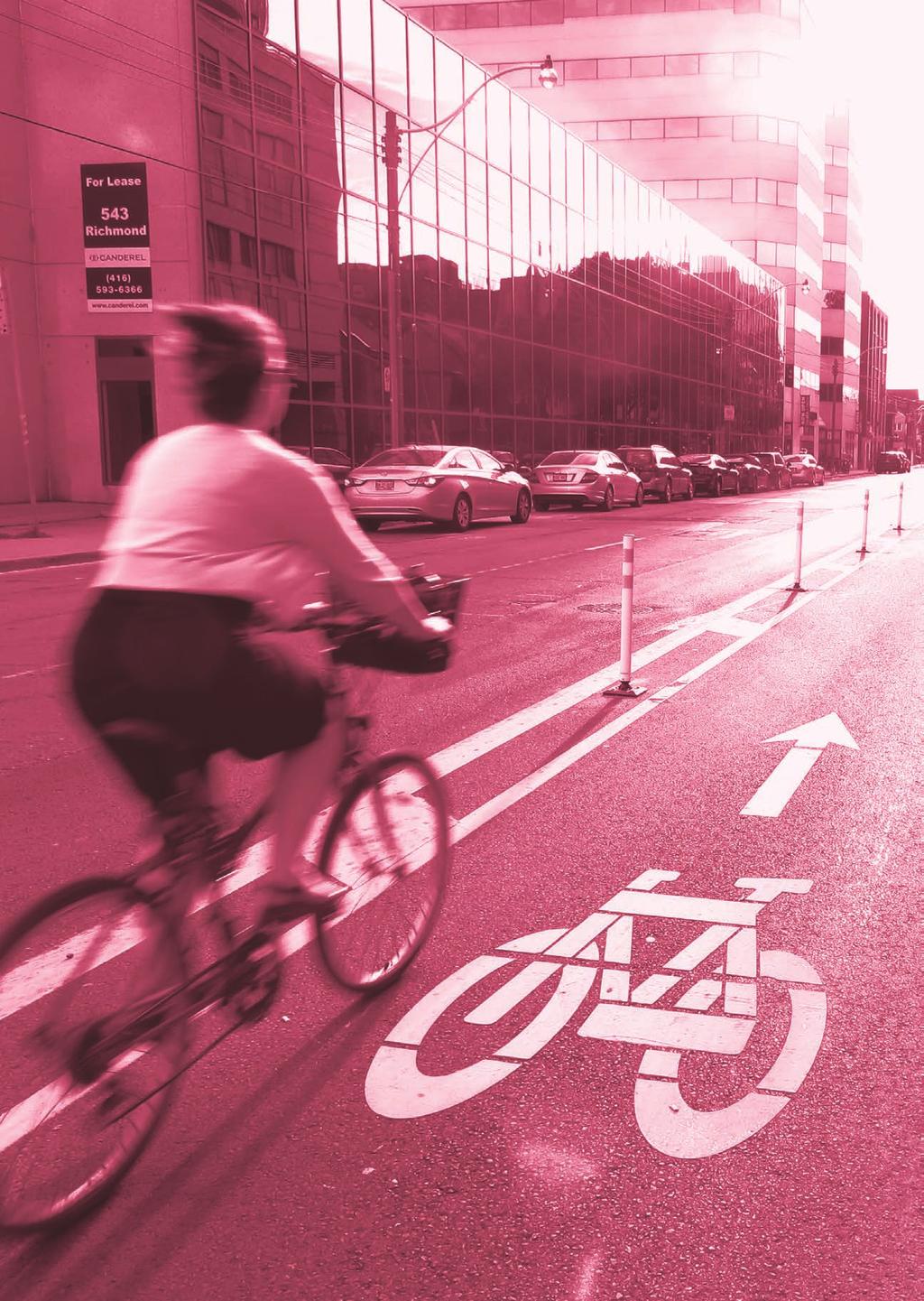
Toronto Complete Streets Guidelines
|
|
|
- Alexander Hardy
- 5 years ago
- Views:
Transcription
1 88
2 Cycling Design Principles Context-sensitive Cycling Facilities Key Cycling Elements Cycling infrastructure provides choice in how people are able to move around the city. Cyclists are vulnerable road users and can be seriously injured in even minor collisions, so prioritizing the safety of cyclists by designing safe streets for cycling is critical. Streets that feel unsafe for cycling may also discourage people from choosing to ride. For many people, cycling close to fast moving motor vehicles is uncomfortable, but well-designed streets and cycling facilities can reduce conflicts for all road users and enhance real and perceived safety. It is critical to consider safe and comfortable cycling on all Toronto streets as part of the street design process. This includes mitigating exposure to potential conflict between cyclists and motor vehicles. Toronto s On-Street Bikeway Design Guidelines and Multi-Use Trail Design Guidelines provide detailed design guidance and should be used in the design of cycling facilities. When trips are shifted from driving to cycling, motor vehicle volumes decrease, which in turn reduces traffic congestion, as well as air and noise pollution. Streets with cycling infrastructure also have the potential to move more people, at a lower cost, and with improved public health outcomes. 5.0 STREET DESIGN FOR CYCLING 89

3 Toronto Complete Streets Guidelines 5.1 Cycling Design Principles 5.1 CYCLING DESIGN PRINCIPLES For illustrative purposes - may include a mix of permanent/temporary materials. 90
4 Cycling Design Principles Apply context appropriate designs. Faster, busier streets create more risk for cyclists and will need greater separation and protection for cyclists. Quiet streets with low traffic volumes and low speeds may provide a comfortable cycling experience without a dedicated cycling facility. 2. Design for both present and future users. Cycling ridership numbers will grow if a cycling facility is provided on a street that was previously uncomfortable for cycling. Where cyclist volumes are growing, consider widening the cycling facilities. 3. Prioritize the most vulnerable road users. Vulnerable users can be seriously injured or killed in even minor collisions. Think of how to design facilities for all types of cyclists, as well as the protection of pedestrians of all ages and abilities. Protect pedestrians from cyclists by providing cycling facilities that are separated from sidewalks using design treatments that respond to both pedestrian and cycling speeds and volumes. Treatments range from buffers and physical delineators to visual contrast and tactile indicators. 4. Visible, intuitive cycling facilities. Clear delineation of the cycling path of travel and wayfinding can improve safety for all road users. Use pavement markings, signs, grade change between users and physical design, like buffers, to mitigate hazards, such as car doors opening, or pedestrians walking into bicycle paths. 5. Intersection safety and mixing zones. Continue bicycle lane markings through intersections and pedestrian crossing markings over cycling routes and clearly mark conflict areas. Consider providing visible, designated space for cyclists to wait and make turns. Avoid pedestrian and cyclist mixing zones, especially at intersections with high pedestrian volumes. 6. Supply adequate bicycle parking and Bike Share access. Support and encourage cycling through Toronto s bike sharing system - Bike Share Toronto, and a convenient and adequate supply of bicycle parking, including multi-unit corrals especially in mixed use, institutional, and commercial areas. 7. Design and maintain bikefriendly curbside conditions. Ensure catch basin covers are bike-friendly, and that debris, water and ice do not accumulate where people will be cycling. 8. Surface conditions. Provide smooth riding surfaces as much as possible by re-paving before adding cycling facilities, and regular maintenance, such as sweeping and snow ploughing. Provide pavement markings that guide cyclists safely across streetcar tracks. 91

5 Context-Sensitive Cycling Facilities CONTEXT-SENSITIVE CYCLING FACILITIES As part of the street design process, a key step is identifying whether the proposed project is part of the existing or planned Cycling Network or other area or corridor plans. The Cycling Network Plan aims to build and connect higher-order cycling routes across the city. A key benefit is to attract and accommodate a wide range of cyclists. While the Cycling Network Plan identifies key routes and their preferred cycling facility type, there is still opportunity to select and design context-sensitive cycling facilities for streets not yet in the plan. Cycling is a year-round activity in Toronto. c: Jun Nogami 92
6 Context-Sensitive Cycling Facilities 5.2 CONNECTIVITY EXISTING CYCLING BARRIERS CYCLING IMPACT ANALYSIS SHORT TRIPS TRIP GENERATORS COLLISIONS COVERAGE POPULATION & EMPLOYMENT DENSITY Figure 5-1: Considerations for Cycling Impact Analysis. For more information on Toronto's cycling network, visit toronto.ca/ cyclingnetwork A good starting point for practitioners is to refer to the Ontario Traffic Manual (OTM) Book 18, which guides facility selection based on motor vehicle operating speed and average daily traffic volumes. In addition, it will be important to apply Toronto s On-Street Bikeway Design Guidelines to design for the context and local conditions. At the outset of a project, design teams should consider the: Presence of existing or planned Cycling Network Routes. Proximity and potential connections to the Cycling Network. Speed and volume of motor vehicles. Street s proximity to schools, seniors homes, or similar institutions, as this may affect the types of users and the interaction with pedestrians of all ages and abilities. Existing and potential pedestrian volumes, as this may affect the suitability of sidewalk-level cycling facilities. Presence of transit and taxi stands. Presence of on-street parking (offpeak, lay-bys or lanes). THE CYCLING NETWORK PLAN A KEY NETWORK OVERLAY Toronto s Ten Year Cycling Network Plan (2016) is the result of extensive feasibility analyses, together with public and stakeholder consultation. The following technical factors were combined to rate a route s cycling impact and feasibility: Current and potential demand: Number of existing and potential cycling trips. Number of short trips by motorists (less than 5km) with a high potential to shift to cycling. Areas where cycling volumes have high growth. Population and employment density: Greater density or new developments suggests more cycling trips. Network coverage, connectivity, and barrier crossings: The presence of gaps in the network or barriers (e.g. ravines, rail corridors) that a route could help overcome. Trip generators and target demographics: Assesses whether the cycling project would improve access to places many people would like to access, such as schools, universities, and transit stations. It also looks at how well the cycling project would meet the needs of target demographics such as women commuting, tourists, and children getting to school. Safety: Opportunities to improve cycling safety if the street in question is known to have a high number of collisions, or reported traffic safety issues. 93
. Dill, Jennifer and McNeil, Nathan (2012). Four types of cyclists?")


7 Context-Sensitive Cycling Facilities 5.2 No Way, No How 32% Strong and Fearless 1% Enthused and Confident 7% Interested But Concerned 60% Figure 5-2: Designing for Cyclists of All Types. source: Ontario Traffic Manual Book 18: Cycling Facilities (2013). Dill, Jennifer and McNeil, Nathan (2012). Four types of cyclists? Examining a typology to better understand bicycling behavior and potential. Geller, R. (2006) Four Types of Cyclists, Portland Bureau of Transportation. Urban edge lines in Toronto provide safe riding space for cyclists. BICYCLE FRIENDLY STREETS Even in cases where there are no plans for cycling facilities, the City s bicycle friendly streets policies, as set out in the Toronto Bike Plan (2001), must be observed. These include wider curb lane widths, standards for the construction of bridges/ underpasses, provisions exempting bicycles from some traffic regulations and maintaining cycling access through traffic calming projects, catch basin cover standards, and bicycle detection at actuated signals. Toronto s Bicycle Friendly Street Policies are applicable to all street types. KEY FACTORS SPEED AND VOLUME OF MOTORIZED TRAFFIC As mentioned above, the speed and volume of motorized traffic are key factors influencing the contextsensitive design of cycling facilities. Detailed guidance is provided in OTM Book 18. Figure 5.3 illustrates that higher speeds and higher volumes lead to higher risk to cyclists, thereby needing more separation (e.g., wider buffers) and protection (e.g., physical buffers) for safe and comfortable conditions for cyclists of all types (Figure 5.2). 94
8 Context-Sensitive Cycling Facilities km/hr 10 Speed (Motorized Vehicles) Consider Shared Roadway such as Shared Lane Markings, Wide Curb Lanes, and Standard Lanes Consider Designated Cycling Operating Space such as Exclusive Bicycle Lanes (incl. Separated Lanes and Cycle Tracks) Consider Separated Facility such as Active Transportation Pathway in Boulevard, Separated Lanes, and Cycle Tracks 0/day Volume (Motorized Vehicles) 15,000+/day Higher Speed and Volume > Higher Risk > Increase Separation and Protection Figure 5-3: The Relationship of Traffic Speed and Volume to Types of Cycling Facilities. Source: Adapted from OTM Book 18. CYCLIST USER CHARACTERISTICS In the street design process, it is critical to consider the characteristics and needs of existing and potential users. This includes cyclists of various ages, skill and comfort levels, as well as various trip purposes such as cycling for recreation, commuting to work or school, and other utilitarian purposes like shopping or visiting friends or making deliveries (e.g., cargo bikes). Important considerations include the typical user characteristics, as a starting point for thinking about the minimum space needed. The right amount of space is determined by examining typical cyclists dimensions, space needed to maneuver, expected cyclist volumes, speed, road geometry, topography and the presence of other users and uses. A variety of factors influences the dimensions when designing cycling facilities. Figure 5.4, adapted from OTM Book 18, illustrates the minimum typical user characteristics for physical space and height. Physical 0.75m Edge Line Minimum 1.2 m Bike Lane Minimum 1.5 m Bike Lane Desired 1.8 m Widths Height of adult standing on pedals Handlebar Figure 5-4: Cyclists Operating Space Requirements. Source: Adapted from OTM Book 18. Eye Level 1.1 m 1.5 m 2.5 m Heights 95

9 Key Cycling Elements KEY CYCLING ELEMENTS Cycling facilities, bicycle parking, Bike Share Toronto, and wayfinding are key elements that should be considered for complete streets improvements. Intersection-related topics are covered in Chapter 9 on Intersections design. Cycling facilities can be subdivided into two categories: those on Fast, Busy Streets and those on Quiet Streets. Cycling facilities can be between the sidewalk and the property line when there are no or few building frontages and when it connects with a multi-use trail such as this one in Scarborough. CYCLING FACILITIES ON FAST, BUSY STREETS High motor vehicle speeds and volumes necessitate dedicated cycling facilities. Examples include painted and buffered bicycle lanes, cycle tracks (separated bicycle lanes with bollards, planters, or a row of parked cars between cyclists and moving traffic), and raised cycling facilities (e.g., curb protects cyclists from motorized vehicles, cycling facility in the boulevard, etc). In any of these cycling facilities, it is not lawful for motor vehicles to drive, stop, stand or park. Exceptions may be made for taxi pick-up and dropoff and Wheel Trans boarding. CYCLING FACILITIES ON QUIET STREETS Low motor vehicle volumes and travel speeds, may provide a comfortable cycling experience without a formal cycling facility. Some Quiet Streets that are part of the Cycling Network may have dedicated facilities, or a range of design features including traffic calming measures, shared lane pavement markings, and wayfinding. If the route is not a designated Quiet Street in the Cycling Network, consider ways to apply the City s Bicycle-Friendly policies. These include wider curb lane widths, standards for the construction of bridges/underpasses, provisions exempting bicycles from some traffic regulations and maintaining cycling access through traffic calming projects, catch basin cover standards, and bicycle detection at actuated signals. 96


10 Key Cycling Elements 5.3 Bicycle lanes are only one form of cycling infrastructure, such as this example in Etobicoke-York. Bicycle Lanes Buffered Bicycle Lanes Cycle Tracks Raised Cycling Facilities Contraflow Bicycle Lanes Routes - Wayfinding Bicycle Friendly Streets 97


11 Key Cycling Elements 5.3 Bicycle parking may be seasonal or permanent depending on context and demand. BICYCLE PARKING AND BIKE SHARE Travel by bicycle requires an adequate and convenient supply of Bike Share Toronto bicycles and docking stations and bicycle parking on both private property and in the public right-of-way. Many types of bicycle parking exist from ring-andpost, to bicycle corrals and parking structures, such as secure bicycle stations or bicycle lockers. Bicycle parking in the right-of-way should be considered on every street type, except perhaps some Neighbourhood Residential Streets and Laneways. It is especially important on Main Streets and near destinations, such as in institutional, mixed-use, and commercial areas. Consider seasonal changes in demand for bicycle parking. Bicycle parking, including the parked bicycles, must not obstruct the pedestrian clearway. Also consider the space needed to access bicycles while being locked or unlocked. Bike Share Toronto requires unobstructed space within or adjacent to the right-of-way for its docking stations. Stations must be connected linearly and wired to a power source. To optimize station balance, Bike Share stations are installed along a 300m grid. The frequency of stations must be maintained to ensure connectivity and accessibility. 98


12 Key Cycling Elements 5.3 WAYFINDING Bicycle wayfinding consists primarily of signs and pavement markings that are legible to cyclists while they are travelling. Directional signs focus on routes that are included in the Cycling Network. In addition to providing information to make travel simpler and more convenient, the main benefits of wayfinding include increased safety by facilitating decision making in advance of intersections rather than in intersections, and greater visibility of cycling as a viable travel mode. MORE INFORMATION City of Toronto. City of Toronto Bike Plan City of Toronto. Toronto Bikeway Design Guidelines. Anticipated City of Toronto. Toronto Cycling Network Plan City of Toronto. Toronto Cycling Wayfinding Strategy City of Toronto. Toronto Multi-Use Trail Design Guidelines CROW-25. Design Manual for Bicycle Traffic Ministry of Transportation of Ontario. Ontario Traffic Manual Book 18: Cycling Facilities National Association of City Transportation Officials. Urban Bikeway Design Guide Bicycle wayfinding provides route and distance information to facilitate convenient travel. 99
Sidewalks provide vital public space day and night. Toronto Complete Streets Guidelines
 Street Design for Pedestrians Public Realm and Placemaking 4.6 4.6 PUBLIC REALM AND PLACEMAKING Beyond providing safe pedestrian movement and access, sidewalk zones also serve as vital public spaces that
Cyclists and Bikeways: What s your match? A guide to bikeway options for a variety of cyclists
 Cyclists and Bikeways: What s your match? guide to bikeway options for a variety of cyclists The workshop and this resource were made possible by funding from the Province of Ontario via the Ministry of
2.0 LANE WIDTHS GUIDELINE
 2.0 LANE WIDTHS GUIDELINE Road Engineering Design Guidelines Version 2.0.1 May 2018 City of Toronto, Transportation Services City of Toronto Page 0 Background In early 2014, Transportation Services initiated
Cycle Track Design Best Practices Cycle Track Sections
 Design Best Practices Sections It is along street segments where the separation and protection methods of cycle tracks offer more comfort than conventional bicycle lanes, and are more attractive to a wide
General Design Factors
 Chapter 3: 3-1.0 Introduction General Design Factors Mn/DOT s goals include encouraging and accommodating safe bicycling. From a design perspective, these goals are achieved by first having an understanding
Bicycle Facilities Planning
 Bicycle Facilities Planning Overview Types of Cyclists Purpose for Riding Types of Facilities Bike Lanes Bicycle Boulevards Cycle Tracks Intersections Signals Signing and Marking Discussion Types of Bicyclists
Chapter 3 DESIGN SPECIFICATIONS
 Brampton PathWays Planning and Design Guidelines 27 Chapter 3 DESIGN SPECIFICATIONS 3.1 CLASS 1 MULTI-USE PATH Off-road multi-use trails are the backbone of the Brampton PathWays Network. They are typically
Zlatko Krstulich, P.Eng. City of O9awa
 Zlatko Krstulich, P.Eng. City of O9awa 1. Introduction to the Ontario Traffic Manual Series 2. What is OTM Book 18: Bicycle Facilities? 3. Study / Committee Team Members 4. Brief overview of the content
Off-road Trails. Guidance
 Off-road Trails Off-road trails are shared use paths located on an independent alignment that provide two-way travel for people walking, bicycling, and other non-motorized users. Trails specifically along
Chapter 7. Transportation. Transportation Road Network Plan Transit Cyclists Pedestrians Multi-Use and Equestrian Trails
 Chapter 7 Transportation Transportation Road Network Plan Transit Cyclists Pedestrians Multi-Use and Equestrian Trails 7.1 TRANSPORTATION BACKGROUND The District of Maple Ridge faces a number of unique
Bicycle Friendly Streets
 Bicycle Friendly Streets 4.1 Guiding Principle and Objectives Bicycles are recognized as vehicles under the Highway Traffic Act, and as such, should be afforded the same consideration as motor vehicles
Planning Guidance in the 2012 AASHTO Bike Guide
 Planning Guidance in the 2012 AASHTO Bike Guide Presentation by: RJ Eldridge Peter Lagerwey August 22, 2012 WEBINAR 2: PLANNING GUIDANCE IN THE 2012 AASHTO BIKE GUIDE Today s Webinar Significant Updates
10.0 CURB EXTENSIONS GUIDELINE
 10.0 CURB EXTENSIONS GUIDELINE Road Engineering Design Guidelines Version 1.0 March 2017 City of Toronto, Transportation Services City of Toronto Page 0 Background In early 2014, Transportation Services
CURBSIDE ACTIVITY DESIGN
 5 CURBSIDE ACTIVITY DESIGN This chapter provides design guidance for separated bike lanes adjacent to curbside activities including parking, loading and bus stops. Typical configurations are presented
Physical Implications of Complete Streets Policies
 Presentation Overview Physical Implications of Complete Norm Cox, ASLA, LLA Landscape Architect Ann Arbor, Michigan, 10:45 to Noon What Are Complete Streets? What Matters to Bicyclists and Pedestrians
Public Information Centre
 WELCOME Public Information Centre Father Tobin Road Lougheed Middle School - Library Wednesday November 7, 2012 7:00 p.m.to 9:00 p.m. Please sign in Neighbourhood Traffic Calming Guide Background The City
Classification Criteria
 SCHEDULE D TO RECOMMENDED OFFICIAL PLAN AMENDMENT NO. 40 SCHEDULE C-4 Road Criteria Criteria Traffic Service Objective Land Service/Access Typical Daily Traffic Volume Flow characteristics Travel Speed
Appendix A Guiding Principles for Cycling Safety in Work Zones
 Appendix A Guiding Principles for Cycling Safety in Work Zones 1. Identify Existing Cycling Facility and Requirements This step should be part of the permitting/approval processes for construction zones
WELCOME Public Information Centre
 WELCOME Public Information Centre Fernforest Drive Brampton Soccer Centre Community Room #2 Tuesday January 19, 2016 6:30 p.m.to 9:00 p.m. Please sign in Neighbourhood Traffic Calming Guide Background
Active Transportation Facility Glossary
 Active Transportation Facility Glossary This document defines different active transportation facilities and suggests appropriate corridor types. Click on a facility type to jump to its definition. Bike
Proposed Bridge Street East Bicycle Lanes Public Open House Thursday, April 27, 2017
 WELCOME Proposed Bridge Street East Bicycle Lanes Public Open House Thursday, April 27, 2017 Purpose of the Open House The purpose of this Open House is to gain public input on the bicycle lanes proposed
Bicycle Boulevards and Neighborhood Greenways
 Bicycle Boulevards and Neighborhood Greenways Traffic Safety is Improving for Everyone 90 80 70 60 50 40 30 20 10 0 PORTLAND: TOTAL TRAFFIC FATALITIES 1986-2008 1986 1987 1988 1989 1990 1991 1992 1993
Coquitlam Cross-town Bike Route Improving Bicycle Facilities in a Mature Suburban Environment
 Coquitlam Cross-town Bike Route Improving Bicycle Facilities in a Mature Suburban Environment Sarah Rocchi, Vice-President, Projects, Opus International Consultants (Main Presenter) Catherine Mohoruk,
City of Waterloo Complete Streets Policy
 City of Waterloo Complete Streets Policy Chris Hodgson P. Eng City of Waterloo Complete Streets Forum 2011 April 28-29 Toronto Waterloo context: Current population Major employers Universities and student
Roadways. Roadways III.
 Introduction 97 Roadway Design Principles 98 Safe Speeds 99 Optimizing of Street Space 00 Minimum Lane Widths in the City of Boston 02 Design Features that Reduce Operating Speeds 05 Travel Lanes Transit
On Road Bikeways Part 1: Bicycle Lane Design
 On Road Bikeways Part 1: Bicycle Lane Design Presentation by: Nick Jackson Bill Schultheiss, P.E. September 04, 2012 FOLLOW THE CONVERSATION ON TWITTER Toole Design Group is live tweeting this webinar
APPENDIX A: Complete Streets Checklist DRAFT NOVEMBER 2016
 APPENDIX A: Complete Streets Checklist DRAFT NOVEMBER 2016 Complete Streets Checklist MetroPlan Orlando s Complete Streets Checklist is an internal planning tool for staff to further implementation of
Living Streets Policy
 Living Streets Policy Introduction Living streets balance the needs of motorists, bicyclists, pedestrians and transit riders in ways that promote safety and convenience, enhance community identity, create
ACTIVE TRANSPORTATION
 ACTIVE TRANSPORTATION Mobility 2040 Supported Goals Improve the availability of transportation options for people and goods. Support travel efficiency measures and system enhancements targeted at congestion
NM-POLICY 1: Improve service levels, participation, and options for non-motorized transportation modes throughout the County.
 Transportation PRINCE WILLIAM COUNTY 2008 COMPREHENSIVE PLAN NON-MOTORIZED PLAN CONTENTS Goals, Policies, and Action Strategies Table 4 (Bike Facility Classifications and Descriptions) Table 5 (Bike Facility
Copenhagen Cycling Map. Red Lines Cycling facilities
 Copenhagen Cycling Map Red Lines Cycling facilities Copenhagen Cycling Facilities Design Approaches Transportation without Pollution Copenhagen s Strategy Where Cycling is one of the top key activities
Bicycle Transportation Budget Plan: Lawrence, KS
 Bicycle Transportation Budget Plan: Lawrence, KS Bicycle Objectives Lawrence Planning Documents Establish a dedicated funding plan to complete the implementation of a bikeway system plan, and for maintenance
Chapter 2. Bellingham Bicycle Master Plan Chapter 2: Policies and Actions
 Chapter 2 Bellingham Bicycle Master Plan Chapter 2: Policies and Actions Chapter 2: Policies and Actions The Bicycle Master Plan provides a road map for making bicycling in Bellingham a viable transportation
TRANSPORTATION NEEDS ASSESSMENT
 TRANSPORTATION NEEDS ASSESSMENT A travel demand analysis was carried out to determine the operational issues and the potential benefit that adding traffic capacity would have on the road network. All the
PBIC Webinar. How to Create a Bicycle Safety Action Plan: Planning for Safety [IMAGE] Oct. 2, 2014, 2 pm
![PBIC Webinar. How to Create a Bicycle Safety Action Plan: Planning for Safety [IMAGE] Oct. 2, 2014, 2 pm](/thumbs/86/93953441.jpg "PBIC Webinar. How to Create a Bicycle Safety Action Plan: Planning for Safety [IMAGE] Oct. 2, 2014, 2 pm") PBIC Webinar How to Create a Bicycle Safety Action Plan: Planning for Safety [IMAGE] Bill Schultheiss, Vice President, Toole Design Peter Lagerwey, Regional Director, Toole Design Oct. 2, 2014, 2 pm Today
PBIC Webinar How to Create a Bicycle Safety Action Plan: Planning for Safety [IMAGE] Bill Schultheiss, Vice President, Toole Design Peter Lagerwey, Regional Director, Toole Design Oct. 2, 2014, 2 pm Today
Proposed. City of Grand Junction Complete Streets Policy. Exhibit 10
 Proposed City of Grand Junction Complete Streets Policy Exhibit 10 1 City of Grand Junction Complete Streets Policy Vision: The Complete Streets Vision is to develop a safe, efficient, and reliable travel
CITY OF BLOOMINGTON COMPLETE STREETS POLICY
 CITY OF BLOOMINGTON COMPLETE STREETS POLICY POLICY OBJECTIVE: The City of Bloomington will enhance safety, mobility, accessibility and convenience for transportation network users of all ages and abilities,
Toronto Complete Streets Guidelines
 Toronto Complete Streets Guidelines 18 20 2.1 Understanding Street Type 22 2.2 Use of Overlays 23 2.3 Toronto Understanding the roles and relationships of a street with its surrounding context is a critical
CONNECTING PEOPLE TO PLACES
 CONNECTING PEOPLE TO PLACES 82 EAST BENCH MASTER PLAN 07 Introduction The East Bench transportation system is a collection of slow moving, treelined residential streets and major arteries that are the
Transportation Master Plan Advisory Task Force
 Transportation Master Plan Advisory Task Force Network Alternatives & Phasing Strategy February 2016 BACKGROUND Table of Contents BACKGROUND Purpose & Introduction 2 Linking the TMP to Key Council Approved
Dowling/Beaty Cycling Route
 Public Meeting #2 Dowling/Beaty Cycling Route May 17, 2017 6:00 p.m. 8:00 p.m. Parkdale Public Library - Auditorium 1303 Queen Street West How to Participate Share your questions, ideas and concerns We
Draft North Industrial Area-Wide Traffic Plan
 Summary of North Industrial and Hudson Bay Industrial Recommended Improvements Table 1. Summary of s Item Location 1 2 3 4 5 6 7 8 9 10 11 12 Millar Ave north of 51st St Super 8 Motel back lane 400 Block
TRAFFIC CALMING GUIDE FOR TORONTO CITY OF TORONTO TRANSPORTATION SERVICES DIVISION
 TRAFFIC CALMING GUIDE FOR TORONTO CITY OF TORONTO TRANSPORTATION SERVICES DIVISION CITY OF TORONTO TRANSPORTATION SERVICES DIVISION 2016 TRAFFIC CALMING GUIDE FOR TORONTO TABLE OF CONTENTS Introduction
Confirmation of Levels of Service for Winter Maintenance of Bikeways, Windrow Opening, Sidewalks and AODA Compliance
 STAFF REPORT ACTION REQUIRED Confirmation of Levels of Service for Winter Maintenance of Bikeways, Windrow Opening, Sidewalks and AODA Compliance Date: March 17, 2014 To: From: Wards: Reference Number:
9/25/2018. Multi-Modal Level of Service (MMLOS) Bianca Popescu, Transportation Planner
 Bianca Popescu, Transportation Planner") Multi-Modal Level of Service (MMLOS) Bianca Popescu, Transportation Planner 1 What is MMLOS? Is this a nice place to walk? Is this a nice place to bike? Is transit convenient? Bottom line - Are there options
Multi-Modal Level of Service (MMLOS) Bianca Popescu, Transportation Planner 1 What is MMLOS? Is this a nice place to walk? Is this a nice place to bike? Is transit convenient? Bottom line - Are there options
Solana Beach Comprehensive Active Transportation Strategy (CATS)
") Solana Beach Comprehensive Active Transportation Strategy (CATS) 3.0 Goals & Policies The Solana Beach CATS goals and objectives outlined below were largely drawn from the Solana Beach Circulation Element
Solana Beach Comprehensive Active Transportation Strategy (CATS) 3.0 Goals & Policies The Solana Beach CATS goals and objectives outlined below were largely drawn from the Solana Beach Circulation Element
Madison Urban Area and Dane County. Bicycle Transportation Plan Summary. September Introduction. Bicycle Plan Scope and Planning Process
 Bicycle Transportation Plan Summary Madison Urban Area and Dane County Introduction September 2000 Bicycling is an important mode of transportation in the Madison urban area and countywide that is available
Toronto Complete Streets Guidelines
 Toronto Complete Streets Guidelines 142 144 9.1Intersection Design Principles 146 9.2 Key Needs and Perspectives of Each Road User 148 9.3 Accessibility and Universal Design of Intersections 150 9.4 Context-Sensitive
2018 AASHTO BIKE GUIDE
 2018 AASHTO BIKE GUIDE Your presenter Rob Burchfield, PE NW Regional Engineering Director 35 years of experience in traffic engineering and bicycle facility design Toole Design Group Toole Design Group
Winnipeg Walk Bike Projects Downtown Tire Talk - Summary
 Winnipeg Walk Bike Projects Downtown Tire Talk - Summary Downtown Projected Bike Lane System Connecting The Forks to the Exchange District (Fort Street, Garry Street & The Forks to Assiniboine Connection)
Edenbrook Hill Drive Traffic Calming Study
 WELCOME Public Information Centre Edenbrook Hill Drive Traffic Calming Study Fletchers Meadow Secondary School Wednesday January 20, 2016 6:30 p.m.to 9:00 p.m. Please sign in Neighbourhood Traffic Calming
The 2012 AASHTO Bike Guide: An Overview
 The 2012 AASHTO Bike Guide: An Overview Presentation by: Jennifer Toole, AICP, ASLA Peter Lagerwey August 10, 2012 {Enter Module Name on Master Slide} WEBINAR #1: OVERVIEW OF 2012 AASHTO BIKE GUIDE Today
2018 AASHTO BIKE GUIDE
 2018 AASHTO BIKE GUIDE Your presenters Jessica Fields, PE Denver Office Director Sagar Onta, PE, PTOE Denver Engineering Director 35 years of combined experience street design, transportation planning,
LONDON COMPLETE STREETS DESIGN MANUAL
 LONDON COMPLETE STREETS DESIGN MANUAL Draft May 2018 CONTENTS 1 COMPLETE STREETS: VISION AND PRINCIPLES 7 1.1 What are Complete Streets? 8 1.2 Who is this Manual For? 9 1.3 The London Plan and Other Policy
Watertown Complete Streets Prioritization Plan. Public Meeting #1 December 14, 2017
 Watertown Complete Streets Prioritization Plan Public Meeting #1 December 14, 2017 Goals for Public Meeting Overview of MassDOT Complete Streets Funding Program Educate the community on Complete Streets
EXECUTIVE SUMMARY. Vision
 Vision Walking and bicycling in Salt Lake City will be safe, convenient, comfortable, and viable transportation options that connect people to places, foster recreational and economic development opportunities,
design jam People on Wheels September 19, 2018
 design jam People on Wheels September 19, 2018 City Streets Today 2 City Streets Today 3 Hurdles to Cycling in Toronto Safety Safety is the most significant deterrent to cycling in the city. Perceived
5. RUNNINGWAY GUIDELINES
 5. RUNNINGWAY GUIDELINES These guidelines should be considered collectively when making runningway decisions. A runningway is the linear component of the transit system that forms the right-of-way reserved
Who is Toole Design Group?
 2018 AASHTO Bike Guide Status Update NCHRP 15 60 Amalia Leighton Cody, PE, AICP & Kenneth Loen, PE Washington APWA October 4, 2018 Who is Toole Design Group? TDG is a full service engineering, planning
TOWN OF PORTLAND, CONNECTICUT COMPLETE STREETS POLICY
 TOWN OF PORTLAND, CONNECTICUT COMPLETE STREETS POLICY I. VISION, GOALS & PRINCIPLES VISION To improve the streets of Portland making them safer and more accessible for all users including pedestrians,
Appendix 3 Roadway and Bike/Ped Design Standards
 Appendix 3 Roadway and Bike/Ped Design Standards OTO Transportation Plan 2040 4/20/2017 Page A3-1 Adopted Standards The adopted OTO Design Standards and Major Thoroughfare Plan are contained herein.
Appendix O. Assessment of Bicycle Facility Alternatives
 Appendix O Assessment of Bicycle Facility Alternatives FINAL ASSESSMENT OF CROSS-SECTION ELEMENTS Lakeshore Road, from Mississaga Street to Dorval Drive Town of Oakville Submitted to: Town of Oakville
PEDALING FORWARD. A Glance at the SFMTA s Bike Program for SFMTA.COM
 PEDALING FORWARD A Glance at the SFMTA s Bike Program for 2017-2021 SFMTA.COM INTRODUCTION About This Booklet More people from all walks of life see their bicycle as a more convenient way to get where
Duwamish Way-finding and CTR Report
 V. North Tukwila When the North Tukwila Manufacturing and Industrial Center was designated in 1992 as part of the region s land use and transportation plan, the plan called for the area to set a light-rail
Rochester Downtown Bicycle Study 2009
 Rochester Downtown Bicycle Study 2009 Relationship of ROCOG Long Range Transportation Plan to Rochester Comprehensive Plan Regional Long Range Transportation Plan (LRTP) is prepared under the auspices
Omaha s Complete Streets Policy
 Omaha s Complete Streets Policy (Adopted August 2015) VISION To create great places and enhance our quality of life, the City of Omaha will provide safe, accessible streets for all users. Complete Streets
Plant City Walk-Bike Plan
 Plant City Walk-Bike Plan Plant City Commute Mode Share 2.2% 1.4% 2.9% Drove alone 10.2% Carpooled Public transportation (0.1%) Walked Used a Bike (0.4%) 82.9% Taxicab, motorcycle, or other means Worked
Broad Street Bicycle Boulevard Design Guidelines
 Broad Street Bicycle Boulevard Design Guidelines Building from the strategies introduced in the 2013 Bicycle Transportation Plan and community input received thus far, City Transportation Staff have identified
In station areas, new pedestrian links can increase network connectivity and provide direct access to stations.
 The Last Mile Planning for Pedestrians Planning around stations will put pedestrians first. Making walking to stations safe and easy is important; walking will be a part of every rapid transit Accessible
Implementing Complete Streets in Ottawa. Project Delivery Process and Tools Complete Streets Forum 2015 October 1, 2015
 Implementing Complete Streets in Ottawa October 1, 2015 The Essentials Complete Streets Implementation Framework will become part of the routine delivery of City transportation projects Approach uses every
complete streets design and construction standards public primer City of Edmonton
 complete streets design and construction standards public primer City of Edmonton introduction Complete Streets are streets for everyone: people who walk, wheel, bike, take transit, or drive. They are
Ajax: The Road to Complete Streets
 Ajax: The Road to Complete Streets Hubert Ng, Senior Transportation Planner Elysia Leung, Transportation Demand Management Coordinator Complete Streets Forum October 1, 2015 Overview 1 2 Introduction to
Welcome. If you have any questions or comments on the project, please contact:
 Welcome This drop-in public open house is intended to provide information about the Bay Street bike lanes project. This project proposes a dedicated cycling facility along Bay Street between Aberdeen Avenue
Appendix T CCMP TRAIL TRAFFIC & TRANSPORTATION DESIGN STANDARD
 Appendix T CCMP 3.3.4 TRAIL TRAFFIC & TRANSPORTATION DESIGN STANDARD 3.3.4 Trail Traffic and Transportation Design Multi-use trails have certain design standards, which vary depending on the agency that
Active Transportation Infrastructure Investment A Business Case
 Active Transportation Infrastructure Investment A Business Case In 2016, the Real Estate Foundation awarded the Capital Regional District a $50,000 grant for Shifting Gears: Land Use Change through Active
4 Goals, Objectives & Actions
 Chapter4 4 This chapter presents goals, objectives, and recommended actions to support the vision of making Overland Park a safer and easier place to ride a bicycle. 35 4.1 Recommendations Structure The
Completing the Street: Denning Drive
 Completing the Street: Denning Drive Public Workshop and Walking Audit Winter Park Civic Center May 12, 2016 Completing the Street What Makes This a Complete Street? Completing the Street Complete Streets
RESOLUTION NO ?? A RESOLUTION OF THE CITY OF NEPTUNE BEACH ADOPTING A COMPLETE STREETS POLICY
 RESOLUTION NO. 2018-?? A RESOLUTION OF THE CITY OF NEPTUNE BEACH ADOPTING A COMPLETE STREETS POLICY WHEREAS, safe, convenient, and accessible transportation for all users is a priority of the City of Neptune
Multimodal Through Corridors and Placemaking Corridors
 68 Multimodal Through Corridors and Placemaking Corridors Corridors have different functions in a region. Some corridors are used to get smoothly and rapidly through a region or to get quickly to major
APPENDIX 2 LAKESHORE ROAD TRANSPORTATION REVIEW STUDY EXECUTIVE SUMMARY
 APPENDIX 2 LAKESHORE ROAD TRANSPORTATION REVIEW STUDY EXECUTIVE SUMMARY Appendix 2 City of Mississauga Lakeshore Road FINAL REPORT Transportation Review Study December 2010 EXECUTIVE SUMMARY Study Purpose
NJDOT Complete Streets Checklist
 Background The New Jersey Department of Transportation s Complete Streets Policy promotes a comprehensive, integrated, connected multi-modal network by providing connections to bicycling and walking trip
CITY OF WEST KELOWNA COUNCIL POLICY MANUAL
 CITY OF WEST KELOWNA COUNCIL POLICY MANUAL Page 1 of 7 DEPARTMENT: Engineering Services SUBJECT: Traffic Calming Policy (Revised June 6, 2017) Policy Statement: The provision of traffic calming measures
G AT E WAY PLAN. Community BRIEFING KIT GATEWAY BIKE
 G AT E WAY PLAN GATEWAY BIKE Community BRIEFING KIT PLAN August 2016 TABLE OF CONTENTS INTRODUCTION... 1 THE BENEFITS OF A BIKEABLE COMMUNITY... 2 ECONOMY...2 SAFETY...3 HEALTH...3 HOUSEHOLD SPENDING...3
21.07 TRANSPORT CONNECTIVITY AND INFRASTRUCTURE
 21.07 TRANSPORT CONNECTIVITY AND INFRASTRUCTURE 21.07-1 Connectivity and Choice Transport connectivity and mode choice are critical to achieving productive, sustainable and socially just cities. Travel
Creating walkable, bikeable and transit-supportive communities in Halton
 Creating walkable, bikeable and transit-supportive communities in Halton By presenting current research and best practices, the information in this paper is meant to support and broaden discussion on how
Transportation Assessment
 Transportation Assessment Midtown Open House February 10, 2018 Overview Midtown in Focus Overview & Purpose of Today Transportation Assessment overview Summary of Transportation work to date Review & Analysis
Shifting Gears for a Healthier City
 Shifting Gears for a Healthier City Mississauga s Cycling Master Plan is an ambitious strategy that sets out to transform Mississauga into a city that is conducive to cycling for daily transportation needs.
Moving Cambridge. City of Cambridge Transportation Master Plan Public Consultation Centre. March 7, :00 8:00 PM.
 City of Cambridge Transportation Master Plan Public Consultation Centre March 7, 2018 5:00 8:00 PM Region of Waterloo City of Cambridge Transportation Master Plan Public Consultation Centre March 7, 2018
BICYCLE FACILITIES & PROGRAMS
 CHAPTER 5 BICYCLE FACILITIES & PROGRAMS This component reviews existing bicycle facilities and issues associated with bicycling in the region. The chapter also presents the regional bicycle route system
Tonight is for you. Learn everything you can. Share all your ideas.
 Strathcona Neighbourhood Renewal Draft Concept Design Tonight is for you. Learn everything you can. Share all your ideas. What is Neighbourhood Renewal? Creating a design with you for your neighbourhood.
Corpus Christi Metropolitan Transportation Plan Fiscal Year Introduction:
 Introduction: The Safe, Accountable, Flexible, Efficient Transportation Equity Act: A Legacy for Users (SAFETEA-LU) has continued the efforts started through the Intermodal Surface Transportation Efficiency
Introduction. Using the Checklist. TDM-Supportive Development Design and Infrastructure Checklist Version 1.0 (30 June 2017) City of Ottawa
 City of Ottawa") Introduction The s Transportation Impact Assessment (TIA) Guidelines (specifically Module 4.1 Development Design) requires proponents of qualifying developments to use the City s TDM-Supportive Development
Introduction The s Transportation Impact Assessment (TIA) Guidelines (specifically Module 4.1 Development Design) requires proponents of qualifying developments to use the City s TDM-Supportive Development
Bellevue Downtown Association Downtown Bike Series
 Bellevue Downtown Association Downtown Bike Series Meeting 2 Franz Loewenherz Andreas Piller Kyle Potuzak Chris Long October 26, 2017 Today s Agenda: 1) Meeting Purpose 2) 9/28 Meeting Recap 3) Candidate
This chapter describes the proposed circulation system and transportation alternatives associated with
 5.0 Circulation 5.1 OVERVIEW This chapter describes the proposed circulation system and transportation alternatives associated with West Landing, and summarize the information contained in the Existing
Complete Streets. Designing Streets for Everyone. Sarnia
 Complete Streets Designing Streets for Everyone Sarnia Complete Streets ~ Sarnia ~ 2018 Introduction Our City is made up of a network of streets that we use to go for a walk, cycle to work, drive to the
2. Vision & Goals. Vision. Santa Rosa is a community where walking and bicycling are comfortable and convenient for people of all ages and abilities.
 2. Vision & Goals Overview The goals of the Santa Rosa Bicycle and Pedestrian Master Plan Update reflect the priorities expressed by the community throughout the public outreach phase of this Plan Update.
FHWA Bikeway Selection Guide
 FHWA Bikeway Selection Guide Tamara Redmon Federal Highway Administration Bill Schultheiss Toole Design Lauren Blackburn VHB March 26, 2019 PBIC Webinar pedbikeinfo.org @pedbikeinfo Housekeeping Problems
Simulation Analysis of Intersection Treatments for Cycle Tracks
 Abstract Simulation Analysis of Intersection Treatments for Cycle Tracks The increased use of cycle tracks also known as protected bike lanes has led to investigations of how to accommodate them at intersections.
CPC Parking Lot Riverside Drive. Transportation Rationale
 CPC Parking Lot Transportation Rationale Prepared By: NOVATECH Suite 200, 240 Michael Cowpland Drive Ottawa, Ontario K2M 1P6 September 2015 Novatech File: 114093 Ref: R-2015-153 Table of Contents 1.0 INTRODUCTION...
CITY OF COCOA BEACH 2025 COMPREHENSIVE PLAN. Section VIII Mobility Element Goals, Objectives, and Policies
 CITY OF COCOA BEACH 2025 COMPREHENSIVE PLAN Section VIII Mobility Element Goals, Objectives, and Policies Adopted August 6, 2015 by Ordinance No. 1591 VIII MOBILITY ELEMENT Table of Contents Page Number