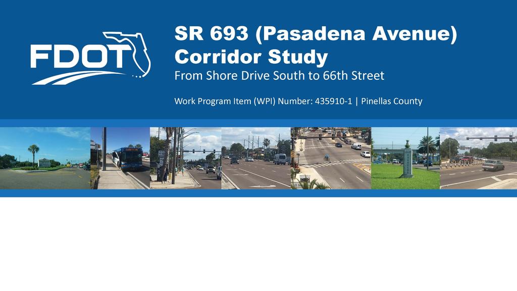
SR 693 (Pasadena Avenue) Corridor Study from Shore Drive South to 66 th Street
|
|
|
- Job Wright
- 5 years ago
- Views:
Transcription
1

2 Welcome and Introduction Sign-in and comment sheets Restrooms and exits Meeting agenda and timeline Meeting goals / expectations Provide input to guide study recommendations Actively participate throughout study duration AGENDA 1. Welcome & Introductions 2. Project Description and Scope of Work 3. Complete Streets Overview 4. Planning Process 5. Project Overview 6. Agency Planning Efforts & Corridor Concerns 7. Project Schedule & Next Steps 8. Wrap-up & Adjourn
 to: Develop a multi-modal vision for the corridor that establishes a more walkable, bike-friendly, urban")
3 Project Description and Scope of Work Corridor study limits Shore Drive South/Mathews Road to 66th Street Project length is miles Scope Collaborate with community, stakeholders and a Project Advisory Group (PAG) to: Develop a multi-modal vision for the corridor that establishes a more walkable, bike-friendly, urban environment Improve safety, mobility and operations/efficiency along the corridor for all users 3
4 Study Purpose and Need Two main objectives Enhance multi-modal mobility and connectivity along the corridor Develop short and long term strategies to address corridor needs Stakeholder Outreach Goals & Objectives / Policy PAG Visioning Meeting Vision Workshop Vison Plan Alternatives Strategies Alternatives Workshop 4


5 Approach to Project Process Corridor Visioning Data Collection & Alternatives Development Analyze, Compare & Select Recommended Alternative Draft Documentation/ Plans Finalize Documentation/ Plans Kickoff Meeting Base Mapping Input on Preliminary Purpose and Need Goals & Objectives Visioning Workshop Vision Plan Engineering & Environmental Data Collection Engineering & Environmental Analysis Design Traffic and Traffic Operational Analysis Alternatives Development Draft Engineering/Environmental Documentation Final Purpose and Need Comparative Evaluation Alternatives Public Meeting Select Recommended Alternative Draft Corridor Alternatives and Strategies Report Draft Conceptual Roadway Design Prepare Cost Estimates Prioritization of Alternative Improvements Final Corridor Alternatives and Strategies Report Coordinate with FDOT for funding for CIP and Work Program Present Findings to MPO Committees Preliminary Purpose and Need 5
6 Project Schedule Study began: January month schedule TASK JAN FEB MAR APR MAY JUN JUL AUG SEP OCT NOV DEC JAN FEB MAR APR Study Begins PAG Meeting PAG Meeting PAG Meeting Public Involvement Data Collection / Analysis (Environmental, Traffic, Etc.) Kick-Off Meeting Visioning Workshop Alternatives Public Workshop Analysis / Alternatives Development Corridor Alternatives & Strategies Report 6

7 Complete Streets New Manuals Draft Florida Design Manual Replaces FDOT Plans Preparation Manual (PPM) Uses complete streets design principles Effective January 2018 Draft Complete Streets Handbook Context based planning and design 7


8 Complete Streets New Context Based Design Highway functional classification Design speed Context Classification - (New) 8


9 Complete Streets Complete streets shall serve the needs all of users: Motorists Pedestrians Cyclists Transit Freight 9
10 Planning Process PHASE 1: Define the Problem 1.1 Initial Stakeholder Outreach PHASE 2: Define Guiding Principles 2.1 Define Guiding Principles PHASE 3: Define & Select Alternatives 3.1 Define Alternatives 1.2 Collect Data 2.2 Define Purpose & Need 3.2 Compare Alternatives 1.3 Synthesize Issues and Opportunities 2.3 Define Measures of Success 3.3 Select Alternatives & Determine Next Phase 10
 Follow-up")
11 Planning Process: PHASE 1.1 PHASE 1.1 Initial Stakeholder Outreach Project Kick-off Meeting Establishment of Project Advisory Group (PAG) Follow-up PAG Meeting Corridor Vision Workshop Create Vision Plan Visualize the Corridor 11

12 Planning Process: PHASE 1.2 PHASE 1.2 Collect Data Working concurrently with PHASE 1.1 Understand the Transportation Context Safety Physical constraints Existing/future traffic Bike/pedestrian/transit needs Land use context What type of area is being served? Who are the predominant Users? Land use special consideration? Policy and financial context Regional priorities Local goals and priorities 12

13 Planning Process: PHASE 1.3 PHASE 1.3 Synthesize Issues and Opportunities Provide information that can be synthesized in ways that can be easily communicated to and understood by community members and decision makers.. Maps, traffic and crash data, photos, aerial boards, etc. 13
14 Project Background Project length is miles Shore Drive South to 66th Street Urban arterial Evacuation route Mostly 6 lanes with a short segment that is 4 lanes Constrained corridor CITY OF SOUTH PASADENA CITY OF ST. PETERSBURG Gulfport Blvd S Park St S SECTION 1 SECTION 2A SECTION 2B 14

15 Existing Roadway Section Section 1 Shore Drive South to Park Street South Total length of miles Urban minor arterial Located in the City of South Pasadena Prior corridor study by the City proposed lane diet 15

16 Existing Roadway Section Section 2A Park Street South to Central Avenue Total length of miles Urban minor arterial and urban principal arterial Wider median, more restrictive from Segment 1 No Bike Lanes!! Intersects Pinellas Trial and Bikes to Beaches Project Located in the City of Saint Petersburg Last RRR project completed in

17 Existing Roadway Section Section 2B Central Avenue to 66th Street North Total length of miles Urban principal arterial Changes from 6 lanes to 4 lanes Outside lanes become right-turn drop lanes No Bike Lanes!! Located in the City of Saint Petersburg Last RRR project completed in
18 Crash Data Signalized Intersections Crash Data from 2010 to 2015 XX Number of Crashes 40 Pasadena Ave
19 Crash Data Top 10 Locations By Number of Crashes 1. Gulfport Boulevard (118) 2. Central Avenue (109) 3. 1 st Avenue South (56) th Street (55) 5. Majestic Way (53) 6. Shore Drive (40) 7. 1st Avenue North (30) not signalized 8. Hibiscus Avenue (27) not signalized 9. Huffman Way South (25) 10. Park Street (21) By Injury Crashes 1. Central Avenue (51) 2. Gulfport Boulevard (47) th Street (30, 1 fatal) 4. 1 st Avenue South (25) 5. Park Street (20) 6. Majestic Way (18, 1 fatal) 7. Shore Drive (18) 8. 1 st Avenue North (18) 9. Hibiscus Avenue (10) 10. Bougainvillea Avenue (10) 19


20 Safety Review - Hibiscus Avenue 27 Total Crashes 10 Injury Crashes 18 Angle Crashes Side street is striped Right-Turn Only 20


21 Safety Review 66 th Street 55 Total Crashes 30 Injury Crashes 26 Roadway Departure Crashes Sharp Curve at 66 th Street 66 th St 21
 28,000 32,000 34,500 37,000 33,500 29,500 28,500 35,900 38,700 41,500 37,600 33,100 32,000 31,400 Future")
22 Motorist - Existing and Future Traffic Preliminary Average Annual Daily Traffic (AADT) Pasadena Ave Existing (2017) 28,000 32,000 34,500 37,000 33,500 29,500 28,500 35,900 38,700 41,500 37,600 33,100 32,000 31,400 Future (2040) 22


23 Pedestrian Users Older population Disabled users SR 693 (Pasadena Avenue) Corridor Study from Shore Drive South to 66th Street 23
24 Pedestrian Volumes XX 2017 Existing Year Peak 4-hour Pedestrian Volume from Preliminary Counts 28 Pasadena Ave

25 Pedestrian Accessibility Crossing Locations Crosswalk Locations No Crosswalk Provided at 66 th Street Pasadena Ave ¼ Mile ¼ Mile ½ Mile 25
 Requires two-stage crossing 2 min, 45 seconds to cross")
26 Pedestrian Accessibility Shore Drive/Matthews Road Excessive crossing distance (Approximately 200 feet) Requires two-stage crossing 2 min, 45 seconds to cross 26


27 Bike Users No bike lanes Riding on sidewalk 27
28 Bike Volumes XX 2017 Existing Year Peak 4-hour Bike Volume from preliminary counts 31 Pasadena Ave


29 Bike Connectivity Planned on-street 4-foot bike lanes Future bike gap Pinellas trail Pasadena Ave 29

 from Downtown St. Petersburg to St.")
30 Transit Connections Existing PSTA Corridor Routes Route 79 Route 90 Central Avenue Trolley Planned PSTA Routes Central Avenue Bus Rapid Transit (BRT) from Downtown St. Petersburg to St. Pete Beach 30

31 Freight Considerations Types of facilities Limited access roadway Regional freight mobility corridor Freight Distribution Route Fright activity Freight activity & land use compatibility analysis Low activity area Freight oriented area Community oriented area Diverse activity area 31

32 Agency Planning Efforts & Corridor Concerns Current/Proposed Transportation Plans Previously identified transportation improvements Anticipated land use changes Transportation policy changes Local Perspective of Corridor Issues Safety Mobility Multi-Modal Needs Land Use Stakeholder Input Open Discussion 32
33 Project Schedule & Next Steps TASK JAN FEB MAR APR MAY JUN JUL AUG SEP OCT NOV DEC JAN FEB MAR APR Study Begins PAG Meeting PAG Meeting PAG Meeting Public Involvement Data Collection / Analysis (Environmental, Traffic, Etc.) Kick-Off Meeting Visioning Workshop Alternatives Public Workshop Analysis / Alternatives Development Corridor Alternatives & Strategies Report 33


34 Thank You! Brian Shroyer, CPM Multimodal Project Manager Remember to be Alert Today, Alive Tomorrow. Safety doesn t happen by accident. 34
Project Advisory Group (PAG) Meeting #2 January 31, SR 693 (Pasadena Avenue) Corridor Study from Shore Drive South to 66 th Street
 Meeting #2 January 31, SR 693 (Pasadena Avenue) Corridor Study from Shore Drive South to 66 th Street") Project Advisory Group (PAG) Meeting #2 January 31, 2018 Welcome & Introductions AGENDA 1. Where are we at? 2. Project Survey / Virtual Comment Tool / PAG Meeting #1 / Visioning Workshop Corridor Map Exercise
Project Advisory Group (PAG) Meeting #2 January 31, 2018 Welcome & Introductions AGENDA 1. Where are we at? 2. Project Survey / Virtual Comment Tool / PAG Meeting #1 / Visioning Workshop Corridor Map Exercise
Financial Project ID No(s).: and ETDM No(s).: and 14181
.: and ETDM No(s).: and 14181") Palm Beach Metropolitan Planning Organization (MPO) Presentation I-95 at Boynton Beach Boulevard Interchange and I-95 at Gateway Boulevard Interchange Project Development and Environment Study Palm Beach
Palm Beach Metropolitan Planning Organization (MPO) Presentation I-95 at Boynton Beach Boulevard Interchange and I-95 at Gateway Boulevard Interchange Project Development and Environment Study Palm Beach
Pinellas County Safety Initiatives
 Florida Department of TRANSPORTATION Pinellas County Safety Initiatives Whit Blanton, FAICP Pinellas County MPO A Distinctive County A unique geography Multi-jurisdictional Key demographics seniors and
Transportation Planning Division
 Transportation Planning Division Presentation Outline Study Tasks Recap of Previous Meetings Data Collected Focus Areas within Study Limits Design Principles Tool Box Recommended Concepts Schedule Moving
Beach Cities Living Streets Design Manual and Aviation Boulevard Multimodal Corridor Plan
 Beach Cities Living Streets Design Manual and Aviation Boulevard Multimodal Corridor Plan AGENDA 1 Introductions & Project Scope 2 Public Outreach Recap 3 Living Streets Design Manual 4 Aviation Boulevard
Transportation Planning Division
 Transportation Planning Division Presentation Outline Study Tasks Recap of Previous Meeting Stakeholder Interviews Data Collection Design Principles Tool Box Recommendations Schedule Moving Forward North
Road Diets FDOT Process
 Florida Department of TRANSPORTATION Road Diets FDOT Process Humberto Castillero, PE, PTOE Roadway Design Office Purpose of Guide Develop a statewide lane elimination review process Balance state & local
Downtown Naples Mobility and Connectivity Study. Naples City Council Presentation January 2017
 Downtown Naples Mobility and Connectivity Study Naples City Council Presentation January 2017 Agenda 1. Introduction 2. Scope Review 3. Project Schedule 4. Existing Conditions 5. Public Charrette 6. Mobility
Dr. M.L. King, Jr. Street North Complete Streets Resurfacing Opportunities HOUSING, LAND USE, AND TRANSPORTATION COMMITTEE MARCH 22, 2018
 Dr. M.L. King, Jr. Street North Complete Streets Resurfacing Opportunities HOUSING, LAND USE, AND TRANSPORTATION COMMITTEE MARCH 22, 2018 What s Happening The City plans to mill and resurface Dr. M.L.
Stakeholder Update. Agenda. Project update Needs Identification Strategy Proposed needs Safety Collectors/Arterials Greenways Local roads
 1 Stakeholder Update May 21, 2018 2 Agenda Project update Needs Identification Strategy Proposed needs Safety Collectors/Arterials Greenways Local roads Proposed Evaluation Criteria Next Steps 1 Project/Schedule
Planning Study SR 976. Project Advisory Team Meeting May 24, 2017
 ` SR 976 BIRD ROAD/SW 40TH STREET FROM SR 821/HEFT TO SR 5/US-1 Miami-Dade County, Florida FPID No.: 434845-4-22-01 Planning Study Project Advisory Team Meeting May 24, 2017 1 Agenda Introductions Project
CITY OF COCOA BEACH 2025 COMPREHENSIVE PLAN. Section VIII Mobility Element Goals, Objectives, and Policies
 CITY OF COCOA BEACH 2025 COMPREHENSIVE PLAN Section VIII Mobility Element Goals, Objectives, and Policies Adopted August 6, 2015 by Ordinance No. 1591 VIII MOBILITY ELEMENT Table of Contents Page Number
City of Wilsonville 5 th Street to Kinsman Road Extension Project
 City of Wilsonville 5 th Street to Kinsman Road Walking Tour & Neighborhood Workshop Summary Report Public Outreach Overview On July 18 th, 2017, the City of Wilsonville hosted a neighborhood walking tour
LANE ELIMINATION PROJECTS
 PRESENTATION OUTLINE Lane Elimination Considerations Districts 4 & 7 Draft Lane Elimination Processes FDOT Lane Elimination Guidelines Example Projects D4 Case Study: SR A1A (Ft. Lauderdale) D7 Case Study:
BETHEL ROAD AND SEDGWICK ROAD CORRIDOR STUDY
 DRAFT PLAN City Council Meeting August 14, 2017 STUDY AREA Sedgwick Corridor State Route 160, principal arterial with Class 3 access management designation, commuter and freight route, connection to SR
54 th Avenue North Complete Streets Concept Plan
 54 th Avenue North Complete Streets Concept Plan June 2018 TABLE OF CONTENTS Introduction and Purpose...1 Existing Conditions...5 Stakeholder and Public Outreach...15 Preferred Options West Segment...19
Diamond Springs Parkway Project
 Diamond Springs Parkway Project Public Information Meeting, Monday, March 18, 2013 330 Fair Lane, Building A, Placerville County Board of Supervisors Meeting Room, 6:30 8:00 p.m. PRESENTED BY: County of
Freeway ramp intersection study
 Freeway ramp intersection study Supporting Vision Zero: Zero traffic deaths in San Francisco by 2024 Study Goals: Primary Improve Safety Improve Accessibility Secondary Provide Efficient Circulation Accommodate
Plant City Bicycle and Pedestrian Master Plan. Project Update March 2, 2017
 Plant City Bicycle and Pedestrian Master Plan Project Update March 2, 2017 NOV Project Kickoff DEC/ JAN FEB/ MAR Plan Review/Field Work Public Meeting/Coordination Meetings Develop Draft Plan APR/ MAY
Progress Report on the Design and Planning of an Infrastructure Improvement Project for the Sunnyside TIF District (Phase II)
") Presentation to the CNRC Board of Directors Regular Meeting March 11, 2015 1 Agenda Preferred Alternate Refinement for University Avenue, 3rd Street, and Beverly Avenue Intersection Improvements validate
Presentation to the CNRC Board of Directors Regular Meeting March 11, 2015 1 Agenda Preferred Alternate Refinement for University Avenue, 3rd Street, and Beverly Avenue Intersection Improvements validate
Presentation Outline. Project/Study Purpose. Existing Conditions. Future Conditions. Understanding the Streetside. Similar Walkable Environments
 Presentation Outline Project/Study Purpose Study Area Map Existing Conditions Future Conditions Understanding the Streetside Similar Walkable Environments Conceptual Alternatives Magnolia/NE 1st Ave Block
SR 826/PALMETTO EXPRESSWAY EXPRESS LANES PD&E STUDY From US 1/SR 5/Dixie Highway to SR 836/Dolphin Expressway FPID No.: ETDM No.
 SR 826/PALMETTO EXPRESSWAY EXPRESS LANES PD&E STUDY From US 1/SR 5/Dixie Highway to SR 836/Dolphin Expressway FPID No.: 432639-1-22-02 ETDM No.: 14308 Newsletter 3 - March 2019 Incluye versión en español
APPENDIX A: Complete Streets Checklist DRAFT NOVEMBER 2016
 APPENDIX A: Complete Streets Checklist DRAFT NOVEMBER 2016 Complete Streets Checklist MetroPlan Orlando s Complete Streets Checklist is an internal planning tool for staff to further implementation of
City of Jacksonville Mobility Fee Update
 City of Jacksonville Mobility Fee Update 2017 Preliminary Analysis May 3, 2017 Carnival Cruise lines photo credit Presentation Overview Public Outreach Process Pedestrian and Bicycle Master Plan Study
Orange County s Transportation Planning and Multimodal Corridor Plan
 Orange County Transportation Planning Division Orange County s Transportation Planning and Multimodal Corridor Plan Presentation to UCF LIFE November 11, 2014 Alissa Barber Torres, Ph.D., AICP, PLS Presentation
FLORIDA DEPARTMENT OF TRANSPORTATION DISTRICT 7 DISTRICT WIDE BICYCLE/PEDESTRIAN ACCESS TO TRANSIT SAFETY ASSESSMENT AND IMPROVEMENT PLAN
 FLORIDA DEPARTMENT OF TRANSPORTATION DISTRICT 7 DISTRICT WIDE BICYCLE/PEDESTRIAN ACCESS TO TRANSIT SAFETY ASSESSMENT AND IMPROVEMENT PLAN TRANSIT SAFETY ASSESSMENT SR 55/US 19 AT 80 TH AVE N DRAFT JUNE
Commerce Street Complete Street Project from Good Latimer Expressway to Exposition Avenue
 Commerce Street Complete Street Project from Good Latimer Expressway to Exposition Avenue T A N Y A B R O O K S A S S I S T A N T D I R E C T O R M O B I L I T Y P L A N N I N G M O B I L I T Y A N D S
Pine Hills Road Pedestrian/Bicycle Safety Study Board of County Commissioners Work Session
 Pine Hills Road Pedestrian/Bicycle Safety Study Board of County Commissioners Work Session February 20, 2018 Meeting Agenda Study Overview Existing Conditions Access Management Potential Gateway Features
Tampa Bay. Pedestrian Safety Skills
 Tampa Bay Pedestrian Safety Skills Today s Presentation After this session, attendees should be able to: Describe the grassroots WalkWise Pedestrian Safety Campaign Understand why pedestrian fatalities
Route 79/Davol Street Corridor Study
 Route 79/Davol Street Corridor Study Fall River, MA Public Information Meeting #2 November 21, 2013 Fall River Heritage State Park Fall River, MA Agenda Welcome and Introductions Overview of Study Process
COMPLETE STREETS A STEP FORWARD ITE District 10/FSITE Annual Meeting November 3, 2015
 COMPLETE STREETS A STEP FORWARD 2015 ITE District 10/FSITE Annual Meeting November 3, 2015 About Lakeland Incorporated: 1885 Population: 100,728 Area: Approx. 75 sq. mi Major Employers: Publix, Lakeland
University of Victoria Campus Cycling Plan Terms of Reference. 1.0 Project Description
 University of Victoria Campus Cycling Plan Terms of Reference 1.0 Project Description The Campus Cycling Plan, a first for the University, will provide a comprehensive and coordinated approach to support
VT15 / Allen Martin Drive Intersection Scoping Study
 VT15 / Allen Martin Drive Intersection Scoping Study ALTERNATIVES PRESENTATION MEETING DECEMBER 19, 2016 Agenda Study Area Project Background Existing Conditions Identified Issues Proposed Alternatives
Safety Emphasis Areas & Safety Project Development Florida Department of Transportation District Seven Tampa Bay
 Safety Emphasis Areas & Safety Project Development Florida Department of Transportation District Seven Tampa Bay Stephen L. Benson, AICP, CNU-A FDOT District Seven Safety Office Presentation Overview Safety
Citizen Advisory Group Meeting #8 May 5, Welcome. Today s meeting will focus on: Land Use & Transportation CHARLOTTEPLANNING.
 Citizen Advisory Group Meeting #8 May 5, 2010 Welcome. Today s meeting will focus on: Land Use & Transportation CHARLOTTEPLANNING.ORG Meeting Agenda Handouts: o Meeting Agenda o Summary of East Seventh
HARRISON STREET/OAKLAND AVENUE COMMUNITY TRANSPORTATION PLAN
 HARRISON STREET/OAKLAND AVENUE Community Workshop #4: Draft Plan Review December 3, 2009 D E S I G N, C O M M U N I T Y & E N V I R O N M E N T INTRODUCTIONS Key Project Staff: Alisa Shen, Project Manager,
PROJECT FACT SHEET May 25, 2018
 SITE CHALLENGES & PROJECT BACKGROUND In 2014, the City of Aspen identified the Castle Creek Bridge and Hallam Street corridor as a deficient link in Aspen s bicycle and pedestrian network. Safe and efficient
WELCOME! Please complete a comment sheet as we value your feedback. 4 pm to 8 pm. September 15, Hosted by: AECOM on behalf of City of Calgary
 WELCOME! Thank you for attending our open house. There will be no formal presentation today so please take the time to read the boards. If you have any questions, please do not hesitate to approach one
North Shore Transportation Improvement Strategy
 North Shore Transportation Improvement Strategy Preliminary, Near-term Recommendation 2016 April Transportation Improvement Strategy (TIS) Comprehensive and Analytical A multi-modal transportation strategy
Omaha s Complete Streets Policy
 Omaha s Complete Streets Policy (Adopted August 2015) VISION To create great places and enhance our quality of life, the City of Omaha will provide safe, accessible streets for all users. Complete Streets
San Jose Transportation Policy
 San Jose Transportation Policy Protected Intersections in LOS Policies to Support Smart Growth Presented by: Manuel Pineda City of San Jose Department of Transportation Bay Area Map San Francisco Oakland
Bicycle Friendly Niagara Falls
 Bicycle Friendly Niagara Falls STAKEHOLDER COMMITTEE MEETING 2 SUPPORTED BY THE OATH COMMUNITY FUND AT THE COMMUNITY FOUNDATION FOR GREATER BUFFALO Develop a Bicycle Master Plan to document the city s
MASTER BICYCLE AND PEDESTRIAN PLAN
 WELCOME! PLEASE FEEL FREE TO REVIEW THE EXHIBITS THE PRESENTATION WILL BEGIN AT 6:00 PM VILLAGE OF NORTHBROOK MASTER BICYCLE AND PEDESTRIAN PLAN DRAFT EXISTING CONDITIONS REPORT AND PUBLIC MEETING WELCOME!
PROJECT FACT SHEET March 21, 2018
 SITE CHALLENGES & PROJECT BACKGROUND In 2014, the City of Aspen identified the Castle Creek Bridge and Hallam Street corridor as a deficient link in Aspen s bicycle and pedestrian network. Safe and efficient
MASTER BICYCLE AND PEDESTRIAN PLAN
 VILLAGE OF NORTHBROOK MASTER BICYCLE AND PEDESTRIAN PLAN DRAFT PLAN OPEN HOUSE May 2, 2018 AGENDA 1. Community Engagement 2. Vision and Goals 3. General Structure of Plan 4. Recommendations Overview 5.
Moving Towards Complete Streets MMLOS Applications
 Moving Towards Complete Streets MMLOS Applications Transportation Education Series May 18 th, 2012 It s not just for cars! Presentation Overview The Complete Streets Movement What is Multi-Modal Level
PROJECT OBJECTIVES. Improve vehicle capacity for the intersection. Improve pedestrian and bicycle access
 COMMUNITY MEETING Project Update March 15, 2010 Purcellville, Virginia OVERVIEW Project need / objectives Project recap Design elements Proposed improvements Summary of project benefits / next steps PROJECT
Bicycle Lanes Planning, Design, Funding South Mountain Partnership Trails Workshop Roy Gothie PennDOT Statewide Bicycle Pedestrian Coordinator
 Bicycle Lanes Planning, Design, Funding 2018 South Mountain Partnership Trails Workshop Roy Gothie PennDOT Statewide Bicycle Pedestrian Coordinator Policy Changes: BOP Bicycle Policy Changes The OLD Way
Florida Department of Transportation District Four. I-95 at 6 th Avenue Interchange Improvements FDOT PM - Fernando Morales, PE
 1 Florida Department of Transportation District Four I-95 at 6 th Avenue Interchange Improvements FDOT PM - Fernando Morales, PE Presentation Outline Overview of Planning and Programming I-95 Interchange
STATUS OF 2009 PEDESTRIAN MASTER PLAN (AS OF DECEMBER 2013)
") Appendix P.1 STATUS OF 2009 PEDESTRIAN MASTER PLAN (AS OF DECEMBER 2013) The 2009 Pedestrian Master Plan establishes 21 core recommendations in three goal areas to improve pedestrian transportation in
Appendix P.1 STATUS OF 2009 PEDESTRIAN MASTER PLAN (AS OF DECEMBER 2013) The 2009 Pedestrian Master Plan establishes 21 core recommendations in three goal areas to improve pedestrian transportation in
Purpose + Need. Connect: Thrive: Develop: < Strengthen the spine of our regional transportation system
 Purpose + Need I-29 NW Barry Road 64/68/72 MAIN STREET Connect: < Strengthen the spine of our regional transportation system Leavenworth Road Parallel Parkway State Avenue 18th Street Expressway Shawnee
Citizen Advocacy. VISION ZERO IN HILLSBOROUGH COUNTY TODAY
 Citizen Advocacy http://www.tampabay.com/news/publicsafety/accidents/car-bus-crash-kills-one/441282 VISION ZERO IN HILLSBOROUGH COUNTY TODAY Does Vision Zero Make Sense Here? Traffic Deaths per 100,000
2018 Pedestrian and Bicycle and Safe Routes to School Application for Funding Page 1 of 31
 2018 Pedestrian and Bicycle and Safe Routes to School Application for Funding Page 1 of 31 2018 Pedestrian and Bicycle and Safe Routes to School Application for Funding Part 1: General Information Funding
Pine Hills Road Pedestrian/Bicycle Safety Study Community Meeting #1
 Pine Hills Road Pedestrian/Bicycle Safety Study Community Meeting #1 June 8, 2017 Meeting Agenda Study Overview Community Survey Existing Conditions Access Management Potential Safety Countermeasures Potential
Draft MOBILITY ELEMENET. Community Meeting May 22, 2013
 Draft MOBILITY ELEMENET Community Meeting May 22, 2013 Agenda Presentation Ira Brown New Mobility Paradigm Movement of People Implementation Q&A Ira Brown and Dave Roseman Small Group Discussion at Each
EL CAMINO REAL BUS RAPID TRANSIT (BRT) PROJECT
 PROJECT") Agenda Item #4.2 EL CAMINO REAL BUS RAPID TRANSIT (BRT) PROJECT VTA BOARD WORKSHOP MAY 1, 2015 ABOUT THIS PRESENTATION CONTEXT Existing conditions and planning for growth WHAT IS THE PROJECT? Project alternatives
Agenda Item #4.2 EL CAMINO REAL BUS RAPID TRANSIT (BRT) PROJECT VTA BOARD WORKSHOP MAY 1, 2015 ABOUT THIS PRESENTATION CONTEXT Existing conditions and planning for growth WHAT IS THE PROJECT? Project alternatives
2015 Florida Main Street Annual Conference. Complete Streets Equal Stronger Main Streets
 WHAT ARE COMPLETE STREETS? CASE STUDIES COMPLETING YOUR MAIN STREET 2015 Florida Main Street Annual Conference St. Petersburg, Florida August 19, 2015 WHAT ARE COMPLETE STREETS? CASE STUDIES COMPLETING
US 19 PEDESTRIAN AND BICYCLE SAFE ACCESS
 US 19 PEDESTRIAN AND BICYCLE SAFE ACCESS TO TRANSIT CORRIDOR STUDY A JOINT EFFORT OF THE FLORIDA DEPARTMENT OF TRANSPORTATION AND FORWARD PINELLAS (F.K.A. PINELLAS COUNTY METROPOLITAN PLANNING ORGANIZATION)
BICYCLE/PEDESTRIAN ACCESS TO TRANSIT SAFETY ASSESSMENT FOR EXISTING AND PLANNED SECTIONS OF US 19
 BICYCLE/PEDESTRIAN ACCESS TO TRANSIT SAFETY ASSESSMENT FOR EXISTING AND PLANNED SECTIONS OF US 19 Project Advisory Committee Meeting December 2, 2015 A JOINT EFFORT OF THE PINELLAS METROPOLITAN PLANNING
Agenda. Overview PRINCE GEORGE S PLAZA METRO AREA PEDESTRIAN PLAN
 PRINCE GEORGE S PLAZA METRO AREA PEDESTRIAN PLAN May 28, 2008 Agenda Welcome and introductions Project overview and issue identification Planning context and strengths Design challenges and initial recommendations
General Plan Circulation Element Update Scoping Meeting April 16, 2014 Santa Ana Senior Center, 424 W. 3rd Street, Santa Ana, CA 92701
 General Plan Circulation Element Update Scoping Meeting April 16, 2014 Santa Ana Senior Center, 424 W. 3rd Street, Santa Ana, CA 92701 Meeting Agenda 1. Purpose of Scoping Meeting 2. Project Overview 3.
RETREAT AGENDA ITEM MIDTOWN AREA TRANSPORTATION PLAN UPDATE
 October 17, 2017 RETREAT AGENDA ITEM MIDTOWN AREA TRANSPORTATION PLAN UPDATE STATEMENT OF ISSUE An update on the Midtown Area Transportation Plan will be provided including a discussion of preliminary
Princeton Avenue and Spruce Street Transportation and Site Access Enhancements Project
 Princeton Avenue and Spruce Street Transportation and Site Access Enhancements Project Mercer County Planning Division AECOM Transportation (formerly DMJM Harris) January 29, 2009 Agenda Project Status
Snelling Bus Rapid Transit June 17, 2013 Technical Advisory Committee Meeting #2 & VISSIM Traffic / TSP Evaluation Wrap-Up
 Snelling Bus Rapid Transit June 17, 2013 Technical Advisory Committee Meeting #2 & VISSIM Traffic / TSP Evaluation Wrap-Up 1 Today s meeting Introductions VISSIM Traffic Modeling / TSP Evaluation SRF Design
Broward Complete Streets Advisory Committee (CSAC) Meeting. Monday, September 24, 2018
 Meeting. Monday, September 24, 2018") Broward Complete Streets Advisory Committee (CSAC) Meeting Monday, September 24, 2018 HOUSEKEEPING Please make sure you have signed in and have an agenda. This meeting is being recorded. Please introduce
Broward Complete Streets Advisory Committee (CSAC) Meeting Monday, September 24, 2018 HOUSEKEEPING Please make sure you have signed in and have an agenda. This meeting is being recorded. Please introduce
Corridor Advisory Group and Task Force Meeting #10. July 27, 2011
 Corridor Advisory Group and Task Force Meeting #10 July 27, 2011 1 Agenda Recap CAG/TF #9 Public Meeting #2 Summary Single Mode Alternatives Evaluation Results Next Steps 2 3 CAG/TF #9 Recap CAG /TF #9
Exhibit 1 PLANNING COMMISSION AGENDA ITEM
 Exhibit 1 PLANNING COMMISSION AGENDA ITEM Project Name: Grand Junction Circulation Plan Grand Junction Complete Streets Policy Applicant: City of Grand Junction Representative: David Thornton Address:
CRESTON ROAD COMPLETE AND SUSTAINABLE STREETS CORRIDOR PLAN
 CRESTON ROAD COMPLETE AND SUSTAINABLE STREETS CORRIDOR PLAN Preferred Plan Community Presentation September 27, 2017 City of El Paso de Robles in partnership with: Local Government Commission, W-Trans,
Complete Streets Chicago: Data Driven Design. Luann Hamilton Deputy Commissioner
 Complete Streets Chicago: Data Driven Design Luann Hamilton Deputy Commissioner AGENDA Chicago s goals Complete Streets & Sustainable Infrastructure Guides Data-Driven Planning Setting goals Scoping/research
Complete Street Analysis of a Road Diet: Orange Grove Boulevard, Pasadena, CA
 Complete Street Analysis of a Road Diet: Orange Grove Boulevard, Pasadena, CA Aaron Elias, Bill Cisco Abstract As part of evaluating the feasibility of a road diet on Orange Grove Boulevard in Pasadena,
Reams Road RCA Study. Board of County Commissioners Public Hearing
 Reams Road RCA Study Board of County Commissioners Public Hearing April 24, 2018 Presentation Overview Study Overview Existing Conditions Development of Alternatives Preferred Alternative Public Involvement
Environment and Public Works Committee Presentation
 Mixed Use Centers Complete Streets Guidelines Project Environment and Public Works Committee Presentation December 10, 2008 Project Objectives: Conduct an inter-departmental and agency process to study
US 41 COMPLETE STREETS CORRIDOR PLANNING STUDY from University Parkway to Whitfield Avenue
 41 US 41 COMPLETE STREETS CORRIDOR PLANNING STUDY from University Parkway to Whitfield Avenue EXECUTIVE SUMMARY DRAFT FEBRUARY 2019 Project Overview The US 41 Complete Streets Corridor Planning Study,
Closing Plenary Session
 TRAFFIC SAFETY CONFERENCE Closing Plenary Session June 9, 2017 Las Colinas, TX Order of Report Out June 9, 2017 Las Colinas, TX Distracted Driving Prioritized Countermeasures Countermeasure 4a Systemically
Route 7 Corridor Study
 Route 7 Corridor Study Executive Summary Study Area The following report analyzes a segment of the Virginia State Route 7 corridor. The corridor study area, spanning over 5 miles in length, is a multi
Arterial Transitway Corridors Study. Ave
 Arterial Transitway Corridors Study Ave January 2012 Arterial Transitway Corridors Study Overview Corridor Features and Demographics 11 study corridors, 95 route miles 86,000 daily rides and half of existing
Central Avenue Corridor Study FPID Number:
 Central Avenue Corridor Study FPID Number: 437932-1-18-01 City Commission Presentation 1 March 27, 2018 Meeting Agenda 1. Introductions 2. Project Overview 3. Opportunity for Economic Development 4. Healthy
Northside Livable Centers Study
 Northside Livable Centers Study Advisory Committee Meeting #2 Preferred Conceptual Plan March 2, 2010 AGENDA FOR ADVISORY COMMUNITY WORKSHOP #1 Project Overview and Timeline Planning Area Overview Workshop
Complete Streets Process and Case Study: Taft / McMillian Two-Way Street Conversion Cincinnati, Ohio. Traffic Engineering Workshop June 4, 2014
 Complete Streets Process and Case Study: Taft / McMillian Two-Way Street Conversion Cincinnati, Ohio Traffic Engineering Workshop June 4, 2014 Complete Streets Streets that enable safe access for users
RESOLUTION NO ?? A RESOLUTION OF THE CITY OF NEPTUNE BEACH ADOPTING A COMPLETE STREETS POLICY
 RESOLUTION NO. 2018-?? A RESOLUTION OF THE CITY OF NEPTUNE BEACH ADOPTING A COMPLETE STREETS POLICY WHEREAS, safe, convenient, and accessible transportation for all users is a priority of the City of Neptune
122 Avenue: 107 Street to Fort Road
 : 107 Street to Fort Road November 24, 2015 4:30 8:00 p.m. Meeting Purpose Summarize project work completed to date Share results of public input from Phase 1 Share the draft concept plan and proposed
CITY OF COCOA BEACH 2025 COMPREHENSIVE PLAN. Section VIII Mobility Element Goals, Objectives, and Policies
 CITY OF COCOA BEACH 2025 COMPREHENSIVE PLAN Section VIII Mobility Element Goals, Objectives, and Policies Adopted August 6, 2015 by Ordinance No. 1591 NOTES This entire element was reorganized and rewritten,
In station areas, new pedestrian links can increase network connectivity and provide direct access to stations.
 The Last Mile Planning for Pedestrians Planning around stations will put pedestrians first. Making walking to stations safe and easy is important; walking will be a part of every rapid transit Accessible
City of San Diego Vision Zero Draft Strategic Plan FY 2017
 City of San Diego Vision Zero Draft Strategic Plan FY 2017 Engineering Objective: To develop and implement a strategy that employs best planning, design and engineering practices. Background: Over the
Regional Bicycle System Master Study. Preliminary Results Update
 Regional Bicycle System Master Study Preliminary Results Update Transportation Committee October 21, 2013 Introduction Study Goals Guiding Principles Bicycle Study System Elements Analysis Approach Proposed
Broward Boulevard Gateway Implementation Project, Downtown Walkability Analysis, & Joint Development Initiative (JDI)
") Broward Boulevard Gateway Implementation Project, Downtown Walkability Analysis, & Joint Development Initiative (JDI) City of Fort Lauderdale ~ Commission Conference July 10, 2012 Page 1 of 15 A Multi-Agency
Broward Boulevard Gateway Implementation Project, Downtown Walkability Analysis, & Joint Development Initiative (JDI) City of Fort Lauderdale ~ Commission Conference July 10, 2012 Page 1 of 15 A Multi-Agency
Hillsborough Pedestrian Safety Action Plan 2015 Update. Hillsborough MPO BPAC May 2015
 Hillsborough Pedestrian Safety Action Plan 2015 Update Hillsborough MPO BPAC May 2015 Presentation Overview Pedestrian Safety Action Plan (PSAP) Review Pedestrian Crash Trends Stakeholder Activities Engineering
West LRT Workshop Session Welcome Stony Plain Road from 149 Street to 124 Street May 12, 2010
 West LRT Workshop Session Welcome Stony Plain Road from 149 Street to 124 Street May 12, 2010 Tonight's Meeting Purpose To provide more detailed information on West LRT concept engineering To provide specific
Main-McVay Transit Study: Phase 2 Options Definition and High Level Constraints Evaluation
 Main-McVay Transit Study: Phase 2 Options Definition and High Level Constraints Evaluation APRIL 2016 A collaborative study between: For Additional Information or to Comment If you would like additional
Bicycle RSAs: How to Conduct Road Safety Audits and How to Use Them to Promote Bicyclist Safety. Dan Nabors, PE, VHB Bill DeSantis, PE, VHB
 PBIC Webinar Bicycle RSAs: How to Conduct Road Safety Audits and How to Use Them to Promote Bicyclist Safety [IMAGE] Dan Nabors, PE, VHB Bill DeSantis, PE, VHB Sept. 26, 2013, 2 pm Today s Presentation
Agenda. Citizen Advisory Committee. CSAH 101 (CSAH 62 to Hutchins Drive) City of Minnetonka May 29, :00 pm
 City of Minnetonka May 29, :00 pm") Citizen Advisory Committee CSAH 101 (CSAH 62 to Hutchins Drive) City of Minnetonka May 29, 2012 3:00 pm Agenda 1. Introductions 2. Project Overview 3. Role of Citizen Advisory Committee 4. Citizen Advisory
Citizen Advisory Committee CSAH 101 (CSAH 62 to Hutchins Drive) City of Minnetonka May 29, 2012 3:00 pm Agenda 1. Introductions 2. Project Overview 3. Role of Citizen Advisory Committee 4. Citizen Advisory
Advancing Transportation Choices in Des Moines. MPO Environmental Roundtable January 9, 2018
 Advancing Transportation Choices in Des Moines MPO Environmental Roundtable January 9, 2018 Presented by Jennifer McCoy, PE, PTOE City Traffic Engineer Agenda Des Moines Area Transportation Planning Connect
MnPASS System Today and the Future
 MnPASS System Today and the Future April 2010 By Nick Thompson Minnesota Department of Transportation Topics Minnesota s Current and Future MnPASS High Occupancy Toll Systems Overview of the MnPASS System
Durham Region Long Term Transit Strategy
 Durham Region Long Term Transit Strategy An adaptive, safe, reliable, frequent, accessible and desirable transit system that shapes and connects Durham Region and beyond in an economically and environmentally
Environmental Assessment Findings & Recommendations. Public Hearing November 13, 2014
 Environmental Assessment Findings & Recommendations Public Hearing November 13, 2014 Welcome! Welcome and Introductions Project and Environmental Assessment Overview Public Comments Adjourn Purpose of
Bicycle Crashes. Number of Bike Crashes. Total Bike Crashes. are down 21% and severe bike crashes down 8% since 2013 (5 years).
.") Bicycle Crashes The City of Fort Collins is well known for its bike culture, and there is a strong focus on encouraging increased riding. Bike safety is an important component of supporting these efforts.
Bicycle Crashes The City of Fort Collins is well known for its bike culture, and there is a strong focus on encouraging increased riding. Bike safety is an important component of supporting these efforts.
Wilshire Boulevard Bus Rapid Transit Project
 Los Angeles County Metropolitan Transportation Authority Wilshire Boulevard Bus Rapid Transit Project COMMUNITY MEETINGS November 2008 Agenda Introduction Proposed Project Overview Participating Agencies
WALKNBIKE DRAFT PLAN NASHVILLE, TENNESSEE EXECUTIVE SUMMARY NASHVILLE, TENNESSEE
 NASHVILLE, TENNESSEE EXECUTIVE SUMMARY Executive Summary A world-class multi-modal transportation system is essential to a vibrant city and better quality of life. -Mayor Barry The WalknBike plan aims
US 19 Pedestrian and Bicycle Safe Access to Transit Corridor Study
 US 19 Pedestrian and Bicycle Safe Access to Transit Corridor Study Summary Report October 2016 Prepared for: FLORIDA DEPARTMENT OF TRANSPORTATION DISTRICT 7 (FDOT) Contract No: C 9B41, FAP No: 8886 318
City of Sammamish. Welcome. Issaquah-Fall City Road Improvements Project Phase I Design: 242nd Avenue SE to Klahanie Drive SE
 Welcome Welcome to the third community meeting for the Issaquah-Fall City Road Improvements Project. AGENDA 6:00 p.m. Welcome and sign-in 6:10 p.m. Presentation 6:50 p.m. Open house Learn about the roadway