Traffic Signal Warrant Analysis Report
|
|
|
- Angel Johns
- 5 years ago
- Views:
Transcription


1 Traffic Signal Warrant Analysis Report US26: Springwater At-Grade Intersection key# US26 at SE 267 th Avenue (M.P ) and US26 at SE Stone Road (M.P ) Prepared by Katherine Carlos, E.I. and Simon Eng, P.E. Oregon Department of Transportation Region 1 Traffic Unit 123 NW Flanders Street Portland, Oregon December 2012
 at its intersections with SE 267 th Avenue and SE Stone Road by installing median concrete traffic separators that")


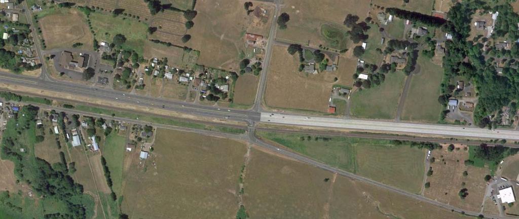
2 Project Background The purpose of the project is to enhance operations and safety on Mt. Hood Highway (US26) at its intersections with SE 267 th Avenue and SE Stone Road by installing median concrete traffic separators that will: Restrict left turns from SE 267th Avenue and Stone Road onto US26 Prevent motorists on SE 267th Avenue and Stone Road from crossing US26 Left turns from US26 onto SE 267th Avenue and Stone Road would still be allowed, as would right turns from the local roads onto the highway. This project also will: Add dedicated right turn lanes from US26 eastbound and westbound onto SE 267th Avenue Install a one-way turnaround between the two directions of US26, northwest of the SE 267th Avenue intersection that will allow westbound motorists to access US26 eastbound without going up to Palmquist Road. 1
3 There have been questions raised by a number of local residents in the project area about installation of traffic signals at the two intersections in lieu of the proposed safety improvements. In order for consideration of signal installation, the intersections have to meet certain nationally established guidelines known as signal warrants at a minimum. The satisfaction of a traffic signal warrant or warrants does not in itself require the installation of a traffic control signal because the installation of a traffic signal could result in adverse safety and operational concerns. This report explains the ODOT Traffic Signal Approval Process and the findings from a signal warrant analysis performed for each intersection. ODOT Traffic Signal Approval Process The Process that establishes consideration and approval for installation or removal of traffic signals on State highways is defined in OAR through The OAR is available through the following web link: A copy of the OAR is provided in the Appendix A. Signal Warrant Analysis A traffic signal warrant analysis was performed in accordance with the guidelines and procedures outlined in the 2009 Manual on Uniform Traffic Control Devices (MUTCD see Appendix B) and ODOT Analysis Procedures Manual (APM) for the intersections of US26 at SE 267 th Ave and US26 at Stone Rd. The MUTCD is published by the Federal Highway Administration and contains the national standards that were developed to ensure uniformity in the application and design of traffic signals, signs and pavement marking throughout the country. A weekday 14-hour (6:00 a.m. to 8:00 p.m.) traffic county survey was conducted on Wednesday, October 12, 2012 at each intersection. Data recorded during the count survey included turning movements. A summary of the 14-hour counts is provided in Appendix C. The following nine traffic signal warrants in the MUTCD were evaluated: Warrant 1, Eight-Hour Vehicular Volume Warrant 2, Four-Hour Vehicular Volume Warrant 3, Peak Hour Warrant 4, Pedestrian Volume Warrant 5, School Crossing Warrant 6, Coordinated Signal System Warrant 7, Crash Experience Warrant 8, Roadway Network Warrant 9, Intersection near a Grade Crossing The Signal Warrant Analysis worksheets provided in Appendix D show that both intersections would not meet the minimum requirement for any of the nine warrants. The traffic volume on SE 267 th Avenue is about 38% of the minimum required to satisfy the warrant whereas the traffic volume on SE Stone Road is only about 19% of the minimum. 2
4 It should be noted that because the minor street right-turning traffic generally does not require a traffic signal to be adequately served, it is a standard department practice as per ODOT Analysis Procedures Manual to discount the minor street right-turning traffic volumes when evaluating signal warrants. Only the right-turning volume that exceeds 85% of the minor street approach lane capacity may be counted. This practice is consistent with the guidelines in the MUTCD. For the intersections of US26 at SE 267 th Avenue and US26 at SE Stone Road, the minor street right-turning traffic volumes were subtracted from the total minor street traffic. The Oregon Highway Plan (OHP) discourages the installation of traffic signals on rural highspeed highways (see Appendix E OHP Action 3A.4) because it can adversely affect the safety and efficiency of vehicle, bicycle and pedestrian traffic. Rural signals are unexpected by the motorist and require longer than normal time for drivers to react. It also can result in significant increases in the frequency of some types of collisions, especially rear-end collisions. Case in point: A traffic signal was installed in 2005 on US26 at SE Orient Dr./Jarl Rd, approximately five and a half miles east of SE Stone Rd. Analysis of the crash history from a five-year period before and after the signal was installed reveals that the number of crashes occurred after the installation of the signal (33) is almost 3 times as many as the number of crashes (12) prior to the signal installation. There was only one rear-end crash before the signal installation and the number of rear-end crashes increased to 20 since the signal has been installed. The crash history for the before and after conditions is provided in Appendix F. Another example of a signal on a rural high speed highway is the signal on OR213 at Leland Rd located approximately one and a half miles south of Oregon City. OR213 at Leland Road was a two-way stop-controlled intersection before an interim project in 1995 installed turn lanes, flashing beacons and a painted crosswalk. In 2001, a traffic signal was installed. Crash data at the intersection was analyzed before the interim project, after the interim project and after the installation of the traffic signal. After construction of the interim project, crash data showed an increase in injury crashes and a reduction in property damage only crashes. After installation of the traffic signal, crash data showed an increase in total crashes and rear-end crashes. There was no net change in fatal and severe injury crashes. The crash history for the three conditions is shown in Appendix G. Appendix A. Oregon Administrative Rules (OAR) through for Traffic Signal Approval Process B. Chapter 4C - Traffic Control Signal Needs Studies of the 2009 Manual on Uniform Traffic Control Devices (MUTCD) C. Table SW-1-14-hour turn movement counts at the intersection of US26 at SE 267 th Ave Table SW-2-14-hour turn movement counts at the intersection of US26 at SE Stone Rd D. Traffic Signal Warrant Analysis Worksheets for US26 at SE 267 th Ave and US26 at Stone Rd 3
5 E. Oregon Highway Plan, Action 3A.4 F. Crash History for US26 at SE Orient Dr./Jarl Rd G. Crash History for OR213 at Leland Rd 4
6 APPENDIX A
7 Traffic Signal Approval Process The Process that establishes consideration and approval for installation or removal of traffic signals on state highways is defined in OAR through The OAR is available through the following web link: A copy of the OAR is provided below. OAR Purpose The purpose of OAR through is to establish the approval process for installation, modification, or removal of traffic signals under the authority of the Oregon Department of Transportation. Stat. Auth.: ORS , , & Stats. Implemented: ORS & Hist.: TO , f. & cert. ef ; HWD , f. & cert. ef Authority OAR through are adopted pursuant to ORS , and The Oregon Transportation Commission has authority to place, maintain and operate traffic control devices on state highways. By this rule, the Oregon Transportation Commission delegates to the State Traffic Engineer the authority to approve the installation of traffic control devices on state highways. Stat. Auth.: ORS , ORS , ORS & ORS Stats. Implemented: ORS & ORS Hist.: TO , f. & cert. ef Definitions For the purposes of OAR through , the following definitions apply: (1) Approach means all lanes of traffic moving toward an intersection or a mid-block location from one direction.
8 (2) MUTCD means the Manual on Uniform Traffic Control Devices as adopted by OAR (3) Private approach means a private roadway or connection that is legally constructed and recognized by the Department in accordance with OAR (4) Public road means a public roadway, or similar facility under the jurisdiction of a public entity and open to public travel. (5) Roadway improvement project means a major construction, reconstruction or realignment of a section of state highway. (6) State Highway System means the group of roads and highways, so designated by law or by the Oregon Transportation Commission pursuant to ORS (7) Traffic signal means any highway traffic signal by which traffic is alternately directed to stop and permitted to proceed. (8) Engineering study is a documented comprehensive analysis and evaluation of available pertinent information, and the application of appropriate principles, standards, guidance, and practices as contained in the MUTCD and other sources, for the purposes of deciding upon the applicability, design, operation, or installation of a traffic control device. Stat. Auth.: ORS , , & Stats. Implemented: ORS & Hist.: TO , f. & cert. ef ; HWD , f. & cert. ef Traffic Signal Approval List (1) traffic signal shall be designed for, or constructed on, the State Highway System, regardless of the funding source, without the prior approval of the State Traffic/Roadway Engineer (STRE). (2) Regardless of any ODOT approved documents, such as land use documents, transportation system plans, corridor plans or other agreements a traffic signal shall not be designed or constructed unless first approved by the STRE. (3) An engineering study is required for approval. The study shall indicate the need for the traffic signal and demonstrate that the installation of a traffic signal would improve the overall safety and operation of the intersection. (4) Intersections shall meet MUTCD traffic signal warrants, unless the STRE finds special conditions documented in the engineering study where no existing warrant is applicable.
9 (5) Traffic signal warrants should be met within three years after construction when a traffic signal is constructed as part of a roadway improvement project. (6) Traffic signal warrants should be met on day of opening to accommodate additional traffic from a public or private development. The traffic signal shall not be turned-on more than one month in advance of day of opening. (7) If traffic signal is not advanced to construction within five years the STRE traffic signal approval is automatically rescinded. (8) For private approaches, assess the ability of the existing, planned, and proposed public roads to accommodate the traffic at another location. (9) The STRE traffic signal approval does not assure the eventual design, installation, or operation of a traffic signal. Stat. Auth.: ORS , , & Stats. Implemented: ORS & Hist.: TO , f. & cert. ef ; HWD , f. & cert. ef ; HWD , f. & cert. ef Traffic Signal Spacing Requirement The desirable spacing of signalized intersections on statewide and regional highways is 1/2 mile. The STRE may approve the installation of a traffic signal at locations where 1/2-mile spacing is inappropriate or infeasible due to: (1) Topography; (2) Existing or proposed road layout; (3) Identified traffic crash pattern; (4) Unique physical constraints; or (5) Existing or proposed land use patterns. Stat. Auth.: ORS , , & Stats. Implemented: ORS & Hist.: TO , f. & cert. ef ; HWD , f. & cert. ef Traffic Signal Progression Analysis for Traffic Signal Approval
10 (1) A traffic signal progression analysis is required for both existing and future conditions when a proposed traffic signal location is within one half mile of any existing or proposed new traffic signal. The STRE may require traffic signal progression analysis for spacing greater than one half mile. (2) A traffic signal progression analysis for all new or modified approaches at traffic signals on state highways may be required for both existing and future conditions. Stat. Auth.: ORS , , & Stats. Implemented: ORS & Hist.: TO , f. & cert. ef ; HWD , f. & cert. ef Design Standards for Installation or Modification of a Traffic Signal The following design standards apply to new, replaced, or significantly modified signal installations: (1) The traffic signal design plans shall conform to the conditions listed in the STRE traffic signal approval. (2) All approaches to a traffic signal controlled intersection shall be signalized. (3) Design geometry of a private approach shall be consistent with that of public road intersections including curbs, appropriate lane widths, pavement markings, and vertical alignment. Stat. Auth.: ORS , & Stats. Implemented: ORS & Hist.: HWD , f. & cert. ef Removal of Traffic Signals An existing traffic signal may be removed if MUTCD traffic signal warrants are no longer met or a proposed change in geometry or traffic flow pattern will eliminate the need for the traffic signal. traffic signal shall be removed from the State Highway System without prior approval of the STRE. A traffic control engineering study is required for approval, which shall include all of the following: (1) A comprehensive investigation of traffic and safety conditions. (2) Assessment of needs of the local community. (3) Public opinion considerations.
11 Stat. Auth.: ORS , , & Stats. Implemented: ORS & Hist.: TO , f. & cert. ef ; HWD , f. & cert. ef
12 APPENDIX B
13 Page Edition CHAPTER 4C. TRAFFIC CONTROL SIGNAL NEEDS STUDIES Section 4C.01 Studies and Factors for Justifying Traffic Control Signals Standard: 01 An engineering study of traffic conditions, pedestrian characteristics, and physical characteristics of the location shall be performed to determine whether installation of a traffic control signal is justified at a particular location. 02 The investigation of the need for a traffic control signal shall include an analysis of factors related to the existing operation and safety at the study location and the potential to improve these conditions, and the applicable factors contained in the following traffic signal warrants: Warrant 1, Eight-Hour Vehicular Volume Warrant 2, Four-Hour Vehicular Volume Warrant 3, Peak Hour Warrant 4, Pedestrian Volume Warrant 5, School Crossing Warrant 6, Coordinated Signal System Warrant 7, Crash Experience Warrant 8, Roadway Network Warrant 9, Intersection Near a Grade Crossing 03 The satisfaction of a traffic signal warrant or warrants shall not in itself require the installation of a traffic control signal. Support: 04 Sections 8C.09 and 8C.10 contain information regarding the use of traffic control signals instead of gates and/ or flashing-light signals at highway-rail grade crossings and highway-light rail transit grade crossings, respectively. Guidance: 05 A traffic control signal should not be installed unless one or more of the factors described in this Chapter are met. 06 A traffic control signal should not be installed unless an engineering study indicates that installing a traffic control signal will improve the overall safety and/or operation of the intersection. 07 A traffic control signal should not be installed if it will seriously disrupt progressive traffic flow. 08 The study should consider the effects of the right-turn vehicles from the minor-street approaches. Engineering judgment should be used to determine what, if any, portion of the right-turn traffic is subtracted from the minor-street traffic count when evaluating the count against the signal warrants listed in Paragraph Engineering judgment should also be used in applying various traffic signal warrants to cases where approaches consist of one lane plus one left-turn or right-turn lane. The site-specific traffic characteristics should dictate whether an approach is considered as one lane or two lanes. For example, for an approach with one lane for through and right-turning traffic plus a left-turn lane, if engineering judgment indicates that it should be considered a one-lane approach because the traffic using the left-turn lane is minor, the total traffic volume approaching the intersection should be applied against the signal warrants as a one-lane approach. The approach should be considered two lanes if approximately half of the traffic on the approach turns left and the left-turn lane is of sufficient length to accommodate all left-turn vehicles. 10 Similar engineering judgment and rationale should be applied to a street approach with one through/left-turn lane plus a right-turn lane. In this case, the degree of conflict of minor-street right-turn traffic with traffic on the major street should be considered. Thus, right-turn traffic should not be included in the minor-street volume if the movement enters the major street with minimal conflict. The approach should be evaluated as a one-lane approach with only the traffic volume in the through/left-turn lane considered. 11 At a location that is under development or construction and where it is not possible to obtain a traffic count that would represent future traffic conditions, hourly volumes should be estimated as part of an engineering study for comparison with traffic signal warrants. Except for locations where the engineering study uses the satisfaction of Warrant 8 to justify a signal, a traffic control signal installed under projected conditions should have an engineering study done within 1 year of putting the signal into stop-and-go operation to determine if the signal is justified. If not justified, the signal should be taken out of stop-and-go operation or removed. 12 For signal warrant analysis, a location with a wide median, even if the median width is greater than 30 feet, should be considered as one intersection. Sect. 4C.01 December 2009
14 2009 Edition Page 437 Option: 13 At an intersection with a high volume of left-turn traffic from the major street, the signal warrant analysis may be performed in a manner that considers the higher of the major-street left-turn volumes as the minor-street volume and the corresponding single direction of opposing traffic on the major street as the major-street volume. 14 For signal warrants requiring conditions to be present for a certain number of hours in order to be satisfied, any four sequential 15-minute periods may be considered as 1 hour if the separate 1-hour periods used in the warrant analysis do not overlap each other and both the major-street volume and the minor-street volume are for the same specific one-hour periods. 15 For signal warrant analysis, bicyclists may be counted as either vehicles or pedestrians. Support: 16 When performing a signal warrant analysis, bicyclists riding in the street with other vehicular traffic are usually counted as vehicles and bicyclists who are clearly using pedestrian facilities are usually counted as pedestrians. Option: 17 Engineering study data may include the following: A. The number of vehicles entering the intersection in each hour from each approach during 12 hours of an average day. It is desirable that the hours selected contain the greatest percentage of the 24-hour traffic volume. B. Vehicular volumes for each traffic movement from each approach, classified by vehicle type (heavy trucks, passenger cars and light trucks, public-transit vehicles, and, in some locations, bicycles), during each 15-minute period of the 2 hours in the morning and 2 hours in the afternoon during which total traffic entering the intersection is greatest. C. Pedestrian volume counts on each crosswalk during the same periods as the vehicular counts in Item B and during hours of highest pedestrian volume. Where young, elderly, and/or persons with physical or visual disabilities need special consideration, the pedestrians and their crossing times may be classified by general observation. D. Information about nearby facilities and activity centers that serve the young, elderly, and/or persons with disabilities, including requests from persons with disabilities for accessible crossing improvements at the location under study. These persons might not be adequately reflected in the pedestrian volume count if the absence of a signal restrains their mobility. E. The posted or statutory speed limit or the 85 th -percentile speed on the uncontrolled approaches to the location. F. A condition diagram showing details of the physical layout, including such features as intersection geometrics, channelization, grades, sight-distance restrictions, transit stops and routes, parking conditions, pavement markings, roadway lighting, driveways, nearby railroad crossings, distance to nearest traffic control signals, utility poles and fixtures, and adjacent land use. G. A collision diagram showing crash experience by type, location, direction of movement, severity, weather, time of day, date, and day of week for at least 1 year. 18 The following data, which are desirable for a more precise understanding of the operation of the intersection, may be obtained during the periods described in Item B of Paragraph 17: A. Vehicle-hours of stopped time delay determined separately for each approach. B. The number and distribution of acceptable gaps in vehicular traffic on the major street for entrance from the minor street. C. The posted or statutory speed limit or the 85 th -percentile speed on controlled approaches at a point near to the intersection but unaffected by the control. D. Pedestrian delay time for at least two 30-minute peak pedestrian delay periods of an average weekday or like periods of a Saturday or Sunday. E. Queue length on stop-controlled approaches. Section 4C.02 Warrant 1, Eight-Hour Vehicular Volume Support: 01 The Minimum Vehicular Volume, Condition A, is intended for application at locations where a large volume of intersecting traffic is the principal reason to consider installing a traffic control signal. 02 The Interruption of Continuous Traffic, Condition B, is intended for application at locations where Condition A is not satisfied and where the traffic volume on a major street is so heavy that traffic on a minor intersecting street suffers excessive delay or conflict in entering or crossing the major street. 03 It is intended that Warrant 1 be treated as a single warrant. If Condition A is satisfied, then Warrant 1 is satisfied and analyses of Condition B and the combination of Conditions A and B are not needed. Similarly, if Condition B is satisfied, then Warrant 1 is satisfied and an analysis of the combination of Conditions A and B is not needed. December 2009 Sect. 4C.01 to 4C.02
15 Page Edition Standard: 04 The need for a traffic control signal shall be considered if an engineering study finds that one of the following conditions exist for each of any 8 hours of an average day: A. The vehicles per hour given in both of the 100 percent columns of Condition A in Table 4C-1 exist on the major-street and the higher-volume minor-street approaches, respectively, to the intersection; or B. The vehicles per hour given in both of the 100 percent columns of Condition B in Table 4C-1 exist on the major-street and the higher-volume minor-street approaches, respectively, to the intersection. In applying each condition the major-street and minor-street volumes shall be for the same 8 hours. On the minor street, the higher volume shall not be required to be on the same approach during each of these 8 hours. Option: 05 If the posted or statutory speed limit or the 85th-percentile speed on the major street exceeds 40 mph, or if the intersection lies within the built-up area of an isolated community having a population of less than 10,000, the traffic volumes in the 70 percent columns in Table 4C-1 may be used in place of the 100 percent columns. Guidance: 06 The combination of Conditions A and B is intended for application at locations where Condition A is not satisfied and Condition B is not satisfied and should be applied only after an adequate trial of other alternatives that could cause less delay and inconvenience to traffic has failed to solve the traffic problems. Standard: 07 The need for a traffic control signal shall be considered if an engineering study finds that both of the following conditions exist for each of any 8 hours of an average day: A. The vehicles per hour given in both of the 80 percent columns of Condition A in Table 4C-1 exist on the major-street and the higher-volume minor-street approaches, respectively, to the intersection; and B. The vehicles per hour given in both of the 80 percent columns of Condition B in Table 4C-1 exist on the major-street and the higher-volume minor-street approaches, respectively, to the intersection. These major-street and minor-street volumes shall be for the same 8 hours for each condition; however, the 8 hours satisfied in Condition A shall not be required to be the same 8 hours satisfied in Condition B. On the minor street, the higher volume shall not be required to be on the same approach during each of the 8 hours. Table 4C-1. Warrant 1, Eight-Hour Vehicular Volume Number of lanes for moving traffic on each approach Condition A Minimum Vehicular Volume Vehicles per hour on major street (total of both approaches) Vehicles per hour on higher-volume minor-street approach (one direction only) Major Street Minor Street 100% a 80% b 70% c 56% d 100% a 80% b 70% c 56% d or more or more 2 or more or more Number of lanes for moving traffic on each approach Condition B Interruption of Continuous Traffic Vehicles per hour on major street (total of both approaches) Vehicles per hour on higher-volume minor-street approach (one direction only) Major Street Minor Street 100% a 80% b 70% c 56% d 100% a 80% b 70% c 56% d or more or more 2 or more or more a Basic minimum hourly volume b Used for combination of Conditions A and B after adequate trial of other remedial measures c May be used when the major-street speed exceeds 40 mph or in an isolated community with a population of less than 10,000 d May be used for combination of Conditions A and B after adequate trial of other remedial measures when the major-street speed exceeds 40 mph or in an isolated community with a population of less than 10,000 Sect. 4C.02 December 2009
16 2009 Edition Page 439 Option: 08 If the posted or statutory speed limit or the 85th-percentile speed on the major street exceeds 40 mph, or if the intersection lies within the built-up area of an isolated community having a population of less than 10,000, the traffic volumes in the 56 percent columns in Table 4C-1 may be used in place of the 80 percent columns. Section 4C.03 Warrant 2, Four-Hour Vehicular Volume Support: 01 The Four-Hour Vehicular Volume signal warrant conditions are intended to be applied where the volume of intersecting traffic is the principal reason to consider installing a traffic control signal. Standard: 02 The need for a traffic control signal shall be considered if an engineering study finds that, for each of any 4 hours of an average day, the plotted points representing the vehicles per hour on the major street (total of both approaches) and the corresponding vehicles per hour on the higher-volume minor-street approach (one direction only) all fall above the applicable curve in Figure 4C-1 for the existing combination of approach lanes. On the minor street, the higher volume shall not be required to be on the same approach during each of these 4 hours. Option: 03 If the posted or statutory speed limit or the 85th-percentile speed on the major street exceeds 40 mph, or if the intersection lies within the built-up area of an isolated community having a population of less than 10,000, Figure 4C-2 may be used in place of Figure 4C-1. Section 4C.04 Warrant 3, Peak Hour Support: 01 The Peak Hour signal warrant is intended for use at a location where traffic conditions are such that for a minimum of 1 hour of an average day, the minor-street traffic suffers undue delay when entering or crossing the major street. Standard: 02 This signal warrant shall be applied only in unusual cases, such as office complexes, manufacturing plants, industrial complexes, or high-occupancy vehicle facilities that attract or discharge large numbers of vehicles over a short time. 03 The need for a traffic control signal shall be considered if an engineering study finds that the criteria in either of the following two categories are met: A. If all three of the following conditions exist for the same 1 hour (any four consecutive 15-minute periods) of an average day: 1. The total stopped time delay experienced by the traffic on one minor-street approach (one direction only) controlled by a STOP sign equals or exceeds: 4 vehicle-hours for a one-lane approach or 5 vehicle-hours for a two-lane approach; and 2. The volume on the same minor-street approach (one direction only) equals or exceeds 100 vehicles per hour for one moving lane of traffic or 150 vehicles per hour for two moving lanes; and 3. The total entering volume serviced during the hour equals or exceeds 650 vehicles per hour for intersections with three approaches or 800 vehicles per hour for intersections with four or more approaches. B. The plotted point representing the vehicles per hour on the major street (total of both approaches) and the corresponding vehicles per hour on the higher-volume minor-street approach (one direction only) for 1 hour (any four consecutive 15-minute periods) of an average day falls above the applicable curve in Figure 4C-3 for the existing combination of approach lanes. Option: 04 If the posted or statutory speed limit or the 85th-percentile speed on the major street exceeds 40 mph, or if the intersection lies within the built-up area of an isolated community having a population of less than 10,000, Figure 4C-4 may be used in place of Figure 4C-3 to evaluate the criteria in the second category of the Standard. 05 If this warrant is the only warrant met and a traffic control signal is justified by an engineering study, the traffic control signal may be operated in the flashing mode during the hours that the volume criteria of this warrant are not met. Guidance: 06 If this warrant is the only warrant met and a traffic control signal is justified by an engineering study, the traffic control signal should be traffic-actuated. December 2009 Sect. 4C.02 to 4C.04
17 Page Edition Figure 4C-1. Warrant 2, Four-Hour Vehicular Volume OR MORE LANES & 2 OR MORE LANES MINOR STREET HIGHER- VOLUME APPROACH - VPH OR MORE LANES & 1 LANE 1 LANE & 1 LANE 115* 80* MAJOR STREET TOTAL OF BOTH APPROACHES VEHICLES PER HOUR (VPH) *te: 115 vph applies as the lower threshold volume for a minor-street approach with two or more lanes and 80 vph applies as the lower threshold volume for a minor-street approach with one lane. Figure 4C-2. Warrant 2, Four-Hour Vehicular Volume (70% Factor) (COMMUNITY LESS THAN 10,000 POPULATION OR ABOVE 40 MPH ON MAJOR STREET) 400 MINOR STREET HIGHER- VOLUME APPROACH - VPH OR MORE LANES & 2 OR MORE LANES 2 OR MORE LANES & 1 LANE 1 LANE & 1 LANE 80* 60* MAJOR STREET TOTAL OF BOTH APPROACHES VEHICLES PER HOUR (VPH) *te: 80 vph applies as the lower threshold volume for a minor-street approach with two or more lanes and 60 vph applies as the lower threshold volume for a minor-street approach with one lane. Sect. 4C.04 December 2009
18 2009 Edition Page 441 Figure 4C-3. Warrant 3, Peak Hour 600 MINOR STREET HIGHER- VOLUME APPROACH - VPH OR MORE LANES & 2 OR MORE LANES 2 OR MORE LANES & 1 LANE 1 LANE & 1 LANE 150* 100* MAJOR STREET TOTAL OF BOTH APPROACHES VEHICLES PER HOUR (VPH) *te: 150 vph applies as the lower threshold volume for a minor-street approach with two or more lanes and 100 vph applies as the lower threshold volume for a minor-street approach with one lane. Figure 4C-4. Warrant 3, Peak Hour (70% Factor) (COMMUNITY LESS THAN 10,000 POPULATION OR ABOVE 40 MPH ON MAJOR STREET) OR MORE LANES & 2 OR MORE LANES MINOR STREET HIGHER- VOLUME APPROACH - VPH OR MORE LANES & 1 LANE 1 LANE & 1 LANE * 75* MAJOR STREET TOTAL OF BOTH APPROACHES VEHICLES PER HOUR (VPH) *te: 100 vph applies as the lower threshold volume for a minor-street approach with two or more lanes and 75 vph applies as the lower threshold volume for a minor-street approach with one lane. December 2009 Sect. 4C.04
19 Page Edition Section 4C.05 Warrant 4, Pedestrian Volume Support: 01 The Pedestrian Volume signal warrant is intended for application where the traffic volume on a major street is so heavy that pedestrians experience excessive delay in crossing the major street. Standard: 02 The need for a traffic control signal at an intersection or midblock crossing shall be considered if an engineering study finds that one of the following criteria is met: A. For each of any 4 hours of an average day, the plotted points representing the vehicles per hour on the major street (total of both approaches) and the corresponding pedestrians per hour crossing the major street (total of all crossings) all fall above the curve in Figure 4C-5; or B. For 1 hour (any four consecutive 15-minute periods) of an average day, the plotted point representing the vehicles per hour on the major street (total of both approaches) and the corresponding pedestrians per hour crossing the major street (total of all crossings) falls above the curve in Figure 4C-7. Option: 03 If the posted or statutory speed limit or the 85th-percentile speed on the major street exceeds 35 mph, or if the intersection lies within the built-up area of an isolated community having a population of less than 10,000, Figure 4C-6 may be used in place of Figure 4C-5 to evaluate Criterion A in Paragraph 2, and Figure 4C-8 may be used in place of Figure 4C-7 to evaluate Criterion B in Paragraph 2. Standard: 04 The Pedestrian Volume signal warrant shall not be applied at locations where the distance to the nearest traffic control signal or STOP sign controlling the street that pedestrians desire to cross is less than 300 feet, unless the proposed traffic control signal will not restrict the progressive movement of traffic. 05 If this warrant is met and a traffic control signal is justified by an engineering study, the traffic control signal shall be equipped with pedestrian signal heads complying with the provisions set forth in Chapter 4E. Guidance: 06 If this warrant is met and a traffic control signal is justified by an engineering study, then: A. If it is installed at an intersection or major driveway location, the traffic control signal should also control the minor-street or driveway traffic, should be traffic-actuated, and should include pedestrian detection. B. If it is installed at a non-intersection crossing, the traffic control signal should be installed at least 100 feet from side streets or driveways that are controlled by STOP or YIELD signs, and should be pedestrian-actuated. If the traffic control signal is installed at a non-intersection crossing, at least one of the signal faces should be over the traveled way for each approach, parking and other sight obstructions should be prohibited for at least 100 feet in advance of and at least 20 feet beyond the crosswalk or site accommodations should be made through curb extensions or other techniques to provide adequate sight distance, and the installation should include suitable standard signs and pavement markings. C. Furthermore, if it is installed within a signal system, the traffic control signal should be coordinated. Option: 07 The criterion for the pedestrian volume crossing the major street may be reduced as much as 50 percent if the 15th-percentile crossing speed of pedestrians is less than 3.5 feet per second. 08 A traffic control signal may not be needed at the study location if adjacent coordinated traffic control signals consistently provide gaps of adequate length for pedestrians to cross the street. Section 4C.06 Warrant 5, School Crossing Support: 01 The School Crossing signal warrant is intended for application where the fact that schoolchildren cross the major street is the principal reason to consider installing a traffic control signal. For the purposes of this warrant, the word schoolchildren includes elementary through high school students. Standard: 02 The need for a traffic control signal shall be considered when an engineering study of the frequency and adequacy of gaps in the vehicular traffic stream as related to the number and size of groups of schoolchildren at an established school crossing across the major street shows that the number of adequate gaps in the traffic stream during the period when the schoolchildren are using the crossing is less than the number of minutes in the same period (see Section 7A.03) and there are a minimum of 20 schoolchildren during the highest crossing hour. Sect. 4C.05 to 4C.06 December 2009
20 2009 Edition Page Figure 4C-5. Warrant 4, Pedestrian Four-Hour Volume TOTAL OF ALL PEDESTRIANS CROSSING MAJOR STREET- PEDESTRIANS PER HOUR (PPH) * MAJOR STREET TOTAL OF BOTH APPROACHES VEHICLES PER HOUR (VPH) *te: 107 pph applies as the lower threshold volume. Figure 4C-6. Warrant 4, Pedestrian Four-Hour Volume (70% Factor) 400 TOTAL OF ALL PEDESTRIANS CROSSING MAJOR STREET- PEDESTRIANS PER HOUR (PPH) * MAJOR STREET TOTAL OF BOTH APPROACHES VEHICLES PER HOUR (VPH) *te: 75 pph applies as the lower threshold volume. December 2009 Sect. 4C.06
21 Page Edition 700 Figure 4C-7. Warrant 4, Pedestrian Peak Hour 600 TOTAL OF ALL PEDESTRIANS CROSSING MAJOR STREET- PEDESTRIANS PER HOUR (PPH) * MAJOR STREET TOTAL OF BOTH APPROACHES VEHICLES PER HOUR (VPH) *te: 133 pph applies as the lower threshold volume. Figure 4C-8. Warrant 4, Pedestrian Peak Hour (70% Factor) TOTAL OF ALL PEDESTRIANS CROSSING MAJOR STREET- PEDESTRIANS PER HOUR (PPH) * MAJOR STREET TOTAL OF BOTH APPROACHES VEHICLES PER HOUR (VPH) *te: 93 pph applies as the lower threshold volume. Sect. 4C.06 December 2009
22 2009 Edition Page Before a decision is made to install a traffic control signal, consideration shall be given to the implementation of other remedial measures, such as warning signs and flashers, school speed zones, school crossing guards, or a grade-separated crossing. 04 The School Crossing signal warrant shall not be applied at locations where the distance to the nearest traffic control signal along the major street is less than 300 feet, unless the proposed traffic control signal will not restrict the progressive movement of traffic. Guidance: 05 If this warrant is met and a traffic control signal is justified by an engineering study, then: A. If it is installed at an intersection or major driveway location, the traffic control signal should also control the minor-street or driveway traffic, should be traffic-actuated, and should include pedestrian detection. B. If it is installed at a non-intersection crossing, the traffic control signal should be installed at least 100 feet from side streets or driveways that are controlled by STOP or YIELD signs, and should be pedestrian-actuated. If the traffic control signal is installed at a non-intersection crossing, at least one of the signal faces should be over the traveled way for each approach, parking and other sight obstructions should be prohibited for at least 100 feet in advance of and at least 20 feet beyond the crosswalk or site accommodations should be made through curb extensions or other techniques to provide adequate sight distance, and the installation should include suitable standard signs and pavement markings. C. Furthermore, if it is installed within a signal system, the traffic control signal should be coordinated. Section 4C.07 Warrant 6, Coordinated Signal System Support: 01 Progressive movement in a coordinated signal system sometimes necessitates installing traffic control signals at intersections where they would not otherwise be needed in order to maintain proper platooning of vehicles. Standard: 02 The need for a traffic control signal shall be considered if an engineering study finds that one of the following criteria is met: A. On a one-way street or a street that has traffic predominantly in one direction, the adjacent traffic control signals are so far apart that they do not provide the necessary degree of vehicular platooning. B. On a two-way street, adjacent traffic control signals do not provide the necessary degree of platooning and the proposed and adjacent traffic control signals will collectively provide a progressive operation. Guidance: 03 The Coordinated Signal System signal warrant should not be applied where the resultant spacing of traffic control signals would be less than 1,000 feet. Section 4C.08 Warrant 7, Crash Experience Support: 01 The Crash Experience signal warrant conditions are intended for application where the severity and frequency of crashes are the principal reasons to consider installing a traffic control signal. Standard: 02 The need for a traffic control signal shall be considered if an engineering study finds that all of the following criteria are met: A. Adequate trial of alternatives with satisfactory observance and enforcement has failed to reduce the crash frequency; and B. Five or more reported crashes, of types susceptible to correction by a traffic control signal, have occurred within a 12-month period, each crash involving personal injury or property damage apparently exceeding the applicable requirements for a reportable crash; and C. For each of any 8 hours of an average day, the vehicles per hour (vph) given in both of the 80 percent columns of Condition A in Table 4C-1 (see Section 4C.02), or the vph in both of the 80 percent columns of Condition B in Table 4C-1 exists on the major-street and the higher-volume minor-street approach, respectively, to the intersection, or the volume of pedestrian traffic is not less than 80 percent of the requirements specified in the Pedestrian Volume warrant. These major-street and minor-street volumes shall be for the same 8 hours. On the minor street, the higher volume shall not be required to be on the same approach during each of the 8 hours. December 2009 Sect. 4C.06 to 4C.08
23 Page Edition Option: 03 If the posted or statutory speed limit or the 85th-percentile speed on the major street exceeds 40 mph, or if the intersection lies within the built-up area of an isolated community having a population of less than 10,000, the traffic volumes in the 56 percent columns in Table 4C-1 may be used in place of the 80 percent columns. Section 4C.09 Warrant 8, Roadway Network Support: 01 Installing a traffic control signal at some intersections might be justified to encourage concentration and organization of traffic flow on a roadway network. Standard: 02 The need for a traffic control signal shall be considered if an engineering study finds that the common intersection of two or more major routes meets one or both of the following criteria: A. The intersection has a total existing, or immediately projected, entering volume of at least 1,000 vehicles per hour during the peak hour of a typical weekday and has 5-year projected traffic volumes, based on an engineering study, that meet one or more of Warrants 1, 2, and 3 during an average weekday; or B. The intersection has a total existing or immediately projected entering volume of at least 1,000 vehicles per hour for each of any 5 hours of a non-normal business day (Saturday or Sunday). 03 A major route as used in this signal warrant shall have at least one of the following characteristics: A. It is part of the street or highway system that serves as the principal roadway network for through traffic flow. B. It includes rural or suburban highways outside, entering, or traversing a city. C. It appears as a major route on an official plan, such as a major street plan in an urban area traffic and transportation study. Section 4C.10 Warrant 9, Intersection Near a Grade Crossing Support: 01 The Intersection Near a Grade Crossing signal warrant is intended for use at a location where none of the conditions described in the other eight traffic signal warrants are met, but the proximity to the intersection of a grade crossing on an intersection approach controlled by a STOP or YIELD sign is the principal reason to consider installing a traffic control signal. Guidance: 02 This signal warrant should be applied only after adequate consideration has been given to other alternatives or after a trial of an alternative has failed to alleviate the safety concerns associated with the grade crossing. Among the alternatives that should be considered or tried are: A. Providing additional pavement that would enable vehicles to clear the track or that would provide space for an evasive maneuver, or B. Reassigning the stop controls at the intersection to make the approach across the track a non-stopping approach. Standard: 03 The need for a traffic control signal shall be considered if an engineering study finds that both of the following criteria are met: A. A grade crossing exists on an approach controlled by a STOP or YIELD sign and the center of the track nearest to the intersection is within 140 feet of the stop line or yield line on the approach; and B. During the highest traffic volume hour during which rail traffic uses the crossing, the plotted point representing the vehicles per hour on the major street (total of both approaches) and the corresponding vehicles per hour on the minor-street approach that crosses the track (one direction only, approaching the intersection) falls above the applicable curve in Figure 4C-9 or 4C-10 for the existing combination of approach lanes over the track and the distance D, which is the clear storage distance as defined in Section 1A.13. Guidance: 04 The following considerations apply when plotting the traffic volume data on Figure 4C-9 or 4C-10: A. Figure 4C-9 should be used if there is only one lane approaching the intersection at the track crossing location and Figure 4C-10 should be used if there are two or more lanes approaching the intersection at the track crossing location. Sect. 4C.08 to 4C.10 December 2009
24 2009 Edition Page 447 MINOR STREET, CROSSING APPROACH - EQUIVALENT VPH** Figure 4C-9. Warrant 9, Intersection Near a Grade Crossing (One Approach Lane at the Track Crossing) D = 110 ft D = 130 ft D = 90 ft D = 70 ft D = 50 ft Minor Street 6 ft D Major Street 50 D = 30 ft 25* MAJOR STREET TOTAL OF BOTH APPROACHES VEHICLES PER HOUR (VPH) * 25 vph applies as the lower threshold volume ** VPH after applying the adjustment factors in Tables 4C-2, 4C-3, and/or 4C-4, if appropriate Figure 4C-10. Warrant 9, Intersection Near a Grade Crossing (Two or More Approach Lanes at the Track Crossing) 350 Major Street 300 D = 130 ft Minor Street 250 D = 110 ft MINOR STREET, CROSSING APPROACH - EQUIVALENT VPH** D = 50 ft D = 90 ft D = 70 ft 6 ft D 50 D = 30 ft 25* MAJOR STREET TOTAL OF BOTH APPROACHES VEHICLES PER HOUR (VPH) * 25 vph applies as the lower threshold volume ** VPH after applying the adjustment factors in Tables 4C-2, 4C-3, and/or 4C-4, if appropriate December 2009 Sect. 4C.10
25 Page Edition B. After determining the actual distance D, the curve for the distance D that is nearest to the actual distance D should be used. For example, if the actual distance D is 95 feet, the plotted point should be compared to the curve for D = 90 feet. C. If the rail traffic arrival times are unknown, the highest traffic volume hour of the day should be used. Option: 05 The minor-street approach volume may be multiplied by up to three adjustment factors as provided in Paragraphs 6 through Because the curves are based on an average of four occurrences of rail traffic per day, the vehicles per hour on the minor-street approach may be multiplied by the adjustment factor shown in Table 4C-2 for the appropriate number of occurrences of rail traffic per day. 07 Because the curves are based on typical vehicle occupancy, if at least 2% of the vehicles crossing the track are buses carrying at least 20 people, the vehicles per hour on the minor-street approach may be multiplied by the adjustment factor shown in Table 4C-3 for the appropriate percentage of high-occupancy buses. 08 Because the curves are based on tractor-trailer trucks comprising 10% of the vehicles crossing the track, the vehicles per hour on the minor-street approach may be multiplied by the adjustment factor shown in Table 4C-4 for the appropriate distance and percentage of tractor-trailer trucks. Standard: 09 If this warrant is met and a traffic control signal at the intersection is justified by an engineering study, then: A. The traffic control signal shall have actuation on the minor street; B. Preemption control shall be provided in accordance with Sections 4D.27, 8C.09, and 8C.10; and C. The grade crossing shall have flashing-light signals (see Chapter 8C). Guidance: 10 If this warrant is met and a traffic control signal at the intersection is justified by an engineering study, the grade crossing should have automatic gates (see Chapter 8C). Table 4C-2. Warrant 9, Adjustment Factor for Daily Frequency of Rail Traffic Rail Traffic per Day Adjustment Factor to to to or more 1.33 Table 4C-3. Warrant 9, Adjustment Factor for Percentage of High-Occupancy Buses % of High-Occupancy Buses* on Minor-Street Approach Adjustment Factor 0% % % % or more 1.32 * A high-occupancy bus is defined as a bus occupied by at least 20 people. Table 4C-4. Warrant 9, Adjustment Factor for Percentage of Tractor-Trailer Trucks % of Tractor-Trailer Trucks on Minor-Street Approach Adjustment Factor D less than 70 feet D of 70 feet or more 0% to 2.5% % to 7.5% % to 12.5% % to 17.5% % to 22.5% % to 27.5% More than 27.5% Sect. 4C.10 December 2009
26 APPENDIX C
27 TABLE SW-1 US26 at SE 267th Ave Date of Counts: Wednesday, October 17, 2012 Highway Approach Eastbound Westbound Highway Approach Hour rthbound Southbound Left Thru Right Left Thru Right Hour NB SB EB* WB* 6-7 AM AM AM AM AM AM AM AM AM AM PM PM PM PM PM PM PM PM PM PM PM PM PM PM PM PM PM PM hour Total hour Total * Excluding Right Turn Volumes Vehicles on *Vehicles on Vehicles on *Vehicles on Major St. Higher Volume Major St. Higher Volume Hour NB+ SB Minor St. Approach Hour NB+ SB Minor St. Approach 6-7 AM AM AM AM AM PM AM PM AM PM PM PM PM AM PM PM th Highest Hour 2-3 PM PM PM AM PM PM PM AM PM PM PM PM * Excluding Right Turn Volumes
28 TABLE SW-2 US26 at Stone Rd Date of Counts: Wednesday, October 17, 2012 Highway Approach Stone Road Approach Approach Volume Hour rthbound Southbound Eastbound Westbound Hour NB SB EB* WB* Left Thru Right Left Thru Right 6-7 AM AM AM AM AM AM AM AM AM AM PM PM PM PM PM PM PM PM PM PM PM PM PM PM PM PM PM PM hour Total hour Total * Excluding Right Turn Volumes Vehicles on *Vehicles on Vehicles on *Vehicles on Major St. Higher Volume Major St. Higher Volume Hour NB+ SB Minor St. Approach Hour NB+ SB Minor St. Approach 6-7 AM PM AM AM AM AM AM PM AM PM PM PM PM AM PM PM th Highest Hour 2-3 PM PM PM AM PM PM PM PM PM PM PM AM * Excluding Right Turn Volumes
29 APPENDIX D
30 OREGON DEPARTMENT OF TRANSPORTATION TRAFFIC SIGNAL WARRANT ANALYSIS (in accordance with procedures outlined in 2009 MUTCD) Date: December 18, 2012 Prepared by: Simon Eng HIGHWAY: Mt. Hood Highway (US26).: 26 City: East of Gresham Minor Street: SE 267th Ave M.P Date of Counts: Wednesday, October 17, 2012 County: Multnomah Region: 1 LANE CONFIGURATIONS Number of approach lanes LEFT THRU RIGHT tes MAJOR ST. X N-S E-W 2 Rt turn demand for SE 267th Ave is less than MINOR ST. N-S X E-W 1 85% of capacity; thus, no rt turn vol is incl. The posted speed is 55 mph. Warrant level (check one) X 100 percent of standard warrants used 70 percent of standard warrants used if the posted speed or the 85th percentile speed on the major street exceeds 40 mph or the intersection lies within an isolated community with population of less than 10,000. HOURLY VOLUMES (average day) MAJOR STREET Total of both approaches, any 8 hours MINOR STREET same 8 hours, higher volume from either approach PEDESTRIAN VOLUMES Crossing major st., same 8 hours, higher volume approach MUTCD WARRANT INFORMATION Warrant number Warrant name Minimum required Condition met? Warrant met? 1 Eight-Hour Vehicular Volume Condition A Minimum vehicular volume Major street 420 Yes Minor street 105 Condition B Interruption of continuous traffic Major street 630 Yes Minor street 53 Signal Warrant for SE 267th Ave.xls Page 1 of 2
31 Warrant number Warrant name Minimum required Condition met? Warrant met? 2 Four-Hour Vehicular Volume 60 (see graph) 3 Peak Hour Volume 75 (see graph) 4 Pedestrian Volume Pedestrian Four-Hour Volume 75 or Pedestrian Peak Hour 93 5 School Crossing N/A 6 Coordinated Signal System N/A 7 Crash Experience Minimum of 5 correctable reported crashes in any 12-month period 5 crashes and 80% of Warrant 1A's requirement or 80% of Warrant 1B's requirement or 80% of Warrant 4's requirement 8 Roadway Network A. Typical weekday peak hour volume and 5-year projected weekday volumes that meet one or more of Warrants 1, 2 and 3. or B. 5-hour vehicular volume on a non-normal business day (Saturday or Sunday) 9 Intersection Near a Grade Crossing (see graph if applicable) N/A Signal Warrant for SE 267th Ave.xls Page 2 of 2
32 US26 at SE 267 th Ave B A D C Pt. A = (1782, 34) B = (1441, 26) C = (2125, 24) D = (1890, 21)
33 US26 at SE 267 th Ave (1782, 34)
34 US26: MP , Crash Data Date of Crash Intersection MP Direction** Injury Collision Type Vehicle 1 Direction Vehicle 2 Direction 12/3/ EB PDO OTH W -E 2/21/ EB/EB INJ C FIX W -E W -E 8/7/ EB/EB PDO SS-O W -E W -E 1/16/ WB INJ B FIX E -W 3/20/ EB FATAL FIX W -E 8/29/ EB/EB PDO SS-O W -E W -E 8/9/ EB/EB PDO SS-O W -E W -E 11/1/ EB/EB PDO OTH W -E W -E 2/15/ th WB/SB thru INJ C ANGL E -W N -S 2/15/ th WB/SB thru FATAL ANGL E -W N -S 2/17/ th EB left/sb thru INJ B ANGL W -N N -S 4/26/ th NB left/sb thru PDO TURN S -W N -S 2/25/ th WB/NB thru INJ C ANGL E -W S -N 11/11/ th EB right PDO FIX W -S 10/10/ WB/EB PDO OTH E -W W -E 9/10/ EB/EB INJ B SS-O W -E W -E 11/3/ WB/WB INJ B REAR E -W E -W 8/13/ WB PDO OTH E -W Right turn from Stone east approach/right turn 1/15/2008 Stone Rd from US26WB PDO TURN E -N S -E Right turn from Stone West 4/19/2009 Stone Rd Approach/US26EB PDO TURN W -S N -S 9/27/2011 Stone Rd Thru Stone West Approach/US26EB INJ B ANGL W -E N -S 3/30/ WB/EB INJ B SS-M E -W W -E 8/2/ EB/EB INJ A REAR W -E W -E 11/22/ EB/WB INJ C REAR W -E W -E 11/22/ EB/EB PDO FIX W -E Within 267th intersection influence area: Within Stone Rd intersection influence area: ** At the intersection of US26 at SE 267th Ave, US26 is coded as EB/WB and SE 267th is designated as rth and South of the highway. ** At the intersection of US26 at SE Stone Rd, SE Stone Rd is designated as East and West of the highway.
35 OREGON DEPARTMENT OF TRANSPORTATION TRAFFIC SIGNAL WARRANT ANALYSIS (in accordance with procedures outlined in 2009 MUTCD) Date: December 18, 2012 Prepared by: Simon Eng HIGHWAY: Mt. Hood Highway (US26).: 26 City: East of Gresham Minor Street: Stone Rd M.P Date of Counts: Wednesday, October 17, 2012 County: Multnomah/Clackamas Region: 1 LANE CONFIGURATIONS Number of approach lanes LEFT THRU RIGHT tes MAJOR ST. X N-S E-W 2 Rt turn demand for SE 267th Ave is less than MINOR ST. N-S X E-W 1 85% of capacity; thus, no rt turn vol is incl. The posted speed is 55 mph. Warrant level (check one) X 100 percent of standard warrants used 70 percent of standard warrants used if the posted speed or the 85th percentile speed on the major street exceeds 40 mph or the intersection lies within an isolated community with population of less than 10,000. HOURLY VOLUMES (average day) MAJOR STREET Total of both approaches, any 8 hours MINOR STREET same 8 hours, higher volume from either approach PEDESTRIAN VOLUMES Crossing major st., same 8 hours, higher volume approach MUTCD WARRANT INFORMATION Warrant number Warrant name Minimum required Condition met? Warrant met? 1 Eight-Hour Vehicular Volume Condition A Minimum vehicular volume Major street 420 Yes Minor street 105 Condition B Interruption of continuous traffic Major street 630 Yes Minor street 53 Signal Warrant for Stone Rd.xls Page 1 of 2
36 Warrant number Warrant name Minimum required Condition met? Warrant met? 2 Four-Hour Vehicular Volume 60 (see graph) 3 Peak Hour Volume 75 (see graph) 4 Pedestrian Volume Pedestrian Four-Hour Volume 75 or Pedestrian Peak Hour 93 5 School Crossing N/A 6 Coordinated Signal System N/A 7 Crash Experience Minimum of 5 correctable reported crashes in any 12-month period 5 crashes and 80% of Warrant 1A's requirement or 80% of Warrant 1B's requirement or 80% of Warrant 4's requirement 8 Roadway Network A. Typical weekday peak hour volume and 5-year projected weekday volumes that meet one or more of Warrants 1, 2 and 3. or B. 5-hour vehicular volume on a non-normal business day (Saturday or Sunday) 9 Intersection Near a Grade Crossing (see graph if applicable) N/A Signal Warrant for Stone Rd.xls Page 2 of 2
37 US26 at Stone Rd B A C D Pt. A = (1985, 14) B = (1666, 13) C = (1256, 13) D = (1806, 12)
38 US26 at SE Stone Rd (1985, 14)
39 APPENDIX E
40 1999 OREGON HIGHWAY PLAN Policy Element to purchase the property. (te: If a hardship is self-inflicted, such as by partitioning or subdividing a property, ODOT does not have responsibility for purchasing the property.) Action 3A.3 Manage the location and spacingoftrafficsignals on state highwaysto ensure the safe and efficientmovementofpeopleand goods. Safe and efficienttraffic signal timing depends on optimal intersection spacing. It is difficult to predetermine where such locations should exist, although half-mile intersection spacing for Statewide and Regional Highways is desirable. The following are critical elements in planning an interconnected traffic signal system: Signalized intersection capacityand operation analysis must take into account lane balance ofexisting and future (20-year projection) traffic volumes. The progression bandwidth must equal or exceed that required to accommodate the through volume on the state highway at the most critical intersection during all peak periods. The most critical intersection is defined as the intersection carrying the highest through volume per lane on the state highway. The State Traffic Engineer or designated representative shall approve signal progression parameters and analysis methodology. All signals must provide for adequate vehicle storage that does not encroach on the operation ofadjacent lanes and signalized intersections. The common cycle length for the interconnected traffic signal system must provide for adequate pedestrian crossing times. The speed ofthe progressed traffic band should be no more than five miles per hour below the existing posted speed for both directions oftravel during the off-peak periods, nor more than 10 miles per hour below the existing posted speed during peak periods. Approval ofthe State Traffic Engineer or designated representative is required where speeds deviate more than the above. Action 3A.4 In general, traffic signals should not be installed on rural high-speed highways because they are inconsistent with the function of these highways to provide for safe and efficient high-speed travel. Although a rural traffic signal may be warranted in a particular instance to control traffic due to existing conditions, ODOT and local governments must avoid creating conditions that would make future traffic signal instaliations necessary in rural areas. Amendments to local 127
41 1999 OREGON 1IIGI 1WAY PLAN Policy Element comprehensive plans or land use ordinances that would require a traffic signal on rural highways are inconsistent with the function ofthe highway." Action 3A.5 Some private approach roads may have characteristics similar to public road approaches. Such similarities may allow a private approach road to operate as a public road approach. For a private approach road to be considered for a signal, it must have the following attributes: High traffic volumes, typically 200 vehicles or more during the peak period; Design geometry consistent with that of public road intersections including curbs, appropriate lane widths, pavement markings and vertical alignment; and An adequate approach throat length to assure that the movementofentering vehicles is not impeded by on-site queuing. Signalization ofa private approach road shall be dependent upon meeting signal spacing criteria considering the likelihood that nearby locations may be signalized in the future as development occurs in the area. Signal spacing concerns may require that a route be established to a nearby public streetthat can be signalized at its intersection with the state highway, or a shared private driveway may be required to serve the needs of multiple properties. If a private approach road is considered, it should also be required to connectto the existing or planned local street system and allow use by surrounding properties. Policy 3B: Medians It is thepolicyofthe State oforegon to planfor andmanage the placement ofmedians and the location ofmedian openings on state highways to enhance the efficiency and safety ofthe highways, and influence and support land use development patterns that are consistent with approved transportation system plans. Action 3B.l Plan for a level of median control for the safe and efficient operation of state highways, consistent with the classification of the highway. Corridor plans and transportation system plans shall identify planned median treatments. 21 Typically. based on guidance provided in the Manualon Uniform Traffic ControlDevices. rural trafficsignals are not warranted. Ruraltrafficsignalsare unexpected by the motorist who is unfamiliar with the location, requiring longerthan normaltime for drivers to react. Ruralhighwayspeedsare typicallyvery high, requiring longersloppingsight distance 128
42 APPENDIX F
43 , Stop Sign Crash Type Highway 26 at Orient Fatal & Inj A Inj B & Inj C PDO Total Crashes Turn Crashes Rear Crashes Fixed Object Other Subtotal Crash Types Turn Crashes Rear Crashes Fixed Object Other , after signal installation Fatal Crash Type & Inj A Inj B & Inj C PDO Total Crashes Turn Crashes Rear Crashes Fixed Object Other Subtotal Crash Types Turn Crashes Rear Crashes Fixed Object Other Hwy26Orient_ xls 10/29/2012
44 APPENDIX G

45 Traffic Signals in Rural Context January 26, 2012 Presented by: Hermanus Steyn, PE, Pr.Eng.
 feedback during Transportation Research Board (TRB) conference")
46 Presentation Outline Highway 213/Leland Road Intersection Experience Federal Highway Administration (FHWA) feedback during Transportation Research Board (TRB) conference

47 OR213/Leland Road Intersection Experience Local Before and After Study Highway 213/Leland Road in Oregon City Google Image

48 OR213/Leland Road Intersection Experience Local Before and After Analysis: Highway 213/Leland Road Configuration - Two through lanes - Stop signs on side-streets Crash data - July 1990 June years - 30 total crashes with: Fatal/Injury A = 2 Injury B & C = 18 Property damage = 19

49 OR213/Leland Road Intersection Experience Local Before and After Analysis: Highway 213/Leland Road Improvements - Turn lanes - Flashing beacons Crash data - July 1995 Oct years - 29 total crashes with: Fatal/Injury A = 2 Injury B & C = 29 Property damage (PDO) = 10 Results: - Increase in injury crashes - Reduction in PDO crashes

50 OR213/Leland Road Intersection Experience Local Before and After Analysis: Highway 213/Leland Road Improvements - Traffic signal Crash data - v 2001 May years - 37 total crashes with: Fatal/Injury A = 2 Injury B & C = 27 Property damage = 22 Results: - Increase in total crashes and rear-end crashes - net change in frequency of Fatal/Injury A crashes
51 FHWA feedback during TRB National research publications regarding safety affects related to potential improvements Recently published Highway Safety Manual (HSM) Supplemental research publications to continue expanding database of safety affects Research indicates that traffic signals in a rural setting have challenges Rear-end crashes increase because motorists have to stop unexpectantly Traffic signals have been removed due to safety concerns and replaced with different intersection treatments
52 FHWA feedback during TRB Research regarding transition zone from rural to suburban/urban context Guidelines for Selection of Speed Reduction Treatment at High-Speed Intersections, NCHRP Report 613 (recently completed) Transition Zone Design (ongoing) FHWA and rural signals (verbal discussions) Actual speeds of 45 mph and lower Change context/character of facility by: - If possible, change approaching geometry - Change cross section (e.g., curbs, median, etc.) - Add street furniture (e.g., landscaping, lighting, sidewalks, etc.) - Introduce these types of changes approximately ¼ ½ mile upstream of intersection - Increase intersection density (part of UGB) Consider advance ITS warning system

53 Questions/Comments?
TRAFFIC SIGNAL WARRANT STUDY
 TRAFFIC SIGNAL WARRANT STUDY 5 th STREET & ENCHANTED PINES DRIVE JANUARY 2013 TRAFFIC OPERATIONS ENGINEERING SERVICES/PUBLIC WORKS DEPARTMENT TABLE OF CONTENTS INTERSECTION LOCATION MAP ii INTRODUCTION
TRAFFIC SIGNAL WARRANT SUMMARY
 Level 1. Is the critical speed of major street traffic > 7 km/h (4 mph)? Yes No 2. Is the intersection in a built-up area of isolated community of
Chapter 3 Chapter 3 TRAFFIC SIGNAL WARRANT SUMMARY PURPOSE
 Chapter 3 Chapter 3 Formatted: Heading 1, None, Space Before: 0 pt TRAFFIC SIGNAL WARRANT SUMMARY Formatted: Heading 2 1.263.13.1 PURPOSE (1) The Traffic Signal Warrant Summary Form (Form No. 750-020-01)
TRANSPORTATION ANALYSIS REPORT US Route 6 Huron, Erie County, Ohio
 TRANSPORTATION ANALYSIS REPORT US Route 6 Huron, Erie County, Ohio December 12, 2012 Prepared for: The City of Huron 417 Main Huron, OH 44839 Providing Practical Experience Technical Excellence and Client
City of Albert Lea Policy and Procedure Manual 4.10 ALBERT LEA CROSSWALK POLICY
 4.10 ALBERT LEA CROSSWALK POLICY PURPOSE: Pedestrian crosswalks are an integral part of our transportation infrastructure. To be effective and promote safety, marked crosswalks must be installed after
PART 4. HIGHWAY TRAFFIC SIGNALS TABLE OF CONTENTS
 2005 Edition Revision 2 Page TC4-1 CHAPTER 4A. PART 4. HIGHWAY TRAFFIC SIGNALS GENERAL TABLE OF CONTENTS Section 4A.01 Types... 4A-1 Section 4A.02 Definitions Relating to Highway Traffic Signals... 4A-1
IMPROVING PEDESTRIAN SAFETY AT UNCONTROLLED CROSSINGS. Guidelines for Marked Crosswalks
 IMPROVING PEDESTRIAN SAFETY AT UNCONTROLLED CROSSINGS Presented by Nazir Lalani P.E. Traffex Engineers Inc. N_lalani@hotmail.com Guidelines for Marked Crosswalks Source: FHWA, Safety Effects of Marked
CROSSING GUARD PLACEMENT CONSIDERATIONS AND GAP ASSESSMENT
 CROSSING GUARD PLACEMENT CONSIDERATIONS AND GAP ASSESSMENT Many factors contribute to the need for a Crossing Guard. General federal guidance, provided by the FHWA MUTCD, states that adult crossing guards
MUTCD Part 6G: Type of Temporary Traffic Control Zone Activities
 MUTCD Part 6G: Type of Temporary Traffic Control Zone Activities 6G.01 Typical Applications Each temporary traffic control (TTC) zone is different. Many variables, such as location of work, highway type,
Designing for Pedestrian Safety. Alabama Department of Transportation Pre-Construction Conference May 2016
 Designing for Pedestrian Safety Alabama Department of Transportation Pre-Construction Conference May 2016 1 Designing for Pedestrians Marking Crosswalks at Signalized intersections High Visibility Markings
Section 400 Signal Design. Engineering Branch
 Section 400 Signal Design Engineering Branch December 2003 TABLE OF CONTENTS 400 SIGNAL DESIGN 401 INTRODUCTION... 1 401.1 About Section 400... 1 401.2 Before You Begin... 1 402 TRAFFIC SIGNALS... 3 402.1
CITY OF SASKATOON COUNCIL POLICY
 ORIGIN/AUTHORITY Clause 1, Report No. 1-1980 and Clause 4, Report No. 22-1990 of the Works and Utilities Committee; Clause 6, Report No. 17-2004 of the Planning and Operations Committee; and Clause D5,
Existing Conditions. Date: April 16 th, Dan Holderness; Coralville City Engineer Scott Larson; Coralville Assistant City Engineer
 Date: April 16 th, 2015 To: From: Re: Dan Holderness; Coralville City Engineer Scott Larson; Coralville Assistant City Engineer Darian Nagle-Gamm, Traffic Engineering Planner Highway 6 (2 nd Street) /
The Corporation of the City of Sarnia. School Crossing Guard Warrant Policy
 The Corporation of the City of Sarnia School Crossing Guard Warrant Policy Table of Contents Overview And Description... 2 Role of the School Crossing Guard... 2 Definition of a Designated School Crossing...
SCHOOL CROSSING PROTECTION CRITERIA
 CITY OF MADISON TRAFFIC ENGINEERING SCHOOL CROSSING PROTECTION CRITERIA January 2016 Adopted as Policy on August 31, 1976, by Common Council by Amended Resolution #29,540 Amended on September 14, 1976,
MEMORANDUM. Nantasket Road at Kingsley Road Kingsley Road at Sumner Street Kingsley Road at Revere Street Kingsley Road at Kenberma Street
 MEMORANDUM Date: June 28, 2012 To: From: Subject: Mr. Joseph Stigliani, Director of Public Works Kenneth J. Petraglia, P.E., PTOE Greg E. Lucas, P.E., PTOE Kingsley Road Stop Sign Warrant Analysis BETA
Traffic Impact Study. Westlake Elementary School Westlake, Ohio. TMS Engineers, Inc. June 5, 2017
 TMS Engineers, Inc. Traffic Impact Study Westlake Elementary School Westlake, Ohio June 5, 2017 Prepared for: Westlake City Schools - Board of Education 27200 Hilliard Boulevard Westlake, OH 44145 TRAFFIC
A plan for improved motor vehicle access on Railroad Avenue in Provincetown
 A plan for improved motor vehicle access on Railroad Avenue in Provincetown February 2011 A plan for improved motor vehicle access on Railroad Avenue in Provincetown INTRODUCTION AND PROBLEM IDENTIFICATION
ROUNDABOUTS/TRAFFIC CIRCLES
 GENERAL 1. Description This standard identifies minimum requirements that shall be met for Roundabouts and Neighborhood Traffic Circles in the design and construction of elements for Arlington County Horizontal
Oregon Supplement to the Manual on Uniform Traffic Control Devices. Adopted July 2005 by OAR
 Oregon Supplement to the Manual on Uniform Traffic Control Devices Adopted July 2005 by OAR 734-020-0005 2003 Edition Oregon Supplement to the MUTCD Page 2 INTRODUCTION Traffic control devices installed
Access Location, Spacing, Turn Lanes, and Medians
 Design Manual Chapter 5 - Roadway Design 5L - Access Management 5L-3 Access Location, Spacing, Turn Lanes, and Medians This section addresses access location, spacing, turn lane and median needs, including
Truck Climbing Lane Traffic Justification Report
 ROUTE 7 (HARRY BYRD HIGHWAY) WESTBOUND FROM WEST MARKET STREET TO ROUTE 9 (CHARLES TOWN PIKE) Truck Climbing Lane Traffic Justification Report Project No. 6007-053-133, P 101 Ι UPC No. 58599 Prepared by:
MUTCD Part 6: Temporary Traffic Control
 MUTCD Part 6: Temporary Traffic Control OMUTCD English units are preferred. OHIO MANUAL OF UNIFORM TRAFFIC CONTROL DEVICES TABLE OF CONTENTS PREFACE INTRODUCTION TABLE OF CONTENTS PART 1. GENERAL Chapter
SCHOOL CROSSING PROTECTION CRITERIA
 CITY OF MADISON TRAFFIC ENGINEERING SCHOOL CROSSING PROTECTION CRITERIA AUGUST 1990 Adopted as Policy on August 31, 1976, by Common Council by Amended Resolution #29,540 Amended on September 14, 1976,
Attachment No. 4 Approved by National Committee Council
 Attachment No. 4 Approved by National Committee Council The Signals Technical Committee distributed a technical committee recommendation to sponsors concerning pedestrian hybrid beacons following the January
ORANGE COUNTY PUBLIC WORKS TRAFFIC INVESTIGATIONS
 ORANGE COUNTY PUBLIC WORKS TRAFFIC INVESTIGATIONS STAFF REPORT OF: January 6, 2019 SUPERVISORIAL DISTRICT: 5 SUBJECT: LOCATION: INVESTIGATOR: O Neill Drive at Roanoke Drive; Ladera Ranch; TB 922-E6 Clever
PART 4. HIGHWAY TRAFFIC SIGNALS
 2006 Edition Page TC4-1 PART 4. HIGHWAY TRAFFIC SIGNALS SECTIONS CHAPTER 4A. Section 4A.01 Section 4A.02 CHAPTER 4B. Section 4B.01 Section 4B.02 Section 4B.03 Section 4B.04 Section 4B.05 CHAPTER 4C. Section
Fundamentals of Traffic Control Devices
 Fundamentals of Traffic Control Devices Traffic Engineering & Operations October 8, 2014 Raj Ponnaluri, Angela Wilhelm, and Christopher Lewis Agenda Agenda Signs Pavement Markings Signals Traffic Operations
TRAFFIC IMPACT STUDY And A TRAFFIC SIGNAL WARRANT ANALYSIS FOR A SENIOR LIVING AND APARTMENT DEVELOPMENT
 TRAFFIC IMPACT STUDY And A TRAFFIC SIGNAL WARRANT ANALYSIS FOR A SENIOR LIVING AND APARTMENT DEVELOPMENT DEERFIELD TOWNSHIP, WARREN COUNTY, OHIO Nantucket Circle and Montgomery Road () Prepared for: ODLE
VILLAGE OF NILES TRAFFIC CALMING POLICY
 INTRODUCTION There is increasing interest across the country in developing new strategies to reduce the speed and amount of traffic in residential neighborhoods. Measurement of speeds, traffic volumes,
Design of Turn Lane Guidelines
 Design of Turn Lane Guidelines CTS Transportation Research Conference May 24, 2012 Howard Preston, PE Minnesota Department of Transportation Research Services Office of Policy Analysis, Research & Innovation
Glenn Avenue Corridor Traffic Operational Evaluation
 Glenn Avenue Corridor Traffic Operational Evaluation PREPARED FOR: THE CITY OF AUBURN PREPARED BY: DECEMBER 2007 Glenn Avenue Corridor Study--Auburn, Alabama TABLE OF CONTENTS Introduction... 1 Background
Memorandum. Bob Doyle - SGJJR. Chris Wall Wade Trim. Date: 5/16/2018. Huron Traffic Study Analysis Summary
 Memorandum To: From: Bob Doyle - SGJJR Chris Wall Wade Trim Date: 5/16/218 Subject: Huron Traffic Study Analysis Summary Overview As part of the Huron Street Improvement project, the Downtown Development
Guidance for Installation of Pedestrian Crosswalks on Michigan State Trunkline Highways
 Guidance for Installation of Pedestrian Crosswalks on Michigan State Trunkline Highways Michigan Department of Transportation July 7, 2014 Engineering Manual Preamble This manual provides guidance to administrative,
Traffic Impact Analysis Walton Acres at Riverwood Athletic Club Clayton, NC
 Traffic Impact Analysis Walton Acres at Riverwood Athletic Club Clayton, NC 1. TABLE OF CONTENTS INTRODUCTION...1 1.1. Site Location and Study Area...1 1.2. Proposed Land Use and Site Access...2 1.3.
Railroad-Highway Grade Crossing Analysis for Corridor Planning Projects
 Railroad-Highway Grade Crossing Analysis for Corridor Planning Projects Word Count: 4,305 Submission Date: August 1, 2015 Author: Adriana Rodriguez, E.I Assistant Engineer Parsons Brinckerhoff 1420 South
TRAFFIC SIGNAL WARRANTS
 TRAFFIC SIGNAL WARRANTS Guidelines for Conducting a Traffic Signal Warrant Analysis Report Number 3991-2 Project Number 7-3991 Sponsored by the Texas Department of Transportation Research Conducted by
ATTACHMENT NO. 11. RRLRT No. 2. Railroad / Light Rail Transit Technical Committee TECHNICAL COMMITTEE: Busway Grade Crossings STATUS/DATE OF ACTION
 ATTACHMENT NO. 11 RRLRT No. 2 TECHNICAL COMMITTEE: TOPIC: Railroad / Light Rail Transit Technical Committee Busway Grade Crossings STATUS/DATE OF ACTION RRLRT TC Draft: 06/23/2011 RRLRT TC Approval: 06/27/2014
TOWN OF CHAPEL HILL POLICY AND PROCEDURES FOR TRAFFIC CALMING MEASURES
 TOWN OF CHAPEL HILL POLICY AND PROCEDURES FOR TRAFFIC CALMING MEASURES (Adopted by the Town Council on June 30, 2004) (Revised December 6, 2010) (Revised February 8, 2016) POLICY AND PROCEDURES FOR TRAFFIC
Washington St. Corridor Study
 FIGURE 7.17 Bridge Alternatives - Cross Sections 86 Discarded Alternative: Short-Term Bridge Repair Short-term repairs and west bridge span replacement were considered during analysis. Short-term repairs
UNCONTROLLED PEDESTRIAN CROSSING GUIDELINES
 City and County of Denver UNCONTROLLED PEDESTRIAN CROSSING GUIDELINES Prepared for: Prepared by: Adopted September 2016 This page is intentionally left blank. Contents for Denver Uncontrolled Pedestrian
Broadway Street Pedestrian Safety Study Cass Street to 700 Feet North of Randall Avenue
 Broadway Street Pedestrian Safety Study Cass Street to 700 Feet North of Randall Avenue Prepared for: City of De Pere, Wisconsin Prepared by: June, 2017 Broadway Street Pedestrian Safety Study Cass Street
CHAPTER 1 STANDARD PRACTICES
 CHAPTER 1 STANDARD PRACTICES OBJECTIVES 1) Functions and Limitations 2) Standardization of Application 3) Materials 4) Colors 5) Widths and Patterns of Longitudinal Pavement Marking Lines 6) General Principles
Date: 09/22/2016 Subject: To: From: PennDOT Engineering District 5-0. Dear Applicant,
 Date: 09/22/2016 Subject: Highway Occupancy Permit Application No. 112807 Returned For Revisions To: Wal-Mart Real Estate Business Trust 2001 SE 10th Street Bentonville, AR 72716 From: PennDOT Engineering
Appendix A: Crosswalk Policy
 Appendix A: Crosswalk Policy Appendix A: Crosswalk Policy Introduction This citywide Crosswalk Policy is aimed at improving pedestrian safety and enhancing pedestrian mobility by providing a framework
FORM A PASCO COUNTY ACCESS CONNECTION PERMIT APPLICATION
 FORM 901.3.A PASCO COUNTY ACCESS CONNECTION PERMIT APPLICATION The following information is required from all applicants directly or indirectly accessing any collector or arterial road or as otherwise
CITY OF BEVERLY HILLS TRAFFIC AND PARKING COMMISSION
 CITY OF BEVERLY HILLS TRAFFIC AND PARKING COMMISSION TO: FROM: SUBJECT: ATTACHMENT: Traffic and Parking Commission Martha Eros, Transportation Planner Christian Vasquez, Transportation Planning Analyst
INDUSTRIAL BUILDING 3009 HAWTHORNE ROAD CITY OF OTTAWA TRANSPORTATION OVERVIEW REVISED. Prepared for: Canada Inc.
 INDUSTRIAL BUILDING 3009 HAWTHORNE ROAD CITY OF OTTAWA TRANSPORTATION OVERVIEW REVISED Prepared for: 7849648 Canada Inc. Octiober 1, 2015 114-598 Overview_2.doc D. J. Halpenny & Associates Ltd. Consulting
Traffic Study of Fuller Street, Cady Street, West Street and West Avenue. Final Report
 Traffic Study of Fuller Street, Cady Street, West Street and West Avenue Final Report July 2005 Prepared for: Town of Ludlow Prepared by: Pioneer Valley Planning Commission 26 Central Street West Springfield,
METHODOLOGY. Signalized Intersection Average Control Delay (sec/veh)
") Chapter 5 Traffic Analysis 5.1 SUMMARY US /West 6 th Street assumes a unique role in the Lawrence Douglas County transportation system. This principal arterial street currently conveys commuter traffic
Chapter 5 Traffic Analysis 5.1 SUMMARY US /West 6 th Street assumes a unique role in the Lawrence Douglas County transportation system. This principal arterial street currently conveys commuter traffic
PART 7. TRAFFIC CONTROLS FOR SCHOOL AREAS CHAPTER 7A. GENERAL
 2012 Edition Page 825 Section 7A.01 Need for Standards January 13, 2012 PART 7. TRAFFIC CONTROLS FOR SCHOOL AREAS CHAPTER 7A. GENERAL 01 Regardless of the school location, the best way to achieve effective
Addendum to SDDCTEA Pamphlet 55 17: Better Military Traffic Engineering Revision 1 Effective: 24 Aug Crosswalk Guidelines
 Addendum to SDDCTEA Pamphlet 55 17: Better Military Traffic Engineering Revision 1 Effective: 24 Aug 2017 Crosswalk Guidelines Warrants for Uncontrolled Crosswalk Locations Crosswalks at Midblock Locations
Roadway Classification Design Standards and Policies. Pueblo, Colorado November, 2004
 Roadway Classification Design Standards and Policies Pueblo, Colorado November, 2004 Table of Contents Page Chapter 1. General Provisions 1.1 Jurisdiction 3 1.2 Purpose and Intent 3 1.3 Modification 3
CURBSIDE ACTIVITY DESIGN
 5 CURBSIDE ACTIVITY DESIGN This chapter provides design guidance for separated bike lanes adjacent to curbside activities including parking, loading and bus stops. Typical configurations are presented
THE INSTALLATION OF PRE-SIGNALS AT RAILROAD GRADE CROSSINGS
 THE INSTALLATION OF PRE-SIGNALS AT RAILROAD GRADE CROSSINGS Lisa D. Sherman, Kenneth J. Petraglia, P.E. INTRODUCTION Each signalized intersection adjacent to a highway-rail grade crossing presents the
TRANSMITTAL LETTER. Revision to Publication 149, Chapter 20 (Criteria for the Design of Traffic Signal Supports) - March 2009 Edition
 - March 2009 Edition") OS-299 (7-08) TRANSMITTAL LETTER PUBLICATION: Publication 149 - Traffic Signal Design Handbook DATE: 10/14/10 SUBJECT: Revision to Publication 149, Chapter 20 (Criteria for the Design of Traffic Signal
OS-299 (7-08) TRANSMITTAL LETTER PUBLICATION: Publication 149 - Traffic Signal Design Handbook DATE: 10/14/10 SUBJECT: Revision to Publication 149, Chapter 20 (Criteria for the Design of Traffic Signal
Focus of activity - The land near intersections often contains a concentration of travel destinations.
 Chapter 6 Intersection Design 6.1 Introduction An intersection is the area where two or more streets join or cross at-grade. The intersection includes the areas needed for all modes of travel: pedestrian,
City of Prince Albert Statement of POLICY and PROCEDURE. Department: Public Works Policy No. 66. Section: Transportation Issued: July 14, 2014
 Page: 1 of 8 1 POLICY 1.01 The City shall follow all of the specifications in the Manual of Uniform Traffic Control Devices for Canada, prepared by the National Committee of Uniform Traffic Control, and
Traffic Control Devices
 533372 Highway Engineering Traffic Control Devices Traffic Control Devices o The media by which traffic engineers communicate with drivers o Every traffic law, regulation, or operating instruction must
City of Vestavia Hills Traffic Calming Policy for Residential Streets
 City of Vestavia Hills Traffic Calming Policy for Residential Streets PURPOSE: The purpose of the Traffic Calming Policy for Residential Streets is to address safety concerns related to vehicular traffic
Town of Mooresville, North Carolina Neighborhood Traffic Calming and Control Device Policy
 Town of Mooresville, North Carolina Neighborhood Traffic Calming and Control Device Policy Adopted January 6, 2014 Town of Mooresville Development Services Department TOWN OF MOORESVILLE NEIGHBORHOOD TRAFFIC
Appendix B Warrants, Standards, and Guidelines for Traffic Control Devices used at Senior Citizen and Disabled Person Crossings
 Appendix B Warrants, Standards, and Guidelines for Traffic Control Devices used at Senior Citizen and Disabled Person Crossings B.1 General Minnesota Statute 169.215 and Highway Traffic Regulation 169.222
List of Attachments. Location Map... Site Plan... City of Lake Elsinore Circulation Element... City of Lake Elsinore Roadway Cross-Sections...
 List of Attachments Exhibits Location Map... Site Plan... City of Lake Elsinore Circulation Element... City of Lake Elsinore Roadway Cross-Sections... Existing Lane Geometry and Traffic Controls... Existing
Caltrans Sloat Boulevard Pedestrian Safety Project Response to Community Questions, Comments & Concerns
 Caltrans Sloat Boulevard Pedestrian Safety Project Response to Community Questions, Comments & Concerns Revised: May 10, 2016 The California Department of Transportation (Caltrans) is planning various
SECTION 1 - TRAFFIC PLANNING
 SECTION 1 - TRAFFIC PLANNING 1.1 TRAFFIC OPERATIONS 1.1.1 Roadway Functional Classification The Multnomah County Comprehensive Framework Plan s Policy 34: Trafficways and the Functional Classification
As the Toronto Transit Commission (TTC) operates a transit service on Avenue Road, City Council approval of this report is required.
 operates a transit service on Avenue Road, City Council approval of this report is required.") REPORT FOR ACTION Corridor Safety Review - Avenue Road Date: September 27, 2017 To: Toronto and East York Community Council From: Acting Director, Transportation Services, Toronto and East York District
REPORT FOR ACTION Corridor Safety Review - Avenue Road Date: September 27, 2017 To: Toronto and East York Community Council From: Acting Director, Transportation Services, Toronto and East York District
Clackamas County Comprehensive Plan
 ROADWAYS The County s road system permits the movement of goods and people between communities and regions, using any of a variety of modes of travel. Roads provide access to virtually all property. They
California Manual on Uniform Traffic Control Devices
 California Manual on Uniform Traffic Control Devices FHWA s MUTCD 2009 Edition as amended for use in California 2012 Edition State of California Business, Transportation and Housing Agency Department of
HENDERSON DEVELOPMENT 213, 217, 221, 221 ½, 223 HENDERSON AVENUE and 65 TEMPLETON STREET OTTAWA, ONTARIO TRANSPORTATION OVERVIEW.
 HENDERSON DEVELOPMENT 213, 217, 221, 221 ½, 223 HENDERSON AVENUE and 65 TEMPLETON STREET OTTAWA, ONTARIO TRANSPORTATION OVERVIEW Prepared for: 2294170 Ontario Inc. February 2, 2017 117-652 Report_1.doc
Date: April 4, Project #: Re: A Street/Binford Street Traffic/Intersection Assessment
 To: Peter Cavanaugh General Electric From: David Bohn, PE Ryan White, PE Date: April 4, 217 Project #: 13421. Re: / Traffic/Intersection Assessment Consistent with the Cooperation Agreement between the
Table of Contents. I. Introduction 1. II. Elements of the School Crossing Program 1
 Table of Contents Page I. Introduction 1 II. Elements of the School Crossing Program 1 a. Identifying Locations Where School Crossing Guards are Needed 1 b. The Role of the School Crossing Guard 1 c. Hiring
TRAFFIC IMPACT ANALYSIS
 TRAFFIC IMPACT ANALYSIS FOR THE CHAMPAIGN UNIT#4 SCHOOL DISTRICT PROPOSED HIGH SCHOOL (SPALDING PARK SITE) IN THE CITY OF CHAMPAIGN Final Report Champaign Urbana Urbanized Area Transportation Study 6/24/2014
Document 2 - City of Ottawa Pedestrian Crossover (PXO) Program
 Program") 40 Document 2 - City of Ottawa Pedestrian Crossover (PXO) Program OVERVIEW The City of Ottawa Pedestrian Crossover (PXO) Program provides the basis for PXO implementation in Ottawa. The program s processes
40 Document 2 - City of Ottawa Pedestrian Crossover (PXO) Program OVERVIEW The City of Ottawa Pedestrian Crossover (PXO) Program provides the basis for PXO implementation in Ottawa. The program s processes
Appendix T CCMP TRAIL TRAFFIC & TRANSPORTATION DESIGN STANDARD
 Appendix T CCMP 3.3.4 TRAIL TRAFFIC & TRANSPORTATION DESIGN STANDARD 3.3.4 Trail Traffic and Transportation Design Multi-use trails have certain design standards, which vary depending on the agency that
Town of Windsor Pedestrian Crossing Guidelines
 Town of Windsor Pedestrian Crossing Guidelines Prepared for: Town of Windsor Engineering Department 301 Walnut Street Windsor, Colorado 80550 For More Information, please contact: Engineering Department
MEMORANDUM. Date: 9/13/2016. Citywide Crosswalk Policy
 MEMORANDUM Date: 9/13/2016 Re: Citywide Crosswalk Policy Foreword Through the s Circulation Element and Complete Streets Policy, it is the City s goal to promote walking trips and provide safe facilities
Chapter 2: Standards for Access, Non-Motorized, and Transit
 Standards for Access, Non-Motorized, and Transit Chapter 2: Standards for Access, Non-Motorized, and Transit The Washtenaw County Access Management Plan was developed based on the analysis of existing
5. RUNNINGWAY GUIDELINES
 5. RUNNINGWAY GUIDELINES These guidelines should be considered collectively when making runningway decisions. A runningway is the linear component of the transit system that forms the right-of-way reserved
WEST AVENUE AND NEW ROAD TRAFFIC STUDY PART III WEST AVENUE CLOSURE ALTERNATIVES ANALYSIS
 WEST AVENUE AND NEW ROAD TRAFFIC STUDY PART III WEST AVENUE CLOSURE ALTERNATIVES ANALYSIS CITY OF LINWOOD ATLANTIC COUNTY, NEW JERSEY March 30, 2006 PREPARED FOR: City of Linwood 400 Poplar Avenue Linwood,
Transportation Impact Study for Abington Terrace
 Transportation Impact Study for Abington Terrace Abington Township, Montgomery County, PA Sandy A. Koza, P.E., PTOE PA PE License Number PE059911 Prepared by McMahon Associates, Inc. 425 Commerce Drive,
In response to your request for information on mid-block pedestrian crossing policies and guidelines, the following information is enclosed:
 August 18, 2016 City of Brentwood, Tennessee Mr. Kirk Bednar City Manager 5211 Maryland Way P. O. Box 788 Brentwood, Tennessee 37024 VIA ELECTRONIC MAIL Dear Mr. Bednar: In response to your request for
1609 E. FRANKLIN STREET HOTEL TRAFFIC IMPACT STUDY EXECUTIVE SUMMARY
 1609 E. FRANKLIN STREET HOTEL TRAFFIC IMPACT STUDY EXECUTIVE SUMMARY Prepared for: The Town of Chapel Hill Public Works Department Traffic Engineering Division Prepared by: HNTB North Carolina, PC 343
INDUSTRIAL BUILDING 1660 COMSTOCK ROAD CITY OF OTTAWA TRANSPORTATION OVERVIEW. Prepared for:
 INDUSTRIAL BUILDING 1660 COMSTOCK ROAD CITY OF OTTAWA TRANSPORTATION OVERVIEW Prepared for: Simluc Contractors Limited 2550 Blackwell Street, Ottawa K1B 5R1 October 18, 2013 113-584 Overview_1.doc D. J.
Chapter Twenty-eight SIGHT DISTANCE BUREAU OF LOCAL ROADS AND STREETS MANUAL
 Chapter Twenty-eight SIGHT DISTANCE BUREAU OF LOCAL ROADS AND STREETS MANUAL Jan 2006 SIGHT DISTANCE 28(i) Chapter Twenty-eight SIGHT DISTANCE Table of Contents Section Page 28-1 STOPPING SIGHT DISTANCE
Fisher Ave and Snoqualmie Parkway Signal
 Fisher Ave and Snoqualmie Parkway Signal Topics How does the City assess roadway conditions? What is the City s standard? What has occurred at Snoqualmie Parkway and Fisher Ave.? What are we currently
Proposed. City of Grand Junction Complete Streets Policy. Exhibit 10
 Proposed City of Grand Junction Complete Streets Policy Exhibit 10 1 City of Grand Junction Complete Streets Policy Vision: The Complete Streets Vision is to develop a safe, efficient, and reliable travel
US 2 & ND 8 Signal Warrant Analysis
 NDSU Dept. 288 PO Box 65 Fargo, ND 5818-65 Tel 71-231-858 Fax 71-231-6265 www.ugpti.org www.atacenter.org US 2 & ND 8 Signal Warrant Analysis Final Report April 21 Prepared for: rth Dakota Department of
Traffic Analysis and Design Report. NW Bethany Boulevard. NW Bronson Road to NW West Union Road. Washington County, Oregon
 Traffic Analysis and Design Report NW Bethany Boulevard NW Bronson Road to NW West Union Road Washington County, Oregon May 2011 Table of Contents Table of Contents Section 1 Executive Summary... 2 Section
Traffic Impact Analysis Chatham County Grocery Chatham County, NC
 Chatham County Grocery Chatham County, NC TABLE OF CONTENTS 1. INTRODUCTION... 1 1.1. Location and Study Area... 1 1.2. Proposed Land Use and Access... 2 1.3. Adjacent Land Uses... 2 1.4. Existing ways...
THE FUTURE OF THE TxDOT ROADWAY DESIGN MANUAL
 THE FUTURE OF THE TXDOT ROADWAY DESIGN MANUAL Kenneth Mora, P.E. (Design Division) 10/10/2017 Table of contents 1 2 Reduction in FHWA design controlling criteria Innovative Intersection Guidance 3-7 8-42
Lake Whitney Elementary School
 Lake Whitney Elementary School SCHOOL ROUTE PLAN For LAKE WHITNEY ELEMENTARY SCHOOL LOCATION 18 ORANGE COUNTY Prepared for: ORANGE COUNTY SCHOOL ASSESSMENT PROGRAM ORANGE COUNTY PUBLIC WORKS Traffic Engineering
DEFINITIONS Activity Area - Advance Warning Area Advance Warning Sign Spacing Advisory Speed Approach Sight Distance Attended Work Space
 DEFINITIONS Activity Area - that part of a TTC zone activity area where the work actually takes place. It consists of the work space, traffic space and one or more buffer spaces. Advance Warning Area -
MEMORANDUM TERESA MCCLISH, COMMUNITY DEVELOPMENT DIRECTOR SUBJECT: CONSIDERATION OF RESTRICTING PARKING ADJACENT TO 170 AND 171 BRISCO ROAD
 MEMORANDUM TO: FROM: BY: TRAFFIC COMMISSION TERESA MCCLISH, COMMUNITY DEVELOPMENT DIRECTOR MATT HORN, CITY ENGINEER SUBJECT: CONSIDERATION OF RESTRICTING PARKING ADJACENT TO 170 AND 171 BRISCO ROAD DATE:
Chapter 5 5. INTERSECTIONS 5.1. INTRODUCTION
 Chapter 5 5. INTERSECTIONS 5.1. INTRODUCTION Intersections are the physical component of the roadways where two highways intersect. They are the most complex element of roadways, since it requires more
Recommended Roadway Plan Section 2 - Land Development and Roadway Access
 Recommended Roadway Plan Section 2 - Land Development and Roadway Access SECTION 2 Land Development and Roadway Access 2.1 Land Use and Access Management The Federal Highway Administration (FHWA) defines
Evaluation of M-99 (Broad Street) Road Diet and Intersection Operational Investigation
 Road Diet and Intersection Operational Investigation") Evaluation of M-99 (Broad Street) Road Diet and Intersection Operational Investigation City of Hillsdale, Hillsdale County, Michigan June 16, 2016 Final Report Prepared for City of Hillsdale 97 North Broad
Evaluation of M-99 (Broad Street) Road Diet and Intersection Operational Investigation City of Hillsdale, Hillsdale County, Michigan June 16, 2016 Final Report Prepared for City of Hillsdale 97 North Broad
TRAFFIC IMPACT STUDY CRITERIA
 Chapter 6 - TRAFFIC IMPACT STUDY CRITERIA 6.1 GENERAL PROVISIONS 6.1.1. Purpose: The purpose of this document is to outline a standard format for preparing a traffic impact study in the City of Steamboat
NEIGHBORHOOD TRAFFIC CALMING POLICY
 NEIGHBORHOOD TRAFFIC CALMING POLICY I. PURPOSE The City of Kent continually strives to strengthen and protect its neighborhoods by improving the quality of life in residential areas. Traffic conditions
Developed by: The American Traffic Safety Services Association (ATSSA) 15 Riverside Parkway, Suite 100 Fredericksburg, VA
 15 Riverside Parkway, Suite 100 Fredericksburg, VA") Addendum Developed by: The American Traffic Safety Services Association (ATSSA) 15 Riverside Parkway, Suite 100 Fredericksburg, VA 22406-1022 800-272-8772 This material is based upon work supported by
Addendum Developed by: The American Traffic Safety Services Association (ATSSA) 15 Riverside Parkway, Suite 100 Fredericksburg, VA 22406-1022 800-272-8772 This material is based upon work supported by
DEPARTMENT OF ENVIRONMENTAL SERVICES. North Harrison Street (Lee Highway to Little Falls Road) Comparative Analysis. Prepared for:
 Comparative Analysis. Prepared for:") DEPARTMENT OF ENVIRONMENTAL SERVICES North Harrison Street (Lee Highway to Little Falls Road) Comparative Analysis Prepared for: Arlington County Department of Environmental Services 2100 Clarendon Boulevard,
DEPARTMENT OF ENVIRONMENTAL SERVICES North Harrison Street (Lee Highway to Little Falls Road) Comparative Analysis Prepared for: Arlington County Department of Environmental Services 2100 Clarendon Boulevard,