Packwood Hydroelectric Project Barrier Analysis December 12, 2006
|
|
|
- Vivien Burns
- 5 years ago
- Views:
Transcription

1 Packwood Hydroelectric Project Barrier Analysis December 12, 2006
2 Study Area Natural barriers to upstream fish passage on Lake Creek at RM 1.03 and RM 1.95 Snyder Creek culvert under the Project tailrace and upstream of the tailrace on Forest Service Road Hall Creek flume crossing Pipeline Road (F.S. Road ) and Pipeline Road Trail No. 74 culvert crossings, including Art Lake Creek
3
4 STUDY GOALS AND OBJECTIVES Determine impacts to fish migration and connectivity from Project facilities and operations. Include in this evaluation all species present and life stages that are appropriate at the particular barrier. Scope of this study is to evaluate Project-related barriers including, but not limited to the following: roads, trails, pipelines and tailrace.
5 Methods 1. Culvert Crossings Washington Department of Fish and Wildlife Passage Barrier and Surface Water Diversion Screening Assessment and Prioritization Manual (TAPPS 2000) Design of Road Culverts for Fish Passage (Bates 2003) Fish Bearing Determination Are WDNR-mapped type 1-4 waterways; Have documented presence of fish through visual observation, electrofishing, or verification by local biologists; Are water courses having ordinary high water widths greater than 0.60 meters (m) and gradients less than 20%; or Are listed in A Catalog of Washington Streams and Salmon Utilization (Phinney and Bucknell 1975).
6 Table 3.1 WDNR Water Type Classification Conversion Table Permanent Water Typing Interim Water Typing Type S Shorelines Type 1 Water Type F Fish-bearing Type 2 and 3 Water Type Np Non-Fish Perennial Type 4 Water Type Ns Non Fish Seasonal Type 5 Water Type U Unknown
7 Methods - Fish Fish Passage Determination Level A Analysis Level B Analysis Stream Simulation Determination Habitat Assessment
8 BARRIER ANALYSIS LEVEL A Collect the Information in Table 3a No Is there Natural Streambed Material Throughout the Culvert? Yes Yes Is the Outfall Drop >0.24 Meters? Is the Culvert Width at Least 75% of the Streambed Toe Width? Yes Barrier Passable No Stream Simulation Model Yes Is the Culvert Slope Greater Than or Equal to 1 Percent? No Barrier No Level B Analysis Required, Collect the Information in Table 3b
9 Level B Applicability: Is there a grade break in the culvert? Is the culvert tidally influenced? Is the downstream control inaccessible? No to all Any Yes Barrier Status is Unknown Collect the information in Table 3b Calculate the High Fish Passage Design Flow Calculate the Depth and Velocity using Manning s Equation Does the Calculated Depth and Velocity meet the Criteria for Trout in WAC ? Yes The culvert is Passable No Do a Backwater Analysis Is the Culvert Backwatered to the Upstream End of the Culvert? No The Culvert is a Barrier Yes The Culvert is a Barrier No Does the Calculated Depth and Velocity at the Upstream End of the Culvert meet the Criteria for Trout in WAC ? Yes The Culvert is Passable
10 Stream Simulation Mode/No Slope Model Does Wcb = 1.2Wch + 2 feet? No Does Wcb = 1.25 X Wch? No Does Not Meet No Slope Criteria Yes Yes No Is Slope Ratio 1.25? Sculv = Slope Sch Ratio Is Slope of Culvert 0% No Does Not Meet No Slope Criteria Does Not Meet Stream Simulation Criteria Yes Yes Passes Stream Simulation Criteria Satisfies No Slope Criteria Model for Stream Simulation Criteria/No Slope Assessment Abbreviations: Sculv = Slope of culvert Sch = Slope of Channel Wcb = Width of culvert bed Wch = Width of backfull channel
11 Table 3.2 Criteria Used to Assign Habitat Quality Modifiers (HQM) to Rearing and Spawning Habitat Habitat Condition HQM Value Rearing Habitat Criteria Spawning Habitat Criteria Good to Excellent 1 Rearing habitat is stable and in a normal productive state with all components functional Spawning gravel patches have 16% fine particle sizes that are < 0.85mm in diameter Fair 2/3 Rearing habitat shows moderate/widespread signs of instability and/or disturbance known to reduce productive capability (one or more habitat components missing or significantly reduced presence) Spawning gravel patches/riffles show moderate/widespread signs of instability (scour/filling) and/or > 16% and 21% fine particle sizes < 0.85mm in diameter Poor 1/3 Rearing habitat shows signs of major/widespread disturbance likely to cause major reductions in its production capabilities (two or more habitat components missing or severely reduced presence) Spawning gravel patches/riffles show major/widespread signs of instability (scour/filling) and/or > 21% and 26% fine particle sizes < 0.85mm in diameter No Value 0 Rearing habitat severely disturbed so that production capabilities are without value to salmonids at this time Spawning gravel patches with > 26% fine particle sizes < 0.85mm in diameter Sources: USFWS 2005 and USDA Forest Service 2005
12 Methods 2. Natural Barriers on Lake Creek Powers and Orsborn (1985) Review by Pat Powers (November 2006) 3. Hall Creek Fish Passage
13 Results Culverts Along Pipeline Road (Snyder Road, 0.95 Miles Behind Pipeline Road Gate) Pipeline Road Trail No. 74 Art Lake Creek Snyder Creek at Tailrace Snyder Creek above Powerhouse
14 Table 4.1 Fish bearing Determination for Culvert Analysis Culvert DNR Stream Type Fish Presence Wetted Width <.6m; Gradient < 20% Listed in Phinney and Bucknell (1975) Snyder Rd Culvert on Pipeline Road Np/4 No No N/A 0.95 Mile Behind Pipeline Road Gate Ns/5 No No N/A Pipeline Rd Trail No. 74 Culverts Ns/5 No No N/A Art Lake Creek Culvert Ns/4 No No N/A Snyder Cr. Above Powerhouse F/3 Yes Yes N/A Snyder Cr. at Tailrace F/3 Yes Yes N/A
15 Culvert Results, Cont d The culverts on the Snyder Road at 0.95 miles behind the Pipeline Road Gate and the Pipeline Road Trail No. 74 culverts would not qualify for determination of passage due to lack of fish presence, high gradient, and the seasonal nature of flows at these culverts. The culvert at Art Lake Creek and the Snyder Road Culvert at the Powerhouse and the Snyder Creek Crossing at the tailrace warrant further analysis.


16 Snyder Rd Culvert at Pipeline Culvert


17 Culvert 0.95 miles from Snyder Road/Pipeline Road


18 Series of Pipeline Road Trail No. 74 Culverts


19 Art Lake Creek Culvert (Pipeline Road Trail No. 74)

20 Snyder Cr. Culvert Above Powerhouse

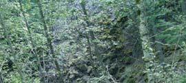
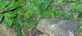
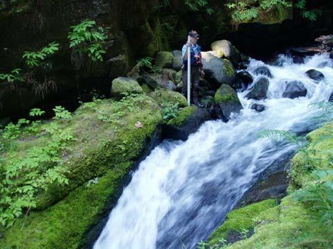
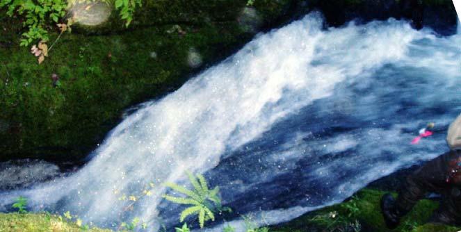
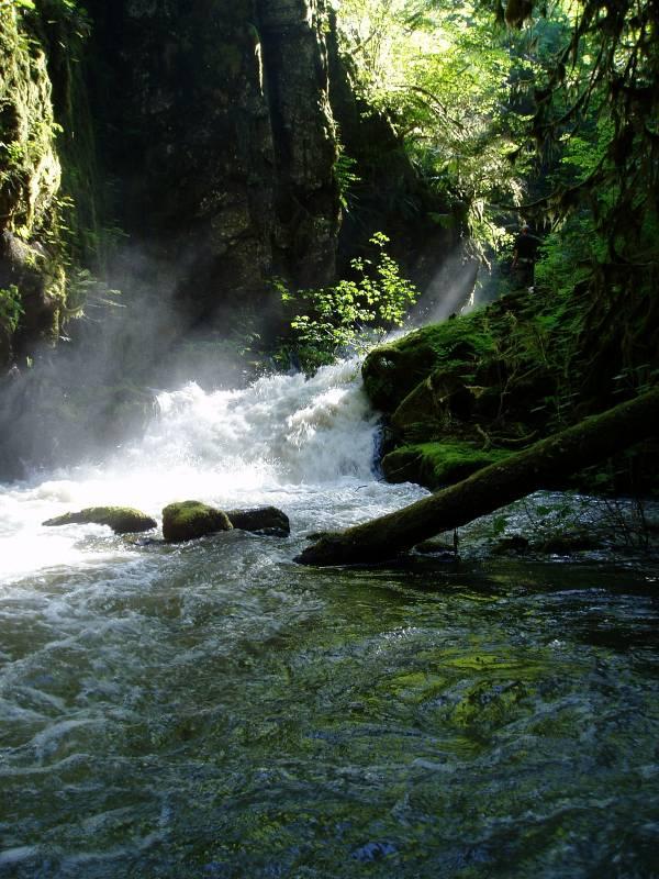
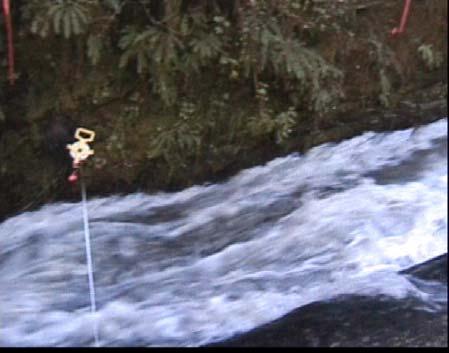
21 Snyder Creek Falls
22 Snyder Creek Pipeline Crossing Plan View
23 Snyder Cr. Crossing Profile View

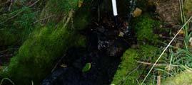
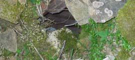
24 Drain and stilling well on Snyder Creek, upstream side of tailrace

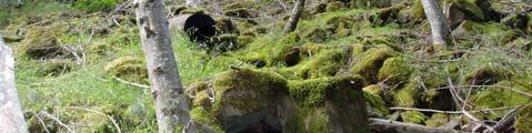
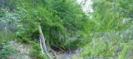
25 Downstream entrance of culvert on Snyder Creek, below tailrace

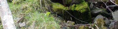
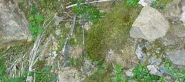
26 Snyder Creek Crossing after November 2006 Flood
27 Conclusions - Culverts The culverts on the Snyder Road at 0.95 miles behind the Pipeline Road Gate and the Pipeline Road Trail No. 74 culverts would not qualify for determination of passage due to lack of fish presence, high gradient, and the seasonal nature of flows at these culverts.
28 Conclusions Culverts (cont d) Art Lake Creek Culvert The overall length of the culvert was 9.93 ft and had a slope of percent. The culvert was dry and had a drop of 2.4 feet to the plunge pool below. Gradient of the areas immediately upstream and downstream of the culvert, however, exceeded 100% and 56%, respectively, and the streambed below the culverts was dry. The lack of perennial flow, high gradient above and below the culvert, and the absence of fish make a full barrier analysis unnecessary. Snyder Creek Culvert Above Powerhouse (Forest Service Road ) The upstream end approximately 1900 ft above the tailrace. The total length of the culvert was 67.9 ft with an outfall drop of 2.87 ft. Water depth inside the culvert was 0.23 ft with no measurable flow. This culvert was determined to be a barrier primarily because of the outfall drop. This culvert is located outside the Project boundary and is not associated with any Project feature; however, it was analyzed since it was the feature which segregated anadromous from resident fish populations. Snyder Creek Culvert at Tailrace Crossing This was found to be passable to adult salmonids. Coho salmon fry, as well as juvenile cutthroat trout, were found in the reach above this Project feature. This feature, however, is in need of repair or replacement, because the culvert is nearly full of gravel and cobble that has washed downstream from Snyder Creek. Note: Culvert is now fully plugged and needs cleaning.
29 Lake Creek Barrier Analysis A total of 11 falls and 23 chutes were noted by the USDA Forest Service (1993) during its survey, and these were verified by EES Consulting in Two barriers were Analyzed for EN in 2004, 2005 and 2006: RM 1.03 RM 1.95
30 Anadromous Salmonid Species Analyzed Steelhead Trout Adult Life Stage Chinook Salmon Adult Life Stage Coho Salmon Adult Life Stage
31 Methods Used Powers and Orsborn (1985) Review from Pat Powers (2006) Anecdotal information from WDFW, others conducting fish passage investigations
32 Analysis of Barriers Fish Entrance Zone Fish Passage Zone Analysis of Falls Analysis of Chutes
33 Table 2 Chute Conditions, Given that Plunge Pool Requirements, Landing Conditions, and Depth of Flow are Sufficient (Powers and Orsborn 1985) 1 Condition If the Velocity of the water > Fish speed Result Velocity Barrier 2 The velocity of the water < fish speed Length of the slope > distance the fish can swim Distance/velocity barrier Length of the slope < distance the fish can swim Passable
34 Classification of Barriers The differential elevation and water velocities are within the swimming and leaping capabilities of the species in question. At higher swimming speeds (> 9 ft/s) leaping is more energetically efficient than swimming (Blake 1983 as cited in Powers and Orsborn 1985). Fish will be attracted to the area of highest momentum (flow times velocity) when migrating upstream; therefore, if multiple paths are present the fish may try to ascend the one with the highest attraction which will be created by the highest combination of drop, velocity, and discharge. Turbulent flow (for white water) with surges, boils, and eddies make it difficult for fish to orientate themselves and make full use of their swimming power.
35 Fish Landing Zone The depth of flow where the fish lands must be equal to or greater than the depth of the fish (generally considered to be 1.0 ft for steelhead). Powers (2006) ft for Spring Chinook, 0.4 ft for steelhead and coho ODFW 0.8 ft for Chinook; 0.6 ft for Steelhead; 0.4 ft for trout (Thompson 1972) The velocity where the fish lands should be within the range of the sustained swimming speed for the species in question. The velocity and depth should be analyzed under a range of fish migration flows
36 Fish Condition Table 3 Fish Condition (C fc ) (from Powers and Orsborn (1985). C fc Fish Condition 1.00 Bright: fresh out of salt water or still a long distance from spawning grounds; spawning colors not yet developed Good: in the river for a short time; spawning colors apparent but not fully developed; still migrating upstream Poor: in the river for a long time; full spawning colors developed and fully mature; very close to spawning grounds
37 Fish Condition When examining a barrier to determine if an absolute barrier, use C f = 1 except In the instance where the fish are delayed and trucked, and not migrating under a natural flow regime which would establish spawning populations above the falls such as for Lake Creek from the Cowlitz River Projects, Mr. Powers suggests that it may make sense to consider a value of 0.5
38 Results Fish Condition in Lake Creek: C f = 0.5 All fish observed were in poor condition All fish had fungus All fish had been trucked from lower Cowlitz WE EVALUATED AT BOTH C f of 1.0 and 0.5.
39 Barrier Location RM 1.03 Table 6 Flows Analyzed at Lake Creek Barriers Date Sept 2, 2004-base July 14, 2004-mid Flow at Drop Structure (cfs) 3 13 Flow at Lower Lake Creek Gage (cfs) Aug 31, 2004-high May 18, 2006-spill * May 23, spill * RM 1.95 Sept. 11, 2005-base Sept. 13, 2005-mid Sept. 15, 2005-high May 18, 2006-spill * May 23, 2006-spill * * Based on stage-discharge relationship; no actual measurements at these flow levels.

40 Barrier at RM 1.03

41 Barrier at RM 1.03 Spill
42 Table 8 Velocities (ft/s) at the Lip of the Falls at Measured Flows Lower Lake Creek Flow Velocity (ft/s) 11 cfs 25 cfs 46 cfs 142 cfs 308 cfs / / / 1/ Measurement not at same location due to safety concerns and lack of purchase to take measurements
43 Table 9 Velocities (ft/s) in the Main Portion of the Chute at Measured Flows Lower Lake Creek Flow 11 cfs 25 cfs 46 cfs 142 cfs 308 cfs Velocity (ft/s) N/A / / 1/ Not measurable; Velocity calculated from Equation 1 estimates peak of ft/sec 2/ Not measured at same location as 11 and 25 cfs due to safety concerns and lack of good purchase.
44 Analysis of Barrier (RM 1.03) at Low Flow Leap 4 feet from a 5.5 foot deep plunge pool and land in a velocity of 8.3 fps Seems passable for adult steelhead, coho and Chinook salmon Swim up a 9 foot long 11% chute with a water velocity of 7.9 fps As long as the depth is 0.4 feet or greater should be passable Enter into a 1.3 foot pool or pocket (turbulent with white water) If this is accurate, I have seen spring chinook (15 lbs.) do this at Shepard Falls on the Wind River and then keep swimming. Change direction and either swim up a 44% slope with velocities in the 9 fps range with a depth of 0.5 feet, or leap a vertical distance of 5 feet with a horizontal of 12 to 13 feet. Given the slope of 44% I feel this is too steep to be considered a chute to swim up. So passage would have to by leaping from the shallow pool. A steelhead leaping at 60 degrees could just make it to the crest, but given the shallow pool depth the leaping ability would be reduced. At higher flows when you get a depth of 2 to 3 feet, steelhead could likely pass. For Coho this would be a barrier. Also, the complexity of the plan view turn would likely reduce leaping capability. Swim 10 feet at a slope of 15% reaching a water velocity of 4.8 fps. Seems passable if fish could reach this point, given that from Figure 10 (Powers and Orsborn) a steelhead could swim over 60 feet in this condition. Note: If you used a CFC of 0.5 it would be a barrier regardless of entrained air and turbulence [Emphasis added].
45 Conclusion Barrier at RM 1.03 The barrier at RM 1.03 is a barrier to Chinook and coho salmon, regardless of condition. If a C f of 0.5 is used for steelhead, this would be a barrier to upstream migration.
46 Barrier at RM 1.95 Classification: This barrier would be classified as a complex falls/chute. Falls at RM Falls, approach or exceed 25 ft in height Chute at backside of falls: 25 rise from barrier cascades near mouth 6 transects to model cascades
47 Table 11 Summary of Hydraulic Information on Transects Evaluated on the Chute at RM 1.95 Flow at Lower Lake Cr. Transect 5 cfs 15 cfs 42 cfs 3 Max Depth Mean Depth Max Velocity Max Depth Mean Depth * Max Velocity

48 RM 1.95 Low Flow
49 Figure 11. Horizontal Profile of Chute at RM Vertical Distance (ft) Horizontal Distance (ft)


50 Barrier at RM 1.95 Middle Flow


51 Barrier at RM 1.95 High Flow Release


52 Barrier at RM 1.95 Spill release of 130 cfs


53 Barrier at RM 1.95 at Spill Release of 291 cfs
54 Conclusions Based on the slopes, all routes over the barrier at RM 1.95 are too steep to be considered chutes. Looking at them for passage over a falls the drops exceed all capabilities of fish (Powers, personal communication, November 18, 2006). This is a barrier to all anadromous salmonids that could be present in Lake Creek and the upper Cowlitz River, regardless of fish condition.
55 Lake Creek Barriers Falls at RM 1.95 is a barrier to all anadromous species, life stages and condition factors Chute at RM 1.03 is a barrier to Chinook and coho salmon regardless of fish condition factor. Chute at RM 1.03 is a barrier to Steelhead IF C f = 0.5; If C f = 1.0, steelhead could pass this barrier.
56 Hall Creek Flume Passage was evaluated in 2004 Conclusion: Hall Creek is passable at all flows. The area that Hall Creek drains is extremely low gradient. Hall Creek tends to inundate a wide area laterally. However, Hall Creek does have a main channel and its thalweg, where it crosses under the tailrace flume, was over 3.0 ft in depth. With a cross-sectional area of 100 ft2, the opening under Hall Creek can easily accommodate fish passage at much higher flows without creating any velocity barriers to fish under these conditions. Adult coho salmon observed spawning upstream of flume above Snyder Road.

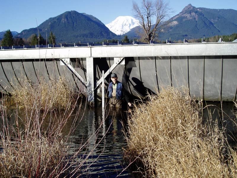
57 Hall Creek Flume
INTERIM REPORT LAKE CREEK ANADROMOUS BARRIER ANALYSIS
 INTERIM REPORT LAKE CREEK ANADROMOUS BARRIER ANALYSIS Prepared for Energy Northwest Prepared by EES Consulting JULY 2005 INTERIM REPORT LAKE CREEK ANADROMOUS BARRIER ANALYSIS SECTION 1: INTRODUCTION In
Study Update Tailrace Slough Use by Anadromous Salmonids
 Study Update Tailrace Slough Use by Anadromous Salmonids Goals and Objectives Identify what anadromous salmonids use the tailrace slough by: Life Stage (Juvenile, migrating and spawning adults) Timing
Study Update Fish Distribution and Species Composition
 Study Update Fish Distribution and Species Composition Goals and Study Area Gain a better understanding of fish species composition and abundance in waters associated with the Packwood Lake Hydroelectric
Interim Guidance Fish Presence Absence
 Interim Guidance Fish Presence Absence Source: Forest Practices Act Guidance for Division 635 of the forest practices act dealing with stream classification when no fish surveys have been done (referenced
Packwood Lake Intake Screen Velocity Test Report for Energy Northwest's Packwood Lake Hydroelectric Project FERC No Lewis County, Washington
 for Energy Northwest's Packwood Lake Hydroelectric Project FERC No. 2244 Lewis County, Washington Submitted to P.O. Box 968 Richland, Washington 99352-0968 Submitted by EES Consulting 1155 North State
FSOC Upstream Fish Passage Guidance Document
 FSOC Upstream Fish Passage Guidance Document STEP 1: Identify species and life stages in need of fish passage STEP 2: Identify fishway options and species applicability STEP 3 Fish passage criteria review
South Fork Chehalis Watershed Culvert Assessment
 South Fork Chehalis Watershed Culvert Assessment Water Resource Inventory Area 23 Lewis County Conservation District Final Report By: Kelly Verd and Nikki Wilson March 2003 Funded by: The Washington State
Project Award Presentation
 University of Massachusetts Amherst ScholarWorks@UMass Amherst International Conference on Engineering and Ecohydrology for Fish Passage International Conference on Engineering and Ecohydrology for Fish
Newaukum Watershed Culvert Assessment
 Newaukum Watershed Culvert Assessment Water Resource Inventory Area 23 Lewis County Conservation District Final Report By: Kelly Verd and Nikki Wilson July 2002 Funded by: Chehalis Fisheries Restoration
Five Counties Salmonid Conservation Program - Fish Passage Design Workshop. February 2013
 Program - Aquatic Organisms and Stream Crossings Ecological Connectivity A watershed is a network of channels that drain a common boundary. Channel characteristics formed by interaction of precipitation,
Final Bull Trout Genetics Monitoring Plan for the Wallowa Falls Hydroelectric Project. (FERC No. P-308) June 2017
 June 2017") Final for the Wallowa Falls Hydroelectric Project (FERC No. P-308) June 2017 Prepared by: Jeremiah Doyle PacifiCorp 825 NE Multnomah Street Portland, OR 97232 June, 2017 Page 1 of 8 Table of Contents 1.0
Final for the Wallowa Falls Hydroelectric Project (FERC No. P-308) June 2017 Prepared by: Jeremiah Doyle PacifiCorp 825 NE Multnomah Street Portland, OR 97232 June, 2017 Page 1 of 8 Table of Contents 1.0
4.4 ASSESSMENT OF POTENTIAL ANADROMOUS FISH HABITAT UPSTREAM OF MERWIN DAM (AQU 4)
") 4.4 ASSESSMENT OF POTENTIAL ANADROMOUS FISH HABITAT UPSTREAM OF MERWIN DAM (AQU 4) 4.4.1 Study Objectives The objectives of this study are to: (1) delineate the stream segments in the upper North Fork
4.4 ASSESSMENT OF POTENTIAL ANADROMOUS FISH HABITAT UPSTREAM OF MERWIN DAM (AQU 4) 4.4.1 Study Objectives The objectives of this study are to: (1) delineate the stream segments in the upper North Fork
BATTLE CREEK FISHERIES STUDIES TASK 4: SURVEYS OF BARRIERS TO THE UPSTREAM MIGRATION OF ANADROMOUS SALMONIDS
 BATTLE CREEK FISHERIES STUDIES TASK 4: SURVEYS OF BARRIERS TO THE UPSTREAM MIGRATION OF ANADROMOUS SALMONIDS Prepared for: California Department of Fish and Game Redding, California 96001 Prepared by:
Washington State Fish Passage Barrier Removal Projects. Casey Kramer, PE WSDOT State Hydraulics Engineer
 Washington State Fish Passage Barrier Removal Projects Casey Kramer, PE WSDOT State Hydraulics Engineer 2014 National Hydraulic Engineering Conference Iowa City, IA August 20 th, 2014 WSDOT Fish Passage
Packwood Lake Hydroelectric Project (FERC No. P-2244) Anadromous Salmonid Habitat and Spawner Survey Report
 Anadromous Salmonid Habitat and Spawner Survey Report") Packwood Lake Hydroelectric Project (FERC No. P-2244) Anadromous Salmonid Habitat and Spawner Survey Report Prepared For Prepared By EES Consulting 1155 N. State Street, Suite 700 Bellingham, WA 98225
Packwood Lake Hydroelectric Project (FERC No. P-2244) Anadromous Salmonid Habitat and Spawner Survey Report Prepared For Prepared By EES Consulting 1155 N. State Street, Suite 700 Bellingham, WA 98225
Aquatic Organism Passage at Road-Stream Crossings CHUCK KEEPORTS FOREST HYDROLOGIST ALLEGHENY NATIONAL FOREST WARREN, PENNSYLVANIA
 Aquatic Organism Passage at Road-Stream Crossings CHUCK KEEPORTS FOREST HYDROLOGIST ALLEGHENY NATIONAL FOREST WARREN, PENNSYLVANIA TOPICS COVERED Aquatic Organism Passage (AOP) Benefits of AOP Crossings
FISH PASSAGE IMPROVEMENT in California s Watersheds. Assessments & Recommendations by the Fish Passage Forum
 FISH PASSAGE IMPROVEMENT in California s Watersheds Assessments & Recommendations by the Fish Passage Forum FISH PASSAGE IMPROVEMENT in California s Watersheds The mission of the Fish Passage Forum is
Southern Oregon Coastal Cutthroat Trout
 Species Management Unit Description Southern Oregon Coastal Cutthroat Trout The Southern Oregon Coastal Cutthroat Trout SMU includes all populations of cutthroat trout inhabiting ocean tributary streams
WHATCOM COUNTY FISH PASSAGE BARRIER INVENTORY FINAL REPORT
 WHATCOM COUNTY FISH PASSAGE BARRIER INVENTORY FINAL REPORT January, 2006 IAC Project Number: 01-1258 N Project Sponsor: Whatcom County Public Works 5280 Northwest Drive, Suite C Bellingham, WA 98226 Grant
Fish Passage Culvert Assessment for Cahilty Creek Watershed FIA Project #
 Fish Passage Culvert Assessment for Cahilty Creek Watershed FIA Project # 4602004 Prepared for Weyerhaeuser Company Ltd. Jason Ladyman R.P.F. 1550 Mission Flats Road PO Box 40 Kamloops BC V2C 5K3 Prepared
CALIFORNIA SALMONID STREAM HABITAT RESTORATION MANUAL APPENDIX IX-A CULVERT CRITERIA FOR FISH PASSAGE INTRODUCTION
 APPENDIX IX-A STATE OF CALIFORNIA RESOURCES AGENCY DEPARTMENT OF FISH AND GAME CULVERT CRITERIA FOR FISH PASSAGE For habitat protection, ecological connectivity should be a goal of stream-road crossing
2 nd Steelhead Summit. October 27 & 28, 2016 in San Luis Obispo, CA
 + 2 nd Steelhead Summit October 27 & 28, 2016 in San Luis Obispo, CA 1 + Session Overview Sponsors: California Trout City of San Luis Obispo Sustainable Conservation California Conservation Corps Cachuma
Understanding the Impacts of Culvert Performance on Stream Health
 Understanding the Impacts of Culvert Performance on Stream Health Kristin Thomas Aquatic Ecologist Michigan Trout Unlimited Transportation and the Environment Conference 12/5/2018 Importance of adequately
Summary of the Pilot Assessment of Three Potential Fish Barriers on Battle Creek
 Summary of the Pilot Assessment of Three Potential Fish Barriers on Battle Creek Laurie A. Earley March 2014 U.S. Fish and Wildlife Service, Red Bluff Fish and Wildlife Office 10950 Tyler Road, Red Bluff,
Culvert Design for Low and High Gradient Streams in the Midwest. Dale Higgins, Hydrologist Chequamegon-Nicolet National Forest
 Culvert Design for Low and High Gradient Streams in the Midwest Dale Higgins, Hydrologist Chequamegon-Nicolet National Forest Overview Culvert Design Considerations Hydraulic Terms Culvert Impacts Low
Session C9: Priest Rapids Fish Bypass: A Case Study from Start to Finish
 University of Massachusetts - Amherst ScholarWorks@UMass Amherst International Conference on Engineering and Ecohydrology for Fish Passage International Conference on Engineering and Ecohydrology for Fish
SELBY CREEK SILVERADO TRAIL CULVERT FISH PASSAGE ASSESSMENT
 SELBY CREEK SILVERADO TRAIL CULVERT FISH PASSAGE ASSESSMENT NAPA COUNTY, CALIFORNIA PREPARED BY NAPA COUNTY RESOURCE CONSERVATION DISTRICT 1303 JEFFERSON ST. SUITE 500B NAPA, CALIFORNIA 94559 WWW.NAPARCD.ORG
Fish Passage at Road Crossings Assessment Boise National Forest FY 2004
 Culvert Inventory Summary 2004 - Boise National Forest Fish Passage at Road Crossings Assessment Boise National Forest FY 2004 Feather River at Road #135 Crossing By Michael S. Kellett, Fishery Biologist
STREAM SURVEY File form No..
 scanned for KRIS THE RESOURCES AGENCY OF CALIFORNIA California Department of Fish and Game STREAM SURVEY File form No.. Date: September 4, 1969. NAME: North Fork Schooner Gulch Creek COUNTY: Mendocino.
A THESIS M.S. CIVIL ENGINEERING UNIVERSITY OF ALASKA ANCHORAGE ALEXANDRA WEST JEFFERIES, P.E.
 Assessing Fish Passage Success in Culvert Structures with the Development of a Two-Dimensional Algorithm Considering Physical Capabilities of Juvenile Salmonids ALEXANDRA WEST JEFFERIES, P.E. A THESIS
OREGON DEPARTMENT OF FISH AND WILDLIFE ROGUE FISH DISTRICT REPORT
 OREGON DEPARTMENT OF FISH AND WILDLIFE ROGUE FISH DISTRICT REPORT TITLE: Upper Rogue Smolt Trapping Project, 1999 STREAM: Big Butte, Little Butte, South Fork Big Butte, Slate and West Fork Evans Creeks
MINISTRY OF ENVIRONMENT ENVIRONMENTAL STEWARDSHIP DIVISION FISH AND WILDLIFE BRANCH. Horsefly River Angling Management Plan
 MINISTRY OF ENVIRONMENT ENVIRONMENTAL STEWARDSHIP DIVISION FISH AND WILDLIFE BRANCH Horsefly River Angling Management Plan January 30 th, 2006 Area/Fishery Description The Horsefly River watershed provides
Simulating Streams Through Culverts in Mat-Su, Alaska
 Simulating Streams Through Culverts in Mat-Su, Alaska Project Managers Bill Rice, P.E., USFWS Hydrologist Mary Price, USFWS Fishery Biologist The Team Approach US Fish and Wildlife Service Bill Rice, P.E.,
HEC 26 Aquatic Organism Passage Design Manual Evolution & Application
 HEC 26 Aquatic Organism Passage Design Manual Evolution & Application Sven Leon, P.E., Hydraulics Engineer Federal Highway Administration 2015 Alaska Fish Passage Meeting October 13 14, 2015 VTRC, Juneau,
Colusa Basin Drain Watershed Fish Stranding Tour Concept Paper Mike Hendrick and Brycen Swart NMFS
 Colusa Basin Drain Watershed Fish Stranding Tour Concept Paper Mike Hendrick and Brycen Swart NMFS On May 31, 2013 representatives from CDFW, USFWS, and NMFS went on a field tour to look at locations in
Final Bull Trout Redd Monitoring Report for the Wallowa Falls Hydroelectric Project
 Final for the Wallowa Falls Hydroelectric Project East Fork Wallowa River barrier to upstream fish migration, photo courtesy of Kendrick Moholt (FERC No. P-308) December 18, 2017 Prepared by: Jeremiah
APPENDIX B. Final reports on chinook salmon spawning surveys - Sultan River, Washington Report
 APPENDX B Final reports on chinook salmon spawning surveys - Sultan River, Washington B-1. B-2. 1987 Report. 1988 Report APPENDX B-l Final report on 1987 chinook spawning survey - Sultan River, Snohomish
Plan B Dam Breach Assessment
 Plan B Dam Breach Assessment Introduction In support of the Local Sponsor permit applications to the states of Minnesota and North Dakota, a dam breach analysis for the Plan B alignment of the Fargo-Moorhead
Project Report for Marsh Creek and Albion River Instream Fish Barrier Removal Flynn Creek Road, CR 135, M.P. 8.1 and 8.3
 Project Report for Marsh Creek and Albion River Instream Fish Barrier Removal Flynn Creek Road, CR 135, M.P. 8.1 and 8.3 Project Title: Marsh Creek and Albion River Instream Fish Barrier Removal, Flynn
REVISED DRAFT HABITAT SUITABILITY CURVES and COHO SALMON and STEELHEAD TROUT. Sawmill Creek Alaska
 REVISED DRAFT HABITAT SUITABILITY CURVES and COHO SALMON and STEELHEAD TROUT Sawmill Creek Alaska Blue Lake Hydroelectric Project, FERC No. 2230, Relicensing Prepared by: City and Borough of Sitka ( City
Big Spring Creek Habitat Enhancement and Fishery Management Plans
 Big Spring Creek Habitat Enhancement and Fishery Management Plans November 5, 2012 Big Spring Events and Activities Center Newville, PA Charlie McGarrell Regional Habitat Biologist Pennsylvania Fish and
Potlatch River Drainage: Salmonid Presence: Largest lower Clearwater River tributary
 X Y Potlatch River Drainage: Largest lower Clearwater River tributary Area = 1500 km 2 Mouth ~ 13 km upstream of Snake/Clearwater confluence X Y Dominated by private land Salmonid Presence: Steelhead,
Proposed Habitat Suitability Criteria (HSC) Curves For Application in Habitat Flow Modeling For the Sultan River Instream Flow Study RSP 3
 Curves For Application in Habitat Flow Modeling For the Sultan River Instream Flow Study RSP 3") - - Proposed Habitat Suitability Criteria (HSC) Curves For Application in Habitat Flow Modeling For the Sultan River Instream Flow Study RSP 3 Prepared for: Public Utility District No. 1 of Snohomish County
- - Proposed Habitat Suitability Criteria (HSC) Curves For Application in Habitat Flow Modeling For the Sultan River Instream Flow Study RSP 3 Prepared for: Public Utility District No. 1 of Snohomish County
Discussion on the Selection of the Recommended Fish Passage Design Discharge
 Discussion on the Selection of the Recommended Fish Passage Design Discharge Introduction The provision of fish passage is a requirement for most proposed culvert and bridge installations in Alberta, depending
An Investigation of the Hydraulics in a Prototype Pool-and-Chute, Vortex Weir Fishway for Anadromous Fish Passage
 University of Massachusetts Amherst ScholarWorks@UMass Amherst International Conference on Engineering and Ecohydrology for Fish Passage International Conference on Engineering and Ecohydrology for Fish
Lake Merwin and Swift Creek Reservoir Tributaries. Bull Trout Limiting Factors Analysis
 Lake Merwin and Swift Creek Reservoir Tributaries Bull Trout Limiting Factors Analysis Study Objectives Answer Key? s Do other tributaries to Swift Creek Reservoir and Lake Merwin not known to support
Fish Passage Assessment of Private Stream Crossings on Lower Stonybrook Creek
 Fish Passage Assessment of Private Stream Crossings on Lower Stonybrook Creek Prepared by: Michael Love & Associates In cooperation with: Center for Ecosystem Management and Restoration Funded by: Coastal
Union Pacific Railroad
 Input Questions: 404/401 Pre Application Meeting, December 18, 2013, Portland, Oregon 1. What is the project purpose and need? The purpose of the project is to improve the efficiency and average velocity
Abundance of Steelhead and Coho Salmon in the Lagunitas Creek Drainage, Marin County, California
 scanned for KRIS Abundance of Steelhead and Coho Salmon in the Lagunitas Creek Drainage, Marin County, California Prepared for: Marin Municipal Water District 220 Nellen Drive Corte Madera, California
FINAL REPORT. Yonkers Creek Migration Barrier Removal Project Wonderstump Road Del Norte County. Submitted By:
 FINAL REPORT Yonkers Creek Migration Barrier Removal Project Wonderstump Road Del Norte County Submitted By: Del Norte County Community Development Department Yonkers Creek Migration Barrier Removal Project
BC Ministry of Forests. March Fish Stream Crossing Guidebook. Forest Practices Code of British Columbia.
 FRST 557 Lecture 7c Bridges and Culverts: Water Velocity and Discharge Lesson Background and Overview: The previous two lessons presented methods for estimating water volume flow at a particular site and
Oregon Coast Coastal Cutthroat Trout
 Oregon Coast Coastal Cutthroat Trout Species Management Unit Description The Oregon Coast Coastal Cutthroat Trout Species Management Unit (SMU) includes all populations of cutthroat trout inhabiting ocean
Sub-watershed Summaries
 Project Description The Salmon Drift Creek Watershed Council (SDCWC) has focused their efforts in the Salmon River estuary for the past few years. The multifaceted partnership effort is nearing completion
Hydraulic Modeling of Stream Enhancement Methods
 Hydraulic Modeling of Stream Enhancement Methods Matthew J. Curry John J. Levitsky Abstract Development within watersheds increases the amounts of runoff causing stream erosion and degradation of stream
Redd Dewatering and Juvenile Salmonid Stranding in the Lower Feather River,
 Redd Dewatering and Juvenile Salmonid Stranding in the Lower Feather River, 2005-2006 Interim Report for NOAA Fisheries Prepared by: California Department of Water Resources Division of Environmental Services
Follow this and additional works at:
 University of Massachusetts Amherst ScholarWorks@UMass Amherst International Conference on Engineering and Ecohydrology for Fish Passage International Conference on Engineering and Ecohydrology for Fish
Subject: Developed fish ladder alternatives for Pastori Avenue at San Anselmo Creek
 Page 1 of 18 SENT VIA EMAIL Sandra Guldman Friends of Corte Madera Creek Watershed Box 415 Larkspur, CA 94977 Subject: Developed fish ladder alternatives for Pastori Avenue at San Anselmo Creek Dear Sandra,
Design Report for Janes Creek Roughened Channel
 August 12, 2005 Design Report for Janes Creek Roughened Channel Table of Contents Project Description...1 Overview of Report...1 Background...2 Design Flows...3 Roughened Channel Design...6 Fish Passage
Assessment of Baseline Geomorphic Features at. Proposed Stream Crossings On The Proposed County Road 595. Marquette County, Michigan
 Assessment of Baseline Geomorphic Features at Proposed Stream Crossings On The Proposed County Road 595 Marquette County, Michigan Prepared for: Kennecott Eagle Minerals Company Marquette, Michigan Prepared
STEELHEAD SURVEYS IN OMAK CREEK
 STEELHEAD SURVEYS IN OMAK CREEK 2002 Annual Report Prepared by Chris Fisher John Arterburn Colville Confederated Tribes Fish and Wildlife Department P.O. Box 150 Nespelem, WA 99155 Prepared for Project
(Revised February,2005) CULVERTS, BRIDGES, AND FORDS
 CULVERTS, BRIDGES, AND FORDS") GUIDE TO STREAM CROSSINGS (Revised February,2005) CULVERTS, BRIDGES, AND FORDS Culverts, bridges, and fords are all methods used to cross-streams. Culverts are the most common stream crossing structure.
GUIDE TO STREAM CROSSINGS (Revised February,2005) CULVERTS, BRIDGES, AND FORDS Culverts, bridges, and fords are all methods used to cross-streams. Culverts are the most common stream crossing structure.
Fish Passage Design Aids Wildlife Crossing in Washington State State of the Practice
 Fish Passage Design Aids Wildlife Crossing in Washington State State of the Practice 0 Submission date: November, 0 Word Count:, Jon Peterson, corresponding author (0-0-, peterjn@wsdot.wa.gov) Fish Passage
Fish Migration Barrier Severity and Steelhead Habitat Quality in the Malibu Creek Watershed
 Fish Migration Barrier Severity and Steelhead Habitat Quality in the Malibu Creek Watershed Produced for California State Coastal Conservancy and California Department of Parks and Recreation By: Heal
Components of a Barrage
 Components of a Barrage Definition The only difference between a weir and a barrage is of gates, that is the flow in barrage is regulated by gates and that in weirs, by its crest height. Barrages are costlier
STREAM CLASSIFICATION AND MAPPING. Prepared For. MacMillan Bloedel Ltd. Menzies Bay Division BOX 6000, Campbell River V9W 5E1.
 STREAM CLASSIFICATION AND MAPPING OF STREAMS IN MENZIES AND OYSTER BAY Prepared For MacMillan Bloedel Ltd. Menzies Bay Division BOX 6000, Campbell River V9W 5E1 September 1998 a a North Island Biological
Juvenile Salmonid Emigration Monitoring in the Middle Sacramento River. Diane Coulon California Department of Fish and Wildlife
 Juvenile Salmonid Emigration Monitoring in the Middle Sacramento River Diane Coulon California Department of Fish and Wildlife Monitoring is conducted primarily to develop information on emigration timing
Fish Passage Culvert Inspection (FPCI) Nicklen Creek Watershed
 Nicklen Creek Watershed") Fish Passage Culvert Inspection (FPCI) Nicklen Creek Watershed FPCI Sites funded by FIA Prepared for: Tolko Industries Ltd., Okanagan Regional Woodlands & British Columbia Timber Sales, Okanagan-Shuswap
Fish Passage Culvert Inspection (FPCI) Nicklen Creek Watershed FPCI Sites funded by FIA Prepared for: Tolko Industries Ltd., Okanagan Regional Woodlands & British Columbia Timber Sales, Okanagan-Shuswap
Trout Unlimited Comments on the Scope of Environmental Impact Statement for the Constitution Pipeline Project, Docket No. PF12-9
 October 9, 2012 Kimberly D. Bose, Secretary Federal Energy Regulatory Commission 888 First Street, NE, Room 1A Washington, DC 20426 RE: Trout Unlimited Comments on the Scope of Environmental Impact Statement
Susitna-Watana Hydroelectric Project (FERC No )
") (FERC No. 14241) Study of Fish Passage Barriers in the Middle and Upper Susitna River and Susitna Tributaries Study Plan Section 9.12 Final Study Plan July 2013 9.12. Study of Fish Passage Barriers in
(FERC No. 14241) Study of Fish Passage Barriers in the Middle and Upper Susitna River and Susitna Tributaries Study Plan Section 9.12 Final Study Plan July 2013 9.12. Study of Fish Passage Barriers in
Klamath Lake Bull Trout
 Klamath Lake Bull Trout Existing Populations The Klamath Lake Bull Trout SMU is comprised of seven existing populations and four populations classified as extinct or functionally extinct (Table 189). Populations
Warner Lakes Redband Trout
 Warner Lakes Redband Trout Existing Populations Warner Valley is an endorheic basin that contains a complex series of interconnected lakes, marshes, sloughs, and potholes, all of which are remnants of
USING A LABYRINTH WEIR TO INCREASE HYDRAULIC CAPACITY. Dustin Mortensen, P.E. 1 Jake Eckersley, P.E. 1
 USING A LABYRINTH WEIR TO INCREASE HYDRAULIC CAPACITY Dustin Mortensen, P.E. 1 Jake Eckersley, P.E. 1 Plum Creek Floodwater Retarding Structure No. 6 is located in an area of Kyle, Texas, that is currently
Executive Summary. Map 1. The Santa Clara River watershed with topography.
 Santa Clara River Steelhead Trout: Assessment and Recovery Opportunities December 2005 Prepared By: Matt Stoecker and Elise Kelley, Ph.D. University of California, Santa Barbara Prepared For: The Santa
Chadbourne Dam Repair and Fish Barrier
 Chadbourne Dam Repair and Fish Barrier Final Report for the Western Native Trout Initiative Prepared by: Carol Endicott Yellowstone Cutthroat Trout Conservation Biologist Montana Fish, Wildlife & Parks
Project Completion Abstract Fish Passage Activity ( Engineering Activities)
") Project Completion Abstract Fish Passage Activity ( Engineering Activities) SUBMIT COMPLETED FORM TO DISTRICT MANAGER AND FIA ADMINISTRATOR AFTER PROJECT COMPLETION SECTION A GENERAL INFORMATION Recipient:
Project Completion Abstract Fish Passage Activity ( Engineering Activities) SUBMIT COMPLETED FORM TO DISTRICT MANAGER AND FIA ADMINISTRATOR AFTER PROJECT COMPLETION SECTION A GENERAL INFORMATION Recipient:
CHAPTER 5 CULVERT DESIGN
 CHAPTER 5 CULVERT DESIGN HYDRAULICS OF CULVERTS There are two major types of culvert flow: 1) flow with inlet control, and 2) flow with outlet control. For each type, different factors and formulas are
Identifying Areas with Potential to Contain High Value Fish Habitat (HVFH) June 2007
 June 2007") Identifying Areas with Potential to Contain High Value Fish Habitat (HVFH) June 2007 1 High Value Fish Habitat INTENT: To apply added precautionary protection to those special areas deemed of high value
Identifying Areas with Potential to Contain High Value Fish Habitat (HVFH) June 2007 1 High Value Fish Habitat INTENT: To apply added precautionary protection to those special areas deemed of high value
LONE TREE POCKET ESTUARY RESTORATION 2004 FISH SAMPLING AND PRE-RESTORATION PROJECT MONITORING REPORT
 Skagit River System Cooperative 11426 Moorage Way P.O. Box 368 LaConner, WA 98257-368 Phone: 36-466-7228 Fax: 36-466-447 www.skagitcoop.org LONE TREE POCKET ESTUARY RESTORATION 24 FISH SAMPLING AND PRE-RESTORATION
Guidance Note. Hydropower Guidance Note: HGN 8 Fish Passage. When do you need to install a fish pass?
 Guidance Note Hydropower Guidance Note: This guidance note is not intended as a statement of law. It should be read in combination with, and in the context of, the relevant enactments and EU obligations.
Study No. 18. Mystic Lake, Montana. PPL Montana 45 Basin Creek Road Butte, Montana 59701
 Study No. 18 Evaluation of the Current Fish Population and Habitat in West Rosebud Creek Downstream from Emerald Lake Mystic Lake Hydroelectric Project FERC No. 2301 Mystic Lake, Montana PPL Montana 45
August 11 Snorkel SCC side channel network (SBA, SCC3) feet 707
 feet 707") Date Survey Type Habitat July 29 Snorkel (reconnaissance) Table 1. Fish use survey schedule 2004 Water temperature 1 (ºC) Estimated Mean visibility 2 discharge 3 (cfs) Mainstem (units #1 42) ND ND 814
Date Survey Type Habitat July 29 Snorkel (reconnaissance) Table 1. Fish use survey schedule 2004 Water temperature 1 (ºC) Estimated Mean visibility 2 discharge 3 (cfs) Mainstem (units #1 42) ND ND 814
OPEN CHANNEL FLOW WORKSHEET 3 WATER SURFACE PROFILES
 Learning Objectives OPEN CHANNEL FLOW WORKSHEET 3 WATER SURFACE PROFILES 1. Learn about gradually varied flow and rapidly varying flow 2. Discuss different types of water surface profiles 3. Discuss the
Mid-Columbia Fisheries Enhancement Group Annual Report Fiscal Year 06: July 1, 2005 June 30, 2006
 Mid-Columbia Fisheries Enhancement Group Annual Report Fiscal Year 06: July 1, 2005 June 30, 2006 Mission Statement The mission of the Mid-Columbia Fisheries Enhancement Group is to restore self-sustaining
SALMON FACTS. Chinook Salmon. Oncorhynchus tshawytscha
 SALMON FACTS Chinook Salmon Oncorhynchus tshawytscha Other names: king, tyee, blackmouth (immature) Average size: 10-15 lbs, up to 135 lbs Fall spawner; fall, spring, and summer runs Chinook salmon are
Job 1. Title: Estimate abundance of juvenile trout and salmon.
 STUDY PERFORMANCE REPORT State: Michigan Project No.: F-53-R-13 Study No.: 461 Title: Population dynamics of juvenile rainbow trout and coho salmon in Lake Superior tributaries Period Covered: April 1,
Blue Creek Chinook Outmigration Monitoring Technical Memorandum
 Blue Creek Chinook Outmigration Monitoring 2012 Technical Memorandum Prepared by: Andrew Antonetti and Erika Partee Yurok Tribe Fisheries Program PO Box 1027 Klamath, California 95548 In Partnership with:
CUSHMAN RESERVOIRS. Skokomish Watershed Monitoring Conference - Public Meeting Florian Leischner 9/17/2015
 CUSHMAN RESERVOIRS Skokomish Watershed Monitoring Conference - Public Meeting Florian Leischner 9/17/2015 CUSHMAN RESERVOIRS MONITORING Management and monitoring of Tacoma Power reservoirs Lake Cushman
Minnesota Department of Natural Resources Division of Fish and Wildlife Section of Fisheries. Stream Survey Report. Luxemburg Creek.
 Minnesota F-29-R(P)-24 Area 315 Study 3 March 2016 Minnesota Department of Natural Resources Division of Fish and Wildlife Section of Fisheries Stream Survey Report Luxemburg Creek 2015 Mark Pelham Sauk
Estimating Summer Steelhead Escapement using Redd Surveys: What have we learned and where do we go? Jim Ruzycki Oregon Department of Fish & Wildlife
 Estimating Summer Steelhead Escapement using Redd Surveys: What have we learned and where do we go? Jim Ruzycki Oregon Department of Fish & Wildlife Spawner Abundance for the John Day Summer Steelhead
Ecology of stream-rearing salmon and trout Part II
 Ecology of stream-rearing salmon and trout Part II Individual Feeding territory Habitat use Growth Movement Survival Population Population Abundance Density Variation Movement Individual Relationship between
Spokane River Fish and Flows Recommendations and Rationale September Hal Beecher Washington Department of Fish and Wildlife
 Spokane River Fish and Flows Recommendations and Rationale September 2012 Hal Beecher Washington Department of Fish and Wildlife Spokane River hydrology and channel: Background Modified hydrology, but
Rogue Winter Steelhead
 Rogue Winter Steelhead Existing Populations The Rogue Winter Steelhead SMU includes eight populations within the Klamath Mountains Province (KMP) in southwest Oregon (Table 93). None of the populations
Assessing Ecosystem Impacts from Road Stream Crossings through Community Involvement
 Assessing Ecosystem Impacts from Road Stream Crossings through Community Involvement Background Why is the NH Fish and Game Department interested in culverts? Block fish migration Reduce opportunities
THE CONFEDERATED TRIBES OF THE WARM SPRINGS RESERVATION OF OREGON
 THE CONFEDERATED TRIBES OF THE WARM SPRINGS RESERVATION OF OREGON To: Branch of Natural Resources P.0. Box C, Warm Springs, Oregon 97761 Phone (541) 553-2002/2003 Fax (541) 553-1994 The Independent Science
The Calawah River System
 The Calawah River System The Calawah River is the largest tributary of the Bogachiel River and is formed by the confluence of the north and south forks of the Calawah. The two forks of the Calawah, CALAWAH
Stream Assessment Cut-block: For: Island Timberlands Limited Partnership, Cameron Operation
 Stream Assessment Cut-block: 171214 For: Island Timberlands Limited Partnership, Cameron Operation Tony Norris Area Engineer Island Timberlands Cameron Operation Port Alberni D.G. Rigets E.I.A. CTech.
Chapter 11. Culverts and Bridges Design Checklist for Culvert Design
 Yes No N/A Design Requirements I. GENERAL DESIGN GUIDELINES Chapter 11. Culverts and Bridges A. Culvert design is in accordance with the Culverts chapter of Volume 2 of the UDFCD Manual for additional
Michigan Department of Natural Resources Status of the Fishery Resource Report Page 1
 Michigan Department of Natural Resources 2008-59 Status of the Fishery Resource Report Page 1 Bowens Manistee County, (T24N R16W Sec. 11, 12, 13, 14, 15, 24, and 30). Last surveyed 2008 Mark A. Tonello
Amendment to a Biological Assessment/Evaluation completed for the Coon Creek Land Disposal completed December Grand Valley Ranger District
 Amendment to a Biological Assessment/Evaluation completed for the Coon Creek Land Disposal completed December 2007 Grand Valley Ranger District Grand Mesa, Uncompahgre, Gunnison National Forests Prepared
Fremont Weir Fish Passage Proof of Concept. Final Engineering Report
 Department of Water Resources FloodSAFE Environmental Stewardship and Statewide Resources Office Fish Passage Improvement Program Fremont Weir Fish Passage Proof of Concept Final Engineering Report This