Management of headwater streams in the White Mountain National Forest
|
|
|
- Frederica Norris
- 6 years ago
- Views:
Transcription

1 Management of headwater streams in the White Mountain National Forest

2 White Mountain National Forest Weeks Act of 1911 authorized the federal government to purchase lands east of the Mississippi River for the National Forest System. White Mountain National Forest was created in 1918 and consisted of 7000 acres. Today the WMNF consists of approximately 800,000 acres.

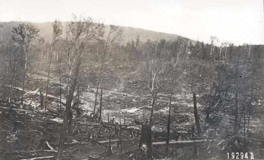

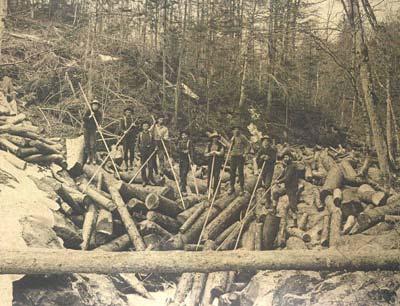
3 Before the Weeks Act.

4 Land Management Today Land and Resource Management Plan for the WMNF

 in a manner that will protect self-sustaining populations of indigenous fish species.")
5 2005 WMNF Land and Resource Management Plan Riparian and Aquatic Habitats Goals: Protect, restore, or improve riparian area conditions to benefit riparian dependent resources and values. Manage riparian areas to provide coldwater, coolwater, and warmwater aquatic communities within the ecological capability of the landscape. Restore and improve self-sustaining indigenous populations and their habitats. Provide a range of recreational fishing opportunities (stocked as well as wild trout) in a manner that will protect self-sustaining populations of indigenous fish species. Objective: Restore or improve 5-10 miles of stream habitat per year over the planning period with emphasis on HUC 6 level watersheds.
6 Time Scales of Recovery from Land Use Conversion Rapid (< 10 years) - hydrology, chemistry Intermediate ( years) shading/temperature, sediment regime (some aspects) Long (> 100 years) Large Woody Debris (LWD), Channel Complexity


7 New Hampshire s State Freshwater Fish.. Eastern Brook Trout Hatchery? Wild?... Native?


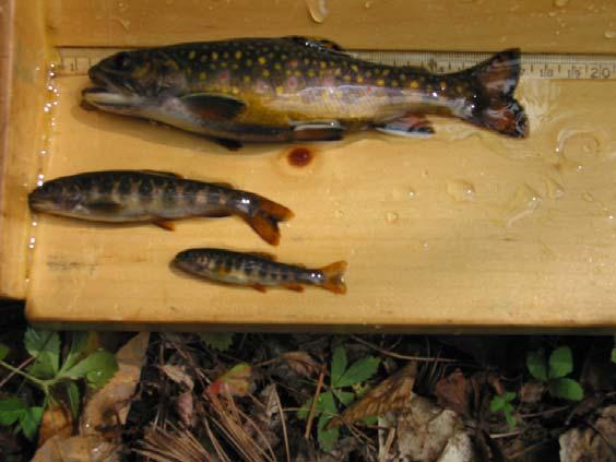
8 Where are Wild Brook Trout in the WMNF landscape? kg/hect 6 sq. miles Kilograms / Hectare of Brook Trout kg/hect 3.6 sq. miles Size of Watershed at Sample Site (sq. miles) 35 kg/ hect 1.6 sq. miles After flood of 2008
 80 60 40 20 0 Brook Trout Biomass vs.")
9 Imagine that..trout like pools Biomass of adult trout (kg/hect) Brook Trout Biomass vs. %Pool Habitat y = 0.63x R² = % Pools in Sampling Reach
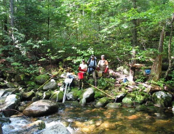
 45 40 35 30 25 20 15 10 5 0 0 100 200 300 400 500 600 Pieces of")
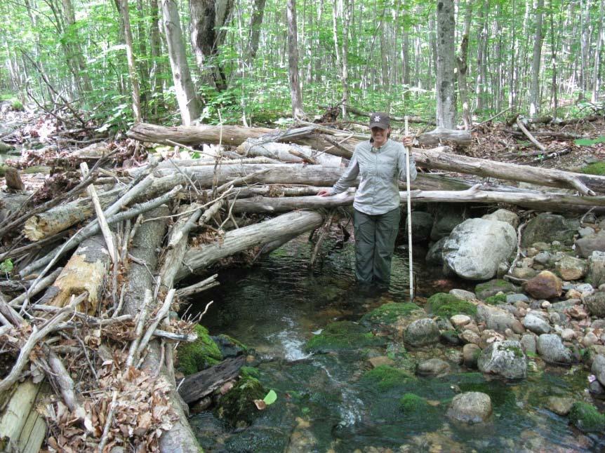
10 Large Woody Debris Creates Pools and Provides Cover Trout Biomass (kg/hectare) Pieces of LWD / Mile


11 Threats to Coldwater Streams Loss of Riparian Shade Sedimentation Acid Deposition Loss of Instream Habitat Stream Habitat Fragmentation Climate Change (Higher Temperatures, Floods, Drought, etc)
 Pemigewasset (11) Dr. John T. Kelly Dr.")


 New Hampshire Merrimack (1) Inorganic Aluminum (μg/l)")
12 Acid Deposition Still a Concern? N Vermont Ammonoosuc (2) Pemigewasset (11) Dr. John T. Kelly Dr. Stephen D. McCormick USGS, Conte Anadromous Fish Research Center & University of Massachusetts, Amherst Dr. Keith H. Nislow US Forest Service, Northern Research Station University of Massachusetts, Amherst Baker (3) Swift (1) Mad (3) H West (8) New Hampshire Merrimack (1) Inorganic Aluminum (μg/l) April June September April June September April June September ph


13 How will Climate Change affect WMNF Streams? Warmer Streams Earlier Spring Run-off More intense Floods Summer Droughts
14 Are the wild trout streams at risk to warming temperatures? Watersheds draining 1.5 to 2.5 square miles Water Temperature (F) /21/2008 0:00 7/1/2008 0:00 7/11/2008 0:00 7/21/2008 0:00 7/31/2008 0:00 8/10/2008 0:00 8/20/2008 0:00 8/30/2008 0:00 9/9/2008 0:00 Date and Time Blue Brook Clear Brook EB Baker River Hancock Trib SB Hancock SB Israel Trib Jefferson WB Mad Whitten EB Wonalancet Wonalancet Miles Brook


15 Promoting Riparian and Stream Habitat Diversity Will it mitigate effects of climate change? 2005 Forest Plan provides Standards and Guidelines for Management: Uneven-aged management in riparian areas. 25 no-cut zones on perennial streams to promote natural loading of downed wood. Consider relocating existing roads and trails within 100 of perennial streams Limit the % of timber volume harvested from a watershed. Span at least bankfull channel width on reconstructed stream crossings.

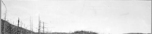
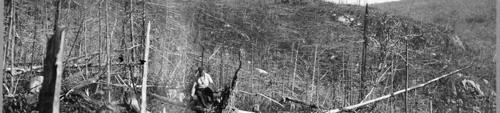
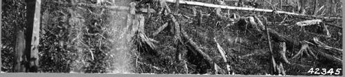
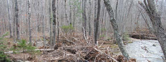
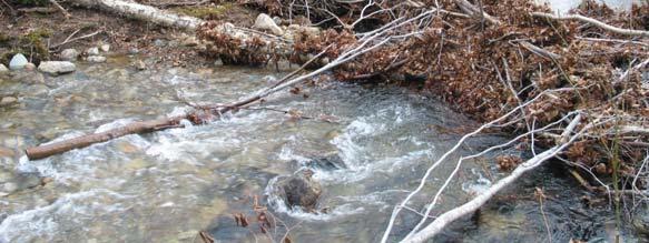
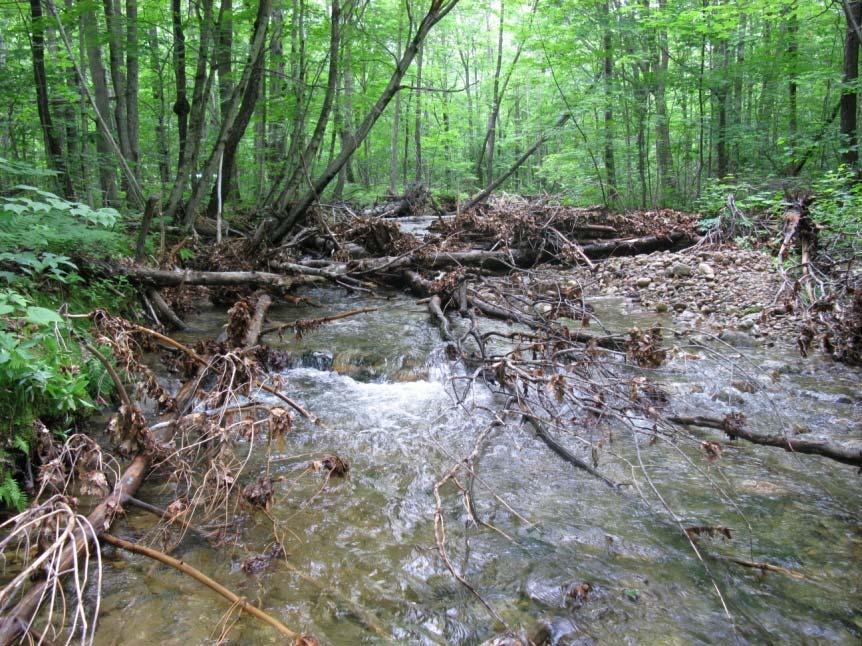
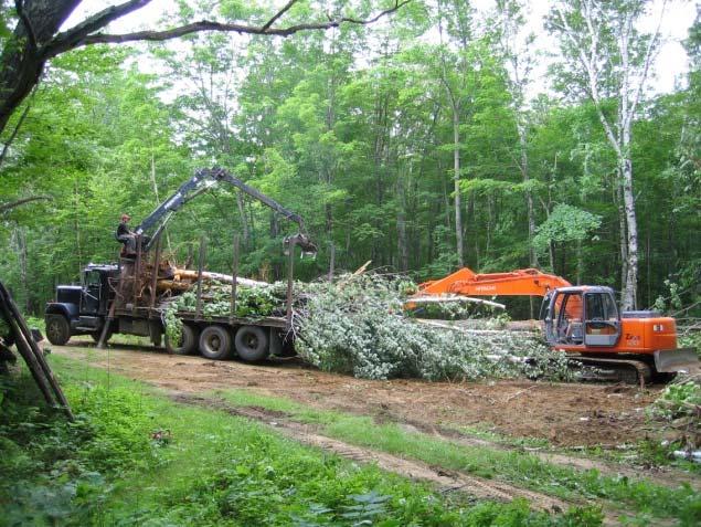
16 Will Increased Wood Loadings (LWD) in the Future Mitigate Climate Change Impacts Stream Habitats? Case Study: Great Brook Wood Addition Project 1100 acres purchased by WMNF in Valley was home to a farming community in 19 th and early 20 th century. Riparian area mostly 3 rd growth hardwood Very little in-stream wood Main channel appeared to be over-widened Very little water storage in mid-summer in upper portion of watershed
17 Project Objectives 1. Create sustainable and highly diverse stream habitat conditions using natural wood and boulder components. 2. Approach 300 pieces of LWD per mile and 30% of surface area in pool habitat. 3. Improve wild trout productivity at least to next higher productivity class (NHFG Wild Trout Classification).


18 Great Brook Stream Restoration Proposal Restore stream habitat by increasing pool habitat and woody cover in approximately 2.5 miles of Great Brook and its tributaries, using whole trees, root wads, and boulders.
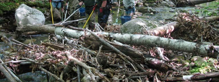
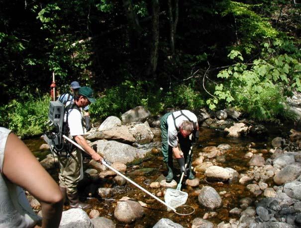
19 Fish and Habitat Monitoring Stations Grouped by Drainage Area Size and Channel Type Sample Site Sample Group Drainage Area (sq.mi.) Slope (%) Rosgen Channel Type % Pool Habitat Shirley Brook Treatment B4 7 Red Rock Brook Treatment B3 13 Willard Brook - upper Control B3 8 Great Brook - upper Treatment B3 7 Willard Brook - lower Control B3 14 Great Brook - lower Treatment C4 19 Great Brook Control B3/C3?? 30


20 Shirley Brook Treatment Site June, 2004 June, 2009


21 Great Brook upper Treatment Site


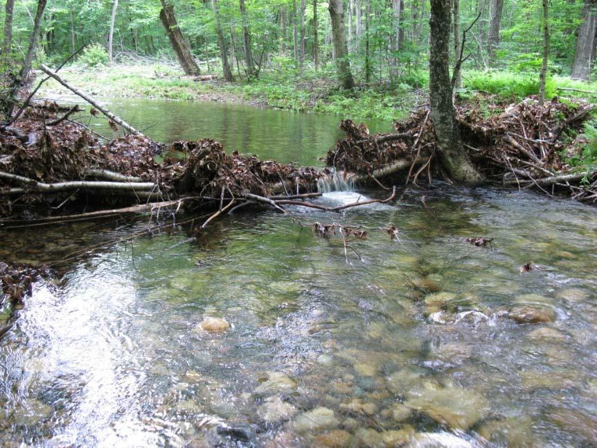
22 Reconnecting Floodplains? During high flows debris jams force water laterally


23 Great Brook Lower Treatment Site C Type Channel or Pool-Riffle Channel
24 Did We Increase LWD Densities > 300 Pieces /Mile? 2004 vs LWD (pieces/mile) Shirley Red Rock Great Brkupper Monitoring Station Great Brklower Willardupper Willardlower Great Brkcontrol
25 Did We Create 30% Pool Habitat? 2004 vs % Pool Habitat Shirley Red Rock Great Brkupper Great Brklower Willardupper Willardlower Great Brkcontrol Monitoring Station

26 Brook Trout Population Estimates
27 Were Changes in Fish Biomass Due to Wood Additions or Other Factors? B Channel Type (1 sq mile or less drainage areas) Brook Trout Biomass (g/100 m2) Shirley Brook - Treated Red Rock - Treated Willard Brook - Control Year *Shirley Brook treated in 2005; Red Rock treated in 2006
28 Length Distribution of Brook Trout Before and After Treatments 80 Shirley Brook 80 Willard Brook - Upper Numbers (262 fish) (30 fish) Numbers (78 fish) (101 fish) Length (mm) Length (mm)
 400 350 300 250 200 150 100 50 Great")

29 B Channel Type Draining < 2 square miles Brook Trout Biomass (g/100m2) Great Brook - upper Treatment Willard Brook - lower Control Year *Upper Great Brook Treated in 2005


30 C Type Channels Draining > 3 sq miles Great Brook - lower Treatment Great Brook - Control Trout Biomass (g/100m2) Year *Lower Great Brook Treated in 2006
")


31 Did We Improve NHFG Trout Productivity Class? High = >35 Kg/Hectare Changes in Brook Trout Biomass (Kg/Hectare) Moderate = >15 and <35 Kg Hectare Low = < 15 Kg/Hectare Pre Treatment Shirley changed from Low to High in some years. 25 Post Treatment Red Rock and Upper Great Brook changed from Low Productivity Wild Trout Sites to Moderate Productivity Sites Lower Great Brook Remained Moderate Productivity Site 5 0 Control Sites remained the same or dropped. Shirley Red Rock Upper Great Lower Great Upper Willard Lower Willard Great Control


32 Increasing LWD Abundance and Climate Change Lessons from Great Brook Increased LWD abundance can result in increased pool habitat. Trout populations in small streams with low pool abundance will benefit the greatest from the maturation of WMNF riparian forests. Deep scour pools created by woody debris jams may become the limiting habitat feature determining brook trout presence in headwater streams if droughts become more common.

33 Promoting Stream Connectivity in the Headwaters Will it Mitigate Effects of Climate Change?


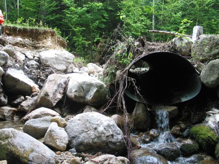
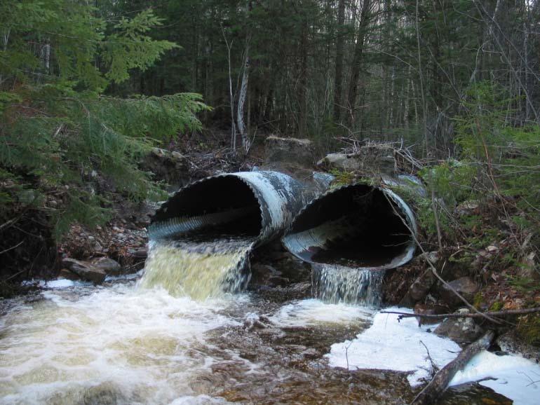
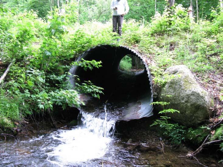
34 Road-Stream Crossing Inventory Results to Date: 392 stream crossings 196 culverts on intermittent streams 58 bridges over perennial streams 138 culverts on perennial streams
35 Level I Survey Determine if stream is perennial, intermittent, or unknown. Document crossing features on survey form Estimate bankfull width of stream at nearby stable stream section Photo document inlet, outlet, and stream above and below crossing.

36 Level II Survey Fish Passage Assessment Coarse Filters Predict if Passable for Groups of Fish Species


37 Status of Stream Crossing Inventory and AOP Assessment All Perennial Streams Red = Barrier to some life stage of brook trout Green = passable culvert or bridge


38 Majority of WMNF Culverts on Small Streams Cumulative Frequency of Drainage Area Size for Culverts on Perennial Streams Percent Drainage Area (sq. miles)


39 Priorities for Stream Connectivity Restoration Is fish passage the driving concern? Are culverts failing? Are there concerns about road failures and downstream habitat or infrastructure impacts? Is the Road Profile going to change?


40 Headwaters of the Upper Ammonoosuc River Over 50 miles of perennial stream maybe more? Godfrey Dam Berlin water supply Dam isolates heavy fish stocking downstream from wild fish above. Western slopes are some of most enriched soils of WMNF..buffering acid deposition. 16 mile Forest Service Loop road has long history of providing access for hunting, fishing, dog trials, and forest products. Road bisects all of the major tributaries of the main stem river.


41 Headwaters of Upper Ammonoosuc River 2005 Fish Inventory Wild Trout Biomass Ave Max Water Temp 70 West Branch of Keenan Brook Kg/Hectare Temperature (F) Keenan Brook Stony Brk WB Keenan Keenan Brk U. Ammo - Brk below FR15 U. Ammo - above FR15 U. Ammo - above godfrey dam WB Upper Ammo Sample Location Upper Ammo River above FR15 Upper Ammo River above Godfrey Dam

42 Are they really Intermittent Streams? Year Site ID Bankfull Width (ft.) ph Fish Above? Fish Below? Adult Trout Fish Passage? Juvenile Trout and Dace Sculpins 2009 FR15UpAmmoT no yes indeterminate impassable impassable 2009 FR15UpAmmoT no no n/a n/a n/a 2009 FR15UpAmmoT yes indeterminate impassable impassable 2009 FR15UpAmmoT yes indeterminate impassable impassable 2009 FR15UpAmmoT yes indeterminate impassable impassable indeterminat 2009 FR15UpAmmoT yes indeterminate indeterminate e 2009 FR15UpAmmoT yes impassable impassable impassable 2009 FR15UpAmmoT no no n/a n/a n/a


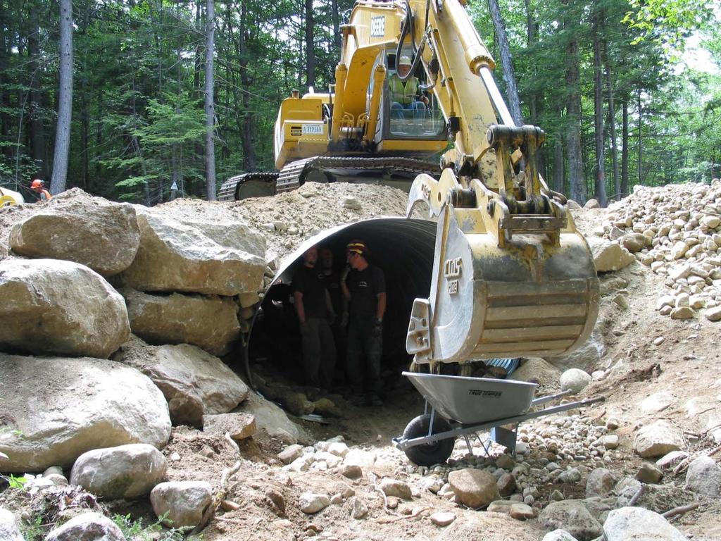
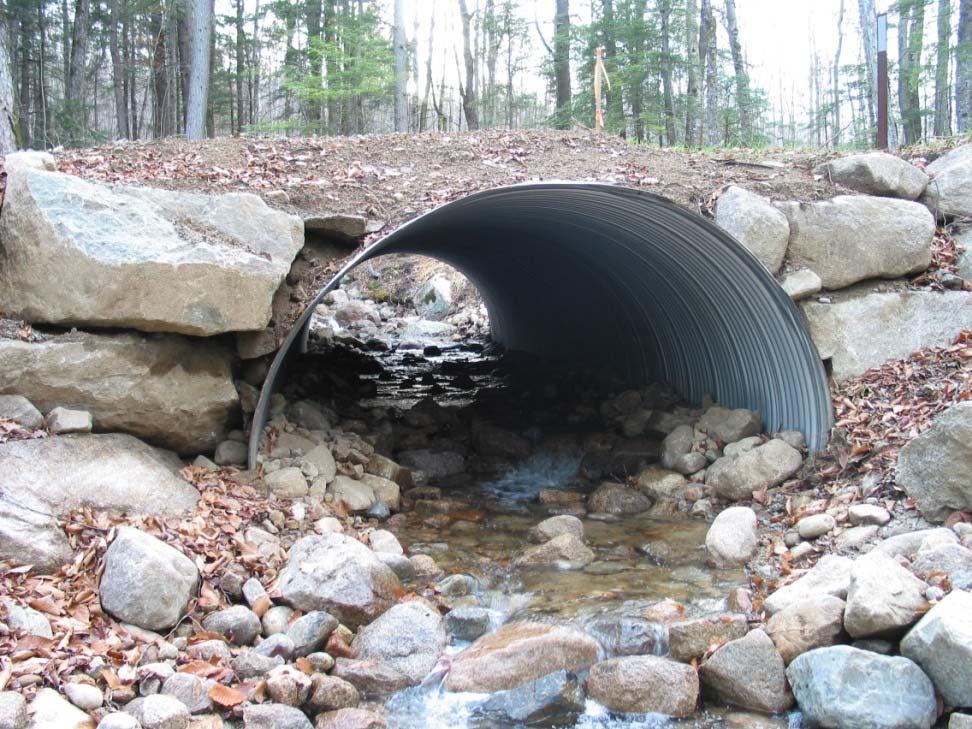
43 Reconnecting Small Headwater Streams Tributary #2 of Upper Ammonoosuc River


44 Brandy Brook- Larger Stream

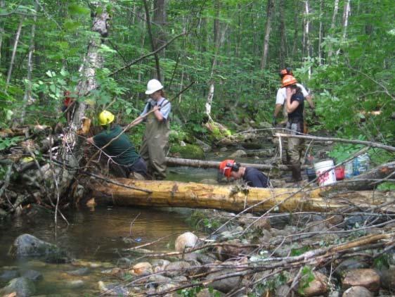
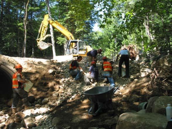
45 Designing Stream Simulation Crossings Level III Survey
 75 65 55 45 35 0 100 200 300 400 500 600 Channel Distance (ft) thalweg water srf LB")

46 Longitudinal Profile Unnamed and Unmapped brook between Louisville Brook and Albany Brook Elevation (ft) Channel Distance (ft) thalweg water srf LB RB BKF XS Determine the slope of the new culvert Determine how deep to embed a culvert Determine how to restore the stream channel above and below the crossing Locate reference sites for cross sections


47 Reference Cross Section Determine bankfull width Unnamed and Unmapped brook between Louisville Brook and Albany Brook Elevation (ft) Determine stream morphology and size of stream substrate Distance From Left Bank (ft)

48 Construct Step-Pool Channel at 4% Gradient
49 Innovation

50 Fill in the Gaps!
51 Stream Simulation
52 Stream Connectivity and Climate Change Incorporating stream simulation techniques into stream crossing designs may allow small headwater streams experiencing drought to be re-populated by aquatic species. Implementing stream simulation as a standard stream crossing practice may reduce the number of culvert and road failures from flood events.


53 Adaptive Land Management to Promote Ecosystem Resiliency Connecting headwater streams to lower watersheds Restoring high quality stream habitat Conserving Coldwater Ecosystems


54 Thanks to all who made this possible.. Many Forest Service Employees New Hampshire Fish & Game.US Fish & Wildlife Service.Trout Unlimited
Aquatic Organism Passage at Road-Stream Crossings CHUCK KEEPORTS FOREST HYDROLOGIST ALLEGHENY NATIONAL FOREST WARREN, PENNSYLVANIA
 Aquatic Organism Passage at Road-Stream Crossings CHUCK KEEPORTS FOREST HYDROLOGIST ALLEGHENY NATIONAL FOREST WARREN, PENNSYLVANIA TOPICS COVERED Aquatic Organism Passage (AOP) Benefits of AOP Crossings
Example Applications
 Example Applications The following example applications are intended to present how the tools developed for Trout Unlimited s Brook Trout Conservation Portfolio and Range-wide Assessment of Habitat Condition
Culvert Design for Low and High Gradient Streams in the Midwest. Dale Higgins, Hydrologist Chequamegon-Nicolet National Forest
 Culvert Design for Low and High Gradient Streams in the Midwest Dale Higgins, Hydrologist Chequamegon-Nicolet National Forest Overview Culvert Design Considerations Hydraulic Terms Culvert Impacts Low
Massachusetts Stream Crossing Case Studies
 Massachusetts Stream Crossing Case Studies Amy Singler Associate Director, River Restoration Program Carrie Banks River Continuity Coordinator Case Studies: Public Benefits: Movement of goods and people
Assessment of Baseline Geomorphic Features at. Proposed Stream Crossings On The Proposed County Road 595. Marquette County, Michigan
 Assessment of Baseline Geomorphic Features at Proposed Stream Crossings On The Proposed County Road 595 Marquette County, Michigan Prepared for: Kennecott Eagle Minerals Company Marquette, Michigan Prepared
Climate Change Adaptation and Stream Restoration. Jack Williams;
 Climate Change Adaptation and Stream Restoration Jack Williams; jwilliams@tu.org 1 Goals for this presentation Develop strategies for adapting streams to climate impacts by Thinking like a watershed Understanding
Minnesota Department of Natural Resources Division of Fish and Wildlife Section of Fisheries. Stream Survey Report. Luxemburg Creek.
 Minnesota F-29-R(P)-24 Area 315 Study 3 March 2016 Minnesota Department of Natural Resources Division of Fish and Wildlife Section of Fisheries Stream Survey Report Luxemburg Creek 2015 Mark Pelham Sauk
Eastern Brook Trout Joint Venture Completed Project Report Form
 Eastern Brook Trout Joint Venture Completed Project Report Form Project Title: Assessing the Efficacy of Remediating Episodic Low ph (and High Aluminum) Concentrations in Headwater Brook Trout Streams
Assessing Ecosystem Impacts from Road Stream Crossings through Community Involvement
 Assessing Ecosystem Impacts from Road Stream Crossings through Community Involvement Background Why is the NH Fish and Game Department interested in culverts? Block fish migration Reduce opportunities
Big Spring Creek Habitat Enhancement and Fishery Management Plans
 Big Spring Creek Habitat Enhancement and Fishery Management Plans November 5, 2012 Big Spring Events and Activities Center Newville, PA Charlie McGarrell Regional Habitat Biologist Pennsylvania Fish and
Eastern Brook Trout. Roadmap to
 Eastern Brook Trout Roadmap to CONSERVATION Our Brook Trout heritage he wild Brook Trout is an American symbol of persistence, adaptability, and the pristine wilderness that covered North America prior
Chagrin River TMDL Appendices. Appendix F
 Appendix F The following are excerpts from the Eastern Brook Trout Joint Venture s Conservation Strategy (Working Draft v.6), Conserving the Eastern Brook Trout: Strategies for Action Found at: http://www.easternbrooktrout.org/constrategy.html
Rehabilitation of Grimes Creek, a Stream Impacted in the Past by Bucket-lined Dredge Gold Mining, Boise River Drainage, July 2008 to August 2011.
 Rehabilitation of Grimes Creek, a Stream Impacted in the Past by Bucket-lined Dredge Gold Mining, Boise River Drainage, July 2008 to August 2011. Pam Harrington TU,1020 W. Main Street Suite 440, Boise,
Illinois Lake Management Association Conference March 23, 2018 By Trent Thomas Illinois Department of Natural Resources Division of Fisheries
 Illinois Lake Management Association Conference March 23, 2018 By Trent Thomas Illinois Department of Natural Resources Division of Fisheries Sources of Habitat Impairment Sedimentation Channelization
Geomorphic Stream Classification A Classification of Natural Rivers, Rosgen, D.L.
 Geomorphic Stream Classification A Classification of Natural Rivers, Rosgen, D.L. Why is Stream Classification Physical stream channel evolution Essential? Similar stream types manifest similar patterns
FISH PASSAGE IMPROVEMENT in California s Watersheds. Assessments & Recommendations by the Fish Passage Forum
 FISH PASSAGE IMPROVEMENT in California s Watersheds Assessments & Recommendations by the Fish Passage Forum FISH PASSAGE IMPROVEMENT in California s Watersheds The mission of the Fish Passage Forum is
Understanding the Impacts of Culvert Performance on Stream Health
 Understanding the Impacts of Culvert Performance on Stream Health Kristin Thomas Aquatic Ecologist Michigan Trout Unlimited Transportation and the Environment Conference 12/5/2018 Importance of adequately
Fish Habitat Restoration and Monitoring in Southeast Washington. Andy Hill Eco Logical Research, Inc.
 Fish Habitat Restoration and Monitoring in Southeast Washington Andy Hill Eco Logical Research, Inc. Fish Habitat Restoration and Monitoring in Southeast Washington Talk overview: Restoration projects
WFC 10 Wildlife Ecology & Conservation Nov. 29, Restoration Ecology: Rivers & Streams. Lisa Thompson. UC Cooperative Extension
 Restoration Ecology: Rivers and Streams WFC 10 29 Nov 2010 Restoration of ecosystems often involves creating new systems with only partial resemblance to the original ecosystems Lisa Thompson Fisheries
Report prepared for: Prepared by: January 2002 BEAK Ref
 AQUATIC ENVIRONMENTAL STUDY KANATA WEST CONCEPT PLAN Report prepared for: ROBINSON CONSULTANTS Prepared by: BEAK INTERNATIONAL INCORPORATED 14 Abacus Road Brampton, Ontario L6T 5B7 January 2002 BEAK Ref.
Trout Unlimited Comments on the Scope of Environmental Impact Statement for the Constitution Pipeline Project, Docket No. PF12-9
 October 9, 2012 Kimberly D. Bose, Secretary Federal Energy Regulatory Commission 888 First Street, NE, Room 1A Washington, DC 20426 RE: Trout Unlimited Comments on the Scope of Environmental Impact Statement
Joe Rathbun Michigan DEQ Water Resources Division Nonpoint Source Unit * Thanks to The Nature Conservancy
 Joe Rathbun Michigan DEQ Water Resources Division Nonpoint Source Unit rathbunj@mi.gov * Thanks to The Nature Conservancy Road-stream intersections = 67,511 Culverts = 60,700 Bridges = 6,811 Perched Piping
Columbia Lake Dam Removal Project
 Columbia Lake Dam Removal Project Major Goals of the Columbia Lake Dam Removal: Reconnect 10 miles of the Paulins Kill River to the Delaware River, restoring natural flow regime and sediment transport.
Holderness. The Three Watersheds within the Newfound Lake Drainage Dorchester. Groton Plymouth. Ashland. Hebron. Canaan. Bridgewater.
 Background Brook trout are the only native stream dwelling trout species in New Hampshire, having a historic range that extended from Georgia to eastern Canada. It is believed that wild brook trout were
Multiple Limiting Factors and Restoration of a Brook Trout Metapopulation
 Multiple Limiting Factors and Restoration of a Brook Trout Metapopulation J. Todd Petty and Brock M. Huntsman Steve Brown (WVDNR), Paul Kinder (NRAC), TJ Burr (NRCS) The Problem Extirpated from or highly
COLUMBIA LAKE DAM REMOVAL PROJECT
 COLUMBIA LAKE DAM REMOVAL PROJECT Major Goals of the Columbia Lake Dam Removal: Reconnect 10 miles of the Paulins Kill River to the Delaware River, restoring natural flow regime and sediment transport.
NEVADA DEPARTMENT OF WILDLIFE STATEWIDE FISHERIES MANAGEMENT
 NEVADA DEPARTMENT OF WILDLIFE STATEWIDE FISHERIES MANAGEMENT FEDERAL AID JOB PROGRESS REPORTS F-20-52 2016 REDBAND TROUT EASTERN REGION NEVADA DEPARTMENT OF WILDLIFE, FISHERIES DIVISION ANNUAL JOB PROGRESS
Fish Friendly Crossings- Examples from Nash Stream
 Fish Friendly Crossings- Examples from Nash Stream Maggie Machinist- North Regional Forester, Division of Forests and Lands. Nash Stream Nash Stream Forest is 40,000 acres, owned and managed by NH Division
Restoring the Kootenai: A Tribal Approach to Restoration of a Large River in Idaho
 Restoring the Kootenai: A Tribal Approach to Restoration of a Large River in Idaho Susan Ireland, Kootenai Tribe of Idaho Future of our Salmon Conference Technical Session August 2016 Healthy Floodplains,
Habitat Conditions, Design Strategies,
 Habitat Conditions, Design Strategies, Coho on Cedar Ck. five years after analog-based stream restoration work. and Stream Classification In river work, computer modeling is an insidious procedure in which
Brook Trout in Massachusetts: A Troubled History, A Hopeful Future
 Brook Trout in Massachusetts: A Troubled History, A Hopeful Future Brook trout are one of the most beautiful and beloved fish in the Eastern United States. In Massachusetts, anglers prize opportunities
Reconnecting Waters; Reconnecting Roads
 Reconnecting Waters; Reconnecting Roads Laura MacFarland, Great Lakes Stream Restoration Manager Wisconsin Lakes Convention Stevens Point, WI April 19, 2018 www.tu.org Overview Reconnecting Waters; Reconnecting
3. The qualification raised by the ISRP is addressed in #2 above and in the work area submittal and review by the ISRP as addressed in #1.
 Please find attached a response from The Confederated Tribes of the Warm Springs Reservation of Oregon (CTWSRO) for Project # 2008-301-00, Habitat Restoration Planning, Design and Implementation within
Minnesota Department of Natural Resources Division of Fish and Wildlife Section of Fisheries. Stream Survey Report. Three Mile Creek 2011
 Minnesota Department of Natural Resources Division of Fish and Wildlife Section of Fisheries Stream Survey Report Three Mile Creek 2011 By Joseph D. Stewig Montrose Area Fisheries Office TABLE OF CONTENTS
Eastern Brook Trout Joint Venture Annual Report The Nature Conservancy 2013
 Eastern Brook Trout Joint Venture Annual Report The Nature Conservancy 2013 2013 Annual Performance Report Enhancing Connectivity in the Ash-Black Rock Sub-basin of the West Branch Narraguagus River. Project
STREAM SURVEY File form No..
 scanned for KRIS THE RESOURCES AGENCY OF CALIFORNIA California Department of Fish and Game STREAM SURVEY File form No.. Date: September 4, 1969. NAME: North Fork Schooner Gulch Creek COUNTY: Mendocino.
FISHERIES BLUE MOUNTAINS ADAPTATION PARTNERSHIP
 FISHERIES A warming climate, by itself, substantially affects the hydrology of watersheds in the Blue Mountains. Among the key hydrologic changes projected under all scenarios for the 2040s and beyond
Five Counties Salmonid Conservation Program - Fish Passage Design Workshop. February 2013
 Program - Aquatic Organisms and Stream Crossings Ecological Connectivity A watershed is a network of channels that drain a common boundary. Channel characteristics formed by interaction of precipitation,
Statement of Dr. Jack Williams Senior Scientist, Trout Unlimited. Before the
 Statement of Dr. Jack Williams Senior Scientist, Trout Unlimited Before the Subcommittee of Water and Power Energy and Natural Resources Committee United States Senate June 6, 2007 Mr. Chairman, Members
South Fork Chehalis Watershed Culvert Assessment
 South Fork Chehalis Watershed Culvert Assessment Water Resource Inventory Area 23 Lewis County Conservation District Final Report By: Kelly Verd and Nikki Wilson March 2003 Funded by: The Washington State
Okanagan Sockeye Reintroduction
 Okanagan Sockeye Reintroduction Backgrounder Elders accounts, and other forms of Traditional Ecological Knowledge (TEK) tell us that many species of salmon once came into the Okanagan Valley and tell us
Executive Summary. Map 1. The Santa Clara River watershed with topography.
 Santa Clara River Steelhead Trout: Assessment and Recovery Opportunities December 2005 Prepared By: Matt Stoecker and Elise Kelley, Ph.D. University of California, Santa Barbara Prepared For: The Santa
Interim Guidance Fish Presence Absence
 Interim Guidance Fish Presence Absence Source: Forest Practices Act Guidance for Division 635 of the forest practices act dealing with stream classification when no fish surveys have been done (referenced
NASCO Guidelines for the Protection, Restoration and Enhancement of Atlantic Salmon Habitat
 NASCO Guidelines for the Protection, Restoration and Enhancement of Atlantic Salmon Habitat 1 NASCO Guidelines for the Protection, Restoration and Enhancement of Atlantic Salmon Habitat Additional copies
Appendix 23 Baseline Conditions for Bull Trout (Salvelinus confluentus), North and Middle Forks of the Flathead Drainage
, North and Middle Forks of the Flathead Drainage") See also: Appendix 24 Baseline Conditions for Bull Trout, South Fork of the Flathead Appendix 25 Baseline Conditions for Bull Trout, Stillwater Drainage Appendix 23 Baseline Conditions for Bull Trout (Salvelinus
See also: Appendix 24 Baseline Conditions for Bull Trout, South Fork of the Flathead Appendix 25 Baseline Conditions for Bull Trout, Stillwater Drainage Appendix 23 Baseline Conditions for Bull Trout (Salvelinus
Identifying and Executing Stream Projects Kristin Thomas, Aquatic Ecologist MITU
 Identifying and Executing Stream Projects Kristin Thomas, Aquatic Ecologist MITU Introduction 1. Methods for Identifying Projects 2. Methods in Action 3. The Partnership Paradigm 2 River Stewards Program
Abundance of Steelhead and Coho Salmon in the Lagunitas Creek Drainage, Marin County, California
 scanned for KRIS Abundance of Steelhead and Coho Salmon in the Lagunitas Creek Drainage, Marin County, California Prepared for: Marin Municipal Water District 220 Nellen Drive Corte Madera, California
Sub-watershed Summaries
 Project Description The Salmon Drift Creek Watershed Council (SDCWC) has focused their efforts in the Salmon River estuary for the past few years. The multifaceted partnership effort is nearing completion
Amendment to a Biological Assessment/Evaluation completed for the Coon Creek Land Disposal completed December Grand Valley Ranger District
 Amendment to a Biological Assessment/Evaluation completed for the Coon Creek Land Disposal completed December 2007 Grand Valley Ranger District Grand Mesa, Uncompahgre, Gunnison National Forests Prepared
Hydraulic Modeling of Stream Enhancement Methods
 Hydraulic Modeling of Stream Enhancement Methods Matthew J. Curry John J. Levitsky Abstract Development within watersheds increases the amounts of runoff causing stream erosion and degradation of stream
Columbia Lake Dam Removal Project
 Columbia Lake Dam Removal Project The Columbia Lake dam located 1/4 mile upstream of the Paulins Kill River's confluence with the Delaware River in Knowlton Township, Warren County has been proposed for
Mountain Columbia Province
 Rolling Provincial Review: Implementation 2001-2003 Province 229 Columbia Basin Fish & Wildlife Authority Province FY 2001-2003 Spending Summaries NPCC Recommendations and BPA Spending by Project Category,
MCCAW REACH RESTORATION
 Final Report MCCAW REACH FISH RESTORATION PHASE B Jack McCaw Inland Empire Action Coalition http://www.wwccd.net/ Phone: 509-956-3777 Hours: 8:00-4:30 Walla Walla County Conservation District Snake River
Simulating Streams Through Culverts in Mat-Su, Alaska
 Simulating Streams Through Culverts in Mat-Su, Alaska Project Managers Bill Rice, P.E., USFWS Hydrologist Mary Price, USFWS Fishery Biologist The Team Approach US Fish and Wildlife Service Bill Rice, P.E.,
Klamath Lake Bull Trout
 Klamath Lake Bull Trout Existing Populations The Klamath Lake Bull Trout SMU is comprised of seven existing populations and four populations classified as extinct or functionally extinct (Table 189). Populations
San Lorenzo Valley Water District, Watershed Management Plan, Final Version Part I: Existing Conditions Report
 LIST OF FIGURES Figure 1-1. Map of the San Lorenzo River watershed Figure 2-1. The Santa Cruz Mountains Bioregion Figure 2-2. Protected areas within the San Lorenzo River watershed Figure 2-3. Primary
Packwood Hydroelectric Project Barrier Analysis December 12, 2006
 Packwood Hydroelectric Project Barrier Analysis December 12, 2006 Study Area Natural barriers to upstream fish passage on Lake Creek at RM 1.03 and RM 1.95 Snyder Creek culvert under the Project tailrace
Catlow Valley Redband Trout
 Catlow Valley Redband Trout Existing Populations The Catlow Valley Redband Trout SMU is comprised of five populations (Table 1). Three exist in Home, Threemile, and Skull creeks, located on the east side
Biological Survey of Allagash Stream
 F i"shery Interim Summary Report Series No. 07-04 Biological Survey of Allagash Stream By Forrest R. Bonney Caring for Maine's Outdoor Future September, 2007 Maine Department of Inland Fisheries and Wildlife
PROJECT TITLE. Leadmine Brook Fish Passage and Habitat Restoration Project. NFHAP funding requested: $50,000
 Page1 PROJECT TITLE Leadmine Brook Fish Passage and Habitat Restoration Project NFHAP funding requested: $50,000 Project Location: (Connecticut, Windham, Ashford) Congressional District: 2nd APPLICANT:
Advancing Fish Passage in the Menomonee River Watershed
 University of Massachusetts - Amherst ScholarWorks@UMass Amherst International Conference on Engineering and Ecohydrology for Fish Passage International Conference on Engineering and Ecohydrology for Fish
1.Warm Springs Creek (Anaconda) Watershed Description and Land Use
 Watershed Description and Land Use") 1.Warm Springs (Anaconda) Watershed Description and Land Use Table xxx: Warm Springs Watershed Overview Watershed Size 92,288 acres/144.2 sq miles/373.6 sq km Elevation Range 5,781 feet [4,800-10,581]
1.Warm Springs (Anaconda) Watershed Description and Land Use Table xxx: Warm Springs Watershed Overview Watershed Size 92,288 acres/144.2 sq miles/373.6 sq km Elevation Range 5,781 feet [4,800-10,581]
Importance of Un-named tributaries to Brook Trout populations. Dr. Jonathan M. Niles
 Importance of Un-named tributaries to Brook Trout populations. Dr. Jonathan M. Niles PA Streams All streams of PA have a designated use - huge resource - 7,357 named streams: 33,687 total miles - 54,552
Minnesota Department of Natural Resources Division of Fish and Wildlife Section of Fisheries. Stream Survey Report. Cold Spring Creek.
 Minnesota F-29-R(P)-24 Area 315 Study 3 March 2013 Minnesota Department of Natural Resources Division of Fish and Wildlife Section of Fisheries Stream Survey Report Cold Spring Creek 2012 Mark Pelham Montrose
Warner Lakes Redband Trout
 Warner Lakes Redband Trout Existing Populations Warner Valley is an endorheic basin that contains a complex series of interconnected lakes, marshes, sloughs, and potholes, all of which are remnants of
Ecology of Place: What salmon need Eric Beamer Skagit River System Cooperative. November 2010
 Ecology of Place: What salmon need Eric Beamer Skagit River System Cooperative November 2010 Acknowledgements NOAA Fisheries NW Fisheries Science Center Tim Beechie George Pess Correigh Greene Talk overview
FINAL REPORT. Yonkers Creek Migration Barrier Removal Project Wonderstump Road Del Norte County. Submitted By:
 FINAL REPORT Yonkers Creek Migration Barrier Removal Project Wonderstump Road Del Norte County Submitted By: Del Norte County Community Development Department Yonkers Creek Migration Barrier Removal Project
Wild Virginia and Heartwood first raised this issue at the May 19, 2014 public meeting.
 June 13, 2014 Karen Stevens Pat Sheridan, District Ranger Warm Springs Ranger District 422 Forestry Road Hot Springs, VA 24445 karenlstevens@fs.fed.us psheridan@fs.fed.us re: Lower Cowpasture Restoration
1.Mill Creek Watershed Summary Description and Land Use
 1.Mill Creek Watershed Summary Description and Land Use Table xxx: Mill Creek Watershed Overview Watershed Size 31,435 acres/49.1 sq miles/ 127.1 sq km Elevation Range 5,594 feet [4,967-10,561] Stream
P.O. Box 65 Hancock, Michigan USA fax
 This PDF file is a digital version of a chapter in the 2005 GWS Conference Proceedings. Please cite as follows: Harmon, David, ed. 2006. People, Places, and Parks: Proceedings of the 2005 George Wright
Southern Oregon Coastal Cutthroat Trout
 Species Management Unit Description Southern Oregon Coastal Cutthroat Trout The Southern Oregon Coastal Cutthroat Trout SMU includes all populations of cutthroat trout inhabiting ocean tributary streams
Minnesota Department of Natural Resources Division of Fish and Wildlife Section of Fisheries. Stream Survey Report. Cold Spring Creek.
 Minnesota F-29-R(P)-24 Area 315 Study 3 March 2015 Minnesota Department of Natural Resources Division of Fish and Wildlife Section of Fisheries Stream Survey Report Cold Spring Creek 2014 Mark Pelham Montrose
TABLE 1. Riverscape surveys completed in the upper Chehalis River, Newaukum, and Satsop rivers.
 RIVERSCAPE SURVEYS OF IN-STREAM FISH ASSEMBLAGES AND HABITAT IN THE CHEHALIS RIVER Mara Zimmerman and John Winkowski Washington Department of Fish and Wildlife, Fish Program EXECUTIVE SUMMARY Introduction
Executive Summary Gantahaz Lake 2006
 Executive Summary Gantahaz Lake 2006 A stocking assessment was conducted at Gantahaz Lake on September 29, 2006. This was the third assessment completed since the inception of stocking in 1976. The management
Mid-Columbia Fisheries Enhancement Group Annual Report Fiscal Year 06: July 1, 2005 June 30, 2006
 Mid-Columbia Fisheries Enhancement Group Annual Report Fiscal Year 06: July 1, 2005 June 30, 2006 Mission Statement The mission of the Mid-Columbia Fisheries Enhancement Group is to restore self-sustaining
Lake Merwin and Swift Creek Reservoir Tributaries. Bull Trout Limiting Factors Analysis
 Lake Merwin and Swift Creek Reservoir Tributaries Bull Trout Limiting Factors Analysis Study Objectives Answer Key? s Do other tributaries to Swift Creek Reservoir and Lake Merwin not known to support
Rebirth of the Pigeon River: Song of the Morning Dam Removal Project
 Major funding for this project was provided by: Michigan Department of Natural Resources Aquatic Habitat Grant Program $293,000 Golden Lotus, Inc. $100,000 Great Lakes Fishery Trust $46,000 Pigeon River
Michigan Department of Natural Resources Status of the Fishery Resource Report Page 1
 Michigan Department of Natural Resources 2008-59 Status of the Fishery Resource Report Page 1 Bowens Manistee County, (T24N R16W Sec. 11, 12, 13, 14, 15, 24, and 30). Last surveyed 2008 Mark A. Tonello
CALIFORNIA SALMONID STREAM HABITAT RESTORATION MANUAL APPENDIX IX-A CULVERT CRITERIA FOR FISH PASSAGE INTRODUCTION
 APPENDIX IX-A STATE OF CALIFORNIA RESOURCES AGENCY DEPARTMENT OF FISH AND GAME CULVERT CRITERIA FOR FISH PASSAGE For habitat protection, ecological connectivity should be a goal of stream-road crossing
Burns Paiute Tribe Fisheries Department. Evaluate The Life History Of Native Salmonids Within The Malheur Subbasin Project #
 Burns Paiute Tribe Fisheries Department Evaluate The Life History Of Native Salmonids Within The Malheur Subbasin Project # 199701900 Prior to 1990 Technical and/or scientific background Malheur population,
NEVADA DEPARTMENT OF WILDLIFE STATEWIDE FISHERIES MANAGEMENT
 NEVADA DEPARTMENT OF WILDLIFE STATEWIDE FISHERIES MANAGEMENT FEDERAL AID JOB PROGRESS REPORTS F-20-48 2012 LAKE TAHOE WESTERN REGION Contents NEVADA DEPARTMENT OF WILDLIFE, FISHERIES DIVISION ANNUAL PROGRESS
Environmental Review and Permitting for Wild Trout
 Environmental Review and Permitting for Wild Trout Tom Shervinskie Wild Trout Summit Watershed Analysis Section August 26, 2017 Division of Environmental Services The mission of the Pennsylvania Fish and
Conserving the Forests, Lakes and Streams of Northeast Michigan
 4241 Old US 27 South, Suite 2, Gaylord, Michigan 49735 (989) 448-2293 www.huronpines.org info@huronpines.org Prioritized Restoration Projects in the AuSable River Watershed Summer 2015 Update from Huron
Ocean and Plume Science Management Uncertainties, Questions and Potential Actions (Work Group draft 11/27/13)
") Ocean and Plume Science Management Uncertainties, Questions and Potential Actions (Work Group draft 11/27/13) (The work group thinks the following four questions should form a logic path, but that logic
Ocean and Plume Science Management Uncertainties, Questions and Potential Actions (Work Group draft 11/27/13) (The work group thinks the following four questions should form a logic path, but that logic
CHAPTER 4 DESIRED OUTCOMES: VISION, GOALS, AND OBJECTIVES
 CHAPTER 4 DESIRED OUTCOMES: VISION, GOALS, AND OBJECTIVES Vision One of the first steps in developing this Plan was articulating a vision - a clear statement of what the Plan strives to achieve and what
New England Atlantic Salmon Programs DPS Delineations
 New England Atlantic Salmon Programs DPS Delineations (CA) Outer Bay of Fundy Gulf of Maine Central New England 6,000 5,000 4,000 3,000 2,000 1,000 GOM CNE LIS Long Island Sound 0 1967 1969 1971 1973 1975
Climate change and the California golden trout
 Climate change and the California golden trout Kathleen R. Matthews US Forest Service Research Sierra Nevada Research Center Outline Golden trout background How climate change may impact CGT and their
MINNESOTA DEPARTMENT OF NATURAL RESOURCES DIVISION OF FISHERIES AND WILDLIFE. Gamefish Assessment Report
 Minnesota DNR F-29-R(P) Area F312 February 1, 2013 MINNESOTA DEPARTMENT OF NATURAL RESOURCES DIVISION OF FISHERIES AND WILDLIFE Gamefish Assessment Report Spring Gamefish Assessment on the Mississippi
(Revised February,2005) CULVERTS, BRIDGES, AND FORDS
 CULVERTS, BRIDGES, AND FORDS") GUIDE TO STREAM CROSSINGS (Revised February,2005) CULVERTS, BRIDGES, AND FORDS Culverts, bridges, and fords are all methods used to cross-streams. Culverts are the most common stream crossing structure.
GUIDE TO STREAM CROSSINGS (Revised February,2005) CULVERTS, BRIDGES, AND FORDS Culverts, bridges, and fords are all methods used to cross-streams. Culverts are the most common stream crossing structure.
Stream Assessment. Date. Data Collected by. Location. Name of Stream and River Basin. Stream Order. Streambank Materials. Streambank Vegetation
 Stream Assessment Date Data Collected by Location Name of Stream and River Basin Stream Order Streambank Materials Streambank Vegetation Floodplain Soils Floodplain Vegetation Valley Type Valley Constraints
Cold Small River. A Brief Ecological Description of this Michigan River Type
 Cold Small River A Brief Ecological Description of this Michigan River Type Cold Small River segments are defined (by the Michigan Department of Natural Resources, Fisheries Division) as typically having
PROJECT TO INSTALL LARGE WOOD HABITAT STRUCTURES IN THE CARMEL RIVER USING CALIFORNIA DEPARTMENT OF FISH AND GAME GRANT FUNDS
 PROJECT TO INSTALL LARGE WOOD HABITAT STRUCTURES IN THE CARMEL RIVER USING CALIFORNIA DEPARTMENT OF FISH AND GAME GRANT FUNDS The Monterey Peninsula Water Management District (MPWMD), in cooperation with
Washington State Fish Passage Barrier Removal Projects. Casey Kramer, PE WSDOT State Hydraulics Engineer
 Washington State Fish Passage Barrier Removal Projects Casey Kramer, PE WSDOT State Hydraulics Engineer 2014 National Hydraulic Engineering Conference Iowa City, IA August 20 th, 2014 WSDOT Fish Passage
California Steelhead: Management, Monitoring and Recovery Efforts
 California Steelhead: Management, Monitoring and Recovery Efforts Jonathan Nelson Steelhead Management, Research and Restoration Program Oncorhynchus mykiss irideus California Steelhead - Hot Topics Implementation
Ecology of Columbia River redband trout (Oncorhynchus mykiss gairdneri) in high desert streams
 in high desert streams") Ecology of Columbia River redband trout (Oncorhynchus mykiss gairdneri) in high desert streams Dry Creek October 2012 Chris A. Walser Ph.D., Professor of Biology Department of Biology and Environmental
Ecology of Columbia River redband trout (Oncorhynchus mykiss gairdneri) in high desert streams Dry Creek October 2012 Chris A. Walser Ph.D., Professor of Biology Department of Biology and Environmental
REC 6 FISHERIES HABITAT EVALUATION
 REC 6 FISHERIES HABITAT EVALUATION 1.0 EXECUTIVE SUMMARY Analysis of fisheries habitat for recreational angling opportunities was completed by reviewing the results of the CAWG 1, Characterize Stream and
Distribution. PFBC Northcentral Region Law Enforcement Office, Attention: WCO Kraynak, 1150 Spring Creek Road, Bellefonte, PA 16823
 Distribution Pennsylvania Department of Environmental Protection, Northcentral Region Office, Attention: Steve Means, 208 West Third St. Suite 101, Williamsport, PA 17701 PFBC Northcentral Region Law Enforcement
EXECUTIVE SUMMARY. Muskegon River Watershed Assessment
 EXECUTIVE SUMMARY This assessment for the Muskegon River watershed is one of a series being prepared by Michigan Department of Natural Resources, Fisheries Division, for river basins in Michigan. This
Merrimack River Watershed MERRIMACK RIVER WATERSHED
 MERRIMACK RIVER WATERSHED 96 Merrimack River Watershed Merrimack River Newburyport, Amesbury, Merrimack, Haverhill, Groveland, Methuen, Lawrence, N. Andover, Andover, Dracut, Tewksbury, Lowell, Chelmsford,
Delaware Basin Stream Management Program
 Delaware Basin Stream Management Program A partnership between NYCDEP and Delaware County Soil & Water Conservation District 2015 Update Delaware Basin - Topics 2015 Project Updates Restoration Projects