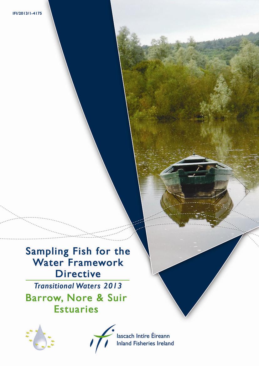
Water Framework Directive Fish Stock Survey of Transitional Waters in the South Western River Basin District Barrow, Nore, Suir Estuary 2013
|
|
|
- Rolf Ferguson
- 6 years ago
- Views:
Transcription
1
2 Water Framework Directive Fish Stock Survey of Transitional Waters in the South Western River Basin District Barrow, Nore, Suir Estuary 2013 Fiona L. Kelly, Ronan Matson, John Coyne, Rory Feeney, Emma Morrissey, and Kieran Rocks Inland Fisheries Ireland, Swords Business Campus, Swords, Co. Dublin CITATION: Kelly, F.L., Matson, R., Coyne, J., Feeney, R., Morrissey, E. and Rocks, K. (2013) Water Framework Directive Fish Stock Survey of Transitional Waters in the South Eastern River Basin District Barrow, Nore and Suir Estuary. Inland Fisheries Ireland, Swords Business Campus, Swords, Co. Dublin, Ireland. Cover photo: Middle Suir Estuary Inland Fisheries Ireland Inland Fisheries Ireland 2013
3 ACKNOWLEDGEMENTS The authors wish to gratefully acknowledge the help and co-operation of the Director Mr. David McInerney and staff from IFI Clonmel as well as other offices throughout the region. The authors also gratefully acknowledge the help and cooperation of their colleagues in IFI, Swords. The landowners and angling clubs that granted access to their land and respective fisheries are also gratefully acknowledged. We would also like to thank Dr. Martin O Grady (IFI) and No. 3 Operational Wing, Irish Air Corps (Aer Chór na héireann) for the aerial photographs. PROJECT STAFF Project Director/Senior Research officer: Project Manager: Research Officer: Technician Technician Technician: GIS Officer: Fisheries Assistant: Fisheries Assistant: Fisheries Assistant: Fisheries Assistant: Fisheries Assistant: Dr. Fiona Kelly Ms. Lynda Connor Dr. Ronan Matson Mr. John Coyne Mr. Rory Feeney Ms. Emma Morrissey Mr. Kieran Rocks Mr. Johannes Bulfin Mr. John Finn Ms. Karen Kelly Ms. Roisin O Callaghan Ms. Laura Walsh The authors would also like to acknowledge the funding provided for the project from the Department of Communications Energy and Natural Resources for The report includes Ordnance Survey Ireland data reproduced under OSI Copyright Permit No. MP Unauthorised reproduction infringes Ordnance Survey Ireland and Government of Ireland copyright. Ordnance Survey Ireland,
4 TABLE OF CONTENTS 1. INTRODUCTION METHODS RESULTS Water body surveys Upper Barrow Estuary Upper Barrow Nore Estuary Barrow Suir Nore Estuary New Ross Port Nore Estuary Lower Suir Estuary Middle Suir Estuary Upper Suir Estuary Species richness SUMMARY REFERENCES
5 1. INTRODUCTION Fish stock surveys were conducted on the Barrow, Nore and Suir Estuaries as part of the programme of fish monitoring for the Water Framework Directive (WFD), between the 30 th of September and the 11 th of October 2013 by staff from Inland Fisheries Ireland (Table 1.1, Fig. 1.1). The Barrow, Nore and Suir estuaries comprise a large, complex estuary system on the south-east coast of Ireland. For the purposes of WFD monitoring and reporting, this large estuary system has been split into eight separate water bodies (Table 1.1), further details of which are given in each individual results section. Table 1.1. Transitional water bodies surveyed for the WFD fish surveillance monitoring programme, October 2013 (FT=freshwater tidal, TW=transitional) Transitional water body MS Code Easting Northing Type Area (km 2 ) Barrow Estuary, Upper SE_100_ TW 1.15 Barrow Nore Estuary, Upper SE_100_ TW 0.64 Barrow Suir Nore Estuary SE_100_ TW New Ross Port SE_100_ TW 6.71 Nore Estuary SE_100_ TW 1.26 Suir Estuary, Lower SE_100_ TW 4.32 Suir Estuary, Middle SE_100_ TW 7.03 Suir Estuary, Upper SE_100_ FT

6 Fig Location map of the eight transitional water bodies on the Barrow, Nore and Suir estuary system surveyed for WFD fish monitoring, September-October
7 2. METHODS Current work in the Republic of Ireland and United Kingdom indicates the need for a multi-method (beach seine, fyke net and beam trawl) approach to sampling fish in estuaries and these procedures are now the standard IFI methodology for fish stock surveys in transitional waters for the WFD monitoring program. Beach seining is conducted using a 30m x 3m net (10mm mesh size) to capture fish in littoral areas (Plate 2.1). The bottom of the net has a weighted lead line to increase sediment disturbance and catch efficiency. Fyke nets (15m in length with a 0.8m diameter front hoop, joined by an 8m leader with a 10mm square mesh) are used to sample benthic fish in the littoral areas. Beam trawls are used for sampling benthic fish in the littoral and open waters, where bed type is suitable. The beam trawl measures 1.5m x 0.5m, with a 10mm mesh bag, decreasing to 5mm mesh in the cod end. The trawl is attached to a 20m tow rope and towed by a boat. Trawls are conducted along transects of 100m in length. All nets are processed on-site by identifying the species present and counting the total numbers caught in each. Length measurements are recorded for each species using a representative sub-sample of 30 fish, while scales are only collected for certain species, such as salmon and sea trout. Unidentified fish specimens were retained for subsequent identification in the laboratory. Sample sites are selected to represent the range of geographical and habitat ranges within the water body, based on such factors as exposure/orientation, shoreline slope, and substrate type. A handheld GPS is used to mark the precise location of each site. 4


8 Plate 2.1. Beach seining on the Barrow-Suir-Nore Estuary waterbody, October 2013 Plate 2.2. Beam trawling on the Barrow-Suir-Nore Estuary waterbody, October
9 3. RESULTS 3.1 Water body surveys Upper Barrow Estuary The Upper Barrow Estuary covers an area of 1.15km 2 (Fig. 3.1, Plates 3.1 to 3.3). It begins approximately 1km north of St. Mullins and stretches for approximately 15.5km downstream before joining the River Nore approximately 3km north of New Ross (Fig. 3.1). This narrow and muddy section of the estuary is situated in an area where the land is predominantly used for agriculture. This water body is situated within the River Barrow and River Nore SAC. A number of important habitats are present within this SAC, including tidal mudflats, estuary and floating vegetation, all of which are listed in Annex I of the EU Habitats Directive. Annex II listed species present include lamprey, Atlantic salmon, freshwater pearl mussel, crayfish and twaite shad (NPWS, 2003). This SAC represents one of only a few spawning grounds for twaite shad in Ireland (NPWS, 2003). Plate 3.1. Aerial photo of the Upper Barrow Estuary looking northwards. Photo courtesy of IFI and No. 3 Operational Wing, Irish Air Corps [Aer Chór na héireann]) 6


10 Plate 3.2: Upper Barrow Estuary close to the tidal limit, St. Mullins Co. Carlow, October Plate 3.3: Upper Barrow Estuary, upstream of ferry bridge near Mount Garrett, October
")
11 Seven beach seines, six fyke nets and six beam trawls were deployed in the Upper Barrow Estuary in September-October 2013 (Fig. 3.1). Fig Location map of the Upper Barrow Estuary indicating sample sites, September- October 2013 A total of ten fish species (sea trout are included as a separate variety of trout) were recorded in the Upper Barrow Estuary in October Table 3.1 shows a comparison between 2013 and the previous survey in A number of species were newly recorded in 2013, including roach, smelt and stone loach. Minnow, three-spined stickleback and salmon were previously caught in 2010 but absent in the 2013 survey. Dace was the most abundant species, followed by flounder and sand goby. Flounder were widely distributed throughout the water body being captured using all three netting 8
12 Number of fish methods, while other species such as three-spined stickleback were more localised, only recorded in the shallow marginal areas using beach seines. Eels, which are listed as critically endangered in the Irish Red Data Book (King et al., 2011) were recorded during this survey. Table 3.1. Number of each species captured by each gear type in the Upper Barrow Estuary, September-October 2010 and 2013 Beach seine Fyke net Beam trawl Total Common name 2010 (6) 2013 (7) 2010 (4) 2013 (6) 2010 (6) 2013 (6) Dace Flounder Sand goby European eel Three-spined stickleback Roach Smelt Sea trout Brown trout Stone loach Minnow Nine-spined stickleback Salmon Flounder captured during the 2013 survey ranged in length from 2.1cm to 20.5cm (mean = 7.5cm) (Fig. 3.2). Flounder captured during the 2010 survey were similar in length ranging in length from 3.0cm to 20.0cm (mean = 9.2cm) Length (cm) Fig Length frequency distribution of flounder in the Upper Barrow Estuary, September 2010 (sub-sample, n = 266) and October 2013 (sub-sample, n=282) 9
13 Number of fish Dace captured during the 2013 survey ranged in length from 3.8cm to 24.1cm (mean = 7.0cm) (Fig. 3.3). Flounder captured during the 2010 survey ranged in length from 2.6cm to 24.8cm (mean = 4.7cm) Length (cm) Fig.3.3. Length frequency distribution of dace in the Upper Barrow Estuary, September 2010 (sub-sample, n = 109) and October 2013 (sub-sample, n=118) 10
14 3.1.2 Upper Barrow Nore Estuary waterbody The Upper Barrow Nore Estuary is a relatively short transitional water body stretching for approximately 4km from the Barrow and Nore confluence to New Ross and covering an area of 0.64 km 2 (Fig. 3.4, Plate 3.4). The water body is mainly bordered by agricultural land but also has a significant amount of urban development on the southern end, much of which is buffered by a long strip of deciduous woodland. On a low tide deep muddy banks become exposed This water body is situated within the Barrow and River Nore SAC (See Section 3.1.1). River Nore River Barrow Plate 3.4. Aerial photo of the Upper Barrow Nore Estuary looking upstream towards the confluence of both rivers. (Photo courtesy of IFI and No. 3 Operational Wing, Irish Air Corps [Aer Chór na héireann]) 11

15 Two beach seines, two fyke nets and four beam trawls were deployed in the Upper Barrow Nore Estuary in October Fig Location map of the Upper Barrow Nore Estuary indicating sample sites, October 2013 A total of seven fish species were recorded in the Upper Barrow Nore Estuary in October Table 3.2 shows a comparison between 2013 and the previous survey in Three-spined stickleback was newly recorded in 2013, however, five species including twaite shad, perch, roach, sea trout and salmon were not recorded. Sand goby was the most abundant species, followed by flounder and eel. Flounder were well distributed throughout this waterbody, being captured using all three netting methods. 12
16 Number of fish One endangered fish species; eels, listed as critically endangered in the Irish Red Data Book (King et al., 2011), was recorded during this survey as well as dace, an invasive species to this country. Table 3.2. Number of each species captured by each gear type in the Upper Barrow Nore Estuary, October 2013 Beach seine Fyke net Beam trawl Total Common name 2010 (2) 2013 (2) 2010 (2) 2013 (2) 2010 (2) 2013 (4) Sand goby Flounder European eel Dace Smelt Brown trout Three-spined stickleback Twaite shad Perch Roach Sea trout Salmon Flounder captured during the 2013 survey ranged in length from 3.0cm to 13.0cm (mean = 7.1cm) (Fig. 3.5). Flounder captured during the 2010 survey ranged in length from 3.1cm to 23.8cm (mean = 8.7cm) Length (cm) Fig Length frequency distribution of flounder in the Upper Barrow Nore Estuary, September 2010 (sub-sample, n = 121) and September 2013 (sub-sample, n = 46) 13
17 Number of fish Eels captured during the 2013 survey ranged in length from 11.0cm to 74.4cm (mean = 36.0cm) (Fig. 3.6). Eels captured during the 2010 survey ranged in length from 30.0cm to 67.0cm (mean = 46.8cm) Length (cm) Fig Length frequency distribution of eels in the Upper Barrow Nore Estuary, September 2010 (n = 21) and September 2013 (n = 62) 14
. It stretches from the village of Campile in Co.")
18 3.1.3 Barrow-Suir-Nore Estuary waterbody The Barrow-Suir-Nore Estuary is a large water body, covering an area of 28.21km 2 and is situated where the Barrow, Suir and Nore rivers enter the sea at Waterford Harbour (Fig. 3.7, Plate 3.5 and 3.6). It stretches from the village of Campile in Co. Wexford as far as the sea, ending between Creadan Head and Broomhill Point (Fig. 3.12). This water body contains the deepest and widest sections of any water body surveyed along the Barrow, Suir, Nore estuarine network. This portion of the estuary is also situated within the River Barrow and Nore SAC (See Section 3.1.1). River Barrow Campile River River Suir Plate 3.5. Aerial photo of the northern part of the Barrow-Suir-Nore Estuary looking north towards the Great Island power station and Barrow Bridge (Photo courtesy of IFI and No. 3 Operational Wing, Irish Air Corps [Aer Chór na héireann]) 15
19 Plate 3.6. The Barrow-Suir-Nore Estuary waterbody looking north towards the Great Island power station, October

20 A total of six beach seines, four fyke nets and nine beam trawls were deployed in the Barrow-Suir- Nore Estuary in October Fig Location map of the Barrow-Suir-Nore estuarywaterbody indicating sample sites, October 2013 A total of 22 fish species were recorded in the Barrow-Suir-Nore Estuary waterbody in October Table 3.3 shows a comparison between 2013 and the previous survey in A number of species were newly recorded in 2013, including Atlantic horse mackerel, herring, pollack, long rough dab, whiting, black goby and turbot. European eel, sand smelt, lesser sandeel, brill, spotted dragonet, three-spined stickleback and haddock were previously caught in 2010 but absent in the 2013 survey. Plaice was the most abundant species, followed by sand goby and flounder. Three species of the gadoid family (cod, poor cod, and five-bearded rockling) were recorded in fyke nets and beam trawls, 17
21 whilst flounder were distributed throughout the water body, being captured by all three sampling methods. Pollack, horse mackerel, dab and pogge were also present. This was the only water body surveyed during 2013 in which the lesser weever fish was recorded. One endangered fish species; twaite shad, listed in Annex II and Annex V of the EU Habitats Directive and also listed as vulnerable in the Irish Red Data book (King et al., 2011) was recorded in this waterbody. Table 3.3. Number of each fish species captured by each gear type in the Barrow-Suir-Nore Estuary, October 2013 Beach seine Fyke net Beam trawl Total Common name 2010 (6) 2013 (6) 2010 (4) 2013 (4) 2010 (9) 2013 (9) Plaice Sand goby Flounder Five-bearded rockling Pogge Poor cod Sprat Thick-lipped grey mullet Atlantic horse mackerel/scad Herring Pollack Cod Long rough dab Nilsson's pipefish Smelt Twaite shad Dab Deep-snouted pipefish Whiting Black goby Lesser weever Turbot European eel Sand smelt Lesser sandeel Brill Spotted dragonet Three-spined stickleback Haddock
22 Number of fish Flounder captured during the 2013 survey ranged in length from 5.2cm to 32.0cm (mean = 15.7cm) (Fig. 3.8). Those captured in 2010 ranged in length from 5.5cm to 30.5cm (mean = 15.0cm) Length (cm) Fig Length frequency distribution of a sub-sample of flounder in the Barrow Suir Nore Estuary, September 2010 (sub-sample, n = 83) and October 2013 (sub-sample, n = 68) 19
. Along its length it is bordered mainly by agricultural land, with most urban activity in New Ross itself.")
23 3.1.4 New Ross Port waterbody New Ross Port waterbody covers an area of 6.71km 2 (Fig. 3.9, Plate 3.7 and 3.8). It begins in the town of New Ross and continues downstream for approximately 16.0km before joining the River Suir at Cheekpoint (Fig. 3.9). Along its length it is bordered mainly by agricultural land, with most urban activity in New Ross itself. This water body contains water deep enough for small ships to access the inland port at New Ross. This water body is also situated within the River Barrow and Nore SAC (See Section 3.1.1). Plate 3.7. Aerial photo of a section of New Ross Port Estuary. (Photo courtesy of IFI and No. 3 Operational Wing, Irish Air Corps [Aer Chór na héireann]) 20


24 Plate 3.8. Beach seining in New Ross port waterbody, October 2013 Plate 3.9. A juvenile Twaite shad, captured in New Ross Port, October,

25 A total of six beach seines, four fyke nets and four beam trawls were deployed in New Ross Port waterbody in October 2013 (Fig. 3.9). Fig Location map of New Ross port Estuary indicating sample sites, October 2013 A total of 17 fish species were recorded in New Ross Port in October Table 3.4 shows a comparison between 2013 and the previous survey in A number of species were newly recorded in 2013, including brown trout, poor cod, whiting, common sole, European seabass and sea lamprey. Cod, three-bearded rockling, pollack and salmon were previously caught in 2010 but not captured in the 2013 survey. Sand goby was the most abundant species, followed by European eel and flounder. Sand goby were captured in large numbers in seine nets, providing a potential source of 22
26 food for larger fish in shallow sections of the waterbody. In a similar trend to many of the other transitional water surveys, flounder were widespread, being recorded using all three netting methods. Eels, listed as critically endangered in the Irish Red Data Book (King et al., 2011), were recorded during this survey as well as dace, an invasive species to this country. Twaite shad, another important species, was recorded during the survey. This species is listed an Annex II and Annex V of the EU Habitats Directive, and also listed as vulnerable in the Irish Red Data Book (King et al., 2011). Salinity values taken at beach seine and beam trawl sites ranged from 0.535ppt to 5.710ppt. Table 3.4. Number of each species captured by each gear type in New Ross Port, October 2013 Beach seine Fyke net Beam trawl Total Common name 2010 (6) 2013 (6) 2010 (4) 2013 (4) 2010 (3) 2013 (4) Sand goby European eel Flounder Sprat Smelt Twaite shad Atlantic horse mackerel/scad Brown trout Five-bearded rockling Poor cod Whiting Common sole Dace European seabass Plaice Sea lamprey Thick-lipped grey mullet Cod Three-bearded rockling Pollack Salmon
27 Number of fish Flounder captured during the 2013 survey ranged in length from 5.1cm to 25.0cm (mean = 13.4cm) (Fig. 3.10). Flounder captured during the 2010 survey ranged in length from 4.2cm to 28.1cm (mean = 10.7cm) Length (cm) Fig Length frequency distribution of flounder in New Ross Port, September 2010 (subsample, n = 206) and October 2013 (n= 33) 24
28 3.1.5 Nore Estuary The Nore Estuary covers an area of 1.26km 2 (Fig. 3.12, Plates 3.10 to 3.12). It begins just north of Inistioge, Co. Kilkenny and continues for approximately 15km until its confluence with the River Barrow three kilometres north of New Ross, Co. Wexford. This water body occupies an area of land used mainly for agriculture and forestry. On a low tide the banks become exposed to reveal deep muddy banks (Plate 3.11 and 3.12). River Nore Beginning of water body River Barrow Plate Aerial photo showing the confluence between the Nore Estuary (top left) and Upper Barrow Estuary (bottom right) to form the Upper Barrow Nore Estuary (Photo courtesy of IFI and No. 3 Operational Wing, Irish Air Corps [Aer Chór na héireann]) 25


29 Plate Seine netting the Nore Estuary on a low tide, October 2013 Plate The Nore Estuary, September
 were recorded in the Nore Estuary in October")
30 A total of six beach seines, four fyke nets and six beam trawls were deployed in the Nore Estuary in October Fig Location map of the Nore Estuary indicating sample sites, October 2013 A total of 13 fish species (sea trout are included as a separate variety of trout) were recorded in the Nore Estuary in October Table 3.5 shows a comparison between 2013 and the previous survey in A number of species were newly recorded in 2013, including sprat, deep-snouted pipefish, sea trout, stone loach and twaite shad. Minnow and roach were previously caught in 2010 but were not captured in the 2013 survey. Sand goby was the most abundant species, followed by dace and flounder. Flounder were widely distributed throughout the whole waterbody, being captured in relatively high numbers using all three netting methods. 27
31 Number of fish Salmon and twaite shad, both of which are listed listed in Annex II and Annex V of the EU Habitats Directive and also listed as vulnerable in the Irish Red Data Book (King et al., 2011) were recorded in this waterbody. European eels, also listed as critically endangered in the Irish Red Data Book (King et al., 2011) were recorded, as well as dace, an invasive species to this country. Table 3.5. Number of each species captured by each gear type in the Nore Estuary, October 2013 Beach seine Fyke net Beam trawl Total Common name 2010 (5) 2013 (6) 2010 (4) 2013 (4) 2010 (6) 2013 (6) Sand goby Dace Flounder European eel Smelt Brown trout Three-spined stickleback Salmon Sprat Deep-snouted pipefish Sea trout Stone loach Twaite shad Minnow Roach Flounder captured during the 2013 survey ranged in length from 3.1cm to 22.3cm (mean = 8.5cm) (Fig. 3.12). Flounder captured during the 2010 survey ranged in length from 2.5cm to 16.4cm (mean = 6.7cm) Length (cm) Fig Length frequency distribution of flounder in the Nore Estuary, September 2010 (subsample, n = 222) and October 2013 (sub-sample, n = 114) 28
32 Number of fish Dace captured during the 2013 survey ranged in length from 3.2cm to 19.5cm (mean = 7.7cm) (Fig. 3.13). Dace captured during the 2010 survey ranged in length from 3.0cm to 21.4cm (mean = 5.3cm) Length (cm) Fig Length frequency distribution of dace in the Nore Estuary, September 2010 (subsample, n = 36) and October 2013 (n=68) 29
33 3.1.6 Lower Suir Estuary The Lower Suir Estuary covers an area of 4.32 km 2 and is located between Co. Kilkenny and County Waterford, on Ireland s south-east coast (Fig. 3.14, Plate 3.13). It stretches approximately 6.5km from Ballynakill on the outskirts of Waterford City, splitting in two around Little Island, and ending at Cheek Point at the confluence with the River Barrow (Fig. 3.14). There are a number of anthropogenic impacts on this water body, including urban runoff and flood defences for Waterford City, as well as a deep-water port situated along the city quays. Further downstream activities include the Cheekpoint power station and jetty, along with a number of small commercial fishing boat operations. Although some patchy areas of seaweed do exist, the majority of this channel appears to be unvegetated, with only a fine muddy substrate exposed on a low tide. The Lower Suir Estuary is part of the Lower Suir SAC. This SAC covers an extensive area encompassing most of the River Suir and large sections of its major tributaries. Important habitats within the area include floating vegetation, Atlantic salt meadows and Mediterranean salt meadows which are all listed in Annex I of the EU Habitats Directive (NPWS, 2005). A number of Annex II species are also present, including sea lamprey, river lamprey, brook lamprey, twaite shad and salmon (NPWS, 2005). Plate Aerial photo of the Lower Suir Estuary showing Little Island, Waterford. (Photo courtesy of IFI and No. 3 Operational Wing, Irish Air Corps [Aer Chór na héireann]) 30

34 A total of six beach seines, four fyke nets and four beam trawls were deployed in the Lower Suir Estuary in October 2013 (Fig. 3.14). Fig Location map of the Lower Suir Estuary indicating sample sites, October 2013 A total of 18 fish species (sea trout are included as a separate variety of trout) were recorded in the Lower Suir Estuary in October Table 3.6 shows a comparison between 2013 and the previous survey in A number of species were newly recorded in 2013, including herring, poor cod, long rough dab, pollack and sea trout. Pogge and brown trout were previously caught in 2010 but were not captured in the 2013 survey. Sprat was the most abundant species, followed by sand goby and flounder. Flounder and eels were the only species recorded using all three netting methods Two protected fish species were recorded during the survey; twaite shad (listed in Annex II and V of the EU Habitats Directive and listed as vulnerable in the Irish Red Data Book (King et al., 2011) and eel (listed as critically endangered in the Irish Red data Book). Salinity values taken at beach seine and beam trawl sites ranged from 5.40ppt to 6.12ppt. 31
35 Number of fish Table 3.6. Number of each species captured by each gear type in the Lower Suir Estuary, September 2013 Beach seine Fyke net Beam trawl Total Common name 2010 (6) 2013 (6) 2010 (4) 2013 (4) 2010 (4) 2013 (4) Sprat Sand goby Flounder European eel Twaite shad Smelt Herring Atlantic horse mackerel/scad Plaice Poor cod Thick-lipped grey mullet Cod Five-bearded rockling Whiting European seabass Long rough dab Pollack Sea trout Pogge Brown trout Flounder captured during the 2013 survey ranged in length from 6.0cm to 23.5cm (mean = 15.5cm) (Fig. 3.15). Flounder captured during the 2010 survey ranged in length from 6.5cm to 27.0cm (mean = 15.8cm) Length (cm) Fig Length frequency distribution of flounder in the Lower Suir Estuary, September 2010 (sub-sample, n = 103) and September 2013 (sub-sample, n=58) 32
36 Number of fish Twaite shad captured during the 2013 survey ranged in length from 7.1cm to 10.4cm (mean = 8.5cm) (Fig. 3.16). Twaite shad captured during the 2010 survey ranged in length from 6.4cm to 15.3cm (mean = 8.6cm) Length (cm) Fig Length frequency distribution of twaite shad in the Lower Suir Estuary, September 2010 (sub-sample, n = 30) and September 2013 (sub-sample, n=40) 33
37 3.1.7 Middle Suir Estuary The Middle Suir Estuary covers an area of 7.03 km 2. It is a long transitional water body, stretching approximately 25km from Fiddown on the border between Co. Kilkenny and Co. Waterford as far as Ballynakill on the eastern edge of Waterford City (Fig. 3.17, Plates 3.14 to 3.16). This water body forms part of the Lower Suir SAC (see Section 3.1.6). Plate Aerial photo of the Middle Suir Estuary, upstream of Waterford City. (Photo courtesy of IFI and No. 3 Operational Wing, Irish Air Corps [Aer Chór na héireann]) 34
 Plate 3.16.")
38 Plate Aerial photo of the Middle Suir Estuary, at Fiddown, Co. Kilkenny. (Photo courtesy of IFI and No. 3 Operational Wing, Irish Air Corps [Aer Chór na héireann]) Plate The Middle Suir Estuary waterbody at low tide, Granny, Co. Waterford. 35

39 A total of six beach seines, six fyke nets and seven beam trawls were deployed in the Middle Suir Estuary in September Fig Location map of the Middle Suir Estuary indicating sample sites, September 2013 A total of 18 fish species were recorded in the Middle Suir Estuary in September Table 3.7 shows a comparison between 2013 and the previous survey in A number of species were newly recorded in 2013, including herring, plaice, European sea bass, perch, roach, whiting, cod and poor cod. Rudd, sand smelt and sea trout were previously caught in 2010 but not captured in the 2013 survey. Flounder was the most abundant species recorded, followed by sand goby and European eels (Table 3.7). Flounder, sand goby, smelt and sprat were well distributed throughout the waterbody, being recorded using all three netting methods. Twaite shad, listed in Annex II and Annex V of the EU Habitats Directive and listed as vulnerable in the Irish Red Data Book (King et al., 2011 were recorded in this waterbody, as well as eels, which are listed as critically endangered in the Irish Red Data Book. Other noteworthy species recorded, include brown trout, European seabass, and smelt. Dace, an invasive species to this country, were also recorded. 36
40 Number of fish Table 3.7. Number of each species captured by each gear type in the Middle Suir Estuary, September 2010 Beach seine Fyke net Beam trawl Total Common name 2010 (6) 2013 (6) 2010 (6) 2013 (6) 2010 (7) 2013 (7) Flounder Sand goby European eel Smelt Sprat Thick-lipped grey mullet Twaite shad Dace Brown trout Herring Plaice European seabass Perch Roach Whiting Cod Poor cod Three-spined stickleback Rudd Sand smelt Sea trout Flounder captured during the 2013 survey ranged in length from 2.4cm to 23.6cm (mean = 10.7cm) (Fig. 3.18). Flounder captured during the 2010 survey ranged in length from 3.0cm to 24.6cm (mean = 9.6cm) Length (cm) Fig Length frequency distribution of flounder in the Middle Suir Estuary, September 2010 (sub-sample, n = 315) and September 2013 (sub-sample, n = 313) 37
41 Number of fish Number of fish Twaite shad captured during the 2013 survey ranged in length from 6.2cm to 9.8cm (mean = 8.2cm) (Fig. 3.19). Twaite shad captured during the 2010 survey ranged in length from 5.2cm to 9.4cm (mean = 6.9cm) Length (cm) Fig Length frequency distribution of twaite shad in the Middle Suir Estuary, September 2010 (n = 62) and September 2013 (n = 39) Dace captured during the 2013 survey ranged in length from 3.5cm to 16.5cm (mean = 7.9cm) (Fig. 3.20). No dace were recorded at this site during the 2010 survey Length (cm) Fig Length frequency distribution of dace in the Middle Suir Estuary, 2013 (n = 37) 38
42 3.1.8 Upper Suir Estuary The Upper Suir Estuary covers an area of 1.09km 2 and begins at the salmon weir approximately 1km west of Carrick-on-Suir and stretches downstream for approximately 9km through the town, ending at Fiddown (Fig. 3.20, Plates 3.17 to 3.19). It is joined on its northern bank by the Pil, Lingaun and Glen Rivers, all of which drain extensive areas of agricultural land in south Co. Kilkenny. This water body is part of the Lower Suir SAC (see Section 3.1.6). The Upper Suir Estuary (near Carrick-on-Suir) is one of the few known spawning grounds in the country for twaite shad (J. King, pers.comm). Plate Aerial photo of the Upper Suir Estuary looking north over Carrick-on-Suir. (Photo courtesy of IFI and No. 3 Operational Wing, Irish Air Corps [Aer Chór na héireann]) 39


43 Plate Upper Suir waterbody downstream of Carrick on Suir, October 2013 Plate Exposed muddy banks along the Upper Suir waterbody, September,

44 A total of three beach seines, two fyke nets and three beam trawls were deployed in the Upper Suir Estuary in October Fig Location map of the Upper Suir Estuary indicating sample sites, Ocotber 2013 Nine fish species were recorded in the Upper Suir Estuary in October Table 3.8 shows a comparison between 2013 and the previous survey in Roach were newly recorded in 2013, while both salmon and perch that were previously caught in 2010 were not captured in the 2013 survey. Flounder was by far the most abundant species, followed by dace and sand goby. Flounder were well distributed throughout the waterbody, being recorded by all three fishing methods. Twaite shad, listed in Annex II and Annex V of the EU Habitats Directive and listed as vulnerable in the Irish Red Data Book (King et al., 2011 were recorded in his waterbody, as well as eels, which are listed as critically endangered in the Irish Red Data Book. Other species recorded included smelt, brown trout and the invasive species, dace. 41
45 Number of fish Table 3.8. Number of each species captured by each gear type in the Upper Suir Estuary, September 2013 Beach seine Fyke net Beam trawl Total Common name 2010 (3) 2013 (3) 2010 (2) 2013 (1) 2010 (3) 2013 (3) Flounder Dace Sand goby Smelt Brown trout Three-spined stickleback Twaite shad European eel Roach Salmon Perch Flounder captured during the 2013 survey ranged in length from 3.0cm to 23.0cm (mean = 8.6cm) (Fig. 3.22). Flounder captured during the 2010 survey ranged in length from 2.6cm to 22.9cm (mean = 8.1cm) Length (cm) Fig Length frequency distribution of flounder in the Upper Suir Estuary, September 2010 (sub-sample, n = 378) and September 2013 (sub-sample, n = 98) 42
46 Number of fish Number of fish Dace captured during the 2013 survey ranged in length from 5.1cm to 18.8cm (mean = 7.2cm) (Fig. 3.23). Dace captured during the 2010 survey ranged in length from 3.1cm to 22.9cm (mean = 13.8cm) Length (cm) Fig Length frequency distribution of dace in the Upper Suir Estuary, September 2010 (n = 50) and September 2013 (sub-sample, n = 86) Twaite shad captured during the 2013 survey ranged in length from 7.9cm to 33.2cm (mean = 8.3cm) (Fig. 3.24). Twaite shad captured during the 2010 survey ranged in length from 4.3cm to 8.1cm (mean = 6.4cm) Length (cm) Fig Length frequency distribution of twaite shad in the Upper Suir Estuary, September 2010 (n = 52) and September 2013 (n = 4) 43
47 Flounder Sand goby Smelt European eel Brown trout Dace Sprat Three-spined stickleback Twaite shad Whiting Plaice Poor cod Thick-lipped grey mullet Atlantic horse mackerel/scad Cod European seabass Five-bearded rockling Herring Roach Sea trout Deep-snouted pipefish Long rough dab Pollack Stone loach % of river sites 3.2 Species richness A total of 34 fish species were recorded (sea trout are counted as a separate variety of brown trout) within the eight Barrow, Nore and Suir transitional water bodies surveyed during Only species that were recorded in at least two individual water bodies are shown in (Fig. 3.25). Flounder, sand gobies and smelt were the three most common fish species recorded, occurring in all eight water bodies. European eels were recorded in seven water bodies, while brown trout and dace (a nonnative, invasive species) were encountered in six Fig Percentage of water bodies where selected fish species were recorded in the Barrow, Nore and Suir transitional waters for WFD SM monitoring
48 4. SUMMARY The eight transitional water bodies comprising the Barrow, Nore and Suir estuary system vary greatly in size, environmental and physical characteristics. This is reflected in the fish species composition recorded in each water body. As expected, with decreasing salinity levels, higher numbers of freshwater fish were recorded in the upper estuaries, while in contrast more marine species were recorded in the water bodies further down the system. This was a trend that was also observed in other transitional water bodies surveyed previously for the WFD surveillance monitoring programme. Sand goby and flounder were among the most abundant and widespread species recorded, while other fish such as European eel and dace (an invasive fish species in Ireland) were also common. Three vulnerable fish species, salmon, twaite shad and eel were recorded throughout the estuary system. An essential step in the WFD monitoring process is the classification of the status of transitional waters, which in turn will assist in identifying the objectives that must be set in the individual River Basin Management Plans. A WFD fish classification tool, Transitional Fish Classification Index or TFCI, has been developed for the island of Ireland (Ecoregion 1) using IFI and Northern Ireland Environment Agency (NIEA) data. This is a multi-metric tool based on similar tools developed in South Africa and the UK (Harrison and Whitfield, 2004; Coates et al., 2007). The TFCI has recently completed the intercalibration process. Using this approach, the eight individual Barrow-Suir-Nore transitional waterbodies have been assigned draft ecological status classifications based on the fish populations present (Table 3.2). The Upper Barrow Estuary, Upper Barrow Nore Estuary, Nore Estuary and Upper Suir Estuary were classed as Moderate, while the Barrow-Suir-Nore Estuary, New Ross Port, Lower Suir Estuary and Middle Suir Estuary were classed as Good. Some waterbodies were also combined together for more practical classifications. These include the Suir (Lower Suir Estuary, Middle Suir Estuary, Upper Suir Estuary and Barrow-Suir-Nore Estuary), the Barrow-Suir-Nore (all eight waterbodies together), the Barrow (Upper Barrow Estuary, Upper Barrow Nore Estuary, New Ross Port and Barrow-Suir-Nore Estuary), the Barrow Nore T (Upper Barrow Estuary, Upper Barrow Nore Estuary, New Ross Port and Nore Estuary) and Suir T (Lower Suir Estuary, Middle Suir Estuary and Upper Suir Estuary). All combined waterbodies were classed as Good (Table 3.2). 45
49 Table 3.9. Draft ecological status classifications for the Barrow, Nore and Suir transitional water bodies, 2013 TFCI Waterbody EQR Class (& EO) Barrow Estuary Upper 0.35 Moderate Barrow Nore Estuary Upper 0.30 Moderate Barrow Suir Nore Estuary 0.73 Good New Ross Port 0.60 Good Nore Estuary 0.45 Moderate Suir Estuary, Lower 0.75 Good Suir Estuary, Middle 0.73 Good Suir Estuary, Upper 0.33 Moderate Combined waterbodies Suir 0.85 Good Barrow Suir Nore 0.88 Good Barrow 0.83 Good Barrow NoreT 0.68 Good SuirT 0.78 Good 46
50 5. REFERENCES Coates, S., Waugh A., Anwar A. & Robson M. (2007) Efficacy of a multi-metric fish index as an analysis tool for the transitional fish component of the Water Framework Directive. Marine Pollution Bulletin, 55, Harrison, T.D. and Whitfield, A.K. (2004) A multi-metric index to assess the environmental condition of estuaries. Journal of Fish Biology, 65, Kelly, F., Harrison, A., Connor, L., Matson, R., Morrissey, E., Feeney, R., Wogerbauer, C., O Callaghan, R. and Rocks, K. (2011) Sampling Fish for the Water Framework Directive Summary Report Inland Fisheries Ireland. King, J.J., Marnell, F., Kingston, N., Rosell, R., Boylan, P., Caffrey, J.M., Fitzpatrick, Ú., Gargan, P.G., Kelly, F.L., O Grady, M.F., Poole, R., Roche, W.K. and Cassidy, D. (2011) Ireland Red List No. 5: Amphibians, Reptiles and Freshwater Fish. National Parks and Wildlife Service, Department of Arts, Heritage and the Gaeltacht, Dublin, Ireland. NPWS (2003) River Barrow and River Nore. Site synopsis, site code: Available at: NPWS (2005) Lower River Suir. Site synopsis, site code: Available at: 47

51 48
Water Framework Directive Fish Stock Survey of Transitional Waters in the South Western River Basin District Lough Gill
 Water Framework Directive Fish Stock Survey of Transitional Waters in the South Western River Basin District Lough Gill Fiona L. Kelly, Ronan Matson, John Coyne, Rory Feeney, Emma Morrissey, and Kieran
The Central and Regional Fisheries Boards
 1 ACKNOWLEDGEMENTS The authors wish to gratefully acknowledge the help and co-operation of the Acting CEO Dr. Milton Matthews and the staff of the Northern Regional Fisheries Board. The authors would also
The landowners and angling clubs that granted access to their land and respective fisheries are also gratefully acknowledged.
 ACKNOWLEDGEMENTS The authors wish to gratefully acknowledge the help and co-operation of the Director Mr. William Walsh and staff from IFI, Blackrock as well as other offices throughout the region. The
We would like to thank the landowners and angling clubs that granted us access to their land and respective fisheries.
 ACKNOWLEDGEMENTS The authors wish to gratefully acknowledge the help and co-operation of the Director Mr. William Walsh and staff from IFI, Blackrock as well as various other offices throughout the region.
We would also like to thank Dr. Martin O Grady (CFB) and No. 3 Operational Wing, Irish Air Corps (Aer Chór na héireann) for the aerial photographs.
 and No. 3 Operational Wing, Irish Air Corps (Aer Chór na héireann) for the aerial photographs.") ACKNOWLEDGEMENTS The authors wish to gratefully acknowledge the help and co-operation of the CEO Mr. Vincent Roche, the assistant CEO Dr. John Conneely and the staff of the North Western Regional Fisheries
ACKNOWLEDGEMENTS The authors wish to gratefully acknowledge the help and co-operation of the CEO Mr. Vincent Roche, the assistant CEO Dr. John Conneely and the staff of the North Western Regional Fisheries
We would also like to thank Dr. Martin O Grady (CFB) and No. 3 Operational Wing, Irish Air Corps (Aer Chór na héireann) for the aerial photographs.
 and No. 3 Operational Wing, Irish Air Corps (Aer Chór na héireann) for the aerial photographs.") ACKNOWLEDGEMENTS The authors wish to gratefully acknowledge the help and co-operation of the CEO Mr. Aidan Barry, the assistant CEO Dr. Patrick Buck and the staff of the Southern Regional Fisheries Board.
ACKNOWLEDGEMENTS The authors wish to gratefully acknowledge the help and co-operation of the CEO Mr. Aidan Barry, the assistant CEO Dr. Patrick Buck and the staff of the Southern Regional Fisheries Board.
We would also like to thank Dr. Martin O Grady (CFB) and No. 3 Operational Wing, Irish Air Corps (Aer Chór na héireann) for the aerial photographs.
 and No. 3 Operational Wing, Irish Air Corps (Aer Chór na héireann) for the aerial photographs.") ACKNOWLEDGEMENTS The authors wish to gratefully acknowledge the help and co-operation of the CEO Mr. Vincent Roche, the assistant CEO Dr. John Conneely and the staff of the North Western Regional Fisheries
ACKNOWLEDGEMENTS The authors wish to gratefully acknowledge the help and co-operation of the CEO Mr. Vincent Roche, the assistant CEO Dr. John Conneely and the staff of the North Western Regional Fisheries
The Central and Regional Fisheries Boards
 1 ACKNOWLEDGEMENTS The authors wish to gratefully acknowledge the help and co-operation of the CEO Mr. Aidan Barry, the Assistant CEO Dr. Patrick Buck and the staff of the South Western Regional Fisheries
We would also like to thank Dr. Martin O Grady (CFB) and No. 3 Operational Wing, Irish Air Corps (Aer Chór na héireann) for the aerial photographs.
 and No. 3 Operational Wing, Irish Air Corps (Aer Chór na héireann) for the aerial photographs.") ACKNOWLEDGEMENTS The authors wish to gratefully acknowledge the help and co-operation of the CEO Mr. Aidan Barry, the assistant CEO Dr. Patrick Buck and the staff of the Southern Regional Fisheries Board.
ACKNOWLEDGEMENTS The authors wish to gratefully acknowledge the help and co-operation of the CEO Mr. Aidan Barry, the assistant CEO Dr. Patrick Buck and the staff of the Southern Regional Fisheries Board.
We would also like to thank Dr. Martin O Grady (CFB) and No. 3 Operational Wing, Irish Air Corps (Aer Chór na héireann) for the aerial photographs.
 and No. 3 Operational Wing, Irish Air Corps (Aer Chór na héireann) for the aerial photographs.") ACKNOWLEDGEMENTS The authors wish to gratefully acknowledge the help and co-operation of the CEO Mr. Pat Doherty, the assistant CEO Mr. William Walsh and the staff of the Eastern Regional Fisheries Board.
ACKNOWLEDGEMENTS The authors wish to gratefully acknowledge the help and co-operation of the CEO Mr. Pat Doherty, the assistant CEO Mr. William Walsh and the staff of the Eastern Regional Fisheries Board.
Water Framework Directive Fish Stock Survey of Glencar Lough, August 2013
 1 Water Framework Directive Fish Stock Survey of Glencar Lough, August 2013 Fiona L. Kelly, Lynda Connor, Emma Morrissey, John Coyne, Ronan Matson, Rory Feeney and Kieran Rocks Inland Fisheries Ireland,
Water Framework Directive Fish Stock Survey of Kylemore Lough, August 2013
 1 Water Framework Directive Fish Stock Survey of Kylemore Lough, August 2013 Fiona L. Kelly, Lynda Connor, Emma Morrissey, John Coyne, Ronan Matson, Rory Feeney and Kieran Rocks Inland Fisheries Ireland,
Water Framework Directive Fish Stock Survey of Lough Meelagh, August 2014
 1 Water Framework Directive Fish Stock Survey of Lough Meelagh, August 2014 Fiona L. Kelly, Lynda Connor, Emma Morrissey, John Coyne, Rory Feeney, Ronan Matson and Kieran Rocks Inland Fisheries Ireland,
We would also like to thank Dr. Martin O Grady (CFB) and No. 3 Operational Wing, Irish Air Corps (Aer Chór na héireann) for the aerial photographs.
 and No. 3 Operational Wing, Irish Air Corps (Aer Chór na héireann) for the aerial photographs.") ACKNOWLEDGEMENTS The authors wish to gratefully acknowledge the help and co-operation of the CEO Dr. Greg Forde, the assistant CEO Ms. Amanda Mooney and the staff of the Western Regional Fisheries Board.
ACKNOWLEDGEMENTS The authors wish to gratefully acknowledge the help and co-operation of the CEO Dr. Greg Forde, the assistant CEO Ms. Amanda Mooney and the staff of the Western Regional Fisheries Board.
Water Framework Directive Fish Stock Survey of Upper Lake, Killarney, September 2014
 1 Water Framework Directive Fish Stock Survey of Upper Lake, Killarney, September 2014 Fiona L. Kelly, Lynda Connor, Emma Morrissey, John Coyne, Rory Feeney, Ronan Matson and Kieran Rocks Inland Fisheries
Water Framework Directive Fish Stock Survey of Glenbeg Lough, September 2014
 1 Water Framework Directive Fish Stock Survey of Glenbeg Lough, September 2014 Fiona L. Kelly, Lynda Connor, Emma Morrissey, John Coyne, Rory Feeney, Ronan Matson and Kieran Rocks Inland Fisheries Ireland,
Water Framework Directive Fish Stock Survey of Lickeen Lough, September 2013
 1 Water Framework Directive Fish Stock Survey of Lickeen Lough, September 2013 Fiona L. Kelly, Lynda Connor, Emma Morrissey, John Coyne, Ronan Matson, Rory Feeney and Kieran Rocks Inland Fisheries Ireland,
We would also like to thank Dr. Martin O Grady (CFB) and No. 3 Operational Wing, Irish Air Corps (Aer Chór na héireann) for the aerial photographs.
 and No. 3 Operational Wing, Irish Air Corps (Aer Chór na héireann) for the aerial photographs.") ACKNOWLEDGEMENTS The authors wish to gratefully acknowledge the help and co-operation of the acting CEO Dr. Milton Matthews and staff of the Northern Regional Fisheries Board. The authors would also like
ACKNOWLEDGEMENTS The authors wish to gratefully acknowledge the help and co-operation of the acting CEO Dr. Milton Matthews and staff of the Northern Regional Fisheries Board. The authors would also like
Water Framework Directive Fish Stock Survey of Upper Lake, September 2011
 1 Water Framework Directive Fish Stock Survey of Upper Lake, September 2011 Fiona L. Kelly, Lynda Connor, Emma Morrissey, Ciara Wogerbauer, Ronan Matson, Rory Feeney and Kieran Rocks Inland Fisheries Ireland,
Water Framework Directive Fish Stock Survey of Rivers in the South Western River Basin District, 2013
 Water Framework Directive Fish Stock Survey of Rivers in the South Western River Basin District, 213 Fiona L. Kelly, Ronan Matson, Lynda Connor, Rory Feeney, Emma Morrissey, John Coyne and Kieran Rocks
Water Framework Directive Fish Stock Survey of Transitional Waters in the South Western River Basin District
 Water Framework Directive Fish Stock Survey of Transitional Waters in the South Western River Basin District Fiona L. Kelly, Lynda Connor, Ronan Matson, Emma Morrissey, Ciara Wogerbauer, Rory Feeney, and
Water Framework Directive Fish Stock Survey of Lough Rea, July 2013
 1 Water Framework Directive Fish Stock Survey of Lough Rea, July 2013 Fiona L. Kelly, Lynda Connor, Emma Morrissey, John Coyne, Ronan Matson, Rory Feeney and Kieran Rocks Inland Fisheries Ireland, 3044
Water Framework Directive Fish Stock Survey of Doo Lough, October 2012
 1 Water Framework Directive Fish Stock Survey of Doo Lough, October 2012 Fiona L. Kelly, Lynda Connor, Emma Morrissey, Ciara Wogerbauer, Ronan Matson, Rory Feeney and Kieran Rocks Inland Fisheries Ireland,
Inland Fisheries Ireland. National Research Survey Programme. Fish Stock Survey of Lough Nasnahida, July 2015
 1 Inland Fisheries Ireland National Research Survey Programme Fish Stock Survey of Lough Nasnahida, July 2015 Fiona L. Kelly, Lynda Connor, Karen Delanty, John Coyne, Emma Morrissey, William Corcoran,
Water Framework Directive Fish Stock Survey of Maumwee Lough, August 2013
 1 Water Framework Directive Fish Stock Survey of Maumwee Lough, August 2013 Fiona L. Kelly, Lynda Connor, Emma Morrissey, John Coyne, Ronan Matson, Rory Feeney and Kieran Rocks Inland Fisheries Ireland,
Water Framework Directive Fish Stock Survey of Lough Leane, September 2014
 1 Water Framework Directive Fish Stock Survey of Lough Leane, September 2014 Fiona L. Kelly, Lynda Connor, Emma Morrissey, John Coyne, Rory Feeney, Ronan Matson and Kieran Rocks Inland Fisheries Ireland,
Beach seining using a 30m fine-mesh net to capture fish in littoral areas
 Preliminary Synopsis of the WFD Surveillance Monitoring Fish Stock Surveys at selected Transitional Water Bodies in the Eastern River Basin District, October 2010 1.1 Introduction Fish stock surveys were
Inland Fisheries Ireland. National Research Survey Programme. Fish Stock Survey of Dunglow Lough, July 2015
 1 Inland Fisheries Ireland National Research Survey Programme Fish Stock Survey of Dunglow Lough, July 2015 Fiona L. Kelly, Lynda Connor, Karen Delanty, John Coyne, Emma Morrissey, William Corcoran, Daniel
Water Framework Directive Fish Stock Survey of Lough Sheelin, June 2011
 1 Water Framework Directive Fish Stock Survey of Lough Sheelin, June 2011 Fiona L. Kelly, Lynda Connor, Emma Morrissey, Ciara Wogerbauer, Ronan Matson, Rory Feeney and Kieran Rocks Inland Fisheries Ireland,
Water Framework Directive Fish Stock Survey of Lough Ree, June 2013
 1 Water Framework Directive Fish Stock Survey of Lough Ree, June 2013 Fiona L. Kelly, Lynda Connor, Emma Morrissey, John Coyne, Ronan Matson, Rory Feeney and Kieran Rocks Inland Fisheries Ireland, 3044
Stillwater Status Report: Lough Muck, County Donegal
 LOUGHS AGENCY OF THE FOYLE CARLINGFORD AND IRISH LIGHTS COMMISSION Stillwater Status Report: Lough Muck, County Donegal Stillwater Fish Stock Survey Loughs Agency of the Foyle Carlingford and Irish Lights
Stillwater Status Report: Lough Muck, County Tyrone
 LOUGHS AGENCY OF THE FOYLE CARLINGFORD AND IRISH LIGHTS COMMISSION Stillwater Status Report: Lough Muck, County Tyrone Stillwater Fish Stock Survey Loughs Agency of the Foyle Carlingford and Irish Lights
We would also like to thank Dr. Martin O Grady (CFB) and No. 3 Operational Wing, Irish Air Corps (Aer Chór na héireann) for the aerial photographs.
 and No. 3 Operational Wing, Irish Air Corps (Aer Chór na héireann) for the aerial photographs.") ACKNOWLEDGEMENTS The authors wish to gratefully acknowledge the help and co-operation of the CEO Dr. Greg Forde, the assistant CEO Ms. Amanda Mooney and the staff of the Western Regional Fisheries Board.
ACKNOWLEDGEMENTS The authors wish to gratefully acknowledge the help and co-operation of the CEO Dr. Greg Forde, the assistant CEO Ms. Amanda Mooney and the staff of the Western Regional Fisheries Board.
The Central and Regional Fisheries Boards
 1 ACKNOWLEDGEMENTS The authors wish to gratefully acknowledge the help and co-operation of the CEO Mr. Vincent Roche, Assistant CEO Dr. John Conneely and their staff from the North Western Regional Fisheries
The Central and Regional Fisheries Boards
 1 ACKNOWLEDGEMENTS The authors wish to gratefully acknowledge the help and co-operation of the CEO Mr. Pat Doherty, Assistant CEO Mr. William Walsh and their staff from the Eastern Regional Fisheries Board.
Report on a Salmon Survey in the Waterford Estuary in 2010
 Report on a Salmon Survey in the Waterford Estuary in 2010 Dr. P. Gargan Inland Fisheries Ireland June 2011 1 Contents 1. Introduction 3 2. Proposal for a Survey in Waterford estuary in 2010 3 3. Survey
We would also like to thank Dr. Martin O Grady (CFB) and No. 3 Operational Wing, Irish Air Corps (Aer Chór na héireann) for the aerial photographs.
 and No. 3 Operational Wing, Irish Air Corps (Aer Chór na héireann) for the aerial photographs.") 1 ACKNOWLEDGEMENTS The authors wish to gratefully acknowledge the help and co-operation of the CEO Mr. Eamon Cusack, ACEO Mr. Sean Ryan and the staff of the Shannon Regional Fisheries Board. The authors
1 ACKNOWLEDGEMENTS The authors wish to gratefully acknowledge the help and co-operation of the CEO Mr. Eamon Cusack, ACEO Mr. Sean Ryan and the staff of the Shannon Regional Fisheries Board. The authors
We would also like to thank Dr. Martin O Grady (CFB) and No. 3 Operational Wing, Irish Air Corps (Aer Chór na héireann) for the aerial photographs.
 and No. 3 Operational Wing, Irish Air Corps (Aer Chór na héireann) for the aerial photographs.") ACKNOWLEDGEMENTS The authors wish to gratefully acknowledge the help and co-operation of the acting CEO Dr. Milton Matthews and the staff of the Northern Regional Fisheries Board. The authors would also
ACKNOWLEDGEMENTS The authors wish to gratefully acknowledge the help and co-operation of the acting CEO Dr. Milton Matthews and the staff of the Northern Regional Fisheries Board. The authors would also
The bigger picture: supplementing established monitoring surveys with knowledge on habitat-specific occurrence of fish in the Wadden Sea
 The bigger picture: supplementing established monitoring surveys with knowledge on habitat-specific occurrence of fish in the Wadden Sea Conservation Hydroacoustic management image of a of vendace fish
Water Framework Directive Fish Stock Survey of Lough Derg, June 2012
 1 Water Framework Directive Fish Stock Survey of Lough Derg, June 2012 Fiona L. Kelly, Lynda Connor, Emma Morrissey, Ciara Wogerbauer, Ronan Matson, Rory Feeney and Kieran Rocks Inland Fisheries Ireland,
Stillwater Status Report: Lough Mourne, County Donegal
 LOUGHS AGENCY OF THE FOYLE CARLINGFORD AND IRISH LIGHTS COMMISSION Stillwater Status Report: Lough Mourne, County Donegal Stillwater Fish Stock Survey Loughs Agency of the Foyle Carlingford and Irish Lights
The authors wish to gratefully acknowledge the help and co-operation of the regional director Mr. David McInerney and staff from
 ACKNOWLEDGEMENTS The authors wish to gratefully acknowledge the help and co-operation of the regional director Mr. David McInerney and staff from IFI Clonmel as well as various other offices throughout
Inland Fisheries Ireland. National Research Survey Programme. Fish Stock Survey of Lough Conn, August 2016
 1 Inland Fisheries Ireland National Research Survey Programme Fish Stock Survey of Lough Conn, August 2016 Inland Fisheries Ireland, 3044 Lake Drive, Citywest Business Campus, Dublin 24. CITATION: Kelly,
Inland Fisheries Ireland. National Research Survey Programme. Fish Stock Survey of Lough Owel, July 2015
 1 Inland Fisheries Ireland National Research Survey Programme Fish Stock Survey of Lough Owel, July 2015 Fiona L. Kelly, Lynda Connor, Karen Delanty, Paul McLoone, John Coyne, Emma Morrissey, William Corcoran,
An Roinn Turasoireachta, lascaigh. agus Foraoiseachta THE IMPACT OF EEL FYKE NETTING ON OTHER FISHERIES
 " An Roinn Turasoireachta, lascaigh agus Foraoiseachta THE IMPACT OF EEL FYKE NETTING ON OTHER FISHERIES Christopher Moriarty 1'1, I " I,' i l,i,! ill I!'I: " I III "!'I :,11 'I, I li,'1 li'[11 ill ':Ii
We would like to thank the landowners and angling clubs that granted us access to their land and respective fisheries.
 ACKNOWLEDGEMENTS The authors wish to gratefully acknowledge the help and co-operation of the regional director Mr. William Walsh and staff from IFI Blackrock as well as various other offices throughout
Information Submitted by Parties on Fishing Effort b) Sweden
 Sweden") 15 th ASCOBANS Advisory Committee Meeting Document AC15/Doc.16 (P) UN Campus, Bonn, Germany, 31 March-3 April 2008 Dist. 31 March 2008 Agenda Item 14.3 Implementation of the ASCOBANS Triennial Work Plan
15 th ASCOBANS Advisory Committee Meeting Document AC15/Doc.16 (P) UN Campus, Bonn, Germany, 31 March-3 April 2008 Dist. 31 March 2008 Agenda Item 14.3 Implementation of the ASCOBANS Triennial Work Plan
Sampling Fish for the Water Framework Directive, Rivers 2014
 Sampling Fish for the Water Framework Directive, Rivers 1 Fiona L. Kelly, Lynda Connor, Ronan Matson, Rory Feeney, Emma Morrissey, John Coyne and Kieran Rocks Inland Fisheries Ireland, 3 Lake Drive, Citywest
Annexes and schedules: rare and protected fish species and the law. Richard Handley
 Annexes and schedules: rare and protected fish species and the law Richard Handley Talk outline what does rare mean? why are rare and protected species important? what is protected? What does rare mean?
The Central and Regional Fisheries Boards
 1 ACKNOWLEDGEMENTS The authors wish to gratefully acknowledge the help and co-operation of the CEO Mr. Eamon Cusack, Assistant CEO Mr. Sean Ryan and their staff from the Shannon Regional Fisheries Board.
IFM Specialist Conference 2018
 IFM Specialist Conference 2018 Managing Fisheries in Estuarine and Coastal Waters Mandy Knott Senior Scientist 23rd May 2018 Photo: Oystercatchers feeding on Foulney mussel bed December 2015 - NWIFCA What
Fish population survey report
 Fish population survey report River Teme 2016 This report provides a summary of results from recent coarse fish population surveys on the River Teme between Tenbury Wells and Powick. The surveys were carried
A guide to fisheries regulations ENVIRONMENT CORNWALL SEA FISHERIES COMMITTEE. WaW AGENCY
 A guide to fisheries regulations CORNWALL SEA FISHERIES COMMITTEE ENVIRONMENT WaW AGENCY The Fal Estuary and Coastal Area BASS FACTS Bass grow and mature slowly and may not breed until they are 7 years
We would like to thank the landowners and angling clubs that granted us access to their land and respective fisheries.
 The Central and Regional Fisheries Boards ACKNOWLEDGEMENTS The authors wish to gratefully acknowledge the help and co-operation of the CEO, Mr. Pat Doherty, Assistant CEO, Mr. William Walsh and the staff
Fish population survey report
 Fish population survey report River Lugg This report provides a summary of results from recent fish population surveys on the River Lugg between Leominster and Hereford. The surveys were carried out to
THE DYNAMICS OF ESTUARIES AND THEIR FISH POPULATIONS: implications for fish conservation in the Tidal Thames
 THE DYNAMICS OF ESTUARIES AND THEIR FISH POPULATIONS: implications for fish conservation in the Tidal Thames Adrian C. Pinder Bournemouth University Global Environmental Solutions (BUG) ESTUARIES AND THEIR
ELECTRO-FISHING REPORT 2016 UPPER TWEED
 ELECTRO-FISHING REPORT 2016 UPPER TWEED The electro-fishing programme carried out each summer by The Tweed Foundation is part of our management plan, which details the information that is required to manage
Fish population survey report
 Fish population survey report Upper River Avon Catchment This report provides a summary of results from recent fish population surveys on the Tetbury Avon, Sherston Avon and River Marden The surveys were
Know Your River Conwy Salmon & Sea Trout Catchment Summary
 Know Your River Conwy Salmon & Sea Trout Catchment Summary Introduction This report describes the status of the salmon and sea trout populations in the Conwy catchment. Bringing together data from rod
A review of Rotary Screw Trap operations on the River Faughan
 LOUGHS AGENCY OF THE FOYLE CARLINGFORD AND IRISH LIGHTS COMMISSION A review of Rotary Screw Trap operations on the River Faughan 2003-2016 Monitoring and Conservation Loughs Agency of the Foyle Carlingford
Channel Manche, refuge for the migratory fish? Dylan Roberts SAMARCH Project Manager
 Channel Manche, refuge for the migratory fish? Dylan Roberts SAMARCH Project Manager The Game and Wildlife Conservation Trust Welcome to the SAMARCH project www.samarch.org The Game and Wildlife Conservation
Aim. Survey Methodology
 The fish that smells of cucumber: conservation of smelt Osmerus eperlanus in the Thames Estuary Interim Report on results of 2015 survey work Joanna Barker Project Manager, Europe Conservation Programme
Warm-up # 7 A day 5/17 - B day 5/18 UPDATE YOUR TABLE OF CONTENTS
 Warm-up # 7 A day 5/17 - B day 5/18 UPDATE YOUR TABLE OF CONTENTS Question: List all examples of surface water on Earth. Answer: Rivers and streams, lakes and reservoirs, (ponds) wetlands, estuaries and
Loughs Agency Water Framework Directive Fish in Rivers Classification Report 2012
 LOUGHS AGENCY OF THE FOYLE CARLINGFORD AND IRISH LIGHTS COMMISSION Loughs Agency Water Framework Directive Fish in Rivers Classification Report 212 Water Framework Directive Fish Population Assessment
Loughs Agency Freshwater Fisheries Monitoring Programme
 Loughs Agency Freshwater Fisheries Monitoring Programme Fisheries Coordination Centre/RAFTS Annual Biologists Meeting 29 th 30 th January 2014 Marine Scotland Freshwater Laboratory, Pitlochry Art Niven,
Delaware River Seine Survey: 2012 Sampling Summary
 Delaware River Seine Survey: 2012 Sampling Summary Fish and Wildlife employees pull in the seine net From June 18 to November 21, 2012, biologists conducted the Delaware River Seine Survey. Over the course
European Smelt (Osmerus eperlanus L.) Baseline Surveys on the River Foyle, River Finn, River Deele & Burndennet River
 Baseline Surveys on the River Foyle, River Finn, River Deele & Burndennet River") 2010 European Smelt (Osmerus eperlanus L.) Baseline Surveys on the River Foyle, River Finn, River Deele & Burndennet River Loughs Agency of the Foyle Carlingford and Irish Lights Commission Report Ref:
2010 European Smelt (Osmerus eperlanus L.) Baseline Surveys on the River Foyle, River Finn, River Deele & Burndennet River Loughs Agency of the Foyle Carlingford and Irish Lights Commission Report Ref:
Coastal Fish Habitats in General What are we talking about?
 Coastal Fish Habitats in General What are we talking about? Josianne G. Støttrup FISK og FISKERI perspektiv 8750 km coastline ~1 km coastline for every 5 km² land High level of land use for agriculture,
Time series of German catch data of flounder, cod and perch in the Western Baltic See (coastline off Mecklenburg-Western Pomerania) Eel monitoring
 Eel monitoring") Time series of German catch data of flounder, cod and perch in the Western Baltic See (coastline off Mecklenburg-Western Pomerania) Eel monitoring program, Reef program Introduction The data set contains
Time series of German catch data of flounder, cod and perch in the Western Baltic See (coastline off Mecklenburg-Western Pomerania) Eel monitoring program, Reef program Introduction The data set contains
Know Your River - River Ogmore Salmon and Sea Trout Catchment Summary
 Know Your River - River Ogmore Salmon and Sea Trout Catchment Summary Introduction This report describes the status of the salmon and sea trout populations in the Ogmore catchments. Bringing together data
Fish Stock Assessment of the River Barrow Catchment 2015
 1 Fish Stock Assessment of the River Barrow Catchment 2015 Karen Delanty, Fiona L. Kelly, Paul McLoone, Ronan Matson, Rossa O Briain, Paul Gordon, Lynda Connor, Will Corcoran, John Coyne, Rory Feeney,
Stillwater Status Report: Enagh Lough East
 LOUGHS AGENCY OF THE FOYLE CARLINGFORD AND IRISH LIGHTS COMMISSION Stillwater Status Report: Enagh Lough East Stillwater Fish Stock Survey Loughs Agency of the Foyle Carlingford and Irish Lights Commission
NORTH RIVER FISH KILL PRELIMINARY REPORT 2014 SUMMARY
 NORTH RIVER FISH KILL PRELIMINARY REPORT 2014 SUMMARY A fish kill on Nor River was reported to e 1-800 Environmental emergency number on August 9, 2014. Representatives from e PEI Department of Environment,
Figure 1. Structure of Estonian commercial fishing and fish farming in 2010 (% of the total volume)
") Estonia FISHERIES Estonia is a sea and coastal country on the Eastern shore of the Baltic Sea. The territory of Estonia is small 45 227 km 2 the length of our coastline, however, is 3794 km. Good location
Estonia FISHERIES Estonia is a sea and coastal country on the Eastern shore of the Baltic Sea. The territory of Estonia is small 45 227 km 2 the length of our coastline, however, is 3794 km. Good location
Loughs Agency Water Framework Directive Fish in Rivers Classification Report 2014 Water Framework Directive Fish Population Assessment
 LOUGHS AGENCY OF THE FOYLE CARLINGFORD AND IRISH LIGHTS COMMISSION Loughs Agency Water Framework Directive Fish in Rivers Classification Report 214 Water Framework Directive Fish Population Assessment
Diadromous Fish Assemblage Assessment in the Saco River Estuary, ME
 Diadromous Fish Assemblage Assessment in the Saco River Estuary, ME Kayla Smith James Sulikowski, Ph.D. and Carrie Byron, Ph.D. Dept of Marine Sciences Saco River Estuary Nursery ground Foraging stop-over
Sampling Fish for the Water Framework Directive, Rivers 2015
 Sampling Fish for the Water Framework Directive, Rivers 15 Fiona L. Kelly, Ronan Matson, Karen Delanty, Lynda Connor, Rossa O Briain, Paul Gordon, Rory Feeney, Will Corcoran, John Coyne, Emma Morrissey,
Figure 1. Structure of Estonian commercial fishing and fish farming in 2011 (% of the total volume)
") Estonia FISHERIES Estonia is a sea and coastal country on the Eastern shore of the Baltic Sea. The territory of Estonia is small 45 227 km 2 ; the length of our coastline, however, is 3794 km. Good location
Estonia FISHERIES Estonia is a sea and coastal country on the Eastern shore of the Baltic Sea. The territory of Estonia is small 45 227 km 2 ; the length of our coastline, however, is 3794 km. Good location
7 MARINE FISH 7.1 INTRODUCTION
 7 MARINE FISH 7.1 INTRODUCTION There are two components of the marine fish monitoring for FEPA reporting purposes: analysis of annual CEFAS trawl surveys and consultations with local fishermen through
The development of novel sampling protocols for endangered fish species in Irish lakes: Trials and Triumphs Inland Fisheries Ireland
 The development of novel sampling protocols for endangered fish species in Irish lakes: Trials and Triumphs Inland Fisheries Ireland Emma Morrissey Overview 15 minute presentation: The idea Introduction
Know Your River Dee Salmon & Sea Trout Catchment Summary
 Know Your River Dee Salmon & Sea Trout Catchment Summary Introduction This report describes the status of the salmon and sea trout populations in the Dee catchment. Bringing together data from rod catches,
Know Your River Conwy Salmon & Sea Trout Catchment Summary
 Know Your River Conwy Salmon & Sea Trout Catchment Summary Introduction This report describes the status of the salmon and sea trout populations in the Conwy catchment. Bringing together data from rod
Striped Bass and White Hybrid (x) Striped Bass Management and Fishing in Pennsylvania
 Striped Bass Management and Fishing in Pennsylvania") Striped Bass and White Hybrid (x) Striped Bass Management and Fishing in Pennsylvania Prepared by R. Lorantas, D. Kristine and C. Hobbs PFBC Warmwater Unit 2005 (stocking numbers updated after 2005) Goal:
Striped Bass and White Hybrid (x) Striped Bass Management and Fishing in Pennsylvania Prepared by R. Lorantas, D. Kristine and C. Hobbs PFBC Warmwater Unit 2005 (stocking numbers updated after 2005) Goal:
Michigan Department of Natural Resources Status of the Fishery Resource Report Page 1
 Michigan Department of Natural Resources 2007-33 Status of the Fishery Resource Report Page 1 Grand Sable Lake Alger County, T49N, R14W, Sec. Many Lake Superior watershed, last year surveyed 2004 James
The Life History and Management of Alewife (Alosa pseudoharengus)
") The Life History and Management of Alewife (Alosa pseudoharengus) Abigail Franklin, University of Massachusetts, Amherst Department of Natural Resources Conservation The Biology and Management of Alewife
The Life History and Management of Alewife (Alosa pseudoharengus) Abigail Franklin, University of Massachusetts, Amherst Department of Natural Resources Conservation The Biology and Management of Alewife
Irish Wildlife Trust s Guide to Sustainable Seafood
 IrishWildlifeTrust s GuidetoSustainableSeafood WrittenbyPádraicFogartyandDeirdreHoare IllustrationsbyChelseaMacClanahan PhotographsbyMarkThomasandMikeBrown Whiting Thesefishwereoncedinnertimefavouritesbuthavenowbeenoverfishedtothepointwhererecoveryintheshorttomediumterminthe
LONE TREE POCKET ESTUARY RESTORATION 2004 FISH SAMPLING AND PRE-RESTORATION PROJECT MONITORING REPORT
 Skagit River System Cooperative 11426 Moorage Way P.O. Box 368 LaConner, WA 98257-368 Phone: 36-466-7228 Fax: 36-466-447 www.skagitcoop.org LONE TREE POCKET ESTUARY RESTORATION 24 FISH SAMPLING AND PRE-RESTORATION
Trip Report: Eagle Creek, Arizona
 Trip Report: Eagle Creek, Arizona 15-17 June 2009 Participants: Abraham Karam, Brian Kesner, and Mike Childs Native Fish Lab Marsh & Associates, LLC 5016 South Ash Avenue Suite 108 Tempe, Arizona 85282
SUMMARY REPORT FOR LAKE ST. MALO FISHERIES ASSESSMENT. Prepared for the St. Malo and District Wildlife Association
 SUMMARY REPORT FOR LAKE ST. MALO FISHERIES ASSESSMENT Prepared for the St. Malo and District Wildlife Association Presented by August 25, 2014 Study dates thus far: Date Tasks February 16 Fishing derby;
DEPARTMENT FOR ENVIRONMENT, FOOD AND RURAL AFFAIRS CEFAS, LOWESTOFT LABORATORY, SUFFOLK, ENGLAND
 DEPARTMENT FOR ENVIRONMENT, FOOD AND RURAL AFFAIRS CEFAS, LOWESTOFT LABORATORY, SUFFOLK, ENGLAND 2005 RESEARCH VESSEL PROGRAMME PROGRAMME: RV CEFAS ENDEAVOUR: CRUISE 07/05 STAFF: D. Righton (SIC), S. Mackinson
Juvenile Salmon Use of Knik Arm Estuaries. Hannah N. Ramage
 Juvenile Salmon Use of Knik Arm Estuaries Hannah N. Ramage Literature Review Function of estuaries for juvenile salmon Migration pathway Pink salmon use estuaries as a neutral pathway (Simenstad 1982)
Stillwater Status Report: Camlough, Co. Armagh
 LOUGHS AGENCY OF THE FOYLE CARLINGFORD AND IRISH LIGHTS COMMISSION Stillwater Status Report: Camlough, Co. Armagh Stillwater Fish Stock Survey Loughs Agency of the Foyle Carlingford and Irish Lights Commission
Video-Based Mapping of Oyster Bottom in the Upper Piscataqua River, Sturgeon Creek, and Spruce Creek
 University of New Hampshire University of New Hampshire Scholars' Repository PREP Reports & Publications Institute for the Study of Earth, Oceans, and Space (EOS) 1-21-2009 Video-Based Mapping of Oyster
Lake St. Clair Fish Community and Fishery
 Lake St. Clair Fish Community and Fishery Megan Belore Ontario Ministry of Natural Resources and Forestry Mike Thomas Michigan Department of Natural Resources Fish Community Fish Community Mixture of warm
***This summary does not include shad and herring net requirements.***
 South Carolina Department of Natural Resources Marine Resources Division Summary of Seine and Gill Net Laws (Saltwater) 2013-2014 This document should be kept on board all vessels using seines or gill
Know Your River River Afan Salmon and Sea Trout Catchment Summary
 Know Your River River Afan Salmon and Sea Trout Catchment Summary Introduction This report describes the status of the salmon and sea trout populations in the Afan catchments. Bringing together data from
We would also like to thank the landowners and angling clubs that granted us access to their land and respective fisheries.
 PROJECT PERSONNEL This report was written and researched by Dr. Fiona Kelly, Dr. Ronan Matson, Mr. Glen Wightman, Ms. Lynda Connor, Mr. Rory Feeney, Ms. Emma Morrissey, Ms. Róisín O Callaghan, Ms. Gráinne
Data Report : Russian River Basin Steelhead and Coho Salmon Monitoring Program Pilot Study
 Data Report 1999-1: Russian River Basin Steelhead and Coho Salmon Monitoring Program Pilot Study Sonoma County Water Agency 215 West College Avenue Santa Rosa, California 951 Prepared by David Cook Senior
Rampart Stream Fish Stock Survey - Monitoring Report
 Rampart Stream Fish Stock Survey - Monitoring Report Action E3 LIFE09 NAT/IE/000220 BLACKWATER SAMOK 2015 The IRD Duhallow LIFE Project is supported through the LIFE financial instrument of the European
Habitat Fact Sheets. Rocky habitats are dominated by seaweeds and often mussels, which rely on the rocks for attachment.
 Habitat Fact Sheets Habitats in the Gulf of Maine serve many important roles for the environment and for humans as well. These include: cycling nutrients, filtering pollution, trapping sediments, storing