The Loon Pond Experience
|
|
|
- Jayson Byrd
- 6 years ago
- Views:
Transcription
. The Loon Pond Experience. In Watershed Access Lab Projects. Project 33. Available at: http://vc.bridgew.")
1 Bridgewater State University Virtual Commons - Bridgewater State University Watershed Access Lab Projects Watershed Access Lab 2005 The Loon Pond Experience Recommended Citation Apponequet Regional High School, Lakeville, Massachusetts (2005). The Loon Pond Experience. In Watershed Access Lab Projects. Project 33. Available at: This item is available as part of Virtual Commons, the open-access institutional repository of Bridgewater State University, Bridgewater, Massachusetts.

2 The Loon Pond Experience Peter Curtin Jeff Kent Evan Marot Katherine Mirra Susan Rezendes

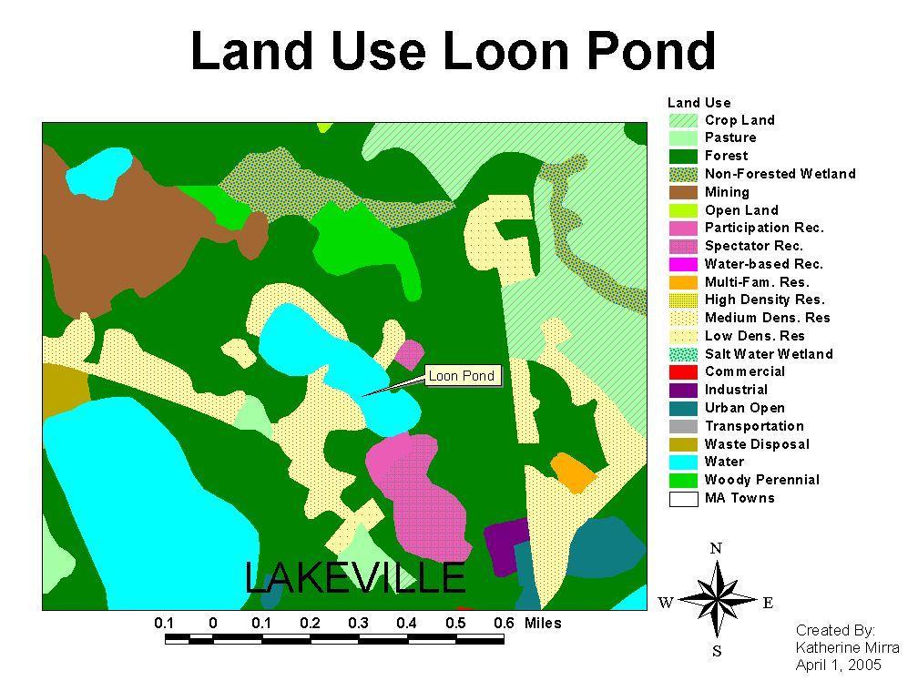
3 Located in Lakeville, Massachusetts Approximately 32 feet deep Covers an approximate 0.69 square miles Surrounded by forest and houses Most of the houses are summer homes Used for: swimming fishing canoeing
4
5 History of Loon Pond The property was owned by Horatio Sampson until Orville Gerrish bought it in 1889 When Orville died, the Boy Scouts bought it to be used as a summer camp The property was later sold to the Lakeville Parks Department The land was then sold to baseball great Ted Williams who created Ted Williams Baseball Camp In 1986, the town of Lakeville bought the park and now use it as a recreational area

6 Objective: To find out if there are invasive weeds in Loon Pond Why? The town of Lakeville wanted to know if there were invasive weeds in Loon Pond.

7
8 Protocol 20 feet into the water, 45 feet across Waded parallel to the shore Established protocol in order to keep consistency and uniformity Utilized weed watcher s booklet in order to identify weeds

9 Weeds Identified White Water Lily Little Floating Heart Pipewort Elodea Nuttallii Elodea Canadensis Hedge Hyssop Water-star Grass Wild Celery
10 Data 5* 5* 4* 4* Macrophyte Species: Ted Williams Camp Boy Scout Beach 60 Precinct St. Rustic Drive White Water Lily Little Floating Heart Pipewort Elodea Nuttallii Elodea Canadensis Hedge Hyssop Waterstar Grass possibly Wild Celery *indicates the number of times the site was visited

11 White Water Lily Rooted plant with large, firm, dark green leaves Leaves are circular with a 5 to 9 diameter and are usually floating or standing above the water s surface Have a distinctive sweetscented white or pink flower Found throughout ponds, lakes, swamps, and streams Non-invasive

12 Little Floating Heart Located in ponds, lakes, and slow moving streams Has shiny, green, heartshaped leaves and white flowers Leaves are arranged alternately along the stem and oppositely on the flower stalks Leaves are purplish underneath and root bunches on the bottom of the stem Found on the water s surface

13 Pipewort Lives in shallow freshwater Has small, white flowers 1 to 10 in height Unmistakable when in bloom; a tiny, white pinhead rising just above the water Distinguished by its leafless stem and narrow, grass-like leaves Non-invasive

14 Elodea Nuttallii Underwater perennial plant May occur as a tangled mass Provides food and habitat for fish Common throughout the Eastern United States Non-invasive

15 Elodea Canadensis Has leaves in whorls around the stems Three leaves per whorl Found throughout temperate North America Provides a good habitat Food for some animals Non-invasive
16 Trailing to standing annual plants up to 30 cm tall Found along shorelines of lakes, ponds, and rivers Oppositely arranged narrow leaves with slightly toothed margins Tubular, irregular flowers, with groups of 5 petals Distinguished by its leaf shape and attachment, the presence of sticky glands, and the flower shape Non-invasive Hedge Hyssop

17 Water star Grass Underwater plant Has small, star shaped yellow flowers that float or rise above the water surface Has long, grass-like, dark green leaves Frequently grow into large tangled masses in shallow water or along shore lines Can be distinguished from pond weeds by the lack of a prominent mid-vein in the leaves Non-invasive

18 Wild Celery Surface plant Ribbon-like leaves which grow to the surface and then bend and float on the surface Leaves are serrated with a stripe down the middle Flowers are on long stalks that float Found in ponds Provides food and habitat Non-invasive

19 Water Quality Analysis Data from Probe launched on April 15, 2005 Nitrogen as Nitrate monthly sampling data Reactive Phosphorous monthly sampling data The above photo shows the launching of the probe.
20 Dissolved Oxygen (mg/l) D.O. vs. Time, Loon Pond, Rustic Drive, April 15, :00:00 2:00:00 3:00:00 4:00:00 5:00:00 6:00:00 7:00:00 8:00:00 9:00:00 10:00:00 11:00:00 12:00:00 13:00:00 14:00:00 15:00:00 16:00:00 17:00:00 18:00:00 19:00:00 20:00:00 21:00:00 22:00:00 23:00:00 Time (HH/MM/SS)
21 Temperature (Degrees Celsius) Temperature vs. Time, Loon Pond, Rustic Drive, April 15, :00:00 2:00:00 3:00:00 4:00:00 5:00:00 6:00:00 7:00:00 8:00:00 9:00:00 10:00:00 11:00:00 12:00:00 13:00:00 14:00:00 15:00:00 16:00:00 17:00:00 18:00:00 19:00:00 20:00:00 21:00:00 22:00:00 23:00:00 Time (HH/MM/SS)
22 ph (ph Units) ph vs. Time, Loon Pond, Rustic Drive, April 15, :00:00 2:00:00 3:00:00 4:00:00 5:00:00 6:00:00 7:00:00 8:00:00 9:00:00 10:00:00 11:00:00 12:00:00 13:00:00 14:00:00 15:00:00 16:00:00 17:00:00 18:00:00 19:00:00 20:00:00 21:00:00 22:00:00 23:00:00 Time (HH/MM/SS)

23

24
25 Conclusions ~Loon Pond does not contain invasive weeds. ~Loon Pond contains healthy nitrogen and phosphorous levels ~Loon Pond retained normal temperatures and levels of dissolved oxygen throughout the year
26 Acknowledgements Mrs. Hubbard, Rustic Drive, Lakeville Ms. Kim McCoy, WAL, Bridgewater State College Mr. Ralph Blackburn, Lakeville Residence of Precinct St., Lakeville
Aquatic Invasives to Watch for in the Tualatin River Watershed
 Aquatic Invasives to Watch for in the Tualatin River Watershed Table of Contents Report Invasive Species! In order to confirm species ID, we 1-Purple loosestrife recommend that people take photos of 2-Parrot
Eurasian Water-milfoil
 Eurasian Water-milfoil Exotic Eurasian Water-milfoil 11 Native Species of Water-milfoil in USA 7 Native Species of Water-milfoil in WI EWM Native to Asia and Europe EWM Arrived in US in 1942 & WI in 1960s
Citizen Lake Monitoring Network. Lakes Convention April 2011 Laura Herman Brenda Nordin Jay Schiefelbein
 Citizen Lake Monitoring Network Lakes Convention April 2011 Laura Herman Brenda Nordin Jay Schiefelbein Wisconsin s Lakes are Changing Faster than Ever: Algae blooms (phosphorus pollution) Destruction
Aquatic Plants of the Three Lakes
 Aquatic Plants of the Three Lakes Chris Doyle, CLM Senior Aquatic Biologist/Water Quality Program Supervisor Allied Biological, Inc. 580 Rockport Road Hackettstown, NJ 07840 Phone: 908-850-0303 E-mail:
What do mangroves mean to you?
 Student Sheet: MA-1 What do mangroves mean to you? Many people see mangroves as unpleasant, muddy places with too many mosquitoes. They take up space that could be used for fish ponds and the wood is useful
Why do different beaches have different types of vegetation?
 Why do different beaches have different types of vegetation? Allan Crowe Environment Canada National Water Research Institute Burlington, Ontario Environment Canada Environnement Canada NATIONAL WATER
Macroinvertabrate and Water Quality Survey of Smelt Brook
 Bridgewater State University Virtual Commons - Bridgewater State University Watershed Access Lab Projects Watershed Access Lab 2009 Macroinvertabrate and Water Quality Survey of Smelt Brook Recommended
2016 Field Survey Oneida Lake / Three Mile Bay WMA SLELO-PRISM Early Detection Surveillance
 St. Lawrence Eastern Lake Ontario Partnership for Regional Invasive Species Management 2016 Field Survey Oneida Lake / Three Mile Bay WMA Early Detection Surveillance August 3 rd, 4 th, 5 th, and 8 th,
For Creative Minds. Salt Marsh Plants and Animals
 For Creative Minds The For Creative Minds educational section may be photocopied or printed from our website by the owner of this book for educational, non-commercial uses. Cross-curricular teaching activities,
A Guide to Selected Invasive Non-native Aquatic Species in Massachusetts
 A Guide to Selected Invasive Non-native Aquatic Species in Massachusetts C. Barre Hellquist Department of Biology Massachusetts College of Liberal Arts North Adams, Massachusetts 01247 James Straub Massachusetts
AQUATIC INVASIVE SPECIES EARLY DETECTORS A HOW-TO GUIDE
 AQUATIC SPECIES EARLY DETECTORS A HOW-TO GUIDE CM 0 1 2 3 4 5 6 7 8 9 10 11 12 13 14 15 16 17 18 19 20 21 FIELD NOTES TABLE OF CONTENTS AIS EARLY DETECTOR BASICS 3 How to prepare 5 Assembling a monitoring
Osoyoos Lake Aquatic Plant Mapping
 Osoyoos Lake Aquatic Plant Mapping AquaTechnex, LLC Presented to Okanogan County NWCB by PO Box 30824 Bellingham WA, 98228 www.aquatechnex.com Introductions Myriophyllum spicatum or Eurasian Milfoil has
Estuarine Shoreline Stabilization
 Estuarine Shoreline Stabilization Property Owner s Guide to Determining the Most Appropriate Stabilization Method Estuarine shorelines are dynamic features that experience continued erosion. Land is lost
Questions # 4 7 refer to Figure # 2 (page 321, Fig )
") Shoreline Community College OCEANOGRAPHY 101 Fall 2006 Sample Exam # 3 Instructor: Linda Khandro Questions # 1 3 refer to Figure # 1 (page 284, Fig 11.7) 1. At which position is the moon in its new moon
Shoreline Community College OCEANOGRAPHY 101 Fall 2006 Sample Exam # 3 Instructor: Linda Khandro Questions # 1 3 refer to Figure # 1 (page 284, Fig 11.7) 1. At which position is the moon in its new moon
Notebooks or journals for drawing and taking notes
 Title: Have to Have a Habitat Grade Level: 5 th -8 th grade Topic: Trout Habitat Background: The following chart lists the ideal conditions for trout habitat. Dissolved Oxygen: > 7 mg/l ph: 5.5-7 Next
City of Los Angeles Department of Building & Safety Disabled Access Section Supplemental Plan Review Checklist No. 8 RECREATION FACILITIES
 AMUSEMENT RIDES, BOAT SLIPS, BOWLING LANES, COURT SPORTS, FISHING PIERS Plan Check No. 1. Amusement rides required to comply with 11B-234, Amusement Rides shall provide accessible routes in accordance
HOTWGPS Newsletter. Volume 10 Issue 3 March 2018
 March Meeting The March meeting will be on March 20th at 6:30 PM. We will meet at Luigi s 319 S Main St., McGregor. Pond Tour Our annual pond tour is coming up. It is scheduled to take place on 9 & 10
SALINITY. It's the amount of dissolved salts the water contains.
 AQUATIC ECOSYSTEMS SALINITY The types of organisms in an aquatic ecosystem depend upon the water s Salinity. It's the amount of dissolved salts the water contains. Salinity determines the two main aquatic
ROUTE 2. Bateau Channel. Topographic Map 31 C/8 Navigation Charts 1438/39 Reference Maps
 Topographic Map 31 C/8 Navigation Charts 1438/39 Reference Maps ROUTE 2 Bateau Channel The shoreline marshes of the Bateaux Channel team with life. Wetlands provide breeding habitat for amphibians, fish
Regulations for Boating and Shore Fishing. Season The Quabbin fishing season runs from the third weekend in April to the third weekend in October
 Welcome to Quabbin Reservoir, the principle drinking water supply for 2.5 million Massachusetts residents in 46 communities. In addition to yielding drinking water of exceptional quality, Quabbin also
PRODUCING A TROPHY LARGEMOUTH BASS FISHERY (CASE STUDY) Greg Grimes President of Aquatic Environmental Services, Inc.
 Greg Grimes President of Aquatic Environmental Services, Inc.") PRODUCING A TROPHY LARGEMOUTH BASS FISHERY (CASE STUDY) Greg Grimes President of Aquatic Environmental Services, Inc. Background 32 acre lake in Harris County, Georgia o The construction of the lake began
PRODUCING A TROPHY LARGEMOUTH BASS FISHERY (CASE STUDY) Greg Grimes President of Aquatic Environmental Services, Inc. Background 32 acre lake in Harris County, Georgia o The construction of the lake began
Identifying Some Pest and Beneficial Insects on Your Sticky Cards Leanne Pundt UConn Extension
 Identifying Some Pest and Beneficial Insects on Your Sticky Cards Leanne Pundt UConn Extension www.ipm.uconn.edu An Equal Opportunity Employer and Program Provider Scouting Use yellow sticky cards to trap
Brook Trout Life Cycle and Habitat
 Brook Trout Life Cycle and Habitat Directions: 1. As you watch this slide show, watch for vocabulary terms we learned today. The first time they appear, you will see them in RED! (not redd!) 2. At the
Columbia Lake Dam Removal Project
 Columbia Lake Dam Removal Project The Columbia Lake dam located 1/4 mile upstream of the Paulins Kill River's confluence with the Delaware River in Knowlton Township, Warren County has been proposed for
GIRL SCOUT EARTH CONNECTIONS BADGE WORKSHEET
 Ecology is the study of how living things interact with each other and their environments. Ecology not only involves plants and animals, but people as well. The activities in this handout can be completed
The Cove Run Brook Trout Restoration Project with the Northern Garrett High School AP Environmental Science Class,
 The Cove Run Brook Trout Restoration Project with the Northern Garrett High School AP Environmental Science Class, 2012 2014. Image or Graphic Presented By: Alan W. Klotz, Western Region District I, Inland
Learning Pad Launch Portal S & T Activities Producers and Consumers activity
 Activities Producers and Consumers activity Google DCDSB. Click on the DCDSB website. Near the top of the screen, click on Students. Down the right side of the screen, click on the LaunchPad Learning Portal
Wetland Plants and Animals. Picture Card Set
 Wetland Plants and Animals Picture Card Set Beaver Usually nocturnal and active year round, this member of the rodent family is the largest in the United States. Its webbed feet and paddle shaped tail
The Sand Beaches of New Hampshire and Maine
 The Sand Beaches of New Hampshire and Maine Beach Preservation and Erosion Control Photographs provided by Joe Kelly and Steve Adams Cover photo: Reid State Park, ME Introduction The sand beaches of New
Northwest Ferns. by Gayle Hammond
 Northwest Ferns by Gayle Hammond Content: General Parts Sword Fern Bracken Fern Licorice Fern Lady Fern Deer Fern Giant Chain Fern Spreading Wood Fern Coastal Wood Fern Maiden Fern Shasta Fern Oak Fern
EcoLogic Memorandum. TO: Ben Brezell; EDR FROM: Mark Arrigo RE: Possible Impacts of Dredging Snooks Pond DATE: 6/4/07
 EcoLogic Memorandum TO: Ben Brezell; EDR FROM: Mark Arrigo RE: Possible Impacts of Dredging Snooks Pond DATE: 6/4/07 Background EDR P.C. (EDR) has been contracted by a landowner to assess the feasibility
Aquatic Plant Point-Intercept Survey for Cates Lake, Scott County, Minnesota
 American Lotus in Cates Lake, Scott County, Minnesota, 2016 Aquatic Plant Point-Intercept Survey for Cates Lake, Scott County, Minnesota [Plant Survey Conducted August 29, 2016] Prepared for: Prior Lake-Spring
Lake wide Milfoil Management Efforts
 Lake Winnipesaukee Lake wide Milfoil Management Efforts Gilford Island Association Winter Meeting March 5, 2016 Presented by: Patricia Tarpey Lake Winnipesaukee Association Gilford Conservation Commission
NYS Coastal Waters. Water Resources of NYS: THE NATURE of the COASTAL ZONE. NYS Coastal Waters. NYS Coastal Atlas. Coastal Zone Management 10/10/2014
 Water Resources of NYS: THE NATURE of the COASTAL ZONE NYS Coastal Waters NYS is the only state to border the Atlantic Ocean and the Great Lakes (Lakes Erie and Ontario). Great Lakes shoreline: 577 miles
BENSON PARK POND FISH SPECIES
 BENSON PARK POND FISH SPECIES Bluegill (Lepomis macrochirus) From the Greek, lepomis means scaled gill cover and macrochirus means large hand, in reference to its body shape and size. Average adult size
SCIENCE. Year 9 Examination C 40 marks. Make sure that you have answered all the questions in paper 9B before you start this paper
 NAME: SCIENCE TEACHER: 9C SCIENCE Year 9 Examination 2006 9C 40 marks Make sure that you have answered all the questions in paper 9B before you start this paper Time allowed for both examinations: 2 hours
Identifying Some Pest and Beneficial Insects on Your Sticky Cards
 Identifying Some Pest and Beneficial Insects on Your Sticky Cards Leanne Pundt University of Connecticut Department of Extension An Equal Opportunity Employer and Program Provider Scouting Methods Sticky
Canoe Trip # Length of Trip: 225 kilometres Time Required to Complete Trip: 10 to 14 days Number of Portages: 21 to 25
 Canoe Trip #34 34 Brabant Lake - Wapiskau River - Steephill Lake - Reindeer River - Churchill River - Sandy Bay 225 Kilometers - 10 to 14 days - 21 to 25 portages Length of Trip: 225 kilometres Time Required
Shallow Lake Management Strategies. Steve McComas Blue Water Science Shallow Lakes Forum April 2014
 Shallow Lake Management Strategies Steve McComas Blue Water Science Shallow Lakes Forum April 2014 Shallow Lakes and Ponds Are Similar Shallow Lake Goal: Clear water and macrophytes. Clear Turbid Aquatic
Name of Applicant Phone Number # Mailing Address. City State Zip
 VIRGINIA DEPARTMENT OF GAME AND INLAND FISHERIES EXOTIC SPECIES APPLICATION/PERMIT TO IMPORT CERTIFIED TRIPLOID GRASS CARP FOR AQUATIC VEGETATION CONTROL IN PRIVATE PONDS (Under Authority of 4 VAC 15-30-40
Evaluation copy. Interdependence of Plants and Animals. computer OBJECTIVES MATERIALS
 Interdependence of Plants and Animals Computer 14 Plants and animals share many of the same chemicals throughout their lives. In most ecosystems, O 2, CO 2, water, food and nutrients are exchanged between
Mill Creek/Rose Valley Watershed General Information Presented by Dr. Mel Zimmerman Lycoming College CWI
 Mill Creek/Rose Valley Watershed General Information Watershed Concerns Rose Valley Lake Areas of Interest Biodiversity of Interest in Rose Valley Lake Rose Valley Lake Bird Area Fishes of Rose Valley
Canoe Trip # Maps: 63L Amisk Lake 63M Pelican Narrows
 Canoe Trip #51 49 Southeast Arem Deschambault Lake - Pelican Narrows - Wunehikun Bay - Attitti Lake - Belcher Lake - Mukoman Lake - Ohoo Lake - Mukoman River - Sokatisewin Lake - Sandy Bay 170 Kilometers
RECREATIONAL PONDS AND LAKES
 RECREATIONAL PONDS AND LAKES POND ECOLOGY AQUATIC PLANTS & FISH F.S. Conte Department of Animal Science University of California Davis Photos By Flickr AQUATIC PLANTS POND HEALTH Chemical Recycling Oxygen
Mogollon Rim and White Mountains Angler Report
 Mogollon Rim and White Mountains Angler Report Becker Lake, Monday, Nov. 6 Blain O.: Becker Lake fished well last week though the water was cold (50- degrees F at the surface). Fish were scattered everywhere
Description of the Fields
 This vernal pool assessment form was developed through funds provided by the Environmental Protection Agency to establish a GIS user interface with the capability to not only integrate all of the vernal
To help protect Becker County s lakes and rivers, please keep these points in mind before transporting watercraft.
 BECKER COUNTY FORESTRY TOURISM INDUSTRY Established to Serve Since 1858 Becker County AGRICULTURE Minnesota is known for its clean water, good fishing, and incredible recreational opportunities. With your
Oceans Humans both depend on it and threaten it with their activities
 Oceans Humans both depend on it and threaten it with their activities Oceans Water covers nearly ¾ of the Earth s surface More than 50% of the world s population lives within an hour of the coast Oceans
Salmon Biology Station
 Salmon Biology Station OBJECTIVES: Students learn: Wild salmon are indicator species and keystone species whose survival is connected to the health of the watershed. o Riparian salmon need trees and trees
Ocean Current Worksheet
 Ocean Current Worksheet Temperature Affects and Surface Currents: Surface waters of the Earth s oceans are forced to move, primarily by winds. Where winds blow in the same direction for a long period of
Launch A: Experimental Lakes Road The launch site is about 4 km from highway #17. There is a sign on the highway indicating the experimental lakes
 Launch A: Experimental Lakes Road The launch site is about 4 km from highway #17. There is a sign on the highway indicating the experimental lakes road. You have to cross railway tracks on the way to the
Coastal Cutthroat Trout
 THE Volume 5, Number 3 The Lakelse Watershed Newsletter Summer 2014 History Coastal Cutthroat Trout Coastal cutthroat and rainbow trout diverged from a common ancestor millions of years ago. Today cutthroat
Fish Fact: A Flathead is a strict carnivore. It will eat virtually any
 A flathead is a large growing catfish. It is easily identified by a broad, unforked, square tail, a large mouth spanning the width of the head, mottled coloration and a flat, sloping head. Colors vary
MUDSKIPPER STANDARD OPERATING PROCEDURES
 MUDSKIPPER STANDARD OPERATING PROCEDURES April 1, 2003 - Revised Dec. 2005 HOUSING: Mudskippers may be held in a variety of tanks as long as they meet the following criteria: 1) The tank size is suitable
The activated sludge process
 The activated sludge process Most wastewater treatment plants are using the activated sludge process. The heart of such a process mainly consists of an aeration tank, a sedimentation tank or clarifier
Warm-up # 7 A day 5/17 - B day 5/18 UPDATE YOUR TABLE OF CONTENTS
 Warm-up # 7 A day 5/17 - B day 5/18 UPDATE YOUR TABLE OF CONTENTS Question: List all examples of surface water on Earth. Answer: Rivers and streams, lakes and reservoirs, (ponds) wetlands, estuaries and
Outline. Wind Turbine Siting. Roughness. Wind Farm Design 4/7/2015
 Wind Turbine Siting Andrew Kusiak 2139 Seamans Center Iowa City, Iowa 52242-1527 andrew-kusiak@uiowa.edu Tel: 319-335-5934 Fax: 319-335-5669 http://www.icaen.uiowa.edu/~ankusiak Terrain roughness Escarpments
CHEBACCO LAKE & WATERSHED ASSOCIATION Newsletter
 CHEBACCO LAKE & WATERSHED ASSOCIATION Newsletter A Quarterly Publication of the Chebacco Lake & Watershed Association www.chebaccolake.org May 2012 Notes from Around the Lake Another summer season on the
Instructions: CLASSIFY ANIMALS AS BLOOD FEEDERS OR NON-BLOODFEEDERS 1. Take out the ADULT CARDS, and place them on the correct boxes 2.
 Instructions: CLASSIFY ANIMALS AS BLOOD FEEDERS OR NON-BLOODFEEDERS 1. Take out the ADULT CARDS, and place them on the correct boxes 2. March the LARVA CARDS with the correct adult cards 3. March the HABITAT
Populations and Life Cycles. Hawaii s Freshwater Ecosystems
 Hawaii s Freshwater Ecosystems Concepts Every species has distinct growth and reproductive characteristics HCPS III Benchmarks 7.1.1 7.1.2 7.1.3 Duration 1 st week: 1 hr 3 rd and 5 th weeks: ½ hr 7 th
Booklet translated by SREJ at CSDC 1
 Name: Gr. : Booklet translated by SREJ at CSDC 1 This is the beginning of a new project about Aquaculture. Before we start, I would like to see what you already know about the subject. Write all the words
Aquatic Plant Point-Intercept Survey for Pike Lake, Scott County, Minnesota
 Campers on Pike Lake, Scott County, Minnesota, 2015 Aquatic Plant Point-Intercept Survey for Pike Lake, Scott County, Minnesota [Plant Survey Conducted August 24, 2015] Prepared for: Prior Lake/Spring
Frequency of Percnon gibbesi in relation to. Diadema antillarum at Rodney s Rock
 Frequency of Percnon gibbesi in relation to Diadema antillarum at Rodney s Rock By: Rickey Wallace Study Abroad Dominica Summer 2007 Texas A&M University Dr. Bob Wharton Dr. Jim Woolley Abstract The nimble
Lesson: Ocean Circulation
 Lesson: Ocean Circulation By Keith Meldahl Corresponding to Chapter 9: Ocean Circulation As this figure shows, there is a connection between the prevailing easterly and westerly winds (discussed in Chapter
Types of Freshwater Ecosystems. Streams originate from underground water. Rivers form when streams join together. Freshwater Biome
 Definition Streams originate from underground water sources Types of Freshwater Ecosystems Streams Rivers Rivers form when streams join together Freshwater Lakes Ponds Basic Characteristics Directional
Figure 1. Schematic illustration of the major environments on Mustang Island.
 STOP #1: PACKERY CHANNEL BEACH TO BAY We will start this field guide near the north jetty of Packery Channel and hike across the island to Corpus Christi Bay (fig. 1). The island emerges from the Gulf
Marine Ecosystems. Aquatic Ecosystems Section 2
 Marine Ecosystems Marine ecosystems are located mainly in coastal areas and in the open ocean. Organisms that live in coastal areas adapt to changes in water level and salinity. Organisms that live in
Everything a Lake Should Be
 Everything a Lake Should Be It's not what we do that sets us apart. It's how and why we do it so well. RESPONSIBLE LAKE MANAGEMENT Since 1977, Aquatic Systems has been solving difficult waterway management
Section 2: Biodiversity at Risk
 Section 2: Biodiversity at Risk Preview Classroom Catalyst Objectives Biodiversity at Risk Current Extinctions Species Prone to Extinction How Do Humans Cause Extinctions? Habitat Destruction and Fragmentation
Barnegat Bay-Friendly Golf Course Certification Program
 Barnegat Bay-Friendly Golf Course Certification Program Businesses for a Better Barnegat Bay Thank you for your interest in becoming a Certified, Barnegat Bay-Friendly Golf Course. This American Littoral
Boat electrofishing survey of Lake Rotokaeo, Hamilton
 Boat electrofishing survey of Lake Rotokaeo, Hamilton CBER Contract Report 93 Client report prepared for National Institute of Water and Atmosphere by Brendan J. Hicks Jeroen Brijs Dudley Bell Centre for
Paulding Soil & Water Conservation District Fish Sale Guide
 2018 Fish Sale Guide Phone: 419-399-4771 Patrick Troyer Education Specialist, Paulding SWCD Email: patrick.troyer@pauldingswcd.org Bluegill The bluegill is small freshwater fish normally measuring around
6TH PELLETIER BROOK LAKE T15 R9, Aroostook Co. U.S.G.S. Gardner Pond, Maine (7 1/2 )
") 6TH PELLETIER BROOK LAKE T15 R9, Aroostook Co. U.S.G.S. Gardner Pond, Maine (7 1/2 ) Fishes Brook trout Minnows Blacknose dace Pearl dace Physical Characteristics Area - 27 acres Average depth - 2 feet
6TH PELLETIER BROOK LAKE T15 R9, Aroostook Co. U.S.G.S. Gardner Pond, Maine (7 1/2 ) Fishes Brook trout Minnows Blacknose dace Pearl dace Physical Characteristics Area - 27 acres Average depth - 2 feet
Snorkel Safari. at Gansey Point. Welcome to the RED DIFFICULT BE SAFE. The Snorkel Trail
 at Gansey oint The Snorkel Trail The trail commences from the gully in front of the car park. You can wade in water to fit your fins. Follow the rock line on your right. There are many gullies and overhangs
ZEBRA MUSSEL MONITORING Guidelines for Stream Teams
 ZEBRA MUSSEL MONITORING Guidelines for Stream Teams How Stream Teams can help track the status of Missouri s latest threat to streams and lakes Zebra Mussels Are Here! Missouri has had its share of exotic
1 P a g e. Crabs of the Maroochy Wetlands Sanctuary. Compiled by Robyn Howard August 2011
 Identifying Crabs at Maroochy Wetlands Sanctuary The old saying Rules were meant to be broken seems to apply when it comes to crab identification. In general, the Ocypodid family have long eye-stalks and
From Phosphorus to Fish: Beneficial Use of Excess Nutrients
 FLOATINGISLANDINTERNATIONAL From Phosphorus to Fish: Beneficial Use of Excess Nutrients Project Location: Shepherd, Montana Fishing can be the primary method for transitioning excess nonpoint source nutrients
River-Lab Grade 3 (RL3) Route Green & Yellow Deep River Pool Trail Guide
 Route Green & Yellow Deep River Pool Trail Guide") River-Lab Grade 3 (RL3) Route Green & Yellow Deep River Pool Trail Guide Route Green & Yellow Deep River Pool Trail Route Sequence Deep Pool Habitat Observation Marsh Habitat Observation Riffles Habitat
River-Lab Grade 3 (RL3) Route Green & Yellow Deep River Pool Trail Guide Route Green & Yellow Deep River Pool Trail Route Sequence Deep Pool Habitat Observation Marsh Habitat Observation Riffles Habitat
Transforming Chadwick Lake
 Transforming Chadwick Lake Chadwick Lake has been going through a process of renovation over the past two years. Management of the area began with a vision statement of producing an ecosystem comprised
AQUATIC PLANT MANAGEMENT PLAN
 AQUATIC PLANT MANAGEMENT PLAN JENNI AND KYLE PRESERVE PONDS TENNEY PARK LAGOON VILAS PARK LAGOON WARNER PARK LAGOON Lower Rock River Basin and VERONA QUARRY Grant-Platte-Sugar-Pecatonica Basin DANE COUNTY,
1. Distribute the activity sheet, and allow 20 minutes for the first use.
 A LOCAL WAY OF LEARNING Title: MISSING MANGROVE MESSAGE Author: Eulalie R. Rivera Elementary School Environmental Education Team Grade Level: 4-6 Concepts: 2.Ecosystem 6.Resources 9.Change Disciplines:
Recent changes in invasive zebra mussel abundance in Gull Lake. Jeffrey D. White GLQO Annual Meeting 12 August 2014
 Recent changes in invasive zebra mussel abundance in Gull Lake Jeffrey D. White GLQO Annual Meeting 12 August 2014 Zebra mussels: background Introduced: 1980s from Europe/Asia Transported: ballast water
f Agricultural S c i e n c SMALL EARTH DAMS LLOYD N. BROWN ^ CALIFORNIA AGRICULTURAL CIRCULAR 467 \ Experiment Station Extension Service
 f Agricultural S c i e n c SMALL EARTH DAMS LLOYD N. BROWN ^ CALIFORNIA AGRICULTURAL \ Experiment Station Extension Service CIRCULAR 467 Crest of dam Dry face slope 2 to 1 Downstream toe About 10,000 small
Chapter 22, Section 1 - Ocean Currents. Section Objectives
 Chapter 22, Section 1 - Ocean Currents Section Objectives Intro Surface Currents Factors Affecting Ocean Currents Global Wind Belts (you should draw and label a diagram of the global wind belts) The Coriolis
Full Name Class Date. 1. Draw and describe your prediction of what will happen to the eggplant after the teacher applies salt to it.
 Full Name Class Date Investigation Booklet Exploring: Salt in Our Lives 1. Draw and describe your prediction of what will happen to the eggplant after the teacher applies salt to it. Use these ecosystem
DRAFT AMENDMENT 1. Introduction
 DRAFT AMENDMENT 1 Aquatic Plant Management Plan, Yahara River and Upper Mud Lake, Lower Rock River Basin, Dane County Wisconsin Approved by the Dane County Lakes and Watershed Commission on and by the
Black crappie (Pomoxis nigromaculatus)
") Black crappie (Pomoxis nigromaculatus) feeding - larger clear non-silty low-gradient rivers; also in lakes and impoundments - clean hard sand or muck substrate - associated with submerged aquatic vegetation
Black crappie (Pomoxis nigromaculatus) feeding - larger clear non-silty low-gradient rivers; also in lakes and impoundments - clean hard sand or muck substrate - associated with submerged aquatic vegetation
APPENDIX 3E HYDROACOUSTIC ANALYSIS OF FISH POPULATIONS IN COPCO AND IRON GATE RESERVOIRS, CALIFORNIA NOVEMBER
 APPENDIX 3E HYDROACOUSTIC ANALYSIS OF FISH POPULATIONS IN COPCO AND IRON GATE RESERVOIRS, CALIFORNIA NOVEMBER 23 February 24 PacifiCorp Fish Resources FTR Appendix 3E.doc Hydroacoustic Analysis of Fish
PROCEDURE FOR MONITORING AN AQUATIC PLANT PROBLEM 1
 PROCEDURE FOR MONITORING AN AQUATIC PLANT PROBLEM 1 The density, diversity, and growth patterns of aquatic plants are unique to each lake. Therefore, many of the details concerning sample site locations
Aquatic Plant Surveys in Donner Lake State Park, California: Report to California State Parks. Final Draft
 Aquatic Plant Surveys in Donner Lake State Park, California: 2017 Report to California State Parks Final Draft Brant Allen, Katie Senft, and Brandon Berry UC Davis Tahoe Environmental Research Center February
Melissa Henry, Extension Agent Putnam County, Tennessee
 4-H JUDGING TEAMS A NATURAL FIT Melissa Henry, Extension Agent Putnam County, Tennessee I am the Lorax, I speak for the Trees! Forestry Judging Both indoor and outdoor components 8-10 practices, 1.5 hour
Wine Water. process occurs in wet environments,
 canoe country ecology G by Darby Nelson eri and I shoulder our packs and canoe then head down the path to the putin point at the east end of Beaverhouse Lake, gateway to Quetico Park. After two trips from
Chesapeake Bay Instantaneous Minimum Dissolved Oxygen Criteria: History and Background
 Chesapeake Bay Instantaneous Minimum Dissolved Oxygen Criteria: History and Background Rich Batiuk Associate Director for Science, Analysis and Implementation Chesapeake Bay Program Office U.S. Environmental
Lake Habitat. Cachuma Lake DISCOVERY BOOK Cachuma Lake Discovery Book V1, Santa Barbara County Parks
 Habitat Cachuma DISCOVERY BOOK 3.0 Habitat From land, a lake looks like one big pool. Under the surface of the water, lakes can have different habitats, just as the land does. We say that the lake is heterogeneous,
Resources and Guidance for writing a River Herring Management Plan
 Resources and Guidance for writing a River Herring Management Plan In 2011 members of the River Herring Network brainstormed a list of questions that should be answered in order to develop a plan for herring
A Winter Wonderland?! February 22, 2014
 A Winter Wonderland?! February 22, 2014 A MONTHLY NEWSLETTER OF NEW HAMPSHIRE LAKES ASSOCIATION The groundhog was right earlier this month - it's been a long winter and there seems to be no end in sight.
General Water Safety Tips
 General Wherever there is water these rules apply. Know the Aquacode Go Together, Stay Afloat and Wave, Reach to Rescue. Always swim with a friend or adult. To reach and rescue, lie down and stretch out.
Alberta Conservation Association 2013/14 Project Summary Report
 Project Name: Trout Stocking Evaluation Fisheries Program Manager: Peter Aku Project Leader: Kevin Fitzsimmons Primary ACA staff on project: Alberta Conservation Association 2013/14 Project Summary Report
The Salmon Circle of Life
 The Salmon Circle of Life for millions of years the wild salmon has helped nourish the plant and animal life of the temperate rain forest. Born in the streams and rivers of the forest, the salmon travels
Lynx Protection Zone and Trap Restrictions
 Lynx Protection Zone and Trap Restrictions Canada lynx are a federally listed Threatened Species. There is no open season for the trapping or hunting of lynx in Maine. Department biologists have confirmed