Fish Communities in Five West Coast Spring-fed Rivers. Brandon Simcox, Eric Johnson, Amanda Schworm, Bill Pouder
|
|
|
- Shana Robinson
- 6 years ago
- Views:
Transcription


1 Fish Communities in Five West Coast Spring-fed Rivers Brandon Simcox, Eric Johnson, Amanda Schworm, Bill Pouder
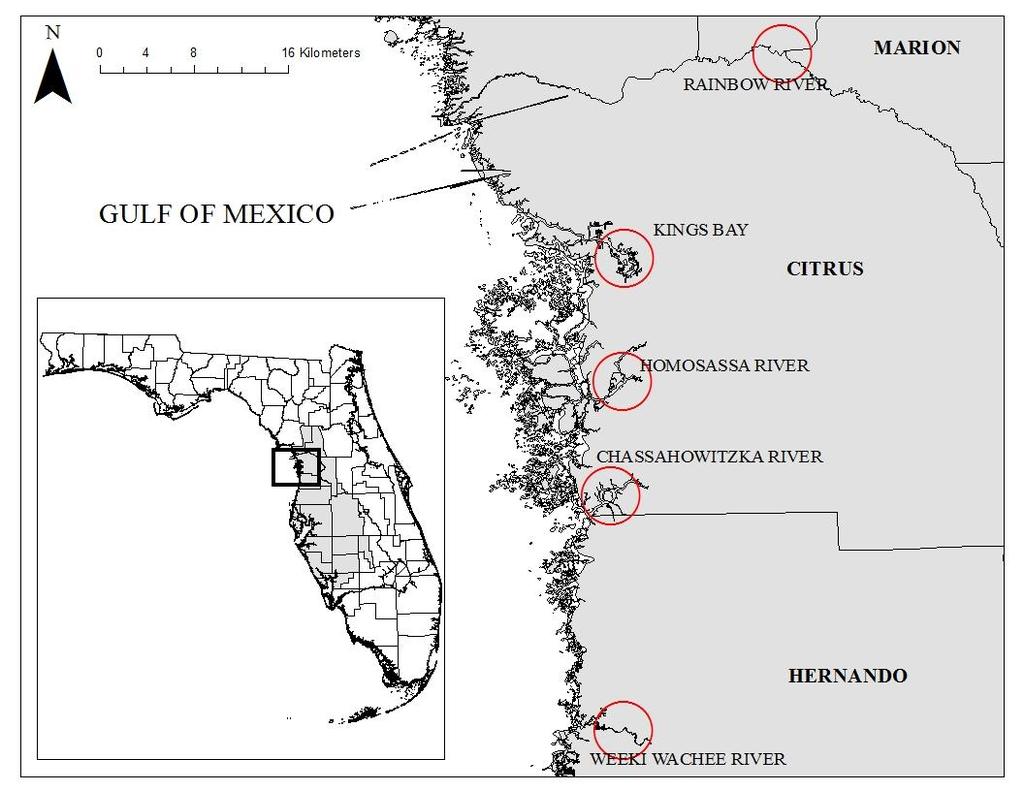
2 Project Overview FWC/SWFWMD partnership 3-yr funded project (thru June 2017) 5 spring-fed river systems Summer/Winter data collection Fisheries, habitat, water quality info for FWC and SWFWMD


3 Why are we sampling?? Threats to springs Nutrient increases, habitat loss, discharge reductions, salinity increases Biological data need Fisheries data gaps Reported changes in sport species Baseline data for future management


4 Project Objectives Document relative abundance, diversity, richness and species composition in each system Evaluate species associations w/quantified habitats and flows in each system
5


6 Fish Sampling Methods Electroing Spring-fed rivers 30 shoreline transects (100 meters length) Kings Bay 25 ten-minute shoreline transects (zig-zag)
 10")

7 Fish Sampling Methods Seining (4 meter seine) 10 seine hauls per system Document smaller missed by electroing

 Substrate type")
8 Habitat Sampling Visual estimates of percent cover Submersed/emergent/floating veg. Woody material (roots, snags, logs) Shoreline type (hardwood, seawall, docks, marsh) Substrate type (sand, mud, bedrock)

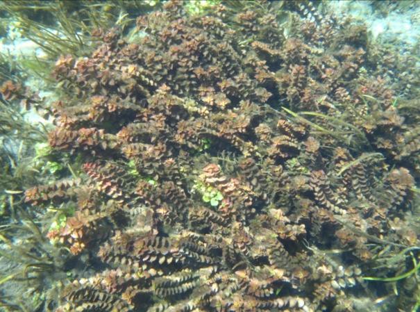
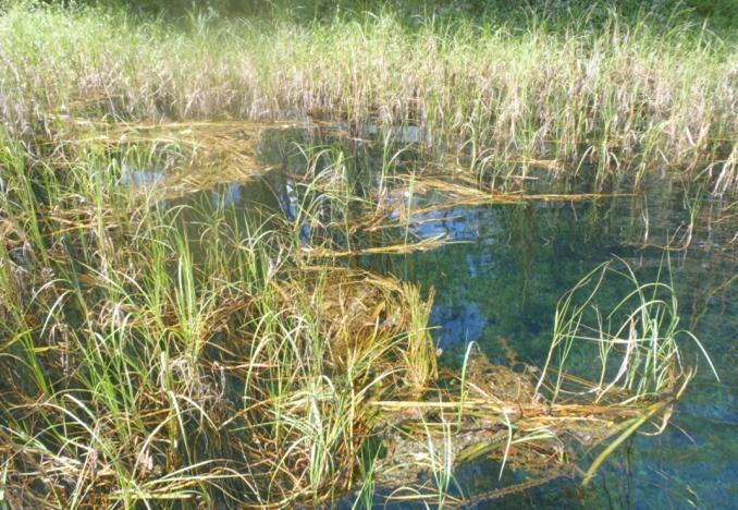
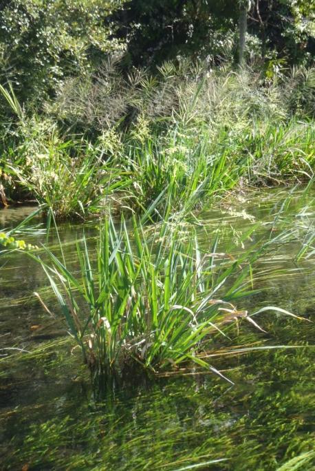
9 Habitat Sampling


10 Water Quality/Flow Sampling Water quality parameters Temperature, dissolved oxygen, salinity, conductivity Flow measurements Instream/USGS gage readings

11
12 Preliminary Findings Winter 2013/2014 (Nov Feb) 135 total electroing transects 43 total seine hauls Summer 2014 (May Aug) 162 total electroing transects 60 total seine hauls


13 Rainbow River Species Bluefin Killi Longnose Gar Bluegill Pirate Perch Bowfin Pygmy Sun Brook Silverside Redbreast Sun Coastal Shiner Redear Sun Dollar Sun Redeye Chub Mosquito Sailfin Molly Florida Gar Seminole Killi Gizzard Shad Spotted Sun Golden Shiner Swamp Darter Inland Silverside Tadpole Madtom Lake Chubsucker Warmouth Largemouth Bass Yellow Bullhead Least Killi
14 Weeki Wachee River Winter 13/14 29 species collected 18 freshwater, 11 saltwater Spotted sun (fresh) Gray snapper (salt) Summer species collected 19 freshwater, 12 saltwater Coastal Shiners (fresh) Hogchocker (salt) 43% 12% Weeki Wachee Winter 13/14 88% 57% Weeki Wachee Summer 14 Freshwater Saltwater Freshwater Saltwater


15 Weeki Wachee River Species American Eel Mountain Mullett Atlantic Needle Naked Goby Bluefin Killi Pin Bluegill Rainwater killi Brown Bullhead Redear Sun Clown Goby Sailfin Molly Coastal Shiner Seminole Killi Crevalle Jack Sheepshead Eastern Mosquito Silver Jenny Fat Sleeper Spotted Sun Florida Gar Striped Mullet Gray Snapper Tadpole Madtom Hogchoker Tidewater Mojarra Inland Silverside Warmouth Lake Chubsucker White Mullet Largemouth Bass Yellow Bullhead Least Killi
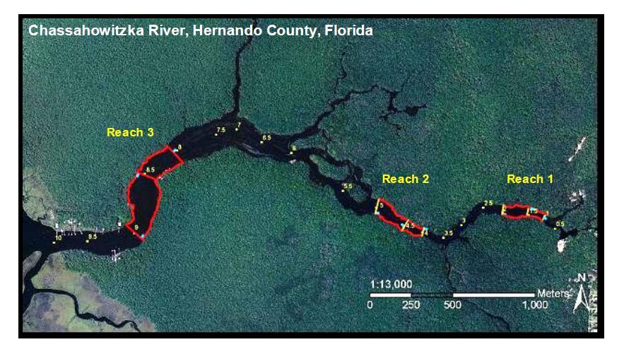
16 Chassahowitzka River Winter 13/14 19 species collected 9 freshwater, 10 saltwater Spotted sun (fresh) Gray snapper (salt) Summer species collected 21 freshwater, 13 saltwater Rainwater Killi (fresh) Pin (salt) 27% Chassahowitzka Winter 13/14 92% 8% Chassahowitzka Summer 14 73% Freshwater Saltwater Freshwater Saltwater


17 Chassahowitzka River American eel Bluefin Killi Bluegill Species Largemouth Bass Least Killi Menhaden spp. Clown Goby Mojarra spp. Coastal Shiner Needle spp. Common Snook Pin Eastern Mosquito Rainwater killi Golden Shiner Redear Sun Gray Snapper Sailfin Molly Gulf Killi Seminole Killi Gulf Toad Sheepshead Hardhead Cat Sheepshead minnow Hogchoker Spot Inland Silverside Spotted Sun Ironcolor Shiner Striped Mullet Lake Chubsucker Yellow Bullhead
18 Homosassa River Winter 13/14 23 species collected 7 freshwater, 16 saltwater Largemouth bass (fresh) Gray snapper (salt) Summer species collected 17 freshwater, 16 saltwater Largemouth Bass (fresh) Striped Mullet (salt) 64% Homosassa Winter 13/14 95% 5% Homosassa Summer 14 46% Freshwater Saltwater Freshwater Saltwater
19 Homosassa River Species American Eel Golden Shiner Pin Atlantic Needle Gray Snapper Rainwater Killi Bay Anchovy Gulf Pipe Red Drum Black Crappie Gulf Toad Redear Sun Black Drum Inland Silverside Seminole Killi Bluefin Killi Lady Sheepshead Bluegill Lake Chubsucker Sheepshead Minnow Clown Goby Largemouth Bass Spotted Seatrout Common Snook Longnose Gar Spotted Sun Crevalle Jack Menhaden spp. Striped Mullet Eastern Mosquito Mojarra spp. White Mullett Florida Gar Naked Goby
20 Kings Bay Winter 13/14 28 species collected 10 freshwater, 18 saltwater Largemouth bass (fresh) Mojarra species (salt) Summer species collected 14 freshwater,19 saltwater Inland Silverside (fresh) Mojarra species (salt) 90% 64% Kings Bay Winter 13/14 10% Kings Bay Summer 14 36% Freshwater Saltwater Freshwater Saltwater


21 Kings Bay Species American Eel Menhaden spp. Atlantic Needle Mojarra spp. Bay Anchovy Mullet Black Drum Naked goby Bluegill Pin Bowfin Rainwater Killi Clown Goby Red Drum Common Snook Redear Sun Crevalle Jack Seminole Killi Eastern Mosquito Sheepshead Florida Gar Sheepshead Minnow Gray Snapper Silver Perch Hardhead Cat Spotted Seatrout Hogchoker Spotted Sun Inland silverside Stingray Lady Striped Mullet Largemouth Bass White Mullet

")

22 Snook Tagging Fish and Wildlife Research Institute Kings Bay 131 tagged (300 to 1000 mm) Tracking Subsequent sampling efforts and anglers 3 recaptures

23 Kings Bay Recaptured Nov 4, 2014 Tagged May 6, 2014
24 Our plans for these data.. Template for Long-Term Monitoring Document relative abundance and diversity Monitor spatial and temporal trends Compare to previous data collected Frazer et al (Jaccard Similarity) Evaluate species associations with measured habitats and flow levels Relationships between shoreline development and communities Snook movement (Kings Bay)
25 Questions?
Delaware River Seine Survey: 2012 Sampling Summary
 Delaware River Seine Survey: 2012 Sampling Summary Fish and Wildlife employees pull in the seine net From June 18 to November 21, 2012, biologists conducted the Delaware River Seine Survey. Over the course
Lake St. Clair Fish Community and Fishery
 Lake St. Clair Fish Community and Fishery Megan Belore Ontario Ministry of Natural Resources and Forestry Mike Thomas Michigan Department of Natural Resources Fish Community Fish Community Mixture of warm
NJ DIVISION OF FISH AND WILDLIFE Bureau of Freshwater Fisheries
 NJ DIVISION OF FISH AND WILDLIFE Bureau of Freshwater Fisheries 2015 Warmwater Reproduction Checks (Shoreline Seining) Alloway Lake (Salem) A seining survey was completed at Alloway Lake (120 acres) on
Thunder Bay River Assessment Appendix. Appendix 2
 Appendix 2 Known past and present fish distributions in the River system. Distribution of fishes were compiled from Bailey et al. (2003) and from records located at the Michigan Department of Natural Resources
Florida Fish and Wildlife Conservation Commission Freshwater Fisheries
 Florida Fish and Wildlife Conservation Commission Freshwater Fisheries Southwest Florida Water Management District Grant Project No. 13PW0000049 Springs Coast Fish Community Assessment E.R. Johnson Principal
Great Lakes Coastal Wetland Communities: Vulnerabilities to Climate Change and Response to Adaptation Strategies
 Great Lakes Coastal Wetland Communities: Vulnerabilities to Climate Change and Response to Adaptation Strategies CCAF Wetlands Study Investigators: Susan Doka Fisheries & Oceans, Great Lakes Lab for Fisheries
Pascagoula River Marsh 2018 REEL FACTS Stephen Brown Fisheries Biologist
 Pascagoula River Marsh 218 REEL FACTS Stephen Brown Fisheries Biologist stephenb@mdwfp.state.ms.us General Information: The Pascagoula River marsh is 25 acres of tidal creeks, canals, bays, and streams
Pearl River 2018 Middle Reach REEL FACTS Dustin Rodgers Fisheries Biologist
 Pearl River 1 Middle Reach REEL FACTS Dustin Rodgers Fisheries Biologist dustinr@mdwfp.state.ms.us General Information: The Pearl River contains the third largest drainage basin in Mississippi. A variety
Onondaga Lake Fishery: 2011 Fact Sheet
 October, 2011 Onondaga County Department of Water Environment Protection SUNY College of Environmental Science and Forestry Joanne M. Mahoney, County Executive Tom Rhoads, P.E., Commissioner Onondaga Lake
12 Affidavits with a Total Release Points for 80 fish : Total Weight Points 1-1 fish :
 IWFA affidavits for September, 2017 Mrs. Roberta Arostegui (Roberta) Coral Gables, Florida Sep 11 Char, Arctic 16 # A Fly 3 56 168 Sep 11 Salmon, Coho 16 # A Fly 10 125 1,250 Sep 12 Trout, Rainbow 16 #
6 Affidavits with a Total Release Points for 173 fish :
 IWFA affidavits for May, 2018 Mrs. Roberta Arostegui (Roberta) Coral Gables, Florida May 4 Bass, Largemouth 4 # A Fly 30 100 3,000 May 4 Bluegill 4 # A Fly 36 100 3,600 May 4 Bowfin 4 # A Fly May 4 Crappie,
Crooked Lake Oakland County (T4N, R9E, Sections 3, 4, 9) Surveyed May James T. Francis
 Surveyed May James T. Francis") Michigan Department of Natural Resources Status of the Fishery Resource Report No. 2004-1, 2004 Crooked Lake Oakland County (T4N, R9E, Sections 3, 4, 9) Surveyed May 2002 James T. Francis Environment Crooked
Michigan Department of Natural Resources Status of the Fishery Resource Report No. 2004-1, 2004 Crooked Lake Oakland County (T4N, R9E, Sections 3, 4, 9) Surveyed May 2002 James T. Francis Environment Crooked
THE LONG-TERM ILLINOIS RIVER FISH POPULATION MONITORING PROGRAM
 T E C H N I C A L R E P O R T THE LONG-TERM ILLINOIS RIVER FISH POPULATION MONITORING PROGRAM Project F-101-R-20 Annual Report to the Illinois Department of Natural Resources Michael A. McClelland and
Forage Fish in Chesapeake Bay: Status, Trends, Science and Monitoring
 Forage Fish in Chesapeake Bay: Status, Trends, Science and Monitoring GIT Meeting Chesapeake Biological Lab Solomons, MD 4 December 2013 Chesapeake Bay Watershed Agreement, Draft 11/3/13 Forage Fish Outcome:
Mississippi s Shore Night Fishing Survey. Marine Recreational Fisheries Statistics Survey. January 2001 December 2002.
 Mississippi s Shore Night Fishing Survey Marine Recreational Fisheries Statistics Survey January 2001 December 2002 Prepared for: FIN Committee Annual Meeting Hilton in the Walt Disney World Resort 1751
Investigating reproduction and abundance of bighead carp (Hypophthalmichthys nobilis) and silver carp (H. molitrix) in the Greenup pool, Ohio River
 and silver carp (H. molitrix) in the Greenup pool, Ohio River") Investigating reproduction and abundance of bighead carp (Hypophthalmichthys nobilis) and silver carp (H. molitrix) in the Greenup pool, Ohio River Nathan Fleshman Dr. Thomas Jones Photo: USGS Photo: USGS
Investigating reproduction and abundance of bighead carp (Hypophthalmichthys nobilis) and silver carp (H. molitrix) in the Greenup pool, Ohio River Nathan Fleshman Dr. Thomas Jones Photo: USGS Photo: USGS
Penny Road Pond Population Survey
 Located in Barrington Hills on the south side of Penny Rd. west of Old Sutton Rd. This small 7 acre pond has a maximum depth of 4.6 feet and is connected to Spring Creek. The fish population of Penny Road
O Malley s Ponds Population Survey
 O Malley s Ponds Survey The newest fishing lake within the Forest Preserves of Cook County, O Malley Ponds were acquired by the District in 2005. Located in Sauk Village at the intersection of Sauk Trail
FISHES AND STREAMS RECLAIMED AFTER PHOSPHATE MINING THOMAS H. FRASER
 FISHES AND STREAMS RECLAIMED AFTER PHOSPHATE MINING BY THOMAS H. FRASER 2052 VIRGINIA AVENUE W. DEXTER BENDER AND ASSOCIATES, INC. FORT MYERS, FLORIDA 33901 DECEMBER, 2003 INTRODUCTION Phosphate mining
Pascagoula River Marsh 2017 REEL FACTS Stephen Brown Fisheries Biologist
 Pascagoula River Marsh 217 REEL FACTS Stephen Brown Fisheries Biologist stephenb@mdwfp.state.ms.us General Information: The Pascagoula River marsh is 25 acres of tidal creeks, canals, bays, and streams
MISSISSIPPI MAKEOVER A Plan for Restoration, Just Around the Bend
 MISSISSIPPI MAKEOVER A Plan for Restoration, Just Around the Bend Interim Report Card 2013 Project coordinated by the Dakota County Soil and Water Conservation District and sponsored by the Minnesota Pollution
An Assessment of the Fish Community in Lake Acworth
 An Assessment of the Fish Community in Lake Acworth By John Damer Fisheries Biologist Georgia Department of Natural Resources Wildlife Resources Division Fisheries Section Calhoun, GA 30701 July 2008 Introduction
SUMMARY REPORT FOR LAKE ST. MALO FISHERIES ASSESSMENT. Prepared for the St. Malo and District Wildlife Association
 SUMMARY REPORT FOR LAKE ST. MALO FISHERIES ASSESSMENT Prepared for the St. Malo and District Wildlife Association Presented by August 25, 2014 Study dates thus far: Date Tasks February 16 Fishing derby;
JadEco, LLC PO BOX 445 Shannon, IL 61078
 Introduction: With the assistance of Lake Holiday staff and volunteers, we were able to conduct an AC electrofishing survey on May 8, 27. Water temperatures were 2.3 C (8.5 F) and water clarity was decent
Oxbows and Sloughs: Wisconsin s Forgotten Lakes
 University of Massachusetts - Amherst ScholarWorks@UMass Amherst International Conference on Engineering and Ecohydrology for Fish Passage International Conference on Engineering and Ecohydrology for Fish
Kay Rybovich Award 2018
 Linda Harper (Linda) Nags Head, NC Total : 42 Amberjack, Greater 223 Barracuda, Great 89 Bass, Largemouth 522 Bass, Striped 205 Bluefish 1843 Bluegill 1710 Bowfin 90 Bullhead, Brown 270 Catfish, Channel
Multi-Scaled Socio-Ecology of the Everglades FCE III Conceptual Framework
 FRESH WATER SUPPLY 1 Multi-Scaled Socio-Ecology of the Everglades FCE III Conceptual Framework Global Climate Change Regional Climate Modulation 2 B O Carbon Cycle P T Organic Matter EXTERNAL DRIVERS LOCAL
Spring Lake 2017 REEL FACTS Keith Meals Fisheries Biologist
 Spring Lake 217 REEL FACTS Keith Meals Fisheries Biologist keithm@mdwfp.state.ms.us General Information: Spring Lake is a clear, shallow 6 acre spring-fed impoundment in Wall Doxey State Park. Nearly half
Cedar Lake Comprehensive Survey Report Steve Hogler and Steve Surendonk WDNR-Mishicot
 Cedar Lake- 2006 Comprehensive Survey Report Steve Hogler and Steve Surendonk WDNR-Mishicot ABSTRACT Cedar Lake is a 142 acre lake located in the southwest corner of Manitowoc County. It is a seepage lake
Kay Rybovich Award 2016
 Mary Muratori (Mary) Miami, FL Total : 36 Barracuda, Great 6440 Bass, Largemouth 4545 Bass, White 360 Bluefish 81 Bluegill 6600 2,000.000 Bowfin 2790 Bullhead, Brown 1620 Bullhead, Yellow 1170 Drum, Black
Archer Lake 2011 Survey Report Prepared by Brian Gunderman
 Archer Lake 211 Survey Report Prepared by Brian Gunderman Introduction Archer Lake is a 64 acre lake located about miles southeast of the city of Coldwater. Archer Lake is part of the Coldwater-Marble
Tips for Identifying Common Fish Species in the Bush River
 Tips for Identifying Common Fish Species in the Bush River Juvenile Largemouth bass Spot Threadfin shad Juvenile White perch The Herrings (Family Clupeidae) Alewife American shad Blueback herring Atlantic
McGinty Slough Population Survey
 Located in Lemont, north of 131 st St and west of Will-Cook Rd. and is 38 acres with a depth of 8.2 feet. This lake is walk in access only, to access the lake walk the multi-use trail ether from 131 st
Ecosystem Monitoring Project 2014 Fish Sampling Update
 Ecosystem Monitoring Project 2014 Fish Sampling Update Lyndal Johnson, Sean Sol, Dan Lomax, Paul Chittaro, David Teel, and Gina Ylitalo NOAA Fisheries Northwest Fisheries Science Center, Seattle, WA, USA
Fish Texas AQUATIC ECOSYSTEMS
 27 Additionally, healthy aquatic communities in Texas rivers, reservoirs and estuaries provide unparalleled recreational opportunities to millions of Texans. Our fresh and saltwater environments vary from
Little Calumet River Rapid Response Fish Identification and Enumeration Branch Summary Report
 Little Calumet River Rapid Response Fish Identification and Enumeration Branch Summary Report Introduction A rotenone rapid response was completed on a 2.6-mile section of the Little Calumet River immediately
Importance of Temperature and Flow for Fish in Connecticut Streams
 Importance of Temperature and Flow for Fish in Connecticut Streams Chris Bellucci, CT DEEP Water Monitoring and Assessment Program Climate Change Conference, Litchfield, CT September 23, 2016 Today s Talk
7 Affidavits with a Total Release Points for 27 fish :
 IWFA affidavits for June, 2017 Mrs. Roberta Arostegui (Roberta) Coral Gables, Florida Jun 8 Marlin, Striped 20 # B General 1 924 924 Jun 8 Marlin, Striped 20 # A Fly 1 924 924 Jun 9 Roosterfish 20 # B
Elk Lake, Antrim and Grand Traverse counties T. 28, 29 N., R. 8, 9 W., Sec. many. Lake surveys. began at 40 feet
 Elk Lake, Antrim and Grand Traverse counties T. 28, 29 N., R. 8, 9 W., Sec. many Physical and chemical data surveyed August 1931 Temperature ( F) Secchi disk (feet) 9. 6 Surface 74 Bottom 45 PH 8.0 Thermocline
Andreas Moshogianis, Theryn Henkel*, John Lopez, and Andrew Baker LAKE PONTCHARTRAIN BASIN FOUNDATION
 Understanding the composition, utilization and coexistence of fresh and saltwater species in Mardi Gras Pass: A new and evolving distributary of the Mississippi River in SE Louisiana Andreas Moshogianis,
Indiana Administrative Code Page IAC Aquaculture permit Authority: IC Affected: IC Sec. 17. (a) A person must not
 A person must not") Indiana Administrative Code Page 71 312 IAC 9-10-17 Aquaculture permit Affected: IC 14-22-27 Sec. 17. (a) A person must not import, raise, sell, or transport fish into or within Indiana without an aquaculture
Indiana Administrative Code Page 71 312 IAC 9-10-17 Aquaculture permit Affected: IC 14-22-27 Sec. 17. (a) A person must not import, raise, sell, or transport fish into or within Indiana without an aquaculture
Bode Lake - South Population Survey
 Bode Lake - South Survey Located in Hoffman Estates on the north side of Bode Rd. 1 mile west of Barrington Rd. Bode Lake is made up of two lakes along Poplar Creek; the larger and deeper Bode Lake South
Sag Quarry - West Population Survey
 Located in Lemont on RT 83 and Archer Ave. just north of 111 th St. Like Sag Quarry East, this lake is an old limestone quarry, 14 acres in size and with a maximum depth of 10.3 feet. The species found
Methods for Evaluating Shallow Water Habitat Restoration in the St. Clair River
 Methods for Evaluating Shallow Water Habitat Restoration in the St. Clair River Objectives Document fish use of restoration sites Spawning Presence of larvae, juvenile, and adult fish Quantify differences
FISHING SARASOTA MANATEE CHARLOTTE
 FISHING SARASOTA MANATEE CHARLOTTE The Florida Gulf Coast is a paradise for fish. Freshwater streams and rivers flow from Manatee, Sarasota and Charlotte County into a bay protected by the barrier islands.
2014 Threatened and Endangered Fish Survey of. East Loon Lake and West Loon Lake. Lake County, Illinois
 2014 Threatened and Endangered Fish Survey of East Loon Lake and West Loon Lake Lake County, Illinois Prepared by Integrated Lakes Management 120 LeBaron St. Waukegan, IL 60085. Chris Ryan Chris Rysso
Rolling Knolls Pond Population Survey
 Located near the town of Elgin on the west side of Rohrssen Rd. between Illinois Route 58 and U.S.- 20. This small 1.8 acre pond has a maximum depth of 7.5 feet and is occasionally influenced by Poplar
The relationship between the spatial distribution of common carp and their environmental DNA in a small lake
 The relationship between the spatial distribution of common carp and their environmental DNA in a small lake Jessica Eichmiller*, Przemyslaw Bajer, and Peter Sorensen Department of Fisheries, Wildlife,
Fisheries Survey of Saratoga Lake
 Fisheries Survey of Saratoga Lake 7- Mark D. Cornwell Kevin Poole State University of New York College of Agriculture & Technology Department of Fisheries & Wildlife Cobleskill, NY ABSTRACT: This survey
SOONER LAKE MANAGEMENT PLAN
 SOONER LAKE MANAGEMENT PLAN Background Lake Sooner impounds Greasy Creek, 15 miles south of Ponca City in Noble and Pawnee Counties, Oklahoma (Figure 1). The Grease Creek basin that Sooner Lake impounds
Target Fish Communities and the MA Water Policy
 Target Fish Communities and the MA Water Policy Todd Richards MA Division of Fisheries and Wildlife Todd.Richards@state.ma.us MA Water Policy (2004) Principle: Protect Fish and Wildlife Habitat Recommendation:
Pickwick Lake 2018 REEL FACTS Trevor Knight Fisheries Biologist (662)
") Pickwick Lake 218 REEL FACTS Trevor Knight Fisheries Biologist trevork@mdwfp.state.ms.us (662) 84-5176 General Information: Covering 43,1 acres, Pickwick Lake, which borders Alabama, Tennessee, and Mississippi,
Pickwick Lake 218 REEL FACTS Trevor Knight Fisheries Biologist trevork@mdwfp.state.ms.us (662) 84-5176 General Information: Covering 43,1 acres, Pickwick Lake, which borders Alabama, Tennessee, and Mississippi,
Warm-up # 7 A day 5/17 - B day 5/18 UPDATE YOUR TABLE OF CONTENTS
 Warm-up # 7 A day 5/17 - B day 5/18 UPDATE YOUR TABLE OF CONTENTS Question: List all examples of surface water on Earth. Answer: Rivers and streams, lakes and reservoirs, (ponds) wetlands, estuaries and
Introduction: JadEco, LLC PO BOX 445 Shannon, IL 61078
 Introduction: was contacted to collected data on the fishery for Lake Holiday. AC Electroshocking was conducted at 2 locations on September 28, 2015. Fish population data was collected for a total of 100
LOUISIANA DEPARTMENT OF WILDLIFE & FISHERIES
 LOUISIANA DEPARTMENT OF WILDLIFE & FISHERIES OFFICE OF FISHERIES INLAND FISHERIES SECTION PART VI B WATERBODY MANAGEMENT PLAN SERIES LAKE FIELDS-LAKE LONG COMPLEX WATERBODY EVALUATION & RECOMMENDATIONS
10000 Bluntnose minnow. White sucker Blacknose shiner. Northern pike Carp Silver shiner Tadpole madtom
 10000 Bluntnose minnow Common shiner umber of individuals 1000 100 potfin shiner chub hite sucker Blacknose shiner Bluegill Blacknose dace Hornyhead chub Rock bass and shiner chub pottail shiner Golden
Busse Reservoir South Lateral Pool Population Survey
 Busse Reservoir South Lateral Pool Survey Located in Elk Grove Village south of Higgins Rd. between RT 53/I-290 and Arlington Heights Rd. Busse Reservoir is comprised of three pools making up a total of
Kay Rybovich Award 2016
 Lisa Olsson Everett (Lisa) Nags Head, NC Total : 49 Barracuda, Great 920 Bass, Black Sea 64 Bass, Largemouth 4887 210.000 Bass, Striped 227 Bluefish 264 Bluegill 23441 3,040.000 Bonito, Pacific 214 Bullhead,
Kay Rybovich Award 2016
 Mary Muratori (Mary) Miami, FL Total : 50 Amberjack, Greater 600 Barracuda, Great 6440 Bass, Black Sea 480 Bass, Largemouth 6525 Bass, Striped (landlocke 4004 Bass, White 1170 Bluefish 1458 Bluegill 6800
BIG TWIN LAKE Kalkaska County (T28N, R05W, Section 18, and T28N, R06W, Section 13) Surveyed May 1999
 Surveyed May 1999") Michigan Department of Natural Resources Status of the Fishery Resource Report No. 2001-1, Year 2001 BIG TWIN LAKE Kalkaska County (T28N, R05W, Section 18, and T28N, R06W, Section 13) Surveyed May 1999
Michigan Department of Natural Resources Status of the Fishery Resource Report No. 2001-1, Year 2001 BIG TWIN LAKE Kalkaska County (T28N, R05W, Section 18, and T28N, R06W, Section 13) Surveyed May 1999
Waubee Lake Kosciusko County Fish Management Report 2006
 Waubee Lake Kosciusko County Fish Management Report 2006 Jed Pearson, fisheries biologist Fisheries Section Indiana Department of Natural Resources Division of Fish and Wildlife I.G.C.-South, Room W273
NEVADA DEPARTMENT OF WILDLIFE STATEWIDE FISHERIES MANAGEMENT
 NEVADA DEPARTMENT OF WILDLIFE STATEWIDE FISHERIES MANAGEMENT FEDERAL AID JOB PROGRESS REPORTS F-20-52 2016 RYE PATCH RESERVOIR WESTERN REGION NEVADA DEPARTMENT OF WILDLIFE, FISHERIES DIVISION ANNUAL PROGRESS
Caro Impoundment, Tuscola County
 Caro Impoundment is a 200 acre impoundment of the Cass River located one mile south of the Village of Caro in Tuscola County. Caro Dam, originally constructed in 1906 for water supply to Michigan Sugar
Kay Rybovich Award 2017
 Mary Muratori (Mary) Miami, FL Total : 46 Amberjack, Greater 538 Barracuda, Great 5520 Bass, Largemouth 4250 Bluefish 4416 Bluegill 5500 300.000 Bonefish 368 Bowfin 3020 Bullhead, Brown 2380 Bullhead,
Big Bend Lake Population Survey
 Big Bend Lake Survey Located in Des Plaines on East River Rd. just south of Golf Rd. This 27 acre body of water has a depth of 27.8 feet; however because it is connected to the Des Plaines River by a spillway,
PRODUCING A TROPHY LARGEMOUTH BASS FISHERY (CASE STUDY) Greg Grimes President of Aquatic Environmental Services, Inc.
 Greg Grimes President of Aquatic Environmental Services, Inc.") PRODUCING A TROPHY LARGEMOUTH BASS FISHERY (CASE STUDY) Greg Grimes President of Aquatic Environmental Services, Inc. Background 32 acre lake in Harris County, Georgia o The construction of the lake began
PRODUCING A TROPHY LARGEMOUTH BASS FISHERY (CASE STUDY) Greg Grimes President of Aquatic Environmental Services, Inc. Background 32 acre lake in Harris County, Georgia o The construction of the lake began
SUMMARY OF CONOWINGO DAM WEST FISH LIFT OPERATIONS 2012
 SUMMARY OF CONOWINGO DAM WEST FISH LIFT OPERATIONS 2012 Michael L. Hendricks Pennsylvania Fish and Boat Commission 1735 Shiloh Rd. State College, Pa 16801 INTRODUCTION The shore-based trapping device at
Maple Lake Population Survey
 Maple Lake Survey Located in Willow Springs approximately 1 mile west of Willow Springs Rd. (104 th Ave.) at Wolf Rd. and 95 th St. Constructed in the 1920 s this 60 acre lake drops down to 20.4 feet in
Alcona Dam Pond Alcona County (T25N, R5E, Sections various) Surveyed June 6-12 and September 16, 2003
 Surveyed June 6-12 and September 16, 2003") Michigan Department of Natural Resources Status of the Fishery Resource Report No. 2004-6, Year 2004 Alcona Dam Pond Alcona County (T25N, R5E, Sections various) Surveyed June 6-12 and September 16, 2003
Michigan Department of Natural Resources Status of the Fishery Resource Report No. 2004-6, Year 2004 Alcona Dam Pond Alcona County (T25N, R5E, Sections various) Surveyed June 6-12 and September 16, 2003
LAKE PLEASANT Steuben County 2006 Fish Management Report. Larry A. Koza Assistant Fisheries Biologist
 LAKE PLEASANT Steuben County 2006 Fish Management Report Larry A. Koza Assistant Fisheries Biologist Fisheries Section Indiana Department of Natural Resources Division of Fish and Wildlife I.G.C.-South,
DISABLED FRESHWATER FISHING 3-DAY EVENT LICENSE Valid: Sept 1 Aug 31 Resident - Nonresident
 Disabled FW 3-Day Event Page 1 DISABLED FRESHWATER FISHING 3-DAY EVENT LICENSE Valid: Sept 1 Aug 31 Resident - Nonresident Alabama Game, Fish and Wildlife Law; Article 2; beginning with 9-11-56.4 PRIVILEGE:
Michigan Dept. of Natural Resources Status of the Fishery Resource Report Page 1. Weber Lake Cheboygan County, T34N, R3W, Sec.
 Michigan Dept. of Natural Resources 2012-143 Status of the Fishery Resource Report Page 1 Weber Lake Cheboygan County, T34N, R3W, Sec. 31 Neal Godby, Fisheries Biologist Environment Weber Lake is a 28.5-acre
JOB 1, PART 2. SUMMARY OF CONOWINGO DAM WEST FISH LIFT OPERATIONS 2011
 JOB 1, PART 2. SUMMARY OF CONOWINGO DAM WEST FISH LIFT OPERATIONS 2011 Michael L. Hendricks Pennsylvania Fish and Boat Commission 1735 Shiloh Rd. State College, Pa 16801 INTRODUCTION The shore-based trapping
Michigan Dept. of Natural Resources Status of the Fishery Resource Report Page 1
 Michigan Dept. of Natural Resources 2012-132 Status of the Fishery Resource Report Page 1 Hamlin Lake Mason County Big Sable River watershed, surveyed 2010 Mark A. Tonello, Senior Fisheries Biologist,
NEVADA DEPARTMENT OF WILDLIFE STATEWIDE FISHERIES MANAGEMENT
 NEVADA DEPARTMENT OF WILDLIFE STATEWIDE FISHERIES MANAGEMENT FEDERAL AID JOB PROGRESS REPORTS F-2-52 216 CHIMNEY RESERVOIR WESTERN REGION NEVADA DEPARTMENT OF WILDLIFE, FISHERIES DIVISION JOB PROGRESS
FISH ASSEMBLAGE ASSESSMENT
 Relicensing Study 3.3.11 FISH ASSEMBLAGE ASSESSMENT Updated Study Report Summary Northfield Mountain Pumped Storage Project No. 2485) and Turners Falls Hydroelectric Project No. 1889) Prepared for: Prepared
Job 1 Part JOB 1, PART 2: SUMMARY OF CONOWINGO DAM WEST FISH LIFT OPERATIONS, 2009
 2.0 JOB 1, PART 2: SUMMARY OF CONOWINGO DAM WEST FISH LIFT OPERATIONS, 2009 Lawrence M. Miller Normandeau Associates U. S. Fish and Wildlife Service 1921 River Road Harrisburg, Pennsylvania Drumore, Pennsylvania
Which Fish Where? Grade level: Elementary (Grades 4-7) Standards: Mathematics, Science, & Technology Standards 1, 4
 Standards: Mathematics, Science, & Technology Standards 1, 4") Which Fish Where? Students will use tables and graphs of fish collection data to draw conclusions about where fish live in the Hudson estuary. Objectives: Students will use data presented in tables and
Which Fish Where? Students will use tables and graphs of fish collection data to draw conclusions about where fish live in the Hudson estuary. Objectives: Students will use data presented in tables and
BEAVER DAM LAKE Kosciusko County 2005 Fish Management Report. Angela C. Benson Assistant Biologist
 BEAVER DAM LAKE Kosciusko County 2005 Fish Management Report Angela C. Benson Assistant Biologist Fisheries Section Indiana Department of Natural Resources Division of Fish and Wildlife I.G.C.-South, Room
Tips for Identifying Common Fish Species in the Bush River
 Tips for Identifying Common Fish Species in the Bush River The Herrings (Family Clupeidae) Alewife (Alosa psuedoharengus) American shad (Alosa sapidissima) Blueback herring (Alosa aestivalis) Atlantic
HOT SPRINGS VILLAGE LAKES
 HOT SPRINGS VILLAGE LAKES BILL STAGGS PUBLIC WORKS DIRECTOR BRADLEY J. MEREDITH LAKES ECOLOGY & FISHERIES MANAGER Photos by Bradley J. Meredith and Katy Harmon LAKES IMPROVEMENT PLAN STAFFING CAPITAL IMPROVEMENTS
Fish Community. Fish Habitat, Streams and Rivers
 Clear, Ston(e)y and White Lake Plan Fish Community The lakes support a cool/warm water fishery including muskellunge, walleye, largemouth and smallmouth bass, yellow perch, pumpkinseed, rockbass, blue
Tittabawassee River Assessment. Miles. Gladwin Smallwood Impoundment. Harrison. Clare. Midland. Mt. Pleasant. St. Louis. Saginaw.
 Warmouth Lepomis gulosus feeding - clear lakes and impoundments and very low-gradient streams - abundant aquatic vegetation - silt-free water - mucky substrate often covered with organic debris spawning
Wampum Lake Population Survey
 Wampum Lake Survey Located in Thornton on Thornton-Lansing Rd. 1½ mile west of Torrence Ave. Wampum Lake is 35 acres is size and has a maximum depth of 14.1 feet. Northern pike, largemouth bass, bluegill,
Electrofishing Surveys Shed Light on Dynamic Millstone River Fishery. By Shawn Crouse, Principal Fisheries Biologist
 Electrofishing Surveys Shed Light on Dynamic Millstone River Fishery By Shawn Crouse, Principal Fisheries Biologist It is June, 2018 and American Shad have been on the move! Great efforts are being made
Lake Ontario Fish Communities and Fisheries: 2017 Annual Report of the Lake Ontario Management Unit
 Lake Ontario Fish Communities and Fisheries: 2017 Annual Report of the Lake Ontario Management Unit Cover Photos: (Left) MNRF s Ontario Explorer on Lake Ontario (Right top) Walleye equipped with acoustic
ELIZABETH RIVER FACTS
 ELIZABETH RIVER FACTS How is she different from inland rivers? The Elizabeth River is an estuary a tidal finger of the Chesapeake Bay, rather than a freshwater river with a spring as origin. The Elizabeth
Exploited Fishery Resources
 Exploited Fishery Resources Reading: Chapter 3 Invertebrate and vertebrate fisheries Diversity and life history species important globally species important locally involving Invertebrate Phyla Mollusca
Columbia Lake Dam Removal Project
 Columbia Lake Dam Removal Project The Columbia Lake dam located 1/4 mile upstream of the Paulins Kill River's confluence with the Delaware River in Knowlton Township, Warren County has been proposed for
Moon Lake 2018 REEL FACTS Nathan Aycock - Fisheries Biologist (601)
") Moon Lake 18 REEL FACTS Nathan Aycock - Fisheries Biologist NathanA@mdwfp.state.ms.us (61) 43- General Information: Moon Lake is a,3 acre oxbow lake of the Mississippi River. The primary inflow to the
Moon Lake 18 REEL FACTS Nathan Aycock - Fisheries Biologist NathanA@mdwfp.state.ms.us (61) 43- General Information: Moon Lake is a,3 acre oxbow lake of the Mississippi River. The primary inflow to the
Florida Fish and Wildlife Conservation Commission (FWC)
") Florida Fish and Wildlife Conservation Commission (FWC) Mason Smith Florida Fish and Wildlife Conservation Commission Division of Marine Fisheries Management Version 1 FWC Mission To manage fish and wildlife
Florida Fish and Wildlife Conservation Commission (FWC) Mason Smith Florida Fish and Wildlife Conservation Commission Division of Marine Fisheries Management Version 1 FWC Mission To manage fish and wildlife
DRIPPING SPRINGS LAKE 5 YEAR LAKE MANAGEMENT PLAN
 DRIPPING SPRINGS LAKE 5 YEAR LAKE MANAGEMENT PLAN FISHERIES DIVISION CENTRAL REGION OKLAHOMA DEPTMENT OF WILDLIFE CONSERVATION PREPARED BY: DANNY BOWEN OCTOBER 2013 1 Background Dripping Springs Lake impounds
LAKE DIANE Hillsdale County (T8-9S, R3W, Sections 34, 3, 4) Surveyed May Jeffrey J. Braunscheidel
 Surveyed May Jeffrey J. Braunscheidel") Michigan Department of Natural Resources Status of the Fishery Resource Report No. 2003-4, 2003 LAKE DIANE Hillsdale County (T8-9S, R3W, Sections 34, 3, 4) Surveyed May 2001 Jeffrey J. Braunscheidel Environment
Michigan Department of Natural Resources Status of the Fishery Resource Report No. 2003-4, 2003 LAKE DIANE Hillsdale County (T8-9S, R3W, Sections 34, 3, 4) Surveyed May 2001 Jeffrey J. Braunscheidel Environment
Status of Lake Erie s Western Basin Fish Populations: Trends and Environmental Conditions
 Status of Lake Erie s Western Basin Fish Populations: Trends and Environmental Conditions Jeff Tyson Ohio Department of Natural Resources Ohio Division of Wildlife Status of the Lake Erie s Western Basin
BASELINE FISH COMMUNITY STUDY REPORT
 BASELINE FISH COMMUNITY STUDY REPORT BLALOCK HYDROELECTRIC PROJECT FERC NO. 14338 Prepared for: Spartanburg Water System Spartanburg, South Carolina Prepared by: Lexington, South Carolina www.kleinschmidtgroup.com
Desmond Shoreline Restoration
 Desmond Shoreline Restoration Gregory A.D. Final Project Report Prepared by: Kathy Johnson Gregory A.D. June 1, 2014 Kathy@GregoryAD.com 1 Report Contents Report Contents... 1 Project Introduction... 2
Rappahannock River from Chester Gap to Chesapeake Bay
 Rappahannock River from Chester Gap to Chesapeake Bay Location: The Rappahannock River runs 186 miles from the Chester Gap (N38.92401 W78.09573) to Chesapeake Bay (N73.62028 W76.41750) Fredericksburg (N38.29860
Michigan Department of Natural Resources Status of the Fishery Resource Report Page 1
 Michigan Department of Natural Resources 2007-33 Status of the Fishery Resource Report Page 1 Grand Sable Lake Alger County, T49N, R14W, Sec. Many Lake Superior watershed, last year surveyed 2004 James
2015 Winnebago System Walleye Report
 215 Winnebago System Walleye Report Adam Nickel, Winnebago Gamefish Biologist, March 216 As winter passes in the rear view mirror, it won t be long until the spring rush of the 216 walleye run is here.
NEVADA DEPARTMENT OF WILDLIFE STATEWIDE FISHERIES MANAGEMENT
 NEVADA DEPARTMENT OF WILDLIFE STATEWIDE FISHERIES MANAGEMENT FEDERAL AID JOB PROGRESS REPORTS F-20-48 2012 LAKE TAHOE WESTERN REGION Contents NEVADA DEPARTMENT OF WILDLIFE, FISHERIES DIVISION ANNUAL PROGRESS