Port Curtis and Rodds Bay seagrass and benthic macro-invertebrate community baseline survey
|
|
|
- Egbert Dickerson
- 5 years ago
- Views:
Transcription


1 INFORMATION SERIES QI03058 Port Curtis and Rodds Bay seagrass and benthic macro-invertebrate community baseline survey November/December 2002 M A Rasheed R Thomas A J Roelofs K M Neil and S P Kerville


2 Information Series QI03058 Port Curtis and Rodds Bay seagrass and benthic macro-invertebrate community baseline survey November/December 2002 Rasheed, M.A., Thomas, R., Roelofs, A.J., Neil, K.M. and Kerville, S.P. Marine Ecology Group Northern Fisheries Centre Queensland Fisheries Service Department of Primary Industries PO Box 5396 Cairns Qld 4870
3
4 First Published 2003 QI03058 ISSN The State of Queensland, Department of Primary Industries Copyright protects this publication. Except for purposes permitted by the Copyright Act, reproduction by whatever means is prohibited without the prior written permission of the Queensland Department of Primary Industries. Disclaimer: The Queensland Department of Primary Industries has taken all reasonable steps to ensure the information contained in this publication is accurate at the time of the surveys. Seagrass and benthic habitat distribution and abundance can change seasonally and between years, and readers should ensure they make appropriate enquiries to determine whether new information is available. The correct citation of this document is: Rasheed, M.A., Thomas, R., Roelofs, A.J. Neil, K.M. and Kerville, S.P. (2003). Port Curtis and Rodds Bay seagrass and benthic macro-invertebrate community baseline survey, November/December DPI Information Series QI03058 (DPI, Cairns), 47 pp. Enquiries should be directed to: Marine Ecology Group Queensland Fisheries Service Northern Fisheries Centre PO Box 5396 Cairns, QLD, 4870, Australia Acknowledgments: This was a joint project between Gladstone Port Authority (GPA), Queensland Fisheries Service (QFS), and CRC Reef Research Centre s ports and shipping program. We would like to thank Dr Rob Coles for assistance in project development and review of the manuscript, and Dr Stuart Campbell, Glen Chisholm, Rose Norton and Phil Smith for assistance in the field component of this project. i
5 Table of Contents EXECUTIVE SUMMARY... 1 INTRODUCTION... 2 METHODOLOGY... 4 Survey Approach... 4 Coastal Seagrass Survey... 4 Coastal Seagrass Habitat Characterisation Sites... 5 Deepwater Seagrass & Benthic Macro-invertebrate Survey... 7 Deepwater Habitat Characterisation Sites... 7 Habitat Mapping and Geographic Information System... 8 Seagrass... 8 Benthic Macro-invertebrates RESULTS Seagrass Coastal Seagrass Habitat Deepwater Seagrass Habitat Benthic macro-invertebrates DISCUSSION Seagrass / Benthic Communities and Port Facilities Proposed Monitoring REFERENCES...46 ii
6 EXECUTIVE SUMMARY A survey of seagrass and deepwater benthic-macro-invertebrate communities in Port Curtis and Rodds Bay was conducted between October and December The survey area contained extensive seagrass communities in coastal and deeper offshore areas as well as a diverse range of benthic macro-invertebrate communities. Seagrass was the dominant habitat feature of intertidal banks in the port and the Dugong Protection Area (DPA) covering a total of 7,246 ha. Seagrass meadows were also found in deeper areas within the port limits covering an additional 6,332 ha. Seagrass communities in the port included meadows of species preferred as food by dugong as well as denser, high biomass meadows that are known to be important as juvenile prawn nursery grounds in other Queensland locations. The extensive areas of seagrass in Port Curtis and Rodds Bay are likely to be of regional significance as they are the only major area of seagrass between Hervey Bay (170 km south) and Shoalwater Bay (170 km north) that have been described. Benthic macro-invertebrate communities were found throughout the deepwater section of the survey area. There was a clear difference in communities between the inner (inside Facing ) and outer (outside Facing ) port areas with the outer port area dominated by low-density benthic macro-invertebrate communities and the inner port dominated by highly diverse and high-density communities. The difference in community density was likely to be a result of the relatively high tidal currents flowing in the channels of the inner port area compared with that in the open area outside Facing. The extensive distribution of seagrass within the port has implications for port development and maintenance programs. Many of the seagrass and benthic macro-invertebrate communities described in this survey occurred in proximity to maintained channels, port facilities, reclamations and the dredge spoil disposal site. The presence of seagrass in these areas indicates that current port management practices are meeting environmental requirements for maintenance of healthy seagrass communities. As the port expands however, these habitats are likely to come under increased pressure and will require ongoing monitoring, maintenance of good water quality, and careful design and placement of new port facilities for their continued health. While results of this survey indicate seagrass communities within the Port Curtis port limits appear healthy, detailed historical comparisons were not possible, as this was the first fine scale survey of the complete area. Further monitoring of seagrasses in the port would be valuable given the proximity of meadows to port infrastructure and possible impacts associated with port and coastal developments. The ability of seagrasses to show measurable growth responses to changes in water quality and their extensive distribution through the port makes them an ideal candidate for monitoring marine environmental health in Port Curtis and should be considered in the design of the Port Curtis integrated monitoring program. Regular seagrass monitoring would give a better picture of the health of seagrass meadows and an overall indication of environmental health in the port. This survey provided the baseline information from which such a monitoring program could be established. 1
7 INTRODUCTION Port Curtis (Port of Gladstone) is Queensland s largest and Australia s fourth largest multicommodity port handling over 50 million tonnes of cargo each year (53.8 million tonnes in 2001/2002). A diverse range of cargoes move through the port with a significant amount of the cargo concerned with import and export of raw materials such as coal, bauxite and Naphtha as well as export of products processed and refined in the port such as alumina products and cement. The last decade has seen significant expansion of the port and facilities with plans to continue expansion to accommodate the growing industrial base in Gladstone. The Gladstone Port Authority (GPA) is the port authority for Port Curtis and is responsible for managing and operating port facilities as well as managing the port environment. The naturally protected waters of Port Curtis provide shelter for a diverse and productive marine environment. Large seagrass meadows were identified in coastal areas within Port Curtis and Rodds Bay during broad-scale surveys of the east coast of Queensland in 1988 (Figure 1) (Coles et al. 1990). The value of these seagrasses as nursery habitat for juvenile prawns and commercial fish is well recognized (see Watson et al. 1993). Seagrasses in Queensland are also an important food resource for dugong and sea turtles. Recently the value of seagrasses in the Port Curtis area to dugong has been recognized by the declaration of the Rodds Bay Dugong Protection Area (DPA). The Rodds Bay DPA encompasses the majority of the port limit area (Figure 1). Seagrasses can also be used as a tool to monitor the environmental health of ports and coastal areas as they show measurable responses to changes in water quality (Dennison et al. 1993). The Queensland Fisheries Service (QFS) Marine Ecology Group (MEG) have established seagrass monitoring programs in a number of Queensland ports through the CRC Reef Research Centres Ports & Shipping program. These mapping and monitoring programs have aided in the planning of dredging programs and port developments that have a minimal effect on the marine environment as well as assisting in the assessment of effects of port maintenance and development operations. GPA is committed to maintaining the health of the marine environment within the port limits, and has recognised that seagrass meadows comprise an important and sensitive component of the marine habitats within the port. GPA have been monitoring seagrasses at two locations in the port, Fisherman s Landing and Wiggins, bi-annually since 1997, but there has been no comprehensive survey of seagrasses within the port since 1988 and detailed fine-scale surveys of seagrasses within the whole port limits have not previously been conducted. Seagrass distribution in the deeper offshore areas within the port limits, including the dredge spoil ground is unknown, although deepwater seagrasses are known to occur to the north and south (Queensland Fisheries Service in prep). Similarly seagrass in areas of the Rodds Bay DPA that lie outside the Gladstone Port Limits have not been investigated since the 1988 broadscale surveys and have not been mapped as part of a fine scale survey. Considering the current expansion and future development plans for the port, GPA has commissioned the MEG to conducted fine scale surveys of seagrass resources in the Gladstone port area. The goals of the study were to provide information required to aid in planning of port development and maintenance programs that will have minimal effects on the marine environment as well as information for more effective management of dugong within the Rodds Bay DPA. The survey will also provide a baseline from which seagrass 2
8 monitoring programs can be developed for Port Curtis and Rodds Bay. The survey area included all areas within the port limits and Rodds Bay Dugong Protected Area (Figure 1). Port Limit DPA Boundary Curtis Gladstone Port Limits GLADSTONE ( Facing Gladstone Spoil Ground Boyne DPA Boundary Hummock Hill Rodds Bay! Seagrass meadows from 1988 broadscale survey 0 5 kilometres 10 Figure 1 Location of Port Curtis & Rodds Bay survey area and seagrass meadows mapped in the 1988 broadscale survey The sampling approach for the current survey was based on the need to establish baseline data on seagrass habitat within the study area, including seagrass characteristics such as above ground biomass, seagrass species composition and sediment characteristics for the major seagrass meadows in coastal and offshore areas. In conjunction with the offshore seagrass surveys, other important habitats including benthic macro-invertebrate (BMI) communities were surveyed. The objectives of this survey were to: 1. Survey and describe seagrass communities within the Gladstone port limits (Port Curtis) and the Rodds Bay Dugong Protection Area (DPA); 2. Establish a baseline from which monitoring programs can be developed; 3. Provide a GIS database and maps within and adjacent to dredged areas in the port and approach channels as well as the dredge spoil ground and areas planned for expansion of port facilities; 4. Discuss the implications of the survey results for protection of dugong in the Rodds Bay DPA and port development and maintenance programs. 3
 seagrass and benthic macro-invertebrate survey.")

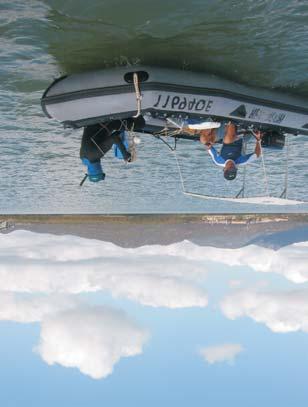
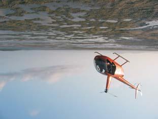
9 METHODOLOGY Survey Approach Seagrass and benthic macro-invertebrate surveys of the Gladstone port limits (Port Curtis) and Rodds Bay were conducted between October and December The survey had two major components, a coastal intertidal to shallow subtidal seagrass survey, and an offshore (deepwater) seagrass and benthic macro-invertebrate survey. Coastal Seagrass Survey A variety of sampling methods were used to survey seagrass in coastal areas based on the physical characteristics such as depth, size of area to be surveyed and safety constraints. Three sampling techniques were used: 1. Helicopter intertidal seagrass mapping and species validation Boundaries of intertidal seagrass meadows were determined around spring low tide when meadows were exposed. Observers in a helicopter hovered directly over the meadow edge (at a height of between m) and the position was fixed using a differential geographic positioning system (dgps). Meadow boundary position fixes were taken approximately every 50m or when there was a change in boundary direction (Plate 1). Within meadows the helicopter was used to determine the range of seagrass species and meadow landscape category (Figure 2). The position of submerged areas likely to contain seagrass was noted to help focus effort during the boat-based surveys. 2. Intertidal seagrass habitat characterisation Sites to determine habitat characteristics were scattered randomly throughout the intertidal areas that were mapped using the helicopter. Sampling sites were examined from the helicopter hovering within a metre above the seagrass meadow. Sampling intensity was stratified with a greater number of sites located in areas where habitat complexity was high or where there was a higher likelihood of impacts (i.e. in proximity to port or town infrastructure or proposed developments) (Plate 2). Plate 1 Helicopter intertidal mapping of exposed seagrass meadows at spring low tide. Plate 2 Intertidal habitat characterisation of exposed seagrass meadows from helicopter. 4

10 3. Subtidal diver seagrass habitat characterisation In subtidal areas habitat characteristics were determined at sites located on transects. Additional sites were sampled between transects to check for habitat continuity. Sites were examined by free-diving observers swimming to the bottom. Seagrass meadow boundaries were determined by continuing transects until three successive sites indicated that seagrass was no longer present (Plate 3). Plate 3 Subtidal habitat characterisation sites observed by free divers. Coastal Seagrass Habitat Characterisation Sites Coastal habitat characterisation was based on a site that encompassed a circular area of the substratum of approximately 10m 2. The position of each site was recorded using a differential Global Positioning System (dgps) accurate to ± 5.0m. While methods of observing habitat characterisation sites varied (helicopter/diver), information collected at each site was consistent. This included seagrass species composition, seagrass above ground biomass, percent cover of algae, depth below mean sea level (MSL) (for subtidal sites), sediment type and the time. Seagrass above ground biomass was determined using a modified visual estimates of biomass technique described by Mellors (1991). This technique involves an observer ranking seagrass biomass in the field in three random placements of a 0.25m 2 quadrat at each site. Ranks were made in reference to a series of quadrat photographs of similar seagrass habitat for which the above ground biomass has previously been measured. This method was utilised for both the subtidal and intertidal survey areas. Two separate biomass ranges were used, low-biomass and high-biomass. The relative proportion of the above ground biomass (percentage) of each seagrass species within each survey quadrat was also recorded. Field biomass ranks were then converted into above ground biomass estimates in grams dry weight per square metre (g DW m -2 ). At the completion of sampling each observer ranked a series of calibration quadrats that represented the range of seagrass biomass in the survey. After ranking, seagrass in these quadrats was harvested and the actual biomass determined in the laboratory. A separate regression of ranks and biomass from these calibration quadrats was generated for each observer and applied to the field survey data to determine above ground biomass estimates. 5


11 Isolated seagrass patches - The majority of area within the meadows consisted of unvegetated sediment interspersed with isolated patches of seagrass Aggregated seagrass patches - Meadows are comprised of numerous seagrass patches but still feature substantial gaps of unvegetated sediment within the meadow boundaries Continuous seagrass cover - The majority of area within the meadows comprised of continuous seagrass cover interspersed with a few gaps of unvegetated sediment. Figure 2 Seagrass meadow landscape categories used in the Port Curtis & Rodds Bay seagrass baseline survey,


12 Deepwater Seagrass & Benthic Macro-invertebrate Survey A different approach was taken for offshore areas that were too deep for free divers to effectively sample (>5m below mean sea level). In these areas a deepwater camera system and sledge sampler was used. Offshore subtidal areas were sampled using a real time camera system towed behind the research vessel Gwendoline May. Offshore sites were randomly located throughout the survey area. A stratified random design was employed with a greater number of sites located in areas of particular interest such as the dredge spoil ground and in proximity to dredged channels. Deepwater Habitat Characterisation Sites At each offshore sampling site the real-time underwater camera system was towed for four minutes (time required to cover approximately 100 metres of benthos) at drift speed (less than one knot). Footage was observed on a TV monitor and recorded to digital tape. The camera was mounted on a sled that incorporated a sled net 600 mm width and 250 mm deep with a net of 10 mm-mesh aperture (Plate 4). Surface benthos was captured in the net (semi-quantitative bottom sample) and used to confirm benthic macro-invertebrates, algal and seagrass habitat characteristics observed on the monitor. Benthic macro-invertebrates collected in the sled net were identified into taxa groups and counts made of individuals (Plate 4). A Van Veen grab (grab area m 2 ) was used to confirm sediment type and collect infaunal taxa. Plate 4 Offshore video sampling sled and sorting benthic samples from the sled net. For each site a benthic macro-invertebrate community density category was determined by analysis of the video record. Four community density categories were used: open substrate low density - dominant feature was bare substrate with occasional isolated benthic macro-invertebrate individuals; - benthic macro-invertebrates present on the screen for < 10% of the site video record; medium density - benthic macro-invertebrates present in 10-80% of the site video record; high density - benthic macro-invertebrates present on the screen for > 80% of the site video record. 7
13 Seagrass biomass was assessed for sites where seagrass presence was noted in the field. Seagrass biomass estimates were based on ten random time frames allocated within the four minutes of video footage for each site. Above ground seagrass biomass was determined by a visual estimates of biomass technique modified from Mellors (1991) for use with video recording. Seagrass species composition was also recorded. The video was paused at each of the ten random time frames selected then advanced to the nearest point on the tape where the bottom was visible and sled was stable on the bottom. From this frame an observer recorded an estimated rank of seagrass biomass and species composition. To standardise biomass estimates a 0.25 m 2 quadrat, scaled to the video camera lens used in the field, was superimposed on the screen. On completion of the videotape analysis, the video observer ranked five additional quadrats that had been previously videoed for calibration. These quadrats were videoed in front of a stationary camera, and then harvested, dried and weighed. A linear regression was calculated for the relationship between the observer ranks and the actual harvested value. This regression was used to calculate above ground biomass for all estimated ranks made from the survey sites. Habitat Mapping and Geographic Information System All data were entered into a Geographic Information System (GIS). Rectified colour aerial photographs of the Gladstone area (courtesy of Gladstone Port Authority & Beach Protection Authority/Department Natural Resources & Mines), combined with aerial photography and videotape footage taken from the helicopter during surveys assisted with mapping. Other information including depth below MSL, substrate type, the shape of existing geographical features such as banks and channels, and evidence of strong wave energy or tidal currents was also interpreted and used in determining habitat boundaries. Seagrass The precision of determining seagrass meadow boundaries depended on the range of mapping information and methods available for each meadow. Intertidal meadow boundaries followed with dgps had the highest precision. Large subtidal areas where meadow boundaries could not be seen from the surface had the lowest mapping precision. For these meadows, boundaries were based on the mid-point between the last site where seagrass was present and the next non-seagrass site. Each meadow was assigned a mapping precision estimate (in metres) based on mapping methodology utilised for that meadow (Table 1). Mapping precision for coastal seagrass meadows ranged from ± 5m for isolated intertidal seagrass meadows to ± 20m for subtidal meadows (Table 1). For offshore meadows where boundaries were determined by distance between video sampling sites mapping was less precise and ranged from ± 200m to ± 500m dependant on the distance between sites. The mapping precision estimate was used to calculate a range of meadow area for each meadow and was expressed as a meadow reliability estimate (R) in hectares. Additional sources of mapping error associated with digitising and rectifying aerial photographs onto base maps and with dgps fixes for survey sites were assumed to be embedded within the meadow reliability estimates. The presence or absence of seagrass at each site was defined by the above ground biomass. Where above ground biomass was absent, the presence of rhizome/root and seed bank material was not reported. Survey sites with no seagrass can be found within meadows because seagrass cover within meadows is not always uniform and may be patchy and contain bare gaps or scars. 8
14 Three GIS layers were created in MapInfo to describe Port Curtis and Rodds Bay seagrasses: Survey sites - dgps sites containing all data collected at seagrass survey sites; Seagrass Landscape Category (coastal meadows only) - area data (polygons) showing the seagrass landscape category determined for each meadow (see Figure 2 for category definitions); Seagrass community types and density - area data for seagrass meadows and information on community characteristics. Community types were determined according to overall species composition. A standard nomenclature system was used to name each of the meadows in the survey area. This system was based on the percent composition of biomass contributed by each species within the meadow (Table 2). This layer also included a measure of meadow density that was determined by the mean above ground biomass of the dominant species within the community (Table 3). Table 1 Mapping precision 5m 10m 20m 200m m Mapping precision and methodology for seagrass meadows in Port Curtis & Rodds Bay, October-December Mapping methodology Meadow boundaries mapped in detail by dgps from helicopter; Intertidal meadows completely exposed or visible at low tide; Relatively high density of mapping and survey sites; Recent aerial photography aided in mapping. Meadow boundaries determined from helicopter and diver surveys; Inshore boundaries mapped from helicopter; Offshore boundaries interpreted from survey sites and aerial photography; Relatively high density of mapping and survey sites; Meadow boundary interpreted from diver surveys; All meadows subtidal; Relatively high density of survey sites; Recent aerial photography aided in mapping. Meadow boundary determined by offshore video sites; Offshore (deepwater) meadows only; Some depth information available for boundary determination. Meadow boundary determined by offshore video sites; Offshore (deepwater) meadows only; Relatively low density of survey sites. Table 2 Nomenclature for community types in Port Curtis & Rodds Bay, October- December Community type Species A Species A with Species B Species A with Species B/Species C Species A/Species B Species composition Species A is % of composition Species A is 60-90% of composition Species A is 50% of composition Species A is 40% - 60% of composition 9
15 Table 3 Density categories and mean above ground biomass ranges for each species used in determining seagrass community density in Port Curtis & Rodds Bay, October-December Mean above ground biomass (g DW m -2 ) Density H. uninervis H. ovalis (narrow) H. decipiens H. uninervis (wide) H. spinulosa Z. capricorni Light < 1 < 1 < 5 < 15 < 20 Moderate Dense > 4 > 5 > 25 > 35 > 60 Benthic Macro-invertebrates Benthic macro-invertebrate community boundaries were determined by information collected at the deepwater habitat characterisation sites. Unlike the coastal survey area there was limited additional information available to assist with mapping. As a consequence the precision in determining boundaries was much lower than for the coastal area and largely dependant on the distance between offshore video sampling sites. Mapping precision ranged from ± 200m to ± 500m dependant on the distance between sites. The mapping precision estimate was used to calculate a range of area for each benthic community region and was expressed as a reliability estimate (R) in hectares. Two GIS layers were created in MapInfo to describe Port Curtis and Rodds Bay benthic macro-invertebrate communities: Survey sites - dgps sites containing all data collected at offshore benthic community survey sites; Benthic Community density and category - area data for benthic macroinvertebrate community regions. Community types (categories) within this layer were determined according to overall taxa composition observed on the video and collected in the sled net at sites within each region; and density was determined by the mean % time benthic macro-invertebrates were present on the video record for sites within regions. 10
16 RESULTS A total of 1344 habitat characterisation sites were surveyed within Port Curtis and Rodds Bay (total does not including meadow boundary mapping sites). These sites included 1201 coastal sites examined from helicopter and by free divers and 143 deepwater sites examined using real-time video equipment (Table 4; Map 1). Table 4 Survey sites and techniques in Port Curtis, November/December Survey area Survey technique No. of sites Coastal Helicopter 618 Free-divers 583 Deepwater Real-time video 143 Total 1344 Seagrass Six seagrass species (from three families) were found in the survey area: Family CYMODOCEACEAE Taylor: Halodule uninervis (wide and narrow leaf morphology) (Forsk.) Aschers. in Boissier Family HYDROCHARITACEAE Jussieu: Halophila decipiens Ostenfeld Halophila minor (Zoll.) den Hartog (R. Br.) Hook. F. Halophila spinulosa (R. Br.) Aschers. in Neumayer Family ZOSTERACEAE Drummortier: Zostera capricorni Aschers. Coastal Seagrass Habitat Extensive areas of seagrass were found in the coastal component of the survey conducted in intertidal to shallow subtidal areas (< 5m below mean sea level). Coastal seagrass communities were found throughout the survey area from the Narrows in the north to Rodds Bay in the south. Seagrass communities were found on the majority of the shallow coastal mud and sand banks within the survey area but rarely penetrated far into subtidal areas off the edge of the banks. Seagrass was present at 749 (62%) of the 1201 coastal survey sites ± 421 ha of coastal seagrass habitat was mapped in 129 individual seagrass meadows (Maps 2-8; Tables 5-11). Seagrass meadows most commonly occurred on intertidal mud and sand substrates. There were only 12 coastal seagrass meadows that were completely subtidal and these were generally small Halophila dominated meadows immediately adjacent to the mud and sand banks (Maps 2-8; Tables 5-11). The maximum depth that coastal seagrasses 11
17 were recorded in the survey was 4.1 m below mean sea level for Halophila spinulosa in meadow 111 at the mouth of Seven Mile Creek, Rodds Bay (Map 7). The coastal seagrass habitat in Port Curtis and Rodds Bay was divided into 32 community types, depending on species presence and dominance (Tables 5-11). Communities that were dominated by Zostera capricorni were the most widely distributed throughout the survey area and comprised 68% (90 individual meadows; ± ha) of the coastal seagrass habitat. Z. capricorni often occurred in conjunction with to form both light and moderate biomass mixed species communities. Z. capricorni communities most commonly occurred as aggregated patches on the extensive intertidal mud and sand banks located throughout the survey area (Maps 2-8; Table 5-11). Communities dominated by Halodule uninervis (wide and thin leaf morphology) were the second most widely distributed and occurred in two main areas. In the north of the survey area, H. uninervis communities dominated the intertidal sand and mud banks between Quoin and Facing s. Further south, H. uninervis communities occurred in the shallow subtidal regions along the exposed coasts of Boyne, Wild Cattle and Hummock Hill s. Minor coastal seagrass habitats included subtidal and H decipiens communities located adjacent to Fisherman s Landing Wharves in the north and intertidal H. ovalis dominated communities further south in Rodds Bay. H. spinulosa dominated two communities at the mouth of Seven Mile Creek in Rodds Bay and also formed a minor component of other subtidal meadows throughout the survey area. H. minor was found at only a few sites on intertidal banks in Rodds Bay. 12
18 MAP 1. Coastal and deep water survey sites in Port Curtis and Rodds Bay, November/December 'E 'E 'E 'E 'E Curtis 0 Graham Creek Coral Sea Facing GLADSTONE Calliope River Rodds Peninsula! 23 40'S 23 50'S 24 00'S Boyne LEGEND Coastal sites Seagrass No seagrass Port Curtis limits Deep water sites Seagrass No seagrass Rodds Bay dugong protection area Dredge spoil ground Area not surveyed Boyne River Wild Cattle Colosseum Inlet Hummock Hill Rodds Bay Source: Rasheed, M.A., Thomas, R., Roelofs, A.J., Neil, K.M. and Kerville, S.P Port Curtis and Rodds Bay seagrass and benthic macro-invertebrate community baseline survey, November/ December QDPI Information Series QI03058 (DPI, Cairns). Gladstone Port Authority and the State of Queensland through the Department of Primary Industries (QFS). Funded by the Gladstone Port Authority and the Queensland Fisheries Service (QFS). Produced by the Marine Ecology Group, Queensland Fisheries Service, Northern Fisheries Centre, Cairns, (Note: meadow boundary mapping sites not shown). Seven Mile Creek Turkey Beach 5 10 Kilometres Pancake Creek Middle
19 MAP 2. Coastal seagrass distribution and community types in The Narrows region, 2002 Port Limits Black Swan Is 113 Curtis 14 The Narrows Redcliff Is Worthington Is Kangaroo Is Graham Creek Laird Pt LEGEND Community type Zostera capricorni Halophila decipiens Halophila decipiens with Halophila spinulosa Halophila decipiens with Halophila spinulosa/ Meadow cover Isolated patches 21 Meadow ID 0! Kilometres Source: Rasheed, M.A., Thomas, R., Roelofs, A.J., Neil, K.M. and Kerville, S.P Port Curtis and Rodds Bay seagrass and benthic macro-invertebrate community baseline survey, November/ December QDPI Information Series QI03058 (DPI, Cairns). Gladstone Port Authority and the State of Queensland through the Department of Primary Industries (QFS). Funded by the Gladstone Port Authority and the Queensland Fisheries Service (QFS). Produced by the Marine Ecology Group, Queensland Fisheries Service, Northern Fisheries Centre, Cairns, 2003.
20 Table 5 Seagrass community types, cover, mean above ground biomass and area in The Narrows region (Map 2), November/December Meadow ID 10 Community type Cover Species present Light Z. capricorni, H. ovalis, H. spinulosa Biomass (g dw m -2 ) Area ± R (ha) No. of sites 3.6 ± ± Light Zostera capricorni Z. capricorni 11.3 ± ± Light Zostera capricorni Z. capricorni, H. ovalis, H. decipiens, H. spinulosa 7.2 ± ± Moderate Zostera capricorni Z. capricorni 36.6 ± ± Moderate Halophila decipiens Light Light H. decipiens 2.1 ± ± Z. capricorni, H. ovalis 5.70± ± Z. capricorni, H. ovalis 6.8 ± ± Light Zostera capricorni Z. capricorni 3.9 ± ± Light Zostera capricorni Z. capricorni 5.4 ± ± Light Zostera capricorni Moderate Halophila 20 * decipiens with Halophila spinulosa Moderate Halophila 21 * decipiens with Halophila spinulosa Light 22 Moderate Halophila 23 * decipiens with Halophila spinulosa/ Z. capricorni, H. ovalis, H. spinulosa 12.1 ± ± H. decipiens, H. spinulosa 3.3 ± ± H. decipiens, H. spinulosa 1.2 ± ± Isolated patches Z. capricorni, H. ovalis 3.6 ± ± H. decipiens, H. spinulosa, H. ovalis 2.4 ± ± Zostera capricorni Isolated patches Z. capricorni, H. ovalis na 6.5 ± Light 113 Moderate Halophila decipiens * denotes subtidal meadow Z. capricorni, H. ovalis 3.1 ± ± H. decipiens 1.9 ± ±
21 MAP 3. Coastal seagrass distribution and community types in the Graham Creek region, Curtis Graham Creek Laird Point LEGEND Community type Meadow cover Zostera capricorni 25 Isolated patches Meadow ID! kilometres Source: Rasheed, M.A., Thomas, R., Roelofs, A.J., Neil, K.M. and Kerville, S.P Port Curtis and Rodds Bay seagrass and benthic macro-invertebrate community baseline survey, November/ December QDPI Information Series QI03058 (DPI, Cairns). Gladstone Port Authority and the State of Queensland through the Department of Primary Industries (QFS). Funded by the Gladstone Port Authority and the Queensland Fisheries Service (QFS). Produced by the Marine Ecology Group, Queensland Fisheries Service, Northern Fisheries Centre, Cairns, 2003.
22 Table 6 Seagrass community types, cover, mean above ground biomass and area in the Graham Creek region (Map 3), November/December Meadow ID Community type Cover Species present Light Biomass (g dw m -2 ) Area ± R (ha) Z. capricorni, H. ovalis na 2.3 ± Z. capricorni, H. ovalis 4.1 ± ± Zostera capricorni Z. capricorni na 0.5 ± Z. capricorni, H. ovalis na 0.9 ± Zostera capricorni Z. capricorni na 0.1 ± Light Z. capricorni, H. ovalis na 0.7 ± Z. capricorni, H. ovalis na 2.5 ± Z. capricorni, H. ovalis na 11.3 ± Z. capricorni, H. ovalis na 3.5 ± Z. capricorni, H. ovalis 3.1 ± ± No. of sites Z. capricorni, H. ovalis na 1.8 ±
23 MAP 4. Coastal seagrass distribution and community types in Fishermans Landing region, 2002 Graham Creek Friend Pt Laird Pt 30 Curtis Passage s Fishermans Landing Wharves Hamilton Pt 7 Tide Is 6 5 Mud Is 4 1 Wiggins Is 3 2 Calliope River LEGEND Community type Zostera capricorni Halophila decipiens with Zostera capricorni Halophila decipiens with Meadow cover Isolated patches Continuous cover 7 Meadow ID 0! kilometres Source: Rasheed, M.A., Thomas, R., Roelofs, A.J., Neil, K.M. and Kerville, S.P Port Curtis and Rodds Bay seagrass and benthic macro-invertebrate community baseline survey, November/ December QDPI Information Series QI03058 (DPI, Cairns). Gladstone Port Authority and the State of Queensland through the Department of Primary Industries (QFS). Funded by the Gladstone Port Authority and the Queensland Fisheries Service (QFS). Produced by the Marine Ecology Group, Queensland Fisheries Service, Northern Fisheries Centre, Cairns, 2003.
24 Table 7 Seagrass community types, cover, mean above ground biomass and area in Fisherman s Landing region (Map 4), November/December Meadow ID Community type Cover Species present Light with Zostera capricorni with Zostera capricorni Light Light Light Biomass (g dw m -2 ) Area ± R (ha) Z. capricorni, H. ovalis 0.5 ± ± H. ovalis, Z. capricorni na 0.9 ± Isolated patches H. ovalis, Z. capricorni na 0.3 ± No. of sites Z. capricorni, H. ovalis 0.8 ± ± Z. capricorni, H. ovalis, H. uninervis (thin) Z. capricorni, H. ovalis, H. decipiens, H. spinulosa 1.4 ± ± ± ± * Light Halophila decipiens H. decipiens 0.9 ± ± Light 8 * Light Halophila decipiens 9 with Z. capricorni, H. ovalis, H. decipiens, H. spinulosa 2.1 ± ± H. decipiens, H. ovalis 0.9 ± ± Light Zostera capricorni Z. capricorni 2.9 ± ± Light Z. capricorni, H. ovalis 0.9 ± ± Zostera capricorni Isolated patches Z. capricorni na 2.4 ± Moderate with Zostera capricorni Moderate with Zostera capricorni Light H. ovalis, Z. capricorni 2.0 ± ± H. ovalis, Z. capricorni 1.0 ± ± Z. capricorni, H. ovalis 0.7 ± ± Light Zostera capricorni Isolated patches Z. capricorni 0.3 ± ± Zostera capricorni Isolated patches Z. capricorni na na Zostera capricorni Isolated patches Z. capricorni na na Zostera capricorni Isolated patches Z. capricorni na na Zostera capricorni Isolated patches Z. capricorni na na 0 * denotes subtidal meadow 19
25 Wiggins Is 1 39 Picnic Is 41 han nel Meadow cover ne l with Halophila Halophila decipiens decipiens Halophila decipiens 49 Meadow ID Continuous cover dc nc han Isolated patches la n Qu oi 49 Halodule uninervis (thin) with Halodule Halodule uninervis uninervis (wide) Au ck 50 Quoin Is Tail Pt Halodule uninervis (wide) with Zostera capricorni / Halodule uninervis (thin) Diamantina Is Turtle Is Zostera capricorni Clinton coal wharves Witt Is Grass Pt 42 Halophila ovalis Community type Tide Is 38 Compigne Is kilometres 1! Facing She Oak Is Gladstone Port Authority and the State of Queensland through the Department of Primary Industries (QFS). Funded by the Gladstone Port Authority and the Queensland Fisheries Service (QFS). Produced by the Marine Ecology Group, Queensland Fisheries Service, Northern Fisheries Centre, Cairns, Po rt Shoal Bay Source: Rasheed, M.A., Thomas, R., Roelofs, A.J., Neil, K.M. and Kerville, S.P Port Curtis and Rodds Bay seagrass and benthic macro-invertebrate community baseline survey, November/ December QDPI Information Series QI03058 (DPI, Cairns) ph ra LEGEND 2 4 Mud Is Curtis Pelican Banks Southend North E ntran ce MAP 5. Coastal seagrass distribution and community types in the Quoin region, 2002 li C al er R iv op e Ex g oto ph i al r e fa to t en Lim its
26 Table 8 Seagrass community types, cover, mean above ground biomass and area in the Quoin region (Map 5), November/December Meadow ID Community type Cover Species present Biomass (g dw m -2 ) Area ± R (ha) 37 Zostera capricorni Isolated patches Z. capricorni na 2.6 ± Zostera capricorni Isolated patches Z. capricorni na 4.8 ± Moderate with Halophila decipiens H. ovalis, H. decipiens 1.3 ± ± Light Zostera capricorni Z. capricorni 0.8 ± ± Light Zostera capricorni Continuous cover Z. capricorni, H. ovalis 3.6 ± ± Zostera capricorni Isolated patches Z. capricorni na 42.4 ± Moderate Zostera capricorni Continuous cover Z. capricorni, H. uninervis (wide), H. ovalis, H. spinulosa No. of sites 20.8 ± ± Zostera capricorni Z. capricorni, H. ovalis na 2.3 ± Zostera capricorni Z. capricorni, H. ovalis na 0.8 ± Moderate Halodule uninervis (wide) with Zostera capricorni/halodule uninervis (thin) Continuous cover H. uninervis (wide), Z. capricorni, H. uninervis (thin), H. ovalis, H. spinulosa 9.8 ± ± Zostera capricorni Isolated patches Z. capricorni na 8.6 ± Moderate Halodule uninervis (thin) with Halodule uninervis (wide) * Moderate Halophila 49 decipiens H. uninervis (thin), H. uninervis (wide), H. spinulosa, H. ovalis, Z. capricorni 1.8 ± ± H. decipiens 1.4 ± ± * Moderate H. ovalis 1.4 ± ± Zostera capricorni Isolated patches Z. capricorni na 1.0 ± Zostera capricorni Isolated patches Z. capricorni na na Zostera capricorni Isolated patches Z. capricorni na na Zostera capricorni Isolated patches Z. capricorni na na Zostera capricorni Isolated patches Z. capricorni na na 0 * denotes subtidal meadow 21

 with Halodule uninervis (wide) Halodule uninervis (wide) with Halodule uninervis (wide) with Halodule uninervis (thin)/ Zostera capricorni!")
.")
27 MAP 6. Coastal seagrass distribution and community types in the South Trees region, 2002 Quoin Channel Shoal Bay Facing Barney Pt Auckland Channel South Trees Pt 60 GLADSTONE South Trees Inlet 57 South Trees Is Boat Harbour Auckland Point 66 West Banks Inlet Boyne 67 Auckland metres Canoe Pt LEGEND Community type Halophila decipiens Zostera capricorni Halodule uninervis (thin) with Halodule uninervis (wide) Halodule uninervis (wide) with Halodule uninervis (wide) with Halodule uninervis (thin)/ Zostera capricorni! Meadow cover Isolated patches 68 Meadow ID kilometres Source: Rasheed, M.A., Thomas, R., Roelofs, A.J., Neil, K.M. and Kerville, S.P Port Curtis and Rodds Bay seagrass and benthic macro-invertebrate community baseline survey, November/ December QDPI Information Series QI03058 (DPI, Cairns). Gladstone Port Authority and the State of Queensland through the Department of Primary Industries (QFS). Funded by the Gladstone Port Authority and the Queensland Fisheries Service (QFS). Produced by the Marine Ecology Group, Queensland Fisheries Service, Northern Fisheries Centre, Cairns, 2003.
28 Table 9 Seagrass community types, cover, mean above ground biomass and area in the South Trees region (Map 6), November/December Meadow ID Community type Cover Species present Biomass (g dw m -2 ) Area ± R (ha) 52 * Light Halophila decipiens H. decipiens 0.5 ± ± Zostera capricorni Isolated patches Z. capricorni na 5.3 ± Zostera capricorni Isolated patches Z. capricorni na 0.2 ± Light Light Light Isolated patches Z. capricorni, H. ovalis na 5.3 ± Z. capricorni, H. ovalis 7.0 ± ± No. of sites Z. capricorni, H. ovalis 1.8 ± ± Z. capricorni, H. ovalis na 1.6 ± Z. capricorni, H. ovalis 9.4 ± ± Light Zostera capricorni Z. capricorni, H. ovalis 4.7 ± ± Light Zostera capricorni Z. capricorni 19.2 ± ± Zostera capricorni Z. capricorni na 0.3 ± Moderate Zostera capricorni Z. capricorni, H. ovalis 56.6 ± ± Moderate Halodule uninervis (wide) with Isolated patches H. uninervis (wide), H. ovalis 15.8 ± ± Halodule uninervis (wide) with Isolated patches H. uninervis (wide), H. ovalis na 0.6 ± Light Halodule uninervis H. uninervis (wide), H. (wide) with Halodule uninervis (thin), Z. capricorni, uninervis (thin)/zostera H. ovalis capricorni 2.9 ± ± Halodule uninervis (thin) with H. uninervis (thin), H. Halodule uninervis (wide) uninervis (wide) na 0.4 ± Light Halodule uninervis H. uninervis (thin), H. (thin) with Halodule uninervis uninervis (wide) (wide) 0.9 ± ± Zostera capricorni Isolated patches Z. capricorni na na 0 * denotes subtidal meadow 23
29 MAP 7. Coastal seagrass distribution and community types in Hummock Hill region, 2002 Rodds Bay DPA Port Limits LEGEND Source: Rasheed, M.A., Thomas, R., Roelofs, A.J., Neil, K.M. and Community type Meadow cover Kerville, S.P Port Curtis and Rodds Bay seagrass and benthic macro-invertebrate community baseline survey, November/ Halodule uninervis (thin) Isolated patches December QDPI Information Series QI03058 (DPI, Cairns). Gladstone Port Authority and the State of Queensland Zostera capricorni Deep water meadow through the Department of Primary Industries (QFS). Halophila spinulosa with Halodule Funded by the Gladstone Port Authority and the Queensland 87 Meadow ID uninervis (thin)/ Zostera capricorni Continuous cover Fisheries Service (QFS). Halodule uninervis (thin) Produced by the Marine Ecology Group, Queensland Fisheries Service, Northern Fisheries Centre, Cairns, 2003.! Halophila spinulosa with Halodule uninervis (wide) Kilometres Basemap courtesy AUSLIG, Australia's national mapping agency 2003.
30 Table 10 Seagrass community types, cover, mean above ground biomass and area in the Hummock Hill region (Map 7), November/December Meadow ID Community type Cover Species present Biomass (g dw m -2 ) Area ± R (ha) 70 Zostera capricorni Z. capricorni na 0.2 ± Moderate Halodule uninervis (thin) Light Halodule uninervis (thin) Moderate Zostera capricorni with H. uninervis (thin), H. ovalis, Z. capricorni No. of sites 2.1 ± ± Z. capricorni, H. ovalis na 4.9 ± Z. capricorni, H. ovalis na 5.9 ± Z. capricorni, H. ovalis na na 0 Z. capricorni, H. ovalis na 3.1 ± Z. capricorni, H. ovalis, H. uninervis (wide) Z. capricorni, H. ovalis, H. Continuous cover uninervis (wide) Z. capricorni, H. ovalis, H. Continuous cover uninervis (wide) Z. capricorni, H. ovalis, H. Continuous cover uninervis (wide) Z. capricorni, H. ovalis, H. uninervis (wide) na 40.6 ± na 0.1 ± na 2.8 ± na 13.4 ± na 2.5 ± Z. capricorni, H. ovalis na 2.2 ± Z. capricorni, H. ovalis, H. uninervis (wide) Z. capricorni, H. ovalis, H. uninervis (wide) Z. capricorni, H. ovalis, H. uninervis (wide) Z. capricorni, H. ovalis, H. uninervis (wide) Z. capricorni, H. ovalis, H. uninervis (wide) na 18.5 ± na 69.7 ± na 12.6 ± na 13.7 ± na 75.2 ± Z. capricorni, H. ovalis na 2.0 ± Z. capricorni, H. uninervis (thin), H. uninervis (wide), H. ovalis, H. minor 8.5 ± ± Z. capricorni, H. ovalis na 20.2 ± Z. capricorni, H. ovalis 23.5 ± ± Light Zostera capricorni Z. capricorni, H. ovalis 3.2 ± ± Light Z. capricorni, H. ovalis na 6.7 ± Isolated patches Z. capricorni, H. ovalis 3.5 ± ± * Light Zostera capricorni Z. capricorni 2.4 ± ± * Dense Halodule uninervis 110 (thin) Light Halophila spinulosa 111 * with Halodule uninervis (thin)/zostera capricorni Light Halophila spinulosa 112 * with Halodule uninervis (wide) H. uninervis (thin), H. ovalis, Z. capricorni H. spinulosa, H. uninervis (thin), Z. capricorni, H. ovalis H. spinulosa, H. uninervis (wide) 4.2 ± ± ± ± ± ± Dense Halophila decipiens Isolated patches H. decipiens 6.5 ± ± 0 1 * denotes subtidal meadow 25
31 MAP 8. Coastal seagrass distribution and community types in the Rodds Bay region, LEGEND Community type Zostera capricorni with Zostera capricorni Zostera capricorni with Halodule uninervis (wide)/ Halodule uninervis (thin) Halophila spinulosa with Halodule uninervis (wide)! Source: Rasheed, M.A., Thomas, R., Roelofs, A.J., Neil, K.M. and Meadow cover Isolated patches Kerville, S.P Port Curtis and Rodds Bay seagrass and benthic macro-invertebrate community baseline survey, November/ December QDPI Information Series QI03058 (DPI, Cairns). Gladstone Port Authority and the State of Queensland through the Department of Primary Industries (QFS). 97 Meadow ID Funded by the Gladstone Port Authority and the Queensland Fisheries Service (QFS) Produced by the Marine Ecology Group, Queensland Fisheries Service, Northern Fisheries Centre, Cairns, kilometres Basemap courtesy AUSLIG, Australia's national mapping agency 2003.
32 Table 11 Seagrass community types, cover, mean above ground biomass and area in the Rodds Bay region (Map 8), November/December Meadow ID 88 Community type Cover Species present Light with Zostera capricorni Biomass (g dw m -2 ) Area ± R (ha) Isolated patches H. ovalis, Z. capricorni 0.9 ± ± Light H. ovalis 0.5 ± ± Zostera capricorni Isolated patches Z. capricorni na 0.1 ± Light Zostera capricorni Z. capricorni, H. ovalis 16.9 ± ± Light Moderate with Zostera capricorni Z. capricorni, H. ovalis 2.2 ± ± H. ovalis, Z. capricorni 1.7 ± ± Light Zostera capricorni Z. capricorni 15.1 ± ± Light with Zostera capricorni H. ovalis, Z. capricorni 0.8 ± ± Light Zostera capricorni Z. capricorni, H. ovalis 6.4 ± ± Moderate Isolated patches H. ovalis 1.1 ± ± Light Zostera capricorni Z. capricorni, H. ovalis, H. uninervis (thin) No. of sites 8.4 ± ± Light Zostera capricorni Isolated patches Z. capricorni, H. ovalis 1.9 ± ± Light Halodule uninervis (wide)/halodule uninervis (thin) Z. capricorni, H. uninervis (wide), H. uninervis (thin), H. ovalis, H. minor 5.7 ± ± Light Isolated patches H. ovalis 0.3 ± ± Light Halodule uninervis (thin)/ Z. capricorni, H. uninervis (thin), H. ovalis, H. uninervis (wide), H. spinulosa, H. decipiens, H. minor 7.9 ± ±
.")
 with Halodule uninervis (narrow) occurring in only one meadow (Table 12).")
33 Deepwater Seagrass Habitat Large areas of deepwater seagrass (>5m below MSL) were found within the Port Curtis port limits. Seagrass occurred at 17% of the offshore survey sites and formed six individual meadows with a total area of 6,332 ha (Table 12; Map 9). Deepwater meadows occurred offshore from Facing and around Seal Rocks, West Banks and East Banks (Map 9). No deepwater meadows occurred in the inner port area (inside Facing ). Deepwater seagrass meadows were dominated by low biomass Halophila species (Plate 5) with Halodule uninervis (narrow) occurring in only one meadow (Table 12). Cover of seagrass in the deepwater meadows was low ranging from 0.01% to 1.9% of the total bottom area (Table 12). The maximum depth recorded for offshore seagrass was 19.1m below mean sea level for Halodule spinulosa in meadow 130 (Map 9). Table 12 Deepwater seagrass community types, cover, mean above ground biomass and area in Port Curtis and Rodds Bay November/December Meadow ID Community type Mean meadow biomass g DW m -2 ± SE Number of sites Area ± R (ha) Mean % seagrass cover Light Halophila spinulosa/ Halophila decipiens/ Light Halophila decipiens with Halophila spinulosa 0.17 ± ± ± ± Light Halophila decipiens 0.06 ± ± Light Halodule uninervis (narrow)/ Halophila ovalis ± Light Halophila decipiens ± Light Halophila decipiens ± Total ± 4624 a b Plate 5 Deepwater seagrass habitats in Port Curtis (a) Halophila spinulosa/ Halophila decipiens/ ; (b) Halophila decipiens. 28
34 MAP 9. Deep water seagrass distribution and community types in Port Curtis and Rodds Bay, Port Limits Dredge spoil ground 134 Rodds Bay DPA LEGEND Community type Halophila decipiens with Halophila spinulosa Halophila decipiens Halophila spinulosa/halophila decipiens/ Halodule uninervis (narrow)/ Coastal seagrass meadow! 131 Meadow ID Kilometres Source: Rasheed, M.A., Thomas, R., Roelofs, A.J., Neil, K.M. and Kerville, S.P Port Curtis and Rodds Bay seagrass and benthic macro-invertebrate community baseline survey, November/ December QDPI Information Series QI03058 (DPI, Cairns). Gladstone Port Authority and the State of Queensland through the Department of Primary Industries (QFS). Funded by the Gladstone Port Authority and the Queensland Fisheries Service (QFS). Produced by the Marine Ecology Group, Queensland Fisheries Service, Northern Fisheries Centre, Cairns, Basemap courtesy AUSLIG, Australia's national mapping agency 2003.
.")
. Inside Facing benthic communities were dominated by medium and high-density community types with only small areas of lowdensity communities (Map 10; Table 13).")
35 Benthic Macro-invertebrates Benthic macro-invertebrates occurred throughout the survey area (Map 10). The dominant community types in the area outside of Facing were those that had a low density of macro-invertebrates with open substrate comprising the majority of the area (Map 10; Table 13). There were two small areas of higher density macro-invertebrates associated with coral bommies outside Facing and medium density communities within the dredge spoil disposal site and surrounding seal rocks (Map 10). Inside Facing benthic communities were dominated by medium and high-density community types with only small areas of lowdensity communities (Map 10; Table 13). Benthic macro-invertebrate communities were divided into regions based on density of individuals and community composition. There were four density categories and a range of different community types within the categories combining to give eleven different benthic macro-invertebrate region types (Table 13; Map 10). Open substrate with occasional individual This was the lowest density category used to describe macro-invertebrate regions and formed 37% of the survey area. There was one community type in this category - community dominated by open substrate with isolated benthic individuals. These regions were nearly all bare substrate with small holes created by burrowing worms, crustacea or fish and only an occasional isolated macroinvertebrate (Plate 6). Macro-invertebrate isolates within these regions were from a range of taxa groups (Table 14). There were three regions of this category; region 7, outside Facing from Curtis to East Bank (8193 ha); region 11, north west of Seal Rocks (206 ha); and region 15, at the entrance to Rodds Bay (1477 ha) (Map 10; Table 13). Plate 6 Open substrate with occasional individual (frame taken from video footage). Low density benthic community Community types in this category covered 32% of the survey area (Table 13). There was one community type in this density category - community dominated by open substrate with a low density of varied benthic taxa. There were eight regions of this community type spread throughout the survey area (Map 10). The dominant feature of this region type was large areas of open substrate, which were interspersed with occasional groups of benthic macroinvertebrates (Plate 7). Although density of individuals was low, there was a wide representation of taxa found within these regions (Table 14). Plate 7 Low density benthic community (frame taken from video footage). 30
.")
 (Map 10; Table 14). 3.")
36 Medium density benthic community There were five different benthic macro-invertebrate community types for this density category covering 15% of the survey area (Plate 8; Table 14): 1. Mostly open substrate interspersed with small rubble dominated by echinoids and gastropods - low numbers of other taxa (Table 14). There was one of these regions in the study area; region 1 (532 ha) outside Facing adjacent to the port limits boundary (Map 10; Table 13). 2. Rubble substrate dominated by bryozoans and hydroids - low numbers of other taxa. This region covered a significant proportion of the dredge spoil ground (region 2; 715 ha) (Map 10; Table 14). 3. Rubble substrate dominated by bryozoans, hard coral, hydroids, echinoids - low numbers of other tax). This community type occurred in one region (region 14; 1984ha) to the north of Seal Rocks (Map 10; Table 14). 4. Rubble reef and coral bommies interspersed with open substrate dominated by bryozoans, hydroids, sponges, soft coral, hard coral, gastropods and bivalves. This medium density community occurred in a single region (17; 424ha) on the southern side of Seal Rocks. 5. Rubble reef dominated by bivalves, ascidians, bryozoans and hard corals- low numbers of other taxa. This region (9; 444ha) occurred in the deep channel area from the mouth of the narrows at Graham Creek to Fisherman s Landing (Map 10; Table 14). Plate 8 Examples of medium density benthic communities (frames taken from video footage). High density benthic community High density benthic communities were mostly located in a narrow strip running in the channel from Fisherman s Landing to inside Facing and East Bank. There were four different benthic macro-invertebrate community types for this density category forming 16% of the survey area (Plate 9; Table 14): 1. Rubble reef dominated by sponges, soft coral, hard coral, hydroids, bryozoans, gorgonians with a mix of other benthic taxa (Table 14). There were 2 of these regions in the study area; region 16 (915 ha) inside Facing ; and region 23 (944 ha) inside East Bank (Map 10; Table 14). 31
; and region 22 (461 ha) (Map 10; Table 13). Both areas were located inside Facing.")
.")
37 2. Scallop / rubble reef community dominated by bivalves with mix of reef taxa (Table 14). There were two of these regions in the study area; region 18 (1456ha); and region 22 (461 ha) (Map 10; Table 13). Both areas were located inside Facing. The regions were dominated by large numbers of scallops but were otherwise similar to regions in the previous category (Table 14). 3. Rubble substrate dominated by bryozoans, sponges, ascidians, bivalves and hard coral - low number of other benthic taxa (Table 14). There was one small area (region 5; 157ha) of this region type inside West Banks (Map 10). 4. Rubble reef and coral bommies interspersed with open substrate mixed coral reef community. There were two small regions (region 3, 98ha & region 4, 158ha) of low coral reef bommies located outside Facing (Map 10). Plate 9 Examples of high density benthic communities (frames taken from video footage). 32
38 Table 13 Benthic macro-invertebrate regions in Port Curtis & Rodds Bay - density, number of sites, area and description for regions mapped in November (R = estimate of mapping reliability). Density category Benthic macro-invertebrate region description Region No. No. of sites Area ± R (ha) Open substrate, occasional individual Low density benthic community Open substrate with isolated benthic individuals Dominated by open substrate with low density of varied benthic taxa Mostly open substrate interspersed with small rubble dominated by echinoids and gastropods - low numbers of other taxa Rubble substrate dominated by bryozoans and Hydroids - low numbers of other taxa ,193 ± 5, ± ,477 ± 1, ,383 ± 1, ± ± ± ± ,766 ± 3, ± ,167 ± ± ± 442 Medium density benthic community High density benthic community Rubble substrate dominated by bryozoans, hard coral, hydroids, echinoids - low numbers of other taxa Rubble reef and coral bommies interspersed with open substrate dominated by bryozoans, hydroids, sponges, soft coral, hard coral, gastropods and bivalves Rubble reef dominated by bivalves, ascidians, bryozoans and hard corals- low numbers of other taxa ,984 ± 1, ± ± 270 Rubble reef dominated by sponges, soft coral, hard ± 352 coral, hydroids, bryozoans, gorgonians with a mix of other benthic taxa ± 337 Rubble substrate dominated by bryozoans, sponges, ascidian, bivalves and hard coral - low number of other benthic taxa Scallop / rubble reef community dominated by bivalves with mix of reef taxa ± ,456 ± ± 217 Rubble reef and coral bommies interspersed with open substrate mixed coral reef community ± ± 105 TOTAL ALL AREAS ,770 ± 11,560 33
39 MAP 10. Deep water benthic macro-invertebrate regions in Port Curtis and Rodds Bay, November/December 'E 'E 'E LEGEND Shallow regions (< 5m) not included in deep water survey Graham Creek Open/low density regions Open substrate with isolated benthic individuals Curtis Coral Sea Dominated by open substrate with low density of varied benthic taxa Medium density regions Fisherman's Landing Mostly open substrate interspersed with small rubble dominated by echinoids and gastropods - low numbers of other taxa Rubble substrate dominated by bryozoans and hydroids - low numbers of other taxa 18 Facing 'S Rubble substrate dominated by bryozoans, hard coral, hydroids, echinoids - low numbers of other taxa Rubble reef and coral bommies interspersed with open substrate dominated by bryozoans, hydroids, sponges, soft/hard coral, gastropods and bivalves 16 7 Rubble reef dominated by bivalves, ascidians, bryozoans and hard coral - low numbers of other taxa GLADSTONE Calliope River Boyne East Banks High density regions Rubble reef dominated by sponges, soft/hard coral, hydroids, bryozoans and gorgonians with a mix of other benthic taxa Rubble substrate dominated by bryozoans sponges, ascidians, bivalves and hard coral - low numbers of other benthic taxa Scallop/rubble reef community dominated by bivalves with mix of reef taxa Wild Cattle 11 Seal Rocks Boyne River 13 Rodds Peninsula! Colosseum Inlet Hummock Hill Source: Rasheed, M.A., Thomas, R., Roelofs, A.J., Neil, K.M. and Kerville, S.P Port Curtis and Rodds Bay seagrass and benthic macro-invertebrate community baseline survey, November/December QDPI Information Series QI03058 (DPI, Cairns). Rodds Bay Gladstone Port Authority and the State of Queensland through the Department of Primary Industries (QFS). Funded by the Gladstone Port Authority and the Queensland Fisheries Service (QFS) 'S Produced by the Marine Ecology Group, Queensland Fisheries Service, Northern Fisheries Centre, Cairns, West Banks Rubble substrate dominated by bivalves with mix of reef taxa Port Curtis limits Dredge spoil ground Rodds Bay DPA 11 Region ID kilometres
40 Table 14 Benthic macro-invertebrate communities in Port Curtis & Rodds Bay density and types of taxa present for each benthic community region containing offshore survey sites. L = low, average of <6 individuals per site; M = medium, 6-20 individuals per site; H = high, average of >20 individuals per site Taxa Benthic Community Region Annelida Polychaeta M M H M L L L L L L L M M M M L L L M M Sipuncula Unsegmented worms L L Ectoprocta Encrusting bryozoan M L M L L L M M L L H M H L M M L M M Cnidaria Erect bryozoan L M L L L L L L L L M L L L L L L Motile bryozoan L L L L Zoantharia Zoanthids L L L L L L L L L L L Anemones L L L L L L Anthozoa Colonial hard corals L L L L L L L M M L L L L M Solitary hard corals L L L L L L M L L L M L Gorgonians L L L L L L L L M L L L L L Sea pens L L L L Soft coral L L L L L L L L M M L L L M M Hydrozoa Hydroids M M L L L L L L L M M H L M L L M M Echinodermata Asteroid L L L L L L L L L L L L L L Crinoid L L L L L M L L L L L L L L Echinoid H L H L L M L M L L M L L L L Holothuroid L L L L L L Ophiuroid L L L L L L M L L L L L M Ctenophore Comb jelly L L L L L L Urochordata Ascidians L L L M L M L L L L L L L L M Porifera Sponges L M M L L L L L L M M L L L M M Arthropoda Crustacea Brachyuran L M L M L L M L L L M L M L M L L L M H Penaeid prawns L L L L L L L L L L Carid shrimps L L L L L L L L L L L L L Other decapods L L L L L Isopod L Stomatopod L L L L L L Amphipod M L L L M L Barnacle L M L L L L Pycnogonida Sea spiders L L L L L Mollusca Bivalves L L M L L L M L L L L L M H L L L H M Gastropods M L M L M L L L L L L L M M L L L M L Cephalopods L L L L L L L L Mollusc egg mass L L L L L L L L L L Nudibranch L L L L L Chiton L Vertebrata Fish L L L L M L L L L L L L L 35
41 Algae Macro-algae were only a minor component of the benthic communities in the survey area. Macro-algae cover was generally low and did not form distinct macro-algae community regions. In the offshore section of the survey area macro-algae cover was typically less than 1%. Only two offshore sites, adjacent to seal rocks, had significant macro-algae cover (5% and 10%). These two sites incorporated sections of reef associated with Seal Rocks and contained a mix of algae species commonly associated with reef communities. It was likely that other rocky or reef areas within the port limits would contain similar algae communities but these areas were generally not examined as part of the survey. While there were no significant areas of macro-algae in the coastal section of the survey area some of the coastal seagrass meadows had a relatively high percentage cover of filamentous green algae. The highest cover of filamentous algae occurred on the two seagrass meadows adjacent to Wiggins meadows 4 and 5 with 35% and 28% cover respectively (Map 4). 36
42 DISCUSSION Port Curtis and Rodds Bay contained extensive seagrass communities in coastal and deeper offshore areas as well as a diverse range of benthic macro-invertebrate communities. Many of these communities occurred in proximity to port infrastructure, developments and dredged channels. Seagrass communities in the port included meadows of species preferred as food by dugong as well as dense high biomass meadows that are known to be important as juvenile prawn nursery grounds in other Queensland locations (eg. Watson et al. 1993). The deepwater section of the survey area was dominated by large areas of low-density benthic communities outside of Facing and by highly diverse and high-density benthic macroinvertebrate communities in the inner port area (inside Facing ). Much of the survey area was relatively well protected from southeasterly winds by Rodds Peninsula and from northerly winds by Curtis and Facing s. This protection from wind and wave action probably explains the extensive seagrass distribution within the survey area. Other large areas of coastal seagrass in Queensland also occur in areas sheltered from the prevailing southeasterly winds such as northward opening bays and estuaries (eg. Coles et al. 2002; 1990; Lee Long et al. 1997). The extensive areas of coastal seagrass in Port Curtis and Rodds Bay are likely to be of regional significance as they are the only described major area of seagrass between Hervey Bay 170 km to the south and Shoalwater Bay 170 km to north (Coles et al. 1990). Coastal seagrass was generally confined to shallow intertidal banks with only small areas of subtidal seagrass found. This was especially the case in the inner port area from The Narrows to Boyne. A restriction of seagrasses to intertidal banks is common in other locations such as Karumba and Weipa in the Gulf of Carpentaria and is generally an indicator of high turbidity with a resulting low light penetration (Rasheed et al. 2001b; Roelofs et al. 2003). It is unlikely however that low light was the major factor in determining seagrass distribution in Port Curtis. Areas in Queensland with similar or greater turbidity to Port Curtis, such as Mourilyan Harbour (Thomas & Rasheed 2003), Cairns Harbour (Campbell et al. 2003) and Upstart Bay (Rasheed & Thomas 2002) have extensive sub-tidal seagrass communities and subtidal communities did occur south of Boyne in Port Curtis. It is more likely that strong currents in the relatively narrow channels and rapid drop off from the banks in the inner port were responsible for the observed distribution. In other areas of Port Curtis and in the other Queensland locations the gradient from the banks to subtidal areas was less severe and currents smaller allowing for the establishment of large subtidal seagrass communities. All of the subtidal areas that contained seagrass in the inner Port Curtis area were on intermediate depth banks outside of the deep channels (eg. north of Fisherman s Landing). The large seagrass area in the port is likely to be of high ecological and economic importance to the Gladstone region. The fisheries value of seagrass habitat as nursery grounds for juvenile commercial fish and prawn species in Queensland is well documented (eg. Rasheed et al. 1996; Watson et al. 1993). Zostera capricorni communities that dominated the intertidal regions of the survey area provide a high level of habitat complexity due to the large size of this species. These areas are likely to provide an important refuge for fish and crustacean species. Similar Zostera capricorni meadows in Cairns Harbour have been demonstrated to be important habitat for juvenile tiger prawns and were estimated to be worth over AUD $3,687 per hectare per year in total landed value (1992 value) (Watson 37
43 et al. 1993). While this value may be different for Gladstone s Zostera meadows they are still likely to be an important fisheries habitat. The current DPA boundary (that includes most of the port) appears to be appropriate in terms of seagrass distribution. Dugong are known to target Halophila and Halodule species as they are more palatable and easily digested than other seagrass species (Lanyon 1991; Preen 1995). Meadows containing these species occurred within the inner port area as well as in Rodds Bay outside the port limits. During the survey, dugong were observed feeding on seagrass meadows between Fisherman s Landing and Wiggins as well as in Rodds Bay. Coastal seagrass meadows suitable for dugong feeding occurred throughout the survey area and dugong feeding trails were observed in many of these meadows during the aerial surveys. Large numbers of green sea turtles were also observed congregating over seagrass meadows, especially on meadows at the mouth of Seven Mile and Boyne Creeks in Rodds Bay. This survey was the first time deepwater seagrass communities within the Port Curtis port limits have been mapped. The 6,332 ha of deepwater meadows found therefore have not previously been described. Deepwater seagrasses within the port occurred outside of Facing and towards Rodds Bay including some areas of the dredge spoil ground and in proximity to dredged channels. All seagrass meadows in areas deeper than 5m below mean sea level consisted of low biomass Halophila and Halodule species. The Halophila species that dominated these meadows are commonly found in deeper waters inside the Great Barrier Reef (Coles et al. 1996; Rasheed et al. 2001a) and similar meadows have been found to the north and south of the survey area (QFS in prep). The low percent cover of seagrass (<2%) is typical for many of the deepwater meadows that have been mapped off the Queensland coast (Rasheed et al. 2001a; Coles et al. 1996). These seagrass meadows were all comprised of species targeted by dugong and occurred at depths that were well within their effective diving range (Lanyon 1991; Preen 1995). This survey is the first fine-scale survey of seagrass habitats to cover the complete port limits and Rodds Bay DPA. The only previous survey that covered this area was part of broadscale seagrass mapping of Queensland s east coast in 1988 (Coles et al. 1990). The area of coastal seagrass mapped in the 2002 fine-scale survey (7,246 ha) was substantially higher than the broadscale survey conducted in 1988 (2,211 ha). A direct comparison of the two surveys is probably not appropriate, however, as the methods used and goals of the surveys were substantially different. The 1988 survey was based on a much smaller number of survey sites and didn t extend into the narrows past Graham Creek. The 1988 survey was also conducted without the aid of helicopter mapping, which enabled large areas of intertidal seagrass to be mapped in the 2002 baseline survey. While not describing the full extent of coastal seagrass, the sites examined in 1988 that contained seagrass generally had seagrass in Most of the additional area of seagrass was found in locations that had no survey sites in 1988, particularly in the Rodds Bay area. Seagrass meadow area and biomass are likely to vary seasonally and between years in Port Curtis and Rodds Bay. Other seagrass meadows in tropical Queensland that have been studied show marked seasonal and inter-annual changes such as Weipa (Roelofs et al. 2001; Roelofs et al. 2003), Karumba (Rasheed et al. 2001b), Mourilyan (McKenzie et al. 1998) and Cairns (McKenzie 1994; Rasheed 1999; Campbell et al. 2003). Generally seagrass meadows on the east coast of Queensland peak in biomass and area in late spring/summer and are lowest over winter (eg. Rasheed 1999; McKenzie et al. 1998; McKenzie 1994). It is likely therefore that the distribution and abundance (biomass) recorded in this baseline represented the peak for For other ports where seagrass has been monitored over several years such as Mourilyan, Cairns, Karumba and Weipa, 2002 was a 38
44 year of below average seagrass biomass and area for many of the meadows that had been monitored. It is possible therefore that seagrass biomass and area for Port Curtis and Rodds Bay may be or have been higher in other years than that measured in the 2002 baseline. The deepwater survey area supported a range of other benthic communities apart from seagrass with benthic macro-invertebrates being found throughout the survey area. There was an obvious distinction in the density and diversity of benthic macro-invertebrate communities between the inner port area (inside Facing ) and the outer port. The most complex and diverse benthic macro-invertebrate communities occurred in the inner port area with the outer port dominated by open substrate and a low density of benthic macroinvertebrates. It is likely that the diversity of benthic life in the channels of the inner port were related to the high currents flowing through these channels compared with the open areas outside of Facing. The benthic communities in these inner port areas were dominated by filter feeding species such as sponges, gorgonians and bivalves that tend to thrive in high current environments. The large areas of high density communities found in Port Curtis were unusual for Queensland tropical and sub-tropical ports that have been surveyed. The low density benthic macro-invertebrate communities found outside of Facing were more typical and similar to open deepwater sections of other Queensland ports that have been surveyed, such as Mackay (Rasheed et al. 2001a) and Cairns (Neil et al. in prep). Seagrass / Benthic Communities and Port Facilities The extensive seagrass distribution in Port Curtis has implications for port and coastal development. Many of the seagrass and benthic macro-invertebrate communities described in this survey occurred in proximity to maintained channels, port facilities and the dredge spoil disposal site (Maps 11, 12, 13 and 14). Two deepwater seagrass meadows had sections within the dredge spoil ground and the other four deepwater meadows were in proximity to Wild Cattle, Boyne and Golding Cuttings in the South Channel (Map 11). The seagrass that occurred within the spoil ground was restricted to the northwest and southeast corners, with the majority of the spoil ground free of seagrass (Map 11). The Halophila species that made up these meadows are considered ephemeral and highly variable (eg. Birch & Birch 1984; Williams 1988) and species in this genus are annual in some locations completely disappearing during winter (Kuo et al. 1993). These species are capable of rapid colonisation and produce large numbers of seeds that enable them to colonise highly disturbed environments (Birch & Birch 1984; Rasheed 2000). Coastal seagrass meadows occurred immediately adjacent to the reclamation at Fisherman s Landing and around the infrastructure and facilities at South Trees Point (Map 12). Seagrass meadows covered most of the intertidal areas surrounding current port facilities and the majority of the intertidal areas within the port limits so any future port infrastructure developments such as wharves, breakwaters and reclamations would potentially have direct impacts on seagrass. The fact that apparently healthy seagrass meadows occurred in such close proximity to port facilities indicates that the port marine environment seems relatively healthy. Although without previous information or ongoing monitoring it is not possible to ascertain if the present seagrass distribution reflects the historical extent of seagrass abundance and distribution in the region. The 2002 survey provides a baseline from which future changes can be assessed. 39
45 High density benthic macro-invertebrate communities were also found around the maintained channels within the port from South Channel (Map 13) to Targinie Channel near Fisherman s Landing (Map 14). These communities were some of the most diverse and densest mapped in the deepwater survey area. As discussed earlier they were dominated by filter feeders and their location is probably associated with the high tidal current flow in the channel regions of the inner port. A medium density benthic macro-invertebrate community covered a large section of the dredge spoil disposal site (Map 13). This community was surrounded by low density and open communities and was not typical of the other communities outside of Facing (Map 13). The high amount of rubble and associated benthic-macro invertebrates in this area may be due to translocation of material from the channels in the inner port area that contain higher density communities. The coarser sediment material from dredge spoil disposal may also be providing a more suitable substrate for the settlement and recruitment of some benthic macro-invertebrates. Proposed Monitoring While results of this survey indicate seagrass communities within the Port Curtis port limits appear healthy detailed historical comparisons were not possible as this was the first fine scale survey of the complete area. Further monitoring of seagrasses in the port would be valuable given the proximity of meadows to port infrastructure and possible impacts associated with port and coastal developments. The ability of seagrasses to show measurable growth responses to changes in water quality and their extensive distribution through the port makes them an ideal candidate for monitoring marine environmental health in Port Curtis. Regular seagrass monitoring would give a better picture of the health of seagrass meadows and an overall indication of environmental health in the port. This survey provided the baseline information from which such a monitoring program could be established. We suggest a monitoring program measuring biomass, area and species composition of selected meadows, as well as measurements of seed banks and physiological stress of seagrasses should be considered. Selecting examples from the range of meadow types within the port as well as targeting meadows that are most at risk due to their location would ensure that changes in seagrasses within the port were detected and enable an evaluation of the port related activities on the marine environment. From the results of this baseline survey we have selected eight meadows that represent the seagrasses within the port and a good coverage of meadows that are most likely to be impacted by port facilities (Map 15). These meadows include both intertidal and subtidal seagrasses as well as meadows preferred as food by dugong and those likely to support high fisheries productivity. Long-term seagrass monitoring programs using these methods have been established in several Queensland ports (eg. Rasheed et al. 2001b; Roelofs et al. 2003; Campbell et al. 2003). These programs have been successful in monitoring seagrass health, detecting local and regional scale changes in seagrasses, discerning natural changes from human induced or port related change and have led to successful conduct of port maintenance and development programs that have a minimal impact on the marine environment. A similar seagrass program for Port Curtis could be useful as part of the port s integrated monitoring program. 40
46 MAP 11. Southern Port Curtis seagrass communities and approximate channel location Coral Sea Facing Dredge spoil ground Port Limits Rodds Bay DPA SOUTH CHANNEL Golding Cutting Wild Cattle Cutting Boyne Cutting Old dredge spoil ground Wild Cattle Colosseum Inlet Rodds Bay Hummock Hill LEGEND Community type Halophila decipiens Halodule uninervis (thin) Halophila decipiens with Halophila spinulosa Halophila spinulosa/halophila decipiens/ Halodule uninervis (narrow)/ Halodule uninervis (thin) with Halodule uninervis (wide) Meadow cover! Kilometres Source: Rasheed, M.A., Thomas, R., Roelofs, A.J., Neil, K.M. and Kerville, S.P Port Curtis and Rodds Bay seagrass and benthic macro-invertebrate community baseline survey, November/ December QDPI Information Series QI03058 (DPI, Cairns). Gladstone Port Authority and the State of Queensland through the Department of Primary Industries (QFS). Funded by the Gladstone Port Authority and the Queensland Fisheries Service (QFS). Produced by the Marine Ecology Group, Queensland Fisheries Service, Northern Fisheries Centre, Cairns, Basemap courtesy AUSLIG, Australia's national mapping agency 2003.
47 MAP 12. Northern Port Curtis coastal seagrass communities, port infrastructure and approximate channel location Curtis Fishermans Landing Wharves Hamilton Pt Tide Is Witt Is Diamantina Is Turtle Is Quoin Is Wiggins Is Picnic Is LEGEND Community type Zostera capricorni Halophila decipiens with Zostera capricorni Halophila decipiens with with Halophila decipiens Halodule uninervis (thin) with Halodule uninervis (wide) Halodule uninervis (wide) with Zostera capricorni / Halodule uninervis (thin) Halodule uninervis (wide) with Halodule uninervis (wide) with Halodule uninervis (thin)/ Zostera capricorni Boyne Meadow cover Isolated patches Continuous cover! Source: Rasheed, M.A., Thomas, R., Roelofs, A.J., Neil, K.M. and Kerville, S.P Port Curtis and Rodds Bay seagrass and benthic macro-invertebrate community baseline survey, November/December QDPI Information Series QI03058 (DPI, Cairns). Gladstone Port Authority and the State of Queensland through the Department of Primary Industries (QFS). Funded by the Gladstone Port Authority and the Queensland Fisheries Service (QFS). Facing Shoal Bay Gatcombe channel South Passage Is Grass Pt Compigne Is Tail Pt Clinton Coal Wharves She Oak Is Barney Pt Produced by the Marine Ecology Group, Queensland Fisheries Service, Northern Fisheries Centre, Cairns, Targinie channel Mud Is Maintained channel area Maintained channel area Auckland channel Calliope River South Trees Is South Trees Inlet kilometres
48 MAP 13. Southern Port Curtis benthic macro-invertebrate regions and approximate channel location Coral Sea Shoal Bay Facing Dredge spoil ground Port Limits East Banks West Banks SOUTH CHANNEL Golding Cutting Rodds Bay DPA Wild Cattle Cutting Boyne River Boyne Cutting Old dredge spoil ground Seal Rocks Wild Cattle Colosseum Inlet Rodds Bay Hummock Hill LEGEND Open/low density regions Medium density regions High density regions Open substrate with isolated benthic individuals Dominated by open substrate with low density of varied benthic taxa! Kilometres Mostly open substrate interspersed with small rubble dominated by echinoids and gastropods - low numbers of other taxa Rubble substrate dominated by bryozoans and hydroids - low numbers of other taxa Rubble substrate dominated by bryozoans, hard coral, hydroids, echinoids - low numbers of other taxa Rubble reef and coral bommies interspersed with open substrate dominated by bryozoans, hydroids, sponges, soft/hard coral, gastropods and bivalves Rubble reef dominated by sponges, soft/hard coral, hydroids, bryozoans and gorgonians with a mix of other benthic taxa Rubble substrate dominated by bryozoans sponges, ascidians, bivalves and hard coral - low numbers of other benthic taxa Scallop/rubble reef community dominated by bivalves with mix of reef taxa Rubble substrate dominated by bivalves with mix of reef taxa Shallow regions (< 5m) not included in deep water survey Source: Rasheed, M.A., Thomas, R., Roelofs, A.J., Neil, K.M. and Kerville, S.P Port Curtis and Rodds Bay seagrass and benthic macro-invertebrate community baseline survey, November/ December QDPI Information Series QI03058 (DPI, Cairns). Gladstone Port Authority and the State of Queensland through the Department of Primary Industries (QFS). Funded by the Gladstone Port Authority and the Queensland Fisheries Service (QFS). Produced by the Marine Ecology Group, Queensland Fisheries Service, Northern Fisheries Centre, Cairns, 2003.
49 MAP 14. Northern Port Curtis benthic macro-invertebrate regions, port infrastructure and approximate channel location Fisherman's Landing Wharves South Passage Is Curtis Compigne Is Hamilton Pt Tide Is Grass Pt Witt Is Turtle Is Tail Pt Facing Targinie channel Diamantina Is Quoin Is Mud Is Picnic Is Maintained channel area Wiggins Is Clinton Coal Wharves She Oak Is Shoal Bay LEGEND Barney Pt Maintained channel area Auckland channel Shallow regions (< 5m) not included in deep water survey Calliope River Open/low density regions Open substrate with isolated benthic individuals South Trees Is South Trees Inlet Dominated by open substrate with low density of varied benthic taxa Gatcombe channel Medium density regions Rubble reef dominated by bivalves, ascidians, bryozoans and hard coral - low numbers of other taxa High density regions Rubble reef dominated by sponges, soft/hard coral, hydroids, bryozoans and gorgonians with a mix of other benthic taxa Scallop/rubble reef community dominated by bivalves with mix of reef taxa! kilometres Source: Rasheed, M.A., Thomas, R., Roelofs, A.J., Neil, K.M. and Kerville, S.P Port Curtis and Rodds Bay seagrass and benthic macro-invertebrate community baseline survey, November/December QDPI Information Series QI03058 (DPI, Cairns). Boyne Gladstone Port Authority and the State of Queensland through the Department of Primary Industries (QFS). Funded by the Gladstone Port Authority and the Queensland Fisheries Service (QFS). Produced by the Marine Ecology Group, Queensland Fisheries Service, Northern Fisheries Centre, Cairns, 2003.
50 Port Limits MAP 15. Proposed coastal seagrass monitoring meadows for Port Curtis Rodds Bay DPA Curtis Pelican Banks Passage s Fisherman's Landing Wharves 43 Compigne Is 7 Hamilton Pt Tide Is Grass Pt Facing Targinie channel Witt Is Diamantina Is Turtle Is Quoin Is Tail Pt Wiggins Is Mud Is Clinton Coal Wharves Picnic Is 48 Quoin Channel Maintained channel area She Oak Is River Maintained channel area Barney Pt Calliope Auckland channel 58 South Trees Pt 60 LEGEND Monitoring meadow community type Meadow cover Zostera capricorni Halophila decipiens Halodule uninervis (thin) with Halodule uninervis (wide) Non-monitoring meadow 48 Continuous cover Meadow ID 0! 1 2 Kilometres Source: Rasheed, M.A., Thomas, R., Roelofs, A.J., Neil, K.M. and Kerville, S.P Port Curtis and Rodds Bay seagrass and benthic macro-invertebrate community baseline survey, November/ December QDPI Information Series QI03058 (DPI, Cairns). Gladstone Port Authority and the State of Queensland through the Department of Primary Industries (QFS). Funded by the Gladstone Port Authority and the Queensland Fisheries Service (QFS). Produced by the Marine Ecology Group, Queensland Fisheries Service, Northern Fisheries Centre, Cairns, Shoal Bay North Entrance Endfield Ck Auckland Inlet
51 REFERENCES Birch, W.R. and Birch, M. (1984). Succession and pattern of tropical intertidal seagrasses in Cockle Bay, Queensland, Australia: a decade of observations. Aquatic Botany 19: Campbell, S. J., Rasheed, M.A. and Thomas, R. (2003). Monitoring of seagrass meadows in Cairns Harbour and Trinity Inlet: December DPI Information Series QI03059 (DPI, Cairns), 20 pp. Coles, R.G., Lee Long W.J., McKenzie L.J. and Roder, C.A. (2002). Seagrass and the marine resources in the dugong protected areas of Upstart Bay, Newry Region, Sand Bay, Llewellyn Bay, Ince Bay and the Clareview Region: April/May 1999 and October (Eds. Coles RG, Lee Long, WJ McKenzie LJ & Roder, C.A.). (Eds. Coles RG, Lee Long, WJ McKenzie LJ & Roder, C.A.). Research Publication No. 72 (Great Barrier Reef Marine Park Authority: Townsville), 131 pp. Coles, R.G., Lee Long, W.J., McKenzie, L.J., Short, M., Rasheed, M.A., Vidler, K.P Distribution of deep-water seagrass habitats between Cape Weymouth and Cape Tribulation, northeastern Queensland. Queensland Department of Primary Industries Information Series QI96 (Queensland Fisheries Service, Department of Primary Industries: Cairns), 33 pp. Coles, R.G., Lee Long, W.J., Miller, K.J., Vidler, K.P. and Derbyshire, K.J. (1990). Seagrass beds and juvenile prawn and fish nursery grounds between water park point and Hervey Bay, Queensland. A report to the Great Barrier Reef Marine Park Authority 49 pp. Dennison, W.C., Orth, R.J., Moore, K.A., Stevenson, J.C., Carter, V., Kollar, S., Bergstrom, P.W. and Batiuk, R.A. (1993). Assessing water quality with submersed aquatic vegetation: Habitat requirements as barometers of Chesapeake Bay health. BioScience 42(2): Kuo, J., Lee Long, W.J. and Coles, R.G. (1993). Fruits and seeds of Halophila tricostata Greenway (Hydrocharitaceae) with special notes on its occurrence and biology. Australian Journal of Marine and Freshwater Research 44: Lanyon, J.M. (1991). The Nutritional Ecology of the Dugong (Dugong dugon) in Tropical North Queensland. Ph.D. Thesis, Monash University, Australia, 337 pp. Lee Long, W.J., McKenzie, L.J. and Coles, R.G. (1997). Seagrass communities in the Shoalwater Bay region, Queensland spring (September) 1995 and Autumn (April) DPI Information Series QI96042 (DPI, Cairns), 38 pp. McKenzie, L.J. (1994). Seasonal changes in biomass and shoot characteristics of a Zostera capricorni Aschers. dominant meadow in Cairns Harbour, northern Queensland. Australian Journal of Marine and Freshwater Research 45: McKenzie, L.J., Lee Long, W.J., Roelofs, A.J., Roder, C.A., Coles, R.G. (1998). Port of Mourilyan Seagrass Monitoring - First 4 Years. EcoPorts Monograph Series No. 15. (Ports Corporation of Queensland, Brisbane), 34 pp. Mellors, J.E. (1991). An evaluation of a rapid visual technique for estimating seagrass biomass. Aquatic Botany 42:
52 Neil, K.A., Stafford, H., Rose, C., Thomas, R. and Rasheed, M.A. (2003). Survey of benthic communities in the Cairns dredge spoil ground and dredged areas. In preparation. Preen, A.R. (1995). Diet of dugongs: are they omnivores? Journal of Mammalogy 76: Rasheed, M.A., Lee Long, W.J., McKenzie, L.J., Roder, C.A., Roelofs, A.J. and Coles, R.G. (1996). Port of Karumba Seagrass Monitoring, Baseline Surveys - Dry-Season (October) 1994 and Wet-Season (March) Eco Ports Monograph Series No. 4. (Ports Corporation of Queensland, Brisbane), 47 pp. Rasheed, M.A. (1999). Recovery of experimentally created gaps within a tropical Zostera capricorni (Aschers.) seagrass meadow, Queensland Australia. Journal of Experimental Marine Biology and Ecology 235: Rasheed, M.A. (2000). Recovery and succession in north Queensland tropical seagrass communities. Ph.D. Thesis, James Cook University of North Queensland, Townsville. Rasheed, M.A., Roder, C.A., and Thomas, R. (2001a). Port of Mackay Seagrass, Macro- Algae and Macro-Invertebrate Communities. February CRC Reef Research Centre, Technical Report No. 43, CRC Reef Research Centre, Townsville, 38 pp. Rasheed, M.A., Roelofs, A.J., Thomas, R. and Coles, R.G. (2001b). Port of Karumba Seagrass Monitoring - First 6 Years. EcoPorts Monograph Series No. 20. (Ports Corporation of Queensland, Brisbane), 38 pp. Rasheed, M.A. and Thomas, R. (2002). Seagrass and marine resources of the Upstart Bay Dugong Protection Area. In Seagrass and the marine resources in the dugong protection areas of Upstart Bay, Newry Region, Sand Bay, Llewellyn Bay, Ince Bay and the Clareview Region: April/May 1999 and October (Eds. Coles RG, Lee Long WJ, McKenzie LJ and Roder CA). Research Publication No. 72 (Great Barrier Reef Marine Park Authority, Townsville). pp Roelofs, A.J., Rasheed, M.A. and Thomas, R. (2003). Port of Weipa Seagrass Monitoring, EcoPorts Monograph Series No.22. (Ports Corporation of Queensland, Brisbane), 32 pp. Roelofs, A.J., Rasheed, M.A. and Thomas, R. (2001). Port of Weipa Seagrass Monitoring Baseline Surveys, April & September EcoPorts Monograph Series No 21. (Ports Corporation of Queensland, Brisbane), 38 pp. Thomas, R. and Rasheed, M.A. (2003). Port of Mourilyan Long Term Seagrass Monitoring, Progress Report - December Report to the Ports Corporation of Queensland. (Queensland Fisheries Service, Northern Fisheries Centre, Cairns), 13 pp. Watson, R.A., Coles, R.G., and Lee Long, W.J. (1993). Simulation estimates of annual yield and landed value for commercial penaeid prawns from a tropical seagrass habitat, northern Queensland, Australia. Australian Journal of Marine and Freshwater Research, 44(1): Williams, S.L. (1988). Disturbance and recovery of a deep-water Caribbean seagrass bed. Marine Ecology Progress Series 42:


53 INFORMATION SERIES QI03058 Port Curtis and Rodds Bay seagrass and benthic macro-invertebrate community baseline survey November/December 2002
Seagrass habitat of Cairns Harbour and Trinity Inlet: December 2001
 Information Series QI02059 Seagrass habitat of Cairns Harbour and Trinity Inlet: December 2001 Campbell, S.J., Rasheed, M.A. and Thomas, R. Marine Plant Ecology Group Northern Fisheries Centre Queensland
Port Curtis post oil spill seagrass assessment Gladstone - February 2006
 Smart State smart fishing Port Curtis post oil spill seagrass assessment Gladstone - February 2006 Helen Taylor Michael Rasheed Ross Thomas Department of Primary Industries and Fisheries Marine Ecology
Seagrass Surveys in Kampot
 Coastal Annual Forum 23 rd October 2014 Sihanoukville, Cambodia Seagrass Surveys in Kampot Presentation by Louis Bourne INTERNATIONAL UNION FOR CONSERVATION OF NATURE Presentation Overview Location and
SEAGRASS MAPPING FOR THE PENRHYN ESTUARY HABITAT ENHANCEMENT PLAN
 SEAGRASS MAPPING FOR THE PENRHYN ESTUARY HABITAT ENHANCEMENT PLAN PREPARED FOR SYDNEY PORTS CORPORATION By D. E. Roberts, S. R. Murray, G. R., Sainty August 2008 TABLE OF CONTENTS INTRODUCTION...3 METHODS...3
Review of the current impacts of Dredge Spoil Islands and water circulation on adjacent seagrass beds Swansea Flats
 Office of the Lake Macquarie and Catchment Co-ordinator Review of the current impacts of Dredge Spoil Islands and water circulation on adjacent seagrass beds Swansea Flats March 2004 TABLE OF CONTENTS
QI06081 ISSN
 QI06081 ISSN 0727-6273 First Published 2006 The State of Queensland, Department of Primary Industries and Fisheries, 2006. Copyright protects this publication. The State of Queensland has no objection
Repeat Monitoring of Seagrass Beds for Project Next Generation Autumn 2016
 Repeat Monitoring of Seagrass Beds for Project Next Generation Autumn 2016 Prepared by April 2016 Project Next Generation: Repeat Seagrass Monitoring: Autumn 2016 1 Repeat Monitoring of Seagrass Beds for
Florida Seagrass Integrated Mapping and Monitoring Program
 Florida Seagrass Integrated Mapping and Monitoring Program - 2004 The following document is composed of excerpts taken from the 2011 publication, Seagrass Integrated Mapping and Monitoring for the State
Nearshore Habitat Mapping in Puget Sound Using Side Scan Sonar and Underwater Video
 Nearshore Habitat Mapping in Puget Sound Using Side Scan Sonar and Underwater Video Dana Woodruff, Paul Farley, Amy Borde, John Southard, Ron Thom Battelle Marine Sciences Laboratory Jim Norris Marine
Significant Ecological Marine Area Assessment Sheet
 Significant Ecological arine Area Assessment Sheet Name: ouhora arbour arine Values Summary: The entrance subtidal channel, tidal flats, seagrass mangrove and saltmarsh habitats of ouhora arbour have given
Deepwater Seagrass Dynamics in the Torres Strait Dugong Sanctuary Interim Report
 Department of Employment, Economic Development and Innovation Deepwater Seagrass Dynamics in the Torres Strait Dugong Sanctuary Interim Report March & November 2010 Taylor, H.A. & Rasheed, M.A. Deepwater
Seagrass-Watch. Activity Book. Junior Edition
 Seagrass-Watch Activity Book Junior Edition Sensational Seagrass Seagrass are flowering plants that live in the sea. There are many different kinds of seagrasses and some do not look like grass at all.
Pre and Post Dredging Coral Health Monitoring
 Pre and Post Dredging Coral Health 11/08/16 Level 31, 12 Creek St Brisbane QLD 4000 Australia 301310-09660-00-EN-REP-0003 www.advisian.com Disclaimer This report has been prepared on behalf of and for
Ecosystem approach to marine spatial planning Polish marine areas and the Natura 2000 network
 Ecosystem approach to marine spatial planning Polish marine areas and the Natura 2000 network Report on task 3.1.1.4 Task title: Video footage captured with a towed underwater camera. Sea Fisheries Institute
Technical and Financial Proposal
 Technical and Financial Proposal Marine Survey of Montego Bay Marine Park Assessment of Reef Health for Management Recommendations Dayne Buddo Ph.D. Marine Ecologist April 24, 2014. Marine Survey Montego
Video-Based Mapping of Oyster Bottom in the Upper Piscataqua River, Sturgeon Creek, and Spruce Creek
 University of New Hampshire University of New Hampshire Scholars' Repository PREP Reports & Publications Institute for the Study of Earth, Oceans, and Space (EOS) 1-21-2009 Video-Based Mapping of Oyster
Reef Check Australia. Magnetic Island Season Report 2016
 Reef Check Australia Season Report 16 Reef Check Foundation Ltd. (Australia) www.reefcheckaustralia.org PO Box 134 George St Brisbane QLD 43 This report should be cited as: M. Welch, J. Salmond and J.
Keywords: marine habitat recovery, derelict fishing gear
 Marine habitat recovery after derelict fishing net removal. Jeff June*, Kyle Antonelis, Natural Resources Consultants, Inc. Seattle, WA. *Corresponding author: jjune@nrccorp.com Keywords: marine habitat
Baseline Assessment of Angaur Conservation area
 Baseline Assessment of Angaur Conservation area Shirley Koshiba, Randa Jonathan, Dawnette Olsudong, Joetlin Oruetamor, Geory Mereb, Kevin Polloi Palau International Coral Reef Center April 2014 PICRC Technical
BASELINE SURVEY, VISUAL - SITE SPECIFIC
 BASELINE SURVEY, VISUAL - SITE SPECIFIC Introduction As stated in SEPA s policy and in the Fish Farm Manual (1998), scientific data are required by SEPA in order to assess the existing condition on the
Seagrass surveys must be conducted between the dates of April 1 st and October 31 st with the following exceptions:
 Florida Fish and Wildlife Conservation Commission (FWC) Recommended Survey Protocols for Estuarine and Marine Submerged Aquatic Vegetation (SAV) related to Permitting Applications 12/14/2011 DRAFT 1) Survey
Can we minimize the impact of vessel moorings on coastal habitats? An interagency management approach in Queensland
 Can we minimize the impact of vessel moorings on coastal habitats? An interagency management approach in Queensland Kurt Derbyshire 1, Rebecca Batton 1, Nicola Udy 2, Kimberly Foster 3 and Richard Marsh
Ecological Interactions in Coastal Marine Ecosystems: Rock Lobster
 Ecological Interactions in Coastal Marine Ecosystems: Rock Lobster Progress Report to 3 November Lachlan MacArthur and Glenn A. Hyndes Centre for Ecosystem Management, Edith Cowan University, 1 Joondalup
LIFE BaĦAR for N2K Project Survey Findings. Leyla Knittweis on behalf of the LIFE BaĦAR for N2K Project
 LIFE BaĦAR for N2K Project - 2015 Survey Findings Leyla Knittweis on behalf of the LIFE BaĦAR for N2K Project Legally Protected Habitats Habitats Directive Directive 92/43/EEC: Protected marine habitats:
Seagrass-Watch: Manual for Mapping & Monitoring Seagrass Resources by Community (citizen) Volunteers. INFORMATION SERIES QI01094
 Volunteers. INFORMATION SERIES QI01094") INFORMATION SERIES QI01094 Seagrass-Watch: Manual for Mapping & Monitoring Seagrass Resources by Community (citizen) Volunteers. L J McKenzie S J Campbell & C A Roder Seagrass-Watch: Manual for Mapping
INFORMATION SERIES QI01094 Seagrass-Watch: Manual for Mapping & Monitoring Seagrass Resources by Community (citizen) Volunteers. L J McKenzie S J Campbell & C A Roder Seagrass-Watch: Manual for Mapping
Red Bay Seagrass Bed recommendation to the Department of Environment Northern Ireland
 Seagrass Bed recommendation to the Department of Environment Northern Ireland Northern Ireland would recommend the large subtidal seagrass bed present in the Red Bay/Waterfoot Bay area of Co. Antrim (Fig.
Use of Conservation Moorings as a Component of Eelgrass Restoration in two Massachusetts Harbors
 Use of Conservation Moorings as a Component of Eelgrass Restoration in two Massachusetts Harbors Massachusetts Bays Program Division of Marine Fisheries Jay Baker, Tay Evans, Mass Bays Program MarineFisheries
Eelgrass and Macroalgae Presence/Absence Preliminary Surveys BHP Proposed Grays Harbor Potash Export Facility A Task 400
 Memorandum 40600-HS-MEM-55036 Revision 0 Date: 26 July 2018 Subject: Eelgrass and Macroalgae Presence/Absence Preliminary Surveys BHP Proposed Grays Harbor Potash Export Facility A17.0202.00 Task 400 INTRODUCTION
Seagrass-Watch. Activity Book
 Seagrass-Watch Activity Book Sensational Seagrass Seagrass is one of the most important plants on earth. Seagrass is the only marine flowering plant. Seagrass is found in oceans throughout the world and
Eelgrass Survey PARADISE CAY BELVEDERE, MARIN COUNTY CALIFORNIA. Prepared For:
 Eelgrass Survey PARADISE CAY BELVEDERE, MARIN COUNTY CALIFORNIA Prepared For: Radford (Skid) Hall, Ph.D. Land Planning and Permitting Consultant 500 Airport Blvd., Suite 350 Burlingame, CA 94010 (650)
Eelgrass Survey Reporting Form 2222 Channel Road Newport Beach, CA Eelgrass (Zostera marina) Survey
 Survey") Eelgrass Survey Reporting Form 2222 Channel Road Newport Beach, CA 92660 Eelgrass (Zostera marina) Survey Survey Date: July 19th, 2013 Report Date: July 26 th, 2013 Prepared by: Coastal Resources Management,
Eelgrass Survey Reporting Form 2222 Channel Road Newport Beach, CA 92660 Eelgrass (Zostera marina) Survey Survey Date: July 19th, 2013 Report Date: July 26 th, 2013 Prepared by: Coastal Resources Management,
A survey of intertidal seagrass from Van Diemen Gulf to Castlereagh Bay, Northern Territory, and from Gove to Horn Island, Queensland
 A survey of intertidal seagrass from Van Diemen Gulf to Castlereagh Bay, Northern Territory, and from Gove to Horn Island, Queensland Report to the National Oceans Office Department of Primary Industries
Citizen Science Based Survey GBR Far North Dive Trip 2016 April 18-26
 Citizen Science Based Survey GBR Far North Dive Trip 2016 April 18-26 Chris Roelfsema Karen Johnson Douglas Stetner Trevor Baerenger Peran Brady May 2016 GBR Far North Citizen Science Trip 5 May 2016 1
SARASOTA BAY ESTUARY PROGRAM OYSTER HABITAT MONITORING RESULTS: YEAR 1. Jay R. Leverone
 SARASOTA BAY ESTUARY PROGRAM OYSTER HABITAT MONITORING RESULTS: YEAR 1 by Jay R. Leverone Mote Marine Laboratory 1600 Ken Thompson Parkway Sarasota, Fl 34236 to Gary Raulerson Sarasota Bay Estuary Program
Habitat Fact Sheets. Rocky habitats are dominated by seaweeds and often mussels, which rely on the rocks for attachment.
 Habitat Fact Sheets Habitats in the Gulf of Maine serve many important roles for the environment and for humans as well. These include: cycling nutrients, filtering pollution, trapping sediments, storing
Domain (island) wide estimates of mutton snapper (Lutjanus analis) abundance for three US Caribbean Islands based on habitat-derived densities
 wide estimates of mutton snapper (Lutjanus analis) abundance for three US Caribbean Islands based on habitat-derived densities") Domain (island) wide estimates of mutton snapper (Lutjanus analis) abundance for three US Caribbean Islands based on habitat-derived densities SEDAR REPORT # SEDAR14-AW2 Prepared May 2007 by Christopher
Domain (island) wide estimates of mutton snapper (Lutjanus analis) abundance for three US Caribbean Islands based on habitat-derived densities SEDAR REPORT # SEDAR14-AW2 Prepared May 2007 by Christopher
Environmental. Effects of Dredging
 Envi~onmental Effects of Dredging Technical Notes THE VALUE OF GRAVEL DISPOSAL MOUNDS IN RIVER SIDE CHANNELS FOR FRESHWATER MUSSELS PURPOSE: This note provides information on the value of gravel disposal
Significant Ecological Marine Area Assessment Sheet
 Significant Ecological Marine Area Assessment Sheet Name: Parengarenga arbour Marine Values Parengarenga arbour is as an outstanding example of a northern estuary with a true tropical and subtropical influence
Implications of proposed Whanganui Port and lower Whanganui River dredging
 PO Box 637 Wanganui 4540 Attention: Rowan McGregor Dear Rowan 1 Summary We understand that it has been proposed to bring large vessels into the Port at Whanganui requiring the excavation of a channel up
Nome Harbor Page 2 of 12
 Nome Harbor Nome Harbor Page 2 of 12 Condition of Improvements 30 December 2015 Nome Harbor, Alaska (CWIS No. 010422, 012270, 072742, 087755) Authorization (1) Rivers and Harbors Act, 8 August 1917 (House
An Camus, Lochboisdale, South Uist
 An Camus, Lochboisdale, South Uist BASELINE VIDEO SURVE Y REPORT 2016 Contents 1.0 Video Survey Analysis... 3 2.0 Appendix 1. Species identified and stills extracted from raw video footage... 5 1.0 Video
dugon) ) and Seagrass in Thailand: Present Status and Future Challenges Kanjana Adulyanukosol Sombat Poovachiranon Mickmin Charuchida
 ) and Seagrass in Thailand: Present Status and Future Challenges Kanjana Adulyanukosol Sombat Poovachiranon Mickmin Charuchida") Dugong ( (Dugong dugon) ) and Seagrass in Thailand: Present Status and Future Challenges Kanjana Adulyanukosol Sombat Poovachiranon Mickmin Charuchida Phuket Marine Biological Center (PMBC) Department
Dugong ( (Dugong dugon) ) and Seagrass in Thailand: Present Status and Future Challenges Kanjana Adulyanukosol Sombat Poovachiranon Mickmin Charuchida Phuket Marine Biological Center (PMBC) Department
Cambridge International Examinations Cambridge International Advanced Subsidiary and Advanced Level
 Cambridge International Examinations Cambridge International Advanced Subsidiary and Advanced Level *4245615796* MARINE SCIENCE 9693/03 Paper 3 A2 Structured Questions May/June 2015 1 hour 30 minutes Candidates
Field Protocol for Monitoring Coral Reef Fisheries Resources in Belize
 Field Protocol for Monitoring Coral Reef Fisheries Resources in Belize Charles A. Acosta, PhD Wildlife Conservation Society Glover s Reef Marine Research Station P.O. Box 272 Dangriga, Belize and Department
Re: Disposal of Maintenance Dredge Material and Impacts on Surfing Breaks and Coastal Processes.
 ecoast Marine Consulting and Research PO Box 151 Raglan, New Zealand. Ph. +64 21 423 224 www.ecoast.co.nz info@ecoast.co.nz 25 August 2015 Reuben Fraser Consents Manager Bay of Plenty Regional Council
JadEco, LLC PO BOX 445 Shannon, IL 61078
 Introduction: With the assistance of Lake Holiday staff and volunteers, we were able to conduct an AC electrofishing survey on May 8, 27. Water temperatures were 2.3 C (8.5 F) and water clarity was decent
/ Advice May 2011
 1.5.1.3/1.5.4.1 Advice May 2011 ECOREGION SUBJECT General advice Update of cold-water coral and sponge maps and the information underpinning such maps on Vulnerable Marine Habitats (including Hatton and
LK Increasing knowledge on sea grass habitats and dugong distribution at selected sites in North Western Sri Lanka Project progress July2016
 LK6-2132 Increasing knowledge on sea grass habitats and dugong distribution at selected sites in North Western Sri Lanka Project progress July2016 ORCA Ocean Resources Conservation Association This is
Characterising the status of the Western Port recreational fishery in relation to biodiversity values: Phase 1 Greg Jenkins and Simon Conron
 Characterising the status of the Western Port recreational fishery in relation to biodiversity values: Phase 1 Greg Jenkins and Simon Conron November 2015 1 Contents Executive Summary... 7 Introduction...
The Maritime Law Association of Australia and New Zealand
 The Maritime Law Association of Australia and New Zealand Protecting the Environment and Promoting Safe Navigation: Australia s System of Pilotage in the Torres Strait Adam McCarthy Assistant Secretary
1-32 NOME HARBOR, ALASKA (CWIS NOS , 87755, 12270, & 10422) Condition of Improvement 30 September 2012
 Condition of Improvement 30 September 2012") NOME HARBOR 1-32 NOME HARBOR, ALASKA (CWIS NOS. 72742, 87755, 12270, & 10422) Condition of Improvement 30 September 2012 AUTHORIZATION: (1) Rivers and Harbors Act, 8 August 1917 (House Doc. 1932, 64th
NOME HARBOR 1-32 NOME HARBOR, ALASKA (CWIS NOS. 72742, 87755, 12270, & 10422) Condition of Improvement 30 September 2012 AUTHORIZATION: (1) Rivers and Harbors Act, 8 August 1917 (House Doc. 1932, 64th
FishRamp Irish Sea VMS
 2015 FishRamp Irish Sea VMS Laurence Rooney AFBI 24/02/2015 Contents Summary Page 2 Data and Method details Page 4 Overview of competing interests Page 6 GB designated Wind-farms in the Irish Sea Page
Seagrasses of the Virgin Islands
 Seagrasses of the Virgin Islands Seagrasses are flowering plants that live underwater. These marine plants resemble the land species of grasses in that they have long blade-like leaves. Seagrasses grow
Reef Ecology and Fisheries Anal ysis in Diani Diani--Chale, southern Kenya: Chale, southern Kenya: A G IS GIS & RDBMS application
 Reef Ecology and Fisheries Analysis in Diani-Chale, southern Kenya: A GIS & RDBMS application Jelvas Mwaura 4 th. Symposium on GIS/Spatial analysis in Fisheries Sciences and Management Nearshore reef fishery
BEFORE THE ENVIRONMENTAL PROTECTION AUTHORITY JOINT STATEMENT OF EXPERTS IN THE FIELD OF MARINE MAMMALS
 BEFORE THE ENVIRONMENTAL PROTECTION AUTHORITY IN THE MATTER of the Exclusive Economic Zone and Continental Shelf (Environmental Effects) Act 2012 AND IN THE MATTER of an Application for Marine D u m p
Results of a Suspended Solids Survey at the Whites Point Quarry, Little River, Digby County, Nova Scotia
 Results of a Suspended Solids Survey at the Whites Point Quarry, Little River, Digby County, Nova Scotia Prepared for Global Quarry Products P.O. Box 2113 Digby, Nova Scotia B0V 1A0 By Michael Brylinsky
Seagrass-Watch Proceedings of Workshops for Monitoring Seagrass Habitats in South East Queensland
 Seagrass-Watch Proceedings of Workshops for Monitoring Seagrass Habitats in South East Queensland Capalaba Baseball Club, Sheldon, Brisbane 24 th November 2007 & Gecko House, Currumbin, Gold Coast 25 th
HARBOUR SEDIMENTATION - COMPARISON WITH MODEL
 HARBOUR SEDIMENTATION - COMPARISON WITH MODEL ABSTRACT A mobile-bed model study of Pointe Sapin Harbour, in the Gulf of St. Lawrence, resulted in construction of a detached breakwater and sand trap to
New information regarding the impact of fisheries on other components of the ecosystem
 ICES Advice North Atlantic Ecoregion Published 20 June 2017 DOI: 10.17895/ices.pub.3059 New information regarding the impact of fisheries on other components of the ecosystem Advice summary ICES has received
Affects of Tides on Lateral Coastal Access at. Las Varas Ranch. Gaviota, California. Photos Courtesy of California Coastal Records Project
 Affects of Tides on Lateral Coastal Access at Las Varas Ranch Gaviota, California Photos Courtesy of California Coastal Records Project September 18, 2014 Santa Barbara County Trails Council 1 As part
7TH ANNUAL MEETING OF THE COMMISSION
 7TH ANNUAL MEETING OF THE COMMISSION 23-27 January 2019, The Hague, The Netherlands COMM7-Prop15.1 Background document: A Proposal for a research fishing Conservation and Management Measure for SPRFMO
Quantitative Freshwater Mussel Survey Date Prepared: 11/20/2017
 PARTNERSHIP FOR THE DELAWARE ESTUARY Science Group Quantitative Freshwater Mussel Survey Date Prepared: 11/20/2017 Prepared By: Kurt Cheng Suggested Citation: Cheng, K. 2017. Quantitative Freshwater Mussel
Biogeographic Assessment of Florida Keys National Marine Sanctuary
 Biogeographic Assessment of Florida Keys National Marine Sanctuary NOAA National Centers for Coastal Ocean Science NOAA Florida Keys National Marine Sanctuary Florida Fish and Wildlife Commission Photos
Beach Wizard: Development of an Operational Nowcast, Short-Term Forecast System for Nearshore Hydrodynamics and Bathymetric Evolution
 Beach Wizard: Development of an Operational Nowcast, Short-Term Forecast System for Nearshore Hydrodynamics and Bathymetric Evolution Ad Reniers Civil Engineering and Geosciences, Delft University of Technology
STATE OF MAINE DEPARTMENT OF MARINE RESOURCES
 STATE OF MAINE DEPARTMENT OF MARINE RESOURCES IN THE MATTER OF THE APPLICATION OF GREAT ) EASTERN MUSSEL FARMS FOR AN AQUACULTURE ) FINDINGS OF FACT, LEASE LOCATED OFF OF HADLEY POINT IN THE ) CONCLUSIONS
Oceanic Society Reef Research Team: Nicole Crane, Avigdor Abelson, Peter Nelson, Giacomo Bernardi, Michelle Paddack, Kate Crosman
 The coral reef of Tamil (Yap, FSM): Preliminary ecological assessment of reef state and fish assemblages, and potential of conservation for sustainable use Report compiled by vigdor belson, Peter Nelson
Part 9 Specific Land Uses - Foreshore & Waterway Development
 7 FORESHORE AND WATERWAY DEVELOPMENT This section applies to the following development uses proposed within the foreshore area (defined by LM LEP 2014), and contains Council s specific requirements for
Summary of Research within Lamlash Bay No-Take Zone - Science report for COAST July
 Summary of Research within Lamlash Bay No-Take Zone - Science report for COAST July 2013 - *Picture of a spider crab (Macropodia spp) inside a plumose anemone. Taken within Lamlash Bay No-Take Zone by
United Kingdom names three Ramsar sites for World Wetlands Day
 United Kingdom names three Ramsar sites for World Wetlands Day 30 March 2005 Three offshore Ramsar sites in the Channel Islands The United Kingdom's Department of Environment, Food, and Rural Affairs (defra)
Case Study 3. Case Study 3: Cebu Island, Philippines MPA Network 10
 Case studies of mpa networks Case Study 3: Cebu Island, Philippines MPA Network 10 Location and background Cebu Island in the Philippines lies in the center of the Visayan Islands, known as an area high
Zostera marina and Zostera japonica
 Zostera marina and Zostera japonica Sensitive Habitat Inventory: a comparison of seagrass distribution and abundance 1995, 2002, and 2004 Blackie Spit 2004, Crescent Beach, Surrey, British Columbia Prepared
Shoreline Response to an Offshore Wave Screen, Blairgowrie Safe Boat Harbour, Victoria, Australia
 Shoreline Response to an Offshore Wave Screen, Blairgowrie Safe Boat Harbour, Victoria, Australia T.R. Atkins and R. Mocke Maritime Group, Sinclair Knight Merz, P.O. Box H615, Perth 6001, Australia ABSTRACT
Nicholas Brown. 31 Bennett Rd Wolfeboro NH Application submitted
 Nicholas Brown 31 Bennett Rd Wolfeboro NH 03894 603-856-5454 Nick4634@gmail.com Application submitted 8-12-2017 Description of proposed project A. General Methodology The site located approximately 600
VIDEO TRANSCRIPT. A Proposal to Expand the Flower Garden Banks National Marine Sanctuary An interview with Sanctuary Superintendent, G.P.
 VIDEO TRANSCRIPT A Proposal to Expand the Flower Garden Banks National Marine Sanctuary An interview with Sanctuary Superintendent, G.P. Schmahl (Opening scene of Flower Garden Banks National Marine Sanctuary
2010 Wildlife Management Unit 501 moose and deer
 2010 Wildlife Management Unit 501 moose and deer Section Authors: Barb Maile and Velma Hudson Suggested Citation: Maile, B., and V. Hudson. 2010. Wildlife Management Unit 501 moose and deer. Pages 73 77.
An Assessment of Quality in Underwater Archaeological Surveys Using Tape Measurements
 An Assessment of Quality in Underwater Archaeological Surveys Using Tape Measurements Peter Holt 3H Consulting Ltd, 6 Honcray, Oreston, Plymouth, Devon, PL9 9XB The quality of a typical underwater archaeological
Appendix 12. Posidonia Survey Report. Page 173 of 173. Rev.:00 / at07
 Page 173 of 173 E.ON New Build & Technology GmbH ERM S.p.A. ESIA Italy Annex 7 Baseline Data and Maps Rev.:00 / at07 Appendix 12 Posidonia Survey Report Page 2 of 14 1 Preliminary statement On Wednesday
Beach profile surveys and morphological change, Otago Harbour entrance to Karitane May 2014 to June 2015
 Beach profile surveys and morphological change, Otago Harbour entrance to Karitane May 2014 to June 2015 Prepared for Port Otago Ltd Martin Single September 2015 Shore Processes and Management Ltd Contact
Protect Our Reefs Grant Interim Report (October 1, 2008 March 31, 2009) Principal investigators: Donald C. Behringer and Mark J.
 Principal investigators: Donald C. Behringer and Mark J.") Investigating the role of the spotted spiny lobster (Panulirus guttatus) in the recovery of the long spined sea urchin (Diadema antillarum) on the coral reefs of the Florida Keys Protect Our Reefs Grant
Investigating the role of the spotted spiny lobster (Panulirus guttatus) in the recovery of the long spined sea urchin (Diadema antillarum) on the coral reefs of the Florida Keys Protect Our Reefs Grant
Three Rivers Cockle Abundance Survey Report April 2016
 Three Rivers Cockle Abundance Survey Report April 16 May 16 Crown Copyright WG 2884 ISBN digital 978-1-4734-669-6 1. Introduction The annual Three Rivers Estuaries cockle abundance survey was conducted
Eastern Shore Islands Area of Interest Community Newsletter
 Eastern Shore Islands Area of Interest Community Newsletter Fall 2018 1ỊNTRODUCTION In addition to information on our Fisheries and Oceans Canada (DFO) website, we have now created a seasonal, community
CROC'S WALL NORTH MARK (16-40)
") Diving at Pomene is remote and very beautiful with no other operations in the area. We can easily guarantee that you will not be sharing the reefs with any other divers. The dives are however, a fair distance
Diving at Pomene is remote and very beautiful with no other operations in the area. We can easily guarantee that you will not be sharing the reefs with any other divers. The dives are however, a fair distance
Scottish Hydro Electric Power Distribution Operation, Inspection, Maintenance and Decommissioning Strategy Bute Cumbrae Cable Replacement
 SHEPD Section ID 154 Scottish Hydro Electric Power Distribution Operation, Inspection, Maintenance and Decommissioning Strategy Bute Cumbrae Cable Replacement Contents Definitions and Abbreviations...
Annual Measurement of Solar UVB at a Reef Site Using a Polyphenylene Oxide Dosimeter
 Annual Measurement of Solar UVB at a Reef Site Using a Polyphenylene Oxide Dosimeter Alfio Parisi, Nathan Downs, Peter Schouten parisi@usq.edu.au University of Southern Queensland, Toowoomba, Australia
We would also like to thank Dr. Martin O Grady (CFB) and No. 3 Operational Wing, Irish Air Corps (Aer Chór na héireann) for the aerial photographs.
 and No. 3 Operational Wing, Irish Air Corps (Aer Chór na héireann) for the aerial photographs.") ACKNOWLEDGEMENTS The authors wish to gratefully acknowledge the help and co-operation of the acting CEO Dr. Milton Matthews and staff of the Northern Regional Fisheries Board. The authors would also like
ACKNOWLEDGEMENTS The authors wish to gratefully acknowledge the help and co-operation of the acting CEO Dr. Milton Matthews and staff of the Northern Regional Fisheries Board. The authors would also like
Subtidal and intertidal restored reefs in North Carolina
 Subtidal and intertidal restored reefs in North Carolina Jonathan H. Grabowski 1, Sean P. Powers 2, Pete Peterson 3, and Hunter S. Lenihan 4 1 Gulf of Maine Research Institute/U. Maine-Darling Marine Center
AGGREGATE DREDGING AND THE MARINE ENVIRONMENT
 AGGREGATE DREDGING AND THE MARINE ENVIRONMENT The marine Aggregate Levy Sustainability Fund ( marine ALSF ) programme represents one of the most substantial investments in UK marine research. The research
Socioeconomic Profile and Spatial Analysis of Fisheries in the three central California National Marine Sanctuaries
 Socioeconomic Profile and Spatial Analysis of Fisheries in the three central California National Marine Sanctuaries Overview and Assessment of CDFG Fisheries Data for use in the Joint Management Plan Review
Map Showing NAFO Management Units
 Map Showing NAFO Management Units Biology Are 6 species of seals in Atlantic Canadian waters, all of which occur in Newfoundland Two Arctic Species (Ringed, Bearded) Two temperate (Grey, Harbour) Two migratory
Proceedings of the 7th Internationa. SEASTAR2000 workshop) (2012):
 (2012):") Title Productivity and Distribution of Se Davao Gulf Author(s) NOEL, HELEN W.; LUCERO, RUTH S.; SA PARCASIO JR; LABIS, PETER Y.; LUCER Proceedings of the 7th Internationa Citation SEASTAR2000 and Asian
Title Productivity and Distribution of Se Davao Gulf Author(s) NOEL, HELEN W.; LUCERO, RUTH S.; SA PARCASIO JR; LABIS, PETER Y.; LUCER Proceedings of the 7th Internationa Citation SEASTAR2000 and Asian
LARGE TROUGH SHELL (MMI)
") (Mactra murchisoni) 1. FISHERY SUMMARY This species is part of the surf clam fishery and the reader is guided to the surf clam introductory chapter for information common to all relevant species. Large
(Mactra murchisoni) 1. FISHERY SUMMARY This species is part of the surf clam fishery and the reader is guided to the surf clam introductory chapter for information common to all relevant species. Large
Stillwater Status Report: Lough Muck, County Tyrone
 LOUGHS AGENCY OF THE FOYLE CARLINGFORD AND IRISH LIGHTS COMMISSION Stillwater Status Report: Lough Muck, County Tyrone Stillwater Fish Stock Survey Loughs Agency of the Foyle Carlingford and Irish Lights
Stillwater Status Report: Lough Muck, County Donegal
 LOUGHS AGENCY OF THE FOYLE CARLINGFORD AND IRISH LIGHTS COMMISSION Stillwater Status Report: Lough Muck, County Donegal Stillwater Fish Stock Survey Loughs Agency of the Foyle Carlingford and Irish Lights
Distribution of fishing intensity of pulseand beam trawling in the North Sea. Marcel Machiels. IMARES rapport C146A/15
 Distribution of fishing intensity of pulseand beam trawling in the North Sea Marcel Machiels IMARES rapport C146A/15 Coöperatieve Visserij Organisatie Mw. Inger Wilms Postbus 64 8300 AB Emmeloord 2015
Experimental reestablishment of populations of the long spined sea urchin, Diadema antillarum, on two small patch reefs in the upper Florida Keys
 Principal Investigator Ken Nedimyer 212 Silver Palm Avenue Tavernier, FL 33070 phone (305) 852-4955, fax (305) 852-3500 email, sealife@terranova.net Associate Investigator Martin A. Moe, Jr. 222 Gulfview
New Millennium Dive Expeditions
 New Millennium Dive Expeditions 15030 N Timberline Drive Reno, NV 89511 (775)850-2510 * nmde@att.net www.nmde.org Project Report July 12, 2013: Phase 1 of 2 (Phase 2: August 26 th 30 th, 2013) Supporting
TAC Reported Landings * - By-catch only
 DFO Atlantic Fisheries Stock Status Report 96/68E 4Vn 3Ps 4W 4Vs EASTERN SCOTIAN SHELF HADDOCK Background Haddock on the eastern Scotian Shelf and southern Gulf of St. Lawrence are considered as a single
Tracking Juvenile Summer Flounder
 Tracking Juvenile Summer Flounder East Coast MARE Materials For the leader: Whiteboard Markers (different colors) For each group: Copies of student group packets Copies of student worksheet Overview Scientists
Marine Character Areas MCA 23 SOUTH PEMBROKESHIRE OPEN WATERS. Location and boundaries
 Marine Character Areas MCA 23 SOUTH PEMBROKESHIRE OPEN WATERS Location and boundaries This Marine Character Area (MCA) encompasses the waters surrounding the southern coast the Pembrokeshire Peninsula.
Visiting Lake Macquarie
 Visiting Lake Macquarie Lake Macquarie is the largest coastal salt water lake in Australia and is a prime boating destination for both small and large vessels. Many sailing regattas and fishing activities