Sailing South Seminar October 6, 2016 ICW Slides
|
|
|
- Dwayne Davidson
- 6 years ago
- Views:
Transcription
1 Sailing South Seminar October 6, 2016 ICW Slides The ICW seminar is undergoing updates and changes as Hurricane Matthew approaches the Florida Coast. These slides include screen shots of all of the trouble areas with tracks as of May Due to the hurricane, many of these trouble areas are likely undergo unpredictable changes. These slides name the known troublesome areas and indicate a previously known route through them. Due to the changes likely as a result of the hurricane these slides are merely for discussion purposes only.
2 The ICW Resources, Hurricane Matthew changes USCG Local Notice To Mariners Local towers, TowBoat US Salty Southeast Cruiser's Net Active Captain
3 Managing the ICW The trip is not an epic voyage, it is a series of ever evolving day trips. Have a plan but not a schedule. Daily plan includes expected overnight stop. A short stop if the day does not go as well as expected, a good luck stop if everything goes better than planned. Schedules Time tides and weather will slow you down. You cannot catch up, so do not schedule. Splurge


4 Ready to Go? Prepare the crew Prepare the boat Navigating the ICW Skinny spots

5 Prepare the crew Navigation, piloting.

6 Prepare the crew The day starts early and ends early. Winter gear. Have polarized sunglasses: you are headed south in low angle light., Binoculars At least two sets. One for each of you. Stabilized binoculars National Parks Senior Pass Boat cards
7 Prepare the Engine Engine Oil Change and transmission change Learn to do maintenance e.g. fuel filter changes and bleeding Consultant.

8 50 amp adapter/splitter Be sure to carry a 50 amp adapter for your 30 amp cord NOTE: It must be a 50A 125/250V adapter It must cover both voltages it cannot be a 125 V and it cannot be 250V adapter
 Choice Rode Paperwork Documentation MD tax sticker delays Dinghy registration -")
9 Prepare the Boat Have at least two extra long lines, and fender boards Steering station enclosure Cabin Heat Anchor(s) Choice Rode Paperwork Documentation MD tax sticker delays Dinghy registration - delays
10 Navigation Electronics Primary Chartplotter UPDATE YOUR CHARTS Routes. Time to waypoint Tracks Tide Current Secondary Chart Plotter with up to date charts Phone navigation for dinghy and for handy reference when you are talking to other cruisers. PC Navigation


11 Communication VHF 16/13/9 Radio Check on 26/27 Hand held WiFi Cellular

12 Provisioning Stock up on the heavy stuff e.g. soda, beer, wine, spaghetti sauce. Unusual foods. You may not find an authentic Asian market or a Whole Foods store. Does your signature docktails hors d ouvre require a special sauce? Refrigeration/freezer? Vacuum sealer Canned goods
13 Reprovisioning Plan a week ahead for food, water, pump out and fuel stops. Pump outs, know how far you can go. Get your fuel and pump out in the afternoon. Fuel Active Captain and Waterway Guide fuel list is very good. A bad tide or weather window is a good time to provision A marina with a loaner car or within walking distance of grocery store. Every 3-4 days along the way. Arrive at marinas early in the day.


14 How to identify the ICW navigation aids. Red Right Returning to Texas Red Right Returning from Sea

15 How to identify the ICW navigation aids. Red Right Returning to Texas Red Right Returning from Sea


16 Watch for Reversing Navigation Aids Cape Fear River, Snows Cut Cape Fear River, Southport

17 ICW Navigation Aids Dredge Symbols
18 Keep Your Charts Up To Date

19 Secondary navigation/chart plotter. Keep your charts updated all the time


20 Secondary navigation/chart plotter. Keep your charts updated all the time

21 Sedimentology, finding the deeper water, Outside of curves Hunting to find water
22 Sedimentology, finding the deeper water, cross setting currents Inlets


23 Ship on land and do not try to follow the magenta line. It is not a chart plotter route
24

25 When to stop and when to push on. How to stage for; Weather Daylight Trouble spots Bridges


26 Tides 2/3rds of the water moves in the middle two hours. Hell Gate GA, first week of November Hell Gate, GA Mid November 2016

27 McClellanville, SC Push on past a trouble spot. Awendaw Creek Anchorage

28 Skinny Waters, Shallow Spots. You have to manage all four dimensions as you cruise the ICW In SC and GA, it is the third dimension that holds your attention!

29 VA and NC Overview Statute Mile 0 to SM 340 Bridges and Trouble Spots Wilkerson Bridge Browns inlet New River Black Mud Chanel Carolina Beach Lockwoods Folly

30 Wilkerson Bridge 64 feet! The one problem bridge until you arrive in Miami Look for tide boards. Wind driven tides can give extra clearance. You might clear the bridge by heeling your boat Mast height Heel Angle
31 Browns Inlet sm 237 Browns Inlet As you approach from the north it will appear that the red is on the east side of the channel and the green is on the west side. That is because the best course through here does a 100 foot westward jog to avoid the shoal.

32 New River Inlet Mile Hammock Anchorage sm245 This area has seen frequent shoaling. As of our northbound trip in may we saw no signs of shoaling in the channel. BUT this area has significant cross setting currents. People may think they were in the middle of the channel when, in fact they had been pushed out of the channel. Note: On the left side of the picture you see a ramp is Swan Point Marina. It is a workboat marina but the fuel price in May 2016 was the lowest we have seen anywhere.
33 Black Mud Channel sm270 I forgot to turn on tracking through this section. It is reminiscent of Browns inlet. The marks look confusing as you approach. As of mid August 2016 the NOAA Charts show only nly 99A, and 99B.

34 Mason Inlet sm 280 Shoal building in from the inlet. Stay on the docks

35 Masonboro Inlet sm 285 Shoal building in from the inlet. Stay on the red side.

36 Mason Inlet sm 280 Masonboro Inlet sm 285 Carolina Beach Inlet sm295 There is a shoal encroaching from the green side.

37 Lockwoods Folly Overview sm 320 The western end of this inlet is very tricky. Do not get confused by the red navigation aids coming in from the sea.

38 Lockwoods Folly sm 320 As of mid August the NOAA charts do not show these nav aids. They still show a G47 which has been moved.

39 Shallotte Inlet sm 330 Did not have any trouble in May, but recently reported to be shoaling at G81. I stayed to the GREENs on the east side and to the REDs on the west side.

40 SC and GA Overview Mile 340 to SM 718 McClellanville Dawho Creek Ashepoo Coosaw Fields Cut Hell Gate Little Mud River Jekyll island Cumberland Dividings

41 South of McClellanville sm 430 to 435 We are unable to find any track that will have much more than about 4 feet at low water. Proceed through on rising tide. The Navionics Sonar Charts were a lot better than the NOAA charts in this area. Stage in McCellenville or go past to Awendaw Creek

42 Dawho River sm497 This area is becoming more of a headache. We found better water on the wrong side of G11 in May However, the Coast Guard is moving marks to help the situation. Proceed slowly on a rising tide. Short stop at Steamboat Creek

43 Ashepoo Coosaw Cut Off sm 516 to 518 Square the corner. Swing wide as you leave Rock Creek

44 East End of Fields Cut and Walls Cut sm572 Watch the marks. The USCG has shifted them from time to time, R48A appears to be in the middle of the creek. It marks a shoal extending off the western shore.

45 Hell Gate sm602 We can confirm that you can take 5 feet through hell gate at low water. We saw it done in November Don t try it! Wait and get some tidal help. The key to this trouble spot is to stay away from the green G89. Note the turning point. This has proven to work on our last two transits.

46 North Entrance to Little Mud River sm 654 to 656 This is one of the areas where you just have to wait it out. Back river anchorage is fine but no shore access

47 Jekyll Island sm 680 to 685 In Spring of 2016 it w not bad. It was reported that tug and barge had gone through an plowed a channel.

48 St. Andrews Sound sm 690 Watch the current and wind. This can be rocky and rolly. Sails up!

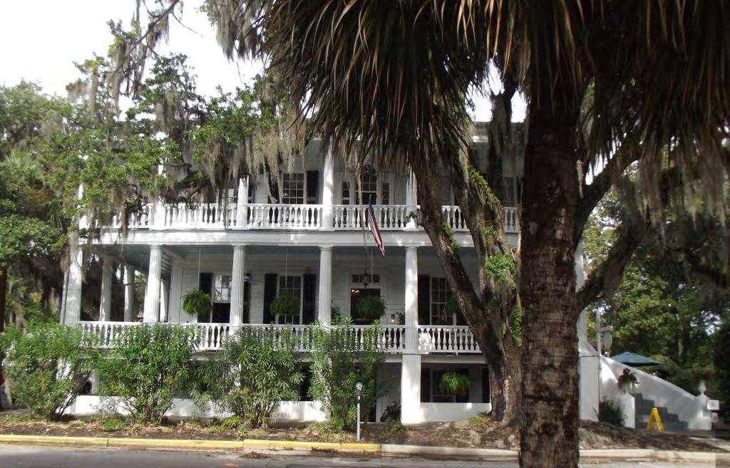
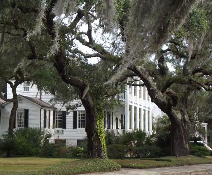
49 Cumberland Dividings sm703 Using the Navionics sonar charts we had plenty of water along this track. Others had reported problems in this area.

50 Florida Overview Mile 718 to 1235 Bridges and Trouble Spots Rayoneer Reach Matanzas River Ponce Inlet

51 Rayoneer Reach Amelia Island sm718 This is our 2016 northbound track the deeper water to the west is real an we missed our slit. There is a real mud bank between the two shorelines. NOAA charts are poor and the best track is to run through the marsh along the west side.

52 Rayoneer Reach November 2015 sm718 The highlighted track was my track in November 2015 after I had used the depth sounder in my dinghy to collect depth data. The NOAA shoreline is not drawn exactly correctly here and you do need to be very close to the west shore through this turn.

53 Pablo Creek Bridge sm 750

54 Matanzas Inlet sm792 to 793 You have to trust the marks as you see them in this stretch. The charts are not up to date. Drag your right hand in the sand as you go south.

55 Towns and Villages to slow down. Beaufort NC Southport NC Myrtle Beach McClellanville Charleston Beaufort SC Isle of Hope Jekyll Fernandina St. Augustine
56 McClellanville

57 Beaufort SC
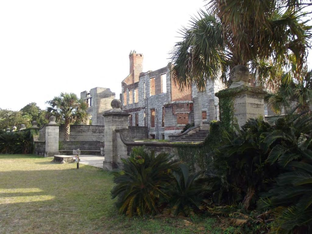
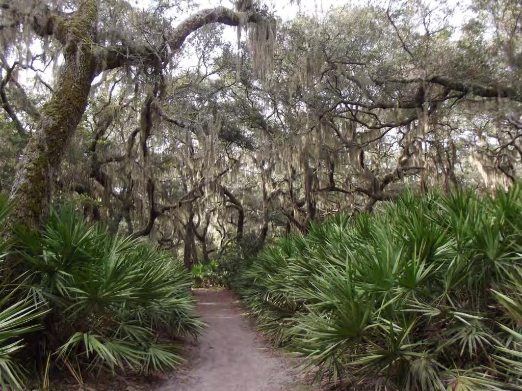
58 Cumberland Island


59 St. Augustine Castillo De San Marcos Bridge of Lions Ponce de Leon Hotel 1888 Flagler College
60 Enjoy the Trip Prepare the crew and the boat. Have a plan but not a schedule. Plan Daily Schedules Time, tides and weather will slow you down. You cannot catch up, so do not schedule. Splurge Slow down, spend time in the towns.
Wexford Harbour. Yachting Guide. Navigation
 Wexford Harbour Yachting Guide Navigation This document supersedes all previous editions. Approvals: Yacht Club Committee April, 2015 Wexford Board of Directors April, 2015 # Date Section Revision 1 6.5.2015
NAV-COM OFFICER PREP FOR SEA CHECKLIST
 NAV-COM OFFICER o Radars are on and functioning properly o Both GPS units are on and functioning properly o Chart Plotter is on and functioning properly o VHF radios are on and functioning properly o VHF
LESSONS LEARNED! LESSON ONE: Things need to REALLY be secured when you go offshore!
 LESSONS LEARNED! Some lessons are learned the hard way. February is when we really started putting some miles under the keel as we moved up the east coast. Even with past boating experience, there are
CDSOA Carolinas Fleet Oriental to Manteo/Ocracoke Cruise Loop
 CDSOA Carolinas Fleet Oriental to Manteo/Ocracoke Cruise Loop May 23-30, 2009 Please respond ASAP! Questions? Contact Fleet Captain Bob Perrone Ph: 919-782-6406; Email: rperronenc@aol.com Or Fleet Secretary
Cruising Means Plans Change
 Cruising Means Plans Change In March, we stayed on a mooring in Stuart while we watched the weather for a calm period to cross the Gulf Stream to the Bahamas. Our departure point would be from Lake Worth
CDSOA Carolinas Fleet Oriental to Manteo Cruise Loop September 23-October 2
 CDSOA Carolinas Fleet Oriental to Manteo Cruise Loop September 23-October 2 Questions? Contact Cruise Captain Shanna Paxton at cdwanderlust@cox.net or Fleet Captain Lou Ostendorff at 919-676-7437 or ostendorff@bellsouth.net
2005 ABC. Chapter 3 Part 2. Navigating with ATON's. Revision to D-13 Local Notes. Instructor Notes for Mike Brough. Mike Brough
 2005 ABC Chapter 3 Part 2 Navigating with ATON's Revision to D-13 Local Notes Instructor Notes for Mike Brough Mike Brough June 24 2008 June 24 2008 Slide 1 June 24 2008 New graphics Navigating on Water
Pilotage. Planning for pilotage
 Pilotage Planning for pilotage Being one step ahead of the game is key to effective pilotage. Only then will you know what to expect and what s lurking around the next bend. It s useful to construct a
Coastal Harbors and Waterways, NC (Shallow Draft Navigation) (O&M)
 (O&M)") Coastal Harbors and Waterways, NC (Shallow Draft Navigation) (O&M) Shallow draft coastal harbors include a subsistence harbor at Silver Lake CONGRESSIONAL DISTRICT: NC 3, 7 DATE: 23 April 2018 1. AUTHORIZATION:
Coastal Harbors and Waterways, NC (Shallow Draft Navigation) (O&M) Shallow draft coastal harbors include a subsistence harbor at Silver Lake CONGRESSIONAL DISTRICT: NC 3, 7 DATE: 23 April 2018 1. AUTHORIZATION:
SECTION II NM 26/10 NAVIGATION PUBLICATIONS ALMANACS CORRECTIONS
 NAVIGATION PUBLICATIONS ALMANACS CORRECTIONS NAUTICAL ALMANAC Ed 2011 NEW EDITION (NGA) 26/10 SAILING DIRECTIONS CORRECTIONS PUB 140 8 Ed 2010 NEW EDITION (NGA) 26/10 COAST PILOT CORRECTIONS COAST PILOT
Jack Hyde Memorial Navigation Contest Saturday, March 18, 2017 The Same Only Different
 Jack Hyde Memorial Navigation Contest Saturday, March 18, 2017 The Same Only Different March 17, 2018 Skippers, Mates and Crews, On behalf of the Tacoma Yacht Club let me welcome you to the running of
FORT to PORT - Fort Pierce to Port Royal
 FORT to PORT - Fort Pierce to Port Royal Back in the USA for April Fools Day. It was a 20 hour sail from Great Sail Cay in the Abacos to Ft. Pierce overnight on March 29 30 th. We left at 4:00 pm and were
BookletChart. Intracoastal Waterway Matecumbe to Grassy Key NOAA Chart A reduced-scale NOAA nautical chart for small boaters
 BookletChart Intracoastal Waterway Matecumbe to Grassy Key NOAA Chart 11449 A reduced-scale NOAA nautical chart for small boaters When possible, use the full-size NOAA chart for navigation. Published by
The Blessing of the Fleet Regatta
 THE BARNACLE CUP SAILORS AND THE ST MARY S RYKEN & LEONARDTOWN HIGH SCHOOL SAILING TEAMS PRESENT: The Blessing of the Fleet Regatta October 5 th, 2013 www.barnaclecup.com For more information, contact
U. S. Coast Guard Sector Boston Merrimack River Approach and Entrance, MA. Waterways Management Survey
 U. S. Coast Guard Sector Boston Merrimack River Approach and Entrance, MA. Waterways Management Survey The Waterways Analysis and Management Survey (WAMS) process is an essential component of both the
Pekeri s Circumnavigation of Phillip Island Dec 2009
 Pekeri s Circumnavigation of Phillip Island Dec 2009 Day 1. 26 Dec 09, Friday Sandringham to Blairgowrie. 11:15am Left Sandringham 10kn S On the nose, need to tack all the way to Blairgowrie. Sails: Main
Nautical Chart Challenge
 Discover Your World With NOAA Nautical Chart Challenge For as long as anyone in his family could remember, Francis Beaufort wanted to make scientific observations from the deck of a ship. In 1789 at the
Coastal Harbors and Waterways, NC (Shallow Draft Navigation) (O&M)
 (O&M)") Coastal Harbors and Waterways, NC (Shallow Draft Navigation) (O&M) Shallow draft coastal harbors include a subsistence harbor at Silver Lake CONGRESSIONAL DISTRICT: NC 3 and 7 DATE: 23 February 2015 1.
Coastal Harbors and Waterways, NC (Shallow Draft Navigation) (O&M) Shallow draft coastal harbors include a subsistence harbor at Silver Lake CONGRESSIONAL DISTRICT: NC 3 and 7 DATE: 23 February 2015 1.
Only launch your boat once you have a clear understanding of the most up-to-date weather forecast.
 Weather and Tides Observing the Weather Only launch your boat once you have a clear understanding of the most up-to-date weather forecast. Start with television and newspaper weather map reports; they
Here s a lovely old wooden schooner we saw in the anchorage.
 In May we took a brief timeout and returned to Atlanta. It was time for our annual doctors visits, dental appointments, etc. However, the most important reason was to attend our son s graduation! Luke
An overview of anchorages used by s/v Field Trip
 Papua New Guinea An overview of anchorages used by s/v Field Trip Mark Silverstein - January 9, 218 Mortlock Islands, PNG ANCHORAGES & PROVISIONING 1 Introduction Papua New Guinea can be challenging in
Expanding Anchoring Away
 Expanding Anchoring Away Vessel taxonomy &territorial waters Maritime and admiralty law distinguished The right to navigate Federal navigational servitude as applied CZMA, reverse federalism & Florida
Essential Safety. in Chichester Harbour. An essential guide for the new or less experienced mariner
 Essential Safety in Chichester Harbour An essential guide for the new or less experienced mariner 01243 512301 www.conservancy.co.uk 1 Enjoying Chichester Harbour in safety Chichester Harbour is renowned
SECTION II NM 11/13 NAVIGATION PUBLICATIONS COAST PILOT CORRECTIONS. Chapter 4 Paragraphs 85 to 86; read: (85)
") NAVIGATION PUBLICATIONS COAST PILOT CORRECTIONS COAST PILOT 1 42 Ed 2012 Change No. 13 LAST NM 9/13 Chapter 4 Paragraph 9; read: (9) Round Rock, which uncovers, and The Boring Stone, 3 feet high and bare,
NAVIGATION PUBLICATIONS COAST PILOT CORRECTIONS COAST PILOT 1 42 Ed 2012 Change No. 13 LAST NM 9/13 Chapter 4 Paragraph 9; read: (9) Round Rock, which uncovers, and The Boring Stone, 3 feet high and bare,
Anchoring Is Important
 BCC Sailing Classes - Third Theory Anchoring Anchoring Is Important 1 The Anchor is your last resort. Anchoring Keep off a lee shore. Needs to be shaped (type of anchor) to bury in the type of bottom for
SAN DIEGO BAY PARADE OF LIGHTS 2017 SKIPPER'S INFO AND INSTRUCTIONS PLEASE READ ALL THE ENCLOSED INFORMATION AND FOLLOW INSTRUCTIONS.
 SAN DIEGO BAY PARADE OF LIGHTS 2017 SKIPPER'S INFO AND INSTRUCTIONS ***NOTICE THE CHANGE IN THE STARTING TIME*** PLEASE READ ALL THE ENCLOSED INFORMATION AND FOLLOW INSTRUCTIONS. QUESTIONS? Email: SDParadeOfLights@gmail.com
Gulet Barba Croatia. Ship base: Split Croatia (or by arrangement, depending on the selected route.) TECHNICAL SPECIFICATIONS: Year 1989.
 TECHNICAL SPECIFICATIONS: Year 1989.") Gulet Barba Croatia TECHNICAL SPECIFICATIONS: Year 1989. Lenght over all Breadth Draugh Weight Maine engines Cruising speed Fuel tank Wather tank (141,08 ft) 43,00 m (23,8 ft) 7,20 m (11,30 ft) 3,40 m
Gulet Barba Croatia TECHNICAL SPECIFICATIONS: Year 1989. Lenght over all Breadth Draugh Weight Maine engines Cruising speed Fuel tank Wather tank (141,08 ft) 43,00 m (23,8 ft) 7,20 m (11,30 ft) 3,40 m
WE RE OUTTA HERE! There were many amusements along the way. Here s some of the sights:
 WE RE OUTTA HERE! Enough preparation already. Time to MOVE! Set sail! Departure! South for the winter! I had figured departure from Port Royal for November 1 st (since the October dock fees were already
Boat Name Phone Owner Name Skipper s Name Phone Length, Beam, Draft, Height Power, Sail or Human Registration/Doc # Sponsor Total on Board
 For Chamber use only Boat Number Payment Method Payment Amount December 1, 2018 from 5-9PM. Salty Sam s Marina Boat Application Boat Name Phone Owner Name_ Email Skipper s Name Phone Length, Beam, Draft,
CRC Inlet Management Study. Matt Slagel Shoreline Management Specialist
 CRC Inlet Management Study Matt Slagel Shoreline Management Specialist Study Origin CRC shall study feasibility of creating new AEC for lands adjacent to mouth of Cape Fear River (HB 819) Collaborate with
Chittagong, Bangladesh (Asia Region)
") General Information: Port Information (Asia Region) Extract of port information from Chittagong Port Authority: The Port of Chittagong is the principal Port of the People's Republic of Bangladesh. It is
General Information: Port Information (Asia Region) Extract of port information from Chittagong Port Authority: The Port of Chittagong is the principal Port of the People's Republic of Bangladesh. It is
Fountaine Pajot MAHE 36 COOL CAT
 Fountaine Pajot MAHE 36 COOL CAT Make: Fountaine Pajot Model: MAHE 36 Length: 36 ft Price: $ 185,000 Year: 2006 Condition: Used Location: Miami, FL, United States Boat Name: Hull Material: Draft: Number
Bremerton Yacht Club
 Bremerton Yacht Club Skippers, Mates and Crews, January 1, 2018 On behalf of the Bremerton Yacht Club and all its members, I am pleased to invite you to the 84th running of our annual Heavy Weather Navigation
Towing Officers' Assessment Record: Near Coastal/Oceans
 Towing Officers' Assessment Record: Near Coastal/Oceans NAME: LICENSE NO.: Task No. Considered Proficient Common Element Task or Duty DE's Initials Date A. Vessel Familiarization A.1. X Locate and demonstrate
Intermediate Cruising Standard (ASA 104)
") Intermediate Cruising Standard (ASA 104) Prerequisites: Basic Keelboat Sailing (ASA 101) and Basic Coastal Cruising (103) Certification General Description: Demonstrated ability to skipper a sloop-rigged,
Intermediate Cruising Standard (ASA 104) Prerequisites: Basic Keelboat Sailing (ASA 101) and Basic Coastal Cruising (103) Certification General Description: Demonstrated ability to skipper a sloop-rigged,
Port Sections Guide Section 01
 s Guide 01 Cow Bay Marina Date 10/1/2016 Position (lat / lon) Minimum controlled water depth Chart datum Range of water densities Tidal range alongside Bottom type Dredging regime Distance pilot station
January Skippers, Mates, and Crews:
 January 2016 Skippers, Mates, and Crews: On behalf of Bremerton Yacht Club and all our members, I am pleased to welcome you to the 82 nd running of our annual Heavy Weather Predicted Log Race and Social
57 TH MBYC BOOMERANG NAVIGATION CONTEST MARCH 2,3,& COURSE DESCRIPTION AND RULES
 57 TH MBYC BOOMERANG NAVIGATION CONTEST MARCH 2,3,&4 2018 COURSE DESCRIPTION AND RULES Please see instructions to sign up for the event, dinner, etc. in a separate communication. Questions? Contact Paul
Visiting Lake Macquarie
 Visiting Lake Macquarie Lake Macquarie is the largest coastal salt water lake in Australia and is a prime boating destination for both small and large vessels. Many sailing regattas and fishing activities
Commandant United States Coast Guard NAVIGATION AND VESSEL INSPECTION CIRCULAR NO. 2-97, CHANGE 1
 Commandant United States Coast Guard 200 Second Street, S.W. Washington, DC 20593-000 Staff Symbol: G-MOC Phone: 202-267-464 A DISTRIBUTION SDL No. 34 a b c d e f g h I j k l m n o p q r s t u v w x y
C&C 40 Koyukuk. Price: $ 49,000. Number:
 C&C 40 Koyukuk Make: C&C Model: 40 Length: 40 ft Price: $ 49,000 Year: 1989 Condition: Used Boat Name: Hull Material: Draft: Koyukuk Fiberglass 7 ft Number of Engines: 1 Fuel Type: Diesel Number: 6164445
ROUTES CAN MESS IT UP
 ROUTES CAN MESS IT UP FROM THIS SEASON, CHART SUPPLIERS NAVIONICS, C-MAP AND BLUECHART, OFFER AUTOMATIC ROUTE PLANNING. WE HAVE TESTED ALL. THE DIFFERENCES IN BOTH USER INTERFACE AND QUALITY OF THE ROUTES
windy. However with the camper enclosure it wasn't too bad being out of the wind. Within the first 25 minutes or so we had to do a little work on the
 Tahoe Pontoon Run from Baltimore to Key West Tahoe Pontoons took an extraordinary step to prove that Tahoe pontoons are the strongest pontoons made. President Jim Wolf and V.P. of Marketing Greg Knight
BookletChart. Chesapeake Bay Tangier Sound, Northern Part NOAA Chart A reduced-scale NOAA nautical chart for small boaters
 BookletChart Chesapeake Bay Tangier Sound, Northern Part NOAA Chart 12231 A reduced-scale NOAA nautical chart for small boaters When possible, use the full-size NOAA chart for navigation. Published by
US Beach Nourishment Experience:
 Beach Nourishment: Introduction of new sand to the beach by truck or dredge Large beach >1 million cubic yards (100,000 dump truck loads) Funding is a combination of federal, state, local & private Also
MAC Transit Advisories as of April 30, 2018
 MAC Transit Advisories as of April 30, 2018 The Mariners Advisory Committee for the Bay and River Delaware was established in October 1964. Its members and associate members are mainly comprised of master
Delaware River Vessel Reporting System Mariners Advisory Committee For
 Delaware River Vessel Reporting System Mariners Advisory Committee For the Bay and River Delaware The Mariner's Advisory Committee is comprised of Master Mariners, River Pilots, and concerns itself with
BookletChart. Sand Key to Rebecca Shoal NOAA Chart A reduced-scale NOAA nautical chart for small boaters
 BookletChart Sand Key to Rebecca Shoal NOAA Chart 11439 A reduced-scale NOAA nautical chart for small boaters When possible, use the full-size NOAA chart for navigation. Published by the National Oceanic
Missionary Sailing School
 Missionary Sailing School Enjoy this short video: http://www.youtube.com/watch?v=pmcsr0wt4wk&feature=related Captain Ron is right most anything can happen out there if you are not prepared, both in knowledge
1995 Hinterhoeller Nonsuch 324
 RICHARD NOLAN Eastland Yacht Sales 33A Pratt Street Essex, CT, US Office: 8607678224 rnolan@eastlandyachts.com 1995 Hinterhoeller Nonsuch 324 Boat Type: Cruiser Address: Groton, CT, US Price: $60,000 OVERVIEW
Coastal Harbors and Waterways, NC (Shallow Draft Navigation) (O&M)
 (O&M)") Coastal Harbors and Waterways, NC (Shallow Draft Navigation) (O&M) Shallow draft coastal harbors include a subsistence harbor at Silver Lake CONGRESSIONAL DISTRICT: NC 3 and 7 DATE: 23 February 2015 1.
Coastal Harbors and Waterways, NC (Shallow Draft Navigation) (O&M) Shallow draft coastal harbors include a subsistence harbor at Silver Lake CONGRESSIONAL DISTRICT: NC 3 and 7 DATE: 23 February 2015 1.
GENTLEMEN SIT or GENTLEMEN CLEAN THE HEAD
 GENTLEMEN SIT or GENTLEMEN CLEAN THE HEAD NOTE: Joker valve has a ¾ in opening. Because of this it is EASY to plug. If you did not eat it do not put it in the head. NEVER RELEASE THE WHEEL WHEN UNDERWAY
WINTERING IN PORT ROYAL
 WINTERING IN PORT ROYAL So Hmmm Are we liveaboards or Cruisers? Sometimes I think about that. We re spending a year at the dock here, as we catch up on finances and two family weddings. Some cruisers travel
Towing Officers' Assessment Record: Western Rivers
 Towing Officers' Assessment Record: Western Rivers NAME: LICENSE NO.: Task No. Considered Proficient Common Element Task or Duty DE's Initials Date A. Vessel Familiarization A.1. X Locate and demonstrate
Dodger Channel. Chart 3671 Map 92C/ N W The southern section is the favoured anchoring area. Good holding. Settled weather only.
 Vancouver Island. West Coast. South to North Burlo Island Cove. Chart 3646. Map 92C/14 48 49N 125 08W At the head of Bamfield Inlet. Anchor on the west or east of Burlo Island. Drying flats. Good holding
1986 Beneteau First 325
 BRUCE MCDONALD Brewer Yacht Sales 1410 Manhanset Ave Greenport, NY, US Office: 631-987-9989 Mobile: (631) 987-9989 bmcdonald@byy.com 1986 Beneteau First 325 Boat Type: Racer and Cruiser Address: Glen Cove,
Please contact our Education Officer if you are interested in any of these courses.
 Please contact our Education Officer if you are interested in any of these courses. Lt/Cdr Jack McKinnon, AP 770-365-9576 or Jakmck@frontier.com Elective Courses Six Elective Courses are offered by USPS.
Boat Name. Hailing Port. Registration # MMSI # Misc:
 NSHSA USEFUL INFORMATION Boat Name Hailing Port Length Beam Draft Mast Height Electric Fuel Burn Rate Fuel Tank Capacity Water Tank Capacity Registration # MMSI # Misc: PASSPORT TO ADVENTURE THE PASSPORT
Assessors Name: East Coast OGA Sub Committee Date: 28 April 2015 Persons Affected: Skipper & Crew. Quantifying Risks
 Risk Assessment: EAST COAST RACE EVENT 2015 Risk Assessments of: East Coast Race Event 17 th 19 th July 2015. Man Overboard, Physical Injury or Illness, Sea Sickness, Fire, Gear Failure, Grounding or Shipwreck,
Leopard 43 JUNO. Just Catamarans, Inc
 Leopard 43 JUNO Make: Model: 43 Length: Leopard 43 ft Price: $ 359,000 Year: 2007 Condition: Used Boat Name: Hull Material: Draft: Number of Engines: 2 Engine Make: Location: JUNO Fiberglass 4 ft 3 in
Texas Department of Transportation s Gulf Intracoastal Waterway Capacity Study. GICA 112 th Annual Seminar July 28, 2017
 Texas Department of Transportation s Gulf Intracoastal Waterway Capacity Study GICA 112 th Annual Seminar July 28, 2017 Study Purpose Determine if current levels of vessel activity on the Texas segment
Seventeenth Coast Guard District Auxiliary Policy Directive 01-07
 Commander Seventeenth Coast Guard District Director of Auxiliary PO Box 25517 Juneau, AK 99802-5517 Staff Symbol: dpa Phone: 907-463-2252 Fax: 907-463-2256 Email: Robert.C.Gross@uscg.mil Seventeenth Coast
TOWING OFFICER ASSESSMENT RECORD
 TOWING OFFICER ASSESSMENT RECORD NEAR COASTAL / OCEANS SIGNATED EXAMINER INFORMATION All Designated Examiners (s) signing off successful completion of practical assessments should provide the information
The LA/LB Harbors handle more than 5,500 commercial vessel arrivals per year (excluding local coastwise and Catalina Island traffic).
.") X. SMALL CRAFT For the purpose of the Los Angeles and Long Beach Harbor Safety Plan, pleasure vessels, commercial fishing vessels and sportfishing boats are designated as small craft. A. BACKGROUND: The
X. SMALL CRAFT For the purpose of the Los Angeles and Long Beach Harbor Safety Plan, pleasure vessels, commercial fishing vessels and sportfishing boats are designated as small craft. A. BACKGROUND: The
CORPS ON THE COAST. North Carolina Coastal Conference Coastal Infrastructure Raleigh, NC April 14, Jim Medlock Chief, Programs Management Branch
 CORPS ON THE COAST North Carolina Coastal Conference Coastal Infrastructure Raleigh, NC April 14, 2015 Jim Medlock Chief, Programs Management Branch US Army Corps of Engineers OVERVIEW What Are The Corps
West Coast Anchorages
 West Coast Anchorages This document aims to catalogue a number of anchorages along the West Coast of Tasmania where shelter may be sought. In addition the degree of protection from the wind, and holding
Fastest in the Forest Regatta Sunday, October 2, 2016 EFYCC Marina. Notice of Race
 Fastest in the Forest Regatta Sunday, October 2, 2016 EFYCC Marina Epping Forest Yacht and Country Club 1830 Epping Forest Drive Jacksonville, Fl. 32217 Notice of Race 1.0 RULES The Regatta will be governed
WELCOME TO LIFE ON THE WATER
 WELCOME TO LIFE ON THE WATER Get Into It. EXCLUSIVELY FOR MARINA PALMS RESIDENTS JOIN THE MARINA PALMS BOAT CLUB, WHERE EVERY DAY IS AN ADVENTURE. Nothing complements the South Florida lifestyle quite
Extract from Cruising Guide to the Saint Lawrence, Editor Jim Evans, Puffin Press
 Visiting Murray Harbour by Boat Extract from Cruising Guide to the Saint Lawrence, Editor Jim Evans, Puffin Press Murray Harbour 46º 02.1N, 62º 27.1W Canadian Chart 4420 Jim Evans 2016 The photo above
STUDENT STUDY GUIDE ASA 104 INTERMEDIATE COASTAL CRUISING & BAREBOAT CHARTERING
 STUDENT STUDY GUIDE ASA 104 INTERMEDIATE COASTAL CRUISING & BAREBOAT CHARTERING Page 1 Intermediate Cruising Standard (ASA 104) Prerequisites: Basic Keelboat Sailing (ASA 101) and Basic Coastal Cruising
Jim McLarty. Commander
 Midland Power and Sail Squadron, Founded in 1952 Summer 2018 Volume 11, Issue 2 c/o 33 Byrnes Crescent, Penetanguishene, ON L9M 1V9 Newsletter Editor: Sandy Campbell Noel Campbell Commander Jim McLarty
ST. AUGUSTINE RACE WEEK
 SAILING INSTRUCTIONS - Offshore ST. AUGUSTINE RACE WEEK March 30 th thru April 3 rd 2016 A Race for Champions, a Race for the Children www.sarw2016.com 1 RULES 1.1 The St. Augustine Race Week Offshore
OASIS SAILING CLUB. A&E Review Form Sailing/CQM Rev 11/9/2015. Name: Level
 OASIS SAILING CLUB A&E Review Form Sailing/CQM Rev 11/9/2015 Name: Level Vessel: A&E Reviews are designed to improve general competence and safe sailing of OSC vessels. The written multiple-choice tests
National Maritime Center
 National Maritime Center Providing Credentials to Mariners Able Seaman Unlimited, Limited, Special, Special OSV, Sail, Fishing Industry (Sample Examination) Page 1 of 17 Choose the best answer to the following
SAILING INSTRUCTIONS BILLY RUN. Saturday 28 April The organising authority (OA) is the South of Perth Yacht Club
 is the South of Perth Yacht Club") SAILING INSTRUCTIONS BILLY RUN Saturday 28 April 2018 The organising authority (OA) is the South of Perth Yacht Club 1. RULES 1.1. The regatta will be governed by the rules as defined in The Racing Rules
SAILING INSTRUCTIONS BILLY RUN Saturday 28 April 2018 The organising authority (OA) is the South of Perth Yacht Club 1. RULES 1.1. The regatta will be governed by the rules as defined in The Racing Rules
2 Boating Rules and Regulations... 73
 Contents at a Glance Chapter 1 Boat Design and Construction Chapter 2 Boating Rules and Regulations Chapter 3 Navigation Rules (ColRegs) Chapter 4 Boat Operating and Seamanship Chapter 5 Piloting and Navigation
Harbourmaster s Office Tamaki River. Navigation Safety Operating Requirements 2014
 Harbourmaster s Office Tamaki River Navigation Safety Operating Requirements 2014 Auckland Council Harbourmaster s Office TAMAKI RIVER Navigation Safety Operating Requirements FOREWARD The purpose of these
UNITED NEW YORK SANDY HOOK PILOTS BENEVOLENT ASSOCIATION AND UNITED NEW JERSEY SANDY HOOK PILOTS BENEVOLENT ASSOCIATION
 UNITED NEW YORK SANDY HOOK PILOTS BENEVOLENT ASSOCIATION AND UNITED NEW JERSEY SANDY HOOK PILOTS BENEVOLENT ASSOCIATION TO: All Shipping Agents and Interested Parties January 19, 2017 SUBJECT: Anchorage
Summary Report. Grounding Twofold Bay. 20 July 2006
 Summary Report Grounding Twofold Bay 20 July 2006 NARRATIVE On the evening of 19 July 2006, the Skipper of Twofold Bay brought the vessel into Whangawehi Roads on the north coast of the Mahia Peninsula
Towed Barge Standard of Care
 Lower Columbia Region Harbor Safety Committee Towed Barge Standard of Care Page 1 of 6 A. 1. Purpose The Columbia River is intended to eliminate conflicts between towing vessels conducting astern towing
05 Boat Handling. Captain
 05 Boat Handling Competence (Skills) Knowledge, Understanding and Proficiency Level Required Boat handling theory and techniques Coxswain Crew RQ RQ Describe the forces acting on a vessel while manoeuvering
Fastest in the Forest Regatta Sunday, October 1, 2017 EFYCC Marina. Notice of Race
 1.0 RULES Fastest in the Forest Regatta Sunday, October 1, 2017 EFYCC Marina Epping Forest Yacht and Country Club 1830 Epping Forest Drive Jacksonville, Fl. 32217 Notice of Race The Regatta will be governed
An Introduction To Marine Charts
 An Introduction To Marine Charts //captnmike.com Revised August 29, 2011 An Illustrated introduction to U. S. Aids to Navigation in the Shilshole Bay area of Puget Sound, Washington. The chart symbols
Cook Inlet pipeline crossing is about making the best choices
 Cook Inlet pipeline crossing is about making the best choices By Larry Persily lpersily@kpb.us Aug. 26, 2015 (This update, provided by the Kenai Peninsula Borough mayor s office, is part of an ongoing
HELSINKI COMMISSION HELCOM SAFE NAV 4/2014 Group of Experts on Safety of Navigation Fourth Meeting Helsinki, Finland, 4 February 2014
 HELSINKI COMMISSION HELCOM SAFE NAV 4/2014 Group of Experts on Safety of Navigation Fourth Meeting Helsinki, Finland, 4 February 2014 Agenda Item 3 Accidents and ship traffic in the Baltic Sea Document
COAST GUARD ADVISORY NOTICE (CGAN ) To: Distribution Date: September 1, 2017
 To: Distribution Date: September 1, 2017") Commander United States Coast Guard Sector New York 212 Coast Guard Drive Staten Island, NY 10305 Staff Symbol: (spw) Phone: (718) 354-2353 Fax: (718) 354-4190 COAST GUARD ADVISORY NOTICE (CGAN 2017-016)
Commander United States Coast Guard Sector New York 212 Coast Guard Drive Staten Island, NY 10305 Staff Symbol: (spw) Phone: (718) 354-2353 Fax: (718) 354-4190 COAST GUARD ADVISORY NOTICE (CGAN 2017-016)
Using a RIB for a Safety Boat Duty
 Using a RIB for a Safety Boat Duty Reminder Notes for Safety Boat Helms This information should be used as a reminder of what constitutes safe practice when carrying out a safety boat duty. However, the
General Boating Knowledge. Common Sense before leaving shore
 General Boating Knowledge Common Sense before leaving shore Engines work, battery charged, hull, tires, drain plug, etc Safety equipment example - Life jackets fit correctly for everyone on board Safety
GULF OF GEORGIA NORTH PUGET SOUND SOUTH PUGET SOUND
 June 8, 2018 GULF OF GEORGIA NORTH PUGET SOUND SOUTH PUGET SOUND Skippers, Mates & Crews, On behalf of the IPBA and all of its members, let me welcome you to our 2018 ICR, course and compass contest/rally.
NAUTICAL TERMINOLOGY
 It s important to have a basic understanding of common nautical terms associated with the parts, positions and directions of your vessel. Knowing these terms will make it easier to communicate with people
Dimensions LOA: 32 feet Beam: 12.5 feet Bridge Clearance: 11.5 feet
 Brad Peterson 1323 SE 17th St Suite168 Ft. Lauderdale, FL 33316 United States http://yachtworld.com/curtisstokes Tel (305) 481-1512 Tel 954-684-0218 Fax (954) 320-6942 Email bradp@curtisstokes.net 33'
Year: 1972 Heads: 1 Location: Conwy Cabins: 1 LOA: 31' 9" (9.67m) Berths: 3 Beam: 9' 6" (2.89m) Keel: Bilge Keel Min Draft: 3' 3" (0.
 Berths: 3 Beam: 9' 6 (2.89m) Keel: Bilge Keel Min Draft: 3' 3 (0.") CONWY OFFICE OFFICES THROUGHOUT THE UK AND EUROPE Macwester Wight MK2 Year: 1972 Heads: 1 Location: Conwy Cabins: 1 LOA: 31' 9" (9.67m) Berths: 3 Beam: 9' 6" (2.89m) Keel: Bilge Keel Min Draft: 3' 3" (0.99m)
CONWY OFFICE OFFICES THROUGHOUT THE UK AND EUROPE Macwester Wight MK2 Year: 1972 Heads: 1 Location: Conwy Cabins: 1 LOA: 31' 9" (9.67m) Berths: 3 Beam: 9' 6" (2.89m) Keel: Bilge Keel Min Draft: 3' 3" (0.99m)
MANAGEMENT SYSTEM MANUAL
 1. Purpose The purpose of this procedure is to establish routine check-off lists to be used in preparation for arrival and departure aboard the R/V Oceanus. 2. Responsibility The Master is responsible
Engine Make: Westerbeke Engine Model: 33-A Primary Engines: Inboard Drive Type: Direct Drive Hours: unknown Power: unknown
 http://www.curtisstokes.net Curtis Stokes & Associates - Ryan Daniels 1323 SE 17th St, Suite168 Ft. Lauderdale, FL 33316, United States Tel: (904) 580 0559 Tel: 954-684-0218 Fax: (954) 320-6942 ryan@curtisstokes.net
XXX. Chisolm Island Creeks. Map Continued on SC-48. Judge Island. SC49-03 Jenkins Creek/Morgan River Intersection XXX. Saint Helena Island
 w River 32 30'0"N ufort County 80 37'30"W 802 Coosaw River 250 450 SC41-05 Geographic Response SC41-03 Plan Map: Coosaw SC-49 River Chisolm Island Chisolm Island s u Map Continued on SC-41 3 (west side)
Enhanced Discussion of Requirements for Commercial Fishing Vessels
 Update on U.S. Commercial Fishing Industry Vessel Requirements Based On Section 604 of the Coast Guard Authorization Act of 2010 (Public Law 111-281) And Section 305 of the Coast Guard and Maritime Transportation
Cape Lookout Field Trip: Coastal Processes and Responses (modified after Riggs, 1997)
") Cape Lookout Field Trip: Coastal Processes and Responses (modified after Riggs, 1997) I. Dates Friday, November 5 through Sunday, November 7. We will camp near the Cape Lookout Lighthouse. We will get
Cape Lookout Field Trip: Coastal Processes and Responses (modified after Riggs, 1997) I. Dates Friday, November 5 through Sunday, November 7. We will camp near the Cape Lookout Lighthouse. We will get
Using Sonar for Navigation
 Using Sonar for Navigation By Steve Dashew We spend a lot of time cruising in remote areas, where charts tend to be out-of-date or nonexistent. For years we've been thinking about using sonar for navigation
Building Beaches with Navigation Sand, Just Don t Forget the Dunes!!
 Building Beaches with Navigation Sand, Just Don t Forget the Dunes!! Ken Willson Kenneth.Willson@CBI.com Introduction Decrease in Federal Funding (Shallow Draft Navigation Maintenance and Shore Protection)
BookletChart. Chesapeake Bay Severn and Magothy Rivers NOAA Chart A reduced-scale NOAA nautical chart for small boaters
 BookletChart Chesapeake Bay Severn and Magothy Rivers NOAA Chart 12282 A reduced-scale NOAA nautical chart for small boaters When possible, use the full-size NOAA chart for navigation. Published by the