NSF's Ocean Observatories Initiative: Building Research Infrastructure for the Pacific Northwest and the Broader Community
|
|
|
- Ginger Tucker
- 5 years ago
- Views:
Transcription


1 Agenda Item B.3.b Supplemental OOI PowerPoint April 2013 Ocean Observatories Initiative NSF's Ocean Observatories Initiative: Building Research Infrastructure for the Pacific Northwest and the Broader Community Presented by Ed Dever College of Earth, Ocean and Atmospheric Sciences (CEOAS) Oregon State University
2 Structure of talk Introduction to OOI Regional Scale Nodes (cabled array) Endurance Array (cabled and uncabled array components) Glider, Benthic Experiment Package, Mooring Videos 1
3 Introduction infrastructure (moorings, profilers, AUVs, gliders, and seafloor platforms) to measure p physical, y, chemical,, geological and biological variables at the air-sea interface, in the ocean, and seafloor. integrated by a cyberinfrastructure to manage resources and bring data to scientists, educators and the public. Education and Public Engagement component. Funded by the National Science Foundation through the Consortium for Ocean Leadership (OL). OL funds the implementing organizations 2
4 OOI Science Themes Coastal and Global Scale Nodes (Global, Endurance, Pioneer) Ocean-Atmosphere Exchange Climate Variability, Ocean Circulation and Ecosystems Turbulent Mixing and Biophysical Interactions Coastal Ocean Dynamics and Ecosystems Regional Scale Nodes Fluid Rock Scale Interactions and the Sub-Seafloor th S b S fl Bi Biosphere h Plate-Scale Geodynamics 3
5 OOI By the Numbers Number of Arrays: 7 (4 Global, 2 Coastal, 1 Regional Cabled) Types of platforms: Gliders, AUVs, profilers, surface moorings, fixed instrument chains, seafloor and subseafloor installations Number of simultaneously deployed instruments: 764 Number of instrument types: 48 Data Volume Produced: 3 Petabytes/year High power (10kV) and high speed data (10Gbs) fiber optic cable, satellite modem, acoustic modem, inductive modem Build: 5 years Operations: 25 years + See oceanobservatories.org for more information 4


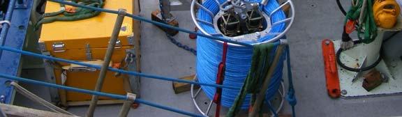
6 Regional Scale Nodes (RSN) The RSN will provide high power and high bandwidth connectivity to instruments installed on the seafloor and deep water column moorings via undersea fiber optic cables. Two electro-optical undersea cables, totaling 880 km, were installed, landed, and connected to the shore station at Pacific City, OR. 5


7 2013/2014 operations Secondary infrastructure 2013: Seabed sensors and short surface laid extension cables 2014: Water column sensors and moorings 6
8 2013/2014 operations Secondary infrastructure Science requirements sensor positions based on scientific value sensor extension cables less than ~1km in length Feasibility Based on site conditions: landing, bathymetry, geology, currents Oh Other marine users fishing & recreational activities existing submarine systems Environmental hazards and protected areas Minimize impacts and maximize protection of the OOI network 7
9 2013/2014 operations Secondary infrastructure Variable sensors configuration fi i at each h site Sensors on seabed and in water column, linked by: extension cables junction boxes low voltage nodes Data back to shore in real-time 8
 OSU non-cabled moorings")
 Secondary node location Lat.")
 All")

10 Infrastructure at PN1C (Oregon slope site) OSU non-cabled moorings turned around twice/year PN1C (617m) Secondary node location Lat. : N Long. : W Depth : 588 m (322 fms) All equipment within 2 water depths of secondary node 1.2km (0.65nm) radius buffer zone 9


11 Infrastructure at the Oregon 80m site OSU non-cabled moorings turned around twice/year Oregon mid-shelf Secondary node location Lat. : N Long. : W Depth : 80 m All sensors within 3 water depths of low voltage node ~300m radius buffer zone 10


12 Endurance Array The Endurance Array has two lines of cross-shelfshelf moorings (inner-shelf, mid-shelf, and slope) off Newport and Grays Harbor. At the Newport line, two of the sites at 80 and 600 m depths will have cabled as well as uncabled platforms. Six glider lines will support the Endurance array by resolving mesoscale spatial variability. 14


13 Site Inshore Oregon Endurance Line Site Center N W Proposed buffer zone Depth Platforms 185 m 24 m Submersible Surface Buoy Uncabled Profiler Shelf N W 250 m 80 m Coastal Surface Buoy Cabled Profiler Cabled Benthic Experiment Package Offshore N 1200 m 588 m Coastal Surface Buoy W Cabled Hybrid Profiler Cabled Benthic Experiment Package 15

14 The Oregon inshore site OSU non-cabled moorings turned around twice/year Oregon inshore Site location Lat. : N Long. : W Depth : 24 m 185m radius proposed buffer zone 16


15 Washington Endurance Line Site Site Center Proposed buffer zone Depth Platforms Inshore N W 185 m 29 m Submersible Surface Buoy Uncabled Profiler Shelf N W 250 m 87 m Coastal Surface Buoy Uncabled Profiler Offshore N 1200 m 542 m Coastal W Surface Buoy Coastal Profiler Mooring 17


16 The Washington offshore site OSU non-cabled moorings turned around twice/year Washington offshore site Site Center Lat. : N Long. : W Depth : 542 m ~ 1200 m radius proposed buffer zone The hatched area demarcates the Grays Canyon Essential Fish Habitat Conservation Area. 18


17 The Washington shelf site OSU non-cabled moorings turned around twice/year Washington shelf site Site Center Lat. : N Long. : W Depth : 87 m ~250m radius proposed dbuffer zone 19

18 The Washington inshore site OSU non-cabled moorings turned around twice/year Washington inshore site Site Center Lat. : N Long. : W Depth : 29 m ~185m radius proposed buffer zone 20
19 Endurance Array uses fixed and mobile assets to observe cross-shelf and along-shelf variability in the coastal upwelling region off Oregon and Washington provides an extended spatial footprint that encompasses a prototypical eastern boundary current regime joins with the RSN cabled infrastructure. 21
20 Endurance Core Sensors Surface fluxes (bulk and direct covariance) CO2 flux and in-water Surface wave spectra Temperature Conductivity Pressure Mean currents Three-axis velocities Dissolved oxygen ph Spectral irradiance Optical attenuation and absorption Chlorophyll-a and CDOM fluorescence Optical backscatter Photosynthetically active radiation (PAR) Nitrate Bio-acoustic sonar Digital still camera Passive hydrophone
 mounting")


21 Endurance (RSN): Benthic Experiment Package The BEP provides a low profile (trawl resistant) mounting platform for sensors that require high power and bandwidth as well as near proximity it to the seafloor. The BEP is connected to the RSN cabled infrastructure at the Endurance Array Offshore and Shelf sites.
22 BEP Core Instruments Optical Attenuation and Absorption Pumped CTD w/ seafloor pressure Passive Broadband Hydrophone Dissolved Oxygen Water pco 2 ph 3D Single Point Current Meter Water Velocity Profile (ADCP) Zooplankton Sonar* Digital Camera with Strobe* *Moved off BEP due to science and power considerations respectively, but part of cabled Endurance core instruments
23 Coastal Mooring deployed off OR and WA Deployed in 80 and m water depths OR moorings deployed over cabled array ay 25


24 Inshore mooring (prototype shown) Deployed in 25 m water depth off Newport, OR and Grays Harbor, WA Design based on similar moorings deployed off the east coast for right whale hazard Surface buoy with electricalmechanical connection to seabed Stretch hose allows mooring to respond to wave motion 26


25 Coastal Wire Following Profiler Mooring: deployed off WA at 500 m site 27


26 Coastal Winched Profilers Deployed off OR and WA at 25 m and 80 m depth sites Small winched body raised to surface every 6-12 hours WET Labs Autonomous Moored Profiler (AMP) 28
27 Endurance Array gliders Coastal gliders will be used to resolve mesoscale features over the shelf and slope between and afield from fixed platforms the Endurance (northeast Pacific) array. Gliders will be deployed up and down the coast in 5 cross-shore shore lines and 1 offshore line Webb Slocum G2 (OOI coastal glider shown) The gliders are configurations of the Teledyne Webb Research Slocum G2 glider. The Slocum G2 has a modular science bays and buoyancy pumps. Coastal gliders will be ordered with a mix of 200 m and 1000 m buoyancy pumps and an ADCP science bay. 29
28 Planned Deployment Schedule Summer 2013 cabled infrastructure (not including cabled profiler moorings) Fall 2013 OR inshore mooring (25 m water depth) OR winched profiler mooring (80 m water depth) Gliders Spring 2014 WA wire following profiler (500 m water depth) WA inshore mooring (25 m water depth) Summer 2014 Remaining cabled infrastructure Fall 2014 Remaining uncabled moorings (WA 80, 500 m; OR 80, 500 m) Remaining winched profilers (WA 25, 80 m; OR 25 m)
29 Videos BEP Deployment/ISMT2 recovery (Aug 2011) Development testing Evaluate the BEP hardware Understand the forces on the BEP as we deployed and recovered 33
30 Videos ISMT2 deployment (March 2011) Developmental testing Understand d the real versus predicted d mooring response to wave motion Evaluate deployment and recovery process Evaluate burial/scouring in the near shore zone 34
31 Videos Coastal glider testing (Nov 2011 Jan 2012) Requirements testing Making sure what we are buying meets the ambitious specifications (mission endurance, speed, instrument integration etc.) Evaluate and practice our own deployment and recovery, data handling procedures etc. 35
Ocean Observatories Initiative (OOI) Moorings: New Capabilities for Seagoing Science
 Moorings: New Capabilities for Seagoing Science") Ocean Observatories Initiative Ocean Observatories Initiative (OOI) Moorings: New Capabilities for Seagoing Science presented by Ed Dever and Walt Waldorf November 20, 2014 OOI Science Themes Coastal and
Ocean Observatories Initiative Ocean Observatories Initiative (OOI) Moorings: New Capabilities for Seagoing Science presented by Ed Dever and Walt Waldorf November 20, 2014 OOI Science Themes Coastal and
Axial Base (PN3A) Medium-Power (MP) J-box
 Medium-Power (MP) J-box") Axial Base (PN3A) Medium-Power (MP) J-box Location: 46.1 N, 129.6 W Depth of Water Column: 2654 m This node supports geophysical instruments at the base of Axial Seamount. Instrument Name/Description Data
Axial Base (PN3A) Medium-Power (MP) J-box Location: 46.1 N, 129.6 W Depth of Water Column: 2654 m This node supports geophysical instruments at the base of Axial Seamount. Instrument Name/Description Data
Pioneer Array Micro-siting Public Input Process Frequently Asked Questions
 Pioneer Array Micro-siting Public Input Process Frequently Asked Questions The National Science Foundation (NSF) has completed the micro-siting of the moored array of the Ocean Observatories Initiative
The Endurance Array. September 27, 2016
 September 27, 2016 The Endurance Array Jack Barth (Project Scien-st), Ed Dever (Project Manager/Principal Inves-gator), Jon Fram (Systems Engineer), Bob Collier (former Project Manager/Principal Inves-gator,
The Wave Glider: A Mobile Buoy Concept for Ocean Science. 009 Liquid Robotics Inc.
 The Wave Glider: A Mobile Buoy Concept for Ocean Science 009 Liquid Robotics Inc. J. Manley & T. Richardson: Liquid Robotics Inc. DBCP XXV Paris September 28, 2009 1 Wave Glider Overview Unique Two Part
R3M: The 2.0 Ocean Observation Strategy for the Macaronesian region
 R3M: The 2.0 Ocean Observation Strategy for the Macaronesian region OUTLINE Where? Who? What? Why? What else? Where? Where? Where? European Station for Time-series in the OCean (ESTOC). Since 1992 60 Nm
Potential applications of AUVs and Gliders in Offshore Windfarm Site Surveys
 Potential applications of AUVs and Gliders in Offshore Windfarm Site Surveys Dr James Hunt (National Oceanography Centre, Southampton) MREKE Internship in partnership with MARS at NOCS Introduction to
Autonomous Environmental Profiling Moorings for Coastal Monitoring
 Autonomous Environmental Profiling Moorings for Coastal Monitoring Jeffrey W. Book Naval Research Laboratory, Stennis Space Center, MS Introduction There are many reasons to monitor coastal environments
MAPCO2 Buoy Metadata Report Project Title:
 MAPCO2 Buoy Metadata Report Project Title: Autonomous Multi-parameter Measurements from a Drifting Buoy During the SO GasEx Experiment Funding Agency: NOAA Global Carbon Cycle program PI(s): Christopher
CMORE HOE DYLAN October 2012 Draft cruise plan
 CMORE HOE DYLAN 11 1 4 October 2012 Draft cruise plan Cruise ID: KM12-21 Vessel: R/V KILO MOANA University of Hawaii Master of the Vessel: Captain Gray Drewry Chief Scientist: Tara Clemente (UH) OTG Marine
High Frequency Acoustical Propagation and Scattering in Coastal Waters
 High Frequency Acoustical Propagation and Scattering in Coastal Waters David M. Farmer Graduate School of Oceanography (educational) University of Rhode Island Narragansett, RI 02882 phone: (401) 874-6222
"Real-Time Vertical Temperature, and Velocity Profiles from a Wave Glider"
 DISTRIBUTION STATEMENT A. Approved for public release; distribution is unlimited. "Real-Time Vertical Temperature, and Velocity Profiles from a Wave Glider" Luca Centurioni Scripps Institution of Oceanography
How well do CMIP5 climate models reproduce Southern Ocean bottom temperature? Model climatology
 How well do CMIP5 climate models reproduce Southern Ocean bottom temperature? Model climatology (colours) plus August (dashed) & February (solid) sea ice edge. Heuzé et al. (2013, GRL) Autosub autonomous
An IOOS Operational Wave Observation Plan Supported by NOAA IOOS Program & USACE
 An IOOS Operational Wave Observation Plan Supported by NOAA IOOS Program & USACE R.E. Jensen, W.A. Birkemeier and W. Burnett JCOMM-Workshop on Wave Measurements from Buoys Wave Information to Application
Well, Well, Well. BACKGROUND Seasonal upwelling is a very important process in the coastal ocean of the Pacific Northwest.
 Well, Well, Well SUMMARY In this activity students investigate the relationship between winds, surface currents, sea surface temperature and upwelling and downwelling off the coast of OR and WA. Students
Effects of Offshore Forcing in the Nearshore Environment
 Effects of Offshore Forcing in the Nearshore Environment Geno Pawlak Department of Ocean and Resources Engineering University of Hawaii at Manoa 2540 Dole St., Holmes Hall 402 Honolulu, HI 96822 phone:
Proof of Concept Demonstration of the Hybrid Remotely Operated Vehicle (HROV) Light Fiber Tether System
 Light Fiber Tether System") Proof of Concept Demonstration of the Hybrid Remotely Operated Vehicle (HROV) Light Fiber Tether System Barbara Fletcher Chris Young James Buescher Space and Naval Warfare Systems Center San Diego, CA
Proof of Concept Demonstration of the Hybrid Remotely Operated Vehicle (HROV) Light Fiber Tether System Barbara Fletcher Chris Young James Buescher Space and Naval Warfare Systems Center San Diego, CA
Wave Glider: Liege Colloquium. Colloquium April 27
 The The Wave Wave Glider: Glider: Enabling Enabling aa New New Approach Approach to to Persistent Persistent Ocean Ocean Observation Observation and and Research Research nd Liege 42 42nd Liege Colloquium
The GCOOS Mooring Plan Element Draft, 19 February 2011
 The GCOOS Mooring Plan Element Draft, 19 February 2011 1. Introduction In order to proceed with the establishment of a regional coastal ocean observing system for the Gulf of Mexico, it is essential to
Application for Consent to Conduct Marine Scientific Research. F Internal Waves in Straits (IWISE) Institution Contact Information Director
 Institution Contact Information Director") 1. General Information 1.1 Reference ID: Application for Consent to Conduct Marine Scientific Research Application number: Project name: F2010-111 Internal Waves in Straits (IWISE) 1.2 Sponsoring institution(s):
1. General Information 1.1 Reference ID: Application for Consent to Conduct Marine Scientific Research Application number: Project name: F2010-111 Internal Waves in Straits (IWISE) 1.2 Sponsoring institution(s):
Oceanographic Research With The LiquID Station
 Oceanographic Research With The LiquID Station Application Note OCEANOGRAPHIC RESEARCH The field of oceanography relies on knowing the precise physical, chemical, and biological state of seawater at different
Cooperative Navigation for Autonomous Underwater Vehicles. Navigare 2011, 4 May 2011, Bern
 Cooperative Navigation for Autonomous Underwater Vehicles Navigare 2011, 4 May 2011, Bern Distributed Intelligent Systems and Algorithms Laboratory disal.epfl.ch Alexander Bahr Land, atmosphere and sea
APPLICANT: Pacific Northwest National Laboratory Attention: Mr. Charles Brandt 1529 West Sequim Bay Road Sequim, Washington 98382
 US Army Corps of Engineers Seattle District Joint Public Notice Application for a Department of the Army Permit and a Washington Department of Ecology Water Quality Certification and/or Coastal Zone Management
RR10106 Cruise Plan ITOP Mooring Recovery and PhilSea10 Seaglider Operation (R/V Revelle November 6-26, 2010)
") RR10106 Cruise Plan ITOP Mooring Recovery and PhilSea10 Seaglider Operation (R/V Revelle November 6-26, 2010) Chief Scientist: Ren-Chieh Lien, Applied Physics Lab, University of Washington Co-Chief Scientist:
RR10106 Cruise Plan ITOP Mooring Recovery and PhilSea10 Seaglider Operation (R/V Revelle November 6-26, 2010) Chief Scientist: Ren-Chieh Lien, Applied Physics Lab, University of Washington Co-Chief Scientist:
Protection for Vessels Engaged in Servicing Submarine Cables
 Protection for Vessels Engaged in Servicing Submarine Cables Proposed Amendments to COLREGS Brief to Navigation Safety Advisory Council November 28, 2012 Tampa, FL Dr. Ronald J. Rapp TE SubCom and Representing
COMMENT RESPONSE MATRIX Revised Micro-siting Plan for the OOI Pioneer Array PUBLIC COMMENT PERIOD: April 12 May 27, 2011
 COMMENT RESPONSE MATRIX Revised Micro-siting Plan for the OOI Pioneer Array PUBLIC COMMENT PERIOD: April 12 May 27, 2011 William J. Mulvey F/V Stormy Elizabeth Port of Galilee Point Judith, RI 20 May I
Acoustic Focusing in Shallow Water and Bubble Radiation Effects
 Acoustic Focusing in Shallow Water and Bubble Radiation Effects Grant B. Deane Marine Physical Laboratory, Scripps Institution of Oceanography UCSD, La Jolla, CA 92093-0238 Phone: (858) 534-0536 fax: (858)
Noise Experiment #2. Marine Physical Laboratory Scripps Institution of Oceanography La Jolla, CA February 22 February 2010
 Noise Experiment #2 Marine Physical Laboratory Scripps Institution of Oceanography La Jolla, CA 92093-0701 16 February 22 February 2010 1. Objective The objective of the noise experiment is to observe
The MEDUSA Deep Sea and FUSION AUVs:
 1 The MEDUSA Deep Sea and FUSION AUVs: When Research and business get together EMRA 2017, Girona, Spain 15 May 2017 Bruno Cardeira/IST Deep Ocean Exploration -Why the effort? Portugal Exclusive Economic
Archimer
 Please note that this is an author-produced PDF of an article accepted for publication following peer review. The definitive publisher-authenticated version is available on the publisher Web site Sea Technology
ACCESS the BLUE ECONOMY ALL OCEANS Engineering Ltd
 Subsea Expo 2018 ROV Conference 07.02.2018 ACCESS the BLUE ECONOMY The BLUE ECONOMY - DEFINITION The Blue Economy is a book by Gunter Pauli publish in 2010 based on the idea that he developed in 2004 In
Air-Sea Interaction Spar Buoy Systems
 DISTRIBUTION STATEMENT A: Distribution approved for public release; distribution is unlimited Air-Sea Interaction Spar Buoy Systems Hans C. Graber CSTARS - University of Miami 11811 SW 168 th Street, Miami,
Cruise Plan Coastal Pioneer 4 Deployment Leg 1: R/V Atlantis Cruise AT April - 5 May 2015 Leg 2: R/V Atlantis Cruise AT-27 7 May - 14 May 2015
 Cruise Plan Coastal Pioneer 4 Deployment Leg 1: R/V Atlantis Cruise AT-27 28 April - 5 May 2015 Leg 2: R/V Atlantis Cruise AT-27 7 May - 14 May 2015 Control Number: Version: 0-03 Author: A. Plueddemann
MOTUS Wave Buoys. Powered By the Aanderaa MOTUS Directional Wave Sensor
 MOTUS Wave Buoys Powered By the Aanderaa MOTUS Directional Wave Sensor Two Buoys, One Brain The Aanderaa MOTUS directional wave sensor factory calibrated and currently available on two proven buoy platforms:
Columbia River Plume 2006 OSU Ocean Mixing Nash, Kilcher, Moum et al. CR05 Cruise Report (RISE Pt. Sur, May )
") CR05 Cruise Report (RISE Pt. Sur, May 21-31 2006) Group Summary: Participants: Pt. Sur Ocean Mixing Group: Jonathan Nash, Levi Kilcher, Alexander Perlin, Greg Avicola; Pt. Sur UW: Emily Spahn (Alex Horner-Devine;
CR05 Cruise Report (RISE Pt. Sur, May 21-31 2006) Group Summary: Participants: Pt. Sur Ocean Mixing Group: Jonathan Nash, Levi Kilcher, Alexander Perlin, Greg Avicola; Pt. Sur UW: Emily Spahn (Alex Horner-Devine;
Location: Barkley Canyon Date: September 9, 2013 Constraints: none
 Page 1 of 11 DIVE PLAN R1650 Location: Barkley Canyon Date: September 9, 2013 Constraints: none Objectives Deploy POD 1 autonomous CTD Survey POD 3 for sediment enrichment sites; deposit cages; collect
Offshore Wind Energy Stringent quality assurance and quality control. Coastal and Freshwater Fast responding and flexible organisation
 Services Oceanographic and Positioning Equipment Rental Meteorological and Oceanographic Surveys Data Analysis and Characterisation Marine Energy Resource Assessment Real-Time Monitoring Founded in 2010,
CENTER FOR SUBSURFACE SENSING AND IMAGING SYSTEMS
 CENTER FOR SUBSURFACE SENSING AND IMAGING SYSTEMS S4: Coral Reef Monitoring Why Coral Reefs? Roy A. Armstrong UPRM CenSSIS Site Visit April 5, 2006 The Importance of Coral Reefs Coral reefs are highly
Understanding the Dynamics of Shallow-Water Oceanographic Moorings
 Understanding the Dynamics of Shallow-Water Oceanographic Moorings Mark A. Grosenbaugh Department of Applied Ocean Physics & Engineering Woods Hole Oceanographic Institution Woods Hole, MA 02543 phone:
The Wave Glider: A Persistent Platform for Ocean Science
 The Wave Glider: A Persistent Platform for Ocean Science Justin Manley and Scott Willcox Liquid Robotics - Sunnyvale, CA justin.manley@liquidr.com, http://www.liquidr.com Abstract The Wave Glider is an
Groundfish Science Report Michelle McClure and John Stein. IEA Update. Cisco Werner and John Stein. September 15, 2011
 Agenda Item G.1.b Supplemental NW & SW Fisheries Science Centers PowerPoint September 2011 Groundfish Science Report Michelle McClure and John Stein IEA Update Cisco Werner and John Stein September 15,
Wave-Phase-Resolved Air-Sea Interaction
 DISTRIBUTION STATEMENT A. Approved for public release; distribution is unlimited. Wave-Phase-Resolved Air-Sea Interaction W. Kendall Melville Scripps Institution of Oceanography (SIO) UC San Diego La Jolla,
JCOMM Technical Workshop on Wave Measurements from Buoys
 JCOMM Technical Workshop on Wave Measurements from Buoys Val Swail Chair, JCOMM Expert Team on Wind Waves and Storm Surges Neville Smith Vincent Cardone Peter Janssen Gerbrand Komen Peter Taylor WIND WAVES
Welcome to PolarConnect
 Welcome to PolarConnect with Lisa Seff and the Oceanographic Conditions of Bowhead Whale Habitat 2012 PolarTREC Expedition Friday 7 September 2012 7:15 a.m. AKDT (8:15 am PDT, 9:15 am MDT, 10:15 am CDT,
Marine Renewables Industry Association. Marine Renewables Industry: Requirements for Oceanographic Measurements, Data Processing and Modelling
 Marine Renewables Industry Association Marine Renewables Industry: Requirements for Oceanographic Measurements, Data Processing and Modelling October 2009 Table of Contents 1. Introduction... 1 2. Measurements
Waves, Bubbles, Noise, and Underwater Communications
 Waves, Bubbles, Noise, and Underwater Communications Grant B. Deane Marine Physical Laboratory, Scripps Institution of Oceanography UCSD, La Jolla, CA 92093-0238 phone: (858) 534-0536 fax: (858) 534-7641
CROSS-SHORE SEDIMENT PROCESSES
 The University of the West Indies Organization of American States PROFESSIONAL DEVELOPMENT PROGRAMME: COASTAL INFRASTRUCTURE DESIGN, CONSTRUCTION AND MAINTENANCE A COURSE IN COASTAL DEFENSE SYSTEMS I CHAPTER
WAVE BREAKING AND DISSIPATION IN THE NEARSHORE
 WAVE BREAKING AND DISSIPATION IN THE NEARSHORE LONG-TERM GOALS Dr. Thomas C. Lippmann Center for Coastal Studies Scripps Institution of Oceanography University of California, San Diego 9500 Gilman Dr.
A process based approach to understand WA s complex coastline Jeff Hansen Ryan Lowe Graham Symonds Laura Segura Gundula Winter
 A process based approach to understand WA s complex coastline Jeff Hansen Ryan Lowe Graham Symonds Laura Segura Gundula Winter WA s coastline is highly variable due to offshore and shore-attached coral
Global Surface Piercing Profiler Specification. Specification REVISIONS REV DESCRIPTION DATE APPROVAL
 REVISIONS REV DESCRIPTION DATE APPROVAL 1-00 Initial Release 13 October 2008 1-01 Amend sensor list 25 October 2008 1-02 Format and Review 31 October 2008 2-00 Revisions per ECR 1303-00039 19 May 2010
Application for Consent to Conduct Marine Scientific Research in Areas Under National Jurisdiction of. Philippines
 Date: July 29, 2008 Application for Consent to Conduct Marine Scientific Research in Areas Under National Jurisdiction of Philippines 1. General Information 1.1 Cruise name and/or #: Philippine Archipelago
Ocean Observatories Initiative Cabled Array Observatory Extension Cables/Connectors
 Ocean Observatories Initiative Cabled Array Observatory Extension Cables/Connectors Mike Harrington mikeh@apl.washington.edu Infrastructure Cable Laying Problem: Get to the interesting stuff. Laying interconnection
Polar Research Vessel Operational Requirements and Summary of Technical Studies
 Polar Research Vessel Operational Requirements and Summary of Technical Studies Presentation to UNOLS by Jim St John Science and Technology Corporation - Polar Technology Office Why a New Antarctic Research
Acoustic Seaglider for Beaked Whale Detection
 DISTRIBUTION STATEMENT A: Approved for public release; distribution is unlimited. Acoustic Seaglider for Beaked Whale ion Neil M. Bogue and Jim Luby Applied Physics Laboratory University of Washington
Challenges in determining water surface in airborne LiDAR topobathymetry. Amar Nayegandhi, Dewberry 15 th Annual JALBTCX Workshop, June 11 th 2014
 Challenges in determining water surface in airborne LiDAR topobathymetry Amar Nayegandhi, Dewberry 15 th Annual JALBTCX Workshop, June 11 th 2014 Why topobathy LiDAR? Complements acoustic (multi-beam sonar)
KY10-15 KAIYO / HYPER-DOLPHIN
 KY10-15 KAIYO / HYPER-DOLPHIN Kumano-Nada January 2011 Earthquake and Tsunami Research Project for Disaster Prevention JAMSTEC TABLE OF CONTENTS 1. INTRODUCTION 2. SCHEDULE 3. DIVE RESULTS 4. CONCLUSIONS
Long-Term Autonomous Measurement of Ocean Dissipation with EPS-MAPPER
 Long-Term Autonomous Measurement of Ocean Dissipation with EPS-MAPPER Neil S. Oakey Bedford Institute of Oceanography Dartmouth, Nova Scotia Canada B2Y 4A2 phone: (902) 426-3147 fax: (902) 426-7827 e-mail:
Mooring Modifications for the Reduction of Losses to Vandalism
 Mooring Modifications for the Reduction of Losses to Vandalism H. Paul Freitag Chris Meinig Andrew J. Shepherd Pacific Marine Environmental Laboratory Seattle, Washington, USA Linda D. Stratton JISAO/University
Proof of Concept Demonstration of the Hybrid Remotely Operated Vehicle (HROV) Light Fiber Tether System
 Light Fiber Tether System") Proof of Concept Demonstration of the Hybrid Remotely Operated Vehicle (HROV) Light Fiber Tether System Barbara Fletcher Chris Young James Buescher Space and Naval Warfare Systems Center San Diego, CA
Proof of Concept Demonstration of the Hybrid Remotely Operated Vehicle (HROV) Light Fiber Tether System Barbara Fletcher Chris Young James Buescher Space and Naval Warfare Systems Center San Diego, CA
High Frequency Acoustical Propagation and Scattering in Coastal Waters
 High Frequency Acoustical Propagation and Scattering in Coastal Waters David M. Farmer Graduate School of Oceanography (educational) University of Rhode Island Narragansett, RI 02882 Phone: (401) 874-6222
SHUTTLE-SUBs ALL OCEANS Engineering Ltd
 SUK Underwater Vehicles Conference 21.11.17 SHUTTLE-SUBs AC-ROV 3000m Fly-out System Introduced in 2011 MAC-ROV 6000m Fly-out System (2017) 6000m, 4k and HD cameras, SM fibre telemetry Expandable architecture,
Institute of Marine Research
 Institute of Marine Research CRUISE REPORT NO. ** R/V G.O. Sars Cruise No. 2005108 9 th June 24 th June 2005 Coral survey off Northern Norway Principal Scientist J. H. Fosså 2005 Benthic Habitat Research
Marine Mammal Acoustic Tracking from Adapting HARP Technologies
 DISTRIBUTION STATEMENT A: Approved for public release; distribution is unlimited. Marine Mammal Acoustic Tracking from Adapting HARP Technologies Sean M. Wiggins and John A. Hildebrand Marine Physical
CRUISE REPORT FOR UW BERING STRAIT MOORING PROJECT 2005 Rebecca Woodgate, University of
 CRUISE REPORT FOR UW BERING STRAIT MOORING PROJECT 2005 Rebecca Woodgate, University of Washington,woodgate@apl.washington.edu CCGC Sir Wilfrid Laurier 2005-05 Kodiak, 8 th July 2005 Barrow, 22nd July
Using AUVs in Under-Ice Scientific Missions
 Using AUVs in Under-Ice Scientific Missions James Ferguson, International Submarine Engineering Ltd. Presented at Arctic Change 08 11 Decenber 2008- Quebec City, Canada 1/16 ISE s s Experience in Arctic
Ocean Observatories Initiative. Coastal & Global Scale Nodes. Hydrogen Safety. OOI Surface Mooring Hydrogen Safety Review
 Ocean Observatories Initiative Coastal & Global Scale Nodes Hydrogen Safety CP01 Mooring Timeline: 21 November 2013: CP01CNSM was deployed and transitioned to shore controlled operations. 17 Feb. 2014:
ATON System Workshop
 ATON System Workshop ATON System: Real-time current measurements from Coast Guard navigation buoys in ports, bays and the coastal ocean Aid-to-Navigation = ATON ATON System Workshop Outline: Overview of
NT09-21 Cruise Report SURUGA-BAY Cable Laying Experiment / VBCS Function Test
 NT09-21 Cruise Report SURUGA-BAY Cable Laying Experiment / VBCS Function Test December 2009 Table of Contents 1. Overview 2. Schedule 3. Dive Summary 4. Concluding Remarks 1. Overview A unique development
Wave-Current Interaction in Coastal Inlets and River Mouths
 DISTRIBUTION STATEMENT A. Approved for public release; distribution is unlimited. Wave-Current Interaction in Coastal Inlets and River Mouths Tim T. Janssen Department of Geosciences, San Francisco State
WEBB RESEARCH CORPORATION
 Use spacebar or arrow keys to advance slide show WEBB RESEARCH CORPORATION Falmouth, MA APEX Profiler SLOCUM Glider Rev: 06/22/08 WEBB RESEARCH CORPORATION Specialists in neutrally buoyant drifters and
Probing the subsurface ocean processes using ocean LIDARS
 Probing the subsurface ocean processes using ocean LIDARS Authors: Robert Arnone (1), Sergio Derada (1), Sherwin Ladner (1), and Charles Trees (2) (1) NRL, Oceanography Division, Stennis Space Center,
Quality control of data streams at ANFOG
 Quality control of data streams at ANFOG Christine Hanson & Claire Gourcuff Australian National Facility for Ocean Gliders (ANFOG), School of Environmental Systems Engineering (SESE) and UWA Oceans Institute
NWEI. Fred.Olsen. Columbia Power
 U.S. Marine Corps Base Hawaii, Kaneohe 30m, 60m, 80m berths in place, grid-connected First device deployed, second Jan 2016, third Sep 2016 HNEI role Funded by DOE, US Navy, ONR, State of Hawaii Acoustic,
Draft of OKMC Cruise Plan (R/V Revelle June 1-14, 2012 RR1205)
") Draft of OKMC Cruise Plan (R/V Revelle June 1-14, 2012 RR1205) Ren-Chieh Lien and Thomas B Sanford 1. Objectives In the RR1205 cruise, we will deploy five subsurface moorings, one surface mooring (TBD),
Draft of OKMC Cruise Plan (R/V Revelle June 1-14, 2012 RR1205) Ren-Chieh Lien and Thomas B Sanford 1. Objectives In the RR1205 cruise, we will deploy five subsurface moorings, one surface mooring (TBD),
Overview of the SACLANTCEN family of trawl-resistant ADCP: evolution from self-recording to real-time profiler configuration
 Bollettino di Geofisica Teorica ed Applicata Vol. 44, n. 1, pp. 59-67; March 2003 Overview of the SACLANTCEN family of trawl-resistant ADCP: evolution from self-recording to real-time profiler configuration
Linking Habitat and Benthic Invertebrate Species Distribu8ons in Areas of Poten8al Renewable Energy Development
 Linking Habitat and Benthic Invertebrate Species Distribu8ons in Areas of Poten8al Renewable Energy Development Sarah K. Henkel & Chris Goldfinger Oregon State University Work presented here sponsored
TRIAXYS Acoustic Doppler Current Profiler Comparison Study
 TRIAXYS Acoustic Doppler Current Profiler Comparison Study By Randolph Kashino, Axys Technologies Inc. Tony Ethier, Axys Technologies Inc. Reo Phillips, Axys Technologies Inc. February 2 Figure 1. Nortek
CMM Conservation and Management Measure for the Management of Bottom Fishing in the SPRFMO Convention Area
 CMM 03-2018 1 Conservation and Management Measure for the Management of Bottom Fishing in the SPRFMO Convention Area The Commission of the South Pacific Regional Fisheries Management Organisation; RECOGNISING
MANAGEMENT OF KRILL AS AN ESSENTIAL COMPONENT OF THE CALIFORNIA CURRENT ECOSYSTEM
 MANAGEMENT OF KRILL AS AN ESSENTIAL COMPONENT OF THE CALIFORNIA CURRENT ECOSYSTEM AMENDMENT 12 TO THE COASTAL PELAGIC SPECIES FISHERY MANAGEMENT PLAN ENVIRONMENTAL ASSESSMENT, REGULATORY IMPACT REVIEW
Essential Fish Habitat OCNMS Advisory Council July 13, 2013
 Essential Fish Habitat OCNMS Advisory Council July 13, 2013 John Stadler Habitat Conservation Division NMFS Northwest Region Essential Fish Habitat (EFH) What is it, where did it come from, and what does
What s UP in the. Pacific Ocean? Learning Objectives
 What s UP in the Learning Objectives Pacific Ocean? In this module, you will follow a bluefin tuna on a spectacular migratory journey up and down the West Coast of North America and back and forth across
Observations of Near-Bottom Currents with Low-Cost SeaHorse Tilt Current Meters
 DISTRIBUTION STATEMENT A. Approved for public release; distribution is unlimited. Observations of Near-Bottom Currents with Low-Cost SeaHorse Tilt Current Meters Vitalii A. Sheremet, Principal Investigator
Cooperative Autonomous Robotics at Sea
 Cooperative Robotics at Sea Andreas J. Häusler Laboratory of Robotics and Systems in Science and Engineering Instituto Superior Técnico Lisbon, Portugal MARUM, September 9, 2014 Introduction Cheira bem,
Ocean Observing Systems Summer Teacher Institute August 10 August 14, 2009
 OOS? What s that?? COSEE-West 2008 Ocean Observing Systems Summer Teacher Institute Resources/Lesson Plans http://www.usc.edu/org/cosee-west/resources.html#aug08 Teacher created lesson plans from 2008
PRELIMINARY CRUISE REPORT, W9909C R/V WECOMA, September 1999 GLOBEC/ENSO Long-Term Observations off Oregon
 Submitted by Jane Fleischbein College of Oceanic & Atmospheric Sciences Oregon State University Corvallis, Oregon 97331-553 flei@oce.orst.edu, 541.737.5698 FILING DATE: 1 October 1999 PRELIMINARY CRUISE
Underwater Robots Jenny Gabel
 Underwater Robots Jenny Gabel 06.01.2014 Table of Contens Introduction Challenges of Underwater Exploration Remotely Operated Vehicles Autonomous Underwater Vehilces Future Perspectives References 2 Introduction
NT10-18 NATSUSHIMA / HYPER-DOLPHIN
 NT10-18 NATSUSHIMA / HYPER-DOLPHIN Kumano-Nada October 2010 Earthquake and Tsunami Research Project for Disaster Prevention JAMSTEC TABLE OF CONTENTS 1. INTRODUCTION 2. SCHEDULE 3. DIVE RESULTS 4. CONCLUSIONS
Autonomous Underwater Vehicles Explorer Class
 Autonomous Underwater Vehicles Explorer Class Neil Bose Professor of Maritime Hydrodynamics Manager, Australian Maritime Hydrodynamics Research Centre AMC National Centre for Maritime Engineering and Hydrodynamics
SeaSmart. Jonathan Evans
 SeaSmart A new approach for rapid, on-site resource assessment at potential tidal stream energy array sites using MAS Marine Solutions for the Deep Data World Jonathan Evans Presentation Outline Marine
Underwater measurement of photosynthetically active radiation
 Underwater measurement of photosynthetically active radiation Mark Blonquist, Damon Nitzel, and Bruce Bugbee Apogee Instruments, Inc., Logan, Utah Introduction Quantum sensors (photosynthetically active
Fine-Scale Survey of Right and Humpback Whale Prey Abundance and Distribution
 DISTRIBUTION STATEMENT A. Approved for public release; distribution is unlimited. Fine-Scale Survey of Right and Humpback Whale Prey Abundance and Distribution Joseph D. Warren School of Marine and Atmospheric
Boost Your Skills with On-Site Courses Tailored to Your Needs
 Boost Your Skills with On-Site Courses Tailored to Your Needs www.aticourses.com The Applied Technology Institute specializes in training programs for technical professionals. Our courses keep you current
OCEANOGRAPHY STUDY GUIDE
 OCEANOGRAPHY STUDY GUIDE Chapter 2 Section 1 1. Most abundant salt in ocean. Sodium chloride; NaCl 2. Amount of Earth covered by Water 71% 3. Four oceans: What are they? Atlantic, Pacific, Arctic, Indian
Wave energy converter effects on wave and sediment circulation
 Wave energy converter effects on wave and sediment circulation Grace Chang and Craig Jones Integral Consulting Inc. cjones@integral-corp.com; gchang@integral-corp.com Jesse Roberts, Kelley Ruehl, and Chris
SAMPLING. Pelagic - open sea,, or the water column Benthic - bottom
 Pelagic - open sea,, or the water column Benthic - bottom SAMPLING Oceanic - refers to the open ocean environment Neritic - the inshore, often defined as shelf depths (200 metres or less) Nekton = organisms
Atmospheric Forcing and the Structure and Evolution of the Upper Ocean in the Bay of Bengal
 DISTRIBUTION STATEMENT A. Approved for public release; distribution is unlimited. Atmospheric Forcing and the Structure and Evolution of the Upper Ocean in the Bay of Bengal J. Thomas Farrar and Robert
Modification of the Stratification and Velocity Profile within the Straits and Seas of the Indonesian Archipelago
 DISTRIBUTION STATEMENT A. Approved for public release; distribution is unlimited. Modification of the Stratification and Velocity Profile within the Straits and Seas of the Indonesian Archipelago Amy Ffield
Emerging sensor technologies for linking optical, biogeochemical, biological and ecological properties Mike Twardowski
 Emerging sensor technologies for linking optical, biogeochemical, biological and ecological properties Mike Twardowski WET Labs, Inc. Narragansett, RI www.wetlabs.com Science Challenges What are the sources
MOOS IvP Helm Based Simulations of Collision Avoidance by an Autonomous Surface Craft Performing Repeat-Transect Oceanographic Surveys
 MOOS IvP Helm Based Simulations of Collision Avoidance by an Autonomous Surface Craft Performing Repeat-Transect Oceanographic Surveys Michael A. Filimon Dept. of Ocean Engineering Daniel L. Codiga Grad.
U.S. Marine Corps Base Hawaii, Kaneohe 30m berth in place (~1km offshore) 60, 80m berths completed in 2015 (~2km offshore) Grid connected
 60, 80m berths completed in 2015 (~2km offshore) Grid connected") U.S. Marine Corps Base Hawaii, Kaneohe 30m berth in place (~1km offshore) 60, 80m berths completed in 2015 (~2km offshore) Grid connected HNEI Research at the US Navy Wave Energy Test Site Patrick Cross
U.S. Marine Corps Base Hawaii, Kaneohe 30m berth in place (~1km offshore) 60, 80m berths completed in 2015 (~2km offshore) Grid connected HNEI Research at the US Navy Wave Energy Test Site Patrick Cross