San Diego Coastal Ocean Observing System
|
|
|
- Iris Hill
- 6 years ago
- Views:
Transcription
1 California Clean Beaches Initiative San Diego Coastal Ocean Observing System Presentation to Imperial Beach City Council August 3, 2005 Eric J. Terrill, Ph.D. Scripps Institution of Oceanography Funded for two years, beginning in July 2002 Prop 13 resources partnership with the City of Imperial Beach and matching funds from County of San Diego Existing operations leverage scientific programs sponsored by National Science Foundation, Office of Naval Research, NOAA, and State of California. No present day operational support.


2 Significant variability exists in the water quality of the region. SDCOOS goals to explain how the environment impacts this variability.
3 What does SDCOOS do for Imperial Beach? monitor the ocean at appropriate time and spaces scales to improve the understanding of changes in water quality provide real-time data to users in San Diego: marine safety, county DEH, local citizens, planners, USCG, USN, resource managers provide access to historical data to understand trends, changes, and efficacy of management decisions
4 What does SDCOOS not do see bacteria with satellites decide beach closures..

5 Observing System needs to an objective source of Data.


6 Imperial Beach Region I.B. pier Tijuana River Border SBOO outfall 3.5 miles offshore


7 Apply real-time sensors to build a system to continuously monitor the coastal ocean moorings instrument city piers bottom mounted sensors HF radar satellite remote sensing Couple data to existing monitoring efforts - provides framework for interpretation/understanding


8 Use of city piers to support observing system infrastructure Array of upward looking acoustic current meters directional waves thermistor strings instrumentation to be cabled back to I.B. pier for real-time observations

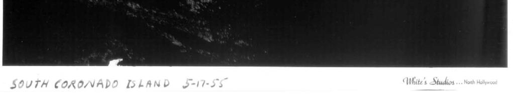
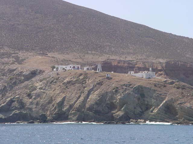
9 3 indicator species total coliform e coli enterrococus Bacteria measurement stations maintained by San Diego County Department of Environmental Health

10 Multiple pulses of rain into the TJ river watershed Flow gauge broke during flooding SDCOOS accesses and locally archives the TJ river flow gauge owned by IBWC.


11 SDCOOS staff installed environmental monitoring equipment to the Imperial Beach Pier.


12 Seamless interface to data from these installations. Shown on the right is the height and direction of ocean waves on the coast of Imperial Beach.


13 Point Loma HF Radar site For mapping ocean currents August 30, 2002

14 Example of radial velocities measured by a single radar site. 10 cm/s 24 hour average of data
15 Binational observing system - working with colleagues at CICESE and UABC provides for expanded region of observations. Scripps facilitates the operation and communication to a Mexican owned radar site located at the PEMEX plant in Rosarito Beach. 10 cm/s 24 hour average of data


16 Los Coronados Islands, MX Installation of alternative power system for autonomous operation of the scientific instruments


17 Los Coronados Island station Installation of alternative power system for autonomous operation of the scientific instruments


18 wireless I.P. connection to CICESE/UABC CODAR station at PEMEX facility, Rosarito Beach MX


19
20 Binational observing system - working with colleagues at CICESE and UABC provides for expanded region of observations. Scripps facilitates the operation and communication to a Mexican owned radar site located at the PEMEX plant in Rosarito Beach. 10 cm/s 24 hour average of data
21 Current animation trajectories
22 particle trajectory tracking research Tijuana River Release offshore release

23 RESEARCH PROJECT: Random walk Models using Objectively Mapped HF radar Data fields data used to understand beach closures. Research
24 Research with trajectory analyses from HF radar used to understand fate and transport


25 Making the connection to end-users: Run-off, transport, and their influence on water quality. February 13, 2003 TJ River Watershed.
26 Linking the transport to the WQ stations sampled by the County DEH February 18, 2003 High levels south of the TJ river mouth


27 Southward currents dominant during the 2/18/03 time period. High counts south of TJ River.


28 24hr averaged ocean currents, 2/25/03 Northward flow present during the time period of high counts in Imperial Beach, City of Coronado.
29 Contaminated north of TJ River to I.B. and Coronado north flow Contaminated north of TJ River to I.B. Contaminated south of the TJ River, clean to the north

30 Movie 2
31
32


33 Combination of HF RADAR CURRENTS with OCEAN COLOR satellite data 2/5/03

34 Tracking plumes in time

35 Integrate satellite remote sensing OCM SENSOR 300m resolution available daily SEAWIFS bands Plumes from Mission Bay, Point Loma, and Tijuana River are visible. Also Los Buenos Creek visible in Mexico.


36
 top:")

37 Nearshore currents - northward flow during and after the rainfall event (heavy rains on the 22nd) top: acoustic current meter data from City of Imperial Beach Pier bottom: HF radar derived currents at mouth of TJ river


38 Continued usage of Imperial Beach region as an area for science and technology development. Example: underwater swimming robot. System deployed by Dr. Mark Moline, Cal Poly San Luis Obisbo.

39


40 IB Pier region no tidal correction meters Bathymetry data acquired by underwater vehicle


41 Robot can be used to map plume field of local outfall.

42 Website designed to distribute data to users.

43 Visitors to usage statistics

44 SDCOOS Main Observation Page

45 Directional Wave Spectrum

46 Meteorological Observations

47 Current Profile: End of Pier

48 Near Shore Current Flow

49

50


51
52 Water Quality Time-series IB 60

53 Water Quality Time-series IB 30
South Bay Coastal Ocean Observing System California Clean Beaches Initiative
 South Bay Coastal Ocean Observing System California Clean Beaches Initiative Quarterly Report September 2003 to City of Imperial Beach Eric Terrill 1 1 Scripps Institution of Oceanography, University of
South Bay Coastal Ocean Observing System California Clean Beaches Initiative
 South Bay Coastal Ocean Observing System California Clean Beaches Initiative Quarterly Report March 2004 to City of Imperial Beach Eric Terrill 1 1 Scripps Institution of Oceanography, University of California,
Pioneer Array Micro-siting Public Input Process Frequently Asked Questions
 Pioneer Array Micro-siting Public Input Process Frequently Asked Questions The National Science Foundation (NSF) has completed the micro-siting of the moored array of the Ocean Observatories Initiative
Beach Water Quality. Ewan Moffat, Environmental Health Specialist, Recreational Water Program
 Beach Water Quality Ewan Moffat, Environmental Health Specialist, Recreational Water Program Items to be Discussed Sampling Locations Advisories, General Advisories, Closures Sept, 2011 Power Outage Sewage
An IOOS Operational Wave Observation Plan Supported by NOAA IOOS Program & USACE
 An IOOS Operational Wave Observation Plan Supported by NOAA IOOS Program & USACE R.E. Jensen, W.A. Birkemeier and W. Burnett JCOMM-Workshop on Wave Measurements from Buoys Wave Information to Application
Lagrangian Tracer Transport and Dispersion in Shallow Tidal Inlets & River Mouths
 DISTRIBUTION STATEMENT A: Approved for public release; distribution is unlimited. Lagrangian Tracer Transport and Dispersion in Shallow Tidal Inlets & River Mouths R. T. Guza & Falk Feddersen Scripps Institution
Wave-Phase-Resolved Air-Sea Interaction
 DISTRIBUTION STATEMENT A. Approved for public release; distribution is unlimited. Wave-Phase-Resolved Air-Sea Interaction W. Kendall Melville Scripps Institution of Oceanography (SIO) UC San Diego La Jolla,
ATON System Workshop
 ATON System Workshop ATON System: Real-time current measurements from Coast Guard navigation buoys in ports, bays and the coastal ocean Aid-to-Navigation = ATON ATON System Workshop Outline: Overview of
Offshore Wind Energy Stringent quality assurance and quality control. Coastal and Freshwater Fast responding and flexible organisation
 Services Oceanographic and Positioning Equipment Rental Meteorological and Oceanographic Surveys Data Analysis and Characterisation Marine Energy Resource Assessment Real-Time Monitoring Founded in 2010,
sulting NOAA Richmond NOAA Richmond Station
 NOAA Richmond NOAA Richmond Station This station is located at the Chevron pier and is operated by the NOAA. It provides wind data as well as tide data. The winds never reached 40 knots The winds did not
Wave Glider: Liege Colloquium. Colloquium April 27
 The The Wave Wave Glider: Glider: Enabling Enabling aa New New Approach Approach to to Persistent Persistent Ocean Ocean Observation Observation and and Research Research nd Liege 42 42nd Liege Colloquium
Airborne Remote Sensing of Surface and Internal Wave Processes on the Inner Shelf
 Airborne Remote Sensing of Surface and Internal Wave Processes on the Inner Shelf Ken Melville, Luc Lenain Scripps Institution of Oceanography North Wind/Wave NDBC Station 42040 29.212 N 88.207 W 19 Oct
PROPERTIES OF NEARSHORE CURRENTS
 Terry Hendricks PROPERTIES OF NEARSHORE CURRENTS During this past year, we have initiated a program to obtain a better understanding of the properties of the currents flowing over the nearshore shelf area
Effects of Offshore Forcing in the Nearshore Environment
 Effects of Offshore Forcing in the Nearshore Environment Geno Pawlak Department of Ocean and Resources Engineering University of Hawaii at Manoa 2540 Dole St., Holmes Hall 402 Honolulu, HI 96822 phone:
Challenges in determining water surface in airborne LiDAR topobathymetry. Amar Nayegandhi, Dewberry 15 th Annual JALBTCX Workshop, June 11 th 2014
 Challenges in determining water surface in airborne LiDAR topobathymetry Amar Nayegandhi, Dewberry 15 th Annual JALBTCX Workshop, June 11 th 2014 Why topobathy LiDAR? Complements acoustic (multi-beam sonar)
WAVE BREAKING AND DISSIPATION IN THE NEARSHORE
 WAVE BREAKING AND DISSIPATION IN THE NEARSHORE LONG-TERM GOALS Dr. Thomas C. Lippmann Center for Coastal Studies Scripps Institution of Oceanography University of California, San Diego 9500 Gilman Dr.
Coastal Environments Oceanographic and Engineering Expertise
 Coastal Environments Oceanographic and Engineering Expertise Coastal Environments La Jolla, CA www.coastalenvironments.com 14 May 2004 CE Ref. No. 04-05 EcoSystems Management Associates, Inc. Carlsbad,
The Wave Glider: A Mobile Buoy Concept for Ocean Science. 009 Liquid Robotics Inc.
 The Wave Glider: A Mobile Buoy Concept for Ocean Science 009 Liquid Robotics Inc. J. Manley & T. Richardson: Liquid Robotics Inc. DBCP XXV Paris September 28, 2009 1 Wave Glider Overview Unique Two Part
"Real-Time Vertical Temperature, and Velocity Profiles from a Wave Glider"
 DISTRIBUTION STATEMENT A. Approved for public release; distribution is unlimited. "Real-Time Vertical Temperature, and Velocity Profiles from a Wave Glider" Luca Centurioni Scripps Institution of Oceanography
The Surfer Health Study
 The Surfer Health Study Surfrider Foundation collaborated with scientists at Southern California Coastal Water Research Project (SCCWRP); University of California, Berkeley, School of Public Health; and
SEASONDE DETECTION OF TSUNAMI WAVES
 SEASONDE DETECTION OF TSUNAMI WAVES Belinda Lipa, John Bourg, Jimmy Isaacson, Don Barrick, and Laura Pederson 1 I. INTRODUCTION We here report on preliminary results of a study to assess the capability
Country report - India NATIONAL INSTITUTE OF OCEAN TECHNOLOGY 07/10/2010
 Country report - India NATIONAL INSTITUTE OF OCEAN TECHNOLOGY 07/10/2010 XXVI DBCP meeting 28 September 2010 Department of Civil Engineering, NIT Trichy 2 FOCUS 1/5 of world population 50 % living along
High Frequency Acoustical Propagation and Scattering in Coastal Waters
 High Frequency Acoustical Propagation and Scattering in Coastal Waters David M. Farmer Graduate School of Oceanography (educational) University of Rhode Island Narragansett, RI 02882 phone: (401) 874-6222
PROCESSING RECORD SCRIPPS INSTITUTION OF OCEANOGRAPHY ARCHIVES. Douglas Lamar Inman Aerial Photographs,
 Accession No.: 87-26 PROCESSING RECORD SCRIPPS INSTITUTION OF OCEANOGRAPHY ARCHIVES Inman, Douglas Lamar 1920- Douglas Lamar Inman Aerial Photographs, 1884-1980 Bulk Dates; 1944-1959 PHYSICAL DESCRIPTION:
CHAPTER 5 REGIONAL NETWORK FOR COASTAL ENGINEERING DATA. Richard J. Seymour* Meredith H. Sessions**
 CHAPTER 5 A. Introduction REGIONAL NETWORK FOR COASTAL ENGINEERING DATA Richard J. Seymour* Meredith H. Sessions** The California Department of Navigation and Ocean Development (DNOD), responsible for
Tools of Oceanography Ocean Currents. Drift Bottles and Dyes: measures speed and direction of ocean currents.
 Tools of Oceanography Ocean Currents Drift Bottles and Dyes: measures speed and direction of ocean currents. Ekman Current Meters: measures speed and direction of currents in deep water. Ocean Water Sampling
Ocean Observatories Initiative (OOI) Moorings: New Capabilities for Seagoing Science
 Moorings: New Capabilities for Seagoing Science") Ocean Observatories Initiative Ocean Observatories Initiative (OOI) Moorings: New Capabilities for Seagoing Science presented by Ed Dever and Walt Waldorf November 20, 2014 OOI Science Themes Coastal and
Ocean Observatories Initiative Ocean Observatories Initiative (OOI) Moorings: New Capabilities for Seagoing Science presented by Ed Dever and Walt Waldorf November 20, 2014 OOI Science Themes Coastal and
Long term observations of internal waves with shore based video cameras. Ata Suanda and John A. Barth
 Long term observations of internal waves with shore based video cameras Ata Suanda and John A. Barth Internal wave? What is an internal wave? Interior oscillations What is an internal wave? Interior oscillations
The Impact on Great South Bay of the Breach at Old Inlet Charles N. Flagg School of Marine and Atmospheric Sciences, Stony Brook University
 The Impact on Great South Bay of the Breach at Old Inlet Charles N. Flagg School of Marine and Atmospheric Sciences, Stony Brook University This is the sixth in a series of reports describing the evolution
Wave research at Department of Oceanography, University of Hawai i
 Wave research at Department of Oceanography, University of Hawai i Hawaii wave climate. Directional waverider buoys around Hawaii. Past and present wave-related research projects. Effect of tides on wave
Ocean Observing Systems Summer Teacher Institute August 10 August 14, 2009
 OOS? What s that?? COSEE-West 2008 Ocean Observing Systems Summer Teacher Institute Resources/Lesson Plans http://www.usc.edu/org/cosee-west/resources.html#aug08 Teacher created lesson plans from 2008
Africa Partnership Station
 Africa Partnership Station Dr. Thomas C. Lippmann Center for Coastal and Ocean Mapping, University of New Hampshire, 24 Colovos Rd., Durham, NH 03824 phone: (603) 397-4450, fax: (603) 397-0384, email:
Tsunamis are not observed via height rather by orbital velocity from shallow-water wave physics
 Modeling of Tsunami Current Flows Presenter: Dr. Don Barrick President, CODAR Ocean Sensors Coauthors: Dr. Belinda Lipa, Chad Whelan RIAM Workshop on Oceanographic Radar Tsunami capability of HF radar
Catch The SEACOOS Wave!
 Catch The SEACOOS Wave! Lundie Spence, Terri Hathaway, Margaret Olsen, Maia McGuire, Carrie Thomas, Jennifer Jolly Clair Presentation National Marine Educators Association July 20, 2004 Why are we interested
RIVET Satellite Remote Sensing and Small Scale Wave Process Analysis
 DISTRIBUTION STATEMENT A. Approved for public release; distribution is unlimited. RIVET Satellite Remote Sensing and Small Scale Wave Process Analysis Hans C. Graber RSMAS Department of Ocean Sciences
Measurement of Coastal & Littoral Toxic Material Tracer Dispersion. Dr. Robert E. Marshall T41 NSWCDD
 Measurement of Coastal & Littoral Toxic Material Tracer Dispersion Dr. Robert E. Marshall robert.e.marshall@navy.mil T41 NSWCDD Mouth of the Piankatank River Chesapeake Bay Model this for CB defense? Ground
CBIBS 2008 Online Data Scavenger Hunt by Christopher Petrone; Adapted from CBIBS 2007 Data Scavenger Hunt by Lorraine Brasseur
 CBIBS 2008 Online Data Scavenger Hunt by Christopher Petrone; Adapted from CBIBS 2007 Data Scavenger Hunt by Lorraine Brasseur Background During our 2008 field experience aboard the R/V Pelican we sampled
Applications of Collected Data from Argos Drifter, NOAA Satellite Tracked Buoy in the East Sea
 Applications of Collected Data from Argos Drifter, NOAA Satellite Tracked Buoy in the East Sea Young-Sang Suh (yssuh@nfrdi.re.kr) Ocean Research Team, National Fisheries Research and Development Institute,
Noise Experiment #2. Marine Physical Laboratory Scripps Institution of Oceanography La Jolla, CA February 22 February 2010
 Noise Experiment #2 Marine Physical Laboratory Scripps Institution of Oceanography La Jolla, CA 92093-0701 16 February 22 February 2010 1. Objective The objective of the noise experiment is to observe
Surf Zone Mapping and Sensor System
 Surf Zone Mapping and Sensor System Marshall D. Earle Planning Systems, Inc. 40201 Highway 190 East Slidell, LA 70461 phone: (985) 649-7252 fax: (985) 649-9679 email: MEarle@plansys.com Contract number:
Open Pacific Coast Study. California Coastal Analysis and Mapping Project
 Open Pacific Coast Study California Coastal Analysis and Mapping Project September 2012 California Open Coast Counties California Coastal Analysis and Mapping Project This publication is an initiative
SEAHORSES and SUBMARINES Testing transformational capabilities with modern UUVs at NAVOCEANO by Craig A. Peterson and Martha E. M.
 SEAHORSE engineers work on a module inside one AUV of the SEAHORSE 2 bays. SEAHORSE 2 is being prepared for launch from the IC-508 AUV Support Vessel. SEAHORSES and SUBMARINES Testing transformational
Characterization of Boundary-Layer Meteorology During DISCOVER-AQ
 Characterization of Boundary-Layer Meteorology During DISCOVER-AQ Daniel M. Alrick and Clinton P. MacDonald Sonoma Technology, Inc. Gary A. Morris St. Edward s University for Texas Air Quality Research
JCOMM Technical Workshop on Wave Measurements from Buoys
 Joint WMO-IOC Technical Commission for Oceanography and Marine Meteorology Commission technique mixte OMM-COI d océanographie et de météorologie maritime http://www.jcomm.info JCOMM Technical Workshop
Waves, Bubbles, Noise, and Underwater Communications
 Waves, Bubbles, Noise, and Underwater Communications Grant B. Deane Marine Physical Laboratory, Scripps Institution of Oceanography UCSD, La Jolla, CA 92093-0238 phone: (858) 534-0536 fax: (858) 534-7641
Future Condi,ons coastal hazard modeling and mapping
 Future Condi,ons coastal hazard modeling and mapping Presented by Bob Ba:alio, PE Environmental Science Associates, Inc. (ESA) On behalf of the physical processes team (USGS, TerraCosta- Scripps, ESA)
Pathogen Transport in Coastal Environments: Case Studies of Urban Runoff in Southern California
 Pathogen Transport in Coastal Environments: Case Studies of Urban Runoff in Southern California A presentation to the Center for Water Sciences MSU Pathogens Workshop, April 20, 2007 Stanley B. Grant Henry
San Diego County 2006 Beach Closure & Advisory Report
 San Diego County 2006 Beach Closure & Advisory Report Imperial Beach pier Beach water quality contamination events and days posted for beaches within San Diego County, California, USA Prepared by the County
LONG WAVES OVER THE GREAT BARRIER REEF. Eric Wolanski ABSTRACT
 LONG WAVES OVER THE GREAT BARRIER REEF by Eric Wolanski k ABSTRACT Low-frequency forcing of water currents over the continental shelf f Australia is quite strong and should be taken into account when the
High Frequency Acoustical Propagation and Scattering in Coastal Waters
 High Frequency Acoustical Propagation and Scattering in Coastal Waters David M. Farmer Graduate School of Oceanography (educational) University of Rhode Island Narragansett, RI 02882 Phone: (401) 874-6222
CHAPTER 91 TRACKED VEHICLE FOR CONTINUOUS NEARSHORE PROFILES. Richard J. Seymour* Alan L. Higgins** David P. Bothman***
 CHAPTER 91 TRACKED VEHICLE FOR CONTINUOUS NEARSHORE PROFILES Richard J. Seymour* Alan L. Higgins** David P. Bothman*** INTRODUCTION The measurement of nearshore profiles has been the traditional method
Oceans and the Global Environment: Lec 2 taking physics and chemistry outdoors. the flowing, waving ocean
 Oceans and the Global Environment: Lec 2 taking physics and chemistry outdoors the flowing, waving ocean Peter Rhines 1 Eric Lindahl 2 Bob Koon 2, Julie Wright 3 www.ocean.washington.edu/courses/has221a-08
JCOMM Technical Workshop on Wave Measurements from Buoys
 JCOMM Technical Workshop on Wave Measurements from Buoys Val Swail Chair, JCOMM Expert Team on Wind Waves and Storm Surges Neville Smith Vincent Cardone Peter Janssen Gerbrand Komen Peter Taylor WIND WAVES
Currents measurements in the coast of Montevideo, Uruguay
 Currents measurements in the coast of Montevideo, Uruguay M. Fossati, D. Bellón, E. Lorenzo & I. Piedra-Cueva Fluid Mechanics and Environmental Engineering Institute (IMFIA), School of Engineering, Research
Southern California Beach Processes Study
 Southern California Beach Processes Study Torrey Pines Field Site 5th Quarterly Report 31 May 22 to California Resources Agency and California Department of Boating and Waterways R.T. Guza 1, W.C. O Reilly
An Observational and Modeling Study to Quantify the Space/Time Scales of Inner Shelf Ocean Variability and the Potential Impacts on Acoustics
 DISTRIBUTION STATEMENT A. Approved for public release; distribution is unlimited. An Observational and Modeling Study to Quantify the Space/Time Scales of Inner Shelf Ocean Variability and the Potential
VENICE LOCAL COASTAL PROGRAM UPDATE: COASTAL HAZARDS WELCOME
 VENICE LOCAL COASTAL PROGRAM UPDATE: COASTAL HAZARDS WELCOME 1 Introducing the Team Hosted by the Department of City Planning and grant funded in part by the California Coastal Commission 2 Workshop Purpose
City of Encinitas Beach Attendance Report 2016
 City of Encinitas Beach Attendance Report 2016 Moonlight State Beach, July 2016 1 Introduction Since 2004, the City of Encinitas has intermittently employed counting technology to measure beach attendance.
APPENDIX H PLUME MODELS
 APPENDIX H PLUME MODELS APPENDIX H PLUME MODELS Prior to the initiation of recovery activities, the National Oceanic and Atmospheric Administration ran a series of oil plume trajectory analyses (2001a)
Understanding the Dynamics of Shallow-Water Oceanographic Moorings
 Understanding the Dynamics of Shallow-Water Oceanographic Moorings Mark A. Grosenbaugh Department of Applied Ocean Physics & Engineering Woods Hole Oceanographic Institution Woods Hole, MA 02543 phone:
APPENDIX G WEATHER DATA SELECTED EXTRACTS FROM ENVIRONMENTAL DATA FOR BCFS VESSEL REPLACEMENT PROGRAM DRAFT REPORT
 APPENDIX G WEATHER DATA SELECTED EXTRACTS FROM ENVIRONMENTAL DATA FOR BCFS VESSEL REPLACEMENT PROGRAM DRAFT REPORT Prepared for: B.C. Ferries Services Inc. Prepared by: George Roddan, P.Eng. Roddan Engineering
Nortek Technical Note No.: TN-021. Chesapeake Bay AWAC Evaluation
 Nortek Technical Note No.: TN-021 Title: Chesapeake Bay AWAC Evaluation Last Edited: October 5, 2004 Authors: Eric Siegel-NortekUSA, Chris Malzone-NortekUSA, Torstein Pedersen- Number of Pages: 12 Chesapeake
NSF's Ocean Observatories Initiative: Building Research Infrastructure for the Pacific Northwest and the Broader Community
 Agenda Item B.3.b Supplemental OOI PowerPoint April 2013 Ocean Observatories Initiative NSF's Ocean Observatories Initiative: Building Research Infrastructure for the Pacific Northwest and the Broader
Marine Mammal Acoustic Tracking from Adapting HARP Technologies
 DISTRIBUTION STATEMENT A: Approved for public release; distribution is unlimited. Marine Mammal Acoustic Tracking from Adapting HARP Technologies Sean M. Wiggins and John A. Hildebrand Marine Physical
Modelling and Assessment of Marine Renewable Energy Resources. Andrew Cornett Canadian Hydraulics Centre National Research Council Canada May 2008
 Modelling and Assessment of Marine Renewable Energy Resources Andrew Cornett Canadian Hydraulics Centre National Research Council Canada May 2008 Background Pan-Canadian resource inventory in 2005/06 Canada
Columbia River Plume 2006 OSU Ocean Mixing Nash, Kilcher, Moum et al. CR05 Cruise Report (RISE Pt. Sur, May )
") CR05 Cruise Report (RISE Pt. Sur, May 21-31 2006) Group Summary: Participants: Pt. Sur Ocean Mixing Group: Jonathan Nash, Levi Kilcher, Alexander Perlin, Greg Avicola; Pt. Sur UW: Emily Spahn (Alex Horner-Devine;
CR05 Cruise Report (RISE Pt. Sur, May 21-31 2006) Group Summary: Participants: Pt. Sur Ocean Mixing Group: Jonathan Nash, Levi Kilcher, Alexander Perlin, Greg Avicola; Pt. Sur UW: Emily Spahn (Alex Horner-Devine;
Impact of the tides, wind and shelf circulation on the Gironde river plume dynamics
 Impact of the tides, wind and shelf circulation on the Gironde river plume dynamics F. Toublanc 1, N. Ayoub 2, P. Marsaleix 3, P. De Mey 2 1 CNES/LEGOS 2 CNRS/LEGOS 3 CNRS/LA, Toulouse, France 5th GODAE
CURRENT, WAVE AND TIDAL OBSERVATIONS FROM A HORIZONTAL ACOUSTIC DOPPLER PROFILER INSTALLED ON SCRIPPS PIER IN LA JOLLA, CALIFORNIA, USA
 CURRENT, WAVE AND TIDAL OBSERVATIONS FROM A HORIZONTAL ACOUSTIC DOPPLER PROFILER INSTALLED ON SCRIPPS PIER IN LA JOLLA, CALIFORNIA, USA David Velasco 1 and Vadim Polonichko 1 Horizontal (side-looking)
7.4 Temperature, Salinity and Currents in Jamaica Bay
 7.4 Temperature, Salinity and Currents in Jamaica Bay Arnold Gordon, Bruce Huber and Robert Houghton 7.4.1 INTRODUCTION Jamaica Bay stratification is weakly indicative of a shallow, tidally active environment,
Ventura County. Open Pacific Coast Study. California Coastal Analysis and Mapping Project
 Ventura County Open Pacific Coast Study California Coastal Analysis and Mapping Project December 2011 Project Name: Meeting: Date and Time: Location: California Coastal Analysis and Mapping Project (CCAMP)/Open
Wave-Current Interaction in Coastal Inlets and River Mouths
 DISTRIBUTION STATEMENT A. Approved for public release; distribution is unlimited. Wave-Current Interaction in Coastal Inlets and River Mouths Tim T. Janssen Department of Geosciences, San Francisco State
THE WEST AUSTRALIAN INTEGRATED MARINE OBSERVATION SYSTEM (WAIMOS):INTERACTIONS BETWEEN THE LEEUWIN CURRENT AND THE CONTINENTAL SHELF
:INTERACTIONS BETWEEN THE LEEUWIN CURRENT AND THE CONTINENTAL SHELF") THE WEST AUSTRALIAN INTEGRATED MARINE OBSERVATION SYSTEM (WAIMOS):INTERACTIONS BETWEEN THE LEEUWIN CURRENT AND THE CONTINENTAL SHELF Pattiaratchi Charitha 1, Ming Feng 2, Rob McCauley 3, Merv Lynch 4,
THE WEST AUSTRALIAN INTEGRATED MARINE OBSERVATION SYSTEM (WAIMOS):INTERACTIONS BETWEEN THE LEEUWIN CURRENT AND THE CONTINENTAL SHELF Pattiaratchi Charitha 1, Ming Feng 2, Rob McCauley 3, Merv Lynch 4,
TITLE: The Importance of Model Validation: Two Case Studies. AUTHOR:Julie Thomas. Scripps Institution of Oceanography, La Jolla, CA.
 TITLE: The Importance of Model Validation: Two Case Studies AUTHOR:Julie Thomas Scripps Institution of Oceanography, La Jolla, CA jothomas@ucsd.edu CO-AUTHOR: Corey Olfe Scripps Institution of Oceanography,
The GCOOS Mooring Plan Element Draft, 19 February 2011
 The GCOOS Mooring Plan Element Draft, 19 February 2011 1. Introduction In order to proceed with the establishment of a regional coastal ocean observing system for the Gulf of Mexico, it is essential to
PUV Wave Directional Spectra How PUV Wave Analysis Works
 PUV Wave Directional Spectra How PUV Wave Analysis Works Introduction The PUV method works by comparing velocity and pressure time series. Figure 1 shows that pressure and velocity (in the direction of
Radar Remote Sensing of Waves and Episodic Flow Events
 DISTRIBUTION STATEMENT A. Approved for public release; distribution is unlimited. Radar Remote Sensing of Waves and Episodic Flow Events PI: Merrick C. Haller 220 Owen Hall Oregon State University Corvallis,
Atmospheric Forcing and the Structure and Evolution of the Upper Ocean in the Bay of Bengal
 DISTRIBUTION STATEMENT A. Approved for public release; distribution is unlimited. Atmospheric Forcing and the Structure and Evolution of the Upper Ocean in the Bay of Bengal J. Thomas Farrar and Robert
Orange County MPA Watch A n n u a l R e p o r t
 Orange County MPA Watch 2 0 1 4 A n n u a l R e p o r t WHAT IS AN MPA? Marine Protected Areas (MPAs) are discrete geographic marine or estuarine areas designed to protect or conserve marine life and habitat.
Nearshore Dredged Material Placement Pilot Study at Noyo Harbor, CA
 1 Nearshore Dredged Material Placement Pilot Study at Noyo Harbor, CA Noyo Cove N 2011 National Conference on Beach Preservation Technology 9-11, February 2011 Lihwa Lin, Honghai Li, Mitchell Brown US
San Diego Shorebird Survey Tijuana River Survey Areas
 San Diego Shorebird Survey Tijuana River Survey Areas Legend Survey Area North McCoy South McCoy Helicopter Airfield North River Mouth- Beach North River Mouth-Marsh South River Mouth- Marsh South River
TRIAXYS Acoustic Doppler Current Profiler Comparison Study
 TRIAXYS Acoustic Doppler Current Profiler Comparison Study By Randolph Kashino, Axys Technologies Inc. Tony Ethier, Axys Technologies Inc. Reo Phillips, Axys Technologies Inc. February 2 Figure 1. Nortek
Cooperative Autonomous Robotics at Sea
 Cooperative Robotics at Sea Andreas J. Häusler Laboratory of Robotics and Systems in Science and Engineering Instituto Superior Técnico Lisbon, Portugal MARUM, September 9, 2014 Introduction Cheira bem,
An Atlas of Oceanic Internal Solitary Waves (May 2002) by Global Ocean Associates Prepared for the Office of Naval Research - Code 322PO
 by Global Ocean Associates Prepared for the Office of Naval Research - Code 322PO") Overview is located in the western Pacific Ocean along the west side of the Philippines (between approximately 5 o and 11 o N. latitude and 117 o and 123 o E. longitude). It is a deepwater sea, roughly
Overview is located in the western Pacific Ocean along the west side of the Philippines (between approximately 5 o and 11 o N. latitude and 117 o and 123 o E. longitude). It is a deepwater sea, roughly
Autonomous Underwater Vehicles Explorer Class
 Autonomous Underwater Vehicles Explorer Class Neil Bose Professor of Maritime Hydrodynamics Manager, Australian Maritime Hydrodynamics Research Centre AMC National Centre for Maritime Engineering and Hydrodynamics
Acoustic Focusing in Shallow Water and Bubble Radiation Effects
 Acoustic Focusing in Shallow Water and Bubble Radiation Effects Grant B. Deane Marine Physical Laboratory, Scripps Institution of Oceanography UCSD, La Jolla, CA 92093-0238 Phone: (858) 534-0536 fax: (858)
Interdisciplinary Research Program
 Interdisciplinary Research Program W. A. Kuperman and W. S. Hodgkiss Marine Physical Laboratory Scripps Institution of Oceanography La Jolla, CA 92093-0701 phone: (858) 534-1803 / (858) 534-1798 fax: (858)
The Influence of Breaking at the Ocean Surface on Oceanic Radiance and Imaging
 The Influence of Breaking at the Ocean Surface on Oceanic Radiance and Imaging W. Kendall Melville Scripps Institution of Oceanography, University of California, San Diego 9500 Gilman Drive La Jolla, CA
COASTAL UPWELLING - MONTEREY BAY CALIFORNIA (modified from The Maury Project, AMS)
") Name: Date: Per: COASTAL UPWELLING - MONTEREY BAY CALIFORNIA (modified from The Maury Project, AMS) The ocean is composed of 3 distinct layers: the shallow surface mixed zone, the transition zone, and
Name: Date: Per: COASTAL UPWELLING - MONTEREY BAY CALIFORNIA (modified from The Maury Project, AMS) The ocean is composed of 3 distinct layers: the shallow surface mixed zone, the transition zone, and
MAPCO2 Buoy Metadata Report Project Title:
 MAPCO2 Buoy Metadata Report Project Title: Autonomous Multi-parameter Measurements from a Drifting Buoy During the SO GasEx Experiment Funding Agency: NOAA Global Carbon Cycle program PI(s): Christopher
Characterizing The Surf Zone With Ambient Noise Measurements
 Characterizing The Surf Zone With Ambient Noise Measurements LONG-TERM GOAL Grant Deane Marine Physical Laboratory Scripps Institution of Oceanography La Jolla, CA 93093-0213 phone: (619) 534-0536 fax:
Waves. G. Cowles. General Physical Oceanography MAR 555. School for Marine Sciences and Technology Umass-Dartmouth
 Waves G. Cowles General Physical Oceanography MAR 555 School for Marine Sciences and Technology Umass-Dartmouth Waves Sound Waves Light Waves Surface Waves Radio Waves Tidal Waves Instrument Strings How
Airborne Remote Sensing of Surface and Internal Wave Processes on the Inner Shelf
 DISTRIBUTION STATEMENT A. Approved for public release; distribution is unlimited. Airborne Remote Sensing of Surface and Internal Wave Processes on the Inner Shelf W. Kendall Melville Scripps Institution
GNSS Technology for the Determination of Real-Time Tidal Information
 GNSS Technology for the Determination of Real-Time Tidal Information Benjamin Kidder C-Nav Positioning Solutions European region Outline of Topics Covered Introduction to Tides Past and Present Methods
Exploring Localized Mixing Dynamics During Wet Weather in a Tidal Fresh Water System
 Exploring Localized Mixing Dynamics During Wet Weather in a Tidal Fresh Water System Ramona McCullough & Phil Duzinski Delaware Estuary Science & Environmental Summit January 27, 2015 Background and objectives
Biological Review of the 2014 Texas Closure
 Biological Review of the 2014 Texas Closure Report to the Gulf of Mexico Fishery Management Council by James M. Nance, Ph.D. Southeast Fisheries Science Center Galveston Laboratory January 2015 Introduction
MOOS IvP Helm Based Simulations of Collision Avoidance by an Autonomous Surface Craft Performing Repeat-Transect Oceanographic Surveys
 MOOS IvP Helm Based Simulations of Collision Avoidance by an Autonomous Surface Craft Performing Repeat-Transect Oceanographic Surveys Michael A. Filimon Dept. of Ocean Engineering Daniel L. Codiga Grad.
Chemical Plume Mapping with an Autonomous Underwater Vehicle
 Chemical Plume Mapping with an Autonomous Underwater Vehicle Barbara Fletcher Space and Naval Warfare Systems Center San Diego (SSC San Diego) 49590 Lassing Road San Diego, CA 92152 (619) 553-3859 bfletch@spawar.navy.mil
LITTLE LAGOON & LITTLE LAGOON PASS: RESEARCH UPDATES & DIRECTIONS
 LITTLE LAGOON & LITTLE LAGOON PASS: RESEARCH UPDATES & DIRECTIONS Bret M. Webb, PhD, PE, DCE Professor Department of Civil, Coastal, and Environmental Engineering October 19, 2017 LLPS Meeting Acknowledgments
Video based assessment of coastal erosion impact on beach attendance. Application to coastal management of Valras beach, France
 Conférence Méditerranéenne Côtière et Maritime EDITION 3, FERRARA, ITALIA (2015) Coastal and Maritime Mediterranean Conference Disponible en ligne http://www.paralia.fr Available online Video based assessment
The Sand Beaches of New Hampshire and Maine
 The Sand Beaches of New Hampshire and Maine Beach Preservation and Erosion Control Photographs provided by Joe Kelly and Steve Adams Cover photo: Reid State Park, ME Introduction The sand beaches of New