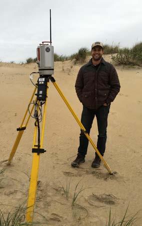
Pathways Interns: Annika O Dea, Ian Conery, Andrea Albright
|
|
|
- Clifford Jones
- 5 years ago
- Views:
Transcription


1 1 REMOTE SENSING OF COASTAL MORPHODYNAMICS Kate Brodie Brittany Bruder, Nick Spore, Alex Renaud Pathways Interns: Annika O Dea, Ian Conery, Andrea Albright File Name

2 COASTAL MORPHODYNAMICS Human influences Figure 2, The Future of Nearshore Processes Research, Winter 215 (Shore & Beach, Vol. 83, No.1) Pertinent Research Questions: 1. How do wave runup & setup, and sediment transport processes during extreme events differ from moderate storms or during recovery? 2. How do feedbacks between hydrodynamics and morphology affect flooding, erosion, and recovery of coastal areas? 3. What are the feedbacks and interactions between coastal processes at short time-scales, such as storms, and long time-scales, such as sea-level rise? 2
3 COASTAL MORPHODYNAMICS Human influences Figure 2, The Future of Nearshore Processes Research, Winter 215 (Shore & Beach, Vol. 83, No.1) Pertinent Applications: 1. Enhanced understanding, monitoring, and planning capability for coastal storm impacts, resiliency, and evolution at a range of engineering relevant timescales for improved management of Federal Beach Project sites 2. Improved situational awareness to ensure safe and efficient maneuverability during Joint Forces entry operations in littoral regions 3
 The ugly: Lots of data that requires filtering and QA/QC Requires precise geo-position information (structure-from-motion) (video or radar) Active sensors emit or transmit energy Passive")
4 REMOTE SENSING TOOLS Just another tool to help solve observation challenges The good: Offer high-resolution (in space & time) synoptic measurement capabilities Can be safer, and less expensive (e.g. cameras) The bad: May be an indirect or proxy measurement Can be expensive (e.g. lidar) The ugly: Lots of data that requires filtering and QA/QC Requires precise geo-position information (structure-from-motion) (video or radar) Active sensors emit or transmit energy Passive BUILDING sensors STRONG only receive energy 4


5 REMOTE SENSING APPLICATIONS Basic R&D Lidar observations of hydrodynamics Wave breaking type and wave transformation through the surf Lidar observations of beach morphology evolution Applied Research Spatial variability in dune morphology evolution at short- and long-timescales Improving swash in CShore using lidar data Assessing video-based bathymetric inversion algorithms During storm erosion on developed coasts Technology Transition suas for Flood Risk Management suas for Joint Littoral Operations Video Imaging for Coastal Monitoring 5


")


6 BASIC R&D - FRF TERRESTRIAL LIDAR Surf-zone wave shapes improve basic physics of wave-driven sediment transport Dune Erosion during Storms collect critical data during storms Beach Morphological Evolution high-spatial (cmscale) & temporal resolution (hourly) 3D data sets Wave Runup & Swash Hydrodynamics data available in near-realtime for model evaluation Elevation (m, NAVD88) Wave time-series paros raw laser filtered (f<.5hz) and averaged (.5s) laser data 8:4:3 8:4:45 8:5: 8:5:15 8:5:3 8:5:45 8:6: 8:6:15


7 BASIC R&D CONTINUOUS DUNE LIDAR TOWER Simultaneous observations of Wave Runup, Swash Hydrodynamics, Morphology Change Inner surf zone wave height & spectra Mean water level Runup elevations Foreshore beach profile (hourly & wave by wave) & 3D morphology data available in near-realtime on CHL THREDDS for model evaluation File Name 7
8 BASIC RESEARCH LIDAR OBSERVATIONS OF WAVES Validated Technology: Lidar and pressure measurements agree well A C..5 < f <.25 Hz Hs infragravity Hs sea/swell.4<f<.5 Hz.5 g25 g3 g35 g45 2 g55 r =.98 g65 rmse =.5m Lidar Setup ( ) 1 Lidar (m) 1.5 B..4 < f <.5 Hz Water Level 1.5.5<f<.25 Hz r =.91 rmse =.3m.5 Gauge (m) Gauge (m).5 2 r =.87 rmse =.7m Gauge (m) Example time-series paros raw laser filtered (f<.5hz) and averaged (.5s) laser data 1 Elevation (m, NAVD88) (Brodie et al., 215) :4:3 8:4:45 8:5: 8:5:15 8:5:3 8:5:45 8:6: Time (HH:MM:SS) BUILDING STRONG Brodie, K.L., B. Raubenheimer, Steve Elgar, R. K. Slocum, and J. E. McNinch, (215): Lidar and Pressure 8 Measurements of Inner-Surfzone Waves and Setup. J. Atmos. Oceanic Technol., 32, :6:15


9 BASIC R&D SURFZONE WAVE SHAPES Why Wave Shapes? Waves change shape as they shoal and break across the surf-zone, through a shorebreak, and into the swash These changes in shape affect the direction of transport of sand underneath them If we want to be able to predict the daily movement of sandbars and changes to the beach we need to understand these physical processes better Skewed waves have steep crests, flat broad troughs Asymmetrical waves have steep front faces, and gently sloping backs 9


10 BASIC R&D - LIDAR OBSERVATIONS OF WAVE SHAPES 3D lidar enables quantification of wave breaking shapes in the field Developing automated analytics to extract wave properties Velodyne lidar mounted on CRAB Concatenating data in the alongcrest direction allows extraction of plunging wave features 1


11 BASIC R&D - 3D LIDAR ERROR PROPAGATION, BEACH MORPHOLOGY OBSERVATIONS Hourly observations of beach topography allow for observations at the same timescale as most numerical models


 8 Elevation (m, NAVD88) 6 4 2 15 2")

 Developed Dune Evolution Analyzing 3-year FRF morphology data")
12 APPLIED RESEARCH - COASTAL DUNE EVOLUTION Dune Erosion during Storms Nearshore collaboration project to improve dune erosion during storms Evaluating numerical models Merged data from dune & pier lidars! 3 Named Tropical systems observed!! During-storm dune erosion observations Short-term Dune Recovery Hourly continuous topographic observations, 2m N & S of FRF pier: Oct 215 to Jan 216 (FY16); Sep 216 to Present (FY17) Pier-mounted Lidar Dune Profiles (subsampled) 8 Elevation (m, NAVD88) Fall Hurricane Season Winter/Spring Nor'Easter Season Long-term Dune Evolution Cross-shore Distance (m) Developed Dune Evolution Analyzing 3-year FRF morphology data set Testing relationships to forcing factors 12
 topographic")
; Sep 216 to Present (FY17) 3 Named")
 8 6 4 2 15 2 25 3 217Aug")


13 APPLIED RESEARCH PIER LIDAR DUNE OBSERVATIONS Hourly continuous (during storm) topographic observations, 2m N & S of FRF pier: Oct 215 to Jan 216 (FY16); Sep 216 to Present (FY17) 3 Named Tropical systems observed Pier-mounted Lidar Dune Profiles (subsampled) Aug 216Nov Elevation Change (m) Elevation (m, NAVD88) Fall Hurricane Season Winter/Spring Nor'Easter Season File Name Cross-shore Distance (m)


14 APPLIED RESEARCH VIDEO OBSERVATIONS OF SURF ZONE MORPHODYNAMICS 6 cameras collecting data since 1987 Argus Coastal Imaging Tower Quantitative Morphodynamic Data: Wave runup position Surf-zone sandbar position Proxy for wave dissipation Long-shore and rip surface current speeds Bathymetry from wave speed measurements using linear theory wave speed in shallow water water depth 14
 during a wide range of conditions Most comprehensive evaluation of cbathy to-date:.3 < H s < 4.6 m -4.8 m < h < -1.")

15 APPLIED RESEARCH EVALUATE DEPTH INVERSIONS Utilize FRF survey & altimeter data to evaluate performance of a video-based depth inversion algorithm (cbathy) during a wide range of conditions Most comprehensive evaluation of cbathy to-date:.3 < H s < 4.6 m -4.8 m < h < -1.5 m Peak in wave breaking Outer surf altimeter RMSE =.35 m, bias: -.1 m, R 2 = shoreline Mid surf altimeter Inner surf altimeter cbathy was consistent with long-term patterns of bathymetric change (r 2 =.64, RMSE =.26 m, bias = -.1 m), particularly when Hs < 1.2 m (r 2 =.83) and were not breaking over the bar


16 TRANSITION TECHNOLOGY DEVELOPING NEW PLATFORMS Traditional long-term monitoring tower Hotel (or house)-mounted cameras Temporary tower systems UAS-based solutions Fixed wing longer coastlines, less frequently Multi-rotor small areas, daily monitoring


17 COASTAL TOPO-BATHYMETRIC MAPPING Goal: provide nimble and efficient technology to monitor USACE coastal project sites frequently, providing rapid, pre-storm risk assessments and post-storm damage assessments & to improve situational awareness during littoral entry operations Solution: 1-2 km Solution: 1s km Small, multi-rotor with single camera Wide field-of-view camera on board fixed-wing or large multi-rotor platform 17


18 QUESTIONS? Alex Renaud Brittany Bruder Nick Spore Ian Conery Annika O Dea 18
Analysis of Wave Predictions from the Coastal Model Test Bed using cbathy
 Analysis of Wave Predictions from the Coastal Model Test Bed using cbathy Spicer Bak, Ty Hesser, Jane Smith U.S. Army Engineer Research & Development Center Duck, NC Coastal Model Test Bed Purpose: Automated
Ongoing Research at the USACE Field Research Facility Jeff Waters, PhD Chief, Coastal Observations & Analysis Branch Coastal & Hydraulics Lab
 Ongoing Research at the USACE Field Research Facility Jeff Waters, PhD Chief, Coastal Observations & Analysis Branch Coastal & Hydraulics Lab Coastal and Hydraulics Laboratory Who We Are CHL is the only
CROSS-SHORE SEDIMENT PROCESSES
 The University of the West Indies Organization of American States PROFESSIONAL DEVELOPMENT PROGRAMME: COASTAL INFRASTRUCTURE DESIGN, CONSTRUCTION AND MAINTENANCE A COURSE IN COASTAL DEFENSE SYSTEMS I CHAPTER
Beach Wizard: Development of an Operational Nowcast, Short-Term Forecast System for Nearshore Hydrodynamics and Bathymetric Evolution
 Beach Wizard: Development of an Operational Nowcast, Short-Term Forecast System for Nearshore Hydrodynamics and Bathymetric Evolution Ad Reniers Civil Engineering and Geosciences, Delft University of Technology
COASTAL MORPHODYNAMICS
 COASTAL MORPHODYNAMICS PATRICIA CHARDÓN-MALDONADO, PHD, EIT Miguel Canals, Jack A. Puleo, Alec Torres-Freyermuth & Jens Figlus March 9, 2017 OUTLINE INTRODUCTION Meteorological Phenomena Forcing Conditions
Coastal Wave Studies FY13 Summary Report
 DISTRIBUTION STATEMENT A. Approved for public release; distribution is unlimited. Coastal Wave Studies FY13 Summary Report Jeffrey L. Hanson US Army Corps of Engineers, Field Research Facility 1261 Duck
Wave Transformation and Setup from a Cross-shore Array of Acoustic Doppler Profilers (Poster)
") Wave Transformation and Setup from a Cross-shore Array of Acoustic Doppler Profilers (Poster) Kent K. Hathaway and Jeffrey L. Hanson Introduction US Army Corps of Engineers Field Research Facility, Kitty
Wave Transformation and Setup from a Cross-shore Array of Acoustic Doppler Profilers (Poster) Kent K. Hathaway and Jeffrey L. Hanson Introduction US Army Corps of Engineers Field Research Facility, Kitty
Coastal Wave Energy Dissipation: Observations and Modeling
 Coastal Wave Energy Dissipation: Observations and Modeling Jeffrey L Hanson US Army Corps of Engineers Field Research Facility USACE Field Research Facility Kent K. Hathaway US Army Corps of Engineers
An IOOS Operational Wave Observation Plan Supported by NOAA IOOS Program & USACE
 An IOOS Operational Wave Observation Plan Supported by NOAA IOOS Program & USACE R.E. Jensen, W.A. Birkemeier and W. Burnett JCOMM-Workshop on Wave Measurements from Buoys Wave Information to Application
Morphological Evolution Near an Inlet
 DISTRIBUTION STATEMENT A. Approved for public release; distribution is unlimited. Morphological Evolution Near an Inlet Steve Elgar Woods Hole Oceanographic Institution, MS11 Woods Hole, MA 02543 phone:
WAVE BREAKING AND DISSIPATION IN THE NEARSHORE
 WAVE BREAKING AND DISSIPATION IN THE NEARSHORE LONG-TERM GOALS Dr. Thomas C. Lippmann Center for Coastal Studies Scripps Institution of Oceanography University of California, San Diego 9500 Gilman Dr.
Bay County, MI Coastal Hazard Analysis Flood Risk Review Meeting. May 14, 2018
 Bay County, MI Coastal Hazard Analysis Flood Risk Review Meeting May 14, 2018 Agenda Introductions Coastal Flood Risk Study and Mapping Program Current Status Technical Overview of Study and Mapping Floodplain
Town of Duck, North Carolina
 Tracking No. 00.00.2010 Erosion Mitigation And Shoreline Management Feasibility Study Town of Duck, North Carolina Coastal Planning & Engineering of North Carolina August 15, 2012 Tom Jarrett Robert Neal
Bob Battalio, PE Chief Engineer, ESA September 8, 2016
 RELATING FUTURE COASTAL CONDITIONS TO EXISTING FEMA FLOOD HAZARD MAPS Technical Methods Manual Bob Battalio, PE Chief Engineer, ESA September 8, 2016 FMA 2016 Sacramento, California DWR-OST-SIO PILOTING
The History of Coastal Flood Hazard Assessments in the Great Lakes
 The History of Coastal Flood Hazard Assessments in the Great Lakes Brian A. Caufield, P.E., CFM June 23, 2016 2 The Great Lakes Some Statistics Courtesy of Great Lakes Information Network One-fifth of
REPORT DOCUMENTATION PAGE
 REPORT DOCUMENTATION PAGE Form Approved OMB No. 0704-0188 Public reporting burden for this collection of information is estimated to average 1 hour per response, including the time for reviewing instructions,
Beach Nourishment Impact on Beach Safety and Surfing in the North Reach of Brevard County, Florida
 Beach Nourishment Impact on Beach Safety and Surfing in the North Reach of Brevard County, Florida Prepared by John Hearin, Ph.D. Coastal Engineering Vice Chairman Cocoa Beach Chapter Port Canaveral Patrick
A Coastal Storm Modeling System for determination of flood hazards along a high energy coast in response to SLR and 21 st century storms
 Li Erikson, Patrick Barnard, Andrea O Neill, Jodi Eshleman, Amy Foxgrover, Michael Fitzgibbon 2, Grant Ballard 2, Kelly Higgason 3 A Coastal Storm Modeling System for determination of flood hazards along
Figure 4, Photo mosaic taken on February 14 about an hour before sunset near low tide.
 The Impact on Great South Bay of the Breach at Old Inlet Charles N. Flagg and Roger Flood School of Marine and Atmospheric Sciences, Stony Brook University Since the last report was issued on January 31
MODELING OF CLIMATE CHANGE IMPACTS ON COASTAL STRUCTURES - CONTRIBUTION TO THEIR RE-DESIGN
 Proceedings of the 14 th International Conference on Environmental Science and Technology Rhodes, Greece, 3-5 September 2015 MODELING OF CLIMATE CHANGE IMPACTS ON COASTAL STRUCTURES - CONTRIBUTION TO THEIR
Surface Wave Processes on the Continental Shelf and Beach
 Surface Wave Processes on the Continental Shelf and Beach Thomas H. C. Herbers Department of Oceanography, Code OC/He Naval Postgraduate School Monterey, California 93943-5122 phone: (831) 656-2917 fax:
OECS Regional Engineering Workshop September 29 October 3, 2014
 B E A C H E S. M A R I N A S. D E S I G N. C O N S T R U C T I O N. OECS Regional Engineering Workshop September 29 October 3, 2014 Coastal Erosion and Sea Defense: Introduction to Coastal Dynamics David
Wave research at Department of Oceanography, University of Hawai i
 Wave research at Department of Oceanography, University of Hawai i Hawaii wave climate. Directional waverider buoys around Hawaii. Past and present wave-related research projects. Effect of tides on wave
Reading Material. Inshore oceanography, Anikouchine and Sternberg The World Ocean, Prentice-Hall
 Reading Material Inshore oceanography, Anikouchine and Sternberg The World Ocean, Prentice-Hall BEACH PROCESSES AND COASTAL ENVIRONMENTS COASTAL FEATURES Cross section Map view Terminology for Coastal
Rip Currents Onshore Submarine Canyons: NCEX Analysis
 Rip Currents Onshore Submarine Canyons: NCEX Analysis Dr. Thomas C. Lippmann Civil and Environmental Engineering & Geodetic Science, Byrd Polar Research Center, 1090 Carmack Rd., Ohio State University,
Prediction of Nearshore Waves and Currents: Model Sensitivity, Confidence and Assimilation
 Prediction of Nearshore Waves and Currents: Model Sensitivity, Confidence and Assimilation H. Tuba Özkan-Haller College of Oceanic and Atmospheric Sciences Oregon State University, 104 Ocean Admin Bldg
Technical Brief - Wave Uprush Analysis Island Harbour Club, Gananoque, Ontario
 Technical Brief - Wave Uprush Analysis RIGGS ENGINEERING LTD. 1240 Commissioners Road West Suite 205 London, Ontario N6K 1C7 October 31, 2014 Table of Contents Section Page Table of Contents... i List
Wave behaviour in the inner surf zone
 Wave behaviour in the inner surf zone Hannah POWER 1 and Michael HUGHES 2 Abstract: The inner surf zone is a critical component of models that are used to predict nearshore wave behaviour and beach morphodynamics.
Nearshore Wave-Topography Interactions
 LONG-TERM GOAL Nearshore Wave-Topography Interactions Rob Holman College of Oceanic and Atmospheric Sciences Oregon State University 104 Ocean Admin Bldg Corvallis, OR 97331-5503 phone: (541) 737-2914
Evaluation of June 9, 2014 Federal Emergency Management Agency Flood Insurance Study for Town of Weymouth, Norfolk, Co, MA
 Evaluation of June 9, 2014 Federal Emergency Management Agency Flood Insurance Study for Town of Weymouth, Norfolk, Co, MA Prepared For: Woodard & Curran 95 Cedar Street, Suite 100 Providence, RI 02903
Improving predictions of nearshore processes and shoreline dynamics for beaches along Australia s rocky and coral reef coasts
 Improving predictions of nearshore processes and shoreline dynamics for beaches along Australia s rocky and coral reef coasts Ryan Lowe Jeff Hansen, Graham Symonds, Mark Buckley, Andrew Pomeroy, Gundula
Citrus, Hernando, and Pasco Coastal Hazard Analysis. Flood Risk Review Meeting Citrus, Hernando, and Pasco Counties, Florida December 14, 2017
 Citrus, Hernando, and Pasco Coastal Hazard Analysis Flood Risk Review Meeting Citrus, Hernando, and Pasco Counties, Florida December 14, 2017 Introductions Risk MAP Project Team FEMA Region IV RAMPP (study
RIP CURRENTS. Award # N
 RIP CURRENTS Graham Symonds School of Geography and Oceanography University College, University of New South Wales, Australian Defence Force Academy, Canberra, 2600 AUSTRALIA Phone: 61-6-2688289 Fax: 61-6-2688313
cbathy Bathymetry Estimation in the Mixed Wave-Current Domain of a Tidal Estuary
 cbathy Bathymetry Estimation in the Mixed Wave-Current Domain of a Tidal Estuary Holman, R., & Stanley, J. (2013). cbathy bathymetry estimation in the mixed wave-current domain of a tidal estuary. Journal
Among the numerous reasons to develop an understanding of LST are:
 Longshore Sediment Transport Among the numerous reasons to develop an understanding of LST are: Process by which the products of terrestrial erosion (riverine sediments, sea cliff failures, etc.) are removed
IMAGE-BASED FIELD OBSERVATION OF INFRAGRAVITY WAVES ALONG THE SWASH ZONE. Yoshimitsu Tajima 1
 IMAGE-BASED FIELD OBSERVATION OF INFRAGRAVITY WAVES ALONG THE SWASH ZONE Yoshimitsu Tajima 1 This study develops an image-based monitoring techniques for observations of surf zone hydrodynamics especially
Undertow - Zonation of Flow in Broken Wave Bores
 Nearshore Circulation Undertow and Rip Cells Undertow - Zonation of Flow in Broken Wave Bores In the wave breaking process, the landward transfer of water, associated with bore and surface roller decay
2016 NC Coastal Local Governments Annual Meeting
 2016 NC Coastal Local Governments Annual Meeting Coastal Flood Study Modeling and Mapping 101 April 21, 2016 Tom Langan, PE, CFM Engineering Supervisor NCEM Floodplain Mapping Program FEMA Coastal Flood
High-Resolution Measurement-Based Phase-Resolved Prediction of Ocean Wavefields
 DISTRIBUTION STATEMENT A. Approved for public release; distribution is unlimited. High-Resolution Measurement-Based Phase-Resolved Prediction of Ocean Wavefields Dick K.P. Yue Center for Ocean Engineering
FEMA Region V. Great Lakes Coastal Flood Study. Pilot Study Webinar. Berrien County, Michigan. February 26, 2014
 FEMA Region V Great Lakes Coastal Flood Study Pilot Study Webinar Berrien County, Michigan February 26, 2014 2 Pilot Study Webinar Agenda Great Lakes Coastal Flood Study Background Demonstration Project
Surf Zone Mapping and Sensor System
 Surf Zone Mapping and Sensor System Marshall D. Earle Planning Systems, Inc. 40201 Highway 190 East Slidell, LA 70461 phone: (985) 649-7252 fax: (985) 649-9679 email: MEarle@plansys.com Contract number:
Nearshore Morphodynamics. Bars and Nearshore Bathymetry. Sediment packages parallel to shore, that store beach sediment
 Nearshore Morphodynamics http://coastal.er.usgs.gov/bier/images/chandeleur-xbeach-lg.jpg Bars and Nearshore Bathymetry Sediment packages parallel to shore, that store beach sediment Can be up to 50 km
Sussex County, DE Preliminary Study Overview
 Sussex County, DE Preliminary Study Overview Coastal study scope: 102 miles of entire County shoreline Revised 102 panels for coastal study Riverine study scope: 14 streams, 67.1 miles, within the Nanticoke
Undertow - Zonation of Flow in Broken Wave Bores
 Lecture 22 Nearshore Circulation Undertow - Zonation of Flow in Broken Wave Bores In the wave breaking process, the landward transfer of water, associated with bore and surface roller decay within the
Door County, WI Coastal Hazard Analysis Flood Risk Review Meeting. August 21, 2017
 Door County, WI Coastal Hazard Analysis Flood Risk Review Meeting August 21, 2017 Agenda Introductions Coastal Flood Risk Study and Mapping Program Current Status Technical Overview of Study and Mapping
South Bay Coastal Ocean Observing System California Clean Beaches Initiative
 South Bay Coastal Ocean Observing System California Clean Beaches Initiative Quarterly Report March 2004 to City of Imperial Beach Eric Terrill 1 1 Scripps Institution of Oceanography, University of California,
Southern California Beach Processes Study
 Southern California Beach Processes Study Torrey Pines Field Site 5th Quarterly Report 31 May 22 to California Resources Agency and California Department of Boating and Waterways R.T. Guza 1, W.C. O Reilly
Wave Breaking. Wave Breaking
 Wave Breaking The release of energy derived from the wind, along a narrow coastal zone - geomorphic work done by wind, really, translated through medium of water. Wave Breaking Wave breaking is responsible
Inlet Management Study for Pass-A-Grille and Bunces Pass, Pinellas County, Florida
 Inlet Management Study for Pass-A-Grille and Bunces Pass, Pinellas County, Florida Final Report Submitted By Ping Wang, Ph.D., Jun Cheng Ph.D., Zachary Westfall, and Mathieu Vallee Coastal Research Laboratory
Climate Change Impacts to KSC Launch Complex
 Climate Change Impacts to KSC Launch Complex Presented to: 2010 International Workshop on Environment and Energy By: John Shaffer NASA Environmental Management Branch Kennedy Space Center Hurricane Season
Deep-water orbital waves
 What happens when waves approach shore? Deep-water orbital waves Fig. 9.16, p. 211 Wave motion is influenced by water depth and shape of the shoreline wave buildup zone surf zone beach Wave base deepwater
IMPACTS OF COASTAL PROTECTION STRATEGIES ON THE COASTS OF CRETE: NUMERICAL EXPERIMENTS
 IMPACTS OF COASTAL PROTECTION STRATEGIES ON THE COASTS OF CRETE: NUMERICAL EXPERIMENTS Tsanis, I.K., Saied, U.M., Valavanis V. Department of Environmental Engineering, Technical University of Crete, Chania,
Waves. G. Cowles. General Physical Oceanography MAR 555. School for Marine Sciences and Technology Umass-Dartmouth
 Waves G. Cowles General Physical Oceanography MAR 555 School for Marine Sciences and Technology Umass-Dartmouth Waves Sound Waves Light Waves Surface Waves Radio Waves Tidal Waves Instrument Strings How
USE OF X-BAND RADAR FOR WAVE AND BEACH MORPHOLOGY ANALYSIS
 USE OF X-BAND RADAR FOR WAVE AND BEACH MORPHOLOGY ANALYSIS JAE HYENG LEE ECOH Corporation, 2-6-4, Kitaueno, Taito, Tokyo, 110-0014, Japan SATOSHI TAKEWAKA Institute of Engineering Mechanics and Systems,
Rip Currents Onshore Submarine Canyons: NCEX Analysis
 Rip Currents Onshore Submarine Canyons: NCEX Analysis Dr. Thomas C. Lippmann Civil and Environmental Engineering & Geodetic Science, Byrd Polar Research Center, 1090 Carmack Rd., Ohio State University,
Challenges in determining water surface in airborne LiDAR topobathymetry. Amar Nayegandhi, Dewberry 15 th Annual JALBTCX Workshop, June 11 th 2014
 Challenges in determining water surface in airborne LiDAR topobathymetry Amar Nayegandhi, Dewberry 15 th Annual JALBTCX Workshop, June 11 th 2014 Why topobathy LiDAR? Complements acoustic (multi-beam sonar)
St. Louis County, MN Coastal Hazard Analysis Flood Risk Review Meeting. May 2, 2018
 St. Louis County, MN Coastal Hazard Analysis Flood Risk Review Meeting May 2, 2018 Agenda Introductions Coastal Flood Risk Study and Mapping Program Current Status Technical Overview of Study and Mapping
DUXBURY WAVE MODELING STUDY
 DUXBURY WAVE MODELING STUDY 2008 Status Report Duncan M. FitzGerald Peter S. Rosen Boston University Northeaster University Boston, MA 02215 Boston, MA 02115 Submitted to: DUXBURY BEACH RESERVATION November
Kelly Legault, Ph.D., P.E. USACE SAJ
 Kelly Legault, Ph.D., P.E. USACE SAJ Report Documentation Page Form Approved OMB No. 0704-0188 Public reporting burden for the collection of information is estimated to average 1 hour per response, including
Bayfield & Ashland Counties, WI Coastal Hazard Analysis Flood Risk Review Meeting. June 05, 2018
 Bayfield & Ashland Counties, WI Coastal Hazard Analysis Flood Risk Review Meeting June 05, 2018 Agenda Introductions Coastal Flood Risk Study and Mapping Program Current Status Technical Overview of Study
Southwest Washington Littoral Drift Restoration Project: Design, Construction, and Monitoring
 Southwest Washington Littoral Drift Restoration Project: Design, Construction, and Monitoring J Jessica i St Stokke kk USACE Portland District October 28, 2010 WEDA Pacific Meeting Monterey, CA US Army
Chapter 1. Introduction
 Chapter 1 Introduction 1.1 Motivation for study The nearshore is the coastal region close to land where surface waves rapidly evolve and break in the surf zone. It is also an area where the bathymetry
Evaluation of Unstructured WAVEWATCH III for Nearshore Application
 Evaluation of Unstructured WAVEWATCH III for Nearshore Application Jane McKee Smith, Tyler Hesser, Mary Anderson Bryant USACE Research and Development Center, Coastal and Hydraulics Lab Aron Roland BGS
Small Footprint Topo-Bathymetric LiDAR
 May 8, 2013 Small Footprint Topo-Bathymetric LiDAR PNAMP Remote Sensing Forum Russ Faux, Co-CEO, WSI Amar Nayegandhi, Manager of Elevation Technologies, Dewberry Colin Cooper, Senior Analyst, WSI Watershed
RCEX: Rip Current Experiment
 RCEX: Rip Current Experiment Jamie MacMahan Oceanography Department, Spanagel 327c, Building 232 Naval Postgraduate School, Monterey, CA 93943 Phone: (831) 656-2379 Fax: (831) 656-2712 Email: jhmacmah@nps.edu
COASTAL ENVIRONMENTS. 454 lecture 12
 COASTAL ENVIRONMENTS Repeated movement of sediment & water constructs a beach profile reflecting the balance between average daily or seasonal wave forces and resistance of landmass to wave action Coasts
New Jersey Coastal Zone Overview. The New Jersey Beach Profile Network (NJBPN) 3 Dimensional Assessments. Quantifying Shoreline Migration
 3 Dimensional Assessments. Quantifying Shoreline Migration") New Jersey Coastal Zone Overview The New Jersey Beach Profile Network (NJBPN) Objectives Profile Locations Data Collection Analyzing NJBPN Data Examples 3 Dimensional Assessments Methodology Examples Quantifying
New Jersey Coastal Zone Overview The New Jersey Beach Profile Network (NJBPN) Objectives Profile Locations Data Collection Analyzing NJBPN Data Examples 3 Dimensional Assessments Methodology Examples Quantifying
Surface Wave Processes on the Continental Shelf and Beach
 Surface Wave Processes on the Continental Shelf and Beach Thomas H. C. Herbers Department of Oceanography, Code OC/He Naval Postgraduate School Monterey, California 93943-5122 phone: (831) 656-2917 fax:
CHAPTER ONE HUNDRED TWENTY EIGHT DUCK82 - A COASTAL STORM PROCESSES EXPERIMENT
 CHAPTER ONE HUNDRED TWENTY EIGHT DUCK82 - A COASTAL STORM PROCESSES EXPERIMENT Curtis Mason, 1 Asbury H. Sallenger, 2 Robert A. Holman, 3 and William A. Birkemeier 1 ' Abstract: In October, 1982, a multi-agency
Observed and simulated wavetide interaction in a region of. high tidal flow
 Observed and simulated wavetide interaction in a region of high tidal flow Lewis M*; Chang W; Neill S; Robins P; Hashemi R;Ward S; Piano M * m.j.lewis@bangor.ac.uk (1/12) Summary Dynamically coupled wave-tide
G. Meadows, H. Purcell and L. Meadows University of Michigan
 www.coj.net/departments/fire+and+rescue/emergency+preparedness/rip+current.htm G. Meadows, H. Purcell and L. Meadows Over 80% of all surf related rescues are attributable to Rip Currents According to the
Beach Profiles. Topics. Module 9b Beach Profiles and Crossshore Sediment Transport 3/23/2016. CE A676 Coastal Engineering
 Beach Profiles AND CROSS-SHORE TRANSPORT Orson P. Smith, PE, Ph.D., Professor Emeritus Topics Features of beach and nearshore profiles Equilibrium profiles Cross-shore transport References Text (Sorensen)
RAPID CHANGE IN COASTAL MORPHOLOGY DUE TO SAND-BYPASSING CAPTURED BY UAV-BASED MONITORING SYSTEM. Abstract
 RAPID CHANGE IN COASTAL MORPHOLOGY DUE TO SAND-BYPASSING CAPTURED BY UAV-BASED MONITORING SYSTEM Yoshinao Matsuba 1, Shinji Sato 2 and Keiji Hadano 3 Abstract A UAV-based monitoring system was developed
Unit VI Detecting Coastal Change with Lasers. Modern Coastal Studies
 Unit VI Detecting Coastal Change with Lasers On the cutting edge Barrier Islands provide natural protection against the destructive wind, waves, and tides that wash the shores of coastal communities. As
Remote-sensing of wave transformation in the surf zone. Abstract
 Remote-sensing of wave transformation in the surf zone Kévin Martins 1, Chris E. Blenkinsopp 1, Erwin W. J. Bergsma 1, Hannah E. Power 2, Brittany Bruder 3, Jack A. Puleo 3 Abstract Skewness and asymmetry
Stormy Wave Analysis Based on Recorded Field Data on South-East Coasts of Queensland, Australia
 Stormy Wave Analysis Based on Recorded Field Data on South-East Coasts of Queensland, Australia Author Jafari, Alireza, Cartwright, Nick, Nielsen, P. Published 011 Journal Title Journal of Coastal Research
HYDRODYNAMICS AND MORPHODYNAMICS IN THE SURF ZONE OF A DISSIPATIVE BEACH
 HYDRODYNAMICS AND MORPHODYNAMICS IN THE SURF ZONE OF A DISSIPATIVE BEACH Leo C. van Rijn, Dirk Jan R. Walstra, Bart T. Grasmeijer and Kees Kleinhout Abstract: Two profile models have been compared with
EVALUATION OF BEACH EROSION UP-DRIFT OF TIDAL INLETS IN SOUTHWEST AND CENTRAL FLORIDA, USA. Mohamed A. Dabees 1 and Brett D.
 EVALUATION OF BEACH EROSION UP-DRIFT OF TIDAL INLETS IN SOUTHWEST AND CENTRAL FLORIDA, USA Mohamed A. Dabees 1 and Brett D. Moore 1 The paper discusses the analysis of up-drift beach erosion near selected
Unsteady Wave-Driven Circulation Cells Relevant to Rip Currents and Coastal Engineering
 Unsteady Wave-Driven Circulation Cells Relevant to Rip Currents and Coastal Engineering Andrew Kennedy Dept of Civil and Coastal Engineering 365 Weil Hall University of Florida Gainesville, FL 32611 phone:
Town of Duck, North Carolina
 Tracking No. 00.00.2010 Erosion Mitigation And Shoreline Management Feasibility Study Town of Duck, North Carolina Coastal Planning & Engineering of North Carolina February 28, 2013 Ken Willson 1 Tracking
Wave Breaking, Infragravity Waves, And Sediment Transport In The Nearshore
 Wave Breaking, Infragravity Waves, And Sediment Transport In The Nearshore Dr. Thomas C. Lippmann Center for Coastal Studies Scripps Institution of Oceanography University of California, San Diego La Jolla,
Determination Of Nearshore Wave Conditions And Bathymetry From X-Band Radar Systems
 Determination Of Nearshore Wave Conditions And Bathymetry From X-Band Radar Systems Okey G. Nwogu Dept. of Naval Architecture and Marine Engineering University of Michigan Ann Arbor, MI 489 phone: (734)
Shorelines Earth - Chapter 20 Stan Hatfield Southwestern Illinois College
 Shorelines Earth - Chapter 20 Stan Hatfield Southwestern Illinois College The Shoreline A Dynamic Interface The shoreline is a dynamic interface (common boundary) among air, land, and the ocean. The shoreline
Catch The SEACOOS Wave!
 Catch The SEACOOS Wave! Lundie Spence, Terri Hathaway, Margaret Olsen, Maia McGuire, Carrie Thomas, Jennifer Jolly Clair Presentation National Marine Educators Association July 20, 2004 Why are we interested
TITLE: The Importance of Model Validation: Two Case Studies. AUTHOR:Julie Thomas. Scripps Institution of Oceanography, La Jolla, CA.
 TITLE: The Importance of Model Validation: Two Case Studies AUTHOR:Julie Thomas Scripps Institution of Oceanography, La Jolla, CA jothomas@ucsd.edu CO-AUTHOR: Corey Olfe Scripps Institution of Oceanography,
Volume and Shoreline Changes along Pinellas County Beaches during Tropical Storm Debby
 Volume and Shoreline Changes along Pinellas County Beaches during Tropical Storm Debby Ping Wang and Tiffany M. Roberts Coastal Research Laboratory University of South Florida July 24, 2012 Introduction
Radar Remote Sensing of Waves and Episodic Flow Events
 DISTRIBUTION STATEMENT A. Approved for public release; distribution is unlimited. Radar Remote Sensing of Waves and Episodic Flow Events PI: Merrick C. Haller 220 Owen Hall Oregon State University Corvallis,
Understanding the Tsunami Wave
 The First Tsunami attack on Sri Lanka Krakatoa Island 27 th August 1883 Understanding the Tsunami Wave Generation Propagation Nearshore Transformation Shoreline Entry Inland Dissipation 1 Generation and
MIAMI BEACH 32ND STREET HOT SPOT: NUMERICAL MODELING AND DESIGN OPTIMIZATION. Adam Shah - Coastal Engineer Harvey Sasso P.E.
 ABSTRACT MIAMI BEACH 32ND STREET HOT SPOT: NUMERICAL MODELING AND DESIGN OPTIMIZATION Adam Shah - Coastal Engineer Harvey Sasso P.E. - Principal Coastal Systems International, Inc. 464 South Dixie Highway
Baraga County, MI Coastal Hazard Analysis Flood Risk Review Meeting. July 12, 2018
 Baraga County, MI Coastal Hazard Analysis Flood Risk Review Meeting July 12, 2018 Agenda Introductions Coastal Flood Risk Study and Mapping Program Current Status Technical Overview of Study and Mapping
WaMoS II Wave Monitoring System
 WaMoS II Wave Monitoring System - An application of WaMoS II at Duck - Katrin Hessner, K. Reichert, J. Dannenberg OceanWaveS GmbH, Germany Kent Hathaway, Don Resio Engineering Research Development Center
BEACH PROCESSES AND COASTAL ENVIRONMENTS
 BEACH PROCESSES AND COASTAL ENVIRONMENTS COASTAL FEATURES Cross section Map view TOPICS: Terminology Waves Beach Morphology Barriers Coastal Migration Tides Tidal Flats and Marshes Sediment Budgets Human
Coastal and Hydraulics Laboratory
 Coastal and Hydraulics Laboratory ERDC/CHL TR-12-X Lake Michigan: Prediction of Sand Beach and Dune Erosion for Flood Hazard Assessment Bradley D. Johnson DRAFT April 2012 Great Lakes Coastal Flood Study,
Chapter 10 Lecture Outline. The Restless Oceans
 Chapter 10 Lecture Outline The Restless Oceans Focus Question 10.1 How does the Coriolis effect influence ocean currents? The Ocean s Surface Circulation Ocean currents Masses of water that flow from one
A process based approach to understand WA s complex coastline Jeff Hansen Ryan Lowe Graham Symonds Laura Segura Gundula Winter
 A process based approach to understand WA s complex coastline Jeff Hansen Ryan Lowe Graham Symonds Laura Segura Gundula Winter WA s coastline is highly variable due to offshore and shore-attached coral
Nearshore Placed Mound Physical Model Experiment
 Nearshore Placed Mound Physical Model Experiment PURPOSE: This technical note describes the migration and dispersion of a nearshore mound subjected to waves in a physical model. The summary includes recommendations
STUDIES OF FINITE AMPLITUDE SHEAR WAVE INSTABILITIES. James T. Kirby. Center for Applied Coastal Research. University of Delaware.
 STUDIES OF FINITE AMPLITUDE SHEAR WAVE INSTABILITIES James T. Kirby Center for Applied Coastal Research University of Delaware Newark, DE 19716 phone: (32) 831-2438, fax: (32) 831-1228, email: kirby@coastal.udel.edu
P.P. Shirshov Institute of Oceanology, Russian Academy of Sciences. Moscow, RUSSIA.
 P.P. Shirshov Institute of Oceanology, Russian Academy of Sciences. Moscow, RUSSIA. E-mail: akivis@ocean.ru Introduction The nearshore zone, though occupying only a small part of seas and oceans, plays
Physical Map Revisions in Connecticut due to Updated Coastal Flood Hazards F8: Maps in Transition
 Physical Map Revisions in Connecticut due to Updated Coastal Flood Hazards F8: Maps in Transition Brian Caufield, P.E., CFM Principal Engineer CDM Smith Kerry Bogdan, CFM Senior Engineer FEMA Region I
Atlantic Coast of Long Island, Jones Inlet to East Rockaway Inlet, Long Beach Island, NY Construction Update
 Atlantic Coast of Long Island, Jones Inlet to East Rockaway Inlet, Long Beach Island, NY Construction Update June 2016 US Army Corps of Engineers Project Purpose Three specific damage mechanisms of coastal