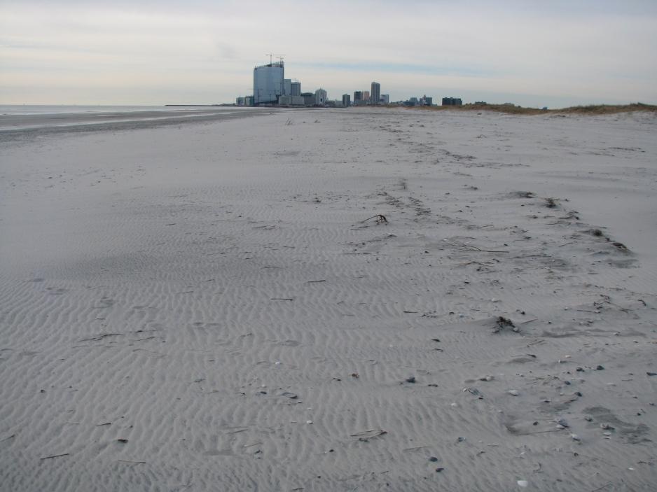
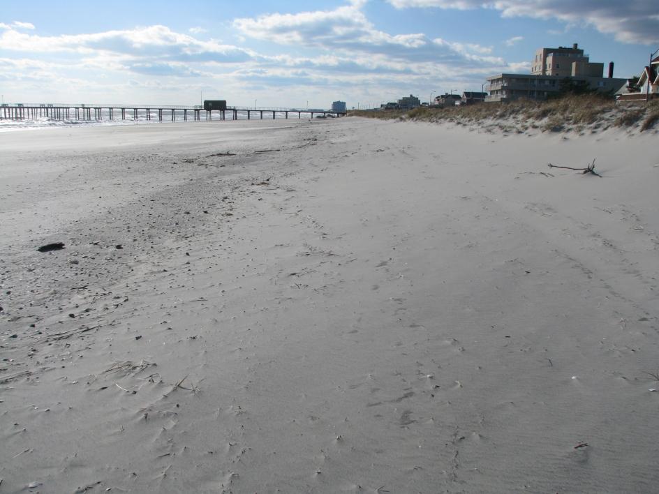
23- Year Sand Volume Changes at Site 132, 15th Street, Brigantine
|
|
|
- Juliana McDowell
- 5 years ago
- Views:
Transcription


1 149

2 Figure75. Location map for the 9 NJBPN profile sites in Atlantic County, NJ ATLANTIC COUNTY SPRING 2008 to FALL
3 The Atlantic County oceanfront shoreline consists of three barrier islands. Between Little Egg Inlet and Brigantine Inlet the island of Little Beach belongs to the Forsythe National Wildlife Refuge. Brigantine Island is divided into a northern third that is undeveloped and owned by NJ Green Acres Program with the City of Brigantine, developed on the remainder. Absecon Island is home to Atlantic City, Ventnor City, Margate City, and the Borough of Longport. All Atlantic County communities have been the direct or indirect beneficiaries of federally sponsored beach nourishment projects that have substantially added to the beach width, sand volume on the beach and enhanced the dune protection for landward properties. The Absecon Island project was completed between fall 2003 and spring 2004 with sand derived from Absecon Inlet. The refusal of Margate City and Longport to participate in the project has resulted in a significant loss of sand from the southern third of Ventnor City beaches through end-effect erosion. Sand is transported (south) to the areas not initially replenished causing the fill to deteriorate on the southern Ventnor beach. The NJBPN surveys have documented substantial increases in sand volume at Benson Avenue in Margate and a minor increase all the way south at 17 th Street in Longport. The Ventnor City profile is located in the middle of the municipal shoreline and has remained stable because it is well north of the project s termination at the border with Margate City. End-effect erosion from fill projects is a significant reason to have continuity of projects across an entire barrier island or between inlets. The fall 2009 series of northeast storms were captured by the 2009 survey that took place in December following four of the six major events. The northern end of Absecon Island suffered dune losses and a much narrower beach as a result of numerous northeast storms. Sand accumulated at both barrier islands southern ends as strong northeast driven littoral currents moved sand south along the beachfront. At the Absecon Inlet jetty on the Brigantine side, the shoreline advanced 75 feet as over 30 cubic yards of sand per foot of beachfront accumulated due to this southerly sand transport. The City of Brigantine received beach sand derived from Brigantine Inlet during 2006 to renourish the erosional area located at the northern end of the development on the island. This area has been the site of three projects in 1997, 2001 and The first two were NJ State and locally sponsored with the 1997 initial fill amounting to 1,000,000 cubic yards of new sand. Lesser amounts have been added subsequently during maintenance projects, but the segment at the extreme north end of development in the City of Brigantine is a continuing zone of instability. Sand moves south toward the north jetty at Absecon Inlet creating a massive beach seaward of the development at the 43 rd Street profile site. The loss of sand to the north has been a direct benefit to the City beaches to the south. This past year the transfer rate to the south dramatically increased as a result of increased storm frequency. If the 33 cubic yards per foot between 43 rd Street and the jetty remained constant for the distance between 43 rd Street and the jetty, the total volume added south of 43 rd Street becomes 213,345 cubic yards of new sand arriving at the beach immediately north of the jetty (43 rd St. is 6,456 feet north of the jetty). This sand volume is being added to a shoreline segment that could act as a source of sand if pumping it were permitted either back north to the zone of erosion on Brigantine Island, or transferring it across the inlet to the northern Atlantic City beaches. On Absecon Island the sand supply provided by the ACOE in 2003 has been depleted to the point where the erosion is shifting south beyond the Steel Pier, located just north of the North Carolina profile site. The northeast storm-enhanced sand volume redistribution from the northern beaches to the south ends of each island is also documented by comparing the data from No. Carolina Avenue vs. 17 th Street in Longport. The March 2010 northeast storm put salt water in the basement of the Showboat Casino in Atlantic City due to the complete loss of the dunes. 151
4 23- Year Sand Volume Changes at Site 132, 15th Street, Brigantine Cu. Yds. of Sand per Foot Sand Volume Changes Were Negative Until Following the 1997 Fill The Past 13 Years Have Seen Sand Move South on Brigantine Due to the 1997, 2001 & 2006 Fills F 1987 F 1988 F 1989 F 1990 F 1991 F 1992 F 1993 F 1994 F 1995 F 1996 F 1997 F 1998 F 1999 F 2000 F 2001 F 2002 F 2003 F 2004 F 2005 F 2006 F 2007 F 2008 F 2009 YEAR Site132 Cumulative Volume Change Figure 76. Brigantine Island is about three quarters developed with the northern section preserved in the NJ Green Acres program. This site lies in the center of development and about a mile south of the end of sand placement by the ACOE. The negative sand volume between 1987 and 1996 reflected sediment supply conditions at this location. Sand was pumped onto the northern third of Brigantine three times and southerly transport transferred over a 100 yds 3 /ft. to this location since The Absecon Inlet jetty traps enough sand to have effects here. 152
5 23- Year Sand Volume Changes at Site 130, No. Carolina Ave., Atlantic City Cu. Yds. of Sand per Foot Sand was Placed in Atlantic City in 1997 The Federal Project was Completed in Loss Rates have Steadily Reduced the Placement Volume to Zero Net Gain by F 1987 F 1988 F 1989 F 1990 F 1991 F 1992 F 1993 F 1994 F 1995 F 1996 F 1997 F 1998 F 1999 F 2000 F 2001 F 2002 F 2003 F 2004 F 2005 F 2006 F 2007 F 2008 F 2009 YEAR Site130 Cumulative Volume Change Figure 77. Comparison of the sites at opposite ends of Absecon Island shows the difference in shoreline stability with regard to beach nourishment projects. The placement volume was nearly 120 yds 3 /ft., but loss rates removed all that material by The 2009 losses would have been more had the sand been on the shoreline to erode, but the situation is becoming critical as the high tide line is pushing under the boardwalk north of the Steel pier in Atlantic City. 153
6 23- Year Sand Volume Changes at Site 129, Raleigh Ave. Ventnor City Sand was Placed in Atlantic City in 1997 The Federal Project was Completed in has Remained Stable in the Middle Section Since Cu. Yds. of Sand per Foot F 1987 F 1988 F 1989 F 1990 F 1991 F 1992 F 1993 F 1994 F 1995 F 1996 F 1997 F 1998 F 1999 F 2000 F 2001 F 2002 F 2003 F 2004 F 2005 F 2006 F 2007 F 2008 F 2009 YEAR Site129 Cumulative Volume Change Figure 78. The Raleigh Avenue site is located near the boundary with Atlantic City. Atlantic City pumped sand onto its shoreline in 1984 and again in 1997 prior to the Federal project. The dramatic gain shows in the 2004 fall survey as a 167 yds 3 /ft. sand volume placement. Losses since have been minimal at this location near the project s center. The two communities at the southern end of the island elected not to participate in the project. Even the storms of 2009 had minimal impact on the total sand volume remaining. 154
7 23- Year Sand Volume Changes at Site 126, 17th Street, Longport Longport has Seen Dramatic Reversals in Sand Volume over Time No Federal Sand was Placed in Longport, but After Reaching a Low Point in 2006, the Trend has been Upward Since Cu. Yds. of Sand per Foot F 1987 F 1988 F 1989 F 1990 F 1991 F 1992 F 1993 F 1994 F 1995 F 1996 F 1997 F 1998 F 1999 F 2000 F 2001 F 2002 F 2003 F 2004 F 2005 F 2006 F 2007 F 2008 F 2009 YEAR Site126 Cumulative Volume Change Figure 79. The situation at Longport shows how volatile the southern barrier beach can be on an island with groins, a terminal jetty and a concrete seawall. The 1990 spike was a modest sand placement by the State of NJ, the 1993 loss was the December 1992 storm. The 2003 loss is unexplained, but the three years of modest gains from 2007 to 2009 may be the result of Federal project sand reaching the southern end of the island. The 2009 gain was storm-driven deposition. 155
8 ANNUAL & CUMULATIVE OCEANFRONT SHORELINE SAND VOLUME CHANGES, ATLANTIC COUNTY 1987 to ,000,000 5,000,000 4,000,000 CUBIC YARDS OF SAND 3,000,000 2,000,000 1,000, ,000,000-2,000, Yearly Sand Volume YEAR Cumulative Sand Volume Figure 80. The 23-year countywide average sand volume change data support the improvement made by the three Brigantine nourishment efforts and the two in Atlantic City, 1997 and 2004 (Federal). The trend between 1987 and 1994 was downward, and then with the major projects starting, the trend reversed into positive territory was the second year post-federal fill that the average sand volume declined in Atlantic County, likely due to the storm frequency s impact across the regional shoreline
9 In summary the Absecon Island project is three years beyond its first maintenance date and the erosion is getting serious between Massachusetts and New Jersey Avenues extending south to Steel Pier at Trump s Taj Mahal Casino. While the State is capable of providing project funding the municipal share becomes 25% of the project cost instead of 8.75% under a Federal, State and local partnership (25% of the 35% State/local share of a federally-funded project). There is potential for ACOE-funded work on the Absecon Island project in , but bureaucratic and procedural delays mean the possibility of another winter without maintenance for the northern beaches on Absecon Island. 157
10
11
12
13

14
15

16
17

18
19
20
21
22
23
24
25
26
27
Figure79. Location map for the 10 NJBPN profile sites in Atlantic County, NJ 155
 154 Figure79. Location map for the 10 NJBPN profile sites in Atlantic County, NJ 155 ATLANTIC COUNTY SPRING 2009 to FALL 2010 The Atlantic County coastline consists of three barrier islands. Between Little
ATLANTIC COUNTY 2006 to 2008
 ATLANTIC COUNTY 2006 to 2008 The Atlantic County oceanfront shoreline consists of three barrier islands where the northern one, Little Beach Island and a third of the second, Brigantine Island, are undeveloped
Figure 262. Location map for the 10 NJBPN profile sites in Atlantic County, NJ 279
 278 Figure 262. Location map for the 10 NJBPN profile sites in Atlantic County, NJ 279 ATLANTIC COUNTY SUMMARY The Atlantic County coastline consists of three barrier islands. The island of Little Beach
New Jersey Beach Profile Network Atlantic County Profile Site Locations
 215 RICHARD STOCKTON COLLEGE OF NEW JERSEY New Jersey Beach Profile Network Atlantic County Profile Site Locations COASTAL RESEARCH CENTER Figure 128 There are nine NJBPN survey sites on the Atlantic County
New Jersey Coastal Zone Overview. The New Jersey Beach Profile Network (NJBPN) 3 Dimensional Assessments. Quantifying Shoreline Migration
 3 Dimensional Assessments. Quantifying Shoreline Migration") New Jersey Coastal Zone Overview The New Jersey Beach Profile Network (NJBPN) Objectives Profile Locations Data Collection Analyzing NJBPN Data Examples 3 Dimensional Assessments Methodology Examples Quantifying
New Jersey Coastal Zone Overview The New Jersey Beach Profile Network (NJBPN) Objectives Profile Locations Data Collection Analyzing NJBPN Data Examples 3 Dimensional Assessments Methodology Examples Quantifying
Figure 46. Locations of the 28 NJBPN profile stations in Ocean County, NJ. A new site was added in the Borough of Seaside Heights (#248).
.") 90 Figure 46. Locations of the 28 NJBPN profile stations in Ocean County, NJ. A new site was added in the Borough of Seaside Heights (#248). 91 OCEAN COUNTY SPRING 2008 to FALL 2009 The Ocean County shoreline
90 Figure 46. Locations of the 28 NJBPN profile stations in Ocean County, NJ. A new site was added in the Borough of Seaside Heights (#248). 91 OCEAN COUNTY SPRING 2008 to FALL 2009 The Ocean County shoreline
Figure 106. Locations of the 28 NJBPN profile stations in Ocean County, NJ.
 130 Figure 106. Locations of the 28 NJBPN profile stations in Ocean County, NJ. 131 2016-2017 Beach Fills in Ocean County: The federal/state/local storm damage reduction project (beachfill) between Manasquan
Figure 38. Locations of the 28 NJBPN profile stations in Ocean County, NJ.
 55 Figure 38. Locations of the 28 NJBPN profile stations in Ocean County, NJ. 56 Individual Site Descriptions: Northern Ocean County recovered its beaches approaching pre-hurricane Sandy elevation or width,
Absecon Island Shore Protection The planning behind the project
 Absecon Island Shore Protection The planning behind the project Most residents of Atlantic City, Ventnor, Margate and Longport are now aware of upcoming plans to protect their common coastline with a beachfill
SPECIAL SPRING 2018 STORM REPORT ON THE CONDITION OF THE MUNICIPAL BEACHES FOR THE BOROUGH OF STONE HARBOR, CAPE MAY COUNTY, NEW JERSEY
 SPECIAL SPRING 2018 STORM REPORT ON THE CONDITION OF THE MUNICIPAL BEACHES FOR THE BOROUGH OF STONE HARBOR, CAPE MAY COUNTY, NEW JERSEY Aerial photograph taken April 21, 2018 showing the view up the beach
Figure 38. Locations of the 28 NJBPN profile stations in Ocean County, NJ.
 52 Figure 38. Locations of the 28 NJBPN profile stations in Ocean County, NJ. 53 Individual Site Descriptions: Beaches in Northern Ocean County continued to recover slowly as sand transported offshore
Beach Dune Performance Assessment of. New Jersey Beach Profile Network (NJBPN) Sites at. Long Beach Island, New Jersey. After Hurricane Sandy
 Sites at. Long Beach Island, New Jersey. After Hurricane Sandy") Beach Dune Performance Assessment of New Jersey Beach Profile Network (NJBPN) Sites at Long Beach Island, New Jersey After Hurricane Sandy November 13, 2012 The Richard Stockton College of NJ Coastal Research
Beach Dune Performance Assessment of New Jersey Beach Profile Network (NJBPN) Sites at Long Beach Island, New Jersey After Hurricane Sandy November 13, 2012 The Richard Stockton College of NJ Coastal Research
FINAL REPORT FOR 2009 ON THE CONDITION OF THE MUNICIPAL OCEANFRONT BEACHES IN THE BOROUGH OF AVALON, CAPE MAY COUNTY, NEW JERSEY
 FINAL REPORT FOR 2009 ON THE CONDITION OF THE MUNICIPAL OCEANFRONT BEACHES IN THE BOROUGH OF AVALON, CAPE MAY COUNTY, NEW JERSEY Storm waves pound the inlet revetment September 10, 2009 as the series of
New Jersey Beach Profile Network Ocean County Profile Site Locations
 125 RICHARD STOCKTON COLLEGE OF NEW JERSEY COASTAL RESEARCH CENTER New Jersey Beach Profile Network Ocean County Profile Site Locations Figure 73 156 155 154 153 152 151 15 149 The Ocean County shoreline
Long Beach Island Holgate Spit Little Egg Inlet Historical Evolution Introduction Longshore Transport Map, Survey and Photo Historic Sequence
 Appendix B Long Beach Island Holgate Spit Little Egg Inlet Historical Evolution Introduction The undeveloped southern end of Long Beach Island (LBI) is referred to as the Holgate spit as it adjoins the
Beach, dune and development in the Borough of Mantoloking as of January Prepared for The Borough of Mantoloking: April 2, 2008
 Summary of 20-years of Shoreline Monitoring Between Maryland Avenue, Point Pleasant Beach, Bay Head, Mantoloking, Brick Township, to 1 st Avenue in Normandy Beach, Ocean County, New Jersey & an Evaluation
OCEAN COUNTY 2006 to 2008
 OCEAN COUNTY 2006 to 2008 Ocean County finally started to benefit from long-awaited startup of Federal beach nourishment projects when sand was pumped onto Surf City, Long Beach Island in late 2006. This
2014 ANNUAL REPORT - TO THE CITY OF NORTH WILDWOOD ON THE CONDITION OF THE CITY BEACHES
 2014 ANNUAL REPORT - TO THE CITY OF NORTH WILDWOOD ON THE CONDITION OF THE CITY BEACHES View on September 25, 2014 looking northwest into Hereford Inlet. Considerable southerly expansion of the tip of
A REVIEW OF THE CONDITION OF THE MUNICIPAL BEACHES AS A RESULT OF HURRICANE SANDY IN THE BOROUGH OF STONE HARBOR, CAPE MAY COUNTY, NEW JERSEY
 A REVIEW OF THE CONDITION OF THE MUNICIPAL BEACHES AS A RESULT OF HURRICANE SANDY IN THE BOROUGH OF STONE HARBOR, CAPE MAY COUNTY, NEW JERSEY View along the dune scarp from 103 rd Street on October 31,
Volume and Shoreline Changes along Pinellas County Beaches during Tropical Storm Debby
 Volume and Shoreline Changes along Pinellas County Beaches during Tropical Storm Debby Ping Wang and Tiffany M. Roberts Coastal Research Laboratory University of South Florida July 24, 2012 Introduction
UPPER BEACH REPLENISHMENT PROJECT RELATED
 ASSESSMENT OF SAND VOLUME LOSS at the TOWNSHIP of UPPER BEACH REPLENISHMENT PROJECT RELATED to the LANDFALL OF HURRICANE SANDY - PURSUANT TO NJ-DR 4086 This assessment is in response to Hurricane Sandy
2013 ANNUAL REPORT - TO THE CITY OF NORTH WILDWOOD ON THE CONDITION OF THE CITY BEACHES
 2013 ANNUAL REPORT - TO THE CITY OF NORTH WILDWOOD ON THE CONDITION OF THE CITY BEACHES View on June 18, 2013 from the 2 nd Avenue jetty looking south while the 2013 beach nourishment project was under
FINAL REPORT FOR 2011 ON THE CONDITION OF THE MUNICIPAL BEACHES IN THE CITY OF BRIGANTINE BEACH, ATLANTIC COUNTY, NEW JERSEY
 FINAL REPORT FOR 2011 ON THE CONDITION OF THE MUNICIPAL BEACHES IN THE CITY OF BRIGANTINE BEACH, ATLANTIC COUNTY, NEW JERSEY Photograph was taken October 10, 2011 from 10 th Street North looking south
Figure 41. Locations of the 28 NJBPN profile stations in Ocean County, NJ.
 57 Figure 41. Locations of the 28 NJBPN profile stations in Ocean County, NJ. 58 Hurricane Sandy s Impact on the Ocean County Shoreline; In general terms, all forms of damage to beaches, dunes and public
2015 ANNUAL REPORT - TO THE CITY OF NORTH WILDWOOD ON THE CONDITION OF THE CITY BEACHES
 2015 ANNUAL REPORT - TO THE CITY OF NORTH WILDWOOD ON THE CONDITION OF THE CITY BEACHES Ariel view of North Wildwood looking south from the Hereford Inlet perspective on June 24, 2015. The main channel
FINAL REPORT FOR 2013 ON THE CONDITION OF THE MUNICIPAL OCEANFRONT BEACHES THE BOROUGH OF AVALON, CAPE MAY COUNTY, NEW JERSEY
 FINAL REPORT FOR 2013 ON THE CONDITION OF THE MUNICIPAL OCEANFRONT BEACHES THE BOROUGH OF AVALON, CAPE MAY COUNTY, NEW JERSEY View from 12 th Street to the south taken February 28, 2013, following completion
PREPARED FOR: THE BOROUGH OF AVALON 3100 DUNE DRIVE AVALON, NJ 08202
 FINAL REPORT FOR 2012 ON THE CONDITION OF THE MUNICIPAL OCEANFRONT BEACHES FOLLOWING HURRICANE SANDY IN THE BOROUGH OF AVALON, CAPE MAY COUNTY, NEW JERSEY View from 78 th Street to the north immediately
TABLE OF CONTENTS APPENDIX & BIBLIOGRAPHY
 TABLE OF CONTENTS Executive Summary 1 Acknowledgements 3 Introduction 3 The New Jersey Coastal Zone 3 Storm Recovery and Beach Project Effectiveness 3 Monmouth County 4 Figure 1. Monmouth County Station
The Stockton University Coastal
 Hurricane Sandy: Beach-dune recovery at New Jersey Beach Profile Network (NJBPN) sites By Kimberly K. McKenna 1, Stewart C. Farrell 1, and Jeffrey A. Gebert 2 1 Stockton University Coastal Research Center
Recycling of Surplus Sand to Extend the Time Between Beach Fill Episodes
 Recycling of Surplus Sand to Extend the Time Between Beach Fill Episodes Cape May County, New Jersey Dr. Stewart Farrell Coastal Research Center 1795 Franklin Map Shows Inlets Inlet Morphology has Remained
Beach Dune Performance Assessment of. New Jersey Beach Profile Network (NJBPN) Sites at. Between Manasquan Inlet and Allenhurst, New Jersey
 Sites at. Between Manasquan Inlet and Allenhurst, New Jersey") Beach Dune Performance Assessment of New Jersey Beach Profile Network (NJBPN) Sites at Between Manasquan Inlet and Allenhurst, New Jersey Related to FEMA DR JI 4086 Declared for Hurricane Sandy December
Beach Dune Performance Assessment of New Jersey Beach Profile Network (NJBPN) Sites at Between Manasquan Inlet and Allenhurst, New Jersey Related to FEMA DR JI 4086 Declared for Hurricane Sandy December
FINAL REPORT FOR 2012 ON THE CHANGES SEEN ON THE OCEANFRONT BEACHES
 FINAL REPORT FOR 2012 ON THE CHANGES SEEN ON THE OCEANFRONT BEACHES IN THE BOROUGH OF MANTOLOKING, OCEAN COUNTY, NEW JERSEY FOCUSED ON THE IMPACTS OF HURRICANE SANDY View looking north on Route 5 on October
RE: Hurricane Matthew Beach Damage Assessment and Recommendations [CSE 2416]
![RE: Hurricane Matthew Beach Damage Assessment and Recommendations [CSE 2416]](/thumbs/83/87675702.jpg "RE: Hurricane Matthew Beach Damage Assessment and Recommendations [CSE 2416]") October 25, 2016 Iris Hill Town Administrator Town of Edisto Beach 2414 Murray St Edisto Beach SC 29438 RE: Hurricane Matthew Beach Damage Assessment and Recommendations [CSE 2416] Dear Iris, Hurricane
October 25, 2016 Iris Hill Town Administrator Town of Edisto Beach 2414 Murray St Edisto Beach SC 29438 RE: Hurricane Matthew Beach Damage Assessment and Recommendations [CSE 2416] Dear Iris, Hurricane
Figure 1. Survey site locations in Monmouth County.
 6 Figure 1. Survey site locations in Monmouth County. 7 Individual Site Descriptions: The restoration of the Sea Bright shoreline was essentially complete by the fall 2013 survey. The NY Corps District
The Richard Stockton College of New Jersey Coastal Research Center
 The Richard Stockton College of New Jersey Coastal Research Center New Jersey Beach Profile Network 20-Year Report On Shoreline Changes In New Jersey Raritan Bay to Delaware Bay Prepared for: New Jersey
ST. JOSEPH PENINSULA, GULF COUNTY, FLORIDA Beach Re-Nourishment and Environmental Enhancement Project RECOMMENDATIONS
 ST. JOSEPH PENINSULA, GULF COUNTY, FLORIDA Beach Re-Nourishment and Environmental Enhancement Project RECOMMENDATIONS January 23, 2018 543 Harbor Boulevard, Suite 204 Destin, Florida 32541 850.654.1555
Town of Duck, North Carolina
 Tracking No. 00.00.2010 Erosion Mitigation And Shoreline Management Feasibility Study Town of Duck, North Carolina Coastal Planning & Engineering of North Carolina August 15, 2012 Tom Jarrett Robert Neal
Performance of Upham Beach T-Groin Project and Its Impact to the Downdrift Beach
 Performance of Upham Beach T-Groin Project and Its Impact to the Downdrift Beach Progress Report for the Period of October 2008 to April 2009 Submitted by Ping Wang, Ph.D., and Tiffany M. Roberts Department
Figure 78. Map of Cape May County showing the locations of the 31 profile sites in the county.
 103 Figure 78. Map of Cape May County showing the locations of the 31 profile sites in the county. 104 Cape May County in 2015: Cape May County has 31 survey stations between Reeds Beach on the Western
FINDING OF NO SIGNIFICANT IMPACT
 DEPARTMENT OF THE ARMY CHARLESTON DISTRICT, CORPS OF ENGINEERS 69A HAGOOD AVENUE CHARLESTON, SOUTH CAROLINA 29403-5107 FINDING OF NO SIGNIFICANT IMPACT EDISTO BEACH COASTAL STORM DAMAGE REDUCTION GENERAL
Aspects of New Jersey Geology 2009 The Jersey Shore
 Aspects of New Jersey Geology 2009 The Jersey Shore Looking towards Belmar at sunset. Photo from VisitUSA.com. This calendar is available for free download from www.ganj.org, the website of the Geological
ATLANTIC COAST OF LONG ISLAND, JONES INLET TO EAST ROCKAWAY INLET, LONG BEACH ISLAND, NY. Contract #2 Construction Scope. April 18th-19th 2018
 ATLANTIC COAST OF LONG ISLAND, JONES INLET TO EAST ROCKAWAY INLET, LONG BEACH ISLAND, NY Contract #2 Construction Scope April 18th-19th 2018 New York District PLAN COMPONENTS Length of Beachfill 35,000
FINAL REPORT FOR 2013 ON THE CONDITION OF THE MUNICIPAL BEACHES IN THE TOWNSHIP OF UPPER, CAPE MAY COUNTY, NEW JERSEY
 FINAL REPORT FOR 2013 ON THE CONDITION OF THE MUNICIPAL BEACHES IN THE TOWNSHIP OF UPPER, CAPE MAY COUNTY, NEW JERSEY Aerial photograph at Corson s Inlet showing conditions on December 1, 2013 of the north
Table 4. Volumetric Change Rates Pre-Project and Post-Project for the Town of Duck
 V. VOLUMETRIC CHANGES General Volumetric changes measured over the entire monitoring area for various time periods are provided in Table 4. The volume changes are given in terms of cubic yards/foot of
DUNE STABILIZATION AND BEACH EROSION
 DUNE STABILIZATION AND BEACH EROSION CAPE HATTERAS NATIONAL SEASHORE NORTH CAROLINA ROBERT DOLAN PAUL GODFREY U. S. DEPARTMENT OF INTERIOR NATIONAL PARK SERVICE OFFICE OF NATURAL SCIENCE WASHINGTON, D.
Delaware Chapter Surfrider Foundation - Indian River Inlet Monitoring
 Delaware Chapter Surfrider Foundation - Indian River Inlet Monitoring In 2012, the Delaware Surfrider Foundation Chapter formed the Surf Quality and Access Committee to focus on issues such as surf spot
Protecting our Beaches
 Protecting our Beaches South Amelia Island Shore Stabilization Project Nassau County, FL Mr. Drew Wallace President South Amelia Island Shore Stabilization Association (SAISSA) Mr. Bill Moore, AICP Project
Atlantic Coast of Long Island, Jones Inlet to East Rockaway Inlet, Long Beach Island, NY Construction Update
 Atlantic Coast of Long Island, Jones Inlet to East Rockaway Inlet, Long Beach Island, NY Construction Update June 2016 US Army Corps of Engineers Project Purpose Three specific damage mechanisms of coastal
2018 Beach Preservation Project Information
 QUICK FACTS Beach Renourishment to begin late April 2018 o U.S. Army Corps of Engineers project o Project Area: 8 th St. E. to end of E. Ashley Ave. o Project Length: 2 miles o Cost: $10,900,000 o Funding:
The Sand Beaches of New Hampshire and Maine
 The Sand Beaches of New Hampshire and Maine Beach Preservation and Erosion Control Photographs provided by Joe Kelly and Steve Adams Cover photo: Reid State Park, ME Introduction The sand beaches of New
Inlet Management Study for Pass-A-Grille and Bunces Pass, Pinellas County, Florida
 Inlet Management Study for Pass-A-Grille and Bunces Pass, Pinellas County, Florida Final Report Submitted By Ping Wang, Ph.D., Jun Cheng Ph.D., Zachary Westfall, and Mathieu Vallee Coastal Research Laboratory
4/20/17. #32 - Coastal Erosion Case Histories - Lake Michigan
 Writing Assignment Due Monday by 11:59 pm #32 - Coastal Erosion Case Histories - Lake Michigan See main class web pages for detailed instructions Submit papers Illinois Compass No copying: Compass will
Impact of Hurricane Matthew on the Atlantic Coast of Florida
 Impact of Hurricane Matthew on the Atlantic Coast of Florida A coastal engineer was driving across country and his jeep broke down in front of a monastery. It was late in the day and the monks invited
Overview. Beach Features. Coastal Regions. Other Beach Profile Features. CHAPTER 10 The Coast: Beaches and Shoreline Processes.
 Overview CHAPTER 10 The Coast: Beaches and Shoreline Processes Coastal regions constantly change. The beach is a dominant coastal feature. Wave activity continually modifies the beach and coastal areas.
Beach Renourishment in Jacksonville
 Beach Renourishment in Jacksonville Kevin Bodge, PhD, P.E. - Olsen Associates, Inc. 1978 Oct 2004 2000 2016 2011 Oct 2016 Coastal Duval County, FL Nassau Sound Blount Island Ft. George Inlet St. Johns
North Shore of Long Island, Feasibility Study
 North Shore of Long Island, Asharoken New York Asharoken, Feasibility Study Asharoken, NY Public Meeting June 30, 2015 US Army Corps of Engineers US Army Corps of Engineers New York BUILDING STRONG BUILDING
SACO RIVER AND CAMP ELLIS BEACH SACO, MAINE SECTION 111 SHORE DAMAGE MITIGATION PROJECT APPENDIX F ECONOMIC ASSESSMENT
 SACO RIVER AND CAMP ELLIS BEACH SACO, MAINE SECTION 111 SHORE DAMAGE MITIGATION PROJECT APPENDIX F ECONOMIC ASSESSMENT Department of the Army New England District, Corps of Engineers 696 Virginia Road
BALD HEAD ISLAND, NC SAND SHARING SYSTEM OVERVIEW AND ASSESSMENT. Erik J. Olsen, P.E. olsen associates, inc.
 BALD HEAD ISLAND, NC SAND SHARING SYSTEM OVERVIEW AND ASSESSMENT Erik J. Olsen, P.E. Olsen Associates, Inc. BACKGROUND Both the Village of Bald Head Island (VBHI) and the Bald Head Island Limited, LLC.
CHAPTER 281 INFLUENCE OF NEARSHORE HARDBOTTOM ON REGIONAL SEDIMENT TRANSPORT
 CHAPTER 281 INFLUENCE OF NEARSHORE HARDBOTTOM ON REGIONAL SEDIMENT TRANSPORT Paul C.-P. Lin, Ph.D., P.E. 1 and R. Harvey Sasso, P.E. 2 ABSTRACT The influence of nearshore hardbottom on longshore and cross-shore
MOREHEAD CITY HARBOR, NC. Dredged Material Management Plan (DMMP)
") MOREHEAD CITY HARBOR, NC Dredged Material Management Plan (DMMP) Public Meeting/Info Session 15 January 2014 US Army Corps of Engineers Morehead City Harbor DMMP Presentation Topics Morehead City Harbor
MOREHEAD CITY HARBOR, NC Dredged Material Management Plan (DMMP) Public Meeting/Info Session 15 January 2014 US Army Corps of Engineers Morehead City Harbor DMMP Presentation Topics Morehead City Harbor
Building Coastal Resiliency at Plymouth Long Beach
 Building Coastal Resiliency at Plymouth Long Beach Department of Marine and Environmental Affairs March 30, 2017 Introducing Green Infrastructure for Coastal Resiliency Plymouth Long Beach & Warren s Cove
Controlling Coastal erosion
 Controlling Coastal erosion Coastal Erosion Rates in the U.S. Coastal Erosion and Stabilization Economic pressures demanding the stabilization of beaches and coastlines are immense Coastal Erosion and
North Carolina s Terminal Groins at Oregon Inlet and Fort Macon Descriptions and Discussions
 Attachment 2 North Carolina s Terminal Groins at Oregon Inlet and Fort Macon Descriptions and Discussions Oregon Inlet Terminal Groin Introduction/Background Oregon Inlet was created by a hurricane on
STATUS REPORT FOR THE SUBMERGED REEF BALL TM ARTIFICIAL REEF SUBMERGED BREAKWATER BEACH STABILIZATION PROJECT FOR THE GRAND CAYMAN MARRIOTT HOTEL
 August 23 STATUS REPORT FOR THE SUBMERGED REEF BALL TM ARTIFICIAL REEF SUBMERGED BREAKWATER BEACH STABILIZATION PROJECT FOR THE GRAND CAYMAN MARRIOTT HOTEL performed by Lee E. Harris, Ph.D., P.E. Consulting
Earth Science Chapter 16 Section 3 Review
 Name: Class: Date: Earth Science Chapter 16 Section 3 Review Multiple Choice Identify the choice that best completes the statement or answers the question. 1. The movement of water that parallels the shore
US Beach Nourishment Experience:
 Beach Nourishment: Introduction of new sand to the beach by truck or dredge Large beach >1 million cubic yards (100,000 dump truck loads) Funding is a combination of federal, state, local & private Also
Executive Director and Director of Education New Jersey Sea Grant Consortium
 Welcome to the 12 th Annual State of the Shore Media Event Claire antonucci Executive Director and Director of Education New Jersey Sea Grant Consortium CLAIRE ANTONUCCI Characterized by endless snowfall,
CHAPTER 80 BEHAVIOR OF BEACH FILL AT ATLANTIC CITY, NEW JERSEY. Craig H. Everts. Allan E. DeWall Martin T. Czemiak ABSTRACT
 CHAPTER 80 BEHAVIOR OF BEACH FILL AT ATLANTIC CITY, NEW JERSEY by Craig H. Everts. Allan E. DeWall Martin T. Czemiak ABSTRACT A beach monitoring program between 1962 and 1972 at Atlantic City, New Jersey
KEYNOTE PRESENTATION FSBPA olsen
 AMELIA ISAND, FLORIDA BEACH MANAGEMENT PARTNERING AND PERSERVERENCE Erik Olsen, PE associates, inc. KEYNOTE PRESENTATION FSBPA 2009 IN ORDER TO ADDRESS SHORE PROTECTION TODAY LOCAL INTERESTS PARTNER WITH:
Lecture Outlines PowerPoint. Chapter 15 Earth Science, 12e Tarbuck/Lutgens
 Lecture Outlines PowerPoint Chapter 15 Earth Science, 12e Tarbuck/Lutgens 2009 Pearson Prentice Hall This work is protected by United States copyright laws and is provided solely for the use of instructors
Essentials of Oceanography Eleventh Edition
 Chapter Chapter 1 10 Clickers Lecture Essentials of Oceanography Eleventh Edition The Coast: Beaches and Shoreline Processes Alan P. Trujillo Harold V. Thurman Chapter Overview Coastal regions have distinct
Long Term Success and Future Approach of the Captiva and Sanibel Islands Beach Renourishment Program
 2017 National Conference on Beach Preservation Technology February 8-10, 2017; Stuart, Florida Long Term Success and Future Approach of the Captiva and Sanibel Islands Beach Renourishment Program Thomas
Salt Ponds Shore Zone Modeling for Breakwater Placement: Summary Report
 Salt Ponds Shore Zone Modeling for Breakwater Placement: Summary Report Virginia Institute of Marine Science May 2014 Salt Ponds Shore Zone Modeling for Breakwater Placement: Summary Report For Waterway
Town of Duck, North Carolina
 Tracking No. 00.00.2010 Erosion Mitigation And Shoreline Management Feasibility Study Town of Duck, North Carolina Coastal Planning & Engineering of North Carolina February 28, 2013 Ken Willson 1 Tracking
Nearshore Sediment Transport What influences the loss of sediment on Beaches? - Waves - Winds - Tidal Currents - River discharge - Runoff
 Tides & Beaches Nearshore Sediment Transport What influences the loss of sediment on Beaches? - Waves - Winds - Tidal Currents - River discharge - Runoff Oceans Ocean Topography Physical Structure of the
Q1. What are the primary causes/contributors to coastal erosion at Westshore and the concept of longshore / littoral drift.
 Q1. What are the primary causes/contributors to coastal erosion at Westshore and the concept of longshore / littoral drift. In order of (timing related) contribution to present problem 1. Beach is too
Assateague Island National Seashore North End Restoration Project Timeline
 Assateague Island National Seashore North End Restoration Project Timeline Date Event Some information provided in the Project Introduction document. Detailed events are available in a timeline compiled
FINAL ENVIRONMENTAL IMPACT STATEMENT ON BROWARD COUNTY SHORE PROTECTION PROJECT SEGMENTS II AND III BROWARD COUNTY, FLORIDA
 FINAL ENVIRONMENTAL IMPACT STATEMENT ON BROWARD COUNTY SHORE PROTECTION PROJECT SEGMENTS II AND III BROWARD COUNTY, FLORIDA 1. PROJECT PURPOSE AND NEED 1.1. PROJECT AUTHORITY. 1.1.1. INITIAL AUTHORIZATION.
Beach Nourishment Impact on Beach Safety and Surfing in the North Reach of Brevard County, Florida
 Beach Nourishment Impact on Beach Safety and Surfing in the North Reach of Brevard County, Florida Prepared by John Hearin, Ph.D. Coastal Engineering Vice Chairman Cocoa Beach Chapter Port Canaveral Patrick
Severe Beach Erosion Caused by Permanent Beach Sand Loss Through Rollover Fish Pass Bolivar Peninsula, Texas
 DRAFT DRAFT DRAFT DRAFT DRAFT DRAFT DRAFT DRAFT Severe Beach Erosion Caused by Permanent Beach Sand Loss Through Rollover Fish Pass Bolivar Peninsula, Texas September, 1999 For J. Martin Green and Alan
A Summary of the 2017 State of Maine s Beaches Report
 Maine Geologic Facts and Localities July, 2017 A Summary of the 2017 State of Maine s Beaches Report William Van Benthuysen, Kennebunkport, Maine Text by Peter A. Slovinsky, Department of Agriculture,
County of Santa Barbara Permit Option Analysis Goleta Beach JULY 13, 2017
 County of Santa Barbara Permit Option Analysis Goleta Beach JULY 13, 2017 Introduction 2 Goleta Beach Park welcomes 1.5 million visitors annually Amenities include: Picnic Areas and Group Areas w/bbqs
Beach profile surveys and morphological change, Otago Harbour entrance to Karitane May 2014 to June 2015
 Beach profile surveys and morphological change, Otago Harbour entrance to Karitane May 2014 to June 2015 Prepared for Port Otago Ltd Martin Single September 2015 Shore Processes and Management Ltd Contact
Today: Coastal Issues and Estuaries
 Today: Coastal Issues and Estuaries Coastal issues Human effect on coastlines What is an estuary Why are they so important? Circulation of water in estuary Environmental issues Coastal Issues: Problem
EVALUATION OF BEACH EROSION UP-DRIFT OF TIDAL INLETS IN SOUTHWEST AND CENTRAL FLORIDA, USA. Mohamed A. Dabees 1 and Brett D.
 EVALUATION OF BEACH EROSION UP-DRIFT OF TIDAL INLETS IN SOUTHWEST AND CENTRAL FLORIDA, USA Mohamed A. Dabees 1 and Brett D. Moore 1 The paper discusses the analysis of up-drift beach erosion near selected
OECS Regional Engineering Workshop September 29 October 3, 2014
 B E A C H E S. M A R I N A S. D E S I G N. C O N S T R U C T I O N. OECS Regional Engineering Workshop September 29 October 3, 2014 Coastal Erosion and Sea Defense: Introduction to Coastal/Marine Structures
Regular Workshop October 20, 2014 Agenda Item: Dr. Albert E. Browder, PE; Olsen Associates, Inc.
 Regular Workshop October 20, 2014 Agenda Item 8 Agenda Item: Presenter: Summary: Beach Update Town Manager; Dr. Albert E. Browder, PE; Olsen Associates, Inc. At the January 21, 2014 Regular Workshop Meeting,
Dear Mr. Howard Ruben,
 Mr. Howard Ruben ( Howard.Ruben@usace.army.mil) The U.S. Army Corps of Engineers New York District Planning Division-Environmental Branch 26 Federal Plaza New York, New York 10278-0090 Dear Mr. Howard
Deep-water orbital waves
 What happens when waves approach shore? Deep-water orbital waves Fig. 9.16, p. 211 Wave motion is influenced by water depth and shape of the shoreline wave buildup zone surf zone beach Wave base deepwater
Chapter 10 Lecture Outline. The Restless Oceans
 Chapter 10 Lecture Outline The Restless Oceans Focus Question 10.1 How does the Coriolis effect influence ocean currents? The Ocean s Surface Circulation Ocean currents Masses of water that flow from one
USE OF SEGMENTED OFFSHORE BREAKWATERS FOR BEACH EROSION CONTROL
 .. CETN-III-22 4/84 PURPOSE: USE OF SEGMENTED OFFSHORE BREAKWATERS FOR BEACH EROSION CONTROL To provide information on the functional application of and general design considerations for using offshore
Chapter 15 SEASONAL CHANGES IN BEACHES OP THE NORTH ATLANTIC COAST OF THE UNITED STATES
 Chapter 15 SEASONAL CHANGES IN BEACHES OP THE NORTH ATLANTIC COAST OF THE UNITED STATES By John M. Darling Hydraulic Engineer, Research Division U. S. Army Coastal Engineering Research Center Corps of
AN OVERVIEW OF RECENT PROJECTS RELATED TO SAND BUDGETS, SOUTHERN CALIFORNIA BEACHES
 AN OVERVIEW OF RECENT PROJECTS RELATED TO SAND BUDGETS, SAND SUPPLY, COASTAL ARMORING, MANAGEMENT, AND VALUING SOUTHERN CALIFORNIA BEACHES Dr. Kiki Patsch California State University Channel Islands Environmental
Coastal Hazards and Management in North Carolina. Braxton Davis April 14, 2015
 Coastal Hazards and Management in North Carolina Braxton Davis April 14, 2015 Coastal Facts and Figures 320 miles of ocean beaches 12,000+ miles of estuarine shoreline 2 million + acres of sounds, creeks,
Reading Material. Inshore oceanography, Anikouchine and Sternberg The World Ocean, Prentice-Hall
 Reading Material Inshore oceanography, Anikouchine and Sternberg The World Ocean, Prentice-Hall BEACH PROCESSES AND COASTAL ENVIRONMENTS COASTAL FEATURES Cross section Map view Terminology for Coastal
Modeling Beach Erosion
 Ocean Lecture & Educator s Night May 16, 2012 Modeling Beach Erosion Below is an overview of the activity Modeling Beach Erosion (New Jersey Sea Grant Consortium, Education Program) to incorporate information
CLAM PASS RESTORATION AND MANAGEMENT PLAN BATHYMETRIC MONITORING REPORT NO. 7 Including Interior Bay Dredge Cuts and Tidal Data
 CLAM PASS RESTORATION AND MANAGEMENT PLAN BATHYMETRIC MONITORING REPORT NO. 7 Including Interior Bay Dredge Cuts and Tidal Data Submitted to: Florida Department of Environmental Protection DEP File No.
Shorelines Earth - Chapter 20 Stan Hatfield Southwestern Illinois College
 Shorelines Earth - Chapter 20 Stan Hatfield Southwestern Illinois College The Shoreline A Dynamic Interface The shoreline is a dynamic interface (common boundary) among air, land, and the ocean. The shoreline
The purpose and needs of the Figure Eight Island Inlet and Shoreline Management Project are as follows:
 Chapter 2 PURPOSE AND NEEDS 1. What are the purpose and needs of this project? The main concern of residents and owners at Figure Eight Island are economic losses resulting from damages to structures and
Nome Harbor Page 2 of 12
 Nome Harbor Nome Harbor Page 2 of 12 Condition of Improvements 30 December 2015 Nome Harbor, Alaska (CWIS No. 010422, 012270, 072742, 087755) Authorization (1) Rivers and Harbors Act, 8 August 1917 (House