Beach Cities Living Streets Design Manual and Aviation Boulevard Multimodal Corridor Plan
|
|
|
- Lisa Long
- 5 years ago
- Views:
Transcription


1 Beach Cities Living Streets Design Manual and Aviation Boulevard Multimodal Corridor Plan
2 AGENDA 1 Introductions & Project Scope 2 Public Outreach Recap 3 Living Streets Design Manual 4 Aviation Boulevard Study 5 Break-out Session Background: Example of a Complete Street
3 INTRODUCTIONS Leeanne Singleton; Environmental Analyst; City of Hermosa Beach Erik Zandvliet; Traffic Engineer; City of Manhattan Beach Gene Kim; Traffic Engineer; City of Redondo Beach Jacqueline Sun; Community Policy Analyst; Beach Cities Health District Background: Example of a Complete Street

4 PROJECT SCOPE Caltrans Transportation Planning Grant/SCAG Prepare Living Streets Design Manual Apply Design Manual Principles to an Arterial Work with Public/Stakeholders to Identify Preferences Active Transportation Specialist: Rock Miller Project Manager: Maria Morris Traffic and Planning: Daryl Zerfass Outreach Specialist: Leslie Scott
 BCHD Workshop featuring Dan Burden January 4 & 5, 2018 Draft Living Streets Design Manual for Public review (Until Feb 15, 2018) Develop Alternatives for Aviation Boulevard and Marine Avenue")
5 MILESTONES Activities so far Understanding Existing Conditions Parking and Traffic Study Meetings with City Staff First Community Workshop - July 2017 (Focused on development of Living Streets Design Manual) BCHD Workshop featuring Dan Burden January 4 & 5, 2018 Draft Living Streets Design Manual for Public review (Until Feb 15, 2018) Develop Alternatives for Aviation Boulevard and Marine Avenue Second Community Workshop- January 2018 (Focused on Aviation Boulevard alternatives) Final Living Street Design Manual Available of City websites Third Community Workshop April 2018 (Focused on Aviation Boulevard options) Activities moving forward Refine Promising Alternatives based on Workshop Feedback Develop Implementation Plan City Adoption - October 2018 Cities would be Responsible for Specific Approvals, Securing Funding, and Implementation for Customized Living Street Design Manual and Aviation Blvd Corridor Plan


6 PUBLIC OUTREACH RECAP WORKSHOP #1 July 17, 2017 What was it about? Introduced the purpose for conducting a study for a Beach Cities Living Streets Manual and Aviation Boulevard Multimodal Corridor Plan for the region. The public was asked to provide input on - Bicycle facilities; - Crossing treatments; - Design elements; - Travel modes; - Living Streets Manual; - Cross sections; and - Potential issues.


7 PUBLIC OUTREACH RECAP WORKSHOP #2 January 31, 2018 What was it about? Focused on the Living Street Design Manual elements and introduced Aviation Boulevard preliminary concept alternatives The public was asked to provide input on 4 project segments. Results: There was a wide variation of input. The most common themes: - Concern about the balance between traffic and active transportation - Safety Survey Comment sheets were made available on the cities website and at workshop #2. It allowed for open ended ideas + 1 survey: I felt like the consultants listened to my concerns, took them seriously, and will give them appropriate consideration Survey ranking was based on a scale of 1 (least) to 5 (most). More than half the respondents ranked their satisfaction in the 4-5 range.

8 LIVING STREETS - STREETS FOR EVERYONE Living Streets have the following elements...


9 LIVING STREETS MANUAL LA County Living Streets model manual updated for localized conditions in Beach Cities - Redondo Beach, Hermosa Beach and Manhattan Beach Updated policies, standards, tool box, local pictures, local conditions Documented outreach process Additional chapter on Emerging Technologies Specific Chapter on each of the three Cities Available Online Please visit your City website


10 LIVING STREETS MANUAL CHAPTERS The Chapters in the Living Streets Manual identifies widely respected universal Living Streets Guidelines and fine tunes the guidelines to be suitable for the local Beach Cities.

11 LIVING STREETS MANUAL CHAPTER 17 Chapter 17 is city specific. We worked with the Cities to identify local areas where the Living Street Guidelines needed to be customized. MANHATTAN BEACH AUTO-ORIENTED DEVELOPMENT IN THE NORTHEAST DOWNTOWN MANHATTAN BEACH DOWNTOWN SPECIFIC PLAN LIVING STREETS POLICY MOBILITY PLAN UPDATE HERMOSA BEACH PIER AVENUE PACIFIC COAST HIGHWAY DOWNTOWN CORE REVITALIZATION STRATEGY CONNECTED STREET GRID COMMUNITY EVENTS PLAN HERMOSA GENERAL PLAN UPDATE LIVING STREETS POLICY REDONDO BEACH METRO RAIL ACCESS SOUTH BAY GALLERIA HARBOR AND POWERPLANT REVITALIZATION UTILITY AND RAILROAD CORRIDORS CITY LIVING STREETS POLICY

12 WHY AVIATION BOULEVARD? Safety concerns Crashes and collisions Serves entire Community Many jobs to the North Passes near Metro Green Line Station Passes through all 3 Cities Popular bike route to Beach Area Multiple options possible 2010 to 2016 Bicycle collisions - 27 Pedestrian collisions -19


13 EXISTING TRAFFIC VOLUMES Average Daily Traffic Daily Bike Volume Intersection AM and PM Peak Hour Level of Service


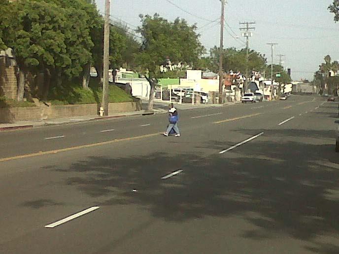
14 AVIATION BOULEVARD TODAY

15 AVIATION BOULEVARD LIVING STREET Provide travel choices for users of all ages and abilities kids, older individuals and people with disabilities Transit by choice and transit by circumstances Connect to Metro Green Line Station Provide welcoming environment to people using Bus service Provide safe environment for all commuters that work along Aviation Boulevard and Marine Avenue 2012 Petition - Enhancing Aviation Boulevard walking and biking paths Connect to destinations Future preparedness/emerging technologies


16 EXAMPLES: VISIONS OF TRANSFORMING STREETS This study does: This study does not: Provides design options for Cities to select from Select a recommended alternative or plan BEFORE BEFORE AFTER AFTER

17 AVIATION BLVD OPTIONS NEAR TERM On-street parking Continuous turn lanes Maintain existing curbs No right-of-way take Adds continuous turn lanes Continuous Class II bike lanes Maintain on-street parking Provide continuous bicycle lanes


18 AVIATION BLVD OPTIONS FUTURE CONCEPTUAL PLAN Curb extensions to improve safety by pedestrians Landscaped medians Landscaped medians Curb Extensions


19 AVIATION BLVD OPTIONS FUTURE CONCEPTUAL PLAN Wider sidewalks with street trees and street lamps Enhanced sidewalks with street trees Two-way Cycle Track Bike Path north of Manhattan Beach Boulevard


20 AVIATION BLVD OPTIONS FUTURE CONCEPTUAL PLAN Mid-block pedestrian crossing with landscaped medians Before After Mid-block pedestrian crossing Roundabout La Jolla Boulevard intersection before and after roundabout: San Diego, CA (Credit: Michael Wallwork)
21 NEXT STEPS Collect public input on Aviation concepts April 2018 Refine alternatives and incorporate in reports to Cities June 2018 Present study results to each City Propose adoption of Living Streets guide by each City May 2018 Action Plan on Aviation Blvd to be considered by each City September/October 2018 Study Conclusion: Fall 2018 June 2018

22 BREAKOUT SESSION & QUESTIONS
SR 693 (Pasadena Avenue) Corridor Study from Shore Drive South to 66 th Street
 Corridor Study from Shore Drive South to 66 th Street") Welcome and Introduction Sign-in and comment sheets Restrooms and exits Meeting agenda and timeline Meeting goals / expectations Provide input to guide study recommendations Actively participate throughout
Welcome and Introduction Sign-in and comment sheets Restrooms and exits Meeting agenda and timeline Meeting goals / expectations Provide input to guide study recommendations Actively participate throughout
BETHEL ROAD AND SEDGWICK ROAD CORRIDOR STUDY
 DRAFT PLAN City Council Meeting August 14, 2017 STUDY AREA Sedgwick Corridor State Route 160, principal arterial with Class 3 access management designation, commuter and freight route, connection to SR
Downtown Naples Mobility and Connectivity Study. Naples City Council Presentation January 2017
 Downtown Naples Mobility and Connectivity Study Naples City Council Presentation January 2017 Agenda 1. Introduction 2. Scope Review 3. Project Schedule 4. Existing Conditions 5. Public Charrette 6. Mobility
KEARNY MESA COMMUNITY PLAN UPDATE
 KEARNY MESA COMMUNITY PLAN UPDATE January 18, 2018 SUBCOMMITTEE MEETING Mobility Concepts and Urban Design Presentation Outline Mobility Concepts: Multimodal Planning Toolbox Presentation and Activities
Citizen Advisory Group Meeting #8 May 5, Welcome. Today s meeting will focus on: Land Use & Transportation CHARLOTTEPLANNING.
 Citizen Advisory Group Meeting #8 May 5, 2010 Welcome. Today s meeting will focus on: Land Use & Transportation CHARLOTTEPLANNING.ORG Meeting Agenda Handouts: o Meeting Agenda o Summary of East Seventh
PEDESTRIAN ACTION PLAN
 ATTACHMENT 2 CITY OF SANTA MONICA PEDESTRIAN ACTION PLAN CITY OF SANTA MONICA PEDESTRIAN ACTION PLAN This page intentionally left blank EXECUTIVE SUMMARY CHAPTER 1 EXECUTIVE SUMMARY Setting the Stage
CRESTON ROAD COMPLETE AND SUSTAINABLE STREETS CORRIDOR PLAN
 CRESTON ROAD COMPLETE AND SUSTAINABLE STREETS CORRIDOR PLAN Preferred Plan Community Presentation September 27, 2017 City of El Paso de Robles in partnership with: Local Government Commission, W-Trans,
Staff Report City of Manhattan Beach
 Agenda Item #: Staff Report City of Manhattan Beach TO: THROUGH: FROM: Honorable Mayor Wilson and Members of the City Council Geoff Dolan, City Manager Richard Thompson, Director of Community Development
Board-Approved Funding Awards for Cycle 4 Active Transportation Grant Program Projects (in Order of Project Rankings) Approved on
 Approved on") CAPITAL Large Category Projects Board-Approved Funding Awards for Cycle 4 Active Transportation Grant Program Projects (in Order of Project Rankings) Approved on 07-27-18 1 La Mesa University Ave Pedestrian
CAPITAL Large Category Projects Board-Approved Funding Awards for Cycle 4 Active Transportation Grant Program Projects (in Order of Project Rankings) Approved on 07-27-18 1 La Mesa University Ave Pedestrian
122 Avenue: 107 Street to Fort Road
 : 107 Street to Fort Road November 24, 2015 4:30 8:00 p.m. Meeting Purpose Summarize project work completed to date Share results of public input from Phase 1 Share the draft concept plan and proposed
Technical Working Group November 15, 2017
 Technical Working Group November 15, 2017 Welcome and Introductions Project Partners Regional Transportation District (RTD) Colorado Department of Transportation (CDOT) Denver Regional Council of Governments
MAYFIELD ROAD CORRIDOR MULTIMODAL TRANSPORTATION PLAN. Public Workshop
 MAYFIELD ROAD CORRIDOR MULTIMODAL TRANSPORTATION PLAN Public Workshop 06.06.18 AGENDA Project Process & Schedule Document Review Summary Project Goals Initial Findings Concept Development Next Steps PROJECT
WELCOME. Stakeholder Involvement Group Meeting #2 Round Lake Public Works October 24, 2018
 WELCOME Stakeholder Involvement Group Meeting #2 Round Lake Public Works October 24, 2018 MEETING AGENDA 1. Welcome and Introductions 2. Study Progress Update 3. Problem Statement 4. Technical Analysis
COASTAL RAIL TRAIL ROSE CREEK BIKEWAY PROJECT COMMUNITY WORKSHOP #2 AUGUST 15, 2013
 COASTAL RAIL TRAIL ROSE CREEK BIKEWAY PROJECT COMMUNITY WORKSHOP #2 AUGUST 15, 2013 CHRIS CARTERETTE, AICP PROJECT MANAGER Chris.Carterette@sandag.org Direct: 619-699.7319 REGIONAL PLANNING BACKGROUND
Welcome. If you have any questions or comments on the project, please contact:
 Welcome This drop-in public open house is intended to provide information about the Bay Street bike lanes project. This project proposes a dedicated cycling facility along Bay Street between Aberdeen Avenue
TABLE OF CONTENTS. Executive Summary
 Executive Summary Background... ES-1 Pedestrian Network... ES-2 Bikeway Network... ES-2 Collision History... ES-2 Public Input... ES-4 Conclusions and Recommendations... ES-4 1. Introduction and Setting
C C C
 C-012-001 Thank you for your support for the creation of new public space and nonmotorized access between downtown and the waterfront through the Overlook Walk, the East-West Connections, and the Promenade.
2014/2015 BIKE ROUTE PLAN 83 AVENUE PROTECTED BIKE LANE
 About the Project The City of Edmonton is planning a major bike route on the southside of Edmonton. The Strathcona Bike Route will connect the communities of Strathcona, Garneau and the University area,
2014/2015 BIKE ROUTE PLAN 83 AVENUE PROTECTED BIKE LANE
 About the Project 2014/2015 BIKE ROUTE PLAN The City of Edmonton is planning a major bike route on the south side of Edmonton. This bike route is one part of a plan to provide citizens with transportation
David DiPierro, John Amberson. Steering Committee Meeting #4 Overview
 IBI GROUP 18401 Von Karman Avenue Suite 110 Irvine CA 92612 USA tel 949 833 5588 fax 949 833 5511 ibigroup.com Memorandum To/Attention Steering Committee Members Date February 17, 2016 From IBI Group Project
Bus Rapid Transit Plans
 Twin Cities Region Bus Rapid Transit Plans ULI Minnesota Workshop Connecting Bus Rapid Transit to the Community December 15, 2009 John Levin Director of Service Development Metro Transit Metropolitan Area
RETREAT AGENDA ITEM MIDTOWN AREA TRANSPORTATION PLAN UPDATE
 October 17, 2017 RETREAT AGENDA ITEM MIDTOWN AREA TRANSPORTATION PLAN UPDATE STATEMENT OF ISSUE An update on the Midtown Area Transportation Plan will be provided including a discussion of preliminary
What Is a Complete Street?
 Session 5 Charleen Zimmer, AICP, Zan Associates May 5-7, 2010 What Is a Complete Street? May 2010 5-1 Not a Complete Street More of a Complete Street May 2010 5-2 Benefits of Complete Streets Safety for
MASTER BICYCLE AND PEDESTRIAN PLAN
 VILLAGE OF NORTHBROOK MASTER BICYCLE AND PEDESTRIAN PLAN DRAFT PLAN OPEN HOUSE May 2, 2018 AGENDA 1. Community Engagement 2. Vision and Goals 3. General Structure of Plan 4. Recommendations Overview 5.
Southview Blvd & 3 rd Avenue Improvement Project. Public Open House December 4, to 7pm
 Southview Blvd & 3 rd Avenue Improvement Project Public Open House December 4, 2014 5 to 7pm Southview Blvd & 3 rd Avenue Public Information Meeting Agenda Presentation 5:30 to 6:15 pm Purpose of Project
Citizen Advocacy. VISION ZERO IN HILLSBOROUGH COUNTY TODAY
 Citizen Advocacy http://www.tampabay.com/news/publicsafety/accidents/car-bus-crash-kills-one/441282 VISION ZERO IN HILLSBOROUGH COUNTY TODAY Does Vision Zero Make Sense Here? Traffic Deaths per 100,000
North Shore Transportation Improvement Strategy
 North Shore Transportation Improvement Strategy Preliminary, Near-term Recommendation 2016 April Transportation Improvement Strategy (TIS) Comprehensive and Analytical A multi-modal transportation strategy
MAKE YOUR PLACE IN CHANNELSIDE
 MAKE YOUR PLACE IN CHANNELSIDE INTRODUCTION PROJECT LIMITS Channelside Drive from Cumberland Ave to Kennedy Boulevard EXISTING CONDITIONS EXISTING CONDITIONS CHANNELSIDE DRIVE FROM E. CUMBERLAND AVENUE
Planning Study SR 976. Project Advisory Team Meeting May 24, 2017
 ` SR 976 BIRD ROAD/SW 40TH STREET FROM SR 821/HEFT TO SR 5/US-1 Miami-Dade County, Florida FPID No.: 434845-4-22-01 Planning Study Project Advisory Team Meeting May 24, 2017 1 Agenda Introductions Project
Tonight is for you. Learn everything you can. Share all your ideas.
 Strathcona Neighbourhood Renewal Draft Concept Design Tonight is for you. Learn everything you can. Share all your ideas. What is Neighbourhood Renewal? Creating a design with you for your neighbourhood.
Atwood Avenue Fair Oaks Avenue Cottage Grove Road
 Atwood Avenue Fair Oaks Avenue Cottage Grove Road Agenda Purpose Review project scope & goals Present design alternatives Gather feedback Answer Questions Format Open House Presentation Q&A Open House
CITY OF COCOA BEACH 2025 COMPREHENSIVE PLAN. Section VIII Mobility Element Goals, Objectives, and Policies
 CITY OF COCOA BEACH 2025 COMPREHENSIVE PLAN Section VIII Mobility Element Goals, Objectives, and Policies Adopted August 6, 2015 by Ordinance No. 1591 VIII MOBILITY ELEMENT Table of Contents Page Number
REGIONAL BICYCLE AND PEDESTRIAN DESIGN GUIDELINES
 REGIONAL BICYCLE AND PEDESTRIAN DESIGN GUIDELINES November 16, 2011 Deb Humphreys North Central Texas Council of Governments Bicycle and Pedestrian Advisory Committee Snapshot of the Guide 1. Introduction
University of Victoria Campus Cycling Plan Terms of Reference. 1.0 Project Description
 University of Victoria Campus Cycling Plan Terms of Reference 1.0 Project Description The Campus Cycling Plan, a first for the University, will provide a comprehensive and coordinated approach to support
UPTOWN REGIONAL BIKE CORRIDORS PROJECT SAN DIEGO ASSOCIATION OF GOVERNMENTS
 UPTOWN REGIONAL BIKE CORRIDORS PROJECT SAN DIEGO ASSOCIATION OF GOVERNMENTS SUMMARY REPORT: COMMUNITY UPDATE MEETING February 6, 2014 6 8:30 p.m. Roosevelt Middle School Library 3366 Park Blvd, San Diego
Toward Zero Deaths. Regional SHSP Road Show Meeting. Virginia Strategic Highway Safety Plan. presented by
 Toward Zero Deaths Regional SHSP Road Show Meeting presented by Virginia Strategic Highway Safety Plan December 1, 2016 1 Welcome & Introductions Purpose of the Meeting Objectives & Key Outcomes Agenda»
Community Task Force July 25, 2017
 Community Task Force July 25, 2017 Welcome and Introductions Project Partners Regional Transportation District (RTD) Colorado Department of Transportation (CDOT) Denver Regional Council of Governments
Community Task Force March 14, 2018
 Community Task Force March 14, 2018 Welcome and Introductions Project Partners Regional Transportation District (RTD) City of Aurora Colorado Department of Transportation (CDOT) Denver Regional Council
LANE ELIMINATION PROJECTS
 PRESENTATION OUTLINE Lane Elimination Considerations Districts 4 & 7 Draft Lane Elimination Processes FDOT Lane Elimination Guidelines Example Projects D4 Case Study: SR A1A (Ft. Lauderdale) D7 Case Study:
CITY OF SLO SEEKS INPUT ON PREFERRED ALTERNATIVE FOR BROAD STREET BICYCLE BOULEVARD PROJECT
 City of San Luis Obispo, News Release DATE: August 1, 2017 RELEASE: Immediate CONTACT: Luke Schwartz (805) 781-7190 Transportation Planner-Engineer, Public Works CITY OF SLO SEEKS INPUT ON PREFERRED ALTERNATIVE
Castro Valley Municipal Advisory Council March 19, 2018
 Castro Valley Municipal Advisory Council March 19, 2018 1 Background 2 Draft Bicycle Vision and Pedestrian Networks 3 Next Steps 4 Updates Agenda 2 PROJECT AREA: Unincorporated Areas of Alameda County
9/25/2018. Multi-Modal Level of Service (MMLOS) Bianca Popescu, Transportation Planner
 Bianca Popescu, Transportation Planner") Multi-Modal Level of Service (MMLOS) Bianca Popescu, Transportation Planner 1 What is MMLOS? Is this a nice place to walk? Is this a nice place to bike? Is transit convenient? Bottom line - Are there options
Multi-Modal Level of Service (MMLOS) Bianca Popescu, Transportation Planner 1 What is MMLOS? Is this a nice place to walk? Is this a nice place to bike? Is transit convenient? Bottom line - Are there options
Agenda. Overview PRINCE GEORGE S PLAZA METRO AREA PEDESTRIAN PLAN
 PRINCE GEORGE S PLAZA METRO AREA PEDESTRIAN PLAN May 28, 2008 Agenda Welcome and introductions Project overview and issue identification Planning context and strengths Design challenges and initial recommendations
Executive Summary Route 30 Corridor Master Plan
 Route Corridor Master Plan Project Overview The Route Corridor Master Plan is a coordinated multimodal transportation and land use plan for the entire stretch of Route through East Whiteland Township,
Community Task Force November 15, 2017
 Community Task Force November 15, 2017 Welcome and Introductions Project Partners Regional Transportation District (RTD) Colorado Department of Transportation (CDOT) Denver Regional Council of Governments
Ann Arbor Downtown Street Plan
 1 Ann Arbor Downtown Street Plan Public Workshop #1 We know that. 2 Public right-of-way (streets, sidewalks, and alleys) make up 30% of the total District area of downtown. Streets need to provide mobility
FINAL REPORT DECEMBER 2011
 FINAL REPORT DECEMBER 2011 AKNOWLEDGEMENTS SFMTA Staff Erin Miller, Project Manager Timothy Papandreou Jerry Robbins Pamela Stone Mike Sallaberry Chris Dimeling Emily Drennen Suzanne Chen-Harding San
City of San Diego Vision Zero Draft Strategic Plan FY 2017
 City of San Diego Vision Zero Draft Strategic Plan FY 2017 Engineering Objective: To develop and implement a strategy that employs best planning, design and engineering practices. Background: Over the
MASHPEE ROTARY CORRIDOR STUDY. Public Listening Session Mashpee Public Library April 11, 2019
 MASHPEE ROTARY CORRIDOR STUDY Public Listening Session Mashpee Public Library April 11, 2019 AGENDA Welcome + Introductions Project Overview Existing Conditions Visioning Exercise Next Steps BACKGROUND
Data Analysis February to March Identified safety needs from reported collisions and existing travel patterns.
 Welcome! Thank you for participating in today s Valencia Bikeway Improvements workshop. Data Analysis February to March Identified safety needs from reported collisions and existing travel patterns. Initial
MAG Town of Cave Creek Bike Study Task 6 Executive Summary and Regional Significance Report
 Page 1 MAG Town of Cave Creek Bike Study Task 6 Executive Summary and Regional Significance Report August 1, 2012 MAG Project #481 Page 2 Task 6 Executive Summary and Regional Significance Report Introduction
Environment and Public Works Committee Presentation
 Mixed Use Centers Complete Streets Guidelines Project Environment and Public Works Committee Presentation December 10, 2008 Project Objectives: Conduct an inter-departmental and agency process to study
RapidRide Roosevelt Seat Sea t t le t le Depa De r pa t r men men t of Sept T an r sp an or sp t or a t t a ion
 RapidRide Roosevelt Seattle Bicycle Advisory Board 1 Our mission, vision, and core values Mission: deliver a high-quality transportation system for Seattle Vision: connected people, places, and products
General Plan Circulation Element Update Scoping Meeting April 16, 2014 Santa Ana Senior Center, 424 W. 3rd Street, Santa Ana, CA 92701
 General Plan Circulation Element Update Scoping Meeting April 16, 2014 Santa Ana Senior Center, 424 W. 3rd Street, Santa Ana, CA 92701 Meeting Agenda 1. Purpose of Scoping Meeting 2. Project Overview 3.
Overview. Illinois Bike Summit IDOT Complete Streets Policy Presentation. What is a Complete Street? And why build them? And why build them?
 Overview Illinois Bike Summit IDOT Complete Streets Policy Presentation Aren Kriks, P.E. District One Bicycle Coordinator and Bureau of Programming Project Engineer History of Complete Streets IDOT Policy
FEDERAL HIGHWAY ADMINISTRATION APPLICATION
 FEDERAL HIGHWAY ADMINISTRATION APPLICATION REQUEST FOR PERMISSION TO EXPERIMENT WITH A BICYCLE BOX INTERSECTION TREATMENT Submitted by: City of Columbus Department of Public Service Date: June 26, 2009
Environmental Assessment Findings & Recommendations. Public Hearing November 13, 2014
 Environmental Assessment Findings & Recommendations Public Hearing November 13, 2014 Welcome! Welcome and Introductions Project and Environmental Assessment Overview Public Comments Adjourn Purpose of
APPENDIX A: Complete Streets Checklist DRAFT NOVEMBER 2016
 APPENDIX A: Complete Streets Checklist DRAFT NOVEMBER 2016 Complete Streets Checklist MetroPlan Orlando s Complete Streets Checklist is an internal planning tool for staff to further implementation of
PEDESTRIAN ACTION PLAN
 CITY OF SANTA MONICA PEDESTRIAN ACTION PLAN DRAFT OCTOBER 2015 Safe Streets Santa Monica, December 3, 2015 Beth Rolandson, AICP Principal Transportation Planner Strategic + Transportation Planning, Planning
Commerce Street Complete Street Project from Good Latimer Expressway to Exposition Avenue
 Commerce Street Complete Street Project from Good Latimer Expressway to Exposition Avenue T A N Y A B R O O K S A S S I S T A N T D I R E C T O R M O B I L I T Y P L A N N I N G M O B I L I T Y A N D S
Chapter 6 Transportation Plan
 Chapter 6 Transportation Plan Transportation Plan Introduction Chapter 6 Transportation Plan Transportation Plan Introduction This chapter describes the components of Arvada s transportation system, comprised
Pine Hills Road Pedestrian/Bicycle Safety Study Board of County Commissioners Work Session
 Pine Hills Road Pedestrian/Bicycle Safety Study Board of County Commissioners Work Session February 20, 2018 Meeting Agenda Study Overview Existing Conditions Access Management Potential Gateway Features
PEDESTRIAN ACTION PLAN
 CITY OF SANTA MONICA PEDESTRIAN ACTION PLAN DRAFT OCTOBER 2015 City Council, February 23, 2016 Beth Rolandson, AICP Principal Transportation Planner Mobility Division, Planning and Community Development
Moving Towards Complete Streets MMLOS Applications
 Moving Towards Complete Streets MMLOS Applications Transportation Education Series May 18 th, 2012 It s not just for cars! Presentation Overview The Complete Streets Movement What is Multi-Modal Level
Van Ness Avenue BRT Overview and Scoping Process. Geary BRT CAC January 8, 2009
 Van Ness Avenue BRT Overview and Scoping Process Geary BRT CAC January 8, 2009 VAN NESS AVENUE S ROLE Identified in Prop K for BRT treatment Muni 47 and 49; 19 operates on Polk 20,000 daily riders on Van
BID Strategy Group and Stakeholders Meeting. April 17, 2018
 BID Strategy Group and Stakeholders Meeting April 17, 2018 Agenda Meeting Objectives Background Short-Term Improvements Long-Term Study Goals Data Review Schedule & Next Steps Open House April 17, 2018
Columbia Pike Implementation Team (CPIT) Meeting
 Meeting") Columbia Pike Implementation Team (CPIT) Meeting November 30, 2010 Agenda Introductions / Purpose of Meeting Review of project goals Multimodal project: 10% street design between the curbs Discussion Multimodal
Columbia Pike Implementation Team (CPIT) Meeting November 30, 2010 Agenda Introductions / Purpose of Meeting Review of project goals Multimodal project: 10% street design between the curbs Discussion Multimodal
STONY PLAIN ROAD STREETSCAPE
 Jasper Place Revitalization Strategy: Vision The people involved in the Jasper Place Revitalization Strategy envision: Goal 1: Feeling safe in our community Create a community where feeling safe is common--where
PRINCE GEORGE S PLAZA METRO AREA PEDESTRIAN PLAN
 PRINCE GEORGE S PLAZA METRO AREA PEDESTRIAN PLAN May 28, 2008 Agenda Welcome and introductions Project overview and issue identification Planning context and strengths Design challenges and initial recommendations
Lee s Summit Road Improvement Study Public Open House June 7, 2007 Summary of Comment Card Responses
 Lee s Summit Road Improvement Study Public Open House June 7, 2007 Summary of Comment Card Responses Introduction At the Lee s Summit Road Improvement Study Public Open House held Thursday, June 7, 2007
Broadway Complete Streets Project
 Broadway Complete Streets Project Megan Johnson, P.E. Associate Civil Engineer James Pangburn, P.E. Consultant Project Manager After the construction of the highway system, Broadway was cut off
Sandwich Pedestrian/Bicycle Planning
 Sandwich Pedestrian/Bicycle Planning Improved Pedestrian and Bicycle Connections with the Cape Cod Canal Multi-use Path February 2014 Table of Contents Introduction... 1 Background... 1 Study Goals...
Speed Limits Study and Proposal. Public Input Session: 8/14/13
 Speed Limits Study and Proposal Public Input Session: 8/14/13 Why is Decatur a unique place for this project? First Community Transportation Plan in the nation with a Health Impact Assessment. Strong sense
Replace century-old sewer & water pipes Pedestrian-scale sidewalk lighting
 PROJECT OVERVIEW The Masonic Avenue Streetscape Project is an effort to improve safety for everyone travelling on Masonic Avenue between Geary Boulevard and Fell Street. This project will bring a variety
TRANSPORTATION TRAINING TOPICS. April 6, 2010
 TRANSPORTATION TRAINING TOPICS April 6, 2010 Roles of Transportation Providers Context and Policy Makers Division of Transportation and Traffic Other City Operations Other Transportation Operators CMA
A CHANGING CITY. of Edmonton, it is essential that it reflects the long-term vision of the City.
 A CHANGING CITY By the year 2040, Edmonton will be home to more than 1 million people. To accommodate growth and support a healthy and compact city, we need a new approach to development/redevelopment
Chapter 5 Future Transportation
 Chapter 5 Future Transportation The Future Land Use Plan identifies the desired land use designations. The land uses desired for Crozet depend, in large part, on the success of the transportation system,
Committed to Service
 Committed to Service Paul Woods, President Rebecca W. Arnold, Vice President Sara M. Baker, Commissioner Jim D. Hansen, Commissioner Kent Goldthorpe, Commissioner March 14, 2017 Planning and Programming
In station areas, new pedestrian links can increase network connectivity and provide direct access to stations.
 The Last Mile Planning for Pedestrians Planning around stations will put pedestrians first. Making walking to stations safe and easy is important; walking will be a part of every rapid transit Accessible
Diamond Springs Parkway Project
 Diamond Springs Parkway Project Public Information Meeting, Monday, March 18, 2013 330 Fair Lane, Building A, Placerville County Board of Supervisors Meeting Room, 6:30 8:00 p.m. PRESENTED BY: County of
El Camino Real Bus Rapid Transit Conceptual Engineering. Los Altos Council Workshop January 24, 2012
 El Camino Real Bus Rapid Transit Conceptual Engineering Los Altos Council Workshop January 24, 2012 Agenda Introduction Growth in the El Camino Real Corridor Benefits of BRT El Camino Real BRT Decision
VISIONZEROPHL.COM #VISIONZEROPHL
 What is Vision Zero? What is Vision Zero? A policy that states clearly that traffic deaths are preventable and unacceptable. CORE PRINCIPLES: Human life takes priority over mobility; Human error is inevitable
Bicycle and Pedestrian Connectivity Study Phase 2
 Connectivity Study Phase 2 Process PROCESS OUTCOMES Phase Prepared By STEP I Public Participation and Outreach 1. RTP Outreach activities, and development of the Bike and Ped Task Force Phase 1 2011 OCPC
Austin Avenue Bridges Project. Public Meeting Summary
 Austin Avenue Bridges Project Public Meeting Summary June 29, 2016 Red Table Safety and Connectivity Notes: 1. Would like to see forensic report evaluations 2. What is the lifespan? 3. Extend safety considerations
Ocean Park Boulevard Streetscape Improvement Project Alternatives & Trade Offs
 City Council Study Session January 27, 2009 Ocean Park Boulevard Streetscape Improvement Project Alternatives & Trade Offs Scope of Work Purpose of Tonight s Meeting Review work to date and direct staff
San Jose Transportation Policy
 San Jose Transportation Policy Protected Intersections in LOS Policies to Support Smart Growth Presented by: Manuel Pineda City of San Jose Department of Transportation Bay Area Map San Francisco Oakland
Application of a Complete Street
 Application of a Complete Street Southbend to Prima Vista Update May 14, 2018 Meeting Agenda Perspective and History Public input received Typical sections being considered Presentation of the 2-lane master
US 41 COMPLETE STREETS CORRIDOR PLANNING STUDY from University Parkway to Whitfield Avenue
 41 US 41 COMPLETE STREETS CORRIDOR PLANNING STUDY from University Parkway to Whitfield Avenue EXECUTIVE SUMMARY DRAFT FEBRUARY 2019 Project Overview The US 41 Complete Streets Corridor Planning Study,
INNER LOOP EAST. AIA Rochester Annual Meeting November 13, 2013 TRANSFORMATION PROJECT. Bret Garwood, NBD Erik Frisch, DES
 INNER LOOP EAST TRANSFORMATION PROJECT AIA Rochester Annual Meeting November 13, 2013 Bret Garwood, NBD Erik Frisch, DES Why? We are building a city that encourages walking, biking and enjoying the outdoor
Major Bike Routes 102 Avenue Workshop April 21, 2015
 Major Bike Routes 102 Avenue Workshop April 21, 2015 Our Purpose Today Provide context on how Major Bike Routes fit into Edmonton s future Share information on what we heard in our last phase, and how
Rhode Island Moving Forward Long-Range Transportation Plan 2040 Municipal Roundtable Newport County
 Rhode Island Moving Forward Long-Range Transportation Plan 2040 Municipal Roundtable Newport County www.planri.com PlanRI2040@gmail.com Municipal Roundtable Meeting Summary Date/time: Location: Wednesday,
APPENDIX 2 LAKESHORE ROAD TRANSPORTATION REVIEW STUDY EXECUTIVE SUMMARY
 APPENDIX 2 LAKESHORE ROAD TRANSPORTATION REVIEW STUDY EXECUTIVE SUMMARY Appendix 2 City of Mississauga Lakeshore Road FINAL REPORT Transportation Review Study December 2010 EXECUTIVE SUMMARY Study Purpose
CHAPTER 1 INTRODUCTION
 CHAPTER 1 INTRODUCTION Chapter Table of Contents THE 2017 HOUSTON BIKE PLAN 1-1 HOUSTON BIKEWAYS PROGRAM 1-2 HISTORY OF BICYCLE PLANNING IN HOUSTON 1-3 BICYCLE LEVEL OF COMFORT 1-3 EXISTING PLANS, PROGRAMS
Draft MOBILITY ELEMENET. Community Meeting May 22, 2013
 Draft MOBILITY ELEMENET Community Meeting May 22, 2013 Agenda Presentation Ira Brown New Mobility Paradigm Movement of People Implementation Q&A Ira Brown and Dave Roseman Small Group Discussion at Each
South Bay Bicycle Master Plan American Planning Association National Conference Los Angeles, CA
 South Bay Bicycle Master Plan 2012 American Planning Association National Conference Los Angeles, CA April 17, 2012 Overview I. Background II. The Importance of Partnerships III. Approach and Success Stories
Complete Streets Workshop Follow-up. April 27, 2011 Rockledge City Hall
 Complete Streets Workshop Follow-up April 27, 2011 Rockledge City Hall Agenda Complete Streets draft briefing presentation and sample policy language Share your Complete Streets projects and post workshop
Transportation Planning Division
 Transportation Planning Division Presentation Outline Study Tasks Recap of Previous Meeting Stakeholder Interviews Data Collection Design Principles Tool Box Recommendations Schedule Moving Forward North
Outreach Approach RENEW SF served as the primary liaison with the North Beach community; the Chinatown. Executive Summary
 Executive Summary Executive Summary The Columbus Avenue Neighborhood Transportation Study s objective is to identify changes to transportation infrastructure and policies that could enhance the livability
AGENDA ITEM NO. 5b HCAOG TAC meeting of May 8, 2014
 Humboldt County Association of Governments Eureka, CA, 95501 AGENDA ITEM NO. 5b HCAOG TAC meeting of May 8, 2014 DATE: May 1, 2014 TO: HCAOG Technical Advisory Committee (TAC) FROM:, SUBJECT: Letters of
Living Streets Policy
 Living Streets Policy Introduction Living streets balance the needs of motorists, bicyclists, pedestrians and transit riders in ways that promote safety and convenience, enhance community identity, create