July 2018 to June 2019
|
|
|
- Abel Gilmore
- 5 years ago
- Views:
Transcription


1 July 2018 to June 2019 FREE walks led by trained volunteers play-a-sport/walking
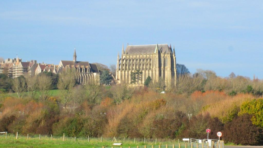
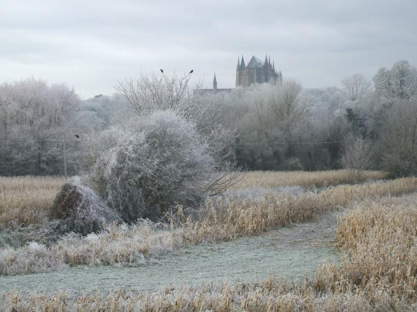
2 Note: The routes of many walks may vary due to ongoing river defence work. Level 1 (30 minutes 1 hour) gentler walks. A very pleasant walk along the seafront towards the inland lake and Nature Reserve of either 30 minutes for those requiring a shorter walk or up to 1 hour for the full walk. Returning to library for a cup of tea. Meet inside Shoreham Library, St Mary s Road, Shoreham-by-Sea, BN43 5ZA This walk occurs once every 3 weeks. Note: An optional extension further along Widewater would be a level 2 walk. Hill to Hill: Walk from Beeding Hill to Truleigh Hill with optional extension to Edburton Hill and back. Note: Optional extension would be a level 2 walk. Meet at Beeding Hill car, Mill Hill (where road turns right to Youth Hostel). Map ref TQ or to. Walk across the locks and along the seafront, or via Southwick Recreation ground to. Return to the library for a cup of tea. Meet inside Southwick Library,Southdown Road,S wick BN42 4FT Level 2 (approx 1.5 hours) to maintain fitness Lancing Leisure Centre to Lancing Ring. A short brisk walk up to the Ring. Meet at the far end of the car at Lancing Leisure Centre, Manor Road, Lancing BN15 0PH Bramber to South Downs Way Bridge. Circular walk from car in Bramber High Street alongside River Adur to South Downs Way bridge, returning via Downs Link path. Meet at the car of Adur Recreation Ground on the A259, BN43 5LT, at 10:00 to arrange car-sharing, OR at Bramber High St. car at 10:20. Buckingham Park to Mill Hill. Walk from the cafe in Buckingham Park to Mill Hill and return for refreshments in the cafe. Meet outside entrance to cafe in Buckingham Park, Upper Shoreham Road, Shoreham-by-Sea, BN43 6BA. Mill Hill to Old. Enjoy fantastic views of Shoreham Harbour and Shoreham Airport. There is at least 1 stile on this walk. Meet at Mill Hill Nature Reserve Car, Mill Hill, Shoreham. Map ref TQ Perch Cafe on seafront at Beach Green Lancing to or to Brooklands Park. A leisurely stroll along the seafront to enjoy the sea views and the nature reserve or to enjoy a stroll around the lake and a bracing walk back by the sea. Meet outside Perch cafe on the seafront at Beach Green, Lancing BN15 8RA. or to. Cross the bridge over the beautiful River Adur and return by the colourful houseboats or visit, a fascinating place which dates back to the Napoleonic Wars and has fine views across the harbour. Return to library for a cup of tea. Meet inside Shoreham Library, St Mary s Road, Shoreham-by-Sea, BN43 5ZA. St Nicolas Church to Lancing College. Cross the toll bridge and follow the river to Cuckoo Corner before heading to Lancing College via road and footpath. Return across A27 back to the bridge via the airport road. Meet at St Nicolas Church, St Nicolas Lane, Shoreham, BN43 5NR Community Centre to Southwick Green. Walk via Southwick Recreation Ground and the seafront. Meet at C. Centre,West Rd, Portslade BN41 1QH
3 Level 2 = health walks, approx. 1-1½ hours July Shoreham library to available 3 4 Car Bramber High St. to South Downs Way bridge 10.00) 5 Lancing Leisure Centre to Lancing Ring Bramber, Beeding & River Adur from car Bramber High St ) 9 Shoreham library to 10 Level am Joint walk with Ramblers: 5½ mls from Nepcote Green Findon BN14 0SL Rec. 09:30) Level 2 Park Mill Hill Nature Reserve to Old 14 Adur Rec. to Cuckoo Corner Steyning Circular walk from Fletchers Croft car (Meet at Adur Rec ) Holmbush shopping centre to Southwick Hill via New 23 available Hill to Hill Beeding Hill to Truleigh Hill 28 Foredown tower to Devil s Dyke 10.00) 29
4 Level 2 = health walks, approx.1-1½ hours August Adur Rec. to Mill Hill (Shorter option) Holmbush Shopping Centre to Mile Oak Farm 6 AGM 7.00pm Shoreham Community Centre am Level1 available Buckingham Park to Mill Hill 9 10 No Man s Land 16 Lancing Leisure Centre to Steep Down St. Nicolas Church to South Downs Way bridge Lychpole Hill from Sainsburys, Lyons Farm Retail Park 20 Shoreham Library to St. Nicolas Church to Lancing College 25 Lancing Ring car to Coombes Farm Bank Holiday (Meet outside library) Cissbury Ring 30 31
5 Level 2 = health walks, approx.1-1½ hours September Adur Rec. to Mill Hill Nature Reserve (Longer option) 3 available 10 Shoreham Library to Community Centre to Southwick Green and Southwick Recreation Ground 6 7 Steyning, Bramber & Beeding from Fletchers Croft car (Meet at Adur Rec. 10:00) 13 Hill to Hill Beeding Hill to Truleigh Hill 14 8 Car Bramber High St. to South Downs Way bridge Foredown Tower to Devil s Dyke (Meet at Adur Rec. 10:00) Steyning circular walk from Fletchers Croft car (Meet at Adur Rec. 10:00) 22 Truleigh Triangle from Beeding Hill available Beeding Hill, Windmill Hill & River Adur from Lay-by on A283 after cement works(meet at Adur Rec. 10:00) Bramber, Beeding & River Adur from car Bramber High St. 10:00)
6 Level 2 = health walks, approx.1-1½ hours October Lancing Leisure Centre to Lancing Ring 5 Mill Hill Nature Reserve to Old 6 No Man s Land Holmbush shopping centre to Southwick Hill via New Adur Rec. to Mill Hill (Shorter option) Cissbury Ring Lychpole Hill from Sainsburys, Lyons Farm Retail Park Adur Rec. to Cuckoo Corner Lancing Leisure Centre to Steep Down
7 Level 2 = health walks, approx.1-1½ hours October 2016 November St. Nicolas Church to South Downs Way Bridge 3 Coffee Methodist Church Hall, Brunswick Road, Shoreham 10:00 12:00 4 Adur Rec. to Mill Hill Nature Reserve (Longer option) Community Centre to Southwick Green and Southwick Recreation Ground Holmbush Shopping Centre to Mile Oak Farm St. Nicolas Church to Lancing College Beeding Hill, Windmill Hill & River Adur from lay-by on A283 after cement works (Meet at Adur Rec.10: Buckingham Park to Mill Hill Steyning, Bramber & Beeding from Fletchers Croft car (Meet at Adur Rec. 10:00) Truleigh Triangle from Beeding Hill
8 Level 2 = health walks, approx.1-1½ hours November December October New Years Eve 1 2 Car Bramber High St. to South Downs Way bridge (Meet at Adur Rec. 10:00) 3 4 Christmas Lunch 1.00pm Windsor Hotel Worthing 5 Bramber, Beeding & River Adur from car Bramber High St 10:00 ) Foredown tower to Devil s Dyke 10:00) Adur Rec. to Cuckoo Corner Holmbush shopping centre to Southwick Hill via New Erringham Farm Christmas Eve Steyning Circular walk from Fletchers Croft car (Meet at Adur Rec.10:00) 25 Christmas Day 26 Boxing Day Mill Hill Nature Reserve to Old 22 Hill to Hill Beeding Hill to Truleigh Hill No Man s Land
9 Level 2 = health walks, approx.1-1½ hours January New Years Day Adur Rec. to Mill Hill (Shorter option) Lychpole Hill from Sainsburys, Lyons Farm Retail Park Lancing Leisure Centre to Steep Down Holmbush Shopping Centre to Mile Oak Farm 19 Buckingham Park to Mill Hill Adur Rec.Mill Hill Nature Reserve (Longer option) Cissbury Ring St. Nicolas Church to South Downs Way Bridge x
10 Level 2 = health walks, approx.1-1½ hours February Steyning, Bramber & Beeding from Fletchers Croft car (Meet at Adur Rec.10:00) Aduur Rec.Mill Hill Nature Reserve 5 6 Steyning Circular walk from Fletchers Croft car (Meet at Adur Rec. 10:00) St. Nicolas Church to Lancing College (Longer option) 9 10 Bramber, Beeding & River Adur from car Bramber High St. 16 Foredown tower to Devil s Dyke 10:00) 10:00) Community Centre to Southwick Green and Southwick Recreation Ground am Level 3 Beeding Hill, Windmill Hill & River Adur from lay-by on A283 after cement works (Meet at Adur Rec.10:00) Mill Hill Nature Reserve to Old
11 Level 2 = health walks, approx -1½ hours March Lychpole Foredown Hill tower from to Sainsburys, Devil s Dyke Lyons Farm (Meet Retail at Adur Park Rec 10.00) Toll Bridge Car Hill to Hill Bramber High Beeding St. to Hill South to Downs Truleigh Way Hill bridge (Meet at Adur Rec 10.00) River Car Adur Bramber to Cuckoo High St. Corner to South (Meet Downs at Way Adur bridge Rec) 10:00) Mill Lychpole Hill Nature Hill from Reserve Sainsburys, to Old Lyons Retail Farm Park the Widewater Old Toll Lagoon Bridge Brooklands Holmbush shopping centre to Southwick Hill via New Widewater Lagoon No Cissbury Man s Ring Land Mill Beggars Hill Nature Bush to Reserve No Man s to Land Old Truleigh Lancing Triangle Leisure from Centre Beeding to Steep Hill Down am Shoreham Library Level 2 to Shoreham the Old Toll Library Bridge to Lancing Leisure Centre to Steep Down 31
12 Level 2 = health walks, approx -1½ hours April Adur Rec. to Mill Hill (Shorter option) 4 5 St.Nicolas Church to Lancing College 6 7 Lancing Ring car to Coombes Farm (Lambing Time) Holmbush Shopping Centre to Mile Oak Farm Easter Monday Availabe (Meet outside Library) Buckingham Park to Mill Hill Good Friday Cissbury Ring Easter Sunday Community Centre to Southwick Green and Southwick Recreation 27 Adur rec. to Mill Hill Nature Reserve ( Longer Option ) Ground 28.
13 Level 2 = health walks, approx -1½ hours May Steyning, Bramber & Beeding from Fletchers Croft car (Meet at Adur Rec 10:00) 2 3 Hill to Hill Beeding Hill to Truleigh Hill 4 5 Holmbush shopping centre to Southwick Hill via New 6 Bank Holiday (Meet outside library) Lancing Leisure Centre to Lancing Ring Steyning Circular walk from Fletchers Croft car (Meet at Adur Rec.10:00) 12 yning Circular walk from Fletchers Croft car (Meet at Adur Rec 10:00) Beeding Hill, Windmill Hill & River Adur from lay-by on A283 after cement works (Meet at Adur Rec. 10:00) Car Bramber High St. to South Downs Way bridge 10:00) Foredown tower to Devil s Dyke 10:00) 20 (Meet outside library) Park Lychpole Hill from Sainsburys, Lyons Farm Retail Park Bank Holiday (Meet outside library) Bramber, Beeding & River Adur from car Bramber High St. 10:00) Truleigh Triangle from Beeding Hill
14 Level 2 = health walks, approx -1½ hours June Buckingham Park to Mill Hill Holmbush Shopping Centre to Mile Oak Farm 7 8 Lancing Ring car to Coombes Farm No Man s Land ing Circular walk from Fletchers Croft car (Meet at Adur Rec 10:00) St.Nicolas Church to South Downs Way Bridge Adur Rec. to Mill Hill (Shorter option) Park Lancing Leisure Centre to Steep Down Mill Hill Nature Reserve to Old River Adur to Cuckoo Corner ) Cissbury Ring
15 Level 3 FRIENDS WALKS (2-3 hours) challenging walks beyond Walking for Health, with some steep hills and stiles. No Mans Land or Cissbury Ring. Excellent views of the sea and Adur Valley. Meet at Beggars Bush car, Titch Hill, Sompting. Map ref TQ Coombes Farm. A beautiful walk returning via Steep Down. Opportunity to visit 11th century church. Meet at Lancing Ring car, Mill Road, Lancing. Map ref TQ Foredown Tower to Devil s Dyke. A stunning walk over the Downs to Devil s Dyke for wonderful views towards the sea. Meet at the car of Adur Recreation Ground on the A259, BN43 5LT at 10:00 to arrange car-sharing OR at Foredown Tower, Foredown Road, Portslade BN41 2EW at 10:20. Lychpole Hill. An exhilarating walk in the countryside around Lychpole Farm returning via lower slopes of Cissbury Ring and Lychpole Hill. Meet at entrance to Sainsbury s Lyons Farm, Lyons Way, Worthing BN14 9LA St. Nicolas Church to South Downs Way Bridge. Walk along the River Adur to the South Downs Way bridge. Meet at St Nicolas Church, St Nicolas Lane, Shoreham, BN43 5NR River Adur. Three options 1. A beautiful walk along the West side of the river to Cuckoo Corner 2. A walk to, across to the Downs Link path then over the A283 to the fields of Mill Hill with great views 3. An extension of the Mill Hill walk (no. 2) to include the Nature Reserve. Meet at the car of Adur Recreation Ground on A259, BN43 5LT Southwick Hill. Two options 1. Great family walk to Mile Oak Farm to see donkeys, goats and peacocks. Enjoy refreshments and other produce from the farm shop 2. Walk to New returning via Southwick Hill. Meet at bus stop at Holmbush Shopping Centre. Please in lower car near petrol station. Steep Down. Walk past Lancing Ring to top of Steep Down. Meet at the far end of the car at Lancing Leisure Centre, Manor Road, Lancing BN15 0PH Steyning, Bramber and Beeding. Four options 1. Steyning Circular walk from Fletchers Croft car, Steyning, BN44 3XZ 2. Steyning, Bramber & Beeding walk from Fletchers Croft car,steyning, BN44 3XZ 3. Beeding Hill, Windmill Hill and upper reaches of River Adur from lay-by on A283 on left after cement works travelling Northwards from Shoreham. 4. Bramber, Beeding and River Adur starting from car in Bramber High Street Meet at the car of Adur Recreation Ground on the A259, BN43 5LT at 10:00 to arrange car-sharing OR at start point at 10:20. Truleigh Triangle from Beeding Hill. Following the escape route of King Charles II known as Monarchs Way and return via Truleigh Hill and the Youth Hostel. Meet at Beeding Hill car, Mill Hill (where road turns right to Youth Hostel). Map ref TQ208097
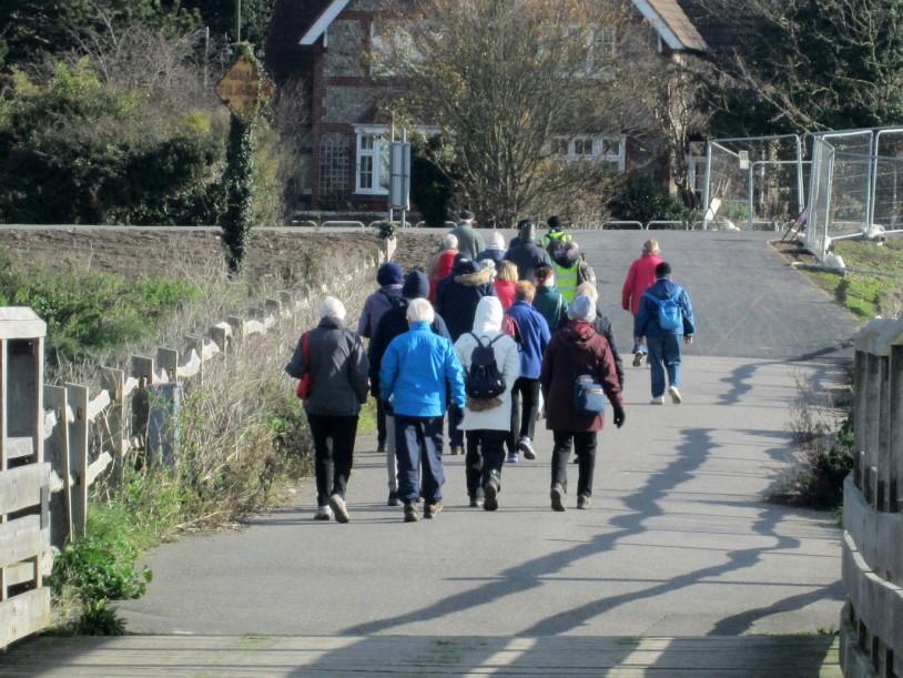
16 Get Fit, Look Fit, Be Fit We have a number of great walks available so why not get out and join us. Our walks are separated into Level 1 and 2 Health Walks, which are 30 minutes, 60 minutes or 90 minutes duration and Level 3 Friends walks which are more strenuous and include some steep hills and stiles and are over 2 hours duration. You will be asked to complete a brief Walker Registration form before walking with us for the first time. Please arrive ten minutes before start time to register. The walks are FREE and led by keen volunteers who very much believe in improving health through activity. They are led at a pace to suit the group but please choose a level that is appropriate to your current state of health. Under 18 s are welcome on the walks but must be accompanied by an adult. Walking is an excellent natural exercise that can help you to stay healthy, live longer, control your weight and keep you happy It is a great way of discovering your local area with friends and family Walking can easily be introduced into your lifestyle It can improve your mood, increase energy levels, keep your heart strong and reduce blood pressure It is a great way to fight stress and improve mental health For your own comfort and safety, please make sure that you are appropriately dressed for the weather and terrain. Some of the routes will become slippery and muddy after prolonged periods of rain or snow. In particular, wear strong, comfortable footwear and have a wind/ rainproof jacket if necessary. Walking poles can be helpful for some of the more strenuous walks as they will provide some support and relieve pressure on your knees. Please bring a bottle of water on the longer walks. If you are interested in training to become a leader please speak to one of our leaders and they will pass your details to the organiser of the next training day. If you are unable to get to the start points of some of the walks please call at least 24 hours prior to the walk and we will try and arrange a lift for you. Programme details are available online at or hard copies are available from walk leaders or in local libraries, health centres and community centres.
July 2017 to June 2018
 July 2017 June 2018 FREE walks led by trained volunteers www.adur-worthing.gov.uk/sport-and-leisure/ play-a-sport/walking Level 1 (30 minutes 1 hour) gentler walks. A very pleasant walk along the seafront
A27 Worthing and Lancing: facilities for walking, cycling, and horse riding [nonmotorised
 A27 Worthing and Lancing: facilities for walking, cycling, and horse riding [nonmotorised users (NMUs)] Introduction This note describes our understanding of the needs of Non-Motorised Users (NMUs) as
2-3 miles - up to 90 minutes walks
 SHIREHAMPTON COMMUNITY ACTION FORUM Walkie-Talkies Issue 17 Free Walks Programme From January 2017, due to changes in the way that LinkAge operates, there will no longer be a Health Walks Coordinator in
Healthwalks Autumn/Winter 10/11
 Healthwalks Autumn/Winter 10/11 Free, Accessible, Fun! Scheme Co-ordinator Corinna Edwards-Colledge corinna.edwards-colledge@brighton-hove.gov.uk Volunteer Co-ordinator Darren Currell healthwalks@brighton-hove.gov.uk
Programme of walks Walks are free, no need to book. Everybody is welcome!
 Programme of walks Walks are free, no need to book. Everybody is welcome! www.broxtowe.gov.uk/walking April Autumn/ 2012- March Winter 2013 2010/11 Walk & Talk offers regular short walks in Broxtowe Borough.
Derbyshire Dales Walking for Health Guide January to March Improve Your Health Explore The Dales Enjoy The Company Get Active
 Improve Your Health Explore The Dales Enjoy The Company Get Active Derbyshire Dales Walking for Health Guide January to March 2018 A programme of led walks across the Derbyshire Dales, supporting local
Walks in the Uttlesford District
 in Uttlesford Walks in the Uttlesford District www.livewellcampaign.co.uk 1 Welcome! This guide aims to provide information on the local walks which take place in the Uttlesford District. These range from
Bedminster and Southville
 Issue 51 Bedminster and Southville Free Walks Programme - Sept to Nov 2016 & Photo taken by Ruth Mor- Between 30-60 minute walks Between 2-3 miles - up to 90 minute walks The Walks are led by qualified
WALK WELL IN TAUNTON AND WELLINGTON WINTER 2018/2019
 WALK WELL IN TAUNTON AND WELLINGTON WINTER 2018/2019 walkwellwithtone.btck.co.uk Walk Well Taunton Deane WHAT IS A HEALTH WALK? It s a brisk walk done on a regular basis for well-being. It can help you
Walk 7: Watchet to washford
 Walk 7: Watchet to washford Length: Moderate - 7.5 miles / 12 km Good For: Theme: History Duration: 2-3 hours depending on speed of walking Notes: This is a moderate to difficult walk in places, with steps,
Walk Well in Taunton and Wellington
 Welcome to Walk Well in Taunton and Wellington Spring 06 http://www.walkwellwithtone.btck.co.uk Walk Well with Tone Taunton Deane What is a Health Walk? It s a brisk walk done on a regular basis for well-being.
Walk Description. Directions
 Title: Saffron Trail: Battlesbridge to Chelmsford Distance: 14¾ miles Time taken: 6 hours Start Point: Outside the Barge Inn, Battlesbridge OS Explorer Map: 175 & 183 Grid Ref.: TQ 780 947 Transport: Rail:-
Explore Hillingdon: Walking and cycling activities for all
 Explore Hillingdon: Walking and cycling activities for all Includes Walk Hillingdon timetable for Oct to Dec 2012 www.hillingdon.gov.uk/change4life Pledge for your chance to win! As part of change 4life
Slindon Folly - South Downs, West Sussex
 Slindon Folly - South Downs, West Sussex Starts at Park road-side near entrance to Slindon College 2 hours 15 minutes 4.5miles 7.2km Easy ID: 0.1598 Developed by: Chris Mumford Checked by: Rockpit www.ramblersroutes.org
Derbyshire Dales Walking for Health Guide April to June Improve Your Health Explore The Dales Enjoy The Company Get Active
 Improve Your Health Explore The Dales Enjoy The Company Get Active Derbyshire Dales Walking for Health Guide April to June 2018 A programme of led walks across the Derbyshire Dales, supporting local communities
Guided Walks in and around Charnwood 2016 July - December
 Guided Walks in and around Charnwood 06 July - December Fusion Lifestyle and Charnwood Borough Council s walks have been nationally accredited with the Walking for Health scheme, underlining the fact that
Other useful information Nearest Refreshments: In the Victoria Inn or the Lugger Inn, in Chickerell OS Explorer Map: OL15 (Purbeck and South Dorset)
") they find the diamond, and then to Holland, where they try to sell it, finding themselves in worse trouble than ever as a result. It is ten years before John returns to Moonfleet, fortuitously being shipwrecked
they find the diamond, and then to Holland, where they try to sell it, finding themselves in worse trouble than ever as a result. It is ten years before John returns to Moonfleet, fortuitously being shipwrecked
Short and healthy walks AROUND BEDALE. with Hambleton Strollers. North Yorkshire County Council
 Short and healthy walks AROUND BEDALE with Hambleton Strollers North Yorkshire County Council Bedale Strollers Why walk? Being active is good for our physical and mental health. Just 30 minutes of moderate
I #. Short and healthy walks. AROUND Bedale. With Hambleton Strollers
 I #. Short and healthy walks AROUND Bedale With Hambleton Strollers Why walk? Being active is good for our physical and mental health. Just 30 minutes of moderate activity, such as brisk walking, 5 times
Explore Hillingdon. Led walks and cycle rides. April to June
 Explore Hillingdon Led walks and cycle rides April to June 2016 www.hillingdon.gov.uk/change4life change4life Hillingdon change4life Hillingdon is all about encouraging you to become healthier and happier.
DISCOVERING SUSSEX AUTUMN & WINTER 2017 / 18
 DISCOVERING SUSSEX AUTUMN & WINTER 2017 / 18 hard copy 2 WELCOME These walks are fully guided by experienced leaders who have a great love and knowledge of the Sussex countryside. They are freely open
9.5 km Circular 3 hours
 RANMORE CIRCULAR A 6 mile (9.5km) circular walk from Boxhill and Westhumble Station in the village of Westhumble, passing through part of the Polesden Lacey Estate, Ranmore Common and Denbies Vineyard.
Explore Hillingdon: Walking and cycling activities for all
 Explore Hillingdon: Walking and cycling activities for all Includes Walk Hillingdon timetable for Jan to March 2013 www.hillingdon.gov.uk/change4life What is change4life Hillingdon? Change4life Hillingdon
9.5 km Circular 3 hours
 MEDIEVAL WAVERLEY Challenging Terrain A 6 mile (9.5km) undulating circular walk from Tilford village passing close to The Sands village and the historic ruins of Waverley Abbey. From the top of Crooksbury
Although the majority of these walks are around country lanes you should still follow the Country Code:-
 With the update of the Parish Plan was a request for details of any Walks around Pillaton The following pages give several walks that I and my wife have done for many years. Please be aware that NONE OF
Margam Country Park. Saturday 10 September, 10am 5pm Margam Country Park, Neath Port Talbot SA13 2TJ. Enjoy a great day out!
 Margam ountry Park Saturday 10 September, 10am 5pm Margam ountry Park, S13 2TJ Enjoy a great day out! #boutg www.ramblers.org.uk/walkabout From 10am 5pm, there s plenty on offer for everyone Throughout
WALK WELL IN TAUNTON AND WELLINGTON WINTER 2017/18
 WALK WELL IN TAUNTON AND WELLINGTON WINTER 2017/18 www.walkwellwithtone.btck.co.uk Walk Well Taunton Deane WHAT IS A HEALTH WALK? It s a brisk walk done on a regular basis for well-being. It can help you
every step counts South Somerset District Council Health Walks Directory Winter 2015 Includes details of Buggy Walks
 Broadway Crewkerne Stoke sub Hamdon Yeovil,Langport and Mudford! Wincanton Somerton Ilminster South Somerset District Council Health Walks Directory Winter 2015 every step counts Includes details of Buggy
Weatherman Walking. Approximate distance: 5.5 miles For this walk we ve included OS grid references should you wish to use them. Start.
 Approximate distance: 5.5 miles For this walk we ve included OS grid references should you wish to use them. 4 1 Start End 3 2 N W E S Reproduced by permission of Ordnance Survey on behalf of HMSO. Crown
Walk 3 - Woodbridge and Melton A Walk Round Waldringfield by Sue and Jim Stacey. Woodbridge. shopping centre, cafes, toilets etc. tide mill.
 Walk 3 - Woodbridge and Melton A Walk Round Waldringfield by Sue and Jim Stacey. road with roundabout church railway with station walk route showing description direction track, wide path, bridlepath footpath
Stroll n Chat. Walking for over 55s. Free Walks Programme Oct - Dec 2018
 Issue 59 Stroll n Chat Walking for over 55s Free Walks Programme Oct - Dec 2018 Photo taken by Ruth Mor- Up to 30 minute walks Between 30-60 minute walks Between 2-3 miles - up to 90 minute walks The Walks
Walk with Me. Bury Health Walks
 Walk with Me Bury Health Walks Winter Walks Programme December 2017 February 2018 Tuesday... Greenmount Medical Centre Community Health Walk When: Every Tuesday Time: 10:30am Duration: Approx. 45 Minutes
Dyrham and Hinton Parish Walks
 Dyrham and Hinton Parish Walks A series of five walks in the parish, exploring most of the public footpaths. By John Miller Each walk is described in detail, with a complete map, to provide a handy guide
ST. AGNES. you cannot put a time limit on beauty.
 ST. AGNES CIRCULAR WALKS AROUND There are many enjoyable and picturesque walks around St. Agnes most are signposted and are featured on the St. Agnes Mini-guide map. Because most of our footpaths are in
Derbyshire Dales Walking for Health Guide January March Improve Your Health Explore The Dales Enjoy The Company Get Active
 Improve Your Health Explore The Dales Enjoy The Company Get Active Derbyshire Dales Walking for Health Guide January March 2017 1 A programme of led walks across the Derbyshire Dales, supporting local
Hexham Abbey to the Racecourse Road
 Hexham Abbey to the Racecourse Road The Yarridge Road, or Racecourse Road as it is often known, runs along the ridge line to the south of Hexham and provides wonderful views of the river valley and fells
Nationally accredited by Ramblers Walking for Health
 Nationally accredited by Ramblers Walking for Health 1 Fareham Walking 4 Health is a nationally accredited health walk scheme. Our walks are led by trained volunteer Walk Leaders. This booklet includes
Walk. with Me. Bury Health Walks Summer Walks Programme June 2017 August 2017
 Walk How you can get involved Walk with Me is a series of local walks, led by trained walk leaders in association with Bury Sport & Physical Activity Service and the National Walking for Health Scheme.
Shirehampton Walkie-Talkies
 Issue 14 Shirehampton Walkie-Talkies Free Walks Programme Photo taken by Ruth Morris 2-3 miles - up to 90 minutes walks The Walks are led by qualified volunteer walk leaders, who have undergone the National
Walk Description. Directions
 Title: East Hanningfield Distance: 8 miles / 9 miles Time taken: 3-3½ hours Location: 5 miles south east of Chelmsford Parking: Free car park off The Tye, East Hanningfield, next to the primary school
10 Miles Circular 5 hours
 VISIT RYEDALE PICKERING AND CAWTHORN CAMPS 10 Miles Circular 5 hours Moderate Terrain 120616 A 10 mile (16km) there and back walk from the market town of Pickering in Ryedale. The route heads north through
Positive Steps Walks for All Ages throughout Southern Staffordshire. May-June 2018
 Positive Steps s for ll ges throughout Southern Staffordshire May-June 2018 ll our walks are free of charge bout ge UK South Staffordshire s ge UK South Staffordshire offers a programme of group walks,
Positive Steps Walks for All Ages throughout Southern Staffordshire. Jan Feb 2019
 Positive Steps Walks for ll ges throughout Southern Staffordshire Jan Feb 2019 ll our walks are free of charge bout ge UK Staffordshire Walks ge UK Staffordshire offers a programme of group walks, encouraging
Walk with Me. Bury Health Walks
 Walk with Me Bury Health Walks Summer Walks Programme June 2018 August 2018 Monday Summerseat District Community Health Walk When: Every Monday Time: 11:00 am Duration: Approx. 60 Minutes Meeting Point:
Guided Walks in and around Charnwood 2016 January - June
 Guided Walks in and around Charnwood 2016 January - June Fusion Lifestyle and Charnwood Borough Council s walks have been nationally accredited with the Walking for Health scheme, underlining the fact
London South District Heat for the National GHS championships. Brighton Excelsior Men's and Women's 10 mile event
 London South District Heat for the National GHS championships and Brighton Excelsior Men's and Women's 10 mile event Saturday 16th July 2016 starting at 06:30am Course G10/97 Promoted for and on behalf
Chapel Point to Anderby Creek
 Coastal Country Park Walks Chapel Point to Anderby Creek A CIRCULAR WALK OF 8.5 OR 6 KM (5.3 OR 3.75 MILES) INTRODUCTION The Lincolnshire Coastal Country Park lies between Sandilands, Chapel St Leonards
Lincolnshire Limewoods Walks. Woodhall Spa. A circular walk of 13km (8 miles)
") Lincolnshire Limewoods Walks Woodhall Spa A circular walk of 13km (8 miles) Introduction The Lincolnshire Limewoods is an area between Wragby, Bardney and Woodhall Spa. It is a fantastic place to explore
Lincolnshire Limewoods Walks Woodhall Spa A circular walk of 13km (8 miles) Introduction The Lincolnshire Limewoods is an area between Wragby, Bardney and Woodhall Spa. It is a fantastic place to explore
Chichester Harbour. A Walker s Guide
 A Walker s Guide - Chichester Harbour Chichester Harbour A Walker s Guide Chichester Harbour is an Area of Outstanding Natural Beauty on the south coast of Britain. Virtually flat with far reaching sea
Saltash, Cornwall - Railways, Rivers & Castles
 Saltash, Cornwall - Railways, Rivers & Castles Starts at St Stephen's Church, Saltash, Cornwall 2 hours 45 minutes 5.5miles 8.9km Easy ID: 0.2532 Developed by: Peter Clements Checked by: Kevin Connor www.ramblersroutes.org
East Devon Way Circulars
 East Devon Way s A new series of circular walks developed by the East Devon Ramblers to help you explore the wildlife, heritage and places of interest just off the East Devon Way. h. i. l. g. k. b. c.
Walking Pembrokeshire.
 Walking Pembrokeshire Canaston Woods Walk It s good to walk, so why not step out and sample some of the walks your neighbourhood has to offer. This pleasant and interesting walk which starts and finishes
6.5 km Circular 2 hours
 REIGATE MILLS AND PILLBOXES A 4 mile (6.5km) enjoyable circular walk from Reigate Heath, passing Reigate Heath windmill, Wonham Mill and pillboxes built during the Second World War. 6.5 km Circular 2 hours
Hertfordshire Health Walks
 Hertfordshire Health Walks Dacorum September - December 2016 Welcome to the Dacorum Health Walks programme, part of a countywide programme of free, led walks, helping everyone get outdoors, get more active
Explore Hillingdon. Led walks and cycle rides. October to December
 Explore Hillingdon Led walks and cycle rides October to December 2015 www.hillingdon.gov.uk/change4life change4life Hillingdon change4life Hillingdon is all about encouraging you to become healthier and
Walk 2 Village Hall - The Shippy - Woodhouse Farm - Village Hall
 Walk 2 Village Hall - The Shippy - Woodhouse Farm - Village Hall The walk is approximately 4km (2.5 miles) across fairly flat countryside with about a quarter on country lanes. It should take about 1 hour
Shirehampton Nomads Level 4 Walking Group
 Issue 8 Shirehampton Nomads Level 4 Walking Group Free Walks Programme Aug - Oct 2014 Shirehampton Nomads Walking Group Autumn walks programme in association with LinkAge and Walking for Health Bristol.
Christchurch to Hengistbury Head
 Last checked 6 June 2018 Document last updated: 13 July 2018 This document and information herein are copyrighted to Saturday Walkers Club. If you are interested in printing or displaying any of this material,
Cycle Tendring. Great Bicycle rides around the Harwich, Manningtree and Mistley area
 Great Bicycle rides around the Harwich, Manningtree and Mistley area Why not discover and explore the beauty of the Tendring Peninsula by bike? There s nothing like following the beautiful coastline or
Approximate distance: 5.5 miles For this walk we ve included OS grid references should you wish to use them. Start. End
 Approximate distance: 5.5 miles For this walk we ve included OS grid references should you wish to use them. End 4 1 Start 3 2 N W E S Reproduced by permission of Ordnance Survey on behalf of HMSO. Crown
For more information and to buy this book click here ISBN: CICERONE. Guides for walkers, trekkers, mountaineers, climbers and cyclists
 For more information and to buy this book click here ISBN: 9781852845377 CICERONE Guides for walkers, trekkers, mountaineers, climbers and cyclists www.cicerone.co.uk WALK 5 Ouston and Urpeth Distance
Walk 2: doniford to east quantoxhead
 Walk 2: doniford to east quantoxhead Length: 9 ¼ miles / 15km Good For: Difficulty: Moderate Theme: Nature Notes: This walk is tidal - please check tide times before setting off. Dogs are welcome but need
WALK YOUR WAY TO GREAT SHAPE
 WALK YOUR WAY TO GREAT SHAPE The fun easy way to BURN Fat You only have to step out of your house and go for a walk to the corner shop and you are exercising. Of course depending on the distance that may
Walk 2: Beamsley Beacon and Bolton Abbey
 Walk 2: Beamsley Beacon and Bolton Abbey Start and Finish: The Memorial Hall, Main Street, Addingham, LS29 0LZ, SE 079 497 The shortest walk is about 5½ miles (8.8km) The medium Walk is about 8¼ miles
A Newsletter and Programme
 ober - December A Newsletter and Programme in Middlesbrough and of Health Walks Redcar & Cleveland Hello everyone! On rd ober I will have been the co-ordinator of Healthy Stepping for years - how time
Welsh Newton and Woodland
 Welsh Newton and Woodland This is a 8.2km miles (approx) walk which will take about 2.5 hours at a relaxed and leisurely pace. There are a few hills but no steep inclines. Start at Llangrove bus stop and
10 km Circular 3 hours
 FRIMLEY AND FRIMLEY GREEN 10 km Circular 3 hours Easy Terrain 250716 A 10km (6 mile) circular walk exploring the canal towpath, riverside path, woodland, heath and small settlements around Frimley in Surrey.
Coast Survey Stretch 03 Seaview High Street to Sandown Zoo
 Coast Survey Stretch 03 Seaview High Street to Sandown Zoo Overview map of the stretch Introduction The route starts at the attractive village of Seaview, through the wooded Priory Bay, passing the remains
AMAZING WALKS RIGHT ON YOUR DOORSTEP AT WALLOPS WOOD COTTAGES!
 Wallops Wood Cottages Sheardley Lane, Droxford, Hampshire, SO32 3QY emma@wallopswoodcottages.co.uk T: 01489 878888 Sign-up to our NEWSLETTER for special offers and news. You can also follow us on social
Redesdale Arms. A Trio of Walks
 Redesdale Arms A Trio of Walks Welcome to The Redesdale Arms Hotel The award winning 34 bedroom Redesdale Arms Hotel sits at the gateway to the Cotswolds in the High Street of the historic town of Moreton-in-Marsh.
Walks in Chellow Dene
 City of Bradford Metropolitan District Council Leisure Services a breath of fresh air Walks in Chellow Dene In association with the Fairweather Green and Daisy Hill Action groups Chellow Dene Chellow Dene
Walk with Me. Bury Health Walks
 Walk with Me Bury Health Walks Autumn Walks Programme September 2018 November 2018 Monday Summerseat District Community Health Walk When: Every Monday Time: 11:00 am Duration: Approx. 60 Minutes Meeting
Maps The maps provided are a guide and are not to scale. Please use OS Explorer Map 120 (Chichester).
.") A Walker s Guide - Chichester Harbour Useful Information Directions All the walks were tested in 2013. Please note, however, that some footpaths may be diverted and buildings such as pubs may have changed
A Walker s Guide - Chichester Harbour Useful Information Directions All the walks were tested in 2013. Please note, however, that some footpaths may be diverted and buildings such as pubs may have changed
Walk, Jog, Cycle in Enfield
 Walk, Jog, Cycle in Enfield Everybody Active in Enfield October - December 2011 Everybody Active in Enfield www.enfield.gov.uk in partnership with @EverybodyActive One-to-one and Age UK ongoing health
Thornton le Dale Walks
 Thornton le Dale Walks A collection of walks in and around the village Thornton le Dale Traders Forum www.visitthorntonledale.co.uk Thornton le Dale Walks Walk 1: Beck Isle Cottage and All Saints Church
Wentworth Falls Conservation Hut Loop
 Wentworth Falls Conservation Hut Loop 3 hrs Hard track 6.7 km Circuit 4 341m This scenic walk from Wentworth Falls Station, winds along the Nature Trail to Conservation Hut, then drops into the magnificent
Case study 64. Shoreham Harbour Shingle Bypassing and Recycling
 Case study 64. Shoreham Harbour Shingle Bypassing and Recycling Authors: Tony Parker, Uwe Dornbusch Main driver: Improved defences Project stage: Ongoing construction/operation since 1992 Photo 1: Shoreham
There are toilets at Manningtree Station, Flatford (close to the hump back bridge) and in Dedham.
 and in Dedham.") Arriving by Train Main Features of the Walk Outline Route Employs particularly attractive paths, many of which offer impressive views across Dedham Vale. Includes a section along the tidal section of the
Arriving by Train Main Features of the Walk Outline Route Employs particularly attractive paths, many of which offer impressive views across Dedham Vale. Includes a section along the tidal section of the
Both walks take you through stunning landscape and you are surrounded by the incredibly diverse flora and fauna of Lamington National Park.
 v Join the Stinson Walk Recount Australian history and celebrate the life of Bernard O Reilly, who heroically saved the lives of two plane crash survivors over 80 years ago in World Heritage-listed Lamington
Clyde Walkway Community Links: Nemphlar Moor Road to Braidwood
 Clyde Walkway Community Links: Nemphlar Moor Road to Braidwood Nemphlar Moor Road to Braidwood Digital Trail Difficulty (out of 3) 2 Distance Main route to Braidwood (shortest) 2.5km, 5km return. Detours
WALKING GROUP 9 th JANUARY 2013
 WALKING GROUP 9 th JANUARY 2013 For our first walk of 2013 we were fortunate to have a dry, sunny day. Val hand Fred had planned a walk around Stratford on hard footpaths as the fields were still very
Countryside Walks. 1) Highclere Park Public Walk.
 Highclere Park Public Walk.") 1) Highclere Park Public Walk. Access: From Highclere Estate Main Entrance at Whitway, please note there is no parking on site or access for vehicles. Open: Throughout the year. Description: This footpath
1) Highclere Park Public Walk. Access: From Highclere Estate Main Entrance at Whitway, please note there is no parking on site or access for vehicles. Open: Throughout the year. Description: This footpath
The North Pennines from near Langwathby
 3.6 Langwathby to Armathwaite Map panel?? Distance 12.7 miles (20.5 km) Terrain farm, woodland and riverside paths; some potentially muddy tracks; a few short sections of road Grade gently undulating Food
Oldbury & Littleton, South Gloucestershire
 Oldbury & Littleton, South Gloucestershire Starts at Church Lane, Oldbury. BS35 1QF 2 hours 0 minutes 5.2miles 8.4km Easy ID: 0.2468 Developed by: GEOFF MULLETT Checked by: Marion Stone www.ramblersroutes.org
Case Study 14. Getting new mothers active: a tale of two buggy walking groups. The Mentro Allan
 Getting new mothers active: a tale of two buggy walking groups. The Mentro Allan programme Project background The following case study draws on the experience of an action research programme called Mentro
Directions for Day 1: Colwood To Metchosin
 Colwood-Metchosin Page 1 of 8 Directions for Day 1: Colwood To Metchosin Start: Royal Roads University, Birds of a Feather B&B, or at Esquimalt Lagoon Finish: Your accommodation in Metchosin Time: 4-5
Sandilands to Huttoft Bank
 Coastal Country Park Walks Sandilands to Huttoft Bank A CIRCULAR WALK OF 11KM (7 MILES) INTRODUCTION The Lincolnshire Coastal Country Park lies between Sandilands, Chapel St Leonards and Huttoft on the
May August. Walk in. Dacorum. Health Walks. Hertfordshire. Working with Hertfordshire County Council
 Walk in Hertfordshire May August 2014 Dacorum Health Walks Working with Hertfordshire County Council Welcome to the Dacorum Health Walks programme, part of a countywide programme of free, led walks, helping
The Bala Challenge Charity Walks - Information
 Saturday, 9 th May 2015 Bala & Penllyn Rotary Club The Bala Challenge Charity Walks - Information Join The Bala & Penllyn Rotary Club on Saturday, 9 th May 2015 on a scenic or challenge walk. You may raise
Cycle Tendring. Great Bicycle rides around the Brightlingsea and Manningtree area
 2 Cycle Tendring Bicycle rides around the Brightlingsea and Manningtree area Cycle Tendring Why not discover and explore the beauty of the Tendring Peninsula by bike? There s nothing like following the
Stepping Out in Suffolk. January to March Waveney. Health. Helping local people live healthier lives
 Stepping Out in Suffolk Waveney Walks January to March 2018 Health Helping local people live healthier lives Be Clear About Your Risk! Check your risk of Type 2 diabetes at: www.onelifesuffolk.co.uk/diabetes
Healthy Footsteps for 50 Plus
 Grade 1 = Flat ground / gentle slopes with mainly firm surfaces. Limited / no steps or stiles. 1 hr (shorter walks of 30 minutes incorporated). Grade 2 = Moderate slopes, steps, uneven surfaces and possible
Green Man Ultra Route Directions 2018
 Green Man Ultra Route Directions 2018 Start-CP1 (9 miles) Community Forest Path (CFP) Frome Valley Way (FVW) From the starting line cross the playing fields diagonally to the metal gates in the hedge lined
Ambergate & Betty Kenny's Tree.
 Walk Information Walk Area: Ambergate OS Map: Explorer OL24 Distance: 4 Miles White Peak Area Start Point: Holly Lane, Ambergate 1:25000 Map Ref: SK 346 254 Post Code N/A General Information Altitude Data
Site Working Information Card: River Chess, Chesham Lawn Tennis and Squash club, Pednormead End, Chesham, Bucks HP5 2JU Grid Ref: SP
 Site Working Information Card: River Chess, Chesham Lawn Tennis and Squash club, Pednormead End, Chesham, Bucks HP5 2JU Grid Ref: SP 955 013 Chesham Lawn Tennis and Squash Club Pednormead End Chesham,
Thornton le Dale Walks
 Thornton le Dale Walks A collection of circular walks in, and around, the village www.visitthorntonledale.co.uk Thornton-le-Dale Traders Forum and Thornton le Dale Parish Council 1 Thornton le Dale Circular
This walk description is from happyhiker.co.uk
 This walk description is from happyhiker.co.uk Pendle Hill Walk From Barley Starting point and OS Grid reference Ordnance Survey map Distance Traffic light rating Barley village honesty box car park OS
Sports Travel Experience Designed Especially for Maryland Youth Soccer Association. Soccer in London. April 14 - April 22, 2019 ITINERARY OVERVIEW
 Sports Travel Experience Designed Especially for Maryland Youth Soccer Association Soccer in London April 14 - April 22, 2019 ITINERARY OVERVIEW DAY 1 DEPARTURE FROM WASHINGTON, D.C. DAY 2 ARRIVE LONDON
TEST 1. PAPER 1 Reading and Writing (1 hour 30 minutes) Reading PART 1
 Reading PART 1") TEST 1 PAPER 1 Reading and Writing (1 hour 30 minutes) Reading PART 1 TIP Read the notices and messages first. Don t look at the A/B/C choices until you understand the texts. Look at each notice or message
TEST 1 PAPER 1 Reading and Writing (1 hour 30 minutes) Reading PART 1 TIP Read the notices and messages first. Don t look at the A/B/C choices until you understand the texts. Look at each notice or message
A circular walk of or km (2 1 4 or miles)
") Grantham A circular walk of 3 3 4 or 5 3 4 km (2 1 4 or 3 1 2 miles) Introduction This relatively short circular walk, which starts in the middle of Grantham, offers plenty of variety. The route takes
Grantham A circular walk of 3 3 4 or 5 3 4 km (2 1 4 or 3 1 2 miles) Introduction This relatively short circular walk, which starts in the middle of Grantham, offers plenty of variety. The route takes