Joshua Saak, P.E., PTOE Traffic Design Engineer Ada County Highway District May 23, 2013
|
|
|
- Georgina Pierce
- 6 years ago
- Views:
Transcription

1 Joshua Saak, P.E., PTOE Traffic Design Engineer Ada County Highway District May 23, 2013 Creating Great Streets Through Road Diets and Conversions The Charlotte Experience


2 Topics to Discuss Charlotte s movement to Complete Streets Charlotte Road Diet - Case Studies

3 27 road diets - completed 20 more being studied 1 1 East Boulevard - Complex 2 2 Selwyn Ave. - Simple


4 East Boulevard Complex! Phase II ,800 Phase III ,300 Phase I ,100 Office Retail centers Multi-family Major Hospital Park/greenway Bus Route

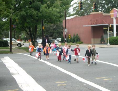
5 More comfortable for all roadway users bikes, pedestrians, transit users and motorists Enhance pedestrian activity on sidewalks Facilitate neighborhood connectivity Sidewalk cafés/outdoor seating What did the Residents Want?
6 How did we advance the project? Not able to accomplish the neighborhood s vision without changing the corridor Conducted detailed traffic simulation (Synchro) Worked with residents/businesses through PIMs Created advocates for the project

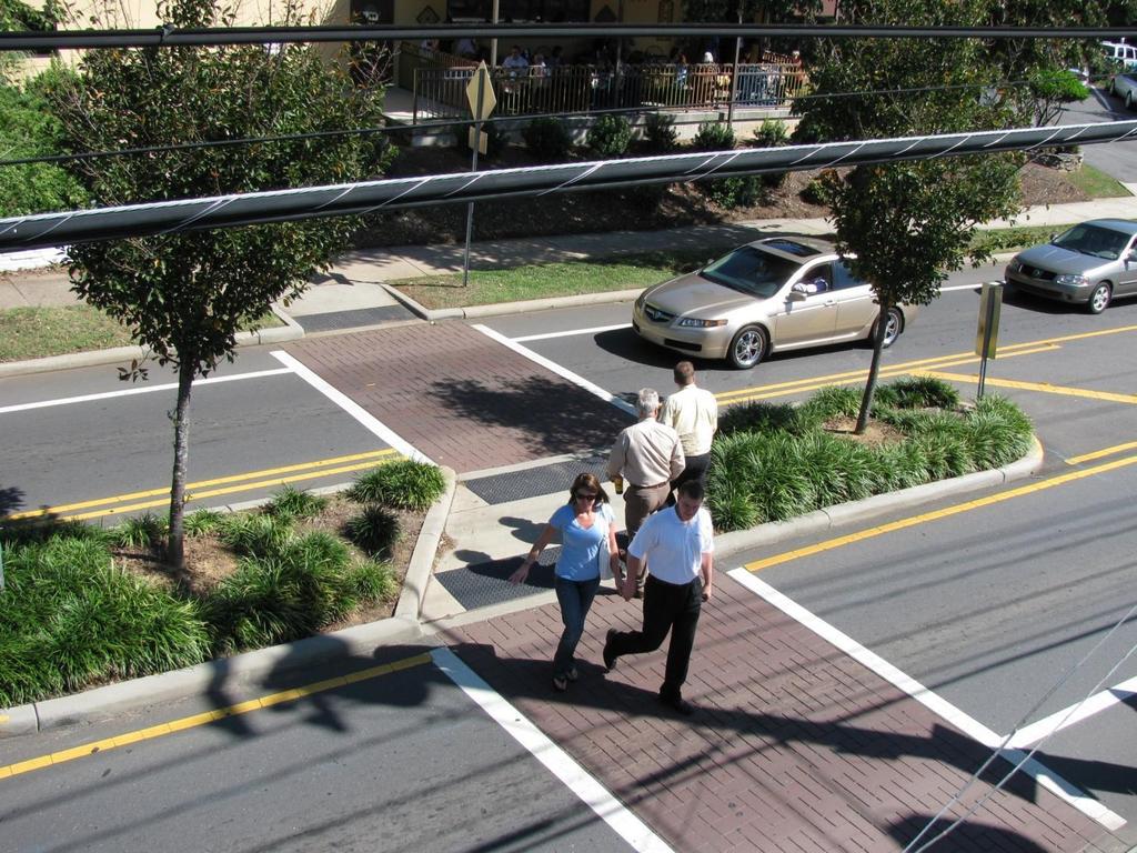
7 40 feet wide Phase 1 - Before


8 Phase 1 After Before Concept Benefits

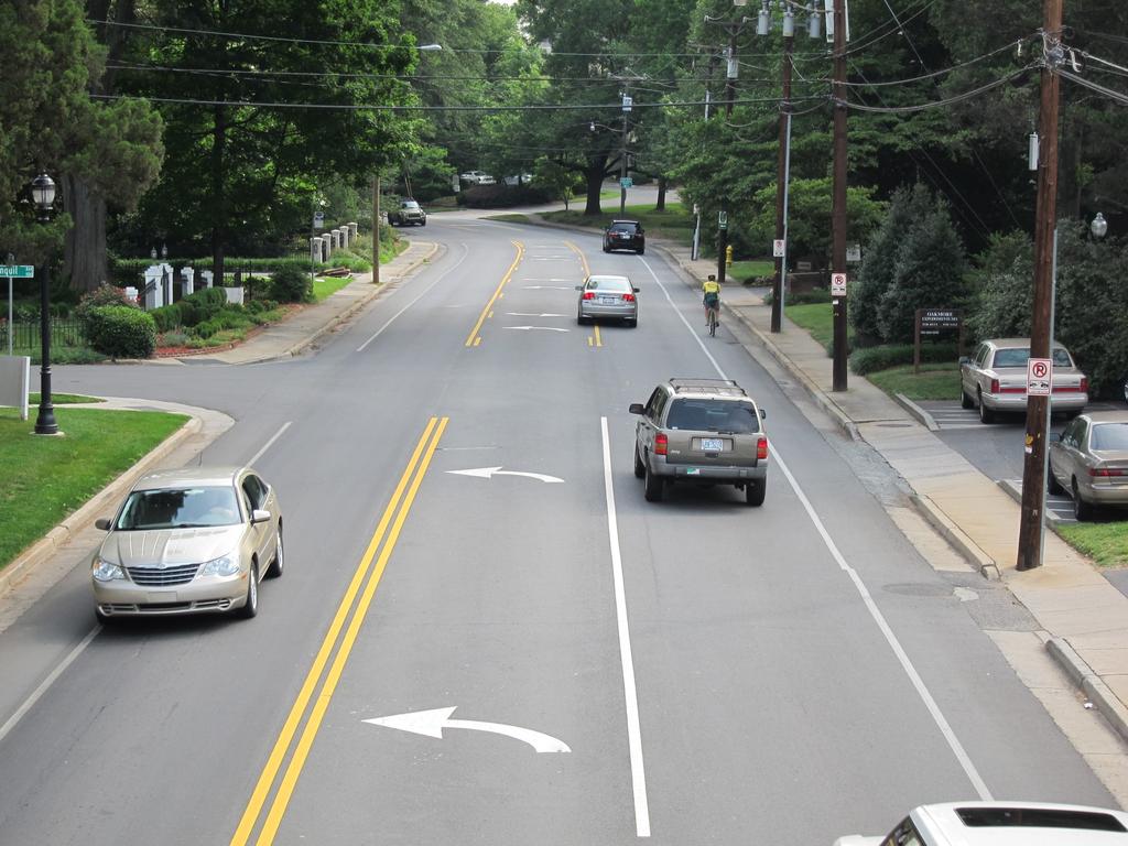
9 15 feet East Boulevard Phase 1 - After

10 Charlotte Observer, June 2004


11 From Charlotte Observer (June 2006) Comments made during construction

12 Judge the Project at Completion
13

14 70 feet wide Phase 2 - Before

15 East Boulevard
16 East Phase I Volumes 2000 East Blvd Phase I - Before vs. After 1500 All Traffic Volume 1000 Westbound All Before WB Before All Before EB Before WB Before All After EB Before WB After EB After 500 Eastbound Hour
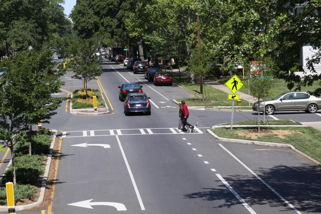
17 East Phase II Volumes East Blvd Phase II - Before vs. After All Traffic Volume Westbound All Before EB Before All Before WB Before EB Before All After II WB Before EB After II WB After II 400 Eastbound Hour
18 Phase II Speed Results Eastbound 85th Percentile Speed EB Before EB After Peak AM Off-Peak AM Off-Peak PM Peak PM Westbound 85th Percentile Phase mph drop Phase 2 bigger drop Speed WB Before WB After Note: Speeds recorded and calculated using Nu-Metrics HiStar Peak AM Off-Peak AM Off-Peak PM Peak PM
19 East Blvd. Phase I Crashes Overall crashes decreased from 2.64 to 1.67 crashes/month Related Crash Type Expected To Rear End Increase Angle Types Decrease Sideswipe Decrease Head-on Decrease Parked Decrease Unrelated??? Results % Crashes/Month - 22 % % % % % % Crash Type Expected To Before After Bike??? 1 12 Pedestrian??? 1 2 Before data: After data: 36 months 57 months
20 East Blvd. Phase II Crashes Overall crashes decreased from 1.97 to 1.86 crashes/month Related Crash Type Expected To Rear End Increase Angle Types Decrease Sideswipe Decrease Head-on Decrease Parked Decrease Unrelated??? Results % Crashes/Month % % % % % % Crash Type Expected To Before After Bike??? 0 0 Pedestrian??? 2 0 Before data: After data: 36 months 21 months


21 Selwyn Avenue Simple! Single Family Multi-family University & Public Schools Retail centers Park/greenway 20,300 AAWDT Road to be resurfaced 4 lanes or 3 lanes?

22 Conversion Typical Section Before Concept 40 feet wide

23 Selwyn Avenue After

24 Selwyn Avenue Road Diet
25 Selwyn Volumes Selwyn Avenue Before vs. After Conversion Volumes Volume All Traffic Change in Peak Hour OB = -9.32% Change in 3-hour OB = +0.32% Outbound All Before Inbound Before All Before Outbound Before Inbound Before All After Outbound Before Inbound After Outbound After 500 Inbound Hour

26 Selwyn Speed Results 50 Southbound 85th Percentile Speed SB Before SB After Peak AM Off-Peak AM Off-Peak PM Peak PM Northbound 85th Percentile Speed NB Before NB After Note: Speeds recorded and calculated using Nu-Metrics HiStar Peak AM Off-Peak AM Off-Peak PM Peak PM
27 Selwyn Crashes Overall crashes decreased from 1.97 to 1.67 crashes/month Related Crash Type Expected To Rear End Increase Angle Types Decrease Sideswipe Decrease Head-on Decrease Parked Decrease Unrelated??? Results % Crashes/Month + 90 % % % Zero Before and After % % Crash Type Expected To Before After Bike??? 0 0 Pedestrian??? 0 0 Before data: After data: 36 months 21 months

28 Lessons Learned Project should begin at neighborhood level what do they want from their street? Seems counterintuitive - need to educate show examples Get Council/Commission and neighborhood on board Build advocates for the project


29 Visuals are worth a 1000 words Construction period will be difficult especially with islands and stamped crosswalks Weather the storm during construction be proactive with media Do before/after studies Lessons Learned

30 Questions?
MEMORANDUM. Charlotte Fleetwood, Transportation Planner
 MEMORANDUM Date: Updated August 22, 2017 To: Organization: Charlotte Fleetwood, Transportation Planner Boston Transportation Department From: Jason DeGray, P.E., PTOE, Regional Director of Engineering
Offset Single Point Interchange I-25 at Rio Bravo Boulevard Albuquerque, New Mexico
 Offset Single Point Interchange I-25 at Rio Bravo Boulevard Albuquerque, New Mexico INSTITUTE OF TRANSPORTATION ENGINEERS 2016 WESTERN DISTRICT MEETING JULY 11, 2016 7/11/2016 1 Project Vicinity Map 7/11/2016
Lawrence Avenue Streetscape Concepts August 30, 2011
 Lawrence Avenue Streetscape Concepts August 30, 2011 Neighborhood Context Phase II: River to Western Ave. Phase I: Western Ave. to Clark St. Key Map Lawrence Ave. Existing Streetscape Conditions East of
About the study. North Milwaukee Ave. Key goals of this study are to: Achieve Vision Zero* by. Harmonize the space and improve walkability
 About the study Key goals of this study are to: North Milwaukee Avenue is a local and regional street for multiple modes of transportation. It is officially zoned and functions as a pedestrian street southeast
Northbound San Jose Avenue & I-280 Off-Ramp Road Diet Pilot Project
 Project Overview Fed by a two-lane Interstate-280 (I-280) off-ramp, high vehicular volumes and speeds are longstanding issues along San Jose Avenue. Residents in the surrounding neighborhoods have expressed
Toronto and East York Community Council. Director, Transportation Services, Toronto and East York District
 No Turn on Red Regulations STAFF REPORT ACTION REQUIRED Date: June 1, 2010 To: From: Toronto and East York Community Council Director, Transportation Services, Toronto and East York District Wards: Trinity
Evaluation of M-99 (Broad Street) Road Diet and Intersection Operational Investigation
 Road Diet and Intersection Operational Investigation") Evaluation of M-99 (Broad Street) Road Diet and Intersection Operational Investigation City of Hillsdale, Hillsdale County, Michigan June 16, 2016 Final Report Prepared for City of Hillsdale 97 North Broad
Evaluation of M-99 (Broad Street) Road Diet and Intersection Operational Investigation City of Hillsdale, Hillsdale County, Michigan June 16, 2016 Final Report Prepared for City of Hillsdale 97 North Broad
Gateway Transportation Study
 Gateway Transportation Study Amherst, Massachusetts SUBMITTED TO University of Massachusetts Amherst Town of Amherst SUBMITTED BY Vanasse Hangen Brustlin, Inc. Watertown, Massachusetts March 213 Back of
Bay to Bay Boulevard Complete Streets Project
 Bay to Bay Boulevard Complete Streets Project Dale Mabry Highway to Bayshore Boulevard February 08, 2018 Photo Source: Tampa Bay Times Alessandra Da Pra Meeting Format Introduction Resurfacing Information
Center Street (S.R. 36) Road Diet Kingsport, TN
 Road Diet Kingsport, TN") TSITE 2015 Summer Meeting Gatlinburg, TN July 30, 2015 Center Street (S.R. 36) Road Diet Kingsport, TN Jason Carder, P.E. Mattern& Craig Najmeh Jami, E.I.T RPM Transportation Consultants AGENDA BACKGROUND
TSITE 2015 Summer Meeting Gatlinburg, TN July 30, 2015 Center Street (S.R. 36) Road Diet Kingsport, TN Jason Carder, P.E. Mattern& Craig Najmeh Jami, E.I.T RPM Transportation Consultants AGENDA BACKGROUND
TRAFFIC IMPACT ANALYSIS
 TRAFFIC IMPACT ANALYSIS FOR THE CHAMPAIGN UNIT#4 SCHOOL DISTRICT PROPOSED HIGH SCHOOL (SPALDING PARK SITE) IN THE CITY OF CHAMPAIGN Final Report Champaign Urbana Urbanized Area Transportation Study 6/24/2014
Lincoln Avenue Road Diet Trial
 Lincoln Avenue Road Diet Trial Data Collection Report June 1, 2015 Department of Transportation Table of Contents I. Introduction...... 3 II. Data Collection Methodology & Results...... 5 A. Traffic Volume
CITY OF LOS ANGELES INTER-DEPARTMENTAL MEMORANDUM
 CITY OF LOS ANGELES INTER-DEPARTMENTAL MEMORANDUM Date: April 1, 219 To: Honorable City Council c/o City Clerk, Room 395, City Hall Attention: Honorable Mike Bonin, Chair, Transportation Committee From:
Road Diets FDOT Process
 Florida Department of TRANSPORTATION Road Diets FDOT Process Humberto Castillero, PE, PTOE Roadway Design Office Purpose of Guide Develop a statewide lane elimination review process Balance state & local
Pedestrian & Bicycle Safety Innovations & Applications
 Pedestrian & Bicycle Safety Innovations & Applications County Engineers Association of Maryland Spring, 2017 Conference May 25, 2017 George Branyan Pedestrian Program Coordinator District Department of
J Street and Folsom Boulevard Lane Conversion Project (T ) Before and After Traffic Evaluation
 Before and After Traffic Evaluation") J Street and Folsom Boulevard Lane Conversion Project (T15125400) Before and After Traffic Evaluation Prepared by Transportation Division June 2014 Executive Summary On February 12, 2013, the City of Sacramento
J Street and Folsom Boulevard Lane Conversion Project (T15125400) Before and After Traffic Evaluation Prepared by Transportation Division June 2014 Executive Summary On February 12, 2013, the City of Sacramento
Rightsizing Streets: The Seattle Experience
 Rightsizing Streets: The Seattle Experience April 30, 2013 Brian Dougherty Seattle Department of Transportation Complete Streets 16% of households do not have a car Seniors Youth Transit riders Safety
Marina Loft (DRC 51-R-12)
") Marina Loft (DRC 51-R-12) traffic study prepared for: Cymbal Development OCtober 2012 Traf Tech October 1, 2012 Mr. Asi Cymbal - President Cymbal Development 3470 North Miami Avenue Upper Suite Miami,
Marina Loft (DRC 51-R-12) traffic study prepared for: Cymbal Development OCtober 2012 Traf Tech October 1, 2012 Mr. Asi Cymbal - President Cymbal Development 3470 North Miami Avenue Upper Suite Miami,
TRANSPORTATION FACILITY PLANNING Waugh Chapel Road Maytime Drive to New Market Lane
 July 24, 2018 TRANSPORTATION FACILITY PLANNING Waugh Chapel Road Maytime Drive to New Market Lane DPWandYOU.com Making a difference, together Meeting Agenda Purpose of the project Overview of work conducted
Conversion of One-Way Couplet Streets to Two-Way
 Conversion of One-Way Couplet Streets to Two-Way May 5, 2016 Oklahoma Traffic Engineers Association 2016 Spring Meeting, Tulsa, OK Kevin St. Jacques, P.E., PTOE, PTP Freese and Nichols Overview Initial
Balancing Operation & Safety for Motorized and Non-Motorized Traffic
 Balancing Operation & Safety for Motorized and Non-Motorized Traffic Brian Willham, PE, PTOE Iowa Director - MOVITE June 30, 2014 Learning Objectives: When & Why should we measure the performance of complete
DEPARTMENT OF ENVIRONMENTAL SERVICES. North Harrison Street (Lee Highway to Little Falls Road) Comparative Analysis. Prepared for:
 Comparative Analysis. Prepared for:") DEPARTMENT OF ENVIRONMENTAL SERVICES North Harrison Street (Lee Highway to Little Falls Road) Comparative Analysis Prepared for: Arlington County Department of Environmental Services 2100 Clarendon Boulevard,
DEPARTMENT OF ENVIRONMENTAL SERVICES North Harrison Street (Lee Highway to Little Falls Road) Comparative Analysis Prepared for: Arlington County Department of Environmental Services 2100 Clarendon Boulevard,
Downtown Naples Mobility and Connectivity Study. Naples City Council Presentation January 2017
 Downtown Naples Mobility and Connectivity Study Naples City Council Presentation January 2017 Agenda 1. Introduction 2. Scope Review 3. Project Schedule 4. Existing Conditions 5. Public Charrette 6. Mobility
CAPITOL DRIVE & FOND DU LAC AVENUE INTERSECTION ANALYSIS. Urban Planning 772 SARAH BREGANT, RYAN PETERSON, & MATT WERDERITCH
 CAPITOL DRIVE & FOND DU LAC AVENUE INTERSECTION ANALYSIS Urban Planning 772 SARAH BREGANT, RYAN PETERSON, & MATT WERDERITCH OVERVIEW N 51 ST BOULEVARD N 51 ST BOULEVARD 12,100 44,700 W CAPITOL DRIVE 52,600
Figure 1: Vicinity Map of the Study Area
 ARIZONA TEXAS NEW MEXICO OKLAHOMA May 5, 2016 Mr. Anthony Beach, P.E. BSP Engineers 4800 Lakewood Drive, Suite 4 Waco, Texas 76710 Re: Intersection and Access Analysis along Business 190 in Copperas Cove
COMMUNITY MEETING AGENDA
 COMMUNITY MEETING AGENDA Welcome and Introductions SAFE Presentation Project Presentation Priorities Feedback Next Steps Q&A Santa Cruz Avenue Corridor Study 1 Santa Cruz Avenue Corridor Study Community
Station 1: Street & Sidewalk Upgrades
 Station 1: Street & Sidewalk Upgrades Existing no left turn; Potential left turn arrow, see Circulation Study boards for more information Thru-lane guidance Improved lead-in green bike lane 17TH ST CASTRO
THE NACTO MANUALS AND DESIGNING FOR VISION ZERO ZAKI MUSTAFA SHIRLEY ZAMORA
 THE NACTO MANUALS AND DESIGNING FOR VISION ZERO ZAKI MUSTAFA SHIRLEY ZAMORA NACTO Design Guides 2 City of Los Angeles Vision Zero 3 Vision Zero Roscoe Boulevard Corridor SHIRLEY ZAMORA TRANSPORTATION ENGINEERING
Donahue Drive Corridor Traffic Operational Evaluation
 Donahue Drive Corridor Traffic Operational Evaluation PREPARED FOR: THE CITY OF AUBURN PREPARED BY: JANUARY 2007 Donahue Drive Corridor Study--Auburn, Alabama TABLE OF CONTENTS Introduction... 1 Background
Appendix C. NORTH METRO STATION AREA TRAFFIC IMPACT STATEMENT 88th Avenue Station
 Appendix C NORTH METRO STATION AREA TRAFFIC IMPACT STATEMENT 88th Avenue Station Prepared for: Regional Transportation Department and URS Corporation as part of the North Metro EIS David Evans and Associates,
Designing for Pedestrian Safety
 Designing for Pedestrian Safety Road Diets Presented by: Peter Lagerwey Senior Planner, Toole Design Group November 3, 2010 Before After Learning Objectives At the end of this module, you will be able
Committed to Service
 Committed to Service Paul Woods, President Rebecca W. Arnold, Vice President Sara M. Baker, Commissioner Jim D. Hansen, Commissioner Kent Goldthorpe, Commissioner March 14, 2017 Planning and Programming
MEMORANDUM. Trip Generation and Distribution. CyRide / ISU Intermodal Facility Steering Committee. Date: August 31, 2009
 MEMORANDUM Transportation Jim Kollbaum, PE 12120 Shamrock Plaza Suite 300 Omaha, NE 68154 (402) 334-8181 (402) 334-1984 (Fax) To: CyRide / ISU Intermodal Facility Steering Committee Date: August 31, 2009
Harrah s Station Square Casino
 Transportation Analysis Harrah s Station Square Casino Pittsburgh, Pennsylvania Submitted To: City of Pittsburgh and Pennsylvania Gaming Control Board Prepared By: DKS Associates GAI Consultants December
WELCOME. Stakeholder Involvement Group Meeting #2 Round Lake Public Works October 24, 2018
 WELCOME Stakeholder Involvement Group Meeting #2 Round Lake Public Works October 24, 2018 MEETING AGENDA 1. Welcome and Introductions 2. Study Progress Update 3. Problem Statement 4. Technical Analysis
Reference number /VP. Lafayette Downtown Congestion Study - Additional Traffic Analysis
 To James Hinkamp and Tony Coe, City of Lafayette Date January 19, 2017 Copies Reference number 243381/VP From Michael Iswalt and Vanessa Peers File reference 4-05 Subject Lafayette Downtown Congestion
Public Involvement Kickoff Meeting. April 29, 2015
 Public Involvement Kickoff Meeting April 29, 2015 Title VI Compliance The Florida Department of Transportation complies with various non-discrimination laws and regulations, including Title VI of the Civil
ALLEY 24 TRAFFIC STUDY
 ALLEY 24 TRAFFIC STUDY in City of Frostburg, Maryland January 2013 3566 Teays Valley Road Hurricane, WV Office: (304) 397-5508 www.denniscorporation.com Alley 24 Traffic Study January 2013 Frostburg, Maryland
Project Goals and Objectives
 Project Goals and Objectives Goal 1: Goal 2: Goal 3: Transform Coast Highway into a Complete Street that accommodates all roadway users (pedestrians, bicyclists, and autos) Objectives: Improve the pedestrian
Welcome! San Jose Avenue Open House August 25, 2015
 Welcome! San Jose Avenue Open House August 25, 2015 Vision Zero The City and County of San Francisco adopted Vision Zero San Francisco Vision Zero High Injury Network as a policy in 2014, committing an
List of Exhibits...ii
 One Brickell Traffic Study TABLE OF CONTENTS List of Exhibits...ii EXECUTIVE SUMMARY...1 1. INTRODUCTION...2 1.1 Study Area...2 1.2 Study Objective...5 2. EXISTING TRAFFIC CONDITIONS...6 2.1 Data Collection...6
Queensboro Bridge Bus Priority Study: Summary of Recommendations. Presentation to Manhattan Community Board 8 May 4, 2011
 : Summary of Recommendations Presentation to Manhattan Community Board 8 May 4, 2011 1 Overview Study Goal: Identify cost-effective ways to improve bus speed and reliability for local and express buses
After. Before ROAD DIETS MODULE of 9 Safety Proven Countermeasures.
 Before After ROAD DIETS MODULE 10 1 of 9 Safety Proven Countermeasures http://safety.fhwa.dot.gov/provencountermeasures/fhwa_sa_12_013.htm Learning Objectives At the end of this module, you will be able
BENNING ROAD & BRIDGES TRANSPORTATION IMPROVEMENTS CRASH DATA AND SAFETY ANALYSIS TECHNICAL MEMORANDUM DRAFT MAY 2016
 BENNING ROAD & BRIDGES TRANSPORTATION IMPROVEMENTS CRASH DATA AND SAFETY ANALYSIS TECHNICAL MEMORANDUM DRAFT MAY 2016 This page left intentionally blank. Table of Contents 1.0 Introduction... 1 1.1 Crash
Presentation Outline. Project/Study Purpose. Existing Conditions. Future Conditions. Understanding the Streetside. Similar Walkable Environments
 Presentation Outline Project/Study Purpose Study Area Map Existing Conditions Future Conditions Understanding the Streetside Similar Walkable Environments Conceptual Alternatives Magnolia/NE 1st Ave Block
Glenn Avenue Corridor Traffic Operational Evaluation
 Glenn Avenue Corridor Traffic Operational Evaluation PREPARED FOR: THE CITY OF AUBURN PREPARED BY: DECEMBER 2007 Glenn Avenue Corridor Study--Auburn, Alabama TABLE OF CONTENTS Introduction... 1 Background
NO BUILD TRAFFIC OPERATIONS
 3. 23 NO BUILD TRAFFIC OPERATIONS This section addresses the operations of the transportation system and details how it would be expected to function under year 23 No Build conditions with the projected
Transportation Setting
 Transportation Setting Operational Analysis Study Area and Periods The study area consists of the following intersections: 1. Serramonte Boulevard/I-28 Southbound Ramps 2. Serramonte Boulevard/I-28 rthbound
After. Before ROAD DIETS MODULE of 9 Safety Proven Countermeasures.
 1 Before After ROAD DIETS MODULE 10 1 of 9 Safety Proven Countermeasures http://safety.fhwa.dot.gov/provencountermeasures/fhwa_sa_12_013.htm 2 Learning Objectives At the end of this module, you will be
Advancing Transportation Choices in Des Moines. MPO Environmental Roundtable January 9, 2018
 Advancing Transportation Choices in Des Moines MPO Environmental Roundtable January 9, 2018 Presented by Jennifer McCoy, PE, PTOE City Traffic Engineer Agenda Des Moines Area Transportation Planning Connect
MoPac South: Impact on Cesar Chavez Street and the Downtown Network
 MoPac South: Impact on Cesar Chavez Street and the Downtown Network Prepared by: The University of Texas at Austin Center for Transportation Research Prepared for: Central Texas Regional Mobility Authority
COMPLETE STREETS A STEP FORWARD ITE District 10/FSITE Annual Meeting November 3, 2015
 COMPLETE STREETS A STEP FORWARD 2015 ITE District 10/FSITE Annual Meeting November 3, 2015 About Lakeland Incorporated: 1885 Population: 100,728 Area: Approx. 75 sq. mi Major Employers: Publix, Lakeland
Chicago Safe Routes to School Safe Routes to High School (SRTS/SRTHS)
") Chicago Safe Routes to School Safe Routes to High School (SRTS/SRTHS) Marshall Community High School and Faraday Elementary School Recommended Improvements Agenda Goals Related Programs Project Location/Area
Chicago Safe Routes to School Safe Routes to High School (SRTS/SRTHS) Marshall Community High School and Faraday Elementary School Recommended Improvements Agenda Goals Related Programs Project Location/Area
Feasibility Study of Pedestrian Crossings Along Route 7, East of Cascades Parkway and West of Dranesville Road. October 3, 2017
 Feasibility Study of Pedestrian Crossings Along Route 7, East of Cascades Parkway and West of Dranesville Road October 3, 2017 Study Area (area within a ¼-mile radius of the study intersections) Route
FRONT RANGE CROSSINGS TRAFFIC IMPACT STUDY
 FRONT RANGE CROSSINGS TRAFFIC IMPACT STUDY Prepared for: City of Thornton And Colorado Department of Transportation Prepared by: 11 Blake Street, Suite 2 Denver, Colorado 822 Contact: Brian Bern, PE, PTOE
AGENDA ITEM 6 D THOMASVILLE ROAD (HERMITAGE BOULEVARD TO LIVE OAK PLANTATION ROAD) ROADWAY SAFETY AUDIT
 ROADWAY SAFETY AUDIT") May 15, 2018 AGENDA ITEM 6 D THOMASVILLE ROAD (HERMITAGE BOULEVARD TO LIVE OAK PLANTATION ROAD) ROADWAY SAFETY AUDIT TYPE OF ITEM: Discussion STATEMENT OF ISSUE The Florida Department of Transportation
May 15, 2018 AGENDA ITEM 6 D THOMASVILLE ROAD (HERMITAGE BOULEVARD TO LIVE OAK PLANTATION ROAD) ROADWAY SAFETY AUDIT TYPE OF ITEM: Discussion STATEMENT OF ISSUE The Florida Department of Transportation
Traffic Circulation Study for Neighborhood Southwest of Mockingbird Lane and Airline Road, Highland Park, Texas
 ARIZONA TEXAS NEW MEXICO OKLAHOMA February 13, 2015 Mr. Meran Dadgostar P.E., R.S. Town of Highland Park 4700 Drexel Dr. Highland Park, Texas 75205 Re: Traffic Circulation Study for Neighborhood Southwest
Dell Range Boulevard Corridor Study Powderhouse Road to College Drive. Prepared for: Cheyenne Metropolitan Planning Organization
 Dell Range Boulevard Corridor Study Powderhouse Road to College Drive Prepared for: Cheyenne Metropolitan Planning Organization Draft August 2014 Dell Range Boulevard Corridor Study (Powderhouse Road to
SH-6 Corridor Improvement Study Policy Committee Progress Report M O N D AY, J U N E 1 0, B R A Z O S C E N T E R
 SH-6 Corridor Improvement Study Policy Committee Progress Report M O N D AY, J U N E 1 0, 2 0 1 3 B R A Z O S C E N T E R Project Overview Study Goals and Objectives» Improve traffic flow» Reduce delay»
Table of Figures. Table of Tables. Table 1: Traffic Volumes Ramblas Delay. Table 2: Las
 Table of Contents 1. Executive Summary... 4 2. Analysiss Methodology... 4 3. Introduction... 4 4. Roadway Geometric Conditions... 5 4.1 Las Ramblas Community Access/ Egress Roads... 7 5. Traffic Data Collection...
Complete Street Analysis of a Road Diet: Orange Grove Boulevard, Pasadena, CA
 Complete Street Analysis of a Road Diet: Orange Grove Boulevard, Pasadena, CA Aaron Elias, Bill Cisco Abstract As part of evaluating the feasibility of a road diet on Orange Grove Boulevard in Pasadena,
Clybourn Ave. Protected Bike Lane Study Halsted St. to Division St.
 Clybourn Ave. Protected Bike Lane Study Halsted St. to Division St. Nathan Roseberry, Senior Engineer Pam Broviak, Project Manager July 24, 2014 Agenda Project Goals Existing Roadway Conditions Traffic
TRAFFIC CONTROL DEVICES ON EDGEWATER BOULEVARD AT PORT ROYAL AVENUE (NORTH)
") Attachment 2 DATE: August 6, 2012 TO: VIA: FROM: SUBJECT: Mayor and Members of the City Council James C. Hardy, City Manager Ramon Towne, Director of Public Works Leah Edwards, Assistant Engineer TRAFFIC
Attachment 2 DATE: August 6, 2012 TO: VIA: FROM: SUBJECT: Mayor and Members of the City Council James C. Hardy, City Manager Ramon Towne, Director of Public Works Leah Edwards, Assistant Engineer TRAFFIC
APS Stratford Project Transportation Analysis Overview. Stratford BLPC #5 June 1, 2015
 APS Stratford Project Transportation Analysis Overview Stratford BLPC #5 June 1, 2015 8 Arrival/dismissal observations and counts BLPC arrival/dismissal observations BLPC early release observation Williamsburg
Arlington Public Schools New Elementary School at Thomas Jefferson Site Off-Site Transportation. Thomas Jefferson BLPC / PFRC Meeting July 27, 2016
 Arlington Public Schools New Elementary School at Thomas Jefferson Site Off-Site Transportation Thomas Jefferson BLPC / PFRC Meeting July 27, 2016 1.Review of Analysis 2.Key Transportation Issues 3.Recommendations
DRAFT Davidson Elementary School Expansion Transportation Impact Analysis
 DRAFT Davidson Elementary School Expansion Transportation Impact Analysis Prepared for: Town of Davidson 216 S. Main Street Davidson, NC 28036 Prepared by: Stantec Consulting Services Inc. 2127 Ayrsley
Road Diets and Roundabouts
 Road Diets and Roundabouts Paul Zykofsky, AICP Local Government Commission Sacramento, CA Classic Road Diet 4 to 3 lanes San Antonio TX On-street parking Median Bike Lanes Center Turn-Lane Seattle WA Road
Intersection LOS Intersection level of service (LOS) is defined by the Highway Capacity Manual (HCM) by the following criteria:
 is defined by the Highway Capacity Manual (HCM) by the following criteria:") Page 2 of 9 Intersection LOS Intersection level of service (LOS) is defined by the Highway Capacity Manual (HCM) by the following criteria: Table 1 LOS Definitions Level of Signalized Un-Signalized Definition
Page 2 of 9 Intersection LOS Intersection level of service (LOS) is defined by the Highway Capacity Manual (HCM) by the following criteria: Table 1 LOS Definitions Level of Signalized Un-Signalized Definition
Lake Zurich Police Department Traffic Safety Division 200 Mohawk Trail Lake Zurich, IL 60047
 Lake Zurich Police Department Traffic Safety Division 200 Mohawk Trail Lake Zurich, IL 60047 Telephone (847) 719-1690 Fax (847) 719-1691 January 15, 2015 This report is being submitted regarding the implementation
Financial Project ID No(s).: and ETDM No(s).: and 14181
.: and ETDM No(s).: and 14181") Palm Beach Metropolitan Planning Organization (MPO) Presentation I-95 at Boynton Beach Boulevard Interchange and I-95 at Gateway Boulevard Interchange Project Development and Environment Study Palm Beach
Palm Beach Metropolitan Planning Organization (MPO) Presentation I-95 at Boynton Beach Boulevard Interchange and I-95 at Gateway Boulevard Interchange Project Development and Environment Study Palm Beach
Welcome to the Quebec Alternatives Analysis Public Meeting
 Welcome to the Public Meeting Please sign in. Public Comment Please fill out a comment card and tell us what you think. Check back or comment any time at: www.quebecalternatives.com Project Area Technical
PEDESTRIAN SAFETY STUDY
 PEDESTRIAN SAFETY STUDY SR 699 (BLIND PASS RD/GULF BLVD) FROM 93 RD AVENUE TO PINELLAS BAYWAY PINELLAS COUNTY SECTION NO.: 15100 MILEPOST: 0.111 3.569 STUDY LIMITS Prepared For: Florida Department of Transportation
RapidRide Roosevelt Seat Sea t t le t le Depa De r pa t r men men t of Sept T an r sp an or sp t or a t t a ion
 RapidRide Roosevelt Seattle Bicycle Advisory Board 1 Our mission, vision, and core values Mission: deliver a high-quality transportation system for Seattle Vision: connected people, places, and products
The Cape Cod Five Cents Savings Bank
 TRAFFIC IMPACT AND ACCESS STUDY The Cape Cod Five Cents Savings Bank Hyannis, Massachusetts PREPARED FOR The Cape Cod Five Cents Savings Bank 19 West Road Orleans, Massachusetts 0263 PREPARED BY 1 Walnut
Citizen Advisory Group Meeting #8 May 5, Welcome. Today s meeting will focus on: Land Use & Transportation CHARLOTTEPLANNING.
 Citizen Advisory Group Meeting #8 May 5, 2010 Welcome. Today s meeting will focus on: Land Use & Transportation CHARLOTTEPLANNING.ORG Meeting Agenda Handouts: o Meeting Agenda o Summary of East Seventh
SR 693 (Pasadena Avenue) Corridor Study from Shore Drive South to 66 th Street
 Corridor Study from Shore Drive South to 66 th Street") Welcome and Introduction Sign-in and comment sheets Restrooms and exits Meeting agenda and timeline Meeting goals / expectations Provide input to guide study recommendations Actively participate throughout
Welcome and Introduction Sign-in and comment sheets Restrooms and exits Meeting agenda and timeline Meeting goals / expectations Provide input to guide study recommendations Actively participate throughout
Route 79/Davol Street Corridor Study
 Route 79/Davol Street Corridor Study Fall River, MA Public Information Meeting #2 November 21, 2013 Fall River Heritage State Park Fall River, MA Agenda Welcome and Introductions Overview of Study Process
Transportation and General Civil Engineering Projects
 Continuing Engineering Services for Transportation and General Civil Engineering Projects Broward County, Florida Why Atkins 2 Existing and Past Clients 3 25+ years Experienced in Civil Engineering PM
Arterial Management Plan for US Route 250 and State Route 623
 Arterial Management Plan for US Route 250 and State Route 623 June 25, 2014 Brad Shelton, AICP Access Management and Traffic Impact Analysis Programs Manager Transportation and Mobility Planning Division
Henderson Avenue Mixed-Use Development
 Zoning Case: Z145-3 Traffic Impact Analysis Henderson Avenue Mixed-Use Development Dallas, TX October 26 th, 216 Kimley-Horn and Associates, Inc. Dallas, Texas Project #644827 Registered Firm F-928 Traffic
SUPERSTREETS IN TEXAS. ITS Texas Annual Meeting San Marcos, Texas Session 6A - Operations November 11, 2011
 SUPERSTREETS IN TEXAS ITS Texas Annual Meeting San Marcos, Texas Session 6A - Operations November 11, 2011 1 Superstreet Corridor Location 2 3 US Highway 281 2007 Looking south above Evans Road, pm peak
Draft North Industrial Area-Wide Traffic Plan
 Summary of North Industrial and Hudson Bay Industrial Recommended Improvements Table 1. Summary of s Item Location 1 2 3 4 5 6 7 8 9 10 11 12 Millar Ave north of 51st St Super 8 Motel back lane 400 Block
Completing the Street: Denning Drive
 Completing the Street: Denning Drive Public Workshop and Walking Audit Winter Park Civic Center May 12, 2016 Completing the Street What Makes This a Complete Street? Completing the Street Complete Streets
Poor pavement condition Substandard Intersections. / Substandard bike/pedestrian/transit accommodations. Driveway access Environmental concerns
 Public Informational Meeting University Avenue (Allen Boulevard Segoe Road) March 23, 2011 City of Madison City of Middleton Village of Shorewood Hills Dane County Existing Roadway Conditions Poor pavement
STILLWATER AVENUE CORRIDOR STUDY Old Town, Maine
 Draft Study STILLWATER AVENUE CORRIDOR STUDY Old Town, Maine SUBMITTED TO: BANGOR AREA COMPREHENSIVE TRANSPORTATION SYSTEM SUBMITTED BY: I MAY 23, 2017 DRAFT STILLWATER AVENUE STUDY FINAL REPORT Table
DRAFT TENNYSON STREET ANGLED PARKING ANALYSIS
 DRAFT TENNYSON STREET ANGLED PARKING ANALYSIS Prepared for: City and County of Denver Department of Public Works, Engineering Division Traffic Engineering Services Parking Operations 201 W. Colfax Avenue,
Boston Post Road Design Feasibility Study
 Boston Post Road Design Feasibility Study Prepared for the City of Rye Final Report July 18, 2007 Prepared by: Buckhurst Fish & Jacquemart (BFJ) 115 Fifth Avenue New York, NY 10003 www.bfjplanning.com
MEMORANDUM. Layout Of Study Intersections And Traffic Control
 BOSTON REGION METROPOLITAN PLANNING ORGANIZATION Richard A. Davey, MassDOT Secretary and CEO and MPO Chairman Karl H. Quackenbush, Executive Director, MPO Staff DATE November 15, 2012 TO FROM RE Town of
Dr. M.L. King, Jr. Street North Complete Streets Resurfacing Opportunities HOUSING, LAND USE, AND TRANSPORTATION COMMITTEE MARCH 22, 2018
 Dr. M.L. King, Jr. Street North Complete Streets Resurfacing Opportunities HOUSING, LAND USE, AND TRANSPORTATION COMMITTEE MARCH 22, 2018 What s Happening The City plans to mill and resurface Dr. M.L.
California Department of Transportation, District 4. Sloat Boulevard Project Skyline Blvd. to 19 th Ave. Community Update January 13, 2016
 California Department of Transportation, District 4 Sloat Boulevard Project Skyline Blvd. to 19 th Ave. Community Update January 13, 2016 Agenda Welcome and introductions Project overview, history and
5858 N COLLEGE, LLC N College Avenue Traffic Impact Study
 5858 N COLLEGE, LLC nue Traffic Impact Study August 22, 2016 Contents Traffic Impact Study Page Preparer Qualifications... 1 Introduction... 2 Existing Roadway Conditions... 5 Existing Traffic Conditions...
Date: April 4, Project #: Re: A Street/Binford Street Traffic/Intersection Assessment
 To: Peter Cavanaugh General Electric From: David Bohn, PE Ryan White, PE Date: April 4, 217 Project #: 13421. Re: / Traffic/Intersection Assessment Consistent with the Cooperation Agreement between the
Hennepin Avenue Reconstruction Washington Avenue to 12 th Street
 CITY OF MINNEAPOLIS Hennepin Avenue Reconstruction Washington Avenue to 12 th Street April 2016 1 Upcoming Opportunities Public Meeting #2 April 25, 2016 Minneapolis Central Library Doty Board Room Repeat
OTTAWA TRAIN YARDS PHASE 3 DEVELOPMENT CITY OF OTTAWA TRANSPORTATION IMPACT STUDY. Prepared for:
 OTTAWA TRAIN YARDS PHASE 3 DEVELOPMENT CITY OF OTTAWA TRANSPORTATION IMPACT STUDY Prepared for: The Ottawa Train Yards Inc. 223 Colonnade Road South, Suite 212 Nepean, Ontario K2E 7K3 January 17, 2012
TRANSPORTATION & MOBILITY VISIONING MEETING. August 23 24, 2017
 TRANSPORTATION & MOBILITY VISIONING MEETING August 23 24, 2017 Project Team 1999 South Lakefront Framework Plan In 1999, the Chicago Park District authorized framework plans for three historic parks: Jackson,
APPENDIX D: SACRAMENTO URBAN AREA TRANSPORTATION PRIORITIES
 1 County County County County 2 Yolo Arterial Roadway Collector Roadway Urban Residential Street Rural Residential Roadway I-80 / U.S. 50 Bus/Carpool Lanes in both directions Richards Blvd PM Yol 80 0.237
Traffic Impact Study WestBranch Residential Development Davidson, NC March 2016
 Traffic Impact Study WestBranch Residential Development Davidson, NC March 216 TRAFFIC IMPACT STUDY FOR THE WestBranch Residential Development LOCATED IN DAVIDSON, NC Prepared For: Lennar Carolinas, LLC
SPEED MANAGEMENT FOR VISION ZERO
 SPEED MANAGEMENT FOR VISION ZERO LUANN HAMILTON, DEPUTY COMMISSIONER FOR PROJECT DEVELOPMENT CHICAGO DEPARTMENT OF TRANSPORTATION NACTO DESIGNING CITIES 2017 Vision Zero Action Plan Speed management and
Vision: Traditional hamlet with an attractive business/pedestrian friendly main street connected to adjacent walkable neighborhoods
 N D. Focus Area II Vision: Traditional hamlet with an attractive business/pedestrian friendly main street connected to adjacent walkable neighborhoods Transit Road Focus Area II is located in the Hamlet
Appendix B. Environmental Resource Technical Memorandum. Assessment on Travel Pattern and Access Impacts
 Appendix B Environmental Resource Technical Memorandum Assessment on Travel Pattern and Access Impacts TECHNICAL MEMORANDUM ENVIRONMENTAL RE-EVALUATION FOR UNION STATION TO OAK CLIFF DALLAS STREETCAR To: