Category I. Fort Ord Reuse Plan Reassessment Report 3-3
|
|
|
- Randolf Preston
- 5 years ago
- Views:
Transcription
1 Category I Fort Ord Reuse Plan Reassessment Report 3-3
2 Chapter 3: Topics and Options Potential Options: Make no corrections to the existing typographical and other non-substantive errors found in the BRP. Direct FORA staff to modify the BRP with all corrections listed in Table 5. instances where the correction may not be obvious, an explanatory note is provided in italics. Some corrections are repeated two or three times, typically with different page references, one occurrence for each member jurisdiction to which the subject text applies. Text deletions are noted in strikethrough and text insertions are underlined. Deliberate all or some of the corrections listed in Table 5 before providing direction to FORA staff to modify the BRP with selected corrections. Synopsis of Public Comments: None Text Corrections Most of the text corrections referenced in Table 5, Index of BRP Corrections and Updates, were identified in the Scoping Report. Others have been independently identified by FORA staff apart from the Scoping Report process. The corrections are largely associated with BRP policies, programs, or mitigation measures. The corrections are grouped by the BRP Element in which the subject text is found. In Land Use Element Volume II, Page 237 Program E-1.2 E-1.3: The City of Marina shall designate convenience/specialty retail land use on its zoning map and provide standards for development within residential neighborhoods. Volume II, Page 241 Program C-1.2: The City of Seaside shall zone and consider development of a golf course community in the New Golf Course Community District totaling 3,365 units. The district District includes the existing 297-unit Sun Bay apartment complex on Coe Road and 3,068 new housing units within the remainder 3- Fort Ord Reuse Plan Reassessment Report
3
4
5 MARINA MUNICIPAL AIRPORT SALINAS VC SAND CITY SEASIDE SEASIDE MONTEREY CO. REY DEL REY OAKS MONTEREY COUNTY


6 Legend SFD Low Density Residential SFD Medium Density Residential MFD High Density Residential Residential Infill Opportunities Highway 68 Bypass ROW; Development with Restrictions Planned Development Mixed Use District Business Park/Light Industrial, Office/R&D Convenience Retail Neighborhood Retail Regional Retail Visitor Serving Golf Course Opportunity Site Hotel Opportunity Site Equestrian Center Opportunity Site Open Space/Recreation Habitat Management School/University University Medium Density Residential Alternative High School Sites Public Facility/Institutional Military Enclave Veterans Cemetery Map Description 2012 Draft update to Figure Land Use Concept Ultimate Development from the 1997 Fort Ord Base Reuse Plan. 0 1 mile Source: FORA 2012 Figure 7.2 Base Reuse Plan Land Use Concept (2012 Draft) Fort Ord Reuse Plan Reassessment Scoping Report
7
8
9
10
11
12

13
14 Fort Ord Reuse Plan General Jim Moore Boulevard General Jim Moore Blvd.
15
16 Fort Ord Reuse Plan General Jim Moore Boulevard General Jim Moore Blvd.
17 Hwy 156 widening 8th Street Crescent Ave Abrams Salinas Rd Intergarrison and Connector Reservation (4-lane to Watkins Gate) Davis Rd (North of Blanco) Hwy 1 widening Sand City - Seaside Monterey Rd IC General Jim (Normandy to McClure) Gigling Rd Eucalyptus Rd Eastside Rd Reservation (Watkins Gate to Davis) Davis Rd (South of Blanco) General Jim (McClure to South Boundary) South Boundary Rd Hwy 68 Operational Improvements Miles 5

18
19 Chapter 3: Topics and Options 3-26 Fort Ord Reuse Plan Reassessment Report Table 10 Regional and Local Plan Consistency Needs BRP Policy/Program Modifications for Regional and Local Plan Consistency Regional or Local Plan New or Expansion of Existing Policies/Programs (Regional Plan Goals in Italics) TAMC Monterey County Regional New Policies/Programs: Transportation Plan prioritize improvements to and maximize use of existing infrastructure RTP Road and Highway Transportation Policy 1: Prioritize maintenance, improvement and implementation of safety and operational improvements on existing road and highway corridors to maximize the efficient use of existing transportation infrastructure. apply new technologies for roadway efficiency RTP Road and Highway Transportation Policy 3: Where appropriate and feasible, apply new technologies, such as Intelligent Transportation System (ITS), to enhance the efficiency and safety of the existing facilities. consider use of roundabouts RTP Road and Highway Transportation Policy 5: Consider installation of roundabouts in lieu of signalization for intersection improvement projects. implement road and highway capacity improvements RTP Road and Highway Transportation Policy 6: Implement road and highway capacity improvements needed to address the projected traffic impacts of future growth on the most congested road and highway corridors where multi-modal transportation options or transportation demand management measures alone will not foreseeably improve travel times or Levels of Service on existing road and highway infrastructure. utilize intelligent transportation systems RTP Road and Highway Transportation Policy 3: Where appropriate and feasible, apply new technologies, such as Intelligent Transportation System (ITS), to enhance the efficiency and safety of the existing facilities. identify and prioritize funding for elimination of bicycle network gaps
20 RTP Bicycle and Pedestrian Policy 1: Identify gaps in the countywide bicycle facilities network, and needed improvements to and within key pedestrian activity centers and county community areas, and define priorities for eliminating these gaps and making needed improvements. encourage bicycle facility maintenance RTP Bicycle and Pedestrian Policy 4: Encourage routine maintenance of bikeway and walkway network facilities, as funding and priorities allow, including regular sweeping of bikeways and shared-use pathways. Programs to support these maintenance efforts could include: Sidewalk repair programs, including incentives to property owners to improve adjoining sidewalks beyond any required maintenance, Continued administration of the Bicycle Service Request Form Program to alert public works departments to bicyclerelated hazards, Adopt a Trail programs that involve volunteers for trail clean-up and other maintenance, Enforcement of sweeping requirements of towing companies following automobile accidents. Fort Ord Reuse Plan Reassessment Report 3-27 coordinate bicycle signage RTP Bicycle and Pedestrian Policy 8: Work with local agencies to develop a coordinated approach to bicycle signage, the system for which could include: Directional and destination signs along bikeways and shared use trails Location maps in downtown areas and other major pedestrian districts A route identification system and common set of signs for the regional bicycle network identified in TAMC s General Bikeways Plan. Expansion of Existing Policies/Programs: provide bicycle facilities; and support new bicycle and pedestrian facilities and bike racks and lockers RTP Bicycle and Pedestrian Policy 5: Continue to administer the Bike Protection Program to subsidize the cost of bike racks and lockers in locations most heavily used by bicyclists. Category II
21 Chapter 3: Topics and Options 3-28 Fort Ord Reuse Plan Reassessment Report RTP Bicycle and Pedestrian Policy 11: Accommodate, and encourage other agencies to accommodate, the need for mobility, accessibility, and safety of bicyclists and pedestrians when planning, designing, and developing transportation improvements. Such accommodation could include: Reviewing capital improvement projects to make sure that needs of non-motorized travel are considered in programming, planning, maintenance, construction, operations, and project development activities and products. Accommodating the needs of all travelers through a complete streets approach to designing new transportation improvements that includes sidewalks, bicycle lanes, crosswalks, pedestrian cut-throughs, or other bicycle and pedestrian improvements. Designation of low-traffic bicycle boulevards incorporating traffic calming features to facilitate safe, direct, and convenient bicycle travel within jurisdictions. encourage design of bikeways to Caltrans standards and utilize the Designing for Transit document for the design of transit, bicycle, and pedestrian projects RTP Bicycle and Pedestrian Policy 12: In order to facilitate regional travel by bicycle, TAMC encourages its member agencies to construct bicycle facilities on new roadways as follows: In coordination with regional and local bikeways plans; According to the specifications in Chapter 1000 of the Caltrans Highway Design Manual; With consideration of bicycle lanes (Class 2 facilities) on all new major arterials and on new collectors with an Average Daily Traffic (ADT) greater than 3,000, or with a speed limit in excess of 30 miles per hour; and With special attention to safe design where bicycle paths intersect with streets. public transit RTP Public Transit Services Policy 5: Encourage the consideration and incorporation of transit facilities and amenities in transportation improvements that meet the needs of transit customers and operations and that serve new land use development according to Monterey-Salinas Transit s Designing for Transit guidelines manual. RTP Public Transit Services Policy 6: Where appropriate and feasible, apply new technologies, such as Intelligent Transportation Systems (ITS), on existing transportation facilities to enhance the efficiency of transit service.
22 transportation demand management RTP Transportation Demand Management Policy 5: Encourage employers, new development, and county jurisdictions to provide carpool or vanpool parking. RTP Transportation Demand Management Policy 6: Encourage large employers to offer child care facilities as resources allow and encourage all employers to provide information on nearby child care resources. RTP Transportation Demand Management Policy 7: Encourage the location of child care facilities in or near employment centers. environmental protection for new transportation projects RTP Environmental Preservation Policy 5: Coordinate with Caltrans and resource agencies to support and expand advance acquisition of important habitat prior to construction of transportation projects. greenhouse gas emissions Fort Ord Reuse Plan Reassessment Report 3-29 MBUAPCD Air Quality Management Plan RTP Environmental Preservation Policy 4: Analyze the estimated greenhouse gas emissions associated with implementation of the Regional Transportation Plan s funding-constrained projects against state-defined targets for the region, and support greenhouse gas reduction measures that may include modification of existing facilities or services, construction of new facilities, and incentive or funding programs. New Policies/Programs: implement signal synchronization programs Transportation Control Measure 7.2.3: The Signal Synchronization TCM includes projects which would coordinate traffic signals that previously operated independently (two or more intersections must be coordinated). Signal synchronization improves traffic flow and thus reduces the amount of vehicle emissions associated with congested (slow) speeds. alternative fuels Transportation Control Measure 7.2.5: This TCM is implemented by projects that convert and replace gasoline and dieselpowered vehicles with vehicles powered by Compressed Natural Gas (CNG) Liquefied Natural Gas (LNG) or Propane fuels, as well as projects that increase the use of vehicles with electric motors. In addition, this TCM is implemented by projects which increase or improve 2008 Air Quality Management Plan infrastructure that supports increased use of alternative fuels, including electricity, as well as projects that demonstrate and promote the use of electric power for vehicles. Category II
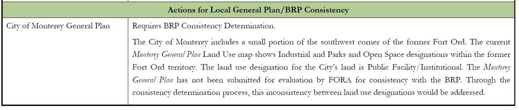
23 Chapter 3: Topics and Options 3-30 Fort Ord Reuse Plan Reassessment Report RWQCB Water Quality Control Plan for the Central Coast Basin ASTM-certified biodiesel, an alternative to petroleum diesel, has become commercially available in the Air Basin. regional initiatives to improve air quality Transportation Control Measure 7.2.6: Projects which implement this TCM foster more efficient land use patterns, improve mobility through reduced congestion, provide accessibility via more efficient transportation modes, improve efficiency of goods movement, and reduce the environmental impact of new development, especially impacts to air quality. Projects which implement this TCM may also develop area-wide source and indirect source control programs. AMBAG is in its second year of Blueprint Planning. Blueprint planning is a statewide initiative funded by Caltrans to encourage regionally integrated, comprehensive transportation and land-use planning. AMBAG continues to work with jurisdictions and other agencies to reduce air quality impacts of new development through Blueprint Planning and related policy and land use planning education efforts. Many projects listed as implementing other TCMs may also implement this one. Other Air Quality Control Plan Policies/Programs are parallel to many of those listed under the TAMC Monterey County Regional Transportation Plan above. These new Policies/Programs are recommended for the optional level of consistency of the Basin Plan: Protection of groundwater during demolition activities Protection of groundwater from industrial activities (including concrete and asphalt recycling) Project design using low-impact development and best management practices to reduce non-point source pollutants City of Monterey General Plan Actions for Local General Plan/BRP Consistency Requires BRP Consistency Determination. The City of Monterey includes a small portion of the southwest corner of the former Fort Ord. The current Monterey General Plan Land Use map shows Industrial and Parks and Open Space designations within the former Fort Ord territory. The land use designation for the City s land is Public Facility/Institutional. The Monterey General Plan has not been submitted for evaluation by FORA for consistency with the BRP. Through the consistency determination process, this inconsistency between land use designations would be addressed.
24 2010 Monterey County General Plan Requires BRP Consistency Determination. The County s Fort Ord Master Plan is part of the 2010 General Plan and was approved concurrently by the County on October 26, The Fort Ord Master Plan land use map essentially matches the BRP Land Use Concept, with the exceptions that: 1) the Youth Camp site near East Garrison is shown in the BRP as Public Facility/Institutional and in the Fort Ord Master Plan as Habitat Management; and 2) the Fort Ord Master Plan describes the East Garrison Parker Flats land swap, but does not reflect changes on the land use map. The 2010 Monterey County General Plan and Fort Ord Master Plan have not been submitted for evaluation by the FORA Board for consistency with the BRP. Through the consistency determination process, this inconsistency between land use designations would be addressed. Source: EMC Planning Group 2012 Fort Ord Reuse Plan Reassessment Report 3-31 Category II
25 Fort Ord Reuse Plan Objective D: Provide an adequate supply of on-street parking An adequate supply of parking provides important economic services to developments. Additionally, sufficient parking helps maintain efficient traffic circulation by minimizing the traffic created by drivers circulating in search of parking spaces. On-street parking provided as part of the streets and roads system is an important component of the parking supply at the former Fort Ord Streets and Roads Policies and Programs Objective A: An efficient regional network of roadways that provides access to the former Fort Ord. 4 Reuse Plan Elements Streets and Roads Policy A-1: FORA and each jurisdiction with lands at former Fort Ord shall coordinate with and assist TAMC in providing funding for an efficient regional transportation network to access former Fort Ord and implement FORA s Development and Resource Management Plan (DRMP). Program A-1.1: Each jurisdiction through FORA s DRMP, shall fund its fair share of on-site, off-site and regional roadway improvements based on the nexus analysis of the TAMC regional transportation model. The nexus is described in the Public Facilities Improvement Plan, Volume 3 of the Reuse Plan, as amended from time to time. The nexus has been updated to reflect TAMC s re-prioritizing of improvements in the network and is reported in the Fort Ord Regional Transportation Study, prepared by TAMC, January 6, Program A-1.2: FORA will retain the flexibility to build roadway improvements to the on-site and off-site network, as described in the Reuse Plan to serve development activities at the former Fort Ord. FORA will participate in reimbursement programs to recover expenses beyond Fort Ord s fair share when alternative programs for financing roadway and transit improvements are established. Program A-1.3: Each jurisdiction, through FORA s DRMP shall participate in a regional transportation financing mechanism if adopted by TAMC, as provided in (a) of the DRMP. If not, FORA will collect and contribute Fort Ord s fair share to construction of a roadway arterial network in and around the former Fort Ord. FORA s participation in the regional improvements program constitutes mitigation of FORA s share of cumulative impacts. Program A-1.4: In order for FORA to monitor the transportation improvements and to prevent development from exceeding FORA s level of service standards, each jurisdiction shall annually provide information to TAMC and FORA on approved projects and building permits within their jurisdiction (both on the former Fort Ord and outside the former base), including traffic model runs, traffic reports, and environmental documents. Objective B: Provide direct and efficient linkages from former Fort Ord lands to the regional transportation system. 300
26
27 that will support residential revitalization and new housing construction at the former Fort Ord. infrastructure and services (e.g., water, wastewater, streets, transit, and emergency services) to meet current and future needs Objective E: Coordinate the location, intensity and mix of land uses with alternative transportation goals and transportation infrastructure. Residential Land Use Policy E-1: The [jurisdiction] shall make land use decisions that support transportation alternatives to the automobile and encourage mixed-use projects and the highest-density residential projects along major transit lines and around stations. Program E-1.1: The City of Seaside shall prepare a specific plan for the University Village mixed-use planning district and incorporate provisions to support transportation alternatives to the automobile. Program E-1.2: The [jurisdiction] shall encourage CSUMB in the preparation of its master plan to designate highdensity residential development near convenience corridors and public transportation routes. Program E-1.3: The [jurisdiction] shall encourage the development of an integrated street pattern for new developments which provides linkages to the existing street network and discourages cul-de-sac s or dead-end streets. Residential Land Use Policy E-2: The [jurisdiction] shall encourage neighborhood retail and convenience/specialty retail land use in residential neighborhoods. Program E-2.1: The [jurisdiction] shall designate convenience/specialty retail land use on its zoning map and See BRP Programs below Incomplete This specific plan has not been completed. Complete CSUMB has completed a master plan that includes high density housing (for students and faculty) generally at the north edges of the campus. Much of the housing is near the University Villages (Dunes) Specific Plan area, which includes the intermodal corridor. Ongoing See BRP Programs below The City has opened several streets that connect the established parts of the city to the Fort Ord lands, including Broadway Avenue after the base closed, and Hilby Avenue and San Pablo Avenue in Military Avenue is open for pedestrian and bicycle access to Coe Avenue. The Seaside Highlands subdivision included connecting streets with several connections to Coe Avenue. Complete The Seaside zoning map includes a Community Commercial designation at Monterey
28 Regional Urban Design Guidelines
29 Reassessment Report Category IV topics Cat. IV staff recommendation: Appoint a Post-Reassessment advisory committee of Board members to identify near-term and medium-term (through fiscal year ) Category IV work plan priority recommendations for full Board review at a subsequent Board meeting(s).
Solana Beach Comprehensive Active Transportation Strategy (CATS)
") Solana Beach Comprehensive Active Transportation Strategy (CATS) 3.0 Goals & Policies The Solana Beach CATS goals and objectives outlined below were largely drawn from the Solana Beach Circulation Element
Solana Beach Comprehensive Active Transportation Strategy (CATS) 3.0 Goals & Policies The Solana Beach CATS goals and objectives outlined below were largely drawn from the Solana Beach Circulation Element
Clackamas County Comprehensive Plan
 ROADWAYS The County s road system permits the movement of goods and people between communities and regions, using any of a variety of modes of travel. Roads provide access to virtually all property. They
Corpus Christi Metropolitan Transportation Plan Fiscal Year Introduction:
 Introduction: The Safe, Accountable, Flexible, Efficient Transportation Equity Act: A Legacy for Users (SAFETEA-LU) has continued the efforts started through the Intermodal Surface Transportation Efficiency
Circulation in Elk Grove includes: Motor vehicles, including cars and trucks
 Circulation, as it is used in this General Plan, refers to the many ways people and goods move from place to place in Elk Grove and the region. Circulation in Elk Grove includes: Motor vehicles, including
Madison Urban Area and Dane County. Bicycle Transportation Plan Summary. September Introduction. Bicycle Plan Scope and Planning Process
 Bicycle Transportation Plan Summary Madison Urban Area and Dane County Introduction September 2000 Bicycling is an important mode of transportation in the Madison urban area and countywide that is available
Bicycle Master Plan Goals, Strategies, and Policies
 Bicycle Master Plan Goals, Strategies, and Policies Mobilizing 5 This chapter outlines the overarching goals, action statements, and action items Long Beach will take in order to achieve its vision of
5/7/2013 VIA . RE: University Village Safeway Expansion (P13-019)
") 5/7/2013 VIA EMAIL David Hung, Associate Planner Community Development Department, Current Planning Division City of Sacramento 300 Richards Boulevard, 3 rd Floor Sacramento, CA 95811 RE: University Village
5/7/2013 VIA EMAIL David Hung, Associate Planner Community Development Department, Current Planning Division City of Sacramento 300 Richards Boulevard, 3 rd Floor Sacramento, CA 95811 RE: University Village
Chapter 7. Transportation. Transportation Road Network Plan Transit Cyclists Pedestrians Multi-Use and Equestrian Trails
 Chapter 7 Transportation Transportation Road Network Plan Transit Cyclists Pedestrians Multi-Use and Equestrian Trails 7.1 TRANSPORTATION BACKGROUND The District of Maple Ridge faces a number of unique
NM-POLICY 1: Improve service levels, participation, and options for non-motorized transportation modes throughout the County.
 Transportation PRINCE WILLIAM COUNTY 2008 COMPREHENSIVE PLAN NON-MOTORIZED PLAN CONTENTS Goals, Policies, and Action Strategies Table 4 (Bike Facility Classifications and Descriptions) Table 5 (Bike Facility
CITY OF BLOOMINGTON COMPLETE STREETS POLICY
 CITY OF BLOOMINGTON COMPLETE STREETS POLICY POLICY OBJECTIVE: The City of Bloomington will enhance safety, mobility, accessibility and convenience for transportation network users of all ages and abilities,
CITY OF COCOA BEACH 2025 COMPREHENSIVE PLAN. Section VIII Mobility Element Goals, Objectives, and Policies
 CITY OF COCOA BEACH 2025 COMPREHENSIVE PLAN Section VIII Mobility Element Goals, Objectives, and Policies Adopted August 6, 2015 by Ordinance No. 1591 VIII MOBILITY ELEMENT Table of Contents Page Number
MCTC 2018 RTP SCS and Madera County RIFP Multi-Modal Project Eval Criteria GV13.xlsx
 MCTC 8 RTP SCS and Madera County RIFP Multi-Modal Project Eval Criteria GV.xlsx Madera County Transportation Commission Regional Transportation Plan / Sustainable Communities Strategy Multi-Modal Project
Living Streets Policy
 Living Streets Policy Introduction Living streets balance the needs of motorists, bicyclists, pedestrians and transit riders in ways that promote safety and convenience, enhance community identity, create
CONNECTING PEOPLE TO PLACES
 CONNECTING PEOPLE TO PLACES 82 EAST BENCH MASTER PLAN 07 Introduction The East Bench transportation system is a collection of slow moving, treelined residential streets and major arteries that are the
Exhibit 1 PLANNING COMMISSION AGENDA ITEM
 Exhibit 1 PLANNING COMMISSION AGENDA ITEM Project Name: Grand Junction Circulation Plan Grand Junction Complete Streets Policy Applicant: City of Grand Junction Representative: David Thornton Address:
GOAL 2A: ESTABLISH AND MAINTAIN A SAFE, CONVENIENT, AND EFFICIENT MULTI-MODAL TRANSPORTATION SYSTEM TO MOVE PEOPLE AND GOODS THROUGHOUT THE CITY.
 2. TRANSPORTATION ELEMENT The purpose of this element is to assist in establishing an adequate transportation system within the City and to plan for future motorized and non-motorized traffic circulation
West Dimond Blvd Upgrade Jodhpur Street to Sand Lake Road
 West Dimond Blvd Jodhpur St to Sand Lake CSS Transportation Project Summary Municipality of Anchorage Project # 05 005 Project Manager: John Smith, P.E. (MOA PM&E) Project Administrator: Julie Makela,
This page intentionally left blank.
 This page intentionally left blank. COMMUNITY Coweta Community Overview Coweta Coweta, a residential community located in Wagoner County, is a suburb of Tulsa situated southeast of the metropolitan area
WHEREAS, the New Jersey Department of Transportation' s Complete Streets
 WHEREAS, the State Department of Transportation adopted a Complete Streets Policy ( Policy No. 703), effective December 3, 2009, for all projects funded through the Department' s Capital Program and strongly
Perryville TOD and Greenway Plan
 Perryville TOD and Greenway Plan Greenway Glossary Pathway: A bicycle and pedestrian path separated from motorized vehicular traffic by an open space, barrier or curb. Multi-use paths may be within the
New Measure A Expenditure Categories DEFINITIONS OF ELIGIBLE EXPENDITURES Adopted March 8, 2007
 New Measure A Expenditure Categories DEFINITIONS OF ELIGIBLE EXPENDITURES Adopted March 8, 2007 City Street and County Road Maintenance Program The preservation and keeping of public street and road rights-of-way
T1-A - Service Reduction (Re-sizing)
") Key T1-A Choice A Key T1-B Choice B Key T1-C Choice C Key T1-D Choice D Key T1-E Choice E Key T1-F Choice F Key Choice G T2 T1-A - Service Reduction (Re-sizing) Description This key choice would represent
Key T1-A Choice A Key T1-B Choice B Key T1-C Choice C Key T1-D Choice D Key T1-E Choice E Key T1-F Choice F Key Choice G T2 T1-A - Service Reduction (Re-sizing) Description This key choice would represent
o n - m o t o r i z e d transportation is an overlooked element that can greatly enhance the overall quality of life for the community s residents.
 N o n - m o t o r i z e d transportation is an overlooked element that can greatly enhance the overall quality of life for the community s residents. 84 Transportation CHAPTER 11 INTRODUCTION Transportation
Proposed. City of Grand Junction Complete Streets Policy. Exhibit 10
 Proposed City of Grand Junction Complete Streets Policy Exhibit 10 1 City of Grand Junction Complete Streets Policy Vision: The Complete Streets Vision is to develop a safe, efficient, and reliable travel
RESOLUTION NO ?? A RESOLUTION OF THE CITY OF NEPTUNE BEACH ADOPTING A COMPLETE STREETS POLICY
 RESOLUTION NO. 2018-?? A RESOLUTION OF THE CITY OF NEPTUNE BEACH ADOPTING A COMPLETE STREETS POLICY WHEREAS, safe, convenient, and accessible transportation for all users is a priority of the City of Neptune
5/31/2016 VIA . Arwen Wacht City of Sacramento Community Development Department 300 Richards Blvd., 3 rd Floor Sacramento, CA 95811
 5/31/2016 VIA EMAIL Arwen Wacht City of Sacramento Community Development Department 300 Richards Blvd., 3 rd Floor Sacramento, CA 95811 RE: El Pollo Loco (P16-028) Dear Ms. Wacht: WALKSacramento has reviewed
Arlington s Master Transportation Plan
 Arlington s Master Transportation Plan The Master Transportation Plan (MTP) Adopted in eight parts Goals & Policies element and MTP Map adopted in 2007 Bicycle, Pedestrian and Demand and Systems Management
12/4/2016 VIA . RE: Grocery Outlet Del Paso (DR16-328)
") 12/4/2016 VIA EMAIL Ethan Meltzer, Assistant Planner City of Sacramento Community Development Department 300 Richards Blvd, 3 rd Floor Sacramento, CA 95811 RE: Grocery Outlet Del Paso (DR16-328) Dear Mr.
12/4/2016 VIA EMAIL Ethan Meltzer, Assistant Planner City of Sacramento Community Development Department 300 Richards Blvd, 3 rd Floor Sacramento, CA 95811 RE: Grocery Outlet Del Paso (DR16-328) Dear Mr.
1.0 INTRODUCTION 1.1 PURPOSE OF THIS REPORT
 1.0 INTRODUCTION This chapter provides an overview of the purpose, authorization and focus of this Recirculated Draft Environmental Impact Report (EIR), an identification of the Lead Agency, an outline
TRANSPORTATION TRAINING TOPICS. April 6, 2010
 TRANSPORTATION TRAINING TOPICS April 6, 2010 Roles of Transportation Providers Context and Policy Makers Division of Transportation and Traffic Other City Operations Other Transportation Operators CMA
REGIONAL BICYCLE AND PEDESTRIAN DESIGN GUIDELINES
 REGIONAL BICYCLE AND PEDESTRIAN DESIGN GUIDELINES November 16, 2011 Deb Humphreys North Central Texas Council of Governments Bicycle and Pedestrian Advisory Committee Snapshot of the Guide 1. Introduction
TOWN OF PORTLAND, CONNECTICUT COMPLETE STREETS POLICY
 TOWN OF PORTLAND, CONNECTICUT COMPLETE STREETS POLICY I. VISION, GOALS & PRINCIPLES VISION To improve the streets of Portland making them safer and more accessible for all users including pedestrians,
WELCOME TO OPEN HOUSE # 1 June 14, 2017
 Langstaff Road Weston Road to Highway 7 Class Environmental Assessment Study WELCOME TO OPEN HOUSE # 1 June 14, 2017 Please sign in and join our mailing list Purpose of Open House #1 & Study Area York
2. TRANSPORTATION ELEMENT.
 2. TRANSPORTATION ELEMENT. The purpose of this element is to assist in establishing an adequate transportation system within the City and to plan for future motorized and non-motorized traffic circulation
Double the amount of bicycle ridership while at the same time reducing the number of bicycle crashes by one-third.
 CHAPTER 6 Recommended Policies and Action Items To achieve the goals stated in Chapter 1 and guide implementation of the Bicycle Plan, policies and action items have been identified. They are presented
9/21/2016 VIA . RE: The Knot (DR16-270)
") 9/21/2016 VIA EMAIL Garrett Norman, Assistant Planner City of Sacramento Community Development Department 300 Richards Boulevard, 3 rd Floor Sacramento, CA 95811 RE: The Knot (DR16-270) Dear Mr. Norman:
9/21/2016 VIA EMAIL Garrett Norman, Assistant Planner City of Sacramento Community Development Department 300 Richards Boulevard, 3 rd Floor Sacramento, CA 95811 RE: The Knot (DR16-270) Dear Mr. Norman:
City of Novi Non-Motorized Master Plan 2011 Executive Summary
 City of Novi Non-Motorized Master Plan 2011 Executive Summary Prepared by: February 28, 2011 Why Plan? Encouraging healthy, active lifestyles through pathway and sidewalk connectivity has been a focus
APPROVE A RESOLUTION ADOPTING A COMPLETE STREETS POLICY
 STAFF REPORT MEETING DATE: September 13, 2016 TO: FROM: City Council Bob Brown, Community Development Director Russ Thompson, Public Works Director Patrick Filipelli, Management Analyst 922 Machin Avenue
8/31/2016 VIA . RE: Freeport Arco Fuel Station (P16-039)
") 8/31/2016 VIA EMAIL Garrett Norman, Assistant Planner City of Sacramento Community Development Department 300 Richards Boulevard, 3 rd Floor Sacramento, CA 95811 RE: Freeport Arco Fuel Station (P16-039)
8/31/2016 VIA EMAIL Garrett Norman, Assistant Planner City of Sacramento Community Development Department 300 Richards Boulevard, 3 rd Floor Sacramento, CA 95811 RE: Freeport Arco Fuel Station (P16-039)
Goal 3: Foster an environment of partnerships and collaboration to connect our communities and regions to one another.
 Non-Motorized Transportation Plan (NMTP) Draft Vision, Goal and,, Tri-County Regional Planning Commission (TCRPC) Purpose The purpose of the Tri-County Regional Planning Commission (TCRPC) Non-Motorized
This chapter describes the proposed circulation system and transportation alternatives associated with
 5.0 Circulation 5.1 OVERVIEW This chapter describes the proposed circulation system and transportation alternatives associated with West Landing, and summarize the information contained in the Existing
APPENDIX H TRAFFIC REPORT
 APPENDIX H TRAFFIC REPORT Keith Higgins Traffic En ginee r WEST END SAND CITY TRAFFIC IMPACT ANALYSIS DRAFT REPORT SAND CITY, CALIFORNIA Prepared for DBO Development No. 3 Monterey, CA Prepared by Keith
Berkeley Strategic Transportation Plan A-76
 Berkeley Strategic Transportation Plan A-76 Appendices 1. A Team Effort 2. Where We ve Been A-11 Berkeley Strategic Transportation Plan Alameda County Transportation Plan Alameda County will be served
Chapter 2. Bellingham Bicycle Master Plan Chapter 2: Policies and Actions
 Chapter 2 Bellingham Bicycle Master Plan Chapter 2: Policies and Actions Chapter 2: Policies and Actions The Bicycle Master Plan provides a road map for making bicycling in Bellingham a viable transportation
City of Wayzata Comprehensive Plan 2030 Transportation Chapter: Appendix A
 A1. Functional Classification Table A-1 illustrates the Metropolitan Council s detailed criteria established for the functional classification of roadways within the Twin Cities Metropolitan Area. Table
Non-Motorized Transportation 7-1
 Non-Motorized Transportation 7-1 Transportation facilities no longer mean just accommodating a vehicle powered by a combustion engine. Pedestrian and non-motorized facilities are important modes of travel
7/23/2017 VIA . Michael Hanebutt City of Sacramento Community Development Department 300 Richards Boulevard, 3 rd Floor Sacramento, CA 95811
 7/23/2017 VIA EMAIL Michael Hanebutt City of Sacramento Community Development Department 300 Richards Boulevard, 3 rd Floor Sacramento, CA 95811 RE: 65 th Street Apartments (DR17-220) Dear Mr. Hanebutt:
5. Pedestrian System. Accomplishments Over the Past Five Years
 5. Pedestrian System Accomplishments Over the Past Five Years The Alamo Area Metropolitan Planning Organization (MPO) and its partner agencies recognize the importance of improving pedestrian mobility.
Best Southwest Transportation Committee. North Central Texas Council of Governments Transportation Department
 Best Southwest Transportation Committee North Central Texas Council of Governments Transportation Department The The Regional Regional Veloweb Veloweb Review Review NCTCOG Bicycle and Pedestrian Program
4. ENVIRONMENTAL IMPACT ANALYSIS 9. TRANSPORTATION AND TRAFFIC
 4. ENVIRONMENTAL IMPACT ANALYSIS 9. TRANSPORTATION AND TRAFFIC 4.9.1 INTRODUCTION The following section addresses the Proposed Project s impact on transportation and traffic based on the Traffic Study
2025 Comprehensive Plan for the City of Temple Terrace Florida. Mobility Element. Adopted by City Council June 30, 2009
 2025 Comprehensive Plan for the City of Temple Terrace Florida Mobility Element Adopted by City Council June 30, 2009 Effective Date September 22, 2009 GOAL 2: To protect and promote the quality of life
City of Charlottesville Bicycle and Pedestrian Master Plan Update
 City of Charlottesville Bicycle and Pedestrian Master Plan Update September 17, 2014 I. Welcome and meeting overview II. Project status update III. Network overview IV. Break-out groups Pedestrian Network
Chapter 9: Pedestrians and Bicyclists
 Chapter 9: Pedestrians and Bicyclists Walking and bicycling are essential modes of transportation. These modes allow people to travel without contributing to congestion and air pollution, to access other
Hennepin County Bicycle and Pedestrian Planning
 Hennepin County Bicycle and Pedestrian Planning 1 Value of bicycle and sidewalk systems Safety Livability Mobility Health Personal Finances Economic Sustainability Clean Air Recreation Parking and congestion
Chapter 5. Complete Streets and Walkable Communities.
 Chapter 5. Complete Streets and Walkable Communities. 5.1 Description of Complete Streets. Cities throughout the world, and specifically the United States, are coming to embrace a new transportation and
Moving Cambridge. City of Cambridge Transportation Master Plan Public Consultation Centre. March 7, :00 8:00 PM.
 City of Cambridge Transportation Master Plan Public Consultation Centre March 7, 2018 5:00 8:00 PM Region of Waterloo City of Cambridge Transportation Master Plan Public Consultation Centre March 7, 2018
Bicycle Boulevards and Neighborhood Greenways
 Bicycle Boulevards and Neighborhood Greenways Traffic Safety is Improving for Everyone 90 80 70 60 50 40 30 20 10 0 PORTLAND: TOTAL TRAFFIC FATALITIES 1986-2008 1986 1987 1988 1989 1990 1991 1992 1993
ACTIVE TRANSPORTATION
 ACTIVE TRANSPORTATION Mobility 2040 Supported Goals Improve the availability of transportation options for people and goods. Support travel efficiency measures and system enhancements targeted at congestion
4 MOBILITY PLAN. Mobility Plan Objectives. Mobility Context. 1. Integrate with Local and Regional Transit Improvements
 Harbor Mixed Use CHAPTER Transit Corridor 4: Mobility Plan 4 MOBILITY PLAN Mobility Plan Objectives The Harbor Corridor Plan seeks to expand and improve the ways that people move along and through the
Active Transportation Infrastructure Investment A Business Case
 Active Transportation Infrastructure Investment A Business Case In 2016, the Real Estate Foundation awarded the Capital Regional District a $50,000 grant for Shifting Gears: Land Use Change through Active
11/28/2016 VIA
 11/28/2016 VIA EMAIL Ethan Meltzer, Assistant Planner City of Sacramento Community Development Department 300 Richards Blvd., 3 rd Floor Sacramento, Ca 95811 RE: Natomas Corporate Center Commercial Building
Performance Criteria for 2035 Long Range Transportation Plan
 Minimizing Impacts on Natural, Historic, Cultural or Archeological Resources 2035 LRTP Weighting Factor: 7% Objective 1.1: Use appropriate planning and design criteria to protect and enhance the built
Develop a Multi-Modal Transportation Strategy (Theme 6)
") DEVELOP A MULTI-MODAL TRANSPORTATION STRATEGY (THEME 6) WHY IS THIS THEME ADDRESSED? Develop a Multi-Modal Transportation Strategy (Theme 6) Statement of Ideal Reduce resident and visitor reliance on single
DEVELOP A MULTI-MODAL TRANSPORTATION STRATEGY (THEME 6) WHY IS THIS THEME ADDRESSED? Develop a Multi-Modal Transportation Strategy (Theme 6) Statement of Ideal Reduce resident and visitor reliance on single
Approved August 12, 1991 Amended March 14, 2016
 Approved August 12, 1991 Amended March 14, 2016 THIS PAGE INTENTIONALLY LEFT BLANK TRANSPORTATION ELEMENT GOALS, OBJECTIVES AND POLICIES INTERMODAL SYSTEM GOAL 1 To develop a balanced transportation system
10/30/2012 VIA
 10/30/2012 VIA EMAIL David Hung, Associate Planner Community Development Department, Current Planning Division City of Sacramento 300 Richards Blvd., 3 rd Floor Sacramento, CA 95811 RE: The Cannery On-Site
Prince George s County plans, policies, and projects
 Prince George s County plans, policies, and projects Over 250 projects for trails, bikeways, designated bike lanes and sidewalk construction Trail projects that improve access to Metro Sidewalk and trail
Transportation Master Plan Advisory Task Force
 Transportation Master Plan Advisory Task Force Network Alternatives & Phasing Strategy February 2016 BACKGROUND Table of Contents BACKGROUND Purpose & Introduction 2 Linking the TMP to Key Council Approved
7 Complete Streets & Roadway Aesthetics
 7 Complete Streets & Roadway Aesthetics 7.1 OVERVIEW Our streets lay the foundation for how we interface with travel needs, physical exercise, social exchanges and access to goods and services. They are
Basalt Creek Transportation Refinement Plan Recommendations
 Basalt Creek Transportation Refinement Plan Recommendations Introduction The Basalt Creek transportation planning effort analyzed future transportation conditions and evaluated alternative strategies for
Chapter 2: Standards for Access, Non-Motorized, and Transit
 Standards for Access, Non-Motorized, and Transit Chapter 2: Standards for Access, Non-Motorized, and Transit The Washtenaw County Access Management Plan was developed based on the analysis of existing
Roadway Classification Design Standards and Policies. Pueblo, Colorado November, 2004
 Roadway Classification Design Standards and Policies Pueblo, Colorado November, 2004 Table of Contents Page Chapter 1. General Provisions 1.1 Jurisdiction 3 1.2 Purpose and Intent 3 1.3 Modification 3
6/14/2013 VIA . Evan Compton, Associate Planner Community Development Department City of Sacramento 300 Richards Blvd Sacramento, CA 95814
 6/14/2013 VIA EMAIL Evan Compton, Associate Planner Community Development Department City of Sacramento 300 Richards Blvd RE: Sacramento Natural Foods Co-Op (P13-025) Dear Mr. Compton: WALKSacramento appreciates
CITY OF BURIEN, WASHINGTON MEMORANDUM
 DATE: November 2, 2011 CITY OF BURIEN, WASHINGTON MEMORANDUM TO: FROM: SUBJECT: Burien Planning Commission Charles W. Chip Davis, AICP, Senior Planner Recommendation on Revised Comprehensive Plan Transportation
Bike San Mateo County San Mateo County Bicycle Plan Recommendations August 30, 2010
 Policy and Procedures Develop and Implement a Complete Streets Policy to comply with DD-64-R1 and AB1358 Commencing January 1, 2011, AB1358 requires that the legislative body of a city or county, upon
MASTER BICYCLE AND PEDESTRIAN PLAN
 VILLAGE OF NORTHBROOK MASTER BICYCLE AND PEDESTRIAN PLAN DRAFT PLAN OPEN HOUSE May 2, 2018 AGENDA 1. Community Engagement 2. Vision and Goals 3. General Structure of Plan 4. Recommendations Overview 5.
FROM: CITY MANAGER DEPARTMENT: PLANNING AND COMMUNITY ENVIRONMENT DATE: OCTOBER 4, 2004 CMR:432:04
 TO: HONORABLE CITY COUNCIL FROM: CITY MANAGER DEPARTMENT: PLANNING AND COMMUNITY ENVIRONMENT DATE: OCTOBER 4, 2004 CMR:432:04 SUBJECT: FINANCE COMMITTEE RECOMMENDATION TO ADOPT TRANSPORTATION STRATEGIC
University of Victoria Campus Cycling Plan Terms of Reference. 1.0 Project Description
 University of Victoria Campus Cycling Plan Terms of Reference 1.0 Project Description The Campus Cycling Plan, a first for the University, will provide a comprehensive and coordinated approach to support
RE: Park Plaza Walgreens (P12-016)
") 12/5/2014 VIA EMAIL David Hung, Associate Planner City of Sacramento Community Development Department 300 Richards Blvd., 3rd Floor Sacramento, CA 95811 RE: Park Plaza Walgreens (P12-016) Dear Mr. Hung:
12/5/2014 VIA EMAIL David Hung, Associate Planner City of Sacramento Community Development Department 300 Richards Blvd., 3rd Floor Sacramento, CA 95811 RE: Park Plaza Walgreens (P12-016) Dear Mr. Hung:
8/1/2018 VIA . Darcy Goulart City of Rancho Cordova Planning Department 2729 Prospect Park Drive Rancho Cordova, CA 95670
 8/1/2018 VIA EMAIL Darcy Goulart City of Rancho Cordova Planning Department 2729 Prospect Park Drive Rancho Cordova, CA 95670 RE: Towne Place Suites by Marriott Hotel (DD9806) Dear Ms. Goulart: WALKSacramento
This page intentionally left blank.
 This page intentionally left blank. COMMUNITY Glenpool Community Overview Glenpool Glenpool is a city of nearly 12,000 residents located in Tulsa County southwest of Tulsa and Jenks. The city is growing
9/22/2014 VIA . RE: Butano Apartments Pre App (PAMP )
") 9/22/2014 VIA EMAIL Surinder Singh, Senior Planner Planning and Environmental Review Division Sacramento County 827 7th Street, Second Floor RE: Butano Apartments Pre App (PAMP2014-00012) Dear Mr. Singh:
9/22/2014 VIA EMAIL Surinder Singh, Senior Planner Planning and Environmental Review Division Sacramento County 827 7th Street, Second Floor RE: Butano Apartments Pre App (PAMP2014-00012) Dear Mr. Singh:
4. Mobility and Transportation Element. Page Bikes and Pedestrians
 Below are the specific General Plan text changes proposed for A-16-015 and the proposed changes to Figure MT-2 Paths and Trails. In general changes consist of removing references to the Bicycle, Pedestrian
CITY OF COCOA BEACH 2025 COMPREHENSIVE PLAN. Section VIII Mobility Element Goals, Objectives, and Policies
 CITY OF COCOA BEACH 2025 COMPREHENSIVE PLAN Section VIII Mobility Element Goals, Objectives, and Policies Adopted August 6, 2015 by Ordinance No. 1591 NOTES This entire element was reorganized and rewritten,
ACTIVE TRANSPORTATION/NONMOTORIZED TRANSPORTATION
 ACTIVE TRANSPORTATION/NONMOTORIZED TRANSPORTATION BACKGROUND Active transportation, also known as nonmotorized transportation, is increasingly recognized as an important consideration when planning and
3/10/2016 VIA th Street, Suite 203 Sacramento, CA
 3/10/2016 VIA EMAIL Arwen Wacht, Associate Planner City of Sacramento Community Development Department 300 Richards Boulevard, 3 rd Floor Sacramento, CA 95811 RE: Natomas Fountains (P16-012) Dear Ms. Wacht:
General Plan Circulation Element Update Scoping Meeting April 16, 2014 Santa Ana Senior Center, 424 W. 3rd Street, Santa Ana, CA 92701
 General Plan Circulation Element Update Scoping Meeting April 16, 2014 Santa Ana Senior Center, 424 W. 3rd Street, Santa Ana, CA 92701 Meeting Agenda 1. Purpose of Scoping Meeting 2. Project Overview 3.
Planning Guidance in the 2012 AASHTO Bike Guide
 Planning Guidance in the 2012 AASHTO Bike Guide Presentation by: RJ Eldridge Peter Lagerwey August 22, 2012 WEBINAR 2: PLANNING GUIDANCE IN THE 2012 AASHTO BIKE GUIDE Today s Webinar Significant Updates
3.0 PROJECT DESCRIPTION
 The following section of the Draft EIR contains a description of the proposed Elk Grove Boulevard/SR 99 Interchange Modification project, consistent with the requirements of CEQA Guidelines Section 15124.
TRANSPORTATION NEEDS ASSESSMENT
 TRANSPORTATION NEEDS ASSESSMENT A travel demand analysis was carried out to determine the operational issues and the potential benefit that adding traffic capacity would have on the road network. All the
4/14/2017 VIA . Miriam Lim, Junior Planner City of Sacramento Community Development Department 300 Richards, 3 rd Floor Sacramento, CA 95811
 4/14/2017 VIA EMAIL Miriam Lim, Junior Planner City of Sacramento Community Development Department 300 Richards, 3 rd Floor Sacramento, CA 95811 RE: Mack & Franklin Development (P17-016) Dear Ms. Lim:
WHAT CAN WE DO? SECTION 6
 WHAT CAN WE DO? SECTION 6 SATOMORROW MLTIMODAL TRANSPORTATION PLAN THE MLTIMODAL TRANSPORTATION PLAN What is a Multimodal Transportation Plan? The SA Tomorrow Multimodal Transportation Plan is the first
Active Transportation Access to Transit
 Active Transportation Access to Transit Introduction COMO Connect customers access transit service in many ways, including walking, bicycling, riding in a car and being dropped off, and directly boarding
11/3/2014 VIA . WALKSacramento has reviewed the Stockton and T Mixed-Use project at 3675 T Street in the
 11/3/2014 VIA EMAIL Antonio Ablog Planning Department City of Sacramento 300 Richards Boulevard Sacramento, CA 95811 RE: Design Review for Stockton and T Mixed-Use (P14-042) Dear Mr. Ablog: WALKSacramento
WELCOME. Thank you for joining us at the Second Public Workshop for the Carlsbad Pedestrian Master Plan. We look forward to receiving your feedback.
 City of Carlsbad Pedestrian Master Plan: WELCOME WELCOME Please Sign In Provide Input at Flip Charts Review Boards Presentation of Draft Plan Thank you for joining us at the Second Public Workshop for
SUMMARY OF TRANSPORTATION INVESTMENTS
 Santa Cruz County 2016 Measure D: Transportation Improvement Expenditure Plan - Approved by over 2/3 of Santa Cruz County voters on November 8, 2016 - Overview Measure D, the 2016 Transportation Improvement
5.0 Roadway System Plan
 Southwest Boise Transportation Study Page 16 5.0 Roadway System Plan The Roadway System Plan outlines roadway improvements in the Initial Study Area. It forecasts future deficiencies on the arterial system,
Summary: Mercer County Princeton Avenue & Spruce Street Study January 2009
 Summary: Several recent studies have assessed potential development and redevelopment opportunities in the Mercer Crossing area of Trenton, Ewing, and Lawrence. This Princeton Avenue and Spruce Street
City of Hamilton s Transportation Master Plan (TMP) Public Consultation 3 December 2015
 Public Consultation 3 December 2015") City of Hamilton s Transportation Master Plan (TMP) Public Consultation 3 December 2015 McPhail Transportation Planning Services Ltd. AGENDA 6:00 7:00 pm Viewing Boards / Q & A with the Team 7:00 7:50
City of Hamilton s Transportation Master Plan (TMP) Public Consultation 3 December 2015 McPhail Transportation Planning Services Ltd. AGENDA 6:00 7:00 pm Viewing Boards / Q & A with the Team 7:00 7:50
4 Goals, Objectives & Actions
 Chapter4 4 This chapter presents goals, objectives, and recommended actions to support the vision of making Overland Park a safer and easier place to ride a bicycle. 35 4.1 Recommendations Structure The
EXECUTIVE SUMMARY: TRANSIT-ORIENTED DEVELOPMENT IN SMITHS FALLS, ONTARIO; A COMPARISON BETWEEN TWO SITES
 EECUTIVE SUMMARY: TRANSIT-ORIENTED DEVELOPMENT IN SMITHS FALLS, ONTARIO; A COMPARISON BETWEEN TWO SITES Topic and Purpose In 2007, the Mayor of Ottawa s Task Force on Transportation suggested adding a