Active Transportation Planning Guide for Manitoba Municipalities
|
|
|
- Joan Hensley
- 6 years ago
- Views:
Transcription
1 Active Transportation Planning Guide for Manitoba Municipalities
2 This guide is intended both for the general public and for professionals involved in developing routes and facilities for pedestrians, cyclists and other active transportation users. It does not constitute a formal set of standards and in no way substitutes for the professional judgement required of engineers, urban planners, landscape architects and other specialists. For detailed design and construction standards, it is necessary to engage the services of professionals. All networks and facilities should be approved by a professional engineer prior to proceeding with construction. Permits and approvals will be required prior to undertaking construction of any facilities. It is recommended that the proper authorities be contacted early in the process to provide input on proposed facilities and identify potential conflicts. Contact your local or provincial community planner for advice on where and how to apply for the necessary permits and approvals. This document is available in alternate formats, upon request.

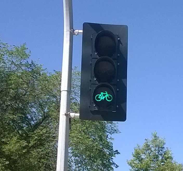
3 COMMON TERMS Throughout this guide, various terms are used to refer to basic types of active transportation (AT) facilities. AT facility refers to any type of linear corridor intended for AT use. It includes the following basic terms: Multi-use trail or trail: a facility that allows pedestrians, cyclists and small-wheel users. The facility may mix or separate users. Sidewalk: a facility intended for pedestrians, smallwheel users (such as in-line skaters) and children cyclists. Bicycle facility: a facility intended for cyclists (such as cycle tracks, bike lanes, or sharrows). Separated facility: a facility that physically separates AT traffic from motor vehicle traffic (may be adjacent to a roadway or may be in a separate corridor). Corridor is a general term for a transportation right-of-way. Although sources use different definitions for various types of corridors, the following details are implied here: Highways include provincial trunk highways and provincial roads Roads exist in the rural context Streets exist in the urban context AT facilities are also corridors Alternative corridors include utility, rail and drainage facilities Motor vehicle includes automobiles, motorcycles, transit and handi-transit buses, trucks and farming equipment. 1 for Manitoba Municipalities
4 for Manitoba Municipalities Table of Contents Common Terms...1 I. Introduction...6 About This Guide...6 What is Active Transportation?...7 Why Support AT?...7 Who is Involved?...8 Partnerships...9 II. Active Transportation Users...10 Modes...10 Skill Level...10 Age and Ability...11 Trip Types...11 III. Developing An Active Transportation Plan...13 Prepare your Team...13 Gather Information...13 Environmental Scan...13 Data Collection...14 Mapping...14 Consultation...14 Summarize your Findings...15 IV. Land Use Planning And Active Transportation...16 Subdivision and Development...16 Land Use: Urban...17 Land Use: Rural...18 V. Developing The Active Transportation Network...19 Professional Services...19 Planning your Network...19 AT Routes...20 Network Development
5 VI. Active Transportation Facilities...22 Urban AT Facilities...23 Urban AT Trails...23 Local Streets...24 Collector Streets...25 Main Streets...25 Through Streets...26 Rural AT Facilities...27 Rural AT Trails...27 Rural Separated AT Facilities...27 Rural Municipal Roads and Service Roads...28 High Speed Rural Routes...28 End-of-Trip Facilities...28 IV. Financing, Promotion And Education...30 Financing...30 Promotion...31 Education...32 Viii. Operation And Maintenance...34 Resources...34 Operations and Signage...34 Contingencies for Emergencies...35 Maintenance...35 Special Operational Considerations...36 Active Transportation at Night...36 Active Transportation in Winter...36 Measurement and Evaluation...37 IX. Documenting The Process...38 X. Resources...39 Provincial Government Contacts...39 Manitoba Provincial Government AT-Related Resources...39 AT Planning and Design Resources...39 AT Education and Advocacy...40 Land Use Planning Resources...41 Sample AT Plans and Strategies from Canadian Municipalities for Manitoba Municipalities
6 I. INTRODUCTION About this Guide The for Manitoba Municipalities provides guidance for the provision of safe and sustainable active transportation (AT) at the local and regional level. It includes: preliminary planning for AT in small communities and rural areas AT network development considerations an overview of AT facilities financing and operations (including promotion, education, maintenance and evaluation of local AT initiatives) a list of resources for more detailed information The guide s target audience is municipalities, local groups and individuals providing AT-related services and facilities in rural and smaller urban centres in Manitoba. These include local elected officials, municipal staff and local trails organizations. This guide will help you: understand the spectrum of AT users and needs prepare a team to develop the plan collect and identify the necessary resources, data and information develop a vision and goals identify AT needs and opportunities develop an AT network budget resources and identify a timeline outline a monitoring and evaluation strategy prepare to work with design professionals This how-to guide provides broad information tailored to municipal Manitoba. It is a complement to other resources and is intended to be applied with professional judgement within Manitoba s statutory and regulatory framework. It is strongly recommended that appropriate professional services be engaged to ensure AT facilities and networks are safe, effective, aesthetically pleasing and environmentally sustainable. Visit Manitoba s AT portal at for information on legislation and regulations. for Manitoba Municipalities 6

7 What is Active Transportation? Active transportation (AT) is any mode of human-powered transportation. It can be done on land or water, during all seasons. It includes walking, running, cycling, in-line skating, skateboarding, paddling, snowshoeing, ice-skating, skiing and using a non-motorized wheelchair. There are many reasons for using AT, including commuting, destination-oriented trips, recreation and exercise. Demand and use of AT facilities may be different depending on the purpose of the trip. This guide focuses mainly on the needs of the most common AT users: Pedestrians (including non-motorized wheelchair users) and cyclists. References to other modes are included where appropriate. Why Support AT? AT provides opportunities to integrate physical activity into daily life. This has many benefits to the individual user, the community and the environment. Here are some examples: Increases mobility options for all, especially for non-drivers. Promotes active lifestyles, which can reduce public health care costs in the long term. Provides opportunities for social interactions and enhances community livability. Provides opportunities for tourism and support for local businesses. Reduces congestion, traffic noise, air pollution and greenhouse gas emissions. Puts less wear-and-tear on road infrastructure due to the reduced numbers of motor vehicles, which can reduce overall infrastructure costs in the long term. AT can be just as popular in small communities and rural areas as in larger urban centres, offering these benefits: With lower traffic volumes, small communities present a safe and comfortable environment for people of all ages to travel on foot or by bike. Parents are more likely to let young children cycle to school and activities, and seniors feel more comfortable walking to local amenities. 7 for Manitoba Municipalities
8 The direct benefits of AT amenities for youth help to retain young people and families in small communities. AT infrastructure projects are simpler in smaller communities where traffic volume is lower, development is less dense and space is more readily available for AT improvements. Investments in biking, walking and trail projects are relatively inexpensive when compared to road projects and can reduce the need for costly new roads or upgrades. This makes a significant difference to communities with smaller budgets. AT projects can create jobs and attract business investment. These can make a large impact on a small community. Although rural areas cover vast distances, many individual trips between destinations are quite short. These can be (and are) done on foot or by bicycle. Many small communities do not have transit. Active modes offer an affordable and viable transportation option for individuals in these communities, especially for those who cannot or choose not to drive. AT systems are also less expensive for municipalities to maintain than transit. For more information on AT in rural and small urban communities, see Transport Canada s Improving Travel Options in Small and Rural Communities and the Rails to Trails Conservancy s Active Transportation Beyond Urban Centres. Many other resource guides, such as Transport Canada s Active Transportation in Canada: A Resource and Planning Guide, provide more details about the benefits of AT with supporting research and case studies. Use this information when building a case for AT. Who is Involved? Many groups are involved in the planning and provision of AT services and facilities: The provincial government sets the minimum standards and requirements related to AT in legislation and regulation. It provides funding, programming and resources to support and enable local AT initiatives. Local elected officials, as representatives of the community, set out the vision for AT, determine priorities and establish the bylaws, policies and budget necessary to see the vision through. They will set the stage for the local AT environment. Municipal staff support elected officials and community members to establish and implement the AT vision and policies. They provide information, expert advice and support. They may also maintain local AT facilities. for Manitoba Municipalities 8

9 Professional engineers, planners and designers provide guidance and expertise, and ensure that legislation and industry standards are properly followed. Trails organizations and local AT users provide advice and perspective through experience to municipal officials and staff. They may also be involved in facility maintenance. Professionals in other sectors such as public and environmental health, education, safety, law enforcement, recreation, tourism, insurance and local business can also play important advisory roles. Partnerships Recognizing the broad spectrum of organizations and individuals involved and interested in AT will be very helpful for establishing and implementing AT in your community. Start early in the process to foster partnerships with and among stakeholders in the community. Working co-operatively with the groups listed above will ensure all opportunities are identified and considered, will encourage transparency in the process, and will assure that the right people are involved at the right time as you move forward with implementation. 9 for Manitoba Municipalities
10 II. ACTIVE TRANSPORTATION USERS There are many types of AT users, each with distinct needs. This chapter provides an overview of the demographics of AT users. It is important to be aware of the wide cross-section of AT users as it will have a major influence on your AT network plan and the types of facilities you will want to provide. Modes Pedestrians, cyclists, and small-wheel users are the dominant users considered in AT planning and design, yet additional types may be accommodated. Manitoba s seasons provide different AT possibilities and these conditions and users have unique design needs. The various user types are listed below. Pedestrians: walking, running, hiking Cyclists: commuter biking, mountain biking, road biking, recreational biking Small-wheel users: inline skates, roller skis, skateboards, wheelchairs, scooters, strollers Cross-country skiers: track skiing, skate skiing, backcountry skiing Snowshoers: recreational use, backcountry touring Watercraft users: kayak, raft, rowboat, sailboat, pedal boat Skill Level The comfort level of an AT user influences the types of facility they use. For example, a daring and skilful cyclist may feel comfortable using high volume and speed corridors, while a wary or inexperienced cyclist would avoid such corridors. Daring and skilful: these are determined AT users who follow the most direct route, regardless of the quality or condition of AT facility or the motor vehicle volumes or speeds on the given corridor. Speed and efficiency are a priority. Determined and enthusiastic: these are keen AT users who appreciate streets with lower traffic volumes and speeds, as well as, designated AT facilities on high volume and speed corridors and trails. Determined and enthusiastic AT users may use higher volume and speed corridors without AT facilities, if there are no alternatives or if the alternative is not sufficiently direct. Interested and cautious: these people are adverse to high traffic volumes and speeds, and prefer low-volume/speed corridors, trails, or designated AT facilities. Interested and cautious users are hesitant to use AT modes altogether (particularly high volume and speed corridors) if the provided route is not protected or separated from motor vehicles. Most people fall under this characterization, making this an opportune target group for increasing AT in Manitoba. for Manitoba Municipalities 10

11 Wary and inexperienced: these individuals are generally unlikely to use AT modes at all. Trails, local streets, or collector streets will accommodate these users on occasions when they do use AT modes. Age and Ability The age and ability of an AT user influences the user s experience level, the distance the user will travel, and the types of facilities the user will seek out. The AT network should be planned and designed with the ultimate goal of accommodating all users to the greatest extent possible. Trip Types The purpose of a trip influences how the facility is used and its sufficiency for the user. For example, a touring cyclist may desire to use a highway shoulder because it is the most direct route, but a recreational cyclist may prefer a meandering road of low-traffic volume and speed. Exercising in-line skaters may struggle to pass recreational pedestrians leisurely walking on a narrow or crowded sidewalk and would prefer a wide separated AT facility. Three primary AT trip purposes are discussed here: Utilitarian trips are for the purpose of arriving at a destination, and typically involve commuting to work or running errands. Route directness with minimal restrictions, (traffic signals or over crowded facilities), are desired. Designated, protected, or separated AT facilities are generally appreciated for utilitarian trips, but a direct route without these AT facilities may be chosen due to its efficiency. 11 for Manitoba Municipalities

12 Recreational trips prioritize the quality of trip experience. Scenery, social interactions, comfort, and enjoyment characterize these trips. Roadways with high motor vehicle volumes and speeds are typically avoided. In a recreational trip, the trip occurs over a period of one day or less. Touring trips are longer than one day or involve long-distance exercise trips. Trips typically cross regional or provincial boundaries. Additional amenities (such as restaurants, resting facilities and accommodations) support these trips. Route directness and scenery are also important. for Manitoba Municipalities 12
13 III. DEVELOPING AN ACTIVE TRANSPORTATION PLAN Whether your community is new to AT or experienced, and whether you re an elected official, staff person or interested community member, the same principle applies: You need a plan. Planning allows a community to create an AT network that is cohesive and integrated, producing a system citizens will actually use. It starts with a long-term vision. There may be only a few actions that can occur today to improve AT in your community, but over 10 or 20 years a full network can be developed as streets are improved, rail lines converted and new communities built. Planning also prevents the need for costly retrofits down the line and prepares the community for investments, barriers or challenges on the way. The following information guides you through the basic steps of forming an AT plan, whatever your situation. Feel free to approach the process presented in a non-linear way, revisiting steps as new information comes to light, and tailoring it to suit your own situation. Depending on the size of your community and the extent of AT, the process could take six to eighteen months or longer if the situation is more complex. Prepare your Team The key to success is working collaboratively. Start with a small working group. Have representation from municipal staff and/or elected officials as well as key stakeholders. These may be individuals from a local trails organization, or those with knowledge and/or a stake in the topic. Make sure the members are interested and committed. Take stock of the resources you have, both human and monetary, and note where you may need to seek additional support. Identify one lead individual. This is not necessarily a full-time job but this person will need time and energy to devote to the project every week to ensure it keeps moving. Dedicate a small budget to the project. This will allow for expenses to cover costs of public events, opinion surveys, travel surveys and mapping. Gather Information Now that you have a team to develop the plan, start gathering information to help understand the AT needs and opportunities in your community. Keep in mind that every person in your community is an AT user, whether they walk the dog, cycle to school or work, run to stay fit, or stroll with a friend. Environmental Scan Look at the existing plans guiding development in your community. This includes your development plan, secondary plans and any recreation, transportation or infrastructure plans you might have. Make note of where you can harness potential opportunities to build AT from those plans. For example, there may be a policy statement supporting multi-modal transportation or age-friendly 13 for Manitoba Municipalities
14 communities in your development plan, or a commitment to reduce infrastructure costs in your capital plan. Also consult any studies, strategies or relevant data undertaken or gathered in the past that may inform your plan. Ask local schools or community organizations if they have any AT-related programming. Identify any potential constraints at this early point in the planning process such as site restrictions, budgetary considerations and major stakeholder issues. These will need to be considered as you move forward with your AT plan. Data Collection Collecting data about existing AT users in your community can help to inform the development of your AT plan. Information about the number of users, demographics, where they are going, and frequency of travel can be gathered in different ways. Look for organizations that may have done traffic studies (for both motor vehicles and AT users) in the past. It is possible to collect information using relatively inexpensive techniques such as simple opinion surveys and observations at key locations in your community. Telephone surveys offer a good response rate at low cost. Interviews and in-person surveys are more resourceintensive and best used with larger budgets and more complex plans. Mapping Mapping existing infrastructure, existing and future land uses and user information will give you a simple way to store and display the relevant information collected. Mapping provides a spatial reference to display distances, key barriers and major attractions that are important in developing your AT plan. You can create as many maps as necessary to illustrate the information gathered, such as AT user data and volumes, location of utilities, property ownership or land use. Walk or cycle through your municipality and take an inventory of what s there. Illustrate the routes on a map. Consultation Consultation is critical to build AT awareness and support. Include individuals such as elected officials and decision-makers, topic experts and advocates, and those with local knowledge such as representatives from local businesses, institutions and neighbourhood organizations (see those listed in Who is involved above). It is also important to include people whose needs may be under-represented but who may benefit greatly from improved AT programs and facilities (for example, low-income groups or youth). Gather your information in a cohesive way and brainstorm some very preliminary ideas with your working group of how to move forward. These ideas are intended to spark discussion when you consult with the community. Work as broadly as possible with community members to come up with a vision and goals for AT in your community. Make sure your goals are integrated with other community priorities. for Manitoba Municipalities 14
15 Ask the public and stakeholders to identify AT origins, destinations, routes, and barriers using events, such as open houses, focus groups, or other means of consultation. Existing and latent demands should drive your AT plan. As a part of your consultation process, allow residents to map this data, and use these maps in conjunction with maps you have created. An effective way to get people involved is to host a community event such as an open house. See The Community Planning Handbook by Nick Wates for a variety of creative activities to engage your community. Start with the information your working group has gathered and the preliminary ideas you came up with. Build on those, but be prepared to change them as discussion progresses. Draw on the many free resources available. There are lots of books and Web sites on how to do a plan, gather information, host an open house, engage the community and prepare and implement an AT plan. Also, it is likely that there are knowledgeable people in and around your community who are happy to help if asked. These could be staff in neighbouring municipalities, provincial civil servants and community members interested in AT and outdoor recreation. Connect with them. Summarize your Findings Organize your findings into a plan that includes a vision, the background information you gathered, findings from community consultation, goals and strategies, a timeline for implementation, a budget, and a means to monitor and measure results. Tailor the plan to your community s needs and don t make it complicated, especially if your community is small. A simple plan with clear strategies that can be easily understood, realistically implemented and measured is much less likely to be shelved. Check in with Council regularly throughout the process for feedback and endorsement. You may need to prepare talking points to promote the ideas you have. See Section 4.0 of Transport Canada s Active Transportation in Canada: A Resource and Planning Guide for guidance. See the Resources section of this guide for a list of sample AT plans and strategies from other small communities in Canada. The Province of Manitoba has several pieces of legislation and regulations that affect AT. Links to these laws are posted on Manitoba s AT portal ( mb.ca/ia/at/index. html). Familiarize yourself with their content as they pertain to AT. Note that they are lengthy and can be difficult to interpret. Reach out to the provincial AT Co-ordinator for help with the basics. See the Resources section of this guide for contact information. In some cases, permits are required before AT construction can begin, such as when a trail crosses a provincial road or provincial trunk highway. See the Resources section for regional operations office contact information. 15 for Manitoba Municipalities
16 IV. LAND USE PLANNING AND ACTIVE TRANSPORTATION Complete streets are roadways designed to accommodate all road users. They provide improved safety, more liveable communities, public health benefits and economic benefits derived from people wanting to be there. Consider the concept of complete streets as you plan and develop your community. Manitoba s planning framework provides opportunities to integrate AT into existing planning processes. Development plans and secondary plans are opportunities for municipalities and planning districts to work with neighbouring communities to ensure local AT is integrated into the broader transportation network. There are also ways to facilitate AT through local zoning by-laws and subdivision design. Keep these opportunities in mind to ensure that AT becomes a part of your everyday planning, construction project, and budgetary considerations. Whether in the urban or rural context, include your AT plan as part of your development plan. This ensures alignment with other bylaw and land use planning priorities. It also enables infrastructure coordination with provincial and federal requirements, which is particularly important for crossing highways, railways or utilities, or using a bridge sidewalk. Talk to your local or provincial community planner for advice about opportunities to integrate AT design with other planning processes. Some design elements can be incorporated into the zoning by-law; others may function better in a set of design standards or guidelines. For example, the City of Brandon adopted Urban Design Standards and Guidelines as an appendix to its zoning bylaw. These guidelines include many design elements that are supportive of AT. Subdivision and Development Plan ahead so you are ready for opportunities as they arise by integrating AT into the planning, subdivision and development process. Under The Planning Act, when a proposal comes forward to subdivide or rezone land, or to issue a conditional use or variance order, a municipality or planning district may require land to be dedicated to public sidewalks, roads and municipal services. The developer may also be required to pay for these facilities, and for landscaping. Municipalities may also establish a public reserve as a condition on subdivision approval. A reserve can be used in part to accommodate AT through parks and on multi-use trails. Use this authority under the guidance of your AT plan to accommodate sidewalks, bike lanes and multi-use trails at the early stages of development. A well-connected network will be built over time as other municipal infrastructure is constructed or refurbished. See Sections 135 and 150 of The Planning Act for details on development agreements and conditional approval. for Manitoba Municipalities 16

17 Land Use: Urban In cities, towns and villages, AT will be used most in areas where the land use is dense, diverse and well-designed. Density, or compact built form, reduces the distances people need to travel on a daily basis. Diversity, or a mix of land uses, enables several activities in a single neighbourhood, such as working, living and shopping. Together, density and diversity facilitate compact living that makes many activities and services accessible to AT users. Design of neighbourhoods includes such features as the shape of street blocks, street connectivity, the type and orientation of buildings, and the presence and attributes of sidewalks, plazas, landscaping, lighting and other elements. Good design turns a compact, mixed use area into a pleasant place to be, drawing more people and further encouraging AT. This type of development is generally referred to as smart growth. Local councils can support smart growth and subsequently, AT in urbanized areas in these ways: Adopting policies and incentives to direct development to mixed use, compact urban centres Adopting policies and incentives to enable AT facilities to be built (ex: bike parking, pedestrian safety features) Identifying and developing a formal pedestrian and cycling network with direct routes between major origins and destinations Smart growth prioritizes infill development and intensification of existing development over previously undeveloped lands ( greenfields ). However, when greenfields are developed, AT can be integrated from the beginning at the planning stage. Express smart growth and AT policies in your development plan and consider requiring secondary plans for more complex proposals. Supporting inter-modal AT opportunities through measures such as bike racks on buses and universally-accessible transit stops For more detail about the impacts of land use and design on AT, see Chapter 3 of Vélo Quebec s Planning and Design for Pedestrians and Cyclists. For more information on smart growth, visit Smart Growth BC s Web site. 17 for Manitoba Municipalities

18 Land Use: Rural In rural areas, land use will have much less of an impact on AT than other features, such as terrain, the distance between destinations, and design features along the way. Manitoba has a variety of land uses, from agriculture in the south to boreal forest and the Canadian Shield in the north. This open environment can be very enjoyable for many AT users, such as recreational or long-distance cyclists and in-line skaters. To enable AT in these areas, strive to link communities and points of interest with direct and enjoyable AT corridors, supported by amenities and design features along the way. Consider developing AT facilities on existing corridors, such as abandoned railways, utility corridors, drainage facilities, and service roads. Many of the features described in the Active Transportation Facilities section below can be applied to rural environments to enhance the user s experience. for Manitoba Municipalities 18
19 V. DEVELOPING THE ACTIVE TRANSPORTATION NETWORK This section covers basic concepts about good AT network planning that you can use to inform your plan. It identifies principles for effectively planning an AT network including information about selecting corridors or routes for AT and network planning considerations related to AT user needs. Professional Services Engage the services of professionals, including engineers, transportation planners and landscape architects when developing an AT network. It is advisable to have all networks and facilities approved by a professional engineer prior to proceeding with construction. Professional experts will ensure your projects are planned and implemented to required standards and in accordance with applicable legislation, fitting them in with the surrounding physical environment that includes such components as drainage, utilities and traffic control devices. Planning Your Network AT networks can be designed at any level, whether across town or across the country. This guide focuses on local and regional networks. A good AT network will have the following characteristics: Safe: A safe network is free of hazards and minimizes any conflict among users, including AT users and motorists. Well-connected: A useful AT network connects people to the places they want to go. The routes should be continuous, direct and convenient so people can move easily among destinations, including home, school, shopping areas, public services, and recreational opportunities, as well as other modes of transport. The AT network should also link with AT networks in neighbouring municipalities or regions, connecting amenities across rural areas. Accessible: All people should be able to use the AT network yearround. This includes children, the elderly, and those with mobility limitations or other physical challenges that may make them more vulnerable while using roads and trails, or at intersections. Attractive: Scenery, lighting, art, landscaping and other amenities and design features create a comfortable, safe and enjoyable environment that is inviting to users. The AT network in your community or region may not have all these characteristics, but aim to achieve them. Always keep them in mind as you work through your AT planning process. 19 for Manitoba Municipalities
20 AT Routes An important aspect of developing your AT network is establishing the corridors that will be used to connect destinations. The characteristics listed provide a good starting point when selecting your AT network corridors. Options can include existing streets or roads, off-road corridors (such as old rail beds, utility corridors, waterways), open green space or previously established public reserves. Not every small Manitoba municipality includes all these corridors. For example, some small urban municipalities consist of a main street, where small businesses are located, and local/residential streets, where homes are situated. As municipalities grow, different types of corridors are needed to support different land uses. As your community developes, identify future corridors for AT through your land use planning process. High volumes of AT users on existing high traffic, high speed roadways, indicate an opportunity to develop a separated AT facility adjacent to the corridor. High traffic, high speed roadways such as provincial trunk highways are not well suited for AT use, especially those with high truck traffic. Due to operational safety considerations, it is not advisable to mix high speed motor vehicle traffic with AT users, many of whom will not feel comfortable in such an environment. In such situations, separated facilities are more appropriate. Network Development The following considerations will guide you through the process of identifying AT opportunities along specific corridors to meet your community s needs. Identify AT origins, destinations, and routes: Using the information you collected through facility and user data collection, and in your consultation process, create a map of your municipality that highlights desirable AT origins and destinations, and routes. An AT network connects people with the places they want to go. Identify both desirable land uses and corridors for AT users. Use the network to connect these. Recognize the motor vehicle context: Building on your inventory, highlight corridors with high motor vehicle speeds and volumes, as well as heavy truck traffic. These corridors require careful design consideration to ensure the safety of all users. Identify any gaps or barriers that restrict AT connectivity: Identify choke points, natural barriers such as streams, long detours, dead ends and routes that are (or feel) unsafe, as discussed in consultation with your community. Generally, all streets should include a sidewalk on both sides. Identify missing sidewalk links in your municipality. If there are foot-worn paths in the grass alongside a corridor, this is a good indication that an AT facility is needed. for Manitoba Municipalities 20

21 Integrate with transit: If you have a transit system in your community, show how it integrates with the AT network, such as ensuring the stops are universally accessible and secure bike parking is available at key nodes. Consider accommodating bikes on buses. Look to existing infrastructure first for opportunities to address any gaps: Are there quieter corridors that could be selected as AT routes with small improvements? Could a busy corridor be made safer with a dedicated or separated bicycle facility? Could pedestrians cross more safely if critical intersections were upgraded? Work with neighbouring municipalities to ensure continuity across boundaries. Also, look for opportunities to connect AT facilities with low volume and lower speed streets. Consider alternative corridors: Are there any unused rail lines in your region that may be considered for trail conversion? Hydro corridors, storm water drainage and dike or dam facilities may also offer opportunities for improved connectivity of your AT network. Using these will require approvals from governing authorities. Also, if these lands form part of your AT network in the long term, your municipality or trail organization may consider acquiring them if they ever come up for sale. When implementing your network, focus your energy on the best opportunities, ones that will meet the greatest demand or lead to the greatest increase in AT use. For example, if two communities are separated by a few kilometres with high traffic volumes in between, consider providing a separated AT facility between these centres for a safer and more enjoyable transportation mode for current users, and a viable option for new AT users. AT improvements leading to and from major centres such as schools, seniors centres or shopping areas may also be valuable connections in a community. Identify streets that are scheduled for reconstruction or rehabilitation, and include AT in their new designs. At certain points, your network may use or cross a major corridor operated by another jurisdiction. When planning an AT network, familiarize yourself with the rules and regulations for crossing major barriers such as railways, provincial highways, provincial drains and other corridors. When considering a crossing, contact the appropriate authority to ensure the proposed crossing complies with requirements. See Manitoba s Guidelines for the Construction of Recreational Trails on or in Proximity to a Departmental Road and Transport Canada s Grade Crossing Standards for more information. 21 for Manitoba Municipalities

22 VI. ACTIVE TRANSPORTATION FACILITIES As part of the process of establishing an AT network, consider the types of AT facilities that are available for the various network segments. There are many options, including off-road facilities such as sidewalks and multi-use trails, and onroad facilities such as cycle tracks or shared roadways with pavement markings and sharrows. This section provides an overview of the types of facilities available. Before selecting a facility type, consider the user characteristics and trip types described in Section II of this guide, as well as motor vehicle volumes and speed. Separated facilities providing a division between motor vehicles and AT users may be needed. Take advantage of opportunities to use existing corridors such as abandoned rail lines, rivers, drainage facilities and utility corridors. These corridors can provide safe, direct and separated routes for AT users between major attractions that do not conflict with motor vehicles. For the purpose of this guide, AT facilities types are divided into urban and rural facilities. There may be significant differences in the nature of AT users and the AT experience from urban to rural environments. Whatever the context, always take a universally inclusive approach. Keep these design considerations in mind: Wide, level sidewalks with very limited inclines, smooth surfaces and curb ramps at intersections enable wheelchair use. Textured pavement and audible crossing signals assist those with vision impairments. Extended crossing signal times and central medians at larger intersections accommodate those who travel slowly. Work together with appropriate professionals when selecting a facility. for Manitoba Municipalities 22
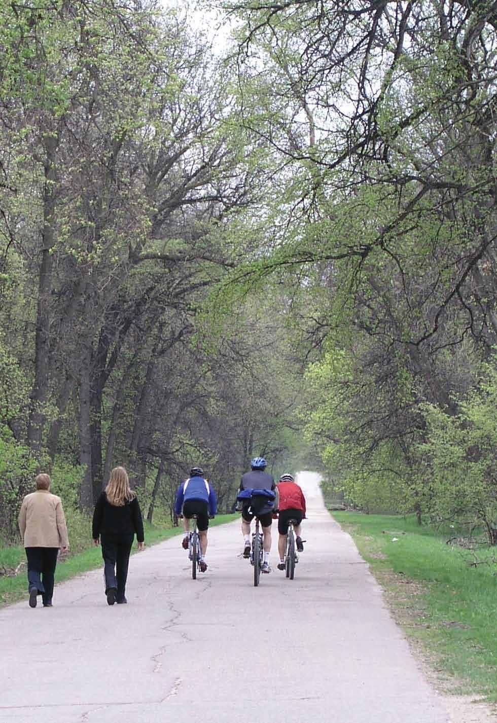
23 Urban AT Facilities In urban areas, AT trips are both utilitarian and recreational in nature. Trips tend to be generated more for commuting and less for touring or tourism purposes. Consider the intended destinations and AT user types when establishing a facility. Urban AT Trails Trails are outside of motor vehicle rights-of-way and are intended to create an enjoyable environment for all AT modes. Trails enable walking, cycling and small wheel use in warmer months, and cross-country skiing and snowshoeing in winter. Trails are much like linear parks, sharing the same features and requiring the same maintenance standards. Strategies Include trails in development plans and secondary plans. This is particularly important if curvilinear or cul-de-sac networks are planned, as trails improve connectivity for AT. Use trails to provide access to natural and historic areas. Use abandoned or existing rail corridors (rails-to-trails or rails-withtrails), utility corridors and drainage facilities. Structures such as bridges may already be available, and there may be few intersections, allowing for long stretches of uninterrupted travel. Trails should provide ample space for different AT users. For example, the trail should allow a fast-moving cyclist to safely pass people who are leisurely walking and socializing. Facility width, pavement markings, or physical barriers are ways to accomplish this. Choose a surface material that best suits the context. Paved facilities accommodate more AT users than gravel, especially wheelchairs or small wheels. Landscape the space surrounding trails. Include amenities such as benches, rest areas and water fountains to make the trail more comfortable. Use signage to communicate trail rules and etiquette. When trails are shared by multiple modes, all people should understand how they are expected to use the trail to prevent conflict, especially in tourist areas where users may be very unfamiliar with the trail. 23 for Manitoba Municipalities
24 Maps and trail markers help to orient users and reassure them they remain on the right path, especially in remote areas. Fencing may be necessary along some parts of a trail, but avoid fencing on both sides so the user will not feel trapped. Ensure safety at all roadway and railway crossings. See Manitoba s Guidelines for the Construction of Recreational Trails on or in Proximity to a Departmental Road and Transport Canada s Grade Crossing Standards for detailed requirements. Consult a detailed design manual for more guidance, such as Vélo Quebec s Planning and Design for Pedestrians and Cyclists. Local Streets Local or residential streets provide access to homes and other land uses through a safe and comfortable AT environment. Whether children are playing or older adults strolling, these streets should feel safe for all ages and mobility levels. Sidewalks are important provisions in residential areas; however, special bicycle facilities are typically not needed due to low motor vehicle volumes and speeds. When traveling on the road, cyclists are required to follow the same rules of the road as motorists. They may not use sidewalks unless expressly indicated. Children, however, may cycle on sidewalks in Manitoba. Motor vehicle access is also an important consideration on local streets. Driveways or on-street parking allocations should be considered and integrated into the facility. Traffic calming strategies can be used to reduce motor vehicle speeds and minimize conflict among users. Strategies Use partial street closures to block motorized through-traffic but allow pedestrian and bicycle flow. Install speed humps to reduce motor vehicle speeds. Install raised crosswalks to increase driver awareness of the presence of pedestrians. Raise driveways along sidewalks, indicating pedestrian priority. Reduce speed limits. Relatively low speeds of km/h can accommodate cyclists and motorists in shared lanes, and provide a safe and comfortable street environment for pedestrians. For more information, consult a detailed design guide such as: Ontario Traffic Manual: Cycling Facilities; Vélo Quebec s Planning and Design for Pedestrians and Cyclists; or the Oregon Department of Transportation s Bicycle and Pedestrian Design Guide. for Manitoba Municipalities 24
25 Collector Streets Collector streets provide a transition between local streets and main streets or through streets. Collector streets also provide connections within neighbourhoods, allowing children to safely travel to school, and residents to access nearby services and amenities. Motor vehicle movement and land use access are also functions of collector streets, with on-street parking and driveways provided. Strategies Build sidewalks on both sides of the street. Reduce speed limits to km/h if necessary to promote safe interaction between motor vehicles and AT users. Add on-street bicycle facilities such as bike lanes. This narrows motor vehicle lanes, thereby causing motor vehicles to reduce speeds and increase attentiveness towards AT. Install median islands and bulb-outs or curb extensions at intersections to reduce the road space for motor vehicles, lower their turning speeds, and shorten pedestrians crossing distance. Remember to accommodate cycling access through curb extensions. Main Streets Main streets are hubs of social interaction and economic activity, and are often found at the centre of older villages, towns and cities. Land uses along main streets are dense and diverse, and run directly adjacent to the sidewalk. This creates an ideal environment for pedestrians and cyclists to access land uses as customers, clients and employees. As an enjoyable social environment, people may window shop with friends, bump into an acquaintance, or meet up with a neighbour for coffee. Main streets also accommodate motor vehicle and truck traffic, with features such as on-street parking and loading zones. Designers must balance the needs of all users on these streets, which is a challenge with limited right-of-way. Strategies Create an enjoyable environment where people can visit, linger and enjoy. Install public art, good-quality lighting, vegetation and engaging design features along the streetscape. Encourage businesses to open patios and other spaces that open onto the street. Install street furniture and vegetation (ex: benches, garbage cans, lamp posts, bike racks, planters and trees) but ensure that walking space and building access along sidewalks remain unobstructed. 25 for Manitoba Municipalities
26 Consider design features to accommodate pedestrian street crossings such as median islands and bulb-outs or curb extensions. Reduce conflicts between pedestrians and motorists through access management techniques, such as raised medians and consolidated driveways. Drive-through windows require a lot of space and lead to idling and congestion. They are not pedestrian friendly and some discourage bicycle use. Drive-through windows can be limited in zoning by-laws, particularly in high-pedestrian areas. Alternatively, walk-up windows are very useful for pedestrians and can contribute to street activity. Provide bike parking near services and amenities to facilitate cycling access. At signalized intersections, increase cyclists access to land use and travel efficiency through bike boxes and separate bike signals. Bike boxes extend bicycle facilities in front of vehicle stop lines, allowing the cyclist to proceed first, which is particularly useful at left turns. Signals featuring a bicycle pictogram provide a specific signal for bicycles and are useful in areas with frequent bike traffic. Provide adequate space between cyclists and parallel parked vehicles to minimize risks of cyclists colliding with opening car doors. Through Streets Through streets have been designed primarily to move motor vehicles. They have minimal land use access points and typically do not allow on-street parking. Big box stores and other low-density development are characteristically found along these corridors. High motor vehicle speeds and volumes minimize the safety and enjoyment of AT users; however, safe AT facilities can be provided to minimize on-street conflict and maintain AT network connectivity. Strategies Consider providing separated facilities. A multi use trail, as described above, can be designed for all AT users and can include landscaping elements to enhance aesthetics. Protected facilities are another option. A cycle track physically separates cyclists from motor traffic. A separate sidewalk is needed to accommodate pedestrians. If the sidewalk is immediately adjacent to the roadway, install barriers between the roadway and the sidewalk to enhance pedestrian safety. Intersections may be less frequent on through streets than on main streets. However, the same design features can be installed at through street intersections to ensure pedestrian safety, such as good quality lighting, cross walk enhancements and countdown signals. for Manitoba Municipalities 26

27 Rural AT Facilities In the rural context, AT is often identified as a recreational or touring activity. However, commuting and other utilitarian trips are common, especially in fringe areas around communities. Determine the purpose of the AT facility. Be aware of the destinations and attractions the facility is intended to access and consider the best type of facility for the application. Rural AT Trails The strategies to accommodate AT trails in rural areas are very similar to trails in urban areas, as described above. Additional points are highlighted here. Strategies Use AT trails to connect to popular recreation areas and parks to attract recreational users and tourists. Develop trails for AT users as an alternative to highways or corridors with high motor vehicle volumes and speeds. Aim to link communities across rural open spaces with good amenities and design features along the way. Rural Separated AT Facilities In the rural environment, it is sometimes necessary to provide AT facilities within the same corridor as a rural highway. Separated AT facilities in the rural context refer to facilities within a roadway right-of-way that are separated by a physical buffer, creating a barrier to high motor vehicle speeds and/or traffic volumes. Separated AT facilities have many of the same characteristics as rural AT trails but require special treatments to ensure a buffer between motor vehicles and AT users. Strategies Place separated facilities as far from the road as possible within the right-of-way; preferably at the back slope of the highway ditch or beyond. Landscape the space surrounding facilities if natural features are limited. This will provide additional buffer and will create a more pleasant experience for the AT user. As with trails, provide access to natural and historic areas, popular recreation areas and parks to attract recreational users and tourists. 27 for Manitoba Municipalities
28 Rural Municipal Roads and Service Roads Rural municipal roads typically facilitate low volumes of local motor vehicle traffic, creating a more comfortable environment for AT users. Rural municipal roads and service roads also provide access to residential properties and residents may use AT along these corridors. Strategies Pave the shoulders of rural municipal roads to provide additional space for AT use. Provide a separated AT facility along rural municipal roads with high AT use or high motor vehicle speeds and volumes. Pave service roads and install signage to indicate the presence of AT users. High Speed Rural Routes Generally, it is not advisable to identify high speed rural roadways as part of the AT network. The mix of high speed motor vehicle traffic with low speed, vulnerable AT users creates an unsafe and unpleasant experience. If AT facilities are to be included in these corridors, it is recommended that a separated facility is provided to enhance the user s safety and experience. End-of-Trip Facilities Pedestrians and cyclists are also customers, clients and employees, so be sure they are accommodated when they arrive at their destination. Strive to build buildings particularly workplaces, institutions and those providing goods or services to meet AT users needs. Here are points to consider when planning, designing and constructing buildings to accommodate AT: All facilities and destinations should have bicycle parking. Short-term parking, such as a basic bike rack, accommodates quick visits for meetings or meals at a restaurant. This type of facility should be widely available and of good design standard, allowing the frame and one or both wheels to be secured. A bike rack should be set away far enough from walls to allow bikes to be loaded properly and securely mounted to a hard surface. Long-term parking, such as a covered and protected bike cage, provides security for consistent use and longer stretches of time as needed by employees and students. Bicycle parking requirements can be included in the zoning by-law. Buildings should be universally accessible and easily approached on foot. Buildings and/or approaches built right to the sidewalk with car parking in the back are features that invite pedestrians. These design standards can be included in the zoning by-law or in supporting guidelines. for Manitoba Municipalities 28


29 Showers and lockers in buildings, especially workplaces, are very useful to those commuting long distances or in inclement weather. This sidewalk has not been maintained for universal accessibility. 29 for Manitoba Municipalities
30 VII. FINANCING, PROMOTION AND EDUCATION Financing Communities often want to be more walkable and bikeable but point to budget limitations as the reason for not taking action. In situations where the population is declining or a strong economic driver has closed or left the community, AT may be the last thing on anyone s mind. However, it is worth rethinking this assumption. AT enhances the quality of life of residents and can improve prospects for a community s future. Limited budgets and declining populations may actually be good reasons to invest in small, targeted AT projects as a way to invite young families and investment into a community. Demand for these features is growing, particularly in younger demographics. When compared to road projects or transit, AT can make a big impact for a comparatively small investment. Financing AT should be included as part of your community s overall AT plan. Look at the potential projects and upgrades you have included, and turn to your municipal annual financial plan to see how these may be accommodated in the short, medium and long terms. The municipal annual financial plan includes an operating and a capital budget. Revenue sources for AT operations may include: Property taxes; transfers from reserves and nominal surplus; conditional and unconditional provincial grants as appropriate; federal grants; and funds from other organizations such as community foundations. Capital projects can be funded through general borrowing to support a project for the whole community, or a local improvement plan for a project that may benefit only a certain area, such as a village within a rural municipality. Fundraising events and volunteer initiatives can also be very effective ways to support AT facility development. Use your AT plan to guide how you will incorporate AT into your annual financial planning. Remember that projects can be planned out fully in the AT plan but funded and completed in phases over several fiscal years. Take advantage of other rehabilitation projects, such as road resurfacing or sewer system repairs. These are opportunities to modify the street geometry to reallocate public space to widen sidewalks, and to incorporate vegetation and street furniture for pedestrians and cyclists. Include these considerations in your plans. Regular, ongoing funding directed to AT, even if modest, is essential. This will encourage community planning and transformation over the long term; stimulate local discussion about the level of funding granted to AT initiatives; and raise awareness among elected officials, municipal staff and citizens to the continuous implementation of AT measures. For more information on municipal finance, see the Municipal Finance and Advisory Services pages of the Manitoba Municipal Government Web site: For information on specific AT funding, visit the Province of Manitoba s AT Web Portal: for Manitoba Municipalities 30

31 For detailed information on cost and making the case for investments in walking and cycling infrastructure, see the US Federal Highway Administration s Costs for Pedestrian and Bicyclist Infrastructure Improvements. Promotion AT investments are worthwhile if people choose to use them, so encourage all citizens to use your AT facilities by promoting what you have. In some communities where cycling and walking are not commonly used as modes of transportation, culture can be a barrier. Seek out champions to help overcome this. Encourage elected officials and prominent local figures to cycle and walk. Over time, this will help AT become a normal activity. Hosting AT events in your community gives champions a showcase and also encourages broad participation for all community members. Campaigns such as the Commuter Challenge, Bike to Work Day and International Walk to School Month help to integrate AT into everyday life. Walking tours, street festivals and races where streets are temporarily closed to motor vehicles also raise the profile of AT. See the Green Action Centre s Web site ( for ongoing events throughout Manitoba. 31 for Manitoba Municipalities
32 Harness Manitoba s winter as an opportunity to cross-promote AT and your community during colder months. Designate AT routes and keep them clear of snow. Hold seasonal AT events, such as Winter Bike to Work Day and the Jack Frost Challenge. Tie these to other winter programming, activities and amenities such as winter fairs or festivals. Consider joining the Winter Cities Institute and consult their Web site for other ideas and resources ( In cases where some community members may be skeptical of the benefits of AT or where funds are very limited, consider a demonstration or showcase project. This will also allow small, short-term, incremental improvements that may really make a difference to the user. Focus on pinch points and dangerous areas on AT routes that dissuade users. Monitor the progress and report on results to build a case for future expansion. Tie AT amenities to programming. Schools may be doing school travel planning; workplaces may offer a transportation options program; or CAN-BIKE clinics may be available in your community. Some communities and businesses offer a bike share program. Such programs encourage people to use AT facilities, thereby raising the profile of AT in the community. Visit the Green Action Centre s Web site ( for information on AT programming in schools and workplaces. Look at what your neighbours are doing and adapt it to your situation. Tailor others ideas to your local topographic, financial, and behavioural context and highlight the unique AT features in your community. Remember that people will generally choose AT for the same reasons they choose other modes: Because it is convenient, fast and simple. They will also enjoy the health, financial and environmental benefits. Try to build a network that appeals to people s natural tendencies and their immediate needs and demands, then promote the broader benefits of using the network so more people will use it. See Transport Canada s Active Transportation in Canada: A Resource and Planning Guide and the Physical Activity Coalition of Manitoba (PACM) Web site ( for detailed information on the benefits and rationale of AT, including research to support the outcomes and concrete examples. Compile your ideas into a promotion strategy with a timeline. For more information on promoting AT, see the Web sites of the Victoria Transport Policy Institute ( and MPI ( Education As part of a promotional program, it is wise to incorporate an education and awareness program as part of the implementation plan for your AT network. As with any new infrastructure, there will be a period of time where both users and non-users must adapt to the new and unfamiliar additions. Early information sessions will help to inform people that new AT facilities are in the works. You can use these sessions to inform people where and when to expect the new facilities to be developed. for Manitoba Municipalities 32

33 Ongoing educational pieces that provide information about how to use AT facilities will give AT users the tools to use the facilities properly and safely. In addition, nonusers such as motorists must be informed of how new AT facilities operate. Engage children in local schools to promote AT safety and awareness. A community education program such as active school travel planning can teach students about local AT facilities and how to use them. This will foster lifelong healthy living skills for the young people of your community. Visit the Green Action Centre s Web site ( for detailed information about school travel planning. 33 for Manitoba Municipalities

34 VIII. OPERATION AND MAINTENANCE Perhaps the most important consideration when developing any new municipal infrastructure is operation and maintenance. Well-maintained infrastructure can provide high quality service for many years. Without it, facilities can fall into disrepair and become unsafe. After you have invested in AT, the success of the network will depend on how well it is operated and maintained. Resources Include network operation and maintenance in your AT plan. Identify who will take care of the network once it is in place. These may be municipal staff or community partners, other levels of government, volunteers or private citizens or groups. As with human resources, plan for how to fund annual operation and maintenance. Regularly assess the condition of your network and plan major maintenance activities well in advance. Be aware that, from time to time, the network will require unexpected or emergency repairs. Consider such costs and include them as part of the operating budget. Operations and Signage Operations typically refer to the means by which you ensure safe and efficient use of the network. There is considerable science behind the operation of transportation systems including AT network operation. As such, it is recommended that you engage appropriate engineering expertise to develop an operations plan for your network. The plan should address the consistent application of pavement markings, signage and crossing treatments. There are a number of sources that provide standards for operation and signage, such as the Transportation Association of Canada s Bikeway Traffic Control Guidelines for Canada. for Manitoba Municipalities 34


35 Contingencies for Emergencies There may be occasions when you need to close pieces of your AT network for emergency purposes (ex: washouts, flooding, etc.). Have a contingency plan in place that clearly outlines who has authority to close a route, who is responsible for implementing the closure, how the closure will be communicated to stakeholders and the public, and what temporary remedial measures can be taken such as detours or re-routing while undertaking emergency repairs. Maintenance AT facilities must be maintained like any other form of municipal infrastructure. Costs must be considered and included as part of the operating budget. Typical AT maintenance activities include the following, many of which can be incorporated as part of regular road or parks maintenance: Sweep all sidewalks, bike lanes and pathways regularly so they are free of debris or hazards such as sand, gravel and leaves. Re-paint crosswalk and bike lane markings as needed. Monitor amenities such as street furniture and bike racks to ensure they are kept in good condition, and check that lighting and signals are in working order. Repair any damage such as potholes, broken curbs and cracks in sidewalks and paths. Keep the drainage system clear, including any ditches and culverts along multi-use trails. Prune trees and shrubs and mow grass along sidewalks and multi-use trails to ensure paths are clear. This trail needs maintenance. Replace materials as they reach the end of their useful life, including signage, amenities and surface materials. This herringbone drain cover is designed to prevent bike tires from catching. 35 for Manitoba Municipalities


36 Special Operational Considerations Active Transportation at Night Remember that people use AT at night. Safety and security for after dark AT users should be a consideration when developing your network. AT facilities that are visible, properly signed and well-lit will improve the overall comfort level for users. Consideration should be given to the use of illumination, retroreflective signage and pavement markings, proper surface maintenance, and well-identified roadway and railway crossings. Active Transportation in Winter No discussion of AT in Manitoba is complete without a reference to winter. Cold, snowy and dark winters can make cycling and walking uncomfortable and inconvenient. However, these very conditions can also make a variety of AT modes useful, convenient and fun. For more detailed information on AT in winter, visit the Winter Cities Institute Web site ( In winter, keep sidewalks clear at a minimum. A thin layer of snow left on sidewalks will enable sleds to be used. Consider the need for sanding AT trails for better traction, especially in locations with high volumes of pedestrians. When plowing streets, take care that the windrows formed do not block sidewalks and intersections, and that they do not impede sightlines. Windrows piled carelessly can cause safety hazards and delays, and may cause a route to be outright inaccessible for those with limited mobility. If your community is keen on year-round cycling, designate certain routes as winter cycling routes and keep them clear of snow and debris. This may include shared roadways, bike paths and multi-use trails. Also, ensure bicycle parking facilities remain accessible. End-of-trip facilities such as showers and lockers will be particularly appreciated by winter cyclists. Snow on recreational trails can be groomed for hiking and cross-country skiing, or left as-is for showshoeing. for Manitoba Municipalities 36

37 Measurement and Evaluation As you implement your plan, monitor and measure the results by gathering as much information as you can. Examples include the following: Kilometers of AT infrastructure built Number of amenities built or improved Number of users on the AT network Number of new AT users Number of people within trailhead radius Reduction in collisions on and off roads Number of tourist visits User satisfaction The methods used to collect this information are the same as for initial datagathering (traffic counts, surveys, interviews, etc.). See Vélo Quebec s Planning and Design for Pedestrians and Cyclists and other resources listed at the end of this guide for more information on conducting surveys and traffic counts. As your community becomes more familiar with AT, begin to set targets or performance measures and work towards those goals. Evaluate the implementation of your plan against those targets. Over time, it may be possible to assess broader outcomes such as public health and well-being. See the Public Health Agency of Canada s Mobilizing Knowledge on Active Transportation project for more information on evaluation. 37 for Manitoba Municipalities

38 IX. DOCUMENTING THE PROCESS It is important to document the process and findings of your efforts. Developing a complete report will help with communicating the AT planning process with stakeholders and decision makers in a concise and transparent fashion both now and in the future. By documenting the process, you will be able to retrace your steps in the future so that you can update and expand on the work that has been done to-date in a consistent manner. AT in the Long Term Once you ve developed and begun to implement your AT plan, keep it alive by revisiting it every five years or so. Consult the community to confirm the overall direction of the plan. Revise or refresh sections as needed to reflect the way the community is changing, and ensure it continues to be integrated with other planning documents, especially the development plan. Consult other resources to keep up-to-date with best practices around the world. It can take many years to develop a fully-functioning AT network so it s never too early to start. Begin with a concise, doable plan with targeted projects and build from there. When investing, think strategically, regionally and long-term. AT is growing in popularity, especially among younger generations, so start today to build a network that will benefit the accessibility and mobility of all citizens in the future. for Manitoba Municipalities 38
Chapter 7. Transportation. Transportation Road Network Plan Transit Cyclists Pedestrians Multi-Use and Equestrian Trails
 Chapter 7 Transportation Transportation Road Network Plan Transit Cyclists Pedestrians Multi-Use and Equestrian Trails 7.1 TRANSPORTATION BACKGROUND The District of Maple Ridge faces a number of unique
Active Transportation Infrastructure Investment A Business Case
 Active Transportation Infrastructure Investment A Business Case In 2016, the Real Estate Foundation awarded the Capital Regional District a $50,000 grant for Shifting Gears: Land Use Change through Active
Cyclists and Bikeways: What s your match? A guide to bikeway options for a variety of cyclists
 Cyclists and Bikeways: What s your match? guide to bikeway options for a variety of cyclists The workshop and this resource were made possible by funding from the Province of Ontario via the Ministry of
Living Streets Policy
 Living Streets Policy Introduction Living streets balance the needs of motorists, bicyclists, pedestrians and transit riders in ways that promote safety and convenience, enhance community identity, create
University of Victoria Campus Cycling Plan Terms of Reference. 1.0 Project Description
 University of Victoria Campus Cycling Plan Terms of Reference 1.0 Project Description The Campus Cycling Plan, a first for the University, will provide a comprehensive and coordinated approach to support
COUNCIL POLICY NAME: COUNCIL REFERENCE: 06/119 06/377 09/1C 10llC 12/1C INDEX REFERENCE: POLICY BACKGROUND
 COUNCIL POLICY NAME: COUNCIL ADVISORY COMMITTEES - TERMS OF REFERENCE ISSUED: APRIL 3, 2006 AMENDED: NOVEMBER 27, 2006 NOVEMBER 23, 2009 JANUARY 11, 2010 DECEMBER 17, 2012 POLICY COUNCIL REFERENCE: 06/119
Kelowna On the Move. Pedestrian and Bicycle Master Plan
 Kelowna On the Move Pedestrian and Bicycle Master Plan Executive Summary April 2016 Purpose of the Plan The Pedestrian and Bicycle Master Plan identifies infrastructure, planning, and policy requirements
Perryville TOD and Greenway Plan
 Perryville TOD and Greenway Plan Greenway Glossary Pathway: A bicycle and pedestrian path separated from motorized vehicular traffic by an open space, barrier or curb. Multi-use paths may be within the
CITY OF BLOOMINGTON COMPLETE STREETS POLICY
 CITY OF BLOOMINGTON COMPLETE STREETS POLICY POLICY OBJECTIVE: The City of Bloomington will enhance safety, mobility, accessibility and convenience for transportation network users of all ages and abilities,
Transportation Master Plan Advisory Task Force
 Transportation Master Plan Advisory Task Force Network Alternatives & Phasing Strategy February 2016 BACKGROUND Table of Contents BACKGROUND Purpose & Introduction 2 Linking the TMP to Key Council Approved
EXECUTIVE SUMMARY. Vision
 Vision Walking and bicycling in Salt Lake City will be safe, convenient, comfortable, and viable transportation options that connect people to places, foster recreational and economic development opportunities,
Exhibit 1 PLANNING COMMISSION AGENDA ITEM
 Exhibit 1 PLANNING COMMISSION AGENDA ITEM Project Name: Grand Junction Circulation Plan Grand Junction Complete Streets Policy Applicant: City of Grand Junction Representative: David Thornton Address:
City of Novi Non-Motorized Master Plan 2011 Executive Summary
 City of Novi Non-Motorized Master Plan 2011 Executive Summary Prepared by: February 28, 2011 Why Plan? Encouraging healthy, active lifestyles through pathway and sidewalk connectivity has been a focus
CONNECTING PEOPLE TO PLACES
 CONNECTING PEOPLE TO PLACES 82 EAST BENCH MASTER PLAN 07 Introduction The East Bench transportation system is a collection of slow moving, treelined residential streets and major arteries that are the
ACTIVE TRANSPORTATION
 ACTIVE TRANSPORTATION Mobility 2040 Supported Goals Improve the availability of transportation options for people and goods. Support travel efficiency measures and system enhancements targeted at congestion
Corpus Christi Metropolitan Transportation Plan Fiscal Year Introduction:
 Introduction: The Safe, Accountable, Flexible, Efficient Transportation Equity Act: A Legacy for Users (SAFETEA-LU) has continued the efforts started through the Intermodal Surface Transportation Efficiency
Appendix 3 Roadway and Bike/Ped Design Standards
 Appendix 3 Roadway and Bike/Ped Design Standards OTO Transportation Plan 2040 4/20/2017 Page A3-1 Adopted Standards The adopted OTO Design Standards and Major Thoroughfare Plan are contained herein.
Proposed. City of Grand Junction Complete Streets Policy. Exhibit 10
 Proposed City of Grand Junction Complete Streets Policy Exhibit 10 1 City of Grand Junction Complete Streets Policy Vision: The Complete Streets Vision is to develop a safe, efficient, and reliable travel
CITY OF SAINT JOHN TRAFFIC CALMING POLICY
 CITY OF SAINT JOHN TRAFFIC CALMING POLICY VERSION: 1.0 April 10, 2012 Pedestrians, Cyclists and Motorists Sharing Street Spaces CONTENTS INTRODUCTION... 3 POLICY GOAL... 3 POLICY OBJECTIVES... 3 GUIDING
Complete Streets. Designing Streets for Everyone. Sarnia
 Complete Streets Designing Streets for Everyone Sarnia Complete Streets ~ Sarnia ~ 2018 Introduction Our City is made up of a network of streets that we use to go for a walk, cycle to work, drive to the
Tonight is for you. Learn everything you can. Share all your ideas.
 Strathcona Neighbourhood Renewal Draft Concept Design Tonight is for you. Learn everything you can. Share all your ideas. What is Neighbourhood Renewal? Creating a design with you for your neighbourhood.
Solana Beach Comprehensive Active Transportation Strategy (CATS)
") Solana Beach Comprehensive Active Transportation Strategy (CATS) 3.0 Goals & Policies The Solana Beach CATS goals and objectives outlined below were largely drawn from the Solana Beach Circulation Element
Solana Beach Comprehensive Active Transportation Strategy (CATS) 3.0 Goals & Policies The Solana Beach CATS goals and objectives outlined below were largely drawn from the Solana Beach Circulation Element
INDOT Complete Streets Guideline & Policy
 INDOT Complete Streets Guideline & Policy INTRODUCTION The Complete Streets guidelines build upon multiple efforts and promote a multimodal transportation system that is integrated and sustains land use
5. Pedestrian System. Accomplishments Over the Past Five Years
 5. Pedestrian System Accomplishments Over the Past Five Years The Alamo Area Metropolitan Planning Organization (MPO) and its partner agencies recognize the importance of improving pedestrian mobility.
TOWN OF PORTLAND, CONNECTICUT COMPLETE STREETS POLICY
 TOWN OF PORTLAND, CONNECTICUT COMPLETE STREETS POLICY I. VISION, GOALS & PRINCIPLES VISION To improve the streets of Portland making them safer and more accessible for all users including pedestrians,
Shifting Gears for a Healthier City
 Shifting Gears for a Healthier City Mississauga s Cycling Master Plan is an ambitious strategy that sets out to transform Mississauga into a city that is conducive to cycling for daily transportation needs.
Active Transportation Facility Glossary
 Active Transportation Facility Glossary This document defines different active transportation facilities and suggests appropriate corridor types. Click on a facility type to jump to its definition. Bike
Chapter 2. Bellingham Bicycle Master Plan Chapter 2: Policies and Actions
 Chapter 2 Bellingham Bicycle Master Plan Chapter 2: Policies and Actions Chapter 2: Policies and Actions The Bicycle Master Plan provides a road map for making bicycling in Bellingham a viable transportation
City of Elizabeth City Neighborhood Traffic Calming Policy and Guidelines
 City of Elizabeth City Neighborhood Traffic Calming Policy and Guidelines I. Purpose: The City of Elizabeth City is committed to ensure the overall safety and livability of residential neighborhoods. One
Section 9. Implementation
 Section 9. Implementation The transportation system is just one of many aspects that must be carefully planned to maintain and enhance the quality of living in Cecil County. The Cecil County Bicycle Plan
TRAFFIC CALMING GUIDE FOR TORONTO CITY OF TORONTO TRANSPORTATION SERVICES DIVISION
 TRAFFIC CALMING GUIDE FOR TORONTO CITY OF TORONTO TRANSPORTATION SERVICES DIVISION CITY OF TORONTO TRANSPORTATION SERVICES DIVISION 2016 TRAFFIC CALMING GUIDE FOR TORONTO TABLE OF CONTENTS Introduction
ACTIVE TRANSPORTATION/NONMOTORIZED TRANSPORTATION
 ACTIVE TRANSPORTATION/NONMOTORIZED TRANSPORTATION BACKGROUND Active transportation, also known as nonmotorized transportation, is increasingly recognized as an important consideration when planning and
Executive Summary Route 30 Corridor Master Plan
 Route Corridor Master Plan Project Overview The Route Corridor Master Plan is a coordinated multimodal transportation and land use plan for the entire stretch of Route through East Whiteland Township,
General Design Factors
 Chapter 3: 3-1.0 Introduction General Design Factors Mn/DOT s goals include encouraging and accommodating safe bicycling. From a design perspective, these goals are achieved by first having an understanding
REGIONAL BICYCLE AND PEDESTRIAN DESIGN GUIDELINES
 REGIONAL BICYCLE AND PEDESTRIAN DESIGN GUIDELINES November 16, 2011 Deb Humphreys North Central Texas Council of Governments Bicycle and Pedestrian Advisory Committee Snapshot of the Guide 1. Introduction
SUPPORTING DOCUMENTATION PROPOSED TRAILS DEVELOPMENT AND IMPLEMENTATION PLAN
 SUPPORTING DOCUMENTATION PROPOSED TRAILS DEVELOPMENT AND IMPLEMENTATION PLAN Prepared For: Prepared By: Town of Rocky Mountain House Recreation, Parks and Community Services 1 INTRODUCTION 1.1 Purpose
Agenda. Overview PRINCE GEORGE S PLAZA METRO AREA PEDESTRIAN PLAN
 PRINCE GEORGE S PLAZA METRO AREA PEDESTRIAN PLAN May 28, 2008 Agenda Welcome and introductions Project overview and issue identification Planning context and strengths Design challenges and initial recommendations
Climate Change Action Plan: Transportation Sector Discussion Paper: Cycling
 Climate Change Action Plan: Transportation Sector Discussion Paper: Cycling ontario.ca/climatechange Contents 1. Minister of Transportation s message... 3 2. Introduction... 5 3. Sector Overview and Support
NOTES FROM JUNIOR COUNCIL ORIENTATION SESSION HELD ON MONDAY, JANUARY 22, 2018, AT 3:30 PM IN COUNCIL CHAMBERS, CITY HALL
 CITY OF KAMLOOPS Junior Council Meeting Agenda March 12, 2018, at 3:30 pm in Council Chambers, 7 Victoria Street West, Kamloops, BC Page 1. APPROVAL OF THE AGENDA 2. MINUTES Attachment Recommendation:
APPENDIX A: Complete Streets Checklist DRAFT NOVEMBER 2016
 APPENDIX A: Complete Streets Checklist DRAFT NOVEMBER 2016 Complete Streets Checklist MetroPlan Orlando s Complete Streets Checklist is an internal planning tool for staff to further implementation of
Chapter 3 DESIGN SPECIFICATIONS
 Brampton PathWays Planning and Design Guidelines 27 Chapter 3 DESIGN SPECIFICATIONS 3.1 CLASS 1 MULTI-USE PATH Off-road multi-use trails are the backbone of the Brampton PathWays Network. They are typically
Downey Road. Transportation Improvement Study
 Downey Road Transportation Improvement Study Workshop 2 Participant Handbook Workshop 1 May 18 and 19, 2016 Workshop 2 June 23 and 28, 2016 Prepared By: City of Guelph Paradigm Transportation Solutions
River Road - Proposed Road Safety Enhancement Measures
 City of Richmond Report to Committee To: From: Re: Public Works and Transportation Committee Victor Wei, P. Eng. Director, Transportation Date: June 6, 2017 River Road - Proposed Road Safety Enhancement
10.0 CURB EXTENSIONS GUIDELINE
 10.0 CURB EXTENSIONS GUIDELINE Road Engineering Design Guidelines Version 1.0 March 2017 City of Toronto, Transportation Services City of Toronto Page 0 Background In early 2014, Transportation Services
Non-Motorized Transportation 7-1
 Non-Motorized Transportation 7-1 Transportation facilities no longer mean just accommodating a vehicle powered by a combustion engine. Pedestrian and non-motorized facilities are important modes of travel
Moving Cambridge. City of Cambridge Transportation Master Plan Public Consultation Centre. March 7, :00 8:00 PM.
 City of Cambridge Transportation Master Plan Public Consultation Centre March 7, 2018 5:00 8:00 PM Region of Waterloo City of Cambridge Transportation Master Plan Public Consultation Centre March 7, 2018
Madison Urban Area and Dane County. Bicycle Transportation Plan Summary. September Introduction. Bicycle Plan Scope and Planning Process
 Bicycle Transportation Plan Summary Madison Urban Area and Dane County Introduction September 2000 Bicycling is an important mode of transportation in the Madison urban area and countywide that is available
Omaha s Complete Streets Policy
 Omaha s Complete Streets Policy (Adopted August 2015) VISION To create great places and enhance our quality of life, the City of Omaha will provide safe, accessible streets for all users. Complete Streets
RESOLUTION NO ?? A RESOLUTION OF THE CITY OF NEPTUNE BEACH ADOPTING A COMPLETE STREETS POLICY
 RESOLUTION NO. 2018-?? A RESOLUTION OF THE CITY OF NEPTUNE BEACH ADOPTING A COMPLETE STREETS POLICY WHEREAS, safe, convenient, and accessible transportation for all users is a priority of the City of Neptune
Implementing Active Transportation (AT) Facilities in Small Communities
 Facilities in Small Communities") Implementing Active Transportation (AT) Facilities in Small Communities Dave McLaughlin M.ES, MCIP, RPP, Partner & Senior Project Manager Presenters: Jay Cranstone, MLA, OALA, CSLA, Associate & Senior
Implementing Active Transportation (AT) Facilities in Small Communities Dave McLaughlin M.ES, MCIP, RPP, Partner & Senior Project Manager Presenters: Jay Cranstone, MLA, OALA, CSLA, Associate & Senior
Toronto Complete Streets Guidelines
 88 90 5.1 Cycling Design Principles 92 5.2 Context-sensitive Cycling Facilities 96 5.3 Key Cycling Elements Cycling infrastructure provides choice in how people are able to move around the city. Cyclists
PRINCE GEORGE S PLAZA METRO AREA PEDESTRIAN PLAN
 PRINCE GEORGE S PLAZA METRO AREA PEDESTRIAN PLAN May 28, 2008 Agenda Welcome and introductions Project overview and issue identification Planning context and strengths Design challenges and initial recommendations
EXECUTIVE SUMMARY: TRANSIT-ORIENTED DEVELOPMENT IN SMITHS FALLS, ONTARIO; A COMPARISON BETWEEN TWO SITES
 EECUTIVE SUMMARY: TRANSIT-ORIENTED DEVELOPMENT IN SMITHS FALLS, ONTARIO; A COMPARISON BETWEEN TWO SITES Topic and Purpose In 2007, the Mayor of Ottawa s Task Force on Transportation suggested adding a
Welcome. Background. Goals. Vision
 Welcome The formal Public Information Centre (PIC) for the Transportation Master Plan How We GO will be held in early 2017. At that time we will present the recommended transportation system for Niagara
WELCOME. Purpose of the Open House. Update you on the project. Present a draft recommended plan. Receive your input
 WELCOME Purpose of the Open House The Town of Smiths Falls has initiated the Beckwith Street Redevelopment Plan that includes the preparation of a streetscape functional design for the renewal of Beckwith
7 Complete Streets & Roadway Aesthetics
 7 Complete Streets & Roadway Aesthetics 7.1 OVERVIEW Our streets lay the foundation for how we interface with travel needs, physical exercise, social exchanges and access to goods and services. They are
Classification Criteria
 SCHEDULE D TO RECOMMENDED OFFICIAL PLAN AMENDMENT NO. 40 SCHEDULE C-4 Road Criteria Criteria Traffic Service Objective Land Service/Access Typical Daily Traffic Volume Flow characteristics Travel Speed
CHAPTER 3: Vision Statement and Goals
 Davidson Walks & Rolls: Active Transportation Master Plan CHAPTER 3 Contents: Overview Vision Statement Measurable Goals Public Outreach CHAPTER 3: Vision Statement and Goals Overview The vision statement
Bicycle Master Plan Goals, Strategies, and Policies
 Bicycle Master Plan Goals, Strategies, and Policies Mobilizing 5 This chapter outlines the overarching goals, action statements, and action items Long Beach will take in order to achieve its vision of
City of Charlottesville Bicycle and Pedestrian Master Plan Update
 City of Charlottesville Bicycle and Pedestrian Master Plan Update September 17, 2014 I. Welcome and meeting overview II. Project status update III. Network overview IV. Break-out groups Pedestrian Network
2. Context. Existing framework. The context. The challenge. Transport Strategy
 Transport Strategy Providing quality connections Contents 1. Introduction 2. Context 3. Long-term direction 4. Three-year priorities 5. Strategy tree Wellington City Council July 2006 1. Introduction Wellington
o n - m o t o r i z e d transportation is an overlooked element that can greatly enhance the overall quality of life for the community s residents.
 N o n - m o t o r i z e d transportation is an overlooked element that can greatly enhance the overall quality of life for the community s residents. 84 Transportation CHAPTER 11 INTRODUCTION Transportation
4 Goals, Objectives & Actions
 Chapter4 4 This chapter presents goals, objectives, and recommended actions to support the vision of making Overland Park a safer and easier place to ride a bicycle. 35 4.1 Recommendations Structure The
NASHUA REGIONAL PLANNING COMMISSION REGIONAL BICYCLE AND PEDESTRIAN PLAN
 NASHUA REGIONAL PLANNING COMMISSION REGIONAL BICYCLE AND PEDESTRIAN PLAN June, 2005 Prepared by the Nashua Regional Planning Commission 2005 NRPC Regional Bicycle and Pedestrian Plan- JUNE 2005 ACKNOWLEDGEMENTS
West Dimond Blvd Upgrade Jodhpur Street to Sand Lake Road
 West Dimond Blvd Jodhpur St to Sand Lake CSS Transportation Project Summary Municipality of Anchorage Project # 05 005 Project Manager: John Smith, P.E. (MOA PM&E) Project Administrator: Julie Makela,
City of Waterloo Complete Streets Policy
 City of Waterloo Complete Streets Policy Chris Hodgson P. Eng City of Waterloo Complete Streets Forum 2011 April 28-29 Toronto Waterloo context: Current population Major employers Universities and student
NM-POLICY 1: Improve service levels, participation, and options for non-motorized transportation modes throughout the County.
 Transportation PRINCE WILLIAM COUNTY 2008 COMPREHENSIVE PLAN NON-MOTORIZED PLAN CONTENTS Goals, Policies, and Action Strategies Table 4 (Bike Facility Classifications and Descriptions) Table 5 (Bike Facility
Coquitlam Cross-town Bike Route Improving Bicycle Facilities in a Mature Suburban Environment
 Coquitlam Cross-town Bike Route Improving Bicycle Facilities in a Mature Suburban Environment Sarah Rocchi, Vice-President, Projects, Opus International Consultants (Main Presenter) Catherine Mohoruk,
7/23/2017 VIA . Michael Hanebutt City of Sacramento Community Development Department 300 Richards Boulevard, 3 rd Floor Sacramento, CA 95811
 7/23/2017 VIA EMAIL Michael Hanebutt City of Sacramento Community Development Department 300 Richards Boulevard, 3 rd Floor Sacramento, CA 95811 RE: 65 th Street Apartments (DR17-220) Dear Mr. Hanebutt:
Michael Parmer, Management Aide, City Manager's Office
 P139 STAFF REPORT f CITY NL- NAGER' S OFFICE RANCHO Date: C;UCAMONGA To: From: Subject: Mayor and Members of the City Council John R. Gillison, City Manager Michael Parmer, Management Aide, City Manager's
21.07 TRANSPORT CONNECTIVITY AND INFRASTRUCTURE
 21.07 TRANSPORT CONNECTIVITY AND INFRASTRUCTURE 21.07-1 Connectivity and Choice Transport connectivity and mode choice are critical to achieving productive, sustainable and socially just cities. Travel
Roadway Classification Design Standards and Policies. Pueblo, Colorado November, 2004
 Roadway Classification Design Standards and Policies Pueblo, Colorado November, 2004 Table of Contents Page Chapter 1. General Provisions 1.1 Jurisdiction 3 1.2 Purpose and Intent 3 1.3 Modification 3
NJDOT Complete Streets Checklist
 Background The New Jersey Department of Transportation s Complete Streets Policy promotes a comprehensive, integrated, connected multi-modal network by providing connections to bicycling and walking trip
WELCOME TO OPEN HOUSE # 1 June 14, 2017
 Langstaff Road Weston Road to Highway 7 Class Environmental Assessment Study WELCOME TO OPEN HOUSE # 1 June 14, 2017 Please sign in and join our mailing list Purpose of Open House #1 & Study Area York
The Florida Bicycle and Pedestrian Partnership Council
 The Florida Bicycle and Pedestrian Partnership Council Input to the Update of the Florida Transportation Plan March 2015 This document presents input from the Florida Bicycle and Pedestrian Advisory Council
Lee s Summit Road Improvement Study Public Open House June 7, 2007 Summary of Comment Card Responses
 Lee s Summit Road Improvement Study Public Open House June 7, 2007 Summary of Comment Card Responses Introduction At the Lee s Summit Road Improvement Study Public Open House held Thursday, June 7, 2007
Proposed Bridge Street East Bicycle Lanes Public Open House Thursday, April 27, 2017
 WELCOME Proposed Bridge Street East Bicycle Lanes Public Open House Thursday, April 27, 2017 Purpose of the Open House The purpose of this Open House is to gain public input on the bicycle lanes proposed
MAG Town of Cave Creek Bike Study Task 6 Executive Summary and Regional Significance Report
 Page 1 MAG Town of Cave Creek Bike Study Task 6 Executive Summary and Regional Significance Report August 1, 2012 MAG Project #481 Page 2 Task 6 Executive Summary and Regional Significance Report Introduction
City of Hamilton s Transportation Master Plan (TMP) Public Consultation 3 December 2015
 Public Consultation 3 December 2015") City of Hamilton s Transportation Master Plan (TMP) Public Consultation 3 December 2015 McPhail Transportation Planning Services Ltd. AGENDA 6:00 7:00 pm Viewing Boards / Q & A with the Team 7:00 7:50
City of Hamilton s Transportation Master Plan (TMP) Public Consultation 3 December 2015 McPhail Transportation Planning Services Ltd. AGENDA 6:00 7:00 pm Viewing Boards / Q & A with the Team 7:00 7:50
Corporate. Report COUNCIL DATE: June 26, 2006 NO: C012 COUNCIL-IN-COMMITTEE. TO: Mayor & Council DATE: June 22, 2006
 Corporate NO: C012 Report COUNCIL DATE: June 26, 2006 COUNCIL-IN-COMMITTEE TO: Mayor & Council DATE: June 22, 2006 FROM: General Manager, Engineering FILE: 0410-20(MoT/Gate) SUBJECT: Surrey Response on
5. RUNNINGWAY GUIDELINES
 5. RUNNINGWAY GUIDELINES These guidelines should be considered collectively when making runningway decisions. A runningway is the linear component of the transit system that forms the right-of-way reserved
Welcome! Public Open House on UBC s Transportation Plan
 1 Welcome! Public Open House on UBC s Transportation Plan Public open house hours: to When it comes to on-campus transportation, what do you think is working well and what are some opportunities for improvement?
TRANSPORTATION NEEDS ASSESSMENT
 TRANSPORTATION NEEDS ASSESSMENT A travel demand analysis was carried out to determine the operational issues and the potential benefit that adding traffic capacity would have on the road network. All the
Chapter 5. Complete Streets and Walkable Communities.
 Chapter 5. Complete Streets and Walkable Communities. 5.1 Description of Complete Streets. Cities throughout the world, and specifically the United States, are coming to embrace a new transportation and
Vision: Traditional hamlet with an attractive business/pedestrian friendly main street connected to adjacent walkable neighborhoods
 N D. Focus Area II Vision: Traditional hamlet with an attractive business/pedestrian friendly main street connected to adjacent walkable neighborhoods Transit Road Focus Area II is located in the Hamlet
Transportation Assessment
 Transportation Assessment Midtown Open House February 10, 2018 Overview Midtown in Focus Overview & Purpose of Today Transportation Assessment overview Summary of Transportation work to date Review & Analysis
2.0 LANE WIDTHS GUIDELINE
 2.0 LANE WIDTHS GUIDELINE Road Engineering Design Guidelines Version 2.0.1 May 2018 City of Toronto, Transportation Services City of Toronto Page 0 Background In early 2014, Transportation Services initiated
CITY OF COCOA BEACH 2025 COMPREHENSIVE PLAN. Section VIII Mobility Element Goals, Objectives, and Policies
 CITY OF COCOA BEACH 2025 COMPREHENSIVE PLAN Section VIII Mobility Element Goals, Objectives, and Policies Adopted August 6, 2015 by Ordinance No. 1591 VIII MOBILITY ELEMENT Table of Contents Page Number
Circulation in Elk Grove includes: Motor vehicles, including cars and trucks
 Circulation, as it is used in this General Plan, refers to the many ways people and goods move from place to place in Elk Grove and the region. Circulation in Elk Grove includes: Motor vehicles, including
How To Encourage More Efficient Transportation in Brazilian Cities
 How To Encourage More Efficient Transportation in Brazilian Cities Todd Litman Victoria Transport Policy Institute Presented Seminar on Discouraging The Use Of Cars São Paulo, Brazil 3 September 2013 Creating
AMATS Complete Streets Policy
 AMATS Complete Streets Policy Table of Contents: Section 1. Definition of Complete Streets Section 2. Principles of Complete Streets Section 3. Complete Streets Policy Section 4. Consistency Section 5.
CHAPTER 7.0 IMPLEMENTATION
 CHAPTER 7.0 IMPLEMENTATION Achieving the vision of the Better Streets Plan will rely on the ability to effectively fund, build and maintain improvements, and to sustain improvements over time. CHAPTER
Chapter VISION, MISSION, AND GOALS AND OBJECTIVES. Vision. Mission. Goals and Objectives CONNECTING COMMUNITIES ACROSS THE ST.
 VISION, MISSION, AND GOALS AND OBJECTIVES Chapter 3 The Plan s vision, mission, and goals and objectives were developed through a series of interactive exercises with the Citizens Advisory Committee (CAC)
Physical Implications of Complete Streets Policies
 Presentation Overview Physical Implications of Complete Norm Cox, ASLA, LLA Landscape Architect Ann Arbor, Michigan, 10:45 to Noon What Are Complete Streets? What Matters to Bicyclists and Pedestrians
Morristown, NJ Complete Streets Policy
 Morristown, NJ Complete Streets Policy Introduction A Complete Street is defined as a means to provide safe access for all users by designing and operating a comprehensive, integrated, connected multi-modal
CITY OF ELKO BICYCLE AND PATHWAY PLAN
 CITY OF ELKO BICYCLE AND PATHWAY PLAN INTRODUCTION: The City of Elko is intended to provide the basic framework for the development of a functional bicycle and pathway system for the community with connections
ACTIVE TRANSPORTATION Active Community Checklist
 ACTIVE TRANSPORTATION Active Community Checklist Safe, accessible spaces to walk, hike, bike and play is an important part of building strong, healthy and active communities for residents and visitors.
summary of issues and opportunities
 1 summary of issues and opportunities EXECUTIVE SUMMARY CHAPTER 2: HISTORY - 3: LAND USE This first chapter is an overview of lessons learned from analysis of the existing conditions on El Camino as well
POLICY: TRAFFIC CALMING
 2006 MAY REFERENCE: COUNCIL APPROVED BY COUNCIL MAY 23, 2006 CITY OPERATIONS - NO. 608 POLICY: TRAFFIC CALMING A. All requests for traffic calming within the City shall be considered in accordance with
5/31/2016 VIA . Arwen Wacht City of Sacramento Community Development Department 300 Richards Blvd., 3 rd Floor Sacramento, CA 95811
 5/31/2016 VIA EMAIL Arwen Wacht City of Sacramento Community Development Department 300 Richards Blvd., 3 rd Floor Sacramento, CA 95811 RE: El Pollo Loco (P16-028) Dear Ms. Wacht: WALKSacramento has reviewed