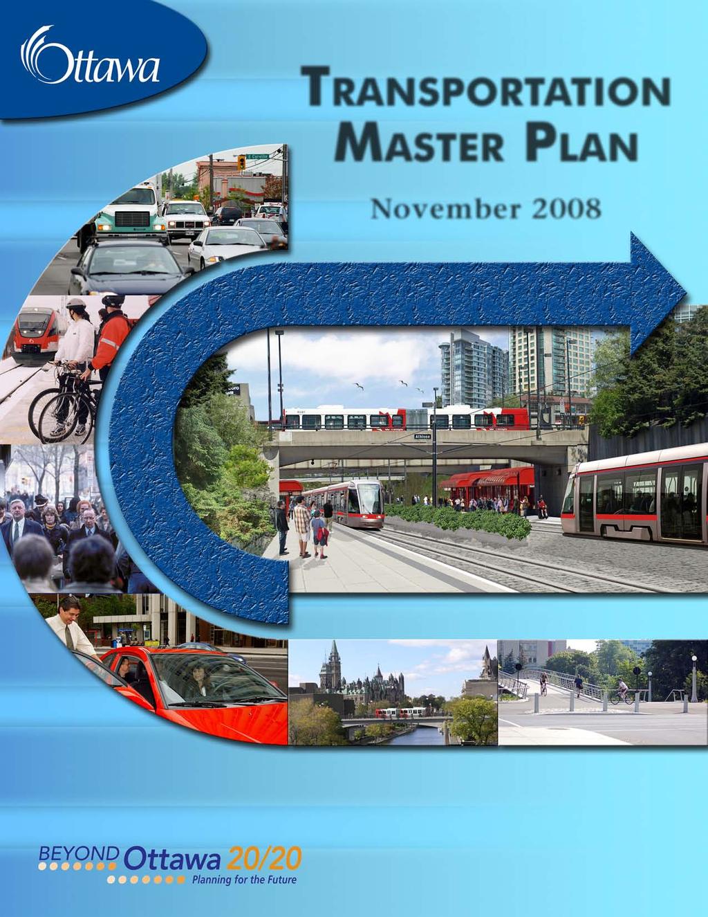
TRANSPORTATION MASTER PLAN
|
|
|
- Magnus Floyd
- 5 years ago
- Views:
Transcription
1
2 Table of Contents EXECUTIVE SUMMARY...iii Chapter 1 Introduction Ottawa s Growth Management Strategy Interpreting and Updating this Plan... 2 Chapter 2 Current and Future Conditions An Overview of Ottawa s Transportation System Population and Employment Distribution Current Travel Patterns and Trends Future Travel Patterns Chapter 3 Strategic Directions Ottawa s Transportation Vision Creating Supportive Land Use Managing Transportation Demand Managing the Transportation System Enhancing Safety and Security Minimizing Environmental Effects Managing and Maintaining Assets Funding Implementation Measuring Performance Chapter 4 Active Transportation: Walking and Cycling Supporting Measures Walking Facilities Cycling Facilities Multi-use Pathways Chapter 5 Public Transit Supporting Measures Ease of Mobility Economic Efficiency Accessibility for Customers with Disabilities Environmental Efficiency Chapter 6 Roads and Motor Vehicle Use City of Ottawa Roads Federal and Provincial Roads Road Right-of-way Protection Road Design Road Safety Road Corridor Optimization Area Traffic Management Ridesharing Taxis Goods Movement Parking Chapter 7 Intercity Travel Intercity Passenger Terminals General Aviation TRANSPORTATION MASTER PLAN Page i
3 Chapter 8 Implementation Capital Works Plan Costs Transportation Outlook Document Environmental Assessment ANNEX A Transportation Performance Objectives and Indicators ANNEX B Required Infrastructure Projects ANNEX C Glossary Maps MAPS 110 Map 1 Map 2 Map 3 Major Multi-Use Pathways (Urban) Primary Urban Cycling Transportation Network Rural Cycling Network and Major Multi-Use Pathways (Rural) Map 4a Rapid Transit Network Map 4b Map 4c Map 5a Map 5b Map 6 Map 7 Map 8 Map 9 Map 10a Map 10b Map 10c Rapid Transit Network - Ultimate Conceptual Interprovincial Transit Corridors Phase 1 - Transit Infrastructure Projects Phase 2 - Transit Infrastructure Projects Urban Road Network Central Area/Inner City Road Network Rural Road Network Road Network Select Villages Phase 1 - Roads Infrastructure Projects Phase 2 - Roads Infrastructure Projects Phase 3 - Roads Infrastructure Projects TRANSPORTATION MASTER PLAN Page ii
4 EXECUTIVE SUMMARY Introduction The Transportation Master Plan identifies the transportation facilities and services that the City of Ottawa will implement to serve a projected population of 1.14 million people by It sets direction for the City s day-to-day transportation programs, and provides a basis for budget planning. It supports the Ottawa 20/20 growth management strategy and the City s Official Plan, which guides the City s physical development. This plan will come to life through mechanisms such as long-range financial plans, mid-range implementation plans, annual budgets, program development, area and corridor transportation studies, design or practice guidelines, and Community Design Plans. The need to update this plan will be reviewed in conjunction with a similar assessment of the City s Official Plan, which is required every five years. Over the intervening time period, readers seeking a current statement of City transportation policies must consult the record of Council decisions in addition to this plan. Current and Future Conditions Transportation system overview. Ottawa s transportation system includes walking and cycling facilities, conventional and specialized bus services, Transitway and O-Train rapid transit lines, a road network and parking facilities. City-owned transportation facilities are complemented by freeways owned by the Province of Ontario, and by roads, interprovincial bridges and multi-use pathways owned by the federal government. There are also international and general aviation airports, intercity rail and bus stations, two ferries and a freight yard. Current travel patterns. During the morning peak hour in 2005 (origin destination survey), about 62% of Ottawa residents traveled by automobile compared to about 21% by transit, 9% by walking, 2% by cycling and 6% by other modes. Transit ridership has seen continuous growth since 1996, and Ottawa residents take transit, on average, 100 times annually more than residents in any city of comparable size in North America. While average household auto ownership increased by 10% from 1995 to 2005, the number of daily trips per person declined slightly Future travel patterns. Population and employment are expected to grow by about 30% and 35% respectively by 2031, with urban communities outside the Greenbelt projected to accommodate 68% of new residents and 42% of new jobs. As a result, the overall demand for morning peak hour person-trips on Ottawa s transportation system will grow by 38%. In view of this growth, this plan strives to minimize the future need for new and widened roads while avoiding levels of congestion that would have unacceptable implications for Ottawa s quality of life. It sets an ambitious transit modal split objective for 2031 of carrying 30% of motorized person-trips in the morning peak hour, a rate significantly greater than the 23% figure observed in Transit will carry 51% of motorized person-trips to and from Ottawa s Inner Urban Area TRANSPORTATION MASTER PLAN Page iii
5 (up from 39% in 2005), 33% of trips across the Greenbelt (up from 23%), and 43% of trips to and from Gatineau (up from 16%) during the morning peak hour, in the peak direction. This plan also sets ambitious objectives for walking and cycling. Respectively, these modes will carry 10% and 3% of all morning peak hour person-trips in 2031, up from 9.3% and 1.7% in 2005 (note these figures are averages for the fall season, and would be higher in summer and lower in winter). This represents a 33% increase in the number of walking trips, and a 139% increase in the number of cycling trips. Despite these substantial increases in the role of transit, walking and cycling, there will be significantly higher traffic volumes in every major travel corridor during the peak hour. Strategic Directions Transportation Vision. This plan identifies a vision that includes 12 elements and 39 supporting principles. The vision expresses how Ottawa s transportation system can support the community s social, environmental and economic sustainability, and how it should be managed to ensure accountability and responsiveness to residents and taxpayers. The plan also identifies eight strategic directions that are essential to achieving this vision, as discussed in the following paragraphs. These directions are themes that cut across the policies and programs for specific modes (e.g. active transportation, transit, motor vehicles) outlined in subsequent sections of the plan. Creating supportive land use. As detailed in the Official Plan, the City will shape development patterns by encouraging compact developments with a mix of uses, and by requiring supportive community and site design practices. Managing transportation demand. The City will develop and implement a transportation demand management (TDM) strategy that uses education, promotion and incentives, often delivered in partnership with employers and other organizations, to make alternatives to driving more attractive, build a positive public attitude towards them, and provide individuals with information and incentives that encourage responsible travel behaviours. Managing the transportation system. The City will maximize the efficiency and people-moving capacity of existing systems, in order to reduce the need for new infrastructure and services, achieve modal shift objectives, minimize the costs of congestion, and preserve public health. To this end, it will develop and implement new strategies to improve incident management and multimodal traveller information. Enhancing safety and security. The City will make walking, cycling, transit use and automobile travel safer and more secure through education, engineering and enforcement. Protecting the environment. The City will work to minimize the environmental effects of transportation infrastructure, services and activities by greening transportation corridors, designing and maintaining infrastructure to minimize impacts on water and land, encouraging cleaner fuel and vehicle technologies, and designing facilities and communities to reduce the impacts of noise. TRANSPORTATION MASTER PLAN Page iv
6 Managing and maintaining assets. The City will minimize the life-cycle costs of transportation infrastructure and sustain desired levels of service by optimizing its reinvestment and renewal strategies, and by pursuing effective and efficient maintenance through supportive infrastructure design, traffic management and landscaping. Funding implementation. The City has insufficient funding sources to support the projects and programs that this plan calls for, and it will pursue possible revenue enhancements through channels including development charges, user fees for motor vehicle use, public-private partnerships and financial transfers from senior governments. Measuring performance. The City will monitor its progress toward key objectives using a framework of transportation performance objectives and indicators to track relevant conditions, actions and impacts. Active Transportation Walking, cycling and other forms of human-powered travel are key to Ottawa s vibrancy and sustainability. They have multiple social, environmental and economic benefits, and collectively represent a priority of this plan. Supporting measures. The City s land use and transportation demand management practices will be essential to the creation of physical, social and cultural environments where walking, cycling and other forms of human-powered travel are attractive alternatives. The City will undertake a wide range of supportive initiatives to demonstrate leadership, create walkable and bicyclefriendly communities, educate users, promote active transportation options, improve end of trip facilities and connections to public transit, and explore a possible system of public bicycles. Walking facilities. The City will emphasize the primary role of pedestrian facilities in building more walkable environments. To this end, the Ottawa Pedestrian Plan (under development) will identify an integrated pedestrian network and implementation strategy. The City will also require walking facilities to provide pedestrian access to transit nodes and between neighbourhoods, and along new and reconstructed roads. Proper design and maintenance are also a priority. Cycling facilities. The City will implement an integrated cycling network that includes the Spine route system and National Capital Pathways shown on Map 2 and Map 3, and the complementary Community route system identified in the Ottawa Cycling Plan (approved in 2008). It will proactively implement a number of strategic linkages, and will pursue supportive operational and maintenance measures that make cycling a safer and more convenient option. Multi-use pathways. This plan calls for the provision of urban and rural multi-use pathways (see Map 1 and Map 3) for walking, cycling and other active modes like in-line skating, especially in, adjacent to or across rapid transit corridors, and within and between neighbourhoods. It recognizes the importance of supportive design and construction standards, and of winter maintenance to enable year-round use. TRANSPORTATION MASTER PLAN Page v
7 Public Transit This plan aims to increase the proportion of motorized person-trips carried by transit in the morning peak hour from 23% in 2005 to 30% (a level similar to many European cities) in Its multi-pronged transit strategy is outlined in the following paragraphs. Supporting measures. The City will work to make transit more competitive relative to automobile use, and to make it the first choice for as many people as possible. To do so, it will improve the form of development, reduce the supply of abundant free parking at key destinations, improve public awareness and support, level the financial playing field between transit and driving, better integrate transit with other modes, and set priorities for new infrastructure that improve transit s service advantage wherever possible. Ease of mobility. The City will improve the mobility it offers to individuals through a variety of initiatives related to route network structure and service standards, rapid transit and transit priority networks, fleet expansion and maintenance, and safety and security: It will make the transit system more customer-friendly by developing and strengthening a network of trunk lines and feeder routes that offers greater simplicity, reliability, efficiency and on-time performance, and by reducing uncertainty and waiting times at transfer points. It will continue to optimize interprovincial transit travel in partnership with the Société de transport de l Outaouais, and to serve residents of villages and rural areas through direct services, Park & Ride lots and support for private or other municipal transit services. It will create a greatly expanded network of bus rapid transit and electrified light rail corridors (see Map 4a). It will endeavour to intensify land uses around many rapid transit stations, add new Park & Ride lots where warranted, and offer superior levels of comfort and convenience at those stations that serve high volumes of transferring passengers. It will implement a network of transit priority corridors (see Map 4a) to reduce travel times and improve the reliability of transit service in mixed traffic conditions. In some cases, transit priority measures may be used to defer the need for greater capital investments in gradeseparated rapid transit facilities. It will improve service availability by expanding its bus and rail fleets and reducing the number of spare buses as a proportion of the total fleet. It will make transit safer and more secure by expanding its security staff and continuing its partnership, education and outreach efforts in key areas. Economic efficiency. The City will strive to offer quality transit service at the lowest possible cost. It will endeavour to recover revenues equivalent to at least 50% of operating expenses until an expanded rail transit network is in operation, at which point it will work toward a new costrecovery target of 55%. It will develop an electronic fare system that can offer flexible transit fare structures including customized fares by user category, time and distance, and will pursue greater contributions from senior governments toward transit operating costs. Accessibility for customers with disabilities. The City will continue to make conventional transit services more accessible while it also provides door-to-door Para Transpo service. It will TRANSPORTATION MASTER PLAN Page vi
8 design new rapid transit facilities to be accessible, and will acquire only low-floor transit vehicles until its fleet is 100% low-floor by Until then, low-floor buses will be assigned to routes where they benefit the greatest number of passengers. Environmental efficiency. The City will strive to reduce transit s greenhouse gas footprint by improving vehicle fuel efficiency. Future light rail vehicles will be electric, hybrid buses will be phased in over three years, and opportunities to adopt other bus technologies including fuel cells will be monitored. Roads and Motor Vehicle Use Roads are the backbone of Ottawa s transportation system. They serve all modes of travel within the City, and the competing needs and interests of those modes represent a great challenge in the development of an effective and efficient road network. The following paragraphs summarize key issues pertaining to the provision and operation of roads. City of Ottawa roads. This plan establishes a comprehensive network of several different types of roads, from freeways to local roads (see Map 5 through Map 8). Requirements for new and widened roads result from projections of future automobile and truck volumes, which are expected to increase in all major corridors despite ambitious modal shift targets. The main performance target for roads is operation at 90% of capacity during the morning peak hour, except in the Urban Core where operation at 100% of capacity will be acceptable. These service targets will always be balanced against the vital requirement for public safety, and may be relaxed in corridors or areas where service levels for transit vehicles, pedestrians or cyclists have a higher priority. Federal and provincial roads. Additional crossing(s) of the Ottawa River will be required by 2031 to serve the increased peak hour travel demand between Ottawa and Gatineau, and to divert heavy trucks from King Edward Avenue and the Macdonald-Cartier Bridge. The City will protect all approaches to possible crossing locations pending the completion of the environmental assessment study of interprovincial crossing being undertaken by the federal government in conjunction with both provincial governments and affected municipalities. Road right-of-way protection. The City may secure right-of-way for public roads from landowners as a condition of development approval for a subdivision, severance or site plan. The City will protect road rights-of-way through the development approval process, as outlined in the Official Plan, although there may be situations in which the City may choose to reduce its right-of way requirement. Road design. The City has developed and will apply design guidelines to ensure that all road corridors support adjacent land uses, enhance safety, offer supportive environments for walking, cycling and transit use, provide adequate lighting and maximize greening opportunities. It will review development applications to ensure that road networks offer access and connectivity for pedestrians, cyclists and transit vehicles. TRANSPORTATION MASTER PLAN Page vii
9 Road safety. The City will develop a comprehensive Road Safety Plan to enhance monitoring and management practices and programs that improve the safety of all road users through engineering, education and enforcement. Road corridor optimization. The City will conduct a program to optimize the operation of freeway and arterial corridors in an integrated manner. It will strive to eliminate bottlenecks that create delay and compromise safety for road users, while also addressing considerations related to property access, vehicular emissions and conditions for walking, cycling, transit and carpooling. Area traffic management. Area traffic management preserves quality of life in neighbourhoods by mitigating undesirable effects of motor vehicle use, including excessive volumes and speeds, aggressive driver behaviour and hostile conditions for walking and cycling. The City s Area Traffic Management Guidelines identify an equitable and consistent process for addressing the needs of neighbourhood residents, businesses and road users through road network modifications, traffic control devices, traffic calming measures, streetscaping, enforcement, transportation demand management and public education. Ridesharing. This plan projects an average automobile occupancy during the morning peak hour of 1.20 persons per vehicle, about the same as the 2005 observed value of By holding this value steady, the City would halt a four-decade downward trend in automobile occupancies and strengthen its ability to provide a desired quality of service on its roadway network. The City will develop an integrated ridesharing strategy to assess opportunities for TDM measures, carpool parking lots and carpool lanes to increase ridesharing in key travel markets, nodes and corridors. It will also promote its online ridematching service, enhance public awareness and understanding of ridesharing opportunities, and study the feasibility of a regional vanpooling service. Taxis. This plan acknowledges the role of taxis in the transportation system, and encourages improvements to the accessibility of the taxi fleet as well as the provision of taxi stands at a variety of locations. Goods movement. Many of Ottawa s major roads are designated as truck routes. While the provision of a comprehensive truck route network enables efficient freight movement through and within Ottawa, trucking activities can be disruptive to communities. The City will continue efforts to protect residential areas from undesirable truck route impacts, including the preservation of alternative routes that can accommodate the loads and manoeuvres of large trucks. Parking. Steps that the City takes to manage parking in both the public and private realms will contribute to its success in achieving key transportation objectives such as transit ridership targets, land use goals such as compact development and intensification, and economic objectives such as thriving business, institutional, residential and tourism uses in the downtown core. To this end, the City will develop a parking management strategy that defines a program of regular parking assessments in key areas, and identifies strategic parking policies, programs and guidelines. It will conduct a pilot project to showcase proactive parking management strategies in Centrpointe Town Centre, and will also ensure that various key land use by-laws and policies are consistent with its parking management principles. TRANSPORTATION MASTER PLAN Page viii
10 Intercity Travel Ottawa s connections to outside destinations contribute to the community s economic vitality. While the plan addresses road and transit links, it also acknowledges the importance of supporting air, rail and intercity bus services. The particular importance of ensuring high-quality transit and road connections to major intercity passenger terminals is highlighted. The plan also addresses general aviation, including the City-owned Carp Airport. Implementation Capital works plan. This plan includes a phasing strategy for infrastructure projects as a basis for future budget preparation. Infrastructure needs are grouped into phases. Costs. The cost of building and operating the transportation system identified in this Plan is about $8.36 billion through 2031, including $7.24 billion for capital costs ($5.11 billion for transit and $2.11 billion for roads) and $1.12 billion for operations and maintenance ($938 million for transit and $180 million for roads). Environmental assessment. Provincially and federally legislated requirements for Environment Assessment studies will also guide the implementation of this plan. While some recommended infrastructure elements have partially completed the related requirements, most elements will be subject to further study, consultation and documentation. TRANSPORTATION MASTER PLAN Page ix

11 Chapter 1 Introduction The City of Ottawa, shown in Figure 1.1, is one of Canada s largest municipalities and delivers services to more than 870, 800 people (2006). By 2031, the City s population is expected to approach 1.14 million people. This level of growth will open new opportunities for the city and its residents, but will also bring significant change and new challenges. The Transportation Master Plan will guide the City of Ottawa over the next two decades as it strives to manage growing transportation demand in ways that reinforce its residents values and aspirations. It identifies the transportation facilities and services that the City intends to put in place by 2031 to meet the travel needs of residents and businesses, and to support the development pattern identified in the Official Plan. Its policies will guide the operation of the City s day-to-day transportation programs, and provide a basis for developing capital and operating budgets. It does not focus on design or operating details, but refers frequently to existing or future guideline or strategy documents that will give detailed support to policy objectives. All of these actions by the City will complement the actions required of the private sector by the Official Plan. Figure 1.1 The City of Ottawa d 1.1 Ottawa s Growth Management Strategy This Plan is an update to Ottawa s 2003 Transportation Master Plan, and has been prepared concurrently with an update to Ottawa s 2003 Official Plan. The original versions of both Plans were developed through the Ottawa 20/20 initiative, a two-year process that helped the City prepare a growth management strategy for the period to The principal goal of Ottawa 20/20 was to balance social, environmental and economic issues in a way that enables the City to serve TRANSPORTATION MASTER PLAN Page 1
12 today s residents while being responsible to future generations. As part of the Ottawa 20/20 process, the City completed five growth management plans in 2003 the Official Plan, Human Services Plan, Arts and Heritage Plan, Economic Strategy and Environmental Strategy. A City Strategic Plan was also prepared in 2006 and updated in Together, these plans identify the City s long-term strategic directions and form a comprehensive blueprint for the future of Ottawa. Ottawa s Official Plan guides the physical development of the city through land use, community design and infrastructure policies, and is directly supported by the Transportation Master Plan as well as the Infrastructure Master Plan (for water, wastewater and stormwater services) and the Greenspace Master Plan (for the protection, acquisition and management of greenspace). Together, these three plans set out strategies, policies, programs and infrastructure elements consistent with the directions contained in the Official Plan, and are clearly referenced within it. The Ottawa 20/20 initiative defined seven guiding principles and accompanying objectives to guide the preparation of all plans related to the City s growth management strategy. Figure 1.2 identifies some ways in which the Transportation Master Plan directly supports these principles. 1.2 Interpreting and Updating this Plan The policies contained in the Transportation Master Plan represent Council s stated intentions, and will guide day-to-day transportation decisions. This plan is a starting point that will come to life through mechanisms such as: long-range financial plans, mid-range (e.g. 10-year) implementation plans and annual budgets that identify priorities and resources for a range of transportation programs strategies and action plans for individual transportation programs that detail undertakings, timeframes and resource needs Environmental Assessment processes to obtain provincial or federal consent for projects like rapid transit systems, major roads and bridges Community Design Plans for areas designated in the Official Plan guideline documents such as those setting design specifications or operational procedures. As time passes, unexpected changes to the assumptions behind this Plan s policies and actions such as the pace, location or magnitude of residential, commercial and institutional development may require adjustments to the Plan and its elements, including the nature and timing of transportation facilities and services. Other possible issues of concern include the City s ability to invest in infrastructure, changes to the City of Gatineau s land use or transportation systems, changes to provincial or federal transportation facilities within Ottawa, or changes in national or international circumstances such as an energy crisis. The City will review the need to update this Plan when it considers the need to update its Official Plan, an event required every five years by provincial legislation. In the intervening period, Council decisions on transportation issues will have the inevitable effect of amending, deleting, replacing or complementing some of the policies in this Plan. For this reason, readers must TRANSPORTATION MASTER PLAN Page 2
13 consider this plan in conjunction with the record of subsequent Council decisions, in order to fully grasp current City transportation policy at any given point in time. Figure 1.2 Ottawa s Growth Management Principles and the Transportation Master Plan Growth Management Principles A Caring and Inclusive City Providing public services in a way that responds to cultural needs and diversity while assisting social integration Transportation Master Plan Directions Ensuring access to transportation options for all residents, regardless of age or ability Providing high-quality services and facilities for walking, cycling and transit Improving road safety A Creative City Rich in Heritage, Unique in Identity Encouraging civic pride and the Supporting a vibrant downtown by preserving multi-modal access, with a arts, and maintaining those focus on walking, cycling and transit community elements that make Acknowledging the different transportation needs of urban and rural areas Ottawa unique A Green and Environmentally Sensitive City Protecting natural resources through wise land use and development Maximizing the use of walking, cycling and transit through supply and demand management Reducing the environmental impacts of transportation on air, water and land Greening major road corridors A City of Distinct, Liveable Communities Fostering identifiable Maximizing access to community services and facilities by walking, communities that have a variety cycling and transit of housing choices, Linking community cores and employment areas with rapid transit employment, parks, services and Offering a range of transportation options for persons with disabilities facilities that are accessible Managing traffic volumes and speeds in residential neighbourhoods Creating public rights-of-way that are sensitive to adjacent land uses An Innovative City Where Prosperity Is Shared Among All Encouraging knowledge and talent to create local business and a strong economy Enabling the efficient movement of goods and services Helping businesses and institutions remain accessible to clients and patrons, including those from outside Ottawa Helping employers improve commuter options and eliminate mobility barriers that limit access to jobs A Responsible and Responsive City Encouraging an open and Setting goals and monitoring their achievement participatory process, being Reducing public and private costs by promoting efficient modes of accountable, conducting ongoing strategic monitoring and Pursuing sustainable funding strategies such as user pay approaches transportation adjusting to make efficient use and public-private partnerships of its infrastructure and Improving cost-effectiveness by partnering with public, private and resources. community organizations Providing information that helps individuals make responsible transportation choices A Healthy and Active City Creating opportunities for healthy living through community design and recreational facilities and parks Promoting active transportation as a component of healthy lifestyles Providing comprehensive walking and cycling networks Minimizing air pollution from transportation TRANSPORTATION MASTER PLAN Page 3
14 Chapter 2 Current and Future Conditions 2.1 An Overview of Ottawa s Transportation System The City of Ottawa is home to about 870,700 people. The city covers an area of 2,760 square kilometres of which 10% is urban and 90% is agricultural land, villages, marginal and forested lands, and wetlands. The population of the City of Gatineau and its surrounding rural area, across the Ottawa River in the Province of Quebec, is about 279,200 people; together, Ottawa-Gatineau is the largest metropolitan area in Canada after Toronto, Montreal and Vancouver. Ottawa s transportation system lies within three government jurisdictions, each of which has specific interests with respect to the planning, design, construction and maintenance of its own facilities. Most of the road, transit and pathway networks are owned and maintained by the City, but major intercity highways (namely Highways 416, 417 and 7) are the responsibility of the provincial government, and five interprovincial road bridges as well as the National Capital Commission s roads and multi-use pathways are under federal jurisdiction. The city is also serviced by one international and three general aviation airports, two passenger railway stations, an intercity bus terminal, two ferries and a freight yard. The City is responsible for a truly multimodal transportation system with facilities and services for walking and cycling, public transit, roads and parking: About 6,000 kilometres of roads (see Chapter 5) including 1,400 km of arterials, 4,600 km of collectors, local streets and a freeway About 1,575 km of sidewalks and 340 km of on-road bicycle lanes City operated off-street parking lots with 2,799 spaces, and 3,773 on-street parking meters 990 standard and articulated buses, a Transitway system (31 km of dedicated busway, 34 stations, 16 km of arterial road bus lanes, 23 km of freeway shoulder bus lanes, and 11 Park & Ride lots with 5370 parking spaces) and the O-Train light rail line (8 km long with five stations) 91 lift-equipped vans and 37 cars providing specialized transit service for persons with disabilities TRANSPORTATION MASTER PLAN Page 4

15 2.2 Population and Employment Distribution The City of Ottawa is expecting substantial growth in population and employment by 2031, with new residents and workers placing considerable pressure on its transportation system. Figure 2.1 summarizes these growth projections and shows that the city s population is projected to grow about 30% from 2006 to Of the 265,000 new residents, 20% will live inside the Greenbelt while 68% will live in urban areas outside the Greenbelt, and 12% will live in rural areas. The number of jobs is projected to grow about 35% from 2006 to About 42% of new jobs will be located inside the Greenbelt, while 50% will be in urban areas outside the Greenbelt and about 8% will be in rural areas. Figure 2.1 Projected Population and Employment Growth Inside Greenbelt West Urban Centre South Urban Centre East Urban Centre Rural Area Population ,100 88,400 64,500 99,000 85, , , , , , ,600 1,135,700 Growth 52,700 73,800 83,100 24,500 30, ,000 Distribution 20% 28% 31% 9% 12% 100% Employment ,600 43,600 9,800 17,900 21, , ,500 77,000 49,300 35,000 36, ,000 Growth 76,900 33,400 39,500 17,100 14, ,300 Distribution 42% 18% 22% 10% 8% 100% Total TRANSPORTATION MASTER PLAN Page 5
16 2.3 Current Travel Patterns and Trends Results of the 2005 Origin-Destination (OD) survey of over 24,000 households in the National Capital Region provide a snapshot of weekday personal travel patterns by persons aged 11 years or more. These results can also be compared to those of previous surveys in 1986 and 1995 to illustrate changes in transportation activity that have occurred in Ottawa. The OD survey did not capture weekend travel, commercial trips or trips generated outside the National Capital Region. Within this section, data are for the National Capital Region unless otherwise noted Individual and Household Characteristics Occupation. The 2005 survey found that (rounded figures) 74% of persons aged 11 or older were employed individuals or students, seniors accounted for a further 17%, homemakers 5% and others 5% (e.g. unemployed). Automobile ownership. In total there were 482,000 vehicles for Ottawa s 2005 population of 865,700. Each household owned an average of 1.39 vehicles, with 13% of households having no vehicle available, 79% having one or two vehicles and 8% having three or more vehicles. As shown in Figure 2.2, vehicle ownership varied considerably among different areas within Ottawa, with very low levels of multiple vehicle availability in central areas, high levels in suburban and rural areas, and more average levels in areas just inside the Greenbelt such as Beacon Hill and Bayshore. Household vehicle ownership increased by 10% over 1995, and by 14% over 1986 levels. Figure 2.2 Household Vehicle Availability (2005) Proportion of Households by Area Number of Vehicles Available or more Ottawa Central core 40% 54% 6% 0% Ottawa Inner Area 35% 50% 13% 1% Ottawa East 25% 50% 21% 4% Beacon Hill 11% 55% 29% 5% Orléans 2% 41% 48% 10% Ottawa West 19% 53% 23% 4% Bayshore 11% 49% 33% 6% Kanata-Stittsville 3% 35% 53% 10% Alta Vista 17% 54% 24% 5% Hunt Club 7% 47% 39% 7% South Gloucester / Leitrim 0% 28% 60% 12% Merivale 13% 50% 30% 7% South Nepean 2% 34% 54% 10% Rural areas 1% 18-19% 53-57% 24-26% Total City 13% 45% 34% 8% TRANSPORTATION MASTER PLAN Page 6
17 2.3.2 Overall trip making Daily trip rates. In 2005, Ottawa residents made 2.1 million trips over a 24-hour period. Each person made an average of 2.8 trips per day and each household made an average of 6.1 trips per day. From 1986 to 2005 the 33% growth in the total number of daily trips was smaller than the growth in population (42%) and households (54%). As a result, the number of trips per person dropped by 2%, from 2.83 trips in 1986 to 2.78 trips in The number of trips per household dropped by 15%, from 7.08 trips in 1986 to 6.03 trips in 2005, due mostly to a reduction in the number of persons per household. Choice of all modes all day. Over a 24-hour period, 58% of trips were made by auto drivers, 13% by auto passengers, 13% by transit, 11% by walking, and 1% by cycling. Choice of car all day. Over a 24-hour period in 2005, 71% of all trips were made by car (58% as drivers and 13% as passengers), unchanged from 1996 (except that the breakdown was 55% as drivers and 16% as passengers). From 1986 to 2005, the average number of occupants in each car decreased from 1.32 to 1.23 persons, meaning that the average number of passengers per car (i.e. excluding the driver) decreased by about 30%. The total number of auto driver trips made in 2005 was 13.5% more than in 1995, and 32% more than in The total number of singleoccupant auto trips, however, increased by about 18% since Choice of transit peak periods. In 2005, 21% of morning peak period trips starting in Ottawa and 18% of all afternoon peak period trips starting in Ottawa were made by transit. In the Outaouais, comparable figures were 17% and 14%, respectively. These figures represented a significant increase over 1996,when the survey observed figures for morning and afternoon trips of 18% and 14% for Ottawa, and 9% and 8% for the Outaouais. Choice of all modes morning peak period. In the morning peak period, 478,400 trips were made to, from or within Ottawa. Of these, 62% were by car, 21% by public transit, 9% by walking, 2% by cycling and 6% by other modes (e.g. school bus, motorcycle). During the same period, 418,000 trips were made entirely within Ottawa. Of these, 61% were by car (and of these, 82% by drivers and 18% by passengers), 20% by public transit, 10% by walking, 2% by cycling and 7% by other modes Time and purpose of travel Concentration of trips during peak hours. In 2005, the proportion of daily (i.e. 24-hour) trips that occurred during the morning and afternoon peak hours was 44% for all modes, 42% for auto drivers, 38% for auto passengers and 60% for transit users (31% in the morning and 29% in the afternoon). The afternoon peak period (644,000 trips) was busier than the morning peak period (573,000 trips), with the busiest single hour being between 4:00 and 5:00 p.m., when 281,300 trips were made. From 1996 to 2005, the number of morning peak hour trips increased by 13% while the number of afternoon peak hour trips increased by 10% (the same as the overall 24-hour period. TRANSPORTATION MASTER PLAN Page 7
18 Travel purpose. The reasons that people travelled during the 2005 morning and afternoon peak periods are illustrated in Figure 2.3. Figure Trip Purpose During Morning and Afternoon Peak Periods (2005) School 24% AM Peak Period Shopping Leisure 3% 1% Medical 1% / Pick up Drop off 9% Return home 4% Other 2% Return home 66% PM Peak Period Work or Other related School 3% 3% 1% Shopping 9% Leisure 9% Medical 1% Work or related 56% / Pick up Drop off 8% Travel origins and destinations Highest volume corridors. The major travel flows between districts in the National Capital Region for weekday mornings in 2005 (where at least 3,000 persons travelled) are shown in Figure 2.4. The figure clearly shows that downtown Ottawa is a dominant destination (23% of trips shown), and that a significantly greater number of residents crossed the Greenbelt from Orléans than from Kanata-Stittsville. It also shows that 57% of trips to central Ottawa from other districts came from east of the Rideau River, versus 43% from areas to the west. The largest trip flows in directions other than to downtown occurred from Orléans to Ottawa East/Beacon Hill (8,400), Hunt Club to Alta Vista (7,500 trips), Orléans to Alta Vista (5,300 trips), and Bayshore to Merivale (5,000 trips). TRANSPORTATION MASTER PLAN Page 8


19 Figure Major Travel Flows, Morning Trips (2005) Trips between Ottawa and Gatineau. The volume of interprovincial trips in the 2005 weekday morning peak period are shown in Figure 2.5. Interprovincial trips account for 31% of all trips starting in the Outaouais but only 4% of all trips starting in Ottawa; these proportions were unchanged from However, the actual number of interprovincial trips in the morning peak period did increase by 18% in both directions from 1995 to 2005, resulting in an imbalance of 43,200 trips crossing from Gatineau to Ottawa but only 17,200 trips crossing from Ottawa to Gatineau. In the afternoon peak period (not illustrated) the volume of interprovincial trips rose by 25% from 1995 to 2005, reaching 44,200 northbound trips and 19,400 southbound trips. Figure Interprovincial Trips, 2005 Morning Peak Period p g p g g Outaouais Ottawa 31% 43, , ,200 17,200 4% TRANSPORTATION MASTER PLAN Page 9


20 Trips between rural and urban Ottawa. Travel between Ottawa s rural and urban districts in the 2005 morning peak period is summarized in Figure 2.6. Rural-urban travel in 2005 accounted for 67% of trips starting in rural areas but only 2% of all trips starting in urban areas, with actual volumes of 25,700 rural-to-urban trips (up by 24% from 1995) and 8,300 urban-to-rural trips (up by 90% from 1995). Figure Morning Trips To/From Rural and Urban Ottawa ,700 Urban Ottawa 396,900 38,300 67% Rural Ottawa 8,300 2% Internal trips within communities outside the Greenbelt. More complete communities tend to have a higher degree of internal trip-making as residents have more local opportunities for employment, education, shopping and recreation. In 2005, the following observations were made for trips to, from and within the urban communities outside the Greenbelt: Kanata-Stittsville 36% were internal, 28% came into the community, 37% left the community South Nepean 25% were internal, 14% came into the community, 61% left the community South Gloucester/Leitrim 5% were internal, 27% came into the community, 68% left the community Orléans 36% were internal, 14% came into the community, 50% left the community These figures show that residents of Kanata-Stittsville and Orléans are more likely than southern communities outside the Greenbelt to make lower-impact trips that stay within their community. TRANSPORTATION MASTER PLAN Page 10
21 2.3.5 Modal choice by area Modal choice for shorter trips. The use of different modes for internal trips within 17 Ottawa districts in the afternoon peak period was analyzed, with the following results: Walking trips made up 75% of trips in the Ottawa central core, 54% within the Ottawa inner area (bounded by the Rideau River and O-Train line) and lesser amounts with increasing distance from downtown (e.g. 28% in Ottawa East, 20% in Beacon Hill, 13% in Orléans, 34% in Ottawa West, 20% in Bayshore, 11% in Kanata-Stittsville, and 8% to 10% in rural areas). Cycling trips ranged from a high of 4% in the Ottawa inner area to less than 2% in most other areas. Transit trips varied from 28% in the Ottawa inner area to 7-13% for districts inside the Greenbelt, and 3-4% for urban communities outside the Greenbelt except South Gloucester/Leitrim which had the same rate (below 1%) as rural areas. Car trips ranged from 17% in the Ottawa central core, 28% in the inner area, and 52-70% in other areas inside the Greenbelt, to 69-85% for urban communities outside the Greenbelt and 70-80% in the rural area. Other trips (principally school bus trips) were most significant in the rural area where they made up 11-21% of trips. Modal choice for longer trips. A similar analysis was conducted on the use of different modes for trips between districts (i.e. non-internal trips) in the afternoon peak period, with the following results: Walking and cycling trips to or from districts varied from 1% or less in rural and urban areas outside of the Greenbelt to 2 to 4% within the Greenbelt, except for the Ottawa central core and Ottawa inner area where it was 5-17%. Transit trips made up 23-32% of all trips to or from the Ottawa central core and Ottawa inner area, 10-27% of trips to or from other districts inside the Greenbelt, 7-21% of all trips to or from urban communities outside the greenbelt (except Orléans where they made up 35% of trips), and lower levels in rural districts (less than 1% in the west, 4-8% in the southeast and southwest and a high of 9-12% in the east). Car trips made up 90% of trips to or from rural districts (except in the east where they ranged from 75-85%), 63-90% of trips to or from urban communities outside the Greenbelt, and 63-89% of trips to from districts inside the Greenbelt (except for the two central districts where they made up 43-60% of trips) Transit travel Total ridership. Ottawa s annual transit ridership of over 100 trips per capita is greater than that of all Canadian cities other than Montreal and Toronto, and of all North American cities of its size. Over the last two decades transit ridership in Ottawa has both fallen and risen, as illustrated TRANSPORTATION MASTER PLAN Page 11
22 in Figure 2.7. Since hitting a low of 65 million annual transit trips in 1996, transit ridership grew about 3.5% annually to reach almost 96 million trips in Modal shares. Public transit s share of 24-hour trips by all modes was 13% in 2005, compared to 10% in 1995 and 15% in The total volume of transit trips was almost identical in 2005 and Transit s share of 24-hour trips by motorized modes was 15% in 2005, up from 13% in 1995 and down from 18% in Figure 2.7 Annual Transit Ridership (1990 to 2007) Transit ridership (millions) Active transportation (walking and cycling) In 2005 active transportation comprised for 12% of all daily trips. In the am and pm peak periods cyclists were 2% of all commuters and walkers were 9%. Measured over a 24 hour period walkers accounted for 11% of all trips. A 2003 surveys of Ottawa residents revealed that 43% of the population are non-cyclists, 36% cycle for utilitarian reasons and 21% cycle for recreation only. Of households with bicycles, 73% have 2 or more cyclists Travel times by car A survey of 2005 morning peak period travel times for automobile trips to Parliament Hill in downtown Ottawa (i.e. the intersection of Wellington and Metcalfe Streets) found the following durations, average speeds and cumulative delays due to complete stops at traffic signals or traffic congestion: From Orléans (Trim and Highway 174, about 18 km) 30 minutes, 40 km/h, 3 minutes From Kanata (March Road and Terry Fox, about 25 km) 35 minutes, 50 km/h, 3 minutes TRANSPORTATION MASTER PLAN Page 12
23 From South Nepean (Prince of Wales and Winding Way, about 17 km) 30 minutes, 35 km/h, 7 min. A similar survey in the afternoon period, for the return trip, found the following: To Orléans 20 minutes, 60 km/h, 2 minutes To Kanata 35 minutes, 45 km/h, 3 minutes To South Nepean 35 minutes, 30 km/h, 9 minutes Goods movement Goods movement is another component of travel demand in Ottawa. Almost all freight is moved within and through the city by truck, which in 2003 amounted amounting to 480 million tonnes annually compared to 900,000 tonnes by rail and 14,000 tonnes by air. About 4% of all freight trips in Ottawa are destined to and from Gatineau. In 2007, about 3,600 trucks crossed the Ottawa River each day, making up less than 2% of overall daily bridge traffic. 2.4 Future Travel Patterns Development of this plan involved the use of computer-based modeling software to project how future travel demand in the morning peak hour on a typical weekday could change as a result of population and employment growth. The principal purpose of the modeling activity was to help identify actions the City must take to serve future travel by pedestrians, cyclists, transit users, auto drivers and passengers, and commercial vehicles 1. While many assumptions about future conditions are required to guide the transportation modeling process, significant assumptions included the following: The likelihood of employed persons to travel to and from work is expected to decline, due to growth in home-based work and teleworking Some shift in automobile trips from the peak hour to adjacent time periods is expected to occur Internalization of travel in the urban communities outside the Greenbelt is expected to increase that is, trips starting in each of the new communities are more likely to also end there due to an improved balance of jobs with population. The demand projection process estimated future growth in passenger travel demand by all modes in Ottawa s morning peak hour, finding that total passenger travel demand is expected to grow from 214,800 person-trips in 2005 to about 296,000 person-trips in This increase of 38% is greater than the population growth of 30% over the same period. 1 Commercial travel demand was not modelled explicitly in terms of trip origins and destinations; rather, the likely proportion of traffic on major roads that would be represented by commercial vehicles was estimated and applied in the system analysis. TRANSPORTATION MASTER PLAN Page 13

24 2.4.1 Transit and Automobile Travel While the demand projection process estimated future growth in passenger travel demand by all key travel modes (walking, cycling, transit and automobile), a subsequent detailed analysis was needed to determine the implications of automobile and transit demand on the capacity requirements of the road and rapid transit systems. This analysis used a number of screenlines 2 and cordons 3 (see Figure 2.8) to assess travel demands in key corridors. (Note that due to their locations most screenlines are crossed by very few pedestrians and cyclists, and do not adequately reflect walking and cycling levels within our communities. Section discusses how objectives for walking and cycling were set.) Figure 2.8 Major Screenlines In order to reflect Ottawa s growth management principles (see Section 1.2) and the Transportation Vision (see Section 3.1), this plan aims to achieve the highest reasonable level of future transit usage. For this reason, an objective of achieving a 30% transit modal split in the 2031 morning peak hour was used for modeling and analysis. This means that 30% of all persontrips made using motorized modes (transit or automobile) would be by transit, and 70% by automobile. While a 30% transit modal split represents a real challenge an increment from 2005 value of 23% it can be achieved if the required service strategies, transit priority measures, 2 Travel patterns in Ottawa are highly dispersed and difficult to summarize comprehensively. One way to examine how travel will change over time is through the use of screenlines. A screenline is an imaginary line drawn across major transportation facilities in a corridor, typically following a feature such as a river or railway that has limited crossing points. 3 A cordon is a screenline or group of screenlines that contains an area of interest. This analysis used cordons to examine all travel to and from the Central Area, to and from the Inner Area, and to and from lands on either side of the Greenbelt. TRANSPORTATION MASTER PLAN Page 14
Chapter 2 Current and Future Conditions
 Chapter 2 Current and Future Conditions 2.1 An Overview of Ottawa s Transportation System The City of Ottawa is home to about 870,700 people. The city covers an area of 2,760 square kilometres of which
2. Transportation in Ottawa Today and Tomorrow
 2. Transportation in Ottawa Today and Tomorrow 2.1 Transportation System Overview The City. The City of Ottawa is the largest municipality in the National Capital Region (NCR). Urban development covers
Transportation Master Plan Advisory Task Force
 Transportation Master Plan Advisory Task Force Network Alternatives & Phasing Strategy February 2016 BACKGROUND Table of Contents BACKGROUND Purpose & Introduction 2 Linking the TMP to Key Council Approved
Chapter 7. Transportation. Transportation Road Network Plan Transit Cyclists Pedestrians Multi-Use and Equestrian Trails
 Chapter 7 Transportation Transportation Road Network Plan Transit Cyclists Pedestrians Multi-Use and Equestrian Trails 7.1 TRANSPORTATION BACKGROUND The District of Maple Ridge faces a number of unique
2. Context. Existing framework. The context. The challenge. Transport Strategy
 Transport Strategy Providing quality connections Contents 1. Introduction 2. Context 3. Long-term direction 4. Three-year priorities 5. Strategy tree Wellington City Council July 2006 1. Introduction Wellington
Climate Change Action Plan: Transportation Sector Discussion Paper: Cycling
 Climate Change Action Plan: Transportation Sector Discussion Paper: Cycling ontario.ca/climatechange Contents 1. Minister of Transportation s message... 3 2. Introduction... 5 3. Sector Overview and Support
Public Consultation Centre
 Region of Waterloo Transportation Master Plan Update Public Consultation Centre See the Information Package on how to contact the Project Team and complete the Comment Sheet www.regionofwaterloo.ca/en/exploring-the-region/transportation-master-plan.aspx
Corporate. Report COUNCIL DATE: June 26, 2006 NO: C012 COUNCIL-IN-COMMITTEE. TO: Mayor & Council DATE: June 22, 2006
 Corporate NO: C012 Report COUNCIL DATE: June 26, 2006 COUNCIL-IN-COMMITTEE TO: Mayor & Council DATE: June 22, 2006 FROM: General Manager, Engineering FILE: 0410-20(MoT/Gate) SUBJECT: Surrey Response on
APPENDIX H EXISTING TRAFFIC CONDITIONS ANALYSIS
 APPENDIX H EXISTING TRAFFIC CONDITIONS ANALYSIS MEMO : Peter Steacy, P.Eng. Date: December 3, 2014 : Ian Borsuk, P.Eng. Job No.: 3414015-000 Subject: City of Ottawa O-Train Extension Planning & EA Study
2011 Origin-Destination Survey Bicycle Profile
 TRANS Committee 2011 Origin-Destination Survey National Capital Region December 2012 TRANS Committee Members: City of Ottawa, including OC Transpo Ville de Gatineau Société de transport de l Outaouais
2.2 TRANSIT VISION 2040 FROM VISION TO ACTION. Emphasize transit priority solutions STRATEGIC DIRECTION
 TRANSIT VISION 2040 FROM VISION TO ACTION TRANSIT VISION 2040 defines a future in which public transit maximizes its contribution to quality of life with benefits that support a vibrant and equitable society,
Active Transportation Infrastructure Investment A Business Case
 Active Transportation Infrastructure Investment A Business Case In 2016, the Real Estate Foundation awarded the Capital Regional District a $50,000 grant for Shifting Gears: Land Use Change through Active
Exhibit 1 PLANNING COMMISSION AGENDA ITEM
 Exhibit 1 PLANNING COMMISSION AGENDA ITEM Project Name: Grand Junction Circulation Plan Grand Junction Complete Streets Policy Applicant: City of Grand Junction Representative: David Thornton Address:
Chapter 4 Transportation Strategies to Support Growth
 City of Brantford Chapter 4 Transportation Strategies to Support Growth TABLE OF CONTENTS 4.1 DESIGNING A TRANSPORTATION STRATEGY... 1 4.2 STRATEGIES TO INCREASE SUPPLY... 2 4.2.1 Optimizing the Existing
CPC Parking Lot Riverside Drive. Transportation Rationale
 CPC Parking Lot Transportation Rationale Prepared By: NOVATECH Suite 200, 240 Michael Cowpland Drive Ottawa, Ontario K2M 1P6 September 2015 Novatech File: 114093 Ref: R-2015-153 Table of Contents 1.0 INTRODUCTION...
Nomination. Halton Region in Context
 Transportation Association of Canada Sustainable Urban Transportation Award Nomination of: Region of Halton Regional Transportation Master Plan Study March 2005 Nominated by: Nomination The TAC Sustainable
Proposed. City of Grand Junction Complete Streets Policy. Exhibit 10
 Proposed City of Grand Junction Complete Streets Policy Exhibit 10 1 City of Grand Junction Complete Streets Policy Vision: The Complete Streets Vision is to develop a safe, efficient, and reliable travel
York Region Population and Employment Growth
 March 1, 2016 1 York Region Population and Employment Growth York Region needs to comply with The Provincial Growth Plan and new forecasts introduced to 2036 and 2041 2 Regional Official Plan Review York
CITY OF COCOA BEACH 2025 COMPREHENSIVE PLAN. Section VIII Mobility Element Goals, Objectives, and Policies
 CITY OF COCOA BEACH 2025 COMPREHENSIVE PLAN Section VIII Mobility Element Goals, Objectives, and Policies Adopted August 6, 2015 by Ordinance No. 1591 VIII MOBILITY ELEMENT Table of Contents Page Number
Purpose and Need. Chapter Introduction. 2.2 Project Purpose and Need Project Purpose Project Need
 Chapter 2 Purpose and Need 2.1 Introduction The El Camino Real Bus Rapid Transit (BRT) Project (Project) would make transit and other transportation improvements along a 17.6-mile segment of the El Camino
WELCOME TO OPEN HOUSE # 1 June 14, 2017
 Langstaff Road Weston Road to Highway 7 Class Environmental Assessment Study WELCOME TO OPEN HOUSE # 1 June 14, 2017 Please sign in and join our mailing list Purpose of Open House #1 & Study Area York
Building a Liveable Ottawa 2031 Preliminary Policy Proposals
 Building a Liveable Ottawa 2031 Preliminary Policy Proposals 2A Official Plan Transportation Master Plan Infrastructure Master Plan Cycling Plan Pedestrian Plan January 29 2013 ottawa.ca/liveableottawa
Tonight is an opportunity to learn about the Study and ask questions of the Study Team members.
 Exhibit 1 Welcome Second Open House Tonight is an opportunity to learn about the Study and ask questions of the Study Team members. A first Public Open House was held on September 18th, 2013 which presented
Having held a public hearing, that Council approve:
 3. MODIFICATIONS TO MERIVALE ROAD FROM FALLOWFIELD ROAD TO OLD HIGHWAY 16 TO ACCOMMODATE THE GROWTH WITHIN THE SOUTH MERIVALE BUSINESS PARK - PUBLIC HEARING COMMITTEE RECOMMENDATIONS Having held a public
Public Consultation Centre For. Transportation Master Plan Update. Information Package
 Public Consultation Centre For Transportation Master Plan Update Information Package Date Location Hours Tuesday, September 12, 2017 Wednesday, September 13, 2017 Tuesday, September 19, 2017 Cambridge
ATTACHMENT 4 - TDM Checklist. TDM Checklist Overview
 ATTACHMENT 4 - TDM Checklist TDM Checklist Overview The proposed checklist rates developments on the degree to which they are TDM and transit supportive. Points are assigned based on the level of transit
Building a Liveable Ottawa 2031 Backgrounder 5: Barrhaven/Riverside South/Leitrim
 Building a Liveable Ottawa 2031 Backgrounder 5: Barrhaven/Riverside South/Leitrim Wards 3 and 22 Official Plan Transportation Master Plan Cycling Plan Pedestrian Plan October 2013 ottawa.ca/liveableottawa
Launceston's Transport Futures. Greater travel options for the people of Launceston
 Launceston's Transport Futures Greater travel options for the people of Launceston Final Draft 13 Jan 2014 1 Page Number Executive summary 3 What is Transport Futures? 4 Vision 6 Economy, access and liveability
North Coast Corridor:
 North Coast Corridor: Connecting People, Transportation & Environment Legislative Hearing: 11.8.10 1 North Coast Corridor Region s Lifeline A Regional Strategy Mobility, Economy & Environment North Coast
Building a Liveable Ottawa 2031 Backgrounder 4: Kanata/Stittsville
 Building a Liveable Ottawa 2031 Backgrounder 4: Kanata/Stittsville Wards 4, 6 and 23 Official Plan Transportation Master Plan Cycling Plan Pedestrian Plan October 2013 ottawa.ca/liveableottawa Building
How To Encourage More Efficient Transportation in Brazilian Cities
 How To Encourage More Efficient Transportation in Brazilian Cities Todd Litman Victoria Transport Policy Institute Presented Seminar on Discouraging The Use Of Cars São Paulo, Brazil 3 September 2013 Creating
Peterborough Council on Aging
 Peterborough Council on Aging Discussion paper series #4, 2015 Transportation Transportation, including accessible and affordable public transport is a key factor influencing active aging. in particular,
Canada s Capital Region Delegation to the Velo-City Global 2010 Conference
 Canada s Capital Region Delegation to the Velo-City Global 2010 Conference Report of Findings from Visits, Meetings & Presentations In Amsterdam-Den Haag, Utrecht, Berlin & Copenhagen The Itinerary Copenhagen
Discussion Paper 1 June 2014 Current State of Transportation in Burlington
 Discussion Paper 1 June 2014 Current State of Transportation in Burlington www.burlington.ca/goyourway Discussion Paper 1: Current State of Transportation in Burlington The City of Burlington is developing
Service Business Plan
 Service Business Plan Service Name Transportation Planning Service Type Public Service Owner Name Kaylan Edgcumbe Budget Year 2019 Service Owner Title Service Description Manager of Transportation Planning
4 Ridership Growth Study
 Clause 4 in Report No. 15 of Committee of the Whole was adopted, without amendment, by the Council of The Regional Municipality of York at its meeting held on November 16, 2017. 4 Ridership Growth Study
Moving Cambridge. City of Cambridge Transportation Master Plan Public Consultation Centre. March 7, :00 8:00 PM.
 City of Cambridge Transportation Master Plan Public Consultation Centre March 7, 2018 5:00 8:00 PM Region of Waterloo City of Cambridge Transportation Master Plan Public Consultation Centre March 7, 2018
Kelowna On the Move. Pedestrian and Bicycle Master Plan
 Kelowna On the Move Pedestrian and Bicycle Master Plan Executive Summary April 2016 Purpose of the Plan The Pedestrian and Bicycle Master Plan identifies infrastructure, planning, and policy requirements
City of Novi Non-Motorized Master Plan 2011 Executive Summary
 City of Novi Non-Motorized Master Plan 2011 Executive Summary Prepared by: February 28, 2011 Why Plan? Encouraging healthy, active lifestyles through pathway and sidewalk connectivity has been a focus
Coolest Cities Results Summary
 Coolest Cities Results Summary About Coolest Cities Canada s six largest urban areas provide homes and jobs for almost 15 million people, nearly half of our population. Transporting these citizens to and
Clackamas County Comprehensive Plan
 ROADWAYS The County s road system permits the movement of goods and people between communities and regions, using any of a variety of modes of travel. Roads provide access to virtually all property. They
Solana Beach Comprehensive Active Transportation Strategy (CATS)
") Solana Beach Comprehensive Active Transportation Strategy (CATS) 3.0 Goals & Policies The Solana Beach CATS goals and objectives outlined below were largely drawn from the Solana Beach Circulation Element
Solana Beach Comprehensive Active Transportation Strategy (CATS) 3.0 Goals & Policies The Solana Beach CATS goals and objectives outlined below were largely drawn from the Solana Beach Circulation Element
Welcome. Background. Goals. Vision
 Welcome The formal Public Information Centre (PIC) for the Transportation Master Plan How We GO will be held in early 2017. At that time we will present the recommended transportation system for Niagara
Develop a Multi-Modal Transportation Strategy (Theme 6)
") DEVELOP A MULTI-MODAL TRANSPORTATION STRATEGY (THEME 6) WHY IS THIS THEME ADDRESSED? Develop a Multi-Modal Transportation Strategy (Theme 6) Statement of Ideal Reduce resident and visitor reliance on single
DEVELOP A MULTI-MODAL TRANSPORTATION STRATEGY (THEME 6) WHY IS THIS THEME ADDRESSED? Develop a Multi-Modal Transportation Strategy (Theme 6) Statement of Ideal Reduce resident and visitor reliance on single
Performance Criteria for 2035 Long Range Transportation Plan
 Minimizing Impacts on Natural, Historic, Cultural or Archeological Resources 2035 LRTP Weighting Factor: 7% Objective 1.1: Use appropriate planning and design criteria to protect and enhance the built
WHITE PAPER: TRANSIT SERVICE FOR SOUTH SHAGANAPPI
 9/27/2012 TRANSIT PLANNING WHITE PAPER: TRANSIT SERVICE FOR SOUTH SHAGANAPPI 2012 Calgary Transit 1 Table of Contents Purpose... 3 Area of Change... 3 Background... 3 Access to destinations... 5 Connecting
WALK Friendly Communities: Creating Vibrant, Inclusive Places for People
 WALK Friendly Communities: Creating Vibrant, Inclusive Places for People Walkers are the indicator species for vibrant communities ~ Dr. Rodney Tolley, Director, Walk21 Imagine yourself walking safely
2015 Florida Main Street Annual Conference. Complete Streets Equal Stronger Main Streets
 WHAT ARE COMPLETE STREETS? CASE STUDIES COMPLETING YOUR MAIN STREET 2015 Florida Main Street Annual Conference St. Petersburg, Florida August 19, 2015 WHAT ARE COMPLETE STREETS? CASE STUDIES COMPLETING
Bicycle Master Plan Goals, Strategies, and Policies
 Bicycle Master Plan Goals, Strategies, and Policies Mobilizing 5 This chapter outlines the overarching goals, action statements, and action items Long Beach will take in order to achieve its vision of
WELCOME. City of Greater Sudbury. Transportation Demand Management Plan
 WELCOME City of Greater Sudbury Transportation Demand Management Plan Public Consultation Session St. Andrew s Place, Activity Hall 111 Larch Street Wednesday September 13, 2017 6:00 to 8:00 pm Welcome
Kitchener Integrated Transportation Master Plan
 Final Report Kitchener Integrated Transportation Master Plan TRANSPORTATION S ROLE IN A COMPLETE AND HEALTHY KITCHENER June 2013 Table of Contents Executive Summary: Implementation Measures... 1 1. Travel
Regional Transportation Needs Within Southeastern Wisconsin
 Regional Transportation Needs Within Southeastern Wisconsin #118274 May 24, 2006 1 Introduction The Southeastern Wisconsin Regional Planning Commission (SEWRPC) is the official areawide planning agency
CITY OF VAUGHAN EXTRACT FROM COUNCIL MEETING MINUTES OF OCTOBER 30, 2012
 CITY OF VAUGHAN EXTRACT FROM COUNCIL MEETING MINUTES OF OCTOBER 30, 2012 Item 31, Report No. 39, of the Committee of the Whole, which was adopted without amendment by the Council of the City of Vaughan
Circulation in Elk Grove includes: Motor vehicles, including cars and trucks
 Circulation, as it is used in this General Plan, refers to the many ways people and goods move from place to place in Elk Grove and the region. Circulation in Elk Grove includes: Motor vehicles, including
City of Hamilton s Transportation Master Plan (TMP) Public Consultation 3 December 2015
 Public Consultation 3 December 2015") City of Hamilton s Transportation Master Plan (TMP) Public Consultation 3 December 2015 McPhail Transportation Planning Services Ltd. AGENDA 6:00 7:00 pm Viewing Boards / Q & A with the Team 7:00 7:50
City of Hamilton s Transportation Master Plan (TMP) Public Consultation 3 December 2015 McPhail Transportation Planning Services Ltd. AGENDA 6:00 7:00 pm Viewing Boards / Q & A with the Team 7:00 7:50
Transportation Master Plan April 2017 i
 Transportation Master Plan April 2017 i City of Regina Policy Title Transportation Master Plan (TMP) Version Version 2.1, April 2017 Policy 2017-1-CPD Tracking # Link to the This master plan provides further
EXECUTIVE SUMMARY OF CALEDON TRANSPORTATION NEEDS STUDY
 EXECUTIVE SUMMARY OF CALEDON TRANSPORTATION NEEDS STUDY The Caledon Transportation Needs Study has been undertaken as a joint project by the Town of Caledon and the Region of Peel to determine the existing
CITY OF BLOOMINGTON COMPLETE STREETS POLICY
 CITY OF BLOOMINGTON COMPLETE STREETS POLICY POLICY OBJECTIVE: The City of Bloomington will enhance safety, mobility, accessibility and convenience for transportation network users of all ages and abilities,
WELCOME. Purpose of the Open House. Update you on the project. Present a draft recommended plan. Receive your input
 WELCOME Purpose of the Open House The Town of Smiths Falls has initiated the Beckwith Street Redevelopment Plan that includes the preparation of a streetscape functional design for the renewal of Beckwith
City of Toronto Complete Streets Guidelines
 Round One This is a summary of the Complete Streets Guidelines Survey posted on June 18 th, 2015 and live until July 2 nd, 2015. The survey was designed to solicit feedback on the draft Complete Streets
Berkeley Strategic Transportation Plan A-76
 Berkeley Strategic Transportation Plan A-76 Appendices 1. A Team Effort 2. Where We ve Been A-11 Berkeley Strategic Transportation Plan Alameda County Transportation Plan Alameda County will be served
Chapter 5. Complete Streets and Walkable Communities.
 Chapter 5. Complete Streets and Walkable Communities. 5.1 Description of Complete Streets. Cities throughout the world, and specifically the United States, are coming to embrace a new transportation and
MCTC 2018 RTP SCS and Madera County RIFP Multi-Modal Project Eval Criteria GV13.xlsx
 MCTC 8 RTP SCS and Madera County RIFP Multi-Modal Project Eval Criteria GV.xlsx Madera County Transportation Commission Regional Transportation Plan / Sustainable Communities Strategy Multi-Modal Project
Chapter 2. Bellingham Bicycle Master Plan Chapter 2: Policies and Actions
 Chapter 2 Bellingham Bicycle Master Plan Chapter 2: Policies and Actions Chapter 2: Policies and Actions The Bicycle Master Plan provides a road map for making bicycling in Bellingham a viable transportation
Pocatello Regional Transit Master Transit Plan Draft Recommendations
 Pocatello Regional Transit Master Transit Plan Draft Recommendations Presentation Outline 1. 2. 3. 4. What is the Master Transit Plan? An overview of the study Where Are We Today? Key take-aways from existing
21.07 TRANSPORT CONNECTIVITY AND INFRASTRUCTURE
 21.07 TRANSPORT CONNECTIVITY AND INFRASTRUCTURE 21.07-1 Connectivity and Choice Transport connectivity and mode choice are critical to achieving productive, sustainable and socially just cities. Travel
2045 Long Range Transportation Plan. Summary of Draft
 2045 Long Range Transportation Plan Summary of Draft Fredericksburg Area Metropolitan Planning Organization The George Washington Region includes the City of Fredericksburg and the counties of Caroline,
Corpus Christi Metropolitan Transportation Plan Fiscal Year Introduction:
 Introduction: The Safe, Accountable, Flexible, Efficient Transportation Equity Act: A Legacy for Users (SAFETEA-LU) has continued the efforts started through the Intermodal Surface Transportation Efficiency
EXECUTIVE SUMMARY: TRANSIT-ORIENTED DEVELOPMENT IN SMITHS FALLS, ONTARIO; A COMPARISON BETWEEN TWO SITES
 EECUTIVE SUMMARY: TRANSIT-ORIENTED DEVELOPMENT IN SMITHS FALLS, ONTARIO; A COMPARISON BETWEEN TWO SITES Topic and Purpose In 2007, the Mayor of Ottawa s Task Force on Transportation suggested adding a
PEDESTRIAN ACTION PLAN
 ATTACHMENT 2 CITY OF SANTA MONICA PEDESTRIAN ACTION PLAN CITY OF SANTA MONICA PEDESTRIAN ACTION PLAN This page intentionally left blank EXECUTIVE SUMMARY CHAPTER 1 EXECUTIVE SUMMARY Setting the Stage
APPENDIX B. TDM Existing Conditions
 APPENDIX B TDM Existing Conditions SCARBOROUGH CENTRE TMP TRANSPORTATION DEMAND MANAGEMENT INTRODUCTION Scarborough Centre has grown into a mixed-use hub for population, transportation, and employment
Appendix 1 Transit Network Analysis
 Appendix 1 Transit Network Analysis APPENDIX 1 TRANSIT NETWORK ANALYSIS The purpose of this appendix is to provide an update on the transit network analysis as it pertains to: i. SmartTrack ii. Scarborough
CONNECTING PEOPLE TO PLACES
 CONNECTING PEOPLE TO PLACES 82 EAST BENCH MASTER PLAN 07 Introduction The East Bench transportation system is a collection of slow moving, treelined residential streets and major arteries that are the
9. Parking Supporting Statement
 9. Parking Supporting Statement Content 1. Setting the Scene 2. Vision 3. Parking and the Shared Priorities 4. Issues 5. Delivery Programme in the first Plan Period 2001/02 2005/06 6. Good Practice 7.
Welcome. The Brooklin Secondary Plan and Transportation Master Plan are collectively referred to as the Brooklin Study.
 Welcome The Town of Whitby is undertaking a study to prepare a Secondary Plan and Transportation Master Plan to guide and manage growth in the Brooklin area. The Brooklin Secondary Plan and Transportation
Executive Summary Route 30 Corridor Master Plan
 Route Corridor Master Plan Project Overview The Route Corridor Master Plan is a coordinated multimodal transportation and land use plan for the entire stretch of Route through East Whiteland Township,
SANTA CLARA COUNTYWIDE BICYCLE PLAN August 2008
 SANTA CLARA COUNTYWIDE BICYCLE PLAN August 2008 To assist VTA and Member Agencies in the planning, development and programming of bicycle improvements in Santa Clara County. Vision Statement To establish,
o n - m o t o r i z e d transportation is an overlooked element that can greatly enhance the overall quality of life for the community s residents.
 N o n - m o t o r i z e d transportation is an overlooked element that can greatly enhance the overall quality of life for the community s residents. 84 Transportation CHAPTER 11 INTRODUCTION Transportation
Ajax: The Road to Complete Streets
 Ajax: The Road to Complete Streets Hubert Ng, Senior Transportation Planner Elysia Leung, Transportation Demand Management Coordinator Complete Streets Forum October 1, 2015 Overview 1 2 Introduction to
Tulsa Metropolitan Area LONG RANGE TRANSPORTATION PLAN
 Tulsa Metropolitan Area LONG RANGE TRANSPORTATION PLAN Indian Nations Council of Governments August 2005 CONTACTING INCOG In developing the Destination 2030 Long Range Transportation Plan, INCOG s Transportation
Access BART: TOD and Improved Connections. October 29, 2008
 Access BART: TOD and Improved Connections October 29, 2008 1 Access BART Study Goals Evaluate at the system-level land use and access scenarios to optimize ridership Identify station clusters that provide
Appendix A-K Public Information Centre 2 Materials
 Appendix A-K Public Information Centre 2 Materials Our Rapid Transit Initiative Make an impact on the future of transit Join the discussion on Rapid Transit in London You re invited to a Public Information
Measuring and Communicating Mobility:
 Measuring and Communicating Mobility: The District Mobility Project Stephanie Dock, District Department of Transportation TRB Transportation Issues in Major Cities Committee May 2, 2017 Deconstructing
Capital and Strategic Planning Committee. Item III - B. April 12, WMATA s Transit-Oriented Development Objectives
 Capital and Strategic Planning Committee Item III - B April 12, 2018 WMATA s Transit-Oriented Development Objectives Page 24 of 76 Washington Metropolitan Area Transit Authority Board Action/Information
University of Leeds Travel Plan
 University of Leeds Travel Plan 2015-2018 Contents 1: Introduction 1.1 What is a Travel Plan? 1.2 Why do we need one? 1.3 Sustainability Strategy 2: Overview 2.1 The bigger picture 2.2 The City scale 2.3
Governor s Transportation Vision Panel
 Office of Governor Kate Brown Governor s Transportation Vision Panel JLA Public Involvement Project Overview The is a yearlong effort to develop a series of recommendations for the Governor that address
Southwest Bus Rapid Transit (SW BRT) Functional Planning Study - Executive Summary January 19 LPT ATTACHMENT 2.
 Functional Planning Study - Executive Summary January 19 LPT ATTACHMENT 2.") Southwest Bus Rapid Transit (SW BRT) Functional Planning Study - Executive Summary 2011 January 19 1 of 19 Introduction This executive summary presents the results of the Southwest Bus Rapid Transit (SW
Southwest Bus Rapid Transit (SW BRT) Functional Planning Study - Executive Summary 2011 January 19 1 of 19 Introduction This executive summary presents the results of the Southwest Bus Rapid Transit (SW
AMATS Complete Streets Policy
 AMATS Complete Streets Policy Table of Contents: Section 1. Definition of Complete Streets Section 2. Principles of Complete Streets Section 3. Complete Streets Policy Section 4. Consistency Section 5.
Perryville TOD and Greenway Plan
 Perryville TOD and Greenway Plan Greenway Glossary Pathway: A bicycle and pedestrian path separated from motorized vehicular traffic by an open space, barrier or curb. Multi-use paths may be within the
TOWARDS A BIKE-FRIENDLY CANADA A National Cycling Strategy Overview
 TOWARDS A BIKE-FRIENDLY CANADA A National Cycling Strategy Overview NationalCyclingStrategFrameworkv3.indd 1 Potential for this modal shift can be found in municipalities of all sizes, in every population
ACTIVE TRANSPORTATION
 ACTIVE TRANSPORTATION Mobility 2040 Supported Goals Improve the availability of transportation options for people and goods. Support travel efficiency measures and system enhancements targeted at congestion
City of Waterloo Complete Streets Policy
 City of Waterloo Complete Streets Policy Chris Hodgson P. Eng City of Waterloo Complete Streets Forum 2011 April 28-29 Toronto Waterloo context: Current population Major employers Universities and student
CHAIR AND MEMBERS CIVIC WORKS COMMITTEE MEETING ON APRIL 25, 2016
 TO: FROM: SUBJECT: CHAIR AND MEMBERS CIVIC WORKS COMMITTEE MEETING ON APRIL 25, 2016 JOHN BRAAM, P. ENG. MANAGING DIRECTOR, ENVIRONMENTAL & ENGINEERING SERVICES AND CITY ENGINEER SCHOOL ZONE SPEED LIMIT
SUPPORTING DOCUMENTATION PROPOSED TRAILS DEVELOPMENT AND IMPLEMENTATION PLAN
 SUPPORTING DOCUMENTATION PROPOSED TRAILS DEVELOPMENT AND IMPLEMENTATION PLAN Prepared For: Prepared By: Town of Rocky Mountain House Recreation, Parks and Community Services 1 INTRODUCTION 1.1 Purpose
March Maidstone Integrated Transport Strategy Boxley Parish Council Briefing Note. Context. Author: Parish Clerk 2 March 2016
 Context. Author: Parish Clerk 2 The Draft Integrated Transport Policy (DITS) sets out a vision and objectives, and identifies a detailed programme of interventions to support the Maidstone Borough Local
Living Streets response to the Draft London Plan
 Living Streets response to the Draft London Plan Contents Living Streets response to the Draft London Plan... 1 About Living Streets... 2 Summary... 2 Consultation response... 3 Chapter 1: Planning London
Briefing Paper #1. An Overview of Regional Demand and Mode Share
 2011 Metro Vancouver Regional Trip Diary Survey Briefing Paper #1 An Overview of Regional Demand and Mode Share Introduction The 2011 Metro Vancouver Regional Trip Diary Survey is the latest survey conducted
Preliminary Review of the T-REX Southeast Corridor Highway and Light Rail Transit Project
 Preliminary Review of the T-REX Southeast Corridor Highway and Light Rail Transit Project DRCOG Congestion Mitigation Program White Paper 07-1 (February 16, 2007) On time and under budget! Festivities
DON MILLS-EGLINTON Mobility Hub Profile
 Mobility Hub Profile Dundas Don Mills-Eglinton West-Bloor Anchor Hub Gateway Hub N MOBILITY HUBS: Places of connectivity between regional and rapid transit services, where different modes of transportation
ABERDEEN: CITY OF THE FUTURE
 ABERDEEN: CITY OF THE FUTURE A contribution towards discussions on a future transport strategy for Aberdeen and its Region Prepared by the Centre for Transport Research University of Aberdeen June 2010