MANATEEPROTECTIONPLAN
|
|
|
- Thomas Lawson
- 5 years ago
- Views:
Transcription
1 MANATEEPROTECTIONPLAN KELLY YOUNG
2 Phase II Manatee Protection Plan for Volusia County Boat Facility Siting Plan and Implementation Approved 10/19/05 1
3 Table of Contents Phase II B. 1. BACKGROUND...6 B. 2. INTRODUCTION...7 B. 3. BOAT FACILITY SITING...9 B. 3. A. Jurisdiction...9 B. 3. B. Speed Zones and Enforcement...10 B. 3. C. Project Inconsistency with MPP Provisions...11 B. 4. BOAT FACILITY SITING SPECIFIC REQUIREMENTS...12 B. 4. A. Manatee Conservation Fund...14 B. 4. B. Water Depth...15 B. 4. C. Water Quality...16 B. 4. D. Dredging...17 B. 4. E. Seagrass or Native Submerged Aquatic Vegetation (NSAV)...18 B. 4. F. Best Management Practices for Marinas...19 B. 4. G. Zoning and Land Use Policies...20 B. 4. H. State and Federal Permitting Evaluation for projects in Volusia County...20 B. 4. H. 1. Halifax River/Indian River (Coastal) Portion...21 B. 4. H. 2. St. Johns River Portion...24 B. 4. I. Existing Florida Department of Environmental Protection...26 and Federal Regulatory Requirements for Marinas...26 B. 5 PLANNING ZONE DESCRIPTIONS...26 B.6. IMPLEMENTATION...48 List of Attachments Attachment A: Definitions and Acronyms...50 Attachment B: Existing State and Federal Regulatory Requirements...62 Attachment C: Data Used for Boat Facility Siting Requirements...63 Attachment D: Halifax/Indian River (H/IR) Planning Zone Maps...65 Attachment E: St. Johns River (SJR) Planning Zone Maps...73 Attachment F: H/IR Speed Zone Maps...82 Attachment G: SJR Speed Zone Maps...92 Attachment H: H/IR Boat Facility Siting Maps Attachment I: SJR Boat Facility Siting Maps Attachment J: Volusia County Comprehensive Plan Elements Attachment K: Outstanding Florida Waters, National Wildlife Refuges, National Seashore and Aquatic Preserve Maps Attachment L: Seagrass Bed Map Attachment M: Volusia County Conservation Lands Attachment N: Boating Activity Study Update Attachment O: Map of Unincorporated Volusia County Attachment P: Recommendations to the Governor and Cabinet,
4 Attachment Q: Volusia County Zoning Classifications Attachment R: Volusia County Project Application Process and Flow Chart Attachment S: Urban Supplement (City Specific Provisions)
5 EXECUTIVE SUMMARY Florida s freshwater, brackish and marine habitats are home to large mammals known as Florida manatees (Trichechus manatus latirostris.) For thousands of years, manatees and humans have shared these waterways. However, as the human population increased in Florida, threats to manatees grew, leading to federal, state, and local protections. In 1972, the Marine Mammal Protection Act prohibited any harassment or harm of manatees. The Endangered Species Act of 1973 increased federal protection of manatees and made it a violation to harass, harm, pursue, hunt, shoot, wound, kill, capture, or collect an endangered species. The Florida Manatee Sanctuary Act of 1978 declared the entire state as a refuge for manatees. In 1989, the State listed Volusia County as one of 13 counties key to manatee survival. As a result of continuing threats to manatees, Volusia County established a manatee protection program to reduce manatee injury and mortality, while taking into consideration natural resources, recreational demands, and economic factors. The County s manatee program, staffed by a full time employee and supported by the County s natural resources program, is designed to meet the State s objectives for the creation of manatee protection plans. Therefore, the County s program intends to: reduce the number of boat-related manatee mortalities; achieve an optimal sustainable manatee population; protect manatee habitat; promote boating safety; and increase public awareness of the need to protect manatees and their environment. See Schedule K, Manatee Protection Plan Guidelines of the Governor and Cabinet s October 1989 Policy Directive. These objectives have been incorporated into the area-specific manatee protection plan, which has been divided into phases. Phase I (approved by the Florida Fish and Wildlife Conservation Commission (FWC) in February 2001) deals with manatee/human interaction, habitat inventory, habitat protection, education, research, and governmental coordination. This phase was designed to address current impacts to manatees and promote manatee conservation in the future. Data and information in Phase I have been updated during the development of Phase II. Under Phase I, Volusia County has implemented several programs designed to protect manatees including: a monofilament recycling program, a manatee conservation newsletter, a boater education program, a bilge sock program (designed to reduce petroleum pollution from entering waterways,) a sediments study, among others. Volusia County has also demonstrated its dedication to habitat protection through programs within its Environmental Management, Public Works, and Land Acquisition and Management divisions. Further, participation in programs such as the Indian River Lagoon National Estuary Program, the Surface Water Improvement and Management Program, and the Northern Coastal Basin Program provides additional protection to manatees through habitat restoration and public education about aquatic environments. 4
6 Phase II, including the Boat Facility Siting Plan, strives to minimize watercraft related injuries to manatees. In setting policies to safeguard manatees and their habitats, Phase II will also have the effects of increasing boater safety, facilitating recreation planning, and protecting estuarine habitat critical to many species. This plan provides critical protection for important manatee areas and other environmentally sensitive areas while creating a funding source for additional law enforcement and education initiatives. This approach will integrate protective strategies for manatees with effective boat facility siting. As a result, there will be greater predictability in the permitting process for the development community and the regulatory agencies, while appropriating increased law enforcement presence into areas of greatest manatee/human overlap. This approach is supported by the Florida Manatee Recovery Plan, which states, priority actions in manatee conservation and protection include boater education, enforcement, maintenance of signs and buoys, compliance assessment, and periodic reevaluation of the effectiveness of the rules. U.S. Fish and Wildlife Service Florida Manatee Recovery Plan, (Trichechus manatus latirostris), Third Revision, U.S. Fish and Wildlife Service. Atlanta, Georgia. p.34. Further, appropriate dock density should be achieved by incorporating a number of factors and approaches into boat facility siting plans. Therefore, Phase II of the Manatee Protection Plan for Volusia County bases boat facility siting on: funding for enforcement through the Manatee Conservation Fund, area-specific slip to shoreline ratios based on an evaluation of the manatee data, and specific siting criteria (including depth conditions, water quality specifications, dredging standards, seagrass/native submerged aquatic vegetation restrictions, best management practices, zoning/land use policies, among others). Finally, Volusia County has demonstrated its commitment to the protection of manatees by allocating resources from its general fund towards the implementation of Phase I, as well as aggressively securing grants for manatee conservation and education. Once approved by the state, Phase II will establish a fund for increased on-the-water law enforcement and manatee conservation and education, while providing specific guidance for the siting and construction of new or expanded boat facilities. 5
7 III. B. BOAT FACILITY SITING PLAN Purpose Statement Phase II of the Manatee Protection Plan for Volusia County is designed to minimize watercraft-related manatee mortalities by establishing requirements for siting, developing, revitalizing, or expanding boat facilities. The combination of these required elements will enhance manatee protection and boater safety. The required elements are designed to be additive to permit requirements such that subsequent boating activity will be less likely to affect manatees or their habitat in the affected areas. The approach is to fairly balance manatee protection, habitat conservation, and boating safety with commercial and recreational marine interests. B. 1. BACKGROUND In 1972, the Marine Mammal Protection Act prohibited any harassment or harm of manatees. The Endangered Species Act of 1973 increased federal protection of manatees and made it a violation to harass, harm, pursue, hunt, shoot, wound, kill, capture, or collect an endangered species. The Florida Manatee Sanctuary Act of 1978 declared the entire state as a refuge for manatees. Because endangered manatees are slow moving aquatic mammals that must surface to breathe, they are vulnerable to watercraft mortalities and injuries. Often found resting near the surface or on the bottom of waterways, manatees also suffer from human impacts such as entrapment in outfall pipes, gates and locks, entanglement in ropes and nets, and ingestion of fishing line or debris. Chemical, trash and waste pollution are also threats to manatees. Loss of warm water refuges due to the possible closure of power plants and reduced flows in natural warm water springs due to human usage are other potential threats. In addition to human related injuries, manatees face a host of other environmental threats such as infectious diseases, perinatal mortality, cold stress, and natural catastrophes (such as red tide poisoning). Manatees have been known to populate certain regions of Florida and as the threats to their survival mounted, federal, state, and local protections increased. In 1989, the State listed Volusia County as one of the 13 counties key to manatee survival. Therefore, the County developed a plan to address boat speed limits and set speed zones. During the 1990 s, the County was awarded a grant to conduct a boating activity study. The study inventoried all marine facilities including boat ramps, marinas, dry storage, and private docks. In addition, the study analyzed boater access, destinations, habits, and vessels. The study has been used as supporting documentation for the Manatee Protection Plan for Volusia County (MPP) and portions of the study were updated in (See Attachment N.) 6
8 Between 1996 and 1999, Volusia County drafted a comprehensive Manatee Protection Plan. However, in order to accommodate lengthy comments from the State, stakeholder groups, and the public, staff divided the MPP into phases. Phase I deals with manatee/human interaction, habitat inventory, habitat protection, education, research and governmental coordination. It was designed to address current impacts to manatees, increase manatee conservation through discrete projects, public awareness initiatives and agency coordination, with the goal of achieving an optimal sustainable manatee population. In September 2000, County Council approved Phase I of the Volusia County MPP. It was subsequently approved by the Florida Fish and Wildlife Conservation Commission (FWC) in February of Phase II, the Boat Facility Siting Plan, aims to minimize future watercraft-related injuries to manatees. Phase II sets out to influence boat facility siting and boating behavior such that appropriate dock density, speed zone management, and increased manatee protection will be achieved. It is designed to be compatible with local policies and ordinances while addressing manatee concerns. In setting policies to safeguard manatees and their habitats, Phase II will also have the effects of increasing boater safety, facilitating recreation planning, and protecting estuarine habitat critical to many species. This plan is aimed at reducing manatee mortality. However, equally important is the protection of habitat to ensure the long-term viability of the species in balance with the economic and recreational needs of Volusia County residents. Boat facilities have a significant economic, cultural, and ecological impact on Volusia County s waterways. To manage this impact, requirements for the placement, or siting of these facilities is crucial. Volusia County and affected cities already have criteria in place that must be met for new or expanding marine facilities. These criteria include land development codes, comprehensive plans, and zoning regulations. Additional criteria are found in: Manatee Sanctuary Regulations, Aquatic Preserve Management Plans, and State and Federal Land Management Plans. Under the Boat Facility Siting Plan, marine facilities within the jurisdiction of this document are required to adhere to the above authorities, any other federal, state, and local management plans and rules, as well as the requirements listed below. All state and federally owned land will be subject to their respective agency s policies. B. 2. INTRODUCTION Phase II of the Manatee Protection Plan for Volusia County (MPP) is the Boat Facility Siting Plan. This plan is designed to decrease the potential for watercraft to collide with manatees and minimize indirect impacts of marine facilities on 7
9 manatee populations. The plan will provide direction to those wishing to expand or construct new marine facilities, result in additional enforcement of existing manatee speed zones, promote human safety, and decrease threats to manatees. In this document, a boat facility is a public or private structure or operation where boats are moored and/or launched, including commercial, recreational, industrial and residential marinas, dry storage, boat ramps, trailer parking, and private docks. For the purposes of this plan, boat facility shall be synonymous with marine facility. The term new or expanding boat facility shall include operations that are revitalizing, refurbishing, or otherwise renovating an existing facility. All legal and properly permitted existing boating facilities shall be allowed to continue with the existing use but may not increase in the number of wet or dry slips (or the number of trailer parking spaces for boat ramps), unless the facility meets all the provisions of the Manatee Protection Plan for Volusia County. According to Schedule K, Manatee Protection Plan Guidelines of the Governor and Cabinet's October 1989 Policy Directive, one of the objectives of a boat facility siting plan is to, "determine appropriate dock densities for particular areas." (See also Chapter (2)(t)(1) Florida Statutes.) Appropriate dock density should be achieved by incorporating a number of factors and approaches into boat facility siting plans. Phase II of the Manatee Protection Plan does this by incorporating funding for increased on-the-water law enforcement of manatee speed zones, area-specific slip to shoreline ratios established by a criteria-based evaluation of the manatee data and manatee habitat by the state and federal agencies, and specific siting criteria (including depth conditions, water quality specifications, best management practices, zoning/land use policies, among others). These factors, utilized together will result in dock density and boater operation that is appropriate to Volusia County. In addition, Volusia County Environmental Management (VCEM) will actively pursue grant funding from various sources for the purpose of manatee awareness and education initiatives. In recent years, VCEM has received funding through the Volusia County General Fund, Florida Fish and Wildlife Conservation Commission s Advisory Council on Environmental Education, the Ponce de Leon Inlet and Port District, and the Florida Department of Environmental Protection s Bureau of Emergency Response, for such educational projects. Currently, grant requests have been submitted to various entities for both educational initiatives and for enhancement of law enforcement. Both phases of the Manatee Protection Plan will require regular updating. Updates to the information in both MPP phases and any necessary minor revisions shall be made every 5 years and conducted in coordination with comprehensive plan revisions, if possible. Periodic changes will be made to attachments as new local, state, or federal policy is created. Annual Reports will also be generated, and will include an update for new or expanding marinas and 8
10 the number of slips approved. Other updates will involve the inclusion of new data regarding manatee mortality and abundance. B. 3. BOAT FACILITY SITING Under the Volusia County Comprehensive Plan (VCCP) the County in coordination with the Florida Fish and Wildlife Conservation Commission (FWC) shall protect manatees and reduce the number of boat-related manatee mortalities by: enforcing boat speeds and water sport activities; utilizing the most current boat facilities permitting standards relating to manatee protection; monitoring manatee signs; protecting manatee habitat; and disseminating educational materials about manatees and boating safety at boat launch and marina facilities. (Chapter 12, Section VCCP) (See Attachment C for data used to generate boat facility siting requirements.) Following the specific requirements for marinas and ramps, the state and federal agencies will evaluate the project based on the provisions set forth in Section B.4. This evaluation will determine appropriate dock densities by geographic location based on an evaluation of manatee data and important manatee habitat features. B. 3. A. Jurisdiction Phase II of the Manatee Protection Plan applies to unincorporated Volusia County. Cities and municipalities within the County have three options that relate to boat facility siting. Cities may adopt Phase II provisions as written, referred to as the as is option, adopt a city specific refinement to Phase II s provisions referred to as the slip aggregation option, or take no action. If a city takes no action, the State may choose not to issue permits for new or expanding marine facilities within that jurisdiction. (See Cabinet Meeting Transcript, July 25, 2000.) If a city wishes to adopt its own plan or adopt cityspecific provisions for the implementation of the MPP, the city should submit the plan to state and federal authorities for approval. Once approved, the city s plan or city-specific provisions would be included into the Manatee Protection Plan for Volusia County as part of Attachment S, the Urban Supplement. Those cities and municipalities that decide to adopt the Manatee Protection Plan and those cities that decide to create their own plan or that have city-specific provisions will, upon state and federal approval, be requested to sign a memorandum of understanding that outlines the City s and County s duties and responsibilities. This agreement would then be incorporated into the Manatee Protection Plan, along with their city s plan or city-specific provisions under Attachment S. 9
11 B. 3. B. Speed Zones and Enforcement The FWC and the United States Fish and Wildlife Service (USFWS) have adopted manatee protection speed zones in Volusia County. Because watercraft-related mortality is the number one cause of human-related manatee deaths, and in accordance with USFWS guidance, Phase II of the MPP for Volusia County integrates the idea that manatee mortality due to watercraft collisions can be reduced through increased manatee speed zone enforcement. (See Final Interim Strategy on Section 7 Consultations under the Endangered Species Act for Watercraft Access Projects in Florida that may Indirectly Affect the Florida Manatee, U.S. Fish and Wildlife Service, August 13, 2001, p. 1.) Studies have shown that law enforcement presence increases boater compliance within manatee speed zones (Gorzelany, J. 1996, 1998, 2001 and Shapiro, S, 2001). The enforcement study component of Shapiro s 2001, Assessing Boater Compliance with Manatee Speed Zones in Florida, concludes: the presence of law enforcement negated any dependence of compliance on any variables. When law enforcement was present, compliance significantly increased, and both forms of non-compliance [blatant and technical] significantly decreased. We recorded up to 89% compliance [New Smyrna] in the presence of law enforcement. Studies of roadway vehicle traffic have also found significant increases in compliance (and decreases in traffic speed) in the presence of law enforcement. They determined that stationary, marked patrol vehicles had the greatest effect. Therefore, Volusia County believes that an increased presence of on-the-water speed zone enforcement is one of the most effective means to improve overall adult manatee survival rates. However, all protective strategies including habitat protection, proper marine facility placement, pollution control, and education programs should be utilized. In fact, the Florida Manatee Recovery Plan states that, "priority actions in manatee conservation and protection include boater education, enforcement, maintenance of signs and buoys, compliance assessment, and periodic re-evaluation of the effectiveness of the rules." (U.S. Fish and Wildlife Service Florida Manatee Recovery Plan, (Trichechus manatus latirostris), Third Revision, U.S. Fish and Wildlife Service. Atlanta, Georgia. p. 34.) The Volusia County Sheriff s Marine Unit has an exemplary record for enforcement of manatee speed zones and other manatee related laws. They have 4 dedicated on-the-water officers and 1 supervisor. The Sheriff s Marine Unit also has 8 boats, 5 of which are actively used for patrols. In 2004, they logged over 1,856 hours underway; issued 478 boating citations, 819 traffic citations, and gave out 829 warnings. They also recorded 105 misdemeanor arrests and 3 felony arrests. The marine unit also conducted 338 directed patrols. 10
12 The U.S. Fish and Wildlife Service also gave them special recognition in 2002, awarding both the Unit and an individual officer the Manatee Protection Award of Appreciation. The Marine Unit has consistently endeavored to provide manatee education to boaters on Volusia County waterways. Additionally, some cities have pooled their resources and formed a marine patrol unit that includes approximately 20 police officers from New Smyrna Beach, Port Orange and Ponce Inlet. They will be utilizing a 21 foot boat for their on-water enforcement of speed zones and can respond to distress calls on the entire length of the river. Additionally, the City of Edgewater has one personal watercraft and a 16 foot, radar mounted patrol boat that may be used for on-thewater enforcement. During the period of May 2004-March 2005, the FWC s Division of Law Enforcement recorded that 1444 of 4637 vessels observed in Volusia County were in non-compliance. They issued 411 citations. Two FWC marine units, composed of up to 5 officers each, operate within Volusia County and surrounding areas. These officers dedicate at least 50% of their time to conducting on-water patrols. Clearly, law enforcement presence is a critical factor in increasing boater compliance with manatee speed zones and subsequently decreasing boat related manatee mortality. In order to further the protection of manatees within Volusia County, the USFWS established part of the eastern coastline of Volusia County as a Manatee Protection Area. These areas contain manatee speed zones intended to regulate boat speeds at appropriate levels in order to reduce the likelihood of manatee mortality from boat strikes. Also, under this designation, four previously identified recreation (water sports) areas were eliminated. A section of the Tomoka River east of the I-95 bridge that had been used for skiing was re-designated as a seasonal slow speed zone. The northernmost water sports area in the Halifax River, formerly located along the southeast side of the Seabreeze Bridge in Daytona Beach, was eliminated totally, as was the recreation area located along the northwest side of the Dunlawton Bridge in Port Orange. A designated ski area located along the eastern shoreline of the Halifax River between the Ponce de Leon Inlet and the north causeway in New Smyrna Beach was also eliminated. B. 3. C. Project Inconsistency with MPP Provisions Applications for new or expanding facilities in areas that are limited in powerboat density by the boat facility siting plan can request review for additional powerboat slips on an individual basis. However, full consultation with both Federal and 11
13 State wildlife agencies will be required, including section 7 consultations by the USFWS. A determination of whether an application should be approved will depend on a case-by-case review of the manatee data, existing manatee protections and the adequacy of manatee protections in relation to current and future development. The location and the activity must be approved by the FWC, the USFWS, the County, and municipality (if applicable) based on a finding that the facility will not have an adverse effect on manatees and that any offsetting measures must represent the same level of protection as what was required under the MPP recommendation. B. 4. BOAT FACILITY SITING SPECIFIC REQUIREMENTS New or expanding marine facilities shall meet all of the following requirements. Further, all new or expanding boat facilities must provide documentation to Volusia County Environmental Management (VCEM) describing how each site will satisfy these criteria. (See Attachment R.) Once it has been established that a prospective site meets the requirements in this section and in B.4.A through B.4.G, the site will be evaluated using the state and federal evaluation process specified in B.4.H. to determine appropriate dock density for the site. In addition: 1. The provisions of this plan shall not preempt or nullify any other more restrictive federal, state, or local regulations that apply. 2. For the purpose of the Manatee Protection Plan for Volusia County, existing boat facilities shall be defined as those facilities which have received all active and required permits and are legally authorized, constructed and in operation as of the effective date of this plan. All legally existing boat facilities shall be allowed to continue with the existing use, and may renovate according to permitting guidelines, provided there is no change in facility size, including no increase in the number of wet or dry slips, unless the facility meets the expansion criteria as provided in the Manatee Protection Plan for Volusia County. 3. The marine facility applicant must provide copies of the site plan, building permit (from either Volusia County or a city within the county) and the mitigation fees as required under section B.4.A., to VCEM s Manatee Protection Program, and must provide all required documents, including a letter of compliance from VCEM to the relevant permitting agencies. Current elements of the Volusia County Comprehensive Plan (VCCP), relating to boat facility siting and manatees are included in this plan by reference, although some specific comprehensive plan policies are identified in this section to provide clear guidance for the appropriate siting of new marinas or the expansion of existing marinas. Any changes to the VCCP will be reflected in future attachments and the MPP shall be amended accordingly. 12
14 1. A priority shall be placed on the development of boat slip capacity at or south of Ponce DeLeon Inlet. (VCCP, Coastal Management Element, Policy ; Recreation and Open Space Element, Policy ) 2. Marinas shall be encouraged to include both wet slip and dry slip capacity. (VCCP, Coastal Management Element, Policy ; Recreation and Open Space Element, Policy ) 3. New or expanded marina facilities shall utilize dry storage to the fullest extent possible in addition to wet slips. (VCCP, Coastal Management Element, Policy ) 4. Marinas shall be located in areas where the least amount of dredging and maintenance are required and where aquatic resources (seagrass, oyster bar, freshwater submerged vegetation, etc.) shall not be adversely affected. (VCCP, Coastal Management Element, Policy (A)) 5. Designated natural resource areas, significant environmental or ecological features, critical wildlife habitat, environmental system corridors or conservation areas shall be protected through a variety of mechanisms including buffer zones, restoration, limiting density and intensity, conservation easements, acquisition, density transfers, transfer of development rights (TDRs), purchase of development rights or land exchanges. (VCCP, Coastal Management Element, Policy ) Boat launching facilities greatly contribute to the number of boats entering Volusia County waters. These ramps shall meet the Specific Requirements, as well as other requirements specific to boat ramps as follows: 1. When feasible and when consistent with other manatee protection considerations, boat ramps should be sited to minimize the travel time to popular locations in order to reduce the impact to manatees from boating travel. 2. The expansion of existing publicly owned boat ramps should be considered before the development of new publicly owned boat ramps. (VCCP, Coastal Management Element, Policy ) 3. The proposed boat ramp sites shall be compatible with existing land use and zoning regulations. 13
15 4. In conjunction with the Coastal Cities and the Ponce DeLeon Port Authority, provide for 1 ramp lane for every 7,500 residents of the County. (VCCP, Coastal Management Element, Objective ) 5. Construction of future boat ramps shall include parking spaces of sufficient size and number to accommodate both trailer and towing vehicles. (VCCP, Coastal Management Element, Policy ) 6. Future boat ramps shall, to the extent possible, be equitably distributed across the coastal area. (VCCP, Coastal Management Element, Policy ) 7. Priority for new boat launching facilities should be in the area of Ponce Inlet. (VCCP, Coastal Management Element, Policy ) 8. The Ponce DeLeon Port Authority (in coordination with the coastal cities or the County, as appropriate) shall provide new boat ramp facilities, where needed (VCCP, Coastal Management Element, Policy ) B. 4. A. Manatee Conservation Fund In order to achieve an optimal sustainable manatee population in the context of a growing county, additional enforcement must be provided. Therefore, Phase II of the Manatee Protection Plan will provide additional funding for increased on-thewater enforcement through the collection of mitigation fees. All applicants with new or expanding boat facilities must pay a one-time mitigation fee for each new or expanded: boat slip, ramp parking space, and/or dry storage space. The fee(s) shall be due and payable in full to the County of Volusia at the time of application. These fees shall be paid into a dedicated, interest bearing account named the Manatee Conservation Fund. This fund will be administered by the County of Volusia Manatee Protection Program. The Manatee Conservation Fund will provide funding for increased enforcement of manatee speed zones by marine law enforcement units, additional equipment for on-the-water law enforcement efforts, and manatee conservation and education programs. The County may also award grants to participating cities for the same types of program expenditures. This funding also can provide high tech resources for marine units such as, but not limited to laser speed guns and hand held computers, enabling officers to track date, time, and location of citations and better document speed zone violations. In addition to mitigation fees, other sources of revenue such as fines, penalties, donations, grants, or other contributions may be accepted for use in the Manatee 14
16 Conservation Fund. The first $500,000 collected by the fund may be used in its entirety for enforcement, manatee conservation, and/or educational purposes. Thereafter, the County of Volusia will only utilize/disburse the interest accrued on the fund account. In the event that manatees are delisted by the state and federal governments as protected species, the principle may be utilized by the County of Volusia for aquatic habitat conservation efforts, if the state and federal governments determine that law enforcement and education are adequate for the protection of the species. All boat facilities (with the exception of docks for single family residences) will pay a one-time mitigation fee of $1000 per wet slip, ramp parking space, or dry storage space. Single family boat docks (see definition) will pay a one-time mitigation fee of $250. The Volusia County Council reserves the right to raise any future mitigation fee amounts as it sees fit. Various factors including watercraftrelated manatee mortality may necessitate changes in mitigation fees. However, for the first five years of the plan, the mitigation fees and planning zone descriptions shall remain fixed. All new or expanding boat facilities must submit the appropriate mitigation fee and documentation of compliance with the provisions of B.4. Boat Facility Siting Specific Requirements (See also Attachment R) to the County of Volusia. Upon successful remittance of the fee, the County of Volusia will issue a letter of compliance to the applicant, who may then submit this letter to any state or federal permitting agency as proof of compliance with this portion of the Manatee Protection Plan for Volusia County. A letter of compliance from the County of Volusia does not obligate permitting agencies to issue a permit. Manatee Conservation Fund grants shall be awarded by the County of Volusia s Manatee Protection Program on an annual basis, according to criteria developed in cooperation with the Volusia County Sheriff and cities. These entities may be eligible to receive funding under this grant program. B. 4. B. Water Depth 1. Water depth at the proposed mooring area of the site shall be at least four (4) feet mean low water (FDEP (5), FAC, Permitting requirements for Marinas.) 2. Marina basins shall be located where there is an existing basin and access channel and adequate depths to accommodate the proposed use. A minimum of four feet below mean low water shall be required. (VCCP, Coastal Management Element, Policy (E)) 15
17 3. The applicant shall affirmatively demonstrate that adequate depths exist for ingress and egress of boats to the mooring site, and in no case shall the depth of the access area be less than the minimum depths necessary to avoid damage to a seagrass bed community. (FDEP (6) FAC, Permitting requirements for Marinas.) The access area of the facility shall include all docks, access walkways, finger piers, mooring areas, turning basins, and ingress and egress pathways. 4. Existing water depth at the site must be adequate for the proposed vessel use such that there will be a minimum of one foot clearance between the deepest draft of the vessel (including engine) and the bottom of the waterbody at mean low water. (Chapter (5)(d)(1), Florida Aquatic Preserves, FAC.) B. 4. C. Water Quality 1. All new and expanded marinas must provide treatment of stormwater runoff from upland areas to the extent necessary to ensure that State Water Quality Standards are met at the point of discharge to Waters of the State. In addition, all requirements for the Water Management Districts and the Florida Department of Environmental Protection shall be met. An environmental resource permit may be required from the above agencies for new stormwater systems or modified systems. (Title XXVIII, Part IV, Chapter 373, Florida Statutes.) 2. Boat maintenance activities in new or expanded marina sites shall be located as far as possible from open water bodies in order to reduce contamination of water bodies by toxic substances common to boat maintenance. Runoff from boat maintenance activities must be collected and treated prior to discharge. 3. National Pollution Discharge Elimination System industrial stormwater permits are required for marinas and boatyards that conduct boatyard activities over land that ultimately discharge to surface waters. These permits must be obtained from the United States Environmental Protection Agency and require that the facility use Best Management Practices and prepare a pollution prevention plan. (Title 40 Code of Federal Regulations Part ) 4. No overboard discharges of trash, human or animal waste, or fuel shall occur from any structures. (FDEP (7) (b) FAC, Standards for Issuance or Denial of a Permit.) 5. Facilities shall be designed to maximize or improve water circulation patterns and shall not adversely affect existing circulation patterns. (VCCP, Coastal Management Element, Policy (F)) 6. Any buffer zones established by Dept. of Agriculture s Shellfish Environmental Assessment Section shall be maintained and where necessary, enhanced or expanded (VCCP, Coastal Management Element, Policy (G)) 16
18 7. Marinas shall not be permitted in areas where approved or conditionally approved shellfish harvesting would be severely impacted and/or sections closed to shellfish harvesting. (VCCP, Coastal Management Element, Policy (H)) 8. Prior to the operation of any new marina fueling facility or expansion of an existing facility, fuel management/spill contingency issues shall be coordinated with the State. (VCCP, Coastal Management Element, Policy (J)) 9. Sewer pump-out service and facilities shall be available and accessible to all new boat slips constructed or renovated, inside marinas. (VCCP, Coastal Management Element, Policy (K)) B. 4. D. Dredging 1. All dredged material shall be contained on an upland site. 2. Dredging shall not be permitted in or connected to Class II waters, OFW s, Aquatic Preserves, areas that contain ten percent (10%) seagrass or more, and conditionally approved shellfish harvesting waters unless the activity is a federal navigation project, in the best public interest, or is approved maintenance dredging of existing public or private navigational channels, or where dredging may improve water quality by removing accumulated silt or improving circulation, or for maintenance of existing structures and utility crossings. 3. The creation of new navigation canals or expansion (widening and/or deepening) of existing ditches, drainage right-of-ways, drainage easements and stormwater facilities connected to the Halifax River or Mosquito Lagoon to accommodate boat traffic shall be prohibited unless it is in the public s best interest and does not adversely impact water quality or natural habitat, or unless the activity is an approved maintenance dredging on existing public navigational channels and public canals, or an existing marina s maintenance dredging. 4. New and maintenance dredging projects on the Halifax and Indian Rivers, and their tributaries, should be performed during the period of November 15 through March 15, when feasible, to minimize potential impacts to manatees. Other dredging windows may be deemed appropriate on a project-by-project basis using the best available manatee data. Specific dredging windows will be recommended for inclusion at the state and federal permitting levels. 5. Aquatic resources such as seagrass, oyster bar, freshwater submerged vegetation, etc shall not be adversely affected. (See Volusia County Comprehensive Plan A.) 17
19 6. The marina areas and navigation access channels shall not be dredged to depths greater than necessary to prevent prop dredging. (VCCP, Coastal Management Element, Policy (D) 7. All dredging activities must be done with effective turbidity controls. Where turbidity screens or similar devices are used, they should be secured and regularly monitored to avoid manatee entrapment. 8. Dredging in areas of abundant seagrasses will be prohibited. (See Section B.4.E.) B. 4. E. Seagrass or Native Submerged Aquatic Vegetation (NSAV) According to fixed transect studies of seagrasses in the Indian River Lagoon, the major species occupying the northern portion of the lagoon, and that portion that lies within Volusia County, are: shoal grass (Halodule wrightii), manatee grass (Syringodium filiforme), widgeon grass (Ruppia maritima), and star grass (Halophila engelmanni.) (Seagrasses: Monitoring, Ecology, Physiology, and Management, Stephen A. Bortone ed., CRC Press 1999). However, this does not imply that other seagrasses may not be present, and efforts should be made to protect all native submerged aquatic vegetation, including freshwater species, critical to manatee survival. If a proposed new facility or expansion of an existing facility will impact NSAV then the following provisions apply. 1. Any boat facility development or expansion plans must demonstrate no negative impacts to Native Submerged Aquatic Vegetation. NSAV species shall include, but not be limited to the following: shoal grass (Halodule wrightii), paddle grass (Halophila decipiens), star grass (Halophila engelmanni), sago pondweed (Potamogeton pectinatus), clasping-leaved pondweed (Potamogeton perfoliatus), widgeon grass (Ruppia maritima), manatee grass (Syringodium filiforme), turtle grass (Thalassia testinudum), tapegrass (Vallisneria americana), and horned pondweed (Zannichellia palustris.) (See Attachment L for seagrass coverage on the Halifax and Indian Rivers.) 2. Covered boat slips, covered walkways, covered terminal platforms or the boat mooring location shall not be located over submerged aquatic grass beds. However, the access walkway portion of the pier may traverse these resources provided it is elevated a minimum of five feet above mean high water or ordinary high water, contains handrails that are maintained in such a manner as to prevent use of the access walkways for boat mooring or access, and does not exceed a width of six feet, or a width of four feet in Aquatic Preserves. (FDEP (2) (a) FAC General Permit for Piers and Associated Structures.) 18
20 3. Any wood planking used to construct the walkway surface of a facility shall be no more than eight inches wide and spaced no less than one-half inch apart after shrinkage. An alternative to wood planking would be the use of grating. Walkway surfaces constructed of material other than wood shall be designed to provide light penetration, which meets or exceeds the light penetration provided by wood construction. (Chapter (5) (a) (4) Florida Aquatic Preserves, FAC.) B. 4. F. Best Management Practices for Marinas Below is a list of best management practices for marinas, some of which may be required as part of the State and/or Federal permit review processes: 1. In reviewing applications for new or expanded docking facilities, ways to improve, mitigate or restore adverse environmental impacts caused by previous activities shall be explored. This may include, but not be limited to, shallowing dredged areas, restoring wetland or submerged vegetation, or marking navigation channels. Such mitigation or restoration may be required as a condition of approval for new, renewed, or expanded facilities. (FDEP FAC.) 2. Implement and maintain a manatee public awareness program which will include the posting of signs to advise boat users that manatees are an endangered species which frequent the waters of the region s estuaries and lagoons and which would also show the number to report an injured manatee ( FWCC). In any areas with known manatee concentrations, manatee awareness signs or informational displays shall be specified as part of a wetland resource or environmental resource permit for the facility. (Chapter (5)(d)(8) Florida Aquatic Preserves, FAC.) 3. Dock designs should not entrap manatees or otherwise prevent them from accessing forage areas. 4. Marine facilities should locate in previously disturbed areas and in areas that have historically been used for marine related activities. 5. Use of upland dry storage shall take precedence over the creation of new wet slips. (Chapter (5)(d)(6), Florida Aquatic Preserves, FAC.) 6. Marinas shall not be sited within state designated manatee sanctuaries. (Chapter (5)(d)(7), Florida Aquatic Preserves, FAC.) 7. Existing and new marinas are encouraged to obtain the Clean Marina designation. (Contact FDEP for more information.) 8. All construction activities shall adhere to FWC s Standard Manatee 19
21 Construction Conditions (Dated 2005). 9. To reduce the risk of entrapment and drowning of manatees, grates or bars shall be installed over pipes or culverts on site that are accessible to manatees and 8-inches or greater, but smaller than eight feet in diameter. Bars no more than 8-inches apart shall be placed on the accessible end(s) to restrict manatee access. Pipes or culverts accessible to manatees that are longer than 200 feet and are connected to water bodies may also require grating. B. 4. G. Zoning and Land Use Policies The Department of Community Affairs has designated two areas in Volusia County as Waterfronts Florida, Oak Hill and Daytona Beach. Since 1997, only 13 such communities have been awarded this designation and received the technical and financial assistance associated with this program. The Waterfronts Florida Partnership Program helps communities revitalize and renew interest in their waterfront district. The program promotes environmental resource protection, public access, retention of viable traditional economies, and hazard mitigation. Oak Hill has had a tradition of being a fishing community, which was economically tied to a working waterfront. The City of Daytona Beach s downtown waterfront district has primarily been oriented towards a water-based recreational activity economy, with related commercial interests. The following specific zoning and land use policies are also applicable to the MPP for Volusia County. 1. Proposed development sites shall be compatible with existing land use and zoning regulations. Marine facilities shall only be located in those areas that are zoned for their respective use. 2. Residential marinas will not be allowed to have boat slips that exceed the number of multi-family units that are approved and/or constructed. 3. Any alteration of native shoreline vegetation must comply with existing regulations as stated in the Volusia County Land Development Code, Article XI. (Wetland Alteration Permits.) B. 4. H. State and Federal Permitting Evaluation for projects in Volusia County The provisions of this plan shall not preempt or nullify any other more restrictive federal, state, or local rules, regulations, or requirements that apply. The boat facility siting guidance below applies to the unincorporated county (and within 20
22 cities that have adopted resolutions in support of the MPP) and shall not supersede more restrictive federal, state, local or municipal regulations. Any entity intending to develop or renovate a marina or boat ramp within a municipality s boundaries must consult that municipality s comprehensive plan and land development regulations. It is the applicant s responsibility to obtain all the necessary permits prior to construction, and compliance with the provisions of this plan does not imply approval of other permitting requirements. Once it has been determined that the project satisfies all of the above-mentioned requirements and regulations found in the earlier sub-sections of B.4, the state and federal regulatory agencies will review new boat facility projects in Coastal Volusia County and determine appropriate dock densities as follows: B. 4. H. 1. Halifax River/Indian River (Coastal) Portion The boat facility siting approach for the Coastal portion of Volusia County is described below. In Coastal Volusia County, there are two boat facility siting options available for determining the allocation of future wet/dry slips or boat ramp trailer parking spaces. The first option is to accept the boat facility siting plan for Coastal Volusia County, referred to as the as is option. The second option is to create a slip pool to allow for powerboat slips to be aggregated at specific parcels within a local government s jurisdiction rather than evenly distributed, referred to as the slip aggregation option. For both options, riparian rights for single family residential uses would be maintained. As Is Option For those locations within unincorporated areas and city jurisdictions that have chosen the as is option of the plan, the following applies. Section 1: Description: Protected Areas. Generally prohibited for boat facility development that includes powerboats at facilities. Allows for: Canoe/kayak launches (and facilities catering to non-motorized vessels). Exceptions may be considered on a case-by-case basis. In no case shall these exceptions allow powerboat-to-shoreline densities exceeding 1 powerboat or boat trailer parking space per 100 feet of shoreline. Locations: Tomoka River and Basin including the areas within the Tomoka State Park and all tributaries of the Tomoka River (Strickland, Dodson, and Thompson Creeks), Spruce Creek and Turnbull Bay (all waters west of the US1 Bridge), Smyrna Dunes Park, Canaveral National Seashore (CNS), and Merritt 21
23 Island National Wildlife Refuge(MINWR). Please refer to the accompanying set of maps (See Map Series 1, Attachment H) for geographic locations. Section 2: Description: One powerboat slip per 100 feet of shoreline. Allows for: Recommendations for powerboats in these areas would be at a density of 1 powerboat or boat trailer parking space per 100 feet of shoreline. Locations: Southern section of Bulow Creek, Halifax Creek and the Northern Halifax River (Flagler County line south to just north of the Granada Bridge in Ormond Beach), Mosquito Lagoon generally from the northern boundary of the Mosquito Lagoon Aquatic Preserve south to the Volusia/Brevard County line (unless within the boundaries of CNS and MINWR already covered under Section 1 description). Please refer to the accompanying set of maps (See Map Series 1, Attachment H) for geographic locations. Section 3: Description: All other areas not in Sections 1, 2, or 4 are subject to the criteriabased evaluation. Limiting Habitat Feature points are added together, and Offsetting Feature points are subtracted to determine a project s final score. Limiting Habitat Features Criteria Points Manatee Abundance July 2002-June 2004 aerial survey dataset 5 or more manatees observed within 5 mile radius 2 points Manatee Mortality: 1 st level Manatee Mortality: 2 nd level Submerged Aquatic Vegetation Class II, OFW, or Aquatic Preserves January 1974-December 2004 (Data to be updated when next full year is available) January 1974-December 2004 (Data to be updated when next full year is available) Number of watercraft mortalities within a 5 mile radius divided by the total number of watercraft-related deaths in Coastal Volusia County (>=0.125 is significant) Number of watercraft-related deaths within a 5 mile radius in the last 10 full years divided by the total number of watercraft-related deaths in Coastal Volusia County in the last 10 full years (>=0.125 is significant) 5% or more SAV on the project site is significant Projects located in Class II, OFW, or within an Aquatic Preserve 1 point 1 point 1 point 1 point Offsetting Features Criteria Points Speed Zones Site is located within a year-round 1 point Slow Speed or Idle Speed Zone Within 3 miles of Ponce Inlet The site is located within a 3-mile radius of Ponce Inlet 1 point 22
24 Allows For: The total score (Limiting Features minus the Offsetting Features) is then utilized in the following table to determine a final powerboat slip (or boat trailer parking space) to shoreline ratio for the proposed project. Manatee Habitat Existing New Feature Score :100 5:100 4:100 4: :100 4: :100 2: :100 1: :100 1:100 1:100 1:100 1:100 1:100 Locations: Please refer to the accompanying set of maps (See Map Series 1, Attachment H) for geographic locations. Section 4: Description: Preferred (No slip to shoreline ratios applied) Allows for: No powerboat or boat trailer parking space per 100 feet of shoreline ratios will be applied to proposed boat facility development in this preferred area. Locations: The area of New Smyrna Beach between the North Causeway and the A1A Causeway and the two creek/canal systems on the west side of the Intracoastal Waterway that are immediately north of the North Causeway. Please refer to the accompanying set of maps (See Map Series 1, Attachment H) for geographic locations. Slip Aggregation Option In the coastal portion of the county for those locations within city jurisdictions that have chosen the slip aggregation option of the plan, the following refinement of the boat facility siting criteria applies. This option essentially creates a level of service for the number of powerboat slips in the municipality. In order to establish this level of service, each city has counted the shoreline within their jurisdiction, with the exception of mosquito ditching, non-navigable waters and small single-family-type canal systems. Based on the as is siting plan described above, the number of slips that would be allowed within the city 23
25 limits was calculated. If the city's jurisdiction fell within more than one category, the allowable shoreline ratio for the applicable length of shoreline was counted. The existing number of slips (including single-family docks, single-family lots that could have a dock, marinas, and boat ramp trailer parking spaces) were then calculated as the number of slips "existing", and deducted from the total. The remaining number of slips is referred to as the slip pool, or the number of available powerboat slips that may be considered for a specific project above what the as is option provides. Each city pursuing the slip aggregation option shall adopt a resolution of support for the MPP and, within 1 year, execute a memorandum of understanding (MOU) with Volusia County specifying the city s and county s specific responsibilities under the city s plan. Additional city-specific information regarding future powerboat allocations and other pertinent information should also be submitted to VCEM and FWC when amending their local comprehensive plan. Each city s resolution to support the MPP, MOU, and amended comprehensive plan language will be incorporated in Attachment S of this document. The state and federal agencies will review permits for Ormond Beach, Daytona Beach Shores, the Town of Ponce Inlet, Oak Hill, and the unincorporated county using the as is option (See Attachment S). Permits for boat facilities in the cities of Holly Hill, Daytona Beach, South Daytona, Port Orange, and Edgewater will be reviewed using the slip aggregation option, because at the time of this writing, these were the only cities to formally request the slip aggregation option (See Attachment S). Local governments choosing the as is option may subsequently elect the aggregation option if they comply with all the provisions of that option and obtain approval for such election by the FWC. In order to track the allocation of powerboat slips within a given slip pool, any facility requesting use of these powerboat slips must obtain a letter from the applicable city manager stating the project name, location, and the number of powerboat slips requested. A copy of this letter must be provided to the FWC, the Service, and the County when an application is submitted for review. In the annual report, the County will provide a summary of the various slip allocations, and a running total of the remaining, available slips per city. In the event a parcel of land is further subdivided, (such as single-family replatted to a higher density, etc.), all additional available single-family lots (or docks, if not counted in original determination) shall be deducted from the available slip pool. B. 4. H. 2. St. Johns River Portion 24
26 Due to the complexity of the lower St. Johns River, the following boat facility siting recommendations shall apply to all of Volusia County along the St. Johns River and affected portions of Putnam, Marion, Lake, and Seminole Counties. These recommendations were formulated in this manner after an investigation of manatee use, manatee watercraft-related deaths, existing boat facilities, boater destinations, conservation land boundaries, and conversations with some conservation land managers. The boat facility siting approach for the St. Johns River portion of Volusia County is described below. In all instances, riparian rights for single family residential uses would be maintained. Section A: Description: Protected Areas. Generally prohibited for future boat facility development that includes powerboats at facilities. Allows for: Canoe/kayak launches (and facilities catering to non-motorized vessels). Exceptions may be considered on a case-by-case basis. In no case shall these exceptions allow powerboat-to-shoreline densities exceeding 1 powerboat or trailer parking space per 100 feet of shoreline. Locations: The general area from the northern boundary of Lake Dexter south to Coxetter s Bend including, but not limited to, the waters of the St. Johns River immediately adjacent to the Blue Spring Run, the Lake Woodruff National Wildlife Refuge, the DeLeon Springs State Recreation Area, the Hontoon Dead River, Hontoon Island State Park, Blue Spring State Park, and the rest of the waterbodies south of Blue Spring to Coxetter s Bend (including the portion of the Lower Wekiva River State Park). Please refer to the accompanying set of maps (See Map Series 2, Attachment I) for geographic locations. Section B: Description: Intermediate Areas Allows for: Recommendations for powerboats for publicly owned lands (which encompass large extents of shoreline) in these areas would be at a density of 1 powerboat or trailer parking space per 100 feet of shoreline. For any privatelyowned parcels located in this designation, powerboat-to-shoreline or trailer parking space to shoreline densities shall not exceed 3:100. Locations: All waters and adjacent waterfront of the Ocala National Forest, the western shore of Lake George, the Lake George Conservation Area and the Nine Mile Point Conservation Area (and all shoreline between these conservation areas), Lake George State Forest, Holiday Haven parcel, the area from the junction of the SJR with Lake George (known as Zinder Point) south to Lake Dexter, the area from Coxetter s Bend south to just north of the US 17/92 Bridge, Gemini Springs County Park, and the Lake Monroe Conservation Area, unless 25
27 the project is not already covered in Sections A or C. Please refer to the accompanying set of maps (See Map Series 2, Attachment I) for geographic locations. Section C: Description: Case-by-Case Review Allows for: Proposed projects will be subjected to a coordinated case-by-case review of the manatee death data, manatee telemetry data, boating traffic patterns, primary boater destinations in the vicinity of the project, and potential impacts to manatee habitat or other environmentally sensitive lands. This review will involve Volusia County staff, the FWC, and the USFWS. Locations: The area south and east of the SR 415 Bridge extending to the Brevard County line. Please refer to the accompanying set of maps (See Map Series 2, Attachment I) for geographic locations. Section D: Description: Maximum of five powerboat slips or boat ramp trailer parking spaces per 100 feet of shoreline Allows for: Powerboat (or boat ramp trailer parking spaces)-to-shoreline ratios up to 5:100 may be applied to proposed boat facility development in the preferred areas. Locations: All boat facilities in areas that are not in Section A, B, or C are eligible (See Map Series 2). Please refer to the accompanying set of maps (See Map Series 2, Attachment I) for geographic locations. B. 4. I. Existing Florida Department of Environmental Protection and Federal Regulatory Requirements for Marinas. (See Attachment B.) B. 5 PLANNING ZONE DESCRIPTIONS The following area specific descriptions provide general natural resource, waterfront development, and boating traffic-related information for each zone. They also provide specific information on existing marinas and boat ramps, boating trends, manatee mortality, relative manatee abundance, and any unique characteristics that may be present in that zone. For planning purposes, the county has been divided into 15 planning zones. There are seven zones on the Halifax and Indian Rivers, inclusive of all 26
28 tributaries. There are eight zones on the St. Johns River, which also include lakes and tributaries. Increased law enforcement, siting restrictions, and development conditions will work together, in an attempt to reduce risks to manatees in Volusia County. B. 5. A. Halifax, Indian Rivers and Tributaries (H/IR) (See Attachment D for Maps) ZONE 1 Tomoka River to just north of the confluence of Strickland Creek and Tributaries The waters in this zone are described as freshwater at the source of the river (west of I-95), becoming brackish as the river winds eastward, and eventually becoming a saltwater system as it approaches the Tomoka Basin and the Halifax River. The Tomoka River is an important water body within the zone and has been designated as an Outstanding Florida Waterway (OFW) along with all of its tributaries. From its natural headwaters to the west, it flows generally north and easterly until its confluence with the Halifax River estuary at the Tomoka Basin. Upstream are four natural tributaries, Priest Branch, the Little Tomoka River, Groover Branch and Misner s Branch. To the east are three other tributaries, Thompson Creek, Dodson and Strickland Creeks, which along with the Tomoka River have been designated the Tomoka River Manatee Sanctuary. This zone also falls within the boundaries of the Tomoka Marsh Aquatic Preserve and it encompasses the Tomoka River from the headwaters of the Tomoka Basin to US Highway 1. The water depth of the Tomoka River is 3 to 4 feet, Dodson and Thompson Creeks are shallower, at 1 to 3 feet. Strickland Creek, a manmade waterway, is 20 feet deep. This zone also contains part of the Tomoka State Park. The length of river from the park to the I-95 bridge is approximately 5 miles. Tomoka State Park consists of over acres. All waters within the park have been designated as Outstanding Florida Waters (OFW) and surface waters within the park are also classified as Class III waters (See Attachment A Definitions) by DEP. The OFW protection of the estuarine reaches of the lower Tomoka River and tidewater tributaries in Tomoka State Park (Strickland Creek and Thompson Creek) was expanded to include all of the upper Tomoka River and major freshwater tributaries, from US1 in Ormond Beach to I-4 in Daytona Beach, by designation as Special Waters OFW (See Attachment A Definitions) in 1991, F.A.C (9)(i). In 1989 the state legislature amended Chapter 370 F.S. to include the Tomoka River (upstream to State Road 40) under the Florida Manatee Sanctuary Act. The tributaries including Strickland Creek, Thompson Creek, and Dodson Creek are now also within Tomoka State Park. 27
29 Habitats within the park include several types of flatwoods and hammocks, mixed forests, depression marshes and estuarine tidal swamp as well as ruderal areas that were dredged and filled at one time. The extensive waterways and tidal wetlands of Tomoka State Park provide habitat for a variety of state-listed species of wading birds, as well as the wood stork, bald eagle and peregrine falcon. Other listed species include the gopher tortoise, Eastern indigo snake, American alligator, Atlantic salt marsh snake as well as the Florida manatee. Manatees inhabit the Tomoka River during the spring and summer months; generally from late March through October; although individuals have been observed by the park biologist in December and February. U.S. Fish and Wildlife Service aerial surveys (12/3/85-1/13/87), Florida Department of Natural Resources aerial surveys (3/11/91 to 11/30/93), Florida Fish and Wildlife Conservation Commission surveys (7/10/02 to 6/24/04), and park shoreline surveys have documented manatees feeding, resting, and mating in the Tomoka River. The sanctuary is particularly recognized, however, as calving and nursing habitat. Both manatee biologists and local shoreline residents commonly observe female-calf pairs in the main river and tributary canals. The primary boating activities in this zone are recreational fishing, cruising, skiing, and canoeing. The City of Ormond Beach has banned personal watercraft and airboats in this area, except for those people who live on the river. The reader is directed to the Tomoka Marsh Aquatic Preserve Management Plan, the Tomoka State Park Management Plan, and the City of Ormond Beach s Development Code for complete regulations regarding boat facilities within this zone. Marinas There is only one marina in this zone; the Tomoka Boat Club. This is a small boat marina catering to Class A and Class 1 boats (See Attachment A Definitions.) All boats in this facility are powerboats. There are no residential marinas in this zone. Boat Ramps In this zone, there are three (3) public boat ramps with four (4) lanes and one (1) private homeowners association ramp with one (1) lane. Based upon the boat study and local knowledge, the only ramp with any type of activity (limited) is the Sanchez Park ramp located on Strickland Creek. Please refer to the corresponding Zone 1 map and the Boating Activity Study update for marina and ramp names and details. (See Attachments D and N) 28
30 ZONE 2 Halifax River and Tomoka Basin from the Volusia/Flagler County line to Red ICW Marker 22 (just north of the Holly Hill/City of Daytona Beach city limits line.) This zone contains part of the Tomoka Marsh Aquatic Preserve. The waterway in this zone consists of the Halifax River, which is a long, wide, shallow estuarine water body; the Tomoka Basin, which is 376 acres of shallow estuarine bay; and several small creeks, the most significant one being Bulow Creek. The Halifax River narrows toward the northern county boundary and becomes Halifax Creek with the ICW following this course. The headwaters of Bulow Creek are to the west and it meanders, for the most part parallel and to the west of the Intracoastal Waterway (ICW), with its confluence with the Halifax River being just south of the Flagler/Volusia county line. The maximum water depth in Bulow Creek is 8 feet although the average depth is much shallower. Water depths throughout most of the basin are 3 feet or less. Depending upon the tide, there are however several deep holes, particularly at the point of the Tomoka State Park. Water depths in the ICW, which is part of the Halifax River, are maintained at ten feet, although the portion of the ICW through the Aquatic Preserve is approximately 3.7 feet. The waters outside the ICW are relatively shallow. The waterfront land in the cities of Ormond Beach and Holly Hill is built out with single-family residences and multi-family facilities. North of Ormond Beach, the land to the west of the Halifax River is undeveloped public and undeveloped private. To the east of the Halifax River, the land is undeveloped public, a small portion of undeveloped private and medium density residential. The Tomoka Marsh Aquatic Preserve is a valuable nursery area for fish, shrimp and crabs, which are important commercially but also important as part of the biological food chain for many species. Habitats include high and low marshes, salt marshes, tidal flats, beds of NSAV, algal beds, black mangrove and some deeper water areas. The preserve is utilized by over 50 species of fish, marine turtles, bottlenose dolphin, wading birds, wood storks, bald eagles and many other species of wildlife. This area has been identified as primarily a manatee travel corridor through the Halifax River and Smith Creek. Aerial data indicates moderate use of the Halifax River/ICW and limited use of the Tomoka Basin. Sightings occur during the warmer months; no sightings were recorded from October to February probably due to cold water temperatures. Boating activity in this area is characterized by recreational fishing, especially in the Tomoka Basin, and traveling along the ICW. The reader is directed to the Tomoka Marsh Aquatic Preserve Management Plan, the Tomoka State Park 29
31 Management Plan, and the City of Ormond Beach s Development Code for additional regulations regarding boat facilities. Marinas At this time, there are no marinas in this zone. There does not appear to be any additional land available, outside of the Tomoka Marsh Aquatic Preserve, for marina development. All parcels are built out as single-family residences. Boat Ramps There are currently three (3) boat ramps that service this area: Highbridge Park (one ramp, two lanes), Granada Riverfront Park (two ramps, four lanes), and the Tomoka Geo Park (one ramp, two lanes.) The Tomoka State Park ramp, although having adequate parking, is not used extensively. The ramp at the park has been renovated but apparently the primary drawback with this ramp is that there is a fee to access the park where it is located. Future boat ramp expansion at the Granada Bridge should be evaluated carefully, based upon the scope of the project. Please refer to the corresponding Zone 2 Map and the Boating Activity Study update for marina and ramp names and details. (See Attachments D and N) ZONE 3 Red ICW Marker 22 (just north of the Holly Hill/Daytona Beach city limits line) to Red ICW Marker 2 (Town of Ponce Inlet.) This zone does not contain any significant levels of vegetation. The waterway is characterized by the deep ICW, with shallow depths immediately outside the channel. This zone is heavily developed and any future activity in this area will most likely be the expansion of existing marinas, with both wet and dry storage. Zone 3 has been characterized as both a manatee travel corridor and an area for a limited amount of mating, cavorting and birthing. Satellite telemetry data show manatee use throughout the Halifax River, with a concentration in the downtown Daytona Beach marinas area. Boating activity in this zone is characterized by large vessels both in marinas and those traveling the ICW from origins north and south of Volusia County. The major boating activity involves accessing the ocean through Ponce de Leon Inlet and traversing the ICW either north or south. Smaller craft utilize the regional boat ramp at the Port Orange Causeway to access the ocean for recreational fishing, traveling to Disappearing Island at the Inlet, or recreational fishing and shrimping along the ICW. Boating activity in this zone can be characterized as heavy. 30
32 The reader is also directed to the City of Holly Hill, Daytona Beach, South Daytona, Daytona Beach Shores and Port Orange Comprehensive Plans for complete regulations regarding boat facilities. Marinas There are 18 marinas located within Zone 3 with either cities or private developments desiring to either expand or create new facilities. The Port Orange Marina currently is used exclusively for sailboats. This zone is heavily developed and any future activity in this area will most likely be the expansion of existing marinas, with both wet and dry storage. Expansion of existing marinas and dry storage would be recommended over new marina construction. Boat Ramps There are currently eight (8) public access ramps in this zone, and 17 lanes. Halifax Harbor Marina also has eight (8) lanes, with two other marinas having one (1) lane each, for a total of 10 lanes. Counting both ramps and marinas there are 27 lanes within this zone. These figures include the opening of the new ramp at the Port Orange Causeway which helped to relieve some of the congestion at this highly active ramp. The inclusion of a Slow Speed zone around the Dunlawton Bridge may also help to reduce manatee mortality in this area. This ramp is used primarily by boaters accessing the Ponce de Leon Inlet area. Please refer to the corresponding Zone 3 Map and the Boating Activity Study update for marina and ramp names and details. (See Attachments D and N) ZONE 4 West Side of the ICW (west of Ponce Cut) through Strickland Creek, Rose Bay, and Turnbull Bay; Spruce Creek. This zone consists of three shallow bays and Spruce Creek. Spruce Creek runs from Ponce de Leon Cut, where it is a saltwater waterway, through Strickland Bay, to its headwaters west of I-95, where it is a freshwater creek. Spruce Creek is a relatively shallow creek with occasional deep pockets. The entrance to Spruce Creek is restricted by a very narrow channel which becomes very shallow and difficult to traverse during low tides. This zone contains dense shoreline vegetation. Spruce Creek, Rose Bay, Turnbull Bay and all tributaries are considered Outstanding Florida Waters. Land use in this zone consists of limited commercial, single family residential, private undeveloped, public limited development, and public undeveloped. In addition, the County has several parcels in this area that they are trying to acquire to add to acreage already owned, known as the Spruce Creek Preserve. 31
33 Manatee use of this area is not well understood. Aerial data documented one sighting of two animals in Strickland Bay during the dataset, and 9 total manatee sightings in Spruce Creek during the dataset. The narrow channel and overall shallowness of the bay and mouth of Spruce Creek may make it difficult for manatees to travel into the creek. However, observations of manatees have been made at Gamble Place, west of I- 95 approximately 7 miles up Spruce Creek. It is believed that manatees may travel up Spruce Creek to access the fresh water, although this has not been formally documented. There is also emergent vegetation available along the shorelines for foraging. Boating activity in this zone is characterized by recreational fishing, commercial crabbing, and canoeing, primarily in Class A boats (See Attachment A, Definitions), due to the shallow waters. Personal watercraft use of Spruce Creek has also been identified through people with local knowledge of the area. The reader is also directed to the City of Port Orange for complete regulations regarding boat facilities. Marinas There was one (1) marina in this zone, Brigadoon Fish Camp, but this facility was sold and then finally closed due to construction activities on the Rose Bay Bridge. Recently, a restaurant at this location has reopened. Any future commercial development in this area is projected to be extremely limited. Currently there are no slips at Spruce Creek Park primarily due to the shallowness of waterbody, but there is an accessible canoe launch. There is also a kayak rental business located in the three bridges area. There are tentative land management plans for the public lands to possibly build some more canoe launches. There may also be plans for the distant future for courtesy slips at the proposed Spruce Creek Preserve visitor center. Boat Ramps The only public boat ramp located on Spruce Creek has been closed. This ramp was in extremely poor condition being an unimproved single lane dirt ramp with three parking spaces. There are two (2) private ramps located in housing developments with access limited to the residents. There is also an extremely narrow ramp which is currently unused, due to construction, located on the northwest side of the Rose Bay Bridge. Just south of the three bridges crossing Strickland Bay and Turnbull Bay there is a heavily used unimproved area, primarily serving small boats. Please refer to the corresponding Zone 4 Map and the Boating Activity Study update for marina and ramp names and details. (See Attachments D and N) 32
34 ZONE 5 Red ICW Marker 2 to the North Causeway in New Smyrna Beach, including Ponce DeLeon Cut, Cook Creek, Hunter Creek, Inlet Creek, and Smyrna Creek. This zone is characterized by several unique characteristics: Ponce de Leon Inlet with access to the Atlantic Ocean, the ICW through the backside of the inlet, which is maintained to a depth of 12 feet, a large flats area between the spoil islands that separate the cut from the inlet, two large tidally-influenced sandbars on either side of Rockhouse Creek (one is locally known as Disappearing Island), and several creeks leading off the cut into tidal marsh land. In addition, there are two parks on either side of the inlet; Lighthouse Park to the north and Smyrna Dunes Park to the south. This is also the northern-most boundary for seagrasses, with seagrasses sparsely found along the flats. No significant NSAV have been documented in the Ponce de Leon cut. Because of the inlet, this area experiences significant tidal fluctuation and currents. Manatee use of this zone is characterized as a travel corridor, with aerial data documenting numerous sightings. Boating activity in this zone is considered heavy, with boats of all class sizes traveling the ICW between the town of Ponce Inlet and the city of New Smyrna Beach. Boats accessing the ocean through the inlet include large watercraft traveling from origins north and south of Volusia County, large craft originating within the county, and recreational boats either heading out to the ocean or accessing Disappearing Island, Lighthouse Park ramp or Smyrna Dunes Park for land activities. The reader is also directed to the City of New Smyrna Beach and the City of Ponce Inlet Comprehensive Plans for complete regulations regarding boat facilities. Marinas There are a total of 14 marinas in this zone, with one large 140 slip condominium facility. This zone has been identified as the most conditionally suitable for future development of marine facilities. The features of this area that make it a viable candidate for development are the following: 1. Nearby ocean access that excludes viable designated manatee habitats. 2. Access to a deep water channel (the ICW). 3. The area currently has marinas. 4. The area is a boater destination zone and because of the inlet, experiences excellent flushing. 33
35 For the area to the east of Ponce Cut, the most likely marina development activity will be the expansion of the existing facilities on the north side of the inlet. The land to the south of the inlet is built up with single- and multi-family residences, is public park land, or government-owned (US Coast Guard station). The most likely area for new residential, commercial, or industrial marina development is the Ponce DeLeon Cut area; particularly the Swoope Power Plant property. Boat Ramps There is currently one (1) boat ramp located in this zone, Lighthouse Park. This ramp, which was renovated in September, 1996, is a single ramp, with a single lane. Please refer to the corresponding Zone 5 Map and the Boating Activity Study update for marina and ramp names and details. (See Attachments D and N) ZONE 6 - North Causeway New Smyrna Beach to Marker 65, including the backwaters of Mosquito Lagoon. The northern end of Zone 6 encompasses the North Indian River through the City of New Smyrna Beach and the backwaters of the city east of the ICW, including the relatively shallow Callalisa Creek. The waters are characterized as shallow on either side of the ICW, which is maintained to a depth of 12 feet. Seagrass begins to be abundant in this area, primarily in the backwaters to the west of the ICW (See Attachments D and L.); the waters of the North Indian River between the two causeways are relatively non-translucent, thus inhibiting abundant seagrass growth. This zone is close enough to Ponce de Leon Inlet to be tidally influenced. Manatee use of this area is characterized as a travel corridor, and aerial data indicates use of this zone. Boating activity in this area consists primarily of boats traveling both north to access Ponce Inlet and south to access Mosquito Lagoon, including the backwaters. There is a limited amount of recreational fishing that takes place in this zone. The southern end of this zone is relatively constricted in areas with the ICW running down the middle of the North Indian River, with shallow bars on either side of the channel. The western shore is the mainland, while the eastern side of the ICW consists of natural and man-made spoil islands. East of the spoil islands are numerous shallow creeks and bays, with depths less than three feet. Seagrass beds abound on either side of the ICW and the islands contain some mangroves. The Mosquito Lagoon Aquatic Preserve encompasses most of the waters within this zone. 34
36 The lagoon itself is relatively shallow, with extensive seagrass coverage, particularly in the southern half. Due to limited freshwater input and a large shallow surface area, high evaporation rates are experienced, producing high salinities, particularly in the summer. There is very little change in water levels and also very little current, so the lagoon is poorly flushed. Low marsh and high marsh habitats are extensive within the preserve, occurring mostly on the tidal islands. There are also 60 species of red, brown and green algae, some of which may form large drifting mats, providing forage and refuge for many species. This zone also falls within the boundaries of the Merritt Island National Wildlife Refuge and Canaveral National Seashore. Canaveral National Seashore habitats include a barrier island, ocean, beach, dune, hammock, lagoon, salt marsh and pine flatlands. It is also home to a diverse number of species, 1,045 species of plants and 310 species of birds can be found within the park. Endangered and threatened species include loggerhead, green and leatherback turtles, southern bald eagle, wood stork, peregrine falcon, eastern indigo snake, Florida scrub jay as well as the Florida manatee. Aerial data shows significant manatee use of this area as a travel zone, with fewer sightings in the backwaters. Observations indicate that the animals generally travel north and south along the edge of the ICW. Boating activity in this area consists of all sizes of boats using the ICW as a travel corridor, with many larger vessels traversing south through the zone in the fall, and returning to the north in the spring. Recreational fishing and commercial crabbing in Class A and Class 1 powerboats (See Attachment A, Definitions) are popular activities in the backwaters. The reader is also directed to the City of New Smyrna Beach Comprehensive Plan, City of Edgewater Comprehensive Plan, the Mosquito Lagoon Aquatic Preserve Management Plan, the Canaveral National Seashore Management Plan, and the Merritt Island National Wildlife Refuge Management Plan for other regulations regarding boat facilities. Marinas There are 12 marinas within the northern portion of this zone, two of which are private yacht clubs. There is one commercial fish facility. There is very little, if any, land available for any new development in the northern section of this zone; therefore, future development will most likely involve the expansion of existing facilities. There are two (2) marinas within the southern portion of this area, one of which is a commercial/recreational facility. According to interviews with the manager, their 35
37 clients are primarily recreational fishermen accessing Mosquito Lagoon to the south. Although there is land available for new marina development, the majority of the current zoning in this area is single-family residential. There is no suitable land along the barrier island for any development. Boat Ramps The northern portion of this zone has two (2) regional boat launching facilities. These are the North Causeway Boat Ramp Park facility, which consists of two (2) ramps with eight (8) lanes, and a city park at the southeast side of the North Causeway, which has one (1) ramp with one (1) lane. Boating activity at both these facilities is characterized as heavy, especially on summer weekends. There are two (2) boat ramps in the southern end of this zone that allow public access, Kennedy Memorial Park with six (6) lanes, and Menard May Park with one (1) lane. Cameron s Marina also allows public access and has one (1) lane. The Menard May ramp is a beach ramp that receives very little activity. Kennedy Memorial Park receives the most activity. Combined, these facilities have four (4) ramps and nine (9) lanes. Please refer to the corresponding Zone 6 Map and the Boating Activity Study update for marina and ramp names and details. (See Attachments D and N) ZONE 7 Marker 65, Mosquito Lagoon (includes Canaveral National Seashore, Oak Hill, Mosquito Lagoon Aquatic Preserve) to the Volusia/Brevard County Line. This zone consists of the constricted North Indian River through the Oak Hill area, with shallow waters on either side of the channel, the wide shallow expanse of Mosquito Lagoon through Canaveral National Seashore (CNS), and the deep ICW (dredged to 12 feet). To the west of the ICW are spoil islands that the Army Corps of Engineers (ACOE) use when maintaining the ICW. To the west of these spoil islands is shallow water with abundant seagrass. The waters to the east of the ICW are also relatively shallow with abundant seagrass. Just to the south of the city of Oak Hill, the old ICW channel runs to the east and north through shotgun pass, Eldora, Turtle Mound, Government Cut, and eventually meeting up with the present ICW in Edgewater. This channel averages 4 feet in depth. This zone experiences very little tidal influence. There is abundant seagrass throughout most of this zone. (See Attachments D and L.) This zone also falls within the boundaries of the Merritt Island National Wildlife Refuge. Approximately half of the refuge s 140,000 acres consist of brackish estuaries and marshes. The remaining lands consist of coastal dunes, pine forests and flatwoods, and palm and oak hammocks. It is also an important wintering area for migratory birds. Over 500 species of wildlife inhabit the refuge with 15 being listed as federally threatened or endangered, including the Florida 36
38 manatee. There are several wading bird rookeries and active osprey and bald eagle nests. There are also Florida scrub jays. Land development regulations placed upon this area from Canaveral National Seashore, Merritt Island National Wildlife Refuge, and the Mosquito Lagoon Aquatic Preserve may limit new development in these areas. Manatee use is characterized as frequented by animals traveling through this zone, depending upon the seasons. Aerial survey data shows extensive use of the ICW with additional use of the old channel along the barrier island. Manatee use of the open waters of the lagoon below Oak Hill is limited, most likely due to the shallow waters. Boating activity consists of all sizes of boats using the ICW as a travel corridor, with many larger vessels traversing south through the zone in the fall, and returning to the north in the spring. Recreational fishing and commercial crabbing in Class A and Class 1 powerboats (See Attachment A, Definitions) are very popular activities in the backwaters, with several hundred boats plying the backwaters of the lagoon on a summer weekend. The reader is also directed to the City of Oak Hill Comprehensive Plan, Mosquito Lagoon Aquatic Preserve Management Plan, Canaveral National Seashore Management Plan, and the Merritt Island National Wildlife Refuge Management Plan for other regulations regarding boat facilities. Marinas There are various commercial/recreational marinas or fish camps in this zone. These are all small boat facilities serving Class A and Class 1 boats. (See Attachment A, Definitions.) Two of the facilities, Indian Mound Fish Camp and Bissitt Bay Fish Camp, are seasonal, closing in the summer months. Goodrich, a commercial fish house whose clients were commercial netters and clammers, has closed its operations, as has Lefil s Fish Camp, although the ramp at this facility is still in use. There are no existing facilities south of Oak Hill. In addition, there is a Boston Whaler Boat Works plant in this zone. Boat Ramps Currently, there are eight (8) boat ramps in this zone, two (2) of the ramps are associated with marinas. There are a total of 12 lanes. In addition, there are two Brevard County boat ramps, Haulover Canal and Shiloh Camp (Beacon 43) Ramp, that also serve this area. These two facilities have two ramps, and two lanes. Both of these ramps see heavy usage year round with recreational fishermen accessing the lower part of Mosquito Lagoon. 37
39 Please refer to the corresponding Zone 8 Map and the Boating Activity Study update for marina and ramp names and details. (See Attachments D and N) B. 5. B. St. Johns River and Tributaries (SJR) (See Attachment E for Maps) ZONE 1 Lake George from the Volusia/Putnam County line to the mouth of the St. Johns River This zone encompasses all of Lake George within Volusia County, Lake County, and a portion of Marion County. Lake George is a large, open body of water, with three distinct creeks on its western shore: Salt Springs Creek, Silver Glen Spring Creek, and Juniper Creek. The land on the west shore of the lake is public land in the form of the Ocala National Forest, while the land on the east shore consists of a large area of undeveloped land, a small area of residential homes, one commercial development, and public land in the form of the Lake George Wildlife Management Area. Submergent, emergent, and floating vegetation is abundant in this zone. No manatee sighting aerial data is available, however, VHF telemetry data from Bengston, , and also Sjotel (unpublished data), shows use of Lake George by manatees. (See John Bengston, University of Minnesota, Ecology of Manatees (Trichechus manatus) in the St. Johns River, Florida, July 1981.) It is believed that manatees use the lake as part of a travel corridor from Blue Spring north through Putnam County. Boating activity in this area is characterized by heavy boat traffic traveling from the Astor area to Silver Glen Springs. On summer weekends, there can be over 100 boats in the spring run. During the winter months, there is also recreational fishing in Class A and Class 1 boats (See Attachment A, Definitions) taking place on the eastern shore. Marinas There is one (1) commercial marina within this zone. It is a small boat marina. Due to the vast amount of land in pub lic ownership, future marina development in this zone appears to be limited, with the most likely development coming from the expansion of existing facilities. In addition, there are two fish camps in the city of Georgetown, Putnam County, that have gone out of business, and the property is for sale. Silver Glen Springs has been documented as a major boater destination and a facility closer to that area would reduce the likelihood of striking a manatee while traversing the southern portions of the river. Boat Ramps 38
40 There are three (3) public boat ramps within the Volusia county portion of this zone. Pine Island Marina also has one (1) ramp, for a total of four (4) ramps and five (5) lanes in Volusia County. There are another three (3) on the east side of Lake George outside of Volusia County. There are also three (3) ramps on the west side of Lake George. During the boating activity study, all of these ramps experienced minimal use. For this reason, and the public lands issue above, future boat ramp demand can be satisfied with existing facilities. During the boating activity study, all of these ramps experienced minimal use. Please refer to the corresponding Zone 1 Map and the Boating Activity Study update for marina and ramp names and details. (See Attachments E and N) ZONE 2 Lake George at the mouth of the St. Johns River (Zinder Point) to Channel Marker 13, just above Lake Dexter. This zone of the SJR is characterized by the sparsely developed area around the mouth of Lake George, the well-developed area of the city of Astor, and an undeveloped area south to Lake Dexter. The Lake County side of the river below Astor is primarily undeveloped land, residential, and small commercial land. The Volusia County side of the river is single-family residential in the northern section of the zone, single and multi-family residential in the Astor area, and undeveloped land south of Astor to Lake Dexter. There are many man-made canals in Astor. Submergent, emergent, and floating vegetation is abundant in this zone. Manatee use in this area has been documented through VHF telemetry studies in (Bengston) Boating activity in this zone is characterized as a heavy travel corridor, especially in the Astor area. Many boaters use this area as their starting point to access Silver Glen Spring. Marinas There are currently seven (7) active commercial/recreational marinas in this zone. In addition, there are two (2) fish camps on the Lake County side of the SJR, Dexter Palms and Holmar that were closed when the boating activity study was conducted. Boat Ramps 39
41 There are four (4) public access boat ramp facilities in this zone, with five (5) lanes. There are also ramps at six (6) of the marinas with six (6) lanes. This makes a total of 10 ramps and 11 lanes in this zone. In addition, as mentioned above, the two closed facilities, Dexter Palms and Holmar Fish Camp, each have one (1) ramp, one (1) lane. There is a large discrepancy in the usage of the ramps in this zone, due to the condition and maintenance of the facilities, with some ramps constantly busy and others experiencing no boating activity at all. By far, the most active boat ramp is the Astor at Butler Street ramp. On a summer weekend day, there is a queue for launching and retrieving boats. This ramp is a favorite launching facility for boaters accessing Silver Glen Spring. This is also a county ramp with no launch fee associated with it. There does not appear to be any land available for new boat ramp construction in the Astor area. The majority of the other ramps in the Astor vicinity are privately owned. There is congestion at the Astor at Butler Street ramp, but any consideration of construction of a new facility south of SR 40 should be analyzed very carefully. Please refer to the corresponding Zone 2 Map and the Boating Activity Study update for marina and ramp names and details. (See Attachments E and N) ZONE 3 SJR from Channel Marker 13 at Lake Dexter to the confluence of the SJR and Highland Park Canal, including all lakes, creeks and dead rivers to the west of the SJR channel.. This zone encompasses the SJR channel from Lake Dexter to just north of the Whitehair Bridge (SR 44) in DeLand. Although the channel is deep, many of the creeks and lakes off the river are relatively shallow, and some are clogged with invasive vegetation. Submergent, emergent, and floating vegetation is abundant in this zone. The lands surrounding the river in this zone are all in public ownership, with the Ocala National Forest on the west of the river, and the Lake Woodruff National Wildlife Refuge to the east. Manatee use is similar to Zone 1 (SJR); telemetry data from indicate frequent use of the river and lakes. Boating activity in this zone is characterized by significant traveling, with recreational fishing along the shores of the SJR and in the lakes, creeks and dead rivers. Boats using the waterway in this zone constitute all classes and types. However, there are no marine facilities in this zone. Marinas There are no marinas within this zone. Boat Ramps 40
42 There are no boat ramps within this zone. Please refer to the corresponding Zone 3 Map and the Boating Activity Study update for details. (See Attachments E and N) ZONE 4 Lake Dexter, Lake Woodruff, Norris Dead River, Ziegler Dead River, all waters east of these two rivers, and all waterways west to the SJR proper. This zone is characterized by the large, relatively shallow water bodies of Lakes Dexter and Woodruff; the narrow and winding Norris Dead and Ziegler Dead rivers; and the narrow Spring Garden Creek, leading to DeLeon Springs, a warmwater natural spring. The surrounding uplands are primarily public lands in the form of Lake Woodruff National Wildlife Refuge and DeLeon Spring State Park, single-family residential, and small commercial lots. Submergent, emergent, and floating vegetation is abundant throughout the dead rivers and along the perimeters of Lakes Dexter and Woodruff. Several of the creeks and lakes in this area are clogged with invasive vegetation, severely restricting passage. The Lake Woodruff National Wildlife Refuge contains more than 21,500 acres and is comprised of 12,100 acres of freshwater marsh, 5,800 acres of hardwood swamp, 2,400 acres of upland, and more than 1,000 acres of lakes, streams and canals. The St. Johns River forms the western boundary of the refuge. It also surrounds the 2,200 acre Lake Woodruff. Lake Dexter covers over 2,000 acres and ties directly into the St. Johns River. The refuge also functions as a wildlife corridor along the St. Johns River extending from the Wekiva River to Lake George. The refuge provides habitat for concentrations of ducks, wading birds, raptors and deer along with many other species of wildlife. Protected species include the snail kite, wood stork, bald eagle, limpkin, Eastern indigo snake, gopher tortoise, American alligator, Florida scrub jay and the Florida manatee. Manatee use is similar to Zone 1 (SJR); telemetry data from indicate frequent use of the Norris Dead and Ziegler Dead rivers and along the perimeter of Lakes Dexter and Woodruff. Boating activity in this zone is characterized by recreational fishing year-round, with an increase during the winter and spring months, in Class A and Class 1 boats (See Attachment A, Definitions). No boats larger than Class 1, and no sailboats were observed in this zone. Recreational fishing in the winter and spring on Lakes Dexter and Woodruff is significant, with over 100 boats counted during weekend aerial flights. The reader is directed to the Lake Woodruff National Wildlife Refuge 41
43 Management Plan and the DeLeon Spring State Park Management Plan for other regulations regarding boat facilities. Marinas There are three (3) small-boat commercial/recreational marinas in this zone. The largest of the three facilities is Highland Park Fish Camp. The two areas with land available for new marina development are Spring Garden Lake, where Tedder s Fish Camp is located, and the Daisy Lake area off the Ziegler Dead River, where the North Shell Fish Camp is located. Boat Ramps There are six (6) public access boat launch facilities in this zone, with six (6) ramps, and seven (7) lanes. This area is fairly remote. Please refer to the corresponding Zone 4 Map and the Boating Activity Study update for marina and ramp names and details. (See Attachments E and N) ZONE 5 The confluence of the SJR and Highland Park Canal to Channel Marker 81, including all of Lake Beresford and the Hontoon Dead River. The northern portion of this zone flows through areas of urban and commercial development (the SR 44 area and Beresford Peninsular), through patches of undeveloped land, and into areas of single-family residential. The uplands to the west of the SJR are public land in the form of the Hontoon Island State Park, as well as other undeveloped lands. Submergent, emergent, and floating vegetation is abundant in this zone. The northernmost boundary of the Wekiva River Aquatic Preserve lies within this zone. Approximately 15 miles of the middle St. Johns River basin, from Interstate 4, just north of Lake Monroe to State Road 44 in Volusia County are included in the aquatic preserve. Habitats within the preserve include mixed hardwood swamp, cypress swamp, hardwood hammock, pine flatwoods scrub, scrubby flatwoods, freshwater marsh and bayheads. The river and its tributaries provide food, shelter and breeding sites for many species of wildlife. Protected species include Florida black bear, Sherman s fox squirrel, Florida scrub jay, Florida sandhill crane, red-cockaded woodpecker, limpkin, southeastern kestrel, bald eagle, wood stork, osprey, gopher tortoise, Florida pine snake, American alligator and the Florida manatee. There are also numerous protected species of plants, wading birds, amphibians, reptiles and invertebrates. Manatee use is similar to Zone 1 (SJR); telemetry data from Bengston, indicate frequent use of Lake Beresford. In addition, the rangers at Blue 42
44 Spring indicate that manatees use Lake Beresford, especially in the winter for foraging, although their use is dependent upon the degree of vegetation available. Boating activity in this area consists of boats of all sizes cruising the SJR channel north and south. Boaters use the northern end of this zone to access Silver Glen Spring and recreational fishermen fish the edges of the river and Lake Beresford. There is also water skiing on Lake Beresford. In addition, there are two marinas that rent large houseboats, so these types of vessels are found in this zone in concentrations. The southern portion of this zone contains Blue Spring and Hontoon Island State Park. Blue Spring State Park comprises 3,842 acres and has a diverse range of habitats. These habitats include sand pine scrub, pine flatwoods, depression marshes, hardwood hammocks and riverine forests. At least 21 species of mammals, 137 species of birds, 42 species of reptiles, 16 species of amphibians and 71 species of fish have been identified within the park. Some of the protected species include black bear, white pelican, wood stork, osprey, bald eagle, limpkin, sandhill crane, American alligator, gopher tortoise, Eastern indigo snake, and many raptors, ducks, wading birds and owls as well as the Florida manatee. Submergent, emergent, and floating vegetation is abundant in this zone. Blue Spring is one of the most important warm water refuges for manatees on the east coast of Florida. The animals use this spring to rest in the colder months, venturing out into the SJR to forage during the warmer periods of the day. Manatee usage of the spring has been steadily increasing over the years. The overwintering manatee population has grown at about 7-8% per year over the past 28 years. Motorboats are prohibited in the Blue Spring run from the confluence of the SJR to the boil. Boating activity is best described as traveling, recreational fishing, and picnicking at the park. The park is a boating destination for many boaters. In the summer boaters visit Blue Spring to swim in the run, and in the winter to observe the manatees. The reader is directed to the Wekiva River Aquatic Preserve Management Plan and the Blue Spring and Hontoon Island State Park Management Plan for other regulations regarding boat facilities. Marinas In the northern section of this zone there are 10 commercial/recreational marinas and one (1) private marina. Kyp s Fish Camp is currently closed. Hontoon Island State Park also has wet slips for boaters who want to access the park via the water; there is no long-term storage at this facility. 43
45 There is very little land that is available or zoned for marinas, so the development of additional slip space most likely will come from the expansion of existing facilities. Boat Ramps In the northern portion of this zone, there are currently 12 public access boat launch facilities, with 17 open lanes. Two facilities, the Boat Show Marina and Pier 44 Marina, have large yards that could potentially be used by boaters for extra trailer parking. Lake Beresford is a popular boating destination and there are no public ramps on the lake itself; there are two private ramps and two fish camp ramps that allow public access for a fee. These two ramps are small and not very well maintained. The County also owns land on this lake. As previously mentioned, boat ramp supply exceeds demand on the SJR, and from observations made during the boat study, the ramps on the SJR proper in this zone are sufficient to meet demand. Building a ramp in this area should only be explored, if demand requires, and it can be shown to be not a risk to manatees. In the southern section there is one (1) boat ramp, the French Avenue ramp. This dirt ramp has one (1) lane, which is located just north of Blue Spring. The ramp is poorly maintained and not very popular with boaters. It is, however, a popular swimming area, with families observed swimming in the river off the end of the ramp. Please refer to the corresponding Zone 5 Map and the Boating Activity Study update for ramp details. (See Attachments E and N) ZONE 6 Channel Marker 81 to the I-4 Overpass. This zone is characterized by a winding SJR with numerous oxbows and dead rivers flowing from it. In addition, the Wekiva River flows into the SJR in this zone. Most of the uplands surrounding the SJR are either undeveloped or residential, with only three commercial areas, Highbanks Marina, the FPL power plant, and the Port of Sanford. In addition, much of the land bordering the river is wetlands, and is flooded during periods of high water. The Wekiva River Aquatic Preserve encompasses the river leading into the Wekiva River and runs through the entire length of this zone. This preserve has the same development and construction guidelines that the Tomoka Marsh and Mosquito Lagoon Aquatic Preserves have. Submergent, emergent, and floating vegetation is abundant in this zone. Manatee use of this area has been documented via VHS telemetry studies done in (Bengston) 44
46 Boating activity is best described as cruising, recreational fishing, waterskiing, and use of personal watercraft. The Florida Power and Light (FPL) plant is also the terminus point for barges bringing fuel from Jacksonville, although the activity level of barge transportation has been sharply curtailed in the past year. The reader is directed to the Wekiva River Aquatic Preserve Management Plan for other regulations regarding boat facilities. Marinas There are two (2) commercial/recreational marinas in this zone; Highbanks Marina on the Volusia County side of the SJR, and Hidden Harbor Marina on the Seminole County side of the SJR. There are also three (3) residential marinas. There is very little land available for development of new marinas, and very little land available for the expansion of the two facilities in this zone. The undeveloped land in this zone is heavily influenced by wetlands, making permitting and the economic justification, difficult. Therefore, future development is severely limited. Boat Ramps There are three (3) boat launch facilities that service this area, Highbanks and Lake Monroe Park in Volusia County, and Lake Monroe Wayside Park in Seminole County. These three facilities have a total of four (4) ramps and six (6) lanes. The boat study indicated that all three of these facilities experience heavy usage. Four of the marinas also have boat launching facilities, which total four (4) ramps and four (4) lanes. The total number of ramps in Volusia County within this zone totals eight (8) with ten (10) lanes. Due to the land issues mentioned above for marinas, new construction seems unlikely. Expansion of existing facilities is the most likely scenario for meeting future demand. Please refer to the corresponding Zone 6 Map and the Boating Activity Study update for marina and ramp details. (See Attachments E and N) ZONE 7 Lake Monroe from the I-4 Overpass to SR 415. This zone encompasses all of Lake Monroe, a large water body that is relatively shallow, especially on the north side. Submergent, emergent, and floating vegetation is abundant in this zone. Manatee use of this zone is not well documented. VHS telemetry data from
47 1980 (Bengston) indicates sporadic use of the southern and western ends of the lake during July through September. Again, the exact number of animals in this data is unknown. Boating on Lake Monroe is extensive, with traveling and recreational fishing occurring on these waters. Sailing is also an important boating activity, as the lake is large and open. Several sailing regattas take place annually on Lake Monroe. In addition, there is a large (Class 3) dinner boat (See Attachment A, Definitions) that cruises from Monroe Harbor to the Wekiva River confluence and back. Marinas There are two (2) commercial/recreational marinas in this zone, Monroe Harbor Marina and Sanford Boat Works and Marina. Interviews with the marina managers indicate that many of the boats berthed in wet storage never leave their slips. Regarding new marina development, land availability is limited. The City of Sanford, on the west side of the lake, is developed, while the land on the southern and northern end is marshland. The land on the east side is also developed with single family residences, with the exception of the Florida Power Corporation plant. This plant is currently closed down, and the future use of this site is unknown at this time. Therefore, new marina construction appears to be limited in this area. Boat Ramps There are currently three (3) public access boat launching facilities in this zone, with three (3) ramps and three (3) lanes. Mariner s Cove Park ramp, a county park, has enough open grass area to park approximately 86 trailers, but the boating activity study showed limited use of this ramp. Land for future boat ramp construction in this area is limited. Please refer to the corresponding Zone 7 Map and the Boating Activity Study update for marina and ramp details. (See Attachments E and N) ZONE 8 SJR from SR 415 to Lake Harney. This zone is more remote than any of the other zones in the county. The river is winding, with many lakes coming from it. In addition, in periods of high water, it can become difficult to follow the river channel. Marked navigational aids cease in this area, thus ending the commercial aspects of the St. Johns River. Submergent, emergent, and floating vegetation is abundant in this zone. 46
48 The uplands in this zone consist of large parcels of undeveloped land interspersed with single-family residential areas. There is no commercial zoning in this area. This area experiences problems with flooding during high water events, and most of the land adjacent to the river is wetlands. Manatee use of this zone is relatively unknown; there is no telemetry or aerial data. Boating activity is characterized as recreational and commercial fishing, cruising, water-skiing, and personal watercraft use, all in almost exclusively Class A and Class 1 powerboats (See Attachment A, Definitions.) Marinas There is one (1) commercial/recreational marina in this area, JJ s Marina Isle, located in Seminole County. This facility is a small-boat fish camp. Based upon the waterway and the upland lands and wetlands situation mentioned above, future marina development in this area seems highly unlikely. Boat Ramps There a total of three (3) public access boat launching facilities in this zone, with three (3) ramps and four (4) lanes. Boat study survey data indicates that these ramps experience light usage. In addition, during periods of extremely high water, several of them flood and are closed to boat traffic. Please refer to the corresponding Zone 8 Map and the Boating Activity Study update for marina and ramp details. (See Attachments E and N) 47
49 B.6. IMPLEMENTATION Future Actions Required for Implementation Once Phase II of the Manatee Protection Plan has been adopted by County Council, it will be submitted to the FWC and USFWS for approval. Upon approval by these agencies, the MPP can then be used by the state and federal wildlife agencies in their permit review processes. Upon adoption of the MPP by the County, FWC, and USFWS, city specific provisions as outlined in city council-passed resolutions (Attachment S) can then be used by the state and federal wildlife agencies in their permit review processes along with the other boat facility siting provisions in the MPP. Those cities and municipalities that decide to adopt the MPP and have cityspecific provisions will, upon state and federal approval, be requested to sign a memorandum of understanding that outlines the City s and County s duties and responsibilities. This agreement would then be incorporated into the Volusia County Plan, along with their city s plan or city-specific provisions under Attachment S. Development of Objectives and Policies Objectives and policies need to be developed that can be incorporated into the County s Comprehensive Plan. These policies will be developed after the final approvals of this plan and included as an addendum at a later date. Within two years of state approval of the MPP for Volusia County, the participating municipalities shall amend their comprehensive plans to reflect their participation. Comprehensive plan amendments will be required in order for the cities to continue participation. Objectives, policies or references must be approved by the DCA, FWC, and County. Periodic Review and Revision New initiatives outlined in the MPP will further the cause of manatee protection beyond what currently exists. There is always room for improvement and reevaluation is necessary as conditions or our knowledge base changes. As such, Volusia County will continue to evaluate all elements of the MPP and related Comprehensive Plan elements at regular intervals to ensure that the best possible protection for manatees is being afforded. 48
50 The Manatee Protection Plan will be reviewed five years after it is formally approved by the County Council and the FWC. Thereafter, a routine evaluation of the plan will be scheduled every five years. An Annual Report will also be written by the County, updating the MPP as needed, such as a running total of the slips used from the city slip pools. In the event that an exceptional review is required, the next routine review will be scheduled five years from that revision date. The following is a list of such exceptions. Any failure to conduct the review and revisions according to the stated schedule shall not invalidate the plan nor any provisions of the county code associated with it. Thus, failure to conduct the update on schedule in no way affects the enforceability of this plan. 1) State delisting of the West Indian Manatee 2) Significant change in legal requirements Implementation Process Attachment R outlines the project application process for applicants interested in developing boat facilities within Volusia County. Applicants must receive a letter of compliance with the MPP from VCEM in order to move forward with permitting a project. Copies of permit applications and all associated documentation (including the mitigation fee as required under section B.4.A) must be provided to Volusia County Environmental Management s Manatee Protection Program for review and approval. If an applicant is interested in increasing the number of powerboat slips over which is allowed by the plan, and the project is located in a city that has opted for the slip aggregation option, a letter of concurrence with use of the powerboat slip pool must be obtained. This letter should be provided to the County, FWC and USFWS. Once a letter of compliance from VCEM is provided to the applicant, the applicant must provide this letter to the relevant state and federal wildlife agencies for their review. 49
51 Attachment A: Definitions and Acronyms 50
52 Definitions As Is Option - The boat facility siting approach as described in B. 4. H., for determining the allocation of future wet/dry slips or boat ramp trailer parking spaces. Riparian rights for single family residential uses would be maintained. Aquatic Preserve State-owned submerged lands in areas which have exceptional biological, aesthetic, and scientific value, that have been set aside forever for the benefit of future generations, as defined in the Florida Statutes. These areas include the water column over such lands, which have been set aside to be maintained in an essentially natural or existing condition of indigenous flora and fauna and their supporting habitat and the natural scenic qualities and amenities thereof. Boat - A vehicle designed for operation as a watercraft propelled by oars, sails or one or more internal combustion engine(s). A boat shall not be considered as a recreational vehicle even though it has facilities for temporary living quarters. Boat Facility - A public or private structure or operation where boats are moored and/or launched, including commercial, recreational, industrial and residential marinas, dry storage, boat ramps and private docks. For the purposes of this plan, boat facility shall be synonymous with marine facility ; however, single family docks with two (2) or fewer wet and/or dry slips are not considered boat facilities. Boat Ramp - A structural, natural or man-made feature that facilitates the launching and landing of boats into a waterbody. For the purposes of this plan, a trailer parking space is considered equivalent to a slip. A boat ramp may also be referred to as a boat facility. Case-by-Case Review In the St. Johns River portion, a coordinated, projectspecific review of the manatee death data, manatee telemetry data, boating traffic patterns, primary boater destinations in the vicinity of the project, and potential impacts to manatee habitat or other environmentally sensitive lands, based on the data available at the time of the review. This review will involve Volusia County, the FWC, and the USFWS (See B. 4.H.2 Section C.). Channel - Means a marked navigation channel, unless otherwise described or designated, and is not intended to mean an access or side channel unless otherwise designated for the purpose of regulation. Channel of the Intracoastal Waterway - All waters within the navigable channel of the Atlantic Intracoastal Waterway within Volusia County, Florida, and which navigable channel is located by buoys or other markers placed by the U.S. Coast Guard (USCG) or Florida Inland Navigation District (FIND) together with the area extending a distance of one hundred (100) feet from each side of said channel in 51
53 a direction away from the center of such channel and the sides of which channel being as determined and marked by the buoys and markers placed by USCG or FIND. Class A - 1 boat Boats less than 12 feet in length, and all canoes to which propulsion motors have been attached, regardless of length. Class A - 2 boat Boats 12 feet or more and less than 16 feet in length. Class 1 boat Boats 16 feet or more and less than 26 feet in length. Class 2 boat Boats 26 feet or more and less than 40 feet in length. Class 3 boat Boats 40 feet or more and less than 65 feet in length. Class 4 boat Boats 65 feet or more and less than 110 feet in length. Class 5 boat Boats 110 feet or more in length. Class I Waters Potable Water Supplies. Fourteen general areas throughout the state including: impoundments and associated tributaries, certain lakes, rivers, or portions of rivers, used as a drinking water supply. Class II Waters Shellfish Propagation or Harvesting. Generally coastal waters where shellfish harvesting occurs. Class III Waters The surface waters of the State of Florida are classified as Class III Recreation, Propagation and Maintenance of a Healthy, Well- Balanced Population of Fish and Wildlife, except for certain waters, which are described in subsection (12), F.A.F. A water body may be designated as an Outstanding Florida Water or an Outstanding National Resource Water in addition to being classified as Class I, Class II, or Class III. Class IV Waters Agricultural Water Supplies. Generally located in agriculture areas around Lake Okeechobee. Class V Waters Navigation, Utility and Industrial Use. Currently, there are not any designated Class V bodies of water. The Fenholloway River was reclassified as a Class III in Conservation Measures - An action or series of actions that may help reduce direct and indirect human impacts to manatees. Criteria-based Evaluation In the Halifax River/Indian River (Coastal) portion, the slip density outcome is determined by a scoring system. The total score is determined by adding the Limiting Features, then subtracting the Offsetting Features (see B. 4. H. 1, Section 3). Dredging - Mechanical or other methods used to remove submerged land. Dry Slip - A space designed for the storage of single watercraft in an upland location. 52
54 Dry Storage Facility - An upland structure used for storing watercraft. A dry storage facility may be either a water-dependent or a water related use. Existing Boat Facilities - For the purpose of the Manatee Protection Plan for Volusia County, existing boat facilities shall be defined as those facilities which have received all active and required permits and/or authorized, constructed and in operation as of the effective date of this plan. All legal and properly permitted existing boat facilities shall be allowed to continue with the existing use, and may renovate according to permitting guidelines, provided there is no change in facility size, including no increase in the number of wet or dry slips, unless the facility meets the expansion criteria as provided in the this Manatee Protection Plan. The effective date of this plan will be the date of State approval. Existing linear shoreline: For the purposes of the Manatee Protection Plan for Volusia County, linear shoreline is determined by the mean high water line in tidally-influenced areas and the ordinary high water line along waterways that are not tidally influenced. This definition shall not apply to shoreline artificially created through dredge or fill activities (such as boat basins or canals) after January 01, Such artificially created shoreline created after January 01, 1996 shall not be considered in the calculation of linear shoreline. Artificially created shoreline that was created prior to January 01, 1996 must have received the proper permitting authorization required at the time of construction. Manmade drainage ditches (such as mosquito control, flood control ditches or any non-navigable waterway) shall not qualify as linear shoreline, regardless of their date of construction. Linear shoreline shall be calculated using survey quality aerial photographs or by accurate field survey. The calculation of linear shoreline is based upon contiguous shoreline that is owned or legally controlled by the applicant. Exception to include non-contiguous shoreline within the sphere of influence of the proposed project will be considered if the federal, state, and local permitting agencies agree that inclusion of that shoreline will not result in significant adverse impacts to manatees or manatee habitat. High Manatee Use Area: In the Halifax River/Indian River (Coastal) portion, an area of high manatee use is defined as greater than five (5) manatees seen per aerial survey flight within a five mile radius of the project site. Five is the countywide average number of manatees in a 5-mile radius. This is calculated using the aerial survey data collected from July 2002-June 2004 during 45 complete overflights. The total number of manatees located in a 5-mile radius of the project site is divided by the total number of flights (45) and then compared to the countywide average (5) for these surveys. High Watercraft-related Manatee Mortality Area: In the Halifax River/Indian River (Coastal) portion, areas of high watercraft-related manatee mortality are defined (using data and data subsets from January 1976-December 2004 to be updated when next full year is available from FWRI) as follows: 53
55 1 st level: # of watercraft deaths within a 5 mile radius/total number of watercraft deaths in Coastal Volusia County (>=0.125 is significant) (1 point) 2 nd level: # of watercraft-related deaths within a 5 mile radius in the last 10 full years/total number of watercraft-related deaths in Coastal Volusia County in the last 10 full years (>=0.125 is significant) (1 point) Idle Speed - The minimum speed that will maintain the steerageway (a rate of motion sufficient to make a ship or boat respond to movements of the rudder) of a motorboat. Idle Speed Zone - An area where vessels may not be operated at greater than Idle Speed, as defined in 68C (2), F.A.C. Lane - A part of a boat ramp that allows for the launching and landing of one boat at a time. A boat ramp can have more than one lane. Letter of Compliance - A letter drafted by Volusia County Environmental Management to the applicant, stating that they are in compliance with the Manatee Protection Plan for Volusia County. (See B. 4. A. and Attachment R). Main Access Dock - A walkway that connects a riparian owner's (a person who owns land on the bank of a natural watercourse or body of water) property to a terminal platform. Maintenance Dredging - Mechanical or other methods used to remove submerged land that has previously been legally dredged. Manatee Conservation Fund - A mitigation fee for each facility that will contribute to increased law enforcement presence and manatee conservation, for each new or expanded: boat slip, ramp parking space, and/or dry storage space on premises. All marine facilities (with the exception of docks for single family residences) will pay a one-time mitigation fee of $1000 per wet slip, ramp parking space, or dry storage space. Single family boat docks (see definition) will pay a one-time mitigation fee of $250. Manatee Mortality (specific types): Cold Stress - Manatees which die as a result of exposure to prolonged cold weather. Animals are usually emaciated and in a general state of malnutrition (sometimes combined with "Other Natural" in some documents). Crushed/Drowned in Flood Gate or Canal Lock - Manatees killed by crushing or asphyxiation in flood gates and canal locks. 54
56 Other Human-Related - Manatee deaths caused by vandalism, poaching, entrapment in pipes and culverts, complications due to entanglement in ropes, lines, and nets, or ingestion of fishing gear or debris. Other Natural - Manatee deaths resulting from infectious and noninfectious diseases, birth complications, natural accidents, and natural catastrophes (such as red tide poisoning). Perinatal A Manatee less than 150 cm (5 ft.) in total length which was not determined to have died due to human-related causes. Undetermined - Manatee deaths in which the cause of death could not be determined. Verified/Not Recovered - Manatee deaths that were reported and verified, but the carcass was not available. (Combined with "Undetermined" in some documents.) Watercraft - Manatees hit by boats, barges or any type of watercraft. Death may result from propeller wounds, impact, crushing, or any combination of the three. Marina (general) - A marina is a facility or structure that provides mooring, docking, anchorage, dry storage, fueling, repairs, launching or other related services for watercraft. Private boat docks associated with single family dwellings are not considered marinas nor are boat ramps. Marina (specific types): Commercial/Recreational Marina - A watercraft complex on and/or adjacent to a waterway that provides services available to the general public, provides docking for vessels of private, non-residential usage, and that are not associated with a subdivision, condominium, duplex, or other multi-family development. Permitted uses may include: rental of wetslips or dry storage space and associated utilities, boat lifting and/or launching, boat rentals, sale of marine fuel and lubricants, wastewater pump-out facilities, sale of fishing bait and equipment, charter boat operations, and/or providing for minor repair services for watercraft, not involving removal of watercraft from the water or removal of inboard or outboard engines from the watercraft. Accessory service uses may include on-shore restaurants, bars, hotels, or motels, charter fishing, eco-tours and offshore casino tours. Industrial Marina - Facilities serving largely commercial interests, including commercial boat building, ship repairs or construction, and 55
57 commercial seafood harvesting and processing. Permitted uses may include fueling facilities, repairs and construction, boat production, ship repairs up to 100' or 100 tons, wastewater pump-out facilities, utilities, and commercial sales of fish and farmed/harvested seafood. Residential Marina - Community docks of three or more boat slips serving subdivisions, condominiums, duplexes, or other multi-family developments. No fueling or repair facilities shall be associated with these marinas. A private residential marina contains wet slips and/or dry slips used only as accessory to a principal multi-family development use. A public/private residential marina has a portion of its wet slips and/or dry slips designated for rental by the general public, with the remaining wet slips and/or dry slips used accessory to a principal multi-family development use. Mean High Waterline - The intersection of the tidal plane or mean high water with the shore. Mean high water is the average height of high waters over a nineteen (19) year period. Memorandum of Understanding - Those cities and municipalities that decide to adopt the Volusia County Plan will, upon state and federal approval, be requested to sign a memorandum of understanding. This agreement will outline the City s and County s duties and responsibilities. (See B.3.A, Jurisdiction.) Mitigation - An action, series of actions, or activity that will offset adverse impacts to manatees. New or Expanding Boat Facility - A marine facility that is proposed to be built, restored, revitalized, renovated, or otherwise increased in size or scope. Percent Seagrass Coverage - Seagrass coverage shall be determined on a project site during the months of May through October. The percent coverage of seagrass is determined by counting short shoots in a one square meter (1m 2 ) plot frame that has been evenly subdivided into one hundred square cells. The plot is placed every five meters (5m) along a minimum of three (3) transect lines perpendicular to the shoreline, extending to the end of the project site, and including ingress and egress pathways. The transect lines are to be evenly spaced along the project site shoreline with one transect located at the middle of the site, one at each end of the project site and a minimum of three transects along ingress and egress pathways extending lengthwise from the shoreline to an authorized marked navigational channel. Transects shall be no greater than fifty meters (50m) apart. If the project site is greater than one hundred meters (100m) in width, additional transects shall be added at a rate of one for every fifty meters (50m) of shoreline. If ten of the sample plot frames contain ten percent (10%) or more seagrass, then the final coverage for the site is greater than or equal to ten percent (10%). The project site is defined as all docks, access walkways, finger piers, mooring areas, turning basins, and ingress and 56
58 egress pathways. If the project site and the shoreline are not contiguous then the first plot frame shall be placed at the intersection of the project site and the transect line. Pier - A structure in, on, or over submerged lands, which is used by the public primarily for fishing or swimming. A pier shall not include the mooring of boats. Powerboat - Any vessel that is primarily propelled or powered by an internal combustion engine and that is used or is capable of being used as a means of navigation or transportation on water. Sailboats with auxiliary engines are not considered powerboats for the purpose of this plan. Private Boat Docks See Single-Family Docks below. SAV - Submerged aquatic vegetation. Rooted, submerged aquatic plants that grow entirely underwater, often in large beds or meadows. Also called seagrasses and submerged macrophytes. These include but are not limited to: shoal grass (Halodule wrightii), paddle grass (Halophila decipiens), star grass (Halophila engelmanni), sago pondweed (Potamogeton pectinatus), clasping leaved pondweed (Potamogeton perfoliatus), widgeon grass (Ruppia maritima), manatee grass (Syringodium filiforme), turtle grass (Thalassia testinudum), tapegrass (Vallisneria americana) and horned pondweed (Zannichellia palustris). Seagrass - A rooted, flowering plant that is aquatic, water pollinated and colonizes marine habitats. Section 1 Protected Areas in the Halifax/Indian River (coastal) portion of Volusia County. These areas are generally prohibited for boat facility development that includes powerboats, but allows for canoe/kayak launches and facilities catering to non-motorized vessels. Exceptions may be considered on a case-by-case basis, however, these exceptions shall not allow powerboat-toshoreline densities exceeding 1 powerboat (or boat trailer parking space) per 100 feet of shoreline. See Section B. 4. H. Section 2 Areas in the Halifax/Indian River (coastal) portion of Volusia County where a maximum of one powerboat slip per 100 feet of shoreline is allowed. See Section B. 4. H. Section 3 - Areas in the Halifax/Indian River (coastal) portion of Volusia County where the allowable density of powerboats are determined by a criteria-based evaluation. The number of powerboats allowed at a specific location will range between one per 100 feet of shoreline and five per 100 feet of shoreline, depending upon the final score. See Section B. 4. H. Section 4 Areas in the Halifax/Indian River (coastal) portion of Volusia County where there is no slip to shoreline density required for powerboats. See Section B. 4. H. 57
59 Section A - Protected Areas in the St. Johns River portion of Volusia County where boat facility development that includes powerboats is generally prohibited, but allows for canoe/kayak launches and facilities catering to non-motorized vessels. Exceptions may be considered on a case-by-case basis, however, these exceptions shall not allow powerboat-to-shoreline densities exceeding 1 powerboat (or boat trailer parking space) per 100 feet of shoreline. See Section B. 4. H. Section B - Areas in the St. Johns River portion of Volusia County where boat facility development that includes powerboats on publicly owned lands would be allowed at a density of 1 powerboat or trailer parking space per 100 feet of shoreline. For any privately-owned parcels located in this designation, powerboat-to-shoreline or trailer parking space to shoreline densities shall not exceed three powerboats per 100 feet of shoreline. See Section B. 4. H. Section C - Areas in the St. Johns River portion of Volusia County where boat facility development that includes powerboats is reviewed on a case-by-case basis. This review will involve Volusia County, the FWC, and the USFWS, and will include the most recent information on manatee death data, manatee telemetry data, boating traffic patterns, primary boater destinations in the vicinity of the project, and potential impacts to manatee habitat or other environmentally sensitive lands. See Section B. 4. H. Section D - Areas in the St. Johns River portion of Volusia County where a maximum of five powerboats per 100 feet of shoreline is allowed. See Section B. 4. H. Single-Family Docks - A fixed or floating structure, including moorings, used for mooring, docking, anchorage and launching watercraft. Single-family boat docks located at private residences may have two or fewer wet and/or dry slips. A single-family residence may include a fishing/observation pier. Slip - A space designed for the mooring or storage of a single watercraft, which include wet or dry slips, anchorage, beached or blocked, hoist, parked on trailers, open or covered racks, seawall, or the number of parking spaces for boat ramps. Piers authorized only for fishing or observation are not considered wet slips. Slip Aggregation Option A further refinement of the boat facility siting approach as described in B. 4. H., for determining the allocation of future wet/dry slips or boat ramp trailer parking spaces. This option is available to local governments in the coastal portion of Volusia County, and creates a slip pool to allow for powerboat slips to be aggregated at specific parcels within a local government s jurisdiction rather than evenly distributed. Riparian rights for single family residential uses would be maintained. 58
60 Slip Pool - The allowance for powerboat slips to be aggregated at specific parcels within a local government s jurisdiction rather than evenly distributed. Based on the siting approach in the plan, the total number of allowable slips within a local government s jurisdiction is calculated. This total number is then subtracted by the number of existing slips (and existing single-family lots) to calculate the remaining number of available slips for powerboats that can be aggregated, or clustered at specific parcels. The use of the powerboat slips from the slip pool requires a letter of concurrence from the local government. Slow Speed - The speed at which a vessel proceeds when it is fully off plane and completely settled into the water. Due to the different speeds at which vessels of different sizes and configurations may travel while in compliance with this definition, there is no specific numerical speed assigned to Slow Speed. A vessel is not proceeding at Slow Speed if it is: 1. On a plane 2. In the process of coming off plane and settling into the water or coming up onto plane 3. Creating an excessive wake or other hazardous condition which unreasonably or unnecessarily endangers other vessels. A vessel is proceeding at Slow Speed if it is fully off plane and completely settled into the water and not creating an excessive wake or other hazardous condition which unreasonably or unnecessarily endangers other vessels. Slow Speed Zone - An area where vessels may not be operated at greater than Slow Speed, as defined above and in 68C (7), F.A.C. Sovereignty Lands - Those lands including, but not limited to: tidal lands, islands, sandbars, shallow banks, and lands waterward of the ordinary or mean high water line, to which the State of Florida acquired title on March 3, 1845, by virtue of statehood, and of which it has not since divested its title interest. Special Waters OFW Special Waters shall mean water bodies designated in accordance with Rule , F.A.C., by the Environmental Regulation Commission for inclusion in the Special Water Category of Outstanding Florida Waters, as contained in Rule , F.A.C. A Special Water may include all or part of any water body. The Commission may designate a water of the State as a Special Water after making a finding that the waters are of exceptional recreational or ecological significance and a finding that the environmental, social, and economic benefits of the designation outweigh the environmental, social, and economic costs. Terminal Platform - That part of a dock or pier, including finger piers, that is connected to the access walkway, is located at the end point of the facility, and is 59
61 designed, to secure and load or unload a vessel or conduct other water dependent activities. Transitory Boat Slip - One that is used by a vessel for a very brief period of time (generally not overnight) and/or is used by various vessels. Examples would include water dependent public transportation dockage and courtesy slips at a fuel dock or restaurant. Turning Basin - The area of submerged land that is required to maneuver a vessel into or out of a facility. Wake - All change in the vertical height of the water s surface caused by the passage of a vessel including, but not limited to, a vessel s bow wave, stern wave, and propeller wash. Water Dependent Uses - Water dependent uses shall include those uses whose primary function is derived by direct water access such as, but not limited to commercial marinas, commercial charter fishing, touring and diving boat piers, water-skiing, sailing and similar instructional operations, dredging, hauling, marine repair and other related uses. Wet Slip - A space designed for the mooring of a single watercraft in water. Such spaces may extend from a dock or shoreline but shall not be allowed to project from a pier. Acronyms USACE (COE) United States Army Corps of Engineers FDEP Florida Department of Environmental Protection FIND Florida Inland Navigation District FWC Florida Fish and Wildlife Conservation Commission H/IR Halifax River/Indian River (Coastal) portion of Volusia County ICW Intracoastal Waterway NSAV Native submerged aquatic vegetation SJR St. Johns River portion of Volusia County SJRWMD St. Johns River Water Management District 60
62 USCG United States Coast Guard USFWS (FWS) United States Fish and Wildlife Service VCEM Volusia County Environmental Management VCCP Volusia County Comprehensive Plan 61
63 Attachment B: Existing State and Federal Regulatory Requirements 62
64 DEPARTMENT OF ENVIRONMENTAL PROTECTION REGULATORY REQUIREMENTS FOR MARINAS Petroleum Spill and Recovery Plan Petroleum 1. Develop a petroleum spill and recovery plan and train personnel in its use. (Chapter Florida Administrative Code.) The plan should be short, with clear directions that can be understood by each employee. Petroleum Control and Containment 1. The Pollutant Discharge Act addresses in Section , transfers of pollutants; Section removal of prohibited discharges; and Section liabilities and defenses of responsible parties; liabilities of third parties; financial security requirements for vessels; notification requirements. (Florida Statutes.) 2. Facility owner/operators or designees must be present during fueling and must have direct access to emergency shut off devices. (Chapter 62N-16 Florida Administrative Code.) 3. Above ground and underground storage tanks (AST/UST) are regulated by State Statute Chapters and are overseen by local county ordinances. Fuel Waste and Used Oil Management 1. The Marina must provide labeled containers for the storage of used oil and used oil filters (Title 40 Code of Federal Regulations 279.) 2. Used oil and used oil filters are prohibited from disposal at Florida landfills; they must be recycled (Chapter 62N Florida Administrative Code.) 3. Used oil and used oil filters must be managed in such a way as to avoid discharges to water or soil. (Chapter 62N Florida Administrative Code.) Bilge Water 1. Pollution discharge restrictions - 33 Code of Federal Regulations 151 prohibits the discharge of any water, substances, or bilge water which produces a sheen or contains 15 parts per million (or greater) within 12 nautical miles of Florida s coastline or inland navigable waters. 2. Section , Florida Statutes prohibits the discharge of pollutants into or upon any coastal waters, estuaries, tidal flats, beaches, and lands adjoining the seacoast of the State. 3. Section (1), Florida Statutes prohibits the causing of pollution in Florida waters. 1
65 Boat Cleaning Boat Cleaning- Exotic Plants/Sea life 1. Importation, transportation or release of exotic plants and animals are prohibited or regulated by section (aquatic plants), Section (saltwater animals) and section (imported fish.) 2 Habitat-Species Boating Sensitive Habitats and Endangered Species 1. The manatee is protected under federal law by the Marina Mammal Protection Act of 1972 and the Endangered Species Act of To catch, molest, injure, kill or annoy or otherwise interfere with the normal activity and well being of manatee, mammalian dolphins or marine turtles are prohibited by section , Florida Statute. 3. Dredging, including inadvertent prop dredging, is regulated under part IV of Chapter 373 of the Florida Statutes. Solid Waste Management Solid Waste 1. On-site solid waste disposal is prohibited unless the facility is a permitted landfill (Section , Florida Statutes.) 2. Open burning of solid waste is prohibited. (Chapter (3) Florida Administrative Code.) Liquid Waste Storage Management Liquid Waste 1. Hazardous waste must be managed and disposed of in accordance with Title 40 Code of Federal Regulation, Parts (See Hazardous Waste Management.) 2. Used oil and used oil filters must be managed and disposed of in accordance with Chapter Florida Administrative Code (See Petroleum Control.) Hazardous Waste Management Hazardous 1. Hazardous waste must be managed and disposed of in accordance with Title 40 Code of Federal Regulation (See Hazardous Waste Management.) 2. Used oil and used oil filters must be managed and disposed of in accordance with
66 3 Chapter , Florida Administrative Code (See Petroleum Code.) 3. Compliance monitoring at facilities under the Resource Conservation and Recovery Act with Chapter , Florida Administrative Code. Household Hazardous Waste Management 1. Section , Florida Statutes prohibits discharges that cause pollution to waters of the State. Hull and Topside Maintenance Painting 1. All hazardous waste generated at the facility must be managed and disposed of in accordance with Chapter Florida Administrative Code (See Hazardous Waste Management MEM.) 2. Marine facilities that engage in spray painting may be required to obtain an air operating permit from the DEP or their Local Air Pollution office. The rules pertinent to these regulations are covered in Chapter , Florida Administrative Code, and/or by local regulations or ordinances. 3. The federal Clean Water Act and the Oil Pollution Act of 1990 prohibit the discharge of paint into waters subject to the Coast Guard s or the Environmental Protection Agency s jurisdiction. 4. Paint chips and sanding dust must be collected for disposal at a permitted landfill. Onsite solid waste disposal of paint chips and sanding dust must be collected for disposal at a permitted landfill. On-site solid waste disposal of paint chips and sanding dust on land or water is prohibited, (Section , Florida Statutes.) 5. NPDES industrial storm water permits are required for marinas and boatyards that conduct boatyard activities over land that ultimately discharge to surface waters. These permits must be obtained from the U. S. Environmental Protection Agency. These permits require that the facility use BMP s and prepare a pollution prevention plan. (Title 40 Code of Federal Regulations, Part ) Engine Repair and Maintenance 1. Used oil must be managed in such a way as to avoid discharges to water and soil. See Used Oil Management MEM. (Chapter Florida Administrative Code.) 2. Oil changes and hydraulic repairs must be performed in a manner that prevents discharges. (Section Florida Statutes.) 3. Hazardous wastes must be managed and disposed of properly. See Hazardous Waste Management MEM. (Chapter Florida Administrative Code, and Title 40 Code of Federal Regulations, Parts ) 4. Properly labeled separate or individual containers must be provided for used oil, used oil filters, and hazardous waste. (Chapter2-710 Florida Administrative Code, and Title 40
67 Code of Federal Regulations Part 262.) 5. It is prohibited to pour liquid waste down floor drains, sinks, or outdoor storm drain inlets. (Section Florida Statutes.) Distressed Signal Flare Management 1. Hazardous waste generated by commercial boaters must be managed and disposed of in accordance with the hazardous waste regulations in Title 40 Code of Federal Regulations An Emergency Thermal Treatment permit from DEP is required for sheriff or fire department personnel who dispose of waste safety flares (Chapter , Florida Administrative Code.) Only a local law enforcement bomb squad experienced in the handling and disposal of explosives may conduct the thermal treatment. Battery Management 1. It is unlawful for anyone to dispose of lead acid, either wet cell or small sealed cell and nickel-cadmium rechargeable batteries in the solid waste stream either sanitary landfilling or municipal waste incineration (Section (14) and , Florida Statutes), or in the waters of the State ( Section , Florida Statutes.) Used lead acid batteries are regulated as hazardous waste if these are not carefully managed and recycled. Mercury Containing Lamps 1. It is unlawful to incinerate mercury-containing lamps in any quantity (excluding those from households.) In addition, businesses which discard more than 10 such lamps per month must either recycle the lamps or send them to a hazardous waste landfill for disposal (Section , Florida Statutes.) 2. Recycle all discarded fluorescent and HID lamps used in marina business applications following Chapter , Florida Administrative Code. Major requirements are listed below: a. Do not place used lamps used in marina business applications in the regular trash. b. Store lamps in an area and in a manner that will prevent them from breaking. c. Do not over fill the shipping container. d. Do not tape lamps together for storage or shipment. e. Label the lamp storage area and each container as Spent Mercury-Containing Lamps for Recycling. f. Do not intentionally break or crush lamps because mercury may be released. g. If lamps are accidentally broken, immediately store them in a tightly sealed container. It is recommended that you mark the container as Spent Broken Mercury-Containing Lamps for Recycling. h. Clearly and visibly label each container and the storage area with the starting date of accumulation when the lamps were first placed in the container and storage area. i. If on-site storage is not feasible, lamps may be transported to a central accumulation point at one of your own facilities, to a registered or permitted storage facility, or 4
68 directly to a recycling facility. Your own business may transport its own lamps or hire a transporter complying with the Department s regulations. j. Keep copies of any shipping papers for at least 3 years. Used Antifreeze Management 1. Antifreeze may become contaminated with heavy metals (such as lead) and organics (such as benzene, trychloroethelene or tetrachloroethelene) at levels that would render the used antifreeze a hazardous waste. If the antifreeze is not recycled, a hazardous waste determination must be made by the generator; the marina or boatyard operator. (Title 40 Code of Federal Regulations Section and Chapter , F.A.C.) If the waste antifreeze is determined to be hazardous waste, it must be managed and disposed of in accordance with Title 40 Code of Federal Regulations If used antifreeze is recycled on site by the marina or boatyard, a hazardous waste determination must be made on the waste antifreeze filters generated from the recycling process equipment. (Title 40 Code of Federal Regulations, Section ) If the lead concentration is 5mg/liter or more it is hazardous waste (See MEM.) Fish Waste Management Fish Waste 1. Section , Florida Statute prohibits discharges that cause pollution to waters of the State. Storm Water Management Storm Water 1. An environmental resource permit (or storm water discharge permit in the northwest district) may be required from your DEP district, local agency, or water management district as applicable if a new storm water system is to be constructed or if an existing system will be modified. A permit may also be required if new site work is proposed at the facility. (Part IV, Chapter 373, Florida Statutes.) Sewage-Gray Sewage Pump Outs and Waste Dump Receptacles 1. Florida statues prohibits the discharge or raw sewage from any vessel. (Section (a), Florida Statutes.) 2. All vessel owners, operators and occupants shall comply with the United States Coast Guard regulations pertaining to marine sanitation devices and with United States Environmental Protection Agency regulations in areas concerning the discharge of sewage, treated and untreated. (Section , Florida Statutes) 5
69 STANDARD MANATEE CONSTRUCTION CONDITIONS June 2001 The permittee shall comply with the following manatee protection construction conditions: a. The permittee shall instruct all personnel associated with the project of the potential presence of manatees and the need to avoid collisions with manatees. All construction personnel are responsible for observing water-related activities for the presence of manatee(s). b. The permittee shall advise all construction personnel that there are civil and criminal penalties for harming, harassing, or killing manatees which are protected under the Marine Mammal Protection Act of 1972, The Endangered Species Act of 1973, and the Florida Manatee Sanctuary Act. c. Siltation barriers shall be made of material in which manatees cannot become entangled, are properly secured, and are regularly monitored to avoid manatee entrapment. Barriers must not block manatee entry to or exist from essential habitat. d. All vessels associated with the construction project shall operate at "no wake/idle" speeds at all times while in the construction area and while in water where the draft of the vessel provides less than a four-foot clearance from the bottom. All vessels will follow routes of deep water whenever possible. e. If manatee(s) are seen within 100 yards of the active daily construction/dredging operation or vessel movement, all appropriate precautions shall be implemented to ensure protection of the manatee. These precautions shall include the operation of all moving equipment no closer than 50 feet of a manatee. Operation of any equipment closer than 50 feet to a manatee shall necessitate immediate shutdown of that equipment. Activities will not resume until the manatee(s) has departed the project area of its own volition. f. Any collision with and/or injury to a manatee shall be reported immediately to the FWC Hotline at FWCC. Collision and/or injury should also be reported to the U.S. Fish and Wildlife Service in Jacksonville ( ) for north Florida or Vero Beach ( ) in south Florida. g. Temporary signs concerning manatees shall be posted prior to and during all construction/dredging activities. All signs are to be removed by the permittee upon completion of the project. A sign measuring at least 3 ft. by 4 ft. which reads Caution: Manatee Area will be posted in a location prominently visible to water related construction crews. A second sign should be posted if vessels are associated with the construction, and should be placed visible to the vessel operator. The second sign should be at least 81/2" by 11" which reads Caution: Manatee Habitat. Idle speed is required if operating a vessel in the construction area. All equipment must be shutdown if a manatee comes within 50 feet of operation. Any collision with and/or injury to a manatee shall be reported immediately to the FWC Hotline at FWCC. The U.S. Fish and Wildlife Service should also be contacted in Jacksonville ( ) for north Florida or in Vero Beach ( ) for south Florida.
70 7 CAUTION MANATEE HABITAT IDLE SPEED is required if operating a vessel in the construction area. All Equipment must be SHUT DOWN if a manatee comes within 50 feet of operation. Any collision with and/or injury to a manatee shall be reported immediately to the FWC at: FWCC ( )
71 Information on the Review of Department of the Army Permit Applications Related to the Manatee The Save the Manatee Club, other environmental groups and several individuals filed suit in the District of Columbia against the U.S. Army Corps of Engineers ( Corps ) and the U.S. Fish and Wildlife Service ( Service ). Plaintiffs alleged violations of the Endangered Species Act ( ESA ), the National Environmental Policy Act ( NEPA ), the Marine Mammal Protection Act ( MMPA ), and the Administrative Procedure Act ( APA ), with regard to the Florida manatee, and alleged that the Corps Clean Water Act Section 404 permitting of Florida boating facilities was responsible for vessel-related manatee mortality in Florida s coastal counties. A settlement was entered on January 5, Under the settlement, the Corps agreed to participate in the rulemaking process to be conducted by FWS for incidental take of the Manatee under the MMPA. The Corps is participating and providing information FWS requested relevant to the rulemaking. Pending MMPA rulemaking, the parties will operate under the following interim measures. The Corps is using a revised version of the 1997 manatee key, to determine which proposed activities may affect the manatee thus triggering consultation under Section 7 of the ESA. The new key has resulted in more consultations on proposed Corps-permitted projects than in the past. The Corps developed, published, and has been using various form letters and other documents to administratively expedite this process. The Service developed guidance for permit applicants who wish to implement measures (as part of any proposed activity that would increase watercraft access to manatee waters) that would offset project impacts so that the project would not result in the take of manatees. Application of the version of the proposed Guidance that was part of the settlement would have required project proponents to make donations to law enforcement for purposes of maintaining the current ratio of on-the water-law enforcement hours to numbers of registered boats. The Service has published its final guidance, which, in light of state efforts to increase speed zone enforcement, does not include provisions for law enforcement contributions. Finally, the settlement required FWS to designate refuges and sanctuaries throughout peninsular Florida by September 21, FWS proposed 16 new protection areas on August 10, 2001, and designated two on January 7, Plaintiffs are challenging the final guidance and FWS failure to meet deadlines associated with the designation of sanctuaries and refuges as violating the terms of the settlement. With regard to the FWS designation of refuges and sanctuaries, the court agreed with the Plaintiffs and, at a hearing on July 31, 2002, ordered FWS to complete rulemaking on additional sanctuaries and refuges by November 1, The judge also issued an order requiring the federal Defendants to show cause why they should not be held in contempt for violating his original settlement order. It is important to point out that the plaintiffs have not alleged, nor has the judge found, that the Corps of Engineers failed to carry out any of its responsibilities in compliance with the terms of the manatee settlement of January What does "consultation under Section 7" mean? The ESA requires the Corps to determine for each application whether the proposed project (a dock or other activity) will affect the manatee or its habitat. If the Corps determines the project will not affect the manatee, then the Corps proceeds with the review of the project for other issues, such as navigation and public interest, and renders a decision. If the determination is that the project may affect the manatee but is not likely to adversely affect the manatee, then the Corps asks FWS for their concurrence. If the Corps determines that the project may affect the manatee (without concluding it is not likely to adversely affect) the Corps and FWS engage in formal consultation which normally concludes with a Biological Opinion. 8
72 What is the "Manatee Key"? This is a document that provides a list of questions that guides the Corps employee reviewing an application through the determination of whether the proposed project may affect the manatee. The Corps had been using a Key dated from 1997 but as part of the Settlement Agreement agreed to use a revised Key. That Key has been used since January,
73
74
75
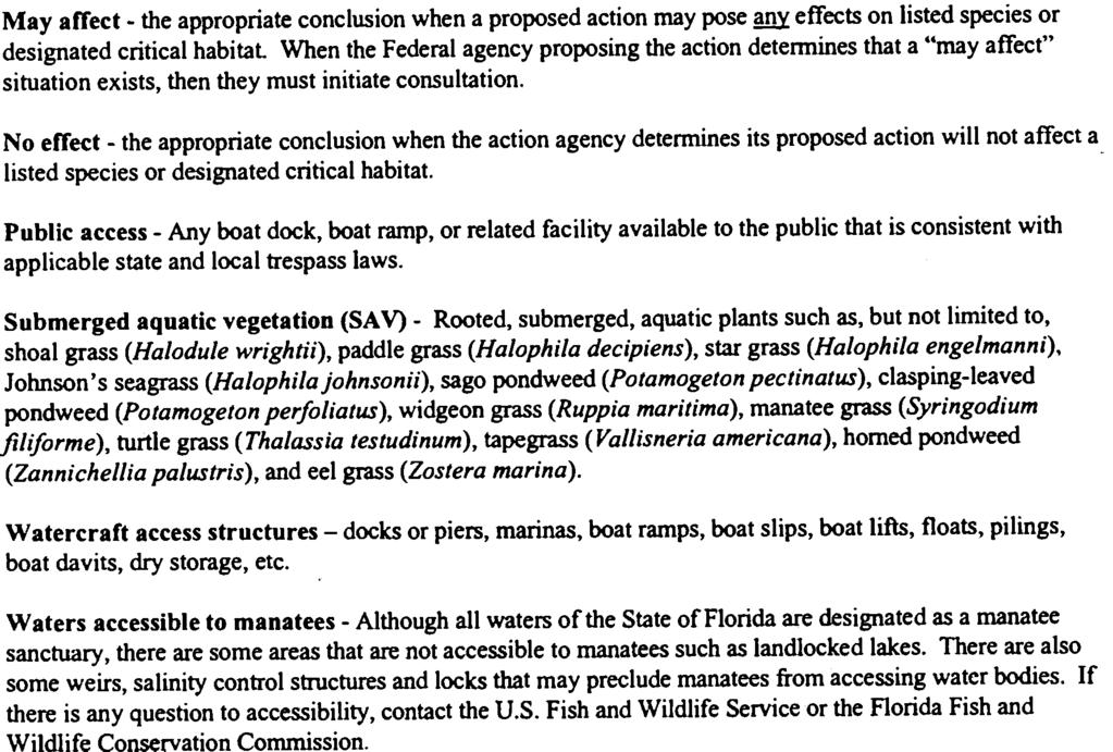
76
77
78
79
80
81
82
83
84
85
86
87
88
89
90
91 Attachment C: Data Used for Boat Facility Siting Requirements 63
92 Attachment C: Data Used For Boat Facility Siting Criteria Various information sources were evaluated to develop the boat facility siting criteria for Volusia County s Manatee Protection Plan. The following data sources were utilized: -Manatee Data Abundance and distribution data Mortality data Manatee movement and use patterns Ecology and historical information Local knowledge Manatee Relative Abundance Composite Index Map -Environmental Factors Water depths Shoreline conditions Benthic community resources Warm water refuges Freshwater sources -Boating Data Volusia County Boating Activity Study-boating patterns, concentrations, seasonality Speed zones Marked channels Local knowledge concerning boating patterns and needs -Land Use Data Current county and municipality development regulations Land available for development Public Lands Inventory 64
93 Attachment D: Halifax/Indian River (H/IR) Planning Zone Maps 65
94 Attachment D: Halifax/Indian River (H/IR) Planning Zone Maps 66
95 67
96 68
97 69
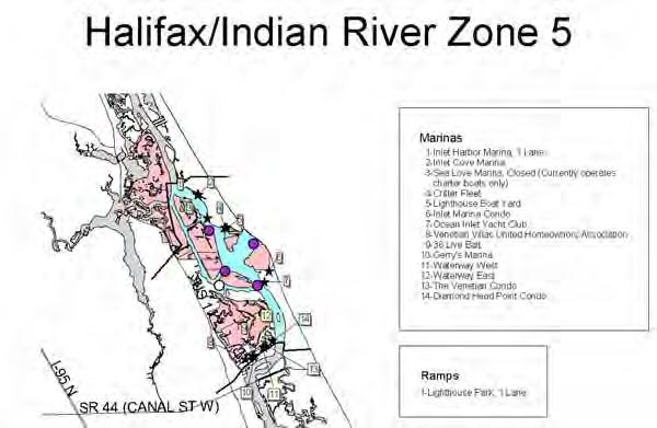
98 70
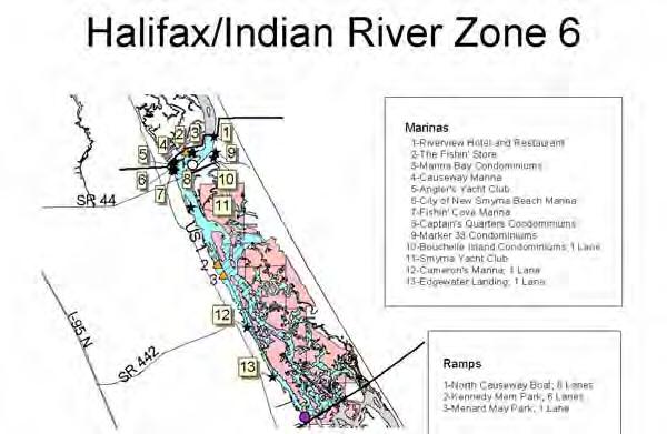
99 71
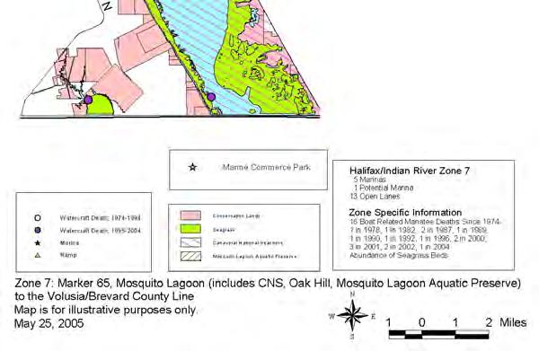
100 72
101 Attachment E: St. Johns River (SJR) Planning Zone Maps 73

102 Attachment E: St. Johns River Planning Zone Maps 74
103 75
104 76
105 77
106 78
107 79
108 80
109 81
110 Attachment F: H/IR Speed Zone Maps 82
111 83
112 84
113 85
114 86

115 87
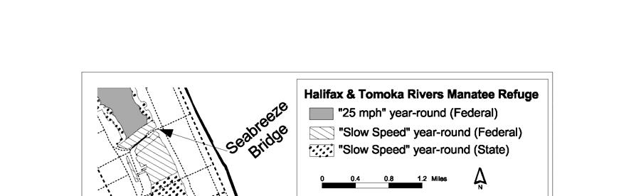

116 88
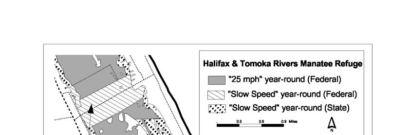
117 89
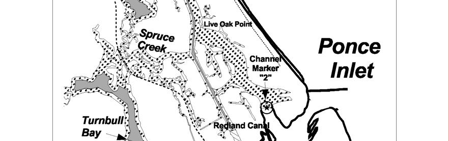

118 90

119 91


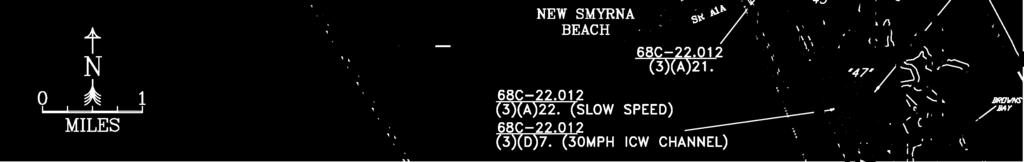
120


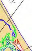

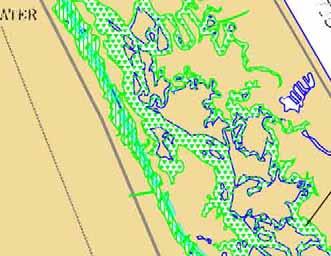
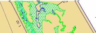
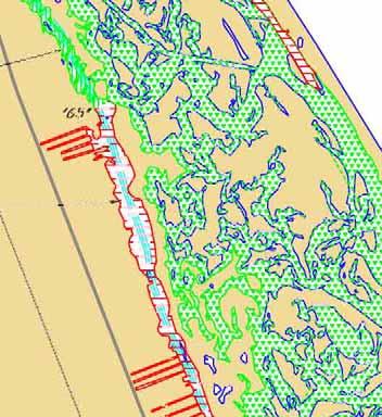
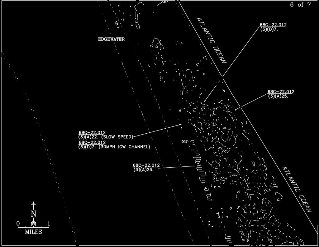
121

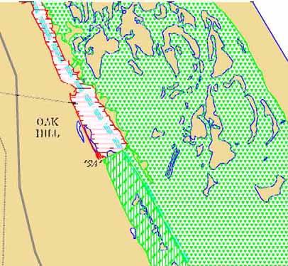
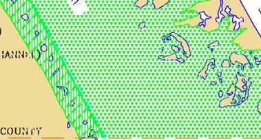
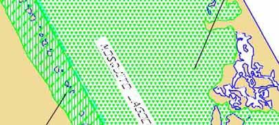
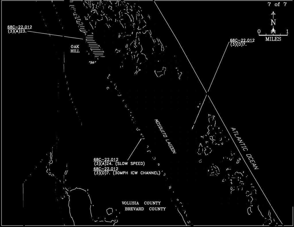
122
123 Attachment G: SJR Speed Zone Maps 92
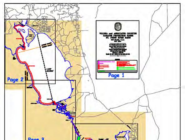
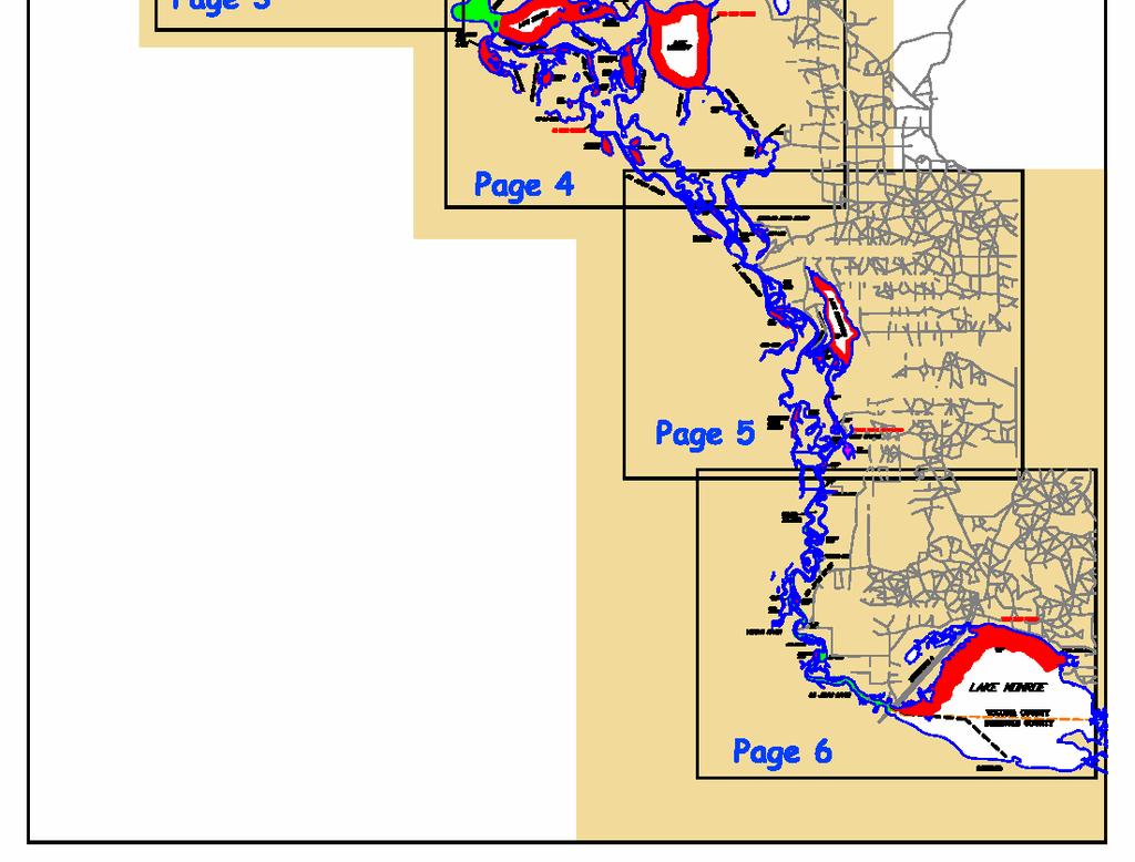
124 93
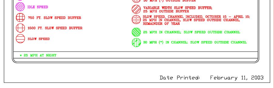
125 94
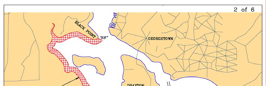
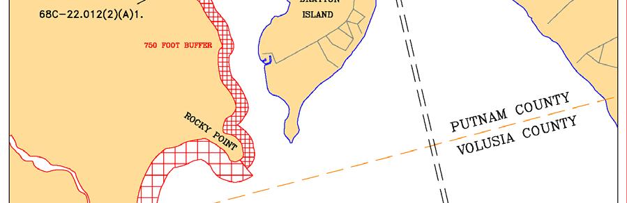
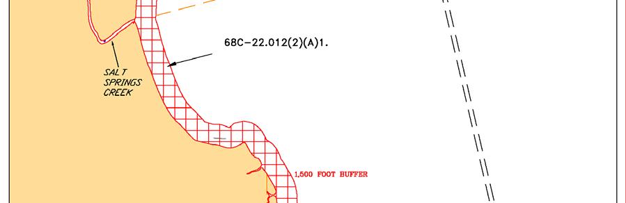
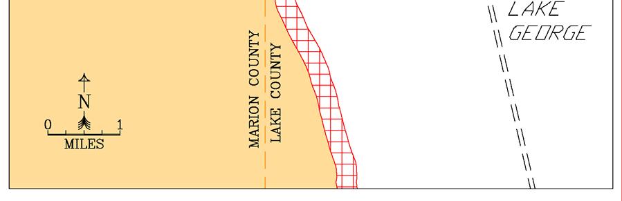
126 95
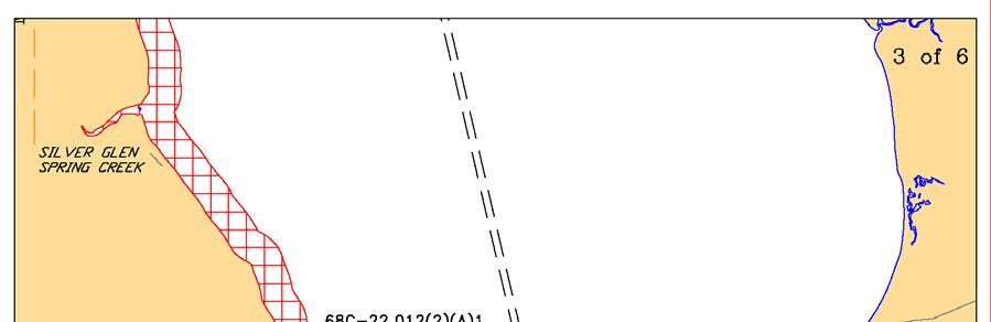
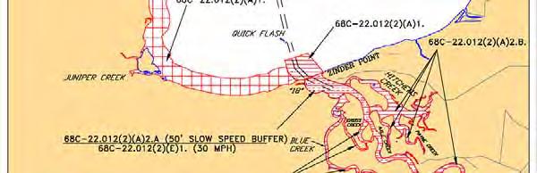
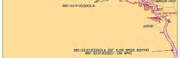
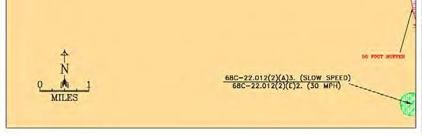
127 96
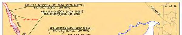
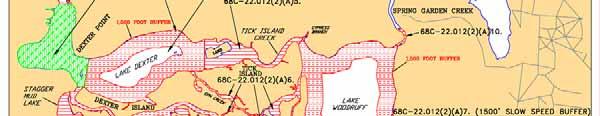

128 97


129 98


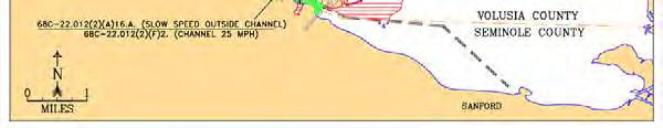
130 99
131 Attachment H: H/IR Boat Facility Siting Maps 100


132 Attachment H: Halifax River/Indian River Volusia County Boat Facility Siting Map 1a: Boat Facility Siting Recommendations Northern Coastal Volusia County 101


133 Map 1b: Boat Facility Siting Recommendations Central Coastal Volusia County 102

134 Map 1c: Boat Facility Siting Recommendations Southern Coastal Volusia County 103
135 Attachment I: SJR Boat Facility Siting Maps 104

136 Attachment I: St. Johns River portion of Volusia County Boat Facility Siting Map 2a: Boat Facility Siting Recommendations Northern Volusia County along the St. Johns River 105


137 Map 2b: Boat Facility Siting Recommendations Central Volusia County along the St. Johns River 106
138 Map 2c: Boat Facility Siting Recommendations Southern Volusia County along the St. Johns River 107
139 Attachment J: Volusia County Comprehensive Plan Elements 108
140 109
141 110
142 Attachment K: Outstanding Florida Waters, National Wildlife Refuges, National Seashore and Aquatic Preserve Maps 111
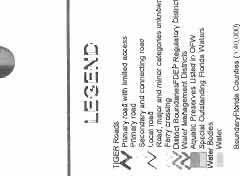

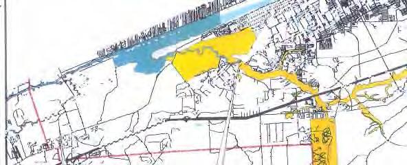

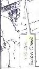
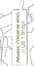
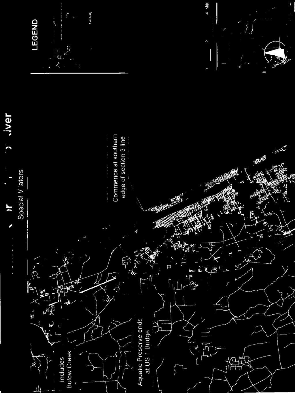
143
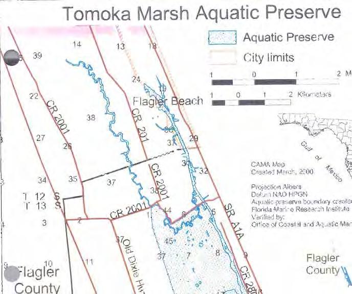
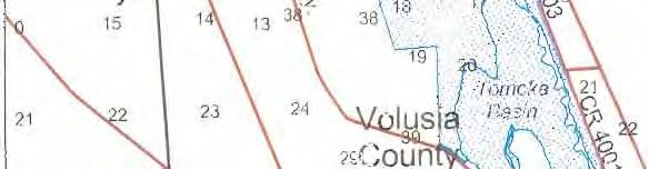
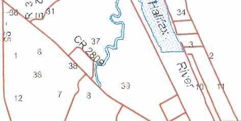
144
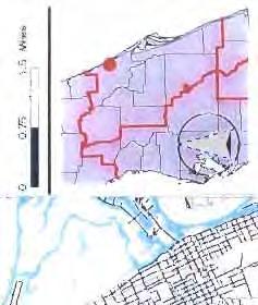
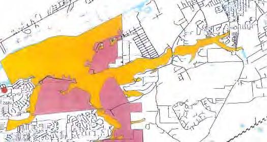
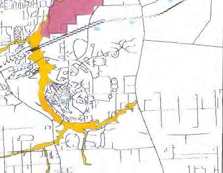
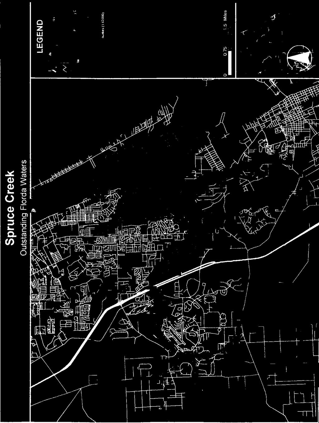
145
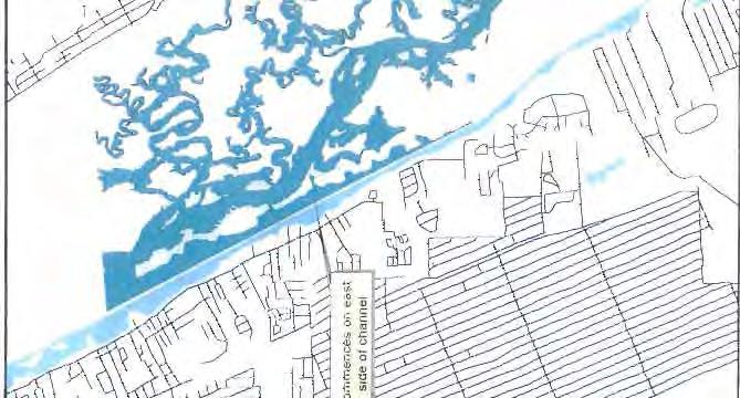
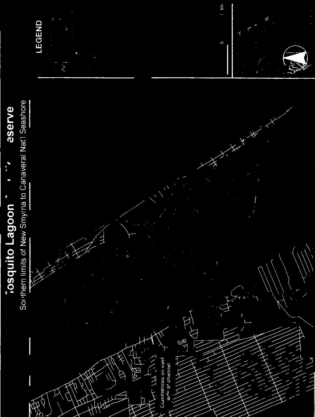
146
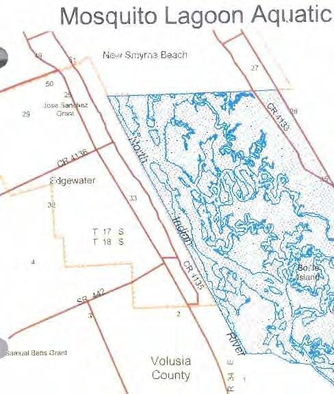
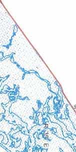
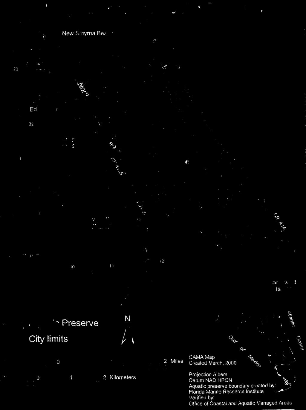
147
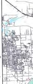
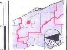
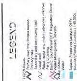
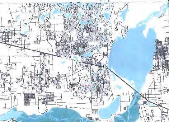
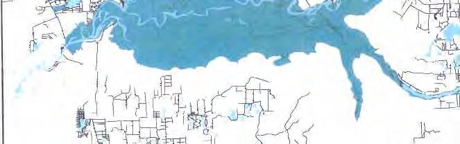
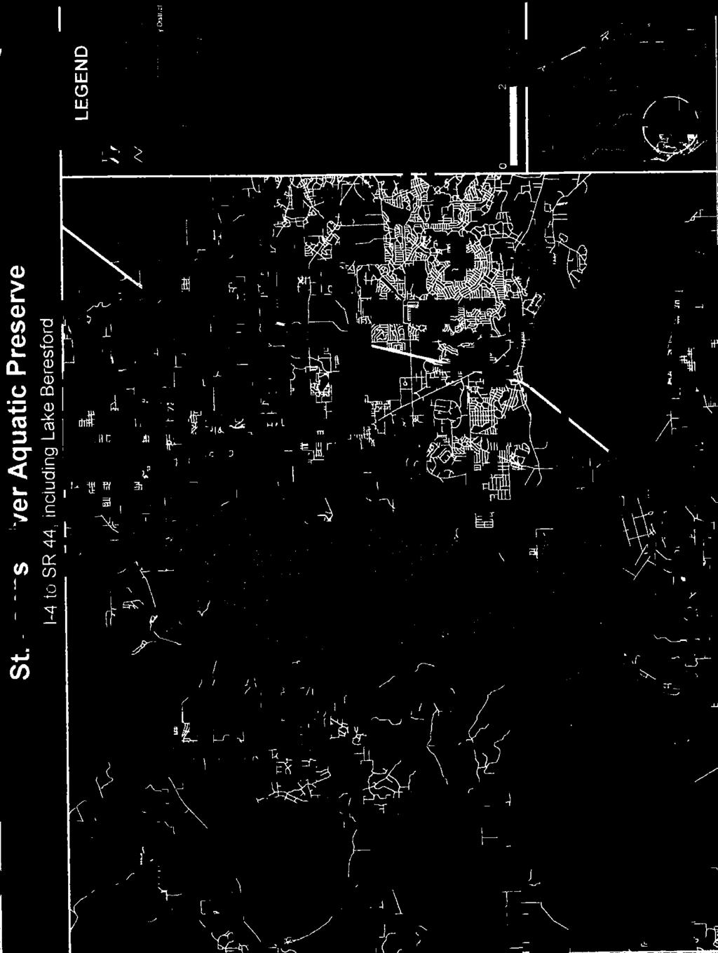
148
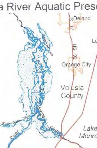
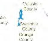
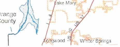
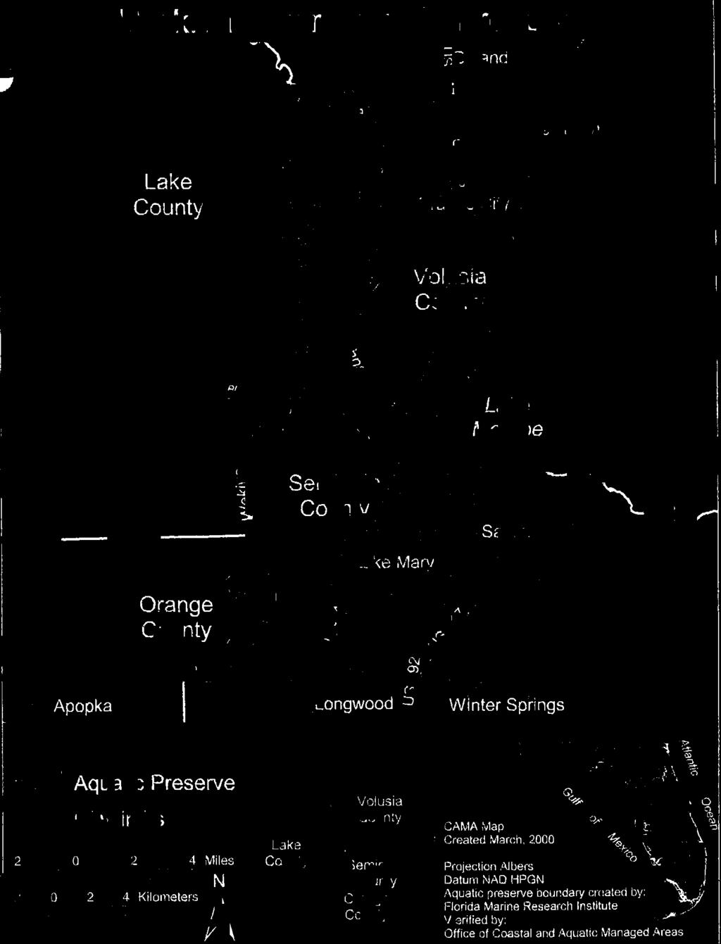
149
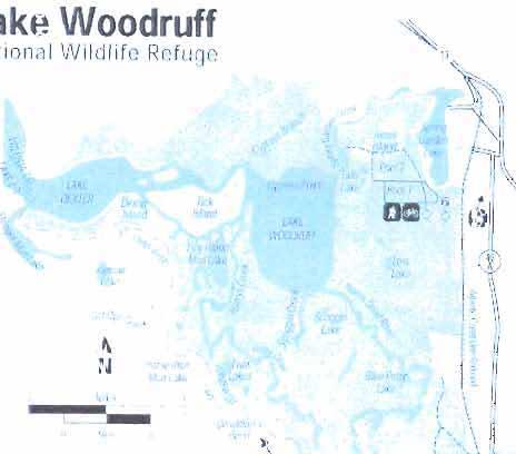
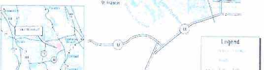
150
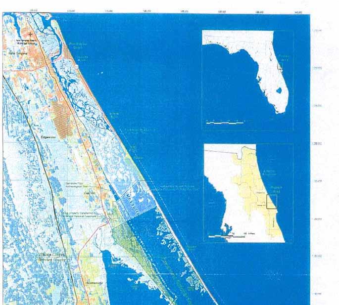
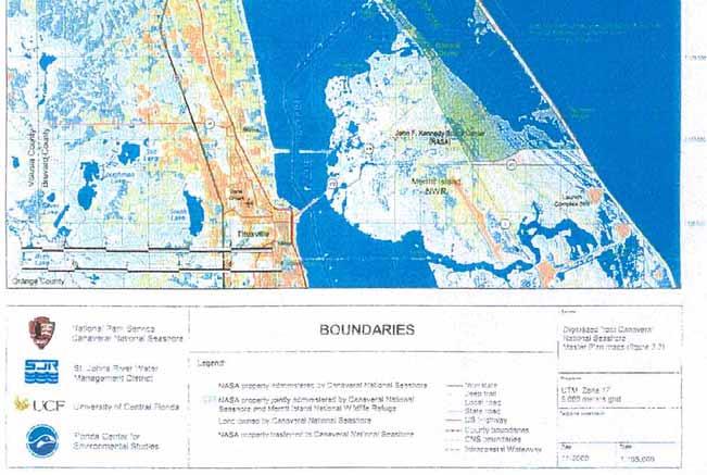
151
152 Attachment L: Seagrass Bed Map 112


153 113
154 Attachment M: Volusia County Conservation Lands 114
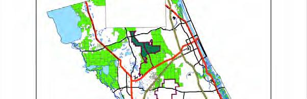
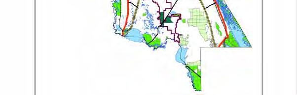
155 115
156 Attachment N: Boating Activity Study Update 116
157 Boating Activity Study Update Background A total of 47 marine facilities located along the Intracoastal Waterway (ICW) and the county s eastern shoreline, including the Halifax and Indian Rivers, the Tomoka River, Spruce Creek and tributaries were surveyed. Along the St. Johns River (SJR) and tributaries, 31 boat related facilities were surveyed. These included facilities which were located outside of Volusia County, but which could contribute to the boating traffic in the waterway. The total number of surveyed facilities came to 78, and is represented in the Marinas Surveyed in Volusia County 2001 chart on the following pages. However, for the purposes of this study update we have chosen to limit the facilities under consideration to those that are located within the Volusia County borders. To accurately calculate the present marine facility supply for Volusia County, facilities that are not located within the county s geographical boundaries were excluded. This study area is reflected in the charts labeled Volusia County Study Area Marina Capacity. Present Marina Supply After eliminating marina facilities outside county boundaries the study area was reduced to 66 total facilities, 44 on the ICW and 22 on the SJR. The 66 marinas have a total of 3,265wet slips and 921 dry slips. The ICW has 2,139 wet slips and 726 dry slips while the SJR has 1,126 wet slips and 195 dry slips. In total, Volusia County has a wet and dry slip supply of 4,186. Marina Slip Occupancy The current marina occupancy rate for facilities located in Volusia County is 80%. Marina occupancy was determined by totaling the number of wet and dry slips occupied on the ICW and SJR and dividing that number by the total number of available wet and dry slips. The ICW has an occupancy rate of 88% and the SJR has an occupancy rate of 63%. Water Body Percentage Water body percentages were calculated for the ICW and SJR to determine how much of the actual demand is placed on each individual waterway. The percentages were calculated by dividing the number of occupied wet and dry slips for the ICW and SJR combined (3,364). The water body percentage is 75% (2,528/3,364) for the ICW and 25% (836/3,364) for the SJR. These figures will be useful when predicting future slip demand for each waterway.
158 Marina Slip Demand The marina slip occupancy rates of 88% for the ICW and 63% for the SJR translate into a slip demand. The ICW has a demand of 1,832 wet slips and 696 dry slips. And the SJR has a demand of 721 wet slips and 115 dry slips. Volusia County s wet slip demand is 2,553 and its dry slip demand is 811, yielding a total marina slip demand of 3,364. Comparing the supply listed previously, to the demand yields a surplus of 822 wet and dry slips. A further breakdown illustrates a surplus of 307 wet slips and 30 dry slips on the ICW and a surplus of 405 wet slips and 80 dry slips on the SJR. Dividing Volusia County s total marina slip demand of 3,354 by the number of registered Volusia County boaters in 1999/2000 (24,202) yields a marina demand rate of 13.8%. It should be noted that 2000/2001 registration figures were not readily available and also that the 24,202 figure, due to a change in tabulation methods by the state, is a projected value. Marina Slip Projections Utilizing the 13.8% marina demand noted earlier and the projected growth rate of registered boaters in Volusia County of 2.7%, total slip demand can be determined. The Volusia County registered boater growth rate was determined by finding the percentage increases for existing registration figures ( ) and calculating their average. We have illustrated the projected slip demand on Volusia County through the year 2015, in total, and by water body. The 75% ICW and 25% SJR water body percentages were used in predicting future slip demand for each individual waterway. Conclusion As can be seen in the chart, there is a surplus of marina slips on the ICW until the year By the year 2005, 2 additional slips will be required, and by the year 2010, 404 additional slips will be required. On the SJR there is a surplus of marina slips until the year 2020, by which time 92 additional slips will be required. These projections prove to be consistent with the present marina occupancy rates for each water body. As noted previously the ICW has an occupancy rate of 88% and the SJR has an occupancy rate of 63%. The ICW s greater occupancy rate explains the larger future slip demand for the ICW than for the SJR.
159 Marinas Surveyed in Volusia County 2001 Halifax and Indian Rivers Marina Wet Slips Wet Slips Occ. Dry Slips Dry Slips Occ. % Wet Occ. % Dry Occ. Adventure Yacht Club % 0.0% Aloha Marina * % 0.0% Angler's Yacht Club % 80.0% Aunt Catfish ** % 0.0% Bouchelle Island Condo ** % 60.0% Brigadoon Fish Camp * % 0.0% Cameron's Marina % 0.0% Captain's Quarters Condo % 0.0% Causeway Marina % 100.0% City of New Symrna Beach Marina % 0.0% Critter Fleet % 0.0% Daytona Beach Riverhouse ** % 0.0% Daytona Marine and Boat Works % 0.0% Diamond Head Point Condo ** % 0.0% Edgewater Landing ** % 100.0% English Jim's Marina % 0.0% Fishin' Cove % 100.0% Gerry's Marina % 0.0% Goodrich Seafood * % 0.0% Halifax Harbor Marina % 100.0% Halifax Harbor Yacht Club % 0.0% Howard's Bait and Tackle % 0.0% Indian Mound Fish Camp % 0.0% Inlet Cove % 0.0% Inlet Harbor (95" was Ponce D.W. Landing) % 97.8% Inlet Marina Condo ** % 0.0% J.B's Fish Camp ** % 0.0% King's Seafood ** % 0.0% Lefil's Fish Camp % 0.0% Lighthouse Boat Yard % 0.0% Lopez Fish Camp % 0.0% Marina Bay Condo ** % 0.0% Marina Point Condo ** % 0.0% Marina Port Orange % 50.0% Marker 33 ** % 0.0% Matthew's Marina (95" was Images Marine) % 0.0% Riverplace 100 ** % 0.0% Riverview Hotel ** % 0.0% Sea Harvest ** % 0.0% Seabreeze Bridge ** % 0.0% Seven Seas Marina % 100.0% Symrna Yacht Club % 0.0% The Fishin' Store (95" was Seafarer Marine) % 0.0% Thirty Eight Live Bait ** % 0.0% Tomoka Boat Club % 100.0% Venetian Villas % 0.0% Waterway East and West Condo % 0.0% Totals/ICW Wet/Dry Occupancy: % 96% * Not in operation in see 1995 data ** Not surveyed in 1995 The final percentages in the % Wet Occ. and % Dry Occ. columns were arrived at by using the final totals for numbers of wet and dry slips.
160 Marinas Surveyed in Volusia County 2001 St. Johns River Marina Wet Slips Wet Slips Occ. Dry Slips Dry Slips Occ. % Wet % Dry Astor Landing ** % 33.3% Blair's Jungle Den % 0.0% Boat Show Marina % 50.0% Camp Henry RV and Marina % 50.0% Georgetown Marina ** % 100.0% Halls Lodge % 0.0% Hidden Harbour Marina % 67.9% Highbanks Marina % 100.0% Highland Park Fish Camp % 40.0% Holly Bluff Marina % 50.0% Hontoon Island State Park ** % 0.0% Hontoon Landing Marina % 0.0% J.J.'s Marina Isle Fish Camp % 53.3% Kyp's Fish Camp % 0.0% Lake Beresford Yacht Club % 0.0% Meadowlea On The River ** % 0.0% Midway Marine % 100.0% Monroe Harbor Marina % 82.0% North Shell Fish Camp % 0.0% Parramores Fish Camp of Astor % 0.0% Pier 44 Marina % 62.5% Pine Island Marina % 0.0% Rivera Resort and Marina % 0.0% Sanford Boat Works % 0.0% Shady Oak Fish Camp ** % 0.0% South Moon Fish Camp % 0.0% Sunrise Fish Camp % 0.0% Tedder's Fish Camp % 0.0% Traders Cove Subdivsion % 0.0% Topical Apartments and Marina % 0.0% Volusia Bar Fish Camp % 0.0% Totals/SJR Wet/Dry Occupancy: % 68% Grand Totals: % 80% * Not in operation in see 1995 data ** Not surveyed in 1995 The final percentages in the % Wet Occ. and % Dry Occ. columns were arrived at by using the final totals for numbers of wet and dry slips. This is also applies to the Grand Totals for the St. Johns and Halifax/Indian Rivers combined.
161 Volusia County Study Area Marina Capacity Halifax and Indian Rivers Marina Wet Slips Wet Slips Occ. Dry Slips Dry Slips Occ. % Wet Occ. % Dry Occ. Adventure Yacht Club % 0.0% Aloha Marina * % 0.0% Angler's Yacht Club % 80.0% Aunt Catfish ** % 0.0% Bouchelle Island Condo ** % 60.0% Brigadoon Fish Camp * % 0.0% Camereon's Marina % 0.0% Captain's Quarter Condo % 0.0% Causeway Marina % 100.0% City of New Symrna Beach Marina % 0.0% Critter Fleet % 0.0% Daytona Beach Riverhouse ** % 0.0% Daytona Marine and Boat Works % 0.0% Diamond Head Point Condo ** % 0.0% Edgewater Landing ** % 100.0% English Jim's Marina % 0.0% Fishin' Cove % 100.0% Gerry's Marina % 0.0% Goodrich Seafood * % 0.0% Halifax Harbor Marina % 100.0% Halifax Harbor Yacht Club % 0.0% Howard's Bait and Tackle % 0.0% Indian Mound Fish Camp % 0.0% Inlet Cove % 0.0% Inlet Harbor (95" was Ponce D.W. Landing) % 97.8% Inlet Marina Condo ** % 0.0% J.B's Fish Camp ** % 0.0% King's Seafood ** % 0.0% Lefil's % 0.0% Lighthouse Boat Yard % 0.0% Lopez Fish Camp % 0.0% Marina Bay Condo ** % 0.0% Marina Point Condo ** % 0.0% Marina Port Orange % 50.0% Marker 33 ** % 0.0% Matthew's Marina (95" was Images Marine) % 0.0% Riverplace 100 ** % 0.0% Riverview Hotel ** % 0.0% Sea Harvest ** % 0.0% Seabreeze Bridge ** % 0.0% Seven Seas Marina % 100.0% Symrna Yacht Club % 0.0% The Fishin' Store (95" was Seafarer Marine) % 0.0% Thirty Eight Live Bait ** % 0.0% Tomoka Boat Club % 100.0% Venetian Villas % 0.0% Waterway East and West Condo % 0.0% Totals/ICW Wet/Dry Occupancy: % 96% * Not in operation in see 1995 data ** Not surveyed in 1995 The final percentages in the % Wet Occ. and % Dry Occ. columns were arrived at by using the final totals for numbers of wet and dry slips.
162 Volusia County Study Area Marina Capacity 2001 St. Johns River Marina Wet Slips Wet Slips Occ. Dry Slips Dry Slips Occ. % Wet % Dry Blair's Jungle Den % 0.0% Boat Show Marina % 50.0% Halls Lodge % 0.0% Highbanks Marina % 100.0% Highland Park Fish Camp % 40.0% Holly Bluff Marina % 50.0% Hontoon Island State Park ** % 0.0% Hontoon Landing Marina % 0.0% Kyp's Fish Camp % 0.0% Lake Beresford Yacht Club % 0.0% Meadowlea On The River ** % 0.0% North Shell Fish Camp % 0.0% Parramores Fish Camp of Astor % 0.0% Pine Island Marina % 0.0% Rivera Resort and Marina % 0.0% Shady Oak Fish Camp ** % 0.0% South Moon Fish Camp % 0.0% Sunrise Fish Camp % 0.0% Tedder's Fish Camp % 0.0% Traders Cove Subdivsion % 0.0% Topical Apartments and Marina % 0.0% Volusia Bar Fish Camp % 0.0% Totals/SJR Wet/Dry Occupancy: % 59% Grand Totals: % 60% * Not in operation in see 1995 data ** Not surveyed in 1995 The final percentages in the % Wet Occ. and % Dry Occ. columns were arrived at by using the final totals for numbers of wet and dry slips. This is also applies to the Grand Totals for the St. Johns and Halifax/Indian Rivers combined.
163 ICW And St. Johns Combined Totals And Slip Occupancy Rate 2001 Area Of Focus Wet and Dry Wet and Dry Slip Occupancy Rate Supply Demand Marinas Surveyed Halifax/Indian Rivers % Marinas Surveyed St. Johns River % Combined % Study Area Halifax/Indian Rivers % Study Area St. Johns River % Combined % Volusia County Boater Registration Projections Year Registered % SJR Demand ICW Projected 2001 Supply Surplus Deficit Boats Demand Demand , ,505 3,340 4, , ,857 3,809 4, , ,086 3,259 4,345 4, , ,239 3,717 4,955 4, , ,413 4,239 5,652 4,176-1,476 * The above table represents projected values. Actual 2000 figures are as follows: SJR demand is 836, the ICW is 2,518. Wet and dry demand is 3, supply is 4,176, and surplus is 822. Marina Supply and Demand ICW Year Projected Demand 2000 supply Surplus Deficit Marina Supply and Demand SJR Year Projected Demand 2000 Supply Surplus Deficit , , ,086 1, ,239 1, ,413 1,321-92
164 Available Marina Facilities In Volusia County Table 19 ICW Marina Name Wet Slips Dry Slips Adventure Yacht Harbor Aloha Marine Angler's Yacht Club Aunt Catfish Restaurant 10 0 Brigadoon's Fish Camp 10 0 Cameron's Marina 30 6 Causeway Marina City of New Symrna Beach Marina 42 0 Daytona Beach Marina and Boat Works Dixie Queen Landing 67 0 English Jim's Marina Fishin' Cove Marina Gerry's Marina 14 0 Halifax Harbor Marina Halifax River Yacht Club 33 0 Howard's Bait and Tackle 7 0 Images Marina 25 0 Inlet Cove Marina 10 0 Lighthouse Boat Yard Lopez Fish Camp/ RV Park 34 0 Marina Port Orange 40 0 Ponce Deepwater Landing Red's Bait and Tackle 12 0 Seven Seas Marina Smyrna Yacht Club 54 0 Tomoka Boat Club Totals: SJR Marina Name Wet Slips Dry Slips Blair's Jungle Den 20 0 Boat Show Marina Hall's Lodge 65 0 Highbanks Marina Highland Park Fish Camp Holly Bluff Marina Hontoon Landing Marina 52 0 Kyp's Fish Camp 20 0 Lake Beresford Yacht Club 49 0 North Shell Fish Camp 11 0 Paramore's Campground 34 0 Pine Island Marina 26 0 Riviera Resort and Marina South Moon Fish Camp 30 0 Sunrise Fish Camp 41 0 Tedder's Fish Camp 15 0 Tropical Apartments and Marina 51 4 Volusia Bar Fish Camp 45 0 Totals: Grand Totals:
165 Available Boat Ramp Facilities In 2001 Halifax/Indian River Study Area All Ramps Survyed #Ramps #Lanes Public Ramps Surveyed #Ramps #Lanes Private Ramps Surveyed #Ramps #Lanes Bethune Point 1 2 Bethune Point 1 2 Bouchelle Island 1 1 Bisset Bay 1 1 Bisset Bay 1 1 Edgewater Landing 1 1 Bouchelle Island 1 1 Cameron's Marina 1 1 Hacienda Del Rio 1 1 Cameron's Marina 1 1 Canaveral National Seashore ** 1 2 Marina Port Orange ** 1 1 Canaveral National Seashore ** 1 2 City Island Park 1 1 Saw Grass Subdivision 1 1 City Island Park 1 1 Goodrich Seafood * 1 1 Tomoka View ** 1 1 Edgwater Landing 1 1 Granada Bridge 2 4 Tierra Mar ** 1 1 Goodrich Seafood * 1 1 Halifax Harbor Marina 1 8 Unamed Ramp - private 1 1 Granada Bridge 2 4 Highbridge 1 2 Totals: 8 8 Hacienda Del Rio 1 1 Indian Mound 1 1 Halifax Harbor Marina 1 8 Inlet Harbor *** 1 1 Highbridge 1 2 J.B's Fish Camp * 1 1 Indian Mound 1 1 Kennedy Memorial Park 1 6 Inlet Harbor *** 1 1 Lighthouse Park 1 2 J.B's Fish Camp * 1 1 Lefill's Fish Camp ** 1 1 Kennedy Memorial Park 1 6 Lopez Fish Camp 1 1 Lighthouse Park 1 2 Menard May Park 1 2 Lefill's Fish Camp 1 1 N. Causeway Park 2 8 Lopez Fish Camp 1 1 Port Orange Causeway I 3 6 Marina Port Orange ** 1 1 Port Orange Causeway II 1 1 Menard May Park 1 2 River Breeze Park ** 1 4 N. Causeway Park 2 8 River Front Veterans Park 1 2 Port Orange Causeway I 3 6 Sanchez Park 1 2 Port Orange Causeway II 1 1 Seabreeze Bridge ** 5 5 River Breeze Park ** 1 4 Sunrise Park 1 1 River Front Veterans Park 1 2 Tomoka Estates 1 1 Sanchez Park 1 2 Tomoka State Park 1 1 Saw Grass Subdivion 1 1 Turtle Mound * 1 1 Seabreeze Bridge ** 5 5 Unamed Dirt Ramp ** 1 1 Sunrise Park 1 1 Totals: Tierra Mar 1 1 Tomoka Estates 1 1 Tomoka State Park 1 1 Tomoka View ** 1 1 Turtle Mound * 1 1 * Ramp not operational Unamed Dirt Ramp ** 1 1 ** Not surveyed in 1995 Unnamed Ramp - private ** 1 1 *** Previous property of Ponce Deepwater Landing - now Inlet Harbor and Totals: Riptide Bait & Tackle
166 Available Boat Ramp Facilities in 2001 St. Johns River Study Area All Ramps Survyed #Ramps #Lanes Public Ramps Surveyed #Ramps #Lanes Private Ramps Surveyed #Ramps #Lanes Blair's Jungle Den * 1 1 Blair's Jungle Den * 1 1 Lakeview Terrace 1 1 Boat Show Marina * 2 2 Boat Show Marina * 2 2 Meadowlea on the River *** 1 1 DeLeon Springs State Park 1 1 DeLeon Springs State Park 1 1 River Oaks Estates *** 1 1 Ed Stone Park 1 6 Ed Stone Park 1 6 Stone Island Ramp 1 1 Florida Power & Light Ramp 1 1 Florida Power & Light Ramp 1 1 Totals: 4 4 French Avenue Ramp 1 1 French Avenue Ramp 1 1 Hall's Lodge * 1 1 Hall's Lodge * 1 1 Highland Park Fish Camp * 1 2 Highland Park Fish Camp * 1 2 Highland Park Remote 1 1 Highland Park Remote 1 1 Highbank's Ramp 1 1 Highbank's Ramp 1 1 Holly Bluff Marina * 1 1 Holly Bluff Marina * 1 1 Hontoon Landing Marina * 1 1 Hontoon Landing Marina * 1 1 Kyp's Fish Camp ** 1 1 Kyp's Fish Camp ** 1 1 Lake Beresford Yacht Club 1 1 Lake Beresford Yacht Club 1 1 Lake Monroe Park 2 4 Lake Monroe Park 2 4 Lake Monroe Wayside Ramp 1 2 Lake Monroe Wayside Ramp 1 2 Lakeview Terrace 1 1 Lemon Bluff Ramp 1 2 Lemon Bluff Ramp 1 2 Mariner's Cove Park 1 1 Mariner's Cove Park 1 1 Nine Mile Ramp 1 1 Meadowlea on the River *** 1 1 North Shell Fish Camp * 1 1 Nine Mile Ramp 1 1 Paramore's Campground * 1 1 North Shell Fish Camp * 1 1 Pine Island Marina 1 1 Paramore's Campground * 1 1 Riverfront Park *** 1 1 Pine Island Marina 1 1 Riviera Resort & Marina 1 1 Riverfront Park *** 1 1 Shady Oak Fish Camp 1 1 River Oaks Estates *** 1 1 Shell Harbor Ramp 1 1 Riviera Resort & Marina 1 1 South Moon Fish Camp 1 1 Shady Oak Fish Camp 1 1 Sunrise Fish Camp 1 1 Shell Harbor Ramp 1 1 Tedder's Fish Camp 1 1 South Moon Fish Camp 1 1 Tropical Apts. & Marina 1 1 Stone Island Ramp 1 1 Volusia Bar Fish Camp 1 1 Sunrise Fish Camp 1 1 Totals: Tedder's Fish Camp 1 1 *Data collected by 2001 marina Tropical Apts. & Marina 1 1 surveys Volusia Bar Fish Camp 1 1 ** Ramp not operational in 2001 Totals: *** New ramp not surveyed in 1995
167 Volusia County Public Boat Ramp Surveys 1995 and 2001 ICW 1995 Ramp Surveys # Ramps # Lanes Pub. Pvt Ramp Surveys # Ramps # Lanes Pub. Pvt. Betune Point 1 2 * Bethune Point 1 2 * Bisset Bay 1 1 * Bisset Bay 1 1 * Cameron's Marina 1 1 * Bouchelle Island Condo * 1 1 * City Island Park 1 1 * Cameron's Marina * 1 1 * Goodrich's Seafood 1 1 * Canaveral National Seashore *** 1 2 * Granada Bridge 2 4 * City Island Park 1 1 * Halifax Harbor 1 8 * Edgewater Landing * 1 1 * Highbridge Park 1 2 * Goodrich Seafood ** 1 1 * Indian Mound 1 1 * Granada Bridge 2 4 * J.B.'s Fish 1 1 * Hacienda del Rio 1 1 * Kennedy Memorial Park 1 6 * Halifax Harbor Marina * 1 8 * Lefil's Fish Camp 1 1 * Highbridge 1 2 * Lighthouse Park 1 1 * Indian Mound * 1 1 * Lopez Fish Camp 1 1 * Inlet Harbor * * * * 1 1 * Menard May Park 1 2 * J.B.'s Fish Camp * 1 1 * North Causeway Park 2 8 * Kennedy Memorial Park 1 6 * Ponce Deepwater Landing **** 1 1 * Lefil's Fish Camp * 1 1 * Port Orange Causeway 1 1 * Lighthouse Park 1 2 * Port Orange Causeway I 1 2 * Lopez Fish Camp * 1 1 * Port Orange CausewayII 1 4 * Marina Port Orange *** 1 1 * River Breeze Park 1 4 * Menard May Park 1 2 * Riverfront Park 1 2 * N. Causeway Park 2 8 * Sanchez Park 1 2 * Port Orange Causeway I 3 6 * Sunrise Park 1 1 * Port Orange Causeway II 1 1 * Tomoka Estates 1 1 * River Breeze Park *** 1 4 * Tomoka State Park 1 1 * Riverfront Veterans 1 2 * Turtle Mound 1 1 * Sanchez Park 1 2 * Totals: Sawgrass Subdivision 1 1 * Seabreeze Bridge *** 5 5 * Sunrise Park 1 1 * Tierrs Mar *** 1 1 * Tomoka Estates 1 1 * Tomoka State Park 1 1 * Tomoka View 1 1 * Turtle Mound ** 1 1 * Unamed Dirt Ramp Spruce Creek*** 1 1 * Unnamed Ramp - private *** 1 1 * Totals: *Data collected by 2001 marina surveys ** Ramp not operational in 2001 *** New ramp not surveyed in 1995 * * * * Previous property of Ponce Deepwater Landing is now Inlet Harbor and Riptide Bait and Tackle
168 Volusia County Public Boat Ramp Surveys 1995 and 2001 SJR 1995 Ramp Surveys # Ramps # Lanes Pub. Pvt Ramp Surveys # Ramps # Lanes Pub. Pvt. Blair's Jungle Den 1 1 * Blair's Jungle Den * 1 1 * Boat Show Marina 1 1 * Boat Show Marina * 2 2 * DeLeon Springs State Park 1 1 * DeLeon Springs State Park 1 1 * Ed Stone Park 1 6 * Ed Stone Park 1 6 * Florida Power & Light Ramp 1 1 * Florida Power & Light Ramp 1 1 * French Avenue Ramp 1 1 * French Avenue Ramp 1 1 * Hall's Lodge 1 1 * Hall's Lodge * 1 1 * Highland Park Fish Camp 1 2 * Highland Park Fish Camp * 1 2 * Highland Park Remote 1 1 * Highland Park Remote 1 1 * Highbank's Ramp 1 1 * Highbank's Ramp 1 1 * Holly Bluff Marina 1 1 * Holly Bluff Marina * 1 1 * Hontoon Landing Marina 1 1 * Hontoon Landing Marina * 1 1 * Kyp's Fish Camp 1 1 * Kyp's Fish Camp ** 1 1 * Lake Monroe Park 2 3 * Lake Beresford Yacht Club 1 1 * Lake Monroe Wayside Ramp 1 1 * Lake Monroe Park 2 4 * Lakeview Marina Ramp 1 1 * Lake Monroe Wayside Ramp 1 2 * Lemon Bluff Ramp 1 1 * Lakeview Terrace 1 1 * Mariner's Cove Park 1 1 * Lemon Bluff Ramp 1 2 * Nine Mile Ramp 1 1 * Mariner's Cove Park 1 1 * North Shell Fish Camp 1 1 * Meadowlea on the River *** 1 1 * Paramore's Campground 1 1 * Nine Mile Ramp 1 1 * Pine Island Marina 1 1 * North Shell Fish Camp * 1 1 * Riviera Resort & Marina 1 1 * Paramore's Campground * 1 1 * Shell Harbor Ramp 1 1 * Pine Island Marina 1 1 * Shell Landing Ramp 1 1 * Riverfront Park *** 1 1 * Sloan's Fish Camp 1 1 * River Oaks Estates *** 1 1 * South Moon Fish Camp 1 1 * Riviera Resort & Marina 1 1 * Sunrise Fish Camp 1 1 * Shady Oak Fish Camp 1 1 * Tedder's Fish Camp 1 1 * Shell Harbor Ramp 1 1 * Tropical Apts. & Marina 1 1 * South Moon Fish Camp 1 1 * Volusia Bar Fish Camp 1 1 * Stone Island Ramp 1 1 * Totals: Sunrise Fish Camp 1 1 * Tedder's Fish Camp 1 1 * Tropical Apts. & Marina 1 1 * Volusia Bar Fish Camp 1 1 * Totals: *Data collected by 2001 marina surveys ** Ramp not operational in 2001 *** New ramp not surveyed in 1995
169 The following is excerpted from the Volusia County Boating Activity Study, Final Report, July Mosquito Lagoon was the most popular boating destination on the ICW. The majority of the boats in this area are Class A and Class I power boats engaged in recreational fishing. The data to support this was gathered primarily from the aerial surveys and from ramp interviews at two ramps: Haulover Canal ramp and Turtle Mound ramp. In addition, boat ramp trailer census data from the Kennedy Park ramp in Edgewater revealed heavy usage. These three ramps provide direct access to Mosquito Lagoon. The fishing takes place on the west side of the ICW channel and the vast expanse to the east of the channel. The east side of the channel is commonly referred to as the back country. (Section 5, Intracoastal Waterway Data Analysis, 5.5 Spatial Analysis, page 110.) The second most popular destination is Ponce Inlet. This area has several unique features that are important to boaters. First, it is the only access to the ocean for more than 60 miles north or south. All types of craft utilize the inlet to access the ocean for recreational and commercial fishing, as well as offshore sailing. The inlet area has a concentration of large, commercial fishing boats (Class 3) that engage in commercial fishing, as well as fishing charters for recreational fishermen. (Section 5, Intracoastal Waterway Data Analysis, 5.5 Spatial Analysis, page 110.) The next most popular destination is the Tomoka River/Tomoka Basin. The basin is used primarily for recreational fishing, while the river is used for a variety of activities, such as recreational fishing and water-skiing. In addition, Tomoka State Park is located on the river and is used by boaters for picnicking and accessing the park s other features. The primary types of boats that frequent this area are Class A and Class I powerboats and pontoon boats. (Section 5, Intracoastal Waterway Data Analysis, 5.5 Spatial Analysis, page 111.) Silver Glen Springs was the most common destination for boaters on the SJR, especially in the summer (791 observations.) Over one hundred boats have been observed in this area at one time using aerial surveys. A total of 291 boaters out of 815 who were interviewed named this site as their destination. The majority of boaters launching from the two ramps in Astor (Butler Street and Midway Marine) indicated during the interviews that their destination was Silver Glen Springs. In addition, boaters interviewed at Ed Stone Park ramp in DeLand also indicated that this was their destination. Aerial survey data supports the interview survey data that boat traffic is very heavy on weekends leading to/from Astor and Silver Glen Springs (617 observations.) The types of boats observed at Silver Glen Springs covered all categories, from Class 3 houseboats to personal watercraft. The other unique factor about this location is the number of boaters who stayed at the springs on their boats all weekend. This was the only location on either water body that had this type of boating activity. (Section 6, St. Johns River Data Analysis, 6.5 Spatial Analysis, page 120.) Other major destinations on the SJR included Blue Spring State Park, Hontoon Island State Park, and the Wekiva River. Blue Spring is a popular destination for picnicking and swimming in the summer and for observing manatees during the winter (159 observations.) Hontoon Island is a popular picnicking destination, and Wekiva Springs is a popular swimming and travelling destination. (Section 6, St. Johns River Data Analysis, 6.5 Spatial Analysis, page 123.)
170
171 Attachment O: Map of Unincorporated Volusia County 117
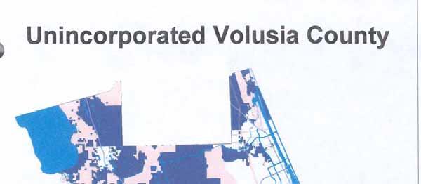
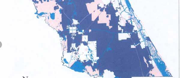
172 118
173 Attachment P: Recommendations to the Governor and Cabinet,
174
175
176 Attachment Q: Volusia County Zoning Classifications 120
177
178
179
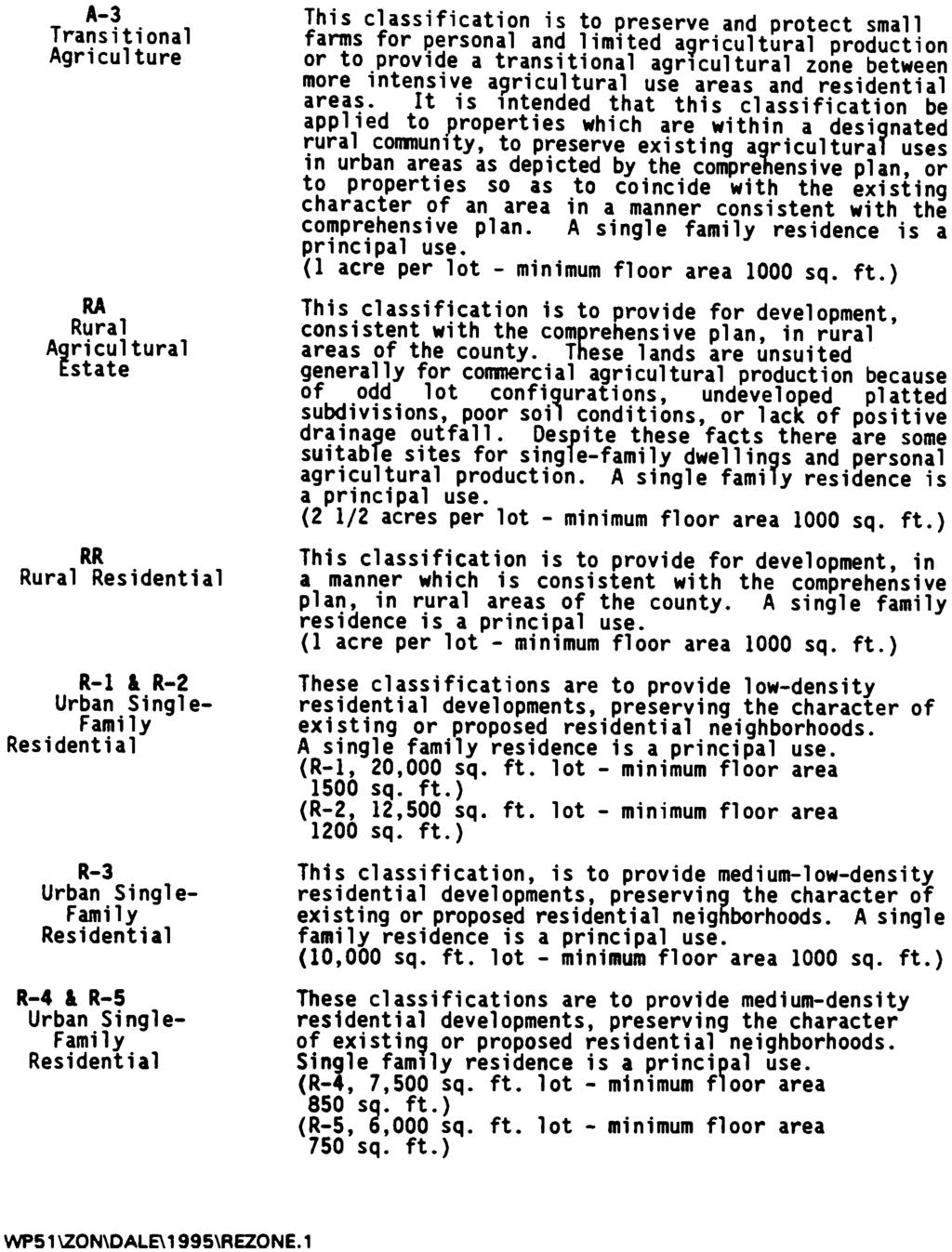
180
181
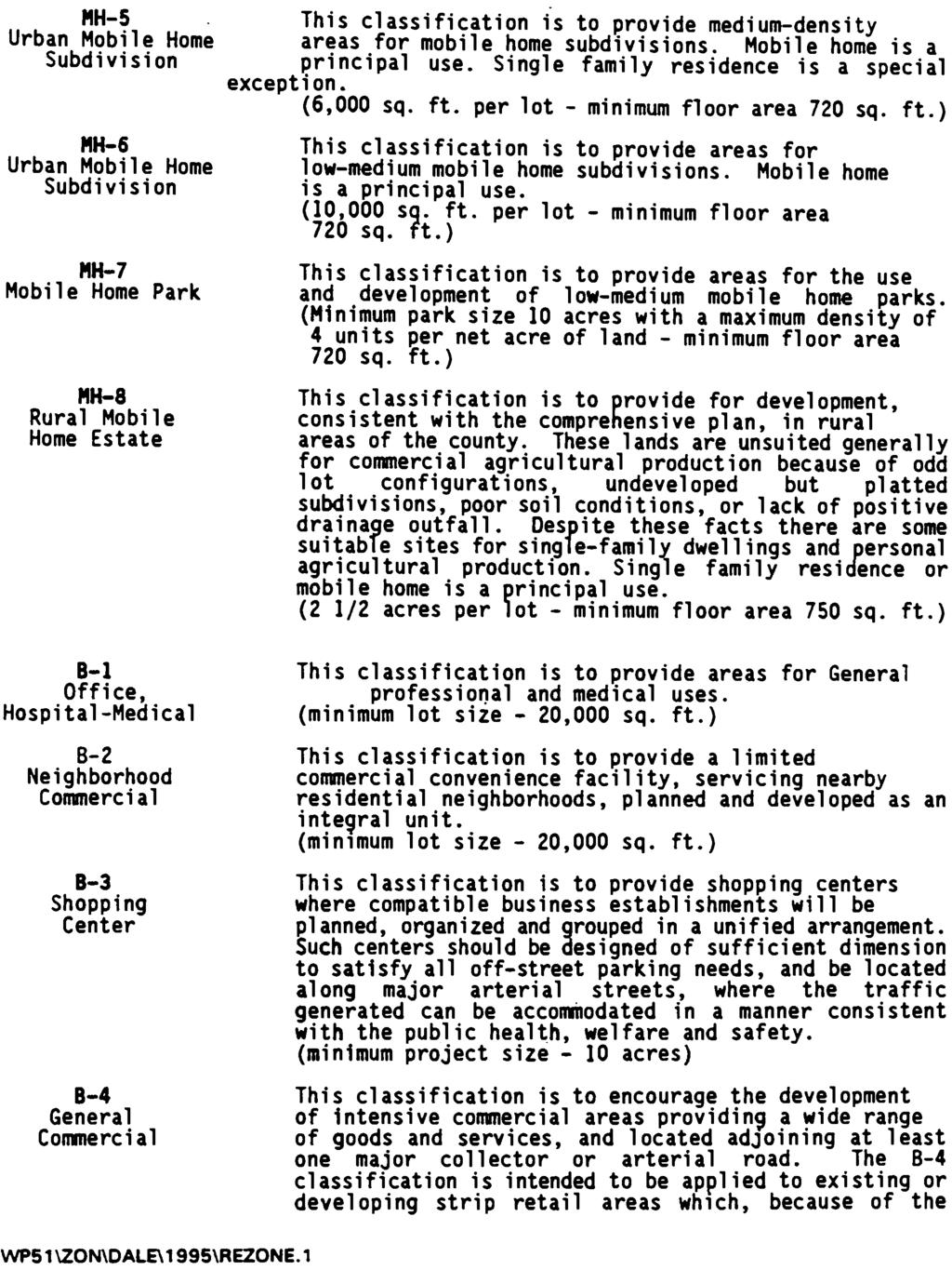
182
183
184

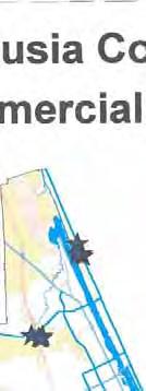
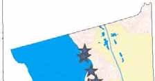
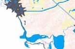
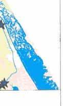
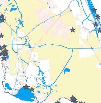

185

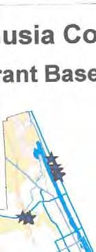
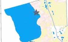
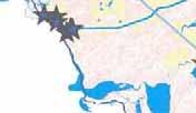
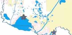
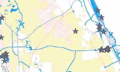

186

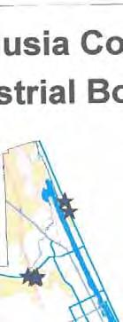
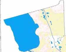
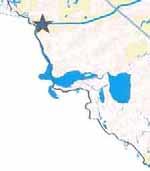
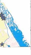
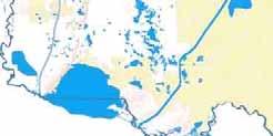
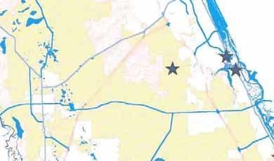

187

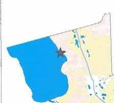
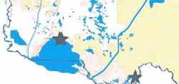
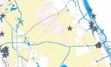
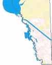

188

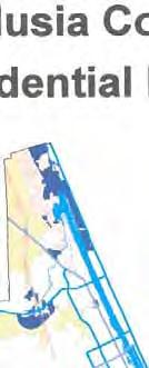
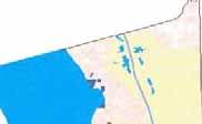

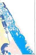
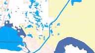
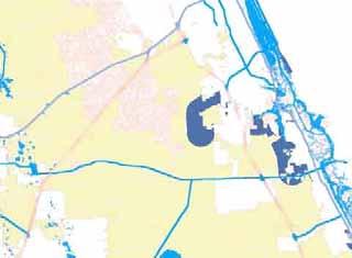
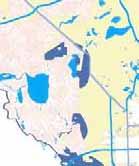

189
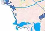
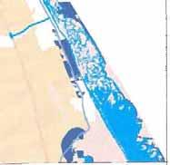
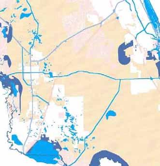

190
191 Attachment R: Volusia County Project Application Process and Flow Chart 121
192 PROJECT APPLICATION PROCESS This process describes the Flow Chart on the adjoining page. It is incumbent upon the applicant to follow appropriate county or city building requirements, procedures, and guidelines. STEP 1 The applicant submits permit applications to the appropriate state and/or federal regulatory agencies. The regulatory agencies then forward these applications to the appropriate wildlife agencies for consultation on wildlife species and their habitats. The Florida Fish and Wildlife Conservation Commission (FWC) and the U.S. Fish and Wildlife Service (USFWS) provide comments on manatee impacts as a component of the environmental permitting process. When the FWC or the USFWS receives an application for review, a letter of compliance from Volusia County Environmental Management (VCEM) will be requested from the applicant. STEP 2 It is the applicant s responsibility to initiate contact with the county in order to start the county MPP review process. A set of construction plans (i.e. footprint, elevations and schematics), appropriate mitigation fees, and any other required city or regulatory agency documentation must be provided to VCEM by the applicant. If a letter from a city is required (slip aggregation option) then this letter must also be provided to the county by the applicant. VCEM will then review the final set of construction plans and other documentation for compliance with the MPP requirements. When VCEM determines that the project satisfies the MPP requirements, Volusia County will issue a letter of compliance to the applicant. It is the applicant s responsibility to then provide the letter of compliance to the appropriate state and/or federal wildlife agencies. STEP 3 Following the evaluation of the application and any requests for additional information on the project, the FWC or USFWS may then issue their biological opinions. 122
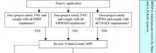
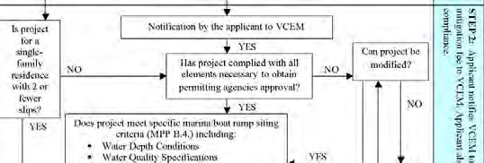
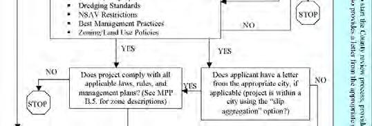
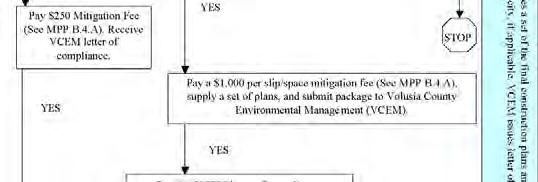
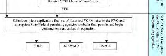
193 123
Florida Seagrass Integrated Mapping and Monitoring Program
 Florida Seagrass Integrated Mapping and Monitoring Program - 2004 The following document is composed of excerpts taken from the 2011 publication, Seagrass Integrated Mapping and Monitoring for the State
Corpus Christi Metropolitan Transportation Plan Fiscal Year Introduction:
 Introduction: The Safe, Accountable, Flexible, Efficient Transportation Equity Act: A Legacy for Users (SAFETEA-LU) has continued the efforts started through the Intermodal Surface Transportation Efficiency
Florida Department of Environmental Protection
 Florida Department of Environmental Protection Bob Martinez Center 2600 Blair Stone Road Tallahassee, Florida 32399-2400 Rick Scott Governor Jennifer Carroll Lt. Governor Herschel T. Vinyard Jr. Secretary
May 12, Dear Superintendent Kimball:
 May 12, 2013 Superintendent Dan Kimball Everglades National Park National Park Service, U.S. Department of the Interior 40001 State Road 9336 Homestead, FL 33034-6733 Dear Superintendent Kimball: The National
Coastal Wetlands Protection Act. Fisheries Management, Marine Sanctuaries and Closures
 , STATE AND LOCAL AUTHORITY FOR MARINE PROTECTION (2014). MISSISSIPPI 1 State Authority for Protection Summary of State Authorities Mississippi has several options for conserving marine habitat; however,
Exhibit 1 PLANNING COMMISSION AGENDA ITEM
 Exhibit 1 PLANNING COMMISSION AGENDA ITEM Project Name: Grand Junction Circulation Plan Grand Junction Complete Streets Policy Applicant: City of Grand Junction Representative: David Thornton Address:
IMPLEMENTING REGULATIONS OF THE WILDLIFE CONSERVATION LAW. Authorized by the Republic of China Wildlife Conservation Law, amended October 29, 1994.
 IMPLEMENTING REGULATIONS OF THE WILDLIFE CONSERVATION LAW Authorized by the Republic of China Wildlife Conservation Law, amended October 29, 1994. CHAPTER I: INTRODUCTION Section 1. The following regulations
CHAPTER 6 10/29/2018 Clean Version REGULATING PIERS, WHARVES, MOORING BUOYS, SWIMMING RAFTS AND INFLATABLES ON ROCK LAKE
 1 2 3 4 5 6 7 8 9 10 11 12 13 14 15 16 17 18 19 20 21 22 23 24 25 26 27 28 29 30 31 32 33 34 35 36 37 38 39 40 41 42 43 44 45 46 CHAPTER 6 10/29/2018 Clean Version REGULATING PIERS, WHARVES, MOORING BUOYS,
Township of Plainsboro Ordinance No County of Middlesex AN ORDINANCE ESTABLISHING A DEER MANAGEMENT PLAN ON CERTAIN PUBLIC PROPERTY
 Township of Plainsboro Ordinance No. 18-10 County of Middlesex AN ORDINANCE ESTABLISHING A DEER MANAGEMENT PLAN ON CERTAIN PUBLIC PROPERTY WHEREAS, White-tailed deer populations have been increasing and
Living Streets Policy
 Living Streets Policy Introduction Living streets balance the needs of motorists, bicyclists, pedestrians and transit riders in ways that promote safety and convenience, enhance community identity, create
Living Beaches: Integrating The Ecological Function Of Beaches Into Coastal Engineering Projects and Beach Management
 Living Beaches: Integrating The Ecological Function Of Beaches Into Coastal Engineering Projects and Beach Management Melissa Bimbi USFWS SC Field Office Kathy Matthews USFWS Raleigh Field Office January
Part 9 Specific Land Uses - Foreshore & Waterway Development
 7 FORESHORE AND WATERWAY DEVELOPMENT This section applies to the following development uses proposed within the foreshore area (defined by LM LEP 2014), and contains Council s specific requirements for
APPROVE A RESOLUTION ADOPTING A COMPLETE STREETS POLICY
 STAFF REPORT MEETING DATE: September 13, 2016 TO: FROM: City Council Bob Brown, Community Development Director Russ Thompson, Public Works Director Patrick Filipelli, Management Analyst 922 Machin Avenue
SOCIETAL GOALS TO DETERMINE ECOSYSTEM HEALTH: A FISHERIES CASE STUDY IN GALVESTON BAY SYSTEM, TEXAS
 SOCIETAL GOALS TO DETERMINE ECOSYSTEM HEALTH: A FISHERIES CASE STUDY IN GALVESTON BAY SYSTEM, TEXAS Anthony S. Pait, NOAA, National Centers for Coastal Ocean Science Thomas P. O Connor, David R. Whitall,
MEMORANDUM. Existing Operations. City of Clearwater. Michael Herrman. Date: January 26, Seminole Boat Launch Overview. M&N Job No.
 1509 W. Swann Avenue, Suite 225 Tampa, FL 33606 (813) 258-8818 Fax (813) 258-8525 www.moffattnichol.com MEMORANDUM To: From: City of Clearwater Michael Herrman Date: Subject: Seminole Boat Launch Overview
Issues facing this region include the status of the Sluice Creek tide gates, various tidal wetlands, and locations of public access:
 5.6 Guilford Point to Madison Town Line Existing Resources This region extends from Guilford Point to the Madison town line. Named places include Grass Island and the East River. Residential, commercial,
Endangered Species Act Application in New York State What s New? October 4, 2015 U.S. Fish and Wildlife Service Robyn A. Niver
 Endangered Species Act Application in New York State What s New? October 4, 2015 U.S. Fish and Wildlife Service Robyn A. Niver Goals of Today s Session Provide an introduction to the Endangered Species
Bicycle Master Plan Goals, Strategies, and Policies
 Bicycle Master Plan Goals, Strategies, and Policies Mobilizing 5 This chapter outlines the overarching goals, action statements, and action items Long Beach will take in order to achieve its vision of
La Crescent Township Zoning Ordinance
 La Crescent Township Zoning Ordinance Table of Contents SECTION 1 ~ PREAMBLE, TITLE, SHORT TITLE AND PURPOSE... 1 0101 Preamble... 1 0102 Title... 1 0103 Short Title... 1 0104 Purpose... 1 SECTION 2 ~
City of Elizabeth City Neighborhood Traffic Calming Policy and Guidelines
 City of Elizabeth City Neighborhood Traffic Calming Policy and Guidelines I. Purpose: The City of Elizabeth City is committed to ensure the overall safety and livability of residential neighborhoods. One
Lake Tahoe Shoreline Plan. 01 Scope
 Lake Tahoe Shoreline Plan 01 Scope 09.20.2016 1 Brief Description The Shoreline Plan needs a defined scope to focus work efforts and complete the planning process by the end of 2018 (within the existing
Traffic Calming Policy
 Article I. Purpose and Goal. The purpose of this policy is to establish criteria and procedures the City will use to evaluate requests for, and if appropriate, implement traffic calming measures. Neighborhood
Prepared By: Environmental Preservation Committee REVISED: 3/29/05. Please see last section for Summary of Amendments
 SENATE STAFF ANALYSIS AND ECONOMIC IMPACT STATEMENT (This document is based on the provisions contained in the legislation as of the latest date listed below.) BILL: SB 1866 Prepared By: Environmental
CITY OF COCOA BEACH 2025 COMPREHENSIVE PLAN. Section VIII Mobility Element Goals, Objectives, and Policies
 CITY OF COCOA BEACH 2025 COMPREHENSIVE PLAN Section VIII Mobility Element Goals, Objectives, and Policies Adopted August 6, 2015 by Ordinance No. 1591 VIII MOBILITY ELEMENT Table of Contents Page Number
Manatee Protection and Boating Safety Comprehensive Management Plan
 Manatee Protection and Boating Safety Comprehensive Management Plan Indian River County Environmental Planning Section T A B L E O F C O N T E N T S EXISTING CONDITIONS... Page 1 INTRODUCTION... Page 1
CHAPTER 7.0 IMPLEMENTATION
 CHAPTER 7.0 IMPLEMENTATION Achieving the vision of the Better Streets Plan will rely on the ability to effectively fund, build and maintain improvements, and to sustain improvements over time. CHAPTER
Hunting, Fishing, Recreational Shooting, and Wildlife Conservation Opportunities and Coordination with States, Tribes, and Territories
 THE SECRETARY OF THE INTERIOR WASHINGTON ORDER NO. 3356 Subject: Hunting, Fishing, Recreational Shooting, and Wildlife Conservation Opportunities and Coordination with States, Tribes, and Territories Sec.
ADDENDUM I TO AMENDMENT 3 OF THE INTERSTATE FISHERY MANAGEMENT PLAN FOR WEAKFISH
 ATLANTIC STATES MARINE FISHERIES COMMISSION ADDENDUM I TO AMENDMENT 3 OF THE INTERSTATE FISHERY MANAGEMENT PLAN FOR WEAKFISH Prepared by the Weakfish Plan Review Team Approved October 18, 2000 TABLE OF
May 12, 2016 Metro Potential Ballot Measure Issue Brief: Local Return
 Summary: Local return is an important revenue source for cities to maintain their local transportation infrastructure. Most cities use their local return to operate small bus systems and repave streets,
Street Paving and Sidewalk Policy
 City Commission Policy 600 Street Paving and Sidewalk Policy DEPARTMENT: Public Works DATE ADOPTED: June 7, 1995 DATE OF LAST REVISION: December 10, 2014 Policy No. 600.01 AUTHORITY: PASS City of Tallahassee-Leon
ARTICLE III. CERTAIN PUBLIC PLACES* DIVISION 1. GENERALLY DIVISION 2. MUNICIPAL YACHT BASIN DIVISION 3. MANAGED MOORING FIELD
 ARTICLE III. CERTAIN PUBLIC PLACES* *Cross References: Parks and recreation, Ch. 14. Secs. 17-56--17-65. Reserved. DIVISION 1. GENERALLY DIVISION 2. MUNICIPAL YACHT BASIN Sec. 17-66. Mooring. It shall
13 August 14, 2013 Public Hearing
 13 August 14, 2013 Public Hearing APPLICANT/ PROPERTY OWNER: POCAHONTAS LANDING, L.L.C. STAFF PLANNER: Ray Odom REQUEST: Condition Use Permit (Non-Commercial Marina) ADDRESS / DESCRIPTION6: Terminus of
REMOVE BARRIERS TO, ENCOURAGE CREATION OF AND PROVIDE GUIDELINES FOR SAFE ROUTES (ALL DISTRICTS)
") Ordinance 2009-98 AN ORDINANCE OF THE BOARD OF SUPERVISORS OF PIMA COUNTY, ARIZONA; RELATING TO ZONING; AMENDING THE PIMA COUNTY ZONING CODE TITLE 18 BY AMENDING SECTION 18.03.020 (DEFINITIONS) TO ADD
Ordinance 2009-98 AN ORDINANCE OF THE BOARD OF SUPERVISORS OF PIMA COUNTY, ARIZONA; RELATING TO ZONING; AMENDING THE PIMA COUNTY ZONING CODE TITLE 18 BY AMENDING SECTION 18.03.020 (DEFINITIONS) TO ADD
Canal Current. Environmental News. Native Plant profile
 Canal Current A wave of information for Cape Coral s Canalwatch volunteers Newsletter: 1 st Quarter 2013 Environmental News Earth Day 2013 Earth Day is on Monday April 22 nd. Please consider these events
MSW Objective 1.1: Level of Service Standards To maintain the IMSWMS MSW collection system to meet or exceed established LOS standards.
 INFRASTRUCTURE - MUNICIPAL SOLID WASTE PURPOSE The purpose of the Solid Waste section of the Infrastructure Element is to ensure that necessary sanitation facilities and services are in place to provide
Section 9. Implementation
 Section 9. Implementation The transportation system is just one of many aspects that must be carefully planned to maintain and enhance the quality of living in Cecil County. The Cecil County Bicycle Plan
Three point plan to addressing land use and habitat loss impacts on Chesapeake Bay tidal fish and shellfish
 Three point plan to addressing land use and habitat loss impacts on Chesapeake Bay tidal fish and shellfish 1. Establish Principles for Protection of Chesapeake Bay Fish and Shellfish The Fisheries GIT
A. PURPOSE B. BACKGROUND
 MEMORANDUM OF UNDERSTANDING BETWEEN THE U.S. DEPARTMENT OF DEFENSE AND THE U.S. FISH AND WILDLIFE SERVICE AND THE ASSOCIATION OF FISH AND WILDLIFE AGENCIES FORA COOPERATIVE INTEGRATED NATURAL RESOURCE
PENSACOLA BAY BRIDGE PROJECT DEVELOPMENT AND ENVIRONMENT (PD&E) STUDY. Appendix D to the Environmental Assessment Standard Protection Measures
 STUDY. Appendix D to the Environmental Assessment Standard Protection Measures") February 2015 PENSACOLA BAY BRIDGE PROJECT DEVELOPMENT AND ENVIRONMENT (PD&E) STUDY Appendix D to the Environmental Assessment Standard Protection Measures Construction Special Provisions, Gulf Sturgeon
February 2015 PENSACOLA BAY BRIDGE PROJECT DEVELOPMENT AND ENVIRONMENT (PD&E) STUDY Appendix D to the Environmental Assessment Standard Protection Measures Construction Special Provisions, Gulf Sturgeon
POLICY: TRAFFIC CALMING
 2006 MAY REFERENCE: COUNCIL APPROVED BY COUNCIL MAY 23, 2006 CITY OPERATIONS - NO. 608 POLICY: TRAFFIC CALMING A. All requests for traffic calming within the City shall be considered in accordance with
General Regulations for Areas Administered by the National Park Service and the Fish and Wildlife Service
 4312-52-M DEPARTMENT OF THE INTERIOR National Park Service 36 CFR Part 2 Fish and Wildlife Service 50 CFR Part 27 RIN 1024-AD70 General Regulations for Areas Administered by the National Park Service and
THIS PAGE INTENTIONALLY BLANK
 THIS PAGE INTENTIONALLY BLANK Readers Guidance: This chapter provides responses to all comments submitted on the Draft Supplemental EIR of November 2011. All comments have been numbered and a corresponding
AMATS Complete Streets Policy
 AMATS Complete Streets Policy Table of Contents: Section 1. Definition of Complete Streets Section 2. Principles of Complete Streets Section 3. Complete Streets Policy Section 4. Consistency Section 5.
Integrated Pest Management Program Final Report
 Integrated Pest Management Program Final Report Shoreline Stewardship Program: Be a Lake Pan Pal Joan Bradshaw Specialized Regional Programs for Natural Resource Citrus, Hernando, Pasco and Sumter Counties
TOWN OF PORTLAND, CONNECTICUT COMPLETE STREETS POLICY
 TOWN OF PORTLAND, CONNECTICUT COMPLETE STREETS POLICY I. VISION, GOALS & PRINCIPLES VISION To improve the streets of Portland making them safer and more accessible for all users including pedestrians,
Case Study 3. Case Study 3: Cebu Island, Philippines MPA Network 10
 Case studies of mpa networks Case Study 3: Cebu Island, Philippines MPA Network 10 Location and background Cebu Island in the Philippines lies in the center of the Visayan Islands, known as an area high
Proposed. City of Grand Junction Complete Streets Policy. Exhibit 10
 Proposed City of Grand Junction Complete Streets Policy Exhibit 10 1 City of Grand Junction Complete Streets Policy Vision: The Complete Streets Vision is to develop a safe, efficient, and reliable travel
The Florida Bicycle and Pedestrian Partnership Council
 The Florida Bicycle and Pedestrian Partnership Council Input to the Update of the Florida Transportation Plan March 2015 This document presents input from the Florida Bicycle and Pedestrian Advisory Council
Florida Department of Environmental Protection
 Florida Department of Environmental Protection Bob Martinez Center 2600 Blair Stone Road Tallahassee, Florida 32399-2400 Rick Scott Governor Jennifer Carroll Lt. Governor Herschel T. Vinyard Jr. Secretary
Regulation PM-10.0: Ships Ballast Water Management
 10.1. General Requirements 10.2 Ships Precaution for Loading Ballast 10.3 Ballast Water Management Plan 10.4 Reporting of Ballast water Reporting Form 10.5 EHS Role for Ballast Uptake 10.6 Ships Responsibility
TRAVEL PLAN: CENTRAL EUROPEAN UNIVERSITY CAMPUS REDEVELOPMENT PROJECT TRAVEL PLAN. Central European University Campus Redevelopment Project.
 TRAVEL PLAN Central European University Campus Redevelopment Project Page 1 Table of Contents Introduction... 3 Background... 7 Building Users... 7 Transportation in Community Consultation... 7 Summary
IC Chapter 34. Nongame and Endangered Species Conservation
 IC 14-22-34 Chapter 34. Nongame and Endangered Species Conservation IC 14-22-34-1 "Endangered species" Sec. 1. (a) As used in this chapter, "endangered species" means any species or subspecies of wildlife
Management of Shellfish Aquaculture and Propagation in Massachusetts Waters
 Management of Shellfish Aquaculture and Propagation in Massachusetts Waters Chris Schillaci Aquaculture and Propagation Project Massachusetts Division of Marine Fisheries Shellfish In Massachusetts Massachusetts
: AUTHORITY: This ordinance is adopted under the authority granted by Section 30.13(2) and 30.13(3) of the Wisconsin Statutes.
 and 30.13(3) of the Wisconsin Statutes.") 1 2 3 4 5 6 7 8 9 10 11 12 13 14 15 16 17 18 19 20 21 22 23 24 25 26 27 28 29 30 31 32 33 34 35 36 37 38 39 40 41 42 43 44 45 CHAPTER 6 REGULATING PIERS, WHARVES, MOORING BUOYS, RAFTS, AND INFLATABLES
1 2 3 4 5 6 7 8 9 10 11 12 13 14 15 16 17 18 19 20 21 22 23 24 25 26 27 28 29 30 31 32 33 34 35 36 37 38 39 40 41 42 43 44 45 CHAPTER 6 REGULATING PIERS, WHARVES, MOORING BUOYS, RAFTS, AND INFLATABLES
Implementing the New Fisheries Protection Provisions under the Fisheries Act
 Implementing the New Fisheries Protection Provisions under the Fisheries Act Discussion Paper Fisheries and Oceans Canada April 2013 Contents 1. Introduction 2. Managing Threats to Canada s Fisheries 3.
CIRCULATION ELEMENT ADOPTED 1980 REPUBLISHED APRIL 2014 County of Santa Barbara Planning and Development 123 E. Anapamu Street Santa Barbara, CA 93101
 CIRCULATION ELEMENT ADOPTED 1980 REPUBLISHED APRIL 2014 County of Santa Barbara Planning and Development 123 E. Anapamu Street Santa Barbara, CA 93101 The electronic version of the Santa Barbara County
Listed species under the jurisdiction of NOAA Fisheries that occur in the geographic area of responsibility of the Wilmington District are:
 Information to assist in compliance with Nationwide Permit General Condition 18, Endangered Species Required Reporting via Pre-Construction Notification The purpose of this document is to provide information
Abandoned and Derelict Vessels in the Florida Keys National Marine Sanctuary
 Abandoned and Derelict Vessels in the Florida Keys National Marine Sanctuary Steve Werndli Emergency Response and Enforcement Coordinator Florida Keys National Marine Sanctuary April 18, 2017 Derelict
Lifeforce Foundation Orca Conservation Programs
 Lifeforce Foundation Orca Conservation Programs Photo Captions: Start Top left Clockwise 1. Over fishing and entanglement in fishing nets and other debris is a threat to orcas. 2. Boaters should be aware
CHAPTER Committee Substitute for Committee Substitute for Senate Bill No. 1318
 CHAPTER 2016-200 Committee Substitute for Committee Substitute for Senate Bill No. 1318 An act relating to shellfish harvesting; amending s. 597.010, F.S.; revising provisions directing the Department
AGENCY/ORGANIZATION OFFICE/DIVISION SECTION/SUBSECTION ACTIONS (Related to Coral Reefs) Natural Resources Planning and Management Division
 Natural Resources Planning and Management Division") AGENCY/ORGANIZATION OFFICE/DIVISION SECTION/SUBSECTION ACTIONS (Related to Coral Reefs) Broward County Environmental Protection and Growth Department Natural Resources Planning and Division Broward County
AGENCY/ORGANIZATION OFFICE/DIVISION SECTION/SUBSECTION ACTIONS (Related to Coral Reefs) Broward County Environmental Protection and Growth Department Natural Resources Planning and Division Broward County
U.N. Gen. Ass. Doc. A/CONF.164/37 (8 September 1995) <http://daccessdds.un.org/doc/undoc/gen/n95/274/67/pdf/n pdf?openelement>.
 <http://daccessdds.un.org/doc/undoc/gen/n95/274/67/pdf/n pdf?openelement>.") Agreement for the Implementation of the Provisions of the United Nations Convention on the Law of the Sea Of 10 December 1982 Relating to the Conservation and Management of Straddling Fish Stocks and Highly
Agreement for the Implementation of the Provisions of the United Nations Convention on the Law of the Sea Of 10 December 1982 Relating to the Conservation and Management of Straddling Fish Stocks and Highly
Grizzly Bear Management Plan for the Gwich in Settlement Area
 1 Grizzly Bear Management Plan for the Gwich in Settlement Area Diana Campbell 2 Introduction Many of our Aboriginal communities have negotiated land claim, resource, or self-government agreements with
Coastal and marine recreation in New England is ingrained in the region s economic and
 RECREATION Coastal and marine recreation in New England is ingrained in the region s economic and social fabric. Recreation on the ocean and coast includes many of New Englanders most time-honored and
PROPOSED RULEMAKING GAME COMMISSION
 PROPOSED RULEMAKING GAME COMMISSION [ 58 PA. CODE CH. 141 ] Hunting and Trapping; Prohibited Devices its October 5, 2010, meeting, proposed to add 141.68 (relating to prohibited devices) to specifically
The Blue Heron Slough Conservation Bank
 1 The Blue Heron Slough Conservation Bank CONSERVATION BANKING July 19-23, 2010 CASE STUDY SERIES The Blue Heron Slough Conservation Bank (Washington) I. OVERVIEW & BACKGROUND: Location: Snohomish River
ECONOMIC DEVELOPMENT ELEMENT
 ECONOMIC DEVELOPMENT ELEMENT Background The Economic Development Element considers labor force and labor force characteristics, employment by place of work and residence, and analysis of the community
Access Management Regulations and Standards for Minor Arterials, Collectors, Local Streets
 Access Management Regulations and Standards for Minor Arterials, Collectors, Local Streets September 2009 Paul Grasewicz Access Management Administrator Concept of Access Management The way to manage access
Amendment to a Biological Assessment/Evaluation completed for the Coon Creek Land Disposal completed December Grand Valley Ranger District
 Amendment to a Biological Assessment/Evaluation completed for the Coon Creek Land Disposal completed December 2007 Grand Valley Ranger District Grand Mesa, Uncompahgre, Gunnison National Forests Prepared
Indian River Lagoon: Lessons, Challenges and Opportunities
 Indian River Lagoon: Lessons, Challenges and Opportunities Upper Chain of Lakes Lake Kissimmee Kissimmee River Indian River Lagoon Caloosahatchee Estuary Lake Okeechobee St. Lucie Estuary Mark Perry, Executive
Funding Habitat Restoration Projects for Salmon Recovery in the Snake River Region SRFB Grant Round Version: 2/19/16
 2016 SRFB Grant Round Version: 2/19/16 Funding Habitat Restoration Projects for Salmon Recovery in the Snake River Region The Project Funding Process Presented by the Snake River Salmon Recovery Lead Entity
Regional School District #19 Transportation Policy
 Regional School District #19 Transportation Policy I. Scope of Policy Many students attending E.O. Smith High School are transported by local boards of education, through written agreements with those
Chapter 11. Culverts and Bridges Design Checklist for Culvert Design
 Yes No N/A Design Requirements I. GENERAL DESIGN GUIDELINES Chapter 11. Culverts and Bridges A. Culvert design is in accordance with the Culverts chapter of Volume 2 of the UDFCD Manual for additional
Frequently Asked Questions About Revised Critical Habitat and Economic Analysis for the Endangered Arroyo Toad
 Q Frequently Asked Questions About Revised Critical Habitat and Economic Analysis for the Endangered Arroyo Toad Q. What is the arroyo toad? The arroyo toad (Bufo californicus) is a small, light greenish-grey
Access requests to County streets and roadways are processed through one of the following methods:
 13.1 GENERAL APPLICATION PROCESS Access requests to County streets and roadways are processed through one of the following methods: A. Planned Developments may set general locations for access points.
Lake Tahoe Shoreline Plan. 05 Policy Topic: Piers- Fish Habitat, Design, and Scenic Issues
 Lake Tahoe Shoreline Plan 05 Policy Topic: Piers- Fish Habitat, Design, and Scenic Issues 07.20.2016 1 Brief Description There are 768 piers located along the shoreline of Lake Tahoe. Approximately 43
Good Mooring to You! Jensen Beach Mooring Field. Kathy Fitzpatrick, P.E. Coastal Engineer, Martin County
 Good Mooring to You! Kathy Fitzpatrick, P.E. Coastal Engineer, Martin County Penny Cutt Regional Manager, Coastal Systems International Mooring Field Advantages Provide a safe and secure anchorage at a
Americans with Disabilities Act Transition Plan for Public Right-of-Way Improvements
 Americans with Disabilities Act Transition Plan for Public Right-of-Way Improvements Prepared by: Public Works Department Engineering Division October 2015 Table of Contents Section I Introduction.. 3
Kennesaw Mountain National Battlefield Park Mountain Road Alternatives
 Kennesaw Mountain National Battlefield Park Mountain Road Alternatives Management Issue Kennesaw Mountain National Battlefield Park was established by Congress in 1935 to preserve and commemorate the site
WHEREAS, the ordinance will not create excessive additional requirements for public facilities and services at public cost.
 ORDINANCE 19-05 AN ORDINANCE OF VALLEY COUNTY, IDAHO, CREATING AN ORDINANCE TO BE ADMINISTERED BY THE VALLEY COUNTY SHERIFF S OFFICE AND TO BE KNOWN AS VALLEY COUNTY WATERWAYS ORDINANCE THAT INCLUDES PAYETTE
Shellfish Lease Program. February 13, Department of Environmental Quality
 Shellfish Lease Program February 13, 2016 Department of Environmental Quality NC Shellfish Lease History The State of North Carolina has provided for the private use of public trust waters for the production
Norwalk Harbor: The Jewel of Long Island Sound. A Presentation by the Norwalk Harbor Management Commission
 Norwalk Harbor: The Jewel of Long Island Sound A Presentation by the Norwalk Harbor Management Commission 2018 State of the Harbor Meeting December 13, 2018 The City of Norwalk in Southwest Connecticut
STATE OF NEVADA BOARD OF WILDLIFE COMMISSIONERS
 STATE OF NEVADA BOARD OF WILDLIFE COMMISSIONERS Number: P-33 Title: Fisheries Management Program Commission Policy Number 33 References: NRS 501.105, 501.181 Effective Date: July 24, 1999 Reviewed Date:
APPENDIX G: INTERSECTION NEEDS AT OKEECHOBEE BOULEVARD
 APPENDIX G: INTERSECTION NEEDS AT OKEECHOBEE BOULEVARD INTERSECTION NEEDS AT SR 7 and OKEECHOBEE BOULEVARD SR 7 Extension Project Development and Environment (PD&E) Study From Okeechobee Boulevard (SR
USING A LABYRINTH WEIR TO INCREASE HYDRAULIC CAPACITY. Dustin Mortensen, P.E. 1 Jake Eckersley, P.E. 1
 USING A LABYRINTH WEIR TO INCREASE HYDRAULIC CAPACITY Dustin Mortensen, P.E. 1 Jake Eckersley, P.E. 1 Plum Creek Floodwater Retarding Structure No. 6 is located in an area of Kyle, Texas, that is currently
ALBERTA FISH & GAME ASSOCIATION 2015 ANNUAL GENERAL MEETING PASSED RESOLUTIONS FEBRUARY 21, 2015
 ALBERTA FISH & GAME ASSOCIATION 2015 ANNUAL GENERAL MEETING PASSED RESOLUTIONS FEBRUARY 21, 2015 GENERAL RESOLUTION NUMBER G-1-2015 and Sustainable Resource Development permit the use of crossbows during
THE GENERAL ASSEMBLY OF PENNSYLVANIA HOUSE BILL
 PRINTER'S NO. THE GENERAL ASSEMBLY OF PENNSYLVANIA HOUSE BILL No. 0 Session of 01 INTRODUCED BY MALONEY, HANNA, TOEPEL, ELLIS, SACCONE, BLOOM, READSHAW, D. COSTA, ORTITAY, McGINNIS, DIAMOND, GIBBONS, QUIGLEY,
Chapter 7. Transportation. Transportation Road Network Plan Transit Cyclists Pedestrians Multi-Use and Equestrian Trails
 Chapter 7 Transportation Transportation Road Network Plan Transit Cyclists Pedestrians Multi-Use and Equestrian Trails 7.1 TRANSPORTATION BACKGROUND The District of Maple Ridge faces a number of unique
ADA Transition Plan. City of Gainesville FY19-FY28. Date: November 5, Prepared by: City Of Gainesville Department of Mobility
 ADA Transition Plan FY19-FY28 Date: November 5, 2018 Prepared by: City Of Gainesville Department of Mobility 1.0 INTRODUCTION 1.1 BACKGROUND The federal statute known as the Americans with Disabilities
CITY OF NAPLES STAFF REPORT
 Meeting of 8/9/17 Variance Petition 17-V5 CITY OF NAPLES STAFF REPORT To: Planning Advisory Board From: Planning Department Subject: Variance Petition 18-V2 Petitioner: Ian & Catherine Delaney Agent: Jeff
Recommended Roadway Plan Section 2 - Land Development and Roadway Access
 Recommended Roadway Plan Section 2 - Land Development and Roadway Access SECTION 2 Land Development and Roadway Access 2.1 Land Use and Access Management The Federal Highway Administration (FHWA) defines
RULES AND GUIDELINES FOR USE OF LYTLE LAKE. The following persons shall have the right to use Lytle Lake for boating, water skiing,
 1 RULES AND GUIDELINES FOR USE OF LYTLE LAKE 2 3 4 I. Access to, and use of, Lytle Lake shall be governed by the laws of the State of Texas (including the Texas Water Safety Act), Rules of the Texas Parks
NEVADA DEPARTMENT OF WILDLIFE STATEWIDE FISHERIES MANAGEMENT
 NEVADA DEPARTMENT OF WILDLIFE STATEWIDE FISHERIES MANAGEMENT FEDERAL AID JOB PROGRESS REPORT F-20-50 2014 LAHONTAN CUTTHROAT TROUT STUDY WESTERN REGION NEVADA DEPARTMENT OF WILDLIFE, FISHERIES DIVISION
County of Greenville South Carolina. Traffic Calming Program Neighborhood Traffic Education Program and Speed Hump Program
 County of Greenville South Carolina Traffic Calming Program Neighborhood Traffic Education Program and Speed Hump Program (rev) August 2008 I. PURPOSE The potential negative impacts from vehicular traffic
ACTIVE TRANSPORTATION
 ACTIVE TRANSPORTATION Mobility 2040 Supported Goals Improve the availability of transportation options for people and goods. Support travel efficiency measures and system enhancements targeted at congestion
Order Adopting Amendments. Title 58. Recreation Part II. Fish and Boat Commission Chapters 97, 109, 111 and 115 Boating. Preamble
 Order Adopting Amendments COMMONWEALTH OF PENNSYLVANIA PENNSYLVANIA FISH AND BOAT COMMISSION Title 58. Recreation Part II. Fish and Boat Commission Chapters 97, 109, 111 and 115 Boating Preamble The Fish
Clackamas County Comprehensive Plan
 ROADWAYS The County s road system permits the movement of goods and people between communities and regions, using any of a variety of modes of travel. Roads provide access to virtually all property. They
Endangered Species Act and FERC Hydroelectric Projects. Jeff Murphy & Julie Crocker NHA New England Meeting November 16, 2010
 Endangered Species Act and FERC Hydroelectric Projects Jeff Murphy & Julie Crocker NHA New England Meeting November 16, 2010 Shortnose Sturgeon Federally listed as endangered in 1967 Listed under the sole
Basalt Creek Transportation Refinement Plan Recommendations
 Basalt Creek Transportation Refinement Plan Recommendations Introduction The Basalt Creek transportation planning effort analyzed future transportation conditions and evaluated alternative strategies for
CHAPTER 4 DESIRED OUTCOMES: VISION, GOALS, AND OBJECTIVES
 CHAPTER 4 DESIRED OUTCOMES: VISION, GOALS, AND OBJECTIVES Vision One of the first steps in developing this Plan was articulating a vision - a clear statement of what the Plan strives to achieve and what