Report prepared by: Hampshire & Wight Trust for Maritime Archaeology HWTMA/ NAS
|
|
|
- Joshua Shepherd
- 6 years ago
- Views:
Transcription
1
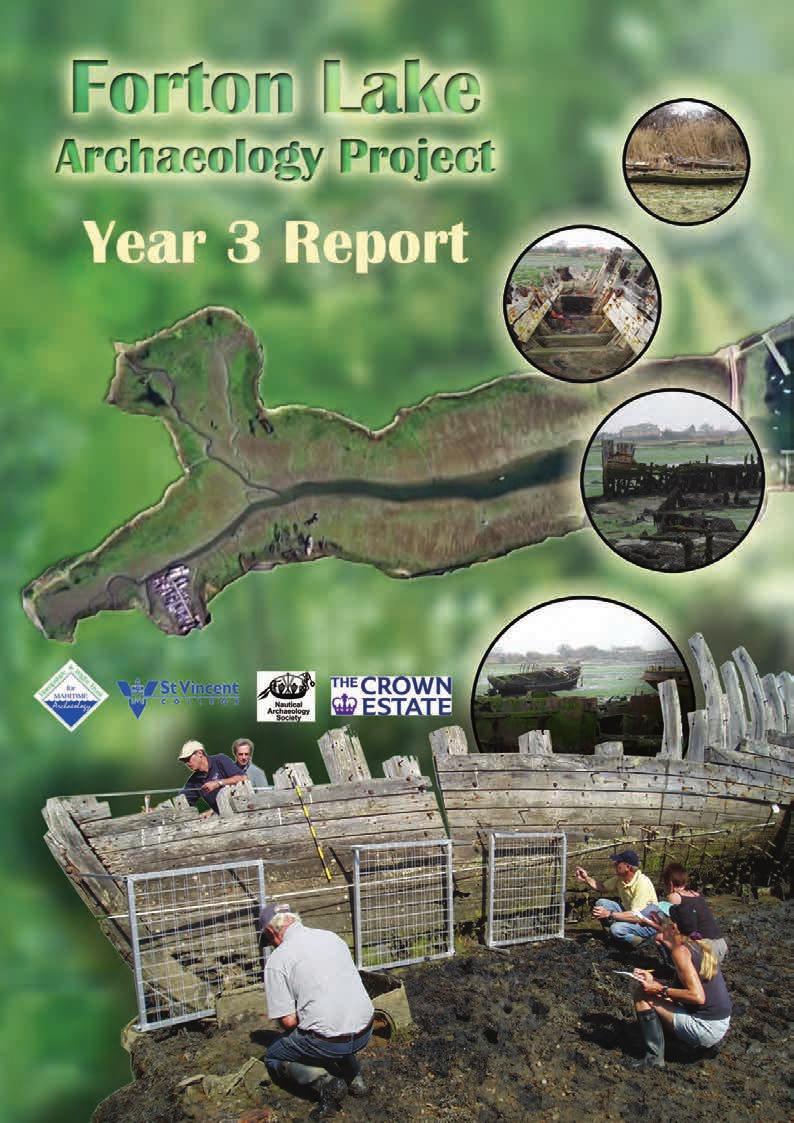
2 Report prepared by: Hampshire & Wight Trust for Maritime Archaeology HWTMA/ NAS Hampshire & Wight Trust for Maritime Archaeology Room W1/95 National Oceanography Centre Empress Dock Southampton SO14 3ZH Nautical Archaeology Society Fort Cumberland Fort Cumberland Road Eastney Portsmouth PO4 9LD HWTMA/ NAS 1
3 Contents I. ACKNOWLEDGEMENTS... 3 II. PROJECT SPONSOR DETAILS... 3 III. LIST OF FIGURES PROJECT BACKGROUND FIELD SEASON HULK RECORDING METHODOLOGY SUMMARY EXCAVATION METHODOLOGY SUMMARY RESULTS FL 1: Wooden Hulk FL 2: Motor Fishing Vessel FL 5: Buried Vessel FL 9: Pinnace FL17: Motor Gunboat FL23: Mark III Bomb Scow FL 29 Buried Vessel FL30 Ships Life Boat AUGER SURVEY FIELD SUMMARY FUTURE WORK Research, Reporting and Dissemination Future Fieldwork Possibilities VOLUNTEER INVOLVEMENT PROJECT OUTREACH LOCAL COMMUNITY ARCHAEOLOGICAL TRAINING EDUCATION SCHOOL OPEN DAYS APPENDICES LIST OF PROJECT VOLUNTEERS AUGER RESULTS REFERENCES GLOSSARY HWTMA/ NAS 2
4 i. Acknowledgements This project has been made possible due to funding from the Local Heritage Initiative and The Crown Estate Marine Stewardship Fund. Additionally the project has received the support of a wide range of individuals and organisations. We would particularly like to acknowledge the help and support of: St. Vincent College, Jane Maddocks, Mr Ted Sutton, Mr E Walker and Mr G Akhurst. Fieldwork was supervised by Dan Pascoe, Julian Whitewright, Jane Maddocks and Jan Gillespie. This report has been produced by Paul Donohue, Dan Pascoe and Julie Satchell of the Hampshire & Wight Trust for Maritime Archaeology, with contributions from Alison Hamer (HWTMA) and Mark Beattie-Edwards (NAS). The cover has been designed by Rebecca Causer (HWTMA). Project management has been undertaken by Mark Beattie-Edwards (NAS) and Julie Satchell (HWTMA). The map image used in Figure 1 was supplied under license agreement from the Ordnance Survey (Licence number ) and must not be reproduced without prior permission. ii. Project Sponsor Details The Forton Lake Project has involved three years of active fieldwork and research and is being followed by a further year of analysis and production of dissemination materials for a variety of audiences. The project has been generously supported by two principal sponsors and a range of assistance in kind. The HWTMA and NAS would like to acknowledge the following support: Year One and Two Sponsorship The Local Heritage Initiative ( generously supported the Forton Lake Project The Local Heritage Initiative (LHI) was a small grants programme ( 3,000 to 25,000) launched in 2000 to help communities bring their local heritage to life. LHI provided funds, advice and support to enable communities to investigate, explain and care for their local landmarks, landscape, traditions and culture. From renovations to re-enactments, oral histories to heritage trails, interpretations to investigations, many aspects of local heritage are in a better state of repair, better understood and better cared for as a result of LHI and the energy and commitment of local communities. From 2000 to 2006, LHI collected the records and stories from these projects to produce a national archive of England s rich and diverse local heritage for future generations to learn from and enjoy. This comprehensive archive is available to view via the LHI Projects Directory page of this web site. This hugely successful LHI programme, administered by the Countryside Agency, funded through the Heritage Lottery Fund (HLF), and with additional sponsorship HWTMA/ NAS 3
5 from Nationwide Building Society, awarded over 23 million to more than 1,400 communities over six and a half years. The LHI programme is now closed, but the LHI web pages are still accessible and provide an excellent resource for learning about the types of projects that received local heritage funding, including archeaological, customs and traditions, industrial, natural and built projects. Year Three and Four Sponsorship The Crown Estate Marine Stewardship Fund has generously supported the Forton Lake project in 2008/9. The Crown Estate is an estate valued at more than 7 billion, including substantial blocks of urban property, over 120,000 hectares (300,000 acres) of agricultural land in England, Scotland and Wales, and around half the foreshore, together with the seabed out to the 12 mile territorial limit. As owners, managers and guardians of one of the world s most important and diverse urban, rural and marine property portfolios are underpinned by the three core values of commercialism, integrity and stewardship. The Crown Estate s marine properties include more than half of the UK s foreshore (17,000 km), 55 per cent of the beds of tidal rivers and estuaries and almost the entire seabed out to the 12 nautical mile territorial limit around the UK. It also includes the rights to the natural resources in the UK Continental Shelf, with the exception of oil, coal and gas. The Crown Estate manages it s assets on a commercial basis, guided by the principles of sustainable development and social responsibility. We are committed to sustainable and long-term management of these unique assets. The Crown Estate established its programme of Marine Stewardship to provide funding to support practical projects, relevant research, and other initiatives that improve the status and management of the marine estate. Since 1999, The Crown Estate s Marine Communities Fund has contributed nearly 5 million to support community groups, voluntary and other organisations for practical projects that contribute to best practice in environmental management. For more information on The Crown Estate and the Marine Communities Fund, visit or contact: Katie King, Communications Dept, The Crown Estate, katie.king@thecrownestate.co.uk Assistance in Kind Hampshire & Wight Trust for Maritime Archaeology and Nautical Archaeology Society have provided additional support for the project. In particular the HWTMA has contributed staff time for project development and management, the HWTMA would like to acknowledge the following supporters who, through grants and donations to core funds, have contributed to this intertidal project on the Hampshire coast: Hampshire County Council, Aiken Foundation, Charlotte Bonham Carter Charitable Trust, George Cadbury Trust, Gosling Foundation, John Coates Charitable Trust, Robert Kiln HWTMA/ NAS 4
6 Charitable Trust, Roger Brooke Charitable Trust and Rowan Bentall Charity Trust. The Nautical Archaeology Society would like to acknowledge the support of Excalibur Procurement. St Vincent College, which boarders Forton Lake, has been a generous supporter providing facilities and storage space during fieldwork. Thanks are also extended to Morrisons Supermarket in Gosport which allowed a display about the project to be hosted within their building. HWTMA/ NAS 5
7 iii. List of figures Figure 1 Forton Lake is in Gosport and is an inlet of Portsmouth Harbour...10 Figure 2 Volunteers conducting a pre-disturbance survey...11 Figure 3 A volunteer collecting heights using a dumpy level...11 Figure 4 Excavation was carried out by volunteers using hand tools...12 Figure 5 The remains of FL 1 with the bow closest to the camera, the two mooring pontoons can be seen within the hulk (looking north)...13 Figure 6 Looking west an image of the bow section with the stempost (red arrow), false-stem (blue arrow), ceiling planking (green arrow) and concrete ballast (yellow arrow) indicated...14 Figure 7 An image showing the four raised floor timbers (red arrow) in the bow section, the keelson (blue arrow) and the bilge keelson (green arrow)...14 Figure 8 Between the composite frames (red arrow) concrete ballast has been placed (blue arrow)...15 Figure 9 A photograph showing the sternpost (red arrow), the rudder stock (blue arrow), the inner-post (green arrow) and the knee (yellow arrow) (looking west)...15 Figure 10 The rudder stock extends from the keel, the rudder stay is present (red arrow), but the rest of the rudder has disappeared (looking west)...16 Figure 11 View of FL1 during 2008 survey...16 Figure 12 Plan and sections of FL1 17 Figure 13 View of Keelson towards the bow 18 Figure 14 Facing the stern, Keelson (blue arrow) and iron strapping (red arrows) 19 Figure 15 Image showing sawn frames which are flat at the top and have not eroded (looking east) 20 Figure 16 A vertical saw cut on the port side of the vessel 20 Figure 17 Port side of the Motor Fishing Vessel..21 Figure 18 Rudder section of FL2 22 Figure 19 Plan and Sections of FL2..23 Figure 20 Looking internally at the starboard side, outer planking (red arrow) and frames (blue arrow).. 24 Figure 21 Drawn plans of FL 5's archaeological excavation. 26 Figure 22 Excavation Area FL 5 A looking south 27 Figure 23 Area A looking north.. 27 Figure 24 The extent of the keel at the bow, with the angled garboard strakes clearly visible (looking north).. 28 Figure 25 Three sets of floor timbers, each comprising of two timbers side by side. The small pulley can be seen to the right of the photograph (looking northeast). 29 Figure 26 A close up of the small pulley located forward of the floor timbers, in the bilge beside the keel. 29 Figure 27 The port limber in the second floor timber (looking north)...30 Figure 28 In the centre of the picture the keelson can be seen protruding from the section (looking north).. 30 Figure 29 Excavation Area FL 5 B looking west 31 Figure 30 Image of the keelson looking west (keelson indicated by arrow) HWTMA/ NAS 6
8 Figure 31 Looking west, the starboard side of the bottom planking, with three runs of floor timbers, the exposed halved joints and the starboard ceiling plank (red arrow)..32 Figure 32 On the port side there are the remains of two strakes of ceiling planking, one which is intact (red arrow) and one broken (blue arrow) (looking forward)...33 Figure 33 The port side of the vessel, giving an internal view of the planking, the bilge stringer (red arrow) and the port ceiling planking (blue arrow) (looking east).34 Figure 34 Area FL5C looking west.35 Figure 35 Five flush strakes of ceiling planking on the portside (red arrows).35 Figure 36 Starboard side of vessel looking south, viewing ceiling planking (green arrow). Floor timbers side by side (blue arrow) and bottom planking (red arrow). 36 Figure 37 Facing south the view of starboard limber hole 36 Figure 38 Starboard side looking east, collapse of the hull has caused futtocks (red arrow) to break at their joints with the floor timbers (blue arrows) 37 Figure 39 Portside hull looking east, composite futtocks (blue arrow), outer planking (red arrow) and iron fastening (green arrow) 37 Figure 40 Collapsed starboard hull looking west, composite futtocks (red arrows), outer planking (yellow arrow), concreted remains of iron nails (blue arrows) and a treenail (green arrow). 38 Figure 41 Treenail protruding from floor timber on the starboard side (red arrow)..38 Figure 42 Disarticulated timber possibly a stringer (red arrow).39 Figure 43 Excavation and recording in FL5 D was difficult due to water ingress and mud. 39 Figure 44 Section of the hull planking and frames that can be seen on the port side (looking east)...40 Figure 45 The exposed floor timbers and bottom planking on the starboard side (looking south).. 41 Figure 46 FL9 is the remains of a steam Pinnace. Most of the strakes are missing, leaving the vessel s skeletal framing. 42 Figure 47 Looking aft from the stem it possible to see the two tanks on the Port and Starboard sides 43 Figure 48 Plan of FL Figure 49 Facing the bow internally, stem (red arrow), knight head (blue arrow), hawse timber (green arrow), hawse pipe (yellow arrow) and hawse hole (pink arrow) 44 Figure 50 Facing bow internally, wooden breast hook (red arrow) and iron crutch (blue arrow) 45 Figure 51 Facing bow, outer planking (red arrow) and iron pins (blue arrow).46 Figure 52 FL17 is the remains of a possible WWII Gunboat.47 Figure 53 Plan of FL17 48 Figure 54 Looking internally at starboard the side, frames (red arrows) and cross beams (Blue arrows).48 Figure 55 Windows located in the stern on the portside 49 Figure 56 Facing towards the stern, doorway (red arrow) and viewing port (blue arrow) 49 HWTMA/ NAS 7
9 Figure 57 View of starboard side, bollards (red arrow), cleat (blue arrow) and side decking (green arrow) 50 Figure 58 View of FL23 facing north Figure 59 Plan of FL Figure 60 Facing the bow, longitudinal bulkhead (red arrow) and transverse bulkheads (blue arrows) 52 Figure 61 View of stern, engine room (red arrow), coxswain s position (blue arrow), steering housing (yellow arrow), entrance to engine room compartment (green arrow) and raised coaming (orange arrow) Figure 62 Photo of Mark III Bomb Scow (D. Blackhurst).. 53 Figure 63 Photograph showing the longitudinal timber and its metal fastenings. 54 Figure 64 A photograph of FL29 looking south, with possible keel (red arrow) and frames (blue arrows) indicated.. 54 Figure 65 Survey location plan of FL29 timber components 55 Figurer 66 Plan and Profile of FL Figure 67 Facing south view of Trench A, mooring pontoons (red arrow), cut marks on keelson (blue arrow) and cut marks on longitudinal timbers (green arrow) 57 Figure 68 Trench A facing south, longitudinal timbers (red arrows), keelson (green arrow) and bottom planking (blue arrows).. 58 Figure 69 View of Starboard side, frames (red arrows), rebates (blue arrows), outer planking (green arrow) and iron fastening (yellow arrow) 58 Figure 70 Looking down into Trench B.59 Figure 71 View of stern, rudder pin (red arrow), rudder pintle (blue arrow), stern post (green arrow) and knee (yellow arrow).. 59 Figure 72 Knee (red arrow), iron pin (blue arrow)...60 Figure 73 View of starboard side, outer planking (red arrow), bottom planking (blue arrows). 60 Figure 74 View of starboard, side outer planking (red arrow), bottom planking (blue arrows). 61 Figure 75 Facing west, remains of ships life boat. 62 Figure 76 Plan of FL30 62 Figure 77 Lifting hook at the stern. 63 Figure 78 Project Display outside Morrisons Supermarket, Gosport. 69 Figure 79 Children from Brockhurst Junior School recording the Medina Ferry using planning frames. 71 HWTMA/ NAS 8
10 1. Project Background The Nautical Archaeology Society (NAS) and the Hampshire and Wight Trust for Maritime Archaeology (HWTMA) were awarded a grant from the Local Heritage Initiative to carry out a community based project at Forton Lake, Gosport, Hampshire (Figure 1). This grant funded field work for 2006 and This year funding was provided through The Crown Estate Marine Stewardship Fund for the final year of field work and associated dissemination and publication. The main aims of the project are to involve the local inhabitants of Gosport in researching, recording, and displaying their maritime heritage. It has been identified that little was known about the archaeology of Forton Lake other than initial information on a number of the most visible hulks. This project sought to address this situation. Full details of the project s aims and objectives can be found in Forton Lake Archaeology Project: Year 1 Report. The following summary of archaeological work undertaken at Forton Lake is presented to provide the background context for the work in 2008: 1997 initial hulk surveys undertaken by Ted Sutton, results placed with Hampshire County Council Historic Environment record. This work prompted the initiation of the Forton Lake Project, which was developed in local volunteers, under the guidance of NAS and HWTMA carried out survey and appraisal of the hulks in Forton Lake. The results were published as the Forton Lake Archaeology Project: Year 1 Report. The report made recommendations for enhanced survey and evaluation excavation in year two fieldwork, again involving volunteers alongside HWTMA and NAS staff, includes survey and excavation. The results were published as Forton Lake Archaeology Project: Year 2 Report and included recommendations for further work. This report presents the results of the fieldwork undertaken in June and July Once again the opportunity to get stuck-in appealed to a large number of volunteers, both young and old. All those involved put in a fantastic amount of effort to contribute to the project, the names of all volunteers are included in this report as Appendix 5.1. HWTMA/ NAS 9

11 Figure 1 Forton Lake is in Gosport and is an inlet of Portsmouth Harbour Field Season The 2008 fieldwork took place between 24th June and 2nd July. This began with the volunteers being given classroom instruction on archaeological survey techniques, recording methodology, excavation methodology and Health and Safety. After instruction in the classroom they were given further guidance and supervision in the field. The volunteers were then divided between vessel survey and excavation. Throughout the week volunteers were rotated between tasks, to give each participant as much experience as possible. The vessel survey was supervised by Julian Whitewright and the excavation by Dan Pascoe. 2.1 Hulk Recording Methodology Summary Between 1996 and 1997 Ted Sutton undertook a basic photographic survey of the Forton Lake hulks. The investigations undertaken between 2006 and 2008 have been conducted to establish the archaeological and historical significance of the hulks. Work has included assessment recording comprising of sketches, hull dimensions, photographs and notes. Selected hulks were then recorded using archaeological survey methods to produce drawn plans. Each vessel was recorded using 30m survey tapes, 3m hand tapes, level lines and plumb-bobs. The survey plans were drawn to a scale of 1.20 with the exception of FL9 which was drawn to a scale 1: Excavation Methodology Summary Site FL29 and a fourth trench in site FL5 had been selected for intrusive investigation after the 2007 season. Prior to excavation in 2008 predisturbance plans of visible surface timbers were produced (Figure 2). The drawings were updated as the excavations progressed. Once excavated structural components of the vessels were uncovered, these were recorded in plan and in section. A comprehensive photographic survey was also collected on completion of excavation. Heights for structural components and HWTMA/ NAS 10


12 excavation sections were collected using a dumpy-level and the drawings were annotated appropriately (Figure 3). Figure 2 Volunteers conducting a pre-disturbance survey Figure 3 A volunteer collecting heights using a dumpy level Excavation of the trenches was performed using hand excavation tools and techniques (Figure 4). Primary tools used were trowels, mattocks and spades. The soil deposits located within the hull were removed, and the structural elements of the vessels were uncovered. As the deposits were removed they were placed upon tarpaulin sheets, and on completion the material was replaced in the trenches. Each evening the excavated areas were cordoned off with road irons and hazard warning tape. The duration of daily excavation periods depended on the tidal windows as work could only be conducted when the water was low enough for the features to be exposed. Tide tables were consulted prior to excavation work to maximise time on site. HWTMA/ NAS 11

13 Figure 4 Excavation was carried out by volunteers using hand tools 2.3 Results This section presents the results of the survey and excavation of each of the sites investigated during the 2008 season. As work was undertaken on some of the vessels during 2007 this report includes text from the previous report where appropriate and provides updates of findings from each vessel. Due to the technical nature of the descriptions of vessel structure and fittings a glossary of terms has been included as appendix 5.5 of this report. FL 1: Wooden Hulk NGR: Site Introduction FL1 is a large wooden vessel located on the southern bank of Forton Lake, it is located 150m to the west of the footbridge (Figure 5). This hulk lies stranded in the inter-tidal zone, beside a small creek. The relatively intact nature of the hulk presents good opportunities for survey. It lies on its starboard side which is partially buried beneath sediments. Two large mooring pontoons have drifted onto the site and lie partly within the vessel s structure. HWTMA/ NAS 12
.")
14 Figure 5 The remains of FL 1 with the bow closest to the camera, the two mooring pontoons can be seen within the hulk (looking north) Survey Results This vessel is carvel built with the timber strakes lying flush. The planks of these strakes are fastened to the frame timbers by metal pins. The run of the strakes finish at the stempost, which is narrow at the front (Figure 6). In front of the stempost a false-stem has been attached (Figure 6). On the inside of the bow section there is short run of ceiling planking (Figure 6). As the frames run directly into the keel at the bow the first four floor timbers have a higher vertical section than those found in the rest of the vessel and are attached to the aft side of the bow frames and the keelson (Figure 7). Concrete has been placed in the base of the bow section to act as ballast. HWTMA/ NAS 13
 in the bow section, the keelson (blue arrow) and the bilge keelson (green arrow) The frames of this vessel are composite (Figure 8), consisting")
.")
15 Figure 6 Looking west an image of the bow section with the stempost (red arrow), false-stem (blue arrow), ceiling planking (green arrow) and concrete ballast (yellow arrow) indicated Figure 7 An image showing the four raised floor timbers (red arrow) in the bow section, the keelson (blue arrow) and the bilge keelson (green arrow) The frames of this vessel are composite (Figure 8), consisting of two timbers side-by-side that are vertically staggered to maintain strength. Between many of the frames there is evidence of concrete ballast (Figure 8). No ceiling planking is visible in the main section of the vessel aft of the bows. At the base of the hull there is a keelson that runs though out the whole vessel (Figure 7). Beside this there is another sturdy longitudinal timber, which is a bilge keelson (Figure 7). This runs from the last of the four bow floor timbers, but is not present at the stern. It can not be seen how far this bilge keelson runs as it is obscured by a mooring pontoon. HWTMA/ NAS 14
, which gives an impression of how the buttock of the vessel would have looked. Forward of this there is the rudder stock (Figure 9).")
, with a knee attached. The knee supports the inner post and runs aft (Figure 9).")
16 Figure 8 Between the composite frames (red arrow) concrete ballast has been placed (blue arrow) At the stern significant elements of the structure remain. These include a curved stern post (Figure 9), which gives an impression of how the buttock of the vessel would have looked. Forward of this there is the rudder stock (Figure 9). The rudder stock extends through the keel and underneath the vessel. Part of a rudder stay (Figure 10) can be seen attached to the stock, but the rest of the rudder has disappeared. Forward of the rudder stock there is an inner post (Figure 9), with a knee attached. The knee supports the inner post and runs aft (Figure 9). Figure 9 A photograph showing the sternpost (red arrow), the rudder stock (blue arrow), the inner-post (green arrow) and the knee (yellow arrow) (looking west) HWTMA/ NAS 15
.")
.")
17 Figure 10 The rudder stock extends from the keel, the rudder stay is present (red arrow), but the rest of the rudder has disappeared (looking west) 2008 Survey Results In 2007 the survey of FL1 was hindered by two mooring pontoons stranded inside the hulk. This season they were no longer there, therefore survey of FL1 continued to add to the survey plans from the previous year (Figure 11). A base line was set up along the centre line of the vessel with the datum origin at the centre of frame five towards the bow. A further baseline was positioned between frame five and the stempost to record the bow structure. The vessel was then recorded in plan and section (Figure 12). Section lines were established along the baseline where the frames of the vessel crossed the baseline. Seven sections were recorded in total to give an overall representation of the vessel from bow to stern (Figure 12). Figure 11 View of FL1 during 2008 survey HWTMA/ NAS 16
18 Figure 12 Plan and sections of FL1 HWTMA/ NAS 17

19 The fairly intact nature of FL1 has enabled the recording of many of the key components that make up the structure of this vessel. The vessel remains consists of forty nine pairs of composite frames. The frames consist of the floor timbers, futtocks, top timbers and are sandwiched between the keel and the keelson. The individual timbers of the futtocks and top timbers making up the composite are 0.10 wide and have a breadth of 0.20m-0.22m (Figure 8). The outer planking is 0.18m wide and 0.03m thick and is clad to the frames by large metal pins. The keelson lies on top of the floor timbers, its shape and dimensions change from bow to stern. At frame seven, 4.60m from the bow it is 0.22m wide with a breadth of 0.28m (Figure 13). At frame forty seven towards the stern its maximum width is 0.60m and breadth is 0.40m. Unfortunately the keelson is not intact around the amidships area of the vessel. The evidence from the remains of the keelson suggests it is more robustly constructed towards the stern. Figure 13 Keelson towards the bow (red arrow) Aft of frame thirty seven iron strapping is fixed across the floor timbers and keelson providing reinforcement (Figure 14). The iron strapping is fixed to the keelson and floor timbers by iron pins. The strapping is 0.10m wide and 0.01m thick. HWTMA/ NAS 18

20 Figure 14 Facing the stern, Keelson (blue arrow) and iron strapping (red arrows) Towards the stern the keel was accessible to record measuring 0.38m wide with a breadth of 0.42m (Figure 12). Interpretation The physical evidence suggests that this vessel has been subject to salvage after being left in Forton Lake. The upper sections of the frames are flat, indicating that the have been sawn off (Figure 15), there are also vertical saw cuts at numerous locations around the hull (Figure 16). These saw marks are often found in vessels that have salvageable materials within the hull structure, between the hull and frames. For example Mine Counter Measures Vessels (MCMV) would have copper placed around the hull as part of the vessel s degaussing system. The commercial value of copper makes it attractive to salvors. From the survey results and the salvage evidence it is thought that this vessel may represent the remains of a MCMV. Survey carried out in 2008 has not changed the interpretation of this vessel but has added to the knowledge of the structure and enhanced our understanding of how this vessel was constructed. Survey has also highlighted similarities between component parts of FL1 and FL3 which was surveyed in 2007 (see Forton Lake Project Year 2 Report). Most noticeably in the framing and the planking of the vessels. Both vessels are constructed with composite frames that are vertically staggered to maintain strength, outer planking is then fastened to the frames by large metal pins. HWTMA/ NAS 19


21 Figure 15 Image showing sawn frames which are flat at the top and have not eroded (looking east) Figure 16 A vertical saw cut on the port side of the vessel Archaeological Potential The identity of this vessel is currently unknown, although there is some evidence to suggest that it is the remains of a Second World War MCMV. Vessels involved in WWII have often had interesting careers through involvement in important actions which can add greatly to the significance of a site. Although the upperworks and internal fixtures and fittings of this vessel have disappeared the hull remains are still sturdy. However, as it is in a dynamic environment it is suggested that it will be susceptible to erosion. As the identity and career history of this vessel is currently unknown it should be considered of having high archaeological potential until further research and investigation reveal more about its past. HWTMA/ NAS 20

22 Recommendations A full drawn survey of this vessel was completed in 2008 which provides a record of the remains. As the identity and class of this hulk are still unknown it is recommended that further research is required. Research on MCMVs is recommended, particularly to compare the dimensions of FL1 with any other recorded examples or available plans. Additional enquiries with local residents may reveal further information as FL1 is one of the largest and most prominent hulks within Forton Lake. The identification of photographs of Forton Lake which include FL1 in earlier years may show the vessel when more intact and aid research. FL 2: Motor Fishing Vessel NGR: Site Introduction The Motor Fishing Vessel lies on the North side of Forton Lake, on an East West orientation (Figure 17). It is 16.60m long and 4m wide. A relatively large amount of the vessel still exists. It is believed that this hulk is the remains of MFV Lauren. This vessel is recorded on the HER as HCC Figure 17 Port side of the Motor Fishing Vessel (Looking south) The vessel remains lean to port, leaving the port hull mainly buried, while the starboard side is fully visible with some degree of damage noted in the interior. Construction of the vessel is carvel, with engine propulsion. The engine is no longer present, but the engine bed and footings can be seen. A number of other elements have also survived, including; the mast, mast- step, rudder (Figure 18), steering gear, possible water tank, propeller post, and a HWTMA/ NAS 21

23 machinists-bench. A range of elements of the hull construction are visible including the keel, keelson, futtocks and external planking. Concrete ballast lies in between the frames. The ballast has been increased by solid iron shells being embedded in the concrete. Some signs of modification are visible when looking at the hatch on the starboard side of the vessel where a coat of cement and stainless steel bolts have been added in recent years. Roman numeral depth markings can be seen at the stern of the vessel. Figure 18 Rudder section of FL Survey Results As recommended a comprehensive survey was carried out on FL2. A baseline was established along the centre line of the vessel with the datum origin at the stern. The vessel was then recorded in plan and section (Figure 19). Section lines were established where the frames of the vessel crossed the baseline. Five sections were recorded in total to give an overall representation of the bow, amidships and the stern. Survey demonstrated that the vessel remains are 16.60m long and approximately 4m wide at its widest point. The frames of the vessel have a width of 0.06m and a breadth of 0.14m (Figure 20). The spacing between the frames is 0.40m towards the bow and the stern decreasing to 0.30m towards amidships (Figure 20). The outer planking has a width of 0.20m and is 0.03m thick (Figure 20). HWTMA/ NAS 22
24 Figure 19 Plan and Section of FL2 HWTMA/ NAS 23

25 Figure 20 Looking internally at the starboard side, outer planking (red arrow) and frames (blue arrow). Archaeological Potential Some details of this vessel are known, for instance it is known that this hulk is the remains of the MFV Lauren. However, the precise history of this vessel s career is currently unknown. It could be possible that this vessel may be of a local type, or it may have employed in wartime operations. Due to the uncertainty of this vessel s history the archaeological potential can be considered to be medium. Further Recommendations As the name of this vessel is known additional archival research is the suggested recommendation for this vessel. If this is conducted original plans and the history of the vessels career may come to light. From this it may be possible to assign a more accurate level of archaeological potential. FL 5: Buried Vessel NGR: Site Introduction The Maritime Workshop boat yard and slipway lies on the south side of Forton Lake, to the east of this slipway a small mole has been constructed. The 2006 survey work identified component timbers from a vessel protruding from the ground surface. This site is recorded on the HER as On the east side these comprised of a series of frames and a section of hull planking, while on the west side floor timbers and hull planking were visible. At three points along the centreline there were small amounts of longitudinal timbers exposed. On the east side of the vessel, towards the bow, concrete had been deposited, making excavation in this area impossible. HWTMA/ NAS 24
26 FL5 Excavation Summary It was decided that FL5 should have four areas of excavation, two amidships, one at the bow and one in the vicinity of the stern. From bow to stern the excavation areas have been given the location indicators FL5 A, FL5 B, FL5 C and FL5 D (Figure 21). The dimensions and positions of the excavation areas are as follows: FL5 A 3.80m long x 2.50m wide, excavation starting at 21.90m working forward FL5 B 4.80m long x 1.20m wide, excavation starting at 14.90m working aft FL5 C 6.20m long, x 1.40 wide, excavation starting at 8.90m working aft FL5 D 1.80m long x 1m wide, excavation starting 0.40m working aft Areas FL5 A, FL5 B and FL5 D were excavated during This season Area FL5C was excavated completing the planned excavation. Structural details from each Area are described in their own sections. For both the 2007 and 2008 excavation a base line was established along the centre line of the vessel, with the datum origin located on a post protruding through the sediments on the northern extremities and believed to be related to the stern structure. The results of the excavation were drawn in plan and sections (Figure 21). Figure 21 illustrates the plan and sections recorded of FL5, and is a culmination of the 2007 and 2008 results. HWTMA/ NAS 25
27 Figure 21 Drawn plans of FL 5's archaeological excavation HWTMA/ NAS 26
, where the most southerly timber element was exposed.")
, comprising of the keel, bottom")
28 2007 Excavation Trenches Area FL 5 A A section line was established at 21.90m along the baseline (Section 2), where the most southerly timber element was exposed. This was believed to be in the vicinity of where the bow would have been. On excavating it was found that a substantial amount of the vessel s forward base structure remains (Figure 22), comprising of the keel, bottom planking, keelson and floor timbers, all remaining fastenings in this area were treenails. However, none of the stem structure is present. Figure 22 Excavation Area FL 5 A looking south Figure 23 Area A looking north HWTMA/ NAS 27

29 The keel has been exposed for 3.60m of its length, and was excavated as far as its extant remains (Figure 24). At this point the keel measured 0.30m wide and 0.10m thick (Section 1). The keel has been rebated to receive the port and starboard garboard strakes. It appears that the keel was flush with the bottom planking. For the final 2.10m of the run of the keel there are no floor timbers present, although the outline of a number of treenails can be seen. These could be related to floor timbers or a false keel. Figure 24 The extent of the keel at the bow, with the angled garboard strakes clearly visible (looking north) Either side of the keel the garboard strakes remain (Figure 24). Both were excavated for 3.40m of their length. The garboard strakes were 0.18m wide and 0.08m thick. The angle of the garboard strakes and therefore the turn of the bilges alter in this excavated area. Towards the bow area the angle is about 45 (Figure 24). This decreases near the floor timber at section 1, where it is almost horizontal. Next to the garboard strakes there is the bottom planking. On the port side there is the remains of six planks and on the starboard side there are four planks. The planks vary in condition and they do not run for their complete length as each has broken ends. The maximum width of the planks is 0.24m and they have a thickness 0.10m. Comparing the width of the strakes with the keel shows there is only 0.02m difference, and that there is only a slight rise in the bilges where the planking meets the keel. At three positions within Area FL5 A there are the partial remains of floor timbers (Figure 25). Each of these comprise of two separate timbers positioned side by side to form one floor timber. These features are eroded in part, and therefore the scantlings vary. The floor timber nearest to the bow only remains on the port side and has length of 1.18m, is 0.28cm at its widest point and has a height of 0.18m. Beside this floor timber, against the keel HWTMA/ NAS 28


30 there is a small 0.14m long pulley block located (Figure 26), this is believed to be in-situ, although the fastenings have corroded. Figure 25 Three sets of floor timbers, each comprising of two timbers side by side. The small pulley can be seen to the right of the photograph (Looking Northeast) Figure 26 A close up of the small pulley located forward of the floor timbers, in the bilge beside the keel The second floor timber lies 0.33m aft of the first. Again this is only present on the port side. It was not possible to excavate the full length of this component as it was buried beneath concrete at its port extremity. However, the timber was exposed for 0.95m of its length. At its widest the floor timbers were 0.24m HWTMA/ NAS 29
 The final floor timber excavated in this area was located 0.35m aft of the previous.")

31 and had a height of 0.20m. Near to the keel, above the garboard strake a limber has been cut to allow the passage of bilge water (Figure 27). Figure 27 The port limber in the second floor timber (looking north) The final floor timber excavated in this area was located 0.35m aft of the previous. On this occasion it remains on both the port and starboard sides, although the port side could only be partially exposed due a deposition of concrete. The timber length exposed was 1.88m, had a width of 0.28m and a height of 0.18m. Either side of the keel above the garboard strakes, there were limber holes cut. Along the centreline, above the second and third floor timbers in this area, are the remains of the keelson (Figure 28). This is in a poor condition and is eroded leaving it with no original edges. Its current length is 0.88m, although it does continue buried behind the section. The width of the keelson at its widest point is 0.40m and has a depth of 0.10m. The keelson protrudes from section 2 and does not rest upon any other structural element in Area A, although it probably would have originally been fastened to the floor timbers. Figure 28 In the centre of the picture the keelson can be seen protruding from the section (looking north) HWTMA/ NAS 30

32 Area FL 5 B A section line was established at along the baseline (Section 3), and a trench was excavated aft of this for 1.20m (Figure 29). This area was chosen as timber components along the centreline could be seen on the surface prior to excavation and it was thought this area would be indicative of the midships portion of the vessel. The area was excavated until the bottom planking was exposed. The component parts uncovered included the bottom planking, the keelson, ceiling planking, a bilge stringer, three section of floor timbers, the port hull and three associated futtocks, and a number of large disarticulated timbers. Figure 29 Excavation Area FL 5 B looking west The bottom of the hull here is flat, and there is no definable curve in the bilges. At this point the keel does not rise above the bottom planking and there is no step in the bilges. Therefore the keel in the bilges can only be identified by its location. Along the base of the hull there are four runs of planks either side of the keel. Each plank has a width of about 0.40m. In Area FL 5 B the keelson is attached to the floor timbers (Figure 30), but does not come into contact with keel itself. It is a substantial timber measuring 0.32m high by 0.40m wide, by far the largest component encountered on this hulk. The exposed keelson in this section is a single piece of timber with no visible joints. Aft of this area of excavation a section of timber is visible through the ground surface; it is believed that this is a continuation of the keelson. HWTMA/ NAS 31

.")
33 Figure 30 Image of the keelson looking west (keelson indicated by arrow) There are three sets of floor timbers running through Area FL 5 B, each appear complete and in excellent condition; it appears that the full length of the floor timbers are present. Interestingly, unlike the double side by side floor timbers in Area FL5 A, these are single frames. The floor timbers run for 4.12m and have a width of 0.16m and a height of 0.18m. On the port side of the vessel the floor timbers run to the base of the hull, at this point they form a corner halved joint with the futtocks. The hull is missing from the starboard side; however the lower part of the joint is visible in the floor timbers, indicating that the base of the hull would have been in this location (Figure 31). Using evidence of the location of the two sides of the hull it is possible to deduce that the breadth of the hull at this point is 4.12m. Figure 31 Looking west, the starboard side of the bottom planking, with three runs of floor timbers, the exposed halved joints and the starboard ceiling plank (red arrow) HWTMA/ NAS 32
. It measures 0.38m wide by 0.09m high.")
34 On both the port and starboard sides of the bottom of the hulk there is evidence of widely spaced ceiling planking. One port side plank is located 0.54m from the keel and is in very good condition (Figures 32 and 33). It measures 0.38m wide by 0.09m high. Inside this there is another plank, which is broken in the middle (Figure 32), just above the floor timber. It also shows sign of wear reducing is measurements to 0.30m wide by 0.09m high. This plank was located 0.12m to the port of the keelson. Lying 0.54m to the starboard of the keelson there is only one remaining ceiling plank (Figure 31), this has been partly disarticulated and, as it was exposed prior to excavation, has eroded. This plank measures 0.28m at its widest and 0.12m high. Figure 32 On the port side there are the remains of two strakes of ceiling planking, one which is intact (red arrow) and one broken (blue arrow) (looking forward) Evidence of a section of the port side hull was revealed in Area FL5 B (Figure 33). Three futtocks were exposed along with five strakes of planking. Frames and planks were fixed together using metal fastenings. Measurements of the futtocks are 1.05m high, 0.18m wide and 0.14m deep, at the top of these elements is the remains of a halved joint, where a second futtock may have been attached. The planks are about 0.14m wide, although it is difficult to define the plank interfaces due to staining from the metal fastenings leeching. The upper most of the remaining planks has a lap joint in it with two steps, which would have helped secure the plank interfaces. In the corner of the hull on the inside there are two large longitudinal timbers laid on top of one another, the uppermost measures 0.12m in height, while the lower is 0.18m. Both have a width of 0.14m. The timbers form a bilge stringer (Figure 33), which rest upon and supports the floor timbers and futtocks. There is a well defined chine visible from the inside of the hull, with the hull having an angle of 110 from the flat base of the bottom planking. HWTMA/ NAS 33
, six protruding from the forward section and one from the aft. All were worked, but some were in better conditions than others.")
35 Figure 33 The port side of the vessel, giving an internal view of the planking, the bilge stringer (red arrow) and the port ceiling planking (blue arrow) (looking east) Seven large disarticulated timbers were encountered whilst excavating Area FL 5 B (Figure 29), six protruding from the forward section and one from the aft. All were worked, but some were in better conditions than others. To the port side of the keelson there were four timbers, one was degraded and relatively narrow. The further three were in excellent condition, with distinct edges. These three timbers had measurements of 0.22m wide by 0.22m high. It is also possible to see a camber on these timbers and it may be that these were frame timbers. Also on the port side there is a timber protruding from the aft section which has similar dimensions to the futtocks found in FL5 and there is a halved joint at the end. Therefore, this timber may be a disarticulated structural component. Starboard of the keelson there are two disarticulated timbers, these were both slightly exposed prior to excavation and have evidence of erosion. Despite this they do show signs of a camber and are of similar dimensions to the three disarticulated timbers on the port side. All five of these timbers are larger that those attached to the hull, so may represent cargo or discarded timbers rather than structural components Excavation Area FL 5 C A section line was established at 8.80m along the baseline, and a trench was excavated aft of this for 1.40m (Figure 34). This area was excavated, until the bottom planking was exposed in order to reveal the hull structure between amidships and the stern. The trench uncovered many component parts including bottom planking, the keelson, ceiling planking, port and (collapsed) starboard hull, three associated futtocks and three disarticulated timbers. HWTMA/ NAS 34
.")

36 Figure 34 Area FL5C looking west As had been revealed in trench FL5B the bottom of the hull is flat with no curve in the bilges. Along the base of the hull on the port side are five strakes of ceiling planking lying flush from the bottom of the keelson (Figure 35). Each plank has a width of 0.28m by 0.06m thick. On the starboard side of the keelson there are only two complete strakes of ceiling planking and the partial remains of another thus exposing the floor timbers and bottom planking beneath (Figure 36). Figure 35 Five flush strakes of ceiling planking on the portside (red arrows) HWTMA/ NAS 35

. The limber holes are cut into the bottom of the floor timbers. They measure 0.08 wide by 0.025m high.")
37 Figure 36 Starboard side of vessel looking south, viewing ceiling planking (green arrow). Floor timbers side by side (blue arrow) and bottom planking (red arrow) The bottom planking has a width of 0.40m. The floor timbers in this area of the vessel differ from those uncovered in trench FL5B in that they are a composite as in FL5A, consisting of two timbers side by side. The joints are staggered to maintain strength (Figure 36). The individual timbers on average are 0.15m wide with breadth of 0.12m. Starboard limber holes are visible on two of the floor timbers (Figure 37). The limber holes are cut into the bottom of the floor timbers. They measure 0.08 wide by 0.025m high. Figure 37 Facing South the view of starboard limber hole As in trench FL5B the keelson is attached to the floor timbers and appears to be one single piece of timber with no joints. It measures 0.32m wide by 0.32 high. It would appear the keelson narrows towards the stern as its width measures 0.08m less than it is in Area FL5B. HWTMA/ NAS 36


38 There are three sets of composite floor timbers running through trench FL5C. On the port side of the vessel the floor timbers appear complete and run to the base of the hull, at this point they form a joint with the futtocks. However on the starboard side the collapse of the hull has caused the floor timbers and the futtocks to break away at their joints (figure 38). Despite the collapsed nature of the starboard side it is still possible to work out the breadth of the hull at this point as 3.92m. Figure 38 Starboard side looking east, collapse of the hull has caused futtocks (red arrow) to break at their joints with the floor timbers (blue arrows) A section of the portside hull was uncovered by the excavation of Area FL5C. Two composite futtocks were exposed along with the remains of one complete strake of planking and the partial remains of another below it (Figure 39). The upper most of the remaining planks has a lap joint in it with two steps, which would have secured the plank interfaces. The upper most plank measures 0.38m wide by 0.03m thick. The composite futtocks are fixed together by iron fastenings. Figure 39 Portside hull looking east, composite futtocks (blue arrow), outer planking (red arrow) and iron fastening (green arrow) HWTMA/ NAS 37
.")

39 It is not possible to see how the outer planking is fixed to the futtocks. However, due to the collapsed nature of the starboard hull the concreted remains of iron nails are visible on the outer planking and treenails are clearly visible on the futtocks (Figure 40). The floor timbers appear to be fastened to the futtocks by treenails (Figure 41) and the outer planking is fixed to the futtocks with iron nails. The outer planking on the collapsed starboard side measures 0.38m and 0.03m thick. Figure 40 Collapsed starboard hull looking west, composite futtocks (red arrows), outer planking (yellow arrow), concreted remains of iron nails (blue arrows) and a treenail (green arrow) Figure 41 Treenail protruding from floor timber on the starboard side (red arrow) Three disarticulated timbers were found protruding from the aft of the section whilst excavating Area FL5C. All would appear to be timbers associated with FL5. The timber lying across the ceiling planks on the starboard side of the keelson has a width of 0.24m and thickness 0.09m and it continues into both HWTMA/ NAS 38

.")
40 sides of the trench (Figure 42). Judging from its size and shape it may be part of a stringer. Too little is exposed of the other two disarticulated timbers to be able to give a satisfactory diagnostic. Figure 42 Disarticulated timber possibly a stringer (red arrow) Area FL 5 D A vertical timber was encountered along the centre line of the vessel towards the northern side, this was interpreted as being part of the stern. The timber was located in an area of thick very dark grey tidal sediments. The viscous nature of the sediments and water ingress here made excavating difficult (Figure 43). On the second day of excavation, it was noted that the sediments may be contaminated with fuel oil, because of this excavation was halted. Figure 43 Excavation and recording in FL5 D was difficult due to water ingress and mud During the period of excavation a number of timber elements were exposed in Area FL5 D. A section of keel was encountered that was 0.32m wide, with part HWTMA/ NAS 39

41 of the sternpost rising from this. Viewing the sternpost in section it measured 0.24m long by 0.20m wide. No fastenings were visible due to the mud. Two bottom planks were discovered; one bottom plank that was partially excavated and a garboard strake with a width of 0.40m. Underneath these vessel timbers, three further timbers were encountered which had a different orientation to those previously excavated, running 30 to the starboard off the centreline of FL5. Their condition is fair, although in part they do appear to be damaged. These timbers were recorded and their maximum widths were 0.18m (eastern timber), 0.34m (central timber) and 0.38m (western timber). The complete length of these elements was not excavated and they continued off in a north-westerly direction under the sediments, the length uncovered was 1.80m. From a brief visual inspection it is believed that these timbers may relate to a vessel. Unexcavated Area 9.30m of the port side of the vessel, including the top of the hull planking and sixteen associated frames, can be seen protruding from the foreshore (Figure 44). Opposite, 9.12m of the starboard side, comprising of floor timbers, with joints for the hull section and bottom planking, can be seen (Figure 45). These timbers are similar to those encountered in excavation area FL5 B. Figure 44 Section of the hull planking and frames that can be seen on the port side (looking east) HWTMA/ NAS 40

42 Figure 45 The exposed floor timbers and bottom planking on the starboard side (looking south) Interpretation In Area A there is a definite narrowing of the vessel s hull and the structural components are slightly different to those found amidships in Area FL5 B. This confirms that Area A is located within the bow section, although the bow, specifically the stem structure, no longer remains. Looking at the keel and the garboard strakes at the furthest point forward suggests that the foot of the stempost would have been stepped here. In Area FL5 D the stern of the vessel was encountered, providing a length of the keel. On the port side of the vessel the hull is present, while on the starboard the base of the hull joints can be seen. This gives an indication of the vessel s beam at its base. From the work carried out in the 2007 season it is possible to deduce that the vessel was 25.30m (83ft) long by 4.12m (13.5ft) wide at the base. Excavation of Areas FL5 B and C showed that the vessel has a flat bottom and a chine with an angle of 110. These characteristics are synonymous with sailing barges, especially those seen in estuarine and riverine environments (Leather 1984). The flat bottom was beneficial as it would enable the vessel to HWTMA/ NAS 41

43 navigate in fairly shallow waters. In the tidal waters of the United Kingdom these vessels were able to rest upright on the sediments during periods of low tide, enabling the continued loading or unloading if required. Excavation has revealed that FL5 is the remains of a carvel built, flat bottomed sailing barge. Archaeological Potential While the excavation has revealed that FL5 is likely to have been a sailing barge, its age and identity are still unknown. Sailing barges can represent important vernacular craft, this is supported by the fact that there are twenty two sailing barges on the National Register of Historic Vessels (NRHV). These are of varying types and date from 1887 to If the age and identity of FL5 could be discovered this will contribute greatly to understanding its history and significance. Until such information can be gained FL5 should be considered as being of high archaeological potential. Recommendations It is recommended that further research is conducted to identify and date FL5. This should include enquiries with local residents, if a name for the vessel can be discovered then and a review of the Mercantile Navy List and the Lloyds List should enable a career chronology to be created. FL 9: Pinnace NGR: Site Introduction Pinnace boats are communication vessels that were used by the navy for the transfer of small stores and personnel to larger ships that lay at anchor. Towards the end of the nineteenth century and into the twentieth century they were of steam propulsion. Later versions were developed with combustion engines. Figure 46 FL9 is the remains of a steam Pinnace. Most of the strakes are missing, leaving the vessel s skeletal framing HWTMA/ NAS 42

44 From the visual inspection of vessel FL9 it appears that this hulk may have been a Pinnace (Figure 46). The measured dimensions are 20.70m in length and 5.70m in width (at the widest point). It is of carvel construction, although a large amount of the original structure has disappeared. It is highly eroded and is of largely skeletal structure. The bow structure can be seen in adequate detail compared with the stern, of which little remains. The engine mounting can be seen, but the engine has been removed. Towards the fore section of the vessel there is a beam that runs from port to starboard. There are two iron tanks forward of this beam, one on the port side and the other on the starboard (Figure 47). Next to the starboard tank there is a hatch and a boiler. Aft of the beam there is another tank that lies slightly starboard of the centre line. In the aft section a there is a remaining post, which would have been part of the steering gear. Other surviving elements include external planking, metal knees, and collapsed deck. Figure 47 Looking aft from the stem it possible to see the two tanks on the Port and Starboard sides 2008 Survey Results The survey of FL9 was carried out on the last day of the project. Unfortunately due to the time constraints the survey was not completed. Also, the vessel lies stranded in deep mud that made recording difficult. Recording that was accomplished was performed by the datum offset method to produce a basic site plan (Figure 48). The recording was supported by a comprehensive photographic survey. HWTMA/ NAS 43
. The stem post is 0.40m wide with a breadth of 0.60m.")
45 Figure 48 Plan of FL9 The most intact feature present on FL9 is the bow section where a great number of component parts still survive. The stem, the knight heads, hawse timbers, hawse holes, wooden breast hook and an iron crutch are all present (Figure 49). The stem post is 0.40m wide with a breadth of 0.60m. There are two timbers one on each side of the stem these are known as the knight heads. Either side of the knight heads are hawse timbers, through these timbers hawse holes are cut. On the port side the partial remains of a hawse pipe remains. This is a cast iron pipe which would have prevented the anchor chain, which ran through these holes, from cutting the wood. Below the hawse holes internally stretching across the point of the bow are two planks 0.15m wide and 0.12m thick. Below these timbers is a breast hook designed to strengthen the forepart of the ship (Figure 50). It is placed across the stem internally to unite it with the bows on each side. It was used to support the hawse pieces and take the strain of the cables. Supporting the breast hook is an iron crutch fixed by iron fastenings (Figure 50). Figure 49 Facing the bow internally, stem (red arrow), knight head (blue arrow), hawse timber (green arrow), hawse pipe (yellow arrow) and hawse hole (pink arrow) HWTMA/ NAS 44
. Unfortunately the outer planking has long since disappeared from the rest of the vessel.")
46 Figure 50 Facing bow internally, wooden breast hook (red arrow) and iron crutch (blue arrow) Externally there are four strakes of outer planking remaining on the port and starboard side of the bow. These are fastened to the knight heads, hawse timbers and frames by iron pins (Figure 51). Unfortunately the outer planking has long since disappeared from the rest of the vessel. There are two metal boxes 6.5m aft of the bow, one on either side of the vessel. They are possible coal bunkers. They measure 1m by 0.50m and are 1.10m high (Figure 47). The frames recorded are very badly degraded but are on average 0.30m wide with a breadth of 0.20m. There is very little evidence of the stern structure remaining other than the stern post which has a breadth of 0.50m and a width of 0.40m. As the stern and stem post survive it was possible to determine the length of the vessel as being 20.70m. HWTMA/ NAS 45
.")
47 Figure 51 Facing bow, outer planking (red arrow) and iron pins (blue arrow) Archaeological Potential FL9 is the remains of a Pinnace, although it is unclear as to the type of Pinnace or to its age. From its basic shape it appears to be a type that was constructed during the inter- war years (HWTMA 2004). There are other examples of this vessel still in existence, and the Royal Navy Museum owns and runs an earlier Pinnace (Ibid). FL9 can be considered to be of medium archaeological potential. FL17: Motor Gunboat NGR: Site Introduction This vessel represents the remains of a Second World War Motor Gunboat (Figure 52), and therefore is of a similar type to FL7 surveyed in 2007 (see Forton Lake Archaeology Project Year 2 Report). Length of this vessel was measured to 12.93m long, which means it is slightly longer than motor gunboat FL7. However, the stern section of FL7 has been eroded. Both the bow and stern of FL17 remain. The width of FL17 was measured at 1.75m. There is external iron sheeting which has been welded, and thin wooden planking in the interior. In the deck near the forecastle there is a circular opening, with a coaming running around the edge. This has been interpreted as the gun mount. Towards the stern there is a small amount of superstructure remaining on the port side, within which there are two square openings where windows would have been located. HWTMA/ NAS 46

48 Figure 52 FL17 is the remains of a possible WWII Gunboat 2008 Survey FL17 was recorded using the datum offset method to produce a site plan (Figure 53). Unfortunately since 2007 the vessel s condition has deteriorated deeming the stern area too hazardous to record safely. The vessel was recorded in plan from the bow to the cabin bulkhead. A photographic record was taken of the stern from outside the vessel. The forward bulk head has partially collapsed since last year. This shows how quickly these hulks are degrading and reiterates how important it is to record these vessel before they are completely lost from the archaeological record. The vessel is constructed of metal plates welded to a metal frame. The frames are 0.05m wide and have spacing between 0.30m and 0.46m. At the bottom of the vessel cross beams are riveted to the frames (Figure 54). HWTMA/ NAS 47
. Other features associated with the stern are cleats and bollards (Figure 57). There are the remains of side decking from the stern running 8.")
49 Figure 53 Plan of FL17 Figure 54 Looking internally at starboard the side, frames (red arrows) and cross beams (Blue arrows) At the stern on the port side there are two rectangular openings for windows they measure 0.32m by 0.24m (Figure 55). Other features associated with the stern are cleats and bollards (Figure 57). There are the remains of side decking from the stern running 8.83m on the port side and 6.93m on the starboard side. The width of the side decking is approximately 0.40m (Figure 57). None of the forward decking or cabin super structure has survived. From the stern there is a doorway through a bulkhead into the engine room behind the main cabin (Figure 56). The doorway measures 0.45m wide by 0.85m HWTMA/ NAS 48
. They measure 0.40m wide and 0.18m high.")
 and viewing port (blue")
50 high. Either side of it are two rectangular viewing ports or vents (Figure 56). They measure 0.40m wide and 0.18m high. Figure 55 Windows located in the stern on the portside Figure 56 Facing towards the stern, doorway (red arrow) and viewing port (blue arrow) HWTMA/ NAS 49

51 Figure 57 View of starboard side, bollards (red arrow), cleat (blue arrow) and side decking (green arrow) Archaeological Potential This vessel is believed to be the remains of a gunboat, no further information on the specific type of gunboat is currently available. Until this is ascertained it is unclear how many of this type were constructed and how many remain. This vessel is considered to have medium archaeological potential. FL23: Mark III Bomb Scow NGR: Site Introduction After the initial inspection of this vessel in 2006 it was believed to be the remains of a World War II Landing Craft. However, there were obvious differences between this vessel and the other Landing Craft (FL10, FL16 and FL20) previously recorded at Forton Lake (see Forton Lake Project Year 2 Report). Further investigation has led to the identification of this vessel as being a Mark III Bomb Scow and not a Landing Craft. Orientation is north south with the bow facing the foreshore. The Bomb Scow is constructed of steel. The bow area is collapsed and open, the engine room has also collapsed and no mechanics remain (Figure 58). HWTMA/ NAS 50
. Survey demonstrated the vessel is 9.20m long and 2.40m wide.")
52 Figure 58 View of FL23 facing north 2008 Survey Results A baseline was established down the centre of the Bomb Scow with the datum origin at the bow. The Bomb Scow was then recorded in plan (Figure 59). Survey demonstrated the vessel is 9.20m long and 2.40m wide. The vessel is constructed of a steel plate outer hull, the wooden inner skin is no longer present. A substantial amount of this vessel s hull remains, but all the propulsion system has been removed. Figure 59 Plan of FL23 HWTMA/ NAS 51
. The main hold of the vessel is 4.90m long by 2.40m wide (Figure 59).")

53 Figure 60 Facing the bow, cross beam (red arrow) and forward bulkhead (blue arrow) The Bomb Scow has three main transverse bulkheads and one main longitudinal bulkhead, however, very little remains of the forward bulkhead (Figure 60). The main hold of the vessel is 4.90m long by 2.40m wide (Figure 59). Behind the aft bulkhead are the engine compartment and the coxswain s position, which have a raised coaming above them (Figures 60 and 61). The engine compartment measures 1.70m by 1.50m. The Bomb Scow was designed with a top hatch over the engine compartment, this hatch no longer survives but there is an entrance from the coxswain s position which measures 0.60m wide. The coxswain s compartment is 0.70m by 1.74m. Behind this is a compartment approximately 1.00m by 2.10m which would have housed the steering gear. Figure 61 View of stern, engine room (red arrow), driving position (blue arrow), steering housing (yellow arrow) and engine room entrance (green arrow) HWTMA/ NAS 52
.")
54 Interpretation The position of a forward bulk head and the remains of a fixed bow would preclude it from being any form of vehicle carrier or Landing Craft Assault as initially thought in 2006 and As there are no lifting eyes either side of the hull forward and aft it is unlikely that it was designed to be transported aboard a parent ship like many Landing Craft (Pers Comms R. G. Todd). Investigations since the recording of the vessel have identified this vessel as being a Mark III Bomb Scow. Bomb Scows were used to transport bombs and depth charges from the shore to flying boats during the Second World War. A number of these vessels were based at Calshot near Southampton (Pers Comms R. G. Todd). They were built by Philip and Son s and supplied to the Air Ministry but after the war over twenty were sent to the Admiralty for disposal (Pers Comms R. G.Todd). Bomb Scows displaced 7.6 tons and were propelled by two four cylinder Henry Meadows petrol engines (D. Blackhurst). Figure 62 Photo of Mark III Bomb Scow (D. Blackhurst) Archaeological Potential This vessel is the remains of a WWII Bomb Scow of which seventy two were built by Philip and Sons (D. Blackhurst). FL23 is the first of its type recorded at Forton Lake and therefore it should be considered having high archaeological potential. Should further information on the vessels history be discovered this may add to its historical significance. FL 29 Buried Vessel NGR: Site Introduction Towards the eastern end of Forton Lake, near to the footbridge, lie the partial remains of a robustly constructed vessel, believed to be part of a barge. Initial inspection and survey in 2007 demonstrated only partially exposed remains, however, excavations in 2008 have revealed significant information on this interesting site. Survey Summary Survey undertaken in 2007 recorded the visible site structure, this included a longitudinal timber, of which 0.70m can be seen before it disappears below HWTMA/ NAS 53
.")
. Other than these elements no other structure was visible in 2007.")
55 the foreshore (Figure 63). Metal fastenings are attached to this timber, interpreted as being a keel or keelson. Eleven vertical posts are located either side of the longitudinal timber, five to the east and six to the west. These are probably the remains of frames (Figure 64). These frames are located next to the longitudinal timber in the south and gradually increase their distance apart to the north, with the widest lateral distance being 2.50m (Figure 65). Other than these elements no other structure was visible in Figure 63 Photograph showing the longitudinal timber and its metal fastenings Figure 64 A photograph of FL29 looking south, with possible keel (red arrow) and frames (blue arrows) indicated HWTMA/ NAS 54
56 Figure 65 Survey location plan of FL29 timber components 2008 Excavation Excavation Methodology This year the partial remains of FL29 were obscured by two mooring pontoons. Frames that had been exposed in 2007 had been damaged by the movement of the pontoons over the vessel remains and were no longer visibly protruding from the foreshore. A test trench was dug 4m to the north of the exposed timbers on the foreshore. Only one longitudinal timber was found so the trench was extended to the south up to the exposed timbers and extended 3m west. This was nominated as Trench A and exposed the severed remains of the stern of a heavily constructed flat bottomed vessel (Figures 66 and 67). Trench B was then excavated running north - south along the starboard side of the vessel. On completion of Trench B a baseline was established along the starboard side with the datum origin located at the rudder pin. FL29 was then recorded in plan and section (Figure 66). HWTMA/ NAS 55
57 Figure 66 Plan and Profile of FL29 Trench A The excavation of Trench A revealed the remains of an unusually constructed vessel unlike anything else that has yet been recorded at Forton Lake. The vessel is flat bottomed with no keel present, there are at least six strakes of bottom planking that lay directly beneath the keelson and the two large longitudinal timbers on the port and starboard side (Figure 68). The keelson and the longitudinal timbers join to form a point at the stern. The keelson measures 0.40m wide and 0.30m high at its widest and thickest point. The two longitudinal timbers measure 0.30m wide by 0.26m high. Two strakes of bottom planking are 0.20m wide and two strakes are 0.34 wide and they are between 0.08 and 0.10m thick. It was not possible to access the width of the HWTMA/ NAS 56
, cut marks on keelson (blue arrow) and cut marks on longitudinal timbers (green arrow) Within the longitudinal timbers are cut")
58 other two strakes but their thickness is 0.08m which could be recorded from Trench B. Figure 67 Facing south view of Trench A, mooring pontoons (red arrow), cut marks on keelson (blue arrow) and cut marks on longitudinal timbers (green arrow) Within the longitudinal timbers are cut rebates for framing. The rebates are between 0.12m and 0.15m wide and spaced 0.40m apart. The frames fit snugly within the rebates and measure on average 0.10m by 0.10m (Figure 69). There are five rebates and four frames remaining on the starboard side and four visible rebates and three frames surviving on the port side. On the port and starboard side there is one strake of outer planking that is fixed by iron fastenings and treenails to the frames. The strake of planking is 0.09m thick and 0.30m wide. On the portside it has split in two appearing as if it is two strakes (Figure 66). HWTMA/ NAS 57
, rebates (blue arrows), outer planking (green arrow) and iron fastening (yellow arrow) Trench B A second trench was excavated")
. The trench also made it possible to identify where the bottom planking finished and whether it met with the outer planking.")
59 Figure 68 Trench A facing south, Longitudinal timbers (red arrows), keelson (green arrow) and bottom planking (blue arrows) Figure 69 View of starboard side, frames (red arrows), rebates (blue arrows), outer planking (green arrow) and iron fastening (yellow arrow) Trench B A second trench was excavated outboard of the starboard side of the vessel, from the stern to the end of the longitudinal timber on the starboard side, to reveal the profile of the vessel (Figure 70). The trench also made it possible to identify where the bottom planking finished and whether it met with the outer planking. HWTMA/ NAS 58
. Just 0.")
. The knee would have been the support for the stern post.")
60 Figure 70 Looking down into Trench B While excavating in Trench B a rudder pin and pintle were identified, confirming this to be the stern of a vessel rather than the bow which was assumed previously. The rudder pintle appears to be fixed to the hull but is heavily concreted forming a large mass around the point of the stern (Figure 71). Just 0.10m forward of the rudder pin is the badly degraded remains of the stern post (Figures 71 & 72). It measures approximately 0.12m by 0.20m, butting onto it internally is a knee which is fastened to the keelson by large metal pins (Figure 72). The knee would have been the support for the stern post. Figure 71 View of stern, rudder pin (red arrow), rudder pintle (blue arrow), stern post (green arrow) and knee (yellow arrow) HWTMA/ NAS 59
.")

61 Figure 72 Knee (red arrow), iron pin (blue arrow) Trench B revealed that the bottom timbers butt up against the bottom edge of the outer planking (Figure 73). There is no evidence of how these timbers are fastened in either trench. The bottom planking is badly degraded at the base of the starboard side where the timbers meet the outer planking (Figure 74). Figure 73 View of starboard side, outer planking (red arrow), bottom planking (blue arrows) HWTMA/ NAS 60

62 Figure 74 View of starboard, side outer planking (red arrow), bottom planking (blue arrows) 2008 Interpretations The excavation of FL29 has revealed the stern section of an unusually constructed vessel that has been severed, this is clearly visible from the saw marks across the keelson and two large longitudinal timbers. There are no further remains to the north of these timbers, suggesting the vessel was subject to salvage. The appearance of a rudder pin and pintle in Trench B confirms this is the stern of a vessel. Excavation of Trench A has identified that the vessel has a flat bottom and is very robustly constructed, which is evident from the size of the keelson and the two rather unusual longitudinal timbers with rebates for the framing. Even though the framing is relatively slender in comparison its location within the longitudinal timbers would have greatly strengthened and stiffened the hull. These are certainly characteristics of a vessel used for transporting heavy goods such as a barge. The flat bottom would have enabled it to lay upright on the sediments during low water for loading and unloading. The flat bottom would also allow the vessel to navigate in shallow waters within Portsmouth Harbour. It is possible that this craft could have related to naval activity and been used to transport munitions from the magazines which are located on the north shore of Forton Lake to the ships moored in Portsmouth Harbour. However, further research is required to confirm this. Archaeological Potential The excavation has revealed that FL29 is likely to have been a barge due to its flat bottom and robust design. However, its age and identity are still unknown. Its unusual construction in the lower hull needs further investigation and may lead to a better understanding of what this craft was used for. Until such information can be obtained FL29 should be considered as being of high archaeological potential. HWTMA/ NAS 61

63 FL30 Ship s Life Boat Position: 10m NW of FL2 Site Introduction On the north shore of Forton Lake lies the slender remains of a ship s lifeboat (Figure 75). All of the upper structure of the hull and most of the lower structure has disappeared. All that remains is its keel and lifting gear at the bow and stern. Figure 75 Facing West, remains of ships life boat Survey Results The remains of the vessel were recorded using the datum offset method to produce a site plan (Figure 76).The length of the vessel is 7.60m. The vessel has a steel keel strip of which 5m still survives. The keel strip is 0.04m wide. Either side of the keel strip are the remains of concrete ballast. At the points of the bow and stern are steel lifting hooks (Figure 77). Figure 76 Plan of FL30 HWTMA/ NAS 62

64 Figure 77 Lifting hook at the stern Interpretation and Significance The survival of the lifting hooks at the bow and stern provides evidence how the lifeboat was deployed and recovered. The remains of concrete suggest how it was ballasted. Unfortunately very little else remains to help identify the vessel construction. Further research may be able to assist in identifying the specific type of lifeboat the remains represent, however, their highly degraded state may make this difficult. The archaeological significance of this vessel should be considered as low to medium, this interpretation could be refined through further research. 2.4 Auger Survey Very little is known about the underlying stratigraphy of Forton Lake. Soil horizons may lie protected under the modern tidal bed. During this seasons field work an auger survey was carried out on the north west shore of Forton Lake. This area was chosen as it was most likely to be undisturbed by modern activity. The full auger logs can be seen in appendix 5.2. Methodology In the north west corner of Forton Lake is a small creek. At low tide the creek can be seen bisecting this corner of the lake. A 20m baseline was set up either side of the creek opposite FL3. Auger samples were collected every 5m along the baseline. Ten samples were taken in total, five on each side. The positions and heights of each auger sample were logged by the total station positioned on land. HWTMA/ NAS 63
65 Auger Survey Results The results of the auger survey highlighted a difference in the depth of sediments found on the two sides of The Lake in the north west corner. Both sides consisted of upper deposits between 0.10m-0.19m deep of soft black marine silt. The second deposit encountered consisted of soft grey buttery marine silts. These are layers of estuarine clay. On the west side the grey buttery clay continued past a depth of 2m. No further deposits were found as this layer continued past depth that the auger could reach. However on the north side the soft buttery clay stopped at a maximum depth 0.73m and was followed by two thinner deposits of gravely clay and firmer clay with brown inclusions. The depth of these deposits varied depending on the proximity of the sample in relation to position on the foreshore. Samples 6-10 indicated that the depth in which the gravel and firmer clay layers appear increases towards the base of the Lake. For instance at sample 6 the gravely clay is found at a depth of 0.34m and appears at a depth of 0.65m at sample 10. Therefore the deposits are sloping down from the top of the shore towards the base of Forton Lake. The fourth deposit encountered was a layer of hard orangey brown clay. This layer was extremely compact. The depth of this deposit is currently unknown as it could not be fully penetrated. Once again the depth of this deposit depended on the proximity of the sample in relation to the position on the foreshore. This layer may represent the local geology before the land became inundated by the sea and the marine silts were deposited. However, further investigation is required to confirm this. Recommendations The orangey brown clay recorded on the north shore of Forton lake is extremely hard and compact. It would be recommended for future auger survey to use a sledge hammer to assist in penetrating down through this layer to the deeper deposits. The deeper deposits may provide evidence for the early Holocene sequence before the land became inundated by the sea. HWTMA/ NAS 64
66 2.5 Field Summary The table below provides a summary of the work that has been undertaken during the three seasons of the Forton Lake Project. This demonstrates the quantity and quality of work that it is possible to achieve through a staged approach to assessment, survey and excavation. The result have been obtained during a total of 30 days fieldwork and a team consisting of a core team of archaeologists with a large number of volunteers. All of the sites included in the table have been subject to basic photographic survey, the survey status column indicates which vessels have been recorded in more detail and any further work required. Detail of Health and safety status of sites has been retained for those sites which have not been recorded as part of this project to aid any future fieldwork. UIN Eastings Northings Description Arch Potential Survey Status FL Unknown Vessel High Detailed photographic survey 2007, Drawn survey 2008, additional research required FL MFV Medium Drawn survey 2008, additional research required FL Minesweeper High Detailed photographic survey 2007, additional research required, could be subject to more detailed survey in the future FL Unknown Vessel High Photographic survey from distance due to H&S concerns FL Unknown Buried High Drawn survey and excavation in 2007 and 2008, Vessel additional research required FL Metal Barge Low Photographic survey 2006, additional research may add to knowledge FL Motor Gunboat High Drawn survey 2007, additional research required FL Barge Medium Photographic survey & basic dimensions 2006, additional research could add to interpretation FL Pinnace Medium Basic site plan in 2008, further detailed survey and additional research required FL Landing Craft Low Detailed photographic survey & basic dimensions 2006, research may indicate history of particular vessel Health & Safety Care to be taken, appropriate PPE, close supervision Access deemed dangerous Hazardous sediments, care should be taken HWTMA/ NAS 65
67 FL Medina Ferry High Photographic survey & basic dimensions 2006, detailed photographic, drawn and total station survey Extensive research undertaken by Uni of Soton student FL Unknown Buried Vessel Medium Drawn survey and excavation in 2007, additional research required FL Landing Craft Low Photographic survey in 2006, additional research may add to historical significance of vessel Easily accessible FL Motor Gunboat Medium Drawn Survey 2008, additional research required FL Unknown Vessel High Further survey required, although access difficult Access dangerous via duck-boards FL Unknown Vessel High Further survey required, although access difficult Access dangerous via duck-boards FL Landing Craft Low Photographic survey 2006, no further survey due to Access dangerous H&S concerns and common vessel types FL Life boat Low Photographic survey 2006, no further survey due to Access dangerous H&S concerns and common vessel types FL Gosport Ferry High Detailed photographic survey & basic measurements Additional research to trace plans & photographs required Stern section in deep sediments, vessel to dangerous to enter FL Mark III Bomb High Drawn survey 2008, further research required Scow FL Pinnace Medium Basic photographic survey 2006, access restricted due to H&S. Research with local people may help identify vessel FL Unknown Vessel Medium Basic photographic survey 2006, access restricted due to H&S. Research with local people may help identify vessel Dangerous sediments towards aft, dangerous sharp edges, deck structure liable to collapse Dangerous deep sediments. Access via boat. Too hazardous to enter FL Unknown Boat High Basic photographic survey 2006, requires drawn survey Easily accessible FL Groyne Low Basic photographic survey & dimensions 2006 Sediments become deeper offshore FL Unknown Vessel High Drawn survey 2007, excavation 2008, additional research required FL30 Ships Lifeboat low Drawn survey 2008 HWTMA/ NAS 66
68 2.6 Future Work This section outlines the tasks now required for research and dissemination of the results of the fieldwork undertaken over the past three years and highlights work that should be considered in the future should resources become available Research, Reporting and Dissemination This report is the culmination of three years of fieldwork which has included the hands-on application of survey techniques, gathering information from local residents and research into specific vessels and Forton Lake in libraries and archives. Work now required to bring the project to a conclusion is outlined below. Research Data gathered in the field has created a valuable record of the physical remains of the vessels within Forton Lake and has sought to assess the broader potential of the Lake through auger surveys and desk based research of the known archaeological sites in the area. The fieldwork results have raised many questions over the history and function of the vessels represented, hence, research is now required to develop interpretations and make judgements on archaeological and historical significance. This work should include: Development of detailed histories for vessels which have been identified General historical research on the classes of vessel so far identified lying within Forton Lake Further discussion with local residents to help identify vessels and trace any available historical photographs which could aid interpretation The results of the research will be used to consider individual vessels, however, it is also important to be able to consider the group value of the collection as a whole. With this information it will be possible to provide recommendations for future management of this important archaeological resource. Reporting There will be two principle means of reporting the project results: A local history guide booklet to the area of Forton Lake and its place in the history of the landscape of Gosport and Portsmouth Harbour this will provide wide-spread access to the material for the long term. Creation of a monograph publication that will not only cover the findings of the research carried out as part of the Forton Lake Archaeology Project but that will also serve as guide to good practice. The last publication to cover such a topic Nautical Archaeology on the Foreshore was produced in 1998 (Milne, McKewan and Goodburn 1998) and the Forton Lake Archaeology Project provides an ideal opportunity to illustrate how techniques and best practice have developed over the last 10 years. HWTMA/ NAS 67
69 Dissemination Long-term dissemination of the project results will also be achieved through: Commissioning the creation of an interpretation panel on the banks of Forton Lake or sited on the Millennium Footbridge that stretches from Weevil Lane to Priddy s Hard. The interpretation panel will provide a continuing interpretation and education resource from a suitable and accessible viewpoint. Providing an exhibition for the Explosion Museum of Naval Firepower at Priddy s Hard in Gosport Future Fieldwork Possibilities During the past three years sites have been selected for their archaeological and historical potential and their accessibility in terms of health and safety. Inevitably there were vessels that it was not possible to complete survey on during the three field seasons of this project, hence there are a number of sites which would benefit from further survey and research. Such work would ensure there is a record of these vessels before they are subject to further degradation and allow more full interpretation of their significance on a local, regional or national scale. Section 2.5 Field Summary outlines the work that was undertaken on the vessels during the project and highlights those which require attention in the future. 3. Volunteer Involvement A number of people from varying backgrounds kindly gave up their time to assist with this project. A project of this nature enables the participants to: Gain hands-on experience of archaeology Directly interact with their heritage Experience the type of archaeological project that maritime archaeologists can expect to be involved with Gain the skills that can be used in the future to record and research vessels and structures located in the inter-tidal zone Add to the archaeological record The volunteers can be split into four main groups; local residents with an interest with their maritime heritage, volunteers from NAS and HWTMA, archaeology students from St Vincent College and work experience interns from both the HWTMA and NAS. A full list of volunteers is included as appendix 5.1. HWTMA/ NAS 68

70 4. Project Outreach Education and outreach form an important part of the Forton Lake project. The maritime archaeological resource is often undervalued by the local community who often know little about what lies on the shores and are disconnected with this aspect of their heritage. This project has aims to highlight the importance of maritime archaeology to the whole community. Through hands-on involvement the project aims to create a sense of ownership to engage local people with the long-term conservation of the heritage resource. Creating a sense of value for heritage assets will help promote the survival of both the physical remains, such as wrecks, and the passing on of stories and recollections of the vessels in use to younger generations. The Local Heritage Initiative grant was used to promote local volunteer involvement and community participation during the 2006 and 2007 field season. Additional funding, kindly provided through The Crown Estate Stewardship Fund has enabled local volunteers to participate in a third season of field work this year. Further support and publicity for the project came from Morrisons Supermarket in Gosport which kindly hosted a display about the work, enabling a large number of local residents to find out more about their heritage. Figure 78 Project Display outside Morrisons Supermarket, Gosport HWTMA/ NAS 69
71 4.1. Local Community Archaeological Training Within the project funding a sum had been set aside to provide a training element for volunteers that had no previous archaeological experience. It was considered that this approach would bear greater fruit than trying to develop skills training within the active phase of the project; although this would provide a natural progression and development of further skills. A couple of project volunteers therefore undertook the Nautical Archaeology Society s Introduction to Foreshore and Underwater Archaeology. The one day course was held in an annex of the St Vincent College, who had generously made it available to the project. The course ran on the first day of the project, prior to the commencement of the active phase of fieldwork. Areas covered within the course included: What is Archaeology? - An introduction to the thought processes behind examining the historic environment, stressing the importance of understanding the societies that lie behind the artifact. Site Types and Dating - looking at how as archaeologists we are able place a site not only in the environment but within the historic timeline. What to do with finds - stresses the importance of complying with the legal framework regarding retrieval of artefacts. Including an understanding of the Treasure Act 1997 which covers terrestrial retrievals down to the low-water mark and also the Merchant Shipping Act which also covers artefact retrieval in the intertidal zone The reminder of the day was spent developing skills in site survey, using basic 2D techniques. Whilst they are termed basic these techniques are still the cornerstone of archaeological site recording. The students received a presentation on the reasons for survey. They were given instruction on how to establish a survey and a variety of survey methods to employ, including the use of planning frames. Following the lunch break the students then practiced the various techniques on a controlled site. On completion they returned to the classroom to commit the survey to paper. The day finished with a more extended practice, developing the skills over a wider area. As indicated above, this training element was not seen as a stand alone element, but rather an introduction to the greater whole. During the project week, the volunteers went on to undertake pre-disturbance surveys, participated in excavations and surveyed the excavated areas. 4.2 Education School Open Days After the success of opening the site to local schools for guided workshop sessions in Year 2, the initiative was continued in Year 3. The sessions titled Maritime Archaeologist for an Hour gave over 160 children from local schools the chance to try their hand at maritime archaeology in a closely controlled environment. Children were introduced to archaeological survey techniques including using planning frames and section and plan drawings (Figure 78). HWTMA/ NAS 70

72 Once again these sessions have proved a massive hit with both the children themselves who have been enthused and engaged by a very hands-on experience and the teachers who have brought them and seen how the sessions dovetail well with local history elements of the curriculum. Figure 79 Children from Brockhurst Junior School recording the Medina Ferry using planning frames HWTMA/ NAS 71
Report prepared by: Hampshire & Wight Trust for Maritime Archaeology HWTMA/ NAS
 Report prepared by: Hampshire & Wight Trust for Maritime Archaeology HWTMA/ NAS Hampshire & Wight Trust for Maritime Archaeology Room W1/95 National Oceanography Centre Empress Dock Southampton SO14 3ZH
Stourport motor barge Severn Collier
 The Purton Hulks Phase 1 Report No 21 Stourport motor barge Severn Collier The Friends of Purton Compiled 1 st March 2010 - 2 - Contents 1.1 Vessel identification page 5 1.2 Photographic comparison page
Perth Schooner Sarah MacDonad
 The Purton Hulks Phase 1 Report No 33 Perth Schooner Sarah MacDonad The Friends of Purton Compiled 1 st March 2010 - 2 - Contents 1.1 Vessel identification page 5 1.2 Photographic comparison page 6 1.2.1
Wrecking barge Petrus
 The Purton Hulks Phase 1 Report No 14 Wrecking barge Petrus The Friends of Purton Compiled 1 st March 2010 - 2 - Contents 1.1 Vessel identification page 5 1.2 Photographic comparison page 6 1.2.1 Historic
Newport Trow Jonadab
 The Purton Hulks Phase 1 Report No 1 Newport Trow Jonadab The Friends of Purton Compiled 1 st March 2010 - 2 - Contents 1.1 Vessel identification page 5 1.2 Photographic comparison page 6 1.2.1 Historic
MVF Sanu Mitigation Survey and Timber Recovery
 1 MVF Sanu Mitigation Survey and Timber Recovery 2 MVF Sanu Mitigation Survey and Timber Recovery Acknowledgements MAST would like to thank the Ian Kemp, National Trust General Manager for North Cornwall
STRUCTURAL MEMBERS OF A SHIP. compartment stem frame beam bracket girder stern post hull angle bar stiffener
 Unit 2 SHIPS AND SHIPS TERMS STRUCTURAL MEMBERS OF A SHIP Basic terms shell plating strake keel deck tank top floor stringer buoyancy strength stability bulkhead compartment stem frame beam bracket girder
SHIP FORM DEFINITION The Shape of a Ship
 SHIP FORM DEFINITION The Shape of a Ship The Traditional Way to Represent the Hull Form A ship's hull is a very complicated three dimensional shape. With few exceptions an equation cannot be written that
OPERATIONS SEAFARER CERTIFICATION GUIDANCE NOTE SA MARITIME QUALIFICATIONS CODE
 Page 1 of 8 Compiled by Chief Examiner Approved by Qualifications Committee: 27 September 2013 OPERATIONS SEAFARER CERTIFICATION GUIDANCE NOTE SA MARITIME QUALIFICATIONS CODE Page 2 of 8 KNOWLEDGE, UNDERSTANDING
REPORT OF INITIAL SURVEY OF AN UNKNOWN BARGE OFF OF CEDAR POINT, SANDUSKY, OHIO. July 26-27, Submitted to Cleveland Underwater Explorers, Inc.
 REPORT OF INITIAL SURVEY OF AN UNKNOWN BARGE OFF OF CEDAR POINT, SANDUSKY, OHIO July 26-27, 2008 Submitted to Cleveland Underwater Explorers, Inc. By Jack Papes SUBJECT Report of Initial survey of an unknown
AGGREGATE DREDGING AND THE MARINE ENVIRONMENT
 AGGREGATE DREDGING AND THE MARINE ENVIRONMENT The marine Aggregate Levy Sustainability Fund ( marine ALSF ) programme represents one of the most substantial investments in UK marine research. The research
RULES PUBLICATION NO. 20/P SHIP SIDE STRENGTHENING OF FISHING VESSELS MOORING AT SEA ALONGSIDE OTHER VESSELS
 RULES PUBLICATION NO. 20/P SHIP SIDE STRENGTHENING OF FISHING VESSELS MOORING AT SEA ALONGSIDE OTHER VESSELS 1995 Publications P (Additional Rule Requirements), issued by Polski Rejestr Statków, complete
MAHS Field School 2018 Pickles Reef Florida Keys National Marine Sanctuary
 MAHS Field School 2018 Pickles Reef Florida Keys National Marine Sanctuary MAHS returned to Pickles Reef in June of 2018 to hold its annual field school. Pickles Reef lies about 6 miles from Key Largo
Euromodel Falmouth Part 5 SHIP S BOAT - v.03. An interpretive build of the. SHIP S BOAT.05.v.03
 TRANSLATION LINKS 1. type into your browser... english+italian+glossary+nautical terms 2. utilise the translation dictionary Nautical Terms & Expressions from Euromodel website An interpretive build of
Paper Tiger Catamaran International Association MEASUREMENT FORM
 Paper Tiger Catamaran International Association MEASUREMENT FORM Amended June 2000: July 2002: April 2012 Name of boat: Sail No: Owner s name: Owner s address: Postcode: Phone: (H) (B) (Mob.) Email: Owner
APPENDIX IV DEVELOPMENT AND MEASUREMENT RULES OF THE INTERNATIONAL TEN SQUARE METER SAILING CANOE
 APPENDIX IV Development Canoe Rules APPENDIX IV DEVELOPMENT AND MEASUREMENT RULES OF THE INTERNATIONAL TEN SQUARE METER SAILING CANOE 1 GENERAL Class and measurement rules measurement forms may be obtained
The Difference in the Principal Dimensions of the Engelhardt Collapsible Boats of Titanic vs. Olympic
 The Difference in the Principal Dimensions of the Engelhardt Collapsible Boats of Titanic vs. Olympic by Bob Read, D.M.D. Introduction Recent information has been uncovered which suggests that Titanic
HMS Colossus Dive Trail
 HMS Colossus Dive Trail HMS Colossus Dive Trail Read this page before the dive HMS Colossus was a 74 gun warship built in 1787 at Gravesend and wrecked in 1798. These 74 gun ships were one of the most
PART 1 GENERAL REQUIREMENTS
 PART 1 GENERAL REQUIREMENTS SECTION SUBJECT 1.1 Standards 1.2 Compliance procedures and certification 1.3 Building premises 1.4 Testing of structures 1.5 Materials 1.6 Definitions of expressions GENERAL
Building your first hull.
 Building your first hull. You ve built your first model boat from a kit, and now you re ready to scratch-build a scale model. You may find what you need as a ready-made hull. Alternatively you may decide
Parts of the Ship. Terms you should already know
 Parts of the Ship Toronto Brigantine Terms you should already know After-peak Fore-peak Bow Stern Fairlead Scupper Freeing port Hull Deck Lifeline Hatch Skylight Cleat Pin-rail Fife-rail Spider-band Block
MARINE ANTIQUITIES SCHEME
 For more information on the Marine Antiquities Scheme visit www.marinefinds.org.uk The MAS support team Wessex Archaeology Portway House Old Sarum Park Salisbury SP4 6EB T: 01722 326867 E: mas@wessexarch.co.uk
State of the Art Mapping of Portland Harbour - August 2004
 State of the Art Mapping of Portland Harbour - August 2004 In 2003 and 2004, as part of the "Diving with a Purpose" initiative the Nautical Archaeology Society mapped some of the wrecks in and around Portland
Boat Strength Errata & Updates 5/7/18 Sheet 1 of 5
 Boat Strength Errata & Updates 5/7/18 Sheet 1 of 5 Formulas 1-2 and 1-3, page 7: Instead of averaging LOA and LWL and when LOA is more than 108% and instead of averaging BOA and BWL when BOA is over 112%,
AUSTRALIAN ARROW AND ARAFURA CADET ASSOCIATION ARROW CATAMARAN RESTRICTIONS AND MEASUREMENT CERTIFICATE
 AUSTRALIAN ARROW AND ARAFURA CADET ASSOCIATION ARROW CATAMARAN RESTRICTIONS AND MEASUREMENT CERTIFICATE 1 NOTE: The object of these restrictions is to provide uniform specifications and restrictions for
Archaeological Documentation and Reconstruction of the 17A Derelict Vessel, Back River, Georgia
 Archaeological Documentation and Reconstruction of the 17A Derelict Vessel, Back River, Georgia Joshua A. Daniel 1 1 Tidewater Atlantic Research, Inc. Washington, North Carolina. USA. Abstract Due to the
HOW TO DIG A TEST PIT
 HOW TO DIG A TEST PIT An archaeological test pit is a small 1m by 1m trench dug in a series of layers, or spits, to a depth of approximately 1m. The archaeological materials collected from these layers
Ohio Shipwreck Inventory Data Entry Instructions
 Ohio Shipwreck Inventory Data Entry Instructions VESSEL IDENTIFICATION 1. Vessel Name (required information): Name given to vessel by owner. If vessel name is unknown type Unknown in this field. 2. Name:
O K D I A MEASUREMENT FORM INTERNATIONAL OK DINGHY CLASS
 O K D I A 2010 MEASUREMENT FORM INTERNATIONAL OK DINGHY CLASS NOTES GENERAL 1. The builder shall pay the current building fee to the National OK Dinghy Association which shall issue a building fee receipt
Note to Shipbuilders, shipowners, ship Managers and Masters. Summary
 MARINE GUIDANCE NOTE MGN 301 (M+F) Manoeuvring Information on Board Ships Note to Shipbuilders, shipowners, ship Managers and Masters This note supersedes Marine Guidance Note MGN 201 (M+F) Summary The
APPENDIX IV DEVELOPMENT AND MEASUREMENT RULES OF THE INTERNATIONAL TEN SQUARE METRE SAILING CANOE (JANUARY 2008) 1 GENERAL
 1 GENERAL") APPENDIX IV DEVELOPMENT AND MEASUREMENT RULES OF THE INTERNATIONAL TEN SQUARE METRE SAILING CANOE (JANUARY 2008) 1 GENERAL Class and measurement rules measurement forms may be obtained from the I.C.F.
APPENDIX IV DEVELOPMENT AND MEASUREMENT RULES OF THE INTERNATIONAL TEN SQUARE METRE SAILING CANOE (JANUARY 2008) 1 GENERAL Class and measurement rules measurement forms may be obtained from the I.C.F.
TP 11249E SHIP SAFETY STANDARD FOR IN-WATER SURVEYS
 TP 11249E SHIP SAFETY STANDARD FOR IN-WATER SURVEYS Canadian Coast Guard Ship Safety Branch 1992 TP 11249E RECORD OF CHANGES STANDARD FOR IN WATER SURVEYS DATE OF AMENDMENT AMENDMENT NUMBER SECTION AMENDED
COURSE OBJECTIVES CHAPTER 9
 COURSE OBJECTIVES CHAPTER 9 9. SHIP MANEUVERABILITY 1. Be qualitatively familiar with the 3 broad requirements for ship maneuverability: a. Controls fixed straightline stability b. Response c. Slow speed
Wooden Canoe. Building a One-Off Wood & Canvas Canoe. Ray Arcand: A Living Link to the Past. Issue 134, April 2006 Volume 29, No.
 Wooden Canoe Issue 134, April 2006 Volume 29, No. 2 Building a One-Off Wood & Canvas Canoe Courses, Classes, Early Summer Ray Arcand: A Living Link to the Past WCHA Annual Report Building a One-Off Wood
INTERNATIONAL FLYING FIFTEEN CLASS MEASUREMENT FORM
 INTERNATIONAL FLYING FIFTEEN CLASS MEASUREMENT FORM 2014 Authority: * International Sailing Federation, Ariadne House, Town Quay, Southampton, Hampshire, SO14 2AQ, UK IN ORDER TO OBTAIN A MEASUREMENT CERTIFICATE
PART 3 HULL INTEGRITY AND ARRANGEMENT
 PART 3 HULL INTEGRITY AND ARRANGEMENT PART 3 HULL INTEGRITY AND ARRANGEMENT SECTION SUBJECT 3.1 Doors, hatchways, and coamings 3.2 Air pipes 3.3 Ventilators 3.4 Portlights 3.5 Skylights 3.6 Windows 3.7
Chapter 1 Boat systems
 Chapter 1 Boat systems Hulls Two common types of boating hulls, displacement and planing, are shown in Figure 5.1. A displacement hull is a type of hull that ploughs through the water, displacing a weight
The salient features of the 27m Ocean Shuttle Catamaran Hull Designs
 The salient features of the 27m Ocean Shuttle Catamaran Hull Designs The hull form is a semi-planing type catamaran. It employs a combination of symmetrical and asymmetrical sponson shapes, thereby combining
A Study on Roll Damping of Bilge Keels for New Non-Ballast Ship with Rounder Cross Section
 International Ship Stability Workshop 2013 1 A Study on Roll Damping of Bilge Keels for New Non-Ballast Ship with Rounder Cross Section Tatsuya Miyake and Yoshiho Ikeda Department of Marine System Engineering,
The True Confessions of Charlotte Doyle
 Novel Ties The True Confessions of Charlotte Doyle Avi A Study Guide Written By Kathleen M. Fischer Edited by Joyce Friedland and Rikki Kessler LEARNING LINKS P.O. Box 326 Cranbury New Jersey 08512 TABLE
PRIMARY EDUCATION PACK SHIP TERMS
 PRIMARY EDUCATION PACK SHIP TERMS www.titanclydebank.com Ship Terms and Definitions A Aft Toward, at, or near stern. After Nearer stern. Aftermost Nearest the stern. Air Port A circular opening or window
SECOND ENGINEER REG III/2 NAVAL ARCHITECTURE
 SECOND ENGINEER REG III/2 NAVAL ARCHITECTURE LIST OF TOPICS A B C D E F G H I J Hydrostatics Simpson's Rule Ship Stability Ship Resistance Admiralty Coefficients Fuel Consumption Ship Terminology Ship
Diana Gerberich Ship Model- War Canoe #84548 April 5, 2016 ANTHRO Warfare and Piracy: War Prahu Construction and Aggression
 Diana Gerberich Ship Model- War Canoe #84548 April 5, 2016 ANTHRO 1218 Warfare and Piracy: War Prahu Construction and Aggression The war prahu was a formidable opponent on the ocean as it targeted merchant
Soling Building Tips II
 Soling Building Tips II Prepared: Arthur Deane Jan 20, 2002 adeane@ic.net Introduction The following are some lessons learned and experience gained in building a Soling kit. The plan developed is based
ANNEX 5 IMO MARINE CASULATY AND INCIDENT REPORT DAMAGE CARDS* AND INTACT STABILITY CASUALTY RECORDS
 ANNEX 5 IMO MARINE CASUATY AND INCIDENT REPORT DAMAGE CARDS* AND INTACT STABIITY CASUATY RECORDS Statistics of damaged ships and of intact stability casualties are important to the work of the Organization
Welcome to the Roger
 Welcome to the Roger Roger taking part in Cavalcade May 2012 (Tim Lewis) Roger is a historic working boat built of wood, carefully rebuilt by Rickmansworth Waterways Trust from 1997 to 2001 to the original,
NAUTICAL TERMINOLOGY
 It s important to have a basic understanding of common nautical terms associated with the parts, positions and directions of your vessel. Knowing these terms will make it easier to communicate with people
IMO SAFETY OF SMALL FISHING VESSELS. Report of the correspondence group (part 3) Submitted by South Africa SUMMARY
 Submitted by South Africa SUMMARY") INTERNATIONAL MARITIME ORGANIZATION E IMO SUB-COMMITTEE ON STABILITY AND LOAD LINES AND ON FISHING VESSELS SAFETY 49th session Agenda item 6 SLF 49/6/2 13 April 2006 Original: ENGLISH SAFETY OF SMALL FISHING
INTERNATIONAL MARITIME ORGANIZATION E IMO SUB-COMMITTEE ON STABILITY AND LOAD LINES AND ON FISHING VESSELS SAFETY 49th session Agenda item 6 SLF 49/6/2 13 April 2006 Original: ENGLISH SAFETY OF SMALL FISHING
OK DINGHY INTERNATIONAL ASSOCIATION. MANUAL OF MEASUREMENT Revised Apr 2009
 OK DINGHY INTERNATIONAL ASSOCIATION MANUAL OF MEASUREMENT Revised Apr 2009 1. GENERAL This manual should be read in conjunction with the racing rules of sailing 2009-2012, the current class rules and measurement
L CLASS MULLET BOAT RESTRICTIONS
 L CLASS MULLET BOAT RESTRICTIONS 1 It is the intention of these restrictions to produce an able type of vessel, and to perpetuate the modern type of mullet boat. The Ponsonby Cruising Club Inc. as ruling
Installation, Compensation and Maintenance Instructions for. RITCHIE Compasses. Made In U.S.A
 Installation, Compensation and Maintenance Instructions for RITCHIE Compasses Made In U.S.A All Magnetic Compasses are vulnerable to magnetic interference, which will produce errors, called deviation.
Mooring, rafting, springing, locks etc, etc
 Mooring, rafting, springing, locks etc, etc www.skysailtraining.co.uk Mooring Alongside a pontoon 1. Adequate fenders 2. Springs are as important as shore lines they stop the boat moving fore and aft.
Unit 18 LEAVING THE DOCK
 Unit 18 LEAVING THE DOCK Basic terms - Dock Pilot - River Pilot - tug-boat - transverse thrust - effect of the screw - singling up - mooring ropes - skipper - handling of ships - buoys - dolphins - slack
S0300-A6-MAN-010 CHAPTER 2 STABILITY
 CHAPTER 2 STABILITY 2-1 INTRODUCTION This chapter discusses the stability of intact ships and how basic stability calculations are made. Definitions of the state of equilibrium and the quality of stability
INTERNATIONAL 420 CLASS MEASUREMENT FORM & MEASUREMENT CERTIFICATE
 INTERNATIONAL 420 CLASS MEASUREMENT FORM & MEASUREMENT CERTIFICATE BOAT DETAILS NATIONAL LETTERS OFFICIAL SAIL NUMBER FIRST OWNER OF HULL RE-REGISTRATION (if change of Nationality) Authority: International
DAMAGE STABILITY TESTS OF MODELS REPRESENTING RO-RC) FERRIES PERFORMED AT DMI
 FERRIES PERFORMED AT DMI") TECHNISCHE UNIVERSITET laboratoriurn vow Scheepshydromechareba slechlef Meketweg 2, 2628 CD. Delft Tel.: 015-788873 - Fax 015-781838 DAMAGE STABILITY TESTS OF MODELS REPRESENTING RO-RC) FERRIES PERFORMED
TECHNISCHE UNIVERSITET laboratoriurn vow Scheepshydromechareba slechlef Meketweg 2, 2628 CD. Delft Tel.: 015-788873 - Fax 015-781838 DAMAGE STABILITY TESTS OF MODELS REPRESENTING RO-RC) FERRIES PERFORMED
ROYAL VANCOUVER YACHT CLUB
 ROYAL VANCOUVER YACHT CLUB PROPOSED EXPANSION PROJECT NAVIGATION CHANNEL DESIGN COAL HARBOUR Prepared for: Royal Vancouver Yacht Club Prepared by: Typlan Consulting Ltd. March 2016 Page 1 of 17 March 23,
Figure 4, Photo mosaic taken on February 14 about an hour before sunset near low tide.
 The Impact on Great South Bay of the Breach at Old Inlet Charles N. Flagg and Roger Flood School of Marine and Atmospheric Sciences, Stony Brook University Since the last report was issued on January 31
International Ship Classification
 International Ship Classification To : All Offices From : General Manager ISClass Date : 11 November 2005 Ref : CIR05/0014 RE: INTERNATIONAL CONVENTION ON LOAD LINE, 1996 RECORDS OF CONDITIONS OF ASSIGNMENT
photos by JURIJ KORENC production STUDIO 37
 photos by JURIJ KORENC production STUDIO 37 www.studio37.si Elan Marine d.o.o. Begunje 1, SI-4275, Begunje na Gorenjskem, Slovenia Phone: +386 4 535 13 70, Fax: +386 4 535 13 60 E-mail: elan.marine@elan.si
Black Bull Close Dunbar: Historical Summary
 Black Bull Close Dunbar: Historical Summary Project Background Addyman Archaeology were contracted by The Ridge to provide historical and archaeological background information as part of a feasibility
Structural Assessment. USS Yorktown CV-10
 Structural Assessment of USS Yorktown CV-10 Assessment Team USS Yorktown History Constructed December 1941- January 1943 Essex Class CV-10 10 th USS Navy Aircraft Carrier Served in WWII Modified in 1955
Table 4. Key to parts shown on the plans of the pinas (see plan drawings 1 5 following table).
.") Table 4. Key to parts shown on the plans of the pinas (see plan drawings 1 5 following table). Ship compartments: A hold B forepeak C protective bulwark for the pumps D powder room E cheese and bread room
Table 4. Key to parts shown on the plans of the pinas (see plan drawings 1 5 following table). Ship compartments: A hold B forepeak C protective bulwark for the pumps D powder room E cheese and bread room
Composite Document Identifying the Adoption of Amendments to the Protocol of 1988 relating to the International Convention on Load Lines, 1966
 The Lloyd s Register Group Composite Document Identifying the Adoption of Amendments to the Protocol of 1988 relating to the International Convention on Load Lines, 1966 The Lloyd's Register Group assumes
Volvo Open 70 Measurement Group. Guide to. Ashore Measurement
 Volvo Open 70 Measurement Group Guide to Ashore Measurement Revision: Document Number: Status: C Comment Date: 28/07/11 Copyright 2011. This document, including the conceptual content thereof and any specifications
Marine Kit 4 Marine Kit 4 Sail Smooth, Sail Safe
 Marine Kit 4 Marine Kit 4 Sail Smooth, Sail Safe Includes Basic ship Terminologies and Investigation Check list Index 1. Ship Terminology 03 2. Motions of a Floating Body...09 3. Ship Stability.10 4. Free
The Distress Socket Signal Firing Station Locations Aboard Titanic
 The Distress Socket Signal Firing Station Locations Aboard Titanic by Bob Read, D.M.D. Introduction The purpose of this article is to show the firing station locations of the distress socket signals aboard
BoatWasher Swede, , MS Float
 BoatWasher Swede, 400-600, MS Float Cleans the hull from algea, barnacles and other fouling. Cleans both motor- and sailing yachts. Three sizes of washers fits most boat types, up to approximate 25-meter
CR 914 Class Rules. Revised July 15, 2000 See also CR-914 Class Rule Interpretations
 CR 914 Class Rules Revised July 15, 2000 See also CR-914 Class Rule Interpretations 1 GENERAL - CLASS: The CR 914 is a One-Design class. The Class objective is that the sailing skills of the skipper shall
Part 3 Structures, equipment Chapter 1 Hull design and construction, general
 RULES FOR CLASSIFICATION Inland navigation vessels Edition December 2015 Part 3 Structures, equipment Chapter 1 Hull design and construction, general The content of this service document is the subject
GUIDANCE NOTICE. Unpowered Barges. Definition. General. Risk assessment. Application. Safety Management. Compliance
 GUIDANCE NOTICE Unpowered Barges Definition Unpowered Barge - a vessel that is not propelled by mechanical means and is navigated by a powered vessel that moves it by pushing or towing. General This notice
Additional Specs, Equipment and Information: Builder/Designer. LOA: 56'-9-1/4" LWL: 39'0" Beam: 11'-9-1/4"
 Welcome to Sparkman & Stephens, Inc. 57' Sparkman & Stephens Cutter Yachts For Sale E-mail Visit our Site! ZWERVER Year: 1956 Current Price: EUR 950, 000 Located in Holland (Netherlan ds) Hull Material:
Charlottetown Marine Terminal Pipeline Decommissioning Project Description
 Charlottetown Marine Terminal Pipeline Decommissioning Project Description 69 Marr Road Unit B Rothesay NB, E2E 3J9 Tel (506) 848-1920 Fax (506) 848-1929 Charlottetown Marine Terminal Pipeline Decommissioning
T H E A R E A I N VO LV E D
 SEABED DREDGING: THE AREA INVOLVED In the past thirty years the UK marine aggregate industry has become a major supplier of sand and gravel for the UK and European construction industries and domestic
Marine Construction & Welding Prof. Dr. N. R. Mandal Department of Ocean Engineering & Naval Architecture Indian Institute of Technology, Kharagpur
 Marine Construction & Welding Prof. Dr. N. R. Mandal Department of Ocean Engineering & Naval Architecture Indian Institute of Technology, Kharagpur Lecture No # 10 Fore & Aft End Construction (Refer Slide
What Height Are Titanic s Funnels? February 16, 2018
 What Height Are Titanic s Funnels? February 16, 2018 By Bob Read, D.M.D. Introduction The question posed in the title of this article is one that I have seen asked over the years more times than I can
Angela Lane, Lowe Environmental Impact / Karen Akuhata (WDC) The Wairoa wastewater treatment system requires a replacement consent by May 2019.
 The Wairoa wastewater treatment system requires a replacement consent by May 2019.") MEMORANDUM Job No.10292 To: From: Jamie Cox, Wairoa District Council Angela Lane, Lowe Environmental Impact / Karen Akuhata (WDC) Date: 11 September 2017 Subject: Task A2I2 Current Outfall Pipe Description
MEMORANDUM Job No.10292 To: From: Jamie Cox, Wairoa District Council Angela Lane, Lowe Environmental Impact / Karen Akuhata (WDC) Date: 11 September 2017 Subject: Task A2I2 Current Outfall Pipe Description
International Cadet Class Cadet Mark IV Specification Measurement Form 2010
 International Cadet Class Cadet Mark IV Specification Measurement Form 2010 The Cadet was designed in 1946 by Jack Holt and was adopted as an international class in 1958. International Cadet Class Cadet
Studland Bay Context and Learning Aims
 Studland Bay Enquiry 7: How are coastal processes affecting Studland Bay? Context and Learning Aims Pupils will be supported in and outside of the classroom to: Identify; describe and explain the physical
The Mary Ellis Report. Team 2. The ketch Mary Ellis (official number: ) was constructed in Kircumber, New
 was constructed in Kircumber, New") The Mary Ellis Report Team 2 Historical Background The ketch Mary Ellis (official number: 106163) was constructed in Kircumber, New South Wales in 1987 by George Frost. Recorded dimensions for the vessel
The Mary Ellis Report Team 2 Historical Background The ketch Mary Ellis (official number: 106163) was constructed in Kircumber, New South Wales in 1987 by George Frost. Recorded dimensions for the vessel
PART 3 HULL INTEGRITY AND ARRANGEMENT
 PART 3 HULL INTEGRITY AND ARRANGEMENT PART 3 HULL INTEGRITY AND ARRANGEMENT SECTION SUBJECT 3.1 General 3.2 Doors, hatchways and covers 3.3 Air pipes 3.4 Ventilators 3.5 Side scuttles (portholes) and
INVINCIBLE, SOLENT, HAMPSHIRE
 ARCHAEOLOGICAL SERVICES IN RELATION TO THE PROTECTION OF WRECKS ACT (1973) INVINCIBLE, SOLENT, HAMPSHIRE DESIGNATED SITE ASSESSMENT: FULL REPORT Prepared by: Wessex Archaeology Portway House Old Sarum
Hansa COG 14 th century SCALE: 1/72 Length: 430mm Width: 210mm Height: 330mm
 Hansa COG 14 th century SCALE: 1/72 Length: 430mm Width: 210mm Height: 330mm HISTORY: The Hansa was a medieval association of German cities which engaged by in long distance business mainly in area of
THE CLASS RULES OF THE INTERNATIONAL 12 SQUARE METRE ONE DESIGN SHARPIE
 THE CLASS RULES OF THE INTERNATIONAL 12 SQUARE METRE ONE DESIGN SHARPIE THE CLASS RULES OF THE INTERNATIONAL 12 SQUARE METRE ONE DESIGN SHARPIE The official language of the Sharpie Class is English. In
APPENDIX D Oil Loading Pipeline - Options
 MAUREEN DECOMMISSIONING PROGRAMME APPENDIX D CONTENTS D.1 Summary of Decommissioning Options Considered 3 D.1.1 D.1.2 D.1.3 Option 1 - Float the Pipeline and Tow it to Shore for Disposal 3 Option 2 Recover
OVERALL SURVEY: A survey intended to report on the overall condition of the hull structure and determine the extent of additional close-up surveys.
 U.S. Department of United States Coast Guard Commandant United States Coast Guard 2100 Second Sbeet, S.W. Washington. DC 20593-0001 Staff Symbol: G-MOC-2 Phone: (202) 267-1464 FAX: (202)2674394 From: Commandant
NATIONAL SOLO CLASS RULES. The Solo was designed in 1956 by Jack Holt and was adopted as an National class in 1963
 NATIONAL SOLO CLASS RULES 2017 The Solo was designed in 1956 by Jack Holt and was adopted as an National class in 1963 INDEX PART I ADMINISTRATION Section A General A.1 Language... 4 A.2 Abbreviations...
RULES FOR THE CONSTRUCTION AND CLASSIFICATION OF SHIPS IDENTIFIED BY THEIR MISSIONS CHAPTERS SCOPE
 PART II RULES FOR THE CONSTRUCTION AND CLASSIFICATION OF SHIPS IDENTIFIED BY THEIR MISSIONS TITLE 12 CONTAINER SHIPS SECTION 1 NAVAL ARCHITECTURE CHAPTERS A SCOPE B DOCUMENTS, REGULATIONS AND STANDARDS
Highlander Specifications
 Highlander Specifications July 22, 2012 Highlander Specifications The intent of this section is to clarify and add to what is shown in the official plans. In case of conflict between these specifications
MAHS Survey of Unidentified Shipwreck Remains on Pickles Reef within the Florida Keys National Marine Sanctuary
 MAHS Survey of Unidentified Shipwreck Remains on Pickles Reef within the Florida Keys National Marine Sanctuary Conducted under Permit FKNMS -2009-054-A1 Key Largo and the FKNMS MAHS was issued a revised
DP Ice Model Test of Arctic Drillship
 Author s Name Name of the Paper Session DYNAMIC POSITIONING CONFERENCE October 11-12, 211 ICE TESTING SESSION DP Ice Model Test of Arctic Drillship Torbjørn Hals Kongsberg Maritime, Kongsberg, Norway Fredrik
Policy for the Implementation of International Load Lines
 IDEPARTMENT OF MARINE ADMIN STRATION MYANMAR Department of Marine Administration - Yangon Myanmar Policy for the Implementation of International Load Lines Operational Procedure : QOP - 72-01- (05) Revision:
London Organising Committee of the Olympic Games and Paralympic Games. 14 June 2010
 London Organising Committee of the Olympic Games and Paralympic Games 14 June 2010 London 2012 Olympic and Paralympic Games Volunteer Protocol Title This document shall be known as the London 2012 Olympic
Transom. Stern. Starboard side. Stem between planing and displacement hulls. Sample. page
 Chapter 1 Review questions 1. Label the illustration of the boat opposite using the list of terms provided. Bow, stern, port side, all-round light, stem, transom, deck, portside, starboard side, coaming,
SCANTLING AND EQUIPMENT TABLES (STEEL AND ALUMINIUM ALLOY)
") PART 6 SCANTLING AND EQUIPMENT TABLES (STEEL AND ALUMINIUM ALLOY) SECTION SUBJECT 6.1 Scantling nueral diensions for steel onohull vessels 6.2 Keel and ste 6.3 Stern frae 6.4 Shell plating 6.5 Transverse
PART 6 SCANTLING AND EQUIPMENT TABLES (STEEL AND ALUMINIUM ALLOY) SECTION SUBJECT 6.1 Scantling nueral diensions for steel onohull vessels 6.2 Keel and ste 6.3 Stern frae 6.4 Shell plating 6.5 Transverse
John Selby suggests Boat Builders Sketchbook by Keith Kealy 1993 as source material
 N&Q 27.18 Contract for building a canal boat in 1836 Hugh Conway-Jones asks I would be interested to hear comments on the following document from the Gloucester Waterways Museum collection that was brought
Appointed person Note: It is recommended that you read the Supporting Information page before you read this factsheet.
 Appointed person Note: It is recommended that you read the Supporting Information page before you read this factsheet. Planning and regulatory requirements (Regulatory requirements) The role or duties
MINNOW SAILING ASSOCIATION. RULES OF MEASUREMENT AND CONSTRUCTION (Amended and approved to Aug 2015 by all State Associations)
") A. GENERAL Minnow Measurement Rules 2015 MINNOW SAILING ASSOCIATION RULES OF MEASUREMENT AND CONSTRUCTION (Amended and approved to Aug 2015 by all State Associations) (i) The Minnow is a One-design class
A. GENERAL Minnow Measurement Rules 2015 MINNOW SAILING ASSOCIATION RULES OF MEASUREMENT AND CONSTRUCTION (Amended and approved to Aug 2015 by all State Associations) (i) The Minnow is a One-design class
Vessel Management Plan THE SURF BOAT THE TACOMA PRESERVATION SOCIETY ROSS H HALDANE
 Vessel Management Plan THE SURF BOAT THE TACOMA PRESERVATION SOCIETY ROSS H HALDANE THIS DOCUMENT HAS BEEN PREPARED WITH THE ASSISTANCE OF THE AUSTRALIAN NATIONAL MARITIME MUSEUM ANMM CONDITIONS OF USE:
RESOLUTION MSC.143(77) (adopted on 5 June 2003) AMENDMENTS TO THE PROTOCOL OF 1988 RELATING TO THE INTERNATIONAL CONVENTION ON LOAD LINES, 1966
 (adopted on 5 June 2003) AMENDMENTS TO THE PROTOCOL OF 1988 RELATING TO THE INTERNATIONAL CONVENTION ON LOAD LINES, 1966") RESOLUTION MSC.143(77) AMENDMENTS TO THE PROTOCOL OF 1988 RELATING TO THE INTERNATIONAL CONVENTION ON LOAD LINES, 1966 THE MARITIME SAFETY COMMITTEE, RECALLING Article 28(b) of the Convention on the International
RESOLUTION MSC.143(77) AMENDMENTS TO THE PROTOCOL OF 1988 RELATING TO THE INTERNATIONAL CONVENTION ON LOAD LINES, 1966 THE MARITIME SAFETY COMMITTEE, RECALLING Article 28(b) of the Convention on the International