2016 MASTER DEVELOPMENT PLAN. December Prepared by:
|
|
|
- Alexandra Barber
- 6 years ago
- Views:
Transcription


1 2016 MASTER DEVELOPMENT PLAN December 2016 Prepared by:
2 TABLE OF CONTENTS I. INTRODUCTION... I-1 II. III. IV. A. LOCATION... I-2 B. LAND OWNERSHIP... I-2 C. CURRENT RESORT OPERATIONS SUMMARY... I-3 1. Winter... I-4 2. Summer... I-5 D. BACKGROUND... I-6 1. Chronology of Development... I-6 E. ABSTRACT OF PLANNED MASTER DEVELOPMENT PLAN... I-8 1. Winter... I-8 2. Summer... I-9 F. PAST PLANNING AND ENVIRONMENTAL DOCUMENTATION... I-9 G. VISION AND DESIGN PHILOSOPHY... I-10 H. STATEMENT OF GOALS AND OBJECTIVES... I Goals... I Objectives... I-11 I. ACCEPTANCE BY THE FOREST SERVICE... I-12 J. PUBLIC/MUNICIPAL REVIEW... I-12 DESIGN CRITERIA... II-1 A. DESTINATION RESORTS... II-1 1. Regional Destination Resorts... II-1 2. National and International Destination Resorts... II-2 B. BASE AREA DESIGN... II-3 C. MOUNTAIN DESIGN... II-3 1. Trail Design... II-3 2. Lift Design... II-6 3. On-Mountain Guest Services... II-6 D. CAPACITY ANALYSIS AND DESIGN... II-6 E. BALANCE OF FACILITIES... II-7 F. MULTI-SEASON RECREATION ACTIVITIES... II-7 1. Summer Activity Zones... II-8 G. APPLICABLE FOREST SERVICE POLICY & DIRECTION... II-9 1. Laws and Policy Directives... II-9 2. GMUG Land and Resource Management Plan (Forest Plan)... II Recreation Opportunity Spectrum... II Visual Management System and the Built Environment Image Guide... II Ski Area Recreational Opportunity Enhancement Act... II-13 SITE INVENTORY... III-1 A. TOPOGRAPHY... III-1 B. SLOPE GRADIENTS... III-1 C. SOLAR ASPECT... III-2 EXISTING FACILITIES... IV-1 A. SUMMARY OF THE EXISTING GUEST EXPERIENCE... IV-1 B. EXISTING LIFT NETWORK... IV Master Development Plan i
3 C. EXISTING TERRAIN NETWORK... IV-4 1. Terrain Variety... IV-4 2. Developed Alpine Trails... IV-5 3. Undeveloped and Gladed Terrain... IV Terrain Parks... IV Nordic Skiing and Showshoeing Trails... IV-17 D. EXISTING CAPACITY ANALYSIS... IV Comfortable Carrying Capacity... IV-17 E. EXISTING GUEST SERVICES FACILITIES, FOOD SERVICE SEATING & SPACE USE ANALYSIS... IV Guest Services... IV Space Use Analysis... IV Food Service Seating... IV-23 F. EXISTING PARKING CAPACITY... IV-25 G. EXISTING RESORT OPERATIONS... IV Ski Patrol/First Aid and Snow Safety... IV Snowmaking Coverage... IV Grooming... IV Maintenance Facilities... IV Utilities... IV Communications... IV Culinary Water and Sewer... IV-30 H. RESORT CAPACITY BALANCE AND LIMITING FACTORS... IV-32 I. SUMMER OPERATIONS... IV Summary of the Existing Summer and Multi-Season Guest Experience... IV Existing Summer and Multi-Season Facilities... IV Mountain Biking... IV Hiking... IV Summer and Multi-Season Guest Service Facilities Use... IV Existing Resort Summer Operations... IV-36 V. PREVIOUSLY-APPROVED PROJECTS, NOT YET IMPLEMENTED... V-1 VI. A. LIFTS... V-1 1. Palmyra Basin Lift (Lift 16)... V-1 2. Gold Hill Summit Surface Lift (Lift 17)... V-2 B. TERRAIN... V-2 1. Clearing and Glading of Forest Vegetation... V-2 C. SNOWMAKING... V-2 1. Snowmaking Pond... V-2 D. GUEST SERVICES FACILITIES... V-2 1. Bon Vivant at Top of Polar Queen Express (Lift 5)... V-2 2. Restaurant and Nordic Center at Top of Sunshine Express (Lift 10)... V-3 3. Expansion of Plunge Restaurant (aka Giuseppe s)... V-3 UPGRADE PLAN... VI-1 A. SUMMARY OF THE UPGRADE PLAN... VI-1 B. UPGRADED LIFT NETWORK... VI-1 1. Palmyra Basin Lift (Lift 16)... VI-1 2. Gold Hill Summit Surface Lift (Lift 17)... VI-2 3. Gold Hill Lift Capacity Upgrade (Lift 14)... VI-2 4. Plunge Lift Replacement (Lift 9)... VI-2 5. Sunshine Express Replacement (including Gondola Option) (Lift 10)... VI-2 6. Coonskin Lift Replacement (Lift 7)... VI-3 ii Telluride Ski Resort
4 7. North Meadows Area Conveyor Lift... VI-3 8. Free Gondola Capacity Upgrades... VI-3 C. UPGRADED TERRAIN NETWORK... VI-5 1. Terrain Variety... VI-5 2. Developed Alpine Trails... VI-5 3. Undeveloped and Gladed Expert Terrain... VI-17 D. PLANNED CAPACITY ANALYSIS... VI Comfortable Carrying Capacity... VI-17 E. UPGRADED GUEST SERVICES FACILITIES, FOOD SERVICE SEATING & SPACE USE ANALYSIS... VI Guest Services... VI Space Use Analysis... VI Food Service Seating... VI-21 F. PLANNED PARKING CAPACITY... VI-21 G. PLANNED RESORT OPERATIONS... VI Ski Patrol/First Aid... VI Snowmaking Coverage... VI Grooming... VI Maintenance Facilities... VI Utilities... VI Communications... VI Culinary Water and Sewer... VI-23 H. RESORT CAPACITY BALANCE AND LIMITING FACTORS... VI-23 I. SUMMER OPERATIONS... VI Recreation Zone Designations... VI Summer and Multi-Season Activities and Facilities... VI-31 List of Tables Table I-1. Annual Skier Visits ( )... I-3 Table I-2. Terrain Quantity by Ability/Type... I-4 Table II-1. Terrain Gradients... II-4 Table II-2. Skier Ability Breakdown... II-4 Table II-3. Skier Density per Acre... II-5 Table IV-1. Lift Specifications Existing Conditions... IV-3 Table IV-2. Terrain Breakdown Existing Conditions... IV-5 Table IV-3. Terrain Specifications Existing Conditions... IV-7 Table IV-4. Terrain Distribution by Ability Level Existing Conditions... IV-14 Table IV-5. Undeveloped Terrain Existing Conditions... IV-16 Table IV-6. Nordic Skiing and Snowshoeing Trails Existing Conditions... IV-17 Table IV-7. Comfortable Carrying Capacity Existing Conditions... IV-18 Table IV-8. Industry Average Space Use, Base Areas Existing Conditions... IV-21 Table IV-9. Industry Average Space Use, On Mountain Existing Conditions... IV-22 Table IV-10. Industry Average Space Use, Overall Resort Existing Conditions... IV-23 Table IV-11. Restaurant Seating Capacity Existing Conditions... IV-24 Table IV-12. Recommended Restaurant Seats Existing Conditions... IV-24 Table IV-13. Public Parking Existing Conditions... IV-25 Table IV-14. Hotel Parking Existing Conditions... IV-26 Table IV-15. Mountain Village Condominium Parking Existing Conditions... IV-27 Table IV-16. Mountain Village Employee Housing Parking Existing Conditions... IV-27 Table IV-17. Recommended Parking Existing Conditions... IV-28 Table IV-18. Sewer and Restroom Facilities Existing Conditions... IV-31 Table IV-19. Hiking & Biking Trails Trail Distribution by Ability Level Existing Conditions... IV-35 Table IV-20. Hiking & Biking Trails Ability Level Distribution Existing Conditions... IV Master Development Plan iii
5 Table VI-1. Lift Specifications Upgrade Plan... VI-4 Table VI-2. Terrain Specifications Upgrade Plan... VI-8 Table VI-3. Terrain Distribution by Ability Level Upgrade Plan... VI-16 Table VI-4. Terrain Summary Upgrade Plan... VI-17 Table VI-5. Comfortable Carrying Capacity Upgrade Plan... VI-18 Table VI-6. Industry Average Space Use Upgrade Plan... VI-20 Table VI-7. Recommended Restaurant Seats Upgrade Plan... VI-21 Table VI-8. Zone Characteristics... VI-29 Table VI-9. Summer Use Zones at TSR... VI-30 List of Charts Chart IV-1. Terrain Distribution by Ability Level Existing Conditions... IV-15 Chart IV-2. Resort Balance Existing Conditions... IV-32 Chart VI-1. Terrain Distribution by Ability Level Upgrade Plan... VI-16 Chart VI-2. Resort Balance Upgrade Plan... VI-23 List of Figures Figure I-1. Location Map Figure I-2. Land Ownership Figure III-1. Slope Analysis Figure IV-1. Existing Resort Facilities Figure IV-2. Existing Snowmaking Figure IV-3. Existing Utilities Figure IV-4. Existing Summer Trails and Multi-Season Facilities Figure VI-1. Proposed Resort Facilities Figure VI-2. Proposed Snowmaking Figure VI-3. Proposed Utilities Figure VI-4. Proposed Summer and Multi-Season Facilities Figure VI-5. Recreation Zone Designations iv Telluride Ski Resort
6 CHAPTER I. INTRODUCTION
7 I. INTRODUCTION This 2016 Master Development Plan (MDP) for Telluride Ski Resort (TSR) updates the 1997 Draft Telluride Ski Area Master Development Plan, and the associated 1998 Decision Notice on the Telluride Ski Area Improvements EA and the 1999 Record of Decision for the Telluride Ski Area Expansion (1999 ROD). This MDP provides a detailed assessment of existing facilities and operations at TSR, as well as a comprehensive overview of planned elements within the TSR special use permit (SUP) area. The MDP discusses planned year-round activities including both winter and summer components slated for implementation over the next five to ten years. Acceptance of this MDP by the U.S. Forest Service (Forest Service) is consistent with the requirements of the TSR SUP, but does not approve any projects contained within the document. The MDP is designed to be dynamic, and may be amended periodically to reflect new developments in facilities and recreation. The TSR experience remains one of the key reasons guests visit the Telluride area. With more than 1,365 skiable acres within its SUP, which covers 3,542 acres of National Forest System (NFS) lands (gross permit area of 3,735 acres,) TSR offers something for everyone, from the very first time beginner to the most adventurous skiers and snowboarders. The primary objective of the TSR experience is to bring all guests closer to nature by providing a unique, fulfilling, and invigorating recreational experience in a scenic alpine setting. This MDP utilizes innovative mountain planning techniques that will enhance the guest experience while maintaining appropriate skier densities and respecting the uniqueness of TSR s natural environment. Since 1983, TSR and the communities of Mountain Village and the Town of Telluride have undergone a major transformation. The mountain has seen the addition of new lifts with state of the art technology as well as the replacement of antiquated lifts with upgraded technology. In addition, a major transformation has taken place at the base of the mountain with the development of the Mountain Village complex. This development provides new lodging and retail opportunities for guests visiting Telluride and its surrounding NFS lands (Grand Mesa, Uncompahgre and Gunnison National Forests [GMUG]) for winter and summer recreation. Nationally, the ski industry set an all-time record in annual skier visits in 2007/08 and 2010/11, with approximately 60.5 million visits. Over the last ten seasons (2004/ /14), the average number of visits recorded nationally was 57.3 million. Skier visits during the 2007/08 and 2010/11 seasons were 5.2% above this ten-year average. Despite the national economic downturn in 2009, the 2008/09 ski season displayed the remarkable resilience of the ski industry. 1 The 2011/12 season saw a significant downturn, but skier visits have since rebounded. These years of generally consistent growth can be seen as a strong indicator of the industry s durability in challenging economic times. Exceeding the 60 million visit threshold during the 2007/08 and 2010/11 seasons was a significant milestone for the ski industry. These years highlight an era of strong performance within the U.S. ski industry that has been ongoing since the 2000/01 season, in which visits have reached 56 to 60 million in 1 National Ski Areas Association Kottke National End of Season Survey 2013/14. August Master Development Plan I-1
8 good years and 54 to 55 million in poor years both significantly above levels recorded in previous decades. 2 Given the growth in the national skier market, it is important for resorts to constantly evaluate their offerings to serve the demand for alpine skiing. This MDP seeks to proactively address future trends in both winter and summer recreation at TSR. Understanding that guests preferences are constantly changing, this MDP will address these trends in both proactive and creative ways. In so doing, the plan will reinforce the values of the Telluride community, the business objectives of Telluride Ski & Golf, LLC (TSG), and the natural resource and recreational goals of the GMUG. In addition to its consistency with the 1991 Forest Plan, this MDP is consistent with the Ski Area Recreational Opportunity Enhancement Act of 2011 (SAROEA) and subsequent Forest Service guidance, which permit additional seasonal and year-round activities and facilities on NFS lands that meet the setting and support snow sports as a primary driver for recreation and revenue at TSR. The Goals and Objectives (p. I-11) identified by TSR spring from the desire to provide the highest quality guest experience that can be offered in the beautiful setting of the San Juan Mountains. Because TSR is a vacation destination, providing a high quality experience is paramount to the goals and objectives for future development of the ski resort A. LOCATION TSR is located on lands managed by the Norwood Ranger District of the GMUG within San Miguel County. Portions of the area are within the boundaries of the Town of Mountain Village and the Town of Telluride, Colorado. Telluride is approximately 200 miles southwest of Denver, 90 miles southeast of Grand Junction and 45 miles north of Durango. The resort is accessed from Interstate 70 at Grand Junction, then Highway 50 to Montrose, then Highway 550 to Ridgway, then Highway 62 to Placerville, and then Highway 145 into Telluride. Refer to Figure I-1 for a map of the vicinity. The SUP area encompasses approximately 3,542 acres of land within the San Miguel River and Prospect Creek drainages. The elevation ranges from approximately 8,750 feet above mean sea level (amsl) at the base in Telluride, to about 12,650 feet amsl at the summit. B. LAND OWNERSHIP TSR is located adjacent to and within the boundaries of the Town of Mountain Village, the Town of Telluride, and San Miguel County, Colorado. TSR utilizes both private and NFS lands. The SUP area includes 3, acres of NFS land in the GMUG. The ski area also operates on several hundred acres of private land owned by TSG within the town boundaries of Mountain Village, Colorado. TSG also owns, or has easements to use, several mining claims within the Forest Service boundary. This private land is used for skiing, lifts, and restaurant operations. Refer to Figure I-2 for a Land Ownership map. 2 Ibid. I-2 Telluride Ski Resort
9 C. CURRENT RESORT OPERATIONS SUMMARY TSR currently operates 16 lifts (6 high-speed quads, 1 high-speed Chondola, 1 fixed-grip quad, 2 triples, 2 doubles, 2 surface lifts, and 2 magic carpets). The Telluride Mountain Village owner s association funds, and the Town of Mountain Village owns and operates the three gondolas that are primarily used for transportation. Developed lift-served terrain includes 96 trails totaling approximately 1,023 acres. The remainder of TSR s terrain is comprised of 73 acres of gladed terrain and 270 acres of un-developed hiketo terrain, which totals approximately 343 acres. Total vertical drop, including all skiable terrain is 4,425 feet. Lift-served vertical drop is 3,790 feet. Ski support facilities include four separate base areas: two in Mountain Village (bases at Village Express Lift, Sunshine Express Lift, and the Chondola), Oak Street/Town of Telluride (base at Oak Street Lift and gondola), and Coonskin (base of Coonskin Lift). It also includes five on-mountain restaurants and one warming hut. Presently, snowmaking is sufficient to cover approximately 300 acres. Summer activities include a golf course (located on private land), and trails for mountain biking and hiking. TSR s market is primarily composed of destination visitors and local pass holders, but also includes local regional visitors from Montrose, Durango, Cortez, and Grand Junction. The annual average visitation for skier s over the last ten years is approximately 445,000 skier visits. The facilities and infrastructure at TSR are owned and operated by TSG, a privately-held corporation. TSR enjoys widespread renown as one of the world s premier destination resorts. It attracts both a wide national and international destination market and is also a regional destination, as is seen by visitation from local markets. As shown in Table I-1, TSR s annual visitation over the past ten seasons has averaged 445,668 with fluctuations resulting from varying snowfall and economic conditions. However, since the period s low mark of 419,476 in 2008/09, there has been a strong upward trend with a 20% growth in annual skier visits between 2008/09 and 2015/16, with 10% growth over the last three ski seasons. TSR averages 138 operational days per season. Table I-1. Annual Skier Visits ( ) Season Visitation 2015/16 505, /15 478, /14 454, /13 420, /12 423, /11 423, /10 454, /09 419, /08 450, /07 426, Master Development Plan I-3
10 Ten-Year Average 445, Winter TSR offers 1,366 acres of total skiable terrain spread amongst the entire permit area. Of this total, approximately 1,023 acres are developed ski runs. An additional 343 acres fall into the category of liftaccessed and/or hike-to terrain that is controlled (gated) but minimally maintained (including bowls, glades, chutes, and hike-to terrain). The total terrain quantity within each pod is approximately as follows: Table I-2. Terrain Quantity by Ability/Type Pod Acreage Beginner 6 Novice 70 Low Intermediate 203 Intermediate 268 Advanced 125 Expert 351 Hike To 270 Glades 73 Total 1,366 Three lifts serve as the primary mountain access options from the Oak Street/Town of Telluride base area. The Free Gondola provides transportation between the Town of Telluride and Mountain Village along with its parking facilities. The Oak Street Lift provides access to the Plunge Lift. The Coonskin Lift also provides access to the Mountain Village portion of the mountain. Mountain Village skiers utilize either the Sunshine Express, or the Village Express to access the mountain. TSR is currently served by 19 lifts: 3 eight-passenger detachable gondolas (operated by Town of Mountain Village, predominately for transportation) 1 Chondola 6 detachable quad chairlifts 1 fixed-grip quad chairlifts 2 fixed-grip triple chairlifts 2 fixed-grip double chairlifts 2 surface lifts 2 conveyor lifts (magic carpets) I-4 Telluride Ski Resort
11 The following programs and uses are a part of TSR s winter resort operations: Alpine skiing, snowboarding, Nordic downhill, snowshoeing, ski biking, and other snow sports activities supported by chairlifts Learning activities and lessons for all activities listed above Construction and maintenance of terrain parks for all levels of skiers and snowboarders NASTAR racing and special events/competitions in all of the above program uses A wide variety of children s programs Nature tours inside ski area boundaries On-mountain food service, retail opportunities, and performance centers On-mountain concerts and festivals on private lands (additional review per Forest Service Manual [FSM] 2340 required for such activities on NFS lands) Nighttime activities and dining opportunities at on-mountain facilities with access via lifts Snowmaking and snow grooming activities Vehicle and lift maintenance activities 2. Summer Current summer resort operations at TSR primarily include dispersed activities, specifically lift-served hiking and mountain biking. Additional summer resort operations include kid s camp, guided Hikes, nature center, weddings, and events. These activities are particularly important to the community and resort guests because they provide opportunities to participate in unique mountain experiences on NFS lands in a comfortable setting. Existing uses and facilities include: Hiking trails Mountain biking trails (both cross-country and gravity) TSG golf course (located on private land) Wedding venues Kid s camp Nature center Hang gliding Paragliding Tennis Various events 2016 Master Development Plan I-5
12 Summer use at TSR is generated primarily by visitors from outside the valley, and the resort s proximity to the Town of Telluride is a major factor in summer visitation. While many attractions exist in Telluride and surrounding areas, the nature-based activities provided at TSR offer unique experiences for guests. D. BACKGROUND As mentioned above, TSR is primarily situated on land managed by the Norwood Ranger District of the GMUG, with portions of the TSG private land in the jurisdiction of the Town of Mountain Village. TSR is owned by TSG, and operates under a SUP from the Forest Service. The SUP requires the development of an MDP, which identifies management direction and opportunities for future management of the ski area on NFS land. Portions of the lower mountain in the Mountain Village area and all commercial and residential areas are located on private lands within the town limits of Town of Mountain Village. All zoning and land use issues are regulated by either the Town of Telluride, Town of Mountain Village or San Miguel County. 1. Chronology of Development The formal establishment of TSR began in 1969 when a Forest Service Permit was issued to Telluride Ski Company (Telski) to determine the commercial feasibility of developing a ski area near Telluride, Colorado. As a result of the study, two Forest Service SUPs were issued to Telski in 1971 which allowed operation on approximately 2,500 acres. The agency requirement that Telski submit a MDP was met in By the end of 1972, Telski had built five double chairlifts and associated trails, as well as a day lodge with associated water and sewage facilities. By 1980 all the original developments authorized by the MDP were completed. In 1980, and under new ownership, a new draft Environmental Assessment (EA) was submitted to further expand the ski area and its facilities. The 1980 EA was completed and a Decision Notice was issued in 1981, as well as an acceptance of the MDP for the Telluride Recreation Area. These actions allowed for the addition and modification of several lifts and brought the total potential development to 1,620 acres and potential comfortable carrying capacity (CCC) of 14,093 skiers. In March 1982, Telski submitted the First Phase Mid Capacity Development Plan to the Forest Service. In 1983, an EA was completed and the agency issued a Decision Notice that approved a proposed action which planned for a capacity of 10,000 skiers per day, and added six new lifts, as well as a gondola linking the Town of Telluride with intermediate terrain and the then proposed Mountain Village development. The 1983 documents established a threshold level of 300,000 annual skier days at which time expansion would be considered. In 1984 the SUPs were updated with one 30-year SUP and a concurrent annual permit which provided the basis for operation. The total NFS land area contained in these permits was 3,380 acres. On November 13, 1992, a Decision Notice and Finding of No Significant Impact was issued by the Rocky Mountain Regional Forester authorizing a land trade between Telski and the Forest Service. The land exchange was completed to consolidate NFS lands, improve land management efficiency, and provide the opportunity for economic growth of industries and communities dependent upon outputs from the Forest I-6 Telluride Ski Resort
13 Service. After the land trade, the Forest Service total land area contained in the SUP area was changed to 3,761 acres. During the 1992/93 ski season, skier days approached the 300,000 skier day threshold. As a result, Telski made a proposal to the Forest Service to develop portions of the permit area previously evaluated and approved in the decision notices of 1980 and Although previously approved, the need for site specific analysis and analysis of new proposed elements dictated that some form of National Environmental Policy Act (NEPA) process would apply. The Forest Service ultimately determined to analyze the proposal under the Environmental Impact Statement (EIS) process. In February 1996, a Final EIS was completed and in July 1996, a Record of Decision (ROD) was issued. In September 1996, an appeal was filed with the Regional Forester. Although the decision was upheld by the Regional Forester, several conditions were added to the decision. As a result, on June 30, 1997 the Forest Supervisor withdrew the ROD. An interdisciplinary team was assembled by the supervisors and asked to follow up on all of the conditions and provide a report to the supervisor in the form of a Supplement to the Final EIS. Due to the withdrawal of the ROD, the ski area requested to review separate from the expansion proposal some improvements to the existing ski area that were addressed in the expansion FEIS under the No Action Alternative. These improvements were proposed to be analyzed in a separate EA. The EA was completed in 1998 and a Decision Notice and Finding of No Significant Impact was issued in April Projects proposed in the EA included improvements to the Polar Queen Express and Apex Lift pods, the front hillside, and construction of the snowmaking water storage ponds; all but one of the snowmaking ponds have been constructed. The Final Supplement to the Final EIS for the Telluride Ski Area Expansion was completed in June After review, the Forest Supervisor issued a ROD (1999 ROD) for the Telluride Ski Area Expansion on June 22, This 1999 ROD authorized MDP components. As of January 2015, all projects cited in the 1999 ROD have been implemented except: Palmyra Basin Lift and ski patrol facility Upper San Joaquin surface lift (aka Gold Hill Summit surface lift) Restaurant at the top of Polar Queen Express (Lift 5) Restaurant and Nordic center at the top of Sunshine Express (Lift 10) Expansion of the Plunge restaurant (aka Giuseppe s) Increase in snowmaking capabilities Trails/glades In February 2004 a 40-year SUP was issued. The permit covers 3,542 acres of NFS land within a gross permit area of 3,735 acres (refer to Figure I-2). This MDP includes the projects that were approved per the Decision Notice but have not yet been implemented Master Development Plan I-7
14 E. ABSTRACT OF PLANNED MASTER DEVELOPMENT PLAN This MDP is divided into six chapters. Chapter I provides an introduction to the document. Chapter II describes the design criteria used for mountain planning specific to TSR. Chapter III provides a site inventory of the resort including topography and information relating to the SUP boundary and surrounding land ownership. Chapter IV describes existing resort facilities for both winter and summer, and evaluates the current balance of resort operations, facilities, and infrastructure including lifts, terrain, guest services, snowmaking, and parking. Chapter IV also provides the baseline conditions that drive the Upgrade Plan in Chapter VI. Chapter V discusses projects previously approved through Forest Service analysis but have not yet been implemented. Chapter VI details proposed upgrades and improvements to the experience at TSR. This MDP includes several previously approved projects that have not yet been implemented: Palmyra Basin Lift and ski patrol facility Upper San Joaquin surface lift (aka Gold Hill Summit surface lift) Restaurant at the top of Polar Queen Express (Lift 5) Restaurant at the top of Sunshine Express (Lift 10) Expansion of the Plunge restaurant (aka Giuseppe s) Increase in snowmaking capabilities Trails/glades Newly-planned projects included in this MDP include the following: 1. Winter North Meadows Area conveyor lift and beginner terrain (private land) Plunge Lift (Lift 9) replacement Sunshine Express (Lift 10) replacement (including Gondola option) Gold Hill Lift (Lift 14) capacity upgrade Coonskin Lift (Lift 7) Widen and realign Cake Walk Jaws access and access tract Widen the Galloping Goose trail Install an arch culvert and fill at Dynamo drain near the bottom of the Gold Hill Lift Bridge from base of Prospect Bowl Express (Lift 12) to base of Gold Hill Express (Lift 14) Gladed terrain Developed high traverses Grading the abrupt terrain change at the bottom of the Meadows ski trail (private land) I-8 Telluride Ski Resort
15 Ski patrol stations Snowmaking coverage Snowmaking compressor building Lift operations building (private land) Vehicle maintenance facility (private land) Upgraded utilities Expanded road network Mountain communication As a result of proposed and previously-approved changes, the CCC for Telluride will increase from 6,550 guests to 8,230 guests (an increase of 26%). The 1999 ROD sets the permitted capacity of TSR at 10,000 skiers at one time. 2. Summer 3 Future downhill mountain biking and cross-country biking trails Canopy tour Aerial trekking park Hiking and mountain biking trail system enhancements Additional winter and summer restrooms at the top of Village Express (Lift 4) F. PAST PLANNING AND ENVIRONMENTAL DOCUMENTATION Since its inception, TSR has undergone several iterations of planning and numerous environmental analyses for site-specific project proposals. The following list provides a summary of these planning and analysis phases: 1969 Forest Service Permit issued to Telluride Ski Company (Telski) to determine the commercial feasibility of developing a ski area near Telluride, Colorado 1971 two Forest Service SUPs were issued to Telski in 1971, which allowed operation on approximately 2,500 acres of NFS land 1971 Telski submits a MDP 1972 Telluride opens for operation 1980 the 1971 MDP is fully implemented 1981 a new MDP is accepted along with a Decision Notice on the associated EA 3 Summer activities will be centralized in the Mountain Village area, unless otherwise noted Master Development Plan I-9
16 1983 Decision Notice approved a proposed action (which planned for a capacity at 10,000 skiers per day), and added six new lifts as well as a gondola linking the Town of Telluride with intermediate terrain and the then proposed Mountain Village 1984 Special Use Permit (SUP) updated with one 30-year SUP (permit covered 3,380 acres) 1992 a Decision Notice and Finding of No Significant Impact was issued by the Rocky Mountain Regional Forester authorizing a land trade between Telski and the Forest Service (permit covered 3,761 acres) 1996 Final EIS was completed for expansion within the permit; a ROD was issued; an appeal was filed with the Regional Forester in September 1997 the Forest Supervisor withdrew his decision; an interdisciplinary team was assembled by the supervisors and asked to follow up on all of the conditions and provide a report to the supervisor in the form of a Supplement to the Final EIS 1998 EA of Proposed Improvements to the Existing Telluride Ski Area 1998 Decision Notice and Finding of No Significant Impact for the proposed improvements to the existing ski area 1999 Final Supplement to the Final EIS for the Telluride Ski Area Expansion was completed in June 1999; upon review, the Forest Supervisor issued a ROD for the Telluride Ski Area Expansion on June 22, 1999, which authorized MDP components 2004 Forest Service issued a 40-year SUP with a gross permit area of 3,735 acres 2009 Telluride Resort Snowmaking Expansion and Retrofit Piping Plan 2015 Telluride Ski Area Forest Vegetation Management Plan G. VISION AND DESIGN PHILOSOPHY Clarifying a vision and design philosophy is essential in the mountain planning process, as it helps to establish an overall theme and direction for all projects. TSR has always provided a high-quality experience for guests in a way that develops awareness of the mountain environment and the incredible natural resources that are found within and surrounding the resort. More recently, TSR has expanded its offerings to summer and multi-season activities, particularly since visitation by families and larger groups is especially evident in summer months. Winter recreation at TSR is the primary reason the resort is a premier destination for guests not just from around the state, but from around the world. The TSR experience remains one of the key reasons guests visit the Telluride area. With more than 1,300 skiable acres, Telluride offers something for everyone, from the very first time beginner to the most adventurous extreme skiers and snowboarders. Summer recreational opportunities popular in mountain resort communities have evolved in the past several decades beyond traditional activities, such as hunting, fishing and camping, to include a significant variety of activities that allow guests to experience the natural environment while still feeling comfortable in their surroundings, such as mountain biking, disc golf, and other activities. NFS lands managed under ski area SUPs are well-situated to provide these forms of recreation due to their existing I-10 Telluride Ski Resort
17 infrastructure, base area facilities, and dedicated staffing. TSR s approach is to provide a sense of adventure and interaction with the setting while eliminating some of the barriers that often prevent guests (particularly families, the elderly/aging or those with disabilities) from participating in outdoor recreational activities. Consistent with SAREOA (refer to Chapter II), planned projects and activities have been designed in harmony with the natural environment in order to heighten the user s experience with their natural surroundings on the GMUG. H. STATEMENT OF GOALS AND OBJECTIVES 1. Goals The primary goal of TSG is to develop and operate the best, not the biggest and most visited, year-round alpine resort in North America. The proposed elements of the MDP are incorporated to maintain and add to the high quality experience that is expected by guests of TSR. The CCC at TSR is currently adequate and often under-utilized. Under this plan there is no intent to increase the permitted capacity of 10,000 skiers at one time. In the 1999 ROD, it was demonstrated that the CCC, as well as the terrain capacity, far exceeded the permitted capacity. Towards that end, the following components form the basic tenants of the MDP: To develop and properly balance high-quality lift facilities with ski area slope characteristics in order to provide an exceptional ski experience. To provide great customer service and high-quality skier service facilities. To develop and operate the ski area in an environmentally sustainable manner. To support a sustainable economic framework for the ski operation, which allows for replacement of infrastructure upon expiration of its useful life. To provide a valuable and predictable recreational amenity for the people who live, work and are invested in the local communities. To provide quality jobs, housing opportunities, and a positive workplace environment, for the employees of TSG. To enhance the summer recreation opportunities for our guests and members of the community. 2. Objectives To attain the goals set forth above, the following objectives have been developed: Work with the community and local governments to improve air access for destination visitors throughout the winter and summer season. Work with land owners, local governments, and the community to provide housing opportunities for employees. Optimize the quality of the ski terrain by properly designing, developing and maintaining ski runs and gladed tree skiing areas Master Development Plan I-11
18 Provide improvements such as high-speed lifts and terrain development, which are needed to ensure that TSR is capable of providing high-quality skiing experiences. Provide a snow safety plan to mitigate avalanche hazard within the ski area boundary. Install an efficient snowmaking system that provides predictable and high-quality snow coverage in key areas from the start of the season. Develop high-quality and diverse on-mountain restaurant facilities. Utilize best management practices to protect the environment in the course of developing and operating ski facilities over the long run. In addition to winter recreation, provide summer recreational opportunities, which are sensitive to the forest environment. Provide high-quality facilities and infrastructure for the staff to properly and safely operate the ski area. Utilize alpine architecture and design which supports the TSR brand and will communicate a sense of quality and character. Create event platforms, gathering spots, and seating areas supported by existing facilities and infrastructure to provide venues for unique events that would be enhanced by the surrounding Forest setting. Expand and enhance hiking trails and on-mountain opportunities, taking advantage of high alpine terrain and views. I. ACCEPTANCE BY THE FOREST SERVICE This MDP is the result of an iterative and collaborative process between TSR and Forest Service staff. Forest Service acceptance is consistent with the requirements of the TSR SUP and the 1991 Forest Plan. This MDP will also undergo analysis and review by the Towns of Telluride and Mountain Village, and San Miguel County, as necessary, to ensure that the goals and objectives presented herein are consistent with those of all other agencies with jurisdiction over the facilities at TSR. It is understood that Forest Service acceptance of this MDP does not imply authorization to proceed with any of the new projects identified herein. None of the new projects identified in this MDP have been reviewed or approved under the requirements of NEPA, and all will require site-specific analyses before a decision can be made, or any projects are approved. Site-specific environmental analysis may result in a modification to planned projects. Furthermore, beyond NEPA analysis, implementation of projects identified in this MDP may be dependent upon approval of detailed plans contained in TSR s annual operations/construction plans. J. PUBLIC/MUNICIPAL REVIEW TSG has conducted a public outreach process to gain information and insight in order to assist in the development of the MDP. During the summer, fall and winter seasons of 2009, TSG conducted three public meetings in Mountain Village, and conducted an on-line survey. A broad cross-section of full-time I-12 Telluride Ski Resort
19 residents, part-time residents, visitors, business owners and local elected officials participated. Over 190 people filled out surveys at these meetings. In the fall of 2016 a draft MDP was reviewed by various stakeholders including Town and County staffs, Town councils, County Commissioners, and local community organizations. Their feedback was incorporated into the final MDP where appropriate. Meetings were also held with employees including ski school, ski patrol, mountain operations staff, administration staff, and other employees interested in providing feedback regarding summer and winter activities at the ski resort. Many of the components listed in this MDP are consistent with the comments received during this process. Prior to acceptance by the Forest Service, TSG will hold a series of public outreach sessions to solicit public reaction. Because some parts of the ski area fall within the boundaries of the Towns of Telluride and Mountain Village, and San Miguel County, public outreach will include those entities Master Development Plan I-13
20 This page intentionally left blank. I-14 Telluride Ski Resort


21 FORT COLLINS BOULDER 70 GLENWOOD SPRINGS DENVER GRAND JUNCTION ROUTE COLORADO SPRINGS 25 ROUTE 550 DURANGO I D A H O S O U T H D A K O T A W Y O M I N G N E V A D A N E B R A S K A U T A H C O L O R A D O K A N S A S A R I Z O N A O K L A H O M A N E W M E X I C O F IGURE I-1 L OCATION M AP Prepared By: December 2016 Contour Interval: 50 ft.
22 LEGEND SUP B oundar y 15 OLD HILL EXPR NX -LY 14-G PRO -R EV EL AT IO N LIF T SPECT E XPRESS SUP BO UNDA RY Private B oundar y ESS A TE P 11-U SU RK Y AR ND OU PB 6-A PE XL IFT AR OL 5-P EE ST R OA K PRIVATE T GO ND OL A A OL ND O EG E HO TELLURIDE SS 1-C EXPRE -FR G3 SHINE 10-SUN LIF EE SS 7 -FR E PR OO -C G2 ILL PH LIF EX G1- IN K NS E AG 8- M CO 2- LL VI 4- TL IFT PRIVATE 9-PLU NGE L IF T SUP BOU SUP BOUNDARY ND ARY SS RE XP NE EE QU T LA NDO GO FREE MOUNTAIN VILLAGE ND OL A PRIVATE NORTH NOTE: TSR maintains agreements with the owners of mining claims that exist within the SUP for use of those lands Scale: 1 = ft. December 2016 F IGURE I - 2 L AND O WNERSHIP Contour Interval: 50 ft. Prepared By:
23 CHAPTER II. DESIGN CRITERIA
24 II. DESIGN CRITERIA Establishing design criteria is an important component in mountain planning. Ski area development and improvements are influenced by design criteria in regards to how the various facilities are planned and implemented. Trail design, lift specifications, CCC, skier services, mountain operations infrastructure, and architectural themes are important considerations in developing a quality ski experience at TSR. Following is an overview of the basic design criteria upon which this MDP is based. A. DESTINATION RESORTS One common characteristic of destination resorts is that they cater to a significant vacation market and thus offer the types of services and amenities vacationers expect. At the same time, some components of the destination resort are designed specifically with the day-use guest in mind (e.g., day-use parking). Additionally, the employment, housing, and community services for both full-time and second-home residents created by destination resorts all encourage the development of a vital and balanced community. This interrelationship is helpful to the long-term success of the destination resort. Destination mountain resorts can be broadly defined by the visitation they attract, which is, in most instances, either regional or national/international. Within these categories are resorts that are purposebuilt and others that are within, or adjacent to, existing communities. TSR and the resort community of Town of Mountain Village is an example of such a resort that exists adjacent to an existing community (Town of Telluride) that is rich in cultural history, and provides a destination guest with a sense of the Mountain West and the mining and ski history of Colorado. This combination of a desirable setting and history supplements the overall experience of a guest visiting TSR, which has become a regional, national, and international destination resort. 1. Regional Destination Resorts Destination resorts appeal and cater to a significant fly-in market, due to the remote location of the ski resort in relationship to large populated areas. The National Ski Area Association s National Demographic Studies indicate the Rocky Mountain region is by far the region where flights are most likely to be a part of the trip for overnight visitors (67% used flights). Together, TSR and the community both need to continue to provide reliable, consistent air service for destination travelers. Destination guests expect opportunities in a variety of vacation experiences. This guest mindset stems from the expectation that their destination vacation will likely represent the highpoint of their skiing season, and hence the appetite for varied experiences will be great. In addition to a weeklong visit, guests may also hope to participate in the resort and community on a more regular or permanent basis (through ownership of real estate and part-time residency). There is a growing demand for mountain destination resorts to provide activities outside of snow sports. At some of the more mature mountain destinations, non-skiing and non-wintertime guests account for a significant percentage of overall guest population. As a result, most ski areas are operating summertime activities including hiking, mountain biking, aerial adventure courses and canopy tours Master Development Plan II-1
25 As a destination resort, the services are set up differently from a drive market resort. Although day skier parking is still needed for the regional drive market, the amount is less than what is needed for a predominantly day-visit ski resort. Much of the needed parking is provided by the lodging facilities that accommodate the destination travelers. The parking numbers reflected in this MDP take into account the fact that a large portion of the skier and summer visits come from destination travelers. 2. National and International Destination Resorts National and international destination resorts appeal and cater to a significant fly-in market, due to a combination of the unique character and level of services offered by the mountain facilities and/or base village (or the Town of Telluride, in TSR s case). TSR s national/international guest expectations are higher than those of many of their regional destination guests. These guests expect abundant opportunities to participate in a variety of vacation experiences. This mindset stems from the expectation that their destination vacation will likely represent the apex of their skiing season, and hence their appetite for varied experiences will be great. Like regional destination guests, national and international guests may also desire to involve themselves in the resort and community on a more regular or permanent basis (through ownership of real estate and part-time residency). There is a growing demand for mountain destination resorts to provide activities outside of snow sports. At some of the more mature mountain destinations, non-skiing wintertime guests account for a very substantial percentage of overall guest population. Furthermore, many of the guests who do ski will not use the mountain facilities every day of their visit. Thus, the ratio of total days skied to total room-nights can be as low as 1:2. Even for day-use guests at a destination resort, skiers are spending less of their day on the mountain. This is due to several factors, including: (1) shifting expectations of what a mountain vacation is about (participation in a variety of experiences, not just skiing); (2) the advent of high-speed lift technology (allows guests to satisfy their vertical demand in a shorter period of time); and (3) an aggregate population of guests, which is aging and requires lesser amounts of vertical demand. In the summer, the resort and community have very high summer utilization due to a dramatic increase in summer mountain vacations. All of these trends add up to a significant demand for attractions and amenities that complement a resort s skiing facilities. National and international destination resorts, including TSR, and the Towns of Telluride and Mountain Village, offer a wide variety of lodging types, including hostels, motels, hotels, inns, bed and breakfast inns, townhomes, condominiums, and single-family chalets. Visitor participation in the real estate market has diversified substantially in the last two decades and includes ownership either whole or fractional as well as usage, which comes in forms like timeshare and club participation. Typically, where the mountain facility is a primary driver for visitation, lodging is clustered at or near the mountain s base area. Amenities usually include a wide variety of restaurants, lounges, shops, conference facilities, and perhaps theatres or concert venues, recreation centers (e.g., swimming, fitness equipment, and indoor courts), etc. Aside from alpine skiing, recreational activities may include snow tubing, Nordic skiing, snowshoeing, sleigh rides, snowmobiling, mountain and road biking, walking, golf, tennis, horseback riding, angling, swimming, spa treatments, etc. A mountain resort that evolves at the edge of an existing community particularly one that has a tourismbased economy typically benefits from the significant infrastructure already in place (i.e., there is less need for a resort to develop infrastructure and create services at the base of the mountain). Some II-2 Telluride Ski Resort
26 mountain facilities have evolved immediately adjacent to the town and hence have developed virtually none of their own destination services. B. BASE AREA DESIGN The relationship between planning at a resort s base area developments and on-mountain lift and terrain network is critically important. This relationship affects the overall function and perception of a resort. Design of the base lands at a mountain resort involves establishing appropriate sizes and locations for the various elements that make up the development program. The complexion and interrelationship of these elements varies considerably depending on the type of resort and its intended character. However, fundamental objectives of base area planning are to integrate the mountain with the base area for the creation of an attractive, cohesive, and functional recreational and social experience. This is essential to creating the feeling of a mountain community, and can only be achieved by addressing base area components such as (but not limited to): guest service locations, skier/rider circulation, pedestrians, parking/access requirements, and mass-transit drop-offs. Planners rely on resort layout as one tool to establish resort character. The manner in which resort elements are inter-organized, both inside the resort core and within the landscape setting, along with architectural style, help to create the desired character. Skier service facilities are located at base area and on-mountain buildings. Base area staging locations, or portals, are gateway facilities that have three main functions: Receiving arriving guests (from a parked car, a bus, or from adjacent accommodations) Distributing the skiers onto the mountain s lift and trail systems Providing the necessary guest services (e.g., tickets and rentals) TSR has two arrival portals, each with multiple access lifts, to the ski area, one at the Town of Telluride and one at the Town of Mountain Village. The two base areas are connected by a free Gondola public transportation system. Visitors staying at the base of the resort in either town can walk to the lift from their lodging accommodations. C. MOUNTAIN DESIGN 1. Trail Design a. Slope Gradients and Terrain Breakdown Terrain ability level designations are based on slope gradients and terrain features associated with the varying terrain unique to each mountain. In essence, ability level designations are based on the maximum sustained gradient calculated for each trail. While short sections of a trail can be more or less steep without affecting the overall run designation, a sustained steeper pitch may cause the trail to be classified with a higher difficulty rating Master Development Plan II-3
27 The following general gradients were used to classify the skier difficulty level of the mountain terrain. Table II-1. Terrain Gradients Skier Ability Slope Gradient Beginner 8 to 12% (5 7 ) Novice to 25% (15 ) Low Intermediate to 35% (20 ) Intermediate to 45% (25 ) Advanced to 55% (30 ) Expert over 55% (30 ) In addition to these general categories for ski terrain area by ability level, other snow-surface areas within the ski resort include base areas, lift mazes and fall-line trail connectors (slope gradient 0 to 5%), and skiways and fall-line trail connectors (slope gradient 8 to 12%). The distribution of terrain by skier ability level and slope gradient is compared with the market demand for each ability level. It is desirable for the available ski terrain to be capable of accommodating the full range of ability levels reasonably consistent with market demand. The market breakdown for the Rocky Mountain skier market is shown in Table II-2. b. Trail Density Table II-2. Skier Ability Breakdown Skier Ability Percent of Skier Market Beginner 5% Novice 15% Low Intermediate 25% Intermediate 35% Advanced 15% Expert 5% The calculation of capacity for a ski area is based in part on the target number of skiers and riders that can be accommodated, on average, on a typical acre of terrain at any one given time. The criteria for the target range of trail densities for North American ski areas are listed in Table II-3. II-4 Telluride Ski Resort
28 Table II-3. Skier Density per Acre Skier Ability Beginner Novice Low Intermediate Intermediate Advanced Expert Bowls/Glades Trail Density skiers/acre skiers/acre 8 20 skiers/acre 6 15 skiers/acre 4 10 skiers/acre 2 5 skiers/acre 0.5 skier/acre TSR strategically maintains low trail densities across its resorts to ensure the high quality experience expected by its destination guests. Therefore, this MDP will use the lower end of the ranges for planning purposes. These density figures account for the skiers that are actually populating the trails and do not account for other guests who are either waiting in lift lines, riding the lifts, or using the milling areas or other support facilities. Empirical observations and calculations indicate that, on an average day, approximately 40% of the total number of skiers/riders at a typical resort are on the trails at any given time. Additionally, areas on the mountain such as merge zones, convergence areas, lift milling areas, major circulation routes, and egress routes experience higher densities periodically during the day. c. Trail System A resort s trail system should be designed to provide a wide variety of terrain to meet the needs of the entire spectrum of ability levels as well as the resort s particular market. Each trail should provide an interesting and challenging experience within the ability level for which the trail is designed. Optimum trail widths vary depending upon topographic conditions and the caliber of the skier/rider being served. The trail network should provide terrain for the full range of ability levels consistent with each level s respective market demand. In terms of a resort s ability to retain guests, both for longer durations of visitation and for repeat business, one of the more important factors has proven to be terrain variety. This means providing developed runs for all ability levels: some groomed on a regular basis and some not bowls, trees, and terrain parks and pipes. In summary, a broad range of terrain satisfies skiers/riders from beginner through expert ability levels within the natural topographic characteristics of the ski area. d. Terrain Parks Terrain parks have become a vital part of most mountain resorts operations, and are now considered an essential mountain amenity. The presence of terrain parks at mountain resorts has changed various operational and design elements. The demand for grooming can increase, as terrain parks often require specialized or dedicated operators, grooming machines, and equipment (such as half-pipe cutting tools). Terrain parks typically require significant quantities of snow, either natural or man-made, often increasing 2016 Master Development Plan II-5
29 snowmaking demand. Terrain parks can affect circulation on the mountain, as the parks are often points of destination. 2. Lift Design The goal for lift design is to serve the available terrain in an efficient manner i.e., having the minimum number of lifts possible while fully accessing the terrain and providing sufficient uphill capacity to balance with the available downhill terrain capacity. In addition, the lift design has to take into consideration such factors as wind, round-trip utilization of the terrain pod, access needs, the ability to connect with other lift pods, the need for circulation space at the lower and upper terminal sites, access to residential development, and the presence of natural resources (e.g., visual impacts, wetlands, and riparian areas). The vertical rise, length, and ride time of lifts across a mountain are important measures of overall attractiveness and marketability of any resort. 3. On-Mountain Guest Services On-mountain guest service facilities are generally used to provide shelter, food service (cafeteria-style or table service), restrooms, and limited retail, as well as patrol/first aid and other guest services, in closer proximity to upper-mountain terrain. This eliminates the need for skiers and riders to descend to the base area for similar amenities. It has also become common for resorts to offer ski/board demo locations onmountain, so skiers and riders can conveniently test different equipment throughout the day. D. CAPACITY ANALYSIS AND DESIGN In ski area planning, a design capacity is established, which represents a daily, at-one-time guest population to which all ski resort functions are balanced. The design capacity is a planning parameter that is used to establish the acceptable size of the primary facilities of a ski resort: ski lifts, ski terrain, guest services, restaurant seats, building space, utilities, parking, etc. Design capacity is commonly expressed as comfortable carrying capacity, skier carrying capacity, skiers at one time, and other ski industry-specific terms. These terms refer to a level of utilization that provides a pleasant recreational experience, without overburdening the resort infrastructure. Accordingly, the design capacity does not normally indicate a maximum level of visitation, but rather the number of visitors that can be comfortably accommodated on a daily basis. Design capacity is typically equated to a resort s fifth or tenth busiest day, and peak-day visitation at most resorts is at least 10% higher than the design capacity. This MDP will use the term comfortable carrying capacity (CCC) when referring to TSR s design capacity. The accurate estimation of the CCC of a mountain is a complex issue and is the single-most important planning criterion for the resort. Related skier service facilities, including base lodge seating, mountain restaurant requirements, restrooms, parking, and other guest services are planned around the proper identification of the mountain s true capacity. CCC is derived from the resort s supply of vertical transport (the vertical feet served combined with the uphill hourly capacities of the lifts) and demand for vertical transport (the aggregate number of runs desired multiplied by the vertical rise associated with those runs). The CCC is calculated by dividing vertical II-6 Telluride Ski Resort
30 supply (VTF/day) by vertical demand, and factors in the total amount of time spent in the lift waiting line, on the lift itself, and in the descent. E. BALANCE OF FACILITIES The mountain master planning process emphasizes the importance of balancing recreational facility development. The sizes of the various guest service functions are designed to match the CCC of the mountain. The future development of a resort should be designed and coordinated to maintain a balance between accommodating guest needs, resort capacity (lifts, trails, and other amenities such as tubing), and the supporting equipment and facilities (e.g., grooming machines, day lodge services and facilities, utility infrastructure, access, and parking). Note that it is also important to ensure that the resort s CCC balances with these other components, facilities, and services at the resort. Since CCC is primarily derived from the resort s lift network, it is possible to have a CCC that is effectively lower or higher than the other resort components. F. MULTI-SEASON RECREATION ACTIVITIES In light of the increasing challenges of operating a sustainable ski resort given the seasonal nature of the typical six-month operating season, there has recently been a great deal of interest within the industry in developing multi-season recreation facilities and activities for guests. As discussed in Chapter I, summer recreational activities tend to attract a more diverse range of new guests than does skiing. This comprehensive resort planning process assesses the best approach and program for adding multi-season activities and facilities in order to have the greatest potential for success given the unique characteristics that define TSR and its markets, and then will create a road map for their implementation. A strategic approach must be taken to identify reasonable and realistic opportunities for multi-season recreational activities. This approach involves a case-by-case examination of several important criteria to determine the multi-season recreation elements that have the greatest potential for success. Criteria such as suitability of available land for recreation facilities and/or activities, operational compatibility with existing or proposed facilities, initial fiscal considerations, and visitation potential are all explored within this MDP. Undertaking such a comprehensive exercise leads to a multi-season recreation program comprised of recreation facilities and/or activities that are suitable for implementation and will align with operational goals and performance expectations. Providing diverse opportunities to a spectrum of visitors is central to TSR s summer activity goals. Nonskiing and multi-season activities are, and will continue to be, important guest offerings at Telluride because summer recreational activities tend to attract a more diverse range of new guests than do skiing and snowboarding (e.g., more balanced gender demographics, older median age, and more families), which is essential to the continued success of the resort. As a four-season recreation destination, TSR has the opportunity to both provide and promote interactive, educational, natural resource-based recreation activities for all ages and demographics. Increasingly, there is potential to reach a wide range of ages and demographics, including those not currently being reached, through multi-season recreation activities. Activities such as mountain biking and hiking can appeal to the more fit and skilled user, while activities such as canopy tours and zip lines can appeal to less adventurous guests and persons with disabilities. TSR desires to facilitate exciting, challenging and 2016 Master Development Plan II-7
31 appropriate use of NFS lands, and in the process, to introduce new user groups to the range of recreational opportunities that exist within their National Forests. Currently, TSR offers a relatively narrow range of previously authorized summer activities concentrated around the Mountain Village base area. These activities include scenic gondola rides, hiking, mountain biking, and various youth summer camp-related activities. These activities and associated infrastructure currently provide limited opportunities for summer guests and therefore provide only a limited introduction to opportunities on National Forest lands. TSR has a tremendous opportunity to introduce guests, who often live in more urban and suburban environments, to the National Forest and a natural alpine environment in a fun and comfortable setting. Opportunities for environmental education, stewardship and overall public lands awareness are present across the TSR s SUP area. Developed activities in an appropriate setting will promote these opportunities, thereby achieving the goal of encouraging guests to further explore their public lands while feeling comfortable doing so. The Forest Service has acknowledged a demonstrated need to encourage the public, particularly youth, to explore the lands within the National Forests. As an identifiable and accessible portal to NFS lands, TSR has a unique opportunity to meet this need through the provision of a range of recreational opportunities experiences suitable to the diverse public groups that live in and visit the area. The activities described in this MDP are designed to utilize existing ski area infrastructure (e.g., lifts and guest services facilities) to the extent possible in order to enhance existing snow sports activities with multi-season activities. In doing so, the projects included in this MDP will improve utilization of ski area infrastructure and ensure the long-term, year-round viability of TSR and the local economy, particularly during the summer months. Snow sports are, and will continue to be, the primary use of NFS within the TSR SUP area, and are the primary economic driver for the Telluride area. 1. Summer Activity Zones At a site-specific level, this MDP takes the existing setting, combined with the anticipated use of the area, to establish finer-grain prescriptions. The summer activity zones identified in Chapter VI of this MDP are based on the existing setting and level of development. Through the planning process, five distinct zones have been identified within the TSR SUP area. These zones consider several characteristics similar to the Recreation Opportunity Spectrum (ROS) (discussion presented in Section G.3 of this chapter), including: Access the number and function of roads within the area Remoteness how far removed an individual feels from human activity Naturalness the extent and intensity of development and disturbance within the area Infrastructure the amount of and proximity to the built environment Each of these characteristics is to be considered within the context of TSR as a developed ski area. Existing summer recreation and maintenance occurs throughout developed portions of the ski area; therefore, no area within the developed ski area is off limits to administrative access and maintenance. II-8 Telluride Ski Resort
32 The TSR SUP area is characterized by diverse settings, from developed and modified areas to remote and more primitive areas. The settings that exist within the SUP mirror what a guest could see and experience in different locations across the GMUG, ranging from high alpine environments, to riparian and wetland ecosystems, to forested settings in remote locations. G. APPLICABLE FOREST SERVICE POLICY & DIRECTION The Forest Service nationally supports the recreational opportunities that private ski areas provide. The Forest Service and National Ski Areas Association work in partnership to achieve common goals of managing and promoting active participation in Alpine recreation and sports by all people. TSR s SUP was issued under the National Forest Ski Area Permit Act of 1986, 16 USC 497b. The Act authorizes the Forest Service to issue term ski area permits for the use and occupancy of suitable lands within the National Forest System for Nordic and alpine skiing operations and purposes. 4 The Act states that a permit shall encompass such acreage as the Secretary [of Agriculture] determines sufficient and appropriate to accommodate the permittee s needs for ski operations and appropriate ancillary facilities. 5 The basis for determining the types of activities and facilities that are appropriate at winter sports resorts that are permitted to operate on NFS lands is contained in federal laws and Forest Service policy directives, and the GMUG Land and Resource Management Plan (Forest Plan). They also provide the Forest Service with authority and direction pertaining to ski area management on NFS lands. TSR and the Forest Service are connected through a committed long-term partnership to provide quality recreational opportunities on NFS lands. By satisfying its current and future visitors, TSR will remain a healthy and competitive destination ski resort within its market niche. This, in turn, would help fulfill Forest Service policy, objectives, and direction for ski area management on the GMUG and the vitality of the local economy. 1. Laws and Policy Directives This MDP provides for high quality recreation on NFS lands and contributes to the economic and operational viability of TSR and the communities that depend on the resort. This would help the Forest Service achieve the following legal and policy objectives: The Multiple-Use Sustained-Yield Act of 1960 mandates that the Forest Service manage NFS lands for outdoor recreation, range, timber, watershed, and wildlife and fish purposes. 6 The National Forest Management Act requires the Forest Service to develop Forest Plans that provide for multiple uses of forests, including coordination of outdoor recreation, range, timber, watershed, wildlife and fish, and wilderness USC 497b(b) 5 16 USC 497b(b)(3) 6 16 USC USC 1604(e)(1) 2016 Master Development Plan II-9
33 The National Forest Ski Area Permit Act of 1986 specifically endorses developed winter recreation on National Forest System lands and authorizes the Forest Service to issue special use permits like that issued at TSR that encompasses such acreage as the Forest Service determines sufficient and appropriate to accommodate the permittee s needs for ski operations and appropriate ancillary facilities. 8 The Service-Wide Memorandum of Understanding between National Ski Areas Association and United States Department of Agriculture, Forest Service, FS Agreement No. 07-SU , recognizes that ski areas can help meet increased demand for recreational opportunities in a managed setting. The Forest Service stated its commitment to evaluate four-season recreation at ski areas to improve economic stability and enhance outdoor recreation opportunities during policy formation, master development planning, and project plans. 2. GMUG Land and Resource Management Plan (Forest Plan) a GMUG Land and Resource Management Plan The GMUG Forest Plan was approved in 1983 and amended in The Forest Plan provides current direction for activities across the GMUG by setting forth management goals, objectives, and standards and guidelines that are general requirements for the administration of NFS lands. The general objectives of the Forest Plan are to provide for multiple use and sustained yield of products, services, and goods in a way that maximizes long-term net public benefits in an environmentally sound manner. This MDP is consistent with these management objectives. The Forest Plan classifies NFS lands into management areas and provides the basic framework for the management of these lands and resources. The Forest Plan designates the TSR SUP area as Management Area 1B (MA-1B). MA-1B directs, Management emphasis provides for downhill skiing on existing sites and maintains selected inventoried sites for future downhill skiing recreation opportunities. Management integrates ski area development and use with other resource management to provide healthy tree stands, vegetative diversity, forage production for wildlife and livestock, and opportunities for non-motorized recreation. Historically, downhill skiing has been a recreation opportunity provided to the general public on NFS lands through the administration of SUPs. Recreational uses at TSR play an important role in the sustainability of the economy in the greater Telluride valley. It is the lands of the GMUG that provide the natural resources necessary to meet these demands and needs, and these lands support a sustainable recreation and tourism based economy. The enhancement of summer uses and facilities will create a vibrant year-round resort that can provide economic stability for residents and business owners. This would help promote economically sustainable uses of NFS lands and support the economic viability of TSR and surrounding communities USC 497b(b)(3) II-10 Telluride Ski Resort
34 3. Recreation Opportunity Spectrum At a macro level, the TSR SUP area is designated within the 1991 Forest Plan as an MA-1B and having an ROS setting of Semi-primitive (non-motorized) and states, Management integrates ski area development and use with other resource management to provide opportunities for non-motorized recreation. 9 This setting is described in the Forest Service s 1986 ROS Book as: A setting that has an area of primitive roads* or trails that are not open to motorized use; is generally at least 2,500 acres in size; and is between 1/2 and 3 miles from all roads, railroads, or trails with motorized use. Access is via non-motorized trails or non-motorized primitive roads or cross-country. Low contact frequency with other visitors. High probability of solitude; natural-appearing environment. Note: Primitive roads are not constructed or maintained and are not generally suitable for highway type vehicles. The assigned desired ROS condition class is the maximum level of use, impact, development, and management that an area should experience over the life of the Forest Plan. The ROS is not prescriptive; it serves as a tool for land managers to identify and mitigate change. Recreational carrying capacity is a consequence of adopting specific ROS classes for which a landscape will be managed. 4. Visual Management System and the Built Environment Image Guide a. Visual Management System The goal of landscape management on all NFS lands is to manage for the highest possible visual quality, commensurate with other appropriate public uses, costs, and benefits. The Forest Service began operating under the guidance of the Visual Management System (VMS) for inventorying, evaluating, and managing scenic resources on NFS lands in the mid-1970s. The VMS is defined in National Forest Landscape Management, Volume The VMS provides a system for measuring the inherent scenic quality of any forest area as well as a measurement of the degree of concern for that quality. It also establishes objectives for alteration of the visual resource. In 1995, the Scenery Management System (SMS) was introduced to inventory and analyze aesthetic values on NFS lands replacing the VMS as new forest plans are adopted across the National Forest System. However, the SMS has not been adopted by all national forests, and, until such time that it is, the VMS will continue to be used for inventorying, evaluating, and managing scenic resources on the GMUG. Per the 1983 Forest Plan, in Management Prescription 1B: Visual resources are managed so that the character is one of forested areas interspersed with openings of varying widths and shapes. Facilities may dominate, but harmonize and blend with the natural setting. Harvest methods in forested areas between ski runs is clearcutting in aspen, and lodgepole pine, shelterwood in interior ponderosa pine and 9 USDA Forest Service Amended Land and Resource Management Plan Grand Mesa, Uncompahgre, and Gunnison National Forests. p. III USDA Forest Service National Forest Landscape Management, Volume 2. Washington, D.C Master Development Plan II-11
35 mixed conifers, and group selection in Engelmann spruce-subalpine fir, or as specified in the permittee s site-specific Master Development Plan. Per the VMS, NFS lands are assigned Visual Quality Objectives (VQOs) that define the degree of acceptable change to the visual resource from human created management activities. VQOs are based on the physical characteristics of the land and the sensitivity of the landscape setting as viewed by humans. They define how the landscape will be managed, the level of acceptable modification permitted in the area, and under what circumstances modification may be allowed. VQOs range from Preservation (untouched environment) to Maximum Modification (major disturbance). General visual resource management in MA-1B is to emphasize visually appealing landscapes (vista openings, rock outcroppings, diversity of vegetation, etc.). The standards and guidelines for visual resources include: do not allow negative deviation from the adopted VQO of modification. The Modification VQO is defined as: Management activities may visually dominate the original characteristic landscape. However, activities of vegetation and land form alteration must borrow from naturally established form, line, color, or texture so completely and at such a scale that their visual characteristics are those of natural occurrences within the surrounding area of character type. Activities which are predominately introduction of facilities such as buildings, signs, roads, etc., should borrow naturally established form, line, color, and texture so completely and at such scale that its visual characteristics are compatible with the natural surroundings. To harmonize with these characteristics, planned activities within this MDP have been designed to correspond with the characteristics of these VQOs. Throughout implementation of the projects discussed in this MDP, TSR will work with the Forest Service to exceed these objectives as practicable. b. Built Environment Image Guide The Built Environment Image Guide (BEIG) has been designed to ensure thoughtful design and management of the built environment, which includes: administrative and recreation structures, landscape structures, site furnishing, structures on roads and trails, and signs installed or operated by the Forest Service, its cooperators, and its permittees. It focuses on the image, appearance, and structural character of facilities. Three core contexts are stressed throughout the BEIG: (1) environmental; (2) cultural; and (3) economic. The BEIG provides general guidance regarding the image, aesthetics, and overall quality of recreational and administrative structures on NFS lands, but it does not contain enforceable standards pertaining to aesthetic quality as would be found in a typical Forest Plan. As indicated on pages of the BEIG, specific direction for the design of administrative and recreational facilities is found in the Forest Service Manual (FSM) and Forest Service Handbooks (FSH). The environmental, cultural, and economic contexts with which the BEIG is based are important considerations in development of structural facilities (not including lift terminals) within the TSR SUP area. Furthermore, there are some elements of the BEIG within the Rocky Mountain Province section (pages ) that should be taken into account when designing and constructing facilities on NFS lands. II-12 Telluride Ski Resort
36 Ski Area Recreational Opportunity Enhancement Act The 2011 Ski Area Recreational Opportunity Enhancement Act (SAROEA) amended the National Forest Ski Area Permit Act of The 2011 SAROEA enables snow sports (other than Nordic and alpine skiing) to be permitted on NFS lands subject to ski area permits issued by the Secretary of Agriculture. In addition, it clarifies the authority of the Secretary of Agriculture to permit appropriate additional seasonal or yearround recreational activities and facilities on NFS lands subject to ski area permits issued by the Secretary of Agriculture. Activities and facilities that may, in appropriate circumstances, be authorized under the Act include, but are not limited to, both zip lines and ropes courses, mountain biking trails, and Frisbee golf. 12 In April 2014 the Forest Service provided a Final Directive for Additional Seasonal or Year-Round Recreation Activities at Ski Areas that includes guidance for implementing the 2011 SAROEA. 13 FSM states that the Forest Service will apply the following screening criteria during review of site specific proposals prior to the initiation of a NEPA review process. During this master planning stage, projects are conceptual and do not, nor should they, include the level of design to complete all of the screening criteria. This site-specific detail would be provided during the project proposal stage to initiate the NEPA process. The screening criteria included in FSM guide the development of projects on NFS lands and the activities and associated facilities must: 1. Not change the primary purpose of the ski area to other than snow sports; 2. Encourage outdoor recreation and enjoyment of nature and provide natural resource-based recreation opportunities; 3. To the extent practicable, be located within the portions of the ski area that are developed or that will be developed pursuant to the master development plan; 4. Not exceed the level of development for snow sports and be consistent with the zoning established in the applicable master development plan; 5. To the extent practicable, harmonize with the natural environment of the site where they would be located by: Being visually consistent with or subordinate to the ski area s existing facilities, vegetation and landscape and Not requiring significant modifications to topography to facilitate construction or operations; 6. Not compromise snow sports operations or functions; and 7. Increase utilization of snow sports facilities and not require extensive new support facilities, such as parking lots, restaurants, and lifts. 11 Public Law Nov. 7, Stat Ibid. Section 3 13 Forest Service Manual April 16, Washington, D.C Master Development Plan II-13
37 Again, the above screening criteria should be applied for the proposed activities in this MDP during the NEPA process. At this point, more detailed design plans would be available compared to the details available during the master planning process. FSM (8) also provides guidance for elements to be included in the master planning process. The process should: 1. Establish zones to guide placement and design of additional seasonal or year-round recreation facilities, basing the zones on the existing natural setting and level of development to support snow sports; 2. Depict the general location of the facilities; and 3. Establish an estimated timeframe for their construction. II-14 Telluride Ski Resort
38 CHAPTER III. SITE INVENTORY
39 III. SITE INVENTORY Chapter III provides a brief overview of some of the unique physical characteristics of the SUP area that were taken into consideration in the preparation of this MDP. A. TOPOGRAPHY The topography across TSR is very complex. The high point within the SUP is Palmyra Peak at the top of Palmyra Basin (13,324 feet amsl). From this peak, two ridges extend in a northerly and northwesterly direction, forming the Prospect Creek drainage area, within which most of the ski area sits. Small portions of the ski area also fall into the Skunk Creek drainage to the west and the Bear Creek drainage to the east. The portion of the ski area above the Town of Telluride is within two small sub-drainages between Bear Creek and Prospect Creek. All of these drainages and sub-drainages flow into the San Miguel River. The topography at TSR is typical of this portion of the Rocky Mountains, consisting of a series of ridges and glaciated bowls with relatively flat terrain in the valleys. The ski terrain lies in the mostly north-facing slopes of these peaks and bowls, with some terrain falling to the east and west off the northward running ridges. This is an ideal topographic scenario for a ski area, as it provides a variety of aspects as well as efficient access and circulation to the terrain. Flatter areas in portions of the resort provide the most significant challenge to circulation within the ski area. Slopes range from near vertical in cliff zones to almost flat in the base area. This type of topography allows for a range of skiing opportunities. The highest lift-served elevations at TSR are Revelation Lift, terminating at 12,515 feet amsl, Gold Hill Express Lift at 12,270 feet amsl, and Prospect Express Lift at 11,815 feet amsl. Hike-to ski terrain is available at higher elevations. The lowest elevation is at the bottom terminal of Coonskin Lift at 8,725 feet amsl. Thus, total lift-served vertical drop at TSR is approximately 3,790 feet, and total vertical drop of all ski terrain (including hike-to) is about 4,425 feet. The Mountain Village base is located at the base of Chair 4 at about 9,535 feet amsl. B. SLOPE GRADIENTS As discussed in Chapter II, terrain ability level designations are based on slope gradients and terrain features associated with the varying terrain unique to each mountain. Regardless of the slope gradient for a particular trail, if it feeds into a trail that is rated higher in difficulty, its ability level must be rated accordingly. Conversely, if a trail is fed only by trails of a higher ability level than the maximum slope of the trail would dictate, it also must be rated accordingly. Slope gradients at TSR are depicted in Figure III-1. 0 to 8% (0 to 5 ): too flat for skiing and riding, but ideal for lift base terminals and milling areas, base area accommodations and other support facility development 8 to 25% (5 to 15 ): ideal for beginners and novices, and typically can support some types of development 25 to 45% (15 to 25 ): ideal for intermediates, and typically too steep for development 45 to 70% (25 to 35 ): ideal for advanced and expert skiers/riders, and are closely managed by the resort operator for avalanche mitigation 2016 Master Development Plan III-1
40 >70% (>35 ): too steep for all but the highest level of skiing/riding; these areas are typically allocated as expert-only and are closely managed by the resort operator for avalanche mitigation As displayed in Figure III-1, slope gradients covering all ability levels are present, with a relatively even mix of terrain for each general skier ability level (beginner/novice, Intermediate, and Advanced/Expert). As described in the topography section, the terrain at TSR is largely characterized by major ridges and subridges that create a series of bowls and valleys. The bottoms of the bowls and valleys are quite flat, in some cases even too flat for consistent skiing. The terrain dropping off the ridges and sub-ridges tends to be quite steep at the higher elevations, in a few locations steeper than desired for skiing. In some cases, this variety of topographic features has created challenges for consistent fall-line skiing, but the ski area design has been successful in creating a ski trail network with relatively consistent grades and enjoyable fall-lines. The largest concentration of intermediate terrain occurs within the Prospect Creek drainage, while the most consistent novice-level terrain is found along the broad, hummocky ridge between the Prospect Creek and Skunk Creek drainages and in the Mountain Village area. Consistent advanced-and expert-level gradients are located on the slopes above Town of Telluride and the higher-elevation, westfacing ridges. C. SOLAR ASPECT Slope aspect plays an important role in snow quality and retention. The variety of exposures at TSR present opportunities to provide a range of slope aspects that allow guests to respond to changes in sun angle, temperature, wind direction, and shadows. Typical constraints in relation to the various angles of exposure are discussed below: North-facing: ideal for snow retention, minimal wind scour, minimal sun exposure Northeast-facing: ideal for snow retention, minimal wind scour, minimal sun exposure East-facing: good for snow retention, some wind scour, morning sun exposure Southeast-facing: fair for snow retention, moderate wind scour, morning and early afternoon sun exposure South-facing: at lower elevations, poor for snow retention, moderate wind scour, full sun exposure Southwest-facing: poor for snow retention, high wind scour, full sun exposure West-facing: good for snow retention, high wind scour, late morning and afternoon sun exposure Northwest-facing: good for snow retention, moderate wind scour, some afternoon sun As described in the topography section, the majority of the skiing terrain at TSR faces north, with many eastward and westward facing aspects. This range of exposures is ideal, allowing for good snow retention while providing a variety of sun exposures and snow conditions. East facing slopes, such as some of the runs off of the Coonskin Lift, provide decent snow retention and also have good sun exposure, particularly in the mornings. North-facing slopes provide better snow retention, and are found throughout the resort, such as in the Plunge, Polar Queen, Prospect Bowl and Sunshine/Ute Park areas. These areas have consistently good snow conditions. The west-facing slopes off of the Village Express, Apex and Gold Hill lifts are protected from the sun in the mornings but get sun exposure in the afternoons and exhibit good snow conditions due to elevation. III-2 Telluride Ski Resort


41 LEGEND 70% and Above Slope Gradient 45-70% 25-45% 8-25% N AT IO EL -R EV 15 OLD HILL EXPR NX -LY 14-G PRO SPECT E XPRESS LIF T 0-8% ESS ARK TE P 11-U 6-A PE XL IFT AR OL 5-P 9-PLU NGE L IFT SS RE XP NE EE QU TL M CO IFT 2- EE TR OA KS 8- GO ND OL A E -FR G3 A OL ND O EG SS EXPRE SHINE EE 10-SUN -FR T CO G2 SS RE 7- ON LIF P EX G1- IN SK LIF E AG ILL LL PH VI 4- T LA NDO GO FREE 1-C HO ND OL A NORTH Scale: 1 = ft. December 2016 F IGURE I I I - 1 S L O P E A N A LY S I S Contour Interval: 50 ft. Prepared By:
42 CHAPTER IV. EXISTING FACILITIES
43 IV. EXISTING FACILITIES Chapter IV contains an examination and analysis of existing facilities at TSR. Completion of a thorough resort inventory is the first step in the master planning process and involves the collection of data pertaining to the resort s existing facilities. This inventory includes lifts, trails, the snowmaking system, base area and on-mountain structures, guest services, other resort functions/activities, day-use parking, operations, and utilities/infrastructure. The analysis of the inventoried data involves the application of industry standards to existing conditions at the resort. This process allows for the comparison of the TSR s existing facilities to those facilities commonly found at resorts of similar size and composition. The overall balance of the existing resort is evaluated by calculating the capacities of various facility components and then comparing these capacities to the resort s comfortable carrying capacity (CCC). This examination of capacities helps to identify strengths, weaknesses, opportunities, and constraints at a resort. The next step is the identification of any improvements that would bring the existing facilities into better balance, and assist the resort in meeting the ever-changing expectations of its marketplace. Accomplishing these objectives will result in a well-balanced resort, which provides an adequate array of services and experiences to satisfy guest expectations for a quality recreation experience. The examination of existing facilities presented in this chapter correlates with Figure IV-1. A. SUMMARY OF THE EXISTING GUEST EXPERIENCE Determining the resort CCC is an important first step in evaluating the overall guest experience because it enables planners to understand the overall balance of the recreational facility. Empirical observations and a close examination of TSR s principal components reveal the existing mountain is fairly well balanced, indicating that any opportunities for expansions should address the full spectrum of facilities and skier ability levels, while focusing on particular areas to correct some small existing imbalances. A resort s CCC is computed by analyzing the resort s supply of, and demand for, vertical lift transport. TSR s CCC was determined to be approximately 6,550 guests. From a terrain standpoint, the resort s trail network has sufficient capacity for approximately three times that number, resulting in skier densities that are on the low side of industry averages. This is a desirable situation and ensures an uncrowded experience, even on peak days. However, this analysis also indicates an imbalance: that there is not enough lift capacity to serve the terrain capacity. Generally speaking, the current guest experience at TSR is excellent. The facilities are well-maintained, the snow is typically abundant, and the skiing is excellent. On most weekdays and non-peak weekends, actual daily visitation levels at the resort are below the calculated CCC, meaning that long lift lines are uncommon. Daily skier visitation to TSR was analyzed as part of the Telluride Ski Expansion Final EIS and 1999 ROD. Based on the elements approved in the decision, the permitted skier visits was approved at a maximum of 10,000 skiers at one time. The supplemental analysis that was included as part of the decision demonstrated that the CCC, as well as the terrain capacity, far exceeded the permitted capacity Master Development Plan IV-1
44 Since the approval, all of the elements approved in the decision have been completed with the exception of the Palmyra Bowl Lift, the Gold Hill Summit surface lift, the full buildout of the restaurant at the top of Polar Queen Express (Lift 5), the restaurant and Nordic center at the top of Sunshine Express (Lift 10), the expansion of the Plunge restaurant (aka Giusseppe s), increased snowmaking capabilities, and trails and glades. This MDP will address these elements as part of the Upgrade Plan (refer to Chapter VI). The skier visit total has not yet reached the 10,000 skier visit threshold since implementation of the ski expansion elements. The maximum skier visits experienced for one day at the TSR was approximately 8,800, which has occurred only in two seasons. The average number of skiers for the core season at the ski resort is approximately 3,900 skiers per day, with an average peak day for the past five seasons of 7,600. The goals of TSR are to continue operating at less than full capacity, but add lifts and lift capacity where needed in order to improve circulation and keep wait times at lifts at a comfortable level and, therefore, maintain a high-level ski experience for guests. Although the terrain capacity exceeds the current skier utilization, TSR wants to make upgrades to the aged infrastructure, add previously approved lifts and expand and improve restaurant and guest service facilities that will contribute to the resort s ability to capture and retain market share and offer an exceptional guest experience. B. EXISTING LIFT NETWORK The existing lift system includes both new and aged lifts. All lifts approved as part of the 1999 ROD have been constructed with the exception of the Palmyra Bowl Lift and the Gold Hill Summit surface lift. These lifts will be included in the upgrade plan along with lifts that are indicated for replacement/upgrade. TSR currently operates 16 lifts (6 high-speed quads, 1 high-speed Chondola, 1 fixed-grip quad, 2 triples, 2 doubles, 2 surface lifts, and 2 magic carpets, which are not included in the lift specifications table). The Telluride Mountain Village Owner s Association funds, and the Town of Mountain Village owns and operates the three gondolas that are primarily used for transportation. The resort s existing total uphill design lift capacity has been calculated at 22,448 people per hour (pph). Table IV-1 summarizes the technical specifications for the existing lifts. Figure IV-1 illustrates the location of existing lifts. Overall, the TSR lift network services the available terrain efficiently and effectively. There are no redundant lift alignments and the only portion of the ski area that is not lift accessible is Palmyra Peak. Approximately half of the lifts have been built in the past fifteen years, indicating that widespread lift replacements likely will not be required for some time with a few notable exceptions. The clear exception to this is the Sunshine Express Lift, which is an original detachable lift built in Many of this lift s components are approaching their 25-year life expectancy, and require costly replacement and maintenance. The other notable exceptions are the free village-to-village gondola and the Chondola, both of which have significantly more use per year than standard ski lifts, as they are also used for transportation between villages. IV-2 Telluride Ski Resort
45 Table IV-1. Lift Specifications Existing Conditions Lift Number Lift Name, Lift Type Top Elevation Bottom Elevation Vertical Rise Slope Length Average Grade Actual Design Capacity Rope Speed Carrier Spacing (ft) (ft) (ft) (ft) (%) (pers/hr) (fpm) (ft) Year Installed 1 Chondola/4DG 9,555 9, , , CTEC Terrain Park Poma 9,950 9, , POMA Village Express/4D 10,770 9,526 1,244 6, ,800 1, DOPP Polar Queen Express/4D 11,195 10, , ,400 1, DOPP Apex Lift/3C 11,969 10,825 1,144 2, , CTEC 85/99 7 Coonskin Lift/2C 10,570 8,725 1,845 4, RIBLET Oak Street Lift/2C 9,805 8,750 1,055 2, SLI 72/85 9 Plunge Lift/3C 11,910 9,785 2,125 6, , CTEC Sunshine Express/4D 10,905 9,170 1,735 10, ,200 1, DOPP Ute Park/4D 11,152 10, , ,500 1, DOPP Prospect Bowl Express/4D 11,815 10,768 1,047 5, ,400 1, DOPP Lynx/P 11,157 11, DOPP 75/01 14 Gold Hill Express/4D 12,255 10,780 1,475 3, ,500 1, DOPP Revelation Lift/4C 12,515 11, , , POMA 2008 G1 Gondola/8G 10,540 8,760 1,780 6, , CTEC 1996 G2 Gondola/8G 10,540 9, , , CTEC 1996 G3 Gondola/8G 9,545 9, , , CTEC 1996 Source: SE Group c = carpet conveyor / p = platter lift 2C = fixed-grip double chairlift / 3C = fixed-grip triple / 4C = fixed-grip quad chairlift 4D = detachable quad chairlift / 4DG = detachable chondola 8G = eight passenger gondola 2016 Master Development Plan IV-3
46 C. EXISTING TERRAIN NETWORK Extensive terrain variety and outstanding views sets TSR apart from many ski resorts. Offering more variety for each of the ability levels provides more opportunities for guests to explore and enhance their experience throughout their stay. Because much of the market is comprised of destination skiers, it is important to have enough terrain variety to keep skiers and riders engaged for extended visits (five to seven days). Its diverse terrain offerings, including wide flowing groomed runs for beginners and intermediate skiers/riders, as well as gladed skiing, mogul skiing and hike-to terrain for a variety of levels, are why many of TSR s guests choose the resort over other destination resorts. Although the available natural terrain and slopes provide many opportunities to enhance the skiing/riding experience, there are areas at TSR where access to and from lifts should be improved to enhance skier/rider circulation. The existence of terrain traps and difficult egress access-ways compromise the overall skier flow. TSR has identified areas that that need to be modified to improve circulation and/or access. The breakdown of current terrain type is listed in Table IV-2. Existing alpine ski trails are depicted on Figure IV Terrain Variety Terrain variety is the key factor in evaluating the quality of the actual skiing and riding guest experience (as opposed to lift quality, restaurant quality, or any other factor). Terrain variety is consistently ranked as one of the most important criterion in skiers choice of a ski destination, typically behind only snow quality, and ahead of such other considerations as lifts, value, accessibility, resort service, and others. This is a relatively recent industry trend, representing an evolution in skier/rider tastes and expectations. The implication of the importance of terrain variety is that a resort must have a diverse, interesting, and welldesigned developed trail system, but also must have a wide variety of alternate-style terrain, such as mogul runs, bowls, gladed trees, open parks, in-bounds backcountry-style (i.e., hike-to) terrain, and terrain parks and pipes. At resorts across the nation, there is a growing trend favoring these more natural, unstructured types of terrain, since the availability of this style of terrain has become one of the more important factors in terms of a resort s ability to retain guests, both for longer durations of visitation and for repeat business. To provide the highest quality guest experience, resorts should offer groomed runs of all ability levels and some level of each of the undeveloped terrain types. Undeveloped terrain is primarily used by advanced and expert level skiers/riders during desirable conditions (e.g., periods of fresh snow, spring corn, etc.). Even though some of these types of terrain only provide skiing/riding opportunities when conditions warrant, they represent the most intriguing terrain, and typically are the areas that skiers/riders strive to access. Terrain variety is increasingly becoming a crucial factor in guests decisions on where to visit. As such, this analysis accounts for three separate types of terrain at TSR, totaling over 2,000 acres: Lift-accessed, developed trails for beginner, intermediate, and expert skiers and riders accounting for 1,023 acres. Lift-accessed and/or hike-to terrain that is controlled (gated) but minimally maintained accounting for about 343 acres (these areas include bowls, chutes, glades, and other natural terrain that exists above tree line in accessible high alpine areas). IV-4 Telluride Ski Resort
47 Undeveloped, densely-treed and/or inaccessible areas within the ski area boundary. This consists primarily of the natural (non-thinned or maintained) forested areas between the defined skiing areas and ski runs, and also accounts for some of the less-accessible open areas in the upper parts of the mountain these areas total 650 acres of terrain. Table IV-2. Terrain Breakdown Existing Conditions Terrain Type Acreage 2. Developed Alpine Trails Developed Terrain 1,023 Hike-To 270 Glades 73 Undeveloped 650 Total 2,000+ The existing developed alpine terrain network at TSR is depicted on Figure IV-1. This developed, or formalized, terrain network consists of the resort s named, defined, lift-serviced, maintained trails. Despite the importance of undeveloped, alternate-style terrain, formalized runs represent the baseline of the terrain at any resort, as they are where the majority of guests ski/ride. Additionally, developed terrain is usually the only place to ski/ride during the early season, periods of poor or undesirable snow conditions, avalanche closures, and in certain weather conditions. As such, the developed trail network represents an accurate picture of the acreage utilized by the average skier/rider on a consistent basis, as well as that used by virtually all guests during the aforementioned conditions. Therefore, the full capacity of the resort must be accommodated by the total acreage of the developed terrain network, rather than relying on undeveloped terrain (which is not always available). At TSR it can be difficult to differentiate between the developed terrain and the undeveloped terrain, much of which is either above tree line or otherwise generally open and skiable. Since there is not a distinct edge to many of the trails, it is difficult to define a fixed area for developed trails. This influences the actual usage patterns for the ski area; skiers are found skiing across the entire width of any given area. In quantifying the acreage of developed terrain, a distinct area can be used where trails are defined by tree edges. In open areas where the trails are not defined by tree edges, a greater width with less-distinct boundaries is used. Based on the rationale presented in the preceding paragraphs, and for the purposes of this analysis, the developed trail network is calculated by accounting for defined trails within the TSR SUP area. As stated, it does not include open bowls, glades, chutes, densely-treed, inaccessible, or hike-to areas. This developed trail network is the basis for the trail acreage calculations, skier/rider classification breakdown, trail capacity, and density formulas. If this analysis were to account for terrain outside of the developed trail network, it would have a misleading effect on those calculations (i.e., lower trail densities, higher capacities, and an incorrect skier/rider classification breakdown). However, terrain outside of the developed network (in this case, open bowls, glades, chutes, and hike-to terrain) is crucial to terrain variety and the overall quality of the guest experience, and thus is addressed later in this section Master Development Plan IV-5
48 The developed trail network accommodates beginner through expert-level guests on 160 lift-served, named trails or trail segments spanning approximately 1,023 acres. Most beginner and intermediate runs are groomed on a regular basis. Key aspects of terrain at TSR are explored in the following discussions. a. Beginner and Teaching Terrain Much of the teaching terrain and programming at TSR is in the Meadows Area, serviced by the Chondola. Additional beginner and teaching terrain is available in the Sunshine and Ute Park areas. The vast majority of novice-level terrain is accessed off these lifts, with single trails also off Village Express and Prospect Bowl lifts. b. Intermediate/Cruiser Terrain TSR is justifiably well-known for its intermediate-level cruising terrain, as there is a large quantity and good variety of this type of terrain. Significant amounts of this type of terrain are found off of Polar Queen, Village Express, and Prospect lifts. 11 These areas represent a large portion of the intermediate terrain at TSR, and are well-used. c. Maintained Expert Trails Most of the developed, maintained expert-level trails are found off of the Plunge, Oak Street, Coonskin, and Apex lifts. The upper lifts (Gold Hill and Revelation) mostly serve more open, natural advanced terrain. Table IV-3 below lists the specifications for all the maintained terrain at TSR, including glades, and hike-to areas. While most of the traditional formalized trails are readily accessible, TSR also contains a large network of lesser-developed terrain, which is discussed later in this section. For purposes of this table, any trail defined as beginner, novice, low intermediate, intermediate, advanced, or expert is a part of the developed alpine trails, as previously described in this chapter. Any trail defined as glades or hike-to is a part of the undeveloped but maintained terrain, and is discussed later in this section. Undeveloped/ inaccessible terrain is not addressed in this table. 11 Cruiser terrain is described as relatively long ski trails with enough vertical drop that skiers/riders are able to continuously link varying radius turns with minimal interference from cross traffic or breaks in the fall-line. These trails are relatively wide with very good visibility and are groomed on a routine basis. IV-6 Telluride Ski Resort
49 Trail Area/Name Top Elevation Table IV-3. Terrain Specifications Existing Conditions Bottom Elevation Vertical Rise Slope Length Average Width Slope Area Average Grade Max Grade (ft) (ft) (ft) (ft) (ft) (acres) (%) (%) Adverse Traverse 10,441 10, Novice Allais Alley 11,834 10, , Expert Alliekit 12,435 12, Hike to Ability Level Alta 10,953 10, Intermediate Andy s Gold 12,193 10,930 1, , Expert Apex 11,736 11, ,177 1, Expert Bail Out 9,763 9, Expert Bail Out 2 9,456 9, , Novice Bees Run 12,475 11, , Expert Beginner Park 11,137 10, , Novice Boomerang Lower 9,828 9, , Low Intermediate Boomerang Upper 10,758 9, , Intermediate Bottom 4 Detail 9,530 9, Beginner Bridges 9,901 9, , Low Intermediate Bushwacker 11,799 9,778 2, , Expert Butterfly 10,571 10, , Low Intermediate Buzz s Glade 12,019 11, , Glade Cakewalk 10,252 10, , Intermediate Camels Garden 9,854 9, Novice Capitol 12,459 12, Hike to Captain Jack 11,013 10, ,527 1, Advanced Cats Paw 9,454 9, Expert Chongos 11,401 11, Glade 2016 Master Development Plan IV-7
50 Trail Area/Name Top Elevation Table IV-3. Terrain Specifications Existing Conditions Bottom Elevation Vertical Rise Slope Length Average Width Slope Area Average Grade Max Grade (ft) (ft) (ft) (ft) (ft) (acres) (%) (%) Confidence 11,811 11, Expert Coonskin Lower 9,221 8, , Expert Ability Level Coonskin Middle 9,575 9, Intermediate Coonskin Upper 10,527 9, , Expert Couloir Bouvier 12,461 11, Hike to Craig s Couloir 12,416 12, Hike to Crystal 11,780 11, Hike to Dew Drop 11,128 10, , Intermediate Dihedral Chute 12,192 11, Hike to Dihedral Face 12,207 11, , Hike to Double Cabin 11,100 9,245 1, , Low Intermediate Dynamo Upper 12,228 11, Expert Dynamo Middle 11,581 10, , Expert Dynamo Lower 10,904 10, Advanced Dynamo 2 Upper 11,328 10, , Expert Dynamo 2 Lower 10,851 10, Low Intermediate East Drain 10,687 10, , Glade Easy Out 9,848 9, , Low Intermediate Electra 12,193 10,986 1, , Expert Electric Shock 12,622 12, Hike to Enchanted Forest 10,637 10, Glade Enchanted Forest 1 10,885 10, , Low Intermediate Galloping Goose Upper 11,808 10,533 1, , Low Intermediate IV-8 Telluride Ski Resort
51 Trail Area/Name Top Elevation Table IV-3. Terrain Specifications Existing Conditions Bottom Elevation Vertical Rise Slope Length Average Width Slope Area Average Grade Max Grade (ft) (ft) (ft) (ft) (ft) (acres) (%) (%) Ability Level Galloping Goose Lower 10,233 9, , Low Intermediate Genevieve 11,808 11,398 1,207 1, Hike to Giant Steps 11,728 11, Expert Goat Path 12,538 12, , Hike to Gold Hill 1 12,501 10, , Hike to Gold Hill 10 12,873 12,510 1, , Hike to Gold Hill 2 12,665 11,406 1,024 2, Hike to Gold Hill 3 12,727 11, , Hike to Gold Hill 4 12,740 11, , Hike to Gold Hill 5 12,708 11, , Hike to Gold Hill 6 12,616 12,146 1, Hike to Gold Hill 7 12,722 12, Hike to Gold Hill 8 12,755 12,438 1, Hike to Gold Hill 9 12,870 12, Hike to Gold Hill Stairs 12,734 12, , Low Intermediate Gold Rush 10,751 10, Advanced Happy Thought Lower 11,304 10, , Low Intermediate Happy Thought Upper 11,929 11, , Expert Happy Thought Middle 11,349 11, Expert Hermit 10,536 10, Advanced Holy Cow! 10,900 10, , Expert Hoot Brown Expert Terrain Park 10,394 9, , Intermediate Humbolt Draw 10,714 10, , Intermediate 2016 Master Development Plan IV-9
52 Trail Area/Name Top Elevation Table IV-3. Terrain Specifications Existing Conditions Bottom Elevation Vertical Rise Slope Length Average Width Slope Area Average Grade Max Grade (ft) (ft) (ft) (ft) (ft) (acres) (%) (%) Jackpot 11,840 11, , Hike to Jaws Lower 9,419 9, Expert Jaws Upper 9,774 9, Expert Jello s Bowl 12,130 11, Hike to Joint Point 11,614 11, Expert Kant-Mak-M Lower 10,294 9, , Expert Kant-Mak-M Middle 10,931 10, , Expert Kant-Mak-M Upper 11,891 11, , Expert La Rosa 11,790 11, Hike to Lakeview 12,084 11, , Hike to Last Chance 11,444 11, Novice Liberty Bell 12,190 11, , Advanced Ability Level Little Maude 11,145 11, , Low Intermediate Little Rose 12,188 11, , Expert Log Pile 11,375 11, , Intermediate Log Pile Trees 11,310 10, , Glade Lookout Lower 10,366 9, , Intermediate Lookout Upper 10,985 10, , Advanced Madison 11,400 10, , Intermediate Magnolia 11,801 10,775 1,177 5, Advanced Majestic 12,286 11, , Expert Mammoth 11,862 10, , Expert Mammoth Ridge 11,850 11, , Low Intermediate IV-10 Telluride Ski Resort
53 Trail Area/Name Top Elevation Table IV-3. Terrain Specifications Existing Conditions Bottom Elevation Vertical Rise Slope Length Average Width Slope Area Average Grade Max Grade (ft) (ft) (ft) (ft) (ft) (acres) (%) (%) Ability Level Marmot 10,522 9, , Low Intermediate May Girl 11,251 11, , Low Intermediate Meadows 9,540 9,170 1,026 2, Novice Milk Run Lower 9,464 8, , Expert Milk Run Upper 10,505 9,778 1,018 1, Expert Milk Run Race Finish Lower 9,544 9, Low Intermediate Milk Run Race Finish Upper 9,767 9, Intermediate Millions 12,238 10, , Expert Misty Maiden 10,480 9, , Intermediate Misty Maiden Intermediate Park 10,030 9, Low Intermediate Mountain Quail 12,218 11, , Hike to Nastar 10,235 9, , Low Intermediate Nellie 11,148 10, , Novice Nice Chute 11,933 11,567 1, Hike to North Chute Lower 10,027 9, Intermediate North Chute Middle 10,474 10, Expert North Chute Upper 10,862 10, Expert North Henry s 10,808 10, , Advanced Ophir Loop 11,190 10, , Intermediate Palmyra Basin 12,466 11, , Hike to Pandora 10,500 10, Expert Peak-A-Boo 10,722 9, , Intermediate Peaks Trail 9,511 9, , Beginner 2016 Master Development Plan IV-11
54 Trail Area/Name Top Elevation Table IV-3. Terrain Specifications Existing Conditions Bottom Elevation Vertical Rise Slope Length Average Width Slope Area Average Grade Max Grade (ft) (ft) (ft) (ft) (ft) (acres) (%) (%) Ability Level Pick N Gad 10,379 10, Low Intermediate Plunge Lower 10,459 9, , Expert Plunge Upper 11,668 10,383 1,054 4, Expert Polar Queen 11,190 10, , Intermediate Power Line 11,036 10, Expert Prospect Woods 11,668 11, Glade Review 11,974 11, Hike to Roy Boy 13,067 12, Hike to Sandia 11,504 10,759 1,285 4, Intermediate Sandia 1 11,790 11, Expert See Forever_14 to 15 12,474 12, , Intermediate See Forever_Happy Thought to Joint Point 11,969 11, , Low Intermediate See Forever_Lookout to Top of Coonskin 11,005 10, , Low Intermediate See Forever_Top of 14 to Top of 6 12,260 11, , Low Intermediate See Forever_Top of 9 to Lookout 11,722 11, , Intermediate Seniors 13,208 12, , Hike to Sheridan Headwall 10,427 10, Advanced Silver Glade 11,502 11, Glade Silver Tip 10,840 10, Intermediate Silver Tip Trees 10,789 10, Glade Silvercloud 12,458 11, , Expert Smuggler 10,528 10, , Intermediate South Henry s 10,697 10, Advanced IV-12 Telluride Ski Resort
55 Trail Area/Name Top Elevation Table IV-3. Terrain Specifications Existing Conditions Bottom Elevation Vertical Rise Slope Length Average Width Slope Area Average Grade Max Grade (ft) (ft) (ft) (ft) (ft) (acres) (%) (%) Spiral Stairs 11,215 10, , Expert Stella 11,469 11, , Expert Sully s 11,681 10, , Expert Sundance 10,060 9, , Novice Ability Level Sundance 1 10,900 10, , Low Intermediate Sunrise 12,792 12, , Hike to Sweet Martha 11,638 11, Hike to Teddy s Way 10,374 10, , Low Intermediate Telluride Terrain Park 9,933 9, Low Intermediate Telluride Trail 10,557 8, , Low Intermediate Terrain Park Access 9,946 9, , Intermediate The Fans 11,719 11, , Hike to Tram Shot 12,910 12, , Hike to UTE Park 11,144 10, , Novice West Drain Lower 10,758 9, , Low Intermediate West Drain Upper 10,482 9,908 1,817 2, Low Intermediate Village Bypass 11,139 10, , Novice Wildcat 11,754 11, , Expert Westlake 12,034 11, Hike to Woozley s Way Lower 11,880 11, , Advanced Woozley s Way Upper 11,286 10,789 1,422 3, Intermediate Zulu Queen 11,688 11, Expert Total 328,649 1, Master Development Plan IV-13
56 d. Terrain Distribution by Ability Level This terrain distribution analysis considers the 1,023 acres within the developed terrain network at TSR (note that Table IV-4 also includes chutes, bowls, glades, and hike-to terrain not included in the developed terrain network, but discussed below). The terrain distribution through the full range of ability levels is relatively close to the ideal breakdown for the regional destination skier/rider market. The terrain classification breakdown of the existing resort is set forth in Table IV-4 and Chart IV-1. The last column in this table represents what can be considered the skill level distribution in the relevant skier/rider market and provides a comparison with the actual skier/rider distribution at TSR. Table IV-4. Terrain Distribution by Ability Level Existing Conditions Skier/Rider Ability Level Trail Area Skier/Rider Capacity Actual Skier/Rider Distribution Relevant Skier/Rider Market (acres) (guests) (%) (%) Beginner Novice 70 1, Low intermediate 203 2, Intermediate 269 2, Advanced Expert Total , Source: SE Group IV-14 Telluride Ski Resort
57 Chart IV-1. Terrain Distribution by Ability Level Existing Conditions 40% 35% 30% Percent of Skiers/Riders 25% 20% 15% 10% 5% 0% Beginner Novice Low Intermediate Intermediate Advanced Expert Skier/Rider Ability Level Existing Skier/Rider Distribution Skier/Rider Market Source: SE Group Chart IV-1 illustrates a relatively close match between existing terrain distribution at TSR and the market demand for beginner-, novice-, and low intermediate-ability levels. The fact that the amount of low intermediate terrain exceeds the national market average reflects the large amount of natural terrain of this category to be found on the mountain. The slight deficiency of developed advanced level terrain is offset by the large amount of undeveloped terrain available, as discussed below. 3. Undeveloped and Gladed Terrain There is a significant amount of maintained undeveloped terrain at TSR; the topography within the SUP area includes steeps, chutes, bowls, and glades intermingled within, and outside of, the developed and maintained terrain network. The undeveloped terrain at TSR fall into two categories: lift accessed undeveloped, but maintained, terrain; and densely-treed, less accessible areas. They are discussed briefly below. a. Undeveloped, but Maintained, Terrain This type of terrain accounts for 343 acres. These areas are detailed in Table IV-5 and include controlled open bowls, glades, chutes, and hike-to terrain. Much of this terrain is gated, which allows TSR ski patrol to control access in the early season, periods of poor or undesirable snow conditions, avalanche closures, and in certain weather conditions. As discussed previously under Developed Alpine Trails, for the purposes of this analysis, the developed trail network does not include open bowls, glades, chutes, and hike-to terrain. Were this analysis to account for terrain outside of the developed trail network, it would have a misleading effect on all of the 2016 Master Development Plan IV-15
58 terrain distribution calculations discussed above. However, terrain outside of the developed network is very important to terrain variety and the overall quality of the guest experience. Table IV-5 summarizes the maintained, undeveloped terrain at TSR. Table IV-5. Undeveloped Terrain Existing Conditions Terrain Type Trail Area (acres) Glades 73 Hike-to 270 Total 343 Source: SE Group b. Densely-treed and less accessible areas This consists primarily of the natural (non-thinned or maintained) forested areas between the defined skiing areas and ski runs, and also accounts for some of the less accessible open areas in the upper parts of the mountain. These areas total approximately 650 acres of terrain. 4. Terrain Parks Terrain parks have become a vital part of most mountain resorts operations, and are now considered an essential mountain amenity. Popularity of terrain parks continues to increase, and is dependent on regional location of the resort, demographics of the resort s target guests, and, significantly, the quality of the parks. A key component to a resort s overall terrain park strategy is progression, which refers to increasing levels of difficulty in the parks. Terrain Parks are an important component of TSR to meet the desires and expectations of visitors. To offer skiers and riders of all abilities the chance to improve their freestyle skills, TSR currently builds, operates, and maintains three primary terrain parks, with a good progression for first-time park users to experts. Individual park areas do not mix features with different ability levels. The parks are currently located off the Village Express and Ute Park lifts. Current parks include: Ute Park Located off the Ute Park Lift at the top of the Sunshine Express this is the introductory park. It consists of beginner- and low intermediate-level features. Hoot Brown Intermediate Park Located off the Village Express, to the right of Lower Misty Maiden. This is the next progression step up, and consists of all low intermediate- and intermediate-level features. Hoot Brown Advanced Park Located off the Village Express, to the right of the Butterfly run. This park consists of advanced- and expert-level features. TSR constantly evaluates optimum locations and varies park elements and locations frequently. TSR will continue this practice as conditions warrant, in locations that are appropriate based on the evolving needs of park users. IV-16 Telluride Ski Resort
59 5. Nordic Skiing and Showshoeing Trails The existing Nordic skiing and snowshoeing trails are located at the top of the Sunshine Express (Lift 10) and include over 11 miles of trails. The trail access, via the lift or uphill skiing in this pod, makes access to the Nordic skiing and snowshoeing trails less than ideal. The lift can only download a total of three chairs at one time for a total capacity of 12 people. This is a limiting factor for this type of use. However, it has been determined that this location is not ideal for Nordic skiing, so a lack of download capacity is not the primary factor for limiting this use. The location of these trails is shown on Figure IV-1 and the trail information is listed in Table IV-6. Table IV-6. Nordic Skiing and Snowshoeing Trails Existing Conditions Trail Name Ability Level Start Point End Point Vertical (feet) Total Distance Lynx Loop Boomerang Loop Moderate to Difficult Moderate to Difficult Top-A-Ten Top-A-Ten miles (3.8 km) Galloping Goose Galloping Goose miles (1.8 km) Magic Meadows Loop Moderate Top-A-Ten Top-A-Ten miles (4 km) To Alta Lakes Moderate Boomerang Loop Alta Lakes miles (2.3 km) Galloping Goose Moderate Bottom of Sunshine Express Top-A-Ten 1, miles (5.8 km) Total 342 3, miles (17.7 km) D. EXISTING CAPACITY ANALYSIS 1. Comfortable Carrying Capacity The reader is referred to Chapter II, Section D for a detailed discussion of capacity analysis and design, defined as CCC. A detailed calculation of CCC was completed for this MDP, as shown in Table IV-7. The CCC of TSR was calculated at 6,550 skiers at one time Master Development Plan IV-17
60 Map Ref. Lift Name, Lift Type Slope Length Table IV-7. Comfortable Carrying Capacity Existing Conditions Vertical Rise Actual Design Capacity Oper. Hours Up-Mtn. Access Role Misload/ Lift Stop Adjusted Hourly Cap. VTF/Day Vertical Demand (ft) (ft) (guests/hr) (hrs) (%) (%) (guests/hr) (000) (ft/day) (guests) CCC 1 Chondola/4DG 2, , ,400 3,773 4, Terrain Park Poma 1, , Village Express/4D 6,227 1,244 2, ,540 13,410 10,906 1,230 5 Polar Queen Express/4D 4, , ,680 10,221 15, Apex Lift/3C 2,957 1,144 1, ,125 8,366 23, Coonskin Lift/2C 4,725 1, ,697 23, Oak Street Lift/2C 2,686 1, , Plunge Lift/3C 6,233 2,125 1, ,075 22, Sunshine Express/4D 10,544 1,735 1, ,016 10, Ute Park/4D 2, , ,125 1,772 3, Prospect Bowl Express/4D 5,097 1,047 2, ,280 13,726 14, Lynx/P , Gold Hill Express/4D 3,645 1,475 1, ,050 8,905 31, Revelation Lift/4C 1, , ,116 5,037 22, G1 Gondola/8G 6,019 1, ,293 15, G2 Gondola/8G 4, ,842 - G3 Gondola/8G 2, Total 69,222 22,638 13,768 88,133 6,550 Source: SE Group IV-18 Telluride Ski Resort
61 E. EXISTING GUEST SERVICES FACILITIES, FOOD SERVICE SEATING & SPACE USE ANALYSIS 1. Guest Services Guest services are provided at several locations in TSR: Mountain Village Center, Meadows Base, Coonskin and Oak Street in the Town of Telluride. Existing guest service facilities are identified on Figure IV-1. a. Base Area Guest Services There are four guest service facilities located at various portals of the ski resort. The primary facility is located at the base of the resort in Town of Mountain Village center. The Mountain Village Skier Service building is the primary on-site location for lift ticket and multiple day pass sales, adult and children s ski school lessons, children s ski rentals, nursery and restrooms. The other Guest Service locations are located at the base in the Town of Telluride, and one at the Meadows base area. These facilities are primarily for lift ticket and multi-day pass sales and are located at the base of access lifts. Guest service locations are depicted on Figure IV-1. Ski and boot storage is also available in a separate building located at the base of the Village Express in the Town of Mountain Village center. It should be noted that a significant portion of the guest service facilities (particularly ski rentals and food and beverage facilities) in the Town of Mountain Village and the Town of Telluride are not owned or operated by TSR. In fact, TSR does not own or operate any rental or repair facilities. This existing space use analysis considers only base village space that is owned and operated by TSR. As a result, the comparisons to the total recommended amount of space will always be low, as the existing totals do not account for guest service space that is not owned by TSR. As stated, examples of this are third-party rental shops in the Towns of Telluride and Mountain Village, the private restaurants in the Towns of Telluride and Mountain Village, retails stores, etc. It is beyond the scope of this document to analyze third-party base village guest service space. b. On-Mountain Guest Services On-mountain skier services are fairly extensive at TSR. There are five on-mountain restaurants (Allred s, Alpino Vino, Bon Vivant, Giuseppe s, and Gorrono Ranch) and one warming hut (High Camp). 2. Space Use Analysis Sufficient existing guest service space should be provided to accommodate the existing resort CCC of 6,550 guests per day. A logical distribution of the CCC to each facility location is utilized to determine guest service capacities and space requirements at base area and on-mountain facilities. The CCC is distributed between each guest service facility location according to the number of guests that would be utilizing the lifts and terrain associated with each facility. Since the on-mountain guest services are available, and returning to the base area for lunch is not necessary, a significant number of skiers remain on the mountain for lunch or breaks from skiing Master Development Plan IV-19
62 In addition to distributing the CCC amongst the base area and on-mountain facilities, guest service capacity needs and the resulting spatial recommendations are determined through a process of reviewing and analyzing the current operations to determine specific guest service requirements that are unique to the resort. Tables IV-8, IV-9, and IV-10 compare the current total space use allocations of the guest service functions to industry norms for a resort of similar market orientation and regional context as TSR (based upon a CCC of 6,550 skiers). Square footages contained in this chart are calculated to illustrate how TSR compares to industry averages, and should not be considered absolute requirements. Service functions that were considered in the total square footage recommendations include the following: Restaurant Seating: All areas designated for food service seating, including restaurants, cafeterias, and brown bag areas. Major circulation aisles through seating areas are designated as circulation/waste, not seating space. Kitchen/Scramble: Includes all food preparation, food service, and food storage space. Bar/Lounge: All serving and seating areas, often designated as restricted use, for the serving and consumption of alcoholic beverages. Since used for food service, seats are included in seat counts. Restrooms: All space associated with restroom facilities (separate women, men, and employees). Guest Services: Services including resort information desks, kiosks, and lost and found. Adult Ski School: Includes ski school booking area and any indoor staging areas. Storage directly associated with ski school is included in this total. Kid s Ski School: Includes all daycare/nursery facilities, including booking areas and lunch rooms associated with ski school functions. Storage and employee lockers directly associated with ski school are included. Rentals/Repair: All rental shop, repair services, and associated storage areas. The assumed target number of units in the rental fleet is 40% of CCC. Retail Sales: All retail shops and associated storage areas. Ticket Sales: All ticketing and season pass sales areas, and associated office space. Public Lockers: All public locker rooms. Any public lockers located along the walls of circulation space are included, as well as the 2 feet directly in front of the locker doors. Includes seasonal and daily lockers. Ski Patrol/First Aid: All first aid facilities, including clinic space. Storage and employee lockers directly associated with ski patrol are included in this total. Administration/Employee Lockers & Lounge/Storage: All administration/ employee/storage space not included in any of the above functions. IV-20 Telluride Ski Resort
63 A recommended range in space requirement for each function was calculated for each location, then totaled and compared to the total space for that location. Table IV-8. Industry Average Space Use, Base Areas Existing Conditions Service Function Existing Total Recommended Range Low High Ticket Sales/Guest Services 2,250 1,470 1,800 Public Lockers 3,166 4,420 5,400 Rentals/Repair -- 10,480 11,790 Retail Sales 18,793 3,090 3,780 Bar/lounge -- 4,640 5,670 Adult Ski School 2,000 2,360 2,880 Kid s Ski School 4,000 4,720 5,760 Restaurant Seating 10,418 16,520 20,190 Kitchen/Scramble -- 13,220 16,150 Rest rooms 4,300 3,300 4,040 Ski Patrol 3,300 1,320 1,620 Administration 10,762 3,090 3,780 Employee Lockers/Lounge 5,540 1,240 1,510 Storage 3,226 3,140 4,640 Circulation/Mechanical/Walls 12,906 12,580 18,560 Total Square Feet 80,661 85, , Master Development Plan IV-21
64 Table IV-9. Industry Average Space Use, On Mountain Existing Conditions Service Function Existing Total Recommended Range Low High Ticket Sales/Guest Services Public Lockers Rentals/Repair Retail Sales Bar/lounge Adult Ski School Kid s Ski School Restaurant Seating 11,661 14,430 17,630 Kitchen/Scramble 6,997 11,540 14,110 Rest rooms 4,861 2,890 3,530 Ski Patrol 2,850 1,150 1,410 Administration Employee Lockers/Lounge Storage 1,318 1,350 2,020 Circulation/Mechanical/Walls 5,274 5,400 8,070 Total Square Feet 32,961 36,760 46,770 IV-22 Telluride Ski Resort
65 Table IV-10. Industry Average Space Use, Overall Resort Existing Conditions Service Function Existing Total Recommended Range Low High Ticket Sales/Guest Services 2,250 1,470 1,800 Public Lockers 3,166 4,420 5,400 Rentals/Repair -- 10,480 11,790 Retail Sales 18,793 3,090 3,780 Bar/lounge -- 4,640 5,670 Adult Ski School 2,000 2,360 2,880 Kid s Ski School 4,000 4,720 5,760 Restaurant Seating 22,079 30,950 37,820 Kitchen/Scramble 6,997 24,760 30,260 Rest rooms 9,161 6,190 7,570 Ski Patrol 6,150 2,470 3,030 Administration 10,762 3,090 3,780 Employee Lockers/Lounge 5,540 1,240 1,510 Storage 4,545 4,490 6,660 Circulation/Mechanical/Walls 18,180 17,980 26,630 Total Square Feet 113, , ,340 As shown in the space use tables, total TSR guest use space is below, but only slightly below, the recommended range. As noted above, the existing base village space only reflects guest service space that is owned and operated by TSR, and so does not account for the private restaurants, ski rental shops, retail, and others. It is reasonable to assume that these third-party restaurants and stores (which are outside the scope of this analysis) make up the difference. While it appears that Telluride has an abundance of Retail Sales space, much of that comes from their need to service a multitude of portals, where most areas only have or need to service one portal. 3. Food Service Seating Food service seating at TSR is provided in the base villages and in six separate locations on the mountain. A key factor in evaluating restaurant capacity is the turnover rate of the seats. A turnover rate of 2 to 4 times throughout the day is the standard range utilized in determining restaurant capacity. Sit-down dining at resorts typically results in a lower turnover rate, while fast food cafeteria-style dining is characterized by a higher turnover rate. Furthermore, weather has an influence on turnover rates at resorts, as on snowy days guests will spend more time indoors than on sunny days. Based on observed operating characteristics at TSR, an average turnover rate of 3 was used for the on-mountain facilities and a turnover rate of 4 was used for the base area facilities, as shown in Table IV Master Development Plan IV-23
66 The following table summarizes the seating requirements at TSR. As with the total guest use space analysis, it is important to note that this analysis only accounts for restaurant seats that are owned and operated by TSR; thus, not all of the 1,093 Mountain Village restaurant seats are taken into account. It is reasonable to assume that the deficiency is easily made up for by the numerous private restaurants in the Town of Mountain Village and the Town of Telluride. Table IV-11 lists the existing on-mountain restaurants, respective capacities, and the type of restaurant. Figure IV-1 shows the locations on the mountain. As stated previously, there are additional restaurants that have been approved but not yet constructed. These restaurants are included in Chapter VI - Upgrade Plan, which discusses both upgrading existing restaurants and adding new restaurants. On-Mountain Restaurants Table IV-11. Restaurant Seating Capacity Existing Conditions Indoor Seating Capacity Outdoor Seating Capacity: Total Seating Capacity Theme High Camp Warming Hut Allred s Contemporary American Alpino Vino High Alpine Wine Bistro Giuseppe s New Orleans inspired fare Gorrono Historic Ranch Big Billies Cafeteria (includes children s ski school) Bon Vivant Bistro Total ,416 Table IV-12. Recommended Restaurant Seats Existing Conditions Base Area On-Mountain Total Resort Lunchtime Capacity (CCC) 3,672 3,206 6,878 Average Seat Turnover 4 3 Existing Seats ,416 Required Seats 918 1,069 1,987 Difference IV-24 Telluride Ski Resort
67 F. EXISTING PARKING CAPACITY The existing parking facilities at TSR include both public and private parking areas. Since access to TSR includes portals in both the Town of Telluride and the Town of Mountain Village there are public and private parking areas in both towns. TSR is a destination resort so many visitors fly to the area and do not rent a vehicle. There is a free public transportation system including the gondola and busses so vehicles are not required when visiting the destination. Also, if travelers either rent a vehicle or drive, parking is often included as part of their lodging (which is included in the following tables). The following tables show existing public parking spaces and private parking that is available for guests of the various hotels, lodges and condominiums. Telluride Table IV-13. Public Parking Existing Conditions Current Parking Capacity Location (spaces) Lot L (Shandoka) 330 Carhenge 290 Lot B 80 Telluride Total 700 Town of Mountain Village Meadows Run 110 Town Hall Plaza 60 Gondola 460 North Village 25 Heritage Public Parking 106 Blue Mesa 18 Shirana 11 Mountain Village Total 815 Total Public Parking Spaces 1, Master Development Plan IV-25
68 Telluride Table IV-14. Hotel Parking Existing Conditions Location Current Parking Capacity (spaces) Hotel Telluride 38 Ice House 18 New Sheridan Hotel 0 The Victoria Inn 13 Camel s Garden 25 Hotel Columbia 20 Manitou B&B 0 Montana Placer Inn 0 Mountainside Inn 12 Total Telluride Hotel Parking Spaces 126 Mountain Village Bear Creek Lodge 63 Hotel Madeline 82 The Peaks 100 Mountain Lodge 55 Franz Klammer 47 Inn at Lost Creek 27 Lumiere 30 Mountain Village Hotel Parking Total 404 Grand Total Hotel Parking Spaces 530 IV-26 Telluride Ski Resort
69 Village Center Table IV-15. Mountain Village Condominium Parking Existing Conditions Location Current Parking Capacity (spaces) Franz Klammer 20 Blue Mesa Lodge 53 Blue Mesa Condominiums 14 Heritage Crossing 40 Centrum 11 Palmyra 17 Westermere 11 Shirana 8 Granita 13 Telemark 12 Dakoda 12 Kayenta 0 Village Creek 0 Total Village Center Condo Parking Spaces 211 Outside Village Core Condominiums 630 Total Outside Village Core Parking Spaces 630 Table IV-16. Mountain Village Employee Housing Parking Existing Conditions Housing Type Current Parking Capacity (spaces) Employee Apartment 394 Employee Apartment inside Village Core 7 Employee Condominium 297 Employee Condominium inside Village Core 5 Employee Dorm 30 Total Employee Housing Parking Spaces 733 As demonstrated in these tables, parking for TSR guests is available across multiple lots Master Development Plan IV-27
70 Table IV-17. Recommended Parking Existing Conditions CCC + other guests 6,878 Average vehicle occupancy 2.5 Required skier car parking spaces 2,751 Required employee car parking spaces 550 Required total parking spaces 3,301 Telluride Public Parking 700 Mountain Village Public Parking 815 Public Parking Sub-Total: 1,490 Telluride Hotel Parking 126 Mountain Village Hotel Parking 404 Hotel Parking Sub-Total: 530 Mountain Village Condominium Parking 841 Total existing guest parking spaces 2,861 MV Employee Housing Parking 734 Total existing parking spaces 3,595 surplus 294 Vehicle occupancy counts confirm that average car occupancy at TSR is 2.5 people per car, which is aligned with national averages of 2.3 to 2.8 people per car. Using this average vehicle occupancy, there is a parking capacity for 7,230 guests. This represents 680 people more than the existing CCC. In addition, a significant portion of the arrival capacity is in the form of shuttles and buses. The Galloping Goose Transit System is operated by the Town of Telluride and operates 365 days a year, every 20 minutes. As stated previously, many destination visitors on ski vacations do not rent a car. The combination of parking capacity and transit options provides surplus access capacity to TSR. G. EXISTING RESORT OPERATIONS 1. Ski Patrol/First Aid and Snow Safety There are currently six ski patrol stations located throughout TSR. Locations for the patrol stations are driven by the size of the resort and the variety of terrain aspects that need to be patrolled by on-ski patrollers. These patrol station locations allow patrollers to be in position to respond to the majority of the terrain by skiing. This improves the response time when patrol is called for assistance. Patrol station locations are indicated on Figure IV-1. The TSR snow safety plan includes avalanche identification factors, terrain analysis, weather and snowpack analysis, hazard reduction techniques, explosives storage, handling and deployment, and IV-28 Telluride Ski Resort
71 rescue equipment and procedures. The plan also identifies, within the existing managed terrain, individual slide paths and control routes used to minimize avalanche hazards. Individuals desiring to access NFS land from the ski area can access from Forest Service designated backcountry access points. Once a skier exits the ski area boundary, the ski area and ski patrol have no duty to provide care and rescue services. There are five Forest Service designated access points through Telluride SUP. One is located near the top of the Plunge Lift, two are located on Gold Hill Ridge, one at Palmyra Peak, and one at Bald Mountain saddle. 2. Snowmaking Coverage a. Snowmaking System The existing snowmaking system covers approximately 300 acres of ski trails (refer to Figure IV-2). TSR obtains its snowmaking water supply from Prospect Creek, the San Miguel River, and the San Miguel River alluvium. The water is either pumped directly into the snowmaking distribution system or to on- mountain storage ponds. The existing storage ponds include Prospect Creek Reservoir alternate number 1 and Prospect Creek Reservoir alternate number 3. An additional storage pond, Prospect Creek Reservoir alternate number 2, has been approved but has not yet been built. The existing reservoirs (ponds) hold 19 acre-feet and 22 acre-feet respectively. The pond storage is primarily used to buffer demand into the distribution system. Water can be pumped into the ponds when there are warmer temperatures that are not conducive to making snow but produce higher streamflow for water supply. When temperatures are colder and supply in the creek and river is diminished the stored water in the ponds can be utilized for snowmaking. The reservoirs and the points of diversion are integral to the snowmaking water supply, which includes numerous water rights held collectively by TSG and Town of Mountain Village. The water case that provides for snowmaking water is Case No. 90CW112 (which amended the previous Case No. 80CW405). In addition to the Prospect Creek and San Miguel River diversions, TSR also purchases water from the Town of Mountain Village that is pumped from wells located in the San Miguel River alluvium (Wells 9 & 10). This snowmaking water is included in the 90CW112 water right. Water from the TMV wells is pumped to their pump station located adjacent to the lower Telluride trail. This pump station delivers water to the snowmaking ponds at approximately 1,200 GPM. A new water rights application is currently before the court for consideration, which includes reasonable future development needs for the Town of Mountain Village and the Telluride Ski & Golf Resort beyond those contemplated in the 90CW112 plan. The new water right also adds additional replacement supply to allow for augmentation that would support the total supply needs. The new Case No. is 10CW206 and is currently under consideration for ruling of Referee, Judgement and Decree. The snowmaking season starts in late October with the ponds at full capacity. Water is either pumped from the ponds or directly from the diversions into the distribution system, which is centralized at the Misty Maiden pump station. Water can also be pumped from the diversions directly into the storage ponds for later distribution. The Upper Prospect Creek diversion can pump up to 500 GPM and the Prospect Creek pump station pumps up to 300 GPM. The Misty Maiden pump station currently has two high pressure pumps and two low pressure pumps that have a total capacity of 2,600 gallons per minute. During the summer of 2016 TSG will complete the full buildout of the pump station, which will include 2016 Master Development Plan IV-29
72 one additional high pressure pump and one additional low pressure pump, adding 1,300 GPM of pumping capacity. TSR has approval to build an additional pump station at the San Miguel River (the Oak Street Pump Station and pipeline,) which at full buildout will have the capability to pump up to 4,050 GPM. 3. Grooming Groomed terrain is important to the majority of guests who visit destination resorts, including TSR s. TSR grooms approximately 700 acres of terrain of which, 400 to 500 acres is groomed every night of the ski season. The resort operates two shifts of seven to nine snow cats each night. Their fleet includes three winch cats, two park cats, six free groomers, one snowmaking cat, two haul cats, and one cat dedicated to avalanche mitigation. 4. Maintenance Facilities TSR s vehicle, snowmaking and lift maintenance facilities are located on private land just off of the Prospect Creek Road with access to the Village Bypass and Boomerang ski trails. The access trail from the vehicle maintenance facility to the ski area includes snowmaking in order to keep the snow surface clean. The warehouse for food and beverage is located at the same site as vehicle maintenance. Building maintenance is based out of the Big Billie s facility. 5. Utilities Electric power is supplied to the ski area from San Miguel Power, which has adequate capacity. Electric lines run to all of the existing lifts and on mountain facilities. Natural gas is provided by Source Gas and is run to the major food service and maintenance facilities. Fiber has been installed in limited areas of the mountain but is becoming a necessity for operations. 6. Communications TSR utilizes an on mountain phone system at Gorrono, Allred s, and the lift operation buildings. There are two dispatchers at ski patrol and mountain operations, and key personnel are equipped with radios. Most employees carry cell phones and TSR utilizes an all mountain text system for emergencies, lost children, closure violator alerts, etc. Wi-Fi is available in limited areas, but there is demand for the service to be expanded. 7. Culinary Water and Sewer Gorrono, Tomboy, Crazy Elk, and the Top of Ten all have potable water that is piped from the Town of Mountain Village. Water service to the Bon Vivant is from a private well. Potable water is hauled from the Town of Mountain Village to Alpine Vino, High Camp, and Giuseppe s. Sanitary sewer and restroom facilities are detailed in Table IV-18. IV-30 Telluride Ski Resort
73 Big Billie s Name/Location Gondola (Mountain Village) Gondola (Station St. Sophia) Gondola (Town of Telluride) Gorrono Table IV-18. Sewer and Restroom Facilities Existing Conditions Toilet Type Town Sewer (Mountain Village) Town Sewer (Mountain Village) Town Sewer (Mountain Village) Town Sewer (Town of Telluride) Town Sewer (Mountain Village) # of stalls (Men) Bon Vivant Septic 1 Guissepe s Clivus 1 Urinals # of stalls (Women) # of stalls (Unisex) (waterless) 2 (waterless) Alpino Vino Clivus High Camp Clivus 1 1 (waterless) 2 -- Ute Park Vault Top of Coonskin Lift Portable Portable Toilet Bottom of Plunge Lift Portable Portable Toilet Between Bottom Prospect Bowl Express & Gold Hill Express Portable Portable Toilet subtotals Total Master Development Plan IV-31
74 H. RESORT CAPACITY BALANCE AND LIMITING FACTORS The overall balance of the existing resort is evaluated by calculating the capacities of the resort s various facilities and comparing those facilities to the resort s CCC. The discussed capacities are shown in Chart IV-2. Chart IV-2. Resort Balance Existing Conditions 20,000 18,000 16,000 14,000 GUESTS 12,000 10,000 8,000 6,000 4,000 2,000 - Lift Network Capacity Alpine Trail Capacity Guest Services Capacity Food Service Seat Capacity Parking Capacity CAPACITIES Source: SE Group Chart IV-2 indicates that most of TSR s capacities are fairly well balanced. The surplus of terrain network capacity is reflected in low skier densities at TSR and a high level of terrain variety, which is a very positive situation. The guest services capacity and food service seating capacity are low, since they do not account for the third-party guest service space and restaurant seats that are available in the towns. There is surplus access capacity, particularly when shuttle bus capacity is added to the parking capacity. I. SUMMER OPERATIONS 1. Summary of the Existing Summer and Multi-Season Guest Experience The existing summer guest experience at TSR is characterized by limited developed recreational opportunities. The Town of Mountain Village Owner s Association and the Town of Mountain Village offers free public transportation via the Free Gondola which provides the public with access to TSR and the surrounding NFS lands for summer recreation such as hiking and mountain biking. While these activities provide exceptional educational and recreational exposure to NFS guests, the physical abilities and required skill-set necessary for these activities may be alienating to some populations. In general, there is a lack of adventurous, exploratory activities on NFS lands that do not require a significant learning curve, or a high level of skill or fitness level, in order to participate. Developing these types of opportunities will encourage guests, and youth in particular, to learn about the natural world that exists around them within the National Forest. Summer visitation at TSR is generated and sustained by the activities and events that exist within the Town of Telluride and the Town of Mountain Village. The recreational activities offered on NFS lands at IV-32 Telluride Ski Resort
75 TSR may attract locals and those already visiting the area, but generally do not generate visits in-and-of themselves. In other words, few visitors are coming to TSR solely for the recreational activities offered on NFS lands. Existing summer trails and facilities are shown on Figure IV Existing Summer and Multi-Season Facilities a. Town of Telluride and Town of Mountain Village (Private Lands) The Towns of Telluride and Mountain Village business community offers a variety of recreational opportunities for guests, including mountain biking, hiking, camping, fly fishing, horseback riding, river sports, 4x4 off-roading, ATV motorcycling, golfing, rock climbing, disc golf, skate parks, running, picnicking, swimming pools, scenic vistas, hot air balloon rides, stand-up paddle boarding, Gravity Play, and court sports. There are also events scheduled throughout the summer, including the Sunset Concert Series, TSRC Town Talks, Youth Camps, Telluride Plein Air, Movies Under the Stars, Red White and Blue Concert, Rundola, and the Telluride Bluegrass Festival. The Telluride Tourism Board is responsible for marketing events within the town, but also markets events occurring on NFS lands and in surrounding areas. b. Gorrono Restaurant and San Sophia Ceremony Site TSR currently provides wedding venues located at the Gorrono Restaurant and San Sophia Ceremony site. Both of these locations are on private land. Weddings have been approved as a use at the Bon Vivant restaurant but currently the site has not been used as a summer venue. In the future, this site will include an indoor restaurant and a bigger kitchen facility, which will enable the opportunity to offer a summer wedding/event venue. Aside from these event venues, no facilities within TSR s SUP continuously operate during the summer season. 3. Mountain Biking Mountain biking has become one of the most popular activities throughout the San Juan Mountains over the past two decades. There are numerous mountain biking trails spread across TSR s SUP area, including NFS trails. Cross-country mountain biking trails were built with federal funding and are currently being managed by the Forest Service with cooperation of TSG and Town of Mountain Village. Cross-country trails have been popular with local riders, and recently have become more popular with destination guests. In total, there are approximately 32 miles of trails open to mountain biking that are either wholly, or partially, on NFS lands within the TSR SUP area. Guests have free access to this trail network from the Free Gondola, where they can access mid- and upper-mountain trails from the adjacent trail network. The Forest Service and TSG have agreed in a Memorandum of Understanding that it is in the best interest of both parties for TSG to resume responsibility of managing the cross-country mountain biking trails. TSG proposes to, in the future, manage those trails that are within the SUP boundary, along with other summer uses and activities considered in this MDP. If accepted by the Forest Service, TSG will include management responsibilities of the existing cross-country mountain biking trails in its annual summer operating plan. Operated by the Town of Mountain Village, the existing downhill trails are located on TSG s private land in the Town and are free to the public. The existing trails are too difficult for beginner and low intermediate riders. These difficult trails do not attract a large number of destination visitors due to the 2016 Master Development Plan IV-33
76 lack of variety for all ability levels. Visiting families prefer to participate in activities with lower risk, such as scenic chairlift rides and hiking, further restricting the volume of trail users. TSR strives to provide four types of mountain biking experience traditional cross-country, downhill, flow and all-mountain/enduro. Each of these types of biking has its own unique equipment and desired experience, and thus its own trail design needs. Traditional cross-country riders generally utilize lighter equipment with smaller suspension systems, and typically climb uphill under their own power (i.e., they typically do not use lift service). The existing trail network at TSR does not serve this market as trail heads begin at the top terminal of the gondola. Downhill riding is categorized strictly as gravity riders, as this form of riding requires zero to minimal uphill travel. Bikes designed for downhill use typically include longer-travel suspension designed to descend steep, rough terrain without the need to ascend for long periods. Downhill riders often wear protective equipment, such as full-face helmets, long-sleeves, and body armor. Generally, downhill riders utilize lifts or shuttles to transport them uphill. They seek opportunities to test their abilities on terrain features such as jumps, drops, wall rides, and rock gardens. Flow riders typically descend terrain and seek out terrain features similar to downhill riders; however, the relative intensity and roughness is subdued resulting in a smoother decent. Flow trails share many characteristics found in downhill trails and predominately attract families, beginners, intermediate and advanced intermediate riders. Similar to downhill and flow riders, all-mountain/enduro riders fall into the category of gravity riders. A growing category of riders are considered all-mountain/enduro riders. This category blends cross-country and downhill, with a focus on more downhill riding. They utilize lifts, but are not averse to ascending trails. As these categories continue to grow, additional trail development will be necessary to provide the level of variety sought by these riders. Feedback from mountain biking guests indicate the need for additional flow terrain that is suitable for all ability levels. 4. Hiking Both guided and non-guided hiking opportunities are available in the greater Telluride region. These tours vary in length and difficulty, and feature interpretation by qualified naturalists. They provide opportunities for guests to experience the National Forest and learn about the plants and wildlife that inhabit it. Approximately 37 miles of trails open to hiking exist across the Town s and TSR s SUP. Note that this does not include mountain service roads, which are also open to hiking. One trail, Boulevard trail, is hiking-only, with the remainder of trails on public and private land servicing multiple recreationalists, including mountain biking and equestrian use. There is a general lack of locational diversity in TSR s trails. Many miles of hiking trails also exist outside the TSR s SUP area on NFS lands. Table IV-19 details the existing hiking trails available at TSR. IV-34 Telluride Ski Resort
77 Trail Name Table IV-19. Hiking & Biking Trails Trail Distribution by Ability Level Existing Conditions Ability Level Length (miles) Boulevard Trail Beginner 2.38 Basin Trail Expert 4.5 Big Billies Trail Intermediate 0.3 Boomerang to Alta Lakes Intermediate 2.0 Boomerang to Valley Floor Intermediate hiking/expert biking 0.75 Camel s Garden* Intermediate 0.46 Coonskin Loop Intermediate 1.4 Jurassic Trail Intermediate 0.75 Meadows Trail Intermediate 1.0 Prospect Trail Intermediate biking/expert hiking 7.9 Ridge Trail* Intermediate 1.54 See Forever Trail Expert 2.6 Sheridan Trail Intermediate hiking/ Expert biking 4.6 Telluride Trail* Intermediate 3.6 Village Trail Intermediate 3.4 Total * indicates trails that are only open to hiking Hiking trails within the SUP area supplement those that exist on NFS lands, within the Towns, and other lands in the surrounding area. Connections, such as Telluride trail, Boomerang trails, and Boulevard trail are essential to the overall trails system in the greater Telluride region. Table IV-20 shows the distribution of hiking trails by ability level. Table IV-20. Hiking & Biking Trails Ability Level Distribution Existing Conditions Ability Level Total Mileage Percent of Total Hiking Biking Hiking Biking Beginner % 8% Intermediate % 67% Advanced % 25% Total % 100% 2016 Master Development Plan IV-35
78 5. Summer and Multi-Season Guest Service Facilities Use The Town of Telluride and the Town of Mountain Village are the centers of summer activities and guest services within the Telluride region. Equipment rental, retail sales, food and beverage services, restrooms, and various other guest service facilities are available in each Town. The Free Gondola provides primary access to the National Forest, as well as to the trail network along the southern border of the Mountain Village. 6. Existing Resort Summer Operations In addition to operations in the Mountain Village base area, various other resort operations take place throughout the summer. Maintenance crews work on the mountain daily, implementing summer construction plans, lift and trail maintenance, facility and infrastructure maintenance, and other tasks related to offering a quality summer experience and preparing the mountain for the winter season. IV-36 Telluride Ski Resort


79 LEGEND Restaurant Ski Patrol Restroom Skier Services N AT IO EL -R EV 15 OLD HILL EXPR NX -LY 14-G PRO SPECT E XPRESS LIF T High Camp Warming Hut ESS ARK TE P 11-U Alpino Vino Restaurant - 2 Warming Yurts Giuseppe s Restaurant 6-A PE XL IFT AR OL 5-P 9-PLU NGE L IFT SS RE XP NE EE QU - Gorrono Ranch Restaurant TL M CO IFT 2ND OL A E -FR G3 EE TR OA KS 8- A OL ND O EG SS EXPRE SHINE Crazy Elk Restaurant GO 10-SUN Allred s Restaurant EE T CO -FR SS RE 7- ON LIF P EX IN SK LIF E AG ILL LL PH VI 4G2 T LA NDO GO FREE G1- MOUNTAIN VILLAGE 1-C TELLURIDE HO Tomboy Tavern ND OL A NORTH Big Billie s - Scale: 1 = ft. December 2016 F IGURE I V- 1 E XISTING R ESORT F ACILITIES Contour Interval: 50 ft. Prepared By:
80 N AT IO EL -R EV 15 OLD HILL EXPR Existing Snowmaking 1 Oak Street Pump & Pipeline Existing Snowmaking Pond 2 Upper Prospect Creek Pumping Plant & Pipeline 3 Prospect Creek H o l e N o. 2 / Prospect Creek R e s e r vo i r P l a n t & P i p e l i n e NX -LY 14-G DIVERSIONS PRO SPECT E XPRESS LIF T LEGEND ESS ARK TE P 11-U 6-A PE XL IFT AR OL 5-P QU 9-PLU NGE L IFT SS RE XP NE EE 2 TL M CO IFT 2- EE TR OA KS 8- GO ND OL A E -FR G3 A OL ND O EG 3 1-C TELLURIDE HO ND SS EXPRE SHINE EE 10-SUN -FR T CO G2 SS RE 7- ON LIF P EX IN SK LIF E AG ILL LL PH VI 4-1 T LA NDO GO FREE G1- MOUNTAIN VILLAGE 4 OL A NORTH Scale: 1 = ft. December 2016 F IGURE I V- 2 E XISTING S NOWMAKING Contour Interval: 50 ft. Prepared By:
81 LEGEND Utilities 15 OLD HILL EXPR NX -LY 14-G PRO -R EV EL AT IO N LIF T SPECT E XPRESS SUP BO UNDA RY Maintenance Roads ESS OU PB RK SU A TE P 11-U Y AR ND 6-A PE XL IFT AR OL 5-P EE ST R OA K PRIVATE T GO ND OL A A OL ND O EG E HO TELLURIDE ND SS 1-C EXPRE -FR G3 SHINE 10-SUN LIF EE SS 7 -FR E PR OO -C G2 ILL PH LIF EX G1- IN K NS E AG 8- M CO 2- LL VI 4- TL IFT PRIVATE 9-PLU NGE L IF T SUP BOU SUP BOUNDARY ND ARY SS RE XP NE EE QU T LA NDO GO FREE MOUNTAIN VILLAGE OL A PRIVATE NORTH Scale: 1 = ft. December 2016 F IGURE I V- 3 E XISTING U TILITIES Contour Interval: 50 ft. Prepared By:

82 LEGEND I nte r m e d i ate H i k i n g Tra i l I nte r m e d i ate Bi ke Tra i l s Intermediate Hiking/ Expert Biking Trail Ex p e r t Bi ke Tra i l s No rd i c Tra i l s EXPR 6-A e ct Prosp Y AR ND Trail OU PB RK SU A TE P 11-U Forever Trail See s Basin ESS Trail 12-PRO 15 HILL NX -LY OLD G a il Nordic Tr -R EV EL AT IO N LIF T SPECT E XPRESS SUP BO UNDA RY Beginner Bi ke Tra i l s PE XL IFT 5-P Trail ect sp P ro AR OL OL A TL IFT EE ST R OA K A OL ND O EG E HO ND SS 1-C EXPRE -FR G3 SHINE 10-SUN 8- il Tra T TELLURIDE LIF ND SS GO E PR EE MOUNTAIN VILLAGE ILL PH -FR Ridge Tr a il 7 PRIVATE ge Tr a il M CO 2- OO -C G2 EX LIF E AG IN K NS LL VI 4- T LA NDO G1- la ct skin Loo Co on p ail e Tr rid u l l Te GO FREE V il 9-PLU NGE L IF T il PRIVATE a Tr SUP Vi e osp Pr SUP BOUNDARY e rev Fo e Se ge lla BOU ND ARY r Tr ail SS S he ridan RE XP Trail NE l EE QU n Trai B a si in Tr ail Bas Bou Trail l e vard OL A ails c Tr rdi No Boo merang Trai l Big Bill ie s Tra il PRIVATE Jura ssic T rail NORTH Scale: 1 = ft. F IGURE I V- 4 E XISTING S UMMER T RAILS A N D M U LT I - S E A S O N F A C I L I T I E S December 2016 Contour Interval: 50 ft. Prepared By:
83 CHAPTER V. PREVIOUSLY APPROVED PROJECTS, NOT YET IMPLEMENTED
84 V. PREVIOUSLY-APPROVED PROJECTS, NOT YET IMPLEMENTED The projects detailed in this section have been previously approved, but have not yet been implemented. It is anticipated that the majority of these projects will ultimately be implemented as capital for onmountain improvements becomes available. Prior to project implementation, the Forest Service will review project consistency with Forest Plan standards and guidelines and determine if additional analysis is warranted due to changed environmental and social conditions, and/or new planning and regulatory guidance. Applicable approvals are contained in the 1998 Telluride Ski Area Improvements EA and the subsequent Decision Notice, along with the 1999 ROD (refer to Chapter I). The 1999 ROD approved a variety of projects, including lifts, snowmaking, trails/glades and facilities. While resource analysis was completed and these projects are considered previously approved, it is understood that certain resource conditions (e.g., watershed and wildlife) may have changed since the 1999 ROD was published. Therefore, additional site-specific analysis will likely be required prior to implementation of certain projects. To date, all projects approved in the 1999 ROD have been implemented except: Palmyra Basin Lift and ski patrol facility Gold Hill Summit surface lift Restaurant at the top of Polar Queen Express (Lift 5) Restaurant and Nordic center at the top of Sunshine Express (Lift 10) Expansion of the Plunge restaurant (aka Giuseppe s) Increase in snowmaking capabilities Trails/glades A. LIFTS 1. Palmyra Basin Lift (Lift 16) The Palmyra Basin Lift was approved in the 1999 ROD. The lift will have a capacity of 1,200 pph. The top terminal will be built on a moraine in Palmyra Basin. The lift will serve intermediate skiing with the expert skiing via the hike to Palmyra Peak from the top of the Prospect Basin Lift. Over the past several years ski patrol has increased avalanche mitigation in this area with the addition of a variety of avalanche mitigation tools which minimize avalanche hazards. Ski patrol has established routes for avalanche control at Palmyra Ridge and Peak, assuring that the terrain can be managed and opened for the skiing public Master Development Plan V-1
85 A patrol facility was also approved in the 1999 ROD, which would be attached to the upper lift operations building. 2. Gold Hill Summit Surface Lift (Lift 17) The Gold Hill Summit surface lift was approved in the 1999 ROD as the Upper San Joaquin surface lift. It was approved as a surface lift with an uphill capacity of 600 pph. TSR has built the Revelation Lift and a short snow cat road that provides hike to access to the Gold Hill Summit surface lift. This lift will provide access to the summit of Gold Hill that serves the Upper Gold Hill chutes and the Gold Hill backcountry access gates. B. TERRAIN 1. Clearing and Glading of Forest Vegetation The 1999 ROD approved clearing, grading, earthwork, and glading in the Prospect Basin expansion area (including lifts and trails), totaling 435 acres. Exact locations were not specified; however, the intent was to implement clearing and glading as it is detailed in summer construction plans on an annual basis, as appropriate. C. SNOWMAKING 1. Snowmaking Pond The 1998 Decision Notice and Finding of No Significant Impact for proposed improvements to the existing ski area approved an additional pond that will be constructed as previously approved by the Forest Service. The pond is located between the two existing ponds and will add approximately 10 acre-feet of water storage. This water storage has an existing court decreed water right. D. GUEST SERVICES FACILITIES 1. Bon Vivant at Top of Polar Queen Express (Lift 5) The 1999 ROD authorized a guest services facility and a seating capacity for this location of 700 (total daily capacity of 2,800 persons). TSR is currently operating a small scale restaurant with outdoor seating for 60 people. There are also public restrooms included at the restaurant. Both the restaurant and the bathrooms operate on a septic system that was designed and built for expansion of the restaurant facility. The next phase of the previously-approved expansion is to include a restaurant facility that has a full kitchen and bar with seating capacity for up to 100 people. This restaurant will also service the existing deck and additional outdoor/tent seating of up to 100 people provided for summer events. The new facility will capture views of Palmyra Peak and Gold Hill and will continue to offer French country cuisine within an authentic setting. Building architecture and materials will be consistent with Forest Service guidelines utilizing timbers and rustic wood highlights to be consistent with the existing deck. V-2 Telluride Ski Resort
86 2. Restaurant and Nordic Center at Top of Sunshine Express (Lift 10) The 1999 ROD authorized a seating capacity of 100 persons (four seatings per day for a total of 400 persons per day). The building architecture will be simple and siting will take advantage of views and solar orientation. After further consideration of having a Nordic center in this location, it has been determined to not be the best use of the area; therefore, TSR will not pursue inclusion of a Nordic center in the building. 3. Expansion of Plunge Restaurant (aka Giuseppe s) The 1999 ROD authorized a seating capacity of 200 persons (four seatings per day for a total of 800 persons per day). The current seating is inadequate, especially for indoor seating needed on cold windy days. The future restaurant will include expanded indoor and outdoor seating, as well as improved kitchen and restroom facilities. The views of all the surrounding mountain ranges at this restaurant location are spectacular, and the expanded seating will provide opportunity for more guests to enjoy the natural surroundings at TSR Master Development Plan V-3
87 This page intentionally left blank. V-4 Telluride Ski Resort
88 CHAPTER VI. UPGRADE PLAN
89 VI. UPGRADE PLAN This MDP has been prepared in compliance with the terms and conditions of the Forest Service-issued 40- year Term SUP for TSR. As stated previously, Forest Service acceptance of this MDP does not convey approval of any projects contained herein. Implementation of any projects on NFS lands within the TSR SUP area is contingent upon site-specific environmental review and approval via NEPA. Planned projects contained in this Master Plan are conceptual in nature and may be refined in the future, as long as the original intent of a planned project is maintained. The Upgrade Plan is depicted on Figures VI-1 through VI-5. A. SUMMARY OF THE UPGRADE PLAN The purpose of this Upgrade Plan is to provide direction for the future development of the TSR, which ensures a balance of facilities and a variety of amenities and opportunities all leading to high quality guest experience. It is designed to improve the recreational experience, circulation on the ski area, as well as operational efficiencies. This plan will allow TSR to continue to be efficient in its operations, remain competitive in the national and international destination skier market, help retain existing guests, and attract new visitors. This Upgrade Plan focuses on the intentions of TSR to enhance the total guest experience through a series of improvements. This would be achieved by implementation of strategic enhancements across the existing SUP area. The initial phase of projects is scheduled to occur within five years after acceptance of this MDP. The second phase of projects would occur in five to fifteen years after acceptance of this MDP. B. UPGRADED LIFT NETWORK As described in Chapter V, there are two previously approved lift installations and lift upgrades that have not yet been implemented, in addition to other proposed upgrades: 1. Palmyra Basin Lift (Lift 16) The Palmyra Basin Lift was approved in the 1999 ROD. This lift will have a capacity of 1,200 pph and will serve intermediate skiing terrain. The top terminal will be built on a moraine in Palmyra Basin. Expert skiing from Palmyra Peak will not be accessed by the Palmyra Basin Lift, but rather via a hike from the top of the Prospect Express Lift. Over the past several years avalanche mitigation in this area has been improved by ski patrol with the addition of a variety of avalanche mitigation tools that can be utilized in mitigating avalanche hazards within Palmyra Basin. Ski patrol has established routes for avalanche control at Palmyra Ridge and Peak, which has given assurance that the terrain can be managed and opened for the skiing public. TSR continues to evaluate a variety of alternative methods for avalanche mitigation within the area. One promising method that TSR is investigating is the use of gas exploders, commonly referred to by the brand name Gazex, as part of their avalanche mitigation efforts Master Development Plan VI-1
90 2. Gold Hill Summit Surface Lift (Lift 17) The Gold Hill Summit surface lift was approved in the 1999 ROD as the Upper San Joaquin surface lift. The lift was approved as a surface lift with an uphill capacity of 600 pph. A short snow cat road from the top of the Revelation Lift provides hike-to access to the proposed Gold Hill Summit surface lift. This lift would provide access to the summit of Gold Hill to serve the Upper Gold Hill chutes. 3. Gold Hill Lift Capacity Upgrade (Lift 14) The capacity of the existing Gold Hill Lift would be increased to its previously approved capacity by simply adding chairs to the existing lift. The Gold Hill Lift was originally approved as two lifts: the Gold Hill Lift and Upper Gold Hill Lift. The uphill capacity for the former was 1,500 pph and the latter was 1,200 pph. After further analysis and review it was determined that one chairlift could be built to serve the terrain, and the current Gold Hill Lift was approved with a design capacity of 2,200 pph. The existing Gold Hill Lift was built with an initial capacity of 1,500 pph, but was designed for an ultimate capacity of 2,200 pph. The Gold Hill Lift has proven to be very popular, especially when opening after a snowstorm, and TSR is now ready to upgrade the lift with additional carriers to its full design capacity of 2,200 pph. 4. Plunge Lift Replacement (Lift 9) The existing Plunge Lift was built in It is a fixed-grip triple chair that operates at 500 fpm and has a capacity of 1,042 pph. This lift is approaching the end of its useful lifespan. Additionally, the chair length is over 6,000 feet, resulting in a ride time of 12 minutes. Intermittent downtime due to lift maintenance issues causes the ride time to be extended at times. Although the chair provides reasonable access for the terrain and skier ability, the ride time and reliability is not consistent with the expectations of TSR guests. As a detachable lift, the chair would operate at 1,000 fpm, cutting the ride time in half. The proposed replacement lift would be installed with an initial capacity of 1,800 pph and design capacity of 2,400 pph. In the future, more carriers could be added to reach the design capacity. The terrain within this lift pod is mostly expert and the existing trail acreage can comfortably handle the additional uphill capacity. There is opportunity to expand terrain within the pod with glading, which will be discussed in the terrain upgrade section. 5. Sunshine Express Replacement (including Gondola Option) (Lift 10) A new detachable quad chairlift with a capacity of 2,400 pph is proposed to replace the existing Sunshine Express Lift, which has an uphill capacity of 1,200 pph. The proposed lift would utilize the same alignment as the existing lift. The existing lift was built in 1986 and is approaching the end of its useful life span. Although long lift lines are generally not an issue, during busy periods the lift lines can grow to an unacceptable 20 minutes. One of the causes for increased wait times is a large number of skiers and riders in the area downloading the lift. Also, intermittent downtime due to lift maintenance issues related to the age of the lift also causes the lift lines to grow to an unacceptable length. An alternate to a detachable chairlift that TSR is also considering is a detachable 8-person gondola with a mid-way station in the vicinity of the Town Hall/Village Market and Double Cabins ski run (on private lands). This would allow the first leg of the gondola to double as a transportation leg to move people from VI-2 Telluride Ski Resort
91 the Meadows area to the Town Hall area and leg three of the town transportation gondola. If this alternate is ultimately pursued, cabins from the Chondola (Lift 1) may be removed and replaced with chairs, which would increase the uphill capacity for that chairlift. The bottom and middle terminal of the proposed Sunshine Express would be on private land with the top terminal on NFS land. 6. Coonskin Lift Replacement (Lift 7) The existing Coonskin Lift would be replaced with a newer lift with capacity to be determined based on future planned development/density at the base area. For the vast majority of the season the uphill capacity of the existing lift is adequate; during powder days long lift lines do form. Primarily, because of the age of the lift, it is being considered for replacement. Under the current demand at this lift, a fixed grip triple chair with a capacity up to 1,200 pph would be the likely maximum to be proposed. If the Town of Telluride plans for growth of short-term accommodations in the base area, a detachable quad could be considered along with potential re-alignment to a top terminal location at Lookout ski trail and See Forever trail. This top terminal location would help circulation by providing access to the Polar Queen Express (Lift 5) base terminal. TSG will work with Town of Telluride to fully understand the future of the Coonskin base area prior to determining lift capacity. 7. North Meadows Area Conveyor Lift In order to improve the beginner experience, an additional conveyor lift is proposed in the North Meadows Area. This lift and the associated terrain provide an appropriate low gradient area of about 2 acres that will benefit the never ever skier. The uphill capacity of the lift would be 600 pph. This lift is located on private land. 8. Free Gondola Capacity Upgrades The three free gondolas that provide transportation between and within the Towns of Telluride and Mountain Village would have additional carriers added to take the lifts closer to their design capacity Master Development Plan VI-3
92 Table VI-1. Lift Specifications Upgrade Plan Lift Number Lift Name, Lift Type Top Elevation Bottom Elevation Vertical Rise Slope Length Average Grade Actual Design Capacity Rope Speed Carrier Spacing (ft) (ft) (ft) (ft) (%) (pers/hr) (fpm) (ft) Year Installed 1 Chondola/4DG 9,555 9, , , CTEC Terrain Park Poma 9,950 9, , POMA Village Express/4D 10,770 9,526 1,244 6, ,800 1, DOPP Polar Queen Express/4D 11,195 10, , ,400 1, DOPP Apex Lift/3C 11,969 10,825 1,144 2, , CTEC 85/99 7 Coonskin Lift/3C 10,570 8,725 1,845 4, , TBD 8 Oak Street Lift/2C 9,805 8,750 1,055 2, SLI 72/85 9 Plunge Lift/4DG 11,910 9,785 2,125 6, ,400 1, TBD 10 Sunshine Express/8G 10,905 9,170 1,735 10, ,400 1, TBD 11 Ute Park/4D 11,152 10, , ,500 1, DOPP Prospect Bowl Express/4D 11,810 10,768 1,042 5, ,400 1, DOPP Lynx/P 11,157 11, DOPP 75/01 14 Gold Hill Express/4D 12,255 10,780 1,475 3, ,200 1, DOPP Revelation Lift/4C 12,515 11, , , POMA 2008 G1 Gondola/8G 10,540 8,760 1,780 6, ,070 1, CTEC 1996 G2 Gondola/8G 10,540 9, , ,070 1, CTEC 1996 G3 Gondola/8G 9,545 9, , ,200 1, CTEC 1996 Palmyra Basin 12,315 11,150 1,165 3, , TBD Gold Hill Summit 12,740 12, , TBD North Meadow Conveyor 9,390 9, TBD Source: SE Group c = carpet conveyor / p = platter lift / C2 = fixed-grip double chairlift / C3 = fixed-grip triple / C4 = fixed-grip quad chairlift / DC4 = detachable quad chairlift / 4DG = detachable chondola G8 = eight passenger gondola VI-4 Telluride Ski Resort
93 C. UPGRADED TERRAIN NETWORK 1. Terrain Variety As discussed in Chapter IV, terrain variety is the key factor in evaluating the quality of the actual skiing and riding guest experience (as opposed to lift quality, restaurant quality, or any other factor). A resort must have a diverse, interesting, and well-designed developed trail system, but also must have a wide variety of alternate style terrain, such as mogul runs, bowls, trees, glades, open parks, in-bounds backcountry style (i.e., hike-to) terrain, and terrain parks and pipes. The reader is referred to Chapter IV, Section C for an in-depth discussion of the importance of terrain variety. 2. Developed Alpine Trails As discussed in Chapter IV, TSR has excellent terrain variety for all ability levels. As a result, there are no significant expansions to the developed terrain network proposed. Rather, improvements are focused on enhancing the guest experience through improved circulation routes, glading and additional beginner terrain. TSR has learned over the years of challenges on some egress trails that are not available for skier circulation from lift pod to lift pod, as well as lift pod to base areas, due to low snow, particularly in early season. These areas cause frustration with skiers and riders who often have to take an additional lift ride to get on a maintained circulation route. There are other circulation routes that could be enhanced to improve the skier and rider access through grading the trail to take out abrupt changes in grade, or eliminating dips in the terrain that interrupt the flow of the trail. Certain areas of the resort would benefit from the creation of new circulation routes. a. Widen Cake Walk Cake Walk is a narrow circulation route to and from the bottom of the Polar Queen Express. With several uphill trails merging into Cake Walk, widening the trail and improving the grade would cause skier traffic to flow more freely. Additionally, the wider trail platform would facilitate more efficient snowmaking, which is also proposed, and grooming operations. An area of approximately 3 acres would be graded. b. Jaws Access and Skiway The current access into the Jaws ski trail is narrow and does not typically have a quality snow surface because it is steep and rocky. To improve the access, a skiway would be graded into Jaws, and then continue as a skiway to the intermediate Telluride Trail to provide an intermediate egress out of the bottom of the Plunge Lift pod. Snowmaking would be added to the skiway to aid in providing early season egress. This egress is desired because in the early season this pod skies well on natural snow but egress is problematic, as the guest is forced to ride the lift out and ski down See Forever to Lookout then down Easy Out. If the lift were to go down, guests must walk up to Easy Out to get to other areas of the resort. The current egress from the Plunge Lift, via Bail Out, is steep and difficult for intermediate skiers, and may not have adequate snow in the early season Master Development Plan VI-5
94 c. North Meadows This area will be more fully utilized with the addition of a conveyor lift and snowmaking. Grading will be done in the area to improve the terrain for beginner skier/riders, and improve the golf course driving range (summer use) as well. This area is on private land. d. Widen the Galloping Goose Trail It is proposed to widen the Galloping Goose Trail where it narrows just pass the saddle before Bald Mountain. This is the easiest way down and at the end of the day and on busy holidays the narrow width of the trail creates congestion for skiers and riders. The proposed grading would cover an area of approximately 2 acres. e. Culvert the Drainage in Lower Dynamo An arch culvert is proposed for installation in the drainage in Lower Dynamo near the bottom of the Gold Hill Lift. This ski trail was not graded when the Gold Hill Lift was constructed in order to avoid disturbing the area around the drainage. The abrupt terrain change associated with the drainage causes skiers/riders to slow down before crossing the drainage, forcing them to go uphill with a loss of momentum, which makes it difficult to get to the lift. The abrupt terrain change is also problematic for skiers when visibility is marginal. By installing an arch culvert and filling in the depression at the drainage the circulation to the north side of the lift will be greatly improved. After several years of skiing and riding in this area, the proposed improvements have proven to be necessary to create an acceptable skier/rider experience, especially during low snowpack years. The proposed area of disturbance is approximately 0.3 acre. f. Prospect Bowl Express to Gold Hill Express Bridge A bridge is proposed from the base of Prospect Bowl Express to the base of Gold Hill Express. This bridge would greatly improve skier circulation and the existing condition where skiers are skiing toward each other as they share a skiway to the two lifts on opposite sides of the drainage. g. Meadows Grading The abrupt terrain changes at the bottom of the Meadows ski trail (private land) would be graded to be more appropriate for the beginner skiers utilizing this area. This area is on private land and would cover approximately 1.5 acres. h. Developed High Traverses The terrain on Gold Hill has areas of great advanced and expert skiing and riding, but these areas often choke into narrow chutes or cliffs that at times make accessing the terrain very difficult. Developed traverses will include benched trails, built elevated traverses, and/or synthetic skiing surfaces in areas that are rocky and don t hold snow. A description of each follows: Gold Hill 1 Entryway: Establish an ingress to Gold Hill Chute from the top of Revelation Bowl crossing in front of the patrol shack. The path would be created using cut and fill techniques to create a flat traverse approximately 10 feet wide and 100 feet long, and potentially utilizing a VI-6 Telluride Ski Resort
95 synthetic surface for skier traffic. The current entry is narrow and rocky, allowing limited entry points into the Gold Hill 1 bowl. Gold Hill 1 to Andy s Gold/Little Rose Traverse: Create a skier path accessing Andy s Gold and Little Rose from the skier s right of Gold Hill 1. The path would require removal of some vegetation and cut and fill to establish a flat path traversing out of Gold Hill 1. Path would be approximately ten feet wide and 150 feet long, and may have sections synthetic material. There is currently no established path exiting Gold Hill 1 to the skier s right into Andy s Gold or further into Little Rose. This path would provide skiers with an exit if they do not wish to continue through the Gold Hill 1 to Gold Hill 1 1/2 Goat Path. Gold Hill 1 to Gold Hill 1 1/2 Goat Path: The proposed path would link the bottom of Gold Hill 1 to Gold Hill 1 1/2 to avoid some rocky cliffs. The path would utilize cut and fill techniques to establish a path and possibly an elevated skier bridge allowing skiers to access Gold Hill 1 1/2. The path would be approximately 75 feet long and 10 feet wide. Synthetic surfaces may be utilized. This would improve upon the current narrow and rocky path, which utilizes a section of rope to help skiers down climb into Gold Hill 1 1/2. The goal is to provide a pathway where a skier can continue to ski from top to bottom from Gold Hill 1 to Gold Hill 1 1/2 without any climbing and avoiding damaging rocks. Gold Hill 2 to Gold Hill 3 Traverse: Create a user-friendly traverse exiting Gold Hill 2 toward lower Gold Hill 3 using cut and fill techniques. The path would be approximately 10 feet wide and about 75 feet in length. The path would establish a route that would hold snow and allow skiers to access the large bowl at the bottom of Gold Hill 3. Gold Hill 9 Entry: Establish a wider path from the end of the existing staircase into a skiable section of Gold Hill 9 Chute. The path would be approximately 10 feet wide and 75 feet in length connecting to a wider section of the chute allowing skiers easier entry into the chute in a section that holds better snow and avoid large rockier sections above. The path would be built using primarily cut and fill techniques with the possibility of some synthetic surfaces for rockier sections of high traffic flow. Mineshaft Egress: Establish a new egress from the bottom of the Mineshaft ski run, which coincides with the Oak Street Lift lift line. The new egress would be higher in elevation than the existing egress shedding skiers to the skier s left and above the new pump station near the base of Oak Street Lift. The new egress would be built by removing vegetation and a cut and fill technique to create a path approximately 10 feet wide and 200 feet long. These areas are identified on Figure VI Master Development Plan VI-7
96 Trail Area/Name Top Elevation Table VI-2. Terrain Specifications Upgrade Plan Bottom Elevation Vertical Rise Slope Length Average Width Slope Area Average Grade Max Grade (ft) (ft) (ft) (ft) (ft) (acres) (%) (%) Adverse Traverse 10,441 10, Novice Allais Alley 11,834 10, , Expert Alliekit 12,435 12, Hike to Ability Level Alta 10,953 10, Intermediate Andy's Gold 12,193 10,930 1,262 2, Expert Apex 11,736 11, ,177 1, Expert Bail Out 9,763 9, Expert Bail Out 2 9,456 9, , Novice Bees Run 12,475 11, , Expert Beginner Park 11,137 10, , Novice Boomerang Lower 9,828 9, , Low Intermediate Boomerang Upper 10,758 9, , Intermediate Bottom 4 Detail 9,530 9, Beginner Bridges 9,901 9, , Low Intermediate Bushwacker 11,799 9,778 2,021 6, Expert Butterfly 10,571 10, , Low Intermediate Buzz's Glade 12,019 11, , Glade Cakewalk 10,252 10, , Beginner Camels Garden 9,854 9, Novice Capitol 12,459 12, Hike to Captain Jack 11,013 10, ,527 1, Advanced Cats Paw 9,454 9, Expert VI-8 Telluride Ski Resort
97 Trail Area/Name Top Elevation Table VI-2. Terrain Specifications Upgrade Plan Bottom Elevation Vertical Rise Slope Length Average Width Slope Area Average Grade Max Grade (ft) (ft) (ft) (ft) (ft) (acres) (%) (%) Chongos 11,401 11, Glade Confidence 11,811 11, Expert Coonskin Lower 9,221 8, , Expert Ability Level Coonskin Middle 9,575 9, Intermediate Coonskin Upper 10,527 9, , Expert Couloir Bouvier 12,461 11, Hike to Craig's Couloir 12,416 12, Hike to Crystal 11,780 11, Hike to Dew Drop 11,128 10, , Intermediate Dihedral Chute 12,192 11, Hike to Dihedral Face 12,207 11, , Hike to Double Cabin 11,100 9,245 1,855 15, Low Intermediate Dynamo Upper 12,228 11, Expert Dynamo Middle 11,581 10, , Expert Dynamo Lower 10,904 10, Advanced Dynamo 2 Upper 11,328 10, , Expert Dynamo 2 Lower 10,851 10, Low Intermediate East Drain 10,687 10, , Glade Easy Out 9,848 9, , Low Intermediate Electra 12,193 10,986 1,207 2, Expert Electric Shock 12,622 12, Hike to Enchanted Forest 10,637 10, Glade 2016 Master Development Plan VI-9
98 Trail Area/Name Top Elevation Table VI-2. Terrain Specifications Upgrade Plan Bottom Elevation Vertical Rise Slope Length Average Width Slope Area Average Grade Max Grade (ft) (ft) (ft) (ft) (ft) (acres) (%) (%) Ability Level Enchanted Forest 1 10,885 10, , Low Intermediate Galloping Goose Upper 11,808 10,533 1,275 11, Low Intermediate Galloping Goose Lower 10,233 9,209 1,024 10, Low Intermediate Genevieve 11,808 11, , Hike to Giant Steps 11,728 11, Expert Goat Path 12,538 12, , Intermediate Gold Hill 1 12,501 10,985 1,516 3, Hike to Gold Hill 10 12,873 12, , Hike to Gold Hill 2 12,665 11,406 1,259 2, Hike to Gold Hill 3 12,727 11, , Hike to Gold Hill 4 12,740 11, , Hike to Gold Hill 5 12,708 11, , Hike to Gold Hill 6 12,616 12, Hike to Gold Hill 7 12,722 12, Hike to Gold Hill 8 12,755 12, Hike to Gold Hill 9 12,870 12, Hike to Gold Hill Stairs 12,734 12, , Low Intermediate Gold Rush 10,751 10, Advanced Happy Thought Lower 11,304 10, , Low Intermediate Happy Thought Upper 11,929 11, , Expert Happy Thought Middle 11,349 11, Expert Hermit 10,536 10, Advanced VI-10 Telluride Ski Resort
99 Trail Area/Name Top Elevation Table VI-2. Terrain Specifications Upgrade Plan Bottom Elevation Vertical Rise Slope Length Average Width Slope Area Average Grade Max Grade (ft) (ft) (ft) (ft) (ft) (acres) (%) (%) Holy Cow! 10,900 10, , Expert Ability Level Hoot Brown Expert Terrain Park 10,394 9, , Intermediate Humbolt Draw 10,714 10, , Intermediate Jackpot 11,840 11, , Hike to Jaws Lower 9,419 9, Expert Jaws Upper 9,774 9, Expert Jello's Bowl 12,130 11, Hike to Joint Point 11,614 11, Expert Kant-Mak-M Lower 10,294 9, , Expert Kant-Mak-M Middle 10,931 10, , Expert Kant-Mak-M Upper 11,891 11, , Expert La Rosa 11,790 11, Hike to Lakeview 12,084 11, , Hike to Last Chance 11,444 11, Novice Liberty Bell 12,190 11, , Advanced Little Maude 11,145 11, , Low Intermediate Little Rose 12,188 11,011 1,177 2, Expert Log Pile 11,375 11, , Intermediate Log Pile Trees 11,310 10, , Glade Lookout Lower 10,366 9, , Intermediate Lookout Upper 10,985 10, , Advanced Madison 11,400 10, , Intermediate 2016 Master Development Plan VI-11
100 Trail Area/Name Top Elevation Table VI-2. Terrain Specifications Upgrade Plan Bottom Elevation Vertical Rise Slope Length Average Width Slope Area Average Grade Max Grade (ft) (ft) (ft) (ft) (ft) (acres) (%) (%) Magnolia 11,801 10,775 1,026 5, Advanced Majestic 12,286 11, , Expert Mammoth 11,862 10,844 1,018 2, Expert Ability Level Mammoth Ridge 11,850 11, , Low Intermediate Marmot 10,522 9, , Low Intermediate May Girl 11,251 11, , Low Intermediate Meadows 9,540 9, , Novice Milk Run Lower 9,464 8, , Expert Milk Run Upper 10,505 9, , Expert Milk Run Race Finish Lower 9,544 9, Low Intermediate Milk Run Race Finish Upper 9,767 9, Intermediate Millions 12,238 10,895 1,343 3, Expert Misty Maiden 10,480 9, , Intermediate Misty Maiden Intermediate Park 10,030 9, Low Intermediate Mountain Quail 12,218 11, , Hike to Nastar 10,235 9, , Low Intermediate Nellie 11,148 10, , Novice Nice Chute 11,933 11, Hike to North Chute Lower 10,027 9, Intermediate North Chute Middle 10,474 10, Expert North Chute Upper 10,862 10, Expert North Henry's 10,808 10, , Advanced VI-12 Telluride Ski Resort
101 Trail Area/Name Top Elevation Table VI-2. Terrain Specifications Upgrade Plan Bottom Elevation Vertical Rise Slope Length Average Width Slope Area Average Grade Max Grade (ft) (ft) (ft) (ft) (ft) (acres) (%) (%) Ability Level Ophir Loop 11,190 10, , Intermediate Palmyra Basin 12,466 11,412 1,054 3, Expert Pandora 10,500 10, Expert Peak-A-Boo 10,722 9, , Intermediate Peaks Trail 9,511 9, , Beginner Pick 'N' Gad 10,379 10, Low Intermediate Plunge Lower 10,459 9, , Expert Plunge Upper 11,668 10,383 1,285 4, Expert Polar Queen 11,190 10, , Intermediate Power Line 11,036 10, Expert Prospect Woods 11,668 11, Glade Review 11,974 11, Hike to Roy Boy 13,067 12, Hike to Sandia 11,504 10, , Intermediate Sandia 1 11,790 11, Expert See Forever_14 to 15 12,474 12, , Intermediate See Forever_Happy Thought to Joint Point 11,969 11, , Low Intermediate See Forever_Lookout to Top of Coonskin 11,005 10, , Low Intermediate See Forever_Top of 14 to Top of 6 12,260 11, , Low Intermediate See Forever_Top of 9 to Lookout 11,722 11, , Intermediate Seniors 13,208 12, , Hike to 2016 Master Development Plan VI-13
102 Trail Area/Name Top Elevation Table VI-2. Terrain Specifications Upgrade Plan Bottom Elevation Vertical Rise Slope Length Average Width Slope Area Average Grade Max Grade (ft) (ft) (ft) (ft) (ft) (acres) (%) (%) Sheridan Headwall 10,427 10, Advanced Silver Glade 11,502 11, Glade Ability Level Silver Tip 10,840 10, Intermediate Silver Tip Trees 10,789 10, Glade Silvercloud 12,458 11, , Expert Smuggler 10,528 10, , Intermediate South Henry's 10,697 10, Advanced Spiral Stairs 11,215 10, , Expert Stella 11,469 11, , Expert Sully's 11,681 10, , Expert Sundance 10,060 9, , Novice Sundance 1 10,900 10, , Low Intermediate Sunrise 12,792 12, , Hike to Sweet Martha 11,638 11, Hike to Teddy's Way 10,374 10, , Low Intermediate Telluride Terrain Park 9,933 9, Low Intermediate Telluride Trail 10,557 8,740 1,817 14, Low Intermediate Terrain Park Access 9,946 9, , Intermediate The Fans 11,719 11, , Hike to Tram Shot 12,910 12, , Hike to UTE Park 11,144 10, , Novice West Drain Lower 10,758 9,336 1,422 10, Low Intermediate VI-14 Telluride Ski Resort
103 Trail Area/Name Top Elevation Table VI-2. Terrain Specifications Upgrade Plan Bottom Elevation Vertical Rise Slope Length Average Width Slope Area Average Grade Max Grade (ft) (ft) (ft) (ft) (ft) (acres) (%) (%) Ability Level West Drain Upper 10,482 9, , Low Intermediate Village Bypass 11,139 10, , Novice Wildcat 11,754 11, , Expert Westlake 12,034 11, Hike to Woozley's Way Lower 11,880 11, , Advanced Woozley's Way Upper 11,286 10, , Intermediate Zulu Queen 11,688 11, Expert North Meadows 9,390 9, Beginner Jaws Cat Track 9,750 9, , Low Intermediate Prospect Glades 18 Glade Gold Hill Glades 33 Glade Sunshine Glades 110 Glade Polar Queen Glades 14 Glade Plunge Glades 172 Glade Coonskin Glades 40 Glade Narnia Glades 60 Glade Apex Glades 24 Glade Total 331,132 1, Master Development Plan VI-15
104 i. Terrain Distribution by Ability Level This terrain distribution analysis considers the 1,122 acres within the developed terrain network at TSR and does not change significantly from existing conditions. The ideal breakdown of trail capacity by ability level should align with percentages of skiers by ability level, based on the regional destination skier market. The terrain classification breakdown of the Upgrade Plan is set forth in Table VI-3 and Chart VI-1. The last column in this table represents what can be considered the ideal skill level distribution in the relevant market and provides a comparison with the planned conditions. Table VI-3. Terrain Distribution by Ability Level Upgrade Plan Skier/Rider Ability Level Trail Area Skier/Rider Capacity Actual Skier/Rider Distribution Relevant Skier/Rider Market (acres) (guests) (%) (%) Beginner Novice 70 1, Low intermediate 206 2, Intermediate 296 2, Advanced Expert 410 1, Total 1,122 9, Source: SE Group Chart VI-1. Terrain Distribution by Ability Level Upgrade Plan 40% Percent of Skiers/Riders 35% 30% 25% 20% 15% 10% 5% 0% Beginner Novice Low Intermediate Intermediate Advanced Expert Skier/Rider Ability Level Existing Skier/Rider Distribution Proposed Skier/Rider Distribution Skier/Rider Market Source: SE Group VI-16 Telluride Ski Resort
105 Because this MDP does not contemplate significant additions to the developed network of skiing terrain, the overall terrain distribution would not change appreciably. A notable improvement is that the proportion of beginner terrain rises from 2% to 5%, which is the targeted percentage for the beginner market segment. 3. Undeveloped and Gladed Expert Terrain The wide variety of undeveloped terrain at TSR is an important component of the mountain experience. The topography within the SUP area includes steeps, chutes, bowls, and glades intermingled within, and outside of, the developed and maintained terrain network. Undeveloped and gladed terrain will continue to be offered extensively at TSR. With the addition of the Gold Hill Summit surface lift, a significant amount of existing hike-to terrain will become lift-served. Under this Upgrade Plan, TSR will increase the extent of lift-served gladed terrain by approximately 470 acres. The areas proposed are associated with the Prospect, Gold Hill, Sunshine, Polar Queen, Plunge, Coonskin, and Apex lifts. These are areas that have been recommended in discussions with ski area employees and locals who have provided input as part of the process of developing the MDP. The majority of the gladed areas face north and provide the best opportunity to have good natural snow conditions. The gladed areas are shown on Figure VI-1. Table VI-4 summarizes the terrain at TSR, by category, under the Upgrade Plan. Terrain Type Table VI-4. Terrain Summary Upgrade Plan Existing Conditions (acres) Upgrade Plan (acres) Developed 1,023 1,121 Lift Accessed Undeveloped (but maintained) Hike To Total 1,366 1,844 Source: SE Group D. PLANNED CAPACITY ANALYSIS 1. Comfortable Carrying Capacity As detailed in Chapter IV, the existing CCC for TSR is calculated at 6,550. Under the Upgrade Plan, the CCC would increase, as detailed in the following table, and has been calculated at 8,240 guests per day Master Development Plan VI-17
106 Map Ref. Lift Name, Lift Type Slope Length Table VI-5. Comfortable Carrying Capacity Upgrade Plan Vertical Rise Actual Design Capacity Oper. Hours Up-Mtn. Access Role Misload/ Lift Stop Adjusted Hourly Cap. VTF/Day Vertical Demand (ft) (ft) (guests/hr) (hrs) (%) (%) (guests/hr) (000) (ft/day) (guests) CCC 1 Chondola/4DG 2, , ,400 3,773 4, Terrain Park Poma 1, , Village Express/4D 6,227 1,244 2, ,540 13,410 10,906 1,230 5 Polar Queen Express/4D 4, , ,680 10,221 15, Apex Lift/3C 2,957 1,144 1, ,125 8,366 23, Coonskin Lift/3C 4,725 1,845 1, ,325 23, Oak Street Lift/2C 2,686 1, , Plunge Lift/4DG 6,233 2,125 2, ,800 24,863 28, Sunshine Express/8G 10,544 1,735 2, ,202 10, Ute Park/4D 2, , ,125 1,772 3, Prospect Bowl Express/4D 5,097 1,042 2, ,280 13,661 14, Lynx/P , Gold Hill Express/4D 3,645 1,475 2, ,540 13,061 31, Revelation Lift/4C 1, , ,116 5,037 22, G1 Gondola/8G 6,019 1,780 1, ,666 15, G2 Gondola/8G 4, , ,842 - G3 Gondola/8G 2, , Palmyra Basin 3,594 1,165 1, ,080 8,807 16, Gold Hill Summit 1, , North Meadow Conveyor Total 74,786 29,460 17, ,784 8,240 Source: SE Group VI-18 Telluride Ski Resort
107 E. UPGRADED GUEST SERVICES FACILITIES, FOOD SERVICE SEATING & SPACE USE ANALYSIS 1. Guest Services Upgrading the existing food and beverage facilities includes both previously approved expansion of existing restaurants and development of previously approved new restaurants. The expansion and addition of food and beverage facilities are planned to maintain the balance of facilities with the existing skier population and anticipated growth of skier visits. Although TSR does not intend to increase the overall approved capacity of the ski area, expansion of facilities are essential for maintaining high level of guest service for the increased numbers that have been experienced over the last five years. The new food and beverage facilities will include additional restrooms as part of the facility. The expansion of these facilities will include expansion of utility infrastructure to support the facility. New and upgraded restaurants are shown on Figure VI-1. TSR is currently operating the Bon Vivant, at the top of the Polar Queen Express, a small-scale restaurant with outdoor seating for 60 people. There are also public restrooms included at the restaurant. Both the restaurant and the bathrooms operate on a septic system that was designed and built with expansion in mind. TRS has a previously approved seating capacity for this location of 700 with an assumption of four turns for a total daily capacity of 2,800 persons. The first phase of this upgrade would include a restaurant facility including full kitchen and bar with seating capacity for up to 100 people. This restaurant will also service the existing deck and additional outdoor/tent seating of up to 100 people for summer events. A previously approved 100-seat restaurant at the top of Sunshine Express with four assumed turns would have a daily capacity of 400. TSR is proposing to build a 200-seat restaurant in this location with two assumed turns for a capacity of 400. This restaurant would primarily serve the ski school and families with young children, as well as other guest utilizing the terrain in the Sunshine Express and Ute Park pods. The long lift ride to the top of Sunshine Express makes it an ideal location for a restaurant with restroom facilities. The existing restrooms are vault toilets and would be upgraded. A Nordic center was anticipated and previously approved in this location. With the development of a Nordic center in the valley floor and Nordic trails in the region, this location is no longer considered necessary for that use. Giuseppe s, the Plunge restaurant, has been previously approved for expansion to 200 seats with a daily capacity of 800 persons. The future restaurant will include expanded indoor and outdoor seating with improved kitchen and restroom facilities. High Camp Warming Hut currently provides limited hot food and beverages. TSR plans on working with the County, the Forest Service, and the community to seek approval to upgrade the food services currently offered Master Development Plan VI-19
108 2. Space Use Analysis A distribution of CCC is utilized to determine guest service capacities and space requirements for guest services at base area portals and on-mountain facilities. The CCC should be distributed between each guest service facility location according to the number of guests that would be utilizing the lifts and terrain associated with each facility. Sufficient guest service space should be provided to accommodate the planned CCC of 8,240 guests per day. The following table addresses the Upgrade Plan s space use needs at the base area and on-mountain facilities, under the upgraded CCC. The space recommendations are directly related to the distribution of the resort s capacity to the various guest service facilities located in the base area and on-mountain. The tables show recommended size ranges for the facilities, based on industry averages for space use by service function. Table VI-6 shows recommended ranges for the facilities. Table VI-6. Industry Average Space Use Upgrade Plan Service Function Existing Total Recommended Range Low High Ticket Sales/Guest Services 2,250 1,850 2,260 Public Lockers 3,166 5,560 6,790 Rentals/Repair 14,588 13,170 14,810 Retail Sales 4,205 3,890 4,750 Bar/lounge -- 5,830 7,130 Adult Ski School 2,000 2,960 3,620 Kid s Ski School 4,000 5,930 7,240 Restaurant Seating 24,418 35,630 43,540 Kitchen/Scramble 11,200 28,510 34,840 Rest rooms 9,500 7,120 8,700 Ski Patrol 6,150 2,850 3,480 Administration 10,762 3,890 4,750 Employee Lockers/Lounge 5,540 1,560 1,900 Storage -- 5,340 7,910 Circulation/Mechanical/Walls -- 21,370 31,640 Total Square Feet 97, , ,360 As discussed in Chapter IV, some of the base area recommended space is accounted for with third-party facilities in the Town of Telluride and Town of Mountain Village the private restaurants, ski rental shops, retail stores, and others. It is reasonable to assume that these third-party restaurants and stores will continue to provide skier services. VI-20 Telluride Ski Resort
109 3. Food Service Seating Seating and restaurant space recommendations are directly related to the lunchtime capacity. The lunchtime capacity is determined by the distribution of each lift pod s CCC. It is assumed that guests would prefer to dine at the facility closest to the area they are using. To allow for this convenience, it is important to provide restaurant seating to accommodate the lunchtime capacity requirement of the area. Restaurant seating should be supplied per the recommendations in Table VI-7. Table VI-7 shows a deficiency related to the base area seats. However, as with the total guest use space analysis, it is important to note that TSR does not own or operate the majority of the food and beverage facilities in the base area; thus, not all of the seats are not taken into account as part of this analysis. While the existing TSR base area restaurants seat a total 470, the total number of seats increases to 1,093 when non-tsr seats are included. Therefore, the number of seats provided by the private restaurants compensates for any deficiency that may be shown in Table VI-7. Table VI-7. Recommended Restaurant Seats Upgrade Plan Base Area On-Mountain Total Resort Lunchtime Capacity (CCC) 4,213 3,705 7,917 Average Seat Turnover Existing Seats ,327 Upgrade Seats Total Seats 470 1,357 1,827 Required Seats 1,053 1,235 2,288 Difference Existing seating capacity 1,880 2,571 4,451 F. PLANNED PARKING CAPACITY The existing parking capacity of 7,215 guests, plus the existing public and private transit options, and guest arriving by air and not renting a car are anticipated to meet the increase in demand. TSR will monitor parking demand in the future to ensure that it is adequate. Additionally, the Mountain Village parking garage was originally designed to accommodate an additional deck of parking when demand warrants it. G. PLANNED RESORT OPERATIONS 1. Ski Patrol/First Aid The patrol station at the top of Coonskin would be expanded by consolidating lift operations and ski patrol into one building. Restrooms would be included in the building. This building would be located on private land. The existing patrol station would be eliminated along with the existing lift operation s building. Additionally, a ski patrol facility has been previously approved as part of the Plunge restaurant (aka Giuseppe s) expansion. As part of this MDP, it is proposed that the future patrol facility would be in a 2016 Master Development Plan VI-21
110 separate structure from the Plunge restaurant, but in the same vicinity. The final location of the building would be determined through an overall site planning exercise that would include the top of the Plunge Lift, the Plunge restaurant, the existing restrooms, and the new patrol headquarters. 2. Snowmaking Coverage TSR plans to expand snowmaking facilities and coverage on trails throughout the mountain as depicted on Figure VI-2. This will increase the snowmaking coverage by approximately 251 acres. Diversion points for snowmaking water are included on Figure VI-2. TSR is currently working on an expansion of its water rights to allow for the additional snowmaking. Depletions will not exceed maximum depletions at full build-out pursuant to prior approvals. On-mountain storage ponds are vital to snowmaking efficiency as they allow the snowmaking system to take advantage of favorable weather windows. An additional pond (Prospect Creek Reservoir alternate number 2) will be constructed as previously approved by the Forest Service. The pond is located between the two existing ponds and will add approximately 10 acre-feet of water storage. This water storage has an existing court decreed water right. TSR will also construct a new compressor house facility to be located near the top of Village Express. This building will provide an indoor environment for the compressors and for the snowmaking crew to work on snowmaking equipment, etc. The existing snowmaking system at TSR has the ability to make snow on 300 acres of terrain. Previously approved snowmaking coverage expansion will add 27.6 acre-feet of water consumption. Additional proposed snowmaking coverage of 222 acres would bring the total to 551 acres. TSR plans to add the 251 acres of snowmaking coverage over the next ten to fifteen years. Existing, proposed and previously approved snowmaking coverage is shown on Figure VI Grooming No changes are anticipated to the existing grooming program. 4. Maintenance Facilities The existing lift operations facility at Coonskin will be replaced with one building that will include both ski patrol and lift operations. Restrooms would be included in the building. The building is location is on private land (refer to Figure VI-1). One bay will be added to the existing vehicle maintenance facility. The building is located on private land. 5. Utilities Power will be added as needed to support new lifts, restaurants, and operations facilities. Locations for power lines are depicted on Figure VI-3. VI-22 Telluride Ski Resort
111 6. Communications On mountain communications and Wi-Fi service is important to operations and service facilities. Fiber will be run to on-mountain locations as depicted on Figure VI Culinary Water and Sewer A water line has been previously approved from the well 6/8 A11 and will provide water to Giuseppe s, Alpino Vino, patrol headquarters and restrooms at the top of Apex Lift, and the Tempter House. These facilities currently use water, and while this is not a new use, it will eliminate the need for hauling water to these sites. Water lines will be run to planned facilities as depicted on Figure VI-3. An upgraded water line is proposed to run to the previously approved restaurant at the top of Sunshine Express. The sewer system and leach field at the top of Sunshine Express would be expanded concurrently with the construction of the previously approved restaurant. An alternative to expanding the leach field may be to install a sewer line from the approved restaurant down to the Town of Mountain Village s sanitary sewer system. TSR is proposing to install a septic system to replace the vault toilets at the bottom of Ute Park. The existing toilets do not have adequate capacity for the current or increased use. A septic system and leach field is being proposed at High Camp. H. RESORT CAPACITY BALANCE AND LIMITING FACTORS The overall balance of the existing resort is evaluated by calculating the capacities of the resort s various facilities and comparing those facilities to the resort s CCC. The upgraded capacities discussed above are shown in Chart VI-2. Chart VI-2. Resort Balance Upgrade Plan 25,000 20,000 GUESTS 15,000 10,000 5,000 - Lift Network Capacity Alpine Trail Capacity Guest Services Capacity Food Service Seat Capacity Parking Capacity CAPACITIES Source: SE Group 2016 Master Development Plan VI-23
112 Chart VI-2 indicates that most of TSR s capacities will remain fairly well balanced. The surplus of terrain network capacity will maintain low skier densities at TSR and a high level of terrain variety, which is a very positive situation. The guest services capacity and food service seating capacity are low, since they do not account for the third-party guest service space and the 1,000 restaurant seats that are available in the Town of Mountain Village. I. SUMMER OPERATIONS 1. Recreation Zone Designations As discussed in Chapter II, TSR identified four characteristics (access, remoteness, naturalness, and infrastructure) to define the summer and multi-season setting and guest experience within different landscapes across the SUP area. The first step in the zone designation process was a careful consideration of the setting and the proximity to infrastructure supporting snow sports. Features such as watersheds, topography, vegetation structure, level of existing disturbance, and existing infrastructure were considered in establishing zone boundaries across the entire SUP area. The exercise resulted in the creation of 16 areas unique in their location and/or features. The second step of the zone designation process was to apply a score for each characteristic on a scale of 1 to 3, with 1 being the most disturbed and 3 being the least disturbed. Figure VI-5 illustrates the recreation zone designations within the TSR SUP area. Because summer and multi-season uses are continually being developed and activities that do not currently exist may be popular within the next several years, a list of compatible activities is provided for each zone. The intent of the list of compatible activities is to allow for a certain amount of flexibility, since it is difficult to foresee exactly which new activities will be developed over this time. TSR will continue to work with the Forest Service to ensure that proposed summer and multi-season activities are suitable for the setting and desired experience within each zone. a. Zone 1 Setting The existing setting of Zone 1 is highly developed and disturbed. Within Zone 1, the built environment dominates the landscape. Within the context of the overall SUP area, the following summarizes the setting in Zone 1: Road access and roads are prevalent; Considerable human activity (people recreation and/or resort operations) occurs within and proximate to this setting there is little to no feeling of remoteness; Terrain modifications (ground disturbance and vegetation removal) dominate the area; and There is presence of resort infrastructure, including chairlifts and buildings One area the upper third of the Village Express Lift has been designated as Zone 1. VI-24 Telluride Ski Resort
113 Desired Experiences Within Zone 1, guests are expected to encounter a high concentration of other guests. The level of development will reflect the current setting and function of these areas as hubs of activity and portals to other activities across the ski area. Most guests visiting Zone 1 will initially access it from private land by utilizing the existing and planned trails from the Free Gondola s mid-station, near Allred s Restaurant, and recreation trails from the Town of Telluride or the Mountain Village. Within Zone 1, the concepts in the BEIG will be followed to ensure appropriate design guidelines for both landscape architecture and built architecture are followed. Zone 1 abuts Zone 2 on the fringes of developed on-mountain areas. This allows guests to experience a gradual transition between the built environment (Zone 1) and more-natural areas that still contain activities and facilities blending with the area s natural setting (Zone 2). Zone 1 abuts Zone 3 in one area, along the southeast side of Area 1. The distinct change in topography and minimal amount of trail access in this area creates a natural buffer between these two zones. Zone 1 will offer interpretive opportunities in a developed setting, with goals of enhancing guests understanding of the natural environment as they prepare to venture into less-developed areas. Compatible Activities and Facilities Services and activities within a Zone 1 include food and beverage operations, special event venues shelter and emergency services, restroom facilities, landscaped areas, and other activities. At TSR, Zone 1 serves as the on-mountain hub and activity center, from which guests will access surrounding activities and refuel between activities. Typically, guests will first access this area after riding the Free Gondola; however, guests could also access Zone 1 under their own power from the surrounding trails network. This area already hosts several multi-season recreational activities, including hiking, mountain biking, and special events. Activities on NFS lands within a Zone 1 may include an alpine coaster, challenge courses, canopy tours, singletrack, flow, and gravity/enduro mountain biking trails, a mountain biking skills park, hiking trails, special events and access pathways to zip lines, challenge courses, fishing and other water-based activities, temporary activities (such as outdoor concerts and kid s playground), and other natural resource-based recreation activities. The activities will not compromise the existing skiing, which occurs in Zone 1 during winter months. b. Zone 2 Setting The setting of Zone 2 is less disturbed when compared with Zone 1 and provides more naturalness due to a lesser degree of disturbance from the surrounding ski area. Within the context of the overall SUP area, the following summarizes the setting in Zone 2: Road access and roads are present; Human activity (people recreating) occurs within and proximate to this setting there is little feeling of remoteness; Terrain modifications (ground disturbance and vegetation removal) are evident in the area, but past disturbance blends with the landscape; and There is presence of resort infrastructure, including chairlifts and buildings 2016 Master Development Plan VI-25
114 Four areas within the TSR SUP area were designated as Zone 2: along the eastern area of the Free Gondola, which connects the Town of Telluride to Station St. Sophia; the top and bottom terminals of Polar Queen Express; and the top terminal of Sunshine Express. Desired Experiences Most guests will access Zone 2 from Zone 1 or private lands, in areas such as the bottom terminal of Polar Queen and the eastern area of the Free Gondola. In moving between these zones, guests will transition from the built environment to a setting characterized by both developed and passive activities proximate to existing infrastructure and facilities, but one that still offers a more natural feel. For many guests of TSR, this may be their first real experience in the mountains, and providing a safe, comfortable environment for exploration is critical to the success of Zone 2 and the overall plan. Zone 2 provides the initial opportunity for guests to learn about and engage in their natural surroundings through hands-on recreational, interpretive, and educational offerings. In addition to hosting activities such as guided hikes, a zip line/canopy tour, and various trails, Zone 2 serves as a buffer between higher levels of development within Zone 1 and private lands, and the more natural settings of Zones 3 and 4. Compatible Activities and Facilities Passive activities within Zone 2 include educational/interpretive opportunities, sightseeing, and light hiking. Zone 2 will provide enhanced sightseeing opportunities when compared to Zone 1 as these areas are typically elevated and further within the mountain landscape. Activity offerings include access to zip lines and canopy tours, guided hikes and interpretative opportunities, extended hiking trails, singletrack, flow, and gravity/enduro mountain biking trails, challenge courses, climbing walls, fishing and other water-based activities, and other natural resource-based activities. As mentioned above, Zone 2 serves two primary purposes to provide activities in a natural setting in proximity to existing infrastructure and services, and to provide a buffer between Zones 3 and 4 and more developed areas within Zone 1 and on private lands. Thus, areas within Zone 2 serve as transitional zones, encouraging guest exploration into more natural portions of the National Forest in a setting that still feels comfortable for less-experienced Forest users. The setting of Zone 2 and the activities that occur in this area will offer sufficient challenge for first-time guests, and will prepare others to venture into the less developed areas of Zones 3 and 4. c. Zone 3 Setting The setting of Zone 3 contains areas of disturbance from ski trails and lift development, but guests can still find a greater degree of remoteness and naturalness depending on their location within the zone. Zone 3 includes areas where existing chairlifts are present; however, this was not the determining factor for the designation. Within the context of the overall SUP area, the following summarizes the setting in Zone 3: Road access and roads are present, but limited to certain areas; Human activity (people recreating) can be seen at a distance or is unseen from within this setting a stronger feeling of remoteness is present; VI-26 Telluride Ski Resort
115 The area is moderately disturbed by ski area activity, including vegetation removal from ski trail development and some ground disturbance; and There is presence of resort infrastructure, including chairlifts and buildings. Three areas within the SUP area were designated as Zone 3: areas around Plunge Lift; upper mountain trail networks present in the middle of TSR s SUP area; and the forested recreation area directly north of Sunshine Express s top terminal. Desired Experiences The majority of guests will initially view a Zone 3 during scenic vista rides via the Free Gondola to Zone 1. In addition to beautiful views of the San Juan Mountains, this fly over exposure will allow guests to see diverse vegetation types and topographic features as they make their way up the mountain. On the ground, access to Zone 3 would typically occur after traveling through Zones 1 and 2 from the top lift/gondola terminals; however, guests could also access Zone 3 from private lands via the existing trails network. Once in Zone 3, guests will have a variety of opportunities to engage in their surroundings in a more natural and remote environment. The desired experience in Zone 3 will be achieved through the activities offered there. Guests will enjoy nature hikes with interpretive signage that will provide education on their biological, cultural, and historical surroundings. Guests will hike to locations that provide expansive views the San Juan Mountains. Opportunities for self-guided tours, or dispersed travel also exist. Guests will ride mountain biking trails through forested settings and learn the importance of forest health and stewardship. Mountain biking trails would be less developed cross-country trails and the trail network would be less dense compared to Zone 2. In Zone 3, guests will also ride zip lines and canopy tours over and through the canopy to experience amazing views of the TSR area and its natural surroundings. Zone 3 offers a diverse set of experiences for guests, which will promote the GMUG as a recreationally-, biologically-, and geographically-diverse landscape. Compatible Activities and Facilities Activities include singletrack mountain biking trails, scenic chairlift rides, hiking trails, multiple-use trails, canopy tours, and other similar natural resource-based activities. Select activities such as interpretive tours and canopy tours may occur on a year-round basis. Activities within Zone 3 will not require substantial modifications to natural topography to facilitate construction. Existing ski area development (ski trails and chairlifts) exist to varying degrees within Zone 3, and potential seasonal and year-round facilities and activities will be consistent with the level of existing development for the ski area operation. d. Zone 4 Setting The setting of Zone 4 is more remote and provides a high degree of naturalness. Ski area development is limited and, where ski trails are present, larger tree islands are present. Within the context of the overall SUP area, the following summarizes the setting in Zone 4: Little to no road access exists; 2016 Master Development Plan VI-27
116 Human activity (people recreating and/or resort operations) is distant or out of sight, providing a greater sense of remoteness; The area is completely natural or has limited disturbance; and There is presence of resort infrastructure, including chairlifts and buildings. Six areas within the TSR SUP area were designated as Zone 4: the steep and densely forested area north of Apex Lift; the dense and secluded valley west of Polar Queen; the western boundary of the SUP area; the Palmyra Basin; the Revelation Bowl; and the small northern section of TSR s SUP area (Area 1). With the exception of the small northern section (Area 1) and Revelation Bowl (Area 5), these areas share characteristic themes such as dense/large tree islands, challenging/isolated topography, minimal trail access, negligible ski resort development, and the absence of notable infrastructure/facilities. While Area 1 does have many of the characteristics associated with a Zone 5 designation, this area is categorized as a Zone 4 due to its proximity and visibility to the Towns of Telluride and the Mountain Village. Similarly, Area 5 is located mostly in an undisturbed setting, it is designated as a Zone 4 area due to the presence of resort infrastructure (Revelation Lift). Overall, natural characteristics and features are dominant in these both of these areas. Desired Experiences The desired experiences in Zone 4 are closely tied to the natural and remote setting of the area itself. This relatively undisturbed area of the National Forest offers opportunities for quiet, solitude, and exploration. Additionally, because natural processes are more evident in these areas as compared with more developed zones, greater educational and experiential learning opportunities exist for guests. The setting in Zone 4 will directly affect the guest experience, and maintaining this more remote setting will meet the guests expectations. Compatible Activities and Facilities Activities will promote the surroundings and inform guests of similar environments throughout the National Forest. Activities include slower-moving actions to match the setting and character, which provide even greater opportunities for environmental education and exposure to unique environments. These activities include singletrack mountain biking and hiking trails with educational/interpretive signage. Activities within Zone 4 will require minimal site modification, which will maintain the current level of naturalness. In this zone, the low density of guests will promote a sense of remoteness. e. Zone 5 Zone 5 is the least developed of all the zones. Only two areas were classified as Zone 5 Area 4 and Area 6 (see Table VI-8). These areas contain challenging topography, are difficult to access, and are located a significant distance from resort developments/infrastructure. Setting The setting in Zone 5 is undisturbed by ski area activities. Zone 5 includes high alpine environments and large, intact vegetation habitats. Very few people recreate in these areas of the SUP boundary. No ski area roads or infrastructure are present in Zone 5. Within the context of the overall SUP area, the following summarizes the setting in Zone 5: VI-28 Telluride Ski Resort
117 No ski area roads are present; Human activity (people recreating and/or resort operations) is predominately out of sight, so one would feel completely remote; Area is undisturbed by ski area activity; and Resort infrastructure is only visible at a distance. Desired Experiences Zone 5 represents the most remote sectors within the SUP and is only accessible by dispersed hiking. The desired experience is remote and more natural. Guests within this zone would not expect to encounter many other guests. Compatible Activities and Facilities The areas with the Zone 5 designation should be left as is with no developed seasonal or year-round activities or facilities. Dispersed hiking by the public occurs and will continue to occur within these areas. Public motorized/mechanical use is not allowed currently nor anticipated as a future use in this zone. Table VI-8 describes the characteristics of each zone. Table VI-8. Zone Characteristics Zone Characteristics Scores Access Road Access within Area 1 Limited Road Access/Trails 2 No Road Access 3 Remoteness Proximate to Human Activity 1 Distant Sight of Human Activity within SUP 2 Out of Sight of Human Activity within SUP 3 Naturalness Heavily Disturbed by Ski Area Activity 1 Moderately Disturbed by Ski Area Activity 2 Undisturbed by Ski Area Activity 3 Infrastructure Adjacent to 2 or More Ski Area Infrastructure 1 Ski Area Infrastructure in Area 2 Out of Sight Ski Area Infrastructure 3 Minimum Score Possible 4 Maximum Score Possible 12 Zones Score Range to to to Master Development Plan VI-29
118 Table VI-9 provides information about each zone at TSR. Table VI-9. Summer Use Zones at TSR Area Boundaries Score Appropriate Zone Area Boundaries Score Appropriate Zone Area 1 Area 9 Access 3 Access 2 Remoteness 1 Remoteness 2 Naturalness 3 Naturalness 3 Infrastructure 3 Infrastructure 3 Total Score 10 Zone 4 Total Score 10 Zone 4 Area 2 Area 10 Access 2 Access 1 Remoteness 1 Remoteness 1 Naturalness 1 Naturalness 2 Infrastructure 2 Infrastructure 2 Total Score 6 Zone 2 Total Score 6 Zone 2 Area 3 Area 11 Access 2 Access 1 Remoteness 2 Remoteness 1 Naturalness 2 Naturalness 1 Infrastructure 2 Infrastructure 1 Total Score 8 Zone 3 Total Score 4 Zone 1 Area 4 Area 12 Access 3 Access 3 Remoteness 3 Remoteness 2 Naturalness 3 Naturalness 3 Infrastructure 3 Infrastructure 2 Total Score 12 Zone 5 Total Score 10 Zone 4 Area 5 Area 13 Access 3 Access 3 Remoteness 3 Remoteness 2 Naturalness 3 Naturalness 3 Infrastructure 2 Infrastructure 2 Total Score 11 Zone 4 Total Score 10 Zone 4 Area 6 Area 14 Access 3 Access 2 Remoteness 3 Remoteness 2 Naturalness 3 Naturalness 2 Infrastructure 3 Infrastructure 2 Total Score 12 Zone 5 Total Score 8 Zone 3 Area 7 Area 15 Access 3 Access 2 Remoteness 2 Remoteness 2 Naturalness 2 Naturalness 1 Infrastructure 3 Infrastructure 1 Total Score 10 Zone 4 Total Score 6 Zone 2 Area 8 Area 16 Access 2 Access 1 Remoteness 2 Remoteness 2 Naturalness 2 Naturalness 2 Infrastructure 2 Infrastructure 1 Total Score 8 Zone 3 Total Score 6 Zone 2 VI-30 Telluride Ski Resort
119 2. Summer and Multi-Season Activities and Facilities a. Upgraded Summer Activities SAROEA has provided an opportunity for the Forest Service to authorize additional seasonal and yearround recreation activities and associated facilities at ski areas on NFS lands. Summer uses at ski areas, both on private and NFS lands, have been increasing in recent years. The increase has been driven by both new technologies in summer recreation equipment, as well as the growing numbers of people seeking recreation activities in more managed settings. With that guidance, TSR has identified additional multi-season and summer recreation opportunities to increase the available recreation activities to NFS guests. These additional recreation opportunities include expanded lift-served downhill mountain biking flow trails, aerial canopy tours, an aerial adventure course, and improved cross-country mountain biking trails, shown on Figure VI-4. Details on planned upgrades are presented below, but specific project locations and associated maps will be developed during site-specific analysis as part of the NEPA process. Phase 1 of multi-season and summer recreation projects are anticipated to be implemented, dependent upon NEPA analysis and approval, between 2016 and Additional summer and multi-season projects may be considered for implementation beyond 2020, in accordance with the setting and desired experience of each zone, as described above. Phase 1 projects include the following: Mountain Biking Trails In 2016 Gravity Logic developed a variety of mountain biking trails to complement the existing trail network. As seen on Figure VI-4, those trails will service beginner, intermediate, and expert mountain bikers and, in addition to existing trails, would total approximately 40 miles of mountain biking trails. Trails would be located mostly in Areas 10 and 11. The decision to focus on the long-term development of terrain directly accessed via Village Express Lift (Lift 4) is based in large part on the fact that the lift departs from the center of the Mountain Village, allowing for easy access to the general public and the top of the lift is just below an obvious break in the mountains geology, topography, and hydrology. The terrain served by this lift is generally less steep and less rocky than much of the terrain elsewhere on the mountain. Consolidating the proposed trails will maintain the less-developed experience found in other portions of the SUP, in accordance with the summer zones described above. It is important to note that the planned trails identified in this figure are conceptual, and are subject to change during site-specific planning and layout. Presently, the bike park is accessed for free on the Gondola with a vertical rise of 1,000 feet. While any extensive expansion of bike park trails accessed from the Gondola is not recommended, it remains nonetheless an important lift to access the bike park from the Town of Telluride. This lift operates daily for foot passengers as a connector between the Town and Mountain Village and could be used as an overflow lift to access a portion of the bike park. It may also be used by the guides teaching beginner riders due to its lower vertical rise Master Development Plan VI-31
120 The majority of planned trails will cater to beginner, intermediate, and advanced riders. As discussed in Chapter IV, Section I, most of the existing trails at TSR are advanced intermediate and expert gravity/ enduro trails, while a growing percentage of TSR guests are beginner and low intermediate cross-country and flow riders. As mentioned above, in order to address this deficiency, a primary goal of the proposed trails is to provide additional flow trails that will accommodate this growing segment of the market. The progression in mountain biking trail construction has become increasingly noticeable over the past several years. In order to continue to be a leader in the market, TSR desires to provide additional diversity and cutting-edge design in its mountain biking trails network. Generally, Zones 1 and 2 will contain denser networks of trails, and will include cross-country singletrack, flow, and gravity/enduro trails. The higher levels of development and activity in these zones makes them suitable for this type of trail development. Zone 3 will contain singletrack trails, which are less visible, produce less impact, and provide the experience suitable for this zone. No mountain biking trails developments are currently planned in Zone 4. Overall, these upgrades will increase opportunities for guests to explore NFS lands within the TSR s SUP area and will promote the development of new riders. Interpretive signage will be located along planned trails to promote stewardship of surrounding natural resources. Canopy Tour A canopy tour consists of multiple zip lines of varying lengths connected via platforms located and constructed on larger trees and/or on separate poles. Users would travel at various speeds, remaining below the top of the tree canopy the majority of the time. Several of the platforms are planned to be themed to educate participants about the surrounding environment. Along with the inherent adventure and scenery offered by the canopy tour, interpretation of the surrounding natural environment will play a significant role in attracting users to this activity. A canopy tour is planned to start near the top terminal of Village Express and descend the forested mountainside into the eastern area of the Mountain Village base area. The location of the canopy tour is depicted on Figure VI-4. The decision to operate Village Express in the summer was driven by a need to provide a better bike park location/experience, as well as to gain access to the elevation and topography needed in order to offer a canopy tour. The proposed canopy tour is a multi-span zip-line ride that allows users to safely explore terrain of the ski resort. Users would be clipped into gear consisting of a harness, lanyards, carabineers, and zip pulleys on heavy-duty steel cables and would glide from one elevated platform to the next. The tour will provide guests with an active opportunity to engage and learn about the ecosystems of the GMUG as they travel through the forest canopy. The canopy tour would be operated primarily during the summer months; however, TSR may expand operation into the spring skiing operating months. Aerial Trekking Park The aerial trekking park is planned in the lower tree island between Misty Maiden and the Competition Hill a short walk from the base of the resort in the Mountain Village (refer to Figure VI-4). The structure would be supported by trees, wooden utility poles, or steel supports and would include with both high VI-32 Telluride Ski Resort
121 and low elements. 14 The aerial elements of this activity would provide a variety of unique challenges in an elevated forest environment. The aerial trekking park would provide physical recreation and engagement in a natural setting, offering a challenging personal development and team-building activity which includes exploring the fundamentals of trust, coaching, group interaction, problem solving, and leadership. Comfort Station at the Top of Village Express Lift (Lift 4) Due to the increase in offered summer activities and proximity to adjacent guest services facilities, a comfort station would be proposed at the top of the Village Express Lift in order to provide basic guest services such as picnic tables, a water bottles fill station, and restrooms. Activities that would take place within each zone are as follows: Zone 1 Zone 2 Zone 3 Zone 4 Zone 5 Canopy tour beginning near the top terminal of the Village Express Lift and concluding at the base area of Mountain Village Comfort station near the top terminal of Village Express Lift Aerial trekking park in the lower tree island between Misty Maiden and Competition Hill Singletrack, flow, and gravity/enduro mountain biking trails and hiking trails Special event/gathering sites Scenic gondola rides utilizing the Free Gondola Singletrack, flow, and gravity/enduro mountain biking trails and hiking trails Singletrack mountain biking and hiking trails Hiking trails No recreation activities are planned in Zone 5; dispersed hiking will continue to be available 14 Low elements take place on or near the ground. High elements take place higher above the ground in the forest canopy or on structures supported by utility-type poles and may require a belay for safety Master Development Plan VI-33


122 LEGEND 6 Prop osed Restaurant Up grade Prop osed Exp er t G lading Existing Lif t 1 M ineshaf t Egress Prop osed Restaurant Prop osed Intermediate G lading Prop osed Lif t 2 G old Hill 1 E ntr y from Revelation Lif t Prop osed Lif t Replacement 3 Gold Hill 1 to Andy s Gold/Little Rose Traverse Prop osed Lif t Capacit y Up grade 4 G old Hill 1 to GH 1 1/2 G oat Path 5 G old Hill 2 to G old Hill 3 Traverse 6 Gold Hill 9 Entry from Staircase to Chute 7 D ynamo Culver t 8 Bridge from Lif t 14 to Lif t 12 9 Widen Cake Walk Trail Prop osed B eginner Trail Prop osed Jaws Sk iway BIB5 IN L BAS GOLD HILL SUMMIT L IFT RA MY PAL 5 PE1 BIB2 IFT High Camp Upgrade Prospect Woods Addition BIB Bald Mtn Trees -R EV EL AT IO GH G OLD HILL GH3 EXPR 10 Widen G alloping G o ose Trail 11 Comfor t Station NX -LY PRO SPECT E XPRESS N LIF T 2 BIB3 ESS GH2 GH1 7 GH4 ARK TE P 11-U GH5 Bon Vivant Upgrade GH7 A1 EF3 EF4 EF5 EF6 PQ2 6-A Giuseppe s Upgrade PE IFT PQ1 EF7 EF2 PQ6 EF8 EF1 PQ3 EF6 AR OL 5-P Sullys Remote P3 P4 XL Peaceful Trees EE QU P5 SS RE XP NE P16 P15 P2 P13 P14 P12 11 IFT P10 Lower Plunge Trees C7 C6 9-PLU NGE L P1 9 N1 P11 C5 P6 C3 C4 IFT M CO EE TR OA KS 8- -FR GO ND OL A EE -FR G3 1 NO RTH TELLURIDE LA DO N GO SS EXPRE SHINE EE 10-SUN 7 G2 T S N OO -C LIF SS RE KIN P EX REE G1-F T LA LIF E AG ILL LL PH VI 4- TL 2- C1 DO GON MOUNTAIN VILLAGE C2 North Meadows ME 1-C AD HO OW ND OL SC ON A VEY OR NORTH Scale: 1 = ft. December 2016 F IGURE V I - 1 P ROPOSED R ESORT F ACILITIES Contour Interval: 50 ft. Prepared By:

123 N AT IO EL -R EV 15 OLD HILL EXPR Existing Snowmaking Pond Proposed Compressor House Proposed Snowmaking Proposed Snowmaking Pond Proposed Pump House NX -LY 14-G Existing Snowmaking PRO SPECT E XPRESS LIF T LEGEND ESS ARK TE P 11-U 6-A PE XL IFT AR OL 5-P 9-PLU NGE L IFT SS RE XP NE EE QU TL M CO IFT 2- EE TR OA KS 8- GO ND OL A E -FR G3 A OL ND O EG SS EXPRE SHINE EE 10-SUN -FR T CO G2 SS RE 7- ON LIF P EX IN SK LIF E AG ILL LL PH VI 4- T LA NDO GO FREE G1- MOUNTAIN VILLAGE 1-C TELLURIDE HO ND OL A NORTH Scale: 1 = ft. December 2016 F IGURE V I - 2 P ROPOSED S NOWMAKING Contour Interval: 50 ft. Prepared By:
124 LEGEND Existing Utilities Proposed Utilities Existing Maintenance Roads Proposed Maintenance Raods 15 OLD HILL EXPR NX -LY 14-G PRO -R EV EL AT IO N LIF T SPECT E XPRESS SUP BO UNDA RY Proposed Fiber Optic Cable ESS OU PB RK SU A TE P 11-U Y AR ND 6-A PE XL IFT AR OL 5-P EE ST R OA K PRIVATE T EE GO ND A E -FR G3 A OL ND O EG HO TELLURIDE ND SS 1-C EXPRE OL SHINE 10-SUN LIF -FR SS 7 G2 E PR OO -C ILL PH LIF EX G1- IN K NS E AG 8- M CO 2- LL VI 4- TL IFT PRIVATE 9-PLU NGE L IF T SUP BOU SUP BOUNDARY ND ARY SS RE XP NE EE QU T LA NDO GO FREE MOUNTAIN VILLAGE OL A PRIVATE NORTH Scale: 1 = ft. December 2016 F IGURE V I - 3 P ROPOSED U TILITIES Contour Interval: 50 ft. Prepared By:


125 LEGEND 6-A PE XL IFT Conceptual Gravity Logic Beginner Trail Proposed Beginner Trail Proposed Canopy Tour Conceptual Gravity Logic Intermediate Trail Proposed Intermediate Tr a i l Proposed Aerial Trekking Course Conceptual Gravity Logic Expert Trail Proposed Connector Trail EN UE RQ LA O 5-P S ES PR EX SHINE 10-SUN SS EXPRE T KIN LIF NS OO -C 7 REE G1-F A DOL GON 2ILL PH M CO T LIF E AG LL VI 4EX GO ND OL A LA DO S EE ES -FR PR G2 EE -FR G3 N GO MOUNTAIN VILLAGE 1-C HO ND OL A NORTH Scale: 1 = ft. S UMMER F IGURE V I - 4 P ROPOSED A N D M U LT I - S E A S O N F A C I L I T I E S December 2016 Contour Interval: 50 ft. Prepared By:


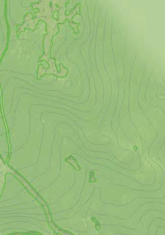
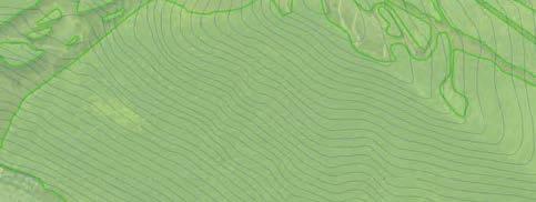
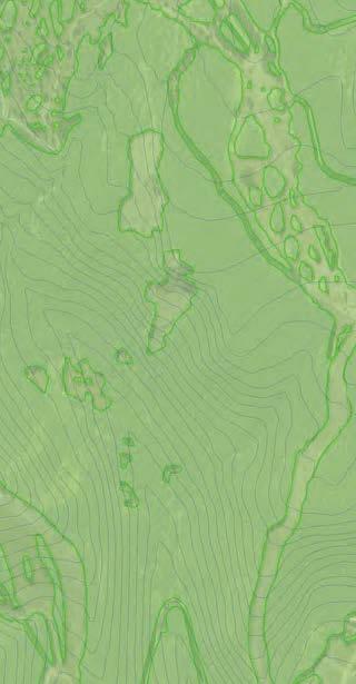
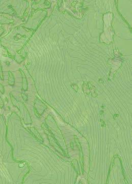

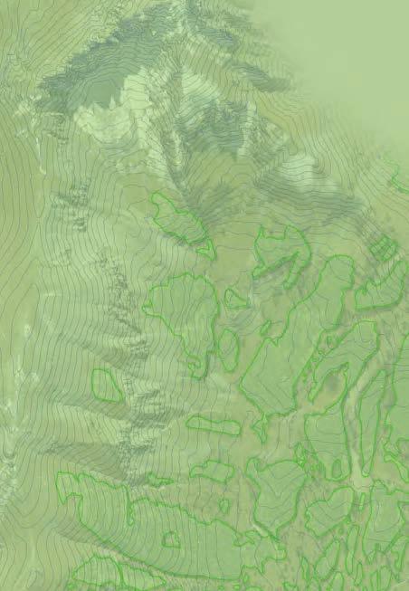

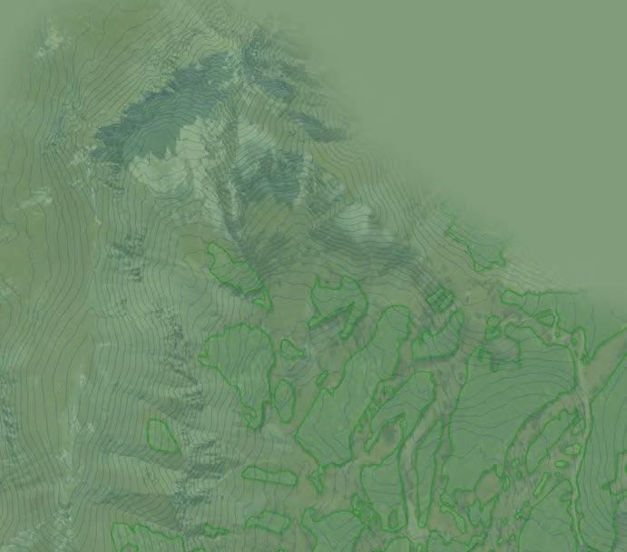

126 LEGEND A6 Existing Lift ZONE 1 Planned or Upgraded Lift ZONE 2 ZONE 3 ZONE 4 IN L BAS GOLD HILL SUMMIT L IFT RA MY PAL ZONE 5 OLD HILL EXPR NX -LY 14-G R EV EL AT IO N A5 12-PRO SPECT E XPRESS LIF T IFT A13 A14 ESS A7 ARK TE P 11-U A14 A9 A15 A15 6-A PE XL 5-P A8 AR OL A12 IFT RE XP NE EE QU A10 SS A4 A3 9-PLU NGE L IFT A11 IFT TL M CO ND OL A EE -FR G3 EE TR NO RTH OA KS 8- TELLURIDE LA DO N GO ME AD 1-C SS EXPRE SHINE GO 10-SUN A1 EE T 7 -FR SS RE S N OO -C LIF P EX KIN LIF E AG ILL LL PH VI 4- REE G1-F G2 T LA DO GON MOUNTAIN VILLAGE 2- A2 HO OW ND OL SC ON A VEY OR NORTH Scale: 1 = ft. December 2016 F IGURE V I - 5 R E C R E AT I O N Z O N E D E S I G N AT I O N S Contour Interval: 50 ft. Prepared By:
CHAPTER 1 PURPOSE OF AND NEED FOR ACTION
 CHAPTER 1 PURPOSE OF AND NEED FOR ACTION This chapter describes the current and proposed project area and summarizes the Proposed Action, the Purpose of and Need for the action, the decisions to be made,
Taos Ski Valley s 2010 Master Development Plan Phase 1 Proposed Projects
 Taos Ski Valley s 2010 Master Development Plan Phase 1 Proposed Projects Background The majority of Taos Ski Valley s (TSV) lift and trail network is located on National Forest System (NFS) lands administered
SOLITUDE MOUNTAIN RESORT MASTER DEVELOPMENT PLAN AMENDMENT PROPOSAL
 SOLITUDE MOUNTAIN RESORT MASTER DEVELOPMENT PLAN AMENDMENT PROPOSAL 6/02/14 INTRODUCTION Solitude Mountain Resort s (Solitude) current Master Development Plan (MDP) was accepted by the Wasatch-Cache National
Medicine Bow Routt National Forest and Thunder Basin National Grassland; Routt. County; Colorado; Steamboat Ski Resort, Steamboat EIS
 This document is scheduled to be published in the Federal Register on 09/06/2016 and available online at http://federalregister.gov/a/2016-21236, and on FDsys.gov [3411-15-P] DEPARTMENT OF AGRICULTURE
File Code: 1950:2720 Date: March 21, Dear Interested Party,
 United States Department of Agriculture Forest Service White River National Forest 900 Grand Ave Glenwood Springs, CO 81601-3602 File Code: 1950:2720 Date: March 21, 2017 Dear Interested Party, The White
TABLE IV-4: CALCULATION OF COMFORTABLE CARRYING CAPACITY EXISTING CONDITIONS. Access Role. Hourly Capacity. Oper. Hours
 C. COMFORTABLE CARRYING CAPACITY The daily carrying capacity of a resort is described as the Comfortable Carrying Capacity (CCC). CCC is not a cap on visitation, but is rather a design standard defined
Exhibit 1 PLANNING COMMISSION AGENDA ITEM
 Exhibit 1 PLANNING COMMISSION AGENDA ITEM Project Name: Grand Junction Circulation Plan Grand Junction Complete Streets Policy Applicant: City of Grand Junction Representative: David Thornton Address:
Hlíðarfjall, Akureyri Mountain Resort Master Plan
 Hlíðarfjall, Akureyri Mountain Resort Master Plan From City Park to Mountain Destination Executive Summary September 2009 Prepared for: Vetraríþróttamiðstöð Íslands Glerárgötu 26 600 Akureyri Prepared
TABLE V-4: CALCULATION OF COMFORTABLE CARRYING CAPACITY UPGRADING PLAN
 C. COMFORTABLE CARRYING CAPACITY The calculation of Mount Sunapee s Upgrading Plan CCC is described in the following table. As illustrated, the upgrading program increases the CCC of the lift and trail
Tahoe National Forest; Placer County, California; Squaw Valley to Alpine Meadows. Notice of intent to prepare an environmental impact statement.
 This document is scheduled to be published in the Federal Register on 04/29/2016 and available online at http://federalregister.gov/a/2016-09672, and on FDsys.gov [3410-11- P] DEPARTMENT OF AGRICULTURE
Prepared for: August 4 th, Presented by: Eric Callender Ecosign VP Adam Schroyen Resort Planner
 TAHOE DONNER PHASE 1 & 2 INVENTORY AND TECHNICAL ASSESSMENT Prepared for: August 4 th, 2017 Presented by: Eric Callender Ecosign VP Adam Schroyen Resort Planner ECOSIGN RESORT PLANNERS (2016) LTD. Whistler,
Spearfish Canyon State Park & Bismarck Lake
 Spearfish Canyon State Park & Bismarck Lake Land Exchange Between the U.S. Forest Service and the State of South Dakota July 12, 2016 Background In 2006, the State of South Dakota received title to several
MASTER DEVELOPMENT PLAN April 2010
 MASTER DEVELOPMENT PLAN April 2010 Prepared By: Taos Ski Valley 2010 Master Development Plan Taos, New Mexico April 2010 Accepted By: Kendall Clark Forest Supervisor Carson National Forest Date Prepared
PEDESTRIAN ACTION PLAN
 ATTACHMENT 2 CITY OF SANTA MONICA PEDESTRIAN ACTION PLAN CITY OF SANTA MONICA PEDESTRIAN ACTION PLAN This page intentionally left blank EXECUTIVE SUMMARY CHAPTER 1 EXECUTIVE SUMMARY Setting the Stage
FOR SALE FOR SALE SINGLE-TENANT STRATA INVESTMENT OPPORTUNITY 4340 SUNDIAL CRESCENT (STRATA LOTS 3 & 4) WHISTLER, BC
 WHISTLER, BC") FOR SALE JON BUCKLEY* 604 630 0215 jbuckley@form.ca CURTIS LEONHARDT* 604 638 1999 cleonhardt @form.ca JOE GENEST 604 398 4341 jgenest@form.ca *Personal Real Estate Corporation FOR SALE PROPERTY HIGHLIGHTS
FOR SALE JON BUCKLEY* 604 630 0215 jbuckley@form.ca CURTIS LEONHARDT* 604 638 1999 cleonhardt @form.ca JOE GENEST 604 398 4341 jgenest@form.ca *Personal Real Estate Corporation FOR SALE PROPERTY HIGHLIGHTS
4. Action Plan & Projects
 4. Action Plan & Projects 45 46 ACTION PLAN AND PROJECTS The Action Plan organizes the list of transportation projects described in the Mobility Framework Plan section into short-term (0-5 years) and long-term
MEETING Agenda. Introductions. Project Overview. Key Study Components. Alternative Station Concepts. Preferred Station Concept. Next Steps.
 City GARLAND Council ROADVISION Briefing STUDY VISION STUDY Dallas, TX April 8, 2010 1 1 MEETING Agenda Introductions Project Overview Key Study Components Alternative Station Concepts Preferred Station
STRATEGIC PLANNING FOR DEVELOPMENT OF THE OREGON SHORT LINE TERMINUS HISTORIC DISTRICT
 STRATEGIC PLANNING FOR DEVELOPMENT OF THE OREGON SHORT LINE TERMINUS HISTORIC DISTRICT & AN EXECUTIVE SUMMARY OF THE HEART OF WEST YELLOWSTONE CONCEPTUAL PLANNING REPORT November 2004 PREPARED BY The Portico
Rethinking the mountain experience.
 Rethinking the mountain experience. Cimarron Mountain Club is comprised of 12 spectacular ranches at the edge of the Uncompahgre Wilderness, between Telluride and Crested Butte. The ranches share world-class
BRUNDAGE MOUNTAIN ROAD
 DESTINATION RESORT DEVELOPMENT LAND 336.64 ACRES AVAILABLE express or implied, is made as to the accuracy of the information contained herein, and same is submitted subject to errors, omissions, change
Three Typologies of Mountain Resort Revitalization
 Presentation of Stan Clauson, AICP, ASLA Aspen, Colorado The 4th World Congress on Snow Sport and Mountain Tourism 21 April 2005 Three Typologies of Mountain Resort Revitalization With warmest greetings
West Dimond Blvd Upgrade Jodhpur Street to Sand Lake Road
 West Dimond Blvd Jodhpur St to Sand Lake CSS Transportation Project Summary Municipality of Anchorage Project # 05 005 Project Manager: John Smith, P.E. (MOA PM&E) Project Administrator: Julie Makela,
SKI THE SLOPES WITH ST. JAMES
 SKI THE SLOPES WITH ST. JAMES JANUARY 16 TH 19 TH 2015 (FRIDAY MONDAY) WINTER PARK, COLORADO (1½ hours from Denver) ZEPHER MOUNTAIN LODGE and WINTER PARK MOUNTAIN LODGE -- BACK BY POPULAR DEMAND -- The
2017/2018 WINTER GROUPS BOOKING PACKAGE
 2017/2018 WINTER GROUPS BOOKING PACKAGE Thanks for choosing The Lake Louise Ski Resort for your winter adventure! We can create memorable experiences for groups of all sizes. We offer packages that include
ACRES FOR SALE Destination Resort Development Land Brundage Mountain Road, McCall, Idaho 83638
 LeAnn Hume, CCIM, CLS Senior Director Retail / Investment Specialist +1 208 287 8436 leann.hume@paccra.com 398 South 9th Street, Ste 260 Boise, Idaho 83702 Main +1 208 287 9500 Fax +1 208 287 9501 paccra.com
Special Investment Project
 Special Investment Project MESTIA, GEORGIA 2011 Mestia Treasure of Caucasus Mestia, Central-West Caucasus, 1450 meters above the sea level surrounded by sub alpine pine and chestnut forests and majestic
KICKING HORSE MOUNTAIN RESORT APPLICATION TO AMEND THE EXISTING CONTROLLED RECREATION AREA
 KICKING HORSE MOUNTAIN RESORT APPLICATION TO AMEND THE EXISTING CONTROLLED RECREATION AREA September 19, 2017 File: 4403694 Reg Nolander Sr. Manager, Major Projects Mountain Resorts Branch Ministry of
Tonight is for you. Learn everything you can. Share all your ideas.
 Strathcona Neighbourhood Renewal Draft Concept Design Tonight is for you. Learn everything you can. Share all your ideas. What is Neighbourhood Renewal? Creating a design with you for your neighbourhood.
Page 1. To: City of Durango - Parks and Recreation Advisory Board - Natural Lands Preservation Advisory Board Highland Avenue Durango, Colorado
 Page 1 To: City of Durango - Parks and Recreation Advisory Board - Natural Lands Preservation Advisory Board From: John Norton 2009 Highland Avenue Durango, Colorado Date: October 27, 2014 Regarding: Natural
ON MOUNTAIN INFORMATION
 Tuning and Repair ON MOUNTAIN INFORMATION Staffed by a highly trained team of certified professionals, our Tuning & Repair Center (upper level of Mountain Gateway building in West Village) can handle all
Mount Snow Disc Golf Course and Mountain Bike Race Course Project
 United States Department of Agriculture Forest Service Eastern Region Mount Snow Disc Golf Course and Mountain Bike Race Course Project Scoping Information May 2017 Manchester Ranger District Green Mountain
You ll find the perfect setting for your group.
 You ll find the perfect setting for your group. WELCOME TO STEAMBOAT. When your group arrives in Steamboat, they will be greeted with our legendary friendliness, they ll be delighted by our unique western
Proposed. City of Grand Junction Complete Streets Policy. Exhibit 10
 Proposed City of Grand Junction Complete Streets Policy Exhibit 10 1 City of Grand Junction Complete Streets Policy Vision: The Complete Streets Vision is to develop a safe, efficient, and reliable travel
Ann Arbor Downtown Street Plan
 1 Ann Arbor Downtown Street Plan Public Workshop #1 We know that. 2 Public right-of-way (streets, sidewalks, and alleys) make up 30% of the total District area of downtown. Streets need to provide mobility
Douglas Land Use and Transportation Strategy (DLUTS) Summary. August 2013
 Summary. August 2013") Douglas Land Use and Transportation Strategy (DLUTS) Summary August 2013 Background Douglas is a large and popular residential suburb of approximately 30,000 persons on the periphery of Cork City along
Douglas Land Use and Transportation Strategy (DLUTS) Summary August 2013 Background Douglas is a large and popular residential suburb of approximately 30,000 persons on the periphery of Cork City along
VOLUME 25 NUMBER 5 JANUARY-MARCH 1995 RESIDENTIAL BEAVER CREEK RESORT AVON, COLORADO PROJECT TYPE
 VOLUME 25 NUMBER 5 JANUARY-MARCH 1995 RESIDENTIAL BEAVER CREEK RESORT AVON, COLORADO PROJECT TYPE Beaver Creek is a 2,777-acre, four-season mountain resort featuring numerous recreational amenities including
Solana Beach Comprehensive Active Transportation Strategy (CATS)
") Solana Beach Comprehensive Active Transportation Strategy (CATS) 3.0 Goals & Policies The Solana Beach CATS goals and objectives outlined below were largely drawn from the Solana Beach Circulation Element
Solana Beach Comprehensive Active Transportation Strategy (CATS) 3.0 Goals & Policies The Solana Beach CATS goals and objectives outlined below were largely drawn from the Solana Beach Circulation Element
MEETINGS & CONFERENCES
 MEETINGS & CONFERENCES EXPERIENCE THE SOUL OF THE MOUNTAINS. BE WELCOMED BY A LEGENDARY VALLEY. FIND NEW INSPIRATION AMIDST CENTURY-OLD TREES AND STUNNING GRANITE MOUNTAIN PEAKS. THE SQUAW VALLEY ALPINE
MEDIA FACT SHEET. Holiday Valley Resort Ellicottville, New York. Background:
 2015-16 Winter Season MEDIA FACT SHEET Holiday Valley Resort Ellicottville, New York Background: Holiday Valley, in Western New York State is a leading eastern North American winter resort. Fifty-eight
East Burke Transportation, Safety and Capacity Improvements
 East Burke Transportation, Safety and Capacity Improvements The purpose of this project is to increase mobility and improve safety for pedestrians, cyclists, and motor vehicles along VT Route 114 in the
SQUAW VALLEY FUNITEL
 SQUAW VALLEY FUNITEL AN INSTALLATION FOR THE THIRD MILLENNIUM Co presentation: Ernst Egli, PE Hans Burkhart Director for Marketing and Sales Gen. Manager Garaventa AG Squaw Valley Ski Corp. Switzerland
Corpus Christi Metropolitan Transportation Plan Fiscal Year Introduction:
 Introduction: The Safe, Accountable, Flexible, Efficient Transportation Equity Act: A Legacy for Users (SAFETEA-LU) has continued the efforts started through the Intermodal Surface Transportation Efficiency
AN EXPERIENCE YOU WILL REMEMBER FOREVER
 AN EXPERIENCE YOU WILL REMEMBER FOREVER RATES & SCHEDULE 2018 SCHEDULE & RATES 02 2018 CPG SCHEDULE & RATES CPG CAN DELIVER THE SKIING OR RIDING EXPERIENCE OF YOUR LIFE Chugach Powder Guides has delivered
2. Context. Existing framework. The context. The challenge. Transport Strategy
 Transport Strategy Providing quality connections Contents 1. Introduction 2. Context 3. Long-term direction 4. Three-year priorities 5. Strategy tree Wellington City Council July 2006 1. Introduction Wellington
Executive Summary Route 30 Corridor Master Plan
 Route Corridor Master Plan Project Overview The Route Corridor Master Plan is a coordinated multimodal transportation and land use plan for the entire stretch of Route through East Whiteland Township,
JC Mesa Ranch. Colorado - San Miguel County - Telluride
 Commanding stunning views of Telluride and surrounding peaks, the 2,379 deeded-acre JC Mesa Ranch is one of the only remaining undeveloped and unencumbered ranches in the Telluride area. Surrounded by
HOUSE BILL NO. HB0032. Sponsored by: Joint Travel, Recreation, Wildlife & Cultural Resources Interim Committee A BILL. for
 0 STATE OF WYOMING LSO-00 HOUSE BILL NO. HB00 Ski Safety Act. Sponsored by: Joint Travel, Recreation, Wildlife & Cultural Resources Interim Committee A BILL for AN ACT relating to skiing; imposing duties
Broken Bar W Ranch TETON VALLEY, IDAHO. Hunting Ranching Fly Fishing Conservation
 Broken Bar W Ranch TETON VALLEY, IDAHO Hunting Ranching Fly Fishing Conservation Broken Bar W Ranch TETON VALLEY, IDAHO Introduction: The Broken Bar W Ranch is located in Driggs, Idaho, the county seat
streams available for guided or unguided fishing trips. heritage, Olympic tradition and world-class skiing/riding,
 Famous for our Champagne Powder snow, western When you re not skiing/riding the 349 of powder snow that Although winter season is more popular with our guests, streams available for guided or unguided
Compliance with Section 18-52(4) City of Thornton Development Code
 City of Thornton Development Code") May 25, 2016 Jay Ruchti City of Thornton City Development Department 9500 Civic Center Drive Thornton, CO 80229 RE: Golf Safety Netting TOPGOLF Entertainment Complex (Southeast Corner of East 136 th Avenue
May 25, 2016 Jay Ruchti City of Thornton City Development Department 9500 Civic Center Drive Thornton, CO 80229 RE: Golf Safety Netting TOPGOLF Entertainment Complex (Southeast Corner of East 136 th Avenue
North Coast Corridor:
 North Coast Corridor: Connecting People, Transportation & Environment Legislative Hearing: 11.8.10 1 North Coast Corridor Region s Lifeline A Regional Strategy Mobility, Economy & Environment North Coast
City of Homewood Transportation Plan
 City of Homewood Transportation Plan Prepared for: City of Homewood, Alabama Prepared by: Skipper Consulting, Inc. May 2007 TABLE OF CONTENTS INTRODUCTION... 1 BACKGROUND INFORMATION... 1 EXISTING TRANSPORTATION
Proposed Amendment to the City-Wide Trails Plan
 Proposed Amendment to the City-Wide Trails Plan Planning and Zoning Commission June 23, 2015 Comprehensive Plan 2010 Sustainable Community Recommendations 2 Goal: Walking and Cycling are Encouraged throughout
Chapter 7. Transportation. Transportation Road Network Plan Transit Cyclists Pedestrians Multi-Use and Equestrian Trails
 Chapter 7 Transportation Transportation Road Network Plan Transit Cyclists Pedestrians Multi-Use and Equestrian Trails 7.1 TRANSPORTATION BACKGROUND The District of Maple Ridge faces a number of unique
BACKGROUND INFORMATION FOR NEW SKI AREA TRANSFER PROPOSAL
 BACKGROUND INFORMATION FOR NEW SKI AREA TRANSFER PROPOSAL Many local skiers, including Los Alamos Ski Club (LASC) members, believe that Pajarito Mountain is now owned and operated by a partnership between
On & Off The Mountain Steamboat Springs Winter Sports Club
 On & Off The Mountain Steamboat Springs Winter Sports Club Jim Boyne, Executive Director Sarah Floyd, Associate Executive Director February 9, 2016 Overview SSWSC / City Collaboration on Howelsen Hill
WORLD-CLASS LAKE TAHOE DEVELOPMENT OPPORTUNITY
 WORLD-CLASS LAKE TAHOE DEVELOPMENT OPPORTUNITY 33441 KIRKWOOD MEADOWS DRIVE, KIRKWOOD, CA. Entitled Residential Project Slope-Side at Kirkwood Mountain Resort Multiple Development Options DEVELOPMENT SITE
AN EXPERIENCE YOU WILL REMEMBER FOREVER
 AN EXPERIENCE YOU WILL REMEMBER FOREVER 02 2019 CPG SCHEDULE & RATES CPG CAN DELIVER THE SKIING OR RIDING Chugach Powder Guides has delivered some of the best powder and most exhilarating terrain that
Clackamas County Comprehensive Plan
 ROADWAYS The County s road system permits the movement of goods and people between communities and regions, using any of a variety of modes of travel. Roads provide access to virtually all property. They
University of Victoria Campus Cycling Plan Terms of Reference. 1.0 Project Description
 University of Victoria Campus Cycling Plan Terms of Reference 1.0 Project Description The Campus Cycling Plan, a first for the University, will provide a comprehensive and coordinated approach to support
TIMBERLINE MOUNTAIN SPECIFICATIONS SUMMARY
 DESIGN CRITERIA TIMBERLINE MOUNTAIN SPECIFICATIONS SUMMARY The upgrading and expansion of a ski area is influenced by a variety of ski facility design criteria that help to create a quality ski experience.
TRAFFIC IMPACT STUDY CRITERIA
 Chapter 6 - TRAFFIC IMPACT STUDY CRITERIA 6.1 GENERAL PROVISIONS 6.1.1. Purpose: The purpose of this document is to outline a standard format for preparing a traffic impact study in the City of Steamboat
Chapter VISION, MISSION, AND GOALS AND OBJECTIVES. Vision. Mission. Goals and Objectives CONNECTING COMMUNITIES ACROSS THE ST.
 VISION, MISSION, AND GOALS AND OBJECTIVES Chapter 3 The Plan s vision, mission, and goals and objectives were developed through a series of interactive exercises with the Citizens Advisory Committee (CAC)
Obey Creek PEDESTRIAN CIRCULATION EAST WEST PARTNERS PEDESTRIAN CIRCULATION CREEK SIDE LANE SLIP STREET SCOTT MURRAY MAIN STREETS EAST/WEST
 THE VILLAGE AT PEDESTRIAN CIRCULATION MAIN STREETS NORTH/SOUTH MAIN STREETS EAST/WEST SLIP STREET CREEK SIDE LANE PEDESTRIAN CIRCULATION DESCRIPTION: Circulation through the downtown of is organized by
Roadway Classification Design Standards and Policies. Pueblo, Colorado November, 2004
 Roadway Classification Design Standards and Policies Pueblo, Colorado November, 2004 Table of Contents Page Chapter 1. General Provisions 1.1 Jurisdiction 3 1.2 Purpose and Intent 3 1.3 Modification 3
Goal 3: Foster an environment of partnerships and collaboration to connect our communities and regions to one another.
 Non-Motorized Transportation Plan (NMTP) Draft Vision, Goal and,, Tri-County Regional Planning Commission (TCRPC) Purpose The purpose of the Tri-County Regional Planning Commission (TCRPC) Non-Motorized
Section 9. Implementation
 Section 9. Implementation The transportation system is just one of many aspects that must be carefully planned to maintain and enhance the quality of living in Cecil County. The Cecil County Bicycle Plan
Briefing Paper: ONE Wasatch Ski Interconnect Concept
 Briefing Paper: ONE Wasatch Ski Interconnect Concept Purpose and Audience The purpose of this briefing paper is to provide information on the ONE Wasatch proposal for discussion purposes. The intent is
Rochester Area Bike Sharing Program Study
 roc bike share Rochester Area Bike Sharing Program Study Executive Summary ~ January 2015 JANUARY 2015 8484 Georgia Avenue, Suite 800 Silver Spring, MD 20910 3495 Winton Pl., Bldg E, Suite 110 Rochester,
Wyldewood Estates. Pre-Application Public Engagement Summary of Issues and Responses
 Wyldewood Estates Pre-Application Public Engagement Summary of Issues and Responses March 2016 Executive Summary Morguard Residential Properties has been thoughtfully planning the redevelopment of Wyldewood
An opportunity for summer revenue at the Camden Snow Bowl. Summer Snow Bowl Lift Serve Mountain Biking, Version 2
 An opportunity for summer revenue at the Camden Snow Bowl By: The Mountain Bike Subgroup of the Snow Bowl Four Season Committee Summer Snow Bowl Lift Serve Mountain Biking, Version 2 Summer Snow Bowl Lift
Citizen Advisory Committee Meeting. November 15, 2011 MPRB Headquarters- 6:30-8:30 p.m.
 Citizen Advisory Committee Meeting November 15, 2011 MPRB Headquarters- 6:30-8:30 p.m. Charge for Wirth Lake Area Citizen Advisory Committee: Prepare recommendations for the Board of Commissioners on the
Trails that Transform: The Economic Impact of Bicycle Tourism
 Trails that Transform: The Economic Impact of Bicycle Tourism September 2016 Economic Growth Summit Alta Planning + Design Nation s leading team of bicycle, pedestrian, greenways, and trails planning and
VAIL HOMEOWNERS ASSOCIATION, INC. VHA Action Notice: Update on Golden Peak Proposal April 10, 2017
 Existing view of Golden Peak - note cut to the summit, made in the 1960 s, for a lift that was never built Approximate view of Golden Peak once construction of proposed race course and lift to the summit
APPENDIX 3: EAGLECREST MASTER PLAN PUBLIC OPINION SURVEYS
 APPENDIX 3: EAGLECREST MASTER PLAN PUBLIC OPINION SURVEYS Eaglecrest Master Plan Public Opinion Surveys Prepared for Eaglecrest Ski Area Board of Directors Prepared by McDowell Group Inc. Eaglecrest Master
Key Features: Media Pack Information Sheet CORONET PEAK Targeted opening date Saturday 13 June 2015
 Media Pack Information Sheet 2015 CORONET PEAK Targeted opening date Saturday 13 June 2015 Contact details: E: info@nzski.com P: +64 3 442 4620 (Winter only) W: www.nzski.com Freephone: 0800 697 547 (within
Russian Outbound Ski Tourism in 2018: An Overview
 Russia s leading travel and tourism exhibition 12 14 March 2019 Russian Outbound Ski Tourism in 2018: An Overview A look at the Russian outbound ski market in 2018 covering: The ski tourism landscape in
Eastern PA Trail Summit October 1, 2018
 Eastern PA Trail Summit October 1, 2018 WHO WE ARE + WHY + WE RE * HERE * * * * * * Session Goals: Discuss how to coordinate planning and design in small, urbanized towns Consider how to develop alternative
Transportation Master Plan Advisory Task Force
 Transportation Master Plan Advisory Task Force Network Alternatives & Phasing Strategy February 2016 BACKGROUND Table of Contents BACKGROUND Purpose & Introduction 2 Linking the TMP to Key Council Approved
Vision: Traditional hamlet with an attractive business/pedestrian friendly main street connected to adjacent walkable neighborhoods
 N D. Focus Area II Vision: Traditional hamlet with an attractive business/pedestrian friendly main street connected to adjacent walkable neighborhoods Transit Road Focus Area II is located in the Hamlet
Planning and Design Nomenclature
 PREFACE This Mountain Resort Master Development Plan (MDP) is intended to be the guiding document for future development at Nordic Valley Ski Resort. Illustration 1 is a visual representation of the process
NOTICE OF AVAILABILITY/NOTICE OF COMMENT PERIOD OF A DRAFT EIR/EIS/EIS FOR PUBLIC REVIEW AND HEARINGS
 Tahoe Transportation District 128 Market Street, Suite 3F Stateline, NV 89449 Phone: (775) 589-5500 www.tahoetransportation.org Federal Highway Administration 650 Capitol Mall, Suite 4-100 Sacramento,
Feasibility Study for Intermodal Facility in Anchorage, Alaska
 Feasibility Study for Intermodal Facility in Anchorage, Alaska Jeanne Bowie, Randy Kinney Abstract The Dimond Transit Center, operated by People Mover, is located in south Anchorage at the Dimond Center,
ECONOMIC DEVELOPMENT ELEMENT
 ECONOMIC DEVELOPMENT ELEMENT Background The Economic Development Element considers labor force and labor force characteristics, employment by place of work and residence, and analysis of the community
CITY OF ALPHARETTA DOWNTOWN MASTER PLAN TRAFFIC EVALUATION
 CITY OF ALPHARETTA DOWNTOWN MASTER PLAN TRAFFIC EVALUATION June 2015 CITY OF ALPHARETTA DOWNTOWN MASTER PLAN TRAFFIC EVALUATION Introduction The Alpharetta Downtown Master Plan was developed in the fall
LUTSEN RESORT ON LAKE SUPERIOR
 FOR SALE HOSPITALITY LUTSEN RESORT ON LAKE SUPERIOR 5700 W Highway 61 Lutsen, MN 55612 PRESENTED BY: Frank Jermusek, JD President / Managing Director 952.820.1615 frank.jermusek@svn.com Cameron Peterson
Cherry Creek Transportation and Land Use Forum September 25, 2013 Meeting Summary
 Cherry Creek Transportation and Land Use Forum September 25, 2013 Meeting Summary I. LEAD-IN TO SMALL GROUP DISCUSSION, POLLING AND STEERING COMMITTEE/TECHNICAL TASK FORCE DISCUSSION The meeting began
TRANSIT & NON-MOTORIZED PLAN DRAFT FINAL REPORT Butte County Association of Governments
 1 INTRODUCTION Maintaining a high quality of life is the essence of this plan for transit and non-motorized transportation in Butte County. Curbing greenhouse gas emissions (GHG) by reducing congestion,
BUILDING DEPARTMENT VALUATION AND FEES MONTHLY REPORT
 MAY BUILDING DEPARTMENT VALUATION AND FEES MONTHLY REPORT $8,000,000 $7,000,000 $6,000,000 $5,000,000 $4,000,000 $3,000,000 $2,000,000 $1,000,000 $0 $7,337,794 Valuation $1,957,965 UP 74.7% May-2015 May-2014
Your views are important. Please fill in a form before you leave. Or alternatively
 Drum Property Group is delighted to welcome you to this exhibition which sets out our initial proposals for a mixed-use development at Stead s Place, Edinburgh. We are keen to hear the views of local people
Purpose and Need. Chapter Introduction. 2.2 Project Purpose and Need Project Purpose Project Need
 Chapter 2 Purpose and Need 2.1 Introduction The El Camino Real Bus Rapid Transit (BRT) Project (Project) would make transit and other transportation improvements along a 17.6-mile segment of the El Camino
BIKE PLAN CONTENTS GATEWAY
 CONTENTS Acknowledgments...vii Great Rivers Greenway District Board of Directors... vii Great Rivers Greenway District Staff... vii Project Consultants... vii Committees... viii Citizens Advisory Committee
Douglas Land Use and Transportation Study
 Douglas Land Use and Transportation Study Summary: Key: Yellow Box = key project information Green Box = project recommendations Grey Box = anticipated project outcomes Background: It is an objective of
4 Goals, Objectives & Actions
 Chapter4 4 This chapter presents goals, objectives, and recommended actions to support the vision of making Overland Park a safer and easier place to ride a bicycle. 35 4.1 Recommendations Structure The
Lee s Summit Road Improvement Study Public Open House June 7, 2007 Summary of Comment Card Responses
 Lee s Summit Road Improvement Study Public Open House June 7, 2007 Summary of Comment Card Responses Introduction At the Lee s Summit Road Improvement Study Public Open House held Thursday, June 7, 2007
TRAVEL PLAN: CENTRAL EUROPEAN UNIVERSITY CAMPUS REDEVELOPMENT PROJECT TRAVEL PLAN. Central European University Campus Redevelopment Project.
 TRAVEL PLAN Central European University Campus Redevelopment Project Page 1 Table of Contents Introduction... 3 Background... 7 Building Users... 7 Transportation in Community Consultation... 7 Summary
CAMPUS GUIDE TO BIKE SHARE. h o w t o p l a n a n d l a u n c h a s u c c e s s f u l u n i v e r s i t y b i k e s h a r e p r o g r a m
 CAMPUS GUIDE TO BIKE SHARE h o w t o p l a n a n d l a u n c h a s u c c e s s f u l u n i v e r s i t y b i k e s h a r e p r o g r a m 20151020 The bicycle is the most loved form of transportation. No
4. ENVIRONMENTAL IMPACT ANALYSIS 9. TRANSPORTATION AND TRAFFIC
 4. ENVIRONMENTAL IMPACT ANALYSIS 9. TRANSPORTATION AND TRAFFIC 4.9.1 INTRODUCTION The following section addresses the Proposed Project s impact on transportation and traffic based on the Traffic Study
Pocatello Regional Transit Master Transit Plan Draft Recommendations
 Pocatello Regional Transit Master Transit Plan Draft Recommendations Presentation Outline 1. 2. 3. 4. What is the Master Transit Plan? An overview of the study Where Are We Today? Key take-aways from existing
Environment and Public Works Committee Presentation
 Mixed Use Centers Complete Streets Guidelines Project Environment and Public Works Committee Presentation December 10, 2008 Project Objectives: Conduct an inter-departmental and agency process to study