York River Marine Debris Survey (Off-season)
|
|
|
- Mervin Gilbert
- 5 years ago
- Views:
Transcription


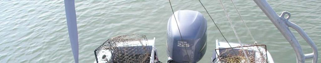
1 York River Marine Debris Survey- Marine Debris Removal Jan/Feb 2006 (Off-season) Kirk Havens David Stanhope Kory Angstadt Center for Coastal Resources Management Virginia Institute of Marine Science
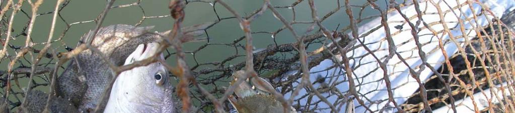
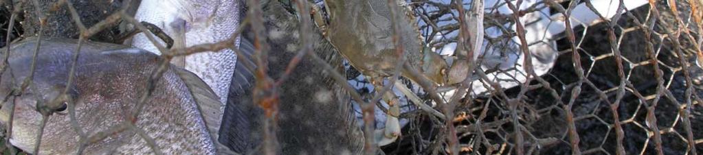
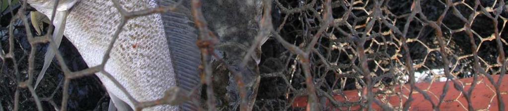
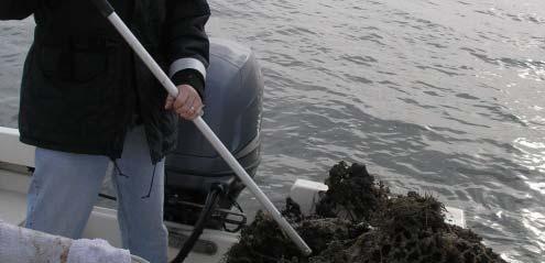
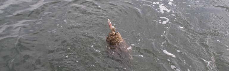
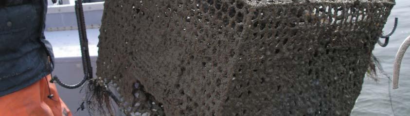
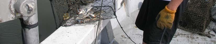
2 Sarah Creek ghost pots
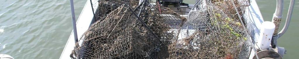
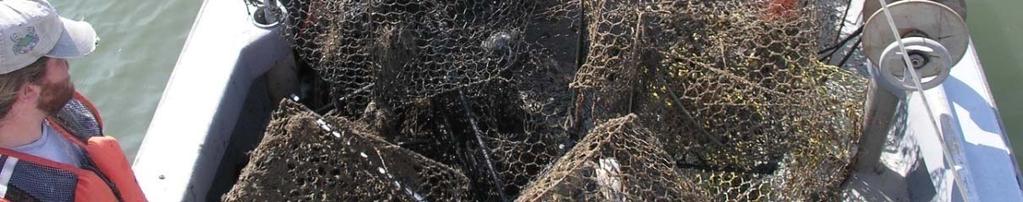
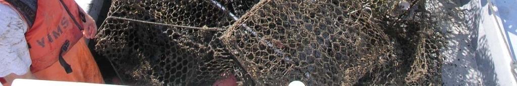
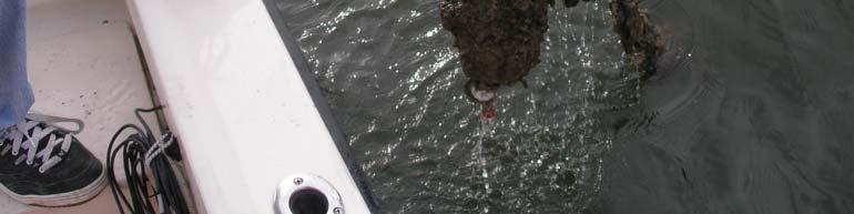
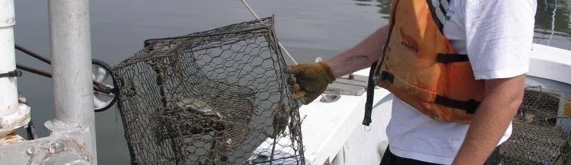
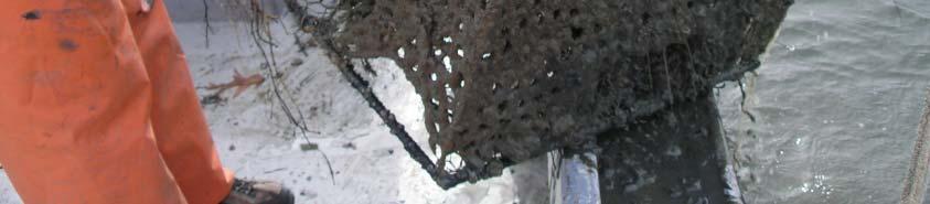
3 Ghost pots removed January/February 2006


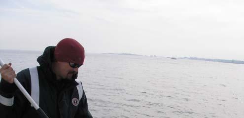
4 Derelict traps identified and removed: derelict traps derelict traps derelict traps Trap loss rate approx % per year
5 York River Marine Debris SurveyJan/Feb 2006 (Off-season) 33 5 S 33.5 Square Kil Kilometers surveyed d
6
7 676 derelict crab pots identified
8
9 Overview Scanning methods Side scan images of debris Humminbird Unit Debris retrieval and disposal Catch data sheets
10 Scanning methods
11 Surveying an area Survey an area by driving your boat along the coast line following the 3 foot contour line or as shallow as you can go.
12 Surveying an area Use the cursor on the Humminbird to mark debris seen on the bottom This will save the lat. Long. of the unknown n object. You can later use the goto feature to return to the object for retrieval


13 Track lines Your track lines for your survey area will look like this 150 feet
14 Side scanning images
15 tire Crab pot
16 Buoyed crab pot Crushed crab pot, chicken wire
17 Crab pots Oyster tray Riprap Bulkhead
18 Crab pot
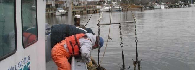
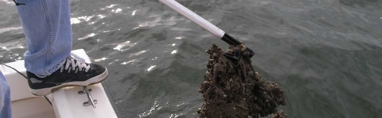
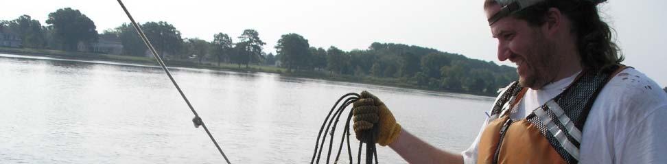
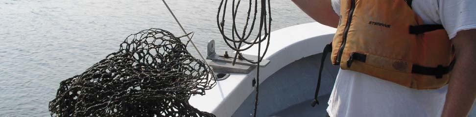
19
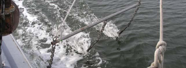
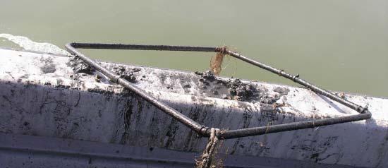
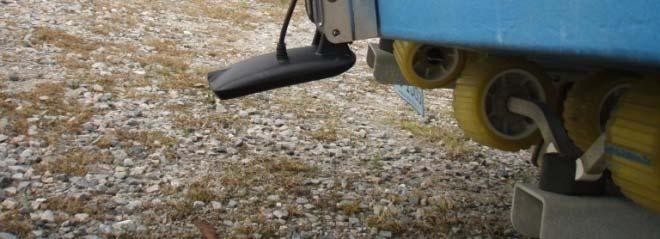
20 Pilings Fish
21 Seagrass Maps We are providing you a map of seagrass areas that are considered to be sensitive within your scanning area. 1. Do not attempt to retrieve material in areas of known submerged aquatic vegetation (SAV). Maps Provided. 2. When retrieving i material if grapping device pulls up any submerged aquatic vegetation, cease attempts in that area. 3. Do not attempt retrieval in areas where vessel prop will disturb bottom.
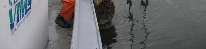
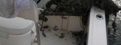
22 Whales All vessels participating must maintain a lookout for whales and reduce speeds to 10 knots or less should a whale be sighted. All scanning should be done at 4 knots Photo: NOAA Photo Library No grappling may occur if a whale is in the vicinity of the project vessel. All grappling should be done at speeds less than one knot. All whale sightings should be recorded in the debris removal data report and be reported to NMFS.
23 Other Species In the event that any of the following species are observed entrapped in a crab trap or other marine debris, that t information must be reported to NMFS within 24 hours of the interaction: loggerhead, Kemp s Ridley, green or leatherback sea turtle; Atlantic sturgeon; or shortnose ose sturgeon. Accompanying the report should be a digital photograph and a complete description of the condition of the animal. Photos: NOAA Photo Library If possible, watermen should contact NMFS from the scene to discuss disposition of the animal. Reports may be filed by FAX ( ) or by (julie.crocker@noaa.gov). The 24-hour NMFS Stranding & Entanglement Hotline can be reached at

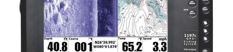

24 Humminbird 1197 Side Imaging Unit
25 Humminbird Settings Single beam set to 200 khz Side scan set to 455 khz Swath width set to 75 feet each side The unit can hold 3000 way points. We will down load the way points.
26 Retrieval of Marine Debris Once the debris has been marked and a Lat. Long. has been saved. You can use the goto feature on the Humminbird to drive to the exact spot and use the grappling device to retrieve the object.
27 Grappling Device


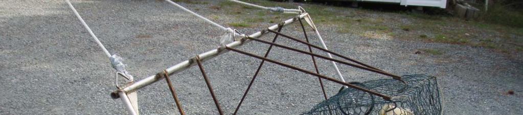


28 Designed to ride above the bottom with only the hooks dragging through the sediment.
29 Removal and Disposal of Marine Debris Go to waypoint marking the unknown object Drag the grappling device through the area Record contents Dispose at dump or recycle if able
30 Data sheets Describes the type and condition of the debris How the debris was retrieved Grappled Abandoned pot with a buoy Condition of debris Good Still able to fish Bad not able to fish Species caught Crab Sex, keeper, sponge Fish Species Other (turtle, muskrat )


31 Retrieval methods Grappling Abandoned Pots
32 Data sheets Describes the type and condition of the debris How the debris was retrieved Grappled Abandoned pot with a buoy Condition of debris Good Still able to fish Bad not able to fish Species caught Crab Sex, keeper, sponge Fish Species Other (turtle, muskrat )


33 Condition of Crab Pots Good Bad
34 Data sheets Describes the type and condition of the debris How the debris was retrieved Grappled Abandoned pot with a buoy Condition of debris Good Still able to fish Bad not able to fish Species caught Crab Sex, keeper, sponge Fish Species Other (turtle, muskrat )


35 Removable Transducer Mount 2 inch Aluminum channel stock or square stock GPS should be mounted directly above the transducer and above any interference Transducer should not be mounted within any prop wash
36 The Prop Method Not a good way to pick up pots
37 Instruction for on the vessel use of the HUMMINBIRD Marking Debris Turn on HUMMINBIRD press exit key press quick key #1, must be in side view mode to mark debris when you see a debris push the cursor so the bulls eye is over the object and push the mark key you must push exit to get back to the side view screen At the end of the day to save all data Push the menu key twice scroll across to the NAV tab scroll down to current track scroll across to save scroll to the right to save and confirm After saving scroll down to clear and scroll to the right to confirm push the exit button three times to return to the side view screen hold down the power key for two seconds to turn off the HUMMINBIRD All your way points are automatically saved to the SD card
38
39
40
41
42
43
44
45
46
47
Derelict Blue Crab Traps in the Virginia Portion of the Chesapeake Bay
 Derelict Blue Crab Traps in the Virginia Portion of the Chesapeake Bay Kirk J. Havens, Donna Marie Bilkovic, David Stanhope, Kory Angstadt Center for Coastal Resources Management Virginia Institute of
Peyton Robertson, Director, NOAA Chesapeake Bay Office Frank Dawson, Assistant Secretary, MD DNR Jeff Corbin, Assistant Secretary, VA Natural
 Peyton Robertson, Director, NOAA Chesapeake Bay Office Frank Dawson, Assistant Secretary, MD DNR Jeff Corbin, Assistant Secretary, VA Natural Resources Baywide Harvest 120 100 Harvest (Millions of Pounds)
Operations Guide for the Recovery of Derelict Crab Pots from Shallow Soft Sediment Estuaries: Lessons Learned from a Mid-Atlantic Coastal Bay
 Operations Guide for the Recovery of Derelict Crab Pots from Shallow Soft Sediment Estuaries: Lessons Learned from a Mid-Atlantic Coastal Bay This project was funded by the NOAA Restoration Center, Office
Marine Debris Survey in Virginia Interim Progress Report 2
 Marine Debris Survey in Virginia Interim Progress Report 2 Carl Hershner, Kirk J. Havens, Donna Marie Bilkovic, David Stanhope, Kory Angstadt Center for Coastal Resources Management Interim Report for
Derelict crab trap removal and prevention in southern New Jersey coastal bays: big implications for smaller scale systems
 Derelict crab trap removal and prevention in southern New Jersey coastal bays: big implications for smaller scale systems Principal investigators: Mark Sullivan, Steve Evert, Pete Straub, Melanie Reding,
Fishing for Energy Fund Project Summaries
 Fishing for Energy Fund Project Summaries Removal of 'ghost' blue crab pots from known hotspots in VA, College of William and Mary, Virginia Institute of Marine Science Virginia Fishing for Energy Fund
FINAL REPORT DERELICT FISHING GEAR IDENTIFICATION AND REMOVAL PROJECT PORT SUSAN
 1900 W. NICKERSON, STE. 207 SEATTLE, WASHINGTON 98119-1650, U.S.A. TELEPHONE: (206) 285-3480 TELEFAX: (206) 283-8263 E-Mail : jjune@nrccorp.com (corporate) FINAL REPORT DERELICT FISHING GEAR IDENTIFICATION
LAKEMASTER MAP CARDS. HELIX and Core Accessory Guide TABLE OF CONTENTS
 LAKEMASTER MAP CARDS HELIX and Core Accessory Guide 532358-1EN_A TABLE OF CONTENTS Overview............................................. 5 Set up the Control Head............................... 5 Set up
Admiralty Inlet Pilot Tidal Project FERC No Appendix C. Derelict Gear Monitoring Plan
 Appendix C Derelict Gear Monitoring Plan ADMIRALTY INLET PILOT TIDAL PROJECT FERC PROJECT NO. 12690 DERELICT GEAR MONITORING PLAN (submitted with the Final Application for a New Pilot Project License)
FISHFINDER OPERATIONS
 SPOT Spot-Lock LOCK FISHFINDER OPERATIONS minnkotamotors.com 55 How WAYPOINT NAVIGATION Works WAYPOINT REMOTE OPERATIONS Waypoints are stored positions that allow you to mark areas of interest or navigation
NOAA s Role in Chesapeake Bay
 NOAA s Role in Chesapeake Bay NOAA Chesapeake Bay Office Mission To understand, predict and explain changes in the Chesapeake Bay ecosystem, and to coordinate efforts to conserve and manage coastal and
Atlantic Sturgeon Update NER Protected Resources
 Atlantic Sturgeon Update NER Protected Resources June 18, 2013 Outline Brief background Update on information available for Atlantic sturgeon Overview of draft batched fisheries Biological Opinion (BiOp)
Pacific States Marine Fisheries Commission Annual Meeting August 21, 2017
 Pacific States Marine Fisheries Commission Annual Meeting August 21, 2017 Crab Gear Marine Mammal Interaction Derelict Crab Gear Regulations Presenter: Dayna Matthews NOAA Fisheries /OLE Dungeness Crab:
The Ghosts in our Oceans, a Global Problem
 The Ghosts in our Oceans, a Global Problem Ingrid Giskes, Global Head of Sea Change Ben Pearson, Senior Campaign Manager World Animal Protection Global Ghost Gear Initiative What is ghost gear? Ghost gear
Rope-less Fishing in Practice Today Ropeless Workshop Feb Woods Hole Oceanographic Institution. Michael Moore
 Rope-less Fishing in Practice Today Ropeless Workshop Feb 1 2018 Woods Hole Oceanographic Institution Michael Moore mmoore@whoi.edu Background To haul without endlines is a fundamental change in how most
Aquatic Trap Instructions and Information
 Aquatic Trap Instructions and Information Crayfish, Crabs, Shrimp Traps Model 405 Repeating Crayfish Trap featuring trap doors on both ends. Trap doors act as funnels for crayfish to enter. One of the
Project Webpage:
 Project Webpage: http://nature.ly/marinesatlanticbightera Coastal Data and Full Metadata: http://easterndivision.s3.amazonaws.com/marine/sab MA/SABMACoastalEcosystems.zip Coastal Chapter: http://easterndivision.s3.amazonaws.com/marine/sab
Marine Debris and Derelict Fishing Gear
 Marine Debris and Derelict Fishing Gear The Importance of Understanding the Impacts to Fisheries and Finding Solutions Council Coordination Committee Meeting Crowne Plaza, Silver Spring, MD February 26,
Marine Debris from Land to Sea: Holistic Characterization, Reduction and Education Efforts in New Hampshire
 Marine Debris from Land to Sea: Holistic Characterization, Reduction and Education Efforts in New Hampshire ABSTRACT Over time, the focus of marine debris research and work has shifted away from simply
2015 Maryland FMP Report (June 2016) Section 10. Maryland Coastal Bays Blue Crab (Callinectes sapidus)
 Section 10. Maryland Coastal Bays Blue Crab (Callinectes sapidus)") 2015 Maryland FMP Report (June 2016) Section 10. Maryland Coastal Bays Blue Crab (Callinectes sapidus) Maryland s Coastal Bays and Chesapeake blue crab fisheries are managed separately under two different
2015 Maryland FMP Report (June 2016) Section 10. Maryland Coastal Bays Blue Crab (Callinectes sapidus) Maryland s Coastal Bays and Chesapeake blue crab fisheries are managed separately under two different
Commercial Black Sea Bass Pot Fishing. A Fishermen s Guide to Federal Regulations
 Commercial Black Sea Bass Pot Fishing A Fishermen s Guide to Federal Regulations S O U T H A T L A N T I C F I S H E R Y M A N A G E M E N T C O U N C I L How To Use This Guide: This guide is designed
Commercial Dungeness Crab Newsletter
 Commercial Dungeness Crab Newsletter September 2, 2008 Oregon Department of Fish & Wildlife 2040 SE Marine Science Drive, Newport, OR 97365 541-867-4741 Contents Page Season summary.... 1 Rule changes.....
ESSENTIAL FISH HABITAT HABITAT AREAS OF PARTICULAR CONCERN (EFH-HAPC) AND CORAL HABITAT AREAS OF PARTICULAR CONCERN (C-HAPC)
 AND CORAL HABITAT AREAS OF PARTICULAR CONCERN (C-HAPC)") ESSENTIAL FISH HABITAT HABITAT AREAS OF PARTICULAR CONCERN () AND CORAL HABITAT AREAS OF PARTICULAR CONCERN (C-HAPC) Shrimp Sargassum All coastal inlets, all statedesignated habitats of particular importance
ESSENTIAL FISH HABITAT HABITAT AREAS OF PARTICULAR CONCERN () AND CORAL HABITAT AREAS OF PARTICULAR CONCERN (C-HAPC) Shrimp Sargassum All coastal inlets, all statedesignated habitats of particular importance
FINAL REPORT DERELICT FISHING GEAR REMOVAL PROJECT PORT GARDNER
 1900 W. NICKERSON, STE. 207 SEATTLE, WASHINGTON 98119-1650, U.S.A. TELEPHONE: (206) 285-3480 TELEFAX: (206) 283-8263 E-Mail : jjune@nrccorp.com (corporate) FINAL REPORT DERELICT FISHING GEAR REMOVAL PROJECT
HOW TO BEST USE YOUR ELECTRONICS: CHARTING, SONAR, AND IMAGING. By: Captain Tom Blackburn
 HOW TO BEST USE YOUR ELECTRONICS: CHARTING, SONAR, AND IMAGING By: Captain Tom Blackburn Topics I. INTRODUCTION II. CHARTING A TREMENDOUS FISH FINDING TOOL III. CHARTING - SIGNIFICANT CHARTING AND NAVIGATIONAL
ATTACHMENT CA fisherman Jim Anderson, CA Working Group
 ATTACHMENT 5 What are some of the things being done on the west coast? Included in this attachment: 5.1 Jim Anderson: CA working group fisherman 5.2 Dan Ayers: WDFW gear retrieval 5.3 Amanda Gladics OR
HOUSE DOCUMENT NO. 7
 REPORT OF THE CENTER FOR COASTAL RESOURCES MANAGEMENT VIRGINIA INSTITUTE OF MARINE SCIENCE COLLEGE OF WILLIAM AND MARY Study on Abandoned and Discarded Blue Crab Traps TO THE GOVERNOR AND THE GENERAL ASSEMBLY
Good Mooring to You! Jensen Beach Mooring Field. Kathy Fitzpatrick, P.E. Coastal Engineer, Martin County
 Good Mooring to You! Kathy Fitzpatrick, P.E. Coastal Engineer, Martin County Penny Cutt Regional Manager, Coastal Systems International Mooring Field Advantages Provide a safe and secure anchorage at a
FINAL REPORT DERELICT FISHING GEAR REMOVAL PROJECT PORT GARDNER
 NATURAL RESOURCES CONSULTANTS, INC. 1900 W. NICKERSON, STE. 207 SEATTLE, WASHINGTON 98119-1650, U.S.A. TELEPHONE: (206) 285-3480 TELEFAX: (206) 283-8263 E-Mail : jjune@nrccorp.com (corporate) FINAL REPORT
PIRANHA I & 2 OPERATION GUIDE
 PIRANHA I & 2 OPERATION GUIDE Thank You Thank you for purchasing a Piranha fishfinder from Humminbird, America s #1 Manufacturer of quality consumer marine electronics WARNING! This device should not be
SUCCESSFUL GEAR RECOVERY Lessons from Puget Sound
 APEC MARINE DEBRIS SEMINAR SUCCESSFUL GEAR RECOVERY Lessons from Puget Sound Jeff June, Project Manager Joe Schmitt & Gary Wood JD Northwest Straits Commission Washington State, U.S. The Northwest Straits
Eco Barge Clean Seas Inc. Activity Book. Colour me in!
 Eco Barge Clean Seas Inc. Activity Book Colour me in! For Parents, Caregivers and Teachers Marine litter is one of the most threatening, but also the most solvable pollution issues currently affecting
NOAA Marine Debris Program
 NOAA Marine Debris Program Nancy Wallace National Oceanic and Atmospheric Administration Marine Debris Program Spill Control Association of America Annual Meeting March 2019 1 NOAA Marine Debris Program
_A - 747c_&_777c2_Man_Eng.qxp 10/2/2006 1:40 AM Page c and 777c 2 Operations Manual _A
 531526-1_A - 747c_&_777c2_Man_Eng.qxp 10/2/2006 1:40 AM Page 1 747c and 777c 2 Operations Manual 531526-1_A 531526-1_A - 747c_&_777c2_Man_Eng.qxp 10/2/2006 1:40 AM Page 2 Thank You! Thank you for choosing
Using Sonar for Navigation
 Using Sonar for Navigation By Steve Dashew We spend a lot of time cruising in remote areas, where charts tend to be out-of-date or nonexistent. For years we've been thinking about using sonar for navigation
Volunteer and Internships Programs ECUADOR
 Volunteer and Internships Programs ECUADOR Equilibrio Azul is a non-for profit organization created in 2005 to protect the marine resources of Ecuador. Our mission is to integrate local communities, governmental
Sharing the Seas Safe Boating for Sailors and Whales. Information provided by Sharing the Seas for the 2017 Vineyard Cup
 Sharing the Seas Safe Boating for Sailors and Whales BEWARE: Whale Crossing Did you know that collisions with vessels is one of the leading causes of death among whales such as the endangered North Atlantic
All About Tripletail. That is a Weird Fish! Bye-Bye Old Traps. Activities and Games. MORE Kids Fishin
 All About Tripletail Next time you think you see a piece of floating trash while fishing, take another look... That is a Weird Fish! You don t usually think of pancakes or bats when talking about fish,
Species Conclusions Table
 Conclusions Table Project Name: Chesapeake Landing HOA- Breakwaters (NAO-14-0283) Date: February 25, 2014 /Resource Name Loggerhead sea turtle (Caretta caretta) Conclusion ESA Section 7 / Eagle Act Determination
***This summary does not include shad and herring net requirements.***
 South Carolina Department of Natural Resources Marine Resources Division Summary of Seine and Gill Net Laws (Saltwater) 2013-2014 This document should be kept on board all vessels using seines or gill
Welcome to Paddle for the Edge!
 Welcome to Paddle for the Edge! Thank you for volunteering to conduct a survey of the Barnegat Bay s shorelines. As a citizen scientist, you become part of a project to collect critical data about current
Beach. Coastal Fishing
 Coastal Discoveries PROGRAM FOR GRADES 6-8 Beach Beach Seine Students explore the high energy surf zone using seine nets to sift and sort organisms. They will learn about functions of producers, consumers,
A Guidance Document of the Global Ghost Gear Initiative Catalyze and Replicate Solutions Working Group
 A Guidance Document of the Global Ghost Gear Initiative Catalyze and Replicate Solutions Working Group Prepared by Joan Drinkwin - Natural Resources Consultants, Inc. August 31, 2017 This document was
Modify Federal Regulations for Swordfish Trip Limits the Deep-set Tuna Longline Fishery. Decision Support Document November 2010
 Agenda Item J.2.a Attachment 2 November 2010 Modify Federal Regulations for Trip Limits the Deep-set Tuna Longline Fishery (Action Pursuant to Modification of Routine Management Measures under the Framework
Oregon Fishing Industry Partnership to Restore Marine Habitat Project Update #2. 1,359 Derelict Crab Pots Recovered in 2009 Gearing Up For 2010
 Oregon Theodore R. Kulongoski Governor Department of Fish and Wildlife Marine Resources Program 2040 SE Marine Science Drive Newport, OR 97365 Voice: 541-867-4741 Fax: 541-867-0311 http://www.dfw.state.or.us
Reducing Risk of Whale Entanglements in Oregon Dungeness Crab Gear
 Session 3 Reducing Risk of Whale Entanglements in Oregon Dungeness Crab Gear CaseID: 20150703Mn NMFS MMHSRP Permit #: 18786 Overview West Coast Information Framing the problem Summary of West Coast large
Fisheries of the Caribbean, Gulf of Mexico, and South Atlantic; Reef Fish Fishery of Puerto Rico and the U.S. Virgin Islands;
 This document is scheduled to be published in the Federal Register on 06/11/2018 and available online at https://federalregister.gov/d/2018-12420, and on FDsys.gov BILLING CODE: 3510-22-P DEPARTMENT OF
Sea Turtle Bycatch Reduction Research: Update on Field Trials
 Sea Turtle Bycatch Reduction Research: Update on Field Trials Yonat Swimmer, Randall Arauz, Chris Boggs, Marti McCracken, Richard Brill,Lianne M c Naughton, Mike Musyl, etc. PFRP/UH DIRECT TESTS OF THE
Scoping Presentation for Amendment 43 to the Snapper Grouper Fishery Management Plan of the South Atlantic Region
 Scoping Presentation for Amendment 43 to the Snapper Grouper Fishery Management Plan of the South Atlantic Region Red Snapper Management and Recreational Reporting Requirements in the South Atlantic Region
NEED FOR SUPPLEMENTAL BATHYMETRIC SURVEY DATA COLLECTION
 305 West Grand Avenue, Suite 300 Montvale, New Jersey 07645 Phone 201.930.9890 Fax 201.930.9805 www.anchorqea.com M EMORANDUM To: Caroline Kwan and Nica Klaber U.S. Environmental Protection Agency Region
National Report on Large Whale Entanglements
 National Report on Large Whale Entanglements Confirmed in the United States in 2017 In 2017, 76 confirmed cases of large whale entanglements were documented along the coasts of the United States. Seventy
TRANSDUCER RESOURCE GUIDE EN_A
 TRANSDUCER RESOURCE GUIDE 532651-1EN_A THANK YOU! Thank you for choosing Humminbird, the #1 name in marine electronics. Humminbird has built its reputation by designing and manufacturing top quality, thoroughly
NOAA/NSTA Web Seminar: Coral Ecosystems: Impacts to Coral Reefs
 LIVE INTERACTIVE LEARNING @ YOUR DESKTOP NOAA/NSTA Web Seminar: Coral Ecosystems: Impacts to Coral Reefs Thursday, April 10, 2008 1 Impacts to Coral Reefs Presented by: Kelly Drinnen, Education Specialist
Overview of Taiwanese Observers Program for Large Scale Tuna Longline Fisheries in Atlantic Ocean from 2002 to 2006
 Overview of Taiwanese Observers Program for Large Scale Tuna Longline Fisheries in Atlantic Ocean from 02 to 06 Hsiang-Wen Huang 1, Shih-Chin Chou 2, Ju-Ping Dai 3, and Chih-Hao Shiao 3 1 National Taiwan
Survey Technical Support Notes October 2015
 Survey Technical Support Notes October 2015 SonarMite with Trimble Access Overview: Trimble Access software, when connected to a SonarMite will store water depths associated with field measurements. Equipment:
2016 West Coast Entanglement Summary
 March 2017 2016 West Coast Entanglement Summary Overview of Entanglement Data west coast region MMHSRP Permit #18786 In 2016, 71 separate cases of entangled whales were reported off the coasts of Washington,
BEFORE THE ENVIRONMENTAL PROTECTION AUTHORITY JOINT STATEMENT OF EXPERTS IN THE FIELD OF MARINE MAMMALS
 BEFORE THE ENVIRONMENTAL PROTECTION AUTHORITY IN THE MATTER of the Exclusive Economic Zone and Continental Shelf (Environmental Effects) Act 2012 AND IN THE MATTER of an Application for Marine D u m p
Listed species under the jurisdiction of NOAA Fisheries that occur in the geographic area of responsibility of the Wilmington District are:
 Information to assist in compliance with Nationwide Permit General Condition 18, Endangered Species Required Reporting via Pre-Construction Notification The purpose of this document is to provide information
VIDEO TRANSCRIPT. A Proposal to Expand the Flower Garden Banks National Marine Sanctuary An interview with Sanctuary Superintendent, G.P.
 VIDEO TRANSCRIPT A Proposal to Expand the Flower Garden Banks National Marine Sanctuary An interview with Sanctuary Superintendent, G.P. Schmahl (Opening scene of Flower Garden Banks National Marine Sanctuary
USING THE GPS TO WALK TRANSECTS. by Robert L. Hafey
 USING THE GPS TO WALK TRANSECTS by Robert L. Hafey This paper will provide specific instructions or suggestions on how to setup the GPS to facilitate transect walking for field surveys. Systematic field
Unit 1 Lesson 2: Reef Surveys and Deep Worker. When Coral Reefs Get in the Way...
 Unit 1 Lesson 2: Reef Surveys and Deep Worker Lesson Objectives: Upon completion of this unit students should gain knowledge and understanding of: factors that cause physical damage to coral reefs the
Wexford Harbour. Yachting Guide. Navigation
 Wexford Harbour Yachting Guide Navigation This document supersedes all previous editions. Approvals: Yacht Club Committee April, 2015 Wexford Board of Directors April, 2015 # Date Section Revision 1 6.5.2015
Operations Manual. Matrix 10 Matrix 27. Matrix 17 Matrix 37. offered by Busse-Yachtshop.de _A
 Operations Manual 531284-2_A Matrix 10 Matrix 27 Matrix 17 Matrix 37 Thank You! Thank you for choosing Humminbird, America's #1 name in fishfinders. Humminbird has built its reputation by designing and
Plot the Path. Mary Anne Otten. lesson three
 Plot the Path Mary Anne Otten lesson three Subject/Grade: Grade 2, Math, Social Studies, Science Duration: one class period Materials needed: Per class: Day the Great Lakes Drained Away by Charles Ferguson
Manatee Entanglement. Claire Erlacher-Reid, DVM, Dipl. ACZM Veterinarian, SeaWorld Orlando
 Manatee Entanglement Claire Erlacher-Reid, DVM, Dipl. ACZM Veterinarian, SeaWorld Orlando Marine Debris Any persistent solid material that is manufactured or processed and disposed of or abandoned into
Evolution of Deepwater Coral Protection in the Southeast U.S
 Evolution of Deepwater Coral Protection in the Southeast U.S Tina Udouj, Florida Fish and Wildlife Conservation Commission Roger Pugliese, South Atlantic Fishery Management Council Overview Deepwater Corals
500 Series Operations Manual _A
 500 Series Operations Manual 531521-1_A Thank You! Thank you for choosing Humminbird, America's #1 name in fishfinders. Humminbird has built its reputation by designing and manufacturing topquality, thoroughly
Information To Assist In Compliance With Nationwide Permit General Condition 18, Endangered Species
 Information To Assist In Compliance With Nationwide Permit General Condition 18, Endangered Species This document implements one of the protective measures identified in the November 24, 2014 programmatic
Figure 1 Example feature overview.
 1. Introduction This case focuses on the northeastern region of Onslow Bay, NC, and includes an initial shoreline, regional contour, wave gauges, inlets, dredging, and beach fills. Most of the features
Expanding Anchoring Away
 Expanding Anchoring Away Vessel taxonomy &territorial waters Maritime and admiralty law distinguished The right to navigate Federal navigational servitude as applied CZMA, reverse federalism & Florida
Vieques Underwater Demonstration Project
 Vieques Underwater Demonstration Project NOAA Office of Response and Restoration National Ocean Service 2006-2007 2007 University of New Hampshire Joint Hydrographic Center 2006 Science Application International
Biogeographic Assessment of Florida Keys National Marine Sanctuary
 Biogeographic Assessment of Florida Keys National Marine Sanctuary NOAA National Centers for Coastal Ocean Science NOAA Florida Keys National Marine Sanctuary Florida Fish and Wildlife Commission Photos
U.S. National Observer Program, Southeast Regional Fishery Observer Programs & Regional Electronic Technology Implementation Plans Jane DiCosimo
 Tab A, No. 7 Office of Science and Technology Silver Spring, MD U.S. National Observer Program, Southeast Regional Fishery Observer Programs & Regional Electronic Technology Implementation Plans Jane DiCosimo
Barge MM 46 Response Natchez, MS Lower Mississippi River Mile Marker 363
 UNCLASSIFIED Barge MM 46 Response Natchez, MS Lower Mississippi River Mile Marker 363 UNCLASSIFIED RRT Activation: Type of Product & Amount spilled: Cause of Spill: None Catalytic Cracked Clarified Oil
Geographic Response Plan Map: SC-41 ACE BASIN NERR. u [b. Big Island. SC47-08 Old Chehaw. River SC Bull River XXX
 32 37'30"N 80 37'30"W Geographic Response Plan Map: SC-41 Map Continued on SC-33W ACE BASIN NERR 80 30'0"W 32 37'30"N!d Old Chehaw Ashepoo Map Continued on SC-40 32 30'0"N y Schooner Channal 80 37'30"W
2012 Maryland FMP Report (July 2013) Section 15. Red Drum (Sciaenops ocellatus)
 Section 15. Red Drum (Sciaenops ocellatus)") 1981 1983 1985 1987 1989 1991 1995 1997 1999 2001 2003 2005 2007 2009 2011 Pounds 2012 Maryland FMP Report (July 2013) Section 15. Red Drum (Sciaenops ocellatus) Chesapeake Bay FMP In 2012, red drum were
1981 1983 1985 1987 1989 1991 1995 1997 1999 2001 2003 2005 2007 2009 2011 Pounds 2012 Maryland FMP Report (July 2013) Section 15. Red Drum (Sciaenops ocellatus) Chesapeake Bay FMP In 2012, red drum were
Plot the Path into the Harbor
 Plot the Path into the Harbor By Mary Anne Otten, Rudyard Area Schools and Joan Chadde, Michigan Technological University Subject/Grade: Grade 3 6, Math, Social Studies, Science Duration: 35 minutes Lesson
Analyzing Human- Environment Interactions using GIS. Cape Breton Highlands Education Centre/Academy
 Analyzing Human- Environment Interactions using GIS Cape Breton Highlands Education Centre/Academy Global Geography 12 The Right Whale Project Why are Right Whales Dying in the Gulf of St. Lawrence?
141c Operations Manual _B
 141c Operations Manual 531442-1_B Thank You! Thank you for choosing Humminbird, America's #1 name in fishfinders. Humminbird has built its reputation by designing and manufacturing top-quality, thoroughly
Derelict fishing gear and other marine debris: Australia and the Asia Pacific
 Derelict fishing gear and other marine debris: Australia and the Asia Pacific 9 June 2005 UNICPOLOS, New York Ilse Kiessling National Oceans Office Department of Environment and Heritage, Australia 1 Marine
Fisheries and Oceans Canada (DFO) Update on North Atlantic Right Whale Recovery Planning and Management Activities
 Update on North Atlantic Right Whale Recovery Planning and Management Activities") Fisheries and Oceans Canada (DFO) Update on North Atlantic Right Whale Recovery Planning and Management Activities Merriman, C. 1 1 Fisheries and Oceans Canada, Bedford Institute of Oceanography, 1 Challenger
Fisheries and Oceans Canada (DFO) Update on North Atlantic Right Whale Recovery Planning and Management Activities Merriman, C. 1 1 Fisheries and Oceans Canada, Bedford Institute of Oceanography, 1 Challenger
Rope-less Fishing: A vision for how it can work
 Rope-less Fishing: A vision for how it can work Mark Baumgartner (WHOI), Tim Werner (NEAq), Amy Knowlton (NEAq), Michael Moore (WHOI), and Scott Kraus (NEAq) The need The latest assessment of the North
Utilizing Vessel Based Mobile LiDAR & Bathymetry Survey Techniques for Survey of Four Southern California Breakwaters
 Utilizing Vessel Based Mobile LiDAR & Bathymetry Survey Techniques for Survey of Four Southern California Breakwaters Western Dredging Association: Pacific Chapter September 2012 Insert: Pipe Location
Horizon Strike 200/220s
 Horizon Strike 200/220s Fishfinder Owner s Manual MARINE PRODUCTS LIMITED WARRANTY Standard Communications Corp. (SCC) warrants to the original consumer purchaser (the Purchaser) only that each new Marine
Community-Based Marine Debris Removal in Pamlico Sound
 Community-Based Marine Debris Removal in Pamlico Sound Project Number: 13-SR-02 Principal Investigator: Ladd Bayliss Project Period: 6/1/2013 6/30/2014 Draft Submitted: May 29, 2014 Final Report Approved:
Rising Tide Oyster Company 2.0 Acre Bellamy Site Marine Aquaculture License Application
 Rising Tide Oyster Company 2.0 Acre Bellamy Site Marine Aquaculture License Application Joshua and Jessica Carloni 264 Swain Road Barrington, N.H. 03825 Summary This is an amendment to our existing license
Body Search and Recovery Using Sonar
 Body Search and Recovery Using Sonar Photos Mark W. Atherton Mark W. Atherton, Echoes and Images Image courtesy FBI Dive Team Images not for distribution. All photographs and drawings courtesy and Mark
Florida Department of Environmental Protection
 Florida Department of Environmental Protection Bob Martinez Center 2600 Blair Stone Road Tallahassee, Florida 32399-2400 Rick Scott Governor Jennifer Carroll Lt. Governor Herschel T. Vinyard Jr. Secretary
Commercial Season, Days, Times and Area Restrictions
 Summary of Maryland Commercial Fisheries Regulations FISH HEALTH HOTLINE: 1-888-584-3110 This is an abridged version of the regulations and does not include all regulated species. May not include Emergency
Dredging Keeping Our Underwater Highways Open
 Dredging Keeping Our Underwater Highways Open Sedimentation Material that falls to the bottom of a liquid is called sediment. If enough sediment deposits to build a shallow spot on the river or ocean bottom,
Eelgrass Survey Reporting Form 2222 Channel Road Newport Beach, CA Eelgrass (Zostera marina) Survey
 Survey") Eelgrass Survey Reporting Form 2222 Channel Road Newport Beach, CA 92660 Eelgrass (Zostera marina) Survey Survey Date: July 19th, 2013 Report Date: July 26 th, 2013 Prepared by: Coastal Resources Management,
Eelgrass Survey Reporting Form 2222 Channel Road Newport Beach, CA 92660 Eelgrass (Zostera marina) Survey Survey Date: July 19th, 2013 Report Date: July 26 th, 2013 Prepared by: Coastal Resources Management,
Nautical Chart Challenge
 Discover Your World With NOAA Nautical Chart Challenge For as long as anyone in his family could remember, Francis Beaufort wanted to make scientific observations from the deck of a ship. In 1789 at the
(e) For the purpose of this section, a menhaden dealer is:
 For the purpose of this section, a menhaden dealer is:") Fis 603.21 Atlantic Menhaden. (a) No person shall take, land, possess, or transfer possession of Atlantic menhaden (Brevortia tyrannus) while on or leaving the waters under the jurisdiction of the state
Fis 603.21 Atlantic Menhaden. (a) No person shall take, land, possess, or transfer possession of Atlantic menhaden (Brevortia tyrannus) while on or leaving the waters under the jurisdiction of the state
Beach Coastal ecology PROGRAM FOR GRADES Beach. Coastal Fishing
 Coastal ecology PROGRAM FOR GRADES 9-12 Beach Beach Seine Students explore the high energy surf zone using a seine net to sift and sort critters. They will learn about behavioral and structural adaptations
Marine Environment Plans
 Marine Environment Plans 1 Marine Sediment Management Plan 2 Marine Sediment Management Plan: Overview What The Marine Sediment Management Plan (MSMP) describes management of marine sediment disturbed
Shellfish Lease Program. February 13, Department of Environmental Quality
 Shellfish Lease Program February 13, 2016 Department of Environmental Quality NC Shellfish Lease History The State of North Carolina has provided for the private use of public trust waters for the production
Florida s Wildlife Contingency Plan for Oil Spill Response June 2012 Carcass Collection Protocols. Carcass Collection Protocols
 The purpose of this protocol is to describe the methods and materials required to collect wildlife carcasses from the field as part of response and NRDA activities during an oil spill incident. The majority
Coastal Harbors and Waterways, NC (Shallow Draft Navigation) (O&M)
 (O&M)") Coastal Harbors and Waterways, NC (Shallow Draft Navigation) (O&M) Shallow draft coastal harbors include a subsistence harbor at Silver Lake CONGRESSIONAL DISTRICT: NC 3, 7 DATE: 23 April 2018 1. AUTHORIZATION:
Coastal Harbors and Waterways, NC (Shallow Draft Navigation) (O&M) Shallow draft coastal harbors include a subsistence harbor at Silver Lake CONGRESSIONAL DISTRICT: NC 3, 7 DATE: 23 April 2018 1. AUTHORIZATION:
Groundfish Endangered Species Workgroup Report
 Agenda Item D.4.a Supplemental GF ESA Workgroup PowerPoint (Electronic Only) June 2015 Groundfish Endangered Species Workgroup Report June 2015 Pacific Fishery Management Council Meeting Biological Opinions
National Oceanic and Atmospheric Administration (NOAA)/ Mulberry Phosphate Trustee Council September 12, 2013
/ Mulberry Phosphate Trustee Council September 12, 2013") OYSTER REEF CREATION PROJECT DESIGN AND IMPLEMENTATION IN HILLSBOROUGH BAY, FLORIDA TAMPA BAY REGIONAL PLANNING COUNCIL AGENCY ON BAY MANAGEMENT MEETING National Oceanic and Atmospheric Administration
OYSTER REEF CREATION PROJECT DESIGN AND IMPLEMENTATION IN HILLSBOROUGH BAY, FLORIDA TAMPA BAY REGIONAL PLANNING COUNCIL AGENCY ON BAY MANAGEMENT MEETING National Oceanic and Atmospheric Administration