Appendix A-K Public Information Centre 2 Materials
|
|
|
- Julie Walker
- 5 years ago
- Views:
Transcription

1 Appendix A-K Public Information Centre 2 Materials


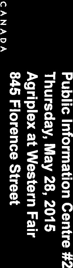
2 Our Rapid Transit Initiative Make an impact on the future of transit Join the discussion on Rapid Transit in London You re invited to a Public Information Centre to help shape the future of transportation in London. Rapid Transit will improve transportation by moving more people faster across the city. Results of the Rapid Transit corridor assessment will be presented, including the preliminary recommended network. Making room for the implementation of Rapid Transit may involve potential changes to the configuration of streets including: road widening that may impact properties, converting traffic lanes to transit-only lanes, a new underpass at the railway and removal of parking spaces. Rapid Transit Public Information Centre #2 The Information Centres will be held at two locations for your convenience. They will have a drop-in, open house format. Members of the project team will be available. Thursday May 28, :30 pm - 8:00 pm Agriplex at Western Fair 845 Florence Street Saturday May 30, :00 am - 3:00 pm Goodwill Centre 255 Horton Street East Venues are accessible and can be reached by transit, bike or car (free parking is available) Accessibility: Should you require assistance to participate in this meeting or to access information in alternate formats, please contact us at least 5 days prior to the meeting at shift@london.ca shiftlondon.ca

3 Welcome Thank you for attending the second Public Information Centre for Shift Our Rapid Transit Initiative Shift is a bold and important initiative for transportation for London. It focuses on rapid transit as part along with cars, bikes and pedestrians of the transportation system that will help our city grow and prosper. Shift will define where Rapid Transit will go, what it will look like, and how it will be implemented. We need your input on: How we ve summarized the input so far The preliminary recommended network Technology options How you may benefit or be affected What is Rapid Transit? Foundation for Rapid Transit The foundation for Rapid Transit was set in the Smart Moves 2030 Transportation Master Plan. The plan will create an integrated, multimodal transportation network that provides enhanced travel options to Londoners. The London Plan (draft) calls for the City to reshape how it grows by directing 40% of new development downtown and along the Rapid Transit corridors. Rapid Transit will play an integral part in shaping how and where London n will grow. By 2031, London will add 77,000 new residents, resulting in 25% more vehicles on local roadways. Even with expensive road widening projects, commuters and freight will face increased congestion unless there is a change in how residents travel.


4 What is Rapid Transit? Is London Ready for Rapid Transit? Yes! Rapid Transit will provide a new mobility choice that will be up to 50% faster than existing transit service and help to attract residents out of their car. Rapid Transit can move more people in less space, at high speeds Rapid Transit provides an efficient solution to move a large number of commuters in less space. It can become an integrated part of the transportation tion network which includes automobiles, transit, pedestrians, cyclists, and goods to keep London moving. London s current transit characteristics make it similar or better than other Canadian cities that have or are building Rapid Transit systems. Population Annual Ridership (millions) Annual Ridership per Capita Existing/(Planned) Rapid Transit Saskatoon 222, BRT Waterloo Region 507, (BRT/LRT) Hamilton 520, (LRT) Mississauga 668, BRT/(LRT) Winnipeg 694, BRT York Region 1,016, BRT Ottawa 1,130, BRT/(LRT) London 366, TBD Study Process and Accomplishments Study Process Shift Timeline 2013 Council approves Smart Moves Transportation Master Plan 2014 The London Plan, the City s new Official Plan (draft), establishing a vision for future growth, is introduced. February 2015 Shift is launched with public information centre at Central Library. Early-Mid 2015 Assessments of preferred alternatives for technology and alignment Mid-Late 2015 Preferred corridor and technology for Environmental Assessment selected Early 2016 Detailed design for the RT route and plans for construction / funding A new rapid transit system is up, running and ready for riders in London We are here Consultation Activities to Date 35 events have so far reached over 6,100 individuals Over 890 followers on Twitter Over 370 followers on Facebook Initial feedback survey received from over 850 citizens Over 2,700 contacts in database


5 What You ve Told Us How Londoners Think Rapid Transit Can Benefit the City We ve received 1500 responses to this question since the launch of Shift, reflecting a wide range of potential benefits. PERCENTAGE OF RESPONSES TO DATE 0% 10% 20% 30% 40% 50% 60% 70% Increase People Activity Protect Farmland Develop Walkable Communities 80% 90% 100% Provide Speed, Comfort, Reliability 4% 6% 7% 7% 11% 16% 17% 31% Save Money Reduce Emissions Create Jobs Reduce Congestion Top Questions and Concerns so Far Question/Concern Response Why is Rapid Transit not going to every area of the City? The entire city will be connected. An effective local transit network will be connected to the rapid transit system, creating a truly integrated transit network. What will Rapid Transit look like? Rapid Transit will mostly operate in dedicated lanes, but not always. We still haven t selected the technology. Can London really afford Rapid Transit? Doing nothing is not an affordable option. Rapid Transit will reduce the need for road expansion, reduce the cost of congestion and allow households to reduce car ownership. What will happen to existing buses? The existing LTC system will continue to operate. Existing routes will be adjusted and new routes will be added in order to feed into the Rapid Transit network to streamline trips. Evaluation Process Assessment Framework The City s Transportation Master Plan established the need for Rapid Transit. The role of this Environmental Assessment is to recommend the preferred corridors and technologies. See Board 7 See Board 8
 Employment Density 2011 within 500 m (jobs/ha) Growth Increase in Population Density")
 of the corridor. Reflects the ability to serve new homes and businesses along the corridors, and shape their form (e.g. transit oriented design).")

6 Initial Screening of Corridors The evaluation process considered a number of potential corridors. Evaluation Criteria Criteria Measure Importance Land Use Density Population Density 2011 within 500m (pers/ha) Employment Density 2011 within 500 m (jobs/ha) Growth Increase in Population Density within 500m (pers/ha) Increase in Employment Density within 500 m (jobs/ha) Major Major generators Destinations within 500m of corridor Reflects the ability to serve existing homes and businesses that are within walking distance (~10 mins) of the corridor. Reflects the ability to serve new homes and businesses along the corridors, and shape their form (e.g. transit oriented design). An indicator of ridership potential. High activity centres are the ideal Rapid Transit station locations due to high trip density. Existing Transit Ridership Transit boarding per km Strong ridership provides a foundation on which to build and indicates that travellers view the corridor as being important. A screening process was used to eliminate corridors which do not justify rapid transit at this time. # Corridor Reason for Screening Out 5 Oxford West B No major nodes; low employment density and growth; low existing transit ridership 8 Dundas East Low employment density and growth; low congestion 9 Springbank - Horton No major nodes; low employment growth; low existing transit ridership 10 Wharncliffe - Riverside No major nodes; low population growth; low employment growth; 11 Wharncliffe South No major nodes; low employment density; low existing transit ridership 12 Wonderland No major nodes; low existing transit ridership Preliminary Recommended Corridors The evaluation process has led to preliminary recommended corridors shown below. These corridors connect major destinations across the city including hospitals, post-secondary institutions, employment areas and retail centres. The next step is to examine different forms of Rapid Transit technologies (e.g. vehicles, stations, alignments) and designs in these corridors.


7 Rapid Transit Approaches Rapid Transit may not look the same in each corridor. Designs will be based on available road width, target speeds for transit vehicles and cost, environmental and cultural heritage considerations. Queue Jump Lanes Short dedicated lanes that allow transit vehicles to avoid queues at major intersections Median Lanes Dedicated lanes for rapid transit Curbside Lanes Lanes for transit and limited other uses Focus Areas - Downtown Considerations for Downtown The two corridors need to connect at a single, convenient transfer point, while still serving major destinations like the train and bus station, office buildings, the Market, Budweiser Gardens and local businesses All roadways in the area are constrained due to existing buildings The rail crossing on Richmond St. is a major challenge for Rapid Transit Maintaining parking and loading zones is important to local businesses OXFORD ST E DRAFT- for discussion purposes only 0 m 500 m 1000 m Distance Richmond Rail Crossing Tunnel Access The Richmond St. railway crossing is a major barrier to Rapid Transit due to existing freight operations. The narrow roadway, existing buildings and nearby river lead to constraints to the options available to overcome it. OXFORD ST W CENTRAL AVE COLBORNE ST WATERLOO ST DUFFERIN AVE WELLINGTON ST QUEENS AVE CLARENCE ST BLACKFRIARS ST RICHMOND ST RIDOUT ST N DUNDAS ST TALBOT ST KING ST WHARNCLIFFE RD N YORK ST RIVERSIDE DR WELLINGTON ST Future Route HORTON ST W GREY ST Rapid Transit Downtown Routing Preliminary North-East Route Preliminary South-West Route Alternative Routings RIDOUT ST S Potential Station WHARNCLIFFE RD S This area of the city has unique challenges and opportunities which require further study and input from the public. What are your thoughts on this area? One option to maintain reliability is to construct a Rapid Transit tunnel from north of Central Ave. to North of Oxford St. This would allow vehicles to remain on-schedule when freight trains cross.

8 CENTRAL AVE KING ST YORK ST DUFFERIN AVE DUNDAS ST HORTON ST Focus Areas Old East Village Considerations for Old East Village Area The area is a Main Street, with a narrow road-way and buildings built to the edge of the sidewalk that creates a distinct character Dundas St. requires loading zones and parking for adjacent businesses Two-way Rapid Transit on Dundas leaves little room for traffic movement and parking King St. is an established major cycling corridor eastbound, which should be maintained Queens Ave. within the area is a predominantly residential street that is not suitable for Rapid Transit OXFORD ST E 0 m 500 m 1000 m ADELAIDE ST N COLBORNE ST RICHMOND ST QUEBEC ST ONTARIO ST GLEBE ST LYLE ST WATERLOO ST CLARENCE ST QUEENS AVE EGERTON ST RECTORY ST Rapid Transit Routing- Old East Village WELLINGTON RD Future Route Tunnel Access Preliminary North-East Route Preliminary South-West Route Alternative North-East Route Potential Station ADELAIDE ST N DRAFT- for discussion purposes only This area of the city has unique challenges and opportunities which require further study and input from the public. What are your thoughts on this area? Focus Areas Western University Considerations for Western University Western University is the largest transit trip destination in London Providing a central stop location on campus is important to maximizing coverage The road network on campus and surrounding area is constrained The University s Campus Master Plan (draft) recognizes Rapid Transit as an important tool for managing parking demand. The plan also identifies future areas for development along Western Rd., Huron Dr. and Perth Dr. and at the Discovery Park This area of the city has unique challenges and opportunities which require further study and input from the public. What are your thoughts on this area?


 Can carry up to")


9 Rapid Transit Elements Bus Rapid Transit (BRT) Can carry up to 10,000 passengers every hour in each direction Vehicles run primarily in dedicated lanes, but can operate in mixed-traffic Has the flexibility to operate outside of dedicated lanes BRT can cost between $15 to $40 million per route kilometre Vehicles are high capacity, accessible and offer comfortable seating Rapid Transit Elements Light Rail Transit (LRT) Can carry up to 15,000 passengers every hour in each direction Is confined to its tracks so requires more people to transfer modes Run primarily in dedicated lanes, but can operate in mixed-traffic Can cost between $40 to $100 million per route kilometre Is a smooth, fast ride and is perceived as an attractive choice by riders Permanency of rails provides assurance to developers that transit will stay Vehicles can be joined together to increase capacity Requires a new Maintenance and Storage Facility


10 Rapid Transit Elements Stops and Stations LRT and BRT station and stop locations share many of the same characteristics. The permanency of stations and runningways provides assurance for development along the corridors. Unique Design Station Technologies Passenger Amenities Fare Machines Accessible Next Vehicle Arrival Wayfinding Climate Controlled Waiting Areas Stay Involved Next Steps Receiving feedback on the preliminary preferred corridors Testing different designs in each corridor Working with the public and stakeholders to maximizing benefits and minimize impacts Refining cost estimates Completing the Rapid Transit Master Plan There will be two more Public Information Centres in Fall 2015 and Spring Look for the Shift Team at events over the summer.


11
12


13
14

15
16

17
18


19


20

21

22


23


24


25


26


27

28


29

30

31

32


33
34

35
36


37

38


39


40


41


42
43

44


45


46

47
48

49


50


51
Frequently Asked Questions (FAQ)
") Frequently Asked s (FAQ) Study Process... 2 Rapid Transit Service and Operations... 5 Public Consultation... 8 Business Impacts... 8 Design and Property Impacts... 9 Construction Impacts...12 Traffic,
Frequently Asked s (FAQ) Study Process... 2 Rapid Transit Service and Operations... 5 Public Consultation... 8 Business Impacts... 8 Design and Property Impacts... 9 Construction Impacts...12 Traffic,
LONDON s. system TRANSFORMING THE WAY LONDON MOVES
 LONDON s system TRANSFORMING THE WAY LONDON MOVES TRANSFORMING The WAY LONDON MOVES London is Canada s largest urban centre without a modern rapid transit system. That s about to change, with a vision
In station areas, new pedestrian links can increase network connectivity and provide direct access to stations.
 The Last Mile Planning for Pedestrians Planning around stations will put pedestrians first. Making walking to stations safe and easy is important; walking will be a part of every rapid transit Accessible
NORTH TURNAROUND. Recommended Design: Expand the existing transit terminal
 NORTH TURNAROUND Recommended Design: Expand the existing transit terminal Feedback from stakeholders and the public: Make it easy to transfer between local and Rapid Transit service Why is this design
Southwest Bus Rapid Transit (SW BRT) Functional Planning Study - Executive Summary January 19 LPT ATTACHMENT 2.
 Functional Planning Study - Executive Summary January 19 LPT ATTACHMENT 2.") Southwest Bus Rapid Transit (SW BRT) Functional Planning Study - Executive Summary 2011 January 19 1 of 19 Introduction This executive summary presents the results of the Southwest Bus Rapid Transit (SW
Southwest Bus Rapid Transit (SW BRT) Functional Planning Study - Executive Summary 2011 January 19 1 of 19 Introduction This executive summary presents the results of the Southwest Bus Rapid Transit (SW
WHITE PAPER: TRANSIT SERVICE FOR SOUTH SHAGANAPPI
 9/27/2012 TRANSIT PLANNING WHITE PAPER: TRANSIT SERVICE FOR SOUTH SHAGANAPPI 2012 Calgary Transit 1 Table of Contents Purpose... 3 Area of Change... 3 Background... 3 Access to destinations... 5 Connecting
Moving Cambridge. City of Cambridge Transportation Master Plan Public Consultation Centre. March 7, :00 8:00 PM.
 City of Cambridge Transportation Master Plan Public Consultation Centre March 7, 2018 5:00 8:00 PM Region of Waterloo City of Cambridge Transportation Master Plan Public Consultation Centre March 7, 2018
Decision on North Waterloo Routing
 Next Steps Decision on North Waterloo Routing Two route variations remain in north Waterloo. The final preferred route will include only one of the two variations. Please consider these two variations
Downtown BRT Corridor Alternatives Review: 1 st, 2 nd, 3 rd and 4 th Avenue. Bus Rapid and Conventional Transit Planning and Design Services
 Downtown BRT Corridor Alternatives Review: 1 st, 2 nd, 3 rd and 4 th Avenue Bus Rapid and Conventional Transit Planning and Design Services City of Saskatoon February 2018 Project Team HDR Corporation
Bus Rapid Transit Plans
 Twin Cities Region Bus Rapid Transit Plans ULI Minnesota Workshop Connecting Bus Rapid Transit to the Community December 15, 2009 John Levin Director of Service Development Metro Transit Metropolitan Area
WELCOME TO OPEN HOUSE # 1 June 14, 2017
 Langstaff Road Weston Road to Highway 7 Class Environmental Assessment Study WELCOME TO OPEN HOUSE # 1 June 14, 2017 Please sign in and join our mailing list Purpose of Open House #1 & Study Area York
Roadways. Roadways III.
 Introduction 97 Roadway Design Principles 98 Safe Speeds 99 Optimizing of Street Space 00 Minimum Lane Widths in the City of Boston 02 Design Features that Reduce Operating Speeds 05 Travel Lanes Transit
Baseline Road Rapid Transit: Bayshore Station to Prince of Wales Drive
 Baseline Road Rapid Transit: Bayshore Station to Prince of Wales Drive Planning and Environmental Assessment Study Consultation Group Meetings May 2014 Presentation Agenda Study Overview Study Progress
DON MILLS-EGLINTON Mobility Hub Profile
 Mobility Hub Profile Dundas Don Mills-Eglinton West-Bloor Anchor Hub Gateway Hub N MOBILITY HUBS: Places of connectivity between regional and rapid transit services, where different modes of transportation
A Selection Approach for BRT Parking Lots Nicolls Road Corridor Parking Study
 A Selection Approach for BRT Parking Lots Nicolls Road Corridor Parking Study Chirantan Kansara, P.E. Engineering Construction Design Planning 2018 ITE Northeastern District Annual Meeting Lake George,
Calgary Transit Route 302 Southeast BRT Year One Review June
 Calgary Transit Route 302 Southeast BRT Year One Review 2011 June Calgary Transit Route 302 Southeast BRT: Year One Review 2011 April Table of Contents 1.0 Executive Summary... 1 2.0 Introduction... 3
WELCOME! Please complete a comment sheet as we value your feedback. 4 pm to 8 pm. September 15, Hosted by: AECOM on behalf of City of Calgary
 WELCOME! Thank you for attending our open house. There will be no formal presentation today so please take the time to read the boards. If you have any questions, please do not hesitate to approach one
DRAFT ENVIRONMENTAL PROJECT REPORT. April 23, 2018
 P A R T N E R ' S P R E S E N T A T I O N DRAFT ENVIRONMENTAL PROJECT REPORT April 23, 2018 P A R T N E R ' S P R E S E N T A T I O N Recent recap July 2017: City Council approves Rapid Transit Master
Transportation Master Plan Advisory Task Force
 Transportation Master Plan Advisory Task Force Network Alternatives & Phasing Strategy February 2016 BACKGROUND Table of Contents BACKGROUND Purpose & Introduction 2 Linking the TMP to Key Council Approved
Providence Downtown Transit Connector STAKEHOLDER MEETING #2. Stakeholder Meeting #1 October 24, 2016
 Providence Downtown Transit Connector STAKEHOLDER MEETING #2 Stakeholder Meeting #1 October 24, 2016 February 2017 1 AGENDA 1 DTC Goals and Expectations 2 Street Design Concepts 3 Potential Benefits and
Public Event 1 Community Workshops
 Public Event 1 Community Workshops Nov. 24 & Dec. 3, 2016 Welcome Workshop Purpose We re looking to you for ideas and insights to help guide future transportation infrastructure planning in the Park Lawn
Bus Rapid Transit ALTERNATIVES ANALYSIS. Open House
 Bus Rapid Transit ALTERNATIVES ANALYSIS Open House June 23, 2015 Open House Meeting Agenda Agenda Introductions What is BRT? Project Goals Study Tasks Next steps Discussion PVTA Bus Rapid Transit Study
South Street Campus Lands Development. City of London TRANSPORTATION IMPACT ASSESSMENT
 South Street Campus Lands Development City of London TRANSPORTATION IMPACT ASSESSMENT TW1387 South Street Campus Lands Development City of London TRANSPORTATION IMPACT ASSESSMENT May 2013 South Street
CHAIR AND MEMBERS CIVIC WORKS COMMITTEE MEETING ON JANUARY 10, 2017
 TO: FROM: SUBJECT: CHAIR AND MEMBERS CIVIC WORKS COMMITTEE MEETING ON JANUARY 10, 2017 KELLY SCHERR, P.ENG., MBA, FEC MANAGING DIRECTOR ENVIRONMENTAL & ENGINEERING SERVICES AND CITY ENGINEER QUEENS AVENUE
TRANSPORTATION NEEDS ASSESSMENT
 TRANSPORTATION NEEDS ASSESSMENT A travel demand analysis was carried out to determine the operational issues and the potential benefit that adding traffic capacity would have on the road network. All the
Community Task Force July 25, 2017
 Community Task Force July 25, 2017 Welcome and Introductions Project Partners Regional Transportation District (RTD) Colorado Department of Transportation (CDOT) Denver Regional Council of Governments
95 th Street Corridor Transportation Plan. Steering Committee Meeting #2
 95 th Street Corridor Transportation Plan Steering Committee Meeting #2 February 18, 2015 PURPOSE OF THE MEETING Update Steering Committee Present Community/Stakeholder Survey Results Present Transportation
PURPOSE AND NEED SUMMARY 54% Corridor Need 1. Corridor Need 2. Corridor Need 3. Corridor Need 4. Corridor Need 5
 SUMMARY PURPOSE AND NEED Chapel Hill Transit ridership has increased Buses operate every 4 minutes and have standing room only Exceeding seated capacity by 12% Corridor Need 1 by more than 20 percent between
Tonight is for you. Learn everything you can. Share all your ideas.
 Strathcona Neighbourhood Renewal Draft Concept Design Tonight is for you. Learn everything you can. Share all your ideas. What is Neighbourhood Renewal? Creating a design with you for your neighbourhood.
Complete Streets: Policy Framework Complete Streets: Implementation Plans A more Complete Street: Laurier Bike Lane Pilot Project
 Complete Streets Initiatives City of Ottawa Complete Streets: Policy Framework Complete Streets: Implementation Plans A more Complete Street: Laurier Bike Lane Pilot Project Zlatko.Krstulic@Ottawa.ca May
Eliminate on-street parking where it will allow for a dedicated bus only lane %
 Traffic Dashboard Priorities Survey Responses Introduction 1) Are you familiar with bus rapid transit (BRT)? a. No, BRT is new to me. 597 23.5% b. I ve heard of BRT, but I don t know much about it. 1,136
How To Encourage More Efficient Transportation in Brazilian Cities
 How To Encourage More Efficient Transportation in Brazilian Cities Todd Litman Victoria Transport Policy Institute Presented Seminar on Discouraging The Use Of Cars São Paulo, Brazil 3 September 2013 Creating
Appendix K: Traffic Analysis July 2017
 Appendix K: Traffic Analysis July 2017 Table of Contents 1 INTRODUCTION AND BACKGROUND... 5 1.1 Route Description and Study Area... 5 1.1.1 South-West Route... 5 1.1.2 North-East Route... 6 1.1.3 Downtown
Transportation Assessment
 Transportation Assessment Midtown Open House February 10, 2018 Overview Midtown in Focus Overview & Purpose of Today Transportation Assessment overview Summary of Transportation work to date Review & Analysis
Bus rapid transit network
 Bus rapid transit network Why we re here Help fine tune the Council-approved design for the BRT network, brought forward May 8, 2018 Provide feedback on the draft Environmental Project Report, which outlines
Purpose and Need. Chapter Introduction. 2.2 Project Purpose and Need Project Purpose Project Need
 Chapter 2 Purpose and Need 2.1 Introduction The El Camino Real Bus Rapid Transit (BRT) Project (Project) would make transit and other transportation improvements along a 17.6-mile segment of the El Camino
Corridor Vision Workshop Summary James Madison Elementary February 22,2018
 Corridor Vision Workshop Summary James Madison Elementary February 22,2018 WHY DEVELOP THIS STUDY? Ogden City is planning for better connectivity and access to jobs and housing. Working with area partners,
DUNDAS WEST-BLOOR Mobility Hub Profile
 Mobility Hub Profile Dundas West-Bloor Anchor Hub Gateway Hub N MOBILITY HUBS: Places of connectivity between regional and rapid transit services, where different modes of transportation come together
Downtown London Member Survey Regarding BRT. May 8, 2017
 Downtown London Member Survey Regarding BRT May 8, 2017 Table Of Contents 1 Description of the Research 3 Objectives 4 Methodology Profile of Respondents 5 6 2 Summary 9 3 Detailed Results Unaided Opinion
EAST CORRIDOR DESIGN BOOKLET KEY PLAN DRAFT ENVIRONMENTAL PROJECT REPORT: APRIL 2018 RICHMOND OXFORD STREET EAST STREET HIGHBURY AVENUE CLARENCE
 EAST CORRIDOR DESIGN BOOKLET NE10 NE11 NE12 CLARENCE RICHMOND STREET STREET ONTARIO STREET NE09 NE08 EAST NE04 NE05 NE06 NE07 NE01 NE02 NE03 KEY PLAN DRAFT ENVIRONMENTAL PROJECT REPORT: APRIL 2018 WATERLOO
ATTACHMENT 4 - TDM Checklist. TDM Checklist Overview
 ATTACHMENT 4 - TDM Checklist TDM Checklist Overview The proposed checklist rates developments on the degree to which they are TDM and transit supportive. Points are assigned based on the level of transit
Typical Rush Hour Commute. PennyforTransportation.com
 Typical Rush Hour Commute In the News Overview of the Plan Collaborative plan with projects in every community Prioritizing connectivity and congestion relief Dedicated transportation-specific funding;
Public Consultation Centre For. Transportation Master Plan Update. Information Package
 Public Consultation Centre For Transportation Master Plan Update Information Package Date Location Hours Tuesday, September 12, 2017 Wednesday, September 13, 2017 Tuesday, September 19, 2017 Cambridge
July 23, Transit Workshop
 Agenda 1. Introductions 2. Presentation: Public Transit in Regina Review of Practices Elsewhere 3. Discussion #1: Transit Today 4. Break 5. Discussion #2: Transit Tomorrow Corridors, Service, and Amenities
Chapter 5 Future Transportation
 Chapter 5 Future Transportation The Future Land Use Plan identifies the desired land use designations. The land uses desired for Crozet depend, in large part, on the success of the transportation system,
Designing Streets for Transit. Presentation to NACTO Designing Cities Kevin O Malley Managing Deputy Commissioner 10/24/2014
 Designing Streets for Transit Presentation to NACTO Designing Cities Kevin O Malley Managing Deputy Commissioner 10/24/2014 Chicago -- Streets for Transit TODAY Jeffery Jump Transit Signal Priority Central
CONNECTING PEOPLE TO PLACES
 CONNECTING PEOPLE TO PLACES 82 EAST BENCH MASTER PLAN 07 Introduction The East Bench transportation system is a collection of slow moving, treelined residential streets and major arteries that are the
Presentation of Staff Draft March 18, 2013 COUNTYWIDE TRANSIT CORRIDORS FUNCTIONAL MASTER PLAN
 Presentation of Staff Draft March 18, 2013 COUNTYWIDE TRANSIT CORRIDORS FUNCTIONAL MASTER PLAN Public Outreach Fall 2011: Two community meetings/open houses Fall 2012: Three community meetings/open houses
Executive Summary BEYOND THE B-LINE: RAPID TRANSIT LINE PHASE II - COMMERCIAL DRIVE WEST. Final Draft December 13, Appendix B BROADWAY/LOUGHEED
 BEYOND THE B-LINE: BROADWAY/LOUGHEED RAPID TRANSIT LINE PHASE II - COMMERCIAL DRIVE WEST Appendix B Executive Summary Final Draft December 13, 1999 UMA Lloyd Lindley Davidson Yuen Simpson Architects BROADWAY/LOUGHEED
Appendix A-2: Screen 1 Alternatives Report
 Appendix A-2: Screen 1 Alternatives Report SCREEN 1 ALTERNATIVES REPORT Western & Ashland Corridors Bus Rapid Transit (BRT) Project Prepared for Chicago Transit Authority 567 West Lake Street Chicago,
Chapter 7. Transportation. Transportation Road Network Plan Transit Cyclists Pedestrians Multi-Use and Equestrian Trails
 Chapter 7 Transportation Transportation Road Network Plan Transit Cyclists Pedestrians Multi-Use and Equestrian Trails 7.1 TRANSPORTATION BACKGROUND The District of Maple Ridge faces a number of unique
Standing Committee on Policy and Strategic Priorities
 POLICY REPORT Report Date: January 15, 2019 Contact: Steve Brown Contact No.: 604.873.9733 RTS No.: 12955 VanRIMS No.: 08-2000-20 Meeting Date: January 30, 2019 TO: FROM: SUBJECT: Standing Committee on
Appendix 1 Transit Network Analysis
 Appendix 1 Transit Network Analysis APPENDIX 1 TRANSIT NETWORK ANALYSIS The purpose of this appendix is to provide an update on the transit network analysis as it pertains to: i. SmartTrack ii. Scarborough
Scope of the Transit Priority Project
 Transit Planning Committee #1 March 19, 2015 Scope of the Transit Priority Project Review of the 2010 plan Analysis of Transit Priority Measures Preliminary plans for rapid transit Recommendations for
4 DISRUPTION MANAGEMENT PLAN HIGHWAY 7 RAPIDWAY CONSTRUCTION BETWEEN BAYVIEW AVENUE AND WARDEN AVENUE TOWNS OF MARKHAM AND RICHMOND HILL
 4 DISRUPTION MANAGEMENT PLAN HIGHWAY 7 RAPIDWAY CONSTRUCTION BETWEEN BAYVIEW AVENUE AND WARDEN AVENUE TOWNS OF MARKHAM AND RICHMOND HILL The Transportation Services Committee recommends the adoption of
STONY PLAIN ROAD STREETSCAPE
 Jasper Place Revitalization Strategy: Vision The people involved in the Jasper Place Revitalization Strategy envision: Goal 1: Feeling safe in our community Create a community where feeling safe is common--where
122 Avenue: 107 Street to Fort Road
 : 107 Street to Fort Road November 24, 2015 4:30 8:00 p.m. Meeting Purpose Summarize project work completed to date Share results of public input from Phase 1 Share the draft concept plan and proposed
NEWMARKET CENTRE Mobility Hub Profile
 Mobility Hub Profile Dundas Newmarket West-Bloor Centre Anchor Hub Gateway Hub N MOBILITY HUBS: Places of connectivity between regional and rapid transit services, where different modes of transportation
Mumford Terminal Replacement Opportunities Neighbourhood Open House. we are here. PHASE 2 Identifying and Evaluating Candidate Sites
 Welcome Replacement Opportunities Neighbourhood Open House. AGENDA PURPOSE 1. REVIEW the information boards 2. DISCUSS aspects of the project with the project team 3. SHARE your thoughts on replacement
NORTH YORK CENTRE Mobility Hub Profile
 Mobility Hub Profile Dundas North York West-Bloor Centre Anchor Hub Gateway Hub N MOBILITY HUBS: Places of connectivity between regional and rapid transit services, where different modes of transportation
DON MILLS-SHEPPARD Mobility Hub Profile
 DON MILLS-SHEPPARD Mobility Hub Profile Dundas Don Mills-Sheppard West-Bloor Anchor Hub Gateway Hub N MOBILITY HUBS: Places of connectivity between regional and rapid transit services, where different
EXECUTIVE SUMMARY OF CALEDON TRANSPORTATION NEEDS STUDY
 EXECUTIVE SUMMARY OF CALEDON TRANSPORTATION NEEDS STUDY The Caledon Transportation Needs Study has been undertaken as a joint project by the Town of Caledon and the Region of Peel to determine the existing
South King County High-Capacity Transit Corridor Study
 HIGH-CAPACITY TRANSIT CORRIDOR STUDY South King County Corridor South King County High-Capacity Transit Corridor Study Corridor Report August 2014 South King County High Capacity Transit Corridor Report
City of Davenport CitiBus Public Transportation Study. April 2015
 City of Davenport CitiBus Public Transportation Study April 2015 Overview Project Background Key Findings CitiBus Service Allocation Policy Discussion 2 Project Background 3 About CitiBus Operates 17 routes
Welcome. Background. Goals. Vision
 Welcome The formal Public Information Centre (PIC) for the Transportation Master Plan How We GO will be held in early 2017. At that time we will present the recommended transportation system for Niagara
VISION Long Range Plan Update Board Workshop. February 10, 2016
 VISION 2040 Long Range Plan Update Board Workshop February 10, 2016 Vision 2040 Key Milestones UNDERSTAND THE NEED IDENTIFY A RANGE OF OPTIONS EVALUATE COMMUNITY OPTIONS DEFINE PROJECTS & PLANS Vision
Climate Change Action Plan: Transportation Sector Discussion Paper: Cycling
 Climate Change Action Plan: Transportation Sector Discussion Paper: Cycling ontario.ca/climatechange Contents 1. Minister of Transportation s message... 3 2. Introduction... 5 3. Sector Overview and Support
Main-McVay Transit Study: Phase 2 Options Definition and High Level Constraints Evaluation
 Main-McVay Transit Study: Phase 2 Options Definition and High Level Constraints Evaluation APRIL 2016 A collaborative study between: For Additional Information or to Comment If you would like additional
5. RUNNINGWAY GUIDELINES
 5. RUNNINGWAY GUIDELINES These guidelines should be considered collectively when making runningway decisions. A runningway is the linear component of the transit system that forms the right-of-way reserved
Building a Toronto that Moves
 Building a Toronto that Moves Image courtesy of the City of Toronto Setting Election Priorities for Walking, Cycling & Public Transit Toronto is a fast-paced, dynamic city. It s a city that moves except
CHAIR AND MEMBERS CIVIC WORKS COMMITTEE MEETING ON SEPTEMBER 25, 2018
 TO: FROM: SUBJECT: CHAIR AND MEMBERS CIVIC WORKS COMMITTEE MEETING ON SEPTEMBER 25, 2018 KELLY SCHERR, P.ENG., MBA, FEC MANAGING DIRECTOR ENVIRONMENTAL AND ENGINEERING SERVICES AND CITY ENGINEER DOWNTOWN
York Region Population and Employment Growth
 March 1, 2016 1 York Region Population and Employment Growth York Region needs to comply with The Provincial Growth Plan and new forecasts introduced to 2036 and 2041 2 Regional Official Plan Review York
ROUTES 55 / 42 / 676 BUS RAPID TRANSIT LOCALLY PREFERRED ALTERNATIVE
 ROUTES 55 / 42 / 676 BUS RAPID TRANSIT LOCALLY PREFERRED ALTERNATIVE April, 2012 1 INTRODUCTION The need for transit service improvements in the Routes 42/55/676 corridor was identified during the Southern
Sustainable Transportation Initiatives and Plans in Caledon
 Sustainable Transportation Initiatives and Plans in Caledon Arash Olia, P.Eng., PhD. Coordinator, Transportation Development Finance & Infrastructure Services Town of Caledon Eric Chan, P.Eng., PMP Manager,
Saskatchewan Drive Roadway Rehabilitation and Shared-Use Path Widening
 Saskatchewan Drive Roadway Rehabilitation and Shared-Use Path Widening We are here today to present the draft plan for the Saskatchewan Drive Roadway Rehabilitation and Shared-Use Path Widening project
AIRPORT ROAD ENVIRONMENTAL ASSESSMENT
 WELCOME TO PUBLIC INFORMATION CENTRE #1 AIRPORT ROAD ENVIRONMENTAL ASSESSMENT From Braydon Boulevard/Stonecrest Drive to Countryside Drive November 23, 2017 6:30 PM 8:30 PM Please sign in and fill out
North Shore Transportation Improvement Strategy
 North Shore Transportation Improvement Strategy Preliminary, Near-term Recommendation 2016 April Transportation Improvement Strategy (TIS) Comprehensive and Analytical A multi-modal transportation strategy
CHAIR AND MEMBERS STRATEGIC PRIORITIES AND POLICY COMMITTEE MEETING ON MARCH 20, 2019
 TO: FROM: SUBJECT: CHAIR AND MEMBERS STRATEGIC PRIORITIES AND POLICY COMMITTEE MEETING ON MARCH 20, 2019 KELLY SCHERR, P.ENG., MBA, FEC MANAGING DIRECTOR, ENVIRONMENTAL & ENGINEERING SERVICES AND CITY
Executive Summary Route 30 Corridor Master Plan
 Route Corridor Master Plan Project Overview The Route Corridor Master Plan is a coordinated multimodal transportation and land use plan for the entire stretch of Route through East Whiteland Township,
Regional Alternatives Analysis. Downtown Corridor Tier 2 Evaluation
 Regional Alternatives Analysis Downtown Corridor Tier 2 Evaluation September 19, 2011 EVALUATION PROCESS REVIEW OF EVALUATION PROCESS Tier 1: Screen Seven Alignment Options into a Short List Tier 2: Evaluate
APPENDIX 2 LAKESHORE ROAD TRANSPORTATION REVIEW STUDY EXECUTIVE SUMMARY
 APPENDIX 2 LAKESHORE ROAD TRANSPORTATION REVIEW STUDY EXECUTIVE SUMMARY Appendix 2 City of Mississauga Lakeshore Road FINAL REPORT Transportation Review Study December 2010 EXECUTIVE SUMMARY Study Purpose
Building a Liveable Ottawa 2031 Backgrounder 4: Kanata/Stittsville
 Building a Liveable Ottawa 2031 Backgrounder 4: Kanata/Stittsville Wards 4, 6 and 23 Official Plan Transportation Master Plan Cycling Plan Pedestrian Plan October 2013 ottawa.ca/liveableottawa Building
Hamilton Transportation Master Plan Public Consultation. Public Information Centre One Summary
 Hamilton Transportation Master Plan Public Consultation Public Information Centre One Summary Table of Contents Introduction 1 Purpose 2 What Was Presented 2 Who Came to the Meeting 2 The Breakout Sessions
Arterial Transitway Corridors Study. Ave
 Arterial Transitway Corridors Study Ave January 2012 Arterial Transitway Corridors Study Overview Corridor Features and Demographics 11 study corridors, 95 route miles 86,000 daily rides and half of existing
INITIAL BUSINESS CASE REPORT
 DURHAM-SCARBOROUGH BUS RAPID TRANSIT STUDY INITIAL BUSINESS CASE REPORT DURHAM Prepared for Metrolinx by IBI Group Spring 2018 Table of Contents Executive Summary... ES-1 Introduction... ES-1 Study Overview...
Berkeley Strategic Transportation Plan A-76
 Berkeley Strategic Transportation Plan A-76 Appendices 1. A Team Effort 2. Where We ve Been A-11 Berkeley Strategic Transportation Plan Alameda County Transportation Plan Alameda County will be served
Governance and Priorities Committee Report For the July 2, 2015 Meeting
 CITY OF VICTORIA For the July 2, 2015 Meeting To: Governance and Priorities Committee Date: From: Subject: Brad Dellebuur, A/Assistant Director, Transportation and Parking Services Executive Summary The
4 Ridership Growth Study
 Clause 4 in Report No. 15 of Committee of the Whole was adopted, without amendment, by the Council of The Regional Municipality of York at its meeting held on November 16, 2017. 4 Ridership Growth Study
DRAFT. Memo. Range of the Alternatives Considered in the EIS
 Memo Date: Friday, December 09, 2016 Project: To: From: Subject: State Route 30 EIS UDOT Vince Izzo This memorandum summarizes the draft State Route (S.R.) 30 Level 1 screening results. A more detailed
Discussion Paper 1 June 2014 Current State of Transportation in Burlington
 Discussion Paper 1 June 2014 Current State of Transportation in Burlington www.burlington.ca/goyourway Discussion Paper 1: Current State of Transportation in Burlington The City of Burlington is developing
PEDESTRIAN ACTION PLAN
 ATTACHMENT 2 CITY OF SANTA MONICA PEDESTRIAN ACTION PLAN CITY OF SANTA MONICA PEDESTRIAN ACTION PLAN This page intentionally left blank EXECUTIVE SUMMARY CHAPTER 1 EXECUTIVE SUMMARY Setting the Stage
A CHANGING CITY. of Edmonton, it is essential that it reflects the long-term vision of the City.
 A CHANGING CITY By the year 2040, Edmonton will be home to more than 1 million people. To accommodate growth and support a healthy and compact city, we need a new approach to development/redevelopment
2.2 TRANSIT VISION 2040 FROM VISION TO ACTION. Emphasize transit priority solutions STRATEGIC DIRECTION
 TRANSIT VISION 2040 FROM VISION TO ACTION TRANSIT VISION 2040 defines a future in which public transit maximizes its contribution to quality of life with benefits that support a vibrant and equitable society,
Chapter 2. Bellingham Bicycle Master Plan Chapter 2: Policies and Actions
 Chapter 2 Bellingham Bicycle Master Plan Chapter 2: Policies and Actions Chapter 2: Policies and Actions The Bicycle Master Plan provides a road map for making bicycling in Bellingham a viable transportation
Pre-Plan Consultation Summary
 Transportation Master Plan Pre-Plan Consultation Summary Thursday July 7, 2011 Presentation ti Outline Consultation Objectives Scope of Consultation Who Responded? What did we hear? How well did we connect?
Table of Contents. London BRT Transit Project Assessment Process Draft Environmental Project Report
 Table of Contents Commitments and Future Work... 2-37 2 Project Description... 2-1 Design Criteria... 2-1 Rapid Transit Corridors... 2-1 Rapid Transit Vehicles... 2-2 Streetscape Elements... 2-2 Rapid
The following notes describe comments received that were written/drawn on maps by workshop participants.
 Stakeholder Workshop Additional Feedback Received Maps and Comment Forms October 5, 2016 The following notes describe comments received that were written/drawn on maps by workshop participants. MAP 1 MAP
EL CAMINO REAL BUS RAPID TRANSIT PROJECT
 EL CAMINO REAL BUS RAPID TRANSIT PROJECT Would upgrade the current 522 Rapid Bus to BRT status by making changes to El Camino Real and The Alameda that make transit FAST, FREQUENT AND RELIABLE and make
Item to be Addressed Checklist Consideration YES NO N/A Required Description Complete Streets Guidelines
 Passaic County Complete Streets Checklist - Concept Development Project Name Item to be Addressed Checklist Consideration YES NO N/A Required Description Complete Streets Guidelines Existing Plans Have
Spring Lake Park Mounds View North Oaks. Arden Hills. Shoreview. Roseville. Little Canada. Falcon Heights SNELLING. Lilydale. West Saint Paul 35E
 Coon Rapids Blaine Spring Lake Park Mounds View rth Oaks In 2011, Metro Transit embarked on the Arterial 494 Minnetonka Maple Grove Plymouth Hopkins Brooklyn Park New Hope Golden Valley Louis Park Edina