Proceedings. The Sinks Symposium: Exploring the Origin and Management of Fishes In the Sinks Drainages of Southeast Idaho
|
|
|
- Rose George
- 5 years ago
- Views:
Transcription

1 Proceedings of The Sinks Symposium: Exploring the Origin and Management of Fishes In the Sinks Drainages of Southeast Idaho
2 Funding for this symposium was provided by Idaho Chapter of the American Fisheries Society USDA Forest Service, Salmon-Challis and Caribou- Targhee National Forests U.S. Bureau of Land Management U.S. Fish and Wildlife Service Idaho Department of Fish and Game The Nature Conservancy of Idaho ii
3 Proceedings of The Sinks Symposium: Exploring the Origin and Management of Fishes In the Sinks Drainages of Southeast Idaho Held in Pocatello, Idaho February 27, 2002 Edited by: Robert W. Van Kirk James M. Capurso Bart L. Gamett Idaho Chapter American Fisheries Society P.O. Box 8472 Boise, ID Proceedings published February 2003 iii
4 Symposium presented by: Native Fish Committee Idaho Chapter American Fisheries Society Symposium organized by: Robert W. Van Kirk James M. Capurso Bart L. Gamett Suggested citation formats for this publication: Entire Publication: Van Kirk, R. W., J. M. Capurso, and B. L. Gamett, editors The Sinks symposium: exploring the origin and management of fishes in the Sinks Drainages of southeastern Idaho. Idaho Chapter American Fisheries Society, Boise, ID. Article within the publication: Link, P. K Geologic and hydrologic history of the Sinks Drainages. Pp. 4-7 in Van Kirk, R. W., J. M. Capurso, and B. L. Gamett, editors. The Sinks symposium: exploring the origin and management of fishes in the Sinks Drainages of southeastern Idaho. Idaho Chapter American Fisheries Society, Boise, ID. iv
5 CONTENTS Introduction Robert W. Van Kirk and Bart L. Gamett Geologic and Hydrologic History of the Sinks Drainages Paul K. Link Evolution and Historical Distribution of Fishes in Western North America in Relation to the Sinks Drainages Robert J. Behnke..8 Preliminary Biogeographic Assessment of the Idaho Sinks Drainages based on Aquatic Invertebrates Daniel L. Gustafson.9 The Distribution and Potential Origin of Sculpin Species in the Sinks Drainages of Southeastern Idaho Bart L. Gamett and Donald W. Zaroban Genetic Analysis to Infer the Origin of Mountain Whitefish Prosopium williamsoni in the Big Lost River Andrew Whiteley and Bart L. Gamett...11 The Settlement of Southeastern Idaho before 1900 Ron Hatzenbuehler. 14 A Summary: The Origin of Fishes in the Sinks Drainages of Southeastern Idaho Bart L. Gamett National Forest Management in the Sinks Drainages James M. Capurso..17 U.S. Bureau of Land Management in the Sinks Drainages Pat Koelsch 18 U.S. Fish and Wildlife Service Activities in the Sinks Drainages Deb Mignogno Past, Current and Future Management by Idaho Department of Fish and Game in the Sinks Drainages Virgil Moore, Chip Corsi, Sharon Clark, and Jim Davis..21 Conclusions from the Sinks Symposium: Answers to Major Questions Bart L. Gamett, James M. Capurso, and Robert W. Van Kirk.23 Appendix: Photographs of representative streams and landscapes in the Sinks Drainages 26 v
6 Introduction Robert W. Van Kirk Department of Mathematics Idaho State University Pocatello, ID and Bart L. Gamett Salmon-Challis National Forest P.O. Box 507 Mackay, ID The Sinks Drainages are a collection of closed surface drainage basins in southeast Idaho consisting of five U.S. Geological Survey hydrologic cataloging units: Beaver-Camas ( ), Medicine Lodge ( ), Birch ( ), Little Lost ( ), and Big Lost ( ) units, in order from east to west (Fig. 1). The streams of these basins originate in the Pioneer, Lost River, Lemhi, and Centennial mountain ranges and flow generally east and south, eventually sinking into the fractured basalts of the Snake River Plain (Fig. 1). Adjacent drainages with surface connections to major river systems are the Big and Little Wood, Salmon, and Henrys Fork in the Snake River basin, and the Red Rock in the upper Missouri River basin (Fig. 2). Twenty-seven fish species and three hybrids have been documented in the Sinks Drainages (Table 1). However, because the Sinks drainage streams are isolated from these major river basins, the origin of their aquatic fauna is not clear. Stocking of nonnative fish species into Sinks drainage streams began in the 19 th century, further confounding the problem of determining the native fish assemblages of these streams. It is possible that bull trout Salvelinus confluentus, a federally listed species under the Endangered Species Act, and cutthroat trout Oncorhynchus clarki, a state species of special concern, are native to at least some of the Sinks drainage streams. Thus, refined knowledge of historical and current presence/absence of these species has important implications for management of fish and related resources in the Sinks Drainages. This symposium brings together researchers from the physical, biological, and social sciences to address the following four questions. 1. What species are native to each of the Sinks Drainages? 2. How and when did the native species colonize the Sinks Drainages? 3. Do any of the native species potentially constitute an endemic subspecies or species? 4. What implications do the native fish assemblages have for the management of the Sinks Drainages? 1


7 Figure 1. Location and physiographic features of the Sinks Drainages. Figure 2. Major streams and towns in the Sinks Drainage area. 2
8 Table 1. Fish species present within the Sinks Drainages. Species Big Little Birch Medicine Beaver/ Lost Lost Creek Lodge Camas Rainbow Trout Oncorhynchus mykiss X X X X X Cutthroat Trout Oncorhynchus clarki X X X X X Bull Trout Salvelinus confluentus? 1 X? 2 Brook Trout Salvelinus fontinalis X X X X X Golden Trout Oncorhynchus aguabonita X Brown Trout Salmo trutta X? 3 X Kokanee Oncorhynchus nerka X Grayling Thymallus arcticus X X Mountain Whitefish Prosopium williamsoni X? 4 Paiute Sculpin Cottus beldingi X Shorthead Sculpin Cottus confusus X X X X X Mottled Sculpin Cottus bairdi X X X Speckled Dace Rhinichthys osculus X X 5 Utah Chub Gila atraria X Redside Shiner Richardsonius balteatus X Utah Sucker Catostomus ardens X Yellow Perch Perca flavescens X Largemouth Bass Micropterus salmoides X Brown Bullhead Ameiurus nebulosus X 6 Bluegill Lepomis macrochirus X Black Crappie Pomoxis nigromaculatus X 7 Guppy Poecilia reticulate X X Green Swordtail Xiphophorus helleri X X Amelanic Convict Cichlid Cichlasoma nigrofasciatum X Mozambique Tilapia Tilapia mossambica X Goldfish Carassius auratus X Oscar Astronotus ocellatus X Brook Trout x Bull Trout hybrid X Rainbow Trout x Cutthroat Trout hybrid X X X Tiger Muskie Esox lucius x Esox masquinongy X 1 In the mid 1970s, personnel from Idaho State University collected one fish from the Big Lost River below Arco that appeared to be a bull trout. (K. Overton, personal communication). However, to our knowledge this is the only report of bull trout in the Big Lost River drainage. We could not verify the presence of bull trout in the Big Lost River drainage through any other accounts or museum records. In addition, the Forest Service completed intensive sampling efforts in the upper Big Lost River drainage in the mid 1990 s and did not collect any bull trout anywhere in the drainage (B. Gamett, personal observation). 2 One account indicates the presence of bull trout in this drainage. This account may be based on a fish deposited in a museum but we have been unable to view the fish to verify this. The presence of this species in this drainage could not be confirmed through another source. 3 Anglers have reportedly caught this species in this drainage. However, the presence of this species in this drainage has not been confirmed. 4 One account indicates this species was present in this drainage in the early 1900s. However, the presence of this species in this drainage could not be confirmed through a museum record or another source. 5 One account also indicates the presence of longnose dace Rhinichthys cataractae in this drainage. However, the presence of this species in this drainage could not be confirmed through a museum record or another source. 6 Both brown bullhead Ameiurus nebulosus and black bullhead Ameiurus melas are reported from this drainage. However, it is likely that all of these fish were actually brown bullhead. 7 At least one account reports the presence of black crappie in this drainage. Other accounts report the presence of crappie but do not specify a species. It is likely that these fish were also black crappie. 3

9 Geologic and Hydrologic History of the Sinks Drainages Paul K. Link Department of Geosciences Idaho State University Pocatello, ID The drainage basins of streams which today drain into the northeastern Snake River Plain have been controlled by topographic uplift and subsidence of the northeast-migrating Yellowstone- Snake River Plain hotspot over the last 17 million years. In Eocene time, 40 to 30 Ma (million years ago), sediments were deposited in a north-trending rift system, and drainage may have been northward. The Green River Lake system occupied intermontane Laramide basins in Wyoming, northeast Utah and northwest Colorado. From Oligocene to middle Miocene time (30 to 12 Ma), drainage was eastward from the eroded roots of the Idaho batholith and probably into the Missouri River system via the ancestral Green River. Drainage from southwest Montana was southeastward, through a middle Miocene Medicine Lodge Lake, and into the ancestral Green River (Fig. 3). Figure 3. Topography of Snake River Plain region about 17 million years ago. 4

10 As the topographic bulge associated with the Yellowstone-Snake River Plain hot spot began to affect eastern Idaho with the Picabo and Heise volcanic fields from 10 to 4 Ma, the Snake River Plain area became an uplifted volcanic plateau, and drainage was radial, to the north, south, and east away from the locus of rhyolite volcanism. The Lost River, Lemhi, and Beaverhead ranges were uplifted, and the Miocene Big and Little Lost rivers initially drained northward into the Salmon River system, which flowed northward into Montana. Eventually the Salmon became a tributary to the Columbia River system after cutting of the River of No Return Canyon (likely post 10 Ma or late Miocene, but timing is uncertain). Ancestral Medicine Lodge and Camas creeks drained eastward into the Lake Teewinot and Green River system, through the Grand Canyon of the Snake and Hoback River canyons, which likely flowed eastward, opposite to their modern course (Fig. 4). Pliocene to Holocene detumescence of extinct volcanic fields along the Snake River Plain resulted in subsidence of the Plain and northward migration of the headwaters of south-draining systems of the Big and Little Lost Rivers, and Birch Creek. Also, the west-flowing Snake River system became integrated, likely near its present location on the southern margin of the eastern Snake River Plain. Lake Idaho on the western Snake River Plain existed from 10 Ma to near 2 Ma and had a maximum extent about 3 Ma, during formation of the fossiliferous beds of the Glenns Ferry Formation at Hagerman Fossil Beds National Monument (Fig. 5). Prior to late Pliocene or early Pleistocene cutting of Hells Canyon (2.5 to 2 Ma), Lake Idaho drained into the Sacramento River system. The traditional location for the drainage is southwestward through southeast Oregon, but there is no geological evidence for this path. Another possibility is a southern drainage of both Lake Idaho and the late Miocene Snake River into the ancestral Humboldt River system in northern Nevada. Figure 4. Topography of Snake River Plain region about 10 million years ago. 5

11 Figure 5. Topography of Snake River Plain region about 4 million years ago. Pleistocene construction of the northeast-trending Axial Volcanic High, with associated rhyolitic domes along the Snake River Plain, plus construction of northwest-trending basaltic volcanic rift zones parallel with Basin and Range mountains north of the Plain, resulted in isolation of the northern drainages from the Snake River. The result was formation of the Big Lost Trough and Lake Terreton basins and the modern Sinks drainage pattern. Large Pleistocene lake systems (ancestral Lake Terreton) formed several times during glacial periods in the Big Lost Trough area (Fig. 6). The most extensive lake existed during the Olduvai normal magnetic polarity interval, from 1.95 to 1.77 Ma. Pleistocene to Holocene connections among the various Sinks Drainages were afforded by common drainage into a lake system on the Snake River Plain and not by connections at the headwaters. Periodic Pleistocene connections into the Snake River system were also likely. Recent volcanism on the Yellowstone Plateau to the northeast of the Sinks Drainages and desiccation of the Snake River Plain lake system produced the Snake River Plain topography and drainage system present today (Fig. 7). 6


12 Figure 6. Topography of Snake River Plain region about 1 million years ago. Figure 7. Current topography of the Snake River Plain region. 7
13 Evolution and Historical Distribution of Fishes in Western North America in Relation to the Sinks Drainages Robert J. Behnke Department of Fishery and Wildlife Biology Colorado State University Fort Collins, CO The native fishes of the five isolated drainages of the Sinks basin are derived from former connections to contiguous drainages: Upper Snake, Middle Snake (Wood River), Upper Columbia (Salmon River), and Upper Missouri (Beaverhead River). Only one species, the shorthead sculpin Cottus confusus, is native to all of the Sinks Drainages. The shorthead sculpin ancestor could only have come from the Salmon River. Its dispersal to all five drainages must have occurred via Lake Terreton, a body of water connecting all five drainages up to about 10,000 years ago. This would suggest that the ancestors of all other native species came into the Sinks Drainages after the desiccation of Lake Terreton. The mountain whitefish Prosopium williamsoni, native only to the Big Lost River drainage, illustrates some unresolved questions concerning native fishes. In relation to past interbasin connections whereby ancestral species transfer from one drainage into another, fishes can be ranked on where they typically occur from the smallest headwater tributaries (first and second order streams) to larger downstream waters (third and fourth order streams). Trout (cutthroat and bull trout) are the typical inhabitants of first and second order streams. Sculpins Cottus, speckled dace Rhinichthys osculus, and the mountain sucker Catostomus playtyrhynchus would be likely species to occur in second and third order streams. The mountain whitefish is typically found in larger river channels of third and fourth order streams. Thus, it would be expected that the transfer of ancestral mountain whitefish into the Big Lost drainage should have included all associated species that also occur in more headwater areas. Of these, only the Paiute sculpin C. beldingi, most probably from upper Snake River, appears to be native to the Big Lost River. Analysis of the distribution of other fishes assumed to be native to the five Sinks Drainages raise similar types of questions. Introductions by humans, deliberate and accidental, recorded and unrecorded over the past 120 years add to the difficulty of any attempt to make a definitive determination of the native fish fauna of the Sinks Drainages. 8
14 Preliminary Biogeographic Assessment of the Idaho Sinks Drainages based on Aquatic Invertebrates Daniel L. Gustafson Department of Ecology Montana State University Bozeman, Montana The Sinks Drainages do not form a natural zoogeographic unit, as they appear to lack any shared invertebrate fauna exclusive of other areas. The smallest area that includes the Sinks Drainages and does have a unique shared fauna must also include the Boise headwaters, the Wood rivers, the Salmon headwaters, the Henrys Fork and the Missouri headwaters. Based on a shared relict fauna, this larger area was once an integrated drainage that formed the northwest limits of the upper Snake paleoriver. This ancient river was not connected to the Columbia River. It originally flowed east and then later coursed across the southwest states to various outlets before its capture by the Columbia River. Volcanic eruptions and uplift from the Yellowstone Hot Spot disrupted this paleo-drainage and eliminated much of the original fauna near its path. Some extinctionresistant taxa survived in the Big Lost, Little Lost, and Birch drainages, but no endemic taxa are yet known in the Medicine Lodge or Beaver-Camas drainages. Miocene relict taxa of the Northern Rocky Mountain Refugium are not yet known in either the Sinks Drainages or Henrys Fork, but these do occur immediately to the north. Late arriving species from the Great Basin into the upper Snake River do not occur north of the Snake River, except sometimes in the lower Henrys Fork. The lack of the mussel Margaritifera in the Sinks Drainages suggests that no original trout lived or survived here but that these arrived later by more limited transfers, natural or anthropogenic. Other fish species may have survived the original drainage breakup, at least in the Big and Little Lost Rivers. These were mostly likely derived from upper Snake River, except in the Little Lost River, where a transfer from the north is also indicated. 9
15 The Distribution and Potential Origin of Sculpin Species in the Sinks Drainages of Southeastern Idaho Bart L. Gamett Salmon-Challis National Forest P.O. Box 507 Mackay, ID Donald W. Zaroban Orma J. Smith Museum of Natural History Albertson College of Idaho 2112 Cleveland Blvd. Caldwell, ID Three sculpin species are known from the Sinks Drainages: shorthead sculpin Cottus confusus, Paiute sculpin C. beldingi, and mottled sculpin C. bairdi. The shorthead sculpin has been found in all five of the major Sinks Drainages (Fig. 8). Distribution patterns and geomorphic evidence suggest that the shorthead sculpin entered one or more of the Sinks Drainages from the Salmon River drainage at least 10,000 years ago. The species then likely gained access to other streams in the Sinks system via glacial Lake Terreton. Morphological assessments and preliminary genetic analysis indicate that the shorthead sculpin of the Sinks Drainages are distinct from shorthead sculpin in other drainages. The mottled sculpin is found in the Camas-Beaver Creek, Medicine Lodge Creek, and Birch Creek drainages but is not known from the Big Lost River and Little Lost River drainages (Fig. 9). Distribution patterns and geomorphic evidence suggest that the mottled sculpin entered the Medicine Lodge Creek and Camas-Beaver Creek drainages from the Henrys Fork Snake River drainage within the last few thousand years. However, distribution patterns and geomorphic evidence indicate either that the occurrence of mottled sculpin in Birch Creek is a reporting error or that the species was introduced into this drainage. The Big Lost River is the only drainage within the Sinks system known to contain Paiute sculpin (Fig. 10). It is unclear how or when this species entered this basin. Early sampling efforts and distribution patterns suggest that this species is native to the drainage. Additional genetic analyses are being pursued to help clarify the origin of the sculpin in the Sinks Drainages and help determine how much genetic change has occurred in these species since they were isolated. 10


16 Figure 8. Occurrence of shorthead sculpin in the Sinks Drainages. Figure 9. Occurrence of mottled sculpin in the Sinks Drainages. 11
17 Figure 10. Occurrence of Paiute sculpin in the Sinks Drainages. 12
18 Genetic Analysis to Infer the Origin of Mountain Whitefish Prosopium williamsoni in the Big Lost River Andrew Whiteley Wild Trout and Salmon Genetics Lab University of Montana Division of Biological Sciences Missoula, MT Bart L. Gamett Salmon-Challis National Forest P.O. Box 507 Mackay, ID We analyzed mountain whitefish Prosopium williamsoni from the Big Lost River and surrounding watersheds at 32 allozyme loci and four microsatellite loci. Populations analyzed from surrounding watersheds were from the upper Snake River (above and below Shoshone Falls) and the Salmon River. We focused on three questions: 1) What is the source of mountain whitefish currently inhabiting the Big Lost River? 2) How does the distribution of genetic variation of Big Lost River mountain whitefish compare to the distribution of genetic variation in surrounding populations? 3) Are mountain whitefish in the Big Lost River potentially an endemic species or subspecies? Mountain whitefish from the Big Lost River appear to have entered the system via the upper Snake River because the Big Lost River population shares allozyme and microsatellite alleles with the upper Snake River populations but not with the Salmon River populations. The Big Lost River mountain whitefish population is characterized by an extreme lack of genetic variation; of the 32 allozyme loci analyzed, only one was variable. Heterozygosity at the four microsatellites was zero, greatly reduced from upper Snake populations, where the average heterozygosity for three populations at the same four loci was Finally, mountain whitefish from the Big Lost River are highly genetically differentiated from surrounding populations. This fact is best demonstrated by the fixation of a unique allele in the Big Lost River population at one of the microsatellite loci. We can infer from these data that genetic exchange has not occurred between whitefish in the Big Lost River and surrounding watersheds for a long time period. When the genetic data are coupled with morphological differences, consideration of Big Lost River mountain whitefish as a separate subspecies may be warranted. 13
19 The Settlement of Southeastern Idaho before 1900 Ron Hatzenbuehler Department of History Idaho State University Pocatello, ID When European-Americans began permanent settlements in what became southeastern Idaho, they began living in an environment that Indians had been using for probably 10,000 years. Because no single place offered sufficient resources on a year-round basis, these people moved about from place to place, living within the environment without diminishing the resources of any single area. Until very recently, anthropologists believed that the Shoshoni did not fish, although there is historical evidence of Indians below Shoshone Falls trading dried salmon with travelers on the Oregon Trail. Excavation of formal garbage dumps on the Ft. Hall Indian Reservation, however, indicates that fully one-half of the bones were from riverine resources (mostly fish -- whitefish and cutthroat trout). Further, systematic analysis of pottery sherds indicates that the Shoshoni hunted salmon using spears at Dagger Falls near present-day Stanley, Idaho, for oil, which they rendered (rendering oil is an efficient way of concentrating fats and protein) and stored in pottery jugs. The first, permanent European-American settlements began in the 1860s when members of the Church of Jesus Christ of Latter-Day Saints moved northward from Cache Valley, Utah, into Idaho Territory (actually, these people thought they were in Utah until the boundary between the two territories was clarified in 1873). Franklin, Idaho, at the northern end of Cache Valley became Idaho=s first, permanent settlement (1860), followed in subsequent years by settlements along the Bear River Valley, the Malad River, and Goose, Warm and Rock creeks and Raft River. Large-scale settlement of Idaho and the other western states as well came with the introduction of the railroad. The Railroad Act of 1862 set the stage for the entry of railroads into the West, and in 1869 the transcontinental railroad was completed. Because the route left out Salt Lake City, leaders of the Church of Jesus Christ of Latter-day Saints decided to get into the railroad business, first to build a spur line to Salt Lake from Ogden, and next to supply miners in the Montana gold fields with supplies. In 1874, the first railroad, the narrow gauge (3 feet between the rails) Utah Northern Railroad, entered Idaho Territory at Preston. Hoewver, money for the railroad quickly evaporated due to infestations of grasshoppers, the panic of 1873 and other factors, and the railroad went into receivership, having built only 14 miles of road into Idaho Territory. In 1878 Jay Gould and other investors associated with the Union Pacific Railroad purchased the bankrupt stock and reorganized it as the Utah & Northern Railway Company. By 1880, the railroad had reached the Montana border and by 1881 entered Butte. Also in 1881, the Union Pacific announced plans to build a main line across Idaho from east to west to eventually reach the Pacific coast. The Oregon Short Line Railway Company was 14
20 chartered in order to build a broad gauge (4 feet, 6 inches) railroad from Granger, Wyoming, to Huntington, Oregon. By 1882, the Oregon Short Line had reached Shoshone, Idaho, where a trunk line was added to Hailey, Idaho for silver, lead, and zinc mines there. By 1884 the railroad connected Idaho with Oregon. At Pocatello, the old narrow and standard gauge tracks initially operated side by side but resulted in a real bottleneck of traffic. On July 25, 1885, the entire 245 miles of narrow gauge track from Pocatello to Silver Bow, Montana was widened. In 1889, the Oregon Short Line and Utah Northern combined, went bankrupt in the panic of 1893 and were reorganized in 1897 as the Oregon Short Line Railroad Company, a subsidiary of Union Pacific. Other railroads built both by Union Pacific interests and other groups were then added that linked outlying cities, for example Mackay in the Big Lost drainage (1901). The railroad brought not only people and an expansion of economic activity to Idaho; it also brought fish and other animal species. One example of fish being transported by train relates directly to Mackay. Trout were not native to the Big Lost River, but in 1896 or 1897 wagons went from Mackay to Blackfoot to get fish that had been transported there by train. In June 1914, the railroad brought 100,000 trout for introduction into Warm Springs Creek above Mackay Reservoir, which had been built in 1910 for irrigation. 15
21 A Summary: The Origin of Fishes in the Sinks Drainages of Southeastern Idaho Bart L. Gamett Salmon-Challis National Forest P.O. Box 507 Mackay, ID Twenty-seven fish species and three hybrids have been found in the Sinks Drainages (Table 1). However, historical records, distribution patterns, and geomorphic history suggest that only a few species are native to the Sinks Drainages (Table 2). There is strong evidence to suggest that shorthead sculpin Cottus confusus, Paiute sculpin C. beldingi, mottled sculpin C. bairdi, mountain whitefish Prosopium williamsoni, and cutthroat trout Oncorhynchus clarki are native to at least portions of the Sinks Drainages. Although it is apparent that rainbow trout O. mykiss and bull trout Salvelinus confluentus are not native to the Big Lost River, Birch Creek, Medicine Lodge Creek, and Camas-Beaver Creek systems, it is unclear whether these two species are native to the Little Lost River basin. Shorthead sculpin, which appear to be native to all five of the major Sinks Drainages, likely entered one or more of the Sinks streams at least 10,000 years ago from the Salmon River drainage. This species appears to have then dispersed to the remaining Sinks streams through glacial Lake Terreton. It is unclear how or when Paiute sculpin, which are known only from the Big Lost River drainage, entered this system. Mottled sculpin and cutthroat trout appear to be native only to the Medicine Lodge and Camas-Beaver drainages. It appears that both of these species entered these streams from the Henrys Fork Snake River drainage within the last 10,000 years, in which case the cutthroat is the Yellowstone subspecies O. c. bouvieri. Mountain whitefish, which are known only from the Big Lost River drainage, appear to have entered the Sinks Drainages from the Snake River at least 10,000 years ago. If rainbow trout or bull trout are native to the Little Lost River, they likely entered this system within the last 10,000 years. Table 2. Species potentially native to the Sinks Drainages. An X indicates that there is strong evidence suggesting the species is native to the particular drainage. A? indicates it is unclear whether a species is native to the particular drainage. Species Big Little Birch Medicine Lost Lost Creek Lodge Yellowstone Cutthroat Trout Oncorhynchus clarki bouvieri X X Bull Trout Salvelinus confluentus? Rainbow Trout Oncorhynchus mykiss? Mountain Whitefish Prosopium williamsoni X? Beaver/ Camas Paiute Sculpin Cottus beldingi X Shorthead Sculpin Cottus confusus X X X X X Mottled Sculpin Cottus bairdi X X 16
22 National Forest Management in the Sinks Drainages James M. Capurso Caribou-Targhee National Forest 1405 Hollipark Dr. Idaho Falls, ID The Sinks Drainages of Idaho drain portions of the Caribou-Targhee and Salmon-Challis National Forests. Sources for Forest management direction in this area include the Forest Service Manual and the respective National Forest Land Management Plans. Forest Service Manual direction includes policies to maintain the population viability of all native and desired non-native fish and wildlife, maintain diverse and productive fish and wildlife habitat, and ensure that species do not become Threatened or Endangered under the Endangered Species Act due to Forest Service actions. Management direction on the Caribou-Targhee National Forest within the Sinks Drainages is also provided by the Targhee Revised Forest Plan. Under the Targhee Revised Forest Plan, riparian areas (termed Aquatic Influence Zones) are managed to restore and maintain riparian and aquatic health and ecological function and processes. The widths of these areas vary by Forest subsection, making them sensitive to physiographic characteristics featured by each subsection. Standards and guidelines increase the sensitivity of land management in these areas. The Targhee Revised Plan emphasizes protection of native cutthroat trout watersheds, encourages watershed analysis, prohibits cross-country motorized use, and identifies fish distribution surveys as a Forest monitoring priority. Land management direction on the Salmon-Challis National Forest within the Sinks Drainages is currently provided by the Challis National Forest Management Plan as amended by the Inland Native Fish Strategy (INFISH). The Salmon-Challis National Forest is currently revising its Forest plan. Riparian Habitat Conservation Areas (RHCA) are established along stream channels, flat water, wetlands, and landslide-prone areas. In these areas, riparian dependent resources receive primary emphasis. Default RHCA widths vary according to type of habitat area (for instance, RHCAs for fish-bearing streams are wider than intermittent stream channels) and can be adjusted through watershed analysis. Standards and guidelines provide specific direction to conserve native fish and their habitat. INFISH also emphasizes watershed analysis, watershed restoration, and monitoring. Additional direction for the Little Lost Drainage includes the bull trout biological assessment, biological opinion, and the soon-to-be-released recovery plan. Both the Caribou-Targhee and the Salmon-Challis National Forests have management direction to conserve riparian and aquatic dependent species in the Sinks Drainages. That direction emphasizes the management of habitat, watersheds, and ecosystems and is seldom speciesspecific. Management emphasis can be influenced through our cooperation with other agencies and laws. 17
23 U.S. Bureau of Land Management in the Sinks Drainages Pat Koelsch U.S. Bureau of Land Management Upper Snake River District 1405 Hollipark Dr. Idaho Falls, ID The Bureau of Land Management=s (BLM) primary land management activity in the Sinks Drainages is livestock grazing. The BLM=s current riparian management philosophy in the Sinks is to modify land management activities to allow streams (both channel and riparian health) to make significant progress toward Proper Functioning Condition (PFC). Standards and Guideline Assessments under BLM=s Healthy Range Initiative and its adaptive management philosophy are the primary tools for accomplishing this goal. If a riparian zone is found to be non-functional or not making significant progress toward PFC, the BLM must make a management change in that allotment before the next grazing season. The change is implemented and monitored. If after several seasons the stream reach is still not making significant progress toward PFC the management is again modified until progress is being made. Typical BLM riparian management involves the establishment of riparian pastures with early season (May and June), short duration (2-4 weeks) use. INFISH standards and guidelines are used in establishing these riparian pastures. This grazing regime allows 3-4 months of re-growth on riparian vegetation and bank stabilization once the livestock are removed. Riparian pasture standards are a 4 inch stubble height at the end of the grazing season and a 6 inch stubble height at the end of the growing season (residual stubble height). Under the Bull trout consultation process with the USFWS in the Little Lost River watershed, the riparian pasture grazing system received a AMay Affect, Not Likely to Adversely Affect@ determination. Since then, it has become the riparian standard throughout most of the Sinks Drainages. All major management changes or project proposals in the Little Lost are reviewed by the Level I streamlining team and formally or informally consulted on by the U.S. Fish and Wildlife Service. Under the Clean Water Act, the State of Idaho has developed Total Maximum Daily Loads (TMDLs) for all 303(d) water quality impaired streams in the Sinks. The BLM is currently developing TMDL Implementation Plans for the Little Lost River and Medicine Lodge Creek watersheds. These TMDLs revolve around the ecological and life history needs of bull trout in the Little Lost and Yellowstone cutthroat trout in Medicine Lodge. 18
24 U.S. Fish and Wildlife Service Activities in the Sinks Drainages Deb Mignogno Eastern Idaho Field Office U.S. Fish and Wildlife Service 4425 Burley Drive, Suite A Chubbuck, ID Debbie_Mignogno@r1.fws.gov Within the area comprising the Sinks Drainages, several branches of the U.S. Fish and Wildlife Service (FWS) are active: Law Enforcement, Ecological Services Office, Fisheries, and National Wildlife Refuges (NWR). The U.S. Fish and Wildlife Service's mission is, working with others, to conserve, protect and enhance fish, wildlife, and plants and their habitats for the continuing benefit of the American people. Law Enforcement - FWS law enforcement activities focus on potentially devastating threats to wildlife resources -- illegal trade, unlawful commercial exploitation, habitat destruction, and environmental contaminants. The National Wildlife Refuge System is a national network of lands and waters established for the conservation and management of fish, wildlife and plant resources and their habitats. Camas NWR is located within the Beaver-Camas watershed. Fisheries. The FWS s Idaho Fisheries Resources Office provides assistance to the State of Idaho, Native American Tribes, and other interested entities to encourage cooperative conservation, restoration, and management of the fishery resources of the State of Idaho. Ecological Services. The FWS s Ecological Services Offices in Boise and Chubbuck operate under a number of authorities and through a number of programs, including, but not limited to: Endangered Species: The Endangered Species Act directs the FWS to identify species whose status warrants listing as endangered or threatened, develop and implement recovery programs for listed species, work with state resource agencies and federal agencies to protect and recover listed species, and to implement a program to permit certain activities with listed species. The only listed aquatic species in the Sinks Drainages, bull trout, occurs within the Little Lost River watershed. The FWS is working actively with various partners to minimize project-related impacts to bull trout and to conduct restoration activities for bull trout recovery. Environmental Contaminants: Contaminants specialists focus on detecting toxic chemicals, addressing their effects, preventing harm to fish, wildlife and their habitats, and removing toxic chemicals and restoring habitat when prevention is not possible. They are experts on oil and chemical spills, pesticides, water quality, hazardous materials disposal and other aspects of pollution biology. 19
25 Partners for Fish and Wildlife: This program offers technical and financial assistance to private (non-federal) landowners to voluntarily restore wetlands and other fish and wildlife habitats on their land. The FWS also provides biological technical assistance to U.S. Department of Agriculture agencies implementing key conservation programs of the Farm Bill. Within the Sinks Drainages, the Service works closely with the Federal land management agencies -- the U.S. Bureau of Land Management and the USDA Forest Service -- as well as with other Federal and State agencies, conservation groups and private landowners to conserve fish and wildlife resources, including the threatened bull trout. 20
26 Past, Current and Future Management by Idaho Department of Fish and Game in the Sinks Drainages Virgil Moore Chip Corsi Sharon Clark Jim Davis Idaho Department of Fish and Game P.O. Box 25 Boise, ID Prior to the 1980s, primary management activities in the Sinks Drainages by the Idaho Department of Fish and Game (IDFG) were fish stocking and transfers. Records date from 1913 in most drainages, with rainbow trout Oncorhynchus mykiss (seven varieties) the most frequent and numerous species stocked. Other coldwater species stocked in the Sinks Drainages include steelhead O. mykiss, westslope O. clarki lewisi and Yellowstone O. c. bouvieri cutthroat, rainbow-cutthroat hybrids, kokanee O. nerka (blueback salmon and Redfish Lake kokanee), brook trout Salvelinus fontinalis, brown trout Salmo trutta, grayling Thymallus arcticus, and golden trout O. aguabonita. Mountain whitefish Prosopium williamsoni stocking records for the Big Lost River show these were fish from transfers of salvaged wild fish within the basin. Numerous warm/cool water species were stocked in Mud Lake, including largemouth bass Micropterus salmoides, walleye Stizostedion vitreum, yellow perch Perca flavescens, bluegill Lepomis macrochirus, crappie Pomoxis nigromaculatus, and tiger muskie Esox lucius x Esox masquinongy. Mud Lake was treated with pisicides in 1951 to remove non-game species. Geothermal waters in theses drainages contain numerous species of tropical fish released illegally. Current management of the Sinks is guided by the Idaho Fisheries Management Plan and recognizes IDFG policy set in 1975 that wild native populations of fish will receive priority consideration in management decisions. This policy further states that nonnative fish will only be introduced where no adverse impact to wild native fish is expected. A 1985 addition to the policy stipulates that fish introduction may only be used where genetic integrity and population viability of wild native stocks will be maintained. Species currently managed as native game fish are: rainbow trout and mountain whitefish in the Big Lost River drainage, rainbow and bull trout in the Little Lost River drainage, rainbow trout in the Birch Creek drainage, rainbow and Yellowstone cutthroat trout in the Medicine Lodge drainage, and Yellowstone cutthroat trout in the Beaver-Camas drainage. Lack of literature and understanding of the fish fauna and their distribution in the Sinks Drainages has resulted in a native stock identification for management purposes that may include non-native species in some streams. Hatchery stocking currently occurs in portions of the Big Lost River and Mackay Reservoir, Birch Creek, Camas Creek and Beaver Creek. Stocking of mountain lakes in all drainages occurs and includes Yellowstone cutthroat, rainbow trout, golden trout and grayling. The Little Lost 21
27 River and Medicine Lodge Creek drainages are managed as wild trout fisheries and have not been stocked since Hatchery use is based on policies that fish will not be stocked in waters designated as wild, and sterile hatchery rainbow will be used where introgression with wild native species is a concern. Yellowstone cutthroat have been protected by restrictive regulations in the streams were they occur since Future fisheries management will continue to focus on providing viable sport fisheries in all of the Sinks Drainages. Further designation of wild and quality trout waters is expected in Beaver Creek, Camas Creek, and portions of the Big Lost to meet angler desires for wild fish and to address conservation needs. IDFG plans to prepare native non-game species conservation plans, including inventory, to assist in determining population management goals for all of the Sinks native species. IDFG will treat mountain whitefish, rainbow, cutthroat, and bull trout as native species but will refine drainage designation based on information from the Sinks Symposium. Future management will consider the information from the symposium in adjusting priorities for native species. IDFG expects to recognize rainbow as the native trout of the Big Lost, Little River and Birch Creek and Yellowstone cutthroat as the native trout in Medicine Lodge, Camas and Beaver creeks. IDFG will continue to manage the bull trout of the Little Lost and a native species. Using the information from this symposium, IDFG will initiate a native non-game species inventory, develop population management goals for native non-game and game species and develop conservation management plans for all native species. 22
28 Conclusions from the Sinks Symposium: Answers to Major Questions Bart L. Gamett Salmon-Challis National Forest P.O. Box 507 Mackay, ID James M. Capurso Caribou-Targhee National Forest 1405 Hollipark Dr. Idaho Falls, ID Robert W. Van Kirk Department of Mathematics Idaho State University Pocatello, ID What species are native to each of the Sinks Drainages? Evidence suggests that as many as seven of the 27 species documented in the Sinks Drainages are native (Tables 1 and 2). There is strong evidence that mountain whitefish, cutthroat trout, shorthead sculpin, Paiute sculpin, and mottled sculpin are native species. However, it is important to recognize that each of these species is not necessarily native to each of the individual drainages. Although there is also evidence to suggest that bull trout and rainbow trout may be native to the Little Lost River drainage, there is some evidence to the contrary. Additional work is needed to determine the status of these two species. 2. How and when did the native species colonize the Sinks Drainages? Mountain Whitefish. Genetic data suggest that the mountain whitefish in the Sinks Drainages originated from the upper Snake River drainage. This species may have entered the Sinks Drainages via a connection between glacial Lake Terreton and the Snake River. The presence of this species in the Big Lost River suggests that this species had entered the Sinks Drainages prior to or during the most recent existence of glacial Lake Terreton (i.e., more than 10,000 years ago). Cutthroat Trout The apparent distribution patterns of native cutthroat trout within and around the Sinks Drainages suggest that this species entered the Sinks Drainages since the most recent existence of glacial Lake Terreton (i.e., within the last 10,000 years). The species most likely entered the Sinks Drainages from the Henrys Fork Snake River drainage via Dry Creek and is thus of the Yellowstone cutthroat subspecies. Shorthead Sculpin The distribution patterns of shorthead sculpin within and around the Sinks Drainages suggest that the shorthead sculpin within the Sinks Drainages originated from the 23
29 Salmon River basin. It is most likely that the species entered the Sinks Drainages through headwater stream transfer. The presence of shorthead sculpin in all of the Sinks Drainages suggests that this species had entered the Sinks Drainages prior to or during the most recent existence of Lake Terreton (i.e., more than 10,000 years ago). Paiute Sculpin Although distribution evidence suggests this species is native to the Big Lost River, it is unclear how or when this species entered the basin. Additional work is needed before these questions can be addressed. Mottled Sculpin The mottled sculpin in the Sinks Drainages likely originated from the Henrys Fork Snake River drainage within the same timeframe and through the same mechanism as the Yellowstone cutthroat trout. Bull Trout and Rainbow Trout If either of these species is native to the Little Lost River drainage, it likely entered the basin from the Salmon River basin via headwater stream transfer. The fact that these species are not native to the other Sinks Drainages suggests that if either of these species is native to the Little Lost River basin it would have had to entered the drainage since the most recent existence of glacial Lake Terreton (i.e., within the last 10,000 years). 3. Do any of the native species potentially constitute an endemic subspecies or species? The mountain whitefish and the shorthead sculpin are the two species in the Sinks Drainages most likely to constitute an endemic species or subspecies. Both of these species appear to have been isolated in the Sinks system for at least 10,000 years. This may have been adequate time for these species to develop significant genetic, physiological, morphological, and ecological changes. Indeed, genetic analysis indicates that there are considerable genetic differences between the mountain whitefish found in the Sinks Drainages and the mountain whitefish found in the upper Snake River drainage, from which the mountain whitefish in the Sinks Drainages is thought to have originated. Work is currently underway to determine if and how these genetic differences express themselves from a morphological and ecological standpoint. Genetic work on the shorthead sculpin is also currently underway to begin evaluating whether this species is significantly different from shorthead sculpin in the Salmon River drainage, from which shorthead sculpin in the Sinks Drainages are thought to have originated. However, additional work is needed before definitive conclusions can be drawn as to whether either of these fishes constitutes an endemic subspecies or species. The status of the Paiute sculpin in the Big Lost River drainage is unclear. It is possible that the species has been isolated in the basin long enough to be have developed significant differences from Paiute sculpin found elsewhere. However, additional work is needed to determine if this is the case. It is doubtful that the cutthroat trout and the mottled sculpin found in the Sinks Drainages constitute an endemic species or subspecies. These two fishes have likely been isolated within the Sinks Drainages for only a few thousand years. This is probably not sufficient time for these species to have undergone significant changes. Likewise, if bull trout or rainbow trout are native to the Little Lost River basin it is it is doubtful these species are significantly different from their 24
30 parent populations, since they would have been isolated within the Little Lost River basin for only a few thousand years. 4. What implications do the native fish assemblages have on the management of the Sinks Drainages? The Bureau of Land Management, Caribou-Targhee National Forest, and Salmon-Challis National Forest have management direction to conserve riparian and aquatic dependent species in the Sinks Drainages. That direction comes from their resource and forest management plans and their agency policies and regulations. It emphasizes the management of habitat, viable populations, watersheds, and ecosystems and is seldom aquatic species-specific. For instance, answers to the question of what fish species are endemic to the sinks drainages do not influence management direction. However, the status or viability of populations may. Management emphasis can be influenced through these agencies cooperation with other agencies and laws. As an example, the Little Lost River drainage is managed by the USDA Forest Service and Bureau of Land Management under a bull trout biological opinion finalized with the U.S. Fish and Wildlife Service in Several branches of U.S. Fish and Wildlife Service have roles within the Sinks Drainages: Law Enforcement, Ecological Services, Fisheries, and Wildlife Refuges. Their activities are directed through Federal Fish and Wildlife Laws. The U.S. Fish and Wildlife Service works closely with Federal land management agencies, as well as other Federal and State agencies, conservation groups, and private landowners, to conserve fish and wildlife resources. As discussed above, their responsibilities, particularly in how they are directed by Federal laws, may influence other agencies activities in the Sinks Drainages. Idaho Department of Fish and Game manages fisheries in the Sinks Drainages that feature populations of mountain whitefish, rainbow trout, brook trout, cutthroat trout, and bull trout. In accordance with the statewide Fisheries Management Plan, emphasis is on protection of wild/native populations. Historically, ambiguity associated with natural distribution of species throughout the Sinks Drainages has posed a unique challenge there. Information presented at The Sinks Symposium provides a stronger basis from which to prioritize actions and make management decisions. 25


31 Appendix Photographs of representative streams and landscapes in the Sinks Drainages. Beaver Creek, Beaver-Camas watershed. Photo courtesy Caribou-Targhee National Forest. Beaver Creek, Beaver-Camas watershed. Photo courtesy Caribou-Targhee National Forest. West Camas Creek, Beaver-Camas watershed. Photo courtesy Caribou-Targhee National Forest. West Camas Creek, Beaver-Camas watershed. Photo courtesy Caribou-Targhee National Forest. 26


32 Medicine Lodge Creek, Medicine Lodge watershed. Photo courtesy U.S. Bureau of Land Management. Medicine Lodge Creek, Medicine Lodge watershed. Photo courtesy U.S. Bureau of Land Management. Birch Creek near Kaufman, Birch Creek watershed. Photo courtesy of Lost River Ranger District, Salmon-Challis National Forest. Willow Creek and Birch Creek Valley, Birch Creek watershed. Photo courtesy of Lost River Ranger District, Salmon-Challis National Forest. 27


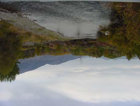
33 Dry Creek, Little Lost watershed. Photo courtesy of Lost River Ranger District, Salmon-Challis National Forest. Lower Little Lost watershed. Photo courtesy of Lost River Ranger District, Salmon-Challis National Forest. Borah Peak, Big Lost watershed. Photo courtesy of Lost River Ranger District, Salmon-Challis National Forest. Surprise Valley, Big Lost watershed. Photo courtesy of Lost River Ranger District, Salmon-Challis National Forest. 28


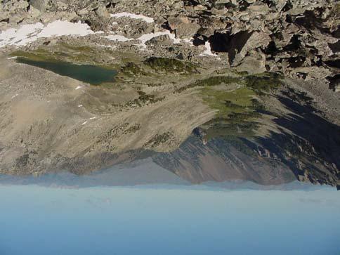
34 Bench Lake, Big Lost watershed. Photo courtesy of Lost River Ranger District, Salmon-Challis National Forest. Wildhorse Creek, Big Lost watershed. Photo courtesy of Lost River Ranger District, Salmon-Challis National Forest. East Fork Big Lost River, Big Lost watershed. Photo courtesy of Lost River Ranger District, Salmon-Challis National Forest. Big Lost River near Mackay, Big Lost watershed. Photo courtesy of Lost River Ranger District, Salmon-Challis National Forest. 29
Little Kern Golden Trout Status:
 Little Kern Golden Trout Status: The Little Kern Golden trout (LKGT) was proposed for federal listing as Threatened under the Endangered Species Act (ESA) on September 1, 1977 by the U. S. Fish and Wildlife
The Status of Fishes on the Middle Fork Ranger District, Salmon-Challis National Forest ( )
") The Status of Fishes on the, Salmon-Challis National Forest (2002-2008) Prepared by: Bart L. Gamett Jessica A. Bartel South Zone Fish Program Salmon-Challis National Forest Trout Unlimted Idaho Water Project
The Status of Fishes on the, Salmon-Challis National Forest (2002-2008) Prepared by: Bart L. Gamett Jessica A. Bartel South Zone Fish Program Salmon-Challis National Forest Trout Unlimted Idaho Water Project
NEVADA DEPARTMENT OF WILDLIFE STATEWIDE FISHERIES MANAGEMENT
 NEVADA DEPARTMENT OF WILDLIFE STATEWIDE FISHERIES MANAGEMENT FEDERAL AID JOB PROGRESS REPORTS F-20-52 2016 REDBAND TROUT EASTERN REGION NEVADA DEPARTMENT OF WILDLIFE, FISHERIES DIVISION ANNUAL JOB PROGRESS
NEVADA DEPARTMENT OF WILDLIFE STATEWIDE FISHERIES MANAGEMENT
 NEVADA DEPARTMENT OF WILDLIFE STATEWIDE FISHERIES MANAGEMENT FEDERAL AID JOB PROGRESS REPORT F-20-50 2014 LAHONTAN CUTTHROAT TROUT STUDY WESTERN REGION NEVADA DEPARTMENT OF WILDLIFE, FISHERIES DIVISION
1.Mill Creek Watershed Summary Description and Land Use
 1.Mill Creek Watershed Summary Description and Land Use Table xxx: Mill Creek Watershed Overview Watershed Size 31,435 acres/49.1 sq miles/ 127.1 sq km Elevation Range 5,594 feet [4,967-10,561] Stream
Burns Paiute Tribe Fisheries Department. Evaluate The Life History Of Native Salmonids Within The Malheur Subbasin Project #
 Burns Paiute Tribe Fisheries Department Evaluate The Life History Of Native Salmonids Within The Malheur Subbasin Project # 199701900 Prior to 1990 Technical and/or scientific background Malheur population,
NEVADA DIVISION OF WILDLIFE STATEWIDE FISHERIES MANAGEMENT FEDERAL AID JOB PROGRESS REPORTS F YELLOWSTONE CUTTHROAT TROUT EASTERN REGION
 NEVADA DIVISION OF WILDLIFE STATEWIDE FISHERIES MANAGEMENT FEDERAL AID JOB PROGRESS REPORTS F-20-48 2012 YELLOWSTONE CUTTHROAT TROUT EASTERN REGION NEVADA DEPARTMENT OF WILDLIFE, FISHERIES DIVISION ANNUAL
NEVADA DEPARTMENT OF WILDLIFE STATEWIDE FISHERIES MANAGEMENT FEDERAL AID JOB PROGRESS REPORTS F LAHONTAN CUTTHROAT TROUT EASTERN REGION
 NEVADA DEPARTMENT OF WILDLIFE STATEWIDE FISHERIES MANAGEMENT FEDERAL AID JOB PROGRESS REPORTS F-20-50 2014 LAHONTAN CUTTHROAT TROUT EASTERN REGION NEVADA DEPARTMENT OF WILDLIFE, FISHERIES DIVISION ANNUAL
Proposed Reclassification of Cherry Creek, North Platte River Basin, Wyoming. October 25, 2010
 Proposed Reclassification of Cherry Creek, North Platte River Basin, Wyoming October 25, 2010 Waterbody: Location: Tributary to: Cherry Creek - Mainstem from headwaters downstream to the confluence with
Parasitic Copepods (Salmincola sp.) and Fish Species Composition in Upper Willamette Reservoirs
 and Fish Species Composition in Upper Willamette Reservoirs") Parasitic Copepods (Salmincola sp.) and Fish Species Composition in Upper Willamette Reservoirs Jeremy D. Romer* Ryan Emig* Fred R. Monzyk Oregon Department of Fish and Wildlife Corvallis Research Lab
Parasitic Copepods (Salmincola sp.) and Fish Species Composition in Upper Willamette Reservoirs Jeremy D. Romer* Ryan Emig* Fred R. Monzyk Oregon Department of Fish and Wildlife Corvallis Research Lab
Amendment to a Biological Assessment/Evaluation completed for the Coon Creek Land Disposal completed December Grand Valley Ranger District
 Amendment to a Biological Assessment/Evaluation completed for the Coon Creek Land Disposal completed December 2007 Grand Valley Ranger District Grand Mesa, Uncompahgre, Gunnison National Forests Prepared
Proposed Reclassification of Deer Creek, North Platte River Basin, Wyoming
 Proposed Reclassification of Deer Creek, North Platte River Basin, Wyoming October 25, 2010 Waterbody: Location: Tributary to: Deer Creek - Mainstem from headwaters downstream to the confluence with the
P.O. Box 65 Hancock, Michigan USA fax
 This PDF file is a digital version of a chapter in the 2005 GWS Conference Proceedings. Please cite as follows: Harmon, David, ed. 2006. People, Places, and Parks: Proceedings of the 2005 George Wright
states and is considered an important asset to conservation and management actions.
 Westslope Cutthroat Trout (Oncorhynchus clarkii lewisi) Data: Status of Westslope Cutthroat trout in the United States: 2002; Partners: ID, MT, WY, FWS, FS, BLM, NPS, Tribes Status of the Westslope Cutthroat
NEVADA DEPARTMENT OF WILDLIFE STATEWIDE FISHERIES MANAGEMENT
 NEVADA DEPARTMENT OF WILDLIFE STATEWIDE FISHERIES MANAGEMENT FEDERAL AID JOB PROGRESS REPORTS F-20-52 2016 LAKE TAHOE WESTERN REGION NEVADA DEPARTMENT OF WILDLIFE, FISHERIES DIVISION ANNUAL PROGRESS REPORT
Alberta Conservation Association 2009/10 Project Summary Report. Project Name: Crowsnest Drainage Sport Fish Population Assessment Phase 1
 Alberta Conservation Association 2009/10 Project Summary Report Project : Crowsnest Drainage Sport Fish Population Assessment Phase 1 Fisheries Program Manager: Peter Aku Project Leader: Jason Blackburn
Backgrounder and Frequently Asked Questions
 Backgrounder and Frequently Asked Questions Who Sent the Letter? The 60-day Notice of Intent to File Suit was sent by Conservation Angler, Wild Fish Conservancy, Snake River Waterkeeper, Friends of the
Eastern Brook Trout. Roadmap to
 Eastern Brook Trout Roadmap to CONSERVATION Our Brook Trout heritage he wild Brook Trout is an American symbol of persistence, adaptability, and the pristine wilderness that covered North America prior
2012 Bring Back the Natives Awarded Projects
 2012 Bring Back the Natives Awarded Projects EZG # Organization Project Title Project Description Location Description Total Award Amount Grantee Non- Federal Match 31904 Sanctuary Forest, Inc. Mattole
1.Warm Springs Creek (Anaconda) Watershed Description and Land Use
 Watershed Description and Land Use") 1.Warm Springs (Anaconda) Watershed Description and Land Use Table xxx: Warm Springs Watershed Overview Watershed Size 92,288 acres/144.2 sq miles/373.6 sq km Elevation Range 5,781 feet [4,800-10,581]
1.Warm Springs (Anaconda) Watershed Description and Land Use Table xxx: Warm Springs Watershed Overview Watershed Size 92,288 acres/144.2 sq miles/373.6 sq km Elevation Range 5,781 feet [4,800-10,581]
THE WESTERN NATIVE TROUT INITIATIVE PLAN FOR STRATEGIC ACTIONS November GOALS, OBJECTIVES, and KEY STRATEGIC ACTIONS
 THE WESTERN NATIVE TROUT INITIATIVE PLAN FOR STRATEGIC ACTIONS November 2016 INTRODUCTION In January 2008, after an intensive scoping and development process, the Western Native Trout Initiative (WNTI)
NEVADA DEPARTMENT OF WILDLIFE STATEWIDE FISHERIES MANAGEMENT
 NEVADA DEPARTMENT OF WILDLIFE STATEWIDE FISHERIES MANAGEMENT FEDERAL AID JOB PROGRESS REPORTS F-20-48 2012 LAKE TAHOE WESTERN REGION Contents NEVADA DEPARTMENT OF WILDLIFE, FISHERIES DIVISION ANNUAL PROGRESS
Proposed Reclassification of Horse Creek, North Platte River Basin in Goshen County, Wyoming
 Proposed Reclassification of Horse Creek, North Platte River Basin in Goshen County, Wyoming October 25, 2010 Waterbody: Location: Tributary to: Horse Creek - Mainstem from the confluence with Stinking
Restoring the Kootenai: A Tribal Approach to Restoration of a Large River in Idaho
 Restoring the Kootenai: A Tribal Approach to Restoration of a Large River in Idaho Susan Ireland, Kootenai Tribe of Idaho Future of our Salmon Conference Technical Session August 2016 Healthy Floodplains,
Statement of Dr. Jack Williams Senior Scientist, Trout Unlimited. Before the
 Statement of Dr. Jack Williams Senior Scientist, Trout Unlimited Before the Subcommittee of Water and Power Energy and Natural Resources Committee United States Senate June 6, 2007 Mr. Chairman, Members
2011 Haha Lake Northern Pike Control
 2011 Haha Lake Northern Pike Control Prepared By: Christin Davis Ministry of Forests, Lands, and Natural Resource Operations #401-333 Victoria Street Nelson, BC V1L 4K3 Summary In 2005, northern pike (Esox
Steelhead Spawning Ground Surveys on the Entiat River, 2015.
 Steelhead Spawning Ground Surveys on the Entiat River, 2015. Kenneth Poczekaj and R.D. Nelle U.S. Fish and Wildlife Service Mid-Columbia River Fishery Resource Office Leavenworth, WA 98826 On the cover:
Catlow Valley Redband Trout
 Catlow Valley Redband Trout Existing Populations The Catlow Valley Redband Trout SMU is comprised of five populations (Table 1). Three exist in Home, Threemile, and Skull creeks, located on the east side
Status of the Yellowstone Cutthroat Trout:
 Yellowstone Cutthroat Trout (Oncorhynchus clarkii bouvieri) Data: Range-wide Status of Yellowstone Cutthroat trout 2001, 2007; Memorandum of Agreement for Conservation and Management of Yellowstone Cutthroat
Union Pacific Railroad
 Input Questions: 404/401 Pre Application Meeting, December 18, 2013, Portland, Oregon 1. What is the project purpose and need? The purpose of the project is to improve the efficiency and average velocity
Ecology and control of invasive Northern Pike in the Columbia River, Canada
 Ecology and control of invasive Northern Pike in the Columbia River, Canada Brian Heise, Daniel Doutaz, Matthias Herborg, Matt Neufeld, David Derosa, Jeremy Baxter 19 th International Conference on Aquatic
NEVADA DEPARTMENT OF WILDLIFE STATEWIDE FISHERIES MANAGEMENT
 NEVADA DEPARTMENT OF WILDLIFE STATEWIDE FISHERIES MANAGEMENT FEDERAL AID JOB PROGRESS REPORTS F-20-49 2013 LAKE TAHOE WESTERN REGION NEVADA DEPARTMENT OF WILDLIFE, FISHERIES DIVISION ANNUAL PROGRESS REPORT
David K. Hering and Mark W. Buktenica, Crater Lake National Park
 Eradication of Nonnative Trout and the Response of Threatened Bull Trout at Crater Lake National Park: Extending Conservation Across Park Boundaries to a Watershed Scale David K. Hering and Mark W. Buktenica,
NEVADA DEPARTMENT OF WILDLIFE STATEWIDE FISHERIES MANAGEMENT
 NEVADA DEPARTMENT OF WILDLIFE STATEWIDE FISHERIES MANAGEMENT FEDERAL AID JOB PROGRESS REPORTS F-20-52 2016 Lake Tahoe Rainbow Trout Study WESTERN REGION NEVADA DEPARTMENT OF WILDLIFE, FISHERIES DIVISION
Maryland Chapter Trout Unlimited Brook Trout Conservation Effort
 Maryland Chapter Trout Unlimited Brook Trout Conservation Effort Photo by Matt Kline Portfolio of Recent Work MDTU Brook Trout Conservation Coordinator: Scott C. Scarfone, ASLA sscarfone@oasisdesigngroup.com
Chagrin River TMDL Appendices. Appendix F
 Appendix F The following are excerpts from the Eastern Brook Trout Joint Venture s Conservation Strategy (Working Draft v.6), Conserving the Eastern Brook Trout: Strategies for Action Found at: http://www.easternbrooktrout.org/constrategy.html
Western native Trout Status report
 Bull trout (Salvelinus confluentus) Data: Draft Recovery Plan, USFWS, 2002; FR Final Critical Habitat Rule - 2005 Partners: ID, MT, OR, WA, NV, FWS, FS, BLM, NPS, Tribes, AK, Canada Species Status review:
The Blue Heron Slough Conservation Bank
 1 The Blue Heron Slough Conservation Bank CONSERVATION BANKING July 19-23, 2010 CASE STUDY SERIES The Blue Heron Slough Conservation Bank (Washington) I. OVERVIEW & BACKGROUND: Location: Snohomish River
Rehabilitation of Grimes Creek, a Stream Impacted in the Past by Bucket-lined Dredge Gold Mining, Boise River Drainage, July 2008 to August 2011.
 Rehabilitation of Grimes Creek, a Stream Impacted in the Past by Bucket-lined Dredge Gold Mining, Boise River Drainage, July 2008 to August 2011. Pam Harrington TU,1020 W. Main Street Suite 440, Boise,
Table xxx: Listed and Suspected Impairments for Willow Creek 2010 Reach Impairment Pollutant Impaired Uses
 1. (Fairmont) Watershed Summary Description and Land Use Table xxx: (Fairmont) Watershed Overview Watershed Size 18,331 acres/28.7 sq miles/74.3 sq km Elevation Range 2,615 feet [4,980-7,595] Stream Miles
Lower Dolores River Corridor Planning Meeting Jim White Colorado Division of Wildlife
 Lower Dolores River Corridor Planning Meeting Jim White Colorado Division of Wildlife Objectives Overview of cold and warm water fishes in the Dolores River including: Flow and Fish Management Distribution
Alberta Conservation Association 2018/19 Project Summary Report. Project Name: North Saskatchewan River Drainage Fish Sustainability Index Data Gaps
 Alberta Conservation Association 2018/19 Project Summary Report Project Name: North Saskatchewan River Drainage Fish Sustainability Index Data Gaps Fisheries Program Manager: Peter Aku Project Leader:
CUSHMAN RESERVOIRS. Skokomish Watershed Monitoring Conference - Public Meeting Florian Leischner 9/17/2015
 CUSHMAN RESERVOIRS Skokomish Watershed Monitoring Conference - Public Meeting Florian Leischner 9/17/2015 CUSHMAN RESERVOIRS MONITORING Management and monitoring of Tacoma Power reservoirs Lake Cushman
NEVADA DEPARTMENT OF WILDLIFE STATEWIDE SPORT FISHERIES MANAGEMENT
 NEVADA DEPARTMENT OF WILDLIFE STATEWIDE SPORT FISHERIES MANAGEMENT FEDERAL AID JOB PROGRESS REPORT F-20-53 2017 RUBY MOUNTAIN & EAST HUMBOLDT HIGH MOUNTAIN LAKES NEVADA DEPARTMENT OF WILDLIFE, FISHERIES
6TH PELLETIER BROOK LAKE T15 R9, Aroostook Co. U.S.G.S. Gardner Pond, Maine (7 1/2 )
") 6TH PELLETIER BROOK LAKE T15 R9, Aroostook Co. U.S.G.S. Gardner Pond, Maine (7 1/2 ) Fishes Brook trout Minnows Blacknose dace Pearl dace Physical Characteristics Area - 27 acres Average depth - 2 feet
6TH PELLETIER BROOK LAKE T15 R9, Aroostook Co. U.S.G.S. Gardner Pond, Maine (7 1/2 ) Fishes Brook trout Minnows Blacknose dace Pearl dace Physical Characteristics Area - 27 acres Average depth - 2 feet
Endangered and Threatened Wildlife and Plants; Recovery Plan for the. SUMMARY: We, the U.S. Fish and Wildlife Service (Service), announce the
, announce the") This document is scheduled to be published in the Federal Register on 09/30/2015 and available online at http://federalregister.gov/a/2015-24670, and on FDsys.gov Billing Code 4310 55 DEPARTMENT OF THE
This document is scheduled to be published in the Federal Register on 09/30/2015 and available online at http://federalregister.gov/a/2015-24670, and on FDsys.gov Billing Code 4310 55 DEPARTMENT OF THE
Warner Lakes Redband Trout
 Warner Lakes Redband Trout Existing Populations Warner Valley is an endorheic basin that contains a complex series of interconnected lakes, marshes, sloughs, and potholes, all of which are remnants of
A Comparison of Western Watershed Councils. Presentation Prepared by Jeff Salt, Great Salt Lakekeeper
 A Comparison of Western Watershed Councils Presentation Prepared by Jeff Salt, Great Salt Lakekeeper Presentation Overview Introduction Jordan River Watershed Council Lower Boise Watershed Council Clackamas
Estimating Valley Confinement using DEM Data to Support Cutthroat Trout Research
 Estimating Valley Confinement using DEM Data to Support Cutthroat Trout Research David Nagel GIS Analyst/Physical Scientist USDA Forest Service, Rocky Mountain Research Station Boise Lab Boise Aquatic
[FWS R1 ES 2015 N076; FXES FF01E00000] Endangered and Threatened Wildlife and Plants; Revised Draft Recovery Plan for
![[FWS R1 ES 2015 N076; FXES FF01E00000] Endangered and Threatened Wildlife and Plants; Revised Draft Recovery Plan for](/thumbs/87/96960993.jpg "[FWS R1 ES 2015 N076; FXES FF01E00000] Endangered and Threatened Wildlife and Plants; Revised Draft Recovery Plan for") This document is scheduled to be published in the Federal Register on 06/04/2015 and available online at http://federalregister.gov/a/2015-13624, and on FDsys.gov DEPARTMENT OF THE INTERIOR Fish and Wildlife
This document is scheduled to be published in the Federal Register on 06/04/2015 and available online at http://federalregister.gov/a/2015-13624, and on FDsys.gov DEPARTMENT OF THE INTERIOR Fish and Wildlife
Elkhorn Creek Westslope Cutthroat Restoration Efforts
 Elkhorn Creek Westslope Cutthroat Restoration Efforts March 2013 A report submitted to WNTI by David Moser Montana Fish, Wildlife & Parks Summary: During the summer of 2012, Montana Fish, Wildlife & Parks
DOWNLOAD OR READ : TROUT STREAMS OF WESTERN NEW YORK PDF EBOOK EPUB MOBI
 DOWNLOAD OR READ : TROUT STREAMS OF WESTERN NEW YORK PDF EBOOK EPUB MOBI Page 1 Page 2 trout streams of western new york trout streams of western pdf trout streams of western new york Interior Redband
Willamette River Oregon Chub
 Willamette River Oregon Chub Interim Risk Assessment Oregon chub (Oregonichthys crameri), small minnows endemic to the Willamette Valley, were federally listed as endangered under the Endangered Species
ESCA. Endangered Species Conservation Act of 1969 Changed in 1973 to ESA Amended several times
 ESCA Endangered Species Conservation Act of 1969 Changed in 1973 to ESA Amended several times International Efforts http://www.cites.org/ Convention on International Trade in Endangered Species of Wild
Golden Eggs: Kern River Hatchery and the Conservation of California s State Fish
 Golden Eggs: Kern River Hatchery and the Conservation of California s State Fish Christy McGuire Associate Fishery Biologist California Dept. of Fish and Game Northwest Fish Culture Conference December
Columbia Lake Dam Removal Project
 Columbia Lake Dam Removal Project The Columbia Lake dam located 1/4 mile upstream of the Paulins Kill River's confluence with the Delaware River in Knowlton Township, Warren County has been proposed for
ADOPTED REGULATION OF THE BOARD OF WILDLIFE COMMISSIONERS. LCB File No. R September 25, 1998
 ADOPTED REGULATION OF THE BOARD OF WILDLIFE COMMISSIONERS LCB File No. R137-98 September 25, 1998 EXPLANATION Matter in italics is new except for scientific names; scientific names that are underscored
Fisheries Management Plan Idaho Department of Fish and Game
 Fisheries Management Plan 2007-2012 2012 Idaho Department of Fish and Game Plan History 1981-1985 1985 Plan Separate anadromous plan Evolved from 5 to 6-year 6 plan Angler Opinion Survey The Process Public-Agency
STATE OF NEVADA BOARD OF WILDLIFE COMMISSIONERS
 STATE OF NEVADA BOARD OF WILDLIFE COMMISSIONERS Number: P-33 Title: Fisheries Management Program Commission Policy Number 33 References: NRS 501.105, 501.181 Effective Date: July 24, 1999 Reviewed Date:
PRE- PROPOSAL FORM - Lewis River Aquatic Fund
 PRE- PROPOSAL FORM - Lewis River Aquatic Fund 1. Applicant organization. USDA Forest Service Gifford Pinchot National Forest 2. Organization purpose Resource management agency 3. Project manager (name,
In the Office of Endangered Species Fish and Wildlife Service United States Department of Interior ) ) ) ) ) ) ) ) ) ) ) ) ) ) ) ) )
 ) ) ) ) ) ) ) ) ) ) ) ) ) ) ) )") In the Office of Endangered Species Fish and Wildlife Service United States Department of Interior WESTERN WATERSHEDS PROJECT P.O. Box 141 Clayton, Idaho 83227 Petitioner Petition for a rule to list the
In the Office of Endangered Species Fish and Wildlife Service United States Department of Interior WESTERN WATERSHEDS PROJECT P.O. Box 141 Clayton, Idaho 83227 Petitioner Petition for a rule to list the
Executive Summary. Map 1. The Santa Clara River watershed with topography.
 Santa Clara River Steelhead Trout: Assessment and Recovery Opportunities December 2005 Prepared By: Matt Stoecker and Elise Kelley, Ph.D. University of California, Santa Barbara Prepared For: The Santa
Oregon Administrative Rules Oregon Department of Fish and Wildlife
 DIVISION 500 Fish Management Plans 635-500-0002 Purpose The administrative rules contained in this division are the legally enforceable elements of fish management plans. Fish management plans are comprehensive
Lahontan Cutthroat Trout in the Upper Truckee River: Restoration of a Threatened Species in a Fluvial Headwater Environment
 Lahontan Cutthroat Trout in the Upper Truckee River: Restoration of a Threatened Species in a Fluvial Headwater Environment Project Area N Expansion Area 2008-2011: beginning of manual removal of brook
Ecology of Columbia River redband trout (Oncorhynchus mykiss gairdneri) in high desert streams
 in high desert streams") Ecology of Columbia River redband trout (Oncorhynchus mykiss gairdneri) in high desert streams Dry Creek October 2012 Chris A. Walser Ph.D., Professor of Biology Department of Biology and Environmental
Ecology of Columbia River redband trout (Oncorhynchus mykiss gairdneri) in high desert streams Dry Creek October 2012 Chris A. Walser Ph.D., Professor of Biology Department of Biology and Environmental
Encampment River-Elk River drainage divide area landform origins along USA Missouri River drainage basin landform origins research project
 10/5/12 7:30 PM Encampment River-Elk River drainage divide area landform origins along the continental divide in the Wyoming and Colorado Sierra Madre Mountains and Park Range, USA October 5, 2012! Colorado,
FISH PASSAGE IMPROVEMENT in California s Watersheds. Assessments & Recommendations by the Fish Passage Forum
 FISH PASSAGE IMPROVEMENT in California s Watersheds Assessments & Recommendations by the Fish Passage Forum FISH PASSAGE IMPROVEMENT in California s Watersheds The mission of the Fish Passage Forum is
Probabilistic models for decision support under climate change:
 Probabilistic models for decision support under climate change: An example using bull trout in the Boise River basin Douglas Peterson 1 US Fish and Wildlife Service Abernathy Fish Technology Center Longview,
FISHERIES BLUE MOUNTAINS ADAPTATION PARTNERSHIP
 FISHERIES A warming climate, by itself, substantially affects the hydrology of watersheds in the Blue Mountains. Among the key hydrologic changes projected under all scenarios for the 2040s and beyond
Aquatic Biological Assessment. Lassen 15 Restoration Project. Modoc National Forest Warner Mountain Ranger District
 Aquatic Biological Assessment Lassen 15 Restoration Project Modoc National Forest Warner Mountain Ranger District Prepared By:_/s/ Marty Yamagiwa Date: December 10, 2015 Marty Yamagiwa, Natural Resources
NEVADA DEPARTMENT OF WILDLIFE STATEWIDE FISHERIES MANAGEMENT
 NEVADA DEPARTMENT OF WILDLIFE STATEWIDE FISHERIES MANAGEMENT FEDERAL AID JOB PROGRESS REPORT F-20-52 2016 LAHONTAN CUTTHROAT TROUT STUDY WESTERN REGION NEVADA DEPARTMENT OF WILDLIFE, FISHERIES DIVISION
NEVADA DEPARTMENT OF WILDLIFE STATEWIDE FISHERIES MANAGEMENT FEDERAL AID JOB PROGRESS REPORT F STREAM FISHERIES MANAGEMENT WESTERN REGION
 NEVADA DEPARTMENT OF WILDLIFE STATEWIDE FISHERIES MANAGEMENT FEDERAL AID JOB PROGRESS REPORT F-20-50 2014 STREAM FISHERIES MANAGEMENT WESTERN REGION NEVADA DEPARTMENT OF WILDLIFE, FISHERIES DIVISION ANNUAL
5B. Management of invasive species in the Cosumnes and Mokelumne River Basins
 5B. Management of invasive species in the Cosumnes and Mokelumne River Basins Cosumnes River The Cosumnes River basin has a number of distinct habitat types that require different management strategies
Fish Community. Fish Habitat, Streams and Rivers
 Clear, Ston(e)y and White Lake Plan Fish Community The lakes support a cool/warm water fishery including muskellunge, walleye, largemouth and smallmouth bass, yellow perch, pumpkinseed, rockbass, blue
Trip Report: Eagle Creek, Arizona
 Trip Report: Eagle Creek, Arizona 15-17 June 2009 Participants: Abraham Karam, Brian Kesner, and Mike Childs Native Fish Lab Marsh & Associates, LLC 5016 South Ash Avenue Suite 108 Tempe, Arizona 85282
CHAPTER 4 DESIRED OUTCOMES: VISION, GOALS, AND OBJECTIVES
 CHAPTER 4 DESIRED OUTCOMES: VISION, GOALS, AND OBJECTIVES Vision One of the first steps in developing this Plan was articulating a vision - a clear statement of what the Plan strives to achieve and what
LAKE DIANE Hillsdale County (T8-9S, R3W, Sections 34, 3, 4) Surveyed May Jeffrey J. Braunscheidel
 Surveyed May Jeffrey J. Braunscheidel") Michigan Department of Natural Resources Status of the Fishery Resource Report No. 2003-4, 2003 LAKE DIANE Hillsdale County (T8-9S, R3W, Sections 34, 3, 4) Surveyed May 2001 Jeffrey J. Braunscheidel Environment
Michigan Department of Natural Resources Status of the Fishery Resource Report No. 2003-4, 2003 LAKE DIANE Hillsdale County (T8-9S, R3W, Sections 34, 3, 4) Surveyed May 2001 Jeffrey J. Braunscheidel Environment
Climate Change Adaptation and Stream Restoration. Jack Williams;
 Climate Change Adaptation and Stream Restoration Jack Williams; jwilliams@tu.org 1 Goals for this presentation Develop strategies for adapting streams to climate impacts by Thinking like a watershed Understanding
NEVADA DEPARTMENT OF WILDLIFE STATEWIDE FISHERIES MANAGEMENT
 NEVADA DEPARTMENT OF WILDLIFE STATEWIDE FISHERIES MANAGEMENT FEDERAL AID JOB PROGRESS REPORTS F-2-52 216 CHIMNEY RESERVOIR WESTERN REGION NEVADA DEPARTMENT OF WILDLIFE, FISHERIES DIVISION JOB PROGRESS
Kootenai Tribe of Idaho
 Kootenai Tribe of Idaho Implementation of Conservation Aquaculture Restoration of Kootenai River White Sturgeon and Burbot William Barquin Attorney General, Kootenai Tribe of Idaho Kootenai Tribe of Idaho
Final Fish Salvage & Temporary Tailrace Barrier Report for the Wallowa Falls Hydroelectric Project Tailrace. (FERC No. P-308) December 20, 2018
 December 20, 2018") Final Fish Salvage & Temporary Tailrace Barrier Report for the Wallowa Falls Hydroelectric Project Tailrace (FERC No. P-308) December 20, 2018 Prepared by: Jeremiah Doyle PacifiCorp 825 NE Multnomah Street
Final Fish Salvage & Temporary Tailrace Barrier Report for the Wallowa Falls Hydroelectric Project Tailrace (FERC No. P-308) December 20, 2018 Prepared by: Jeremiah Doyle PacifiCorp 825 NE Multnomah Street
For next Thurs: Jackson et al Historical overfishing and the recent collapse of coastal ecosystems. Science 293:
 For next Thurs: Jackson et al. 2001. Historical overfishing and the recent collapse of coastal ecosystems. Science 293: 629-637. Resource: means of supplying a want or deficiency, from French resourdre
Elementa: Science of the Anthropocene
 Elementa: Science of the Anthropocene http://dx.doi.org/10.12952/journal.elementa.000042.s003 Figure S3. Supporting information for the article Recovery of a mining-damaged stream ecosystem by Mebane,
Alberta Conservation Association 2017/18 Project Summary Report
 Alberta Conservation Association 2017/18 Project Summary Report Project Name: Abundance, Distribution, Spawning, and Thermal Habitat of Westslope Cutthroat Trout and Bull Trout in the Stimson Creek Watershed
Protection Measures Against Exotic Species
 MONTANA AUDUBON P.O. Box 595 Helena, MT 59624 406-443-3949 mtaudubon@mtaudubon.org April 9, 2010 MO River Reservoir Management Plan Montana Fish, Wildlife & Parks P.O. Box 200701 Helena, MT 59620-0701
FINAL Fish Salvage Plan for the Wallowa Falls Hydroelectric Project Tailrace. (FERC No. P-308) April 19, 2017
 April 19, 2017") FINAL for the Wallowa Falls Hydroelectric Project Tailrace (FERC No. P-308) April 19, 2017 Prepared by: Jeremiah Doyle PacifiCorp 825 NE Multnomah Street Portland, OR 97232 April 19, 2017 Page 1 of 10
FINAL for the Wallowa Falls Hydroelectric Project Tailrace (FERC No. P-308) April 19, 2017 Prepared by: Jeremiah Doyle PacifiCorp 825 NE Multnomah Street Portland, OR 97232 April 19, 2017 Page 1 of 10
Invasive Fish in the Cariboo Region. Russell Bobrowski Fisheries Biologist, BC Gov Cariboo Region Dec 19, 2017
 Invasive Fish in the Cariboo Region Russell Bobrowski Fisheries Biologist, BC Gov Cariboo Region Dec 19, 2017 Cariboo - Fishery Combination of productive lake and river fisheries 700 lakes with known game
Oregon Department of Fish and Wildlife: Inland Fisheries - Hatchery Management
 Oregon Department of Fish and Wildlife: Inland Fisheries - Hatchery Management Primary Outcome Area: Economy & Jobs Secondary Outcome Area: Healthy Environments Program Contact: Ed Bowles, 503-947-6206
FISHERIES MANAGEMENT PLAN
 FISHERIES MANAGEMENT PLAN 2007-2012 INTRODUCTION The 2007 2012 Fisheries Management Plan describes the management direction of the Idaho Department of Fish and Game (Department) over the next six years
U.S. Fish and Wildlife Service Native American Crosscut Funding
 U.S. Fish and Wildlife Service Native American Crosscut Funding Tribal / Interior Budget Council National Budget Meeting L Enfant Plaza Hotel Washington, DC November 8, 2013 U.S. Fish and Wildlife Service
THE coexistence of ecologically similar species
 Copeia, 24(3), pp. 617 623 Factors Affecting Allopatric and Sympatric Occurrence of Two Sculpin Species across a Rocky Mountain Watershed MICHAEL C. QUIST, WAYNE A. HUBERT, AND DANIEL J. ISAAK We assessed
Concurrent Sessions C: Prioritization - Oregon Fish Passage Priority List - A Statewide Barrier Prioritization Effort
 University of Massachusetts - Amherst ScholarWorks@UMass Amherst International Conference on Engineering and Ecohydrology for Fish Passage International Conference on Engineering and Ecohydrology for Fish
FACT SHEET I. LOCATION
 STEAMBOAT ISLAND HABITAT REHABILITATION AND ENHANCEMENT PROJECT (HREP) SCOTT COUNTY, IOWA, UPPER MISSISSIPPI RIVER RESTORATION-ENVIRONMENTAL MANAGEMENT PROGRAM ROCK ISLAND DISTRICT FACT SHEET I. LOCATION
Alberta Conservation Association 2018/19 Project Summary Report
 Alberta Conservation Association 2018/19 Project Summary Report Project Name: Ram River Bull Trout Assessment Fisheries Program Manager: Peter Aku Project Leader: Chad Judd Primary ACA staff on project:
Mountain Snake Province
 Rolling Provincial Review: Implementation 2001-2003 Province 253 Columbia Basin Fish & Wildlife Authority Province FY 2001-2003 Spending Summaries NPCC Recommendations and BPA Spending by Project Category,
Frequently Asked Questions About Revised Critical Habitat and Economic Analysis for the Endangered Arroyo Toad
 Q Frequently Asked Questions About Revised Critical Habitat and Economic Analysis for the Endangered Arroyo Toad Q. What is the arroyo toad? The arroyo toad (Bufo californicus) is a small, light greenish-grey
STEELHEAD SURVEYS IN OMAK CREEK
 STEELHEAD SURVEYS IN OMAK CREEK 2002 Annual Report Prepared by Chris Fisher John Arterburn Colville Confederated Tribes Fish and Wildlife Department P.O. Box 150 Nespelem, WA 99155 Prepared for Project
Early History, Prehistory
 History of Management of Large Mammals in North America What experience and history teach us is this that nations and governments have never learned anything from history, or acted upon any of the lessons
State of San Francisco Bay 2011 Appendix O Steelhead Trout Production as an Indicator of Watershed Health
 State of San Francisco Bay 2011 Appendix O Steelhead Trout Production as an Indicator of Watershed Health Gordon Becker and Katherine Smetak, Center for Ecosystem Management and Restoration 290 Introduction
Indiana Administrative Code Page IAC Aquaculture permit Authority: IC Affected: IC Sec. 17. (a) A person must not
 A person must not") Indiana Administrative Code Page 71 312 IAC 9-10-17 Aquaculture permit Affected: IC 14-22-27 Sec. 17. (a) A person must not import, raise, sell, or transport fish into or within Indiana without an aquaculture
Indiana Administrative Code Page 71 312 IAC 9-10-17 Aquaculture permit Affected: IC 14-22-27 Sec. 17. (a) A person must not import, raise, sell, or transport fish into or within Indiana without an aquaculture