2015 Annual Report. February 15, 2016
|
|
|
- Andra McCoy
- 5 years ago
- Views:
Transcription

1 2015 Annual Report February 15, 2016

2 2015 Round Lake Management Commission (RLMC) Annual Report Contents The Round Lake Mgt Commission 2015 Year in Review Huebner Fishery Mgt Foundation Shoreline Restoration / Demonstration Project 2016 and Beyond 2
3 Round Lake Management Commission Purpose: Provide a Safe, Clean and Pleasant Lake for the Enjoyment of All Area Residents Methods: Protection, Maintenance, Enhancement of our Natural Resource History: Formed in 2003 by an intergovernmental agreement between the Villages of Round Lake, Round Lake Beach and Round Lake Park for the betterment of Round Lake, surrounding lakes and the Round Lake Watershed (includes Highland & Cranberry Lakes) 3
4 Round Lake Management Commission 4 Village Round Lake Beach Chris Siegel Vivien Protine Jeff Poynter Tim Pasternak Village of Round Lake Park Bob Cerretti (Treasurer) Dave Strom Village of Round Lake Open Round Lake Area Park District Frank Palmisano, Jr.
5 Round Lake Management Commission Recognized by: State of Illinois: 2006 Governor s Home Town Award with the Village of Round Lake Beach Illinois Lakes Management Association: 2008 Frank Loftus Lake Stewardship Award.ILMA s 1 st awarded to a group! Round Lake Area Park District: 3 time Community Service Award recipient! 5
 drainage of the Fox River watershed Elevation: 763 feet above")
6 Round Lake Facts & Figures Size: acres Shoreline: 4.4 miles Maximum Depth: 32 feet Average Depth: 8 feet Volume: 600 million gallons Watershed: Part of Squaw Creek (Long Lake) drainage of the Fox River watershed Elevation: 763 feet above sea level Municipal Boundaries: Village of Round Lake Village of Round Lake Beach Village of Round Lake Park Public Access Points: 2 6
7 2015 Year in Review Illinois Lakes Management Association SCALE Grant (IL EPA) Fishing Line Recycling Program Volunteer Water Clarity Lake Monitoring Invasives, Invaders and Impact Commission Boat Shoreline Restoration / Demonstration Project Huebner Fishery Management Foundation Events Annual Family Fishing Event Annual Shoreline Clean Up Pre-Summer Free Paddling Day Beginning Paddling Classes and Paddling Clinic Saturdays Fishing Should Be Fun - Kids Fishing Derby End of Summer Round Lake Clean Up Day Sunset Paddle on Round Lake Historical Tour On Round Lake Fish Stocking Residential Shoreline Restoration Grant Program 7


8 Illinois Lakes Management Association Tim Pasternak, Membership Secretary Round Lake Mgmt. Commission 1933 Oaktree Trail, Round Lake Beach, IL Phone:

9 Streambank Cleanup And Lakeshore Enhancement (SCALE) Grant * RLMC was awarded the grant, however, due to available funding for the RLMC, we asked that the grant go to another applicant. 9


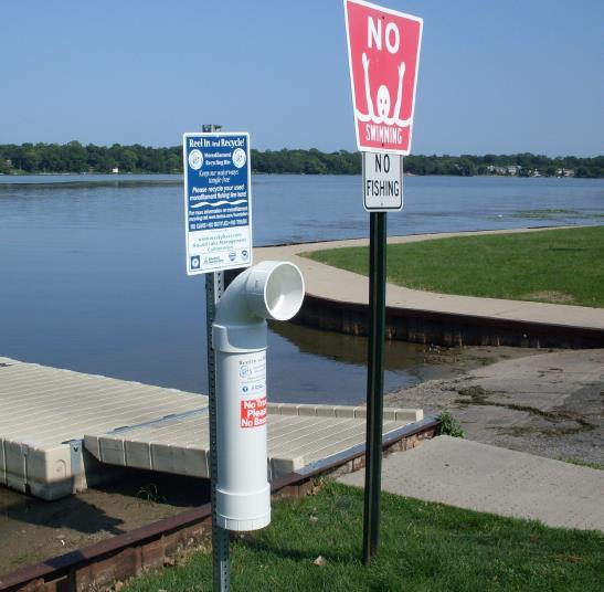
10 Fishing Line Recycle Program 10

11 Illinois Volunteer Lake Monitoring Program Initiated by Illinois Environmental Protection Agency (IEPA) Unites citizens, state agency staff and regional planning commissions to monitor the quality of Illinois lakes Volunteers measure lake water transparency or clarity, typically 2x a month from May through October IEPA used for: Local lake & watershed management decision making Biennial assessment of State s waters as required by the Federal Clean Water Act 11


 Boaters & Anglers Carp")


12 Invasives, Invaders and IMPACT Canada Geese Phosphorus Based Fertilizer (Village of RL & others still allow!) Boaters & Anglers Carp Contribute to: Zebra Mussels Algae (1# of phosphorus can produce up to 500 # of algae!) Shoreline Erosion 12


13 RLMC Motorboat Random boat patrol of the lake as volunteer time allows. Focus on safety, education, and re-enforcement of proper boating behavior by presence on the lake. Stored at Alpine Country Club.Thank You! 13
14 Round Lake Shoreline Restoration / Demonstration Area RLMC met with Integrated Lakes Management, Inc. (ILM), in 2012 in order to help develop a Shoreline Restoration Proposal for the Northwest section of Round Lake. Through continued conversations with ILM and the Village of Round Lake Beach, the development of a Comprehensive Lake Report, and the increased involvement of the RLAPD, the RLMC was able to develop a realistic plan for a Shoreline Restoration / Demonstration Area. This project will serve to not only restore a section of the shoreline, but also provide an example to residents on Round Lake and surrounding communities of ways to restore their respective shorelines as well. The project was approved by the Village of Round Lake Beach and is currently in the permitting and review phase with the Army Corp of Engineers and the Stormwater Management Commission. Anticipating a Spring 2016 start to the project. 14

15 Round Lake Shoreline Restoration / Demonstration Area cont d Pictured below is a diagram of one of the methods of the restoration project (Coconut Fiber Roll with plantings) 15

16 Huebner Fishery Management Foundation Programs and Updates Through the Round Lake Area Park District 16
17 Huebner Fishery Management Foundation The Huebner Fishery Management Foundation was created after the passing of John Huebner, a long time resident of Round Lake and advocate of fishing, recreation, and conservation. Through the assistance of the Huebner Fishery Management Foundation and John Huebner s vision, the Round Lake Area Park District is working to promote good fishing for all age and skill levels, the achievement of a reasonably diverse fish population, and the safe enjoyment of all water recreation activities through public opportunities and education. 17


18 Family Fishing Event 5/2/15 Special Event held at Round Lake Beach s Lakefront Park. This family event encourages families to come out and fish on Round Lake. Fishing equipment was made available to loan out for people who did not have any, and there was a free raffle along with kids games & activities, photo opportunities, and music. Over 200 people attended this annual event. Raffle prizes, including a kayak and paddling equipment were awarded at this year s event. 18


19 RLMC Clean Up Day 5/16/15 The RLMC, RLAPD staff, and volunteers spent the morning cleaning up the shoreline of Round Lake and its channels. Several hundred pounds of trash was removed from the lake. Over sixty (60) people, including several scouting groups participated. Advertising to the community through the Park District brochure, website, and Facebook page, along with assistance of the Huebner Boat and Park District staff. 19
20 Free Paddling Day 5/30/15 This program serves as a kickoff to the paddling season on Round Lake. Ten (10) people were registered for the event, however, inclement weather prevented the program from taking place. The registrants were a mixture of previous and new participants. 20
21 Beginning Paddling Classes and Paddling Clinic Saturdays Paddling Classes and Clinics were offered in summer 2015 to the community. Two (2) participants came to each paddling class of the 2015 season. 20 total participants came to the Paddling Clinic Saturdays Programs offered in


22 Fishing Should Be Fun Fishing Derby 7/25/15 This annual kids fishing derby hosted by the Competition Bassmasters of Northern Illinois was put on in conjunction with the RLMC and the RLAPD. Children spent the morning learning about safe fishing and boating, trying their hand at casting, and fishing along the shore of Round Lake. Over 90 children and their parents came out to this family friendly event. 22
23 Sunset Paddle on Round Lake 8/28/15 Nine (9) participants signed up for a rare opportunity to paddle around Round Lake as the moon was rising and the sun was setting. 23


24 End of the Summer Round Lake Clean Up Day 9/12/15 RLAPD staff and volunteers spent the morning cleaning up the shoreline of Round Lake and its channels. Several hundred pounds of trash was removed from the lake. 24
25 Round Lake Historical Tour 9/20/15 18 people had the opportunity to either ride on a pontoon boat, or paddle a kayak around Round Lake and learn about the history of the lake and those who have lived here. This year the event was so popular we did three tours around the lake. One of the tours consisted of residents and staff from Lamb s Farm. 25


26 Fish Stocking Based on recommendations from recent IDNR fish surveys of Round Lake, Northern Pike and Walleye were stocked in Round Lake by Richmond Fisheries. In addition we were able to stock small mouth bass as well, due in part by a donation from Anglers Unlimited. 700 Walleye (7-9 inches) 110 Northern Pike (12-15 inches) 125 Small Mouth Bass 26


27 Fish Stocking-Results! 17 inch Walleye 34 inch Northern Pike 27
28 2015 Programs and Achievements During 2015 Fiscal Year, the RLAPD was able to offer a variety of programs and services through the assistance and support of the HFMF. Programs consisted of educational, recreational, and environmental opportunities for a variety of ages. Wetland and Aquatic themed summer camps offered throughout the summer. Paddling Mondays for the RLAPD Teen Camp campers throughout the summer. 28
29 Residential Shoreline Restoration Grant The Residential Shoreline Restoration Grant (RSRG) offers residents on Round Lake and its channels a funding opportunity to improve the shoreline on their property. Residents can apply to be awarded the grant to aide them in consulting with ILM and the development and implementation of shoreline improvement on their property. 29
30 Other Programs and Services Contracted Integrated Lakes Management, Inc. (ILM) to do an Aquatic Plant Survey of Round Lake. This survey will serve as the next step in addressing invasive aquatic plants in and around Round Lake 30

31 Commission Finances: 2015 Income RLP Annual Donation, $500 RL Annual Donation, $500 Anglers Unlimited, $200 RLAPD Donation, $500 RLB Annual Donation, $1,500 Total: $3,200 31
, ($50) Reimbursement for Award Plaques,")
 Total:")
32 Commission Finances: 2015 Expenditures ILMA Dues (2015), ($50) Reimbursement for Award Plaques, ($50) Fish Stocking - Small Mouth Bass, ($400) ILMA Annual Conference Attendance, ($223) Total: ($723) 32
33 Commission Finances: 2015 Summary 2014 Carry Over: $8,931 Income: $3,200 Expenditures: ($723) Cash on Hand: $162 Balance as of 1/1/16: $11,570 33
34 RLMC Partnerships Villages of Round Lake Beach, Round Lake Park & Round Lake Mayors Lucassen, Hill, & MacGillis, Village Trustees, and Staff, RLB & RLP Public Works Round Lake Area Park District Huebner Fishery Management Foundation Alpine Country Club Competition Bassmasters of Northern Illinois Anglers Unlimited Lake County Health Department Environ. Services Team Illinois Lakes Management Association Volunteer Residents 34
35 Funding RLMC Partnerships, con t Villages of RL, RLB, RLP, & RLAPD: Annual Contributions Huebner Fishery Management Foundation RLMC Appointees Increase RLP Representation: Currently the minimum of 2 appointee positions are filled, with 3 available. Establish RL Representation: Currently none of the available 5 appointee positions are filled. 35
36 2016 & Beyond Visions/Plans Maintain & Build Partnerships Villages of Round Lake, Round Lake Beach, Round Lake Park and Round Lake Area Park District Huebner Fishery Management Foundation Alpine & Other Resident Groups Illinois Lakes Management Association Round Lake Shoreline Restoration / Demonstration Area Continue work on the Shoreline Restoration / Demonstration project 36
37 2016 & Beyond Visions/Plans Activities and Volunteer Opportunities Lake Patrol with RLB Police Marine Unit Annual Kids Fishing Derby Annual Shoreline Clean Up Events Environmental Education Historical Tour on the Lake Multiple Paddling Events Fish Stocking 37
38 2016 & Beyond Visions/Plans, con t Continue to develop a RLMC Strategic Plan based on Recommendations From ILM Lake Report Shoreline erosion abatement & Educational Pilot Area Chloride/conductivity levels (Reduce/Replace Road Salt use) Eliminate use of fertilizers with phosphates Increase public access - parks and fishing piers Promote safety Healthy fish populations Continue Volunteer Water Clarity Monitoring Widen Reach of the RL Management Commission to the RL Watershed 38
39 Please join the Commission on the 1 st Thursday of each month, 7 PM, at the Round Lake Park Village Hall to learn how you can help us to: Provide a Safe, Clean and Pleasant Lake for the Enjoyment of All Area Residents. Thank You! 39

40 1
Estimated on-the-ground start and end dates: 1 June October 2018
 A. Applicant Information Name of Organization: U.S. Army Corps of Engineers, Carlyle Lake 801 Lake Road, Carlyle, IL 62231 Contact Information: Robert Wilkins, Operations Manager, (618) 594-2484, Robert.Wilkins@usace.army.mil
Crawford Reservoir. FISH SURVEY AND MANAGEMENT INFORMATION Eric Gardunio, Fish Biologist Montrose Service Center
 FISH SURVEY AND MANAGEMENT INFORMATION General Information: Crawford Reservoir is a popular fishery that provides angling opportunity for yellow perch, channel catfish, northern pike, rainbow trout, black
2016 Volunteer Program Annual Report
 The mission of the Oregon Department of Fish & Wildlife Volunteer Program is to actively involve citizens as volunteers in the protection and enhancement of Oregon s fish and wildlife resources for the
Integrated Pest Management Program Final Report
 Integrated Pest Management Program Final Report Shoreline Stewardship Program: Be a Lake Pan Pal Joan Bradshaw Specialized Regional Programs for Natural Resource Citrus, Hernando, Pasco and Sumter Counties
Green Lake Population Survey
 Located next to the Green Lake Aquatic Center in Calumet City on the north side of 159 th St, east of Torrence Ave. Size can be deceiving; this 5 acre lake is the deepest lake in the District with a maximum
December 18, Dear Sir/Madam,
 December 18, 2000 Dear Sir/Madam, We are writing to bring you up-to-date on our efforts to develop fish community objectives for the St. Lawrence River. First of all, we want to thank you for participating
Rolling Knolls Pond Population Survey
 Located near the town of Elgin on the west side of Rohrssen Rd. between Illinois Route 58 and U.S.- 20. This small 1.8 acre pond has a maximum depth of 7.5 feet and is occasionally influenced by Poplar
Maple Lake Population Survey
 Maple Lake Survey Located in Willow Springs approximately 1 mile west of Willow Springs Rd. (104 th Ave.) at Wolf Rd. and 95 th St. Constructed in the 1920 s this 60 acre lake drops down to 20.4 feet in
2014 Island Lake Survey June 13 th, 2014 Andrew Plauck District Fisheries Biologist Report Prepared 4 March 2015
 2014 Island Lake Survey June 13 th, 2014 Andrew Plauck District Fisheries Biologist Report Prepared 4 March 2015 BACKGROUND - A fish survey was requested due to a moderately severe winterkill in Island
Fisheries and Lake Management Planning. CAP Mtg Nov21,2012 Brett Tregunno Aquatic Biologist, Kawartha Conservation
 Fisheries and Lake Management Planning CAP Mtg Nov21,2012 Brett Tregunno Aquatic Biologist, Kawartha Conservation Outline Aquatic Habitat Types Fish Communities Significance of Resource Current Management
Budget Presentation Joint Committee on Ways and Means. Scott Brewen Director
 2015-2017 Budget Presentation Joint Committee on Ways and Means Scott Brewen Director Mission To serve the recreational boating public through education, enforcement, access and environmental stewardship
Bode Lake - South Population Survey
 Bode Lake - South Survey Located in Hoffman Estates on the north side of Bode Rd. 1 mile west of Barrington Rd. Bode Lake is made up of two lakes along Poplar Creek; the larger and deeper Bode Lake South
Schiller Pond Population Survey
 Located in the town of Schiller Park on Irving Park Rd. just west of Cumberland Ave. This small 6 acre pond has a maximum depth of 6.3 feet. In addition to largemouth bass and bluegill, Schiller Pond is
SKIATOOK LAKE MANAGEMENT PLAN
 SKIATOOK LAKE MANAGEMENT PLAN Background Skiatook Lake impounds Hominy Creek, 5 miles west of Skiatook in Osage County, Oklahoma (Figure 1). Skiatook Lake covers 10,540 surface acres and was constructed
Wampum Lake Population Survey
 Wampum Lake Survey Located in Thornton on Thornton-Lansing Rd. 1½ mile west of Torrence Ave. Wampum Lake is 35 acres is size and has a maximum depth of 14.1 feet. Northern pike, largemouth bass, bluegill,
Sag Quarry - West Population Survey
 Located in Lemont on RT 83 and Archer Ave. just north of 111 th St. Like Sag Quarry East, this lake is an old limestone quarry, 14 acres in size and with a maximum depth of 10.3 feet. The species found
Tampier Lake Population Survey
 Located in Palos Park on 131 st St. between Wolf and Will-Cook Rd. s. Tampier Lake has 131 acres of fishable water, with a maximum depth of 9.4 feet. Walleye, northern pike, largemouth bass and channel
Winnipeg. Urban Sport Fishing Stakeholders Report
 Urban Sport Fishing 1996 Stakeholders Report Urban Sport Fishing CONTENTS 2 Introduction 2 Strategic Goals Learn to Fish Program The learn to fish program introduces Winnipeggers to the world class sport
Arrowhead Lake Population Survey
 Located in Palos Heights at 135 th St, east of Harlem Ave. Arrowhead Lake is a 13 acre body of water with a maximum depth of 12.6 feet. Fish species found in this lake include largemouth bass, bluegill,
Understanding Today s Environmental Issues and the Oregon Stewardship Guidelines. David Phipps GCSAA NW Field Staff
 Understanding Today s Environmental Issues and the Oregon Stewardship Guidelines David Phipps GCSAA NW Field Staff My Roots Northwest Landscape Industries 1986-1990 The Oregon Golf Club 1990-2000 Stone
COCOLALLA LAKE ASSOCIATION MEETING JUNE 17, 2008
 COCOLALLA LAKE ASSOCIATION MEETING JUNE 17, 2008 The annual membership and public meeting of the CLA was held on June 17, 2008, at the Cocolalla Community Hall. 14 members and guests were present. Board
U.S. Fish and Wildlife Service Native American Crosscut Funding
 U.S. Fish and Wildlife Service Native American Crosscut Funding Tribal / Interior Budget Council National Budget Meeting L Enfant Plaza Hotel Washington, DC November 8, 2013 U.S. Fish and Wildlife Service
Robert Weber PA Fish and Boat Commission Fisheries Biologist Fish Management Division
 Robert Weber PA Fish and Boat Commission Fisheries Biologist Fish Management Division Pennsylvania s Flowing Water Resources - Surveyed Stream Sections - Unassessed Stream Sections Pennsylvania s Flowing
Budget Presentation Joint Committee on Ways and Means. Scott Brewen Director
 2017-2019 Budget Presentation Joint Committee on Ways and Means Scott Brewen Director Mission To serve the recreational boating public through education, enforcement, access and environmental stewardship
State Route 28 Shared Use Path & Safety/Stormwater Enhancements Public Information Meeting
 State Route 28 Shared Use Path & Safety/Stormwater Enhancements Public Information Meeting Thursday, March 30, 2017 4-7 p.m. Presentation at 5:30 p.m. The Chateau at Incline Village 955 Fairway Blvd. Incline
NEVADA DEPARTMENT OF WILDLIFE STATEWIDE FISHERIES MANAGEMENT
 NEVADA DEPARTMENT OF WILDLIFE STATEWIDE FISHERIES MANAGEMENT FEDERAL AID JOB PROGRESS REPORTS F-20-48 2012 RYE PATCH RESERVOIR WESTERN REGION NEVADA DEPARTMENT OF WILDLIFE, FISHERIES DIVISION JOB PROGRESS
R & E Grant Application 13 Biennium
 R & E Grant Application 13 Biennium Project #: 13-068 Project Information R&E Project $68,220.00 Request: Match Funding: $185,400.00 Total Project: $253,620.00 Start Date: 8/2/2014 End Date: 6/30/2015
North Carolina Wildlife Resources Commission. Gordon Myers Executive Director North Carolina Wildlife Resources Commission
 Gordon Myers Executive Director North Carolina Wildlife Resources Commission Federal Funding Board Overview Areas of Focus Organizational Review Efforts Economic Impacts Federal Funds: Sport Fish & Wildlife
Lake Texoma Advisory Committee
 Lake Texoma Authorized by Flood Control Act of 1938 Construction of dam completed in 1944 89,000 surface acres Largest lake in capacity in the Tulsa District Operated by the U.S. Army Corps of Engineers
Annual Report for Fiscal Year and Future Plans for the Tillamook Bay Watershed Council
 Annual Report for Fiscal Year 2012-2013 and Future Plans for the Tillamook Bay Watershed Council A report prepared for the Tillamook County Board of Commissioners August 2013 Table of Contents: Recently
Introduction: JadEco, LLC PO BOX 445 Shannon, IL 61078
 Introduction: was contacted to collected data on the fishery for Lake Holiday. AC Electroshocking was conducted at 2 locations on September 28, 2015. Fish population data was collected for a total of 100
Busse Reservoir South Lateral Pool Population Survey
 Busse Reservoir South Lateral Pool Survey Located in Elk Grove Village south of Higgins Rd. between RT 53/I-290 and Arlington Heights Rd. Busse Reservoir is comprised of three pools making up a total of
County of Orange Resources and Development Management Department Harbors, Beaches and Parks. Strategic Plan. HBP Strategic Plan Workshop 1.
 County of Orange Resources and Development Management Department Harbors, Beaches and Parks Strategic Plan HBP Strategic Plan Workshop 1 v18 PRESENTATION OUTLINE Harbors, Beaches & Parks (HBP) History
U.S. Army Corps of Engineers
 A. U.S. Army Corps of Engineers Kevin Parsons, Natural Resources Specialist 500 Resource Management Drive West Point, GA 31833 706-645-2937 Kevin.M.Parsons@usace.army.mil B. Underwater Structure Enhancement
Restoring the Iconicc Lower Cache River
 Restoring the Iconicc Lower Cache River A new chapter holds promise of revitalizing cherished waters and woods The story of conservation in the lower Cache River and surrounding Big Woods of eastern Arkansas
RHODE ISLAND. Foundation. P.O. Box 1465, Coventry, Rhode Island FAX:
 RHODE ISLAND SALTWATER Foundation P.O. Box 1465, Coventry, Rhode Island 02816 401-826-2121 FAX: 401-826-3546 2013 Southern New England Recreational Fishing Symposium April 2, 2013 Radisson Airport Hotel,
Cat Island Chain Restoration
 Cat Island Chain Restoration 1820s Fox River Military Road Map to Fort Howard 1845 Chart of Green Bay & Fox River Cat Island Chain - 1938 Cat Island Brown County Aerial Photography, 1938 Historic Western
NEVADA DEPARTMENT OF WILDLIFE STATEWIDE FISHERIES MANAGEMENT
 NEVADA DEPARTMENT OF WILDLIFE STATEWIDE FISHERIES MANAGEMENT FEDERAL AID JOB PROGRESS REPORTS F-2-49 213 RYE PATCH RESERVOIR WESTERN REGION NEVADA DEPARTMENT OF WILDLIFE, FISHERIES DIVISION ANNUAL PROGRESS
Exploring the relationship between native smallmouth bass and invasive mussels in the Huron Erie Corridor
 Exploring the relationship between native smallmouth bass and invasive mussels in the Huron Erie Corridor Nick Popoff Michigan Department of Natural Resources What is a Fishery? Fish Peop le Habitat Fishery
U.S. Army Corps of Engineers (USACE) P.O. Box 428 Smithville, MO
 P.O. Box 428 Smithville, MO") Applicant Information United States Army Corps of Engineers Kansas City District Principal Contact: Derek Dorsey, Natural Resource Manager U.S. Army Corps of Engineers P.O. Box 428 Smithville, MO 64089
Applicant Information United States Army Corps of Engineers Kansas City District Principal Contact: Derek Dorsey, Natural Resource Manager U.S. Army Corps of Engineers P.O. Box 428 Smithville, MO 64089
JadEco, LLC PO BOX 445 Shannon, IL 61078
 Introduction: With the assistance of Lake Holiday staff and volunteers, we were able to conduct an AC electrofishing survey on May 8, 27. Water temperatures were 2.3 C (8.5 F) and water clarity was decent
Columbia Lake Dam Removal Project
 Columbia Lake Dam Removal Project The Columbia Lake dam located 1/4 mile upstream of the Paulins Kill River's confluence with the Delaware River in Knowlton Township, Warren County has been proposed for
Narrows West. Lots For Sale Overview
 Lots For Sale Overview Spring/Summer Sales Book 2017 My family has been living at the Lake Manitoba Narrows for approximately 100 years. One of my grandfathers settled on the west shore of the Narrows
TABLE ROCK LAKE 2014 ANNUAL LAKE REPORT. Shane Bush Fisheries Management Biologist Missouri Department of Conservation Southwest Region
 TABLE ROCK LAKE 14 ANNUAL LAKE REPORT Shane Bush Fisheries Management Biologist Missouri Department of Conservation Southwest Region March 1, 15 EXECUTIVE SUMMARY Table Rock Lake is a 43,1 acre reservoir
Shoreline Studies Program, Department of Physical Sciences, VIMS
 Living Shoreline Training Class 2017 1 Demonstration sites discussed in this talk. 2 A shoreline management plan for the entire creek made conceptual shoreline management recommendations along every stretch
Waupaca Chain O' Lakes Anonymous Stakeholder Survey Surveys Distributed: 804 Surveys Returned: 432 Response Rate: 54% Chain Property
 Waupaca Chain O' Lakes Anonymous Stakeholder Survey Surveys Distributed: 84 Surveys Returned: 432 Rate: 54% Chain Property 1. On which lake of the Chain do you reside or own property? Percent Columbia
Current Status and Management Recommendations for the Fishery in the Cloverleaf Chain of Lakes
 Current Status and Management Recommendations for the Fishery in the Cloverleaf Chain of Lakes Jason Breeggemann Senior Fisheries Biologist Wisconsin Department of Natural Resources Outline DNR fisheries
Iowa Department of Natural Resources Iowa Water Trails Grant Program
 Iowa Department of Natural Resources Iowa Water Trails Grant Program Submitted by the City of Story City in conjunction with the Skunk River Paddlers and the Story County Conservation Board Tuesday, January
Quemahoning Reservoir
 Pennsylvania Fish & Boat Commission Biologist Report Quemahoning Reservoir Somerset County May 2011 Trap Net, Gill Net and Electrofishing Survey Quemahoning Reservoir is an 899 acre impoundment located
Fisheries Survey of White Rapids Flowage, Marinette County Wisconsin during Waterbody Identification Code
 Fisheries Survey of White Rapids Flowage, Marinette County Wisconsin during 25 Waterbody Identification Code 6343 Michael Donofrio Fisheries Supervisor Wisconsin Department of Natural Resources Peshtigo,
2004 ANNUAL REPORT BOARD OF DIRECTORS
 2004 ANNUAL REPORT Enhancing and protecting the Upper Deschutes River watershed through collaborative projects in watershed stewardship, habitat enhancement, and community awareness. Dear Friends and Supporters,
Angling in Manitoba (2000)
") Angling in Manitoba (2000) TABLE OF CONTENTS Page Introduction 1 Angler Profile 2 Angling Effort 7 Catch and Harvest 10 Angling Expenditures 13 Bait Use 16 Nonresident Trip Characteristics 18 Angling in
Angling in Manitoba (2000) TABLE OF CONTENTS Page Introduction 1 Angler Profile 2 Angling Effort 7 Catch and Harvest 10 Angling Expenditures 13 Bait Use 16 Nonresident Trip Characteristics 18 Angling in
A New Ecological Framework for Recreational Fisheries Management in Ontario
 A New Ecological Framework for Recreational Fisheries Management in Ontario FOCUS: New Fisheries Management Zones State of the Resource Reporting Enhanced Stewardship Ministry of Natural Resources Ontario's
Restoring a Recreational Gem. Pete Jopke Water Resources Planner Dane County Land & Water Resources Department
 Restoring a Recreational Gem Pete Jopke Water Resources Planner Dane County Land & Water Resources Department Lake Park Association 1912 Land purchased, road constructed and dam built Late Fall 1912 January
Tunica Cutoff 2018 REEL FACTS Keith Meals Fisheries Biologist
 Tunica Cutoff 218 REEL FACTS Keith Meals Fisheries Biologist keithm@mdwfp.state.ms.us General Information: Tunica Cutoff was created by the US Army Corps of Engineers (COE) in 1942 when a bend in the Mississippi
P.O. Box 1749 Halifax, Nova Scotia B3J 3A5 Canada Item No. Halifax Regional Council January 16, 2017
 P.O. Box 1749 Halifax, Nova Scotia B3J 3A5 Canada Item No. Halifax Regional Council January 16, 2017 TO: Mayor Savage and Members of Halifax Regional Council SUBMITTED BY: Jacques Dubé, Chief Administrative
Summary of and Initial Response to public comments on MN Department of Natural Resources proposal to manage new waters for Muskellunge
 Summary of and Initial Response to public comments on MN Department of Natural Resources proposal to manage new waters for Muskellunge Summary of and Initial Response to public comments: This document
North Carolina Wildlife Resources Commission Agency Overview. Appropriations Subcommittee on Natural and Economic Resources February 22, 2011
 Agency Overview Appropriations Subcommittee on Natural and Economic Resources February 22, 2011 Agency Background Key Funding Elements Agency Board Economic Impacts Background Agency Purpose derived from
LAKE BLUFF PARK DISTRICT BLAIR PARK SWIMMING POOL Questions and Answers OVERVIEW
 LAKE BLUFF PARK DISTRICT BLAIR PARK SWIMMING POOL Questions and Answers www.lakebluffparks.org OVERVIEW Q: How did the community rate the pool on the Community Wide survey? A: The top three highest rated
Site Tour, August 24, Fish Science - Big Lake Coho Salmon Migration and Habitat Use
 Matanuska-Susitna Basin Salmon Habitat Partnership Site Tour, August 24, 2015 Part 1 of Tour Big Lake watershed Fish Science - Big Lake Coho Salmon Migration and Habitat Use Presenter: Jon Gerken (U.S.
Annual Meeting and Director Elections
 Annual Meeting and Director Elections 6:00 p.m. Reception 6:30 p.m. Annual Meeting & Election 1 vacant seat on 5- member board 4-year term Candidate: Scott Hanshue Meet the Candidate Scott Hanshue: Scott
Mecklenburg County. Fish Consumption Advisories A Local Government Perspective
 Mecklenburg County Fish Consumption Advisories A Local Government Perspective David Caldwell Charlotte-Mecklenburg Storm Water Services Water Quality Program NCLMS October 4, 2012 Lake monitoring program
Fisheries Resources in White Pine County
 Fisheries Resources in White Pine County June 22, 2013 Update to the Nevada Board of Wildlife Commissioners Jon C. Sjöberg Chief of Fisheries Comins Lake Located 7 miles south of Ely. Built in 1953 as
With Unmatched Amenities
 A Planned Gated Residential and Commercial Development In Manvel, Texas With Unmatched Amenities Developed by Joe Watson AXIS POINT DEVELOPERS, LLC Investment Builders and Developers 281 932 4143 JWatson@APDllc.net
Illinois Lake Management Association Conference March 23, 2018 By Trent Thomas Illinois Department of Natural Resources Division of Fisheries
 Illinois Lake Management Association Conference March 23, 2018 By Trent Thomas Illinois Department of Natural Resources Division of Fisheries Sources of Habitat Impairment Sedimentation Channelization
O Malley s Ponds Population Survey
 O Malley s Ponds Survey The newest fishing lake within the Forest Preserves of Cook County, O Malley Ponds were acquired by the District in 2005. Located in Sauk Village at the intersection of Sauk Trail
FACT SHEET MCGREGOR LAKE RESTORATION HABITAT PROJECT POOL 10, UPPER MISSISSIPPI RIVER, WISCONSIN ENVIRONMENTAL MANAGEMENT PROGRAM
 FACT SHEET MCGREGOR LAKE RESTORATION HABITAT PROJECT POOL 10, UPPER MISSISSIPPI RIVER, WISCONSIN ENVIRONMENTAL MANAGEMENT PROGRAM LOCATION McGregor Lake is located within a mid-river island in Pool 10
Lake information report
 Lake information report: Minnesota DNR Page of 5 Lake information report jf Prinlable senior Name: Spring Nearest Town: Spring Lake (Scott) Primary County: Scott Survey Date: 08/02/200 Inventory Number:
Natick Comprehensive Master Plan PHASE I COMMUNITY MEETING. November 29, 2016
 Natick 2030+ Comprehensive Master Plan PHASE I COMMUNITY MEETING November 29, 2016 Tonight s Agenda Project Introduction Breakout group discussion of vision & goals: Land Use, Housing & Economic Development
BASS LAKE PLANNING UNIT Willow Creek Watershed
 Existing Conditions & Uses Overview Reservoir that is a popular summer recreation destination, with substantial residential and recreation development 1,085 acres in Madera County; 149 acres outside and
Drew Christianson University of Minnesota Duluth
 Drew Christianson University of Minnesota Duluth Purpose To compare the potential influence of walleye tournaments vs. the general angler population on spread of invasive earthworms. Main Goals Introduce
Run of the Charles Boston s Premier Paddling Race
 Charles River Watershed Association presents the 35 th Annual Run of the Charles Boston s Premier Paddling Race Sunday, April 30, 2017 2017 Sponsor Proposal About the Run of the Charles The Run of the
PLANNING TO KEEP WELLFLEET SPECIAL
 PLANNING TO KEEP WELLFLEET SPECIAL HEATHER MCELROY Wellfleet Conservation Trust Annual Meeting : August 18, 2018 Mission of the Cape Cod Commission To protect the unique values and quality of life on Cape
Orange County MPA Watch Program Quarterly Report (Jan 1 March 31, 2012)
") Orange County MPA Watch Program Quarterly Report (Jan 1 March 31, 2012) What is the OC MPA Watch Program? The Orange County Marine Protected Area (OC MPA) Watch Program enlists volunteers, community groups
Orange County MPA Watch Program Quarterly Report (Jan 1 March 31, 2012) What is the OC MPA Watch Program? The Orange County Marine Protected Area (OC MPA) Watch Program enlists volunteers, community groups
Black Sturgeon Regional Plan
 Black Sturgeon Regional Plan This is one of twenty Regional Plans that support implementation of the Lake Superior Biodiversity Conservation Strategy (Strategy). The Strategy, prepared and overseen by
LAKE TANEYCOMO 2012 ANNUAL LAKE REPORT. Shane Bush Fisheries Management Biologist Missouri Department of Conservation Southwest Region
 LAKE TANEYCOMO 12 ANNUAL LAKE REPORT Shane Bush Fisheries Management Biologist Missouri Department of Conservation Southwest Region March 1, 13 EXECUTIVE SUMMARY Lake Taneycomo was formed by the construction
MISSISSIPPI MAKEOVER A Plan for Restoration, Just Around the Bend
 MISSISSIPPI MAKEOVER A Plan for Restoration, Just Around the Bend Interim Report Card 2013 Project coordinated by the Dakota County Soil and Water Conservation District and sponsored by the Minnesota Pollution
Fisheries Management Plan
 Fisheries Management Plan 2007-2012 2012 Idaho Department of Fish and Game Plan History 1981-1985 1985 Plan Separate anadromous & resident plans Evolved from 5 to 6-year 6 plan Angler Opinion Survey The
Corpus Christi Metropolitan Transportation Plan Fiscal Year Introduction:
 Introduction: The Safe, Accountable, Flexible, Efficient Transportation Equity Act: A Legacy for Users (SAFETEA-LU) has continued the efforts started through the Intermodal Surface Transportation Efficiency
Introduction Parks Open Space Standards Recreation & Open Space Land Use Design Principles
 Chapter Seven: Parks, Recreation, & Open Space Chapter Seven: Parks, Recreation, & Open Space Introduction Parks Open Space Standards Recreation & Open Space Land Use Design Principles September 2008 Page
Wisconsin s Citizen-Based Monitoring Partnership Program and Trout Unlimited Driftless Area Restoration Effort (TUDARE)
") Wisconsin s 2010-11 Citizen-Based Monitoring Partnership Program and Trout Unlimited Driftless Area Restoration Effort (TUDARE) TUDARE Stream Monitoring Sites Established in 2010-2011 Summary Prepared
Wisconsin s 2010-11 Citizen-Based Monitoring Partnership Program and Trout Unlimited Driftless Area Restoration Effort (TUDARE) TUDARE Stream Monitoring Sites Established in 2010-2011 Summary Prepared
For more information or permission to reprint slides, please contact Donna Milligan at 1
 For more information or permission to reprint slides, please contact Donna Milligan at milligan@vims.edu 1 For more information or permission to reprint slides, please contact Donna Milligan at milligan@vims.edu
MARH 25, ILL. ADM. CODE CH. I, SEC. 810
 MARH 25, 2016 17 ILL. ADM. CODE CH. I, SEC. 810 Section 810.90 Fishing Tournament Permit a) A Fishing Tournament Permit from the Department is required for any fishing tournament event, which includes
IZAAK WALTON LEAGUE OF AMERICA. Strategic Plan
 IZAAK WALTON LEAGUE OF AMERICA Strategic Plan 2014-2019 At the turn of the 20th century, uncontrolled discharges of industrial waste and raw sewage, unrestricted logging, and soil erosion threatened to
LaSalle Park Marina Wave Break
 LaSalle Park Marina Wave Break Federal and Municipal Environmental Assessment Background History of the Marina and LaSalle Park The LaSalle Park Marina is located in LaSalle Park at the foot of LaSalle
Of the following, which best describes you?
 Summary of Downtown Des Moines Dam Debate April 26 th, 2016 The following are the responses we heard from participants in the Dam Debate cohosted by the Register and the Des Moines Area Metropolitan Planning
Gill Netting on Bull Shoals Lake for Walleye, Striped Bass, and White Bass
 Gill Netting on Bull Shoals Lake for Walleye, Striped Bass, and White Bass We conducted winter time gillnetting samples for Striped Bass, Walleye, and White Bass on Bull Shoals Lake over 6 nights in January
CONNECTICUT RIVER WATERSHED COUNCIL The River Connects Us
 CONNECTICUT RIVER WATERSHED COUNCIL The River Connects Us Upper Valley: P.O. Box 206, Saxtons River, VT 05154 Electronic Filing UNITED STATES OF AMERICA FEDERAL ENERGY REGULATORY COMMISSION Grafton Hydro,
NE Region 2017 Fishing opener report
 NE Region 2017 Fishing opener report New walleye regulation are in effect on on Lake Vermilion allowing more harvest of walleye, with the protected slot limit moved from 18-26 inches to 20-26 inches. The
NEVADA DEPARTMENT OF WILDLIFE STATEWIDE FISHERIES MANAGEMENT
 NEVADA DEPARTMENT OF WILDLIFE STATEWIDE FISHERIES MANAGEMENT FEDERAL AID JOB PROGRESS REPORTS F-2-52 216 CHIMNEY RESERVOIR WESTERN REGION NEVADA DEPARTMENT OF WILDLIFE, FISHERIES DIVISION JOB PROGRESS
Oregon Department of Fish and Wildlife: Inland Fisheries - Hatchery Management
 Oregon Department of Fish and Wildlife: Inland Fisheries - Hatchery Management Primary Outcome Area: Economy & Jobs Secondary Outcome Area: Healthy Environments Program Contact: Ed Bowles, 503-947-6206
 White Oak Lake Association Newsletter Spring 2016 New WOLA Website consolidates documents, lists, news updates and more. No more mailings via US Postal Service for WOLA! Jon McKee, current WOLA President
COUNTY OF SAN MATEO Parks Department
 Agenda Item 5.B COUNTY OF SAN MATEO Parks Department DATE: March 16, 2015 COMMISSION MEETING DATE: April 9, 2015 TO: FROM: Parks and Recreation Commission Cecily Harris, Development Consultant SUBJECT:
Michigan Dept. of Natural Resources Status of the Fishery Resource Report Page 1. Weber Lake Cheboygan County, T34N, R3W, Sec.
 Michigan Dept. of Natural Resources 2012-143 Status of the Fishery Resource Report Page 1 Weber Lake Cheboygan County, T34N, R3W, Sec. 31 Neal Godby, Fisheries Biologist Environment Weber Lake is a 28.5-acre
DALE HOLLOW LAKE TROOPER ISLAND IMPROVEMENT PROJECT Proposal for Reservoir Fisheries Habitat Partnership (RFHP)
") DALE HOLLOW LAKE TROOPER ISLAND IMPROVEMENT PROJECT Proposal for Reservoir Fisheries Habitat Partnership (RFHP) A. Applicant Information: US Army Corps of Engineers, Dale Hollow Lake POC: Gregg Nivens
DALE HOLLOW LAKE TROOPER ISLAND IMPROVEMENT PROJECT Proposal for Reservoir Fisheries Habitat Partnership (RFHP) A. Applicant Information: US Army Corps of Engineers, Dale Hollow Lake POC: Gregg Nivens
Angling in Manitoba Survey of Recreational Angling
 Angling in Manitoba 2005 Survey of Recreational Angling TABLE OF CONTENTS Page Introduction 1 Angler Profile 2 Angling Effort 6 Catch and Harvest 9 Angling Expenditures 11 Bait Use 14 Canadian and Nonresident
Big Bend Lake Population Survey
 Big Bend Lake Survey Located in Des Plaines on East River Rd. just south of Golf Rd. This 27 acre body of water has a depth of 27.8 feet; however because it is connected to the Des Plaines River by a spillway,
Penny Road Pond Population Survey
 Located in Barrington Hills on the south side of Penny Rd. west of Old Sutton Rd. This small 7 acre pond has a maximum depth of 4.6 feet and is connected to Spring Creek. The fish population of Penny Road
Proposed Changes to Bag and Size Limits Minnesota/Wisconsin Border Waters of the Mississippi River
 Proposed Changes to Bag and Size Limits Minnesota/Wisconsin Border Waters of the Mississippi River The Minnesota and Wisconsin DNRs are jointly reviewing fishing regulations on Pools 3-9 of the Mississippi
One Truckee River Sparks City Council
 One Truckee River Sparks City Council What is the One Truckee River initiative? Working together for a sustainable, clean, thriving river community recognized in the hearts and minds of all for the treasure