NORTH LAUDERDALE WALKING AUDIT: VIRTUAL APPENDIX
|
|
|
- Curtis Terry
- 5 years ago
- Views:
Transcription
1
2 NORTH LAUDERDALE WALKING AUDIT: VIRTUAL APPENDIX TABLE OF CONTENTS VIRTUAL APPENDIX A: WALKING AUDIT FINDINGS... 3 Route 1 Notes... 3 Route 2 Notes... 5 Route 3 Notes... 6 Virtual Audit Notes... 8 VIRTUAL APPENDIX B: SILVER LAKES MIDDLE SCHOOL STUDENTS NOTES... 9 Team SLMS Team SLMS Team SLMS VIRTUAL APPENDIX C: WALKING AUDIT FORM VIRTUAL APPENDIX D: EVENT EVALUATION SUMMARY
3 VIRTUAL APPENDIX A: WALKING AUDIT FINDINGS Route 1 Notes Cracked sidewalks Not enough time to cross Signs not named clearly No reflectors on guard rail Trash bins needed Road striping needing maintenance Clogged drainage Wooden FPL sign is damaged Exposed FPL wires Low library sign broken sidewalk Blind corners Missing detectable warning bumps on ground / at ramps Electrical poles in the way of the sidewalk Cracks in sidewalk No bus shelters Trees blocking crossing lights Littering / trash on ground Uprooted sidewalk Utility box hazard Tree branches should be cut Vegetation / grass should be cut Cracks / dents in the street Pedestrian lights could be better if led Uneven sidewalk Faded roadway lines at Kimberly and Rock Island Faded paint at crosswalks and parking areas Indentations in the sidewalk No bus shelters Tree roots were overgrown causing cracks Hazardous utility pole wires Worn out ADA ramps Tree branches blocking too low and blocking pedestrian signal Bike lanes needed More trash cans needed In the rain, no shelter meant very uncomfortable Pedestrians not enough shade Didn t always cross with traffic signal Kimberly Boulevard and Rock Island Road had crossing guards (because the school was letting out) 3
4 Between Kimberly Blvd. and Tam O Shanter Boulevard, the area did not feel crowded and felt safe and appropriately open/enclosed ADA access to sidewalk was correct at McNab Road and Rock Island Road Bus stops present but no bus (Fire Chief says: they re death traps/most unsafe place to have bus stops in the City) 40 mph speed limit Fences right up to sidewalk and by FPL easements, making sidewalk very narrow o Recommendation: FPL should take back that easement to allow for more room for pedestrians and bicyclists so they aren t forced into the roadway and t give more visibility o Rio Pinar and Dural have a lot of traffic that cuts across to go the opposite direction (very dangerous intersections; zero visibility for pedestrians or vehicles that are entering the roadway) Route 1 Walking Audit Form Final Rating (the combined score of the Walking Audit Form ratings, found on Walking Audit Form Page Four; see Virtual Appendix C): 16 4
5 Route 2 Notes Wide sidewalks near McNab Road Wide buffer between sidewalk and roadway at points Access from sidewalk to business at McNab Road is helpful for pedestrians to avoid conflict with vehicles Generally easy to cross the street Drivers drove more careful in the rain Feet get caught on grates in the sidewalk and sewage covers No shelter for bus Missing detection signal (bumps) for ramps Overgrown tree branches No pedestrian crossing at one intersection even though there are pedestrian signs (confusing, not fair, dangerous) Worn out painted lines in roadway (are they bike lanes?) Overgrown vegetation Bike lanes too narrow, near the school especially meant exposing people to high- speed traffic Sidewalk impediments Utility poles placed within sidewalk, public works covers damaged and hazardous Uneven sidewalks Narrow sidewalks Conflicts between bikes and pedestrians because of sidewalk width, bikes or pedestrians have to give way, dangerously Poor bicycle lanes, need paint and are too narrow Bike lanes should be widened and separated from traffic Bicyclists used sidewalk vs. narrow bike lane Bike lanes could be relocated and improved Some uneven utility manhole covers were trip hazards Some shade but long stretches of exposed sidewalk to direct sun/rain Lots of trash near the school Bench across the street from the school was not covered Phone box next to sidewalk was destroyed Shelter should be provided Trash receptacles should be placed near the school Manhole / utility covers should be replaced and/or repaired Route 2 Walking Audit Form Final Rating (the combined score of the Walking Audit Form ratings, found on Walking Audit Form Page Four; see Virtual Appendix C): 27 5
6 Route 3 Notes Shelter needed on southwest corner of Tam O Shanter Boulevard and Rock Island Road Utility box on sidewalk Manholes are tripping hazards / falling in hazards No sign on bike path Shelter / cover needed Uneven sidewalk Trash / containers in way Landscape / trimming Access to businesses for pedestrians missing Driver behavior is far from optimal Clogged gutters and drains Cracked sidewalk Fire hydrant on sidewalk Pole within the sidewalk Sidewalk too narrow / not safe Curb at street dangerous Larger bike path needed Paint crosswalk Walk sign question Ample time to cross street ADA grading question No crosswalk at intersection No cover at bus stops Sidewalk at McNab Road and Rock Island Road are too narrow Stop sign is obscure Telephone / electrical box damaged Cables hanging out of light pole Faded road sign Broken electrical box Low barriers Mosquitos, possibly from pond Traffic engineering box on sidewalk Car in bus stop Gutters need to be cleaned and defined No bike lane No crosswalk at Rock Island Road and SW 14 th Avenue Light poles in sidewalk Patched asphalt instead of concrete on sidewalk / inconsistent Maintenance needed Long wait times to cross the street Short crossing time 6
7 Light and control not in sync Re- striping needed to better identify spatial demarcation Drivers didn t wait until pedestrians were fully across the street before proceeding Inadequate bike path Narrow lanes need bike lanes and restriping No lighting on northbound side No walkways into parks Better separation between parking lot and sidewalk is desirable The sidewalk should be continued from Forest Boulevard to South Gate Boulevard on the north [east] Frontage roads have ADA issues with all the driveways Few areas to accommodate trees, but on north, east side, under the power lines, Crape Myrtle or short trees could be planted Route 3 Walking Audit Form Final Rating (the combined score of the Walking Audit Form ratings, found on Walking Audit Form Page Four; see Virtual Appendix C): 18 7
8 Virtual Audit Notes Trashcan at Kimberly Boulevard and Rock Island Road Shaded area past shopping center Grass separation between road and sidewalk Pedestrian lighting is available (though it should be studied at night) Missing detectable warning on ramp at Rock island Road and Kimberly Boulevard Missing paint and refurbishing needed High emphasis crosswalk missing Pole in middle of sidewalk o Recommendation: The sidewalk should be wider so people can navigate around Location of bus stop bench is within sidewalk Pedestrian access to shopping center is not available Canal barrier below the knee creates a tripping hazard o What is the standard/safe height? Narrow sidewalk Blind spots at corners o Vegetation should be trimmed back Missing pedestrian crosswalk and ADA ramps Road striping / maintenance question Plastic bags for dog owners might help No crosswalks at many intersections Angle of the curb ramp is not consistent with crosswalk crossing direction What are the standards for high visibility crosswalks? What are some ways to address pedestrian entries to shopping centers? Traffic conflict with pedestrians and vehicles Walgreens sidewalk adjacent to roadway No room for traffic and pedestrians / too narrow Non- standard height barriers (to prevent people from falling in the drainage canal) School zone markings need to be redone / repainted, and maintained south of Kimberly Additional Comments: Narrow bike lanes are very dangerous, kids riding in the road, on the grass because the sidewalk is too narrow and the bike lane is not adequate Striping in the road is faded Ramps are missing the detection warnings for ADA (mainly) It is important for curb ramps to be aligned with the sidewalk, because people with diminished vision to be clearly directed where to go when crossing (straight- line path) Some trees that provide shade are beneficial to the pedestrian experience 8
9 VIRTUAL APPENDIX B: SILVER LAKES MIDDLE SCHOOL STUDENTS NOTES Team SLMS- 1 Leaning stop sign Sidewalk not wide Trash [along roadway] More trees [needed] Replace pedestrian crossing [at] 75 th Avenue [and Tam O Shanter Boulevard] Need detectable [pedestrian signal at] 73 rd Avenue Mow the grass The tree could fall [on someone] Nail coming out of the ground [is a hazard] Exposed electrical wires [near Highland Lakes Town Homes] Need a crosswalk from the south side to the north side of Tam O Shanter Boulevard Turning radius at SW 74 Avenue [allows cars to speed] No barrier on Rock Island Road Shade on Rock Island Road [needed] Trees need to be cut Car in the grass [in the way] Utility [access] covers missing [numerous] Car on sidewalk Cars are [perceived to be] speeding Walking guards Scary dog [not adequately tied up or controlled large dog in a backyard on Tam O Shanter Boulevard, south side, a block or so from Rock Island Road, threatened the safety of all participants and caused everyone to cross Tam O Shanter Boulevard and then cross back south when not so close to the dog] Team SLMS- 2 Out front of school stop sign leaning and faded Scenery is dirty Broken sidewalk east of campus, south on Tam O Shanter Boulevard Huge nail in sidewalk [is exposed and is a hazard] Sidewalk gated [forcing students to walk around it, in the vehicular travel lanes] The [street] light is good but on too early People put trash on the floor [ground along roadway] Broken sidewalk Exposed cable [wires] Bad graffiti Huge dog not restrained [and is threatening everyone] Good spacing [and wide buffer at points] Making good things bad is an opportunity here 9
10 Lack of draining [water pooling in some places and potentially harboring bacteria] There is more space on the sidewalk [at some points, than at other points, due to vegetation growing into the sidewalk] There is shade and space so people can walk [at some locations like the corner of Tam O Shanter Boulevard and Rock Island Road, though the shade was inadequate and simply small palm trees] Blind turns around corners [create hazards where people could run into each other if walking fast, running, bicycling or simply not paying attention at all times] Hotdogs on the floor [trash] Speed humps [calm traffic] Huge potholes Speeding on Tam O Shanter Boulevard [perceived, and Rock Island Road as well] Pedestrian crossing sign needed at 75 th Avenue and Tam O Shanter Team SLMS- 3 Stop sign is faded Traffic speeding on Tam O Shanter Boulevard Sign leaning dangerously Littering around the basketball court [and along side of roadway] Parking lines are not appropriate No sign for parking Pedestrian sign loose Grate needed around the crossing area Cracks in the concrete [along the sidewalk] Trees around the sidewalk need to be cut Sidewalk too narrow Grass needs [to be] cut around the area [and edged at the sidewalk s edge] Trim the trees around the area [and where interfering with the pathway along the sidewalk] Homeowner s property needs to be fixed around the sidewalk Cables in the area need to be fixed, put away or hidden [exposed wires and coaxial cable] Bent stop sign Gate around the lake is too short [too low and is hazardous] Crevices in the sidewalk Roots growing out of the sidewalk Dogs jumping gates [potentially] is a hazard for pedestrians Wires around the gates Litter around the sidewalk Un- leveled sidewalks [different heights on sidewalk create a hazard] Cars parking on the sidewalk prevent pedestrians from walking on the sidewalk Trim trees [in general, along the roadside and around the lake] Lack of sidewalk [at points] and other places too narrow of a sidewalk 10
11 Silver Lakes Middle School Walking Audit Points of Agreement among all Teams Discussion Topic Definition Resolving maintenance issues Recognizing shade as an important element to the pedestrian experience Blinds corners at right turns Speeding motor vehicles Pedestrian Crosswalks and Signage Drainage concerns Damaged signs Decaying and narrow sidewalk Dangerous animals should be securely leashed or prevented from escaping all residences Maintenance of the right of way, such as edging sidewalks and removing trash and debris (such as overgrown vegetation or exposed wires), would initiate dramatically different perceptions of the corridor. There was also an instance along Tam O Shanter Boulevard where a wooden barrier created a divider and had an exposed, large nail. When trees provide pedestrians with shade, the experience is monumentally more enjoyable than when walking under hot Florida sun. When there are long stretches with no shade, walking is unpleasant. The intersection of Rock Island Road and Tam O Shanter Boulevard would benefit greatly from shade trees that pedestrians could rest under while waiting to cross. The southwest corner of the intersection at Tam O Shanter Boulevard and Rock Island Road, as well as the northeast corner of the intersection at Rock Island Road and SW 14 th Street, are dangerous for pedestrians and bicyclists who are turning on the inside corners, due to limited visibility. The opaque wall and dense vegetation hinder visibility, increasing chances of collisions. Many drivers appeared to exceed the speed limit on Tam O Shanter Boulevard, even when many children/students were present in the area. Some students suggested traffic calming devices or roadway design improvements that would encourage drivers to slow down. Others recognized the potential benefit of a police presence, to enforce laws. Students realized that high- visibility crosswalks and signs could help drivers become more aware to watch out for people crossing the streets, especially at major intersections, and Tam O Shanter Boulevard and SW 75 th Avenue. Many participants pointed out the possibility of drainage problems since they observed stagnant water and the potential threat due to bacteria. Signs that are bent, twisted and/or faded should be repaired or replaced (if they are beyond repairing). The stop sign in front of the school was very faded and a stop sign along the walk was bent, from a collision. The sidewalk is too narrow throughout and at many instances, only a couple feet wide. People cannot pass or walk side by side, comfortably, and in some areas, the sidewalk is damaged, with cracks and uprooting. All participants were frightened to cross along the sidewalk next to a house on the south side Tam O Shanter Boulevard, east of SW 73 rd Avenue because there was a large, intimidating dog barking and overlooking them from a raised area within a private residence s backyard. The dog was not leashed and physically able to jump over the fence, if it so desired, so all participants chose to cross Tam O Shanter Boulevard, walk further east, then cross back over Tam O Shanter Boulevard in order to avoid proximity to the animal. 11


12 VIRTUAL APPENDIX C: WALKING AUDIT FORM Walking Audit Form Page One Walking Audit Form Page Two 12


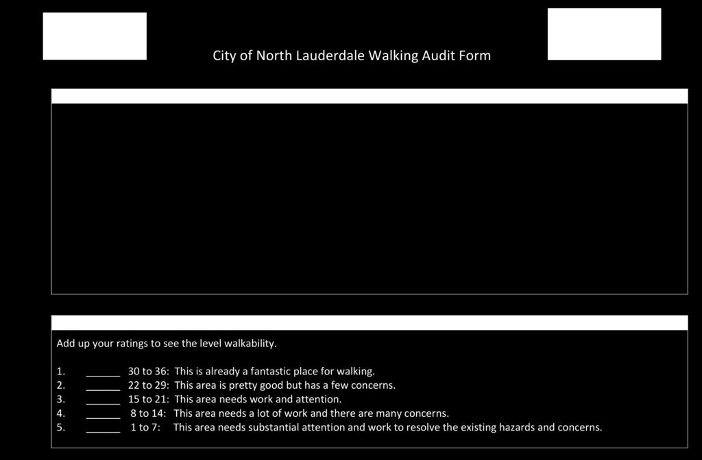
13 Walking Audit Form Page Three Walking Audit Form Page Four 13


14 VIRTUAL APPENDIX D: EVENT EVALUATION SUMMARY Summary of event- evaluation survey: 14
WALKABILITY CHECKLIST How walkable is your community?
 WALKABILITY CHECKLIST How walkable is your community? Everyone benefits from walking and other forms of active transportation. These benefits include: improved fitness, cleaner air, reduced risks of certain
Fill in the rating for each section. Total up the ratings to see how your neighbourhood scores overall for walkability.
 WALKABILITY CHECKLIST How walkable is your community? Everyone benefits from walking and other forms of active transportation. These benefits include: improved fitness, cleaner air, reduced risks of certain
Monument Elementary School Trenton, NJ School Travel Plan
 Monument Elementary School Trenton, NJ School Travel Plan Prepared by Greater Mercer TMA With Assistance from Alan M. Voorhees Transportation Center; Rutgers, The State University of New Jersey and NJ
PART A: IDENTIFICATION/LOCATION
 Appendix A. Quick Bus Stop Checklist QUICK BUS STOP CHECKLIST A1 Street Name: PART A: IDENTIFICATION/LOCATION A2 Nearest Cross Street (street name or landmark if mid-block): A3 A4 A5 Bus Route Direction:
FOCUS AREA 1 - Alberta Avenue Pocket Park 3 (121 Ave and 92 St)
") FOCUS AREA 1 - Alberta Avenue Pocket Park 3 (121 Ave and 92 St) New benches Plant evergreen trees Widen existing sidewalk from 1.5m to 1.8m Marked crosswalk 1.8m wide sidewalk Add pedestrian oriented lights
FOCUS AREA 1 - Alberta Avenue Pocket Park 3 (121 Ave and 92 St) New benches Plant evergreen trees Widen existing sidewalk from 1.5m to 1.8m Marked crosswalk 1.8m wide sidewalk Add pedestrian oriented lights
Clarkson Walkability Audit: Results and Recommendations Summary
 Clarkson Walkability Audit: Results and Recommendations Summary The following document was prepared by the Region of Peel and includes a summary of comments made by participants during our breakout discussion
STEERING COMMITTEE MEETING June 17, Streetscape Overview Burlington Comprehensive Master Plan
 STEERING COMMITTEE MEETING June 17, 2015 Streetscape Overview Burlington Comprehensive Master Plan 1 Introduction Slide This slide show was presented to the Burlington Steering Committee on June 17, 2015
What Is a Complete Street?
 Session 5 Charleen Zimmer, AICP, Zan Associates May 5-7, 2010 What Is a Complete Street? May 2010 5-1 Not a Complete Street More of a Complete Street May 2010 5-2 Benefits of Complete Streets Safety for
Typical Cross Section: DOWNTOWN (Observer Highway - 8th Street)
") Typical Cross Section: DOWNTOWN (Observer Highway - 8th Street) DRAFT SEPTEMBER 23, 14 1 Washington Street Typical Block Downtown Typical Block: DOWNTOWN (Observer Highway - 8th Street) New crosswalks
Typical Cross Section: DOWNTOWN (Observer Highway - 8th Street) DRAFT SEPTEMBER 23, 14 1 Washington Street Typical Block Downtown Typical Block: DOWNTOWN (Observer Highway - 8th Street) New crosswalks
Woodrow Wilson Elementary School Trenton, NJ School Travel Plan
 Woodrow Wilson Elementary School Trenton, NJ School Travel Plan Prepared by Greater Mercer TMA With Assistance from Alan M. Voorhees Transportation Center; Rutgers, The State University of New Jersey and
Middle School Walk Audit Booklet
 Safe Routes to School GEORGIA Georgia Department of Transportation Middle School Walk Audit Booklet This Walk Audit Guide was prepared by the Georgia Safe Routes to School Resource Center, funded by the
Duwamish Way-finding and CTR Report
 V. North Tukwila When the North Tukwila Manufacturing and Industrial Center was designated in 1992 as part of the region s land use and transportation plan, the plan called for the area to set a light-rail
ROUTE 81 CORRIDOR STUDY DESIGN CONCEPTS
 RT 81 Corridor Study CLINTON ROUTE 81 CORRIDOR STUDY DESIGN CONCEPTS View north on High Street, with potential improvements to the streetscape Draft Recommendations November 8 th, 2018 TOWN OF CLINTON
All Season Age Friendly Pedestrian Safety and Walkability Checklist *
 FOSTERING AGE FRIENDLY, WALKABLE NEIGHBOURHOODS Walkability is a key component of optimal aging in Age Friendly cities. Walkable neighbourhoods promote physical and mental health and well-being, support
Sidewalk Accessibility Checklist
 Starting Address: Ending Address: Date: Sidewalk Accessibility Checklist Please indicate your experience with any barriers you encountered when using the sidewalks in your neighborhood. 1. Did you have
Midtown Rail Station Accessibility Assessment N4
 Midtown Rail Station Accessibility Assessment N4 Joel Anders, Arnaud Huguet, and Alex Poznanski 15 August 2012 Table of Contents EXECUTIVE SUMMARY... 1 MISSION STATEMENT... 2 INTRODUCTION... 2 CROSSWALKS
Steps to Conducting a Complete Streets Assessment
 Steps to Conducting a Complete Streets Assessment Familiarize yourself with Complete Streets Read through the Complete Streets Assessment Guidelines. This will give you an idea of what Complete Streets
Orange Center Elementary School
 Drag and drop pic and stretch/crop to the limits of the blue rectangle (delete this text box) Orange Center Elementary School Drag and drop pic and stretch/crop to the limits of the blue rectangle (delete
Walking Audit Supporting Information
 Walking Audit Supporting Information Planning to do a walking audit of your streets? Here s some helpful suggestions to help get you started. 1. Preparing for your audit Decide where you want to walk.
Hedgepeth Williams Middle School and Paul Robeson Elementary School Trenton, NJ. School Travel Plan
 Hedgepeth Williams Middle School and Paul Robeson Elementary School Trenton, NJ School Travel Plan Hedgepeth Williams Middle School Description: Hedgepeth-Williams Middle School is located at 301 Gladstone
AGENDA ITEM 6 D THOMASVILLE ROAD (HERMITAGE BOULEVARD TO LIVE OAK PLANTATION ROAD) ROADWAY SAFETY AUDIT
 ROADWAY SAFETY AUDIT") May 15, 2018 AGENDA ITEM 6 D THOMASVILLE ROAD (HERMITAGE BOULEVARD TO LIVE OAK PLANTATION ROAD) ROADWAY SAFETY AUDIT TYPE OF ITEM: Discussion STATEMENT OF ISSUE The Florida Department of Transportation
May 15, 2018 AGENDA ITEM 6 D THOMASVILLE ROAD (HERMITAGE BOULEVARD TO LIVE OAK PLANTATION ROAD) ROADWAY SAFETY AUDIT TYPE OF ITEM: Discussion STATEMENT OF ISSUE The Florida Department of Transportation
Figure 4-10: Pedestrian Improvements Types of Potential Station Area Improvements - Place-Making Improvements
 INCORPORATE FEATURE PAVIN IN CROSSWALK AND INTERSECTION FIELDS Identifies high-priority pedestrian areas and create a station identity through colorful and interesting patterns ADD CURB EXTENSIONS Extending
Ballston Station Multimodal Study WMATA and Arlington County. Meeting Minutes
 Date of Meeting: June 10, 2010 Location: Ballston Metrorail Station and NRECA Building 4301 Wilson Blvd, Arlington, VA Subject: Ballston Station Multimodal Study Stakeholder Meeting #1 Summary: This first
Safe Routes to School Action Plan Aberdeen, Idaho
 Background Aberdeen, Idaho is a largely agricultural community of nearly 2,000 people and is located in the southeast portion of the state on the western edge of American Falls Reservoir. The community
WHEREAS delivery trucks also pass through the Narrows, into the northern parking lot, to loading docks in the back of the building.
 CEDAR-ISLES-DEAN NEIGHBORHOOD ASSOCIATION ( CIDNA ) RESOLUTION OPPOSING A DRUG STORE DRIVE THRU, AND COMMENDING DORAN COMPANIES FOR PROPOSING MITIGATING AMENITIES INCLUDING NEW LANDSCAPING AND A DEDICATED
Poor pavement condition Substandard Intersections. / Substandard bike/pedestrian/transit accommodations. Driveway access Environmental concerns
 Public Informational Meeting University Avenue (Allen Boulevard Segoe Road) March 23, 2011 City of Madison City of Middleton Village of Shorewood Hills Dane County Existing Roadway Conditions Poor pavement
Complete Streets Funding Program Project Prioritization Plan
 Funding Program Project Prioritization Plan Location and Type Needs South Street Crosswalk Installation Stripe a new formalized crosswalk across South Street at the Anne T. Dunphy School pedestrian path
James Williams Middle School 915 Acacia Lane
 James Williams Middle School 915 Acacia Lane Grades Served: 6 th -8 th Student Geography According to an address analysis of students, 36.7% of students attending JWMS live within 2 miles of school (see
July 5, Arthur R. Ware, Jr. Elementary School 2017 Safe Routes to School Walkabout Report
 July 5, 2017 Arthur R. Ware, Jr. Elementary School 2017 Safe Routes to School Walkabout Report 1 Walkabout Report Introduction On April 28, 2017, City, School, and SAWMPO staff met to conduct a Safe Routes
City of Margate, Florida. Neighborhood Traffic Management Manual
 City of Margate, Florida Neighborhood Traffic Management Manual Table of Contents Page No. I. INTRODUCTION... 1 II. TRAFFIC CALMING REQUEST AND PROCESSING PROCEDURES... 2 1. COMPLETE AND SUBMIT PROJECT
Memo. Introduction. Memphis STP Pedestrian Sidewalk Project
 Memo Memphis STP Pedestrian Sidewalk Project To: Kyle Wagenshutz, City of Memphis From: Matthew Berkow, Collin Chesston, and Anne Eshleman, Alta Planning + Design Date: June 2014 Re: Photo Inventory Introduction
NAPIER AVENUE PEDESTRIAN AND BICYCLE PLAN
 NAPIER AVENUE PEDESTRIAN AND BICYCLE PLAN Prepared By: DRAFT: 1/17/1 WHAT ARE WALKABILITY AUDITS AND WHY ARE THEY IMPORTANT? Walkability is important for a community and everyone benefits from walking.
Road Safety Assessment
 Road Safety Assessment Team Findings Report July 2013 Page 1 of 36 Introduction East Bay Drive from Lake Avenue to Keene Road The Federal Highway Administration s (FHWA) Safety Office established Road
Safe Routes to School: Munroe Elementary Walk Audit Report. Image: Drexel, Barrell & Co.
 Safe Routes to School: Munroe Elementary Walk Audit Report Image: Drexel, Barrell & Co. April 12, 2016 OVERVIEW As part of the 2014/2015 Denver Safe Routes to School (SRTS) Program, WalkDenver coordinated
Complete Streets. Designing Streets for Everyone. Sarnia
 Complete Streets Designing Streets for Everyone Sarnia Complete Streets ~ Sarnia ~ 2018 Introduction Our City is made up of a network of streets that we use to go for a walk, cycle to work, drive to the
Summary of School Observations and Education and Encouragement Initiatives
 Rye Shared Committee Summary of School Observations and Education and Encouragement Initiatives Presented to the Rye City Council & The Rye City School District Board of Education April 9 th, 2011 1 Why
Pedestrian Road Safety Audit
 Pedestrian Road Safety Audit Middlebrook Road From Father Hurley Boulevard to Waring Station Road December 2017 Montgomery County Department of Transportation Table of Contents 1. Introduction... 1 1.1
Transportation Planning Division
 Transportation Planning Division Presentation Outline Study Tasks Recap of Previous Meetings Data Collected Focus Areas within Study Limits Design Principles Tool Box Recommended Concepts Schedule Moving
12/4/2016 VIA . RE: Grocery Outlet Del Paso (DR16-328)
") 12/4/2016 VIA EMAIL Ethan Meltzer, Assistant Planner City of Sacramento Community Development Department 300 Richards Blvd, 3 rd Floor Sacramento, CA 95811 RE: Grocery Outlet Del Paso (DR16-328) Dear Mr.
12/4/2016 VIA EMAIL Ethan Meltzer, Assistant Planner City of Sacramento Community Development Department 300 Richards Blvd, 3 rd Floor Sacramento, CA 95811 RE: Grocery Outlet Del Paso (DR16-328) Dear Mr.
APPENDIX A: Complete Streets Checklist DRAFT NOVEMBER 2016
 APPENDIX A: Complete Streets Checklist DRAFT NOVEMBER 2016 Complete Streets Checklist MetroPlan Orlando s Complete Streets Checklist is an internal planning tool for staff to further implementation of
BLUETT TRAFFIC CALMING ON-SITE MEETING #2 DISCUSSION SUMMARY
 BLUETT TRAFFIC CALMING ON-SITE MEETING #2 DISCUSSION SUMMARY Date: Wednesday, April 11, 2018 Time: 5:30 p.m. to 7:30 p.m. Location: Clague Middle School parking lot Attendees: Public Present: 42 Council
Bicycle Network. Vision Zero San Francisco The City and County of San
 PROJECT BACKGROUND Project Needs 1. 17th between Church and Sanchez is identified as a location where there is a disproportionate number of crashes involving people riding bikes. 2. There is currently
DEPARTMENT OF ENVIRONMENTAL SERVICES. North Harrison Street (Lee Highway to Little Falls Road) Comparative Analysis. Prepared for:
 Comparative Analysis. Prepared for:") DEPARTMENT OF ENVIRONMENTAL SERVICES North Harrison Street (Lee Highway to Little Falls Road) Comparative Analysis Prepared for: Arlington County Department of Environmental Services 2100 Clarendon Boulevard,
DEPARTMENT OF ENVIRONMENTAL SERVICES North Harrison Street (Lee Highway to Little Falls Road) Comparative Analysis Prepared for: Arlington County Department of Environmental Services 2100 Clarendon Boulevard,
David Hung, Associate Planner City of Sacramento Community Development Department 300 Richards Boulevard, 3 rd Floor Sacramento, CA
 June 13, 2016 VIA EMAIL David Hung, Associate Planner City of Sacramento Community Development Department 300 Richards Boulevard, 3 rd Floor Sacramento, CA 959811 RE: Fire Station 14 (DR16-128) Dear Mr.
St. Francis Drive through the City of Santa Fe Corridor Study
 VII. ENGINEERING AND ENVIRONMENTAL EVALUATION TRAIL CONNECTIVITY In the southern portion of the Corridor there is a lack of a sidewalk, trail or bicycle facility within the right-ofway. However, the City
Accommodating Pedestrians in the Work Zone
 Accommodating Pedestrians in the Work Zone Guidance for Section C Plan Preparers Some impacts cannot be avoided and those impacts apply to residents, businesses, motorists, and pedestrians alike. However,
CURB EXTENSIONS BULB OUTS DPS 201 NECKDOWNS
 CURB EXTENSIONS BULB OUTS DPS 201 NECKDOWNS WHY WHEN & WHERE When Limited Sight Distance Pedestrians & Vehicles Vehicles and Signs Want to put two curb ramps in Discourage High speed turning High number
Meadow Woods Elementary School
 Drag and drop pic and stretch/crop to the limits of the blue rectangle (delete this text box) Meadow Woods Elementary School Drag and drop pic and stretch/crop to the limits of the blue rectangle (delete
RE: Park Plaza Walgreens (P12-016)
") 12/5/2014 VIA EMAIL David Hung, Associate Planner City of Sacramento Community Development Department 300 Richards Blvd., 3rd Floor Sacramento, CA 95811 RE: Park Plaza Walgreens (P12-016) Dear Mr. Hung:
12/5/2014 VIA EMAIL David Hung, Associate Planner City of Sacramento Community Development Department 300 Richards Blvd., 3rd Floor Sacramento, CA 95811 RE: Park Plaza Walgreens (P12-016) Dear Mr. Hung:
Streets. Safe for Pedestrians 20% 2nd 5,000. Are We People-Friendly?
 Streets Safe for Pedestrians 20% Pedestrian deaths account for more than of all traffic-related fatalities in California each year. 600 More than people are killed and another 13,000 are injured every
COWETA HIGH SCHOOL AND EAST HIGHWAY 51
 COWETA HIGH SCHOOL AND EAST HIGHWAY 51 Lack of sidewalks along Ben Lumpkin Rd. Lack of crosswalks and ramps at intersection. Hwy 51 is wide to cross as a pedestrian. No ADA compliance or connection to
Military Road Safety Improvements
 Military Road Safety Improvements 26 th Road North to 31 st Street North SUMMARY OF DATA REVIEW AND PRELIMINARY RECOMMENDATIONS Prepared for: Department of Environmental Services Traffic Engineering and
Active Transportation Audit
 Intersection: Municipality: Audit Conducted By (Name): Time of Audit: Date and Day of Week: Weather Conditions: Active Transportation Audit A. Pedestrian Facilities Please indicate north direction Street
Parental Responsibilities
 Bicycle riding is a fun way to exercise and enjoy the outdoors. To remain safe on Illinois roads, bicyclists must obey the same traffic safety laws that govern vehicle drivers. No amount of bicycle safety
ADA on Construction. Guidance for Section C Plan Preparers
 ADA on Construction Guidance for Section C Plan Preparers Some impacts cannot be avoided and those impacts apply to residents, businesses, motorists, and pedestrians alike. However, good planning can minimize
INDEX. Geometric Design Guide for Canadian Roads INDEX
 Acceleration lane, see Lanes, Acceleration Access, 8.1 Access Management and Functional Classification 8.2 Access Management by Design Classification 8.3 Access Configuration 8.4 Building Set-Back Guidelines
TRANSPORTATION STANDARDS
 INTRODUCTION LOCAL STREETS ON-STREET PARKING SIDEWALKS STREET LIGHTING STREET FURNISHINGS TRAFFIC CALMING STREET TREES MEDIAN PLANTING BOULEVARD LOCATIONS VILLAGE CENTER STREET LOCATIONS RESIDENTIAL STREET
Broad Street Bicycle Boulevard Design Guidelines
 Broad Street Bicycle Boulevard Design Guidelines Building from the strategies introduced in the 2013 Bicycle Transportation Plan and community input received thus far, City Transportation Staff have identified
Forest Hills Improvement Initiative
 Forest Hills Improvement Initiative Transportation Action Plan Short Term Recommendations ONLY Final Draft as of April 30, 2008 For Community Review and Feedback Prepared for: The City of Boston Boston
C/CAG. Sunnybrae Elementary School Walking and Bicycling Audit. San Mateo-Foster City School District JUNE 2013
 Sunnybrae Elementary School Walking and Bicycling Audit JUNE 2013 San Mateo-Foster City School District C/CAG City/County Association of Governments of San Mateo County SUNNYBRAE ELEMENTARY SCHOOL WALKING
Observations and Ideas: Toomer s Corner Streetscape Improvements
 Observations and Ideas: Toomer s Corner Streetscape Improvements AUBURN DOWNTOWN MASTER PLAN planning downtown s future August 26, 2013 Observations: Vertical Clutter at Corners 6 3 7 5 9 2 8 4 1 Excess
10/30/2012 VIA
 10/30/2012 VIA EMAIL David Hung, Associate Planner Community Development Department, Current Planning Division City of Sacramento 300 Richards Blvd., 3 rd Floor Sacramento, CA 95811 RE: The Cannery On-Site
11/28/2016 VIA
 11/28/2016 VIA EMAIL Ethan Meltzer, Assistant Planner City of Sacramento Community Development Department 300 Richards Blvd., 3 rd Floor Sacramento, Ca 95811 RE: Natomas Corporate Center Commercial Building
REGIONAL BICYCLE AND PEDESTRIAN DESIGN GUIDELINES
 REGIONAL BICYCLE AND PEDESTRIAN DESIGN GUIDELINES November 16, 2011 Deb Humphreys North Central Texas Council of Governments Bicycle and Pedestrian Advisory Committee Snapshot of the Guide 1. Introduction
Report on Walkability Survey and Workshop for ZIP Code Hosted by the Oklahoma City-County Health Department April 13, 2013
 Report on Walkability Survey and Workshop for ZIP Code 73111 Hosted by the Oklahoma City-County Health Department April 13, 2013 On April 13th, the Oklahoma City-County Health Department hosted a community
Active Transportation Facility Glossary
 Active Transportation Facility Glossary This document defines different active transportation facilities and suggests appropriate corridor types. Click on a facility type to jump to its definition. Bike
City of Vallejo Traffic Calming Toolbox
 City of Vallejo Traffic Calming Toolbox June 1, 2013 Final Table of Contents Introduction... 1 Non-Physical Devices... 3 High-Visibility Crosswalk... 3 In Pavement Lighted Crosswalk... 4 Rapid Flashing
Safe Routes to School: Valverde Elementary Walk Audit Report. Image: CPLIVE, SkyscraperPage.com
 Safe Routes to School: Valverde Elementary Walk Audit Report Image: CPLIVE, SkyscraperPage.com April 28, 2016 1 OVERVIEW As part of the 2014/2015 Denver Safe Routes to School (SRTS) Program, WalkDenver
Streetscape: Core Shopping District
 Streetscape: Core Shopping District DRAFT DRAFT DRAFT May 00 Core Shopping District: Phase Blue Island s Core Shopping District is located along Western Avenue, between Grove and Union Streets. Streetscape
Walkability Audit Scores and Comments Lacey, Tumwater, and Olympia, WA September 2012
 Walkability Audit Scores and Comments Lacey, Tumwater, and Olympia, WA September 2012 The U.S. Environmental Protection Agency (EPA) provided technical assistance to Thurston Regional Planning Commission
Item No. 14 Town of Atherton
 Item No. 14 Town of Atherton CITY COUNCIL STAFF REPORT CONSENT AGENDA TO: THROUGH: FROM: HONORABLE MAYOR AND CITY COUNCIL GEORGE RODERICKS, CITY MANAGER MICHAEL KASHIWAGI, COMMUNITY SERVICES DIRECTOR MARTY
Brooklyn Boulevard (County Road 152) Reconstruction Project Phase I. OPEN HOUSE June 20, 2017
 Reconstruction Project Phase I. OPEN HOUSE June 20, 2017") Brooklyn Boulevard (County Road 152) Reconstruction Project Phase I OPEN HOUSE June 20, 2017 Brooklyn Boulevard (County Road 152) Phase I Project Partners Project Lead Other Project Partners include Brooklyn
Brooklyn Boulevard (County Road 152) Reconstruction Project Phase I OPEN HOUSE June 20, 2017 Brooklyn Boulevard (County Road 152) Phase I Project Partners Project Lead Other Project Partners include Brooklyn
Designing Pedestrian Facilities for Accessibility. Module 3 Curb Ramps & Blended Transitions
 Module 3 & Other Purpose: Allow pedestrians to transition between the street and sidewalks, islands, etc. Typically installed at: Intersections (1 ramp at each end of each crosswalk) Mid-block crossings
Off-road Trails. Guidance
 Off-road Trails Off-road trails are shared use paths located on an independent alignment that provide two-way travel for people walking, bicycling, and other non-motorized users. Trails specifically along
Draft North Industrial Area-Wide Traffic Plan
 Summary of North Industrial and Hudson Bay Industrial Recommended Improvements Table 1. Summary of s Item Location 1 2 3 4 5 6 7 8 9 10 11 12 Millar Ave north of 51st St Super 8 Motel back lane 400 Block
MEMORANDUM. Nantasket Road at Kingsley Road Kingsley Road at Sumner Street Kingsley Road at Revere Street Kingsley Road at Kenberma Street
 MEMORANDUM Date: June 28, 2012 To: From: Subject: Mr. Joseph Stigliani, Director of Public Works Kenneth J. Petraglia, P.E., PTOE Greg E. Lucas, P.E., PTOE Kingsley Road Stop Sign Warrant Analysis BETA
5 CIRCULATION AND STREET DESIGN
 5 CIRCULATION AND STREET DESIGN This chapter describes circulation and streetscape improvements proposed for the Northwest Chico Specific Plan Area. It includes detailed design specifications for existing
Appendix B - Street Sections
 Appendix B - Street Sections 6TH STREET CORRIDOR PLAN STREET SECTIONS The street sections in Appendix B include recommended improvements to streets for North Glenwood. They include existing conditions
Appendix C. TRAFFIC CALMING PROGRAM TOOLBOX
 Appendix C. TRAFFIC CALMING PROGRAM TOOLBOX PHASE I...2 Do Not Enter Sign...3 One-Way Sign...4 Turn Prohibition...5 Pavement Markings...6 Speed Monitoring Trailer...7 Neighborhood Speed Watch...8 Police
Chapter 4 TOOLBOX AND SAMPLE BIKE BOULEVARD LAYOUT
 Chapter 4 TOOLBOX AND SAMPLE BIKE BOULEVARD LAYOUT OVERVIEW This chapter describes a cohesive set of strategies to create a bicycle boulevard, namely to make streets safer and more efficient for bicycle
APPENDIX 1 CITY OF CALGARY SHARE THE PATHWAY PROGRAM
 APPENDICES APPENDIX 1 CITY OF CALGARY SHARE THE PATHWAY PROGRAM Share the Pathway Share the pathway and share the responsibilities. Those who use the pathway get along better when they show courtesy and
Chapter 3.5 Osteen Elementary School. Volusia County MPO. November 2008
 Chapter 3.5 Osteen Elementary School Osteen, FL Volusia County MPO November 2008 Volusia County MPO School Bicycle and Pedestrian Review Study, Phase 3B School Summary Osteen Elementary School is located
Sidewalks and Streets Survey
 Tips, Tools and Resources for Organizers Sidewalks and Streets Survey Communities can make walking safer by teaching small groups to take simple walkability surveys and to take recommended actions for
WHITE STREET/ ENGLISH PLAZA STREETSCAPE IMPROVEMENT PROJECT
 WHITE STREET/ ENGLISH PLAZA STREETSCAPE IMPROVEMENT PROJECT 1 Project Goals 1 Improved Safety: Lighting, Multi-Modal Circulation, Emergency Access, Tripping Hazards; Stormwater 4 Environmental Performance:
About the Studio. Edward J. Bloustein School of Planning and Public Policy - Rutgers University
 About the Studio Edward J. Bloustein School of Planning and Public Policy - Rutgers University Purpose of studio: Help City of Bayonne apply for Safe Routes to School (SRTS) funding by producing a School
25th Avenue Road Diet Project A One Year Evaluation. Transportation Fund for Clean Air Project #05R07
 25th Avenue Road Diet Project A One Year Evaluation Transportation Fund for Clean Air Project #05R07 Submitted by: The San Francisco Municipal Transportation Agency Dan Provence May 22, 2009 EXECUTIVE
Item to be Addressed Checklist Consideration YES NO N/A Required Description Complete Streets Guidelines
 Passaic County Complete Streets Checklist - Concept Development Project Name Item to be Addressed Checklist Consideration YES NO N/A Required Description Complete Streets Guidelines Existing Plans Have
Tonight is for you. Learn everything you can. Share all your ideas.
 Strathcona Neighbourhood Renewal Draft Concept Design Tonight is for you. Learn everything you can. Share all your ideas. What is Neighbourhood Renewal? Creating a design with you for your neighbourhood.
Vallecito Elementary School. Travel Plan
 Vallecito Elementary School Travel Plan TABLE OF CONTENTS 1. PURPOSE... 1 1.1. SR2S PLANNING, IMPLEMENTATION AND MONITORING... 1 1.2. MARIN COUNTY MEASURE A... 1 2. VALLECITO ELEMENTARY SCHOOL PROFILE...
ALBERTA AVENUE WHAT WE HEARD REPORT BUILDING GREAT NEIGHBOURHOODS
 ALBERTA AVENUE WHAT WE HEARD REPORT BUILDING GREAT NEIGHBOURHOODS FEBRUARY 2019 EXECUTIVE SUMMARY Starting in 2019, Alberta Avenue will see the replacement and enhancement of its aging collector and local
Active Transportation Rail to River Corridor. Community Meeting - Segment A
 Active Transportation Rail to River Corridor Community Meeting - Segment A June 29, 2017 Tonight s Agenda > Open House (30 min) > Welcome / Project Overview > Presentation of 30% Design Refinements > Next
Chapter 2: Standards for Access, Non-Motorized, and Transit
 Standards for Access, Non-Motorized, and Transit Chapter 2: Standards for Access, Non-Motorized, and Transit The Washtenaw County Access Management Plan was developed based on the analysis of existing
SR/CR A1A PEDESTRIAN SAFETY & MOBILITY STUDY
 SR/CR AA PEDESTRIAN SAFETY & MOBILITY STUDY PEDESTRIAN / BICYCLE SAFETY REVIEW Focus Area H / 9th Street S to 3th Street N Prepared for: River to Sea Transportation Planning Organization 2570 West International
Road Safety Evaluation ation A process to investigate traffic safety on tribal, county, or city roadways Roadway may be selected for evaluation if the
 Road Safety Evaluation Shoalwater Bay Roads WSDOT Highways & Local Programs Road Safety Evaluation ation A process to investigate traffic safety on tribal, county, or city roadways Roadway may be selected
Chapter 6: Along the Street
 Chapter 6: Along the Street This section describes the types of infrastructure that should be in place along school routes to make walking and bicycling to school safer. Sidewalks In communities with sidewalks,
Bicycle and Pedestrian Facilities Toolbox (Excerpt from Figure 3.1)
") Appendix B Neighborhood Connections Summaries This Appendix is a supplement to the information presented in Chapter 3 Connect People. The Appendix includes a summary or profile for each of the proposed
Appendix B Neighborhood Connections Summaries This Appendix is a supplement to the information presented in Chapter 3 Connect People. The Appendix includes a summary or profile for each of the proposed
Borough of Danville, PA Traffic Calming Program Guidelines
 Borough of Danville, PA Traffic Calming Program Guidelines Adopted by Borough Council on 1 INTRODUCTION Speeding Traffic is a major concern in the Borough of Danville because of its detrimental impacts
DRAFT. System Components. Greenway Trails. Introduction. Trail Types. Zebulon Greenway Master Plan
 5 System Components Wakefield Street Photo Simulation showing Sharrows Introduction The Master Plan identifies various system components that, together, create a comprehensive greenway system. These components
Chapter 3.3 Horizon Elementary School. Volusia County MPO. June 2009
 Chapter 3.3 Horizon Elementary School Port Orange, FL Volusia County MPO June 2009 Volusia County MPO School Bicycle and Pedestrian Review Study, Phase 3C School Summary Horizon Elementary School is located
Appendix 3 Roadway and Bike/Ped Design Standards
 Appendix 3 Roadway and Bike/Ped Design Standards OTO Transportation Plan 2040 4/20/2017 Page A3-1 Adopted Standards The adopted OTO Design Standards and Major Thoroughfare Plan are contained herein.