DATE: October 20, Planning Commission. Beth McKibben, Planner Community Development Department FILE NO.: CSP
|
|
|
- Brice Skinner
- 5 years ago
- Views:
Transcription
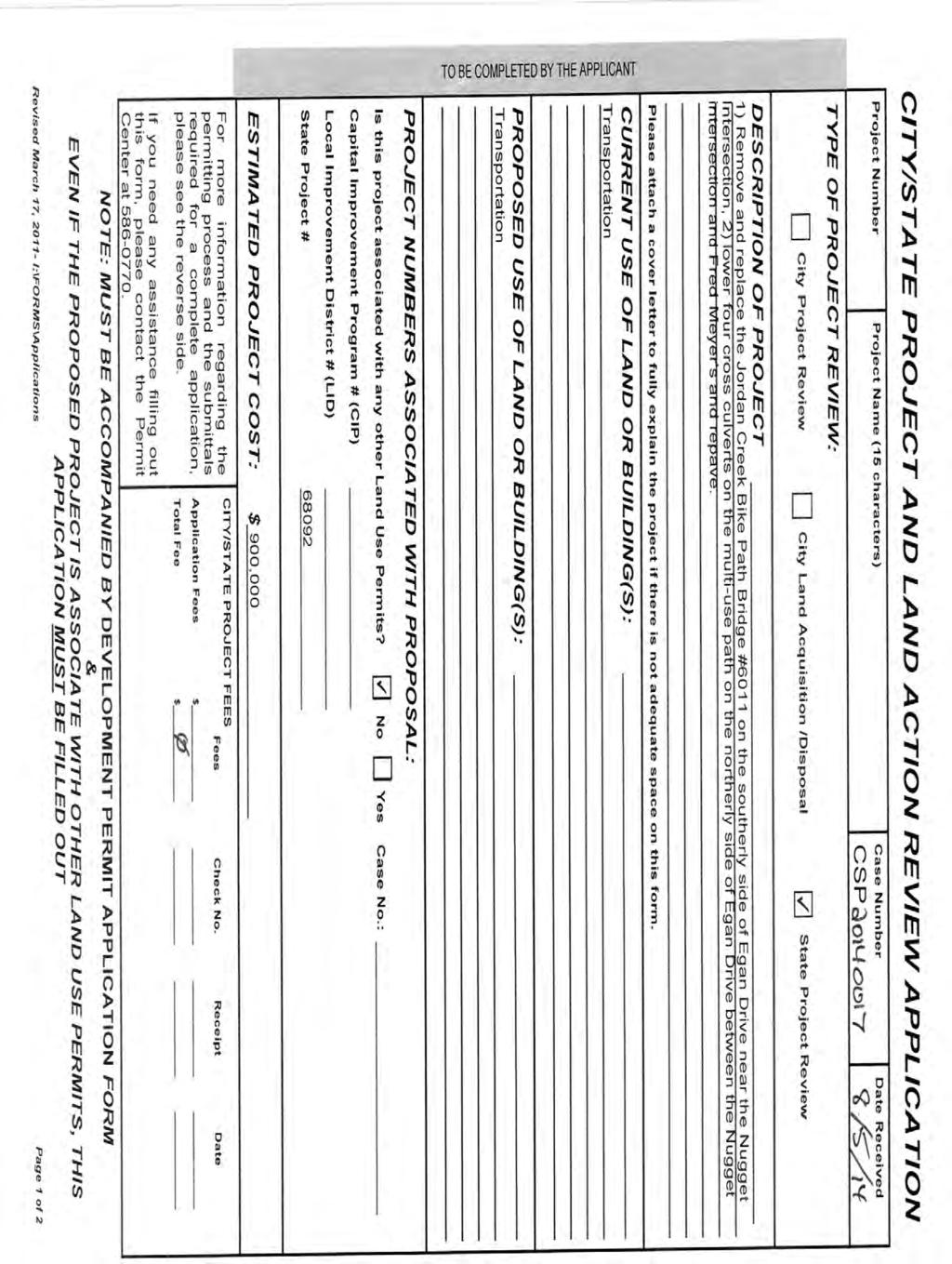
1 DATE: October 20, 2014 TO: FROM: Planning Commission Beth McKibben, Planner Community Development Department FILE NO.: CSP PROPOSAL: Local consistency review of DOT&PF project to remove and replace the Jordan Creek Bike Path Bridge on the southerly side of Egan Drive near the Nugget intersection; repave and lower four cross culverts on the multiuse path on the northerly side of Egan Drive between the Nugget intersection and Fred Meyer. GENERAL INFORMATION Applicant: Property Owner: Property Address: State of Alaska DOT & PF State of Alaska DOT & PF Egan Drive Site Size: 0 Access: Roadway Classification: Adjacent Zones: Surrounding Land Use: Egan Drive Arterial GC, LC, D15 North - D15 Residential/vacant LC Commercial South - GC Commercial
2 Planning Commission File No.: CSP October 20, 2014 Page 2 of 6 ATTACHMENTS A- Flood Narrative - Michael Knapp P.E., DOT Hydrologist PROJECT DESCRIPTION Egan Drive is a major arterial. The proposed project will repave the existing ten-foot-wide separated path on the north side of Egan Drive between the Nugget Intersection and Fred Meyer and replace four culverts. The Jordan Creek pedestrian bridge on the south side of Egan will be replaced. The project is listed on the DOT&PF website as Need ID 68092, and is budgeted for design in
3 Planning Commission File No.: CSP October 20, 2014 Page 3 of 6 the Statewide Transportation Improvement Program (STIP) project list for $75,000 in The project is described in the STIP as follows: ANALYSIS Repair the frost heave created grade breaks on the shared use path on the northbound side of Egan Drive and repave the shared use path. Replace the Jordan Creek bridge (BR No 4067) on the shared use path on the southbound side of Egan Drive. CBJ State project review: The commission shall review proposed Alaska State Capital Improvement Projects for consistency with this title pursuant to AS , and may impose conditions on and modifications to such projects. The proposed project was reviewed for conformance with the following CBJ-adopted plans: Comprehensive Plan (2013) Non-Motorized Transportation Plan (2009) (NMTP) Area-Wide Transportation Plan (2001) (AWTP) CBJ Offenses Against the Public Order CBJ Habitat CBJ Street Closure Permits Comprehensive Plan Several policies and implementing actions call for the facilitation and development of multi-use paths and other non-motorized transportation facilities: POLICY 8.5. TO PROMOTE A BALANCED, WELL-INTEGRATED MULTI-MODAL SURFACE TRANSPORTATION SYSTEM THAT PROVIDES SAFE, CONVENIENT AND ENERGY-EFFICIENT ACCESS AND TRANSPORT FOR PEOPLE AND COMMODITIES. POLICY 8.6. TO PROMOTE AND FACILITATE TRANSPORTATION ALTERNATIVES TO PRIVATE VEHICLES AS A MEANS OF REDUCING TRAFFIC CONGESTION, AIR POLLUTION AND THE CONSUMPTION OF FOSSIL FUELS, AND TO PROVIDE SAFE AND HEALTHY MEANS OF TRANSPORTATION TO ALL PEOPLE. Implementing Action: 8.8 IA17 Require sidewalks and bicycle paths or lanes along newly constructed arterial and collector streets where appropriate, and provide or work with DOT&PF to provide such amenities along existing roads to provide safe and efficient access and recreation and to reduce pedestrian/automobile conflicts.
4 Planning Commission File No.: CSP October 20, 2014 Page 4 of 6 Non-Motorized Transportation Plan The Non-motorized Transportation plan makes both general policy recommendations for trail development in Juneau and specific recommendations. The plan identifies this project as a midlow Priority. The Plan includes a recommendation for signs and pavement markings. The Plan recommends wayfinding signs along the length of the trail as part of the Cross Juneau Bikeway. To ensure the continued and consistent implementation of bicycle wayfinding in Juneau, a signage plan reviewed and approved by CDD will be required as a condition of consistency. Area Wide Transportation Plan The Area Wide Transportation Plan (2001) has six top priorities. Number four is particularly relevant to this project: 4. Establish and maintain bicycle lanes, pathways, sidewalks and bus stops where they are needed. Maintain bicycle lanes, pathways, sidewalks and bus stops with regular restriping, re-surfacing, street sweeping and snow removal. CBJ Offenses Against the Public Order As a pavement rehabilitation project, the proposed project will necessarily result in inconveniences for many residents and visitors to the project area. CBJ staff expects that the contractor awarded the project by DOT&PF will need to use heavy machinery and that lane closures and traffic revisions may be required in the course of the project. It is also likely that some portion of the project may be completed at night to avoid or minimize impacts to traffic during peak hours. CBJ (b) establishes hours of operation for heaving equipment to ensure quiet hours for area residents. These provisions are in local ordinance, and apply to the project. Staff recommends that an advisory condition reiterating the provisions of CBJ (b) be placed on the finding of local concurrence so as to ensure that the prohibition against use of heavy construction equipment during specified hours is not a surprise to the contractor: CBJ (b) Construction of buildings and projects. It is unlawful to operate any pile driver, power shovel, pneumatic hammer, derrick, power hoist, or similar heavy construction equipment, before 7:00 a.m. or after 10:00 p.m., Monday through Friday, or before 9:00 a.m. or after 10:00 p.m., Saturday and Sunday, unless a permit shall first be obtained from the City and Borough building official. Such permit shall be issued by the building official only upon a determination that such operation during hours not otherwise permitted under this section is necessary and will not result in unreasonable disturbance to surrounding residents. Capital City Fire/Rescue staff have, in the past, expressed concern that they have not been notified of street closures and traffic revisions, which could have serious consequences in the
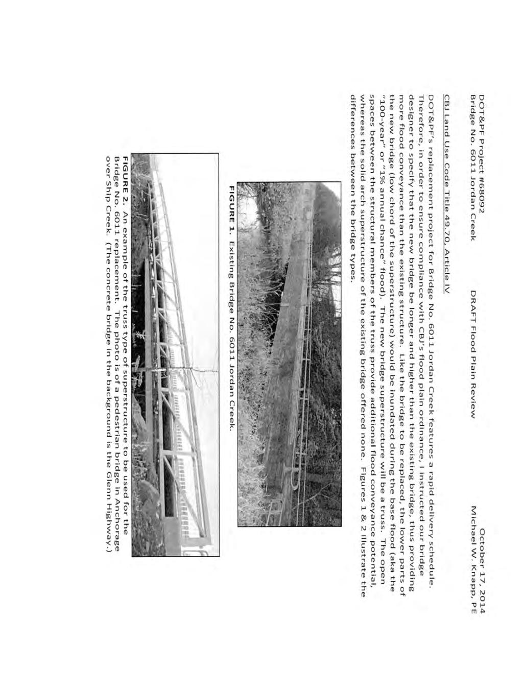
5 Planning Commission File No.: CSP October 20, 2014 Page 5 of 6 event of an emergency requiring access through or within the project area. Staff recommends that an advisory condition alerting the project contractor to notify both the Juneau Police Department and Capital City Fire/Rescue prior to modifying traffic patterns be placed on the finding of consistency with locally adopted plans. CBJ Habitat CBJ (b) also requires the reasonable preservation of salmon habitat, or mitigation of its disturbance: Where roads and trails cross anadromous streams, the design and construction of bridges and culverts shall allow free passage of fish, and shall take all feasible and prudent steps to prevent habitat disturbance. Phasing and construction shall be done to avoid critical migration periods for salmon and other anadromous species. The existing pedestrian bridge across Jordan Creek will be replaced across an anadromous fish stream. Because the proposed project is for a public structure to cross the stream, the development is exempt from CBJ s anadromous fish stream and lake setbacks, as per CBJ (f). CBJ Flood Hazard Areas According to the effective Flood Insurance Rate Map of the CBJ the new pedestrian bridge that will cross Jordan Creek near McDonalds is located in an AE high risk flood zone with a base flood elevation of 30 feet above Mean Lower Low Water (MLLW). According to the submitted narrative (attachment A) from Michael Knapp P.E., DOT Hydrologist, the proposed Jordan Creek pedestrian bridge will be built to allow for greater water flow during a flood event than the existing bridge. The proposed bridge elevation will be slightly below the flood elevation. The CBJ flood regulations do not require roads, trails, and bridges be built at or above the 100-year flood elevation. CDD always encourages this and during some circumstances it is necessary, having the bridge be re-designed above the flood elevation would significantly increase the cost of the project as the adjacent trail would have to be raised to match the bridge elevation. The proposed bridge will be higher than the existing bridge and provide more openings to facilitate water flow. The existing bridge design consists of a large solid wall which does not allow for water passage. The proposed project will improve the flood management of Jordan Creek. For these reasons, CDD staff finds the project consistent with CBJ flood regulations. FINDINGS The project is consistent with CBJ 49 and the plans adopted therein, with the recommended conditions placed upon it.
6 Planning Commission File No.: CSP October 20, 2014 Page 6 of 6 RECOMMENDATION Staff recommends that the Planning Commission find the proposed project, remove and replace the Jordan Creek Bike Path Bridge on the southerly side of Egan Drive near the Nugget intersection; repave and lower four cross culverts on the multi-use path on the northerly side of Egan Drive between the Nugget intersection and Fred Meyer, consistent with CBJ 49 and the plans adopted therein, with the following condition: 1. The length of the project shall be signed with wayfinding signs where appropriate as part of the Cross Juneau Bikeway. The applicant must submit a signage and striping plan for review and approval by the Community Development Department for consistency with the Non-Motorized Transportation Plan. Staff further recommends that two advisory conditions be placed on the finding of consistency in order to provide all possible notice to the applicant and the project contractor that a construction noise permit will be required for heavy equipment work during night-time hours as provided at CBJ (b), and that notice must be provided to JPD and to CCF/R prior to any street closures. Advisory Condition: 1. CBJ (b) Construction of buildings and projects. It is unlawful to operate any pile driver, power shovel, pneumatic hammer, derrick, power hoist, or similar heavy construction equipment, before 7:00 a.m. or after 10:00 p.m., Monday through Friday, or before 9:00 a.m. or after 10:00 p.m., Saturday and Sunday, unless a permit shall first be obtained from the City and Borough building official. Such permit shall be issued by the building official only upon a determination that such operation during hours not otherwise permitted under this section is necessary and will not result in unreasonable disturbance to surrounding residents. 2. At least three business days prior to any traffic revision or road closure of any public street or portion thereof, the contractor shall provide written notification of the traffic revision plan to the CBJ Fire Marshall and Chief of Police. Failure to provide such notice may result in suspension of any CBJ-issued permits for such work, and is punishable by fine as an unlawful street closure under CBJ

7
8
9
10
11
12
13
14
15
16
17
18
19
20
21
22
23
24
25
26
27 ATTACHMENT A
28 ATTACHMENT A

29 ATTACHMENT A
Double the amount of bicycle ridership while at the same time reducing the number of bicycle crashes by one-third.
 CHAPTER 6 Recommended Policies and Action Items To achieve the goals stated in Chapter 1 and guide implementation of the Bicycle Plan, policies and action items have been identified. They are presented
Alaska Department of Transportation and Public Facilities. Glacier Highway from Fritz Cove Road to Seaview Avenue. 1 mile long, feet wide
 DATE: May 5, 2014 TO: FROM: Planning Commission Travis Goddard, Planning Manager Community Development Department FILE NO.: CSP2014 0006 PROPOSAL: Review of Alaska DOT&PF project 68471, Glacier Highway
CITY OF BLOOMINGTON COMPLETE STREETS POLICY
 CITY OF BLOOMINGTON COMPLETE STREETS POLICY POLICY OBJECTIVE: The City of Bloomington will enhance safety, mobility, accessibility and convenience for transportation network users of all ages and abilities,
Improving Cyclist Safety at the Dundas Street West and Sterling Road Intersection
 STAFF REPORT ACTION REQUIRED Improving Cyclist Safety at the Dundas Street West and Sterling Road Intersection Date: August 17, 2012 To: From: Wards: Reference Number: Public Works and Infrastructure Committee
Living Streets Policy
 Living Streets Policy Introduction Living streets balance the needs of motorists, bicyclists, pedestrians and transit riders in ways that promote safety and convenience, enhance community identity, create
Third Street Bridge & Corridor Project
 Third Street Bridge & Corridor Project Preparation for the FY2018 budget to commence October 1, 2017, includes funding to address a project that has been considered since 1994. The Third Street bridge
PROPOSAL: Review of Alaska DOT&PF project 68471, Glacier Highway reconstruction and pedestrian improvements from
 PROPOSAL: Review of Alaska DOT&PF project 68471, Glacier Highway reconstruction and pedestrian improvements from Fritz Cove Rd to Seaview Ave, for consistency with locally adopted plans and ordinances.
NM-POLICY 1: Improve service levels, participation, and options for non-motorized transportation modes throughout the County.
 Transportation PRINCE WILLIAM COUNTY 2008 COMPREHENSIVE PLAN NON-MOTORIZED PLAN CONTENTS Goals, Policies, and Action Strategies Table 4 (Bike Facility Classifications and Descriptions) Table 5 (Bike Facility
Corpus Christi Metropolitan Transportation Plan Fiscal Year Introduction:
 Introduction: The Safe, Accountable, Flexible, Efficient Transportation Equity Act: A Legacy for Users (SAFETEA-LU) has continued the efforts started through the Intermodal Surface Transportation Efficiency
SAN FRANCISCO MUNICIPAL TRANSPORTATION AGENCY
 THIS PRINT COVERS CALENDAR ITEM NO. : 11 DIVISION: Sustainable Streets BRIEF DESCRIPTION: SAN FRANCISCO MUNICIPAL TRANSPORTATION AGENCY Approving traffic modifications on Twin Peaks Boulevard between Christmas
Solana Beach Comprehensive Active Transportation Strategy (CATS)
") Solana Beach Comprehensive Active Transportation Strategy (CATS) 3.0 Goals & Policies The Solana Beach CATS goals and objectives outlined below were largely drawn from the Solana Beach Circulation Element
Solana Beach Comprehensive Active Transportation Strategy (CATS) 3.0 Goals & Policies The Solana Beach CATS goals and objectives outlined below were largely drawn from the Solana Beach Circulation Element
77th OREGON LEGISLATIVE ASSEMBLY Regular Session. House Bill 2732 SUMMARY
 Sponsored by Representative BUCKLEY th OREGON LEGISLATIVE ASSEMBLY--0 Regular Session House Bill SUMMARY The following summary is not prepared by the sponsors of the measure and is not a part of the body
CITY OF COCOA BEACH 2025 COMPREHENSIVE PLAN. Section VIII Mobility Element Goals, Objectives, and Policies
 CITY OF COCOA BEACH 2025 COMPREHENSIVE PLAN Section VIII Mobility Element Goals, Objectives, and Policies Adopted August 6, 2015 by Ordinance No. 1591 VIII MOBILITY ELEMENT Table of Contents Page Number
Complete Streets Policy DAVID CRONIN, P.E., CITY ENGINEER
 Complete Streets Policy DAVID CRONIN, P.E., CITY ENGINEER Complete Streets City Commission adopted a Complete Streets policy in 2012 Complete Streets are road networks that are designed for all users:
Exhibit 1 PLANNING COMMISSION AGENDA ITEM
 Exhibit 1 PLANNING COMMISSION AGENDA ITEM Project Name: Grand Junction Circulation Plan Grand Junction Complete Streets Policy Applicant: City of Grand Junction Representative: David Thornton Address:
CITY OF LOMITA CITY COUNCIL REPORT
 CITY OF LOMITA CITY COUNCIL REPORT TO: FROM: City Council Ryan Smoot, City Manager Item No. SCH 12 PREPARED BY: Mark A. McAvoy, P.E., Public Works Director/City Engineer MEETING DATE: August 1, 2017 SUBJECT:
Proposed. City of Grand Junction Complete Streets Policy. Exhibit 10
 Proposed City of Grand Junction Complete Streets Policy Exhibit 10 1 City of Grand Junction Complete Streets Policy Vision: The Complete Streets Vision is to develop a safe, efficient, and reliable travel
Clackamas County Comprehensive Plan
 ROADWAYS The County s road system permits the movement of goods and people between communities and regions, using any of a variety of modes of travel. Roads provide access to virtually all property. They
Michael Parmer, Management Aide, City Manager's Office
 P139 STAFF REPORT f CITY NL- NAGER' S OFFICE RANCHO Date: C;UCAMONGA To: From: Subject: Mayor and Members of the City Council John R. Gillison, City Manager Michael Parmer, Management Aide, City Manager's
RESOLUTION NO ?? A RESOLUTION OF THE CITY OF NEPTUNE BEACH ADOPTING A COMPLETE STREETS POLICY
 RESOLUTION NO. 2018-?? A RESOLUTION OF THE CITY OF NEPTUNE BEACH ADOPTING A COMPLETE STREETS POLICY WHEREAS, safe, convenient, and accessible transportation for all users is a priority of the City of Neptune
Public Information Centre
 WELCOME Public Information Centre Father Tobin Road Lougheed Middle School - Library Wednesday November 7, 2012 7:00 p.m.to 9:00 p.m. Please sign in Neighbourhood Traffic Calming Guide Background The City
Providing an Efficient and Multi-modal Transportation System
 Providing an Efficient and Multi-modal Transportation System Welcome and Introductions The Plan Process Transportation Overview Workshop Discussions Report Out and Next Steps AGENDA Comprehensive Plan
ITEM 3 ATTACHMENT A RESOLUTION NO
 ITEM 3 ATTACHMENT A RESOLUTION NO. 2018-1575 A RESOLUTION OF THE CITY COUNCIL OF THE CITY OF CALABASAS, CALIFORNIA, ADOPTING THE FISCAL YEAR 2017-18 LIST OF PROJECTS FUNDED BY SB 1: THE ROAD REPAIR AND
University of Victoria Campus Cycling Plan Terms of Reference. 1.0 Project Description
 University of Victoria Campus Cycling Plan Terms of Reference 1.0 Project Description The Campus Cycling Plan, a first for the University, will provide a comprehensive and coordinated approach to support
Circulation in Elk Grove includes: Motor vehicles, including cars and trucks
 Circulation, as it is used in this General Plan, refers to the many ways people and goods move from place to place in Elk Grove and the region. Circulation in Elk Grove includes: Motor vehicles, including
Multi-Modal Transportation Programs
 Multi-Modal Transportation Programs Supporting the Lawrence Strategic Plan Critical Success Factors: Safe, Healthy and Welcoming Neighborhoods Innovative Infrastructure & Asset Management Effective Governance
ENFIELD BOARD OF EDUCATION ENFIELD, CONNECTICUT
 1 2 3 4 5 6 7 8 9 10 11 12 13 14 15 16 17 18 19 20 21 22 23 24 25 26 27 28 29 30 31 32 33 34 35 36 37 38 39 40 41 42 43 44 45 46 47 48 49 50 ENFIELD BOARD OF EDUCATION ENFIELD, CONNECTICUT TRANSPORTATION
Rochester Downtown Bicycle Study 2009
 Rochester Downtown Bicycle Study 2009 Relationship of ROCOG Long Range Transportation Plan to Rochester Comprehensive Plan Regional Long Range Transportation Plan (LRTP) is prepared under the auspices
SR-203 Sidewalks and Town-Wide Mobility Improvements. Town Council Presentation September 7, 2016
 SR-203 Sidewalks and Town-Wide Mobility Improvements Town Council Presentation September 7, 2016 SR-203 Sidewalks and Town- Wide Mobility Improvements SR-203 Sidewalks and Appurtenances Town-Wide Mobility
MUNICIPALITY OF ANCHORAGE TRAFFIC CODE UPDATE MASTER RECOMMENDATION REPORT: 9.14, 9.16, 9.18
 MUNICIPALITY OF ANCHORAGE TRAFFIC CODE UPDATE MASTER RECOMMENDATION REPORT: 9.14, 9.16, 9.18 Report Date: Please send all recommendations for update to Shane Locke (343-8413, lockesr@muni.org) 8-Apr-09
Prince George s County plans, policies, and projects
 Prince George s County plans, policies, and projects Over 250 projects for trails, bikeways, designated bike lanes and sidewalk construction Trail projects that improve access to Metro Sidewalk and trail
TRAFFIC CALMING GUIDE FOR TORONTO CITY OF TORONTO TRANSPORTATION SERVICES DIVISION
 TRAFFIC CALMING GUIDE FOR TORONTO CITY OF TORONTO TRANSPORTATION SERVICES DIVISION CITY OF TORONTO TRANSPORTATION SERVICES DIVISION 2016 TRAFFIC CALMING GUIDE FOR TORONTO TABLE OF CONTENTS Introduction
5. RUNNINGWAY GUIDELINES
 5. RUNNINGWAY GUIDELINES These guidelines should be considered collectively when making runningway decisions. A runningway is the linear component of the transit system that forms the right-of-way reserved
Glebe Neighbourhood Cycling Plan
 Glebe Neighbourhood Cycling Plan Summary of Public Comments received after June 5 th Public Information Session Comment STUDY NETWORK CS9, CS8, E, E0 CS4, E CS4 CS8 E Suggestions for alternate cycling
City of Novi Non-Motorized Master Plan 2011 Executive Summary
 City of Novi Non-Motorized Master Plan 2011 Executive Summary Prepared by: February 28, 2011 Why Plan? Encouraging healthy, active lifestyles through pathway and sidewalk connectivity has been a focus
POLICY: TRAFFIC CALMING
 2006 MAY REFERENCE: COUNCIL APPROVED BY COUNCIL MAY 23, 2006 CITY OPERATIONS - NO. 608 POLICY: TRAFFIC CALMING A. All requests for traffic calming within the City shall be considered in accordance with
City of Gainesville Transportation/Roadway Needs PROJECT SUMMARY
 A1 Roadway Resurfacing $23,846,000 TYPE: Preservation of existing system Roadway resurfacing A2 Signal Replacement $6,000,000 TYPE: Preservation of existing system Replace traffic signals. B1 W 6th St
TRAFFIC ACTION PLAN. Laurie Meadows Neighborhood CITY OF SAN MATEO
 TRAFFIC ACTION PLAN Laurie Meadows Neighborhood CITY OF SAN MATEO Draft January 2017 Table of Contents Introduction... 2 The Traffic Forum Process... 5 Neighborhood Traffic Issues... 7 Neighborhood Recommendations
MASTER BICYCLE AND PEDESTRIAN PLAN
 VILLAGE OF NORTHBROOK MASTER BICYCLE AND PEDESTRIAN PLAN DRAFT PLAN OPEN HOUSE May 2, 2018 AGENDA 1. Community Engagement 2. Vision and Goals 3. General Structure of Plan 4. Recommendations Overview 5.
TRAFFIC CALMING POLICY & PROCEDURES
 TRAFFIC CALMING POLICY & PROCEDURES AS ADOPTED BY MONTCLAIR TOWNSHIP COUNCIL AUGUST 4, 2009 TABLE OF CONTENTS 1. INTRODUCTION... 2 Purpose... 2 Traffic Calming Definition... 2 Statement Of Township Council
11/28/2016 VIA
 11/28/2016 VIA EMAIL Ethan Meltzer, Assistant Planner City of Sacramento Community Development Department 300 Richards Blvd., 3 rd Floor Sacramento, Ca 95811 RE: Natomas Corporate Center Commercial Building
CONNECTING PEOPLE TO PLACES
 CONNECTING PEOPLE TO PLACES 82 EAST BENCH MASTER PLAN 07 Introduction The East Bench transportation system is a collection of slow moving, treelined residential streets and major arteries that are the
CHAPTER 77: RECREATIONAL VEHICLES. Section. Bicycles
 CHAPTER 77: RECREATIONAL VEHICLES Section Bicycles 77.01 License required 77.02 Registration required 77.03 Tags and registration certificate 77.04 License fee 77.05 Tags and certificate nontransferable
3.9 Recreational Trails and Natural Areas
 3.9 Recreational Trails and Natural Areas 3.9.1 Introduction Parks and other recreational facilities such as trails, bicycle routes, and open space are important community resources. This section discusses
David Hung, Associate Planner City of Sacramento Community Development Department 300 Richards Boulevard, 3 rd Floor Sacramento, CA
 June 13, 2016 VIA EMAIL David Hung, Associate Planner City of Sacramento Community Development Department 300 Richards Boulevard, 3 rd Floor Sacramento, CA 959811 RE: Fire Station 14 (DR16-128) Dear Mr.
City of Memphis On-Street Parking Modification Guidelines
 City of Memphis Effective Date: December 1, 2013 Bicycle/Pedestrian Program 125 N. Main Street Memphis, TN 38103 (901) 576-6710 www.bikepedmemphis.com City of Memphis Executive Summary It is current practice
WELCOME Public Information Centre
 WELCOME Public Information Centre Fernforest Drive Brampton Soccer Centre Community Room #2 Tuesday January 19, 2016 6:30 p.m.to 9:00 p.m. Please sign in Neighbourhood Traffic Calming Guide Background
Harbord Street and Hoskin Avenue Bicycle Lane Upgrades
 STAFF REPORT ACTION REQUIRED and Bicycle Lane Upgrades Date: April 22, 2014 To: From: Wards: Reference Number: Public Works and Infrastructure Committee General Manager, Transportation Services 19 and
SIDEWALK GUIDELINES April 14, 2008
 SIDEWALK GUIDELINES April 14, 2008 I. Introduction The issue of sidewalks represents a delicate balance that must be considered carefully. On the one hand, in certain circumstances, sidewalks are needed
Goal 3: Foster an environment of partnerships and collaboration to connect our communities and regions to one another.
 Non-Motorized Transportation Plan (NMTP) Draft Vision, Goal and,, Tri-County Regional Planning Commission (TCRPC) Purpose The purpose of the Tri-County Regional Planning Commission (TCRPC) Non-Motorized
Draft MOBILITY ELEMENET. Community Meeting May 22, 2013
 Draft MOBILITY ELEMENET Community Meeting May 22, 2013 Agenda Presentation Ira Brown New Mobility Paradigm Movement of People Implementation Q&A Ira Brown and Dave Roseman Small Group Discussion at Each
Chapter 3 DESIGN SPECIFICATIONS
 Brampton PathWays Planning and Design Guidelines 27 Chapter 3 DESIGN SPECIFICATIONS 3.1 CLASS 1 MULTI-USE PATH Off-road multi-use trails are the backbone of the Brampton PathWays Network. They are typically
Public Works and Infrastructure Committee. General Manager, Transportation Services
 STAFF REPORT ACTION REQUIRED Extending the Bay Street Bicycle Lanes Date: May 16, 2013 To: From: Public Works and Infrastructure Committee General Manager, Transportation Services Wards: Toronto Centre
Perryville TOD and Greenway Plan
 Perryville TOD and Greenway Plan Greenway Glossary Pathway: A bicycle and pedestrian path separated from motorized vehicular traffic by an open space, barrier or curb. Multi-use paths may be within the
Senate Amendment to Senate Bill No. 354 (BDR ) Amends: Summary: Yes Title: Yes Preamble: No Joint Sponsorship: No Digest: Yes
 Amends: Summary: Yes Title: Yes Preamble: No Joint Sponsorship: No Digest: Yes") 0 Session (th) A SB Amendment No. Senate Amendment to Senate Bill No. (BDR -) Proposed by: Senate Committee on Transportation Amends: Summary: Yes Title: Yes Preamble: No Joint Sponsorship: No Digest:
0 Session (th) A SB Amendment No. Senate Amendment to Senate Bill No. (BDR -) Proposed by: Senate Committee on Transportation Amends: Summary: Yes Title: Yes Preamble: No Joint Sponsorship: No Digest:
Auke Bay Area Plan. DRAFT Transportation Chapter
 Auke Bay Area Plan DRAFT Transportation Chapter Existing Conditions This plan comes at a time of change in the transportation infrastructure within Auke Bay. Both marine and upland transportation facilities
CITY OF OTTAWA ROADWAY MODIFICATION APPROVAL UNDER DELEGATED AUTHORITY
 RMA-2015-ATM-038 CITY OF OTTAWA ROADWAY MODIFICATION APPROVAL UNDER DELEGATED AUTHORITY DATE: April 22, 2015 SUBJECT Approval of Roadway Modifications Recommended through an Area Traffic Management Study
Basalt Creek Transportation Refinement Plan Recommendations
 Basalt Creek Transportation Refinement Plan Recommendations Introduction The Basalt Creek transportation planning effort analyzed future transportation conditions and evaluated alternative strategies for
Madison Urban Area and Dane County. Bicycle Transportation Plan Summary. September Introduction. Bicycle Plan Scope and Planning Process
 Bicycle Transportation Plan Summary Madison Urban Area and Dane County Introduction September 2000 Bicycling is an important mode of transportation in the Madison urban area and countywide that is available
Traffic Calming Policy
 Article I. Purpose and Goal. The purpose of this policy is to establish criteria and procedures the City will use to evaluate requests for, and if appropriate, implement traffic calming measures. Neighborhood
900 BICYCLE FACILITIES Traffic Engineering Manual
 TABLE OF CONTENTS Part 9 - BICYCLE FACILITIES 900 GENERAL... 9-3 900-1 General Background... 9-3 900-2 Designated Bicycle Routes... 9-3 901 SIGNINGS... 9-4 902 MARKINGS... 9-4 902-1 General... 9-4 902-2
Bicycle Master Plan Goals, Strategies, and Policies
 Bicycle Master Plan Goals, Strategies, and Policies Mobilizing 5 This chapter outlines the overarching goals, action statements, and action items Long Beach will take in order to achieve its vision of
Saskatchewan Drive Roadway Rehabilitation and Shared-Use Path Widening
 Saskatchewan Drive Roadway Rehabilitation and Shared-Use Path Widening We are here today to present the draft plan for the Saskatchewan Drive Roadway Rehabilitation and Shared-Use Path Widening project
County of Spartanburg South Carolina
 County of Spartanburg South Carolina Traffic Calming Program June 2012 (Revised/Program on Hold) PURPOSE The potential negative impacts from vehicular traffic on residential roads have been a longstanding
New Measure A Expenditure Categories DEFINITIONS OF ELIGIBLE EXPENDITURES Adopted March 8, 2007
 New Measure A Expenditure Categories DEFINITIONS OF ELIGIBLE EXPENDITURES Adopted March 8, 2007 City Street and County Road Maintenance Program The preservation and keeping of public street and road rights-of-way
Planning Guidance in the 2012 AASHTO Bike Guide
 Planning Guidance in the 2012 AASHTO Bike Guide Presentation by: RJ Eldridge Peter Lagerwey August 22, 2012 WEBINAR 2: PLANNING GUIDANCE IN THE 2012 AASHTO BIKE GUIDE Today s Webinar Significant Updates
LESLIE BARNS & CONNECTION TRACK. Construction Liaison Group Meeting #2
 LESLIE BARNS & CONNECTION TRACK Construction Liaison Group Meeting #2 July 23, 2013 1 UPDATE (SINCE LAST CLG) Cyclist safety walk (June 26) to review current construction configurations and discuss how
CITY OF WEST LAKE HILLS. Forest View Neighborhood Traffic Calming Study
 CITY OF WEST LAKE HILLS 901 South Mopac Expressway Building V, Suite 220 Austin, Texas 78746 Texas P.E. Firm Registration No. F-929 Klotz Associates Final Report Submittal: March 20, 2015 Revised Final
EXECUTIVE SUMMARY. Vision
 Vision Walking and bicycling in Salt Lake City will be safe, convenient, comfortable, and viable transportation options that connect people to places, foster recreational and economic development opportunities,
City of Vestavia Hills Traffic Calming Policy for Residential Streets
 City of Vestavia Hills Traffic Calming Policy for Residential Streets PURPOSE: The purpose of the Traffic Calming Policy for Residential Streets is to address safety concerns related to vehicular traffic
Cycle Track Design Best Practices Cycle Track Sections
 Design Best Practices Sections It is along street segments where the separation and protection methods of cycle tracks offer more comfort than conventional bicycle lanes, and are more attractive to a wide
GOAL 2A: ESTABLISH AND MAINTAIN A SAFE, CONVENIENT, AND EFFICIENT MULTI-MODAL TRANSPORTATION SYSTEM TO MOVE PEOPLE AND GOODS THROUGHOUT THE CITY.
 2. TRANSPORTATION ELEMENT The purpose of this element is to assist in establishing an adequate transportation system within the City and to plan for future motorized and non-motorized traffic circulation
BICYCLE PEDESTRIAN ADVISORY COMMITTEE (BPAC)
") BICYCLE PEDESTRIAN ADVISORY COMMITTEE (BPAC) Position: BPAC Committee Member Purpose and Duties of BPAC Committee Member: The City of Rolla is in the process of forming a Bicycle Pedestrian Advisory Committee
BICYCLE PEDESTRIAN ADVISORY COMMITTEE (BPAC) Position: BPAC Committee Member Purpose and Duties of BPAC Committee Member: The City of Rolla is in the process of forming a Bicycle Pedestrian Advisory Committee
December 15, City of Ottawa Planning and Growth Management Branch 110 Laurier Ave. W., 4 th Floor Ottawa, ON K1P 1J1
 December 15, 2017 City of Ottawa Planning and Growth Management Branch 110 Laurier Ave. W., 4 th Floor Ottawa, ON K1P 1J1 Attention: Mr. Wally Dubyk, C.E.T. Project Manager, Infrastructure Approvals Dear
APPENDIX A: Complete Streets Checklist DRAFT NOVEMBER 2016
 APPENDIX A: Complete Streets Checklist DRAFT NOVEMBER 2016 Complete Streets Checklist MetroPlan Orlando s Complete Streets Checklist is an internal planning tool for staff to further implementation of
Referred to Committee on Transportation. SUMMARY Authorizes the use of motorized wheelchairs in bicycle lanes. (BDR )
") SENATE BILL NO. SENATORS DENIS, MANENDO; HAMMOND AND WOODHOUSE MARCH, JOINT SPONSOR: ASSEMBLYMAN ARAUJO Referred to Committee on Transportation S.B. SUMMARY Authorizes the use of motorized wheelchairs
SENATE BILL NO. SENATORS DENIS, MANENDO; HAMMOND AND WOODHOUSE MARCH, JOINT SPONSOR: ASSEMBLYMAN ARAUJO Referred to Committee on Transportation S.B. SUMMARY Authorizes the use of motorized wheelchairs
West Dimond Blvd Upgrade Jodhpur Street to Sand Lake Road
 West Dimond Blvd Jodhpur St to Sand Lake CSS Transportation Project Summary Municipality of Anchorage Project # 05 005 Project Manager: John Smith, P.E. (MOA PM&E) Project Administrator: Julie Makela,
Crystal City Potomac Yard Transitway. Enforcement Ordinance & Construction Update
 Enforcement Ordinance & Construction Update December 2015 Project Purpose Provide high-capacity, high-quality transit service Support redevelopment in Crystal City and in Potomac Yard in Alexandria and
Bicycle Facilities Planning
 Bicycle Facilities Planning Overview Types of Cyclists Purpose for Riding Types of Facilities Bike Lanes Bicycle Boulevards Cycle Tracks Intersections Signals Signing and Marking Discussion Types of Bicyclists
Blue Ribbon Commission Report Recommendations on Pedestrian and Bicycle Infrastructure Improvements
 Recommendations on Pedestrian and Bicycle Infrastructure Improvements July 2017 Plan Development: Our committee consisted of seven individuals appointed by the Mayor and Village Board. Those members included:
INDOT Complete Streets Guideline & Policy
 INDOT Complete Streets Guideline & Policy INTRODUCTION The Complete Streets guidelines build upon multiple efforts and promote a multimodal transportation system that is integrated and sustains land use
Hospital Link Project Project Update September 2017
 Hospital Link Project Project Update September 2017 General The project provides a link from Riverside Drive and the Transitway to the Hospital Link Road. Construction is well underway. Read on for important
HOOPA DESIGN FAIR 4. IMPLEMENTATION PHASES & FUNDING
 4. IMPLEMENTATION PHASES & FUNDING HOOPA DESIGN FAIR 4-1 4. IMPLEMENTATION PHASES & FUNDING Phase One Development 1. Implementation The Conceptual Plan recommends five concept elements to revitalize downtown
CITY OF SIGNAL HILL Cherry Avenue Signal Hill, CA
 CITY OF SIGNAL HILL 2175 Cherry Avenue Signal Hill, CA 90755-3799 AGENDA ITEM TO: HONORABLE MAYOR AND MEMBERS OF THE CITY COUNCIL FROM: STEVE MYRTER, P. E. DIRECTOR OF PUBLIC WORKS SUBJECT: SPRING STREET
Edenbrook Hill Drive Traffic Calming Study
 WELCOME Public Information Centre Edenbrook Hill Drive Traffic Calming Study Fletchers Meadow Secondary School Wednesday January 20, 2016 6:30 p.m.to 9:00 p.m. Please sign in Neighbourhood Traffic Calming
City of Charlottesville Bicycle and Pedestrian Master Plan Update
 City of Charlottesville Bicycle and Pedestrian Master Plan Update September 17, 2014 I. Welcome and meeting overview II. Project status update III. Network overview IV. Break-out groups Pedestrian Network
Chapter 2. Bellingham Bicycle Master Plan Chapter 2: Policies and Actions
 Chapter 2 Bellingham Bicycle Master Plan Chapter 2: Policies and Actions Chapter 2: Policies and Actions The Bicycle Master Plan provides a road map for making bicycling in Bellingham a viable transportation
2.0 Existing Conditions
 20 2.0 Existing Conditions 2.1 Land Use, Future Growth Patterns, Physical Barriers Geographic Overview Sutter County s land use pattern is characterized by extensive agricultural areas, significant natural
CITY OF KASSON TRANSPORTATION ALTERNATIVES KASSON SAFE ROUTES TO SCHOOL
 ve ha 8t G B A Mantorville Ave N 240th Ave 16th St NE 11th Ave NE K-M HIGH SCHOOL SUNRISE TRAIL TO MANTORVILLE MNTH 57 SUNSET TRAIL TO MANTORVILLE NE PARK 16TH ST NE TRAIL K-M ELEMENTARY SCHOOL K-M MIDDLE
County of Greenville South Carolina. Traffic Calming Program Neighborhood Traffic Education Program and Speed Hump Program
 County of Greenville South Carolina Traffic Calming Program Neighborhood Traffic Education Program and Speed Hump Program (rev) August 2008 I. PURPOSE The potential negative impacts from vehicular traffic
Chapter 2: Standards for Access, Non-Motorized, and Transit
 Standards for Access, Non-Motorized, and Transit Chapter 2: Standards for Access, Non-Motorized, and Transit The Washtenaw County Access Management Plan was developed based on the analysis of existing
Tonight is for you. Learn everything you can. Share all your ideas.
 Strathcona Neighbourhood Renewal Draft Concept Design Tonight is for you. Learn everything you can. Share all your ideas. What is Neighbourhood Renewal? Creating a design with you for your neighbourhood.
CHAPTER 8. TRANSPORTATION
 CHAPTER 8. TRANSPORTATION A safe, efficient, convenient and interconnected transportation system facilitates the movement of people and goods to and within the CBJ while conserving land resources, energy
CITY OF ELKO BICYCLE AND PATHWAY PLAN
 CITY OF ELKO BICYCLE AND PATHWAY PLAN INTRODUCTION: The City of Elko is intended to provide the basic framework for the development of a functional bicycle and pathway system for the community with connections
Castro Valley Municipal Advisory Council March 19, 2018
 Castro Valley Municipal Advisory Council March 19, 2018 1 Background 2 Draft Bicycle Vision and Pedestrian Networks 3 Next Steps 4 Updates Agenda 2 PROJECT AREA: Unincorporated Areas of Alameda County
Shifting Gears for a Healthier City
 Shifting Gears for a Healthier City Mississauga s Cycling Master Plan is an ambitious strategy that sets out to transform Mississauga into a city that is conducive to cycling for daily transportation needs.
HIGHBURY AVENUE/HAMILTON ROAD INTERSECTION IMPROVEMENTS PUBLIC INFORMATION CENTRE 1 MAY 14, 2015
 HIGHBURY AVENUE/HAMILTON ROAD INTERSECTION IMPROVEMENTS Municipal Class Environmental Assessment PUBLIC INFORMATION CENTRE 1 MAY 14, 2015 ACCESSIBILITY Under the Accessibility Standards 2015 for Customer
This chapter describes the proposed circulation system and transportation alternatives associated with
 5.0 Circulation 5.1 OVERVIEW This chapter describes the proposed circulation system and transportation alternatives associated with West Landing, and summarize the information contained in the Existing
Toronto and East York Community Council. Director, Transportation Services, Toronto and East York District
 No Turn on Red Regulations STAFF REPORT ACTION REQUIRED Date: June 1, 2010 To: From: Toronto and East York Community Council Director, Transportation Services, Toronto and East York District Wards: Trinity
5 CIRCULATION AND STREET DESIGN
 5 CIRCULATION AND STREET DESIGN This chapter describes circulation and streetscape improvements proposed for the Northwest Chico Specific Plan Area. It includes detailed design specifications for existing