Transport Priorities
|
|
|
- Harvey Montgomery
- 5 years ago
- Views:
Transcription
1 Transport Priorities
2 Contents Page What is the Eastern Transport Coalition? 3 Investing in the East is investing in Victoria 4 P riorities 5 Projects Train and Tram 7-14 Bus Roads Walking and Cycling What s next? 32 Version 1
3 What is the Eastern Transport Coalition? The Eastern Transport Coalition (ETC) consists of Melbourne s seven eastern metropolitan councils: City of Greater Dandenong, Knox City Council, Manningham City Council, Maroondah City Council, City of Monash, City of Whitehorse and Yarra Ranges Shire Council. The ETC advocates for sustainable and integrated transport services to reduce the level of car dependency so as to secure the economic, social and environmental wellbeing of Melbourne s east. We aim to work in partnership with federal and state governments to ensure the future sustainability of Melbourne s eastern region. In order to preserve the region s economic promise and ensure the wellbeing of our residents, it is crucial that we work to promote better transport options in the east. Vision for the East The Eastern Transport Coalition has put together a suite of projects and priorities to promote connectivity, liveability, sustainability, productivity and efficiency throughout Melbourne s eastern region. The ETC is now advocating for the adoption and implementation of each of the transport priorities proposed in this document by the Federal and State Government. The ETC aims for Melbourne s east to become Australia s most liveable urban region connected by world class transport linkages, ensuring the sustainability and economic growth of Melbourne. With better transport solutions, Melbourne s east will stay the region where people build the best future for themselves, their families, and their businesses. 3

4 Investing in the East is investing in Victoria The Eastern Transport Coalition (ETC) consists of Melbourne s seven eastern metropolitan councils. As with most urban areas in Australia, the ETC region is facing several major compounding challenges. The eastern region will have to accommodate both a burgeoning population and an ageing community increasingly isolated by a public and private transport network built to enable commuter movement to and from the CBD, now at odds with the pattern of commuting within the region. Population growth is forecast to bring the region s population to well over 1.2 million by This will see an increase to the region s existing 400,000 jobs and $36.3 billion of expenditure on goods and services sourced within the region today. * The east of Melbourne s vibrant economy is currently buoyed by approximately $106 billion in total sales, $23 billion in exports and over four million visitors to the region per annum resulting in $2.6 billion in tourist revenue.* To ensure the region s economic promise is preserved, Melbourne s east needs a transport network that can handle the expected increase in both freight and commuter movement. Investing in better transport connectivity in Melbourne s east is an investment in the productivity and efficiency of an economy that is thriving, diverse and competitive. This document builds on many of the recommendations in Infrastructure Victoria's 30-year infrastructure strategy and the Victorian Government s Plan Melbourne, together with other locally identified needs and solutions. Each of the projects put forward in this document will directly go to improving the connectivity, liveability, sustainability, productivity and efficiency in Melbourne s east. These projects have community, stakeholder and Council support and now require cooperation and investment from the State and Federal Government. *Dench McClean Carlson. (2015). Melbourne East Investment Attraction Strategy. Melbourne: Regional Development Australia Eastern Melbourne. 4
5 Priorities Transport underpins the pillars of Connectivity, Liveability, Productivity and Efficiency as well as the Sustainability of Melbourne as a city. The Eastern Transport Coalition has listed our transport priorities under these four pillars. Connectivity Liveability Connectivity in transport improves mobility, provides better and easier access to trade, social services, employment and opportunities for the community. Plan Melbourne speaks of the need for an integrated 21st century transport system that connects people to jobs and services. Melbourne s transport system currently lacks interconnectivity between many suburban centres and the broader public transport network. One of the greatest barriers to using public transport to commute to work is lack of convenient and regular connections. Commuters who wish to park and ride are often unable to do so with limited parking at stations. Improved connectivity will result in better productivity, while families will enjoy shorter, more reliable travel times. Melbourne s population growth is not being matched by growth in the public transport system. In order to maintain Melbourne s liveability status our rail, tram and rapid bus services must be provided to the many areas of the city that have developed without good public transport, as well as maximising walking and cycling opportunities. Better transport improves the wellbeing of our community, ensures that Melbourne is a place where people want to live now and in the future, and is crucial to realising Plan Melbourne s concept of 20-minute neighbourhoods. Initiatives that allow residents to easily access transport modes other than cars will not only improve travel times and make Melbourne a safer community, it will also improve the overall liveability of the ETC region. Productivity and Efficiency Sustainability Melbourne needs a transport system that provides people with viable options. Congestion is one of the biggest issues in Melbourne affecting economic efficiency on several different levels of society. Funding sustainable alternatives and improving rail and road use will maximise opportunities for individuals, businesses and government to increase income and asset value. Implementing solutions that increase capacity and improve operational productivity on the road and rail networks will increase the efficiency of the transport system itself. Transport funding decisions should be based on long-term planning that will ensure the efficient movement of people and product across Victoria, using sustainable transport that is safe and environmentally viable. Melbourne s transport system is at risk of failure as short term solutions are put in place to solve major infrastructure challenges. Pressure from a growing population, soaring petrol costs and traffic congestion, mean that Melbourne needs forward-thinking transport policies for a sustainable city. 5


6 Transport Modes TRAIN AND TRAM BUS ROADS WALKING AND CYCLING 6
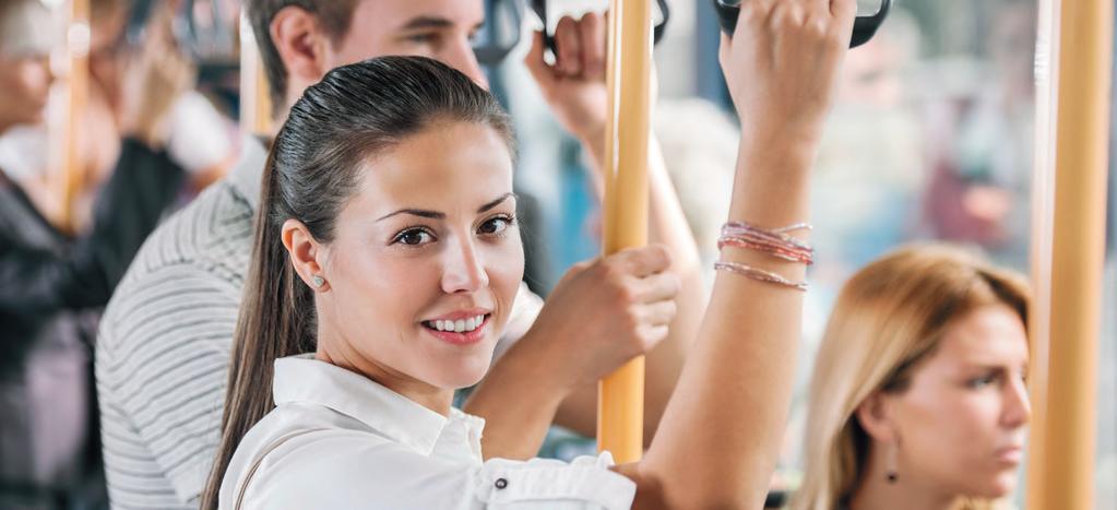
7 Train and Tram In the ETC region, rail patronage continues to grow, placing strain on our trains and trams. At the same time, there are significant issues that impact the reliability of services, such as a shortage of rolling stock and the regular cancellation of services during peak periods due to signal failure. As an increasing population fills up our roads with private vehicles, the congestion severely affects the trams sharing these roads. As Melbourne expands, another issue has become apparent in the tram lines that stop short of the outer suburbs, exacerbating connectivity issues between modes of transport, and making public transport less attractive for residents in Melbourne s east. The ETC s proposed train and tram projects will go a long way to decrease congestion and travel times in the east. 7
8 Train and Tram - Projects that deliver our principles Network extensions Level crossings Operational efficiency Better access Rowville Rail line construction Doncaster Rail construction Connectivity Tram route 75 extension from Vermont to Knox Tram route 48 extension to Doncaster Hill Liveability Croydon Station upgrade and level crossing removal Increased commuter parking at rail stations Upgrade of the Box Hill public transport interchange Productivity & Efficiency Doncaster Rail Study undertake a detailed technical feasibility study Burnley Rail group upgrades Regional south eastern corridor dedicated rail track Removal of 10 level crossings in the ETC region Removal of the level crossing at Surrey Hills, Ringwood line Improved train signalling Improved frequency of trains Rollout ICT infrastructure Rail fleet upgrades Sustainability Preserve Rowville Rail reservation Preserve Eastern Freeway median strip for public transport Belgrave/Lilydale rail capacity creation 8
9 Projects in detail: Train and Tram Network extensions Rowville Rail line construction The eastern region of Monash and the southern region of Knox municipality are significantly car-dependent, due in part to limited public transport options including poor frequency and indirect bus services. While the Wellington Road SmartBus has assisted in providing an interim solution, these services are hampered by road congestion and bus capacity. A longer term solution is now required. Construction of the Rowville Rail line would improve transport choices and accessibility, enabling residents across Melbourne s outer east to access employment (including the National Employment Cluster at Monash), education (Monash University) and other job clusters, services and activities, thereby improving community capacity and minimising social isolation. The development of the Doncaster Rail line from the CBD to Doncaster Hill will address current heavy reliance on private transport modes, reduce car dependence and improve intermodal connectivity as well as increase cross-city travel. Once the detailed technical feasibility study is completed in its entirety, the best course of action and further alignment can be established to ensure project delivery by An immediate priority, in line with Plan Melbourne s recommendation on preserving land for future transport needs, is to ensure the preservation of necessary corridors for future development of the Rowville and Doncaster rail lines as the demand case for their development continues to grow over coming years. Doncaster Rail Study: undertake a detailed technical feasibility study The first phase of the Doncaster Rail Study was released in late 2014 and determined that a Doncaster Rail line is feasible, with prospective patronage of 56,000 journeys per day. However, the study was not formally completed, delaying potential delivery of the rail line. The importance of constructing the Doncaster Rail cannot be overstated. Traffic congestion will increase without a mode shift to public transport, as the number of residents and commercial businesses in areas surrounding the proposed line is predicted to rise. Doncaster Rail: image courtesy of The Age 9

10 Projects in detail: Train and Tram Network extensions cont. Tram route 75 extension from Vermont to Knox Knox Central, incorporating Westfield Knox Shopping Centre, is a Principal Activity Centre as identified by the Victorian Government. The centre plays an important role as a focus for community activity, services and investment. Knox Central is currently serviced only by buses with a frequent SmartBus operating north/south on Stud Rd. While there is a transit link bus service in the east/west, connecting the existing tram terminus on Burwood Highway in Vermont South to Westfield Knox, this is not well understood or considered a reliable service by commuters. Burnley Rail group upgrades The Melbourne railway is struggling to cope with the number of passengers using the rail network. An upgrade to the Burnley rail group is needed to support the development of a metro rail system. This would include the rationalisation of Burnley junction, duplication of the line between Mooroolbark and Lilydale to facilitate additional services and improve the reliability of the Ringwood corridor, as well as a quadruplication of the line between Burnley and Camberwell station. This will particularly assist in meeting the growing demand for access to economic activity in central Melbourne. The extension of tram route 75 from Vermont South to Knox Central would provide a seamless connection between the Knox Central Principal Activity Centre and important regional services and employment nodes in the City of Whitehorse and beyond, including Deakin University, Burwood One and Vermont South shopping centres and new mixed use development clusters and student accommodation along Burwood Highway. Tram route 48 extension to Doncaster Hill There is growing demand for public transport to support the future growth of Doncaster Hill. As part of an integrated public transport network, an extension of the route 48 tram line from Balwyn North to Doncaster Hill a distance of four kilometres should be considered. This service will benefit the transport network by providing a link to the Doncaster Park & Ride and new Tullamore residential estate, as well as a local service connection between Doncaster Hill and Kew Junction. 10 Route 48 tram Marcus Wong
11 Projects in detail: Train and Tram Network extensions cont. Provide a regional south eastern corridor dedicated rail track The Dandenong line is one of Melbourne's most congested lines. Its two tracks are shared by Metro's Pakenham and Cranbourne trains, V/Line's Gippsland services and freight trains. The result is peak-hour overcrowding that is consistently worse than most other lines. Dedicated regional rail tracks on the south eastern corridor will separate regional passengers and freight from metropolitan trains, easing congestion and reducing travel time. This will also encourage more people to use the train service instead of private transport. Preserve median strips for public transport The increasing demand to expand Melbourne s freeway networks threatens designation of median strips for public transport purposes. The median strip of the Eastern Freeway (which was originally designed and planned for a heavy rail line) may be lost to accommodate additional traffic lanes on the Eastern Freeway, forever relinquishing this corridor for a possible public transport purpose. Similarly, the median strip where the potential Rowville rail will be built is yet to be formally reserved for this purpose. These median strips must be reserved as public transport corridors as part of planning to determine future public transport corridors in Melbourne. This will benefit public transport users as the corridors will be preserved for future improvements of the bus or rail network. It will also reduce reliance on cars, with the attendant congestion, emissions, energy and safety benefits. 11
12 Projects in detail: Train and Tram Level crossings Croydon Station upgrade and level crossing removal A railway line currently bisects the Croydon town centre, causing poor integration and interface between the major retail precincts of Croydon Market and Main Street. The antiquated station and bus interchange has also resulted in substandard amenity, limited parking availability, safety and security at the station. Grade separation of Coolstore Road level crossing provides an excellent opportunity to deliver a modern public transport interchange due to the station s close proximity to the level crossing. The project can maximise the transit network capacity, urban design, amenity, walkability, local economy and community benefits by collaborative planning with the planned Croydon Town Square. Removal of 10 level crossings in the ETC region There are 24 level crossings within the ETC municipalities. Fourteen of these locations are being removed by the State Government over the coming years. The remaining 10 sites still represent conflicting points between trains and road traffic, including cars, buses, cyclists and pedestrians. With average crossing closing times well in excess of one minute, these conflicts represent a constraint to road capacity and exacerbate traffic congestion in the region, with significant wider impacts to the on-road public transport network. Additional to the ten level crossings within the ETC region there is one other level crossing left to be listed for removal by the State Government on the Ringwood line, at Surrey Hills. Although Surrey Hills is outside the ETC region it still affects the flow-on traffic, and to make the Ringwood line fully functional it will be of utmost importance that this level crossing is removed as well. Removing level crossings is vital to achieving efficiencies across the rail network. Once these are removed along a rail corridor, more efficient signalling technologies can be introduced along with more intelligent train management, therefore increasing capacity for rail services across the network. This will not only ease congestion and provide opportunity for an increase in train frequency, but also improve response time for emergency services. A commitment from the State Government to remove the 10 level crossings within the ETC region as well as the additional one in Surrey Hills is required. 12 Level crossing Marcus Wong
13 Projects in detail: Train and Tram Network extensions cont. Improved train signalling Train operations are limited by the existing signalling systems available across Melbourne s rail network, which typically result in longer gap requirements between trains across the network. This system has now reached its natural capacity. Train signal upgrades to incorporate moving block technology have commenced, with trials of the new system implemented across key lines. However, to achieve metropolitan-wide benefits through increased train frequency and overall capacity enhancements, the rollout of signalling upgrades must be accelerated. Improved frequency of trains There is a pressing need for service improvements along Melbourne s rail network. Although frequency of services is increased during peak hour traffic, the poor frequency of off-peak trains affects overall viability as an alternative transport mode. Overcrowding of peak services is an indicator that the system is under strain and rapidly reaching capacity. Provision of additional service capacity and reliability is limited by level crossings, ageing signalling systems and sections of single tracks. A progressive program of level crossing removals, installation of modern high capacity signalling technology and rail expansion works will deliver a metro-style system along the Belgrave and Lilydale line. Duplicating the Mooroolbark to Lilydale section would be highly beneficial, as this project is supported by PTV s Network Development Plan and it will maximise the number of trains that can operate on the line and prevent service disruptions from cascading. Accelerated completion of the project will benefit residents and workers along the Belgrave and Lilydale corridor through improved journey times, reliable services and a higher quality experience. Frequent services are critical to encourage public transport use. Timetable changes on the metropolitan train network are required to deliver peak period service uplifts. This will not only encourage more people to choose public transport instead of private motor vehicles, but also increase capacity on overcrowded lines in Melbourne s eastern region. Belgrave/Lilydale capacity creation Population and economic growth along the Belgrave and Lilydale line corridor has led to escalating rail patronage growth. However, the quality and reliability of rail service is declining as it struggles to cater for escalating demand. Train signalling Marcus Wong 13

14 Projects in detail: Train and Tram Better access Increased commuter parking Car parking and overcrowding are among the issues that most concern Melbourne rail commuters. Establishing new or expanding existing rail station car parks to increase capacity and introducing more Park & Ride facilities will ease this strain. It will also help manage the current overflow parking in residential streets and shopping precincts surrounding rail stations. Upgrade of the Box Hill public transport interchange The Box Hill public transport interchange is in urgent need of infrastructure improvements. The current facilities are dysfunctional and disconnected, causing safety, connectivity and accessibility issues for train, tram, bus and taxi users as well as pedestrians and cyclists. The facilities also have limitations in handling ongoing ridership growth and changing passenger expectations. There are practical and compliance issues relating to disability access, ease of navigation, bicycle parking, capacity and priority for public and active transport modes over car-based modes. Wayfinding, signal priority, upgrade of passenger amenities and improvements to bus access and egress are some of the crucial works needed. Improving the Box Hill Transport Interchange will address significant safety and accessibility issues. It will also unlock and facilitate regionally significant economic, social and environmental outcomes for Melbourne s east as well as respond to and leverage off the current substantial private investment and population growth. Rollout of ICT infrastructure The current lack of effective technology management is causing trams and buses to languish in heavy traffic when they need to be given priority passage to prevent gridlock. Public transport vehicle tracking systems are obsolete and the lack of effective interfaces with road traffic systems results in inefficient tram and bus priority. The quality and reliability of bus and ICT system communications and interfaces must be improved to increase public transport user benefit. There is also a need to centralise transport network information. Rolling out ICT infrastructure that provides centralised real-time information across the transport network will enable both private and public transport commuters to better make real-time multi-modal decisions about their journey. This will assist in managing demand. Rail fleet upgrades Rapid increases in train patronage have resulted in a train shortage and overcrowded services. This does not provide passengers with the reliable, frequent and readily available service that they need, making public transport significantly less competitive compared to private vehicles. Train and tram capacity must be improved, including modifying existing train and tram fleets by reducing seating. New high capacity trains, prioritising comfort, safety and capability are needed. This will relieve current overcrowding and provide additional services to continue supporting growing patronage, as well as ensuring that passengers are provided with a reliable and frequent service. 14 High Capacity Metro Trains courtesy of Urban Melbourne
15 BUS Infrequent bus service, particularly at weekends, has resulted in underutilisation of buses compared to private vehicles despite increasing traffic congestion, higher petrol prices, and emissions concerns. Issues such as poor planning around bus routes and safety around bus stops at night and in peak hour traffic also reduce the likelihood of people using the service. Plan Melbourne highlights the need to improve the metropolitan bus network by progressively updating existing bus service plans to better link people to job-rich areas, community and service centres. The ETC has identified some key bus projects that will improve accessibility, increase patronage and decrease congestion. 15
16 Bus - Projects that deliver our principles Servicing and frequency Safety and access Fit for purpose Transitioning for growth Connectivity Improved bus service coverage and frequency Safer access to bus stops Provide bus routes to key employment areas Increased SmartBus service provision Upgrade bus stops with refuge area, lighting and links to pedestrian paths Liveability Bus interchange upgrades at Box Hill, Glen Waverley & Oakleigh rail stations Productivity & Efficiency Doncaster bus improvement (DART) On-road bus lanes and bus priority at traffic signals ITS use for trip reliability Sustainability Bus Rapid Transit (BRT) service Eastern Freeway 16
17 Projects in detail: Bus Servicing and frequency Improved bus service and frequency Improving bus service coverage and frequency will assist in reducing journey times and improve connectivity between services. Many areas across the ETC region have very poor coverage and infrequent services that do not meet the minimum service requirements. As a result, the local community has been forced to rely on private vehicles to meet their transport needs. The ETC welcomes a review of bus services throughout metropolitan Melbourne, building on the approach taken in Brimbank in This review featured more direct and frequent services and longer hours of operation. The changes resulted in patronage growth and better connections to other transport modes. In the short term, all bus routes must be upgraded to a minimum service level in terms of frequency and hours of operation. Increased SmartBus provision For many residents in Melbourne s east, buses are the only public transport available within a reasonable distance of their homes. However, lack of coordination between services, inadequate frequency, insufficient coverage and already congested roads means that the existing bus network is not competitive with car travel. The existing SmartBus premium network must be expanded to promote bus patronage. This can be done by connecting SmartBus services between employment centres and more residential catchments. A higher frequency of the SmartBuses will also increase the percentage of Melbourne residents who can access non central employment centres within 30 minutes of home, supporting cross-town travel and making public transport a more viable option. Doncaster bus improvement (DART) The Doncaster Area Rapid Transit (DART) network is experiencing constant over-crowding issues on peak service buses, increasing demand and instances of bus bunching on key roads (where an influx of buses result in delays to one another). Commuters report regularly watching buses drive past while waiting for one with capacity. Between 2009 and 2012, weekday patronage of DART services increased by 47 per cent, Saturday patronage increased by 212 per cent and Sunday patronage by 149 per cent, with the four DART routes now carrying in excess of 3 million passengers per year. These figures illustrate the demand for reliable and efficient public transport services in the region, and the need to enhance the bus service with increasing service capacity, frequency and priority for buses on the road network along the entire routes of each of the four DART services. By allowing prioritisation of public transport along the DART corridor, particularly along Hoddle Street between the Eastern Freeway and Victoria Parade, the 12,000 daily users of DART will be able to commute without the current issues. It will also promote the service to people currently using their car. Bus Rapid Transit (BRT) service Eastern Freeway Manningham requires a mass-transit solution to its public transport problems, and until heavy rail can be delivered, an interim solution is required. The present bus transit system to and from the CBD compromises travel time by having to compete with other road-based transport along its route, and in particular, at the entry and exit points along the Eastern Freeway leg of the commute and along Hoddle Street and Lonsdale Street in the CBD. A key step will be consideration of an upgrade of DART to a full Bus Rapid Transit (BRT) network between the Doncaster area and Melbourne CBD, with dedicated priority and reliable, high-frequency and accessible bus services. This will require an extensive upgrade of DART route 907, with the provision of a dedicated busway along the Eastern Freeway and adjoining roads, including Hoddle Street, Alexandra Parade, Lonsdale Street and Doncaster Road. This will provide uniform improvements to bus priority on the existing road network, as was recently implemented by PTV and VicRoads along Victoria Parade. A dedicated BRT network can provide significantly improved transport capability to the region, with short headways between buses, very frequent services, and priority treatment to reduce delays and provide a reliable level of service. A BRT network can also be delivered at a far lower cost (to implement and operate) than heavy rail and provide for a suitable dedicated public transport service between the CBD and Manningham in the interim, as a short to medium-term solution to the future provision of heavy rail. BRT will also enable the preservation of the Eastern Freeway median west of Bulleen Road for a public transport purpose, as well as the creation of a new dedicated reservation east of Bulleen Road. 17
 are typically located on busy arterial roads.")
18 Projects in detail: Bus Safety and access Safer access to bus stops The ability for pedestrians to safely cross roads to access bus services and reach their destinations is a concern, particularly at mid-block locations between intersections where higher frequency services (SmartBuses) are typically located on busy arterial roads. These mid-block bus stops are particularly problematic for the mobility impaired, including those using mobility equipment and parents with prams. Mid-block pedestrian accidents for the elderly account for 20 per cent of all pedestrian accidents. The provision of dedicated safe crossing points along major bus routes will improve pedestrian safety and reduce the incidence of accidents, while also increasing the natural catchment areas for bus patrons. Bus interchange upgrades at Glen Waverley, Oakleigh and Box Hill rail stations Upgrades to the bus interchanges at Glen Waverley, Oakleigh and Box Hill rail stations are needed to provide full accessibility and improve amenity and shelter for pedestrians as well as benefits to thousands of regular public transport users travelling to and from the Glen Waverley, Oakleigh and Box Hill rail stations each day. These upgrades will also provide a seamless interchange between bus and rail and create a safer, more accessible and attractive place for people to live, work and visit. Upgrade bus stops A lack of adequate bus stops with refuge areas, lighting and links to pedestrian paths for the local community, tourists and visitors has resulted in unpleasant, and at times dangerous, situations for pedestrians. Providing bus stops with necessary refuge areas, lighting and links to pedestrian paths will encourage greater use of public transport, reducing dependency on private vehicles. This would also assist in making public transport options a safer and more pleasant experience for pedestrians. It should also be noted that the State Government has an obligation to upgrade public transport infrastructure to meet the objectives of the Disability and Discrimination Act 1992, making all public transport infrastructure DDA compliant by DDA compliant bus
19 Projects in detail: Bus Fit for purpose Provide bus routes to key commercial/industrial employment areas The Monash Employment Cluster is Melbourne's largest established employment cluster, with a unique mix of education, research and industry participants. The cluster supports 58,500 jobs and has the largest concentration of employment outside Melbourne CBD. However, nearby road congestion is jeopardising the reliability of transport access to the Monash employment centre. By providing bus routes into key commercial and industrial employment areas, such as the one in Monash, private vehicle use and congestion can be reduced in the eastern region of Melbourne. On-road bus lanes and bus priority at traffic signals A large proportion of public transport options in the ETC region are delivered through the bus network, leaving the region hampered by road congestion. This can lead to delays in services and an inability to compete with car travel in journey times. Transitioning for growth Intelligent Transport System (ITS) for trip reliability The installation of an intelligent transport system (ITS) that is able to link, monitor and control all the intersections in an entire precinct will provide real time travel demand response capabilities. Greater network management control will allow for effective bus prioritisation in and out of the centre to increase bus service reliability and integration with trains. Congestion will be relieved by better traffic flow and connectivity. Pedestrians will also benefit from improved safety and walkability throughout the entire precinct. For example, transport analysis of the Ringwood Metropolitan Activity Centre has demonstrated that traffic circulation through the heart of Ringwood is increasingly congested. Centre access, transport integration and amenity is affected by inefficient traffic circulation on Wantirna Road, Warrandyte Road, Maroondah Highway and around the station and bus interchange. This experience is similar across activity centres within the region. The efficiency and reliability of buses can be improved by providing bus priority at traffic signals, real-time and intelligent transport solutions, and dedicated priority bus lanes. This will increase the attractiveness of public transport when compared with private vehicle travel and further increase ridership while reducing congestion. For example, bus priority improvements are needed through Doncaster Hill. There is currently a 600-metre gap of bus lane through the Hill along Doncaster Road, impacting travel times in periods of congestion. Another example where a bus lane is needed is in Bulleen where a 500 metre bus lane (inbound) and bus priority improvements on Thompson Road at the Bulleen Road/Eastern Freeway intersection would reduce congestion and travel times. Monash Employment Cluster courtesy of Urban Melbourne 19


20 Roads As population growth outpaces infrastructure development, the ETC region continues to face numerous transport challenges and pressure to keep pace with much-needed road and public transport improvements. An integrated and balanced approach is needed to address the transport needs in the ETC region, requiring improvements to both road and public transport infrastructure. The ETC has identified road projects to reduce congestion and constraints on our roads, improving freight efficiency and assisting trams and buses. 20
21 Why roads? Roads and public transport aren t mutually exclusive With Melbourne's trams and buses relying on a functional road network, the ETC group recognises roads as a key feature of a working public transport system. Increasing productivity and moving people and goods efficiently will only be a reality if we have an adequate road network that can accommodate buses and trams as well as trucks and cars. Managing the use of road space is therefore central to an efficient eastern region. Traffic congestion and the poor condition of roads impact not only private motor vehicles, but severely limit the efficiency of public transport options such as trams and buses. To maximise the value of public transport to the community greater attention must be paid to identifying and resolving causes of delay to buses and trams. This includes ensuring better roads. The ETC advocates for sustainable and integrated transport services to reduce the level of car dependency, however, the group recognises that this has to be done by facilitating sustainable transport outcomes, encouraging reallocation of road space, getting the right traffic on the right roads, and linking key places to each other. The Eight Indicators: 1. Supports connectivity between key activity centres. 2. Aligns with VicRoads priority traffic route designation. 3. Reduces vehicle traffic through activity centres to support improved public realm. 4. Supports balanced land use and transport provision. 5. Improves access to job clusters. 6. Supports enhancement of designated freight routes. 7. Enables sustainable transport projects. 8. Protects natural environment by reducing transport related emissions. The road projects that the ETC advocates for have all been assessed against eight indicators, ensuring that the projects put forward meet some or all of the following objectives: Links key trip attractors Creates quality urban places and community spaces Provides access to jobs and facilitates economic growth Provides sustainable transport outcomes 21
22 Roads - Projects that deliver our principles Link key trip attractors Provide access to jobs Provide sustainable transport options Connectivity Westall Road extension Dorset Road extension Opportunities for public transport provision through the North East Link project Liveability Productivity & Efficiency Glasscocks Road land acquisition and construction Dandenong south east-west access (central precinct) Improve road infrastructure in Yarra Ranges Sustainability Road space allocation changes 22
23 Projects in detail: Roads Link key trip attractors Westall Road extension (completion) Westall Road forms part of a planned arterial road network link from Monash Freeway, Mulgrave to the Dandenong and Dingley Bypasses, which provides connections to major arterials through to the South Gippsland Highway, Dandenong South and to Warrigal Road. Now that the Dingley Bypass has been constructed, the network will be completed with an extension of Westall Road from Princes Highway to Monash Freeway/ Ferntree Gully Road, including an intersection with Wellington Road. The Westall Road extension will have a major impact in diverting traffic from nearby roads that are overloaded such as Blackburn Road, Clayton Road and Springvale Road, significantly easing congestion and provide opportunities to enhance public transport on these roads. It may even become a principal public transport route. The road extension will also improve access to the Monash Employment Cluster, and provide for better freight movement throughout and beyond the region. Dorset Road extension A missing north-south connection within the southern part of the Knox municipality is an extension of Dorset Road from Burwood Highway through to Napoleon Road and ultimately to Lysterfield Road. This lack of connectivity to the south of Burwood Highway to the residential areas of Rowville and Lysterfield and to rapidly developing municipalities such as the City of Casey is causing an increasing strain on Council s local roads network and existing arterial roads in the area. The Dorset Road extension would provide opportunities to improve bus services between Rowville and Boronia station to the north as well as freight movements between the industrial area in Bayswater and destinations to the south of Knox. Provide access to jobs Glasscocks Road land acquisition and construction Glasscocks Road is planned as a six-lane arterial road serving as another east-west regional link and as access to the adjoining industrial area. However, in its current state, it is a gravel road of poor quality that is frequently used to bypass other congested roads in Dandenong South. While its initial construction as a two-lane collector road is planned to be funded as part of the C87 Lyndhurst Development Contribution Plan, early funding by the State Government would accelerate its construction timeline. Importantly, it would encourage further development within the National Employment Cluster and significantly improve regional east-west access. The North East Link The Victorian Government has announced it intends to build the North East Link, a new freeway that will complete the missing link in Melbourne's metropolitan ring road. The North East Link will connect the Metropolitan Ring Road at Greensborough to the Eastern Freeway and EastLink. Infrastructure Victoria has identified the project as a priority in its 30-year plan. Justifications for the project include that it will take trucks off local streets and reduce congestion in Melbourne s northern suburbs, and that it will provide an essential north-south connection, catering for Melbourne s future growth, while linking the eastern suburbs to the northern and western suburbs and the airport. The Eastern Transport Coalition will work with the State Government, the North East Link Authority and local governments, communities and stakeholders to understand issues around route selection, local traffic management and implications and opportunities for public transport provision. 23

24 Projects in detail: Roads Provide sustainable transport options Dandenong south east west access (central precinct) Dandenong South National Employment Cluster has limited east-west road connectivity, making existing east-west roads heavily congested in peak periods. Accordingly, commuters and freight are subject to travel time delays and congestion reducing productivity and acting as a disincentive to investment. A future east-west arterial road is proposed, linking existing and planned road infrastructure through the central precinct of Dandenong South. Several substantial infrastructure projects are required to be delivered including: A bridge over Eumemmerring Creek including the construction of part of Bangholme Road On/Off Ramps to EastLink at Bangholme Road and A bridge over the Cranbourne Rail line between Remington Drive and Pound Road West The delivery of these projects would improve travel times for commuters and freight, improve business efficiency and productivity, and vastly improve access to the Dandenong South National Employment Cluster. Improve road infrastructure in Yarra Ranges Infrastructure deficiencies in the Yarra Ranges road network have resulted in reduced levels of transport service for all road users, particularly freight. Improvements to road infrastructure of Canterbury Road, Kilsyth (Dorset Road to Mount Dandenong Road) are required to create an additional third lane in both directions to improve access and safety for traffic and to address current service level deficiencies. Road space allocation changes Trams and buses are hampered by road congestion, excessively low speed and traffic management policies that prioritise cars over public transport. These issues diminish user benefit and inflate operating costs, discouraging use of trams and buses. To use the road network more efficiently, we must expand the prioritisation of public transport on the road network into the central city and employment centres. This is relevant for all routes on the Principal Public Transport Network, not just those accessing the city or employment centres. Improving tram right-of-way and priority, including re-allocation of existing road space with a focus on key location, will increase speed and reliability and improve tram utilisation. The current situation results in delays for all road users, proving an inefficient system of competing modes sharing limited road space. Road space allocation changes will allow trams to play a vital role in the city s transport system, particularly in the linking of the inner and middle suburbs to employment, educational, medical and other activity clusters in Melbourne s CBD and surrounds, and in providing local access to inner suburban strip shopping centres. 24
25 Walking and Cycling Walking and cycling are key modes of both transport and recreation and are encouraged by governments to promote environmental sustainability, health and wellbeing, and reduce road congestion. Research shows that around 60 per cent of the general population is interested in cycling but has safety concerns that impede their willingness to participate.* The construction of safe and convenient off-road shared use paths provides significant opportunities for all community members, including those using mobility devices, pushing prams and walking dogs. The health and wellbeing outcomes from the paths are supported by social, environmental, economic and safety benefits. The development of safe, efficient and accessible pedestrian networks and local networks of cycling links are high priorities under Plan Melbourne. The ETC has identified a suite of projects that improve the safety and connectivity of sustainable transport options like walking and cycling. * City of Portland Office of Transportation, (accessed December 12, 2015). 25
26 Walking and Cycling - Projects that deliver our principles Main routes Missing links Wayfinding Access Connectivity Maroondah Highway bicycle lane Improve and upgrade bicycle infrastructure Construction of off-road shared use paths Completion of missing links in trail network and PBN and upgrade standards Ringwood to Croydon connection Completion of Pedestrian Path Network (PPN) Path surfaces Bridge across the Yarra River at Banksia Park Pedestrian operated signals Liveability Burwood Highway shared path - Eastlink shared path bridge (at Mountain Highway) to Morack Road Wayfinding signage roll-out Shared path lighting Productivity & Efficiency Sustainability Long-term bicycle parking at railway stations Travel behaviour change programs 26
27 Projects in detail: Walking and Cycling Main routes Maroondah Highway bicycle lane Maroondah Highway is the spine of the Maroondah Bicycle Network. Capacity to link existing cycling routes and trails is dependent on the provision of dedicated bicycle lanes on Maroondah Highway. Without the improvement to safety, connectivity and convenience offered by the bicycle lanes, the appeal of cycling on Maroondah highway will remain limited to experienced road cyclists. Installation of bicycle lanes within the service lanes along the Maroondah Highway will provide direct bicycle priority connectivity between the Ringwood, Croydon and Chirnside Park activity centres the regional significance of these centres is confirmed by inclusion in the Chirnside Park to Mordialloc Strategic Cycling Corridor. Construction of these lanes will provide safe and appealing cycling in Melbourne s east and help reduce road congestion. Improve and upgrade bicycle infrastructure Cycling infrastructure along arterial roads across the region do not cater for the needs of cyclists. Improving road and trail networks to better meet the needs of cyclists will also improve road network safety, encouraging increased use of cycling as a mode of transport and reducing dependency on motorised transport. Cycling infrastructure improvements are required in locations such as: Monbulk Road (Belgrave to Kallista) Mt Dandenong Tourist Road Mountain Highway (The Basin to Sassafras) Swansea Road (Montrose to Lilydale) Mount Dandenong Road and Canterbury Road (Montrose to Ringwood) Melba Highway (Lilydale to Yarra Glen) and Healesville (Yarra Glen to Healesville) Healesville Koo Wee Rup Road (Healesville to the Warburton Rail Trail) 27


28 Projects in detail: Walking and Cycling Main routes cont. Construction of off-road shared use paths The construction of shared use paths provides significant opportunities for all community members including those using mobility devices, pushing prams and walking dogs. The health and wellbeing outcomes from the paths are supported by social, environmental, economic and safety benefits. Three priority projects in the ETC region are: Melbourne Water pipe track: Construction of a 3-metre wide path along the Melbourne Water pipe track from Syndal to Mitcham is a key segment of the 'Chirnside Park to Mordialloc Strategic Cycling Corridor, identified by VicRoads as a regionally significant cycling and walking route. Detailed design for the section of the path within the City of Whitehorse is complete and a construction and maintenance agreement for this project is in place with Melbourne Water - making this section of the project shovel ready. Planning is underway for the section of the path within the City of Monash. Government funding is sought for this vital project that, when completed, will provide safe and accessible walking and cycling infrastructure across the eastern region of Melbourne. Former Healesville Freeway Reservation: The Victorian Government has committed to construct an east-west shared use path linking Dandenong Creek, Vermont to Springvale Road, Forest Hill. The path will be of regional significance. The ETC strongly suggests that the government complete the master planning for the path and undertake its construction as a high priority, noting that this path has also been included as a VicRoads Strategic Cycling Corridor. The Brushy Creek Trail: The Brushy Creek trail in Mooroolbark provides the community with safe access to local destinations. To provide further access to urban centres for local residents and tourists, it is now requested that the Brushy Creek Trail is extended to Mooroolbark Township (off-road 2km). Missing Links Completion of missing links on trail network and PBN The trail network and the PBN are currently missing sections and some routes are not continuous, making cycling unsafe and inconvenient at times. There is an underlying demand for continuous safe bicycle facilities that provide links between destinations. Completing the missing links on the trail network and the PBN will encourage cycling throughout the ETC region. Positioning cycling as a sustainable mode of transport is integral to improving the health of our communities, improving safety, minimising congestion and achieving environmental benefits. Completing the links in the shared path network will provide cyclists with a safer off-road avenue to commute to the CBD and other centres in the region

29 Projects in detail: Walking and Cycling Missing links cont. Ringwood to Croydon connection There is currently no dedicated off-road cycling connection between the Ringwood Metropolitan Activity Centre and the Croydon Major Activity Centre. The transit orientated, 20-minute neighbourhood and transit network planning objectives of both activity centres strongly encourage cycling as a priority mode for local work, school and recreational journeys. A dedicated cycling route along the rail corridor alignment will increase the appeal of cycling along the corridor by providing a safer, convenient and more attractive option. The connection is also regionally significant with the inclusion in the Ringwood to Dandenong and CBD to Croydon Strategic Cycling Corridors. Its completion will create a major east-west metropolitan cycling transit corridor, extending from central Melbourne out beyond the Yarra Ranges and Dandenong. Together these significant cycling corridors have the potential to boost tourism, work and education opportunities in the region. Completion of Pedestrian Path Network (PPN) Current infrastructure does not adequately cater for the needs of pedestrians, resulting in underutilisation of many paths. Improvements to PPN will meet the needs of pedestrians, improve access and increase safety, encouraging pedestrian access and reducing dependency on motorised transport. Burwood Highway shared path Eastlink shared path bridge (at Mountain Highway) to Morack Road Currently pedestrians and cyclists are forced to use a narrow boggy goat track beside Burwood Highway between the EastLink shared path bridge (in the City of Knox) and Morack Road (in the City of Whitehorse) as there are no footpaths or shared paths on either side of the road. This section of Burwood Highway would be one of a very limited number of sites in the metropolitan area where no provision has been made for pedestrians or cyclists along the side of a State Highway. A shared path connection along Burwood Highway is of regional significance as it will provide a safe and viable link for: recreational and commuter cyclists travelling along Burwood Highway and/or the Dandenong Creek Trail, and residents of Vermont South to walk or ride to Knox City Shopping Centre and the EastLink Trail. It will also provide an invaluable link between the adjoining residential communities of Vermont South and Wantirna. VicRoads identified the need for this section of path along Burwood Highway in its Principal Bicycle Network. 29

30 Projects in detail: Walking and Cycling Wayfinding Wayfinding signage Lack of clarity around location and the direction, distance and time to different destinations is a major barrier to use of the shared path network, particularly the regional trail networks. Implementing a standard wayfinding system across the shared path network will improve information for pedestrians and cyclists, encouraging greater use of the network. Infrastructure needed on the PPN includes: Wayfinding signage roll-out across 41 townships, including PPN mapping for sign locations, project promotion and detail sign design and installation. Access Path surfaces There are existing shared paths within the PBN where path surfaces do not meet the needs of the local communities. Several paths within the PBN network are required to be upgraded to a sealed surface to ensure a smooth riding surface and encourage greater utilisation of the PBN. For example, the Dandenong Creek Trail is primarily surfaced as concrete. However, the 7km section of gravel path between Greens Road, Dandenong South and the Mornington Peninsula Freeway, Carrum needs upgrading to concrete as it is unfavourable for cyclists and inconsistent with the rest of the trail. Bridge across the Yarra River at Banksia Park There is currently no connection from the main Yarra trail to other local cycling and pedestrian networks in the area. Constructing a dedicated pedestrian and cycling bridge across the Yarra River between Bulleen and Heidelberg will connect the Main Yarra trail to other local cycling and pedestrian networks in the area. It will also create an alternative river crossing to the constrained and unsafe footpath along the Manningham Road bridge in Bulleen. The connection will be a crucial link between the Cities of Manningham and Banyule, and complement associated public transport and road improvements along Templestowe Road. This will encourage people to walk or cycle rather than depend on private vehicles. 30 Shared path lighting courtesy of Klik Systems

31 Projects in detail: Walking and Cycling Access cont. Pedestrian operated signals Improved access and safe connections across arterial roads to bicycle paths and bus stops are key factors in encouraging greater use of sustainable forms of transport. Pedestrian operated signals will increase safety and encourage further use at sites such as: Wellington Road near Haverbrack Drive (Mulgrave) Warburton Rail Trail in Wandin and Seville Highbury Road, Burwood East at Melbourne Water Pipe Track. Shared path lighting The majority of the shared paths throughout the region do not have any lighting, which is a significant barrier to the use of active transport (walking and cycling) for trips outside of daylight hours, such as the journey to and from work. Without lights, paths can only be safely accessed in daylight, severely limiting use by cyclists and pedestrians. Laburnum, Blackburn, Heatherdale, Ringwood East, Heathmont, Mooroolbark, Upper Ferntree Gully, Upwey, Tecoma, Belgrave, Jordanville, Mount Waverley, Syndal, Clayton, Sandown Park, and Yarraman. The improved access, quality and security of the Parkiteer will bolster the appeal of cycling to the station for local residents and assist to reduce the strain on station car parking. Travel behaviour change programs There is currently no organisation able to assist local councils in delivering travel behaviour programs. Funding opportunities for these types of programs are therefore limited, despite the benefits to the future sustainability of our communities. Victorian Government support for councils to deliver travel behaviour programs would assist in educating our residents, schools and businesses about the travel options available, and encourage greater use of sustainable transport. Providing lighting on shared paths will assist in supporting and encouraging people to walk or cycle rather than depend on private vehicles. Long-term bicycle parking at railway stations The ability to cycle to train stations is diminished by limited access to secure long-term bicycle parking available at stations without Parkiteers. Waiting lists for the limited bicycle lockers delays access and forces people to travel to the station by car. There are benefits to preventative health, parking demand management and amenity in encouraging residents to cycle to the station. A simple, inexpensive and effective strategy to increase the appeal of cycling to the station is to provide Parkiteers at the following stations: Parkiteer bike parking 31


32 What s next? We must act now to put sustainable and integrated transport services in Melbourne s east on the State and Federal government agenda. What we re doing Not only will we engage with policy makers, we will also work to ensure that our communities understand and support our work. State and federal policy makers must realise that these issues are of high importance to their residents. The ETC will continue to: Invite residents and stakeholder groups to forums where we discuss our initiatives, seek feedback and further ideas. We will also seek comment and input from experts and other organisations and community groups; Engage with the public through traditional media outlets and on social media; and Build coalitions with like-minded community groups. We ll keep you updated on our website, Twitter and Facebook page: Facebook.com/CommutersCount Contact Us: info@etc.org.au 32
21.07 TRANSPORT CONNECTIVITY AND INFRASTRUCTURE
 21.07 TRANSPORT CONNECTIVITY AND INFRASTRUCTURE 21.07-1 Connectivity and Choice Transport connectivity and mode choice are critical to achieving productive, sustainable and socially just cities. Travel
2. Context. Existing framework. The context. The challenge. Transport Strategy
 Transport Strategy Providing quality connections Contents 1. Introduction 2. Context 3. Long-term direction 4. Three-year priorities 5. Strategy tree Wellington City Council July 2006 1. Introduction Wellington
Transportation Master Plan Advisory Task Force
 Transportation Master Plan Advisory Task Force Network Alternatives & Phasing Strategy February 2016 BACKGROUND Table of Contents BACKGROUND Purpose & Introduction 2 Linking the TMP to Key Council Approved
Launceston's Transport Futures. Greater travel options for the people of Launceston
 Launceston's Transport Futures Greater travel options for the people of Launceston Final Draft 13 Jan 2014 1 Page Number Executive summary 3 What is Transport Futures? 4 Vision 6 Economy, access and liveability
City of Perth Cycle Plan 2029
 Bicycling Western Australia s response City of Perth Cycle Plan 2029 2012-2021 More People Cycling More Often ABOUT BICYCLING WESTERN AUSTRALIA Bicycling Western Australia is a community based, not-for-profit
Berwick Health and Education Precinct: Casey Amendment C207 (Part 1) Submission to Planning Panels Victoria
 Submission to Planning Panels Victoria") Berwick Health and Education Precinct: Casey Amendment C207 (Part 1) Submission to Planning Panels Victoria August 2018 CONTENTS 1 Executive summary... 1 2 Summary of the amendment... 2 3 Submission...
Berwick Health and Education Precinct: Casey Amendment C207 (Part 1) Submission to Planning Panels Victoria August 2018 CONTENTS 1 Executive summary... 1 2 Summary of the amendment... 2 3 Submission...
Ormond & McKinnon Walks Response to Draft Glen Eira Community Plan
 Response to Draft Glen Eira Community Plan We would like to take this opportunity to thank Glen Eira City Council for the opportunity to comment on the Glen Eira Draft Community Plan. Below is an outline
Living Streets response to the Draft London Plan
 Living Streets response to the Draft London Plan Contents Living Streets response to the Draft London Plan... 1 About Living Streets... 2 Summary... 2 Consultation response... 3 Chapter 1: Planning London
Chapter 7. Transportation. Transportation Road Network Plan Transit Cyclists Pedestrians Multi-Use and Equestrian Trails
 Chapter 7 Transportation Transportation Road Network Plan Transit Cyclists Pedestrians Multi-Use and Equestrian Trails 7.1 TRANSPORTATION BACKGROUND The District of Maple Ridge faces a number of unique
Devonport City Cycling Network Strategy
 Devonport City Cycling Network Strategy 2010-2013 Devonport City Cycling Network Strategy Introduction In February 2010 a draft master plan for cycleways was presented to the community. The feedback received
Purpose and Need. Chapter Introduction. 2.2 Project Purpose and Need Project Purpose Project Need
 Chapter 2 Purpose and Need 2.1 Introduction The El Camino Real Bus Rapid Transit (BRT) Project (Project) would make transit and other transportation improvements along a 17.6-mile segment of the El Camino
Moving Cambridge. City of Cambridge Transportation Master Plan Public Consultation Centre. March 7, :00 8:00 PM.
 City of Cambridge Transportation Master Plan Public Consultation Centre March 7, 2018 5:00 8:00 PM Region of Waterloo City of Cambridge Transportation Master Plan Public Consultation Centre March 7, 2018
ONE SIZE DOESN T FIT ALL RECONCILING OVERLAPPING TRANSPORT NETWORKS IN A CONSTRAINED URBAN ENVIRONMENT
 One Size Doesn t Fit All S Corbett, C Chenery Page 1 ONE SIZE DOESN T FIT ALL RECONCILING OVERLAPPING TRANSPORT NETWORKS IN A CONSTRAINED URBAN ENVIRONMENT Authors/Presenters: Sam Corbett, Principal Transport
Regional Transportation Needs Within Southeastern Wisconsin
 Regional Transportation Needs Within Southeastern Wisconsin #118274 May 24, 2006 1 Introduction The Southeastern Wisconsin Regional Planning Commission (SEWRPC) is the official areawide planning agency
9. Parking Supporting Statement
 9. Parking Supporting Statement Content 1. Setting the Scene 2. Vision 3. Parking and the Shared Priorities 4. Issues 5. Delivery Programme in the first Plan Period 2001/02 2005/06 6. Good Practice 7.
Bristol City Council has produced a draft Bristol Transport Strategy document.
 Bristol Transport Strategy Summary Document Introduction Bristol City Council has produced a draft Bristol Transport Strategy document. The Strategy fills a gap in transport policy for Bristol. We have
AUTOMATED AND ZERO EMISSION VEHICLES HOW THEY MIGHT RESHAPE OUR STREETS
 AUTOMATED AND ZERO EMISSION VEHICLES HOW THEY MIGHT RESHAPE OUR STREETS STURT ST BALLARAT WATERGARDENS TAYLORS LAKES SIMPSON ST YARRAVILLE CHAPEL ST SOUTH YARRA RINGWOOD STATION MONASH FREEWAY SA NSW VIC
Strategy for Walking & Cycling Action Plan
 Strategy for Walking & Cycling Action Plan To achieve higher levels of walking and cycling activity, the destinations which people access have to be available within suitable distances and designed to
ABERDEEN: CITY OF THE FUTURE
 ABERDEEN: CITY OF THE FUTURE A contribution towards discussions on a future transport strategy for Aberdeen and its Region Prepared by the Centre for Transport Research University of Aberdeen June 2010
RAA Submission to: The City of Adelaide Draft Integrated Movement Strategy Moving Adelaide
 RAA Submission to: The City of Adelaide Draft Integrated Movement Strategy 2012-22 Moving Adelaide May 2012 RAA Submission to the City of Adelaide Draft Integrated Movement Strategy 2012-22 Moving Adelaide
RACQ SUBMISSION ON DRAFT BRISBANE CITY COUNCIL TRANSPORT PLAN FOR BRISBANE The Royal Automobile Club of Queensland Limited
 RACQ SUBMISSION ON DRAFT BRISBANE CITY COUNCIL TRANSPORT PLAN FOR BRISBANE 2006-2026 The Royal Automobile Club of Queensland Limited 18 April 2008 Introduction The Royal Automobile Club of Queensland (RACQ)
Nottingham Cycle City Frequently Asked Questions
 Nottingham Cycle City Frequently Asked Questions About the scheme How much money is to be spent on cycling? And where is the money from? We have 6.1 million in Growth Fund which we will be investing directly
HAMILTON BIKING PLAN OUR VISION: A BIKE FRIENDLY CITY
 HAMILTON BIKING PLAN 2015-2045 OUR VISION: A BIKE FRIENDLY CITY INTRODUCTION Biking as a travel option is experiencing a resurgence internationally and in New Zealand, growing as a familyfriendly and healthy
Update June 2018 OUR 2017 PUBLIC ENGAGEMENT
 Update June 2018 Hi, Let s Get Wellington Moving (LGWM) is developing a Recommended Programme of Investment (RPI) that meets our programme objectives and supports the city s and region s growth. As part
Draft Greater Sydney Region Plan
 Powered by TCPDF (www.tcpdf.org) Draft Greater Sydney Region Plan Submission_id: 31452 Date of Lodgment: 15 Dec 2017 Origin of Submission: Online Organisation name: UNSW Sydney Organisation type: Other
GLEN EIRA CITY COUNCIL. MURRUMBEENA Transforming our neighbourhood together our concepts based on your ideas
 GLEN EIRA CITY COUNCIL MURRUMBEENA Transforming our neighbourhood together our concepts based on your ideas 1 WHAT HAVE WE HEARD? WHAT NOW? Stage one Tell us what you love about your shopping strip November
Speed Limits in the Hoddle Grid
 Speed Limits in the Hoddle Grid Recent History of speed limits March 2013 Docs # 7738485 1 Introduction Muncipalities have power to Erect speed limit signs BUT Municipalities DO NOT have the power to approve
CITY OF COCOA BEACH 2025 COMPREHENSIVE PLAN. Section VIII Mobility Element Goals, Objectives, and Policies
 CITY OF COCOA BEACH 2025 COMPREHENSIVE PLAN Section VIII Mobility Element Goals, Objectives, and Policies Adopted August 6, 2015 by Ordinance No. 1591 VIII MOBILITY ELEMENT Table of Contents Page Number
2.2 TRANSIT VISION 2040 FROM VISION TO ACTION. Emphasize transit priority solutions STRATEGIC DIRECTION
 TRANSIT VISION 2040 FROM VISION TO ACTION TRANSIT VISION 2040 defines a future in which public transit maximizes its contribution to quality of life with benefits that support a vibrant and equitable society,
BELFAST RAPID TRANSIT. Ciarán de Búrca Director, Transport Projects Division Department for Regional Development
 BELFAST RAPID TRANSIT Ciarán de Búrca Director, Transport Projects Division Department for Regional Development Objectives of Belfast Rapid Transit To provide a modern, safe, efficient and high quality
Submission Cover Sheet Mordialloc Bypass Project EES IAC
 Submission Cover Sheet Mordialloc Bypass Project EES IAC 61 Request to be heard?: yes Full Name: Organisation: Affected property: Attachment 1: Attachment 2: Attachment 3: Comments: Lucinda Bertram Aspendale
EXECUTIVE SUMMARY Callan Park accommodates travel from a wide range of transport modes, including walking, cycling, bus and light rail.
 TRANSPORT AND ACCESS EXECUTIVE SUMMARY Callan Park accommodates travel from a wide range of transport modes, including walking, cycling, bus and light rail. Whilst there are some walking facilities within
Wellington Public Transport Spine Study
 Wellington Public Transport Spine Study Study purpose Feasibility study Options for a high quality, high frequency PT system Key action from Ngauranga to Airport Corridor Plan (2008) Long-term outlook
The Safe System Approach
 There are very few areas of public discussion and sentiment which generate as much consensus as road safety. Everyone wants safer roads for all users, and road safety is a key priority for governments,
Southwest Bus Rapid Transit (SW BRT) Functional Planning Study - Executive Summary January 19 LPT ATTACHMENT 2.
 Functional Planning Study - Executive Summary January 19 LPT ATTACHMENT 2.") Southwest Bus Rapid Transit (SW BRT) Functional Planning Study - Executive Summary 2011 January 19 1 of 19 Introduction This executive summary presents the results of the Southwest Bus Rapid Transit (SW
Southwest Bus Rapid Transit (SW BRT) Functional Planning Study - Executive Summary 2011 January 19 1 of 19 Introduction This executive summary presents the results of the Southwest Bus Rapid Transit (SW
Active Transportation Infrastructure Investment A Business Case
 Active Transportation Infrastructure Investment A Business Case In 2016, the Real Estate Foundation awarded the Capital Regional District a $50,000 grant for Shifting Gears: Land Use Change through Active
Improving Melbourne for wheels, paws and feet
 Improving Melbourne for wheels, paws and feet September 208 Authorised and published by the Victorian Government, Treasury Place, Melbourne Greensborough Road walking and cycling paths. Artist impression
Corporate. Report COUNCIL DATE: June 26, 2006 NO: C012 COUNCIL-IN-COMMITTEE. TO: Mayor & Council DATE: June 22, 2006
 Corporate NO: C012 Report COUNCIL DATE: June 26, 2006 COUNCIL-IN-COMMITTEE TO: Mayor & Council DATE: June 22, 2006 FROM: General Manager, Engineering FILE: 0410-20(MoT/Gate) SUBJECT: Surrey Response on
AUTOMATED AND ZERO EMISSION VEHICLES HOW THEY MIGHT RESHAPE OUR STREETS
 AUTOMATED AND ZERO EMISSION VEHICLES HOW THEY MIGHT RESHAPE OUR STREETS BACKGROUND: This study is a collaboration between Urban Circus (Visualisation) and Ethos Urban (Urban Design) Ideas were workshopped
North Coast Corridor:
 North Coast Corridor: Connecting People, Transportation & Environment Legislative Hearing: 11.8.10 1 North Coast Corridor Region s Lifeline A Regional Strategy Mobility, Economy & Environment North Coast
March Maidstone Integrated Transport Strategy Boxley Parish Council Briefing Note. Context. Author: Parish Clerk 2 March 2016
 Context. Author: Parish Clerk 2 The Draft Integrated Transport Policy (DITS) sets out a vision and objectives, and identifies a detailed programme of interventions to support the Maidstone Borough Local
Public Consultation Centre
 Region of Waterloo Transportation Master Plan Update Public Consultation Centre See the Information Package on how to contact the Project Team and complete the Comment Sheet www.regionofwaterloo.ca/en/exploring-the-region/transportation-master-plan.aspx
WELCOME TO OPEN HOUSE # 1 June 14, 2017
 Langstaff Road Weston Road to Highway 7 Class Environmental Assessment Study WELCOME TO OPEN HOUSE # 1 June 14, 2017 Please sign in and join our mailing list Purpose of Open House #1 & Study Area York
Acknowledgments Doncaster Hill Pedestrian and Cycling Plan
 Acknowledgments Doncaster Hill Pedestrian and Cycling Plan February 2010 Draft May 0 CONTENTS 1. INTRODUCTION 4 1.1. BACKGROUND 4 1.2. DONCASTER HILL PRINCIPAL ACTIVITY CENTRE 5 1.3. PURPOSE OF THE PLAN
London Cycle Network Annual Report 2000
 London Cycle Network Annual Report 2000 A cycle network for London by 2005 A cycle network for London by 2005 The London Cycle Network will: provide local links between residential neighbourhoods, railway
Chapter 5 Future Transportation
 Chapter 5 Future Transportation The Future Land Use Plan identifies the desired land use designations. The land uses desired for Crozet depend, in large part, on the success of the transportation system,
Walking and Cycling Action Plan Summary. A Catalyst for Change The Regional Transport Strategy for the west of Scotland
 Walking and Cycling Action Plan Summary A Catalyst for Change The Regional Transport Strategy for the west of Scotland 2007-2021 Strathclyde Partnership for Transport Contents Purpose...2 Issues, Constraints
Douglas Land Use and Transportation Strategy (DLUTS) Summary. August 2013
 Summary. August 2013") Douglas Land Use and Transportation Strategy (DLUTS) Summary August 2013 Background Douglas is a large and popular residential suburb of approximately 30,000 persons on the periphery of Cork City along
Douglas Land Use and Transportation Strategy (DLUTS) Summary August 2013 Background Douglas is a large and popular residential suburb of approximately 30,000 persons on the periphery of Cork City along
Melbourne Transport Strategy
 Melbourne Transport Strategy Submission from the Public Transport Users Association Inc. 30 September 2005 Public Transport Users Association Inc. 247 Flinders Lane Melbourne VIC 3000 Ph: 03 9650 7898
ROUTES 55 / 42 / 676 BUS RAPID TRANSIT LOCALLY PREFERRED ALTERNATIVE
 ROUTES 55 / 42 / 676 BUS RAPID TRANSIT LOCALLY PREFERRED ALTERNATIVE April, 2012 1 INTRODUCTION The need for transit service improvements in the Routes 42/55/676 corridor was identified during the Southern
Corpus Christi Metropolitan Transportation Plan Fiscal Year Introduction:
 Introduction: The Safe, Accountable, Flexible, Efficient Transportation Equity Act: A Legacy for Users (SAFETEA-LU) has continued the efforts started through the Intermodal Surface Transportation Efficiency
Victorian Cycling Strategy
 Victorian Cycling Strategy 2018-28 Increasing cycling for transport Victorian Cycling Strategy 2018-28 1 Published by Transport for Victoria Department of Economic Development, Jobs, Transport and Resources
Active and Public Transport Plan
 Active and Public Transport Plan Palmerston North SMALL CITY BENEFITS, BIG CITY AMBITION 2018/21 Te Kaunihera o Papaioea Palmerston North City Council 2 Palmerston North City Council Active and Public
BANYULE BICYCLE STRATEGY
 BANYULE BICYCLE STRATEGY 2010 2020 BANYULE BICYCLE STRATEGY 2010-2020 1 Contents 1. Introduction 6 1.1 Banyule City Plan 6 1.2 Banyule Integrated Transport Strategy 7 1.3 North East Integrated Transport
IAN WHITE ASSOCIATES. Crawley Station Gateway Public Realm
 IAN WHITE ASSOCIATES Crawley Station Gateway Public Realm contents 1. objectives & client brief 2. site appraisal 3. best practice guidance 4. design concept 1. objectives & client brief Crawley Train
Proposed. City of Grand Junction Complete Streets Policy. Exhibit 10
 Proposed City of Grand Junction Complete Streets Policy Exhibit 10 1 City of Grand Junction Complete Streets Policy Vision: The Complete Streets Vision is to develop a safe, efficient, and reliable travel
ACTIVE TRANSPORTATION
 ACTIVE TRANSPORTATION Mobility 2040 Supported Goals Improve the availability of transportation options for people and goods. Support travel efficiency measures and system enhancements targeted at congestion
Welcome. Background. Goals. Vision
 Welcome The formal Public Information Centre (PIC) for the Transportation Master Plan How We GO will be held in early 2017. At that time we will present the recommended transportation system for Niagara
Climate Change Action Plan: Transportation Sector Discussion Paper: Cycling
 Climate Change Action Plan: Transportation Sector Discussion Paper: Cycling ontario.ca/climatechange Contents 1. Minister of Transportation s message... 3 2. Introduction... 5 3. Sector Overview and Support
WHITE PAPER: TRANSIT SERVICE FOR SOUTH SHAGANAPPI
 9/27/2012 TRANSIT PLANNING WHITE PAPER: TRANSIT SERVICE FOR SOUTH SHAGANAPPI 2012 Calgary Transit 1 Table of Contents Purpose... 3 Area of Change... 3 Background... 3 Access to destinations... 5 Connecting
ENFIELD TOWN THE REVISED DESIGN
 TOWN THE REVISED DESIGN We re turning Enfield into a borough that encourages walking and cycling, a place that s easy for all of us to get around however we choose to travel. A greener place, with safer
AMETI PANMURE: A SUSTAINABLE TRANSPORT SOLUTION - OR NOT? Phil Harrison, Opus International Consultants
 IPWEA Conference: 7 June 11 June 2015 Abstract AMETI PANMURE: A SUSTAINABLE TRANSPORT SOLUTION - OR NOT? Phil Harrison, Opus International Consultants The AMETI project is a package of multi-modal transport
GETTING WHERE WE WANT TO BE
 CAMBRIDGESHIRE & peterborough GETTING WHERE WE WANT TO BE A GREEN PARTY TRANSPORT POLICY CONTENTS Our Campaign Priorities 4 Bus Franchising 6 Supporting Active Transport 8 Workplace Parking Levy 9 Tackling
Oxfordshire Local Transport Plan 4 Science Vale Cycle Network Project Proposal Didcot Ladygrove Link
 Overview of project: The Ladygrove Link will provide a modern, direct, off-road, active travel route from the new Didcot North East development and new leisure centre to the strategic Cow Lane Tunnel.
Building a Liveable Ottawa 2031 Backgrounder 5: Barrhaven/Riverside South/Leitrim
 Building a Liveable Ottawa 2031 Backgrounder 5: Barrhaven/Riverside South/Leitrim Wards 3 and 22 Official Plan Transportation Master Plan Cycling Plan Pedestrian Plan October 2013 ottawa.ca/liveableottawa
Develop a Multi-Modal Transportation Strategy (Theme 6)
") DEVELOP A MULTI-MODAL TRANSPORTATION STRATEGY (THEME 6) WHY IS THIS THEME ADDRESSED? Develop a Multi-Modal Transportation Strategy (Theme 6) Statement of Ideal Reduce resident and visitor reliance on single
DEVELOP A MULTI-MODAL TRANSPORTATION STRATEGY (THEME 6) WHY IS THIS THEME ADDRESSED? Develop a Multi-Modal Transportation Strategy (Theme 6) Statement of Ideal Reduce resident and visitor reliance on single
PEDESTRIAN ACTION PLAN
 ATTACHMENT 2 CITY OF SANTA MONICA PEDESTRIAN ACTION PLAN CITY OF SANTA MONICA PEDESTRIAN ACTION PLAN This page intentionally left blank EXECUTIVE SUMMARY CHAPTER 1 EXECUTIVE SUMMARY Setting the Stage
Christchurch 3 years on: - growing resilience
 Christchurch 3 years on: - growing resilience Presentation to Road Controlling Authorities Forum 9 May 2014 Michael Blyleven Presentation Outline The Earthquakes The Damage The Recovery Plan An Accessible
Transport Workshop Dearbhla Lawson Head of Transport & Infrastructure Policy & Funding University of the Third Age.
 Transport Workshop Dearbhla Lawson Head of Transport & Infrastructure Policy & Funding University of the Third Age 30 th March 2015 1 Presentation Overview Roles and responsibilities Snapshot of Key Challenges
WDA response to O'Brien summary of recommendations dated 4 September 2017
 WDA response to O'Brien summary of recommendations dated 4 September 2017 O'Brien recommendation 1. Incorporate sustainable solutions such as travel demand management, active traffic management, multimodal
Extracting Maximum Benefit from Parking Policy - 10 Years Experience in Perth, Australia. By Emmerson Richardson Sinclair Knight Merz
 Extracting Maximum Benefit from Parking Policy - 10 Years Experience in Perth, Australia By Emmerson Richardson Sinclair Knight Merz Snapshot of Perth > Metropolitan Area Population 1.7 million > 3.5 million
Transit boulevard: A new road type for Sydney s Growth Centres
 Transit boulevard: A new road type for Sydney s Growth Centres Cleaver, M. A., de Roos, M. P., NSW Centre for Road Safety, Roads and Traffic Authority, NSW Collins, G., Network Services, Roads and Traffic
Circulation in Elk Grove includes: Motor vehicles, including cars and trucks
 Circulation, as it is used in this General Plan, refers to the many ways people and goods move from place to place in Elk Grove and the region. Circulation in Elk Grove includes: Motor vehicles, including
Governor s Transportation Vision Panel
 Office of Governor Kate Brown Governor s Transportation Vision Panel JLA Public Involvement Project Overview The is a yearlong effort to develop a series of recommendations for the Governor that address
George Street Concept Design
 George Street Concept Design City of Sydney with Gehl Architects This document sets out the design principles that will guide the detailed design of George Street. It outlines strategies and concepts for
York Region Population and Employment Growth
 March 1, 2016 1 York Region Population and Employment Growth York Region needs to comply with The Provincial Growth Plan and new forecasts introduced to 2036 and 2041 2 Regional Official Plan Review York
Estimated community value of Melbourne s bus services,
 News. Evidence. Opportunities. Cost Effective. Demand Responsive. Issue 04. March 2011 A new bus lane on Wellington Road is making buses more reliable and cutting peak period travel time by up to 8 minutes.
MOBILITY RESULTS AREA. Budgeting For Outcomes Council Presentation January 12, 2007
 MOBILITY RESULTS AREA Budgeting For Outcomes Council Presentation January 12, 2007 Mobility Results Team Members 2 Hammond Perot, OED, Co-Team Leader Bonnie Meeder, DEV (returning), Co-Team Leader Peer
Exhibit 1 PLANNING COMMISSION AGENDA ITEM
 Exhibit 1 PLANNING COMMISSION AGENDA ITEM Project Name: Grand Junction Circulation Plan Grand Junction Complete Streets Policy Applicant: City of Grand Junction Representative: David Thornton Address:
College Green Submission May 2016 Executive Summary
 College Green Submission May 2016 Executive Summary The advent of the Luas Cross City in 2017 will bring major changes to Dublin city. The city s central spine which will now be used by Luas, has for many
Base Information. 1. Project Title SH7/East Arapahoe Multi-Use Path and Transit Stop Improvements. 2. Project Start/End points or Geographic Area
 Part 1 Base Information 1. Project Title SH7/East Arapahoe Multi-Use Path and Transit Stop Improvements 2. Project Start/End points or Geographic Area 38 th /Marine streets to Cherryvale Road (See attached
Clackamas County Comprehensive Plan
 ROADWAYS The County s road system permits the movement of goods and people between communities and regions, using any of a variety of modes of travel. Roads provide access to virtually all property. They
Welcome! Public Open House on UBC s Transportation Plan
 1 Welcome! Public Open House on UBC s Transportation Plan Public open house hours: to When it comes to on-campus transportation, what do you think is working well and what are some opportunities for improvement?
SANTA CLARA COUNTYWIDE BICYCLE PLAN August 2008
 SANTA CLARA COUNTYWIDE BICYCLE PLAN August 2008 To assist VTA and Member Agencies in the planning, development and programming of bicycle improvements in Santa Clara County. Vision Statement To establish,
CONNECTING PEOPLE TO PLACES
 CONNECTING PEOPLE TO PLACES 82 EAST BENCH MASTER PLAN 07 Introduction The East Bench transportation system is a collection of slow moving, treelined residential streets and major arteries that are the
Solana Beach Comprehensive Active Transportation Strategy (CATS)
") Solana Beach Comprehensive Active Transportation Strategy (CATS) 3.0 Goals & Policies The Solana Beach CATS goals and objectives outlined below were largely drawn from the Solana Beach Circulation Element
Solana Beach Comprehensive Active Transportation Strategy (CATS) 3.0 Goals & Policies The Solana Beach CATS goals and objectives outlined below were largely drawn from the Solana Beach Circulation Element
Joint Response to the Department for Transport Consultation on the Station Champions Report on Better Rail Stations. February 2010
 Joint Response to the Department for Transport Consultation on the Station Champions Report on Better Rail Stations Joint Response to the Better Rail Stations Consultation This response has been prepared
Classification Criteria
 SCHEDULE D TO RECOMMENDED OFFICIAL PLAN AMENDMENT NO. 40 SCHEDULE C-4 Road Criteria Criteria Traffic Service Objective Land Service/Access Typical Daily Traffic Volume Flow characteristics Travel Speed
City of Hamilton s Transportation Master Plan (TMP) Public Consultation 3 December 2015
 Public Consultation 3 December 2015") City of Hamilton s Transportation Master Plan (TMP) Public Consultation 3 December 2015 McPhail Transportation Planning Services Ltd. AGENDA 6:00 7:00 pm Viewing Boards / Q & A with the Team 7:00 7:50
City of Hamilton s Transportation Master Plan (TMP) Public Consultation 3 December 2015 McPhail Transportation Planning Services Ltd. AGENDA 6:00 7:00 pm Viewing Boards / Q & A with the Team 7:00 7:50
Chapter 6 Transportation Plan
 Chapter 6 Transportation Plan Transportation Plan Introduction Chapter 6 Transportation Plan Transportation Plan Introduction This chapter describes the components of Arvada s transportation system, comprised
Report to Cabinet. 18 May 2016
 Agenda Item 8 Report to Cabinet 18 May 2016 Subject: Presenting Cabinet Member: Proposed CCTV Enforcement of Traffic Contraventions in a Bus Lane (Key Decision Ref. No. HE030) Highways and Environment
Typical Rush Hour Commute. PennyforTransportation.com
 Typical Rush Hour Commute In the News Overview of the Plan Collaborative plan with projects in every community Prioritizing connectivity and congestion relief Dedicated transportation-specific funding;
EXECUTIVE SUMMARY: TRANSIT-ORIENTED DEVELOPMENT IN SMITHS FALLS, ONTARIO; A COMPARISON BETWEEN TWO SITES
 EECUTIVE SUMMARY: TRANSIT-ORIENTED DEVELOPMENT IN SMITHS FALLS, ONTARIO; A COMPARISON BETWEEN TWO SITES Topic and Purpose In 2007, the Mayor of Ottawa s Task Force on Transportation suggested adding a
DON MILLS-EGLINTON Mobility Hub Profile
 Mobility Hub Profile Dundas Don Mills-Eglinton West-Bloor Anchor Hub Gateway Hub N MOBILITY HUBS: Places of connectivity between regional and rapid transit services, where different modes of transportation
TOWARDS A BIKE-FRIENDLY CANADA A National Cycling Strategy Overview
 TOWARDS A BIKE-FRIENDLY CANADA A National Cycling Strategy Overview NationalCyclingStrategFrameworkv3.indd 1 Potential for this modal shift can be found in municipalities of all sizes, in every population
Your views are important. Please fill in a form before you leave. Or alternatively
 Drum Property Group is delighted to welcome you to this exhibition which sets out our initial proposals for a mixed-use development at Stead s Place, Edinburgh. We are keen to hear the views of local people
Building a Toronto that Moves
 Building a Toronto that Moves Image courtesy of the City of Toronto Setting Election Priorities for Walking, Cycling & Public Transit Toronto is a fast-paced, dynamic city. It s a city that moves except
High frequency bus services operating to Little Island; Creation of a new Park and Ride site and train station at North Esk;
 Cork County Council 7 th December 2018 Dear Adrian O Neill (aoneill@jbbarry.ie) The Transport and Mobility Forum, Cork (TMF) is a representative group of organisations who have a common interest in sustainable
Development Type - Neighbourhood Planning and Design
 Introduction The design and layout of new neighbourhoods greatly influences the nature of the urban form. When a neighbourhood is well designed it: allocates land for a range of uses, eg shops, community
TRAVEL PLAN: CENTRAL EUROPEAN UNIVERSITY CAMPUS REDEVELOPMENT PROJECT TRAVEL PLAN. Central European University Campus Redevelopment Project.
 TRAVEL PLAN Central European University Campus Redevelopment Project Page 1 Table of Contents Introduction... 3 Background... 7 Building Users... 7 Transportation in Community Consultation... 7 Summary