The ABCs and 123s on how transportation works in your City
|
|
|
- Candice Hines
- 5 years ago
- Views:
Transcription
 transcustomerserviceteam@roswellgov.")
1 Transportation 101 The ABCs and 123s on how transportation works in your City City of Roswell Department of Transportation 38 Hill Street Roswell, GA (phone)
2 Let s Get Started This presentation was put together for you. The slides describe what your Roswell DOT does, why we do it, and how we do it. The presentation includes information about elements of the Transportation Department. The slides will progress at about 10 second intervals. You can advance (or reverse) the slides by using the (page down) or (page up) buttons on your keyboard Have a question about something in the presentation? The final slide has a variety of ways to contact us. Disclaimer This presentation is intended to be used for informational purposes only. A number of photographs used in this presentation were located via the world wide web and are copyrighted to their respective owners. All rights are reserved. Copyright 2010, City of Roswell.
3 The Roswell Department of Transportation How a Project Goes from Concept to Construction Traffic Signs Pavement Markings Traffic Signals Automated Traffic Management Systems Pavement Management Resources Available on roswellgov.com


4 Part One The Roswell Department of Transportation
 Engineering and Design project design, manages engineering consultants, plan review, right-of-way coordination Operations")
5 Structure The Transportation Department is made up of five divisions: Administration Director s office, support services Construction and Maintenance repairs the infrastructure (potholes), inspects transportation construction projects, maintains roadside (trash, mowing) Engineering and Design project design, manages engineering consultants, plan review, right-of-way coordination Operations signs, signals, pavement markings Planning master plan, regional and state coordination, corridor studies


6 Staff The Transportation Department has over 66 employees: Administration 7 Construction and Maintenance 31 FT, 2 PT Engineering and Design 5 Land Development - 2 Operations 18 Planning 3


7 Budget The Transportation Department represents about 9% of the City s overall budget General Fund 59% Impact Fee Fund 2% Capital Projects Fund 39%

8 What We Do The Roswell Department of Transportation operates, maintains, and builds the City s transportation infrastructure. Roswell has 402 centerline-miles of public roadways The City maintains miles GDOT maintains 35.6 miles of state routes (SR 9, SR 92, SR 120, SR 140, SR 400) Roswell has 101 traffic signals The City maintains all signals regardless of who maintains the roadway

9 What We Do (continued) The Roswell Department of Transportation operates, maintains, and builds the City s transportation infrastructure. Roswell has 188 miles of sidewalk facilities covering approximately 47% of the City s public maintained roadways Dependent on funding, current City Policies strive to put sidewalks within ½ mile of a school, park of transit route Roswell has 73.3 miles of bicycle facilities 18.9 miles of marked bicycle lanes (width: >4 feet) 33.2 miles of bicycle shoulders (width: 2-4 feet) 21.2 miles of paved shoulders (width: feet)

10 What Others Do The Metropolitan Atlanta Rapid Transit Authority (MARTA) operates transit service in the City of Roswell. Roswell is served by two bus routes with a total of 96 stops Route 85 mainly along SR 9 south and Mansell Road east Route 185 mainly along SR 9 north and SR 140/Holcomb Bridge Road Route 142- (weekday service only) mainly along SR 140 / Holcomb Bridge Road from GA-400/Mansell Road Park & Ride lot to Spalding Drive in Sandy Springs It is important to note Roswell has no bus service west of SR 9/120 While not in Roswell, a MARTA park-and-ride lot is available at the interchange of SR 400 and Mansell Road. This lot is serviced by the Route 85, 140, and 142 busses and connects to the North Springs MARTA Rail Station.


11 The Players Roswell DOT Staff interact with a variety of local, state, regional, and Federal agencies in order to secure funding, gain approvals, and coordinate with appropriate laws. Atlanta Regional Commission Georgia Department of Transportation MARTA Other State Agencies Federal Highway Administration Neighboring jurisdictions


12 Part Two How a Project Goes from Concept to Construction


13 Project: Concept to Construction A project is born Through the Needs Assessment phase of the Transportation Master Plan Reported safety issues Inspection of infrastructure Through other studies (i.e. regional, state)
 as part of the annual budget process Work with ARC and GDOT to identify Federal and/or state funding Look for partnerships with neighboring governments,")
14 Project: Concept to Construction (continued) Identification of funding Mayor and City Council identify the project as a priority and assign funding to it in the Capital Improvement Program (CIP) as part of the annual budget process Work with ARC and GDOT to identify Federal and/or state funding Look for partnerships with neighboring governments, CIDs, etc.

15 Project: Concept to Construction (continued) Design and Engineering Staff will begin design and engineering of the project Alignment Drainage Operations Materials More complex projects are passed along to external consultants either through the City s on-call services or through the traditional procurement process

16 Project: Concept to Construction (continued) Design and Engineering If the project is funded using Federal or state sources, approvals must be gained from GDOT Finalizing the design can take a number of weeks or months depending on a variety of factors including material costs or available funding Depending on the infrastructure improvement, decisions will be made on the maintenance of traffic Lane closure Road closure Working at night
17 Project: Concept to Construction (continued) Right-Of-Way Acquisition Some projects require the City to purchase right-of-way This can take the form of a construction easement, permanent easement, or actual property acquisition The process can take several weeks to several years depending on the complexity of the project If the project is funded using Federal or state sources, approvals must be gained from GDOT as well Railroad Right of Way Map c. 1891

18 Project: Concept to Construction (continued) Right-Of-Way Acquisition The City works in good faith to acquire right-of-way using fair market values The City will only condemn as an absolute last resort The Mayor and Council take action when the time comes to purchase the land or approve the easement Right of Way Plans for Oak Street Streetscape

19 Project: Concept to Construction (continued) Construction Sometimes, the City holds a groundbreaking to announce construction of the project During construction, Roswell DOT staff inspect the site to ensure all City, State, and Federal laws and codes are being followed Environmental Work hours Work conditions Materials

20 Project: Concept to Construction (continued) Construction After a determined amount of time, the project will open to traffic or for use Sometimes, the City holds a ribbon-cutting ceremony to announce the completion of the project Grimes Bridge Road Bridge Replacement Ribbon-Cutting Ceremony, Dec. 2009


21 Part Three Traffic Signs


22 Sign Types and Their Meaning Regulatory Inform the road user of traffic laws or regulations Warning Call attention to unexpected conditions that may not be readily apparent to road users Marker Numeric route identification Guide and Informational Direct or inform road users about important destinations such as cities, towns, historic sites, etc.


23 Sign Types and Their Meanings Regulatory Signs Inform the road user of traffic laws or regulations The MUTCD is very specific to size, shape, and reflectivity to remove any doubt or confusion of the sign s meaning Most regulatory signs are rectangular with notable exceptions for STOP, YIELD, DO NOT ENTER, and turn prohibition signs White with black text or symbols Can include red


24 Sign Types and Their Meanings Warning Signs These signs call attention to unexpected conditions that may not be readily apparent to road users Nearly all warning signs are diamond-shaped Yellow with black text or symbols Can also be florescent yellow-green Two notable exceptions are School Zone and Railroad Crossing signs
 Route State Route These routes are owned and maintained by the Georgia Department of")

25 Sign Types and Their Meanings Marker Signs Three main types of Route Markers Interstate United States (Federal) Route State Route These routes are owned and maintained by the Georgia Department of Transportation Federal and state funds used to construct and maintain these routes All other roadways are considered LOCAL Nearly 70% of all roadway miles in Roswell are locally classified Interstate U.S. / Federal State Route


26 Sign Types and Their Meanings Guide and Information Signs Guide signs that direct or inform road users about: Roadway mileage Nearby cities and towns, rivers or streams, parks, forests or historical sites Other important destinations Almost always green with white text Includes HOSPITAL and general information signs Usually white text or symbol on blue background Also includes Historical Markers and Signs Usually white text and/or symbol on brown background


27 How Are Signs Made? City purchases aluminum blanks Variety of shapes (i.e. octagon, square) Using a computer program, the specific sign is printed on special reflective material The sign is aligned to the blank and the two are pressed together Workers remove the extra film leaving the chosen sign
 The City")


28 How Are Signs Made? (continued) The City keeps a variety of signs in reserve in case of emergency replacement Most commonly, STOP and other regulatory signs


29 Part Four Pavement Markings


30 Pavement Markings White Separation of traffic flowing in same direction Right-hand edge of roadway Guide markings Some messages Yellow Separation of traffic flowing in opposite direction Left-hand edge of roadway
 Solid line Discourages or prohibits")
 Broken")
31 Pavement Markings (continued) Double line Special restriction (i.e. no passing; reversible lane operation) Solid line Discourages or prohibits crossing (i.e. STOP bar) Broken line Permissive condition (i.e. multi-lane roadway) Dotted line Guidance or change in downstream lane function


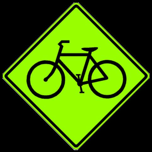
32 Pavement Markings Sharrow Alerts motorists to the presence of bicyclists in the travel lane Displayed in conjunction with a Share-The-Road sign Used when roadway right-of-way prohibits the addition of a dedicated bicycle lane Along Riverside Road west of Dogwood Road, along Houze Road west of Houze Road, and along Willeo Road east of Cobb County line


33 Pavement Markings Bike Box Allows bicyclists to move to the front of a queue line at a traffic signal Reduces bicycle-vehicle conflicts Cars stop further back Provides passive guidance to bicyclists Located along Grimes Bridge Road EB at Oxbo Road and at Riverside Road WB at Dogwood Road


34 Part Five Traffic Lights

35 History of Traffic Lights The world s first traffic light was installed outside of Parliament in London, England in 1868 Used gas lamps with red and green lenses The modern traffic light was invented by Detroit, MI police officer William L. Potts Used red, amber, and green railroad lights First 4-way, three-color traffic light Installed at Woodward and Michigan Avenues in Detroit in 1920 Fourteen additional lights were added within a year Traffic light invented by William L. Potts, 1920


 Arrow Directional")
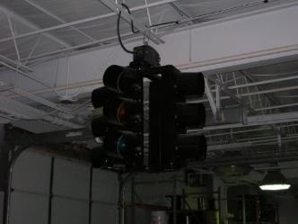
36 Traffic Lights Parts of the Traffic Signal Signal head Signals heads are manufactured individually and assembled based on desired need Most common configuration is a three-head signal (RYG) Can include four- and five-head signals (RYG with yellow and green arrows) Signal face Each color lens is a face (Red/Yellow/Green) Ball Solid color indicator (Red/Yellow/Green) Arrow Directional arrow indicator


37 Traffic Lights Rules Governing Traffic Signals The Manual of Uniform Traffic Control Devices (MUTCD) governs the installation, appearance, and function of traffic signals All signals must have a minimum of three signal heads The red indicator is always on top or on the far left Minimum of two signal displays must face traffic Timing of each signal phase based on engineering studies Priority given to main thoroughfare Based on vehicular volumes


38 Traffic Lights How Does the Signal Know I Am There? Magnetic Loops A loop is cut in the pavement just behind the STOP bar Activates a call to the signal to change Fairly inexpensive to install Have to be replaced when road is resurfaced Video Detection A small camera is mounted on the pole or mast arm Computer detects a vehicle and sends a call to the controller Moderately priced Less chance of malfunction


39 Traffic Lights The Controller The signal s brain Controls the selection and duration of displays for conflicting traffic movements The cabinet includes a variety of items to control the signal Power panel Detector interface panel (loop or video detectors) Detector amplifiers The computer controller A conflict monitor unit Flash transfer relays Police override panel


40 Traffic Lights Determining if a Signal Can Be Installed A traffic study known as a warrant analysis must be performed before the installation of a traffic signal Just because a signal may meet one of the warrants does not suppose the signal is the right traffic control device to address the issue Warrant One, Eight-Hour Vehicular Volume Warrant Two, Four-Hour Vehicular Volume Warrant Three, Peak Hour Warrant Four, Pedestrian Volume Warrant Five, School Crossing Warrant Six, Coordinated Signal System Warrant Seven, Crash Experience Warrant Eight, Roadway Network Warrant Nine, Intersection Near a Grade Crossing


41 Part Six Advanced Traffic Management Systems (ATMS)


42 What is ATMS? Application of advanced technologies to the transportation system Remote access to field equipment Coordinated traffic signal systems Adaptive signal timings control based on real time traffic Traffic monitoring cameras Pre-trip and en-route traveler information
 Maximize the efficiency of the")

43 What is ATMS? (continued) Maximize the efficiency of the existing roadway Reduce the time needed to clear hazards from the roadway ATMS projects are far cheaper than adding road capacity


44 Advanced Traffic Management Systems Elements Traffic Control Center Field equipment could be accessed remotely to make changes Capability to remotely monitor traffic conditions Traffic Monitoring Cameras Identify areas of severe traffic congestion and back ups Help identify incidents/hazards such as stalled cars or accidents

")
45 Real Time Signal Coordination Advanced Traffic Management Systems Elements (continued) Tie several signals in a corridor together to improve traffic flows and reduce delay Changeable Message Signs Overhead signs along Interstates Cobb, Clayton, and Gwinnett Counties also have CMSs on selected arterials Other Tools Statewide 511 Service Website (i.e. Georgia NaviGAtor)


46 Advanced Traffic Management Systems Benefits Safe and efficient travel Fewer traffic jams/improved traffic flow Better travel information Quicker incident clearance Improved air quality (less idling) Fuel/energy savings Time savings (less time in congested conditions)
 As of November 2017, Roswell has 60 cameras")

47 Advanced Traffic Management Systems ATMS in Roswell City has Traffic Control Center (TCC) As of November 2017, Roswell has 60 cameras within Roswell City limits Expansion Plans RDOT currently anticipates adding an additional 10 cameras over before 2020 as funding is identified.


48 Part Seven Pavement Management
 Streets with rankings of 0-30 get full rehabilitation Includes full milling (asphalt removal) and patching The")
49 Pavement Management A rating of all public streets in the City A ranking of 100 is considered the best, zero is the worst The lower the number, the higher the priority Pavement with a rating of receives minor maintenance Pavement ranked gets overlay (new pavement over old) Streets with rankings of 0-30 get full rehabilitation Includes full milling (asphalt removal) and patching The City always starts at the bottom of the list


50 Pavement Management What Are You Driving On? Most important part is sub-base and the base Sub-base is generally soil, base is generally stone Surface is either concrete or asphalt


51 Pavement Management What Causes Potholes? Movement of the base due to water or extremely heavy vehicles (mainly trucks) or high volumes of traffic Damage by one semi-truck is equivalent to 200,000 passenger vehicles As the base deteriorates, the asphalt surface shifts and begins to break up


52 Pavement Management Patching Two types of patching Emergency Cold patch fills the hole Lasts a week or so Routine Maintenance Milling to a depth of four inches, then filling with hot mix asphalt Lasts much longer


53 Pavement Management Paving in Roswell The City paves/repaves approximately 15 miles a year Equivalent of streets Priority based on Pavement Management Ranking Funding amount set annually by Mayor and City Council City will patch the bad spots, mill where necessary Widen shoulders when possible for addition of bicycle-friendly shoulders or bike lanes in selected cases

54 Part Eight Resources Available on roswellgov.com
")
55 Click on Cone Zone for info on current Construction projects you are interested in and select the box Web Resources Cone Zone (continued)

56 Web Resources Cone Zone (continued) Tabs Once this map appears, click on the project or search the map for the project you are interested in Project info Appears here

57 Web Resources Contact us / Report Issues To contact us to report potholes, signal or sign issues, or anything else related to the Transportation infrastructure you can call or us
58 Contact us See Click Fix (app) Another way to report potholes, signal or sign issues, or anything else related to the Transportation infrastructure is to use the SEECLICKFIX app on your mobile device Visit their website: or Download the app directly in the Android or Apple app store

 Add picture")
59 Contact us See Click Fix (app) Select Report to notify RDOT of problems Enter the following information: 1) Issue Title or Type 2) Description 3) Location (by phone GPS or manual enter 4) Add picture (optional step)

60 Contact us See Click Fix (app) (continued) Enter Location by GPS or by address Enter Issue Title Enter brief description

61 Contact us See Click Fix (app) (continued) You also have the optional step to insert a picture. This is helpful for RDOT staff to see repair issues first hand. Once complete, the app sends an notification to the appropriate contact at RDOT. RDOT staff will investigate and respond accordingly.

62 If you have questions or need clarification on anything represented in this presentation, Please contact us! For information about the Roswell DOT, surf to or send us an to: or phone us. Phone:
Active Transportation Facility Glossary
 Active Transportation Facility Glossary This document defines different active transportation facilities and suggests appropriate corridor types. Click on a facility type to jump to its definition. Bike
ATTACHMENT NO. 11. RRLRT No. 2. Railroad / Light Rail Transit Technical Committee TECHNICAL COMMITTEE: Busway Grade Crossings STATUS/DATE OF ACTION
 ATTACHMENT NO. 11 RRLRT No. 2 TECHNICAL COMMITTEE: TOPIC: Railroad / Light Rail Transit Technical Committee Busway Grade Crossings STATUS/DATE OF ACTION RRLRT TC Draft: 06/23/2011 RRLRT TC Approval: 06/27/2014
SCOPE Application, Design, Operations,
 SCOPE Application, Design, Operations, Maintenance, etc.: Typical Traffic Control Signals Pedestrian Hybrid Beacons Emergency Vehicle One-Lane/Two-Way Facilities, Freeway Entrance Ramps, and Movable Bridges
Glossary of Terms. ABANDONMENT The permanent cessation of rail activity on a given line of railroad.
 Glossary of Terms AAR/DOT CROSSING NUMBER A uniform numbering system in which a unique designation is assigned to every highway-rail grade crossing in the nation. It consists of a six digit number followed
Chapter V TRAFFIC CONTROLS. Tewodros N.
 Chapter V TRAFFIC CONTROLS www.tnigatu.wordpress.com tedynihe@gmail.com Lecture Overview Traffic markings Longitudinal markings Transverse markings Object markers and delineator Traffic signs Regulatory
PART 9. TRAFFIC CONTROLS FOR BICYCLE FACILITIES TABLE OF CONTENTS
 2006 Edition Page TC9-1 PART 9. TRAFFIC CONTROLS FOR BICYCLE FACILITIES TABLE OF CONTENTS SECTIONS CHAPTER 9A. Section 9A.01 Section 9A.02 Section 9A.03 Section 9A.04 Section 9A.05 Section 9A.06 Section
Traffic Signs and Markings. Instructor: Dr. Yahya Sarraj Associate Prof. Of Transportation
 and Markings Instructor: Dr. Yahya Sarraj Associate Prof. Of Transportation Definition; A traffic sign is defined as a device mounted on a fixed or portable support whereby a specific message is conveyed
Chapter #4 Traffic Control Devices and Laws
 Chapter #4 Traffic Control Devices and Laws Chapter #4 Overview Unit 4 will introduce the student to traffic control devices, including signs, signals and pavement markings, as well as traffic laws specific
Figure 3B-1. Examples of Two-Lane, Two-Way Marking Applications
 Figure 3B-1. Examples of Two-Lane, Two-Way Marking Applications A - Typical two-lane, two-way marking with passing permitted in both directions B - Typical two-lane, two-way marking with no-passing zones
CHAPTER 2G. PREFERENTIAL AND MANAGED LANE SIGNS
 2011 Edition - Revision 2 Page 275 Section 2G.01 Scope CHAPTER 2G. PREFERENTIAL AND MANAGED LANE SIGNS 01 Preferential lanes are lanes designated for special traffic uses such as high-occupancy vehicles
Oregon Supplement to the Manual on Uniform Traffic Control Devices. Adopted July 2005 by OAR
 Oregon Supplement to the Manual on Uniform Traffic Control Devices Adopted July 2005 by OAR 734-020-0005 2003 Edition Oregon Supplement to the MUTCD Page 2 INTRODUCTION Traffic control devices installed
Beginning School Bus Driver Curriculum UNIT IX. FIELD TRIPS and TRAFFIC CONTROL DEVICES. Revised 09/2011 Revised 10/2013 (Instructional Content)
") Beginning School Bus Driver Curriculum UNIT IX FIELD TRIPS and TRAFFIC CONTROL DEVICES Revised 09/2011 Revised 10/2013 (Instructional Content) Unit IX FIELD TRIPS AND TRAFFIC CONTROL DEVICES TABLE OF CONTENTS
Beginning School Bus Driver Curriculum UNIT IX FIELD TRIPS and TRAFFIC CONTROL DEVICES Revised 09/2011 Revised 10/2013 (Instructional Content) Unit IX FIELD TRIPS AND TRAFFIC CONTROL DEVICES TABLE OF CONTENTS
Section 9A.07 Meaning of Standard, Guidance, Option, and Support
 2012 Edition Page 895 PART 9. TRAFFIC CONTROLS FOR BICYCLE FACILITIES CHAPTER 9A. GENERAL Section 9A.01 Requirements for Bicyclist Traffic Control Devices 01 General information and definitions concerning
(This page left intentionally blank)
") (This page left intentionally blank) 2011 Edition- Revision 2 Page 813 CHAPTER 9A. GENERAL Section 9A.01 Requirements for Bicyclist Traffic Control Devices 01 General information and definitions concerning
(This page left intentionally blank) 2011 Edition- Revision 2 Page 813 CHAPTER 9A. GENERAL Section 9A.01 Requirements for Bicyclist Traffic Control Devices 01 General information and definitions concerning
Traffic Control Devices
 533372 Highway Engineering Traffic Control Devices Traffic Control Devices o The media by which traffic engineers communicate with drivers o Every traffic law, regulation, or operating instruction must
CHAPTER 1 STANDARD PRACTICES
 CHAPTER 1 STANDARD PRACTICES OBJECTIVES 1) Functions and Limitations 2) Standardization of Application 3) Materials 4) Colors 5) Widths and Patterns of Longitudinal Pavement Marking Lines 6) General Principles
GLOSSARY CROSSWALK. CROSSING TYPES
 CROSSWALK The part of a roadway at an intersection included within the connections of the lateral lines of the sidewalks on opposite sides of the street measured from the curbs, or in the absence of curbs
5. RUNNINGWAY GUIDELINES
 5. RUNNINGWAY GUIDELINES These guidelines should be considered collectively when making runningway decisions. A runningway is the linear component of the transit system that forms the right-of-way reserved
Traffic Signs and Signals
 CHAPTER FOUR Traffic Signs and Signals Traffic signs control traffic flow, making streets and highways safer for drivers, bicyclists and pedestrians. These signs, which are posted by the Indiana Department
Comments EXECUTIVE SUMMARY
 Comments 1. Under any Alternatives, MCDOT should provide better at-grade pedestrian crossing of Georgia Avenue and Forest Glen Road, including improved crosswalks with wider medians and adequate signal
MANUAL ON UNIFORM TRAFFIC CONTROL DEVICES INTRODUCTION
 2011 Edition Page I-1 MANUAL ON UNIFORM TRAFFIC CONTROL DEVICES INTRODUCTION 01 Traffic control devices shall be defined as all signs, signals, markings, and other devices used to regulate, warn, or guide
MUTCD Part 6G: Type of Temporary Traffic Control Zone Activities
 MUTCD Part 6G: Type of Temporary Traffic Control Zone Activities 6G.01 Typical Applications Each temporary traffic control (TTC) zone is different. Many variables, such as location of work, highway type,
CHAPTER 3 SIGNS, SIGNALS AND PAVEMENT MARKINGS. Responsible Driving (Red book) NOTES & STUDY GUIDE
 NOTES & STUDY GUIDE") CHAPTER 3 SIGNS, SIGNALS AND PAVEMENT MARKINGS Responsible Driving (Red book) NOTES & STUDY GUIDE Regulatory Signs Warning Signs International Signs Guide Signs Types of Road Signs Sub category (construction
CHAPTER 3 SIGNS, SIGNALS AND PAVEMENT MARKINGS Responsible Driving (Red book) NOTES & STUDY GUIDE Regulatory Signs Warning Signs International Signs Guide Signs Types of Road Signs Sub category (construction
MUTCD, 2003 Edition. FHWA, US DOT March R
 MUTCD, 2003 Edition FHWA, US DOT http://mutcd.fhwa.dot.gov/index.htm March 2008 962R561200 1 Overview The traffic control devices (TCD) are very critical for the safe and efficient transportation of people
Section 3A.04 Colors. Section 3B.10 Approach Markings for Obstructions
 Section 3A.04 Colors Markings shall be yellow, white, red, or blue, or purple. The colors for markings shall conform to the standard highway colors. Black in conjunction with one of the above colors shall
NJDOT Complete Streets Checklist
 Background The New Jersey Department of Transportation s Complete Streets Policy promotes a comprehensive, integrated, connected multi-modal network by providing connections to bicycling and walking trip
Pedestrians and Bicyclists. Bruce Friedman and Scott Wainwright FHWA MUTCD Team
 Impact of the New MUTCD on Pedestrians and Bicyclists Bruce Friedman and Scott Wainwright FHWA MUTCD Team Development of the 2009 MUTCD NPA published in the Federal Register on January 2, 2008 Received
Appendix Work Zone Traffic Control
 ppendix Work Zone Traffic Control The purpose of this appendix is to present basic guidelines for work zone traffic control and to supplement the Highway Work Zone Safety Checklist. This appendix presents
PART 4 HIGHWAY TRAFFIC SIGNALS
 2016 Edition Page 111 PART 4 HIGHWAY TRAFFIC SIGNALS CHAPTER 4A. GENERAL [This is a new section. There is no corresponding section in the MUTCD.] Section 4A.100 Traffic Control Device Alternatives for
Draft North Industrial Area-Wide Traffic Plan
 Summary of North Industrial and Hudson Bay Industrial Recommended Improvements Table 1. Summary of s Item Location 1 2 3 4 5 6 7 8 9 10 11 12 Millar Ave north of 51st St Super 8 Motel back lane 400 Block
TRAFFIC CONTROLS FOR BICYCLE FACILITIES
 Part 9. TRAFFIC CONTROLS FOR BICYCLE FACILITIES TABLE OF CONTENTS Chapter 9A. GENERAL Page Section 9A.1 Requirements for Bicyclist Traffic Control Devices............................. 9A-1 9A.2 Scope.................................................................
An Overview of the 2009 MUTCD
 An Overview of the 2009 MUTCD CLRP Highway School June 7, 2010 Sally S. Olsen, P.E. New York State Department of Transportation solsen@dot.state.ny.us 518-457-5690 Goals for this Session Review the changes
A COMPREHENSIVE APPROACH TO TRANSPORTATION AT SUNTRUST PARK AND THE BATTERY ATLANTA
 A COMPREHENSIVE APPROACH TO TRANSPORTATION AT SUNTRUST PARK AND THE BATTERY ATLANTA Overview The Atlanta Braves strategically selected the location for SunTrust Park to provide an environment rich in transportation
Managed Lanes. Steve Schilke, P.E. Major Projects Unit Head District 1. Illinois Traffic Engineering and Safety Conference October 2016
 Managed Lanes Steve Schilke, P.E. Major Projects Unit Head District 1 Illinois Traffic Engineering and Safety Conference October 2016 Agenda Managed Lanes Projects I-55 (Stevenson Expressway) Express Toll
APPENDIX A: Complete Streets Checklist DRAFT NOVEMBER 2016
 APPENDIX A: Complete Streets Checklist DRAFT NOVEMBER 2016 Complete Streets Checklist MetroPlan Orlando s Complete Streets Checklist is an internal planning tool for staff to further implementation of
Double the amount of bicycle ridership while at the same time reducing the number of bicycle crashes by one-third.
 CHAPTER 6 Recommended Policies and Action Items To achieve the goals stated in Chapter 1 and guide implementation of the Bicycle Plan, policies and action items have been identified. They are presented
Video Review: Signs, Signals and Markings Video Review 4.1
 Video Review: Signs, Signals and Markings Video Review 4.1 Video 4.1 Review: 1. What must you do before turning left at an intersection with a green light? 2. What do flashing yellow lights mean? 3. At
PART 10. TRAFFIC CONTROLS FOR HIGHWAY-LIGHT RAIL TRANSIT GRADE CROSSINGS TABLE OF CONTENTS
 Part 10. Traffic Controls for Highway-Light Rail Transit Grade Crossings Page 10TC-1 PART 10. TRAFFIC CONTROLS FOR HIGHWAY-LIGHT RAIL TRANSIT GRADE CROSSINGS TABLE OF CONTENTS CHAPTER 10A. GENERAL..........................................
MUTCD Part 6: Temporary Traffic Control
 MUTCD Part 6: Temporary Traffic Control OMUTCD English units are preferred. OHIO MANUAL OF UNIFORM TRAFFIC CONTROL DEVICES TABLE OF CONTENTS PREFACE INTRODUCTION TABLE OF CONTENTS PART 1. GENERAL Chapter
Shortening or omitting a pedestrian change interval when transitioning into preemption
 Signals #1 NOTE: This is a recommendation by the Signals Technical Committee of the NCUTCD. It is being distributed to the NC Sponsoring agencies for review and is subject to revision. This recommendation
CHAPTER 6H. TYPICAL APPLICATIONS
 2006 Edition Page 6H-1 CHAPTER 6H. TYPICAL APPLICATIONS Section 6H.01 Typical Applications Support: Whenever the acronym TTC is used in this Chapter, it refers to temporary traffic control. Standard: The
Ohio Department of Transportation Edition of the OMUTCD It s Here!
 Ohio Department of Transportation John R. Kasich, Governor Jerry Wray, Director 2012 Edition of the OMUTCD It s Here! June 6, 2012 Here are reasons why we have a Manual of Uniform Traffic Control Devices
Bluffdale/ UDOT South High-T Intersection Project Type Operations
 Bluffdale/ UDOT 14600 South High-T Intersection Project Type Operations 14600 South and Redwood Road $ 600,000 $ 550,000 This project is to install a new High-T intersection at Redwood Road and 14600 South
ONTARIO REGULATION 239/02 MUNICIPAL ACT MINIMUM MAINTENANCE STANDARDS FOR MUNICIPAL HIGHWAYS
 ONTARIO REGULATION 239/02 made under the MUNICIPAL ACT Made: July 23, 2002 Filed: August 8, 2002 MINIMUM MAINTENANCE STANDARDS FOR MUNICIPAL HIGHWAYS Definitions 1. (1) In this Regulation, cm means centimetres;
Public Information Meeting. Orange Camp Road. Dr. Martin Luther King Jr. Beltway to I-4. Presented by: Volusia County August 2, 2018
 Public Information Meeting Orange Camp Road Dr. Martin Luther King Jr. Beltway to I-4 Presented by: Volusia County August 2, 2018 1 Project Goals To improve the operations and safety for Orange Camp Road
Phone: Fax: Project Reference No. (to be filled out by MassHighway):
:") Massachusetts Highway Department District 3 Project Need Form (PNF) This form is intended to provide preliminary information about the proposed project. It is not expected that all information that is
Massachusetts Highway Department District 3 Project Need Form (PNF) This form is intended to provide preliminary information about the proposed project. It is not expected that all information that is
Appendix 3 Roadway and Bike/Ped Design Standards
 Appendix 3 Roadway and Bike/Ped Design Standards OTO Transportation Plan 2040 4/20/2017 Page A3-1 Adopted Standards The adopted OTO Design Standards and Major Thoroughfare Plan are contained herein.
Houma-Thibodaux Metropolitan Planning Organization STP<200K Funding Application APPLICATION
 APPLICATION HOUMA-THIBODAUX METROPOLITAN PLANNING ORGANIZATION (HTMPO) FOR SURFACE TRANSPORTATION PROGRAM (STP
The 2009 Manual on Uniform Traffic Control Devices (MUTCD) (Brief) Highlights for Arizona Practitioners. Arizona Department of Transportation
 (Brief) Highlights for Arizona Practitioners. Arizona Department of Transportation") The 2009 Manual on Uniform Traffic Control Devices (MUTCD) (Brief) Highlights for Arizona Practitioners Arizona Department of Transportation New 2009 MUTCD 9 Parts (down from 10 in 2003) 816 pages (up
The 2009 Manual on Uniform Traffic Control Devices (MUTCD) (Brief) Highlights for Arizona Practitioners Arizona Department of Transportation New 2009 MUTCD 9 Parts (down from 10 in 2003) 816 pages (up
SRTS IMPLEMENTATION COSTS
 SRTS IMPLEMENTATION COSTS What Is a Estimate? A cost estimate establishes the anticipated budget required to implement the actions (the improvement projects and programs) identified in your School Travel
DEFINITIONS Activity Area - Advance Warning Area Advance Warning Sign Spacing Advisory Speed Approach Sight Distance Attended Work Space
 DEFINITIONS Activity Area - that part of a TTC zone activity area where the work actually takes place. It consists of the work space, traffic space and one or more buffer spaces. Advance Warning Area -
PLACEMENT OF SIGNS RECOMMENDED PRACTICES SUB-SECTION
 Page 1 of 6 RECOMMENDED PRACTICES PART SECTION SUB-SECTION HIGHWAY SIGNS GENERAL General Proper positioning of signs is an important element in the overall control of traffic within a roadway network.
900 BICYCLE FACILITIES Traffic Engineering Manual
 TABLE OF CONTENTS Part 9 - BICYCLE FACILITIES 900 GENERAL... 9-3 900-1 General Background... 9-3 900-2 Designated Bicycle Routes... 9-3 901 SIGNINGS... 9-4 902 MARKINGS... 9-4 902-1 General... 9-4 902-2
STANLEY STREET December 19, 2017
 STANLEY STREET December 19, 2017 Welcome Mike Wiza, Mayor Scott Beduhn, Director of Public Works Agenda 1. Introduction 2. Existing Roadway Conditions 3. Current Alternative Improvements 4. Summary of
CITY OF BLOOMINGTON COMPLETE STREETS POLICY
 CITY OF BLOOMINGTON COMPLETE STREETS POLICY POLICY OBJECTIVE: The City of Bloomington will enhance safety, mobility, accessibility and convenience for transportation network users of all ages and abilities,
Proposed Bridge Street East Bicycle Lanes Public Open House Thursday, April 27, 2017
 WELCOME Proposed Bridge Street East Bicycle Lanes Public Open House Thursday, April 27, 2017 Purpose of the Open House The purpose of this Open House is to gain public input on the bicycle lanes proposed
ADA PRESENTATION (CURB RAMPS)
") ADA PRESENTATION (CURB RAMPS) ACECNJ/NJDOT/FHWA DESIGN SUMMIT Warren Howard New Jersey Department of Transportation May 21, 2013 ADA Curb Ramps NJDOT wants curb ramps to be designed & constructed properly
ADA PRESENTATION (CURB RAMPS) ACECNJ/NJDOT/FHWA DESIGN SUMMIT Warren Howard New Jersey Department of Transportation May 21, 2013 ADA Curb Ramps NJDOT wants curb ramps to be designed & constructed properly
Washington St. Corridor Study
 FIGURE 7.17 Bridge Alternatives - Cross Sections 86 Discarded Alternative: Short-Term Bridge Repair Short-term repairs and west bridge span replacement were considered during analysis. Short-term repairs
New Measure A Expenditure Categories DEFINITIONS OF ELIGIBLE EXPENDITURES Adopted March 8, 2007
 New Measure A Expenditure Categories DEFINITIONS OF ELIGIBLE EXPENDITURES Adopted March 8, 2007 City Street and County Road Maintenance Program The preservation and keeping of public street and road rights-of-way
Broad Street Bicycle Boulevard Design Guidelines
 Broad Street Bicycle Boulevard Design Guidelines Building from the strategies introduced in the 2013 Bicycle Transportation Plan and community input received thus far, City Transportation Staff have identified
Table of Contents. Introduction. Prompt List Arterials and Streets. Prompt List Interchange. Prompt List Intersections. Prompt List Limited Access
 Table of Contents Introduction Prompt List Arterials and Streets Prompt List Interchange Prompt List Intersections Prompt List Limited Access Prompt List MOT Prompt List Pedestrian Bicyclist Prompt List
Non-Motorized Transportation 7-1
 Non-Motorized Transportation 7-1 Transportation facilities no longer mean just accommodating a vehicle powered by a combustion engine. Pedestrian and non-motorized facilities are important modes of travel
C/CAG. Sunnybrae Elementary School Walking and Bicycling Audit. San Mateo-Foster City School District JUNE 2013
 Sunnybrae Elementary School Walking and Bicycling Audit JUNE 2013 San Mateo-Foster City School District C/CAG City/County Association of Governments of San Mateo County SUNNYBRAE ELEMENTARY SCHOOL WALKING
Fundamentals of Traffic Control Devices
 Fundamentals of Traffic Control Devices Traffic Engineering & Operations October 8, 2014 Raj Ponnaluri, Angela Wilhelm, and Christopher Lewis Agenda Agenda Signs Pavement Markings Signals Traffic Operations
BOSTON REGION METROPOLITAN PLANNING ORGANIZATION
 PLANNING ORGANIZATIO BOSTON REGION MPO NMETROPOLITAN BOSTON REGION METROPOLITAN PLANNING ORGANIZATION Stephanie Pollack, MassDOT Secretary and CEO and MPO Chair Karl H. Quackenbush, Executive Director,
Overview. Illinois Bike Summit IDOT Complete Streets Policy Presentation. What is a Complete Street? And why build them? And why build them?
 Overview Illinois Bike Summit IDOT Complete Streets Policy Presentation Aren Kriks, P.E. District One Bicycle Coordinator and Bureau of Programming Project Engineer History of Complete Streets IDOT Policy
900 BICYCLE FACILITIES Traffic Engineering Manual
 TABLE OF CONTENTS Part 9 - BICYCLE FACILITIES 900 GENERAL... 9-3 900-1 General Background... 9-3 900-2 Designated Bicycle Routes... 9-3 901 SIGNING... 9-4 901-1 General... 9-4 901-2 Bicycle 3-Foot Clearance
California Manual on Uniform Traffic Control Devices
 California Manual on Uniform Traffic Control Devices FHWA s MUTCD 2009 Edition as amended for use in California 2012 Edition State of California Business, Transportation and Housing Agency Department of
Including Revision 1 dated May 2012 and Revision 2 dated May 2012
 Including Revision 1 dated May 2012 and Revision 2 dated May 2012 Page 634 2009 Edition Notes for Figure 6H-1 Typical pplication 1 Work eyond the Shoulder 1. If the work space is in the median of a divided
l Civil Engineering Group of PSRA Techn ical Plan Review Team. '\J \
 GOVERNMENT OF THE DISTRICT OF COLUMBIA District Department of Transportation Public Space Regulation Administration PSRA.. *.. d ~ oc == *. * GENERAL TRAFFIC CONTROL PLAN (TCP) SUBMITTAL GUIDELINES 18
INDOT Complete Streets Guideline & Policy
 INDOT Complete Streets Guideline & Policy INTRODUCTION The Complete Streets guidelines build upon multiple efforts and promote a multimodal transportation system that is integrated and sustains land use
Vermont Permit Test Flash Cards
 Vermont Permit Test Flash Cards Study online at quizlet.com/_aormb are the most likely places for car and motorcycle collisions to occur. intersections are areas around trucks where cars disappear 2. :
ALLEY 24 TRAFFIC STUDY
 ALLEY 24 TRAFFIC STUDY in City of Frostburg, Maryland January 2013 3566 Teays Valley Road Hurricane, WV Office: (304) 397-5508 www.denniscorporation.com Alley 24 Traffic Study January 2013 Frostburg, Maryland
TEMPORARY TRAFFIC CONTROL GUIDELINES FOR HIGHWAY-RAIL GRADE CROSSINGS
 TEMPORARY TRAFFIC CONTROL GUIDELINES FOR HIGHWAY-RAIL GRADE CROSSINGS 1.0 INTRODUCTION 1.1 Purpose The Southern California Regional Rail Authority (SCRRA) is the designated track owner of the Metrolink
ADDENDUM NUMBER ONE (1) For
 For") ADDENDUM NUMBER ONE (1) For OCCOQUAN REGIONAL PARK MULTIPURPOSE TRAIL Recreation Trails Program (RTP) Federal Highway Administration (FHWA) CFDA Number: 20.219 State Project Number: VRT-301 In Lorton,
ADDENDUM NUMBER ONE (1) For OCCOQUAN REGIONAL PARK MULTIPURPOSE TRAIL Recreation Trails Program (RTP) Federal Highway Administration (FHWA) CFDA Number: 20.219 State Project Number: VRT-301 In Lorton,
CIRCULAR NO. O-13. Recommended Practices for Manual Protection of Highway/Railway Grade Crossings
 CIRCULAR NO. O-13 Recommended Practices for Manual Protection of Highway/Railway Grade Crossings Effective: October 1, 2004 CONTENTS 1. SCOPE 2. GENERAL PRINCIPLES 3. DEFINITIONS 4. PROTECTION REQUIRED
TRAFFIC CONTROLS FOR BICYCLE FACILITIES
 PART IX. TRAFFIC CONTROLS FOR BICYCLE FACILITIES A. GENERAL 9A-1 Requirements for Bicyclist Traffic Control Devices Traffic control devices, whether they are intended for motorists or bicyclists, must
CHAPTER 2: SIGNALS, SIGNS AND PAVEMENT MARKINGS
 CHAPTER 2: SIGNALS, SIGNS AND PAVEMENT MARKINGS This chapter provides the information you need to know about Pennsylvania roadways. It covers: Signals Signs Pavement Markings SIGNALS Traffic signals are
City of Vallejo Traffic Calming Toolbox
 City of Vallejo Traffic Calming Toolbox June 1, 2013 Final Table of Contents Introduction... 1 Non-Physical Devices... 3 High-Visibility Crosswalk... 3 In Pavement Lighted Crosswalk... 4 Rapid Flashing
PART 5. TRAFFIC CONTROL DEVICES FOR LOW-VOLUME ROADS TABLE OF CONTENTS
 2005 Edition Page TC5-1 PART 5. TRAFFIC CONTROL DEVICES FOR LOW-VOLUME ROADS TABLE OF CONTENTS CHAPTER 5A. Section 5A.01 Section 5A.02 Section 5A.03 Section 5A.04 CHAPTER 5B. GENERAL Page Function...5A-1
TRANSPORTATION TRAINING TOPICS. April 6, 2010
 TRANSPORTATION TRAINING TOPICS April 6, 2010 Roles of Transportation Providers Context and Policy Makers Division of Transportation and Traffic Other City Operations Other Transportation Operators CMA
Chapter 5: Crossing the Street
 Chapter 5: Crossing the Street Whether walking or bicycling, a student s journey to school will more than likely require crossing one or more streets. Per the Safe Routes to School Guide, maintained by
Cycle Track Design Best Practices Cycle Track Sections
 Design Best Practices Sections It is along street segments where the separation and protection methods of cycle tracks offer more comfort than conventional bicycle lanes, and are more attractive to a wide
National Committee on Uniform Traffic Control Devices RWSTC RECOMMENDATION FOLLOWING SPONSOR COMMENTS
 1 2 3 ATTACHMENT NO. 1 RW No. 1, Jan 2012 4 5 6 7 8 9 10 11 12 13 14 15 16 17 18 19 20 21 22 23 24 25 26 27 28 29 30 31 32 33 34 35 36 37 38 39 40 41 National Committee on Uniform Traffic Control Devices
Signs. signs, signals and road markings. in this chapter
 3 signs, signals and road markings in this chapter Signs regulatory signs school, playground and crosswalk signs lane use signs turn control signs parking signs reserved lane signs warning signs object
(This page left intentionally blank)
") (This page left intentionally blank) 2011 Edition - Revision 1 Page 553 Section 5A.01 Function CHAPTER 5A. GENERAL 01 A low-volume road shall be defined for this Part of the Manual as follows: A. A low-volume
(This page left intentionally blank) 2011 Edition - Revision 1 Page 553 Section 5A.01 Function CHAPTER 5A. GENERAL 01 A low-volume road shall be defined for this Part of the Manual as follows: A. A low-volume
Chapter 2: Standards for Access, Non-Motorized, and Transit
 Standards for Access, Non-Motorized, and Transit Chapter 2: Standards for Access, Non-Motorized, and Transit The Washtenaw County Access Management Plan was developed based on the analysis of existing
TRAFFIC IMPACT ANALYSIS
 TRAFFIC IMPACT ANALYSIS FOR THE CHAMPAIGN UNIT#4 SCHOOL DISTRICT PROPOSED HIGH SCHOOL (SPALDING PARK SITE) IN THE CITY OF CHAMPAIGN Final Report Champaign Urbana Urbanized Area Transportation Study 6/24/2014
SCHOOL CROSSING PROTECTION CRITERIA
 CITY OF MADISON TRAFFIC ENGINEERING SCHOOL CROSSING PROTECTION CRITERIA January 2016 Adopted as Policy on August 31, 1976, by Common Council by Amended Resolution #29,540 Amended on September 14, 1976,
TRANSPORTATION ANALYSIS REPORT US Route 6 Huron, Erie County, Ohio
 TRANSPORTATION ANALYSIS REPORT US Route 6 Huron, Erie County, Ohio December 12, 2012 Prepared for: The City of Huron 417 Main Huron, OH 44839 Providing Practical Experience Technical Excellence and Client
Transportation Planning Division
 Transportation Planning Division Presentation Outline Study Tasks Recap of Previous Meetings Data Collected Focus Areas within Study Limits Design Principles Tool Box Recommended Concepts Schedule Moving
November 2012: The following Traffic and Safety Notes were revised:
 CHANGE LIST for MDOT Traffic and Safety, TRAFFIC AND SAFETY NOTES Located at http://mdotcf.state.mi.us/public/tands/plans.cfm JANUARY 2014: The following Traffic and Safety Note was added: Note 705A Angled
Identify the letter of the choice that best completes the statement or answers the question.
 Chapter 02 - Practice Questions Multiple Choice Identify the letter of the choice that best completes the statement or answers the question. 1) No-parking zones often are near a. fire hydrants, curves,
Santa Clara County Expressways Complete Streets & Design Challenges
 Santa Clara County Expressways Complete Streets & Design Challenges Presented as part of County Partnerships to Improve Community Health Project Panel Discussion September 24, 2015 By Dan Collen, Deputy
PART 7. TRAFFIC CONTROLS FOR SCHOOL AREAS CHAPTER 7A. GENERAL
 2012 Edition Page 825 Section 7A.01 Need for Standards January 13, 2012 PART 7. TRAFFIC CONTROLS FOR SCHOOL AREAS CHAPTER 7A. GENERAL 01 Regardless of the school location, the best way to achieve effective
Congestion Reducing Activities. Toby Carr GDOT Director of Planning April 10, 2014
 Congestion Reducing Activities Toby Carr GDOT Director of Planning April 10, 2014 GDOT Performance Dashboard Congestion Congestion Relief Strategies 511 HEROS RTOP Highway Emergency Response Operators
Circulation in Elk Grove includes: Motor vehicles, including cars and trucks
 Circulation, as it is used in this General Plan, refers to the many ways people and goods move from place to place in Elk Grove and the region. Circulation in Elk Grove includes: Motor vehicles, including
Hospital Link Project Project Update September 2017
 Hospital Link Project Project Update September 2017 General The project provides a link from Riverside Drive and the Transitway to the Hospital Link Road. Construction is well underway. Read on for important
ATTACHMENT NO. 18 GMI-C. National Committee on Uniform Traffic Control Devices GMI SIGNS TECHNICAL COMMITTEE RECOMMENDATION
 1 2 3 ATTACHMENT NO. 18 GMI-C 4 5 6 7 8 9 10 11 12 13 14 15 16 17 18 19 20 21 22 23 24 25 26 27 28 29 30 31 32 33 34 35 36 37 38 39 GMI agenda item II.H.2., January 19, 2012 National Committee on Uniform
Houma-Thibodaux Metropolitan Planning Organization STP<200K Funding Application APPLICATION
 APPLICATION HOUMA-THIBODAUX METROPOLITAN PLANNING ORGANIZATION (HTMPO) FOR SURFACE TRANSPORTATION PROGRAM (STP