CITY OF SEBASTOPOL BICYCLE AND PEDESTRIAN MASTER PLAN AMENDED NOVEMBER, 2011
|
|
|
- Moses Foster
- 6 years ago
- Views:
Transcription

1 CITY OF SEBASTOPOL BICYCLE AND PEDESTRIAN MASTER PLAN AMENDED NOVEMBER, 2011

2
3 Sebastopol Bicycle & Pedestrian Master Plan Table of Contents Page 1. Introduction 1 Purposes of the Plan 1 Vision Statement 2 Caltrans Compliance 3 2. Setting and Context 4 Land Use History 4 Jurisdiction Overview Setting and Land Use 4 Attractors and Generators 4 Schools and Safe Routes 5 Parks and Community Facilities 7 Sebastopol Demographics and Commute Patterns 7 Local Opportunities and Constraints 10 Data Collection Recommendations Vision, Goal, Objectives and Policies 12 Vision, Goal, Objectives and Policies 12 Relationship to Other Plans and Policies The Local Bicycle and Pedestrian Transportation Network 24 Existing Conditions 24 Proposed Improvements Project Costs and Funding 30 Costs 30 Past Expenditures 30 Funding Sources 30 Appendices A: Caltrans Checklist B: Proposed Bicycle and Pedestrian Count Locations C: Existing and Proposed Bikeways and Pedestrian Facilities Table 4 - Existing Bikeways Table 5 - Proposed Bikeways, Est. Costs and Priorities Table 6 - Planning Level Cost Assumptions for Bike Facility Improvements Table 7 - Proposed Pedestrian Facilities and Misc. Projects D: MAP - PROPOSED AND EXISTING BICYCLE AND PEDESTRIAN FACILITIES IN THE CITY OF SEBASTOPOL SCTA Countywide Bicycle & Pedestrian Master Plan City of Sebastopol Amended: November 2011
4 1.! Introduction This Sebastopol Bicycle & Pedestrian Master Plan was developed as a component of the Sonoma County Transportation Authority s (SCTA s) 2008 Countywide Bicycle & Pedestrian Master Plan. While part of the Master Plan, the Sebastopol plan is also a stand-alone document to be used by the City of Sebastopol to guide implementation of local projects and programs and document city policy. It is also designed to be a component of the SCTA Countywide Bicycle & Pedestrian Master Plan to improve coordination in realizing the countywide bicycle and pedestrian system. The 2008 Sebastopol plan was developed over the course of a year through the coordinated efforts of the SCTA s Bicycle and Pedestrian Advisory Committee, a focused project steering committee, Sebastopol staff, and input from the public through a series of public workshops and public review periods. The Project Steering Committee was established to oversee the development of the plan and consisted of representatives from the County and each of its cities. Public workshops were held throughout the County to collect input from interested members of the public. The workshops were advertised through various local and regional print media, mailings, the posting of public fliers, and government outreach efforts. When the plan was approved, the City determined that additional study was needed to further refine the plan regarding designation of Class 2 bike facilities. The City completed a Bike Lane Feasibililty Study in June This amendment to the plan incorporates the recommendations of the Bike Lane Feasibililty Study as directed by the City Council, and updates other sections of the plan to include changes that have occurred since the plan was first adopted. Purposes of the Plan The primary emphasis of the SCTA Countywide Bicycle & Pedestrian Master Planning effort was to facilitate transportation improvements for bicyclists and pedestrians. The purposes of the Plan are to: Assess the needs of bicyclists and pedestrians in Sebastopol and throughout Sonoma County in order to identify a set of local and countywide improvements and implementation strategies that will encourage more people to walk and bicycle; Identify local and countywide systems of physical and programmatic improvements to support bicycling and walking; Provide local agencies that adopt the Plan with eligibility for various funding programs, including the State Bicycle Transportation Account (BTA); Act as a resource and coordinating document for local actions and regional projects; and Foster cooperation between entities for planning purposes and to create Geographic Information System (GIS) maps and a database of existing and proposed facilities countywide. How Does the Plan Affect Daily Life in Sonoma County? The SCTA Countywide Bicycle & Pedestrian Master Plan describes a vision for the future of these alternative transportation modes, identifies policies to help achieve that vision and contains funding strategies for implementation of the projects and programs contained within the plan. These policies affect what choices we have for travel by car, bus, and bicycle and on foot. By identifying 1

5 To achieve these, the Plan includes recommendations for physical improvements and programs that could be developed to enhance and expand existing facilities, connect gaps, address constraints, provide for greater local and regional connectivity, and increase the potential for walking and bicycling as transportation modes. Vision Statement Through a collaborative planning process, a vision, goal and objectives were approved by all ten jurisdictions of Sonoma County: Cloverdale, Healdsburg, Windsor, Santa Rosa, Cotati, Rohnert Park, Petaluma, Sonoma, Sebastopol, and the County of Sonoma. These are designed to guide the development and maintenance of bicycle and pedestrian facilities throughout Sonoma County and express the intent of SCTA and its member agencies to enhance non-motorized mobility and to improve safety, access, traffic congestion, air quality, and the quality of life of Sonoma County residents, workers and visitors. The vision for a comprehensive bicycle and pedestrian transportation system is: In Sonoma County bicycling and walking are: Important to residents quality of life Integral parts of an interconnected transportation system Safe and convenient for all user groups Viable means of reaching desired destinations Routinely accommodated Encouraged by easy connections to transit Fostered by education and enforcement Advanced by actions of government, schools and the private sector Promoted as tourism and recreation attractions Mode choices that contribute to personal health Options that reduce vehicle miles traveled and greenhouse gas emissions Caltrans Compliance Bicycle Transportation Act To be eligible for Bicycle Transportation Account (BTA) funds, a city or county must prepare and adopt a Bicycle Transportation Plan (BTP) that addresses items a k in Streets and Highways Code Section If a city plans to use a countywide BTP to establish their eligibility for BTA funds, the countywide BTP must include a discussion of items a k for that city in addition to addressing these items for the unincorporated areas in the county. Items a k, and their location in this Plan, are identified in Appendix A. Bicycle Transportation Plan Approval Process Following adoption at the local level, a city or county sends their plan to the appropriate Regional Transportation Planning Agency (RTPA) for approval. Sonoma County s RTPA is the 2
6 Metropolitan Transportation Commission (MTC). RTPA approval consists of verifying that the plan is in compliance with Section and the Regional Transportation Plan (RTP). Following RTPA approval, the local agency submits the plan, adopting resolution, and RTPA letter of approval to Caltrans Bicycle Facilities Unit for review to ensure the plan addresses the required elements. Caltrans Bicycle Program staff employs a checklist approach to BTP review to determine if the plan includes the required elements. While each required element should be addressed in the plan, regardless of applicability to the local agency preparing the plan, the review does not grade the information provided in the discussion of the required elements. BTP adoption establishes eligibility for five consecutive BTA funding cycles. 3

7 2.! Setting and Context Land Use History Miwok and Pomo peoples were the area's first known inhabitants. The westward migration and Gold Rush brought new settlers to California. Some found the land around Sebastopol hospitable for farming. Sebastopol formed in the 1850s with a post office and as a small trade center to support the growing agricultural operations. An apple industry was established, along with schools, churches, hotels, canneries, mills, wineries, and an opera house. Sebastopol was incorporated in 1902, but a few years later the earthquake of 1906 reduced many of the early buildings to rubble. The town rebuilt, and the apple business flourished. The Petaluma and Santa Rosa Railroad, an electric interurban railway was established in The railroad aided commerce and included rail lines north to south through the center of town extending to Forestville and Petaluma, and one to the east to Santa Rosa. The apple industry gradually declined after the mid 1900 s, when competition with other apple producing regions emerged. The next major influence on transportation, and likewise land use, was the affordability of the automobile for many families and businesses. Trails evolved into paved roads to serve the new vehicular mode and land use and development quickly adapted with more dispersed patterns. As development became more sprawled and the number of car owners grew, non-motorized means of travel declined. Worth noting is that most of Sonoma County s cities retain a central historic core that preceded the advent of the automobile, and Sebastopol s downtown retains much of its walkability from that earlier era. Jurisdiction Overview Setting and Land Use Most of Sebastopol s commercial businesses are concentrated along two state highways (State Route (SR) 12 and SR116, which double as the city s main streets. There are residential neighborhoods west of SR 116 until it veers west as Healdsburg Avenue, at which point there are neighborhoods both north and south of the highway. Most of the city s industrial uses are concentrated north of SR 12, as it enters Sebastopol from Santa Rosa. In recent years, higherdensity infill development has occurred along the state highways, which will favor increased pedestrian traffic along the City s core corridors. Sebastopol s development patterns, coupled with its relatively small land area, create many opportunities for residents to walk to and around downtown and on the Main Street corridor. Land use development and settlement patterns are indicated in Figure 1, the Sebastopol LandUse Map. Attractors and Generators Attractors and generators in Sebastopol were identified by reviewing information from standard sources such as maps, plans, and the City s website as well as consultation with staff. The locations of the attractors and generators were considered in determining the alignments of both the local and countywide networks. They include downtown, City Hall and other government 4
8 buildings, the downtown Plaza, the post office, the Joe Rodota and West County trails, transit stops, parks, schools, Palm Drive Hospital and nearby medical offices, Community Center and Youth Annex, shopping centers, and other public attractions. 5
9 Schools and Safe Routes Two school districts serve the city of Sebastopol, the Sebastopol Union School District and the West Sonoma County High Union High School District. The City s six schools include Analy High School, Laguna Continuation High School, Brook Haven Middle School,, Park Side Elementary School, and the Sebastopol Independent Charter School which operates schools on two campuses. 1 The schools, the grades they serve, and their addresses are listed in Table 1 below. Table 1 Sebastopol Schools School Grade Levels Location Analy High School Analy Avenue Laguna Continuation High School Taft Street Brookhaven Middle School Valentine Avenue Park Side Elementary School K Bodega Avenue Sebastopol Independent Charter School K Valentine Avenue Sebastopol Independent Charter School South Main Street Safe routes to schools programs are an essential component of successful efforts to make walking and bicycling to school safer, increase the number of children walking and bicycling to school, improve children s health and fitness, and educate students and parents about the health, transportation and environmental benefits of walking and bicycling. Safe Routes to Schools programs typically use the "five Es" to accomplish these goals: Encouragement (e.g., prizes, special events like Walk to School Day), Education (e.g., fliers on the benefits of walking, maps of safe routes, classroom curriculum), Engineering (e.g., improvements to infrastructure such as roadways, intersections, sidewalks and bicycle facilities), Enforcement (making sure motorists, pedestrians and bicyclists understand and obey the rules of the road), and Evaluation (such as before/after surveys to see the effect of programs and physical improvements on mode choice for student commuters). The City has been active in its pursuit of Safe Routes to Schools funding and was awarded both an infrastructure and a non-infrastructure grant in the from the State SR2S funding cycle. The infrastructure grant funded the Huntley Street Sidewalk Gap Closure Project, which closed a sidewalk gap in front of the Sebastopol Union School District office leading to Park Side Elementary School, and installed a high-visibility crosswalk and signage. The noninfrastructure grant funded the Sebastopol Safe Routes to Schools Program, which was used to establish a formal and ongoing SR2S Program for the elementary schools in the Sebastopol Union School District. The Sebastopol Safe Routes Program commenced with the school year and will run through the end of the school year. The Sebastopol program established a model of sorts, which is now being replicated in schools throughout the 1 A seventh campus, Pine Crest Elementary School (3-5) was closed by the District in


10 County, and efforts are underway to ensure future sustainability of this program in Sebastopol schools. The City of Sebastopol enthusiastically supports a number of other education and/or outreach efforts including: Bike Rodeos Bicycle Helmet giveaway (ongoing and funded by the Police Officer s Association) Enforcement of bicycle helmet laws and other traffic laws impacting bicyclists Investigation of collisions, including collisions involving bicyclists. Annual Bike and Walk to School day participation Patrolling the Sonoma County Regional Park Bicycle and Pedestrian trails Bicycle Patrol Parks and Community Facilities A variety of parks and community facilities exist in Sebastopol. They include neighborhood parks, community parks, open space areas, regional parks, civic buildings, schools, and other quasi-public facilities. These facilities are distributed throughout the community and are accessible by those on foot and/or bicycle. Following is a list of parks and community facilities: Ives Park community park Laguna Youth Park community park Laguna de Santa Rosa Wetlands Preserve Gold Ridge Experiment Farm Laguna Skategarden skate park and community Garden Libby Park neighborhood park City Plaza community park Spooner Park pocket park Ragle Ranch Park Sonoma County regional park Sebastopol Community Center and Youth Annex Sebastopol Library Sebastopol Center for the Arts Veterans Building Chamber of Commerce / West County Museum Sebastopol Demographics and Commute Patterns Local Bicycle and Pedestrian Travel Characteristics Travel information in Sebastopol was analyzed to identify mode split and to evaluate travel time to work. The term mode split refers to the form of transportation a person chooses: walking, bicycling, taking a bus, driving, etc. The commute analysis establishes base data on the existing number of bicycle and pedestrian commuters, as well as an indication of the number of potential bicycle and pedestrian commuters in the plan area. This information can then be used by staff and local officials to develop improvement plans and set priorities, with the objective of 7

11 increasing the percentage of people who choose to walk or bicycle rather than drive a car or be driven. A review of available demographic and commute statistics was performed in order to better understand the level of walking and bicycling in Sebastopol and Sonoma County as a whole. Several data sources were reviewed, including California Department of Finance Population Estimates, the Bay Area Travel Survey, and Journey-to-Work (JTW) Data from the US Census Bureau. Every ten years, the US Census Bureau attempts to count every person throughout the nation. As part of this survey process, the agency distributes a longer questionnaire to one in eight American households. One of the long form questions is, How did you usually get to work last week? Respondents who typically use more than one method of transportation are instructed to mark the mode used for most of the distance. The collective responses to this question form a set of data known as Journey-to-Work (JTW). Because of its extremely large sample size over 400 households in Sebastopol alone JTW data is considered the most reliable source of transportation mode choice information available. However, while the JTW provides a glimpse of how Sebastopol residents travel to and from work, the data source only provides a partial understanding of travel characteristics. The instructions effectively eliminate any record of the pedestrian portion of walk-to-transit and walkto-carpool trips; the wording leaves the response, for commuters who do not use the same mode every day, up to the respondent; the survey takes place in the month of March, which can be quite rainy in Sonoma County, a deterrent to walking and bicycling; and, most importantly, only work trips are surveyed, which ignores many common walk and bicycle trips, such as trips to school, to local shops, and for exercise. The 2000 US Census indicates a population of 7,770 in Sebastopol; it is expected to grow to 9,620 2 by 2020 (Sonoma County General Plan 2020, Overview Draft). According to the 2000 US Census, there are 3,882 workers in Sebastopol 16 years old or older. Of these, 3,663 work outside the home. Twenty-nine percent, or 1,080 workers, have a travel time to work of 15 minutes or less. Sebastopol has an average rate of workers with a commute time of less than when compared to the nation which is at 30 percent, but a higher than average rate when compared to the state which are at 25 percent. This data indicates a high percentage of workers who are employed within the community and close to home, which represents an opportunity to shift travel modes, at least part of the time. Travel time to work in Sebastopol is shown in Table 2 below. 2 Travel data from the 2010 Census is not yet available, so information from the 2000 Census cannot be updated at this writing. Growth projections for Sebastopol will be reviewed in an upcoming Genera Plan update, however it should be noted that the 2010 Census found a population of 7,379, a 5.1% population decline from 2000 to 2010, calling into question past growth projections for the town. 8
12 Sebastopol Travel Time Over Table 2 to Work for Workers 16 Years Old and # % Total Employed Persons 3, % Worked at home 219 6% Did not work at home 3,663 94% Travel Time # % Less than 15 minutes 1,080 29% 15 to 29 minutes 1,254 43% 30 to 44 minutes % 45 to 59 minutes 156 4% 60 minutes or more % Source: 1United States Census 2000, United States Census Bureau, 2000 As shown in Table 3 below, JTW data indicates that approximately 80 percent of workers in Sebastopol, or 3,142 persons, drive to work alone. Approximately 1.1 percent, or 41 workers commute by bicycle, a rate that is higher than the County and statewide average bicycle mode share of 0.8 percent, and more than double the national average of 0.4 percent. Approximately 3.2 percent of workers, or 125 persons, walk to work, a rate that is slightly higher than the countywide average of 3.1 percent and the statewide average of 2.9 percent. While approximately 6.6 percent workers in Sebastopol (256 persons) carpool, about half of the statewide and national averages, the majority of workers in Sebastopol drive to work alone. Given Sebastopol s climate, topography, and percentage of commuters with a travel time to work of 15 minutes or less, a significant opportunity exists to achieve greater bicycle and pedestrian mode splits. Every motor vehicle trip or vehicle mile driven eliminated results in less air pollution, reduced green house gas emissions, and lessened traffic congestion. Table 3 Demographic and Journey to Work Data 2000 US Census Sebastopol Countywide California Population 8, ,614 33,871,648 Employed persons 16 years of age + 3, ,947 14,525,322 Mode Split # % # % # % Drove Alone 3, % 168, % 10,432,4 71.8% 62 Bike % 1, % 120, % Walk % 6, % 414, % Public Transit % 5, % 736, % Carpool % 28, % 2,113, % 3 Motorcycle 22 1% % 36, % 9
13 Other 6 0.2% 1,587 1% 115,064 1% Worked at Home 219 6% 12,246 5% 557,036 4% Local Opportunities and Constraints This section provides a list of opportunities and constraints for the City s bicycle and pedestrian networks. A variety of conditions were considered including roadway geometries, traffic volumes, crossing locations, distance between destinations, topography, system users, and other issues. Opportunities Planned Street Smart Sebastopol improvements Potential bicycle and pedestrian design enhancements on the state highways (context sensitive main street improvements) Programmed Safe Routes to School infrastructure improvements and programs Improved inter-county and inter-city connection opportunities System enhancements through a comprehensive way-finding, directional, and warning signing campaign for pedestrians and bicyclists Potential mode share growth and safety improvements through education and awareness efforts Constraints No bike lanes on HWY 116 or HWY 12 through central downtown Limited right-of-way for bicycle or pedestrian improvements on many residential roads Limited control over state highways Limited locations to develop a crossing of SR 12 for the Laguna Path Topography on the west side of town can be steep Signalized intersections need bicycle sensitive detection Data Collection Recommendations Bicycle and Pedestrian Counts One of the challenges facing staff and local decision makers in the area of bicycle and pedestrian planning is the lack of documentation on usage and demand for pedestrian and bicycle facilities. Without accurate and consistent data, it is difficult to measure the positive benefits of bicycle and pedestrian investments, especially when compared to the other types of transportation such as the automobile. In order to supplement JTW data, to attain a better understanding of existing usage and travel patterns, and to be able to project demand, regular bicycle and pedestrian counts are recommended. Proposed count locations in Sebastopol and throughout the County were identified through the planning process The basic criteria used to select count locations included points along and intersections of primary streets in the network, area coverage, population centers, attractors and generators, and community gateways. A table of the original Proposed Count Locations can be found in Appendix B. 10
14 Since adoption of the plan the Sonoma County Transportation Authority has established an ongoing Bicycle and Pedestrian Count Program beginning in 2009, now in its third year. Although funding for the program is limited, SCTA has utilized summer interns funded through MTC to conduct the counts using National Bicycle and Pedestrian Documentation Project (NBPDP) methodology, and has provided training on data collection methodology to County jurisdictions. The SCTA program has provided data at three locations in Sebastopol, as follows. Street Name Location 2009 Bike PedAM PM AM PM 2010 Bike Ped AM PM AM PM 2011 Bike Ped AM PM AM PM North Main St Analy Ave South Main St Burnett St Petaluma Ave Joe Rodota Tr City Staff is exploring ways to expand the number of locations and frequency of bike and pedestrian counts. 11
15 3.! Vision, Goal, Objectives and Policies Vision, Goal, Objectives, and Policies This section defines the vision for bicycle and pedestrian transportation throughout Sonoma County, and outlines the vision, principal goal, and objectives that will serve as guidelines in the continuing development of the countywide bicycle and pedestrian transportation system 3. Through a collaborative planning process, the vision, goal and objectives were approved by all ten jurisdictions of Sonoma County: Sebastopol, Healdsburg, Windsor, Santa Rosa, Sebastopol, Rohnert Park, Petaluma, Sonoma, Sebastopol, and the County of Sonoma. These are designed to guide the development and maintenance of bicycle and pedestrian facilities throughout Sonoma County and express the intent of SCTA and its member agencies to enhance non-motorized mobility to improve safety, access, traffic congestion, air quality, and the quality of life of Sonoma County residents, workers and visitors. The vision, goal and top-tier objectives are meant to function as the mutually agreed upon common framework applicable to both the primary countywide system and local bicycle and pedestrian networks. Policies, and possibly additional objectives, that address jurisdictionspecific issues are included in the individual County and city/town plans. The role of the SCTA is in advocating, planning, coordinating, and funding, whereas local agencies, such as cities, towns, and the County, transit agencies, Caltrans, and the non-profit and private sectors, will be chiefly responsible for implementation of objectives and policies. The vision for a comprehensive bicycle and pedestrian transportation system is: In Sonoma County bicycling and walking are: Important to residents quality of life Integral parts of an interconnected transportation system Safe and convenient for all user groups Viable means of reaching desired destinations Routinely accommodated Encouraged by easy connections to transit Fostered by education and enforcement Advanced by actions of government, schools and the private sector Promoted as tourism and recreation attractions Mode choices that contribute to personal health Options that reduce vehicle miles traveled and greenhouse gas emissions Principal Goal: To develop and maintain a comprehensive countywide bicycle and pedestrian transportation system, which includes projects, programs, and policies that work together to provide safe and efficient opportunities for bicyclists and pedestrians to 3 The system is defined as the whole of all of the components physical and programmatic. 12
16 access public transportation, school, work, shopping, services, recreation and residences. Objectives and Policies Objective 1.0: The Countywide Bicycle and Pedestrian Network* Establish a comprehensive countywide bicycle and pedestrian transportation system. Policies:.1 Develop a local and countywide bicycle and pedestrian transportation network that provides access to and among major activity centers, commercial districts, schools, transportation centers, public transportation recreation, and other destinations, according to the recommendations in this plan..2 Work cooperatively with responsible agencies including Transportation and Public Works, Regional Parks, SCTA, SMART, SCWA, Caltrans and others, to close existing facility gaps and ensure the system is implemented, constructed, and maintained..3 Assign a bicycle and pedestrian coordinator to oversee implementation of the Bicycle and Pedestrian Plan and coordinate activities between City departments and other jurisdictions..4 Double the Journey to Work mode split percentages for walking and bicycling, by the year 2020, using 2006 data as the baseline. Bicycle-specific policies.5 Consider the needs of bicyclists of all types (commuters, recreational riders, children, and families) in planning, developing, and maintaining a bikeway network that is safe and convenient. Pedestrian-specific policies.6 Require new development to provide safe, continuous and convenient pedestrian access to jobs, shopping and other local services and destinations..7 Create spaces and activities that invite pedestrian use and optimize the experience of walking with amenities such as landscaping, public art, seating and drinking fountains..8 Focus on improving safety of pedestrian crossings of roadways and highways, especially in pedestrian districts. Objective 2.0: Design Utilize accepted Complete Streets design standards and best practices for the development of bicycle and pedestrian facilities. Policies:.1 Utilize the California Highway Design Manual, the California Manual of Uniform Traffic Control Devices, the American Association of State Highway Transportation Officials (AASHTO) Guide for the Development of Bicycle Facilities and Guide for the Planning, Design, and Operation of Pedestrian Facilities for the development of bicycle and pedestrian facilities..2 Require that all new signalized intersections include bicycle detection and are properly marked and operational for use by bicyclists. 13
17 .3 Where minimum bike lane standards are infeasible, use striped edge lines, signs, shared lane markings, or other route enhancements to improve conditions for bicyclists, wherever feasible..4 Projects that will result in the loss of existing bicycle and pedestrian facilities or jeopardize future facilities as shown on the Bikeways Map should be mitigated wherever feasible..5 Install way finding signage, markers, and stencils on off-street paths, on-street bikeways, local roads, and State Routes to improve way finding for bicyclists, assist emergency personnel, and heighten motorist s awareness..6 Provide consistent enhanced features at uncontrolled pedestrian crossings, especially within pedestrian districts and at intersections of arterials with Class I trail. Objective 3.0: Multimodal Integration Develop and enhance opportunities for bicyclists and pedestrians to easily access public transit. Policies:.1 Cooperate with transit providers to implement a safe routes to transit program that prioritizes pedestrian and bicycle access to transit stops and stations..2 Encourage transit providers to provide and maintain convenient and secure bike parking facilities, all-weather shelters, and other amenities at major transit stops and transportation centers at a minimum..3 Encourage local and regional transit agencies to accommodate bicycles on transit and plan for the need for additional bicycle storage capacity on transit to ensure capacity keeps up with demand. Objective 4.0: Comprehensive Support Facilities Encourage the development of comprehensive support facilities for walking and bicycling. Policies:.1 Require adequate short-term bicycle parking for retail, office, commercial and industrial uses..2 Require adequate short-term bicycle parking and long-term bicycle storage for transportation centers..3 Encourage employers to provide secure indoor and/or covered bicycle parking for their employees..4 Encourage employers to provide adequate shower and locker facilities for workers..5 Install high-visibility crossing treatments, pedestrian scale lighting, street furniture, drinking fountains, and other pedestrian amenities in pedestrian districts and on Class I trails. Objective 5.0: Education and Promotion Develop programs and public outreach materials to promote bicycle and pedestrian safety and the positive benefits of bicycling and walking. 14
18 Policies:.1 Participate in the development and maintenance of a bicycle and pedestrian safety campaign as a countywide tool to deliver comprehensive safety awareness, driver, cyclist and pedestrian education information, and to increase the awareness of the benefits of walking and bicycling as transportation modes..2 Support grassroots efforts that help to resolve bicycle and pedestrian transportation issues..3 Distribute bicycle and pedestrian safety, educational, and promotional materials through law enforcement activities, at scholastic orientations, through drivers training and citation diversion programs, and to new political representatives..4 Encourage events that introduce residents to walking and bicycling, such as bike-towork, walk/bike-to-school days, senior walks and historic walks..5 Encourage major employment centers and employers to encourage commuting by bicycle, including the use of flex-time work schedules to support non-rush hour bicycle commuting..6 Educate the general public and the officials of state, county, and local law enforcement agencies on common Vehicle Code infractions involving bicyclists and other users of roadways or off-road pathways Objective 6.0: Safety and Security Create countywide pedestrian and bicycle networks that are, and are perceived to be, safe and secure. Policies:.1 Reduce automobile collisions with pedestrians and bicyclists by 50 percent by the year 2020, using 2006 collision data as the baseline for analysis..2 Coordinate the delivery of bicycle Safety Education Programs to schools, utilizing assistance from law enforcement agencies, local bicycle shops, and other appropriate groups and organizations..3 Focus on improving safety of intersection crossings using pedestrian signal cycles, pedestrian buttons, high-visibility crosswalk markings and education..4 Prioritize safety improvements in the vicinity of schools, public transit and other highpriority pedestrian destinations..5 Review collision data annually to identify problem areas and to prioritize projects and program activities..6 Improve pedestrian safety and security with pedestrian-level lighting, where appropriate, and development of activities and facilities that encourage walking..7 Continue to seek sources of funding for ongoing implementation of the Safe Routes to School program in the Sebastopol Union School District schools. Objective 7.0: Land Use 15
19 Encourage smart growth land use strategies by planning, designing and constructing bicycle and pedestrian facilities in new development. Policies:.1 Encourage School districts to participate in providing safe and continuous bicycle and pedestrian connections from surrounding neighborhoods when constructing new or improving existing school facilities..2 Encourage compact, high density pedestrian oriented development in pedestrian districts..3 In pedestrian districts allow shared parking for commercial uses rather than requiring each business to provide separate parking areas..4 Condition discretionary projects in pedestrian districts to provide pedestrian facilities such as sidewalks, and trails that link pedestrian routes or provide access to destinations wherever feasible..5 Where a nexus is identified, condition discretionary projects to provide an irrevocable offer of Class I easement or land dedication and construction of Class I multi-use pathways as designated in an adopted plan provided it can be shown that such a Class I pathway will serve as loops and/or links to designated or existing Class I multi-use pathways, trails, communities, existing or proposed schools, public parks and open space areas, and existing or proposed public transit nodes (e.g., transportation centers, park and ride lots, bus stops). Objective 8.0: Planning and Analysis Continue to support bicycle and pedestrian efforts with data measurement, analysis, and ongoing planning. Policies:.1 The Countywide Bicycle and Pedestrian Advisory Committee (CBPAC) shall continue to be responsible for advising staff on the ongoing planning and coordination of the bicycle and pedestrian transportation system..2 Update the Bicycle and Pedestrian Plan in accordance with the California Bicycle Transportation Act, and to coordinate with Regional Transportation Plan updates..3 The CBPAC shall review the design of all new road widening projects in order to minimize hazards and barriers to bicycle travel on all local roads. City staff shall evaluate all designs and plans for new capital improvement projects on City streets or state highways within Sebastopol, to ensure consistency with this plan..4 Where different classes of bikeways share the same route, Class I or II bikeways should not be constructed in a manner that reduces or eliminates other designated bikeways. 16
20 Objective 9.0: Maintenance Maintain and/or improve the quality, operation, and integrity of bicycle and pedestrian infrastructure. Policies:.1 Maintain geometry, pavement surface condition, debris removal, markings, and signage on Class II and Class III bikeways to the same standards and condition as the adjacent motor vehicle lanes..2 Assign a point of contact in Public Works for maintenance reporting to compile, track, and respond to routine bicycle and pedestrian maintenance issues in a timely manner..3 Require that road construction projects minimize their impacts on bicyclists and pedestrians to the greatest extent possible, through the proper placement of construction signs and equipment, and by providing adequate detours..4 Require that routine maintenance of local roads consider bicycle and pedestrian safety and at a minimum includes the following activities: Trim vegetation to provide a minimum horizontal clearance of 4 feet from the edge of pavement and a minimum vertical clearance of 8 feet. Clear debris from road shoulder areas to provide space for walking..5 Perform periodic sidewalk inspections to ensure adequate pedestrian clearance and to address maintenance issues that could present a tripping hazard. Objective 10.0: Funding Maximize the amount of funding for bicycle and pedestrian projects and programs throughout Sonoma County, with an emphasis on implementation of this plan. Policies: 10.1! Work with federal, state, regional, and local agencies and any other available public or private funding sources to secure funding for the bicycle and pedestrian system. 10.2! Encourage multi-jurisdictional funding applications to implement the regional bicycle and pedestrian system. 10.3! Promote the availability of adequate regional, state and federal funding sources for bicycle and pedestrian transportation projects. Relationship to Other Plans and Policies Implementation of the Sebastopol Bicycle & Pedestrian Master Plan will require coordination, consistency, and cooperation among numerous jurisdictions and agencies with varied interests that share policy decisions within and immediately adjacent to Sebastopol and Sonoma County. There are myriad relevant federal, state, regional, county, and local agencies that have developed plans, programs, directives, policies, and regulations related to funding, planning, designing, operating, maintaining, and using bicycle and pedestrian facilities. These agencies and their plans, policies, etc., have been evaluated for coordination, consistency, and conformance with this Plan. Brief summaries of local plans and policies are provided below. 17
21 Summaries of regional, state, and federal plans, policies, and other relevant resources are provided in the Overview section. Sebastopol General Plan The Sebastopol General Plan is a long-range comprehensive planning document required by state law and adopted by the City in to set policy and guide future growth, development and conservation of resources. The following General Plan goals are relevant to bicycle and pedestrian improvements in Sebastopol. Chapter II Transportation Goal 1! Reduce Regional Traffic Growth P.3! Support Region Alternatives to the Single-Occupant Vehicle: Support regional transportation policies and programs which increase the use of public transit, carpools, bicycles and other alternative modes of transportation and limit the growth of single-occupant vehicle traffic. Program 3.11: Continue to provide staff resources to review, analyze, and monitor regional transportation plans. Responsibility: City Manager. Goal 2! Develop a Citywide and areawide circulation system that is safe and efficient. P.7-! Continuation of Streets: Facilitate the continuation of streets and bicycle and pedestrian paths through new developments wherever possible. Program 7.1:! Review site plans of developments to facilitate the continuation of streets, bicycle and pedestrian paths to improve local circulation. Responsibility: Planning Department Continuation of existing streets should be considered in the review of development of larger parcels located between streets where this will not generate adverse impacts for traffic movement, public safety and the character of the neighborhood. Priority shall be given to providing pedestrian and bicycle trails to connect streets wherever possible. Goal 3!Regard the quality of life in Sebastopol and maintaining community identity as more important that accommodating traffic. 4 At this writing, the City contemplates, but has not yet begun a General Plan Amendment Process. (Novmeber 2011) 18
22 P.8-! Community Identity Higher Priority that Accommodating Traffic: Place a higher priority on safety and pedestrian-oriented design and scale, as opposed to traffic flow and speed. P.9-! Community Priorities for Transportation Improvements: Place a higher priority on maintaining a sense of place, and enhancing the attractiveness of the Downtown and residential neighborhoods, than on traffic flow and movement. P.10-! Protect Irreplaceable Resources: Ensure that transportation facilities do not adversely impact irreplaceable resources such as the Laguna de Santa Rosa, important open space lands, recreational facilities and neighborhood integrity. P.11-! Reduce Pollution: Reduce the air, water, and noise pollution that results from vehicular traffic by reducing the number of trips. P.12-! Promote Public Participation and Education in Transportation Decisions: Actively seek public participation in the preparation and review of regional and local transportation plans. Program 12.1:!Continue to hold public meetings on proposed transportation plans and improvements. Responsibility: Planning and Engineering Departments Alternatives to the Automobile Goal 6! Reduce dependence on the automobile. Bicycle and Pedestrian Trails. Goal 7!Make it easier and safer for people to travel by bicycle. Goal 8!Make it easier and safer for people to walk. P.21! Comprehensive Bicycle Path System: Establish a comprehensive and safe system of bicycle trails connected to all parts of the City. Program 21.1:!Complete the bicycle and pedestrian trail system as included in map 4: Bicycle and Pedestrian Trails System. Responsibility: Planning and Engineering Departments. Program 21.2:! Incorporate bicycle and pedestrian facilities into the design and construction of all roadway improvements as feasible. Responsibility: Planning and Engineering Departments. Program 21.3:! Continue to participate in the Countywide Bicycle Advisory Committee. Responsibility: Engineering. Program 21.4:! Utilize park in-lieu funds, dedications, grant funding, traffic impact fees, and other means, as appropriate, to acquire rights-of-way needed for a comprehensive bike and 19
23 pedestrian path-system, bike racks and other bike-related facilities, as indicated in map 4: Bicycle and Pedestrian Trails System. Responsibility: Engineering Department. Program 21.5:!Prepare and distribute maps of Sebastopol s bicycle and pedestrian trails system at public hearings, the library, schools and other public places. Responsibility: Engineering Department. Programs 21.6:! Construct bike trails according to the standards established by Caltran s Planning and Design Criteria for Bikeways for the roadway system. Alternative designs may be required in the Laguna de Santa Rosa. Responsibility: Engineering Department. Programs 21.7:! Maintain bicycle and pedestrian trails to ensure that they are free of debris, and other obstacles. Consider increasing the number of trash receptacles, solarpowered emergency telephones and increased lighting along bicycle trails. Responsibility: Public Works Department. Programs 21.8:! Require new development to provide on-site connections to existing and proposed bicycle and pedestrian trails, as appropriate. Responsibility: Planning and Engineering Departments. P.22! Bicycle Parking:! Provide adequate and secure bicycle parking at public transit facilities, park and ride lots, schools, the library, parks, city offices, and commercials areas. Program 22.1:! Require new development to provide secure bicycle parking. Responsibility: Planning Department. Revisions to the parking standards contained in the Zoning Ordinance are required to implement this program. The Zoning Ordinance should specify the number of bicycle parking spaces required as a ratio of building and the type of bicycle racks and locker designs which should be used. The specifications for bicycle racks should reflect the type of use. Long term parking at bus stops and workplaces would require locker-type storage for bicycles, whereas short-term parking at stores would require the simpler locking bicycle racks. Program 22.2:!Continue to maintain and improve bicycle parking at City Hall, the library, public parks and the recreation center. Responsibility: Planning and Public Works Departments. Program 22.3:! Work with Golden Gate Transit and Sonoma County Transit to place covered bicycle parking at bus stops and to increase the number of buses able to take bicycles. Responsibility: Planning Department. Program 22.4:! Revise the Zoning Ordinance to require large employers to provide covered bicycle parking and shower facilities. Responsibility: Planning Department. Program 22.5:!Continue the bicycle safety programs run by the Police Department. Responsibility: Police Department. 20
24 The Police Department runs an innovative bicycle safety education program in the elementary schools. Program 23:! Provide Continuous Sidewalks: throughout the City. Provide a continuous system of sidewalks Program 23.1:!Require a sidewalk on both sides of all collector and arterial streets and either a sidewalk or a walkway on local streets. Responsibility: Planning and Engineering Departments. Program 24:! Improve Pedestrian Facilities: Create and maintain a safe and convenient pedestrian system. Program 24.1:! Continue to provide traffic controls and lighting in areas with high volumes of pedestrian movement. Responsibility: Police and Engineering Departments. Program 25:! Pedestrian Paths: Develop a series of continuous pedestrian paths or walkways to connect Downtown and residential neighborhoods. (This program refers to off-site improvements.) Program 25.1:! Permit asphalt pedestrian paths in low-density single-family residential areas in lieu of curb, gutter, and sidewalk, where appropriate. Responsibility: Planning and Engineering Departments. Program 25.2:!Revise the Subdivision Ordinance to allow asphalt pedestrian paths within developments and to nearby streets, community facilities, and adjacent developments as a part of on- and off-site improvements. (This program refers to on-site improvements for all types of development.) Responsibility: Planning and Engineering Departments. Program 25.3:! Ensure that pedestrian paths in environmentally sensitive areas are sited and constructed in a manner compatible with maintaining ecological diversity. Responsibility: Planning and Engineering Departments. Goal 7! Protect and Improve Air Quality P.20! Reduce Vehicle Trips: Encourage transportation facilities modes which minimize motor vehicle use. Program 20.1: Continue to implement a trip reduction ordinance Responsibility: Planning Department. The City has adopted a Trip Reduction Ordinance which requires large employers to encourage ride-sharing, flexible hours and other means to reduce peak hour trips. Refer to the Transportation Chapter for places and programs relating to public transit, bike and pedestrian trails, and other measures to reduce motor vehicle emissions. 21
25 Measures to Reduce Travel Demand Measures to reduce travel demand are directed at reducing the number of single-occupant vehicles during the peak hour commute periods. These programs include the promotion of car and van pooling; encouraging telecommuting; providing shuttle buses to transit lines; providing incentives and rewards for bicycling and walking; and preferred parking for carpools. The effectiveness of such programs depends on having large concentrations of businesses and institutions. At present Sebastopol has a relatively small employment base. Businesses in the City are typically small to medium-sized and are dispersed throughout the Downtown, the adjacent industrial areas and along the arterial roads. Goal 10!! Reduce travel demand P.27! Reducing Travel Demand: Promote measures to reduce travel demand. Program 27.1:! Continue to implement the Trip Reduction Ordinance and consider inclusion of multiple employment centers in the ordinance and other ways to strengthen this ordinance. Responsibility: Planning Department The City has adopted a Trip Reduction Ordinance which requires employers with 100 or more employees to inform their staffs of ways to reduce peak hour trips in single-occupant vehicles. Program 27.2:!Consider establishing incentives for new commercial and industrial developments to provide cafeterias, lunchrooms, showers, bicycle parking and other amenities encouraging alternatives to driving alone to work. Incentives that should be considered include exempting these facilities from the floor area ratio limits, and reducing parking requirements. Responsibility: Planning Department Transportation Funding Goal 11! Promote balanced funding for transportation systems. P.28! Balanced Transportation Funding: Promote a shift in transportation funding away from the road system to improvements related to public transit, rail, bicycle, pedestrian, and carpool transportation. Program 28.1:!Establish a higher priority in funding for alternative modes of transportation in developing the City Capital Improvement Programs. Responsibility: City Manager, Finance, Planning and Engineering Departments Program 28.2:! Work with other jurisdictions in the County and the region, such as MTC, to lobby for increased funding for alternative transportation modes. Responsibility: City Manager and City Council. Chapter III Conservation, Open Space and Parks 22
26 Energy Conservation Goal 6.!Conserve Energy P.16! Reduce Vehicle Trips: Reduce the number of single-occupant vehicle trips and the number of vehicle miles traveled within the planning area. Goal 7! Protect and improve air quality. P. 20! Reduce Vehicle Trips: Encourage transportation facilities and modes which minimize motor vehicle use. Program 20.1: Continue to implement a Trip Reduction Ordinance. Responsibility: Planning Department Goal 9!Provide an attractive and comprehensive system of parks and trails throughout the City that meets the recreational need of all age groups and capabilities. P.27! Biannual Review of Parks, Trails and Open Space acquisition. Carry out a biannual review of the status of parks, trails and open space acquisition and development by the City Council. Program 27.2: Include in the Capital Improvement Program (CIP) the schedule and costs of expanding and improving the urban trails system. Responsibility: Planning and Engineering Departments. 23
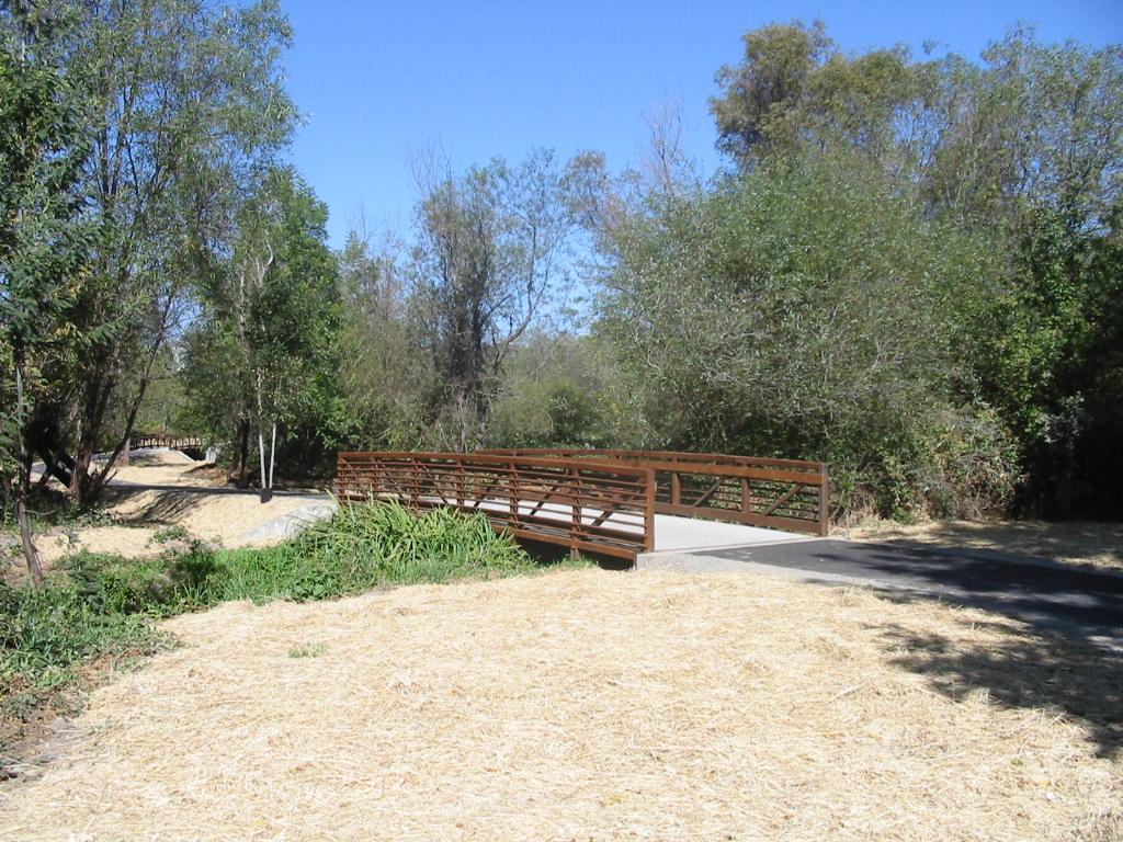
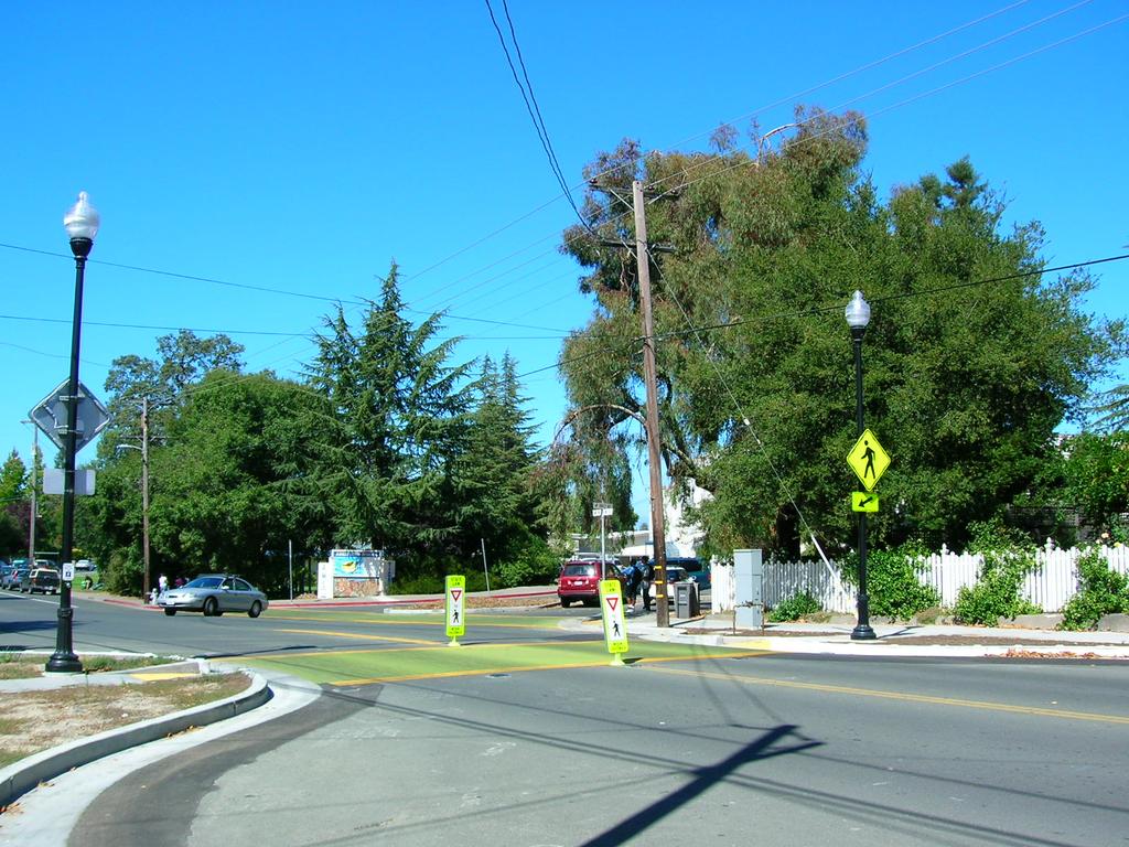
27 4.! The Local Bicycle and Pedestrian Transportation Network A map showing Proposed and Existing Bicycle and Pedestrian Facilities in the City of Sebastopol is included as Appendix D. Existing Conditions Bicyclists and Bicycle Conditions The existing bicycle network in Sebastopol consists of several segments of Class I pathway. Pursuant to the recommendations in the recent Bike Lane Feasibility Study (May 2011) the project list (Appendix C) has been amended to include a list of proposed bikeways which will include Class II bike lanes, Sharrows or Shared Lane Markings, and Class III bike routes to create a community wide network of bicycle facilities. Existing Class I pathways include the Joe Rodota Trail, which extends east from Petaluma Avenue approximately 0.25 miles to the Sebastopol city limits and continues eastward through the County to the City of Santa Rosa. The Railroad Forest Bike Path, which was recently completed, extends northward from the Joe Rodota Trail approximately 0.22 miles to Sebastopol Avenue. A 0.34 mile segment of pathway that provides a connection to the West County Trail is located along Eddie Lane on the north side of Analy High School between Morris Street and High School Road. The West County Trail extends 0.34 miles from High School Road west to the city limits near Dufranc Avenue, then continues beyond the city limits to SR 116. Finally, a short section of Class I pathway is provided on Jewell Avenue between Meadowlark Avenue and Lynch Road. A segment by segment breakdown of existing bikeways is listed in Table 4. Pedestrians, Pedestrian Districts, and Pedestrian Conditions Sebastopol s quiet neighborhoods, multitude of local and regional parks, and vibrant downtown offer residents, workers and visitors many walkable destinations. Furthermore, Sebastopol is temperate and compact, so summer fog and short distances keep walk trips more comfortable than in the hotter and more spread-out Sonoma County cities. However, State Highways 12 and 116, which funnel most West County-bound traffic directly through the center of downtown Sebastopol, and which are operated by Caltrans, rather than Sebastopol, have a significant impact on Walkability. Sebastopol s topography presents an additional challenge: Many of the city s residential neighborhoods west of Main Street are hilly, which can be difficult for some pedestrians to negotiate, especially persons with certain disabilities. These hills have also limited the construction of roadway corridors parallel to Sebastopol s literal Main Street (Highway 116), focusing automobile traffic local and otherwise onto Healdsburg Avenue, North Main Street and South Main/Petaluma Avenue. These hills also serve to concentrate most pedestrian activity on the Highway 116 corridor, or Main Street, the location of Sebastopol s two primary pedestrian districts or activity centers places where walking could be prioritized as a mode of travel. The downtown pedestrian district encompasses a large portion of the city s center, including the old cannery area to the east of our downtown. The district is roughly bounded by Laguna Park Way, High Street, Willow Street 24
28 and Morris Street. The district includes major community destinations, such as: the Plaza; Main Street and its shops; restaurants; bars and services; City Hall; the Sebastopol Branch Library; Ives Park and Community Pool; the post office, a park-and-ride lot; residences; and a variety of other businesses and destinations. Wide sidewalks, street trees and crossing enhancements are found throughout much of the district. Sebastopol s second pedestrian district, the Main Street corridor, overlaps the first, and extends from Analy High School south to Spooner Park. The Main Street pedestrian corridor provides access to Analy High School to the north, Safeway, Rite Aid, and civic destinations near the center of town, the Sebastopol Post Office, West County Museum, Ives Park and Pool, the Sebastopol Charter School, Joe Rodota Trail, Park-and-Ride, and a number of restaurants, local shops, services, and residences in between. In an effort to capitalize on what Sebastopol has to offer pedestrians, and to improve pedestrian safety and walkability in the downtown area, the City developed the Street Smart Sebastopol program in From the citywide Street Smart visioning process, a wish-list of over 40 projects was developed. Many of these projects have been competed, as opportunities have presented. Most visible are a series of pedestrian safety improvements at 15 intersections, mostly located along State Highway 116 in the downtown area. These intersections have been reconstructed with bulb-outs, pedestrian-level lighting, sidewalk widening, continuous sidewalks where formerly there were gaps, refuge islands, and pedestrian actuated crossing beacons and in-pavement lights, and landscaping. Three intersections were constructed in Another three were completed in 2010, and the remaining nine intersections are nearing completion at this writing. This work was accomplished using $2 million in Countywide Transportation Sales Tax (Measure M) funds, combined with approximately $1 million in Federal transportation grantsthis project is a credit to the local jurisdictions ability to work with Caltrans, which owns and operates these highways, to make pedestrian-related improvements. Bike Detection on City-owned Traffic Signals The City s two traffic signals on Bodega Avenue (at Jewell Avenue and Pleasant Hill Avenue North) were equipped for bicycle detection during the fiscal year, using funds from the Traffic Impact Fund. Bike Lane Feasibility Study More recently, the City collaborated with Caltrans to complete a Bike Lane Feasibility. With help from Caltrans District 4 Bicycle Coordinator and other Caltrans staff, we were able to work out a scheme to create bicycle lanes on the State Highways in Sebastopol. This was a challenging process, due to the somewhat irregular geometry of our downtown highways, but the District s commitment to helping us find solutions was successful in moving forward our goal to establish bikeways throughout Sebastopol. Disabled Access ADA The Americans with Disabilities Act (ADA) was enacted in 1990, providing rights and protections to individuals with disabilities. To comply in the realm of the pedestrian network, local governments must bring sidewalks, curb ramps and roadway crossings up to a set of specified 25

29 standards when constructing new facilities or making modifications within existing public rightsof-way. According to ADA, additions and alterations to existing facilities shall comply with R Alterations include, but are not limited to, renovation, rehabilitation, reconstruction, historic restoration, resurfacing of circulation paths or vehicular ways, or changes or rearrangement of structural parts or elements of a facility. Pavement patching and liquid-applied sealing, lane restriping, and short-term maintenance activities are not alterations. In addition to providing individuals with disabilities with accessible sidewalk, curb ramp and crossing facilities, many ADA requirements help other populations as well. For instance, in addition to serving people who use wheelchairs or other mobility aids, curb ramps facilitate travel by those pushing strollers and inexperienced bicyclists who are not yet ready to ride in the street. Wide sidewalks, and a lack of obstructions, create a nicer environment for all pedestrians. These improvements can also reduce demand for paratransit services (demand-responsive transit for people whose disabilities prevent them from using public transit) by allowing some people with disabilities to access public transit stops. Curb Ramp Upgrades The City has utilized Community Development Block Grant funding for an ongoing program of replacement and retrofit of non-compliant curb ramps beginning in The project continues as funding permits. All new street and sidewalk construction projects are required to upgrade ramps within the area of work to current ADA compliance. The City also collaborates with Caltrans in their program to create compliant facilities on State Highways in Sebastopol. Transit and Multi-Modal Access Convenient multi-modal connections for bicyclists and pedestrians that are well-integrated into the transportation system are a vital component of the bicycle and pedestrian network. Transit has the potential to extend trip ranges for bicyclists and pedestrians to nearby communities and destinations outside of Sonoma County. This is especially important for Sebastopol and Sonoma County in general, considering existing barriers to bicycle and pedestrian travel such as distances between communities, gaps in the existing bicycle and pedestrian networks between urban areas, heat during summer months and rain during winter months. While these obstacles likely serve as deterrents to existing and potential trips by bike or by foot, convenient multi-modal access can help to address these issues and extend trip ranges. Sonoma County Transit Since most transit passengers in Sonoma County walk to their bus stop, pedestrian facilities leading to each stop including completed sidewalk networks, curb cuts and safe intersection crossings are important components of Sebastopol s pedestrian environment. Four Sonoma County Transit routes serve Sebastopol. The Route 20 provides daily service between 5 US Access Board; Revised Draft Guidelines for Accessible Public Rights-of-Way, R202 - Alterations and Additions to Existing Facilities,
30 communities on the Russian River, Forestville, Graton, Sebastopol and Santa Rosa. Route 22 is a weekday express bus that travels between Sebastopol and Santa Rosa. Sonoma County Transit also operates Route 24, a six-day per week local shuttle within Sebastopol. Route 26 travels weekdays between Sebastopol and Sonoma State University in Rohnert Park. Route 50 provides intercity service between Sebastopol and Rohnert Park, with a connection to Golden Gate Transit, which serves Marin County and San Francisco. Sonoma County Transit provides eight bus shelters at bus stops throughout Sebastopol. In October, 2011, Sonoma County Transit completed construction of the Sebastopol Transit Hub facilities (new stop and shelters on Laguna Park Way, and on South Main Street) as part of a collaborative project with the City, funded through Transportation for Clean Air (TFCA) grant from the Bay Area Air Quality Control District. Support Facilities and Bicycle Parking End-of-trip support facilities include bicycle parking, areas to change clothes and shower, and facilities for storing clothes and equipment. Bicycle parking in the form of bicycle racks is provided at locations throughout the community including schools, some downtown businesses, parks, and civic facilities. The City s Community Development Agency recently approved a plan for installation of bike racks on public owned properties throughout downtown; approximately fifteen racks have been installed. In the City provided funding for installation of 32 bike racks on private properties at local businesses, schools and other community facilities, using a $20,000 Transportation Fund for Clean Air grant from Bay Area Air Quality Management District. Other projects to provide bicycle amenities are included in the Street Smart Sebastopol program of projects, and in the project list for the City s Traffic Impact developer fee. There are no known existing shower or locker facilities designated for bicyclists, and none are proposed at this time. Safety and Security Safety is a major concern of both current and potential bicyclists and pedestrians. For those who walk or bicycle, it is typically an on-going concern. For those who avoid walking and/or bicycle riding, concern about safety is one of the most frequently cited reasons for not doing so. In discussing bicycle safety, it is important to separate perceived dangers from actual safety hazards. Riding a bicycle on the street is commonly perceived as unsafe because of the exposure of a lightweight, two-wheeled vehicle to heavier and faster moving motor vehicles including autos, trucks and buses. Actual accident statistics, however, show that bicyclists face only a marginally higher degree of sustaining an injury than a motorist, based on numbers of users and miles traveled. Death rates are essentially the same for bicyclists as motorists. Collisions between bicycles and vehicles are much less likely to happen than bicycle-with-bicycle, bicyclewith-pedestrian, or collisions caused by roadway facilities. Additionally, the majority of reported bicycle crashes show the bicyclist to be at fault; generally, this involves younger bicyclists riding on the wrong side of the road or being hit broadside by a vehicle at an intersection or driveway. 27
31 Local Enforcement Responsibilities The Sebastopol Police Department enforces the California Vehicle Code and traffic laws in Sebastopol, including bicycle and pedestrian violations. Existing and Proposed Safety and Education Programs The city of Sebastopolcontracted with the Sonoma County Bicycle Coalition, to develop safety and education materials for delivery to students in the Sebastopol Union School District, under a grant from the Caltrans Safe Routes to Schools Program. Collision Analysis The collision history for Sebastopol is reviewed periodically to determine any trends or patterns that could indicate safety issues. The collision data for is collected bythe California Highway Patrol (CHP) as published in their State Wide Integrated Traffic Records System (SWITRS) reports. The CHP Accident Investigation Unit maintains SWITRS. It was developed as a means to collect and process data from collision scenes. The program ensures that local police departments and the CHP utilize and maintain uniform data collection tools and methods to collect and compile meaningful data and statistics that can be used to improve roadway conditions and monitor the effectiveness of enforcement efforts. Sebastopol s bicycle and pedestrian collision rates have historically rated in the higher ranges for the average number of collisions per year by population among cities of our size (there are 74 cities in California with a population of 10,000 persons or fewer). Sebastopol s high ranking can be attributed in part to the fact that most all of the collisions occur on the State Highways in town, which carry traffic volumes disproportionate to our population. Detailed collision statistics are reviewed and analyzed as necessary to inform the City s decisions about proposed improvement projects, their location, and their design. The Police Department monitors SWITRS data and makes regular presentations of the data to the City Council and the public. Bicycle Collisions Collisions involving bicycles typically represent only around 3% of the total crashes in a jurisdiction. Bicycle collisions have consistently numbered in a range between 5 and 10 per year, and while fatalities are rare to nonexistent in any given year, most bicyclists involved in the collisions sustain injury. The vast majority of collisions occur on either State Route 116, or on Bodega Avenue, which traverses the City from East to West, and carries significant volumes of through traffic into and from unincorporated areas West of Sebastopol. Pedestrian Collisions Pedestrian collisions likewise occur at fairly consistent rates, with the vast majority occurring on State Route 116 or Bodega Avenue. Drivers are assigned fault in the majority of collisions with pedestrians. 28
32 Proposed Improvements Bikeways A breakdown of the proposed bikeways including facility type, length, estimated cost of improvements, project priority, and other criteria are listed in APPENDIX C - Table 5. The proposed bikeways network has been developed to provide bicycle access to destinations throughout Sebastopol. The network consists of primary routes that connect through the City and provide access to neighboring jurisdictions, as well as local bikeways that provide access to neighborhoods and destinations throughout Sebastopol. While some of the projects in this Plan have received a preliminary feasibility evaluation, engineering and environmental studies will be required prior to project implementation to determine project specific issues such as right-of-way impacts, traffic operations, parking impacts, and legal and environmental issues. Approximately 12.4 miles of bikeways are proposed in Sebastopol, including 0.36 miles of Class I pathway, 5.58 miles of Class II bike lanes, 2.92 miles of Sharrows or Shared Lane Markings, and approximately 3.95 miles of Class III bike routes which will provide neighborhood access on local streetsin addition to these facilities, a signing program of warning signs and destination based wayfinding signs is proposed. Approximately signs placed strategically at community gateways, route junctions, and regular intervals along the primary network would provide coverage for the entire community. Estimated projects costs are derived from Planning Level Cost Assumptions for Bike Facility Improvements, included in APPENDIX C - Table 6. Pedestrian Facilities Proposed pedestrian improvements in this Plan include pedestrian safety improvements at crossing locations and gap closures and pedestrian connections where none presently exist. These proposed pedestrian facilities are listed in APPENDIX C - Table 7 Pedestrian Districts Several areas in Sebastopol have been identified as a pedestrian districts, including the downtown, the former Cannery Area including the old Barlow Appleprocessing plant, Petaluma Avenue, Ragle Road, and Main Street (South and North). These districts are ones which experience frequent pedestrian activity and street crossings, or are expected to with further development. Therefore, the City should identify future pedestrian facilities and amenities in this district to serve this need. 29
33 5.! Project Costs and Funding Costs Project costs for the improvement projects identified in this Plan are identified in Tables 5 and 7. These are planning level estimates, and actual project costs may vary significantly due to individual project circumstances. Past Expenditures Sebastopol has invested an average of approximately $300,000 per year on bicycle and pedestrian improvements throughout the City over the past five years. Completed work includes design and construction of 15 Street Smart intersection improvements, the Huntley Street sidewalk gap closure, a four-year Safe Routes to School program in the local school district, interim crosswalk improvements at Bodega and Ragle, solar-powered speed limit signage and the Slow Down Sebastopol campaigns, a Bike Rack Program for City-funded racks on private properties, bike detection on City-owned traffic signals, and a Transit Hub facility. Future years average investment will likely be significantly lower, due to several factors, including current economic conditions generally, declining local revenues, uncertainty of Federal funding availability, and the completion of the $3 million Street Smart program funded through Measure M in fiscal year Funding Sources The City obtains funding for Bicycle and Pedestrian programs from a number of different sources. These include local funding from Traffic Impact Fees and Community Development Block Grants; State funding programs such as Bicycle Lane Account, Recreational Trails Program, Transportation Development Account, and the State Safe Routes to School program; Federal-aid funding such as Regional Bicycle and Pedestrian Program, Congestion Management Air Quality grants (CMAQ) and others; Bay Area Air Quality Management District programs such as Transportation Fund for Clean Air, and other sources: The City will continue to seek out funding opportunities that will allow us to leverage our limited local resources to implement the projects listed in this plan. 30
34 SEBASTOPOL BICYCLE & PEDESTRIAN MASTER PLAN APPENDICES Amended: November 2011
35 Appendix A Caltrans Checklist Location a. The estimated number of existing bicycle commuters in thesection 2: Demographics plan area and the estimated increase in the number of bicycle and Commute Patterns commuters resulting from implementation of the plan. b. A map and description of existing and proposed land use andsection 2: Setting and settlement patterns which shall include, but not be limited to, Context locations of residential neighborhoods, schools, shopping centers, public buildings, and major employment centers. c. A map and description of existing and proposed bikeways. Map Section 2: Text Section 4: Description and List of Bicycle and Pedestrian Projects d. A map and description of existing and proposed end-of-tripmap Page 8: Text bicycle parking facilities. These shall include, but not be limitedsection 4: Support Facilities to, parking at schools, shopping centers, public buildings, and and Bicycle Parking major employment centers. e. A map and description of existing and proposed bicyclemap Section 2: Text transport and parking facilities for connections with and use ofsection 4: Transit and other transportation modes. These shall include, but not bemulti-modal Access limited to, parking facilities at transit stops, rail and transit terminals, ferry docks and landings, park and ride lots, and provisions for transporting bicyclists and bicycles on transit or rail vehicles or ferry vessels. f. A map and description of existing and proposed facilities formap Section 2: Text changing and storing clothes and equipment. These shall Section 4: Support Facilities include, but not be limited to, locker, restroom, and showerand Bicycle Parking facilities near bicycle parking facilities. g. A description of bicycle safety and education programssection 4: Safety and conducted in the area included within the plan, efforts by the Security law enforcement agency having primary traffic law enforcement responsibility in the area to enforce provisions of the Vehicle Code pertaining to bicycle operation, and the resulting effect on accidents involving bicyclists. h. A description of the extent of citizen and communitysection 1: Introduction involvement in development of the plan, including, but not limited to, letters of support. i. A description of how the bicycle transportation plan has beensection 2: Relationship to coordinated and is consistent with other local or regionalother Plans & Appendix B transportation, air quality, or energy conservation plans, of the Countywide Plan including, but not limited to, programs that provide incentives for bicycle commuting. j. A description of the projects proposed in the plan and a listingsection 4: Project Priorities of their priorities for implementation. k. A description of past expenditures for bicycle facilities andsection 5: Costs and future financial needs for projects that improve safety and Implementation Strategies convenience for bicycle commuters in the plan area.
36 APPENDIX B Proposed Count Locations in City of Sebastopol # Primary Street Cross Street Notes 1 Bodega Avenue Pleasant Hill Road Primary Network / Local Bikeway 2 Petaluma Avenue Joe Rodota Trail Primary Network / Downtown Railroad Forest Bike Morris Street 3 Path Sebastopol Road Primary Network / Downtown Gravenstein Avenue Petaluma Avenue 4 (SR 116) South Main Street Primary Network 5 West County Trail North Main Street Primary Network / School Healdsburg Avenue (SR Primary Network / School / 6 North Main Street 116) Commercial District Healdsburg Avenue Primary Network / Local 7 (SR 116) Covert Lane Bikeway 8 Bodega Avenue High Street Primary Network / Downtown 9 Ragle Road Covert Lane Local Bikeway / Regional Park 10 Jewell Avenue Hayden Avenue Local Bikeway / School Note: Refer to Section 1, Bicycle Counts, for additional details about current status of the SCTA Bike and Ped Counts. Locations 2 and 5 in the table above have been included in counts, in addition to South Main Street at Burnett Avenue, as of this writing (November 2011).
37 APPENDIX C EXISTING AND PROPOSED BIKEWAYS AND PEDESTRIAN FACILITIES TABLES!! TABLE 4!! EXISTING BIKEWAYS!! TABLE 5!! PROPOSED BIKEWAYS, ESTIMATED COSTS AND PRIORITIES!! (4 PAGES)!! TABLE 6!! PLANNING LEVEL COST ASSUMPTIONS FOR!! BIKE FACILITY IMPROVEMENTS!! TABLE 7!! PROPOSED PEDESTRIAN FACILITIES!! AND MISCELLANEOUS PROJECTS ( 2 PAGES)
38 TABLE 4 EXISTING BIKEWAYS Project Corridor/ Street Begin Point End Point Class Lengt h (Miles) Local (L) Regional (R) Primary Networ k SF Bay Area Regiona l Route Use Eddie Lane Joe Rodota Trail High School Road Petaluma Avenue Johnson Street I 0.34 R Yes Yes Trans/ Rec Seb. City Limits I 0.24 R Yes Yes Trans/ Rec Railroad Forest Bike Path Sebastopol Avenue Joe Rodota Trail I 0.22 R Yes Yes Trans/ Rec West County Trail Seb. City Limits High School Road I 0.34 R Yes Yes Trans/ Rec Jewell Ave Extension Meadowlark Drive Lynch Road I 0.09 L No No Trans/ Rec Class I 1.23 Class II - Class III -
39 TABLE 5 PROPOSED BIKEWAYS, ESTIMATED COSTS AND PRIORITIES (Ref: Table 6 - Planning Level Cost Assumptions for Bike Facility Improvements) Class I Bikeways Corridor/Street Begin Point End Point Length (miles) Local or Regional Route County Primary Network MTC Regional Network Use Est. Cost Jurisdiction Priority Bodega Avenue City Limits Ragle Road 0.30 R Yes Yes Trans $263,700 City High Libby Park Pleasant Hill Ave N Washington Ave 0.06 L No No Trans /Rec $44,550 City Low TOTAL CLASS I 0.36 $308,250 Class II Bikeways Corridor/Street Begin Point End Point Length (miles) Local or Regional Route County Primary Network MTC Regional Network Use Est. Cost Jurisdiction Priority Morris Street Eddie Lane Sebastopol Avenue 0.44 R Yes Yes Trans $35,600 City High Laguna Park Way Morris Street McKinley Street 0.27 L No No Trans $38,300 City Med North Main Street Healdsburg Ave Eddie Lane 0.29 L No No Trans $39,600 City High Bodega Avenue Ragle Road Washington Ave 0.83 R No Yes Trans $224,000 City High Covert Lane Healdsburg Ave Ragle Road 0.50 R Yes Yes Trans $135,800 City High TOTAL CLASS II (CITY STREETS) 2.33 $473,200 1
40 TABLE 5 PROPOSED BIKEWAYS, ESTIMATED COSTS AND PRIORITIES (Ref: Table 6 - Planning Level Cost Assumptions for Bike Facility Improvements) Corridor/Street Begin Point End Point Length (miles) Local or Regional Route County Primary Network MTC Regional Network Use Est. Cost Jurisdiction Priority CLASS II BIKEWAYS (CONTINUED) Petaluma Ave (SR 116) McKinley Street (SR 116) North Main Street (SR 116) S Main Street McKinley Street 0.64 R No Yes Trans $103,300 Caltrans High Petaluma Ave N Main Street 0.08 R No Yes Trans $15,500 Caltrans High Sebastopol Ave Healdsburg Ave 0.24 R No Yes Trans $58,600 Caltrans High Healdsburg Ave N Main St Covert Lane 0.64 R No Yes Trans $110,200 Caltrans High Gravenstein Hwy North (SR 116) Covert Lane Mill Station Road 0.52 R Yes Yes Trans $155,100 Caltrans High South Main Street Sebastopol Ave Petaluma Avenue 0.57 R Yes Yes Trans $99,300 Caltrans High Gravenstein Hwy South (SR 116) Petaluma Ave Cooper Road 0.56 R Yes Yes Trans $118,700 Caltrans High TOTAL CLASS II (STATE HIGHWAYS) 3.25 $660,700 2
41 TABLE 5 PROPOSED BIKEWAYS, ESTIMATED COSTS AND PRIORITIES (Ref: Table 6 - Planning Level Cost Assumptions for Bike Facility Improvements) Shared Lane Markings Corridor/Street Begin Point End Point Length (miles) Local or Regional Route County Primary Network MTC Regional Network Use Est. Cost Jurisdiction Priority Washington Ave Bodega Ave Huntley St 0.17 L No No Trans $1,300 City Med Murphy Ave Huntley St Healdsburg Ave 0.39 L No No Trans $2,800 City Med Valentine Avenue Murphy Ave Ragle Road 0.57 L No No Trans $13,300 City Med Pleasant Hill Ave N Covert Lane Bodega Avenue 0.50 R No No Trans $10,600 City Med Bodega Avenue Main Street Washington Ave 0.28 R Yes Yes Trans $1,200 City High Ragle Road Covert Lane Bodega Avenue 0.52 R Yes No Trans $10,800 City Med Willow Street South Main St Jewell Avenue 0.20 L No No Trans $1,800 City Med Sebastopol Avenue (SR 12) TOTAL SHARED LANE MARKINGS Morris Street Main Street 0.29 R No No Trans $6,700 Caltrans High 2.92 $48,500 3
42 TABLE 5 PROPOSED BIKEWAYS, ESTIMATED COSTS AND PRIORITIES (Ref: Table 6 - Planning Level Cost Assumptions for Bike Facility Improvements) Class III Bikeways Corridor/Street Begin Point End Point Length (miles) Local or Regional Route County Primary Network MTC Regional Network Use Est. Cost Jurisdiction Priority Burnett Street Petaluma Ave High Street 0.14 L No No Trans $200 City Low High Street Wilton Avenue Willow Street 0.23 L No No Trans $310 City Low Pitt Avenue Healdsburg Ave Wilton Avenue 0.20 L No No Trans $270 City Low Wilton Avenue Pitt North High 0.03 L No No Trans $100 City Low Jewell Avenue Bodega Ave Meadowlark Drive 0.82 L No No Trans $1,200 City Low Washington Ave Murphy Ave Libby Park 0.39 L No No Trans $530 City Low Zimpher Drive Valentine Ave Covert Lane 0.21 L No No Trans $290 City Low Pleasant Hill Road Bodega Ave City Limits 0.34 R No No Trans $460 City Med Fellers Lane Grav Hwy So Litchfield Ave 0.34 L No No Trans $460 City Low Hayden Avenue Litchfield Ave Jewell Avenue 0.34 L No No Trans $460 City Low Woodland Avenue First Street McFarlane Avenue 0.23 L No No Trans $310 City Low McFarlane Avenue Woodland Avenue Lynch Road 0.24 L No No Trans $330 City Low Lynch Road McFarlane Avenue Jewell Ave Ext 0.15 L No No Trans $210 City Low Lynch Road Grav Hwy So City Limits 0.05 L No No Trans $100 City Low Danmar Drive Grav Hwy No City Limits 0.05 L No No Trans $100 City Low Norlee Street Covert Lane City Limits 0.19 L No No Trans $260 City Low TOTAL CLASS III 3.95 $5,590 4
43 Table 6 Planning Level Cost Assumptions for Bike Facility Improvements Capital Project Construction Streets under Caltrans Jurisdiction Streets under Sebastopol Jurisdiction Unit Cost (C) Engineerin g (E) 25% of C Project Management (PM) 25% of C Total (C + E + PM) Engineerin g (E) 10% of C Project Management (PM) 25% of C Total (C + E + PM) Class I Path 5,280 feet $550,000 $137,500 $137,500 $825,000 $55,000 $137,500 $742,500 Class II Bike Lanes Reconfigure Roadway Striping to add Bike Lanes (Striping removal & new striping installation required) On existing 2-lane streets 1,000 ft $20,000 5,000 5,000 $30,000 2,000 5,000 $27,000 On existing 3-lane streets 1,000 ft $25,000 6,250 6,250 37,500 2,500 6,250 33,750 On existing 4-lane streets 1,000 ft $30,000 7,500 7,500 45, Install Bike Lanes, Signs, & Symbols (Up to 4 signs & symbols per 1,000 ft) (No striping removal required) Signalized intersection electrical work/ detectors & detector symbols 1,000 ft $5,000 1,250 1,250 7, ,250 6,750 Each intersection approach $2, , ,700 Remove & replace 12-foot wide median 1,000 ft $100, ,400 6,000 32,400 Shared Lane Markings (SLM) Install SLM legends & signs (Up to 8 legends & 4 signs per 1,000 feet) Class III Bike Routes 1,000 ft $3, , ,050 Install Signing (Up to 4 signs per 1,000 feet) 1,000 ft $1, , ,350 Note: Costs to rehabilitate city streets, to resurface portions of streets or grind asphalt near gutters prior to construction of an asphalt overlay, are not included in the tabulated unit costs Source: Sebastopol Bike Lane Feasibility Study, May 24, 2011, Whitlock & Weinberger Transportation, Inc.
44 TABLE 7 PROPOSED PEDESTRIAN FACILITIES AND MISCELLANEOUS PROJECTS PROJECT NAME DESCRIPTION LOCATION PLANNING LEVEL COST ESTIMATE NOTES Priority Gravenstein Highway South Enhancement Sidewalk Gap Closures, Crossing Improvements, Transit Shelter Improvements Gravenstein Hwy S, from Petaluma Avenue to Lynch Road $3,500,000 Conceptual Plan approved Included in CDA 5-year Plan 2007 High Crosswalk Improvements Traffic Signal and Crosswalk Grav Hwy S at Fircrest $200,000 Intersection Control Priority #1 High Crosswalk Improvements Pedestrian Signal and Crosswalk Bodega Avenue at Ragle Road $200,000 High Bodega Avenue Sidewalk Sidewalk Gap Closure Bodega Ave between Golden Ridge and Pleasant Hill Ave N $100,000 Requires right of way acquisition, extensive grading, tree removal. Med Gravenstein Highway North Sidewalk Sidewalk Gap Closure Grav Hwy N between Live Oak Ave and Soll Court $300,000 Requires right of way acquisition, extensive grading, tree removal. Med Pine Crest School Pathway Pedestrian Path Maytum/Evan Intersection to Pine Crest School Campus $25,000 School Campus current not in use (2011) Low Crosswalk Improvements Pedestrian Signal and Crosswalk Bodega Avenue at Nelson Way $50,000 Low Petaluma-Sebastopol Trail Feasibility Study City support for County grant application, to study feasibility of portion of bicycle path within City limits. Parallels State Route 116 from Joe Rodota Trail to South City Limits. $5,000 County P&R is lead agency. Cost represents City share of local matching funds for feasibility study ($1700) plus limited staff time. Med BIke Racks Provide Bike Racks on Public and Private Properties in Downtown Areas Various $10,000 Ongoing Low Transit Shelter Improvements Provide New Transit Shelter Grav Hwy Pacific Market $35,000 Collaboration with Sonoma County Transit Med 1
45 TABLE 7 PROPOSED PEDESTRIAN FACILITIES AND MISCELLANEOUS PROJECTS PROJECT NAME DESCRIPTION LOCATION PLANNING LEVEL COST ESTIMATE NOTES Priority Gravenstein Highway South Enhancement Sidewalk Gap Closures, Crossing Improvements, Transit Shelter Improvements Gravenstein Hwy S, from Petaluma Avenue to Lynch Road $3,500,000 Conceptual Plan approved Included in CDA 5-year Plan 2007 High Crosswalk Improvements Traffic Signal and Crosswalk Grav Hwy S at Fircrest $200,000 Intersection Control Priority #1 High Crosswalk Improvements Pedestrian Signal and Crosswalk Bodega Avenue at Ragle Road $200,000 High Bodega Avenue Sidewalk Sidewalk Gap Closure Bodega Ave between Golden Ridge and Pleasant Hill Ave N $100,000 Requires right of way acquisition, extensive grading, tree removal. Med Gravenstein Highway North Sidewalk Sidewalk Gap Closure Grav Hwy N between Live Oak Ave and Soll Court $300,000 Requires right of way acquisition, extensive grading, tree removal. Med Pine Crest School Pathway Pedestrian Path Maytum/Evan Intersection to Pine Crest School Campus $25,000 School Campus current not in use (2011) Low Crosswalk Improvements Pedestrian Signal and Crosswalk Bodega Avenue at Nelson Way $50,000 Low Petaluma-Sebastopol Trail Feasibility Study City support for County grant application, to study feasibility of portion of bicycle path within City limits. Parallels State Route 116 from Joe Rodota Trail to South City Limits. $5,000 County P&R is lead agency. Cost represents City share of local matching funds for feasibility study ($1700) plus limited staff time. Med BIke Racks Provide Bike Racks on Public and Private Properties in Downtown Areas Various $10,000 Ongoing Low Transit Shelter Improvements Provide New Transit Shelter Grav Hwy Pacific Market $35,000 Collaboration with Sonoma County Transit Med 2
46 TABLE 7 PROPOSED PEDESTRIAN FACILITIES AND MISCELLANEOUS PROJECTS PROJECT NAME DESCRIPTION LOCATION PLANNING LEVEL COST ESTIMATE NOTES Priority Transit Shelter Improvements Provide New Transit Shelter Grav Hwy Fircrest Market Transit Shelter Improvements Provide New Transit Shelter Morris Sebastopol Ave $35,000 Collaboration with Sonoma County Transit $35,000 Collaboration with Sonoma County Transit Med Med Guide Signage System Directional signs Various Locations Downtown $10,000 Wayfinding Project; currently suspended due to CDA status Med Downtown Streetscape Street Trees, Street Furniture, and Amenities Various Locations Downtown $30,000 Downtown Streetscape Project; currently suspended due to CDA status Med Signal Timing Revisions Adjust Signal Timing to Prioritize Pedestrians 5 Caltrans Signals in Downtown Area $30,000 Caltrans Jurisdiction Low TOTAL ALL $4,565,000 3
47 APPENDIX D MAP OF PROPOSED AND EXISTING BICYCLE AND PEDESTRIAN FACILITIES IN THE CITY OF SEBASTOPOL, SONOMA COUNTY, CALIFORNIA

48 MAY ELLIS HARRISON HOLLMAN MCFARLANE MCFARLANE AV HAMLET SCHEIBEL WAVERLY BIKE PATH BARBARA DUER GOLD RIDGE SPRING BODEGA HWY HILL SCHOOL GOLD RIDGE LEGEND Bike Routes CLASS I, EXISTING CLASS I, PROPOSED POPLAR Highlighted Route on the Regional Network CLASS II, EXISTING CLASS II, PROPOSED BENVENUTO Transportation Features Street or Road Highway Freeway Railroad Waterway Schools Highlighted Route on the Regional Network CLASS III, EXISTING CLASS III, PROPOSED Highlighted Route on the Regional Network SHARROWS, RECOMMENDED Bicycle Amenities Bike Parking - Existing Bike Parking - Proposed Showers/Lockers - Existing Showers/Lockers - Proposed Pedestrian Crossing Enhancements EXISTING PROPOSED Pedestrian Oriented Areas Pedestrian Districts Pedestrian Corridors Multimodal Connections EXISTING PROPOSED Geographic Elements City Sphere of Influence Sebastopol City Limits Other City Limits Public Places/Parks City Halls Hospitals OTHER ELEMENTARY MIDDLE HIGH SCHOOL WILSON QUAIL HAVEN MILL STATION AVILA BELV EDERE BELVEDERE BARLOW SCHUH BURNSIDE MARTIN Orchard View DOS REIS Apple Blossom (Elem) STARLIGHT GARDEN RAGLE RANCH REGIONAL PARK Sunridge Charter School CANDY APPLE VIEW WATER TROUGH MILL STATIONRD VALLEY RAGLE RAGLE RD BODEGA AVE WATER TROUGH RD HWY 116 N APOLLO DANMAR LONGW OOD HETTS DEAN BODEGA RAGLE MICHAEL HWY 116 DANIEL COVERT LN RAGLE RD MEDVED APPLE BLOSSOM WEST COUNTY REGIONAL TR HOLLY TERESA DANMAR DORTHEL TOCCHINI HANSEN VALLEY VIEW DR BELLA VISTA HILL FRANKEL JOE RODOTA TRAIL NORLEE EILEEN NORLEE ST VALENTINE WASH INGTON WES T HIL WHITED LS PILLOW GERMONE WINONA HURLBUT GRAVENSTEIN HWY N. JUANITA VALENTINE AV LIBBY PARK LIBBY PARK SWARTZ PLEASANT HILL RD NOTE: Proposed facilities outside of Sebastopol City limits are shown to illustrate connectivity with the countywide system. The City of Sebastopol has no jurisdiction over projects outside of City limits. Any proposed facilities shown outside of Sebastopol City limits have been proposed by other jurisdictions. HILL RD PLEASANT BARLOW VIOLA GOLDEN RIDGE SOLL PATRICIA Brook Haven Middle School GRUNDELL SHOLEM ZIMPHER DR PLEASANT HILL WOOD ZIMPHER BLACKNEY WI NDING SWARTZ LIVE OAK MITCHELL WESTCOUNTY WASHINGTON AV Sebastopol Christian BROOKSIDE SPRIN GDALE VIRGINIA LYDING MURPHY ANTHONY BODEGA GAYDEE NELSON PINE TREE HURLBUT AVE DUFRANC NORA MEADOW BATELY MURPHY ROBINSON LAWRENCE BRITTAIN HENON HEALDSBURG MURPHY AV LUTHER BURBANK EXPERIMENTAL FARM AVE JESSE CAMELLA WEST COUNTY REGIONALTR NEVA HUNTLEY ELLIS WASHINGTON LELAND HEALDSBURG FLORENCE CLEVELAND MARYS DUTTON Park Side Elementary WEST 1ST LYNCH SNOW LOGAN HIGH SCHOOL HIGH SCHOOL RD HIGH SCHOOL WILTON JEWELL AV JEWELL PITT AV AVE BODEGA N MAIN MAIN PIT T ST SWAIN ANALY N MAIN ST KEATING WILTON AV WILLOW BLOSSO MWOOD WALNUT SHAUN WOODL AND MEADOWLARK ENOS FORE ST BELLE VIEW DOWD JEAN SANTA BONNARDEL HIGH PARQUET MARIA EDDIE Analy Evening Adult Gerboth (Jack) High (Cont.) SEBASTOPOL LIBRARY WALLACE CALDER WOODLAND AV LYNCH RD Analy High VETERANS BUILDING IVES PARK SWAIN WOODS HAYDEN AV HIGH EDDIE LN SUNSET TAFT MCKINLEY ST VINE PINE CREST EA STSIDE ANDREE HIGH PALM HAYDEN KATHY JOHNSON SEBASTOPOL CITY HALL BURNET ST Sebastopol Independent Charter WILLOW ST LYNCH RD Laguna High (Cont.) LAGUNA PARK WY PLAZA HIGH MAYTUM FLYNN LAGUNA PARK MCKINLEY BROWN MAPLE DEPOT BARNES ABBOTT CHAMBER OF Sebastopol COMMERCE Park and Ride W. COUNTY MUSEUM EVAN ST HELENA SKIDMORE FANNEN ST Pine Crest Elementary AVERILL ELEANOR LITCHFIELD WALKER FELLERS LILLIAN MORRIS JOE RODOTA S MAIN PETALUMA AVE MORRIS ST SEBASTOPOL CENTER FOR THE ARTS SEBASTOPOL COMMUNITY CENTER AND YOUTH ANNEX SEBASTOPOL RD LAGUNA YOUTH PARK AND PLAYING FIELDS FE LERS LN MORRIS PALM DRIVE HOSPITAL SPOONER PARK HWY 116 FIRCREST LYNCH RD LAGUNA PRESERVE RAILROAD FOREST WITTER GATES SOUTHPOINT DEER PEARL SARA VIEW REDWOOD ELPHICK ELPHICK HUTCHINS HAZEL COTTER CORLINE VILLAGE LAGUNA DE SANTA ROSA TRAIL HWY S EVERGREEN GRAVENSTEIN CITY OF SEBASTOPOL AND VICINITY PROPOSED AND EXISTING BICYCLE AND PEDESTRIAN FACILITIES SONOMA COUNTY, CALIFORNIA Author: Sonoma County Transportation Authority Date: April 20, 2006 Revised: November 1, 2011 Projection & Coordinate System: CA State Plane, Zone 11, NAD 83, US Survey Feet, Lambert Conformal Conic Projection. Project Source: s:\scta\scta Modeling Program\PROJECTS\bikemaps\newupdates\ sebastopol_update.mxd Sources: SCTA Countywide Bicycle and Pedestrian Advisory Committee, Sonoma County GIS, City INDUSTRIAL HWY Miles Kilometers of Sebastopol SPARKES 116 BARBARA CAROL KELLY COOPER BASSIGNINI COOPER VER NI BURBANK MEMORIALHWY JOE RODOTA COOPER TRAIL SEBASTOPOL This map is for illustrative purposes only, and though care has been taken to ensure that data is accurate, maps and represented data are provided without warranty of any kind. JAMES HART OZONE DOYLE LLANO LAGUNA DE SANTA ROSA TRAIL (ALTERNATIVE) LLANO RD IRWIN LAGUNA DE SANTA ROSA TRAIL IRWIN LN
Chapter 2. Bellingham Bicycle Master Plan Chapter 2: Policies and Actions
 Chapter 2 Bellingham Bicycle Master Plan Chapter 2: Policies and Actions Chapter 2: Policies and Actions The Bicycle Master Plan provides a road map for making bicycling in Bellingham a viable transportation
Bicycle Master Plan Goals, Strategies, and Policies
 Bicycle Master Plan Goals, Strategies, and Policies Mobilizing 5 This chapter outlines the overarching goals, action statements, and action items Long Beach will take in order to achieve its vision of
Solana Beach Comprehensive Active Transportation Strategy (CATS)
") Solana Beach Comprehensive Active Transportation Strategy (CATS) 3.0 Goals & Policies The Solana Beach CATS goals and objectives outlined below were largely drawn from the Solana Beach Circulation Element
Solana Beach Comprehensive Active Transportation Strategy (CATS) 3.0 Goals & Policies The Solana Beach CATS goals and objectives outlined below were largely drawn from the Solana Beach Circulation Element
NM-POLICY 1: Improve service levels, participation, and options for non-motorized transportation modes throughout the County.
 Transportation PRINCE WILLIAM COUNTY 2008 COMPREHENSIVE PLAN NON-MOTORIZED PLAN CONTENTS Goals, Policies, and Action Strategies Table 4 (Bike Facility Classifications and Descriptions) Table 5 (Bike Facility
Proposed. City of Grand Junction Complete Streets Policy. Exhibit 10
 Proposed City of Grand Junction Complete Streets Policy Exhibit 10 1 City of Grand Junction Complete Streets Policy Vision: The Complete Streets Vision is to develop a safe, efficient, and reliable travel
Madison Urban Area and Dane County. Bicycle Transportation Plan Summary. September Introduction. Bicycle Plan Scope and Planning Process
 Bicycle Transportation Plan Summary Madison Urban Area and Dane County Introduction September 2000 Bicycling is an important mode of transportation in the Madison urban area and countywide that is available
Corpus Christi Metropolitan Transportation Plan Fiscal Year Introduction:
 Introduction: The Safe, Accountable, Flexible, Efficient Transportation Equity Act: A Legacy for Users (SAFETEA-LU) has continued the efforts started through the Intermodal Surface Transportation Efficiency
TABLE OF CONTENTS. Executive Summary
 Executive Summary Background... ES-1 Pedestrian Network... ES-2 Bikeway Network... ES-2 Collision History... ES-2 Public Input... ES-4 Conclusions and Recommendations... ES-4 1. Introduction and Setting
Chapter 14 PARLIER RELATIONSHIP TO CITY PLANS AND POLICIES. Recommendations to Improve Pedestrian Safety in the City of Parlier (2014)
") Chapter 14 PARLIER This chapter describes the current status and future plans for biking and walking in the City of Parlier. RELATIONSHIP TO CITY PLANS AND POLICIES The Parlier General Plan is the primary
Chapter 14 PARLIER This chapter describes the current status and future plans for biking and walking in the City of Parlier. RELATIONSHIP TO CITY PLANS AND POLICIES The Parlier General Plan is the primary
Chapter 7. Transportation. Transportation Road Network Plan Transit Cyclists Pedestrians Multi-Use and Equestrian Trails
 Chapter 7 Transportation Transportation Road Network Plan Transit Cyclists Pedestrians Multi-Use and Equestrian Trails 7.1 TRANSPORTATION BACKGROUND The District of Maple Ridge faces a number of unique
September Prepared by: In partnership with:
 Sonoma Bicycle & Pedestrian Master Plan September 2008 Prepared by: Sonoma County Transportation Authority In partnership with: City of Sonoma Sonoma Bicycle & Pedestrian Master Plan Table of Contents
City of Novi Non-Motorized Master Plan 2011 Executive Summary
 City of Novi Non-Motorized Master Plan 2011 Executive Summary Prepared by: February 28, 2011 Why Plan? Encouraging healthy, active lifestyles through pathway and sidewalk connectivity has been a focus
Perryville TOD and Greenway Plan
 Perryville TOD and Greenway Plan Greenway Glossary Pathway: A bicycle and pedestrian path separated from motorized vehicular traffic by an open space, barrier or curb. Multi-use paths may be within the
Exhibit 1 PLANNING COMMISSION AGENDA ITEM
 Exhibit 1 PLANNING COMMISSION AGENDA ITEM Project Name: Grand Junction Circulation Plan Grand Junction Complete Streets Policy Applicant: City of Grand Junction Representative: David Thornton Address:
CONNECTING PEOPLE TO PLACES
 CONNECTING PEOPLE TO PLACES 82 EAST BENCH MASTER PLAN 07 Introduction The East Bench transportation system is a collection of slow moving, treelined residential streets and major arteries that are the
SANTA CLARA COUNTYWIDE BICYCLE PLAN August 2008
 SANTA CLARA COUNTYWIDE BICYCLE PLAN August 2008 To assist VTA and Member Agencies in the planning, development and programming of bicycle improvements in Santa Clara County. Vision Statement To establish,
BIKE PLAN CONTENTS GATEWAY
 CONTENTS Acknowledgments...vii Great Rivers Greenway District Board of Directors... vii Great Rivers Greenway District Staff... vii Project Consultants... vii Committees... viii Citizens Advisory Committee
ACTIVE TRANSPORTATION
 ACTIVE TRANSPORTATION Mobility 2040 Supported Goals Improve the availability of transportation options for people and goods. Support travel efficiency measures and system enhancements targeted at congestion
Living Streets Policy
 Living Streets Policy Introduction Living streets balance the needs of motorists, bicyclists, pedestrians and transit riders in ways that promote safety and convenience, enhance community identity, create
CITY OF BLOOMINGTON COMPLETE STREETS POLICY
 CITY OF BLOOMINGTON COMPLETE STREETS POLICY POLICY OBJECTIVE: The City of Bloomington will enhance safety, mobility, accessibility and convenience for transportation network users of all ages and abilities,
General Plan Circulation Element Update Scoping Meeting April 16, 2014 Santa Ana Senior Center, 424 W. 3rd Street, Santa Ana, CA 92701
 General Plan Circulation Element Update Scoping Meeting April 16, 2014 Santa Ana Senior Center, 424 W. 3rd Street, Santa Ana, CA 92701 Meeting Agenda 1. Purpose of Scoping Meeting 2. Project Overview 3.
CITY OF COCOA BEACH 2025 COMPREHENSIVE PLAN. Section VIII Mobility Element Goals, Objectives, and Policies
 CITY OF COCOA BEACH 2025 COMPREHENSIVE PLAN Section VIII Mobility Element Goals, Objectives, and Policies Adopted August 6, 2015 by Ordinance No. 1591 VIII MOBILITY ELEMENT Table of Contents Page Number
Berkeley Strategic Transportation Plan A-76
 Berkeley Strategic Transportation Plan A-76 Appendices 1. A Team Effort 2. Where We ve Been A-11 Berkeley Strategic Transportation Plan Alameda County Transportation Plan Alameda County will be served
Section 9. Implementation
 Section 9. Implementation The transportation system is just one of many aspects that must be carefully planned to maintain and enhance the quality of living in Cecil County. The Cecil County Bicycle Plan
Double the amount of bicycle ridership while at the same time reducing the number of bicycle crashes by one-third.
 CHAPTER 6 Recommended Policies and Action Items To achieve the goals stated in Chapter 1 and guide implementation of the Bicycle Plan, policies and action items have been identified. They are presented
APPENDIX A: Complete Streets Checklist DRAFT NOVEMBER 2016
 APPENDIX A: Complete Streets Checklist DRAFT NOVEMBER 2016 Complete Streets Checklist MetroPlan Orlando s Complete Streets Checklist is an internal planning tool for staff to further implementation of
REGIONAL BICYCLE AND PEDESTRIAN DESIGN GUIDELINES
 REGIONAL BICYCLE AND PEDESTRIAN DESIGN GUIDELINES November 16, 2011 Deb Humphreys North Central Texas Council of Governments Bicycle and Pedestrian Advisory Committee Snapshot of the Guide 1. Introduction
Goal 3: Foster an environment of partnerships and collaboration to connect our communities and regions to one another.
 Non-Motorized Transportation Plan (NMTP) Draft Vision, Goal and,, Tri-County Regional Planning Commission (TCRPC) Purpose The purpose of the Tri-County Regional Planning Commission (TCRPC) Non-Motorized
EXECUTIVE SUMMARY. Vision
 Vision Walking and bicycling in Salt Lake City will be safe, convenient, comfortable, and viable transportation options that connect people to places, foster recreational and economic development opportunities,
Develop a Multi-Modal Transportation Strategy (Theme 6)
") DEVELOP A MULTI-MODAL TRANSPORTATION STRATEGY (THEME 6) WHY IS THIS THEME ADDRESSED? Develop a Multi-Modal Transportation Strategy (Theme 6) Statement of Ideal Reduce resident and visitor reliance on single
DEVELOP A MULTI-MODAL TRANSPORTATION STRATEGY (THEME 6) WHY IS THIS THEME ADDRESSED? Develop a Multi-Modal Transportation Strategy (Theme 6) Statement of Ideal Reduce resident and visitor reliance on single
ACTIVE TRANSPORTATION/NONMOTORIZED TRANSPORTATION
 ACTIVE TRANSPORTATION/NONMOTORIZED TRANSPORTATION BACKGROUND Active transportation, also known as nonmotorized transportation, is increasingly recognized as an important consideration when planning and
Non-Motorized Transportation 7-1
 Non-Motorized Transportation 7-1 Transportation facilities no longer mean just accommodating a vehicle powered by a combustion engine. Pedestrian and non-motorized facilities are important modes of travel
Bikeway action plan. Bicycle Friendly Community Workshop March 5, 2007 Rochester, MN
 Bikeway action plan Summary The was held on March 5, 2007 at the Rochester Mayo Civic Center. The workshop was hosted by Rochester-Olmsted County Planning Department in collaboration with the League of
RESOLUTION NO ?? A RESOLUTION OF THE CITY OF NEPTUNE BEACH ADOPTING A COMPLETE STREETS POLICY
 RESOLUTION NO. 2018-?? A RESOLUTION OF THE CITY OF NEPTUNE BEACH ADOPTING A COMPLETE STREETS POLICY WHEREAS, safe, convenient, and accessible transportation for all users is a priority of the City of Neptune
Chapter VISION, MISSION, AND GOALS AND OBJECTIVES. Vision. Mission. Goals and Objectives CONNECTING COMMUNITIES ACROSS THE ST.
 VISION, MISSION, AND GOALS AND OBJECTIVES Chapter 3 The Plan s vision, mission, and goals and objectives were developed through a series of interactive exercises with the Citizens Advisory Committee (CAC)
Circulation in Elk Grove includes: Motor vehicles, including cars and trucks
 Circulation, as it is used in this General Plan, refers to the many ways people and goods move from place to place in Elk Grove and the region. Circulation in Elk Grove includes: Motor vehicles, including
Transportation Master Plan Advisory Task Force
 Transportation Master Plan Advisory Task Force Network Alternatives & Phasing Strategy February 2016 BACKGROUND Table of Contents BACKGROUND Purpose & Introduction 2 Linking the TMP to Key Council Approved
ATTACHMENT 4 - TDM Checklist. TDM Checklist Overview
 ATTACHMENT 4 - TDM Checklist TDM Checklist Overview The proposed checklist rates developments on the degree to which they are TDM and transit supportive. Points are assigned based on the level of transit
APPROVE A RESOLUTION ADOPTING A COMPLETE STREETS POLICY
 STAFF REPORT MEETING DATE: September 13, 2016 TO: FROM: City Council Bob Brown, Community Development Director Russ Thompson, Public Works Director Patrick Filipelli, Management Analyst 922 Machin Avenue
1.0 INTRODUCTION 1.1 PURPOSE OF THIS REPORT
 1.0 INTRODUCTION This chapter provides an overview of the purpose, authorization and focus of this Recirculated Draft Environmental Impact Report (EIR), an identification of the Lead Agency, an outline
The Florida Bicycle and Pedestrian Partnership Council
 The Florida Bicycle and Pedestrian Partnership Council Input to the Update of the Florida Transportation Plan March 2015 This document presents input from the Florida Bicycle and Pedestrian Advisory Council
5. Pedestrian System. Accomplishments Over the Past Five Years
 5. Pedestrian System Accomplishments Over the Past Five Years The Alamo Area Metropolitan Planning Organization (MPO) and its partner agencies recognize the importance of improving pedestrian mobility.
University of Victoria Campus Cycling Plan Terms of Reference. 1.0 Project Description
 University of Victoria Campus Cycling Plan Terms of Reference 1.0 Project Description The Campus Cycling Plan, a first for the University, will provide a comprehensive and coordinated approach to support
AMATS Complete Streets Policy
 AMATS Complete Streets Policy Table of Contents: Section 1. Definition of Complete Streets Section 2. Principles of Complete Streets Section 3. Complete Streets Policy Section 4. Consistency Section 5.
Chapter 9: Pedestrians and Bicyclists
 Chapter 9: Pedestrians and Bicyclists Walking and bicycling are essential modes of transportation. These modes allow people to travel without contributing to congestion and air pollution, to access other
PEDESTRIAN ACTION PLAN
 ATTACHMENT 2 CITY OF SANTA MONICA PEDESTRIAN ACTION PLAN CITY OF SANTA MONICA PEDESTRIAN ACTION PLAN This page intentionally left blank EXECUTIVE SUMMARY CHAPTER 1 EXECUTIVE SUMMARY Setting the Stage
Toward Zero Deaths. Regional SHSP Road Show Meeting. Virginia Strategic Highway Safety Plan. presented by
 Toward Zero Deaths Regional SHSP Road Show Meeting presented by Virginia Strategic Highway Safety Plan December 1, 2016 1 Welcome & Introductions Purpose of the Meeting Objectives & Key Outcomes Agenda»
2.0 Existing Conditions
 20 2.0 Existing Conditions 2.1 Land Use, Future Growth Patterns, Physical Barriers Geographic Overview Sutter County s land use pattern is characterized by extensive agricultural areas, significant natural
2. Vision & Goals. Vision. Santa Rosa is a community where walking and bicycling are comfortable and convenient for people of all ages and abilities.
 2. Vision & Goals Overview The goals of the Santa Rosa Bicycle and Pedestrian Master Plan Update reflect the priorities expressed by the community throughout the public outreach phase of this Plan Update.
Chapter 13 ORANGE COVE
 Chapter 13 ORANGE COVE This chapter describes the current status and future plans for biking and walking in the City of Orange Cove. RELATIONSHIP TO CITY PLANS AND POLICIES The Orange Cove General Plan
EXECUTIVE SUMMARY: TRANSIT-ORIENTED DEVELOPMENT IN SMITHS FALLS, ONTARIO; A COMPARISON BETWEEN TWO SITES
 EECUTIVE SUMMARY: TRANSIT-ORIENTED DEVELOPMENT IN SMITHS FALLS, ONTARIO; A COMPARISON BETWEEN TWO SITES Topic and Purpose In 2007, the Mayor of Ottawa s Task Force on Transportation suggested adding a
CPC Parking Lot Riverside Drive. Transportation Rationale
 CPC Parking Lot Transportation Rationale Prepared By: NOVATECH Suite 200, 240 Michael Cowpland Drive Ottawa, Ontario K2M 1P6 September 2015 Novatech File: 114093 Ref: R-2015-153 Table of Contents 1.0 INTRODUCTION...
MCTC 2018 RTP SCS and Madera County RIFP Multi-Modal Project Eval Criteria GV13.xlsx
 MCTC 8 RTP SCS and Madera County RIFP Multi-Modal Project Eval Criteria GV.xlsx Madera County Transportation Commission Regional Transportation Plan / Sustainable Communities Strategy Multi-Modal Project
Tonight is for you. Learn everything you can. Share all your ideas.
 Strathcona Neighbourhood Renewal Draft Concept Design Tonight is for you. Learn everything you can. Share all your ideas. What is Neighbourhood Renewal? Creating a design with you for your neighbourhood.
Chapter 5. Complete Streets and Walkable Communities.
 Chapter 5. Complete Streets and Walkable Communities. 5.1 Description of Complete Streets. Cities throughout the world, and specifically the United States, are coming to embrace a new transportation and
COMMUNITY PARTICIPATION CHAPTER 8
 COMMUNITY PARTICIPATION CHAPTER 8 8.1 ROLE OF THE CITY S BICYCLE ADVISORY COMMISION 8.2 BICYCLE TRANSPORTATION PLAN STAKEHOLDERS 8.2.1 Stakeholders 8.2.2 Stakeholders Letters of Recommendations 8.3 CITY
Rochester Downtown Bicycle Study 2009
 Rochester Downtown Bicycle Study 2009 Relationship of ROCOG Long Range Transportation Plan to Rochester Comprehensive Plan Regional Long Range Transportation Plan (LRTP) is prepared under the auspices
Goals, Objectives, and Policies
 Goals, Objectives, and Policies ADVISORY GROUP INPUT PUBLIC INPUT SNS PREVIOUS STUDIES RBPP Goals Vision Statement Southern Nevada will develop a safe, connected, and convenient walking and bicycling system
Appendix C 3. Bicycle / Pedestrian Planning
 Appendix C 3. Bicycle / Pedestrian Planning BICYCLE/PEDESTRIAN PLANNING 2005 Master Plan GOAL: Provide for safe and convenient bicycle and pedestrian circulation throughout the City. Develop a city-wide
Welcome. Background. Goals. Vision
 Welcome The formal Public Information Centre (PIC) for the Transportation Master Plan How We GO will be held in early 2017. At that time we will present the recommended transportation system for Niagara
Clackamas County Comprehensive Plan
 ROADWAYS The County s road system permits the movement of goods and people between communities and regions, using any of a variety of modes of travel. Roads provide access to virtually all property. They
May 12, 2016 Metro Potential Ballot Measure Issue Brief: Local Return
 Summary: Local return is an important revenue source for cities to maintain their local transportation infrastructure. Most cities use their local return to operate small bus systems and repave streets,
A Matter of Fairness: ROCOG s Environmental Justice Protocol. What is Mobility Limitation?
 No Person Left Behind What is Mobility Limitation? What is the Access Limitation? Environmental Justice population should be provided adequate mobility & access to meet their needs; Identify acceptable
North Coast Corridor:
 North Coast Corridor: Connecting People, Transportation & Environment Legislative Hearing: 11.8.10 1 North Coast Corridor Region s Lifeline A Regional Strategy Mobility, Economy & Environment North Coast
NOTES FROM JUNIOR COUNCIL ORIENTATION SESSION HELD ON MONDAY, JANUARY 22, 2018, AT 3:30 PM IN COUNCIL CHAMBERS, CITY HALL
 CITY OF KAMLOOPS Junior Council Meeting Agenda March 12, 2018, at 3:30 pm in Council Chambers, 7 Victoria Street West, Kamloops, BC Page 1. APPROVAL OF THE AGENDA 2. MINUTES Attachment Recommendation:
1. Engineering: An Inviting Network of Bicycling Facilities for Cyclists of All Ages and Abilities and Destinations that Support Bicycling
 This Plan lays out a framework for creating and expanding programs and improvements to increase bicycling in Greenville. The Vision, Goals, and Objectives of the City of Greenville Bicycle Master Plan
Anne Arundel County BICYCLE, PEDESTRIAN, TRANSIT ASSESSMENT GUIDELINES
 Anne Arundel County BICYCLE, PEDESTRIAN, TRANSIT ASSESSMENT GUIDELINES December 2018 TABLE OF CONTENTS I. Executive Summary 3 II. When Is A Bicycle Pedestrian Transit Assessment (BPTA) Required? 4 III.
4 MOBILITY PLAN. Mobility Plan Objectives. Mobility Context. 1. Integrate with Local and Regional Transit Improvements
 Harbor Mixed Use CHAPTER Transit Corridor 4: Mobility Plan 4 MOBILITY PLAN Mobility Plan Objectives The Harbor Corridor Plan seeks to expand and improve the ways that people move along and through the
FOR INFORMATION ONLY
 9 Date: August 6, 2012 Current Meeting: August 16, 2012 Board Meeting: September 6, 2012 BOARD MEMORANDUM TO: THROUGH: FROM: SUBJECT: Santa Clara Valley Transportation Authority Congestion Management Program
Typical Rush Hour Commute. PennyforTransportation.com
 Typical Rush Hour Commute In the News Overview of the Plan Collaborative plan with projects in every community Prioritizing connectivity and congestion relief Dedicated transportation-specific funding;
MASTER BICYCLE AND PEDESTRIAN PLAN
 VILLAGE OF NORTHBROOK MASTER BICYCLE AND PEDESTRIAN PLAN DRAFT PLAN OPEN HOUSE May 2, 2018 AGENDA 1. Community Engagement 2. Vision and Goals 3. General Structure of Plan 4. Recommendations Overview 5.
Executive Summary Route 30 Corridor Master Plan
 Route Corridor Master Plan Project Overview The Route Corridor Master Plan is a coordinated multimodal transportation and land use plan for the entire stretch of Route through East Whiteland Township,
TRANSPORTATION TRAINING TOPICS. April 6, 2010
 TRANSPORTATION TRAINING TOPICS April 6, 2010 Roles of Transportation Providers Context and Policy Makers Division of Transportation and Traffic Other City Operations Other Transportation Operators CMA
 MEMORANDUM - CITY OF PASADENA Department Of Transportation DATE: OCTOBER 21, 2008 TO: ENVIRONMENTAL ADVISORY COMMISSION FROM: ~ FRED C. DOCK, DIRECTOR OF TRANSPORTATION SUBJECT: UPDATE ON DEPT. OF TRANSPORTATION
WHEREAS, the New Jersey Department of Transportation' s Complete Streets
 WHEREAS, the State Department of Transportation adopted a Complete Streets Policy ( Policy No. 703), effective December 3, 2009, for all projects funded through the Department' s Capital Program and strongly
West Dimond Blvd Upgrade Jodhpur Street to Sand Lake Road
 West Dimond Blvd Jodhpur St to Sand Lake CSS Transportation Project Summary Municipality of Anchorage Project # 05 005 Project Manager: John Smith, P.E. (MOA PM&E) Project Administrator: Julie Makela,
Appendix T CCMP TRAIL TRAFFIC & TRANSPORTATION DESIGN STANDARD
 Appendix T CCMP 3.3.4 TRAIL TRAFFIC & TRANSPORTATION DESIGN STANDARD 3.3.4 Trail Traffic and Transportation Design Multi-use trails have certain design standards, which vary depending on the agency that
Climate Change Action Plan: Transportation Sector Discussion Paper: Cycling
 Climate Change Action Plan: Transportation Sector Discussion Paper: Cycling ontario.ca/climatechange Contents 1. Minister of Transportation s message... 3 2. Introduction... 5 3. Sector Overview and Support
Moving Cambridge. City of Cambridge Transportation Master Plan Public Consultation Centre. March 7, :00 8:00 PM.
 City of Cambridge Transportation Master Plan Public Consultation Centre March 7, 2018 5:00 8:00 PM Region of Waterloo City of Cambridge Transportation Master Plan Public Consultation Centre March 7, 2018
AGENDA ITEM NO. 5b HCAOG TAC meeting of May 8, 2014
 Humboldt County Association of Governments Eureka, CA, 95501 AGENDA ITEM NO. 5b HCAOG TAC meeting of May 8, 2014 DATE: May 1, 2014 TO: HCAOG Technical Advisory Committee (TAC) FROM:, SUBJECT: Letters of
DRAFT MOVING FORWARD RHODE ISLAND BICYCLE MOBILITY PLAN 2018 PREPARED FOR PREPARED BY IN ASSOCIATION WITH
 RHODE ISLAND MOVING FORWARD BICYCLE MOBILITY PLAN 2018 PREPARED FOR PREPARED BY IN ASSOCIATION WITH T AF CHAPTER 1 D R INTRODUCTION CHAPTER 3 ARTICULATES VISION Bicycling is safe, fun and practical in
ADA Transition Plan. City of Gainesville FY19-FY28. Date: November 5, Prepared by: City Of Gainesville Department of Mobility
 ADA Transition Plan FY19-FY28 Date: November 5, 2018 Prepared by: City Of Gainesville Department of Mobility 1.0 INTRODUCTION 1.1 BACKGROUND The federal statute known as the Americans with Disabilities
Cherry Creek Transportation and Land Use Forum September 25, 2013 Meeting Summary
 Cherry Creek Transportation and Land Use Forum September 25, 2013 Meeting Summary I. LEAD-IN TO SMALL GROUP DISCUSSION, POLLING AND STEERING COMMITTEE/TECHNICAL TASK FORCE DISCUSSION The meeting began
General Design Factors
 Chapter 3: 3-1.0 Introduction General Design Factors Mn/DOT s goals include encouraging and accommodating safe bicycling. From a design perspective, these goals are achieved by first having an understanding
Roadway Classification Design Standards and Policies. Pueblo, Colorado November, 2004
 Roadway Classification Design Standards and Policies Pueblo, Colorado November, 2004 Table of Contents Page Chapter 1. General Provisions 1.1 Jurisdiction 3 1.2 Purpose and Intent 3 1.3 Modification 3
Kelowna On the Move. Pedestrian and Bicycle Master Plan
 Kelowna On the Move Pedestrian and Bicycle Master Plan Executive Summary April 2016 Purpose of the Plan The Pedestrian and Bicycle Master Plan identifies infrastructure, planning, and policy requirements
TRANSPORTATION NEEDS ASSESSMENT
 TRANSPORTATION NEEDS ASSESSMENT A travel demand analysis was carried out to determine the operational issues and the potential benefit that adding traffic capacity would have on the road network. All the
City of Charlottesville Bicycle and Pedestrian Master Plan Update
 City of Charlottesville Bicycle and Pedestrian Master Plan Update September 17, 2014 I. Welcome and meeting overview II. Project status update III. Network overview IV. Break-out groups Pedestrian Network
FUNDING SOURCES CHAPTER 6
 CHAPTER 6 6.1 BICYCLE 6.1.1 Local 6.1.2 Regional 6.1.3 State 6.1.4 Federal 6.1.5 Public Facilities 6.1.6 Bicycle Registration and Licensing Fees 6.1.7 Summary Table 6.1 of Bicycle Funding Sources 6 2 6.2
NJDOT Complete Streets Checklist
 Background The New Jersey Department of Transportation s Complete Streets Policy promotes a comprehensive, integrated, connected multi-modal network by providing connections to bicycling and walking trip
TRANSIT & NON-MOTORIZED PLAN DRAFT FINAL REPORT Butte County Association of Governments
 1 INTRODUCTION Maintaining a high quality of life is the essence of this plan for transit and non-motorized transportation in Butte County. Curbing greenhouse gas emissions (GHG) by reducing congestion,
5. RUNNINGWAY GUIDELINES
 5. RUNNINGWAY GUIDELINES These guidelines should be considered collectively when making runningway decisions. A runningway is the linear component of the transit system that forms the right-of-way reserved
Chapter PERFORMANCE MEASURES AND ACCOUNTABILITY. Introduction
 PERFORMANCE MEASURES AND ACCOUNTABILITY Introduction Performance measures are helpful in evaluating the progress being made toward achieving the goals and objectives of the Gateway Bicycle Plan. The Plan
CHAPTER 7.0 IMPLEMENTATION
 CHAPTER 7.0 IMPLEMENTATION Achieving the vision of the Better Streets Plan will rely on the ability to effectively fund, build and maintain improvements, and to sustain improvements over time. CHAPTER
Roads and Vehicular Traffic Design Principles. Roads and Vehicular Traffic Recommendations
 CIRCULATION AND PARKING roads and vehicular traffic The Campus Master Plan updates the campus transportation network through a multi-modal approach that encourages walking and biking while improving vehicular
Eastern PA Trail Summit October 1, 2018
 Eastern PA Trail Summit October 1, 2018 WHO WE ARE + WHY + WE RE * HERE * * * * * * Session Goals: Discuss how to coordinate planning and design in small, urbanized towns Consider how to develop alternative
Omaha s Complete Streets Policy
 Omaha s Complete Streets Policy (Adopted August 2015) VISION To create great places and enhance our quality of life, the City of Omaha will provide safe, accessible streets for all users. Complete Streets
MAG Town of Cave Creek Bike Study Task 6 Executive Summary and Regional Significance Report
 Page 1 MAG Town of Cave Creek Bike Study Task 6 Executive Summary and Regional Significance Report August 1, 2012 MAG Project #481 Page 2 Task 6 Executive Summary and Regional Significance Report Introduction
Chapter 5 Future Transportation
 Chapter 5 Future Transportation The Future Land Use Plan identifies the desired land use designations. The land uses desired for Crozet depend, in large part, on the success of the transportation system,
Regional Transportation Needs Within Southeastern Wisconsin
 Regional Transportation Needs Within Southeastern Wisconsin #118274 May 24, 2006 1 Introduction The Southeastern Wisconsin Regional Planning Commission (SEWRPC) is the official areawide planning agency