Mississippi River Guide Department of Natural Resources
|
|
|
- Mitchell Casey
- 6 years ago
- Views:
Transcription
1

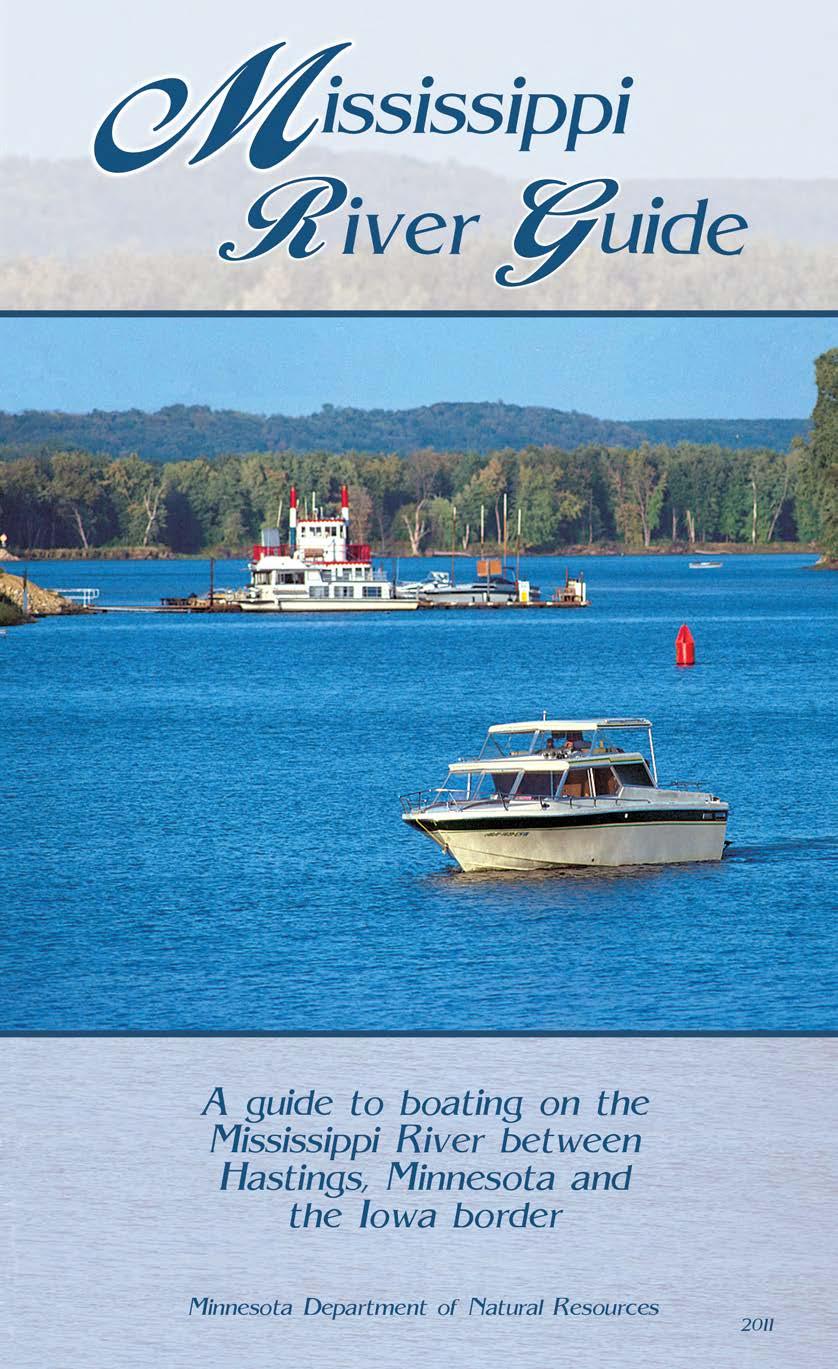
2 Mississippi River Guide Department of Natural Resources While not an approved boating safety course, this publication is recognized by the National Association of State Boating Law Administrators to benefit boating safety Information in this publication was compiled in Front cover photo taken by Lawrence C. Duke.

3 Unsinkable Molly Brown. Children under 10 years old are now required to wear a life jacket while boating in Minnesota. *It s smart, it s safe, it s the law. *Except when boat is anchored and being used as a swimming platform or the child is below decks or in an enclosure or cabin on the craft. Minnesota Department of Natural Resources This document is available in alternative formats by calling: in MN toll free TTY toll free TTY Printed on recycled paper containing a minimum of 10-30% post-consumer waste. Copyright 2011, State of Minnesota, Department of Natural Resources 10/11 5M
4 TABLE OF CONTENTS ABOUT THIS GUIDE...3 BOATING SAFETY...4 You Are The Key to Water Safety...4 Float Plan...4 Boating Accidents...5 BOATING ON THE BIG RIVER...6 Locks and Dams...6 Hazards...9 Buoys and Markers...11 VHF-FM Marine Radio...12 Drawbridge Operation Regulations...12 REGULATIONS AND EQUIPMENT...13 Registration (Licensing)...13 Safety Equipment...13 Rules of The Road...14 Watercraft Operator s Permit...16 Personal Watercraft...16 Enforcement...18 Alcohol & DWI...18 Wake Damage and Erosion...19 Pollution...21 Aquatic Invasive Species & Drain Plug Laws...21 Final Note...22 AGENCIES AND ORGANIZATIONS...22 Minnesota Department of Natural Resources...22 Wisconsin Department of Natural Resources...24 Violations...24 National Park Service...24 Upper Mississippi River Conservation Committee...25 U.S. Fish and Wildlife Service...25 Upper Mississippi River National Wildlife and Fish Refuge Signs...26 U.S. Coast Guard...26 U.S. Coast Guard Auxiliary...27 U.S. Power Squadrons...27 HELP ON THE RIVER...27 Emergency and Non-Emergency
5 TABLE OF CONTENTS (continued) RIVER MAPS St. Croix River Mississippi River AGENCIES INVOLVED WITH BOATING ON THE RIVER THE SILENT KILLER - CARBON MONOXIDE SAMPLE FLOAT PLAN MAP LEGEND... Fold-Out Flap on the Back Cover MAP INDEX... Back Cover 2
6 ABOUT THIS GUIDE The Minnesota Department of Natural Resources has prepared two publications in response to the recommendations of the GREAT I Study and the demand of the boating public for a detailed guide of Minnesota s great rivers. This is one of two river guides that covers the most popular portions of the Mississippi, St. Croix and Minnesota rivers (see inset on back cover). These guides are intended to assist boaters on the rivers and to promote safe and enjoyable use of the resource. They contain detailed maps of the rivers and include frequently requested information on boating facilities, safety aspects and hazards specific to the Mississippi, St. Croix and Minnesota rivers. Take a few minutes to read through the safety information section in the next few pages. The BOATING ON THE BIG RIVER section on page 6 is especially important to boaters on the Mississippi River. Be informed about submerged wing dams and stump fields. IT COULD SAVE YOUR MOTOR S LOWER UNIT! Also know the proper boating procedures around towboats as well as locks and dams. IT COULD SAVE YOUR LIFE! NOTE: A river, by its character, is constantly changing its physical dimensions. The rivers portrayed in this guide are no exception. While the mapping for this guide utilized the latest information, changes may have occurred. It is suggested that the user exercise care when navigating, especially in the backwater areas where changes occur more frequently. The information provided on marinas and other facilities is done as a public service for boaters. This is not an endorsement by the State of Minnesota or the Minnesota Department of Natural Resources of the private facilities or services listed in this publication. Facilities are also subject to change. Note: The mid-channel sailing line does not always follow the state line. Hunting and fishing regulations may differ between MN & WI. Check the hunting and fishing regulations for details. Using This Guide Using this river guide is easy. An index of maps and a fold-out legend is located on the back cover. An explanation of each facility is located on the facing or previous page for each map. Facilities are indexed by river mile and side of river (left or right when going downstream). Note: state parks as well as many county and regional parks require entrance fees for motor vehicles. 3
7 BOATING SAFETY YOU ARE THE KEY TO WATER SAFETY Considering the large number of participants in Minnesota, water-based recreation is a relatively safe pastime. Still, an average of 20 persons die in boating accidents each year in the state. In addition, many more people are injured and hundreds of thousands of dollars worth of property damage results from boating mishaps. Your water fun depends on you, your equipment and other people who, like yourself, enjoy spending leisure time on, in or near the river. Let s look at your responsibilities: 1. A knowledge of rules and regulations for watercraft use. 2. A knowledge of safety equipment required by law to be on board your watercraft. 3. A knowledge of the operation of your boat. 4. Knowledge of boating hazards unique to large rivers. 5. Responsibility for the actions of all persons on board the watercraft. 6. Acceptance of the fact that everyone has the right - and privilege - to use the river in a proper manner. FLOAT PLAN Leave a float plan with someone who will miss you if you do not return on time. A float plan should include the following information: (See sample float plan on pages ) 1. A description of your car and where you will park it. 2. Where you intend to boat. 3. A description of your boat including the registration number. 4. Communication equipment on board and cell phone number or radio call sign if you have one. 5. The names of all persons on board. 6. Safety equipment on board. 7. Estimated time of arrival back home. 4
8 8. The latest return time home. 9. Your alternate plans in the event of an emergency or bad weather. 10. The phone number of the county sheriff for the area in which you will be boating. 11. Don t forget to cancel your float plan when you return home. BOATING ACCIDENTS Many boating accidents can be avoided if you follow these safe boating practices: 1. Wear your life jacket. 2. Avoid alcohol when boating. 3. Be especially careful around cold water. Hypothermia kills. 4. Turn your navigation lights on at sunset. 5. Carry a fire extinguisher aboard at all times. 6. Be aware of changing weather conditions. 7. Keep a constant lookout for other boats and navigational hazards. Remember: Most boating accidents occur during the day and in clear weather. The majority of boat operators involved in accidents have considerable experience in using their craft, but have never taken a formal boating safety course. Reporting Accidents Federal and state rules require that any accident, collision, or other casualty involving a motorboat or other vessel, must be reported if it resulted in: 1. a fatality, or 2. personal injury involving loss of consciousness, requiring medical treatment, or resulting in incapacitation for 24 hours or more, or 3. property damage of $2,000 or more. In Minnesota, all accidents must be reported to the county sheriff s office where the accident occurred. The telephone numbers for each county sheriff s office are on pages of this publication. In an emergency - call

9 Photo by Tim Smalley High speed operation can cause accidents. A single occupant was ejected into the water when he hit a wake while operating his boat at high speed near the Twin Cities. The boat continued unmanned towards shore where it hit a swimming raft. The raft launched the boat skyward and it came down on top of a boat lift, causing heavy damage to the boat, lift and dock. Amazingly enough, there were no injuries and alcohol was not involved. BOATING ON THE BIG RIVER LOCKS AND DAMS In the 1930s, the United States Army Corps of Engineers built a series of locks and dams on the Mississippi River to maintain a navigational channel of at least nine feet in depth. Eleven such lock and dam facilities are located on the Mississippi north of the Minnesota-Iowa border. These locks and dams present a special hazard to recreational boaters who are unfamiliar with them. Special precautions must be taken when approaching and going through these navigational structures. In addition to these facilities, there are other dams on the Mississippi, Minnesota and St. Croix rivers that have no locks. 6
10 What is a lock? The dams on the Mississippi River create a series of navigational pools. Each dam can be thought of as a step in the river as it descends to the Gulf of Mexico. A lock is used to raise or lower boats to the next pool in the system. A lock is a chamber that may be opened on either end to allow boats to enter or leave. Once a boat is in the lock, water is added to the chamber to raise a boat to the upstream pool or released from the chamber to lower a boat to the downstream pool. Deceptive Currents Near each lock and dam the water is turbulent and dangerous. Currents are strong, swift, and deceptive. As water is drawn in and discharged from a lock chamber or drawn over a dam, undercurrents are created that are powerful enough to drag a boat and its occupants to the bottom. Restricted Areas There are certain restricted areas to protect boaters in the vicinity of locks and dams. The water near each lock and dam has dangerous currents. Boats may not enter the following areas: The area 600 feet upstream and 150 feet downstream from the dam (including auxiliary locks not in service). Additional restrictions may be posted at each dam or spillway. Obey all signs and buoys. 150 RESTRICTED AREA 600 RESTRICTED AREA SLOW - NO WAKE WATER FLOW 150 RESTRICTED AREA SLOW - NO WAKE CONTROL HOUSE MAIN LOCK SLOW - NO WAKE Mississippi River, Lock and Dam No. 6 7
11 Locking Through Upon approaching a lock, a set of traffic signals (the same as you would find at a road intersection) will inform the boater as to the lock s status. See below for a description of these lights and their meaning. Upon approach to the lock, you can contact the lockmaster via channel 14 on your VHF marine radio or simply pull the signal cord on the lock approach wall. You should be aware that the lock may be in use as you approach, locking craft through from the other side, and you may have to wait. No Light Lock not in use, approach guide wall and signal for lockage by pulling signal cord. Red Light Stand clear, do not approach. Yellow Light Approach lock under full control. Green Light Enter lock. Signal Device (pull signal cord) Red Yellow Green Mooring Lines Red Yellow Green Signal Device (pull signal cord) Lock Flow Spillway Lower Pool Upon receiving a green light, proceed slowly into lock and observe mooring lines spaced along lock wall. The lines should be held by hand and not tied to the boat while in the lock chamber. Do not tie a line to a recessed ladder. Insure that passengers remain seated at all times and keep hands inside the boat to avoid the chance of crushed fingers. If construction of craft requires handling lines on deck, a life jacket should be worn. Do not leave the engine running during lockage, nor climb ladders of the lock structure. Upon completion of the lock filling or emptying operation and when the gates are fully open, a signal will be given by the lock operator that it is safe to depart the lock. The signal will be either a P.A. announcement, one short toot of the signal horn or a hand 8
12 signal by the lock operator. Leave the lock at a slow speed assuring that you are well clear of the lock structure before gaining speed. The approaches to the locks are considered no wake areas. Recreational craft and towboats are locked through on a first-come, first-served basis. Only government craft and regularly scheduled passenger craft have priority. Boaters should be aware that delays in locking through may occur. Lock and dam personnel monitor channels 14 and 16 on the VHF marine radio and can be contacted about waiting periods. There is no charge for locking through. HAZARDS Towboats When encountering a towboat, always obey the following rules: 1. Stay clear of towboats! They usually have the right-ofway over recreational boats and they create strong wakes. 2. Never anchor in their course; it may require a half-mile or more for them to stop. 3. Remember, at night their lights appear far apart compared to small boats. 4. They have a blind area directly in front of the barges and on each side. Line of Sight Danger Zone 5. Stay clear of the stern of the towboats. They may suddenly turn on a burst of power and overturn a small boat. 6. Turn your bow into the wake of barges and boats. 7. When meeting a barge at a bend in the river move to the inside of the bend where possible. Wing Dams To help improve the navigability of the Mississippi River by controlling the direction of channel flow, the U.S. Army Corps of Engineers has placed hundreds of wing dams. A wing dam is an elongated pile of rocks or concrete which is usually submerged. Because wing dams often lie just below the water surface, they cannot be visually detected, are not marked 9
13 and pose a great danger to the unwary boater. If you follow these boating practices, however, you can avoid an unwanted encounter with a wing dam. 1. Stay within the main channel, indicated by buoys and markers (see fold-out flap on back cover). It is continually dredged and maintained. 2. If approaching shore, proceed slowly from a perpendicular angle. 3. Stay clear of ripples in the water surface; these are a tell-tale sign of a wing dam lying just below. WARNING! The dam symbols in this guide show approximate locations of the wing or closing dams. The actual locations may vary. Wing Dams and Closing Dams Are Not Buoyed! River Current Speed Shallow Water Eddies Mid-Channel Sailing Line Shallow Water Closing Dams Top drawing is not to scale Closing dams were constructed by the U.S. Army Corps of Engineers to help control the direction of channel flow on the river. These dams are located on some side channels of the Mississippi River and may not be visible from the surface. A number of these dams are located between Hastings and Red Wing and others between the 10
14 lower end of Pepin and the Iowa border. Although most of these are marked on this set of maps - boaters are cautioned to always proceed at a slow speed outside the main channel of the river to avoid striking either natural or artificial obstructions. Stump Fields When the dam system on the Mississippi River was built in the 1930s, many low-lying areas were covered with trees. Although the trees were cut down, many submerged tree stumps still remain. We have shown the approximate locations of stump fields on the river maps; but please remember, whenever you are in a backwater area there is always a chance that you will encounter a stump. Use extra caution in these areas. Changing Water Levels Water levels change frequently on the rivers, causing changes in currents that may not be immediately obvious to boaters. High water can produce unpredictable and swift currents and moving debris that may come in the form of logs, timbers, docks and whole trees. Conversely, low water can produce hazards above and below the water s surface (stump fields, wing dams, etc.). BUOYS AND MARKERS A list of the buoys and markers you will encounter on the river can be found on the fold-out flap of the back cover. A knowledge of them is essential for safe navigation on the river. Not all structures including wing dams are marked by the buoys. All boaters are cautioned not to rely solely on buoys for navigation because of their potential unreliability. U.S. Coast Guard buoys are removed, relocated or established whenever the U.S. Coast Guard determines a change is desirable for the safety of navigation. While the U.S. Coast Guard makes every reasonable effort to ensure buoys are properly located to serve their intended purpose, they cannot keep all buoys and navigable channels under constant surveillance. Between visits of a Coast Guard buoy tender, it is possible for a channel or obstruction to have shifted, the water depth to have changed, or for a buoy to have moved, sunk, or gone adrift. Daymarks are square, triangular or diamond-shaped boards (usually red or green in color) that are used to mark channels on the large river systems. On the Mississippi they will also indicate the river mileage upstream from Cairo, Illinois on a white board beneath the daymark. They may also be lighted (green or white lights on green boards and red or white lights on red boards). Even with lighted buoys and markers, boating at night should be avoided if at all possible. 11
15 VHF-FM MARINE RADIO Channel 16 is a calling and distress channel. Communications on channel 16 should be kept short, limited to initial contact only, unless there is an emergency. Channel 22A is for non-emergency communications with the U.S. Coast Guard. It is also used by the U.S. Coast Guard to make broadcast notices to mariners. Locks on the Upper Mississippi River monitor channels 14 & 16. Initial contact with locks should be made on channel 14, which will also be the working channel in most cases. When important marine events occur, broadcast notices to mariners are issued. These notices are broadcast by U.S. Coast Guard radio stations on channel 22A (157.1 MHz). Non-scheduled broadcasts are often made to supplement scheduled broadcasts. U.S. Coast Guard preliminary announcements of broadcasts are made on channel 16 (156.8 MHz) and channel 19 ( MHz) as a secondary channel. The U.S. Coast Guard broadcasts are then given on channel 22A (157.1 MHz). Broadcast times for this area are 3:00 a.m., 8:00 a.m., 3:00 p.m. and 9:00 p.m. For more information on marine radio use, contact the Federal Communications Commission (website and telephone number are at the end of this guide). DRAWBRIDGE OPERATION REGULATIONS For drawbridges over the Mississippi and St. Croix rivers, the usual sound signal for opening the draw is a prolonged blast (4 to 6 seconds duration) of a whistle or horn, followed by one short blast (one second duration), sounded not more than three seconds after the prolonged blast. This sequence is repeated at intervals until acknowledged by the drawtender. If the draw can be opened immediately, acknowledging signal is one prolonged blast followed by one short blast, sounded not more than 30 seconds after opening signal. If the draw cannot be opened immediately, or if open and must be closed immediately, five short blasts, sounded in rapid succession not more than 30 seconds after the opening signal, shall be repeated at intervals until acknowledged by a signal which has the same meaning from the vessel. Some drawbridges are equipped with VHF marine radios; a list is provided on the next page. Mariners approaching these drawbridges are urged to contact the bridge tender to confirm requests for opening, or to exchange information. Bridges may also have opening schedules to reduce the backup of traffic. These schedules can vary with the hour, day and time of year and are usually posted on the bridge itself. You should factor this possibility into your float plan. 12
16 Locations of Drawbridges Mississippi River Mile Call Sign Channel La Crosse Railroad KVY & 16 Hastings Railroad KTD & 16 REGULATIONS AND EQUIPMENT (This is not a complete summary of regulations. Rules and laws are subject to change. A current copy of federal, Minnesota and Wisconsin regulations should be consulted. Unless noted, all rules summarized below are from Minnesota and were in effect in 2011.) REGISTRATION (LICENSING) All watercraft, except wild-rice boats and duckboats used during the appropriate season, non-motorized boats nine feet or less in length, and seaplanes, are required to be licensed by the DNR. This rule does not apply if the watercraft is licensed by another state, federal agency or foreign country. All canoes, sailboats, kayaks and rowing shells used in Minnesota must be registered either in Minnesota or the user s home state. To obtain or renew a watercraft license, go to the nearest deputy registrar s office (where you license your car) or the DNR s License Center (address is at the back of this guide). SAFETY EQUIPMENT Personal Flotation Devices - PFDs The U.S. Coast Guard estimates that 80 percent of the boating fatalities in the country could have been prevented if boaters were wearing their life jackets. This is especially important in boats less than 20 feet in length. The most common boating fatalities are capsizing and falling overboard. Minnesota rules require that: On all boats* a U.S. Coast Guard (USCG) approved wearable device (Type I, II, III or V) must be worn or readily accessible for each person on board as well as any persons being towed on water skis or similar devices. Anyone operating or riding on a personal watercraft (Jet Ski, Sea Doo etc.) must WEAR a Type I, II, III or V USCG approved device (see page 16). *The following are exempt from state PFD carriage laws: 1) All sailboards, and 2) rowing team members specified in law and accompanied by a chase boat carrying the required PFDs. In addition, on all boats 16 feet or more in length, except canoes and kayaks, at least one U.S. Coast Guard (USCG) approved Type IV throwable device must be immediately 13
17 FULL EMPTY Type B:C Size INSTRUCTIONS DRY CHEMICAL I available aboard the craft. Type IV devices include buoyant cushions, ring buoys and horseshoe buoys. All flotation devices must be U.S. Coast Guard (USCG) approved and bear the USCG approval number. The devices must be in serviceable condition and, if wearable, must be of the correct size for the person who is or would be using it. As of 2005, Minnesota law requires that children less than 10 years of age wear a PFD when aboard a boat that is underway, unless they are below decks or in an enclosed cabin. There are also exemptions for commercial vessels and also any boat at anchor when swimming or diving activities are taking place. Lights All watercraft must display the navigation lights required by law when operating between sunset and sunrise. These lights are to warn others and in many cases indicate what the watercraft is doing. Boaters should check the state or federal regulations for the lighting requirements for their craft. Fire Extinguishers Marine Type USCG All watercraft using motors should carry a U.S. Coast Guard approved fire extinguisher. Both state and federal laws require fire extinguishers on watercraft carrying or using fuel or other flammable fluid in any enclosure of the boat. Check the state or federal regulations for specific requirements. Signaling Systems A whistle or horn is required on all motorboats 16 feet or longer. Check the current regulations for exact requirements. Other Desirable Equipment Anchor and line Fenders Flashlight First aid kit Marine radio Cell phone Paddle, oars or auxiliary outboard Bilge pump or bailing devices A tool kit and spare parts (including an extra propeller) Battery box or non-conductive cover for terminals (required by State of Wisconsin) RULES OF THE ROAD There are traffic rules afloat, as well as on our highways. Common sense tells us we should know what to do when passing, meeting and/or crossing the path of another craft. These rules are simple and they provide uniform patterns of passing and direction that otherwise would not exist. 14

18 Port to Port or Head to Head Each watercraft must pass on the port or left side of the other when meeting port to port or head to head. Starboard to Starboard When courses of two boats are so far on the starboard or right of each other as not to be considered a head to head meeting, they may pass on the starboard side of each other. Crossing When two boats approach each other at right angles, the boat on the starboard (right) side has the right-of-way. The stand-on boat must hold course and speed while the give-way boat must keep clear and pass behind the boat with the right-of-way. Overtaking In an overtaking situation, the boat being overtaken has the right-ofway and must hold course and speed, even if the overtaking boat is a sailboat. Non-Motorized Boats Except when passing, sailboats and non-motorized craft have the right-of-way over motorized watercraft. Steer clear of them, and remember that your wake can cause them trouble. Commercial Vessels Small boats should not insist on the right-of-way when approaching large commercial vessels, which are limited in maneuverability. Emergency Craft and Move Over Law All watercraft will yield right-of-way to an authorized watercraft displaying a red or blue flashing light. When approaching and passing a law enforcement watercraft with its emergency lights activated, the operator of a watercraft must safely move the watercraft away from the law enforcement watercraft and maintain a slow-no wake speed while within 150 feet of the law enforcement watercraft. At Night At night, running lights indicate which boat has the right-of-way. The green light is on the starboard (right) side and a red light on the port (left) side of the craft. If the red and white lights are the only ones visible, then that boat is stand-on and has the right-of-way. Whistle Signals 1 BLAST - passing on the port (left) side. 2 BLASTS - passing on the starboard (right) side. 3 BLASTS - operating in reverse. 5 BLASTS - DANGER - may be used to indicate passage is not safe. 15
19 WATERCRAFT OPERATOR S PERMIT See the chart on page 17 to determine Minnesota s age and permit requirements. Permits may be obtained by contacting the Minnesota Department of Natural Resources Boat and Water Safety Section at: MN DNR Boat & Water Safety 500 Lafayette Road St. Paul, MN Boat & Water Safety (651) DNR Information: (651) or in Minnesota Toll Free: Wisconsin also has permit and age requirements for motorboat operators, including some adults. More information on Wisconsin s boating education requirements can be obtained from the Wisconsin DNR (address located on page 24 of this guide). PERSONAL WATERCRAFT What is a personal watercraft? Sometimes known as Jet Skis, Wave Runners, PWCs, etc., a personal watercraft is defined by law as a motorboat that is: 1) powered by an inboard motor powering a water jet pump or by an outboard or propeller-driven motor; and 2) designed to be operated by a person or persons sitting, standing, or kneeling on the craft, rather than in the conventional manner of sitting or standing inside a motorboat. All personal watercraft are considered motorboats and therefore, any regulations that govern other motorboats (such as fishing boats, cabin cruisers, etc.), also govern personal watercraft. Personal Watercraft Laws In summary, the law requires that: Anyone operating or riding on a personal watercraft must wear a U.S. Coast Guard approved Type I, II, III or V personal flotation device (PFD or life jacket). Operation of personal watercraft is allowed only from 9:30 a.m. to 1 hour before sunset. A personal watercraft rules decal issued by DNR needs to be on the craft in full view of the operator. Personal watercraft must travel at slow - no wake speed (5mph or less) within 150 feet of non-motorized boats, shore (unless launching or landing skiers directly to or from open water), docks, swim rafts, swimmers, or any moored or anchored boat. If you tow a person on water skis, or any other device, there must be an additional person on board the personal watercraft to act as an observer. (The observer does not have to be facing 16
20 backward.) The skier/kneeboarder etc. must also be wearing a PFD or there must be one on board the personal watercraft for the skier. Factory-installed or factory-specified rearview mirrors are allowed instead of an observer when pulling a skier or other device (tube, kneeboard, etc.). The mirrors must be specified by the personal watercraft manufacturer. After-market mirrors, (continued on next page) Motorboat Operator Age Laws in Minnesota* Type of Craft and Age As of 2011 Motorboats (Except personal watercraft - see below) Less than 12 years old years old Personal Watercraft (PWC, Jet Skis etc.) regardless of horsepower Less than 13 years old 13 years old hp or less - no restriction, more than 25 thru 75 hp - must have someone at least 21 on board in reach of controls**, over 75 hp - cannot operate, even with adult on board 25 hp or less - no restriction, over 25 hp - must have: a watercraft operator s permit, or someone at least 21 on board in reach of controls** Cannot operate, even with adult on board. Must either have: someone at least 21 on board, or a watercraft operator s permit and be in visual supervision by someone at least years old * ** Must either have: a watercraft operator s permit, or someone at least 21 on board this is only a summary of the legislation and not a copy of the actual law for purposes of the BWI law, both the youthful operator and the supervising adult are considered to be in actual physical control of the motorboat 17
21 stick-on mirrors, motorcycle mirrors etc., do not qualify for the observer exemption. If the machine is equipped by the manufacturer with a lanyardtype engine cutoff switch, it must be attached to the person, life jacket or clothing of the operator when underway. You may not operate a personal watercraft if any part of the springloaded throttle system has been removed or tampered with so it interferes with the return-to-idle system. You may not chase or harass wildlife. You may not travel through emergent or floating vegetation at greater than slow - no wake speed. You may not operate a personal watercraft in a manner that unreasonably or unnecessarily endangers life, limb or property. You may not weave through congested watercraft traffic, or jump the wake of another watercraft within 150 feet of the other watercraft. This includes other personal watercraft. You may not operate a personal watercraft while facing backward. ENFORCEMENT Whenever you are boating or fishing on the rivers in this book you are subject to laws and rules similar to those in effect on streets and highways. Enforcement of state regulations is the responsibility of Minnesota conservation officers, Wisconsin DNR conservation wardens, and county sheriffs deputies. You are also subject to federal laws which are enforced by the U.S. Coast Guard, National Park Service and the U.S. Fish and Wildlife Service. ALCOHOL & DWI Alcohol will influence your balance, coordination, vision, judgment and reaction time. The use of alcohol is involved in about a third of all the boating deaths that occur in Minnesota and Wisconsin. This includes not only the spectacular collisions, but the lone angler who drowns after falling out of their boat on a peaceful backwater. Operating a motorboat while under the influence of alcohol, a controlled substance or other illegal chemical is unlawful. Operators who are impaired may be required to take tests by an enforcement officer to determine their sobriety. Penalties for DWI or refusal to submit to a chemical test on a motorboat can include any or all of the following: a fine a jail sentence loss of your motorboat operating privileges loss of your driver s license loss of your car or truck license plates forfeiture of your motorboat and trailer 18
22 WAKE DAMAGE AND EROSION Watercraft operators are responsible for damage to property, shoreline and moored boats caused by their wake. Wake damage is more likely during periods of high water with normal operation. A combination of factors should be considered when assessing the possibility of damage caused by your wake including speed, draft and nearness to the bank. Operating out of the normal navigation channel also increases the likelihood of wake damage. The Problem A serious riverbank erosion problem is occuring in a portion of Pool No. 4, extending from Lock and Dam No. 3 (north of Red Wing) to the northern end of Pepin. The banks in this section of the river are composed mostly of fine silt and sand that is easily eroded by wake or wave action, especially during high water levels. Research Research done on the river by the Minnesota Department of Natural Resources (DNR) near Red Wing from 1989 through 1992 revealed that high energy wakes from motorboats can greatly accelerate natural erosion, causing the banks to erode by as much as two feet per year on the inside of a riverbend and up to 14 feet on the outside of the riverbend over a three-year period! This erosion was most common during periods when the river was at least three feet above the normal low water level. The study used locations and techniques to reflect the specific effects attributable to recreational boat wakes, realizing that the river is also subject to commercial barge traffic, as well as the natural action of waves and currents. As an example, a parallel channel in the same area of the river, which receives very little recreational boat traffic, did not show the same accelerated bank erosion. This erosion has the potential for serious consequences for river ecology, fishing and boating resulting in a loss of shoreland, increased sediment in the water and a loss of trees and vegetation along the river. The Effects 1. Reduced Recreation - Sediment washed into the river clouds the water, creating poor swimming, fishing and boating conditions. 2. Damage to Fish and Wildlife Habitat - Sediment settles out of the water and fills in important backwater areas choking out aquatic vegetation that is essential to fish and wildlife. 3. Additional Dredging - Over time, this extra sediment will probably require additional dredging to maintain the navigation channel. This costs additional taxpayer dollars and presents the problem of where to safely place the extra dredge spoil. 4. Property Loss - When land is lost, it cannot easily be replaced. 19
23 Owners of riverbank property, whether private or public, are deprived of its use. In addition, the expenditure of thousands of dollars may be necessary by the owners in an attempt to stabilize the shoreline. 5. Damage to Boats - Trees and large branches can float downstream after falling into the water (creating snags or deadheads), sometimes lodging in the bottom of the river. These become serious hazards to watercraft. Many of them also float just below the surface of the river, hidden like a mine from the unsuspecting boater and serious damage can result from hitting one of them. At best you will be left with a repair bill for hull repairs, a new propeller or a lower drive unit (which can cost up to $3,000 to repair or replace). At worst, your boat could hit a deadhead at night and capsize, resulting in injury or death. 6. Damage to Facilities - When floating snags hit an obstruction (such as a bridge, navigational buoy, dock or lock and dam) they can cause damage. In addition, removal of the floating trees and repair to buoys and facilities costs money, which comes from you as a taxpayer. The Solution As a boater, you are the key to reducing shoreline erosion when you are on the river by reducing the speed and resulting wake from your boat, especially when the water level is above normal. To reduce your wake, you first need to understand that most modern power boats operate in three different speed zones: Displacement Speed - This is the slowest speed for most motorboats and occurs when the boat operates with the bow down at slow speeds resulting in very little wake. Transition Speed - When power is applied, the bow rises and the engine is using the maximum amount of fuel as it attempts to get the boat up on plane (if the boat has a planing hull). It also creates the largest wake, since the boat is now plowing through the water. Planing Speed - When a boat reaches planing speed the bow drops, fuel consumption is less than transition speed and only a small portion of the hull contacts the water (which creates less of a wake than transition speed). Note: many cruisers and houseboats cannot reach this speed. When the water level is three feet or more above the normal low level (667 feet above sea level) on this section of the Mississippi River, minimum wake speed is recommended. During this period, boaters need to slow down and make sure their wakes are five inches high or less in this area. The best way to do this is to always be aware of the wake behind your craft and what it looks like as it impacts the shore. As a boat operator, you need to know that you 20
24 are legally responsible for your wake under both federal and state law. A river level three feet above normal low pool will be encountered approximately 80 percent of the time during April, but that drops to 17 percent during the month of August. During years in which there is a low river flow, it is likely that there will be little need to restrict your boat wake during the months of July through October. However, you should be alert for water level changes that sometimes vary unexpectedly as the result of heavy rains upstream. The Future If all boaters become aware of the wakes their boats create and take action to reduce them when necessary, shoreline erosion can be reduced and conditions should improve. If this does not occur voluntarily, however, mandatory speed and wake restrictions may have to be placed on the river. POLLUTION Trash Disposal Many people receive cuts and other injuries from trash thrown in our rivers and on shorelines. This same trash can injure wildlife through cuts, entanglements, strangulation, suffocation and digestive disorders. Throwing trash in the water is against the law. A TO SWIM! fine, jail sentence, or other penalty can be imposed on anyone who is convicted of this offense. Remember, If you carried it in, carry it back! Marine Toilets DON'T TEACH YOUR Both federal and state laws prohibit the discharge of raw sewage from boats. Minnesota law requires that sewage from marine toilets be retained through the use of a U.S. Coast Guard Certified Type III holding tank which is pumped out at dockside, or a portable device which retains waste on board for disposal on shore (there is one exception noted below). Pumpout locations are listed with the information on marinas in this publication. U.S. Environmental Protection Agency regulations (which preempt state law) allow the use of U.S. Coast Guard Certified Type I or Type II treatment/discharge marine sanitation devices (MSDs) only on the Mississippi River below Lock and Dam No. 2 (Hastings). TRASH AQUATIC INVASIVE SPECIES (AIS) & DRAIN PLUG LAWS See the DNR website ( for more information: 21
25 1. Inspect all watercraft, trailers, and water-related equipment; remove any visible aquatic plants, zebra mussels, and other prohibited invasive species before leaving any water access. 2. Drain water from motor, boat bilges, live wells, and other boating equipment holding water. Drain plugs must be removed from bilges and live wells at the water access, and all water draining devices must remain open while trailering or transporting your boat. 3. Watercraft owners or operators must display an Aquatic Invasive Species Rules decal, issued by the DNR, on watercraft before launching, entering into, or operating on any waters of the state. FINAL NOTE This discussion of rules and regulations is by no means complete. Reference should be made to the current state, federal and local regulations before you embark on your first cruise. The Minnesota Boating Guide is a summary of laws and rules and is available from the Minnesota DNR or a Minnesota county sheriff. Wisconsin regulations can be obtained from the Wisconsin DNR (see page 24 for address.) AGENCIES AND ORGANIZATIONS MINNESOTA DEPARTMENT OF NATURAL RESOURCES Minnesota s lakes and rivers offer a wealth of canoeing, boating and fishing opportunities. Public Access/State Water Trails The DNR State Water Trails Program provides printed maps for 32 rivers and the North Shore of Superior. The free maps show access points, campsites, rest areas and portages. Hazards such as dams, waterfalls and rapids are marked. A description of each water trail lets paddlers know what to expect along the way. The DNR also provides online digital mapping, and a real-time river level reporting service at Paddlers and boaters can call the DNR Information Center to order printed maps or check the condition of water trails at (651) or toll free in Minnesota , TDD: (651) or toll free in Minnesota Minnesota DNR accesses are usually open 24 hours a day. No fee is charged for their use, nor is there a fee for any of the accesses shown on the county access maps. Note: State parks as well as many county and regional parks require entrance fees for motor vehicles and may not be open 24 hours a day. Remote water trail 22
26 campsites are typically free and non-reservable, unless otherwise noted on the maps. For public access and water trail maps and brochures contact: DNR Information Center Telecommunications device 500 Lafayette Road for the deaf: (651) St. Paul, MN or in MN toll free: (651) or in MN toll free DNR web site: Adopt-a-River Program This program encourages Minnesota volunteers to adopt a section of a lake, river, wetland or ravine to ensure its long-term health by doing at least one annual trash cleanup. DNR Parks and Trails 500 Lafayette Road St. Paul, MN (651) DNR web site: Boat and Water Safety Program One of the boat and water safety program s primary responsibilities is education. Using brochures, boating courses, pamphlets, billboards, television and radio public service announcements, media interviews and news releases, the public is kept informed of boating safety issues. DNR Boat and Water Safety Section 500 Lafayette Road St. Paul, MN (651) DNR web site: Division of Enforcement The Division s responsibilities on the river include enforcement of fish and wildlife regulations, boating safety laws, water-use regulations and water pollution laws. DNR conservation officers also conduct firearm, snowmobile and all-terrain vehicle (ATV) safety training programs; enforce snowmobile and ATV laws; and patrol state parks and campgrounds. DNR Division of Enforcement 500 Lafayette Road St. Paul, MN (651) DNR web site: 23
27 WISCONSIN DEPARTMENT OF NATURAL RESOURCES The Wisconsin DNR is also involved with enforcement, boating safety, pollution control, boat licensing, and information and education. For more information about Wisconsin DNR programs contact: Wisconsin DNR West Central Region 1300 West Clairemont Avenue Box 4001 Eau Claire, WI (715) DNR web site: VIOLATIONS Report law violations by calling 911. Report fish and wildlife violations by calling Minnesota or Wisconsin Department of Natural Resources conservation officers at: Minnesota (Turn in Poachers) Wisconsin TIP-WDNR NATIONAL PARK SERVICE The National Park Service (NPS), U.S. Department of the Interior, manages a wide range of areas throughout the United States to conserve natural, cultural and recreational resources while providing for their enjoyment today in such a manner that leaves them unimpaired for future generations. The NPS manages two units of the National Park System in and near the Minneapolis/St. Paul metropolitan area, the upper 27 miles of the Lower St. Croix National Scenic Riverway (NSR) and the Mississippi National River and Recreation Area along the Mississippi River. The Mississippi National River and Recreation Area was designated by Congress in It covers the Mississippi River and adjoining shore areas from the mouth of the Crow River at Dayton to the Goodhue County line southeast of Hastings. The National Park Service provides interpretive and information programs about the Mississippi and cooperates with local and state agencies in managing the river s scenic and recreational characteristics. Mississippi River National Park Service Mississippi National River and Recreation Area 111 E. Kellogg Blvd., Suite 105 St. Paul, MN (651)
28 UPPER MISSISSIPPI RIVER CONSERVATION COMMITTEE Since 1943, the Upper Mississippi River Conservation Committee (UMRCC) has been promoting the preservation and wise utilization of the natural and recreational resources of the Upper Mississippi River. Composed of representatives from the states of Minnesota, Wisconsin, Iowa, Illinois and Missouri, as well as the U.S. Fish and Wildlife Service and the U.S. Army Corps of Engineers; the UMRCC serves as a forum for formulating policies and plans and conducting cooperative studies. For more information contact: UMRCC nd Avenue Rock, IL U.S. FISH AND WILDLIFE SERVICE Many of the bottomlands on the Mississippi River lie within the boundaries of the Upper Mississippi River National Wildlife and Fish Refuge. Beginning at the mouth of the Chippewa River (River Mile 763.4) and extending 261 miles downriver, the refuge encompasses 241,000 acres of wooded islands, and backwaters. The refuge is administered by the U.S. Fish and Wildlife Service to protect habitat for migratory birds, mammals, fish, and other aquatic animal and plant life. Millions of ducks, geese and swans rest and feed here during spring and fall migration. Hundreds of American bald eagles winter along the river where they feed on fish taken from open water areas. The popularity of fishing, hunting, wildlife observation, sightseeing, boating, and camping have made this one of the most visited National Wildlife Refuges in the country. Please note that the USFWS has implemented regulations in the refuge that affect boat use and hunting, primarily in back water areas that are off the main navigation channel of the river. These restrictions are noted on the river maps. Information, maps and current regulations governing public use are available from: U.S. Fish and Wildlife Service Upper Mississippi River National Wildlife and Fish Refuge 51 East 4th Street, Room 101 Winona, MN (507) TTY (Federal Relay) 25
29 U.S. FISH & WILDLIFE SERVICE O F T H E U.S. FISH & WILDLIFE SERVICE O F T H E U.S. FISH & WILDLIFE SERVICE O F T H E UPPER MISSISSIPPI RIVER NATIONAL WILDLIFE and FISH REFUGE SIGNS The area marked by these signs is closed to all migratory bird hunting. Other hunting and trapping is allowed beginning the day after the close of the state duck hunting season, until season closure or March 15, whichever occurs first, except spring turkey hunting is allowed during state seasons. Please avoid entering the area from October 15 to end of regular state duck hunting season to allow waterfowl to rest and feed. Special Regulations AREA CLOSED To all migratory bird hunting. To all other hunting and trapping from March 16 until the day after the close of the state duck hunting seson. AVOID AREA Please from October 15 through end of state duck hunting season. Except spring wild turkey hunting D E PA R T M E N T I N T E R I O R ELECTRIC MOTOR AREA Closed year-round to all motorized vehicles and watercraft. Watercraft powered by electric motors or non-motorized means are allowed. The possession of other watercraft motors is not prohibited, only their use. D E PA R T M E N T I N T E R I O R Areas marked with this sign are closed yearround to all motorized watercraft and vehicles. Watercraft powered by electric motors, or those that are being propelled by non-motorized means, are allowed. The possession of other watercraft motors is not prohibited, only their use. In areas marked by these signs, watercraft must travel at slow, no-wake speed and no airboats or hovercraft are allowed from March 16 through October 31. SLOW NO WAKE AREA From March 16 through October 31. No airboats or hovercraft allowed same period. D E PA R T M E N T I N T E R I O R NATIONAL WILDLIFE REFUGE Refuge Boundary Sign SPECIAL REGULATIONS IN EFFECT U.S. DEPARTMENT OF THE INTERIOR FISH AND WILDLIFE SERVICES U.S. COAST GUARD The Coast Guard, the nation s lead agency in boating safety, has three primary roles on the rivers: 1) to ensure waterway safety & safe river commerce, including the inspection of ports and commercial vessels for safety, 2) the maintenance of aids to navigation, and 3) the protection of the environment, including pollution prevention, and the response to oil spills or other marine incidents. All por- 26
30 tions of the Minnesota, Mississippi and St. Croix Rivers fall into the Eighth U.S. Coast Guard District - Sector Upper Mississippi River (this sector includes all of the Twin Cities Metro Area and the Mississippi River to Cairo, IL): U.S. Coast Guard Sector Upper Mississippi River 1222 Spruce Street St. Louis, MO Non-emergency (314) hour emergency or contact using marine channel hrs-a-day. U.S. COAST GUARD AUXILIARY The U.S. Coast Guard Auxiliary offers public courses in boating safety and seamanship. They are taught by experienced Auxiliary members and the only charge is for course materials. These courses are usually given in the winter and spring. U.S. POWER SQUADRONS U.S. Power Squadrons is a private, non-profit organization dedicating themselves to boating and boating safety. The Power Squadrons offer free public boating courses. HELP ON THE RIVER EMERGENCY AND NON-EMERGENCY Emergency (illness, injury, accident, etc.) dial 911 on your cell phone or send a distress call on Channel 16 of your marine radio. Remember to give your position and the nature of the emergency and be prepared to stay on the line or have someone stand by the radio. Non-Emergency (out of fuel, engine failure, etc.) first try to summon help from a passing boat or call one of the marinas in this publication for assistance. Law enforcement craft may not be available to respond in non-emergency situations. If an officer or deputy is able to assist, they may only be able to tow you to the closest safe mooring or marina where you can call for or obtain mechanical assistance. 27
31 Mississippi River see map on page R Lock and Dam No. 2, U.S. Army Corps of Engineers lock on right 815.0R - Rebecca Municipal Park, City of Hastings 814.1R concrete plank ramp on lake, picnic area, trail, portable chemical toilet (across road) Rebecca Conley 814.3R Mississippi River - Hastings Public Access, MN DNR and City of Hastings concrete slab ramp 813.8L King s Cove Marina, LLC, Private entrance at River Mile 812.7L, dockage, fuel, pumpouts, repair facilities, restrooms, service and canvas department, ship s store, transient slips for rent, storage, brokerage (651) , (651) , fax (651) L Great River Boat Rental, Private entrance at River Mile 812.7L, boat rental, dockage, transient slip rental Mississippi River Hastings area 812.0R food, lodging Dakota County Sheriff emergency 911 or non-emergency (651) R Hastings Public Dock, City of Hastings 150 feet in length 814.2L Hub s Landing and Marina, Private concrete slab ramp (fee), transient slips, overnight parking, pumpout, restrooms, ship s store, store & launch (651) R Hastings Marina, Inc., Private concrete slab ramp (fee), fuel, pumpouts, restrooms, showers, snacks, water & pop (651) , fax (651)
32 St. Croix River 0.4- Prescott area 810.8L food, lodging away from river Pierce County Sheriff emergency 911 or all other services (715) L Prescott Public Beach, City of Prescott beach.3r Point Douglas, Washington County Parks fishing pier, picnicking, restrooms, swimming beach (651) Prescott City, Courtesy Dock temporary docking (fee) Mississippi River Prescott area 810.8L food, lodging Pierce County Sheriff emergency 911 or all other services (715) L Leo s Landing, Private temporary dockage, fuel, full service marina, pumpouts, restrooms (715) , fax (651) jande10136@aol.com 811.4L Point St. Croix Marina, Private restrooms, temporary slips (715) L Prescott Public Access, City of Prescott two paved concrete ramps (fee) 811.1L Miss Croix Yacht Harbor, Private fuel, pumpouts, 35 ton travel lift, boat repair, snacks, water & pop (715) , (651) Gores Wildlife Management Area, MN DNR 802.2R Contact DNR for more information on this area. See the Metro Area Rivers Guide for information on the rivers north of Prescott. 29
33 No wake zones Special slow - no wake zones (indicated with red hatch marks on map) are enforced in congested and hazardous areas of the river. In No Wake Zones, motorboat operation is restricted to the slowest possible speed necessary to maintain steerage, but in no case greater than five miles per hour. To improve safety conditions and make the river experience more enjoyable for more people, please obey the speed limits and maintain special vigilance when traveling through such zones. Boater's Notes 30
34 MINNESOTA DAKOTA COUNTY Nininger Rd. Rebecca 815 Lock & Dam No Hastings Conley 10 Vermillion E. 18th St. Isabelle River 813 Closing Dam MINNESOTA WASHINGTON COUNTY 21 4h St. E. N Point Douglas Park Ravenna Trl. River Vermillion Prescott Prescott Campbell St. N. Gores W.M.A. Ash St. Prescott Walnut St. 35 WISCONSIN PIERCE COUNTY 810 Q 31
35 Mississippi River see map on page Gores Wildlife Management Area, MN DNR 802.2R Contact DNR for more information on this area. Vermillion River North Vermillion River Public Access, MN DNR concrete plank ramp (shallow water access, small boats only), located near the confluence of Truedale Slough Vermillion River Public Access, MN DNR concrete plank ramp, located by 200th St. E. North Public Access, MN DNR earth ramp (shallow water access, small boats only) Boater's Notes 32
36 160th St. E. Trl. 54 Gores W.M.A. 35 WISCONSIN PIERCE COUNTY Orlando Ave. 809 Ravenna Closing Dam 35 MINNESOTA DAKOTA COUNTY Truedale Slough th 175th St. E. No. 2 Closing Dam St. E. 54 Mud Hen s No. 1 Closing Dam 807 Trl. River No. 3 Ravenna Gores W.M.A. Vermillion 806 Gores W.M.A. Sharp Muskrat E. Spring Banks GOODHUE COUNTY Gores W.M.A. 805 Big River 200th St. 18 North Upper Clear N 190th St. Way Twin s Smith Landing
37 Mississippi River see map on page Gores Wildlife Management Area, MN DNR 802.2R Contact DNR for more information on this area L - Diamond Bluff, Unincorporated 800.9L Pierce County Sheriff emergency 911 or non-emergency (715) L Sea Wing Memorial Park, Diamond Bluff City two rock fishing piers, picnicking parking, piers 799.9L Diamond Bluff Landing, Public crushed rock ramp (limited parking) Sturgeon 800.0R Treasure Resort & Casino Marina, Private - owned and operated by Prairie Indian Community overnight dockage, electricity, fuel (gas & diesel), lodging, pumpouts, restrooms, restaurants, showers, 81 transient slips, ship s store, water (800) ext (enter Sturgeon at river mile 798.2R) 799.4R Sturgeon Public Access, MN DNR, U.S. Army Corps of Engineers concrete plank ramp - access suitable for small boats only. parking, ramp, dock Gores Wildlife Management Area, MN DNR 796.1R There are restrictions on the use of personal watercraft (jet skis), airboats and amphibious vehicles inside this wildlife management area. Please see the DNR website or call the DNR Information Center for more information R Commissory Point Campground, U.S. Army Corps of Engineers camping (no fee), picnic area (accessible by boat only) Mississippi River R Lock and Dam No. 3, U.S. Army Corps of Engineers lock on right
38 Jacks on Run Gores W.M.A. Clear Miley Run North Gores W.M.A. 802 River MINNESOTA GOODHUE COUNTY Brewer Wood Vermillion 18 Slough Eggleston Larson Nelson Stroms Church Rd. Prairie Indian Reservation Holmquist Rd. Sturgeon Rd. Buffalo Slough Trl. Submerged Closing Dam Sturgeon 801 WindRiv Indian Slough Dr. Diamond Bluff Wakonade Ave. 290th Goose Lock and Dam Rd. Prairie Power Plant 799 Wildcat Birch 798 WISCONSIN PIERCE COUNTY N Jones Marsh 797 Lock & Dam No. 3 35
39 Mississippi River see map on page Gores Wildlife Management Area, MN DNR 796.1R There are restrictions on the use of personal watercraft (jet skis), airboats and amphibious vehicles inside this wildlife management area. Please see the DNR website or call the DNR Information Center for more information R Commissory Point Campground, U.S. Army Corps of Engineers camping (no fee), picnic area (accessible by boat only) Vermillion Slough 797.6R Vermillion River Public Access, MN DNR concrete plank ramp (shallow water access, small boats only, access road may be inaccessible during periods of high water) Mississippi River 796.9R Lock and Dam No. 3, U.S. Army Corps of Engineers lock on right 794.2L Evert s Resort, Private concrete slab ramp (fee), bait shop, fuel, lodging, boat rental, restrooms (715) Wisconsin Channel 792.7R Wisconsin Channel Boat Launch, Wisconsin DOT asphalt ramp 792.7L Mr. Sippi, Private concrete ramp, camping, transient docking, food, play area, restrooms with showers, ice & supplies, water (715) Mississippi River Red Wing area 788.5R food, lodging Goodhue County Sheriff emergency 911 or Sheriffs s Water Patrol non-emergency (651)
40 Mississippi River Continued 791.4R Ole Miss Marina at Bay Point, City of Red Wing temporary & overnight dockage, gas dock, ice, pumpouts, restrooms, showers, drinking water, boat storage, office (651) , gas dock (651) R Bay Point Municipal Access, City of Red Wing concrete ramps 791.4R Bay Point Municipal Park, City of Red Wing picnic area, public restrooms, drinking water, walking path 791.2R Red Wing Marina, Private temporary & overnight dockage, electrical hookup and cable, ice, fuel, pumpout, restrooms, shower drinking water (651) R Levee Park, City of Red Wing short term boat mooring 790.8L Trenton Marina, Private temporary dockage, overnight docking (fee), slip rental, restrooms, service, showers, drinking water (715) L Campground & Marina, Private concrete ramp (fee), camping (fee), courtesy boat dock, dumping station, electricity, firewood, fish cleaning house, laundry, children s play area, showers, slips available, flush toilets, portable waste area, water (715) No wake zones Special slow - no wake zones (indicated with red hatch marks on map) are enforced in congested and hazardous areas of the river. In No Wake Zones, motorboat operation is restricted to the slowest possible speed necessary to maintain steerage, but in no case greater than five miles per hour. To improve safety conditions and make the river experience more enjoyable for more people, please obey the speed limits and maintain special vigilance when traveling through such zones. Note: See section on wake damage and erosion on page 19. The section from Lock & Dam No. 3 to the upper end of Pepin is particularly prone to shoreline erosion from boat wakes, especially during high water. 37
41 38 Boater's Notes
42 Levee Rd. Pickerel Slough 797 Lock & Dam No. 3 Marsh Collischan Rd. Gores W.M.A. Vermillion 796 Gantenbein Trimbelle River Cannon Slough WISCONSIN PIERCE COUNTY River Channel only navigable by very small boats. Diamond 795 Slough MINNESOTA GOODHUE COUNTY Closing Dam Trenton K Dredgers Little Goose Round Upper Round 794 Trenton Rice Hole N Cannon Spring Creek Bartenders 793 Channel Navigational Hazard Underwater Pilings 830th St. K Hay Creek Espen s Closing Dam W Hager City th Ave. St. North Red Wing Wisconsin 825th 791 Mud Pucketville Mud East Ave. Red Wing Plum St. 790 Navigational Hazard Bush St. Carlson Dead Slough 39
43 Colvill Bay see maps on pages Pepin 788.9R Bill s Bay Marina, Private concessions, temporary dockage, fuel, haul out (up to 55 ), mechanical service, pumpout, supplies, water (651) R Colvill Municipal Park, City of Red Wing concessions, picnic area, public restrooms, shelter & pavilion (fee - reservations (651) ), drinking water, Aquatic Center (fee) 788.6R Colvill Municipal Park Public Access, City of Red Wing concrete plank ramp, asphalt parking lot 786.4L Bay City food Pierce County Sheriff emergency 911 or non-emergency (715) L Bay City Village Park and Access, Bay City concrete slab ramp, beach, camping (fee), picnic area, public restrooms, drinking water camping hours 6am - 10pm, camping reservations May - October (715) Frontenac State Park, MN DNR 776.4R bird watching, public camping, 13 miles of hiking trails, picnicking & panoramic overlooks, shelter, Minnesota State Park vehicle (boats excluded) permit required (651) , 40
44 No wake zones Special slow - no wake zones (indicated with red hatch marks on map) are enforced in congested and hazardous areas of the river. In No Wake Zones, motorboat operation is restricted to the slowest possible speed necessary to maintain steerage, but in no case greater than five miles per hour. To improve safety conditions and make the river experience more enjoyable for more people, please obey the speed limits and maintain special vigilance when traveling through such zones. Note: See section on wake damage and erosion on page 19. The section from Lock & Dam No. 3 to the upper end of Pepin is particularly prone to shoreline erosion from boat wakes, especially during high water. Boater's Notes 41
45 C 170th Ave. 170th Ave. EE 35 Bay City Navigational Hazard Wisconsin Goose Channel Submerged Bar Dead 789 Slough Catherine Pass 788 Baldwin 787 Lily Pond Red Wing Bush St. MINNESOTA GOODHUE COUNTY N 42
46 D 170th Ave. WISCONSIN PIERCE COUNTY Isabelle 35 Cre ek 130th Ave. Oakridge 786 Fishermans Point Sawdust Bar Lighthouse Pepin Wacouta Bay 785 Bullard Presbyterian Point Creek Grace Friedrich Point 784 Wacouta Trl. Grotes Pond view Ave. Wacouta Beach Greene Point 783 N 61 Frontenac State Park 63 43
47 Pepin see maps on pages Frontenac State Park, MN DNR 776.4R bird watching, public camping, 13 miles of hiking trails, picnicking & panoramic overlooks, shelter, Minnesota State Park vehicle (boats excluded) permit required (651) , L Maiden Rock food Pierce County Sheriff emergency 911 or non-emergency (715) L Maiden Rock Village Park, City of Maiden Rock Village gravel ramp (shallow water access - small boats only), camping, temporary dockage, baseball field, picnicking, park shelter (715) (ask for village clerk) 779.0R Frontenac Goodhue County Sheriff emergency 911 or Sheriffs s Water Patrol non-emergency (651) R Florence Township Beach, Public concrete slab ramp 776.4R Hansen s Harbor & Trailer Court, Private concrete ramp (fee), overnight dockage, fuel (including diesel), pumpout, restrooms & showers, full service, ship s store (651) R Pepin Rest Area, MN DOT pay phone, pet exercise area, picnic area, restrooms, vending machines, drinking water (open all year) 44
48 Boater's Notes 45
49 Creek Rush 35 River Pepin Frontenac State Park 780 Point No Point MINNESOTA GOODHUE COUNTY Frontenac Pleasant Valley Creek Frontenac Station 2 Pleasant Valley let 2 Wells N 46
50 3 35 Maiden Rock WISCONSIN Pine AA Creek PIERCE COUNTY PEPIN COUNTY Pepin 779 Submerged Bar 778 Long Point
51 Pepin see map on page R Hok-Si-La Park Public Access, City concrete slab ramps 774.8R Hok-Si-La Park, City camping (fee, tents only), dining hall (fee), picnic area, restrooms, shelters (day use only, fee), showers, swimming beach, drinking water, open May 1 - October 31 (651) L Stockholm food, shops Pepin County Sheriff emergency 911 or non-emergency (715) or Pepin Police non-emergency (715) L Stockholm Campsite, Stockholm City camping (fee), electrical hookup, restrooms, hand water pump, first-come, first-served 774.2L Stockholm Municipal Park and Access, City of Stockholm concrete slab ramp, restrooms, drinking water City area 771.5R food, lodging Goodhue County Sheriff emergency 911 or Sheriffs s Water Patrol non-emergency (651) Wabasha County Sheriff emergency 911 or non-emergency (651) R Ohuta Municipal Park, City restrooms, drinking water 772.8R City Marina, City concrete slab ramp (fee), temporary overnight dockage (water & power on dock), 35 ton straddle crane, fuel, 2 pumpouts (651) , (651) R Fishing Platform, City fishing platform on breakwater 772.7R Government Fishing Platform, MN DNR fishing platform on breakwater 772.1R Roschen Park and Access, City paved concrete ramp, picnic area, restrooms 48
52 MINNESOTA 776 Territorial Rd. N Trl. 775 Erickson Point WISCONSIN PEPIN COUNTY 61 Gilbert 63 Creek Central Point Stockholm J GOODHUE COUNTY WABASHA COUNTY 774 Pepin City Harbor of Refuge Bogus Cree k
53 Pepin see map on page L Deer Boat Ramp, City of Pepin concrete slab ramp 767.2L Pepin food, lodging Pepin County Sheriff emergency 911 or non-emergency (715) or Pepin Police non-emergency (715) R Maple Springs Public Access, MN DNR concrete ramp (shallow water access - small boats only) parking, ramp 767.1L Dan s Pepin Marina, Private concrete ramp (fee), temporary dockage, pumpouts, yearly rental slips, restrooms, snacks and beverages, drinking water on season call (715) , off season (Nov. - Mar.) call (715) , fax (715) L Sportsman Landing, Private concrete slab ramp 764.8R Camp Lacupolis Resort, Private concrete slab ramp (fee), camping, temporary dockage, protected harbor, fuel, lodging (cabin rental), boat rental, snacks (651) , winter (507) bea@camplacupolis.com Boater's Notes 50
54 MINNESOTA WABASHA COUNTY WISCONSIN PEPIN COUNTY Bogus Creek 770 Creek 35 Lost Deer 61 Deer 769 Pepin port 768 Kepler Coulee 183 King Coulee 1st St. Pepin Maple Springs 767 St. N Dutchman C ou lee N
55 Pepin see map on page R Camp Lacupolis Resort, Private concrete slab ramp (fee), camping, temporary dockage, protected harbor, fuel, lodging (cabin rental), boat rental, snacks (651) , winter (507) Mississippi River Highway Reads Landing 762.9R Wabasha County Sheriff emergency 911 or non-emergency (651) Northern Boundary of Upper Mississippi River National Wildlife and Fish Refuge Covers 261 miles from Chippewa River in Wisconsin and ends near the towns of Princeton, Iowa and Cordova, Illinois Wabasha 759.5R food, lodging Wabasha County Sheriff emergency 911 or non-emergency (651) R Mississippi Parkside Marina, Private temporary dockage, fuel, laundry, pumpouts, repairs & boat painting, ship s store, showers, supplies (651) R Ike s Park, City of Wabasha paved ramp, dockage and overnight dockage parking, ramp, dock, toilet 760.2L (a) Indian Slough Landing, USFWS one concrete plank ramp, one gravel ramp 760.2L (d) Unnamed Landing, USFWS gravel ramp 760.2L (b) Pontoon Slough Landing, Buffalo County gravel ramp 760.2L (c) Beef Slough Landing, USFWS gravel ramp L (e) Unnamed Landing, USFWS gravel ramp
56 Mississippi River 760.1R Wabasha Municipal Dock, City of Wabasha asphalt ramp, temporary dockage 759.4R Wabasha Marina / Boat Yard, Private temporary & overnight dockage, fuel, pumpouts, repairs, ship s store (651) R Great River Houseboat, Private houseboat rental, marina pickup (651) No wake zones Special slow - no wake zones (indicated with red hatch marks on map) are enforced in congested and hazardous areas of the river. In No Wake Zones, motorboat operation is restricted to the slowest possible speed necessary to maintain steerage, but in no case greater than five miles per hour. To improve safety conditions and make the river experience more enjoyable for more people, please obey the speed limits and maintain special vigilance when traveling through such zones. Boater's Notes 53
57 54 Boater's Notes
58 765 Pepin 35 Schmidt MINNESOTA WABASHA COUNTY 61 Goose Pond Steamboat Bay Chimney N WISCONSIN PEPIN COUNTY Chippewa River Coulee Reads Landing 763 BUFFALO COUNTY Northern Limit of Upper Mississippi River National Wildlife & Fish Refuge Smith Slough Brewery Creek 5th Grant Blvd. Wabasha Drury 762 Slough Govt. Light Swift Slough S lough Nelson / Trevino Slough Gage Station 761 He rshey Parent Slo ug h USFWS Restriction for Nelson / Trevino Slough From Mar Oct Slow - no wake speed for all boats. 2. No airboats or hovercraft allowed. Hershey Indian Slough a d Truedale Big Sloug h Pontoon b 25 c Buffalo Slough USFWS Restriction for Big Closed to all migratory bird hunting. Voluntary avoidance from Oct. 15 to end of duck hunting season. Big e Nelson 35 55
59 Mississippi River see map on page Wabasha 759.5R food, lodging Wabasha County Sheriff emergency 911 or non-emergency (651) Upper Mississippi National River Wildlife and Fish Refuge Covers 261 miles from Chippewa River in Wisconsin and ends near the towns of Princeton, Iowa and Cordova, Illinois R Mississippi Parkside Marina, Private temporary dockage, fuel, laundry, pumpouts, repairs & boat painting, ship s store, showers, supplies (651) R Ike s Park, City of Wabasha paved ramp, dockage and overnight dockage parking, ramp, dock, toilet Highway L (a) Indian Slough Landing, USFWS one concrete plank ramp, one gravel ramp 760.2L (d) Unnamed Landing, USFWS gravel ramp 760.2L (b) Pontoon Slough Landing, Buffalo County gravel ramp Mississippi River 760.1R Wabasha Municipal Dock, City of Wabasha asphalt ramp, temporary dockage 759.4R Wabasha Marina / Boat Yard, Private temporary & overnight dockage, fuel, pumpouts, repairs, ship s store (651) R Great River Houseboats, Private houseboat rental, marina pickup (651)
60 Robinson 756.4R Wilcox Landing, MN DNR entrance at Teepeeota Point, two paved ramps, fishing pier, shore fishing, Buffalo Slough 755.0L Buffalo River Landing, USFWS/City of Alma concrete plank ramp 754.7L Rieck s side Park, Alma City camping, picnic area, restrooms Peterson 754.7R Peterson Landing, USFWS concrete ramp (small boats) Boater's Notes 57
61 58 Boater's Notes
62 Gage Station Indian d a b Truedale USFWS Restriction for Nelson / Trevino Slough From Mar Oct Slow - no wake speed for all boats. 2. No airboats or hovercraft allowed. Big Slough E. Upper Mississippi River National Wildlife & Fish Refuge Wabasha Hiawatha Dr. 759 Hershey Big USFWS Restriction for Big Closed to all migratory bird hunting. Voluntary avoidance from Oct. 15 to end of duck hunting season. WISCONSIN BUFFALO COUNTY 35 Deer Creek Big Robinson Teepeeota Point T Spring Cre ek Buffalo 76 MINNESOTA WABASHA COUNTY USFWS Restriction for Buffalo River No hunting zone. Slough N USFWS Restriction for Peterson Closed to all migratory bird hunting. No motors and voluntary avoidance from Oct. 15 to end of duck hunting season. Peterson
63 Mississippi River see maps on pages Upper Mississippi River National Wildlife and Fish Refuge Covers 261 miles from Chippewa River in Wisconsin and ends near the towns of Princeton, Iowa and Cordova, Illinois. Peterson 754.7R Peterson Landing, USFWS concrete ramp (small boats) Mississippi River Finger s 754.0L Alma Marina, Private concrete ramp, bait, temporary dockage, fuel, haul out, pumpouts, boat rental (pontoon, houseboat), restrooms, full-service, winter storage, supplies (608) , (608) , L Tank Pond, City of Alma, Public fishing pier 752.8L Lock and Dam No. 4, U.S. Army Corps of Engineers 752.8R Alma Fishing Float, Private located just below Lock and Dam No. 4. Mississippi River Lock and Dam No. 4 Landing, MN DNR carry-in Pioneer Landing, MN DNR plank ramp - canoes and small boats (backwater, no access to main channel) parking, ramp, dock Pioneer Campsite, Private camping, children s play area, groceries, restrooms, rental canoes, showers (fee) (651) L Alma food, lodging, Buffalo County Sheriff emergency 911 or non-emergency (608)
64 Mississippi River Continued 751.6L Alma Landing, Wisconsin DNR/Alma concrete ramp, restrooms Zumbro River 5.1L Zumbro River, Kellogg Access, MN DNR carry-in West Newton Chute 749.7R West Newton Chute, MN DNR, U.S. Army Corps of Engineers single concrete plank ramp Belvidere (Pomme De Terre) Slough Murphy s Cut toilet 748.0L Great River Harbor, Private concrete ramp (fee), cabins, camping, fuel & L.P. gas, boat rental (canoes, kayaks), marine sales & full service repair, restaurant (limited hours), showers, overnight slips, monitors channel 16 on season call (608) off season call (507) (November - April) 746.9L Belvidere Slough Landing, WI DNR paved ramp 747.5R Halfmoon Landing, USFWS concrete slab ramp, transfer dock, portable toilets 747.3R Halfmoon Canoe Access, USFWS carry-in (shallow water access - for small boats) No wake zones Special slow - no wake zones (indicated with red hatch marks on map) are enforced in congested and hazardous areas of the river. In No Wake Zones, motorboat operation is restricted to the slowest possible speed necessary to maintain steerage, but in no case greater than five miles per hour. To improve safety conditions and make the river experience more enjoyable for more people, please obey the speed limits and maintain special vigilance when traveling through such zones. 61
65 State Line Peterson MINNESOTA WABASHA COUNTY Zumbro USFWS Restriction for Peterson Closed to all migratory bird hunting. No motors and voluntary avoidance from Oct. 15 to end of duck hunting season. Dr. Tree Rd. Pine Lower Peterson Clear 5 4 Kellogg Zumbro 3 River 2 Old U.S. Hwy Newton Rd. 84 N 62
66 W. Rd. Chute USFWS Restriction for Buffalo River No hunting zone. 754 State Line Critical Zone Potential Railroad Trackbed Erosion L WISCONSIN BUFFALO COUNTY Finger s 2nd 1st 3rd Wiggle Waggle 753 Lock & Dam No. 4 Note Mid-channel sailing line does not always follow the state line. Hunting and fishing regulations may differ between MN & WI. N. 2nd St. Alma Slough 752 Upper Mississippi River National Wildlife & Fish Refuge County Navigational Hazard - Sunken Barge Buoys Rd. E. 750 W. NewtonRd. West Newton Newton USFWS 42 Restriction Electric motor or non-motorized boats only. 748 Indian Point Belvidere West Newton Slough Halfmoon Murphy s Cut Upper Mississippi River National Wildlife & Fish Refuge
67 Mississippi River see maps on pages Upper Mississippi River National Wildlife and Fish Refuge Covers 261 miles from Chippewa River in Wisconsin and ends near the towns of Princeton, Iowa and Cordova, Illinois. Goose 746.8R Goose Public Access, MN DNR concrete plank ramp (shallow water access - for small boats) 744.7R Weaver Wabasha County Sheriff emergency 911 or non-emergency (651) R Weaver Landing, USFWS concrete plank ramp (shallow water access - for small boats), restrooms Belvidere (Pomme De Terre) Slough Buffalo City 743.5L food, lodging Buffalo County Sheriff 911 or non-emergency (608) L Buffalo City Landing, Buffalo City paved ramp Whitewater River Spring 743.3R Whitewater River - Old Hwy. 61 Access, MN DNR carry-in 742.4L Upper Spring Landing, USFWS/Buffalo City gravel ramp 741.2L Lower Spring Landing, WI DNR/Buffalo City concrete slab ramp 64
68 Mississippi River 741.8R Minneiska Public Access, MN DNR concrete plank ramp (shallow water access - for small boats) 741.7R Minneiska Winona County Sheriff emergency 911 or non-emergency (507) John A. Latsch State Park, MN DNR 737.0R camping, wayside rest, restrooms (Facilities are not available to boaters because of railroad and highway constraints.) Boater's Notes 65
69 Halfmoon 84 MINNESOTA Rd. Sam St. Annie St. Goose Upper Mississippi River National Wildlife & Fish Refuge 61 Snake Pritc h ard Creek Pritchard Maloney Weaver Bottoms 14 East Indian C reek Weaver Goose Maloney Mallard Weaver Swan Montgomery Point River Pond Whitewater River Dorer 61 Whitewater Pools 29 USFWS Restriction for Weaver / Lost Closed to all migratory bird hunting. Voluntary avoidance from Oct. 15 to end of duck hunting season. WABASHA COUNTY WINONA COUNTY Creek N Trout
70 Slough St. 747 Belvidere Roebuck s Run OO Foegen Rd. 35 WISCONSIN BUFFALO COUNTY 746 Buffalo City Muench W. 24th St. 745 Sand Run River St. Bucks N. Herman St. W. 10th St. 10th St. Buffalo City Rd. Lost S. River Rd. W. 1st St. S. Washington St. Cochrane 744 Keller River ASt. OO S. River Navigational Hazard 743 Pelican Rd Water Snake Closing Structure Bennett Ave. Minneiska Kelly Ave. Sommerfield Area 742 Deer Toe Spring Bulrush USFWS Restriction for Spring Closed Area Closed to all migratory bird hunting. No motors and voluntary avoidance from Oct. 15 to end of duck hunting season. Deep Hole Dr. Hill Hill Dr. Snipe Taylor Schell John A. Latsch State Park 67
71 Mississippi River see map on page 69 Upper Mississippi River National Wildlife and Fish Refuge Covers 261 miles from Chippewa River in Wisconsin and ends near the towns of Princeton, Iowa and Cordova, Illinois John A. Latsch State Park, MN DNR 737.0R camping, wayside rest, restrooms (Facilities are not available to boaters because of railroad and highway constraints.) R Lock and Dam No. 5, U.S. Army Corps of Engineers 737.7R Bass Camp Resort Inc., Private double concrete ramps (fee), camping, concessions, temporary dockage, fuel, lodging, canoe & boat rental, restrooms (507) Thorpe Wildlife Management Area, MN DNR 736.5R Whitman Dam Wildlife Area, WI DNR L Whitman Dam Wildlife Area, WI DNR gravel ramp 736.6L Bay s End, Private asphalt ramp (fee), courtesy dock, slip rental (608) L Indian Creek Resort, Private bait, temporary dockage, food, fuel, ice, pumpout, camping, lodging (608) Fountain City Bay Merrick State Park, WI DNR 734.0L two asphalt ramps, camping, restrooms, drinking water (608)
72 City Walter s Creek 740 Upper Mississippi River National Wildlife & Fish Refuge Kamrowski Bensel Pond Indian John A. Latsch State Park 739 S. River Rd. Creek WISCONSIN BUFFALO COUNTY Road Whitman 738 Lock & Dam No. 5 Whitman Bottoms Floodplain Forest State Natural Area (No. 173) Whitman Dam Wildlife Area No. 52 Bechly Rd. MINNESOTA WINONA COUNTY Thorpe W.M.A. 737 No. 53 No. 54 Kieselhorse Indian Rd. 61 Bay 35 Merrick State Park Creek Mv. Twp. 8 Slough No Wauman dee Haddock N Upper Mississippi No. 57 River National Wildlife & Fish Refuge Burleigh Slough Dark Slough Snyder Straight No. 58 No. 60 Breached Closing Dam USFWS Snyder Restriction Electric motor or non-motorized boats only. 69 Slough 735 Horseshoe Bend 734 Fountain Bay 35
73 Mississippi River see map on page 71 Upper Mississippi River National Wildlife and Fish Refuge Covers 261 miles from Chippewa River in Wisconsin and ends near the towns of Princeton, Iowa and Cordova, Illinois L Fountain City food, lodging Buffalo County Sheriff emergency 911 or non-emergency (608) L Fountain City Boat Dock, Fountain City concrete ramp, temporary dockage 732.1L Lower Fountain City Landing, Fountain City two concrete ramps, temporary dockage Straight Slough 731.3R Minnesota City Boat Club, Inc., Private live bait, temporary dockage, fuel, water (507) R Verchota Landing, USFWS concrete plank ramp 728.7R Upper McNalley Landing, USFWS concrete plank ramp Mississippi River 728.5R Lock and Dam No. 5A, U.S. Army Corps of Engineers 728.4L Freddies Float, Private fishing pier (fee) 728.1L Breezy Point Marina, Private concrete ramp Straight Slough 728.4R Latsch Prairie Park and Access, Winona City earth ramp, camping, picnic area, restrooms, drinking water R Prairie Campground, Private Facilities For Campers Only concrete ramp (free), 1/3 mile of sand beach for swimming and landing boats, camping, boat dock & landing, firewood, canoe rental, restrooms, showers, drinking water (507)
74 USFWS Snyder Restriction Electric motor or non-motorized boats only. Snyder No. 60 Straight Slough No. 58 Horseshoe Bend 734 City Bay USFWS Restriction for Denzers Slough From Mar Oct Slow - No Wake speed for all boats. 2. No airboats or hovercraft allowed. Burleigh Upper Mississippi River National Wildlife & Fish Refuge Fountain Brook Slough 61 Minnesota City Winona Rd. Theurer Blvd. Garvi n N Prairie Rd. N. Crooked Slough Prairie Crooked Slough Pickerel Run Twin s Star USFWS Restriction for Polander Main navigational channel - no boating restrictions. Outside of channel - voluntary avoidance from Oct. 15 to end of duck hunting season. Closed to all migratory bird hunting. White Slough Honeymoon No. 64 Pap 730 Slough No. 63 Betsy 731 Fountain City Slough WISCONSIN BUFFALO COUNTY Goodview 54th Ave. Airport Theurer Slough MINNESOTA WINONA COUNTY Bartlet Prairie Rd. N. Polander Turtle No. 66 Paddle Fish No Rileys Spillway 44th Ave. Blvd. Straight No. 68 Blackbird Slough Lock & Dam No. 5A Goodview I ndian Channel Slough 14 Pelzer St. 71
75 Straight Slough see map on page R Prairie Campground, Private Facilities For Campers Only concrete ramp (free), 1/3 mile of sand beach for swimming and landing boats, camping, boat dock & landing, firewood, canoe rental, restrooms, showers, drinking water (507) Mississippi River Upper Mississippi River National Wildlife and Fish Refuge Covers 261 miles from Chippewa River in Wisconsin and ends near the towns of Princeton, Iowa and Cordova, Illinois R Lock and Dam No. 5A, U.S. Army Corps of Engineers 728.4L Freddies Float, Private private fishing pier (fee) 728.1L Breezy Point Marina, Private concrete ramp Winona area 723.4R food, lodging Winona County Sheriff emergency 911 or non-emergency (507) L Dick s Marina, Private fuel (230 gas dock), overnight dockage, pumpouts, repairs, restrooms, ship s store, monitors channel 16 (507) L Winona Municipal Harbor Public Access, Winona City concrete ramp 725.7L Latsch East, USFWS concrete ramp 725.6L Latsch Park and Landing, Winona City gravel ramp, picnic area 725.4R Levee Park, Winona City restrooms, temporary dockage L Bluff Siding food, Buffalo County Sheriff emergency 911 or non-emergency (608)
76 Mississippi River Continued 724.8R Winona Marina, Private temporary dockage, fuel, pumpouts, repairs, restrooms, supplies, ice & refreshments (507) R St. Charles Street Public Access, Winona City concrete plank ramp 723.7R East 5th Street Public Landing, Winona City asphalt ramp No wake zones Special slow - no wake zones (indicated with red hatch marks on map) are enforced in congested and hazardous areas of the river. In No Wake Zones, motorboat operation is restricted to the slowest possible speed necessary to maintain steerage, but in no case greater than five miles per hour. To improve safety conditions and make the river experience more enjoyable for more people, please obey the speed limits and maintain special vigilance when traveling through such zones. Boater's Notes 73
77 74 Boater's Notes
78 14 61 Pelzer Goodview St. Indian Channel Rd. N. 728 Blackbird Slough No. 68 Lock & Dam No. 5A Prairie Yeoman s Pond Slough Straight USFWS Mertes Slough Restriction Electric motor or non-motorized boats only. W. 4th No. 71 North Channel Mertes Slough WISCONSIN BUFFALO COUNTY N St Winona Main St. Center Winona Johnson St. 43 St. Lafayette St. Walnut St. Front St. Slow-no wake speed 150 feet from shore in this area south of bridge - on the Northeast side of Latsch. M E. 4th St. Laird St. St. Charles St. 725 Trempealeau National Wildlife Refuge Bluff Siding MINNESOTA WINONA COUNTY East Winona Mud
79 Mississippi River see map on page 77 Upper Mississippi River National Wildlife and Fish Refuge Covers 261 miles from Chippewa River in Wisconsin and ends near the towns of Princeton, Iowa and Cordova, Illinois. Trempealeau National Wildlife Refuge 6,200 acre refuge lies within the Mississippi flyway, along the Mississippi River providing resting and feeding areas for waterfowl and other birds R Homer Winona County Sheriff emergency 911 or non-emergency (507) L Trempealeau Wildlife Refuge Access, USFWS concrete ramp (electric motors only) 718.0R Pla-Mor Campground, Private concrete ramp (fee), camping & camping cabins, concessions, docking (fee), showers (fee) (507) , Trempealeau Bay Perrot State Park, WI DNR 714.8L concrete plank ramp, camping, canoe rental, restrooms, Great River Trail, drinking water (608) Mississippi River 716.0R Lamoille Winona County Sheriff emergency 911 or non-emergency (507)
80 722 BUFFALO COUNTY TREMPEALEAU COUNTY 15 Homer 721 Blacksmith Slough Trempealeau National Wildlife Refuge 15 Homer Creek WISCONSIN 720 Kiep s MINNESOTA WINONA COUNTY Kiep s Dike Trempealeau National Wildlife Refuge 719 Black Oak Trempealeau River Schuh Rd. Twp. Hwy Trempealeau Mountain Rd. 9 Cedar Creek Johnson Trempealeau Bay N 717 Perrot State Park Park Rd. Lehmann Rd. Prairie W. Canar Rd. Williamson Ln. 7 Lamoille
81 Mississippi River see map on page 81 Upper Mississippi River National Wildlife and Fish Refuge Covers 261 miles from Chippewa River in Wisconsin and ends near the towns of Princeton, Iowa and Cordova, Illinois Perrot State Park, WI DNR 714.8L concrete plank ramp, camping, canoe rental, restrooms, Great River Trail, drinking water (608) R Trout Creek Public Access, MN DOT carry-in Trempealeau 714.0L food, lodging, Trempealeau County Sheriff emergency 911 or non-emergency (715) L Lock and Dam No. 6, U.S. Army Corps of Engineers 714.0L Trempealeau Landing, WI DNR two paved ramps 714.0L Trempealeau Public Landing, Trempealeau concrete ramp 714.0L Sunset Bay Marina, Private concrete slab ramp, transient docking, pumpouts, ship s store, slip rentals, full service marina, winter storage, showers (fee) (608) , (800) , fax (608) L Larry s Landing Hungry Point, Private bait & tackle, temporary dockage, food, fuel, boat rental (608) Second, Third, Long and Round s Second Access, WI DNR/USFWS gravel ramp 713.5L Third Access, WI DNR/USFWS gravel ramp 713.4L Round Landing, USFWS gravel ramp L Long Landing, USFWS concrete plank ramp
82 Mississippi River Great River Bluffs State Park, MN DNR 707.3R Located in the Blufflands Landscape Region. This landscape features half-dome bluffs with sheer rock cliffs, steep valley walls, and rolling uplands. King s and Queen s Bluff Scientific & Natural Areas (S.N.A.) are located in park. No boat access to the river. Trempealeau Marsh 712.0L Lonetree Landing, USFWS carry-in Boater's Notes 79
83 80 Boater's Notes
84 Lamoille 716 Perrot State Park Big 7 Trout Creek th St. 2nd St. 3rd St. MINNESOTA WINONA COUNTY 7th St. Lock & Dam No. 6 Chase St. K Trempealeau WISCONSIN N First Rd. Second Third Round Richmond 712 Long TREMPEALEAU COUNTY Mud Pigeon Bodega Point LA CROSSE COUNTY King s Bluff S.N.A. Trempealeau Marsh Donehower Queen s Bluff S.N.A. 711 Spring Slough Tank Creek Great River Bluffs State Park Upper Mississippi River National Wildlife & Fish Refuge
85 Mississippi River see map on page 83 Upper Mississippi River National Wildlife and Fish Refuge Covers 261 miles from Chippewa River in Wisconsin and ends near the towns of Princeton, Iowa and Cordova, Illinois Great River Bluffs State Park, MN DNR 707.3R Located in the Blufflands Landscape Region. This landscape features half-dome bluffs with sheer rock cliffs, steep valley walls, and rolling uplands. King s and Queen s Bluff Scientific & Natural Areas (S.N.A.) are located in park. No boat access to the river R Dakota Public Access, MN DNR concrete plank ramp (shallow water - small boats only) 706.9R Dakota food Winona County Sheriff emergency 911 or non-emergency (507) R Dresbach Winona County Sheriff emergency 911 or non-emergency (507) Onalaska 706.2L Upper Brice Prairie Landing, USFWS/Onalaska Township two concrete ramps, boarding dock, restrooms 82
86 Queen s Bluff SNA Upper Mississippi River National Wildlife & Fish Refuge MINNESOTA WINONA COUNTY Hammond Shingle Creek Great River Bluffs State Park USFWS Restriction for Black River Bottoms From Mar Oct Slow - No Wake speed for all boats. 2. No airboats or hovercraft allowed. Chute Chute Black River 709 Bullet Dodge Chute Lytle USFWS Browns Marsh Restriction Electric motor or non-motorized boats only. Gibbs Chute WISCONSIN LA CROSSE COUNTY N 708 No. 91 ZB Dakota 707 Upper Mississippi River National Wildlife & Fish Refuge ZB ZN Dresbach 706 USFWS Restriction for Onalaska Main navigational channel - no boating restrictions. Outside of channel - voluntary avoidance from Oct. 15 to end of duck hunting season. Closed to all migratory bird hunting. 705 Onalaska Dresbach 83
87 Mississippi River see maps on pages Upper Mississippi River National Wildlife and Fish Refuge Covers 261 miles from Chippewa River in Wisconsin and ends near the towns of Princeton, Iowa and Cordova, Illinois R Dresbach Winona County Sheriff emergency 911 or non-emergency (507) R Lock and Dam No. 7, U.S. Army Corps of Engineers 702.2R Upper I-90 Access, MN DNR two concrete ramps parking, ramp, dock, toilet 701.9R Dresbach State Travel Information Center, MN DOT state information, picnic area, restrooms 701.7R Lower I-90 Landing, USFWS concrete ramp Onalaska (Shallow waters. Use caution - there are underwater obstructions on this lake.) 704.3L (a) North Shore Landing, Private concrete ramp, camping, lodging, boat rental (stump field area - use caution) (608) L (b) Schafer s Boat Landing, Private bait & tackle, fishing, lake & river maps available (free), motorboat rental, restrooms, snacks, drinking water, (stump field area - use caution) (608) L (c) Mosey s Landing, Onalaska Township/USFWS two concrete ramps (stump field area - use caution) 703.1L (d) La Crosse Sailing Club, Private (Located on north end of French.) private docks (rental) (608) L (e) Nelson Park and Landing, La Crosse County concrete ramp, picnic area, restrooms L (f) Upper Dike Landing, La Crosse County gravel ramp
88 French 701.7L (g) Lower Dike Landing, La Crosse County gravel ramp French Slough Black River 699.8L (h) Al s Marina, Private docking, paddle boat rental (608) Onalaska 701.4L food, lodging, La Crosse County Sheriff emergency 911 or non-emergency(608) L (i) Fisherman Road Landing, USFWS concrete slab ramp 701.7L (j) Sias Isles Boat Livery, City of Onalaska canoe (carry-in), shore fishing, hiking 701.5L (k) Black River French Landing, City of La Crosse gravel ramp La Crosse area 695.5L food, lodging La Crosse County Sheriff emergency 911 or non-emergency (608) L (l) Black s Cove Marina & Boat Rental, Private temporary & overnight dockage, ice, repairs, restrooms, shower (with overnight docking), drinking water, monitors channel 1616 (608) L (m) Best Western Midway Hotel Riverfront Resort docking (free to registered guest of hotel), slips, lodging, restaurant (608) L (n) Logan Street Landing, City of La Crosse two paved ramps 699.4L (o) Clinton Street Landing, City of La Crosse two paved ramps 699.4R (p) Bob s Bait Shop Marina, Private bait & tackle, docking, restaurant (608) R (q) Clinton Street Landing West, City of La Crosse two concrete paved ramps 85
89 Black River Continued 699.3L (r) Copeland Park, City of La Crosse picnic area, restrooms, drinking water 699.3L (s) Copeland Boat Stop, Private live bait, fuel, rowboat rental, restrooms, snacks, drinking water (608) R (t) Skipperliner Harbor, Private temporary dockage, fuel, haul out, pumpouts, repairs, restaurant, restrooms, supplies (608) Boater's Notes 86
90 Boater's Notes 87
91 707 Upper Mississippi River National Wildlife & Fish Refuge Onalaska 706 Cormorant Dresbach Dresbach Oak Hill Rd MINNESOTA Lock & Dam No Creek Burns Valley Rd. Burns N WINONA COUNTY HOUSTON COUNTY 29 River Junction 88 N. 4th St. La Crescent
92 St. Z a b c N. Shore Ln. 53 Broken Gun East Ave. N. USFWS Restriction for Onalaska Main navigational channel - no boating restrictions. Outside of channel - voluntary avoidance from Oct. 15 to end of duck hunting season. Closed to all migratory bird hunting. Rosebud 35 Arrowhead Onalaska d Onalaska e Bell Quincy St. 4th Ave. N. Red Oak Ridge La Crosse Municipal Airport Fisherman i Rd. j Locust St. WISCONSIN LA CROSSE COUNTY k Spillway Bayshore Dr. f French shore Dr. shoredr. Spillway Dr. Plainview Rd. g French Fanta Reed Rd. Dawson Ave. Round Bay Richmond 53 l Moore St. 701 Minnesota Minnesota Smith Slough Slough West La Crosse French h t River Black p m n o Clinton St. q s r North La Crosse Gillette St. George
93 Mississippi River see maps on pages Blue Upper Mississippi River National Wildlife and Fish Refuge Covers 261 miles from Chippewa River in Wisconsin and ends near the towns of Princeton, Iowa and Cordova, Illinois La Crosse area 695.5L food, lodging La Crosse County Sheriff emergency 911 or non-emergency (608) La Crescent 698.5R food, lodging Houston County Sheriff emergency 911 or non-emergency (507) R Allen s Boat Livery & Access concrete ramp (fee), boat rental, restrooms (507) Mississippi River 698.4R Pettibone Park, City of La Crosse concessions, restrooms, drinking water West Channel Sportsmen s Landing, MN DNR two concrete ramps South Bay Marina / Bikini Yacht Club, Private daily excursion cruises (May - Oct.), temporary dockage, food, fuel, lodging, pumpouts, repairs, restrooms, ship s store, transient slips (608) Mississippi River parking, ramp, toilet 698.1L Riverside Park, City of La Crosse R La Crosse Pettibone Boat Club, Private concrete ramp, temporary dockage, food, fuel (diesel available), pumpouts, restaurant (608) , reservations for overnight docking and gas dock (608)
94 Mississippi River Continued Root River 697.2L La Crosse Houska Park, City of La Crosse 696.7L La Crosse Municipal Boat Harbor, City of La Crosse concrete ramp, temporary dockage, fuel, laundry, pumpouts, restrooms, showers, supplies (608) L Green Park, City of La Crosse picnic area 695.8L Green Ramp, City of La Crosse paved ramp 6.0R Canoe Access, City of Hokah Confluence with Thompson Creek, a designated trout stream. 3.3L County Highway 26 Bridge, MN DNR carry-in landing Boater's Notes 91
95 N. 4th St Pine 25 La Crescent Michigan Ave S. 29 Main St. N. Elm St. 7th St. 61 Blue Creek 16 HOUSTON COUNTY USFWS Restriction for Blue / Target From Mar Oct Slow - No Wake speed for all boats. 2. No airboats or hovercraft allowed River 26 Root Hokah 44 N 92 18
96 700 1 River 35 River 16 Closing Dam 14 Taylor 699 Black 53 La Crosse WISCONSIN LA CROSSE COUNTY 61 West Channel Barron La Crosse Blue Dr. N. Pettib one 698 La Crosse St. Badger St. 16 Vine St. 16 Dr. S. Pettibone No. 5 La Plume Slough Market Main 7th St. S. St. Cass St. St. 12th St. N S. Target Broken Arrow Hintgen Isle La Plume Marco Dr. 7th St. 696 Swift Creek Slough 7th Green St. S. Haniff Bluff 35 Rd. Slough USFWS Restriction for Root River From Mar Oct Slow - No Wake speed for all boats. 2. No airboats or hovercraft allowed. 695 Mormon 2 Root 1 River Slough 694 MINNESOTA HOUSTON COUNTY Upper Mississippi River National Wildlife & Fish Refuge
97 Mississippi River see maps on pages Goose / Wigwam Slough Upper Mississippi River National Wildlife and Fish Refuge Covers 261 miles from Chippewa River in Wisconsin and ends near the towns of Princeton, Iowa and Cordova, Illinois L Upper Goose Landing, La Crosse County concrete ramp 692.0L Goose Landing, La Crosse County two concrete ramps 691.7L Goose County Park, La Crosse County camping, picnic area, canoe rental, restrooms, drinking water (608) L Hunter s Point Landing, USFWS/La Crosse County gravel ramp Mississippi River 690.5R Lawrence Marina, Private paved ramp (fee), bait, temporary dockage, fuel, pumpout, boat rental (507) R Brownsville food Houston County Sheriff emergency 911 or non-emergency (507) R Wildcat Campground & Landing, Houston County two concrete slab ramps, camping (fee) - (30 day sites and 30 seasonal sites), picnicking, restrooms, reservations & site rental, shelters, showers, drinking water May - September (507) , toll free wildcatlanding.com Channel Marker to Stoddard 685.7L Waters Edge Motel, Private concrete slab ramp, camping, boat rental, restrooms (look for channel marker to Stoddard - stump field area - use caution) (608)
98 685.6L Stoddard food, lodging (stump field area - use caution) Vernon County Sheriff emergency 911 or non-emergency (608) Boater's Notes 95
99 Valley Lawrence Paridise Twp. Hwy. 219 MINNESOTA HOUSTON COUNTY 18 Spring 7th St. Brook 690 Cork Hollow Rd. Brownsville Main 7th St. St. 689 Sloug Crosby Lower Wildcat Hamilton St. Creek Creek 3 Dr. Bro w nsville Coon 96 N Hillside USFWS Restriction for Wisconsin s Main navigational channel - no boating restrictions. Outside of channel - voluntary avoidance from Oct. 15 to end of duck hunting season. Closed to all migratory bird hunting. Slough Horseshoe
100 693 Rd. 35 Goose Park Goose 692 Slough Park Rd. GI 691 Muskrat Wigwam USFWS Restriction for Goose No hunting zone. Goose LA CROSSE COUNTY VERNON COUNTY Slough Crosby Upper Mississippi River National Wildlife & Fish Refuge Running USFWS Restriction for Goose Closed to all migratory bird hunting. No motors and voluntary avoidance from Oct. 15 to end of duck hunting season. Slough WISCONSIN 35 Slough Coon 687 Slough Turtle Crosby N. Pearl St. Broadway St. Proksch Coulee Stoddard Rd. 97
101 Mississippi River see maps on pages Upper Mississippi River National Wildlife and Fish Refuge Covers 261 miles from Chippewa River in Wisconsin and ends near the towns of Princeton, Iowa and Cordova, Illinois. Channel Marker to Stoddard Raft Channel 685.7L Waters Edge Motel, Private concrete slab ramp, camping, boat rental, restrooms (look for channel marker to Stoddard - stump field area - use caution) (608) L Stoddard food, lodging (stump field area - use caution) Vernon County Sheriff emergency 911 or non-emergency (608) L Stoddard Park Landing, City of Stoddard concrete ramp (stump field area - use caution) 681.4R Reno Public Access, MN DNR carry-in at Lock & Dam No R Reno food, lodging (stump field area - use caution) Houston County Sheriff emergency 911 or non-emergency (507) Mississippi River 679.5L Genoa food, lodging (stump field area - use caution) Vernon County Sheriff emergency 911 or non-emergency (608)
102 Boater's Notes 99
103 Creek 3 Dr... Rd Shellhorn Hillside MINNESOTA HOUSTON COUNTY Hillside Dr. Crooked Creek Crooked 249 N Creek Clear 100
104 Coon Slough Boomerang N. Pearl St. Broad- way Stoddard St. 26 Broken Bow Raft Ln. Cant Hook Channel Brown Raft Snake Tongue Grassy 685 East Cottage Prairie Ln. Dabbler 35 Cygnet WISCONSIN VERNON COUNTY USFWS Restriction for Wisconsin s Main navigational channel - no boating restrictions. Outside of channel - voluntary avoidance from Oct. 15 to end of duck hunting season. Closed to all migratory bird hunting. Middle Dr. RaftChannel 682 Hillside Slough Spring Coulee Reno Slough 681 Bluff Upper Mississippi River National Wildlife & Fish Refuge Slough 35 USFWS Restriction for Reno Bottoms From Mar Oct Slow - No Wake speed for all boats. 2. No airboats or hovercraft allowed. Running Slough Pickerel 680 Genoa 101
105 Mississippi River see maps on pages Thief Slough Upper Mississippi River National Wildlife and Fish Refuge Covers 261 miles from Chippewa River in Wisconsin and ends near the towns of Princeton, Iowa and Cordova, Illinois L Genoa food, lodging (stump field area - use caution) Vernon County Sheriff emergency 911 or non-emergency (608) L Genoa Harbor, Village of Genoa concrete ramp 679.2L Lock and Dam No. 8, U.S. Army Corps of Engineers comfort station, observation platform 677.8L Dairyland Power Access, Dairyland Power Co-op concrete ramp Ice Haul Slough Bad Axe River 677.3R Millstone Landing, U.S. Army Corps of Engineers concrete ramp (shallow water access for small boats) 676.0R Visgers Landing, USFWS gravel ramp (shallow access for small boats) 675.2L Bad Axe Landing, U.S. Army Corps of Engineers paved ramp, restrooms Minnesota Slough, Iowa 673.3R New Albin, Iowa bait & tackle, food, gas Allamakee County Sheriff emergency 911 or non-emergency (563)
106 For copies of river guides for Iowa, please contact: Iowa Department of Natural Resources Wallace State Office Building 502 East 9th Street Des Moines, IA Iowa DNR: (515) Boater's Notes 103
107 Ice Clear Creek Clear Creek Hwy. USFWS Restriction for Reno Bottoms From Mar Oct Slow - No Wake speed for all boats. 2. No airboats or hovercraft allowed. 14 Twp. 14 Bluff Slough Twp. Hwy Winnebago Haul Slough Creek N MINNESOTA HOUSTON COUNTY IOWA ALLAMAKEE COUNTY Winnebago 5 New Albin 26 1st St. 3rd St Creek
108 Slough Running Slough 35 Water 56 Genoa Beaver Upper Mississippi River National Wildlife & Fish Refuge Malin Pickerel Zabolio 679 Lock & Dam No. 8 Rd. Gianoli 678 Rd. Slough Thief Hayshore MINNESOTA HOUSTON COUNTY 677 Waller s WISCONSIN VERNON COUNTY Twin Mud 676 Maple Dr. Genoa National Fish Hatchery Bad Axe River Minnesota Slough Goose Sand Slough Elgar Commodore 675 Gillette 35 Indian Slough No Pi gpen Slough Minnes ota Slough MINNESOTA HOUSTON COUNTY IOWA ALLAMAKEE COUNTY Upper Mississippi River National Wildlife & Fish Refuge l Channe Lost 105
109 AGENCIES INVOLVED WITH BOATING ON THE RIVER MN Department of Natural Resources Type of Program DNR Information Center Enforcement, boating 500 Lafayette Road and water safety St. Paul, MN education, public DNR Information: (651) or in access, and resource Minnesota Toll Free: management Telecommunications Device for the Deaf: (651) or in Minnesota Toll Free: License Center Watercraft licensing 500 Lafayette Road and titling St. Paul, MN (651) or in Minnesota Toll Free: Region III / Central Resource management 1200 Warner Road in Central and South- St. Paul, MN eastern Minnesota (651) Region IV / Southern Resource management 261 Highway 15 South in Southern and South- New Ulm, MN western Minnesota (507) Federal Agencies Type of Program U.S. Coast Guard & Coast Guard Auxiliary USCG Boating Safety USCG-Aids to navigawww.uscgboating.org tion, inspection of boat USCG Auxiliary: manufacturers, federal or regulations, marine Sector Upper Mississippi River event permits and Non-emergency (314) pollution control 24 hour emergency USCG Auxiliary - 24 hour Marine Radio on Channel 16 Boating safety classes, safety patrols Federal Communications Commission Administration, Phone 1-(888) information, licensing TTY and regulation of Fax radio communications 106
110 U.S. Army Corps of Engineers Administration of locks St. Paul District and dams, channel Sibley Square at Mears Park maintenance and river 180 5th Street East, Suite 700 charts St. Paul, MN (651) U.S. Fish and Wildlife Service Wildlife refuge Upper Mississippi River National administration, Wildlife and Fish Refuge wildlife requirements, 51 East Fourth Street, Room 101 information, maps, Winona, MN current regulations (507) governing public use County Sheriffs Enforcement, search and rescue and general water safety Minnesota Dakota County Hastings, MN (651) Goodhue County Red Wing, MN (651) Houston County Caledonia, MN (507) Wabasha County Wabasha, MN (651) Winona County Winona, MN (507) Wisconsin Buffalo County Alma, WI (608) La Crosse County La Crosse, WI (608) Pepin County Durand, WI (715) Pierce County Ellsworth, WI (715) Wisconsin continued on next page 107
111 County Sheriffs Enforcement, search and rescue and general water safety Wisconsin (continued) Trempealeau County Whitehall, WI (715) Vernon County Viroqua, WI (608) Iowa Emergency Numbers Cell Phone Phone 911 VHF-FM Marine Radio Channel 16 Allamakee County Waukon, IA (563) COAST GUARD Boater's Notes 108
112 THE SILENT KILLER CARBON MONOXIDE Passengers of nearly any boat with a motor on board can be victims of carbon monoxide poisoning. Carbon monoxide is an odorless, colorless, tasteless gas that can be toxic even in very small quantities. Carbon monoxide s effects are cumulative over time and there have been injuries and deaths caused by the infiltration of this poisonous gas into boats living and sleeping spaces, and also on the stern deck and swim platform area. Common signs of carbon monoxide poisoning include irritated eyes, headache, nausea, weakness and dizziness. These symptoms can often be misdiagnosed as seasickness or intoxication! A newly recognized phenomenon has been discovered where a swimmer died when they ventured too closely to a houseboat s swim platform while engines or generators were running or have been overcome while being towed or dragged too near the stern of a boat. The U.S. Coast Guard has issued the warning that if your boat has a swim platform and its electrical generator vents through the transom into a stern cavity, do not run your generator when not underway if someone is swimming in the area near the stern or sitting on the stern deck or swim platform. To help avoid the dangers of carbon monoxide on your watercraft: Keep air flowing throughout the boat whenever any gas or diesel engine, generator or propane appliance is running. Stay away from any area where engine or generator exhaust is vented. Do not allow anyone to swim near the stern of the boat or sit on the stern deck or swim platform when the generator is running. Do not leave your generator running at night, or when anchored, or when people are near the stern of a boat that is not in motion. Do not ski, drag, or tube closer than 20 feet from a motorboat. Any closer, and carbon monoxide can be fatal! 109
113 Install carbon monoxide detectors in the living areas of your boat, test them frequently and never remove the batteries unless you are replacing them with new ones. Keep your boat and motor properly maintained including keeping exhaust clamps tight and in place. Also, it s a good idea to replace exhaust hoses if there is cracking or deterioration. If your boat is more than a few years old, hasn t been regularly professionally inspected and maintained or the generator or other engine was originally installed by a backyard mechanic, have it checked by a service technician before you use it! Swim Platform Exhaust from generator DANGER! Carbon monoxide and propeller hazards under and around the platform. Swim Platform Exhaust Ports 110
114 Float Plan To Date Fold in half Tear Out 111
115 SAMPLE FLOAT PLAN If you are planning on an extended or even a weekend boating or fishing trip, you should leave a float plan with someone who can notify the county sheriff, should you not return as scheduled. 1. Description of Boat Length overall feet Color Manufacturer Registration number MN 2. Persons on Board (names and addresses) 3. Trip Plan Departing From Destination Departure Date / Time Date & Estimated Return Time May be contacted by calling (radio call letters, cell phone, pager, destination) 4. Vehicle Parking location Description and license of vehicle 5. If not returned by (date / time), call County Sheriff s Department at ( ). 112
116 000 National Wildlife Refuge State Park Scientific & Natural Area (S.N.A.) Wildlife Management Area (W.M.A.) Public Access - trailer Public Access - carry in Marina Docking Facility Fishing Pier Park Resort Private Campground Other Accessible Dam Stump Field Slow - No Wake Zone Rapids Wing Dam Daymark Lighted Daymark Navigation Light River Mile Current Direction Aerial Cable County Boundary Mid-Channel Sailing Line National Great River Road Minnesota Great River Road 0 1/2 Scale 1 mile Warning Wing dams, stump fields, daymarks, lighted daymarks and navigation lights were mapped using estimated locations; actual locations may vary. The user is warned to exercise caution when navigating near the mapped hazards.
 side when")
 side")


117 BUOYS AND MARKERS GREEN Port (left) side when traveling upstream RED Starboard (right) side when traveling upstream Can Buoy Nun Buoy Daymark Daymark Daymark If lighted, green buoys and daymarks will show a green or white light with a single flash. Daymark If lighted, red buoys and daymarks will show a red or white light with a double flash. INFORMATION/REGULATORY MARKERS Slow - no wake Danger
118 A cknowledgments The Minnesota Department of Natural Resources would like to thank all of the federal, state and local agencies and private organizations that contributed to the completion of this guide. Written by Tim Smalley and Kim Elverum Cartography Narrative by Sharon Ketelsen Design and Layout by Sharon Ketelsen Front cover photo by Larry Duke Valuable Assistance in the production of this book by Tim Loesch, Chris Pouliot, Dave Lonetti, Jason Peterson, Terri Roesler, Deb Ethier and Sue Fleury. Equal opportunity to participate in and benefit from programs of the Minnesota Department of Natural Resources is available to all individuals regardless of race, color, creed, religion, national origin, sex, marital status, public assistance status, age, sexual orientation, disability or activity on behalf of a local human rights commission. Discrimination inquiries should be sent to: Minnesota Department of Natural Resources 500 Lafayette Road St. Paul, MN or the Office of Civil Rights U.S. Coast Guard nd St. SW Washington, DC

119 WASHINGTON COUNTY ST. CROIX COUNTY Lock & Dam No. 2 pg. 31 N Prescott Hastings pg. 33 DAKOTA COUNTY pg. 35 PIERCE COUNTY Diamond Bluff Hager City Lock & Dam No. 3 Bay City pg. 39 Red Wing PEPIN COUNTY Maiden Rock pp GOODHUE COUNTY Frontenac Frontenac State Park pp Stockholm City pg. 49 pg. 51 Pepin Nelson Wabasha WABASHA COUNTY pg. 55 BUFFALO COUNTY pg. 59 Lock & Dam No. 4 Alma Kellogg pp pp Minneiska John A. Latsch State Park Buffalo City Lock & Dam No. 5 Fountain City pg. 69 pg. 71 Lock & Dam No. 5A Minnesota City pg. 75 Goodview Elk River Taylors Falls Wisconsin WINONA COUNTY TREMPEALEAU COUNTY Merrick State Park Winona Perrot State Park Trempealeau pg. 77 Lock & Dam No. 6 Great River Bluffs State Park Dakota Lock & Dam No. 7 Shakopee pp Prescott pg. 83 LACROSSE COUNTY Onalaska La Crescent pp HOUSTON COUNTY Minnesota Brownsville pp New Albin Mississippi River Guide Source: U.S. Geological Survey, U.S. Army Corps of Engineers La Crosse pp pp Iowa pg. 81 New Albin ALLAMAKEE COUNTY Stoddard Lock & Dam No. 8 VERNON COUNTY CRAWFORD COUNTY
Lake Minnetonka Conservation District 2016 Summer Rules Watercraft Operation and General Recreation
 Lake Minnetonka Conservation District 2016 Summer Rules Watercraft Operation and General Recreation Vern WhittenPhotography 125 Miles of Shoreline 14,043 Acres of Surface Use Area (42 Bays/Areas) 30 Foot
watersafety.usace.army.mil Brochure created by CEMVR IM-I
 watersafety.usace.army.mil Brochure created by CEMVR IM-I Introduction We hope you find this information useful for boating on the Upper Mississippi River and Illinois Waterway. The purpose of this booklet
Berkeley Island Marine Pre-Rental Instructions. If you do not have a
 Berkeley Island Marine Pre-Rental Instructions. If you do not have a safe boating certificate or a boat license in the state of NJ, or an equivalent in another state, you must take this instruction. Approximate
US POWERBOATING/US SAILING Safe Powerboat Handling RI State-Specific Lesson Plans
 78 Lesson: 24 OTHER BOATING ACTIVITIES (INCLUDING RHODE ISLAND REGULATIONS) Time: 10 minutes Equipment: Whiteboard with dry erase markers Student References: Start Powerboating Right! RI State-Specific
LAKE MINNETONKA SUMMER RULES
 LAKE MINNETONKA SUMMER RULES Lake Minnetonka Conservation District (LMCD) (952) 745-0789 - www.lmcd.org LMCD is a governing body set up by the State Legislature to enact ordinances to regulate activity
Scope: This is the minimum required standard that applies to all basic boating courses in the U.S. states and territories and District of Columbia.
 Title: Level 1 Basic Boating Knowledge Scope: This is the minimum required standard that applies to all basic boating courses in the U.S. states and territories and District of Columbia. Purpose: To establish
2002 National Recreational Boating Survey Technical Report
 2002 Technical Report November 30, 2003 995 Goodale Blvd. Columbus, OH 43212 Voice: (614) 220-8860 Fax: (614) 220-8845 Toll Free Number: (800) 341-3660 Website: www.strategicresearchgroup.com TABLE OF
Personal Watercraft Safety Course for Boy Scouts
 This syllabus is designed to be a guideline for local councils intending to implement a Personal Watercraft Program. This is a compilation of three years of experience and best practices. Changes are made
LAKE MINNETONKA SUMMER RULES
 LAKE MINNETONKA SUMMER RULES Lake Minnetonka Conservation District (LMCD) (952) 745-0789 - www.lmcd.org LMCD is a governing body set up by the State Legislature to enact ordinances to regulate activity
National Maritime Center
 National Maritime Center Providing Credentials to Mariners Q301 Rules of the Road-Inland (Sample Examination) Page 1 of 19 Choose the best answer to the following Multiple Choice Questions. NO reference
Boating Tip #47: Safety Gear & Required Equipment
 Boating Tip #47: Safety Gear & Required Equipment The U.S. Coat Guard requires that recreational vessels carry specific safety equipment while underway. The safety gear must be in good condition and readily
Know About Boating Before You Go Floating
 Know About Boating Before You Go Floating KEY TERMS All-around white light: Navigation light that is visible in all directions around the boat from 2 miles away. Bow: The front part of a boat. Buoy: An
The LA/LB Harbors handle more than 5,500 commercial vessel arrivals per year (excluding local coastwise and Catalina Island traffic).
.") X. SMALL CRAFT For the purpose of the Los Angeles and Long Beach Harbor Safety Plan, pleasure vessels, commercial fishing vessels and sportfishing boats are designated as small craft. A. BACKGROUND: The
X. SMALL CRAFT For the purpose of the Los Angeles and Long Beach Harbor Safety Plan, pleasure vessels, commercial fishing vessels and sportfishing boats are designated as small craft. A. BACKGROUND: The
VESSEL REGISTRATION # P.O. BOX Rev. 09/10 BATON ROUGE, LA OPERATOR BOATING INCIDENT REPORT PAGE 1 of
 LOUISIANA DEPARTMENT OF WILDLIFE AND FISHERIES LAW ENFORCEMENT DIVISION DWF-BIR-010-OP VESSEL REGISTRATION # P.O. BOX 98000 Rev. 09/10 BATON ROUGE, LA 70898-9000 OPERATOR BOATING INCIDENT REPORT PAGE 1
DRI Policy for Safety Associated with Measurements, Sampling, and Related Streamgaging. Table of Contents
 Table of Contents Introduction 1 Scope 1 General Policy 1 Responsibilities for Safety Compliance 2 Corrective Action for Failure to Follow Procedures 2 Appendix A General Safety Guidance for Making Measurements
SUB Vessel Safety Check Review D11NR VE s-we save lives! Prepared by: Mike Lauro DSO-VE 11NR and Tony Budlong ADSO-VE 11NR
 SUB Vessel Safety Check Review D11NR VE s-we save lives! Prepared by: Mike Lauro DSO-VE 11NR and Tony Budlong ADSO-VE 11NR Sport Utility Boats (SUB) The fastest growing area of Recreational Boating! What
When answering a question, when in doubt, pick answer that considers safety first. Navigation Aids
 Appendix A Boat Course Review When answering a question, when in doubt, pick answer that considers safety first. Navigation Aids Port hand lateral buoy Starboard hand lateral buoy (red right returning)
KEEPING YOUR BOATING EXPERIENCE FUN AND SAFE FROM THE U.S. COAST GUARD AND THIS COMPANY
 KEEPING YOUR BOATING EXPERIENCE FUN AND SAFE FROM THE U.S. COAST GUARD AND THIS COMPANY YOUR RESPONSIBILITY NEGLIGENT OPERATION Excessive speed in the vicinity of other boats or in dangerous waters. FROM
1. An aid to navigation is any object external to the boat that: 1) helps a boater pilot a boat safely, 2) aids a boater in finding position and 3)
 helps a boater pilot a boat safely, 2) aids a boater in finding position and 3)") 1. An aid to navigation is any object external to the boat that: 1) helps a boater pilot a boat safely, 2) aids a boater in finding position and 3) a. marks the best fishing holes. b. provides a place
1. An aid to navigation is any object external to the boat that: 1) helps a boater pilot a boat safely, 2) aids a boater in finding position and 3) a. marks the best fishing holes. b. provides a place
BOATING AND SWIMMING RULES
 BOATING AND SWIMMING RULES Revised by the ALA Board of Directors June 23, 2018 A. GENERAL RULES: 1. All members participating in boating and swimming activities agree to know and follow these rules. Violation
STATE OF WISCONSIN State-Specific Boating Safety Requirements
 STATE OF WISCONSIN State-Specific Boating Safety Requirements SL 1. Law Enforcement Authority The Bureau of Law Enforcement of the Wisconsin Department of Natural Resources has the responsibility to enforce
EPA Vessel Safety during Response Operations
 EPA Vessel Safety during Response Operations EPA Vessel Safety Manual EPA employees who operate Class A vessels under 45 feet in length, shall conform to the minimum qualifications; 1) Approval by the
MINNESOTA Boating Guide 2019
 MINNESOTA Boating Guide 2019 Life jackets save lives. Wear it! MINNESOTA BOATING GUIDE 2019 Enjoying Minnesota s lakes and rivers by boat or canoe is a wonderful privilege. That privilege comes with serious
Reminders for 2012 Aquatic Invasive Species (AIS) / Drain plug laws for boats / New mandatory AIS Rules Decal - see page 23.
 / Drain plug laws for boats / New mandatory AIS Rules Decal - see page 23.") PLEASE NOTE This book summarizes Minnesota s boating laws and regulations in an easy-to-read form. It supplies the information that most boaters need to know about operating watercraft on the state s lakes
PLEASE NOTE This book summarizes Minnesota s boating laws and regulations in an easy-to-read form. It supplies the information that most boaters need to know about operating watercraft on the state s lakes
Chapter 5 Personal Watercraft Jet Skis and High Speed Power Boats
 Chapter 5 Personal Watercraft Jet Skis and High Speed Power Boats 69 5 Personal Watercraft (PWC) such as jet skis or water/wet bikes are a rapidly growing segment of the recreational craft market. A PWC
SS&S Chapter 8 Instructor Guide
 SS&S Chapter 8 Instructor Guide The Rules of the Nautical Road The PowerPoints (PPT) slides for this SS&S chapter were copied from the BS&S-13 th Ed PPT because they are identical. Only the chapter numbers
2018 PENNSYLVANIA BOATING ACCIDENT ANALYSIS
 2018 PENNSYLVANIA BOATING ACCIDENT ANALYSIS By Ryan C. Walt Boating Accident Review Officer The total number of reported recreational boating accidents in Pennsylvania in 2018 decreased from 2017. Boaters
WHEREAS, the ordinance will not create excessive additional requirements for public facilities and services at public cost.
 ORDINANCE 19-05 AN ORDINANCE OF VALLEY COUNTY, IDAHO, CREATING AN ORDINANCE TO BE ADMINISTERED BY THE VALLEY COUNTY SHERIFF S OFFICE AND TO BE KNOWN AS VALLEY COUNTY WATERWAYS ORDINANCE THAT INCLUDES PAYETTE
Chapter 2. Before You Get Underway. Copyright Coast Guard Auxiliary Association, Inc.
 Chapter 2 Before You Get Underway 1 We ll Discuss: 1 Capacity 2 Float Plan 3 Pre-Departure Checks 4 Trailering & Fueling - Safety 5 Launching and Retrieving 6 Boat Maintenance 7 Boating Accessories 2 Capacity
BOATING AND SWIMMING RULES
 BOATING AND SWIMMING RULES Revised by the ALA Board of Directors June 24, 2017 A. GENERAL RULES: 1. All members participating in boating and swimming activities agree to know and follow these rules. Violation
BILL REQUEST - CODE REVISER'S OFFICE. Creating a boater safety education program.
 BILL REQUEST - CODE REVISER'S OFFICE BILL REQ. #: ATTY/TYPIST: BRIEF DESCRIPTION: S-0220.2/05 2nd draft JM:mos Creating a boater safety education program. 1 AN ACT Relating to a boater safety education
RULES AND GUIDELINES FOR USE OF LYTLE LAKE. The following persons shall have the right to use Lytle Lake for boating, water skiing,
 1 RULES AND GUIDELINES FOR USE OF LYTLE LAKE 2 3 4 I. Access to, and use of, Lytle Lake shall be governed by the laws of the State of Texas (including the Texas Water Safety Act), Rules of the Texas Parks
MINNESOTA. Boating Guide. Boat Safe Boat Smart Take a boating safety course.
 MINNESOTA Boating Guide 2017 Boat Safe Boat Smart Take a boating safety course. For watercraft registration and titling questions: 651-296-2316 mndnr.gov/licenses For boating information: 651-259-5400
Nagambie Waterways Boating Guide 2007
 Nagambie Waterways Boating Guide 2007 Welcome Strathbogie Shire Council has prepared the Nagambie Waterways Boating Guide to help boaters safely enjoy this recreation venue. Funding to assist with the
Stay Alert, Stay Alive
 Stay Alert, Stay Alive Top Five Boating Safety Tips 1. Wear your life jacket And make sure your children wear theirs. 2. Stay sober Booze and boating don t mix. Alcohol is the #1 factor in boating fatalities.
2017 Water Safety Manual. Presented by:
 2017 Water Safety Manual Presented by: 1 WATER EMERGENCY SAFETY PLAN This Water Emergency Safety Plan was developed to aid in the response to injuries or illnesses on the water during the Partners In Education
Personal Watercraft Required Onboard Equipment, etc. for Virginia & North Carolina
 Personal Watercraft Required Onboard Equipment, etc. for Virginia & North Carolina February 19, 2013 ITEM VA PWCs NC PWCs REQUIRED Vessel Registration Req'd 1 Req'd 21 Registration Decal Req'd 2 Req'd
Order Adopting Amendments. Title 58. Recreation Part II. Fish and Boat Commission Chapters 97, 109, 111 and 115 Boating. Preamble
 Order Adopting Amendments COMMONWEALTH OF PENNSYLVANIA PENNSYLVANIA FISH AND BOAT COMMISSION Title 58. Recreation Part II. Fish and Boat Commission Chapters 97, 109, 111 and 115 Boating Preamble The Fish
and Responsibilities 2010 Edition Copyright 2010 Boat Ed,
 of Illinois Boating La w s and Responsibilities 2010 Edition of Illinois Boating Laws and Responsibilities Table of Contents Before Going Out Registering and Titling... 3 Where To Title/Register... 3 Hull
Paddle Craft Vessel Safety Check Review D11NR Vessel examiner swe save lives! Prepared by: Mike Lauro DSO-VE 11NR
 1. Paddle Craft Vessel Safety Check Review D11NR Vessel examiner swe save lives! Prepared by: Mike Lauro DSO-VE 11NR Paddle Craft The fastest growing area of Recreational Boating! What s a Paddle Craft?
PLEASE NOTE SEE PAGE 48 FOR INFORMATION ON LOCAL BOATING RESTRICTIONS AND PAGES FOR FEDERAL WEBSITES
 PLEASE NOTE This book summarizes Minnesota s boating laws and regulations in an easy-to-read form. It supplies the information that most boaters need to know about operating watercraft on the state s lakes
ICE and WATER RESCUE
 Page 1 of 8 Last Revised 12/12 40.01 Scope: The Town of Menasha Fire Department is certified to the technician level according to NFPA 1670. Due to a lack of equipment and resources, emergency responses
Spring Valley Property Owners & Recreation Corporation Policy #810: SVPORC Property Recreational Regulations Policy Revised 12/22/2017 Page 1 of 7
 SPRING VALLEY PROPERTY OWNERS & RECREATIONAL CORPORATION Policy Number 810 SVPORC PROPERTY RECREATIONAL REGULATIONS Effective January 1, 2010 I. GENERAL A. The Spring Valley subdivision includes four parcels
2 Boating Rules and Regulations... 73
 Contents at a Glance Chapter 1 Boat Design and Construction Chapter 2 Boating Rules and Regulations Chapter 3 Navigation Rules (ColRegs) Chapter 4 Boat Operating and Seamanship Chapter 5 Piloting and Navigation
August April 18,2008 First Revision
 August 15 2011 Slide 01 April 18,2008 First Revision August 15, 2011 Text converted to Tables for ease of formatting instructor guide. Slide 23 Sound Signals Corrected Danger Signal 5 or More Short Blasts
LAHAINA YACHT CLUB BOAT USE POLICY & REQUIREMENTS
 LAHAINA YACHT CLUB BOAT USE POLICY & REQUIREMENTS Adopted by the Board of Governors 3/15/17 I. INTRODUCTION The boats owned by the Lahaina Yacht Club (LYC) are used for events sponsored by the Club, such
NavRule Practice Exam, 70 Series Practice April 18, Labeled C have been copied to collection
 1C. INTERNATIONAL & INLAND There are two classes of vessel which, to the extent necessary to carry out their work, do not have to comply with the rule regarding traffic separation schemes. One of these
80th OREGON LEGISLATIVE ASSEMBLY Regular Session. House Bill 2352 SUMMARY
 0th OREGON LEGISLATIVE ASSEMBLY--0 Regular Session House Bill Sponsored by Representatives POWER, HELM (Presession filed.) SUMMARY The following summary is not prepared by the sponsors of the measure and
IC Chapter 2. Watercraft Equipment
 IC 14-15-2 Chapter 2. Watercraft Equipment IC 14-15-2-1 Unlawful operation without proper equipment Sec. 1. A person may not operate a motorboat upon public water if the motorboat is not equipped with
ABC 3 SM Errata as of 15 July 2013
 ABC 3 SM Errata as of 15 July 2013 This errata is applicable unless otherwise indicated to the four printings of ABC3; 2008, 2010, 2012 and 2013. Section 1 Pg. 10, Para. 97 Change to read: Directed Thrust.
Boating Activity-Specific Plan
 Boating Activity-Specific Plan Camp Name: Prepared By: Phone number: Signature: Date: Enter a date. Title: Email: Complete the following plan for each boating activity that campers participate in. Use
REPORT SUBMISSION ACCIDENT SUMMARY
 Arizona Boating Accident and Casualty Report NOTE: The operator or owner of every watercraft involved in a collision, accident or other casualty involving property damage exceeding $500 shall submit a
CHAPTER 3 BOAT OPERATION
 CHAPTER 3 BOAT OPERATION Safe boat operation is coupled with preparation, prevention and practice. Each time before you start out on your next boating trip, follow these guidelines for maintenance, departure,
SUB Vessel Safety Check Review. Prepared by: Mike Lauro DSO-VE 11NR and Tony Budlong ADSO-VE 11NR
 SUB Vessel Safety Check Review Prepared by: Mike Lauro DSO-VE 11NR and Tony Budlong ADSO-VE 11NR Sport Utility Boats (SUB) The fastest growing area of Recreational Boating! What s an SUB? Canoe, kayak,
By order of the Lake Quinsigamond Commission
 The Lake Quinsigamond Commission acting under the authority of Chapter 294 of the Special Acts of the Legislature of Massachusetts of the year 1916, as amended by Chapter 357 of the Acts of 1973 and other
Lake San Marcos Lake and Recreation Area Rules and Regulations
 This is a proposed policy and CDC is seeking your input. Input timing is limited so please forward your suggestions at your earliest convenience. What do you like, what do you not like, what questions
Nanaimo Ocean Swim and Newcastle SUP Race Safety Plan
 Nanaimo Ocean Swim and Newcastle SUP Race Safety Plan Use of this document Permission is granted to reproduce any information in this document; however, please notify the author (Matthew Lamb) if doing
SAFE POWERBOAT HANDLING EXAM B
 SAFE POWERBOAT HANDLING EXAM B PO Box 1260 Portsmouth, RI 02871 Tel 401 683-0800 Fax 401 683-0840 powerboat@ussailing.org www.uspowerboating.com US Powerboating an affiliate of US Sailing SAFE POWERBOAT
NAUTICAL TERMINOLOGY
 It s important to have a basic understanding of common nautical terms associated with the parts, positions and directions of your vessel. Knowing these terms will make it easier to communicate with people
RULES AND PROCEDURES OF THE FARALLON PATROL V5 April 2014
 Introduction RULES AND PROCEDURES OF THE FARALLON PATROL V5 April 2014 The Farallon Patrol has a long and distinguished record of service to Point Blue Conservation Science and its staff members who conduct
Procedure for Small Boat Operator Qualification
 Procedure for Small Boat Operator Qualification Introduction Prior to being qualified as a small boat operator, prospective users will be asked to fill out a questionnaire (contact RFO for copy of questionnaire)
Rules Practice Exam 11
 1 BOTH INTERNATIONAL & INLAND While underway in fog, you hear a vessel sound one prolonged blast followed by two short blasts on the whistle. What does this signal indicate? A. A vessel towing B. A vessel
PECANWOOD BOAT CLUB RULES AND REGULATIONS
 PECANWOOD BOAT CLUB RULES AND REGULATIONS The rules and regulations as set out below pertain to the Pecanwood Boat Club (The Club) and the use of the Hartbeespoort Dam (The Dam). Section A pertains specifically
A note to parents and teachers
 A note to parents and teachers This water safety coloring and activity book may be used to instruct children in some of the basics of boat and water safety. We recommend that you go through the book with
U.S. POWER SQUADRONS QUALIFICATION EXAMINATION FOR VESSEL EXAMINER. 1. Check the subject of this examination to insure it is the one requested.
 Test Edition: B Number: 99 Course Code: VSC Rev. Date: 12/14 Revised Manual U.S. POWER SQUADRONS QUALIFICATION EXAMINATION FOR VESSEL EXAMINER 1. Check the subject of this examination to insure it is the
General Water Safety Tips
 General Wherever there is water these rules apply. Know the Aquacode Go Together, Stay Afloat and Wave, Reach to Rescue. Always swim with a friend or adult. To reach and rescue, lie down and stretch out.
General Boating Knowledge. Common Sense before leaving shore
 General Boating Knowledge Common Sense before leaving shore Engines work, battery charged, hull, tires, drain plug, etc Safety equipment example - Life jackets fit correctly for everyone on board Safety
You must stop your. pass with caution on the port side of vessel "B" The vessel moving upstream against the current
 BK NUM ANS QUESTION ANSWER A ANSWER B ANSWER C ANSWER D ILLUST 1 1 C 1 2 B INLAND ONLY You are navigating in a narrow channel and must remain in the channel for safe operation. Another vessel is crossing
Guelph Rowing Club Safety Manual. 1 When revised versions are posted to the website, all members will be notified by an announcement.
 Guelph Rowing Club 2014 1 Safety Manual 1 When revised versions are posted to the website, all members will be notified by an email announcement. SAFETY MANUAL Figure 1: Rowing Navigation Map of Guelph
A note to parents and teachers
 CAB Page 11 No boating trip should start out in a storm. If you see a storm coming, head back to shore. Activity Lightning strikes the tallest object it can find. Talk about what the tallest things are
STATE OF NORTH CAROLINA
 STATE OF NORTH CAROLINA State-Specific Education Requirements Course Supplement US SAILING/US Powerboating 15 Maritime Drive Post Office Box 1260 Portsmouth, RI 02871 Tel 401-683-2938 Fax 401-683-0840
FILED 12/04/2017 3:00 PM ARCHIVES DIVISION SECRETARY OF STATE
 OFFICE OF THE SECRETARY OF STATE DENNIS RICHARDSON SECRETARY OF STATE LESLIE CUMMINGS DEPUTY SECRETARY OF STATE PERMANENT ADMINISTRATIVE ORDER OSMB 4-2017 CHAPTER 250 OREGON STATE MARINE BOARD ARCHIVES
Safety Recommendations & Codes of Practice
 Safety Recommendations & Codes of Practice Reviewed 2018 Amended 2018 Introduction Safety is very important when participating in any sport. Safety not only means the safety of those participating in the
Rules Practice Exam 7
 1 INTERNATIONAL ONLY The light which may be used with a vessel's whistle is to be. A. used when the whistle is broken B. used prior to sounding the whistle C. used only at night D. a white light 2 INTERNATIONAL
The Legal Requirements of Boating
 2 0 14 The Legal Requirements of Boating 25 Your Vessel s Certificate of Number and Decal In Virginia you must have a Certificate of Number (registration) and validation decals to operate your vessel legally
MINNESOTA Boating Guide
 MINNESOTA Boating Guide 2016 A summary of laws and rules Stay Alert, Stay Alive Top Five Boating Safety Tips 1. Wear your life jacket And make sure your children wear theirs. 2. Stay sober Booze and boating
Vessel Safety Check Review. Prepared by: Michael J. Lauro Vessel Examiner United States Coast Guard Auxiliary
 1. Vessel Safety Check Review Prepared by: Michael J. Lauro Vessel Examiner United States Coast Guard Auxiliary The Vessel Safety Check The Vessel Safety Check- One-on-One Education! Vessel Safety Check
Riding Mountain National Park Fishing Regulations Summary
 Riding Mountain National Park Fishing Regulations Summary Riding Mountain Fishing Regulations Summary Key Reminders : All National Parks of Canada Fishing Regulations apply A Riding Mountain National Park
Head of the Trent Regatta
 Head of the Trent Regatta Regatta Safety Plan 2018 Head of the Trent Regatta Safety Plan 2018 1 Head of the Trent Regatta Safety Plan Head of the Trent Regatta (HOTR) 1. Introduction... 3 2. Safety Procedures
NEPTUNE SAILING CLUB RULES
 NEPTUNE SAILING CLUB RULES The following Club Rules have been adopted by the Board of Directors of the Neptune Sailing Club to achieve the following purposes: 1) to ensure the safety of club members, 2)
Paddlesports Safety Facilitator - SUP
 SUP Module Overview: We expect Paddlesports Safety Facilitators (PSF) for the SUP Module to be able to effectively maneuver their board, and demonstrate competent rescue techniques. This certification
2 RIDER TUBE TOW ROPE PRODUCT INSTRUCTIONS AND WARNINGS
 2 RIDER TUBE TOW ROPE PRODUCT INSTRUCTIONS AND WARNINGS Watersports can be safe and fun for all levels of enthusiasts. The User s Manual is presented to enhance your enjoyment of the sport. It is intended
APPENDIX: RATIONALES
 APPENDIX: RATIONALES Rationale for 1.1 - A boat operator must be able to avoid capsizing situations by adhering to boat capacity limits and maintaining proper distribution of the weight in the boat for
: AUTHORITY: This ordinance is adopted under the authority granted by Section 30.13(2) and 30.13(3) of the Wisconsin Statutes.
 and 30.13(3) of the Wisconsin Statutes.") 1 2 3 4 5 6 7 8 9 10 11 12 13 14 15 16 17 18 19 20 21 22 23 24 25 26 27 28 29 30 31 32 33 34 35 36 37 38 39 40 41 42 43 44 45 CHAPTER 6 REGULATING PIERS, WHARVES, MOORING BUOYS, RAFTS, AND INFLATABLES
1 2 3 4 5 6 7 8 9 10 11 12 13 14 15 16 17 18 19 20 21 22 23 24 25 26 27 28 29 30 31 32 33 34 35 36 37 38 39 40 41 42 43 44 45 CHAPTER 6 REGULATING PIERS, WHARVES, MOORING BUOYS, RAFTS, AND INFLATABLES
Before Each Trip Manual Propelling Device
 Before Each Trip Manual Propelling Device If you are in a high traffic area use a manual propelling device (such as a Use a marine grade CO detector and check the batteries before each trip, Only idle.
Darien Police Department
 Darien Police Department Monthly Report il SWIMMING SAFETY Though it may have seemed like summer would never arrive, it is making an appearance. Memorial Day is, for many pool owners, the time to open
TEXAS A&M WATER SKI CLUB BOAT DRIVER S MANUAL
 TEXAS A&M WATER SKI CLUB BOAT DRIVER S MANUAL Effective 10-8-13 The purpose of this manual is to teach the basic duties and responsibilities of a Texas A&M Water ski Club boat driver. This information
WELCOME TO THE. Pleasure Craft Operator Training (PCOC)
") WELCOME TO THE Pleasure Craft Operator Training (PCOC) REGULATIONS The Competency of Operators of Pleasure Craft Regulations require operators of pleasure craft fitted with a motor and used for recreational
WELCOME TO THE Pleasure Craft Operator Training (PCOC) REGULATIONS The Competency of Operators of Pleasure Craft Regulations require operators of pleasure craft fitted with a motor and used for recreational
Saint John's Abbey Arboretum Controlled Deer Hunt 2013
 Saint John's Abbey Arboretum Controlled Deer Hunt 2013 Welcome to Saint John s for the 12th controlled deer hunt since 1933. 17 July 2013 The following rules apply to all hunters allowed on Saint John
Paddlesports Safety Facilitator
 General Knowledge Module Overview: Fundamentally, we expect that Paddlesports Safety Facilitators (PSF) should have the ability to manage groups, have background knowledge of paddling safety and environmental
Save the Date for the Annual Meeting:
 Spring, 2018 www.austinlakeportage.com Portage, Michigan Save the Date for the Annual Meeting: The annual meeting of the Austin Lake Riparians will be held on Wednesday, June 6, 2018, from 7:00-8:30 PM
CATAWBA YACHT CLUB RULES Approved 10/6/09
 CATAWBA YACHT CLUB RULES Approved 10/6/09 The Board of Governors has established the following rules, and the membership is hereby notified that they are in effect. For the purposes of these rules, the
National Maritime Center
 National Maritime Center Providing Credentials to Mariners (Sample Examination) Page 1 of 19 Choose the best answer to the following multiple choice questions. NO reference materials are authorized for
BARRIE ROWING CLUB. Have you completed the BRC Safety Quiz?
 BARRIE ROWING CLUB Have you completed the BRC Safety Quiz? The Barrie Rowing Club requires all members to demonstrate their knowledge and understanding of the BRC Safety Program by completing a short quiz.
FACT SHEET MCGREGOR LAKE RESTORATION HABITAT PROJECT POOL 10, UPPER MISSISSIPPI RIVER, WISCONSIN ENVIRONMENTAL MANAGEMENT PROGRAM
 FACT SHEET MCGREGOR LAKE RESTORATION HABITAT PROJECT POOL 10, UPPER MISSISSIPPI RIVER, WISCONSIN ENVIRONMENTAL MANAGEMENT PROGRAM LOCATION McGregor Lake is located within a mid-river island in Pool 10
AUSTRALIAN BUILDERS PLATE Frequently Asked Questions General Public
 AUSTRALIAN BUILDERS PLATE Frequently Asked Questions General Public The ABP and the law 1. Is the ABP required by law? All Australian States apply the National Standard for the Australian Builders Plate
Boat Name Phone Owner Name Skipper s Name Phone Length, Beam, Draft, Height Power, Sail or Human Registration/Doc # Sponsor Total on Board
 For Chamber use only Boat Number Payment Method Payment Amount December 1, 2018 from 5-9PM. Salty Sam s Marina Boat Application Boat Name Phone Owner Name_ Email Skipper s Name Phone Length, Beam, Draft,
Schedule of Events for Skippers Catalina Channel Crossing
 Schedule of Events for Skippers Catalina Channel Crossing Friday, September 8 MANDATORY Meeting for all Coaches and Skippers Pavilion A at Newport Dunes Newport Dunes Waterfront Resort & Marina 1131 Back
SANDY RUN ROWING FACILITY RULES AND PROCEDURES
 SANDY RUN ROWING FACILITY RULES AND PROCEDURES The park is open to the public for the purpose of education, training, practice, and racing for competitive and recreational sculling and rowing. Only shells
Center Hill Lake as seen by the people who love it!
 CALENDAR 2017 Center Hill Lake as seen by the people who love it! ALL of the photos included in this year s calendar were taken by visitors to Center Hill Lake! Anyone and everyone was encouraged to enter