TABLE OF CONTENTS IMPORTANT NOTICE. Message from the Government of Ontario 2 How to Use this Summary 3. Zone SPECIFIC REGULATIONS
|
|
|
- Sara James
- 5 years ago
- Views:
Transcription
1
2 TABLE OF CONTENTS Message from the Government of Ontario 2 How to Use this Summary 3 Recreational Fishing Licence Information 4 General Fishing Regulations 7 Angler s Guide to Fishing Regulations 7 General Prohibitions It is Illegal To 8 Transporting Fish 9 Tips on Live Release 10 Bait 10 Ice Fishing 11 Non-angling Methods 11 Provincial Boundary Waters 12 Crown Land Camping 12 Laws to Help Stop the Spread of Invading Species 13 VHS (Viral Hemorrhagic Septicemia) 13 Zone SPECIFIC REGULATIONS Zones 1, 2 & Zone Zone 5 (including Border Waters Regulations for Non-Canadian Resident Anglers) Zone Zone Zone Zone Zone Zone Zone Zones 13 & Zone Zone Zone Zone Zone Zone Government Offices 96 Cover Photo - jamessmedleyoutdoors.com IMPORTANT NOTICE This is a summary of information dealing with fishing licences and fishing laws. This Summary is neither a legal document nor a complete collection of the current regulations. It is meant to be a convenient reference only. For details on the current regulations see: Fish and Wildlife Conservation Act and regulations Federal Fisheries Act Ontario Fishery Regulations - Close times, fishing quotas and limits on the size of fish established in the Ontario Fishery Regulations may be changed through Variation Orders which are available online at ontario.ca/fishing. The maps presented in this Summary are provided as a guide only. Due to the scale of the maps, the official plan (detailed information) for the boundaries of the Zones cannot be provided in this Summary. You can obtain specific details of the regulations, including more detailed maps of Zone boundaries from ontario.ca/fishing or local MNR offices. Find the Ministry of Natural Resources at: ontario.ca/mnr Visit the MNR s fishing website: ontario.ca/fishing All proceeds from the sale of advertisements appearing in this Summary will be applied in support of the fish and wildlife management programs in Ontario. The Province of Ontario and the Ministry of Natural Resources neither endorse products or services offered in advertisements nor accept any liability arising from the use of such products or services. Printed on Recycled Paper MNR #5439 (English version) ISSN PRINT/ENGLISH VERSION (900.0 K.P.R., ) 1

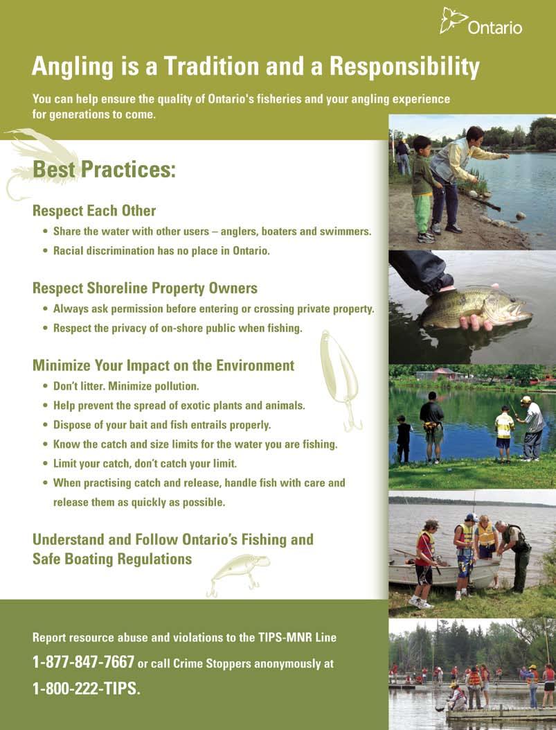
3 MESSAGE FROM THE GOVERNMENT OF ONTARIO Fishing is one of the most popular outdoor activities for Ontario residents and visitors alike. With a quarter million lakes and many rivers and streams, the province offers a wide range of angling opportunities. Outdoor recreation, such as angling, is a great way for families to spend time together, to learn about the importance of healthy waters and fish communities to our way of life, and to promote greater appreciation of nature. With a range of fishing experiences from walleye in remote northern lakes to world class salmon and trout fishing within an hour of Toronto, there is a fishing opportunity for everyone. This publication helps you know when and what you can catch so that you have a great time fishing while helping to ensure the fishery will be available for future generations. This year marks an important milestone for Ontario s recreational fisheries. In 2008, the Government initiated a new ecological approach to fisheries management which includes improved fisheries monitoring and enhanced public participation. Since 2008, over 370 lakes have been sampled as part of a long-term monitoring program to better understand the state of our resources. Fisheries Management Zone Advisory Councils, comprised of a broad range of public stakeholders, are being established across Ontario. Council members are doing a great public service by volunteering their time and providing advice to ensure Ontario s fisheries provide benefits now and in the future. The 2010 Fishing Summary is the first edition to reflect the advice of the Zone Advisory Councils. We can all do our part to keep Ontario s recreational fishery healthy. Read the summary, follow the rules, and share your love of fishing. Please respect the natural environment and one another when enjoying the outdoors. Ministry of Natural Resources Fish and Wildlife Funding Since 1996, Ontario has put all licence fees, royalties and fines collected under the Fish and Wildlife Conservation Act into a Special Purpose Account that is used exclusively for fish and wildlife management. For 2009/10, approximately $64.1 million is planned to be sourced from the Fish and Wildlife Special Purpose Account. The remaining funding comes from other provincial sources. Fish Culture 5% Great s 10% Fish and Wildlife 22% Other 10% Applied Research and Development 10% Fish and Wildlife Heritage Commission Science and Information 8% Field Operations 21% Enforcement 14% The Fish and Wildlife Heritage Commission was created in 2002 to advise the Minister on matters related to the promotion of hunting and fishing, funding of the Fish and Wildlife Program, and other matters as requested by the Minister. The Commission currently has nine members who represent a cross-section of people with a keen interest in the sustainable use of our fish and wildlife resources. Over the past year, the Commission has been working hard on a number of key issues, including the development of strategies to engage youth in our fishing and hunting heritage. 2
4 HOW TO USE THIS SUMMARY For recreational fishing purposes, Ontario is divided into 20 Fisheries Management Zones (Zones). The map below indicates the general location of these Zones within Ontario. Please follow these step-by-step instructions to be sure that you comply with the regulations. 1. Make sure that you have a valid Ontario fishing licence. 2. Carefully read the General Regulations section. Here you will find information that applies to fishing in all Zones, including general prohibitions, definitions, as well as information on ice fishing, bait, transporting fish, non-angling methods and laws to help stop the spread of invading species. 3. Using the map below, determine the Zone in which you plan to fish. For more detailed information, see the Zone section in which you plan to fish. 4. Check the Zone regulations table to determine: The open season for fishing for any species you plan to target in that Zone. The catch and possession limits and size limits, if applicable, for those species in that Zone Remember that most catch and possession limits and some size limits are different for a holder of a Sport Fishing Licence than for a holder of a Conservation Fishing Licence. S - refers to limits under a Sport Fishing Licence. For example: S 4 = catch and possession limit of four. C - refers to limits under a Conservation Fishing Licence. For example: C 2 = catch and possession limit of two. NOTE: all size limits refer to total length refer to Angler s Guide to Fishing Regulations, page Also, don t forget to check the additional fishing opportunities for each Zone to make the most of your fishing experience. THEN YOU MUST 7. Check the exceptions to the General Regulations for the waters or general area in which you will be fishing. If there are any exceptions to the general rule for the Zone, you must comply with those exceptions. NOTE: In some cases, lower limits or size limits stated in the exceptions apply only to Sport Fishing Licence holders. If no Conservation Fishing Licence limit or size limit is stated for exception waters, then the Conservation Licence limit is the same as for the rest of the Zone for that species and can be found in the Zone Regulations Table. 8. Non-Canadian residents fishing in northwestern Ontario must also check page Superior L. Michigan L. Huron Erie L. Ontario 3
5 RECREATIONAL FISHING LICENCE INFORMATION MOST PEOPLE NEED ONE OF THE FOLLOWING RECREATIONAL LICENCES TO FISH IN ONTARIO Sport Fishing Licence: For anglers who want full catch and possession fishing privileges. In this Summary, S - refers to limits under a Sport Fishing Licence (e.g., S - 4 = catch and possession limit of 4). Conservation Fishing Licence: A reduced catch and possession limit licence that is ideal for anglers who want to live-release the majority of fish caught. Under this licence, anglers must immediately release muskellunge, Atlantic salmon and aurora trout. In this Summary, C - refers to limits under a Conservation Fishing Licence (e.g., = catch and possession limit of 2). Refer to the Zone tables and the exceptions for catch and possession limits. RECREATIONAL FISHING LICENCE INFORMATION FOR Ontario Residents and Canadian Residents Ontario Resident: An Ontario resident is defined as a person whose primary residence is in Ontario and who has lived in Ontario for a period of at least six consecutive months during the 12 months immediately before applying for a licence. Canadian Resident: A Canadian resident is defined as a person who is a non-ontario resident and whose primary residence is in any part of Canada and who has lived in Canada for a period of at least six consecutive months during the 12 months immediately before applying for a licence. Non-Canadian Resident: A person who is neither an Ontario nor Canadian resident (see page 6 for licence information). For Ontario Residents a complete and valid licence to fish consists of an Outdoors Card plus a valid fishing licence tag, or a Temporary Fishing Licence and Outdoors Card Application. The Outdoors Card is a plastic, wallet-sized identification card to which your Ontario fishing licence tag is affixed. The Outdoors Card is valid for three calendar years and serves as a durable carrier for your licence tags. For Canadian Residents a complete and valid licence to fish consists of an Outdoors Card or a Temporary Outdoors Card and Application plus a valid fishing licence tag for Canadian residents. The Outdoors Card is a plastic, wallet-sized card used for identification and administration purposes. A person is deemed to be the holder of a Recreational Fishing Licence if they are: 1. Residents of Ontario and Canada under 18 years old, or 65 years of age or older and in possession of any licence, permit, certificate, or identification card issued by the Government of Canada or a provincial or territorial government of Canada that indicates their name and date of birth. 2. Disabled Ontario and Canadian residents eligible for and in possession of: A Canadian National Institute for the Blind National Identity Card issued to them; or, An Ontario Ministry of Transportation Accessible Parking Permit issued to them; or, A black and white photocopy or printed version of an electronic copy of the Ontario Ministry of Transportation Accessible Parking Permit accompanied by any licence, permit, certificate, or identification card issued by the Government of Canada or a provincial or territorial government of Canada that indicates the person s name and date of birth. Any licence, permit, certificate or identification card issued by the Government of Canada or a provincial or territorial government of Canada that indicates the person s name and date of birth where the individual must be accompanied by and require the direct assistance of another person to fish and follow applicable fishing laws due to a condition of mental impairment or a developmental disability, a learning disability or dysfunction, or a mental disorder. The person accompanying the above person does not require a fishing licence if they are only assisting, but must have a licence if they wish to engage in fishing. Those who qualify to fish with a deemed licence must follow the same catch and possession limits as a Sport Fishing Licence. Aboriginal people: Members of Ontario Aboriginal communities having established Aboriginal or treaty rights do not require an Outdoors Card or Ontario fishing licence tag to take fish for personal use within their traditional or treaty territory. Personal use means use for food, social or ceremonial purposes. Individuals should be prepared to provide identification when showing their community membership. Members of Aboriginal communities fishing outside of their traditional or treaty areas must have a valid Ontario Outdoors Card and fishing licence tag and follow the corresponding seasons, limits and exceptions. APPLYING FOR YOUR FIRST OUTDOORS CARD AS AN ONTARIO RESIDENT 1. If you can wait, submit an Outdoors Card application through the mail. You will receive the card and fishing licence tag you selected in approximately four to six weeks. To have an application mailed to you, call the Outdoors Card Centre at You can also pick up an Outdoors Card application at any ServiceOntario office (see pg. 96). 2. If you want to fish right away, a temporary paper licence and Outdoors Card Application is available from more than 1,800 licence issuers across the province. The delivery time for an Outdoors Card may vary. An Outdoors Card renewed by telephone or online arrives in approximately 20 days. Mail-in renewal takes approximately four to six weeks. If you re renewing by purchasing a Temporary Outdoors Card, the card should arrive before year end depending upon when purchased. What you need to know about your Outdoors Card. You must notify the Ministry of Natural Resources of any address or name change within 10 days of the change. You can change your address or name by calling the Outdoors Card Centre at , online (address change only) at ontario.ca/ outdoorscard, or visit one of the more than 70 ServiceOntario kiosk locations. If your Outdoors Card is lost or stolen or if you need more information about Outdoors Cards or fishing licences, call the Outdoors Card Centre from anywhere in North America at You must carry your Outdoors Card and fishing licence tag or Temporary Fishing Licence and Outdoors Card Application with you whenever you are fishing. If a Conservation Officer asks to see your Outdoors Card, the law states you must show it. Your Outdoors Card is not transferable to another person it provides privileges to you alone. It is an offence to attempt to obtain more than one card. It is also an offence to provide false information on a card application. One-year fishing licences expire December 31st of the year printed on the licence. Three-year fishing licences expire at the same time as the Outdoors Card, on December 31st of its third year. Your card s expiry year is the two numbers following your 15-digit card number. If you ve applied for an Outdoors Card and haven t received it within the stated timeframe, call the Outdoors Card Centre at
6 RECREATIONAL FISHING LICENCE INFORMATION (CONTINUED) The 2010 one-year licence fees listed in this summary are in effect from January 1, 2010 until December 31, The 2010 three-year licence fees are subject to change after August 31, For the location of the licence issuer nearest you, contact the Ministry of Natural Resources. A list of Ministry of Natural Resources offices and ServiceOntario locations is provided on page 96. LICENCE TYPE Outdoors Card plus three-year Sport Fishing Licence Tag Outdoors Card plus three-year Conservation Fishing Licence Tag Sport Fishing Licence Tag (one year) and Outdoors Card Application (Outdoors Card is included in this fee) Conservation Fishing Licence Tag (one year) and Outdoors Card Application (Outdoors Card is included in this fee) Ontario/Canadian Resident One-Day Fishing Licence Three-year Outdoors Card only (no licence tags). This Outdoors Card becomes a fishing licence only when a one-year licence tag is affixed. One-year Sport Fishing Licence Tag (for holders of a valid Outdoors Card) One-year Conservation Fishing Licence Tag (for holders of a valid Outdoors Card) LICENCE AVAILABility By phone (renewal only) at Online at ontario.ca/outdoorscard (renewal only) By mail (new application or renewal) By phone (renewal only) at Online at ontario.ca/outdoorscard (renewal only) By mail (new application or renewal) As an E-licence (renewal only) at ontario.ca/outdoorscard Licence issuers throughout the province. As an E-licence (renewal only) at ontario.ca/outdoorscard Licence issuers throughout the province. Most licence issuers (including Service Ontario) throughout the province. By phone (renewal only) at Online at ontario.ca/outdoorscard (renewal only) By mail (new application or renewal) As an E-licence at ontario.ca/ outdoorscard Licence issuers throughout the province. As an E-licence at ontario.ca/ outdoorscard Licence issuers throughout the province Fee for Ontario Residents (includes GST) $83.25 $51.75 $33.75 $23.25 $11.25 $9.00 $24.75 $14.25 LICENCE TYPE Canadian Resident Temporary Outdoors Card and Application only. This Outdoors Card becomes a fishing licence only when accompanied by a one-year licence tag. One-year Sport Fishing Licence Tag (for holders of a valid Outdoors Card) One-year Conservation Fishing Licence Tag (for holders of a valid Outdoors Card) Ontario/Canadian Resident One-Day Fishing Licence LICENCE AVAILABility Licence issuers throughout the province. Licence issuers throughout the province. Licence issuers throughout the province. Most licence issuers (including ServiceOntario) throughout the province Fee for Canadian Residents (includes GST) $9.00 $46.00 $27.75 $11.25 The 2009 Ontario Budget proposed a Harmonized Sales Tax (HST) for the Province of Ontario. Subject to legislative approval, the HST would come into effect on July 1, 2010, and would generally apply to fees that cover a period that occurs on or after July 1, For this reason, the printed fees may change. NEW Automated Licensing System The ministry is proceeding with the implementation of an automated licensing service for the sale of fishing and hunting licences. Licences will be available through the system at over 1,800 private licence issuers across the province, at ServiceOntario counters, online, and through an automated tollfree telephone service. The target implementation date for the new system is late The new automated licensing system will offer many benefits to anglers and hunters, including: an increased range of fishing and hunting licences and other services, such as big game draw entry, available online, non-canadian resident anglers and hunters will be able to purchase fishing and hunting licences online and through an automated toll-free telephone system, new anglers will be able to purchase their first Outdoors Card online, easier replacement of lost or stolen licences. 5

7 Recreational Fishing Licence Information For Non-Canadian Residents Anyone who is not an Ontario or Canadian resident (see definitions, page 4) is considered a non-canadian resident for the purposes of fishing licence regulations. Most non-canadian residents require an Ontario fishing licence to fish in Ontario. Non-Canadian residents 18 years of age and over must purchase a fishing licence. (NOTE: Non-Canadian residents 65 years of age or older are not exempt from requiring a licence.) Non-Canadian residents under 18 years of age may fish without a licence if accompanied by an adult who has a valid fishing licence. Any fish kept are part of the catch and possession limit of the person who holds the licence. As another option, non-canadian residents under 18 years may purchase a licence to have their own limits. Non-Canadian resident fishing licences are available through licence issuers and through the mail by calling the Ministry of Natural Resources at Please allow four weeks for delivery. For non-canadian residents a complete and valid licence to fish consists of an Outdoors Card or a Temporary Outdoors Card and Application plus a valid fishing licence tag for non-canadian residents carried as a separate document. The Outdoors Card is a plastic, wallet-sized card used for identification and administration purposes. For non-canadian resident groups of children (at least five people under the age of 18 years) there is a special licence for members of an organized camp. This licence is available from ServiceOntario/ Ministry of Natural Resources offices (see page 96). NOTE: Non-Canadian residents camping on Crown lands in northwestern Ontario are subject to conservation licence limits except in the border waters area (see page 12). Canadian/Non-Canadian Resident Outdoors Card REQUIREMENT The Ministry of Natural Resources (MNR) is working on a project to improve the fishing and hunting licensing system. Once these improvements are complete, Canadian/non-Canadian resident anglers will be able to purchase Ontario fishing licences from home, using the Internet or the automated toll-free phone system. As part of this project, MNR will also be developing an automated licensing system for licence issuers to improve service to anglers and hunters. See page 5 for more information on the new automated licensing system. The automated system will mean that all anglers and hunters will need a unique identification number. That is why MNR has extended the requirement to have an Outdoors Card to Canadian/non-Canadian resident anglers and hunters, effective January 1, The Outdoors Card is required to purchase an Ontario fishing or hunting licence, except for a One-Day Sport Fishing Licence. Canadian/non-Canadian resident anglers and hunters will be able to purchase their initial Outdoors Card by filling out an application at any ServiceOntario counter or Ontario fishing and hunting licence issuer. There are over 1,800 licence issuers located throughout the province. The paper application will serve as a temporary Outdoors Card until the plastic card is received in the mail. Non-Canadian resident fishing licences are also available through the mail by calling the Ministry of Natural Resources at Please allow 4-6 weeks for delivery. All fees include GST. LICENCE TYPE Non-Canadian Resident Temporary Outdoors Card and Application only. Yearly licences must be purchased One-year Sport Fishing Licence Tag (for holders of a valid Outdoors Card) One-year Conservation Fishing Licence Tag (for holders of a valid Outdoors Card) Eight-day Sport Fishing Licence Tag* Eight-day Conservation Fishing Licence Tag* LICENCE AVAILABility Licence issuers throughout the province. Licence issuers throughout the province. Licence issuers throughout the province. Licence issuers throughout the province. Licence issuers throughout the province Fee for Non- Canadian Residents (includes GST) $9.00 $69.50 $42.75 $44.50 $25.75 One-Day Sport Fishing Licence Through many charter boat operators, licence issuers and ServiceOntario locations $18.75 Non-Canadian Resident Angling Licence for a Member of an Organized Camp St. Joseph tags ServiceOntario $4.50 St. Joseph tourist operator from whom accommodation is obtained. No charge * Eight-day fishing licences are valid for eight consecutive calendar days. A calendar day is a 24-hour period starting at 12:00 Midnight 6
8 GENERAL FISHING REGULATIONS ANGLER S GUIDE TO FISHING REGULATIONS NOTE: This section contains important information that anglers must understand to make sure they follow the regulations. Additional Fishing Opportunities There are some waters where regulations for certain species are more liberal than the Zone regulations. These include areas where anglers may fish for a species during part or all of the time when the season is generally closed in the Zone and include extended seasons or open all year seasons for some species. Often these additional opportunities are provided through fish stocking. Aggregate Limits Aggregate limits are catch and possession limits for a combination of fish species. Where there are aggregate limits, you may not catch and retain a separate limit of each species. In this Summary, limits stated for walleye and sauger are aggregate limits as are limits for largemouth and smallmouth bass and the limits for black and white crappie. The aggregate limits for these species can be found in the Zone-wide tables or in the exceptions for each Zone. See also Catch and Possession Limits, below. Aggregate Limits for Trout and Salmon In addition, throughout the province there are standard aggregate limits for all species of trout and salmon in combination: S 5 and C 2; that is you may only catch and keep in one day or possess no more than five trout and salmon in total under a Sport Fishing Licence or two trout and salmon in total under a Conservation Fishing Licence. NOTE: In addition to the aggregate limit, you may not exceed individual species limits where they are otherwise stated (e.g., the S limit for Atlantic salmon is one and you may not catch and keep or possess more than one Atlantic salmon at any time). Angling Angling means fishing with a line that is held in the hand or attached to a rod that is held in the hand or closely attended. Artificial fly - An artificial fly means a hook dressed with silk, wool, fur, feathers or similar material but does not include other types of artificial lures. Artificial Lure An artificial lure means a spoon, plug, jig, artificial fly or other such device that is designed to catch fish by means of angling. Bait There are some areas of the province where the use of any form of organic bait is not allowed. Organic bait includes live or dead animals, plants or parts. See Bait (page 10), or exceptions to the Zone regulations for the Zone where you are fishing. Baitfish Some species of fish may be used as bait in some areas (see Bait, page 10). Barbless Hook A barbless hook means a hook without barbs or one that has barbs that are compressed so as to be completely in contact with the shaft of the hook. Catch and Possession Limits The catch limit is the number of fish you are allowed to catch and keep in one day and includes fish that are retained for any period of time and any fish eaten or given away. The possession limit is the number you are allowed to have in your possession on hand, in cold storage, in transit, or anywhere. Possession limits are the same as one day s catch limit except where otherwise specified. In this summary: S refers to limits under a Sport Fishing Licence (For example: S 4 = catch and possession limit of four). C refers to limits under a Conservation Fishing Licence (For example: C 2 = catch and possession limit of two). If you catch a fish after reaching the daily catch or possession limit for that species, the fish must be released immediately back to the water (see Ontario s Catch and Retain Rules, on page 9). If the limit is zero, anglers may practise catch and release only and any fish caught must be released immediately back into the water in a manner that does not harm the fish. For some species there are no limits and no reference will be made to a limit in this Summary. See Size Limits, next page. Check Stations Conservation Officers operate random Fish Check Stations throughout the year. At these stations, Conservation Officers collect information on fish taken and make sure that regulations are being followed in order to better manage our fisheries resources. Remember to keep all licences, equipment and fish easily accessible for inspection. Conservation Officers Conservation Officers enforce fisheries regulations in the Province of Ontario. They have powers of inspection, arrest, search and seizure under the various statutes they enforce, including the Fish and Wildlife Conservation Act and the Fisheries Act. When carrying out their duties, Conservation Officers may do the following: Stop and inspect a vehicle, boat or aircraft Ask questions relevant to the inspection Inspect buildings or other places Require assistance to complete inspections Enter onto private property to perform their duties Search with a warrant Search without a warrant in circumstances requiring immediate action Seize items related to an offence Arrest anyone the Conservation Officer believes has committed, is committing, or is about to commit an offence. Crappie For the purpose of this Summary, crappie includes both black crappie and white crappie. Exceptions In specified waters, there are exceptions to the general regulations established for each Zone. These include fish sanctuaries, bait and gear restrictions and different seasons, limits and size limits for some species. Anglers must check the exceptions for the waters where they will be fishing. NOTE: Some waters are grouped with other waters that have the same regulatory exceptions and these will generally be listed under the proper name for the largest or most significant water body. If there is nothing stated in the exceptions, then the regulations for the Zone apply. Export of Fish A person may, on leaving Ontario, take no more than the designated limits for fish. 7
9 GENERAL FISHING REGULATIONS (CONTINUED) Fish Sanctuaries Fish sanctuaries are described in the Exceptions to Zone Regulations. No fishing of any kind is permitted in a fish sanctuary. Some bodies of water, or parts of them, are declared fish sanctuaries for all or part of the year. Fish sanctuaries are not always marked with signs. Sanctuary dates are inclusive; all dates including the first and last dates stated in the summary are closed. Fisheries Management Zone or Zone The province is divided into 20 Fisheries Management Zones (or Zones) for which there are general regulations that establish open seasons, limits and size limits (where applicable) for popular fish species. See also Exceptions. Hook A hook includes a single-pointed or multiple-pointed hook on a common shaft but does not include a snagger or spring gaff. The number of hooks includes any single-pointed or multiple-pointed hooks that are part of a lure. Hooks and Lines An angler may use only one line, unless otherwise stated in the regulations. Two lines may be used when angling from a boat in parts of the Great s (see Exceptions to the General Regulations) and for ice fishing in many areas (see Ice Fishing, page 11). A fishing line must not have more than four hooks attached. Lead Sinkers and Jigs It is illegal to use or possess lead fishing sinkers or jigs in Canada s national parks and wildlife areas. Further information is available at Live Holding Boxes If you use a live holding box or impounding device, it must be clearly marked with your name and address and it must be legible without having to lift the box, unless it forms part of or is attached to a boat. Any fish in holding boxes are part of your limit. Always monitor fish in your possession; allowing fish to waste is an offence. Catch and retain possession limits apply to live holding boxes. Livewell A livewell is a compartment designed to keep fish alive. For a livewell to be used to selectively release bass, walleye and northern pike, it must be attached to or form part of a boat, hold a total volume of not less than 46 litres (10 gallons) of water, have the capacity for water exchange and be mechanically aerated at all times when live fish are being held in it. (See Ontario s Catch and Retain Rules). Open Seasons Fishing season opening and closing dates vary depending on the species and the area. Dates are inclusive; all dates including the first and last dates stated in the summary are open or closed. It is illegal to attempt to catch fish for which the season is closed, even if you are going to release them. Fish accidentally caught during the closed season must be immediately released back to the water. Unless stated otherwise, species that are not listed (such as sucker and rock bass) have a year-round open season. Pacific Salmon - For the purpose of this Summary, Pacific salmon include Chinook salmon, Coho salmon and Pink salmon. Size Limits All size limits refer to total length which is a measure from the tip of the mouth with the jaws closed to the tip of the tail, with the tail fin lobes compressed to give the maximum possible length. Provincial regulations are established using the metric system. NOTE: If you catch a fish in a restricted size range, you must release it immediately (see Units of Measure, below). Sunfish For the purpose of this summary, sunfish includes pumpkinseed, bluegill, green sunfish, warmouth, orange spotted sunfish, longear sunfish and Lepomis hybrids. Units of Measure There are many units of measure referred to in the Summary. Provincial regulations are established using the metric system and converted to imperial measurement units for the convenience of anglers. The following short forms are used: km = kilometre (or mi. = mile) m = metre (or ft. = feet) cm = centimetre (or in. = inches) GENERAL PROHIBITIONS IT IS ILLEGAL TO: Fish for or possess the following specially protected fish species: American eel, cutlip minnow and redside dace. Possess any of the following live invasive species: rudd, ruffe, bighead carp, black carp, grass carp, silver carp, round goby, tubenose goby or any member of the snakehead family. Sell any recreationally-caught fish, crayfish, leeches, frogs, fish eggs or spawn. Only holders of commercial fishing and commercial bait licences may sell their catch. Possess a spring gaff, snagger or spear gun within 30 m (98 ft.) of any waters. A spring gaff includes any spring loaded device which sets the hook for an angler. No person shall take fish with a gaff, snare, snagger or spear gun. A gaff, other than a spring gaff, may be used to assist in landing fish caught by lawful means. Catch a fish by impaling or snagging it with a hook through any part of the body other than the mouth any fish hooked in this way must be released immediately. Take fish by any means other than angling, spear, bow and arrow, net or bait fish trap. Possess a spear for the purpose of fishing on or within 30 m (98 ft.) of the edge of any waters except when fishing in accordance with the regulations (see Non-angling Methods, page 11). Use artificial lights to attract fish except: to fish for smelt, or to fish for lake whitefish or lake herring with a dip net if the light is part of a lure attached to a line used in angling. Transport live fish, other than baitfish, taken from Ontario waters or to transfer or stock any fish into Ontario s waters without a special licence to transport or stock fish. Use dynamite or other explosives to take or destroy fish. Fish within 25 m (81.8 ft.) of a pound net or fish culture cage. Fish within 22.9 m (75 ft.) downstream from the lower entrance to any fishway or canal, obstacle, or any device designed to assist fish around an obstacle. Transfer live fish or live spawn from one body of water to another without the authorization of the Ministry of Natural Resources. Abandon fish or permit the flesh to spoil, if the fish is suitable for human consumption. 8
10 GENERAL FISHING REGULATIONS (CONTINUED) Generally, daily catch limits include all fish that are retained for any period of time and not immediately released. Anglers fishing from a boat may now catch, hold, and selectively live release, more walleye, northern pike, largemouth or smallmouth bass than the daily limit, provided: (a) the fish are held in a livewell with a mechanical aerator operating at all times, (see Anglers Guide, p. 8, for livewell requirements) (b) the fish comply with any applicable size limits, (c) the Sport or Conservation Fishing Licence daily catch and retain limits for walleye or northern pike are not exceeded at any one time, (d) no more than six largemouth or smallmouth bass (or any combination) caught under a Sport Fishing Licence are retained at any one time, and It is contrary to the Fish and Wildlife Conservation Act to stock or transport live sport fish without a permit. Anglers need to ensure they are transporting fish in compliance with the regulations, which are designed to protect fisheries resources. The fish that you catch and keep may be cleaned. However, please remember that fish taken from waterbodies where size limits are in effect must be readily measurable at all times, unless the fish are: Being prepared for immediate consumption Prepared at an overnight accommodation for storage Being transported on the water from a temporary overnight accommodation to your residence and you are not engaged in sport fishing ONTARIO S CATCH AND RETAIN RULES TRANSPORTING SPORT FISH IN ONTARIO TIPS FOR PACKAGING FISH (e) the Conservation Fishing Licence catch and retain limits for largemouth and smallmouth bass (or any combination) are not exceeded at any one time. Anglers are reminded to closely monitor the condition of fish held in a livewell. Only fish that are in such a condition that they will survive may be released (see Tips on Live Release of Fish, page 10). Releasing a fish that will not survive and allowing the flesh of that fish to be wasted is an offence. Any fish not live-released are part of your daily catch and retain limit. Being transported overland. In addition, when packaging fish you must ensure that a Conservation Officer can easily determine: The number of fish in your possession The species of fish in your possession. This may require leaving a large patch of skin, the head, or some other identifying feature depending on the species of fish (e.g. whitefish vs herring). 1. All fish must be packaged so that they can be easily counted and identified, not just those with limits. 2. To ensure fish can be easily counted, package each fish separately, or arrange fillets spread flat in a clear freezer bag. DO NOT freeze fillets in a milk carton, margarine tub or other container. A large lump of fillets frozen together in bags is also unacceptable. 3. Since anglers often transport various species of fish, it s their responsibility to ensure every fillet of their catch can be easily identified. Ensure you leave at least a large patch of skin on all fish fillets for identification purposes. Some species (e.g. whitefish or herring) may require additional identifying features such as the head. 4. Conservation Officers may inspect your catch at any time. Always have your fish and your licence easily accessible and place coolers of fish where they can be easily inspected. No one wants to unload a vehicle to find licences and coolers. 5. If a Conservation Officer inspects the sport fish you re transporting and they are improperly packaged: Your catch may be seized for evidence You could get a ticket and be fined You may have to attend court, usually close to where the inspection took place, which may be far from where you live. Frozen fish fillets without skin attached Species cannot be identified Numbers can be counted Walleye fillets properly packaged Whole skin attached Can be counted and identified Perch and Walleye fillets Patch of skin attached Fillets form a frozen block Numbers cannot be counted Species cannot be determined on all fillets Walleye fillets Patch of skin attached Can be counted and identified Pike fillets Individually packaged 9
11 GENERAL FISHING REGULATIONS (CONTINUED) TIPS ON LIVE RELEASE OF FISH Using proper handling and release techniques improves fish survival. Here are some tips for releasing fish: 1. Use barbless hooks and artificial lures (no organic bait) to prevent deep hooking. 2. Land fish as quickly as possible and use a rubber landing net if needed. 3. Keep the fish in the water as much as possible and handle the fish gently. 4. Wet your hands or use wet cloth gloves when handling fish out of water. 5. Do not touch the gills or eyes. Grasp the fish just behind the gill covers, or for fish without teeth (for example, bass or panfish), hold the fish by the lower lip. BAIT Anglers with a valid recreational fishing licence may capture their own bait for personal use as follows: BAIT LIMIT NOTES Baitfish 120 Includes those caught and or purchased. See list of permitted baitfish species. Leeches 120 Includes those caught and or purchased. Only resident anglers may capture baitfish, using the methods outlined below. One baitfish trap no more than 51 cm (20 in.) long and 31 cm (12.2 in.) wide can be used day or night. Bait-fish traps must be clearly marked with the licence holder s name and address. One dip-net no more than 183 cm (6 ft.) on each side if square, or 183 cm (6 ft.) across if circular, during daylight hours only (after sunrise and before sunset). Dip-nets and baitfish traps may not be used in Algonquin Park. Only one leech trap no more than 45 cm (17.7 in.) in any dimension can be used day or night to capture leeches. Leech traps must be clearly marked with the licence holder s name and address. Crayfish 36 Must be used in same water body where caught. May not be transported overland. May be captured by hand or using the methods outlined for Baitfish above. Frogs 12 Only northern leopard frogs may be captured or used as bait. NOTE: The capture and use of bait is not allowed in some waters (see other Zone Regulations or Exceptions for the Zone you are fishing in). Salamanders cannot be captured, imported, or used as bait in Ontario. 6. Use long-nose pliers to remove the hook quickly without injuring the fish. If the fish is hooked deeply, cut the line and leave the hook in. 7. If you want to take a picture, be ready ahead of time, hold the fish in a horizontal position supporting its weight with your arm and hands, and take pictures quickly, minimizing the time the fish is out of water. 8. When releasing the fish, hold it in the water so that it is facing into the current or if there is no current, gently move the fish in a forward direction so water flows through the gills. 9. When the fish begins to struggle, is breathing normally and can keep its balance, let it swim away. 10. Remember that all fish not immediately released count towards your daily catch or possession limits (also see Ontario s Catch and Retain Rules). IMPORT OF BAIT It is illegal to bring any crayfish or salamanders or live fish or leeches into Ontario for use as bait. NO RELEASE OF BAIT It is illegal to release any live bait or dump the contents of a bait bucket including the water, into any waters or within 30 m of any waters (see page 13). Minnows Blacknose shiner Blackchin shiner Bluntnose minnow Brassy minnow Central stoneroller Common shiner Creek chub Eastern blacknose dace Emerald shiner Fallfish Fathead minnow Finescale dace Golden shiner Hornyhead chub chub Longnose dace Mimic shiner Northern redbelly dace Pearl dace Redfin shiner River chub Rosyface shiner Sand shiner Spotfin shiner Spottail shiner Striped shiner BAITFISH Please note that a number of changes have been made to bait regulations to protect rare and endangered species, conserve biodiversity and prevent the spread of invasive species. Anglers may not use live yellow perch and alewife as bait anywhere in Ontario. Baitfish Only the fish species listed below may be used as live bait: Suckers White sucker Longnose sucker Others Central mudminnow herring (cisco) Trout-Perch Sticklebacks Brook stickleback Ninespine stickleback Sculpins Mottled sculpin Slimy sculpin Darters and Logperch Blackside darter Fantail darter Iowa darter Johnny darter Least darter Rainbow darter River darter Tessellated darter Logperch 10
12 GENERAL FISHING REGULATIONS (CONTINUED) Game Amphibians and Reptiles Holders of valid recreational fishing licences may catch and retain bullfrogs and snapping turtles during open seasons. For details on harvest areas, season dates and catch and possession limits, see the Ontario Hunting Regulations Summary. ZONES IN WHICH ICE HUT REGISTRATION IS REQUIRED ICE FISHING Two lines may be used for ice fishing except in a limited number of waters (see the Exceptions for the Zone in which you are fishing). You must be within 60 m (197 ft.) at all times of any line or tip-up you are using when ice fishing and you must have a clear and unobstructed view of the lines being used at all times. Any spring loaded device which sets the hook for an angler may not be possessed within 30 m (98 ft.) of any waters. ICE HUT REGISTRATION Ice fishing huts must be registered if they are being used in the following Fisheries Management Zones and must be removed by the dates indicated below. To register an ice fishing hut contact your local MNR office. Once registered, an ice fishing hut can be used anywhere in Ontario. 17, 20 March 1 14, 16, 18, 19 March 15 9, 10, 11, 15 March Above Timiskaming Dam - March 31 Below Timiskaming Dam - March 15 Ice hut registration numbers must be at least 6.3 cm (2.5 in.) in height and clearly displayed on the outside of the hut. ICE HUT REMOVAL DATE You do not need to register your ice hut or abide by specific removal dates: in Zones 1-8 and 13, or if your ice hut is a tent made of cloth or synthetic fabric that has a base area of seven square metres (75.4 square feet) or less when erected. Note: It is an offence under the Public Lands Act to leave your ice hut out after ice break up, regardless of whether registration and removal dates apply. NON-ANGLING METHODS OF CAPTURING FISH Residents and non-canadian residents with a valid recreational fishing licence may fish with one dip net, one seine net, one spear or a bow and arrow for the species outlined below. Dip nets may be no more than 183 cm (6 ft.) on each side if square, or 183 cm (6 ft.) in diameter, if circular. Seine nets may be no more than 10 m (32.8 ft.) long and 2 m (6.5 ft.) high. Spears cannot be possessed on or within 30 m (98 ft.) of the edge SPECIES AND GEAR TYPE Bowfin Bow and arrow (during daylight hours only) Carp Bow and arrow, spear and dip net (during daylight hours only). Smelt Dip net and seine (day or night) OPEN SEASON May 1 to July 31 No open season May 1 to July 31 2nd Saturday in May to July 31 No open season March 1 to May 31 2nd Saturday in May to May 31 No open season ZONE LIMIT 10, 13, 14, 19 No limit 1, 2, 3, 4, 5, 6, 7, 8, 9, 11, 12, 15, 16, 17, 18, 20 5, 6, 9, 10, 12, 13, 14, 15 (except Algonquin Park),16, 18, 19, 20 Zone 17 1, 2, 3, 4, 7, 8, 11, Algonquin Park in Zone 15 N/A No limit No limit N/A 6, 7, 8, 9, 10, 11, 12, No limit 13, 14, 15, (except Algonquin Park), 16, 18, 19, No limit 1,2,3, 4, 5 Algonquin Park in Zone 15 N/A of any waterbody except when fishing for carp and white sucker as described on this page. Northern pike spearing is not allowed. Bow and arrow: includes all longbows and crossbows. SPECIES AND GEAR TYPE White Sucker Bow and arrow, spear and dip net (during daylight hours only) Whitefish Dip net (day or night) Herring Dip net (day or night) OPEN SEASON March 1 to May 31 2nd Saturday in May to May 31 No open season Oct. 1 to Dec. 15 Oct. 1 to Dec. 15 No open season Oct. 1 to Dec. 15 No open season ZONE 1, 2, 3, 4, 5, 6, 7, 8, 9, 10, 11, 12, 13, 14, 15, (except Algonquin Park) 16, 18, 19, 20 Zone 17 LIMIT No limit No limit Algonquin Park in N/A Zone 15 1, 2, 3, 4, 5, 6, 7, 8, 9 Same as angling limit in Zone 10, 11, 15 (note in designated waters only, see ontario.ca/fishing or contact local MNR office for locations) 12, 13,14, Algonquin Park in Zone 15, 16, 17, 18, 19, 20 1, 2, 3, 4, 5, 6, 7, 8, 10, 11, 15 (note in designated waters only, see ontario.ca/fishing or contact local MNR office for locations) 9, 12, 13, 14, Algonquin Park in Zone 15, 16, 17, 18, 19, 20 Same as angling limit in Zone N/A No limit N/A 11
. Labyrinth (48 14 N., 79 31 W.). Raven (48 03 N., 79 33 W.). Timiskaming (47 20 N., 79 30 W.). Ottawa River (45 34 N.")
13 85 o 20' W GENERAL FISHING REGULATIONS (CONTINUED) BOUNDARY WATERS Licences for Provincial Boundary Waters Ontario-Quebec Boundary Anglers may fish in the following waters with either an Ontario Resident Fishing Licence or a Quebec Resident Fishing Licence. Clarice (48 20 N., W.). Labyrinth (48 14 N., W.). Raven (48 03 N., W.). Timiskaming (47 20 N., W.). Ottawa River (45 34 N., W.). St. Francis (45 08 N., W.) and the waters of the St. Lawrence River between the dam at the Robert H. Saunders Generating Station and the Ontario-Quebec boundary. Ontario-Manitoba Boundary Anglers may fish in the following waters with either an Ontario Resident Fishing Licence or a Manitoba Resident Fishing Licence. Garner (50 48 N., W.). Davidson (50 21 N., W.). Ryerson (50 23 N., W.). Mantario (49 95 N., W.). Frances (51 43 N., W.). Moar (52 00 N., W.). High (49 42 N., W.). Limits in Boundary Waters Anglers who fish in waters that lie both in Ontario and another province or state must include the total number of fish caught anywhere in those waters as part of the number caught and kept or possessed under the Ontario recreational fishing regulations when bringing those fish into Ontario. Northwestern Ontario Regulations for Non-Canadian Residents Crown Land Camping Non-Canadian residents camping on Crown land in the areas shown in blue on the map below must follow Conservation Fishing Licence limits in Zones 2, 4, 6 and Zone 5 (except in the border waters area). Non-Canadian residents Camping on Crown Lands in Northwestern Ontario Border waters area Superior o N Pic River 11 Bicknell Twp Border Waters Area There are exceptions in the border waters area of Northwestern Ontario, Zone 5, that affect the number of walleye, sauger and lake trout that non-canadian resident anglers can catch and keep or possess. See, Northwestern Ontario Regulations for Border Waters, Zone 5 (page 23). Winnipeg River and the Sydney Area There are also exceptions for the Winnipeg River, Zone 5 and the Sydney Area, Zone 2 and 4 that affect non-canadian resident anglers. See, exceptions for Zones 2, 4 and 5. 12

14 LAWS TO HELP STOP THE SPREAD OF INVADING SPECIES Harmful introduced species are often spread unknowingly. As an angler or boater, you should always take precautions to help stop the spread of invading species. The following laws are in place to prevent unauthorized introductions. POSSESSING LIVE FISH It is illegal to possess live invasive fish including: round goby, tubenose goby, grass carp, bighead carp, black carp, silver carp, rudd, ruffe and any species of snakehead. If any of these species are caught they should be destroyed and not released back into any waters. MOVING LIVE FISH Many new populations of fish have been established through unauthorized stocking. This practice is illegal and can cause great harm to existing fisheries and aquatic ecosystems. A licence is required for all fish (including live spawn) transfers and stocking into Ontario waters, and a licence is required to ship or transport live fish, other than baitfish, taken from Ontario waters. Also, take care when cleaning smelt. Do not rinse equipment or dump entrails into a lake or river. Fertilized smelt eggs can easily invade new waters. AQUARIUM FISH Never release or flush pets, plants or water from aquaria, backyard ponds or water gardens. It is illegal and can harm the environment. If you have an unwanted aquarium pet, you can return it to a local pet store, donate it to a school or contact the Fish Rescue Program at CRAYFISH Crayfish can only be used for bait in the waterbody in which they were caught and they cannot be transported overland. ROUND GOBY The round goby is frequently caught by anglers. It is just one of the many serious threats to North American waters. Since its discovery in the St. Clair River in 1990, this bottom-dwelling fish has rapidly spread to many areas of the Great s and inland waters. The round goby can displace native fish from optimal habitat, eat their eggs and young and spawn multiple times a season. Anglers should know how to identify the round goby - these aggressive fish are easily caught by hook and line. Fin may be tinged in green Frog-like raised eyes Thick lips Body mostly slate gray, mottled with black to brown spots Black spot Single suction-cup like pelvic fin Credit: Donna Francis WHAT YOU CAN DO... Report new sightings. If you catch a round goby it should be destroyed and not released back into any waters. Always dispose of your unwanted bait and the contents of your bait bucket or bait bucket water on land or in the trash it is illegal to dump the contents of a bait bucket into any waters or within 30 metres of any waters. Never use gobies as bait remember it is against the law to use them as bait or have live gobies in your possession. For more information or to report a sighting, call the Invading Species Hotline or visit BY SPREADING THE WORD AND TAKING ACTION AGAINST INVADING SPECIES YOU CAN HELP CONSERVE ONTARIO S HEALTHY FISHERIES! WHAT YOU SHOULD KNOW ABOUT VHS Help Slow the Spread of VHS Viral Hemorrhagic Septicemia (VHS) is an infectious disease of fish. VHS is not a threat to human health. Fish carrying the VHS virus are safe to eat and handle. You can help slow the spread of this virus and other invasive species by following the laws outlined above (Laws to Help Stop the Spread of Invasive Species) and the guidelines on page 57 (Keep All Our s Great). Anglers are asked not to move bait voluntarily outside the VHS management zone. More information is available at ontario.ca/fishing or call Natural Resources Information Centre at
15 FISHERIES MANAGEMENT ZONES 1, 2 & 3 54 o N ZONES 1, 2 & 3 NOTE: - The part of the Berens River that is between Zone 2 and Zone 4, is wholly within Zone 4 - The part of the Missinaibi River and Moose River that is between Zone 3 and Zone 8 is wholly within Zone 8 - Universal Transverse Mercator (UTM) coordinates are in UTM Zone 16 Key Plan Hudson Bay River Legend Severn Polar Bear Provincial Boundary City/Town/Community Peawanuck MNR District Office River River Winisk Major Road Major Railway 1 Polar Bear River Zone Boundary Sutton Fawn Major Park Boundary Provincial Park km No Use or Possession of Live Baitfish Ekwan River Big Trout Opasquia Sturgeon - Closed All Year Attawapiskat River Attawapiskat UTM (Zone 16) E Wunnummin Winisk North Caribou L. Sandy 52º35 N James Bay 89 o W Kashechewan 3 Missisa 93º55 W Attawapiskat 2 92º10 W 52º10 N River UTM (Zone 16) N 11 th Baseline Berens Pikangikum River River Provincial Boundary Moosonee Pickle Albany River Moose River UTM (Zone 16) E St. Joseph Trout Woodland Caribou Red Wabakimi Ear Falls Park Missinaibi River Park Boundary Boundary Lac Seul 8 Armstrong River 516 Nakina Railway Railway (Abandoned) 72 Sioux Lookout 527 Dryden Kenora 7 17 Hearst Longlac Mattice 11 Geraldton Nipigon 71 of the Woods 14
16 ZONE 1 SEASONS AND LIMITS SPECIES OPEN SEASONS LIMITS Open all year Walleye & Sauger or any combination S - 4; not more than 1 greater than 46 cm (18.1 in.) ; not more than 1 greater than 46 cm (18.1 in.) Northern Pike Open all year S - 6; not more than 2 greater than 61 cm (24 in.), of which not more than 1 greater than 86 cm (33.9 in.) ; not more than 1 greater than 61 cm (24 in.), none greater than 86 cm (33.9 in.) Yellow Perch Open all year S SPECIES OPEN SEASONS LIMITS Brook Trout* Jan. 1 to Sept. 30 Trout* Open all year S - 3 C - 1 Whitefish Open all year S - 12 C - 6 Sturgeon Jan. 1 to Apr. 30 & July 1 to Dec. 31 S - 5; not more than 1 greater than 40 cm (15.7 in.) ; not more than 1 greater than 40 cm (15.7 in.) S - 0 C - 0 ZONES 1, 2 & 3 The following species are not present in this Zone and are closed to fishing all year: Muskellunge, Crappie, Sunfish, Brown Trout, Rainbow Trout, Splake, Pacific Salmon, Atlantic Salmon, Channel Catfish, Largemouth and Smallmouth Bass. * Aggregate Limits apply to these species. See page 7 for full details. OTHER ZONE 1 REGULATIONS possessed for use as bait in Zone 1 Only one barbless hook may be used in Zone 1 ZONE 2 SEASONS AND LIMITS Species Open Seasons Limits Walleye & Sauger or any combination Largemouth & Smallmouth Bass or any combination Jan. 1 to Apr. 14 & 3rd Sat. in May to Dec. 31 Open all year S - 4; not more than 1 greater than 46 cm (18.1 in.) ; not more than 1 greater than 46 cm (18.1 in.) S - 2; must be less than 35 cm (13.8 in.) from Jan. 1 - June 30 & Dec. 1 - Dec. 31 S - 4; no size limit from July 1 - Nov. 30 C - 1; must be less than 35 cm (13.8 in.) from Jan. 1 - June 30 & Dec. 1 - Dec. 31 ; no size limit from July 1 - Nov. 30 Northern Pike Open all year S - 4; none between cm ( in.), not more than 1 greater than 90 cm (35.4 in.) ; none between cm ( in.), not more than 1 greater than 90 cm (35.4 in.) Muskellunge 3rd Sat. in June to Dec. 15 Yellow Perch Open all year S S - 1; must be greater than 91 cm (36 in.) C - 0 Species Open Seasons Limits Sunfish Open all year S Brook Trout* Jan. 1 to Labour day Brown Trout* Open all year S - 5 Rainbow Trout* Trout* Open all year S - 5 Jan. 1 to Sept. 30 Splake* Open all year S - 5 Whitefish Open all year S - 12 C - 6 Sturgeon Jan.1 to Apr. 30 & July 1 to Dec. 31 S - 5; not more than 1 greater than 30 cm (11.8 in.) ; not more than 1 greater than 30 cm (11.8 in.) S - 2; not more than 1 greater than 56 cm (22 in.) from Sept. 1 - Sept. 30, no size limit rest of year C - 1; any size S - 0 C - 0 The following species are not present in this Zone and are closed to fishing all year: Crappie, Pacific Salmon, Atlantic Salmon and Channel Catfish. *Aggregate Limits apply to these species. See page 7 for full details. OTHER ZONE 2 REGULATIONS Smelt may not be used as bait or possessed for use as bait Non-residents camping on Crown land must follow conservation fishing licence limits. 15
 Jo-Jo (Minnow) (50 10'N., 86 46'W.) EXCEPTIONS TO ZONE 2 REGULATIONS Secret (50 17'N., 89 00'W.) Unnamed (51 38 N., 89 55 W.")
17 ZONES 1, 2 & 3 Blue (50 20'N., 88 56'W.) E-206 (50 22'N., 86 23'W.) ADDITIONAL ZONE 2 FISHING OPPORTUNITIES Brook trout open all year, S - 5,, no size limits Johnny (50 17'N., 87 03'W.) Jo-Jo (Minnow) (50 10'N., 86 46'W.) EXCEPTIONS TO ZONE 2 REGULATIONS Secret (50 17'N., 89 00'W.) Unnamed (51 38 N., W.) known as Whiz All waters located within the portion of Zone 2 from the Ontario / Manitoba interprovincial boundary east along the line of N. latitude, to the intersection with W. longitude, thence south to the intersection with N. latitude, thence east to the intersection with W. longitude, thence south to the Zone 2 boundary, including all of the waters within Woodland Caribou Provincial Park; thence in a westerly direction to the Ontario/Manitoba interprovincial boundary, thence northerly to the intersection with N. latitude. All waters in Zone 2 draining into Nipigon including the Little Jackfish River beginning at the hydro control dam at Mojikit. All waters north of the 11th baseline and west of longitude 89 00'W. Echoing. Esnagami River - from the northern boundary of Esnagami Twp. (50 21'36"N., 86 46'45"W.) downstream (north) to the second set of rapids (50 25'20"N., 86 40'45"W.). Faircloth (Greytrout ) ( N., W.) and Merpaw ( N., W.). Kawashkagama River - from Abamasagi to 100 m (328 ft.) above Albert Falls. I-100 (South ) (50 01'N., 88 03'W.). St. Joseph - Twiname Bay east of a line beginning at the north shore at N., W., southeast to N., W., and south to N., W. St. Joseph. sturgeon - closed all year. sturgeon - closed all year. trout S - 1 in one day, possession limit of 2, not more than 1 greater than 65 cm (25.6 in.) and C - 1, any size. Mar. 1 - June 14. trout S - 1 and C - 0. Apr. 1 - June 14. trout - not more than 1 greater than 56 cm (22 in.). Mar. 1 - June 14. Only one barbless hook may be used. Non-residents require a special tag which is available at no charge from the St. Joseph tourist operators Little Jackfish River - downstream from and including the first rapids upstream of the Pikitigushi Road Bridge to the centre line of the CN railway bridge. Luella (51 11'N., 88 43'W). Merpaw ( N., W.) and Faircloth (Greytrout ) ( N., W.). Walleye and sauger open from Jan. 1 - Apr. 14 & June 10 - Dec. 31. Walleye and sauger S - 2 and, not more than 1 greater than 46 cm (18.1 in.). trout - not more than 1 greater than 56 cm (22 in.). trout S - 1 and C - 0. Opapimiskan. All species S - 0 and C - 0. Opichuan (51 14'N., 87 47'W.). trout - not more than 1 greater than 56 cm (22 in.). O'Sullivan (50 25'N., 87 03'W.). trout - not more than 1 greater than 56 cm (22 in.). Superb (50 29'N., 86 59'W.). trout - not more than 1 greater than 56 cm (22 in.). Sydney Area - North Kenora Pilot Project area - waters south and east of Kilburn in Zone 2, including Sydney and Rowdy s. Troutfly (51 41'N., 88 53'W). Upper Twin (Pete s Bay) - beginning at the intersection of Shamokan Creek and the Rail Line Road continuing downstream to include all of Pete s Bay of Upper Twin. Zeemel - including the Paseminon River upstream to 300 m (984 ft.) above the Musselwhite Mine Road. Non-resident walleye and sauger S - 2 and, not more than 1 greater than 46 cm (18.1 in.). Non-resident largemouth and smallmouth bass S - 1 and C - 1, must be less than 35 cm (13.8 in.) from Jan. 1 - June 30 and Dec. 1 - Dec. 31 Non-resident northern pike S - 2 and, none between cm ( in.), not more than 1 greater than 90 cm (35.4 in.). Non-resident muskellunge S - 0 and C - 0. Non-resident yellow perch S - 25 and 5. Non-resident trout S - 1 and C - 1. Non-resident lake whitefish S - 6 and C - 6. trout- not more than 1 greater than 56 cm (22 in.). Apr. 1 - June
18 ZONE 3 SEASONS AND LIMITS Species Open Seasons Limits Walleye & Sauger or any combination Largemouth & Smallmouth Bass or any combination Jan. 1 to Apr. 14 & 3rd Sat. in May to Dec. 31 Open all year S - 6 S - 4; not more than 1 greater than 46 cm (18.1 in.) ; not more than 1 greater than 46 cm (18.1 in.) Northern Pike Open all year S - 6; not more than 2 greater than 61 cm (24 in.), of which not more than 1 greater than 86 cm (33.9 in.) ; not more than 1 greater than 61 cm (24 in.), none greater than 86 cm (33.9 in.) Yellow Perch Open all year S Species Open Seasons Limits Sunfish Open all year S Brook Trout* Trout* Jan. 1 to Sept. 15 Jan. 1 to Sept. 30 S - 5 S - 3 C - 1 Splake* Open all year S - 5 Whitefish Open all year S - 12 C - 6 Sturgeon Jan. 1 to Apr. 15 & July 1 to Dec. 31 S - 0 C - 0 ZONES 1, 2 & 3 The following species are not present in this Zone and are closed to fishing all year: Muskellunge, Crappie, Brown Trout, Pacific Salmon, Atlantic Salmon and Channel Catfish. *Aggregate Limits apply to these species. See page 7 for full details. OTHER ZONE 3 REGULATIONS Non-residents camping on Crown land must follow conservation fishing licence limits. ADDITIONAL ZONE 3 FISHING OPPORTUNITIES Brook trout open all year Rainbow trout open all year, S - 5, trout open all year Bittern - Area 238 (48º 28 N., 83º 15 W.) Pelican - Rogers Twp. (49º 55 N., 84º 08 W.) Scaup - Area 238 (50º 01 N., 84º 09 W.) Swallow - Rogers Twp. (49º 55 N., 84º 08 W.) Brave - Auden Twp. (49º 51 N., 84º 20 W.) EXCEPTIONS TO ZONE 3 REGULATIONS French Creek - from its outflow at French to the area between Hanlan and Wolverine lakes from Lot 13, Conc. 10 to Lot 16, Conc. 11 (known locally as Hanlan Narrows) and Ryland Creek from its outflow at French to its intersection with the Conc. 7 road - Hanlan Twp. Holland and Holland Creek - Stoddart Twp. Pivabiska River lying between its outflow from Pivabiska in Lot 28, Conc. 12 Casgrain Twp. downstream to the point where it intersects N. - Ritchie Twp. Ste. Therese Creek - from its mouth at Lac Ste. Therese upstream to the point where it crosses the south boundary of Lot 26, Conc. 7, Casgrain Twp. and the unnamed tributary lying between Ste. Therese Creek and Hwy. 583 in Lots 25 and 26, Conc. 8. Stoddart Creek - Stoddart Twp., between Stoddart and the Valentine River. Valentine River - Stoddart, Bannerman and Hanlan Twps., Hwy. 11 to Hanlan (excluding Fushimi ). 17
19 Provincial Park Major Zone Boundary Major Railway Major Road MNR District Office City/Town/Community 525 Kenora L La oun ke t Rd Separation Woods Aulneau Peninsula of the 17 Umfreville ry un da Bo Woodland Caribou rk Pa Legend Provincial Boundary Red L. 5 Eagle Railway 105 Ear Falls Rd Sioux Lookout 4 ake nl hly Kat Lac Seul Dryden River Ignace Zionz L i Br an ts gh Savant L. Pickle 599 ake 17 L on rge u t S St. Joseph - The Berens River that forms the boundary between Zone 2 and Zone 4 is wholly within Zone 4. NOTE: Pakwash L. Gullrock L. Red Trout Berens 20 d 40 er Pikangikum ar y nd Key Plan Rd ham Gra rk Pa Riv Railway Bo u ou n Pa B da ry 6 80 ka Kop 100 km 811 River Wabakimi rk ZONE 4 FISHERIES MANAGEMENT ZONE 4
20 ZONE 4 SEASONS AND LIMITS SPECIES OPEN SEASONS LIMITS Walleye & Sauger or any combination Largemouth & Smallmouth Bass or any combination Jan. 1 to Apr. 14 & 3rd Sat. in May to Dec. 31 Open all year S - 4; not more than 1 greater than 46 cm (18.1 in.) ; not more than 1 greater than 46 cm (18.1 in.) S - 2; must be less than 35 cm (13.8 in.) from Jan. 1 - June 30 & Dec. 1 - Dec. 31 S - 4; no size limit from July 1 - Nov. 30 C - 1; must be less than 35 cm (13.8 in.) from Jan. 1 - June 30 & Dec. 1 - Dec. 31 ; no size limit from July 1 - Nov. 30 Northern Pike Open all year S - 4; none between cm ( in.), not more than 1 greater than 90 cm (35.4 in.) ; none between cm ( in.), not more than 1 greater than 90 cm (35.4 in.) Muskellunge 3rd Sat. in June to Dec. 15 Yellow Perch Open all year S S - 1; must be greater than 102 cm (40 in.) C - 0 SPECIES OPEN SEASONS LIMITS Crappie Open all year S - 15 C - 10 Sunfish Open all year S Brook Trout* Rainbow Trout* Jan. 1 to Labour Day Open all year S - 5 S - 5; not more than 1 greater than 30 cm (11.8 in.) ; not more than 1 greater than 30 cm (11.8 in.) Trout* Jan. 1 to Sept. 30 S - 2; not more than 1 greater than 56 cm (22 in.) from Sept. 1 - Sept. 30 C - 1; no size limit Splake* Open all year S - 5 Whitefish Open all year S - 12 C - 6 Sturgeon Closed all year ZONE 4 The following species are not present in this Zone and are closed to fishing all year: Brown Trout, Pacific Salmon, Atlantic Salmon and Channel Catfish. *Aggregate Limits apply to these species. See page 7 for full details. OTHER ZONE 4 REGULATIONS Smelt may not be used as bait or possessed for use as bait Non-residents camping on Crown land must follow conservation fishing licence limits. ADDITIONAL ZONE 4 FISHING OPPORTUNITIES Brook trout open all year, S - 5,, no size limits Berglund (49 35 N., W.) Bill ( N., W.) Butler (49 29 N., W.) Dog ( N., W.) Highway Krisko (49 42 N., W.) Larger Unnamed (50º19 N., 91º21 W.) - known as Mile 40 or FX17-11 Little Butler (49 28 N., W.) Little Snowstorm (49 37 N., W.) McLaurin (49 43 N., W.) Nyilas (50 03 N., W.) O Dell (49 25 N., W.) Reguly (49 38 N., W.) Shrimp (49 35 N., W.) Snowstorm (49 37 N., W.) Snyder (50 03 N., W.) Wreck ( N., W.) EXCEPTIONS TO ZONE 4 REGULATIONS WATERBODY EXCEPTION DETAILS Apr. 1 - June 14. WATERBODY EXCEPTION DETAILS Apr. 1 - June 14. Agimak River and Little Indian downstream from Sandbar to the mouth of the Agimak River where it enters Indian - Gour Twp. Barnard Creek (50 06 N., W.) between Fourbay and Eady. Big Vermilion (50 02'N., 92 13'W.). Bruce - from Bruce Creek at Hwy. 105 north to, and including, the south half of Bruce. Apr. 1 - June 14. Only artificial lures may be used. Only one line may be used when angling trout - none between cm ( in.), not more than 1 greater than 60 cm (23.6 cm). Apr. 1 - June 14. Camp Creek and part of Indian - Gour Twp. Cedar (50 12 N., W.). Cedar (Louise Rapids, Nelson ). Cedarbough and all connecting streams to Little Vermilion - Jordan, Drayton, Vermilion and Pickerel Twps. Cliff - at Hwy. 105 (50 10 N., W.). Muskellunge must be greater than 137 cm (54 in.). Apr. 1 - May 31. trout closed all year. Muskellunge must be greater than 137 cm (54 in.). 19
21 EXCEPTIONS TO ZONE 4 REGULATIONS ZONE 4 WATERBODY EXCEPTION DETAILS Cloudlet and connecting streams. Jan. 1 - Fri. before the 3rd Sat. in June & Dec. 1 - Dec. 31. Only artificial lures may be used. Only one barbless hook may be used. Smallmouth bass S - 0 and C - 0. Northern pike S - 0 and C - 0. Muskellunge S - 0 and C - 0. Confusion (50 40'N., 94 09'W.). Muskellunge must be greater than 91 cm (36 in.). Elva (49 52 N., W.). Walleye S - 0 and C - 0. English River - from an unnamed island at Talking Falls to latitude N. drawn across Franks. Flat (50 57'N., 93 57'W.). Graystone - from Hwy. 599 to a line drawn across Graystone at W. Gullrock ( N., W.) Hooch and connecting waters - Echo, Lomond, Pickerel and Vermilion Twps. Jackfish Creek - from the outflow of Jackfish to the inflow of Perrault. Apr. 1 - June 14. Muskellunge must be greater than 91 cm (36 in.). Walleye open from Jan. 1 - Mar. 31 & June 15 - Dec 31. trout S - 0 and C - 0. Jan. 1 - Fri. before the 3rd Sat. in June & Dec. 1 - Dec. 31. Only artificial lures may be used. Only one barbless hook may be used. Smallmouth bass S - 0 and C - 0. Northern pike S - 0 and C - 0. Muskellunge S - 0 and C - 0. Fish Sanctuary - no fishing from Apr. 1 - May 31. Keg ( N., W.) trout S - 0 and C - 0. Lac Seul, including Broad, Sunlight, Root River, Vaughan (Whitefish ) and Lost s, and Wenasaga River from the first rapids upstream from Lac Seul approx. 3km downstream to the last group of islands. Little Vermilion and all connecting waters to Cedarbough in Jordan, Drayton, Vermilion and Pickerel Twps. Longlegged (50 45 N., W.). Maskinonge and connecting waters - Echo, Lomond, Pickerel and Vermilion Twps. Megikons River and Sowden - that part downstream from confluence of Megikons River and Reba River to longitude W. drawn through Sowden. Walleye and sauger - none between cm ( in.), not more than 1 greater than 53 cm (20.9 in.). Muskellunge S - 0 and C - 0. No person may possess any live fish taken by angling other than bait-fish. trout closed all year. Muskellunge must be greater than 137 cm (54 in.). Jan. 1 - Fri. before the 3rd Sat. in June & Dec. 1 - Dec. 31. Only artificial lures may be used. Only one barbless hook may be used. Smallmouth bass S - 0 and C - 0. Northern pike S - 0 and C - 0. Muskellunge S - 0 and C - 0. Apr. 1 - June 14. WATERBODY Minnitaki, including Abram, Duck, Hidden, Pelican, Botsford lakes and the English River, Red Pine Bay, and Rice River. Minnitaki, Grassy Bay and English River between English Falls downstream to include all of Grassy Bay of Minnitaki. Minnitaki, Red Pine Bay Minnitaki, Twin Bay and the Rice River, including Twill, Flower, Twinflower, Purity, Parnes and connecting streams, Twin-flower Creek, and Twin Bay of Minnitaki (collectively known as the Rice River) and waters extending approximately 300 m (980 ft.) North, to the parallel of latitude N., drawn across Minnitaki. Mud (50 25'25"N., 93 14'07"W.) - all waters in the unsurveyed portion of the territorial District of Kenora starting from where its mouth enters Wabaskang - Kenora District. Nelson - from a line between the western shoreline at approximately N., W. and the eastern shoreline at N., W. upstream including the north part of Nelson and the creek and Richmond - Kenora District. Ord River - from N., W. upstream to the top of first set of rapids at N., W. - Kenora District. Pakwash - Fisherman s Bay. Perrault Falls and Wabaskang - Town of Perrault Falls, between Hwy. 105 bridge and a point 500 m (1640 ft.) northeast of the bridge. Perrault (50 17 N., W.). Post Creek - from the base of the waterfall in Post Bay to latitude N. on Sturgeon. Puzzle Bay of Ord south of the narrows at latitude N. Ranger ( N., W.) EXCEPTION DETAILS Walleye and sauger - none between cm ( in.), not more than 1 greater than 53 cm (20.9 in.) Northern pike open from Jan. 1 - Apr. 14 & the 3rd Sat. in May - Dec. 31. No person may possess any live fish taken by angling other than bait-fish. Apr. 1 - June 14. All species S - 0 and C - 0 from 3rd Sat. in May - June 14. Apr. 1 - June 14. Apr. 1 - May 31. Apr. 1 - May 31. Apr. 1 - May 31. Apr. 1 - June 14. Apr. 1 - May 31. Muskellunge must be greater than 137 cm (54 in.). Walleye open from Jan. 1 - Mar. 31 & June 15 - Dec. 31. Apr. 1 - May 31. trout S - 0 and C

22 EXCEPTIONS TO ZONE 4 REGULATIONS WATERBODY Red (51 03'N., 93 49'W.) - all the waters upstream of the Chukuni River at Hwy Red - Chukuni River - McDonough and Bateman Twps., from Little Vermilion south to Red, including part of Hoyles Bay - Golden Creek - Bateman Twp., from the Pine Ridge Road, south to Red, including part of East Bay - Parker Creek - Fairlie Twp., from Parker to Red, including an unnamed bay. - Ranger, Ranger Creek and part of North Bay of Gullrock. Red /Gullrock System - those waters upstream of Snowshoe Dam ( N., W.) on the Chukuni River, which includes Red (51 03 N., W.), Keg ( N., W.), Gullrock ( N., W.), Ranger ( N., W.), Two Island ( N., W.) and all portions of the Chukuni River in-between these lakes and any waters flowing into the Red /Gullrock System. Minnitaki, Red Pine Bay Richmond - Kenora District. Root River - between latitudes N., and N. Root River (Adamhay) between latitudes N. and N. Russett (50 58'N., 93 55'W.). Savant (North Arm) - Savant Twp. (50 28'N., 90 25'W.). Sturgeon described as Trappers Point Bay from N. to the intersection of Trout Creek and Second Creek with Hwy EXCEPTION DETAILS Only artificial lures may be used while angling for lake trout. Only one barbless hook may be used while angling for lake trout. trout S - 0 and C - 0. Apr. 1 - June 14. trout S - 0 and C - 0. All species S - 0 and C - 0 from 3rd Sat. in May - June 14. Apr. 1 - May 31. Jan. 1 - June 14 & Sept. 1 - Dec. 31. Jan. 1 - June 14 & Dec. 1 - Dec. 31. Muskellunge must be greater than 91 cm (36 in.). Apr. 1 - June 14. Walleye open from Jan. 1 - Mar. 31 & June 15 - Dec. 31. WATERBODY Sydney Area - North Kenora Pilot Project area. Waters within boundaries of Manitoba/Ontario border to south shore of the English River System including Goshawk and Tourist lakes to Separation Rapids Bridge and South Pakwash Road to Leano, south boundary of Woodland Caribou Provincial Park to Manitoba/Ontario border. Troutlake River - from the top of Whitefish Falls to a point 2 km (1.2 mi.) downstream where the river intersects Latitude N. Two Island (50º55 30 N., 93º34 53 W.) Unnamed - Paul-Orr (50 59'N., 93 56'W.). Unnamed - Spires (50 58'N., 93 58'W.). Vaughan (Whitefish ) (50 13 N., W.). Vermilion River and tributaries between Elbow and Expanse. EXCEPTION DETAILS Non-resident walleye and sauger S - 2 and, not more than 1 greater than 46 cm (18.1 in.). Non-resident largemouth and smallmouth bass S - 1 and C - 1 must be less than 35 cm (13.8 in.) from Jan. 1 - June 30 and Dec. 1 - Dec. 31. Non-resident northern pike S - 2 and, none between cm ( in.), not more than 1 greater than 90 cm (35.4 in.) Non-resident muskellunge S - 0 and C - 0. Non-resident yellow perch S - 25 and 5. Non-resident lake trout S - 1 and C - 1. Non-resident lake whitefish S - 6 and C - 6. Apr. 1 - June 14. trout S - 0 and C - 0. Muskellunge must be greater than 91 cm (36 in.). Muskellunge must be greater than 91 cm (36 in.). Jan. 1 - June 14 & Dec. 1 - Dec. 31. Apr. 1 - June 14. Watcomb (49 51 N., W.). Walleye S - 2 and, not more than 1 greater than 46 cm (18.1 in.). Wenasaga River - from the first rapids upstream from Lac Seul approx. 3 km (1.86 mi.) downstream to the last group of islands. Apr. 1 - June 14. Whiterock (49 51 N., W.). Walleye S - 0 and C - 0. Young (49 51 N., W.). Walleye S - 0 and C - 0. Zeemel - including the Paseminon River upstream to 300 m (984 ft.) above the Musselwhite Mine Road. ZONE 4 21
23 FISHERIES MANAGEMENT ZONE 5 Sturgeon UTM (Zone 15) E Park Boundary Kenora of the Woods Rainy Fort Frances ZONE 5 Railway Dryden Eagle Atikokan International Boundary Canada U.S.A. Umfreville Separation 525 Sand L. KENORA Shoal Aulneau Peninsula DRYDEN 17 FORT FRANCES 11 THUNDER BAY International Boundary 600 Kakagi L. Rowan L. Rainy River 4 Lac Seul SIOUX LOOKOUT Sioux Lookout Upper Manitou L White Otter L. 17 Kathlyn Rd Ignace 5 Quetico km Key Plan Lac des Mille Lacs 6 Lount Rd Legend City/Town/Community MNR District Office Major Road Major Railway Areas affected by International Border Water Regulations Zone Boundary Major Provincial Park NOTE: - The International Border Water Area is part of Zone 5 MNR District Provincial Boundary 22
24 ZONE 5 SEASONS AND LIMITS Species Open Seasons Limits Walleye & Sauger or any combination Largemouth & Smallmouth Bass or any combination Jan. 1 to Apr. 14 & 3rd Sat. in May to Dec. 31 Open all year S - 4; not more than 1 greater than 46 cm (18.1 in.) ; not more than 1 greater than 46 cm (18.1 in.) S - 2; must be less than 35 cm (13.8 in.) from Jan. 1 - June 30 & Dec. 1 - Dec. 31 S - 4; no size limit from July 1 - Nov. 30 C - 1; must be less than 35 cm (13.8 in.) from Jan. 1 - June 30 & Dec. 1 - Dec. 31 ; no size limit from July 1 - Nov. 30 Northern Pike Open all year S - 4; none between cm ( in.), not more than 1 greater than 90 cm (35.4 in.) ; none between cm ( in.), not more than 1 greater than 90 cm (35.4 in.) Muskellunge 3rd Sat. in June to Dec. 15 S - 1; must be greater than 102 cm (40 in.) C - 0 Species Open Seasons Limits Yellow Perch Open all year S Crappie Open all year S - 15 C - 10 Sunfish Open all year S Brook Trout* Open all year S - 5 Rainbow Trout* Open all year S - 5 Trout* Jan. 1 to Sept. 30 S - 2; not more than 1 greater than 56 cm (22 in.) from Sept. 1 - Sept. 30 C - 1; no size limit Splake* Open all year S - 5 Whitefish Open all year S - 12 C - 6 Sturgeon Closed all year ZONE 5 The following species are not present in this Zone and are closed to fishing all year: Brown Trout, Pacific Salmon, Atlantic Salmon, and Channel Catfish. *Aggregate Limits apply to these species. See page 7 for full details. OTHER ZONE 5 REGULATIONS Smelt may not be used as bait or possessed for use as bait Non-residents camping on Crown land must follow conservation fishing licence limits, except in the Border Waters Area. High (49 42'N., 95 08'W.) ADDITIONAL ZONE 5 FISHING OPPORTUNITIES trout open all year, no size limits Northwestern Ontario United States Border Waters Regulations for Non-Canadian Resident Anglers See map, page 22, for the location of the border waters area which includes: of the Woods (including Cul de Sac and Obabikon s and waters of the Aulneau and Western Peninsulas), Rainy River (from Wheeler Point upstream to the Fort Frances Dam), Rainy (including the portion of the Seine River System upstream to the Crilly Dam and Rainy River from Rainy to the Fort Frances Dam), and the remaining Fort Frances and Dryden District lakes. The following inland lakes are considered to fall entirely within the border waters area (green shaded area on the Zone 5 map): Rowan, Katimiagagimak, Dibble, White Otter, Nora, Kanoshay, Pine, Elsie, Guliver, Cloven, Campus, Fish, Adele, Portage, Pyramid, Mack, Saganagons, Amit, Moose Bay, Lower Scotch and four unnamed lakes situated at the following coordinates (49 12 N., W.), (49 12 N., W.), (49 12 N., W.), and (48 22 N., W.). There are regulations in the border waters area that affect the number of walleye, sauger and lake trout that non-canadian residents can catch and retain in one day and the total number that can be possessed at any time (see next page). For all other species, non-canadian residents should refer to seasons and catch and possession limits for Zone 5, including the exceptions to the regulations. 23
25 Northwestern Ontario United States Border Waters Regulations for Non-Canadian Resident Anglers ZONE 5 WALLEYE AND SAUGER (OR ANY COMBINATION) Rainy - includes that portion of the Seine River system upstream to the Crilly Dam and the Rainy River from Rainy downstream to the Fort Frances Dam (size limits apply to walleye only for this area). Rainy River - includes from Wheeler s Point upstream to Fort Frances Dam. of the Woods* and all other lakes within border water boundaries of Dryden, Fort Frances and Kenora MNR Districts Non-Canadian resident Sport Fishing Licence Jan. 1 to Apr. 14 & 3rd Sat. in May to Dec. 31 Catch and retain in one day S - 1; must be between cm ( in.) OR greater than 70 cm (27.6 in.) Possession limit S - 4; must be between cm ( in.) OR greater than 70 cm (27.6 in.) S - Only 1 greater than 70 cm (27.6 in.) Jan. 1 to last day in Feb. & 3rd Sat. in May to Dec. 31 Catch and retain in one day S - 2; only 1 greater than 46 cm (18.1 in.) Possession limit S - 4; only 1 greater than 46 cm (18.1 in.) Mar. 1 to Apr. 14 Catch and possession limit S - 2; must be less than 46 cm (18.1 in.) Jan. 1 to Apr. 14 & 3rd Sat. in May to Dec. 31 Catch and retain in one day S - 2; only 1 greater than 46 cm (18.1 in.) Possession limit S - 4; only 1 greater than 46 cm (18.1 in.) Non-Canadian resident Conservation Fishing Licence Jan. 1 to Apr. 14 & 3rd Sat. in May to Dec. 31 Catch and retain in one day C - 1; must be between 35-45cm ( in.) OR greater than 70 cm (27.6 in) Possession limit ; must be between cm ( in.) OR greater than 70 cm (27.6 in.) C - Only 1 greater than 70 cm (27.6 in.) Jan. 1 to last day in Feb. & 3rd Sat. in May to Dec. 31 Catch and possession limit ; only 1 greater than 46 cm (18.1 in.) Mar. 1 to Apr. 14 Catch and possession limit ; must be less than 46 cm (18.1 in.) Jan. 1 to Apr. 14 & 3rd Sat. in May to Dec. 31 Catch and possession limit ; only 1 greater than 46 cm (18.1 in.) LAKE TROUT Non-Canadian resident Sport Fishing Licence Non-Canadian resident Conservation Fishing Licence All waters in the Border Waters area (shaded area on map), except of the Woods and Cul de Sac Jan 1. to Sept. 30 Catch and retain in one day S - 1 Possession limit S - 2; only 1 greater than 56 cm (22 in.) from Sept. 1 to Sept. 30 Jan. 1 to Sept. 30 Catch and possession limit C - 1 * of the Woods includes Cul de Sac and Obabikon lakes and the waters of the Aulneau and Western Peninsulas, but excludes Shoal. Note: No person who is engaged in recreational fishing from a vessel shall possess more fish on board the vessel than the daily limit for that species. Note: Please also refer to the Exceptions to the General Regulations for the waters you are fishing. EXCEPTIONS TO ZONE 5 REGULATIONS WATERBODY EXCEPTION DETAILS Burditt (48 57 N., W.). Muskellunge must be greater than 122 cm (48 in.). Butler (49 41 N., W.). Muskellunge must be greater than 137 cm (54 in.). Crook (49 04 N., W.). Feb. 1 - June 30 & Aug. 1 - Dec. 31. Crowrock (48 58'N., 91 49'W.). Walleye S - 2 and, not more than 1 greater than 46 cm (18.1 in.). Crowrock upstream from the narrows at 49º00'00"N., 91º43'50"W. Apr. 1 - June 14. Dashwa (48 56'N., 91 45'W.). Walleye S - 2 and, not more than 1 greater than 46 cm (18.1 in.). Despair (48 53 N., W.). Muskellunge must be greater than 122 cm (48 in.). Dinorwic (49 37 N., W.). Muskellunge must be greater than 137 cm (54 in.). WATERBODY EXCEPTION DETAILS Dovetail (48 53 N., W.). Walleye S - 2 and, not more than 1 greater than 46 cm (18.1 in.). Dryberry - Northwest Bay, Point Bay and Point - (49 30 N., W.). Eagle - portions of Eagle and associated waters including Whiteclay Narrows, Brule Narrows, Niven Bay, Bunyon, Godson Creek, Kekekwa Creek, Wawapus Creek, Bear Narrows, Froghead Bay, Rice Bay, Violet, One Mile Rapids, Two Mile Rapids, Meridian Bay. Muskellunge must be greater than 137 cm (54 in.). trout S - 1 in one day, possession limit of 2, not more than 1 greater than 65 cm (25.6 in.) and C - 1, any size. Fish or fish parts may not be used as bait from Jan. 1 - Fri. before 3rd Sat, in May. Only barbless hooks may be used from Jan. 1 - Fri. before 3rd Sat. in May. Apr. 1 - May
. Experimental s Area - Pine Road Area - Dryden District - s # 111, 189, 191, 221, 222, 223, 224, 239, 260, 305, 373, 375, 377, 378, 382, 442, 622, 623, 626 and 658.")
26 EXCEPTIONS TO ZONE 5 REGULATIONS WATERBODY EXCEPTION DETAILS WATERBODY EXCEPTION DETAILS Eagle (49 42 N., W.). Esox (49 05 N., W.). Experimental s Area - Pine Road Area - Dryden District - s # 111, 189, 191, 221, 222, 223, 224, 239, 260, 305, 373, 375, 377, 378, 382, 442, 622, 623, 626 and 658. Walleye - none between cm ( in.), not more than 1 greater than 58 cm (22.8 in.). Northern pike open from Jan. 1 - Apr. 14 & Sat. after 3rd Fri. in May - Dec. 31. Muskellunge must be greater than 137 cm (54 in.). trout S - 1 and C - 1 in one day. trout possession limit S - 2 and C - 1, not more than 1 greater than 65 cm (25.6 in.). NO ANGLING AT NIGHT FOR ANY SPECIES. Muskellunge must be greater than 122 cm (48 in.). Closed to angling all year. Contact Dryden MNR office for more details. Eye (48º52 N., 91º45 W.). Walleye S - 2 and, not more than 1 greater than 46 cm (18.1 in.). Footprint (48 54 N., W.). Muskellunge must be greater than 122 cm (48 in.). Grimshaw (48 58 N., W.). High - Territorial District of Kenora. Island Creek ( "N., "W.) - Haycock Twp. - Kenora District. Apr. 1 - May 31. Kakagi (Crow ) (49 13 N., W.) - Kenora District. Laclu Creek (Belle Creek) (49 48 N., W.) - Pellatt Twps. - Kenora District. Ladysmith Creek and Unnamed Creek - Ladysmith Twp., between Rugby and the confluence of Ladysmith Creek and the unnamed creek flowing out of Tent. of the Woods - all portions of of the Woods excluding waters of Clearwater Bay, Deception Bay, Woodchuck Bay, Kendal Inlet, Echo Bay, Cul de Sac and Whitefish Bay consisting of Regina, Snake, Boot, Ghost, Brule, Devils, Atikaminke, Camp, Cloverleaf, Log, Reedy, Willow and Sammons Bays, and Knickerbocker, Louis, Cross, and Alfred Inlets. of the Woods - including waters of the Western Peninsula, Aulneau Peninsula and an unnamed lake at 49 36'N., 94 51'W. Largemouth and smallmouth bass S - 0 and C - 0 from June 1 - June 30. Muskellunge must be greater than 137 cm (54 in.). Apr. 1 - May 31. Apr. 1 - May 31. trout S - 0 and C - 0. Largemouth and smallmouth bass S - 0 and C - 0 from June 1 - June 30. Muskellunge must be greater than 137 cm (54 in.). trout S - 0 and C - 0. No person who is engaged in sport fishing from a vessel shall possess more fish on board the vessel than the daily limit for that species. ZONE 5 25
27 EXCEPTIONS TO ZONE 5 REGULATIONS WATERBODY EXCEPTION DETAILS WATERBODY EXCEPTION DETAILS ZONE 5 of the Woods - Sabaskong Bay (49 09'N., 94 09"W.) - Godson Twp - Kenora District. of the Woods - waters of Clearwater Bay, Echo Bay and Cul de Sac. of the Woods - Whitefish Bay - consisting of Regina, Snake, Boot, Ghost, Brule, Devils, Atikaminke, Camp, Cloverleaf, Log, Reedy, Willow and Sammons Bays and Knickerbocker, Louis, Cross, Alfred Inlets. s # 20, 26, 39, 42 - research lakes - Centre for Northern Forest Ecosystem Research. Larson (49 38 N., W.). Lilac (48 17 N., W.) - between Little Vermilion and Lac la Croix. Little Grey Trout (49 03 N., W.). Apr. 1 - May 31. Fish or fish parts may not be used as bait. Only barbless hooks may be used and for lake trout only one barbless hook may be used. trout open from 3rd Sat. in May - Sept. 30. trout S - 0 and C - 0, except for tag holders. Contact Kenora MNR office for details on lake trout tags. Fish or fish parts may not be used as bait from Jan. 1 - Fri. before 3rd Sat. in May. Only barbless hooks may be used from Jan. 1 - Fri. before 3rd Sat. in May. trout S - 1 in one day, possession limit of 2, not more than 1 greater than 65 cm (25.6 in.) and C - 1, any size. trout closed all year. Contact Atikokan MNR Office for more details. Muskellunge must be greater than 137 cm (54 in.). Jan. 1 - May 31 & Oct. 1 - Dec. 31. Feb. 1 - June 30 & Aug. 1 - Dec. 31. Lower Manitou (49 15 N., W.). Manomin (48 52 N., W.). Meggisi (49 17 N., W.). Mile (49 40 N., W.). Minnehaha (49º31 N., 92º38 W.). Moose Creek - between Big Moose and Cobble including part of Cobble. Nugget Creek - Zealand Twp., between Hughes Creek and C.P.R. crossing at Wabigoon. Olsen (49 40 N., W.). Passover Creek - between the southern end of Meridian Bay of Eagle (49 42 N., W.) and Chancellor. Paulson (49 37 N., W.). Pipestone - Pipestone Chain (49 05 N., W.). Quetico Provincial Park. Quill - Pipestone Chain (49 01 N., W.). Muskellunge must be greater than 122 cm (48 in.). Muskellunge must be greater than 122 cm (48 in.). Muskellunge must be greater than 122 cm (48 in.). Muskellunge must be greater than 137 cm (54 in.). Muskellunge must be greater than 137 cm (54 in.). Apr. 1 - May 31. Apr. 1 - May 31. Muskellunge must be greater than 137 cm (54 in.). Apr. 1 - May 31. Muskellunge must be greater than 137 cm (54 in.). Muskellunge must be greater than 122 cm (48 in.). Only artificial lures may be used. Only barbless hooks may be used. Muskellunge must be greater than 122 cm (48 in.). 26
28 EXCEPTIONS TO ZONE 5 REGULATIONS WATERBODY Rainy - Squirrel Falls between Namakan and Rainy, downstream for 250 m (820 ft.) on the north shore and 200 m (656 ft.) on the south shore from the Canadian Kettle Falls Dam. Rainy - Stanjikoming Bay. Rainy - Big Canoe River (48 48'N., 93 13'W.). Rainy - Falls River and Pipestone River from Stokes Bay of Rainy upstream to first rapids. Rainy - Little Canoe River (48 54'N., 93 18'W.). Rainy (48 42'N., 93 10'W.). Rainy - Crooked Narrows to Sand Island Falls of Redgut Bay. Rainy - Halfway Inlet and Lost Bay. Rainy - Porter Inlet of Redgut Bay. Rainy - Rat River Bay from the narrows and small island at the entrance to Rat River Bay, upstream to, and including the first rapids of both the West Branch Rat River and the East Branch Rat River. Rainy River - from dam in Fort Frances downstream to Wheeler s Point at of the Woods. Rainy River - from Rainy downstream to the Fort Frances dam. Rock (49 32 N., W.). Rowan (49 19 N., 93 33'W.). Rugby ( N., W.) Ladysmith and Rowell Twps. Rutter (49 04 N., W.). Scattergood (49 17 N., W.). Schistose (49 09 N., W.). Seahorse. Secret (49 04 N., W.). EXCEPTION DETAILS Apr. 1 - June 14. Apr. 1 - June 14. Apr. 1 - June 14. Apr. 1 - June 14. Walleye must be between cm ( in.) or greater than 70 cm (27.6 in.) and not more than 1 greater than 70 cm (27.6 in). Muskellunge must be greater than 122 cm (48 in.). Apr. 1 - June 14. Apr. 1 - June 14. Apr. 1 - June 14. Apr. 1 - June 14. Walleye S - 2 and, must be less than 46 cm (18.1 in.) from Mar. 1 - Apr. 14. Muskellunge must be greater than 137 cm (54 in.). Walleye must be between cm ( in.) or greater than 70 cm (27.6 in.) and not more than 1 greater than 70 cm.(27.6 in.) Muskellunge must be greater than 122 cm (48 in.). Muskellunge must be greater than 137 cm (54 in.). Muskellunge must be greater than 137 cm (54 in.). Non-residents fishing in the border waters area, refer to page 12. Apr. 1 - May 31. Feb. 1 - June 30 & Aug. 1 - Dec. 31. Jan. 1 - July 31 & Sept. 1 - Dec. 31. Muskellunge must be greater than 122 cm (48 in.). trout closed all year. Feb. 1 - June 30 & Aug. 1 - Dec. 31. WATERBODY Seine River System - from Kettle Point of Rainy upstream to Crilly Dam, situated immediately north of Hwy. 11, including Little Grassy, Grassy, Shoal, Wild Potato and Partridge Crop lakes. Shoal above Ash Rapids - Kenora District. Slender (49 01 N., 93 41'W.). Trap (49 39 N., W.). Trout (48 17 N., W.) - between Little Vermilion and Lac la Croix. Trout River (49 01 N., W.) - from the falls of Sakwite to Otukamamoan. EXCEPTION DETAILS Walleye must be between cm ( in.) or greater than 70 cm (27.6 in.) and not more than 1 greater than 70 cm (27.6 in.). Muskellunge must be greater than 122 cm (48 in.). Walleye closed all year. Largemouth and smallmouth bass S - 0 and C - 0 from June 1 - June 30. Muskellunge must be greater than 137 cm (54 in.). Muskellunge must be greater than 122 cm (48 in.). Muskellunge must be greater than 137 cm (54 in.). Jan. 1 - May 31 & Oct. 1 - Dec. 31. Apr. 1 - June 14. Turtle (48 57'N., 91 57'W.). Walleye S - 2 and, not more than 1 greater than 46 cm (18.1 in.). Wabigoon m (328 ft.) from Christie Island - Zealand Twp. Wabigoon (49 44 N., W.). Wabigoon River - Snake Bay Road to the Wabigoon Indian Reserve - Satterly Twp. Weld (49 01 N., W.). White Otter (49 07 N., W.). Winnipeg River (west branch) - from Norman Dam to westerly tip of Tunnel Island and northerly point of Patent Property A-16. Winnipeg River System - from outflow of of the Woods to the Manitoba Border including the waters of Big Sand (50 08'N., 94 38'W.), Eaglenest ( N., W.), English River, from the Winnipeg and English Rivers upstream to the Caribou Falls dam, Gun (49 58 N., 94 39'W.), Hidden ( N., W.), Little Sand (50 03'N., 94 42'W.), Lost (50 01'N., 94 39'W.), MacFarlane River to Ena Dam, Middle ( N., W.), Muriel (49 49 N., W.), Pistol (50 00 N., W.) and Roughrock (50 06 N., W.), Swan ( N., W.) and Tetu ( N., W.). Apr. 1 - May 31. Muskellunge must be greater than 137 cm (54 in.). Apr. 1 - May 31. Muskellunge must be greater than 122 cm (48 in.). Apr. 1 - June 14. Apr. 1 - May 31. Walleye and sauger open from Jan. 1 - Mar. 14 & 3rd Sat. in May - Dec. 31. Non-resident walleye and sauger S - 2 and C - 1. Resident walleye and sauger S - 4 and. Walleye must be between cm ( in.) or greater than 70 cm (27.6 in.) and not more than 1 greater than 70 cm (27.6 in.). Sauger - not more than 1 greater than 46 cm (18.1 in.). Muskellunge must be greater than 137 cm (54 in.). ZONE 5 27
29 FISHERIES MANAGEMENT ZONE 6 5 Atikokan ZONE 6 St. Ignace I. Simpson I. 6 Sleeping Giant Canada U.S.A. Park Boundary Graham Rd UTM (Zone 15) E Armstrong Onaman Kopka River Kinghorn Rd N Geraldton 11 Jellicoe Beardmore Red Rock International Boundary Railway River Brightsand Ignace Quetico 4 Lac des Mille Lacs Wabakimi Nipigon Nipigon Dog Terrace Bay Thunder Bay Superior 9 Railway Park Boundary Legend City/Town/Community MNR District Office Major Road Major Railway Zone Boundary Major Provincial Park Key Plan km 28
30 ZONE 6 SEASONS AND LIMITS Species Open Seasons Limits Walleye & Sauger or any combination Largemouth & Smallmouth Bass or any combination Jan. 1 to Apr. 14 & 3rd Sat. in May to Dec. 31 Open all year S - 4 S - 4; not more than 1 greater than 46 cm (18.1 in.) ; not more than 1 greater than 46 cm (18.1 in.) Northern Pike Open all year S - 4; not more than 1 greater than or equal to 70 cm (27.6 in.) ; not more than 1 greater than or equal to 70 cm (27.6 in.) Muskellunge 3rd Sat. in June to Dec.15 Yellow Perch Open all year S Crappie Open all year S - 15 C - 10 Sunfish Open all year S Brook Trout* 4th Sat. in Apr. to Labour Day S - 1; must be greater than 91 cm (36 in.) C - 0 S - 5; not more than 1 greater than 30 cm (11.8 in.) ; not more than 1 greater than 30 cm (11.8 in.) Species Open Seasons Limits Brown Trout* Open all year S - 5 Rainbow Trout* Open all year S - 1 C - 0 Trout* Feb. 1 to Mar. 31 & 4th Sat. in May to Sept. 30 Splake* Open all year S - 5 Pacific Salmon* Open all year S - 5 Atlantic Salmon* Open all year S - 1 C - 0 Whitefish Open all year S - 12 C - 6 Sturgeon Closed all year Channel Catfish Open all year S - 12 C - 6 S - 2; not more than 1 greater than 56 cm (22 in.) from Sept. 1 - Sept.30 no size limit rest of year C - 1; no size limit *Aggregate Limits apply to these species. See page 7 for full details. ZONE 6 OTHER ZONE 6 REGULATIONS Non-residents camping on Crown land must follow conservation fishing licence limits. ADDITIONAL ZONE 6 FISHING OPPORTUNITIES Brook trout open all year, no size limits Adrian - Adrian Twp. Aldina - Aldina Twp. Annette (49 26'06''N., 89 39'49"W.) Bateman (48 13'N., 89 45'W.) - Conmee Twp. Bell - Devon Twp. Birch (48 10' N., 90 07'W) - Hardwick Twp. Black - Pearson Twp. Blake's (48 58'N., 88 28'W.) - Hele Twp. Caribou - McTavish Twp. Caro (49 06'N., 88 58'W.) Cavern (48 49'N., 88 39'W.) - Dorion Twp. Chub - Scoble Twp. Clegge (48 45'N., 88 44'W.) Deer - Booth Twp. Devon (48 09'N., 89 51'W.) - Devon Twp. Devonline (48 09'N., 89 51'W.) - Devon Twp. Downy (48 14'N., 89 52'W.) Driftstone (48 58'N., 88 30'W.) - Hele Twp. Duchess (48 53'N., 88 35'W.) - Stirling Twp. East Pennock (48 22'N., 89 56'W.) - Aldina Twp. Echo (48 20'N., 89 54'W.) - Marks Twp. Elbow (48 10'N., 90 16'W.) Fall (48 47'84''N., 88 37'99"W.) Five Minute (48 45'N., 88 10'W.) Float (48º20 N., 89º53 W.) Forrest (48 08'N., 90 15'W.) Furcate (48 47'N., 88 46'W.) - Dorion Twp. Goddard (49 42'N., 87 43'W.) - Walter Twp. Gold (48 30'N., 89 45'W.) - Conmee Twp. Golding (48 36'N., 89 14'W.) - Gorham Twp. Grande (48 49'09''N., 88 40'52"W.) Han's ( 'N., 88 36'W.) - McMaster Twp. Hartington s #1, #2, and #3 (48 09'N., 89 57'W.) Head (48 17'N., 90 10'W.) - Jean Twp. Himdick (48 45'N., 88 43'W.) - Dorion Twp. Inwood (49 01'N., 90 27'W.) - Inwood Twp. Jeff (48 43'N., 88 40'W.) - McTavish Twp. Joan (48 06'N., 89 43'W.) - Devon Twp. # 82E (48 14'N., 89 55'W.) - Strange Twp. Lauries s #1 (48 15'N., 90 16'W.) Lauries s #3 and 4 (48 14'N., 90 16'W.). Lismore s #1 and 2 (48 09'N., 89 57'W.) - Lismore Twp. Little Addie (48 09'N., 90 25'W.) Little Hawkeye (48 41'N., 89 27'W.) - Fowler Twp. Little Head (48 16'N., 90 08'W.) - Jean Twp. Liver (48 36'N., 88 56'W.) Lizard (48 14'N., 89 52'W.) Loch Muich (48º36 N., 90º18 W.) - Haines Twp. Lofquist (49 02'N., 88 20'W.) - Booth and Nipigon Twps. Long - Dorion Twp. Lorne's (49 04'N., 88 36'W.) - Cockeram Twp. Lower Moonshine (48 52'N., 88 36'W.) - Stirling Twp. Malborne (49 11'N., 88 25'W.) - Purdom Twp. Male (49 13'N., 88 22'W.) - Purdom Twp. Marble (48 29'31''N., 89 45'21"W.) Matson (48 06'N., 89 42'W.) - Pardee Twp. McKecknie (48 07'N., 90 15'W.) Melvin (48 42'N., 88 43'W.) - McTavish Twp. 29
31 ADDITIONAL ZONE 6 FISHING OPPORTUNITIES Brook trout open all year, no size limits ZONE 6 Middle Moonshine (49 52'N., 88 36'W.) - Stirling Twp. Moonshine (48 53'N., 88 36'W.) - Stirling Twp. Morrison (48 11'N., 89 53'W.) - Fraleigh Twp. Mutt (48 43'N., 88 40'W.) - McTavish Twp. No Good (49 03'N., 88 21'W.) - Booth Twp. Paradise (48 41'N., 88 49'W.) Peridotite (48 29'N., 89 47'W.) Peter's (48 58'N., 88 28'W.) - Hele Twp. Pocket - Glen Twp. Ranger (48 23'N., 89 52'W.) - Marks Twp. Rock (48 11'N., 90 06'W.) - Hardwick Twp. Roll (formerly 19) (48 38'N., 88 56'W.) Sand North (48 15'N., 90 14'W.) Scott #1 (48 11'N., 90 19'W.) Scott #2 (48 10'N., 90 18'W.) Shale (48 54'N., 88 43'W.) Shoepac (49 01'N., 88 23'W.) - Nipigon Twp. Sitch (49 39'N., 90 39'W.) - Ames Twp. South Castle (48 11'N., 90 04'W.) - Hardwick Twp. South Fallingsnow East (48 08'21''N., 89 47'46"W.) South Fallingsnow West (48 08'33''N., 89 48'00"W.) Stillwater (49 02'N., 88 24'W.) - Nipigon Twp. Sunset (48 12'N., 89 56'W.) - Lismore Twp. Sunset (48 44'N., 88 40'W.) - Dorion Twp. Tear Drop (48 47'N., 90 22'W.) - Haines Twp. Ten Minute (48 22'N., 89 52'W.) - Marks Twp. Thompson - Stirling Twp. Thompson s (48 18'N., 89 35'W.) - Scoble Twp. Thunder (48 29'N., 89 46'W.) Tuesday (48 44'15''N., 89 05'16"W.) Twin Mountain (48 10'47''N., 89 49'33"W.) Unnamed #9 (49 58'N., 88 29'W.) - Hele Twp. Unnamed # 19 (49 02'N., 88 27'W.) - Hele Twp. Unnamed #20 (49 01'N., 88 29'W.) - Hele Twp. Unnamed #21 (49 00'N., 88 28'W.) - Hele Twp. Unnamed #22 (48 58'N., 88 32'W.) - Hele Twp. Unnamed #34 (49 02'N., 88 25'W.) - Nipigon Twp. Unnamed #39 (48 56'N., 88 25'W.) - Nipigon Twp. Wasp (48 13'N., 90 12'W.) West Arrow (48 08'N., 90 26'W.) West Greenhue (48 42'08''N., 89 27'02"W.) West MacDonald (48 50'N., 88 39'W.) - Dorion Twp. Rainbow Trout, S - 5, Amanda (49 29'01"N., 89 34'06"W.) Badger (49 29'56"N., 89 31'39"W.) Dayle (49 24'52"N., 89 41'47"W.) Jinx A (48 13'46"N., 89 53'00"W.) - Lybster Twp. 81e (48 13'50"N., 89 54'19"W.) - Strange Twp. Pothole (48 13'55"N., 89 53'47"W.) Trout Open All Year, No Size Limits Keemle (49 17'N., 88 07'W.) - Unorg Twp. Pasha (49 42'N., 87 43'W.) - Walters Twp. EXCEPTIONS TO ZONE 6 REGULATIONS Brook trout S - 1 and C - 0, must be greater than 56 cm (22 in.). Only artificial lures may be used. All tributaries to Superior in zone 6 described as follows: 1. Current River downstream from the Boulevard Dam (48 27 N., W.); 2. Coldwater Creek downstream from Ouimet Canyon Road (48 45 N., W.); 3. Spring Creek downstream from Dorion Fish Culture Station (48 50 N., W.); 4. Wolf River downstream from the lower falls ( N., W.); 5. Black Sturgeon River downstream from the Dam (48 55 N., W.); 6. Nipigon River, entire length including Jessie, Polly and Helen; 7. From the Pigeon River to the Nipigon River, all tributaries lying downstream from Hwy. 61 and Hwy. 11/17, including Sibley and Black Bay Peninsula and all islands and excluding those listed in items 1 to 5 above. Argon Grand Trunk Pacific Block 2. Arrow River between the dam on Arrow (Hardwick Twp.) and the Robbins/Hartington Township line. Only artificial flies may be used. Arrow River between the Robbins/ Hartington Township Line and its confluence with the Pigeon River in Devon Twp. Arrow River. Black Sturgeon (49 21' N., 88 52'W.). Black Sturgeon River downstream from the dam (48 55 N., W.) to Superior. Cushing. Gessie - Goodfellow Twp. Granite River and Saganaga, Saganaga Falls. Greenwater Creek - from the dam on Greenwater Creek to the first island in Upper Shebandowan. Grouse (48 32 N., W.). Henderson - Grand Trunk Pacific Block 2. Ice - Goodfellow Twp. Only barbless hooks may be used. Brown trout open from 4th Sat. in Apr. - Sept. 30. Brown trout S - 0 and C - 0. trout closed all year. Walleye closed all year. Walleye must be greater than 33 cm (13.0 in.), not more than 1 greater than 46 cm (18.1 in.). Northern Pike open from Jan. 1 - Apr. 14 & 2nd Sat. in May - Dec. 31. Apr. 1 - May 31. Apr. 1 - May 31. Jan. 1 - Fri. before 4th Sat. in May & Oct. 1 - Dec
 and Wabinosh Bay (50 02 N., 88 50 W.")
32 EXCEPTIONS TO ZONE 6 REGULATIONS Jessie. Kashabowie River - from the dam on Kashabowie to the island in Upper Shebandowan. Lac des Mille Lacs. Helen. Nipigon - Ombabika Bay (50 15 N., W.) and Wabinosh Bay (50 02 N., W.) and the tributaries of the bays up to the first barrier including the Little Jackfish River downstream from the centre line of the CN railway bridge and Wabinosh River downstream of Wabinosh. Northern pike S - 4 and, none between cm (27.6 in in.) and not more than 1 greater than 90 cm (35.4 in.). Brook trout S - 1 and C - 0, must be greater than 56 cm (22 in.). trout open from Feb Mar. 15 & 4th Sat. in May - Sept. 30. Apr. 1 - May 31. Walleye must be greater than 33 cm (13.0 in.), not more than 1 greater than 46 cm (18.1 in.). Northern pike open from Jan. 1 - Apr. 14 & 2nd Sat. in May - Dec. 31. Walleye and sauger closed all year. Northern pike S - 4 and, none between cm (27.6 in in.) and not more than 1 greater than 90 cm (35.4 in.). Brook trout S - 1 and C - 0, must be greater than 56 cm (22 in.). trout open from Feb Mar. 15 & 4th Sat. in May - Sept. 30. Walleye and sauger S - 2 and, not more than 1 greater than 46 cm (18.1 in.). Nipigon (West Bay) the waters lying north and west of the north tip of Boles Island. Nipigon and all tributaries downstream from the first falls, rapids, dams or lakes identified on a Provincial Series Map or the entire stream if there are no falls, rapids, dams or lakes identified on a Provincial Series Map or if the tributary does not appear on a Provincial Series Map; also including: 1. Waters on the islands of Nipigon, including Forgan, Bonner, Little Bonner and Jackpot (Madeline ). 2. Gull River, downstream from the Hwy 527 bridge. 3. Kabitotikwia River, downstream from the Hwy. 527 bridge. 4. Poshkokagan River, downstream from and including the rapids (49 25'39"N., 89 05'12"W.) located 13 km (8.1 mi.) upstream from the Black Sturgeon Road bridge. 5. Wabinosh River downstream from Wabinosh. 6. Little Jackfish River, downstream from the centre line of the CN railway bridge. Little Gunflint. Little North. Only artificial lures may be used when angling Only one barbless hook may be used. No person shall use stringers, impounding devices or live holding boxes. A person may hold fish, other than brook trout or lake trout, in a livewell. Walleye and sauger open from Jan. 1 - Apr. 14 & June 10 - Dec. 31. Northern pike open from Jan. 1 - Apr. 14 & 3rd Sat. in May - Dec. 31. Northern pike S - 4 and, none between cm (27.6 in in.) and not more than 1 greater than 90 cm (35.4 in.). Brook trout open from 4th Sat. in Apr. - Sept. 15. Brook trout S - 1 and C - 0, must be greater than 56 cm (22 in.). trout open from Mar. 1 - Sept. 30. trout - not more than 1 greater than 70 cm (27.6 in.). No possession of live brook trout or lake trout. Apr. 1 - May 31. Apr. 1 - May 31. ZONE 6 31

33 EXCEPTIONS TO ZONE 6 REGULATIONS ZONE 6 Little Savanne River (48 57'N., 90 15'W.) - from the C.P.R. right-of-way to the first C.N.R. right-of-way. Little Savanne River (48 57'N., 90 15'W.). Maligne River and Curran Bay (Saganaga ). McIntyre River - from the footbridge to the dam on the University property in the City of Thunder Bay. Apr. 1 - May 31. Walleye must be greater than 33 cm (13.0 in.), not more than 1 greater than 46 cm (18.1 in.). Apr. 1 - May 31. McIntyre River. Rainbow trout must be greater than 69 cm (27.1 in.). Muskrat River - from Muskrat trout closed all year. downstream to Black Sturgeon. Neebing River Rainbow trout must be greater than 69 cm (27.1 in.). Nipigon River Northern pike S - 4 and, none between cm (27.6 in in.) and not more than 1 greater than 90 cm (35.4 in.). trout open from Feb.15 - Mar.15 & 4th Sat. in May - Sept.30. Nipigon River - (Backpool) below the Alexander Dam east of a line drawn south from the Alexander Dam Log Chute to the northernmost tip of the point of land on the east shore of the Nipigon River. Nipigon River - between Alexander Falls Dam and Nipigon Bay. Nipigon River (Gapen s Pool) (49 01 N., W.) that part of the Nipigon River lying east of a line drawn north from the eastern shore abutment of Hwy. 11/17 bridges to the western tip of a point of land on the eastern shore of the outflow from Helen. Nipigon River (Parmacheene) (49 05 N., W.) from the downstream edge of the Parmacheene C.N.R. bridge abutments, upstream approx. 400 m (1312 ft.) to the first narrows. North Mawn (49 36 N., W.) in the Territorial District of Thunder Bay. Jan. 1 - Fri. before 4th Sat. in May & Tues. after Labour Day - Dec. 31. Walleye and sauger closed all year. Jan. 1 - Fri. before 4th Sat. in May & Tues. after Labour Day - Dec. 31. Jan. 1 - Fri. before 4th Sat. in May & Tues. after Labour Day - Dec. 31. Fish Sanctuary no fishing from Jan. 1 Fri. before the 4th Sat. in May & Oct. 1 Dec. 31. Pine River - near Gunflint. Polly. Savanne - Grand Trunk Pacific Block 2. Savanne River (48 56'N., 90 17'W.) - from One Mile Creek to Dexter Creek. Savanne River (48 56'N., 90 17'W.). Sawmill Creek and Sawmill Bay of Upper Shebandowan. Shebandowan (48 20 N., W.). Spruce River - from Little Sturge downstream to Black Sturgeon. Squeers (48 31 N., W.). Swamp River and Swamp Bay of Lower Shebandowan - Conacher and Hagey Twps. Watershed (48 32 N., W.). Weikwabinonaw River - between Marks and Weikwabinonaw. Weikwabinonaw River - from Marks upstream to the Weikwabinonaw Road. Weikwabinonaw River - from Trafalgar Bay on Northern Light extending upstream to its confluence with Nelson Creek, including the unnamed lake known locally as Lily. Whitefish (48 13 N., W.). Apr. 1 - May 31. Walleye and sauger closed all year. Northern pike S - 4 and, none between cm (27.6 in in.) and not more than 1 greater than 90 cm (35.4 in.). Brook trout S - 1 and C - 0, must be greater than 56 cm (22 in.). trout open from Feb.15 - Mar.15 & 4th Sat. in May - Sept.30. Apr. 1 - May 31. Walleye must be greater than 33 cm (13.0 in.), not more than 1 greater than 46 cm (18.1 in.). Apr. 1 - May 31. trout closed all year. trout closed all year. Apr. 1 - May 31. Jan. 1 - Fri. before 4th Sat. in May & Oct. 1 - Dec. 31. Apr. 1 - May 31. Apr. 1 - May 31. Apr. 1 - May 31. Yellow perch S - 50 in one day, possession limit of 100. Yellow perch 5. 32
34 FISHERIES MANAGEMENT ZONE 7 Michipicoten R. Nipigon ZONE 7 Hearst Railway Missinaibi Chapleau Railway Railway Railway (Abandoned) Long Nipigon Manitouwadge 17 White Michipicoten I. km 10 Kabinakagami Canada U.S.A. Beardmore Red Rock St. Ignace I. Onaman Nakina 584 Longlac Jellicoe Nagagami L Simpson I. Marathon Pukaskwa Mattice 129 Rd N Kinghorn 6 2 Geraldton Terrace Bay 3 Wawa Superior Chapleau Crown 10 8 Game Preserve Superior Legend City/Town/Community MNR District Office Major Road Major Railway Zone Boundary Major Provincial Park Key Plan 34
35 ZONE 7 SEASONS AND LIMITS Species Open Seasons Limits Walleye & Sauger or any combination Largemouth & Smallmouth Bass or any combination Jan. 1 to Apr. 14 & 3rd Sat. in May to Dec. 31 Open all year S - 6 S - 4; not more than 1 greater than 46 cm (18.1 in.) ; not more than 1 greater than 46 cm (18.1 in.) Northern Pike Open all year S - 6; not more than 2 greater than 61 cm (24 in.), of which not more than 1 greater than 86 cm (33.9 in.) ; not more than 1 greater than 61 cm (24 in.), none greater than 86 cm (33.9 in.) Yellow Perch Open all year S Sunfish Open all year S Brook Trout* Jan. 1 to Labour Day S - 5; not more than 2 greater than 30 cm (11.8 in.), of which not more than 1 is greater than 40 cm (15.7 in.) ; not more than 1 greater than 30 cm (11.8 in.), none greater than 40 cm (15.7 in.) Species Open Seasons Limits Brown Trout* Open all year S - 5 Rainbow Trout* Trout* Open all year S - 1 C - 0 Jan. 1 to Sept. 30 S - 2 C - 1 Splake* Open all year S - 5 Pacific Salmon* Atlantic Salmon* Open all year S - 5 Open all year S - 1 C - 0 Whitefish Open all year S - 25 C - 12 Sturgeon Closed All Year ZONE 7 The following species are not present in this Zone and are closed to fishing all year: Muskellunge, Crappie and Channel Catfish. *Aggregate Limits apply to these species. See page 7 for full details. ADDITIONAL ZONE 7 FISHING OPPORTUNITIES Brook trout open all year, no size limits Ambrose (48 55 N., W.) Angel (48 46 N., W.) Arnott #19 - Arnott Twp. Ashmore ( N., W.) - Priske Twp. Atkinson #1 (48 32 N., W.) - Atkinson Twp. Ault (48 58 N., W.) - Yesno Twp. Belanger (49 07 N., W.) - Lascelles Twp. Bews ( N., W.) Big ( N, W) - Cowie Twp. Bluebill ( N., W.) Bluff (48 57 N., W.) Bob (47 22 N., W.) Boobas (49 28 N., W.) Botham (48 41 N., W.) - Bomby Twp. Buck (48 38 N., W.) - Cecile Twp. Cantin - Arnott Twp. Centennial (47 55 N., W.) - Naveau Twp. Chain (49 38 N., W.) Chapman (49 05 N., W.) Charlotte (48 57 N., W.) Claire - Arnott Twp. Clearwater (48 40 N., W.) - Common Twp. Cruise ( N., W.) - Lalibert Twp. Curry s A - Recollet Twp. Curry s B - Recollet Twp. Curry s C - Recollet Twp. Curry s D - Recollet Twp. Dead (48 37 N., W.) - Cecile Twp. Deadman (48 23 N., W.) Deep (48 56 N., W.) Dew ( N., W.) Disappointment ( N, W.) - Cowie Twp. Doran (49 06 N., W.) - Larkin Twp. Dragline (48 33 N., W.) - Cecile Twp. Drop ( N., W.) Dycie (47 56 N., W.) - McMurray Twp. East Shell (48 27 N., W.) - Vasiloff Twp. Echo (48 47 N., W.) Emerald (49 09 N., W.) - Nickel Twp. Emond - Arnott Twp. Empire (49 36 N., W.) - Summers Twp. Eric ( N., W.) Eric (49 36 N., W.) - Arnott Twp. Evelyn - Arnott Twp. Fire Hill (49 01 N., W.) - Corrigal Twp. Flats ( N., W.) Fog (48 37 N., W.) - Abraham Twp. Francoise (48 29 N., W.) - St. Julien Twp. Furnival ( N., W.) - Lalibert and Knicely Twp. Gagnon - Arnott Twp. Gaug (49 08 N., W.) - Leslie Twp. Gordon ( N., W.) Half (Chapleau) ( N, W.) - Copenace Twp. Hartley (49 28 N., W.) Hilder (49 47 N., W.) Hob (49 30 N., W.) Hook - McEwing Twp. Igloo - D Arcy Twp. Jason ( N., W.) - Killraine Twp. Jerrards (48 29 N., W.) - Vasiloff Twp. Jubilee (47 59 N., W.) - McMurray Twp. Kabossakwa Pothole ( N, W.) - Mikano Twp. Klein ( N, W.) - Welsh Twp. #34 (49 10 N., W.) - Nickel Twp. #35 (49 11 N., W.) - Nickel Twp. #36 (49 11 N., W.) - Nickel Twp. E-11(50 06 N., W.) Lamont ( N., W.) Leana (49 50 N., W.) Leo s (48 33 N., W.) - Hunt Twp. Lewis - Arnott Twp. Limestone (49 07 N., W.) Little Flood ( N, W.) - Flood Twp. Little Hart - Gill Twp. Little Harvie ( N., W.) Lovely (49 07 N., W.) - Lascelles Twp. Lower Ross ( N., W.) Lyne (48 52 N., W.) Manton (Chapleau) ( N, W.) - Echum Twp. McAvay (49 19 N., W.) Mercury (48 29 N., W.) Mickey ( N., W.) Middleton ( N., W.) 35
36 ADDITIONAL ZONE 7 FISHING OPPORTUNITIES Brook trout open all year, no size limits ZONE 7 Mikano Pothole ( N, W.) - Mikano Twp. Mile 30 (50 05 N., W.) Mileage 10 Pothole (48 29 N., W.) - Vasiloff Twp. Minnow (48 51 N., W.) - Strey Twp. Minto (47 58 N., W.) - McMurray Twp. Mole - McEwing Twp. Murphy - Arnott Twp. Myrtle - Arnott Twp. Mystery (48 19 N., W.) - Dumas Twp. Nik (48 09 N., W.) - Musquash Twp. Norn (49 07 N., W.) - Larkin Twp. North O Brien (48 33 N., W.) - Vasiloff Twp. North Oganek (48 34 N., W.) - Abraham Twp. North Twin ( N, W.) - Cecile Twp. Norwalk (47 55 N., W.) - Rabazo Twp. O Brien (48 32 N., W.) - Vasiloff Twp. Other Mans (49 05 N., W.) - Larkin Twp. Pearkes #10 (48 32 N., W.) - Pearkes Twp. Pointing - Frost Twp. Post ( N., W.) Rice - Gill Twp. Rod & Gun (47 59 N., W.) - Lendrum Twp. Rootcellar (48 25 N., W.) - Ashley Twp. Rope ( N., W.) Sand (49 07 N., W.) - Leslie Twp. Setting Duck (49 41 N., W.) Shaw (49 07 N., W.) - Larkin Twp. Sider - Arnott Twp. Slim - Arnott Twp. Souloup (48 19 N., W.) Souter - Arnott Twp. South O Brien ( N., W.) - Vasiloff Twp. South Shell ( N., W.) - Alanen Twp. South Twin (48 38 N., W.) - Cecile Twp. Southpine ( N., W.) Spectacle ( N., W.) - Killraine Twp. Spring (49 41 N., W.) Square - Gilliland Twp. That Man s (49 05 N., W.) - Larkin Twp. Tricorn (49 30 N., W.) Rainbow Trout S - 5, Trodd - Arnott Twp. Turtle (48 46 N., W.) - Flood Twp. Upper Ross (48 55 N., W.) Violet (48 31 N., W.) - Cudney Twp. West (Chapleau) ( N, W) - Echum Twp. West Shell ( N, W.) - Vasiloff Twp. Wilson (49 07 N., W.) - Lascelles Twp. Arnott #47 - Arnott Twp. Balancing (49 50 N., W.) Boobas (49 28 N., W.) Frost #68 - Frost Twp. Hart - Gill Twp. Hartley (49 28 N., W.) Hilder (49 47 N., W.) Humberstone - Frost Twp. Leana (49 50 N., W.) Lukinto (49 48 N., W.) Margo (49 49 N., W.) Pamela (49 47 N., W.) Tricorn (49 30 N., W.) Unnamed A-620-A (49 47 N., W.) Unnamed A-717 (49 54 N., W.) Trout Open All Year Arnott - Arnott Twp. Beaton 65 (48 58 N., W.) - Beaton Twp. Big Skunk - Arnott Twp. Corine - McEwing Twp. Redpine - Arnott Twp. Young - Arnott Twp. EXCEPTIONS TO ZONE 7 REGULATIONS Alder Creek - from the culvert at Hwy. 17 downstream to Cedar and 200 m (656 ft.) out from the creek mouth into Cedar. All waters located within the portion of Zone 7 north of Hwy. 11 and east of Hwy All tributaries to Superior in Zone 7 described as follows: 1. Jackfish River downstream from the falls (49 03 N., W.); 2. Jackpine River downstream from Wilson s Falls (49 07 N., W.); 3. Cypress River downstream from falls (48 57 N., W.); 4. Cypress River West Tributary downstream from the falls (48 57 N., W.); 5. Gravel River downstream from the falls ( N., W.); 6. Little Gravel River downstream from the falls ( N., W.); 7. Steel River downstream from the Golden Staircase (outflow of Santoy ) 8. McKellar River downstream from the falls 150 m (492 ft.) north of Hwy. 17; 9. Prairie River downstream from the first hydro line north of Superior; (continued next column) Sturgeon open Jan. 1 to Apr. 30 and Jul. 1 to Dec. 31. Sturgeon S - 0 and C - 0. Brook trout open from the 4th Sat. in Apr. - Labour Day. Brook trout S - 1 and C - 0, must be greater than 56 cm (22 in.). (continued) 10. From the east shore of the Nipigon River to Camp 81 Road, all tributaries lying downstream from Hwy. 17, excluding those listed in items 1 to 9 above; 11. From Camp 81 Road east to the Whitesand River (48 50 N., W.), all tributaries lying downstream from the first hydro line north of Superior, excluding those listed in items 1 to 9 above; 12. From and including the Whitesand River to the west shore of the Pic River all tributaries lying downstream from Hwy. 17, excluding those listed in items 1 to 9 above. 13. All tributaries to Superior in Zone 7 from the Pic River to the Michipicoten River, inclusive, downstream from the first falls, rapids, dam or lake as identified on a Provincial Series Map or the entire tributary where there are no falls, rapids, dams or lakes identified on a Provincial Series Map or if the tributary does not appear on a Provincial Series Map (contact Local District office for information on Provincial Series Maps.) All tributaries to Superior in Zone 7 east of and including the Pic River to the boundary with Zone 10. Brook trout open from the 4th Sat. in Apr. - Labour Day. Brook trout S - 1 and C - 0, must be greater than 56 cm (22 in.). Rainbow trout S - 2 and C
37 EXCEPTIONS TO ZONE 7 REGULATIONS All waters in the townships of Broughton, Atkinson, Cooper, Doucette, Nameigos, McGowan and Mosambik. Anaharea - Doucett Twp. Augusta west of St. Germain Twp. - Mishibishu chain. Borealis ( N., W.) Buckaday ( N., W.) and headwaters lakes. Buhl (49 17 N., W.). Cedar Creek (narrows) - between Cedar and Little Cedar - Brothers Twp., 200 m (656 ft.) out from each end of the creek. Chapleau River (also known as Kebsquasheshing River) - Chapleau Twp., between Three Mile Rapids ( N., W.) and a narrowing of the river at N., W. Chapleau River (also known as Kebsquasheshing River) - Chapleau Twp., from the centreline of the C.P.R. track upstream for 100 m (328 ft.) and downstream for 300 m (984 ft.). Cirrus (48 55 N., W.). Clearwater (48 41 N., W.) - Laberge Twp. Crayfish - Killins Twp., Two Bays at the south end, south of a line east and west of tip of the peninsula 200 m (656 ft.) northwest of the inlet from West Kabenung ; and all tributaries from West Kabenung ; and the tributary 200 m (656 ft.) west of the inlet, 150 m (492 ft.) upstream. Dayohessarah and Little Dayohessarah s (48 47 N., W.) - Odlum and Hambleton Twps. Delmage Bay - Delmage Twp. Dog - Bay 57 Narrows - West Twp. Dog - Dog-McMurtry Narrows - Bruyere Twp. Dog and Dog River - West Twp., from 200 m (656 ft.) out from river mouth to the northern township boundary up river. Dog and McKee Creek (Bay 57) - Stover Twp. from 200 m (656 ft.) out from creek mouth to 300 m (984 ft.) up creek. Brook trout S - 2 and C - 1, any size. Jan. 1 - Feb. 14 & Mar the 3rd Sat. in May. Aurora trout open Aug. 1 - Oct. 15, 2010, S - 1 and C - 0, fish sanctuary remainder of the year Fish sanctuary - closed all year in 2011 and Brook trout open from 4th Sat. in Apr. - Labour Day. Jan. 1 - Fri. before the 3rd Sat. in May and Oct. 1 - Dec. 31. Jan. 1 - Feb. 15 & Mar Fri. before the 3rd Sat. in May. Only artificial lures may be used. trout open from Feb Mar. 15 & 3rd Sat. in May - Sept. 30. Dog at Height of Land Bay - Stover Twp. from 1.3 km (0.81 mi.) out into Dog to Crooked portage. Dog at Lochalsh Bay and Lochalsh River - (Gutelius) Riggs Twp. - lying within 182 m (597 ft.) radius measured from the C.P.R. bridge. Duncannon (47 56 N., W.) - Planet and Marshall Twps. Fernow (49 55 N., W.). Fungus - Dahl Twp., from mouth of Fungus Creek to 200 m (656 ft.) in an arc extending out into Fungus. Gentian Creek at Kagiano, between Lobelia and Kagiano, from Unnamed to Kagiano, approx. 1km (3,280 ft.) out from Gentian Creek Mouth. Goldie River - Delmage Twp., from a narrowing of the river at N., W. downstream to N., W. Greenwater (49 39 N., W.). trout - not more than 1 greater than 56 cm (22 in.). Grehan (49 29 N., W.). trout S - 1 and C - 0. Hawk, McVeigh Creek and connecting waters - Esquega and Corbiere Twps. - part of Hawk north of line from the northwest shore of Hawk 250 m (820 ft.) south of the creek mouth, northeast to the north shore due south of the intersection of Finn Town Rd. and Hwy. 547, and the creek 3 km (1.8 mi.) upstream to the Algoma Central Railway culvert. Hillsport Creek at White Otter - between Hillsport and White Otter, from down-stream side of culverts on Bound Road to 200 m (656 ft.) out from creek mouth. Huck (49 50 N., W.). Jackfish River - between Nipigon Bay ( Superior) and the First Barrier. Kabenung and Fungus Creek (350 m (1,148 ft.) out from creek mouth to Hwy Dahl Twp. Kabenung and Ruthelda Creek - narrow bay at northeast corner, northeast of a line 400 m (1,312 ft.) southwest of Hwy. 17 to east shore 400 m (1,312 ft.) southwest of Hwy. 17 and Ruthelda Creek upstream to top of rapids 700 m (2,297 ft.) east of Hwy Dahl Twp. Kabinakagami at Ermine Creek - Ermine Twp., between Ermine and Kabinakagami. Jan. 1 - Fri. before 3rd Sat. in May and Oct. 1 - Dec. 31. Walleye and sauger closed all year. ZONE 7 37
38 EXCEPTIONS TO ZONE 7 REGULATIONS ZONE 7 Kabinakagami at Fairy Creek (Lipton Creek) - between Lipton (Lipton Twp.) and Kabinakagami (Lizar Twp.). Kabinakagami at Noisy Creek - Lizar Twp., from Kabinakagami to eastern boundary of Lizar Twp. Kabinakagami at Oba River - Ermine Twp., from Kabinakagami to northern boundary of Ermine Twp. Kabinakagami at Stoney Creek - Lizar Twp. between Breckenridge and Kabinakagami. Kabinakagami River - Lizar and Mosambik Twps., from mouth of river in Little Kaby Bay to 100 m (328 ft.) above Chipmunk Falls. Kabinakagami River and its tributary lakes and streams in McGowan, Atkinson, Broughton, Cooper, Doucett, Mosambik Twps. and the southeast half of Nameigos Twp., excluding Anaharea. Kabiskagami (48 42 N., W.) - Mosambik Twp. Kagiano (49 22 N., W.) the portion known as Palmquist Bay between the mouth of Palmquist River and Kagiano. Kagiano River - between the weir at the top of Twin Falls downstream to the top of First Falls Rapids. Kagiano River at Kagiano, south end of lake 200 m (656 ft.) out from river mouth. Kagiano River at Michal from Marmota Creek upstream to top of rapids. Katzenbach (48 04 N., W.) - St.Germain Twp. Mishibishu Chain. Killala (49 05 N., W.). Knife and the University (Dog) River - Chapais Twp., from the top of the rapids at the outlet of Obatanga downstream 1.3 km (0.81mi.) in the University River and extending 600 m (1,968 ft.) into Knife. Kwinkwaga and River - east of a line 300 m (984 ft.) north and 500 m (1,640 ft.) west of the river mouth and 1.3 km (0.81mi.) upstream from the lake to the widening in the river - Flood and Johns Twps. Linbarr Creek - Lessard Twp., between Linbarr and Lessard. Only artificial lures may be used. Only one barbless hook may be used. Jan. 1 - Feb. 14 & Mar. 16-3rd Sat. in May. Little Pic (49 22 N., W.). trout S - 1 and C - 0. Macutagon Ponds - Cecil Twp. Brook trout open from the 4th Sat. in Apr. - Labour Day. Madoson (48 54 N., W.). Jan. 1 - Fri. before the 3rd Sat. in May & Oct. 1 - Dec. 31. Magpie River downstream of Brook trout S - 2 and C - 1, any size. Steephill Falls and its tributaries lying west of the Algoma Central Railway and east of Hwy. 17 and including Catfish Creek downstream of Catfish. Magpie River from Mission Falls to Michipicoten River. Maguire, Kapimchigama, Radford, Lund, Lost Sky Pilot, Pashoskoota, Rainbow, Reynolds, and all connecting waters, in the Territorial District of Algoma. Manitowik and Boisey Creek - Debassige Twp. (between Boisey and Outline Bay), from 200 m (656 ft.) out from creek mouth to 250 m (820 ft.) up creek (at top of rapids). Manitowik and Goudreau Creek - Bruyere Twp., from 200 m (656 ft.) out from creek mouth to 1.3 km (0.81 mi.) up creek (at top of rapids). Manitowik and Hawk River - Esquega and Fiddler Twps., from Blue Bay of Manitowik lake to Hwy Manitowik and Michipicoten River (Stoney Portage Falls) - Bruyere Twp., from first narrows of Manitowik to the top of the Falls. McKay (49 36 N., W.). Michipicoten River (Scott Falls to Superior). Michipicoten River tributaries flowing into the Michipicoten River in Rabazo Twp. Mishi (48 05 N., W.) - west of St. Germain Twp. Mishibishu Chain. Mishibishu (48 05 N., W.) - west of St. Germain Twp. Mishibishu Chain. Missing (48 00 N., W.). Murray and Blackfish Creek - Copenace Twp., from the bay in Murray to 90 m (295 ft.) up the creek. Nagagami - Foch Bay. Nagagami at mouth of Foch River - Foch, Flanders and Frances Twps. Nagagami at Obakamiga River - Nagagami Twp. - from Nagagami to the top of Sagi Rapids. Nagagamisis and River - Elgie Twp. Walleye and sauger open from Jan. 1 - Apr. 14 & July 1 - Dec. 31. Walleye S - 2 and C - 1 any size from these waters combined. trout - not more than 1 greater than 56 cm (22 in.). Walleye and sauger open from Jan. 1 - Apr. 14 & July 1 - Dec. 31. Apr June 15. Brook trout S - 2 and C - 1, any size. Mar. 1 - June 15. Walleye open from Jan. 1 - Mar. 14 & the 3rd Sat. in May - Dec
39 Northeast Campcot (49 02 N., W.). Oba and Oba River (White Berry Creek) - from 200 m (656 ft.) out from river mouth to intersection of Oba River with Road #6. Oba and Tatnall River - Carney and Martin Twps., from 200 m (656 ft.) out from river mouth to 3.5 km (2.2 mi.) up river. Oba at Hoodoo Bay and Hoodoo Creek - Carney and Simpson Twps., from Algoma Central Railway trestle crossing the Bay to first falls on the Creek. Oba River - Ermine Twp. - downstream from the north boundary of the township to Kabinakagami. Obakamiga - Foch and Lessard Twps., from power line at Rocky Narrows to outlet of lake at Canyon Portage. Obakamiga at Obakamiga River - between Granitehill and Obakamiga (Three Mile Narrows) - Cholette Twp. Obakamiga River - Nagagami Twp., from Nagagami upstream to the uppermost part of the Sagi Rapids. Obatanga Provincial Park (all waters) including Bogle, Burnfield, Cotton, Knife, Obatanga and Patron s. Onaman (50 00 N., W.). Picnic and Tukanee Creek - the bay at the southeast corner, south of a line from the east shore 200 m (656 ft.) northeast of the Hwy. 631 culverts northwest to the point on the south shore 200 m (656 ft.) north of the culverts, including Little Picnic, and Tukanee Creek from Picnic 500 m (1640 ft.) upstream to the first pond above the small bridge - Hunt Twp. Pipe (47 58 N., W.). Pukaskwa National Park and the surrounding waters south of a line running west from the south boundary of Knowles Twp. and east of the Thunder Bay - Algoma District Boundary, and including the waters of Pokei Creek, Gibson, Jarvey, Coronation Creek and, Warbedeelius, Soulier and all waters tributary to the Pukaskwa River in the Algoma District. EXCEPTIONS TO ZONE 7 REGULATIONS Walleye S - 2, not more than 1 greater than 40 cm (15.7 in.) and not more than 1 less than 40 cm (15.7 in.). Walleye C - 1, must be less than 40 cm (15.7 in.). Closed to all species from Mar. 1 to May 31. Racine - Darcy Twp., from where the northern boundary of Lots 8 and 9, Conc. V crosses Racine southward to the first rapids in Lot 10, Conc. III. Rock - Tilston Twp. Ruthie (48 42 N., W.) and tributaries - Common Twp. - the south bay south of a line from a point on the east shore 320 m (1049 ft.) north of the south end of the lake to the island, and from the island to the west shore 450 m (1476 ft.) northwest of the south end of the lake, and the tributary at the southeast corner upstream to the top of the first rapids and the tributary at the southwest corner upstream to John. Shamokan Creek from the centre line of Rail Line Road downstream to the mouth of Shamokan Creek at N., W., where it flows into Upper Twin. Shikwamkwa and the Jackpine River - Keesickquayash Twp., between a point where the Little Jackpine River enters the Jackpine River downstream to a point where Shikwamkwa intersects latitude N. Shikwamkwa, Windermere River, and Goldie River lying east of a line from a point on the west shore of Shikwamkwa at N., W., and a point on the east shore at N., W., upstream to a point on the Windermere River at N., W., and upstream of where the Goldie River enters the Windermere River to a point on the Goldie River at N., W. Southeast Campcot ( N., W.) in the Territorial District of Thunder Bay. Only artificial lures may be used. Brook trout S - 2 and C - 1, any size. Fish sanctuary no fishing from Apr. 1 June 14. Sun (49 25 N., W.). trout S - 1 and C - 0. Three Finger ( N., W.) - Pic Twp. Trout Creek and its tributaries (47 56 N., W.) - from the Michipicoten River to 2 km (1.2 mi.) upstream of the Hydro transmission line in the Townships of Rabazo, Lendrum and McMurray. Unnamed Creek m (1640 ft.) south of Kagiano River Inlet at Kagiano, south end of lake from first obstruction to 200 m (656 ft.) out from creek mouth. Only barbless hooks may be used. Jan. 1 - June 30 & Sept. 1 - Dec. 31. Walleye S - 0 and C - 0. Apr June 15. ZONE 7 39
 and Ellis including Edna Creek upstream to the first obstruction to fish. White and White River (48 41 N., 85 36 W.")
40 EXCEPTIONS TO ZONE 7 REGULATIONS Unnamed Creek - at the south end of Kagiano in a bay east of the southernmost narrows, from the first obstruction to fish to 200 m (656 ft.) into Kagiano. Unnamed Creek - between Wabikoba (48 47 N., W.) and Ellis including Edna Creek upstream to the first obstruction to fish. White and White River (48 41 N., W.) - the bay of White south of a line from the northeast corner of Regan Pt. east to the eastern shore of White at the road from the Mobert subdivision, and the White River from White upstream 700 m (2300 ft.) to the bridge on the Mobert Road (Laberge Twp.). ZONE 7 Valentine River - Stoddart, Bannerman and Hanlan Twps., Hwy. 11 to Hanlan (excluding Fushimi ). Wabatongushi - Dibben Bay - from a point 1.3 km (0.81 mi.) west to a point 1.2 km (0.75 mi.) southwest of Dibben Creek and Dibben Creek upstream to Dibben, and including the creek and connecting Dibben Creek to the unnamed lake due north of Dibben - Simpson, Moorehouse and Challener Twps. Wabatongushi at Wabatongushi Narrows (48 28 N., W.) - Challener Twp. Wabenung (48 24 N., W.). Wabikoba Creek (48 43 N., W.) - first obstruction south into Cedar including north end of Cedar not within Brothers Twp. Wabikoba Creek (48 48 N., W.) - from Theresa dam south and extending 200 m (656 ft.) from creek mouth into Wabikoba. Walleye closed all year. White, Olga Creek, and McGill Creek (unsurveyed territory) (48 52 N., W.) - part of Shabotik Bay from a point 300 m (984 ft.) west and southeast to the point 650 m (2133 ft.) east of the mouth of Olga Creek; and Olga Creek upstream from the lake 2 km (1.24 mi.) to a small lake; and McGill Creek from Olga Creek 1 km (3280 ft.) upstream to Atikameg Twp. White, Shabotik River, Kwinkwaga River (48 51 N., W.) - the part of Shabotik Bay 850 m (2790 ft.) southwest of the mouth of the Shabotik River north to the west tip of the low island along the north shore of Shabotik Bay about 1.05 km (3445 ft.) northwest of the mouth of the Shabotik River; the Shabotik River from White upstream to the top of the first rapids about 350 m (1148 ft.) above the confluence with the Kwinkwaga River; and the Kwinkwaga River upstream to Atikameg. Waters east of Pukaskwa National Park - within the following boundary: Beginning at the southwest corner of Legarde Twp., then west along the projection of the southeast boundary of Legarde Twp., to the east boundary of Pukaskwa National Park, and including the waters of Little Beaver, Coronation Creek, Coronation and their tributaries in Keating Twp.; and the tributaries of Farewell Creek in Legarde Twp.; but not including the waters of East Pukaskwa (48 06 N., W.). Brook trout S - 2 and C - 1, any size. Whitefish and Shikwamka River - Maness Twp. from 820 m ( ft.) below Bailey Bridge site to 200 m (656 ft.) above Bailey Bridge site. Wylie ( N., W.) Yucca (49 23 N., W.). trout S - 1 and C
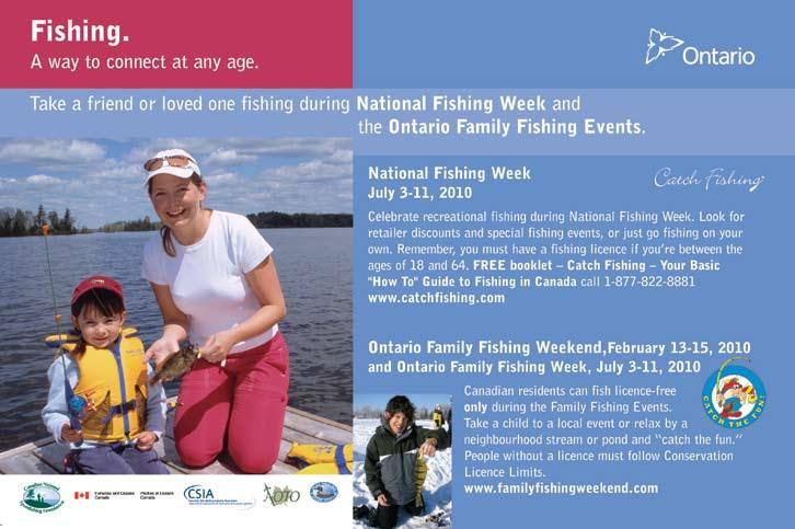
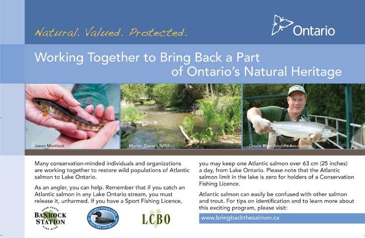
41 41 ZONE 7
42 FISHERIES MANAGEMENT ZONE 8 Provincial Boundary Provincial Boundary Hearst Chapleau Mattice Kapuskasing Gogama ZONE 8 Moosonee Kesagami Abitibi South Porcupine Timiskaming Moose River River Missinaibi River River Railway Railway Missinaibi 11 Kabinakagami Wawa Superior Superior Sultan Timmins 144 James Bay Iroquois Falls Night Hawk L. Kirkland 66 Elk Lady-Evelyn Smoothwater New Liskeard Haileybury 12 Sultan Industrial Rd 7 3 Chapleau Crown Game Preserve 10 8 Cochrane 11 0 Key Plan NOTE: - Those portions of the Missinaibi River and Moose River that are between Zone 3 and Zone 8 are wholly within Zone 8 Legend City/Town/Community MNR District Office Major Road Major Railway Zone Boundary Major Provincial Park Sturgeon - Closed All Year km 42
43 ZONE 8 SEASONS AND LIMITS Species Open Seasons Limits Walleye & Sauger or any combination Largemouth & Smallmouth Bass or any combination Jan. 1 to Apr. 14 & 3rd Sat. in May to Dec. 31 Open all year S - 6 S - 4; not more than 1 greater than 46 cm (18.1 in.) ; not more than 1 greater than 46 cm (18.1 in.) Northern Pike Open all year S - 6; not more than 2 greater than 61 cm (24 in.), of which not more than 1 is greater than 86 cm (33.9 in.) ; not more than 1 greater than 61 cm (24 in.), none greater than 86 cm (33.9 in.) Yellow Perch Open all year S Species Open Seasons Limits Sunfish Open all year S Brook Trout* Jan. 1 to Sept. 15 S - 5 Rainbow Trout* Open all year S - 5 Trout* Feb. 15 to Mar. 15 & 3rd Sat. in May to Sept. 30 S - 3 C - 1 Splake* Open all year S - 5 Whitefish Open all year S - 25 C - 12 Sturgeon Jan. 1 to Apr. 30 & July 1 to Dec. 31 The following species are not present in this Zone and are closed to fishing all year: Muskellunge, Crappie, Brown Trout, Pacific Salmon, Atlantic Salmon and Channel Catfish. S - 0 C - 0 *Aggregate Limits apply to these species. See page 7 for full details. ZONE 8 ADDITIONAL ZONE 8 FISHING OPPORTUNITIES Brook trout open all year Alvin - Bradburn Twp. Andrew (48 26'N., 80 28'W.) -McCann Twp. Armitage (48 23'N., 79 54'W.) - Thackeray Twp. Arnold #6 (48 13'N., 79 52'W.) - Arnold Twp. Arrow - Sheraton Twp. Axe - Ivanhoe Twp. Babs (47 40'N., 80 42'W.) - Haultain Twp. Bea (48 20'N., 79 51'W.) - Clifford Twp. Bear (Duff) - Colquhoun Twp. Beaver - Adams Twp. Beckett - Edith Twp. Bow - Sheraton Twp. Briere # 30 (48 19'N., 80 36'W.) -McEvay Twp. Brinnie (48 25'N., 79 58'W.) - Thackeray Twp. Bullfrog - German Twp. - Kettle s Prov. Pk. Burt #4 (48 03'N., 80 21'W.) - Burt Twp. Burt #5 (48 04'N., 80 21'W.) - Burt Twp. Camp 22 - DeGaulle Twp. Camp - German Twp. Canyon - Ivanhoe Twp. Canyon (47 40'N., 80 24'W.) - Yarrow Twp. Carlyle (48 32'N., 79 49'W.) - Lamplugh Twp. Catcher ( N., W.) - Ivanhoe Twp. Centre Triple - Sheraton Twp. Charles (47 52'N., 80 41'W.) - Yarrow Twp. Chown #15 (47 42'N., 80 35'W.) - Chown Twp. Collacut (47 42'N., 80 00'W.) - Beauchamp Twp. Collins (48 31'N., 79 59'W.) - Garrison Twp. Cook (48 17'N., 80 34'W.) - Deloro Twp. Cootie (48 16'N., 80 27'W.) - McEvay Twp. Debbie - Sherlock Twp. Deep - Macklem Twp. Deer - German Twp. - Kettle s Prov. Pk. Devil's Punch Bowl - Calvert Twp. Dewhirst (48 27'N., 80 00'W.) - Garrison Twp. Docks (47 52'N., 81 55'W.) - Wigle Twp. Dorothy (48 14'N., 80 00'W.) - Morrisette Twp. Downey (47 52'N., 83 21'W.) - Cochrane Twp. Driscoll (48 23'N.,79 54'W.) - Thackeray Twp. Dugwal Pit - Matheson Twp. Else (49 00'N., 81 10'W.) Elspeth - Timmins Twp. Eno - Freele Twp. Fade (48 33'N., 80 08'W.) - Munro Twp. Ferguson (48 16'N., 80 03'W.) - Bernhardt Twp. Fisher - German Twp. Flood (47 53'N., 80 44'W.) - Yarrow Twp. Flyline - DeGualle Twp. Gale (48 09'N., 80 14'W.) - Grenfell Twp. Garrison #4 (48 29'N., 80 00'W.) - Garrison Twp. Gary - Connaught Twp. George - Chester Twp. Gerry (48 18'N., 79 53'W.) - Powell Twp. Giunta (48 23'N., 79 54'W.) - Thackeray Twp. Green - German Twp. - Kettle s Prov. Pk. Greenock (48 18'N., 80 44'W.) - Timmins Twp. Grey (48 17'N., 80 34'W.) - McEvay Twp. Harvey - DeGualle Twp. Heart - German Twp. - Kettle s Prov. Pk. Hewitt (48 30'N., 80 01'W.) - Michaud Twp. Holster - Michie Twp. Hope - Ogden Twp. Hornet #42 (47 52'N., 81 54'W.) - Wigle Twp. Horseshoe - Dundonald Twp. Hutch - Timmins Twp. Imperial (48 29'N., 79 48'W.) - Harker Twp. Island - Edwards Twps. James (47 52'N., 80 41'W.) - Yarrow Twp. Jessup (48 16'N., 80 34'W.) - Nordica Twp. John (47 52'N., 80 43'W.) - Yarrow Twp. Joyce (48 13'N., 79 59'W.) - Morrisette Twp. June - Macklem Twp. Karen - Michie Twp. Kennedy (47 40'N., 83 12'W.) - Halsey Twp. Kidney - Colquhoun Twp. Knothole - (47 42 N., W.) - Togo Twp. La Violette - German Twp. - Kettle s Prov. Pk. #1 (47 54'N., 81 50'W.) - Middleboro Twp. #1 (48 08'N., 82 32'W.) - Ivanhoe Twp. #2 Local Name A ( N., W.) - Somme Twp. #3 Local Name Tahill ( N., W.) - Somme Twp. #4 (47 45'N., 81 25'W.) - Cabot Twp. #4 - Reeves Twp. #4 (48 01'N., 81 19'W.) - Semple Twp. #4 - Silk Twp. #5 - Teetzel Twp. #7 - Boyle Twp. #7 - McNaught Twp. #9 - Ivanhoe Twp. #9 - Middleboro Twp. #9 - Teetzel Twp. #10 - English Twp. #10 - Teetzel Twp. #11 - Pearce Twp. #13 (48 05'N., 81 15'W.) - English Twp. #15 - Nimitz Twp. #25 (48 18'N., 80 44'W.) - Timmins Twp. #30 - Guilfoyle Twp. #33 (48 03'N., 81 16'W.) - English Twp. #36 "B" (47 45'N., 81 55'W.) - Somme Twp. 43
44 ADDITIONAL ZONE 8 FISHING OPPORTUNITIES Brook trout open all year ZONE 8 #37 - Guilfoyle Twp. #39 - Guilfoyle Twp. #41 - Ivanhoe Twp. #42 - Ivanhoe Twp. #50 (48 04'N., 82 31'W.) - Ivanhoe Twp. #52 - Ivanhoe Twp. #53 (48 04'N., 82 31'W.) - Ivanhoe Twp. #56 - English Twp. #64 - Guilfoyle Twp. #68 - Guilfoyle Twp. #68 - Howells Twp. #69 - Guilfoyle Twp. #69 - Howells Twp. # (48 13'N., 82 02'W.) - Reeves Twp. Leatherleaf - Halsey Twp. Little Club - Macklem Twp. Little Dougherty - Timmins Twp. Little Elephant Head #23 (47 34'N., 81 23'W.) - Miramichi Twp. Little Gibson - Macklem Twp. Little Pinnacle (47 46'N., 82 01'W.) - Desrosiers Twp. Mall (48 20'N., 79 52'W.) - Clifford Twp. Marylyn ( N., W.) - DeGaulle Twp. Matti - McNaught Twp. Maurice (47 52'N., 80 41'W.) - Yarrow Twp. McCulloch (48 30'N., 80 05'W.) - Michaud Twp. McEvay #18 (48 17'N., 80 39'W.) - McEvay Twp. Mearow (47 45'N., 80 06'W.) - Robillard Twp. Milligan (48 37'N., 80 07'W.) - Milligan Twp. Moon (47 40'N., 81 03'W.) - Knight Twp. Mountain (47 49'N., 80 09'W.) - Truax Twp. Neannin - Burrows Twp. Neazin - Burrows Twp. Nelson (48 14'N., 79 53'W.) - Arnold Twp. North East Twin - German Twp. O'Connell (48 10'N., 80 01'W.) - Teck and Lebel Twps. Overhill - Howells Twp. Packcan (48 27'N., 79 59'W.) - Garrison Twp. Packsack - Moody Twp. Pall (48 20'N., 79 53'W.) - Clifford Twp. Park - Colquhoun Twp. Partridge - Evelyn Twp. Pearl - Wigle Twp. Pine - German Twp. Pothole #6 (48 28'N., 80 00'W.) - Garrison Twp. Potvin (48 17'N., 80 35'W.) - McEvay Twp. Price - Bradburn Twp. Ramey (48 18'N., 79 53'W.) - Clifford Twp. Ray - Invergarry Twp. Regis (47 45'N., 83 14'W.) - McNaught Twp. Roger - Chester Twp. Round - Macklem Twp. Rozon (48 16'N., 79 53'W.) -Arnold Twp. Seahorse (48 18'N., 79 52'W.) - Clifford Twp. Scotties #48 - Kelvin Twp. Sherry (48 15'N., 82 26'W.) - Foleyet Twp. Sigs (47 41'N., 80 41'W.) - Haulltain Twp. Slab - German Twp. - Kettle s Prov. Pk. Sootheran (47 44'N., 83 22'W.) - Gallagher Twp. South Triple - Sheraton Twp. Spring - German Twp. Strong (47 59'N., 80 52'W.) - Powell Twp. Sullivan (48 16'N., 79 42'W.) - Baden Twp. Susanne ( N., W.) - Neville Twp. Tailleurs (49 03 N., W.) Taylor #43 (47 52 N., W.) - Wigle Twp. Thackeray #9 (48 23'N., 79 53'W.) - Thackeray Twp. Thrasher (48 22'N., 79 52'W.) - Clifford Twp. Tracy - Colquhoun Twp. Trotter - Regan Twp. Vannier (48 18'N., 79 53'W.) - Clifford Twp. Walker - Deloro Twp. Wanatangua ( N., W.) - Connaught Twp. Wee - Regan Twp. Whopper - Whalen Twp. Wine - Whalen Twp. Wiskin - Colquhoun Twp. Wolverton - Michie Twp. Wright's - Whalen Twp. Wuskwi - McNaught Twp. Yarrow #10 (47 41'N., 80 41'W.) - Yarrow Twp. Yarrow #19 (47 54'N., 80 44'W.) - Yarrow Twp. Trout open all year Blue - Colquhoun Twp. Clearwater - Evelyn Twp. Crawfish - Duff Twp. Doucette - Mortimer Twp. Elmer (47 53'N., 80 50'W.) - Doon Twp. Flipper - Moody Twp. Jerry - Tweed Twp. Ketchini - Wigle Twp. Kwitosse - Burrows Twp. Laidlaw (48 56'N., 81 47'W.) Laughton - Laughton Twp. Long (47 49'N., 80 08'W.). - Robillard, Sharp, and Truax Twps. Macfie - Cabot Twp. Mary - St. John Twp. Mesomikenda - Chester, Neville, and Somme Twps. Miller (47 40'N., 80 43'W.) - Nicol Twp. Mistango - Freele Twp. Nellie - Calvert Twp. Nettie (48 13'N., 79 59'W.) - Morrisette Twp. Paddy - Duff Twp. Pallet - Duff Twp. Perry (48 32'N., 80 06'W.) - Michaud Twp. Pine - Kenning Twp. Rancourt - Clute Twp. Return - Laidlaw Twp. Secret #38 - Stetham Twp. Semple - Semple Twp. Sibbald - Edwards Twp. Star - Alexandra Twp. Starvation - Bragg Twp. Sunny (48 10'N., 80 32'W.) - Sheba and Dunmore Twp. Trail - Moody Twp. Upper and Lower Scott s - Bartlett Twp. Wendigo (47 52'N., 79 43'W.)-Bayly and MarterTwps. Zinger - Potter Twp. All those waters located within the portion of Zone 8 from the junction of Hwy. 66 and the Ontario/Quebec interprovincial boundary, thence generally southerly along the Ontario/ Quebec interprovincial boundary to it s junction with Hwy. 65, thence generally westerly, northerly and north-westerly along Hwy. 65 to it s intersection with Hwy. 66, thence generally north-easterly and easterly along Hwy 66 to it s junction with the Ontario/Quebec interprovincial boundary. Anthead (49 58 N., W.). EXCEPTIONS TO ZONE 8 REGULATIONS sturgeon - closed all year. Nov. 1 - Dec. 31. Bateman s - Tomlinson Twp. Big Club (48 28 N., W.) - Bond and MacKlem Twps. Bill's (50 07'N., 80 36'W.). Blanche River - Marquis Twp. Borden - Borden Twp., waters east of a line drawn from a point on the south shore at 47 51'23"N., 83 13'25"W. to a point on the north shore at 47 51'55"N., 83 13'32"W. Borden - Cochrane Twp., waters north of a line drawn from a point at the east shore at 47 51'58"N., 83 16'55"W. to a point on the west shore at 47 51'58"N., 83 17'25"W. Nov. 1 - Dec. 31. Fish sanctuary closed all year in 2010 and Jan. 1 - Fri. before 3rd Sat. in May & Nov. 1 - Dec
45 Bounce (49 48 N., W.). Brayley - Blakelock Twp. Burnt (49 42 N., W.). Chapleau River (also known as Kebsquasheshing River) Chapleau Twp., from the centerline of the C.P.R. track upstream for 100 m (328 ft.) and downstream for 300 m (984 ft.). Commando (49 04 N., W.) - Glackmeyer Twp. Crooked Creek System - Marquis, Blain, and Eby Twps. Deluxe (49 52 N., W.). Departure and Poplar Rapids River in Haggart Twp. lying south of a line from a point on the west shore of Departure at "N., "W. and the peninsula on the east shore at "N., "W. and the inflow of the Poplar Rapids River upstream to the first rapids, including 500 m (1640 ft.) of Sydere Creek measured upstream from the mouth where it enters the Poplar Rapids River. Duckbreast and Groves s - beginning at the narrowing of the south end of Duckbreast (47 40 N., W.), continuing in a southerly direction through the creek and extending 100 m (328 ft.) into the north end of Groves (47 38 N., W.), encompassing the waters locally known as Spruce. Echo (50 00'N., 80 36'W.). Edgar (50 22'N., 80 23'W). Esker (49 50 N., W.). Esker s Provincial Park - all lakes in or partially in the park. Firth Creek (Spawning Creek) - Milner Twp. Floodwood - Tweed and Blakelock Twps. Floodwood River - McQuibban Twp.,the part of the river within McQuibban Twp. French (49 39 N., W.). EXCEPTIONS TO ZONE 8 REGULATIONS Nov. 1 - Dec. 31. Nov. 1 - Dec. 31. Nov. 1 - Dec. 31. Jan. 1 - Sat. before 2nd Sun. in Feb. & Sept Dec. 31 trout open from 2nd Sun in Feb. to Sept. 15. Nov. 1 - Dec. 31. Apr. 1 - June 30. Nov. 1 - Dec. 31. Jan. 1 - Fri. before 3rd Sat. in May & Nov. 1 - Dec. 31. Northern pike S - 2, not more than 1 greater than 71 cm (27.9 in.). and C - 1, must be less than 71 cm (27.9 in.). Nov. 1 - Dec. 31. Jan. 1 - Fri. before 3rd Sat. in May & Nov. 1 - Dec. 31. Nov. 1 - Dec. 31. Groundhog River (The Pot) - Beardmore and Tucker Twps. Groundhog River - from the bridge on Hwy. 101, downstream to the mouth of the Nat River - Reeves, Melrose, Strachan, Montcalm and Poulett Twps. Groundhog River - Keith Twp., between the base of the Horwood Dam downstream to where it enters Groundhog. Hill s (49 53 N., W.) - Cochrane District. Horwood - Dale Twp., from a point on the Woman River 1km (3281 ft.) upstream from its confluence with the Rush River, downstream to Horwood and all waters of Horwood within Dale Twp. Horwood - Horwood and Keith Twps., Cornice Creek downstream from the Keith Twp. Boundary to Horwood including all waters of Horwood within 2 km (1.24 mi.) of the Cornice Creek mouth. Horwood - Horwood Twp., from the outflow of Great Pike downstream to Horwood and including all waters of Horwood within 300 m (984 ft.) of the creek mouth. Horwood - Horwood Twp., Marl Creek downstream from the Horwood Twp. Boundary to Horwood and including all waters of Horwood within 1.8 km (1.1 mi.) of the Marl Creek mouth. Horwood - Horwood Twp., Swayze River downstream from the Horwood Twp. Boundary to Horwood and including all waters of Horwood within 800 m (2625 ft.) of the Swayze River mouth. Horwood - Keith Twp., the portion known as Hoodoo or Hoodoo Bay. Kapakita Creek - Maisonville Twp. Keith (Walter s ) (49 45 N., W.). Kenogaming - Kenogaming Twp., from the outflow of Kaneki downstream to Kenogaming and including the waters of the adjacent bay. Kesagami. Labyrinth (48 14'N., 79 31'W.) - including that part of Waterhen Creek downstream from the Access Road Bridge. Apr July 15. Sturgeon open from Jan. 1 - Apr. 14 & July 1 - Dec. 31. Jan. 1 - Fri. before 3rd Sat. in May & Nov. 1 - Dec. 31. Nov. 1 - Dec. 31. Northern pike S - 2, not more than 1 greater than 71 cm (27.9 in.) and C - 1, must be less than 71 cm (27.9 in.). Walleye open from Jan. 1 to Mar. 31 & 3rd Fri. in May to Dec. 31. Smallmouth bass open from Jan. 1 - Apr. 15 & Fri. before 4th Sat. in June - Dec. 31. Northern pike open from Jan. 1 - Apr. 15 & 3rd Fri. in May - Dec. 31. ZONE 8 45
46 EXCEPTIONS TO ZONE 8 REGULATIONS ZONE 8 #57 (48 17'N., 80 40' W.) - Timmins Twp. Larder - Hearst, McFadden, McVittie and McGarry Twps. Larry (49 44 N., W.). Lauzon (49 49 N., W.). Little Abitibi - McQuibban Twp., waters in the northern part of the lake within McQuibban Twp. Little Abitibi River - McQuibban and Sangster Twps. - from boundary between the two townships to a line at longitude W. Little Abitibi River - McQuibban Twp., from Pierre Road to part of Pierre lying east of longitude W. Little Abitibi River and Montreuil - Swartman Twp. - between northern narrows of Pierre to portion lying east of longitude W. Little Wakwayowkastic (49 49 N., W.). Louise (Choppa ) (49 50 N., W.). Magiskan - Blakelock Twp. Marsh (49 58 N., W.). Mattagami River - Gouin and Hassard Twps., between the dam at Kenogamissi Falls to a point on the Kenogamissi at approximately (48 02 N., W.). Mattagami River - Mahaffy Twp., lying between the Lower Sturgeon hydro dam and downstream to the northern boundary of Mahaffy Twp. Mattagami River - Mountjoy Twp - from the face of Sandy Falls power dam downstream to the boundary of Mountjoy Twp. McParlon (50 09'N; 80 42'W). McPhail - Michie Twp. Mego - Blakelock Twp. Mesomikenda - waters known as the West Arm - Somme and Neville Twps. including waters of the Somme River in Neville Twp. Aurora trout open from Aug. 1 - Oct. 15, 2010, S-1 and C-0, fish sanctuary remainder of year in Fish sanctuary - closed all year in 2011 and Jan. 1 - Feb. 14 & Oct. 1 - Dec. 31. Nov. 1 - Dec. 31. Nov. 1 - Dec. 31. Apr June 30. Apr June 30. Nov. 1 - Dec. 31. Nov. 1 - Dec. 31. Nov. 1 - Dec. 31. Nov. 1 - Dec. 31. Nov. 1 - Dec. 31. Nov. 1 - Dec. 31. Michiwakenda - from the outflow of Okawakenda downstream to Michiwakenda and including the waters of the northwest bay. Mikwam - Blakelock Twp. Minisinakwa - from the northern point of the first island at the mouth of the Makami River (47 40 N., W.) continuing north for 13 km (8.1 mi.) to 100 m (328 ft.) north of the top of the falls on the Makami River (47 46 N., W.). Minisinakwa - from Benneweis Bay (47 34 N., W.) and continuing west for 3 km (1.86 mi.) up Benneweis Creek to the first small pond excluding the unnamed (47 34 N., W.). Minisinakwa River - Noble, Togo and Mattagami Twps. Mons Creek (Hay Creek) - Usnac Twp. Moose (49 40 N., W.). Moving Rock (49 49 N., W.) Nabakwasi River - all waters east of the power transmission line to the mouth of the Opikinimika River and upstream to the outflow of Ola. Nabakwasi River - from the outflow of Nabakwasi downstream to the confluence with the Minisinakwa River. Nayowin (47 47 N., W.) - Burrows Twp. Nebskwashi River - Chapleau Twp. - from Hwy. 129 downstream to a narrowing of the river at N., W. Nettogami (50 13'N; 80 34'W.). North Choppa (49 51 N., W.). North French (49 45 N., W.). North Unknown (49 48 N., W.). Opasatika River, Crow Creek, Wolfe Creek, Montcalm Creek, and South Crow Creek - McCrea Twp. Opishing - Hillary Twp., waters of Kamiskotia River and Opishing between Hwy. 101 and first narrows on Opishing at latitude N. Pallet (48 16 N., W.) - Nordica Twp. Partridge (50 24'N., 80 19'W.). Nov. 1 - Dec. 31. Nov. 1 - Dec. 31. Nov. 1 - Dec. 31. Fish sanctuary closed all year in 2010 and Nov. 1 - Dec. 31. Nov. 1 - Dec. 31. Nov. 1 - Dec. 31. Nov. 1 - Dec. 31. Fish sanctuary closed all year in 2010 and Nov. 1 - Dec
. Porcupine River - From 200 m (656 ft.")
47 Payntouk - Tomlinson Twp. Piyagoskogau (50 14'N., 80 25'W.). Jan. 1 - Fri. before 3rd Sat. in May & Nov. 1 - Dec. 31. Jan. 1 - Fri. before 3rd Sat. in May & Nov. 1 - Dec. 31. Porcupine - Whitney Twp. Walleye S - 2 and, none between cm ( in.). Porcupine River - From 200 m (656 ft.) upstream of the old ONR Crossing on the South Porcupine River Downstream to Porcupine and all waters within 200 m (656 ft.) of the river mouth. Pot Hole (50 08'N., 80 40'W.). Rainy (50 05'N., 80 36'W.). Sand (49 44 N., W.). Snare - Newman Twp. South Choppa (49 49 N., W.). South West Kesagami (50 17'N., 80 23'W.). Steve's (50 05'N., 80 38'W.). Thorning River - from the mouth of the river at Harris upstream to the junction of the first creek. Today (49 51 N., W.). EXCEPTIONS TO ZONE 8 REGULATIONS Jan. 1 - Fri. before 3rd Sat. in May & Nov. 1 - Dec. 31. Jan. 1 - Fri. before 3rd Sat. in May & Nov. 1 - Dec. 31. Jan. 1 - Fri. before 3rd Sat. in May & Nov. 1 - Dec. 31. Jan. 1 - Fri. before 3rd Sat. in May & Nov. 1 - Dec. 31. Jan. 1 - Fri. before 3rd Sat. in May & Nov. 1 - Dec. 31. Jan. 1 - Fri. before 3rd Sat. in May & Nov. 1 - Dec. 31. Jan. 1 - Fri. before 3rd Sat. in May & Nov. 1 - Dec. 31. Apr June 30. Jan. 1 - Fri. before 3rd Sat. in May & Nov. 1 - Dec. 31. Tomorrow (49 55 N., W.). Twenty-Six Mile Creek - Robb and Turnbull Twps., between Kamiskotia and Christmas. Twopeak - Newman Twp. Unknown (49 47 N., 80 39'W.). Verana (49 49 N., W.). Wakusimi River - Griffin, Seaton and Lisgar Twps. Waterhen Creek in Ossian Twp. - from the culvert crossing the Pontiac- Mcvittie Road east to the mouth of the creek as it flows into Labyrinth. West Choppa (49 50 N., W.). Jan. 1 - Fri. before 3rd Sat. in May & Nov. 1 - Dec. 31. Jan. 1 - Fri. before 3rd Sat. in May & Nov. 1 - Dec. 31. Jan. 1 - Fri. before 3rd Sat. in May & Nov. 1 - Dec. 31. Jan. 1 - Fri. before 3rd Sat. in May & Nov. 1 - Dec. 31. day after Labour Day - Dec. 31. Apr. 1 - June 14. Jan. 1 - Fri. before 3rd Sat. in May & Nov. 1 - Dec. 31. Wynn - Arnold Twp. Aurora trout open from Aug. 1 - Oct. 15, 2010, S-1 and C-0, fish sanctuary remainder of year in Fish sanctuary - closed all year in 2011 and Yesterday (49 50 N., W.). Jan. 1 - Fri. before 3rd Sat. in May & Nov. 1 - Dec. 31. Yesterday River (49 49 N., W.). Jan. 1 - Fri. before 3rd Sat. in May & Nov. 1 - Dec. 31. ZONE 8 47
48 FISHERIES MANAGEMENT ZONE 9 ZONE 9 Manitouwadge 10 International Boundary International Boundary Sleeping Giant 11 St. Ignace I. 17 Simpson I. Marathon 6 Michipicoten I River St. Joseph I. 10 Canada U.S.A. 527 Red Rock 614 White L. Pukaskwa Kabinakagami L St. Mary's 7 9 Wawa Sault Ste. Marie Superior Dog Thunder Bay 6 Key Plan Nipigon Terrace Bay NOTE: - St. Mary's River west of the compensation works gate and the canal lock in Sault Ste. Marie are in Zone 9. Legend City/Town/Community MNR District Office Major Road Major Railway Zone Boundary Major Provincial Park km Superior Chapleau Crown Game Preserve 10 48
49 ZONE 9 SEASONS AND LIMITS Species Open Seasons Limits Walleye & Sauger or any combination Largemouth & Smallmouth Bass or any combination Jan. 1 to Apr. 14 & 3rd Sat. in May to Dec. 31 S - 2 C - 1 Open all year S - 6 Northern Pike Open all year S - 4; none between cm ( in.), not more than 1 greater than 90 cm (35.4 in.) ; none between cm ( in.), not more than 1 greater than 90 cm (35.4 in.) Muskellunge 3rd Sat. in June to Dec. 15 Yellow Perch Open all year S - 25 C - 12 Crappie Open all year S - 30 C - 10 Sunfish Open all year S Brook Trout* 4th Sat. in Apr. to Labour Day S - 1; must be greater than 91 cm (36 in.) C - 0 S - 1; must be greater than 56 cm (22 in.) C - 0 Species Open Seasons Limits Brown Trout* Open all year S - 5 Rainbow Trout* Open all year S - 1 C - 0 Trout* Jan. 1 to Sept. 30 S - 3 C - 1 Splake* Jan. 1 to Sept. 30 S - 3 C - 1 Pacific Salmon* Atlantic Salmon* Open all year S - 5 Open all year S - 1 C - 0 Whitefish Open all year S - 12 C - 6 Sturgeon Closed all year Channel Catfish Open all year S - 12 C - 6 *Aggregate Limits apply to these species. See page 7 for full details. ZONE 9 Superior - Black Bay from N. (Bent Island) northward. Superior - Nipigon Bay. Superior, except the following: Black Bay north of latitude 48 37'N. (Bent Island); Superior and Nipigon Bay lying north of a line drawn northeasterly from the southernmost tip of Magnet Point on Black Bay Peninsula to Schreiber Point; and Michipocoten Bay inside a line drawn across the bay from Perkwakwai Point to Smokey Point. EXCEPTIONS TO ZONE 9 REGULATIONS Walleye and sauger closed all year. Walleye and sauger closed all year. Two lines may be used when trolling from a boat in open water. Superior, east of the Pic River (Zone 9). Montreal River - from the first Great s Power Dam to Superior. Rainbow trout S - 2 and C - 1. Walleye and sauger open from Jan. 1 - Mar. 31 & July 1 - Dec
50 50 Key Plan PEEVER HOME St. Joseph Island 0 iver real R Mont Sault Ste. Marie GROOTENBOER CANNARD LABONTE LARSON GREENWOOD BULLOCK BEAUDIN Cockburn I Blind River km 13 Huron 10 6 Island 10 Manitoulin Great La Cloche I ial Rd Industr Ramsey L. Sultan Elliot i River Mississag Wakami 667 Sultan Pickerel n ch 522 F re R. L. Nipissing Parry Sound 15 River Temagami 11 Elk Lady EvelynSmoothwater Pa St rk ur Bo ge un on da ry R iv er Sudbury Panache L Kirkland MakobeGrays River Wanapitei L. Georgian Bay Killarney Espanola Onaping L. Gogama NOTE: All lakes on Manitoulin Island are a part of Zone 10 except South Bay (Zone 13) and Wolsey (Zone 14). There are some regulatory exceptions in place on Manitoulin Island. Please see Manitoulin Island inland waters under Exceptions to Zone 10 Regulations. North Channel Ca n U. ada S. A Wenebegon L. 129 Chapleau Chapleau Crown Game Preserve r Rive No Use or Possession of Live Baitfish Provincial Park Major Zone Boundary Major Railway 17 SUGANAQUEB ROY Anjigami L. RESTOULE 651 h Major Road REDSKY Michipicoten R.101 Superior Wawa 7 nis Spa MNR District Office City/Town/Community 9 Superior Legend 10 Michipicoten I. Pukaskwa Park Boundary ZONE 10 FISHERIES MANAGEMENT ZONE 10
51 Species Open Seasons Limits Walleye & Sauger or any combination Largemouth & Smallmouth Bass or any combination Jan. 1 to Mar. 31 & 3rd Sat. in May to Dec. 31 4th Sat. in June to Nov. 30 S - 4; not more than 1 greater than 46 cm (18.1 in.) ; not more than 1 greater than 46 cm (18.1 in.) S - 6 Northern Pike Open all year S - 6; not more than 2 greater than 61 cm (24 in.), of which not more than 1 is greater than 86 cm (33.9 in.) ; not more than 1 greater than 61 cm (24 in.), none greater than 86 cm (33.9 in.) Muskellunge 3rd Sat. in June to Dec. 15 Yellow Perch Open all year S Crappie Open all year S - 30 C - 10 Sunfish Open all year S ZONE 10 SEASONS AND LIMITS S - 1; must be greater than 91 cm (36 in.) C - 0 Species Open Seasons Limits Brook Trout* Jan. 1 to Sept. 30 S - 5 Brown Trout* 4th Sat. in Apr. to Sept. 30 S - 5 Rainbow Trout* Open all year S - 2 C - 1 Trout* Jan. 1 to Labour Day Splake* Open all year S - 5 Pacific Salmon* Open all year S - 5 Atlantic Salmon* Jan. 1 to Sept. 30 S - 1 C - 0 Whitefish Open all year S - 12 C - 6 Sturgeon Closed all year Channel Catfish Open all year S - 12 C - 6 S - 2, not more than 1 greater than 40 cm (15.7 in.) C - 1 * Aggregate Limits apply to these species. See page 7 for full details. If fishing on Manitoulin Island see Manitoulin Island inland waters on page 54. Deschenes (47 37 N., W.) - Garvey Twp. Edna (47 05 N., W.) - Frechette Twp. Elkhorn (47 35 N., W.) - Milner and Leith Twps. Gowganda (47 38 N., W.) - Milner and Nicol Twps. ADDITIONAL ZONE 10 FISHING OPPORTUNITIES Smallmouth Bass open all year Hangingstone (Fryingpan) (47 34 N., W.) - Milner and Leith Twps. Harrison (47 08 N., W.) Frechette Twp. Ida (47 25 N., W.) - Ogilvie Twp. Little Pilon (47 07 N., W.) - Frechette Twp. Margueratt (47 37 N., W.) - Milner Twp. Pilon (47 09 N., W.) - McNamara Twp. Shining Tree (47 33 N., W.) - Fawcett Twp. Thor (47 08 N., W.) Frechette Twp. ZONE 10 Annie - Beulah Twp. Antoine (47 53 N., W.) - Rabazo Twp. Barager s - Garibaldi Twp. Betts (47 08 N., W.) Beulah - Beulah Twp. Big Beaver - Frechette Twp. Boot (47 36 N., W.) - Tyrrell Twp. Brown s (47 10 N., W.) - Lampman Twp. Camp - Frechette Twp. Caput - Asquith Twp. Crane (47 37 N., W.) - Roadhouse Twp. Crystal (47 08 N., W.) - Frechette Twp. Daniel ( N., W.) - Marshay Twp. Dwyer Janes Twp. Eli - Marshay Twp. Gay - MacMurchy Twp. Groom - Frechette Twp. Hook - MacMurchy Twp. Ingrid #20 (47 18 N., W.) - Beulah Twp. Jen (47 17 N., W.) - Beulah Twp. #6 - Local Name Clem s ( N., W.) - Beulah Twp. Bob #29 - MacMurchy Twp. Bud #20 - Invergarry Twp. Coyne - Moffat Twp. Deer (46 47 N., W.) - Daumont Twp. Brook Trout open all year #6 - Garibaldi Twp. #7 ( N., W.) - Moffat Twp. #8 - Chappise Twp. #16 - Local Name Heerschap ( N., W.) - Beulah Twp. #27 - Local Name Hydro ( N., W.) - Lampman Twp. #28 - Local Name Felix ( N., W.) - Marshay Twp. #33 - Local Name Weasel ( N., W.) - Valin Twp. #48 - Beulah Twp. #58 ( N., W.) - Chappise Twp. #59 - Chappise Twp. #64 - Local Name Little Jens ( N., W.) - Beulah Twp. Lawson #15 (47 46 N., W.) - Lawson Twp. Leta (47 39 N., W.) - Lawson Twp. Little Beaver - Frechette Twp. Lue (47 04 N., W.) - Frechette Twp. Mike - Nimitz Twp. Mile (47 25 N., W.) - Ray Twp. Rainbow Trout S- 5, Felix #28 - Marshay Twp. Groom - Frechette Twp. Leishman (Long) (46 43 N., W.) - Whitman Twp. Margaret - Beulah Twp. Monday - Beulah Twp. Moonshine - Margaret Twp. Outpost #6 (47 10 N., W.) - Valin Twp. Pat - MacMurchy Twp. Pat - Nimitz Twp. Paul - Invergarry Twp. Pheasant - Beulah Twp. Phils - Lynch Twp. Red Bark - Reany Twp Roadhouse #19 (47 37 N., W.) - Roadhouse Twp. Roadhouse #20 (47 37 N., W.) - Roadhouse Twp. Seagull (47 09 N., W.) - Lampman Twp. Stripcut - Neeland Twp. Suzuki - Beulah Twp. Tower - Margaret Twp. Tremble (47 28 N., W.) - North Williams Twp. Twin South (47 30 N., W.) - Garibaldi Twp. Walroth - Garibaldi Twp. Weiner - Chappise Twp. White Bark - Reaney Twp. Wrench (47 07 N., W.) - McNamara Twp. Robertson (Mud) (46 47 N., W.) - Vankoughnet Twp. Seven Mile (48 06 N., W.) - Chappise Twp. Weashkog (Weashcog) (46 39 N., W.) - Jarvis Twp. 51
52 Azure - Invergarry Twp. Blackies - Garibaldi Twp. Gowganda (47 38 N., W.) - Milner and Nicol Twps. Bass Striker Twp. Bellows Deagle Twp. Cedar ( #56) Haentschel Twp. Elizabeth Foster Twp. Geneva Hess Twp. Isabel (Beauty) Corkill Twp. ADDITIONAL ZONE 10 FISHING OPPORTUNITIES trout open all year, no size limits Jerry - MacMurchy Twp. #34 - Stull Twp. (Plier ) trout, open Jan. 1 - Labour Day, no size limits Kecil Victoria Twp. #29 Cox Twp. Little Serpent Deagle Twp. Long ( #23) Harrow Twp. Loon Merritt Twp. Memoir Neelands Twp. Peach - Invergarry Twp. Shoofly - Marshay Twp. Mount Sagard Twp. Ortona Lockeyer Twp. Post Beaumont Twp. Rocky Island Royal Twp. Round Harrow Twp. Upper Island (Island) Aweres Twp. EXCEPTIONS TO ZONE 10 REGULATIONS ZONE 10 Acid - Killarney Twp. All of the waters within the boundaries and all of the waters of which a portion falls within the boundaries of the geographic Townships of Schembri and Scriven in the Territorial District of Sudbury and Way-White, Wlasy, Bracci and Tupper in the Territorial District of Algoma, excepting those portions of Government Creek and Sawmill Creek in Tupper Township in the Territorial District of Algoma from the centreline of Hwy. 17 to the shore of Superior. All tributaries to Superior in Zone 10 described as follows: 1. That portion of the Montreal River (in Zone 9) downstream from the falls ( N., W.); 2. Batchewana River downstream from the falls ( N., W.); 3. Chippewa River downstream from the falls ( N., W.); 4. Carp River downstream from the road crossing ( N., W.) where the Carp River Weir Road (east bank of the river) fords the river and joins the Carp Road (west bank of the river); 5. Harmony River downstream from the hydro line crossing the river ( N., W.); 6. From the boundary between Zone 7 and Zone 10 to the north shore of the Montreal River, all tributaries downstream from the first falls, rapids, dams or lakes identified on a Provincial Series Map or the entire stream if there are no falls, rapids, dams or lakes identified on a Provincial Series Map or if the tributary does not appear on a Provincial Series Map. Alton Creek - Peterson Twp. flowing into South Old Woman River. Avery - Frechette Twp. Banana - Dalmas Twp. Bar River - Laird Twp. and MacDonald Twp. Jan. 1 - Feb. 14 & Mar Fri. before 3rd Sat. in May & Oct. 1 - Dec. 31. Brook trout open from 4th Sat. in Apr. - Labour Day. Brook trout S - 1 and C - 0, must be greater than 56 cm (22 in.). Apr June 15. trout open from Feb Mar. 15 & 3rd Sat. in May - Labour Day. Aug Dec. 31. Barnet - Leask Twp. Barron - Stobie Twp. Bass Creek - Town of Northeastern Manitoulin and the Islands, from the culvert at Hwy. 6 downstream to the mouth of Bass Creek at Shequiandah Bay. Batchawana - Norberg Twp. Bell, Killarney Provincial Park - Goschen Twp. Bellevue Creek and tributaries - Van Koughnet Twp. Bennett Creek and tributaries and Bennett-Davignon Diversion Channel - Korah Twp. Big Basswood (Wakwekobi ) - Day, Gladstone and Kirkwood Twps. Big Horseshoe - Le Caron Twp. Biscotasi m (328 ft.) east and west of the centre point of the C.P.R. Hogsback Channel trestle (Lillie Twp.) and 200 m (656 ft.) north and south of the railway tracks. Biscotasi m (328 ft.) east and west of the centre point of the C.P.R. trestle (Margaret Twp.) and 200 m (656 ft.) north and south of the railway tracks. Biscotasi - from Ramsey Dam extending downstream 500 m (1640 ft.). Blue Jay Creek - from bridge on Conc. VI in Tehkummah Twp., downstream to the mouth of Blue Jay Creek on Huron. Blue Jay Creek - Tehkummah Twp. Bobowash - Raimbault Twp. Bonhomme Aylmer Twp. Bowland - Howey Twp. Broker - Attlee Twp. trout open from Feb Mar. 15 & 3rd Sat. in May - Labour Day. trout closed all year. trout closed all year. Apr June 15. Apr June 15. Jan. 1 - Fri. before the 4th Sat. in Apr. & Oct. 1 - Dec. 31. Jan. 1 - Fri. before the 3rd Sat. in May & Oct. 1 - Dec. 31. Walleye open from Jan. 1 - Mar. 31 & June 15 - Dec. 31. Walleye open from Jan. 1 - Mar. 31 & June 15 - Dec. 31. Walleye open from Jan. 1 - Mar. 31 & June 15 - Dec. 31. Mar. 1 - Fri. before 2nd Sat. in May & Sept Oct. 31. Mar. 1 - Fri. before 2nd Sat. in May. Oct. 1 - Dec. 31. trout closed all year. trout closed all year. 52
53 EXCEPTIONS TO ZONE 10 REGULATIONS Burke, Killarney Provincial Park - Killarney Twp. Burwash - Cotton, Valin, Leask and McNamara Twps. trout open from Feb Mar. 15 & 3rd Sat. in May - Labour Day. Carol - Beulah Twp. Fish sanctuary - closed all year in Aurora trout open from Aug. 1 - Oct.15, 2011, S-1 and C-0, fish sanctuary remainder of year in Caswell (46 52 N., W.) - trout closed all year. Aylmer Twp. Chiblow - Montgomery, Patton, Scarfe and Juillette Twps. Chief Tilton/Broder Twps. Chrysler - Ogilvie Twp. Clay River - Goodwillie Twp. Colin Scott McCarthy Twp. Conacher - Shingwaukonce Twp. Cranberry Creek and tributaries - Fenwick and Pennefeather Twps. Crazy Creek - Goodwillie Twp. Darragh - Otter Twp. David, Killarney Provincial Park - Hansen and Goschen Twp. Davis McConnell Twp. Denman (Little Chiblow) - Montgomery and Patton Twps. Devlin Creek - Peever Twp. Dewdney Mackelcan Twp. Dollyberry - Beange and Raimbault Twps. Downey Creek and tributaries - Tilley Twp., except the portion between centre of Hwy. 17 and Superior shore. Duval - Sleivert Twp. Dwyer - Janes Twp. East Davignon Creek and tributaries - Korah Twp. East Goulais River - from Laughing in Menard Twp. to the Goulais River. Edna - Frechette Twp. Edna McCarthy Twp. Elboga Muldrew Twp. Elbow (46 39 N., W.) (Onedee ) - Sayer Twp. Jan. 1 - Fri. before 4th Sat. in Apr. & Oct. 1 - Dec. 31. trout closed all year. trout open from Feb Mar. 15 & 3rd Sat. in May - Labour Day. Apr June 15. trout closed all year. Jan. 1 - Feb. 14 & Mar Fri. before 4th Sat. in Apr. & Oct. 1 - Dec. 31. Apr June 15. Apr June 15. Jan. 1 - Feb. 14 & Mar Fri. before 4th Sat. in Apr. & Oct. 1 - Dec. 31. trout closed all year. Jan. 1 - Fri. before 4th Sat. in Apr. & Oct. 1 - Dec. 31. Apr June 15. trout closed all year. Oct. 1 - Dec. 31. Apr June 15. Jan. 1 - Feb. 14 & Mar Fri. before 4th Sat. in Apr. & Oct. 1 - Dec. 31. Apr June 15. Only artificial flies may be used. trout open from Feb Mar. 15 & 3rd Sat. in May - Labour Day. trout closed all year. trout closed all year. Jan. 1 - Feb. 14 & Mar Fri. before 4th Sat. in Apr. & Oct. 1 - Dec. 31. Ezma - Nicholas Twp. Flack - Raimbault Twp. Flagg and Gould s and all connecting waters and tributaries in the District of Algoma. Fort Creek, downstream of Mission - Rabazo Twp. Foy - Foy Twp. Fraleck Fraleck Twp. Franks Mackelcan Twp. Frater Creek - Labonte and Labelle Twps. French River - from Chaudiere and Little Chaudiere dams to Georgian Bay. French River - those areas north of Hwy. 64 and west of Hwy. 69 starting at the Hwy. 69 bridge on the French River and proceeding downstream to Georgian Bay along the French River within the boundaries of the French River Provincial Park. Fullerton (Lanark ) - Raimbault Twp. Garden River - from Ranger to Garden. George, Killarney Provincial Park - Killarney Twp. Gibbery - Beange and Raimbault Twps. Gong. Gough (Birch ) - Gough Twp. Goulais River (Whitman Dam to Superior). Government Creek and tributaries - Tupper Twp. Grace - Curtin Twp. Great Mountain, Killarney Provincial Park - Hansen Twp. Havilland Creek and tributaries - Havilland Twp. Oct. 1 - Dec. 31. Oct. 1 - Dec. 31. trout open from Feb Mar. 15 & 3rd Sat. in May - Labour Day. Apr June 15. trout closed all year. trout closed all year. trout closed all year. Apr June 15. Muskellunge must be greater than 122 cm (48 in.). Walleye and sauger S - 4 and - none between cm ( in.), not more than 1 greater than 60 cm (23.6 in.) for these waters combined. Largemouth and smallmouth bass S - 4 and, none between cm (13-17 in.), not more than 1 greater than 43 cm (17 in.). Northern pike open Jan. 1 - Mar. 31 & 3rd Sat. in May to Dec. 31. Northern pike S - 4 and, none between cm (21-34 in.), not more than 1 greater than 86 cm (34 in.). Muskellunge open 1st Sat. in June - Dec. 15. Muskellunge must be greater than 122 cm (48 in.). Oct. 1 - Dec. 31. Only artificial flies may be used. trout closed all year. Oct. 1 - Dec. 31. Brook trout open from Feb Mar. 15 & 3rd Sat. in May - Sept. 30. Brook trout S - 2 and C - 1, not more than 1 greater than 40 cm (15.7 in.). trout open from Feb Mar. 15 & 3rd Sat. in May - Labour Day. Walleye S - 1 and C - 0, must be greater than 50 cm (19. 6 in.). Walleye and sauger open from Jan. 1 - Mar. 31 & July 1 - Dec rd Sat. in May - June 15. Apr June 15. ZONE 10 53
54 EXCEPTIONS TO ZONE 10 REGULATIONS ZONE 10 Helenbar - Hembruff Twp. Horner - Shingwaukonce Twp. Icewater Creek - La Verendrye Twp. Jim Christ - Raimbault Twp. Johnnie, Killarney Provincial Park - Carlyle Twp. Jones Creek and tributaries - Tilley and Archibald Twps., except the portion between centre of Hwy. 17 and Superior shore. June Creek - Giles Twp. Kagawong River - Billings Twp., from the bridge on Hwy. 540 downstream to the bridge on Henry Street in the Village of Kagawong. Kakakise, Killarney Provincial Park - Killarney Twp. Kelly Creek and tributaries - Pennefeather Twp. Killarney, Killarney Provincial Park - Killarney Twp. Kirk - LeCaron Twp. Kirkpatrick - the rivers and streams of Kirkpatrick extending 800 m (2,625 ft.) from the lake and an unnamed stream connecting Robb and Elbow s - Sayer and LeCaron Twps. Kirkpatrick (Blue ) - Sayer and LeCaron Twp. Kukagami - Davis, Kelly, Rahbun and Scadding Twps. LaCloche - Harrow Twp. Jan. 1 - Fri. before 4th Sat. in Apr. & Oct. 1 - Dec. 31. Jan. 1 - Feb. 14 & Mar Fri. before 4th Sat. in Apr. & Oct. 1 - Dec. 31. Oct. 1 - Dec. 31. trout closed all year. Apr June 15. Apr June 15. Sept Oct. 31. trout closed all year. Apr June 15. Jan. 1 - Fri. before 4th Sat. in Apr. & Oct. 1 - Dec th Sat. in Apr. - May 25. Jan. 1 - Feb. 14 & Mar Fri. before 4th Sat. in Apr. & Oct. 1 - Dec. 31. Jan. 1 - Fri. before 4th Sat. in Apr. Walleye closed all year. Superior Provincial Park and the surrounding Twps. of Redsky and Restoule (except Anjigami ), Roy, Stoney, Sugananaqueb, Barnes, Beaudin, Bullock, Cannard, Greenwood, Grootenboer, Labonte, and Larson, Home and Peever north of the Montreal River. Lamon Creek and tributaries - Dennis Twp. Laughing Brook - Peever Twp. Leask - Leask Twp. Little Burwash - McNamara Twp. Little Prune - Leask Twp. Little Turkey - Wishart Twp. Lohi - Broder Twp. Lower Matagamasi McCarthy Twp. Lumsden, Killarney Provincial Park - Killarney Twp. Mamainse Creek and tributaries within the A. McDonnel Mining location and the North Montreal (Sand Bay) Mining location except the portion between centre of Hwy. 17 and Superior shore. Manitou River - from the bridge on the Government Road in Tehkummah Twp. downstream to the mouth of the Manitou River at Michael s Bay of Huron. Manitoulin Island - inland waters including Cockburn Island. (Check Exceptions to Zone 10 Regulations for lake specific restrictions) Apr June 15. Apr June 15. trout open from Feb Mar. 15 & 3rd Sat. in May - Labour Day. trout open from Feb Mar. 15 & 3rd Sat. in May - Labour Day. trout open from Feb Mar. 15 & 3rd Sat. in May - Labour Day. trout closed all year. Apr June 15. Mar. 1 - Fri. before 2nd Sat. in May & Sept Oct. 31. Northern pike open from Jan. 1 - Mar. 31 & 3rd Sat. in May - Dec.31. Yellow perch open from Jan.1 - Mar.31 & 3rd Sat. in May - Dec.31. Yellow perch S - 25, possession limit of 50. Yellow perch 5. Rainbow trout open from 4th Sat. in Apr. - Dec. 31. trout open from Jan. 1 - Sept. 30. trout S-2 and C-1, no size limit #2 - Nahwegezhic Twp. Fish sanctuary - closed all year in Aurora trout open from Aug.1-Oct.15, 2011, S-1 and C-0, fish sanctuary the remainder of the year in trout closed all year. Maquon (47 42 N., W.) - Stone Twp. Marjorie McConnell Twp. Brook trout S - 2 and C - 1, not more than 1 greater than 40 cm (15.7 in.). trout closed all year. #21 (47 37 N., W.) - Tyrrell Twp. #24 - Gaudry Twp. #27 Kelly Twp. McGovern. Brook trout open from Feb Mar. 15 & 3rd Sat. in May - Sept. 30. Brook trout S - 2 and C - 1, not more than 1 greater than 40 cm (15.7 in.). trout open from Feb Mar. 15 & 3rd Sat. in May - Labour Day. Meteor - Beulah Twp. trout open from Feb Mar. 15 & 3rd Sat. in May - Labour Day. #37 Aylmer Twp. #44 - Leask Twp. trout closed all year. trout open from Feb Mar. 15 & 3rd Sat. in May - Labour Day. Metheany Creek - Slater Twp. - between Hwy. 17 and Superior. Mica Bay Creek and tributaries - Kincaid Twp. Middle - Broder Twp. Mindemoya River - Carnarvon Twp., from the bridge on Hwy. 551/542 downstream to the bridge on Hwy Apr June 15. Apr June 15. #65 - Valin Twp. #79 - Valin Twp. trout open from Feb Mar. 15 & 3rd Sat. in May - Labour Day. trout open from Feb Mar. 15 & 3rd Sat. in May - Labour Day. Sept Oct
55 Montreal River (flowing into Superior) and Indian River - McParland Twp., from 300 m (984 ft.) out from the river mouth to the northern boundary of McParland Twp. Montreal River (flowing into Superior) at Jeff Creek - Loach Twp., from 250 m (820 ft.) out from creek mouth to 2.6 km (1.62 mi.) up creek (at top of rapids). Montreal River and Bunny Creek - McParland Twp., from 400 m (1313 ft.) south of the mouth of Bunny Creek northeast 600 m (1968 ft.) east of the creek mouth and Bunny Creek upstream 800 m (2625 ft.) to top of first rapids. Muldrew Bay - Onaping Twp. Nagasin - Caouette and Caverly Twps., all of Bland Bay, Fagus Bay, and Bird Bath Bay. Neault - Valin Twp. Nebskwashi River and Highbrush - Caverly Twp., from a point on the Nebskwashi River at N., W. northeast to a line drawn between the west shore of Highbrush at N., W. and a point on the southeast shore at N., W. Nellie (46 08 N., W.), Killarney Provincial Park - Roosevelt Twp. Nelson - Bowell Twp. Noisy Creek - Dulhut Twp. Northland Creek - Deroche Twp., Hwy. 556 to the Goulais River. Norway, Killarney Provincial Park - Killarney and Carlyle Twps. O.S.A., Killarney Provincial Park - Killarney Twp. Pancake. Perry Creek and tributaries - Gaudette Twp. Peter - Goschen Twp. Pilon - McNamara Twp. Poem - Nahwegezhic Twp. Potvin Kelly Twp. Primeau - Shingwaukonce Twp. Probyn Creek and tributaries - Fenwick Twp. Prune - Leask Twp. EXCEPTIONS TO ZONE 10 REGULATIONS trout open from Feb Mar. 15 & 3rd Sat. in May - Labour Day. Jan. 1 - Fri. before 4th Sat. in Apr. Apr June 15. Apr June 15. Brook trout open from Feb Mar. 15 & 3rd Sat. in May - Sept. 30. Brook trout S - 2 and C - 1, not more than 1 greater than 40 cm (15.7 in.). trout open from Feb Mar. 15 & 3rd Sat. in May - Labour Day. Apr June 15. trout closed all year. trout open from Feb Mar. 15 & 3rd Sat. in May - Labour Day. trout closed all year. Jan. 1 - Feb. 14 & Mar Fri. before 4th Sat. in Apr. & Oct. 1 - Dec. 31. Apr June 15. trout open from Feb Mar. 15 & 3rd Sat. in May - Labour Day. Rainbow Creek and tributaries - Hodgins Twp. Rand Bowell Twp. Rawhide - Viel and Piche Twps. Robb - Sayer Twp. Ronnie s Creek - Labelle Twp. Ruth-Roy, Killarney Provincial Park - Carlyle Twp. Saddle - Lamming Twp. Salter Creek - LaRonde Twp. Samried - Raimbault Twp. Sawmill Creek and tributaries except the portion between centre of Hwy. 17 and Superior Shore - Tupper Twp. Scotia - Scotia Twp. Semiwite - Hembruff and Raimbault Twps. Sheppard Creek and tributaries - Deroche Twp. Sill (46 46 N., W.) - Van Koughnet Twp. Silver Creek and tributaries - Hodgins Twp. Silvester Mackelcan Twp. Spanish River - downstream from the Dam at Espanola, including Gagans Pond. Spanish River - that part going downstream from Espanola excluding Gagans Pond in Victoria Twp. Spanish River - the waters extending from the dam at Domtar Inc. to the Hwy. 6 bridge, Town of Espanola. Stokely Creek and tributaries - Van Koughnet Twp. Stony Creek and tributaries - Hodgins Twp. Stouffer Turner/Marconi Twps. Taylor Creek and tributaries - Van Koughnet Twp. Teardrop, Killarney Provincial Park. Thielman Creek and tributaries - Pennefeather Twp. Thor and Edna s - from a line 90 degrees due north and another line 90 degrees due east from the center of the island situated on Edna (47 05 N., W.), at the mouth of the Vermilion River north through the river 400 m (1310 ft.) into Thor (47 09 N., W.). Apr June 15. trout closed all year. Oct. 1 - Dec. 31. Jan. 1 - Feb. 14 & Mar Fri. before 4th Sat. in Apr. & Oct. 1 - Dec. 31. Apr June 15. Apr June 15. Oct. 1 - Dec rd Sat. in May - June 15. trout open from Feb Mar. 15 & 3rd Sat. in May - Labour Day. Oct. 1 - Dec. 31. Apr June 15. Apr June 15. trout closed all year. Muskellunge closed all year. Oct. 1 - Dec. 31. Apr June 15. Apr June 15. trout closed all year. Apr June 15. Apr June 15. ZONE 10 55
 - Eaket Twp. trout open from Feb. 15 - Mar. 15 & 3rd Sat. in May - Labour Day. White Oak - Tilton Twp. Townline - Sayer Twp. Unnamed Creek (47 34 N., 84 58 W.")
56 EXCEPTIONS TO ZONE 10 REGULATIONS Thor - Lampman Twp. trout open from Feb Mar. 15 & 3rd Sat. in May - Labour Day. West Davignon Creek - Korah Twp., City of Sault Ste. Marie. Apr June 15. Tikamaganda (47 31 N., W.) - Eaket Twp. trout open from Feb Mar. 15 & 3rd Sat. in May - Labour Day. White Oak - Tilton Twp. Townline - Sayer Twp. Unnamed Creek (47 34 N., W.) - Bray Twp., at Gargantua Harbour of Superior. Vondet and Creek - Shelly Twp. Wanapitei River - from the northernmost Bailey Bridge in Fraleck Twp. to the abandoned Poupore Bridge at the mouth of the river in Rathbun Twp. Welcome - Valin Twp. Jan. 1 - Feb. 14 & Mar Fri. before 4th Sat. in Apr. & Oct. 1 - Dec. 31. Apr June 15. Apr. 1-3rd Sat. in May. trout open from Feb Mar. 15 & 3rd Sat. in May - Labour Day. White Pine - McLeod Twp. White Rock - McNie Twp. Whitebear - Sayer Twp. Whitefish Channel (Whitefish Creek) - City of Sault Ste. Marie, between St. Mary s Island and Whitefish Island. Whitman Creek - Daumont and Gaudette Twps., between Devil s (Deil ) and the Goulais River. Wishart - Wishart Twp. Jan. 1 - Feb. 14 & Mar Fri. before 4th Sat. in Apr. & Oct. 1 - Dec. 31. Apr June 15. Wenebegon and River - Langlois and Lynch Twps. Wolf - Mackelcan Twp. trout closed all year. ZONE 10 56
57 B 58 da ry Pickerel 69 River 64 r Georgian Bay ry River nch Fre R iver Field 15 Nipissing Sturgeon Falls Tomiko L er 14 Pa rk n ou 637 St Nipissing Crown Game Preserve taw Killarney n Sudbury ve Ri 144 eo g ur Rabbit L. Temagami tre 805 Temagami M on Obabika L. Timiskaming iv R al 11 Latchford Haileybury New Liskeard v Ot Wanapitei Park Bounda Lady EvelynSmoothwater Lady Evelyn L. 65 Ri er Makobe-Gra ys River Elk er ry 0 ve r 20 k Par Mattawa Ri 40 ry nda Bou River 60 Algonquin Ottawa Ontario portion of the Ottawa River and Timiskaming 12 BALLANTYNE nda Bou LAURIER hip ns Tow HIMSWORTH CHISHOLM North Bay iv ar Brent Rd ZONE Provincial Park Major Zone Boundary Major Railway Major Road MNR District Office City/Town/Community Legend Key Plan 100 km FISHERIES MANAGEMENT ZONE 11
58 ZONE 11 SEASONS AND LIMITS Species Open Seasons Limits Walleye & Sauger or any combination Largemouth & Smallmouth Bass or any combination Northern Pike Muskellunge Jan. 1 to 3rd Sun. in Mar. & 3rd Sat. in May to Dec. 31 4th Sat. in June to Dec.31 Jan. 1 to 3rd Sun. in Mar. & 3rd Sat. in May to Dec. 31 3rd Sat. in June to Dec. 15 Yellow Perch Open all year S Crappie Open all year S - 30 C - 10 Sunfish Open all year S S - 4; none between cm ( in.), not more than 1 greater than 60 cm (23.6 in.) ; none between cm ( in.), not more than 1 greater than 60 cm (23.6 in.) S - 6 S - 6; not more than 2 greater than 61 cm (24 in.), of which not more than is 1 greater than 86 cm (33.9 in.) ; not more than 1 greater than 61 cm (24 in.), none greater than 86 cm (33.9 in.) S - 1; must be greater than 122 cm (48 in.) C - 0 Species Open Seasons Limits Brook Trout* Feb. 15 to Sept. 30 S - 5; not more than 1 greater than 31 cm (12.2 in.) ; none greater than 31 cm (12.2 in.) Brown Trout* Rainbow Trout* Trout* 4th Sat. in Apr. to Sept. 30 S - 5 Open all year S - 5 Feb. 15 to 3rd Sun. in Mar. & 3rd Sat. in May to Sept. 30 S - 2 C - 1 Splake* Open all year S - 5 Pacific Salmon* Atlantic Salmon* Open all year S - 5 Closed all year Whitefish Open all year S - 12 C - 6 Sturgeon Closed all year Channel Catfish Open all year S - 12 C - 6 *Aggregate Limits apply to these species. See page 7 for full details. Nipissing and Temagami have regulations that are different than the zone-wide regulations. Please see exceptions to Zone 11 regulations for details. ZONE 11 ADDITIONAL ZONE 11 FISHING OPPORTUNITIES Brook trout open all year Barnett - Aston Twp. Bartle (47 30'N., 79 50'W.) - Hudson Twp. Bastien - Mattawan Twp. Beach (46 44'N., 79 48'W.) - Sisk Twp. Best #73 - Best Twp. Brown s - Cynthia Twp. Coppersand - Cynthia Twp. Dokis Pond - IR #9 Fork - Boyd Twp. Froggy - Bonfield Twp. Gillies Limit #19 (47 16'N., 79 47'W.) - Gillies Limit Twp. Gillies Limit #51 (47 16'N., 79 43'W.) - Gillies Limit Twp. Glassy - Phelps Twp. Herbert - Joan Twp. High - Afton Twp. Hillcrest - Joan Twp. Hook - Strathy Twp. Hush Hush - Cynthia Twp. Indian - French Twp. # Butler Twp. #2 - French Twp. Little McConnell - McConnell Twp. Love - South Himsworth Twp. Malloch - Cynthia Twp. Mirror - Phelps Twp. Montreuil - Mattawa Twp. Mowat - Barr Twp. Mug - McAuslan Twp. Norway - Wyse Twp. Pine - McAuslan Twp. Pole (46 43'N., 79 22'W.) - McAuslan Twp. Price - Phyllis Twp. Quarry - McAuslan Twp. Redbark - Joan and Belfast Twp. Robert - Brigstocke Twp. Roko - Cynthia Twp. Round (46 47'N., 79 20'W.) - McAuslan Twp. Secord - LaSalle Twp. Side Rock - Cynthia Twp. Strathcona #25 (47 01'N., 79 49'W.) - Strathcona Twp. Teasdale - Olrig Twp. Turtle - Boulter Twp. Whitefawn (46 24'N., 79 28'W.) - Widdifield Twp. trout open all year Crooked - Patterson Twp. Hearst - Gillies Limit Twp. Justin - Coleman Twp. Kingston (47 35'N., 80 06'W.) - Cane Twp. Kitt - ( N., W.) - Kittson Twp. McNab - Best Twp. Roosevelt - Gillies Limit Twp. Stormy - Patterson Twp. Threetrails - McAuslan Twp. Tooth - Lorrian Twp. Wilson - Wilson Twp. 59
59 ZONE 11 Anima-Nipissing River - Banting Twp. from 100 m (328 ft.) in an arc extending out into Red Squirrel to a point upstream 400 m (1312 ft.). Big Webb - Parkman Twp. Blue - McAuslan Twp. Camp - McAuslan Twp. Cut (46 46 N., W.) McAuslan Twp. Duchesney Creek - City of North Bay and Commanda Twp., from Nipissing to the C.N.R. bridge. Emerald - McAuslan Twp. Ferrim Creek - Cynthia Twp., from Ferrim to 200 m (656 ft.) in an arc extending out into Kokoko. Florence (47 14'16"N., 80 33'28"W.). Four Mile Creek - Widdifield Twp., within Lots 8 and 9 in Conc. B. French River Provincial Park - waters lying south of the Five Finger Rapids, and west of the Chaudière Dam downstream to the Hwy. 69 bridge including Wolseley Bay, the North Channel of the French River, 18 Mile Bay, Ranger Bay and Dry Pine Bay, and the waters of Cross lying west of Hwy. 536 in Cherriman Twp. Friday Creek - Cassels Twp., including the waters in an arc extending 200 m (656 ft.) out into Obashkong. Green - Parkman Twp. Jimmie - McAuslan Twp. Kaibuskong Bay - in front of Bonfield Twp. Kaibuskong River - from Sheedy to Kaibuskong Bay. EXCEPTIONS TO ZONE 11 REGULATIONS Jan. 1 - Apr. 30 & Oct. 1 - Dec. 31. Fish sanctuary no fishing from Jan. 1 Apr. 30 & Oct. 1 Dec. 31. Mar Fri. before 3rd Sat. in May. Mar Fri. before 3rd Sat. in May. trout closed all year. Walleye and sauger open from Jan. 1 - Mar. 31 & 3rd Sat. in May - Dec. 31. Walleye and sauger S - 4 and -none between cm ( in.), not more than 1 greater than 60 cm (23.6 in.). Largemouth and smallmouth bass S - 4 and - none between cm (13-17 in.), not more than 1 greater than 43 cm (17 in.). Northern pike open Jan. 1 - Mar. 31 & 3rd Sat. in May to Dec. 31. Northern pike S - 4 and - none between cm (21-34 in.), not more than 1 greater than 86 cm (34 in.). Muskellunge open from 1st Sat. in June - Dec. 15. Brook trout open from May 1 - Sept. 30. Mar. 1 - Fri. before 3rd Sat. in May. Mar. 1 - Fri. before 3rd Sat. in May. Kanichee Creek - Strathy Twp., from Kanichee to 200 m (656 ft.) in an arc extending out into Net. Klock - Klock Twp. Nipissing - Iron Island vicinity m (328 ft.) around shore Nipissing (Wasi Falls) - Waters of Nipissing lying east of the east boundary of Lot 9 Conc.XXIV and south of a line joining this projection where it meets Nipissing to the northwest tip of Burford Point, and mouth of the Wistiswasing River - North Himsworth Twp. Nipissing including the waters of the French River from the Chaudière and the Little Chaudière dams to Nipissing; the west bay of Nipissing in Haddo Twp.; the northwest bay of Nipissing to the falls of MacPherson Creek; the Sturgeon River from Nipissing to the dam at Sturgeon Falls; the Veuve River from Nipissing to the chutes located in Lot 5 in Conc. l in Caldwell Twp.; the South River from Nipissing to Hwy. 654; and the entire West Arm of Nipissing including Cross. Temagami. Temagami - Gull Creek - Scholes and Phyllis Twps., from dam at outlet of Gull to 200 m (656 ft.) in an arc extending into Temagami. Temagami - Kokoko Bay - Joan Twp. Temagami - Spawning Creek - Briggs and Joan Twps., from Spawning including all waters of Spawning Bay and Loon Bay. Mar. 16 to Fri. before 3 rd Sat. in May Mar. 16 to May 31 & Oct. 1 to Nov. 30 Closed to all species from Mar Fri. before 3rd Sat. in May & Dec. 1 - Dec. 31. Walleye and yellow perch open from Jan. 1 - Mar. 15 & 3rd Sat. in May - Oct. 15. Walleye - none between cm ( in.). Northern Pike S - 4, not more than 2 greater than 61 cm (24 in.), of which not more than 1 is greater than 86 cm (33.9 in.) and, not more than 1 greater than 61 cm (24 in.), none greater than 86 cm (33.9 in.). Yellow perch S - 25 in one day, possession limit of 50. Only live or dead bait-fish less than 13 cm (5.1 in.) in length may be used as bait. whitefish S - 25 and C Walleye none between 46-60cm ( in.), not more then 1 greater then 60 cm (23.6 in.). Liberty - Aston Twp. Fish sanctuary - closed all year in Aurora trout open from Aug.1-Oct.15, 2011, S-1 and C-0, fish sanctuary remainder of year in possessed for use of bait. Little Clear - Boulter Twp. Little Webb - Parkman Twp. Mattawa River - Papineau and Mattawan Twps., from the face of Hurdman Dam to 200 m (656 ft.) downstream. McConnell - McAuslan Twp. Jan. 1 - Apr. 30 & Oct. 1 - Dec
60 EXCEPTIONS TO ZONE 11 REGULATIONS Memesagamesing and Rainy Creek - Hardy Twp., waters that fall within Lots 22, 23, 24, 25, Conc. VII.- Hardy Twp. Modder - McAuslan and La Salle Twps. Montreal River - Town of Latchford and Gillies Limit Twp., Ontario Hydro dam to 30 m (98.4 ft.) south of the Ontario Northland Transportation Commission bridge. Montreal River (Fountain Falls) - Gillies Limit Twp. 150 m (492 ft.) upstream and downstream from the concrete abutments. Mug - McAuslan Twp. Net Creek - Cassels Twp., from dam on Net to 200 m (656 ft.) in an arc extending out into Cassels. Net m (328 ft.) easterly and westerly of the O.N.R. bridge in Temagami Twp. Norway - Wyse Twp. Apr. 1 - Fri. before 3rd Sat. in May. Sharpes Creek from Hwy. 17 to Kaibuskong Bay. Slade - Leo Twp. South River -the waters of the South River lying between the bridge that forms part of Hwy. 654 and the northerly boundary of Conc. XIV in Nipissing Twp. Spring - McAuslan Twp. Surecatch - Parkman Twp. Talon in front of Olrig and Calvin Twps., including Kaibuskong Bay. Thieving Bear Creek - Best Twp., from Thieving Bear to 200 m (656 ft.) in an arc extending out into Net. Tomiko River - from the bridge in Lot 8, Conc. IV, Grant Twp. to Tomiko. Fish sanctuary no fishing from Mar. 1 to Fri. before 3 rd Sat. in May. Mar. 16 to Fri. before 3 rd Sat. in May & Oct. 1 to Nov. 30. Brook trout open from May 1 - Sept. 30. Mar. 1 - Fri. before 3 rd Sat. in May. Obabika (47 00 N., W.) - Belfast, Armagh, Afton, LaRoche and Delhi Twps. Orient - McAuslan Twp. Otter - Parkman Twp. Pascal - Boulter Twp. Smallmouth bass S - 2 and C - 1. Northern pike S - 2, only one greater than 86 cm (33.9 in.) and C - 1, must be less than 86 cm (33.9 in.). trout closed all year. Trout - City of North Bay and East Ferris Twp. Trout - East Ferris Twp., lying between the waters edge and a line drawn 30 m (98.4 ft.) in perpendicular distance from Poplar Island along the west side of the island from the northwest tip of the island to the southwest tip of the island. trout and Atlantic salmon open from 3rd Sat. in June - Fri. before 4th Sat. in June. trout and Atlantic salmon S - 1 and C - 1, must be less than 55 cm (21.7 in.). May 15 - July 31. ZONE 11 Pine - McAuslan Twp. Planet - Van Nostrand Twp. Pole - McAuslan Twp. Trout - Widdifield Twp., lying within a line drawn from the most westerly tip of Kirkwood Island, commonly known as Camp Island extending 50 m (164 ft.) into the water and paralleling the shore for a distance of 500 m (1640 ft.) then back to the south shore. May 15 - July 31. Quarry - McAuslan Twp. Troutbait - Parkman Twp. Rainbow - Van Nostrand Twp. Turtle - Boulter Twp. Restoule and River - Patterson Twp., that part in Lots 24 and 25, Concs. III and IV. Round - McAuslan Twp. Mar. 1 - June 15. Whirligig - Gamble Twp. Whitepine - Gamble Twp. Shanty - McAuslan Twp. Jan. 1 - Apr. 30 & Oct. 1 - Dec. 31. Wicksteed - Kenny, Gladman, Flett, Gooderham and Milne Twps. Wolf - Sisk Twp. Jan. 1 - Fri. before 3 rd Sat. in May. 61
61 FISHERIES MANAGEMENT ZONE 12 Quebec Ontario Ottawa River 11 North Bay Algonquin ZONE Ottawa River Timiskaming (Ontario portion) 18 Ottawa River 8 New Liskeard Haileybury Latchford Temagami 11 Nipissing Mattawa Legend City/Town/Community MNR District Office Major Road Major Railway Zone Boundary Major Provincial Park Whitney NOTE: - see page 12 for information on licences and limits in boundary waters - the zone 12 boundary extends across the mouths of tributaries, except the Madawaska and Mississippi Rivers where the boundary extends upstream to the first dam Ontario portion of the Ottawa River and Timiskaming Deep River Petawawa Pembroke Renfrew 132 Arnprior Kanata Almonte Key Plan Vanier Ottawa Gloucester Nepean Rockland Hawkesbury 417 Casselman Alexandria 34 km 62

62 ZONE 12 SEASONS AND LIMITS Species Open Seasons Limits Walleye & Sauger or any combination Largemouth & Smallmouth Bass or any combination Jan. 1 to Mar. 31 & Fri. before 3rd Sat. in May to Dec. 31 Fri. before 4th Sat. in June to Nov. 30 Northern Pike Jan. 1 to Mar. 31 & Fri. before 3rd Sat. in May to Dec. 31 Muskellunge Fri. before 3rd Sat. in June to Dec. 15 S - 5; must be less than 40 cm (15.7 in.) from Mar. 1 - June 15 ; must be less than 40 cm (15.7 in.) from Mar. 1 - June 15 S - 6 S - 6 Yellow Perch Open all year S Crappie Open all year S - 30 C - 10 S - 1; must be greater than 137 cm (54 in.) C - 0 Species Open Seasons Limits Sunfish Open all year No limit Brook Trout* Fri. before 4th Sat. in Apr. to Sept. 30 S - 5 Brown Trout* & Rainbow Trout* Trout* & Splake* Atlantic Salmon* Fri. before 4th Sat. in Apr. to Sept. 30 Fri. before 4th Sat. in Apr. to Sept. 30 Fri. before 4th Sat. in Apr. to Sept. 30 S - 5 S - 2 C - 1 S - 1 C - 0 Whitefish Open all year S - 12 C - 6 Sturgeon Closed all year Channel Catfish Open all year S - 12 C - 6 The following species is not present in this Zone and is closed all year: Pacific Salmon. American Eel is a specially protected fish species and may not be caught or possessed under a recreational fishing licence. *Aggregate Limits apply to these species. See page 7 for full details. EXCEPTIONS TO ZONE 12 REGULATIONS Mar. 1 - Thurs. before the 3rd Sat. in May. Lac des Chats (Ottawa River), Madawaska River and Mississippi River - including waters of the Madawaska River downstream from the Arnprior Generating Station, Ottawa River from Dochart Creek to the lighthouse ( N., W.) and then east following the inter-provincial boundary to the south end of the CNR bridge at Lavergne Point - West Carleton Twp., and the Mississippi River downstream from the Generating Station at the town of Galetta. Lac la Cave (Ottawa River) - from the Timiskaming dam downstream to a line drawn due east from the southernmost point of land at the mouth of Fournier Creek in Poitras Twp. Timiskaming (Ottawa River), Sutton Bay - Harris Twp. Ottawa River - below Carillon Dam to Point Fortune. Ottawa River - between the Québec Carillon Power House and Pointe Fortune. American shad open all year. American shad S - 5 and. Apr. 1 - Thurs. before the 2nd Fri. in May. ZONE 12 63
63 Provincial Park Major Zone Boundary Major Railway Major Road MNR District Office City/Town/Community Legend 9 10 Cockburn I Key Plan 19 Pt. Edward Sarnia - St. Mary s River east of the compensation works gate and the canel lock in Sault Ste. Marie is in Zone Island Great La Cloche I. Manitoulin North Channel Blind River - All lakes on Manitoulin Island are a part of Zone 10 except South Bay (Zone 13) and Wolsey (Zone 14). There are some regulatory exceptions in place on Manitoulin Island. Please see Manitoulin Island - inland waters under Exceptions to Zone 10 Regulations. NOTE: St. Joseph I. 17 Elliot 553 Wyoming Forest Strathroy Exeter 8 London Waterloo Kitchener Elmira 16 Arthur 69 en Fr Acton Georgetown Caledonia Hamilton Ancaster Burlington Oakville QEW km Fonthill Vineland 118 Niagara-On-The- Ontario Oshawa Whitby Ajax Pickering Brooklin Port Perry 7 Lindsay Minden Fort Erie Niagara Falls St. Catharines 20 Toronto 404 Stouffville Markham Uxbridge Keswick Thornhill 407 Mississauga Milton 7 Erin Brampton Bolton King City Newmarket Aurora 12 Cannington Georgina Simcoe 7/12 Bracebridge Gravenhurst 11 Mattawa Algonquin Huntsville 15 North Bay Orillia 518 Bradford 400 Innisfil Barrie Midhurst Wasaga Beach Alliston Brantford 20 Paris R. Parry Sound ch Orangeville Guelph 9 11 Sturgeon Falls Nipissing Cambridge Shelburne 10 Collingwood Mount Forest Ingersoll 17 Field Penetanguishene Midland Pickerel River Durham Owen Sound Woodstock St. Marys Stratford Mitchell Listowel Palmerston Hanover Seaforth Clinton Wiarton Sauble Beach 6 Port Elgin Wingham 86 Kincardine 21 Goderich 13 Huron UTM (Zone 17) N Tobermory Georgian Bay Killarney Espanola Sudbury St 108 ek yc 129 on e Sault Ste. Marie re y sb 64 Canada U.S.A. im UTM (Zone 17) E Gr ZONES 13 & 14 FISHERIES MANAGEMENT ZONES 13 & 14
64 ZONE 13 SEASONS AND LIMITS Species Open Seasons Limits Walleye & Sauger or any combination Largemouth & Smallmouth Bass or any combination Open all year S - 6 4th Sat. in June to Nov. 30 S - 6 Northern Pike Open all year S - 4 Muskellunge 3rd Sat. in June to Dec. 15 Yellow Perch Open all year S Crappie Open all year S - 30 C - 10 Sunfish Open all year S S - 1; must be greater than 102 cm (40 in.) C - 0 Species Open Seasons Limits Brown Trout* Open all year S - 5 Rainbow Trout* Open all year S - 2 C - 1 Trout* Jan. 1 to Sept. 30 & Dec. 1 to Dec. 31 Pacific Salmon* Atlantic Salmon* Whitefish Sturgeon Channel Catfish S - 2 C - 1 Open all year S - 5 Open all year S - 1 C - 0 Open all year S - 12 C - 6 Closed all year Open all year S - 12 C - 6 The following species are not present in this Zone and are closed to fishing all year: Brook Trout and Splake. *Aggregate Limits apply to these species. See page 7 for full details. EXCEPTIONS TO ZONE 13 REGULATIONS Huron (Main Basin), excluding South Bay on Manitoulin Island, Georgian Bay (Zone 14), the North Channel (Zone 14) and tributaries to Huron in Zones 10, 15, and 16. Two lines may be used when trolling from a boat in open water. ZONES 13 & 14 65
65 ZONE 14 SEASONS AND LIMITS Species Open Seasons Limits Walleye & Sauger or any combination Largemouth & Smallmouth Bass or any combination Jan. 1 to Mar. 1 & May 1 to Dec. 31 4th Sat. in June to Nov. 30 Northern Pike Jan. 1 to Mar. 1 & May 1 to Dec. 31 Muskellunge 3rd Sat. in June to Dec. 15 S - 2 in one day, possession limit of 4; none between cm ( in.), not more than 1 greater than 56 cm (22 in.) C - 1 in one day, possession limit of 2; none between cm ( in.), not more than 1 greater than 56 cm (22 in.) S - 3 C - 1 S - 2 in one day, possession limit of 4; not more than 1 greater than 86 cm (34 in.) C - 1 in one day, possession limit of 2; not more than 1 greater than 86 cm (34 in.) S - 1; must be greater than 137 cm (54 in.) C - 0 Yellow Perch Open all year S - 25 in one day, possession limit of 50 C - 12 in one day, possession limit of 25 Crappie Open all year S - 30 C - 10 Species Open Seasons Limits Sunfish Open all year S Brown Trout* Open all year S - 5 Rainbow Trout* Open all year S - 2 C - 1 Trout* Jan. 1 to Sept. 30 & Dec. 1 to Dec. 31 S - 2 C - 1 Pacific Salmon* Open all year S - 5 Atlantic Salmon* Open all year S - 1 C - 0 Whitefish Open all year S - 12 C - 6 Herring Open all year S - 25 C - 12 Sturgeon Closed all year Channel Catfish Open all year S - 12 C - 6 The following species are not present in this zone and are closed to fishing all year: Brook Trout and Splake. *Aggregate Limits apply to these species. See page 7 for full details. EXCEPTIONS TO ZONE 14 REGULATIONS trout open from Jan. 1 - Sept. 30. trout S 0 and C 0 from Jan. 1 Feb. 7, Apr. 1 June 23 & Sept. 1 Sept. 30. trout S 1 and C 1, must be less than 61 cm (24 in.) from Feb 8 Mar. 31 & June 24 Aug. 31. trout S - 1 and C - 0. ZONES 13 & 14 Big Sound of Parry Sound - waters of Big Sound, including Depot Harbour, Parry Sound Harbour and the waters west of Parry Sound between Snake Island and the Nias Islands. Big Sound of Parry Sound (Killbear Channel) - waters between the Nias Islands and Cadotte Point of Parry Island. Blackstone River and Harbour - Archipelago Twp., Lot 37, Conc. V. Georgian Bay - waters locally known as the Dawson Rock-Grand Bank Area in the Territorial District of Manitoulin bounded by lines starting at N., W., then northward to N., W., then westward to N., W., then southward to N., W., then eastward to the place of beginning. trout closed all year. Apr. 1 - Fri. before the 3rd Sat. in May. Georgian Bay - waters west of the Big Sound of Parry Sound, including an area south of Shawanaga Island; east of North Limestone, Sandy and the Umbrella Islands; and north of Frying Pan Island; which includes Five Mile Bay but excludes those areas covered under separate regulations listed under Big Sound of Parry Sound. A map is available at the local MNR Office. Iroquois Bay of the North Channel of Huron. Wolsey - Gordon and Mills Twp. McGregor Bay - Huron - north of a line drawn from the most westerly point of McGregor Point to the most easterly point of land of Little La Cloche Island, including Iroquois Bay. Moon River - Freeman Twp., Lots 33, 34, 35, 36 in Concs. VIII, IX and X. Jan. 1 - Apr. 30. trout S - 1 and C - 0, must be less than 51 cm (20 in.), possessing a fin clip with a healed scar. Yellow perch open from Jan. 1 - Mar. 31 & 3rd Sat. in May to Dec. 31. Walleye closed all year. Apr. 1 - Fri. before the 3rd Sat. in May. 66
 on the waters edge of Cape Smith (on Manitoulin Island) to the most southerly point (45 58 05 N., 81 29 20 W.")
66 North Channel of Huron - waters lying west of a straight line from the most northerly point ( N., W.) on the waters edge of Cape Smith (on Manitoulin Island) to the most southerly point ( N., W.) on the waters edge of Red Rock Point (east of the Town of Killarney), and east of a straight line from the most southerly point ( N., W.) on the waters edge along the shore of Mary Point (east of Blind River) to the most northerly point ( N., W.) on the waters edge of Cape Roberts (on the west side of Bayfield Sound on Manitoulin Island). EXCEPTIONS TO ZONE 14 REGULATIONS Rainbow trout S - 5 and. Shawanaga River - west of C.P.R. right-of-way - Shawanaga Twp. St. Marys River - from the gates of the Compensating Works downstream to longitude W. which extends from Eagle Point (Hay Bay) south to the international boundary with the United States. St. Marys River, George - in the waters of Laird Twp., from Pumpkin Point upstream to the Laird Twp. boundary. Sucker Creek - Harrison Twp., from Hwy. 69 downstream to a point 250 m (820 ft.) west of the C.P.R. Apr. 1 - Fri. before the 3rd Sat. in May. Two lines may be used when trolling from a boat in open water. Walleye open from Jan. 1 - last day in Feb. & May 15 - Dec. 31. Walleye S - 4 and C -2, any size. Northern pike - any size. Walleye S - 0 and C - 0 from Apr. 1 - Fri. before the 3rd Sat. in May. North River from Laughlin Falls downstream to Coldwater River, Matchedash. Twp. Apr. 1 - Fri. before the 3rd Sat. in May. Tug Channel and unnamed channel - between Little and Georgian Bay - Tay and Georgian Bay Twps. Apr. 1 - Fri. before the 3rd Sat. in May. Seguin River - Town of Parry Sound. Apr. 1 - Fri. before the 3rd Sat. in May. Whitefish River - Curtin Twp. from the mouth at the North Channel of Huron, upstream to the Frood Dam, east of Hwy. 6. Walleye open from Jan. 1 - Mar. 1 & 3rd Sat. in May - Dec. 31. ZONES 13 & 14 67
67 64 68 Park and Crown Game Preserve Major Geographic Township Zone Boundary Major Railway Major Road MNR District Office City/Town/Community Legend 539 River River Georgian Bay Pickerel Wanapitei er 522 Joseph Parry Sound iv hr 0 Wasaga Beach River Severn km Minden 35 Lindsay field Buckhorn L. 36 Peterborough 17 L METHUEN Tweed GRIMSTHORPE 41 BLITHFIELD SOUTH CANONTO NORTH CANONTO MILLER MATAWATCHAN ABINGER DENBIGH EFFINGHAM ASHBY dary TUDOR un s Bo Campbellford LAKE To hip wns CASHEL To dary n Bou LYNDOCH w 38 Almonte PAKENHAM y 511 ar Kingston LAVANT To nd s hip ns DARLING u Bo MCNAB Arnprior FITZROY Key Plan Otta wa R iver Calabogie L. BAGOT Renfrew 17 BROUGHAM L. Dore 41 GRIFFITH L. Clear Golden L. hips wns RAGLAN 60 Round L. Pembroke Petawawa MAYO LIMERICK Bancroft WOLLASTON 62 Ontario portion of the Ottawa River Deep River 12 CHANDOS y ton S 28 Highlands Kawartha 118 Haliburton 127 Whitney Algonquin Brent Rd. 15 Bobcaygeon 45 Sturgeon L. MARIPOSA ELDON BROCK THORAH 12 MARA CARDEN 45 DALTON Queen Elizabeth II Wildlands 80 RAMA Simcoe Orillia River of Bays 60 Park Boundary r ve Ri Mattawa wa tta O Huntsville Bracebridge 11 LAURIER un dary BALLANTYNE. Bo Twp Muskoka HIMSWORTH CHISHOLM North Bay Gravenhurst Barrie Midhurst Midland 124 Nipissing Penetanguishene 69 nc Fre 11 Sturgeon Falls Field 11 Nipissing Crown Game Preserve ZONE FISHERIES MANAGEMENT ZONE 15
68 ZONE 15 SEASONS AND LIMITS Species Open Seasons Limits Walleye & Sauger or any combination Largemouth & Smallmouth Bass or any combination Jan. 1 to Mar. 15 & 3rd Sat. in May to Dec. 31 4th Sat. in June to Nov. 30 Northern Pike Jan. 1 to Mar. 31 & 3rd Sat. in May to Dec. 31 Muskellunge 1st Sat. in June to Dec. 15 S - 4; not more than 1 greater than 46 cm (18.1 in.) ; not more than 1 greater than 46 cm (18.1 in.) S - 6 S - 6 Yellow Perch Open all year S Crappie Open all year S - 30 C - 10 Sunfish Open all year S S - 1; must be greater than 91 cm (36 in.) C - 0 Species Open Seasons Limits Brook Trout* Jan. 1 to Sept. 30 S - 5 Brown Trout* Open all year S - 5 Rainbow Trout* Open all year S - 5 Trout* Jan. 1 to Sept. 30 S - 2 C - 1 Splake* Open all year S - 5 Pacific Salmon* Open all year S - 5 Atlantic Salmon* Closed all year Whitefish Open all year S - 12 C - 6 Sturgeon Closed all year Channel Catfish Open all year S - 12 C - 6 American Eel is a specially protected fish species and may not be caught or possessed under a recreational fishing licence. *Aggregate Limits apply to these species. See page 7 for full details. ADDITIONAL ZONE 15 FISHING OPPORTUNITIES Brook trout open all year Adams (44 59'N., 78 10'W.) - Cardiff Twp. Aide (45 01'N., 77 43'W.) - Cashel Twp. Barns (44 36'N., 78 09'W.) - Murchison Twp. Black Cat (45 11'N., 78 42'W.) - Sherborne Twp. Bronson (45 02 N., W.) - McClure Twp. Burdock (45 10'N., 78 35'W.) - Guilford Twp. Burleigh (44 53'N., 78 05'W.) - Chandos Twp. Burnt (45 01'N., 77 53'W) - Faraday Twp. Burnt River (44 53'N., 78 38'W.) - Snowdon Twp. Cat (45 11'N., 78 41'W.) - Stanhope Twp. Cedar (44 59'N., 77 39'W.) - Dungannon Twp. Centre (45 01 N., W.) - Cardiff Twp. Cherrytree (45 04'N., 77 35'W.) - Mayo Twp. Curries (44 59'N., 77 37'W.) - Cashel Twp. Davis Pond (45 18'N., 77 48'W.) - Wicklow Twp. Dixie (45 02'N., 78 08'W.) - Cardiff Twp. Doe (44 56'N., 78 54'W.) - Anson Twp. Dovetail (45 02'N., 77 37'W.) - Mayo Twp. East Chainy (45 13'N., 78 05'W.) - McClure Twp. Finger (45 35'N., 77 48'W.) - Dickens Twp. Fish (45 13'N., 78 05'W.) - Dickens Twp. Gil (44 53'N., 78 10'W.) - Anstruther Twp. Glennie's Pond (45 12'N., 78 45'W.) - Sherborne Twp. Green Canoe (45 16'N., 78 26'W.) - Harburn Twp. Green (45 28'N., 77 59'W.) - Lyell Twp. Halls (45 02'N., 78 11'W.) - Cardiff Twp. Harburn (45 13'N., 78 27'W.) - Harburn Twp. Hardings (45 00'N., 78 05'W.) - Cardiff Twp. Hicks (45 22'N., 77 50'W.) - Bangor Twp. Ike's Pond (45 12'N., 78 28'W.) - Harburn Twp. Inright (45 23'N., 77 51'W.) - Wicklow Twp. James (45 21'N., 77 44'W.) - Bangor Twp. Jimmie (44 59'N., 77 39'W.) - Dungannon Twp. Johnson (44 21'N., 77 58'W.) - Wicklow Twp. Ketch (45 02'N., 78 57'W.) - Hindon Twp. on the Hill (45 26'N., 77 59'W.) - Lyell Twp. Leatherroot (45 11'N., 78 03'W.) - Herschel Twp. Lennon (45 18'N., 77 40'W.) - Carlow Twp. Little Birch (45 00'N., 77 33'W.) - Cashel Twp. Little Bob (44 55'N., 78 22'W.) - Glamorgan Twp. Little Clear (44 47'N., 78 24'W.) - Cavendish Twp. Little Copper (44 47'N., 78 11'W.) - Anstruther Twp. Little Echo (44 55'N., 78 10'W.) - Monmouth Twp. Little Otter (44 54'N., 78 52'W.) - Anson Twp. Long (45 03'N., 78 03'W.) - Cardiff Twp. Lost (45 10'N., 78 52'W.) - Ridout Twp. Lowry (44 56'N., 78 15'W.) - Monmouth Twp. Lunch (45 33'N., 78 14'W.) - Airy Twp. Mawson (44 56'N., 77 36'W.) - Cashel Twp. McCormick (45 20'N., 77 47'W.) - Bangor Twp. McFee (45 31'N., 78 06'W.) - Airy Twp. Mitchell (45 04'N., 78 01'W.) - Herschel Twp. Moonbeam (45 34'N., 78 07'W.) - Airy Twp. Nehemiah (45 12'N., 78 48'W.) - Sherborne Twp. No Name (45 11'N., 78 45'W.) - Sherborne Twp. North Chainy (45 13'N., 78 05'W.) - McClure Twp. North Moonbeam (Sawlog) (45 35'N., 78 08'W.) - Murchison Twp. Otherside (45 34'N., 78 04'W.) - Murchison Twp. Paradise (45 37'N., 77 54'W.) - Dickens Twp. Partridge (45 08'N., 78 47'W.) - Stanhope Twp. Pat (45 18'N., 78 05'W.) - McClure Twp. Pell (45 25'N., 77 57'W.) - Lyell Twp. Poplar Pond (45 21'N., 77 48'W.) - Bangor Twp. Potash (45 23'N., 77 50'W.) - Bangor Twp. Pritchard (45º06 N., 77º34 45 W.) - Mayo Twp. Rabbit (45 11'N., 78 44'W.) - Sherborne Twp. Rock (45 02'N., 77 53'W.) - Dungannon Twp. Ronald (45 13'N., 78 48'W.) - Sherborne Twp. Runaround (44 52'N., 78 13'W.) - Anstruther Twp. Salty (45 11'N., 77 34'W.) - Carlow Twp. Seesaw (45 33'N., 78 11'W.) - Airy Twp. Shoelace (45 13'N., 78 45'W.) - Sherborne Twp. Silver Buck (45 10'N., 78 47'W.) - Sherborne Twp. Silver Doe (45 10'N., 78 48'W.) - Sherborne Twp. Silversheen (45 18'N., 78 05'W.) - McClure Twp. Sleeper Green (45 01 N., W.) - Cashel Twp. Stethan (45 51'N., 78 08'W.) - Anstruther Twp. Stick (44 50'N., 78 11'W.) - Anstruther Twp. Sunbeam (45 31'N., 78 08'W.) - Airy Twp. Swordfingal (45 02'N., 77 37'W.) - Mayo Twp. Tim (45 07 N., W.) - Herschel Twp. Tommy's (44 59'N., 77 36'W.) - Cashel Twp. Trout (45 31'N., 77 58'W.) - Murchison Twp. Tub (45 30'N., 77 58'W.) - Murchison Twp. Tuya (45 33'N., 78 08'W.) - Airy Twp. Twin (45 01'N., 78 04'W.) - Cardiff Twp. West Headstone (45 34'N., 78 14'W.) - Airy Twp. Wicklow (45 21'N., 77 58'W.) - Wicklow Twp. Wish (45 36'N., 78 05'W.) - Murchison Twp. Yuill (45 22'N., 77 52'W.) - Wicklow Twp. ZONE 15 69
69 ADDITIONAL ZONE 15 FISHING OPPORTUNITIES trout open all year Bark - Bangor, Jones and Lyell Twps. Bay (45 01 N., W.) - Faraday Twp. Bay - Perry Twp. Beech - Stanhope Twp. Big Gibson - Maria Twp. Big Limestone - Broughman Twp. Bigwind - Oakley Twp. Bitter - Guilford Twp. Blackstone - Conger Twp. - excluding sanctuary (see exception below). Buckskin - Monmouth Twp. Cardwell - Cardwell Twp. Cherry - Burleigh Twp. Concession - Galway Twp. Cox - Burleigh Twp. Crane - Conger Twp. Darlington - McDougall Twp. Diamond - Herschel Twp. Dotty - Finlayson Twp. Fairholme - Hagerman Twp. Fletcher - McClintock Twp. Forget - Foley Twp. Fortescue - Cavendish Twp. Fourcorner - Dudley Twp. Green - Brougham Twp. Harp - Chaffey Twp. Kabakwa - Stanhope Twp. Klaxon - Guilford Twp. Lipsy - Guilford Twp. Little Anstruther - Anstruther Twp. Little Bob - Lutterworth Twp. Little Mayo - Mayo Twp. Little Seguin - Christie Twp. Loon (Big Dudman) - Dudley Twp. Lorimer - Hagerman Twp. Lower Fletcher - McClintock Twp. Loxton - Ballantyne Twp. Lutterworth - Lutterworth Twp. Maple - Stanhope Twp. Mayo (45 02 N., W.) - Mayo Twp. McGee - Burleigh Twp. McSourley - Head Twp. Monmouth - Monmouth Twp. Moore - Lutterworth Twp. Morrow - Matawatchan Twp. North Pigeon - Lutterworth Twp. Oxbow - Finlayson Twp. Pencil - Cavendish Twp. Peninsula - Franklin Twp. Portage - Humphrey Twp. Raglan (White) - Raglan Twp. Rathbun - Anstruther Twp. Rebecca - Sinclair Twp. Robinson - Limerick Twp. Sheldon - Lutterworth Twp. Shoe - Ridout Twp. Silver - Humphrey Twp. South Anson - Anson Twp. Star - Christie Twp. Sucker - Humphrey Twp. Triangle - Burleigh Twp. Trout (Stubbs) - Jones Twp. Trout - McDougall Twp. Valiant - Maria Twp. Wabun - Brougham Twp. Wadsworth - Radcliffe Twp. Whyte - Mayo Twp. Wilbermere - Monmouth Twp. Young - Watt Twp. ZONE 15 Acorn - Richards Twp. Adams - Cardiff Twp. Algonquin Park. Animoosh - Dickson and Niven Twps. Anstruther - Anstruther Twp. Art (Spruce ) - Dysart Twp. Aylen - Dickens Twp. Baldcoot - Bangor Twp. Baptiste - Herschel Twp. Basshaunt - Guilford Twp. EXCEPTIONS TO ZONE 15 REGULATIONS Jan. 1 - Fri. before 4th Sat. in Apr. & Dec. 1 - Dec. 31. Dip-nets and baitfish traps may not be used to harvest baitfish. Only artificial lures may be used. Brook trout S - 2 and, must be greater than 36 cm (14 in.). Jan. 1- Fri. before 3rd Sat. in May & Dec. 1 - Dec. 31. Brook trout open from 4th Sat. in Apr. - Sept. 30. trout open from 3rd Sat. in May - Sept. 30. trout open from 3rd Sat. in May - Sept. 30. Bear - Livingstone Twp. Beaver - Cavendish Twp. Bella - Sinclair Twp. Big Trout - Longford Twp. Black Creek, Wilberforce Twp. between the mouth of Black Creek at Doré and the upstream side of the bridge on Black Creek Road Black Donald. Blackstone and Creek - Conger Twp., Lots 12, 13, 14 in Conc. XII. Blairs - Wicklow Twp. Blue Chalk - Ridout Twp. Blue Paint - Livingstone Twp. Jan. 1 - Fri. before 3rd Sat. in May & Dec. 1 - Dec. 31. trout open from 3rd Sat. in May - Sept. 30. Apr. 1 - Fri. before 3rd Sat. in May. Walleye S - 2 and C - 1, must be greater than 50 cm (19.7 in.). Apr. 1 - Fri. before 3rd Sat. in May. Brook trout open from 4th Sat. in Apr. - Sept. 30. Brook trout must be greater than 28 cm (11 in.). trout open from 3rd Sat. in May - Sept
70 EXCEPTIONS TO ZONE 15 REGULATIONS Bob - Anson Twp. Bonita - Peck Twp. Bonnechere River and the expansions being Sicards, Square, Wilson and Kranz Bays and Griffins Narrows lying between the south face of the Tramere Dam and the northerly edge of the bridge at King s Hwy North Algoma, Hagarty and Richards Twps. Bonnechere River downstream of the Tramore (Round ) dam (45º37 N),. 77º28 W.) and upstream of the Golden dam (45º34 N., 77º14 W.) Boshkung - Stanhope Twp. Bottle - Cavendish Twp. Boulter - McClure Twp. Bow (44 51'N., 78 34'W.) - Snowdon Twp. Bright - McClintock Twp. Buchanan - McClintock Twp. Buck - Bangor Twp. Buck Mountain - Brudenell Twp. Burleigh - Chandos Twp. Burns - Griffith Twp. Burnt - Butt Twp. Burnt River - Dysart Twp., between County Road No. 3 and Blue Hawk. Buzzard - Burleigh Twp. Calabogie - Bagot and Blithfield Twps. Calabogie - Bagot and Blithfield Twps., west of line from Nettleton s Bay to Barrett s Point, and inflowing streams. Camp - Finlayson Twp. Mar. 1 - Fri. before 3rd Sat. in May. Walleye S- 2 and C - 1, must be greater than 50 cm (19.7 in.). Dec. 1 - Dec. 31. Oct. 1 - Dec. 31. Jan. 1 - Fri. before 3rd Sat. in May and Dec. 1 - Dec. 31. trout open from 3rd Sat. in May - Sept. 30. Dec. 1 - Dec. 31. Apr. 1 - Fri. before 3rd Sat. in May. Jan. 1 - Fri. before 3rd Sat. in May & Dec. 1 - Dec. 31. Walleye S - 2 and C - 1, must be greater than 50 cm (19.7 in.). Mar. 1 - Fri. before 3rd Sat. in May. Canoe - Peck Twp. Capsell - Joly Twp. Carmichael (45 48'N., 79 07'W.) - Paxton Twp. Carson - Jones and Sherwood Twps. Cashel - Cashel Twp. Cashman Creek - from the first bridge upstream from Sand to the Proudfoot/Bethune Twp. boundary. Catchacoma - Cavendish Twp. Cavendish - Cavendish Twp. Centennial. Chandos - Chandos Twp. Chartier and parts of Pickerel River and Kimikong River Lots 13 to 20, Conc. I and II - East Mills Twp. Chateau - Maria Twp. Jan. 1 - Fri. before 4th Sat. in Apr. Apr. 1 - May 31. Dec. 1 - Dec. 31. Dec. 1 - Dec. 31. Walleye S - 2 and C - 1, must be greater than 50 cm (19.7 in.). Dec. 1 - Dec. 31. Mar Fri. before 3rd Sat. in May. Walleye open from 3rd Sat. in May - Dec. 31. Chipmunk - Preston Twp. Clean - Havelock Twp. trout open from Jan. 1 - June 30. Clear - Humphrey Twp. Clear - Oakley Twp. Clear - Sherborne Twp. Clearwater - Morrison Twp. (44º48 26 N., 79º14 37 W.) Clinto - McClintock Twp. Cod - McClintock Twp. Crochet - Longford Twp. Crosstee (Pine ) - Murchison Twp. Crystalline - Livingstone Twp. Curries - Cashel Twp. Davis - Lutterworth Twp. trout open from 3rd Sat. in May - Sept. 30. trout open from 3rd Sat. in May - Sept. 30. trout open from 3rd Sat. in May - Sept. 30. trout open from 3rd Sat. in May - Sept. 30. trout open from 3rd Sat. in May - Sept. 30. ZONE 15 71
71 EXCEPTIONS TO ZONE 15 REGULATIONS Deer - Cardiff Twp. Dec. 1 - Dec. 31. trout open from 3rd Sat. in May - Sept. 30. Dec. 1 - Dec. 31. Apr. 1 - Fri. before 3rd Sat. in May. Eyre - Eyre Twp. trout open from Jan. 1 - June 30. Faraday - Faraday Twp. Fifteen Mile - Franklin Twp. trout open from 3rd Sat. in May - Sept. 30. Finger - Butt Twp. Fishtail - Harcourt Twp. trout open from 3rd Sat. in May - Sept. 30. Flaxman - Christie Twp. trout open from 3rd Sat. in May - Sept. 30. Delphis - Dudley Twp. Dixie - Cardiff Twp. ZONE 15 Dixon - Limerick Twp. Dobbs and part of the Little Pickerel River - Lots 1, 2, Conc. IV in Pringle Twp. and Lots 1, 2, 3, Conc. IV in East Mills Twp. Doughnut - Finlayson Twp. Drag - Dudley and Dysart Twps. Drag River - Dysart Twp. and Village of Haliburton, between Bailey s Dam and Head. Drizzle - Sabine Twp. Eagle - Guilford Twp. East (45º07 N., 78º15 W.) - Harcourt Twp. East Jeannie s - Livingstone Twp. Eastell - Sinclair Twp. Echo - Bangor Twp. Eels - Anstruther and Cardiff Twps. Mar Fri. before 3rd Sat. in May. Jan. 1 - Fri. before 4th Sat. in Apr. & Dec. 1 - Dec. 31. Brook trout open from 4th Sat. in Apr. - Sept. 30. Brook trout must be greater than 28 cm (11 in.). Brook trout open from 4th Sat. in Apr. - Sept. 30. Brook trout must be greater than 28 cm (11 in.). Jan. 1 - Fri. before 3rd Sat. in May & Dec. 1 - Dec. 31. trout open from 3rd Sat. in May - Sept. 30. Brook trout open from 4th Sat. in Apr. - Sept. 30. Brook trout must be greater than 28 cm (11 in.). Galeairy Airy and Nightingale Twps. Gliskning - Airy Twp. Gold - Cavendish Twp. Golden - North and South Algona Twps. Goodwin - Havelock Twp. Grace - Harcourt Twp. Graphite - Butt Twp. Grass (Sweny ) - Proudfoot Twp. Greenbark - McClure Twp. Gull - Lutterworth Twp. Halls - Cardiff Twp. Halls - Stanhope Twp. Hansons Creek - McNab Twp. Dec. 1 - Dec. 31. Walleye S - 2 and C - 1, must be greater than 50 cm (19.7 in.). trout open from 3rd Sat. in May - Sept. 30. trout open from 3rd Sat. in May - Sept. 30. Brook trout open from 4th Sat. in Apr. - Sept. 30. Mar. 1 - Fri. before 3rd Sat. in May. Only artificial lures may be used. Brook trout S - 2 and, must be greater than 36 cm (14 in.). Brook trout open from 4th Sat. in Apr. - Sept. 30. Brook trout must be greater than 28 cm (11 in.). Eighteen Mile - McClintock Twp. Eiler - McClintock Twp. Esson - Monmouth Twp. Evans - Wicklow Twp. Harry - Lawrence Twp. Havelock - Havelock Twp. Hawk - Wicklow Twp. 72
72 EXCEPTIONS TO ZONE 15 REGULATIONS Hay - Sabine Twp. Jan. 1 - Fri. before 4th Sat. in Apr. & Dec. 1 - Dec. 31. Kaminiskeg - Sherwood and Bangor Twps. Head - from the Drag River west to the western boundary of the Hwy. 121 bridge (including the waters under the bridge) - Dysart Twp. Mar Fri. before 3rd Sat. in May. Kawagama - Sherborne/ McClintock/Livingstone Twps. Holland - Dungannon Twp. Horn (Sollman ) - Chapman and Ryerson Twps. Hound - Herschel Twp. Hudson - Cardiff Twp. Indian River - from Boundary Road in the City of Pembroke downstream to its confluence with the Muskrat River - Renfrew County. Island - Paxton Twp. Jack - Burleigh and Methuen Twps., those waters lying north of the most northerly narrows of Rathbun Bay in Lot 27, Con. 8, Methuen Twp. Jack - Burleigh and Methuen Twps., those waters lying within Lots 22 to 25 in Con. 8, and within Lots 21 to 26 in Concs. 9 and 10 all in Methuen Twp. Jamieson - Dungannon Twp. Jeffrey - Faraday Twp. Jimmies - Dungannon Twp. John - Limerick Twp. Johnson - Havelock Twp. Johnson - Wicklow Twp. Joly Creek (Inlet Creek) - from Bernard upstream to Strong/Joly Twp. boundary Dec. 1 - Dec. 31. trout open from 3rd Sat. in May - Sept. 30. Brook trout open from 4th Sat. in Apr. - Sept. 30. Dec. 1 - Dec. 31. Apr. 1 - Fri. before 3rd Sat. in May. Mar. 1 - Fri. before 3rd Sat. in May. Apr. 1 - Fri. before 3rd Sat. in May. Dec. 1 - Dec. 31. Oct. 1 - Dec. 31. trout open from 3rd Sat. in May - Sept. 30. Apr. 1 - May 31. Kelly - Havelock Twp. Kimball - Livingstone Twp. Koshlong - Glamorgan Twp. Kushog - Stanhope Twp. Kushog (Ox Narrows) - Stanhope Twp., 100 m (328 ft.) on either side of the bridge on Hwy. 35. Kuwasda - Ballantyne Twp. Clear - Sebastopol Twp. Dore (45 37'N., 77 08'W.) - North Algona - Wilberforce Twp. Joseph and Little Joseph - Humphrey and Medora Twps. St. Peter - McClure Twp. L'Amable - Faraday Twp. Laurier - Laurier Twp. Lavallee - Faraday Twp. Limerick - Limerick Twp. Limestone - Mayo Twp. Little Beaver - Ballantyne Twp. trout open from 3rd Sat. in May - Sept. 30. trout open from 3rd Sat. in May - Sept. 30. Sept Nov. 30. Walleye S - 2 and C - 1, must be greater than 50 cm (19.7 in.). trout open from 3rd Sat. in May - Sept. 30. Walleye S - 2 and C - 1, must be greater than 50 cm (19.7 in.). Jan. 1 - Feb. 14. trout - none between cm ( in.). Dec. 1 - Dec. 31. Jan. 1 - Fri. before 3rd Sat. in May & Dec. 1 - Dec. 31. ZONE 15 73
73 EXCEPTIONS TO ZONE 15 REGULATIONS ZONE 15 Little Boshkung - Minden Twp. Little Butt (45 38'N., 79 02'W.) - Butt Twp. Little Clean - Eyre Twp. trout open from Jan. 1 - June 30. Little Crooked - Dickson Twp. Only artificial lures may be used. Brook trout S - 2 and. Little Clear - Sebastopol Twp. Walleye S - 2 and C - 1, must be greater than 50 cm (19.7 in.). trout open from 3rd Sat. in May - Sept. 30. Little Meach - McClure Twp. Brook trout open from 4th Sat. in Apr. - Sept. 30. Brook trout must be greater than 28 cm (11 in.). Little Mykiss - Preston Twp. Little Nelson - Finlayson Twp. Little Whetstone - Proudfoot Twp. Livingstone - Livingstone Twp. Lobster - Airy Twp. Lonesome - Murchison Twp. Long - Burleigh Twp. Long (45 50 N., 79 15'W.) - Joly Twp. Long (45 51'N., 79 12'W.) - Joly Twp. Long (Oliphant ) - Proudfoot Twp. Lost - Ridout Twp. Loucks - Burleigh Twp. Lowery (Bluerock ) - Monmouth Twp. Lyell (Cross ) - Lyell Twp. trout - none between cm ( in.). trout open from 3rd Sat. in May - Sept. 30. trout - none between cm ( in.). MacDonald - Havelock Twp. trout open from Jan. 1 - June 30. Madawaska River - Bagot Twp., Lots 17 and 18, Concs. IX and X. Mar. 1 - Fri. before 3rd Sat. in May. Madawaska River - from Mountain Chute Hydro Dam to Lots 17-19, Conc. I, Brougham Twp. and Lots 17-20, Conc. IX, North Canonto Twp. Madawaska River - from the bridge on Hwy. 62 at Combermere south to the bridge crossing at Madawaska River at Lot 24, Conc. XVIII, Raglan Twp. on Hwy Madawaska River - Griffith and Matawatchan Twps. Madawaska River - McNabb Twp., downstream from the Stewartville Hydro Dam, including Lots 9 to 13 in Conc. VI. Madawaska River - upstream of Mountain Chute Dam (45 12 N., W.) and downstream of Highland Falls (45 15 N., W.) and including Black Donald (45 13 N., W.) and Centennial (45 09 N., W.). Madawaska River (Upper) - from the village of Whitney to the Hamlet of Madawaska. Madawaska River, Calabogie west of line from Nettleton's Bay to Barrett's Point, and inflowing streams - Bagot and Blithfield Twps. Magnetawan River - village of Magnetawan - Chapman Twp. Major - Murchison Twp. Margaret - Ridout Twp. Marsden - Eyre, Guilford and Havelock Twps. Martencamp - Finlayson Twp. McCann (Buck ) - Proudfoot Twp. McCauley - Airy and Murchison Twps. McFadden (Crozier) McClintock Twp. McGuire (45 44'N., 79 05'W.) - Butt Twp. McKenzie - Sabine and McClure Twps. Meach - McClure Twp. Meadow - Sebastopol Twp. Mar. 1 - Fri. before 3rd Sat. in May. Mar. 1 - Fri. before 3rd Sat. in May. Mar. 1 - Fri. before 3rd Sat. in May. Mar. 1 - Fri. before 3rd Sat. in May. Walleye S - 2 and C - 1, must be greater than 50 cm (19.7 in.). Walleye open from 3rd Sat. in May - Nov. 30. Mar. 1 - Fri. before 3rd Sat. in May. May 1 - June 15. trout open from 3rd Sat. in May - Sept. 30. trout open from 3rd Sat. in May - Sept. 30. trout - none between cm ( in.). trout open from 3rd Sat. in May - Sept. 30. trout - none between cm ( in.). Brook trout open from 4th Sat. in Apr. - Sept. 30. Brook trout must be greater than 28 cm (11 in.). Walleye S - 2 and C - 1, must be greater than 50 cm (19.7 in.). 74
 - Paxton Twp. Murphy s (Arabis) - Burns Twp. Dec. 1 - Dec. 31.")
74 EXCEPTIONS TO ZONE 15 REGULATIONS Mephisto - Cashel Twp. Millichamp - McClintock Twp. Miskokway (Simikoka ) - Burton and Harrison Twps. Mississauga - Cavandish Twp. Mitchell - McClure Twp. Moose - Guilford and Harburn Twps. Mountain - Cardiff Twp. Mountain - Minden Twp. Mud - Sebastopol Twp. Mud (45 49'N., 79 09'W.) - Paxton Twp. Murphy s (Arabis) - Burns Twp. Dec. 1 - Dec. 31. Dec. 1 - Dec. 31. Brook trout open from 4th Sat. in Apr. - Sept. 30. Brook trout must be greater than 28 cm (11 in.). trout open from 3rd Sat. in May - Sept. 30. Walleye S - 2 and C - 1, must be greater than 50 cm (19.7 in.). Jan. 1 - Fri. before 4th Sat. in Apr. Dec. 1 - Dec. 31. Brook trout must be greater than 28 cm (11 in.). Muskoka River - including the North Muskoka River (Town of Bracebridge) from Bracebridge Falls downstream to the mouth of the Muskoka River at Muskoka including the main channel to the green lighted buoy (E.E.1) and the secondary channel known as the Gap to the red lighted buoy (E.C.2); and the south Muskoka River (Village of Muskoka Falls) from the South Falls downstream to the confluence of the north and south branches of the Muskoka River. Muskrat River - Renfrew County, from Hwy. 17 downstream through the City of Pembroke to its confluence with the Ottawa River. Mykiss - Preston Twp. Nabdoe - Butt Twp. Apr. 1- June 15. Apr. 1 - Fri. before 3rd Sat. in May Nelson - Finlayson Twp. Brook trout open from 4th Sat. in Apr. - Sept. 30. Niger - McClintock Twp. Nightfall - McCraney Twp. Nogies Creek - Galway and Harvey Twps., from Bass Dam to Nogies Creek Dam. No-name - Sherborne Twp. North - Harburn Twp. trout open from 3rd Sat. in May - Sept. 30. North - Proudfoot Twp. (45º43 17 N., 79º11 49 W.) North Magnetawan River - Armour, Proudfoot and Strong Twps., from the bridge between Lots 30 and 31 in Strong Twp. to Pickerel. North Moonbeam (Sawlog ) - Murchison Twp. trout open from 3rd Sat. in May - Sept. 30. Apr. 1 - Fri. before 3rd Sat. in May. ZONE 15 75
75 EXCEPTIONS TO ZONE 15 REGULATIONS Nunikani - Sherborne Twp. Raven - Sherborne Twp. trout - none between cm trout open from 3rd Sat. in May - Sept. 30. Only artificial lures may be used. Brook trout S - 2 and, must be greater than 36 cm (14 in.). trout - none between cm Brook trout open from 4th Sat. in Apr. - Sept. 30. Brook trout must be greater than 28 cm (11 in.). trout - none between cm Jan. 1 - Fri. before 4th Sat. in Apr. Only artificial lures may be used. Brook trout S - 2 and. trout open from 3rd Sat. in May - Sept. 30. Apr. 1 - Fri. before 3rd Sat. in May. ZONE 15 Opeongo River - Preston Twp., from immediately downstream from the dam at Annie Bay of Opeongo to 300 m (985 ft.) downstream. Otter Creek - Sabine Twp. Otter Creek (Lower Hay ) - Airy Twp., south of the Hay Dam. Otter - Foley Twp. Oxtongue - McClintlock Twp. Paisley - Joly Twp. Papineau - Wicklow and Bangor Twps. Paudash - Cardiff Twp. Paugh - Burns and Sherwood Twps. Peyton - Joly and Paxton Twps. Pickerel River - from the first set of rapids downstream of the lake at ( N., W.) downstream to Georgian Bay and including those parts of the Pickerel River known as Cantin, Trestle Gully, Deep Bay, Muskrat Bay and David s Bay. Piglet - Maria Twp. Jan. 1 - Fri. before 4th Sat. in Apr. & Dec. 1 - Dec. 31. Jan. 1 - Fri. before 4th Sat. in Apr. & Dec. 1 - Dec. 31. trout open from 3rd Sat. in May - Sept. 30. Muskellunge must be greater than 122 cm (48 in.). Dec. 1 - Dec. 31. trout open from 3rd Sat. in May - Sept. 30. trout open from 3rd Sat. in May - Sept. 30. trout - none between cm trout open from 3rd Sat. in May - Sept. 30. Red Chalk - Ridout Twp. Red Deer (45 53'N., 79 13'W.) - Laurier Twp. Rence - Lawrence Twp. Rock - Nightingale Twp. Rocky - Mayo Twp. Roger - Livingstone Twp. Round - Hagarty and Richards Twps. Royal (45 49'N., 79 08'W.) - Paxton Twp. Runaround - Anstruther Twp. Salmon (44 49'N., 78 27'W.) - Cavendish Twp. Scott - Peck Twp. Shallnot - Clancy Twp. Sherborne - Sherborne Twp. Shoelace - Sherborne Twp. Silent - Cardiff Twp. Six Mile Creek (Bennett s Creek) Watt Twp., Three Mile to Muskoka Road 35. Skeleton - Cardwell, Sisted, Stephenson and Watts Twps. Dec. 1 - Dec. 31. Brook trout must be greater than 28 cm (11 in.). trout open from 3rd Sat. in May - Sept. 30. trout open from 3rd Sat. in May - Sept. 30. Pine - Butt Twp. Pine - Harcourt Twp. Pine - Oakley Twp. Presto - Preston Twp. Purdy - Bangor Twp. Pusey (Dark ) - Cardiff and Monmouth Twps. Slipper - Havelock Twp. Smoke - Peck Twp. Solitaire - Sinclair Twp. South Tasso - Finlayson Twp. 76
76 EXCEPTIONS TO ZONE 15 REGULATIONS South Wildcat - Havelock Twp. Soyers - Minden Twp. Spider - Cowper Twp. Spring (Fowke ) - Lount Twp. St. Nora - Sherborne Twp. Stethan - Anstruther Twp. Stick - Anstruther Twp. Stocking - Havelock Twp. Stoney (45 48'N., 79 08'W.) - Paxton Twp. Stoplog - Burleigh Twp. Stormy - Glamorgan Twp. Stringer - Lawrence Twp. Stubinski - Brougham Twp. Sucker Creek - Wilson Twp. Sucker - Anstruther Twp. Sud - McClure Twp. Sunrise - Livingstone Twp. Tallan - Chandos Twp. Tea - Peck Twp. Three Legged - Foley and Cowper Twps. Thumb - McClintock Twp. Tommies - Cashel Twp. trout open from 3rd Sat. in May - Sept. 30. trout open from 3rd Sat. in May - Sept. 30. Dec. 1 - Dec. 31. Brook trout must be greater than 28 cm (11 in.). Jan. 1 - Fri. before 4th Sat. in Apr. Dec. 1 - Dec. 31. trout open from 3rd Sat. in May - Sept. 30. Apr. 1 - Fri. before 3rd Sat. in May. Brook trout open from 4th Sat. in Apr. - Sept. 30. Jan. 1 - Fri. before 4th Sat. in May & Dec. 1 - Dec. 31. trout open from 3rd Sat. in May - Sept. 30. Trout (45 35'N., 80 10'W.) - East Burpee Twp. Trout (45 48'N., 79 08'W.) - Paxton Twp. Twelve Mile - Minden Twp. Two Island - Dudley Twp. Two Rivers - Canisbay Twp. Upper Oxbow - Finlayson Twp. Victoria - Clancy and Murchison Twp. Wahwashkesh (Deer) - Burton and McKenzie Twps. Waterloo - Clara Twp. Welcome - Lawrence and Nightingale Twps. Wendigo - Clara Twp. Westward - Peck Twp. Whetstone - Proudfoot Twp. Whitefish - Canisbay, Sproule and Nightingale Twps. Whitefish - Humphrey Twp. Wicklow - Wicklow Twp. Wilbur - McClintock Twp. Windfall (45 45'N., 79 06'W.) - Butt Twp. Wollaston - Wollaston Twp. York River - from Hamlet of Radcliffe/ Mayhews Landing downstream to a line between the points of land at the confluence with Negeek on the Madawaska River (Lots 10 and 11, Conc. 1 of Radcliffe Twp.). Yuill - Wicklow Twp. Dec. 1 - Dec. 31. Jan. 1 - Fri. before 4th Sat. in Apr. trout open from 3rd Sat. in May - Sept. 30. Dec. 1 - Dec. 31. Only artificial lures may be used. Brook trout S - 2 and, must be greater than 36 cm (14 in.). Brook trout must be greater than 28 cm (11 in.). Only artificial lures may be used. Brook trout S - 2 and, must be greater than 46 cm (18.1 in.). trout - none between cm ( in.). Mar. 1 - Fri. before 3rd Sat. in May. ZONE 15 77
77 ZONE 16 NOTE: - Hamilton Harbour is in Zone 20 - Detroit River and St. Clair River are in Zone 19 - The mouths of many tributaries to Huron and Georgian Bay are in zones 13 and 14. See Regulation Maps for Great Tributaries on the MNR website at ontario.ca/fishing. FISHERIES MANAGEMENT ZONE 16 78
 ; not more than 1 greater than 46 cm (18.")
78 Species Open Seasons Limits Walleye & Sauger or any combination Largemouth & Smallmouth Bass or any combination Jan. 1 to Mar. 15 & 2nd Sat. in May to Dec. 31 4th Sat. in June to Nov. 30 Northern Pike Jan. 1 to Mar. 31 & 2nd Sat. in May to Dec. 31 Muskellunge 1st Sat. in June to Dec. 15 S - 4; not more than 1 greater than 46 cm (18.1 in.) ; not more than 1 greater than 46 cm (18.1 in.) S - 6 S - 6 Yellow Perch Open all year S Crappie Open all year S - 30 C - 10 Sunfish Open all year S Brook Trout* 4th Sat. in Apr. to Sept. 30 S - 1; must be greater than 91 cm (36 in.) C - 0 S - 5 ZONE 16 SEASONS AND LIMITS Species Open Seasons Limits Brown Trout* Rainbow Trout* 4th Sat. in Apr. to Sept. 30 4th Sat. in Apr. to Sept. 30 S - 5 S - 2 C - 1 Trout* Jan. 1 to Sept. 30 S - 2 C - 1 Splake* Open all year S - 5 Pacific Salmon* Atlantic Salmon* 4th Sat. in Apr. to Sept. 30 Closed all year S - 5 Whitefish Open all year S - 12 C - 6 Sturgeon Closed all year Channel Catfish Open all year S - 12 C - 6 ADDITIONAL ZONE 16 FISHING OPPORTUNITIES Walleye open all year, S 6, C 2, no size limits. *Aggregate Limits apply to these species. See page 7 for full details. Chenail Ecarte - from the mouth of the Chenail Ecarte at St. Clair to the mouth of the Sydenham River. Brook Trout Open All Year Bells - Grey County Sydenham River - from the mouth of the Sydenham River at the Chenail Ecarte to the downstream side of the St. George Street Bridge in the Town of Dresden. Thames River - from the mouth of the Thames River at St. Clair to the downstream side of the Keil Street Bridge in the Municipality of Chatham. Rainbow Trout Open all Year, S - 5, Allan Park Trout Pond - Bentinck Twp. Rainbow Trout and Brown Trout Open all Year, S - 5, Big Creek - Walsingham Twp., downstream from Regional Road 21 to Long Point Bay of Erie. North Thames River (main branch only) - Middlesex County Rainbow Trout, Brown Trout and Pacific Salmon Extended Fall Season (4th Sat. in Apr. to Dec. 31) Bayfield River - Goderich and Stanley Twps. from Hwy. 4 to the downstream side of the Hwy. 21 bridge (Huron County) Beaver River - Collingwood Twp. from the Thornbury Dam to Georgian Bay (Grey County) Big Creek - Walsingham Twp., south of the Quance Dam to Regional Road 21 at Lynedoch. Big Otter Creek - Bayham Twp. (Elgin County) Bighead River - St. Vincent Twp. (Grey County). Bronte Creek - Town of Oakville from Hwy. 2 upstream to the south side of Hwy. 407 Credit River and tributaries - from the south side of Britannia Road in the City of Mississauga upstream to the south side of the Hwy. 407 Bridge in the City of Brampton. Don River and tributaries - upstream from Eglinton Ave. in the City of Toronto to the south side of Hwy. 407 in the Regional Municipality of York Grand River - from a line across the Grand River in Paris at 100 m (328 ft.) downstream of the Hwy. 2 bridge to the edge of Erie (see Exceptions for catch and possession limits) Hog Creek - Tay Twp. from the C.P.R. bridge (Lot 10, Conc. 6) downstream (north) to Georgian Bay (Simcoe County) Humber River and tributaries - upstream from Eglinton Ave. in the City of Toronto to the south side of the Hwy. 407 bridge in the Regional Municipality of York Little Otter Creek - East branch of Big Otter Creek in Bayham Twp. Little Sauble River - Bruce Twp. from Hwy. 21 to Huron (Bruce County ) Continued on next page ZONE 16 79
79 ADDITIONAL ZONE 16 FISHING OPPORTUNITIES Rainbow Trout, Brown Trout and Pacific Salmon Extended Fall Season (4th Sat. in Apr. to Dec. 31) continued. Maitland River - Colborne, Goderich, Hullett, East and West Wawanosh, Turnberry twps. between County Road 4 and the downstream side of the Hwy. 21 bridge (Huron County) Nine Mile (Lucknow) River - Ashfield and West Wawanosh Twps. between County Road 86 and Huron North Creek - Middleton Twp. downstream of Hwy 3 Rouge River - from Hwy. 2 in the City of Toronto upstream to the south side of Hwy. 407 in the Town of Markham Sauble River - Amabel Twp. from the lowest ledge of Sauble Falls 440 m (1443 ft.) downstream to a line drawn perpendicular to the rivers current. Saugeen River - Arran, Amabel, Brant, Elderslie and Saugeen Twps. and in the Town of Walkerton and the Village of Paisley, between the Truax Dam (Walkerton) and the westerly edge of the abutments of Denny's Dam. (Bruce County) Sixteen Mile Creek (Oakville Creek) and tributaries - Town of Oakville from Hwy. 2 upstream to the south side of Hwy. 407 Sturgeon River and tributaries - Tay and Oro- Medonte Twps. (Simcoe County) - including the mouth of the Sturgeon River at Georgian Bay Young s Creek - from the dam on Lot 23, Conc. III to the downstream side of the Front Road bridge. Rainbow Trout, Brown Trout and Pacific Salmon Open All Year Black Creek - City of Nanticoke from Hwy. 3 to the junction with the Lynn River Bronte Creek - Town of Oakville from Hwy. 2 to Ontario Credit River and tributaries - City of Mississauga from the south side of Hwy. 403 bridge downstream to Ontario Don River and tributaries City of Toronto from Ontario upstream to Eglinton Avenue Fifteen Mile Creek - City of St. Catharines and town of Lincoln between the Queen Elizabeth Way and Ontario Forty Mile Creek - Town of Grimsby between the Queen Elizabeth Way and Ontario Grindstone Creek - City of Burlington from Hwy. 2 (Plains Road) to Hamilton Harbour of Ontario - City of Hamilton and Region of Halton Highland Creek - City of Toronto from the downstream edge of the Hwy. 2 (Kingston Road) bridge to Ontario. Humber River - City of Toronto between Eglinton Ave. and Ontario Nottawasaga River - from the Boyne River downstream (north) to Georgian Bay Rouge River - City of Toronto between Hwy. 2 and Ontario Sixteen Mile (Oakville) Creek - Town of Oakville from Hwy. 2 to Ontario Sixteen Mile Creek - Town of Lincoln between the Queen Elizabeth Way and Ontario Spencer Creek - City of Hamilton from Hwy. 102 (Cootes Dr.) to Ontario Thames River (main branch only) - Elgin County and Middlesex County and the Municipality of Chatham-Kent Trout Pond of Waterford Ponds - City of Nanticoke Twelve Mile Creek - City of St. Catharines between port Road and Ontario Twenty Mile Creek - Town of Lincoln between the Queen Elizabeth Way and Ontario Young's Creek (Ryerse Creek) - Woodhouse Twp., from the downstream side of the Front Road bridge to Erie at Port Ryerse. Note: the mouths of many tributaries to Huron and Georgian Bay are in Zones 13 and 14 where the season for rainbow trout, brown trout and Pacific salmon is open all year. For more information see Regulation Maps for Great s Tributaries on MNR s website at ontario.ca/fishing. ZONE 16 Bayfield River on upstream side of Hwy. 21 bridge in Huron County. Bayfield River Tributaries - Huron County. Beatty Saugeen River and tributaries - Normanby, Bentinck Twps. and that part of Egremont Twp. from Hwy. 6 upstream to the dams at Orchard Park. Beaver River - Thorah Twp., from the CNR railway bridge in the town of Beaverton upstream to Hwy. 12/48. Big Creek - Walsingham Twp., south of the Quance Dam to Regional Road 21 at Lynedoch. Big Creek in the Twp. of Walsingham lying southerly of the dam in the Hamlet of Teeterville to the Quance Dam in the Town of Delhi. Bighead River Tributaries - Sydenham, St. Vincent and Holland Twps. Boyne River - Tosorontio Twp., from the dam in Earl Rowe Provincial Park downstream (east) to the park boundary. EXCEPTIONS TO ZONE 16 REGULATIONS Jan. 1 - Fri. before 4th Sat. in Apr. Jan. 1 - Fri. before 4th Sat. in Apr. & Oct. 1 - Dec th Sat. in Apr. - May 31. Mar. 1 - Fri. before 2nd Sat. in May. Jan. 1 - Fri. before 4th Sat. in Apr. Jan. 1 - Fri. before 4th Sat. in Apr. & Oct. 1 - Dec th Sat. in Apr. - May 31. Jan. 1 - Fri. before 2nd Sat. in May & Oct. 1 - Dec. 31. Bradleys Creek - Yarmouth Twp., from the Elgin County Road 35 dam to Catfish Creek. Bronte Creek - City of Burlington and Flamborough Twp., from the C.P.R. track in the Village of Progreston downstream to the south side of Hwy. 407, including part of Limestone Creek upstream to Steeles Avenue in the Town of Milton. Bruce and Grey Counties (inland rivers/streams only) excluding those waters identified for this area in the Zone 16 Additional Fishing Opportunities. Colpoy s Creek - Albemarle Twp., from the upper bridge on County Road 9 downstream to the mouth. Jan. 1 - Fri. before 4th Sat. in Apr. Jan. 1 - Fri. before 4th Sat. in Apr. & Oct. 1 - Dec. 31. All species (except walleye and sauger, largemouth and smallmouth bass, northern pike, muskellunge and lake sturgeon) open from 4th Sat. in Apr. - Sept. 30. Walleye and sauger open from 2nd Sat. in May - Sept. 30. Largemouth and smallmouth bass open from 4th Sat. in June - Sept. 30. Northern pike open from 2nd Sat. in May - Sept. 30. Muskellunge open from 1st Sat. in June - Sept
80 EXCEPTIONS TO ZONE 16 REGULATIONS Credit River and tributaries - from the south side of the Britannia Road bridge in the village of Streetsville, upstream to the south side of the Old Baseline Road bridge, town of Caledon, Regional Municipalities of Peel and Halton, excluding Levi's Creek (43 37'N., 79 44'W.) and Fletchers Creek (43 37'N., 79 43'W.). Credit River and tributaries - from the south side of the Hwy. 403 bridge, City of Mississauga, upstream to the south side of the Britannia Road bridge in the village of Streetsville. Credit River and tributaries - from the south side of the Old Baseline Road bridge, Town of Caledon, Regional Municipality of Peel, upstream to Hwy. 9. Credit River and tributaries - upstream of Old Baseline Road, Town of Caledon, Regional Municipality of Peel. Fisher s Creek - Walsingham Twp. Galt Creek (Mill Creek) - upstream from the boundary of North Dumfries and Puslinch Twps., including Aberfoyle Creek. Gleason Brook - Keppel Twp., from the bridge on County Road 26 to the mouth. Grand River - between the former town of Paris (City of Brant) and Brantford from a line across the Grand River in Paris at 100 m (328 ft.) downstream of the Hwy. 2 bridge downstream to the pedestrian and service bridge that crosses the Grand River on an angle upstream (west) of the Brant Conservation Area in the city of Brantford. Grand River - from the pedestrian and service bridge that crosses the Grand River on an angle upstream (west) of the Brant Conservation Area in the City of Brantford to the edge of Erie. Grand River - from the Penman Dam downstream to the William Street Bridge in the former town of Paris (City of Brant County). Grand River - from the water s edge of Erie upstream to the dam in the Town of Caledonia - Haldimand County. Grand River and its tributaries - downstream of the Onondaga and Tuscarora Twps. line to Erie. Jan 1 - Fri. before 4th Sat. in Apr. Jan. 1 - Fri. before 4th Sat. in Apr. & Aug Dec. 31. Jan. 1 - Fri. before 4th Sat. in Apr. & Oct. 1 - Dec. 31. Only artificial lures may be used. Only one single-pointed barbless hook may be used. Brook trout S - 0 and C - 0. Brown trout S - 0 and C - 0. Rainbow trout S - 0 and C - 0. Jan. 1 - Fri. before 4th Sat. in Apr. & Oct. 1 - Dec. 31. Jan. 1 - Fri. before 4th Sat. in Apr. & Oct. 1 - Dec. 31. Mar. 1 - Fri. before 4th Sat. in Apr. Only artificial lures may be used. Only one barbless hook may be used. Walleye S - 0 and C - 0. Smallmouth bass S - 0 and C - 0. Northern pike S - 0 and C - 0. Brown trout S - 0 and C - 0. Rainbow trout S - 0 and C - 0. Brown trout and rainbow trout combined S - 1 and C - 0 from Oct. 1 - Dec. 31 Oct. 1 - Nov. 30. Walleye S - 4 and, any size. Walleye and Northern pike open from Jan. 1 - last day in Feb. & 2nd Sat. in May - Dec. 31. Grand River: - between the West Garafraxa 2nd Line and Scotland Street in the Town of Fergus; - between Tower Street in the Town of Fergus and the Bissell Dam in Nichol Twp.; - between 100 m (328 ft.) downstream of a bridge located at the southern boundary of the Elora Gorge Conservation Area and a point 100 m (328 ft.) upstream of Pilkington 8th Line in Pilkington Twp.; - between 100 m (328 ft.) downstream of Pilkington 8th Line bridge and 100 m (328 ft.) upstream of Pilkington Twp. and Woolwich Twp. boundary line; and - between 100 m (328 ft.) downstream of Pilkington Twp. and Woolwich Twp. boundary line and 100 m (328 ft.) upstream of Hwy. 86 bridge. Grindstone Creek - Flamborough Twp. and City of Burlington, from Waterdown Road to Hwy. 2 (Plains Road). Gully Creek and tributaries - Goderich Twp. Humber River and tributaries - upstream from Eglinton Ave. Humber River and tributaries - upstream of Hwy. 407, Regional Municipalities of York and Peel and Counties of Dufferin and Simcoe. Indian Brook and tributaries - Collingwood Twp. Indian River - Sarawak Twp., from Georgian Bay to Indian Falls. Judges Creek - Eastnor Twp. from the first falls above County Road 9 to Georgian Bay. Keefer s Creek - between the waters edge of Owen Sound and Slattery Mills Falls - Sydenham Twp. LaFontaine Creek and tributaries (44 43'10.2"N., 80 01'43.5"W.) - Tiny Twp. s Simcoe, Couchiching, Green River, and their tributaries, the Trent Canal System and its tributaries - downstream from Couchiching to Lock 42, the Trent Canal System in Brock and Ramara Twps., and the Severn River and its tributaries (excluding the Black River) downstream from Couchiching to Wasdell Falls, all within the Regional Municipalities of York, Durham and Simcoe County and The District of Muskoka. Little Sauble River and tributaries - Bruce Twp., all waters upstream of a line drawn across the river at a point 180 m (590 ft.) upstream from the foot bridge in Inverhuron Provincial Park. Only artificial lures may be used. Only one barbless hook may be used. Brook trout S - 0 and C - 0. Brown trout S - 0 and C - 0. Rainbow trout S - 0 and C - 0. Jan. 1 - Fri. before 4th Sat. in Apr. & Oct. 1 - Dec. 31. Jan. 1 - Fri. before 4th Sat. in Apr. & Oct. 1 - Dec. 31. Brook trout, brown trout and rainbow trout combined S - 2 and C - 1. Jan. 1 - Fri. before 4th Sat. in Apr. & Oct. 1 - Dec th Sat. in Apr. - May 31. 4th Sat. in Apr. - May 31. 4th Sat. in Apr. - May 31. 4th Sat. in Apr. - May 31. Jan. 1 - Fri. before 4th Sat. in Apr. Muskellunge closed all year. Yellow perch S - 50 in one day, possession limit of 100. Yellow perch 5 in one day, possession limit of 50. trout open from Jan. 1 - Mar. 15 & 2nd Sat. in May - Sept. 30. whitefish open from Jan. 1 - Mar. 15 & 2nd Sat. in May - Sept. 30. whitefish S - 2 and C - 1. herring (cisco) closed all year. 4th Sat. in Apr. - May 31. ZONE 16 81
81 EXCEPTIONS TO ZONE 16 REGULATIONS Fish sanctuary - closed to night fishing from Sept Oct. 31 (one-half hour after sunset to one-half hour before sunrise). 4th Sat. in Apr. - May 31. Maitland River - Colborne and Goderich Twps., extending 550 m (1804 ft.) downstream from Falls Reserve Waterfall to the first natural waterfall. Maitland River in Huron County - between the bridge on Hwy. 21 and the bridge on County Rd. 4. Jan. 1 - Fri. before 4th Sat. in Apr. Park Head Creek in Amabel Twp., from the confluence of Park Head Creek with the Sauble River upstream to Bruce County Road 10. Pefferlaw Brook in the Town of Georgina, from Hwy. 48 upstream to the dam in the village of Pefferlaw. Mar. 1 - Fri. before 2nd Sat. in May. Maitland River Tributaries in the County of Huron extending upstream from the upstream side of the bridge on Highway Number 21 to the downstream side of the bridge on Highway Number 4. Meux Creek in Neustadt Village - Normanby Twp., from dam face to South Saugeen River. Fish sanctuary no fishing from Jan. 1 - Fri. before 4th Sat. in Apr. & Oct. 1 - Dec th Sat. in Apr. - May 31. Pottawatomi River and Maxwell Creek - City of Owen Sound and Derby Twp., from the 4th Avenue West Bridge upstream to the base of the escarpment. Pretty River and tributaries - Collingwood and Osprey Twps. 4th Sat. in Apr. - May 31 & Sept. 1 - Sept th Sat. in Apr. - May 31. Mill Creek and tributaries - Euphrasia and Collingwood Twps., downstream of Mitchell s Falls to the Euphrasia/ Collingwood Townline. Naftel s Creek and tributaries - Huron County. Nine Mile River m (328 ft.) above Port Albert Fishway - Ashfield Twp. Nine Mile River (Lucknow River) - Ashfield and West Wawanosh Twps., between County Road 86 and Huron. Nine Mile River tributaries - Huron County, Hwy. 86 downstream to Huron. Normandale Creek (Potters Creek) - Walsingham Twp. 4th Sat. in Apr. - May 31. Jan. 1 - Fri. before 4th Sat. in Apr. & Oct. 1 - Dec th Sat. in Apr. - May 15 & Sept. 1 - Nov. 30. Jan. 1 - Fri. before 4th Sat. in Apr. Jan. 1 - Fri. before 4th Sat. in Apr. & Oct. 1 - Dec. 31. Jan. 1 - Fri. before 4th Sat. in Apr. & Oct. 1 - Dec. 31. Pretty River and tributaries - Town of Collingwood and Nottawasaga Twp. Sangs Creek and tributaries - Arran Twp. Saugeen River- Arran, Amabel, Brant, Elderslie, and Saugeen Twps. and in the Town of Walkerton and the Village of Paisley, between the Truax Dam (Walkerton) and the westerly edge of the concrete abutments downstream of Denny s Dam. Severn River between Coopers Falls Road bridge, downstream to a line extending southerly across the river from the westerly limit of Lot 17, Conc. A, Morrison Twp. Silver Creek and tributaries - Town of Collingwood, Collingwood and Nottawasaga Twps. Stoney Creek - Walsingham Twp., south of Hwy. 3 to Big Creek. Jan. 1 - Fri. before 4th Sat. in Apr. & Oct. 1 - Dec th Sat. in Apr. - May 31. Fish sanctuary - closed to night fishing from Oct. 1 - Oct. 31 (one-half hour after sunset to one-half hour before sunrise). Mar. 1 - Fri. before 2nd Sat. in May. Jan. 1 - May 31 & Oct. 1 - Dec. 31. Jan. 1 - Fri. before 4th Sat. in Apr. ZONE 16 North Creek - Walsingham Twp., south of Hwy. 3. Jan. 1 - Fri. before 4th Sat. in Apr. Sturgeon River and tributaries - Tay and Oro-Medonte Twps., upstream (south) from the lamprey barrier. Jan. 1 - Fri. before 4th Sat. in Apr. Nottawasaga River - Essa Twp., waters lying within Lot 1, Conc. V, from Hwy. 89 above Nicholson Dam downstream to near the confluence of the Boyne River. Nottawasaga River - from the Boyne River downstream (north) to the Pine River. Jan. 1 - Fri. before 2nd Sat. in May & Oct. 1 - Dec. 31. Rainbow trout S - 0 and C - 0. Sydenham River - Artificial Spawning Channels Nos. 1 and 2 - Derby Twp. Sydenham River - City of Owen Sound and Derby Twp., from Inglis Falls to Mill Dam, excluding Artificial Spawning Channels Nos. 1 and 2. 4th Sat. in Apr. - May 31. Orchard Creek (Centreville Creek) and tributaries in St. Vincent Twp. 4th Sat. in Apr. - May 31. Sydenham River - City of Owen Sound, from the Mill Dam to a point 177 m (581 ft.) downstream. 82

82 Sydenham River and tributaries, in the City of Owen Sound and Derby Twp., from the base of Inglis Falls downstream to a line drawn due east from the north end of the bridge known locally as either Chinese or Rainbow Bridge to the permanent steel post marker affixed to the shore of the Sydenham River in Harrrison Park. Talbot River and its tributaries excluding the Trent Canal system in Thorah and Mara Twps. upstream to the Dam at Lot 6, Conc. XI in Thorah Twp. EXCEPTIONS TO ZONE 16 REGULATIONS Sept. 1 - Sept. 30. Mar. 1 - Fri. before 2nd Sat. in May. Whitemans Creek (Horner Creek) - Brantford Twp., between Robinson Road and Cleaver Sideroad. Whitemans Creek (Horner Creek) and tributaries, from the East Quarter Town Line Road downstream to the edge of the Grand River. Willow Creek - St. Edmunds Twp. Only artificial lures may be used. Only one barbless hook may be used. Brown trout or rainbow trout S - 1 and C - 1, must be greater than 50 cm (19.7 in.). Jan. 1 - Fri. before 4th Sat. in Apr. & Oct. 1 - Dec th Sat. in Apr. - May 31. Telfer Creek (Bothwell s Creek) - Sydenham Twp (Grey County). Thames River - between the dam at Gordon Pittock Reservoir and the bridge at Hwy th Sat. in Apr. - May 31. Mar Fri. before 2nd Sat. in May. Young s Creek (Ryerse Creek) - Woodhouse Twp. and the City of Nanticoke, between the dam on Lot 23, Conc. III in the former Twp. of Charlotteville and the downstream side of the bridge on the shore Road at Port Ryerse. Jan. 1 - Fri. before 4th Sat. in Apr. ZONE 16 83
83 FISHERIES MANAGEMENT ZONE 17 Simcoe 16 ZONE 17 Dalrymple L. Queen Elizabeth II Wildlands Canal L. Balsam L Kawartha Peterborough LAKE Crown Game Highlands Preserve Buckhorn L. Ontario Crowe L. 18 Tweed Prince Edward Stony L. Sturgeon L. Townships Boundary Chemong L. Pigeon L. Scugog Orillia Newmarket Aurora 404 Stouffville /12 Uxbridge Port Perry Pickering Ajax 7 2 Head L Whitby Oshawa 45 7A Lindsay Bowmanville Port Hope field 28 Cobourg Campbellford Brighton Trenton Stirling Belleville 62 River Vansickle Rd Cordova Rd Rice Georgina Keswick Cannington 48 Brooklin Courtice Bobcaygeon Peterborough Trent RAMA MARA BROCK ELDON MARIPOSA TUDOR L. Couchiching Legend City/Town/Community MNR District Office Major Road Major Railway Zone Boundary Geographic Township Major Park and Crown Game Preserve DALTON THORAH CARDEN CHANDOS METHUEN km GRIMSTHORPE Key Plan 84
84 ZONE 17 SEASONS AND LIMITS SPECIES OPEN SEASONS LIMITS Walleye & Sauger or any combination Largemouth & Smallmouth Bass or any combination 2nd Sat. in May to Nov. 15 4th Sat. in June to Dec. 15 Northern Pike Open all year S - 6 Muskellunge 1st Sat. in June to Dec. 15 S - 4; must be between cm ( in.). C - 1; must be between cm ( in.). S - 6 S - 1; must be greater than 112 cm (44 in.). C - 0 Yellow Perch Open all year S Crappie Open all year S - 30 C - 10 Sunfish Open all year S - 300, only 30 may be greater than 18 cm (7.1 in.). C SPECIES OPEN SEASONS LIMITS Brook Trout* Brown Trout* Rainbow Trout* Trout* Pacific Salmon* Atlantic Salmon* Whitefish Sturgeon Channel Catfish 4th Sat. in Apr. to Sept. 30 4th Sat. in Apr. to Sept. 30 4th Sat. in Apr. to Sept. 30 4th Sat. in Apr. to Sept. 30 4th Sat. in Apr. to Sept. 30 Closed all year 4th Sat. in Apr. to Nov. 15 Closed all year 4th Sat. in Apr. to Nov. 15 S - 5 S - 5 S - 2 C - 1 S - 3 C - 1 S - 5 S - 12 C - 6 S - 12 C - 6 The following species is not present in this Zone and is closed all year: Splake. American Eel is a specially protected fish species and may not be caught or possessed under a recreational fishing licence. *Aggregate Limits apply to these species. See page 7 for full details. ADDITIONAL ZONE 17 FISHING OPPORTUNITIES Rainbow Trout, Brown Trout and Pacific Salmon Extended Fall Season (4th Sat. in April to Dec. 31) Northumberland County - all waters downstream of Hwy. 2, except the Ganaraska River which may only be fished downstream of the south side of the C.P.R. bridge Regional Municipality of Durham - all waters between Hwy. 2 and the southerly limit of the C.N.R. right-of-way Rainbow Trout, Brown Trout and Pacific Salmon Open all year Cobourg Brook (Cobourg Creek/Factory Creek) between the southerly limit of the C.N.R. right-of-way and Ontario Gages Creek - between the southerly limit of the C.N.R. right-of-way and Ontario Ganaraska River - between the southerly limit of the C.N.R. right-of-way and Ontario Regional Municipality of Durham - all waters lying between the southerly limit of the C.N.R. right-of-way and Ontario Balsam (44 35 N., W.) - including the waters of the Gull River upstream to the dam at Coboconk, the waters of the Otonabee River (Rosedale River) between the Trent dam at Rosedale upstream to Balsam, the waters of the Trent Canal between the upstream lock at Rosedale upstream to its junction with the Otonabee River (Rosedale River) and the waters of the Trent Canal between Balsam and Mitchell - Bexley and Fenelon Twps. EXCEPTIONS TO ZONE 17 REGULATIONS Walleye S - 3 and C - 1, none between cm ( in.). Burleigh Falls, Perry s Creek, Stony - Smith and Harvey Twps., Trent-Severn Dam to Stony. Chemong - Bridgenorth Causeway - Smith and Ennismore Twps., 100 m (328 ft.) on both sides of causeway on County Road 16. Cobourg Brook - from the downstream side of the lamprey barrier downstream to the south side of the King St. Bridge in the town of Cobourg. Jan. 1 - Fri. after 2nd Sat. in May & Nov Dec. 31. Jan. 1 - Fri. before 2nd Sat. in May & Nov Dec. 31. ZONE 17 85
85 EXCEPTIONS TO ZONE 17 REGULATIONS Crowe (44 29 N., W.) Marmora and Belmont Twps., and the waters of the Crowe River in Marmora and Rawdon Twps. Crowe River from the Marmora Dam downstream to the north side of the Hwy. 7 bridge. Fishog River - from the mouth of the river at Head (44 45 N., W.) to the base of the waterfalls approx. 1.5 km (0.9 mi.) upstream. Walleye open from Jan. 1 - Mar. 1 & 2nd Sat. in May - Dec. 31. Jan. 1 - Fri. before 2nd Sat. in May & Nov Dec. 31. Jan. 1 - Fri. after 2nd Sat. in May & Nov Dec. 31. Mitchell (44 34 N., W.) - including the waters of the Trent Canal between Mitchell and Balsam, and the waters of the Trent Canal between Mitchell and lock No. 36 at Kirkfield - Eldon Twp. Otonabee River (Bobcaygeon) - from Trent-Severn Dam to Pigeon and Little Bob Dam to Pigeon (100m from Little Bob Dam). Walleye S - 3 and C - 1, none between cm ( in.). Jan. 1 - Fri. after 2nd Sat. in May & Nov Dec. 31. Ganaraska River - Town of Port Hope, from Hwy. 401 downstream to the south side of the Jocelyn St. Bridge. Gannon s Narrows - Harvey and Ennismore Twps. - within 100 m (328 ft.) of both sides of the causeway on County Road 16. Gull River (Coboconk) - Bexley and Somerville Twps. from Trent-Severn Dam downstream to narrows approaching Balsam. Healey Falls - Seymour Twp., all water flowing from Seymour from the north-westerly side of the bridge on County Road 50 to Crowe Bay. Katchewanooka (Young s Point) - Smith and Douro Twps. from Trent- Severn Dam to the downstream (west) side of the Hwy. 28 bridge. Scugog m (328 ft.) on both sides of Hwy. 7A (causeways) - Scugog Twp. Scugog Jan. 1 - Fri. before 2nd Sat. in May & Nov Dec. 31. Jan. 1 - Fri. after 2nd Sat. in May & Nov Dec. 31. Jan. 1 - Fri. after 2nd Sat. in May & Nov Dec. 31. Jan. 1 - Fri. after 2nd Sat. in May & Nov Dec. 31. Jan. 1 - Fri. before 2nd Sat. in May & Nov Dec. 31. Walleye open from Jan. 1 - last day in Feb. & 2nd Sat. in May - Nov. 15. Otonabee River (Fenelon Falls) - Fenelon Twp., from Trent-Severn Dam to second power line 1 km (3281 ft.) downstream. Otonabee River (Peterborough) from Trent-Severn Dam at Lock 19 to Bensfort Bridge at County Road 2 (20km downstream). Otonabee River (Rosedale) - Fenelon Twp., from the Trent Severn Dam to Cameron. Pigeon River (Omemee) - Emily Twp., from Omemee Dam to C.N.R. bridge. Scugog River (Lindsay) - Ops Twp., from Trent-Severn Dam to Ops- Fenelon boundary. Talbot River - Kirkfield - Carden Twp., fronting Conc. VII, VIII and IX. Jan. 1 - Fri. after 2nd Sat. in May & Nov Dec. 31. Jan. 1 - Fri. after 2nd Sat. in May & Nov Dec. 31. Jan. 1 - Fri. after 2nd Sat. in May & Nov Dec. 31. Jan. 1 - Fri. after 2nd Sat. in May & Nov Dec. 31. Jan. 1 - Fri. after 2nd Sat. in May & Nov Dec. 31. Jan. 1 - Fri. after 2nd Sat. in May & Nov Dec. 31. ZONE 17 Lovesick Dams former townships of Smith and Harvey, 100m downstream from each dam. Lower Buckhorn (Buckhorn) - Smith and Harvey Twps. from Trent- Severn Dam to a point 400 m (1312 ft.) below the dam. Jan. 1 - Fri. after 2nd Sat. in May & Nov Dec. 31. Jan. 1 - Fri. after 2nd Sat. in May & Nov Dec. 31. Trent River - Village of Hastings, 500 m (1640 ft.) upstream of the dam and 1 km (3281 ft.) downstream of the dam. Trent River - waters from the first dam (Number One) above Ontario upstream to Lock No. 9 (Myers Lock) at the head of Percy Reach. Jan. 1 - Fri. after 2nd Sat. in May & Nov Dec. 31. Walleye open from Jan. 1 - Mar. 1 & 2nd Sat. in May - Dec
86 FISHERIES MANAGEMENT ZONE 18 Algonquin Pembroke Round L. River Ottawa Provincial Nepean Boundary Township Boundary Township Boundary St. Lawrence River 30 Brighton Trenton 14 Campbellford 33 Ontario 62 Belleville 37 Tweed Prince Edward Picton Napanee Renfrew Kingston Arnprior 511 Gananoque Perth 15 Almonte Kanata 7 Carleton Place Smiths Falls 29 Ontario portion of the Ottawa River Vanier Ottawa Brockville Prescott Gloucester Winchester Morrisburg 401 Rockland Casselman Hawkesbury Alexandria Cornwall 20 Ontario portion of the St. Lawrence River and St. Francis 34 Township Boundary Township Boundary Stirling 17 Golden L. L. Clear L. Dore Ottawa River Bobs L. Newboro L. Mississippi L. Big Rideau L. Charleston L. St. Francis Bancroft CHANDOS METHUEN WOLLASTON LAKE MAYO LIMERICK TUDOR RAGLAN CASHEL ASHBY GRIMSTHORPE LYNDOCH EFFINGHAM DENBIGH GRIFFITH ABINGER MATAWATCHAN MILLER BROUGHAM NORTH CANONTO BLITHFIELD SOUTH CANONTO Vansickle Rd Cordova Rd Amherst I. BAGOT LAVANT MCNAB DARLING Wolfe I. PAKENHAM Howe I. FITZROY Kemptville Legend City/Town/Community MNR District Office Major Road Major Railway Zone Boundary Geographic Township Major U.S.A. Canada Park and Crown Game Preserve km Key Plan Ontario ZONE 18 87
87 ZONE 18 SEASONS AND LIMITS SpecIes Open Seasons LImIts Walleye & Sauger or any combination Largemouth & Smallmouth Bass or any combination Jan. 1 to Mar. 1 & 2nd Sat. in May to Dec. 31 4th Sat. in June to Nov. 30 Northern Pike Jan. 1 to Mar. 31 & 2nd Sat. in May to Dec. 31 Muskellunge 1st Sat. in June to Dec. 15 S - 4; not more than 1 greater than 46 cm (18.1 in.) ; not more than 1 greater than 46 cm (18.1 in.) S - 6 S - 6 S - 1; must be greater than 91 cm (36 in.) C - 0 Yellow Perch Open all year S Crappie Open all year S - 30 C - 10 Sunfish Open all year S - 300, only 30 may be greater than 18 cm (7.1 in.). C - 15 SpecIes Open Seasons LImIts Brook Trout* Open all year S - 5 Brown Trout* Open all year S - 5 Rainbow Trout* Open all year S - 5 Trout* 4th Sat. in May to Sept. 8 S - 2 C - 1 Splake* Open all year S - 5 Pacific Salmon* Open all year S - 5 Atlantic Salmon* Closed all year Whitefish Open all year S - 12 C - 6 Sturgeon Closed all year Channel Catfish Open all year S - 12 C - 6 American Eel is a specially protected fish species and may not be caught or possessed under a recreational fishing licence. *Aggregate Limits apply to these species. See page 7 for full details. ADDITIONAL ZONE 18 FISHING OPPORTUNITIES trout open all year Ashden - Ashby Twp. Big Ohlmann - Miller Twp. Camp (Little Mackie) - Miller Twp. Freen ( N., W.) - Twp. Little Green - Clarendon Twp. Long Mallory - Abinger Twp. Long Schooner ( N., W.) - Miller Twp. Loughborough (44 27'N., 76 25'W.) - Storrington Twp. Mackie - Miller Twp. Potspoon (44 36'N., 76 35'W.) - Bedford Twp. Redhorse (44 32'N., 76 05'W.) - Leeds and Landsdowne Twps. Reid - Miller and South Canonto Twps. Round Schooner - Miller Twp. Shabomeka ( N., W.) - Barrie Twp. Silver (44 51'N., 76 36'W.) - South Sherbrooke and Oso Twps. Simpson - Ashby Twp. Trout - Ashby Twp. ZONE 18 Bennett. Big Rideau (The Bog and Long Island) - Bastard and Burgess Twps. Christie - Bathurst Twp. and downstream to bridge at Tay River, Lot 7, Conc. II. Clayton. Crotch and Mississippi River - Palmerston Twp.; from Sidedam Rapids to north shore of Skull Island including McLean s Bay. Crotch. Dalhousie and Mississippi River within a 300 m (984 ft.) radius of the bridge of the Twp. road crossing the Mississippi River where it enters Dalhousie - Dalhousie Twp. EXCEPTIONS TO ZONE 18 REGULATIONS Walleye must be greater than 41 cm (16.1 in). Mar. 1 - Fri. before 2nd Sat. in May. Walleye - none between cm ( in.). Walleye must be greater than 41 cm (16.1 in). Mar. 1 - June 15. Walleye - none between cm ( in.). Mar. 1 - Fri. before 2nd Sat. in May. Fawn - Clarendon Twp. Hoople Creek - Osnabruck Twp. Indian River and Clayton within a 300 m (984 ft.) radius of the Command Bridge crossing the Indian River where it enters Clayton in Lanark Twp. Lancaster and Charlottenburgh Twps. (South Glengarry Twp.) and the City of Cornwall (all waters) Lingham - Grimsthorpe Twp. Mississippi River - Drummond Twp., from 79.2 m (260 ft.) east of Main Street to Mississippi. Mississippi River - Drummond Twp., from 79.2 m (260 ft.) east to m (790 ft.) west of Main Street. Walleye - none between cm ( in.). Mar. 1 - Fri. before 2nd Sat. in May. Mar. 1 - Fri. before 2nd Sat. in May. Yellow perch open from Jan 1 - Mar. 31 & 2nd Sat. in May - Dec. 31. Jan. 1 - Fri. before 4th Sat. in June & Dec. 1 - Dec. 31. Mar. 1 - Fri. before 2nd Sat. in May. 88
 upstream to Hwy 7. Newboro (Old Iron Mine Bay) - North Crosby and South Crosby Twps. Newboro (The Bog) - South Crosby Twp.")
88 EXCEPTIONS TO ZONE 18 REGULATIONS Mississippi River - Pakenham Twp., between the falls in the Town of Almonte and upstream side of bridge on Lanark County Road 20. Moira. Moira River - from the first dam above Ontario (in the city of Belleville) upstream to Hwy 7. Newboro (Old Iron Mine Bay) - North Crosby and South Crosby Twps. Newboro (The Bog) - South Crosby Twp. Opinicon (Darlings Bay) - Storrington Twp. Opinicon (Murphy Bay) - South Crosby Twp. Pike. Raisin River - those portions of the river in the village of Martintown and Lot 43, Conc. I, north side of Raisin River in Charlottenburgh Twp. Rideau River. Sand - N. Crosby Twp., that part lying in Lots 15 and 16 in Conc. IX and Lot 15 in Conc. VIII, and the waters of the river flowing between Wolfe and Sand. Sand (Freeman s Bay) - South Crosby Twp. Mar. 1 - Fri. before 2nd Sat. in May. Muskellunge must be greater than 102 cm (40 in.). Muskellunge must be greater than 102 cm (40 in.). Walleye - none between cm ( in.). Mar. 1 - Fri. before 2nd Sat. in May. Muskellunge must be greater than 112 cm (44 in.). Mar. 1 - Fri. before 4th Sat. in June. South Nation River - Cambridge Twp., Coupal s dam in Casselman downstream to the westerly limit of Lot 11, Conc. V. South Nation River - Finch Twp., Hamlet of Crysler. South Nation River - North Plantagenet Twp., between north side of Conc. IV and a point 30.5 m (100 ft.) upstream of C.P.R. right-of-way. South Nation River - Winchester Twp., Village of Chesterville. Stoco (44 28 N., W.). Tay River - Bathurst Twp., Lots 3 to 6 in Concs. 2 and 3. Taylor - Ramsay Twp. Twin Island. Upper Rideau (44º41'N., 76º20'W.) - North Crosby Twp. Westport Pond - North Crosby Twp. White - Bagot, Darling and McNabb Twps. White - Olden Twp. Whitefish (Jones Falls Bay) - South Crosby Twp. Mar. 1 - Fri. before 2nd Sat. in May. Mar. 1 - Fri. before 2nd Sat. in May. Mar. 1 - Fri. before 2nd Sat. in May. Mar. 1 - Fri. before 2nd Sat. in May. Muskellunge must be greater than 102 cm (40 in.). Mar. 1 - Fri. before 2nd Sat. in May. Walleye must be greater than 41 cm (16.1 in.). Walleye - none between cm ( in.). Walleye S - 2 and C - 1 must be greater than 50 cm (19.7 in.). Fish Sanctuary - Closed all year Walleye - none between cm ( in.). ZONE 18 89
89 Toronto Ontario 20 Niagara-On-The- Grimsby FISHERIES MANAGEMENT ZONE 19 ZONE 19 Huron Forest Exeter Clinton 8 St. Marys 23 Stratford QEW 19 Chatham St. Clair Erie Vineland 407 Stoney Creek 20 St. Catharines Niagara Falls Fonthill QEW Welland Niagara River 4 Seaforth 7 Mitchell 7/8 Woodstock Kitchener Waterloo Elmira Paris Guelph International Boundary 40 Port Stanley 2 Dresden Wallaceburg 73 Tillsonburg Simcoe 3 Nanticoke Aylmer Port Dover St. Thomas 59 Erie 401 Fort Erie Dunnville Port Colborne Cambridge 8 Brantford Georgetown Ancaster Caledonia Pt. Edward Sarnia Wyoming Strathroy London Ingersoll Hagersville 6 Cayuga Corunna Petrolia Glencoe Tecumseh Windsor 3 Amherstburg Blenheim Tilbury 77 Leamington Key Plan Acton 6 Milton Burlington Mississauga Oakville Hamilton St. Clair River River Canada U.S.A. Detroit 20 International Boundary Legend City/Town/Community MNR District Office Major Road Major Railway km NOTE: - Detroit River and St. Clair River are in Zone The Niagara River upstream of the falls is in Zone 19. Zone Boundary Major Provincial Park 90

90 ZONE 19 SEASONS AND LIMITS Species Open Seasons Limits Walleye & Sauger or any combination Largemouth & Smallmouth Bass or any combination Open all year S - 6 4th Sat. in June to Nov. 30 S - 6 Northern Pike Open all year S - 6 Muskellunge 1st Sat. in June to Dec. 15 Yellow Perch Open all year S Crappie Open all year S - 30 C - 10 S - 1; must be greater than 112 cm (44 in.) C - 0 Species Open Seasons Limits Sunfish Open all year S C - 50 Brown Trout* Open all year S - 5 Rainbow Trout* Open all year S - 5 Trout* Jan. 1 to Sept. 30 & Dec. 1 to Dec. 31 S - 3 C - 1 Pacific Salmon* Open all year S - 5 Whitefish Open all year S - 12 C - 6 Sturgeon Closed all year Channel Catfish Open all year S - 12 C - 6 The following species are not present in this Zone and are closed to fishing all year: Brook Trout, Splake, Atlantic Salmon. *Aggregate Limits apply to these species. See page 7 for full details. EXCEPTIONS TO ZONE 19 REGULATIONS June 1 - July 15. June 1 - July 15. Erie Town of Fort Erie, from Stonemill Rd. 750 m (2460 ft.) south to a marine buoy, east 1250 m (4100 ft.) to a marine buoy, north to Rosehill Rd. Erie - Port Colborne, from Cassady Point 500 m (1640 ft.) south to a marine buoy, 1000 m (3280 ft.) east to a marine buoy, north to Weaver Rd. Erie (eastern portion of the Inner Bay) - Walsingham and Norfolk Twps. June 1 - July 15. May 15 - Fri. before the 4th Sat. in June. Erie (Gravelly Bay) - from breakwall on east side of Welland Canal to a marine buoy 500 m (1640 ft.) east then north to the water s edge between Lots 24 and 25, Conc. 1 in the City of Port Colborne. Erie (Gravelly Bay) - from Sugar Loaf Point to H. Knoll view Park in the City of Port Colborne. Erie and St. Clair, except Rondeau Bay and the Inner Bay. June 1 - July 15. Two lines may be used when angling from a boat in open water. Two lines not allowed in St. Clair River or Detroit River. Niagara River from the Peace Bridge to Niagara Falls. Muskellunge open from the 3rd Sat. in June - Dec. 15. ZONE 19 91
91 FISHERIES MANAGEMENT ZONE 20 ZONE Brockville Midhurst Barrie 16 Simcoe Rice Alliston Bolton Brampton Innisfil King City Orillia Newmarket Aurora Toronto Keswick Stouffville Markham Cannington Uxbridge Brooklin Whitby Ajax Pickering Port Perry Oshawa Bobcaygeon Lindsay Bowmanville 17 Port Hope field Ontario Cobourg Brighton Campbellford Trenton 20 Stirling Tweed Belleville Prince Edward Napanee Kingston Gananoque International Boundary Halton Bradford Mississauga Picton Canada Georgina 48 Thornhill L. Scugog Charleston St. Lawrence River L. Sturgeon L. Courtice 28 Peterborough 37 Amherst I. Wolfe I. Howe I. U.S.A. Key Plan Milton QEW Oakville Hamilton Burlington Stony Creek Grimsby Cayuga Vineland Fonthill Welland St.Catharines Niagara-On-The- QEW Fort Erie Port Colborne Erie Niagara Falls km Niagara R. Legend 29 Brockville 18 Prescott 416 Morrisburg 20 Cornwall St. Lawrence River Charleston L. City/Town/Community MNR District Office Major Road Major Railway Zone Boundary Major Provincial Park NOTE: - Hamilton Harbour is in Zone 20 - The Niagara River downstream of the falls is in Zone 20 Ontario portion of the St. Lawrence River and St. Francis St. Francis km 92
92 ZONE 20 SEASONS AND LIMITS Species Open Seasons Limits Walleye & Sauger or any combination Largemouth & Smallmouth Bass or any combination Northern Pike Muskellunge Jan. 1 to Mar.1 & the 1st Sat. in May to Dec. 31 4th Sat. in June to Nov. 30 Jan. 1 to Mar. 31 & 1st Sat. in May to Dec. 31 3rd Sat. in June to Dec. 15 S - 4; not more than 1 greater than 63 cm (24.8 in.) ; not more than 1 greater than 63 cm (24.8 in.) S - 6 S - 6 Yellow Perch Open all year S Crappie Open all year S - 30 C - 10 Sunfish Open all year S C - 50 S - 1; must be greater than 122 cm (48 in.) C - 0 Species Open Seasons Limits Brown Trout* Open all year S - 5 Rainbow Trout* Open all year S - 5 Trout* Jan. 1 to Sept. 30 & Dec. 1 to Dec. 31 S - 3 C - 1 Pacific Salmon* Open all year S - 5 Atlantic Salmon* Open all year S - 1; must be greater than 63 cm (24.8 in.) C - 0 Whitefish Open all year S - 12 C - 6 Sturgeon Closed all year Channel Catfish Open all year S - 12 C - 6 The following species are not present in this zone and are closed all year: Brook Trout and Splake. American Eel is a specially protected fish species and may not be caught or possessed under a recreational fishing licence. *Aggregate Limits apply to these species. See page 7 for full details. EXCEPTIONS TO ZONE 20 REGULATIONS All waters of Zone 20, including the Niagara River (downstream of Niagara Falls). The following waters are excluded: Jordan Harbour, Hamilton Harbour, Toronto Harbour, Frenchman's Bay, Murray Canal, Presqu'ile Bay, Weller's Bay, East, West, the Bay of Quinte (the waters lying west of the Glenora Ferry), the St. Lawrence River (waters lying east of a line drawn between Bishops Point and the easternmost tips of Howe and Wolfe islands), and all other tributaries to Ontario. Consecon Creek - Hillier and Ameliasburgh Twps., from the dam in the Village of Consecon to Weller s Bay. Two lines may be used when angling from a boat in open water. Apr. 1 - Fri. before 1st Sat. in May. Moira River and Bay of Quinte - from the Lott Dam downstream, including Belleville Harbour in the Bay of Quinte. Napanee River - Town of Napanee from the waterfalls at Springside Park downstream to the bridge at Centre Street. Niagara River - downstream from Niagara Falls to Ontario. St. Lawrence River, waters east of a line drawn between Bishops Point and the eastern most tips of Howe and Wolfe Islands, and including St. Francis. Apr. 1 - Fri. before 1st Sat. in May. Apr. 1 - Fri. before 1st Sat. in May. Muskellunge must be greater than 112 cm (44 in.). Walleye - no size limit. Consecon Creek - Hillier Twp., from Lot 86 in Conc. V to the mouth of the creek. St. Francis and the waters of the St. Lawrence River lying east of Robert H. Sauders Generating Station. Apr. 1 - Fri. before 1st Sat. in May. Yellow perch open from Jan. 1 to March 31 & 2nd Sat. in May to Dec. 31 Trent River - City of Quinte West, between the first dam north of Ontario downstream to the south side of the Dundas Street bridge and the Trent Canal from Lock No.1 downstream to where it joins the Trent River. Apr. 1 - Fri. before 1st Sat. in May. ZONE 20 93

93 Recommended Lures for Ontario s Gamefish an Ontario fishing tackle manufacturer for 79 years, is proud to recommend our best selection in lures for some of Ontario s most popular game fish. Smallmouth Bass Recommended Lures: Commonly referred to as smallies or bronzebacks the Smallmouth Bass are a thrill to catch because of their fierce fighting qualities. Main Diet: Crayfish, frogs, insects and fish eggs. Crankbaits, worm harness and spinnerbaits Pro Series Spinnerbaits Walleye Recommended Lures: Walleye are one of the best tasting catches in Ontario. They get their name from their large glassy eyes which are very sensitive to sunlight. Dusk and dawn are ideal times for catching this favourite. Main Diet: A wide variety of other fishes, especially perch. Lead-free jigs with grubtail or minnow and spinners June Bug Spinner Trout Recommended Lures: Trout are found in deep water where they can retreat to cooler depths in the summer. Temperatures around the 10 C/50 F mark are preferred by this prized catch. Main Diet: insects, opossum shrimp, herring and smaller trout. Trolling spoons with a wide range of colours Warden s Worry Muskellunge Recommended Lures: An Ontario favourite due to the Musky s fierce darting attack and because of their large size. The Canadian angling record from Blackstone Harbour, Georgian Bay, Ontario is Kg, or lbs. Main Diet: other fish, frogs, small mammals and waterfowl. Large plugs, bucktail spinners, spoons and spinner baits Ol Wooden Musky Plug Lucky Strike presently manufactures close to 2,000 different tackle items and landing nets. If you want to purchase any of the above favourites check with your local tackle retailer or contact Lucky Strike at LURES4U ( ) or for more information.


94 Basket Net provides Ontario s anglers with a wide variety of equipment to land their catch safely and quickly. New designs incorporating flat bottom landing net bags with rubberized mesh, cradle the fish, presenting it to the angler for easy handling. Northern Pike Recommended Lures: Pike are solitary and are found in lakes and rivers where the water is still or in slow currents. Females grow larger, faster and live longer than males; life span is up to 26 years. Main Diet: Over 90% of the diet for adult Pike are other fish, mainly Yellow Perch and shiners. Frogs, crayfish, mice, muskrats and ducklings provide meals as well. Trolling Spoons and Plugs of red and white colour combinations are most effective Half Wave Spoon Chinook Salmon Recommended Lures: Chinook Salmon have been stocked in the Great s region which has enhanced the sportfishing and tourism industries of Ontario. More commonly known as King Salmon, this fish species is sought after by anglers because of their fierce fighting power and size. Main Diet: Freshwater herring, smelt, crustaceans and insects. Flutter spoons on downriggers and.75 to 1.3 ounce spoons for flatlining. Silver combinations and glow in the dark colours are popular Canoe Wobbler Largemouth Bass Recommended Lures: Most popular in Southern Ontario the Largemouth Bass can be found in calm shallow areas of lakes and large river bays. Unlike it s cousin, the Smallmouth Bass, it favours heavy aquatic vegetation and submerged logs. Main Diet: A variety of fishes, insects, leeches, crayfish, frogs and mice. Recommended Lures. Soft plastic worms and frogs, surface baits, crankbaits and jigs Texas Weedless Brook Trout Recommended Lures: Other common names for this fish are Speckled Trout, Squaretail and Brookie. Specks can be found in Central and Northern Ontario streams and lakes, usually in less than 20 C water. Favourite spots are shaded areas like under fallen trees, underneath banks, and behind rocks. Main Diet: Food includes aquatic insects, various fish including their own young, frogs, salamanders and mice. Spinners, spoons, plugs, jigs, wet and dry flies Toronto Wobbler
RECREATIONAL FISHING LICENCE INFORMATION
 RECREATIONAL FISHING LICENCE INFORMATION MOST PEOPLE NEED ONE OF THE FOLLOWING RECREATIONAL LICENCE TAGS TO FISH IN ONTARIO Sport Fishing Licence Tag: For anglers who want full catch and possession fishing
RECREATIONAL FISHING LICENCE INFORMATION
 RECREATIONAL FISHING LICENCE INFORMATION MOST PEOPLE NEED ONE OF THE FOLLOWING RECREATIONAL LICENCE TAGS TO FISH IN ONTARIO Sport Fishing Licence Tag: For anglers who want full catch and possession fishing
Fishing Ontario. Recreational Fishing Regulations Summary. (Effective January 1, 2015)
") 2015 Fishing Ontario Recreational Fishing Regulations Summary (Effective January 1, 2015) New cisco (lake herring) regulations for Lake Simcoe New brook trout limits for Zone 17 New yellow perch limits
2015 Fishing Ontario Recreational Fishing Regulations Summary (Effective January 1, 2015) New cisco (lake herring) regulations for Lake Simcoe New brook trout limits for Zone 17 New yellow perch limits
Fishing Ontario. Recreational Fishing Regulations Summary. Report Resource Abuse Please call ontario.ca/fishing
 2016 Fishing Ontario Recreational Fishing Regulations Summary (Effective January 1, 2016) New exception regulations for Wabigoon, Dinorwic and Eagle Lakes in Zone 5 New catch and release season for Atlantic
FISHING ONTARIO RECREATIONAL FISHING REGULATIONS SUMMARY. Report Resource Abuse Please call ontario.ca/fishing
 2 0 18 FISHING ONTARIO (Effective January 1, 2018) RECREATIONAL FISHING REGULATIONS SUMMARY New regulations for Non-Canadian Residents in FMZ 5. New to fishing? Join a family-friendly Learn to Fish experience.
Recreational Fishing Licence Information
 Recreational Fishing Licence Information Ontario has introduced a new Fish and Wildlife Licensing Service. Please read the following section carefully as there are new rules and regulations for anyone
Thunder Bay River Assessment Appendix. Appendix 2
 Appendix 2 Known past and present fish distributions in the River system. Distribution of fishes were compiled from Bailey et al. (2003) and from records located at the Michigan Department of Natural Resources
Lake St. Clair Fish Community and Fishery
 Lake St. Clair Fish Community and Fishery Megan Belore Ontario Ministry of Natural Resources and Forestry Mike Thomas Michigan Department of Natural Resources Fish Community Fish Community Mixture of warm
Licence Information 2015 Hunting Licence Information
 Licence Information 2015 Hunting Licence Information All hunters (both Ontario residents and non-residents) must have the hunting version of the Ontario Outdoors Card prior to purchasing a hunting licence
Elk Lake, Antrim and Grand Traverse counties T. 28, 29 N., R. 8, 9 W., Sec. many. Lake surveys. began at 40 feet
 Elk Lake, Antrim and Grand Traverse counties T. 28, 29 N., R. 8, 9 W., Sec. many Physical and chemical data surveyed August 1931 Temperature ( F) Secchi disk (feet) 9. 6 Surface 74 Bottom 45 PH 8.0 Thermocline
Riding Mountain National Park Fishing Regulations Summary
 Riding Mountain National Park Fishing Regulations Summary Riding Mountain Fishing Regulations Summary Key Reminders : All National Parks of Canada Fishing Regulations apply A Riding Mountain National Park
Summary Statement. Section 1: Overview
 RULES Maine Indian Tribal-State Commission (94-409) Summary Statement This chapter regulates fishing on waters within Passamaquoddy and Penobscot Territory that are under the exclusive jurisdiction of
Indiana Administrative Code Page IAC Aquaculture permit Authority: IC Affected: IC Sec. 17. (a) A person must not
 A person must not") Indiana Administrative Code Page 71 312 IAC 9-10-17 Aquaculture permit Affected: IC 14-22-27 Sec. 17. (a) A person must not import, raise, sell, or transport fish into or within Indiana without an aquaculture
Indiana Administrative Code Page 71 312 IAC 9-10-17 Aquaculture permit Affected: IC 14-22-27 Sec. 17. (a) A person must not import, raise, sell, or transport fish into or within Indiana without an aquaculture
Cast Net Report. As required by Minnesota Statutes, section 97C.345, subdivision 3a, paragraph (c) 03/01/2018. Cast Net Report 1
 03/01/2018. Cast Net Report 1") Cast Net Report As required by Minnesota Statutes, section 97C.345, subdivision 3a, paragraph (c) 03/01/2018 Cast Net Report 1 Report to the Minnesota Legislature Minnesota Department of Natural Resources
Cast Net Report As required by Minnesota Statutes, section 97C.345, subdivision 3a, paragraph (c) 03/01/2018 Cast Net Report 1 Report to the Minnesota Legislature Minnesota Department of Natural Resources
ALBERTA S FISHERIES MANAGEMENT SYSTEM
 Alberta s anglers are seeing the results of decades of careful management. Lakes that were once almost devoid of fish have become desirable fishing destinations thanks to sound management practices that
SUBJECT: Provision of Fish or Gametes from the Provincial Fish Culture Program
 SECTION: Aquaculture SUBSECTION: Source of Fish or Gametes SUBJECT: Provision of Fish or Gametes from the Provincial Fish Culture Program POLICY/PROCEDURE: FisPp.9.5.1 ISSUE DATE: August 2004 DEFINITIONS
Quemahoning Reservoir
 Pennsylvania Fish & Boat Commission Biologist Report Quemahoning Reservoir Somerset County May 2011 Trap Net, Gill Net and Electrofishing Survey Quemahoning Reservoir is an 899 acre impoundment located
Species at Risk... vi. How to Use this Summary... vii
 Table of Contents Message from the Government of Ontario................................... i Species at Risk......................................................... vi How to Use this Summary...............................................
White-tailed Deer Regulations
 Deer General White-tailed Deer Regulations Information for All Deer Hunters Licence fees can be found on page 12. Firearms Big game, including deer, may only be hunted with a firearm (this includes bows).
Who is developing this NAAHP?
 National Aquatic Animal Health Plan and Viral Hemorrhagic Septicemia (VHS) North Carolina Aquaculture Conference Atlantic City, NC February 9, 2007 Dr. Gary Egrie Who is developing this NAAHP? The Joint
Tahquamenon River Assessment Appendix
 DNR DEPARTMENT OF NATURAL RESOURCES MICHIGAN STATE OF MICHIGAN DEPARTMENT OF NATURAL RESOURCES SR45 Appendix February 2008 Tahquamenon River Assessment Appendix James R. Waybrant and Troy G. Zorn www.michigan.gov/dnr/
FISH COMMUNITIES AND FISHERIES OF THE THOUSAND ISLANDS AND MIDDLE CORRIDOR
 St. Lawrence River Discussion Paper FISH COMMUNITIES AND FISHERIES OF THE THOUSAND ISLANDS AND MIDDLE CORRIDOR Issues Below is a synopsis of fish community issues and proposed management approaches. More
Licence Information 2018 Hunting Licence Information
 2018 Hunting All hunters (both Ontario residents and non-residents) must have the hunting version of the Ontario Outdoors Card prior to purchasing a hunting licence or licence tag. It is illegal for a
The Fisheries Regulations
 Consolidated to December 17, 2012 1 The Fisheries Regulations being Chapter F-16.1 Reg 1 (effective May 9, 1995) as amended by Saskatchewan Regulations 13/96, 102/96, 26/97, 56/98, 32/1999, 22/2000, 27/2001,
ONTARIO COURT OF JUSTICE PROVINCIAL OFFENCES ACT
 ONTARIO COURT OF JUSTICE PROVINCIAL OFFENCES ACT IT IS ORDERED, pursuant to the provisions of the Provincial Offences Act and the rules for the Ontario Court of Justice, that the amount set opposite each
Fisheries Management Zone 10:
 Fisheries Management Zone 10: Lake Trout Operational Objectives and Management Photo Credit: www.jamessmedleyoutdoors.com 2 FMZ 10: Lake Trout Operational Objectives and Management Lake trout are the second
Invasive Species Act, Jeremy Downe Invasive Species Program/Policy Advisor Ministry of Natural Resources and Forestry February 8, 2017
 Invasive Species Act, 2015 Jeremy Downe Invasive Species Program/Policy Advisor Ministry of Natural Resources and Forestry February 8, 2017 Invasive Species in Ontario 1 440 180 39 10 Ontario has more
Angling in Manitoba (2000)
") Angling in Manitoba (2000) TABLE OF CONTENTS Page Introduction 1 Angler Profile 2 Angling Effort 7 Catch and Harvest 10 Angling Expenditures 13 Bait Use 16 Nonresident Trip Characteristics 18 Angling in
Angling in Manitoba (2000) TABLE OF CONTENTS Page Introduction 1 Angler Profile 2 Angling Effort 7 Catch and Harvest 10 Angling Expenditures 13 Bait Use 16 Nonresident Trip Characteristics 18 Angling in
Geology. Key Factors. Overfishing. Great Lakes Fishes. Historical Fishing. About 10,000 years since last glacial retreat very young ecologically
 Great Lakes Fishes Geology About 10,000 years since last glacial retreat very young ecologically Largest surface freshwater system on earth 21% of world s supply 84% of North America s supply Five unique
Crawford Reservoir. FISH SURVEY AND MANAGEMENT INFORMATION Eric Gardunio, Fish Biologist Montrose Service Center
 FISH SURVEY AND MANAGEMENT INFORMATION General Information: Crawford Reservoir is a popular fishery that provides angling opportunity for yellow perch, channel catfish, northern pike, rainbow trout, black
The Fisheries Regulations
 1 The Fisheries Regulations being Chapter F-16.1 Reg 1 (effective May 9, 1995) as amended by Saskatchewan Regulations 13/96, 102/96, 26/97, 56/98, 32/1999, 22/2000, 27/2001, 67/2002, 65/2004, 48/2006,
Regulatory Guidelines for Managing the Muskellunge Sport Fishery in Ontario
 Regulatory Guidelines for Managing the Muskellunge Sport Fishery in Ontario Fisheries Section Fish and Wildlife Branch Ontario Ministry of Natural Resources June 2003 Updated August 2005 Regulatory Guidelines
Nature Conservation Regulation 1994
 Queensland Nature Conservation Act 1992 Nature Conservation Regulation 1994 Reprinted as in force on 10 June 2005 Reprint No. 4L This reprint is prepared by the Office of the Queensland Parliamentary Counsel
Minnesota Department of Natural Resources. Adopted Expedited Emergency Game and Fish Rules: USING CISCO AND SMELT AS BAIT 6262
 Minnesota Department of Natural Resources Chapters: Adopted Expedited Emergency Game and Fish Rules: 6216 6254 USING CISCO AND SMELT AS BAIT 6262 PUBLISHED 04-02-2012 EFFECTIVE 04-05-2012 EXPIRES 10-05-2013
STUDY PERFORMANCE REPORT
 STUDY PERFORMANCE REPORT State: Michigan Study No.: 427 Project No.: F-81-R-1 Title: Measurement of sportfishing harvest in lakes Michigan, Huron, Erie, and Superior Period Covered: October 1, 1999 to
Renseignements supplémentaires. Supplementary Information. Présentation du Ministère des Richesses naturelles de l Ontario
 Deep Geologic Repository Joint Commission d examen conjoint du projet de stockage dans des couches géologiques profondes PMD 13-P1.6B File / dossier : 8.01.07 Date: 2013-10-01 Edocs: 4209085 Supplementary
Pennsylvania Fish & Boat Commission Biologist Report. Wilmore Dam. Cambria County. May 2011 Trap Net, Electrofishing and Hoop Net Survey
 Pennsylvania Fish & Boat Commission Biologist Report Wilmore Dam Cambria County May 2011 Trap Net, Electrofishing and Hoop Net Survey Wilmore Dam is a 195 acre impoundment located in central Cambria County
Aquatic Exotics In Wisconsin
 Aquatic Exotics In Wisconsin A Presentation Developed by Wisconsin Sea Grant Advisory Services October 2006 Aquatic Exotics In Wisconsin Wisconsin has become host to several aquatic species that never
Garden Lakes Fishing Rules, Catch and Release only
 Garden Lakes Fishing Rules, Catch and Release only 1. Fishing in Garden Lakes is restricted to residents and their guests only. Fishing permits must be obtained from the Management Company for Garden Lakes
APPENDIX B. SUPREME COURT S EXTENDED SCHEDULE OF FINES
 APPENDIX B. SUPREME COURT S EXTENDED SCHEDULE OF FINES CONSERVATION Offense Game & Fish: Code Section or Regulation No.: Scheduled Fine 9-1-1 Making false statement to obtain $250 license 9-1-3 Lending,
SUMMARY OF CONOWINGO DAM WEST FISH LIFT OPERATIONS 2012
 SUMMARY OF CONOWINGO DAM WEST FISH LIFT OPERATIONS 2012 Michael L. Hendricks Pennsylvania Fish and Boat Commission 1735 Shiloh Rd. State College, Pa 16801 INTRODUCTION The shore-based trapping device at
Conditions of Issue Game Licence
 Conditions of Issue Game Licence 1. Licence holders are required by law to tag all wild salmon caught and retained, immediately on landing the fish. Licence holders are required by law to tag all sea trout
Lake Seminole. and Waters Bordering Georgia and Alabama
 Lake Seminole and Waters Bordering Georgia and Alabama LAKE SEMINOLE Site Description Lake Seminole is a 37,500-acre reservoir located at the juncture of the Florida, Georgia, and Alabama state lines.
Angling in Manitoba Survey of Recreational Angling
 Angling in Manitoba 2005 Survey of Recreational Angling TABLE OF CONTENTS Page Introduction 1 Angler Profile 2 Angling Effort 6 Catch and Harvest 9 Angling Expenditures 11 Bait Use 14 Canadian and Nonresident
2011 Status of Major Stocks. Lake Erie Management Unit March 2012
 211 Status of Major Stocks Lake Erie Management Unit March 212 The Lake Erie Management Unit of the Ontario Ministry of Natural Resources is responsible for managing the fishery resources of the Ontario
Manitoba 2018/2019 Commercial Fishing Guide
 Commercial fishing in Manitoba is governed under regulations made under the Provincial Fisheries Act and the Fisheries Act of Canada. This guide provides a brief summary of some of the most commonly applied
Kawartha Lakes Fisheries. Dan Taillon Peterborough District Mike Rawson Kawartha Lakes Fisheries Assessment Unit
 Kawartha Lakes Fisheries Dan Taillon Peterborough District Mike Rawson Kawartha Lakes Fisheries Assessment Unit Presentation Outline State of the Kawartha Lakes Fishery Index netting data Angler creel
FISH AND WILDLIFE SPECIAL PURPOSE ACCOUNT
 REPORT TO THE LEGISLATURE ON THE FISH AND WILDLIFE SPECIAL PURPOSE ACCOUNT FOR FISCAL YEAR 2009/10 Cette publication hautement spécialisée Special Purpose Account Expenditure Report n est disponible qu
HUBBARD LAKE Alcona County (T27N, R7E; T28N, R7E) Surveyed May and September Tim A. Cwalinski
 Surveyed May and September Tim A. Cwalinski") Michigan Department of Natural Resources Status of the Fishery Resource Report No. 2003-1, 2003 HUBBARD LAKE Alcona County (T27N, R7E; T28N, R7E) Surveyed May and September 1996 Tim A. Cwalinski Environment
Michigan Department of Natural Resources Status of the Fishery Resource Report No. 2003-1, 2003 HUBBARD LAKE Alcona County (T27N, R7E; T28N, R7E) Surveyed May and September 1996 Tim A. Cwalinski Environment
A New Ecological Framework for Recreational Fisheries Management in Ontario
 A New Ecological Framework for Recreational Fisheries Management in Ontario FOCUS: New Fisheries Management Zones State of the Resource Reporting Enhanced Stewardship Ministry of Natural Resources Ontario's
Job 1 Part JOB 1, PART 2: SUMMARY OF CONOWINGO DAM WEST FISH LIFT OPERATIONS, 2009
 2.0 JOB 1, PART 2: SUMMARY OF CONOWINGO DAM WEST FISH LIFT OPERATIONS, 2009 Lawrence M. Miller Normandeau Associates U. S. Fish and Wildlife Service 1921 River Road Harrisburg, Pennsylvania Drumore, Pennsylvania
Lake information report
 Lake information report: Minnesota DNR Page of 5 Lake information report jf Prinlable senior Name: Spring Nearest Town: Spring Lake (Scott) Primary County: Scott Survey Date: 08/02/200 Inventory Number:
(date are inclusive)
") Kind of Fish and Locality Methods Permitted Open Season (date are inclusive) Bag Limit Maximum or Minimum Size Limits (a) LARGE MOUTH AND SMALLMOUTH BASS. (i) All waters Hook & Line ice fishing (including
Kind of Fish and Locality Methods Permitted Open Season (date are inclusive) Bag Limit Maximum or Minimum Size Limits (a) LARGE MOUTH AND SMALLMOUTH BASS. (i) All waters Hook & Line ice fishing (including
TABLE OF CONTENTS ILLINOIS FISHING INFORMATION Effective April 1, 2008 to March 31, 2009
 TABLE OF CONTENTS 2008 ILLINOIS FISHING INFORMATION Effective April 1, 2008 to March 31, 2009 SPORT FISHING LICENSE INFORMATION.................. 2 SUMMARY OF FISHING REGULATIONS Administrative Rules.....................................
ALBERTA FISH & GAME ASSOCIATION 2015 ANNUAL GENERAL MEETING PASSED RESOLUTIONS FEBRUARY 21, 2015
 ALBERTA FISH & GAME ASSOCIATION 2015 ANNUAL GENERAL MEETING PASSED RESOLUTIONS FEBRUARY 21, 2015 GENERAL RESOLUTION NUMBER G-1-2015 and Sustainable Resource Development permit the use of crossbows during
GENERAL FISHERIES (ALBERTA) REGULATION
 REGULATION") Province of Alberta FISHERIES (ALBERTA) ACT GENERAL FISHERIES (ALBERTA) REGULATION Alberta Regulation 203/1997 With amendments up to and including Alberta Regulation 34/2016 Office Consolidation Published
Province of Alberta FISHERIES (ALBERTA) ACT GENERAL FISHERIES (ALBERTA) REGULATION Alberta Regulation 203/1997 With amendments up to and including Alberta Regulation 34/2016 Office Consolidation Published
Aquatic Invasive Species. September 30 th, 2014, NOFNEC
 Aquatic Invasive Species September 30 th, 2014, NOFNEC Overview Introduction Invasive Species of Concern Round Goby Phragmites Asian Carps How can you help? Decontamination Resources AOFRC 2 Introduction
Aquatic Invasive Species
 Aquatic Invasive Species Redpath Museum McGill University This presentation was made possible with funding from the PromoScience programme of NSERC www.wikipedia.org: public domain or licensed under a
FRESHWATER FISHING. Valid: Sept 1 Aug 31 Non-Resident
 NR FW Fish Page 1 FRESHWATER FISHING Valid: Sept 1 Aug 31 Non-Resident Alabama Game, Fish and Wildlife Law; Article 2; beginning with 9-11-55 PRIVILEGE: Allows non-resident 16 years of age and older to
VT Baitfish Regulations Review Update: Comprehensive Evaluation of Fish Pathogens & Aquatic Nuisance Species (ANS)
") VT Baitfish Regulations Review Update: Comprehensive Evaluation of Fish Pathogens & Aquatic Nuisance Species (ANS) PRESENTATION TO THE VERMONT FISH & WILDLIFE BOARD FEBRUARY 21ST, 2018 TEAM MEMBERS: ADAM
VT Baitfish Regulations Review Update: Comprehensive Evaluation of Fish Pathogens & Aquatic Nuisance Species (ANS) PRESENTATION TO THE VERMONT FISH & WILDLIFE BOARD FEBRUARY 21ST, 2018 TEAM MEMBERS: ADAM
Summary of 2012 DNR and Partners Fisheries Surveys in St. Clair/Lake Erie and Fishery Forecast for 2013
 Summary of 2012 DNR and Partners Fisheries Surveys in St. Clair/Lake Erie and Fishery Forecast for 2013 LE/LSC Citizens Fishery Advisory Committee April 2, 2013 Michael Thomas Fisheries Research Biologist
Exploring the relationship between native smallmouth bass and invasive mussels in the Huron Erie Corridor
 Exploring the relationship between native smallmouth bass and invasive mussels in the Huron Erie Corridor Nick Popoff Michigan Department of Natural Resources What is a Fishery? Fish Peop le Habitat Fishery
Facilities Engineering FISHING
 *APH Regulation 200-6 DEPARTMENT OF THE ARMY HEADQUARTERS, US ARMY GARRISON, FORT A.P. HILL FORT A.P. HILL, VIRGINIA 22427-3114 APH Regulation 200-6 1 January 2004 Facilities Engineering FISHING FOR THE
Co-operative Freshwater Ecology Unit 2004 Program
 Co-operative Freshwater Ecology Unit 2004 Program Nordic Fish Survey (2003 + 2004) A survey of fish communities present in 25 Sudbury lakes was performed using the international standard Nordic Method.
December 18, Dear Sir/Madam,
 December 18, 2000 Dear Sir/Madam, We are writing to bring you up-to-date on our efforts to develop fish community objectives for the St. Lawrence River. First of all, we want to thank you for participating
Public Input to St. Lawrence River Fisheries Community Objectives
 Public Input to St. Lawrence River Fisheries Community Objectives Tommy L. Brown, Human Dimensions Research Unit, Cornell University Steven R. LaPan, New York State Department of Environmental Conservation,
Fish Community. Fish Habitat, Streams and Rivers
 Clear, Ston(e)y and White Lake Plan Fish Community The lakes support a cool/warm water fishery including muskellunge, walleye, largemouth and smallmouth bass, yellow perch, pumpkinseed, rockbass, blue
Morris County Park Commission White-tailed Deer Management Program. Rules and Regulations REVISED August 2016 NOTICE FOR ALMATONG WELLFIELD HUNTERS
 Morris County Park Commission White-tailed Deer Management Program Rules and Regulations REVISED August 2016 All Morris County Park Commission Rules and Regulations will be strictly enforced except as
Michigan Dept. of Natural Resources Status of the Fishery Resource Report Page 1. Weber Lake Cheboygan County, T34N, R3W, Sec.
 Michigan Dept. of Natural Resources 2012-143 Status of the Fishery Resource Report Page 1 Weber Lake Cheboygan County, T34N, R3W, Sec. 31 Neal Godby, Fisheries Biologist Environment Weber Lake is a 28.5-acre
Federal AIS Regulations in Canada: Finally! Kate Wilson Aquatic Invasive Species Specialist Alberta Environment & Parks PNWER July 13, 2015
 Federal AIS Regulations in Canada: Finally! Kate Wilson Aquatic Invasive Species Specialist Alberta Environment & Parks PNWER July 13, 2015 DFO Risk Assessment Dreissenid mussel risk high Freshwater ecosystems
LAKE DIANE Hillsdale County (T8-9S, R3W, Sections 34, 3, 4) Surveyed May Jeffrey J. Braunscheidel
 Surveyed May Jeffrey J. Braunscheidel") Michigan Department of Natural Resources Status of the Fishery Resource Report No. 2003-4, 2003 LAKE DIANE Hillsdale County (T8-9S, R3W, Sections 34, 3, 4) Surveyed May 2001 Jeffrey J. Braunscheidel Environment
Michigan Department of Natural Resources Status of the Fishery Resource Report No. 2003-4, 2003 LAKE DIANE Hillsdale County (T8-9S, R3W, Sections 34, 3, 4) Surveyed May 2001 Jeffrey J. Braunscheidel Environment
Presented to O.F.A.H. Zone F August 22, 2010 By Ed Giffin, Chair O.F.A.H. Zone F
 O1 Walleye in Ontario Presented to O.F.A.H. Zone F August 22, 2010 By Ed Giffin, Chair O.F.A.H. Zone F Slide 1 O1 Owner, 28/04/2009 Walleye in Southern Ontario 2005 Survey of Recreational Fishing in Ontario
Fashion a Michigan Fish
 4ENVIRONMENTAL SCIENCE Fashion a Michigan Fish Key Concept: Adaptations Grade Level: 1 7 Education Subject: Science Success Indicator: After participating in this activity, learners will be able to: Classify
IMPLEMENTING REGULATIONS OF THE WILDLIFE CONSERVATION LAW. Authorized by the Republic of China Wildlife Conservation Law, amended October 29, 1994.
 IMPLEMENTING REGULATIONS OF THE WILDLIFE CONSERVATION LAW Authorized by the Republic of China Wildlife Conservation Law, amended October 29, 1994. CHAPTER I: INTRODUCTION Section 1. The following regulations
Lake information report
 Page 1 of 6 Lake information report Name: Saganaga Nearest Town: Grand Marais Primary County: Cook Survey Date: 08/08/2011 Inventory Number: 16063300 walleye stocking. Purchase a walleye stamp. Your voluntary
Fish Survey of Arctic Lake (ID # ), Scott County, Minnesota in 2012
, Scott County, Minnesota in 2012") Snapping Turtle from Arctic Lake, September 2012 Fish Survey of Arctic Lake (ID #70-0085), Scott County, Minnesota in 2012 Survey Dates: September 18-20, 2012 MnDNR Permit Number: 18362 Prepared for: Shakopee
Snapping Turtle from Arctic Lake, September 2012 Fish Survey of Arctic Lake (ID #70-0085), Scott County, Minnesota in 2012 Survey Dates: September 18-20, 2012 MnDNR Permit Number: 18362 Prepared for: Shakopee
Cedar Lake Comprehensive Survey Report Steve Hogler and Steve Surendonk WDNR-Mishicot
 Cedar Lake- 2006 Comprehensive Survey Report Steve Hogler and Steve Surendonk WDNR-Mishicot ABSTRACT Cedar Lake is a 142 acre lake located in the southwest corner of Manitowoc County. It is a seepage lake
DISABLED FRESHWATER FISHING 3-DAY EVENT LICENSE Valid: Sept 1 Aug 31 Resident - Nonresident
 Disabled FW 3-Day Event Page 1 DISABLED FRESHWATER FISHING 3-DAY EVENT LICENSE Valid: Sept 1 Aug 31 Resident - Nonresident Alabama Game, Fish and Wildlife Law; Article 2; beginning with 9-11-56.4 PRIVILEGE:
Little Calumet River Rapid Response Fish Identification and Enumeration Branch Summary Report
 Little Calumet River Rapid Response Fish Identification and Enumeration Branch Summary Report Introduction A rotenone rapid response was completed on a 2.6-mile section of the Little Calumet River immediately
Crooked Lake Oakland County (T4N, R9E, Sections 3, 4, 9) Surveyed May James T. Francis
 Surveyed May James T. Francis") Michigan Department of Natural Resources Status of the Fishery Resource Report No. 2004-1, 2004 Crooked Lake Oakland County (T4N, R9E, Sections 3, 4, 9) Surveyed May 2002 James T. Francis Environment Crooked
Michigan Department of Natural Resources Status of the Fishery Resource Report No. 2004-1, 2004 Crooked Lake Oakland County (T4N, R9E, Sections 3, 4, 9) Surveyed May 2002 James T. Francis Environment Crooked
Spring Valley Property Owners & Recreation Corporation Policy #810: SVPORC Property Recreational Regulations Policy Revised 12/22/2017 Page 1 of 7
 SPRING VALLEY PROPERTY OWNERS & RECREATIONAL CORPORATION Policy Number 810 SVPORC PROPERTY RECREATIONAL REGULATIONS Effective January 1, 2010 I. GENERAL A. The Spring Valley subdivision includes four parcels
Recommended Fish Handling Guidelines for Bass Tournaments in Alabama Waters
 Recommended Fish Handling Guidelines for Bass Tournaments in Alabama Waters Damon Lee Abernethy Fisheries Development Coordinator and Brian Rinehard Fish Hatchery Coordinator Alabama Department of Conservation
Ontario s New Licensing Service. What Anglers and Hunters Need to Know
 Ontario s New Licensing Service What Anglers and Hunters Need to Know 90th OFAH Annual General Meeting and Fish & Wildlife Conference March 17, 2018 Overview 1. Regulatory Changes 2. New Licensing Service
Methods for Evaluating Shallow Water Habitat Restoration in the St. Clair River
 Methods for Evaluating Shallow Water Habitat Restoration in the St. Clair River Objectives Document fish use of restoration sites Spawning Presence of larvae, juvenile, and adult fish Quantify differences
Rolling Knolls Pond Population Survey
 Located near the town of Elgin on the west side of Rohrssen Rd. between Illinois Route 58 and U.S.- 20. This small 1.8 acre pond has a maximum depth of 7.5 feet and is occasionally influenced by Poplar
MISSISSIPPI COMMISSION ON WILDLIFE, FISHERIES, AND PARKS MISSISSIPPI DEPARTMENT OF WILDLIFE, FISHERIES, AND PARKS
 MISSISSIPPI COMMISSION ON WILDLIFE, FISHERIES, AND PARKS MISSISSIPPI DEPARTMENT OF WILDLIFE, FISHERIES, AND PARKS Title 40: Wildlife, Fisheries, and Parks Part 3: Fisheries Part 3, Chapter 3: Regulations
BIG TWIN LAKE Kalkaska County (T28N, R05W, Section 18, and T28N, R06W, Section 13) Surveyed May 1999
 Surveyed May 1999") Michigan Department of Natural Resources Status of the Fishery Resource Report No. 2001-1, Year 2001 BIG TWIN LAKE Kalkaska County (T28N, R05W, Section 18, and T28N, R06W, Section 13) Surveyed May 1999
Michigan Department of Natural Resources Status of the Fishery Resource Report No. 2001-1, Year 2001 BIG TWIN LAKE Kalkaska County (T28N, R05W, Section 18, and T28N, R06W, Section 13) Surveyed May 1999
Regulations. Grabbling season May 1 July 15; only wooden structures allowed.
 Sardis Reservoir 218 REEL FACTS Keith Meals, Arthur Dunn, Stanley Turner Fisheries Biologists keithm@mdwfp.state.ms.us, ArthurD@mdwfp.state.ms.us, StanleyT@mdwfp.state.ms.us General Information: Sardis
LAKE OF THE WOODS and RAINY RIVER INFORMATION December 1, 2017 April 23, Minnesota Waters Fishing Regulation Summary
 LAKE OF THE WOODS and RAINY RIVER INFORMATION December 1, 2017 April 23, 2018 Lake of the Woods is a border water, shared with the Canadian provinces of Manitoba and Ontario. The Minnesota portion of Lake
Largemouth Bass. Max 30 inches Average 4-12 inches EATS
 Largemouth Bass Max 30 inches Average 4-12 inches EATS Largemouth Bass may only be consumed if they are bigger than 12 to preserve the supply of Largemouth Bass in this pond. Please catch and release if
FISHERIES MANAGEMENT PLAN FOR DUFFINS CREEK AND CARRUTHERS CREEK JUNE, 2004
 FISHERIES MANAGEMENT PLAN FOR DUFFINS CREEK AND CARRUTHERS CREEK JUNE, 2004 Toronto and Region Conservation 2004 ISBN0-9732764-0-1 www.trca.on.ca 5 Shoreham Drive, Toronto, Ontario M3N 1S4 phone: 416-661-6600
Ch. 71 INTRO. OF FISH INTO COMMW. WATERS CHAPTER 71. PROPAGATION AND INTRODUCTION OF FISH INTO COMMONWEALTH WATERS
 Ch. 71 INTRO. OF FISH INTO COMMW. WATERS 58 71.1 CHAPTER 71. PROPAGATION AND INTRODUCTION OF FISH INTO COMMONWEALTH WATERS Sec. 71.1. General. 71.2. Fish species approved for artificial propagation and
Bode Lake - South Population Survey
 Bode Lake - South Survey Located in Hoffman Estates on the north side of Bode Rd. 1 mile west of Barrington Rd. Bode Lake is made up of two lakes along Poplar Creek; the larger and deeper Bode Lake South
Current Status and Management Recommendations for the Fishery in the Cloverleaf Chain of Lakes
 Current Status and Management Recommendations for the Fishery in the Cloverleaf Chain of Lakes Jason Breeggemann Senior Fisheries Biologist Wisconsin Department of Natural Resources Outline DNR fisheries
FISHERIES, WILDLIFE, MIGRATORY BIRDS AND RENEWABLE RESOURCES ACT
 2009 FISHERIES, WILDLIFE, MIGRATORY BIRDS AND RENEWABLE RESOURCES ACT Date Enacted: 3 April 2009 Last Consolidation: 8 June 2015 This version of the Act is not the official version, and is for informational
East Metro Forest Lake (2,251 acres): Coon Lake (1,481 acres):
: Coon Lake (1,481 acres):") East Metro Forest Lake (2,251 acres): Located within the City of Forest Lake and just east of Interstate 35, Forest Lake boasts good numbers of northern pike and walleye. Northern pike and walleye were
East Metro Forest Lake (2,251 acres): Located within the City of Forest Lake and just east of Interstate 35, Forest Lake boasts good numbers of northern pike and walleye. Northern pike and walleye were
For the purposes of any clarification and legal interpretation the original byelaw should referred to.
 Sussex Inshore Fisheries and Conservation Authority Byelaw guidance for marine fisheries and conservation management Marine Protected Areas Byelaw 2015 Schedule 1: Kingmere Marine Conservation Zone Introduction
First Nations Fish Habitat Program Discussion Workbook
 First Nations Fish Habitat Program Discussion Workbook The First Nations Fish Habitat Program is a joint initiative of the Centre for Indigenous Environmental Resources (CIER) and The Southern Chiefs Organization
A FISHING BAN ON GRENADIER POND
 A FISHING BAN ON GRENADIER POND The activity or sport of fishing should be banned commencing spring of 2013 pending a study to determine whether, and in what particular circumstances, fishing can be considered
CRYSTAL LAKES ROAD AND RECREATION ASSOCIATION FISHING POLICY. October 17, 2015
 CRYSTAL LAKES ROAD AND RECREATION ASSOCIATION FISHING POLICY 1. SCOPE 1.1. ALL anglers are required to visibly wear fishing badges at all times while fishing. Members must visibly wear their CLRRA photo