Kawartha Lakes Fisheries. Dan Taillon Peterborough District Mike Rawson Kawartha Lakes Fisheries Assessment Unit
|
|
|
- Karin McKenzie
- 6 years ago
- Views:
Transcription

1 Kawartha Lakes Fisheries Dan Taillon Peterborough District Mike Rawson Kawartha Lakes Fisheries Assessment Unit
2 Presentation Outline State of the Kawartha Lakes Fishery Index netting data Angler creel data Fisheries Management in FMZ 17 Ecological Framework for Recreational Fisheries Management FMZ 17 Advisory Council FMZ 17 Fisheries Management Planning

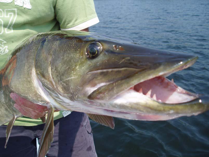
3 State of the Fisheries Resource Photo: C. Giles


,")
4 Lake Sampling Trap Netting Passive gear Size selective Vulnerable Catchability Examples: Nearshore Community Index Netting (NSCIN), End of Spring Trap Netting (ESTN), Spring Index Netting (SIN)

,")
5 Lake Sampling Gill Netting Size selectivity Passive gear Examples: Fall Walleye Index Netting (FWIN), Summer Profundal Index Netting (SPIN), Broad-Scale Monitoring (BsM)
6 Fisheries Indicators Abundance Among lake comparisons Trend through time Population Structure Size and age distribution looking for balance and consistency
7 Fish Community Balsam Lake Rice Lake Biomass (Kg/Net) WAL SMB LMB MSK BC RB PS BG 1960s TN 1970s TN 1980s SIN 1990s SIN 2000s SIN 2000 ESTN 2000 NSCIN Biomass (kg/net) WAL SMB LMB MSK RB PS BG BC 1960s TN 1970s SIN 1980s SIN 1990s SIN 2000s SIN 2000s ESTN 2000s NSCIN Decline in walleye and pumpkinseed biomass over time Increase in biomass of bass, muskie Emergence of new species (black crappie, bluegill) No decrease in total biomass (kg/net) Similar pattern across FAU lakes

8 Walleye Abundance Through Time Based on trap netting data Dramatic declines on Rice, Scugog Balsam and Buckhorn consistent, low abundance Abundance highly variable within lakes 28 Number of Walleye / Net Lift BALSAM BUCKHORN RICE SCUGOG
9 Walleye FWIN Catch low on most lakes Comparable to southern region averages 30 FMZ 17 Average Crowe - 99 Relative Abundance (Geometric Mean CUE) Balsam - 98 Balsam - 01 Balsam - 02 Balsam - 03 Balsam - 04 Balsam - 05 Cameron - 01 Sturgeon - 01 Sturgeon - 06 Pigeon - 00 Pigeon - 04 Chemung - 00 Chemung - 04 Buckhorn - 00 Buckhorn - 04 Rice - 99 Rice - 03 Rice - 06 Scugog - 02 Scugog - 06 Belmont - 99 Dalrymple - 99 Four Mile - 01 Sandy - 01 SR Average
10 Relative Abundance of Species in Nearshore Community Index Netting 150 BC Catch / Net-Lift BG PS RB LMB SMB WA

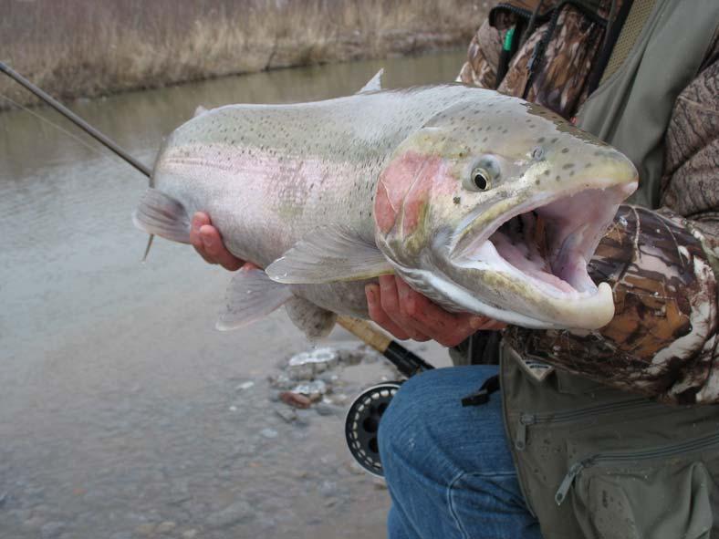
11 Trends in the Fishery Photo: M. Brown
12 Angler Effort 70 Balsam- Total Rice - Total Tri-Lakes - Total Scugog - Total A general decline in total angler effort, but still high ~1.25 million hours on FAU lakes/year (most recent creels) Dramatic decline in walleye targeted effort Angler Effort (Rod Hours per Hectacre) Angler Effort (Rod Hours per Hectacre) Year Balsam - Walleye Rice - Walleye Tri-Lakes - Walleye Scugog - Walleye Year
13 Targeted Species Lake specific fisheries Anything becoming more common 100 Walleye Largemouth bass Smallmouth bass Muskellunge Panfish Yellow perch Northern Pike Anything 80 % of Total Effort
14 Tri-Lakes Creel 160, , ,000 Bass Catch Walleye Catch Bass Harvest Walleye Harvest Number of Fish 100,000 80,000 60,000 40,000 20, Year

15 Fisheries Management in the Kawartha Lakes Photos: C. Giles

16 FMZ 17 9,360 km 2 Coldwater streams Lake Ontario tribs ORM flowing north 64 lakes larger than 5 ha 12 > 1,000 ha Rice Lake = 9200 ha Total lake area ~ 45,000 ha
17 Bobs Lake Whitefish Lake Lake Tamagami Lac Seul Pigeon Lake Rainy Lake Lake Superior Lake Scugog Lake St. Clair Bay of Quinte Lake Nipissing Rice Lake Trent System Lake Simcoe Lake of the Woods Lake Erie Georgian Bay Lake Ontario P, S, R, Trent Lake Huron # Days * Lake Nipigon Eagle Lake Lac Des Milles Lacs 0 # Days Fished on Specific Lakes TOTAL Trent System Rice Lake Lake Scugog Pigeon Lake Data from: 2000 Survey of Recreational Fishing in Ontario.
18 A new approach Individual lake management has increased complexity of regulations Broader spatial and temporal scale better approach
19 Fisheries Goals & Strategies FMZ Councils & public participation Adaptive Management Cycle Actions Regulations Education Rehabilitation Protection Stewardship Stocking Enforcement Etc. Research Monitoring, & Reporting
20 Ecological Framework The EFFM consists of three components: New regulatory framework Increased public involvement in decision making process Monitoring and reporting

21 New Fisheries Management Zones
22 FMZ Advisory Councils Role of the Advisory Council: advise the MNR work with existing stewardship groups help with public consultation Together: Identify and prioritize issues Examine of available information Set goals and objectives Development management strategies
23 FMZ 17 Advisory Council One of three pilot councils in Ontario Established in 2007 Providing input and advice to aid in the development of a Fisheries Management Strategy for the zone
24 FMZ 17 Advisory Council OFAH Ontario BASS Federation Muskies Canada Cold Creek Flyfishers Ontario Chinese Anglers Association Anglers (3) Bait Industry Tourism (3) First Nations (3) Peterborough Field Naturalists FOCA Lake Association (1) Academia Stewardship Councils
25 FMZ 17 Fisheries Management Strategy Currently working with the FMZ 17 Advisory Council to: Identify fisheries management objectives Identify a suite of potential management actions Ecosystem approach Targeting early 2009 for broad public consultation Implementation in 2010

26 Broad Scale Monitoring of Inland Lakes For each Fisheries Management Zone (FMZ) Describe the current and changing state of the resource Describe the current and changing pressures on the resource Produce a periodic report on state of the resource


27 What we measure State Indicators Pressure Indicators Fishery species Habitat Community Exploitation Abundance Bathymetry Fish species Angling effort Size Temperature Zooplankton Age Oxygen Benthos Maturation Water clarity Contaminants Disease Water chemistry Spring water sampling Aerial effort survey
 Stratified random sampling Stratify by depth Random sites within depth strata Overnight sets")
28 Proposed Netting Method Summer sampling Two types of gillnets Large mesh (North American standard) Small mesh (Ontario standard) Stratified random sampling Stratify by depth Random sites within depth strata Overnight sets (18+ hour)

29 Fisheries Goals & Strategies FMZ Councils & public participation Adaptive Management Cycle Actions Regulations Education Rehabilitation Protection Stewardship Stocking Enforcement Etc. Research Monitoring, & Reporting
Building a science for landscape fisheries management
 Building a science for landscape fisheries management Nigel Lester Aquatic Research and Monitoring Section Science and Research Branch Ministry of Natural Resources nigel.lester@ontario.ca American Fisheries
Fisheries Management Plan for Fisheries Management Zone 17: November Ontario Ministry of Natural Resources Peterborough District
 Fisheries Management Plan for Fisheries Management Zone 17: November 2009 Ontario Ministry of Natural Resources Peterborough District Fisheries Management Plan for Fisheries Management Zone 17 November
Fisheries and Lake Management Planning. CAP Mtg Nov21,2012 Brett Tregunno Aquatic Biologist, Kawartha Conservation
 Fisheries and Lake Management Planning CAP Mtg Nov21,2012 Brett Tregunno Aquatic Biologist, Kawartha Conservation Outline Aquatic Habitat Types Fish Communities Significance of Resource Current Management
Status of Lake Erie s Western Basin Fish Populations: Trends and Environmental Conditions
 Status of Lake Erie s Western Basin Fish Populations: Trends and Environmental Conditions Jeff Tyson Ohio Department of Natural Resources Ohio Division of Wildlife Status of the Lake Erie s Western Basin
Lake St. Clair Fish Community and Fishery
 Lake St. Clair Fish Community and Fishery Megan Belore Ontario Ministry of Natural Resources and Forestry Mike Thomas Michigan Department of Natural Resources Fish Community Fish Community Mixture of warm
Summary of 2012 DNR and Partners Fisheries Surveys in St. Clair/Lake Erie and Fishery Forecast for 2013
 Summary of 2012 DNR and Partners Fisheries Surveys in St. Clair/Lake Erie and Fishery Forecast for 2013 LE/LSC Citizens Fishery Advisory Committee April 2, 2013 Michael Thomas Fisheries Research Biologist
FISH COMMUNITIES AND FISHERIES OF THE THOUSAND ISLANDS AND MIDDLE CORRIDOR
 St. Lawrence River Discussion Paper FISH COMMUNITIES AND FISHERIES OF THE THOUSAND ISLANDS AND MIDDLE CORRIDOR Issues Below is a synopsis of fish community issues and proposed management approaches. More
A New Ecological Framework for Recreational Fisheries Management in Ontario
 A New Ecological Framework for Recreational Fisheries Management in Ontario FOCUS: New Fisheries Management Zones State of the Resource Reporting Enhanced Stewardship Ministry of Natural Resources Ontario's
NORTHWEST SCIENCE AND INFORMATION
 Science and Information Branch NORTHWEST SCIENCE AND INFORMATION Aquatics Update 2002-1 Fall Walleye Index Netting (FWIN) and Trap Netting Summary for Niobe Lake, 2000 by T. Cano Introduction Since 1981,
Regulatory Guidelines for Managing the Muskellunge Sport Fishery in Ontario
 Regulatory Guidelines for Managing the Muskellunge Sport Fishery in Ontario Fisheries Section Fish and Wildlife Branch Ontario Ministry of Natural Resources June 2003 Updated August 2005 Regulatory Guidelines
Dauphin Lake Fishery. Status of Walleye Stocks and Conservation Measures
 Dauphin Lake Fishery Status of Walleye Stocks and Conservation Measures Date: December, 21 Dauphin Lake Fishery Status of Walleye Stocks and Conservation Measures Background: Walleye stocks in Dauphin
THE FISHERY IN KENNEBEC LAKE Prepared by: Cam McCauley Landscape Planning Biologist Peterborough District, i t Kingston
 THE FISHERY IN KENNEBEC LAKE Prepared by: Cam McCauley Landscape Planning Biologist Peterborough District, i t Kingston 613-531-57055705 Questions 1. How many walleye and age structure now? 2. Status of
Fisheries Management Zone 10:
 Fisheries Management Zone 10: Lake Trout Operational Objectives and Management Photo Credit: www.jamessmedleyoutdoors.com 2 FMZ 10: Lake Trout Operational Objectives and Management Lake trout are the second
Inventory # Perch Lake
 Inventory # 9-036 Perch Lake Perch Lake is a double-basin lake. The southern, shallow portion of the lake is 414 acres, making it the largest wild rice lake on the Reservation. The fish communities sampled
Fisheries Management Plan for Fisheries Management Zone 6. August Ontario Ministry of Natural Resources Thunder Bay District
 Fisheries Management Plan for Fisheries Management Zone 6 August 2009 Fisheries Management Plan for Fisheries Management Zone 6 August 2009 Ontario Ministry of Natural Resources Thunder Bay District 1
Quemahoning Reservoir
 Pennsylvania Fish & Boat Commission Biologist Report Quemahoning Reservoir Somerset County May 2011 Trap Net, Gill Net and Electrofishing Survey Quemahoning Reservoir is an 899 acre impoundment located
FISH AND WILDLIFE SPECIAL PURPOSE ACCOUNT
 REPORT TO THE LEGISLATURE ON THE FISH AND WILDLIFE SPECIAL PURPOSE ACCOUNT FOR FISCAL YEAR 2009/10 Cette publication hautement spécialisée Special Purpose Account Expenditure Report n est disponible qu
Fish Community. Fish Habitat, Streams and Rivers
 Clear, Ston(e)y and White Lake Plan Fish Community The lakes support a cool/warm water fishery including muskellunge, walleye, largemouth and smallmouth bass, yellow perch, pumpkinseed, rockbass, blue
Current Status and Management Recommendations for the Fishery in the Cloverleaf Chain of Lakes
 Current Status and Management Recommendations for the Fishery in the Cloverleaf Chain of Lakes Jason Breeggemann Senior Fisheries Biologist Wisconsin Department of Natural Resources Outline DNR fisheries
December 18, Dear Sir/Madam,
 December 18, 2000 Dear Sir/Madam, We are writing to bring you up-to-date on our efforts to develop fish community objectives for the St. Lawrence River. First of all, we want to thank you for participating
BIG TWIN LAKE Kalkaska County (T28N, R05W, Section 18, and T28N, R06W, Section 13) Surveyed May 1999
 Surveyed May 1999") Michigan Department of Natural Resources Status of the Fishery Resource Report No. 2001-1, Year 2001 BIG TWIN LAKE Kalkaska County (T28N, R05W, Section 18, and T28N, R06W, Section 13) Surveyed May 1999
Michigan Department of Natural Resources Status of the Fishery Resource Report No. 2001-1, Year 2001 BIG TWIN LAKE Kalkaska County (T28N, R05W, Section 18, and T28N, R06W, Section 13) Surveyed May 1999
Current projects for Fisheries Research Unit of Minnesota Department of Natural Resources
 Current projects for Fisheries Research Unit of Minnesota Department of Natural Resources MAJOR RESOURCE ISSUES IN THE DIVISION OF FISHERIES Status of Fish Populations To effectively manage fish populations,
2011 Status of Major Stocks. Lake Erie Management Unit March 2012
 211 Status of Major Stocks Lake Erie Management Unit March 212 The Lake Erie Management Unit of the Ontario Ministry of Natural Resources is responsible for managing the fishery resources of the Ontario
DOW# West Twin Lake
 DOW# 69-0696 West Twin Lake West Twin Lake has a surface area of 120.4 acres and is located on the east side of St. Louis County Road 31, south of Highway 2. West Twin Lake has a maximum depth of 18 feet
Exploring the relationship between native smallmouth bass and invasive mussels in the Huron Erie Corridor
 Exploring the relationship between native smallmouth bass and invasive mussels in the Huron Erie Corridor Nick Popoff Michigan Department of Natural Resources What is a Fishery? Fish Peop le Habitat Fishery
Background Information to Fisheries Management Plan for Fisheries Management Zone 17
 Photo: C. Giles Photo: MNR Photo: C. Giles Photo: MNR Photo: M. Brown Photo: C. Giles Background Information to Fisheries Management Plan for Fisheries Management Zone 17 Photo: C. Giles Photo: R. Reyns
I Region I Area I DOW Number / County I DOW Lake Name I Acreage I
 LAKE MANAGEMENT PLAN 814 Bp I Region I Area I DOW Number / County I DOW Lake Name I Acreage I I I # I f 2 Duluth F213 690036 St Louis Salo DOW:149 Plan: 137 Long Range Goal: Manage for walleye with a gillnet
Keuka Lake State of the Lake 2017
 Keuka Lake State of the Lake 2017 1 2 Lake Characteristics Third largest by area of the Finger Lakes 11,730 ac Deep and steep sided - max 185 ft mean 101 ft Two story fishery (warmwater/coldwater) 178,800
Rolling Knolls Pond Population Survey
 Located near the town of Elgin on the west side of Rohrssen Rd. between Illinois Route 58 and U.S.- 20. This small 1.8 acre pond has a maximum depth of 7.5 feet and is occasionally influenced by Poplar
Busse Reservoir South Lateral Pool Population Survey
 Busse Reservoir South Lateral Pool Survey Located in Elk Grove Village south of Higgins Rd. between RT 53/I-290 and Arlington Heights Rd. Busse Reservoir is comprised of three pools making up a total of
East Metro Forest Lake (2,251 acres): Coon Lake (1,481 acres):
: Coon Lake (1,481 acres):") East Metro Forest Lake (2,251 acres): Located within the City of Forest Lake and just east of Interstate 35, Forest Lake boasts good numbers of northern pike and walleye. Northern pike and walleye were
East Metro Forest Lake (2,251 acres): Located within the City of Forest Lake and just east of Interstate 35, Forest Lake boasts good numbers of northern pike and walleye. Northern pike and walleye were
Tampier Lake Population Survey
 Located in Palos Park on 131 st St. between Wolf and Will-Cook Rd. s. Tampier Lake has 131 acres of fishable water, with a maximum depth of 9.4 feet. Walleye, northern pike, largemouth bass and channel
Adapting to Climate Change In Coastal Environments
 Adapting to Climate Change In Coastal Environments Peter Nimmrichter, P.Eng. AMEC Earth and Environmental, Mississauga, Ontario 19/11/2007 1 The Great Lakes Watershed The Great Lakes cover an area of 244,160
HUBBARD LAKE Alcona County (T27N, R7E; T28N, R7E) Surveyed May and September Tim A. Cwalinski
 Surveyed May and September Tim A. Cwalinski") Michigan Department of Natural Resources Status of the Fishery Resource Report No. 2003-1, 2003 HUBBARD LAKE Alcona County (T27N, R7E; T28N, R7E) Surveyed May and September 1996 Tim A. Cwalinski Environment
Michigan Department of Natural Resources Status of the Fishery Resource Report No. 2003-1, 2003 HUBBARD LAKE Alcona County (T27N, R7E; T28N, R7E) Surveyed May and September 1996 Tim A. Cwalinski Environment
Pennsylvania Fish & Boat Commission Biologist Report. Wilmore Dam. Cambria County. May 2011 Trap Net, Electrofishing and Hoop Net Survey
 Pennsylvania Fish & Boat Commission Biologist Report Wilmore Dam Cambria County May 2011 Trap Net, Electrofishing and Hoop Net Survey Wilmore Dam is a 195 acre impoundment located in central Cambria County
2010 Fishing Opener Prognosis. Central Region
 2010 Fishing Opener Prognosis Central Region Hinckley PINE COUNTY Pokegama, Cross, Island, Oak and North and South Big Pine Lakes are typically the best lakes for targeting walleye in Pine County. They
Bode Lake - South Population Survey
 Bode Lake - South Survey Located in Hoffman Estates on the north side of Bode Rd. 1 mile west of Barrington Rd. Bode Lake is made up of two lakes along Poplar Creek; the larger and deeper Bode Lake South
Fish Lake Informational Meeting. Dan Wilfond, Fisheries Specialist Deserae Hendrickson, Area Fisheries Supervisor MN DNR Fisheries - Duluth
 Fish Lake Informational Meeting Dan Wilfond, Fisheries Specialist Deserae Hendrickson, Area Fisheries Supervisor MN DNR Fisheries - Duluth Why are we here tonight? Provide background info on fish community
Agenda and minutes. Minnesota 1837 Ceded Territory Fisheries Committee January 17, 2018, 10:00 a.m. WebEx
 Agenda and minutes Minnesota 1837 Ceded Territory Fisheries Committee January 17, 2018, 10:00 a.m. WebEx 1. Introductions 2. Review and approve agenda (Action) Agenda was approved 3. Distribute past meeting
(date are inclusive)
") Kind of Fish and Locality Methods Permitted Open Season (date are inclusive) Bag Limit Maximum or Minimum Size Limits (a) LARGE MOUTH AND SMALLMOUTH BASS. (i) All waters Hook & Line ice fishing (including
Kind of Fish and Locality Methods Permitted Open Season (date are inclusive) Bag Limit Maximum or Minimum Size Limits (a) LARGE MOUTH AND SMALLMOUTH BASS. (i) All waters Hook & Line ice fishing (including
Rainy Lake Open-water Creel Survey:
 Rainy Lake Open-water Creel Survey: 21 11 Darryl McLeod District Update 212-1 Introduction An open-water creel survey was conducted on the Ontario portion of Rainy Lake from May 15 th (the opening of the
Technical Briefing. Northern Cod (NAFO Div. 2J3KL) Newfoundland & Labrador March 23, 2018
 Newfoundland & Labrador March 23, 2018") Technical Briefing Northern Cod (NAFO Div. 2J3KL) Newfoundland & Labrador March 23, 2018 Outline Purpose of this briefing Science advice & the precautionary approach Summary of stock status How we estimate
Technical Briefing Northern Cod (NAFO Div. 2J3KL) Newfoundland & Labrador March 23, 2018 Outline Purpose of this briefing Science advice & the precautionary approach Summary of stock status How we estimate
Michigan Dept. of Natural Resources Status of the Fishery Resource Report Page 1. Weber Lake Cheboygan County, T34N, R3W, Sec.
 Michigan Dept. of Natural Resources 2012-143 Status of the Fishery Resource Report Page 1 Weber Lake Cheboygan County, T34N, R3W, Sec. 31 Neal Godby, Fisheries Biologist Environment Weber Lake is a 28.5-acre
Michigan Department of Natural Resources Status of the Fishery Resource Report Page 1
 Michigan Department of Natural Resources 2007-33 Status of the Fishery Resource Report Page 1 Grand Sable Lake Alger County, T49N, R14W, Sec. Many Lake Superior watershed, last year surveyed 2004 James
STUDY PERFORMANCE REPORT
 STUDY PERFORMANCE REPORT State: Michigan Study No.: 427 Project No.: F-81-R-1 Title: Measurement of sportfishing harvest in lakes Michigan, Huron, Erie, and Superior Period Covered: October 1, 1999 to
LAKE DIANE Hillsdale County (T8-9S, R3W, Sections 34, 3, 4) Surveyed May Jeffrey J. Braunscheidel
 Surveyed May Jeffrey J. Braunscheidel") Michigan Department of Natural Resources Status of the Fishery Resource Report No. 2003-4, 2003 LAKE DIANE Hillsdale County (T8-9S, R3W, Sections 34, 3, 4) Surveyed May 2001 Jeffrey J. Braunscheidel Environment
Michigan Department of Natural Resources Status of the Fishery Resource Report No. 2003-4, 2003 LAKE DIANE Hillsdale County (T8-9S, R3W, Sections 34, 3, 4) Surveyed May 2001 Jeffrey J. Braunscheidel Environment
STUDY PERFORMANCE REPORT
 STUDY PERFORMANCE REPORT State: Michigan Project No.: F-81-R-3 Study No.: 491 Title: Evaluation of lake sturgeon Acipenser fulvescens populations in the St. Clair River and Lake St. Clair Period Covered:
Executive Summary Lake Vermilion Fisheries Management Plan
 Executive Summary Lake Vermilion Fisheries Management Plan 2017-2022 Minnesota Department of Natural Resources Division of Fish and Wildlife Section of Fisheries 500 Lafayette Road St. Paul, MN 55155-4020
Maple Lake Population Survey
 Maple Lake Survey Located in Willow Springs approximately 1 mile west of Willow Springs Rd. (104 th Ave.) at Wolf Rd. and 95 th St. Constructed in the 1920 s this 60 acre lake drops down to 20.4 feet in
Proposed Changes to Bag and Size Limits Minnesota/Wisconsin Border Waters of the Mississippi River
 Proposed Changes to Bag and Size Limits Minnesota/Wisconsin Border Waters of the Mississippi River The Minnesota and Wisconsin DNRs are jointly reviewing fishing regulations on Pools 3-9 of the Mississippi
WISCONSIN DEPARTMENT OF NATURAL RESOURCES FISH MANAGEMENT ACTIVITIES DELAVAN LAKE SPRING 2012
 WISCONSIN DEPARTMENT OF NATURAL RESOURCES FISH MANAGEMENT ACTIVITIES DELAVAN LAKE SPRING 212 Electrofishing and fyke net surveys were conducted on Delavan Lake March 2-May 3, 212. Fyke netting and electrofishing
Alcona Dam Pond Alcona County (T25N, R5E, Sections various) Surveyed June 6-12 and September 16, 2003
 Surveyed June 6-12 and September 16, 2003") Michigan Department of Natural Resources Status of the Fishery Resource Report No. 2004-6, Year 2004 Alcona Dam Pond Alcona County (T25N, R5E, Sections various) Surveyed June 6-12 and September 16, 2003
Michigan Department of Natural Resources Status of the Fishery Resource Report No. 2004-6, Year 2004 Alcona Dam Pond Alcona County (T25N, R5E, Sections various) Surveyed June 6-12 and September 16, 2003
Sag Quarry - West Population Survey
 Located in Lemont on RT 83 and Archer Ave. just north of 111 th St. Like Sag Quarry East, this lake is an old limestone quarry, 14 acres in size and with a maximum depth of 10.3 feet. The species found
Caro Impoundment, Tuscola County
 Caro Impoundment is a 200 acre impoundment of the Cass River located one mile south of the Village of Caro in Tuscola County. Caro Dam, originally constructed in 1906 for water supply to Michigan Sugar
Archer Lake 2011 Survey Report Prepared by Brian Gunderman
 Archer Lake 211 Survey Report Prepared by Brian Gunderman Introduction Archer Lake is a 64 acre lake located about miles southeast of the city of Coldwater. Archer Lake is part of the Coldwater-Marble
Presented to O.F.A.H. Zone F August 22, 2010 By Ed Giffin, Chair O.F.A.H. Zone F
 O1 Walleye in Ontario Presented to O.F.A.H. Zone F August 22, 2010 By Ed Giffin, Chair O.F.A.H. Zone F Slide 1 O1 Owner, 28/04/2009 Walleye in Southern Ontario 2005 Survey of Recreational Fishing in Ontario
Wampum Lake Population Survey
 Wampum Lake Survey Located in Thornton on Thornton-Lansing Rd. 1½ mile west of Torrence Ave. Wampum Lake is 35 acres is size and has a maximum depth of 14.1 feet. Northern pike, largemouth bass, bluegill,
NE Region 2017 Fishing opener report
 NE Region 2017 Fishing opener report New walleye regulation are in effect on on Lake Vermilion allowing more harvest of walleye, with the protected slot limit moved from 18-26 inches to 20-26 inches. The
Fish Community and Aquatic Ecosystem Responses to the Cessation of Eurasian Watermilfoil Chemical Treatment on Lake Ellwood, Wisconsin
 Fish Community and Aquatic Ecosystem Responses to the Cessation of Eurasian Watermilfoil Chemical Treatment on Lake Ellwood, Wisconsin Greg G. Sass Wisconsin Department of Natural Resources Fisheries and
Geology. Key Factors. Overfishing. Great Lakes Fishes. Historical Fishing. About 10,000 years since last glacial retreat very young ecologically
 Great Lakes Fishes Geology About 10,000 years since last glacial retreat very young ecologically Largest surface freshwater system on earth 21% of world s supply 84% of North America s supply Five unique
Lake information report
 Lake information report: Minnesota DNR Page of 5 Lake information report jf Prinlable senior Name: Spring Nearest Town: Spring Lake (Scott) Primary County: Scott Survey Date: 08/02/200 Inventory Number:
Cedar Lake Comprehensive Survey Report Steve Hogler and Steve Surendonk WDNR-Mishicot
 Cedar Lake- 2006 Comprehensive Survey Report Steve Hogler and Steve Surendonk WDNR-Mishicot ABSTRACT Cedar Lake is a 142 acre lake located in the southwest corner of Manitowoc County. It is a seepage lake
LAKE ONTARIO FISH COMMUNITIES AND FISHERIES: 2013 ANNUAL REPORT OF THE LAKE ONTARIO MANAGEMENT UNIT
 LAKE ONTARIO FISH COMMUNITIES AND FISHERIES: 2013 ANNUAL REPORT OF THE LAKE ONTARIO MANAGEMENT UNIT LAKE ONTARIO FISH COMMUNITIES AND FISHERIES: 2013 ANNUAL REPORT OF THE LAKE ONTARIO MANAGEMENT UNIT
Status of the Lake Erie Fish Community Jeff Tyson, Ohio Division of Wildlife
 Status of the Lake Erie Fish Community 2010 Jeff Tyson, Ohio Division of Wildlife Status of the Lake Erie Fish Community 2010 Physical Environment/Fish Community West to east gradient in depth, temperature,
Schiller Pond Population Survey
 Located in the town of Schiller Park on Irving Park Rd. just west of Cumberland Ave. This small 6 acre pond has a maximum depth of 6.3 feet. In addition to largemouth bass and bluegill, Schiller Pond is
MIDDLE FORK RESERVOIR Wayne County 2004 Fish Management Report. Christopher C. Long Assistant Fisheries Biologist
 MIDDLE FORK RESERVOIR Wayne County 2004 Fish Management Report Christopher C. Long Assistant Fisheries Biologist FISHERIES SECTION INDIANA DEPARTMENT OF NATURAL RESOURCES DIVISION OF FISH AND WILDLIFE
Summary of and Initial Response to public comments on MN Department of Natural Resources proposal to manage new waters for Muskellunge
 Summary of and Initial Response to public comments on MN Department of Natural Resources proposal to manage new waters for Muskellunge Summary of and Initial Response to public comments: This document
Climate Change Impacts on Great Lakes Fishes
 Climate Change Impacts on Great Lakes Fishes Stuart A. Ludsin ludsin.1@osu.edu Changing Climate Webinar Series The Ohio State University 19 April 2011 Today s Presentation Great Lakes Fish Community A
Arrowhead Lake Population Survey
 Located in Palos Heights at 135 th St, east of Harlem Ave. Arrowhead Lake is a 13 acre body of water with a maximum depth of 12.6 feet. Fish species found in this lake include largemouth bass, bluegill,
STUDY PERFORMANCE REPORT
 STUDY PERFORMANCE REPORT State: Michigan Study No.: 427 Project No.: F-81-R-2 Title: Measurement of sportfishing harvest in lakes Michigan, Huron, Erie, and Superior Period Covered: October 1, 2000 to
Status Review and Management Outline for Quality Bluegill and Black Crappie Populations in the Grand Rapids Area.
 Status Review and Management Outline for Quality Bluegill and Black Crappie Populations in the Grand Rapids Area. Revised in 2013 By David L. Weitzel Assistant Area Fisheries Supervisor MN DNR, Grand Rapids
Elk Lake, Antrim and Grand Traverse counties T. 28, 29 N., R. 8, 9 W., Sec. many. Lake surveys. began at 40 feet
 Elk Lake, Antrim and Grand Traverse counties T. 28, 29 N., R. 8, 9 W., Sec. many Physical and chemical data surveyed August 1931 Temperature ( F) Secchi disk (feet) 9. 6 Surface 74 Bottom 45 PH 8.0 Thermocline
An annual fisheries newsletter from Grand Rapids Fisheries: Spring 2018
 Fisheries Update Contact us Minnesota Dept. of Natural Resources Grand Rapids Area Fisheries Office 1201 East Hwy 2 Grand Rapids, MN 55744 Phone (218) 328-8836 grandrapids.fisheries @state.mn.us Did you
Highlights of the Annual Lake Committee Meetings Great Lakes Fishery Commission proceedings held in Ypsilanti, MI
 Inland Seas Angler GREAT LAKES BASIN REPORT Special Report Lake Ontario A Publication of the Great Lakes Sport Fishing Council May 2009 http://www.great-lakes.org Vol. 20, No. 7 Highlights of the Annual
Green Lake Population Survey
 Located next to the Green Lake Aquatic Center in Calumet City on the north side of 159 th St, east of Torrence Ave. Size can be deceiving; this 5 acre lake is the deepest lake in the District with a maximum
LAKE MANAGEMENT PLAN
 LAKE MANAGEMENT PLAN Region Area DOW Number County DOW Lake Name Acreage 2 Duluth F213 69-0041 St. Louis Bassett DOW: 436 Plan: 442 Long Range Goal: Manage for walleye with a gillnet catch rate greater
Invasive Fish in the Cariboo Region. Russell Bobrowski Fisheries Biologist, BC Gov Cariboo Region Dec 19, 2017
 Invasive Fish in the Cariboo Region Russell Bobrowski Fisheries Biologist, BC Gov Cariboo Region Dec 19, 2017 Cariboo - Fishery Combination of productive lake and river fisheries 700 lakes with known game
Application of a New Method for Monitoring Lake Trout Abundance in Yukon: Summer Profundal Index Netting (SPIN)
") Application of a New Method for Monitoring Lake Trout Abundance in Yukon: Summer Profundal Index Netting (SPIN) Prepared by: Lars Jessup Nathan Millar November 2011 Application of a New Method for Monitoring
Application of a New Method for Monitoring Lake Trout Abundance in Yukon: Summer Profundal Index Netting (SPIN) Prepared by: Lars Jessup Nathan Millar November 2011 Application of a New Method for Monitoring
Highlights of Native Fish Rehabilitation Activities in the Great Lakes. Presented By: Arunas Liskauskas, Ontario Ministry of Natural Resources
 Highlights of Native Fish Rehabilitation Activities in the Great Lakes Presented By: Arunas Liskauskas, Ontario Ministry of Natural Resources In this presentation Focus on activities from 2002 to 2007
FISHERY MANAGEMENT. Table of Contents
 FISHERY MANAGEMENT Table of Contents Lake Trout (Cold Water) Fishery Warm & Cool Water Fishery Broad-scale Monitoring Appendix Eagle Lake Property Owners`Association 2 Fish & Fishery Table 1. Weight class
LAKE MANAGEMENT PLAN
 LAKE MANAGEMENT PLAN Region 1 Area Park Rapids D.O.W. Number 29-185 County Hubbard D.O.W. Lake Name Big Sand Lake Class 22 Acreage 1,635 GIS 465 littoral LONG RANGE GOALS: Maintain or improve the quality
Crooked Lake Oakland County (T4N, R9E, Sections 3, 4, 9) Surveyed May James T. Francis
 Surveyed May James T. Francis") Michigan Department of Natural Resources Status of the Fishery Resource Report No. 2004-1, 2004 Crooked Lake Oakland County (T4N, R9E, Sections 3, 4, 9) Surveyed May 2002 James T. Francis Environment Crooked
Michigan Department of Natural Resources Status of the Fishery Resource Report No. 2004-1, 2004 Crooked Lake Oakland County (T4N, R9E, Sections 3, 4, 9) Surveyed May 2002 James T. Francis Environment Crooked
Fisheries Management Plan for Fisheries Management Zone 4 1. Ministry of Natural Resources and Forestry
 Fisheries Management Plan for Fisheries Management Zone 4 1 Ministry of Natural Resources and Forestry Fisheries Management Plan for Fisheries Management Zone 4 2 Fisheries Management Plan for Fisheries
Ministry of Natural Resources. Fish and Wildlife Special Purpose Account. 2011/2012 Annual Report
 Ministry of Natural Resources Fish and Wildlife Special Purpose Account 2011/2012 Annual Report Cette publication hautement spécialisée Special Purpose Account Expenditure Report n est disponible qu en
Lake information report
 Page 1 of 6 Lake information report Name: Saganaga Nearest Town: Grand Marais Primary County: Cook Survey Date: 08/08/2011 Inventory Number: 16063300 walleye stocking. Purchase a walleye stamp. Your voluntary
In each summer issue of Lake
 The 2000 Lake Erie Walleye Report by Rick Kubb In each summer issue of Lake Erie Walleye Magazine, we provide a synopsis of the walleye fishery in Lake Erie based on the scientific reports produced by
Lake Winnibigoshish Fisheries Information Newsletter
 Lake Winnibigoshish Fisheries Information Newsletter 03/21/2016 An annual fisheries newsletter for Lake Winnibigoshish In This Issue 2016 Population Assessment Invasive Species VHS Interesting Links Invasive
Big Bend Lake Population Survey
 Big Bend Lake Survey Located in Des Plaines on East River Rd. just south of Golf Rd. This 27 acre body of water has a depth of 27.8 feet; however because it is connected to the Des Plaines River by a spillway,
MARTINDALE POND Wayne County 2004 Fish Management Report. Christopher C. Long Assistant Fisheries Biologist
 MARTINDALE POND Wayne County 2004 Fish Management Report Christopher C. Long Assistant Fisheries Biologist Fisheries Section Indiana Department of Natural Resources Division of Fish and Wildlife I.G.C.
Moses Lake Fishery Restoration Project
 Moses Lake Fishery Restoration Project Factors Affecting the Recreational Fishery in Moses Lake Washington Annual Report 2002-2003 DOE/BP-00006320-4 November 2003 Field37: This Document should be cited
Angling in Manitoba Survey of Recreational Angling
 Angling in Manitoba 2005 Survey of Recreational Angling TABLE OF CONTENTS Page Introduction 1 Angler Profile 2 Angling Effort 6 Catch and Harvest 9 Angling Expenditures 11 Bait Use 14 Canadian and Nonresident
Penny Road Pond Population Survey
 Located in Barrington Hills on the south side of Penny Rd. west of Old Sutton Rd. This small 7 acre pond has a maximum depth of 4.6 feet and is connected to Spring Creek. The fish population of Penny Road
2011 Haha Lake Northern Pike Control
 2011 Haha Lake Northern Pike Control Prepared By: Christin Davis Ministry of Forests, Lands, and Natural Resource Operations #401-333 Victoria Street Nelson, BC V1L 4K3 Summary In 2005, northern pike (Esox
JadEco, LLC PO BOX 445 Shannon, IL 61078
 Introduction: With the assistance of Lake Holiday staff and volunteers, we were able to conduct an AC electrofishing survey on May 8, 27. Water temperatures were 2.3 C (8.5 F) and water clarity was decent
Introduction: JadEco, LLC PO BOX 445 Shannon, IL 61078
 Introduction: was contacted to collected data on the fishery for Lake Holiday. AC Electroshocking was conducted at 2 locations on September 28, 2015. Fish population data was collected for a total of 100
Renseignements supplémentaires. Supplementary Information. Présentation du Ministère des Richesses naturelles de l Ontario
 Deep Geologic Repository Joint Commission d examen conjoint du projet de stockage dans des couches géologiques profondes PMD 13-P1.6B File / dossier : 8.01.07 Date: 2013-10-01 Edocs: 4209085 Supplementary
Peace River Water Use Plan. Monitoring Program Terms of Reference. GMSMON-1 Peace River Creel Survey
 Peace River Water Use Plan Monitoring Program Terms of Reference GMSMON-1 Peace River Creel Survey April 10, 2008 Terms of Reference for the Peace River Water Use Plan Monitoring Program: Peace River Creel
Lake Wanapitei Fall Walleye Index Netting, 2004
 Lake Wanapitei Fall Walleye Index Netting, 2004 Kimberley Carmichael, Fisheries Biologist August 2005 755 Wallace Road, Unit 5 North Bay, ON P1B 8G4 Phone: (705) 472-7888 Fax: (705) 472-6333 email: aofrc@aofrc.org
Angling in Manitoba (2000)
") Angling in Manitoba (2000) TABLE OF CONTENTS Page Introduction 1 Angler Profile 2 Angling Effort 7 Catch and Harvest 10 Angling Expenditures 13 Bait Use 16 Nonresident Trip Characteristics 18 Angling in
Angling in Manitoba (2000) TABLE OF CONTENTS Page Introduction 1 Angler Profile 2 Angling Effort 7 Catch and Harvest 10 Angling Expenditures 13 Bait Use 16 Nonresident Trip Characteristics 18 Angling in
Public Input to St. Lawrence River Fisheries Community Objectives
 Public Input to St. Lawrence River Fisheries Community Objectives Tommy L. Brown, Human Dimensions Research Unit, Cornell University Steven R. LaPan, New York State Department of Environmental Conservation,