Lake St. Clair Fish Community and Fishery
|
|
|
- Howard Cain
- 5 years ago
- Views:
Transcription


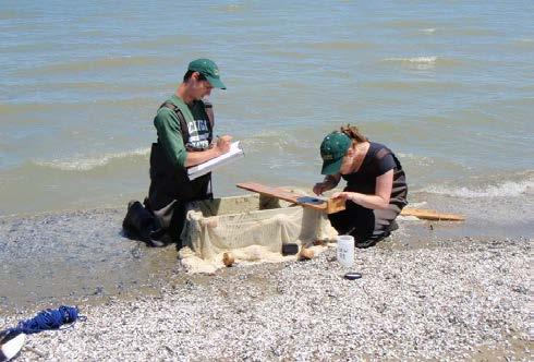
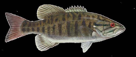
1 Lake St. Clair Fish Community and Fishery Megan Belore Ontario Ministry of Natural Resources and Forestry Mike Thomas Michigan Department of Natural Resources


2 Fish Community


3 Fish Community Mixture of warm water and cool water species More than 110 fish species live in, or move through Lake St. Clair and its connecting waters Provides spawning and nursery habitat to more than 45 species of fish


4 Species At Risk Common Name ON Status MI Status Brindled madtom Special concern Channel darter Threatened Endangered Eastern sand Endangered Threatened darter Grass pickerel Special concern Lake chubsucker Threatened Lake sturgeon Threatened Threatened Mooneye Threatened Northern madtom Endangered Endangered Pugnose minnow Threatened Endangered Pugnose shiner Endangered Endangered River darter Endangered Sauger Threatened Silver chub Special concern Special concern Silver lamprey Special concern Not listed Spotted Gar Threatened Special concern Spotted sucker Special concern Not listed


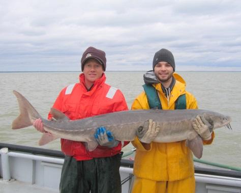
5 Lake St. Clair is important lake sturgeon habitat 40% of all (108 of 268) acoustic-tagged lake sturgeon were detected in Lake St. Clair in 2014 during a 4 month period (Jul-Oct) 82 tagged Lake St. Clair St. Clair R. 86 tagged Detroit, MI 72 tagged Detroit R. receivers =tag site
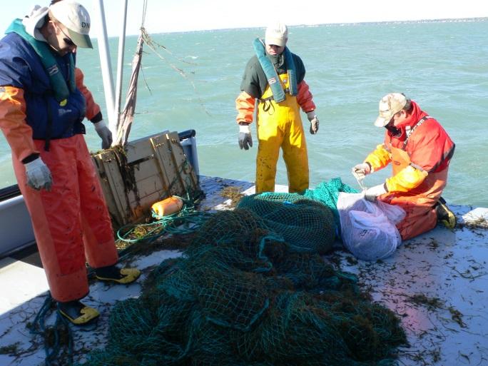
6 Assessment Programs


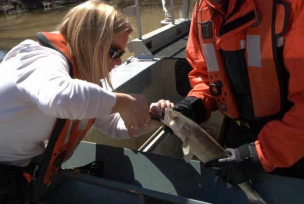
7 Michigan Spring Trap Net Index Evaluates the adult fish community composition Survey dates back to trap nets fished in Anchor Bay Late April to late May All fish identified, counted, and measured Selected species aged Smallmouth bass tagged
8 Michigan Trap Net Survey Average CUE CUE (#/24 hour lift) Other White perch Pumpkinseed Shorthead redhorse Yellow perch Channel catfish Rock bass Muskellunge Silver redhorse Northern pike Freshwater drum Walleye Smallmouth bass CUE - 29% in 2014 from CUE 24.9 (mean 40.3)

9 Ontario Fall Trap Net Index Evaluates the adult fish community composition Survey dates back to sites Generally fished beginning of October to mid November All fish identified, counted, and measured Selected species aged
10 Ontario Trap Net Survey Average CUE CUE (# / net night) Freshwater Drum Yellow Perch Smallmouth Bass Pumpkinseed White Bass Channel Catfish Others Walleye Black Crappie Bluegill Rock Bass White Perch Common Carp CUE + 3% in 2014 from CUE 11.9 (mean 23.2) No survey in 1999, 2002 and 2010


11 Michigan Fall Trawl Index Used to assess the fish community composition and YOY abundance of yellow perch and smallmouth bass Survey dates back to 1996 Anchor Bay site in early September 3 to 10 trawl tows All fish identified and enumerated Lengths for select species and age groups
12 Michigan Fall Trawl Index 1% 1% 4% 13% 1% 3% 1% Average Composition (All Ages) 78% others Shiners and Minnows White Perch & White Bass Perches Sunfishes Gobies Trout-perch Suckers Other Spottail Shiner, Sand Shiner, Emerald Shiner, Bluntnose Minnow, and Including Yellow Perch, Walleye, Logperch and Darters Including Sm. Bass, Lg. Bass, Rock Bass, and Pumpkinseed


13 Ontario Young-of-the-Year Index Used to assess the nearshore fish community composition and YOY abundance Survey dates back to Sites, June - July 2 hauls with 30m small-mesh beach seine net All fish identified and enumerated
14 Ontario YOY Seine Index 1% 3% 2% 4% 10% 16% Average Composition (All Ages) 18% 1% 44% Carps and Minnows Gizzard Shad Brook Silversides Sunfishes White Perch & White Bass Perches Gobies Suckers Others Spottail Shiner, Emerald Shiner, Sand Shiner, Mimic Shiner, Bluntnose Minnow, and others Largemouth Bass, Bluegill, Smallmouth Bass, and other sunfish Yellow Perch, Logperch, Walleye, and Darters
15 Angler Diary Program Volunteer sport catch reporting program Supported by OMNRF and MDNR Lake Erie, Lake St. Clair, Detroit River, St Clair River Survey Area Number of Diarists Number of Trips Number of Rods per Trip Total Rod Hours Hours per Trip Lake St. Clair , Detroit River , St. Clair River Total ,


16 Common Sport Fish


17 Yellow Perch The most sought after species in Lake St. Clair Open water and winter ice fishery Half of the total annual fishing effort in Michigan Michigan anglers harvest ~750,000 each year
18 Angler Diary Yellow Perch CUE Angler Diarists recorded 152 fishing trips targeting yellow perch in % of effort was directed towards yellow perch in Lake St. Clair, and 8% in Detroit River Catch per unit effort Lake St. Clair Detroit River
19 Ontario Yellow Perch Fall Trap Net CUE CUE (# fish / net night) Year CUE - 13% in 2014 from CUE 0.1 (mean 0.4) No survey in 1999, 2002 and 2010
20 Michigan September Index Trawls YOY Yellow Perch 600 1, Catch per 10 minute tow Year Class
21 Ontario YOY Yellow Perch CUE CUE (#fish/10 Seine Hauls) Year CUE -8% in 2014 from 2013 BM;BRE;PR;PS July Only No surveys from ; ; and 2006


22 Walleye Walleye fishing ~ 30% of the boat fishery 80% of legal-sized walleye caught are harvested
23 St. Clair System Walleye Harvest Water Average SCR 30,744 46,767 No data 38,756 LSC 48,841 93,155 32,822 58,273 DR 199,219 No data 134, ,093 Total 278, ,121 Creel estimates for Michigan waters only >250,000 legal-sized walleye are harvested from the Michigan waters of the system annually Many walleye caught are migratory spawning is in the Detroit River and Lake Erie sites
24 Angler Diary Walleye CUE Angler Diarists recorded 616 fishing trips targeting walleye in % of effort was directed towards walleye in the Detroit River, 55% in St. Clair River, and 36% in Lake St. Clair Catch per unit effort Lake St. Clair Detroit River St. Clair River
25 Michigan Spring Trap Net CUE Catch per 24 hours Walleye
26 Ontario Walleye Fall Trap Net CUE 10 9 CUE (# fish / net night) Year CUE +53% in 2014 from CUE 0.6 (mean 3.1) No survey in 1999, 2002 and 2010


27 Walleye Tagging on the Thames and Sydenham Rivers Recaptured River Year Tagged Sydenham Thames Purpose: To assess the status and characteristics of the Walleye population Double tagged with PIT and jaw tags

28 Walleye Recaptures By Tagging Origin Tagged in Sydenham River 2013 Tagged in Thames River


29 Smallmouth Bass ~20% of the boat fishery effort >100,000 legal-sized smallmouth bass caught annually from Michigan waters of Lake St. Clair >90% of legal-size smallmouth bass are released Fishery attracts out-of-state anglers, tournaments
30 Angler Diary Smallmouth Bass CUE Catch per unit effort Lake St. Clair Detroit River % of effort was directed towards yellow perch in Lake St. Clair, and 12% in Detroit River
31 Michigan Spring Trap Net CUE Catch per 24 hours Smallmouth bass
32 Ontario Smallmouth Bass Fall Trap Net CUE CUE (# fish / net night) Year CUE - 34% in 2014 from CUE 0.2 (mean 0.5) No survey in 1999, 2002 and 2010
33 Michigan September Index Trawls YOY SMB 30.0 Mean density (#/Acre) Age 0 SMB per acre
34 Ontario YOY Smallmouth Bass CUE CUE (#Fish/10 Seine Hauls) Year CUE +20% in 2014 from 2013 BM;BRE;PR;PS July Only No surveys from ; ; and 2006

35 Michigan Smallmouth Bass Tagging 4,598 tagged in Anchor Bay since tags reported by anglers from 2002 to 2014 Some fish with multiple recaptures Recaptures heavily clumped in Anchor Bay area


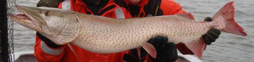
36 Muskellunge Legendary fishery known for high catch rates and increasing numbers of large fish (>50 ) 26% of all Lake St. Clair charter fishing trips in Michigan targeted muskie in 2014 ~99% of all muskies caught on LSC are released
37 Michigan Spring Trap Net CUE Catch per 24 hours Muskellunge
38 Ontario Muskellunge Fall Trap Net CUE 0.25 CUE (# fish / net night) Year CUE - 13% in 2014 from CUE 0.06 (mean 0.04) No survey in 1999, 2002 and 2010


39 Bi-National Detroit River Creel Survey in 2015 Joint creel survey by MDNR and OMNRF with support from USGS
40 Questions
Summary of 2012 DNR and Partners Fisheries Surveys in St. Clair/Lake Erie and Fishery Forecast for 2013
 Summary of 2012 DNR and Partners Fisheries Surveys in St. Clair/Lake Erie and Fishery Forecast for 2013 LE/LSC Citizens Fishery Advisory Committee April 2, 2013 Michael Thomas Fisheries Research Biologist
Thunder Bay River Assessment Appendix. Appendix 2
 Appendix 2 Known past and present fish distributions in the River system. Distribution of fishes were compiled from Bailey et al. (2003) and from records located at the Michigan Department of Natural Resources
Methods for Evaluating Shallow Water Habitat Restoration in the St. Clair River
 Methods for Evaluating Shallow Water Habitat Restoration in the St. Clair River Objectives Document fish use of restoration sites Spawning Presence of larvae, juvenile, and adult fish Quantify differences
Great Lakes Coastal Wetland Communities: Vulnerabilities to Climate Change and Response to Adaptation Strategies
 Great Lakes Coastal Wetland Communities: Vulnerabilities to Climate Change and Response to Adaptation Strategies CCAF Wetlands Study Investigators: Susan Doka Fisheries & Oceans, Great Lakes Lab for Fisheries
Elk Lake, Antrim and Grand Traverse counties T. 28, 29 N., R. 8, 9 W., Sec. many. Lake surveys. began at 40 feet
 Elk Lake, Antrim and Grand Traverse counties T. 28, 29 N., R. 8, 9 W., Sec. many Physical and chemical data surveyed August 1931 Temperature ( F) Secchi disk (feet) 9. 6 Surface 74 Bottom 45 PH 8.0 Thermocline
Bode Lake - South Population Survey
 Bode Lake - South Survey Located in Hoffman Estates on the north side of Bode Rd. 1 mile west of Barrington Rd. Bode Lake is made up of two lakes along Poplar Creek; the larger and deeper Bode Lake South
Big Bend Lake Population Survey
 Big Bend Lake Survey Located in Des Plaines on East River Rd. just south of Golf Rd. This 27 acre body of water has a depth of 27.8 feet; however because it is connected to the Des Plaines River by a spillway,
Investigating reproduction and abundance of bighead carp (Hypophthalmichthys nobilis) and silver carp (H. molitrix) in the Greenup pool, Ohio River
 and silver carp (H. molitrix) in the Greenup pool, Ohio River") Investigating reproduction and abundance of bighead carp (Hypophthalmichthys nobilis) and silver carp (H. molitrix) in the Greenup pool, Ohio River Nathan Fleshman Dr. Thomas Jones Photo: USGS Photo: USGS
Investigating reproduction and abundance of bighead carp (Hypophthalmichthys nobilis) and silver carp (H. molitrix) in the Greenup pool, Ohio River Nathan Fleshman Dr. Thomas Jones Photo: USGS Photo: USGS
Delaware River Seine Survey: 2012 Sampling Summary
 Delaware River Seine Survey: 2012 Sampling Summary Fish and Wildlife employees pull in the seine net From June 18 to November 21, 2012, biologists conducted the Delaware River Seine Survey. Over the course
Exploring the relationship between native smallmouth bass and invasive mussels in the Huron Erie Corridor
 Exploring the relationship between native smallmouth bass and invasive mussels in the Huron Erie Corridor Nick Popoff Michigan Department of Natural Resources What is a Fishery? Fish Peop le Habitat Fishery
SUMMARY REPORT FOR LAKE ST. MALO FISHERIES ASSESSMENT. Prepared for the St. Malo and District Wildlife Association
 SUMMARY REPORT FOR LAKE ST. MALO FISHERIES ASSESSMENT Prepared for the St. Malo and District Wildlife Association Presented by August 25, 2014 Study dates thus far: Date Tasks February 16 Fishing derby;
Quemahoning Reservoir
 Pennsylvania Fish & Boat Commission Biologist Report Quemahoning Reservoir Somerset County May 2011 Trap Net, Gill Net and Electrofishing Survey Quemahoning Reservoir is an 899 acre impoundment located
Rolling Knolls Pond Population Survey
 Located near the town of Elgin on the west side of Rohrssen Rd. between Illinois Route 58 and U.S.- 20. This small 1.8 acre pond has a maximum depth of 7.5 feet and is occasionally influenced by Poplar
Highlights of the Annual Lake Committee Meetings Great Lakes Fishery Commission proceedings, Toronto, Ontario
 Inland Seas Angler GREAT LAKES BASIN REPORT Special Report Lakes Erie & St. Clair A Publication of the Great Lakes Sport Fishing Council April 2018 http://www.great-lakes.org Vol. 29, No. 4.2 Highlights
Little Calumet River Rapid Response Fish Identification and Enumeration Branch Summary Report
 Little Calumet River Rapid Response Fish Identification and Enumeration Branch Summary Report Introduction A rotenone rapid response was completed on a 2.6-mile section of the Little Calumet River immediately
HUBBARD LAKE Alcona County (T27N, R7E; T28N, R7E) Surveyed May and September Tim A. Cwalinski
 Surveyed May and September Tim A. Cwalinski") Michigan Department of Natural Resources Status of the Fishery Resource Report No. 2003-1, 2003 HUBBARD LAKE Alcona County (T27N, R7E; T28N, R7E) Surveyed May and September 1996 Tim A. Cwalinski Environment
Michigan Department of Natural Resources Status of the Fishery Resource Report No. 2003-1, 2003 HUBBARD LAKE Alcona County (T27N, R7E; T28N, R7E) Surveyed May and September 1996 Tim A. Cwalinski Environment
Onondaga Lake Fishery: 2011 Fact Sheet
 October, 2011 Onondaga County Department of Water Environment Protection SUNY College of Environmental Science and Forestry Joanne M. Mahoney, County Executive Tom Rhoads, P.E., Commissioner Onondaga Lake
Busse Reservoir South Lateral Pool Population Survey
 Busse Reservoir South Lateral Pool Survey Located in Elk Grove Village south of Higgins Rd. between RT 53/I-290 and Arlington Heights Rd. Busse Reservoir is comprised of three pools making up a total of
SUMMARY OF CONOWINGO DAM WEST FISH LIFT OPERATIONS 2012
 SUMMARY OF CONOWINGO DAM WEST FISH LIFT OPERATIONS 2012 Michael L. Hendricks Pennsylvania Fish and Boat Commission 1735 Shiloh Rd. State College, Pa 16801 INTRODUCTION The shore-based trapping device at
Caro Impoundment, Tuscola County
 Caro Impoundment is a 200 acre impoundment of the Cass River located one mile south of the Village of Caro in Tuscola County. Caro Dam, originally constructed in 1906 for water supply to Michigan Sugar
2011 Status of Major Stocks. Lake Erie Management Unit March 2012
 211 Status of Major Stocks Lake Erie Management Unit March 212 The Lake Erie Management Unit of the Ontario Ministry of Natural Resources is responsible for managing the fishery resources of the Ontario
Tahquamenon River Assessment Appendix
 DNR DEPARTMENT OF NATURAL RESOURCES MICHIGAN STATE OF MICHIGAN DEPARTMENT OF NATURAL RESOURCES SR45 Appendix February 2008 Tahquamenon River Assessment Appendix James R. Waybrant and Troy G. Zorn www.michigan.gov/dnr/
Schiller Pond Population Survey
 Located in the town of Schiller Park on Irving Park Rd. just west of Cumberland Ave. This small 6 acre pond has a maximum depth of 6.3 feet. In addition to largemouth bass and bluegill, Schiller Pond is
FISH COMMUNITIES AND FISHERIES OF THE THOUSAND ISLANDS AND MIDDLE CORRIDOR
 St. Lawrence River Discussion Paper FISH COMMUNITIES AND FISHERIES OF THE THOUSAND ISLANDS AND MIDDLE CORRIDOR Issues Below is a synopsis of fish community issues and proposed management approaches. More
Alcona Dam Pond Alcona County (T25N, R5E, Sections various) Surveyed June 6-12 and September 16, 2003
 Surveyed June 6-12 and September 16, 2003") Michigan Department of Natural Resources Status of the Fishery Resource Report No. 2004-6, Year 2004 Alcona Dam Pond Alcona County (T25N, R5E, Sections various) Surveyed June 6-12 and September 16, 2003
Michigan Department of Natural Resources Status of the Fishery Resource Report No. 2004-6, Year 2004 Alcona Dam Pond Alcona County (T25N, R5E, Sections various) Surveyed June 6-12 and September 16, 2003
Penny Road Pond Population Survey
 Located in Barrington Hills on the south side of Penny Rd. west of Old Sutton Rd. This small 7 acre pond has a maximum depth of 4.6 feet and is connected to Spring Creek. The fish population of Penny Road
JOB 1, PART 2. SUMMARY OF CONOWINGO DAM WEST FISH LIFT OPERATIONS 2011
 JOB 1, PART 2. SUMMARY OF CONOWINGO DAM WEST FISH LIFT OPERATIONS 2011 Michael L. Hendricks Pennsylvania Fish and Boat Commission 1735 Shiloh Rd. State College, Pa 16801 INTRODUCTION The shore-based trapping
Job 1 Part JOB 1, PART 2: SUMMARY OF CONOWINGO DAM WEST FISH LIFT OPERATIONS, 2009
 2.0 JOB 1, PART 2: SUMMARY OF CONOWINGO DAM WEST FISH LIFT OPERATIONS, 2009 Lawrence M. Miller Normandeau Associates U. S. Fish and Wildlife Service 1921 River Road Harrisburg, Pennsylvania Drumore, Pennsylvania
Sag Quarry - West Population Survey
 Located in Lemont on RT 83 and Archer Ave. just north of 111 th St. Like Sag Quarry East, this lake is an old limestone quarry, 14 acres in size and with a maximum depth of 10.3 feet. The species found
Crooked Lake Oakland County (T4N, R9E, Sections 3, 4, 9) Surveyed May James T. Francis
 Surveyed May James T. Francis") Michigan Department of Natural Resources Status of the Fishery Resource Report No. 2004-1, 2004 Crooked Lake Oakland County (T4N, R9E, Sections 3, 4, 9) Surveyed May 2002 James T. Francis Environment Crooked
Michigan Department of Natural Resources Status of the Fishery Resource Report No. 2004-1, 2004 Crooked Lake Oakland County (T4N, R9E, Sections 3, 4, 9) Surveyed May 2002 James T. Francis Environment Crooked
Public Input to St. Lawrence River Fisheries Community Objectives
 Public Input to St. Lawrence River Fisheries Community Objectives Tommy L. Brown, Human Dimensions Research Unit, Cornell University Steven R. LaPan, New York State Department of Environmental Conservation,
Maple Lake Population Survey
 Maple Lake Survey Located in Willow Springs approximately 1 mile west of Willow Springs Rd. (104 th Ave.) at Wolf Rd. and 95 th St. Constructed in the 1920 s this 60 acre lake drops down to 20.4 feet in
Tampier Lake Population Survey
 Located in Palos Park on 131 st St. between Wolf and Will-Cook Rd. s. Tampier Lake has 131 acres of fishable water, with a maximum depth of 9.4 feet. Walleye, northern pike, largemouth bass and channel
Status of the Lake St. Clair Fish Community and Sport Fishery,
 STATE OF MICHIGAN DEPARTMENT OF NATURAL RESOURCES Number 2067 April 1, 2004 Status of the Lake St. Clair Fish Community and Sport Fishery, 1996-2001 Michael V. Thomas and Robert C. Haas www.michigan.gov/dnr/
The relationship between the spatial distribution of common carp and their environmental DNA in a small lake
 The relationship between the spatial distribution of common carp and their environmental DNA in a small lake Jessica Eichmiller*, Przemyslaw Bajer, and Peter Sorensen Department of Fisheries, Wildlife,
Michigan Dept. of Natural Resources Status of the Fishery Resource Report Page 1. Weber Lake Cheboygan County, T34N, R3W, Sec.
 Michigan Dept. of Natural Resources 2012-143 Status of the Fishery Resource Report Page 1 Weber Lake Cheboygan County, T34N, R3W, Sec. 31 Neal Godby, Fisheries Biologist Environment Weber Lake is a 28.5-acre
Cedar Lake Comprehensive Survey Report Steve Hogler and Steve Surendonk WDNR-Mishicot
 Cedar Lake- 2006 Comprehensive Survey Report Steve Hogler and Steve Surendonk WDNR-Mishicot ABSTRACT Cedar Lake is a 142 acre lake located in the southwest corner of Manitowoc County. It is a seepage lake
Who is developing this NAAHP?
 National Aquatic Animal Health Plan and Viral Hemorrhagic Septicemia (VHS) North Carolina Aquaculture Conference Atlantic City, NC February 9, 2007 Dr. Gary Egrie Who is developing this NAAHP? The Joint
Wampum Lake Population Survey
 Wampum Lake Survey Located in Thornton on Thornton-Lansing Rd. 1½ mile west of Torrence Ave. Wampum Lake is 35 acres is size and has a maximum depth of 14.1 feet. Northern pike, largemouth bass, bluegill,
LAKE DIANE Hillsdale County (T8-9S, R3W, Sections 34, 3, 4) Surveyed May Jeffrey J. Braunscheidel
 Surveyed May Jeffrey J. Braunscheidel") Michigan Department of Natural Resources Status of the Fishery Resource Report No. 2003-4, 2003 LAKE DIANE Hillsdale County (T8-9S, R3W, Sections 34, 3, 4) Surveyed May 2001 Jeffrey J. Braunscheidel Environment
Michigan Department of Natural Resources Status of the Fishery Resource Report No. 2003-4, 2003 LAKE DIANE Hillsdale County (T8-9S, R3W, Sections 34, 3, 4) Surveyed May 2001 Jeffrey J. Braunscheidel Environment
Michigan Dept. of Natural Resources Status of the Fishery Resource Report Page 1
 Michigan Dept. of Natural Resources 2012-132 Status of the Fishery Resource Report Page 1 Hamlin Lake Mason County Big Sable River watershed, surveyed 2010 Mark A. Tonello, Senior Fisheries Biologist,
Lake Ontario Fish Communities and Fisheries: 2017 Annual Report of the Lake Ontario Management Unit
 Lake Ontario Fish Communities and Fisheries: 2017 Annual Report of the Lake Ontario Management Unit Cover Photos: (Left) MNRF s Ontario Explorer on Lake Ontario (Right top) Walleye equipped with acoustic
Lake Ontario Fish Communities and Fisheries: 2016 Annual Report of the Lake Ontario Management Unit
 Lake Ontario Fish Communities and Fisheries: 216 Annual Report of the Lake Ontario Management Unit Cover Photos: (Left) MNRF s Ontario Explorer departing the Toronto Harbour, July 17, 216 (Right top) Ontario
LAKE ONTARIO FISH COMMUNITIES AND FISHERIES: 2013 ANNUAL REPORT OF THE LAKE ONTARIO MANAGEMENT UNIT
 LAKE ONTARIO FISH COMMUNITIES AND FISHERIES: 2013 ANNUAL REPORT OF THE LAKE ONTARIO MANAGEMENT UNIT LAKE ONTARIO FISH COMMUNITIES AND FISHERIES: 2013 ANNUAL REPORT OF THE LAKE ONTARIO MANAGEMENT UNIT
Fisheries Survey of White Rapids Flowage, Marinette County Wisconsin during Waterbody Identification Code
 Fisheries Survey of White Rapids Flowage, Marinette County Wisconsin during 25 Waterbody Identification Code 6343 Michael Donofrio Fisheries Supervisor Wisconsin Department of Natural Resources Peshtigo,
Desmond Shoreline Restoration
 Desmond Shoreline Restoration Gregory A.D. Final Project Report Prepared by: Kathy Johnson Gregory A.D. June 1, 2014 Kathy@GregoryAD.com 1 Report Contents Report Contents... 1 Project Introduction... 2
Introduction: JadEco, LLC PO BOX 445 Shannon, IL 61078
 Introduction: was contacted to collected data on the fishery for Lake Holiday. AC Electroshocking was conducted at 2 locations on September 28, 2015. Fish population data was collected for a total of 100
STUDY PERFORMANCE REPORT
 STUDY PERFORMANCE REPORT State: Michigan Study No.: 427 Project No.: F-81-R-1 Title: Measurement of sportfishing harvest in lakes Michigan, Huron, Erie, and Superior Period Covered: October 1, 1999 to
Status of Lake Erie s Western Basin Fish Populations: Trends and Environmental Conditions
 Status of Lake Erie s Western Basin Fish Populations: Trends and Environmental Conditions Jeff Tyson Ohio Department of Natural Resources Ohio Division of Wildlife Status of the Lake Erie s Western Basin
10000 Bluntnose minnow. White sucker Blacknose shiner. Northern pike Carp Silver shiner Tadpole madtom
 10000 Bluntnose minnow Common shiner umber of individuals 1000 100 potfin shiner chub hite sucker Blacknose shiner Bluegill Blacknose dace Hornyhead chub Rock bass and shiner chub pottail shiner Golden
O Malley s Ponds Population Survey
 O Malley s Ponds Survey The newest fishing lake within the Forest Preserves of Cook County, O Malley Ponds were acquired by the District in 2005. Located in Sauk Village at the intersection of Sauk Trail
REEL FACTS. Regulations. Limblines Fishing with limblines and set hooks is prohibited at Lake Washington.
 Lake Washington 19 REEL FACTS Nathan Aycock Fisheries Biologist NathanA@mdwfp.state.ms.us (61) 432-2 General Information: Lake Washington is a 3, acre oxbow lake of the Mississippi River. It is one of
2010 Fishing Opener Prognosis. Central Region
 2010 Fishing Opener Prognosis Central Region Hinckley PINE COUNTY Pokegama, Cross, Island, Oak and North and South Big Pine Lakes are typically the best lakes for targeting walleye in Pine County. They
Crews collected 5,874 fish of 49 species and 1 hybrid group, which included 120 Banded Killifish (state threatened species).
.") June Summary Bottom Line: Monitoring occurred in the CAWS and upper Illinois Waterway downstream of the Electric Dispersal Barrier in May. NO BIGHEAD CARP OR SILVER CARP were any found in new locations
June Summary Bottom Line: Monitoring occurred in the CAWS and upper Illinois Waterway downstream of the Electric Dispersal Barrier in May. NO BIGHEAD CARP OR SILVER CARP were any found in new locations
THE LONG-TERM ILLINOIS RIVER FISH POPULATION MONITORING PROGRAM
 T E C H N I C A L R E P O R T THE LONG-TERM ILLINOIS RIVER FISH POPULATION MONITORING PROGRAM Project F-101-R-20 Annual Report to the Illinois Department of Natural Resources Michael A. McClelland and
Appendix 2. Miscellaneous Historical Creel Data. References
 Appendix 2 Miscellaneous Historical Creel Data This appendix contains miscellaneous creel data from 1928-1964 for the Kalamazoo River and tributaries. Angler hours, catch by species, total catch, catch
December 18, Dear Sir/Madam,
 December 18, 2000 Dear Sir/Madam, We are writing to bring you up-to-date on our efforts to develop fish community objectives for the St. Lawrence River. First of all, we want to thank you for participating
Kawartha Lakes Fisheries. Dan Taillon Peterborough District Mike Rawson Kawartha Lakes Fisheries Assessment Unit
 Kawartha Lakes Fisheries Dan Taillon Peterborough District Mike Rawson Kawartha Lakes Fisheries Assessment Unit Presentation Outline State of the Kawartha Lakes Fishery Index netting data Angler creel
Arrowhead Lake Population Survey
 Located in Palos Heights at 135 th St, east of Harlem Ave. Arrowhead Lake is a 13 acre body of water with a maximum depth of 12.6 feet. Fish species found in this lake include largemouth bass, bluegill,
Fisheries Survey of Saratoga Lake
 Fisheries Survey of Saratoga Lake 7- Mark D. Cornwell Kevin Poole State University of New York College of Agriculture & Technology Department of Fisheries & Wildlife Cobleskill, NY ABSTRACT: This survey
Spring Lake 2017 REEL FACTS Keith Meals Fisheries Biologist
 Spring Lake 217 REEL FACTS Keith Meals Fisheries Biologist keithm@mdwfp.state.ms.us General Information: Spring Lake is a clear, shallow 6 acre spring-fed impoundment in Wall Doxey State Park. Nearly half
BIG TWIN LAKE Kalkaska County (T28N, R05W, Section 18, and T28N, R06W, Section 13) Surveyed May 1999
 Surveyed May 1999") Michigan Department of Natural Resources Status of the Fishery Resource Report No. 2001-1, Year 2001 BIG TWIN LAKE Kalkaska County (T28N, R05W, Section 18, and T28N, R06W, Section 13) Surveyed May 1999
Michigan Department of Natural Resources Status of the Fishery Resource Report No. 2001-1, Year 2001 BIG TWIN LAKE Kalkaska County (T28N, R05W, Section 18, and T28N, R06W, Section 13) Surveyed May 1999
Archer Lake 2011 Survey Report Prepared by Brian Gunderman
 Archer Lake 211 Survey Report Prepared by Brian Gunderman Introduction Archer Lake is a 64 acre lake located about miles southeast of the city of Coldwater. Archer Lake is part of the Coldwater-Marble
Green Lake Population Survey
 Located next to the Green Lake Aquatic Center in Calumet City on the north side of 159 th St, east of Torrence Ave. Size can be deceiving; this 5 acre lake is the deepest lake in the District with a maximum
Fish Communities in Five West Coast Spring-fed Rivers. Brandon Simcox, Eric Johnson, Amanda Schworm, Bill Pouder
 Fish Communities in Five West Coast Spring-fed Rivers Brandon Simcox, Eric Johnson, Amanda Schworm, Bill Pouder Project Overview FWC/SWFWMD partnership 3-yr funded project (thru June 2017) 5 spring-fed
Current Status and Management Recommendations for the Fishery in the Cloverleaf Chain of Lakes
 Current Status and Management Recommendations for the Fishery in the Cloverleaf Chain of Lakes Jason Breeggemann Senior Fisheries Biologist Wisconsin Department of Natural Resources Outline DNR fisheries
Lake Erie Fisheries Status and Trends Report 2006 Prepared March 2007
 Lake Erie Fisheries Status and Trends Report 26 Prepared March 27 Report to the Lake Erie Committee Pennsylvania Fish and Boat Commission Lake Erie Research Unit P.O. Box 531 Fairview, PA 16415 Pennsylvania
NJ DIVISION OF FISH AND WILDLIFE Bureau of Freshwater Fisheries
 NJ DIVISION OF FISH AND WILDLIFE Bureau of Freshwater Fisheries 2015 Warmwater Reproduction Checks (Shoreline Seining) Alloway Lake (Salem) A seining survey was completed at Alloway Lake (120 acres) on
Pennsylvania Fish & Boat Commission Biologist Report. Wilmore Dam. Cambria County. May 2011 Trap Net, Electrofishing and Hoop Net Survey
 Pennsylvania Fish & Boat Commission Biologist Report Wilmore Dam Cambria County May 2011 Trap Net, Electrofishing and Hoop Net Survey Wilmore Dam is a 195 acre impoundment located in central Cambria County
A SURVEY OF THE PRETTY LAKE FISH COMMUNITY, LARGEMOUTH BASS AND WALLEYE POPULATIONS AND FISH HARVEST LaGrange County 2010
 A SURVEY OF THE PRETTY LAKE FISH COMMUNITY, LARGEMOUTH BASS AND WALLEYE POPULATIONS AND FISH HARVEST LaGrange County 2010 Larry A. Koza Assistant Fisheries Biologist Fisheries Section Indiana Department
Michigan Department of Natural Resources Status of the Fishery Resource Report Page 1
 Michigan Department of Natural Resources 2007-33 Status of the Fishery Resource Report Page 1 Grand Sable Lake Alger County, T49N, R14W, Sec. Many Lake Superior watershed, last year surveyed 2004 James
LAKE ONTARIO FISH COMMUNITIES AND FISHERIES: 2007 ANNUAL REPORT OF THE LAKE ONTARIO MANAGEMENT UNIT
 LAKE ONTARIO FISH COMMUNITIES AND FISHERIES: 2007 ANNUAL REPORT OF THE LAKE ONTARIO MANAGEMENT UNIT LAKE ONTARIO FISH COMMUNITIES AND FISHERIES: 2007 ANNUAL REPORT OF THE LAKE ONTARIO MANAGEMENT UNIT
STUDY PERFORMANCE REPORT
 STUDY PERFORMANCE REPORT State: Michigan Project No.: F-53-R-14 Study No.: 466 Title: Fish Community status in Saginaw Bay, Lake Huron Period Covered: April 1, 1997 to March 31, 1998 Study Objective: To
Proposed Changes to Bag and Size Limits Minnesota/Wisconsin Border Waters of the Mississippi River
 Proposed Changes to Bag and Size Limits Minnesota/Wisconsin Border Waters of the Mississippi River The Minnesota and Wisconsin DNRs are jointly reviewing fishing regulations on Pools 3-9 of the Mississippi
Michigan Dept. of Natural Resources Status of the Fishery Resource Report Page 1
 Michigan Dept. of Natural Resources 2012-149 Status of the Fishery Resource Report Page 1 Lake Cadillac Wexford County Last surveyed 2012, Clam River Subwatershed, Muskegon River Watershed Mark A. Tonello,
McGinty Slough Population Survey
 Located in Lemont, north of 131 st St and west of Will-Cook Rd. and is 38 acres with a depth of 8.2 feet. This lake is walk in access only, to access the lake walk the multi-use trail ether from 131 st
Minnesota Department of Natural Resources
 Minnesota Department of Natural Resources Fisheries Management Lake Name: Colby Survey Type: Population Assessment DOW Number: 699 Survey ID Date: 7// Lake Identification Alternate Lake Name: Partridge
STUDY PERFORMANCE REPORT
 STUDY PERFORMANCE REPORT State: Michigan Study No.: 427 Project No.: F-81-R-2 Title: Measurement of sportfishing harvest in lakes Michigan, Huron, Erie, and Superior Period Covered: October 1, 2000 to
2017 Lake Winnebago Bottom Trawling Assessment Report
 217 Lake Winnebago Bottom Trawling Assessment Report Adam Nickel, Winnebago System Gamefish Biologist, March 218 There were several highlights from the 217 Lake Winnebago bottom trawling survey, including
East Metro Forest Lake (2,251 acres): Coon Lake (1,481 acres):
: Coon Lake (1,481 acres):") East Metro Forest Lake (2,251 acres): Located within the City of Forest Lake and just east of Interstate 35, Forest Lake boasts good numbers of northern pike and walleye. Northern pike and walleye were
East Metro Forest Lake (2,251 acres): Located within the City of Forest Lake and just east of Interstate 35, Forest Lake boasts good numbers of northern pike and walleye. Northern pike and walleye were
Name That Fish : Identify living things using an existing classification key, and explain the rationale used.
 Outcome: 6-1-04: Identify living things using an existing classification key, and explain the rationale used. Materials: writing utensil Teacher Instructions: 1. Make a class set of pages 2-4. 2. Instruct
Lake Butte des Morts Commercial Seining Project Report
 Lake Butte des Morts Commercial Seining Project Report Adam Nickel, Winnebago Gamefish (excluding sturgeon) Biologist, 22 December 2014 Conducting comprehensive fish surveys on the Upriver Lakes, including
Aquatic Plant Management and Importance to Sport Fisheries
 Aquatic Plant Management and Importance to Sport Fisheries Presentation to Michigan Inland Lakes Convention May 2014 Mike Maceina Professor Emeritus School of Fisheries, Aquaculture, and Aquatic Sciences
Fish Survey of Arctic Lake (ID # ), Scott County, Minnesota in 2012
, Scott County, Minnesota in 2012") Snapping Turtle from Arctic Lake, September 2012 Fish Survey of Arctic Lake (ID #70-0085), Scott County, Minnesota in 2012 Survey Dates: September 18-20, 2012 MnDNR Permit Number: 18362 Prepared for: Shakopee
Snapping Turtle from Arctic Lake, September 2012 Fish Survey of Arctic Lake (ID #70-0085), Scott County, Minnesota in 2012 Survey Dates: September 18-20, 2012 MnDNR Permit Number: 18362 Prepared for: Shakopee
HOT SPRINGS VILLAGE LAKES
 HOT SPRINGS VILLAGE LAKES BILL STAGGS PUBLIC WORKS DIRECTOR BRADLEY J. MEREDITH LAKES ECOLOGY & FISHERIES MANAGER Photos by Bradley J. Meredith and Katy Harmon LAKES IMPROVEMENT PLAN STAFFING CAPITAL IMPROVEMENTS
Indiana Administrative Code Page IAC Aquaculture permit Authority: IC Affected: IC Sec. 17. (a) A person must not
 A person must not") Indiana Administrative Code Page 71 312 IAC 9-10-17 Aquaculture permit Affected: IC 14-22-27 Sec. 17. (a) A person must not import, raise, sell, or transport fish into or within Indiana without an aquaculture
Indiana Administrative Code Page 71 312 IAC 9-10-17 Aquaculture permit Affected: IC 14-22-27 Sec. 17. (a) A person must not import, raise, sell, or transport fish into or within Indiana without an aquaculture
2014 Threatened and Endangered Fish Survey of. East Loon Lake and West Loon Lake. Lake County, Illinois
 2014 Threatened and Endangered Fish Survey of East Loon Lake and West Loon Lake Lake County, Illinois Prepared by Integrated Lakes Management 120 LeBaron St. Waukegan, IL 60085. Chris Ryan Chris Rysso
Fish Survey of Goose Lake (ID # ), Ramsey County, Minnesota in 2012
, Ramsey County, Minnesota in 2012") Softshell Turtle from Goose Lake, July 2012 Fish Survey of Goose Lake (ID #62-0034), Ramsey County, Minnesota in 2012 Survey Dates: July 16-18, 2012 MnDNR Permit Number: 18362 Prepared for: VLAWMO and
Softshell Turtle from Goose Lake, July 2012 Fish Survey of Goose Lake (ID #62-0034), Ramsey County, Minnesota in 2012 Survey Dates: July 16-18, 2012 MnDNR Permit Number: 18362 Prepared for: VLAWMO and
Status of the Walleye in Michigan Waters of Lake Erie and Connecting Waters,
 1 9 1 8 Status of the Walleye in Michigan Waters of Lake Erie and Connecting Waters, 1980-1983 William C. Bryant Fisheries Research Report No. 1918 J a nu a ry 1 8, 1 9 8 4 MICHIGAN DEPARTMENT OF NATURAL
Michigan Dept. of Natural Resources and Environment Status of the Fishery Resource Report Page 1
 Status of the Fishery Resource Report Page 1 Avalon Lake Montmorency County Thunder Bay River watershed, last surveyed 2010 Tim A. Cwalinski, MDNR Senior Fisheries Biologist Environment Avalon Lake, formerly
Co-operative Freshwater Ecology Unit 2004 Program
 Co-operative Freshwater Ecology Unit 2004 Program Nordic Fish Survey (2003 + 2004) A survey of fish communities present in 25 Sudbury lakes was performed using the international standard Nordic Method.
(date are inclusive)
") Kind of Fish and Locality Methods Permitted Open Season (date are inclusive) Bag Limit Maximum or Minimum Size Limits (a) LARGE MOUTH AND SMALLMOUTH BASS. (i) All waters Hook & Line ice fishing (including
Kind of Fish and Locality Methods Permitted Open Season (date are inclusive) Bag Limit Maximum or Minimum Size Limits (a) LARGE MOUTH AND SMALLMOUTH BASS. (i) All waters Hook & Line ice fishing (including
Status of Lake St. Clair Submerged Plants, Fish Community, and Sport Fishery
 Michigan Department of Natural Resources Fisheries Research Report 20 Status of Lake St. Clair Submerged Plants, Fish Community, and Sport Fishery Michael V. Thomas and Robert C. Haas Michigan Department
Rat Cove and Brookwood Point littoral fish survey, 2002
 Rat Cove and Brookwood Point littoral fish survey, 2 Katie Wayman 1 INTRODUCTION During the summer of 2, efforts to monitor the Otsego Lake littoral fish community continued with trap netting at both Rat
JadEco, LLC PO BOX 445 Shannon, IL 61078
 Introduction: With the assistance of Lake Holiday staff and volunteers, we were able to conduct an AC electrofishing survey on May 8, 27. Water temperatures were 2.3 C (8.5 F) and water clarity was decent
Restoration of Spawning Habitat for Native Fish in the Central Great Lakes
 Restoration of Spawning Habitat for Native Fish in the Central Great Lakes D. H. B E N N I O N 1, E. R O S E M A N 1, B. M A N N Y 1, G. K E N N E D Y 1, J. B O A S E 2, J C R A I G 1 1 U S G S - G R E
BEAVER DAM LAKE Kosciusko County 2005 Fish Management Report. Angela C. Benson Assistant Biologist
 BEAVER DAM LAKE Kosciusko County 2005 Fish Management Report Angela C. Benson Assistant Biologist Fisheries Section Indiana Department of Natural Resources Division of Fish and Wildlife I.G.C.-South, Room
LAKE SURVEY REPORT DRAFT VERSION PRELIMINARY DATA (AS OF 08/24/2018) Fisheries Management. DOW Number: Survey ID Date: 08/21/2018
 Fisheries Management. DOW Number: Survey ID Date: 08/21/2018") Fisheries Management DRAFT VERSION PRELIMINARY DATA (AS OF 8//8) Lake Name: Sisseton Survey Type: Standard Survey DOW Number: 6-- Survey ID Date: 8//8 Lake Identification Alternate Lake Name: Primary Lake
Fisheries Management DRAFT VERSION PRELIMINARY DATA (AS OF 8//8) Lake Name: Sisseton Survey Type: Standard Survey DOW Number: 6-- Survey ID Date: 8//8 Lake Identification Alternate Lake Name: Primary Lake
Climate Change Impacts on Great Lakes Fishes
 Climate Change Impacts on Great Lakes Fishes Stuart A. Ludsin ludsin.1@osu.edu Changing Climate Webinar Series The Ohio State University 19 April 2011 Today s Presentation Great Lakes Fish Community A
Tips for Identifying Common Fish Species in the Bush River
 Tips for Identifying Common Fish Species in the Bush River Juvenile Largemouth bass Spot Threadfin shad Juvenile White perch The Herrings (Family Clupeidae) Alewife American shad Blueback herring Atlantic