2015 OREGON. BIG GAME REGULATIONS
|
|
|
- Katrina Stanley
- 6 years ago
- Views:
Transcription


1 2015 OREGON BIG GAME REGULATIONS TURN IN POACHERS OREGON PROGRAM SPONSORED BY Oregon Hunters Association and Leupold & Stevens, Inc. In Cooperation with Oregon State Police and Oregon Department of Fish and Wildlife Report Wildlife and Habitat Violations TIPs Can Remain Anonymous REMEMBER TO REPORT By January 31 for tags valid April 1 - December 31 By April 15 for tags valid January 1 - March 31
2


3 trees were harvested to produce this proclamation 100% of our paper is produced from the wood chips created by sawmill waste combined with recycled paper. This publication is 100% recyclable Liberty Press
4 Web Information and Education Licensing Controlled Hunts Wildlife Division Mandatory Reporting ODFW (6339) Wildlife Violations The information in this booklet will be furnished in alternate format for people with disabilities, if needed. Please call (voice), or to request an alternate format. ODFW prohibits discrimination on the basis of race, color, national origin, age, sex or disability. If you believe you have been discriminated against as described above in any program, activity or facility, or if you desire further information, please contact ADA Coordinator, ODFW, 4034 Fairview Industrial Dr. SE, Salem, OR 97302, or call , or write to the Civil Right Coordinator for Public Access, U.S. Fish and Wildlife Service, 4401 N Fairfax Dr, Mail Stop: WSFR-4020 Arlington, VA ODFW allows appropriate advertising in this booklet to help offset the cost of printing. ODFW neither endorses products or services listed nor accepts any liability arising from the use of products or services listed. OREGON DEPARTMENT OF FISH AND WILDLIFE FULL SERVICE OFFICES High Desert Parrell Rd Bend, OR Northeast th Street La Grande, OR Northwest SE Evelyn Street Clackamas, OR Southwest 4192 N Umpqua Hwy Roseburg, OR Please visit our website at www. odfw.com/agency/directory/local_ offices.asp for a list of local offices. Curt Melcher, Interim Director Salem Headquarters Office 4034 Fairview Industrial Dr. SE Salem, OR ODFW in-state toll-free odfw.info@state.or.us OREGON FISH AND WILDLIFE COMMISSION Bobby Levy (Chair)...Echo Michael Finley (Vice Chair)...Medford Holly Akenson...Enterprise Laura Anderson... Newport Bob Webber... Port Orford Greg Wolley...Portland What s new in 2015? SPRING BEAR HUNTERS purchasing a SW Oregon spring bear tag prior to the drawing will not be eligible to apply for other controlled spring bear tags or utilize the July-November Point Saver option for spring bear hunts Archery deer hunting in the Mt Emily, Walla Walla, and Wenaha units is now by controlled hunts...41 Archery elk hunting in the Maury and Warner units is now by controlled hunts Elk bag limit changes in the Stott Mtn and Keating WMUs. The bag limit for archery hunters and hunters with Oregon Hunting and Fishing Permits LONGER INCLUDES ANTLERLESS ELK DURING BULL SEASONS in the Stott Mtn. unit For the up to date list of units, including in 2015 the addition of the Keating unit, where the bag limit is extended to include an antlerless deer or antlerless elk Page English This book includes important information about Oregon hunting laws. You can be fined or jailed if you violate these laws. Please have an English reader who fully understands this information and can accurately interpret the legal meaning of the regulations in this book explain them to you. Spanish Este libro incluye información importante sobre las leyes de caseria en Oregon. Puede recibir multas o ir a la cárcel si infringe estas leyes. Haga que un lector angloparlante que entienda claramente esta información y pueda interpretar y explicar con exactitud las consecuencias legales de las leyes expresadas en este libro. Traditional Chinese Russian..,,,. Ukranian.,.,,,. Vietnamese Quy n sách này bao g m nh ng thông tin quan tr ng v lu t i s n c a Oregon. Quý v có th b ph t ti n ho c ph t tù n u vi ph m nh ng lu t này. Hãy nh m t ng i th o ti ng Anh, ng i có th hoàn toàn hi u nh ng thông tin này và có th gi i thích chính xác ý ngh a lu t pháp c a các quy ch nêu trong sách, gi i thích cho quý v. 4 Oregon Department of Fish and Wildlife
... 25 SW Additional... 24-25 Cougar Additional... 27 General Statewide Season... 27 Deer Bow Hunts Controlled Hunts... 41 General Season.")
5 HUNTING SEASONS... PAGE General Season Dates... 6 Bighorn Sheep Black Bear Cascade Additional (Nonresident) Spring Hunts General Statewide Season Limited First-Come, First-Served (SW Oregon) SW Additional Cougar Additional General Statewide Season Deer Bow Hunts Controlled Hunts General Season Buck Hunts Centerfire Firearm Seasons Controlled 100 Series Centerfire Firearm Hunts Controlled W High Cascade and Hood-White River Hunts Controlled Muzzleloader Hunts Controlled 600 Series Deer Hunts Controlled Youth Hunts Elk Bow Hunts Controlled Hunts General Season Controlled 200 Series Centerfire Firearm Hunts General Centerfire Firearm Seasons Controlled Muzzleloader Firearm Hunts Controlled Youth Hunts Pronghorn Antelope Rocky Mountain Goat Western Gray Squirrel CONTROLLED AND SPECIAL HUNTS Uniformed Services Active Duty Controlled Hunt Tags Controlled Hunt Deadlines... 7 Controlled Hunt Procedures Emergency Hunts Landowner Preference Program (LO P) CONTENTS AUCTION AND RAFFLE HUNT...PAGE Big Game Auction Hunts...14 Big Game Raffle Hunts...15 Rules, Instructions and Order Forms LICENSES, TAGS, PERMITS AND FEES Duplicate Tags and Tag Exchanges Leftover Tags License and Tag Fees... 7 License and Tag Requirements Oregon Disabilities Hunting and Fishing Permit Purchasing Licenses, Controlled Hunt Applications and Tags Tag Sale Deadlines... 7 Wildlife Area Parking Permit Program...19 MISCELLANEOUS REGULATIONS Arms and Ammunition Regulations General Hunting Regulations Hunting and ATVs...19 and 21 Road Closures (Travel Management Areas) Wildlife Areas, Refuges and Special Areas ADDITIONAL INFORMATION Abbreviations... 6 Definitions Drought, Fire and Hunting...18 and 26 Feral Swine Glossary of Wildlife Symbols... 6 Mandatory Reporting of Harvest and Effort Map Availability...27, 74 and 78 Master Hunter Program Native American Sacred Objects & Cultural Sites Transfer Record Form What s New for Wildlife Health, Elk Hoof Disease Wildlife Management Unit Boundary Descriptions Wildlife Management Unit Boundary Maps Wolves in Oregon YOUTH HUNTING INFORMATION Youth First Time Program Youth Hunting Opportunities... 25, 30, 35, 49, and 67 Youth Point Saver...11 Youth Hunter Orange...22 and 48 Major regulation changes for 2015 are in blue print throughout these regulations. Please read the regulations carefully for minor changes, such as dates, that are not printed in blue. Regulations may change on short notice during the year or season. For the latest on regulations, call or visit our website at This publication is a summary of Oregon s annual hunting regulations. For additional Oregon big game hunting laws and regulations, consult Oregon Administrative Rules and Oregon Revised Statutes. Comments on regulations are encouraged and are considered annually by the Oregon Fish and Wildlife Commission in the regulation setting process. Please provide comments to: ODFW Wildlife Division; 4034 Fairview Industrial Dr SE; Salem, OR, or odfw.commission@state.or.us. Cover photo: A mule deer in the Sumpter Unit taken by Nick Myatt. GENERAL REGULATIONS Pages BLACK BEAR Pages COUGAR Pages PRONGHORN Pages MT. GOAT Page 32 BIGHORN SHEEP Pages DEER Pages ELK Pages SQUIRREL Page 71 Oregon Department of Fish and Wildlife 5
6 GENERAL SEASONS Western Oregon Deer Centerfire Firearm Cascade Buck Area Coast Buck Area Cascade Bull Elk Centerfire Firearm Rocky Mt Bull Elk Centerfire First Season Second Season Coast Bull Elk Centerfire Firearm First Season Second Season Bowhunting Deer (Western/Eastern) Elk (Western/Eastern) GENERAL SEASONS Black Bear Eastern Oregon Western Oregon SW Additional SW Additional (Nonresident) Cascade Additional (Nonresident) Cougar General (statewide) Additional (see page 27) GENERAL SEASONS AUGUST SEPTEMBER OCTOBER VEMBER DECEMBER See page 43 for late seasons Jan Feb Mar Apr May Jun Jul Aug Sept Oct Nov Dec TAG REQUIRED Western Oregon Deer Cascade Elk Rocky Mt Elk 1st Season Rocky Mt Elk 2nd Season Coast 1st Season Coast 2nd Season Deer and/or Elk Bow TAG REQUIRED General Black Bear SW Additional Cascade Additional General Cougar Additional WILDLIFE SYMBOLS AND ABBREVIATIONS PRONGHORN BLACK ROCKY MT BIGHORN COUGAR BUCK ANTLERLESS GENERAL ELK CONTROLLED ANTELOPE BEAR GOAT SHEEP DEER DEER ELK pages pages page 32 pages pages pages pages pages pages The following abbreviations are used throughout this document in Hunt Tables, Hunt Descriptions and regulations. Abbreviations will be used in upper/lower case and plural. Ave = Avenue ATV = All-terrain vehicle BLM = Bureau of Land Management Blvd = Boulevard Co = County Cr = Creek Dr = Drive F = Fork FR = Forest Road Hwy = Highway I = Interstate Highway ID = Identification Lk = Lake Ln = Lane Mi = Mile Mt = Mountain or Mount NAR = National Antelope Refuge NF = National Forest NP = National Park NWR = National Wildlife Refuge ODA = Oregon Dept. of Agriculture ODF = Oregon Dept. of Forestry ODFW = Oregon Dept. of Fish & Wildlife POS = Point of Sale RHA = Regulated Hunt Area Rvr = River Rd = Road sq mi = Square Miles USFS = U.S. Forest Service USFWS = U.S. Fish and Wildlife Service WA = Wildlife Area WMU = Wildlife Management Unit 6 Oregon Department of Fish and Wildlife
7 LICENSE AND TAG FEES RESIDENT Applications and Licenses Controlled Hunt Application Hunting License Juvenile Hunting License Senior Citizen Hunting License (70 years old and 5-year Oregon resident(defined on page 8)) Combination Angling/Hunting License Senior Citizen Combination Angling/Hunting (70 years old and 5-year Oregon resident (defined on page 8)) Sports Pac (resident only) Juvenile Sports Pac (resident only age 12-17) Disabled Veteran Angling/Hunting... * Free Pioneer Angling/Hunting (65 years old and 50-year Oregon resident)... * Free Landowner Preference Registration Landowner Preference Tag Redistribution * Initial documents are issued at Salem, Bend, Central Point, Charleston, Clackamas, Corvallis, La Grande, Newport, Roseburg, Springfield, and Tillamook ODFW offices. Subsequent years may be picked up at any POS license agent. Call Licensing at the headquarters at for location or an application to apply for a permanent license by mail. Tags Bighorn Sheep Black Bear General Season Southwest Additional (General) Spring Black Bear (Controlled) Cougar General Season Additional Deer (Controlled or General) Elk (Controlled or General) Elk (Disabled Veteran and Pioneer) Pronghorn Antelope Rocky Mountain Goat Upland Game Bird Validation Waterfowl Validation Turkey (Spring, Fall or Bonus) Juvenile Turkey (Spring, Fall or Bonus) NRESIDENT Applications and Licenses Controlled Hunt Application Hunting License Juvenile Hunting License day Nonresident Hunting License for Migratory Waterfowl and Upland Birds Tags Bighorn Sheep... 1, Black Bear General Season Cascade Additional (General) Southwest Additional (General) Spring Black Bear (Controlled) Cougar Additional General Season Deer (Controlled or General) Elk (Controlled or General) Pronghorn Antelope Mountain Goat... 1, Game Bird Validation Turkey (Spring, Fall or Bonus) Juvenile Turkey (Spring, Fall or Bonus) See Oregon Game Bird Regulations TAG SALE DEADLINES It is the hunter s responsibility to purchase the correct tag for each species prior to the first valid date of the tag. Tag sale deadline and Sports Pac tag pick up deadline is the day before the hunt begins (see below for Bighorn Sheep, Rocky Mt Goat, general bear, and cougar deadlines). For hunts with more than one hunt period, the tag sale deadline and the Sports Pac tag pick up deadline is the day before the earliest opening date. LOP tags must also be purchased by specified Tag Purchase Deadlines below. See page 13 for deadlines on LOP registration forms, distribution forms, and applications. Members of the uniformed services with Oregon resident status, returning to Oregon after tag sale deadlines will be permitted to purchase general season tags for themselves at the regular rate. Contact ODFW at for information. Tags may be purchased or obtained after the deadline date through ODFW s headquarter office, regional offices, and some district offices; provided an affidavit is signed and a fee for a duplicate tag is paid. Controlled Hunts Application Deadlines Spring Black Bear Feb. 10 Results Available Feb. 20 All Others May 15 Results Available June 20 Tag Name Bighorn Sheep (Controlled) Rocky Mt Goat (Controlled) Deadline The day before the season end date Black Bear (Controlled) Pronghorn Antelope (Controlled) Day before earliest Deer (Controlled) hunt period opens Elk (Controlled) Deer or Elk Bow (General) Aug. 28 Western Oregon Deer Centerfire (General) Oct. 2 Black Bear (General) Oct. 2 Bear (SW Additional) No Deadline* Cascade Elk Centerfire (General) Oct. 16 Cougar (General) Oct. 2 Cougar (Additional) No Deadline* Rocky Mt Elk Centerfire, 1st Sea son Oct. 27 (General - Limited Open Area) Rocky Mt Elk Centerfire, 2nd Sea son (General) Nov. 6 Coast Elk Centerfire, 1st Season (General) Nov. 13 Coast Elk Centerfire, 2nd Season (General) Nov. 20 *Hunters must purchase the general season tag for that species prior to the deadline to be eligible for the additional tag. The agent fee is included in all prices. License, tag, application and agent fees are not refundable. Exchanges of tags and duplicate tags may be obtained only through ODFW s headquarters, region offices and some district offices. Duplicate licenses can be obtained at any license agent. ODFW offices are closed on state holidays, and weekends. Hunting licenses may be exchanged for a Combination or Sports Pac within 90 days of purchase.tags may be exchanged ONLY prior to the seasons for which they are valid. A non-resident member of the uniformed services may purchase licenses, tags, and permits at resident rates. License or tag may be purchased by mail or fax, in person, visit any license agent; or via the internet, please visit our website at Oregon Department of Fish and Wildlife 7
8 LICENSE REQUIREMENTS ALL HUNTERS Must have a valid hunting license. (See exceptions for youths participating in the Mentored Youth Hunter Program at odfw.com/ education/mentored_youth)» Hunting licenses are valid through December 31 of each year. Hunts extending into or beginning in the following calendar year require a new hunting license.» No one may possess more than one valid annual hunting license. However, for the purpose of acquiring preference points under the controlled hunts system and hunting big game, a youth between the ages of 9 and 13 may hold both a free youth license and a juvenile hunting license.» Hunters, 14 years of age and older, who will be hunting predators on public land, and western gray squirrels, unprotected mammals, and unprotected birds on public or private land must have a valid hunting license. No tags are required.» Any hunter with a valid Oregon or Idaho hunting license may hunt in the waters or on the islands of the Snake Rvr, where the rvr forms the boundary between the two states. All laws and rules of the respective states apply.» To apply for controlled hunts, all hunters must purchase a current hunting license. To hunt big game you must have in possession a valid hunting license and a big game tag valid for the dates, area, and species being hunted. Licenses, tags, and controlled hunt applications can only be obtained at license agents throughout the state, via the internet ( or through the headquarters office by mail, fax, or in person.» Licenses and tags may be purchased for you by a family member or friend. OREGON RESIDENTS Obtaining hunting, combination, or Sports Pac license.» Oregon Administrative Rule (OAR) (4)(a) provides the legal standard for purchasing a resident license: A resident is one who has physically dwelled in Oregon continuously for the six months prior to applying for a license. Temporary absences from Oregon during that time period do not defeat a person s residency so long as such absences were not for the purpose of establishing residency outside Oregon.» These requirements are waived for certain active members of the uniformed services and for some foreign exchange students (see OAR (4) for details). Submitting a false application is a crime. NRESIDENTS (INCLUDING NRESIDENT MEMBERS OF UNIFORMED SERVICES) Must obtain a valid nonresident hunting license or nonresident juvenile hunting license if 14 years of age or older. Must obtain a valid nonresident tag for each species they will hunt. A nonresident license, or a nonresident uniformed services license, and/or tag may be purchased for a person by a family member or friend directly from a license agent or by mail, via the internet ( or fax. YOUTH (RESIDENT AND NRESIDENT) License, controlled hunt application and big game tag requirements.» All hunters 12 years of age and older must purchase a hunting license to apply in the big game controlled hunt drawing, to purchase a tag and hunt in any big game season and to apply for and receive landowner preference tags.» Youth 11 years of age are allowed to purchase a juvenile hunting license provided they will turn 12 at the time they hunt.» Youth 9-12 must purchase a hunting license to participate in the point saver program. See page 11. No one 11 years of age and younger may hunt for big game.» See exceptions for youths participating in the Mentored Youth Hunter Program at odfw.com/education/mentored_youth. Tags and applications requirements» Youth 13 years of age and younger are required to obtain a FREE license in order to purchase turkey tags or apply for sage grouse hunts and waterfowl reservations. Hunters 17 years of age or younger can buy a juvenile hunting license. Youth 13 years of age and younger while hunting on property other than land owned by parent or legal guardian must be accompanied by an adult 21 years of age or older. Youth 17 and younger must have a Hunter Education Certificate or a department issued document (ex. hunting license) which includes their Hunter Education Certificate Number in their possession to hunt anywhere except on land owned by their parent or legal guardian. See for Hunter Education information. Hunters ages 17 and under must wear a hunter orange exterior garment (shirt, jacket, coat, vest, or sweater) or hat when hunting game mammals or upland birds (except turkey) with any firearm. The exterior garment or hat must have hunter orange visible in all directions (360 degrees). LANDOWNERS A resident does not need a license to hunt on land upon which the person resides and is owned by the person or a member of the person s immediate family, unless they are hunting a species for which a tag is required. If landowners are purchasing big game tags, applying in the big game controlled hunt drawings or applying for landowner preference tags, a hunting license is required. All landowners (residents and nonresidents) eligible for landowner preference must send in appropriate landowner preference forms, purchase a valid hunting license, and apply by specified deadlines to receive landowner preference tags. See page 13 for details. A landowner or landowner agent does not need a hunting or trapping license to take predatory animals on land they own, lease, lawfully occupy, possess, or have charge of or dominion over. See page 72 for the definition of a predatory animal. 8 Oregon Department of Fish and Wildlife
9 Hunting Season TAG REQUIREMENTS General Bowhunting Deer YES Deer Bow Tag License Tag Required Annual Tag Possession Required 1 Western Oregon General Deer Centerfire Firearm YES Western Oregon Deer Tag Controlled Deer Centerfire Firearm, Muzzleloader, or YES Controlled 100 Series Deer Tag Bow (100 series) Persons may obtain only one of these tags. 3,4 Controlled Deer (600 series) YES Con trolled 600 Series Deer Tag Persons may obtain one 600 series controlled deer tag in addition to one 100 series (general or controlled). 3,4 General Bowhunt ing Elk YES Elk Bow Tag General Cascade Elk Centerfire Firearm YES Cascade Elk Tag General Coast Elk Centerfire Firearm YES Coast Elk - First Season Tag First Season General Coast Elk Centerfire Firearm YES Coast Elk - Second Season Tag Second Season General Rocky Mt Elk Centerfire Firearm YES Rocky Mt Elk - First Season Tag First Season General Rocky Mt Elk Centerfire Firearm Second Season YES Rocky Mt Elk - Second Season Tag Persons may obtain only one of these tags. 3,4 Controlled Elk Centerfire Firearm, Muzzleloader, YES Controlled 200 Series Elk Tag or Bow (200 series) Controlled Pronghorn Antelope (400 series) YES Controlled Pronghorn Antelope Tag Persons may obtain only one controlled tag through the controlled hunt drawing. 4 Controlled Rocky Mt Goat (900 series) YES Controlled Rocky Mt Goat Tag Persons may obtain only one controlled Rocky Mt Goat Tag in a lifetime. 4 SW Limited or Controlled Spring Black Bear (700 series) YES SW Limited or Controlled Spring Bear Tag General Black Bear YES General Fall Black Bear Tag SW Additional Bear YES Resident SW Additional or Nonresident SW Additional or Nonresident Cascade Additional Persons may obtain one Limited or Controlled Spring Black Bear Tag 3 and one General Season Black Bear Tag and one SW Additional Bear Tag. Controlled Bighorn Sheep (500 series) YES Controlled Bighorn Sheep Tag Persons may obtain only one Controlled Bighorn Sheep Ram Tag in a lifetime. 4 General Cougar YES General Cougar Tag Persons may obtain one Additional Cougar YES Additional Cougar Tag General Season Cougar Tag and one Additional Cougar Tag. Western Gray Squirrel YES 2 No tag required Refer to season dates page 71. Unprotected Mammals YES 2 No tag required. No closed season or bag limit. See definition on page 72. Furbearers YES 5 See Oregon Furbearer Trapping and Hunting Regulations. 1 See page 8 for License Requirements. 2 License exceptions exist for landowner and youth, see page 8. (Note: To hunt any big game species, one must have a valid hunting license and appropriate tags). 3 Leftover tags obtained after the controlled hunt drawing are additional. 4 Auction and Raffle Tags (see pages 14-17) and Mandatory Hunter Reporting Incentive Tags are in addition to Controlled Hunt Tags. 5 Any person hunting or trapping furbearing animals must possess a valid Furtaker s License or Hunting License for Furbearers. Oregon Department of Fish and Wildlife 9
10 ABOUT LICENSES, CONTROLLED HUNT APPLICATIONS AND TAGS The ODFW POS system and online sales are available 24 hours a day. Check with your local license agent to determine store hours for POS sales. Note: As a hunter it is your responsibility to: Ensure the hunts you apply for (all choices in all series) are hunts you want to participate in. Monitor your preference points, tags allocated to specific hunts, and odds of drawing a tag. Ensure the actual area you are interested in hunting is within the hunt boundary and is open for hunting access. Secure access to any private lands you wish to hunt on within the established hunt area boundary. ODFW strives to make all information available to all hunters and ODFW will not reinstate preference points or change tags because the tag you drew is not the one you wanted or expected. LICENSES You can buy a hunting license in person, by mail, via the internet, or by fax. A $2.00 shipping and handling fee applies. You must have a license to apply for controlled hunts or buy tags (license may be purchased before or at the same time you purchase your controlled hunt applications or general season tags.) 1. To purchase in person, go to any license agent. 2. To purchase by mail or fax, use the application form at odfw.com/ resources/forms_applications. 3. To purchase by internet, please visit CONTROLLED HUNT APPLICATIONS TO APPLY for a controlled hunt, you must have a VALID HUNTING LICENSE. Application fee is $8.00 per hunt series. Apply at a license agent, via the internet, by mail or by fax. To apply by mail or fax, use the application form at odfw.com/resources/ forms_applications. A $2.00 shipping and handling fee applies. If applying in person or via the internet, you may use the application form as a worksheet to speed up the process. License agents will ask for information shown on the application form. Available hunt choices are listed in the controlled hunt tables for each species/ series. Enter at least one complete hunt number choice (3-digit minimum). You may enter up to four additional hunt choices. All hunt choices on one application for a series must have the same first digit. Hunters should apply for more than one hunt choice in case a particular hunt is cancelled. Verify that all information entered is what you requested before the transaction is completed. The license agent will give you an application receipt showing your hunt choices. You should check it for accuracy before you leave the license outlet and keep it for proof of application. PARTY APPLICATIONS You must indicate if you are applying as an individual, party member or party leader when applying for your controlled hunts. All applicants, including party leader must purchase separate applications. Parties must assign ONE member as the party leader. Each party member, except party leader, must enter their party leader s Hunter/Angler ID number on their application. The party leader s hunt choices will be used for the entire party. All members must list the same choices as the party leader on their individual applications. Party-size limitations: 18 hunters for deer and elk; six hunters for black bear; ONLY two hunters for pronghorn antelope. No party applications are permitted for bighorn sheep or Rocky Mt goat. All persons in parties that exceed the allowed party size will be considered single applicants in the drawing. Parties will T be split to fill hunt quotas. This also applies to limits on controlled hunts for nonresidents. If the nonresident maximum is reached, parties composed solely or partially of nonresidents will not receive tags in that particular hunt. CORRECTING ERRORS OR CHANGING APPLICATIONS If there is an error on your controlled hunt application (incorrect party leader s license number, hunt choice, etc.), or if you need to change your application, you must contact the Controlled Hunt staff by June 1 to have it corrected. Mail a photocopy of your application with the corrections marked to ODFW-Controlled Hunts, 4034 Fairview Industrial Dr SE Salem, OR 97302, or fax to or PURCHASING TAGS Youths who will turn 12 during a season (controlled or general) must purchase their tag prior to the tag sale deadline but may not hunt until they turn 12. General Season Tags You may purchase or claim tags directly from a license agent, by mail, or fax before the tag sale deadline. To purchase or claim by mail or fax, use the application form odfw.com/resources/ forms_applications. Be sure to clearly identify which tags you want to purchase and include appropriate fees. If purchasing by mail, fax or via the internet, please remember to allow time for delivery. General season tags available are: Fall Black Bear SW Additional Bear Cascade Additional Bear (Nonresident) Western Oregon Deer Cougar Additional Cougar Deer Bow Elk Bow Cascade Elk Coast Elk First Season Coast Elk Second Season Rocky Mt Elk First Season Rocky Mt Elk Second Season Controlled Hunt Tags Hunters have the option of deciding whether or not they want to purchase the tag for the hunt choice drawn. Successful applicants may purchase or pick up tags directly from a license agent, or purchase by mail or fax by the day before the hunt. Telephone purchases are not accepted. Check the TAG PURCHASE DEADLINE to allow plenty of time to complete this transaction. To purchase or pick up tags in person, go to a license agent and buy the tag(s) you drew. To purchase tags by mail or fax: Make a photocopy of your license, OR write your full name and hunting license number on a piece of paper. Include a check, money order, VISA or MasterCard for the tag fee amount and a $2.00 shipping and handling fee payable to ODFW. If paying by credit card, include the account number, expiration date and signature to authorize charges. DO T SEND CASH. Mail to: ODFW-Licensing 4034 Fairview Industrial Dr SE Salem, OR 97302; or fax payment if using a credit card to or TIFICATION Notifications (successful or unsuccessful) will be made available by Feb. 20 (spring black bear) and June 20 (big game). Check draw results by visiting the website ( calling the ODFW Controlled Hunt Information Line, or returning to any license agent. It is the hunter s responsibility to verify success in the drawing and purchase or pick up any tags by the earliest opening day before the hunt begins, or by the earliest opening date for hunts with split-season dates, including tags obtained with a Sports Pac. IF SUCCESSFUL: Tags must be purchased or picked up by the day before the hunt begins. In the case of a controlled hunt tag that is also good for general season, the tag must be purchased or picked up by the day before the earliest hunt or by the earliest opening date for hunts with split-season dates. IF UNSUCCESSFUL: Hunters may purchase a general season tag and/or purchase leftover tags if available on a first-come, first-served basis. 10 Oregon Department of Fish and Wildlife
11 CONTROLLED HUNT DEADLINES For controlled hunt deadline information, see page 7. PREFERENCE POINT SYSTEM Hunters who apply and do not receive their first choice for pronghorn, deer, elk and spring black bear controlled hunts receive a preference point for future controlled drawings for those species. All party applicants will receive one preference point for the species listed above if they do not receive their first hunt choice. Hunters DO T have to apply for the same hunt number in consecutive years to gain points. Preference points will be kept on file under a person s Hunter/Angler ID number. Failure to consistently use the same ID number can prevent you from being successful in the drawing. Party applicant points shall be determined by totaling preference points of all party members and then calculating the average of this total. Average party preference points will be rounded up from.51 and rounded down from.50 to the next whole number (example: 3.51 to 4; 3.50 to 3). Drawing a first choice hunt within a hunt series takes the successful hunter s point total back to zero whether or not they purchase the tag, except for those hunters with a Pioneer Angling/Hunting License. Successful applicants with a Pioneer Angling/Hunting License shall have one preference point when they next apply for a tag in that hunt number series. Hunters who successfully draw second or lower hunt choices still receive a preference point for future drawings except in the case of a first hunt choice that is cancelled. (See pages 11-12). Their existing preference point total will also carry over. Hunters who indicate a Point Saver number, one ending in 99, will receive a preference point that will add to any existing points for that hunt series. Hunters will not forfeit their preference points if they do not apply for a hunt series for two or more consecutive years. Preference points remain in the system until they are redeemed by drawing a hunt. Applicants who have their license suspended by legal action will forfeit all preference points. Youth participating in the Mentored Youth Hunting Program will receive one mentored youth preference point for each year they register for the program. See odfw.com/education/mentored_youth. POINT SAVER HUNT NUMBERS Point Saver hunt numbers give hunters a preference point and maintain existing preference points. If you do not plan to hunt in a controlled hunt series, you can apply for a Point Saver to gain a preference point. You can still hunt during general seasons and/or purchase leftover tags if available. You can also apply for an emergency hunt in addition to general, controlled hunt and/or leftover tags. How to Apply: (see odfw.com/resources/ hunting/big_game/controlled_hunts/#how for controlled hunt application procedures). You must have a hunting license. Apply by the appropriate deadline (Feb. 10 for 700 series black bear; May 15 for all other hunt series). You Select may the purchase Point Saver one number Point Saver for the for the appropriate current year, hunt for series each (1 series hunt series (100, 200, per application). 400, and 600) from July 1 through Nov. 199 for 30 Buck if you Deer did not apply during the controlled 299 for Elkhunt drawing for that series. Point 499 for Savers Pronghorn purchased Antelope from July 1 through 699 for Antlerless Nov. 30 must Deer be purchased via mail 799 for order Spring with Bear applications available at You CANT apply or at for ODFW other offices. hunt Select choices the within Point the Saver same number series if for using the appropriate the Point Saver hunt number. series (1 hunt series per You application). may purchase one Point Saver for 199 the current for Buck year, Deer for each series (100, , for 400, Elkand 600) from July 1 through 499 Nov. for 30 Pronghorn if you did not Antelope apply during the 699 controlled for Antlerless hunt drawing Deer for that series. 799 Point for Savers Spring purchased Bear from July 1 You through CANT Nov. 30 apply must for be other purchased hunt via choices mail order within the applications same series available if using at the Point Saver or number. at ODFW offices. Youth applying for a Point Saver CANT apply for a First Time Youth tag in the same series later in the same year. Youth nine years of age or older are eligible to apply for point savers provided they have a social security number, a hunter/angler ID number and purchase a hunting license. HOW THE DRAWING WORKS Public Welcome For date and time of public drawing, call The computer assigns each application a 10-digit random number. Members of the public pick a 10-digit number at random for each hunt series. Those random starting numbers are used by the computer to select successful applicants. Hunting parties are maintained by the computer and only the party leader s 10-digit number is used in the drawing. The controlled hunt drawing allocates 75% of first choice available tags for a hunt to applicants with existing preference points. The remaining 25% will be drawn randomly from a pool of all applicants. This step ensures that all applicants have some chance of drawing a tag each year they apply. All applicants are grouped by preference points and then arranged by 10-digit random number within preference point group. Tags are awarded in each preference point group beginning with the applicant whose 10-digit number matches (or is closest to and above) the start number. The selection continues with the applicant having the next higher number and continues until 75% of available tags are awarded or until all first-choice applicants have received tags. Any remaining tags from the 75% will be added to the 25%. Then all remaining applicants are rearranged solely by 10-digit random number to award the remaining tags (25% of total available). All applicants in a hunt series are grouped by first hunt choice. Tags are assigned to first choice applicants as above until all tags are assigned or all first choices are filled. Tags are only assigned to second choice applicants after all first choices have been filled. Selection is still based on the draw numbers described above. This sequence is followed for 3rd, 4th and 5th choices. Preference points do not apply to 2nd or lower choices. LEFTOVER CONTROLLED TAGS Leftover tags for hunts with fewer applicants than there are tags will be sold on a first-come, first-serve basis beginning at 10 a.m. (Pacific time) on Mar. 15 for black bear and July 1 for all other big game series (see page 13 for LOP leftover tag information) until all tags are sold as follows: Hunts having leftover tags may include: Controlled Deer hunts (100 series), Controlled Elk hunts (200 series), Controlled Pronghorn Antelope (400 series), Controlled Antlerless Deer (600 series) and Controlled Spring Bear (700 series). Only hunts with more tags than applicants (including 1st, 2nd, 3rd, 4th and 5th hunt choices) in the Controlled Hunt Drawing will qualify. Tags awarded through the controlled hunt drawing, but not claimed or purchased will not be included or available for sale. Tags from unlimited tag hunts, and hunts where the tag is also valid during a general season, some hunts where access is limited may be excluded from the first-come, first-serve process. A list of hunts and available leftover tags for sale on a first-come, first-serve basis will be made available at license agents and ODFW offices by Mar. 15 for bear and July 1 for all other big game species. Leftover tags except LOP tags may only be purchased in person at license agents or ODFW offices. Mail orders and faxes will not be accepted for leftover tags. Leftover LOP tags may only be purchased through the Controlled Hunts office. Only one leftover tag may be purchased per person per hunt series. Leftover tags are in addition to General Season, Controlled Hunt, or LOP tags you may purchase in a series. Leftover tags MUST be purchased by the day before the earliest opening date. See page 13 for LOP leftover tags. Leftover tags purchased by youth do not impact their eligibility for First Time tags in that series. Leftover tags will be sold at the regular price for the current hunting season. However, leftover tags may be sold at a price up to four times the regular amount in the future. No Preference Points will be given or taken away when purchasing leftover tags. Oregon Department of Fish and Wildlife 11
12 CANCELLED HUNTS Information about any cancelled hunts will be made available to the general public by Apr. 15. A postcard will be sent to all applicants who apply for a hunt that is cancelled by Apr. 15, stating the hunt applied for has been cancelled and the following options are available:» Option 1 - The second hunt choice becomes first choice. If a hunter is successful in the draw, no preference points are awarded and existing preference points will return to zero. If unsuccessful, applicants will receive a preference point.» Option 2 - Request an application change for another hunt at no additional cost through the Salem office (submit through mail, fax, etc.), or for a Point Saver at no additional cost.» Option 3 - Withdraw application with refund, receive no preference point.» If ODFW does not receive notification from an applicant, Option 1 will be chosen. NRESIDENT APPLICANTS A maximum of 3% of tags for pronghorn antelope and black bear hunts and a maximum 5% of tags for controlled deer and controlled elk hunts can be issued to nonresidents. No less than 5% and no more than 10% of all bighorn sheep and Rocky Mt goat tags will be issued to nonresidents. Less than the maximum percentage may be issued, as nonresident applications receive no preference other than existing preference points in the drawings. The Guides and Outfitters Program impacts the number of nonresident tags available in the drawing. Parties will not be split if the nonresident maximum is reached for any hunt. Parties composed solely or partially of nonresidents will not be eligible to receive tags in a hunt after the nonresident maximum is reached. NRESIDENTS BLACK BEAR APPLICATION PROCEDURES 1. Applicants must provide the following information: full name, current address, date of birth, Social Security number, Angler/Hunter I.D. (if known) and tele phone number. (See odfw.com/ resources/forms_applications for mail order form). 2. Applicants must include fees of $ per tag and $ for a non res i- dent hunting license (if not already purchased), with the application. 3. Applicants shall specify areas for which they are applying in order of choice. Nonresident bear hunters may obtain one general season nonresident bear tag for a specified area and one additional nonresident bear tag valid for specified areas of southwest Oregon. CONTROLLED HUNT INFORMATION The computer-assisted telephone line allows hunters to access preference point information or to check the status of their 12 applications, by entering their ID number and selecting the type of information desired. You can also access this information on our website at com. Controlled Hunt staff will also be available during regular business hours. CONTROLLED HUNTS or (In Oregon only) GUIDES AND OUTFITTERS As enacted by the 1997 Oregon State Legislature, the Guides and Outfitters Program provides guides and outfitters with the opportunity to market nonresident tags. A number of tags equal to one-half the nonresident tags drawn in the previous year are available through this program. Guides certified by the Oregon State Marine Board submitted applications and competed for the right to market these tags. Tags not sold to guides by Apr. 15 are available in the that year s big game drawing. Information on Guides and Outfitters can be obtained from Oregon State Marine Board in Salem, , extension 225. EMERGENCY HUNTS An emergency hunt is a hunt held on short notice to address acute agricultural or reforestation damage. Most game damage situations are addressed during the annual big game seasons and the ODFW anticipates very few emergency hunts during any year. Emergency hunts may be held on a private property ownership or multiple ownerships wherein the district biologist has established a hunt area. On average, about 200 tags are issued annually statewide. Emergency hunt bag limits are in addition to any animals harvested during general seasons, controlled hunts, or leftover hunts. 1. How to Apply: Emergency hunt participants are selected from a list established on a county-by-county basis. You may apply for one county only. Applicants can request an emergency hunt application from the headquarters office, any regional office or some district offices, or apply online at com/emergencyhunt. Hard copy applications must be submitted to the headquarters office of ODFW, 4034 Fairview Industrial Drive SE, Salem, Oregon When to Apply: Applications received between July 1 - July 31 will be randomly assigned to lists. After July 31, names will be placed on lists in the order received. Applications received prior to July 1 will only be valid on the current year s list ending June 30. Applications from Master Hunters (see page 87 for information) received between July 1 - July 31 will be randomized, then placed at the top of the emergency hunt list by county. All other applications, including Master Hunters, received after July 31 will be placed on lists in the order received. 3. Who May Apply: Hunters 12 years and older at the time of application are eligible. Persons under 18 must be accompanied by a responsible adult (age 21 or older) while hunting. Oregon Department of Fish and Wildlife All hunters must possess a valid hunting license. Hunters may apply singly, or in parties of two. ODFW will try to keep parties together for emergency hunts whenever possible. In hunts requiring single hunters, however, party applications may be bypassed for that opportunity but will retain their position on the list. 4. Disqualification: Applicants submitting more than one application will be disqualified. Application forms that are incomplete or illegible will be disqualified. 5. Landowners: Landowners are eligible to receive Landowner Preference (LOP) tags to hunt on their land within emergency hunt areas. LOP tags issued for an emergency hunt are issued on the same land ownership acreage schedule as are LOP tags for controlled hunts and are in addition to LOP tags issued for controlled hunts and leftover tags. Landowners do not have to be on the emergency hunt list but they must be within the emergency hunt boundary. Landowners can obtain LOP tags for established emergency hunts by contacting the headquarters office, Controlled Hunt Section or any ODFW office. 6. Notification for Emergency Hunts: Individuals listed for a county in which a hunt is to be held will be notified by telephone and given instructions on when and where to check in for the hunt. Individuals unable to meet the time schedule will be bypassed, but will retain their position on the list. Individuals participating in a hunt will be removed from the list. 7. Emergency Hunt Tags: Hunters must possess a valid hunting license and Emergency Hunt Tag issued by ODFW personnel. Hunters must check in and out of the hunt area as directed by ODFW personnel. Successful hunters must:» Tag the harvested animal immediately;» Contact the ODFW office that authorized the hunt; and» Pay a fee equal to the regular tag fee for that species. UNIFORMED SERVICES ACTIVE DUTY CONTROLLED HUNT TAGS Oregon s active duty members of the uniformed services stationed outside of the state can obtain a controlled deer, elk, or spring bear hunt tag if they return to Oregon on leave during the season so they can hunt with their family and friends. To qualify for these tags the individual must be from Oregon, currently stationed outside of the state, and maintain Oregon residency. Tags will be issued on a first-come, first-served basis until the authorized number of tags have been issued. All hunt specific regulations for the hunt where a tag is issued will apply. Tag recipient must pay the standard resident price for the tag. For further information please contact an ODFW District Office to make an appointment.
, or representative partner of a partnership may register.")

13 How to Apply: Landowners must register, file tag distribution forms and purchase controlled hunt applications prior to the deadlines below. Only one representative landowner, or stockholder of a corporation or Limited Liability Company (LLC), or representative partner of a partnership may register. Registration packets may be obtained by contacting any local ODFW office, or by contacting the ODFW Controlled Hunt office in Salem at Landowner tags are not issued automatically upon filing of tag distribution forms. All landowners and eligible applicants must purchase controlled hunt applications prior to the deadlines specified below. Applicants for LOP tags must indicate a landowner preference hunt choice on their applications. Deadlines for submitting LOP registration and tag distribution forms and LOP controlled hunt applications are in the table below. If applying for LOP tags in the big game drawing, you have the option of applying for up to five hunt choices plus LOP or applying for LOP only. LANDOWNER PREFERENCE PROGRAM (LOP) If applying for controlled hunt tags, or if applying for a limited landowner deer or elk tag (see following note), all forms and applications must be received by May 15. Note: LOP tags are not available for the new long duration (August 1 - December 31) or the Melrose 223T (August 1 - March 31) youth elk hunts. In certain controlled buck deer and elk units, LOP tags will be limited to five tags or 10% of the total controlled hunt tags; whichever is greater. The affected buck deer hunts are: 141C, 142B, 154C, 165R, 168R2 and 170R3. The affected elk hunts are: 226R, 226Y, 248A1, 249A1, 250X, 251A, 252A1, 253X, 254R1, 254Y1, 255R1, 255Y1, 256R1, 256Y1, 259Y, 261X, 262X and 263X. For more information Contact Controlled Hunts In addition to the above hunts, the 2013 Oregon Legislature authorized limiting LOP tags for mule deer in Wildlife Management Units that are below the population management objective. A list of the affected hunts will be available starting May 1, 2015, and can be obtained on line at or by calling Pronghorn antelope hunts with an either-sex or a one doe or fawn bag limit occurring on a landowner s registered property are also eligible. If an applicant is successful in receiving a LOP pronghorn antelope tag for a hunt with an either-sex bag limit, the LOP tag is automatically issued with a bag limit of one doe or fawn. Minimum Tag Acreage Hunt Type All hunts except pronghorn antelope, eastern Oregon buck or either-sex deer and eastern Oregon bull and either-sex elk hunts All hunts 3 1,200 2 All hunts 4 2,500 2 All hunts 5 5,000 2 All hunts 6 10,000 2 All hunts 8 20,000 2 All hunts 10 40,000 2 All hunts 12 80,000 2 All hunts , All hunts. LOP ELIGIBLE HUNT SERIES LOP ELIGIBLE HUNTS AND DEADLINES Purchase of Controlled Hunt Application LOP DEADLINES Landowner Registration/Tag Distribution Forms (see note 1) Tag Purchase (see note 3) 100 series deer Day before hunt Sept. 15 (see note 2) Day before hunt 100 series deer (limited) May 15 May 15 Day before hunt 200 series elk (bull and either sex) Day before hunt Sept. 15 (see note 2) Day before hunt 200 series elk (antlerless) Day before hunt Day before hunt Day before hunt 200 series elk (Long Duration Youth) LOP not available LOP not available LOP not available 200 series elk (limited) May 15 May 15 Day before hunt 200 series elk (Leftover limited tags) Sept. 15 (see note 2) Sept. 15 (see note 2) Day before hunt 400 series pronghorn antelope (see note 4) Day before hunt Day before hunt Day before hunt 600 series deer Day before hunt Day before hunt Day before hunt 1 All landowners must submit tag distribution forms by specific deadlines above to be eligible for LOP tags. 2 If hunt begins prior to Sept. 15, controlled hunt applications, registration forms, and tag distribution forms must be received before earliest opening date. 3 For hunts with more than one hunt period, the tag purchase deadline is the day before the earliest opening date. 4 LOP tags are only available for hunts with doe or fawn or either sex bag limits. Connect on Facebook and Oregon Department of Fish and Wildlife 13
 973-3940 Oregon Hunters Association, Redmond Chapter KC Thrasher (541) 419-7215 January 8 10, 2015 Reno-Sparks Convention Center, Reno, NV")
")
 643-5327 National Wild Turkey Federation, Central Oregon Chapter Jason Preston (541) 693-4597 Foundation for North American Wild Sheep, Oregon Chapter David Geelan (503)")

14 Big Game Auction Hunts 2015 Auction Events Schedule 2015 Auction Tag Organization/Contact Date & Location Bighorn Sheep Statewide Deer Pronghorn Antelope Wild Sheep Foundation Don Whittaker, (503) Mule Deer Foundation, National Miles Moretti (801) Oregon Hunters Association, Redmond Chapter KC Thrasher (541) January 8 10, 2015 Reno-Sparks Convention Center, Reno, NV February 20, :00 P.M. PST Salt Palace Convention Center, Salt Lake City, UT February 28, :00 P.M. PST Deschutes County Fairgrounds, Redmond, OR Statewide Elk Oregon Hunters Association, Rogue Valley Chapter Ty Stubblefield (541) February 28, :30 P.M. PST Ramada Inn Convention Center, Medford, OR Statewide Deer Statewide Elk Statewide Elk Statewide Deer Statewide Deer Statewide Elk Mule Deer Foundation, Linn-Benton Chapter Alan Bakkala (541) Rocky Mountain Elk Foundation, Pendleton Chapter Tim Campbell (541) Rocky Mountain Elk Foundation, Medford Chapter Matt Dunbar (541) Oregon Hunters Association, Capitol Chapter Ty Stubblefield (541) National Wild Turkey Federation, Central Oregon Chapter Jason Preston (541) Foundation for North American Wild Sheep, Oregon Chapter David Geelan (503) March 7, :00 P.M. PST Lebanon Elks Lodge Lebanon, OR March 21, :00 P.M. PST Pendleton Convention Center, Pendleton, OR March 28, :00 P.M. PST Kids Unlimited, Medford, OR April 4, :00 P.M. PST Oregon State Fairgrounds, Salem, OR April 11, :00 P.M. PST Bend Elks Lodge, Bend, OR May 2, :00 P.M PST Washington County Fair Complex, Hillsboro, OR Governor s Statewide Oregon Hunters Association, May 16, :00 P.M. PST Deer/Elk Combination State Convention Chinook Winds Casino, Ty Stubblefield (541) Lincoln City, OR Phone bidders should contact the sponsoring organization to register at least 48 hours prior to the scheduled event. Oregon Big Game Auction and Raffle Hunts Regulations All funds raised by Big Game Auction and Raffle tags directly fund big game management, big game research, and habitat and hunter access projects. All auction and raffle tags are in addition to controlled and general season tags. Any weapon legal for that species may be used. Auction/Raffl e Hunt Hunt Dates Hunt Area Deer and Elk Sept 1 - Nov 30 Statewide or within regional hunt boundaries shown on the following page, 15 except for specific area closures listed on pages Pronghorn Antelope Aug 1 - Sept. 30 Anywhere there is an authorized pronghorn antelope season and tags in 2015 Rocky Mountain Goat* Sept 1 - Oct 31 Anywhere there is an authorized Rocky Mountain goat season and tags in 2015 Note: Previous holders of any Oregon Rocky Mountain goat tag are eligible. Bighorn Sheep Aug 1 - Nov 22 Anywhere there is an authorized bighorn sheep season and tags in 2015 Note: Previous holders of any Oregon bighorn sheep tag are eligible. *No auction tag available for Rocky Mountain goat 14 Oregon Department of Fish and Wildlife
 1. Governor s Statewide Deer & Elk Combination 2. Statewide Deer 3. Southeast Oregon Deer 4. Central Oregon Deer 5. Northeast Oregon Deer 6. Statewide Elk 7.")

15 Big Game Raffle Hunts ONE LUCKY WINNER WILL BE DRAWN FOR EACH HUNT AT THE ANNUAL OREGON HUNTERS ASSOCIATION CONVENTION MAY 16, 2015 AT CHIOK WINDS CASI, LINCOLN CITY, OR RAFFLE HUNTS AVAILABLE IN 2015 (drawn in the order listed) 1. Governor s Statewide Deer & Elk Combination 2. Statewide Deer 3. Southeast Oregon Deer 4. Central Oregon Deer 5. Northeast Oregon Deer 6. Statewide Elk 7. Northeast Oregon Elk 8. Central/Southeast Elk 9. Western Oregon Elk 10. Rocky Mt. Goat 11. Pronghorn Antelope 12. Bighorn Sheep SIXES TIOGA CHETCO WILSON WILLAMETTE SANTIAM WESTERN OREGON POWERS SADDLE MT TRASK STOTT MT ALSEA SIUSLAW MELROSE SCAPPOOSE EVANS CREEK APPLEGATE DIXON MCKENZIE INDIGO ROGUE CRATER LAKE NP KE HOOD UPPER DESCHUTES METOLIUS BIGGS GRIZZLY CENTRAL OREGON KLAMATH FALLS MAUPIN PAULINA FORT ROCK SPRAGUE WHITE RIVER WARM SPRINGS TRIBAL RES. SILVER LAKE INTERSTATE MAURY UMATILLA INDIAN RES. COLUMBIA BASIN FOSSIL OCHOCO WAGONTIRE WARNER STARKEY HEPPNER PINE CR KEATING DESOLATION RTHEAST OREGON RTHSIDE SUMPTER SILVIES MURDERERS CREEK SOUTHEAST OREGON JUNIPER BEATYS BUTTE UKIAH MT EMILY MALHEUR RIVER STEENS MT WALLA WALLA CATHERINE CREEK WENAHA SLED SPRINGS BEULAH MINAM LOOKOUT MT CHESNIMNUS OWYHEE WHITEHORSE IMNAHA SNAKE RVR SEE RAFFLE RULES, INSTRUCTIONS AND ORDER FORM ON FOLLOWING PAGE PREVIOUS AUCTION AND RAFFLE HUNT WINNERS ROCKY MT. GOAT SOUTHEAST OREGON DEER Oregon Department of Fish and Wildlife 15
16 Big Game Raffle Rules & Instructions Raffle Rules: Residents and nonresidents may purchase raffl e tickets. INCOMPLETE OR ALTERED TICKETS WILL T BE ACCEPTED. All tickets must include a name, address, and telephone number. If this information is not pre-printed on your ticket, you must write it in. Deer and elk tickets must also include a hunt choice selection. ALL RAFFLE TICKET SALES ARE N REFUNDABLE. Space will be provided on the raffl e ticket to designate the tag to another person. To designate the ticket to another person you must include both the fi rst and last name of the designated tag recipient. If these are not included prior to submitting the ticket, the tag will be automatically designated to the entrant named on the preprinted portion of the ticket. Each tag will be issued to the designated tag recipient on the winning ticket and cannot be transferred. All raffl e hunts are in addition to controlled and general season tags. There is no limit on the number of tickets entered by any one individual. One winner and two alternates will be drawn for each raffl e hunt. If an individual is drawn as the winner of more than one hunt for the same species, the department will issue that person the fi rst raffl e tag drawn for that species. Individuals who purchase a deer auction tag are not eligible to win a deer raffl e tag (and vice versa); individuals who purchase an elk auction tag are not eligible to win an elk raffl e tag (and vice versa). How to Purchase Raffle Tickets: Raffl e tickets can be purchased from any point of sale agent, online at or by mail/fax using the order form on the following page by May 4, Deer and elk 40 and 100 ticket packages will only be available through the Salem headquarters or by mail/fax order. Tickets will be pre-printed with the name, address, and telephone number associated with the hunter ID provided to the point of sale agent or entered on the order form. To have these tickets mailed to a different address, you must complete the mail to section on the order form. For deer and elk tickets: You have the option to pre-print your hunt choice on your raffl e tickets. If you choose to have your tickets pre-printed with a hunt choice, the choice must be made on a per-package basis. If you wish to make multiple hunt choices on different tickets from the same package, you must choose No Hunt Selection. You must then manually mark your hunt choices before submitting the tickets. You must indicate the number of packages that you would like to be printed with a particular hunt choice. Any raffl e ticket submitted without a hunt choice selected (either pre-printed or manually marked) will T be accepted. For combination deer & elk, bighorn sheep, pronghorn, or Rocky Mountain goat tickets: There are no regional hunt choices to select for these hunts. The combination deer & elk tag is a statewide hunt. Raffl e bighorn sheep, pronghorn and Rocky Mountain goat tags are valid anywhere there is an authorized season and tags for the respective species. Do not attempt to make a hunt choice for combination deer & elk, Bighorn sheep, pronghorn and Rocky Mountain goat tickets. Simply purchase the number of packets you would like. Raffle Instructions: Completed tickets must be received no later than 5:00 P.M. on Thursday, May 14, Mail completed raffl e tickets to: ODFW Raffl es, P.O. Box 3307, Salem, OR, 97302, or tickets can be hand delivered to the 2015 OHA Convention at Chinook Winds Casino in Lincoln City, OR, on Saturday, May 16, 2015, between 4:30 and 7:30 P.M. Tickets will be available for sale between 4:30 P.M. and 7:00 P.M. at the OHA State Convention. Completed tickets delivered to the drawing event must be fi lled out completely and turned in by 7:30 P.M. The raffl e drawing will be conducted at 7:45 P.M. A summary of raffle tickets sold can be found at: This information will be updated as it is available. 16 Oregon Department of Fish and Wildlife
17 BIG GAME RAFFLE TICKET MAIL/FAX ORDER FORM You can pre-select your hunt choice for deer and elk tickets. If you do not select a hunt choice at time of ticket purchase, the hunt choice fi eld will be left blank. A hunt choice must be selected (for deer or elk) before tickets are entered into the drawing The last day to purchase raffle tickets at a POS* license agent, or online is May 4, Deer 1 ticket pkg 6 ticket pkg 15 ticket pkg 40 ticket pkg* 100 ticket pkg* Enter the number of packages you want printed with each hunt choice Statewide Southeast Central Northeast No Hunt Selection Total # of packages x $4.50 = x $11.50 = x $21.50 = x $51.50 = x $ = $ $ $ $ $ Total Price Mail order/fax ticket orders must be received by May 4, 2015 at the following address: ODFW - Raffles 4034 Fairview Industrial Dr SE Salem, OR or FAX: or 6113 Completed tickets must be received at our Salem Headquarters no later than 5:00 P.M. on Thursday May 14, Mail completed raffle tickets to: ODFW - Raffles P.O. Box 3307 Salem, OR or: tickets can be hand delivered to the 2015 OHA Convention at the Chinook Winds Casino, Lincoln City OR, on Saturday, May 16, 2015, between 4:30 and 7:30 P.M. Raffle Entrant: This information will be pre-printed on raffle tickets Name Hunter/Angler ID Address City/State/Zip Phone Elk Combination Deer/Elk Bighorn Sheep Pronghorn Rocky Mountain Goat Date of Birth 1 ticket pkg 6 ticket pkg 15 ticket pkg 40 ticket pkg* 1 ticket pkg 6 ticket pkg 15 ticket pkg 40 ticket pkg* 1 ticket pkg 6 ticket pkg 13 ticket pkg 1 ticket pkg 6 ticket pkg 13 ticket pkg 1 ticket pkg 6 ticket pkg 13 ticket pkg Statewide Northeast *Only available through the Salem headquarters or by mail/fax order. Central/SE Western No Hunt Selection DO T WRITE IN SHADED AREA Total # of Packages x $6.50 = x $21.50 = x $41.50 = x $ = x $11.50 = x $31.50 = x $61.50 = x $ = x $11.50 = x $51.50 = x $ = x $11.50 = x $51.50 = x $ = x $11.50 = x $51.50 = x $ = Shipping & Handling GRAND TOTAL $ $ $ $ $ $ $ $ $ $ $ $ $ $ $ $ $ Total Price Do not mail - submit directly into drawing (not available for orders that include tickets with No Hunt Selection ) OR Mail to: (if different than entrant s address) Name Address City/State/Zip $ $2. 00 PAYMENT METHOD (DO T SEND CASH) Check/Money Order to ODFW enclosed MasterCard Visa Credit Card Number Expiration Date CVC # Signature (Required for credit card purchases) Oregon Department of Fish and Wildlife 17


18 FOR YOUR INFORMATION WOLVES IN OREGON Gray wolves are currently protected statewide by the Oregon Endangered Species Act. West of Oregon Highways 395/78/95, they are currently federally listed as endangered under the federal Endangered Species Act. It is unlawful to kill any wolf in Oregon. In December 2013, Oregon s wolf population consisted of a minimum of 64 wolves, including 8 packs in northeastern Oregon. As of September 2014, wolves are resident in portions of Baker, Jackson, Klamath, Umatilla, Union, and Wallowa counties, but wolves or wolf sign could potentially be observed anywhere in Oregon. Wolf sign Dog, coyote, and cougar paw prints can be mistaken for wolf tracks. Adult wolf prints are much larger than dog and coyote prints. See graphic below. Wolf scat varies widely, depending on diet. Wolf scat is often cord-like and may contain hair and bone fragments. Wolf scat diameter ranges from 0.5 to 1.5 inches, but is usually greater than an inch. Wolf scat generally tapers to a point at one end. The howls of wolves tend to be long and drawn-out as compared with the shorter, higher-pitched yapping sounds made by coyotes. Howling is a normal part of wolf communication and does not indicate aggression. Wolf vocalizations can also include growls and barks. Barks are not necessarily a sign of aggression; they may indicate a den or feeding site is nearby. Like other Oregon carnivores, wolves tend to be very timid and avoid detection by humans. See the graphic below to help identify wolves vs. coyotes. Reduce Conflict Between Wolves and Hunting Dogs Wolves are by nature territorial and guard their territory from other canids, including domestic dogs. Hunters who use dogs in wolf country can take the following steps to limit potential conflicts between their dog(s) and a wolf: Keep dogs within view. Place a bell or beeping collar on wider ranging dogs. Talk loudly to the dog or other hunters or use whistles. Control the dog so that it stays close to you and wolves associate it with a human. Place the dog on a leash if wolves or fresh sign are seen. US FOREST SERVICE (USFS) MOTOR VEHICLE USE PLAN Statewide, the USFS is shifting to new Motor Vehicle Use Plans for each Forest. Under these plans, roads are closed unless designated open on the USFS Motor Vehicle TO REPORT A WOLF SIGHTING, PLEASE CALL: U.S. FISH AND WILDLIFE SERVICE AT OR ODFW AT Identification characteristics of wolves and coyotes: Remember, wolf pups in the mid-summer and fall can closely resemble coyotes, and it can be difficult to tell them apart. While hunting coyote in wolf country, you should not shoot unless you are sure of your target. COYOTES: Weight: Pounds Shoulder Height: 1 1/2 Feet Snout/Muzzle: Long and Pointed Ears: Long and Pointed WOLVES: Weight: Pounds Shoulder Height: 2 1/2 Feet Snout/Muzzle: Large and Blocky Ears: Short and Rounded Use Map. In the transition there will be situations where an existing Cooperative Travel Management Area (TMA) open road system does not exactly match the new USFS Vehicle Use Map. Unless the USFS or Department has vacated a TMA agreement, the TMA as described in the Big Game Regulations remains in affect. As part of the TMA, or for administrative purposes, roads may be posted as closed in addition to those designated as closed on the USFS Motor Vehicle Use Map. The Department will be working with the USFS and OSP at State, Region, and District levels for smooth transitions to the new USFS Vehicle Use Plans. FERAL SWINE Feral swine are an invasive non-native introduced species in Oregon that destroy important wildlife habitat and may prey on livestock and native wildlife, with potential to transmit diseases to wildlife, livestock and humans. Feral swine are included in the Oregon Invasive Species Council s list of 100 Worst List to keep out of Oregon. It is very important to the Oregon Department of Fish and Wildlife, the US Department of Agriculture and the Oregon Department of Agriculture to eliminate this invasive non-native species before they become established. It is legal to hunt feral swine year round on public land with a hunting license and there is no harvest limit. On private property, feral swine are defined as a predatory animal. Hunting feral swine on private land does not require a hunting license, but you must have landowner permission to act at their agent. It is your responsibility to determine if any swine found meet the definition of feral swine (see definitions page 71). PLEASE REPORT ANY FERAL SWINE OBSERVED, KILLED, OR FERAL SWINE DAMAGE TO ODFW AT OR INVADER DROUGHT, FIRE AND HUNTING ODFW will not close hunting seasons as a result of fire danger or active fires. Fire danger or active fires may cause Rd closures or result in use restrictions that impact camping, burning, wood cutting, hunting and other activities. When drought leads to severe fire danger, hunters may not be able to camp in their favorite camp site, may have to hike farther to reach favorite hunting areas, or may have to hunt new areas. Those that traditionally cook with open fires should prepare to cook with gas stoves. In the unlikely event that all access for hunting in a hunt area has been closed as a result of fire danger or an active fire, ODFW will evaluate the situation after the season(s) closes. If ODFW determines hunters lost their opportunity to hunt, a number of options may be available to provide compensation. Available options will depend on the season, timing, duration and extent of fire related impacts for individual hunts.iv 18 Oregon Department of Fish and Wildlife


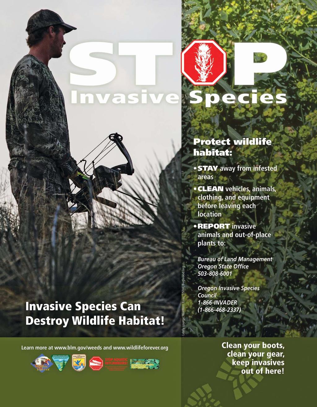
19 HUNTING AND ATV S RESPONSIBILITY OR REGULATION? The Choice is Yours Nobody likes regulations; but if irresponsible ATV use continues to cause unacceptable impacts, then regulations will become necessary to ensure protection of public lands. A better alternative would be for ATV users to recognize the impacts their activity can cause and voluntarily take steps to reduce those impacts. ATV users are not unique in this respect - as more and more people use public lands for recreation, the potential impacts of these activities are growing fast. ROAD CLOSURES There are a number of reasons why some modes of travel are restricted on public lands. Reasons for restricting travel include: Wildlife and Habitat Protection Minimize Conflict Between Users Public Safety Resource Protection Legal Mandates Fire Protection OREGON OFF-HIGHWAY VEHICLE LAWS All ATVs operating on public lands must display an Oregon ATV Operating Permit. Please refer to the Oregon Parks & Recreation website for more information: Permits can be purchased over the telephone, through many Oregon State Parks and Recreation Dept. offices or at one of their 200 vendors. A current vendor list is available online at or.us. For more information or to purchase a permit over the telephone, call Refer to page 21 of this publication for hunting and ATV regulations. REDUCE ATV IMPACTS What you can do to reduce ATV impacts: Know the vehicle use regulations for the area you are hunting and respect road and area closures. Avoid the use of ATVs in wet areas or during wet conditions. Even though the lighter weight and low-pressure tires reduce impacts, ATVs can still do serious damage to wet areas. INTERESTING FACTS Since 1995, the number of All Terrain Vehicles (ATVs) in Oregon has increased fivefold. There are now over 129,000 valid ATV Operating Permits in the state. Studies have shown that the harvest of bull elk increases with increased hunter access. Eventually this can lead to reduced hunter opportunity. Elk use declines in areas with adjacent roads open to motorized vehicles. OBJECTS AND CULTURAL SITES OBJECTS AND CULTURAL SITES Many Indian artifacts and all Indian burial sites are considered sacred within Oregon s Native American culture and serve as important links to the past. The Oregon Legislature has recognized the importance of these sites and artifacts by passing laws that specifically protect these areas and items. Digging up cultural sites is against the law. Taking human remains or sacred objects from a site can lead to serious penalties. State and federal laws covers both private and public land in Oregon. The state law can be found in Oregon Revised Statutes (ORS) Chapters 97, 358 and 390. If you should find any Native American artifacts while out hunting, stop and look around. REMEMBER, DON T DISTURB THESE SITES. Respect and honor these sites for what they mean to Oregon s Native Americans and to Oregon s rich cultural background. HUNTERS: RETURN RADIO TRANSMITTERS Radio transmitters used on deer, elk and other big game animals are property of ODFW. These transmitters store valuable information and are re-usable. It is legal to harvest an animal with these transmitters. Please call your local ODFW office if you harvest an animal with a transmitter or find a transmitter. We thank you for your cooperation. Attention Starkey Experimental Forest Hunters Research designed to evaluate the response of elk and mule deer to ATV activity during the hunting season will continue in the Starkey Experimental Forest and Range enclosure in Successful applicants for hunts 152B, 252D and 252R must agree to participate in the research by having a GPS unit (~1.0 lb) on their person during each 5-day hunting season and 5-day pre-hunt period when inside the Starkey enclosure. Hunters should be aware that only green dot roads will be open to ATV use, and road 2120 will be closed to all motorized access beyond Rock Spring in the north half of Starkey. The new changes in ATV and motorized access will be in effect five days before each hunt and through each hunt period. Hunters should also be aware of camping restrictions, which limit camps to within 300 feet of open (green dot) roads. For further details of the ATV project and other related research or to view a map of roads open during the hunts, please visit the following websites ( state.or.us or Starkey), or contact Scott Findholt at or Brian Dick at Display your parking permit at wildlife areas Don t forget to display the parking permit that comes with your hunting license on your vehicle at the following wildlife areas: Coyote Springs, Ken Denman, EE Wilson, Elkhorn, Fern Ridge, Irrigon, Jewell Meadows, Klamath, Ladd Marsh, Phillip W. Schneider, Power City, Sauvie Island, Summer Lake, White River and Willow Creek. A free annual permit comes with the purchase of an annual hunting license or Sports Pac. All other wildlife area users need to purchase a permit ($7 daily, $22 annually). Permits are available where e fishing and hunting licenses are sold and on the ODFW website ( 01/01/ /31/2014 OREGON DEPARTMENT OF FISH AND WILDLIFE Oregon Department of Fish and Wildlife 19
20 20 LEGAL HUNTING METHODS FOR GAME MAMMALS Species and Season CENTERFIRE FIREARMS OTHER WEAPONS Rifle Handgun Shotgun Muzzleloading Firearm (any barrel) Note: Some hunts and areas have specific weapon restrictions; consult hunt tables and descriptions for other restrictions..22 cal. or larger.24 cal. or larger.22 cal. or larger.24 cal. or larger WESTERN GRAY SQUIRREL Any rifle; handgun; shotgun; muzzleloading firearm; or long, recurve or compound bow. * Except during 600 series hunts where there is a weapon restriction of shotgun/muzzleloader only or archery/muzzleloader only. GENERAL WEAPONS PROVISIONS FOR HUNTING GAME MAMMALS: CENTERFIRE FIREARM Fully automatic firearms prohibited. Semiautomatic rifles with a magazine capacity greater than five cartridges prohibited (except for western gray squirrel). Military or full-metal jacket bullets in original or altered form prohibited. Hunters may use any muzzleloader with any ignition type, except matchlock, any legal sight, any propellant, or any bullet type during centerfire firearm seasons, provided the weapon meets caliber restriction for the species. SHOTGUN Shotgun is a smooth bore firearm, designed for firing bird shot and intended to be fired from the shoulder, with a barrel length of 18 inches or more and with an overall length of 26 inches or more. Shotguns equipped with rifled slug barrels are considered shotguns when used for hunting pronghorn antelope, bear, cougar, deer, or elk when centerfire rifles or shotguns are legal weapons. MUZZLELOADER Scopes (permanent and detachable), and sights that use batteries, artificial light or energy are not allowed during muzzleloader-only seasons and 600 series hunts where there is a weapon restriction of shotgun/muzzleloader only or archery/muzzleloader only, except for visually impaired hunters who have a visual acuity of 20/200 with lenses or visual field of 20 degrees (a permit is required; please see page 86). Open and peep sights made from alloys, plastic, or other materials that do not have the properties described above are legal sights. Fiber optics and fluorescent paint incorporated into or on open or iron sights are legal. During muzzleloader-only seasons and 600 series hunts where there is a weapon restriction of shotgun/muzzleloader only or archery/ muzzleloader only, it is illegal to hunt with jacketed bullets, sabots, and bullets with plastic or synthetic tips or bases. Only the following projectile/bullet types are allowed: a) Round balls made of lead, lead alloy, or federally-approved nontoxic shot material, used with cloth, paper or felt patches; (b) Conical bullets made of lead, lead alloy, or federally-approved nontoxic shot material, with a length that does not exceed twice the diameter; (c) Lead free copper conical bullets with a length that does not exceed twice the diameter. It is illegal to hunt with centerfire primers as an ignition source during muzzleloader-only seasons and 600 series hunts where there is a weapon restriction of shotgun/muzzleloader only or archery/muzzleloader only. It is illegal to hunt with pelletized powders or propellants during muzzleloader-only seasons and 600 series hunts where there is a weapon restriction of shotgun/muzzleloader only or archery/muzzleloader only. Granular (loose) black powder and black powder substitutes are the only legal propellants during muzzleloader-only seasons and 600 series hunts where there is a weapon restriction of shotgun/muzzleloader only or archery/muzzleloader only. No other firearm may be used for hunting during a muzzleloader-only season. See definition on page 72. Muzzleloading firearms with revolving actions are prohibited during muzzleloader-only seasons and 600 series hunts where there is a weapon restriction of shotgun/muzzleloader only or archery/muzzleloader only. For muzzleloader-only seasons and 600 series hunts where there is a weapon restriction of shotgun/muzzleloader only or archery/ muzzleloader only, the muzzleloader must have an open ignition. See definition on page 72. BOW Broadhead blades must be fixed, unbarbed and at least 7/8 wide (except for western gray squirrel). It is illegal to hunt with or possess mechanical or moveable blade broadheads when hunting game mammals, except western gray squirrel. No device secured to or supported by a bow may be used to maintain the bow at full draw. No electronic devices may be attached to bow or arrow. No device that supports or guides the arrow from a point rearward of the bow string when the bow is at rest (undrawn) may be secured to or supported by a bow s riser. Overdraws meeting this restriction are legal during archery seasons. #1 buck or larger Slugs only any.40 cal. or larger Oregon Department of Fish and Wildlife.40 cal. or larger; open or peep sights & open ignition any.50 cal. or larger.50 cal. or larger; open or peep sights & open ignition 40 lb. or greater recurve, long, or compound bow BLACK BEAR & COUGAR General or controlled seasons YES YES YES YES YES YES YES YES YES YES YES YES PRONGHORN Rifle Muzzleloader (slugs only) Archery BUCK DEER General or controlled rifle Muzzleloader (#1 or larger buckshot, slugs) Archery YES YES YES YES YES YES YES YES YES YES 600 SERIES DEER HUNTS* YES YES YES YES YES YES YES YES YES YES YES YES ELK General or controlled rifle Muzzleloader (slugs only) Archery YES YES BIGHORN SHEEP and ROCKY MT GOAT YES YES YES YES YES YES YES YES YES YES YES YES YES YES YES YES YES YES YES YES YES YES YES YES YES YES YES YES Bow 50 lb. or greater recurve, long, or compound bow YES YES YES YES YES
21 SHOOTING HOURS Game mammals may only be hunted from 1/2 hour before sunrise to 1/2 hour after sunset. Neither landowners nor their agents need a permit from ODFW to spotlight predatory animals (as defined in ORS ) on land they own or lawfully occupy. ODA has authority to define agent for purposes of the predatory animal statute. Written documentation is not required. (Predatory Animals means coyotes, rabbits, rodents and feral swine which are or may be destructive to agricultural crops.) DECOYS Except for purposes of law enforcement or wildlife management, the use of decoys with moving parts is prohibited for all big game species. This prohibition includes, but is not limited to, decoys with parts that are powered by a motor, battery, human action (for example, cable or pull-string), or the wind. Flexible or adjustable parts that permit placement or adjustment of a decoy but do not otherwise move do not constitute moving parts. This rule is intended to ban decoys that attract wildlife via movement. VEHICLES, BOATS, AIRCRAFT, ATVS No Person Shall: Hunt any wildlife from a motor-propelled vehicle. Exceptions: 1) A qualified disabled hunter may obtain an Oregon Disabilities Hunting and Fishing Permit to hunt from a motor-propelled vehicle except while the vehicle is in motion or on any public Rd or Hwy, or within Cooperative Travel Management Areas. 2) Landowners and their agents can shoot predatory animals from motorized vehicles on land they own or lawfully occupy. Hunt within eight hours of communicating with or receiving information on the location of game mam mals from an aircraft. For the purpose of this rule aircraft includes unmanned aircraft such as drones. Hunt within 8 hours after having been trans ported by he li cop ter or fixed-wing air craft to any point other than an established airport adequate for fixed-wing aircraft. Shoot at pronghorn antelope from a point within 50 yards of a motor-propelled vehicle, including air craft. Exception: A qualified disabled hunter may obtain an Oregon Disabilities Hunting and Fishing Permit to hunt from a motor vehicle except while the vehicle is in motion or on any public Rd or Hwy, or within Cooperative Travel Management Areas. Hunt or harass animals from snowmobile, ATV, or passenger vehicles. (1) Operate a snowmobile or ATV while carrying a firearm or a bow unless the firearm is unloaded, or with a bow, unless all arrows are in a quiver. (2) Subsection (1) of this section does not GENERAL HUNTING REGULATIONS apply to a person who is licensed under ORD and to carry a concealed handgun. (3) As used in this section, unloaded means: (a) If the firearm is a revolver, that there is no live cartridge in the chamber that is aligned with the hammer of the revolver; (b) if the firearm is a muzzle-loading firearm, that the firearm is not capped or primed; or (c) If the firearm is other than a revolver or a muzzle-loading firearm, that there is no live cartridge in the chamber.(violation of ORS is a Class B traffic violation). Cast an artificial light from a motor vehicle while in possession of a weapon; or cast an artificial light upon a game mammal, predatory animal, or livestock from within 500 feet of a motor vehicle while in pos ses sion of a weapon. Exception: Landowners or their agents hunting predatory animals on land they own or lawfully occupy. DISGUISING SEX, WASTE, SALE No Person Shall: Disguise the sex or kind of any wildlife while in the field or in transit from the field. Possess the meat or carcass of any deer, elk, pronghorn antelope, bighorn sheep, or Rocky Mtn goat without evidence of sex while in the field, forest, or in transit on any of the hwys or premises open to the public in Oregon, except processed or cut and wrapped meat. Evidence of sex for deer, elk, pronghorn antelope, bighorn sheep, or Rocky Mountain goat is: Option 1- Either the animal s scalp which shall include the attached eyes and ears, if animal is female; or ears, antlers or horns, and eyes if the animal is male; or Option 2 - the head naturally attached to at least one quarter of the carcass; or Option 3 - reproductive organs (testicles, scrotum, or penis, if male; vulva or udder (mammary), if female) naturally attached to one quarter of the carcass or to another major portion of meat. * Applies to option 3 only. * For Hunts with Antler or Horn Restrictions: if the head is not attached to the carcass, in addition to leaving the testicles, scrotum, or penis naturally attached to one quarter of the carcass or to another major portion of meat, the head or skull plate with both antlers or horns naturally attached shall accompany the carcass or major portions of meat. * For White-tailed Deer Only Hunts and for Mule Deer Only Hunts: in addition to evidence of sex, (testicles, scrotum, penis, vulva, udder, mammary), either the head or tail shall remain naturally attached to one quarter of the carcass or to another major portion of meat as evidence of the species taken. Waste any game mammals or parts thereof, except that meat of cougar need not be salvaged. Sell, trade, barter, exchange, or offer for sale, trade, barter, or exchange, any game mammal or parts thereof EXCEPT as identified in Oregon Administrative Rule 635, Division 200. If you have questions relative to the sale of wildlife parts, or would like a copy of Division 200 please call your local ODFW office. PROHIBITED METHODS No Person Shall: Shoot from or across a public Rd, Rd right-of-way or railroad right-of-way, except that persons legally hunting on closed Rds within Cooperative Travel Management Areas are not violating current prohibitions on shooting from or across a public Rd. The same is true for other Rds closed to use of motor vehicles by the public. Hunt for or kill any wildlife for another person. Exceptions: a) a visually impaired hunter may obtain an Oregon Disabilities Hunting and Fishing Permit which allows a sighted person to assist the permit holder. The accompanying person must have a valid Oregon hunting license and can assist the permit holder by: selecting a game mammal or game bird, aiming the firearm, advising the hunter when to shoot, or shooting a game mammal or game bird on behalf of the hunter. b) an able-bodied companion may accompany any person with an Oregon Disabilities Hunting and Fishing Permit and kill any animal wounded by the permit holder. The wounded animal must be killed using a legal weapon for the season and species designated on the tag. That companion must immediately attach the permit holder s tag to the carcass of the animal. A companion dispatching a wounded animal is not required to possess a hunting license or tag. See page 86. c) See odfw.com/education/mentored_youth for Mentored Youth Hunter Program exceptions. Hunt any game mammal with dogs, EXCEPT western gray squirrel. Use an artificial light for hunting any wildlife, except raccoon, bobcat and opos sum provided the light is not cast from or attached to a motor vehicle. This includes laser sights or any other sights which project a beam to the target. This does not include battery operated sights which only light the reticle. Hunt any wildlife with infrared or any other night vision sight. Take game mam mals with trap or snare. Use any poisoning, immobilizing, or tranquilizing drug or chemical to hunt or kill any game mam mal. TRESPASS No Person Shall: Hunt on cultivated or enclosed land of another without permission. Enclosed land may be bounded by a fence, ditch, water, Oregon Department of Fish and Wildlife 21
22 or any other line indicating separation from surrounding territory. In addition, be aware that under ORS you can be liable to the landowner for civil restitution if you trespass on land that has been posted. Refer to the above statute for options landowners may use to post their land. HUNTING PROHIBITED No Person Shall: Hunt with a centerfire or muzzleloading rifle without a valid unused deer or elk tag for that time period and area on their person (see exceptions) during: standard Eastern Oregon controlled buck deer centerfire firearm season (Oct.3-Oct.14), Cascade bull elk centerfire firearm season, Coast bull elk 1st and 2nd centerfire firearm seasons both General and Controlled, or Rocky Mt bull or either-sex elk centerfire firearm seasons or standard Rocky Mt antlerless elk centerfire firearm seasons (Nov Nov. 29). This does not include Controlled W High Cascade (119A) or Hood White Rvr (141A) buck hunts. EXCEPTIONS: (1) Hunters who have a tag for one of the hunts listed above may continue to hunt bear and/or cougar within the time period and area for which their deer or elk tag is valid (used or unused) provided they have a valid, unused bear and/or cougar tag; used deer or elk tags must be on the tagged animal and not on the hunters person. (2) Hunters are not required to have an elk tag to hunt bear or cougar in the Applegate WMU during elk seasons. (3)Landowners, or their agent, hunting predators on lands they own or lease may use centerfire or muzzleloading firearms to hunt on such lands; (4) Hunters may use.22 caliber or smaller centerfire firearms for hunting coyotes in Juniper, Beatys Butte, Whitehorse and Owyhee units, in Wagontire Unit south of Lk Co Rd 5-14 and those portions of the Beulah Unit in Malheur and Baker Cos. during or Rocky Mt bull or either-sex elk centerfire firearm seasons. Legal.22 caliber centerfire firearms include common cartridges such as.222,.223, ,.220 Swift and others less than.23 caliber. Hunt on any refuge closed by state or federal gov ern ment. Hunt within corporate limits of any city or town; public park or cemetery; or on any campus or grounds of a public school, college, or university or from a public Rd, Rd right-of-way, or railroad right-of-way. Hunt game mammals outside any area designated by a controlled hunt tag when such tag is required for that season. Take or attempt to take any game mammals or any protected wildlife species of any size or sex or amount, by any method or weapon, during a time or in any area not prescribed in these rules. OTHER RESTRICTIONS No Person Shall: Hunt in any Safety Zones created and posted by ODFW. 22 Take or hold in captivity any game mam mal. Hold in captivity any wildlife of this state for which a permit is required without first securing a permit. Release without a permit any wildlife brought from an oth er state or country, or raised in cap tiv ity in this state. Resist game enforcement officers. Refuse inspection of any license, tag, or permit by an em ployee of ODFW, any person au thor ized to enforce wild life laws, or a land owner or agent of the landowner on their land. Refuse inspection of any gear used for the purpose of taking wildlife by an employee of the Oregon Department of Fish and Wildlife, or any person authorized to enforce wildlife laws. Hunt protected wildlife. Operate or be transported in a motor-propelled ve hi cle in clud ing aircraft not landing on designated air strips in vio la tion of Co op era tive Travel Man age ment Area re stric tions. Co op era tive Travel Man agement Areas are listed on pages Disturb or remove traps or snares of any licensed trapper while that person is trapping on public lands or on other land by landowner s permission. Take furbearers, except in compliance with furbearing mammal (pg. 71) regulations. Disturb, damage, remove, alter, or possess any of fi cial ODFW signs. Possess the horns of bighorn sheep that were not taken legally during an authorized season. Sell, lend, or borrow any big game tags. Knowingly provide false information to the Department or Commission on any report required by law. TAGGING, POSSESSION AND TRANSPORTATION The owner of a game mammal tag that kills a game mammal for which a tag is issued, shall im me di ate ly remove in its entirety only the month and day of kill and attach the tag in plain sight securely to the game mammal. The tag shall be kept attached to such carcass or remain with any parts thereof so long as the same are preserved. No person shall have in possession any game mammal tag from which all or part of any date has been removed or mutilated except when the tag is legally validated and attached to a game mammal. When a game mammal or part thereof is transferred to the possession of another person, including a meat processor or taxidermist, a written record describing the game mammal or part being transferred and name and address of the person whose tag was originally attached to the carcass and the number of that tag shall accompany such transfer and shall remain with such game mammal or part so long as the same is preserved (see Wildlife Transfer Record Form form on page 87). The original tag should remain with the portion of the animal retained by the hunter. All game mammals in pos ses sion in the field or forest or in transit more than 48 Oregon Department of Fish and Wildlife hours after the close of the open season for such mammal must be tagged by ODFW or Oregon State Police. All game mammals or portions thereof shipped by commercial carrier must be tagged by ODFW or Oregon State Police. No person shall receive or have in possession any game mammal or part thereof which: (1) is not properly tagged; (2) was taken in violation of any wildlife laws or regulations; or (3) was taken by any person who is or may be exempt from jurisdiction of such laws or regulations. No person shall possess or transport any game mammal or part thereof, which has been illegally killed, found or killed for humane reasons, except shed antlers, unless they have notified and received permission from personnel of the Oregon State Police or ODFW prior to transporting. Any person who counsels, aids or assists in any violation of the wildlife laws, or shares in any of the proceeds of such violation by receiving or possessing any wildlife, shall incur the penalties provided for the person guilty of such violation. PARTS BAN Except for the following parts, no person shall import a cervid carcass or parts of a cervid carcass if the cervid was killed in a state or province with a documented case of Chronic Wasting Disease (CWD): Meat that is cut and wrapped commercially or privately; Meat that has been boned out; Quarters or other portions of meat with no part of the spinal column or head attached; Hides and/or capes with no head attached; Skull plates with antlers attached that have been cleaned of all meat and brain tissue (velvet antlers are allowed); Antlers with no tissue attached (velvet antlers are allowed); Upper canine teeth (buglers, whistlers, ivories); Finished taxidermy heads. States or provinces with a documented case of CWD are Alberta, Colorado, Iowa, Illinois, Kansas, Maryland, Michigan, Minnesota, Missouri, Montana, Nebraska, New Mexico, New York, North Dakota, Ohio, Oklahoma, Pennsylvania, South Dakota, Texas, West Virginia, Wisconsin, Wyoming, Utah, Virginia, and Saskatchewan. The department shall add by temporary rule any additional states or provinces when any new cases of CWD arise. HUNTER ORANGE No person younger than 18 years of age shall hunt with any firearm for any game mammal or upland game bird (excluding turkey) unless the person is wearing in a manner visible from all directions a hat or exterior garment of hunter orange. Exterior garment means a shirt, jacket, coat, vest, or sweater. Hunter orange camouflage patterns are acceptable. Hat means any head covering.
, if available.")
23 OTHER REGULATIONS Person may harvest one black bear during specified seasons with a general season black bear tag, one black bear with a SW Additional bear tag, one black bear with a controlled or SW limited spring bear tag and one black bear with a leftover controlled spring bear tag (see page 11), if available. It is unlawful to hunt with a centerfire or muzzleloading rifle without a valid unused deer or elk tag for that time period and area on your person (see exceptions) during: standard Eastern Oregon con trolled buck deer centerfire firearm season (Oct. 3 -Oct. 14), Cascade bull elk centerfire firearm season, Coast bull elk 1st and 2nd centerfire firearm seasons both General and Controlled or Rocky Mt bull elk or either sex centerfire firearm seasons or standard Rocky Mt antlerless elk centerfire firearm seasons (Nov Nov. 29). This does not include the controlled W High Cascade (119A) or Hood-White Rvr (141A) buck hunts. EX CEP TIONS: (1) Hunters who have a tag for one of the hunts listed above may continue to hunt bear and/or cougar within the time period and area for which their deer or elk tag is valid (used or unused) provided they have a valid, unused bear and/or cougar tag; used deer or elk tags must be on the tagged animal and not on the hunters person. (2) Hunters are not required to have an elk tag to hunt bear or cougar in the Applegate WMU during elk seasons. T The number of limited, con trolled hunt, and general season tags issued to nonresident black bear hunters is limited to no more than 3% of all tags. Using bait to attract black bear and using dogs to locate and tree black bear is prohibited. Applying a scent or attractant to one s body or clothing while worn is not baiting. ORY CHE MANDATORY CHECK FOR ALL BEARS The skull of any bear taken must be presented to an ODFW office or designated collection site; the person who took the animal is responsible to have it presented, within 10 days of the kill to be checked and marked. The skull is required to be checked in for the purpose of inspection, data gathering, tagging and removal of a pre-molar tooth for aging. Skull must be unfrozen when presented for check-in. Check-in at ODFW offices must occur during normal business hours (Mon.- Fri., 8-5) by appointment. Remember to call ahead to make arrangements. When the bear skull is presented at check-in, information that must be provided includes: 1) date of harvest and location of harvest including Wildlife Management Unit, and 2) complete hunter information including tag number as found on the bear tag. Hunter information is on the bear tag; the bear tag, a copy of the tag, or a completed Wildlife Transfer Record Form (page 87) are alternatives for providing information. Hunters must still complete mandatory reporting via the internet ( resources/hunting/reporting) or call toll free at ODFW(6339). By counting rings on sectioned and stained teeth, biologists can estimate the age of each bear, and determine if the bear has been marked as part of ODFW s tetracycline study. This information can then be used to estimate black bear populations. This information is important for black bear management in Oregon. Hunters providing teeth will be notified of the age of their bear once laboratory analyses are complete in about a year. Removing this small tooth will not affect any taxidermy work you plan to have done with your trophy. Reproductive tracts help the department estimate reproductive rates and litter size of bear in Oregon. Reproductive tracts are easiest to collect when field dressing your bear (see illustration on page 26). Carry a clean sandwich bag and keep the sample cooled or frozen to maintain the quality of this important sample for the department. Reproductive tracts may be delivered to any ODFW field office when you check in your bear. BLACK BEAR Pages Report On Your Deer and Elk Tags by the Deadline to Avoid $25 Fee Hunters that report on time are entered to win a special big game tag of their choice (deer, elk or pronghorn antelope). This special tag allows the hunter an extended season and expanded hunt area. Deadlines: For all hunts that end April 1-Dec. 31, 2015, the deadline is Jan. 31, 2016 For all hunts that end Jan. 1-March 31, 2016, the deadline is April 15, 2016 Report online at or under the Hunting menu, Or call toll-free ODFW (6339) to speak with a customer service representative. (Do Not call your local field office to report) Oregon Department of Fish and Wildlife 23
24 AVOID THE FEE MANDATORY REPORTING REQUIRED SEE PAGE 23 GENERAL Tag Sale Deadline Date: Oct. 2, 2015 Tag Area Descriptions. BLACK BEAR - GENERAL TAG SALE DEADLINE: Oct. 2, 2015 OPEN SEASON - Western Oregon: Aug. 1 - Dec All units west of the eastern boundaries of Santiam, McKenzie, Indigo, Dixon and Rogue units except those lands within one mi of Rogue Rvr between Grave Cr and Lobster Cr, which are closed. OPEN SEASON - Eastern Oregon: Aug. 1 - Nov All units east of the eastern boundaries of Santiam, McKenzie, Indigo, Dixon and Rogue units. Southwest Oregon Additional Bear: Aug. 1- Dec (all of units 20-30) (Requires a resident SW Additional; a nonresident SW Additional; or a nonresident Cascade Additional bear tag. See information below for units with nonresident tags). An additional tag may be purchased throughout the season; however, hunters must purchase the general season tag (see tag sale deadlines on page 7) to be eligible for the additional tag. BAG LIMIT: One black bear per tag, except that it is unlawful to take cubs less than one year old or sows with cubs less than one year old. Note: Nonresident tags are valid for only one of the areas listed below under Nonresident Black Bear OTHER REGULATIONS: Mandatory check for all bears, see page 23. Using dogs to locate and tree black bear is prohibited. There are specific weapon restrictions in parts of the hunt area. See page RESIDENT AND NRESIDENT BLACK BEAR TAG AREAS For general black bear season (including the additional bear tags), the 3% nonresident limit is based on the previous year s general season black bear hunter distribution patterns by areas throughout the state. In 2015, non res i dent black bear tag sales will be limited in four areas: Northwest, South west, Cascades and Eastern. The number of tags available by area, along with area de scrip tions, for the 2015 season are listed below. Nonresident hunters who wish to hunt in general black bear seasons may pur chase their black bear tags at any license agent, via the internet, or by mail, if postmarked not later than Oct. 2 (or fax for credit card purchases). The additional tag may be purchased throughout the season; however, hunters must purchase the general season tag prior to the deadline to be eligible to purchase an additional tag. Tags will be issued on a first-come, first-served basis until gone. Ap pli cants should list pre ferred hunting areas in order of priority (see area descriptions below). If you do not receive your first choice, you may receive your second or later choice depending on how many tags remain available at the time of application. Please list only areas where you are willing to hunt. See odfw.com/resources/forms_applications, application procedures for nonresident bear hunters. Area Descriptions/Tag Numbers: Northwest: All of units 10-12, 14, 15, 17, 18. (Number of tags: 238) Southwest & SW Additional Nonresident Bear Tag All of units 20 and (Number of tags: 374) Cascades & Cascade Additional Nonresident Bear Tag: All of units 16, 19, 21, 22, 30, 31, 34, 39, 41, 42 and those portions of units 33 and 77 west of U.S. Hwy 97. (Number of tags: 434) Eastern: All of units 32, 35, 38, 40, 43 and those portions of units 33 and 77 east of U.S. Hwy 97; and all other units east of these units. (Number of tags: 493) SIXES 25 TIOGA 24 CHETCO 27 UMATILLA INDIAN SADDLE MTN RESERVATION 10 WALLA WENAHA WALLA ALSEA 18 SIUSLAW 20 POWERS 26 WILSON 12 TRASK 14 STOTT MTN MELROSE APPLEGATE SCAPPOOSE EVANS CREEK 29 WILLAMETTE 15 INDIGO 21 DIXON 22 SANTIAM 16 MCKENZIE 19 ROGUE 30 KE 31 METOLIUS 39 FORT ROCK 77 PAULINA 35 GRIZZLY 38 CRATER SILVER LAKE LAKE 76 N.P. SPRAGUE HOOD 42 WHITE RIVER 41 WARM SPRINGS INDIAN RES UPPER DESCHUTES 97 KLAMATH FALLS 32 MAUPIN 40 BIGGS 43 INTERSTATE 75 MAURY 36 WAGONTIRE 73 FOSSIL 45 OCHOCO 37 WARNER 74 COLUMBIA BASIN 44 HEPPNER 48 SILVIES 72 RTHSIDE 47 MURDERERS CR 46 JUNIPER 71 BEATYS BUTTE 70 UKIAH 49 DESOLATION 50 SUMPTER 51 MALHEUR RIVER 66 STEENS MTN 69 MT EMILY 54 STARKEY 52 CATHERINE CR 53 BEULAH 65 SLED SPRINGS 57 MINAM 60 KEATING 63 WHITEHORSE LOOKOUT MTN 64 OWYHEE 67 CHESNIMNUS IMNAHA 61 PINE CREEK 62 SNAKE RIVER 59 Western Oregon Aug. 1 - Dec. 31 Eastern Oregon Aug. 1 - Nov. 30 There are no hunting seasons on NP lands or allotted and/or Tribal lands in these areas. 24 Oregon Department of Fish and Wildlife
25 CONTROLLED Application Deadline Date: Feb. 10, 2015 Applicants may apply singly or as a party of no more than six persons. BLACK BEAR - CONTROLLED TAG SALE DEADLINE: The day before the hunt begins. CONTROLLED HUNT APPLICATION PROCEDURES: Please read pages All spring black bear hunts are controlled hunts where the number of hunters is limited and tags are awarded through a public drawing, except the new limited SW Oregon first-come, first-served spring black bear hunt. BAG LIMIT: One black bear, except that it is unlawful to take cubs less than one year old or sows with cubs less than one year old. HUNT AREA: Entire wildlife management unit unless indicated by an asterisk(*). Please refer to HUNT DESCRIPTIONS BELOW. Please note additional closure areas listed on pages that may affect your hunt area. REGULATIONS: Mandatory check for all bears, see page 23. Using dogs to locate and tree black bear is prohibited. TE: The st Choice Applicants column is not influenced by preference points; it only indicates the number of first choice applicants for each hunt. Successful individuals may also purchase a 2015 general season black bear tag and a 2015 SW Additional bear tag. Controlled black bear tags not drawn in the February drawing will be sold first-come, first-served beginning Mar. 15 at 10 a.m. Tags purchased in this manner are in addition to other bear tags purchased. Hunters purchasing a SW Oregon spring bear tag prior to the drawing will not be eligible to apply for other controlled spring bear tags or utilize the Point Saver option for spring bear hunts. Hunters planning to apply for other controlled spring bear hunts or a Point Saver should wait until after the drawing to purchase a SW Oregon spring bear tag. Please note there is a limited number of SW Oregon spring bear tags available. STOP Private lands will limit access for hunts printed in red. Do not apply unless you have access to a place to hunt. CONTROLLED SPRING BLACK BEAR HUNTS HUNT # HUNT NAME OPEN SEASON 2015 TAGS 2014 TAGS ST CHOICE APPLICANTS 710A Saddle Mt - Scappoose* April 1 - May A Wilson-Trask* April 1 - May A N Cascades* April 1 - May A Alsea-Stott Mt* April 1 - May A South Central* April 15 - May White River Unit April 1 - May Hood Unit April 1 - May A S Blue Mts* April 15 - May A W Blue Mts* April 1 - May , A Starkey* April 15 - May Wenaha Unit April 15 - May A Sled Springs-Chesnimnus* April 15 - May A Snake Rvr Unit April 15 - May A Minam-Imnaha* April 15 - May A Pine Cr - Keating - Catherine Cr*April 15 - May Lookout Mt Unit April 15 - May LIMITED FIRST-COME, FIRST SERVED SPRING BLACK BEAR HUNTS HUNT # OPEN SEASON 2014 TAGS SW Oregon* Apr. 1 - May 31 4,400 (Tags will be availble on a first-come, first served basis. See hunt description below) CONTROLLED SPRING BLACK BEAR HUNTS FOR YOUTH To apply, hunters must be years of age at the time they hunt, have completed a hunter education class by the time they hunt (see or.us/education/hunter/ for Hunter Education Certificate Requirement) and have a hunting license. Youths must be accompanied by an adult at least 21 years of age. Adults may not accompany more than two youths ST CHOICE HUNT # HUNT NAME OPEN SEASON 2015 TAGS 2014 TAGS APPLICANTS 756T Wenaha Unit April 15 - May T Sled Springs-Chesnimnus* April 15 - May T Minam-Imnaha* April 15 - May * HUNT DESCRIPTIONS HUNT 710: Saddle Mt - Scappoose - All of SW Oregon - All of units 20, 21, 22, 23, HUNT 749A: W Blue Mts - All of units 49, units 10 and , 25, 26, 27, 28, 29 and 30. Exception: 54 and 55. HUNT 712A: Wilson-Trask - All of units Lands within 1 mi of Rogue Rvr between HUNT 752A: Starkey - 67% public 12 and 14. There are specific weapon Grave Cr and Lobster Cr are closed to bear lands. All of Unit 52 except the Starkey restrictions in the Cascade Head - Lincoln hunting. Tags will be available on a limited Experimental Forest and Range fenced City area of the Trask Unit. See page 83. first-come, first-served basis from Dec. 1 HUNT 716A: N Cascades - All of Unit 16 through March 31, or until the authorized enclosure and a 1/4-mi buffer outside the excluding the Marion and Linn Co portion number of tags are sold, whichever comes exterior 8-ft fence. outside of the USFS lands: the McKenzie first. Note: Purchasing this tag prior to the HUNTS 757A and 757T: Sled Springs- Unit excluding the Linn Co portion outside drawing eliminates your ability to apply for Chesnimnus - All of units 57 and 58. of the Willamette NF. other controlled spring bear tags or point savers. Please refer to note section above. HUNTS 760A and 760T: Minam-Imnaha HUNT 717A: Alsea-Stott Mt - All of units HUNT 731A: South Central - All of units - All of units 60 and and 18. There are specific weapon 31, 32, 33, 74, 75, 76 and 77. HUNT 762A: Pine Cr - Keating - restrictions in the Cascade Head - Lincoln City area of the Stott Mt Unit. See page 83. HUNT 746A: S Blue Mts - 64% public Catherine Cr - All of units 53, 62 and 63. lands. All of units 45, 46, 47, 48, 50, 51, 65, 66 and 72. Oregon Department of Fish and Wildlife 25 BLACK BEAR Pages AVOID THE FEE MANDATORY REPORTING REQUIRED SEE PAGE 23


26 LOCATING AND COLLECTING THE REPRODUCTIVE TRACT FROM A FEMALE BLACK BEAR OR FEMALE COUGAR 1.Label a plastic bag with: Tag Number, Date of Kill, Unit Number and Name, County, and Your Name and Address. Ziplock type kitchen or freezer bags work very well for this purpose. 2.Locate the Y shaped reproductive tract beneath and slightly ahead of the pelvis or hip bones. It usually is necessary to move some of the intestines and other organs aside to locate the entire tract, including both ovaries and the uterus. 3.Cut the uterus immediately forward of the bladder. Use caution when handling the bladder and cutting the reproductive tract from the body cavity to insure the meat is not contaminated with urine from the bladder. 4.Place the entire reproductive tract in the labeled plastic bag and seal. 5.Preserve specimens by freezing as soon as possible and submit to any ODFW district office or check station. OREGON DEPARTMENT OF FISH AND WILDLIFE 26 Oregon Department of Fish and Wildlife
 will be closed if mortality quotas for the year are met in that zone.")


27 GENERAL Tag Sale Deadline Date: Oct. 2, 2015 COUGAR - GENERAL GENERAL STATEWIDE SEASON: Jan. 1 - Dec. 31 or until Zone Mortality Quotas have been met, whichever occurs first. OPEN AREA: Entire state is open. However, specific Quota Zones (defined in table below) will be closed if mortality quotas for the year are met in that zone. Please note additional closure areas listed on pages that may affect your hunt area. ADDITIONAL COUGAR (Requires an Additional cougar tag): Entire state is open Jan. 1 - Dec. 31 or until Zone Mortality Quotas have been met, whichever occurs first. An additional tag may be purchased throughout the season; however, hunters must purchase the general season tag (see tag sale deadlines on page 7) to be eligible for the additional tag. BAG LIMIT: One cougar per tag, except that it is unlawful to take spotted kittens or females with spotted kittens. HUNTING REGULATIONS: No person shall use dogs for the taking or pursuit of cougar. It is unlawful to hunt with a centerfire or muzzleloading rifle without a valid (used or unused) deer or elk tag for certain time periods and areas; see page 22. Any cougar taken must be presented at a Department of Fish and Wildlife office within 10 days of the kill to be checked and marked. The person who took the cougar is responsible GENERAL SEASON HUNT HUNT ZONE* NAME QUOTA A Coast/North Cascades 180 B Southwest Cascades 200 C Southeast Cascades 80 D Columbia Basin 100 E Blue Mountains 270 F Southeast Oregon 140 STATEWIDE TOTAL QUOTA 970 *Please refer to Cougar Quota Mortality Zones below. to have it presented for check-in. The hide with skull and proof of sex attached are required. Hide and skull must be unfrozen when presented for check-in. Hunters are also required to submit the reproductive tract of any female cougar taken (see illustration on page 26). Check-in must occur during normal business hours (8 a.m. to 5 p.m., Monday-Friday. Please call ahead to make an appointment. When the required parts are presented at check-in, information that must be provided includes: 1) date of harvest and location of harvest including Wildlife Management Unit, and 2) complete hunter information including tag number as found on the cougar tag. Hunter information is on the cougar tag; the cougar tag, a copy of the tag, or a completed Wildlife Transfer Record Form (page 87) are alternatives for providing information. Hunters must still complete mandatory reporting via the internet ( or call toll free at ODFW(6339). See page 23 for more information. Cougar hunters are reminded that it is mandatory to provide the reproductive tract of any female cougar taken. The reproductive tract provides valuable information on the number and frequency of kittens born annually in Oregon and is a critical part of ODFW s cougar population models. Carrying a clean, empty sandwich bag while hunting, and keeping the sample cooled or frozen in an ice chest or refrigerator after collection, is an easy way to maintain the quality of this important sample for the department. Reproductive tracts may be delivered to any ODFW fi eld offi ce when you check in your cougar. COUGAR QUOTA MORTALITY ZONES Refer to WMU boundary descriptions on pages for exact boundary locations of each Wildlife Management Unit. HUNT ZONE A, COAST/RTH CASCADES: All of wildlife management units 10-12, 14-18, 20, 24-27, 39, 41 and 42. There are specific weapon restrictions in the parts of the hunt area. See pages HUNT ZONE B, SOUTHWEST CASCADES: All of wildlife management units 19, and HUNT ZONE C, SOUTHEAST CASCADES: All of wildlife management units and HUNT ZONE D, COLUMBIA BASIN: All of wildlife management units 38, 40 and HUNT ZONE E, BLUE MOUNTAINS: All of wildlife management units 37 and HUNT ZONE F, SOUTHEAST OREGON: All of wildlife management units 36 and MORTALITY QUOTAS: Hunt zones will be closed early to cougar hunting if individual zone mortality quotas are reached. For information on quotas that may have been reached, contact an ODFW office near you. Find Great Hunting in Oregon your next spot. With new features you can: Search by species Search by location Oregonhuntingmap.com on Google Maps, you ll be able to scout areas for habitat Oregonhuntingmap.com OREGON DEPARTMENT OF FISH AND WILDLIFE Oregon Department of Fish and Wildlife 27 COUGAR Pages AVOID THE FEE MANDATORY REPORTING REQUIRED SEE PAGE 23


28 Cougar management and big game in Oregon Photo by Brian Wolfer. Modeled Cougar Population Cougar population growth rates have slowed since the 2006 Cougar Management Plan went into effect. COUGAR TARGET AREAS TO HELP BIG GAME ODFW removed 291* cougars in Heppner, Steens Mtn, Ukiah, Warner, and Wenaha Units to benefit deer or elk populations (*does not include cougar taken by hunters or on damage complaints). The most dramatic results have been in the Heppner and Ukiah Target Areas: Elk calf survival doubled Ukiah elk population grew by 500 since 2010 Heppner elk population grew by 2,200 since 2007 Wildlife managers were not able to measure a population-level response in deer and elk in Steens Mtn, Warner and Wenaha Units at this time. Additional cougar target areas are being considered for COUGAR QUOTA INCREASE Statewide cougar quota raised to 970, a 25% increase (beginning 2015) Don t forget to buy your cougar tag Most cougar are taken when hunters are pursuing other species. Buy a cougar tag and be ready. The Heppner Unit elk population rebounded dramatically after the first year of cougar removals. In the last five years, the elk population has risen to slightly above the management objective. Steve Cherry, District Wildlife Biologist COUGAR RESEARCH TO SUPPORT MANAGEMENT The ODFW research team has recently published peer-reviewed research on cougar kill rates and prey selection in northeast Oregon, cougar survival rates, and estimating cougar densities using dogs. What researchers found in northeast Oregon: Deer and elk made up 95% of the animals preyed on by cougar. Of the deer and elk kills examined: o More than 2/3 (69%) were deer, just under 1/3 (31%) were elk o Almost ½ (47%) of the deer killed were fawns, ¾ (75%) of the elk killed were calves o On average, an adult cougar kills one deer or elk per week. (Oregon has an estimated 4,000 adults out of a total cougar population of 6,000.) High levels of hunter harvest can reduce local cougar populations. Benefits of target areas can last for several years. Results of this work can be found at: dfw.state.or.us/wildlife/research/ Photo by Dean Brown. 28 Oregon Department of Fish and Wildlife
29 Application Deadline Date: May 15, 2015 All persons in parties that exceed the allowed party size of two will be considered as single applicants in the drawing. PRONGHORN ANTELOPE - CONTROLLED TAG SALE DEADLINE: The day before the hunt begins. MORE THAN TWO PERSONS MAY APPLY AS A PARTY FOR PRONGHORN ANTELOPE. CONTROLLED HUNT APPLICATION PROCEDURES: Please read pages All pronghorn antelope hunts are controlled hunts where the number of hunters is limited and tags are awarded through a public drawing. Hunters should apply for more than one hunt choice. If your first choice hunt is cancelled, you will receive a postcard describing your hunt choice options. See page 12 for further information. HUNT AREA: Entire wildlife management unit unless indicated by an asterisk(*). Please refer to HUNT DESCRIPTIONS. A map will be sent if indicated in hunt description by [MAP]. Please note additional closure areas listed on pages that may affect your hunt area. Additionally, some private lands may be closed to all hunting. OTHER REGULATIONS: No person shall shoot at a pronghorn antelope from a point within 50 yards of a motor vehicle including aircraft, except persons that have an Oregon Disabilities Hunting and Fishing Permit (see page 86). LANDOWNER PREFERENCE TAGS: Pronghorn antelope hunts with an either-sex or a one doe or fawn bag limit occurring on a landowner s registered property are also eligible. If an applicant is successful in receiving a LOP pronghorn antelope tag for a hunt with an either-sex bag limit, the LOP tag is automatically issued with a bag limit of one doe or fawn. See page 13 for further information. Note: The st Choice Applicants column is not in flu enced by preference points; it only in di cates the number of first choice appli cants for each hunt in The Fish and Wildlife Com mis sion will not set actual tag numbers for hunts listed here until June The tag numbers shown were those allocated for 2014 or estimated for new 2015 hunts. Actual tag numbers for 2015 may be higher or lower than those listed based on population conditions. STOP Private lands will limit access for hunts printed in red. Do not apply unless you have access to a place to hunt. PRONGHORN ANTELOPE HUNT # HUNT NAME BAG LIMIT OPEN SEASON 2014 TAGS ST CHOICE APPLICANTS 435 Paulina Unit One buck pronghorn Aug Aug Maury Unit One buck pronghorn Aug Aug Ochoco Unit One buck pronghorn Aug Aug , Grizzly Unit One buck pronghorn Aug Aug Maupin-W Biggs* One pronghorn either sex Aug Aug A1 Columbia Plateau No. 1* One doe or fawn pronghorn Oct Oct A2 Columbia Plateau No. 2* One buck pronghorn Oct Oct A S Fossil-Winlock* One doe or fawn pronghorn Aug Aug Murderers Cr Unit One buck pronghorn Aug Aug Northside - Ritter* One buck pronghorn Aug Aug A N Sumpter* One buck pronghorn Aug Aug B S Sumpter* One buck pronghorn Aug Aug Keating Unit One buck pronghorn Aug Aug Lookout Mt Unit One buck pronghorn Aug Aug Beulah Unit One pronghorn either sex Aug Aug , A1 Malheur Rvr No. 1 One buck pronghorn Aug Aug , A2 Malheur Rvr No. 2 One buck pronghorn Aug Sept B Harney Basin* One doe or fawn pronghorn Sept. 5 - Sept Owyhee Unit One pronghorn either sex Aug Aug , A1 Whitehorse Unit No.1 One pronghorn either sex Aug Aug , A2 Whitehorse Unit No. 2 One pronghorn either sex Aug Sept , A Steens Mt* One buck pronghorn Aug Aug , A E Beatys Butte* One buck pronghorn Aug Aug , B W Beatys Butte* One buck pronghorn Aug Aug , C Hart Mt* One buck pronghorn Sept Sept , A Juniper* One buck pronghorn Aug Aug , A1 Silvies Unit No. 1 One buck pronghorn Aug Aug , A2 SilviesUnit No. 2 One buck pronghorn Aug Sept B Riley* One doe or fawn pronghorn Sept. 5 - Sept A N Wagontire* One buck pronghorn Aug Aug B S Wagontire* One buck pronghorn Aug Aug A Warner Unit No. 1 One buck pronghorn Aug Aug , B Warner Unit No. 2 One buck pronghorn Aug Sept A E Interstate* One pronghorn either sex Aug Aug A E Ft Rock-Silver Lake* One pronghorn either sex Aug Aug Oregon Department of Fish and Wildlife 29 PRONGHORN Pages AVOID THE FEE MANDATORY REPORTING REQUIRED SEE PAGE 23
30 AVOID THE FEE MANDATORY REPORTING REQUIRED SEE PAGE 23 PRONGHORN ANTELOPE BOW HUNTS HUNT # HUNT NAME BAG LIMIT OPEN SEASON 2014 TAGS ST CHOICE APPLICANTS 435R Paulina Unit Bow One buck pronghorn Aug Sept R Maury Unit Bow One pronghorn either sex Aug Sept R Lookout Mt Unit Bow One pronghorn either sex Sept. 5 - Sept R Malheur Rvr Unit Bow One pronghorn either sex Sept. 5 - Sept R Owyhee Unit Bow One pronghorn either sex Aug Sept R1 Hart Mt Bow* One buck pronghorn Aug. 6 - Aug R2 W Beatys Butte Bow* One pronghorn either sex Aug Sept R N Wagontire Bow* One buck pronghorn Aug Sept R Warner Unit Bow One pronghorn either sex Aug. 6 - Aug R1 E Interstate Bow* One pronghorn either sex Sept. 5 - Sept R2 Gerber Reservoir Bow* One pronghorn either sex Aug. 1 - Aug R E Slope Bow* One pronghorn either sex Aug Sept Please read note in hunt description before applying for this hunt. PRONGHORN ANTELOPE MUZZLELOADER FIREARM HUNTS HUNT # HUNT NAME BAG LIMIT OPEN SEASON 2014 TAGS ST CHOICE APPLICANTS 435M Paulina Unit Muzzleloader One buck pronghorn Aug Sept M E Beatys Butte Muzzleloader* One buck pronghorn Aug Sept M1 S Wagontire Muzzleloader* One pronghorn either sex Aug Sept M2 N Wagontire Muzzleloader* One buck pronghorn Aug Sept M Gerber Reservior Muzzleloader* One pronghorn either sex Aug Sept M E Fort Rock-Silver Lake Muzzleloader* One pronghorn either sex Sept. 5 - Sept PRONGHORN ANTELOPE YOUTH CENTERFIRE FIREARM HUNTS To apply, hunters must be years of age at the time they hunt, have completed a hunter education class by the time they hunt (see for Hunter Education Certificate Requirement) and have a hunting license. Youths must be accompanied by an adult at least 21 years of age. Adults may not accompany more than two youths. HUNT # HUNT NAME BAG LIMIT OPEN SEASON 2014 TAGS ST CHOICE APPLICANTS 432T Swan Lake* One pronghorn either sex Aug Aug T Thief Valley* One buck pronghorn Aug. 1 - Aug T Hart Mt* One buck pronghorn Aug Aug. 23 est. 3 in 2015 NEW 475T Gerber Reservior* One pronghorn either sex Aug Aug PRONGHORN HUNTERS: See pages for information on the pronghorn auction and raffle hunting opportunities. *HUNT DESCRIPTIONS For those hunt descriptions with [MAP] following the description, maps can be found on our website at HUNT 432T: Swan Lake - 10% public lands. That part of Unit 32 beginning at Klamath Falls north on US Hwy 97 to Hagelstien Park; east on FR 9718 to FR 22; south and east on 22 to Co Rd 1101; south on 1101 to State Hwy 140; west on Hwy 140 to Klamath Falls, point of beginning. Successful applicants will be provided a list of landowners where a hunt may be arranged. [MAP] HUNT 440: Maupin-W Biggs - 15% public lands. All of Unit 40 and that part of Unit 43 west of John Day Rvr. HUNTS 443A1 and 443A2: Columbia Plateau - 2% pub lic lands. That part of Unit 43 east of John Day Rvr; Unit 44 south of I-84; and those parts of units 45 and 48 north of FRs 21 and 53. HUNT 445A: S Fossil - Winlock - 10% public lands. That part of Unit 45 south of FR 21. HUNT 447: Northside - Ritter - All of Unit 47 and that part of Unit 48 south and east of North Fork John Day Rvr. HUNT 451A: N Sumpter - 40% pub lic lands. That part of Unit 51 north of Burnt Rvr Canyon Rd from Durkee to junction State Hwy 245 and Hwy 245 from junction Burnt Rvr Canyon Rd to Unity. HUNT 451B: S Sumpter - 25% pub lic lands. That part of Unit 51 south of Burnt Rvr Canyon Rd from Durkee to junction State Hwy 245 and Hwy 245 from junction Burnt Rvr Canyon Rd to Unity. HUNT 453T: Thief Valley - 8% public lands. That part of units 53 and 63 begining at I-84 at North Powder to Clover Cr, east and south along Clover Cr to Jimmy Cr and south along Jimmy Cr to Hwy 237; northeast on Hwy 237 to Telocaset Ln, south and east on Telocaset Ln to Hwy 203; south and west on Hwy 203 to I-84 (approx. 5 mi. north of Baker City), north on I-84 to point of beginning. HUNT 466B: Harney Basin - 45% public lands. Parts of units 66, 69, 71 and 72 as follows: In Unit 66, that part south and west of the following line: Beginning at the intersection of US Hwy 395 and 500 KV Powerline 6 mi north of Burns; east on 500 KV Powerline to its intersection with US Hwy 20 about 1 mi northeast of Buchanan; southeast on Hwy 20 to Buchanan; south on Crane-Buchanan Rd to State Hwy 78 near Crane, the Unit boundary. In Unit 69, that part north of the following line: Beginning at State Hwy 78 near Princeton, west on Co Rd 404 to Co Rd 405 (Sodhouse Ln); west on 405 to State Hwy 205 near The Narrows. In Unit 71, that part north of the following line: Beginning on US Hwy 395 near MP 17 (T26S, R25E, SW corner of Section 2); east on Iron Mt Rd to Double O Rd; east on Double O Rd to State Hwy 205. Excluding Malheur NWR. In Unit 72, that part south and east of the following line: Beginning at the intersection of US Hwy 395 and 500 KV Powerline 6 mi north of Burns; southwest on 500 KV Powerline to its intersection with US Hwy 20/US Hwy 395 near MP 117 west of Burns. [MAP] HUNT 469A: Steens Mt - 80% public lands. All of Unit 69 excluding Malheur NWR. HUNTS 470A and 470M: E Beatys Butte - 85% public lands. That part of Unit 70, east of the fol low ing: Beginning at Nevada- Oregon line at East Guano Valley Rim; north on East Guano Valley Rim to State Hwy 140; west on Hwy 140 to Lakeview BLM Rd ; north on to Lakeview BLM Rd K; northwest K to Hart Mt NAR bound ary; north on refuge boundary to Frenchglen-Plush Rd. HUNTS 470B and 470R2: W Beatys Butte - 95% public lands. That part of Unit 70, exclud ing Hart Mt NAR, west of the fol low ing: Beginning at Nevada-Oregon line at East Guano Valley Rim; north on East Guano 30 Oregon Department of Fish and Wildlife


31 Valley Rim to State Hwy 140; west on Hwy 140 to Lakeview BLM Rd ; north on to Lakeview BLM Rd K; northwest K to Hart Mt NAR bound ary; north on ref uge boundary to Frenchglen-Plush Rd. HUNTS 470C; 470R1 and 470T: Hart Mt - That part of units 70 and 71 within the boundaries of Hart Mt NAR. Within the refuge boundary are scattered private inholdings; landowner permission is required to hunt these private inholdings. HUNT 471A: Juniper - 90% pub lic lands. All of Unit 71, ex clud ing Hart Mt NAR and that part of Malheur NWR north of Foster Flat Rd. HUNT 472B: Riley - 65% public lands. Beginning at the junction of US Hwy 20 and Mayo Ranch Rd near MP 96; north and east on Mayo Ranch Rd and Best Ln to Silver Creek Rd (Harney Co Rd 138); north on Silver Creek Rd to FR 4130; east on 4130 to FR 4135 near Egypt Well; south on 4135, 4120 and 4126 to Forest boundary; east and south on Forest boundary to N Sagehen Hill Rd; south on N Sagehen Hill Rd to US Hwy 20; west on Hwy 20 to Mayo Ranch, point of beginning. [MAP] HUNT 473A, 473R and 473M2: N Wagontire - 80% public lands. That part of Unit 73 north of Lk Co Rd HUNTS 473B and 473M1: S Wagontire - 95% pub lic lands. That part of Unit 73 south of Lk Co Rd HUNTS 475A, and 475R1: E Interstate - 60% public lands. That part of Unit 75 east of Klamath-Lake Co line. HUNTS 475R2, 475M and 475T: Gerber Reservoir - 75% public lands. That part of Unit 75 west of Kla math-lake Co line; that part of Unit 33 southeast of FR 44 (Lone Pine to Teddy Power s Meadow); and that part of Unit 32 east of the following line: Starting at Beatty; south west on Hwy 140 to Bly Mt Cutoff Rd to Bonanza; west on Hwy 70 to Dairy; west on Hwy 140 to Crystal Springs Rd; south on Crystal Springs Rd to Hill Rd; south on Hill Rd to town of Merrill; south on South Merrill Rd to STateline Rd; east on Stateline Rd to Klamath-Interstate unit boundary. Note: 475T is for youths only (ages 12-17). [MAP] HUNTS 476A and 476M: E Fort Rock- Silver Lake - 70% public lands. All of Unit 76 and that part of Unit 77 east of the Klamath-Lake Co line. HUNT 477R: E Slope - 44% public lands. Please consider and be familiar with the following circumstances before applying for this hunt; Pronghorn antelope exist at very low densities within this hunt area, the hunt area is comprised of heavily timbered landscapes, and hunter success is low. Beginning at Diamond Lk junction; west on State Hwy 138 to Crater Lk NP boundary; south on NP boundary to 2304; southeast on 2304 to 2300, southwest on 2300 to 9740; southeast on 9740 to US Hwy 97; south on Hwy 97 to 43; north and east on 43 to Klamath Marsh Rd; north on Klamath Marsh Rd to 86; north and west on 86 to US Hwy 97; south on Hwy 97 to Diamond Lk junction, point of beginning, excluding Klamath Marsh NWR. [MAP] PRONGHORN Pages HELP OREGON WILDLIFE Hunters have a long history of supporting and conserving Oregon s wildlife. Continue that tradition by switching to non-lead ammunition. Non-lead ammunition is available for most rifles, handguns and shotguns. High performance non-lead bullets have the same stopping power as lead, but leave fewer bullet fragments that can be swallowed by scavengers and other wildlife. Switching to non-lead ammunition means eagles, scavengers, other wildlife and humans will not be exposed to lead fragments in game meat. Lead can be harmful to wildlife and humans. A nationwide ban on lead shot for waterfowl hunting is credited with saving millions of ducks, geese and waterfowl from lead poisoning. Birds of prey, scavengers and other wildlife can be harmed by eating meat containing lead fragments. DO YOUR PART TO HELP OREGON WILDLIFE. GET THE LEAD OUT. Oregon Department of Fish and Wildlife 31
32 AVOID THE FEE MANDATORY REPORTING REQUIRED SEE PAGE 23 CONTROLLED Application Deadline Date: May 15, 2015 ROCKY MOUNTAIN GOAT - CONTROLLED TAG SALE DEADLINE: The day before the season end date. PARTY APPLICATIONS ARE T ALLOWED. CONTROLLED HUNT APPLICATION PROCEDURES: Please read pages TE: No less than 5% and no more than 10% of all Rocky Mt goat tags can be issued to nonresidents. One Rocky Mt goat tag is estimated to be issued for 951A2 Elkhorn No 2 and one tag for 959A1 Hat Point No 1 in All Rocky Mt goat hunts are controlled hunts where the number of hunters is limited and tags are awarded through a public drawing. A person may draw only one controlled Rocky Mt goat tag in a lifetime. The Fish and Wildlife Commission will not set actual tag numbers for hunts listed here until June Actual tag numbers for 2015 may be higher or lower than listed based on population conditions. Rocky Mt goats are located in extremely steep and rugged terrain at higher elevations and hunters should be in good physical condition. BAG LIMIT: One Rocky Mt goat. HUNT AREA: See HUNT DESCRIPTIONS below. Please note additional closure areas listed on pages that may affect your hunt area. OTHER REGULATIONS: Orientation class with district biologist IS required. Rocky Mt goats taken by hunters must be marked by ODFW personnel prior to hunters leaving the hunt area. ALL HUNTERS MUST CHECK OUT THROUGH THE LOCAL ODFW OFFICE IN THE DISTRICT WHERE THE HUNT OCCURS WITHIN 72 HOURS AFTER COMPLETING THEIR HUNT UNLESS OTHER AR- RANGEMENTS HAVE BEEN MADE. Checkout must occur during normal business hours (Mon. - Fri., 8-5) unless prior arrangements have been made. ROCKY MOUNTAIN GOAT HUNTERS: See pages for information on the Rocky Mountain goat raffle hunting opportunity. Nonresidents may purchase raffle tickets. STOP Private lands will limit access for hunts printed in red. Do not apply unless you have access to a place to hunt. ROCKY MOUNTAIN GOAT HUNT # HUNT NAME OPEN SEASON 2014 TAGS RESIDENT NRES ST CHOICE APPLICANTS 946A Strawberry Mt.* Sept. 1 - Oct , A1 Elkhorn No.1* Sept Sept , A2 Elkhorn No. 2* Sept Sept , A3 Elkhorn No. 3* Oct Oct , A N Wenaha* Sept Sept A1 Hat Point No. 1* Sept Sept A2 Hat Point No. 2* Oct Oct B S Snake Rvr* Sept Sept A1 E Hurricane Cr* Sept Sept A2 W Hurricane Cr* Sept Sept B Goat Mt* Sept Sept HUNT 946A: Strawberry Mt - 65% public lands. That part of Unit 46 east of US Hwy 395. HUNTS 951A1, 951A2 and 951A3: Elkhorn - All of Unit 51 and that portion of Unit 50 that lies east of USFS Rd HUNT 956A: N Wenaha - 100% public lands. That portion of Unit 56 within the Wenaha-Tucannon Wilderness; north of the Wenaha Rvr and west of Butte Cr. HUNTS 959A1 and 959A2: Hat Point - 95% public lands. That part of unit 59 north of Freezeout Creek Rd 4230 and Saddle Creek Trail HUNT 959B: S Snake Rvr - 95% public lands. That part of unit 59 south of Freezeout Cr Rd 4230 and Saddle Cr Trail * HUNT DESCRIPTIONS HUNT 960A1: E. Hurricane Cr - 100% public lands. Beginning at Wallowa Lk trailhead; south on trail 1820 to trail 1810; west on 1810 to trail 1807; north on 1807 to Hurricane Creek Rd; north on Hurricane Creek Rd to Airport Ln; east on Airport Ln to Hwy 82; south on Hwy 82 to Wallowa Lk trailhead point of beginning. HUNT 960A2: W. Hurricane Cr - 90% public lands. That part of unit 60 beginning at Lostine; south along Lostine Rvr Rd and East Fork trail no to trail no. 1810; north along trail no to trail no. 1807; north along trail no to Hurricane Cr Rd; north on Hurricane Cr Rd to Hwy 82; west on Hwy 82 to Lostine, point of beginning. HUNT 960B: Goat Mt - 95% public lands. That part of unit 60 as follows: Beginning at Boundary Campground; north on FR 040 to junction of Rd 8250; southeast on 8250 to junction of Lostine River Rd 8210; south on 8210 to Bowman Trail 1651; southwest on trail 1651 to junction of Bear Cr trail 1653; north on 1653 to Washboard Ridge Trail 1680; north on 1680 to Stanley Spring Trail 1677; north on 1677 to wilderness boundary; east on wilderness boundary to Doc Cr; north on Doc Cr to Bear Cr; north on Bear Cr to Boundary Campground, point of beginning. To Report Wildlife Violators Call or tip@state.or.us 32 Oregon Department of Fish and Wildlife
33 CONTROLLED Application Deadline Date: May 15, 2015 BIGHORN SHEEP - CONTROLLED TAG SALE DEADLINE: The day before the season end date. PARTY APPLICATIONS ARE T ALLOWED. CONTROLLED HUNT APPLICATION PROCEDURES: Please read pages All bighorn sheep hunts are controlled hunts where the number of hunters is limited and tags are awarded through a public drawing. You may draw only one controlled bighorn sheep ram tag in a lifetime. Hunters previously holding any Oregon bighorn sheep tag (controlled, raffle, or auction) may obtain either the bighorn raffle tag or bighorn auction tag for additional bighorn hunting opportunity. Details on purchasing raffle tickets and auction date/location are listed on pages HUNTERS SHOULD APPLY FOR MORE THAN ONE HUNT AREA. If your first choice hunt is cancelled, you will receive a postcard describing your hunt choice options. See page 12 for further information. BAG LIMIT: One bighorn sheep ram. HUNT AREA: Entire wildlife management unit unless indicated by an asterisk (*). Please refer to HUNT DESCRIPTIONS on following page. A map will be sent out if hunt description indicates [MAP]. Please note additional closure areas listed on pages that may affect your hunt area. OTHER REGULATIONS: Bighorn sheep taken by hunters must have one horn marked (pinned) by ODFW personnel. ALL HUNTERS MUST CHECK OUT THROUGH THE LOCAL ODFW OFFICE IN THE DISTRICT WHERE THE HUNT OCCURS WITHIN 72 HOURS AFTER COMPLETING THEIR HUNT. Checkout must occur during normal business hours (Mon.-Fri., 8-5) unless prior arrangements have been made. Please call the local ODFW office to make arrangements for checkout. TE: No less than 5% and no more than 10% of all bighorn sheep tags can be issued to nonresidents. Seven bighorn sheep tags were issued to nonresidents in NRESIDENT TAGS WILL PROBABLY BE ISSUED FOR THE FOLLOWING HUNTS IN 2015: HART MT REFUGE, E BEATY S BUTTE/ALVORD PEAK 2, S CENTRAL 1, E. JOHN DAY RVR 2, W JOHN DAY RVR. 2, LOOKOUT MT. 1 and LOWER OWYHEE. 2. The Fish and Wildlife Commission will not set actual tag numbers for hunts listed here until June The tag numbers currently shown, for your reference, were those allocated for Actual tag numbers for 2015 may be higher or lower than those listed based on popula tion conditions. STOP Private lands will limit access for hunts printed in red. Do not apply unless you have access to a place to hunt. CALIFORNIA BIGHORN SHEEP HUNT # HUNT NAME OPEN SEASON 2014 TAGS RESIDENT NRES ST CHOICE APPLICANTS RESIDENT NRES. 543A1 E John Day Rvr No. 1* () Oct Oct A2 E John Day Rvr No. 2* () Nov. 2 - Nov A3 E John Day Rvr No. 3* () Nov Nov A4 W John Day Rvr No. 1* () Oct Oct A5 W John Day Rvr No. 2* () Nov. 2 - Nov A6 W John Day Rvr No. 3* () Nov Nov B1 E Deschutes Rvr No. 1* Sept Sept B2 E Deschutes Rvr No. 2* Oct Oct B3 E Deschutes Rvr No. 3* Nov. 2 - Nov C1 W Deschutes Rvr No. 1* Sept Sept C2 W Deschutes Rvr No. 2* Oct Oct C3 W Deschutes Rvr No. 3* Nov. 2 - Nov A1 Aldrich No. 1* Aug Aug A2 Aldrich No. 2* Sept. 5 - Sept B McClellan* Aug Aug Potamus* Aug Aug A Burnt Rvr Canyon* Sept Sept A1 Owyhee No. 1* Aug Sept , A2 Owyhee No. 2* Sept. 8 - Sept A3 Owyhee No. 3* Oct Nov. 8 est. 2 in 2015 NEW 568A1 Sheepshead Mts No. 1* Aug Sept A2 Sheepshead Mtns No. 2* Sept. 8 - Sept B1 E Whitehorse No. 1* Aug Sept B2 E Whitehorse No. 2* Sept. 8 - Sept A1 Steens Mt No. 1* Aug Sept A2 Steens Mt No. 2* Sept. 8 - Sept B N Catlow Rim* Sept. 8 - Sept A Hart Mt Refuge* Sept. 5 - Sept , B1 E Beatys Butte/ Alvord Peaks No. 1* Aug Sept B2 E Beatys Butte/ Alvord Peaks No. 2* Sept. 8 - Sept C Coleman - E Guano* Aug Sept Warner Unit Aug Sept , A1 S Central No. 1* Aug Sept A2 S Central No. 2* Sept. 5 - Sept () Access is extremely limited; hunters may have to float the John Day Rvr to access public lands. Access through some private land may be fee only. Oregon Department of Fish and Wildlife 33 BIGHORN SHEEP Pages AVOID THE FEE MANDATORY REPORTING REQUIRED SEE PAGE 23
34 AVOID THE FEE MANDATORY REPORTING REQUIRED SEE PAGE 23 ROCKY MOUNTAIN BIGHORN SHEEP HUNT # HUNT NAME OPEN SEASON 2014 TAGS RESIDENT NRES ST CHOICE APPLICANTS RESIDENT NRES. 559A1 N Snake Rvr* Sept Sept A Hurricane Divide* Sept Sept B Bear Creek* Sept Sept A1 Lookout Mt. No. 1 Aug Sept A2 Lookout Mt. No. 2 Sept Sept TE: Bighorn sheep are located in extremely steep and rugged terrain at higher elevations and hunters should be in good physical condition. * HUNT DESCRIPTIONS For those hunt descriptions with [MAP] following the description, maps can be found on our website at resources/hunting/big_game/units. HUNTS 543A1, 543A2 AND 543A3: E John Day Rvr - 90% public lands. That part of the John Day Rvr canyon from Clarno Bridge to McDonald Ferry/Rock Cr in Unit 43 east of the John Day Rvr. Access is extremely limited, hunters may have to float the John Day Rvr to access public lands. Access to Public Land through some private land may be by fee only. HUNTS 543A4, 543A5 and 543A6: W John Day Rvr - 60% public lands. That part of the John Day Rvr canyon from Clarno Bridge to McDonald Ferry/Rock Cr in Unit 43 west of the John Day Rvr. Access is extremely limited, hunters may have to float the John Day Rvr to access public lands. Access to Public Land through some private land may be by fee only. HUNTS 543B1, 543B2 and 543B3: E Deschutes Rvr - 40% public lands. That part of the Deschutes Rvr canyon from Sherar s bridge to the mouth east of the Deschutes Rvr. Access will be limited from the top of the canyon and boat or foot access will be required. Access through some private land may be by fee only. HUNTS 543C1, 543C2 and 543C3: W Deschutes Rvr - 40% public lands. That part of the Deschutes Rvr canyon from Sherar s bridge to the mouth that is west of the Deschutes Rvr. Access will be limited from the top of the canyon and boat or foot access will be required. Access through some private land may be by fee only. HUNTS 546A1 and 546A2: Aldrich - 85% public lands. That part of Unit 46 west of the following line; starting at junction of Hwy 26 and Dry Cr, follow Dry Cr south to West Dry Cr; follow West Dry Cr south to FS Rd 2140; southeast on FS Rd 2140 to junction of FS Rd 21; follow FS Rd 21 south and east to Co Rd 63; west on Co Rd 63 to unit 46 boundary. HUNT 546B: McClellan - 85% public lands. That part of Unit 46 east of the following line: starting at Junction of Hwy 26 and Dry Cr; follow Dry Cr south to West Dry Cr; follow West Dry Cr south to FS Rd 2140; southeast on FS Rd 2140 to junction of FS Rd 21; follow FS Rd 21 south and east to Co Rd 63, east on Co Rd 63 to Hwy 395; north on Hwy 395 to Hwy 26 to starting point. HUNT 548: Potamus - That part of Unit 48 beginning where the N Fork John Day Rvr crosses Hwy 395; west along the N Fork John Day Rvr to Ditch Creek, north along Ditch Cr to FR 53; east along FR 53 to Hwy 395; south along Hwy 395, point of beginning. HUNT 551A: Burnt Rvr Canyon - 95% public lands. That part of Unit 51 south of Hwy 7. HUNTS 559A: N Snake Rvr - 93% public lands. That part of Unit 59 north and west of the following line: Beginning at the mouth of Trail Gulch; south on trail no to trail no. 1706; south on 1706 to trail no. 1699; southwest on 1699 to Fingerboard Saddle; south on the Hells Canyon Wilderness boundary to Hat Point Lookout; south on Rd number 315 to Rd number 4240; south then northwest on Rd number 4240 to Imnaha. HUNT 560A: Hurricane Divide - 100% public lands. All of Unit 61 and parts of units 60, 62 and 63 as follows: Beginning at Lostine; south along Lostine River Rd and trail nos. 1670, 1673 to trail no. 1947; east on trail 1947 to trail no. 1910; south on trail 1910 to trail no. 1945; east on trail 1945 to trail no. 1885; north on trail 1885 to trail no. 1816; northwest on trail 1816 to trail no. 1820; north on trail 1820 to Wallowa Lake and Hwy 82; northwest on Hwy 82 to Lostine, point of beginning. HUNT 560B: Bear Cr - 100% public lands. That part of Unit 60 west of Lostine Rvr Rd and trail nos. 1670, 1673 and 1947 to Frazier Pass on Unit 60 boundary. HUNTS 567A1, 567A2 and 567A3: Owyhee - 84% public lands. The entire Owyhee Unit. HUNTS 568A1 and 568A2: Sheepshead Mts - 95% public lands. That part of Unit 68 north of the following line: Beginning at Burns Junction; south 6 mi on US Hwy 95 to Crooked Cr/Mickey Hot Springs Rd (BLM Rds , and ); west on that route to East Steens Co Rd about 4 mi north of Alvord Ranch. HUNTS 568B1 and 568B2: E Whitehorse - 90% public lands. That part of Unit 68 east and south of the following line: Beginning at OR/NV state line near Denio, north on Co Rd 201 to Whitehorse Rd, east on Whitehorse Rd to Hwy 95, north then east on Hwy 95 to Jordan Valley, east on Jordan Valley - Silver City Rd to OR/ID state line. HUNTS 569A1 and 569A2: Steens Mt - 75% public lands. That part of Unit 69 north of the following line: Beginning on State Hwy 205 at South Steens Lp Rd; east on South Steens Lp Rd to Blitzen Crossing; south and east following Blitzen Rvr, Ankle Cr and South Ankle Cr to northwest corner of Section 21 in T34S, R33E; due east on north section lines of sections 21 and 22 to Wildhorse Cr; south on Wildhorse Cr to East Steens Co Rd. HUNT 569B: N Catlow Rim - 70% public lands. That part of Unit 69 south and west of the following line: Beginning on State Hwy 205 at South Steens Lp Rd; east on South Steens Lp Rd to Blitzen Crossing; south following the Blitzen Rvr to BLM Rd AO near Huffman Camp; east and south on AO Rd through Smith Flat and down Skull Cr to Rd; west on Skull Cr on Rd to Hwy 205; north on Hwy 205 to point of beginning. [MAP] HUNT 570A: Hart Mt Refuge - That part of units 70 and 71 within the boundaries of Hart Mt NAR. Within the refuge boundary are scattered private inholdings; landowner permission is required to hunt these private inholdings. HUNTS 570B1 and 570B2: E Beatys Butte/Alvord Peaks - 85% public lands. Those parts of units 68, 69, and 70 as follows: In Unit 68 beginning at the intersection of Wildhorse Cr and East Steens Co Rd (unit boundary); south and east on unimproved Rd past Serrano Springs, across Alvord Desert through Little Sand Gap to Whitehorse Rd about 1 mi west of Whitehorse Ranch; southwest on Whitehorse Rd to Fields-Denio Rd; north on Fields-Denio Rd to East Steens Co Rd (unit boundary); that part of Unit 69 not included in hunts 569A1, 569A2, and 569B, (see hunt descriptions for these hunts); that part of Unit 70 lying east of the following roads: starting on Hwy 140 at the OR/NV border, north on BLM Rd to BLM Rd ; north on Rd to Rock Cr Ln to unit boundary. [MAP] HUNT 570C: Coleman - E Guano -That portion of Unit 70, excluding Hart Mountain NAR, lying west of the following Rds. Starting at Hwy 140 at the Nevada - Oregon border, north on BLM road to BLM Road , north on to the unit boundary. HUNTS 575A1 and 575A2: S Central - 90% public lands. All of Unit 75; all of Unit 71, excluding Hart Mt NAR; and that part of Unit 73 south of Lk Co Rd Oregon Department of Fish and Wildlife
35 See Map and Table for Areas and Season Dates Controlled rifle buck hunting. Closed to all hunting except by controlled tag. See pages for controlled hunt opportunities. Cascade buck area (General Western Centerfire Firearm Season) Oct. 3 - Oct. 16 and Oct Nov. 6. Closed during Cascade bull elk centerfire firearm season. Coast buck area - (General Western Rifle Season) Oct Nov. 6. There are no hunting seasons on NP lands or allotted and/or Tribal lands in these areas. TE: White-tailed deer are protected in all units west of the eastern boundaries of Santiam, McKenzie, Indigo, Dixon and Rogue units, except for the Umpqua hunts (123A, 123R1) and North Bank Habitat hunts (123B, 123M2, 123R2, 623T1) listed on pages 36, 40, 41 and 49. TE: Tag sale deadline is day before the earliest opening day for a season. Eastern CONTROLLED SEASON Western GENERAL SEASON Cascade Buck Area Coast Buck Area BUCK DEER SEASONS OPEN SEASON TAG REQUIRED BAG LIMIT OPEN AREA** All eastern Oregon deer centerfire firearm hunting is by controlled hunt tag Oct. 3 - Oct. 16 & Oct Nov. 6 Oct. 3 - Nov. 6 Controlled 100 Series Deer Tag Western Oregon Deer Tag Western Oregon Deer Tag See Controlled Buck Deer information on pages One buck deer having not less than a forked antler One buck deer having not less than a forked antler * See page 83 under units 14 and 17 for weapon restrictions in Cascade Head - Lincoln City Area. ** See pages for refuge and area regulations. SIXES 25 TIOGA 24 CHETCO 27 UMATILLA INDIAN RTHEAST RESERVATION SADDLE MTN 10 WALLA WENAHA WALLA COLUMBIA SLED WILSON SPRINGS 12 SNAKE COLUMBIA BASIN 57 HOOD MT RIVER EMILY 59 BIGGS 54 TRASK 43 WILLAMETTE MINAM WHITE UKIAH IMNAHA RIVER STARKEY MAUPIN 52 HEPPNER PINE CREEK STOTT MTN WARM KEATING SANTIAM SPRINGS 63 FOSSIL 16 DESOLATION INDIAN RES. LOOKOUT MTN RTHSIDE GRIZZLY SUMPTER ALSEA METOLIUS OCHOCO MURDERERS CR MCKENZIE CENTRAL BEULAH SIUSLAW MAURY SILVIES PAULINA INDIGO MALHEUR RIVER POWERS 26 SOUTHWEST RTHWEST MELROSE 23 EVANS CREEK 29 APPLEGATE 28 See pages Dixon, Evans Cr, Indigo, McKenzie, Rogue and Santiam units. Alsea, Applegate, Chetco, Melrose, Powers, Saddle Mt, Scappoose, Siuslaw, Sixes, Stott Mt*, Tioga, Trask*, Willamette and Wilson units. Exception: That part of Saddle Mt Unit north of Burlington Northern railroad tracks to Astoria is closed to all deer hunting except during authorized emergency hunts. Attention Youth Hunters: To increase youth hunting opportunity, the Western Oregon general buck deer firearm season is extended two days for youth years of age. Youth hunters with an unfilled Western Oregon general season deer tag, an unfilled W. High Cascade (119A), or an unfilled Hood-White River (141A) controlled hunt tag may hunt the area of the Western Oregon general deer season Nov. 7-8, The tag sale deadline is Oct. 2. Bag limit: One buck having not less than a forked antler. SCAPPOOSE 11 DIXON 22 ROGUE 30 CRATER LAKE N.P. KE 31 UPPER DESCHUTES 34 FORT ROCK 77 SPRAGUE 33 SILVER LAKE 76 KLAMATH FALLS 32 SOUTH CENTRAL INTERSTATE 75 WAGONTIRE 73 WHITEHORSE 68 Oregon Department of Fish and Wildlife 35 WARNER 74 JUNIPER 71 BEATYS BUTTE 70 STEENS MTN 69 CATHERINE CR 53 CHESNIMNUS 58 OWYHEE 67 SOUTHEAST DEER DEER Pages Pages AVOID THE FEE MANDATORY REPORTING REQUIRED SEE PAGE 23
36 AVOID THE FEE MANDATORY REPORTING REQUIRED SEE PAGE 23 Application Deadline Date: May 15, 2015 Applicants may apply singly or as a party of no more than 18 persons. DEER - CONTROLLED 100 SERIES HUNTS TAG SALE DEADLINE: The day before the hunt begins. CONTROLLED HUNT APPLICATION PROCEDURES: Please read pages HUNTERS: Please be sure you have access to a place to hunt before you apply for a tag. Always ask permission first to hunt on private lands, respect these properties and be sure to leave gates as you found them. Many units have road closures that will be in effect during hunting seasons. See pages for road closure information. CONTROLLED DEER HUNTS: You may submit only one application for the 100 series hunt numbers on pages Successful applicants who purchase their controlled hunt tag may not purchase a general season deer tag. The W High Cascade (119A) or Hood-White Rvr (141A) centerfire firearm buck hunt, tags allow hunting in general seasons as described in the hunt area descriptions of those hunts. Hunters should apply for more than one hunt choice. If your first choice hunt is cancelled, you will receive a postcard describing your hunt choice options. See page 11 for further information. TE: The st Choice Applicants column is not in flu enced by preference points; it only in di cates the number of first choice ap pli cants for each hunt. REGULATIONS: It is unlawful to hunt with a centerfire or muzzleloading rifle during eastern Oregon controlled buck deer centerfire firearm seasons without a valid deer tag for that time period and area. This does not include the Controlled W High Cascade or Hood-White Rvr buck deer centerfire firearm hunts that occur Sept Sept. 20. See page 22 for exceptions. The Fish and Wildlife Com mis sion will not set actual tag numbers for hunts listed here until June Tag numbers currently shown, for your reference, were those allocated for 2014 or estimated for new 2015 hunts. Actual tag numbers for 2015 may be higher or lower than those listed based on population conditions. TE: As a hunter it is your responsibility to ensure the hunts you apply for (all choices in all series) are hunts you want to participate in. It is your responsibility to monitor your preference points, tags allocated to specific hunts, odds of drawing a tag and to ensure the actual area you are interested in hunting is within the hunt boundary and is open for hunting access. ODFW strives to make all information available to all hunters and ODFW will not reinstate preference points or change tags because the tag you drew is not the one you wanted or expected. HUNT AREA: Entire wildlife management unit unless indicated by an asterisk(*). A map will be sent if indicated in hunt description by [MAP]. Landowner preference tags available, see page 13. STOP Private lands will limit access for hunts printed in red. Do not apply unless you have access to a place to hunt. CONTROLLED 100 SERIES BUCK DEER CENTERFIRE FIREARM HUNTS SOUTHWEST AREA HUNTS TE: White-tailed deer are protected in all units west of the eastern boundaries of Santiam, McKenzie, Indigo, Dixon and Rogue units, except for the Umpqua hunts (123A, 123R1) and North Bank Habitat hunts (123B, 123M2, 123R2, 623T1) listed on pages 36, 40, 41 and ST CHOICE HUNT # HUNT NAME BAG LIMIT OPEN SEASON 2014 TAGS APPLICANTS 123A Umpqua* One white-tailed or black-tailed buck having not less than a forked antler Oct. 3 - Oct B N Bank Habitat* One white-tailed buck having not less than a forked antler or one black-tailed deer Dec. 26-Jan.1, SOUTH CENTRAL AREA HUNTS HUNT # HUNT NAME BAG LIMIT OPEN SEASON 2014 TAGS ST CHOICE APPLICANTS 131 Keno Unit One buck with visible antler Oct. 3 - Oct. 14 1,045 1, Klamath Falls Unit One buck with visible antler Oct. 3 - Oct. 14 1,036 1, Sprague Unit One buck with visible antler Oct. 3 - Oct Interstate Unit One buck with visible antler Oct. 3 - Oct. 14 1,650 3, Silver Lake Unit One buck with visible antler Oct. 3 - Oct. 14 1,980 2, Fort Rock Unit One buck with visible antler Oct. 3 - Oct. 14 2,750 3,126 CENTRAL AREA HUNTS HUNT # HUNT NAME BAG LIMIT OPEN SEASON 2014 TAGS ST CHOICE APPLICANTS 134 Upper Deschutes Unit One buck with visible antler Oct. 3 - Oct. 14 2,750 3, Paulina Unit One buck with visible antler Oct. 3 - Oct. 14 2,200 4, Maury Unit One buck with visible antler Oct. 3 - Oct Ochoco Unit One buck with visible antler Oct. 3 - Oct. 14 3,080 4, Grizzly Unit One buck with visible antler Oct. 3 - Oct. 14 1,320 2, Metolius Unit One buck with visible antler Oct. 3 - Oct ,783 To Report Wildlife Violators Call or tip@state.or.us 36 Oregon Department of Fish and Wildlife
37 COLUMBIA AREA HUNTS HUNT # HUNT NAME BAG LIMIT OPEN SEASON 2014 TAGS ST CHOICE APPLICANTS 140 Maupin Unit One buck with visible antler Oct. 3 - Oct B White River Unit No. 1 One buck with visible antler Oct. 3 - Oct. 14 2,035 2, C White River Unit No. 2 One buck with visible antler Nov Nov , A Hood Unit No. 1 One buck with visible antler Oct. 3 - Oct B Hood Unit No. 2 One buck with visible antler Nov Nov A E Biggs* One buck with visible antler Oct. 3 - Oct B W Biggs* One buck with visible antler Oct. 3 - Oct ,052 RTHEAST AREA HUNTS HUNT # HUNT NAME BAG LIMIT OPEN SEASON 2014 TAGS ST CHOICE APPLICANTS 144 Columbia Basin Unit One buck with visible antler Oct. 3 - Oct. 14 1,980 1, Fossil Unit One buck with visible antler Oct. 3 - Oct. 14 2,200 2, Murderers Cr Unit One buck with visible antler Oct. 3 - Oct , Northside Unit One buck with visible antler Oct. 3 - Oct. 14 1,320 2, Heppner Unit One buck with visible antler Oct. 3 - Oct. 14 3,520 4, Ukiah Unit One buck with visible antler Oct. 3 - Oct. 14 1,843 2, Desolation Unit One buck with visible antler Oct. 3 - Oct. 14 1,320 1, Sumpter Unit One buck with visible antler Oct. 3 - Oct. 14 1,540 2, A Starkey* One buck with visible antler Oct. 3 - Oct , B Starkey Exp Forest* One buck with visible antler Oct. 3 - Oct. 7** **Tag is valid in the Starkey Unit, outside the Exp For and Range enclosure from Oct See hunt desc. for 152A for boundary. 153 Catherine Cr Unit One buck with visible antler Oct. 3 - Oct A E Mt Emily* One buck with visible antler Oct. 3 - Oct B W Mt Emily* One buck with visible antler Oct. 3 - Oct C Mt Emily One buck with visible antler Nov Nov , A Walla Walla Unit* One buck with visible antler Oct. 3 - Oct B Mill Cr Watershed One deer Oct. 3 - Oct Wenaha Unit One buck with visible antler Oct. 3 - Oct Sled Springs Unit One buck with visible antler Oct. 3 - Oct. 14 1,925 2, Chesnimnus Unit One buck with visible antler Oct. 3 - Oct Snake Rvr Unit One buck with visible antler Oct. 3 - Oct Minam Unit One buck with visible antler Oct. 3 - Oct Imnaha Unit One buck with visible antler Oct. 3 - Oct Pine Cr Unit One buck with visible antler Oct. 3 - Oct Keating Unit One buck with visible antler Oct. 3 - Oct , Lookout Mt Unit One buck with visible antler Oct. 3 - Oct Beulah Unit One buck with visible antler Oct. 3 - Oct. 14 2,090 3, A SE Beulah* One buck with visible antler Oct. 3 - Oct SOUTHEAST AREA HUNTS HUNT # HUNT NAME BAG LIMIT OPEN SEASON 2014 TAGS ST CHOICE APPLICANTS 166 Malheur Rvr Unit One buck with visible antler Oct. 3 - Oct. 14 1,870 3, Owyhee Unit One buck with visible antler Oct. 3 - Oct , A NE Owyhee* One buck with visible antler Oct. 3 - Oct A Trout Cr Mts* One buck with visible antler Oct. 3 - Oct , B E Whitehorse* One buck with visible antler Oct. 3 - Oct A Steens Mt* One buck with visible antler Oct. 3 - Oct , A Beatys Butte* One buck with visible antler Oct. 3 - Oct A N Juniper* One buck with visible antler Oct. 3 - Oct B S Juniper* One buck with visible antler Oct. 3 - Oct Silvies Unit One buck with visible antler Oct. 3 - Oct , Wagontire Unit One buck with visible antler Oct. 3 - Oct A N Warner* One buck with visible antler Oct. 3 - Oct B S Warner* One buck with visible antler Oct. 3 - Oct *HUNT DESCRIPTIONS For those hunt descriptions with [MAP] following the description, maps can be found on our website at hunting/big_game/units. HUNT 123A: Umpqua - 50% public lands. All of Unit 23 and those parts of units 21, 22 and 24 within Douglas Co (not including the BLM North Bank Habitat Mgt Area). HUNT 123B: N Bank Habitat Rifle - 100% public lands. No motorized vehicles allowed within the hunt area. N Bank Habitat Mgt Area (Dunning Ranch) - 6,500 acres located approximately 8 mi northeast of Roseburg. Open Area: BLM Oregon Department of Fish and Wildlife 37 DEER Pages AVOID THE FEE MANDATORY REPORTING REQUIRED SEE PAGE 23
![lands located in T25S, R5W, sections 35 and 36; T26S, R5W, sections 1, 2, 11-14; T25S, R4W, sections 31-33; T26S, R4W, sections 4-8, 18. [MAP] HUNT 143A: E Biggs - 15% public lands.](/docs-images/80/80835455/images/38-0.jpg "That part of Unit 43 east of John Day Rvr. HUNT 143B: W Biggs - 15% public lands. That part of Unit 43 west of John Day Rvr. HUNT 152A: Starkey - 67% public lands.")


. HUNT 154B: W Mt Emily - 40% public lands.")

38 lands located in T25S, R5W, sections 35 and 36; T26S, R5W, sections 1, 2, 11-14; T25S, R4W, sections 31-33; T26S, R4W, sections 4-8, 18. [MAP] HUNT 143A: E Biggs - 15% public lands. That part of Unit 43 east of John Day Rvr. HUNT 143B: W Biggs - 15% public lands. That part of Unit 43 west of John Day Rvr. HUNT 152A: Starkey - 67% public lands. All of Unit 52 excluding the Starkey Experimental Forest and Range fenced enclosure and a 1/4-mi buffer outside the exterior 8-ft fence. HUNT 152B: Starkey Exp. Forest - 100% public lands. That part of Unit 52 as follows: ap prox i mate ly 30 sq mi of Starkey Experimental Forest and Range enclosure located within Unit 52. A 1/4-mi buffer along all 8-ft high fences, the 900-acre feed area, 1,500-acre Campbell Flat and 3,600-acre intensive timber management area are closed to all hunting, except as permitted by ODFW research per sonnel prior to any hunt. Hunt ers shall agree to participate in re search collections and activities, which will include a general questionnaire about the hunting experience. See page 19 for ATV research that will affect this hunt. This tag is valid in the Starkey Unit, outside the Experimental Forest and Range enclosure from Oct See hunt description for 152A for boundary. [MAP] HUNT 154A: E Mt Emily - 41% public lands. That part of Unit 54 south and east of FR 31 (Summit Rd). HUNT 154B: W Mt Emily - 40% public lands. That part of Unit 54 north and west of FR 31 (Summit Rd). HUNT 155A: Walla Walla Unit - 39% public lands. All of Unit 55 except for the Mill Cr Watershed. See 155B for Mill Cr. Watershed hunt description. HUNT 155B: Mill Cr Watershed - 100% public lands. That part of Unit 55 beginning at Mill Cr Watershed intake at Mill Cr; north on Intake Ridge trail to OR/WA state line in T6N, R38E, Section 15; east on state line to FR 64 (Skyline Rd); southwest on 64 to FR 65 (Tiger Canyon Rd); southwest on FR 65 to Indian Ridge trail; northwest on Indian Ridge Trail to Tiger Cr Bridge on Mill Cr; east on Mill Cr to Mill Cr Watershed intake, point of beginning. See page 85 for specific regulations prior to applying for this hunt. [MAP] HUNT 165A: SE Beulah - 35% public lands. That part of Unit 65 east and south of the following line: Beginning at junction of Hwy 20 and Harper-Bonita Rd; north on Bonita Rd to Hwy 26; east and south on Hwy 26 to Indian Gulch Rd near Cow Valley Butte; northeast on Indian Gulch Rd to Willow Creek Rd; east on Willow Creek Rd to Huntington Junction; east on Huntington Rd/Malheur Line Rd to I-84; southeast on I-84 to Birch Cr near Farewell Bend; east on Birch Cr to Snake Rvr. HUNT 167A: NE Owyhee - 44% public lands. That portion of Unit 67 east and north of the following line: Beginning on Hwy 20 at Vines Hill (MP 231.5) south then east on BLM Rd approximately 20 miles to Twins Springs Rd (BLM ). South on Twin Springs Rd. approximately 4 miles to the PP&L Transmission line at Sourdough Gulch (T22S R43E Sec 23) easterly on PP&L transmission line approximately 22 miles to the Oregon State Line near Graveyard Point (T23S R46E Sec 18). [MAP] HUNT 168A: Trout Cr Mts - 95% public lands. That part of Unit 68 south of Whitehorse Ranch Rd; west of Hwy 95; and east of Fields-Denio Rd. [MAP] HUNT 168B: E Whitehorse - 80% public lands. All of Unit 68 excluding that area described for Hunt 168A. HUNT 169A: Steens Mt - 80% public lands. All of Unit 69 excluding Malheur NWR and a 40-acre BLM shooting closure adjacent to the community of Frenchglen. HUNT 170A: Beatys Butte - 90% public lands. All of Unit 70 excluding Hart Mt NAR. HUNT 171A: N Juniper - 45% public lands.that part of Unit 71 north of the following line: Beginning on US Hwy 395 near MP 17, east on Iron Mt Rd to Double O Rd; east on Double O Rd to State Hwy 205. Excluding Malheur NWR. HUNT 171B: S Juniper - 96% public lands. That part of Unit 71 south of the following line: Beginning on US Hwy 395 near MP 17, east on Iron Mt Rd to Double O Rd; east on Double O Rd to State Hwy 205. Excluding Hart Mt NAR, that part of Malheur NWR north of Foster Flat Rd, the Oregon State Park adjacent to Frenchglen and a 120-acre BLM shooting closure surrounding the Frenchglen community. HUNT 174A: N Warner - 60% public lands. That part of Unit 74 north of State Hwy 140. HUNT 174B: S Warner - 35% public lands. That part of Unit 74 south of State Hwy Oregon Department of Fish and Wildlife

39 CONTROLLED 100 SERIES HIGH CASCADE BUCK DEER CENTERFIRE FIREARM HUNTS TAG SALE DEADLINE: The day before the hunt begins ST CHOICE HUNT # HUNT NAME BAG LIMIT OPEN SEASON 2014 TAGS APPLICANTS 119A W High Cascade* One buck having not less than a forked antler Sep Sep. 20 3,300 1, A Hood-White Rvr* One buck having not less than a forked antler *HUNT DESCRIPTIONS For those hunt descriptions with [MAP] following the description, maps can be found on our website at HUNT 119A: W High Cascade - 100% public lands. Successful ap pli cants will receive one tag valid for both the W High Cascade hunt and Western Oregon General Deer Rifle season. Hunters who harvest a deer in the W High Cascade hunt may not hunt in the Western Oregon General Deer Rifle season. Approximately 1,900 sq mi HUNT AREA: Parts of units 16, 19, 21, 22, 30, 31 and 77 as follows: Within wilderness boundaries of Rogue- Umpqua Divide and Sky Lks Wilderness areas and beginning at Detroit; northeast on Breitenbush Rd 46 to FR 4660; east on 4660 to FR 4661; north and east on 4661 to FR 5732; north on 5732 to FR 5730; northwest on 5730 to FR 57; east on 57 to FR 58; north on 58 to FR 5850; north on 5850 to Linney Cr; north on Linney Cr to Salmon Rvr; northwest on Salmon Rvr to FR 2618; north on 2618 to Hwy 26; east and south on Hwy 26 to north boundary at Warm Springs Reservation; northwest on north reservation boundary through Bear Springs to Clear Lk Butte; west and south on the west boundary of the Confederated Past, Present and Future Columbian white-tailed deer were first described by early pioneers as a common animal throughout the valleys of western Oregon and Washington. The Columbian white-tailed deer was first recognized as endangered in 1967 and listed under the Federal Endangered Species Act in 1973 and under the Oregon Endangered Species Act in Two populations remain; one in the Umpqua Basin near Roseburg and one along the lower Columbia River. Oregon populations recovered sufficiently since listing to be removed from the state Endangered Species list in Efforts by ODFW, other state and federal agencies, Douglas County and private landowners have led to the removal of the Roseburg population of the Columbian white-tailed deer from the federal Endangered Species List. Management authority for this population has been moved from the federal government to Oregon Department of Fish and Wildlife and continues to be monitored after delisting. There are no changes to regulations regarding protection of Columbian white-tailed deer at this time. In 2014, six (6) controlled hunts (2 rifle, 1 muzzleloader, 2 archery and 1 youth), which allow the taking of Columbian white-tailed deer will be offered in the Roseburg area. A very limited Tribes of the Warm Springs Reservation (CTWSRO) to the summit of Mt. Jefferson; south along the west CTWSRO boundary and the Cascade crest (Jefferson/Linn Co. line) to the junction of the crest of the Cascades with the Pacific Crest National Scenic Trail (PCT) in T11S R8E Sec 17; then south on the PCT to Hwy 20/126 at Santiam Pass; south on Pacific Crest Trail to Southern Pacific Railroad track north of Diamond Peak; southeast on Southern Pacific Railroad track to FR 60; southwest on 60 to Pacific Crest Trail at Windigo Pass; south on Pacific Crest Trail to the boundary of Mt Thielsen Wilderness near Tolo Mt; east and south on eastern wilderness boundary to Pacific Crest Trail near Summit Rock in S36, T28S, R5-1/2E; south on Pacific Crest Trail to Hwy 138; west and north on Hwy 138 to FR 60; northeast on 60 to FR 700; northwest on 700 to FR 770; north on 770 to FR 2154; east on 2154 to FR 362; north on 362 approximately 3/4 mi to FR 2153; north on 2153 to FR 21; west and north on 21 to FR 23; northwest on 23 to FR 5875; north on 5875 to Hwy 58; west on Hwy 58 to FR 5871; north on 5871 to FR 2408; northwest on 2408 to FR 24; east on 24 to FR 1934; north on 1934 to FR 19; east and north on COLUMBIAN WHITE-TAILED DEER number of tags will be offered. White-tailed deer continue to be protected in all western Oregon except for the Umpqua controlled hunt numbers 123A, 123R1 and North Bank Habitat controlled hunt numbers 123B, 123M2, 123R2, 623T1. Oregon Department of Fish and Wildlife continues to live trap and transplant Columbian white-tailed deer from Douglas Sep Sep TE: White-tailed deer are protected in all units west of the eastern boundaries of Santiam, McKenzie, Indigo, Dixon and Rogue units, except for the Umpqua hunts (123A, 123R1) and North Bank Habitat hunts (123B, 123M2, 123R2, 623T1) listed on pages 36, 40, 41 and to FR 410; south on 410 to FR 2639; east on 2639 to FR 2638; north on 2638 to Hwy 126; east on Hwy 126 to FR 2654; north on 2654 to FR 15; north on 15 to Hwy 20; west on Hwy 20 to Sheep Cr Rd (FR 2047); north and east on 2047 to FR 2266; east on 2266 to Hwy 22; north and west on Hwy 22 to Detroit, the point of beginning. [MAP] The USFS requires a Wilderness Entry Permit for anyone entering the Three Sisters, Mt Jefferson and Mt Wash ington wil der ness areas between Me mo ri al Day and Oct. 31. These permits are free and can be obtained at some trailheads or from offices of the Willamette and Deschutes NFs. Contact the Willamette or Deschutes NF for more information. Hunt 141A: Hood-White Rvr - 100% public lands. Successful applicants will receive one tag valid for both the Hood- White Rvr hunt and Western Oregon General Deer Rifle season. Hunters who harvest a deer in the Hood-White Rvr hunt may not hunt in the Western Oregon General Deer Centerfire Firearm season. HUNT AREA: All of units 41 and 42 within the Mt Hood Forest Boundary. County into parts of their historic range in unoccupied areas of Western Oregon. All of western Oregon will continue to be closed to hunting Columbian whitetailed deer, except in the controlled hunt areas near Roseburg. The department anticipates that additional hunting opportunity may be offered in future years if populations remain healthy and new populations are reetablished in historic range. For additional information contact the ODFW Roseburg office at Oregon Department of Fish and Wildlife 39 DEER Pages AVOID THE FEE MANDATORY REPORTING REQUIRED SEE PAGE 23
40 AVOID THE FEE MANDATORY REPORTING REQUIRED SEE PAGE 23 CONTROLLED 100 SERIES DEER MUZZLELOADER FIREARM HUNTS TAG SALE DEADLINE is day before the hunt begins. For hunts with more than one hunt period, the tag sale deadline is day before the earliest opening date. HUNT AREA: Entire wildlife management unit unless indicated by an asterisk(*). A map will be sent if indicated in hunt description by [MAP]. Landowner preference tags available, see page 13. Please note additional closure areas listed on pages that may affect your hunt area ST CHOICE HUNT #HUNT NAME BAG LIMIT OPEN SEASON 2014 TAGS APPLICANTS 100M N Muzzleloader Willamette Unit One deer Oct. 3 - Nov. 30 Trask Unit One deer Nov. 7 - Nov. 20 McKenzie Unit & N Indigo One deer Nov Nov M S Indigo* One deer Nov Dec M1 Melrose - N Sixes* One deer Nov Nov M2 N Bank Habitat* One white-tailed buck having not less than a forked antler or one black-tailed deer Nov Dec M Chetco Unit One buck having not less than a forked antler Nov Dec. 6 est. 35 in 2015 NEW 128M Applegate Unit One deer Nov Dec M Klamath Falls Unit One deer Nov. 2 - Nov M Paulina Unit One antlerless deer Oct Oct M1 Metolius Unit No. 1 One deer Oct Oct M2 Metolius Unit No. 2 One antlerless deer Oct Oct M Hood-White River* One deer Oct Oct. 27 est. 40 in 2015 NEW 145M Flatiron* One buck with visible antler Oct Oct M Ditch Cr* One buck with visible antler Oct Oct M Baker* One white-tailed deer Nov Nov M Union Co* One white-tailed deer Nov Nov M N Wenaha-E Sled Springs* One white-tailed deer Dec. 5 - Dec M N Malheur* One buck with visible antler Oct Oct M NE Whitehorse* One buck with visible antler Nov Nov M Hart Mt* One buck with visible antler Oct. 3 - Oct M Juniper* One buck with visible antler Nov Dec M Silvies Unit One buck with visible antler Oct Oct M Interstate Unit One deer Oct Oct M Silver Lake-E Fort Rock* One deer Oct Oct TE: White-tailed deer are protected in all units west of the eastern boundaries of Santiam, McKenzie, Indigo, Dixon and Rogue units, except for the Umpqua hunts (123A, 123R1) and North Bank Habitat hunts (123B, 123M2, 123R2, 623T1) listed on pages 36, 40, 41 and 49. *HUNT DESCRIPTIONS HUNT 100M: N Muzzleloader - 40% public lands. All of units 15, and19: All of Unit 14 except Cascade Head - Lincoln City Area see page 83 under Unit 14); That part of Unit 21 in the Willamette Rvr drainage north of the following line: beginning along the eastern edge of the Indigo Unit at the Pacific Crest Trail, south on the Pacific Crest Trail to Trail 3641, westerly on Trails 3641, 3643 and 1407 to FS Rd 770, westerly on FRs 770, 2154, 236, 436 to FR 3810, northwest on 3810 to junction of FR 3810 and 5851, north on 5851 to trail 1407, north on 1407 to FR 5850, north and west on 5850 to 745; westerly along FRs 745, 2213, 767, 2212 (Champion Saddle) and county Rd 2460 (Sharps Cr Rd) to BLM Rd ; southwest on BLM Rds and to BLM Rd (Big River Rd); northwest on BLM Rd to the unit boundary at London Rd [Maps: USFS Umpqua NF, Willamette NF, Umpqua NF Diamond Lake Ranger District]. HUNT 121M: S Indigo - 73% public lands. That part of Unit 21 south of the following line: beginning along the eastern edge of Unit 21 at the Pacific Crest Trail; south on the Pacific Crest Trail to Trail 3641; westerly on Trails 3641, 3643 and 1407 to FS Rd 770; westerly on FRs 770, 2154, 236, 436 to FR 3810; northwest on 3810 to junction of FR 3810 and 5851; north on 5851 to Trail 1407; north on 1407 to FR 5850; north and west on 5850 to 745; westerly along FRs 745, 2213, 767, 2212 (Champion Saddle) and County Rd 2460 (Sharps Creek Rd) to BLM Rd ; southwest on BLM Rds and to BLM Rd (Big River Rd); northwest on BLM Rd to the unit boundary at London Rd. [Maps: USFS Umpqua NF, USFS-Umpqua NF Diamond Lake Ranger District Map] HUNT 123M1: Melrose-N Sixes - 8% public lands. All of Unit 23 and that portion of Unit 25 north of the following line: From the mouth of Sixes Rvr upstream following Sixes Rvr and Middle Fork Sixes Rvr to NF boundary in Section 13, T32S, R13W; east and north along NF boundary to Salmon Cr; northeast on Salmon Cr to Powers Hwy. HUNT 123M2: N Bank Habitat - 100% public lands. No motorized vehicles allowed within the hunt area. N Bank Habitat Mgt Area (Dunning Ranch) - 6,500 acres located approximately 8 mi northeast of Roseburg. Open Area: BLM lands located in T25S, R5W, sections 35 and 36; T26S, R5W, sections 1, 2, 11-14; T25S, R4W, sections 31-33; T26S, R4W, sections 4-8, 18. [MAP] HUNT 141M: Hood-White River - 50% public lands. All of Unit 42 and that part of Unit 41 north of Dufur Mill Rd (FR44). HUNT 145M: Flatiron - 100% public lands. All public lands within Unit 45. HUNT 148M: Ditch Cr - 100% public lands. All public lands within Unit 48. HUNT 151M: Baker - 45% public lands. All of units 51, 62, 63 and 64. HUNT 153M: Union Co - 50% public lands. All of Unit 52, and those parts of units 53, 54, 56 and 57 within Union Co, excluding Starkey Experimental Forest and Range fenced enclosure and a 1/4-mi buffer outside the exterior 8-ft fence. HUNT 156M: N Wenaha - E Sled Springs - 50% public lands. That part of Unit 56 beginning at Troy; south west on Grande Ronde Rvr to Alder Cr; northwest on Alder Cr to FR 62; north on 62 to FR 6413; west on 6413 to FR 64; north on FR 64 to Oregon-Wash ing ton state line; east on state line to Grande Ronde Rvr; southwest on Grande Ronde Rvr to Troy; and that portion of the Unit 57 east of the Wallowa Rvr from the Minam bridge to Rondowa and east and south of Unit 57 boundary downstream along the Grande Ronde Rvr to the Oregon-Washington state line. HUNT 166M: N Malheur - 80% public lands. That part of Unit 66 north of US Hwy 20. HUNT 168M: NE Whitehorse - 95% public lands. That part of Unit 68 north and east of the mainstem Owyhee Rvr. HUNT 170M: Hart Mt - That part of units 70 and 71 within the boundaries of Hart Mt NAR. Within the refuge boundary are scattered private inholdings; landowner permission is required to hunt these private inholdings. HUNT 171M: Juniper - 90% public lands. That part of Unit 71 beginning at junction of State Hwy 205 and Rock Cr Ln - Co Rd #412 (Hart Mt Rd); west on Rock Cr Ln to Riecken Corner; north on the Rd from Riecken Corner to Foster Flat Rd; west on Foster Flat Rd to Muncy Lk Rd; north on Muncy Lk Rd to Buzzard Cr; down Buzzard Cr to Iron Mt Rd; east on Iron Mt Rd to Double O Rd; east on Double O Rd to State Hwy 205; south on Hwy 205 to point of beginning. Excluding Malheur NWR lands north of Foster Flat Rd, the Oregon State Park adjacent to Frenchglen and a 120-acre BLM shooting closure surrounding the Frenchglen community. [MAP] HUNT 176M: Silver Lake - E Fort Rock - 66% public lands. All of Unit 76 and that part of Unit 77 east of US Hwy Oregon Department of Fish and Wildlife
41 CONTROLLED 100 SERIES DEER BOW HUNTS TE: Successful applicants for 123R1, 123R2, 136R, 154R, 155R, 156R1, 168R1, 174R1 and 174R2 will receive one tag valid for the controlled hunt and general deer bow season. You may harvest only one deer. Tags must be purchased or redeemed by the day before the earliest hunt begins. TE: Do not purchase a general season deer bow tag if applying for a 100 series controlled hunt ST CHOICE HUNT # HUNT NAME BAG LIMIT OPEN SEASON 2014 TAGS APPLICANTS 123R1 Umpqua Bow* One white-tailed buck having not less Aug Sept than a forked antler or one black-tailed deer (*see hunt description for details) 123R2 N Bank Habitat Bow* One white-tailed buck having not less Sept Sept than a forked antler or one black-tailed deer R Keno Unit Bow* One buck with visible antler (only archery deer opportunity) Oct Nov R Paulina Unit Bow One antlerless deer (only archery deer opportunity) Nov Nov R Maury Unit Bow One buck with visible antler Aug Sept R1 Metolius Unit No. 1 Bow One deer (only archery deer opportunity) Nov. 7 - Nov R2 Metolius Unit No. 2 Bow One antlerless deer (only archery deer opportunity) Nov. 7 - Nov R Mt Emily Unit Bow One buck with visible antler Aug Sept. 27 est. 400 in 2015 NEW 155R Walla Walla Unit Bow One buck with visible antler Aug Sept. 27 est. 150 in 2015 NEW 156R1 Wenaha Bow One buck with visible antler Aug Sept. 27 est. 250 in 2015 NEW 156R2 N Wenaha Bow* One white-tailed deer (only archery deer opportunity) Nov Nov. 29 est. 30 in 2015 NEW 165R W Beulah* One buck with visible antler Nov Nov (only archery deer opportunity) 168R1 Trout Cr Mts Traditional Bow* One buck with visible antler Aug Sept. 27 Unlimited 37 (Long or recurve bow ONLY; compound bows prohibited) 168R2 SE Whitehorse * One buck with visible antler Nov Nov (only archery deer opportunity) 170R1 Hart Mt No. 1 Bow* One buck with visible antler Aug. 6 - Aug (only archery deer opportunity) 170R2 Hart Mt No. 2 Bow* One buck with visible antler Aug Aug (only archery deer opportunity) 170R3 Hart Mt No. 3 Bow* One buck with visible antler Nov. 1 - Nov (only archery deer opportunity) 174R1 N Warner Bow* One buck with visible antler Aug Sept R2 S Warner Bow* One buck with visible antler Aug Sept BIG GAME FIREARMS HUNTS SCHED ULED DURING GEN ER AL BOW SEASONS Please be aware that there are big game firearm hunts and upland game bird hunts occurring during archery season. This includes some pronghorn antelope hunts, W High Cascade and Hood-White Rvr deer hunts, most youth elk hunts, general black bear season, general cougar season, most bighorn sheep hunts, all Rocky Mt goat and all Access and Habitat auction and raffle hunts. CONSULT HUNT TABLES FOR HUNTS SCHEDULED DURING ARCHERY SEASONS. *HUNT DESCRIPTIONS HUNT 123R1: Umpqua Bow - 50% public lands. All of Unit 23 and portions of Units 21, 22 and 24 within Douglas Co (not including the BLM North Bank Habitat Mgt Area). If tag is unfilled after Sept. 22, hunters may continue to hunt in Western Oregon late season bow hunts and must follow the bag limit as outlined on pages HUNT 123R2: N Bank Habitat Bow - 100% public lands. No motorized vehicles allowed within the hunt area. N Bank Habitat Mgt Area (Dunning Ranch) - 6,500 acres located approximately 8 mi northeast of Roseburg. Open Area: BLM lands located in T25S, R5W, sections 35 and 36; T26S, R5W, sections 1, 2, 11, 12, 13, 14; T25S, R4W, sections 31, 32, 33; T26S, R4W, sections 4, 5, 6, 7, 8, 18. If tag is unfilled after Sept. 22, hunters may continue to hunt in Western Oregon late season bow hunts and must follow the bag limit as outlined on pages [MAP] HUNT 131R: Keno Unit Bow - 41% public lands. All of Unit 31. This tag is T valid for the General Deer Bowhunting Season. This would be your only archery season deer opportunity. HUNT 156R2: N Wenaha Bow - 90% public lands. That part of Unit 56 beginning at Troy; southwest on Grande Ronde Rvr to Alder Cr; northwest on Alder Cr to FR 62; north on 62 to FR 6413; west on 6413 to FR 64; north on FR 64 to Oregon-Washington state line; east on state line to Grande Ronde Rvr; southwest on Grande Ronde Rvr to Troy, point of beginning. HUNT 165R: W Beulah - 80% public lands. TE: This hunt may partially overlap with rifle elk hunts 265A, 265C, 265D, and 266A2. The department tries to ensure there are time periods or portions of the hunt area where the overlap does not occure but hunters should review the overlapping hunt dates and boundries prior to applying for this tag. That part of Unit 65 west of the following line: Beginning at the junction of Hwy 20 and N Fork of Malheur Rvr at Juntura; north on N Fork Malheur Rvr to Little Malheur Rvr; then northerly on Little Malheur Rvr to FR 16; north and east on 16 to Hwy 26 east of Unity. This tag is T valid for the General Deer Bowhunting Season. This would be your only archery season deer opportunity. HUNT 168R1: Trout Cr Mts Traditional - 95% public lands. That part of Unit 68 south of Whitehorse Ranch Rd and west of US Hwy 95. Restricted to long bows and recurve bows ONLY. Compound bows prohibited. [MAP] HUNT 168R2: SE Whitehorse - 95% public lands. That part of Unit 68 south of the mainstem of the Owyhee River and east of Hwy 95. This tag is T valid for the General Deer Bowhunting Season. This would be your only archery season deer opportunity. HUNTS 170R1, 170R2, and 170R3: Hart Mt - That part of units 70 and 71 within the boundaries of Hart Mt NAR. Within the refuge boundary are scattered private inholdings; landowner permission is required to hunt these private inholdings. These tags are T valid for the General Deer Bowhunting Season. This would be your only archery season deer opportunity. HUNT 174R1: N Warner - 60% public land. That part of Unit 74 north of State Hwy 140. HUNT 174R2: S Warner - 35% public land. That part of Unit 74 south of State Hwy 140. Oregon Department of Fish and Wildlife 41 DEER Pages AVOID THE FEE MANDATORY REPORTING REQUIRED SEE PAGE 23
42 GENERAL DEER BOW SEASONS AVOID THE FEE MANDATORY REPORTING REQUIRED SEE PAGE 23 GENERAL BOW Tag Sale Deadline Date: Aug. 27, 2015 SIXES 25 TIOGA 24 CHETCO 27 EASTERN OREGON: Aug Sept. 27. (Traditional bows only in the Canyon Cr area of Unit 46 between Aug Sept. 4) Controlled deer bowhunting only. ALSEA 18 See page 43 for restrictions in Ochoco Unit. UMATILLA INDIAN SADDLE MTN RESERVATION 10 WALLA RTHEAST WENAHA COLUMBIA WALLA SIUSLAW 20 POWERS 26 WILSON 12 TRASK 14 STOTT MTN 17 SOUTHWEST RTHWEST 23 MELROSE EVANS CREEK 29 APPLEGATE 28 SCAPPOOSE 11 WILLAMETTE 15 INDIGO 21 DIXON 22 SANTIAM 16 MCKENZIE 19 ROGUE 30 CRATER LAKE N.P. KE 31 HOOD 42 FORT ROCK 77 SPRAGUE 33 WHITE RIVER 41 WARM SPRINGS INDIAN RES. METOLIUS UPPER DESCHUTES CENTRAL PAULINA 35 SILVER LAKE 76 KLAMATH FALLS 32 MAUPIN 40 GRIZZLY 38 SOUTH CENTRAL BIGGS 43 INTERSTATE 75 MAURY 36 WAGONTIRE 73 FOSSIL 45 OCHOCO 37 WARNER 74 Closed to all bowhunting (see Eastern Oregon deer area description below). There are no hunting seasons on NP lands or allotted and/or Tribal lands in these areas. WESTERN OREGON: Aug Sept. 27 All units west of the eastern boundary of Dixon, Indigo, McKenzie, Santiam and Rogue units. COLUMBIA BASIN 44 HEPPNER 48 SILVIES 72 RTHSIDE 47 MURDERERS CR 46 JUNIPER 71 BEATYS BUTTE 70 UKIAH 49 DESOLATION 50 SUMPTER 51 MALHEUR RIVER 66 STEENS MTN 69 MT EMILY 54 STARKEY 52 CATHERINE CR 53 BEULAH 65 SLED SPRINGS 57 MINAM 60 KEATING 63 WHITEHORSE 68 CHESNIMNUS 58 LOOKOUT MTN 64 OWYHEE 67 IMNAHA 61 PINE CREEK 62 SOUTHEAST SNAKE RIVER 59 Aug Sept. 27 and Nov Dec. 6 Aug Sept. 27 and Nov Dec Oregon Department of Fish and Wildlife
43 WESTERN OREGON EASTERN OREGON GENERAL DEER BOW SEASONS OPEN SEASON BAG LIMIT OPEN AREA (See pages for refuge and area regulations.) Aug Sept. 27 One buck deer having not less than a forked antler Applegate, Chetco, Dixon, Powers, Rogue, Scappoose, Tioga, Trask, and Wilson units. Aug Sept. 27 & Nov Dec. 6 Aug Sept. 27 & Nov Dec. 13 One deer One buck deer having not less than a forked antler One deer One buck deer having not less than a forked antler One deer That part of Indigo Unit south of the following line: Beginning along the eastern edge of the Indigo Unit at the Pacific Crest Trail; westerly on Trails 3641, 3643 and 1407 to FS Rd 770; westerly on FRs 770, 2154, 236, 436 to FR 3810; northwest on 3810 to junction of FR 3810 and 5851; north on 5851 to trail 1407; north on 1407 to FR 5850; north and west on 5850 to 745; westerly along FRs 745, 2213, 767, 2212 (Champion Saddle) and Co Rd 2460 (Sharps Cr Rd) to BLM Rd ; southwest on BLM Rds and to BLM Rd (Big River Rd); northwest on BLM Rd to the unit boundary at London Rd [Map: Eastern Lane Forest Protection District - Cottage Grove Unit] Evans Cr, Rogue, and Sixes Units. Melrose Unit Alsea, Saddle Mtn, Siuslaw, and Stott Mtn. units McKenzie, Santiam, Willamette units and that part of Indigo Unit in the Willamette Rvr drainage north of the following line: Beginning along the eastern edge of the Indigo Unit at the Pacific Crest Trail; westerly on Trails 3641, 3643 and 1407 to FS Rd 770; westerly on FRs 770, 2154, 236, 436 to FR 3810; northwest on 3810 to junction of FR 3810 and 5851; north on 5851 to trail 1407; north on 1407 to FR 5850; north and west on 5850 to 745; westerly along FRs 745, 2213, 767, 2212 (Champion Saddle) and Co Rd 2460 (Sharps Cr Rd) to BLM Rd ; southwest on BLM Rds and to BLM Rd (Big River Rd); northwest on BLM Rd to the unit boundary at London Rd [Map: Eastern Lane Forest Protection District - Cottage Grove Unit] Aug Sept. 27 One buck with visible antler All units east of the eastern boundary of Dixon, Indigo, McKenzie, Rogue and Santiam units. (Please note exception in sections below.) Approximately 40 sq mi. of the Starkey Experimental Forest within the Starkey Unit shall be closed to all deer bowhunting. One deer Columbia Basin, Biggs, Hood and Maupin units. EXCEPTION: Columbia Basin Unit is closed to all bowhunting beginning at Vinson at the intersection of Hwy 74 and Butter Creek Rd, west on Hwy 74 to Sandhollow Rd, north on Sandhollow Rd to Baseline Rd, west half mile to Sandhollow Rd, north on Sandhollow Rd to Hwy 207, north and east on Hwy 207 to Butter Creek Junction, south on Butter Creek Rd to Hwy 74 at Vinson. Aug Sept. 4* One buck with visible antler Canyon Cr - 100% public lands. Approximately 35.5 sq mi in Unit 46 beginning at the junction of FR 15 and FR 651; north and east Sept. 5 - Sept. 27 (Any legal archery equipment) Controlled deer bowhunting only Controlled deer bowhunting only One buck with visible antler One buck with visible antler on 651 to Table Mt trail head (trail 217); north on 217 to trail 211; north and east on 211 to trail 218; west on 218 to trail 219; west on 219 to Berry Cr; west on Berry Cr to Malheur NF boundary; south and east on forest boundary to FR 15; south and east on 15 to point of beginning. Please visit our website at for map. *Weapons Restriction: Traditional archery equipment only (long or recurve bows). Ochoco Unit is closed to all deer bowhunting unless the hunter has a controlled elk bow tag (used or unused) for the respective unit. See page 67,68 and 70. One buck with visible antler Maury, Warner, Hart Mt. NAR and Trout Cr Mts, that part of Unit 68 south of Whitehorse Ranch Rd and west of US Hwy 95, is closed to general bowhunting. Refer to page 20 for bowhunting equipment restrictions under Legal Hunting Methods and General Provisions. TE: Only traditional archery equipment (long or recurve bows) is allowed in the Canyon Cr archery area of the Murderers Cr Unit between Aug Sept. 4. TE: White-tailed deer are protected in all units west of the eastern boundaries of Santiam, McKenzie, Indigo, Dixon and Rogue units, except for the Umpqua hunts (123A, 123R1) and North Bank Habitat hunts (123B, 123M2, 123R2, 623T1) listed on pages 36, 40, 41 and 49. Oregon Department of Fish and Wildlife 43 DEER Pages AVOID THE FEE MANDATORY REPORTING REQUIRED SEE PAGE 23
44 AVOID THE FEE MANDATORY REPORTING REQUIRED SEE PAGE Application Deadline Date: May 15, 2015 Applicants may apply singly or as a party of no more than 18 persons. DEER - CONTROLLED 600 SERIES DEER HUNTS TAG SALE DEADLINE is day before the hunt begins. For hunts with more than one hunt period, the tag sale deadline is the day before the earliest opening date. Favorable winter weather conditions may lead to deer populations exceeding population management objectives in many units. In that case, biologists will recommend antlerless deer hunts where deer exceed the ecological and/or social carrying capacity of a unit. Antlerless deer hunting is an important management tool to keep populations and their habitats healthy. Unanticipated hunts in response to populations exceeding objective will be publicly announced by Apr. 15. All such hunts will have a unique hunt number and will be available for the big game drawing if approved by the Oregon Fish and Wildlife Commission. Most of the antlerless deer hunts recommended for eastern Oregon are in response to specific animal damage situations. CONTROLLED HUNT APPLICATION PROCEDURES: Please read pages All antlerless deer hunts are controlled hunts where the number of hunters is limited and tags are awarded through a public drawing. Hunters should apply for more than one hunt choice. If your first choice hunt is cancelled, you will receive a postcard describing your hunt choice options. See page 12 for further information. YOUTH CONTROLLED HUNTS FOR DEER: Controlled deer hunts for youth are listed on page 49. CAUTION TO HUNTERS: Obtaining a tag does not guarantee a place to hunt Some hunts in these regulations are composed mostly or entirely of private lands and are printed in red. ODFW tries to design hunts to provide public access; however, in some areas this is not possible. It is the hunter s responsibility to obtain access to hunt on private property. In areas with high percentages of private land, please make sure you have a place to hunt before you apply for a tag. TE: The st Choice Applicants column is not in flu enced by preference points; it only in di cates the number of first choice appli cants for each hunt. TE: White-tailed deer are protected in all units west of the eastern boundaries of Santiam, McKenzie, Indigo, Dixon and Rogue units, except for the Umpqua hunts (123A, 123R1) and North Bank Habitat hunts (123B, 123M2, 123R2, 623T1) listed on pages 36, 40, 41 and 49. TAGS: The Fish and Wildlife Commission will not set actual tag numbers for hunts listed here until June Tag numbers currently shown, for your reference, were those allocated for 2014 or estimated for new 2015 hunts. Actual tag numbers for 2015 may be higher or lower than those listed based on pop u la tion conditions. HUNT AREA: Entire wildlife management unit unless indicated by an asterisk(*). A map will be sent if indicated in hunt description by [MAP]. Landowner preference tags available, see page 13. Please note additional closure areas listed on pages that may affect your hunt area. STOP Private lands will limit access for hunts printed in red. Do not apply unless you have access to a place to hunt. Oregon Department of Fish and Wildlife DEER BAG LIMIT DEFINITIONS See pages RTHWEST AREA HUNTS TE: White-tailed deer are protected in all units west of the eastern boundaries of Santiam, McKenzie, Indigo, Dixon and Rogue units, except for the Umpqua hunts (123A, 123R1) and North Bank Habitat hunts (123B, 123M2, 123R2, 623T1) listed on pages 36, 40, 41 and ST CHOICE HUNT # HUNT NAME BAG LIMIT OPEN SEASON 2014 TAGS APPLICANTS 610 Saddle Mt Unit One antlerless or spike deer Oct Nov , Scappoose Unit One antlerless or spike deer Oct Nov , Wilson Unit One antlerless or spike deer Oct Nov Trask Unit* One antlerless or spike deer Oct Nov , Willamette Unit One deer Sept. 1 - Feb. 29, ,240 10, A1 NW Santiam* One antlerless or spike deer Oct Nov , A2 SW Santiam* One antlerless or spike deer Oct Nov Stott Mt Unit* One antlerless or spike deer Oct Nov Alsea Unit One antlerless or spike deer Oct Nov , W McKenzie* One antlerless or spike deer Oct Nov , A Mill Cr* One antlerless or spike deer Nov. 7-8, 14-15, 440 1, , 28-29, & Dec A N Siuslaw* One antlerless or spike deer Oct Nov B S Siuslaw* One antlerless or spike deer Oct Nov C Camas Swale* One deer Oct Nov SOUTHWEST AREA HUNTS TE: White-tailed deer are protected in all units west of the eastern boundaries of Santiam, McKenzie, Indigo, Dixon and Rogue units, except for the Umpqua hunts (123A, 123R1) and North Bank Habitat hunts (123B, 123M2, 123R2, 623T1) listed on pages 36, 40, 41 and 49. HUNT # HUNT NAME BAG LIMIT OPEN SEASON 2014 TAGS ST CHOICE APPLICANTS 621A Dorena* One antlerless or spike deer Oct Nov B Calapooya* One antlerless or spike deer Oct Nov A W Dixon* One antlerless or spike deer Oct Nov Melrose Unit One antlerless or spike deer Oct Nov A Central Melrose* One antlerless or spike deer Oct Nov. 6 1, B1 N Bank Habitat No. 1* One antlerless or spike deer Oct Oct Master Hunter ONLY. Must have completed Master Hunter Program to apply. See page B2 N Bank Habitat No. 2* One antlerless or spike deer Nov Nov Master Hunter ONLY. Must have completed Master Hunter Program to apply. See page 87.
45 SOUTHWEST AREA HUNTS (CONTINUED) HUNT # HUNT NAME BAG LIMIT OPEN SEASON 2014 TAGS 623B3 N Bank Habitat No. 3* One antlerless or spike deer Dec Dec Master Hunter ONLY. Must have completed Master Hunter Program to apply. See page A Tioga* One antlerless or spike deer Oct Nov B E Tioga* One antlerless or spike deer Oct Nov Sixes Unit One antlerless or spike deer Oct Nov Powers Unit One antlerless or spike deer Oct Nov Chetco Unit One antlerless or spike deer Oct Nov A W Applegate* One antlerless or spike deer Oct Nov Evans Cr Unit One antlerless or spike deer Oct Nov ST CHOICE APPLICANTS CENTRAL AREA HUNTS HUNT # HUNT NAME BAG LIMIT OPEN SEASON 2014 TAGS ST CHOICE APPLICANTS 638A Lower Willow Cr Agric* One antlerless deer Oct Nov COLUMBIA AREA HUNTS HUNT # HUNT NAME BAG LIMIT OPEN SEASON 2014 TAGS ST CHOICE APPLICANTS 640 Maupin Unit One antlerless deer Oct Oct A The Dalles Orchard* One antlerless deer Sept. 5 - Sept (Shotgun/Muzzleloader ONLY) 642A Hood Unit- Hood Rvr Valley* One antlerless deer Nov Nov A E Biggs* One antlerless deer Oct Oct B W Biggs* One antlerless deer Oct Oct RTHEAST AREA HUNTS 644A1 Umatilla NWR No. 1* One antlerless deer Aug Sept (Shotgun/Muzzleloader ONLY) 644A2 Umatilla NWR No. 2* One antlerless deer Sept Sept (Shotgun/Muzzleloader ONLY) 644A3 Umatilla NWR No. 3* One deer Oct. 3 - Oct ,267 (Shotgun/Muzzleloader ONLY) 644B1 N Columbia Basin No. 1* One antlerless deer Oct Nov B2 N Columbia Basin No. 2* One antlerless deer Nov. 7 - Nov C S Columbia Basin* One antlerless deer Oct Oct A N Fossil* One antlerless deer Oct Oct A John Day Valley* One antlerless deer Oct Oct B Middle Fork John Day* One antlerless white-tailed deer Oct Oct A Heppner Private* One antlerless deer Oct Oct A1 N Ukiah No. 1* One antlerless deer Oct Nov A2 N Ukiah No. 2* One antlerless deer Nov. 7 - Nov B W Blue Mts* One white-tailed deer Nov Dec ,278 (Archery/Muzzleloader ONLY) 651A Sumpter-Unity Agri* One antlerless deer Oct Oct A Rawhide* One antlerless deer Oct Nov A Orchards* One white-tailed deer Dec. 1 - Dec B1 Walla Walla No. 1* One antlerless deer Oct Nov B2 Walla Walla No. 2* One antlerless white-tailed deer Jan. 1 - Jan. 17, A1 Flora No. 1* One antlerless white-tailed deer Oct Oct A2 Flora No. 2* One antlerless mule deer Oct Oct B1 N Wallowa Val No. 1* One antlerless mule deer Oct Oct B2 N Wallowa Val No. 2* One antlerless white-tailed deer Oct Oct C Upper Swamp Cr* One antlerless deer Oct Oct D Prairie Cr* (Centerfire Rifles Prohibited) One antlerless white-tailed deer Dec Dec A1 Upper Wallowa Valley No. 1* One antlerless mule deer Oct Oct (Centerfire Rifles Prohibited) 660A2 Upper Wallowa Valley No. 2* One antlerless white-tailed deer Oct Oct (Centerfire Rifles Prohibited) 660A3 Upper Wallowa Valley No. 3* One antlerless white-tailed deer Dec Dec (Centerfire Rifles Prohibited) Oregon Department of Fish and Wildlife 45 DEER Pages AVOID THE FEE MANDATORY REPORTING REQUIRED SEE PAGE 23
46 AVOID THE FEE MANDATORY REPORTING REQUIRED SEE PAGE 23 RTHEAST AREA HUNTS (CONTINUED) HUNT # HUNT NAME BAG LIMIT OPEN SEASON 2014 TAGS ST CHOICE APPLICANTS 663A Keating Agri* One antlerless deer Oct Oct A Vale Bench* One antlerless deer Oct Oct (No centerfire rifles allowed for hunting on private land without Landowner Permission) 665B Vale-Ontario Agri* One antlerless deer Oct Oct (No centerfire rifles allowed for hunting on private land without Landowner Permission) 665C Moores Hollow-Porter Flat* One antlerless deer Oct Oct (No centerfire rifles allowed for hunting on private land without Landowner Permission) 665D Willow Cr Agri* One antlerless deer Oct Oct (No centerfire rifles allowed for hunting on private land without Landowner Permission) SOUTHEAST AREA HUNTS 667A Mitchell Butte* One antlerless deer Oct Oct (No centerfire rifles allowed for hunting on private land without Landowner Permission) 667B NE Owhyee* One antlerless deer Oct Oct (No centerfire rifles allowed for hunting on private land without Landowner Permission) 679A Harney Basin Agri* One antlerless deer Oct Oct *HUNT DESCRIPTIONS For those hunt descriptions with [MAP] following the description, maps can be found on our website at resources/hunting/big_game/units. HUNT 614: Trask Unit - 42% public lands. All of Unit 14. There are specific weapon restrictions in the Cascade Head - Lincoln City area of the Trask Unit. See page 83. HUNT 616A1: NW Santiam - 22% public lands. That part of Unit 16 outside of the western exterior boundary of the Mt. Hood NF and Willamette NF beginning at the junction of Hwy 22 and Hwy 226; west on Hwy 22 to Cascade Hwy; north on Cascade Hwy to State Hwy 213 at Silverton; northeast on Hwy 213 to State Hwy 211; northeast on Hwy 211 to Hwy 26 at Sandy; east on Hwy 26 to Teneyck Rd; north on Teneyck Rd to Sandy River; northwest down Sandy River to I-84; northeast on I-84 to Benson State Park and Mt. Hood NF boundary; south along the western exterior boundary of the Mt. Hood NF and Willamette NF to Hwy 22; west on Hwy 22 to Hwy 226; point of beginning. [MAP] HUNT 616A2: SW Santiam - 30% public lands. That part of Unit 16 beginning at Lebanon, north on Brewster Rd to Lacomb Rd; east on Lacomb Rd to Kowitz Rd; north on Kowitz Rd to Baptist Church Dr; west on Baptist Church Dr to Richardson Gap Rd; north on Richardson Gap Rd to State Hwy 226; northeast on Hwy 226 to State Hwy 22, east on Hwy 22 to the western exterior boundary of the Willamette NF; south along the western exterior boundary of the Willamette NF to State Hwy 20; west on Hwy 20 to Lebanon, point of beginning. HUNT 617: Stott Mt Unit - 22% public lands. All of Unit 17. Note: Regulation on weapons in a part of Stott Mt Unit listed on page 83 under Units 14 and 17. HUNT 619: W McKenzie - 5% public lands. All of Unit 19 excluding Willamette NF lands. HUNT 619A: Mill Cr - 13% public lands. That part of Unit 19 beginning at Springfield; northeast on Mohawk Rvr Rd (Co Rd 19) to BLM Rd ; east on , Rd 107, and Rd 100 to the Mohawk 3000 Rd; south on Rd 3000 to the Mohawk Mainline Rd; east on the Mohawk Mainline Rd and Rd 4000 to the Gate Creek 100 Rd; east then south on Rd 100 to the Gate Creek Mainline Rd, south on the Gate Creek Mainline Rd to Hwy 126; west on Hwy 126 to Spring field, point of beginning. [MAP] HUNT 620A: N Siuslaw - 60% public lands. That part of Unit 20 in Lane Co. HUNT 620B: S Siuslaw - 40% public lands. That part of Unit 20 in Douglas Co. HUNT 620C: Camas Swale - 7% public lands. 255 sq mi. That part of Unit 20 east of Territorial Hwy. [MAP] HUNT 621A: Dorena - 23% public lands. 415 sq mi in northwest corner of Unit 21 beginning at Cottage Grove; north on I-5 to State Hwy 58; southeast on Hwy 58 to Willamette NF boundary; west then south on Forest boundary to BLM Rd ; west on to (Big Rvr Rd); northwest on Big Rvr Rd, London Rd, and S 6th St to I-5; north on I-5 to Cottage Grove, point of beginning. [MAP] HUNT 621B: Calapooya - 15% public lands. Those parts of units 21 and 23 beginning at Roseburg; north on I-5 to S. 6th St. at Cottage Grove, south on S. 6th St. and London Rd. to Big Rvr Rd ; southeast on to Rock Cr Rd ; southwest on to Hwy 138; west on Hwy 138 to Roseburg, point of beginning. [MAP] HUNT 622A: W Dixon - 44% public lands. That part of Unit 22 beginning at Dixonville; north on Hwy 138 to FR 27 (Little Rvr Rd); east on 27 to FR 2719 (Black Cr Rd); south on 2719 to FR 28; southwest on 28 to Co Rd 1 at Tiller; west on 1 to the Dixonville-Nickel Mt powerline at Days Cr; north on powerline to Dixonville, point of beginning. [MAP] HUNT 623A: Central Melrose - 2% public lands. All of Unit 23 excluding those portions described as follows: Northwest portion bounded by I-5 and Hwy 138 and southwest portion bounded by I-5 and Hwy 42. HUNTS 623B1, 623B2, and 623B3: N Bank Habitat Area - 100% public lands. No motorized vehicles allowed within the hunt area. N Bank Habitat Mgt Area (Dunning Ranch) - 6,500 acres located approximately 8 mi northeast of Roseburg. Open Area: BLM lands located in T25S, R5W, sections 35 and 36; T26S, R5W, sections 1, 2, 11, 12, 13, 14; T25S, R4W, sections 31, 32, 33; T26S, R4W, sections 4, 5, 6, 7, 8, 18. These hunts are exclusively for Master Hunters and requires collecting biological samples from deer. [MAP] HUNT 624A: Tioga - 40% public lands. All of Unit 24 excluding the following: Beginning at confluence of Millicoma and Coos Rvrs; northeast on Millicoma Rvr to Glenn Cr; northeast on Glenn Cr to south boundary of T23S; east on south boundary of T23S to northeast corner of Section 5, T24S, R8W; south on that section line 2 mi to Old Blue Access Rd; south on Old Blue Access Rd, Bateman Access Rd, Weyco 8420, 8800 and 8500 spurs and Reston Rim Rd to south boundary of T27S; west on T27S boundary to southwest corner of T27S, R8W; north on west boundary of R8W to Williams Rvr; northwest on Williams Rvr to S Fork Coos Rvr; northwest on S Fork Coos Rvr to point of beginning. [MAP] HUNT 624B: E Tioga - 30% public lands. That part of Unit 24 east of the following line: Beginning at Hwy 42 and BLM Rd (Signal Tree Rd) near Camas Valley; west then north on to BLM Rd ; north on to BLM Rd to Douglas Co Rd 112; east on 112 to BLM Rd ; northwest on to BLM Rd ; northeast on to BLM Rd ; north on to BLM Rd ; north on to BLM Rd ; north on to BLM Rd ; north on to Douglas Co Rd 6 (Hubbard Cr Rd); north on 6 to Unit 23 boundary (Umpqua Rvr). Part of Unit 24 that includes the east and north flowing tributaries of Umpqua Rvr from Basin to Lutsinger Cr. [MAP] HUNT 628A: W Applegate - 57% public lands. 590 sq mi. That part of Unit 28 west of the Jackson-Josephine Co line. HUNT 638A: Lower Willow Cr Agri - 14% public lands. That part of Units 38 and 39; Beginning at confluence of Deschutes Rvr and Trout Cr; east on Trout Cr to Hwy 97; south on Hwy 97 to Dogwood 46 Oregon Department of Fish and Wildlife
47 Rd; east on Dogwood Rd to powerlines; south on powerlines to Willow Cr; south on Willow Cr to powerlines; west on powerlines to CRNG s west boundary; south on west boundary to BOR s north boundary at Haystack Reservoir; west on BOR boundary to Jericho Ln; west on Jericho Ln to Hwy 97; south on Hwy 97 to Norris Rd; east on Norris Rd to CRNG s west boundary; south on CRNG s boundary to the Crooked Rvr; south on the Crooked Rvr to Smith Rock State Park; south and east on State Park boundary to Deschutes Co boundary; north on Co boundary to CRNG; east and north on CRNG boundry to Hwy 26; south on Hwy 26 to Elliot Rd; west and south on Elliot Rd to O Neil Hwy; west on O Neil Hwy to Hwy 97; south on Hwy 97 to Hwy 126; west on Hwy 126 to Deschutes Rvr; north on Deschutes Rvr to Trout Cr, point of beginning. [MAP] HUNT 641A: The Dalles Orchard - 0% public land. Shotgun or muzzleloader ONLY. That part of Unit 41 within 1 mi of commercial orchards beginning at The Dalles south on Hwy 197 to south boundary of section 32 (T1N, R13E); west on section lines 9.5 mi; north on section lines 3.75 mi to Browns Cr Rd; northeast on Browns Cr Rd to intersection with Chenowith Rd; northeast on Chenowith Rd and follow Chenowith Creek to its intersection with I-84; east on I-84 to intersection of Hwy 197, point of beginning. [MAP] HUNT 642A: Hood Unit-Hood Rvr Valley - 50% public lands. All of Unit 42 and that portion of Unit 41 west of a line beginning at the intersection of Hwy 35 and I-84; east on I-84 to the eastern edge of T3N R12E Sec 31; south along section lines 3.5 miles to power transmission lines; west along power transmission lines to Hood River/ Wasco Co line; south along Hood River/ Wasco Co line to Husky Rd; south on Husky Rd to Fir Mtn Rd; south on Fir Mtn Rd to USFW Rd 17 at Long Prairie; south on USFW Rd 17 to Shellrock Mtn; west along the section lines to their intersection with Hwy 35. HUNT 643A: E Biggs - 15% public lands. That part of Unit 43 east of John Day Rvr. HUNT 643B: W Biggs - 15% public lands. That part of Unit 43 west of John Day Rvr. HUNTS 644A1 644A2, and 644A3: Umatilla NWR - 100% public lands. Shotgun or muzzleloader ONLY. That part of Umatilla NWR in Morrow Co. Note: only a portion of the refuge will be available for hunting as selected by Umatilla NWR personnel. Hunters should contact Umatilla NWR for hunt area description. [MAP] HUNTS 644B1 and 644B2: N Columbia Basin - 2% public lands. That part of Unit 44 north of I-84. HUNT 644C: S Columbia Basin - 2% public lands. That part of Unit 44 south of I-84. HUNT 645A: N Fossil Hunt - 10% public lands. That part of Unit 45 north of State Hwy 19. HUNT 647A: John Day Valley - 5% public lands. Those parts of units 37, 46 and 47 within 1 mi on either side of Hwy 26 from Picture Gorge east to the intersection of Dog Cr Rd and Hwy 26 and within 1 mi on either side of Hwy 395 north of Hwy 26 to Little Beech Cr. HUNT 647B: Middle Fork John Day - 72% public lands. Those parts of units 47 and 50 within 1 mi on either side of Grant Co Rd 20 from the junction of Hwy 7 west to the FS boundary. [MAP] HUNT 648A: Heppner Private - 0% public lands. All private lands in Unit 48 north and west of N Fork John Day Rvr. HUNTS 649A1 and 649A2: N Ukiah - 0% public lands. That part of Unit 49 outside the exterior boundary of the NF and north of Hwy 244. [MAP] HUNT 649B: W Blue Mts - 0% public lands. Archery or muzzleloader ONLY. Those parts of units 44, 49 and 55 outside the exterior boundary of the NF, that part of Unit 54 north and west of FR 31 which is outside the exterior boundary of the NF and that part of units 45 and 48 north of FR s 53 and 21 outside the exterior boundary of the NF. HUNT 651A: Sumpter-Unity Agri - 5% public lands. On or within 1 mi of agricultural lands in Unit 51; that part of Unit 65 within 6 mi of Unity outside the exterior boundary of the NF. Agricultural lands are described on definitions page. HUNT 654A: Rawhide - 0% public lands. That part of Unit 54 north of the Umatilla Rvr and west of the eastern boundary of R35E (Longitude W ) outside of the exterior boundary of the Umatilla Indian Reservation. [MAP] HUNT 655A: Orchards - 0% public lands. That part of Unit 55 outside the exterior boundary of Umatilla NF. HUNTS 655B1 and 655B2: Walla Walla -0% public lands. That part of Unit 55 west of the eastern boundary of R36E (Longitude W ). [MAP] HUNTS 657A1 and 657A2: Flora - 0% public lands. That part of Unit 57 beginning at the intersection of Joseph Cr and the Oregon-Washington state line; south on Joseph Cr to Wallowa-Whitman Forest Boundary; west along the south edge of Township 5 North to Courtney Cr; west and northwest on Courtney Cr to the Grande Ronde Rvr; northeast on the Grande Ronde Rvr to Oregon-Washington state line; east on state line to Joseph Cr, point of beginning. [MAP] HUNTS 657B1 and 657B2: N Wallowa Valley - 0% public lands. That part of Unit 57 beginning at Enterprise, north on Hwy 3 to Leap Ln ; northwest on Leap Ln to Gaston Rd; west on Gaston Rd to south fork of Whiskey Cr in Section 11; northwest on south fork of Whiskey Cr to Whiskey Cr Rd; west on Whiskey Cr Rd to west section boundary of Section 4; north on section line to Bear Wallow Rd; west on Bear Wallow Rd to Powwatka Rd; north on Powwatka Rd to Dry Cr; southwest on Dry Cr to Promise Rd; south on Promise Rd to Hwy 82; southeast on Hwy 82 to Enterprise, point of beginning. [MAP] HUNT 657C: Upper Swamp Cr - 0% public lands. That part of Unit 57 beginning at Enterprise; north on Hwy 3 to Co Rd 646 (Swamp Cr Ln); southeast on Swamp Cr Ln to Co Rd 797 (Elk Mt Rd); northeast on Elk Mt Rd to Crow Cr Rd; south and west on Crow Cr Rd to Hwy 82; northwest on Hwy 82 to Enterprise, point of beginning. [MAP] HUNT 657D: Prairie Cr - 0% public lands. Hunting with centerfire rifles prohibited. Those parts of units 57, 58, and 60 beginning at Enterprise; south on Hwy 82 to Ira Pratt Rd; east on Ira Pratt Rd to Crow Cr Rd; east of Crow Cr Rd to Klages Rd; south on Klages Rd to Bicentennial Ln; west on Bicentennial Ln to Dobbin Rd; south on Dobbin Rd to Imnaha Hwy; west on Imnaha Hwy to W. Wallowa Ave; west on W. Wallowa Ave to Airport Ln. to Hurrican Cr Rd; north on Hurricane Cr Rd to Enterprise; point of beginning. HUNTS 660A1, 660A2, and 660A3: Upper Wallowa Valley - 0% public lands. Hunting with Centerfire Rifles Prohibited. Those parts of units 58, 60 and 61 beginning at Enterprise; south on Hwy 82 to Crow Cr Rd; east on Crow Cr Rd to Klages Rd; south on Klages Rd to Liberty Rd; south on Liberty Rd to Little Sheep Hwy; east on Little Sheep Hwy to Tucker Down Rd; south on Tucker Down Rd to Kinney Lk Rd; east on Kinney Lk Rd to Kinney Lk; south, then west on big game fence to its end above Wallowa Lk; from end of game fence directly west to Hwy 82; north on Hwy 82 to Ski Run Rd; south on Ski Run Rd to Moonshine Ditch; west on Moonshine Ditch to Hurricane Cr; across Hurricane Cr to Upper Alder Slope Ditch; northwest on Upper Alder Slope Ditch to Black Marble Ln; west on Black Marble Ln to Lime Quarry Rd; north on Lime Quarry Rd to upper Alder Slope Ditch; northwest on Alder Slope Ditch to Bennett Gulch; north on Bennett Gulch to Hwy 82; east on Hwy 82 to En ter prise; point of beginning. [MAP] HUNT 663A: Keating Agri - 5% public lands. On or within 1 mi of agricultural lands in Unit 63. Agricultural lands are described on definitions page. HUNT 665A: Vale Bench - 25% public lands. No centerfire rifles are allowed for hunting on private land unless permission is obtained from landowner. Beginning at Vale, northwest on Hwy 26 to 6th Ave West; due west from this point approximately 8 mi to the northwest corner of section 28 (near Hope Butte); due south from this point approximately 13 mi to Hwy 20; east and north on Hwy 20 to Vale, point of beginning. [MAP] HUNT 665B: Vale-Ontario Agri - 25% public lands. No centerfire rifles are allowed for hunting on private land unless permission is obtained from landowner. Beginning at Vale; east then south on Hwy 20/26 to Snake Rvr at Nyssa; north on Snake Rvr to I-84; northwest on I-84 to S Fork Jacobsen Gulch Rd; west on S Fork Jacobsen Gulch Rd to Alkali Flats Rd; west and south on Alkali Flats Rd to 5th Ave East; west on 5th Ave East to Hwy 26, south on Hwy 26 to Vale, point of beginning. [MAP] DEER Pages Oregon Department of Fish and Wildlife 47


48 HUNT 665C: Moores Hollow-Porter Flat - 10% public lands. No centerfire rifles are allowed for hunting on private land unless permission is obtained from the landowner. That part of Unit 65 north and east of I-84. [MAP] HUNT 665D: Willow Cr Agri - 5% public lands. No centerfire rifles are allowed for hunting on private land unless permission is obtained from landowner. Approximately 75 sq mi in the vicinity of Willow Cr and Jamieson, northwest of Vale in Malheur Co: Starting at the intersection of State Hwy 26 and 6th Ave. W., northwest of Vale, proceed west along 6th Ave. W to its end; continue directly west about 4.5 mi to Hope Flat - Gum Cr Rd; northwest on the Hope Flat - Gum Cr Rd approximately 11 mi to its intersection with the Gum Cr/14th Ave W Rd; east along the Gum Cr/14th Ave W Rd to the intersection with State Hwy 26 and N Rd K; north on N Rd K to a point which is 1 mi northeast of the Willow Cr drainage, southeast and parallel to Willow Cr for approximately 14 mi to 5th Ave E; west on 5th Ave E to Hwy 26, northwest on Hwy 26 to 6th Ave W, point of beginning [MAP]. HUNT 667A: Mitchell Butte - 26% public lands. No centerfire rifles are allowed for hunting on private land unless permission is obtained from landowner. That part of Unit 67 beginning at Hwy 201 and Oregon- Idaho state line; south on the Oregon/ Idaho state line to the Pacific Power and Light (PP&L) transmission line; northwest along the PP&L transmission line to the Succor Cr Rd; north on the Succor Cr Rd to Hwy 201; northwest on Hwy 201 to junction with Woodbridge Rd; west on Woodbridge Rd 3-1/4 mi to southwest corner Section 17 (T22S, R46E); north on section lines 5 mi; west on section lines 4 mi; north at this point 9 mi on section lines; east at this point on section lines 4-1/2 mi to Enterprise Ave; continue east on Enterprise Ave, past Hwy 201 to Snake Rvr; south on Snake Rvr and Oregon-Idaho border to Hwy 201, point of beginning. [MAP] HUNT 667B: NE Owyhee - 27% public lands. No centerfire rifles are allowed for hunting on private land unless permission is obtained from landowner. That part of Unit 67 beginning at Vale; east on US Hwy 20 to Hwy 201; south on Hwy 201 to Enterprise Ave; west on Enterprise Ave to Lytle Blvd; northwest on Lytle Blvd to Sandhollow Rd; southwest to Sandhollow Rd to the JH irrigation canal; west (upstream) on JH canal to Hwy 20 at MP 236; east on Hwy 20 to Vale, point of beginning. [MAP] HUNT 679A: Harney Basin Agri - 45% public lands. Parts of units 66, 69 and 71 as follows: That part of Unit 66 south of US Hwy 20 and west of Crane-Buchanan Rd. In Unit 69, that part north of the following line: Beginning at Hwy 78 near Princeton; south on Lava Bed Rd (Co Rd 404) to Diamond Ln (Co Rd 409); west on Diamond Ln to Hwy 205. In Unit 71, that part north of the following line: Beginning on US Hwy 395 near MP 17; east on Iron Mt Rd to Double O Rd; east on Double O Rd to State Hwy 205. Excluding Malheur NWR. [MAP] WALLOWA COUNTY IS A HAY QUARANTINE AREA It is unlawful to transport uncertified hay, straw, or grass (whether baled, chopped, or cubed) into or within, Wallowa County for use on public lands or private lands, except if you have permission from the landowner. To be legal, feed must meet the certification requirements of the North American Weed Management Association (NAWMA). The reasons for this ordinance are: noxious weeds are being introduced to big game and livestock ranges; farmers, the county, ODFW, and other landowners area are spending thousands of dollars for weed control/ an effort is being made to reduce chemical use; and weeds have destroyed major wildlife habitat areas in surrounding states and counties. Wallowa Co is asking all hunters, campers, and landowners to cooperate in this effort. Hay will be available at the Hay Station in Minam, at Wallowa, Enterprise, and Joseph. The Hay Station will be open three days prior to the Controlled Buck Deer, Second Season Bull Elk, and Controlled Antlerless Elk seasons and four days prior to the First Bull Elk season. For more information call the Wallowa Co Vegetation Manager ; Wallowa Co Extension ; or the Wallowa Mt Visitor Center Oregon Department of Fish and Wildlife
49 YOUTH - CONTROLLED DEER HUNTS TAG SALE DEADLINE is day before the hunt begins. For hunts with more than one hunt period, the tag sale deadline is day before the earliest opening date. The deer hunts listed below and elk hunts listed on page 67, are part of a program to encourage youth participation in big game hunting. CONTROLLED HUNT Application procedures: Please read pages Hunters should apply for more than one hunt choice. If your first choice hunt is cancelled, you will receive a postcard describing your hunt choice options. See page 12 for further information. These hunts are designed to provide young hunters with a safe, well-supervised, low-stress setting where they can enjoy the hunt while building fun da men tal skills. Youths must be accompanied by an adult at least 21 years of age. Adults may not accompany more than two youths.to apply, hunters must be years old at the time they hunt, have completed a hunter education class by the time they hunt (see for Hunter Education Requirement) and possess a hunting license. Youth selected for these hunts will be provided with ad di tion al in for ma tion and rec om men da tions about preparing for the hunt. See pages for application procedures. Hunters should apply for more than one hunt area. USE COMPLETE HUNT NUMBER WHEN APPLYING. HUNT AREA: Entire wildlife management unit unless indicated by an asterisk(*). A map will be sent if indicated in hunt description by [MAP]. Landowner preference tags available, see page 13. Please note additional closure areas listed on pages that may affect your hunt area. STOP Private lands will limit access for hunts printed in red. Do not apply unless you have access to a place to hunt. TE: White-tailed deer are protected in all units west of the eastern boundaries of Santiam, McKenzie, Indigo, Dixon and Rogue units, except for the Umpqua hunts (123A, 123R1) and North Bank Habitat hunts (123B, 123M2, 123R2, 623T1) listed on pages 36, 40, 41 and 49. HUNT # HUNT NAME BAG LIMIT OPEN SEASON 2014 TAGS ST CHOICE APPLICANTS 141T The Dalles Watershed* One buck with visible antler Nov Nov T Warner Unit One deer Sept Sept T Interstate Unit One deer Nov Nov T Saddle Mt Unit One spike or antlerless deer Oct. 3 - Nov T Scappoose Unit One spike or antlerless deer Oct. 3 - Nov T Wilson Unit One spike or antlerless deer Oct. 3 - Nov T Trask Unit* One spike or antlerless deer Oct. 3 - Nov T SW Santiam* One deer Nov Nov T Stott Mt. Unit* One spike or antlerless deer Oct. 3 - Nov T Alsea Unit One spike or antlerless deer Oct. 3 - Nov T McKenzie Unit One deer Nov Nov T1 N Siuslaw* One spike or antlerless deer Oct. 3 - Nov T2 Territorial* One deer Nov. 7-8, 14-15, , T N Indigo* One deer Nov Nov T1 N Bank Habitat Mgt One white-tailed buck having not Oct. 3 - Oct Area No. 1* (T) less than a forked antler or one black-tailed deer 623T2 N Bank Habitat Mgt One black-tailed deer Oct Nov Area No. 2* (T) 623T3 Melrose* One deer Dec Jan 5, T N Sixes* One spike or antlerless deer Dec Jan 5, T Chetco Unit One deer Dec Jan 5, T Applegate Unit One deer Dec Jan 5, T Evans Cr Unit One deer Dec Jan 5, T Rogue Unit One deer Dec Jan 5, T1 Moyina Hill* One deer Oct Nov T2 S Bryant Youth* One deer Oct Nov T Mid-Columbia Private* One antlerless deer Nov Dec T1 Umatilla NWR* One antlerless deer Aug Aug (Shotgun/Muzzleloader ONLY) 644T2 Umatilla Co Private* One antlerless deer Nov Dec T Morrow Co* One antlerless deer Nov Nov T1 Baker No. 1* One antlerless deer Oct Nov T2 Baker No. 2* One antlerless white-tailed deer Oct Nov T1 Ladd Marsh Bow No. 1* One deer Aug Sept (Archery ONLY) 652T2 Ladd Marsh No. 2* One deer Sept Oct (Shotgun/Muzzleloader ONLY) 665T Malheur Co* One antlerless deer Aug. 1 - Sept. 27 & Oct Oct T Paisley* One antlerless deer Sept. 1 - Sept T Harney Basin* One antlerless deer Sept Sept DEER Pages AVOID THE FEE MANDATORY REPORTING REQUIRED SEE PAGE 23 Oregon Department of Fish and Wildlife 49
50 *HUNT DESCRIPTIONS For those hunt descriptions with [MAP] following the description, maps can be found on our website at big_game/units. HUNT 141T: The Dalles Watershed - 100% public lands. That part of Unit 41 as follows: 22 sq mi in Unit 41 southwest of The Dalles within the boundaries of The Dalles Watershed. This area is closed to motor vehicles. Entry is allowed only by a valid City of The Dalles permit, only for the duration of the hunt. Any entry into watershed at other times or by persons other than tag holder and two accompaning adult is prohibited. The City of The Dalles entry permit will be limited to the youth with a valid ODFW controlled hunt tag and two adults, 21 years or older, who may not hunt. Early season snows may make this hunt challenging. [MAP] HUNT 614T: Trask Unit - All of Unit 14. There are specific weapon restrictions in the Cascade Head - Lincoln City area of the Trask Unit. See page 83. HUNT 616T: SW Santiam - 30% public lands. That part of Unit 16 beginning at Lebanon; north on Brewster Rd to Lacomb Rd; east on Lacomb Rd to Kowitz Rd; north on Kowitz Rd to Baptist Church Dr; west on Baptist Church Dr to Richardson Gap Rd; north on Richardson Gap Rd to State Hwy 226; northeast on Hwy 226 to State Hwy 22; east on Hwy 22 to the western exterior boundary of the Willamette NF; south along the western exterior boundary of the Willamette NF to Hwy 20; west on Hwy 20 to Lebanon, point of begining. [MAP] HUNT 617T: Stott Mt. Unit: All of Unit 17. There are specific weapon restrictions in the Cascade Head - Lincoln City area of the Stott Mt Unit. See page 83. HUNT 620T1: N. Siuslaw - 60% public lands. That part of Unit 20 in Lane County. HUNT 620T2: Territorial - 100% private lands. 6.9 sq. mi in Unit 20 two mi west of Curtin. Giustina Resources and Seneca Jones Timber Co lands located within T21S, R5W, Sections 2, 11, 12, 13, 14, 23, 24, 25 and 26. Youths and accompanying adult(s) must register with the landowner, agree to the conditions of access and check in and out daily with security. [MAP] HUNT 621T: N Indigo - 65% public lands. 1,055 sq mi. in that part of the Unit 21 in the Willamette Rvr drainage (includes Middle Fork Willamette Rvr, Brice Cr, Sharps Cr, Mosby Cr, Big Rvr, Little Rvr and Lost Cr). [MAP] HUNTS 623T1 and 623T2: N Bank Habitat Mgt Area - 100% public lands. IMPORTANT TICE: Youth hunters participating in these hunts and adults accompanying them are required to review a video prior to hunting. Please call the ODFW Roseburg office at to make arrangements to obtain the video. The video can also be reviewed online at www. odfw.com/news/video_gallery/north_bank_ HMA_2.asp. Hunters are required to collect biological samples from deer. No motorized vehicles allowed within the hunt area. OPEN AREA: The N Bank Habitat Mgt Area (Dunning Ranch) - 6,500 acres located approx i mate ly 8 mi northeast of Roseburg. All BLM lands located in T25S, R5W, sections 35 and 36; T26S, R5W, sections 1, 2, 11-14; T25S, R4W, sections 31-33; and T26S, R4W, sections 4-8, 18. [MAP] HUNT 623T3: Melrose - That part of Unit 23, excluding the BLM N Bank Habitat Mgt Area. HUNT 625T: N Sixes - 8% public lands. That part of Unit 25 north of the following line: From the mouth of Sixes Rvr upstream following Sixes Rvr and Middle Fork Sixes Rvr to NF boundary in Section 13, T32S, R13W; east and north on NF boundary to Salmon Cr; northeast on Salmon Cr to Powers Hwy. Note: The majority of deer during this hunt are concentrated on private lands. Do not apply unless you have access to a place to hunt. HUNT 632T1: Moyina Hill - 100% private lands. 7.7 sq. mi in Unit 32, 10 mi east of Klamath Falls. BAR CL, Inc. lands located in T39 - R10 Sec 2, 3, 10, 15; and T38 - R10 Sec 15, 21, 22, 23, 26, 27, 28, 33, 34, and 35 excluding cultivated fields. Youths and accompanying adults will be required to attend an orientation with the landowner or their agent. [MAP] HUNT 632T2: S Bryant Youth - 100% private lands. 4 sq. mi in Unit 32, 5 miles east of Malin. Basin View Ranch lands in T41S R13E Sec 15,16, 21, 22, 23, 24. Youth hunters and accompanying adults will be required to check in with the landowner prior to hunting. [MAP] HUNT 640T: Mid-Columbia Private - Private lands within units 40, 41, 42 and that part of Unit 43 west of the John Day Rvr. HUNT 644T1: Umatilla NWR - 100% public lands. Shotgun and muzzleloader only. That part of the Umatilla NWR located in Morrow Co. Note: only a portion of the refuge will be available for hunting as selected by Umatilla NWR personnel. Hunters should contact Umatilla NWR for hunt area description. HUNT 644T2: Umatilla Co. Private - 0% public lands. All of Umatilla Co outside the exterior boundaries of the NF. HUNT 648T: Morrow Co - 0% public lands. Those parts of units 48 and 44 in Morrow Co. This hunt is on private lands only. You must obtain permission before entering any private property. If you already have permission from a land-owner within the open area, you may hunt there. If you are not familiar with the area and/or the landowners, you may contact the Heppner District Office at HUNTS 651T1 and 651T2: Baker - Private lands within units 51, 62, and 63. HUNTS 652T1 and 652T2: Ladd Marsh - 100% public lands. The Ladd Marsh WA excluding safety zones and refuge areas. Special Restrictions: HUNT 652T1; archery equipment only, HUNT 652T2; shotguns and muzzleloading rifles only. You may contact Ladd Marsh office for details at HUNT 665T: Malheur Co - 5% public lands. That part of units 65 and 67 as follows: Any private land with landowner permission and public lands within the following boundaries: beginning at Nyssa north on the Snake Rvr to Birch Cr, upstream Birch Cr to I-84, SE on I-84 to Jacobsen Gulch Rd; west on Jacobsen Gulch Rd to Alkali Flat Rd; southwest on Alkali Flat Rd to the Section 13 Northwest parallel to Willow Cr drainage to a point in the center of section 3, 1.5 mi north of Jameson; due south to N Rd K; south on N Rd K to 14th Ave W; west on 14th Ave W to Gum Cr Rd; west on Gum Cr Rd to Hope Flat Gum Cr Rd; south on Hope Flat-Gum Cr Rd to the south line of Sec. 22; west on section lines 1.6 miles; south 12 miles on section line through Hope Spring to Hwy 20; east on Hwy 20 to JH canal; east (downstream) on JH canal to Sandhollow Rd; northeast on Sandhollow Rd to Lyle Blvd; southeast on Lyle Blvd to Enterprise Ave; due west on Enterprise Ave to end, due west on section lines 4.5 mi, due south on section lines 9 mi; due east on section lines 4 mi; due south on section lines 5 mi; due west on section lines to Woodbridge Rd; east on Woodbridge Rd to Hwy 201, south on Hwy 201 to Succor Cr Rd; south on Succor Cr Rd to PPL power line; southeast on PPL power line to OR/ID state line; north on state line to Nyssa; point of beginning. [MAP] HUNT 675T: Paisley - This hunt occurs exclusively on private land, outside but within 2 miles of the Paisley city limits in Unit 75. Prior to the hunt, successful applicants will be provided with a list of landowners where a hunt may be arranged. HUNT 679T: Harney Basin - 45% public lands. Parts of units 66, 69 and 71 as follows: That part of Unit 66 south of US Hwy 20 and west of Crane-Buchanan Rd. In Unit 69, that part north of the following line: Beginning at Hwy 78 near Princeton; south on Lave Bed Rd (Co Rd 404) to Diamond Ln (Co Rd 409); west on Diamond Ln to Hwy 205. In Unit 71, that part north of the following line: Beginning on US Hwy 395 near MP 17, east on Iron Mt Rd to Double O Rd; east on Double O Rd to Hwy 205. Excluding Malheur NWR. [MAP] Youth hunters and accompanying adults will be required to check in with the landowner prior to hunting. [MAP] 50 Oregon Department of Fish and Wildlife
 GUARANTEED BIG GAME HUNTING OPPORTUNITIES FOR YOUTH 12-17 YEARS OLD The First Time program guarantees that youth hunters will be eligible to receive up to three tags: one buck deer (100 series),")


51 YOUTH FIRST TIME HUNT PROGRAM Application Period Begins July 1 (use application form at dfw.state. or.us/resources/hunting/youth_ hunting_opportunities.asp) GUARANTEED BIG GAME HUNTING OPPORTUNITIES FOR YOUTH YEARS OLD The First Time program guarantees that youth hunters will be eligible to receive up to three tags: one buck deer (100 series), one antlerless deer (600 series) and one antlerless elk (200 series). It is one of many programs ODFW has in response to increased demand for youth hunting opportunities. WHO MAY APPLY: Oregon residents age 12 to 17. See for Hunter Education requirements. Youths 11 years old may apply if they will be 12 by the time they hunt. Youths may not hunt with First Time tags once they turn age 18. To qualify for the Youth First Time Hunt Program the youths must have applied in the Controlled Hunt Drawing Elk hoof disease Report sightings online If you see or harvest a lame elk with hoof deformities, please report it online (see odfw.com under Hunting/Hot Topics) or WildlifeHealth@state.or.us / call Hoof disease has been a problem for southwest Washington elk since It is a bacterial-associated syndrome that causes severe lameness in elk. Elk with the disease have deformed and overgrown or broken sloughed hooves, abscesses in the hoof soles and chronic laminitis. ODFW wildlife veterinary staff and biologists are keeping a close eye on Oregon s elk. More information at YOUTH FIRST TIME HUNT PROGRAM for a hunt in hunt series 100, 200, or 600 (deadline May 15; see page 10) and been unsuccessful in the drawing. Qualified applicants must submit a First Time Hunt Application, see dfw.state.or.us/resources/hunting/ youth_hunting_opportunities.asp or call for application and details. If in a previous year, the youth has been successful in one of the following hunt series 100, 200 or 600 they are no longer eligible to participate in the Youth First Time Hunt Program for that hunt series. Important: The youth first time hunt program is not limited to just controlled youth hunts; however not all hunts are included in the program. Each hunt must meet a minimum tag allocation to be available to First Time hunters: HUNT SERIES MIN. TAG LEVEL Buck Deer (100 series) at least 201 tags Elk (200 series)-antlerless only at least 51tags Antlerless deer (600 series) at least 51 tags HOW IT WORKS: If youth meet the criteria above, mail or fax a Youth First Time Program Hunt application (see dfw. state.or.us/resources/hunting/ youth_hunting_opportunities.asp for application) to request a tag of their choice (TAG NUMBERS FOR THE HUNT MUST MEET THE MINIMUM TAG AUTHORIZATION LEVEL). No additional fee is required for this application. Applications must be received before the hunt begins. Enter up to five hunt choices per hunt series to ensure receipt of an eligible hunt (see min. tag level, per hunt series above). Youth will be assigned a tag in the first eligible hunt listed and be able to purchase the tag from a license agent a few days after their application is processed. Tags must be purchased by the day before the season starts. IMPORTANT THINGS TO KW: A youth loses eligibility for a First Time tag in a hunt series once they are successful for any hunt choice in that series (including youth hunts and LOP tags), except for leftover tags. Preference points will not be lost if participating in the First Time program. Youth that have applied for Point Savers in the same hunt series for the same year are T eligible for a guaranteed First Time tag. Applications must be received before the hunt begins. Adults who apply in a party with a youth in the controlled hunt drawing and are unsuccessful will not receive tags if the youth requests a First Time tag. Youth can use their First Time options in any combination (all in one year, one per year, skip years between tags). Youth can hunt in general seasons and use leftover tags if available without losing eligibility for First Time tag. However, First Time tags are not extra tags. Youth are still limited to the maximum number of tags per species (series) per year. For example, a youth can possess only one controlled buck deer tag or one general rifle deer tag or one general bow deer tag and one leftover tag if available. Other hunters with appropriate tags may hunt with youth. Youths participating in the First Time program are not eligible to participate in the Mentored Youth Hunter Program for that particular hunt for that year. For more information, call Elk hunters Don t Shoot a Moose Moose continue to expand their range through out the western states including Oregon. A resident population of moose now occupies portions of the Walla Walla and Wenaha Wildlife Management Units north of Elgin. Moose are also frequently sighted in adjacent management units particularly the Sled Springs, Chesnimnus, Snake River, Imnaha and Pine Creek Wildlife Management Units. Moose are generally larger than elk and vary in color from dark brown to black; nevertheless, moose are occasionally mistaken for other big game species, particularly elk. There are no hunts for moose, but moose occur where there are elk hunts. ODFW is reminding hunters to be sure of their target. Oregon Department of Fish and Wildlife 51
52 AVOID THE FEE MANDATORY REPORTING REQUIRED SEE PAGE 23 SIXES 25 TIOGA 24 CHETCO 27 ALSEA 18 ELK CENTERFIRE FIREARM SEASONS You may only hunt one of the elk seasons listed on this page. Make sure you purchase or redeem the correct tag for the season you want to hunt prior to the earliest hunt date. GENERAL CASCADE BULL ELK: Oct Oct. 23 (General Centerfire Firearm Season) INDIGO 21 DIXON 22 GENERAL COAST BULL ELK: 1st Season: Nov Nov. 17 (General Centerfire Firearm Season) 2nd Season: Nov Nov. 27 (General Centerfire Firearm Season) SPIKE ONLY ELK bag limit in Wilson, Trask and Siuslaw units. UMATILLA INDIAN RTHEAST RESERVATION SADDLE MTN 10 WALLA WENAHA WALLA COLUMBIA SIUSLAW 20 POWERS 26 WILSON 12 TRASK 14 STOTT MTN 17 SOUTHWEST RTHWEST MELROSE 23 EVANS CREEK 29 APPLEGATE 28 SCAPPOOSE 11 WILLAMETTE 15 SANTIAM 16 MCKENZIE 19 ROGUE 30 CRATER LAKE N.P. KE 31 HOOD 42 METOLIUS 39 FORT ROCK 77 SPRAGUE 33 WHITE RIVER 41 WARM SPRINGS INDIAN RES. CENTRAL UPPER DESCHUTES 34 PAULINA 35 SILVER LAKE 76 KLAMATH FALLS 32 WAGONTIRE 73 GENERAL ROCKY MT BULL ELK: 1st Season: Oct Nov. 1 (General Centerfire Firearm Season) 2nd Season: Nov. 7 - Nov. 15 (General Centerfire Firearm Season) GENERAL ROCKY MT BULL ELK: Columbia Basin Extended Season: Oct Dec. 4 (General Centerfire Firearm Season) PUBLIC ACCESS IS EXTREMELY LIMITED IN THIS AREA; OBTAIN PERMISSION BEFORE HUNTING. That part of Biggs Unit east of John Day Rvr and Columbia Basin Unit are open with a one elk bag limit FOR FIRST SEASON GENERAL ROCKY MT ELK TAG HOLDERS ONLY. WHITEHORSE 68 GENERAL ROCKY MT BULL ELK: 1st Season: Controlled Elk Hunting only. See hunt tables pages nd Season: Nov. 7 - Nov. 15 (General Centerfire Firearm Season) CONTROLLED ELK HUNTING ONLY. GENERAL SEASON. See pages for controlled hunt opportunities. There are no hunting opportunities on NP lands, or allotted and/or Tribal lands in these areas. TE: Coast bull elk 2nd Season tags are valid in all coast general season units Nov , including Wilson, Trask and Siuslaw units; however, the bag limit in Wilson, Trask and Siuslaw is SPIKE ONLY. ELK BAG LIMIT DEFINITIONS: See pages 71-72, also refer to spike antler sketches on page pt. + = Bull elk having three points or more on one antler including the brow tine. Antlerless = Cow or calf elk. Bull elk = Bull elk with at least one visible antler. One elk = Either sex elk. Spike only = Bull elk with at least one visible unbranched antler (a brow tine is not considered an antler branch under spike only regulations). Refer to sketches on page 53. MAUPIN 40 GRIZZLY 38 SOUTH CENTRAL BIGGS 43 INTERSTATE 75 MAURY 36 FOSSIL 45 OCHOCO 37 WARNER 74 COLUMBIA BASIN 44 HEPPNER 48 SILVIES 72 RTHSIDE 47 MURDERERS CR 46 JUNIPER 71 BEATYS BUTTE 70 UKIAH 49 DESOLATION 50 SUMPTER 51 MALHEUR RIVER 66 STEENS MTN 69 MT EMILY 54 STARKEY 52 CATHERINE CR 53 BEULAH 65 SLED SPRINGS 57 MINAM 60 CHESNIMNUS 58 PINE CREEK KEATING LOOKOUT MTN 64 OWYHEE 67 IMNAHA 61 SOUTHEAST SNAKE RIVER Oregon Department of Fish and Wildlife
53 ELK CENTERFIRE FIREARM GENERAL SEASONS Note: Tag sale deadline is the day before the earliest opening day for a season. OPEN SEASON TAG REQUIRED BAG LIMIT 1 OPEN AREA (See pages for refuge and area regulations.) GENERAL Oct Oct. 23 Cascade Elk One bull elk with Dixon, Evans Cr, Indigo, Keno, McKenzie, Metolius, Rogue, CASCADE visible antler Santiam and Upper Deschutes units, those parts of Fort Rock and Sprague units west of Hwy 97 and that part of Grizzly Unit west of Hwy 97 and south of Hwy 26. GENERAL COAST 1ST SEASON GENERAL COAST 2ND SEASON GENERAL ROCKY MT 1ST SEASON GENERAL ROCKY MT 2ND SEASON Nov Nov. 17 Nov Nov. 27 Oct Nov. 1 Oct Dec. 4 Columbia Basin Extended Season Nov. 7 - Nov. 15 Coast Elk 1st Season Coast Elk 2nd Season Rocky Mt Elk 1st Season One bull elk with visible antler One bull elk with visible antler One spike elk with at least one visible unbranched antler One bull elk with visible antler Alsea, Applegate, Melrose, Scappoose, Siuslaw, Stott Mt 2, Trask 2, Willamette and Wilson units. Alsea, Applegate, Melrose, Scappoose, Stott Mt 2 and Willamette units. Wilson, Trask 2 and Siuslaw units. Hood, Maupin and White Rvr units and that part of Biggs unit west of John Day Rvr. 1 Refer to page for BAG LIMIT DEFINITIONS. 2 See page 83 under units 14 & 17 for weapon restrictions in parts of Stott Mt and Trask units referred to as the Cascade Head - Lincoln City Area. Note: It is unlawful to hunt with a centerfire or muzzleloading rifle without a valid elk tag for that time period and area during: Cascade bull elk centerfire firearm season, Coast bull elk centerfire firearm seasons, or Rocky Mt bull elk. or either-sex centerfire firearm seasons or the standard Rocky Mt antlerless elk centerfire firearm seasons (Nov ). See page 22 for exceptions. ILLUSTRATIONS FOR SPIKE ELK HUNTS A spike only bag limit applies in some hunts. The sketches below show some antler configurations you may encounter in the field. Please use caution and judgement when selecting your target. LEGAL Rocky Mt Elk 1st Season Rocky Mt Elk 2nd Season One elk One bull elk with visible antler One spike elk with at least one visible unbranched antler Columbia Basin unit and that part of Biggs unit east of John Day Rvr. Hood, Maupin and White Rvr units and that part of Biggs unit west of John Day Rvr. Catherine Cr, Desolation, Imnaha, Keating, Pine Cr, Starkey (except approximately 40 sq mi. of the Starkey Experimental Forest within the Starkey Unit shall be closed to all elk hunting unless the hunter has a valid controlled elk hunt tag for the Experimental Forest), Ukiah units, Heppner unit north and west of N Fork John Day Rvr and Sumpter Unit north of State Hwy 245 and Burnt Rvr Canyon Rd between Unity and Durkee. LEGAL Oregon Department of Fish and Wildlife 53 ELK Pages AVOID THE FEE MANDATORY REPORTING REQUIRED SEE PAGE 23
54 AVOID THE FEE MANDATORY REPORTING REQUIRED SEE PAGE 23 Application Deadline Date: May 15, 2015 Applicants may apply singly or as a party of no more than 18. CONTROLLED 200 SERIES ELK CENTERFIRE FIREARM TAG SALE DEADLINE: The day before the hunt begins. CONTROLLED HUNT Application procedures: Please read pages Hunters should apply for more than one hunt choice. If your first choice hunt is cancelled, you will receive a postcard describing your hunt choice options. See page 12 for further information. You may submit only 1 application for elk (200 series) hunts. This may include bull, either-sex, or antlerless elk (200 series) hunts. CAUTION TO HUNTERS: Obtaining a tag does not guarantee a place to hunt Some hunts in these regulations are comprised mostly or entirely of private lands and are printed in red. ODFW tries to design hunts to provide public access; however, in areas where this is not possible, it is the hunter s responsibility to obtain access to hunt on private property. Refer to pages for Rd closure information. TE: The st Choice Applicants column is not influenced by preference points; it only indicates the number of first choice applicants for each hunt. REGULATIONS: It is unlawful to hunt with a centerfire or muzzleloading rifle without a valid elk tag for that time period and area during: Cascade bull elk centerfire firearm season, Coast bull elk centerfire firearm seasons, or Rocky Mt bull elk or either-sex centerfire firearm seasons or standard Rocky Mt antlerlass elk centerfire firearm seasons (Nov Nov. 29). See page 22 for exceptions. The Fish and Wildlife Com mis sion will not set actual tag numbers for hunts listed here until June Tag numbers currently shown, for your reference, were those allocated for 2014 or estimated for new 2015 hunts. Actual tag numbers for 2015 may be higher or lower than those listed based on population conditions. TE: As a hunter it is your responsibility to ensure the hunts you apply for (all choices in all series) are hunts you want to participate in. It is your responsibility to monitor your preference points, tags allocated to specific hunts, odds of drawing a tag and to ensure the actual area you are interested in hunting is within the hunt boundary and is open for hunting access. ODFW strives to make all information available to all hunters and ODFW will not reinstate preference points or change tags because the tag you drew is not the one you wanted or expected. HUNT AREA: Entire wildlife management unit unless indicated by an asterisk(*). A map will be sent if indicated in hunt description by [MAP]. Landowner preference tags available, see page 13. Please note additional closure areas listed on pages that may affect your hunt area. STOP Private lands will limit access for hunts printed in red. Do not apply unless you have access to a place to hunt. RTHWEST AREA HUNTS HUNT # HUNT NAME BAG LIMIT OPEN SEASON 2014 TAGS ST CHOICE APPLICANTS 210 Saddle Mt Unit One antlerless elk Dec. 1- Mar. 15, A1 Onion Peak No. 1* One antlerless elk Dec. 5-6, 12-13, 19-20, A2 Onion Peak No. 2* One antlerless elk Jan. 2-3, 9-10, 16-17, 23-24, 30-31, B1 Lewis & Clark No. 1* One antlerless elk Dec. 5-6, 12-13, 19-20, B2 Lewis & Clark No. 2* One antlerless elk Jan. 2-3, 9-10, 16-17, 23-24, 30-31, C Upper Nehalem* One antlerless elk Dec. 1- Mar. 15, D Lower Columbia* One antlerless elk Dec. 1- Mar. 15, Master Hunter only. Must have completed Master Hunter Program to apply. See page E Young's Rvr* One antlerless elk Dec. 1- Mar. 15, F1 Camp McGregor No. 1* One antlerless elk Dec. 5-6, 12-13, 19-20, F2 Camp McGregor No. 2* One antlerless elk Jan. 2-3, 9-10, 16-17, 23-24, 30-31, X Saddle Mt Unit No. 1 One 3 pt. + Nov Nov. 17 1,320 1, Y Saddle Mt Unit No. 2 One 3 pt. + Nov Nov. 27 1,320 1, Scappoose Unit One antlerless elk Jan. 1 - Mar. 31, A1 S Scappoose No. 1* One antlerless elk Jan. 1 - Mar. 31, A2 S Scappoose No. 2* One antlerless elk Jan. 1 - Jan. 31, A3 S Scappoose No. 3* One antlerless elk Feb. 1 - Mar. 31, B N Central Scappoose* One antlerless elk Jan. 1 - Mar. 31, Wilson Unit One antlerless elk Dec. 1 - Mar. 15, A1 Miami-Nehalem No. 1* One antlerless elk Dec. 1 - Mar. 15, A2 Miami-Nehalem No. 2* One antlerless elk Dec Jan. 31, A3 Miami-Nehalem No. 3* One antlerless elk Feb. 1 - Mar. 15, Master Hunter only. Must have completed Master Hunter Program to apply. See page B Buick Canyon* One antlerless elk Dec Mar. 15, Trask Unit* One antlerless elk Dec. 1 - Mar. 15, A W Trask* One antlerless elk Dec. 1 - Mar. 15, B1 Central Trask No. 1 One antlerless elk Jan. 1 - Feb. 15, 2016 est.15 in 2016 NEW 214B2 Central Trask No. 2 One antlerless elk Feb Mar. 31, 2016 est.15 in 2016 NEW 214C Wind Rvr* One antlerless elk Dec. 1 - Mar. 31, Oregon Department of Fish and Wildlife
55 RTHWEST AREA HUNTS (CONTINUED) HUNT # HUNT NAME BAG LIMIT OPEN SEASON 2014 TAGS ST CHOICE APPLICANTS 214D Beaver Cr* One antlerless elk Dec. 1 - Mar. 31, E Pike* One antlerless elk Dec. 1 - Mar. 31, F1 NE Trask No. 1* One antlerless elk Jan. 1 - Mar. 31, F2 NE Trask No. 2* One antlerless elk Feb. 1 - Mar. 31, G Panther Cr* One antlerless elk Jan. 1 - Jan. 31, A1 Willamette Plus No. 1* One elk Aug. 1 - Mar. 31, Antlerless only Aug. 1 - Oct 31 in the Finley Subunit A2 Willamette Plus No. 2* One antlerless elk Aug. 1 - Mar. 31, B SW Santiam* One antlerless elk Jan. 1 - Jan. 31, C1 Molalla No. 1* One antlerless elk Jan. 1 - Mar. 31, C2 Molalla No. 2* One antlerless elk Jan. 1 - Jan. 31, C3 Molalla No. 3* One antlerless elk Feb. 1 - Mar. 31, D Sandy* One antlerless elk Jan. 1 - Mar. 31, E Green Mt* One antlerless elk Jan. 1 - Mar. 31, F NW Santiam* One antlerless elk Jan. 1 - Mar. 31, A Lower Siletz Rvr* One antlerless elk Jan. 1 - Jan. 31, B Upper Siletz Rvr* One antlerless elk Jan. 1 - Feb. 29, C Dallas* One antlerless elk Jan. 1 - Feb. 29, A NE Alsea* One antlerless elk Jan. 1 - Jan. 31, B SW Alsea* One antlerless elk Dec Dec C SE Alsea* One antlerless elk Jan. 1 - Jan. 31, D SW Alsea Private Lands* One antlerless elk Jan. 1 - Feb. 29, E Central Alsea Private* One antlerless elk Jan. 1 - Feb. 29, F NW Alsea* One antlerless elk Jan. 1 - Feb. 29, A S Central McKenzie* One antlerless elk Jan. 1 - Jan. 31, B NW McKenzie* One antlerless elk Jan. 1 - Feb. 29, C Horse Rock* One antlerless elk Jan. 1 - Feb. 29, D Scott Mt* One antlerless elk Jan. 1 - Mar. 31, E Pengra* One antlerless elk Aug. 1 - Mar. 31, F Oakridge Private Lands* One antlerless elk Jan. 1 - Feb. 29, A Noti-Saginaw* One antlerless elk Jan. 1 - Feb. 29, B W Siuslaw* One antlerless elk Dec. 1 - Dec C E Siuslaw* One antlerless elk Dec. 1 - Dec SOUTHWEST AREA HUNTS HUNT # HUNT NAME BAG LIMIT OPEN SEASON 2014 TAGS ST CHOICE APPLICANTS 220D Elkton* One antlerless elk Aug. 1 - Mar. 31, A NW Indigo* One antlerless elk Dec Dec B Cougar Mt - Taylor Bt* One antlerless elk Jan. 1 - Feb. 29, C Sutherlin* One antlerless elk Feb. 1 - Feb. 29, D S Indigo Private Lands* One antlerless elk Dec 1 - Feb. 29, E Mosby* One antlerless elk Feb 6-7, 13-14, 20-21, 27-28, 2016 est. 10 in 2016 NEW 222A Dixon Private Lands* One antlerless elk Nov Mar. 31, A1 Melrose Unit No. 1* One antlerless elk Aug. 1 - Mar. 31, A2 Melrose Unit No. 2* One elk Aug. 1 - Mar. 31, A Callahan* One antlerless elk Jan , 30-31, Feb. 6-7, B Old Blue* One antlerless elk Jan , 30-31, Feb. 6-7, C Tioga Private* One antlerless elk Dec. 1 - Feb. 29, X Tioga Unit No. 1 One 3 pt. + Nov Nov. 18 1, Y Tioga Unit No. 2 One 3 pt. + Nov Nov. 29 1, A N Sixes* One antlerless elk Dec. 1 - Feb. 29, B Curry Private* One antlerless elk Dec. 1 - Jan. 31, X Sixes Unit No. 1 One bull elk Nov Nov Y Sixes Unit No. 2 One bull elk Nov Nov A Powers Unit Private* One antlerless elk Dec. 1 - Feb. 29, X Powers Unit No. 1 One spike only elk Nov Nov Y Powers Unit No. 2 One bull elk Nov Nov X Chetco Unit No. 1 One bull elk Nov Nov Y Chetco Unit No. 2 One bull elk Nov Nov A Applegate-Evans Cr* One antlerless elk Nov Mar. 31, A W Rogue* One antlerless elk Nov Mar. 31, Oregon Department of Fish and Wildlife 55 ELK Pages AVOID THE FEE MANDATORY REPORTING REQUIRED SEE PAGE 23
56 AVOID THE FEE MANDATORY REPORTING REQUIRED SEE PAGE 23 SOUTH CENTRAL AREA HUNTS HUNT # HUNT NAME BAG LIMIT OPEN SEASON 2014 TAGS ST CHOICE APPLICANTS 232X Klamath Falls Unit No. 1 One bull elk Oct Nov Y Klamath Falls Unit No. 2 One bull elk Nov. 7 - Nov X Sprague No. 1* One bull elk Oct Nov Y Sprague No. 2* One bull elk Nov. 7 - Nov X Paulina-E Fort Rock No. 1* One bull elk Oct Nov Y Paulina-E Fort Rock No. 2* One bull elk Nov. 7 - Nov X Interstate Unit No. 1 One bull elk Oct Nov Y Interstate Unit No. 2 One bull elk Nov. 7 - Nov X Silver Lake Unit No. 1 One bull elk Oct Nov Y Silver Lake Unit No. 2 One bull elk Nov. 7 - Nov A Connley Hills* One antlerless elk Sept. 1 - Mar. 31, CENTRAL AREA HUNTS HUNT # HUNT NAME BAG LIMIT OPEN SEASON 2014 TAGS ST CHOICE APPLICANTS 234A Little Rvr* One antlerless elk Aug & Nov B Tumalo* One antlerless elk Dec. 1 - Dec A Badlands* One antlerless elk Aug Oct A Maury-Hampton Butte* One antlerless elk Aug Nov X Maury Unit No. 1 One bull elk Oct Nov Y Maury Unit No. 2 One bull elk Nov. 7 - Nov A N Ochoco* One antlerless elk Aug Nov B Crooked Rvr* One antlerless elk Aug Nov C1 Ochoco Private No. 1* One elk Oct Nov C2 Ochoco Private No. 2* One elk Nov. 7 - Nov X Ochoco Unit No. 1 One bull elk Oct Nov , Y Ochoco Unit No. 2 One bull elk Nov. 7 - Nov , A SW Grizzly* One antlerless elk Aug Nov B N Grizzly Private* One antlerless elk Aug Nov C1 Grizzly Private No. 1* One elk Oct Nov C2 Grizzly Private No. 2* One elk Nov. 7 - Nov X Grizzly Unit No. 1 One bull elk Oct Nov Y Grizzly Unit No. 2 One bull elk Nov. 7 - Nov COLUMBIA AREA HUNTS HUNT # HUNT NAME BAG LIMIT OPEN SEASON 2014 TAGS ST CHOICE APPLICANTS 240A Maupin-W Biggs* One antlerless elk Oct Nov A The Dalles Watershed* One elk Oct Nov B White Rvr-Hood* One antlerless elk Nov Nov C1 N White Rvr-Hood No. 1* One antlerless elk Dec. 1 - Jan. 15, C2 N White Rvr-Hood No. 2* One antlerless elk Jan Feb. 29, D Larch Cr* One antlerless elk Dec. 1 - Feb. 29, RTHEAST AREA HUNTS HUNT # HUNT NAME BAG LIMIT OPEN SEASON 2014 TAGS ST CHOICE APPLICANTS 244A Columbia Basin* One antlerless elk Aug. 1 - Dec A1 N Fossil Private No. 1* One bull elk Oct Nov A2 N Fossil Private No. 2* One elk Nov. 7 - Nov B1 S. Fossil Private No. 1* One bull elk Oct Nov B2 S. Fossil Private No. 2* One elk Nov. 7 - Nov C N Fossil* One antlerless elk Nov Nov D1 S Fossil No. 1* One antlerless elk Nov Nov D2 S Fossil No. 2* One antlerless elk Dec. 5 - Dec D3 S Fossil No. 3* One antlerless elk Dec Dec E Fossil - E Biggs Agri* One antlerless elk Aug. 1 - Mar. 31, X Fossil Unit No. 1 One bull elk Oct Nov Y Fossil Unit No. 2 One bull elk Nov. 7 - Nov Oregon Department of Fish and Wildlife
57 RTHEAST AREA HUNTS (CONTINUED) HUNT # HUNT NAME BAG LIMIT OPEN SEASON 2014 TAGS ST CHOICE APPLICANTS 246A W Murderers Cr * One elk Nov. 7 - Nov , B E Murderers Cr* One elk Nov. 7 - Nov C Flagtail* One antlerless elk Nov Nov D Up John Day Rvr* One antlerless elk Dec. 1 - Dec E1 Murderers Cr Private Lands Plus No.1* One antlerless elk Aug. 1 - Sept Must be listed on Landowner Permission Form to apply for this hunt (See hunt desc.) 246E2 Murderers Cr Private Lands Plus No. 2* One antlerless elk Dec. 1 - Jan. 31, Must be listed on Landowner Permission Form to apply for this hunt (See hunt desc.) 246X Murderers Cr Unit One bull elk Oct Nov , Northside Unit One antlerless elk Nov Nov A1 Northside Private Lands Plus No.1* One elk Oct Nov Must be listed on Landowner Permission Form to apply for this hunt (See hunt desc.) 247A2 Northside Private Lands Plus No. 2* One elk Nov. 7 - Nov Must be listed on Landowner Permission Form to apply for this hunt (See hunt desc.) 247B W Northside* One elk Nov. 7 - Nov C E Northside* One elk Nov. 7 - Nov , D1 W Grant Private No.1* One antlerless elk Aug. 1 - Sept Must be listed on Landowner Permission Form to apply for this hunt (See hunt desc.) 247D2 W Grant Private No.2* One antlerless elk Oct. 1 - Dec Must be listed on Landowner Permission Form to apply for this hunt (See hunt desc.) 247D3 W Grant Private No. 3* One antlerless elk Jan. 1 - Mar. 31, Must be listed on Landowner Permission Form to apply for this hunt (See hunt desc.) 247E1 E Northside Private No. 1* One antlerless elk Aug. 1 - Sept Must be listed on Landowner Permission Form to apply for this hunt (See hunt desc.) 247E2 E Northside Private No. 2* One antlerless elk Aug. 1 - Mar. 31, Must be listed on Landowner Permission Form to apply for this hunt (See hunt desc.) 247E3 E Northside Private No. 3* One antlerless elk Dec. 1 - Jan. 31, Must be listed on Landowner Permission Form to apply for this hunt (See hunt desc.) 247X Northside Unit One bull elk Oct Nov , A1 Heppner No. 1* One bull elk Oct Nov , A2 Heppner No. 2 * One spike only elk Oct Nov B1 Ritter No. 1* One elk Oct Nov B2 Ritter No. 2* One elk Nov. 7 - Nov C Monument* One antlerless elk Aug. 1 - Dec D Heppner* One antlerless elk Nov Nov E Willow Creek* One antlerless elk Aug. 1 - Dec A1 Ukiah Unit No. 1 One bull elk Oct Nov , A2 Ukiah Unit No. 2 One spike only elk Oct Nov B McKay Cr* One antlerless elk Dec. 5 - Dec C Central Ukiah* One antlerless elk Nov Nov D South Ukiah* One antlerless elk Nov Nov A Desolation Unit One antlerless elk Nov Nov X Desolation Unit One bull elk Oct Nov. 1 1,100 2, A N Sumpter* One bull elk Oct Nov , B1 S Sumpter No. 1* One elk Oct Nov B2 S Sumpter No. 2* One elk Nov. 7 - Nov C N Sumpter* One antlerless elk Oct Oct D S Sumpter* One antlerless elk Oct Oct E1 Elkhorn Mt No. 1* One antlerless elk Oct Oct E2 Elkhorn Mt No. 2* One antlerless elk Nov Nov A1 Starkey Unit No. 1* One bull elk Oct Nov , A2 Starkey Unit No. 2* One spike only elk Oct Nov. 1 2, B S Starkey* One antlerless elk Nov Nov C S Starkey Private* One antlerless elk Nov Nov D Starkey Experimental Forest* One bull elk Oct Nov E1 Shaw Mt No. 1* One antlerless elk Oct Nov E2 Shaw Mt No. 2* One antlerless elk Nov. 7 - Nov F N Starkey* One antlerless elk Dec. 5 - Dec A1 S Catherine Cr Private No. 1* One antlerless elk Sept. 1 - Oct A2 S Catherine Cr Private No.2* One antlerless elk Nov. 1 - Dec. 31 est. 200 in 2015 NEW ELK Pages AVOID THE FEE MANDATORY REPORTING REQUIRED SEE PAGE 23 Oregon Department of Fish and Wildlife 57
58 AVOID THE FEE MANDATORY REPORTING REQUIRED SEE PAGE 23 RTHEAST AREA HUNTS (CONTINUED) HUNT # HUNT NAME BAG LIMIT OPEN SEASON 2014 TAGS ST CHOICE APPLICANTS 253B S Catherine Cr* One antlerless elk Nov Nov C1 Mt Harris No. 1* One antlerless elk Nov Nov C2 Mt Harris No. 2* One antlerless elk Dec Dec X Catherine Cr Unit One bull elk Oct Nov A Pumpkin Ridge* One antlerless elk Aug Sept. 27 & Nov Dec X Mt Emily Unit No. 1 One spike only elk Oct Nov Y1 Mt Emily Unit No. 2 One bull elk Nov. 7 - Nov , Y2 Mt Emily Unit No. 3 One spike only elk Nov. 7 - Nov A Mill Cr Watershed* One antlerless or 3pt+ bull elk Oct Nov B Walla Walla Private* One antlerless elk Aug. 1 - Dec X Walla Walla No. 1* One spike only elk Oct Nov Y1 Walla Walla No. 2* One bull elk Oct Nov Y2 Walla Walla No. 3* One spike only elk Nov. 7 - Nov A Bartlett Bench* One antlerless elk Aug. 1-9 & Oct B Troy* One antlerless elk Dec. 1 - Dec X Wenaha Unit No. 1 One spike only elk Oct Nov Y1 Wenaha Unit No. 2 One bull elk Nov. 7 - Nov , Y2 Wenaha Unit No. 3 One spike only elk Nov. 7 - Nov A Elk Cr* One antlerless elk Aug. 1-9 & Nov B1 Flora No. 1* One antlerless elk Aug. 1-9, Oct Nov. 1, & B2 Flora No. 2* One antlerless elk Oct Nov. 1 & Nov C Whisky Cr* One antlerless elk Aug & Nov Dec D E Sled Springs* One antlerless elk Nov Nov E W Sled Springs* One antlerless elk Nov Nov F Cricket Flat* One antlerless elk Nov. 7 - Nov X Sled Springs Unit No. 1 One bull elk Oct Nov , Y Sled Springs Unit No. 2 One spike only elk Nov. 7 - Nov A1 Zumwalt No. 1* One antlerless elk Aug Sept A2 Zumwalt No. 2* One antlerless elk Nov Dec A3 Zumwalt No. 3* One antlerless elk Dec. 5 - Dec A4 Zumwalt No. 4* One antlerless elk Dec Jan 15, X Chesnimnus Unit One bull elk Nov. 7 - Nov , Snake River Unit One antlerless elk Dec X Snake Rvr Unit No. 1* One spike only elk Oct Nov Y Snake Rvr Unit No. 2* One bull elk Nov. 7 - Nov , A Alder Slope* One antlerless elk Oct & Centerfire Rifles/Handguns prohibited for hunting Dec in part of this hunt. See hunt description. 260X Minam Unit No. 1 One bull elk Oct Nov Y Minam Unit No. 2 One bull elk Nov. 7 - Nov Imnaha Unit One antlerless elk Nov Nov A1 Clear Lake - Deadhorse No. 1* One antlerless elk Nov Nov A2 Clear Lake - Deadhorse No. 2* One antlerless elk Dec. 1 - Dec X Imnaha Unit One bull elk Oct Nov , Pine Cr Unit No. 1 One antlerless elk Nov Nov X Pine Cr Unit No. 2 One bull elk Oct Nov Keating Unit One antlerless elk Nov Nov A1 SW Keating Private No. 1* One antlerless elk Aug. 1 - Oct A2 SW Keating Private No. 2* One antlerless elk Nov. 1 - Jan 31, X Keating Unit One bull elk Oct Nov A1 Lookout Mt Unit No. 1 One antlerless elk Oct Nov A2 Lookout Mt Unit No. 2 One antlerless elk Dec. 1 - Jan. 31, 2016 est. 175 in 2015 NEW 264X Lookout Mt Unit No. 1 One elk Oct Nov Y Lookout Mt Unit No. 2 One elk Nov. 7 - Nov A1 W Beulah No. 1* One bull elk Oct Nov A2 W Beulah No. 2* One elk Nov. 7 - Nov , Oregon Department of Fish and Wildlife
59 RTHEAST AREA HUNTS (CONTINUED) HUNT # HUNT NAME BAG LIMIT OPEN SEASON 2014 TAGS ST CHOICE APPLICANTS 265B1 E Beulah No. 1* One elk Oct Nov B2 E Beulah No. 2* One elk Nov. 7 - Nov B3 E Beulah No. 3* One antlerless elk Nov Dec C Bully Cr* One antlerless elk Aug. 1 - Feb. 29, D E Grant* One antlerless elk Nov Nov SOUTHEAST AREA HUNTS HUNT # HUNT NAME BAG LIMIT OPEN SEASON 2014 TAGS ST CHOICE APPLICANTS 266A1 Drewsey Valley No. 1* One antlerless elk Aug Sept A2 Drewsey Valley No. 2* One antlerless elk Nov. 1 - Nov B N Malheur Rvr* One antlerless elk Nov Nov C S Malheur Rvr* One antlerless elk Aug Sept X N Malheur Rvr No. 1* One bull elk Oct Nov Y N Malheur Rvr No. 2* One bull elk Nov. 7 - Nov Owyhee Unit One antlerless elk Oct Jan 31, A E Whitehorse* One antlerless elk Oct Jan 31, A1 Silvies - N Juniper No. 1* One antlerless elk Aug Sept A2 Silvies - N Juniper No. 2* One antlerless elk Nov. 1 - Nov B1 N Juniper No. 1* One antlerless elk Dec. 1 - Dec B2 N Juniper No. 2* One antlerless elk Jan. 1 - Jan. 31, A Silvies Unit One antlerless elk Nov Nov , B W Silvies* One antlerless elk Dec. 5 - Dec X Silvies Unit No. 1 One bull elk Oct Nov , Y Silvies Unit No. 2 One bull elk Nov. 7 - Nov , X Warner No. 1 One bull elk Oct Nov Y Warner No. 2 One bull elk Nov. 7 - Nov A1 High Desert No. 1* One elk Oct Nov A2 High Desert No. 2* One elk Nov. 7 - Nov *HUNT DESCRIPTIONS For those hunt descriptions with [MAP] following the description, maps can be found on our website at resources/hunting/big_game/units. HUNTS 210A1 and 210A2: Onion Peak - 6% public lands. Those parts of units 10 and 12 beginning at mouth of Nehalem Bay; north on coast line to Hwy 101 at Seaside; south on Hwy 101 to Hwy 26; east on Hwy 26 to Hwy 53 at Necanicum Junction; south on Hwy 53 to Hwy 101; south on Hwy 101 to mouth of Nehalem Bay, point of beginning. [MAP] HUNTS 210B1 and 210B2: Lewis & Clark - 0% public lands. That part of Unit 10 beginning at Seaside; north on Hwy 101 to Hwy 202; southeast on Hwy 202 to Fishhawk Falls Hwy; south on Fishhawk Falls Hwy to Hwy 26; west on Hwy 26 to Hwy 101, north on Hwy 101 to Seaside, point of beginning. [MAP] HUNT 210C: Upper Nehalem - 18% public lands. 184 sq mi in units 10 and 11 within the first 2 mi either side of the following Rds: Starting at Timber Junction on Hwy 26; north on Timber Rd to Hwy 47; north on Hwy 47 to Hwy 202; west on Hwy 202 to Jewell; southwest on Fishhawk Falls Hwy to Hwy 26. Jewell WA lands are closed to hunting. [MAP] HUNT 210D: Lower Columbia - 28% public lands. Hunters must complete the Master Hunter Program prior to applying for this hunt. 81 sq mi in Unit 10 beginning at the mouth of Clatskanie Rvr; south on Clatskanie Rvr to State Hwy 47 at Clatskanie; south on Hwy 47 to BPA transmission line, west on BPA transmission line to Knappa-Svensen R.F.P.D. boundary; west on Knappa- Svensen R.F.P.D. boundary to Akerstadt Rd; north on Akerstadt Rd to Hillcrest Rd; northwest on Hillcrest Rd to Old Hwy 30; west on Old Hwy 30 to Market Rd; south on Market Rd to George Hill Rd; southeast on George Hill Rd to Knappa-Svensen R.F.P.D. boundary, west on Knappa-Svensen R.F.P.D. boundary to John Day-Fernhill R.F.P.D. boundary; west on John Day- Fernhill R.F.P.D. to BPA transmission line; west on BPA transmission line to Pipeline Rd; southeast on Pipeline Rd to Walluski Way; southwest on Walluski Way to Labiski Rd; west on Labiski Rd to Walluski Lp Rd; west on Walluski Lp Rd to Hwy 202; north on Hwy 202 to BPA transmission line; west on BPA transmission line to Youngs Bay; north on east shore of Youngs Bay to Columbia Rvr; east on Columbia Rvr to Clatskanie Rvr, point of beginning. [MAP] HUNT 210E: Young s Rvr - 3% public lands. 40 sq mi in Unit 10 within 1 mi west of Hwy 202 from Astoria District ODF Office to southern junction of Walluski Lp Rd and within 1 mi of the following Rds: Hwy 202 from southern junction of Walluski Lp Rd to Klaskanine Fish Hatchery; Lewis and Clark Rd from Miles Crossing to junction with Lewis and Clark Mainline just north of CZ Camp; Fort Clatsop Rd south of Fort Clatsop parking lot; Tucker Cr Rd and Logan Rd from Hwy 101 Alternate to Lewis and Clark Rd; Young s Rvr Lp Rd from Miles Crossing to junction with Olney Ln; Olney Ln to junction with Hwy 202. [MAP] HUNTS 210F1 and 210F2: Camp McGregor - 16% public lands. That part of Unit 10 within the following boundary: Beginning at Sunset Rest Area on Hwy 26 at MP 29; east along Hwy 26 to McGregor Rd; east and north along McGregor Rd to NoFo Rd; south along NoFo Rd to the ODF/ Private land boundary at section 36; east to the Clatsop/Columbia county line; north along the county line and including NW 1/4 of section 30 to the southern boundary of section 18; east to the southeastern corner of section 17; north to Eastside Grade Rd; north on Eastside Grade Rd to Rock Cr; east along Rock Cr to the Columbia Rvr Mainline; north on the Columbia Rvr Mainline to Deep Cr; west and south along Deep Cr to the NE corner of section 19; west to the Clatsop/Columbia co line; south along the co line to the T4N/5N boundary; west along the T4N/5N line to the NW corner of S1 of T4N, R7W; southwest to Hwy 26 at MP 24; southeast along Hwy 26 to Sunset Rest Area, point of beginning. [MAP] HUNTS 211A1, 211A2, and 211A3: S Scappoose - 10% public lands. That part of Unit 11 beginning at Hwy 26 and Cornelius Pass Rd junction; west on Hwy 26 to Hwy 6; west and north on Hwy 6 to Timber Rd; north on Timber Rd to Timber- Vernonia Rd; north and east on Timber- Vernonia Rd to Hwy 47; north on Hwy 47 to Scappoose-Vernonia Hwy; south and east on Scappoose-Vernonia Hwy to Hwy 30; south and east on Hwy 30 to Cornelius Pass Rd; south and west on Cornelius Pass Rd to Hwy 26, point of beginning. Oregon Department of Fish and Wildlife 59 ELK Pages AVOID THE FEE MANDATORY REPORTING REQUIRED SEE PAGE 23
60 HUNT 211B: N Central Scappoose - 5% public lands. That part of Unit 11 beginning at Scappoose, northwest on the Scappoose- Vernonia Hwy to Hwy 47; north on Hwy 47 to Clatskanie; north on Clatskanie Rvr to state line in Columbia Rvr; southeast on state line to Willamette Rvr; southwest on Willamette Rvr to Multnomah Channel; northwest on Multnomah Channel to Hwy 30 at Sauvie Island bridge; northwest on Hwy 30 to Scappoose, point of beginning. HUNTS 212A1, 212A2, and 212A3: Miami-Nehalem - 15% public lands. 80 sq mi in units 10 and 12 within 1 mi either side of the following Rds: Hwy 53 from Nehalem Hatchery to Hwy 101; N Fork Rd from Hwy 53 to Hwy 101; Foss Rd from Hwy 53 to the mouth of Cook Cr; Miami Foley Rd from Foss Rd to the mouth of Miami River and that part of Unit 12 east of Hwy 101 and west of Miami Foley Rd. [MAP] HUNT 212B: Buick Canyon - 60% public lands. 15 sq mi in Unit 12 beginning at the Foss Rd junction with Sibley Rd; east on Sibley Rd to Buck Mtn Rd; southeast on Buck Mtn Rd to North Side Rd; east on North Side Rd to Clay Cr Rd junction; due south of the junction approximately 3/4 mi to S Fk Sakmonberry Rvr; northeast along S Fk Salmonberry to Salmonberry Rvr; northwest on Salmonberry Rvr to Foss Rd; west on Foss Rd to Sibley Rd junction, point of beginning. [MAP] HUNT 214: Trask - 42% public lands. All of Unit 14. There are specific weapon restrictions in the Cascade Head - Lincoln City area of the Trask Unit. See page 83. HUNT 214A: W Trask - 42% public lands. That part of Unit 14 beginning at Tillamook; west on Netarts Hwy to Bayocean Rd (Three Capes Scenic Loop); north and west on Bayocean Rd to Cape Meares Loop Rd; south on Cape Meares Loop Rd. to the coast at Oceanside; south on coast to Proposal Rock; east from Proposal Rock to Hwy 101; southeast on Hwy 101 to the T5S/6S boundary; due east on the T5S/6S boundary to the corner of S34 and 35; northeast in a straight line to Castle Rock campground; north in a straight line to Hebo Lk campground; northeast in a straight line to Square Top Mt; northwest in a straight line to High Peak; north in a straight line to Edwards Butte; northeast in a straight line to Gold Peak; northwest in a straight line through Peninsula Co Park to Hwy 6; west on Hwy 6 to Tillamook, point of beginning. [MAP] HUNT 214B1 and 214B2: Central Trask- 95% public land. That part of Unit 14 begonning at Beaver Dam Rd near the summit of Hwy 6; west on Hwy 6 to MP8 (Sylvan Cr); southeast in a straight line to TraskRvr Rd at Peninsula Park; west on Trask Rvr Rd to the mouth of Gold Cr; upstream on Gold Cr to Gold Cr Rd; east and south on Gold Cr Rd to Edwards Butte Rd; south on Edwards Butte Rd to Simmons Ridge Rd; east on Simmons Ridge Rd to BSM Rd south on BSM Rd to (Grindstone Mtn); east on to Boundray Rd to Headquarters Grade;north on Headquarters Grade to Murphys Camp; north and east on Rd (Flora Mainline) to N Fork Trask Rvr Rd at Neverstill; north and west on N Fork Trask Rvr Rd to Williams Rd; north on WIlliams Rd to 2500 Line Rd; north and west on 2500 Line Rd to Seven Cedars cross-over; north and east on Seven Cedars cross-over to C-Line Rd; north and east on C-Line Rd to Beaver Dam Rd; north on Bever Dam Rd to Hwy 6, point of beginning. [MAP] HUNT 214C: Wind Rvr - 28% public lands. 109 sq mi. That part of Unit 14 beginning at Willamina Cr Rd in Willamina; north on Willamina Cr Rd to Coast Cr Rd; west on Coast Cr Rd to Gilbert Cr Rd; north on Gilbert Cr Rd to Bald Mt Access Rd; north on Bald Mt Access Rd to Bible Cr Rd; west on Bible Cr Rd to Siuslaw NF FR 14; west on Siuslaw NF FR 14 to FR 2210; southwest on FR 2210 to FR 2282; south on FR 2282 to Hwy 22; southwest on Hwy 22 to powerline crossing at T5S, R9W, Sec 36; southeast on powerline to 9A Rd; south on 9A Rd to 9 Rd; south on 9 Rd to Hwy 18; east on Hwy 18 to Hwy 18 Business Route; northeast on Hwy 18 Business Route to Willimina Cr Rd; point of beginning. [MAP] HUNT 214D: Beaver Cr - 8% public lands. 100 sq mi. That part of Unit 14 : Beginning at Willamina Cr Rd in Willamina; north on Willamina Cr Rd to Coast Cr Rd; west on Coast Cr Rd to Gilbert Cr Rd; north on Gilbert Cr Rd to Bald Mt Access Rd; north on Bald Mt Access Rd to Homestead Tie Rd; southeast on Homestead Tie Rd to Willamina Cr Rd; northeast on Willamina Cr Rd to East Cr Rd; southeast on East Cr Rd to Green Top Rd; east on Green Top Rd to Gopher Valley Rd; north on Gopher Valley Rd to Peavine Rd; east on Peavine Rd to SW Old Sheridan Rd; north on SW Old Sheridan Rd to Hwy 99W; south on Hwy 99W to Hwy 18; south and west on Hwy 18 to Hwy 18 Business Route; west on Hwy 18 Business Route to Willamina Cr Rd, point of beginning. [MAP] HUNT 214E: Pike - 5% public lands. 80 sq mi. That part of Unit 14 : Beginning at McMinnville; southwest on Hwy 99W to SW Old Sheridan Rd; west on SW Old Sheridan Rd to Peavine Rd; west on Peavine Rd to White Rd; north on White Rd to Wanless Rd; northeast on Wanless Rd to High Heaven Rd; east on High Heaven Rd to Von Rd; northeast on Von Rd to Panther Cr Rd; northwest on Panther Cr Rd to Meadowlake Rd; east on Meadowlake Rd to Haskins Cr Rd; west on Haskins Cr Rd to Haskins Cr Guard Station; northwest on 100 line to Rd 121 in T3S, R6W Section 12; north on 121 to Rd 122; north on 122 to Rd ; north on to Kutch Cr Rd; north on Kutch Cr Rd to Upper Kutch Rd (in T3S,R6W section 1); north and east on Upper Kutch Rd to Boise Cascade s N Fairdale Rd; east and north on N Fairdale Rd to Fairdale Rd; north on Fairdale Rd to Old Railroad Grade Rd; east on Old Railroad to Rockyford Rd; north on Rockyford Rd to Pike Rd; southeast on Pike Rd to Hwy 47 at Yamhill; south on Hwy 47 to Hwy 99W; southwest on Hwy 99W to McMinnville, point of beginning. [MAP] HUNTS 214F1 and 214F2: NE Trask - 15% public lands. That part of Unit 14 beginning at the junction of Hwy 8 and Hwy 47 (Forest Grove); south on Hwy 47 to Pike Rd (Yamhill); north and west on Pike Rd to Rockyford Rd; south on Rockyford Rd to Old Railroad Grade; west on Old Railroad Grade to Rd (CCC Rd and Toll Rd); west and north on Rd to Rd at Murphy Camp; north and east on Rd (Flora Mainline) to N Fork Trask Rvr Rd at Neverstill; north and west on N Fork Trask Rvr Rd to Williams Rd; north on Williams Rd to 2500 Line Rd; north and west on 2500 Line Rd to Seven Cedars Rd cross-over; north and east on Seven Cedars cross-over to C-Line Rd; north and east on C-line Rd to Beaver Dam Rd; north on Beaver Dam Rd to Hwy 6; east on Hwy 6 to junction with Hwy 8; south and east on Hwy 8 to Hwy 47, point of beginning. [MAP] HUNT 214G: Panther Cr - 50% public lands. 16 sq mi. That part of Unit 14 beginning at intersection of Alder Brook and Hwy 18 one mi east of Rose Lodge; north up Alder Brook to Widow Cr Ridge Rd; north on Widow Cr Ridge Rd to FR 115, south on 115 to Cascade Head Experimental FR (FR 1861), north and west on 1861 to US Hwy 101; south on Hwy 101 to Three Rocks Rd; east on Three Rocks Rd to Old Scenic Hwy 101; south on Old Scenic Hwy 101 to N Bank Rd; east on N Bank Rd to Hwy 18 at Rose Lodge; east on Hwy 18 to Alder Brook, point of beginning. [MAP] HUNT 215A1: Willamette Plus No. 1-1% public lands. All of Unit 15 and that part of Unit 18 as follows: 11 square mi east of Bellfountian Rd and north of Coon Rd. Special Restriction Finley Subunit: Bag limit restricted to antlerless elk only from Aug. 1 - Oct sq miles. Inside the following area within the WIllamette Unit; beginning at the intersection of Llewellyn and Bellfountain Roads; east on Lewellyn Rd to Hwy 99; south on Hwy 99 to Smith Loop Rd; southeast on Smith Loop Rd to Hurlburt Rd; southeast on Hurlburt Rd to the Willamette River; south along the west bank of the Willamette River to Goracke Rd; west on Goracke Rd to Stow Pit Rd, west on Stow Pit Rd to Hwy 99 W; north on 99 W to Dawson Rd.; west on Dawson Rd. to Bellfountain; north on Bellfountain Rd to Llewellyn Rd: point of beginning. 215A2: Willamette Plus No. 2-1% public lands. All of Unit 15 and that part of Unit 18 as follows: 11 sq mi east of Bellfountain Rd and north of Coon Rd. HUNTS 216B: SW Santiam - 30% public lands. That part of Unit 16 beginning at Lebanon, north on Brewster Rd. to Lacomb Rd.; east on Lacomb Rd to Kowitz Rd; north on Kowitz Rd to Baptist Church Dr; west on Baptist Church Dr to Richardson Gap Rd; north on Richardson Gap Rd to State Hwy 226; northeast on Hwy 226 to State Hwy 22; east on Hwy 22 to the western exterior boundary of the Willamette NF; south along the westernexterior boundary of the Willamette NF to Hwy 20; west on Hwy 20 to Lebanon, point of beginning. HUNTS 216C1, 216C2, and 216C3: Molalla - 25% public lands. That part of Unit 16 west of the western exterior boundary of Mt Hood and Willamette NF: Beginning at the junction of Hwy 211 and the Molalla FR; south and east on Molalla FR to N Fork Main Line; east on N Fork Main Line to Lukens Cr Rd; east on Lukens Cr Rd to NF boundary; south on the NF boundary to the north bank of the N Santiam Rvr; west 60 Oregon Department of Fish and Wildlife
61 on the north bank of the N Santiam Rvr to Stayton-Scio Rd; north on Stayton-Scio Rd and Cascade Hwy to Hwy 213 at Silverton; north on Hwy 213 to Hwy 211; east on Hwy 211 to Molalla FR, point of beginning. HUNT 216D: Sandy - 10% public lands. Those portions of unit 16 west of the western exterior boundary of the Mt Hood NF: Beginning at Interstate 84 at Benson State Park; west on Interstate 84 to Sandy River; southeast on the Sandy River to Teneyck Rd; south on Teneyck Rd to Hwy 211; southwest on Hwy 211 to Hwy 224; southeast on Hwy 224 to western exterior boundary of Mt Hood NF; north on western exterior boundary of Mt. Hood NF to Interstate 84; point of beginning. HUNT 216E: Green Mt. - 18% public lands. 114 sq mi. That part of Unit 16 west of the western exterior boundary of Mt Hood NF. Beginning at Hwy 224 and Hwy 211 Junction in Estacada; south on Hwy 211 to Molalla FR; south and east on Molalla FR to N Fork Main Line; east on N Fork Main Line to Lukens Cr Rd; east on Lukens Cr Rd to Mt. Hood NF boundary; north on western exterior boundary of Mt Hood NF to Hwy 224; west on Hwy 224 to Hwy 211 junction; point of beginning. HUNT 216F: NW Santiam - 22% public lands. That part of Unit 16 outside of the western exterior boundary of the Mt. Hood NF and Willamette NF beginning at the junction of Hwy 22 and Hwy 226; west on Hwy 22 to Cascade Hwy; north on Cascade Hwy to State Hwy 213 at Silverton; northeast on Hwy 213 to State Hwy 211; northeast on Hwy 211 to Hwy 26 at Sandy; east on Hwy 26 to Teneyck Rd; north on Teneyck Rd to Sandy River; northwest down Sandy River to I-84; northeast on I-84 to Benson State Park and Mt. Hood NF boundary; south along the western exterior boundary of the Mt. Hood NF and Willamette NF to Hwy 22; west on Hwy 22 to Hwy 226; point of beginning[map] HUNT 217A: Lower Siletz Rvr - 25% public lands. 106 sq mi. That part of Unit 17 as follows: Beginning at the intersection of Hwy 101and Hwy 18; east on Hwy 18 to Murphy Rd; south on Murphy Rd to 100 Rd; south on 100 to BLM Rd ; east on to 300 Rd; south and west on 300 to 100 Rd; south on 100 to 800 Rd; west on 800 to BLM Rd (Box Canyon); west on to 200 Rd (Gravel Cr Rd); southeast on 200 to 300 Rd; southwest on 300 to 4000 Rd (Werner Rd); west on 4000 to Siletz Rvr at Ichwhit County Park; downstream on Siletz Rvr to the Hwy 101 bridge; north on Hwy 101 to East Devils Lake Rd east and north on E. Devils Lake Rd to Hwy 101, then north on Hwy 101 to Hwy 18; point of begining. [MAP] HUNT 217B: Upper Siletz Rvr - 10% public lands. 128 sq mi. Beginning at the bridge over the Siletz Rvr, on the south side of Siletz upstream along the north side of the Siletz Rvr to the confluence of the north and south forks of the Siletz Rvr; upstream along the S Fork to the Old Valsetz-Falls City bridge; east on Old Valsetz-Falls City Rd to 1300 Rd; northwest on the 1300 to Fanno Ridge Rd; northwest on Fanno Ridge Rd to BLM Rd ; northwest on to BLM Rd ; north on to BLM Rd ; northeast on to BLM Rd (M4 and Blackrock mainline); north and west on to 300 Rd; west on 300 to 100 Rd; south on 100 to 800 Rd; west on 800 to BLM Rd (Box Canyon); west on to 200 Rd; southeast on 200 (Gravel Cr Rd) to 300 Rd; southwest on 300 to 4000 Rd (Werner Rd); southwest on 4000 to the Siletz Rvr at Ichwhit Co Park; upstream along the Siletz Rvr to the bridge on the south side of Siletz, point of beginning. [MAP] HUNT 217C: Dallas - 17% public lands. That part of Unit 17 beginning at Dallas; northeast on State Hwy 223 to State Hwy 22; Northwest on Hwy 22 to State Hwy 18; west on Hwy 18 to Murphy Rd; south on Murphy Rd to 100 Rd; south on Rd 100 Rd to BLM Rd ; east on to 300 Rd; south on 300 Rd to BLM Rd (M4 and Blackrock mainline); east on Blackrock mainline to S-line; southwest on S-line to Fanno Ridge Rd; southeast on Fanno Ridge to 1300 Rd; southeast on 1300 Rd to old Valsetz-Fall City Co Rd; east on old Valsetz-Fall City Co Rd to Fall City; southeast on Bridgeport Rd (No 864) and Gardner Rd (No 865) to Hwy 223; north on Hwy 223 to Dallas, point of beginning. [MAP] HUNT 218A: NE Alsea - 15% public lands. That part of Unit 18 beginning at the intersection of Hwys 99 and 20/34 in Corvallis; west on Hwy 34 to Philomath; west on Hwy 20 to Blodgett; north west on the Summit-Nashville Rd (Co Rd 180) to the Logsdon Rd in Nashville; north on Logsdon Rd to the Green Mt Rd; north on Green Mt Rd to the 1420 Rd; north on 1420 to 1400 Rd; west on 1400 Rd to the old Valsetz-Fall City main Co Rd; east on the old Valsetz-Fall City main Co Rd to Fall City, southeast on Bridgeport Rd (No 864), Gardner Rd (No. 865), Airlie Rd ( No 7) to State Hwy 99; south on Hwy 99 to Corvallis, point of beginning. [MAP] HUNT 218B: SW Alsea - 84% public lands. 468 sq mi. That part of Unit 18 south and west of the following line: Beginning at Waldport; east on State Hwy 34 to FR 3415; south on FRs 3415, 3412 and 3310 to Lobster Cr Rd; south and east on Lobster Cr Rd to Preacher Cr Rd; south on Preacher Cr Rd to FR 35; south on 35 to Panther Cr Rd; south on Panther Cr Rd to Deadwood Cr Rd; south on Deadwood Cr Rd to State Hwy 36, south to the north shoreline of Lake Cr. [MAP] HUNT 218C: SE Alsea - 42% public lands. 381 sq mi. That part of Unit 18 south and east of the following line: Beginning at the intersection of Decker Rd and Bellfountain Rd; west on Decker Rd to State Hwy 34; southwest on Hwy 34 to FR 3415; south on FRs 3415, 3412 and 3310 to Lobster Cr Rd; south and east on Lobster Cr Rd to Preacher Cr Rd; south on Preacher Cr Rd to FR 35; south on 35 to Panther Cr Rd; south on Panther Cr Rd to Deadwood Cr Rd; south on Deadwood Cr Rd to State Hwy 36, south to the north shoreline of Lake Cr. [MAP] HUNT 218D: SW Alsea Private Lands: - 0% public lands. PRIVATE LANDS ONLY within that part of Unit 18 south and west of the following line: Beginning at Waldport; east on State Hwy 34 to FR 3415; south on FRs 3415, 3412 and 3310 to Lobster Cr Rd; south and east on Lobster Cr Rd to Preacher Cr Rd; south on Preacher Cr Rd to FR 35; south on 35 to Panther Cr Rd; south on Panther Cr Rd to Deadwood Cr Rd; south on Deadwood Cr Rd to State Hwy 36, south to the north shoreline of Lake Cr. [MAP] HUNT 218E: Central Alsea Private - 0% public lands. PRIVATE LANDS ONLY. Within that part of Unit 18 beginning at Newport; east on Hwy 20 to state Hwy 34 in Philomath; southwest on Hwy 34 to Waldport; north on Hwy 101 to Newport, point of beginning. HUNT 218F: NW Alsea - 5% public lands. 263 sq mi Beginning at the intersection of US Hwy 101 and US Hwy 20 in Newport; east on Hwy 20 to Co Rd 180 (Nashville Summit Rd) in Blodgett; northwest on Co Rd 180 to the Logsden Rd intersection at Nashville; north on Logsden Rd to Green Mt Rd (BLM Rd ); north on Green Mt Rd to the 1420 Rd; north on 1420 Rd to the 1400 Rd (Luckiamute Rd); west and north on the 1400 Rd to Old Valsetz-Fall City Rd; west on the Old Valsetz- Fall City Rd to the bridge over the S Fork of the Siletz Rvr; downstream along the south side of the Siletz Rvr to US Hwy 101in Kernville; then south on Hwy 101 to Newport, point of beginning. [MAP] HUNT 219A: S Central McKenzie - 22% public lands. Most elk in this area are on Weyerhaeuser lands that are open to hunters only on weekends. 803 sq mi. That part of Unit 19 beginning in Springfield; south on I-5 to Hwy 58; east on Hwy 58 to Lowell; east on N Shore Rd to Willamette NF boundary; north on NF boundary to FR 1806 (Little Fall Cr); northeast on FR 1806 to Willamette NF boundary; east on Willamette NF boundary to FR 1985; northeast on FR 1985 to FR 19; north on FR 19 to Hwy 126; west on Hwy 126 to FR 15; north on FR 15 to FR 1509; northwest on FRs 1509 and 1510 to the Lane Co Line/Calapooia divide; west along the Lane Co Line/Calapooia divide to Brush Cr Rd; north on Brush Cr Rd to Hwy 228; west on Hwy 228 to 1-5; south on I-5 to Springfield, point of beginning. [MAP] HUNTS 219B: NW McKenzie - 5% public lands. That part of Unit 19 beginning at the junction of I-5 and Hwy 34; south on I-5 to Hwy 228; east on Hwy 228 to Brush Cr Rd; south on Brush Cr Rd to the Lane Co Line/Calapooia Divide; east on the Lane Co Line/Calapooia Divide to the western exterior boundary of Willamette NF; north along the exterior boundary of the Willamette NF to Hwy 20, near Cascadia; west and north on Hwy 20 to Hwy 34; west on Hwy 34 to I-5, point of beginning. [MAP] HUNT 219C: Horse Rock - 20% public lands. 210 sq mi. That part of Unit 19 beginning at Hwy 228 at I-5; east on Hwy 228 to Brush Cr Rd; south on Brush Cr Rd to Marcola Rd; south on Marcola Rd to I-105; west on I-105 to I-5; north on I-5 to Hwy 228, point of beginning. [MAP] HUNT 219D: Scott Mt - 0% public lands. 103 sq mi. That part of Unit 19 beginning at ELK Pages Oregon Department of Fish and Wildlife 61
62 junction of Hwys 228 and 20; west and north on Hwy 20 to Hwy 34; west on Hwy 34 to Steckly Rd; south on Steckly Rd, Sand Ridge Rd and Brownsville Rd to Hwy 228; east on Hwy 228 to Hwy 20 point of beginning. [MAP] HUNT 219E: Pengra - 1% public lands. Approximately 14 sq. mi. That part of Unit 19 beginning at the junction of Hwy 58 and Parkway Rd; east on Hwy 58 to Jasper Lowell Rd; north and west on Jasper-Lowell Rd to Parkway Rd; south on Parkway Rd to Hwy 58, point of beginning. State and Co parks within this hunt boundary are not open to big game hunting. Do not apply unless you have access to a place to hunt. HUNT 219F: Oakridge Private Lands - 0% public lands. Shotgun or muzzleloader only. Private lands only in the following townships of Unit 19: T20S R3E, T21S R2E, and T21S R3E. Hunters should not apply unless they have access to a place to hunt. HUNT 220A: Noti-Saginaw - 10% public lands. 308 sq mi. That part of Unit 20 beginning at Eugene; west on Hwy 126 to Poodle Cr Rd; north on Poodle Cr Rd to Hwy 36; west on Hwy 36 to BLM Rd ; south on BLM Rds , , , and to Hwy 126; southwest on Hwy 126 to Penn Rd; east on Penn Rd and Co Rd 4335 to Crow; south from Crow on Territorial Hwy to I-5; north on I-5 to Eugene, point of beginning. [MAP] HUNT 220B: W Siuslaw - 50% public lands. That part of Unit 20 west of the following line: From the intersection of State Hwy 38 and Weatherly Cr Rd (BLM Rd ) east of Scottsburg; north on Weatherly and Big Cr Rds to Upper Smith Rvr Access Rd (BLM Rd ); north on BLM Rd to Twin Sisters; east from Twin Sisters on BLM Rds and (South Sister Cr Rd) to BLM Rd (Oxbow Access Rd); east on to Siuslaw Rvr Rd (BLM Rd ) at Alma; west on BLM Rd and BLM Rd to State Hwy 126; west on Hwy 126 to the Siuslaw Rvr at Mapleton. [MAP] HUNT 220C: E Siuslaw - 50% public lands. That part of Unit 20 east of the following line: From the intersection of Hwy 38 and Weatherly Cr Rd (BLM Rd ) east of Scottsburg; north on Weatherly and Big Cr. Rds to Upper Smith Rvr Access Rd (BLM Rd ); north on to Twin Sisters; east from Twin Sisters on BLM Rds and (South Sister Cr Rd) to BLM Rd (Oxbow Access Rd); east on to Siuslaw Rvr Rd (BLM Rd ) at Alma; west on and BLM Rd to State Hwy 126; west on Hwy 126 to the Siuslaw Rvr at Mapleton. [MAP] HUNT 220D: Elkton - 35% public lands. Southeast corner of Unit 20 in Umpqua Rvr drainage above Scottsburg. [MAP] HUNT 221A: NW Indigo - 23% public lands. 415 sq mi in northwest corner of Unit 21 beginning at Cottage Grove; north on I-5 to State Hwy 58; southeast on Hwy 58 to Willamette NF boundary; west then south on Forest boundary to BLM Rd ; west on to (Big Rvr Rd); northwest on Big Rvr Rd, London Rd, and S 6th St to I-5; north on I-5 to Cottage Grove, point of beginning. [MAP] 62 HUNT 221B: Cougar Mt Taylor Bt - 5% public lands. 65 sq mi. That part of Unit 21 beginning at intersection of I-5 and Hwy 58; south on I-5 to S 6th St, south on S 6th St and London Rd to BLM Rd ; east and north on and BLM Rd to Mosby Cr Rd; northwest on Mosby Cr Rd to Garoutte Rd; northeast on Garoutte Rd to Government Rd; northwest on Government Rd to Row Rvr Rd; east on Row Rvr Rd to BLM Rd (Cerro Gordo Rd); north on and BLM Rd to Weyerhaeuser Rd 1500; northwest on 1500 to Rd 1000; northeast on 1000 to Rd (Castle Rock Mainline); northeast on for 1 mi; north (cross country) from to BLM Rd ; north on Rds , , and to Bear Cr Rd; east on Bear Creek Rd to Rodgers Rd, north on Rodgers Rd to Enterprise Rd, north on Enterprise and N Enterprise Rd to Hwy 58, west on Hwy 58 to I-5, point of beginning. [MAP] HUNT 221C: Sutherlin - 25% public lands. That part of unit 21 east of Sutherlin starting at junction of Nonpareil Rd (Co Rd 19) and Gassy Cr (BLM ); proceed east and south on 2.0 to junction with Rd ; proceed east and south on 12.1 and it becomes 25-3W-36.0; continue on 36.0 to Rock Creek Rd ( ); north and east on Rock Cr Rd to ; north and west on to London and London Hill (Co Rd 8A); west on London Hill Rd to the powerline crossing in section 30 (Unit boundary line); follow powerline south and west to Romie Howard Rd (Co Rd 69); south and east on Romie Howard Rd to BLM Rd ; south on to ; south on to ; north and east on to ; east on to Nonpareil Rd (Co Rd 19); south and west on Co Rd 19, to point of beginning. Roseburg Forest Products lands in the Hinkle Cr drainage will be open to hunting on weekends only. [MAP] HUNT 221D: S Indigo Private Lands - 0% public lands. PRIVATE LANDS ONLY within that portion of Unit 21 in Douglas Co. HUNT 221E: Mosby - 35% public lands. That part of Unit 21 beginning at the intersection of London Rd and Reservior Rd; east on Reservior Rd to BLM Rd ; east and north on and BLM Rd to Mosby Cr Rd; northwest on Mosby Cr Rd to Garoutte Rd; northeast on Garoutte Rd to Government Rd; northwest on Government Rd to Row Rvr Rd; east on Row Rvr Rd to Sharp Cr Rd; south on Sharp Crk Rd to BLM Rd ; southwest on BLM Rd and to Big Rvr Rd (BLM Rd ); northwest on Big Rvr Rd to Lindon Rd; north on London Rd to Reservoit Rd, point of beginning. [MAP] HUNT 222A: Dixon Private Lands -0% public lands. PRIVATE LANDS ONLY in Unit 22. HUNT 223A1 and 223A2: Melrose Unit - 14% public lands. All of Unit 23. Note: The majority of elk during this hunt are concentrated on private lands. Do not apply unless you have access to a place to hunt. HUNT 224A: Callahan - 11% public lands. 111 sq. mi. In Unit 24, west of Roseburg, at the junction of Callahan Rd (Co Rd Oregon Department of Fish and Wildlife 174) and BLM Rd (Rd 5340); southwest on to Reston Rim Rd (Weyerhaeuser 9540 & ); south and west on to ; west to Burnt Mt Rd ( ); north and west on to Burnt Ridge Rd ( ); north on to ; north and west on to Rd 5000 (Williams Rvr Rd); east on Rd 5000 to 7000 (Bottom Cr Rd); north and east on Rd 7000 to Rd 2550; Rd 2550 north to Rd 2000 (Bateman Rd); east on Rd 2000 to 8420 Rd; southeast on 8420 to 8800; south and east on 8800 ( ); to 8500; east and south on 8500 to 5340; southeast on 5340 to junction of Co Rd 174 and , point of beginning. [MAP] HUNTS 224B: Old Blue -10% public lands. 156 sq mi. That part of Unit 24 southwest of Elkton starting at junction of Loon Lake Rd (Co Rd 3) and Soup Cr (Co Rd 72 & BLM ); east on to ; south and east on to , south & east on to Section 4 (1 mi east of Old Blue); south & east 1/2 mi to becoming 3606 Rd (Bateman Rd); south and west on 3606 becoming Rd 2000 (still Bateman Rd); south and west on Rd 2000 to 2550; south on 2550 to 7000 Rd (Bottom Cr Rd); southwest on Rd 7000 to 5000 Rd (Williams Rvr Rd); northwest on Rd 5000 to 4000 Rd (E Millicoma Rvr Rd); west on 4000 to 1000 Rd (Matson Cr Rd); north and east on 1000 to Loon Lake Rd (Co Rd 3); east and north on Co Rd 3 to junction of Soup Cr, point of beginning. [MAP] HUNT 224C: Tioga Private - 0% public lands. PRIVATE LANDS ONLY in Unit 24. HUNT 225A: N Sixes - 8% public lands. That portion of Unit 25 north of the following line: From the mouth of Sixes Rvr upstream following Sixes Rvr and Middle Fork Sixes Rvr to NF boundary in Section 13, T32S, R13W; east and north on NF boundary to Salmon Cr; northeast on Salmon Cr to Powers Hwy. Note: The majority of elk during this hunt are concentrated on private lands. Do not apply unless you have access to a place to hunt. HUNT 225B: Curry Private - 0% public lands. Private lands in that part of Unit 25 south of the following line: From the mouth of the Sixes Rvr upstream following Sixes Rvr and Middle Fork Sixes Rvr to the NF boundary in Section 13, T32S, R13W; east and north on Forest boundary to Salmon Cr; northeast on Salmon Cr to Powers Hwy; and private lands in that portion of Unit 27 in Curry Co. HUNT 226A: Powers Unit Private - 0% public lands. PRIVATE LANDS ONLY in Unit 26. HUNT 228A: Applegate-Evans Cr - 35% public lands. All of Units 28 and 29. Note: The majority of elk during this hunt are concentrated on private lands. Do not apply unless you have access to a place to hunt. HUNT 230A: W Rogue - 35% public lands. That part of Unit 30 west of the following line: Beginning at State Hwy 62 and Butte Falls- Prospect Rd; south on Butte Falls-Prospect Rd to Butte Falls Fish Lk Rd southeast of Butte Falls; southeast on Butte Falls Fish Lk Rd to State Hwy 140; east on Hwy 140 to boundary of Unit 30; south on Unit boundary
63 to Oregon-California State line; and that part of Unit 22 in Jackson Co south of the NF exterior boundary. [MAP] Note: The majority of elk during this hunt are concentrated on private lands. Do not apply unless you have access to a place to hunt. HUNTS 233X and 233Y: Sprague - 75% public lands. That part of Unit 33 east of US Hwy 97. HUNT 234A: Little Rvr - 50% public lands. Those parts of units 34 and 35 beginning at Burgess Rd and US Hwy 97; west on Burgess Rd to Ponderosa; west on Ponderosa to FR 4320; south on FR 4320 to Masten Rd; south and west on Masten Rd to FR 6203; west on 6203 to FR 6224; west on 6224 to FR 6220; south on 6220 to FR 62; south on 62 to US Hwy 97; south on Hwy 97 to USFS Rd 9775; east on 9775 to FR ; north on to Hwy 31; northwest on Hwy 31 to Hwy 97, point of beginning. [MAP] HUNT 234B: Tumalo - 47% public lands. 415 sq mi in northeast part of Unit 34 and southeast part of Unit 39. Beginning at Deschutes Rvr at Tumalo; north on Deschutes Rvr to confluence with Whychus Cr; southwest on Whychus Cr to intersection with USFS 16 road in Sisters. South on USFS 16 road to junction of USFS 16x South on USFS 370 to jct with USFS 46 road (Century Drive), east and north on USFS 46 to Bend. From Bend, north on US Hwy 97 to jct with Hwy 20 west. Northwest on Hwy 20 west to Deschutes River in Tumalo, point of beginning. [MAP]. Please note: The Tumalo winter range road closure is in effect in portions of the hunt area. Motor vehicles are not allowed on closed roads within the closure area. HUNT 235A: Badlands - 65% public lands. 405 sq mi. That part of Unit 35 beginning at Bend southeast on Hwy 20 to junction with Millican Rd; north on Millican Rd to Bear Cr Rd; east on Bear Cr Rd to Hwy 27; north on Hwy 27 to Prineville and Hwy 126; west on Hwy 126 to Redmond and Hwy 97; south on Hwy 97 to Bend, point of beginning. [MAP] HUNTS 235X and 235Y: Paulina - E Fort Rock - 75% public lands. All of Unit 35 and that part of Unit 77 east of US Hwy 97. HUNT 236A: Maury-Hampton Butte - 53% public lands. That part of Unit 36 outside exterior boundary of Ochoco NF. HUNT 237A: N Ochoco - 12% public lands. 235 sq mi of the northern part of Unit 37. Beginning at Mitchell east on Hwy 26 to Dayville; south on the South Fork John Day River to Tunnel Cr to Ochoco NF (ONF); west along exterior boundary of the ONF to Hwy 26; east on Hwy 26 to Mitchell, point of beginning. [MAP] HUNT 237B: Crooked Rvr - 12% public land. 461 sq mi in the southern part of Unit 37. Beginning at the town of Prineville east on Hwy 26 to Ochoco NF (ONF) boundary; east along exterior boundary of the ONF and selected BLM lands (BLM lands adjoining the ONF and along the NF Crooked Rvr) to where Forest Rd 58 exits the east side of the ONF; east on Forest Rd 58 to the South Fork John Day Rvr (SFJDR); south on SFJDR to Grant Co Rd 67; west on Grant Co Rd 67, Crook Co Rd 112 and State Hwy 380 to the Crooked River; west on Crooked Rvr, Prineville Res to Hwy 27 at Bowman Dam; northwest on Hwy 27 to Prineville and Hwy 26, point of beginning. [MAP] HUNTS 237C1 and 237C2: Ochoco Private - 16% public land, 893 sq mi That part of Unit 37 outside the exterior boundary of the Ochoco NF. Private inholdings within the Ochoco NF are closed to hunting with this tag. HUNT 238A: SW Grizzly - 17% public lands. 450 sq mi of Unit 38 in portions of T10, 11, 12, 13, 14S and R13, 14, 15, 16, 17 and 18E. [MAP] HUNT 238B: N Grizzly Private - 0% public lands. PRIVATE LANDS ONLY. 326 sq mi of units 38, 40 and 43 in parts of T6, 7, 8, 9 and 10S, R14, 15, 16, 17, 18, 19 and 20E. [MAP] HUNTS 238C1 and 238C2: Grizzly Private Lands - 0% public lands. PRIVATE LANDS ONLY in Unit 38. HUNT 240A: Maupin-W Biggs - 7% public lands. All of Unit 40 and that part of Unit 43 west of John Day Rvr. HUNT 241A: The Dalles Watershed - 100% public lands. That part of Unit 41 as follows: 22 sq mi in Unit 41 southwest of The Dalles within the boundaries of The Dalles Watershed. This area is closed to motor vehicles. Entry is allowed only by City of The Dalles permit, only for the duration of the hunt. Any entry into watershed at other times or by persons other than tag holders is prohibited. The City of The Dalles entry permits are limited to persons with a valid ODFW controlled hunt tag. After a tag holder harvests an animal, one person may accompany the permit holder to help remove the animal. Persons unable to hunt alone should apply as a party or not apply for this hunt. [MAP] HUNT 241B: White Rvr-Hood - 50% public lands. All of units 41 and 42. HUNTS 241C1 and 241C2: N White Rvr -Hood - 50% public lands. All of Unit 42 and that part of Unit 41 north of Dufur Mill Rd (FR 44). HUNT 241D: Larch Cr - 20% public lands. That part of Unit 41 beginning at Dufur; south on Hwy 197 approximately 12 mi to Tooter Cr Big Game Fence; northwest on Big Game Fence to Friend Rd; west on Friend Rd to FR 2730; west on 2730 to Forest trail 457; northeast on 457 to Fifteenmile Cr; east on Fifteenmile Cr to NF boundary; north on Forest boundary to FR 44; east on 44 to Dufur, point of beginning. [MAP] HUNT 244A: Columbia Basin - 5% public land. All of unit 44. HUNTS 245A1 and 245A2: N Fossil Private Lands - Private lands only within that part of Unit 45 north of State Hwy 19. HUNTS 245B1 and 245B2: S Fossil Private Lands - Private lands only within that part of Unit 45 south of State Hwy 19. HUNT 245C: N Fossil - 14% public lands. That part of Unit 45 north of State Hwy 19. HUNTS 245D1, 245D2, and 245D3: S Fossil - 10% public lands. That part of Unit 45 south of State Hwy 19. HUNT 245E: Fossil-E Biggs Agri - 8% public lands. That part of Unit 45 that is on or within one mi of agricultural lands and that portion of Unit 43 that is east of the John Day Rvr that is on or within one mi of agricultural lands and that portion of Unit 44 west of Rock Cr that is on or within one mi of agricultural lands or active CRP lands. Agricultural lands are defined on the definitions page. HUNT 246A: W Murderers Cr - 65% public lands. That part of Unit 46 west of US Hwy 395. HUNT 246B: E Murderers Cr - 65% public lands. That part of Unit 46 east of US Hwy 395. HUNT 246C: Flagtail - 65% public lands. That part of Unit 46 west of US Hwy 395. HUNT 246D: Upper John Day Rvr - 7% public lands. Those parts of units 46, 47 and 65 as follows: In Unit 46: from US Hwy 26 Dog Cr intersection; south on Dog Cr to a line 1/2 mi south of exterior NF boundary from Dog Cr to John Day Rvr. In Unit 65: west of a line 1/2 mi east of the exterior boundary of NF from Rail Cr to Hwy 26 at Dixie Summit. In Unit 47 south from Dixie Summit, west on FS Rd 096 to Ella Gulch; downstream on Ella Gulch to Dixie Cr; downstream on Dixie Cr to the junction of Dixie Cr and the north edge of Section 26; west on sections 26, 27, 28 and 29 to exterior boundary on NF; west on exterior boundary to US Hwy 395. South on US Hwy 395 to 395/26 intersection; east on Hwy 26 to Dog Cr, point of beginning. [MAP] HUNTS 246E1 and 246E2: Murderers Cr Private Lands Plus - 0% public lands. PRIVATE LANDS ONLY in Unit 46 and that part of Unit 65 starting at the junction of Co Rd 62 and the Malheur NF boundary; north on the exterior forest boundary to the junction of Hwy 26; southwest on Hwy 26 to the junction of Co Rd 62, point of beginning. ALL applicants for this hunts must be listed on a Landowner Permission Form of a qualified landowner within the hunt area. You are still eligible to hunt on other private lands within the entire hunt area, but must have permission to hunt at least one property via the form. HUNTS 247A1 and 247A2: Northside Private Lands - 0% public lands. OPEN AREA: Private lands only in Unit 47; by per mis sion from landowner. ALL applicants for these hunts must be listed on a Landowner Permission Form of a qualified landowner within the hunt area. You are still eligible to hunt on other private lands within the hunt area, but must have permission to hunt at least one property via the form. HUNT 247B: W Northside - 30% public lands. That part of Unit 47 west of US Hwy 395. HUNT 247C: E Northside - 90% public lands. That part of Unit 47 east of US Hwy 395. HUNTS 247D1, 247D2, and 247D3: W Grant Private - 0% public lands. PRIVATE LANDS ONLY in that part of Unit 48 south and east of N Fork John Day Rvr and that part of Unit 47 west of US Hwy 395. ALL applicants for these hunts must be listed on a Landowner Permission Form of a qualified landowner within the hunt area. You are still eligible to hunt on other private lands within the hunt area, but must have permission to hunt at least one property via the form. ELK Pages Oregon Department of Fish and Wildlife 63
64 HUNT 247E1, 247E2, and 247E3: E Northside Private - 0% public lands. PRIVATE LANDS ONLY in that part of Unit 47 east of US Hwy 395. ALL applicants for these hunts must be listed on a Landowner Permission Form of a qualified landowner within the hunt area. You are still eligible to hunt on other private lands within the entire hunt area, but must have permission to hunt at least one property via the form. HUNTS 248A1 and 248A2: Heppner - 38% public lands. That part of Unit 48 north and west of N Fork John Day Rvr. HUNTS 248B1 and 248B2: Ritter - 8% public lands. That part of Unit 48 south and east of N Fork John Day Rvr. HUNT 248C: Monument - 0% public lands. Private lands only in that part of Unit 48 located south of exterior boundary of Umatilla NF and north of mainstem and N Fork John Day Rvr. HUNT 248D: Heppner - 38% public lands. That part of Unit 48 north of mainstem and N Fork John Day Rvr. HUNT 248E: Willow Creek - 0% public lands. Private lands only in that portion of Unit 48 north of the exterior boundary of the Umatilla NF and FR 53. HUNT 249B: McKay Cr - 5% public lands. That part of Unit 49 north of East Birch Cr Co Rd (including Indian Lk Rd). HUNT 249C: Central Ukiah - 35% public lands. That part of Unit 49 south of East Birch Cr Co Rd, Indian Lake Rd and FR 21, and north of Hwy 244. HUNT 249D: S Ukiah - 70% public lands. That part of Unit 49 south of Hwy 244. HUNT 251A: N Sumpter - 40% public lands. That part of Unit 51 north of Burnt Rvr Canyon Rd from Durkee to junction State Hwy 245 and Hwy 245 from junction Burnt Rvr Canyon Rd to Unity. HUNTS 251B1 and 251B2: S Sumpter - 25% public lands. That part of Unit 51 south of Burnt Rvr Canyon Rd from Durkee to junction State Hwy 245 and Hwy 245 from junction Burnt Rvr Canyon Rd to Unity. HUNT 251C: N Sumpter - 40% public lands. That part of Unit 51 north of Burnt Rvr Canyon Rd from Durkee to junction State Hwy 245 and Hwy 245 from junction Burnt Rvr Canyon Rd to Unity. HUNT 251D: S Sumpter - 25% public lands. That part of Unit 51 south of Burnt Rvr Canyon Rd from Durkee to junction State Hwy 245 and Hwy 245 from junction Burnt Rvr Canyon Rd to Unity. HUNTS 251E1 and 251E2: Elkhorn Mt - 70% public lands. This hunt area is mostly rugged terrain with few Rds; hunters should be prepared. That part of Unit 51 beginning at Baker City, south on Hwy 7 to FR 6550 (near McEwen); north on 6550 to FR 6530; east and north on 6530 to FR 6510; east and north on 6510 to Elkhorn Ridge; northwest on Elkhorn Ridge to Anthony Lks Rd; east on Anthony Lks Rd to Foothill Rd; south on Foothill Rd to Muddy Cr Rd; east on Muddy Cr Rd to Pocahontas Rd; south and east on Pocahontas Rd to Baker City, point of beginning. [MAP] HUNTS 252A1 and 252A2: Starkey - 67% public lands. All of Unit 52 excluding 64 the Starkey Experimental Forest and Range fenced enclosure and a 1/4-mi buffer outside the exterior 8-ft fence. HUNT 252B: S Starkey - 60% public lands. All of Unit 52 south of State Hwy 244. HUNT 252C: S Starkey Private - 0% public lands. PRIVATE LANDS ONLY in that part of Unit 52 south of State Hwy 244, excluding Elkhorn WA. HUNT 252D: Starkey Experimental Forest - 100% public lands. That part of Unit 52 as follows: approximately 30 sq mi of Starkey Experimental Forest and Range enclosure located within Unit 52. A 1/4-mi buffer along all 8-ft high fences, the 900-acre feed area, 1,500-acre Campbell Flat and 3,600-acre intensive timber management area are closed to all hunting, except as permitted by ODFW research personnel prior to any hunt. Hunters shall agree to participate in research collections and activities, which will include a general questionnaire about the hunting experience. See page 19 for ATV research that will affect this hunt. [MAP] HUNT 252E1 and 252E2: Shaw Mtn- 23% public lands. That part of Unit 52 as follows: Beginning 7 mi. south of La Grande at junction of I-84 and FR 43; west and south on FR 43 to FR 4315; south and east on FR 4315 to Wolf Creek Ln to I-84 and north to point of beginning. HUNT 252F: North Starkey - 77% public lands. All of Unit 52 north of Hwy 244, excluding the Starkey Experimental Forest and Range fenced enclosure and 1/4 mile buffer outside the exterior 8 ft. fence. HUNT 253A1 and 253A2: S Catherine Cr Private - 0% public land. Private lands only in that part of Unit 53 south of Hwy 237 from Island City to Cove and Mill Cr Rd from Cove to Moss Springs Campground and that portion of unit 63 north of Hwy 203. HUNT 253B: S Catherine Cr - 40% public lands. That part of Unit 53 south of Hwy 237 from Island City to Cove and Mill Cr Rd from Cove to Moss Springs Campground. HUNTS 253C1 and 253C2: Mt Harris - 20% public lands. That part of Unit 53 north of Hwy 237 from Island City to Cove and Mill Cr Rd from Cove to Moss Springs Campground. [MAP] HUNT 254A: Pumpkin Ridge - 25% public lands. That part of Unit 54 beginning at Elgin; south on State Hwy 82 approximately 4-1/4 mi to Courtney Ln; west on Courtney Ln to Summerville Rd; north on Summerville Rd to Dry Cr Ln; west on Dry Cr Ln to Craig Lp; northwest on Craig Lp to Ruckel Rd; northwest on Ruckel Rd (FR 32) to FR 31; north on 31 to FR 3738 (Phillips Cr Rd); southeast on 3738 to State Hwy 204; east on Hwy 204 to Elgin, point of beginning. [MAP] HUNT 255A: Mill Cr Watershed - 100% public lands. That part of Unit 55 beginning at Mill Cr Watershed intake at Mill Cr; north on Intake Ridge trail to Oregon-Washington state line in T6N, R38E, Section 15; east on state line to FR 64 (Skyline Rd); southwest on 64 to FR 65 (Tiger Canyon Rd); southwest on FR 65 to Indian Ridge trail; north west on Indian Ridge trail to Tiger Cr Bridge on Mill Cr; east on Mill Cr to Mill Oregon Department of Fish and Wildlife Cr Watershed intake, point of beginning. See page 85 for specific regulations prior to applying for hunt. [MAP] HUNT 255B: Walla Walla Private - 0% public lands. PRIVATE LANDS ONLY in that part of Unit 55 outside the exterior boundary of the NF. HUNTS 255X, 255Y1, and 255Y2: Walla Walla - 33% public lands. All of Unit 55 except for the Mill Cr Watershed. See 255A for Mill Cr. Watershed hunt description. HUNT 256A: Bartlett Bench - 10% public lands. That part of Unit 56 beginning at Troy; west on Wenaha Rvr to Crooked Cr; north on Crooked Cr to Washington state line; east on state line to Grande Ronde Rvr; southwest on Grande Ronde Rvr to Troy, point of beginning. [MAP] HUNT 256B: Troy - 70% public lands. That part of Unit 56 north of Wenaha Rvr and east of N Fork Wenaha Rvr. [MAP] HUNT 257A: Elk Cr - 20% public lands. That part of Unit 57 south and east of following line: Beginning on Unit 57 boundary at Enterprise; north on Hwy 3 to Charlois Rd (FR 46); southeast on Charlois Rd to FR 4605; north on 4605 to FR ; north on to FR 4615; north on 4615 to north boundary of Section 9 (T3N, R45W); east on north boundary of section 9 and 10 to Unit 57 boundary at Joseph Cr. [MAP] HUNTS 257B1 and 257B2: Flora - 5% public lands. That part of Unit 57 beginning at Day Ridge Rd; west on Day Ridge Rd to the line between Sections 28 and 29 (T4N, R44E); north on section line to Shamrock Cr; northwest on Shamrock Cr to Courtney Cr; northwest on Courtney Cr to Grande Ronde Rvr; northeast on Grande Ronde Rvr to Oregon-Washington state line; east on state line to Joseph Cr; southwest on Joseph Cr to Wallowa-Whitman Forest boundary; southwest on Forest boundary to Hwy 3; south on Hwy 3 to Day Ridge Rd, point of beginning. [MAP] HUNT 257C: Whisky Cr - 0% public lands. That part of Unit 57 beginning at Enterprise; northwest on Hwy 82 to Promise Rd; north on Promise Rd to Dry Cr; east on Dry Cr to Troy Rd; north on Troy Rd to Tope Cr Lookout Rd; southeast on Tope Cr Lookout Rd to Whisky Cr Rd; south on Whisky Cr Rd to Middle Fork Whisky Cr; east on Middle Fork Whisky Cr to Hick Springs Rd, northeast on Hick Springs Rd to Hwy 3; south on Hwy 3 to Enterprise, point of beginning. HUNT 257D: E Sled Springs - 10% public lands. That part of Unit 57 east of Powwatka Ridge Rd. HUNT 257E: W Sled Springs - 25% public lands. That part of Unit 57 west of Powwatka Ridge Rd. HUNT 257F: Cricket Flat - 0% public lands. That part of Unit 57 west of Wallowa Rvr. HUNTS 258A1, 258A2, 258A3 and 258A4: Zumwalt - 5% public lands. That part of Unit 57 south and east of the following line: Beginning at Enterprise; north on Hwy 3 to Co Rd 646 (Swamp Cr Ln); southeast on Swamp Cr Ln to Co Rd 797 (Elk Mt Rd); north on Co Rd 797 to Co Rd 749 (Beaver Cr Rd); northeast on Co
65 Rd 749 to FR 80; northwest on FR 80 to FR 46; northeast on FR 46 to Crow Cr and that part of Unit 58 south of the following line: Beginning where Crow Cr Rd crosses Chesnimnus Cr; east on Chesnimnus Cr to Pine Cr; southeast on Pine Cr to Alder Cr; southeast on Alder Cr to FR 990; east on 990 to FR 46; north on FR 46 to township line separating T2 and 3N; east on township line to Imnaha Rvr. [MAP] HUNTS 259X and 259Y: Snake Rvr Unit - 92% public lands. All of Unit 59. TE: Private lands on Imnaha Rvr may limit access to west portion of Unit 59. Hunters are required to obtain permission from landowners before accessing private lands. HUNT 260A: Alder Slope - 40% public lands. That part of Unit 60 beginning at Enterprise; south and east on Hwy 82 to BC Cr; up BC Cr through BC Saddle to Twin Cr; down Twin Cr to Hurricane Cr; north on Hurricane Cr to Little Granite Cr; up Little Granite Cr to summit of Lostine-Hurricane Divide; north on Lostine-Hurricane Divide through Ruby Peak and Murray Saddle to Eagle Cap Wil der ness boundary; north and west on wilderness boundary to Silver Cr; down Silver Cr to Lostine Rvr; north on Lostine Rvr to Rd 8250; northwest on Rd 8250 to Co Rd 515; north on 515 to Hwy 82; southeast on Hwy 82 to Enterprise, point of beginning. [MAP] Special restriction: Within the following portion of the Alder Slope Hunt boundary, centerfire rifles and handguns are prohibited for hunting: Beginning at Enterprise, south and east on Hwy 82 to W Wallowa Ave in Joseph; west on W Wallowa Ave to Airport Ln; west on Airport Ln to Hurricane Cr Rd; north on Hurricane Cr Rd to Pine Tree Rd; west and north on Pine Tree Rd to Century Ln; west on Century Ln to Alder Slope Rd; north on Alder Slope Rd to Black Marble Ln; west on Black Marble Ln to Lime Quarry Rd; north on Lime Quarry Rd to Reavis Ln; west on Reavis Ln to Sunrise Rd; north on Sunrise Rd to Homan Rd; east on Homan Rd to Powers Rd; north on Powers Rd to Hwy 82; east on Hwy 82 to Enterprise, point of beginning. [MAP] HUNT 261A1 and 261A2: Clear Lake - Deadhorse - 55% public lands. That part of unit 61 beginning at the junction of Hwy 350 (Imnaha Hwy) and county Rd 674 (Rail Canyon); south and east on Rd 674 to Co Rd 805; east on Rd 805 to Big Sheep Cr.; north on Big Sheep Cr. to Hwy 350; southwest on Hwy 350 to junction of Hwy 350 and Co. Rd. 674, point of beginning. Hunt 263A1 and 263A2: SW Keating Private - 30% public lands. That part of Unit 63 beginning at N Powder; northeast and southeast on Powder Rvr to State Hwy 203; northeast on state Hwy 203 to Medical Springs; southeast on Big Cr Rd 71 to FR 70 (Collins Rd); south on FR 70 to NF boundary; southeast along the NF boundary to FR 70 (near Forshey Cr); south on FR 70 to Sparta Rd; south and west along Sparta Rd to Hwy 86; west on Hwy 86 to I-84 to N. Powder; point of beginning. [MAP] HUNTS 265A1 and 265A2: W Beulah - 80% public lands. That part of Unit 65 west of the following line: Beginning at the junction of Hwy 20 and N Fork of Malheur Rvr at Juntura; north on N Fork Malheur Rvr to Little Malheur Rvr; then northerly on Little Malheur Rvr to FR 16; north and east on 16 to Hwy 26 east of Unity. HUNTS 265B1, 265B2, and 265B3: E Beulah - 50% public lands. This hunt occurs in an elk de-emphasis zone with liberal hunting seasons designed to control elk populations. It is not intended to be a quality hunting opportunity. That part of Unit 65 east of the following line: Beginning at the junction of Hwy 20 and N Fork of Malheur Rvr at Juntura; north on N Fork Malheur Rvr to Little Malheur Rvr; northerly on Little Malheur Rvr to FR 16; north and east on 16 to Hwy 26 near Murray Reservoir. HUNT 265C: Bully Cr - 60% public lands. This hunt occurs in an elk de-emphasis zone with liberal hunting seasons designed to control elk populations. It is not intended to be a quality hunting opportunity. That part of Unit 65 east of the following line: Beginning at junction of Hwy 20 and N Fork Malheur Rvr at Juntura; north on N Fork Malheur Rvr to Bear Cr; north on Bear Cr to FR 416; east on 416 to Lockhart Crossing on the Little Malheur Rvr; north on Little Malheur Rvr to FR 16; north and east on FR 16 to Hwy 26. HUNT 265D: E Grant - 85% public lands. That part of Unit 65 that drains into John Day Rvr system and that part of Unit 46 east of US Hwy 395. [MAP] HUNTS 266A1 and 266A2: Drewsey Valley - 60% public lands. Those parts of units 65 and 66 as follows: In Unit 65 beginning at the junction of the Drewsey-Prairie City Rd and US Hwy 20; north on the Drewsey-Prairie City Rd (FR 1663) to the Malheur NF boundary; east and north along the Malheur NF exterior boundary to the N Fork Malheur Rvr; south on the N Fork Malheur Rvr to US Hwy 20; west on US Hwy 20 to the Drewsey-Prairie City Rd In Unit 66 beginning at the junction of US Hwy 20 and Pine Cr Rd; north on Pine Cr Rd to the confluence of Little Pine Cr and Pine Cr; upstream to the west on Pine Cr to the Malheur NF boundary; north and east on the Malheur NF exterior boundary to FR 1663; south on FR 1663 and the Drewsey- Prairie City Rd through Drewsey to US Hwy 20; west on Hwy 20 to Pine Cr Rd, the point of beginning. National Forest land as well as state, private and other lands within the exterior boundary of the NF are excluded from the hunt area. HUNTS 266B, 266X and 266Y: N Malheur Rvr - 80% public lands. That part of Unit 66 north of US Hwy 20. HUNT 266C: S Malheur Rvr - 70% public lands. That part of Unit 66 south of US Hwy 20. HUNT 268A: E Whitehorse - 95% public lands. That part of Unit 68 lying south and east of State Hwy 95. Most elk found in this area migrate from Idaho and cannot consistently be found in Oregon. Elk will be scattered. HUNTS 271A1 and 271A2: Silvies-N Juniper - 45% public lands. Those parts of Units 71, 72 and 73 as follows: In Unit 71 north of the following line: Beginning on US Hwy 395 near MP 17, east on Iron Mt Rd to Double O Rd; east on Double O Rd to State Hwy 205 (excluding Malheur NWR). That part of Unit 72 outside the exterior boundary of the Ochoco and Malheur NF (National Forest land as well as state, private and other lands within the exterior boundary of the NF are excluded from the hunt area). That part of Unit 73 north and east of Placidea Butte Rd.[MAP] HUNT 271B1 and 271B2: N Juniper - 50% public lands. Those parts of units 71 and 73 as follows: That part of Unit 71 north of the following line: Beginning on US Hwy 395 near MP 17; east on Iron Mt Rd to Double O Rd; east on Double O Rd to State Hwy 205. Excluding Malheur NWR. That part of Unit 73 north and east of Placidea Butte Rd. HUNT 272B: West Silvies - 60% public lands. That part of Unit 72 west of the following roads: Beginning at junction of US Hwy 20 and Silver Creek Rd (Harney Co Rd 138); north on Co Rd 138 and USFS Rd 45 to USFS Rd 41 north of Delintment Lake; north on USFS Rd 41 to 125Grant Co Rd 69; north on Co 69 to Crook Co Rd 318; north on Co Rd 318 to junction with Paulina-Suplee Rd. [MAP] HUNT 277A: Connley Hills - 55% public lands. That part of Unit 76 north and east of FR 2901, 3036, 2914, 2916, 2917 and 2804 and that part of Unit 77 east of FR [MAP] HUNT 278A1 and 278A2: High Desert - 80% public lands. That part of Unit 66 south of US Hwy 20; and all of units 67, 68, 69, 70, 71 and 73, hunt excludes Malheur NWR and Hart Mt NAR. ELK Pages Oregon Department of Fish and Wildlife 65
66 AVOID THE FEE MANDATORY REPORTING REQUIRED SEE PAGE 23 CONTROLLED 200 SERIES ELK MUZZLELOADER HUNTS TAG SALE DEADLINE: The day before the hunt begins. HUNT AREA: Entire wildlife management unit unless indicated by an asterisk(*). Landowner preference tags available, see page 13. STOP Private lands will limit access for hunts printed in red. Do not apply unless you have access to a place to hunt ST CHOICE HUNT # HUNT NAME BAG LIMIT OPEN SEASON 2014 TAGS APPLICANTS One elk** outside all USFS lands 200M1 NW Cascades* **One bull inside all USFS lands Nov Nov M2 SW Cascade* One elk** outside all USFS lands **One bull inside all USFS lands Nov Nov M NE Trask* One elk Dec Dec M Tioga* One 3 pt+ Dec Dec M E Cascade* One elk Nov. 7 - Nov M Paulina - E Fort Rock* One bull elk Oct Oct M Pole Cr* One bull elk Oct Oct M1 Elkhorn No. 1* One antlerless elk Aug. 1 - Oct M2 Elkhorn No. 2* One antlerless elk Oct Dec M Mt Harris* One antlerless elk Dec. 5 - Dec M1 Union Agri No. 1* One antlerless elk Aug. 1 - Oct M2 Union Agri No. 2* One antlerless elk Oct Jan 31, M Eagle Cap* One bull elk Oct Oct. 25 est. 40 in 2015 NEW 265M E Grant* One elk Oct Oct M High Desert* One elk Oct Oct *HUNT DESCRIPTIONS For those hunt descriptions with [MAP] following the description, maps can be found on our website at hunting/big_game/units.hunt 200M1: NW Cascades - All of units 16 and 19 and that part of Unit 21 in the Willamette Rvr Drainage north of the following line: Beginning along the eastern edge of Unit 21 at the Pacific Crest Trail; south on the Pacific Crest Trail to Trail 3641; westerly on Trails 3641, 3643 and 1407 to FS Rd 770; westerly on FRs 770, 2154, 236, 436 to FR 3810; northwest on 3810 to junction of FR 3810 and 5851; north on 5851 to trail 1407; north on 1407 to FR 5850; north and west on 5850 to 745; westerly along FRs 745, 2213, 767, 2212 (Champion Saddle) and Co Rd 2460 (Sharps Cr Rd) to BLM Rd ; southwest on BLM Rds and to BLM Rd (Big Rvr Rd); northwest on BLM Rd to the unit boundary at London Rd. [MAPS: USFS Umpqua NF, Willamette NF, Umpqua NF- Diamond Lake Ranger District] HUNT 200M2: SW Cascades - All of units 22, 29, 30 and that part of Unit 21 south of the following line: Beginning along the eastern edge of Unit 21 at the Pacific Crest Trail; south on the Pacific Crest Trail to Trail 3641; westerly on Trails 3641, 3643 and 1407 to FS Rd 770; westerly on FRs 770, 2154, 236, 436 to FR 3810; northwest on 3810 to junction of FR 3810 and 5851; north on 5851 to Trail 1407; north on 1407 to FR 5850; north and west on 5850 to 745; westerly along FRs 745, 2213, 767, 2212 (Champion Saddle) and Co Rd 2460 (Sharps Cr Rd) to BLM Rd ; southwest on BLM Rds and to BLM Rd (Big Rvr Rd); northwest on BLM Rd to the unit boundary at London Rd. [MAPS: USFS Umpqua NF, Umpqua NF- Diamond Lake Ranger District]. HUNT 214M: NE Trask - 15% public lands. That part of Unit 14 beginning at the junction of Hwy 8 and Hwy 47 (Forest Grove); south on Hwy 47 to Pike Rd (Yamhill); north and west on Pike Rd to Rockyford Rd; south on Rockyford Rd to Old Railroad Grade; west on Old Railroad Grade to Rd (CCC Rd and Toll Rd); west and north on Rd to Rd at Murphy Camp; north and east on Rd (Flora Mainline) to N Fork Trask Rvr Rd at Neverstill; north and west on N Fork Trask Rvr Rd to Williams Rd; north on Williams Rd to 2500 Line Rd; north and west on 2500 Line Rd to Seven Cedars Rd cross-over; north and east on Seven Cedars cross-over to C-Line Rd; north and east on C-line Rd to Beaver Dam Rd; north on Beaver Dam Rd to Hwy 6; east on Hwy 6 to junction with Hwy 8; south and east on Hwy 8 to Hwy 47, point of beginning. [MAP] HUNT 234M: E Cascade - 70% public lands. All of units 34 and 39; that part of Unit 38 west of US Hwy 97 and south of US Hwy 26; and that part of Unit 77 west of Hwy 97. HUNT 235M: Paulina - E Ft Rock - 75% public lands. All of Unit 35 and that part of Unit 77 east of Hwy 97. HUNT 248M: Pole Cr - 100% public lands. All public lands within the Unit 48. HUNTS 251M1 and 251M2: Elkhorn All private lands in Unit 51 and the Auburn and Muddy Creek tracts of the Elkhorn Wildlife Area. Elkhorn Wildlife Area is closed to public access Dec. 1 - April 10. HUNT 253M: Mt Harris - 20% public lands. That part of Unit 53 north of Hwy 237 from Island City to Cove and Mill Cr Rd from Cove to Moss Springs Campground. [MAP] HUNTS 254M1 and 254M2: Union Agri - 5% public lands. On or within 1 mi of agricultural lands in Unit 52 and those portions of units 53, 54, 56, and 57 on or within 1 mi of agricultural lands in Union Co, excluding Elkhorn WA from Dec. 1 - Jan. 31. Agricultural lands are described on definitions page 71. HUNT 260M: Eagle Cap 100% Public land. That portion of the Minam Unit within the Eagle Cap Wilderness boundary. HUNT 265M: E Grant - 85% public lands. That part of Unit 65 that drains into John Day Rvr system and that part of Unit 46 east of US Hwy 395. [MAP] HUNT 278M: High Desert - 80% public lands. That part of Unit 66 south of US Hwy 20; and all of units 67, 68, 69, 70, 71 and 73 excluding Malheur NWR and Hart Mt NAR. To Report Wildlife Violators Call or tip@state.or.us 66 Oregon Department of Fish and Wildlife
67 YOUTH-CONTROLLED ELK HUNTS APPLICATION DEADLINE: MAY 15, Use complete hunt numbers when applying. TAG SALE DEADLINE is day before the hunt begins. For hunts with more than one hunt period, the tag sale deadline is day before the earliest opening date. The elk hunts listed below and the deer hunts listed on page 49, are part of a program to encourage youth participation in big game hunting. These hunts are designed to provide young hunters with a safe, well supervised, low-stress setting where they can enjoy the hunt while building fun da men tal skills. Youths must be ac com pa nied by an adult at least 21 years of age. Adults may not accompany more than two youths. To apply, hunters must be years old at the time they hunt, have completed a hunter safety class by the time they hunt (see or.us/education/hunter/ for Hunter Education Requirement) and have a hunting license. Youths selected for these hunts will be provided with ad ditional in for ma tion and rec om men da tions about preparing for the hunt. See pages for application procedures. Hunters should apply for more than one hunt area. HUNT AREA: Entire wildlife management unit unless indicated by an asterisk(*). A map will be sent if indicated in hunt description by [MAP]. Landowner preference tags available, see page 13. Please note additional closure areas listed on pages that may affect your hunt area. STOP Private lands will limit access for hunts printed in red. Do not apply unless you have access to a place to hunt ST CHOICE HUNT # HUNT NAME BAG LIMIT OPEN SEASON 2014 TAGS APPLICANTS 210T Saddle Mt Unit One antlerless elk Aug. 1 - Dec T Scappoose Unit One antlerless elk Aug. 1 - Dec T1 Wilson Unit No. 1 One antlerless elk Aug. 1 - Dec T2 Wilson Unit No. 2 One antlerless elk Dec Dec T3 Wilson Unit No. 3 One antlerless elk Dec Jan. 3, T Trask Unit* One antlerless elk Aug. 1 - Dec T Santiam Unit* One antlerless elk Aug. 1 - Dec T Stott Mt Unit One antlerless elk Aug. 1 - Dec T Alsea Unit One antlerless elk Aug. 1 - Dec T McKenzie Unit One antlerless elk Aug. 1 - Dec T Siuslaw Unit One antlerless elk Aug. 1 - Dec T1 Indigo Unit One antlerless elk Aug. 1 - Dec T2 Sutherlin* One antlerless elk Jan. 1 - Jan. 31, T Dixon Unit One antlerless elk Aug. 1 - Dec T Melrose Unit* One antlerless elk Aug. 1 - Mar. 31, T1 Tioga Unit One antlerless elk Aug. 1 - Dec T2 Callahan* One antlerless elk Jan. 2-3, 9-10, 16-17, T3 Old Blue* One antlerless elk Jan. 2-3, 9-10, 16-17, T1 Sixes Unit No. 1 One antlerless elk Aug. 1 - Dec T2 Sixes Unit No. 2 One antlerless elk Jan. 1 - Mar. 31, T1 Powers Unit One antlerless elk Aug. 1 - Dec T2 Bone Mt* One antlerless elk Dec. 5-6, 12-13, T Chetco Unit One antlerless elk Aug. 1 - Dec T Applegate-Evans Cr* One antlerless elk Aug. 1 - Dec T1 Rogue Unit One antlerless elk Aug. 1 - Dec T2 W Rogue* One antlerless elk Aug. 1 - Mar. 31, T Keno Unit One antlerless elk Aug. 1 - Dec T Sprague Unit One antlerless elk Aug. 1 - Dec T E Cascade* One antlerless elk Aug. 1 - Dec T Paulina-E Ft Rock* One antlerless elk Aug. 1 - Dec T Maury Unit One antlerless elk Aug. 1 - Dec T1 Ochoco Unit No. 1 One antlerless elk Aug. 1 - Dec T2 Ochoco Unit No. 2 One antlerless elk Oct Oct T Grizzly Unit One antlerless elk Aug. 1 - Dec T Maupin-W Biggs* One antlerless elk Aug. 1 - Dec T White Rvr-Hood* One antlerless elk Aug. 1 - Dec T Umatilla* One antlerless elk Aug. 1 - Dec T Fossil Unit One antlerless elk Aug. 1 - Dec T1 Murderers Cr - Northside* One antlerless elk Aug. 1 - Dec T2 Flat Cr* One antlerless elk Aug. 1 - Aug T Heppner Unit One antlerless elk Aug. 1 - Dec T Desolation Unit One antlerless elk Aug. 1 - Dec T Sumpter Unit One antlerless elk Aug. 1 - Dec T1 Starkey Unit* One antlerless elk Aug. 1 - Dec T2 Glass Hill* One elk Nov Dec T Catherine Cr Unit One antlerless elk Aug. 1 - Dec T Sled Springs Unit One antlerless elk Aug. 1 - Dec T Chesnimnus Unit One antlerless elk Aug. 1 - Dec T Snake Rvr Unit One antlerless elk Aug. 1 - Dec Oregon Department of Fish and Wildlife 67 ELK Pages AVOID THE FEE MANDATORY REPORTING REQUIRED SEE PAGE 23
68 YOUTH CONTROLLED ELK HUNTS (CONTINUED) AVOID THE FEE MANDATORY REPORTING REQUIRED SEE PAGE 23 HUNT # HUNT NAME BAG LIMIT OPEN SEASON 2014 TAGS ST CHOICE APPLICANTS 260T Minam Unit One antlerless elk Aug. 1 - Dec T Imnaha Unit One antlerless elk Aug. 1 - Dec T Pine Creek Unit One antlerless elk Aug. 1 - Dec T Keating Unit One antlerless elk Aug. 1 - Dec T Lookout Mt Unit One antlerless elk Aug. 1 - Dec T Beulah Unit One antlerless elk Aug. 1 - Dec T N Malheur Rvr* One antlerless elk Aug. 1 - Dec T Silvies Unit One antlerless elk Aug. 1 - Dec T Silver Lake Unit One antlerless elk Aug. 1 - Dec T High Desert* One antlerless elk Aug. 1 - Dec *HUNT DESCRIPTIONS For those hunt descriptions with [MAP] following the description, maps can be found on our website at resources/hunting/big_game/units. HUNT 214T: Trask Unit - 42% public lands. All of Unit 14. There are spacific weapon restrictions in the Cascade Head - Lincoln City area of the Trask Unit. See page 83. HUNT 216T: Santiam Unit -All of Unit 16, excluding the Willamette National Forest. HUNT 221T2: Sutherlin - 25% public lands. That part of unit 21 east of Sutherlin starting at junction of Nonpareil Road (Co Rd 19) and Gassy Cr (BLM ) proceed east and south on 2.0 to jct with road ; proceed east and south on 12.1 and it becomes 25-3W-36.0, and continue on 36.0 to Rock Creek Road ( ); north and east on Rock Cr Rd to ; north and west on to London and London Hill (Co Rd 8A); west on London Hill Rd to the powerline crossing in section 30 ( Unit boundary line); follow powerline south and west to Romie Howard Rd (Co Rd 69); south and east on Romie Howard Rd to BLM Rd ; south on to ; south on to ; north and east on to ; east on to Nonpareil Rd (Co Rd 19); south and west on Co Rd 19 to point of beginning. Roseburg Forest Products lands in the Hinkle Cr drainage will be open to hunting on weekends only.[map] HUNT 223T: Melrose Unit - 14% public land. All of Unit 23. Note: The majority of elk during this hunt are concentrated on private lands. Do not apply unless you have access to a place to hunt. HUNT 224T2: Callahan - 11% public lands. 111 sq. mi. In Unit 24, west of Roseburg, at the junction of Callahan Rd (Co Rd 174) and BLM Rd (Rd 5340); southwest on to Reston Rim Rd (Weyerhaeuser 9540 & ); south and west on to ; west to Burnt Mt Rd ( ); north and west on to Burnt Ridge Rd ( ); north on to ; north and west on to Rd 5000 (Williams Rvr Rd); east on Rd 5000 to 7000 (Bottom Cr Rd); north and east on Rd 7000 to Rd 2550; Rd 2550 north to Rd 2000 (Bateman Rd); east on Rd 2000 to 8420 Rd; southeast on 8420 to 8800; south and east on 8800 ( ); to 8500; east and south on 8500 to 5340; southeast on 5340 to junction of Co Rd 174 and , point of beginning. [MAP] HUNT 224T3: Old Blue - 10% public lands. 156 sq mi. That part of Unit 24 southwest of Elkton starting at junction of Loon Lake Rd (Co Rd 3) and Soup Cr (Co Rd 72 and BLM ); east on to ; south and east on to , south and east on to Section 4 (1 mi east of Old Blue); south and east 1/2 mi to becoming 3606 Rd (Bateman Rd); south and west on 3606 becoming Rd 2000 (still Bateman Rd); south and west on Rd 2000 to 2550; south on 2550 to 7000 Rd (Bottom Cr Rd); southwest on Rd 7000 to 5000 Rd (Williams Rvr Rd); northwest on Rd 5000 to 4000 Rd (E Millicoma Rvr Rd); west on 4000 to 1000 Rd (Matson Cr Rd); north and east on 1000 to Loon Lake Rd (Co Rd 3); east and north on Co Rd 3 to junction of Soup Cr, point of beginning. [MAP] HUNT 226T2: Bone Mt - 15% public lands. 175 sq mi. Beginning at junction of Hwy 42 and Powers Hwy; south on Powers Hwy to Coal Cr Rd (2000); east on Coal Cr Rd to 1300; northeast on 1300 to 1000; east on 1000 to 1200; east on 1200 to 1201 (Slater Cr Rd); north on 1201 to Hwy 42; west on Hwy 42 to Powers Hwy, point of beginning. [MAP] HUNT 228T: Applegate-Evans Cr - 35% public lands. All of Units 28 and 29. Note: The majority of elk during this hunt are concentrated on private lands. Do not apply unless you have access to a place to hunt. HUNT 230T2: W Rogue - 35% public lands. That part of Unit 30 west of the following line: Beginning at State Hwy 62 and Butte Falls-Prospect Rd; south on Butte Falls-Prospect Rd to Butte Falls Fish Lk Rd southeast of Butte Falls; southeast on Butte Falls Fish Lk Rd to State Hwy 140; east on Hwy 140 to boundary of Unit 30; south on Unit boundary to Oregon- California State line; and that part of Unit 22 in Jackson Co south of the NF exterior boundary. Note: The majority of elk during this hunt are concentrated on private lands. Do not apply unless you have access to a place to hunt. [MAP] HUNT 234T: E Cascade - All of units 34, 39 and 77 west of Hwy 97. HUNT 235T: Paulina-E Fort Rock - 75% public lands. All of Unit 35 and that part of Unit 77 east of Hwy 97. HUNT 240T: Maupin-W Biggs - 7% public lands. All of Unit 40 and that part of Unit 43 west of the John Day Rvr. HUNT 241T: White Rvr-Hood - 50% public lands. All of units 41 and 42. White River WA closed to elk hunting Dec HUNT 244T: Umatilla - All of units 44, 49, 54, 55 and that part of Unit 43 east of the John Day Rvr. HUNT 246T1: Murderers Cr - Northside - All of units 46 and 47. HUNT 246T2: Flat Cr - 70% public land. That part of Unit 46 beginning at Dayville; east on Hwy 26 to NF Rd 21; south on NF Rd 21 to the exterior boundary of the NF; west on the exterior boundary of the NF to the exterior boundary of the Phillip W. Schneider WA (PWSWA); follow the PWSWA boundary west; continue south to the southern boundary neer Deer Cr; west to the S Fork John Day, continue to follow the west boundary of the PWSWA north to the point where the most norhtern boundary of the PWSWA crosses the S Fork John Day Rvr; from this point, travel north on the S Fork John Day Rvr to Dayville; point of beginning. Contact information for cooperating surrounding private landowners will be provided. [MAP] HUNT 252T1: Starkey Unit - 67% public lands. All of Unit 52 excluding the Starkey Experimental Forest and Range fenced enclosure and a 1/4-mi buffer outside the exterior 8-ft fence. HUNT 252T2: Glass Hill - Beginning at La Grande; west on Morgan Lake Rd to Glass Hill Rd; south on Glass Hill Rd to FR 4305, south and east on FR 4305 to FR 43 (Ladd Creek Rd); east on the 43 road to I-84; I-84 north to Foothill Rd to La Grande. HUNT 266T: N Malheur Rvr - 80% public lands. That part of Unit 66 north of Hwy 20. HUNT 278T: High Desert - 80% public lands. that part of Unit 66 south of Hwy 20 and all of units 67, 68, 69, 70, 71 and 73 excluding Malheur NWR and Hart Mt NAR. 68 Oregon Department of Fish and Wildlife
69 GENERAL ELK BOW SEASONS ELK BAG LIMIT DEFINITIONS: 3 pt. + = Bull elk having three points or more on one antler including the brow tine. Antlerless = Cow or calf elk. Bull elk = Bull elk with at least one visible antler. One elk = Either sex elk. Spike only = Bull elk with at least one visible unbranched antler (a brow tine is not considered an antler branch under spike only regulations). Refer to sketches on page 53. For Controlled Elk Bow Hunts, see page 70. Refer to page 20 for bowhunting equipment restrictions under Legal Hunting Methods. Only traditional archery equipment (long or recurve) may be used to hunt in the Canyon Cr archery area of the Murderers Cr Unit between Aug Sept. 4. WESTERN OREGON EASTERN OREGON OPEN SEASON BAG LIMIT OPEN AREA (See pages for refuge and area regulations.) Aug Sept. 27 One antlerless elk Special Restriction Finley Subunit- Inside the following area within the Willamette Unit; beginning at the intersection of Llewellyn and Bellfountain Rds; east on Lewellyn Rd to Hwy 99; south on Hwy 99 to Smith Loop Rd; southeast on Smith Loop Rd to Hurlburt Rd; southeast on Hurlburt Rd to the Willamette River; south along the west bank of the Willamette River to Goracke Rd; west on Goracke Rd to Stow Pit Rd, west on Stow Pit Rd to Hwy 99 W; north on 99 W to Dawson Rd.; west on Dawson Rd. to Bellfountain; north on Bellfountain Rd to Llewellyn Rd: point of beginning. Aug Sept. 27 One elk Applegate, Melrose, Scappoose, Siuslaw, Sixes, (Willamette except for the Special Restriction Finley Subunit, *see discription above), and Wilson units; and outside USFS (NF) Lands in the Dixon, Evans Creek, Indigo, McKenzie, Rogue, and Santiam units. One bull elk Alsea, Chetco, Stott Mt, and Trask Units; and within USFS (NF) Lands in the Dixon, Evans Creek, Indigo, McKenzie, Rogue, and Santiam. One bull 3 pt. + One bull 3 pt. + or antlerless One spike only elk Tioga unit Saddle Mt Unit Powers Unit Aug Sept. 27 One elk Beatys Butte, Beulah, Biggs, Catherine Creek, Columbia Basin, E Fort Rock (that portion east of Hwy 97), Fossil, Grizzly, Hood, Imnaha, Juniper, Keating, Lookout Mt, Malheur Rvr, Maupin, Murderers Cr, Northside, Owhyee, Paulina, Pine Cr, Ritter portion of the Heppner Unit (that part of 48 south and east of N Fork John Day Rvr.), Silvies, Steens Mt, S Sumpter (see page 64), Wagontire, White Rvr, and Whitehorse units EXCEPTIONS: Ochoco unit is closed to deer and elk bowhunting unless the hunter has a controlled elk bow tag for the respective unit. Columbia Basin Unit is closed to all bowhunting beginning at Vinson at the intersection of Hwy 74 and Butter Creek Rd, west on Hwy 74 to Sandhollow Rd, north on Sandhollow Rd to Baseline Rd, west half mile to Sandhollow Rd, north on Sandhollow Rd to Hwy 207, north and east on Hwy 207 to Butter Creek Junction, south on Butter Creek Rd to Hwy 74 at Vinson. One bull elk Desolation, W Fort Rock (that portion west of Hwy 97), Heppner north and west of N John Day Rvr, Interstate, Keno, Klamath Falls, Metolius, Minam, Upper Deschutes, Silver Lake, Snake Rvr, Sprague, Starkey, N Sumpter (see page 64), and Ukiah units. EXCEPTIONS: Starkey Experimental Forest except by controlled elk bow tag. Aug Sept. 4** One elk Canyon Cr - 100% public lands. Approximately 35.5 sq mi in Unit 46 beginning at the junction of FR 15 and FR 651; north and east on 651 Sept. 5 - Sept. 27 One elk to Table Mt trail head (trail 217); north on 217 to trail 211; north and east on 211 to trail 218; west on 218 to trail 219; west on 219 to Berry Cr; west on Berry Cr to Malheur NF boundary; south and east on forest boundary to FR 15; south and east on 15 to point of beginning. Please visit our website at for map. **Weapons Restriction: Traditional archery equipment only (long or recurve bows). BIG GAME FIREARMS HUNTS SCHED ULED DURING GEN ER AL BOW SEASONS Please be aware that there are big game firearm hunts and upland game bird hunts occurring during archery season. This includes some pronghorn antelope hunts, W High Cascade and Hood-White Rvr deer hunts, most youth elk hunts, general black bear season, general cougar season, most bighorn sheep hunts, all Rocky Mt goat and all Access and Habitat auction and raffle hunts. CONSULT HUNT TABLES FOR HUNTS SCHEDULED DURING ARCHERY SEASONS. Oregon Department of Fish and Wildlife 69 ELK Pages AVOID THE FEE MANDATORY REPORTING REQUIRED SEE PAGE 23
70 AVOID THE FEE MANDATORY REPORTING REQUIRED SEE PAGE 23 CONTROLLED 200 SERIES ELK BOW HUNTS TAG SALE DEADLINE is Aug. 29 FOR ALL HUNTS IN TABLE BELOW. TE: Successful applicants for controlled hunts on this page will receive one tag valid for both the general elk bowhunting season and a controlled bow season. Do not purchase a general season bow tag if you are successful in the controlled hunt draw. Tags must be purchased by the day before the earliest hunt begins. Hunters who harvest an elk during the general bowhunting season may not hunt in the controlled bow season. You can harvest only one elk per year. HUNT AREA: Entire wildlife management unit unless indicated by an asterisk(*). A map will be sent if indicated in hunt description by [MAP]. Landowner preference tags available, see page 13. STOP Private lands will limit access for hunts printed in red. Do not apply unless you have access to a place to hunt. HUNT # HUNT NAME BAG LIMIT OPEN SEASON 2014 TAGS ST CHOICE APPLICANTS 216R Santiam Bow* One antlerless elk Nov Dec R Stott Mt Unit Bow One antlerless elk Nov Dec R Alsea Unit Bow One antlerless elk Nov Dec R McKenzie Unit Bow* One antlerless elk Nov Dec R N Indigo Bow* One antlerless elk Nov Dec R Tioga Unit Bow One 3 pt. + Jan. 2 - Jan. 17, R Powers Unit Bow One elk Aug Sept R W Rogue Bow* One antlerless elk Jan 1 - Feb 29, R Maury Unit Bow One bull elk Aug Sept. 27 est. 100 in 2015 NEW 237R1 Ochoco Unit Bow No. 1 One elk Aug Sept Deer bowhunter must also have a controlled Ochoco Unit elk bow tag (used or unused) to hunt deer in the Ochoco Unit. 237R2 Ochoco Unit Bow No. 2 One bull elk Aug Sept Deer bowhunters must also have a controlled Ochoco Unit elk bow tag (used or unused) to hunt deer in the Ochoco Unit. 248R Heppner Bow* One elk Aug Sept R Ukiah Unit Bow One elk Aug Sept R Starkey Exp Forest Bow* One bull elk Aug Sept R1 Mt Emily Unit Bow No. 1 One bull elk Aug Sept , R2 Mt Emily Unit Bow No. 2 One spike only elk Aug Sept R1 Walla Walla Unit Bow No. 1* One bull elk Aug Sept R2 Walla Walla Unit Bow No. 2* One spike only elk Aug Sept R1 Wenaha Unit Bow No. 1 One bull elk Aug Sept , R2 Wenaha Unit Bow No. 2 One spike only elk Aug Sept R1 Sled Springs Unit Bow No. 1 One elk Aug Sept R2 Sled Springs Unit Bow No. 2 One antlerless or spike elk Aug Sept R1 Chesnimnus Unit Bow No. 1 One elk Aug Sept R2 Chesnimnus Unit Bow No. 2 One antlerless or spike elk Aug Sept R Snake River Unit Bow One elk Aug Sept R Warner Unit Bow One bull elk Aug Sept. 27 est. 50 in NEW *HUNT DESCRIPTIONS HUNT 216R: Santiam Bow- Those portions of Unit 16 in Linn and Marion Cos excluding Mt. Hood NF and Willamette NF lands. HUNT 219R: McKenzie Unit Bow- All of Unit 19 excluding Willamette NF Land. HUNT 221R: N Indigo Bow - 23% public lands. 415 sq mi in northwest corner of Unit 21 beginning at Cottage Grove; north on I-5 to State Hwy 58; southeast on Hwy 58 to Willamette NF boundary; south on Forest boundary to BLM Rd ; west on to (Big Rvr Rd); northwest on Big Rvr Rd, London Rd, and S 6th St to I-5; north on I-5 to Cottage Grove, point of beginning. [MAP] HUNT 230R: W Rogue Bow- 35% public lands. That part of Unit 30 west of the following line: Beginning at State Hwy 62 and Butte Falls Prospect Rd; south on Butte Falls-Prospect Rd to Butte Falls Fish Lk Rd southeast of Butte Falls; southeast on Butte Falls Fish Lk Rd to State Hwy 140; east on Hwy 140 to boundary of Unit 30; south on Unit boundary to Oregon- California State line; and that part of Unit 22 in Jackson Co south of the NF exterior boundary. [MAP] Note: The majority of elk during this hunt are concentrated on private lands. Do not apply unless you have access to a place to hunt. HUNT 248R: Heppner Bow - 38% public lands. That part of Unit 48 north and west of N Fork John Day Rvr. HUNT 252R: Starkey Exp Forest Bow - 100% public lands. That part of Unit 52 as follows: approximately 30 sq mi of the Starkey Experimental Forest and Range enclosure located within Unit 52. A 50-yard buffer along all 8-ft high fences, the 900-acre feed area, 1,500- acre Campbell Flat and the 3,600-acre intensive timber management area are closed to all hunting, except as permitted by ODFW research personnel prior to any hunt. Hunters shall agree to participate in research collections and activities, which will include a general questionnaire about the hunting experience. See page 19 for ATV research that will affect this hunt. [MAP] HUNTS 255R1 and 255R2: Walla Walla Bow - 33% public lands. All of Unit 55 except for the Mill Cr Watershed. See 255A (page 64) for hunt description. To Report Wildlife Violators Call or tip@state.or.us 70 Oregon Department of Fish and Wildlife
71 WESTERN GRAY SQUIRREL WESTERN GRAY SQUIRREL OPEN SEASON: Aug Nov. 11 BAG LIMIT: 5 squirrels daily. POSSESSION LIMIT: 15 in possession. OPEN AREA: All units west of the eastern boundary of the Santiam, McKenzie, Indigo, Sprague and Interstate units. Exception: No bag limit or closed season in that part of the Rogue Unit south of Rogue Rvr and S Fork Rogue Rvr and north of Hwy 140. OPEN SEASON: Sept Oct. 18 BAG LIMIT: 3 squirrels daily. POSSESSION LIMIT: 6 in possession. OPEN AREA: White Rvr and Hood units. SQUIRREL Page 71 Adult Hunting License is a resident or non res i dent hunt ing license, resident com bi na tion angler s and hunt ing license, dis abled vet er an s angling and hunting license, pi o neer s angling and hunting li cense, or senior citizen s angling and hunting license. Agricultural Lands are lands not less than 10 acres in extent that have been cultivated and planted or irrigated to domestic crops that are currently in use. Isolated home gardens, aban doned farmsteads, logged lands, range lands and tree farms are not included in this def i ni tion. Antler Point is a point at least 1 inch in length measured from tip of point to nearest edge of beam. This definition applies only to the 3-point elk and spike only elk bag limits. Antlerless Deer means doe (female deer) or deer fawn (young of the year). Antlerless Elk means cow (female elk) or elk calf (young of the year). Bait for hunting game mammals means any substance placed to attract an animal by its sense of smell or taste, including, but not limited to, food items or minerals (such as salt). Applying a scent or attractant to one s body or clothing while worn is not baiting. Brace Height is the distance from the back of the bow s riser at the handgrip to the string when the bow is at rest. Broadhead see Unbarbed Broadhead. Buck deer means a male deer with at least one visible antler. Buck Pronghorn means a male pronghorn antelope with visible horns and a dark cheek patch below the ear. Bull elk for the purposes of a bag limit definition, means a male elk with at least one visible antler. Carcass means the skinned or unskinned body, with or without entrails, of a game bird or game mammal. Cervid means any member of the family cervidae (deer), including gametes or hybrids. DEFINITIONS Closed Sea son is any time and place when it is not au tho rized to take a specific species, sex, or size of wildlife. Controlled Hunt is a season where the number or dis tri bu tion of hunters is limited through a public draw ing or other means. Doe or fawn pronghorn, for the purpose of pronghorn bag limits, means a female pronghorn without a dark cheek patch below the ear, or a pronghorn fawn (young of the year) of either sex. Eligible Hunter is someone who will be 12 years of age by the time they hunt. Established Airport is one that the Oregon Department of Aviation has licensed as a public-use airport, registered as a personal-use airport, or specif i cal ly ex empt ed from either licensing or reg is tra tion. Feral Swine are animals of the genus Sus which meet the following conditions: (1) The animals are free roaming on public or private lands and not being held under domestic management confinement; (2) No notification to the land owner, manager, or occupant has been made by the swine owner or their representative of specifically identified and described swine having escaped domestic management confinement within a radius of five miles during the past five days; (3) The swine under consideration do not appear to be domesticated and are not tame; and (4) The swine under consideration do not meet the identification and description of escaped swine in section (2) above. Furbearers are beaver, bobcat, fisher, marten, mink, muskrat, otter, rac coon, red fox and gray fox. Bobcat and Fox Hunters: Bobcat and fox are defined as furbearers. A Furtaker s License or a Hunting License for Furbearers is required to take furbearers including bobcat and fox. In addition, a bobcat record card is required prior to hunting, trapping, or harvesting bobcats. For more information please refer to the current Oregon Furbearer Trapping and Hunting Regulations, available at any ODFW office or by contacting Oregon Department of Fish and Wildlife, Trapper Education, 4034 Fairview Industrial Dr SE, Salem, OR 97302; Game Birds are any wa ter fowl, snipe, band-tailed pigeon, mourning dove, pheasant, quail, partridge, grouse, or wild turkey. Game Mam mals are pronghorn antelope, bighorn sheep, black bear, cougar, deer, elk, moose, Rocky Mt goat and western gray squir rel. General Season is any season open to the hold er of a valid hunting license and ap pro pri ate game mammal tag without restriction as to the number of par ticipants. Hunt means to take or attempt to take any wildlife by means involving the use of a weap on or with the as sis tance of any mammal or bird. In for ma tion al Note: As per ORS Attempt described: A person is guilty of an attempt to commit a crime when the person intentionally engages in conduct which con sti tutes a substantial step toward com mis sion of the crime. Immediate Family means a landowner s spouse, domestic partner, children, father, moth er, brother, sister, step-children and grandchildren. For the purpose of Landowner Preference, immediate family also includes brotherin-law and sister-in-law. Inedible means unfit for human con sump tion. Juvenile hunting license means a resident, nonresident hunting license or resident combination angling and hunting license for persons 9 to 17 years of age to hunt wildlife. Landowner means a person who holds title in trust or in fee simple to 40 or more contiguous acres of land provided that a recorded deed or contract of ownership shall be on file in the county in which the land is located; and/or a corporation or Limited Liability Company Oregon Department of Fish and Wildlife 71

72 (LLC) holding title in fee simple to 40 or more contiguous acres of land provided that the corporation or LLC shall be registered with the State of Oregon; and/or a partnership holding title in fee simple to 40 or more contiguous acres of land. Persons who hold title as part of a time share are not eligible for landowner preference. Muzzleloader is any single barreled (shotguns may be double barreled) long gun meant to be fired from the shoulder and loaded from the muzzle with an open ignition system and open or peep sights. This definition applies to muzzleloader-only seasons and 641B, 644A1, 644A2, 644A3, 644T1, 649B and 652T2 and includes: open ignition in-line percussion; sidelock, under-hammer, top-hammer and mule ear percussion; sidelock flintlock and wheelock ignition systems. Matchlock ignition systems are not allowed. One deer means a buck, doe, or fawn deer. One elk means a bull, cow, or calf elk. Open Ignition is an ignition system where the percussion cap, frizzen, or flint is visible and exposed to the weather at all times and is not capable of being closed or covered by any piece of the weapon. Point-of-Sale (POS) is a computerized licensing system available at all locations that sell Oregon s hunting and angling licenses. Licenses and tags are generated and issued directly to customers from a POS machine at the time of sale. Possession means holding any wildlife or parts there of in custody and any person who counsels, aids, or abets another person holding such wildlife is deemed equally in possession. Predatory Animals means coyotes, rabbits, rodents and feral swine which are or may be destructive to agricultural crops. Protected Mammals and Birds are any game mammal, game bird, furbearer, Threatened or En dan gered species, fisher, ringtail cat, fringed myotis, Townsend s big-eared bat, pallid bat, silver-haired bat, western small-footed myotis, long-eared myotis, long-legged myotis, yuma myotis, pika (cony), pygmy rabbit, whitetailed jackrabbit, white-tailed antelope squirrel, Washington ground squirrel, northern flying squirrel, chickaree (pine squirrel), golden-mantled ground squirrel, chipmunks, white-footed vole, all marine mammals and all nongame birds except European starling, house sparrow, Eurasian collared dove, and rock pigeon. Protected species may not be taken without a valid license and tag during authorized seasons or a Scientific Taking Permit. However, rabbits and 72 DEFINITIONS - CONTINUED rodents on private property may be taken with landowner permission. Pursue means the act of trailing, tracking, or chasing wildlife in an attempt to locate, capture, catch, tree, or kill any game mammal or furbearer. Resident is any person who has; (a) has resided in Oregon for a period of at least six consecutive months immediately prior to the date of making application for a license, tag, or permit; (b) Members of the uniformed services of the United States who: (i) Are permanently assigned to active duty in this state, and their spouse and dependent children, (ii) Reside in this state while assigned to duty at any base, station, shore establishment or other facility in this state, (iii) Reside in this state while serving as members of the crew of a ship that has an Oregon port or shore establishment as its home port or permanent station. (c) Aliens attending school in Oregon under a foreign student exchange program. Resident Juvenile is any Resident of Oregon 12 through 17 years of age. Sabot is a carrier, bushing or device in which a projectile of a smaller caliber is centered so as to permit firing the projectile within a larger caliber weapon. Cloth, paper or felt patches used with round balls are not considered a sabot. Shotgun is a smooth bore firearm, designed for firing birdshot and intended to be fired from the shoulder, with a barrel length of 18 inches or more and with an overall length of 26 inches or more. Exception: Shotguns equipped with rifled slug barrels are considered shotguns when used for hunting pronghorn antelope, black bear, cougar, deer, or elk when centerfire rifles or shotguns are legal weapons. Spike Deer is a deer with spike (unbranched) antlers. Spike only elk for the purposes of a bag limit definition, means a bull elk with at least one visible unbranched antler (a brow tine is not considered an antler branch under spike only elk regulations). Tag is a doc u ment au tho riz ing the taking of a des ig nat ed kind of mammal at a specified time and place. Take means to kill or obtain possession or control of any wildlife. Three (3) point plus (+) elk for the purposes of a bag limit definition, means a bull elk having 3 points or more on 1 antler including the brow tine. Unbarbed Broadhead means a fixed position ar row head where the rear edge of the blade(s) forms an angle with the arrow shaft to which it is attached of 90 or greater. Both of the dashed lines (Figure 1) designate an unbarbed broadhead. Blades with rear edges that form an angle of less than 90 degrees in Oregon Department of Fish and Wildlife the direction of the arrow tip (Figure 2, for example) are not legal. Uniformed Services means Army, Navy, Air Force, Marine Corps and Coast Guard, or their reserve components; the National Guard or Oregon National Guard, commissioned corps of the National Oceanic and Atmospheric Administration, and the Public Health Service of the United States Department of Health and Human Services detailed with the Army or Navy. Unprotected Mammals and Birds means European starling, house sparrow, Eurasian collared dove, rock pigeon and any mammal species for which there are no closed seasons or bag limits. However, all general hunting regulations and licensing laws still apply. Common unprotected mammals include coyote, badger, gophers, moles, mountain beaver, marmots, porcupine, skunks, cottontails, black-tailed jackrabbit, rats, mice, opossum, nutria and weasels. Visible Antler means a velvet or hardened antler that is visible above the hairline on the skullcap and is capable of being shed. Waste means to allow any edible portion of any game mammal (except cougar) or game bird to be rendered unfit for human consumption, or, to fail to retrieve edible portions except internal organs of such game mam mals or game birds from the field. Entrails, in clud ing the heart and liver, are not considered edible. Weapon means any device used to take or at tempt to take wildlife. Wildlife means fish, wild birds, am phib i ans, reptiles, wild mammals and feral swine. Wildlife Unit means a geographic area described in the section, Wildlife Management Unit Boundary Descriptions, pages
73 WESTERN OREGON WILDLIFE MANAGEMENT UNIT BOUNDARY DESCRIPTIONS WILDLIFE MANAGEMENT UNITS For the purpose of man ag ing Or e gon s wildlife, the state has been divided into separate wildlife management units. Unit numbers are identifiable in smaller subunits by the last 2 digits of the number assigned to the rule description. Maps are available from the Bu reau of Land Management (BLM), National Forest (NF), or Oregon Department of Forestry (ODF), as indicated following each descrip tion. ALSEA 42% public lands. Beginning at Corvallis; southwest on State Hwy 34 to Decker Rd; south east on Decker Rd to Bellfountain Rd; south on Bell foun tain Rd to Bell foun tain; east on Dawson Rd (Co Rd 45200) to State Hwy 99W; south on State Hwy 99W to Monroe; south on Ter ri to rial Rd to State Hwy 36; southwest on State Hwy 36 to north shoreline of Triangle Lk; south west on Triangle Lk shore line, Lk Cr, Siuslaw Rvr and north shoreline of Si uslaw Bay to Pacific Ocean; north on Pacific Ocean coastline to north shoreline of Siletz Bay; east on north shoreline of Siletz Bay, Siletz Rvr and S Fork of Siletz Rvr to Valsetz; east on Valsetz-Falls City main Co Rd to Falls City; south east on Bridgeport Rd (No. 864), Gardner Rd (No. 865) and Airlie Rd (No. 7) to State Hwy 99W; south on Hwy 99W to Corvallis, point of be gin ning. (Maps: Siuslaw NF, Eugene/ Salem BLM) APPLEGATE 57% public lands. Beginning at Grants Pass; east and southeast on I-5 to Oregon-California state line; west on state line to US Hwy 199; northeast on US Hwy 199 to Grants Pass, point of beginning. (Maps: Siskiyou NF, Rogue Rvr NF, Medford BLM) CHETCO 82% public lands. Beginning at Gold Beach; east on Rogue Rvr to Grants Pass; south west on US Hwy 199 to Oregon-California state line; west on state line to Pa cific Ocean; north west on Pa cific Ocean coast line to Gold Beach, point of be gin ning. (Maps: Siskiyou NF, Coos Bay/ Medford BLM) DIXON 77% public lands. Beginning at Shady Cove; northwest on State Hwy 227 and Douglas Co Rd 1 to Prospect- Days Creek power trans mis sion line at a point ap proxi mately 2 mi west of Days Cr; northwest along Prospect-Days Creek, Dixonville-Meridian, Dixonville Loop power transmission line to N Umpqua Rvr; east on N Umpqua Rvr to Toketee; south on Toketee Rd to State Hwy 138; east and south on Hwy 138 to State Hwy 230; southwest on Hwy 230 to State Hwy 62; southwest on Hwy 62 to Shady Cove, point of beginning. (Maps: Umpqua NF, Rogue Rvr NF, Medford-Roseburg BLM) EVANS CR 43% public lands. Beginning at Grants Pass; northwest on Rogue Rvr to Grave Cr bridge; northeast on Grave Cr-Wolf Cr Rd to I-5 at Wolf Cr; north on I-5 to Canyonville; east and south on Douglas Co Rd 1 and State Hwy 227 to Shady Cove; south on State Hwy 62 to Medford; northwest on I-5 to Grants Pass, point of beginning. (Maps: Umpqua NF, Medford BLM) INDIGO 68% public lands. Beginning at Oakridge; southeast on State Hwy 58 to Pacific Crest Trail; south on Pacific Crest Trail to State Hwy 138; north and west on Hwy 138 to Toketee junction; north on Toketee Rd to N Umpqua Rvr; west on N Umpqua Rvr to Dix on ville loop power trans mis sion line; north on Dix onville-albany main power transmission line to Shoe string Rd; east on Shoestring Rd 0.8 mi to London Rd; north on London Rd and South 6th St to I-5; north on I-5 to State Hwy 58; southeast on Hwy 58 to Oakridge, point of be gin ning. (Maps: Willamette NF, Umpqua NF, Eugene/ Roseburg BLM) MCKENZIE 60% public lands. Beginning at Lebanon; east on US Hwy 20 to Pacific Crest Trail; south on Pacific Crest Trail to State Hwy 58; northwest on Hwy 58 to I-5; north on I-5 to State Hwy 34; east on Hwy 34 to Lebanon, point of be gin ning. (Maps: Willamette NF, Eugene/Salem BLM) MELROSE 16% public lands. Beginning at Dixonville power substation; south along Dixonville-Meridian, Dixonville-Days Creek, Prospect-Days Creek power transmis sion line to Douglas Co Rd 1 at a point ap proxi mately 2 mi west of Days Cr; southwest on Douglas Co Rd 1 to Canyonville; south on I-5, 3/4 mi to Grants Pass - Dixonville, Hanna Tap power trans mission line; west on Grants Pass-Dixonville, Hanna Tap main power trans mis sion line to Southern Pacific railroad tracks ad ja cent to the Nickel Mt Rd junction; southwest on SPRR tracks to Union Cr Rd; north on Union Cr Rd to Live Oak Cr Rd; northeast on Live Oak Cr Rd through Horse Prairie to Olalla Cr Rd; north on Olalla Cr Rd to Ireland Rd; west on Ireland Rd to Benedict Rd; north on Benedict Rd to Tenmile; north on Reston, Coos Bay Wagon, Flournoy Valley, and Melrose Rds to Melrose; north and east on Melqua Rd and Ft McKay Rd to Umpqua Rvr; north on Umpqua Rvr to State Hwy 38 at Elkton; east on Hwy 38 to Drain; northeast on State Hwy 99 to Curtin; northeast on I-5 to South 6th St; south on South 6th St to London Rd; south on London Rd to Shoestring Rd; west 0.8 mi on Shoestring Rd to the Alvey-Dixonville power trans mis sion line; south along Alvey-Dixonville, Dixonville Loop power transmission line to Dix on ville power substation, point of beginning. (Maps: Roseburg BLM) POWERS 49% public lands. Beginning at Grave Cr Bridge on Rogue Rvr; west on Rogue Rvr to Illahee; north on posted FR to Powers; northwest on Powers Hwy to State Hwy 42; east on Hwy 42 to Tenmile; south on Benedict Rd to Ireland Rd; east on Ireland Rd to Olalla Cr Rd; south on Olalla Cr Rd through Horse Prairie to Live Oak Cr Rd; southwest on Live Oak Cr Rd to Union Cr Rd; south on Union Cr Rd to Southern Pacific railroad track; northeast on SPRR tracks to Grants Pass-Dixonville Hanna Tap power transmission line adjacent to Nickel Mt Rd; east on Grants Pass-Dixonville Hanna Tap power transmis sion line to I-5; south on I-5 to Wolf Cr; south-west on Wolf Cr-Grave Cr Rd to Grave Cr Bridge, point of beginning. (Maps: Siskiyou NF, Medford-Coos Bay- Roseburg BLM) ROGUE 57% public lands. Beginning at Medford; north on State Hwy 62 to State Hwy 230; northeast on Hwy 230 to State Hwy 138; south and east on Hwy 138 to Pacific Crest Trail; south on Pacific Crest Trail to bound ary of Crater Lk NP; west, south and east on Crater Lk NP boundary to Pacific Crest Trail; south on Pacific Crest Trail; southeast on Forest Trail 993 along Fourmile Lk; south on FR 3661 to State Hwy 140; west on Hwy 140 to FR 3601; south on 3601 to Dead Indian Rd; southwest on Dead Indian Rd to Jackson- Klamath Co line; south on Jackson- Klamath Co line to State Hwy 66; west on Hwy 66 to Copco Rd; south on Copco Rd to Oregon-California state line; west on state line to I-5; north on I-5 to Medford, point of beginning. (Maps: Rogue NF, Medford BLM) SADDLE MT 25% public lands. Beginning at the mouth of Columbia Rvr; east on state line to mouth of Clatskanie Rvr; south on Clatskanie Rvr to Clatskanie; south on State Hwy 47 to Timber-Vernonia Hwy; southwest on Timber-Vernonia Hwy to US Hwy 26; northwest on US Hwy 26 to State Hwy 53 at Necanicum Junction; southwest on Hwy 53 to N Fork Nehalem Rvr; southwest on N Fork Nehalem Rvr and north shoreline of Nehalem Bay to Pacific Ocean; north on Pacific Ocean coastline to state line at mouth of Columbia Rvr, point of beginning. (Maps: ODF-Astoria) SANTIAM 63% public lands. Beginning at Lebanon; north on Brewster Rd to Lacomb Rd; east on Lacomb Rd to Kowitz Rd; north on Kowitz Rd to Baptist Church Dr; west on Baptist Church Dr to Richardson Gap Rd; north on Richardson Gap Rd to State Hwy 226; northeast on Hwy 226 to State Hwy 22; west on Hwy 22 to Cascade Hwy; north on Cascade Hwy to State Hwy 213 at Silverton; northeast on Hwy 213 to State Hwy 211; northeast on Hwy 211 to Sandy; north on Teneyck Rd to Sandy Rvr; northwest down Sandy Rvr to state line in Columbia Rvr; northeast on state line to Multnomah-Hood Rvr Co line; southeast on Multnomah-Hood Rvr Co line to Lolo Pass; southeast on Pacific Crest Trail to Barlow Pass; west on Hwy 35 to Hwy 26; southeast on Hwy 26 to Hwy 216; west and then south along the west boundary of The Confederated Tribes of Warm Springs Tribal Res er va tion (CTWSRO) (McQuinn Strip line) to summit of Mt Jefferson; south along the west CTWSRO boundary and the Cascade crest (Jefferson/Linn Co line) to the junction of the Pacific Crest National Scenic Trail (PCT) in T11S, R8E Sec 17 then south on PCT to US Hwy 20/126 at Santiam Pass; PCT west on US Hwy 20 to Lebanon, point of beginning. (The McQuinn Strip portion of White Rvr Unit and Warm Springs Tribal Reservation was closed to public hunting Oregon Department of Fish and Wildlife 73


74 Sept. 21, 1992 until further notice). (Maps: Mt Hood NF, Willamette NF, Salem BLM) SCAPPOOSE 9% public lands. Beginning at Vernonia; northeast on State Hwy 47 to Clatskanie; north on Clatskanie Rvr to state line in Columbia Rvr; southeast on state line to Willamette Rvr; south west on Wil lam ette Rvr to Multnomah Channel; northwest on Multnomah Channel to US Hwy 30 at Sauvie Island bridge; northwest on US Hwy 30 to Cornelius Pass Rd; southwest on Cornelius Pass Rd to US Hwy 26; northwest on US Hwy 26 to State Hwy 6; west on Hwy 6 to Glenwood; northwest on Glenwood-Tim ber-vernonia Hwy to State Hwy 47; north on Hwy 47 to Vernonia, point of beginning. (Maps: Salem BLM and Co maps) SIUSLAW 40% public lands. Beginning at I-5-Belt Line Rd junc tion north of Eugene; south on I-5 to Drain junction and State Hwy 99; southwest on Hwy 99 to Drain; west on State Hwy 38 to Umpqua Rvr at Elkton; west on Umpqua Rvr and south shoreline of Winchester Bay to Pacific Ocean; north on Pacific Ocean coastline to north shoreline of Siuslaw Bay; northeast on north shore line of Siuslaw Bay, Siuslaw Rvr, Lk Cr and north shoreline of Triangle Lk to State Hwy 36; south on Hwy 36 to Poodle Cr junction; south on Poodle Cr Rd to State Hwy 126; east on Hwy 126 to Belt Line Rd; northeast on Belt Line Rd to I-5, point of beginning. (Maps: Siuslaw NF, Coos Bay-Eugene-/Roseburg BLM) SIXES 29% public lands. Beginning at Gold Beach; north on Pacific Ocean coastline to south shoreline of Coos Bay; easterly on south shore of Coos Bay to US Hwy 101; south on US Hwy 101 to State Hwy 42; southeast on Hwy 42 to Powers Hwy; southeast on Powers Hwy to Powers; south on posted FR to Rogue Rvr at Illahee; southwest on Rogue Rvr to Gold Beach, point of beginning. (Maps: Siskiyou NF, Coos Bay BLM) STOTT MT 22% public lands. Beginning at Dallas; south on State Hwy 223 to Gardner Rd (No. 865); northwest on Gardner Rd and Br idge port Rd (No. 864) to Falls City; west on Valsetz Rd to S Fork of Siletz Rvr; down stream on S Fork of Siletz Rvr, main Siletz Rvr and north shoreline of Siletz Bay to Pacific Ocean; north on Pacific Ocean coastline to mouth of Salmon Rvr; east on Salmon Rvr to State Hwy 18 near Rose Lodge; east on Hwy 18 to State Hwy 22; south east on Hwy 22 to Perrydale Rd; south on Perrydale Rd to State Hwy 223 at Dallas, point of beginning. (Maps: Siuslaw NF, Salem BLM) TIOGA 35% public lands. Beginning at Coquille; north on State Hwy 42 and US Hwy 101 to south shoreline of Coos Bay; southwest on south shoreline of Coos Bay to Pacific Ocean; north on Pacific Ocean coastline to south shoreline of Win ches ter Bay; east on south shore line of Winchester Bay and Umpqua Rvr to Ft. McKay Rd; west and south on Ft. McKay and Melqua Rds to Melrose; south on Melrose, Flournoy Valley, Coos Bay Wagon and Reston Rds to Tenmile; west on State Hwy 42 to Coquille, point of beginning. (Maps: ODF-Elliot, Coos Bay BLM) TRASK 42% public lands. Beginning at McMinnville; southwest on State Hwy 18 to Salmon Rvr; west on Salmon Rvr to Pacific Ocean; north on Pacific Ocean coastline to north shoreline at mouth of Til lamook Bay; east on north shoreline of Tillamook Bay and Wilson Rvr to State Hwy 6 at Mills Bridge; northeast on Hwy 6 to State Hwy 8 near Gales Cr; southeast on Hwy 8 to State Hwy 47 at Forest Grove; south on Hwy 47 to State Hwy 99W; southwest on Hwy 99W to McMinnville, point of be gin ning. (Maps: ODF-Tillamook, Siuslaw NF, Salem (BLM) WILLAMETTE 2% public lands. Beginning at Sandy; southwest on State Hwy 211 to State Hwy 213; southwest on Hwy 213 to Cascade Hwy at Silverton; south on Cascade Hwy to State Hwy 22; east on Hwy 22 to State Hwy 226; south and west on Hwy 226 to Richardson Gap Rd; south on Richardson Gap Rd to Baptist Church Dr; east on Baptist Church Dr to Kowitz Rd; south on Kowitz Rd to Lacomb Rd; west on Lacomb Rd to Brewster Rd; south on Brewster Rd to State Hwy 34; west on State Hwy 34 to I-5; south on I-5 to Belt Line Rd; west and south on Belt Line Rd to State Hwy 126; west on Hwy 126 to Poodle Cr Rd; north on Poodle Cr Rd to State Hwy 36; northeast on Hwy 36 to Territorial Rd near Cheshire; north on Territorial Rd to Monroe; north on State Hwy 99W to Dawson Rd (Co Rd 45200); west on Dawson Rd to Bell foun tain; north on Bellfountain Rd to Decker Rd at Invale School; west on Decker Rd to State Hwy 34; northeast on Hwy 34 to Corvallis; north on State Hwy 99W to Airlie Rd (No. 7) at Suver; north west on Airlie Rd to State Hwy 223; north on Hwy 223 to Per ry dale Rd at Dallas; north on Perrydale Rd to State Hwy 22; northwest on Hwy 22 to State Hwy 18; northeast on Hwy 18 to State Hwy 99W; north on Hwy 99W to State Hwy 47; north on Hwy 47 to State Hwy 8; northwest on Hwy 8 to State Hwy 6; east on Hwy 6 to US Hwy 26; southeast on US Hwy 26 to Cornelius Pass Rd; northeast on Cornelius Pass Rd to US Hwy 30; southeast on US Hwy 30 to Multnomah Channel at Sauvie Island bridge; southeast on Multnomah Channel to Willamette Rvr; northeast down Willamette Rvr to state line in Columbia Rvr; southeast on state line to Sandy Rvr; southeast up Sandy Rvr to TenEyck Rd; south on TenEyck Rd to Sandy, point of beginning. (Co maps) WILSON 65% public lands. Beginning on north shoreline at mouth of Tillamook Bay; north on Pacific Ocean coastline to north shoreline of Nehalem Bay; northeast on north shoreline of Nehalem Bay and N Fork Nehalem Rvr to State Hwy 53 bridge; northeast on Hwy 53 to US Hwy 26; southeast on US Hwy 26 to Timber-Glenwood Hwy; south on Timber- Glen wood Hwy to Glenwood; south west on State Hwy 6 to Wilson Rvr at Mills Bridge; west on Wilson Rvr and north shoreline of Tillamook Bay to mouth, point of beginning. (Maps: ODF-Astoria and Tillamook, Salem (BLM). HUNTERS GET THE STATEWIDE WILDLIFE MANAGEMENT UNIT MAP A statewide hunting unit map is available from the Oregon Department of Fish and Wildlife. Cost of the unit map is $5. This map includes big game unit boundaries and denotes land ownership and landmarks. This map includes a written description of each management unit, along with additional information hunters will find helpful. It is printed in color on high quality, durable paper. This map can be ordered by phone at: VISA and MasterCard only (add $1.25 for shipping and handling) 74 Oregon Department of Fish and Wildlife
75 EASTERN OREGON WILDLIFE MANAGEMENT UNIT BOUNDARY DESCRIPTIONS BEATYS BUTTE 82% public lands. Beginning at Denio; west on Oregon state line to Fort Bidwell-Warner Valley Rd (Lake Co Rd 3-14); north on 3-14 to Adel; north on Co Rd 3-10 through Plush to Co Rd 3-11; east on 3-11 to Hart Refuge and Co Rd 3-12; north and east on 3-12 to Hart Refuge headquarters; east on Hart Mt-Frenchglen Rd (Lake Co Rd 3-12 and Harney Co Rd 412) to Catlow Valley Rd (Harney Co Rd 202); south and east on Catlow Valley Rd to Harney Co Rd 201, 1 mi north of Fields; south on Co Rd 201 through Fields to Denio, point of beginning. Specific hunts do not include Hart Mt NAR. (Maps: Lakeview/ Burns BLM) BEULAH 57% public lands. Beginning at Vale; southwest on US Hwy 20 to Drewsey- Prairie City Rd near Drewsey; north west on Drewsey-Prairie City Rd and FR 1663 to the junction with FR 14 near Antelope Mt; northwest on FR 14 and FR 16 to Summit Prairie; north on Co Rd 62 to US Hwy 26; east on Hwy 26 to Ironside; east on Willow Creek Rd to Huntington Junction; east on Huntington Junction Rd/Malheur Line Rd (Durbin Creek), to I-84; south east on I-84 to Birch Cr near Farewell Bend; east on Birch Cr to Snake Rvr; south east along Snake Rvr to Nyssa; north on Hwy 201 to Cairo Junction; and west on US Hwy 20 to Vale, point of beginning. (Maps: Vale/Burns BLM, Malheur/Wallowa-Whitman NF) BIGGS 11% public lands. Beginning at Arlington; south on State Hwy 19 to Fossil; southwest on State Hwy 218 to Shaniko; north on US Hwy 97 to Grass Valley; southwest on State Hwy 216 to Tygh Valley; north on US Hwy 197 to Columbia Rvr; east on Columbia Rvr to Arlington, point of beginning. (Maps: Prineville BLM) CATHERINE CR 24% public lands. Beginning at Elgin; northeast on State Hwy 82 to Minam; south on Minam Rvr to Wallowa-Whitman NF boundary; west on forest boundary to Point Prominence Rd (62 and 6220); south on Point Prominence Rd to Moss Springs Campground; south and east from Moss Springs Campground on Lodgepole Trail 1920 to Cartwheel Ridge Trail 1907; north and east on Cartwheel Ridge Trail 1907 to the divide between Catherine Cr and Minam Rvr drainages and south to Meadow Mt; generally southeast on the divide between Catherine Cr and the Minam Rvr drainages past Burger Butte to Granite Butte; generally south on the divide between Catherine Cr and Eagle Cr drainages to Flagstaff Butte; west on FR to FR 77; west on FR 77 to FR 7740; south on 7740 to ; south and west on to Big Cr; south along Big Cr to FR 67; west on FR Rd 67 to Big Cr Rd 71; southwest and northwest on Big Cr Rd 71 to Medical Springs; southwest on State Hwy 203 to Powder Rvr; northwest on Powder Rvr to I-84 at N Powder; north on I-84 to State Hwy 82 at La Grande; northeast on Hwy 82 to Elgin, point of beginning. (Maps: Wallowa-Whitman NF, Vale BLM, ODF) CHESNIMNUS 48% public lands. Beginning at Joseph; north on State Hwy 82 to Crow Cr Rd; north on Crow Cr Rd to Chesnimnus Cr; northwest on Chesnimnus Cr to Joseph Cr; northeast on Joseph Cr to Oregon-Washington state line; east and southeast along state line to Snake Rvr; southeast on Snake Rvr to mouth of Imnaha Rvr; southwest on Imnaha Rvr to Imnaha; southwest on Sheep Cr Rd to Joseph, point of beginning. (Maps: Wallowa-Whitman NF, Vale BLM) COLUMBIA BASIN 5% public lands. Beginning at Condon; north on State Hwy 19 to Oregon-Washington state line at Arlington; north east on state line to State Hwy 11; southwest on Hwy 11 to Pendleton; southwest on US Hwy 395 to State Hwy 74; southwest on Hwy 74 to Heppner; southwest on State Hwy 207 to State Hwy 206; west on Hwy 206 to Condon, point of beginning. (Co maps) DESOLATION 87% public lands. Beginning at Dale on US Hwy 395; southeast on N Fork John Day Rvr to Big Cr; northeast on Big Cr to Meadow Cr; northeast on Meadow Cr to FR 5225 at Forks Guard Station; northwest on 5225 to Granite-Ukiah Rd 52; southeast on Granite-Ukiah Rd 52 to Anthony Lks Rd 73; northeast on Anthony Lakes Rd to Summit of Blue Mts west of Anthony Lakes; south along summit of Blue Mts. to the Summit of Anthony Lakes Ski Area (junction of Grant, Baker, and Union counties); southwest on summit of Blue Mts. (Baker/Grant county line) to Hwy 7; southwest along Hwy 7 to Co Rd 20; northwest on Co Rd 20 to US Hwy 395; north on Hwy 395 to Dale, point of beginning. (Maps: Umatilla National Forest, Malheur NF, Prineville BLM, ODF) FORT ROCK 65% public lands. Beginning at Silver Lake; west on State Hwy 31 to Klamath Marsh-Silver Lk Rd; west on Klamath Marsh Rd to Williamson Rvr; west and south on Williamson Rvr returning to Klamath Marsh Rd; west on Klamath Marsh Rd to US Hwy 97; west on Scott Cr Rd 66 one mi to Sand Cr; southwest on Sand Cr to Crater Lk NP boundary; north and west on Crater Lk NP boundary to Pacific Crest Trail; north on Pacific Crest Trail to State Hwy 58; southeast on Hwy 58 to Crescent Cr; north on Crescent Cr to Co Rd 61 to Crescent; east on Co Rd 61 to Crescent; north on Hwy 97 to Gilchrist main logging Rd one mi north of Gilchrist; east on Gilchrist main logging Rd 9775 to State Hwy 31 between milepost 16 and 17; south east on Hwy 31 to Lk Co Rd 5-10 at Horse Ranch; 22 mi east and south on Lk Co Rd 5-10 to junction with Lk Co Rd 5-14; east on Lk Co Rd 5-14 to Lk Co Rd 5-14F at Christ mas Valley; southwest on Lk Co Rd 5-14F to State Hwy 31, 9 mi east of Silver Lake; west on Hwy 31 to Silver Lk, point of beginning. (Maps: Deschutes/ Winema/ Fremont NF, Lakeview BLM) FOSSIL 16% public lands. Beginning at Fossil; north on Hwy 19 to Condon; east on State Hwy 206 to State Hwy 207; south on Hwy 207 to State Hwy 19; southeast on Hwy 19 to US Hwy 26; west on Hwy 26 to Bridge Cr near Mitchell; northwest on Bridge Cr to John Day Rvr; northwest on John Day Rvr to State Hwy 218 at Clarno; northeast on Hwy 218 to Fossil, point of be gin ning. (Maps: Umatilla NF, Prineville BLM, ODF) GRIZZLY 28% public lands. Beginning at Redmond; north on US Hwy 97 to Crooked Rvr; north on Crooked Rvr and Deschutes Rvr to S Junction; northeast on S Junction Co Rd to Hwy 97 and US Hwy 197; south on Hwy 97 to Antelope Cr Rd; northeast on Antelope Cr Rd to Antelope; east on Hwy 218 to John Day Rvr at Clarno; southeast on John Day Rvr to Bridge Cr; southeast on Bridge Cr to US Hwy 26 near Mitchell; southwest on Hwy 26 to Prineville; west on US Hwy 126 to Redmond, point of beginning. (Maps: Ochoco NF, Prineville BLM) HEPPNER 34% public lands. Beginning at Heppner; northeast on State Hwy 74 to US Hwy 395; south on Hwy 395 to Long Cr-Monument Rd; northwest on Long Cr- Monument Rd to N Fork John Day Rvr at Monument; southwest on N Fork John Day Rvr to State Hwy 19 at Kimberly; north west on Hwy 19 to State Hwy 207; north on Hwy 207 to Heppner, point of beginning. (Maps: Umatilla NF, ODF) HOOD 65% public lands. Beginning at Hood Rvr; southwest on State Hwy 35 to Barlow Pass (Pacific Crest Trail); northwest on Pacific Crest Trail to Lolo Pass; northwest on Hood Rvr-Multnomah Co line to Columbia Rvr near Bonneville; east on Columbia Rvr to Hood Rvr, point of beginning. (Maps: Mt Hood NF) IMNAHA 74% public lands. Beginning at Joseph; northeast on Imnaha Hwy to Imnaha; south and west on Imnaha Rvr and S Fork of Imnaha Rvr to Hawkins Pass; north on W Fork Trail to Wallowa Lk; north on State Hwy 82 to Joseph, point of beginning. (Maps: Wallowa-Whitman NF) INTERSTATE 56% public lands. Beginning at Bly; west on State Hwy 140 to Beatty; north on Godowa Springs Rd to Sprague Rvr; west on Sprague Rvr one mi to Sycan Rvr; upstream north and east on Sycan Rvr to Pikes Crossing; east on FR 30 to FR 28; east on 28 to FR 29; east on 29 to State Hwy 31; southeast on Hwy 31 to Valley Falls; south on US Hwy 395 to Oregon- California state line; west on state line to Lost Rvr; northwest on Lost Rvr to East Langell Valley Rd; north on East Langell Valley Rd to Gerber Rd; northeast on Gerber Rd to Bly, point of beginning. (Maps: Fremont NF, Lakeview BLM) JUNIPER 89% public lands. Beginning at Burns; east 2 mi on State Hwy 78 to State Hwy 205; south on Hwy 205 through Frenchglen to Hart Mt Rd (Harney Co Rd 412 and Lake Co Rd 3-12); west on Hart Mt Rd to Flagstaff Lk Rd (Lake Co Rd 3-11); west on Flagstaff Lk Rd to Hogback Rd (Lake Co Rd 3-10); northwest on Hogback Rd to US Hwy 395; northeast on Hwy 395 to US Hwy 20; east on Hwy 20 to Burns; point of beginning. Specific hunts do not include Hart Mt NAR. (Maps: Lakeview/ Burns BLM) Oregon Department of Fish and Wildlife 75
76 KEATING 58% Public lands. Beginning at N Powder; northeast and southeast on Powder Rvr to State Hwy 203; northeast on Hwy 203 to Medical Springs; southeast and northeast on Big Cr Rd 71 and FR 67; north on Big Cr to FR ; east and north on FR to FR 7740 and to FR 77; east on 77 to Flagstaff Butte Rd ; east on Rd to Flagstaff Butte; north on the divide between Catherine Cr and Eagle Cr drainages to Granite Butte; east on summit of Eagle Mts. to Hawkins pass; south to Jackson Peak; south to Krag Peak; south and east to Crater Lake; north and east to Red Mt.; north and east to Blue Cr Trail (1865) north of Cornucopia; south on Blue Cr trail to Pine Cr; south and east on Pine Cr to State Hwy 86; southwest on Hwy 86 to Old Richland-Halfway Hwy (Sag Rd); south on Sag Rd to Powder Rvr arm of Brownlee Reservoir; west on Powder Rvr to Hwy 86 near Goose Cr; west on Hwy 86 to I-84; north on I-84 to N Powder; point of beginning. (Maps Wallowa-Whitman NF; Vale BLM) KE 41% public lands. Beginning at Klamath Falls; south on US Hwy 97 to Oregon-California state line; west on state line to Copco Rd; north on Copco Rd to State Hwy 66; east on Hwy 66 to Jackson- Klamath Co line; north on Jackson-Klamath Co line to Dead Indian Rd; northeast on Dead Indian Rd to FR 3601; north on 3601 to State Hwy 140; east on Hwy 140 to FR 3661; north on 3661 to Fourmile Lk; northwest on Forest Trail 993 to Pacific Crest Trail; north on Pacific Crest Trail to south boundary of Crater Lk NP; east on south boundary of Crater Lk NP to State Hwy 62; southeast on Hwy 62 to Hwy 97; south on Hwy 97 to Klamath Falls, point of beginning. (Maps: Winema NF) KLAMATH FALLS 35% public lands. Beginning at Klamath Falls; north on US Hwy 97 to Williamson Rvr; north on Williamson Rvr to confluence of Sprague Rvr; east on Sprague Rvr to Godowa Springs Rd north of Beatty; south on Godowa Springs Rd to State Hwy 140 at Beatty; east on Hwy 140 to Bly; southwest on Gerber Rd to East Langell Valley Rd; south on East Langell Valley Rd to Lost Rvr; southeast on Lost Rvr to Oregon-California state line; west on state line to US Hwy 97; northeast on Hwy 97 to Klamath Falls, point of beginning. (Maps: Winema NF, Fremont NF) LOOKOUT MT 38% public lands. Beginning at junction of I-84 and State Hwy 86 northeast of Baker; east on Hwy 86 to Powder Rvr near Goose Cr; east on Powder Rvr to Snake Rvr; southwest on Snake Rvr to Birch Cr at Fare well Bend; west on Birch Cr to I-84; northwest on I-84 to Hwy 86, point of beginning. (Maps: Vale BLM, ODF) MALHEUR RVR 69% public lands. Beginning at Burns; north on US Hwy 395 to Seneca; east on Logan Valley Co Rd (FR 16) to FR 14; southeast on FR 14 to FR 1663 near Antelope Mt; south on 1663 and Otis Valley Rd (Harney Co Rd 304) to Drewsey; south on Drewsey Rd (Harney Co Rd 305) to US Hwy 20; east on Hwy 20 to Harper; southwest on Harper-Follyfarm Rd (Malheur Co Rds 585 and 513) to state 76 Hwy 78 near Follyfarm; northwest on State Hwy 78 to Burns, point of beginning. (Maps: Malheur NF, Burns and Vale BLM) MAUPIN 9% public lands. Beginning at Maupin; north on US Hwy 197 to Tygh Valley; northeast on State Hwy 216 to Grass Valley; south on Hwy 97 to Shaniko; southeast on State Hwy 218 to Antelope; south west on Antelope Cr Rd to Hwy 97; north on Hwy 97 to Hwy 197 and S Junction Rd; southwest on S Junction Rd to Deschutes Rvr at S Junction; northeast on Deschutes Rvr to Maupin, point of beginning. (Maps: Prineville BLM) MAURY 56% public lands. Beginning at Brothers on US Hwy 20; north west on Hwy 20 to State Hwy 27; north on Hwy 27 to Prineville Dam; east on Prineville Reservoir, Crooked Rvr and Bea ver Cr to Paulina; east on main Co Rd to Grindstone Cr Rd; southeast on Grindstone Cr Rd to Twelvemile Cr Rd; west on Twelvemile Cr Rd to Camp Cr-Glass Buttes Rd; south on Camp Cr-Glass Buttes Rd to US Hwy 20 near Glass Buttes; northwest on Hwy 20 to Brothers, point of beginning. (Maps: Ochoco NF, Prineville BLM) METOLIUS 66% public lands. Beginning at Sisters; west on State Hwy 242 to Pacific Crest Trail; north on Pacific Crest Trail to to the junction of the crest of the Cascades with the Pacific Crest National Scenic Trail (PCT) in T11S R8E Sec 17; north on the Crest of the Cascades to the south boundary of Warm Springs Tribal Reservation; east on Warm Springs Tribal Reservation boundary following Jef fer son Cr and Metolius Rvr to Lk Billy Chinook; south on Lk Billy Chinook to Crooked Rvr; southeast on Crooked Rvr to US Hwy 97; south on Hwy 97 to Redmond; west on State Hwy 126 to Sisters, point of beginning. (Maps: Deschutes NF, Prineville BLM) MINAM 74% public lands. Beginning at Minam; southeast on State Hwy 82 to head of Wallowa Lk; south west on W Fork Trail to Hawkins Pass; southwest on summit of Eagle Mts to Granite Butte; northwest on summit separating Big Minam and Catherine Cr drainages past Burger Butte and Meadow Mt to Cartwheel Ridge Trail 1907; west on Cartwheel Ridge Trail to Lodgepole Trail 1920; north on Lodge Pole Trail to Moss Springs; north on Point Prominence Rd to boundary of Wallowa- Whitman NF; north and east on Forest boundary to Minam Rvr; north on Minam Rvr to Hwy 82 at Minam, point of beginning. (Maps: Wallowa-Whitman NF, Vale BLM) MT EMILY 44% public lands. Beginning at Pendleton; northeast on State Hwy 11 to Weston; southeast on State Hwy 204 to Elgin; southwest on State Hwy 82 to I-84; northwest on I-84 to Pendleton, point of beginning. (Maps: Umatilla NF, Wallowa- Whitman NF, ODF) MURDERERS CR 65% public lands. Beginning at Dayville; east on US Hwy 26 to Prairie City; southeast on Co Rd 62 to Summit Prairie; west on Logan Valley Co Rd 16 to Seneca; south on US Hwy 395 to FR 37; southwest on 37 to FR 3750; west on 3750 to S Fork John Day Rvr; northwest Oregon Department of Fish and Wildlife on S Fork John Day Rvr to Dayville, point of beginning. (Maps: Malheur NF, Prineville BLM, ODF) RTHSIDE 41% public lands. Beginning at John Day; northwest on US Hwy 26 to State Hwy 19; north on Hwy 19 to N Fork John Day Rvr at Kimberly; north east on N Fork John Day Rvr to Long Cr Rd at Monument; southeast on Long Cr Rd to Long Cr; north on US Hwy 395 to Co Rd 20; southeast on Co Rd 20 to State Hwy 7; south on Hwy 7 to US Hwy 26; southwest on Hwy 26 to John Day, point of beginning. (Maps: Malheur NF, Prineville BLM, ODF) OCHOCO 54% public lands. Beginning at Prineville; northeast on US Hwy 26 to Dayville; south on S Fork John Day Rvr to Pine Cr Rd; west on Pine Cr Rd to Suplee; west on Co Rd to Paulina; west on Beaver Cr, Crooked Rvr and Prineville Reservoir to State Hwy 27 at Prineville Dam; northwest on Hwy 27 to Prineville, point of beginning. (Maps: Ochoco NF, Prineville BLM) OWYHEE 82% public lands. Beginning at Nyssa; south on Oregon-Idaho state line to Jordan Valley-Silver City Rd; west on Jordan Valley-Silver City Rd to Jordan Valley; southwest on US Hwy 95 to State Hwy 78; northwest on Hwy 78 to Follyfarm; north east on Follyfarm-Harper Rd to Harper; east on US Hwy 20 to Cairo Junction, south on Hwy 20/26 to Nyssa, point of beginning. (Maps: Vale BLM) PAULINA 76% public lands. Beginning at Redmond; east on State Hwy 126 to Prineville; southeast on State Hwy 27 to US Hwy 20; northwest on Hwy 20 to Millican- Lk Rd 2-1/2 mi east of Millican; southeast and south on Millican-Lk Rd past Dick er son Well and Janes Well (Lk Co Rd 5-12D) to intersection of Lk Co Rd 5-12B; east on Lk Co Rd 5-12B to intersection of Lk Co Rd 5-14C; south on Lk Co Rd 5-14C to junction of Lk Co Rd 5-14; 2 mi east of Christmas Valley; west on Lk Co Rd mi to junction with Lk Co Rd 5-10; 22 mi north and west on Lk Co Rd 5-10 to State Hwy 31; northwest on Hwy 31 to Gilchrist main logging Rd 9775 between MP 16 and 17; west on Gilchrist main logging Rd to US Hwy 97; northeast on Hwy 97 to Redmond, point of beginning. (Maps: Deschutes NF, Prineville/Lakeview BLM) PINE CR 76% public lands. Beginning at Cornucopia; north on Blue Cr trail (1865) to summit of Eagle Mts; west and south on summit of Eagle Mts to Red Mt; west and south on summit of Eagle Mts to Crater Lake; north and west on summit of Eagle Mts to Krag Peak; north on summit of Eagle Mts to Jackson Peak; north to Hawkins Pass; east and north on S Fork Imnaha Rvr and Imnaha Rvr to Dry Cr; southeast on Dry Cr and northeast on N Fork Dry Cr to Summit Rd; north and northeast on Summit Rd to Thirty-two Point Cr; east on Thirty-two Point Cr to Snake Rvr; south on Snake Rvr to mouth of Powder Rvr; west on Powder Rvr arm of Brownlee Reservoir to Old Richland-Halfway Hwy (Sag Rd); north on Sag Rd to Hwy 86; northeast on Hwy 86 to Pine Cr; northwest on Pine Cr to Cornucopia, point of beginning. (Maps: Wallowa-Whitman NF, Vale BLM, ODF)
77 SILVER LAKE 60% public lands. Beginning at Silver Lk; southeast on State Hwy 31 to FR 29; west on 29 to FR 28; west on 28 to FR 30; west on 30 to Pikes Crossing; downstream north and southwest on Sycan Rvr to Powers Crossing (Teddy Powers Meadow); northwest on Rd 44 to Yamsey Guard Station at head of Williamson Rvr; north and west on Williamson Rvr to Klamath Marsh-Silver Lk Rd; east on Klamath Marsh Rd through Bear Flat to Hwy 31; east on Hwy 31 to Silver Lake, point of beginning. (Maps: Winema NF, Fremont NF, Lakeview BLM) SILVIES 67% public lands. Beginning at Burns; west on US Hwy 20 to Glass Buttes- Camp Cr Rd near Glass Buttes; north on Glass Buttes-Camp Cr Rd to Twelvemile Cr Rd; east on Twelvemile Cr Rd to Grindstone Cr Rd; northeast on Grind stone Cr Rd to Paulina-Suplee Rd; southeast on Paulina- Suplee Rd to Suplee; east on Pine Cr Rd to S Fork John Day Rvr; southeast on S Fork John Day Rvr to FR 3750 at Bear Cr; east on 3750 to FR 37; northeast on 37 to US Hwy 395; south on Hwy 395 to Burns, point of be gin ning. (Maps: Ochoco NF, Malheur NF, Burns BLM) SLED SPRINGS 21% public lands. Beginning at Wallowa; west on State Hwy 82 to Elgin; northeast on Grande Ronde Rvr to Oregon-Washington state line; east along state line to Joseph Cr; southwest on Joseph Cr to Chesnimnus Cr; southeast on Ch esnimnus Cr to Crow Cr Rd; south on Crow Cr Rd to Hwy 82; northwest on Hwy 82 to Wallowa, point of beginning. (Maps: Wallowa-Whitman NF, Vale BLM, ODF) SNAKE RVR 92% public lands. Beginning at confluence of Imnaha and Snake Rvr; southeast on Snake Rvr to Thirty-two Point Cr; southwest on Thirty-two Point Cr to Summit Rd; southwest and northwest on Summit Rd to N Fork Dry Cr; southwest on N Fork Dry Cr and northwest on Dry Cr to Imnaha Rvr; north on Imnaha Rvr to Snake Rvr, point of beginning. (Maps: Wallowa- Whitman NF) SPRAGUE 72% public lands. Beginning at Chiloquin; south on Williamson Rvr to US Hwy 97; north on Hwy 97 to State Hwy 62; northwest on Hwy 62 to Crater Lk NP boundary; east and north on Crater Lk NP boundary to Sand Cr; east on Sand Cr to Scott Cr Rd 66; east on Scott Cr Rd one mi to Hwy 97; east on Klamath Marsh-Silver Lk Rd to Williamson Rvr; up stream north, east and south on Williamson Rvr to Yamsey Guard Station; southeast on FR 44 to Sycan Rvr at Powers Crossing; south on Sycan Rvr to Sprague Rvr; west on Sprague Rvr to Williamson Rvr at Chiloquin, point of beginning. (Maps: Winema NF) STARKEY 67% public lands. Beginning on I-84 at State Hwy 82 at La Grande; southeast on I-84 to North Powder; west on N Powder Rvr Ln to Ellis Rd; south on Ellis Rd to Anthony Lks Rd; west on Anthony Lks Rd 73 to Anthony Lks; west past Anthony Lks to Granite-Ukiah Rd 52; northwest on Granite-Ukiah Rd 52 to Tower Mt Rd 5226; east and north on Tower Mt Rd 5226 past Tower Mt and Frazier Forest Camp to State Hwy 244 (FR 59); east on Hwy 244 (FR 59) to FR at Four Corners Forest Camp; north on Rd to , north on Rd to FR 21; north on 21 to FR 2135; northeast on 2135 to FR ; northeast on FR to Kamela; east on Summit Rd to I-84; southeast on I-84 to Hwy 82, point of beginning. (Maps: Wallowa-Whitman NF, Vale BLM, ODF) STEENS MT 64% public lands. Beginning at the junction of State Hwy 78 and State Hwy 205, 2 mi east of Burns; southeast on Hwy 78 to East Steens Rd (Harney Co Rd 201) near Follyfarm; southwest on East Steens Rd through Andrews to Catlow Valley Rd (Harney Co Rd 202) junction, 1 mi north of Fields; west and north on Catlow Valley Rd to Hwy 205 at Frenchglen; north on Hwy 205 to Hwy 78, point of beginning. (Maps: Burns BLM) SUMPTER 45% public lands. Beginning at Ironside; northwest on US Hwy 26 to Austin junction; northeast on State Hwy 7 to summit of Blue Mountains (Tipton Summit); northeast on Blue Mt summit (Baker/Grant county line) to the Summit of Anthony Lks Ski Area (junction of Grant, Baker, and Union counties); north along the Blue Mt summit to Anthony Lks Rd 73; northeast on Anthony Lks Rd to Ellis Rd; north on Ellis Rd to North Powder River Ln; east on North Powder River Ln to I-84 at North Powder; southeast on I-84 to Malheur Line Rd (Durbin Creek) overpass; west on Malheur Line Rd/Huntington Rd to Huntington Junction; west on Willow Creek Rd to Ironside, point of beginning. (Maps: Malheur NF, Wallowa-Whitman NF, Vale BLM, ODF) UKIAH 35% public lands. Beginning at Pendleton; southeast on I-84 to Mt Emily exit; west on Co Rd to Kamela; southwest on FR to FR 2135; southwest on 2135 to FR 21; southwest on 21 to , south on to FR ; south on to State Hwy 244 ( FR 59) at Four Corners Forest Camp; west on Hwy 244 ( FR 59) ap prox i mate ly 2 mi to Tower Mt Rd 5226; south and east on Tower Mt Rd 5226 past Frazier Forest Camp and Tower Mt to Silver Butte Rd 5225; south on Silver Butte Rd 5225 to Meadow Cr; southwest on Meadow Cr to Big Cr; southwest on Big Cr to N Fork John Day Rvr; northwest on N Fork John Day Rvr to US Hwy 395; north on Hwy 395 to Pendle ton, point of beginning. (Maps: Umatilla NF, Wallowa- Whitman NF, Vale BLM, ODF) UPPER DESCHUTES 75% public lands. Beginning at Bend; southwest on US Hwy 97 to Crescent; west on Klamath Co Rd 61 to Crescent Cr; southwest on Crescent Cr to State Hwy 58; northwest on Hwy 58 to Pacific Crest Trail; north on Pacific Crest Trail to US Hwy 242; east on Hwy 242 to Sisters; east on State Hwy 126 to Redmond; southwest on US Hwy 97 to Bend, point of beginning. (Maps: Deschutes NF) WAGONTIRE 85% public lands. Beginning on US Hwy 20, 2-1/2 mi east of Millican; southeast on Hwy 20 to US Hwy 395; southwest on Hwy 395 to State Hwy 31 at Valley Falls; northwest on Hwy 31 to Lk Co Rd 5-14F, 9 mi east of Silver Lk; northeast on Lk Co Rd 5-14F to Lk Co Rd 5-14 at Christmas Valley; east 2 mi on Lk Co Rd 5-14 to junction with Lk Co Rd 5-14C, 2 mi east of Christmas Valley; north and north east on Lk Co Rd 5-14C to junction with Lk Co Rd 5-14D; continue north on Lk Co Rd 5-14C to intersection of Lk Co Rd 5-12B; west on Lk Co Rd 5-12B to Junction of Lk Co Rd 5-12D; north on Lk Co Rd 5-12D past Janes Well and Dickerson Well to Hwy 20, point of beginning. (Maps: Lakeview /Prineville/Vale BLM) WALLA WALLA 33% public lands. Beginning at Weston; north on State Hwy 11 to Oregon-Washington state line; east on state line to FR 64; southwest on 64 to Tollgate; northwest on State Hwy 204 to Weston, point of beginning. (Only specific hunts include Mill Cr Watershed.) (Maps: Umatilla NF, Vale BLM, ODF) WARNER 70% public lands. Beginning at Lakeview; northeast on US Hwy 395 to Fort Bidwell-Warner Valley Rd north of Abert Lk; south on Fort Bidwell-Warner Valley Rd through Plush and Adel to Oregon- California state line; west on state line to Hwy 395; north on Hwy 395 to Lakeview, point of beginning. (Maps: Fremont NF, Lakeview BLM) WENAHA 70% public lands. Beginning at Troy; southwest on Grande Ronde Rvr to Elgin; northwest on State Hwy 204 to Tollgate; northeast on FR 64 to Oregon- Washington state line; east on state line to Grande Ronde Rvr; southwest on Grande Ronde Rvr to Troy, point of beginning. (Maps: Umatilla NF, ODF) WHITEHORSE 90% public lands. Beginning at Follyfarm; southeast on State Hwy 78 to US Hwy 95; northeast on Hwy 95 to Jordan Valley; east on Jordan Valley-Silver City Rd to Oregon-Idaho state line; south on Oregon-Idaho state line to the Oregon-Nevada state line; west on the Oregon-Nevada state line to Denio; northeast on Co Rd 201 through Fields and Andrews to Follyfarm, point of beginning. (Maps: Burns/Vale BLM) WHITE RVR 43% public lands. Beginning at The Dalles; east on Columbia Rvr to US Hwy 197; south on Hwy 197 to Deschutes Rvr at Maupin; south on Deschutes Rvr to north boundary of Warm Springs Tribal Reservation boundary; west on northern Warm Springs Tribal Reservation boundary (McQuinn Strip line) to Hwy 216 and Hwy 26; northwest on Hwy 26 to Hwy 35; northeast on Hwy 35 to Hood Rvr; east on Columbia Rvr to The Dalles; point of beginning. (The McQuinn Strip portion of White Rvr Unit and Warm Springs Tribal Reservation was closed to public hunting Sept. 21, 1992 until further notice). (Maps: Mt Hood NF, Prineville BLM) Oregon Department of Fish and Wildlife 77
78 WESTERN OREGON UNIT MAP MAP AVAILABILITY ODFW produced a statewide map showing wildlife management units. The map is available for sale at ODFW Salem and regional offices and some sporting goods stores. To order the statewide map showing all wildlife management units, including land ownership, please call MasterCard and VISA only. Hunters successful in the controlled hunt drawing, for a hunt for which a map is provided, will be mailed a map prior to the hunt. The department is beginning to make maps for some controlled hunts available for viewing on the ODFW website. Hunters may periodically check the department website for an updated listing of controlled hunt maps. Each of the following sources produce and stock their own maps. Some maps are free. Others have a slight charge. A num ber of maps pre pared by private com mer cial companies are avail able at sporting goods stores and other commercial outlets. Bureau of Land Management P.O. Box SW First Ave Portland, OR Oregon Department of Transportation Inventory and Map Distribution Unit th St, NE Salem, OR odotmaps.aspx Oregon State Forestry Department 2600 State Street, Building 10 Salem, OR Department of Geology and USFS Nature of the Northwest State Office Building 800 NE Oregon Street, Suite 965 Portland, OR Hunting is prohibited in Crater Lake NP. Unloaded weap ons may be possessed in a temporary lodg ing or mechanical mode of conveyance when such implements are rendered tem po rari ly in op era ble, or are packed, cased, or stored in a manner that prevents their ready use. SIXES 25 COOS BAY TIOGA 24 BROOKINGS Map is only a guide. See the descriptions on pages for exact boundaries. ASTORIA RAINIER SADDLE MTN Mil 10 SCAPPOOSE Jewell 11 A Meadows ST HELENS WA WILSON Sauvie Island WA FOREST GROVE TILLAMOOK A PORTLAND TRASK I WILLAMETTE 26 MCMINNVILLE 15 ( 18 STOTT MTN A SALEM 17 SANTIAM B C 16 E.E. Wilson ( 22 NEWPORT WA CORVALLIS ALBANY ALSEA WALDPORT 18 I-5 20 A A Fern Ridge E WA EUGENE MCKENZIE FLORENCE ( SIUSLAW 20 ( 58 B 101 C COTTAGE OAKRIDGE GROVE ( 38 D A INDIGO ( 42 GOLD BEACH CHETCO MELROSE 23 ROSEBURG POWERS 26 EVANS CREEK 29 I-5 GRANTS PASS MEDFORD APPLEGATE 28 DIXON 22 B ( 138 ( 62 Denman WA A ROGUE Oregon Department of Fish and Wildlife
79 Cooperative Travel Management Areas A (approx. location) Wildlife Management Units Reservation and National Park EASTERN OREGON UNIT MAP HOOD RIVER Wildlife Areas (WA) Highways County Boundaries Miles ment Areas ark CRATER LAKE NP A KE 31 METOLIUS 39 UPPER DESCHUTES 34 CRESCENT B A B 97 KLAMATH FALLS HOOD 42 White River WA SISTERS FORT ROCK 77 C SPRAGUE 33 HOOD RIVER KLAMATH FALLS 32 WHITE RIVER 41 WARM SPRINGS INDIAN RES.. Klamath B WA A A Wildlife Areas (WA) Highways County Boundaries THE DALLES A Lower Deschutes WA MORO DUFUR ( MAUPIN MAUPIN 40 SILVER LAKE 76 INTERSTATE 75 BIGGS 43 WAGONTIRE 73 WARNER 74 COLUMBIA BASIN 44 A HEPPNER 48 JUNIPER 71 BEATYS BUTTE 70 UKIAH 49 WALLA WALLA 55 A MT EMILY 54 LA GRANDE D STARKEY 52 E A B C STEENS MTN WENAHA A B A B C SLED SPRINGS 57 WHITEHORSE 68 MINAM KEATING SPRAY MONUMENT FOSSIL DESOLATION Elkhorn 50 WA 45 BAKER MADRAS RTHSIDE B A SUMPTER 84 MITCHEL GRIZZLY PRAIRIE A CITY 38 DAYVILLE OCHOCO CANYON CITY 26 REDMOND 37 A MURDERERS PRINEVILLE B Phillip P. A CREEK Schneider WA 46 A BEULAH BEND MAURY 36 B 395 PAULINA 35 A SILVIES B 20 A 72 MALHEUR HINES RIVER Riverside WA C BURNS 66 BONANZA ( 31 SHANIKO ANTELOPE Summer Lake WA PAISLEY LAKEVIEW BOARDMAN CONDON FOSSIL 395 Irrigon WA HEPPNER 84 UMATILLA INDIAN RESERVATION UMATILLA HERMISTON PENDLETON 395 PILOT ROCK Bridge Creek WA ( 205 ( 78 ELGIN CATHERINE CREEK 53 Ladd Marsh WA Wenaha WA ENTERPRISE JOSEPH B A LOOKOUT MTN ( 3 A B C PINE CREEK 62 OWYHEE 67 C A B D IMNAHA A 61 VALE B A CHESNIMNUS 58 SNAKE RIVER 59 B HUNTINGTON JORDAN VALLEY 95 ONTARIO NYSSA Note: Public land ownership patterns and access are changing throughout the west as a result of executive orders and land exchanges. Contact the local ODFW, BLM, or USFS office where you will be hunting for information on changes and restrictions. Oregon Department of Fish and Wildlife 79
80 Through cooperative agreement, motor vehicle use is limited to specific roads for dates and areas listed below. Maps of most areas will be available by Sept. We do not carry maps of areas that are easily plotted on forestry maps. Old maps should not be relied on because roads open to vehicles may change. There are two methods of posting roads for motorized travel: 1) Negative marking in which closed roads are marked by signs, gates, berms, designated on maps, etc. 2) Positive marking in which open roads are marked by round green reflectors (areas below where round green reflectors are used are indicated by a ), orange carsonite posts, designated on maps, etc. Note: A TMA may use more than one method, for example TMAs with positive markings may also use signs for some situations, such as confusing intersections. No person shall shoot from or across a public Rd or railroad right-of-way, except that persons legally hunting on closed Rds within Cooperative Travel Management Areas (TMAs) are not violating current prohibitions on shooting from or across a public Rd. The same is true for other Rds closed to use of motor vehicles by the public (See WA Regs. pages 83-85). There are additional travel management programs being implemented by other public agencies and private landowners. ODFW has no information for Rd closures not listed on these pages. Hunters need to contact the land management agency or landowner to determine the extent of such closures before going hunting.* Signifies TMAs that have maps. Area # Unit(s) Closure Name Effective Period Location 10A Saddle Mt, N Coast 3 days prior to the opening of All gated, posted and/or barrier closed Rds within Scappoose, Access Area archery season through close Saddle Mt, Scappoose, Trask and Wilson units. Trask and of all bull elk rifle seasons. Cooperators require: day use only on private Wilson Access may be closed during lands, no ATV use on private and designated extreme fire danger. state lands, no vehicle may block any Rd or gate. 14A* Trask Upper Tualatin- Trask 3 days prior to the opening of buck deer rifle season through the close of all bull elk rifle seasons 60 sq mi in Townships 1S and 1 & 2N, Ranges 5 & 6W. 17A* Stott Mt Rickreall Nov. 1 - Nov sq mi in Townships 7 & 8S, Ranges 6 & 7W. Regulated Hunt Area 17B* Stott Mt-Alsea Luckiamute Permanent 9 sq mi in Townships 8 & 9S, Ranges 7 & 8W. 17C* Stott Mt-Alsea Stott Mt-N Alsea 1 day prior to opening of archery season through the close of all bull elk rifle seasons. Access may be closed during extreme fire danger. All gated, posted and/or barrier closed Rds within the Alsea Unit north of US Hwy 20 and west of State Hwy 223 (Kings Valley Hwy); and in the Stott Mt Unit. Cooperators require: day use only on private lands, no ATV use on private and designated state lands, no vehicle may block any Rd or gate. 18A Alsea Mid-Coast Permanent Open Rds in the Siuslaw NF lands south of US Hwy 20 and north of State Hwy 126 are designated on the Siuslaw NF Motor Vehicle Use Map. However, additional Rds may be posted as closed as part of the Cooperative TMA or for administrative purposes. 19A McKenzie Smith Ridge Permanent 8 sq mi in Townships 13 & 14S, Ranges 6 & 7E. 19B McKenzie Chucksney Mt Sept. 1 - Nov sq mi in Township 19S, Range 5-1/2E. 19C McKenzie Skookum Flat Permanent 8 sq mi in Townships 19 & 20S, Range 6E. 19D* McKenzie Eagle Cr 3 days prior to opening of general Cascade elk season through the close of general Cascade elk season 66 sq mi in Townships 21 & 22S, Ranges 5, 5-1/2 and 6E. 19E McKenzie Scott Cr Permanent 51 sq mi in Townships 14, 15 and 16S, Ranges 6 & 7E. Individual gated, barricaded and posted Rds. Refer to informational signs as you enter area. 19F McKenzie Wendling Opening of archery season Approximately 185 sq mi in Unit 19 northeast of through the end of the general Springfield, north of Hwy 126, east of Marcola Rd buck deer season (including and Brush Creek Rds, and south of the Calapooia youth weekend) River Mainline. Roads open to motor vehicle use will be marked with orange road markers. Access may be closed due to fire danger. 24A Tioga Coos Bay BLM Permanent Individual posted Rds on lands administered by BLM. 30A* Rogue, Dixon Upper Rogue 3 days prior to opening of general Cascade elk season through the close of general Cascade elk season 30B* Rogue, Dixon, Evans Cr COOPERATIVE TRAVEL MANAGEMENT AREAS Jackson 3 days prior to opening of general Cascade elk season through Apr. 30 High Cascades Ranger District, Rogue Rvr NF. All OHV use prohibited on north High Cascades Ranger District (formerly Prospect Ranger District) during this time period. 116 sq mi in Townships 32, 33, 34 & 35S, Ranges 1 & 2W and 1 & 2 E; off Rd motor vehicle travel is prohibited at all times. 31A Keno Pokegama Nov Mar sq mi in Townships 40 & 41S, Ranges 4, 5 & 6E. 31B* Fort Rock Green Diamond Permanent Applies to all gated, posted, or barrier-closed roads Interstate, Keno, (formerly JWTR) within the Rogue, Keno, Klamath Falls, Sprague, Klamath Falls, Interstate, Silver Lake, and Fort Rock Units within Rogue, Silver the land holdings of Green Diamond Resource Lake, Sprague Company. 32A Klamath Lower Klamath Permanent 3 sq mi in Township 40 S, Range 9E. Hills 80 Oregon Department of Fish and Wildlife
81 Area # Unit(s) Closure Name Effective Period Location 32B Klamath Goodlow Mt Dec. 1 - Mar sq mi in Townships 38 & 39S, Ranges 12 & 13E. 33A Sprague Sun Cr Nov. 1 - June sq mi in Township 32S, Ranges 6 & 7-1/2E. 35A* Paulina Fox Butte 3 days prior to opening of controlled buck deer rifle season through the close of the controlled buck deer season 230 sq mi in Townships 20, 21, 22, 23, & 24S, Ranges 14, 15, & 16E. 35B* Paulina Timbers Permanent 25 sq mi in Townships 23 & 24S, Ranges 9 & 10E. 35C* Paulina Spring Butte Permanent 30 sq mi in Township 23S, Range 11 E. 37A* Ochoco Rager 3 days prior to opening of 352 sq mi. All Ochoco NF land Paulina Ranger controlled buck deer rifle season District. through the close of the Rocky Mt. bull elk second season 37B* Ochoco South Boundary 43A Biggs Lower Deschutes 45A Fossil Lost Valley Ranch RHA 46A* Murderers Cr Murderers Cr-Flagtail Permanent 47 sq mi Ochoco National Forest along the southern boundary of the Lookout Mountain Ranger District. Townships 15 and 16S; Ranges 20, 21 and 22E. Permanent 12 sq mi along lower 17 mi of Deschutes Rvr except County access Rd to Kloan. Aug. 1 - Jan. 31 Approx. 9 sq. mi. in T5 & 6S and R22 & 23E. Camping, horseback riding and open fires prohibited. 3 days prior to opening of archery deer and elk season through the close of controlled buck deer rifle season and 3 days prior to opening of controlled Rocky Mt. bull elk first season through close of Rocky Mt. bull elk second season. 47A* Northside Camp Cr 3 days prior to opening of controlled buck deer rifle season through the close of controlled buck deer rifle season and 3 days prior to opening of controlled Rocky Mt. bull elk first season through close of Rocky Mt. bull elk second season 48A* Heppner, Fossil Heppner Regulated Hunt Area Year-round unless posted otherwise 185 sq mi in Townships 13, 14, 15, 16, & 17S, Ranges 26, 27, 28, & 29E 54 sq mi in Townships 10, 11, & 12S, Ranges 31, 32, & 33E. Approx. 63 sq mi in Townships 2, 3, 4, 6, & 7S, Ranges 25, 26, 27, & 28E. Open fires and camping prohibited in posted areas. Approx. 41 sq. mi in Units 49, 52, and 54 in townships 1 & 2S, Township 1N, Ranges 34, 35, and 36E. 20 sq mi in Townships 11 & 12S, Ranges 40 & 41E. 49A Ukiah Meacham 3 days prior to opening of archery season through May 31 51A* Sumpter Dark Canyon 3 days prior to opening of controlled buck deer season through the close of the last elk season 51B* Sumpter Patrick Cr 3 days prior to opening of 8 sq mi in Townships 10 & 11S, Ranges 35-1/2 & controlled buck deer season 36E. through the close of the last elk season and May 1 through June 30 52A* Starkey Clear C 3 days prior to opening of Rocky Mt. 23 sq mi in Township 5S, Ranges 37 & 38E. bull elk first season through close of Rocky Mt. bull elk second season 52B* Starkey Trail Cr See 52A effective period 29 sq mi in Townships 6 & 7S, Ranges 35-1/2 & 36E. 52C* Starkey Indian Cr- Gorham Butte See 52A effective period 24 sq mi in Townships 6 & 7S, Ranges 36 & 37E. 52D* Starkey Starkey Permanent 40 sq mi in Townships 3 & 4S, Range 34E. Exp Forest Enclosure 52E* Starkey Dry Beaver- Permanent 125 sq mi in Townships 4, 5, & 6S, Ranges 35, 36, Ladd Canyon 37, & 38E. 53A Catherine Cr Hall Ranch 3 days prior to the opening of 3 sq mi in Township 5S, Range 41E. Rocky Mt. bull elk first season through Apr B* Catherine Cr Little Catherine 3 days prior to opening of archery 22 sq mi in Townships 3, 4 & 5S, Ranges 40 & 41E. Cr season through May 31 56A Walla Walla, Walla Walla, Permanent All gated, posted and closed Rds in Walla Walla Wenaha, Mt Wenaha, Mt Ranger District of Umatilla NF. Emily Emily Oregon Department of Fish and Wildlife 81
82 COOPERATIVE TRAVEL MANAGEMENT AREAS (CONTINUED) Area # Unit(s) Closure Name Effective Period Location 57A* Sled Springs Noregaard 3 days prior to opening of archery season through May sq mi in west one-third of Sled Springs WMU TE: Gates will be open to permit removal of camping equipment during the two days following the end of the antlerless elk rifle season. 57B* Sled Springs Shamrock 3 days prior to opening of archery season through May 31 57C* Sled Springs Whiskey Cr 3 days prior to opening of archery season through May 31 58B* Chesnimnus Cemetery Ridge Ridge Rd Permanent 58C* Chesnimnus Wildhorse 3 days prior to opening of archery Ridge-Teepee season through end of elk rifle Butte* season 58D Chesnimnus, Imnaha, Snake Rvr, Pine Cr Hells Canyon National Recreation Area 59A Snake River Lord Flat Trail (#1774) Permanent 3 days prior to opening of archery season through the end of all elk rifle seasons 59B Snake River PO Saddle Rd 3 days prior to opening of archery season through June 15th 61A* Imnaha Grouse-Lick 3 days prior to opening of Rocky Mt. Crs bull elk first season through close of Rocky Mt. bull elk second season 61B Imnaha Clear Lake Ridge 3 days prior to opening of archery season through Dec. 1 62A* Pine Cr, Keating 62B* Pine Cr Lake Fork- Dutchman 20 sq mi in Township 4N, Range 44E. 45 sq. mi. in Townships 2 & 3N, Ranges 43, 44, & 45E. Cemetery Ridge Rd north of the south boundary of Section 4, Township 3N, Range 48E. Posted and gated Rds N of 46 Rd in Chesnimnus Unit closed. Those parts of Chesnimnus, Imnaha, Snake Rvr & Pine Cr units in Eastern Wallowa Co that are closed by the National Recreation Area. 15 mi of Rd in Townships 1S, 1 & 2N, Ranges 49 & 50E. 3 mi of Rd in Townships 3 & 4S, Range 48E. 100 sq mi in Townships 2, 3, 4, & 5S, Ranges 46, 47, & 48E. 5 sq mi in Township 2S, Range 47E, Sec. 3 & 4 and Township 1S, Range 47E, Sec. 28, 15, 33, 34, & 22. Mehlhorn Permanent 26 sq mi in Township 6S, Ranges 45 & 46E. 3 days prior to opening of archery season to end of all elk rifle seasons and from May 1 to July 1 42 sq mi in Township 6 & 7S, Ranges 46 & 47E. 62C* Pine Cr Okanogan-Fish 3 days prior to opening of buck deer 20 sq mi in Townships 6 & 7S, Ranges 46 & 47E. rifle season to end of all elk rifle seasons and from May 1 to July 1 63A* Keating Summit Point Permanent 14 sq mi in Townships 6 & 7S, Ranges 44 & 45E. 63B* Keating Eagle Cr Dec. 1 - Apr sq mi in Townships 7 & 8S, Ranges 44 and 45E. 66A* Malheur Rvr Conroy-Cliff 3 days prior to opening of controlled buck deer rifle season through the close of controlled buck deer rifle season and 3 days prior to opening of controlled Rocky Mt. bull elk first season through close of Rocky Mt. bull elk second season 66B* Malheur Rvr Devine Ridge- See 66A effective period Rattlesnake 46 sq mi in Townships 16, 17, & 18S, Ranges 32-1/2, 34, & 35E. 59 sq mi in Townships 20 & 21S, Ranges 31, 32, & 32-1/2E. 72A* Silvies Dairy C See 66A effective period 98 sq mi in Townships 19, 20, 21, & 22S, Ranges 24, 25, & 26E. 72B* Silvies Burnt Cabin See 66A effective period 22 sq mi in Townships 18 & 19S, Ranges 26 & 27E. 77A* Fort Rock Walker Rim 3 days prior to opening of controlled buck deer season through the close of controlled buck deer season 113 sq mi in Townships 24, 25, & 26S, Ranges 8, 9, & 10E. 77B Fort Rock N Paunina Permanent 12 sq mi in Townships 25 & 26S, Range 8E. 77C Fort Rock Sugarpine Mt Permanent 40 sq mi in Township 28, Ranges 9 & 10E. To Report Wildlife Violators Call or tip@state.or.us 82 Oregon Department of Fish and Wildlife
83 REGULATIONS FOR WILDLIFE AREAS, REFUGES AND SPECIAL AREAS Unit(s) Area Name 10, 12 Jewell Meadows WA (Clatsop Co) 11 Sauvie Island WA (Multnomah and Columbia Cos) 12 Gods Valley WA (Clatsop Co) 14, 17 Cascade Head - Lincoln City Area (Lincoln-Tillamook Cos) (Portions of Stott Mt and Trask units) 15 E.E. Wilson WA (Benton Co) 15, 20 Fern Ridge WA (Lane Co) 15 William Finley NWR (Benton Co) 15 Willamette Rvr Greenway 15 Government Island State Recreation Area (Multnomah Co) 16 Sandy Rvr Delta (Multnomah Co) 18 Tami Wagner WA (Lincoln Co) Regulation All areas posted as Refuge are closed to public entry. The Beneke Tract is open to hunting only during game mammal and game bird seasons. Posted portions of the Beneke tract are closed to public entry during any open Saddle Mt. Unit elk season except for black-tailed deer hunting only during the general western Oregon rifle season with a valid unused tag. The Humbug Tract is open to hunting only during game mammal and game bird seasons. It is unlawful to shoot firearms and bows from or across open fields during any open Wilson Unit elk season. ODFW parking permit is required (see page 19 for more information). Open to bowhunt ing for black-tailed deer Aug Sept. 27, except Oak Island (Multnomah- Columbia Co) is closed to deer hunting and Sturgeon Lk Refuge is closed to all hunting. Free daily hunt permits are required and are available at self-service check stations located at Sauvie Island WA headquarters, Willow Bar parking lot off Reeder Rd and North Unit parking lot. Hunters must check in and out daily. Closed to deer hunting after Sept. 27. Closed to hunting for furbearers, predators, unprotected and protected wildlife (except black-tailed deer, rabbit, crow, Eurasian collared dove and game birds). Use of rifles, handguns and crossbows prohibited at all times. ODFW parking permit is required (see page 19 for more information). Vehicles restricted to travel on Co Rds. The Cascade Head - Lincoln City Area is closed to hunting with centerfire rifles, muzzleloaders, or handguns. Hunting is restricted to archery and shotguns only during authorized seasons, except for department approved emergency hunts. Hunters using shotguns for elk shall use slugs (single projectile) only. Area boundary: Beginning at Pacific Ocean and Siletz River mouth, east along the north of shoreline of the Siletz Rvr to Drift Cr Rd (milepost 1 on Hwy 229); north on Drift Cr Rd to Anderson Cr Rd; north on Anderson Cr Rd to Schooner Cr Rd; west on Schooner Cr Rd to Forest Rd 2200; north and east on FR 2200 to FR 1726; west on FR 1726 to FR 2100; northeast on FR 2100 to the powerline crossing; north along the powerline to State Hwy 18; west on Hwy 18 to Old Scenic Hwy 101; north on Old Scenic Hwy 101 to Three Rocks Rd; west on Three Rocks Rd to US Hwy 101; north on Hwy 101 to FR 1861; west on FR 1861 to Harts Cove trailhead; west on Harts Cove trail to the Pacific Ocean; south along the coastline to the Siletz River, point of beginning. Open to big game hunting during authorized seasons, except closed to bow deer hunting when youth pheasant hunts are in progress. (See current Oregon Game Bird Regulations.) Rabbit hunting is permitted from Nov. 1 through Feb. 28. Hunting by permit only. Permits are available at self-service stations located on the area. Hunters must check in and out daily. Use of rifles, handguns and crossbows prohibited at all times. The possession or use of shot other than federally-approved nontoxic shot is prohibited. Non-toxic shot restrictions do not apply to big game hunting. ODFW parking permit is required (see page 19 for more information). Open to big game hunting during authorized seasons (see current Oregon Game Bird Regulations). Free daily hunting permits are required for East Coyote, West Coyote, Fisher Butte, Royal-Amazon and Kirk Park units and are available at self-service stations located at area access points. Hunters must check in and out daily. Hunters limited to muzzleloaders, shotguns and archery equipment only; discharging rifles and handguns prohibited. ODFW parking permit is required (see page 19 for more information). All hunters must obtain a refuge permit and check in and out daily. Information about deer and elk hunting locations, seasons, weapon restrictions, and applications instructions are available at the refuge office at , or on their website. Hunting is permitted with shotguns or bows and arrows only, during authorized seasons on Willamette Rvr Corridor Greenway parcels, except in those parcels where hunting is prohibited. Oregon Parks and Recreation Department prohibits trespass above mean high water mark on their ownerships. Discharge of rifles, handguns, shotguns with slugs or buckshot, and bows is prohibited. This area, bounded by the Sandy Rvr on the west, I-84 on the south and Columbia Rvr on the north is owned and managed by the USFS. The area is closed to all hunting, except the portion of the area north and east of the BPA powerline is open to waterfowl hunting with shotgun only. Lands below the mean high water line of the Columbia Rvr or Sandy Rvr are not affected by this regulation. Open for wilidlife-orented public use unless otherwise excluded or restricted by the following rules: discharge of any firearm is prohibited except as authorized during game bird and game seasons. Camping is prohibited except by ODFW access permit. Unauthorized motor vehicle use is prohibited. Phone Long Ranch (Linn Co) 48 acres 21 mi east of Sweet Home off Hwy 20. Closed to all hunting. 20 Dunes National Recreation Area Use of rifles and handguns prohibited for all hunting in that part of Siuslaw Unit west of Hwy 101 and north of Tahkenitch Cr. 21, 23 North Bank Habitat The area is closed to all big game hunting except for and during controlled hunts specific to the Management Area management area by hunters possessing a controlled hunt tag for the area. Elk hunting will be (Dunning Ranch Area) allowed for hunters who possess a valid NBHMA controlled hunt tag in addition to a valid elk tag. All (Douglas Co) BLM lands located in T25S, R5W, Sections 35, 36; T26S, R5W, Sections 1, 2, 11, 12, 13, 14; T25S, R4W, Sections 31,32, 33; T26S, R4W, Sections 4, 5, 6, 7, 8, 18 (6,500 acres located ap prox i mately 8 mi northeast of Roseburg). The use of bait for hunting game mammals is prohibited on NBHMA. Oregon Department of Fish and Wildlife 83
84 REGULATIONS FOR WILDLIFE AREAS, REFUGES AND SPECIAL AREAS (CONT.) Unit(s) Area Name Regulation 24 Dean Cr Elk Viewing All Bureau of Land Management lands within or adjacent to T22S, R11W (including Spruce Reach Island Area (Douglas Co) located adjacent to Hwy 38 and between the outlets of Koapke and Hinsdale Sloughs) are closed to hunting. Also, other lands located with in the following boundary are closed to hunting during all deer and elk seasons that pertain to this area: Beginning at the intersection of Schofield Rd. and Hwy 38, south on Schofield Rd. to it s intersection with Hakki Ridge Rd., east on Hakki Ridge Rd. to the crest of Hakki Ridge, east along the crest of Hakki Ridge to it s intersection with the BLM boundary located in T22S, R11W, Section 4, easterly along the BLM boundary to Hwy. 38, west to Hwy. 38 to point of beginning. 25 South Slough National Estuarine Reserve Specific areas are closed to hunting for public health and safety. Contact reserve head quar ters for map of specific closures. 25, 26, Rogue Rvr Area All land within 1 mi of Rogue Rvr between Grave Cr and Lobster Cr closed to bear hunting. All land 27 within 1/4 mi of Rogue Rvr in the wild rvr section from Grave Cr down stream to Watson Cr is closed to all hunting except during authorized seasons. 29 Denman WA (Jackson Open to hunt ing only during game mammal and game bird seasons. The use of rifles and handguns Co) prohibited at all times. All hunters must check in and out daily at self-service check stations located at area access points. ODFW parking permit is required (see page 19 for more information). 31 Klamath WA (Klamath Co) Miller Island Unit is closed to all deer hunting. ODFW parking permit is required (see page 19 for more information). 31 Bear Valley NWR (Klamath Co) Closed to all public entry except walk-in deer hunting prior to Nov. 1. Closed to all motor vehicle use year round. 6 sq. mi. in T40S, R7 and 8E. 32 Lost Rvr Winter Range Closed to all motor vehicle use Dec. 1 - Apr sq mi in T39S, R11, 11-1/2 and 12E. 32 Bryant Mt Closed to all motor vehicle use Nov. 1 - Apr sq. mi. in T39, 40 and 41S, R12 and 13E. 33, 77 Klamath Marsh NWR Closed to all deer and elk hunting. 34 Tumalo Winter Range Closed to all motor vehicle use Dec. 1 - Mar sq mi in T15, 16, 17, 18 and 19S, R10, 11E. 35 Newberry Crater All hunting, injuring, taking, killing, or destroying any wild bird or mammal on public land is Wildlife Refuge prohibited within the rim of Newberry Crater in: T21S, R12E; T22S R12E; T21S, R13E; T22S, R13E (Deschutes Co) (approximately 15 sq mi). 36,37 Prineville Reservoir WA (Crook Co.) Open to public access and hunting of big game and game birds during authorized seasons. Motorized vehicle travel is restricted to designated open roads. This area is closed to motorized vehicle access from Nov. 15 or Dec. 1 as posted at each gate through April 15 annually. That part of the Ochoco and Maury Unit as follows: 5 square miles in Township 16S, Range 17E. 35, 76, 77 Cabin Lake-Silver Lake Closed to all motor vehicle use Dec. 1 - Mar sq mi in T23, 24, 25, 26, 27, 28 and 29S, R11, Winter Range 12, 14, 15 and 16E. 38 Rimrock Springs WA Closed to all hunting. 38, 43, 45, 47 John Day Fossil Beds National Monument Closed to all hunting and trapping. 39 Metolius Wildlife All hunting, injuring, taking, killing, or destroying any wild bird or mammal on public land is prohibited Refuge (Jefferson Co) within T12 and T13S, R9E, bounded by FR 1420 and 1419 on the west, FR 1400 on the south and east and FR , Metolius Rvr and posted boundary from Metolius Rvr to Rd 1400 on the north. (36 CFR (v)). (approx. 5 sq mi) 39 Metolius Winter Range Closed to all motor vehicle use Dec. 1 - Mar sq. mi. in T11, 12,13 and 14S, R11 and 12E. 41 White Rvr WA Motor vehicle travel is only allowing in parking areas, designatred campsites, and open roads. No cross country travel or off road motor vehicle use is allowed, except by permit or for administrative use. ATV/ OHV and snowmobile use are prohibited on all area lands except for administrative use. Camping is prohibited except in designated campsites or by permit, and may not exceed 14 days in a 30-day period. Campfires and open burning prohibited except in designated campsites. Fires are prohibited during designated fire closures. Dogs are prohibited from running at large except during authorized bird hunting seasons. ODFW parking permit is required (see page 19 for more information). 43 Lower Deschutes WA Open to the discharge of firearms only while hunting of big game and game birds during authorized seasons, except that discharge of firearms is prohibited within the Wild and Scenic waterway boundary from the third Saturday in May through August 31. Access by foot, boat, or bicycle only. 43 John Day Rvr Refuge (Sherman & Gilliam Cos) 44 Cold Springs Refuge (Umatilla Co) 44 Irrigon, Coyote Springs, and Power City (Morrow- Umatilla Cos) Includes all land within 1/4-mi of the John Day Rvr mean high water line from the Columbia Rvr upstream to Thirty Mile Cr. Within this area, from the Columbia Rvr upstream to Rock Cr, the area shall be open to hunting of upland game birds during authorized seasons only between Sept. 1 - Oct. 31, but closed to all waterfowl hunting. The remaining area from Rock Cr upstream to Thirty Mile Cr is open to the hunting of all game birds during authorized seasons. Hunting of big game is allowed during authorized seasons. Closed to deer and elk hunting. Use of rifles and handguns prohibited at all times. Big game hunting is prohibited at Coyote Springs. ODFW parking permit is required (see page 19 for more information). 44 Umatilla Refuge Closed to deer and elk hunting except by permit during controlled hunts or emergency hunts specific (Morrow-Umatilla Cos) to the refuge. 44 Willow Cr WA Discharge of firearms is prohibited except during game bird, game mammal, furbearer seasons, or for the hunting of nongame, non-protected wildlife. ODFW parking permit is required (see page 19 for more information). 84 Oregon Department of Fish and Wildlife
85 Unit(s) Area Name Regulation 45 Lost Valley Ranch RHA Open to public access and hunting Aug. 1 to Jan. 31. Camping, horseback riding and open fires prohibited. Closed to all motor vehicle use unless posted otherwise. Approx. 9 sq. mi. in T5 & 6S and R22 & 23E. 45, 48 Heppner RHA Open fires and camping prohibited in posted areas. Approx. 63 sq mi in T2, 3 and 5S and R25, and 28E. Closed to all motor vehicle use year-round unless posted otherwise. 46 Phillip W Schneider WA (Grant Co.) Open to public access and hunting Apr Jan. 31. Motorized vehicle travel restricted to open rds. Some rds closed seasonally from Dec. 1 - Apr. 14. Entry by permit only Feb. 1 - Apr. 14; including BLM land within exterior boundaries of the area. ODFW parking permit is required (see page 19 for more information). 49 Bridge Cr WA Open to public access and hunting Apr Nov. 30. Motorized vehicle travel restricted to open rds. Entry by permit only Dec. 1 - Apr sq mi in Townships 5 & 6S, Ranges 31 & 32E in southwest corner of Ukiah Unit. 49 McKay Cr Refuge Closed to deer and elk hunting. (Umatilla Co) 51, 52 Elkhorn WA (Baker- Union Cos) 52 Ladd Marsh WA (Union Co) 52 Starkey Experimental Forest Enclosure (Union Co) Open to public access Apr Nov. 30, or by permit. Roth Tract closed to all hunting; an entry permit is required at all times of the year. Motorized vehicle travel restricted to open rds. Permanent Rd closure: 7 sq mi in T6S, R38E. ATV and snowmobile use is prohibited on all area lands except for administrative use or by permit. ODFW parking permit is required (see page 19 for more information). All land north and east of Foothill Rd is closed to rifle and handgun shooting and closed to deer and elk hunting except for youth deer hunts (652T1 and 652T2). Big game hunting will be allowed as authorized by the Department. All lands west of Foothill Rd are closed to all entry Feb. 1- Mar. 31, except by permit. ODFW parking permit is required (see page 19 for more information). A posted 1/4-mi wide buffer zone on NF surrounding the Experimental Forest enclosure is closed to all hunting with a centerfire rifle or bow. The enclosure is open to deer and elk hunting only by permit during controlled hunts. The main study area is open to hunting of other species during authorized seasons. The 12-foot right-of-way along each side of all 8-foot-high perimeter and internal game fences is closed to all motorized travel. Public entry is allowed only through the main gate. The Experimental Forest is closed to all public entry during the winter closure, which runs from Nov April 30. Big game auction and raffle tag holders are not eligible to hunt in this area. 52 Spring Cr Winter Range Closed to all motor vehicle use Dec Apr sq mi in T2 and 3S, R36E. 52 McCarty Winter Range Closed to all motor vehicle use Dec Mar sq mi in T4 and 5S, R34 and 35E. 55 Mill Cr Watershed Closed to all access and hunting except during specific hunt dates by USFS permit and ODFW (Umatilla Co) controlled hunt tag (155B or 255A). Entry at any other time is prohibited. Each tag holder will be permitted to have one person accompany them during the hunt. After the kill, one person for 155B tag holder or three people for 255A tag holders may assist in removing your animal. 56 Wenaha WA (Wallowa Co) 60 Enterprise Wildlife Area (Wallowa Co) 60 Wallowa Lake (Wallowa Co) Open to public access and hunting. Motorized vehicle travel restricted to open rds. Camping is restricted to areas designated for that use. Permanent Rd closure: 17 sq mi in T5 and 6N, R42 and 43E along eastern edge of Umatilla Forest in northeast corner of Wenaha Unit. Open to hunting seven days a week. No entry permit is required. Posted portions of the area lying south of the Union Pacific Railroad line and the entire Marr Tract are closed to all hunting. All land on or within 1/4-mi of Wallowa Rvr from Wallowa Lk upstream to the falls and within 1/4-mi on the west side of Wallowa Lk from Wallowa Lk State Park to Wallowa Rvr outlet is closed to all big game hunting. Closed to hunting with rifles. 65, 67 Snake Rvr Islands (Malheur Co) 71 Malheur NWR (Harney Co) Parts of the refuge in Blitzen Valley west of State Hwy 205 are open during authorized deer and pronghorn antelope seasons. 70, 71 Hart Mt NAR (Lake Co) Parts of the refuge will be open for hunting as prescribed under chukar season, controlled pronghorn antelope, bighorn sheep, deer bowhunting and muzzleloader deer. The refuge is open for pronghorn antelope Mandatory Reporting Incentive tag holders, and pronghorn and bighorn sheep auction and raffle tag holders, but is closed for A&H auction and raffle and Mandatory Reporting Incentive deer and elk tag holders. Information on open areas and special regulations are available at the refuge ( ). 73 Summer Lake WA (Lake Co) Portions of the Area are open to public access and hunting during authorized big game and game bird hunting seasons. It is unlawful to discharge firearms except during game mammal and game bird hunting seasons or by permit. Centerfire rifles and handguns are prohibited for game mammal hunting east of Hwy 31. Closed to game mammal hunting with firearms during any pheasant, quail or waterfowl hunting seasons east of State Hwy. 31 and posted refuges areas are closed to hunting. Motorized vehicle travel restricted to open rds and some rds may be closed prior to and during waterfowl hunting seasons. Hunters must obtain a daily hunting permit. Check out at the end of the day or following two consecutive days is required. Permits and area maps are available at Headquarters (1.1 mi south of the town of Summer Lake). ODFW parking permit is required (see page 19 for more information). Please note: The area south of Thousand Springs Lane (Lake Co. Road 4-17), except the Foster Place unit and specfied open rds and campgrounds may be closed to access seven days prior to general waterfowl hunting seasons. 75 Lost Rvr Winter Range Closed to all motor vehicle use Dec. 1 - Apr sq mi in T41S and R14E. Oregon Department of Fish and Wildlife 85
86 OREGON DISABILITIES HUNTING AND FISHING PERMIT INFORMATION In order to be considered a person with a disability under the wildlife laws, a person shall provide either: 1. Written certification from a licensed physician, licensed physician assistant or certified nurse practitioner which states that the applicant: a. Is permanently unable to walk without the use of, or assistance from, a brace, cane, crutch, prosthetic device, wheelchair, scooter or walker; b. Is restricted by lung disease to the extent that the person s forced expiratory volume for one second, when measured by a spirometer, is less than 35 percent predicted, or arterial oxygen tension is less than 55 mm/ Hg on room air at rest; c. Has a cardiac condition to the extent that the person s functional limitations are classified in severity as Class III or Class IV, according to standards established by the American Heart Association; d. Has a permanent, physical impairment that prevents the person from holding or shooting a firearm or bow or from holding a fishing rod in hand; or e. Has central visual acuity that permanently does not exceed 20/200 in the better eye with corrective lenses, or the widest diameter of the visual field is no greater than 20 degrees; or 2. Written proof that the last official certification of record by the United States Department of Veterans Affairs or any branch of the Armed Forces of the United States shows the person to be at least 65 percent disabled (ORS ). A person who is not visually impaired and who accompanies a hunter who is visually impaired (1)e. that possesses an Oregon Disabilities Hunting and Fishing Permit may: assist the hunter in selecting a game animal or bird; assist the hunter aiming or sighting a firearm; advise the hunter when to fire a firearm; shoot a game animal or bird on behalf of the hunter while in the immediate presence of the hunter; and tag and retrieve game animals and birds on behalf of the hunter. The person accompanying a hunter who is visually impaired: Is required to possess a valid hunting license. May also hunt game animals or birds if the person possesses the appropriate tags, permits, validations and stamps for the area and time period. An Oregon Disabilities Hunting and Fishing Permit holder may: Hunt from a parked motor-propelled vehicle except on any public road or Hwy, or within Cooperative Travel Management Areas. A public road is the entire right of way of any road over which the public has a right of use. Public roads include, but are not limited to, road related structures that are in the right of way such as tunnels, bridges, or similar structures. Roads on federal, state, or local government lands are public roads. Hunting from a parked motor-propelled vehicle is allowed on private land with the landowner s permission and on public land where off-road travel is permitted. Have an able-bodied companion accompany them and kill any animal wounded by the permit holder. The wounded animal must be killed using a legal weapon for the season and species designated on the tag. The companion must immediately attach the permit holder s tag to the carcass of the animal. The companion is not required to possess a hunting license or tag, except a person accompanying a visually impaired hunter is required to possess a valid hunting license (OAR (3)) OREGON DISABILITIES HUNTING AND FISHING PERMIT BAG LIMIT For Holders of an Oregon Disabilities Hunting and Fishing Permit the bag limit includes antlerless animals in the following units only: FOR DEER ONLY One Deer During Buck Seasons: Biggs, Columbia Basin (portions of the unit are closed to bowhunting- see page 42 and 43), Hood, Indigo, Maupin, McKenzie, Melrose, Santiam, and Willamette. FOR ELK ONLY Antlerless OR Legal Bull Elk During Bull Seasons: Applegate, Beatys Butte, Beulah, Biggs, Catherine Creek, Chesnimnus, Columbia Basin (portions of the unit are closed to bowhunting- see page 69), E Fork Rock (that portion east of Hwy 97), Fossil, Grizzly, Hood, Imnaha, Juniper, Keating, Lookout Mt, Malheur River, Maupin, Melrose, Murderers Creek, Northside, Ochoco, Owyhee, Paulina, Pine Creek, Saddle Mt, Scappoose, Silvies, Siuslaw, Sixes, Sled Springs, Steens Mt, S Sumpter (251B hunt area; see page 64), Wagontire, White River, Whitehorse, Willamette and Wilson, and outside USFS (NF) Lands within the Dixon, Evans Creek, Indigo, McKenzie, Rogue, and Santiam units. On USFS (NF) Lands within the Dixon, Evans Creek, Indigo, McKenzie, Rogue, and Santiam units the bag limit is one legal bull elk. FOR ANTELOPE ONLY Pronghorn Antelope: All buck pronghorn hunts have a bag limit of one pronghorn antelope. OREGON DISABILITIES HUNTING AND FISHING PERMIT APPLICATION For more information or to obtain an Oregon Disabilities Hunting and Fishing Permit application packet, please visit our website at Application packets are also available at the headquarters office, regional offices, district offices, or by calling Please note: Permits are valid for two calendar years. To renew a permit, the holder must submit a new, updated application form. 86 Oregon Department of Fish and Wildlife

87 The Master Hunter Program is an advanced hunter education program designed to help hunters increase their knowledge and help them understand concerns of private landowners. The program s objectives are: Foster positive relationships between hunters and private landowners. Increase hunting access to private lands by giving landowners a way to identify hunters who have had advanced training. Improve the hunting experience for graduates. Improve the public image of hunters. The program includes a home study course, a 4-hour class that includes a written test, a test of firearms proficiency, and a requirement to perform 20 hours of volunteer service that benefits Oregon s natural resources. MASTER HUNTER PROGRAM A fish and wildlife violation background check will be conducted prior to certification, and no person with a violation in the past 5 years will be allowed to graduate. Additional checks will be conducted each time a certified Master Hunter applies for special hunting privileges. Any conviction or plea of guilt to a wildlife violation (including angling violations) will result in a five year suspension from the program. MASTER HUNTER PROGRAM INFORMATION Information on the Master Hunter Program contact For detailed information and the enrollment form go to; hunter/master_hunter.asp Special Opportunities: Master Hunters applying between July 1 and July 31 are given priority when selecting hunters for emergency hunts. MASTER HUNTER ONLY HUNTS Unless you are eligible for and possess a landowner preference tag, you must successfully complete the Master Hunter Program before applying for these hunts: 210D Lower Columbia (elk) 212A3 Miami-Nehalem No. 3 (elk) 623B s N Bank Habitat Area (deer) To Report Wildlife Violators Call or tip@state.or.us When a game mammal or part thereof is transferred to the possession of another person, a written record (use form below) describing the game mammal or part being transferred indicating the name and address of the person whose tag was originally attached to the carcass and the number of that tag shall accompany such transfer and shall remain with such game mammal or part so long as the same is preserved. WILDLIFE TRANSFER RECORD FORM Hunter/Person transferring wildlife: Name: Phone: Address: _ License #: Tag #: Harvest Location (including Wildlife Management Unit): _ Harvest Date: _ Signature Species being transferred: Bear Elk Bighorn Sheep Mt Goat Cougar Pronghorn Antelope Deer Other (list species) Indicate: Entire carcass Parts Number of antler points (list parts) Transferred to: INSTRUCTIONS FOR A WILDLIFE TRANSFER RECORD Name: Phone: _ Address: _ Oregon Department of Fish and Wildlife 87


88 Register Online for a Hunter Education Class Who Needs to Take Hunter Education? Anyone age 17 or under must have proof of hunter education in their possession (certificate or valid license that includes hunter education number) when hunting on land other than their own property, except youth participating in the Mentored Youth Program. Many states require ALL hunters to have passed hunter education - plan your out-of-state hunts accordingly. Information for Youth: Youth may purchase licenses and tags prior to taking course, but must carry proof of having passed hunter education in the field. There is no minimum age requirement to take a class; however a child must be able to physically handle a firearm safely and understand the concepts of firearm safety and other topics covered in class. How to Obtain a Duplicate Card? Download form from: Fax to or mail to 4034 Fairview Industrial Dr. SE, Salem, OR For more information call Oregon Department of Fish and Wildlife


89 Automatically look up your points. Reminds you of application dates. Never miss the hunt of a lifetime. Pictures shown are tags the app helped draw in 2014 on public land $ 1.99 Get the app today Oregon Department of Fish and Wildlife 89


90 (303) No trees were harvested to produce this book 100% of our paper is produced from the wood chips created by sawmill waste combined with recycled paper. This publication is 100% recyclable. This type of newsprint paper has one of the highest recycle contents of any grade of paper 2011 Liberty Press


91


92 t takes a special kind of map to actual product screenshots Purchase all your favorite HUNT products at To learn more and view all product offerings visit: HUNTINGGPSMAPS.COM
2009 OREGON. BIG GAME REGULATIONS
 2009 OREGON BIG GAME REGULATIONS www.dfw.state.or.us Remember to Report! For information on Mandatory Reporting, please see pages 18-19. Participate in the Mentored Youth Hunter Program. Learn more on
2014 OREGON BIG GAME REGULATIONS. See What s New for 2014 on Page 4.
 2014 OREGON BIG GAME REGULATIONS www.dfw.state.or.us See What s New for 2014 on Page 4. REMEMBER TO REPORT By January 31 for tags valid April 1 - December 31 By April 15 for tags valid January 1 - March
OREGON ADMINISTRATIVE RULES OREGON DEPARTMENT OF FISH AND WILDLIFE DIVISION 60 GAME MAMMAL AND GAME BIRD CONTROLLED HUNT REGULATIONS
 DIVISION 60 GAME MAMMAL AND GAME BIRD CONTROLLED HUNT REGULATIONS 635-060-0000 Purpose and General Information Temporary Rule: Effective 6-28-18 through 11-30-18 (1) The purpose of these rules is to describe
OREGON ADMINISTRATIVE RULES OREGON DEPARTMENT OF FISH AND WILDLIFE
 DIVISION 067 PRONGHORN ANTELOPE, COUGAR, ROCKY MOUNTAIN GOAT, BIGHORN SHEEP REGULATIONS 635-067-0000 Purpose and General Information (1) The purpose of these rules is to establish season dates, bag limits,
contents 2009 Big Game Statistics
 2009 Big Game Statistics Introduction How to use this information... 2 Setting regulations... 3 How the information is collected... 4 How the management system works... 5 Making your points work for you...
OREGON ADMINISTRATIVE RULES OREGON DEPARTMENT OF FISH AND WILDLIFE DIVISION 75 LANDOWNER HUNTING PREFERENCE AND OUTFITTERS AND GUIDES TAG ALLOCATION
 DIVISION 75 LANDOWNER HUNTING PREFERENCE AND OUTFITTERS AND GUIDES TAG ALLOCATION 635-075-0000 Purpose The purpose of these rules is to describe the procedures and requirements necessary for landowners
contents 2004 Big Game Statistics
 2004 Big Game Statistics Introduction How to use this information... 2 Setting regulations... 3 How the information is collected... 4 How the management system works... 5 Making your points work for you...
OREGON ADMINISTRATIVE RULES OREGON DEPARTMENT OF FISH AND WILDLIFE DIVISION 75 LANDOWNER HUNTING PREFERENCE AND OUTFITTERS AND GUIDES TAG ALLOCATION
 DIVISION 75 LANDOWNER HUNTING PREFERENCE AND OUTFITTERS AND GUIDES TAG ALLOCATION 635-075-0000 Purpose The purpose of these rules is to describe the procedures and requirements necessary for landowners
New Hampshire Fish and Game Department 2018 NEW HAMPSHIRE MOOSE HUNT *
 New Hampshire Fish and Game Department 2018 NEW HAMPSHIRE MOOSE HUNT * LOTTERY PHOTO JOHNNY ADOLPHSON@DREAMSTIME.COM *as proposed Information and Application Must be postmarked, or apply online, by midnight
2008 & 2009 Big Game Hunting Regulations Proposal Information
 2008 & 2009 Big Game Hunting Regulations Proposal Information TAG PROPOSALS, expect minor changes due to rounding, corrections and changes Table 1. Summary of controlled hunt tag numbers. Proposed *Percent
Confederated Tribes of the Umatilla Indian Reservation -- Cayuse, Umatilla, and Walla Walla Tribes
 2018-2019 Treaty Hunting Seasons and Regulations Confederated Tribes of the Umatilla Indian Reservation -- Cayuse, Umatilla, and Walla Walla Tribes CTUIR Tribal Hunting Rights Reserved in 1855 Treaty a
GENERAL HUNTING REGULATIONS
 GENERAL HUNTING REGULATIONS The following are brief summaries of some of the hunting regulations that apply to the purchase and use of licences obtained through a draw. A more comprehensive summary is
GENERAL HUNTING REGULATIONS
 GENERAL HUNTING REGULATIONS The following are brief summaries of some of the hunting regulations that apply to the purchase and use of licences obtained through a draw. A more comprehensive summary is
2010 Oregon SPORT. F I R S T D R A F T
 2010 Oregon SPORT FISHING Regulations www.dfw.state.or.us F I R S T D R A F T 09/11/2009 Instructions: 1. Read the Special Regulations for the zone in which you will be fishing. Special Regulations apply
DRAFT 2, May 3, 2011 Information for May 2011, District Meetings Proposed Revision to OAR Division 46 The Dog Training Rules
 Information for May 2011, District Meetings Proposed Revision to OAR Division 46 The Dog Training Rules In early 2011 a citizen advisory group was formed and charged with making recommendations to the
Big Game Regulation Proposal Overview October 7, Proposed 2012 General Seasons
 Attachment 3 Big Game Regulation Proposal Overview October 7, 2011 This overview is primarily an abbreviated version of proposals presented to the Oregon Fish and Wildlife Commission on June 3, 2011. This
NAVAJO NATION DEPARTMENT OF FISH AND WILDLIFE Non-Navajo Fall Big Game Hunt Proclamation ARCHERY DEER HUNTS
 NAVAJO NATION DEPARTMENT OF FISH AND WILDLIFE 2017-2018 Non-Navajo Fall Big Game Hunt Proclamation The following 2017-2018 Non-Navajo Big Game Permits will be sold beginning Monday, April 3, 2017. Deadline
Saskatchewan Resident Big Game Draw Overview
 Contents What is the big game draw?... 1 Who can apply for the big game draw?... 2 How do I apply for the big game draw?... 3 Big game draw application rules... 4 How can I check my pool status?... 5 Selecting
Hunt ID: CO-ElkMDeerGoatSheepBear-All-ISONGUNN-CGSG-JN
 Hunt ID: CO-ElkMDeerGoatSheepBear-All-ISONGUNN-CGSG-JN This is the best wilderness horseback hunting adventures ever, tucked tightly in the heart of the Colorado Rockies. These guided hunts and premium
Deer Hunting Frequently Asked Questions 2017 Deer Hunting Rules September 22, 2017
 What to Know for 2017 Season Structure Licenses and tags Bonus antlerless tags Crossbow regulations Public and private lands tags Tagging deer Harvest Registration Transportation of deer Chronic wasting
Arizona Javelina, Bear, Turkey and Buffalo. Spring Hunting Regulations Supplement Spring 2006
 Arizona Javelina, Bear, Turkey and Buffalo Spring Hunting Regulations Supplement Spring 2006 See main 2005-2006 Hunting Regulations Booklet for additional information, sample application form, management
Hunting Seasons and Bag Limits
 2017-18 Hunting Seasons and Bag Limits These are the seasons and bag limits for most hunting and trapping seasons from July 1, 2017 through June 30, 2018. 2017-18 HUNTING SEASONS AND BAG LIMITS SQUIRRELS,
Big game2010 UTAH BIG GAME GUIDEBOOK. Utah Division of Wildlife Resources Turn in a poacher: wildlife.utah.gov
 Utah Division of Wildlife Resources Turn in a poacher: 1-800-662-3337 wildlife.utah.gov UTAH BIG GAME GUIDEBOOK Big game2010 1 Utah Big Game 2010 wildlife.utah.gov Utah Big Game 2010 wildlife.utah.gov
2018 Zuni Tribal Big Game Hunting Proclamation
 2018 Zuni Tribal Big Game Hunting Proclamation http://www.ashiwi.org/fishandwildlife.html (Fish and Wildlife Icon Right Hand Corner) BIG GAME APPLICATION PROCEDURES Rules and Regulations Important information
STAFF PROPOSALS TABLE OF CONTENTS
 Attachment 3 STAFF PROPOSALS TABLE OF CONTENTS Introduction.... Page 2 Public Meeting Schedule.... Page 3 Legislative Regulation Changes Page 4 Regulation Changes and Concepts Under Consideration for...
2019 Big Game Tag Application Seminar. Nevada Department of Wildlife
 2019 Big Game Tag Application Seminar Nevada Department of Wildlife OVERVIEW Nevada Big Game Eligibility App Resources What s New Hunt Stats Bonus Points How to Apply Mistakes to Avoid Where to Go!!! MULE
Minutes of the Meeting of the Mineral County Advisory Board to Manage Wildlife Monday January 22, 2018 at 6:00 PM
 Minutes of the Meeting of the Mineral County Advisory Board to Manage Wildlife Monday January 22, 2018 at 6:00 PM MEETING ROOM, HAWTHORNE FIRE HOUSE Present: Glenn Bunch, Chairman, Members: Billie Williams
Hunting License Information
 Hunting License Information Adult Resident Hunting License: ($20.70) Issued to bona fide residents of Pennsylvania ages 17 through 64. Junior Resident Hunting License: ($6.70) Issued to bona fide residents
Licence Information 2015 Hunting Licence Information
 Licence Information 2015 Hunting Licence Information All hunters (both Ontario residents and non-residents) must have the hunting version of the Ontario Outdoors Card prior to purchasing a hunting licence
2016 and 2017 Big Game Tag Numbers and 2017 Hunting Regulations
 2016 and 2017 Big Game Tag Numbers and 2017 Hunting Regulations Oregon Fish and Wildlife Commission June 9, 2016 Salem, Oregon 1 June Meeting Overview New Regulations Process Program Updates Mentored Youth
2018/19 Deer Management Program Controlled Archery Component
 Forest Preserve District of Kane County 2018/19 Deer Management Program Controlled Archery Component RULES & REGULATIONS Table of Contents General Information Program Rationale...2 Type of Hunting...2
NONRESIDENT COMBINATION LICENSE AND DEER AND ELK PERMIT APPLICATION PACKET. Apply for your license and permits by March 15, 2014
 MONTANA 2014 NONRESIDENT COMBINATION LICENSE AND DEER AND ELK PERMIT APPLICATION PACKET Apply for your license and permits by March 15, 2014 2014 is the first year in Montana s 2014 and 2015 biennial hunting
DRAFT Regulation Simplification Proposals April 27, 2018
 DRAFT Regulation Simplification Proposals April 27, 2018 Reference 1 Bighorn Sheep and Mountain Goat Tag Sale Deadline The day before the season end date. No longer needed due to tag sale deadline exception
ADOPTED REGULATION OF THE BOARD OF WILDLIFE COMMISSIONERS. LCB File No. R137-03
 ADOPTED REGULATION OF THE BOARD OF WILDLIFE COMMISSIONERS LCB File No. R137-03 1, 2, 3, 6-10, 12, 14, 18, 22-30, 32, 33, 34, subsection 1 of 37 and 38 effective January 20, 2004 4, 5, 11, 13, 15, 16, 17,
Prairie WMUs (100 Series & 732)
") BIG GAME S Prairie WMUs (100 Series & 732) Sunday hunting for big game is prohibited in Prairie WMUs (102 160). Archery Only Seasons are those where only a bow and arrow may be used to hunt. General Seasons
BIG GAME S Prairie WMUs (100 Series & 732) Sunday hunting for big game is prohibited in Prairie WMUs (102 160). Archery Only Seasons are those where only a bow and arrow may be used to hunt. General Seasons
79th OREGON LEGISLATIVE ASSEMBLY Regular Session. Enrolled
 79th OREGON LEGISLATIVE ASSEMBLY--2018 Regular Session Enrolled Senate Bill 1517 Printed pursuant to Senate Interim Rule 213.28 by order of the President of the Senate in conformance with presession filing
MOOSE HUNT 2018 The Bois Forte Band of Chippewa is having a Moose Hunt this year and it will be held within the boundaries of the Reservation.
 Bois Forte Band of Chippewa MOOSE HUNT 2018 The Bois Forte Band of Chippewa is having a Moose Hunt this year and it will be held within the boundaries of the Reservation. SEASON DATES: September 22 October
White-tailed Deer Regulations
 Deer General White-tailed Deer Regulations Information for All Deer Hunters Licence fees can be found on page 12. Firearms Big game, including deer, may only be hunted with a firearm (this includes bows).
2010 Wyoming Nonresident
 Wyoming Game and Fish Department 5400 Bishop Boulevard Cheyenne, WY 82006-0001 (307) 777-4600 http://gf.state.wy.us STANDARD MAIL U.S. POSTAGE PAID CHEYENNE, WY PERMIT NO.196 2010 Wyoming Nonresident Hunting
1452 W. Horizon Ridge Pkwy #537 ± Henderson, Nevada ± Phone (602) ±
 ±") Standard Draw Service This service includes application service for any of the states we operate. Application set up fee is $150 per year (First application) with a $50 per additional applications fee.
Standard Draw Service This service includes application service for any of the states we operate. Application set up fee is $150 per year (First application) with a $50 per additional applications fee.
Elite Outfitters. 2013/2014 Hunting Agreement and Limited Power of Attorney
 Elite Outfitters 2013/2014 Hunting Agreement and Limited Power of Attorney Step 1 - Each applicant needs to print, Complete, and sign this agreement. Send all pages along with the required deposit to:
Oregon Big Game Regulations 2005
 Oregon Big Game Regulations 2005 SEASONS AND HUNTS: Page Auction and Raffle Hunts Bighorn Sheep................................30 Deer and Elk...............................28-29 Pronghorn Antelope............................30
MISSISSIPPI COMMISSION ON WILDLIFE, FISHERIES, AND PARKS MISSISSIPPI DEPARTMENT OF WILDLIFE, FISHERIES, AND PARKS
 MISSISSIPPI COMMISSION ON WILDLIFE, FISHERIES, AND PARKS MISSISSIPPI DEPARTMENT OF WILDLIFE, FISHERIES, AND PARKS Title 40: Wildlife, Fisheries, and Parks Part 2: Wildlife Part 2, Chapter 2: White-tailed
Wisconsin Deer Hunting Pocket Guide
 Wisconsin Deer Hunting Pocket Guide Linda Freshwaters Arndt The very basics of deer hunting in Wisconsin For more detail, refer to the 2017 Deer Hunting Regulations or visit dnr.wi.gov, search keyword
Oregon Disabilities Hunting and Fishing Permit
 MAIL TO: ODFW LICENSE SERVICES Office use only: 3406 Cherry Avenue NE Permit No: Salem, OR 97303 Date issued: Initials: Phone: (503) 947-6100 FAX: (503) 947-6117 Oregon Disabilities Hunting and Fishing
Preliminary Information for May 2015, District Meetings. Upland Game Bird and Waterfowl Updates
 Preliminary Information for May 2015, District Meetings Upland Game Bird and Waterfowl Updates Waterfowl Season proposals for 2015-16 Migratory Game Bird (Duck, Goose, etc.) Seasons will not be available
Trophy Quest Outdoors License Application Form
 Trophy Quest Outdoors License Application Form Trophy Quest Outdoors Application Service PO Box 131, Ephraim, UT 84627 (435) 469-0681 info@trophyquestoutdoors.com Complete and send form to Trophy Quest
City of Anoka Archery Deer Hunting Program
 City of Anoka Archery Deer Hunting Program - 2018 The City of Anoka is currently allowing archery deer hunting on two publically owned properties within the City of Anoka: Federal Premium Ammunition Wildlife
NAVAJO HUNTING PROCLAMATION
 NAVAJO ING PROCLAMATION IMPORTANT CHANGES July 1, 2017 - June 30, 2018 APPLICATION DEADLINE IS MAY 26, 2017 www.nndfw.org The Department of Fish and Wildlife will accept big game applications along with
CHAPTER 11. Article 1 Hunting Regulations, General 2 Special Either-Sex Deer Hunting Regulations. Article 1 General Hunting Regulations
 CHAPTER 11 HUNTING REGULATIONS Article 1 Hunting Regulations, General 2 Special Either-Sex Deer Hunting Regulations Article 1 General Hunting Regulations 11101. Legal Shooting Time. 11102. Hunting License
TOWN OF BURLINGTON HUNTING POLICY 2013 ARCHERY SEASON FOR DEER IN THE LANDLOCKED FOREST
 TOWN OF BURLINGTON HUNTING POLICY The Town of Burlington will open a 2013 Archery Season for Deer on the Landlocked Forest. The Landlocked Forest will not be for the sole purpose of archery hunting. The
2014 Oregon Hunting Survey: An effort to better understand the choices Oregon hunters make regarding ammunition
 2014 Oregon Hunting Survey: An effort to better understand the choices Oregon hunters make regarding ammunition Q1. How many years have you lived in Oregon? YEARS LIVED IN OREGON Q2. How many years have
Elite Outfitters. 2013/2014 Hunting Agreement and Limited Power of Attorney
 Elite Outfitters 2013/2014 Hunting Agreement and Limited Power of Attorney Step 1 - Each applicant needs to print, Complete, and sign this agreement. Send all pages along with the required deposit to:
SUMMARY of Regulation Simplification Proposals Attachment 4
 SUMMARY of Regulation Simplification Proposals Attachment 4 Reference 1 Bighorn Sheep and Mountain Goat Tag Sale Deadline The day before the season end date. No longer needed due to tag sale deadline exception
77th OREGON LEGISLATIVE ASSEMBLY Regular Session. Enrolled. House Bill 2027 CHAPTER... AN ACT
 77th OREGON LEGISLATIVE ASSEMBLY--2013 Regular Session Enrolled House Bill 2027 Sponsored by Representative CLEM (Presession filed.) CHAPTER... AN ACT Relating to wildlife; creating new provisions; amending
2018/2019 On-reservation Hunting Season Dates and Rules and Regulation. Hunt Date Summary. Mountain Lion Sept. 24 Nov.1 Aug.
 2018/2019 On-reservation Hunting Season Dates and Rules and Regulation Hunt Date Summary Pick-up Deer and Elk Aug. 13 Early Archery General Season Dates Aug.25 Sept.7 Sept.8 Dec.31 Upland Game Birds Aug.13
Licence Information 2018 Hunting Licence Information
 2018 Hunting All hunters (both Ontario residents and non-residents) must have the hunting version of the Ontario Outdoors Card prior to purchasing a hunting licence or licence tag. It is illegal for a
Glenn Bunch, Chairman, Members: Billie Williams Jr., Johnny Peterson, Wayne Larson, Darren Hamrey Marlene Bunch, Recording Secretary
 Minutes of the Mineral County Advisory Board to Manage Wildlife Meeting Date & Time: Monday, January 22, 2019 at 6:00 PM Location : MEETING ROOM, HAWTHORNE LIBRARY Present: Glenn Bunch, Chairman, Members:
Elite Outfitters. Hunting Agreement and Limited Power of Attorney
 Elite Outfitters Hunting Agreement and Limited Power of Attorney Step 1 - Each applicant needs to print, Complete, and sign this agreement. Send all pages along with the required deposit to: Elite Outfitters
Archery Public Advisory Committee (ARPAC)
") OREGON DEPARTMENT OF FISH & WILDLIFE Archery Public Advisory Committee (ARPAC) 2014 Final Report 4/30/2014 Executive Summary In an effort to address the concerns being raised by its archery stakeholders,
OREGON DEPARTMENT OF FISH & WILDLIFE Archery Public Advisory Committee (ARPAC) 2014 Final Report 4/30/2014 Executive Summary In an effort to address the concerns being raised by its archery stakeholders,
BIG GAME SEASON STRUCTURE
 9/11/2014 2015-2019 BIG GAME SEASON STRUCTURE Approved By Parks and Wildlife Commission - September, 2014 I. DEER AND ELK SEASON STRUCTURE Deer and Elk Seasons listed below assume no change to the relative
HILLSBOROUGH TOWNSHIP
 HILLSBOROUGH TOWNSHIP DEER MANAGEMENT PROGRAM PERMIT APPLICATION 2018-2019 Hunting Season Application Deadline: Friday, July 6, 2018 by 4 p.m. *No applications will be accepted after this time* Must submit
HUNTING LICENSING REGULATION 8/99
 PDF Version [Printer-friendly - ideal for printing entire document] HUNTING LICENSING REGULATION 8/99 Published by Quickscribe Services Ltd. Updated To: [includes B.C. Reg. 79/2018, App. 2 amendments (effective
DEPARTMENT OF WILDLIFE Operations Division 6980 Sierra Center Parkway, Ste. 120 Reno, Nevada (775) Fax (775)
 Fax (775)") STATE OF NEVADA # DEPARTMENT OF WILDLIFE Operations Division 6980 Sierra Center Parkway, Ste. 10 Reno, Nevada 89511 (775) 688-1500 Fax (775) 688-1987 MEMORANDUM Date: June 4, 016 To: From: Nevada Board
STATE OF NEVADA # DEPARTMENT OF WILDLIFE Operations Division 6980 Sierra Center Parkway, Ste. 10 Reno, Nevada 89511 (775) 688-1500 Fax (775) 688-1987 MEMORANDUM Date: June 4, 016 To: From: Nevada Board
Tennessee Fish and Wildlife Commission Proclamation Hunting Seasons and Bag Limits on Select National Wildlife Refuges and Other Federal Areas
 &~. ve C. Page 1 of 6 eff. Tennessee Fish and Wildlife Commission Proclamation 15-05 Hunting Seasons and Bag Limits on Select National Wildlife Refuges and Other Federal Areas Pursuant to the authority
MANAGED LANDS DEER PROGRAM INFORMATION. General Requirements
 MANAGED LANDS DEER PROGRAM INFORMATION General Requirements The Managed Lands Deer Program (MLDP) is intended to foster and support sound management and stewardship of native wildlife and wildlife habitats
2016 License Application Form
 2016 License Application Form Huntin Fool License Application Service, PO Box 2804, Cedar City, UT 84721 / Fax 435-865-1090 Full Name Email Please provide your state ID numbers if you have applied in the
ARIZONA GAME AND FISH DEPARTMENT GUIDELINES FOR THE AND HUNTING SEASONS
 ARIZONA GAME AND FISH DEPARTMENT GUIDELINES FOR THE 2016-2017 AND 2017-2018 HUNTING SEASONS As proposed by the Arizona Game and Fish Commission 2 TABLE OF CONTENTS Schedule for formulating 2016-2017 and
Hunt ID: 5044-G-C-5500-ElkMDeerAlopeSheepLionBear-CO-XXX-TCLIF3FEWES- DC7OS-O1MT-Ranching 4 Wildlife
 Hunt ID: 5044-G-C-5500-ElkMDeerAlopeSheepLionBear-CO-XXX-TCLIF3FEWES- DC7OS-O1MT-Ranching 4 Wildlife These outfitters guides are exceptionally qualified, offering you more than 50 years combined experience.
Oregon 2018 Big Game Auction Tag Sponsorship Application
 2018 Oregon Big Game Auction Tag Sponsorship Application Organization Information Name of Organization: Federal Tax ID #: Number of Members: Membership Area: Applicant Contact Information Auction Event
2008 Nebraska Big Game Guide and Applications
 University of Nebraska - Lincoln DigitalCommons@University of Nebraska - Lincoln Nebraska Game and Parks Commission Publications Nebraska Game and Parks Commission January 2008 2008 Nebraska Big Game Guide
COUNTY ADVISORY BOARD TO MANAGE WILDLIFE 2019 BIG GAME SEASONS RECOMMENDATIONS
 COUNTY ADVISORY BOARD TO MANAGE WILDLIFE 2019 BIG GAME SEASONS RECOMMENDATIONS Please check the appropriate blanks and list any exceptions below each hunt. 1. Resident and Nonresident Black Bear Either
Controlled Bow Hunt Questions and Answers
 Controlled Bow Hunt Questions and Answers 2016-2017 How are bow hunters selected? Bow hunters who apply for the 2016-2017 season will be selected by lottery and required to pass a State Hunter Education
HUNTING DRAWS Alberta. ONLINE TAGS Call to have online tags mailed to you
 2017 Alberta HUNTING DRAWS Draw Application Period is May 30 to June 22, 2017 Apply online at albertarelm.com or at a Licence Issuer near you. ONLINE TAGS Call to have online tags mailed to you 1-888-944-5494
ALBERTA FISH & GAME ASSOCIATION 2015 ANNUAL GENERAL MEETING PASSED RESOLUTIONS FEBRUARY 21, 2015
 ALBERTA FISH & GAME ASSOCIATION 2015 ANNUAL GENERAL MEETING PASSED RESOLUTIONS FEBRUARY 21, 2015 GENERAL RESOLUTION NUMBER G-1-2015 and Sustainable Resource Development permit the use of crossbows during
A responsible steward of its lands through a balance of conservation, education and recreation.
 A responsible steward of its lands through a balance of conservation, education and recreation. Dear Prospective Resident Hunter: Hunter s Name: The Catalina Island Conservancy is looking forward to another
Hunt ID: 5083-G-L-4295-MDeerWDeerAntelopeElk-CO-105-IO9WAK-C9OK-A1ND-Trophy Hunts Only
 tttttttt rrr rr Hunt ID: 5083-G-L-4295-MDeerWDeerAntelopeElk-CO-105-IO9WAK-C9OK-A1ND-Trophy Hunts Only Trophy Hunting in Colorado and Texas. Our Colorado operation encompasses over 40,000 acres between
FY10 Deer Management Activities
 FY10 Deer Management Activities ARCHERY PROGRAM DATES Laurel Hill (Fairfax County Park Authority) November 2009 - December 2009 Colvin Run Stream Valley (Fairfax County Park Authority) November 2009 January
Nevada Wildlife Commission. Interim: 2014 Big Game Draw Report by Systems Consultants Reno, Nevada November 15, 2014
 Nevada Wildlife Commission Interim: 2014 Big Game Draw Report by Systems Consultants Reno, Nevada November 15, 2014 1 Agenda Our Agenda 2014 Draw - Interim Stats Big Game Applications PIW Applications
State of Colorado Department of Natural Resources Colorado Parks and Wildlife Lone Mesa State Park
 State of Colorado Department of Natural Resources Colorado Parks and Wildlife Lone Mesa State Park Adapted from Regulation #601 - Lone Mesa Hunting Special Use Permit Special Use Permit Procedure a. Permit
LOH Outfitters Application Form and Hunt Contract
 LOH Outfitters Application Form and Hunt Contract Applicants will be charged for a hunting license, habitat stamp ($74), & a game permit which is required to apply and hunt in New Mexico. The NMDGF charges
Big Game Season Structure, Background and Context
 To: Members of the Colorado Parks and Wildlife Commission From: Danielle Isenhart, Regulations Manager Date: April 16, 2018 Re: 2020-2024 Big Game Season Structure, Background and Context At the May Commission
Teton County Related Hunting and Fishing Spending, For the Wyoming Wildlife Federation. David T. Taylor & Thomas Foulke
 Teton County Related Hunting and Fishing Spending, 2015 For the Wyoming Wildlife Federation University of Wyoming, Department of Agricultural & Applied Economics David T. Taylor & Thomas Foulke 1 February
ISSUING AGENCY: New Mexico Department of Game and Fish. [ NMAC - Rp, NMAC, 01/01/2018]
![ISSUING AGENCY: New Mexico Department of Game and Fish. [ NMAC - Rp, NMAC, 01/01/2018]](/thumbs/92/108503268.jpg "ISSUING AGENCY: New Mexico Department of Game and Fish. [ NMAC - Rp, NMAC, 01/01/2018]") TITLE 19 CHAPTER 30 PART 8 NATURAL RESOURCES AND WILDLIFE WILDLIFE ADMINISTRATION GUIDE AND OUTFITTER REGISTRATION 19.30.8.1 ISSUING AGENCY: New Mexico Department of Game and Fish. [19.30.8.1 NMAC - Rp,
TITLE 19 CHAPTER 30 PART 8 NATURAL RESOURCES AND WILDLIFE WILDLIFE ADMINISTRATION GUIDE AND OUTFITTER REGISTRATION 19.30.8.1 ISSUING AGENCY: New Mexico Department of Game and Fish. [19.30.8.1 NMAC - Rp,
ONLINE TAGS Call to have online tags mailed to you
 2018 Draw Application Period is May 29 to June 21, 2018 Apply online at albertarelm.com or at a Licence Issuer near you. ONLINE TAGS Call to have online tags mailed to you 1-888-944-5494 See page 6 for
Pershing County Advisory Board to Manage Wildlife
 Pershing County Advisory Board to Manage Wildlife Agenda Tuesday January 23, 2018 5:00 P.M. Pershing County Community Center 820 6 th Street Lovelock, NV 89419 Members: Ryan Collins, Randy Scilacci, Gary
CR SEASONS, BAG LIMITS, AND SPECIAL REGULATIONS FOR MIGRATORY WATERFOWL
 STATE OF NEVADA BOARD OF WILDLIFE COMMISSIONERS #17 The Board of Wildlife Commissioners under the authority of Section 501.181, 503.090, 503.140 and 503.245 of the Nevada Revised Statutes, does hereby
APPENDIX B. SUPREME COURT S EXTENDED SCHEDULE OF FINES
 APPENDIX B. SUPREME COURT S EXTENDED SCHEDULE OF FINES CONSERVATION Offense Game & Fish: Code Section or Regulation No.: Scheduled Fine 9-1-1 Making false statement to obtain $250 license 9-1-3 Lending,
NORTH DAKOTA STATE REPORT June 2018
 Terry Steinwand, Director North Dakota Game and Fish Department 100 N. Bismarck Expressway Bismarck, ND 58501 NORTH DAKOTA STATE REPORT June 2018 Deer Season Set North Dakota s 2018 deer season is set
2019 Big Game Regulations and Tag Numbers
 2019 Big Game Regulations and Tag Numbers Oregon Fish and Wildlife Commission September 14, 2018 Bandon, Oregon 1 Meeting Overview 2019 Regulations Proposals Species Specific: season dates, tag numbers,
A responsible steward of its lands through a balance of conservation, education and recreation.
 A responsible steward of its lands through a balance of conservation, education and recreation. Dear Prospective Resident Hunter: The Catalina Island Conservancy is looking forward to another successful
APPLICATION FOR THE WILDLIFE CONSERVATION CORPS
 New Jersey Division of Fish and Wildlife WCC Information Sheet APPLICATION FOR THE WILDLIFE CONSERVATION CORPS Please complete, print and mail or e-mail to the address on page 5 1. GENERAL INFORMATION:
Carbon County Related Hunting and Fishing Spending, 2015
 Carbon County Related Hunting and Fishing Spending, 2015 1 For the Wyoming Wildlife Federation University of Wyoming, Department of Agricultural & Applied Economics AAAAddd David T. Taylor & Thomas Foulke
PEPPER RANCH PRESERVE QUALITY WILDLIFE MANAGEMENT HUNT PROGRAM Brochure FOR COLLIER COUNTY RESIDENTS ONLY
 PEPPER RANCH PRESERVE QUALITY WILDLIFE MANAGEMENT HUNT PROGRAM FOR COLLIER COUNTY RESIDENTS ONLY 2017-2018 Brochure Pepper Ranch Preserve Check Station 6315 Pepper Road Immokalee, FL 34142 Phone: 239-657-1999
Black Bear Quota Recommendations CR 17-13
 Black Bear Quota Recommendations CR 17-13 Recommendations 41 resident tags 4 nonresident tags Harvest limit of 20 2017 Black Bear Seasons Changes Historically entire area was open 57 out of 82 bears historically
Hunting Contract, Rules & Policy Form
 Hunting Contract, Rules & Policy Form CONTACT INFO: First Name: Last Name: DOB: Phone: Address: City: St: Zip Email: Gender: M / F Weight: Height: Handed: R / L Experience (yrs hunting): Dates Desired
White Clay Creek State Park Hunting Rules
 White Clay Creek State Park 2018-19 Hunting Rules Refer to map for approximate locations of indicated areas. In addition to the rules and regulations found in the Delaware Hunting and Trapping Guide: 2018-2019,
Agenda Item 16 Chapter W-3 - Furbearers and Small Game, Except Migratory Birds
 1313 Sherman, Room 111 Denver, CO 80203 P 303.866.3203 TO: Members of the Colorado Parks and Wildlife Commission FROM: Danielle Isenhart, Regulations Manager RE: May 2017 Parks and Wildlife Commission
Tennessee Fish and Wildlife Commission Proclamation Hunting Seasons and Bag Limits on Select National Wildlife Refuges and Other Federal Areas
 Tennessee Fish and Wildlife Commission Proclamation 17-06 Hunting Seasons and Bag Limits on Select National Wildlife Refuges and Other Federal Areas 05-~:l-)t Page 1 of 7 Pursuant to the authority granted
Big Game Allocation Policy Sub-Committee Recommendations to AGPAC
 Big Game Allocation Policy Sub-Committee Recommendations to AGPAC Hunting provides important social, economic and environmental benefits to all Albertans, with approximately 130,000 resident and non-resident