City of Falls Church Citizens Advisory Committee on Transportation
|
|
|
- Phillip Lloyd
- 5 years ago
- Views:
Transcription
1 City of Falls Church Citizens Advisory Committee on Transportation DATE: December 15, 2015 TO: FROM: SUBJECT: Mayor Tarter and Members of the City Council Citizens Advisory Committee on Transportation 2015 Annual Report of the Citizens Advisory Committee on Transportation Introduction This report summarizes the calendar year 2015 activities of the Citizens Advisory Committee on Transportation (CACT) and its priorities for City Council established the CACT in 1976 to study and advise Council, the Planning Commission, and the City Manager on matters related to the transportation of people. In 2000, Council expanded the CACT s responsibilities to include the Neighborhood Traffic Calming Program. This program authorizes the CACT to receive petitions from residents, conduct hearings, evaluate data, and recommend solutions to the City Manager to improve safety on residential streets. The CACT has seven voting members and a youth representative appointed by Council. The members are: Paul Baldino, Chair; Hal Morgan, Vice-Chair; Bill Ackerman, Andrea Caumont; Doug Devereaux; Addison Heard; and Stephen Knight. Ian Reusch is the Youth Representative. The Committee s Council Liaison is Karen Oliver. Russell Wodiska is the Planning Commission Liaison. The CACT is supported by and works together with a City Interdisciplinary Team appointed by the City Manager. The members are Paul Stoddard and Jeff Sikes, Development Services; Mike Collins and Stephanie Rogers, Public Works; and Major Richard Campbell, Police. Recommendations to Council 1. Neighborhood Traffic Calming Fund a recurring Capital Improvement Program (CIP) line item of $200,000 for Neighborhood Traffic Calming (NTC). The FY Adopted CIP included annual funding of $200,000 for NTC. In FY16, this amount was funded from water sale proceeds. The next four years were marked as Only if Grant/Revenue Offset. Staff projects the expenditure of $230,000 on traffic calming projects in FY16. This will be a mix of the $100,000 budgeted specifically for Parker Avenue/Kent Street traffic
2 calming and the $200,000 budgeted for the NTC Program. Spending per project is expected to be: Parker Ave./Kent St. $110,000 Pennsylvania Ave. $60,000 North Maple Ave. $60,000 Total: $230,000 In CY15 City residents submitted seven petitions for traffic calming. The CACT anticipates increasing demand for traffic calming on residential streets as development occurs in the commercial corridors. 2. W&OD Trail Improvements Fund the FY17 $40,000 local match portion of a grant for improvements to the W&OD Trail. Council, at its October 26, 2015 meeting, approved a grant application to the Federal Transportation Alternatives Program (TAP) to design and construct plazas and improved crossings at the six trail/street crossings within the City. The complete project is expected to cost $900,000 with $720,000 (80%) in grant funds and $180,000 (20%) in local match. The first year request is $200,000: $160,000 in grant funds and $40,000 in local match. This will fund improvements at Little Falls Street (Veterans Common) and Oak Street (Walter Mess Plaza). The Northern Virginia Regional Park Authority (NOVA Parks) provided $30,000 for the design. 3. Americans with Disabilities Act Transition Plan Begin funding Americans with Disabilities Act (ADA) pedestrian facility improvements by establishing a recurring CIP line item. Consider the use of proffers to accelerate the program. The Mobility for All Modes Transportation Chapter of the Comprehensive Plan includes a project to establish and implement an ADA Transition Plan to correct deficiencies in the pedestrian network. The Plan would address non-compliant crosswalks and signage, sidewalk obstructions, defective curb ramps and driveway slopes, and sidewalks with excessive level changes. Following investigations by the U.S. Department of Justice, both Arlington County and Fairfax County entered into consent decrees to correct ADA deficiencies. In 2011, City staff and consultants developed an inventory of improvements to meet ADA standards on City streets. The estimated cost at that time was $6.3 million. Correction of pedestrian network deficiencies would benefit all pedestrians, not just those with disabilities, and further the goal of attaining the Walk-Friendly Community designation Highlights 1. Additional Resources The CACT appreciates Council s actions in providing additional resources for transportation and traffic calming in In addition to traffic calming funding in the FY16 CIP, Council funded a transportation planner, transportation engineer, and grants administrator through a combination of CIP and General Funds. 2

3 2. Revision of the Neighborhood Traffic Calming Program Council adopted a major revision of the Neighborhood Traffic Calming (NTC) Program on February 23, The revised program was developed in collaboration with staff through a nearly yearlong process that included a study of the best practices of Walk-Friendly jurisdictions and work sessions with Council and the Planning Commission. The new program provides for: Greater neighborhood engagement in identifying traffic calming problems and solutions Expansion of eligibility to all residential streets Consideration of traffic volume, roadway design deficiencies, and proximity to pedestrian generators in addition to traffic speed A mechanism for prioritizing requests based on estimated risk A system for balancing input from different kinds of property owners - single-family residential, multi-family residential, retail, and commercial Identification of traffic control solutions, such as traffic signals and signs, that can be implemented by the Department of Public Works without community engagement Classification of traffic calming solutions as light (e.g., narrowing travel lanes with pavement marking or installing speed feedback signs) that are less expensive and can be implemented relatively quickly or heavy (physical obstructions such as speed tables and curb extensions) that require more time and greater community engagement 3. Administration of the Neighborhood Traffic Calming Program a. Parker Avenue & Kent Street Intersection This project was completed in October 2015 with the construction of curb extensions and painting of crosswalks. Staff plans an after-action report in Spring 2016 to assess the effectiveness of the intermediate actions taken in 2014 (pedestrian crossing signs, striping, and painted crosswalks) and the subsequent construction of curb extensions. The report will review the process and identify improvement opportunities for future projects. Figure 1: Parker Ave. & Kent St. 3

4 b. Pennsylvania Avenue Centerline and edge lines were painted and advisory speed limit signs installed in August 2015 in advance of the opening of schools. Construction of permanent traffic calming measures is planned for Spring Figure 2: Pennsylvania Ave. c. Pending Cases Seven petitions were submitted under the revised NTC Program in CY15 North Cherry Street, North Maple Avenue, Little Falls Street, South West Street, South Spring Street, Grove Avenue and West Marshall Street. Data collection was completed for North Cherry, North Maple, and Little Falls Streets in June At its October 14, 2015 meeting, the CACT evaluated these cases and selected North Maple Avenue as the next NTC project. Staff began meetings with a neighborhood working group in November Data collection for Grove Avenue and Great Falls Street occurred in December South Spring and West Marshall Streets have not yet obtained the required number of signatures to advance to the data collection phase. South West Street has completed its petition but data collection has been deferred until after the completion of the road construction project. Data will be collected in the Spring Progress on Last Year s Action Items In its 2014 Annual Report, the CACT identified several priorities for One of these, the revision and implementation of the NTC Program, was completed as reported above. Following is the current status of the other items: a. W&OD Trail Projects Construct at least one plaza at a trail/street intersection and replace the welcome signs at the eastern and western trail entrances to the City. The Planning Commission proposed CIP funding for plaza construction but it was not included in the FY16 Adopted Budget. 4


5 Council approved a grant application to construct plazas and improvements at the six trail/street crossings within the City. Improvements will include raised crossings, access to restrooms, a bicycle repair stand, and historical and wayfinding information. Staff is currently developing a W&OD Master Plan to provide a vision for the trail and policy guidance for future grant applications. This is scheduled for presentation to the Planning Commission and Council in Spring VPIS approved funding for trail welcome signs in the style of the City s roadway welcome signs. These are planned for installation in 2016 and will replace the dilapidated signs now marking the eastern and western trail entrances to the City. Figure 3 Veterans Common Figure 4 Walter Mess Place b. Transportation Demand Management Template Develop a model Transportation Demand Management (TDM) template. With a grant from the Metropolitan Washington Council of Governments (COG), the City contracted with a consultant (Foursquare Integrated Transportation Planning) to develop a set of TDM policies, strategies, and tools specifically designed for conditions in the City. The goal is to utilize TDM in the development process to increase transportation alternatives to driving alone in the City. o The 2013 report of the Foursquare study, Transit-Oriented Design Within and Beyond the Quarter-Mile, includes a TDM framework for site plans in the Washington and Broad Street corridors. 5
6 o o The framework is differentiated for the land use type and size of a proposed development with separate thresholds for office, retail, industrial, residential, and mixed-use. Drawing from this framework, staff now provides developers a specific set of TDM requirements tailored to each development proposal in the Washington Street and Broad Street corridors. Attachment 1 is an example of the TDM and Parking Management guidelines provided to the developer of a proposed project. c. City-Wide Bicycle Facilities Plan Develop a plan to connect commercial areas and neighborhoods, transit facilities, schools, regional bicycle facilities, and bicycle routes in neighboring jurisdictions. Council adopted the Bicycle Master Plan on July 13, d. Paper Streets Review the City s paper streets and develop recommendations for those that appear suited for pedestrian and bicycle travel. CACT members visited the paper streets and identified four that appear suitable for this purpose: o The grassy alleyway that runs from West Marshall Street to West Westmoreland Street o The gravel road connecting to the west side of South Spring Street, south of the West Broad Street intersection o The paved trail between North Cherry Street and Midvale Street o The grassy area on Cedar Street between Fulton Avenue and the W&OD Trail The CACT reported this to Council in a December 2015 memorandum. e. Neighborhood Pace Car Program Develop a proposal for this program that currently operates in dozens of U.S. cities. Pace Car volunteers sign a pledge to drive within the speed limit, stop for pedestrians, drive courteously, and display a Pace Car sticker on their vehicles, thereby setting the pace and acting as mobile speed bumps. The CACT learned that the District of Columbia, in partnership with the Washington Area Bicyclists Association, operates the program. Staff has obtained permission to modify the District s program brochure (Attachment 2) and sticker for use by Falls Church. In many jurisdictions, Parent Teacher Associations have been instrumental in the rollout of the program. As a first step, the incoming President of the Falls Church Elementary Parent Teacher Association (FCEPTA) has agreed to present the program to her board in in January If sufficient support is built within the Schools, the CACT will present a proposal to Council in 2016 for program implementation. f. Play Streets Seek input from other City boards and committees on the establishment of Play Streets, the temporary closing of a street to traffic to create an area where kids can play freely. The CACT made presentations on the program at meetings of the Recreation & Parks Advisory Board in November, the Planning Commission in December, and to the President-Elect of the FCEPTA in December. All expressed interest and support. 6


7 The CACT will submit a proposal to Council in 2016 for implementation of the Play Streets Program. g. Walk Friendly Community Develop an action plan for recognition of the City as a Walk Friendly Community, a program that certifies communities based on the evaluation of conditions related to walking including safety, mobility, access, and comfort. The CACT and staff researched the requirements to obtain the Walk Friendly designation and contacted staff at Arlington County, a designated community. Staff advised that completion of the application would require in excess of 200 hours and that resources would be better employed in developing Pedestrian Friendly Design Standards and a Pedestrian Facilities Manual and implementing pedestrian projects. The CACT reported this to Council in a September 2015 memorandum. 5. Project Reviews The CACT provided input on the following plans: Parks for People, the Parks, Open Space and Recreation Chapter of the Comprehensive Plan West Broad Street Small Area Plan Bicycle Master Plan W&OD Master Plan Mason Row 6. Bike-to-Work Day Over 450 cyclists visited the City s Pit Stop at Grove Avenue on May 15 th for t-shirts, food, games, and prizes. 7. Other Activities CACT members participated in: I-66 Inside the Beltway Public Information Meetings Route 7 Transit Alternatives Study Meetings League of Women Voters Route 7 Corridor Forum Falls Church City Schools Visioning Stakeholder Interviews 7
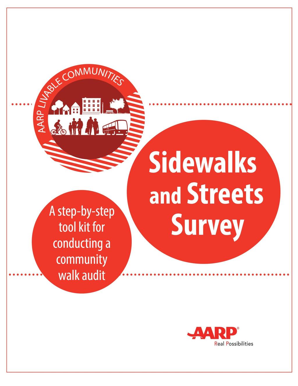
8 West Broad Street Small Area Plan Meetings 2016 Action Items The CACT s priorities for 2016 are: 1. Refine the Neighborhood Traffic Calming Program Demand for NTC reached a new high in 2015 with seven petitions from residential streets: The first project selection under the new program (North Maple Avenue) occurred in October 2015 and staff began meeting with the neighborhood working group in November to identify alternative solutions. The CACT plans to work closely with petitioners and staff and to modify the administration of the program as needed to assure it fulfills the goal of improving safety on residential streets as efficiently and cost-effectively as possible. 2. Development Plan Review The CACT recognizes that transportation, including public transit, walking, and cycling as well as automobile travel, is essential to the City s quality of life and success of future developments. The CACT plans to: Increase members attendance at local and regional transportation meetings to better understand the context of City transportation issues. Intensify committee review of development plans, seeking more comprehensive Transportation Demand Management strategies and coordination with the Citywide transportation network. 3. Joint Meeting with the Economic Development Authority At the October 19, 2015 Council Work Session, the Economic Development Authority (EDA) presented a list of action items developed at its annual retreat in September. Three of the ten items were transportation issues - parking, a Metro shuttle, and biking/walking improvements. The EDA may share interest in some CACT issues such as Traffic Calming, Transportation Demand Management, W&OD Trail Projects, Play Streets, the Pace Car Program, and Walkability and Bikeability Surveys. The CACT and EDA plan a joint meeting in February to discuss areas of common interest and opportunities for cooperation. 4. Neighborhood Pace Car Program and Play Streets The CACT, with staff assistance, is completing research and assembling proposals for the implementation of the Neighborhood Pace Car and Play Streets Programs. These are planned for presentation to Council in Walkability Survey Conduct a survey of the commercial areas of Broad and Washington Streets using the Walkability Checklist of the Pedestrian and Bicycle Information Center of the University of North Carolina s Highway Safety Research Center (Attachment 3) and the Sidewalks and Streets Survey of the AARP Livable Communities Program (Attachment 4). 8
9 These surveys are designed for use by citizens to assess and score the walkability of a street or neighborhood on factors such as room to walk, condition of sidewalks, ease of crossing streets, driver behavior, perceptions of safety, and comfort and appeal of the walking experience. The CACT will summarize its findings and recommendations in a report to Council, the Planning Commission, other City boards and committees, and staff to provide an on-theground, citizen-oriented perspective on the pedestrian strengths and needs of the City. 6. Bikeability Survey Conduct a survey of the City s sharrow-marked streets (Park Avenue, Maple Avenue, and West Street) and the segment of the W&OD Trail within the City limits using the Bikeability Checklist of the Pedestrian and Bicycle Information Center of the University of North Carolina s Highway Safety Research Center (Attachment 5). The checklist is designed for use by citizen cyclists to assess and score the cycling routes on factors such as sharing the road with automobiles, condition of road surfaces, cycling route continuity and connections, intersection navigation, driver behavior, and comfort and appeal of cycling. The CACT will summarize its findings and recommendations in a report to Council, the Planning Commission, other City boards and committees, and staff to provide an on-theground, citizen-oriented perspective on the cycling strengths and needs of the City. CACT members appreciate the opportunity to serve our City by improving the safety and effectiveness of the transportation network. We look forward to assisting Council, the Planning Commission, and the City Manager in creatively addressing the challenges of increasing population and travel demand. Attachments: 1. Transportation Demand Management and Parking Management Plan Example 2. Neighborhood Pace Car Program Brochure 3. Pedestrian and Bicycle Information Center s Walkability Checklist 4. AARP Livable Communities Sidewalk and Streets Survey 5. Pedestrian and Bicycle Information Center s Bikeability Checklist 9
10 Tradition Place Transportation Demand Management and Parking Management Plan Purpose This City s Comprehensive Plan establishes a vision of providing a transportation network that offers choices in travel modes. The Plan also includes a strategy of meeting increased travel demand within, form, and through the City via non-automobile modes. To that end, the City expects redevelopment activity to use Transportation Demand Management (TDM) and Parking Management Techniques that provide a range of options and reduce the reliance on automobiles. Goals Specific to the Project Name located at Project Address. This combined TDM and Parking Management Plan is designed to achieve the following goal(s): 1. Reduce onsite parking demand by x percent from City code, to a total of y spaces. 2. Reduce the number of peak hour vehicle trips by z percent from ITE Trip Generation Model Predictions. 3. Achieve a minimum non-single Occupancy Vehicle (SOV) mode share of xx percent. Plan Flexibility This combined TDM and Parking Management Plan recognizes that different strategies may work better for buildings and site and that travel behavior may change over time. For that reason, this combined plan uses a strategy of adaptive management monitoring performance and updating the strategies applied as necessary to achieve the stated goals. Plan This table summarizes the plan elements and how they will be applied to different travelers to/from the site. The plan elements are split in the following four categories: 1. Site Design, Infrastructure, and Options. These options will be provided when the project is opened for operation. 2. Promotion, Education, and Incentives. These options will be provided while the project is in operation. 3. Monitoring and Enforcement. These techniques will be used to measure performance of the implemented strategies, ensure compliance, and assess whether the strategies applied are meeting the goals of the plan.
11 4. Adaptive Management. These additional techniques will be used is the implemented strategies are not sufficient to meet the goals of the plan. Note that this list is not exhaustive. Other strategies as needed will be used to be the performance goals. Site Employees Retail Customers Building Residents Site Design, Infrastructure and Options Promotion, education, and incentives Monitoring and Enforcement Adaptive Management Secure bike parking Shower facilities and changing room Kiosk of transit and taxi information Parking cashout Employee agreement to restrict parking offsite Shared parking agreement with nearby properties Increase the parking cashout Secure bike parking Kiosk of transit and taxi information Kiosk of transit and taxi information Unbundle parking spaces from the condos Site Design, Infrastructure, and Travel Options Secure Bike Parking, Shower Facilities, and Changing Rooms Provide on-site secure storage for bicycles all building residents. Provide on-site secure storage for bicycle and access to shower facilities and changing rooms for onsite employees. Promotion, Education, and Incentives Information Kiosk Setup and maintain an information kiosk with information on various transportation options in the City of Falls Church and the surrounding area. This kiosk will include information regarding bus, metro, taxi and Uber options. Parking Cashout Allow employees a choice among free automobile parking, a monthly transit stipend, or cash payment.
12 Monitoring and Enforcement Employee Parking Onsite Require as part of employee agreements that all onsite employees park onsite. Adaptive Management Shared Parking If the parking reduction goals of the TDM cannot be achieved, work with nearby property owners to develop shared parking agreements.


, Northampton (MA), Santa Fe (NM), and other cities around the world. d. District Dip.")


13 Put the enclosed sticker on your vehicle & drive within the posted speed limit on all city streets! ZTGØ Slowertraffic is safer for people walking and cycling, for children and the elderly, and even for other drivers. As a vehicle travels more slowly, the driver and all other road users are given more time for courtesy and safety. Less road aggression and frustration When drivers allow themselves enough travel time so they re not in a hurry, they are much less aggressive and create less tension on the roadway. With less speed and tension, the streets can be shared much more safely. Better chances of survival in the case of an incident! A little extra speed can mean the difference between life and death for a cyclist or pedestrian struck by a vehicle. A person hit by a vehicle traveling at 25 mph has a 90% chance of survival; at 40 mph, a person has a 90% chance of dying. Let s remove this critical risk from the streets we share! Street safety is a key element towards making a community truly livable. Our civic pride is reflected in how we treat each other on the street. OTHER PACECAR PROGRAMS: Boise (ID), Palo Alto and Santa Cruz (CA), Atlanta (GA), Greensboro (NC), Salt Lake City (UT), Northampton (MA), Santa Fe (NM), and other cities around the world. d. District Dip.rtment of Transportation WABA WASIRNSTON AREA RCW5TASSCOA11ON Washington Area Bicyclist Association 2599 Ontartio Rd. NW Washington, DC Phone: Fax: Web: In recognition of the importance of traffic safety, DDOT is pleased to partner with the Washington Area Bicyclist Association in the DC Neighborhood Pace Car Program, an important community safety project! YOU can make DC a safer place to walk, a better place to bike, and a more satisfying place to live! The Neighborhood Pace Car Progam is sponsored by a. Di5tr,ct Dopartent & Irnporfl,ton.010p clioiuthnl cop-in Printed with Eco-ink - low volatility vegetable oil-based ink on Ecoprint Silk 100 text, 100% post-consumer recycled, processed chlorine using free, 100% Wind Energy in a Carbon Neutral Process.


14 : i DC Neighborhood Pace Car to the DC Neighborhood Pace Car Program! The DC Neighborhood Pace Car Program encourages residents to,take responsibility for the impact of their own driving while setting the pace for safer streets and neighborhoods. Drivers sign the Pledge to drive safely, courteously, and within the posted speed limit on city streets, and display the official DC Neighborhood Pace Car sticker on their vehicles. 1. I will drive within the posted speed limit on city streets. A slower travel speed makes it easier to share the road with people walking and bicycling, and promotes courteous and safe habits. 2. I ll treat people walking and bicycling with respect and will share the mad safely with them. 3. I ll give myself enough travel time so that I m not sacrificing courtesy or safety. b The Pace Car sticker shows other drivers that you, as a resident, are taking part in a community-based effort to set the pace for safer and more enjoyable neighborhood streets. 4. I will not be pressured by others impatience to drive above the posted speed limit. L.i SIGN THE PLEDGE AND STICKER YOUR VEHICLE! 5. I ll display the PACE CAR sticker on my vehicle, and encourage others to join! wi i/, i/il- ake it Slow.. t1e1)( Keep it $ 6ccô,nc tnt tñ i/, s tit t,c/i NAME DATE si,4c 5c i #i I A k & A k P ø.. p% frw % - -P I won t let my driving prevent DC from becoming a safer place to walk, a better place to bike and a more satisfying place to live!
15
16 The problem Too many communities in the United States are designed for automobile travel, with very little consideration given to the needs of walkers. A scarcity of sidewalks, the placement of sidewalks too close to roads and a lack of maintenance are all factors that discourage people from walking. The solution You can help make walking safer by conducting a walk audit (also known as a walkability survey ) as well as by teaching or encouraging others to do the same. Time commitment It takes about an hour to complete a walkability survey and a bit more time to follow up and pursue the needed improvements. The latter will depend on the extent of the necessary improvements and the community s cooperation in getting the work done. Special considerations None Who can do this? Anyone Great reasons to do a walk audit It increases exercise opportunities for your communities It boosts social interaction among neighbors by creating a pedestrian-friendly environment It helps reduce traffic congestion and pollution by enabling people to leave their car at home It can lead to increase property values since walkable communities have higher home values! A publication of AARP Education and Outreach/Livable Communities Website: AARP.org/livable livable@aarp.org AARP 601 E Street NW, Washington, D.C., AARP 2014 All Rights Reserved Learn more at AARP.org/livable and AARP.org/livability-factsheets Page 2
17 STEP 1: Recruit People to Conduct a Survey You can do a walk audit on your own but it s more fun to do with other people. It s helpful to include a person who has a walking or physical challenge (e.g., someone who uses a walker, wheelchair or cane, or even a parent pushing a baby stroller). That will help you get a true sense of an area s walkability. STEP 2: Identify Your Route Map out a walkable area that can get you to and from where you need to go. STEP 3: Gather Your Supplies o Street maps o Clipboards o Notepaper and pens o A digital or smartphone camera o Comfortable walking shoes o A hat and sunscreen. o The survey documents (it starts on page 5) STEP 4: Choose a Date and Time for the Survey STEP 5: Conduct the Survey STEP 6: Rate the Route STEP 7: Take Action to Make Your Community More Walkable Learn more at AARP.org/livable and AARP.org/livability-factsheets Page 3
18 Review the checklist before you go and as you walk note the locations of things you d like to change. Take photos of problem areas as well as features you like and would like to see more of. Suggestions for photos to take include: o o o o o o o Crossing signals Overhead traffic lights Turning lanes Curb cuts Sidewalks Crosswalk lines and vehicle stop lines Important signage The survey contains the following sections to help guide and record your observations: Section A. Mapping the Walk Audit Section B. Crossing Streets and Intersections Section C. Sidewalks Section D. Driver Behavior Section E. Safety Section F. Comfort and Appeal Section G. Overall Ratings and Observations Each section asks you to rate your streets or intersections. Here s what each rating means: Excellent Good Fair Poor The area is very pedestrian-friendly and safe The area is moderately pedestrian-friendly and safe The area is somewhat pedestrian-friendly and safe The area is not pedestrian-friendly or safe Learn more at AARP.org/livable and AARP.org/livability-factsheets Page 4
19 This survey will tell you what to look for on sidewalks and streets within the walkable area you choose to survey. Your walkable area could be as small as one intersection or it could include several streets and intersections. Consider starting small, with one or two intersections and a connecting street. ADVICE: The smaller your walk survey area, the easier it is to follow-up and get results. Record the following for your walk survey area: County City/Town State Zip Code Next, draw a simple map of your walk survey area and label the streets. Be sure to indicate North, East, South and West on the map to show which direction the streets are facing. Learn more at AARP.org/livable and AARP.org/livability-factsheets Page 5
20 Complete one Section B page for each intersection you observe within your walkable area. (We suggest allowing 20 to 30 minutes per intersection.) Intersection observed: location at and Street Name 1 Street Name 2 Day of week: Time observations began: a.m. p.m. Date: Time observations ended: a.m. p.m. DIRECTIONS: Place a next to any items that are a problem for pedestrians and note: What might be especially problematic for a child, older adult or person with disabilities? What is the exact location(s) of each problem? Record a landmark or side of street (North, South, East or West) on the line to the right of each item you check. PROBLEMS FOR WALKERS LOCATION o Crossing doesn t have a pedestrian signal or audible signal o The pedestrian signal doesn t give people walking at an average speed enough time to cross. Time allowed for crossing: (Minutes) : (Seconds) o o Pedestrian signal doesn t give slower walkers enough time to cross The traffic signal makes pedestrians wait too long before crossing o The location needs a traffic signal or crosswalk o A Push-to-Walk signal is not available/operating/accessible o The crosswalk is not marked or is poorly marked o Need to walk too far (>300 feet) for a safe place to cross the street o The road is too wide to safely cross o There s no median on a streets with two or more lanes o Parked cars or utility poles block the view of traffic o Other issues and observations: Learn more at AARP.org/livable and AARP.org/livability-factsheets Page 6
21 WHO S USING THE CROSSWALK? NUMBER OF INDIVIDUALS OBSERVED (use hash marks for counting) TOTAL # People walking at average speed People walking slowly People with young children or strollers People crossing against the signal People using assistive devices (canes, wheelchairs, walkers, etc.) Bicyclists Skateboarders or Scooters Other OVERALL RATING OF THE STREET CROSSING(S) IN THE SURVEY AREA: Excellent Good Fair Poor Learn more at AARP.org/livable and AARP.org/livability-factsheets Page 7
22 Complete one Section C page for each sidewalk-equipped street within your walkable area. Street observed: between and Street Name Cross Street 1 Cross Street 2 Day of week: Time observations began: a.m. p.m. Date: Time observations ended: a.m. p.m. DIRECTIONS: Place a next to any items that are a problem for pedestrians and note: What might be especially problematic for a child, older adult or person with disabilities? What is the exact location(s) of each problem? Record a landmark or side of street (North, South, East or West) on the line to the right of each item you check. PROBLEMS FOR WALKERS LOCATION o There are no sidewalks, paths or shoulders o The sidewalks are not continuous (i.e. segments are missing) o The sidewalk isn t wide enough for two people to walk together side-by-side (minimum needed: 5 feet) o The sidewalk is broken or cracked o There s no buffer between traffic and the sidewalk o The sidewalks are interrupted by driveway s o There are no ramps (curb cuts) or they re misplaced (Note: There should be two per corner.) o The curb cuts aren t textured or marked for people with visual impairments o The sidewalk is blocked or interrupted by poles, signs, shrubs, dumpsters, low hanging trees, etc. o Cars, trucks, vendors are blocking the sidewalk o Other issues and observations OVERALL RATING OF THE STREET CROSSING(S) IN THE SURVEY AREA: Excellent Good Fair Poor Learn more at AARP.org/livable and AARP.org/livability-factsheets Page 8
23 Complete one page for the entire walkable area on your survey map. Day of week: Time observations began: a.m. p.m. Date: Time observations ended: a.m. p.m. DIRECTIONS: Place a next to any items that are a problem for pedestrians and note: What might be especially problematic for a child, older adult or person with disabilities? What is the exact location(s) of each problem? Record a landmark or side of street (North, South, East or West) on the line to the right of each item you check. PROBLEMS FOR WALKERS LOCATION o Drivers do not stop at stop signs o Drivers do not obey traffic signals o Drivers appear to be speeding o Drivers don t yield to pedestrians, especially at right turns o Drivers do not stop behind the crosswalk o Drivers don t look when leaving or backing out of driveways o Drivers make unexpected turns/maneuvers o Other issues and observations OVERALL RATING OF THE STREET CROSSING(S) IN THE SURVEY AREA: Excellent Good Fair Poor Learn more at AARP.org/livable and AARP.org/livability-factsheets Page 9
24 Complete one page for the entire walkable area on your survey map. Day of week: Time observations began: a.m. p.m. Date: Time observations ended: a.m. p.m. DIRECTIONS: Place a next to any items that are a problem for pedestrians and note: What might be especially problematic for a child, older adult or person with disabilities? What is the exact location(s) of each problem? Record a landmark or side of street (North, South, East or West) on the line to the right of each item you check. PROBLEMS FOR WALKERS LOCATION Pedestrians don t feel safe walking here because: o Car speeds are too fast o Too much traffic o Drivers are distracted (e.g. they re using cell phones) o There is loitering or suspicious/criminal activity o There are unleashed dogs o The signage or directions for drivers/pedestrians are confusing o Other issues and observations OVERALL RATING OF THE STREET CROSSING(S) IN THE SURVEY AREA: Excellent Good Fair Poor Learn more at AARP.org/livable and AARP.org/livability-factsheets Page 10
25 Complete one page for the entire walkable area on your survey map. Day of week: Time observations began: a.m. p.m. Date: Time observations ended: a.m. p.m. DIRECTIONS: Place a next to any items that are a problem for pedestrians and note: What might be especially problematic for a child, older adult or person with disabilities? What is the exact location(s) of each problem? Record a landmark or side of street (North, South, East or West) on the line to the right of each item you check. PROBLEMS FOR WALKERS LOCATION Pedestrians don t feel comfortable walking here because: o The street needs shade trees o The street needs grass, flowers, landscaping o The street needs benches and places to rest o The grass/landscaping needs maintenance o There needs to be water fountains and bathrooms o A sidewalk is needed to the bus stop o The bus stop doesn t provide shelter o The bus stop doesn t have adequate lighting o There s graffiti or vacant/rundown buildings o There s too much trash or litter o Other issues and observations OVERALL RATING OF THE STREET CROSSING(S) IN THE SURVEY AREA: Excellent Good Fair Poor Learn more at AARP.org/livable and AARP.org/livability-factsheets Page 11
26 Now it s time to tally your scores from each observation section. Place a next to each rating from the previous sections. If you observed more than one location for Sections B and C, record the average of your observations. SECTION RATING B: Crossing the Street (Intersections) Excellent Good Fair Poor C: Sidewalks Excellent Good Fair Poor D: Driver Behavior Excellent Good Fair Poor E: Safety Excellent Good Fair Poor F: Comfort and Appeal Excellent Good Fair Poor TOTALS: Excellent Good Fair Poor _ Your Overall Rating will be more than just your checkmark total. Think about your observations as a whole. Were some areas much better or worse than others? For example, the sidewalks might be good for walking, but intersections might be poor for crossing the street. This might justify reducing the overall rating of your walk survey area. With this in mind: OVERALL RATING OF THE ENTIRE SURVEY AREA: Excellent Good Fair Poor _ Additional comments about what works well and what needs improvement: Learn more at AARP.org/livable and AARP.org/livability-factsheets Page 12
27 It can be a challenge to persuade municipal bureaucracies to make needed improvements and changes. Obstacles abound, ranging from politics to price tags. But individuals and community groups can get the ball rolling by identifying problems and calling attention to them. Some next steps: Rally community members to work with the local government and transportation officials to add new walkways and sidewalks and help improve the safety and accessibility of your community. Contact the local public works and transportation departments, or the area s elected community representative, to report unsafe sidewalks. Provide copies of the completed Sidewalks and Streets Survey as well as photographs that demonstrate the problems. Ask local officials to create crosswalks, install traffic signals and use traffic-calming measures (such as a road diet) to help control the speed of traffic. If a traffic signal already exists, ask that the light s timing accommodate slower moving pedestrians, such as children, older adults and people with disabilities. Organize a neighborhood watch group to keep an eye out for speeders, criminal activity or other conditions or activities that would prevent people from being able to safely go for a walk. Advocate for the walkability features that will make your community walkable and welcoming for people of all ages and abilities. Sidewalk requests can be complicated because, although a city s public works department often addresses sidewalk maintenance, the maintenance may actually be the responsibility of the adjacent property owner. Adding a new walkway could require negotiating with the respective property owners. Installing a sidewalk where one doesn t already exist is easier if the work involves filling in a gap in an otherwise continuous sidewalk. In most areas, a community s department of Public Works or Transportation can address concerns about the placement and width of sidewalks and the maintenance of publically managed sidewalks. Caring for trees and bushes that intrude upon a sidewalk is usually the responsibility of the property s owner, but the local government can send a notice asking the owner to perform the maintenance. If the property owner does not comply, a public works crew might be able to trim the bushes and bill the property owner. In some neighborhoods, a homeowners association is responsible for sidewalks. Some communities or neighborhoods have ordinances restricting the installation of sidewalks or curbs for aesthetic reasons or to make the area appear less urban. Advocating for sidewalks in these types of communities can be challenging. If action on sidewalks is not possible, the local government can still make the streets safer for pedestrians by employing traffic-calming measures. Learn more at AARP.org/livable and AARP.org/livability-factsheets Page 13
28 With the Problems Identified, It s Time to Find Solutions THE PROBLEMS No sidewalks, paths or shoulders Sidewalks that start and stop, are broken or blocked Too much traffic What can be done right away Identify another (safer) route Tell the traffic engineering or public works department about the problems and provide a copy of the Sidewalks and Streets survey results What can be done with more time Speak up at board meetings Write or petition the city for better walkways Work with a local transportation engineer to develop a plan for a safe walking route Make the local media aware of the problems THE PROBLEMS Roads are too wide to cross Traffic signals don t allow enough time to cross and/or regular opportunities to cross There aren t any crosswalks or traffic signals Views of traffic are blocked by trees, landscaping and/or parked cars Curb cuts are missing or are in need of repair What can be done right away Identify another (safer) route Tell the traffic or public works departments about the problems and provide a copy of the Sidewalks and Streets Survey results Trim the trees or bushes that block the street and/or ask the property owner to do so Leave polite notes on the problem cars asking owners not to park there What can be done with more time Attend community meetings to advocate for crosswalks, signals, parking changes and curb cuts Report parked cars that cause safety hazards to the police or traffic departments Ask the department of public works to trim trees and bushes that block views of the street Make the local media aware of the problems THE PROBLEMS Drivers are backing up without looking Drivers aren t yielding to pedestrians Drivers are driving too fast and/or speeding up to make the light Drivers are running red lights and stop signs What can be done right away Identify another (safer) route Set an example by being a safe driver Report unsafe drivers to the police What can be done with more time Petition for better law enforcement Ask the municipalities transportation planners and engineers for traffic-calming solutions Organize a neighborhood speed-watch program THE PROBLEMS The landscaping is in poor condition or non-existent Dogs are off-leash The area isn t well-lighted There s a lot of litter There s no place to sit and rest There s no criminal activity What can be done right away Identify another (safer) route Report unleashed dogs to municipal authorities Report unlawful activity to police Report lighting needs to the police or department of public works Collect the trash yourself What can be done with more time Request increased law enforcement Ask the municipalities transportation planners and engineers for traffic-calming solutions Organize a community cleanup day Start a neighborhood crime watch program Sponsor a neighborhood beautification day Begin an adopt-a-street program AARP thanks the Institute of Transportation Engineers for its assistance with this survey. Learn more at AARP.org/livable and AARP.org/livability-factsheets Page 14


29 Walkability Checklist How walkable is your community? Take a walk with a child and decide for yourselves. Everyone benefits from walking. These benefits include: improved fitness, cleaner air, reduced risks of certain health problems, and a greater sense of community. But walking needs to be safe and easy. Take a walk with your child and use this checklist to decide if your neighborhood is a friendly place to walk. Take heart if you find problems, there are ways you can make things better. Getting started: First, you ll need to pick a place to walk, like the route to school, a friend s house or just somewhere fun to go. The second step involves the checklist. Read over the checklist before you go, and as you walk, note the locations of things you would like to change. At the end of your walk, give each question a rating. Then add up the numbers to see how you rated your walk overall.after you ve rated your walk and identified any problem areas, the next step is to figure out what you can do to improve your community s score. You ll find both immediate answers and long-term solutions under Improving Your Community s Score... on the third page.
30 Take a walk and use this checklist to rate your neighborhood s walkability. How walkable is your community? Location of walk 1. Did you have room to walk? Yes Some problems: Sidewalks or paths started and stopped Sidewalks were broken or cracked Sidewalks were blocked with poles, signs,shrubbery, dumpsters, etc. No sidewalks, paths, or shoulders Too much traffic Something else Rating Scale: 1 awful 2 many problems 3 some problems 4 good 5 very good 4. Was it easy to follow safety rules? Could you and your child 6 excellent Yes No Cross at crosswalks or where you could see and be seen by drivers? Yes No Stop and look left, right and then left again before crossing streets? Yes No Walk on sidewalks or shoulders facing traffic where there were no sidewalks? Yes No Cross with the light? Rating: (circle one ) Locations of problems: Rating: (circle one) Locations of problems: 2. Was it easy to cross streets? Yes Rating: (circle one ) Some problems: Road was too wide Traffic signals made us wait too long or did not give us enough time to cross Needed striped crosswalks or traffic signals Parked cars blocked our view of traffic Trees or plants blocked our view of traffic Needed curb ramps or ramps needed repair Something else Locations of problems: 3. Did drivers behave well? Yes Rating: (circle one ) Some problems: Drivers Backed out of driveways without looking Did not yield to people crossing the street Turned into people crossing the street Drove too fastp Sped up to make it through traffic lights or drove through traffic lights? Something else Locations of problems: 5. Was your walk pleasant? Yes Rating: (circle one ) Some problems: Needed more grass, flowers, or trees Scary dogs Scary people Not well lighted Dirty, lots of litter or trash Dirty air due to automobile exhaust Something else Locations of problems: How does your neighborhood stack up? Add up your ratings and decide Celebrate! You have a great 2. neighborhood for walking Celebrate a little. Your neighborhood 3. is pretty good Okay, but it needs work It needs lots of work. You deserve Total: better than that It's a disaster for walking! Now that you've identified the problems, go to the next page to find out how to fix them.
31 Now that you know the problems, you can find the answers. Improving your community's score 1. Did you have room to walk? Sidewalks or paths started and stopped Sidewalks broken or cracked Sidewalks blocked No sidewalks, paths or shoulders Too much traffic 2. Was it easy to cross streets? Road too wide Traffic signals made us wait too long or did not give us enough time to cross Crosswalks/traffic signals needed View of traffic blocked by parked cars, trees, or plants Needed curb ramps or ramps needed repair 3. Did drivers behave well? Backed without looking Did not yield Turned into walkers Drove too fast Sped up to make traffic lights or drove through red lights 4. Could you follow safety rules? Cross at crosswalks or where you could see and be seen Stop and look left, right, left before crossing Walk on sidewalks or shoulders facing traffic Cross with the light What you and your child can do immediately pick another route for now tell local traffic engineering or public works department about specific problems and provide a copy of the checklist pick another route for now share problems and checklist with local traffic engineering or public works department trim your trees or bushes that block the street and ask your neighbors to do the same leave nice notes on problem cars asking owners not to park there pick another route for now set an example: slow down and be considerate of others encourage your neighbors to do the same report unsafe driving to the police educate yourself and your child about safe walking organize parents in your neighborhood to walk children to school What you and your community can do with more time speak up at board meetings write or petition city for walkways and gather neighborhood signatures make media aware of problem work with a local transportation engineer to develop a plan for a safe walking route push for crosswalks/signals/ parking changes/curb ramps at city meetings report to traffic engineer where parked cars are safety hazards report illegally parked cars to the police request that the public works department trim trees or plants make media aware of problem petition for more enforcement request protected turns ask city planners and traffic engineers for traffic calming ideas ask schools about getting crossing guards at key locations organize a neighborhood speed watch program encourage schools to teach walking safely help schools start safe walking programs encourage corporate support for flex schedules so parents can walk children to school 5. Was your walk pleasant? Needs grass, flowers, trees Scary dogs Scary people Not well lit Dirty, litter Lots of traffic A Quick Health Check point out areas to avoid to your child; agree on safe routes ask neighbors to keep dogs leashed or fenced report scary dogs to the animal control department report scary people to the police report lighting needs to the police or appropriate public works department take a walk wih a trash bag plant trees, flowers in your yard select alternative route with less traffic request increased police enforcement start a crime watch program in your neighborhood organize a community clean-up day sponsor a neighborhood beautification or treeplanting day begin an adopt-a-street program initiate support to provide routes with less traffic to schools in your community (reduced traffic during am and pm school commute times) Could not go as far or as fast as we wanted Were tired, short of breath or had sore feet or muscles Was the sun really hot? Was it hot and hazy? start with short walks and work up to 30 minutes of walking most days invite a friend or child along walk along shaded routes where possible use sunscreen of SPF 15 or higher, wear a hat and sunglasses try not to walk during the hottest time of day get media to do a story about the health benefits of walking call parks and recreation department about community walks encourage corporate support for employee walking programs plant shade trees along routes have a sun safety seminar for kids have kids learn about unhealthy ozone days and the Air Quality Index (AQI)
32 Need some guidance? These resources might help Great Resources WAlking information Pedestrian and Bicycle Information Center (PBIC) UNC Highway Safety Research Center Chapel Hill, NC National Center for Safe Routes to School Chapel Hill, NC For More Information about Who Can Help Address Community Problems State Bicycle & Pedestrian Coordinators federal PoliCy, guidance AnD funding sources for WAlking facilities Federal Highway Administration Bicycle and Pedestrian Program Office of Natural and Human Environment Washington, DC PeDestriAn safety Federal Highway Administration Pedestrian and Bicycle Safety Team Office Of Safety Washington, DC National Highway Traffic Safety Administration Traffic Safety Programs Washington, DC sidewalk ACCessibility information US Access Board Washington, DC Phone: (800) ; (800) (TTY)


33 Bikeability Checklist How bikeable is your community? Riding a bike is fun! Bicycling is a great way to get around and to get your daily dose of physical activity. It's good for the environment, and it can save you money. No wonder many communities are encouraging people to ride their bikes more often! Can you get to where you want to go by bike? Some communities are more bikeable than others: how does yours rate? Read over the questions in this checklist and then take a ride in your community, perhaps to the local shops, to visit a friend, or even to work. See if you can get where you want to go by bicycle, even if you are just riding around the neighborhood to get some exercise. At the end of your ride, answer each question and, based on your opinion, circle an overall rating for each question. You can also note any problems you encountered by checking the appropriate box(es). Be sure to make a careful note of any specific locations that need improvement. Add up the numbers to see how you rated your ride. Then, turn to the pages that show you how to begin to improve those areas where you gave your community a low score. Before you ride, make sure your bike is in good working order, put on a helmet, and be sure you can manage the ride
Sidewalks and Streets Survey
 Tips, Tools and Resources for Organizers Sidewalks and Streets Survey Communities can make walking safer by teaching small groups to take simple walkability surveys and to take recommended actions for
MPO Staff Report Technical Advisory Committee: September 13, 2017 MPO Executive Board: September 20, 2017
 MPO Staff Report Technical Advisory Committee: September 13, 2017 MPO Executive Board: September 20, 2017 RECOMMENDED ACTION: Update on Near Southside Walkability Survey. Matter of the Near Southside Neighborhood
Middle School Walk Audit Booklet
 Safe Routes to School GEORGIA Georgia Department of Transportation Middle School Walk Audit Booklet This Walk Audit Guide was prepared by the Georgia Safe Routes to School Resource Center, funded by the
WALKABILITY CHECKLIST How walkable is your community?
 WALKABILITY CHECKLIST How walkable is your community? Everyone benefits from walking and other forms of active transportation. These benefits include: improved fitness, cleaner air, reduced risks of certain
Fill in the rating for each section. Total up the ratings to see how your neighbourhood scores overall for walkability.
 WALKABILITY CHECKLIST How walkable is your community? Everyone benefits from walking and other forms of active transportation. These benefits include: improved fitness, cleaner air, reduced risks of certain
Streets. Safe for Pedestrians 20% 2nd 5,000. Are We People-Friendly?
 Streets Safe for Pedestrians 20% Pedestrian deaths account for more than of all traffic-related fatalities in California each year. 600 More than people are killed and another 13,000 are injured every
Agenda. Overview PRINCE GEORGE S PLAZA METRO AREA PEDESTRIAN PLAN
 PRINCE GEORGE S PLAZA METRO AREA PEDESTRIAN PLAN May 28, 2008 Agenda Welcome and introductions Project overview and issue identification Planning context and strengths Design challenges and initial recommendations
Safe Routes to School Action Plan Aberdeen, Idaho
 Background Aberdeen, Idaho is a largely agricultural community of nearly 2,000 people and is located in the southeast portion of the state on the western edge of American Falls Reservoir. The community
Proposed. City of Grand Junction Complete Streets Policy. Exhibit 10
 Proposed City of Grand Junction Complete Streets Policy Exhibit 10 1 City of Grand Junction Complete Streets Policy Vision: The Complete Streets Vision is to develop a safe, efficient, and reliable travel
Solana Beach Comprehensive Active Transportation Strategy (CATS)
") Solana Beach Comprehensive Active Transportation Strategy (CATS) 3.0 Goals & Policies The Solana Beach CATS goals and objectives outlined below were largely drawn from the Solana Beach Circulation Element
Solana Beach Comprehensive Active Transportation Strategy (CATS) 3.0 Goals & Policies The Solana Beach CATS goals and objectives outlined below were largely drawn from the Solana Beach Circulation Element
CONNECTING PEOPLE TO PLACES
 CONNECTING PEOPLE TO PLACES 82 EAST BENCH MASTER PLAN 07 Introduction The East Bench transportation system is a collection of slow moving, treelined residential streets and major arteries that are the
Why Zone In on Speed Reduction?
 Learn it. Do it. Live it! SPEED REDUCTION IN THE ZONE Why Zone In on Speed Reduction? Speeding is a serious issue that plays a major role in the risk of serious injury and pedestrian fatality in a crash.
PRINCE GEORGE S PLAZA METRO AREA PEDESTRIAN PLAN
 PRINCE GEORGE S PLAZA METRO AREA PEDESTRIAN PLAN May 28, 2008 Agenda Welcome and introductions Project overview and issue identification Planning context and strengths Design challenges and initial recommendations
REGIONAL BICYCLE AND PEDESTRIAN DESIGN GUIDELINES
 REGIONAL BICYCLE AND PEDESTRIAN DESIGN GUIDELINES November 16, 2011 Deb Humphreys North Central Texas Council of Governments Bicycle and Pedestrian Advisory Committee Snapshot of the Guide 1. Introduction
Chapter 5. Complete Streets and Walkable Communities.
 Chapter 5. Complete Streets and Walkable Communities. 5.1 Description of Complete Streets. Cities throughout the world, and specifically the United States, are coming to embrace a new transportation and
APPENDIX A: Complete Streets Checklist DRAFT NOVEMBER 2016
 APPENDIX A: Complete Streets Checklist DRAFT NOVEMBER 2016 Complete Streets Checklist MetroPlan Orlando s Complete Streets Checklist is an internal planning tool for staff to further implementation of
What Is a Complete Street?
 Session 5 Charleen Zimmer, AICP, Zan Associates May 5-7, 2010 What Is a Complete Street? May 2010 5-1 Not a Complete Street More of a Complete Street May 2010 5-2 Benefits of Complete Streets Safety for
Bikeability Checklist
 Bikeability Checklist How bikeable is your community? Riding a bike is fun! Bicycling is a great way to get around and to get your daily dose of physical activity. It's good for the environment, and it
Pedestrian, Bicycle and Traffic Calming Strategic Implementation Plan. January 18, 2011
 Pedestrian, Bicycle and Traffic Calming Strategic Implementation Plan January 18, 2011 Tonight s Agenda Receive update on project Provide feedback on two policy issues Complete Streets Policy Project Prioritization
5/7/2013 VIA . RE: University Village Safeway Expansion (P13-019)
") 5/7/2013 VIA EMAIL David Hung, Associate Planner Community Development Department, Current Planning Division City of Sacramento 300 Richards Boulevard, 3 rd Floor Sacramento, CA 95811 RE: University Village
5/7/2013 VIA EMAIL David Hung, Associate Planner Community Development Department, Current Planning Division City of Sacramento 300 Richards Boulevard, 3 rd Floor Sacramento, CA 95811 RE: University Village
Lee s Summit Road Improvement Study Public Open House June 7, 2007 Summary of Comment Card Responses
 Lee s Summit Road Improvement Study Public Open House June 7, 2007 Summary of Comment Card Responses Introduction At the Lee s Summit Road Improvement Study Public Open House held Thursday, June 7, 2007
Bridgewater Complete Streets Prioritization Plan and Pedestrian Safety Assessment
 Bridgewater Complete Streets Prioritization Plan and Pedestrian Safety Assessment Presented by Luciano Rabito Manager of Complete Streets Presented to Bridgewater, MA Wednesday, April 26, 2017 6:30 P.M.
Chapter 2. Bellingham Bicycle Master Plan Chapter 2: Policies and Actions
 Chapter 2 Bellingham Bicycle Master Plan Chapter 2: Policies and Actions Chapter 2: Policies and Actions The Bicycle Master Plan provides a road map for making bicycling in Bellingham a viable transportation
City of Novi Non-Motorized Master Plan 2011 Executive Summary
 City of Novi Non-Motorized Master Plan 2011 Executive Summary Prepared by: February 28, 2011 Why Plan? Encouraging healthy, active lifestyles through pathway and sidewalk connectivity has been a focus
CITY OF BLOOMINGTON COMPLETE STREETS POLICY
 CITY OF BLOOMINGTON COMPLETE STREETS POLICY POLICY OBJECTIVE: The City of Bloomington will enhance safety, mobility, accessibility and convenience for transportation network users of all ages and abilities,
Introduction.
 2307-1.0. Introduction. Delaware s Safe Routes to School (SRTS) Program was established September 10, 2002 when Governor Ruth Ann Minner signed Senate Bill 353 of the 141st General Assembly of Delaware
Living Streets Policy
 Living Streets Policy Introduction Living streets balance the needs of motorists, bicyclists, pedestrians and transit riders in ways that promote safety and convenience, enhance community identity, create
NM-POLICY 1: Improve service levels, participation, and options for non-motorized transportation modes throughout the County.
 Transportation PRINCE WILLIAM COUNTY 2008 COMPREHENSIVE PLAN NON-MOTORIZED PLAN CONTENTS Goals, Policies, and Action Strategies Table 4 (Bike Facility Classifications and Descriptions) Table 5 (Bike Facility
Bicycle Master Plan Goals, Strategies, and Policies
 Bicycle Master Plan Goals, Strategies, and Policies Mobilizing 5 This chapter outlines the overarching goals, action statements, and action items Long Beach will take in order to achieve its vision of
5. Pedestrian System. Accomplishments Over the Past Five Years
 5. Pedestrian System Accomplishments Over the Past Five Years The Alamo Area Metropolitan Planning Organization (MPO) and its partner agencies recognize the importance of improving pedestrian mobility.
10/30/2012 VIA
 10/30/2012 VIA EMAIL David Hung, Associate Planner Community Development Department, Current Planning Division City of Sacramento 300 Richards Blvd., 3 rd Floor Sacramento, CA 95811 RE: The Cannery On-Site
University of Victoria Campus Cycling Plan Terms of Reference. 1.0 Project Description
 University of Victoria Campus Cycling Plan Terms of Reference 1.0 Project Description The Campus Cycling Plan, a first for the University, will provide a comprehensive and coordinated approach to support
ASSESSING THE WALKING & BIKING ENVIRONMENT
 ASSESSING THE WALKING & BIKING ENVIRONMENT M A Y 2 0 1 3 Jon Morgan WI DHS ACTIVE COMMUNITY LINE-UP Rationale Why do an audit What s involved in an audit Things to look for and consider Hitting the streets
May 12, 2016 Metro Potential Ballot Measure Issue Brief: Local Return
 Summary: Local return is an important revenue source for cities to maintain their local transportation infrastructure. Most cities use their local return to operate small bus systems and repave streets,
CITY OF COCOA BEACH 2025 COMPREHENSIVE PLAN. Section VIII Mobility Element Goals, Objectives, and Policies
 CITY OF COCOA BEACH 2025 COMPREHENSIVE PLAN Section VIII Mobility Element Goals, Objectives, and Policies Adopted August 6, 2015 by Ordinance No. 1591 VIII MOBILITY ELEMENT Table of Contents Page Number
Bringing together community and health. Physical Activity and Nutrition Unit Office of Statewide Health Improvement Initiatives
 Bringing together community and health. Physical Activity and Nutrition Unit Office of Statewide Health Improvement Initiatives Physical Activity and Nutrition Unit Office of Statewide Health Improvement
Table of Contents Introduction. 2 Purpose of the Plan...2 The Benefits of Walking and Bicycling...3 Vision and Goals of the Plan...
 BICYCLE AND This plan was created through a grant from the Healthy Communities Program with the cooperation of the City of Cynthiana, Cynthiana Main Street, Cynthiana-Harrison County-Berry Joint Planning
CHAPTER 3: Vision Statement and Goals
 Davidson Walks & Rolls: Active Transportation Master Plan CHAPTER 3 Contents: Overview Vision Statement Measurable Goals Public Outreach CHAPTER 3: Vision Statement and Goals Overview The vision statement
County of Greenville South Carolina. Traffic Calming Program Neighborhood Traffic Education Program and Speed Hump Program
 County of Greenville South Carolina Traffic Calming Program Neighborhood Traffic Education Program and Speed Hump Program (rev) August 2008 I. PURPOSE The potential negative impacts from vehicular traffic
11/28/2016 VIA
 11/28/2016 VIA EMAIL Ethan Meltzer, Assistant Planner City of Sacramento Community Development Department 300 Richards Blvd., 3 rd Floor Sacramento, Ca 95811 RE: Natomas Corporate Center Commercial Building
PEDESTRIAN ACTION PLAN
 ATTACHMENT 2 CITY OF SANTA MONICA PEDESTRIAN ACTION PLAN CITY OF SANTA MONICA PEDESTRIAN ACTION PLAN This page intentionally left blank EXECUTIVE SUMMARY CHAPTER 1 EXECUTIVE SUMMARY Setting the Stage
8/31/2016 VIA . RE: Freeport Arco Fuel Station (P16-039)
") 8/31/2016 VIA EMAIL Garrett Norman, Assistant Planner City of Sacramento Community Development Department 300 Richards Boulevard, 3 rd Floor Sacramento, CA 95811 RE: Freeport Arco Fuel Station (P16-039)
8/31/2016 VIA EMAIL Garrett Norman, Assistant Planner City of Sacramento Community Development Department 300 Richards Boulevard, 3 rd Floor Sacramento, CA 95811 RE: Freeport Arco Fuel Station (P16-039)
Do you support funding a Vision Zero approach for pedestrian & cycling safety citywide?
 Councilman Kenyatta Johnson Second Council District The 5th Square PAC CANDIDATE QUESTIONNAIRE VISION ZERO Do you support funding a Vision Zero approach for pedestrian & cycling safety citywide? Would
TRAFFIC CALMING TOOLBOX. For the residents of the City of Decatur, Georgia
 TRAFFIC CALMING TOOLBOX For the residents of the City of Decatur, Georgia 2 City of Decatur Traffic Calming Toolbox Public Works Department 2635 Talley Street Decatur, GA 30030 404.377.5571 3 Welcome to
TRAFFIC ACTION PLAN. Laurie Meadows Neighborhood CITY OF SAN MATEO
 TRAFFIC ACTION PLAN Laurie Meadows Neighborhood CITY OF SAN MATEO Draft January 2017 Table of Contents Introduction... 2 The Traffic Forum Process... 5 Neighborhood Traffic Issues... 7 Neighborhood Recommendations
EXECUTIVE SUMMARY. Vision
 Vision Walking and bicycling in Salt Lake City will be safe, convenient, comfortable, and viable transportation options that connect people to places, foster recreational and economic development opportunities,
Borough of Danville, PA Traffic Calming Program Guidelines
 Borough of Danville, PA Traffic Calming Program Guidelines Adopted by Borough Council on 1 INTRODUCTION Speeding Traffic is a major concern in the Borough of Danville because of its detrimental impacts
BIKE PLAN CONTENTS GATEWAY
 CONTENTS Acknowledgments...vii Great Rivers Greenway District Board of Directors... vii Great Rivers Greenway District Staff... vii Project Consultants... vii Committees... viii Citizens Advisory Committee
9/22/2014 VIA . RE: Butano Apartments Pre App (PAMP )
") 9/22/2014 VIA EMAIL Surinder Singh, Senior Planner Planning and Environmental Review Division Sacramento County 827 7th Street, Second Floor RE: Butano Apartments Pre App (PAMP2014-00012) Dear Mr. Singh:
9/22/2014 VIA EMAIL Surinder Singh, Senior Planner Planning and Environmental Review Division Sacramento County 827 7th Street, Second Floor RE: Butano Apartments Pre App (PAMP2014-00012) Dear Mr. Singh:
5/31/2016 VIA . Arwen Wacht City of Sacramento Community Development Department 300 Richards Blvd., 3 rd Floor Sacramento, CA 95811
 5/31/2016 VIA EMAIL Arwen Wacht City of Sacramento Community Development Department 300 Richards Blvd., 3 rd Floor Sacramento, CA 95811 RE: El Pollo Loco (P16-028) Dear Ms. Wacht: WALKSacramento has reviewed
NJDOT Complete Streets Checklist
 Background The New Jersey Department of Transportation s Complete Streets Policy promotes a comprehensive, integrated, connected multi-modal network by providing connections to bicycling and walking trip
TOWN OF PORTLAND, CONNECTICUT COMPLETE STREETS POLICY
 TOWN OF PORTLAND, CONNECTICUT COMPLETE STREETS POLICY I. VISION, GOALS & PRINCIPLES VISION To improve the streets of Portland making them safer and more accessible for all users including pedestrians,
Exhibit 1 PLANNING COMMISSION AGENDA ITEM
 Exhibit 1 PLANNING COMMISSION AGENDA ITEM Project Name: Grand Junction Circulation Plan Grand Junction Complete Streets Policy Applicant: City of Grand Junction Representative: David Thornton Address:
NEIGHBORHOOD TRAFFIC CALMING POLICY
 NEIGHBORHOOD TRAFFIC CALMING POLICY I. PURPOSE The City of Kent continually strives to strengthen and protect its neighborhoods by improving the quality of life in residential areas. Traffic conditions
7/23/2017 VIA . Michael Hanebutt City of Sacramento Community Development Department 300 Richards Boulevard, 3 rd Floor Sacramento, CA 95811
 7/23/2017 VIA EMAIL Michael Hanebutt City of Sacramento Community Development Department 300 Richards Boulevard, 3 rd Floor Sacramento, CA 95811 RE: 65 th Street Apartments (DR17-220) Dear Mr. Hanebutt:
All Season Age Friendly Pedestrian Safety and Walkability Checklist *
 FOSTERING AGE FRIENDLY, WALKABLE NEIGHBOURHOODS Walkability is a key component of optimal aging in Age Friendly cities. Walkable neighbourhoods promote physical and mental health and well-being, support
The DC Pedestrian Master Plan
 The DC Pedestrian Master Plan September 28, 2010 George Branyan Pedestrian Program Coordinator District Department of Transportation Presentation Agenda Scope of the Plan Methodology Recommendations Implementation
CITY OF VISTA TRAFFIC CALMING PROGRAM
 CITY OF VISTA TRAFFIC CALMING PROGRAM The purpose of the Vista Traffic Calming Program is to reduce speeds of motorists driving through residential neighborhoods. The program does not apply to nonresidential
City of Elizabeth City Neighborhood Traffic Calming Policy and Guidelines
 City of Elizabeth City Neighborhood Traffic Calming Policy and Guidelines I. Purpose: The City of Elizabeth City is committed to ensure the overall safety and livability of residential neighborhoods. One
Morristown, NJ Complete Streets Policy
 Morristown, NJ Complete Streets Policy Introduction A Complete Street is defined as a means to provide safe access for all users by designing and operating a comprehensive, integrated, connected multi-modal
Perryville TOD and Greenway Plan
 Perryville TOD and Greenway Plan Greenway Glossary Pathway: A bicycle and pedestrian path separated from motorized vehicular traffic by an open space, barrier or curb. Multi-use paths may be within the
July 5, Arthur R. Ware, Jr. Elementary School 2017 Safe Routes to School Walkabout Report
 July 5, 2017 Arthur R. Ware, Jr. Elementary School 2017 Safe Routes to School Walkabout Report 1 Walkabout Report Introduction On April 28, 2017, City, School, and SAWMPO staff met to conduct a Safe Routes
City of Birmingham Draft Multi-modal Transportation Plan
 City of Birmingham Draft Multi-modal Transportation Plan City Commission Public Hearing Monday, November 25, 2013 7:30 pm Norman Cox, PLA, ASLA The Greenway Collaborative, Inc. Ann Arbor, Michigan The
Residential Traffic Calming Program Guide. Town of Ashland, Virginia
 Residential Traffic Calming Program Guide Town of Ashland, Virginia August 1, 2006 TABLE OF CONTENTS A. INTRODUCTION... 1 B. GOALS... 1 C. CRITERIA... 1 D. IDENTIFYING NEIGHBORHOOD TRAFFIC CONCERNS...
HYATTSVILLE TRANSPORTATION PLAN. City Council Update March 19, 2018
 HYATTSVILLE TRANSPORTATION PLAN City Council Update March 19, 2018 AGENDA PROJECT GOALS DATA COLLECTION WHAT WE LEARNED NEXT STEPS PROJECT GOALS Identify bicycle and pedestrian needs of the city Evaluate
3/10/2016 VIA th Street, Suite 203 Sacramento, CA
 3/10/2016 VIA EMAIL Arwen Wacht, Associate Planner City of Sacramento Community Development Department 300 Richards Boulevard, 3 rd Floor Sacramento, CA 95811 RE: Natomas Fountains (P16-012) Dear Ms. Wacht:
TRAFFIC CALMING GUIDE FOR TORONTO CITY OF TORONTO TRANSPORTATION SERVICES DIVISION
 TRAFFIC CALMING GUIDE FOR TORONTO CITY OF TORONTO TRANSPORTATION SERVICES DIVISION CITY OF TORONTO TRANSPORTATION SERVICES DIVISION 2016 TRAFFIC CALMING GUIDE FOR TORONTO TABLE OF CONTENTS Introduction
ACTIVE TRANSPORTATION Active Community Checklist
 ACTIVE TRANSPORTATION Active Community Checklist Safe, accessible spaces to walk, hike, bike and play is an important part of building strong, healthy and active communities for residents and visitors.
9/21/2016 VIA . RE: The Knot (DR16-270)
") 9/21/2016 VIA EMAIL Garrett Norman, Assistant Planner City of Sacramento Community Development Department 300 Richards Boulevard, 3 rd Floor Sacramento, CA 95811 RE: The Knot (DR16-270) Dear Mr. Norman:
9/21/2016 VIA EMAIL Garrett Norman, Assistant Planner City of Sacramento Community Development Department 300 Richards Boulevard, 3 rd Floor Sacramento, CA 95811 RE: The Knot (DR16-270) Dear Mr. Norman:
ACTIVE TRANSPORTATION/NONMOTORIZED TRANSPORTATION
 ACTIVE TRANSPORTATION/NONMOTORIZED TRANSPORTATION BACKGROUND Active transportation, also known as nonmotorized transportation, is increasingly recognized as an important consideration when planning and
Steps to Conducting a Complete Streets Assessment
 Steps to Conducting a Complete Streets Assessment Familiarize yourself with Complete Streets Read through the Complete Streets Assessment Guidelines. This will give you an idea of what Complete Streets
City of Davis East Covell Corridor Plan
 Community Open House #2 January 22, 2014 6:00 8:00 p.m. Veterans Memorial Center, Club Room City of Davis Introduction The (ECCP) is a taking a comprehensive look at the existing transportation systems
o n - m o t o r i z e d transportation is an overlooked element that can greatly enhance the overall quality of life for the community s residents.
 N o n - m o t o r i z e d transportation is an overlooked element that can greatly enhance the overall quality of life for the community s residents. 84 Transportation CHAPTER 11 INTRODUCTION Transportation
CITY OF SAINT JOHN TRAFFIC CALMING POLICY
 CITY OF SAINT JOHN TRAFFIC CALMING POLICY VERSION: 1.0 April 10, 2012 Pedestrians, Cyclists and Motorists Sharing Street Spaces CONTENTS INTRODUCTION... 3 POLICY GOAL... 3 POLICY OBJECTIVES... 3 GUIDING
Bicycle and Pedestrian Connectivity Study. Old Colony Planning Council
 Bicycle and Pedestrian Connectivity Study Old Colony Planning Council Outline Why consider bike/peds in road designs? Why are measures needed? Connecting Land Use with Transportation Evaluation Tools:
S A F E R O U T E S T O S C H O O L H E R M A N TOW N S C H O O L S A N D P R O C TO R S C H O O L S P L A N A P P R OVA L S
 S A F E R O U T E S T O S C H O O L H E R M A N TOW N S C H O O L S A N D P R O C TO R S C H O O L S P L A N A P P R OVA L S WHAT IS SAFE ROUTES TO SCHOOL? In 1969, nearly 50% of children walked or rode
 COMPLETE STREETS CHECKLIST City of Philadelphia The City of Philadelphia's Complete Streets policies are designed ensure that city streets are safe, comfortable and convenient for people of all ages and
Bikeway action plan. Bicycle Friendly Community Workshop March 5, 2007 Rochester, MN
 Bikeway action plan Summary The was held on March 5, 2007 at the Rochester Mayo Civic Center. The workshop was hosted by Rochester-Olmsted County Planning Department in collaboration with the League of
CHAPTER 7 OF THE COMPREHENSIVE PLAN TRANSPORTATION Mobility for all Modes
 CHAPTER 7 OF THE COMPREHENSIVE PLAN TRANSPORTATION 2030 Adopted xxx, xx, xxxx Mobility for all Modes Chapter 7, Page 0, Draft version 48 Context and Vision Why Automobiles Alone are not the Answer Because
INDOT Complete Streets Guideline & Policy
 INDOT Complete Streets Guideline & Policy INTRODUCTION The Complete Streets guidelines build upon multiple efforts and promote a multimodal transportation system that is integrated and sustains land use
5. RUNNINGWAY GUIDELINES
 5. RUNNINGWAY GUIDELINES These guidelines should be considered collectively when making runningway decisions. A runningway is the linear component of the transit system that forms the right-of-way reserved
Ballston Station Multimodal Study WMATA and Arlington County. Meeting Minutes
 Date of Meeting: June 10, 2010 Location: Ballston Metrorail Station and NRECA Building 4301 Wilson Blvd, Arlington, VA Subject: Ballston Station Multimodal Study Stakeholder Meeting #1 Summary: This first
CITY OF ANN ARBOR TRAFFIC CALMING PROGRAM PROCESS OVERVIEW. Petitioner defines the project area limits and gathers petition signatures.
 CITY OF ANN ARBOR TRAFFIC CALMING PROGRAM PROCESS OVERVIEW Step 1: Petition Petitioner defines the project area limits and gathers petition signatures. 50% of addresses within the project area must sign
WALKNBIKE DRAFT PLAN NASHVILLE, TENNESSEE EXECUTIVE SUMMARY NASHVILLE, TENNESSEE
 NASHVILLE, TENNESSEE EXECUTIVE SUMMARY Executive Summary A world-class multi-modal transportation system is essential to a vibrant city and better quality of life. -Mayor Barry The WalknBike plan aims
12/4/2016 VIA . RE: Grocery Outlet Del Paso (DR16-328)
") 12/4/2016 VIA EMAIL Ethan Meltzer, Assistant Planner City of Sacramento Community Development Department 300 Richards Blvd, 3 rd Floor Sacramento, CA 95811 RE: Grocery Outlet Del Paso (DR16-328) Dear Mr.
12/4/2016 VIA EMAIL Ethan Meltzer, Assistant Planner City of Sacramento Community Development Department 300 Richards Blvd, 3 rd Floor Sacramento, CA 95811 RE: Grocery Outlet Del Paso (DR16-328) Dear Mr.
DRAFT MOVING FORWARD RHODE ISLAND BICYCLE MOBILITY PLAN 2018 PREPARED FOR PREPARED BY IN ASSOCIATION WITH
 RHODE ISLAND MOVING FORWARD BICYCLE MOBILITY PLAN 2018 PREPARED FOR PREPARED BY IN ASSOCIATION WITH T AF CHAPTER 1 D R INTRODUCTION CHAPTER 3 ARTICULATES VISION Bicycling is safe, fun and practical in
Walking Audit Supporting Information
 Walking Audit Supporting Information Planning to do a walking audit of your streets? Here s some helpful suggestions to help get you started. 1. Preparing for your audit Decide where you want to walk.
COUNCIL POLICY NAME: COUNCIL REFERENCE: 06/119 06/377 09/1C 10llC 12/1C INDEX REFERENCE: POLICY BACKGROUND
 COUNCIL POLICY NAME: COUNCIL ADVISORY COMMITTEES - TERMS OF REFERENCE ISSUED: APRIL 3, 2006 AMENDED: NOVEMBER 27, 2006 NOVEMBER 23, 2009 JANUARY 11, 2010 DECEMBER 17, 2012 POLICY COUNCIL REFERENCE: 06/119
MAG Town of Cave Creek Bike Study Task 6 Executive Summary and Regional Significance Report
 Page 1 MAG Town of Cave Creek Bike Study Task 6 Executive Summary and Regional Significance Report August 1, 2012 MAG Project #481 Page 2 Task 6 Executive Summary and Regional Significance Report Introduction
Item to be Addressed Checklist Consideration YES NO N/A Required Description Complete Streets Guidelines
 Passaic County Complete Streets Checklist - Concept Development Project Name Item to be Addressed Checklist Consideration YES NO N/A Required Description Complete Streets Guidelines Existing Plans Have
Tonight is for you. Learn everything you can. Share all your ideas.
 Strathcona Neighbourhood Renewal Draft Concept Design Tonight is for you. Learn everything you can. Share all your ideas. What is Neighbourhood Renewal? Creating a design with you for your neighbourhood.
TRANSPORTATION & MOBILITY
 TRANSPORTATION & MOBILITY ROADWAY SYSTEM There are approximately 40 miles of roadways in Manitou Springs. For planning purposes, roadways are typically assigned a functional classification which defines
PEDALING FORWARD. A Glance at the SFMTA s Bike Program for SFMTA.COM
 PEDALING FORWARD A Glance at the SFMTA s Bike Program for 2017-2021 SFMTA.COM INTRODUCTION About This Booklet More people from all walks of life see their bicycle as a more convenient way to get where
Chapter 7. Transportation. Transportation Road Network Plan Transit Cyclists Pedestrians Multi-Use and Equestrian Trails
 Chapter 7 Transportation Transportation Road Network Plan Transit Cyclists Pedestrians Multi-Use and Equestrian Trails 7.1 TRANSPORTATION BACKGROUND The District of Maple Ridge faces a number of unique
Blue Ribbon Commission Report Recommendations on Pedestrian and Bicycle Infrastructure Improvements
 Recommendations on Pedestrian and Bicycle Infrastructure Improvements July 2017 Plan Development: Our committee consisted of seven individuals appointed by the Mayor and Village Board. Those members included:
6/22/2018 VIA . Darcy Goulart, Planning Manager City of Rancho Cordova Planning Department 2729 Prospect Park Drive Rancho Cordova, CA 95670
 6/22/2018 VIA EMAIL Darcy Goulart, Planning Manager City of Rancho Cordova Planning Department 2729 Prospect Park Drive Rancho Cordova, CA 95670 RE: Quick Quack Car Wash (DD9801) Dear Ms. Goulart: WALKSacramento
Tolono. Walkability/Bikeability. Map data 2018 Google
 Tolono Walkability/Bikeability Map data 2018 Google 500 ft Walkability Checklist How walkable is your community? Take a walk with a child and decide for yourselves. Everyone benefits from walking. These
WalkinG School Bus. Program Handbook. Florida Safe Routes to School Walking School Bus Program
 Florida Safe Routes to School Walking School Bus Program Florida Safe Routes to School the WalkinG School Bus The Walking School Bus - A fun and safer way for children to get to school. Program Handbook
MTP BICYCLE ELEMENT UPDATE. November 2017
 MTP BICYCLE ELEMENT UPDATE November 2017 TIME FOR AN UPDATE Bicycle Element adopted in July 2008 Almost 10 years old Many planned facilities have been implemented 10 years more experience in planning,
Non-Motorized Transportation 7-1
 Non-Motorized Transportation 7-1 Transportation facilities no longer mean just accommodating a vehicle powered by a combustion engine. Pedestrian and non-motorized facilities are important modes of travel