Hidden Springs Neighborhood Association. City of. West Linn Oregon
|
|
|
- Harry Campbell
- 6 years ago
- Views:
Transcription


1 Hidden Springs Neighborhood Association City of West Linn Oregon Fall, 2006

2 West Linn City Council Mayor Norman King Scott Burgess Jody Carson Michele Eberle Mike Gates West Linn Planning Commission Chair John Kovash Gary Stark Michael Babbitt Michael Bonoff Gary Hitesman Michael Jones Paul Fisher West Linn Staff Chris Jordan, City Manager Bryan Brown, Planning Director John Atkins, Community Services Coordinator Teresa Zak, Administrative Assistant Kathy Aha, GIS Consultants Cogan Owens Cogan, LLC Portland, Oregon
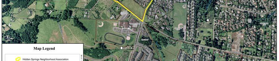
3 Table of Contents INTRODUCTION...1 NEIGHBORHOOD PROFILE...5 VISION STATEMENT...12 NEIGHBORHOOD OBJECTIVES Public Safety Neighborhood Character Land Use...14 Recreation...15 Transportation...15 ACTION CHART...18 MAPS Profile...3 Aerial...8 Zoning... 9 Parks and Open Space...10 Street Map...11
4 Introduction Neighborhood Plan Purpose The purpose of a neighborhood plan is to identify issues that are of concern to the residents of the neighborhood, and to devise strategies for addressing these concerns. In conjunction with broader policies and implementation measures contained within the City's comprehensive plan, the neighborhood planning process is intended to protect and enhance livability within specific neighborhoods, as well as help fulfill the overall community vision and create a more livable city. More specifically, the neighborhood plan is intended to: Educate both city government and neighborhood residents about the concerns and of each their visions for the future. Promote collaboration between the city and the neighborhood in order to achieve mutual goals and a shared sense of responsibility. Create a "sense of place" within the community by identifying and developing the assets within each neighborhood. Initiate change, rather than simply reacting to it, by addressing specific issues and opportunities. Achieve sensible and coordinated project and program planning within each neighborhood and among all neighborhoods. Strengthen neighborhoods. Relationship to the Comprehensive Plan In general, a comprehensive plan is intended to provide broad policy direction which is implemented through more specific development regulations and capital expenditure programs. Comprehensive plans do not, however, typically address the more immediate needs and concerns of individual neighborhoods. This is the purpose of a sub-area or neighborhood plan. The West Linn Comprehensive Plan was adopted in December 1983 and amended in July 2000 and October The Comprehensive Plan provides the basis for plans, ordinances, and other implementing documents that set forth more detailed direction regarding specific activities and requirements. All City plans and implementing ordinances must be consistent with the Plan. Furthermore the Plan is comprehensive in scope and its goals and policies are intended to be supportive of one another. West Linn s Comprehensive Plan provides guidelines and standards for decision makers, including City employees and officials, citizens, developers, community groups, and other local, state, regional, and federal agencies. After adoption into the Comprehensive Plan, the purpose of the Hidden Springs Neighborhood Plan is to integrate neighborhood needs into the City's budget process; Multi-Year Street Improvement Program; Neighborhood Traffic Control Program; Parks, Recreation, and Open Space Plan; Community Development Code and other planning and funding programs. The policy statements included in the Plan may also be used by the City Council to guide future decisions involving development proposals and plan amendments affecting the neighborhood. 1
5 The Hidden Springs Neighborhood Leadership Planning Team, whose members come from the Neighborhood Association and the neighborhood at large, coordinated the development of this plan. Neighborhood Associations The City of West Linn encourages, recognizes and supports neighborhood associations. Neighborhood associations organized under provisions of Chapter 2.14 of the West Linn Municipal Code receive official recognition from the City of West Linn. Neighborhood associations are looked to by the City Council for advice and suggestions on any and all issues affecting the governance of the city, particularly on matters relating to the livability of the city's neighborhoods. A primary purpose of neighborhood associations is to facilitate communication between the residents of West Linn and their elected leaders, the city's staff, and the members of advisory boards and commissions. West Linn has 11 neighborhood associations. Each is made up of citizen volunteers. They elect officers, adopt bylaws and establish geographical boundaries. Each association is entitled to identify its own interests and set its own agenda. Neighborhood associations do not levy dues. Membership in a neighborhood association is open to anyone who lives, works or owns property within its boundaries. Neighborhood association activities may include monitoring and expressing neighborhood views on land-use issues or city policies and priorities, establishing neighborhood programs such as Neighborhood Watch or traffic safety projects, neighborhood beautification, organizing cultural or social functions such as neighborhood picnics or potlucks; neighborhood clean-ups, etc. Unlike privately organized homeowners' and recreation associations, neighborhood associations receive support from the City of West Linn. Under the city's Neighborhood Assistance Program, neighborhood associations may be reimbursed for their expenses in carrying out eligible activities and projects. In addition, neighborhood associations in West Linn have the right to appeal land-use decisions to the City Council without cost. Neighborhood associations promote citizen participation in developing city policies and strategies. They provide a means for reviewing and evaluating issues affecting neighborhoods and the community as a whole. They serve as a voice for neighborhood interests and concerns. They improve communications between the city and its residents. They promote neighborhood and community identity. The Neighborhood Planning Process This draft version of the Plan is available for review and comment by all residents of the neighborhood. A neighborhood vision, along with goals and policies, were developed based on the results of a spring, 2006 mail and internet-based questionnaire. Over several months, NPLT members revised the vision, goals, policies and actions into a draft neighborhood plan. Comments on the draft plan will be solicited from all neighborhood residents at a public meeting on Saturday, September 9 th at City Hall. Comments received at the 2
6 public meeting will be incorporated into a revised neighborhood plan, which will be distributed for a final review before it is endorsed by the Neighborhood Association and forwarded to the Planning Commission for their consideration. The City Council will then adopt the Plan by resolution. It is intended that city agencies will utilize the plan as input in developing more specific work programs and helping to establish city-wide funding priorities. It is recognized that many of the recommendations contained in the plan are conceptual only and may need to be analyzed in greater detail, both individually and in relationship to other recommendations. It should also be emphasized that funding sources may not exist for implementing all of the recommendations identified in the plan. Some of the actions identified in the plan are intended to be initiated and implemented by residents of the neighborhood. Overview of the Plan The Plan is organized into four sections. The Neighborhood Profile contains a general description of the current conditions within the neighborhood. The Neighborhood Vision describes the neighborhood's sense of identity and vision for its future. The Goals, Policies and Actions section identifies issues that are of concern to the residents of the neighborhood and potential strategies for addressing those concerns. 3


7 4
8 Neighborhood Profile Physical Description Hidden Springs is one of eleven neighborhoods in the City of West Linn. Located in the northwest region of the city, the 478-acre neighborhood is bordered by the Marylhurst and Robinwood neighborhoods to the north/northeast, by the Bolton and Rosemont Summit neighborhoods to the south/southeast, and by West Linn s urban growth boundary and city limits to the west. Hidden Springs lies atop a ridge that overlooks the Willamette and Tualatin Rivers. The topography of the neighborhood includes moderate to steep slopes. Elevations on top of the ridge average 550 feet, and Hidden Springs includes West Linn s highest point at 743 feet. There are several smaller bodies of water in the neighborhood, including Fern, Robin, Trillium, Heron, and Hidden Springs Creeks. Demographics The population of Hidden Springs is 3,105 according to 2005 estimates by Portland State University. This accounts for 12.8% of the city s population. Land Use The majority of Hidden Springs is zoned for single-family detached residential housing. Several portions of the neighborhood are zoned for singlefamily and multiple-family residences. There are no commercial properties in Hidden Springs. However, there are a number of home-based businesses. There are currently a total of 1,225 residential parcels, nine of which are vacant. These parcels hold 1,006 single-family residential units, 20 medium-density multi family units, 249 medium to high-density multi-family residential units, and five non-annexed single-family units. Parks and Recreation According to the 1998 Park, Recreation and Open Space Plan, Hidden Springs has 7.07 acres of developed parkland and landscaped areas and an additional acres of undeveloped open space. Palomino Park is classified as a mini-park. This 0.57-acre site contains a paved play area for children. The 2005 Park, Recreation and Open Space Plan Update calls for the development of a trail that connects Palomino Park to the Hidden Springs trail system. Benski Park is one of two neighborhood parks in Hidden Springs. This 1.68-acre park contains a paved play area and play equipment, climbing structure, volleyball court, open grass area, drinking fountain, picnic tables and benches. The 2005 Plan Update calls for Benski Park to be connected to Hidden Springs and Carriage Way through a trail system. Sunburst Park is the second neighborhood park in Hidden Springs. This 5.5-acre park has open grass play areas and a small forested pocket with trails. Other facilities include: a grass volleyball court, paved pathway, paved play area, playground equipment, picnic tables and benches. The 2005 Plan Update recommends improved 5
9 neighborhood access points, including signage, to make the park more inviting, and that the park should be managed for invasive species. Hidden Springs Park is a acre passive-oriented park that provides a significant corridor in northwestern West Linn. The 2005 Plan Update recommends trail improvements to improve neighborhood access and for the site to be managed for invasive species. Carriage Way is a passive-oriented park located near the western boundary of West Linn. The 2005 Plan Update calls for trail improvements to improve neighborhood access and for the site to be managed for invasive species. According to the 2005 Park, Recreation and Open Space Plan Update, a number of trails have been developed in and around Hidden Springs since There are paths in Carriage Way Open Space, Hidden Springs Open Space and Sunburst Park. In addition, there are paths connecting Hidden Springs Open Space to Palomino Park and Benski Park to Hidden Springs Park. Finally, there is a bike path that runs through the neighborhood along Hidden Springs Road. A pool and tennis courts are available for public use through paying membership fees to the Hidden Springs Recreation Association. Public Facilities Transportation Hidden Springs does not contain any major arterials, but includes several roads classified as minor arterials, including Rosemont Road, Santa Anita Drive and Hidden Springs Road. Rosemont Road is a two-lane, twoway roadway with a posted speed of 40 miles per hour. South of Miles Drive the speed limit drops to 25 miles per hour and continues through the length of Summit Street and Skyline Drive. There are sidewalks adjacent to recently developed areas, but otherwise there generally are no sidewalks. Rosemont carries about 4,900 vehicles daily near Hidden Springs Road, with about 500 vehicles (twoway) during the evening peak hour. A bikeway is planned from Summit to Santa Anita. Hidden Springs Road is a two-lane, two-way roadway with left-turn lanes at key locations. It has a posted speed of 25 miles per hour and generally has sidewalks on both sides. It carries about 2,450 vehicles per day near Rosemont Road and about 6,300 near Highway 43, with about 250 and 650 vehicles (twoway) during the evening peak hour, respectively. A bike lane exists from Rosemont Road to Willamette Drive. Santa Anita Drive is a two-lane, twoway roadway with left-turn lanes at key locations. It has a posted speed of 25 miles per hour and generally has sidewalks on the west side. It carries about 3,600 vehicles per day near Rosemont Road, with about 350 vehicles (two-way) during the evening peak hour. A bike lane is planned from Rosemont Road to Hidden Springs Road. Carriage Way, Pimlico Drive, Summit Street and Horton Road are classified as collector streets. Bike lanes are planned for Carriage Way, from 6
10 Rosemont Road to Hidden Springs Road and on Pimlico Drive from Willamette to Santa Anita Drive. Sidewalk improvements are planned throughout the neighborhood. West Linn is primarily a single-family residential community where income and car ownership is high. There currently is little incentive to use transit as only two public bus lines operated by TriMet service West Linn. Hidden Springs is not served by either bus route. Several proposed transit improvements include service to the Hidden Springs neighborhood. Water The existing water system in West Linn includes a reliable long-term source of water and the water quality is excellent. Storm Drainage Overall, the storm drainage system is in variable condition. Recommended improvements in Hidden Springs include replacing a number of under-capacity road and driveway culverts and undercapacity storm drains. Sanitary Sewer Upgrades are needed for several sewer segments throughout the neighborhood. Public Services Public schools in West Linn are part of the West Linn-Wilsonville Oregon School District. There are no schools in the Hidden Springs neighborhood. West Linn is served by its own police department and by the Tualatin Valley Fire and Rescue Service District. The West Linn Library, which services Hidden Springs, is located in the Bolton neighborhood. 7


11 8


12 9


13 10


14 11


15 Neighborhood Vision The residents of Hidden Springs seek to preserve and maintain their neighborhood as it was first conceived and as it exists today: a residential, non-commercial group of homes within the City of West Linn that provides a safe, peaceful and quiet respite to come home to. They advocate the preservation of the surrounding nondeveloped areas as rural buffers. 12
16 Goals, Policies and Actions Public Safety Goal 1: Ensure that Hidden Springs remains a safe neighborhood for families and children. Policy 1: Emphasize community actions to increase neighborhood safety. Action: 1. Facilitate and support the development of neighborhood watch and safe house programs. Policy 2: Improve communications with City representatives. Actions: 1. Establish and maintain open communication with the West Linn/Wilsonville School District. 2. Continue to receive reports from police at Neighborhood Association meetings. 3. Request that a City Councilor give a general report at quarterly Neighborhood Association meeting. Policy 3: Enhance fire and health safety. Actions: 1. Review and enhance measures to increase fire safety. 2. Establish a policy to phase out shake roofs. Partners: School District, Police Department, elected officials, city department representatives, Fire department. Land Use Goal 2: Preserve and maintain the character of the Hidden Springs neighborhood. Policy 1: Ensure new housing is designed to compliment existing housing. Action: 1. Support city efforts to establish and enforce limits on height, lot coverage and floor-to-area ratios. Policy 2: Manage growth to protect neighborhood character. Actions: 1. Maintain existing zoning (minimum lot sizes) per the Comprehensive Plan or downzone residential lots to maintain current densities of no greater than R Develop code to prohibit multiple subdivisions. 3. Develop code to restrict the creation of flag lots. 4. Create a partnership with adjacent neighborhood associations to work together on shared zoning issues. Policy 3: Educate neighborhood residents on City ordinances and procedures so that the Neighborhood Association can review and comment on proposed projects and/or zoning changes and provide testimony at public hearings. Action: 1. Support and encourage attendance at League of West Linn Neighborhoods training seminars. 13
17 2. Encourage the City to offer training to Neighborhood Association officers and members. Policy 4: Limit noise pollution and other nuisances. Actions: 1. Enforce noise regulations for traffic, dogs, and yard maintenance equipment. 2. Restrict truck traffic to local deliveries only and/or designate truck routes. 3. Enforce street parking regulations. 4. Mitigate light pollution by retrofitting public light fixtures. Policy 5: Encourage maintenance of private property. Actions: 1. Work with homeowner associations to maintain appearance of common areas. 2. Enforce regulations intended to maintain the appearance of private property. 3. Work with the City to host an annual neighborhood cleanup. Policy 6: Encourage home businesses to be good neighbors. Actions: 1. Prohibit the storage of commercial vehicles or materials on-site. 2. Enforce regulations that allow no more than six vehicle visits per day. Partners: Planning & Building, adjacent neighborhoods, West Linn League of Neighborhoods, Code Enforcement, Police Department, Chamber of Commerce. Natural Environment Goal 3: Acquire, maintain and protect open spaces and views. Policy 1: Plant and thoughtfully maintain trees, shrubs and other natural features to protect public views. Actions: 1. Place trail markers and benches in areas that make viewing sites and walking trails more accessible and usable for residents and visitors. 2. Encourage planting of medium specimen trees to reduce the obstruction of public views and impact on public utilities, existing structures and neighboring properties. 3. Educate, encourage and provide funds for homeowners to protect public views and care for older trees with proper pruning methods. 4. Notify public utilities to prune trees growing into power lines. 5. Post signs on public property to assist enforcement of policies that protect public rights-of-way and prohibit illegal tree cutting. Policy 2: Preserve and acquire open spaces that act as neighborhood buffers. Actions: 1. Work with the city to enforce the city s tree preservation ordinance. 2. Support city efforts to protect open spaces identified in the Parks and Recreation Plan and Comprehensive Plan. 3. Encourage the city to acquire additional open spaces. Partners: Parks and Recreation, arborist, Code Enforcement, Planning & Building, public utilities. 14

18 Parks and Recreation Goal 4: Provide a variety of parks and recreational opportunities for residents of Hidden Springs. Policy 1: Work with schools and other organizations to promote the use of existing facilities and programs and develop new recreational opportunities as necessary. Action: 1. Explore opportunities to create a teen center for area youth. Policy 2: Provide and maintain access to safe parks and trails. Action: 1. Aggressively pursue acquisition of the Erickson property for use as a park. Partners: Parks and Recreation, School District 4. Encourage the City to incorporate sustainable plants that reflect neighborhood aesthetics, and soils and irrigation systems for successful plantings as part of future median development and redevelopment, especially on Santa Anita Drive. Diagrams for Goal 5 Policy 1 Action 4 Transportation Goal 5: Facilitate the safe and efficient movement of cars, bicycles and pedestrians. Policy 1: Use traffic calming techniques where speeding is frequent and endangers bicyclists and pedestrians. Actions: 1. Enforce current speed limits throughout the neighborhood. 2. Use radar signs in strategic locations where speeding is frequent, including Santa Anita Drive. 3. Create a program to strategically plant trees on new streets and replace dead or dying trees on existing streets to develop tree canopies as a traffic calming technique. 15
19 5. Construct a landscaped curb extension to prevent traffic from turning right onto Appaloosa Way from Santa Anita Drive. 6. Use traffic calming techniques to slow traffic on Suncrest and Pimlico Drives and Hidden Springs Road, especially at the intersection of Rosemont and Hidden Springs Road. Policy 2: Develop and maintain safe places to walk, including sidewalks and other paths. Actions: 1. Provide the city with priority areas in need of sidewalks or sidewalk repair. 2. Use crosswalks, flashing lights and other techniques to ensure safe crossings for pedestrians. 3. Move the crosswalk on Santa Anita and Horton/Churchill Downs to the north side of street. Partners: Planning & Building, Public Works, ODOT. 16


20 Maps for Goal 5 Policy 1 Action 5 17
21 Action Chart The following Action Chart summarizes policies and actions in table format. In addition, the chart identifies the relative priority of each action along with the agencies and organizations responsible for implementing the actions. Recommended actions identified as having as a short-term priority are considered by the Neighborhood Association to be the most important. Medium priority action items are somewhat less important. Long-term actions are considered least important. ACTION CHART HIDDEN SPRINGS NEIGHBORHOOD PLAN Policies and Action Steps Timeframe Responsible Party(s) GOAL 1: SAFETY Policy 1: Emphasize community actions to increase neighborhood safety. 1. Facilitate and support the development of neighborhood watch and safe house programs. S West Linn/Wilsonville School District Policy 2: Improve communications with City representatives. 1. Establish and maintain open communication with the West Linn/Wilsonville School District M West Linn/Wilsonville School District Legend: = Lead role = Supporting role S = Short-term action (1-2 years) M = Medium-term action (3-5 years) L = Long-term Action (6-10 years) 18
22 Policies and Action Steps Timeframe Responsible Party(s) 2. Continue to receive reports from police at Neighborhood Association meetings. 3. Request that a City Councilor give a general report at quarterly Neighborhood Association meetings. Policy 3: Enhance fire and health safety. M S City Council 1. Review and enhance measures to increase fire safety. M Fire Department 2. Establish a policy to phase out shake roofs. M GOAL 2: LAND USE Policy 1: Ensure new housing is designed to compliment existing housing. 1. Support city efforts to establish and enforce limits on height, lot coverage S and floor-to-area ratios. Policy 2: Manage growth to protect neighborhood character. 1. Maintain existing zoning (minimum lot sizes) per the Comprehensive Plan S or downzone residential lots to maintain current densities of no greater than R Develop code to prohibit multiple subdivisions. S 3. Develop code to restrict the creation of flag lots. S 4. Create a partnership with adjacent neighborhood associations to work together on shared zoning issues. M Adjacent neighborhood associations Policy 3: Educate neighborhood residents on city ordinances and procedures so that the Neighborhood Association can review and comment on proposed projects and/or zoning changes and provide testimony at public hearings. Legend: = Lead role = Supporting role S = Short-term action (1-2 years) M = Medium-term action (3-5 years) L = Long-term Action (6-10 years) 19
23 Policies and Action Steps Timeframe Responsible Party(s) 1. Support and encourage attendance at League of West Linn M League of West Linn Neighborhoods training seminars. Neighborhoods 2. Encourage the City to offer training to Neighborhood Association officers and members. Legend: = Lead role = Supporting role S = Short-term action (1-2 years) M = Medium-term action (3-5 years) L = Long-term Action (6-10 years) S Policy 4: Limit noise pollution and other nuisances. 1. Enforce noise regulations for traffic, dogs, and yard maintenance S equipment. 2. Restrict truck traffic to local deliveries and/or designate truck routes. S 3. Enforce street parking regulations. M 4. Mitigate light pollution by retrofitting public light fixtures. L Policy 5: Encourage maintenance of private property. 1. Work with homeowner associations to maintain appearance of common S areas. 2. Enforce regulations intended to maintain the appearance of private property. 3. Work with the City to host an annual neighborhood cleanup. M Policy 6: Encourage home businesses to be good neighbors. 1. Enforce regulations that prohibit storage of commercial materials or M Chamber of Commerce vehicles on site. 2. Enforce regulations that allow no more than six vehicle visits per day. M Chamber of Commerce S 20
24 Policies and Action Steps Timeframe Responsible Party(s) Legend: = Lead role = Supporting role S = Short-term action (1-2 years) M = Medium-term action (3-5 years) L = Long-term Action (6-10 years) GOAL 3: NATURAL ENVIRONMENT Policy 1: Plant and thoughtfully maintain trees, shrubs and other natural features to protect and provide better access to public views. 1. Place trail markers and benches in areas that make viewing sites and M walking trails more accessible and usable for residents and visitors. 2. Encourage planting of medium specimen trees to reduce the obstruction of public views and impact on public utilities, existing structures and neighborhood properties. 3. Educate, encourage and provide funds for homeowners to maintain older trees with property pruning methods. M M 4. Notify public utilities to prune trees growing into power lines. M Public utility companies 5. Post signs on public property to assist enforcement of policies that protect public rights-of-way and prohibit illegal tree cutting. L Policy 2: Preserve and acquire open spaces that act as neighborhood buffers. 1. Work with the City to enforce the city s tree preservation ordinance. S 2. Support city efforts to protect open spaces identified in the Parks and Recreation Plan and Comprehensive Plan. S 3. Encourage the City to acquire additional open spaces. M GOAL 4: PARKS AND RECREATION Policy 1: Work with schools and other organizations to promote the use of existing facilities and programs and develop new recreational opportunities as necessary. 1. Explore opportunities to create a teen center for area youth. M West Linn/Wilsonville School District 21
25 Policies and Action Steps Timeframe Responsible Party(s) Policy 2: Provide and maintain access to safe parks and trails. 1. Aggressively pursue acquisition of the Erickson property for use as a park. S GOAL 5: TRANSPORTATION Policy 1: Use traffic calming techniques where speeding is frequent and endangers bicyclists and pedestrians. 1. Enforce current speed limits throughout the neighborhood. S 2. Use radar signs in strategic locations where speeding is frequent, including Santa Anita Drive. 3. Create a program to strategically plant trees on new streets and replace dead or dying trees on existing streets to develop street tree canopies as a traffic calming technique. 4. Encourage the City to incorporate sustainable plants that reflect neighborhood aesthetics, and soils and irrigation systems for successful plantings as part of future median development and redevelopment, especially on Santa Anita Drive. 5. Construct a landscaped curb extension to prevent traffic from turning right onto Appaloosa Way from Santa Anita Drive. 6. Use traffic calming techniques to slow traffic on Suncrest and Pimlico Drives and Hidden Springs Road, especially at the intersection of Rosemont and Hidden Springs Road. S M M S S Policy 2: Develop and maintain safe places to walk, including sidewalks and other paths. 1. Provide the City with priority areas in need of sidewalks or sidewalk S repair. Legend: = Lead role = Supporting role S = Short-term action (1-2 years) M = Medium-term action (3-5 years) L = Long-term Action (6-10 years) 22
26 Policies and Action Steps Timeframe Responsible Party(s) 2. Use crosswalks, flashing lights and other techniques to ensure safe crossings for pedestrians. 3. Move the crosswalk on Santa Anita and Horton/Churchill Downs to the north side of street. S M Legend: = Lead role = Supporting role S = Short-term action (1-2 years) M = Medium-term action (3-5 years) L = Long-term Action (6-10 years) 23
Exhibit 1 PLANNING COMMISSION AGENDA ITEM
 Exhibit 1 PLANNING COMMISSION AGENDA ITEM Project Name: Grand Junction Circulation Plan Grand Junction Complete Streets Policy Applicant: City of Grand Junction Representative: David Thornton Address:
Corpus Christi Metropolitan Transportation Plan Fiscal Year Introduction:
 Introduction: The Safe, Accountable, Flexible, Efficient Transportation Equity Act: A Legacy for Users (SAFETEA-LU) has continued the efforts started through the Intermodal Surface Transportation Efficiency
COUNCIL POLICY NAME: COUNCIL REFERENCE: 06/119 06/377 09/1C 10llC 12/1C INDEX REFERENCE: POLICY BACKGROUND
 COUNCIL POLICY NAME: COUNCIL ADVISORY COMMITTEES - TERMS OF REFERENCE ISSUED: APRIL 3, 2006 AMENDED: NOVEMBER 27, 2006 NOVEMBER 23, 2009 JANUARY 11, 2010 DECEMBER 17, 2012 POLICY COUNCIL REFERENCE: 06/119
Solana Beach Comprehensive Active Transportation Strategy (CATS)
") Solana Beach Comprehensive Active Transportation Strategy (CATS) 3.0 Goals & Policies The Solana Beach CATS goals and objectives outlined below were largely drawn from the Solana Beach Circulation Element
Solana Beach Comprehensive Active Transportation Strategy (CATS) 3.0 Goals & Policies The Solana Beach CATS goals and objectives outlined below were largely drawn from the Solana Beach Circulation Element
Chapter 7. Transportation. Transportation Road Network Plan Transit Cyclists Pedestrians Multi-Use and Equestrian Trails
 Chapter 7 Transportation Transportation Road Network Plan Transit Cyclists Pedestrians Multi-Use and Equestrian Trails 7.1 TRANSPORTATION BACKGROUND The District of Maple Ridge faces a number of unique
West Dimond Blvd Upgrade Jodhpur Street to Sand Lake Road
 West Dimond Blvd Jodhpur St to Sand Lake CSS Transportation Project Summary Municipality of Anchorage Project # 05 005 Project Manager: John Smith, P.E. (MOA PM&E) Project Administrator: Julie Makela,
Borough of Danville, PA Traffic Calming Program Guidelines
 Borough of Danville, PA Traffic Calming Program Guidelines Adopted by Borough Council on 1 INTRODUCTION Speeding Traffic is a major concern in the Borough of Danville because of its detrimental impacts
Living Streets Policy
 Living Streets Policy Introduction Living streets balance the needs of motorists, bicyclists, pedestrians and transit riders in ways that promote safety and convenience, enhance community identity, create
Roadway Classification Design Standards and Policies. Pueblo, Colorado November, 2004
 Roadway Classification Design Standards and Policies Pueblo, Colorado November, 2004 Table of Contents Page Chapter 1. General Provisions 1.1 Jurisdiction 3 1.2 Purpose and Intent 3 1.3 Modification 3
CITY OF COCOA BEACH 2025 COMPREHENSIVE PLAN. Section VIII Mobility Element Goals, Objectives, and Policies
 CITY OF COCOA BEACH 2025 COMPREHENSIVE PLAN Section VIII Mobility Element Goals, Objectives, and Policies Adopted August 6, 2015 by Ordinance No. 1591 VIII MOBILITY ELEMENT Table of Contents Page Number
Vision: Traditional hamlet with an attractive business/pedestrian friendly main street connected to adjacent walkable neighborhoods
 N D. Focus Area II Vision: Traditional hamlet with an attractive business/pedestrian friendly main street connected to adjacent walkable neighborhoods Transit Road Focus Area II is located in the Hamlet
General Plan Circulation Element Update Scoping Meeting April 16, 2014 Santa Ana Senior Center, 424 W. 3rd Street, Santa Ana, CA 92701
 General Plan Circulation Element Update Scoping Meeting April 16, 2014 Santa Ana Senior Center, 424 W. 3rd Street, Santa Ana, CA 92701 Meeting Agenda 1. Purpose of Scoping Meeting 2. Project Overview 3.
RESOLUTION NO ?? A RESOLUTION OF THE CITY OF NEPTUNE BEACH ADOPTING A COMPLETE STREETS POLICY
 RESOLUTION NO. 2018-?? A RESOLUTION OF THE CITY OF NEPTUNE BEACH ADOPTING A COMPLETE STREETS POLICY WHEREAS, safe, convenient, and accessible transportation for all users is a priority of the City of Neptune
AGENDA REPORT. Issue: Discussion of potential improvements on Barnwell Road at Niblick Drive
 AGENDA REPORT To: From: By: Honorable Mayor and City Council Members Warren Hutmacher, City Manager Tom Black, Public Works Director Date: March 23, 2016 Agenda: March 28, 2016 WORK SESSION AGENDA: Barnwell
CONNECTING PEOPLE TO PLACES
 CONNECTING PEOPLE TO PLACES 82 EAST BENCH MASTER PLAN 07 Introduction The East Bench transportation system is a collection of slow moving, treelined residential streets and major arteries that are the
Ocean Park Boulevard Green Street Project Alternatives & Trade Offs
 Planning Commission March 4, 2009 Ocean Park Boulevard Green Street Project Alternatives & Trade Offs Purpose of Tonight s Meeting Review concept plans and options Provide input on alternatives and trade-offs
o n - m o t o r i z e d transportation is an overlooked element that can greatly enhance the overall quality of life for the community s residents.
 N o n - m o t o r i z e d transportation is an overlooked element that can greatly enhance the overall quality of life for the community s residents. 84 Transportation CHAPTER 11 INTRODUCTION Transportation
Ann Arbor Downtown Street Plan
 1 Ann Arbor Downtown Street Plan Public Workshop #1 We know that. 2 Public right-of-way (streets, sidewalks, and alleys) make up 30% of the total District area of downtown. Streets need to provide mobility
Executive Summary Route 30 Corridor Master Plan
 Route Corridor Master Plan Project Overview The Route Corridor Master Plan is a coordinated multimodal transportation and land use plan for the entire stretch of Route through East Whiteland Township,
Clackamas County Comprehensive Plan
 ROADWAYS The County s road system permits the movement of goods and people between communities and regions, using any of a variety of modes of travel. Roads provide access to virtually all property. They
Perryville TOD and Greenway Plan
 Perryville TOD and Greenway Plan Greenway Glossary Pathway: A bicycle and pedestrian path separated from motorized vehicular traffic by an open space, barrier or curb. Multi-use paths may be within the
REGIONAL BICYCLE AND PEDESTRIAN DESIGN GUIDELINES
 REGIONAL BICYCLE AND PEDESTRIAN DESIGN GUIDELINES November 16, 2011 Deb Humphreys North Central Texas Council of Governments Bicycle and Pedestrian Advisory Committee Snapshot of the Guide 1. Introduction
NEIGHBORHOOD TRAFFIC CALMING POLICY
 NEIGHBORHOOD TRAFFIC CALMING POLICY I. PURPOSE The City of Kent continually strives to strengthen and protect its neighborhoods by improving the quality of life in residential areas. Traffic conditions
University of Victoria Campus Cycling Plan Terms of Reference. 1.0 Project Description
 University of Victoria Campus Cycling Plan Terms of Reference 1.0 Project Description The Campus Cycling Plan, a first for the University, will provide a comprehensive and coordinated approach to support
County of Greenville South Carolina. Traffic Calming Program Neighborhood Traffic Education Program and Speed Hump Program
 County of Greenville South Carolina Traffic Calming Program Neighborhood Traffic Education Program and Speed Hump Program (rev) August 2008 I. PURPOSE The potential negative impacts from vehicular traffic
5 CIRCULATION AND STREET DESIGN
 5 CIRCULATION AND STREET DESIGN This chapter describes circulation and streetscape improvements proposed for the Northwest Chico Specific Plan Area. It includes detailed design specifications for existing
City of Novi Non-Motorized Master Plan 2011 Executive Summary
 City of Novi Non-Motorized Master Plan 2011 Executive Summary Prepared by: February 28, 2011 Why Plan? Encouraging healthy, active lifestyles through pathway and sidewalk connectivity has been a focus
New Measure A Expenditure Categories DEFINITIONS OF ELIGIBLE EXPENDITURES Adopted March 8, 2007
 New Measure A Expenditure Categories DEFINITIONS OF ELIGIBLE EXPENDITURES Adopted March 8, 2007 City Street and County Road Maintenance Program The preservation and keeping of public street and road rights-of-way
MAG Town of Cave Creek Bike Study Task 6 Executive Summary and Regional Significance Report
 Page 1 MAG Town of Cave Creek Bike Study Task 6 Executive Summary and Regional Significance Report August 1, 2012 MAG Project #481 Page 2 Task 6 Executive Summary and Regional Significance Report Introduction
Chapter 2. Bellingham Bicycle Master Plan Chapter 2: Policies and Actions
 Chapter 2 Bellingham Bicycle Master Plan Chapter 2: Policies and Actions Chapter 2: Policies and Actions The Bicycle Master Plan provides a road map for making bicycling in Bellingham a viable transportation
Bicycle Master Plan Goals, Strategies, and Policies
 Bicycle Master Plan Goals, Strategies, and Policies Mobilizing 5 This chapter outlines the overarching goals, action statements, and action items Long Beach will take in order to achieve its vision of
David Hung, Associate Planner City of Sacramento Community Development Department 300 Richards Boulevard, 3 rd Floor Sacramento, CA
 June 13, 2016 VIA EMAIL David Hung, Associate Planner City of Sacramento Community Development Department 300 Richards Boulevard, 3 rd Floor Sacramento, CA 959811 RE: Fire Station 14 (DR16-128) Dear Mr.
DRAFT - CITY OF MEDFORD TRANSPORTATION SYSTEM PLAN Roadway Cross-Sections
 Roadway Cross-Sections Medford s roadway cross-section standards apply to new and reconstructed roads. The crosssections take into consideration roadway function and operational characteristics, including
CITY OF ELKO BICYCLE AND PATHWAY PLAN
 CITY OF ELKO BICYCLE AND PATHWAY PLAN INTRODUCTION: The City of Elko is intended to provide the basic framework for the development of a functional bicycle and pathway system for the community with connections
Introduction Parks Open Space Standards Recreation & Open Space Land Use Design Principles
 Chapter Seven: Parks, Recreation, & Open Space Chapter Seven: Parks, Recreation, & Open Space Introduction Parks Open Space Standards Recreation & Open Space Land Use Design Principles September 2008 Page
12 RECOMMENDATIONS Road Improvements. Short Term (generally the next five years)
") 12 RECOMMENDATIONS Recommendations are based on the technical analysis of existing and future road and active transportation conditions, the results of the review of existing City policies and public feedback.
12 RECOMMENDATIONS Recommendations are based on the technical analysis of existing and future road and active transportation conditions, the results of the review of existing City policies and public feedback.
Lee s Summit Road Improvement Study Public Open House June 7, 2007 Summary of Comment Card Responses
 Lee s Summit Road Improvement Study Public Open House June 7, 2007 Summary of Comment Card Responses Introduction At the Lee s Summit Road Improvement Study Public Open House held Thursday, June 7, 2007
CONNECTIVITY PLAN. Adopted December 5, 2017 City of Virginia Beach
 CONNECTIVITY PLAN Adopted December 5, 2017 City of Virginia Beach CONTENTS 1.0 Background & Purpose... 2 2.0 Existing Inventory & Analysis... 3 ViBe District Existing Walking Conditions... 4 3.0 ViBe District
Michael Parmer, Management Aide, City Manager's Office
 P139 STAFF REPORT f CITY NL- NAGER' S OFFICE RANCHO Date: C;UCAMONGA To: From: Subject: Mayor and Members of the City Council John R. Gillison, City Manager Michael Parmer, Management Aide, City Manager's
Report. Typical Sections. City of Middleton, WI
 Report Typical Sections City of Middleton, WI December 2006 Report for City of Middleton, Wisconsin Typical Sections repared by: Traffic Associates LLC and STRAND ASSOCIATES, INC. 910 West Wingra Drive
Environment and Public Works Committee Presentation
 Mixed Use Centers Complete Streets Guidelines Project Environment and Public Works Committee Presentation December 10, 2008 Project Objectives: Conduct an inter-departmental and agency process to study
EXECUTIVE SUMMARY. Vision
 Vision Walking and bicycling in Salt Lake City will be safe, convenient, comfortable, and viable transportation options that connect people to places, foster recreational and economic development opportunities,
Third Street Bridge & Corridor Project
 Third Street Bridge & Corridor Project Preparation for the FY2018 budget to commence October 1, 2017, includes funding to address a project that has been considered since 1994. The Third Street bridge
County of Spartanburg South Carolina
 County of Spartanburg South Carolina Traffic Calming Program June 2012 (Revised/Program on Hold) PURPOSE The potential negative impacts from vehicular traffic on residential roads have been a longstanding
Street Paving and Sidewalk Policy
 City Commission Policy 600 Street Paving and Sidewalk Policy DEPARTMENT: Public Works DATE ADOPTED: June 7, 1995 DATE OF LAST REVISION: December 10, 2014 Policy No. 600.01 AUTHORITY: PASS City of Tallahassee-Leon
Proposed. City of Grand Junction Complete Streets Policy. Exhibit 10
 Proposed City of Grand Junction Complete Streets Policy Exhibit 10 1 City of Grand Junction Complete Streets Policy Vision: The Complete Streets Vision is to develop a safe, efficient, and reliable travel
11/28/2016 VIA
 11/28/2016 VIA EMAIL Ethan Meltzer, Assistant Planner City of Sacramento Community Development Department 300 Richards Blvd., 3 rd Floor Sacramento, Ca 95811 RE: Natomas Corporate Center Commercial Building
NM-POLICY 1: Improve service levels, participation, and options for non-motorized transportation modes throughout the County.
 Transportation PRINCE WILLIAM COUNTY 2008 COMPREHENSIVE PLAN NON-MOTORIZED PLAN CONTENTS Goals, Policies, and Action Strategies Table 4 (Bike Facility Classifications and Descriptions) Table 5 (Bike Facility
CHAPTER 7.0 IMPLEMENTATION
 CHAPTER 7.0 IMPLEMENTATION Achieving the vision of the Better Streets Plan will rely on the ability to effectively fund, build and maintain improvements, and to sustain improvements over time. CHAPTER
6/22/2018 VIA . Darcy Goulart, Planning Manager City of Rancho Cordova Planning Department 2729 Prospect Park Drive Rancho Cordova, CA 95670
 6/22/2018 VIA EMAIL Darcy Goulart, Planning Manager City of Rancho Cordova Planning Department 2729 Prospect Park Drive Rancho Cordova, CA 95670 RE: Quick Quack Car Wash (DD9801) Dear Ms. Goulart: WALKSacramento
TRAFFIC CALMING TOOLBOX. For the residents of the City of Decatur, Georgia
 TRAFFIC CALMING TOOLBOX For the residents of the City of Decatur, Georgia 2 City of Decatur Traffic Calming Toolbox Public Works Department 2635 Talley Street Decatur, GA 30030 404.377.5571 3 Welcome to
CITY OF BLOOMINGTON COMPLETE STREETS POLICY
 CITY OF BLOOMINGTON COMPLETE STREETS POLICY POLICY OBJECTIVE: The City of Bloomington will enhance safety, mobility, accessibility and convenience for transportation network users of all ages and abilities,
2.0 Existing Conditions
 20 2.0 Existing Conditions 2.1 Land Use, Future Growth Patterns, Physical Barriers Geographic Overview Sutter County s land use pattern is characterized by extensive agricultural areas, significant natural
5/31/2016 VIA . Arwen Wacht City of Sacramento Community Development Department 300 Richards Blvd., 3 rd Floor Sacramento, CA 95811
 5/31/2016 VIA EMAIL Arwen Wacht City of Sacramento Community Development Department 300 Richards Blvd., 3 rd Floor Sacramento, CA 95811 RE: El Pollo Loco (P16-028) Dear Ms. Wacht: WALKSacramento has reviewed
Active Transportation Infrastructure Investment A Business Case
 Active Transportation Infrastructure Investment A Business Case In 2016, the Real Estate Foundation awarded the Capital Regional District a $50,000 grant for Shifting Gears: Land Use Change through Active
PEDESTRIAN ACTION PLAN
 ATTACHMENT 2 CITY OF SANTA MONICA PEDESTRIAN ACTION PLAN CITY OF SANTA MONICA PEDESTRIAN ACTION PLAN This page intentionally left blank EXECUTIVE SUMMARY CHAPTER 1 EXECUTIVE SUMMARY Setting the Stage
TOWN OF WILLIAMSTON, SC BICYCLE AND PEDESTRIAN MASTER PLAN TOWN OF WILLIAMSTON, SC BICYCLE AND PEDESTRIAN MASTER PLAN
 TOWN OF WILLIAMSTON, SC BICYCLE AND PEDESTRIAN MASTER PLAN Americans Want Choices 55% of Americans would rather drive less & walk more. Transit use is growing faster than population or highway travel.
Traffic Calming Policy
 Article I. Purpose and Goal. The purpose of this policy is to establish criteria and procedures the City will use to evaluate requests for, and if appropriate, implement traffic calming measures. Neighborhood
PHILOMATH TSP Citizen Advisory Committee (CAC) Meeting Notes Thursday, February 25, :00 PM
 Meeting Notes Thursday, February 25, :00 PM") PHILOMATH TSP Citizen Advisory Committee (CAC) Meeting Notes Thursday, February 25, 2016 6:00 PM Present: Citizen Members: Sonlla Heern, Ron Hartz, Van Hunsaker, Lauri Lehman, Severn Thomas, Rick Wells.
PHILOMATH TSP Citizen Advisory Committee (CAC) Meeting Notes Thursday, February 25, 2016 6:00 PM Present: Citizen Members: Sonlla Heern, Ron Hartz, Van Hunsaker, Lauri Lehman, Severn Thomas, Rick Wells.
CITY OF SAINT JOHN TRAFFIC CALMING POLICY
 CITY OF SAINT JOHN TRAFFIC CALMING POLICY VERSION: 1.0 April 10, 2012 Pedestrians, Cyclists and Motorists Sharing Street Spaces CONTENTS INTRODUCTION... 3 POLICY GOAL... 3 POLICY OBJECTIVES... 3 GUIDING
HOOPA DESIGN FAIR 4. IMPLEMENTATION PHASES & FUNDING
 4. IMPLEMENTATION PHASES & FUNDING HOOPA DESIGN FAIR 4-1 4. IMPLEMENTATION PHASES & FUNDING Phase One Development 1. Implementation The Conceptual Plan recommends five concept elements to revitalize downtown
SECTION 1 - TRAFFIC PLANNING
 SECTION 1 - TRAFFIC PLANNING 1.1 TRAFFIC OPERATIONS 1.1.1 Roadway Functional Classification The Multnomah County Comprehensive Framework Plan s Policy 34: Trafficways and the Functional Classification
CITY MANUALS AND STANDARDS REVIEW
 GEORGETOWN SIDEWALK MASTER PLAN CITY MANUALS AND STANDARDS REVIEW RESOURCES AND STANDARDS As part of the Master Plan process, a review and evaluation of current City documents and policies relevant to
5 Transit & Traffic. Overview
 5 Transit & Traffic Overview Montgomery Place s roadways and overall traffic circulation are unique in the city due to the narrow streets and avenues with boulevards; however, no sidewalks or curbs in
Draft Traffic Calming Policy Paper
 Draft Traffic Calming Policy Paper What is Traffic Calming The term traffic calming is defined differently throughout the United States. The Institute of Transportation Engineers, an international educational
Non-Motorized Transportation 7-1
 Non-Motorized Transportation 7-1 Transportation facilities no longer mean just accommodating a vehicle powered by a combustion engine. Pedestrian and non-motorized facilities are important modes of travel
WELCOME. Purpose of the Open House. Update you on the project. Present a draft recommended plan. Receive your input
 WELCOME Purpose of the Open House The Town of Smiths Falls has initiated the Beckwith Street Redevelopment Plan that includes the preparation of a streetscape functional design for the renewal of Beckwith
SAN FRANCISCO MUNICIPAL TRANSPORTATION AGENCY
 THIS PRINT COVERS CALENDAR ITEM NO. : 10.2 DIVISION: Sustainable Streets BRIEF DESCRIPTION: SAN FRANCISCO MUNICIPAL TRANSPORTATION AGENCY Adopting Conceptual Proposal for Streetscape Improvements to Broadway,
City of Wilsonville 5 th Street to Kinsman Road Extension Project
 City of Wilsonville 5 th Street to Kinsman Road Walking Tour & Neighborhood Workshop Summary Report Public Outreach Overview On July 18 th, 2017, the City of Wilsonville hosted a neighborhood walking tour
TOWN OF PORTLAND, CONNECTICUT COMPLETE STREETS POLICY
 TOWN OF PORTLAND, CONNECTICUT COMPLETE STREETS POLICY I. VISION, GOALS & PRINCIPLES VISION To improve the streets of Portland making them safer and more accessible for all users including pedestrians,
Circulation in Elk Grove includes: Motor vehicles, including cars and trucks
 Circulation, as it is used in this General Plan, refers to the many ways people and goods move from place to place in Elk Grove and the region. Circulation in Elk Grove includes: Motor vehicles, including
TRAFFIC CALMING GUIDE FOR TORONTO CITY OF TORONTO TRANSPORTATION SERVICES DIVISION
 TRAFFIC CALMING GUIDE FOR TORONTO CITY OF TORONTO TRANSPORTATION SERVICES DIVISION CITY OF TORONTO TRANSPORTATION SERVICES DIVISION 2016 TRAFFIC CALMING GUIDE FOR TORONTO TABLE OF CONTENTS Introduction
APPENDIX A: Complete Streets Checklist DRAFT NOVEMBER 2016
 APPENDIX A: Complete Streets Checklist DRAFT NOVEMBER 2016 Complete Streets Checklist MetroPlan Orlando s Complete Streets Checklist is an internal planning tool for staff to further implementation of
5. Pedestrian System. Accomplishments Over the Past Five Years
 5. Pedestrian System Accomplishments Over the Past Five Years The Alamo Area Metropolitan Planning Organization (MPO) and its partner agencies recognize the importance of improving pedestrian mobility.
City of Elizabeth City Neighborhood Traffic Calming Policy and Guidelines
 City of Elizabeth City Neighborhood Traffic Calming Policy and Guidelines I. Purpose: The City of Elizabeth City is committed to ensure the overall safety and livability of residential neighborhoods. One
Ocean Park Boulevard Green Street Project Community Workshop
 Ocean Park Boulevard Green Street Project Community Workshop 2.2.10 Project Objectives Community Priority: reclaim OPB for public open space. Build upon LUCE principles; neighborhood enhancement, connectivity,
3/10/2016 VIA th Street, Suite 203 Sacramento, CA
 3/10/2016 VIA EMAIL Arwen Wacht, Associate Planner City of Sacramento Community Development Department 300 Richards Boulevard, 3 rd Floor Sacramento, CA 95811 RE: Natomas Fountains (P16-012) Dear Ms. Wacht:
City of Waterloo Complete Streets Policy
 City of Waterloo Complete Streets Policy Chris Hodgson P. Eng City of Waterloo Complete Streets Forum 2011 April 28-29 Toronto Waterloo context: Current population Major employers Universities and student
TABLE OF CONTENTS. Executive Summary
 Executive Summary Background... ES-1 Pedestrian Network... ES-2 Bikeway Network... ES-2 Collision History... ES-2 Public Input... ES-4 Conclusions and Recommendations... ES-4 1. Introduction and Setting
Montgomery County Life Sciences Center Loop Trail
 Montgomery County Life Sciences Center Loop Trail Advisory Committee Meeting #1 February 10, 2015 Agenda 1. Project Background 2. Existing Conditions Analysis 3. Examples from Elsewhere 4. Discussion Project
BIKE PLAN CONTENTS GATEWAY
 CONTENTS Acknowledgments...vii Great Rivers Greenway District Board of Directors... vii Great Rivers Greenway District Staff... vii Project Consultants... vii Committees... viii Citizens Advisory Committee
POLICY: TRAFFIC CALMING
 2006 MAY REFERENCE: COUNCIL APPROVED BY COUNCIL MAY 23, 2006 CITY OPERATIONS - NO. 608 POLICY: TRAFFIC CALMING A. All requests for traffic calming within the City shall be considered in accordance with
ADOT Statewide Bicycle and Pedestrian Program Summary of Phase IV Activities APPENDIX B PEDESTRIAN DEMAND INDEX
 ADOT Statewide Bicycle and Pedestrian Program Summary of Activities APPENDIX B PEDESTRIAN DEMAND INDEX May 24, 2009 Pedestrian Demand Index for State Highway Facilities Revised: May 29, 2007 Introduction
Chapter 5 Future Transportation
 Chapter 5 Future Transportation The Future Land Use Plan identifies the desired land use designations. The land uses desired for Crozet depend, in large part, on the success of the transportation system,
Complete Streets Policy DAVID CRONIN, P.E., CITY ENGINEER
 Complete Streets Policy DAVID CRONIN, P.E., CITY ENGINEER Complete Streets City Commission adopted a Complete Streets policy in 2012 Complete Streets are road networks that are designed for all users:
Section 9. Implementation
 Section 9. Implementation The transportation system is just one of many aspects that must be carefully planned to maintain and enhance the quality of living in Cecil County. The Cecil County Bicycle Plan
8/31/2016 VIA . RE: Freeport Arco Fuel Station (P16-039)
") 8/31/2016 VIA EMAIL Garrett Norman, Assistant Planner City of Sacramento Community Development Department 300 Richards Boulevard, 3 rd Floor Sacramento, CA 95811 RE: Freeport Arco Fuel Station (P16-039)
8/31/2016 VIA EMAIL Garrett Norman, Assistant Planner City of Sacramento Community Development Department 300 Richards Boulevard, 3 rd Floor Sacramento, CA 95811 RE: Freeport Arco Fuel Station (P16-039)
TRAFFIC IMPACT STUDY CRITERIA
 Chapter 6 - TRAFFIC IMPACT STUDY CRITERIA 6.1 GENERAL PROVISIONS 6.1.1. Purpose: The purpose of this document is to outline a standard format for preparing a traffic impact study in the City of Steamboat
PEDESTRIAN NETWORK PLAN
 GRAHAM PEDESTRIAN TRANSPORTATION PLAN Chapter 3 A 3.1 Overview new pedestrian network plan for the City of Graham has been developed based on an examination of the existing conditions (Chapter 2) and an
INDOT Complete Streets Guideline & Policy
 INDOT Complete Streets Guideline & Policy INTRODUCTION The Complete Streets guidelines build upon multiple efforts and promote a multimodal transportation system that is integrated and sustains land use
CHAPTER 16 PEDESTRIAN FACILITIES DESIGN AND TECHNICAL CRITERIA TABLE OF CONTENTS
 CHAPTER 16 PEDESTRIAN FACILITIES DESIGN AND TECHNICAL CRITERIA TABLE OF CONTENTS Section Title Page 16.1 General... 16-1 16.1.1 AASHTO Reference... 16-1 16.1.2 ADA Requirements... 16-1 16.2 Sidewalks...
Omaha s Complete Streets Policy
 Omaha s Complete Streets Policy (Adopted August 2015) VISION To create great places and enhance our quality of life, the City of Omaha will provide safe, accessible streets for all users. Complete Streets
Classification Criteria
 SCHEDULE D TO RECOMMENDED OFFICIAL PLAN AMENDMENT NO. 40 SCHEDULE C-4 Road Criteria Criteria Traffic Service Objective Land Service/Access Typical Daily Traffic Volume Flow characteristics Travel Speed
PRINCE GEORGE S PLAZA METRO AREA PEDESTRIAN PLAN
 PRINCE GEORGE S PLAZA METRO AREA PEDESTRIAN PLAN May 28, 2008 Agenda Welcome and introductions Project overview and issue identification Planning context and strengths Design challenges and initial recommendations
Bicycle-Pedestrian Master Plan Update
 Bicycle-Pedestrian Master Plan Update Planning & Zoning Commission November 29, 2017 Overview Project Purpose & Scope Project History Plan Vision & Goals Chapter 5: Making Connections-Beyond the Path Next
Chapter 14 PARLIER RELATIONSHIP TO CITY PLANS AND POLICIES. Recommendations to Improve Pedestrian Safety in the City of Parlier (2014)
") Chapter 14 PARLIER This chapter describes the current status and future plans for biking and walking in the City of Parlier. RELATIONSHIP TO CITY PLANS AND POLICIES The Parlier General Plan is the primary
Chapter 14 PARLIER This chapter describes the current status and future plans for biking and walking in the City of Parlier. RELATIONSHIP TO CITY PLANS AND POLICIES The Parlier General Plan is the primary
Public Information Centre
 WELCOME Public Information Centre Father Tobin Road Lougheed Middle School - Library Wednesday November 7, 2012 7:00 p.m.to 9:00 p.m. Please sign in Neighbourhood Traffic Calming Guide Background The City
Goal 3: Foster an environment of partnerships and collaboration to connect our communities and regions to one another.
 Non-Motorized Transportation Plan (NMTP) Draft Vision, Goal and,, Tri-County Regional Planning Commission (TCRPC) Purpose The purpose of the Tri-County Regional Planning Commission (TCRPC) Non-Motorized
Madison Urban Area and Dane County. Bicycle Transportation Plan Summary. September Introduction. Bicycle Plan Scope and Planning Process
 Bicycle Transportation Plan Summary Madison Urban Area and Dane County Introduction September 2000 Bicycling is an important mode of transportation in the Madison urban area and countywide that is available
Agenda. Overview PRINCE GEORGE S PLAZA METRO AREA PEDESTRIAN PLAN
 PRINCE GEORGE S PLAZA METRO AREA PEDESTRIAN PLAN May 28, 2008 Agenda Welcome and introductions Project overview and issue identification Planning context and strengths Design challenges and initial recommendations