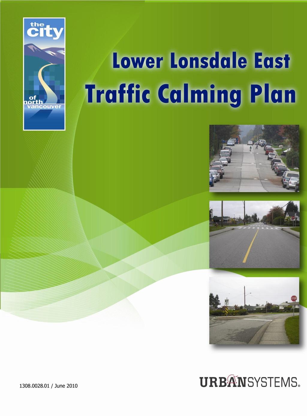
LOWER LONSDALE EAST NEIGHBOURHOOD TRAFFIC CALMING PLAN. Date: June 16, 2010 File No: LLE1
|
|
|
- Gwendolyn Young
- 5 years ago
- Views:
Transcription

1 The Corporation of THE CITY OF NORTH VANCOUVER ENGINEERING, PARKS & ENVIRONMENT DEPARTMENT REPORT To: From: SUBJECT: Mayor Darrell R. Mussatto and Members of Council Daniel Watson, Transportation Planner LOWER LONSDALE EAST NEIGHBOURHOOD TRAFFIC CALMING PLAN Date: June 16, 2010 File No: LLE1 The following is a suggested recommendation only. Please refer to Council Minutes for adopted resolution. RECOMMENDATION: PURSUANT to the report of the Transportation Planner, dated June 16, 2010, entitled Lower Lonsdale East Neighbourhood Traffic Calming Plan : THAT the Lower Lonsdale East Neighbourhood Traffic Calming Plan included in Attachment 1 be endorsed; THAT implementation of the Traffic Calming Plan be held and considered for funding prioritization by Council during preparation of the City s 10 Year Project Plan; AND THAT the funding for the implementation of the two pedestrian signals at the 3rd Street and St. Andrew s Avenue intersection and at the 3rd Street and St David s Avenue intersection be considered in the context of the City s 10 Year Project Plan. ATTACHMENTS: 1. Lower Lonsdale East Neighbourhood Traffic Calming Plan 2. Extract from Lower Lonsdale East Traffic Calming Plan study report (Urban Systems Limited, June 2010) PURPOSE: To seek Council endorsement of the Traffic Calming Plan developed for the Lower Lonsdale East Neighbourhood and funding consideration in the Financial Plan. REPORT: Lower Lonsdale East Neighbourhood Traffic Calming Plan Date: June 16, 2010 Page 1
2 SUMMARY: As part of the City s Traffic Calming program, staff have undertaken a public involvement process to develop a traffic calming plan for the Lower Lonsdale East Neighbourhood, and the recommended Plan for Council endorsement is included in Attachment 1. Unlike other Traffic Calming Plans, the Lower Lonsdale East area is bisected with two arterial roads, of which East 3 rd Street carries significant traffic volume. As such, in addition to the typical traffic calming measures (speed humps, traffic circles, corner bulges, etc.) the Plan also includes the provision of two pedestrian and cyclist activated crosswalks to overcome the barrier to walking and cycling between the north and south parts of the neighbourhood. As these two projects are expected to contribute to neighbourhood liveability, community safety and accessibility, improve cycling along the designated bike route (St Andrew s) and assist in connecting the Spirit Trail and Keith Road Greenway, staff recommends Council consider funding for these projects separately from the overall traffic calming plan. The implementation of the Lower Lonsdale East Neighbourhood Traffic Calming Plan is estimated to cost $250,000, while two pedestrian/cyclists signals are estimated to cost $360,000. Work on the development of the Lower Lonsdale East Traffic Calming Plan was approved in the 2009 Capital Budget and was initiated prior its implementation being ranked "B" in the Financial Planning process. Funding for the implementation of the Plan received 1 A, 2 Bs and 3 Cs during the ranking process and as such is now planned to occur in the latter five years of the plan. The funding for provision of two signals is not included in the budget. As such, staff recommend that these projects be considered in the Financial Planning process. Although implementation of the Plan may not occur until later in the 10-year Plan, endorsement of the proposed traffic calming plan would give staff direction for any future neighbourhood improvements, whether funding would come from the Capital Budget or via re-development opportunities, and would assist in pursuing grant applications. BACKGROUND: The Neighbourhood Traffic Calming Program for the City of North Vancouver was endorsed by Council in March 2001 and updated in September The goal of the program is to enhance the safety and liveability of neighbourhoods by reducing vehicle speeds, discouraging through traffic, and minimizing conflicts between road users. The Traffic Calming Program divides the City into 12 distinct neighbourhoods and traffic calming plans are subsequently developed for each neighbourhood. (See Figure 1.) To date, traffic calming plans have been prepared for seven neighbourhoods and this neighbourhood is eighth on the list. A Traffic Calming Plan in the Loutet neighbourhood was also prepared and implemented in conjunction with the development of the Sutherland Artificial Turf Field (ATF). REPORT: Lower Lonsdale East Neighbourhood Traffic Calming Plan Date: June 16, 2010 Page 2
. Two arterial roads bisect the neighbourhood, St. Georges and East 3 rd Street.")
3 Figure 1: Traffic Calming Plan Neighbourhoods The Lower Lonsdale East neighbourhood is bounded by Keith Road to the north, Queensbury Avenue to the east, Esplanade to the south and Lonsdale Avenue to the west (see Attachment 1). Two arterial roads bisect the neighbourhood, St. Georges and East 3 rd Street. This is a comparatively large neighbourhood with safety concerns at pedestrian crossings as well as significant shortcutting and speeding. The Lower Lonsdale East Traffic Calming Plan was developed with the local community and included the formation of the Neighbourhood Traffic Residents Association (NTRA), along with a public walkabout and three staff led public Open Houses. Work on the development of the Lower Lonsdale East Traffic Calming Plan was approved in the 2009 Capital Budget and was initiated prior its implementation being ranked B in the Financial Planning process. Funding for the implementation of the Plan received 1 A, 2 Bs and 3 Cs during the ranking process and as such is now planned to occur in the latter five years of the plan. DISCUSSION: The predominant concerns in the Lower Lonsdale East neighbourhood include excessive short cutting and resultant speed on local streets and pedestrian safety particularly crossing the arterial roadways. The proposed traffic calming measures are primarily aimed at encouraging motorists away from local streets, reducing the speed of motorists, enhancing the environment for non-motorized road users, and minimizing the likelihood of diversion to an alternate route to avoid the measures. REPORT: Lower Lonsdale East Neighbourhood Traffic Calming Plan Date: June 16, 2010 Page 3
4 The recommended Lower Lonsdale East Traffic Calming Plan is provided in Attachment 1, while the study report titled, Lower Lonsdale East Traffic Calming Plan, (prepared by Urban Systems Limited, June 2010) is provided in Attachment 2. For completeness this Plan also shows some measures that will be implemented later this year as part of the East 4 th Street Bike Route Project, and some have already been implemented as part of Spirit Trail project. A questionnaire including the Traffic Calming Plan was distributed to neighbourhood residents and businesses and we received 292 responses (7% response rate). While still quite modest, this has been one of the highest number of responses from any of the previous traffic calming neighbourhoods surveyed in the City. From the responses, 71% support the Plan, while 19% do not (Attachment 2; section 6). Compared with other neighbourhoods in the City for which traffic calming plans have been developed, the support in the Lower Lonsdale East Neighbourhood (71%) is relatively lower (Attachment 2, Figure 12), however the support rate does exceed the desired minimum two-thirds support indicated in the City s Traffic Calming Program. East 3 rd Street creates a major barrier for pedestrians and cyclists in the neighbourhood and being an arterial street limits the number of traffic calming options. To address safety concerns two pedestrian and bicycle operated signals on East 3 rd Street: at St Andrew s (bike route) and St David s Avenues are proposed. These two projects are expected to contribute to neighbourhood liveability, community safety and accessibility, improve cycling along the designated bike route (St Andrew s) and assist in connecting Spirit Trail and Keith Road Greenway. Stakeholders including North Shore Fire and Rescue, Ambulance Services, and TransLink were contacted for their input regarding the Plan. None of these stakeholders objected to the Plan. Staff recommend endorsement of the Lower Lonsdale East Traffic Calming plan as developed in consultation with the neighbourhood (Attachment 2). Although implementation of the Plan may not occur until later in the 10-year Plan, endorsement of the proposed traffic calming plan would give staff direction for any future neighbourhood improvements, whether funding would come from the Capital Budget or via re-development opportunities, and assist us in pursuing grant opportunities. FINANCIAL IMPLICATIONS: The implementation of the Lower Lonsdale East Neighbourhood Traffic Calming Plan developed in the public consultation process is estimated to cost $250,000, and two signals are expected to cost $360,000. These cost estimates do not include measures that will be implemented as part of the East 4 th Street Bike Route nor the Sprit Trail projects. The Financial Plan includes $205,000 for the installation of traffic calming measures in this area in the last 5 years of the plan, and no funding provision is made for the two proposed signals. REPORT: Lower Lonsdale East Neighbourhood Traffic Calming Plan Date: June 16, 2010 Page 4
5 There are additional potential funding sources for the implementation of the traffic calming plan, including developments in the neighbourhood, and other government agencies. In the past the Insurance Corporation of British Columbia (ICBC) has contributed between $20,000 and $30,000 towards implementation of Traffic Calming Plans in the Central Lonsdale East and West neighbourhoods, and staff expect a similar level of contribution for this neighbourhood. Regarding the pedestrian signals installation, ICBC has contributed towards various safety improvement projects in the City, and staff expect some funding support for both signals. As the East 3 rd and St Andrew s signal is located on the designated bike route, funding support for the implementation of this signal could also be sought through the TransLink bicycle program. Staff recommend that funding for the implementation of the Plan including the two pedestrian signals at the 3 rd & St. Andrew s and 3 rd & St David s intersections be considered for ranking by Council as part of the Financial Plan process and more details about the possible funding opportunities will be outlined in the project plan. INTER-DEPARTMENTAL IMPLICATIONS: This report has been reviewed and endorsed by the Civic Projects Team. STRATEGIC PLANNING IMPLICATIONS: Traffic Calming is consistent with the City s Strategic Plan, Community Objectives C2 (we will protect and maintain new and existing public infrastructure and amenities and enhance the natural and built environment) and C3 (we will enhance community safety). This program is also consistent with the OCP and Transportation Plan goals and objectives in mitigating traffic disruption to neighbourhoods through the planning and implementation of traffic calming measures. REPORT: Lower Lonsdale East Neighbourhood Traffic Calming Plan Date: June 16, 2010 Page 5
6 The Community Energy and Emissions Plan suggests that Traffic Calming, the provision of curb bulges and crosswalks are important actions in our efforts to follow a Low Carbon Path. RESPECTFULLY SUBMITIED BY: Dary.erWatson, MSc (Eng) Transportation Planner APPROVED BY: REVIEWED BY: REVIEWED BY: Douglas T. Pope, P. ng. Deputy City Engineer ~~"g City Engineer REVIEWED BY: A. K. Tolls am, C. A. City Manager REPORT: Lower Lonsdale East Neighbourhood Traffic Calming Plan Date: June 16, 2010 Page 6
7 6.4 Features of the Recommended Traffic Calming Plan The recommended Traffic Calming Plan for the Lower Lonsdale East neighbourhood is illustrated in Figure 14. Specific features of the Traffic Calming Plan are described on the following pages. Figure 14 Recommended Traffic Calming Plan Page 25
8
9 CONTENTS 1.0 INTRODUCTION STUDY PROCESS NEIGHBOURHOOD CHARACTERISTICS OTHER PLANS AND STUDIES TRAFFIC AND SAFETY ISSUES Vehicle Speeds Traffic Volumes Pedestrian Safety Other Traffic and Safety Issues TRAFFIC CALMING PLAN Draft Traffic Calming Plan Questionnaire Results Revisions to the Traffic Calming Plan Features of the Recommended Traffic Calming Plan IMPLEMENTATION Costs Timing On-Going Monitoring APPENDICES Appendix A: Appendix B: Appendix C: Community Involvement Open House Materials Data Page (i)
10 1.0 INTRODUCTION In 2001, the City of North Vancouver adopted a Community Traffic Calming Program in response to concerns expressed by residents regarding speeding, pedestrian safety, short-cutting traffic and other safety issues on neighbourhood streets. The Community Traffic Calming Program, which was updated in 2004, identified twelve neighbourhoods throughout the City for the purposes of preparing Traffic Calming Plans. To date, Traffic Calming Plans have been prepared for seven of these neighbourhoods. Lower Lonsdale East is the eighth neighbourhood in the City for which a Traffic Calming Plan has been developed. This report describes the Traffic Calming Plan developed for the Lower Lonsdale East neighbourhood. The primary objectives of the Traffic Calming Plan are: Safety make neighbourhood streets safer for everyone, including pedestrians, cyclists, children and motorists. Livability restore and enhance the livability of the neighbourhood. The Traffic Calming Plan was developed by Urban Systems Ltd., with the involvement of neighbourhood residents and with the assistance of City staff. Development of the plan was initiated in September, 2009 The boundaries of the Lower Lonsdale East neighbourhood are illustrated in Figure 1. The neighbourhood is bounded by Lonsdale Avenue to the west, Keith Road to the north, Queensbury Avenue to the east, and Esplanade Street and Low Level Road to the south. Page 1

11 Page 2 Figure 1 Study Area

12 2.0 STUDY PROCESS The most important aspect of developing a neighbourhood Traffic Calming Plan is involving the entire community in the process residents, business owners and stakeholders. The people who live and work in the area know better than anyone what the traffic and safety issues are, and provide an essential perspective on the practicality of potential traffic calming solutions in their neighbourhood. As shown in Figure 2 and described below, residents and other members of the community had several opportunities to provide input and suggestions for the development of the Traffic Calming Plan. Figure 2 Study Process Page 3

13 The following community events and activities were undertaken in the Lower Lonsdale East neighbourhood: A Neighbourhood Traffic Residents Association (NTRA) was established to assist the consulting team and City staff in identifying traffic and safety issues, involving the community, and developing the Traffic Calming Plan. In August, 2009 a notice was sent to all households and businesses in the Lower Lonsdale East neighbourhood to inform them of the study and to invite them to apply to be a member of the NTRA (see Appendix A). Eight applications were received from all areas of the neighbourhood, and all eight applicants were selected to form the NTRA. The NTRA participated in community events and assisted consultants in identifying neighbourhood issues, soliciting input from other residents, and identifying and reviewing various solutions to include in the Traffic Calming Plan. Stakeholder input. In order to develop a Traffic Calming Plan that addresses the concerns of all members of the community, several stakeholders were contacted for their input regarding the plan, including the North Vancouver RCMP, Ambulance Services, North Vancouver Fire Department, the North Vancouver School Board, Ridgeway Annex Elementary School, TransLink, the Lower Lonsdale Business Association, and the Joint Bicycle Advisory Committee (JBAC). No objections to the Traffic Calming Plan were raised by stakeholders, and a number of implementation suggestions were provided. A neighbourhood walkabout was held on Sunday, October 18, The walkabout consisted of a four-hour tour of the neighbourhood, where residents were invited to walk with consultants and City staff and identify traffic and safety issues in the neighbourhood. The walkabout was advertised by distributing a flyer to all residents and businesses within the neighbourhood. The flyer included a map of the neighbourhood, the walkabout route and meeting times along the route. In addition, an advertisement was placed in the local newspaper (see Appendix A for a copy of the flyer and newspaper advertisement). Approximately 20 residents, NTRA members, City staff and the consultants participated in the walkabout. Compared with other neighbourhoods where walkabouts have been conducted, this number of participants reflects a good level of interest from the community. Page 4
14 Dedicated Webpage. The City established a dedicated web page for the Lower Lonsdale East Neighbourhood Traffic Calming Plan ( The dedicated webpage included all information and materials that were provided throughout the development of the plan, including the walkabout notice, the questionnaire from the first open house, the community questionnaire, the results of the community questionnaire, display boards from all three open houses, traffic data, and the City s Traffic Calming Program. An address and dedicated telephone information line was provided for residents who wished to communicate via the internet or telephone. The telephone information line was connected directly to the consulting team during business hours, and a voice mail was provided outside business hours. The voice mail was regularly updated throughout the course of the study to provide general information about the current status of the plan and upcoming events. All phone calls and s were followed up with a telephone or response. An open house was held on November 19, 2009 at the North Shore Neighbourhood House. The open house was advertised by sending a notice to all residents and businesses in the neighbourhood, and by placing an advertisement in the local newspaper (see Appendix A for a copy of the flyer and newspaper advertisement). Approximately 20 residents attended the open house to learn about the traffic calming process, view displays of traffic data from their neighbourhood and find out how traffic calming measures could be used to improve safety and livability in the neighbourhood. Attendees were also asked to complete a questionnaire to identify additional traffic issues and indicate which traffic calming measures they would like to see in the neighbourhood (see Appendix A). Page 5 A community questionnaire was distributed to every household and business in the neighbourhood, describing the proposed Traffic Calming Plan. Residents and business owners were asked to indicate whether they supported the plan, felt neutral, or did not support the plan. They were also asked to indicate their support for localized parking restrictions at intersections to improve safety. Residents were invited to return the questionnaire by , mail, fax, or in person at City Hall. In addition, the questionnaire could be completed directly on-line from the dedicated webpage. Approximately 4,200 questionnaires were distributed to every household and business in the community, and 294 completed questionnaires were returned by neighbourhood residents. As summarized in Section 6, this represents an overall response rate of approximately 7%, which is comparable to the response rate in several other neighbourhoods for which Traffic Calming Plans have been prepared, but represents the second largest absolute number of responses in any Traffic Calming Plan in the City of
15 North Vancouver to date. Appendix A. A copy of the community questionnaire is included in A second open house was held on March 10, 2010 at Ridgeway Annex Elementary School, coinciding with the distribution of the community questionnaire. The open house was advertised by sending a notice in the Community Questionnaire to all residents and businesses in the neighbourhood, and by placing an advertisement in the local newspaper (see Appendix A for a copy of the Community Questionnaire and newspaper advertisement). The open house provided residents with an opportunity to obtain more information regarding the proposed traffic calming plan, and to ask questions of NTRA members, City staff and the consultants. Approximately 20 people attended the open house. A third open house was held on April 29, 2010 at Ridgeway Annex Elementary School to present the results of the survey and the preferred Traffic Calming Plan (see Appendix A for a copy of the flyer and newspaper advertisement and Appendix B for the materials that were provided at this open house). The open house was advertised by sending a notice to all residents and businesses in the neighbourhood, and by placing an advertisement in the local newspaper. Approximately 30 people attended the open house. Throughout the process, NTRA members provided a vital link to the community, and were involved in all community activities as well as development of the Traffic Calming Plan. The proposed Traffic Calming Plan was developed with NTRA members prior to distribution to residents. The consultants and City staff wish to thank NTRA members for their involvement and valuable contribution. As described in the City s Traffic Calming Program, a permanent Neighbourhood Transportation Committee (NTC) could be established following approval of the Traffic Calming Plan. The NTC would liaise with City staff in monitoring the implementation of the plan and in identifying any additional problems in follow-up study areas. The NTC would also function as a sounding board for all concerns and requests for transportation improvements from residents and other members of the community. Page 6
16 3.0 NEIGHBOURHOOD CHARACTERISTICS There are approximately 4,200 households and businesses in the neighbourhood, including businesses along Lonsdale Avenue, Esplanade Street, 1 st Street, and 3 rd Street. In addition, there are a number of community facilities, including the North Shore Neighbourhood House and Ridgeway Annex Elementary School. There are also a number of parks in the neighbourhood, including Derek Inman Park, Emerald Park, Hamersley Park, Moodyville Park, Chief Dan George Park, and Chief Mathias Joe Park (see Figure 3). Figure 3 Neighbourhood Characteristics Page 7
17 The neighbourhood is characterized predominantly by a rectangular grid network of east-west streets and north-south roadways, with the orientation of the grid changing at St. David s Avenue. The road classification system is illustrated in Figure 4 and includes: Major arterial roads include Lonsdale Avenue, Esplanade Street, and Low Level Road; Minor arterial roads include St. George s Avenue, Queensbury Avenue, 3 rd Street, and Keith Road; and Local roads, which include all other roads in the neighbourhood. There are no Collector roads in the neighbourhood. Figure 4 Road Network Classification Page 8
18 The identification of arterial roads is particularly important, as the City s Traffic Calming Policy states that traffic calming measures are generally not appropriate on arterial roads. In addition, there are several 30 km/h zones within the neighbourhood, including: 1 st Street between St. George s Avenue and St. Andrew s Avenue, adjacent to Derek Inman Park; 1 st Street between St. Andrew s Avenue and St. Patrick s Avenue, adjacent to Hamersley Park; 2 nd Street between St. George s Avenue and St. Andrew s Avenue, adjacent to North Shore Neighbourhood House; 2 nd Street between St. Andrew s Avenue and St. Patrick s Avenue, adjacent to Hamersley Park and Emerald Park; 3 rd Street between St. Andrew s Avenue and St. Patrick s Avenue, adjacent to Emerald Park; 4 th Street between St. Andrew s Avenue and St. Patrick s Avenue, adjacent to Chief Mathias Joe Park; 5 th Street between Moody Avenue and Queensbury Avenue, adjacent to Chief Dan George Park; and 5 th Street between St. David s Avenue and Ridgeway Avenue, 6 th Street west of Ridgeway Avenue, and Ridgeway Avenue between 5 th Street and 6 th Street, adjacent to Ridgeway Annex Elementary School. Figure 4 also indicates transit routes, bicycle routes, and greenways in the neighbourhood, as summarized below: Buses operate along Lonsdale Avenue, Queensbury Avenue, 3 rd Street, and Keith Road. Designated bicycle routes include bicycle lanes on Esplanade Street and Low Level Road, and a shared bicycle route on St. Andrew s Avenue. A shared bicycle route is also planned on 4 th Street. Greenways include the Green Necklace Greenway, which runs along Queensbury Avenue, St. David s Avenue, and Keith Road; the Waterfront Greenway, which runs along 1 st Street and 2 nd Street; and the Spirit Trail, which runs along Esplanade Street, 1 st Street, St. David s Avenue, 2 nd Street, and through Moodyville Park. It should also be noted that the only designated truck routes in the neighbourhood are Lonsdale Avenue, Esplanade Street, and Low Level Road. Figure 5 summarizes the existing roadway infrastructure in the Lower Lonsdale East Neighbourhood. This includes: Page 9
19 Traffic signals on Lonsdale Avenue and St. George s Avenue at Esplanade Street and 3 rd Street, respectively; Pedestrian activated signal on Esplanade Street between Lonsdale Avenue and St. George s Avenue, 3 rd Street at Ridgeway Avenue, and Keith Road at both East and West Grand Boulevard; Speeds humps on 1 st Street between St. Andrew s Avenue and St. Patrick s Avenue, 4 th Street between St. Andrew s Avenue and St. Patrick s Avenue, and 5 th Street between St. David s Avenue and Ridgeway Avenue; Right-in / Right-Out Island at Keith Road and St. David s Avenue; and Marked pedestrian crosswalks at several locations throughout the neighbourhood. Figure 5 Roadway Infrastructure Page 10
20 4.0 OTHER PLANS AND STUDIES The City has adopted or is currently conducting a number of plans and policies that are relevant to this study. Most recently, the City adopted a Long-Range Transportation Plan, with the following goals being used to guide and measure the success of the Transportation Plan: Livability. The Transportation Plan will contribute toward the City s overall Vision of becoming a vibrant, diverse and highly liveable community, where quality of life and community well-being are vital. Mobility. The Transportation Plan will support the safe, efficient, and accessible movement of people, goods, and services throughout the City and beyond our boundaries. Integration. The Transportation Plan will support the development and integration of all modes of travel in order to offer more choice to the residents, workforce, and visitors of the City. Affordability. The Transportation Plan will recognize the financial constraints of the City and promote the development of transportation infrastructure and services that will best support the goals of the Plan. Environment. The Transportation Plan will support alternative means of transportation, namely walking, cycling and transit and promote strategies to manage travel demand in an attempt to reduce local greenhouse gas emissions. The development of Traffic Calming Plans directly supports each of these five goals. In addition, one of the key directions in the Transportation Plan was to Protect Neighbourhoods, which includes promoting the development of traffic calming plans to help achieve the goals of the Transportation Plan and broader City goals outlined in the OCP (see Figure 6). In addition, the Transportation Plan identified existing and projected traffic volumes in 2021 along the collector and arterial roads within the City (see Figure 7). The projections show modelled traffic volumes currently and projected forward to the year The traffic forecasts indicate that the most significant volumes are on the major east-west roads through the neighbourhood, such as Esplanade Street, Low Level Road, 3 rd Street, and Keith Road, each of which have existing and projected traffic volumes of between 10,000 17,500 vehicles per day. The model also indicates that Lonsdale Avenue south of Keith Road has existing and projected traffic volumes under 10,000 vehicles per day, with St. George s Avenue having existing and projected volumes of 8,400 and 9,100 vehicles per day, respectively. Page 11
21 Figure 6 Key Features of the Long-Term Transportation Plan Pedestrian Plan 1. Pedestrian Areas & Generators 2. Pedestrian Treatments 3. Greenways Bicycle Plan 1. Bicycle Network 2. Design Guidelines 3. Bicycle Support Strategies 4. Greenways Transit Strategy 1. Improved Accessibility to Transit 2. Increased Local Area Frequency and Coverage 3. Expanded Frequent Transit Network 4. Transit Priority Treatments 5. U-Pass Program 6. Expanded SeaBus Service and Enhance Terminal A Sustainable Transportation Plan Road Network Plan 1. Updated Roadway Classification System 2. Emergency and Disaster Response Routes 3. Major Road Network Improvement Strategies 4. Arterials, Collectors & Local Road Enhancements 5. Parking Strategies 6. Protect Neighbourhoods Goods & Services Movement Strategy 1. Minimized Delays Along Truck Routes 2. Signage Strategy 3. Effective Use of Freight Infrastructure Travel Demand Management Strategy 1. Integrated Land Use and Transportation Planning 2. Parking Management Strategies 3. Leadership 4. Education & Awareness Page 12 During the development of the Traffic Calming Plan, the City was also involved in several studies in the Lower Lonsdale East neighbourhood that should be considered as part of the Traffic Calming Plan. These include: Lonsdale Avenue Safety Study, which is being conducted jointly with ICBC for the Lonsdale Corridor between Esplanade Street and 8th Street / 11th Street; and North Shore Trade Area Study, which is being conducted jointly with Transport Canada, Port Metro Vancouver and other stakeholder and has looked at key issues along road and railway corridors adjacent to the port terminals and industrial activities along the North Shore. The study is examining options for improvements to the Low Level Road and adjacent rail corridors. Spirit Trail, which is a multi-use greenway that will ultimately provide access to pedestrians, cyclists, inline skaters and people with wheeled mobility aids across the North Shore, from Horseshoe Bay to Deep Cove. Through the Lower Lonsdale East neighbourhood, the Spirit Trail will follow along the Waterfront Escarpment from St. Patrick s Avenue to St. David s Avenue and continue along 2 nd Street to Moodyville Park. Curb extensions will be provided on St. David s Avenue at Alder Street, 1 st Street, and 2 nd Street. 3 rd Street Bicycle and Pedestrian Improvements, which includes bicycle lanes on the 3 rd Street hill between Kennard and Queensbury Avenues, and pedestrian improvements at the intersection of 3 rd Street and Queensbury. Phase 1 improvements

22 include bicycle lanes that will be provided utilizing the existing road space, by converting most of the uphill curb lane into a westbound bicycle lane, separated by a solid white line and knock down bollards or other physical dividers. Phase 2 improvements also include the provision of a multi-use path along the 3 rd Street hill. 4 th Street Bicycle Improvements, which involves providing bicycle facilities along 4 th Street as per the Bicycle Master Plan. This includes intersection treatments at key intersections, including curb extensions at St. George s Avenue, a diverter at St. David s Avenue, and re-orienting stop bars from an east-west to north-south orientation at Ridgeway Avenue. Emerald Park and Hamersley Parks Improvement Project, which includes a number of improvements focused on replacing deteriorating infrastructure and improving sightlines, including stair and retaining wall replacement, simplified trail layout, and replacement of overgrown vegetation. Figure 7 Existing and Projected Daily Traffic Volumes Page 13
23 5.0 TRAFFIC AND SAFETY ISSUES Residents in the Lower Lonsdale East neighbourhood reported problems regarding traffic shortcutting through the neighbourhood, speeding, pedestrian safety, stop sign compliance and other intersection safety issues. These issues are illustrated in Figure 8. Figure 8 Reported Issues Based on reports from residents, data were collected regarding traffic volumes, traffic speeds and collisions, to provide a basis for developing the Traffic Calming Plan. Traffic volume and speed data were collected for a total of 48 locations throughout the neighbourhood. Volume and speed data were typically collected for a minimum of four weekdays (96 hours). Traffic volume and speed data are presented in Figure 9 and described in further detail in the sections below. Page 14

24 Figure 9 Motor Vehicle Speeds and Volumes Collision data was collected for all collisions reported to ICBC over a period of 5 years from 2003 through Figure 10 illustrates all the locations within the Lower Lonsdale East neighbourhood recorded at least one collision on average per year between 2003 and For each of these locations, the figure shows the collision rate, which is the defined as the number of collisions per million motor vehicles. Figure 10 also shows any locations where a pedestrian or a cyclist was reported to be involved in a collision between 2003 and Page 15
25 Figure 10 Collisions Significant issues are described below, as identified by residents and stakeholders and where applicable verified through data collection. A detailed summary of issues is included in Appendix C, including a detailed summary of traffic volume and speed data. 5.1 Vehicle Speeds Speed data were collected both with automatic tube counters, which use tubes placed across the road, and with NuMetric counters, which measure the magnetic field distortion caused by vehicles. Both data collection methods can measure vehicle speeds and count the numbers of vehicles. Vehicle speeds are presented as 85 th percentile speeds. This is the standard measure of vehicle speed, and represents the speed at or below which 85% of vehicles are travelling. This means that 15% of vehicles are travelling faster than the 85 th percentile speed. Page 16
26 The speed limit on neighbourhood streets is 50 km/h, except for several 30 km/h zones (indicated in Figure 4). For the purposes of developing the Traffic Calming Plan, any 85 th percentile speeds observed in excess of the applicable speed limits are considered to indicate that there is speeding issue. As shown in Figure 9, speeds over the posted speed limit were observed on several neighbourhood streets, including Keith Road, where observed 85 th percentile speeds between St. George s Avenue and St. Andrew s Avenue, and between Moody Avenue and Ridgeway Avenue, were 52.2 km/h and 59.6 km/h in the westbound direction, and 57.0 km/h and 58.6 km/h in the eastbound direction, respectively, over a 24-hour period. 2 nd Street between Ridgeway Avenue and Moody Avenue, where observed 85 th percentile speeds were 52.1 km/h in the westbound direction over a 24-hour period. 3 rd Street where observed 85 th percentile speeds over a 24-hour period were: o 61.3 km/h in the westbound direction and 64.5 km/h in the eastbound direction between Moody Avenue and Ridgeway Avenue; o 59.0 km/h in the westbound direction and 57.7 km/h in the eastbound direction between St. Patrick s Avenue and St. David s Avenue; o 58.1 km/h in the westbound direction and 57.3 km/h in the eastbound direction between St. Andrew s Avenue and St. Patrick s Avenue; and o 57.4 km/h in the westbound direction and 57.3 km/h in the eastbound direction between St. David s Avenue and Ridgeway Avenue. 4 th Street between Moody Avenue and Queensbury Avenue and between St. George s Avenue and St. Andrew s Avenue, where observed 85 th percentile speeds were 50.1 km/ h and 50.8 km/h in the westbound direction over a 24 hour period. Queensbury Avenue between 5 th Street and 6 th Street where observed 85 th percentile speeds were 58.7 km/h in the northbound direction and 56.2 km/h in the southbound direction over a 24-hour period. St. George s Avenue between 5 th Street and 6 th Street where observed 85 th percentile speeds were 54.6 km/h in the northbound direction and 50.9 km/h in the southbound direction over a 24-hour period. In the 30 km/h zones on 1 st Street between St. George s Avenue and St. Andrew s Avenue, 1 st Street between St. Andrew s Avenue and St. Patrick s Avenue, 2nd Street between St. George s Avenue and St. Andrew s, 2 nd Street between St. Andrew s Avenue and St. Patrick s Avenue, 3 rd Street between St. Andrew s Avenue and St. Patrick s Avenue, 4 th Street between St. Andrew s Avenue and St. Patrick s Avenue, 5 th Street between St. David s Avenue and Ridgeway Avenue, 6 th Street between St. David s Avenue and Ridgeway Avenue, and Ridgeway Avenue between 5 th Street and 6 th Street, all of which had observed 85 th percentile traffic speeds over 30 km/h over a 24-hour period; and Page 17
27 Several other locations where 24-hour 85 th percentile speeds were slightly above 50 km/h over a 24-hour period, or above 50 km/h at certain times of day. Detailed speed data is presented in Appendix C. 5.2 Traffic Volumes Because of the central location of the Lower Lonsdale East neighbourhood in the City, its proximity to the Lonsdale Avenue and Esplanade Street commercial areas, its grid street network, and high population, some local streets experience traffic volumes which are higher than usual for typical local streets (typical volumes for local streets are less than 1,000 vehicles per day). As shown in Figure 9, local roads with higher traffic volumes include: 1 st Street between St. George s Avenue and St. Andrew s Avenue, where daily traffic volumes are approximately 1,800 vehicles per day; 2 nd Street between St. George s Avenue and St. Andrew s Avenue, where daily traffic volumes are approximately 1,900 vehicles per day; 2 nd Street between St. Andrew s Avenue and St. Patrick s Avenue, where daily traffic volumes are approximately 1,100 vehicles per day; 4 th Street between Lonsdale Avenue and St. George s Avenue, where daily traffic volumes are approximately 1,400 vehicles per day; Ridgeway Avenue between 3 rd Street and 7 th Street, where daily traffic volumes are approximately 1,200 vehicles per day; and St. Andrew s Avenue, where daily traffic volumes range from approximately 1,100 to 1,500 vehicles per day. Detailed traffic volume data is presented in Appendix C. 5.3 Pedestrian Safety A number of locations were identified by residents and stakeholders where pedestrian safety is an issue, including: Several intersections along St. George s Avenue including intersections at 2 nd Street, 4 th Street, 5 th Street and 6 th Street, where residents reported difficulty crossing due to motorists who do not yield to pedestrians; Several intersections along 3 rd Street including intersections at St. David s Avenue, Moody Avenue and Queensbury Avenue, where residents reported difficulty crossing due to relatively high traffic volumes and speeds and motorists who do not yield to pedestrians; Several intersections along 2 nd Street, including intersections at St. Andrew s Avenue, St. Patrick s Avenue, and St. David s Avenue, where residents indicated that motorists frequently do not comply with stop signs. Page 18
28 2 nd Street mid-block between St. Andrew s Avenue and St. Patrick s Avenue adjacent to Emerald Park and Hamersley Park; 6 th Street at St. Andrew s Avenue, where residents indicated that is difficult for pedestrians to cross. 5.4 Other Traffic and Safety Issues In addition to short-cutting, speeding and pedestrian safety issues, residents also reported a number of other traffic and safety issues in the neighbourhood. These include: Limited visibility due to parked vehicles when entering a street from side streets and laneways; Limited visibility at several intersections where the stop bar is oriented north-south on the hill and is set back from the intersection; Intersection safety at several locations due to change in road geometry; and Intersection safety due to vehicles short-cutting the corner. Residents also identified a number of issues in the neighbourhood that are beyond the scope of the neighbourhood Traffic Calming Plan. These issues include lack of sidewalks or narrow sidewalks on several streets in the neighbourhood, lack of curb letdowns at some intersections, poor illumination levels on many streets (including 1 st Street and 2 nd Street), poor visibility on several streets due to topography and vegetation encroaching onto the sidewalk, parking enforcement, and road maintenance. Although these issues cannot be addressed through the Traffic Calming Plan, comments regarding these issues have been forwarded to the appropriate departments within the City. Page 19
29 6.0 TRAFFIC CALMING PLAN 6.1 Draft Traffic Calming Plan An initial draft Traffic Calming Plan was developed by the consulting team, with the involvement of neighbourhood residents and with the assistance of City staff. The initial Traffic Calming Plan was developed based on input received by the NTRA as well as comments from the Neighbourhood Walkabout and first Open House. The initial Traffic Calming Plan was presented to the NTRA for comments before being circulated in the Community Questionnaire and at the Second Open House. The Traffic Calming Plan is intended to address identified traffic and safety problems, and achieve the community s goals of improving safety and livability. In general, the draft Traffic Calming Plan primarily recommends traffic calming features on local streets on which issues related to speeding, short-cutting, or safety have been identified. The City s Traffic Calming Policy states that traffic calming measures are generally not appropriate on arterial roads, such as St. George s Avenue and 3 rd Street. This is consistent with current practices in traffic calming throughout North America, as there is a more limited toolbox of traffic calming features that can be applied on arterial roads. 1 In general, physical measures that reduce traffic volumes and speeds (such as traffic circles and speeds humps) are not appropriate on arterial roads, as the primary function of this class of roadway is traffic movement 2. However, measures that improve pedestrian and cyclist safety, while not compromising the mobility function of the road, can be considered along arterial roads. A summary of the features included in the initial Traffic Calming Plan is provided below: Speed humps on 4 th Street and 6 th Street; Traffic circles at 1 St Street and St. Andrew s Avenue, 2 nd Street at St. Patrick s Avenue, 5 th Street at St. Andrew s Avenue, and 6 th Street at Ridgeway Avenue; Curb extensions on St. George s Avenue at 2 nd Street, 4 th Street, and 6 th Street, as well as 2 nd Street between St. Andrew s Avenue and St. Patrick s Avenue; Median islands on 3 rd Street and St. David s Avenue and Moody Avenue, Painted pedestrian crosswalks on St. George s Avenue at 2 nd Street, 4 th Street and 6 th Street, Special crosswalks with flashing lights 3 rd Street and St. David s Avenue; Pedestrian and bicycle activated signal at 3 rd Street and St. Andrew s Avenue; Right-in/Right-out island at Esplanade Street and St. Andrew s Avenue; Page 20 1 Reid Ewing and Steven J. Brown, U.S. Traffic Calming Manual. American Planning Association / American Society of Civil Engineers: Chicago. 2 Transportation Association of Canada, Geometric Design Guide for Canadian Roads.
30 Stop sign re-orientations at 1 st Street and St. Patrick s Avenue and 2 nd Street and St. Andrew s Avenue; Driver feedback sign on 3 rd Street east of Queensbury Avenue; and Several additional measures that have been recommended through other processes, including curb extensions proposed as part of the Spirit Trail, as well as a diverter and stop sign re-orientation proposed as part of the 4 th Street Bicycle Route. Further details regarding each of the features of the recommended Traffic Calming Plan (including a description of each feature and the rationale for selecting each feature), is provided in Section Questionnaire Results As noted previously, a community questionnaire was distributed to every household and business in the neighbourhood, describing the proposed Traffic Calming Plan. Residents and business owners were asked to indicate whether they supported the plan, felt neutral, or did not support the plan. They were also asked to indicate their support for localized parking restrictions at intersections to improve safety. Approximately 4,200 questionnaires were distributed to the community and 294 completed questionnaires were returned by neighbourhood residents. This represents an overall response rate of approximately 7%, which is comparable to the response rate in several other neighbourhoods for which Traffic Calming Plans have been prepared, but represents the second largest absolute number of responses in any Traffic Calming Plan to date. A copy of the community questionnaire is included in Appendix A. Figure 11 and Table 1 provide a summary of the level of support in the neighbourhood for the Traffic Calming Plan. Overall, approximately 71% of respondents to the community questionnaire indicated that they support the plan. Nineteen percent indicated that they did not support the plan, and ten percent indicated that they were neutral. Detailed questionnaire results are included in Appendix A. Seventy-one percent is a relatively strong indication of community support for the Traffic Calming Plan. This result exceeds the desired minimum two-thirds support indicated in the City s Traffic Calming Program. Compared with other neighbourhoods in the City for which traffic calming plans have been developed, the 71% support rate in Lower Lonsdale East is higher than the level of support in Cloverley, but lower than other previous plans, such as 73% support in Ridgeway, 77% in Central Lonsdale East and Central Lonsdale West, 79% in Lower Lonsdale West, 80% in Sutherland, and 84% in Marine-Hamilton (see Figure 12). Page 21
31 Figure 11 Support for the Traffic Calming Plan Neutral 10.3% Do Not Support Plan 18.5% Support Plan 71.2% Table 1 Support for the Traffic Calming Plan Responses Percentages I support the proposed plan % I am neutral % I do not support the plan % Totals % Figure 12 Level of Support for Traffic Calming Plans 100% 71% 73% 77% 77% 79% 80% 84% 80% 62% 60% 40% 20% 0% Page 22 Within the Lower Lonsdale East neighbourhood, 54 respondents indicated that they do not support the plan, representing approximately 18% of the total 292 respondents who provided a response to this question. Table 2 provides a summary of reasons which residents gave for not supporting the plan (some respondents gave more than one reason for not supporting the plan). In general, the majority of reasons reflect opposition to spending limited tax dollars on traffic
32 calming, the concept of traffic calming in general, and opposition to specific traffic calming measures. Table 2 Reasons why residents did not support the Traffic Calming Plan Numbers of Reasons Responses Don't like traffic circles in general 13 Traffic Tall vegetation blocks drivers views at traffic circles 4 Circles Don t like traffic circles at certain locations 3 Plants are unnecessary at traffic circles 1 Speed Don't like speed humps in general 12 Humps Right-In/Right-Out Island Don t like right-in/right-out island at certain location 1 Curb Extensions Don't like curb extensions in general 7 Don t like curb extensions at certain locations 2 Driver Feedback Don t like driver feedback signs in general 2 Signs Diverters Don t like traffic diverters in general 2 Other Would like to see 4-way stops 4 Concerns Would like to see slower speed limit signs 1 Plan will move traffic problems to other streets 1 Would prefer less expensive pedestrian crossings 1 Waste of tax dollars 17 Would rather see measures in other locations 10 General Don t support traffic calming in general 7 Don t agree with parking restrictions 6 Don t think traffic calming plan is needed 5 Several respondents to the questionnaire also provided suggestions for changes to the Traffic Calming Plan. Many of the respondents suggested additional speed humps throughout the neighbourhood, particularly on 1 st Street, 2 nd Street, and 4 th Street. Several respondents also provided comments suggesting additional measures to help pedestrians and cyclists cross 3 rd Street, such as special crosswalks, pedestrian activated signals, or full traffic signals. Page 23 Residents were also asked to indicate whether or not they support parking restrictions within one to two car lengths of corners at certain intersections where parked vehicles obstruct sight lines. As shown in Figure 13, eighty percent of respondents indicated support for parking restrictions, and only 13% indicated that they do not support such restrictions.
33 Figure 13 Support for Localized Parking Restrictions Do Not Support Parking Restrictions 13.4% Neutral 6.6% Support Parking Restrictions 80.0% 6.3 Revisions to the Traffic Calming Plan Based on comments received from the Community Questionnaire and at the Open Houses, several minor changes were made to the Traffic Calming Plan. Revisions to the draft Traffic Calming Plan include: Additional speed humps on 4 th Street and 6 th Street between St. George s Avenue and St. Andrew s Avenue to more effectively reduce speeds at these locations. New speed humps on 1 st Street and 2 nd Street between St. George s Avenue and St. Andrew s Avenue to reduce speeds and short-cutting traffic. New speed humps on 4 th Street between Ridgeway Avenue and Queensbury Avenue to reduce speeds, based on comments that the re-orientation of the stop sign at Ridgeway may increase traffic speeds. Remove driver feedback sign due to the 3 rd Street Bicycle Lanes project. Remove right-in/right-out island at St. Andrew s Avenue and Esplanade Street. This was originally proposed to reduce short-cutting on St. Andrew s Avenue but it was felt that the other measures proposed on St. Andrew s Avenue may help fulfill this objective. Traffic volumes and speeds should be evaluated and a right-in/right-out island should be considered as a possible further addition if necessary. Replace special crosswalk and median island with a pedestrian activated signal at 3 rd Street and St. David s Avenue, due to concerns about the traffic operations and safety of implementing a median island at this location due to the curvature of the street. Replace median island at 3 rd Street and Moody Avenue with curb extensions on the southwest and northeast corners of the intersection based on a separate safety assessment of this intersection. Page 24

34 6.4 Features of the Recommended Traffic Calming Plan The recommended Traffic Calming Plan for the Lower Lonsdale East neighbourhood is illustrated in Figure 14. Specific features of the Traffic Calming Plan are described on the following pages. Figure 14 Recommended Traffic Calming Plan Page 25
35 Speed humps are proposed on several neighbourhood streets. Speed humps are rounded raised areas placed across the roadway and are effective in preventing speeding, and also improve safety. At moderate vehicle speeds, speed humps gently rock a car, whereas at higher speeds, there is more of a jolt. The result is that motorists typically slow to about 30 to 35 km/h traveling over speed humps. Studies have shown that speed humps are the most effective traffic calming devices at reducing speeds, typically reducing 85 th percentile speeds by an average of more than 11 km/h, or over 20%. Speed humps have also been shown to reduce traffic volumes by approximately 20% and reduce the number of collisions by 14%. 3 Speed humps do not affect parking motorists can park on top of a speed hump. Speed humps do not typically increase traffic noise, and are safe for bicycles. Speed humps are not the same as the speed bumps used in shopping mall parking lots or residential lanes. Speed humps are 4 metres (13 feet) long, 0.08 metres (3 inches) in height, and sinusoidal in shape. Speed humps are already located on several streets in the neighbourhood, including 1 st Street, 4 th Street, and 5 th Street. Speed humps are proposed on 1 st Street and 2 nd Street to address identified speeding issues through the 30 km/h zones on these streets, and to discourage short-cutting by reducing the relatively high traffic volumes on these streets (with 1,800 and 1,900 vehicles per day on 1 st Street and 2 nd Street, respectively). Speed humps are also proposed on 4 th Street to address identified speeding issues and discourage short-cutting. They are also proposed on 6 th Street to address speeding issues, particularly during the AM peak period. A typical speed hump is illustrated in Figure 15. A schematic drawing of a speed hump is provided in Figure 16. A local example of speed humps is on Ridgeway Avenue between 16 th and 22 nd Streets Speed bumps have been installed in some lanes in the Lower Lonsdale East neighbourhood. Residents who wish to have speed bumps installed in their lanes can do so through the Local Improvement Program, whereby residents contribute a portion of the cost of speed bumps. Page 26 3 Reid Ewing and Steven J. Brown, U.S. Traffic Calming Manual. American Planning Association / American Society of Civil Engineers: Chicago.


36 Figure 15 Speed Hump Figure 16 Speed Hump Schematic Traffic circles are raised landscaped islands placed in the centre of an intersection to safely control traffic without using stop signs or traffic signals. They are usually circular but may be oblong to fit the specific dimensions of an intersection. A typical traffic circle is illustrated in Figure 17. Navigating a traffic circle requires that motorists slow down and drive around the circle in a counter-clockwise direction. The design of a traffic circle accommodates large vehicles, which can drive onto the concrete apron around the circle. Traffic circles improve safety for pedestrians and other road users, and have been shown Page 27

37 to reduce collisions by up to 73%. Traffic circles also discourage speeding and have been shown to reduce speeds by over 10%. 4 Figure 17 Traffic Circle Traffic circles work best at intersections of local streets. Traffic circles are proposed at the intersections of 1 st Street and St. Andrew s Avenue, and 2 nd Street and St. Patrick s Avenue primarily to improve intersection safety, as both of these intersections have relatively high collision rates of greater than 2 collisions per million vehicles. They are also proposed at these locations to reduce speeding and short-cutting. A traffic circle is also proposed at the intersection of 5 th Street and St. Andrew s Avenue to reduce shortcutting traffic along St. Andrew s Avenue, which currently has traffic volumes between 1,100 and 1,500 vehicles per day. A traffic circle is also proposed at the intersection of 6 th Street and Ridgeway Avenue to discourage short-cutting on Ridgeway, which currently has traffic volumes of approximately 1,200 vehicles per day, and to reduce address speeding issues in the 30 km/h zones on Ridgeway Avenue and 5 th Street. Local examples of traffic circles are on St. Andrews, Ridgeway and Moody south of 13 th Street. Curb extensions involve extending the curb on one or both sides of the roadway, narrowing the width of the road between the curb extensions, as illustrated in Figure 18. Curb extensions improve pedestrian safety by increasing the visibility of pedestrians 4 Reid Ewing and Steven J. Brown, U.S. Traffic Calming Manual. American Planning Association / American Society of Civil Engineers: Chicago. Page 28

38 and reducing the crossing distance. Curb extensions also improve safety by improving sight lines for motorists turning to and from a side street, and by discouraging highspeed turns. Existing curb extensions have recently been installed in the neighbourhood on St. David s Avenue as part of the Spirit Trail. New curb extensions are proposed on 2 nd Street midblock between St. Andrew s Avenue and St. Patrick s Avenue to improve pedestrian safety at the existing marked crossing between Emerald and Hamersley Parks. Curb extensions are also proposed on 3 rd Street at Moody Avenue and on St. George s Avenue at several locations to address reported issues of the difficulty of pedestrians crossing St. George s Avenue. Since speed humps only have limited effects on reducing speeds and volumes, they are appropriate to consider on a minor arterial roads such as St. George s Avenue. Figure 18 Curb Extension Diverters are barriers placed diagonally across an intersection, blocking all through movement. A diverter is proposed at the intersection of 4 th Street and St. David s Avenue as part of the 4 th Street bicycle route project. This diverter will reduce shortcutting along 4 th Street and will address reported issues related to intersection safety. An example of a diverter is provided in Figure 19. Page 29

39 Figure 19 Diverter Marked zebra crosswalks are proposed on St. George s Avenue on 2 nd Street, 4 th Street, and 6 th Street in conjunction with the curb extensions noted above to improve pedestrian safety. A marked crosswalk is currently located on the south side of the intersection of 2 nd Street at St. George s Avenue. The plan recommends an additional crosswalk on the north side of the intersection based on community input suggesting the demand for pedestrian crossing is high on the north side. The marked crosswalks at 4 th Street and 6 th Street are recommended on the south side of the intersection due to visibility issues. Stop signs at the intersection at 1 st Street and St. Patrick s Avenue and 2 nd Street and St. Andrew s Avenue would be re-oriented to face east and west. These measures would work in conjunction with the traffic circles in 1 st Street and 2 nd Street to address shortcutting and speeding issues, and to improve safety, particularly at the intersection of 2 nd Street and St. Andrew s Avenue which has a relatively high collision rate of over 2 collisions per million vehicles. Parking Restrictions at Intersections Many residents expressed concerns regarding obstructed sight lines at intersections due to vehicles parked close to the intersection. Pedestrians crossing these streets can be blocked from Page 30
40 motorists view by parked vehicles, and motorists turning onto these streets from side streets and lanes can find it difficult to see approaching traffic due to parked vehicles. To address this issue and in addition to the features of the Traffic Calming Plan described above the City will work towards implementing parking restrictions at problem locations. These restrictions would prohibit motorists from parking within one to two car lengths of the corner, so as to improve sight lines, and would be indicated with No Parking signs. Implementation of parking restrictions is supported by 83% of respondents to the community questionnaire, and would occur independently of implementation of the Traffic Calming Plan. Emergency Vehicles Emergency vehicles particularly fire trucks can be affected by some traffic calming measures. Research has shown that speed humps and speed tables can add 3 to 10 seconds delay per device, and traffic circles can add a few seconds delay as well. In many other communities throughout North America, most residents consider this an acceptable trade-off given the benefits that traffic calming can provide on a daily basis. For some residents, this could mean up to 30 seconds additional time for emergency response. Most residents, however, consider this an acceptable trade-off given the benefits that traffic calming measures provide on a daily basis. Page 31
41 7.0 IMPLEMENTATION 7.1 Costs In this section, a strategy is presented for implementing the recommended Lower Lonsdale East Neighbourhood Traffic Calming Plan. As summarized in Table 3, the cost of implementing the recommended Lower Lonsdale East Neighbourhood Traffic Calming Plan is estimated to be approximately $506,400, including a 20% contingency, but excluding HST and the Capital Overhead Allocation. This includes the costs of the majority of the traffic calming measures described in the previous section. However, approximately sixty percent of the overall cost of the traffic calming plan consists of the two pedestrian and bicycle activated signals on 3 rd Street ($250,000). There may be opportunities for the City to implement these signals in conjunction with other projects or through other funding sources. If the pedestrian and bicycle activated signals are excluded, the total cost of the traffic calming plan would be approximately $206,400,000, including a 20% contingency, but excluding HST and the Capital Overhead Allocation. This estimate does not include the cost of the diverter at 4 th Street and St. David s Avenue which will be implemented as part of the 4 th Street bicycle route project. In addition, the estimated costs in Table 3 do not include any allowance for additional traffic calming measures which might be added to the plan through follow-up monitoring. Table 3 Estimated Costs for Traffic Calming Plan Page 32 Measure Unit Cost Quantity Total Cost Speed hump $3, $36,000 Traffic circle $14,000 4 $56,000 Curb extension $5, $70,000 Diverter* n/a n/a n/a Pedestrian and bicycle activated signal St. Andrew s $120,000 1 $120,000 Pedestrian and bicycle activated signal St. David s $130,000 1 $130,000 Signage, pavement markings and miscellaneous $10,000 Sub-Total $422,000 Contingency (20%) $84,400 Total (Including Contingency) $506,400 HST (12%) $60,768 Capital Overhead Allocation (7%) $39,702 Grand Total $606,870 * Diverter to be included in funding for 4 th Street bicycle route
42 The estimated costs in Table 3 are based on recent costs for similar measures implemented in other neighbourhoods in the City, and are intended as order-of-magnitude estimates for budgeting purposes. City staff have provided these costs, and will prepare more accurate estimates at the time when detailed designs are prepared. In the implementation of the traffic calming plan, the City should pursue other funding opportunities, such as ICBC s Road Improvement Program partnership. Some of the measures recommended in the Traffic Calming Plan have been recommended primarily to improve safety for pedestrians, cyclist and motorists, particularly along arterial roads. In addition, a number of measures have been recommended on local roads within the neighbourhood based on relatively high collision rates or identified safety issues. If limited funds are available to implement the traffic calming plan, it is recommended that those measures which have a primary purpose of improving safety be implemented first. These safety-related measures include: Pedestrian and bicycle activated signals on 3 rd Street at St. David s Avenue and St. Andrew s Avenue to improve pedestrian safety crossing 3 rd Street; Median island on 3 rd Street at St. David s Avenue to improve pedestrian safety crossing 3 rd Street; Marked pedestrian crossings and curb extensions on St. George s at 2 nd Street, 4 th Street, and 6 th Street to improve pedestrian safety crossing St. George s Avenue; Traffic circles and stop sign re-orientations on 1 st Street and 2 nd Street at St. George s Avenue and St. Andrew s Avenue, respectively, to address identified safety issues at these intersections. The remaining measures recommended in the traffic calming plan are intended primarily to reduce motor vehicle speeds and volumes and could be implemented as a second priority if necessary. 7.2 Timing After the Traffic Calming Plan has been approved by City Council, some traffic calming measures might be implemented on a temporary basis to provide an opportunity to assess their effectiveness and fine-tune the geometrics. Measures which might be implemented temporarily include traffic circles. Figure 22 provides an example of a temporary traffic circle implemented in the Ridgeway neighbourhood (this is the same location as the traffic circle in Figure 17). Page 33

43 Figure 22 Temporary Traffic Circle Implementation of the Traffic Calming Plan would begin with the construction of speed humps as well as appropriate signage and pavement markings. Some or all curb extensions, median islands, and traffic circles could be constructed on a temporary basis, with permanent construction to occur following evaluation. 7.3 On-Going Monitoring It is important to note that the Traffic Calming Plan is not cast in stone. Although analysis of traffic conditions in the Lower Lonsdale East neighbourhood as well as experience in other neighbourhoods and communities indicates that the plan will be effective in resolving traffic problems, every neighbourhood is different. The Traffic Calming Plan may need to be fine-tuned based on actual experience, to ensure that existing problems are adequately addressed. As well, new issues might arise as a result of changes in the neighbourhood and elsewhere on the North Shore. Page 34 To ensure that the Traffic Calming Plan is effective and that traffic and safety issues are addressed, City staff will monitor conditions following implementation of the plan. This will involve collecting traffic volume and speed data after the plan is implemented, in the same locations as data were collected during development of the plan. These data and input from the permanent Neighbourhood Transportation Committee will indicate whether there are any outstanding traffic and safety problems. Where problems persist or new problems are identified, staff can work with the Neighbourhood Transportation Committee to modify the plan as necessary.
CITY OF OTTAWA ROADWAY MODIFICATION APPROVAL UNDER DELEGATED AUTHORITY
 RMA-2015-ATM-038 CITY OF OTTAWA ROADWAY MODIFICATION APPROVAL UNDER DELEGATED AUTHORITY DATE: April 22, 2015 SUBJECT Approval of Roadway Modifications Recommended through an Area Traffic Management Study
CITY OF WEST KELOWNA COUNCIL POLICY MANUAL
 CITY OF WEST KELOWNA COUNCIL POLICY MANUAL Page 1 of 7 DEPARTMENT: Engineering Services SUBJECT: Traffic Calming Policy (Revised June 6, 2017) Policy Statement: The provision of traffic calming measures
POLICY: TRAFFIC CALMING
 2006 MAY REFERENCE: COUNCIL APPROVED BY COUNCIL MAY 23, 2006 CITY OPERATIONS - NO. 608 POLICY: TRAFFIC CALMING A. All requests for traffic calming within the City shall be considered in accordance with
REPORT District of Maple Ridge
 REPORT District of Maple Ridge Traffic Calming Policy This report is prepared for the sole use of the District of Maple Ridge. No representations of any kind are made by Urban Systems Ltd. or its employees
CITY OF SAINT JOHN TRAFFIC CALMING POLICY
 CITY OF SAINT JOHN TRAFFIC CALMING POLICY VERSION: 1.0 April 10, 2012 Pedestrians, Cyclists and Motorists Sharing Street Spaces CONTENTS INTRODUCTION... 3 POLICY GOAL... 3 POLICY OBJECTIVES... 3 GUIDING
Improving Cyclist Safety at the Dundas Street West and Sterling Road Intersection
 STAFF REPORT ACTION REQUIRED Improving Cyclist Safety at the Dundas Street West and Sterling Road Intersection Date: August 17, 2012 To: From: Wards: Reference Number: Public Works and Infrastructure Committee
Tonight is for you. Learn everything you can. Share all your ideas.
 Strathcona Neighbourhood Renewal Draft Concept Design Tonight is for you. Learn everything you can. Share all your ideas. What is Neighbourhood Renewal? Creating a design with you for your neighbourhood.
TRAFFIC CALMING GUIDE FOR TORONTO CITY OF TORONTO TRANSPORTATION SERVICES DIVISION
 TRAFFIC CALMING GUIDE FOR TORONTO CITY OF TORONTO TRANSPORTATION SERVICES DIVISION CITY OF TORONTO TRANSPORTATION SERVICES DIVISION 2016 TRAFFIC CALMING GUIDE FOR TORONTO TABLE OF CONTENTS Introduction
University of Victoria Campus Cycling Plan Terms of Reference. 1.0 Project Description
 University of Victoria Campus Cycling Plan Terms of Reference 1.0 Project Description The Campus Cycling Plan, a first for the University, will provide a comprehensive and coordinated approach to support
NEIGHBOURHOOD TRAFFIC COMMITTEE POLICY AND PROCEDURE
 The City of Vaughan 2141 Major Mackenzie Drive Vaughan, Ontario Canada L6A 1T1 Tel (905) 832-2281 NEIGHBOURHOOD TRAFFIC COMMITTEE POLICY AND PROCEDURE REVISED JUNE 2010 APPLICABILITY The Neighbourhood
Corporate. Report COUNCIL DATE: June 26, 2006 NO: C012 COUNCIL-IN-COMMITTEE. TO: Mayor & Council DATE: June 22, 2006
 Corporate NO: C012 Report COUNCIL DATE: June 26, 2006 COUNCIL-IN-COMMITTEE TO: Mayor & Council DATE: June 22, 2006 FROM: General Manager, Engineering FILE: 0410-20(MoT/Gate) SUBJECT: Surrey Response on
122 Avenue: 107 Street to Fort Road
 : 107 Street to Fort Road November 24, 2015 4:30 8:00 p.m. Meeting Purpose Summarize project work completed to date Share results of public input from Phase 1 Share the draft concept plan and proposed
Edgemont Village Traffic and Parking Technical Report January 2014
 Edgemont Village Traffic and Parking Technical Report January 2014 In the fall of 2013, the District of North Vancouver engaged consultants to assess existing intersection and parking conditions in Edgemont
Corporate. Report COUNCIL DATE: May 25, 1998 NO: R1500 REGULAR COUNCIL. TO: Mayor & Council DATE: April 27, 1998
 R1500 : Traffic Safety at 25 Avenue and 128 Street Intersection Corporate NO: R1500 Report COUNCIL DATE: May 25, 1998 REGULAR COUNCIL TO: Mayor & Council DATE: April 27, 1998 FROM: General Manager, Engineering
Draft North Industrial Area-Wide Traffic Plan
 Summary of North Industrial and Hudson Bay Industrial Recommended Improvements Table 1. Summary of s Item Location 1 2 3 4 5 6 7 8 9 10 11 12 Millar Ave north of 51st St Super 8 Motel back lane 400 Block
Transportation Master Plan Advisory Task Force
 Transportation Master Plan Advisory Task Force Network Alternatives & Phasing Strategy February 2016 BACKGROUND Table of Contents BACKGROUND Purpose & Introduction 2 Linking the TMP to Key Council Approved
Traffic Safety Advisory Committee - Proposed 2015 Initiatives
 City of Richmond Report to Committee To: Public Works and Transportation Committee Date: December 23,2014 From: Victor Wei, P. Eng. File: 01-0100-30-TSAD1- Director, Transportation 01/2014-Vo101 Re: Traffic
Coquitlam Cross-town Bike Route Improving Bicycle Facilities in a Mature Suburban Environment
 Coquitlam Cross-town Bike Route Improving Bicycle Facilities in a Mature Suburban Environment Sarah Rocchi, Vice-President, Projects, Opus International Consultants (Main Presenter) Catherine Mohoruk,
Active Transportation Infrastructure Investment A Business Case
 Active Transportation Infrastructure Investment A Business Case In 2016, the Real Estate Foundation awarded the Capital Regional District a $50,000 grant for Shifting Gears: Land Use Change through Active
Traffic Calming Policy
 Page 22 of Report TS-1-13 Development and Infrastructure Division Transportation Services Department Approved by: City Council on February 19, 2013 Report Number: TS-1-13 Effective: February 20, 2013 Amended:
City of Elizabeth City Neighborhood Traffic Calming Policy and Guidelines
 City of Elizabeth City Neighborhood Traffic Calming Policy and Guidelines I. Purpose: The City of Elizabeth City is committed to ensure the overall safety and livability of residential neighborhoods. One
Public Information Centre
 WELCOME Public Information Centre Father Tobin Road Lougheed Middle School - Library Wednesday November 7, 2012 7:00 p.m.to 9:00 p.m. Please sign in Neighbourhood Traffic Calming Guide Background The City
Dowling/Beaty Cycling Route
 Public Meeting #2 Dowling/Beaty Cycling Route May 17, 2017 6:00 p.m. 8:00 p.m. Parkdale Public Library - Auditorium 1303 Queen Street West How to Participate Share your questions, ideas and concerns We
PEDESTRIAN ACTION PLAN
 ATTACHMENT 2 CITY OF SANTA MONICA PEDESTRIAN ACTION PLAN CITY OF SANTA MONICA PEDESTRIAN ACTION PLAN This page intentionally left blank EXECUTIVE SUMMARY CHAPTER 1 EXECUTIVE SUMMARY Setting the Stage
REGIONAL BICYCLE AND PEDESTRIAN DESIGN GUIDELINES
 REGIONAL BICYCLE AND PEDESTRIAN DESIGN GUIDELINES November 16, 2011 Deb Humphreys North Central Texas Council of Governments Bicycle and Pedestrian Advisory Committee Snapshot of the Guide 1. Introduction
Kelowna On the Move. Pedestrian and Bicycle Master Plan
 Kelowna On the Move Pedestrian and Bicycle Master Plan Executive Summary April 2016 Purpose of the Plan The Pedestrian and Bicycle Master Plan identifies infrastructure, planning, and policy requirements
Byron Avenue. Public Meeting. Thursday June 16, Traffic Calming Design Sherbourne Road to Island Park Drive
 Byron Avenue Traffic Calming Design Sherbourne Road to Island Park Drive Public Meeting Thursday June 16, 2016 Our Lady of Fatima Parish 153 Woodroffe Avenue 6 9pm 1 Project Summary Area Projects Background
CORPORATE. Transportation Department Traffic Services Division Neighbourhood Traffic Management Policy. Revision Date January 24, 2006
 CORPORATE POLICY NO. POLICY AND PAGE 1 of 10 PROCEDURE EFFECTIVE DATE JULY 1998 REVISION JANUARY 2006 Tab Authority Subject Approved by Transportation Department Traffic Services Division Neighbourhood
SAN FRANCISCO MUNICIPAL TRANSPORTATION AGENCY
 THIS PRINT COVERS CALENDAR ITEM NO. : 10.2 DIVISION: Sustainable Streets BRIEF DESCRIPTION: SAN FRANCISCO MUNICIPAL TRANSPORTATION AGENCY Adopting Conceptual Proposal for Streetscape Improvements to Broadway,
Glebe Neighbourhood Cycling Plan
 Glebe Neighbourhood Cycling Plan Summary of Public Comments received after June 5 th Public Information Session Comment STUDY NETWORK CS9, CS8, E, E0 CS4, E CS4 CS8 E Suggestions for alternate cycling
Governance and Priorities Committee Report For the July 2, 2015 Meeting
 CITY OF VICTORIA For the July 2, 2015 Meeting To: Governance and Priorities Committee Date: From: Subject: Brad Dellebuur, A/Assistant Director, Transportation and Parking Services Executive Summary The
5 Transit & Traffic. Overview
 5 Transit & Traffic Overview Montgomery Place s roadways and overall traffic circulation are unique in the city due to the narrow streets and avenues with boulevards; however, no sidewalks or curbs in
We want to hear from you!
 Welcome Improvement Program We want to hear from you! As part of the Transportation 2040 plan, the City is implementing an ongoing cycling spot improvement program for existing bicycle routes. We are currently
Welcome. If you have any questions or comments on the project, please contact:
 Welcome This drop-in public open house is intended to provide information about the Bay Street bike lanes project. This project proposes a dedicated cycling facility along Bay Street between Aberdeen Avenue
WALKNBIKE DRAFT PLAN NASHVILLE, TENNESSEE EXECUTIVE SUMMARY NASHVILLE, TENNESSEE
 NASHVILLE, TENNESSEE EXECUTIVE SUMMARY Executive Summary A world-class multi-modal transportation system is essential to a vibrant city and better quality of life. -Mayor Barry The WalknBike plan aims
CHAIR AND MEMBERS CIVIC WORKS COMMITTEE MEETING ON APRIL 25, 2016
 TO: FROM: SUBJECT: CHAIR AND MEMBERS CIVIC WORKS COMMITTEE MEETING ON APRIL 25, 2016 JOHN BRAAM, P. ENG. MANAGING DIRECTOR, ENVIRONMENTAL & ENGINEERING SERVICES AND CITY ENGINEER SCHOOL ZONE SPEED LIMIT
CITY OF HAMILTON PLANNING AND ECONOMIC DEVELOPMENT DEPARTMENT Transportation Planning and Parking Division
 CITY OF HAMILTON PLANNING AND ECONOMIC DEVELOPMENT DEPARTMENT Transportation Planning and Parking Division TO: Chair and Members Public Works Committee COMMITTEE DATE: June 18, 2018 SUBJECT/REPORT NO:
Having held a public hearing, that Council approve:
 3. MODIFICATIONS TO MERIVALE ROAD FROM FALLOWFIELD ROAD TO OLD HIGHWAY 16 TO ACCOMMODATE THE GROWTH WITHIN THE SOUTH MERIVALE BUSINESS PARK - PUBLIC HEARING COMMITTEE RECOMMENDATIONS Having held a public
Agenda. Overview PRINCE GEORGE S PLAZA METRO AREA PEDESTRIAN PLAN
 PRINCE GEORGE S PLAZA METRO AREA PEDESTRIAN PLAN May 28, 2008 Agenda Welcome and introductions Project overview and issue identification Planning context and strengths Design challenges and initial recommendations
Seattle Department of Transportation (SDOT) Preliminary Responses to Madison-Miller Community List of Site-Specific Concerns
 Preliminary Responses to Madison-Miller Community List of Site-Specific Concerns") Seattle Department of Transportation (SDOT) Preliminary Responses to Madison-Miller Community List of Site-Specific Concerns Background In July 2002 SDOT staff met with a small group of community residents
Seattle Department of Transportation (SDOT) Preliminary Responses to Madison-Miller Community List of Site-Specific Concerns Background In July 2002 SDOT staff met with a small group of community residents
Corporate Report. Recommendation
 Deferred by General Committee, August 25, 2014, Item 3.4 Corporate Report Report from Transportation and Environmental Services, Operations Date of Report: August 7, 2014 Date of Meeting: September 8,
CITY OF BLOOMINGTON COMPLETE STREETS POLICY
 CITY OF BLOOMINGTON COMPLETE STREETS POLICY POLICY OBJECTIVE: The City of Bloomington will enhance safety, mobility, accessibility and convenience for transportation network users of all ages and abilities,
Appendix A. Road Classification Review of Outstanding Issues and Proposed Classifications (All Wards) Staff Report Road Classification System
 Staff Report Road Classification System") Appendix A Road Classification Review of Outstanding Issues and Proposed Classifications (All Wards) Staff Report 2000 A.1 of A.10 A.2 of A.10 STAFF REPORT January 26, 2000 To: From: Works Committee Barry
Appendix A Road Classification Review of Outstanding Issues and Proposed Classifications (All Wards) Staff Report 2000 A.1 of A.10 A.2 of A.10 STAFF REPORT January 26, 2000 To: From: Works Committee Barry
CLOSED. The draft concept design has been broken down into 5 categories for the purpose of this survey:
 Old Strathcona s neighbourhood renewal process is now at the draft concept design phase. Over the last several months, the city has been gathering local knowledge and resident input that has been used
City of White Rock. Strategic Transportation Plan. May 16, 2005
 City of White Rock Strategic Transportation Plan May 16, 2005 1 Outline Scope of Plan & Approach Council input and direction Key issues based on existing conditions Range of strategies to consider? Next
WELCOME Public Information Centre
 WELCOME Public Information Centre Fernforest Drive Brampton Soccer Centre Community Room #2 Tuesday January 19, 2016 6:30 p.m.to 9:00 p.m. Please sign in Neighbourhood Traffic Calming Guide Background
City of Hamilton s Transportation Master Plan (TMP) Public Consultation 3 December 2015
 Public Consultation 3 December 2015") City of Hamilton s Transportation Master Plan (TMP) Public Consultation 3 December 2015 McPhail Transportation Planning Services Ltd. AGENDA 6:00 7:00 pm Viewing Boards / Q & A with the Team 7:00 7:50
City of Hamilton s Transportation Master Plan (TMP) Public Consultation 3 December 2015 McPhail Transportation Planning Services Ltd. AGENDA 6:00 7:00 pm Viewing Boards / Q & A with the Team 7:00 7:50
Environment and Public Works Committee Presentation
 Mixed Use Centers Complete Streets Guidelines Project Environment and Public Works Committee Presentation December 10, 2008 Project Objectives: Conduct an inter-departmental and agency process to study
TO: Board Members Vancouver Park Board FROM: General Manager Parks and Recreation SUBJECT: Seaside Greenway Improvements
 Date: October 1, 2013 TO: Board Members Vancouver Park Board FROM: General Manager Parks and Recreation SUBJECT: Seaside Greenway Improvements RECOMMENDATION A. THAT the Board approve the new bike paths
Complete Streets. Designing Streets for Everyone. Sarnia
 Complete Streets Designing Streets for Everyone Sarnia Complete Streets ~ Sarnia ~ 2018 Introduction Our City is made up of a network of streets that we use to go for a walk, cycle to work, drive to the
NOTES FROM JUNIOR COUNCIL ORIENTATION SESSION HELD ON MONDAY, JANUARY 22, 2018, AT 3:30 PM IN COUNCIL CHAMBERS, CITY HALL
 CITY OF KAMLOOPS Junior Council Meeting Agenda March 12, 2018, at 3:30 pm in Council Chambers, 7 Victoria Street West, Kamloops, BC Page 1. APPROVAL OF THE AGENDA 2. MINUTES Attachment Recommendation:
Memorandum. Sunday, July 13, Saturday, July 19, 2014
 Memorandum To: David Lowin, Brooklyn Bridge Park Corporation From: Daniel Schack, AICP, PTP Date: Re: Brooklyn Bridge Park Pier 5/6 Loop Road Traffic Study Project No: 14-01-2407 At the request of Brooklyn
Pedestrian Crosswalk Audit
 1200, Scotia Place, Tower 1 10060 Jasper Avenue Edmonton, Alberta T5J 3R8 edmonton.ca/auditor Pedestrian Crosswalk Audit June 19, 2017 The conducted this project in accordance with the International Standards
BETHEL ROAD AND SEDGWICK ROAD CORRIDOR STUDY
 DRAFT PLAN City Council Meeting August 14, 2017 STUDY AREA Sedgwick Corridor State Route 160, principal arterial with Class 3 access management designation, commuter and freight route, connection to SR
Exhibit 1 PLANNING COMMISSION AGENDA ITEM
 Exhibit 1 PLANNING COMMISSION AGENDA ITEM Project Name: Grand Junction Circulation Plan Grand Junction Complete Streets Policy Applicant: City of Grand Junction Representative: David Thornton Address:
Chapter 7. Transportation. Transportation Road Network Plan Transit Cyclists Pedestrians Multi-Use and Equestrian Trails
 Chapter 7 Transportation Transportation Road Network Plan Transit Cyclists Pedestrians Multi-Use and Equestrian Trails 7.1 TRANSPORTATION BACKGROUND The District of Maple Ridge faces a number of unique
WELCOME. Purpose of the Open House. Update you on the project. Present a draft recommended plan. Receive your input
 WELCOME Purpose of the Open House The Town of Smiths Falls has initiated the Beckwith Street Redevelopment Plan that includes the preparation of a streetscape functional design for the renewal of Beckwith
Traffic Calming Review. Sims Estate Drive. Wednesday, November 22, 2017 Presentation at 7:00 p.m. Centreville-Chicopee Community Centre
 Traffic Calming Review Sims Estate Drive Wednesday, November 22, 2017 Presentation at 7:00 p.m. Centreville-Chicopee Community Centre Agenda 1. Introductions 2. Traffic Calming Review Process 3. Study
Borough of Danville, PA Traffic Calming Program Guidelines
 Borough of Danville, PA Traffic Calming Program Guidelines Adopted by Borough Council on 1 INTRODUCTION Speeding Traffic is a major concern in the Borough of Danville because of its detrimental impacts
Downey Road. Transportation Improvement Study
 Downey Road Transportation Improvement Study Workshop 2 Participant Handbook Workshop 1 May 18 and 19, 2016 Workshop 2 June 23 and 28, 2016 Prepared By: City of Guelph Paradigm Transportation Solutions
WEST AND SOUTH WEST RING ROAD DOWNSTREAM TRAFFIC IMPACTS
 Page 1 of 9 EXECUTIVE SUMMARY Alberta Transportation ( AT ) is preparing to construct the final sections of the Calgary Ring Road. This includes the South West Ring Road ( SWRR ) (from Lott Creek Blvd
Community Transportation Plan
 Community Transportation Plan Appendix A: Traffic Calming CITY OF DECATUR COMMUNITY TRANSPORTATION PLAN Appendix A: City of Decatur City-wide Residential Traffic Calming Program Process & Procedures The
Table of Contents Introduction...1. A. Background B. Introduction to Traffic Calming Devices Purpose Statement...
 Borough of Brentwood February 23, 2010 Neighborhood Traffic Calming FINAL Program Table of Contents Neighborhood Traffic Calming Program 192-01 Introduction...1 A. Background... 1 B. Introduction to Traffic
CITY OF VAUGHAN EXTRACT FROM COUNCIL MEETING MINUTES OF OCTOBER 30, 2012
 CITY OF VAUGHAN EXTRACT FROM COUNCIL MEETING MINUTES OF OCTOBER 30, 2012 Item 31, Report No. 39, of the Committee of the Whole, which was adopted without amendment by the Council of the City of Vaughan
Access Management Regulations and Standards
 Access Management Regulations and Standards January 2014 Efficient highway operation Reasonable property access Concept of Access Management The way to manage access to land development while preserving
Cycle Track Design Best Practices Cycle Track Sections
 Design Best Practices Sections It is along street segments where the separation and protection methods of cycle tracks offer more comfort than conventional bicycle lanes, and are more attractive to a wide
Proposed Bridge Street East Bicycle Lanes Public Open House Thursday, April 27, 2017
 WELCOME Proposed Bridge Street East Bicycle Lanes Public Open House Thursday, April 27, 2017 Purpose of the Open House The purpose of this Open House is to gain public input on the bicycle lanes proposed
Classification Criteria
 SCHEDULE D TO RECOMMENDED OFFICIAL PLAN AMENDMENT NO. 40 SCHEDULE C-4 Road Criteria Criteria Traffic Service Objective Land Service/Access Typical Daily Traffic Volume Flow characteristics Travel Speed
CITY OF COCOA BEACH 2025 COMPREHENSIVE PLAN. Section VIII Mobility Element Goals, Objectives, and Policies
 CITY OF COCOA BEACH 2025 COMPREHENSIVE PLAN Section VIII Mobility Element Goals, Objectives, and Policies Adopted August 6, 2015 by Ordinance No. 1591 VIII MOBILITY ELEMENT Table of Contents Page Number
Welcome! Public Open House on UBC s Transportation Plan
 1 Welcome! Public Open House on UBC s Transportation Plan Public open house hours: to When it comes to on-campus transportation, what do you think is working well and what are some opportunities for improvement?
10.0 CURB EXTENSIONS GUIDELINE
 10.0 CURB EXTENSIONS GUIDELINE Road Engineering Design Guidelines Version 1.0 March 2017 City of Toronto, Transportation Services City of Toronto Page 0 Background In early 2014, Transportation Services
City of Novi Non-Motorized Master Plan 2011 Executive Summary
 City of Novi Non-Motorized Master Plan 2011 Executive Summary Prepared by: February 28, 2011 Why Plan? Encouraging healthy, active lifestyles through pathway and sidewalk connectivity has been a focus
Traffic Calming Review. Max Becker Drive. Thursday, November 30, 2017 Presentation at 7:00 p.m. WT Townshend Public School
 Traffic Calming Review Max Becker Drive Thursday, November 30, 2017 Presentation at 7:00 p.m. WT Townshend Public School Agenda 1. Introductions 2. Traffic Calming Review Process 3. Study Area & Existing
Saskatchewan Drive Roadway Rehabilitation and Shared-Use Path Widening
 Saskatchewan Drive Roadway Rehabilitation and Shared-Use Path Widening We are here today to present the draft plan for the Saskatchewan Drive Roadway Rehabilitation and Shared-Use Path Widening project
TABLE OF CONTENTS. Executive Summary
 Executive Summary Background... ES-1 Pedestrian Network... ES-2 Bikeway Network... ES-2 Collision History... ES-2 Public Input... ES-4 Conclusions and Recommendations... ES-4 1. Introduction and Setting
PRINCE GEORGE S PLAZA METRO AREA PEDESTRIAN PLAN
 PRINCE GEORGE S PLAZA METRO AREA PEDESTRIAN PLAN May 28, 2008 Agenda Welcome and introductions Project overview and issue identification Planning context and strengths Design challenges and initial recommendations
a) receiving of legal advice subject to solicitor client privilege and labour relations regarding contract negotiations
 receiving of legal advice subject to solicitor client privilege and labour relations regarding contract negotiations") Regional Municipality of Waterloo Planning and Works Committee Agenda Tuesday, April 4, 2017 9:30 a.m. (Following Closed Session) Regional Council Chamber 150 Frederick Street, Kitchener Media Release:
Regional Municipality of Waterloo Planning and Works Committee Agenda Tuesday, April 4, 2017 9:30 a.m. (Following Closed Session) Regional Council Chamber 150 Frederick Street, Kitchener Media Release:
25th Avenue Road Diet Project A One Year Evaluation. Transportation Fund for Clean Air Project #05R07
 25th Avenue Road Diet Project A One Year Evaluation Transportation Fund for Clean Air Project #05R07 Submitted by: The San Francisco Municipal Transportation Agency Dan Provence May 22, 2009 EXECUTIVE
September 2017 I City of New Westminster
 September 2017 I City of New Westminster Page 1 1. Context Sapperton is a predominantly residential community and home to the Royal Columbian Hospital (RCH). The neighbourhood is undergrowing major growth
Terwillegar Drive Expressway Draft Concept Plan
 Terwillegar Drive Expressway Draft Concept Plan Anthony Henday Drive to Whitemud Drive November 28 5:00-8:00 p.m. December 1 10:00 a.m. - 3:00 p.m. Let s Talk Today you can: Learn about the new direction
Co-ordinator Transportation Committee. Director, Mobility Services and Corporate Fleet Services Environment and Transportation Department
 28 REGIONAL MUNICIPALITY OF OTTAWA-CARLETON MUNICIPALITÉ RÉGIONALE D OTTAWA-CARLETON REPORT RAPPORT Our File/N/Réf. Your File/V/Réf. 25 23-97-R016 DATE 15 April 1997 TO/DEST. FROM/EXP. SUBJECT/OBJET Co-ordinator
Appendix C 3. Bicycle / Pedestrian Planning
 Appendix C 3. Bicycle / Pedestrian Planning BICYCLE/PEDESTRIAN PLANNING 2005 Master Plan GOAL: Provide for safe and convenient bicycle and pedestrian circulation throughout the City. Develop a city-wide
FEDERAL HIGHWAY ADMINISTRATION APPLICATION
 FEDERAL HIGHWAY ADMINISTRATION APPLICATION REQUEST FOR PERMISSION TO EXPERIMENT WITH A BICYCLE BOX INTERSECTION TREATMENT Submitted by: City of Columbus Department of Public Service Date: June 26, 2009
TRAFFIC CALMING POLICY
 TRAFFIC CALMING POLICY #2353 13353 Commerce Parkway Richmond, BC, V6V 3A1 Phone: (604) 273-8700 Fax: (604) 273-8752 TABLE OF CONTENTS SUMMARY...II 1.0 INTRODUCTION...1 2.0 WHY & WHERE CONSIDER TRAFFIC
Toronto and East York Community Council. Director, Transportation Services, Toronto and East York District
 No Turn on Red Regulations STAFF REPORT ACTION REQUIRED Date: June 1, 2010 To: From: Toronto and East York Community Council Director, Transportation Services, Toronto and East York District Wards: Trinity
NEIGHBORHOOD TRAFFIC CALMING POLICY
 NEIGHBORHOOD TRAFFIC CALMING POLICY I. PURPOSE The City of Kent continually strives to strengthen and protect its neighborhoods by improving the quality of life in residential areas. Traffic conditions
General Plan Circulation Element Update Scoping Meeting April 16, 2014 Santa Ana Senior Center, 424 W. 3rd Street, Santa Ana, CA 92701
 General Plan Circulation Element Update Scoping Meeting April 16, 2014 Santa Ana Senior Center, 424 W. 3rd Street, Santa Ana, CA 92701 Meeting Agenda 1. Purpose of Scoping Meeting 2. Project Overview 3.
Living Streets Policy
 Living Streets Policy Introduction Living streets balance the needs of motorists, bicyclists, pedestrians and transit riders in ways that promote safety and convenience, enhance community identity, create
Corpus Christi Metropolitan Transportation Plan Fiscal Year Introduction:
 Introduction: The Safe, Accountable, Flexible, Efficient Transportation Equity Act: A Legacy for Users (SAFETEA-LU) has continued the efforts started through the Intermodal Surface Transportation Efficiency
Proposed Low Level Road Project
 Proposed Low Level Road Project Consultation Summary Report February/March Proposed 2012 Low Information Level Sharing Road and Consultation Project Program April 30, 2012 Prepared by: Lucent Strategies
Committee of the Whole Report For the Meeting of October 6, 2016
 CITY OF VICTORIA For the Meeting of October 6, 2016 To: Committee of the Whole Date: September 29,2016 From: Subject: Fraser Work, Director of Engineering and Public Works RECOMMENDATION That Council direct
2. KING EDWARD AVENUE AND ST. PATRICK STREET - SAFETY IMPROVEMENT
 2. KING EDWARD AVENUE AND ST. PATRICK STREET - SAFETY IMPROVEMENT COMMITTEE RECOMMENDATION That Council approve the construction of the proposed modifications for the intersection of King Edward Avenue
WELCOME PETTIT AVENUE SPEED CONTROL REVIEW NIEGHBOURHOOD OPEN HOUSE. City of Niagara Falls Transportation Services
 WELCOME PETTIT AVENUE SPEED CONTROL REVIEW NIEGHBOURHOOD OPEN HOUSE City of Niagara Falls Transportation Services NEIGHBOURHOOD TRAFFIC REVIEW OBJECTIVES A Neighbourhood Traffic Review should be undertaken
EXECUTIVE SUMMARY Callan Park accommodates travel from a wide range of transport modes, including walking, cycling, bus and light rail.
 TRANSPORT AND ACCESS EXECUTIVE SUMMARY Callan Park accommodates travel from a wide range of transport modes, including walking, cycling, bus and light rail. Whilst there are some walking facilities within
WELCOME TO OPEN HOUSE # 1 June 14, 2017
 Langstaff Road Weston Road to Highway 7 Class Environmental Assessment Study WELCOME TO OPEN HOUSE # 1 June 14, 2017 Please sign in and join our mailing list Purpose of Open House #1 & Study Area York
City of Cape Coral Traffic Calming. City Council May 16,
 City of Cape Coral Traffic Calming City Council May 16, 2016 1 In This Presentation Why Traffic Calming? What is Traffic Calming? Examples Traffic Calming in the City of Cape Coral How to develop a Traffic
Public Works and Infrastructure Committee. General Manager, Transportation Services. P:\2016\Cluster B\TRA\TIM\pw16009tim.docx
 Ten Year Cycling Network Plan Date: May 3, 2016 STAFF REPORT ACTION REQUIRED PW13.11 To: From: Wards: Reference Number: Public Works and Infrastructure Committee General Manager, Transportation Services
RESOLUTION NO ?? A RESOLUTION OF THE CITY OF NEPTUNE BEACH ADOPTING A COMPLETE STREETS POLICY
 RESOLUTION NO. 2018-?? A RESOLUTION OF THE CITY OF NEPTUNE BEACH ADOPTING A COMPLETE STREETS POLICY WHEREAS, safe, convenient, and accessible transportation for all users is a priority of the City of Neptune
5. RUNNINGWAY GUIDELINES
 5. RUNNINGWAY GUIDELINES These guidelines should be considered collectively when making runningway decisions. A runningway is the linear component of the transit system that forms the right-of-way reserved
Public Works and Infrastructure Committee. General Manager, Transportation Services
 STAFF REPORT ACTION REQUIRED Extending the Bay Street Bicycle Lanes Date: May 16, 2013 To: From: Public Works and Infrastructure Committee General Manager, Transportation Services Wards: Toronto Centre