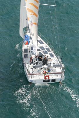
ECO 40 is a CLASS 40 Main dimensions of the boat
|
|
|
- Daisy Hudson
- 6 years ago
- Views:
Transcription
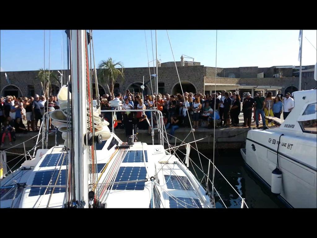
1 11 marzo 2015 I condizionamenti dell ambiente sulla performance sportiva: come si vince un Olimpiade Aula Magna - Politecnico di Torino Corso Duca degli Abruzzi 24 ROMA OCEAN WORLD Paolo DE GIROLAMO - Università di Roma La Sapienza ECO40 - Team Manager Matteo MICELI (in collegamento telefonico) Skipper - ECO40


2

3
4 ECO 40 is a CLASS 40 Main dimensions of the boat Loa = 12,19 m Max Loa = 12,19 m Max beam =4,5 m Displacement = 4500 kg Ballast = 750 l symmetrically distributed Mast = + 19,00 m from the sea surface Design : SITO AVILES RAMOS Structural design: GIULIO RICCI

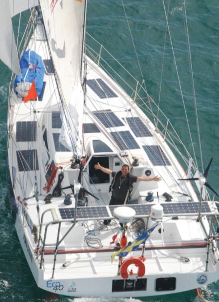

5 Photovoltaic panels
6 WIND GENERATORS


7 - Up to 9/10 Kn 240 mm propeller - from 10 a 13 Kn 200 mm propeller - More than 13 kn Hydrogenerators off Hydrogenerators


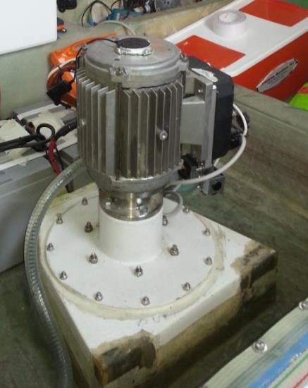
8 LITHIUM BATTERIES 400 A - 24 V ELECTRIC MOTOR 7KW - 48 V


9 Boat movement measurements by means of Leica Geosystems GPS Three high-precision GPS receivers Leica are positioned at the vertices of a triangle INERTIAL PLATFORM
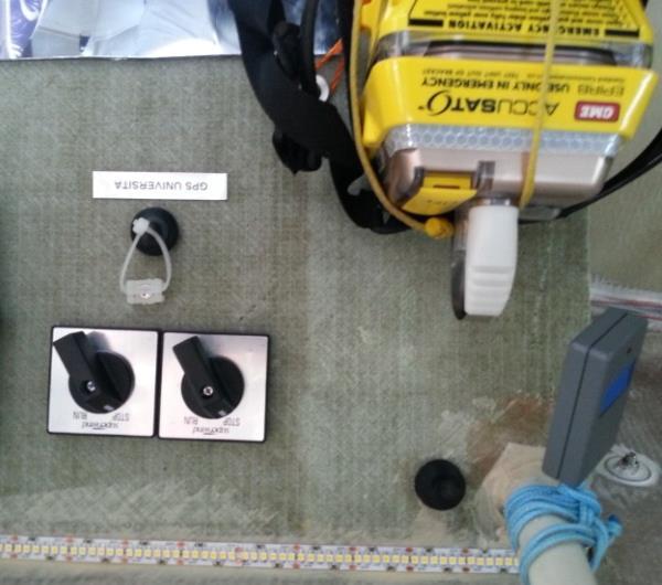

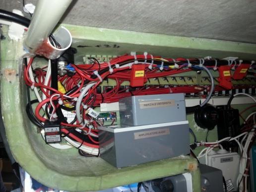

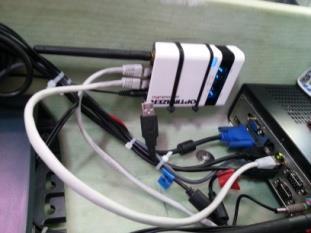
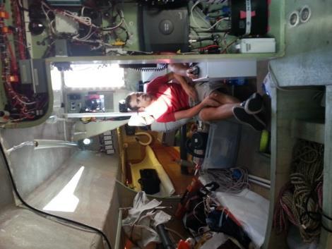
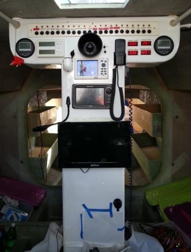

10 Onboard electronics Epirb, inertial platform, computer, multiplexer, satellite modem, ecc. Alessandro teaches Matteo the navigation system
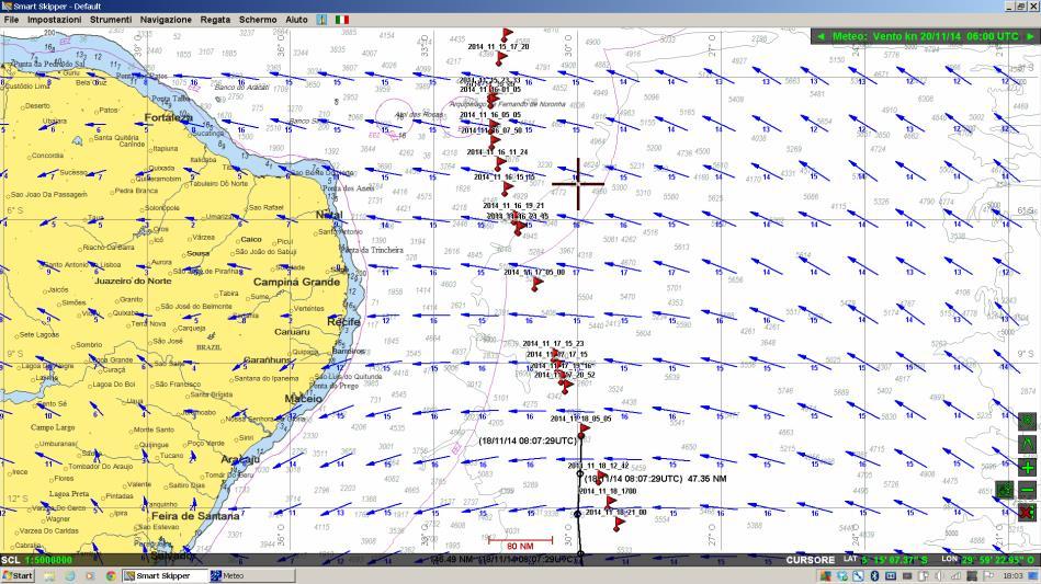

11 NAVIGATION SOFTWARE


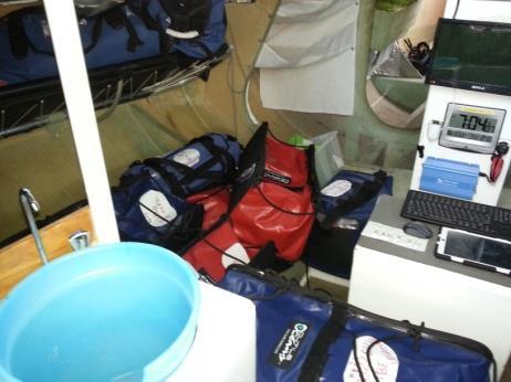
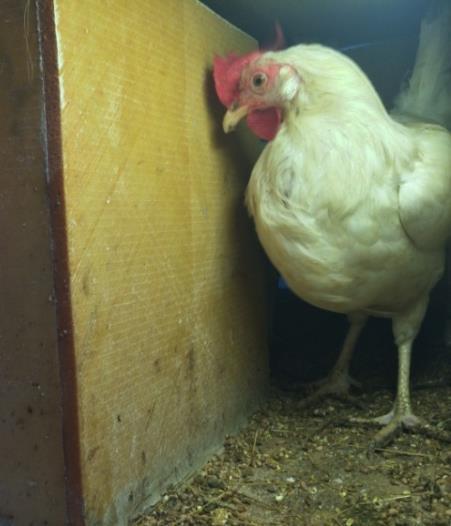
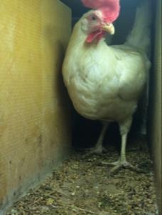

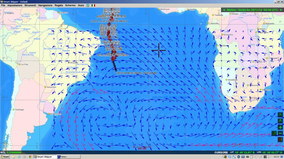
12 The hens LaBionda e LaMora, the garden, Aliseolo, S. Cristoforo, the doctor list and the luggages
13 Satellite support for monitoring and Ice tracking -COSMO-SkyMed -SENTINEL 1
 Spatial resolution: 30 m.")
14 Satellite: COSMO-SkyMed-3 Pass: Right ascending Date / time: Nov. 11, 2014 / 08:05 UTC Polarization: HH Incidence angle: Mode: Wide-region (WR03) Spatial resolution: 30 m. Where and when the radar image was collected

 Spatial resolution: 30 m.")

15 Satellite: COSMO-SkyMed-3 Pass: Right ascending Date / time: Nov. 11, 2014 / 08:05 UTC Polarization: HH Incidence angle: Mode: Wide-region (WR03) Spatial resolution: 30 m. Sea surface with strong wind (rough) Relatively flat Sea surface Thunderstorm rain cells with shadow ECO40 radar signal Pixel size 30 m. Boat length 12 m.
 Spatial resolution: 3 m.")
16 Where and when the radar image was collected Satellite: COSMO-SkyMed-1 Pass: Right ascending Date / time: Nov. 28, 2014 / 07:44 UTC Polarization: HH Incidence angle: 40 Mode: HIMAGE-Stripmap (H409) Spatial resolution: 3 m. ECO 40 meets Cosmo-SkyMed

17 Thunderstorms ECOO 40 meets Cosmo-SkyMed Track forecast Windy area Boat position 7:47 UTC Nov, 28 Big ship (tanker or cargo)

18 Wind from COSMO-SkyMed and ECO40 position Wind field derived from COSMO- SkyMed 06/11/ :45 UTC Positions of ECO40 boat

19 Max (%) Antartic Circumpolar W-E current

20 Mean Antartic Circumpolar W-E current

21 CAPE HORN DRAKE PASSAGE Antartic Circumpolar current

22 ICE TRACKING

23 ICE TRACKING Drake passage

24 ICE TRACKING ICEBERG DEATH Unusually North, 47 latitude south, a big iceberg 12 km long, disintegrates in water with a temperature above 10 C. The COSMO-SkyMed image was taken IN Atlantic about 1000 km east of the location of ECO40, in a sea particularly perturbed by the wind.


25 At 50 latitude south, about 900 km east of the route of ECO40, a large group of icebergs, the biggest of which are long some Km, moves pushed by winds and currents, forming a trail of debris. The two images were taken about 12 hours apart.

26 Copyright Copernicus data (2015)/ESA/e-GEOS Image Sentinel 1A (ESA). A large iceberg in fragmentation close to Shag Rocks, a group of four rocky islets located about 115 miles to the west of South Georgia. The rocks are in the north of the fragmented iceberg, whose length is about 10 km, and are visible as bright spots a little bit confused with many shards of ice.

27 Copyright Copernicus data (2015)/ESA/e-GEOS Image Sentinel 1A (ESA). About kilometers south of the iceberg of the previous image, other icebergs taken from C-band radar of Sentinel 1A. The varying shades of gray sea well represent the extreme variability of the wind in these latitudes. The radar picks up more signal (image clearer) where are stronger ripples on the surface of the water due to wind itself.
. At this latitude the sea contains a mix of water and ice crystals (frazil ice or grease ice) that follow the pattern of the current.")
28 Copyright Copernicus data (2015)/ESA/e-GEOS Further south, at the snowy peaks of the South Orkney Islands (which rise up to 1200 m and appear dark in the radar because of the snow cover). At this latitude the sea contains a mix of water and ice crystals (frazil ice or grease ice) that follow the pattern of the current.
29
30 Thank you for your attention
ROMA OCEAN WORLD Matteo MICELI Skipper - ECO40
 MODIMAR S.r.l. - Roma ROMA OCEAN WORLD Matteo MICELI Skipper - ECO40 Staff ECO40 Valerio BRINATI Cecilia ANGELELLI Alessandro ROMANO - University of Rome La Sapienza Alessandro PEZZOLI Politecnico di Torino
RIVET Satellite Remote Sensing and Small Scale Wave Process Analysis
 DISTRIBUTION STATEMENT A. Approved for public release; distribution is unlimited. RIVET Satellite Remote Sensing and Small Scale Wave Process Analysis Hans C. Graber RSMAS Department of Ocean Sciences
The Sea surface KInematics Multiscale (SKIM)
") The Sea surface KInematics Multiscale () proposal for ESA EE9 the team : https://www.facebook.com/4ee9 http://tinyurl.com/onrg http://www.umr-lops.fr/projets/projets-actifs/ 14 years of Doppler oceanography:
The Sea surface KInematics Multiscale () proposal for ESA EE9 the team : https://www.facebook.com/4ee9 http://tinyurl.com/onrg http://www.umr-lops.fr/projets/projets-actifs/ 14 years of Doppler oceanography:
STUDY OF LOCAL WINDS IN MOUNTAINOUS COASTAL AREAS BY MULTI- SENSOR SATELLITE DATA
 STUDY OF LOCAL WINDS IN MOUNTAINOUS COASTAL AREAS BY MULTI- SENSOR SATELLITE DATA Werner Alpers Institute of Oceanography, University of Hamburg, Bundesstrasse 53, D-20146 Hamburg, Germany E-mail: alpers@ifm.uni-hamburg.de
On the assimilation of SAR wave spectra of S-1A in the wave model MFWAM
 On the assimilation of SAR wave spectra of S-1A in the wave model MFWAM Lotfi Aouf and Alice Dalphinet Météo-France, Département Marine et Océanographie,Toulouse 14 th wave forecasting and hindcasting,
SAR images and Polar Lows
 SAR images and Polar Lows Gunnar Noer, Birgitte Furevik, Johannes Röhrs Observing polar lows in 2012: AVHRR Polar orbiting satellite imagery Primary source of info Observations at cloud tops Synoptic observations
STABILITY OF MULTIHULLS Author: Jean Sans
 STABILITY OF MULTIHULLS Author: Jean Sans (Translation of a paper dated 10/05/2006 by Simon Forbes) Introduction: The capsize of Multihulls requires a more exhaustive analysis than monohulls, even those
Polar Activities at DLR Maritime Security Lab Bremen in the Projects EISTAK and EMS
 Polar Activities at DLR Maritime Security Lab Bremen in the Projects EISTAK and EMS Susanne Lehner, Anja Frost, Rudolf Ressel German Aerospace Center Chart 2 Maritime Security Lab in Bremen German Aerospace
Cross-Calibrating OSCAT Land Sigma-0 to Extend the QuikSCAT Land Sigma-0 Climate Record
 Cross-Calibrating OSCAT Land Sigma-0 to Extend the QuikSCAT Land Sigma-0 Climate Record David G. Long Department of Electrical and Computer Engineering Brigham Young University May 2013 0 Scatterometer
Sentinel-1A Ocean Level-2 Products Validation Strategy
 Sentinel-1A Ocean Level-2 Products Validation Strategy Sentinel-1 Mission Performance Centre ESL L2 Team and Ocean Data Lab G.Hajduch (1), A.Mouche (2), P.Vincent (1), R.Husson (1), H.Johnsen (3), F.Collard
World Marine Offshore Torskekaj Esbjerg, Denmark
 WS30 WORLD BORA Vessel Specification MULTIPURPOSE OFFSHORE SUPPORT Suitable for transfer of crew and cargo to wind industry, crew change vessel, survey, ROV, standby, rescue and guard duties. The vessel
Viva TPS. TS11/15 Total Stations Check and Adjust Procedure. October Summary
 Viva TPS October 2010 TS11/15 Total Stations Summary Leica builds total stations to the highest quality and calibrates each instrument before it leaves the Factory. After the instrument is shipped or used
THE EFFECT OF RAIN ON ASCAT OBSERVATIONS OF THE SEA SURFACE RADAR CROSS SECTION USING SIMULTANEOUS 3-D NEXRAD RAIN MEASUREMENTS
 THE EFFECT OF RAIN ON ASCAT OBSERVATIONS OF THE SEA SURFACE RADAR CROSS SECTION USING SIMULTANEOUS 3-D NERAD RAIN MEASUREMENTS David E. Weissman Hofstra University Hempstead, New York 11549 Mark A. Bourassa
CHANGE OF THE BRIGHTNESS TEMPERATURE IN THE MICROWAVE REGION DUE TO THE RELATIVE WIND DIRECTION
 JP4.12 CHANGE OF THE BRIGHTNESS TEMPERATURE IN THE MICROWAVE REGION DUE TO THE RELATIVE WIND DIRECTION Masanori Konda* Department of Geophysics, Graduate School of Science, Kyoto University, Japan Akira
westsail 42 Center cockpit ASTRAEA
 westsail 42 Center cockpit ASTRAEA Make: westsail 42 Model: Length: Center cockpit 42 ft Price: $ 89,900 Year: 1978 Condition: Used Location: San Diego, CA, United States Boat Name: Hull Material: Draft:
NEW BUILD - Wildcat 53 Windfarm Support Vessel Listing ID:
 Australia - Chile - Indonesia - Great Britain - New Zealand - Panama - Philippines - South Korea - Thailand - USA E: sales@seaboats.net (sales) - E: admin@seaboats.net (accounts) NEW BUILD - Wildcat 53
Synthetic Aperture Radar imaging of Polar Lows
 Oslo Polar Low workshop 21-22 May 2012 Extended abstract Synthetic Aperture Radar imaging of Polar Lows Birgitte Furevik, Gunnar Noer and Johannes Röhrs met.no Forecasting polar lows is to a large degree
Sailing the Seas: Wind Driven Ocean Circulation Ocean Gyres
 Sailing the Seas: Wind Driven Ocean Circulation Ocean Gyres Ocean Currents What Happens at the Coast? Readings: Ch 9: 9.2-9.6, 9.8-9.13 Graphic: America's Cup sailboat race off Newport, Rhode Island. J.
Flow separation and lee-waves in the marine atmosphere
 Flow separation and lee-waves in the marine atmosphere Det norske Videnskabs-Akademi 16 Oct. 2009 Bjørn Gjevik Universitetet i Oslo epost: bjorng@math.uio.no Flow separation and lee-waves in the marine
World Marine Offshore Torskekaj Esbjerg, Denmark
 WS25 WORLD SCIROCCO Vessel Specification MULTIPURPOSE OFFSHORE SUPPORT Suitable for transfer of crew and cargo to wind industry, crewchange vessel, survey, ROV, standby rescue and guard duties. The vessel
High resolution wind fields over the Black Sea derived from Envisat ASAR data using an advanced wind retrieval algorithm
 High resolution wind fields over the Black Sea derived from Envisat ASAR data using an advanced wind retrieval algorithm Werner Alpers (1), Alexis Mouche (2), Andrei Yu. Ivanov (3), and Burghard Brümmer
World Marine Offshore Torskekaj Esbjerg, Denmark
 Vessel Specification Suitable for transfer of crew and cargo to wind indu stry, crew change vessel, survey, ROV, standby rescue and guard duties. The vessel design is a proven concept within support vessels
HIGH RESOLUTION WIND AND WAVE MEASUREMENTS FROM TerraSAR-X IN COMPARISON TO MARINE FORECAST
 SAR Maritime Applications German Aerospace Center (DLR) Remote Sensing Technology Institute Maritime Security Lab HIGH RESOLUTION WIND AND WAVE MEASUREMENTS FROM TerraSAR-X IN COMPARISON TO MARINE FORECAST
Boost Your Skills with On-Site Courses Tailored to Your Needs
 Boost Your Skills with On-Site Courses Tailored to Your Needs www.aticourses.com The Applied Technology Institute specializes in training programs for technical professionals. Our courses keep you current
Monitoring Conditions Offshore with Satellites
 Downloaded from orbit.dtu.dk on: Dec 15, 2017 Monitoring Conditions Offshore with Satellites Karagali, Ioanna; Hasager, Charlotte Bay; Badger, Merete; Bingöl, Ferhat; Ejsing Jørgensen, Hans Publication
13. TIDES Tidal waters
 Water levels vary in tidal and non-tidal waters: sailors should be aware that the depths shown on the charts do not always represent the actual amount of water under the boat. 13.1 Tidal waters In tidal
The Wave Glider: A Mobile Buoy Concept for Ocean Science. 009 Liquid Robotics Inc.
 The Wave Glider: A Mobile Buoy Concept for Ocean Science 009 Liquid Robotics Inc. J. Manley & T. Richardson: Liquid Robotics Inc. DBCP XXV Paris September 28, 2009 1 Wave Glider Overview Unique Two Part
model 304 ShrinQ PEDOMETER
 model 304 PEDOMETER WV4407IS01SPTRA.indd 1 TABLE OF CONTENTS INTRODUCTION INTRODUCTION 1 HOW TO USE THIS MANUAL 2 REMOVING THE BATTERY INSULATOR TAB 3 WARNINGS & CAUTIONS 4 PEDOMETER FUNCTIONS 5 HOW TO
LAMPEDUSA C B TRIPOLI
 ITALY SRR LAMPEDUSA 0 60 120 KILOMETERS MALTA SRR NATO MARITIME SURVEILLANCE AREA AS OF MARCH 23, 2011 D C B NATO MARITIME SURVEILLANCE AREA AS OF APRIL 8, 2011 A LIBYA SRR E TRIPOLI EXCERPT FROM: REPORT
What Causes Different Weather?
 What Causes Different Weather? Table of Contents What causes weather?...3 What causes it to rain or snow?...4 What causes flooding?...5 What causes hail?...6 What causes the seasons?...7-8 What causes
An Atlas of Oceanic Internal Solitary Waves (February 2004) by Global Ocean Associates Prepared for Office of Naval Research Code 322 PO
 by Global Ocean Associates Prepared for Office of Naval Research Code 322 PO") Overview The is located in the North Atlantic Ocean between southern Ireland and southwest England (Figure 1). The Sea s western edge covers a continental shelf region characterized by rough and irregular
Overview The is located in the North Atlantic Ocean between southern Ireland and southwest England (Figure 1). The Sea s western edge covers a continental shelf region characterized by rough and irregular
Chapter 8 Air Masses
 Chapter 8 Air Masses Air Masses - 1 1. An Air Mass is a large body of air usually about 1500 km across and several km thick, that has homogeneous physical properties. 2. The important physical properties
Analyses of Scatterometer and SAR Data at the University of Hamburg
 Analyses of Scatterometer and SAR Data at the University of Hamburg Wind, Waves, Surface Films and Rain ГАДЕ, Мартин Хорстович (aka Martin Gade) Institut für Meereskunde, Universität Hamburg, Германия
Bavaria 44 Fizz (GRP) Price: EUR 97,500
 Price: EUR 97,500") Bavaria 44 Fizz Make: Model: 44 Length: Bavaria 13.94 m Price: EUR 97,500 Year: 2002 Condition: Used Boat Name: Hull Material: Number of Engines: 1 Fuel Type: Fizz Fibreglass (GRP) Diesel The "Fizz" This
Bavaria 44 Fizz Make: Model: 44 Length: Bavaria 13.94 m Price: EUR 97,500 Year: 2002 Condition: Used Boat Name: Hull Material: Number of Engines: 1 Fuel Type: Fizz Fibreglass (GRP) Diesel The "Fizz" This
PRELIMINARY STUDY ON DEVELOPING AN L-BAND WIND RETRIEVAL MODEL FUNCTION USING ALOS/PALSAR
 PRELIMINARY STUDY ON DEVELOPING AN L-BAND WIND RETRIEVAL MODEL FUNCTION USING ALOS/PALSAR Osamu Isoguchi, Masanobu Shimada Earth Observation Research Center, Japan Aerospace Exploration Agency (JAXA) 2-1-1
ERS-1/2 Scatterometer new products: mission reprocessing and data quality improvement
 ERS-1/2 Scatterometer new products: mission reprocessing and data quality improvement Giovanna De Chiara (1), Raffaele Crapolicchio (1), Pascal Lecomte (2) (1) Serco SpA Via Sciadonna 22-24 Frascati (Roma),
Feasibility of snow water equivalent retrieval by means of groundbased and spaceborne SAR interferometry
 Feasibility of snow water equivalent retrieval by means of groundbased and spaceborne SAR interferometry, Helmut Rott, Markus Heidinger ENVEO, Innsbruck, Austria Guido Luzi, Giovanni Macaluso, Daniele
Development of SAR-Derived Ocean Surface Winds at NOAA/NESDIS
 Development of SAR-Derived Ocean Surface Winds at NOAA/NESDIS Pablo Clemente-Colón, William G. Pichel, NOAA/NESDIS Frank M. Monaldo, Donald R. Thompson The Johns Hopkins University Applied Physics Laboratory
Nautor Swan EMOCEAN2
 Nautor Swan 55-107 EMOCEAN2 Make: Nautor Swan Model: 55-107 Length: 55 ft Price: $ 450,000 Year: 1992 Condition: Used Location: Hong Kong Boat Name: Hull Material: Draft: Number of Engines: 1 Engine Make:
Marine Kit 4 Marine Kit 4 Sail Smooth, Sail Safe
 Marine Kit 4 Marine Kit 4 Sail Smooth, Sail Safe Includes Basic ship Terminologies and Investigation Check list Index 1. Ship Terminology 03 2. Motions of a Floating Body...09 3. Ship Stability.10 4. Free
High resolution wind retrieval for SeaWinds
 High resolution wind retrieval for SeaWinds David G. Long and Jeremy B. Luke Brigham Young University, 459 Clyde Building, Provo, UT 84602, USA ABSTRACT The SeaWinds instrument on the QuikSCAT satellite
1995 Hinterhoeller Nonsuch 324
 RICHARD NOLAN Eastland Yacht Sales 33A Pratt Street Essex, CT, US Office: 8607678224 rnolan@eastlandyachts.com 1995 Hinterhoeller Nonsuch 324 Boat Type: Cruiser Address: Groton, CT, US Price: $60,000 OVERVIEW
Beneteau Oceanis 38. Page 1 of 7
 Beneteau Oceanis 38 Make Model Length Price Year Condition Beneteau Oceanis 38 11.5 m EUR 169,000 2016 Used Tax Status Hull Material Draft Engine Hours Fuel Type Engine Model Tax Paid Fibreglass (GRP)
GUINNESS WORLD RECORD ATTEMPT THE ULTIMATE STAND UP PADDLE CHALLENGE
 GUINNESS WORLD RECORD ATTEMPT THE ULTIMATE STAND UP PADDLE CHALLENGE Antonio De La Rosa If there is something that defines me, it s the word energy which I learned to channel through sports since I was
Offshore wind resource mapping in Europe from satellites
 Offshore wind resource mapping in Europe from satellites Charlotte Bay Hasager Seminar at University of Auckland, Dept. of Physics 1 April 2015 Content DTU Wind Energy Offshore wind turbines New European
WMB-160F Multi-beam Fishing System
 WMB-160F Multi-beam Fishing System Take away the guess work and see what s REALLY below your boat! Seven Systems in One 2 WMB-160F WMB-160F Screen Shots The WMB-160F is a multi-beam sonar that has been
P2.17 OBSERVATIONS OF STRONG MOUNTAIN WAVES IN THE LEE OF THE MEDICINE BOW MOUNTAINS OF SOUTHEAST WYOMING
 P2.17 OBSERVATIONS OF STRONG MOUNTAIN WAVES IN THE LEE OF THE MEDICINE BOW MOUNTAINS OF SOUTHEAST WYOMING Larry D. Oolman 1, Jeffrey R. French 1, Samuel Haimov 1, David Leon 1, and Vanda Grubišić 2 1 University
RORC Caribbean 600. Preparation and introduction to Adrena Software
 RORC Caribbean 600 Preparation and introduction to Adrena Software What we will cover The role of the navigator Pre-race preparation Course Planning and ADRENA Roadbooks Pre-race Weather Weather Routing
SEA SURFACE TEMPERATURE RETRIEVAL USING TRMM MICROWAVE IMAGER SATELLITE DATA IN THE SOUTH CHINA SEA
 SEA SURFACE TEMPERATURE RETRIEVAL USING TRMM MICROWAVE IMAGER SATELLITE DATA IN THE SOUTH CHINA SEA Mohd Ibrahim Seeni Mohd and Mohd Nadzri Md. Reba Faculty of Geoinformation Science and Engineering Universiti
High Resolution Sea Surface Roughness and Wind Speed with Space Lidar (CALIPSO)
") High Resolution Sea Surface Roughness and Wind Speed with Space Lidar (CALIPSO) Yongxiang Hu NASA Langley Research Center Carl Weimer Ball Aerospace Corp. 1 CALIPSO Mission Overview CALIPSO seeks to improve
High Resolution Sea Surface Roughness and Wind Speed with Space Lidar (CALIPSO) Yongxiang Hu NASA Langley Research Center Carl Weimer Ball Aerospace Corp. 1 CALIPSO Mission Overview CALIPSO seeks to improve
GULF OF GEORGIA NORTH PUGET SOUND SOUTH PUGET SOUND
 June 8, 2018 GULF OF GEORGIA NORTH PUGET SOUND SOUTH PUGET SOUND Skippers, Mates & Crews, On behalf of the IPBA and all of its members, let me welcome you to our 2018 ICR, course and compass contest/rally.
Outremer. Just Catamarans, Inc
 Outremer 5X Make: Model: Length: Outremer 5X 59 ft Price: EUR 1,078,481 Year: 2014 Condition: New Location: France Hull Material: Draft: Number of Engines: 2 Engine Make: Engine Power: Engine Hours: Fiberglass
9.3. Storing Thermal Energy. Transferring Thermal Energy
 9.3 If you have been to a beach on a hot summer day, you have likely cooled off by going for a dip in the water. The water, which is cooler than you are, removes thermal energy from your body, making you
Chapter 10: Global Wind Systems
 Chapter 10: Global Wind Systems Three-cell model of atmospheric circulation Intertropical Convergence Zone (ITCZ) Typical surface wind patterns Upper-level pressure and winds Climatological sea-level pressure
RIPPLE TANK - with rippler & kit
 GENERAL DESCRIPTION: RIPPLE TANK - with rippler & kit Cat: SW3430-001 with illuminator, rippler & kit. The ripple tank is used to investigate wave motion in a shallow trough of water to understand how
Social Studies CHAPTER 2: PART 2 CLIMATE AND WEATHER
 Social Studies CHAPTER 2: PART 2 CLIMATE AND WEATHER Climate Weather and Identity Climate and weather have a large influence on how Canadians build their identity. We will study the factors that contribute
HOW TO BEST USE YOUR ELECTRONICS: CHARTING, SONAR, AND IMAGING. By: Captain Tom Blackburn
 HOW TO BEST USE YOUR ELECTRONICS: CHARTING, SONAR, AND IMAGING By: Captain Tom Blackburn Topics I. INTRODUCTION II. CHARTING A TREMENDOUS FISH FINDING TOOL III. CHARTING - SIGNIFICANT CHARTING AND NAVIGATIONAL
Sensors and Platforms for Autonomous Undersea Systems
 Sensors and Platforms for Autonomous Undersea Systems Robert C. Spindel Applied Physics Laboratory University of Washington 1013 NE 40 th Street Seattle, WA 98105 USA spindel@apl.washington.edu 206 543
Challenges in determining water surface in airborne LiDAR topobathymetry. Amar Nayegandhi, Dewberry 15 th Annual JALBTCX Workshop, June 11 th 2014
 Challenges in determining water surface in airborne LiDAR topobathymetry Amar Nayegandhi, Dewberry 15 th Annual JALBTCX Workshop, June 11 th 2014 Why topobathy LiDAR? Complements acoustic (multi-beam sonar)
Synthetic aperture radar observations of sea surface signatures of atmospheric gravity waves over Southeast Asian coastal waters
 Synthetic aperture radar observations of sea surface signatures of atmospheric gravity waves over Southeast Asian coastal waters Werner Alpers Institute of Oceanography, University of Hamburg, Hamburg,
The Ice Contamination Ratio Method: Accurately Retrieving Ocean Winds Closer to the Sea Ice Edge While Eliminating Ice Winds
 The Ice Contamination Ratio Method: Accurately Retrieving Ocean Winds Closer to the Sea Ice Edge While Eliminating Ice Winds David Long Department of Electrical and Computer Engineering Brigham Young University
Krogen Pilothouse Trawler Lucky
 Krogen Pilothouse Trawler Lucky Make: Model: Length: Krogen Pilothouse Trawler 39 ft Price: $ 369,900 Year: 2000 Condition: Used Location: Anacortes, WA, United States Boat Name: Hull Material: Draft:
Characterization of Boundary-Layer Meteorology During DISCOVER-AQ
 Characterization of Boundary-Layer Meteorology During DISCOVER-AQ Daniel M. Alrick and Clinton P. MacDonald Sonoma Technology, Inc. Gary A. Morris St. Edward s University for Texas Air Quality Research
Australian Northwest Shelf
 Overview The Australian Northwest shelf extends roughly 2000 km along the coast of Western Australia (Figure 1). The region is influenced by part of the South Equatorial Current that runs southwest out
4.2 Pressure and Air Masses (6.3.2)
") 4.2 Pressure and Air Masses (6.3.2) Explore This Phenomena www.ck12.org Everybody loves a picnic. Your friends and you are headed up the canyon to enjoy the mountains. While driving you feel a slight discomfort
4.2 Pressure and Air Masses (6.3.2) Explore This Phenomena www.ck12.org Everybody loves a picnic. Your friends and you are headed up the canyon to enjoy the mountains. While driving you feel a slight discomfort
Monterey Peninsula College
 Introduction to Google Earth Name Goals 1. To become proficient at using the basic features of Google Earth. 2. To recognize differences in coastal features between the east and west coast of North America.
Keywords: Flap controls, Redundancy, Dynamic simulation, Failure
 27 TH INTERNATIONAL CONGRESS OF THE AERONAUTICAL SCIENCES REDUNDANT HYDRAULIC SECONDARY FLIGHT CONTROL SYSTEMS BEHAVIOR IN FAILURE CONDITIONS Lorenzo Borello, Giuseppe Villero, Matteo Dalla Vedova Department
Simrad yachting catalog 2007
 26 AUTOSTEERING Electronic intelligence combined with powerful and reliable designs make sure you enjoy boating even more. 27 Tillerpilots Enjoy silence when sailing SIMRAD TP SERIES REMOTE COMMANDER High
Cyclone Hazards: waves and storm tide
 Cyclone Hazards: waves and storm tide 1/32 HIGH WAVES TORRENTIAL RAIN (FLOODING) SURGE ON COAST AT CROSSING GALE FORCE WINDS 2/32 Waves and Swell MetEd Comet Program Wind and Wave forecasting https://www.meted.ucar.edu/training_course.php?id=8
1 A Mangonel is a type of catapult used to launch projectiles such as rocks. A student made a working model of a Mangonel. crossbar. bucket.
 1 A Mangonel is a type of catapult used to launch projectiles such as rocks. A student made a working model of a Mangonel. crossbar bucket arm rubber band string scale handle As the handle is turned, the
An Atlas of Oceanic Internal Solitary Waves (May 2002) by Global Ocean Associates Prepared for the Office of Naval Research - Code 322PO
 by Global Ocean Associates Prepared for the Office of Naval Research - Code 322PO") Overview is located in the western Pacific Ocean along the west side of the Philippines (between approximately 5 o and 11 o N. latitude and 117 o and 123 o E. longitude). It is a deepwater sea, roughly
Overview is located in the western Pacific Ocean along the west side of the Philippines (between approximately 5 o and 11 o N. latitude and 117 o and 123 o E. longitude). It is a deepwater sea, roughly
SIO 210 MIDTERM, 26 October 2009.
 SIO 210 MIDTERM, 26 October 2009. Please mark your answers on the attached answer sheet, and turn in ONLY THE ANSWER SHEET. Donʼt forget to put your name on the answer sheet!! Here are some constants,
Advanced Sea Kayak Leader Assessment Notes
 Advanced Sea Kayak Leader Assessment Notes Technical Syllabus Part A - Personal Paddling Skills Through the blending of their body, boat and blade positions, the paddler must be able to skilfully control
EVOLUTION PACKAGE. Set your destination, sit back, relax and let your Aquanima take you there with a complete peace of mind!
 AQUANIMA CONCEPT Solar electric yachts form a new class of their own. They offer an unprecedented sailing experience in perfect symbiosis with the ocean. They combine the silence of sails with the convenience
Hydrographic Surveying Methods, Applications and Uses
 Definition: Hydrographic Surveying Methods, Applications and Uses It is the branch of surveying which deals with any body of still or running water such as a lake, harbor, stream or river. Hydrographic
BFGC Soaring & Cross Country
 Lecture 2 Meteorology: Basic Weather Forecasting: Websites to use Pressure Charts Fronts Cloudbase Forecast Hidden Meanings Thermal Strength Trigger Temperature Advantageous Route Planning Principles of
FMB12329 Accommodation Work Barge
 FMB12329 Accommodation Work Barge Delivery 2014 Class Notation: ABS + Maltese Cross + A1 Barge for unrestricted service Function: completely outfitted for pipelay derrick work and other related duties
MISR CMVs. Roger Davies and Aaron Herber Physics Department
 MISR CMVs Roger Davies and Aaron Herber Physics Department Acknowledgements: MISR Science and Data Processing Team (especially Catherine Moroney and Mike Garay) From the AGU Fall Meeting 2009 MISR and
Singularity analysis: A poweful technique for scatterometer wind data processing
 Singularity analysis: A poweful technique for scatterometer wind data processing M. Portabella (ICM-CSIC) W. Lin (ICM-CSIC) A. Stoffelen (KNMI) A. Turiel (ICM-CSIC) G. King (ICM-CSIC) A. Verhoef (KNMI)
SENSOR SYNERGY OF ACTIVE AND PASSIVE MICROWAVE INSTRUMENTS FOR OBSERVATIONS OF MARINE SURFACE WINDS
 SENSOR SYNERGY OF ACTIVE AND PASSIVE MICROWAVE INSTRUMENTS FOR OBSERVATIONS OF MARINE SURFACE WINDS N. Ebuchi Institute of Low Temperature Science, Hokkaido University, N19-W8, Kita-ku, Sapporo 060-0819,
Greenhouse Effect Activity
 Greenhouse Effect Activity Objectives: The student will: 1. Read and use weather instruments. 2. Collect and record temperature readings. 3. Describe the concept of the greenhouse effect. Materials: Fish
LOA: 48' 0" (14.63m)
") SIMBA FRERS Builder: FRERS LOA: 48' 0" (14.63m) Year Built: 1980 Model: Cruising/Racing Sailboat Price: $97,500 USD Off the market Location: United States Our experienced yacht broker, Andrey Shestakov,
SIMBA FRERS Builder: FRERS LOA: 48' 0" (14.63m) Year Built: 1980 Model: Cruising/Racing Sailboat Price: $97,500 USD Off the market Location: United States Our experienced yacht broker, Andrey Shestakov,
Open Ocean Storm Waves in the Arctic
 International Workshop on Wave Hindcasting and Forecasting/Coastal Hazards Symposium Liverpool, UK, 10-15 September 2017 Open Ocean Storm Waves in the Arctic Takuji Waseda,Adrean Webb (UTokyo, Japan) Kazutoshi
Luxury customized to the max
 preliminary Luxury customized to the max www.hanseyachts.com The true peace of god begins at any point 1.000 miles from the nearest land. Joseph Conrad, novelist, 1857 1924 FAST CRUISING As one of the
MASTER THESIS PRESENTATION. Comparison Of Seakeeping Performance Of The Two Super Yachts Of 53 And 46 m In Length
 MASTER THESIS PRESENTATION Comparison Of Seakeeping Performance Of The Two Super Yachts Of 53 And 46 m In Length Muhammad Asim Saleem Supervisor : Prof. Dario Boote, Universita degli studi di Genova, Italy
New Syllabus for 12 Nautical Miles
 New Syllabus for 12 Nautical Miles 1. Legal and professional responsibilities of skippers under the Tourism Authority Act 2006. a) The meaning of Skipper as defined under the Tourism Authority Act 2006
TOFINOU 8.0 M DAYSAILER. Year DIAMOND Yachts, Yachtzentrum Baltic Bay Börn Laboe
 TOFINOU 8.0 M DAYSAILER DIAMOND Yachts, Yachtzentrum Baltic Bay Börn 17 24235 Laboe Boat sold Main Info Model Dimensions & Material Tofinou 8.0 m Daysailer Key Facts Exclusive sail inventory by NORTHSails.
Cornish Crabbers Shrimper 19 Curlew
 Cornish Crabbers Shrimper 19 Curlew Make: Cornish Crabbers Model: Shrimper 19 Length: 5.87 m Price: EUR 15,900 Year: 1989 Condition: Used Boat Name: Hull Material: Draft: Number of Engines: 1 Fuel Type:
Presentation Library for Inland ECDIS
 Edition 2.0 1.6.2006 Standard Electronic Chart Display and Information System for Inland Navigation Inland ECDIS for Inland ECDIS In addition to the IHO-S-52 Edition 2.0 IES 20-Section 3 PresLib.doc Page
Crave the Wave, Feb 16, 2008 TEAM Mentor Invitational Score Rank
 Crave the Wave Mentor Invitational Feb 16, 2008 Page 1 of 15 Crave the Wave, Feb 16, 2008 TEAM Mentor Invitational Score Rank Scoring: Points will be awarded for the accuracy and quality of the responses.
Riva 63 Vertigo (GRP) Price: EUR 980,000. Number: Yachts Invest - Jean Lacombe
 Price: EUR 980,000. Number: Yachts Invest - Jean Lacombe") Riva 63 Vertigo Make: Model: Length: Riva 63 Vertigo 19.57 m Price: EUR 980,000 Year: 2007 Condition: Used Location: Ibiza, Spain Hull Material: Number of Engines: 0 Fuel Type: Fibreglass (GRP) Diesel
Riva 63 Vertigo Make: Model: Length: Riva 63 Vertigo 19.57 m Price: EUR 980,000 Year: 2007 Condition: Used Location: Ibiza, Spain Hull Material: Number of Engines: 0 Fuel Type: Fibreglass (GRP) Diesel
65ft Expedition Sailing Yacht Listing ID:
 Australia - Great Britain - Indonesia - New Zealand - Philippines - Thailand - USA E: sales@seaboats.net (sales) - E: admin@seaboats.net (accounts) 65ft Expedition Sailing Yacht Listing ID: 627187 DESCRIPTION:
Port of Port Elizabeth Information
 LOCATION Latitude 34º 01 S Longitude 25º 42 E PILOTAGE Pilotage is compulsory. Rendezvous point is 2.2 nautical miles NE of the port entrance on the leading lights. Pilot transfer is by pilot boat, unless
MARINE NOTICE MARINE NOTICE. Marine Notice 7/2012. Guidance on ECDIS for ships calling at Australian ports 7/2012
 MARINE NOTICE MARINE 7/2012 NOTICE Marine Notice 7/2012 Guidance on ECDIS for ships calling at Australian ports This notice aims to clarify some of the emerging issues relating to the carriage requirements
DIRECT INVENTORY TAKING OF UNDERWATER OBJECTS USING A HANDHELD GPS RECEIVER
 DIRECT INVENTORY TAKING OF UNDERWATER OBJECTS USING A HANDHELD GPS RECEIVER ABSTRACT Dariusz Popielarczyk Chair of Satellite Geodesy and Navigation Warmia and Mazury University in Olsztyn The paper presents
Beneteau 411 Mi Amante
 Beneteau 411 Mi Amante Make: Model: 411 Length: Beneteau 41 ft Price: $ 145,000 Year: 2001 Condition: Used Location: Seattle, WA, United States Boat Name: Hull Material: Draft: Number of Engines: 1 Fuel
SOCCER / FOOTBALL.
 144 Soccer scoreboards are used for small sport facilities, but also in large soccer stadiums and must meet different requirements. In order to guarantee the best possible readability, the scoreboards
DARTSAILER 27. Year DIAMOND Yachts, Yachtzentrum Baltic Bay Börn Laboe
 DIAMOND Yachts, Yachtzentrum Baltic Bay Börn 17 24235 Laboe Boat sold Main Info Dimensions & Material Key Facts LOA 8.25 m Motorsailer with inner helm station Manufacturer Holland Boat Company LWL 7.00
Incident Reporting for Pilots, PEC Holders and Masters
 Incident Reporting for Pilots, PEC Holders and Masters It is a requirement that all Incidents or near misses are reported to the Harbour Master. This is a necessary requirement to allow a full investigation
Brioni 44+ Brioni is presenting new model in 2015
 Brioni is presenting new model in 2015 Brioni 44+ Company was founded in 2006 with determination to build reliable, easy to handle, fast, but economic 44 footer, that offers you luxury of your home. Basic