Henry s Fork Angler Access. Below Mesa Falls
|
|
|
- Sophia Gregory
- 6 years ago
- Views:
Transcription
1 Henry s Fork Angler Access Below Mesa Falls
2 Table of Contents 29. Grandview Campground 30. Warm River Campground 31. Stone Bridge 32. Fisherman s Drive Jumpoff Canyon 33. Ashton Reservoir 34. Ashton Dam East 34. Ashton Dam West 35. Ora Bridge 36. Vernon Bridge 37. Henrys Fork Ranch 38. Chester Dam 39. Chester Wetlands WMA 40. Fun Farm Bridge 41. Del Rio Bridge 42. Clyde Keefer City Park 43. St. Anthony Greenway Bridge St 44. St. Anthony Greenway Cemetery 45. St. Anthony Railroad Trestle 46. Red Road Bridge 47. Warm Slough 48. Beaver Dick Park
 Use Put-In (Raft Only) Float Distance to Stonebridge, 6.")
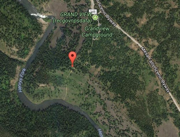
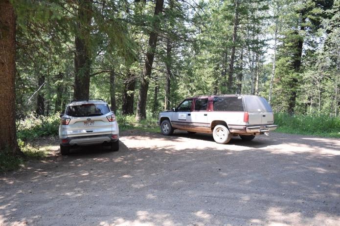
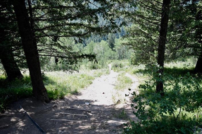
3 Grandview Campground Back to Top Latitude Longitude Owner Caribou-Targhee National Forest Boat Ramp (Unpaved Boatslide) Use Put-In (Raft Only) Float Distance to Stonebridge, 6.5 Miles Parking 5 Trashcans Campers Only Restroom At Campground Room to Turn Trailer? Google Maps Link
4

5

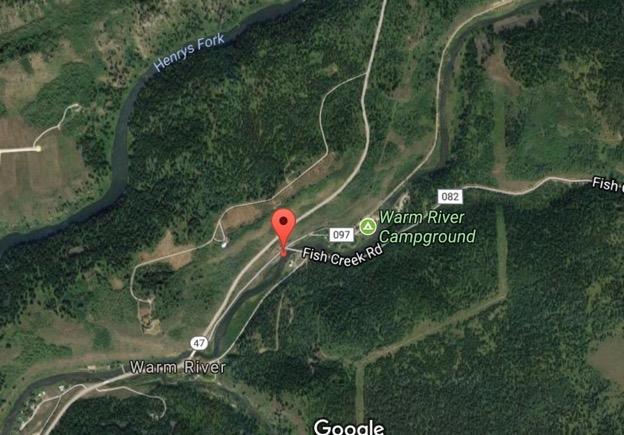
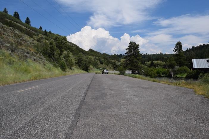
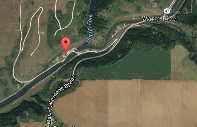
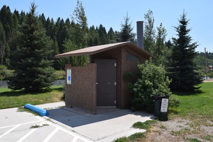
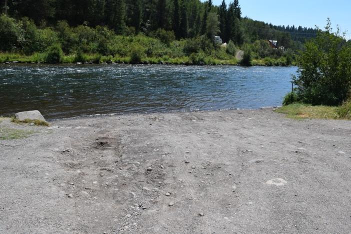
6 Warm River Campground Back to Top Latitude Longitude Owner Caribou-Targhee National Forest Boat Ramp Use Wading Parking 15+ Trashcans Campers Only Restroom In Campsite Room to Turn Trailer? Google Maps Link
7
 Use Boating Put-In & Take-Out, Wading Float Distance to Jumpoff Canyon, 6 Miles Ashton Reservoir, 7")
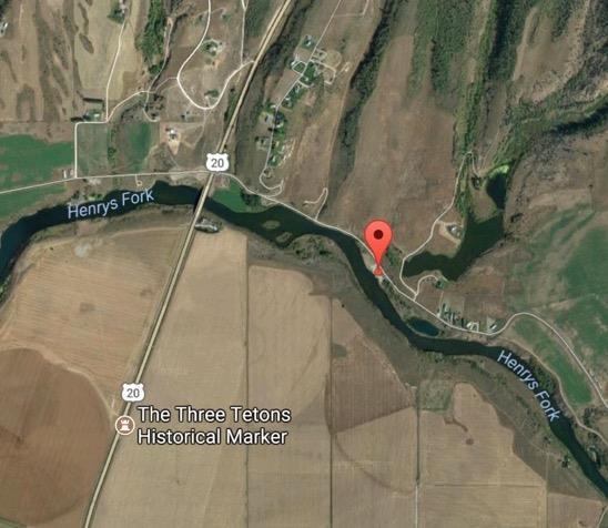
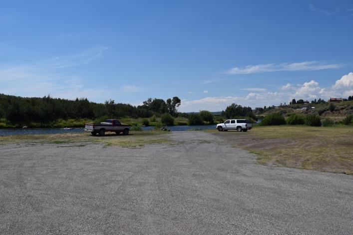
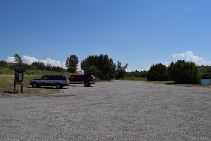
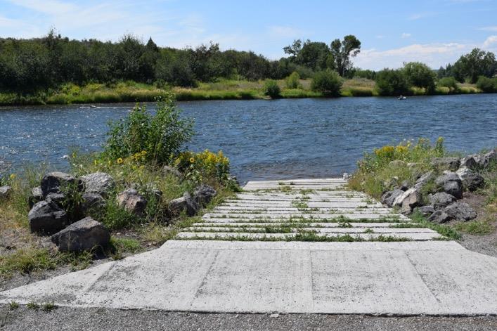
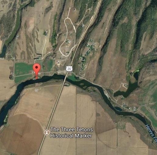
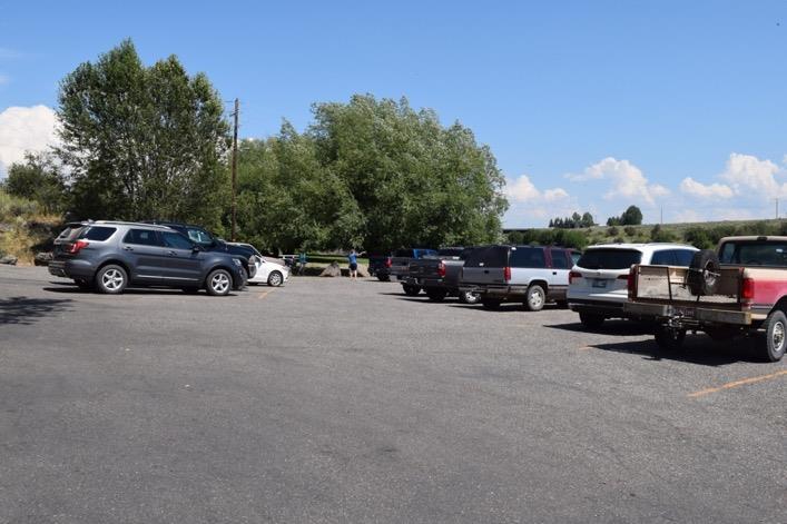
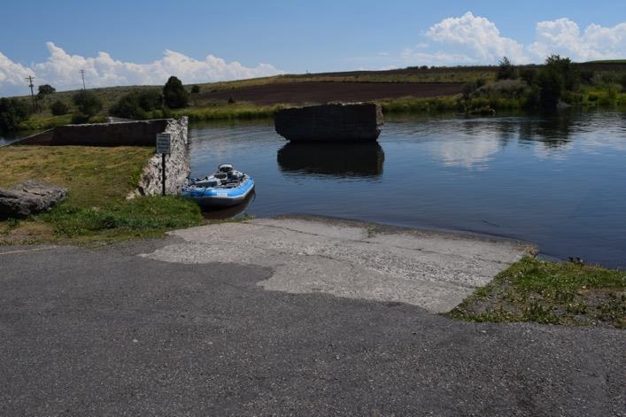
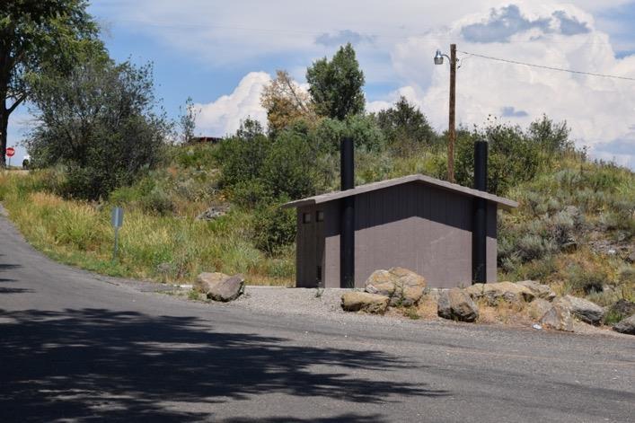
8 Stone Bridge Back to Top Latitude Longitude Owner Fremont County Boat Ramp (Gravel) Use Boating Put-In & Take-Out, Wading Float Distance to Jumpoff Canyon, 6 Miles Ashton Reservoir, 7 Miles Parking 20+ (1 Handicap) Trashcans Restroom Room to Turn Trailer? Google Maps Link
9

10
 Use Boating Put-In & Take Out, Wading Float Distance to Ashton Reservoir, 1 Mile")
11 Fisherman s Drive Jumpoff Canyon Back to Top Latitude Longitude Owner Fremont County Boat Ramp (Concrete Block) Use Boating Put-In & Take Out, Wading Float Distance to Ashton Reservoir, 1 Mile Parking 20+ Trashcans Restroom Room to Turn Trailer? Google Maps Link
12
13
 Use Boating, Wading Parking 20+ Trashcans Restroom Room")
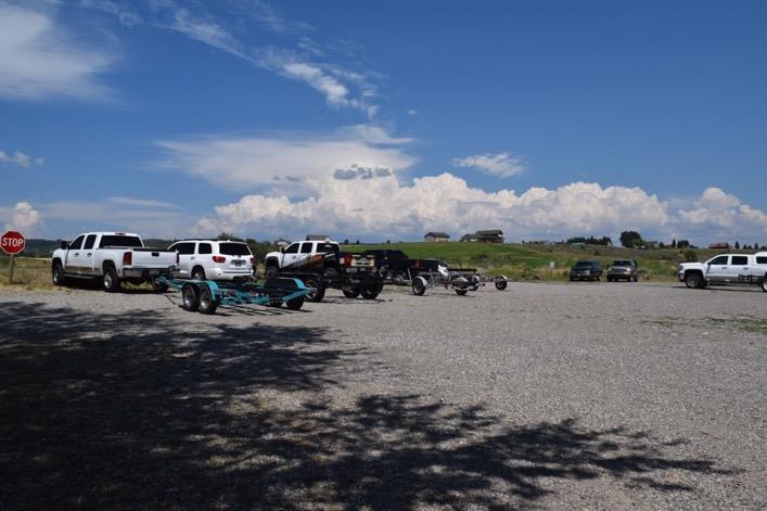
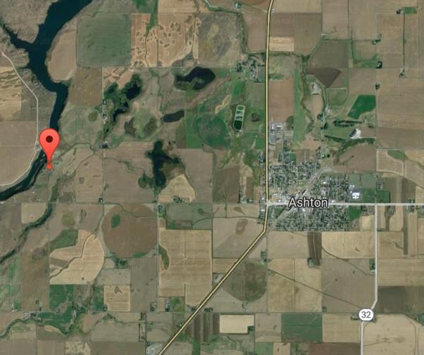
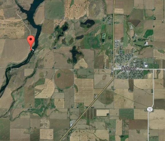
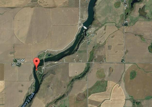
14 Ashton Reservoir Back to Top Latitude Longitude Owner PacifiCorp Boat Ramp (Paved) Use Boating, Wading Parking 20+ Trashcans Restroom Room to Turn Trailer? Google Maps Link
15

16
17

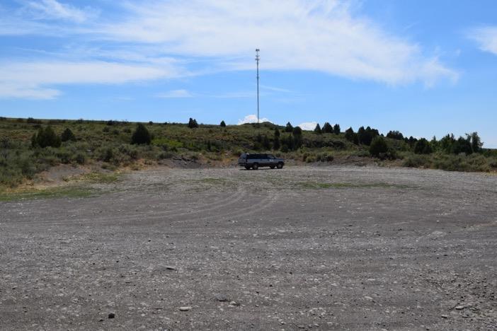
18 Ashton Dam East Back to Top Latitude Longitude Owner PacifiCorp Boat Ramp Use Google Maps Link Wading Parking 10 Trashcans Restroom Room to Turn Trailer?
19

20

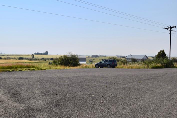
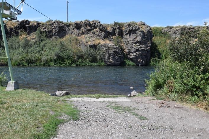
21 Ashton Dam West Back to Top Latitude Longitude Owner PacifiCorp Boat Ramp Use Wading Parking 10 Trashcans Restroom Room to Turn Trailer? Google Maps Link

22
 Use Boating Put-In, Wading Float Distance to Vernon Bridge, 3.")
23 Ora Bridge Back to Top Latitude Longitude Owner Fremont County Boat Ramp (Concrete Block) Use Boating Put-In, Wading Float Distance to Vernon Bridge, 3.5 Chester Dam, 5.5 Parking 10+ Trashcans Restroom Room to Turn Trailer? Google Maps Link
24

25
 Use Boating Put-In & Take-Out, Wading Float Distance to Chester Dam, 3.")
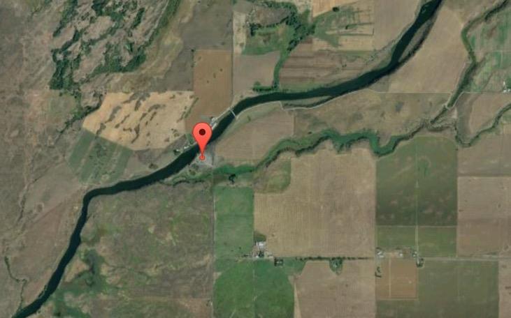
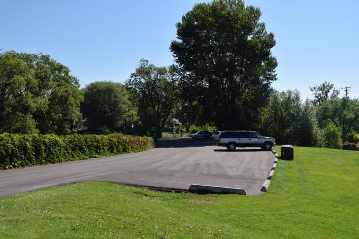
26 Vernon Bridge Back to Top Latitude Longitude Owner Fremont County Boat Ramp (Concrete Block) Use Boating Put-In & Take-Out, Wading Float Distance to Chester Dam, 3.5 Miles Parking 15+ Trashcans Restroom Room to Turn Trailer? Google Maps Link
27

28
 Parking 5 Trashcans Restroom")
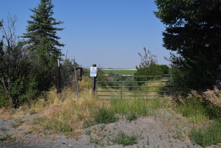
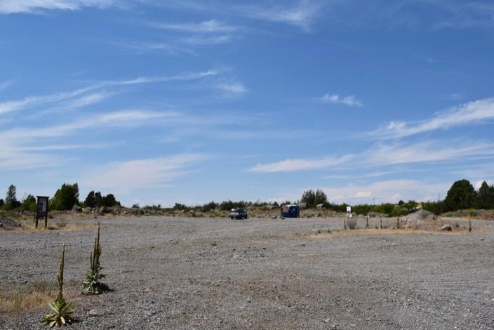
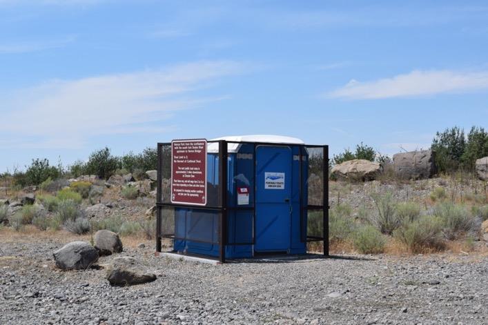
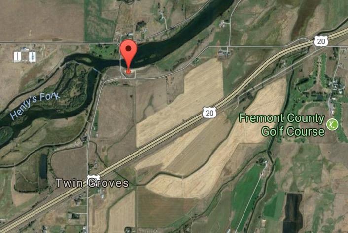
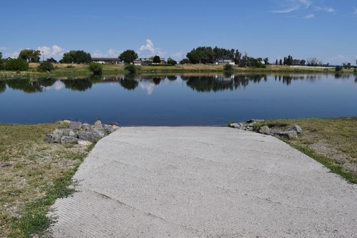
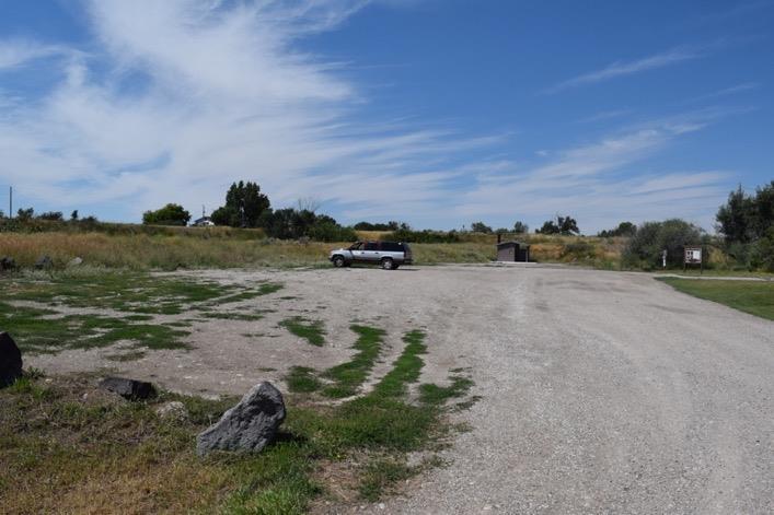
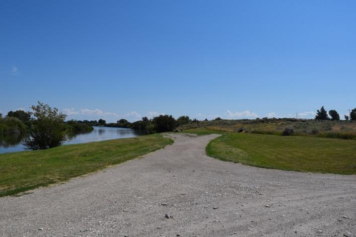
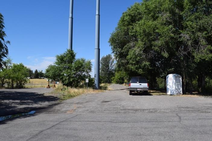
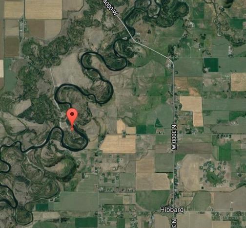
29 Henry s Fork Ranch Back to Top Latitude Longitude Owner Private Land Owner Boat Ramp Use Wading (Sign in Required) Parking 5 Trashcans Restroom Room to Turn Trailer? Google Maps Link
30
 **Above and Below Dam** Use Boating Put-In & Take Out, Wading Float Distance")
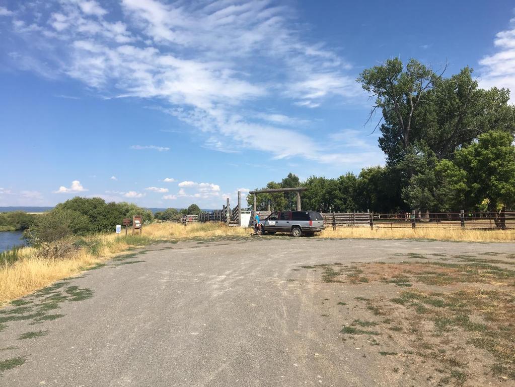
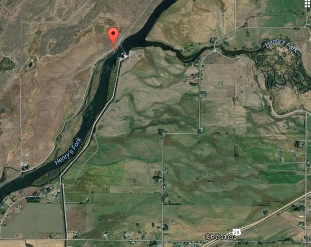
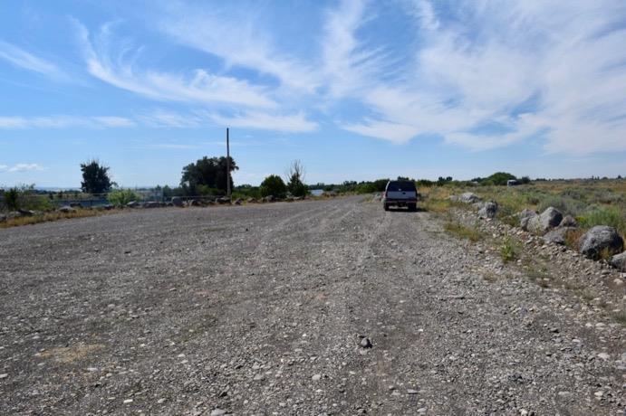
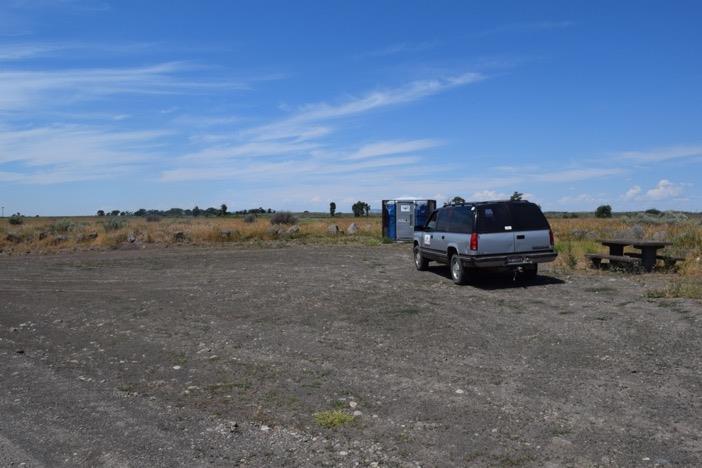
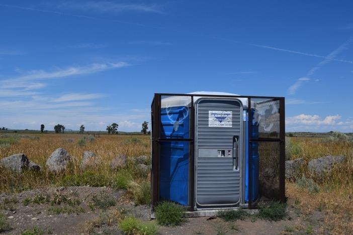
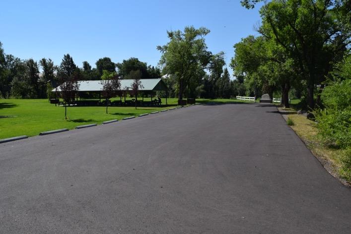
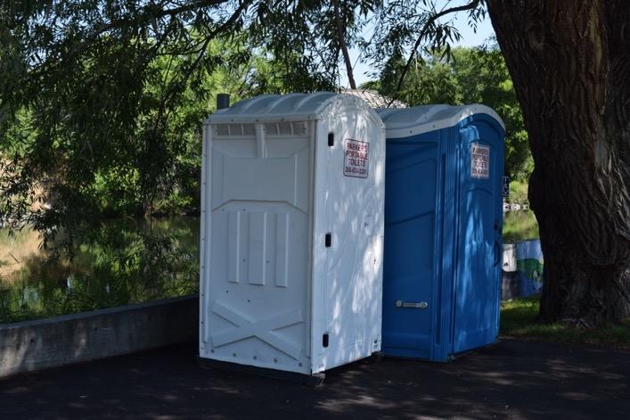
31 Chester Dam Back to Top Latitude Longitude Owner Fremont-Madison Irrigation District Boat Ramp (Concrete Block) **Above and Below Dam** Use Boating Put-In & Take Out, Wading Float Distance to Fun Farm Bridge, 3.5 Miles Parking 20+ Trashcans Restroom Room to Turn Trailer? Google Maps Link
32

33

34

35 Chester Wetlands WMA Back to Top Latitude Longitude Owner Idaho Department of Fish & Game Boat Ramp Use Wading Parking 10 Trashcans Restroom Room to Turn Trailer? Google Maps Link
36
37
 Use Boating Take-Out, Wading Parking 20+ Trashcans")
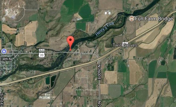
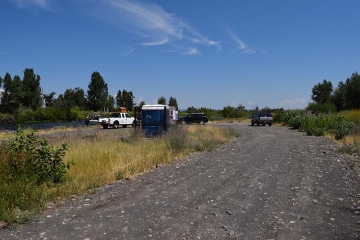
38 Fun Farm Bridge Back to Top Latitude Longitude Owner Fremont County Boat Ramp (Paved) Use Boating Take-Out, Wading Parking 20+ Trashcans Restroom Room to Turn Trailer? Google Maps Link
39
40

41 Del Rio Bridge Back to Top Latitude Longitude Owner Fremont County Boat Ramp Use Wading Parking 10+ Trashcans Restroom Room to Turn Trailer? Google Maps Link
42

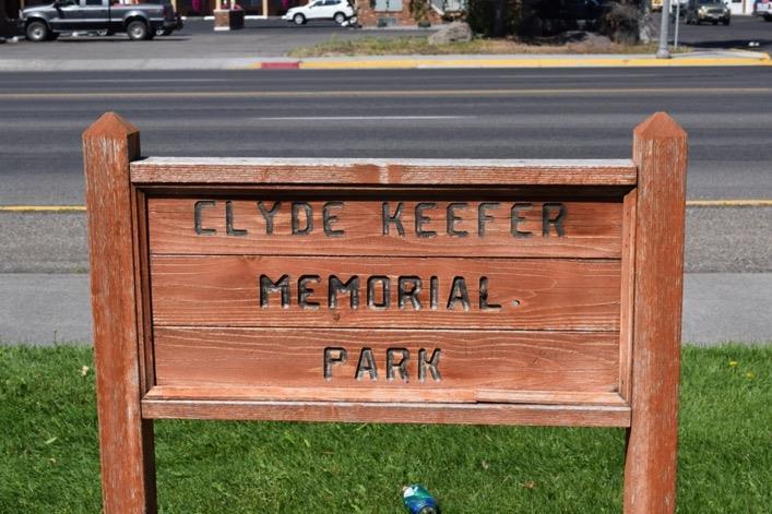
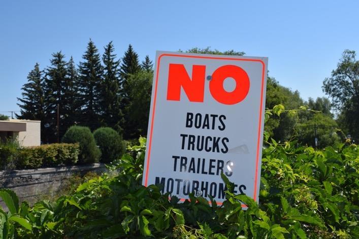
43 Clyde Keefer City Park Back to Top Latitude Longitude Owner City of St. Anthony Boat Ramp Use Wading Parking 20+ Trashcans Restroom Room to Turn Trailer? Google Maps Link

44
45
46
 Parking 5 Trashcans Restroom Room")
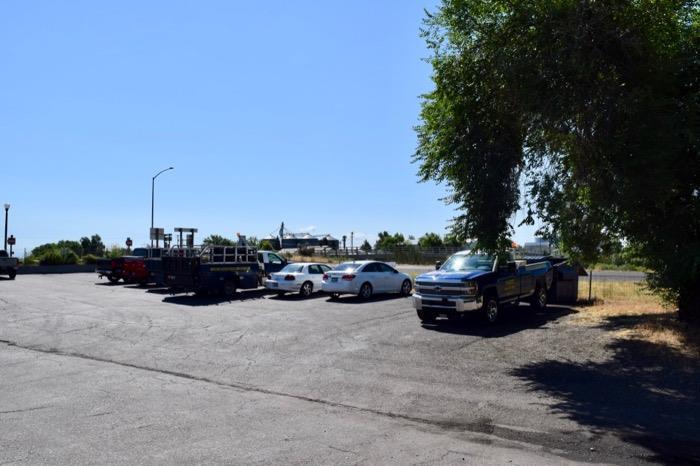
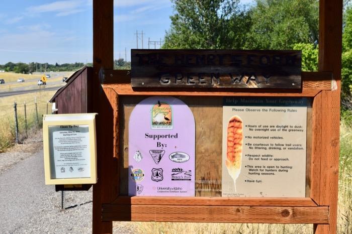
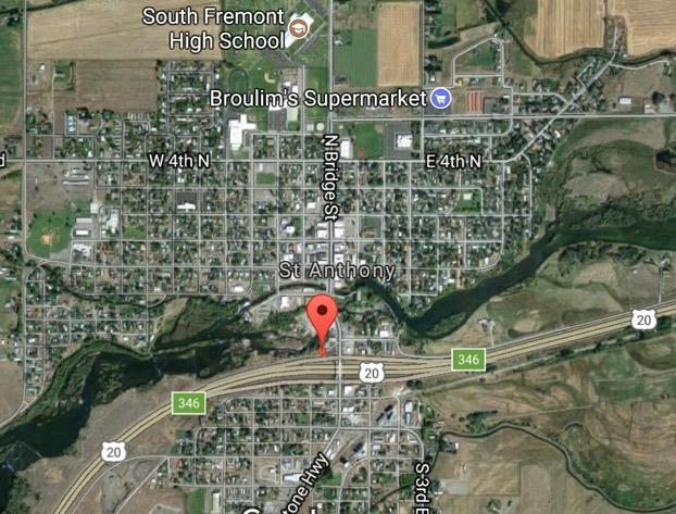
47 St. Anthony Greenway Bridge St. Back to Top Latitude Longitude Owner Idaho Department of Transportation Boat Ramp Use Wading (Hike-in) Parking 5 Trashcans Restroom Room to Turn Trailer? Google Maps Link
48
49

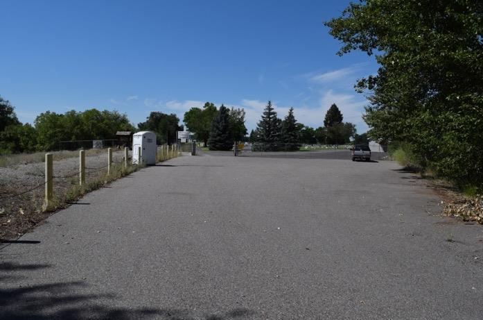
50 St. Anthony Greenway Cemetery Back to Top Latitude Longitude Owner Riverview Cemetery District Boat Ramp Use Wading Parking 15+ Trashcans Restroom Room to Turn Trailer? Google Maps Link
51
 Use Wading Float Distance to Red Road Bridge, 5 Miles Parking 15+")
52 St. Anthony Railroad Trestle Back to Top Latitude Longitude Owner Bureau of Land Management Boat Ramp (Unpaved) Use Wading Float Distance to Red Road Bridge, 5 Miles Parking 15+ Trashcans Restroom Room to Turn Trailer? Google Maps Link
53
 Boating, Wading Warm Slough, 9 Miles")
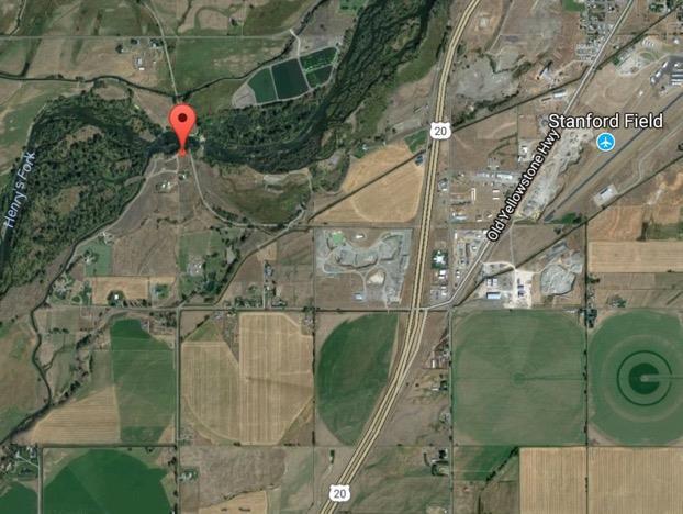
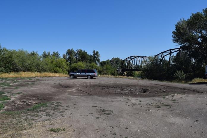
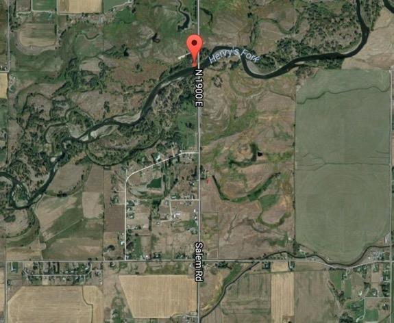
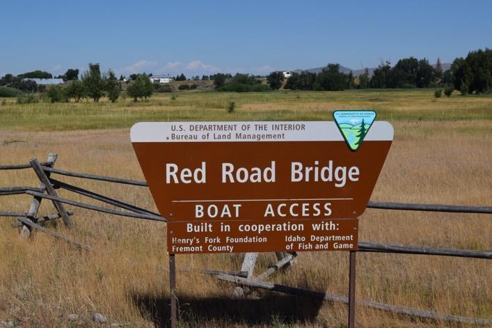
54 Red Road Bridge Back to Top Latitude Longitude Owner Boat Ramp Use Float Distance to Bureau of Land Management (Concrete Block) Boating, Wading Warm Slough, 9 Miles Parking 10+ Trashcans Restroom Room to Turn Trailer? Google Maps Link
55
56
57
 Boating, Wading Beaver Dick Park, 7 Miles")
58 Warm Slough Back to Top Latitude Longitude Owner Boat Ramp Use Float Distance to Idaho Department of Fish & Game (Paved) Boating, Wading Beaver Dick Park, 7 Miles Parking 60+ Trashcans Restroom Room to Turn Trailer? Google Maps Link
59

60
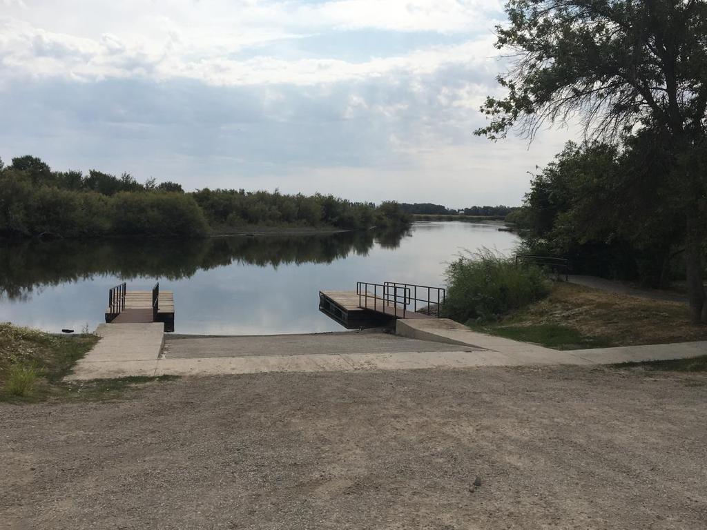
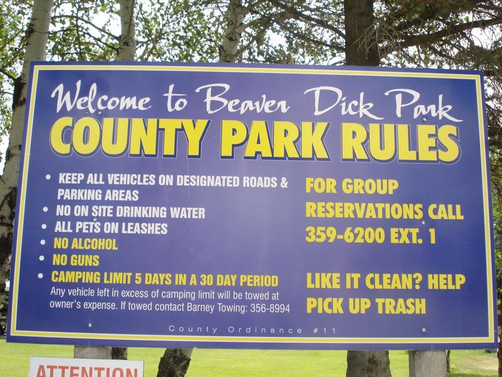
 Use Boating, Wading, Camping Parking 20+ Trashcans")
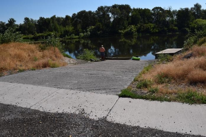
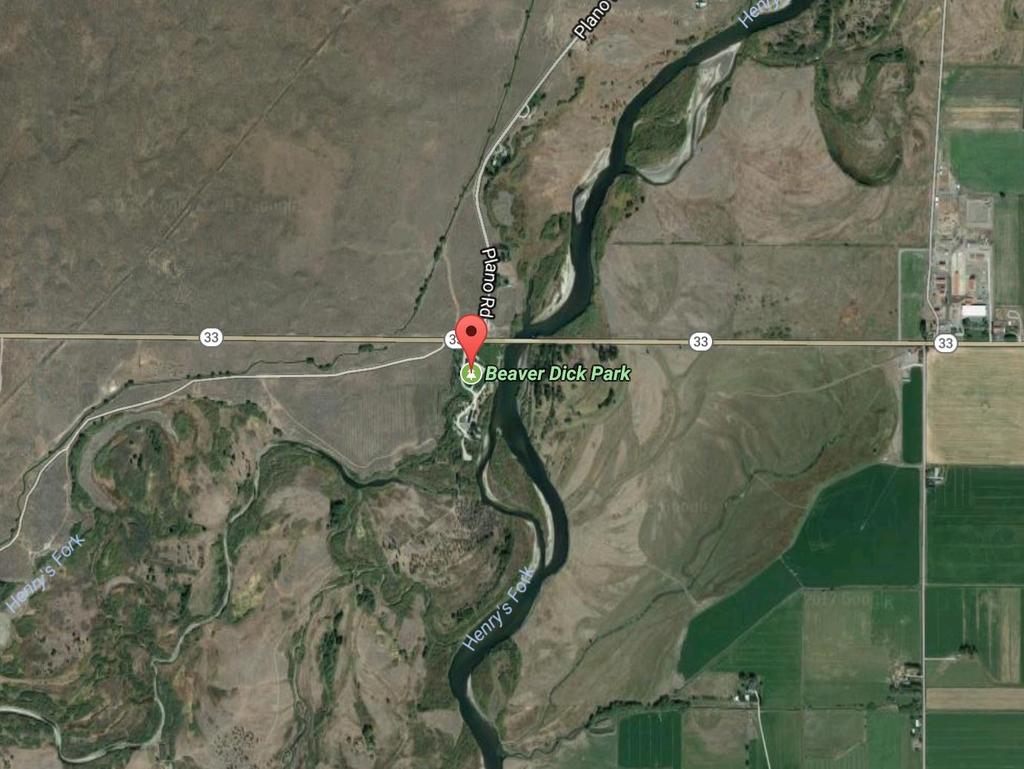
61 Beaver Dick Park Back to Top Latitude Longitude Owner Madison County Boat Ramp (Paved) Use Boating, Wading, Camping Parking 20+ Trashcans Restroom Room to Turn Trailer? Google Maps Link
62

63
South Fork River Retreat SWAN VALLEY, IDAHO
 South Fork River Retreat SWAN VALLEY, IDAHO South Fork River Retreat SWAN VALLEY, IDAHO Introduction: Positioned on the banks of the Upper South Fork River in Swan Valley, Idaho, the South Fork River
Bitch Creek Canyon Ranch
 Bitch Creek Canyon Ranch LAMONT, IDAHO Fly Fishing Hunting Ranching Conservation Bitch Creek Canyon Ranch LAMONT, IDAHO Introduction: Within close driving distance to some of Idaho s most prestigious fisheries,
Go l d Ran c h REXBURG, IDAHO. Fly Fishing Hunting Ranching Conservation
 Go l d Ran c h REXBURG, IDAHO Fly Fishing Hunting Ranching Conservation Go l d Ran c h REXBURG, IDAHO Introduction: The Gold Ranch is comprised of 980 deeded acres nestled along the river bottom of the
Henrys Fork - Railroad Ranch
 Henrys Fork - Railroad Ranch Location: Henry's Fork River runs approximately 127 miles from Henry's Lake (N44.59711 W111.35330) to its confluence with the Snake River (N43.75267 W111.95776). The area is
Fall River Ranch ASHTON, IDAHO
 Fall River Ranch ASHTON, IDAHO Fall River Ranch ASHTON, IDAHO Introduction: Located in Idaho s wild and scenic Henry s Fork Basin in the heart of the Greater Yellowstone Ecosystem, the Fall River Ranch
Lazy K Ranch DRIGGS, IDAHO. Hunting Ranching Fly Fishing Conservation
 Lazy K Ranch DRIGGS, IDAHO Hunting Ranching Fly Fishing Conservation Lazy K Ranch DRIGGS, IDAHO Introduction: Ideally situated in the heart of Teton Valley, Idaho, the Lazy K Ranch is 3 miles from downtown
Falls Lake Trail (A part of the NC Mountains-to-Sea Trail) East to West
 East to West") Falls Lake Trail (A part of the NC Mountains-to-Sea Trail) East to West Section 1 (Falls of the Neuse Rd to Raven Ridge Rd) 0.0 mi Parking area of the Tailrace Fishing Area, just below the dam, off Falls
Falls Lake Trail (A part of the NC Mountains-to-Sea Trail) East to West Section 1 (Falls of the Neuse Rd to Raven Ridge Rd) 0.0 mi Parking area of the Tailrace Fishing Area, just below the dam, off Falls
GREEN RIVER - FLAMING GORGE
 GREEN RIVER - FLAMING GORGE Rating: Class 3 CFS Range: 800-7,500 Length: 1-2 days Gear: Standard Rafting Gear Maps: Dutch John, UT; Goslin Mountain, UT; Clay Basin, UT; Warren Draw, UT; Swallow Canyon,
NATIONWIDE PERMIT ACTIONS JULY - SEPT 2016
 NATIONWIDE PERMIT ACTIONS JULY - SEPT 2016 DA Number Action Type Project Name Closure Method County State SPA-2016-00240-SCO State of Colorado Verified Without Special Conditions Bent CO SPA-2016-00289-SCO
Falls Lake Trail (A part of the NC Mountains-to-Sea Trail) East to West
 East to West") Falls Lake Trail (A part of the NC Mountains-to-Sea Trail) East to West Section 1 (Falls of the Neuse Rd to Raven Ridge Rd) 0.0 mi Parking area of the Tailrace Fishing Area, just below the dam, off Falls
Falls Lake Trail (A part of the NC Mountains-to-Sea Trail) East to West Section 1 (Falls of the Neuse Rd to Raven Ridge Rd) 0.0 mi Parking area of the Tailrace Fishing Area, just below the dam, off Falls
Rapids. Quote or the month: It s only water and rocks, and I can dodge. Double D. Skills Day 2013
 Rapids July 2013 Join us Canyon Creek Restaurant & Lounge1411 Shilo Dr. Nampa, Idaho I-84 Exit 36 Next meeting: July 8th 7 pm Do you have a topic to discuss or a guest speaker we for the meeting? Please
lot across from the Barrington Post Office, please do not use Woolen Mill Museum parking if there are more than 1 vehicle.
 BARRINGTON Launch Rating Moderate to difficult depending on your skills. Launch Description This launch is usable at high tide using proper skills to enter and exit your kayak. Put in just above the concrete
Canoe/Kayak Launch Sites and Accessibility
 Canoe/Kayak Launch Sites and Accessibility Doug Alderson, Paddling Trails Coordinator Division of Recreation and Parks Office of Greenways and Trails Each potential access site on a river, lake or ocean
GALLATIN CAMPGROUND GUIDE & PICNIC AREA. United States Department of Agriculture
 GALLATIN United States Department of Agriculture CAMPGROUND & PICNIC AREA GUIDE R1-97-104 Revised 2010 Welcome to the Gallatin National Forest To ensure that everyone has a safe and enjoyable visit,
Basin Water Use Profile - Recreation
 TECHNICAL MEMORANDUM SUBJECT: PREPARED BY: Basin Water Use Profile - Recreation Sunrise Engineering, Inc. DATE: July 15, 2002 Introduction: There is a significant amount of recreational activity within
62. Gulkana River, Main Fork, Middle Fork, and West Fork
 62. Gulkana River, Main Fork, Middle Fork, and West Fork The Gulkana, a National Wild and Scenic River, is one of Alaska s most popular whitewater rivers because of its road accessibility and because of
Faler Creek Ranch DANIEL, WYOMING. Fly Fishing Hunting Ranching Conservation
 Faler Creek Ranch DANIEL, WYOMING Fly Fishing Hunting Ranching Conservation Faler Creek Ranch DANIEL, WYOMING Introduction: Faler Creek Ranch is comprised of 91 acres, providing stunning views of the Wyoming
The Animas below Durango Version June 2014
 The Animas below Durango Version June 2014 Quick Planner: Mile 0 Launch Dalbetta Park Durango Mile 13.9 Private Island tiny camp-picnic spot Mile 15.3 Danger Undercut Rocks Mile 15.4 Bondad Bridge access
RECREATION. in the St. Paul District. Your safety is our concern ALWAYS wear a LIFE VEST
 RECREATION in the St. Paul District Your safety is our concern ALWAYS wear a LIFE VEST Cross La RECREATION in the St. Paul District CANADA NORTH DAKOTA Lake of the Woods Homme Lake Devils Lake Red River
Quay County, New Mexico 160 deeded acres; (MOL) $420,000
 $420,000") Quay County, New Mexico 160 deeded acres; (MOL) $420,000 Turn your steers out and watch them gain! FARMING House Ranch offers 60 acres of water rights This region of New Mexico just east of Tucumcaro
Quay County, New Mexico 160 deeded acres; (MOL) $420,000 Turn your steers out and watch them gain! FARMING House Ranch offers 60 acres of water rights This region of New Mexico just east of Tucumcaro
APPENDIX 2B PHASE I INTERVIEW FORMAT
 APPENDIX 2B PHASE I INTERVIEW FORMAT February 2004 PacifiCorp The following provides the general format used during Phase I structured interviews. The document outlines the general interview topics and
GOAL: Collect product flowing over Onalaska spillway to protect downstream resources C&C 250 Y Y. Looking upstream at spillway
 GOAL: Collect product flowing over Onalaska spillway to protect downstream resources BR5 Black n/a Onalaska Spillway Carry- In C&C 250 Y Y Looking upstream at spillway Implementation (Go to Aerial View)
ISSUES SUBMITTAL FORM
 Date: 12/2/13 ISSUE: Should the West Bank Boat Ramp be renamed to Sam Caudill SWA? The West Bank Boat Ramp has been under lease to the DOW and now CPW for several years. CPW acquired the property through
Teton Darby Ranch TETON VALLEY, IDAHO
 Teton Darby Ranch TETON VALLEY, IDAHO Teton Darby Ranch TETON VALLEY, IDAHO Introduction: The Teton Darby Ranch is the combination of two adjacent ranches, Double Creek Ranch and Broken Bar W Ranch, totaling
Kayak Launch Sites in the Bellingham Area
 revised: Feb. 5, 2017 Page 1 of 5 Arranged Roughly North to South NOTE: if you want to see location on a map just cut and paste the Latitude and Longitude into your browser and a map with the location
HANGING ROCK STATE PARK EXPANSION MASTER PLAN PHASE TWO INITIAL CONCEPTS INSTRUCTIONS
 ABOUT THE PROJECT The Master Plan for the Expansion of Hanging Rock State Park will create a vision for the nearly 750 acres of land added to the park in 2014. The new property includes Vade Mecum, which
Floating the Buffalo National River. with First River Outfitter. Michelle Hulett. exp2010_w01h3buffalo2_ann_solution
 Floating the Buffalo National River with First River Outfitter Michelle Hulett The Buffalo River Beginning as just a trickle, The Buffalo National River runs down the Boston Mountains, flows north and
50 places. of Medford. to go fishing within 60 minutes
 * Directions and times are approximate. 50 places to go fishing within 60 minutes of Medford Let s go fishing on Saturday. Not enough time to go fi shing? Think again if you live in the Medford area, there
PERMIT NUMBER ACTION DATE PROJECT NAME CLOSURE METHOD COUNTY. Jelinek - Twentymile Creek/Brown Creek - Bank Stabilization (w/nrcs)
") NWW-2011-00553-C03 COMPCERT 7-Sep-12 Jelinek - Twentymile Creek/Brown Creek - Bank Stabilization (w/nrcs) Authorized Work/Mitigation Pending Boundary NWW-2000-1201040 COMPCERT 11-Sep-12 ITD/NORTH FORK
NWW-2011-00553-C03 COMPCERT 7-Sep-12 Jelinek - Twentymile Creek/Brown Creek - Bank Stabilization (w/nrcs) Authorized Work/Mitigation Pending Boundary NWW-2000-1201040 COMPCERT 11-Sep-12 ITD/NORTH FORK
Androscoggin River Trail Access Sites. Mahoosucs. 168 miles from its source at Lake Umbagog to Merrymeeting Bay
 Androscoggin River Trail Access Sites Mahoosucs 168 miles from its source at Lake Umbagog to Merrymeeting Bay Trail Under Construction More than 40 Public Access Sites Available Androscoggin River Watershed
North Idaho River Trips
 North Idaho River Trips Campus Recreation 875 Perimeter Drive MS 1230 Moscow. Idaho 83844-1230 Ph: 208.885.6810 Rentals: 208.885.6170 Fax: 208.885.6879 uidaho.edu/outdoorprogram 1 NORTH IDAHO RIVER TRIPS
Nez Perce National Forest Land and Resource Management Plan Amendment No. 40
 Nez Perce- National Forests Attachment 4 - Forest Plan Amendment Project Specific Amendment Would Apply to the DRAMVU Project Only Nez Perce National Forest Land and Resource Management Plan Amendment
Management Plan for the Obey River Trout Fishery
 Management Plan for the Obey River Trout Fishery 28-214 By: James Travis Scott Jack Swearengin Walter Scott Webb D.W. Young Tennessee Wildlife Resources Agency January 28 Management Plan for the Obey River
Fly Fisher s Quick Reference Guide to the Gunnison Valley
 Fly Fisher s Quick Reference Guide to the Gunnison Valley By John Bocchino Fly Fisher s Quick Reference Guide to the Gunnison Valley By John Bocchino Copyright 2015 John Bocchino All Rights Reserved. John
Androscoggin River Trail Access Sites. Mahoosucs. 168 miles from its source at Lake Umbagog to Merrymeeting Bay
 Androscoggin River Trail Access Sites Mahoosucs 168 miles from its source at Lake Umbagog to Merrymeeting Bay Trail Under Construction More than 40 Public Access Sites Available Androscoggin River Watershed
PERMIT NUMBER ACTION DATE PROJECT NAME CLOSURE METHOD COUNTY
 NWW-2008-00307-I01 COMPCERT 1-May-12 U.S. Forest Service - Caribou-Targhee National Forest - replace culvert Squaw Creek NWW-2009-00556-I02 COMPCERT 1-May-12 McNeil Development-Snake River NWW-2007-00613-I02
SELF GUIDED TOURING ROUTE
 SELF GUIDED TOURING ROUTE Things to see and places to go on the loop from Orbost to Marlo, Cape Conran, Cabbage Tree and back to Orbost (or onwards to Cann River) V6 April 2017 This guide should be read
Mississippi River Project
 Mississippi River Project Fallll on tthe Miissiissiippii As the days get shorter and the nights get cooler sitting around a campfire can be a great way to enjoy the outdoors before the snow begins to fly.
PLEASE NOTE: The Black Canyon is a Class 5 Boating Opportunity. Experts Only
 PLEASE NOTE: The Black Canyon is a Class 5 Boating Opportunity Experts Only The Black Canyon is rated Class 5 1 whitewater, appropriate for expert boaters only. Class 5 whitewater is described as extremely
Woods Creek Ranch DRIGGS, IDAHO
 Woods Creek Ranch DRIGGS, IDAHO Woods Creek Ranch DRIGGS, IDAHO Introduction: Woods Creek Ranch is a sportsman s paradise located in the heart of Teton Valley, Idaho, less than 3 miles from downtown Driggs
Fall Creek Ranch - Wilson, Wyoming
 Page 1 of 5 Fall Creek Ranch - Wilson, Wyoming Fall Creek Ranch is a unique legacy ranch located in the heart of Jackson Hole. The property consists of 164 deeded acres that are completely surrounded by
ALABAMA RIVER. Clarke County. Monroe County. Monroe County. Clarke County. CHART NO. 11 1, ,000 2,000 3,000 4,000 Feet RIVER MILE
 MILE 75 BAR 75 74 73 Isaac Creek Isaac Creek Campground Boat Ramp Claiborne Lock & Dam Water Outfall CLAIBORNE LOCK UA Claiborne Damsite West (232.4 Acres) Claiborne Damsite East (717.7 Acres) 72 Claiborne
Fortress Rosecrans and Battle Of Stones River Civil War Trail
 General Information: This should be considered a moderate hike. It is approximately 11.7 miles. The Cost of this Hike is free and the Memories are Priceless. Enjoy! Requirements: - It is good to read every
50 places. 60 minutes. to go fishing within. of Roseburg
 * Directions and times are approximate. 50 places to go fishing within 60 minutes of Roseburg Let s go fishing on Saturday. Not enough time to go fishing? Think again if you live in the Roseburg area,
OPEN KAYAK POOL SESSIONS UI Swim Center - This is a chance for kayakers of all experience levels to work on skills in the safety of the pool.
 OPEN KAYAK POOL SESSIONS UI Swim Center - This is a chance for kayakers of all experience levels to work on skills in the safety of the pool. Cost: $5 pay at the pool, 7-10pm Dates: August 29, September
TABLE OF CONTENTS LIST OF TABLES NONE LIST OF FIGURES NONE
 TABLE OF CONTENTS 7.4 RIVER-RELATED RECREATION SURVEYS (REC 4)... REC 4-1 7.4.1 Study Objectives... REC 4-1 7.4.2 Study Area... REC 4-1 7.4.3 Methods... REC 4-1 7.4.4 Key Questions... REC 4-3 7.4.5 Results...
APPENDIX 2E PHASE II CONTROLLED FLOW SURVEY INSTRUMENTS
 APPENDIX 2E PHASE II CONTROLLED FLOW SURVEY INSTRUMENTS February 2004 PacifiCorp KLAMATH BOATER PRE-FIELDWORK INFORMATION FORM Date: / / 2002 Your name: 1. For the following types of whitewater craft,
3.7 River Navigation Affected Environment
 3 Affected Environment and Environmental Consequences 3.7 River Navigation 3.7.1 Affected Environment Sterling Highway MP 45 60 Project Final EIS The Kenai River is approximately 82 river miles long in
The Economic Value of Recreational Fishing & Boating to Visitors & Communities along the Upper Snake River
 The Economic Value of Recreational Fishing & Boating to Visitors & Communities along the Upper Snake River May 2005 Dr. John Loomis, Dept. of Agricultural and Resource Economics, Colorado State University,
 SOUTHWEST REGION 2003 2004 2005 2006 2007 2008 2009 2010 2011 2012 2013 2014 RIDGWAY REVENUE 2003-2014 1,000,000.00 900,000.00 800,000.00 700,000.00 600,000.00 500,000.00 400,000.00 300,000.00 200,000.00
Cedar River Paddling Trips Otranto, through Charles City, to Janesville Canoes, Kayaks, and SUPs Charles City Chamber of Commerce.
 Cedar River Paddling Trips Otranto, through Charles City, to Janesville Canoes, Kayaks, and SUPs Charles City Chamber of Commerce Paddle the Cedar In addition to the whitewater course in Charles City,
Gravel Bike Guide Haywood County
 Gravel Bike Guide Haywood County Haywood County is an ideal place for bicycling on gravel roads, because 37% or 129,994 acres of Haywood County is federal property, including portions of the Pisgah National
Chapter 6 River Recreation Eagle River Watershed
 Chapter 6 River Recreation Eagle River Watershed River Recreation Goal: Water related recreational activities and associated businesses thrive in Eagle County in a manner that respects the quality of water
Fish Lake Team Relay Course Information 2016
 Fish Lake Team Relay Course Information 2016 Fish Lake Team Relay Course Information 2016 The Fish Lake Team Relay begins at Fish Lake Lodge on the shores of beautiful Fish Lake located in Sevier County,
Chapter 4.5 Recreation
 . Chapter 4.5 4.5.1 Introduction This chapter describes the existing recreational resources conditions within the area of the Proposed Project. Section 4.5.2, Environmental Setting describes the major
Teton River Confluence Ranch TETON VALLEY, IDAHO
 Teton River Confluence Ranch TETON VALLEY, IDAHO Teton River Confluence Ranch TETON VALLEY, IDAHO TETON RIVER CONFLUENCE RANCH INTRODUCTION Introduction: Teton River Confluence Ranch possesses that rare
Roanoke River Blueway
 Roanoke River Blueway Roanoke River Currents Conference Friday October 9, 2015 Ferrum College Shane Sawyer, Regional Planner Roanoke Valley - Alleghany Regional Commission Roanoke River Blueway www.roanokeriverblueway.org
Vicinity Map. IA Parking Area (3) IA!y
 IA!y") -Construct Marina -Install Accessible Fishing Area -Continue coordination with Jefferson County for Development of Marina/Resort y y Primary Boat Ramp (1) y Secondary Boat Ramp (1) Parking Area (3) y Exit
-Construct Marina -Install Accessible Fishing Area -Continue coordination with Jefferson County for Development of Marina/Resort y y Primary Boat Ramp (1) y Secondary Boat Ramp (1) Parking Area (3) y Exit
Striking a careful balance between grazing, wildlife, history and fishing at Harriman State Park
 Striking a careful balance between grazing, wildlife, history and fishing at Harriman State Park By Steve Stuebner A big group of cowboys came together at the break of dawn on a Saturday morning to trail
2.3 Acres South Fork Salmon River
 2.3 Acres South Fork Salmon River 177 of Backcountry River Frontage! Riverfront backcountry dream on the South Fork of the Salmon River! 2.3 acres with 177+ of river frontage. Beautiful parcel with picturesque
Tech It Easy. Engage at Every Age. Inside this Issue:
 Tech It Easy Access Technologies, Inc. May 2018 Edition Editor: Laurie Brooks Engage at Every Age May is time to recognize and celebrate Older American s Month! This year s theme, Engage at Every Age,
Trail Notes Local Mountain Bike Areas
 Trail Notes Local Mountain Bike Areas Campus Recreation 875 Perimeter Drive MS 1230 Moscow. Idaho 83844-1230 Ph: 208.885.6810 Rentals: 208.885.6170 Fax: 208.885.6879 uidaho.edu/outdoorprogram 1 Table of
PG&E RECREATION FACILITIES
 Last Update 5/16/2018 For information about our facilities, go to www.pge.com/recreation. s below do not reflect reservations fees. Reservation fees applied where applicable. ALMANOR SCENIC OVERLOOK Lake
Geographic Response Plan Map: EFL-13NW AB 608 AB 5 1 AB 68 ") 770. !Å Heliport [ Historical!Å Site!(RSeagrass! Manatee
 770. !Å Heliport [ Historical!Å Site!(RSeagrass! Manatee") ! 27 30'0"N 80 22'30"W! Geographic Response Plan Map: EFL-13NW [k Indian River - Vero Beach to Ft. Pierce Aquatic Preserve Ft. Pierce State Park [k J a c k I s l a n d 80 18'45"W [\ 27 30'0"N ]^607A ")
! 27 30'0"N 80 22'30"W! Geographic Response Plan Map: EFL-13NW [k Indian River - Vero Beach to Ft. Pierce Aquatic Preserve Ft. Pierce State Park [k J a c k I s l a n d 80 18'45"W [\ 27 30'0"N ]^607A ")
Using This Guide. Latitude and longitude lines are indicated in white (see next page for complete legend).
.") Using This Guide This guide is divided into 13 sections. Each section is approximately 5 miles long. The detailed maps contain mileage figures and GPS points. Distances on the map are approximate. Your
Using This Guide This guide is divided into 13 sections. Each section is approximately 5 miles long. The detailed maps contain mileage figures and GPS points. Distances on the map are approximate. Your
Float Trips CANOEING. Bass River Resort
 Float Trips Bass River Resort 800-392-3700 www.basscanoeresort.com basscanoeresort@misn.com CANOEING Canoeing is delightful on the crystal clear Courtois, Huzzah, and Meramec Rivers. We offer 6, 7, and
Portage Bay Park Design Commission Review 4: 90% Design Development January 5, 2017
 to be updated to reflect base bid condition Portage Bay Park Design Commission Review 4: 90% Design Development January 5, 2017 Previous Site Plan POTENTIAL PARK CONNECTION & MID-BLOCK CROSSING BOAT STREET
Bicycle and Pedestrian Facilities Toolbox (Excerpt from Figure 3.1)
") Appendix B Neighborhood Connections Summaries This Appendix is a supplement to the information presented in Chapter 3 Connect People. The Appendix includes a summary or profile for each of the proposed
Appendix B Neighborhood Connections Summaries This Appendix is a supplement to the information presented in Chapter 3 Connect People. The Appendix includes a summary or profile for each of the proposed
KNOW BEFORE YOU GO GUIDE TO THE FRENCH BROAD RIVER AND PADDLE TRAIL
 KNOW BEFORE YOU GO GUIDE TO THE FRENCH BROAD RIVER AND PADDLE TRAIL HEADWATERS OUTFITTERS OUTDOOR ADVENTURES FOUNDED IN 1992 FAMILY OWNED AND OPERATED FOR 26 YEARS CANOEING, KAYAKING, AND TUBING ADVENTURES
* * * * * * * * * * * *
 Excerpts from Idaho Department of Fish and Game, 2003 Fishery Management Report. Southwest Region Nampa 2003. Brian J. Flatter, Regional Fishery Biologist, Kurtis Plaster, Senior Fishery Technician, Jeff
Crawford Reservoir. FISH SURVEY AND MANAGEMENT INFORMATION Eric Gardunio, Fish Biologist Montrose Service Center
 FISH SURVEY AND MANAGEMENT INFORMATION General Information: Crawford Reservoir is a popular fishery that provides angling opportunity for yellow perch, channel catfish, northern pike, rainbow trout, black
Angler Perception of Fishing Experience in a Highly Technical Catch-and-Release Fishery:
 Angler Perception of Fishing Experience in a Highly Technical Catch-and-Release Fishery: How closely does perception align with biological reality? Jamie Laatsch, Dr. Rob Van Kirk, Christina Morrisett,
Recreation Facilities in the Vicinity of the Project. Table Recreation Facilities in the Vicinity of the Big Creek Nos. 1 and 2 Project.
 TABLE OF CONTENTS Page... 1 5.2.9.1 Methods... 1 5.2.9.2 Affected Environment... 3 5.2.9.3 Impacts of Proposed Action... 22 5.2.9.4 Unavoidable Adverse Impacts... 35 List of Tables Table 5.2.9-1. Recreational
Duck Creek Cabin at Yello wstone Park
 Duck Creek Cabin at Yello wstone Park WEST YELLOWSTONE, MONTANA Hunting Ranching Fly Fishing Conservation Duck Creek Cabin at Yello wstone Park WEST YELLOWSTONE, MONTANA Introduction: An outdoor enthusiast
Kick n Bass Goes Out West
 To Book a trip call 270-703-6133 or visit our website www.kicknbass.net Sept 26, 2014 I can tell you with the very limited time I ve been on the water this week that bass fishing is good and they re going
Annual Meeting June 17, Research Stewardship Education
 Annual Meeting June 17, 2016 Research Stewardship Education 1 James Chandler, Intern from St. Lawrence University Christina Morrisett, Research Assistant Melissa Muradian, Post-Graduate Research Associate
2017 BRATTLEBORO OUTING CLUB (BOC) SUMMER PADDLING SCHEDULE
 SUMMER PADDLING SCHEDULE") 2017 BRATTLEBORO OUTING CLUB (BOC) SUMMER PADDLING SCHEDULE SATURDAY, April 29th - CT River Setbacks, Hinsdale, NH. (Lake Wantastiquet). Meet at 10:30AM in the Hinsdale, NH, Wal-Mart parking lot (Rte 119).
2017 BRATTLEBORO OUTING CLUB (BOC) SUMMER PADDLING SCHEDULE SATURDAY, April 29th - CT River Setbacks, Hinsdale, NH. (Lake Wantastiquet). Meet at 10:30AM in the Hinsdale, NH, Wal-Mart parking lot (Rte 119).
ORDINANCE NO. 10- AN ORDINANCE OF THE COUNTY OF PLUMAS, STATE OF CALIFORNIA, ADDING ARTICLE 10 TO CHAPTER 3 OF TITLE 4 OF THE PLUMAS COUNTY CODE
 ORDINANCE NO. 10- AN ORDINANCE OF THE COUNTY OF PLUMAS, STATE OF CALIFORNIA, ADDING ARTICLE 10 TO CHAPTER 3 OF TITLE 4 OF THE PLUMAS COUNTY CODE The Board of Supervisors of the County of Plumas, State
DRAFT. System Components. Greenway Trails. Introduction. Trail Types. Zebulon Greenway Master Plan
 5 System Components Wakefield Street Photo Simulation showing Sharrows Introduction The Master Plan identifies various system components that, together, create a comprehensive greenway system. These components
Dry Creek Ranch. Emigrant, Montana
 Dry Creek Ranch Emigrant, Montana Dry Creek Ranch Emigrant, Montana Introduction Dry Creek Ranch consists of 644 acres with unbelievable views of Emigrant Peak and the Yellowstone River. The ranch has
Clallam County Shoreline Master Program Update. Draft Public Land/Access Inventory Emphasis on Shoreline Public Access
 Clallam County Shoreline Master Program Update Draft Public Land/Access Inventory Emphasis on Shoreline Public Access Outline Public Lands Public Shoreline Access Inventory Marine Shoreline Freshwater
Resident Outdoor Recreation for Fremont County, WY July 1999
 UNIVERSITY OF WYOMING 'P.O. Box 3354 Cooperative Extension Service Laramie, WY 82071-3354 College of Agriculture Phone: 307-766-2386 Department of Agricultural and Applied Economics Fax: 307-766-5544 Resident
Initial Study Report Whitewater Boating
 Initial Study Report Whitewater Boating Prospect No. 3 Hydroelectric Project FERC Project No. P-2337 PacifiCorp May 2015 South Fork of the Rogue River, 2007 Reproduced with permission from Peter Gandesbery,
L3 One-Day Fishing Trip on the Tribal Side of the Lower Deschutes River
 L1 Get Away to Portland for Soccer, Spa and a DeLuxe Stay! Game Date: Saturday, August 25, 2012 Donated by: Portland Timbers, Hotel DeLuxe, Deschutes Brewery Portland Pub & Kanani Spa If you are a soccer
NEVADA DIVISION OF WILDLIFE STATEWIDE FISHERIES MANAGEMENT FEDERAL AID JOB PROGRESS REPORTS F YELLOWSTONE CUTTHROAT TROUT EASTERN REGION
 NEVADA DIVISION OF WILDLIFE STATEWIDE FISHERIES MANAGEMENT FEDERAL AID JOB PROGRESS REPORTS F-20-48 2012 YELLOWSTONE CUTTHROAT TROUT EASTERN REGION NEVADA DEPARTMENT OF WILDLIFE, FISHERIES DIVISION ANNUAL
Dallas District Men s Retreat Fishing Tournament Rules and Regulations
 Dallas District Men s Retreat Fishing Tournament Rules and Regulations Date: Friday and Saturday, September 19 & 20 Location: Caddo Lake See map for public boat launch locations Entry Fee: $25 per person/$40
Background Report Draft Rule 68A Agenda Item 15.A.(1) and (2) November 21, 2014 Version 2, November 7, 2014 DRAFT RULE
 and (2) November 21, 2014 Version 2, November 7, 2014 DRAFT RULE") Background Report Draft Rule 68A-15.063 Agenda Item 15.A.(1) and (2) November 21, 2014 Version 2, November 7, 2014 Explanation of Version 2: This update addresses proposed rule amendments to Joe Budd Wildlife
Background Report Draft Rule 68A-15.063 Agenda Item 15.A.(1) and (2) November 21, 2014 Version 2, November 7, 2014 Explanation of Version 2: This update addresses proposed rule amendments to Joe Budd Wildlife
Mogollon Rim and White Mountains Angler Report
 Mogollon Rim and White Mountains Angler Report Becker Lake, Monday, Nov. 6 Blain O.: Becker Lake fished well last week though the water was cold (50- degrees F at the surface). Fish were scattered everywhere
Table of Contents. Photos by Brian Grossenbacher.
 6 About the Authors 9 Dedication Acknowledgments 3 Etiquette, Access, and Conservation 6 Flies to Use in Montana 7 Top Montana Fly Fishing Waters 8 Beaverhead River 3 Big Hole River 36 Bighorn River 40
Fish Lake Team Relay Course Information
 Fish Lake Team Relay Course Information Fish Lake Team Relay Course Information The Fish Lake Team Relay begins at Fish Lake Lodge on the shores of beautiful Fish Lake located in Sevier County, Utah. The
About Rend Lake Marina:
 PRICE GREATLY REDUCED TO $1,495,000.00 For Sale: Rend Lake Marina plus 18 Contiguous Waterfront Acres for Development (Approved by the US Corp of Engineers). Rend Lake Marina 8955 West Dam Lane Benton
SELBY RANCH CALIFORNIA, YUBA COUNTY, BROWNS VALLEY. Recreational Haven in Northern California with Excellent Fishing and Hunting
 SELBY RANCH CALIFORNIA, YUBA COUNTY, BROWNS VALLEY Recreational Haven in Northern California with Excellent Fishing and Hunting This beautiful 1,812-acre ranch is located in the Gold Country Foothills
MINUTES OF THE MEETING OF THE HAILEY CITY COUNCIL HELD SEPTEMBER 25, 2017 IN THE HAILEY TOWN CENTER MEETING ROOM
 MINUTES OF THE MEETING OF THE HAILEY CITY COUNCIL HELD SEPTEMBER 25, 2017 IN THE HAILEY TOWN CENTER MEETING ROOM The Meeting of the Hailey City Council was called to order at 5:31 P.M. by Mayor Fritz Haemmerle.
Sport Fishing Expenditures and Economic Impacts on Public Lands in Washington
 Sport Fishing Expenditures and Economic Impacts on Public Lands in Washington For: Northwest Sportfishing Industry Association By: Southwick Associates Released June 2015 PO Box 6435 Fernandina Beach,
El Dorado County / Tahoe Roadwork Schedule
 Today s Date: Friday, August 3, 2012, #12-220 District: District 3 - Marysville, http://www.dot.ca.gov/dist3 Jody Jones, District Director Contact: Deanna Shoopman deanna_shoopman@dot.ca.gov 530. 741.4566
RLRC COMMUNITIES EAST GRAND FORKS AREA CHARACTER THE RED LAKE RIVER & THE RED RIVER OF THE NORTH CONFLUENCE EAGLE POINT BOAT LAUNCH DESIGN
 AREA CHARACTER THE RED LAKE RIVER & THE RED RIVER OF THE NORTH CONFLUENCE EAGLE POINT BOAT LAUNCH DESIGN DESIGN DETAILS 135 AREA CHARACTER East Grand Forks a city of 7,501 people is located across the
Klickitat County Shoreline Master Program Update. Open House March 15, 2017
 Klickitat County Shoreline Master Program Update Open House March 15, 2017 Agenda 6:00 6:10 Welcome 6:10 6:40 Presentation SMP Update Process Shoreline Analysis review 6:40 8:00 Open House Topics SMP Process
BEACH ACCESS INVENTORY 2014 Electoral Area A
 BEACH ACCESS INVENTORY 2014 Electoral Area A Site Inventory and report compiled by the Electoral Area A Parks, Recreation and Culture Commission members: Alec McPherson, Andrew Thornton, Angela Vincent,
PThe 16,000 acre Pettyjohn Ranch is located on the west side of Tehama County twenty miles from Red Bluff, CA on Interstate
 PThe 16,000 acre Pettyjohn Ranch is located on the west side of Tehama County twenty miles from Red Bluff, CA on Interstate 5. It is surrounded by privately owned land and can be reached all year by paved
WHEREAS, the ordinance will not create excessive additional requirements for public facilities and services at public cost.
 ORDINANCE 19-05 AN ORDINANCE OF VALLEY COUNTY, IDAHO, CREATING AN ORDINANCE TO BE ADMINISTERED BY THE VALLEY COUNTY SHERIFF S OFFICE AND TO BE KNOWN AS VALLEY COUNTY WATERWAYS ORDINANCE THAT INCLUDES PAYETTE