SLDMB Project NSS NIF. Brian Stone Canadian Coast Guard 2011
|
|
|
- Meghan Thomas
- 6 years ago
- Views:
Transcription

1 SLDMB Project NSS NIF Brian Stone Canadian Coast Guard 2011
2 North Atlantic Coast Guard Forum Big challenges relates still to tidal drift and current. To get a reliable result of the maritime search activities, you need to have a real time wind, current and surf data for the drifting calculations. Without this information, even the best calculation software doesn't give you the correct estimate or area of probability. North Atlantic Coast Guard Forum Report of the Expert Group on Search & Rescue
 3")
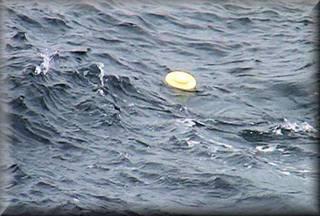
3 SLDMB Self Locating Datum Marker Buoy Ship or air deployed drifter buoy used to report surface currents to automated maritime search planning tools (CANSARP) 3

4 Seimac Ltd s SLDMBs Worked well for many years PIW or 4 person liferaft mode used as TWC in CANSARP Drawbacks: Company no longer manufacturing or refurbishing Used slow ARGOS network Expensive ~$4k per buoy / ~$3k refurbishment Plus Argos Service Costs Expire mid 2012, no suitable replacements 4
5 Principle NIF Contractors C-CORE is a separately incorporated non-profit research and development corporation of Memorial University of Newfoundland & Labrador 5


6 Project Objective Principal contractors C-CORE Work with existing manufacturers to make a new cheaper SLDMB Zero leeway Costs ~$3K plus iridium network registration and airtime 5 existing manufacturers invited 3 prototypes tested in wave tank 2 were a workable prototype Metocean Ltd, Canada Clearwater Instruments, USA 6
 Low power requirements, buoys last longer, reports more")
7 Iridium Satellite Network Benefits Worldwide Coverage Low Latency ~2 minutes No ground station required (Argos LUT at CCG College near end of life) Low power requirements, buoys last longer, reports more frequently 7
8 SLDMB Communications Schedule SLDMB reporting schedule Rapid Response mode Every 10 to 15 minutes for first 24 hours, then every 30 minutes for next 48 hours Scientific mode Hourly positions afterwards may be stored and transmitted once every 3 hours Bi-directional communications Some SLDMBs may support changing of reporting schedule by buoy owner 8
9 Prototype Testing


10 Environmental Testing Wave tank testing Stability ability to upright in 10 seconds Vibration test One hour of shaking along each axis (x, y, z) Air Drop (shock) test six shocks in the Z axis, 3 positive and 3 negative Low and High Temperature Test -20 for 120 hours, -30 for 24 hours +30 for 120 hours. +35 for 24 hours Watertight Integrity Test Depth of 6 meters for 48 hours 10


11 Air Cannon Testing Objective to simulate buoy entry into water from aircraft 2 Metocean tested 2 Clearwater tested Clearwater Prototype Metocean Prototype 11
12 Field trials Four field trials of prototype buoys were conducted: July/August 2010 in Placentia Bay October 2010 in Placentia Bay December 2010 to March 2011 on the Grand Banks, and March 2011 off Nova Scotia 12
13 Sea Trials #1 Placentia Bay Objective to ship deploy buoys and monitor their performance until they ceased transmitting 6 new Metocean prototype SLDMB 6 old Metocean 7/10 th Code Drifter [USCG type] 6 Clearwater prototype SLDMB 1 CCG Seimac SLDMB (ARGOS) 3 Pathfinder Marine Marker Buoys Buoys released near Mortier Rock N W 13


14 Sea Trials Metocean Old Pathfinder Metocean New 14


15 Sea Trials Clearwater Pathfinder MMB Metocean 15


16 Sea Trials Metocean Prototype Clearwater Prototype Metocean 7/10 CODE Pathfinder MMB 16

17 Sea Trials #1 44 days 17
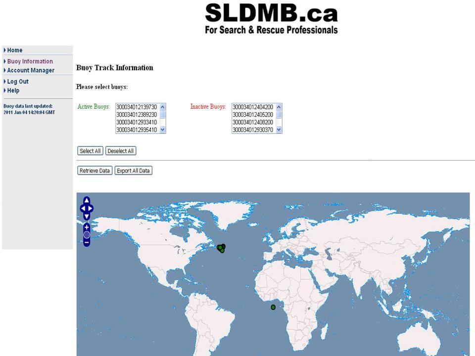
18 Sea Trials #2 Placentia Bay Objective to deploy upgraded Metocean buoys and monitor their performance until they cease transmitting 6 Metocean prototype SLDMBs 2 Clearwater prototype SLDMBs Buoys released near Mortier Rock N W 18

19 Sea Trials #2 10 days 19


20 Sea Trials #3 Grand Banks 22 prototype SLDMBs deployed MetOcean Metocean 7/10 CODE Clearwater Pathfinder MMB SVP 20

21 Sea Trials #3 66 Days 21

22 Sea Trials #4 16 days Test for fix of Metocean tangling issue 22
23 Air Drop Testing Objective to deploy SLDMBs from an aircraft to observe their flight characteristics, deployment in the water and survivability. Air drop testing conducted in British Columbia November 2010 (Clearwater & Metocean) and March 2011(Metocean) 23

24 Air Drop - Clearwater 24

25 Air Drop - Metocean 25
26 SLDMB Data Processing
27 SLDMB Data Processing SLDMB Web Server receives buoy data via internet, decodes the message, and sends information on to CANSARP Web based SLDMB mapping implemented at server SLDMB drift data stored in the server database - Export of SLDMB drift data available to all users 27


28 SLDMB Error Processing Date/time correct Reduction of erroneous positions Lat/Long of 0.00N/S 0.00E/W and at N/S poles considered erroneous and automatically marked as bad data. Buoy Owner can modify. New positions considered erroneous if more than 5 times the average drift rate Exact duplicate positions considered erroneous Buoy Owners can also mark positions as bad 28
29 Short Term Predictive System Hindcasting and forecasting of SLDMB positions Allows for the delay in deployment Allows for prediction of drift Based on statistical regression analysis only 29
30 SLDMB WebServer Surface Current Mapping Generates a map of surface currents from the SLDMBs and the interaction of the surface currents with the coastline 30
31 SLDMB WebServer Buoy Control Allows the owner of a buoy to change reporting interval and turn on/off reporting of a SLDMB which supports this. Note: not all SLDMBs support this. 31
32 32
33 Guidelines for SLDMB Deployment
34 Number of SLDMBs Single unit deployment In cases where the last known position is known and the time lag to SLDMB deployment are minimal, only a single unit may be necessary Multiple unit deployment A minimum of three SLDMBs should be used to facilitate SAR operations. The assessments clearly indicated the benefit of incrementally adding a second and a third SLDMB to the analysis Maximum Number of SLDMBs The use of more than 5 SLDMBs in relatively constrained areas, does not add significant information to the search planning accuracy 34
35 Initial Deployment Configuration Initial deployment strategy is not critical Note that the initial separation distance should not be too large, typically of the order of 10 nautical miles If no other information is available, this should be the last known position (LKP), or if a significant period of time has elapsed (+6 hours) at datum If 3 SLDMBs are available it is suggested they are deployed in a triangle that is centered on the most likely position of the SAR target at the time of deployment If the search area radius exceeds 20 nautical miles, it is suggested that 3 are deployed in a triangle and a fourth SLDMB be deployed at the center 35
36 Size of Deployment Area There are several factors that should be taken into account when specifying the size of the deployment area: the historical (known) spatial variability of the current field the uncertainty about the present position of the SAR target the information about the weather conditions at the time of incident and SAR operation 36
37 Timing of Deployment The SLDMBs should be deployed as quickly as possible Deploying SLDMBs over a longer period of time does not add significant value, except where the search area has expanded beyond the area encompassed by the SLDMBs 37
38 Thank You SLDMBs don t save lives if YOU won t throw them overboard!
A Next Generation Self- Locating Datum Marker Buoy
 A Next Generation Self- Locating Datum Marker Buoy A smaller, more easily deployed and faster reporting SLDMB Gary Williams and Eugene Zeyger Clearwater Instrumentation, Inc. www.clearwaterinstrumentation.com
INVESTIGATION OF LEEWAY AND DRIFT FOR OVATEK LIFE RAFTS PROJECT FINAL REPORT
 INVESTIGATION OF LEEWAY AND DRIFT FOR OVATEK LIFE RAFTS PROJECT FINAL REPORT Submitted to: Canadian Coast Guard Newfoundland Region St. John s, Newfoundland Prepared by: 85 Lemarchant Road St. John s,
START SAD & SAC KNOWLEDGE CHECK TEST
 Marine SAR Technical START SAD & SAC KNOWLEDGE CHECK TEST New Zealand Land Search and Rescue Inc. 2016 With thanks to Martin Paget, NZ Police. CREATIVE COMMONS These works may be downloaded or shared as
The Icelandic Information System on Weather and Sea State Related to Fishing Vessels Crews and Stability
 The Icelandic Information System on Weather and Sea State Related to Fishing Vessels Crews and Stability Seminar on Fishing Vessels Crews and Stability World Fishing Exhibition 2009, Vigo Spain September
Applications of Datum Marker Buoy Data to Search and Rescue of Persons in Water
 This article has been peer reviewed and accepted for publication in JMST but has not yet been copyediting, typesetting, pagination and proofreading process. Please note that the publication version of
Warranty The device shall have a 6-year warranty at minimum
 Bid Specifications Defibrillator The AED must have a high-resolution liquid crystal display with capacitive touch panel. The AED must have an ON/OFF button. The AED must have a SHOCK button that illuminates
Search Techniques. Contents
 Search Techniques Contents Overview... 2 1. Developing the Search Plan... 2 1.1 Search Planning Sequence... 2 2. Search Terminology... 3 3. Search Patterns... 6 4. Searching and GPS... 8 5. Search Protocols...
TRIAXYS Acoustic Doppler Current Profiler Comparison Study
 TRIAXYS Acoustic Doppler Current Profiler Comparison Study By Randolph Kashino, Axys Technologies Inc. Tony Ethier, Axys Technologies Inc. Reo Phillips, Axys Technologies Inc. February 2 Figure 1. Nortek
Dynamic Positioning Control Augmentation for Jack-up Vessels
 DYNAMIC POSITIONING CONFERENCE October 9-10, 2012 Design and Control Session Dynamic Positioning Control Augmentation for Jack-up Vessels By Bradley Deghuee L-3 Communications 1 Introduction Specialized
A Wind Profiling Platform for Offshore Wind Measurements and Assessment. Presenter: Mark Blaseckie AXYS Technologies Inc.
 A Wind Profiling Platform for Offshore Wind Measurements and Assessment Presenter: Mark Blaseckie AXYS Technologies Inc. Any Sensor, Any Telemetry, Any Environment Founded in 1974 Part of the AXYS Group
INTERNATIONAL HYDROGRAPHIC SURVEY STANDARDS
 INTERNATIONAL HYDROGRAPHIC SURVEY STANDARDS by Gerald B. MILLS 1 I. Background The International Hydrographic Organization (IHO) traces its origin to the establishment of the International Hydrographic
U.S. Coast Guard Research and Development Center 1082 Shennecossett Road, Groton, CT
 U.S. Coast Guard Research and Development Center 1082 Shennecossett Road, Groton, CT 06340-6048 Report No. CG-D-05-06 LEEWAY OF SUBMARINE ESCAPE RAFTS AND SUBMARINE EMERGENCY POSITIONING BEACONS FINAL
Helicopter Underwater Emergency Breathing Apparatus (HUEBA) Implementation Plan
 Implementation Plan") CANADIAN ASSOCIATION OF PETROLEUM PRODUCERS Helicopter Underwater Emergency Breathing Apparatus (HUEBA) Implementation Plan 211 Evaluation of HUEBA Training HUEBA training will be evaluated by the CAPP
CANADIAN ASSOCIATION OF PETROLEUM PRODUCERS Helicopter Underwater Emergency Breathing Apparatus (HUEBA) Implementation Plan 211 Evaluation of HUEBA Training HUEBA training will be evaluated by the CAPP
Sar-Drift: Drifting at sea, whence and whereto?
 Sar-Drift: Drifting at sea, whence and whereto? Michel Olagnon IFREMER Brest, France With material from: Sar-Drift: Drifting at sea, whence and whereto? Øyvind Breivik Marc Pavec Art Allen José Perez Marrero
properly applied assessment in the use.1 landmarks.1 approved in-service of ECDIS is not experience The primary method of fixing required for those
 STCW Code Table A-II/3 Specification of minimum standard of for officers in charge of a navigational watch and for masters on ships of less than 500 gross tonnage engaged on near-coastal voyages Ref: https://www.edumaritime.net/stcw-code
AMSA A Roadmap Forward & Relevant Alaska Activities. Captain Bob Pawlowski, NOAA (Ret), MNI Legislative Liaison to the Denali Commission
, MNI Legislative Liaison to the Denali Commission") AMSA A Roadmap Forward & Relevant Alaska Activities Captain Bob Pawlowski, NOAA (Ret), MNI Legislative Liaison to the Denali Commission Selected AMSA Key Findings UNCLOS: Fundamental framework IMO: Competent
AMSA A Roadmap Forward & Relevant Alaska Activities Captain Bob Pawlowski, NOAA (Ret), MNI Legislative Liaison to the Denali Commission Selected AMSA Key Findings UNCLOS: Fundamental framework IMO: Competent
International Civil Aviation Organization
 International Civil Aviation Organization WORKING PAPER 11 August 2015 ENGLISH ONLY Agenda item 4 ICAO/IMO JOINT WORKING GROUP ON HARMONIZATION OF AERONAUTICAL AND MARITIME SEARCH AND RESCUE (ICAO/IMO
MAPCO2 Buoy Metadata Report Project Title:
 MAPCO2 Buoy Metadata Report Project Title: Autonomous Multi-parameter Measurements from a Drifting Buoy During the SO GasEx Experiment Funding Agency: NOAA Global Carbon Cycle program PI(s): Christopher
JCOMM Pilot Project on Wave measurement Evaluation and Test from moored buoys. Val Swail and Bob Jensen, Co-Chairs
 JCOMM Pilot Project on Wave measurement Evaluation and Test from moored buoys Val Swail and Bob Jensen, Co-Chairs Courtesy C-C Teng Wave Data on the GTS Bias in wave height measurements ENVISAT wave heights
Marine Renewables Industry Association. Marine Renewables Industry: Requirements for Oceanographic Measurements, Data Processing and Modelling
 Marine Renewables Industry Association Marine Renewables Industry: Requirements for Oceanographic Measurements, Data Processing and Modelling October 2009 Table of Contents 1. Introduction... 1 2. Measurements
ROSE-HULMAN INSTITUTE OF TECHNOLOGY Department of Mechanical Engineering. Mini-project 3 Tennis ball launcher
 Mini-project 3 Tennis ball launcher Mini-Project 3 requires you to use MATLAB to model the trajectory of a tennis ball being shot from a tennis ball launcher to a player. The tennis ball trajectory model
2017 Float and Sensor Workshop. Conveners: Brian King, Steve Riser, Susan Wijffels Local Host: Steve Riser, U. Washington
 2017 Float and Sensor Workshop Conveners: Brian King, Steve Riser, Susan Wijffels Local Host: Steve Riser, U. Washington Objectives The goals of the workshop were to Increase the overall efficiency of
GNSS Technology for the Determination of Real-Time Tidal Information
 GNSS Technology for the Determination of Real-Time Tidal Information Benjamin Kidder C-Nav Positioning Solutions European region Outline of Topics Covered Introduction to Tides Past and Present Methods
Modelling and Assessment of Marine Renewable Energy Resources. Andrew Cornett Canadian Hydraulics Centre National Research Council Canada May 2008
 Modelling and Assessment of Marine Renewable Energy Resources Andrew Cornett Canadian Hydraulics Centre National Research Council Canada May 2008 Background Pan-Canadian resource inventory in 2005/06 Canada
MEMORANDUM OF UNDERSTANDING BETWEEN FISHERIES AND OCEANS CANADA AND TRANSPORT CANADA REGARDING
 Fisheries and Oceans Canada and Transport Canada Peches et Oceans Canada et Transports Canada MEMORANDUM OF UNDERSTANDING BETWEEN FISHERIES AND OCEANS CANADA AND TRANSPORT CANADA REGARDING SAFETY AT SEA
THE WAVE CLIMATE IN THE BELGIAN COASTAL ZONE
 THE WAVE CLIMATE IN THE BELGIAN COASTAL ZONE Toon Verwaest, Flanders Hydraulics Research, toon.verwaest@mow.vlaanderen.be Sarah Doorme, IMDC, sarah.doorme@imdc.be Kristof Verelst, Flanders Hydraulics Research,
BUYER S GUIDE AQUAlogger 530WTD
 OCEAN & ENVIRONMENTAL BUYER S GUIDE AQUAlogger 530WTD Wireless Temperature and Depth Logger AQUAlogger 530WTD The AQUAlogger 530WTD has an innovative design that includes the ability to transfer stored
SVP-B drifter built by METOCEAN Use and deployment instructions
 Centre de Meteorologie Marine Tel: +33 2 98 22 18 52 Meteo-France Fax: +33 2 98 22 18 49 13, rue du Chatellier E-mail: Pierre.Blouch@meteo.fr BP 90411 29604 BREST CEDEX France SVP-B drifter built by METOCEAN
An IOOS Operational Wave Observation Plan Supported by NOAA IOOS Program & USACE
 An IOOS Operational Wave Observation Plan Supported by NOAA IOOS Program & USACE R.E. Jensen, W.A. Birkemeier and W. Burnett JCOMM-Workshop on Wave Measurements from Buoys Wave Information to Application
ANDRO: An Argo-based deep displacement atlas
 ANDRO: An Argo-based deep displacement atlas Michel Ollitrault 1 & Jean-Philippe Rannou 2 1 IFREMER Brest France michel.ollitrault@ifremer.fr 2 ALTRAN Ouest Brest France jean-philippe.rannou@altran.com
Competency framework for Skipper Coastal / Offshore. Competency framework for Skipper Coastal/ Offshore
 Competency framework for Skipper Coastal/ Offshore Table of Contents... 1... 1 Function: Safety at the management level... 11 Manage safety aboard a coastal and vessel... 11 Competency framework for Skipper
ADMINISTRATIVE INSTRUCTION No. STCW-14 QUALIFICATION / CERTIFICATION REQUIRED FOR OPERATION OF A DOMESTIC VESSESL
 ADMINISTRATIVE INSTRUCTION No. STCW-14 QUALIFICATION / CERTIFICATION REQUIRED FOR OPERATION OF A DOMESTIC VESSESL (Issued under section 3(5) of the Gibraltar Merchant Shipping (Safety etc.) Ordinance 1993
STATIONKEEPING DYNAMIC POSITIONING FOR YACHTS. Hans Cozijn
 STATIONKEEPING DYNAMIC POSITIONING FOR YACHTS Hans Cozijn Senior Project Manager Offshore YACHTS VS. OFFSHORE INDUSTRY 2 YACHTS VS. OFFSHORE INDUSTRY Source : www.hdmt21.com Source : www.charterworld.com
PART I: DRAFT [PRACTICAL] GUIDELINES OF IOC, WITHIN THE CONTEXT OF UNCLOS, FOR THE COLLECTION OF OCEANOGRAPHIC DATA BY SPECIFIC MEANS
![PART I: DRAFT [PRACTICAL] GUIDELINES OF IOC, WITHIN THE CONTEXT OF UNCLOS, FOR THE COLLECTION OF OCEANOGRAPHIC DATA BY SPECIFIC MEANS](/thumbs/89/99229578.jpg "PART I: DRAFT [PRACTICAL] GUIDELINES OF IOC, WITHIN THE CONTEXT OF UNCLOS, FOR THE COLLECTION OF OCEANOGRAPHIC DATA BY SPECIFIC MEANS") Agenda item: 3.2 IOC/ABE-LOS VII/7 Paris, 19 February 2007 Original: English INTERGOVERNMENTAL OCEANOGRAPHIC COMMISSION (of UNESCO) SEVENTH MEETING OF THE ADVISORY BODY OF EXPERTS ON THE LAW OF THE SEA
Agenda item: 3.2 IOC/ABE-LOS VII/7 Paris, 19 February 2007 Original: English INTERGOVERNMENTAL OCEANOGRAPHIC COMMISSION (of UNESCO) SEVENTH MEETING OF THE ADVISORY BODY OF EXPERTS ON THE LAW OF THE SEA
ACCURACY, PERFORMANCE, AND HANDLING OF OIL-FILLED DIGIQUARTZ PRESSURE INSTRUMENTATION
 Application Note Doc. G8108-001 Rev. A - 23-Jul-02 ACCURACY, PERFORMANCE, AND HANDLING OF OIL-FILLED DIGIQUARTZ PRESSURE INSTRUMENTATION For more information regarding Digiquartz products contact: Paroscientific,
SeaSmart. Jonathan Evans
 SeaSmart A new approach for rapid, on-site resource assessment at potential tidal stream energy array sites using MAS Marine Solutions for the Deep Data World Jonathan Evans Presentation Outline Marine
MOTUS Wave Buoys. Powered By the Aanderaa MOTUS Directional Wave Sensor
 MOTUS Wave Buoys Powered By the Aanderaa MOTUS Directional Wave Sensor Two Buoys, One Brain The Aanderaa MOTUS directional wave sensor factory calibrated and currently available on two proven buoy platforms:
AUSTRIAN RISK ANALYSIS FOR ROAD TUNNELS Development of a new Method for the Risk Assessment of Road Tunnels
 - 204 - ABSTRACT AUSTRIAN RISK ANALYSIS FOR ROAD TUNNELS Development of a new Method for the Risk Assessment of Road Tunnels Kohl B. 1, Botschek K. 1, Hörhan R. 2 1 ILF, 2 BMVIT In Austria, in the past
VIKING Defence We re right beside you
 VIKING Defence We re right beside you VIKING LIFe-SAVING equipment - Protecting people and business 2 Helicopter Rescue VIKING Defence Discover the VIKING advantage Life-saving equipment is serious business,
DUKC Chart Overlay. Presentation to IHO TWL and DQ Working Groups Wollongong, March 2014
 DUKC Chart Overlay Presentation to IHO TWL and DQ Working Groups Wollongong, March 2014 Outline Who is OMC? DUKC description & methodology. DUKC Chart Overlay concept. Chart Overlay application example.
RESOLUTION MSC.94(72) (adopted on 22 May 2000) PERFORMANCE STANDARDS FOR NIGHT VISION EQUIPMENT FOR HIGH-SPEED CRAFT (HSC)
 (adopted on 22 May 2000) PERFORMANCE STANDARDS FOR NIGHT VISION EQUIPMENT FOR HIGH-SPEED CRAFT (HSC)") MSC 72/23/Add.1 RESOLUTION MSC.94(72) EQUIPMENT FOR HIGH-SPEED CRAFT (HSC) THE MARITIME SAFETY COMMITTEE, RECALLING Article 28(b) of the Convention on the International Maritime Organization concerning
MSC 72/23/Add.1 RESOLUTION MSC.94(72) EQUIPMENT FOR HIGH-SPEED CRAFT (HSC) THE MARITIME SAFETY COMMITTEE, RECALLING Article 28(b) of the Convention on the International Maritime Organization concerning
South Bay Coastal Ocean Observing System California Clean Beaches Initiative
 South Bay Coastal Ocean Observing System California Clean Beaches Initiative Quarterly Report March 2004 to City of Imperial Beach Eric Terrill 1 1 Scripps Institution of Oceanography, University of California,
WildCat RF unit (0.5W), full 32-byte transmissions with built-in checksum
, full 32-byte transmissions with built-in checksum") Overview of SMRU series 9000 SRDL satellite tags Basic tag construction and function Housing: Standard sensors: Optional sensor: normal solid epoxy body rated to 500m, reinforced 2000m pressure (resolution
Overview of SMRU series 9000 SRDL satellite tags Basic tag construction and function Housing: Standard sensors: Optional sensor: normal solid epoxy body rated to 500m, reinforced 2000m pressure (resolution
Characterizing Ireland s wave energy resource
 Snapshots of Doctoral Research at University College Cork 2011 Characterizing Ireland s wave energy resource Brendan Cahill Hydraulics & Maritime Research Centre, UCC Introduction In theory, the energy
High seas: conservation and management measures to prevent significant adverse impacts on vulnerable marine ecosystems
 High seas: conservation and management measures to prevent significant adverse impacts on vulnerable marine ecosystems ABSTRACT Australia has consented to implement the interim measures adopted in 2007
South Bay Coastal Ocean Observing System California Clean Beaches Initiative
 South Bay Coastal Ocean Observing System California Clean Beaches Initiative Quarterly Report September 2003 to City of Imperial Beach Eric Terrill 1 1 Scripps Institution of Oceanography, University of
Race Management Policies for World Sailing Events Fleet Racing Updated for Oceania & Australian Laser Regattas
 Race Management Policies for World Sailing Events Fleet Racing Updated for Oceania & Australian Laser Regattas 31 Dec 2018 Principles in the revision Make the statements more the order in which they occur
Wave climate in the Baltic Sea 2014
 Wave climate in the Baltic Sea 2014 Authors: Heidi Pettersson, Marine Research, Finnish Meteorological Institute Helma Lindow, Swedish Meteorological and Hydrological Institute Thorger Brüning, Bundesamt
Wave climate in the Baltic Sea 2013
 Wave climate in the Baltic Sea 2013 Authors: Heidi Pettersson, Marine Research, Finnish Meteorological Institute Helma Lindow, Swedish Meteorological and Hydrological Institute Thorger Brüning, Bundesamt
Pioneer Array Micro-siting Public Input Process Frequently Asked Questions
 Pioneer Array Micro-siting Public Input Process Frequently Asked Questions The National Science Foundation (NSF) has completed the micro-siting of the moored array of the Ocean Observatories Initiative
Country report - India NATIONAL INSTITUTE OF OCEAN TECHNOLOGY 07/10/2010
 Country report - India NATIONAL INSTITUTE OF OCEAN TECHNOLOGY 07/10/2010 XXVI DBCP meeting 28 September 2010 Department of Civil Engineering, NIT Trichy 2 FOCUS 1/5 of world population 50 % living along
Offshore Wind Energy Stringent quality assurance and quality control. Coastal and Freshwater Fast responding and flexible organisation
 Services Oceanographic and Positioning Equipment Rental Meteorological and Oceanographic Surveys Data Analysis and Characterisation Marine Energy Resource Assessment Real-Time Monitoring Founded in 2010,
by Robert Gifford and Jorge Aranda University of Victoria, British Columbia, Canada
 Manual for FISH 4.0 by Robert Gifford and Jorge Aranda University of Victoria, British Columbia, Canada Brief Introduction FISH 4.0 is a microworld exercise designed by University of Victoria professor
JUNE 2016 REPORT WATER-RELATED FATALITY TRENDS ACROSS CANADA 1991 TO 2013
 JUNE 2016 REPORT WATER-RELATED FATALITY TRENDS ACROSS CANADA 1991 TO 2013 WATER-RELATED FATALITY TRENDS ACROSS CANADA 1991 TO 2013 The Canadian Red Cross is committed to preventing water-related injuries
Ultima. X Series Gas Monitor
 Ultima X Series Gas Monitor Safety Manual SIL 2 Certified " The Ultima X Series Gas Monitor is qualified as an SIL 2 device under IEC 61508 and must be installed, used, and maintained in accordance with
RICK FAUSEL, BUSINESS DEVELOPMENT ENGINEER TURBOMACHINERY CONTROL SYSTEM DESIGN OBJECTIVES
 RICK FAUL, BUSINESS DEVELOPMENT ENGINEER TURBOMACHINERY CONTROL SYSTEM DESIGN OBJECTIVES The primary design objective for any turbomachinery control system should be to maintain or maximize machine and
Connect with Confidence NO POWER NO PROBLEM
 Connect with Confidence NO POWER NO PROBLEM The ideal solution to implement wireless sensor monitoring in IoT applications where power is not available. At last, there s a roll-out ready way to implement
JCOMM Technical Workshop on Wave Measurements from Buoys
 JCOMM Technical Workshop on Wave Measurements from Buoys Val Swail Chair, JCOMM Expert Team on Wind Waves and Storm Surges Neville Smith Vincent Cardone Peter Janssen Gerbrand Komen Peter Taylor WIND WAVES
Search and Rescue The Armed Forces of Malta SAR - AFM
 Search and Rescue The Armed Forces of Malta Agenda Who we are and our responsibilities The AFM as the SAR Point of Contact Where, when, why and how we conduct SAR The application of technology in SAR together
Carbon Trust Offshore Wind Accelerator. OWA floating LiDAR campaign: Babcock trial at Gwynt Y Môr Copenhagen, 11 March 2015 Megan Smith
 Carbon Trust Offshore Wind Accelerator OWA floating LiDAR campaign: Babcock trial at Gwynt Y Môr Copenhagen, 11 March 2015 Megan Smith 1 Trial Overview Using RWE s Gwynt y Mor mast in the Irish Sea MeasNet-calibrated
RESOLUTION MSC.256(84) (adopted on 16 May 2008) ADOPTION OF AMENDMENTS TO THE INTERNATIONAL CONVENTION FOR THE SAFETY OF LIFE AT SEA, 1974, AS
 (adopted on 16 May 2008) ADOPTION OF AMENDMENTS TO THE INTERNATIONAL CONVENTION FOR THE SAFETY OF LIFE AT SEA, 1974, AS") RESOLUTION MSC.256(84) ADOPTION OF AMENDMENTS TO THE INTERNATIONAL CONVENTION FOR THE SAFETY OF LIFE AT SEA, 1974, AS AMENDED THE MARITIME SAFETY COMMITTEE, RECALLING Article 28(b) of the Convention on
RESOLUTION MSC.256(84) ADOPTION OF AMENDMENTS TO THE INTERNATIONAL CONVENTION FOR THE SAFETY OF LIFE AT SEA, 1974, AS AMENDED THE MARITIME SAFETY COMMITTEE, RECALLING Article 28(b) of the Convention on
Minimum standard of competence for Master (STCW Reg II/2)
") Minimum standard of for Master (STCW Reg II/2) Function: Navigation at the management level Column 1 Column 2 Column 3 Column 4 Plan a voyage and Voyage planning and Examination and The equipment, charts
Minimum standard of for Master (STCW Reg II/2) Function: Navigation at the management level Column 1 Column 2 Column 3 Column 4 Plan a voyage and Voyage planning and Examination and The equipment, charts
Drone SAR System PRESENTED BY GOTOLONDON
 Drone SAR System PRESENTED BY GOTOLONDON 1 CONTENTS Mortality in MOB Situation MOB Detector Auto-search planner on ECDIS SAR DRONES SEARCH PERSON (15MIN) SAR Operation(Within half an hour) 2 GLOSSARY Abbreviations
Reliable, accurate groundwater Diver dataloggers and software. Diver-Suite
 Reliable, accurate groundwater Diver dataloggers and software Diver-Suite SMART MONITORING TECHNOLOGY Diver-Suite*, from Schlumberger Water Services, provides groundwater and environmental professionals
7 th International Conference on Wind Turbine Noise Rotterdam 2 nd to 5 th May 2017
 7 th International Conference on Wind Turbine Noise Rotterdam 2 nd to 5 th May 2017 Sound power level measurements 3.0 ir. L.M. Eilders, Peutz bv: l.eilders@peutz.nl ing. E.H.A. de Beer, Peutz bv: e.debeer@peutz.nl
Council CNL(16)63. Atlantic Salmon Federation s Salmon Tracking Programs Investigating Low Marine Survival. (Presentation by Dave Meerburg)
63. Atlantic Salmon Federation s Salmon Tracking Programs Investigating Low Marine Survival. (Presentation by Dave Meerburg)") Council CNL(16)63 Atlantic Salmon Federation s Salmon Tracking Programs Investigating Low Marine Survival (Presentation by Dave Meerburg) Atlantic Salmon Federation s Salmon Tracking Programs Investigating
Council CNL(16)63 Atlantic Salmon Federation s Salmon Tracking Programs Investigating Low Marine Survival (Presentation by Dave Meerburg) Atlantic Salmon Federation s Salmon Tracking Programs Investigating
Working Near, On or Above Water
 APPROVALS Position Name Date President Donna Stobbart DISCLAIMER: City Transfer nor any person acting on its behalf, makes any warranty, express or implicit, with respect to the use of information, data,
Trends in Wildland Fire Load and Fire Management Expenditures in Canada: *
 Area Burned (hectares) Number of Fires Trends in Wildland Fire Load and Fire Management Expenditures in Canada: 197-212* Brian J. Stocks B.J. Stocks Wildfire Investigations Ltd. Paul C. Ward Ward Consulting
BILLY BISHOP TORONTO CITY AIRPORT PRELIMINARY RUNWAY DESIGN COASTAL ENGINEERING STUDY
 Bâtiment Infrastructures municipales Transport Industriel Énergie Environnement BILLY BISHOP TORONTO CITY AIRPORT PRELIMINARY RUNWAY DESIGN COASTAL ENGINEERING STUDY N. Guillemette 1, C. Glodowski 1, P.
Standard Underway Drills - All Platforms Search Patterns (Drifting Patterns) (Optional)
 (Optional)") Unit Name: Boat Nr: Score: SAT/UNSAT Coxswain: Engineer: Date: DD/MON/YR Crewmember: Crewmember: Indicate Search Pattern Used: VS, SS, Other Weather during drill: Winds: T KTS Seas: Swell: FT T FT T Current:
Unit Name: Boat Nr: Score: SAT/UNSAT Coxswain: Engineer: Date: DD/MON/YR Crewmember: Crewmember: Indicate Search Pattern Used: VS, SS, Other Weather during drill: Winds: T KTS Seas: Swell: FT T FT T Current:
CORIOLIS, A FRENCH PROJECT FOR IN SITU OPERATIONAL OCEANOGRAPHY. S. Pouliquen, A. Billant, Y. Desaubies, G. Loaec, F. Gaillard, G.
 CORIOLIS, A FRENCH PROJECT FOR IN SITU OPERATIONAL OCEANOGRAPHY S. Pouliquen, A. Billant, Y. Desaubies, G. Loaec, F. Gaillard, G. Maudire IFREMER, BP70, 29280 Plouzané, France Sylvie.Pouliquen@ifremer.fr
Preventing Damage to Harbour Facilities and. Ship Handling in Harbours PART 2 INDEX
 Preventing Damage to Harbour Facilities and Ship Handling in Harbours PART 2 INDEX 1 Vessel handling is based on the basic knowledge that a vessel floats in the water and returns to its original position
Amendments to the International Convention on Maritime Search and Rescue of 27 April 1979
 Downloaded on July 27, 2018 Amendments to the International Convention on Maritime Search and Rescue of 27 April 1979 Region United Nations (UN) Subject Maritime Sub Subject Type Amendments Reference Number
Even Better Support For. Professional Rescuers
 Even Better Support For Professional Rescuers Beyond the AED Plus In 2002, ZOLL launched the AED Plus defibrillator with Real CPR Help real-time CPR feedback to let rescuers know, for the first time ever,
Argo National Data Management Report Italy (2016)
") Argo National Data Management Report Italy (2016) 1. Status Data acquired from floats: 335 floats were deployed in the Mediterranean and in Black Seas between 2001 and 2016 (the floats temporal distribution
Argo National Data Management Report Italy (2016) 1. Status Data acquired from floats: 335 floats were deployed in the Mediterranean and in Black Seas between 2001 and 2016 (the floats temporal distribution
7 MAN OVERBOARD PROCEDURES
 7 MAN OVERBOARD PROCEDURES Overview... 142 Primary Actions... 143 Shout... 143 Throw... 143 Point... 143 Secondary Actions... 144 Initiate Turn... 144 Methods for Turning... 145 Williamson Turn... 145
ICES Guidelines for Multibeam Echosounder Data (Compiled September 2006)
") ICES Guidelines for Multibeam Echosounder Data (Compiled September 2006) If you are considering producing a hydrographic survey please read the following information first. Your survey could be used to
ICES Guidelines for Multibeam Echosounder Data (Compiled September 2006) If you are considering producing a hydrographic survey please read the following information first. Your survey could be used to
DQM Annual Hopper QA Checks
 DQM Annual Hopper QA Checks The following document is intended to be a guide for conducting annual Dredge Quality Management quality assurance checks on hopper dredges. The procedures should provide general
DP Ice Model Test of Arctic Drillship
 Author s Name Name of the Paper Session DYNAMIC POSITIONING CONFERENCE October 11-12, 211 ICE TESTING SESSION DP Ice Model Test of Arctic Drillship Torbjørn Hals Kongsberg Maritime, Kongsberg, Norway Fredrik
Wind and Tidal - Benefits and Opportunities in Australia
 Wind and Tidal - Benefits and Opportunities in Australia Presented by MR MATTHEW KEYS, BEng (Civil) Lead Analysis Engineer Carnegie Corporation Ltd 2007 Carnegie Corporation Ltd Outline Ocean Energy Introduction
Surf Clams: Latitude & Growth
 Surf Clams: Latitude & Growth East Coast MARE Materials For the leader: Projector Whiteboard to project data graph onto For the activity: Copy of data table Copy of map Computer program to graph in or
ATON System Workshop
 ATON System Workshop ATON System: Real-time current measurements from Coast Guard navigation buoys in ports, bays and the coastal ocean Aid-to-Navigation = ATON ATON System Workshop Outline: Overview of
Race Management Policies for SB20 World Championship 2018
 Race Management Policies for SB20 World Championship 2018 Based on Race Management Policies for World Sailing Events Fleet Racing 3 October 2017 Race Management Policies for SB20 World Championship 2018
Version 2.8 improvements
 Contents Version 2.8 improvements... 3 Boat Setup... 4 Forecast Setup (Weather Source Setup)... 7 Route calculation and Parameters... 12 Nautical Charts... 24 Using public and private charts... 24 Chargement
AGENCY: National Marine Fisheries Service (NMFS), National Oceanic and Atmospheric
, National Oceanic and Atmospheric") This document is scheduled to be published in the Federal Register on 05/30/2013 and available online at http://federalregister.gov/a/2013-12869, and on FDsys.gov BILLING CODE 3510-22-P DEPARTMENT OF COMMERCE
This document is scheduled to be published in the Federal Register on 05/30/2013 and available online at http://federalregister.gov/a/2013-12869, and on FDsys.gov BILLING CODE 3510-22-P DEPARTMENT OF COMMERCE
Guide to Providing Shoreside and Underway Training Opportunities to Sea Cadets & Sea Scouts
 Guide to Providing Shoreside and Underway Training Opportunities to Sea Cadets & Sea Scouts The purpose of this document is to provide guidance for providing shoreside and underway training opportunities
INCIDENT MANAGEMENT SYSTEM AND TACTICAL OPERATIONS MANUAL
 Series 354 Rapid Intervention Team(RIT) Page 1 of 6 INCIDENT MANAGEMENT SYSTEM AND TACTICAL OPERATIONS MANUAL OPERATIONAL GUIDELINE RAPID INTERVENTION TEAM (RIT) SERIES 354 PURPOSE Fire departments are
APPLICATIONS OF DATUM MARKER BUOY DATA TO SEARCH AND RESCUE OF PERSONS IN WATER
 Journal of Marine cience and Technology, Vol. 24, o. 3, pp. 631-636 (2016) 631 DOI: 10.6119/JMT-014-0520-1 APPLICATIO OF DATUM MARKR BUOY DATA TO ARCH AD RCU OF PRO I ATR Chou-Tien Yao 1, 2, Chen-Han Tsai
A real time vessel air gap monitoring system
 Journal of Physics: Conference Series A real time vessel air gap monitoring system To cite this article: D McStay and K Thabeth 2009 J. Phys.: Conf. Ser. 178 012038 View the article online for updates
FMEA- FA I L U R E M O D E & E F F E C T A N A LY S I S. PRESENTED BY: AJITH FRANCIS
 FMEA- FA I L U R E M O D E & E F F E C T A N A LY S I S. PRESENTED BY: AJITH FRANCIS 1 OBJECTIVES What is FMEA? Why is an FMEA important? History of FMEA Benefits of FMEA Limitations of FMEA How to conduct
ON THE CYPRUS EDDY KINEMATICS
 ON THE CYPRUS EDDY KINEMATICS Arthur Prigent 1,2 and Pierre-Marie Poulain 1 1 Istituto Nazionale di Oceanografia e di Geofisica Sperimentale (OGS), Trieste, Italy 2 Ecole Nationale Supérieure de Techniques
WEBB RESEARCH CORPORATION
 Use spacebar or arrow keys to advance slide show WEBB RESEARCH CORPORATION Falmouth, MA APEX Profiler SLOCUM Glider Rev: 06/22/08 WEBB RESEARCH CORPORATION Specialists in neutrally buoyant drifters and
13. TIDES Tidal waters
 Water levels vary in tidal and non-tidal waters: sailors should be aware that the depths shown on the charts do not always represent the actual amount of water under the boat. 13.1 Tidal waters In tidal
Geospatial Positioning Accuracy Standards Part 5: Standards for Nautical Charting Hydrographic Surveys - Public Review Draft
 Appendix B FGDC Hydrographic Accuracy Standard Geospatial Positioning Accuracy Standards Part 5: Standards for Nautical Charting Hydrographic Surveys - Public Review Draft Subcommittee on Marine and Coastal
Which Delayed Surface Marker Buoy should I choose?
 Which Delayed Surface Marker Buoy should I choose? DSMBs are nothing new. They come in different colours, lengths, materials, and can have many additional features. However, what should you keep in mind
ANNEX 2. RESOLUTION MSC.256(84) (adopted on 16 May 2008)
 (adopted on 16 May 2008)") RESOLUTION MSC.256(84) (adopted on 16 May 2008) ADOPTION OF AMENDMENTS TO THE INTERNATIONAL CONVENTION FOR THE SAFETY OF LIFE AT SEA, 1974, AS AMENDED THE MARITIME SAFETY COMMITTEE, RECALLING Article 28(b)
RESOLUTION MSC.256(84) (adopted on 16 May 2008) ADOPTION OF AMENDMENTS TO THE INTERNATIONAL CONVENTION FOR THE SAFETY OF LIFE AT SEA, 1974, AS AMENDED THE MARITIME SAFETY COMMITTEE, RECALLING Article 28(b)
Reply of Guyana Annex R2
 Summary of Findings: Analysis of Recent Shoreline Revisions to the This report assesses recent shoreline changes made to the 2005 edition of Dutch nautical chart NL 2218. This new edition is credited jointly
IDeA Competition Report. Electronic Swimming Coach (ESC) for. Athletes who are Visually Impaired
 for. Athletes who are Visually Impaired") IDeA Competition Report Electronic Swimming Coach (ESC) for Athletes who are Visually Impaired Project Carried Out Under: The Department of Systems and Computer Engineering Carleton University Supervisor
IDeA Competition Report Electronic Swimming Coach (ESC) for Athletes who are Visually Impaired Project Carried Out Under: The Department of Systems and Computer Engineering Carleton University Supervisor
National Report of China
 National Report of China Yu Ting (NMDIS), State Oceanic Administration (SOA), China DBCP 29, 27 Sep. 2013, Paris, France Contents 1 Current program status 2 Future deployment plan 3 Technical development
Sail Through Engineering Post-Workshop Activity
 Sail Through Engineering Post-Workshop Activity Thank you for participating in the Sail Through Engineering Workshop. We hope you and your students enjoyed your time at the MIT Museum. This post-workshop