RAA Travel Time Survey 2016 Results
|
|
|
- Miranda Barnett
- 5 years ago
- Views:
Transcription


1 RAA Travel Time Survey 2016 Results
2 Contents Executive Summary... 3 Introduction... 6 RAA Travel Time Surveys Survey Results... 7 Slowest Sections...11 Travel Times Across The Years...13 Impact of Roadworks...17 Darlington Upgrade Project...17 Torrens to Torrens Project...19 O-Bahn Extension Project...21 Bluetooth Travel Time Data...23 Removing Outliers and Understanding the Bluetooth Data...24 Reporting of Bluetooth Results...26 RAA Results vs Bluetooth Results...27 Peak Times on Each Route...28 Changing Time of Travel...30 Appendix: Individual Survey Results...34 Brighton Road/Anzac Highway...35 Churchill Road...37 Fullarton Road...39 Goodwood Road...41 Grange Road...43 Greenhill Road...45 Main North Road...47 Marion Road...49 North East Road...51 Payneham/Lower North East Road...53 Prospect Road...55 South Road (Northern Section)...57 South Road (Southern Section)...59 Torrens Road...61 Unley Road
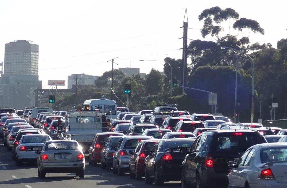
3 Executive Summary In 2016, RAA once again performed travel time surveys across Adelaide s major arterial network. A total of 15 roads were surveyed, covering a total of 180km of road. Stationary Time As with previous years, RAA s Travel Time Survey results highlight some of the deficiencies in the major arterial road network that spans across Adelaide. In 2016 for both morning and afternoon peak periods, almost a third of all travel times across the routes that RAA surveys are spent stationary. This equates to almost 20 seconds of every minute of travel. As might be expected, there is a correlation between routes that have slow average speeds and high proportions of stationary time. The routes include Greenhill Road, Grange Road, Prospect Road and Unley Road during the morning peak period, and Greenhill Road and Goodwood Road across the afternoon peak. Slow Sections There has been little variation in the slowest sections of road across the network. In 2016, the slowest section during the morning peak was on Unley Road, between Greenhill Road and South Terrace. It took 5m26s to travel this 600m stretch of road, which generated an average speed of 7km/h. Similarly, the section of Adam Street, which is part of the Grange Road survey, between Manton Street and Port Road also generated an average speed of 7km/h. During the afternoon peak, it was once again the section of Main North Road, between Darlington Street and Grand Junction Road which topped the list of slowest sections with an average speed of 8km/h. These sections, for both the morning and afternoon, seem to crop up each year in our travel time surveys. Other sections that repeatedly feature as being some of the slowest include: Payneham Road between Stephen Terrace and Harrow Road (AM) Main North Road between Barton Terrace and Fitzroy Terrace (PM) Marion Road between Mooring Avenue and Cross Road (PM) Dequetteville Terrace between Rundle Street and North Terrace (PM) Payneham Road between Lambert Road and Portrush Road (PM) Changes Over Time Travel times for all surveys during the morning peak took an average of 6 minutes and 49 seconds longer than they did in 1996; whilst in the afternoon, all travel runs took an average of 5 minutes and 55 seconds extra to conduct. This equates to 29 hours a year longer spent travelling than it did 20 years ago during the morning peak, and 25 hours a year longer spent in the afternoon peak. Some of the more prominent travel time increases when compared with 1996 levels are: Morning Afternoon Survey Time Increase Survey Time Increase Unley Road +12m31s Marion Road +9m28s North East Road +10m54s South Road +9m22s Marion Road +10m09s Brighton Rd/ Anzac Hwy +6m38s Main North Road +9m10s Goodwood Road +6m19s Brighton Road +7m39s Main North Road +5m23s 3
4 For the Unley Road survey during the morning peak the average speed in 1996 was 35km/h. By 2016 this had dropped to 23km/h. Much of the 12½ minutes extra that it now takes is spent on the approach to Cross Road and from Arthur Street to the city. Marion Road too has experienced significant travel time increases across both morning and afternoon peaks. This is in part due to the increased amount of time that it now takes road users to progress through the Cross Road intersection. Impact of Roadworks There are several large-scale road works projects currently taking place in metropolitan Adelaide, although the analysis of survey results suggests that there have been only minor changes to travel times around the Torrens to Torrens and Darlington Upgrade projects. There appears to have been some displacement of vehicles from the southern section of South Road onto Marion Road and sections of Brighton Road were slower, although it is unknown whether the latter is as a result of the roadworks. South Road through the roadworks during the afternoon peak was slower, particularly from Flinders Drive through to Seacombe Road. Marion Road was also slower, with the section between Daws Road and Alawoona Avenue recording an average speed of 15km/h; it s slowest performance in recent times. For the Torrens to Torrens project, movement around the intersection of South Road and Torrens Road was slower than in previous years, although the section between Torrens Road and South Road, which historically was one of the worst across the network, actually performed better. There was some evidence of delays on roads surrounding the O-Bahn Upgrade project. The average speed of the section of Hackney Road between Bundeys Road and Botanic Road fell to 9km/h during the morning peak in 2016, making it one of the slowest sections across the network. This compared poorly to the previous three-year average speed of 19km/h. Bluetooth Data Results Bluetooth Data, provided by the Department of Planning, Transport and Infrastructure was included in the analysis of 2016 travel times for the first time. It highlighted that there was a correlation between this and the floating car method of collecting travel time data. By using the Bluetooth data, it enabled for an analysis of travel times across all hours of the day to be conducted. During the morning peak period the worst time to commute was between 8:15am and 8:45am which is consistent with the times that RAA collects floating car data. However, the distribution of the afternoon peak differs according to each road. On some roads, there is a clear afternoon peak that occurs between 5:30pm to 6pm, whilst on others the peak time is aligned with school pick up times such as on Grange Road, Prospect Road and Torrens Road where the afternoon peak occurs between 3:45pm to 4:15pm. On other roads, such as Brighton Road, Greenhill Road, Payneham Road and Unley Road, they have two afternoon peaks. As well as being one of the slowest routes from RAA s surveys, Greenhill Road also recorded the slowest average speeds for both of its peak periods within the Bluetooth data set. Unley Road, Fullarton Road and Grange Road also generated less than desirable average speeds for both morning and afternoon peak periods. Changing Time of Travel For commuters with school children or set working hours, changing their time of travel might not be an option. 4
5 However, after analysing the Bluetooth travel times, it shows that peak time commuters on Marion Road and Fullarton Road would stand to benefit the most from changing their travel time to either half an hour earlier or later. If commuters used Marion Road half an hour earlier than the peak for both their morning and afternoon journeys, they would stand to save 13 minutes per day. Extrapolated over a year this has the potential to result in travel time savings of 55 hours, although this assumes similar road conditions each day. Other roads with significant savings are as follows: Road Marion Road South Road (Southern Section) Fullarton Road Fullarton Road South Road (Northern Section) Marion Road Changing Journey to be Half an hour later than the peak Half an hour later than the peak Half an hour later than the peak Half an hour earlier than the peak Half an hour earlier than the peak Half an hour earlier than the peak Time Savings per Day Time Savings per Year 13 minutes 55 hours 11 minutes 47 hours 9½ minutes 40 hours 9 minutes 38 hours 7½ minutes 5½ minutes 32 hours 23 hours It is worthy to note that results from RAA s floating car survey over the years show that it is taking commuters longer than ever to undertake their journeys during both peak periods of the day. For the Marion Road survey, it takes just over 10 minutes longer in the morning and an extra 9½ minutes in the afternoon to conduct this trip at peak times than it did 20 years ago. If a commuter had the capacity and inclination to, then much of this extra time could be recouped if they changed their journey along Marion Road to be half an hour later than the peak. It would not make up all of the gap since 1996 levels, but it may provide some relief for the commuter which would otherwise be spent stuck in traffic. 5
6 Introduction This report provides a summary of the average speeds, travel times and delays on some of the major arterial roads in and around Adelaide, as surveyed by RAA in RAA has been conducting travel time surveys since 1986 to monitor the efficiency of these routes. The car is an integral part of modern communities and as such RAA, on behalf of its members has a duty to report where there are deficiencies in the South Australian road network. This report provides a summary of the investigations carried out on the arterial roads that surround Adelaide City Centre as surveyed by RAA during The major delays on these roads are highlighted and comparisons are made to corresponding surveys done in previous years in an attempt to address the commonly held view of motorists that the roads are getting slower. In order to gather data for the Travel Time Survey, RAA adopted what is known as the floating car method. This method involves driving a car at certain designated times in such a manner that it attempts to simulate the average vehicle in the traffic stream. A GPS with specifically designed software is used to capture data on average speed, time taken and stationary time, which is then extracted and analysed. The travel surveys were conducted by RAA personnel. Multiple runs were conducted in each direction over several days and then averaged out. Once all data was obtained it was then formatted and analysed. The analysis comprised of comparing 2016 travel survey results with corresponding surveys that were conducted in previous years. There are several large-scale road works projects currently taking place in metropolitan Adelaide. Part of this analysis considered what impact there was to sites where major roadworks were ongoing. Major projects included the Torrens to Torrens Upgrade, the Darlington Upgrade and the O-Bahn Extension. Other forms of data were used in the analysis process to complement travel survey findings. These included traffic flow data as supplied by the DPTI, as well as Bluetooth travel time data. The Bluetooth data allows for the analysis of travel times over different times of the day, and as such, analysis was conducted to examine the impact of travelling routes at varying times. RAA would like to thank DPTI for their co-operation during this project. 6

7 RAA Travel Time Surveys 2016 Survey Results AM Peak Road Average Travel Stationary % Stationary Speed Time Time Time Brighton Road/Anzac Hwy 28.1km/h 31m33s 8m54s 28% Churchill Road 33.4km/h 13m22s 2m56s 22% Fullarton Road 25.5km/h 19m59s 5m33s 28% Goodwood Road 28.9km/h 19m21s 4m50s 25% Grange Road 24.8km/h 26m06s 10m27s 40% Greenhill/Richmond Road 23.7km/h 24m56s 10m27s 42% Main North Road 24.6km/h 25m06s 7m03s 28% Marion Road 25.0km/h 33m15s 10m46s 32% North East Road 23.9km/h 35m35s 10m29s 29% Payneham Road 19.7km/h 24m52s 8m23s 34% Prospect Road 18.5km/h 19m19s 7m14s 37% South Road (Northern Section) 30.0km/h 36m47s 12m09s 33% South Road (Southern Section) 27.0km/h 29m44s 7m56s 27% Torrens Road 28.2km/h 20m40s 6m38s 32% Unley/Belair Road 22.6km/h 34m16s 11m46s 34% 7
8 Average speeds for inbound trips during the morning peak period ranged from 33km/h for the Churchill Road survey and 30km/h along the northern section of the South Road survey which includes the Superway, down to 18km/h along Prospect Road and 20km/h on Payneham Road. RAA monitors average speeds in relation to a minimum acceptable level of service. For the majority of roads where the speed limit is set at 60km/h, it is expected that they should achieve an average running speed of at least 50% or 30km/h. Any speed below this is a result of congestion due to significant intersection delays. For most routes that were surveyed during the morning in 2016, achieving an average speed of 30km/h or greater would have been deemed acceptable. Thirteen out of 15 routes surveyed during the morning peak period failed to meet this target. Those that did were Churchill Road which, for the second year running, performed well and the northern South Road survey. It should be noted that for the latter, its travel time is improved by the increased speeds achieved on the Superway. For all routes during the morning peak period, the time that is spent stationary on the road or at intersections makes up almost a third of the travel time (32%). So, for every minute of travel, approximately 20 seconds of that is spent stationary. Some of the surveys where this is more prevalent include Greenhill Road, where 42% of the travel time was spent stationary. Congestion in the lead up to Portrush Road, Unley Road and up to Anzac Highway is the primary reason for this. For the Grange Road survey, 40% of the travel time was spent stationary. Delays on Grange Road occur in the lead up to Holbrooks Road, South Road and the section of Adam Street between Manton Street and Port Road. On Prospect Road, where 37% of travel time was stationary, it was slow from Olive Street through to Barton Terrace in North Adelaide; whilst for Unley Road, where stationary time accounted for 34%, the main delays occurred in the lead up to Cross Road and then between Arthur Street and South Terrace. 8
9 PM Peak Road Average Travel Stationary % Stationary Speed Time Time Time Brighton Road/Anzac Hwy 25.6km/h 34m33s 12m01s 35% Churchill Road 39.4km/h 11m21s 1m51s 16% Fullarton Road 24.6km/h 20m41s 6m53s 33% Goodwood Road 24.6km/h 22m53s 8m17s 36% Grange Road 29.2km/h 22m03s 7m04s 32% Greenhill/Richmond Road 20.2km/h 29m19s 12m31s 43% Main North Road 26.7km/h 23m04s 8m09s 35% Marion Road 24.1km/h 34m22s 11m36s 34% North East Road 32.6km/h 26m03s 5m53s 23% Payneham Road 27.0km/h 18m02s 4m54s 27% Prospect Road 24.8km/h 14m25s 4m59s 35% South Road (Northern Section) 38.3km/h 29m15s 7m31s 26% South Road (Southern Section) 27.7km/h 28m57s 6m55s 24% Torrens Road 27.6km/h 21m09s 7m18s 35% Unley/Belair Road 29.5km/h 26m14s 7m02s 27% 9
10 For outbound surveys during the afternoon peak period, the range spanned between 39km/h along Churchill Road and 38km/h along the northern section of the South Road survey, which includes the Superway, to 20km/h along Greenhill Road and 24km/h along Marion Road. Regarding the minimum acceptable level of service, just three out of the 15 routes surveyed achieved an average speed of 30km/h or greater. These included Churchill Road, the northern South Road survey and North East Road, the latter of which has continued to perform well. The amount of time spent stationary as a proportion of all travel times during the afternoon peak was 31%, which is marginally lower than the morning peak period. For the afternoon peak, motorists spend the highest proportion of travel time that is stationary along Greenhill Road. For its overall travel time of almost 29½ minutes, a total of 12½ minutes (43%) of it was spent stationary. This was worst in the lead up to Peacock Road, Fullarton Road and Portrush Road. It is no coincidence that Greenhill Road posted the slowest average speed across all surveys. Goodwood Road also performed poorly during the afternoon peak, with 36% of its travel time being spent stationary. This was at its worst when passing alongside Wayville Showgrounds and then between the tram level crossing and Cross Road. 10

11 Slowest Sections The tables below shows the slowest sections of the travel time network that RAA collected data for in A number of sections, which are highlighted in these tables, are also repeat offenders which have been highlighted in previous travel time reports, particularly the sections on Brighton Road, Fullarton Road, Greenhill Road, Main North Road, Marion Road, Payneham Road and Unley Road. Slowest Sections of Road During the Morning Peak Period: Road Section Distance 1 Unley Road 2 Adam Street 3 Prospect Road 4 Hackney Road 5 Payneham Road 6 Grange Road 7 Marion Road 8 South Road 9 Belair Road 10 Torrens Road 11 Prospect Road Greenhill Road to South Terrace Manton Street to Port Road Fitzroy Terrace to Barton Terrace West Bundeys Road to North Terrace Stephen Terrace to Harrow Road Frederick Street to South Road Bray Street to Cross Road Regency Road to Torrens Road Tutt Avenue to Cross Road Rosetta Street to South Road Clifton Street to Fitzroy Terrace Average Speed Average Time (min:sec) 0.63km 7km/h 5: km 7km/h 2: km 8km/h 2: km 9km/h 7: km 10km/h 3: km 10km/h 4: km 11km/h 7: km 11km/h 8: km 11km/h 3: km 11km/h 4: km 11km/h 3:18 11

12 Slowest Sections of Road During the Afternoon Peak Period: Road Section Distance 1 Main North Road 2 Jeffcott Street 3 Goodwood Road 4 Main North Road 5 Fullarton Road 6 Greenhill Road 7 Marion Road 8 Marion Road 9 Dequetteville Terrace 10 Payneham Road 11 South Road Darlington Street to Grand Junction Road Barton Terrace West to Park Terrace Young Street to Leader Street Barton Terrace to Fitzroy Terrace Ferguson Avenue to Cross Road Sir Lewis Cohen Ave to King William Road Mooringe Avenue to Anzac Highway Anzac Highway to Cross Road Rundle Street to North Terrace Lambert Road to Portrush Road James Congdon Drv to Sir Donald Bradman Drv Average Speed Average Time (min:sec) 0.68km 8km/h 4: km 8km/h 3: km 9km/h 2: km 9km/h 2: km 10km/h 2: km 10km/h 3: km 10km/h 2: km 10km/h 2: km 10km/h 1: km 10km/h 4: km 10km/h 3:50 12
13 Travel Times Across the Years The table below highlights the average speed for all of the routes that were surveyed by RAA in 2016 for both the morning and afternoon peak period and also lists the corresponding average speed as collected in 2006 and 1996 to allow for comparisons to be made. Survey Table Average Travel Speeds, 2016 vs vs Average Speed (AM) Average Speed (PM) Brighton Road 28km/h 31km/h 32km/h 26km/h 30km/h 32km/h Fullarton Road 25km/h 25km/h 26km/h 25km/h 31km/h 30km/h Goodwood Road 29km/h 23km/h 29km/h 25km/h 26km/h 34km/h Main North Road 25km/h 32km/h 38km/h 27km/h 33km/h 35km/h Marion Road 25km/h 28km/h 36km/h 24km/h 28km/h 33km/h North East Road 24km/h 32km/h 34km/h* 33km/h 31km/h 36km/h* South Road 29km/h 27km/h 34km/h 27km/h 32km/h 41km/h Unley Road 23km/h 27km/h 35km/h 29km/h 32km/h 35km/h *Average speed from 1997 RAA historically has referred to minimum acceptable levels of service as being achieving an average speed that is either 50% of the posted speed limit or 30km/h. Considering those surveys that were conducted back in 1996 which are still done in the present day it can be seen how each route performed in terms of achieving that minimum level. For the morning peak period back in 1996, 6 out of 8 surveys achieved an average speed that was 30km/h or greater. In 2006, this number had reduced to 3 and in 2016, none of those 8 survey routes reached the minimum acceptable level. For the afternoon peak, all 8 surveys in 1996 registered an average speed of 30km/h or greater. In 2006 this had reduced to 6 surveys and last year only the North East Road survey registered an acceptable average speed. There can be some variability between individual years, but by looking back further it can be seen how there have been reductions on Brighton Road, Main North Road, Marion Road, North East Road and Unley Road during the morning peak. During the afternoon peak Brighton Road, Main North Road, Marion Road, South Road and Unley Road have also experienced reductions. For the most affected roads, this equates to the following daily time increases: Morning Afternoon Survey Time Increase Survey Time Increase Unley Road +12m31s Marion Road +9m28s North East Road +10m54s South Road +9m22s Marion Road +10m09s Brighton Road +6m38s Main North Road +9m10s Goodwood Road +6m19s Brighton Road +7m39s Main North Road +5m23s 13
14 Travel times for all surveys during the morning peak took an average of 6 minutes and 49 seconds longer than they did in 1996, whilst in the afternoon, all travel runs took an average of 5 minutes and 55 seconds extra to conduct. By far, the biggest travel time increase has occurred during the morning peak along Unley Road. The 12½ minutes extra it now takes represents a 58% time increase when compared to 1996 levels. For Marion Road, the 10 minutes extra that it now takes is 44% higher than 20 years ago. For the afternoon peak the biggest increase in travel time has occurred on Marion Road. The 9½ extra minutes that it now takes represents a 38% increase, whilst on South Road in the afternoon peak it takes 53% longer to travel the route than it did 20 years ago. On the Unley Road survey, the time increase during the morning peak can be explained by the extra time that it takes to travel between Grange Road and Cross Road (2 minutes), Arthur Street to Greenhill Road (2½ minutes) and Greenhill Road to South Terrace (3½ minutes). Marion Road has experienced significant travel time increases across both morning and afternoon peaks. During the morning, increases have mainly occurred between South Road and Alawoona Avenue (3 minutes), Bray Street and Cross Road (4½ minutes) and Richmond Road to Sir Donald Bradman Drive (1 minute). Meanwhile, during the afternoon peak the sections that have deteriorated the most were between Anzac Highway and Cross Road (2 minutes), Bray Street and Daws Road (3 minutes) as well as Daws Road to Alawoona Avenue (4½ minutes). On Main North Road, the overall 9 minutes extra that it took during the morning peak in 2016 was mainly due to the extra time that it took to travel between Darlington Street and Fitzroy Terrace. In 1996 it took just under 9 minutes to travel this 5.3km section of road; whereas in 2016 it took just over 17 minutes. For the afternoon survey it took an extra minute to travel between Barker Road and Regency Road and an extra 3 minutes to travel between Darlington Street and Grand Junction Road. The morning survey for North East Road took almost 11 minutes longer to travel in 2016 than it did in The reasons for this were found in three locations along the route. Firstly, it took an extra 1½ minutes to pass through the intersection with Sudholz Road. Then it took an extra 4 minutes to travel between OG Road and Nottage Terrace. Finally, the North East Road survey takes in Hackney Road, which itself took 5 minutes longer to travel between Bundeys Road and North Terrace. The travel time for this particular section is likely to be inflated in 2016 as a result of the O-Bahn Upgrade; although the travel times for 2015 and 2014 both show an increase, albeit one that is not as large as the one generated in For the South Road survey the afternoon travel time was almost 9½ minutes longer in 2016 than it was in It took 4 minutes longer to travel over the Emerson Overpass, through to Albert Street and then there were additional delays leading up to Ayliffes Road. The Goodwood Road survey in 2016 appears to be an exception. It remains to be seen whether this will be an isolated change or part of an ongoing trend, with the main improvements occurring between Shepherds Hill Road and Daws Road. On average, this section took 4½ minutes to travel in 2016, compared to almost 7½ minutes in The longer term trend for Goodwood Road tends to highlight a reduction in average speed. The following pages display average speeds for the last 20 years for RAA s longer standing survey routes. 14
15 AM Average Speeds Since
16 PM Average Speeds Since

17 Impact of Roadworks There are several large-scale roadworks projects currently happening in metropolitan Adelaide which will eventually aid in the movement of a significant number of vehicles and public transport users. In awarding these major contracts, the Department of Planning, Transport and Infrastructure stipulated that whilst the roadworks were ongoing, that travel times through them needed to be managed, with penalties to be applied if this was not the case. Many smaller construction projects were completed prior to the major works to cater for the displacement of vehicles seeking alternate routes. During the collection of travel time data, RAA made observations of how traffic was moving at these three roadwork sites. Darlington Upgrade Project The Darlington Upgrade Project commenced in 2015 and is due for completion in This project will deliver an upgrade of 3.3km on Main South Road between Tonsley Boulevard and the Southern Expressway. This will include a non-stop motorway passing beneath Flinders Drive, Sturt Road, Sutton Road and Tonsley Boulevard as well as grade separation at the intersection of Main South Road, Ayliffes Road and Shepherds Hill Road. AM Peak Travel Times, Selected Roads Affected by Darlington Upgrade During the AM peak, South Road travel times through the roadworks appeared to perform well. There were slow sections, particularly between Marion Road and Sturt Road, although they were no slower than they had been in previous years. Survey Section South Marion Road to Road Flinders Drive 17km/h 18km/h 14km/h 16km/h South Flinders Drive to Road Ayliffes Road 21km/h 28km/h 16km/h 27km/h 17

18 Marion Road Marion Road Brighton Road Brighton Road Ayliffes Road Ayliffes Road Sturt Road to Alawoona Avenue Alawoona Avenue to Daws Road Seacombe Road to Sturt Road Sturt Road to Balmoral Avenue Shepherds Hill Road to Painter Street Painter Street to Daws Road 24km/h 28km/h 36km/h 43km/h 28km/h 29km/h 23km/h 32km/h 24km/h 45km/h 42km/h 34km/h 35km/h 36km/h 37km/h 43km/h 51km/h 31km/h 32km/h 29km/h 30km/h 19km/h 21km/h 24km/h However, some sections of Marion Road during the morning peak recorded average speeds that were as slow as they have been in over 10 years. It is conceivable that commuters are avoiding South Road and using Marion Road instead. Average speeds were slower, particularly between Sturt Road and Alawoona Avenue, and to a lesser degree between Alawoona Avenue and Daws Road. Brighton Road was also slower, particularly between Seacombe Road and Balmoral Avenue. For the section of Seacombe Road to Sturt Road, this year s survey generated an average speed of 24km/h; significantly slower than the corresponding average speeds generated in previous years. In contrast, Ayliffes Road/Fiveash Drive/Goodwood Road was quicker between Shepherds Hill Road and Daws Road. In the 2016 survey, it took on average 4½ minutes to travel between these two points; almost 3 minutes quicker than it did in It is likely that a reconfiguration of the traffic signals at the intersection of Goodwood Road/Daws Road/Springbank Road has enabled traffic to flow through this intersection better. PM Peak Average Speeds, Selected Roads Affected by Darlington Upgrade 18

19 In the afternoon, South Road through the roadworks was slower, particularly from Flinders Drive through to Seacombe Road. Also, Marion Road was slow from Daws Road through to Sturt Road. The section of Marion Road, from Daws Road to Alawoona Avenue at 15km/h recorded the slowest travel time in a number of years. On Brighton Road, Oaklands Road through to Jetty Road (Brighton) was slower than normal, although it s unclear whether this is directly related to the Darlington roadworks. Meanwhile, Goodwood Road did not appear to be affected. Survey Section South Flinders Drive to Road Marion Road 33km/h 48km/h 32km/h 43km/h South Marion Road to Road Seacombe Road 20km/h 37km/h 41km/h 57km/h Marion Daws Road to Road Alawoona Avenue 15km/h 30km/h 29km/h 46km/h Marion Alawoona Avenue to Road Sturt Road 17km/h 18km/h 21km/h 30km/h Brighton Oaklands Road to Road Balmoral Avenue 19km/h 37km/h 48km/h 53km/h Brighton Balmoral Avenue to Road Level Crossing 19km/h 21km/h 36km/h 49km/h Brighton Level Crossing to Road Jetty Road 16km/h 19km/h 33km/h 19km/h Torrens to Torrens Project The Torrens to Torrens Project will deliver a 4km non-stop roadway and is due for completion in It will comprise of a 3km section of lowered motorway, an overpass of the Outer Harbor railway line and a number of intersection upgrades. AM Peak Average Speeds, Selected Roads Affected by Torrens to Torrens Project 19
, whilst Port Road through to Adam Street was also slower. There was no noticeable evidence of motorists taking alternative routes.")
20 The survey results for 2016 indicate that Regency Road to Torrens Road was slower, Torrens Road to Port Road was marginally quicker (but historically this has been the worst section of road during the AM peak and so any change would have made an improvement), whilst Port Road through to Adam Street was also slower. There was no noticeable evidence of motorists taking alternative routes. Churchill Road operated in a similar way in which it did in 2015; and because of this it is unlikely that the increase in travel time along Prospect Road would have been caused by displaced road users. On Torrens Road, the section between Rosetta Street and South Road was slower in 2016 than it was in 2015 (11km/h vs 20km/h), but it performed better beyond the South Road intersection. For Grange Road, Frederick Street to South Road was slower (10km/h vs 15km/h) as was South Road to Adam Street (38km/h vs 47km/h). Survey (AM) South Road South Road South Road Torrens Road Torrens Road Grange Road Grange Road Section Regency Road to Torrens Road Torrens Road to Port Road Port Road to Adam Street Rosetta Street to South Road South Road to Coglin Street Frederick Road to South Road South Road to Adam Street 11km/h 24km/h 28km/h 28km/h 16km/h 12km/h 7km/h 9km/h 22km/h 40km/h 30km/h 41km/h 11km/h 20km/h n/a n/a 54km/h 39km/h n/a n/a 10km/h 15km/h n/a n/a 38km/h 47km/h n/a n/a PM Peak Average Speeds, Selected Roads Affected by Torrens to Torrens Project 20

21 During the afternoon peak, the only noticeable differences between the travel surveys conducted this year and last year was that it took longer when passing through the South Road/Torrens Road intersection. Survey (PM) South Road South Road South Road Torrens Road Torrens Road Section Adam Street to Port Road Port Road to Torrens Road Torrens Road to Regency Road Coglin Street to South Road South Road to Rosetta Street 26km/h 15km/h 9km/h 14km/h 21km/h 25km/h 29km/h 22km/h 27km/h 26km/h 33km/h 42km/h 21km/h 32km/h n/a n/a 38km/h 43km/h n/a n/a Grange Road, Churchill Road and Prospect Road recorded average speeds that were comparable with 2015 results. O-Bahn Extension Project The O-Bahn Extention Project will extend the O-Bahn system from the end of the existing busway at Gilberton through to the bus lanes on Grenfell Street. A dedicated bus tunnel will be constructed to take buses below the Botanic Road and North Terrace intersection and will pass under the Park Lands. This project is due for completion by the end of AM Peak Average Speeds, Selected Roads Affected by O-Bahn Upgrade Project From 2016 travel time results it would appear that the O-Bahn roadworks have had a negative impact on average speeds on the approach to the intersection of Hackney Road/Botanic Road/Dequetteville Terrace. On Hackney Road, on the approach to this intersection average speeds dropped to as low as 9km/h. When compared to other sections of road that RAA 21

22 surveys, the 1.2km section between Bundeys Road and Botanic Road was one of the worst in It took almost 8 minutes to travel through this section of which almost half of it was spent stationary. When compared to 2015 results, this represents an increase in time of 3½ minutes. This section of road has also recorded an average speed that has steadily declined since On Payneham Road, the section between Fullarton Road and Hackney Road was also slower in 2016 than it was in Survey (AM) Hackney Road Hackney Road Payneham Road Section Melbourne Street to Bundeys Road Bundeys Road to Botanic Road Fullarton Road to Hackney Road 13km/h 17km/h 16km/h 22km/h 9km/h 16km/h 19km/h 22km/h 12km/h 15km/h 19kmh/ 16km/h PM Peak Average Speeds, Selected Roads Affected by O-Bahn Upgrade Project During the afternoon peak Rundle Street to Botanic Road on Dequetteville Terrace recorded an average speed of 10km/h, but this is fairly consistent with previous years. On Hackney Road, the section between Botanic Road/North Terrace and Bundeys Road was marginally quicker, whilst on Payneham Road, the section between Hackney Road and Fullarton Road was slightly slower. Based on these sections there appears to be little evidence of an impact on these sections from the O-Bahn roadworks. Survey (PM) Section Hackney Botanic Road to Road Bundeys Road 31km/h 24km/h 28km/h 25km/h Dequetteville Rundle Street to Terrace Botanic Road 10km/h 9km/h 8km/h 8km/h Payneham Hackney Road to Road Fullarton Road 34km/h 37km/h 37km/h 35km/h 22
23 Bluetooth Travel Time Data For the past 30 years, RAA has collected its travel time data using a process known as the floating car method. This method requires a driver to collect data whilst mimicking the average flow of the traffic that is around it. The floating car method has been used since RAA began collecting data in 1986 and at first was a two person exercise involving a driver and a passenger whose role it was to record and log travel times between sections manually. Towards the late 1990 s, this became a one person role, when technology was used to capture this data, which could then be analysed later on. To this day, the technology used to collect the data has evolved, but the premise has remained the same. Collecting data using the floating car method provides a great insight into the flow of traffic and levels of congestion, but it also allows the driver to record their experience and to understand why problems occur in the way that they do. However, the main drawback from this method is that it is very labour intensive and data can only be collected at one point in time. Morning travel time surveys begin at 8am whilst the afternoon surveys begin at 5.20pm. This is traditionally when most vehicles are on the road, but travel patterns are changing. Organisations are much more amenable towards flexible working hours than ever before, which means that road users can take advantage of avoiding peak period traffic by adjusting their work hours around this. Unfortunately, due to the nature of the way that floating car data is collected it has not been possible to understand how travel times and average speeds fluctuate by time of the day. Over the past 3-4 years, the Department of Planning, Transport and Infrastructure (DPTI) has invested in the use of Bluetooth technology to monitor traffic movements across the metropolitan area of Adelaide. The use of Bluetooth technology data represents a costefficient way of collecting and reporting on traffic patterns. DPTI use information gathered using this method to provide travel information both through the TrafficSA website and on information signs that are located across the metropolitan area. DPTI has won a number of state and national awards for the implementation of this Bluetooth system across South Australia. A series of Bluetooth receivers are located in over 400 locations across the metropolitan area which assists in the gathering of this data. This is collected from vehicles that are Bluetooth enabled by capturing the Media Access Control (MAC) address from a radio or hands free kit, every time such a device passes through a location that has a scanner. The MAC identification is a unique anonymous ID that is allocated to each device. By passing through multiple scanners, a travel time and average speed for that and each unique MAC ID can be calculated. The average speed of a vehicle is based on Bluetooth devices across the network recording the same MAC address, matching them and then performing the calculations of speed and time. The advantage of collecting travel time data using Bluetooth technology is that travel time patterns can be analysed for all times of the day and night and it is also a less labour intensive method of collecting data. Prior to this analysis, DPTI were contacted regarding the availability of Bluetooth travel time data for selected months of 2014, 2015 and This was specifically for the months of February, May and August of each of these years, as these were months that consistently do not have any school holidays that may influence travel times during peak periods. 23
24 The Bluetooth data that RAA requested was for a variation of the routes that are surveyed via the floating car method. Because the data request was for the full routes, it was found that in the early parts of the analysis that for selected routes not many vehicles travel the entire length of it. For instance, RAA s Greenhill Road survey spans from Glynburn Road all the way through to the intersection of Richmond Road and Marion Road. The reality is that on a day to day basis, few vehicles undertake this journey in its entirety. Therefore, for selected routes, the start and end points were altered in order to accommodate a higher number of data points. A key note to consider when interpreting Bluetooth data is that it is reported in terms on the survey end time(i.e. when a vehicle passed through the end point of the survey). Calculations can be made on the start time, but given that the data RAA received showed individual travel times in terms of the 15 minute bracket that it fell in, rather than rounding up or down to minute level, this calculation was deemed impractical for this exercise. Removing Outliers and Understanding the Bluetooth Data The Bluetooth data provides an excellent way of collecting data on a section of road over multiple time periods. However, one of the drawbacks is that because the data is anonymised, it cannot distinguish between modes of transport. For instance, Bluetooth readings can come from a car or a bicycle rider whose Bluetooth setting on their mobile device is activated, but the signal can also come from a passenger on a bus. Previous studies that RAA has conducted highlights that along certain routes a bicycle can be just as quick, if not quicker than a car. However, this would be the case mainly at times of peak congestion. The Bluetooth method can also returns unreasonable data points on occasions. For instance, if the driver along a route went to pick up a colleague along the way or if they had to stop for fuel. They would still pass through the start and finish points along that route, but the data returned would be compromised. Therefore a consistent method to remove any outlier data needed to be considered before the data was analysed. The first part of the process was to remove weekend data from the sample as it was perceived that this is not reliable information when reporting on weekday peak travel times. Then the remaining weekday data was charted to examine the presence of outliers. 24

25 The previous chart shows Bluetooth travel time records for weekday movements between Devereux Road and Unley Road, comprising of 6060 records for that month (approx. 263 per day). The pattern in which it exhibits is one that would be expected for a citybound survey, i.e. with a peak occurring through the morning peak period from 8am through to 10am, before levelling out for the majority of the day. However, later on in the day, particularly from 1pm onwards the chart displays records which otherwise might not be expected, with selected travel times ranging from 20 minutes through to over 50 minutes. It is unclear why these records appear, along with those records that were much lower than would otherwise be expected. Removing these outliers manually was one option, but using a method that could be applied to all requested routes was the preferred option. For each month s data, the outliers were identified in Excel through standardizing the data by calculating z-scores 1 that are relative to the mean. Rather than doing this for the whole data set, this process was done for each 15 minute time period. This was because, for certain datasets, calculating and removing outliers actually eliminated some values from the peak travelling period. The previous chart showed a months worth of weekday travel time data for a section of Greenhill Road. The process described in the last paragraph identified 59 outliers, which when removed show a distribution of travel times across the day as would be expected. 1 Calculating z-scores allows for a comparison of all data points relative to the mean (average) from which outliers can be identified. 25
26 Reporting of Bluetooth Results Once the outliers were removed from each month, average travel times as well as travel times for the 15 th and 85 th percentile were calculated. Then the averages for each month were combined and charted. The chart shown above shows the median travel time for all of the requested 9 months as well as those months that recorded the highest travel time and those which recorded the lowest time. In interpreting the data, once again the section of Greenhill Road, between Devereux Road and Unley Road is shown. When considering that the data is reported by its end time, it can be read that the peak time for vehicles travelling on this section of road is between 8:30am and 8:45am, with vehicle arriving at Unley Road at this time. On average, in this 15 minute time period, it takes vehicles 12 minutes and 48 seconds to travel this 4.1km section of road. However, because of the variability of travel times it could reasonably be expected to take up to just over 15 minutes or as low as just over 11 minutes. The wider the gap between the minimum and maximum average travel times, the more variability there is on a daily basis. This approach takes into account the average travel times for good months and bad months, which could be the focus of a future piece of analysis. 26
27 RAA Results vs Bluetooth Results RAA first started reporting on Bluetooth travel time data earlier in 2016 when it published results on how travel times were affected by road closures in the lead up to the Clipsal 500 motor racing event, held each year in Adelaide City Centre. In that previous piece of analysis, it was shown that Bluetooth data was a reliable substitute for floating car data, and so it proved to be the case in this analysis, as data in the following table shows: Road Greenhill Road Fullarton Road Main North Road Payneham Road Section Devereux Road to Unley Road Russell Street to Grant Avenue Montague Road to Fitzroy Terrace Darley Rd to Dequetteville Terrace Floating Car Results m32s 9m53s 10m02s 21m19s 25m51s 19m59s 22m23s 21m44s 25m06s 19m11s 20m44s 23m30s Bluetooth Average 8m59s- 13m08s 20m40s- 25m36s 16m54s- 21m47s 17m57s- 21m35s Whilst the Bluetooth data fits around the floating car data well, there is a trend that the Bluetooth results are generally quicker. However, this is no surprise given the conservative approach to driving as adopted by drivers taking part in floating car surveys. In the broad scheme of things this is a small price to pay when considering the number of data points that the Bluetooth method provides over multiple time periods. 27
28 Peak Times on Each Route In reporting on all of the routes for which Bluetooth data was requested, it is possible to determine the worst times for travelling on each road. Road Peak AM Time Travel Time Average Speed Anzac Highway 8:15-8:30 12m35s-15m26s 29.9km/h Brighton Road 8:30-8:45 13m26s-17m18s 24.5km/h Churchill Road 8:15-8:30 12m50s-17m17s 31.6km/h Fullarton Road 8:30-8:45 21m26s-25m36s 22.2km/h Goodwood Road 8:30-8:45 17m47s-21m40s 27.5km/h Grange Road 8:30-8:45 16m08s-19m10s 22.3km/h Greenhill Road 8:30-8:45 11m13s-15m13s 19.2km/h Main North Road 8:15-8:30 16m54s-21m47s 27.6km/h Marion Road 8:30-8:45 22m04s-26m48s 24.3km/h North East Road 8:15-8:30 21m14s-25m21s 31.7km/h Payneham Road 8:30-8:45 19m00s-24m12s 21.0km/h Prospect Road 8:15-8:30 13m36s-15m59s 21.9km/h South Road 8:15-8:30 24m40s-31m01s 36.8km/h (Northern Section) South Road 8:30-8:45 24m19s-31m09s 29.5km/h (Southern Section) Torrens Road 8:15-8:30 13m53s-17m04s 26.4km/h Unley/Belair Road 8:15-8:30 9m36s-14m10s 22.4km/h The worst roads at their AM peak time in terms of average speed are Greenhill Road, Payneham Road, Prospect Road, Fullarton Road, Grange Road and Unley Road. Road Peak PM Time Travel Time Average Speed Anzac Highway 17:45-18:00 13m05s-16m23s 30.6km/h Brighton Road 15:45-16:00 10m09s-16m23s 26.4km/h Churchill Road 16:00-16:15 10m00s-11m37s 40.1km/h Fullarton Road 17:30-17:45 19m42s-22m42s 23.7km/h Goodwood Road 17:30-17:45 18m39s-21m45s 26.8km/h Grange Road 15:45-16:00 15m03s-18m01s 24.3km/h Greenhill Road 17:30-17:45 10m22s-11m55s 21.7km/h Main North Road 16:45-17:00 14m35s-17m52s 31.5km/h Marion Road 17:30-17:45 23m18s-29m12s 23.5km/h North East Road 17:30-17:45 18m34s-20m28s 36.2km/h Payneham Road 17:45-18:00 14m43s-18m24s 26.0km/h Prospect Road 15:45-16:00 12m41s-13m29s 26.0km/h South Road 17:30-17:45 26m56s-30m51s 37.7km/h (Northern Section) South Road 17:30-17:45 25m00s-34m02s 25.8km/h (Southern Section) Torrens Road 15:45-16:00 10m45s-12m56s 34.5km/h Unley/Belair Road 17:30-17:45 9m45s-12m15s 22.9km/h The worst roads at their PM peak time in terms of average speed are Greenhill Road, Unley Road, Marion Road, Fullarton Road and Grange Road. 28
29 In terms of looking at afternoon peaks, there is much more variance in the worst time to travel than there is during the morning. For instance, for each route during the morning peak it can be predicted with a reasonable amount of accuracy that the worst times to travel are on average 8-8:30am. Yet with the afternoon, there is a real difference between the worst time for each route, and this can largely be attributed to those roads which commuters use as part of the school run. Based on this data, the distribution of travel times across the afternoon peak can be categorised in four ways: Routes that have one afternoon peak that occurs 17:30-18:00 (Anzac Highway, Fullarton Road, Goodwood Road, Main North Road, Marion Road, South Road (Southern Section)) Routes that have one afternoon peak that occurs 15:45-16:15 (Grange Road, Prospect Road, Torrens Road) Routes that have two clear afternoon peaks around the hours of 4pm and 6pm (Brighton Road, Greenhill Road, Payneham Road, South Road (Northern Section), Unley Road) Routes that have no real peaks in travel time (Churchill Road) 29
30 Changing Time of Travel An analysis of travel times across different time periods can allow us to make estimations of how much time would be saved if commuters changed the time in which they travelled. The following tables highlight the potential time savings that could be made if commuters changed their journey times to be either half an hour earlier or half an hour later. AM Peak Period Road Worst Travel Time Anzac Highway 8:15-8:30 Brighton Road 8:30-8:45 Churchill Road 8:15-8:30 Fullarton Road 8:30-8:45 Goodwood Road 8:30-8:45 Grange Road 8:30-8:45 Greenhill Road 8:30-8:45 Main North Road 8:15-8:30 Marion Road 8:30-8:45 North East Road 8:15-8:30 Payneham Road 8:30-8:45 Prospect Road 8:15-8:30 South Road (Northern Section) South Road (Southern Section) 8:15-8:30 8:30-8:45 Torrens Road 8:15-8:30 Unley/Belair Road 8:15-8:30 30 minutes earlier 30 minutes later Arriving 7:45-8:00 saves 3 minutes Arriving 8:00-8:15 saves 2 minutes Arriving 7:45-8:00 saves 2½ minutes Arriving 8:00-8:15 saves 4 minutes Arriving 8:00-8:15 saves 1 minute Arriving 8:00-8:15 saves 2½ minutes Arriving 8:00-8:15 saves 2 minutes Arriving 7:45-8:00 saves 3½ minutes Arriving 8:00-8:15 saves 3½ minutes Arriving 7:45-8:00 saves 3 minutes Arriving 8:00-8:15 saves 3 minutes Arriving 7:45-8:00 saves 4 minutes Arriving 7:45-8:00 saves 5½ minutes Arriving 8:00-8:15 saves 2 minutes Arriving 7:45-8:00 saves 3 minutes Arriving 7:45 to 8:00 saves 2½ minutes Arriving 8:45-9:00 saves 4 minutes Arriving 9:00-9:15 saves 6 minutes Arriving 8:45-9:00 saves 2 minutes Arriving 9:00-9:15 saves 6 minutes Arriving 9:00-9:15 saves 4½ minutes Arriving 9:00-9:15 saves 2½ minutes Arriving 9:00-9:15 saves 3 minutes Arriving 8:45-9:00 saves 5 minutes Arriving 9:00-9:15 saves 7½ minutes Arriving 8:45-9:00 saves 3 minutes Arriving 9:00-9:15 saves 6 minutes Arriving 8:45-9:00 saves 3 minutes Arriving 8:45-9:00 saves 0 minutes Arriving 9:00-9:15 saves 5 minutes Arriving 8:45-9:00 saves 2 minutes Arriving 8:45-9:00 saves 1½ minutes 30
31 PM Peak Period Road Worst Travel Time Anzac Highway 17:45-18:00 Brighton Road 15:45-16:00 Churchill Road 16:00-16:15 Fullarton Road 17:30-17:45 Goodwood Road 17:30-17:45 Grange Road 15:45-16:00 Greenhill Road 17:30-17:45 Main North Road 16:45-17:00 Marion Road 17:30-17:45 North East Road 17:30-17:45 Payneham Road 17:45-18:00 Prospect Road 15:45-16:00 South Road (Northern Section) South Road (Southern Section) 17:30-17:45 17:30-17:45 Torrens Road 15:45-16:00 Unley/Belair Road 17:30-17:45 30 minutes earlier 30 minutes later Arriving 17:15-17:30 saves 1 minutes Arriving 15:15-15:30 saves 2 minutes Arriving 15:30-15:45 saves ½ minute Arriving 17:00-17:15 saves 5 minutes Arriving 17:00-17:15 saves 2 minutes Arriving 15:15-15:30 saves ½ minute Arriving 17:00-17:15 saves 3 minutes Arriving 16:15-16:30 saves 1 minute Arriving 17:00-17:15 saves 2 minutes Arriving 17:00-17:15 saves 1 minute Arriving 17:15-17:30 saves 2 minutes Arriving 15:15-15:30 saves 1 minute Arriving 17:00-17:15 saves 2 minutes Arriving 17:00-17:15 saves 2 minutes Arriving 15:15-15:30 saves ½ minute Arriving 17:00-17:15 saves 1½ minutes Arriving 18:15-18:30 saves 3 minutes Arriving 16:15-16:30 saves 1½ minutes Arriving 16:30-16:45 saves ½ minute Arriving 18:00-18:15 saves 3½ minutes Arriving 18:00-18:15 saves 2 minutes Arriving 16:15-16:30 saves 3 minutes Arriving 18:00-18:15 saves 1½ minutes Arriving 17:15-17:30 saves ½ minute Arriving 18:00-18:15 saves 5½ minutes Arriving 18:00-18:15 saves ½ minute Arriving 18:15-18:30 saves 3 minutes Arriving 16:15-16:30 saves 1 minute Arriving 18:00-18:15 saves 4½ minutes Arriving 18:00-18:15 saves 6 minutes Arriving 16:15-16:30 saves 1 minute Arriving 18:00-18:15 saves 2 minutes For many commuters leaving half an hour earlier at the start and end of each day would not be an option, specifically if those commuters had to take children to school or if they had set working hours to adhere to. Anecdotally for many people, flexible working or commuting is inferred as making a journey earlier than others would. However, what the Bluetooth data is showing is that for certain routes, the best times savings can be made by making journeys later. Average travel times during morning peak periods tend to build up to a point (i.e. sometime between 8am and 8.30am) before dropping off. This is particularly true for Marion Road, Fullarton Road, Brighton Road and Payneham Road during the morning. In the afternoon, it is South Road (both Northern and Southern sections) as well as Marion Road where most time savings can be made if journeys are made after 6pm. 31
32 For Marion Road if a commuter changed their commute so that they arrived half an hour later each day then this could result in daily time savings of 13 minutes; comprising of 7½ minutes in the morning and 5½ minutes in the afternoon. Travelling half an hour later on the southern section of South Road would achieve daily savings of 11 minutes, whereas on Fullarton Road the time saving would be 9½ minutes. If commuters changed their journey times so that they arrived half an hour earlier than the peak for the morning and afternoon, it would be those who use Fullarton Road who would stand to benefit the most. A total of 9 minutes per day could be saved if Fullarton Road commuters travelled 30 minutes earlier. Commuters using the northern section of South Road would save 7½ minutes per day and those using Marion Road would save 5½ minutes per day. It is noteworthy that out of all of the routes that RAA received Bluetooth data for, the analysis shows that commuters would stand to benefit the most if they changed their commute time to plan to arrive either half an hour earlier or half an hour later than the peak travel time along Fullarton Road or Marion Road. Some of the travel time savings may look small but they all contribute towards the quality of the journey; for instance, it may involve stopping at one set of lights instead of two. It should be considered that whilst leaving later can reduce travel times significantly, those savings may be eradicated by having to find a car park, particularly during the morning peak. Small travel time savings per day can result in large savings over a longer period, such as over a year. Travelling on Marion Road half an hour later than the peak in both the morning and the afternoon means planning to arrive at 9-9:15am for the citybound leg and 6-6:15pm for the outbound journey. This has the potential to save a commuter 13 minutes per day. Extend this over a working year and this saving becomes much more significant as it would equate to just over 55 hours of time saved. Alternatively, if the same Marion Road commuter decided to change their travel time so that they planned to arrive half an hour earlier than the peak, at 8-8:15am for the citybound leg and 5-5:15pm for the outbound journey then this could result in savings of over 23 hours per year. Some other significant travel time savings are shown below. Road Marion Road South Road (Southern Section) Fullarton Road Fullarton Road South Road (Northern Section) Marion Road Changing Journey to be Half an hour later than the peak Half an hour later than the peak Half an hour later than the peak Half an hour earlier than the peak Half an hour earlier than the peak Half an hour earlier than the peak Time Savings per Day Time Savings per Year 13 minutes 55 hours 11 minutes 47 hours 9½ minutes 40 hours 9 minutes 38 hours 7½ minutes 5½ minutes 32 hours 23 hours The figures in these table should be interpreted with caution. Whilst they are averages calculated from real data, there is a need to understand that certain events can have an impact on travel times and as such a journey that is taken half an hour later might not achieve the time savings as listed previously. 32
33 Take for instance the distribution of travel times across the morning peak period on North East Road. The worst time to travel on this route is between 8:15am and 8:30am with an average travel time of 22 minutes and 8 seconds. The average travel time half an hour later, between 8:45am and 9am is 19 minutes and 6 seconds which is a 3 minute saving. However, because the average times for the 8:45-9am period span between 17 minutes 38 seconds and 20 minutes 48 seconds, this could result in a time saving of just over 1 minute. Of course, the reverse is true and therefore could result in savings of up to 5 minutes. For a further examination of the average travel times over various time periods as well as the routes that they apply to, refer to the charts in the Appendix. END OF REPORT 33
34 Appendix: Individual Survey Results 34

35 Brighton Road/Anzac Highway In 2016, traffic volumes dipped at the southern end of Brighton Road, between Seacombe Road and Jetty Road (Brighton). Conversely, there has tended to be an increase in traffic volumes along the whole of Anzac Highway. Morning Peak AM Result: 28km/h BLUETOOTH DATA: Unexpectedly, the peak time for travel along Brighton Road occurs earlier than the worst time for travelling along Anzac Highway. The peak on Brighton Road builds up to 8:45am before dropping off, whilst on Anzac highway the peak occurs at 8:30am. RAA SURVEY RESULT: Brighton Road was at its slowest from Jetty Road to the railway crossing and then from Jetty Road (Glenelg) to Anzac Highway, as per in previous years. Anzac highway flowed well also there was some congestion between Cross Road and Marion Road. 35

36 Afternoon Peak PM Result: 34 minutes and 33 26km/h BLUETOOTH DATA: On Anzac Highway there is a clear peak that occurs from 5:30pm to 6pm, whereas on Brighton Road there are two peaks; one at 4pm and then another between 5:30pm and 6pm. RAA SURVEY RESULT: The afternoon result was impacted due to delays experienced between South Road and Marion Road. When turning onto Brighton Road there was congestion up until Diagonal Road and the section from Oaklands Road through to Sturt Road was also slower than usual. 36

37 Churchill Road Since 2011, traffic volumes on Churchill Road have generally increased, with the largest increase between Regency Road and Dudley Avenue Morning Peak AM Result: 33km/h BLUETOOTH DATA: Average travel times on Churchill Road begin to increase after 7:30am and gradually reach a peak around 8:30am with a median travel time of 14:02 minutes. Average travel times gradually declines after 8:30am and begin to even out again around 9:30am. RAA SURVEY RESULT: Churchill Road, during the morning peak is one of the better arterial routes to travel on in the metropolitan area. During the morning, which the exception of the lead up to Regency Road, the traffic moved well all the way to Clifton Street, where it slowed through to Torrens Road. 37

38 Afternoon Peak PM Result: 39km/h BLUETOOTH DATA: Average travel times on Churchill Road peak around 4:15pm with a median travel time of 11:05 minutes however travel times over the peak period do not vary dramatically. Travel time savings can still be obtained by travelling on Churchill Road outside of the 4-4:30pm window. RAA SURVEY RESULT: Churchill Road, during the afternoon peak also appears to be one of the better arterial routes to travel on in the metropolitan area. In the afternoon, despite some congestion at the intersection with Regency Road, traffic flowed well. 38

39 Fullarton Road Traffic volumes on Fullarton Road have not varied considerably since 2011 with a marginal overall increase since then other than between Cross Road and Glen Osmond Road where traffic volumes have dipped slightly since 2012 Morning Peak AM Result: 19 minutes and 59 26km/h BLUETOOTH DATA: Average travel times on Fullarton Road gradually increase to a peak at 8:45am of 22:40 minutes with little travel time variation between 8:30am and 9:30am. Significant travel time savings can be obtained by travelling outside of this window. RAA SURVEY: Over the past 10 years the average speed for the Fullarton Road survey during the morning peak has hovered in the range of 20-25km/h and this year is no different. This average speed drops, particularly from Wattle Road onwards, averaging just 16km/h from this point to the end of the survey at Grant Avenue. Some minor delays were also encountered either side of the Blythewood Road roundabout. 39

40 Afternoon Peak PM Result: 20 minutes and 41 25km/h BLUETOOTH DATA: A Minor peak occurs at approximately 4pm with a median travel time of 17:18 minutes. A Small trough occurs between 4:15pm and 5pm where travel times are under 16 minutes. From 5pm onwards, median travel times gradually come to a peak of 21:18 minutes between 5:45pm and 6pm. Travel times begin to decline more rapidly after 6:15pm. RAA SURVEY: During the afternoon, the main delays were experienced when leaving the city, between Grant Avenue and Glen Osmond Road. It took almost 6½ minutes to travel this 1.5km section of road, at an average speed of 14km/h. It was also very slow prior to the intersection with Cross Road. Between Ferguson Avenue and Cross Road the average speed was 10km/h; the lowest it has been in 6 years. 40

41 Goodwood Road Traffic volumes have risen on Goodwood Road since 2011 between South Road and Cross Road, however they have decreased since 2013 between Cross Road and West Terrace with no variation here since 2014 Morning Peak AM Result: 19 minutes and 21 29km/h BLUETOOTH DATA: Goodwood Road travel times gradually increase to a peak of 18:59 minutes around 8:45am. From 9am onwards travel times will begin to decline at a faster rate. RAA SURVEY: The overall travel speed for Goodwood Road was boosted during the morning peak period, particularly between Shepherds Hill Road and Daws Road. Whilst traffic slowed prior to Cross Road, the main area of congestion occurred through Goodwood Village where the average speed between Rosa Street and Leader Street was 13km/h. Traffic time on Goodwood Road through this section is limited by the movement of traffic moving west to east, particularly out of Victoria Street and onto Gilbert Street. 41

42 Afternoon Peak PM Result: 22 minutes and 53 25km/h BLUETOOTH DATA: Travel times gradually increase between 4pm and 5pm where they peak at approximately 19:30 minutes. Travel times then increase sharply to a peak of 21:45 minutes at 5:45pm, with travel times gradually decreasing thereafter RAA SURVEY: In the afternoon peak, congestion was high leaving the city all the way through to Cross Road. It took along 7 minutes to travel between Rosa Street and Cross Road, where half of that time was spent stationary. 42

43 Grange Road Traffic volumes have remained fairly steady on Grange Road since 2011 with only marginal increases. Traffic volumes on West Terrace have slightly dropped since Morning Peak AM Result: 26 minutes and 06 25km/h BLUETOOTH DATA: Travel times increase at a fairly rapid rate between 7:30am and 8:45am where they peak at 18:03 minutes. From 9am onwards the average travel times slowly begin to decrease. RAA SURVEY: During the morning peak the section between Crittenden Road and Holbrooks Road took 2½ minutes to travel, despite being just 0.5km in length. This generated an average speed of 13km/h. The approach to South Road was also slow at 10km/h; slower than the 2015 speed of 15km/h, although this may have occurred due to roadworks. It took almost 3 minutes to travel between Manton Street and Port Road, of which 75% was spent stationary. 43

44 Afternoon Peak PM Result: 22 minutes and 03 29km/h BLUETOOTH DATA: Average travel times remained steadier in the afternoon with a peak time of 16:33 minutes at 4pm. After 4pm, travel times began to decline and from 4:30pm to 5pm average travel times were in the vicinity of 13:30 minutes with minor peak of 14:33 minutes at 5:30pm RAA SURVEY: The afternoon survey performed better than the morning survey although once again, the approach to Holbrooks Road was slow. Sections of the Inner Ring Road were also slow, taking over 7 minutes to travel from North Terrace to Port Road at an average speed of 17km/h. 44

45 Greenhill Road Traffic Volumes have remained fairly steady on Greenhill Road with a slight increase between Fullarton Road and George Street and a slight decrease between Unley Road and King William Road. Richmond Road traffic volumes appear to have significantly decreased between 2011 and 2014 with no major change since. Morning Peak AM Result: 24 minutes and 56 24km/h BLUETOOTH DATA: Travel Times between Devereaux Road and Unley Road were used as there was insuficcient data available for the entire route. Travel times increased steadily between 7:30am and 8:45am to a peak of 12:48 minutes and decreased steadily between 8:45am and 10am. RAA SURVEY: The main areas of congestion during the morning peak fistly occurred approaching the intersection of Portrush Road where 58% of the stravel time from Devereux Road was spent stationary. Further delays were experienced between Hutt Street and Unley Road, through to King William Road and then between Goodwood Road and Anzac Highway. 45

46 Afternoon Peak PM Result: 29 minutes and 19 20km/h BLUETOOTH DATA: Two peaks are experienced in the afternoon, with the first at 4pm with an average time of 10:58 minutes before a dip in travel times between 4:15pm and 5:15pm. RAA SURVEY: During the afternoon peak the main areas of delay occurred from Railway Terrace through to King William Road, where between Sir Lewis Cohen Avenue and King William Road where over 2 of the 3 minutes of travel time was spent stationary, generating an average speed of 10km/h. It was then slow from Unley Road through to Fullarton Road. The section of Fullarton Road to Coningham Street performed well, but the following section through to Portrush Road slowed up to an average 11km/h. This 800m took over 4 minutes to travel. 46

47 Main North Road Traffic volumes on Main North Road have dropped slightly in the past five years between Montague Road and Nottage Terrace, however from Robe Terrace and along O Connell Street, there has been little variation in traffic volume. Morning Peak AM Result: 25 minutes and 06 25km/h BLUETOOTH DATA: Montague Road to Fitzroy Terrace was used for the Bluetooth data analysis as insufficient data was available for the entire route. Average travel times rise sharply between 7:45am and 8:30am where an average peak of 19:21 minutes is reached. From 8:45am to 9am travel times drop fairly quickly before becoming steady around 9:15am. RAA SURVEY: On Main North Road the average morning speed in 2015 was 25km/h, which is 3km/h slower than in The approach to Regency Road continues to be slow, averaging 15km/h as does the approach to Fitzroy Terrace. Between Regency Road and Fitzroy Terrace the average speed was 17km/h. 47

48 Afternoon Peak PM Result: 23 minutes and 04 27km/h BLUETOOTH DATA: Average travel times in the afternoon peak period remained fairly steady between 3:45pm and 6pm. The longest travel times were generally found at 5pm, taking 16:57 minutes RAA SURVEY: As with other surveys, it was extremely slow leaving the city with Barton Terrace to Fitzroy Terrace averaging just 9km/h. The other main slow point occurred prior to Grand Junction Road, where the average speed was 8km/h, making it the slowest section of road during the afternoon peak. It was slow on the approach too Regency Road, but most other sections appeared to flow well. 48

49 Marion Road Traffic Volumes between South Road and the Southern Expressway have significantly dropped, most likely due to the new Marion Road exit. This also caused an increase between the expressway and Sturt Road and a general increase for the majority of Marion Road through to Anzac Highway. Volumes have decreased past Anzac Highway. Morning Peak AM Result: 33 minutes and 15 25km/h BLUETOOTH DATA: Travel times significantly increase at a steady rate between 7:30am and 8:45am where a peak of 25:26 minutes is reached. From 9am, travel times begin to steadily decline. RAA SURVEY: The average speed result for Marion Road was the slowest it has been in 20 years. Slow sections during the morning occurred prior to the intersections with Sturt Road, Cross Road, Anzac Highway and Sir Donald Bradman Drive. There is likely to have been a displacement of vehicles that were avoiding the Darlington Upgrade roadworks which has slowed speeds down along the southern section of Marion Road. The approach to Cross Road was very slow, taking over 7½ minutes to travel the 1.4km from Bray Street, of which almost 4 minutes was spent stationary. 49

50 Afternoon Peak PM Result: 34 minutes and 22 24km/h BLUETOOTH DATA: Average travel times did not vary too much between Marion Road and Sturt Road in the afternoon and remained fairly steady. A peak of 26:21 minutes is reached at 5:45pm and travel times decrease relatively rapidly after this. RAA SURVEY: Afternoon travel times have continued to increase for the third year in a row. It took over 34 minutes to complete the afternoon survey compared to under 34 minutes in 2015 and 32 minutes in 2014.During the afternoon peak the slowest section was between Mooringe Avenue and Cross Road, averaging just 10km/h. It took 5½ minutes to travel just under a kilometre of which over 3 minutes was spent stationary. From Raglan Avenue through to Sturt Road it was slower, taking 15 minutes to travel compared to just over 10 minutes in This could be as a result of the Darlington Upgrade roadworks. 50

51 North East Road Traffic volumes since 2011 have slightly increased between Golden Grove Road and Grand Junction Road, however have decreased by a larger amount between Grand Junction Road and OG Road. Morning Peak AM Result: 35 minutes and 35 24km/h BLUETOOTH DATA: Average times between Golden Grove Road and Robe Terrace steadily rise between 7:30am and 8:30am where a peak of 22:08 minutes is reached. After 8:30am, travel times steadily begin to decline until a trough is reached at around 9:30am. RAA SURVEY: The average speed on North East Road during the morning travel time run dropped by remained the same in 2016 as it did in 2015 and highlights the continued poor performance of this route in recent years. The section between Tarton Road and Sudholz Road had an average speed of 23km/h, which is its worst result since The journey mainly slowed up from Hampstead Road with an average speed of 14km/h. It also was very slow from Melbourne Terrace through to North Terrace which is due to the roadworks for the O-Bahn upgrade project. 51
 and 5:45pm (19:22 minutes) with a slight trough between these periods with a 17:18 minute travel time around 16:30.")
52 Afternoon Peak PM Result: 26 minutes and 03 33km/h BLUETOOTH DATA: Average travel times between Robe Terrace and Golden Grove Road varied slightly throughout the afternoon peak period. The peak travel times were at 3:45pm (19:10 minutes) and 5:45pm (19:22 minutes) with a slight trough between these periods with a 17:18 minute travel time around 16:30. RAA SURVEY: Travel times during the afternoon peak responded well in 2016 after a poor However there were delays leaving the CBD and the section between Walkerville Terrace and Nottage terrace appears to be slowing. With an average speed of 25km/h, a third of the time that it took to pass through this section was spent stationary. Congestion was also prevalent between Hampstead Road and Muller Road and then from Pitman Road to Sudholz Road. The changes to the Sudholz Road intersection do not appear to have had any impact on travel times during the time that this route was surveyed with a three year average speed of 19km/h. 52

53 Payneham/Lower North East Road In recent years, traffic volumes have slightly dropped on Lower North East Road, however on Payneham Road they have remained fairly steady, with a slight overall increase since Morning Peak AM Result: 24 minutes and 52 20km/h BLUETOOTH DATA: Average travel times between Darley Road and Dequetteville Terrace rapidly increase between 7:30am and 8:30am, almost doubling during this period. After 8:45am, travel times begin to decline at a fairly fast pace. RAA SURVEY: For the fifth year in a row, the most congested section was between Stephen Terrace and Fullarton Road, where the average speed was just 11km/h. Traffic queuing to turn left onto Fullarton Road stretches way beyond the left-hand filter lane and causes a bank up of vehicles on Payneham Road. Traffic was also slow between Montacute Road and Portrush Road, taking almost 5 minutes to travel 1.8km at an average speed of 22km/h. 53

54 Afternoon Peak PM Result: 18 minutes and 02 27km/h BLUETOOTH DATA: Average travel times vary throughout the afternoon peak period. A minor peak of 15:34 minutes is gradually reached at 4:15pm, with travel times decreasing after this until 5pm where times increase more rapidly until a peak of 16:51 minutes is reached at 6pm after which travel times rapidly decrease. RAA SURVEY: After a poor results for the afternoon survey in 2015, average speeds picked up slightly in However, the main areas of congestion remain the same. It was particularly slow on the approach to Stephen Terrace. The average speed between Harrow Road and Stephen Terrace was 15km/h; the slowest it has been in 5 years. Then the average speed between Lambert Road and Portrush Road was 10km/h, with half of the 4½ minutes it took to travel this section being spent stationary. There was also a build-up of traffic between Gorge Road and Darley Road with an average achieved speed of 21km/h. 54

55 Prospect Road Traffic volumes have decreased significantly on Prospect Road in 2015/2016. This is possibly due to motorists avoiding the reduced 40km/h speed limit. Before this period, traffic volumes had generally been increasing year after year. Morning Peak AM Result: 19 minutes and 19 19km/h BLUETOOTH DATA: Average travel times steadily increase between 7:30am and 8:30am to a peak of 15:21 minutes. After 8:30am, travel times generally begin to decrease at a fast rate until 9:15am where travel times become steady again. RAA SURVEY: On Prospect Road the morning surveys generated an average speed that was less than desirable. Traffic really slowed up from Audrey Avenue all the way through to Barton Terrace. If the first section between Grand Junction Road and Audrey Avenue was excluded then the average speed of this survey would have been 15km/h. It was at its slowest from Olive Street to Pulsford Road and then from Clifton Street through to Barton Terrace. 55

56 Afternoon Peak PM Result: 14 minutes and 25 25km/h BLUETOOTH DATA: Travel times during the afternoon peak period gradually increase to a peak at 4pm, taking 12:56 minutes on average. Travel times after 4pm generally decrease and travel times around 11:00 minutes can be expected after 5pm. RAA SURVEY: The afternoon fared slightly better than the morning although it was slow leaving North Adelaide between Barton Terrace and Fitzroy Terrace. Congestion was experienced through the 40km/h zone between Pulsford Road and Olive Street and then on the approach to Regency Road. It was also slow travelling between Audrey Avenue and Grand Junction Road. 56

57 South Road (Northern Section) Traffic volumes on Salisbury Highway have increased between Mawson Lakes and the Motorway. Data for the motorway is not very useful at this stage due to the long periods of roadworks between 2011 and Traffic volumes have dropped in 2016 between Torrens Road and Ashwin Parade due to the Torrens to Torrens (T2T) project. Morning Peak AM Result: 36 minutes and 47 30km/h BLUETOOTH DATA: Travel times between Elder Smith Drive and Richmond Road gradually reach a peak at 8:30am with an average travel time of 29:50 minutes, however longer travel times can be experienced until 9:15am on some mornings. There is little variation in travel time between 8:30am and 9:15am, whereafter travel times begin to decrease. RAA SURVEY: Average speeds when passing over the Superway were good, although they dropped prior to the Regency Road intersection. It was slower than usual travelling between Regency Road and Torrens Road with an average speed of 11km/h. This is most likely due to the roadworks although average speeds fared better between Torrens Road and Port Road. 57

58 Afternoon Peak PM Result: 29 minutes and 15 38km/h BLUETOOTH DATA: Travel times slowly increase between 3:45pm and 4:45pm where there is a minor peak of 28:44 minutes. After 4:45pm travel times decrease to 27:04 minutes at 5:15pm, where they begin to increase again, reaching 19:07 minutes at 5:45pm. Average travel times decrease at a faster rate after 5:45pm. RAA SURVEY: In the afternoon the travel time was slowest between James Congdon Drive and Sir Donald Bradman Drive, averaging 10km/h. This is the slowest this section has been in the three years that RAA has been surveying this road. Although there was congestion due to roadworks, travel times improved when passing through the Port Road intersection and it is anticipated that they will continue to improve once the Torrens to Torrens upgrade has been completed. 58

59 South Road (Southern Section) Estimated Traffic volumes on South Road have drastically decreased between Majors Road and the Southern Expressway. Since the duplication of the Southern Expressway completed in 2014, traffic volumes have increased between the Southern Expressway and Raglan Avenue. Morning Peak AM Result: 29 minutes and 44 27km/h BLUETOOTH DATA: Travel times steadily increase between 7:30am and a peak of 27:51 minutes occurs at 8:45am. Travel times drop drastically after 8:45am and steady out for the rest of the morning, although there can be a lot of variation. RAA SURVEY: In 2016, it was slow between Marion Road and Flinders Drive; taking 3½ minutes to travel at an average speed of 17km/h. This should be addressed by the Darlington upgrade although concern remains from Ayliffes Road onwards, where the average speed was 17km/h to Celtic Avenue. This section is not covered by the Darlington upgrade. Traffic was then slow from the Emerson Overpass although the way through to Richmond Road. 59

60 Afternoon Peak PM Result: 28 minutes and 57 28km/h BLUETOOTH DATA: Travel times during the afternoon peak are fairly even between 3:45pm and 5:45pm with minor variations in travel time reaching a peak at 5:45pm. After this time, travel times begin to decrease rapidly. RAA SURVEY: During the afternoon peak the main areas of congestion were between Anzac Highway and Daws Road and then from Celtic Avenue and Sturt Road. It was slowest passing over the Emerson Overpass through to Albert Street, taking 8½ minutes at an average speed 17km/h. 60

61 Torrens Road Traffic volumes on Torrens road have not varied dramatically since 2011 with some slight increases and decreases over the years. The busiest sections are between Woodville Road and David Terrace and between Churchill Road and Fitzroy Terrace. Morning Peak AM Result: 20 minutes and 40 28km/h BLUETOOTH DATA: Travel times increase steadily between 7:30am and 8:30am, reaching a peak of 15:13 minutes on average. Times slowly reduce after 8:30am and level out by 9:30am. RAA SURVEY: The Torrens Road survey ran fairly well up to the approach to South Road. It took over 4 minutes to travel between Rosetta Street and South Road, of which 2½ minutes was spent stationary; most likely due to the roadworks. Beyond there was congestion between Coglin Street and Fitzroy Terrace which generated an average speed of 17km/h. 61

62 Afternoon Peak PM Result: 21 minutes and 09 28km/h BLUETOOTH DATA: Average travel times remain fairly constant throughout the afternoon peak with a variation of just over 1 minute between 3:30pm and 6:15pm, with averages tending to remain between 10 and 12 minutes. RAA SURVEY: Afternoon travel times along Torrens Road fared better although it was slow when trying to pass through the intersection with Fitzroy/Robe Terrace where the average speed was 8km/h. Beyond Fitzroy Terrace, speeds were good all the way to the end of the survey at Grand Junction Road, averaging 35km/h; this despite some congestion around the intersection with South Road. 62

63 Unley Road There has been no significant change in traffic volumes on Unley Road since 2011, with only a very marginal decrease since then. Morning Peak AM Result: 34 minutes and 16 23km/h BLUETOOTH DATA: Travel times between Grange Road and Greenhill Road were used due to a lack of sufficient data for the route in its entirety. Average travel times almost doubled between 7:15am and 8:30am rising to a peak of 10:27 minutes before slowly declining to a steady travel time around 9:45am. RAA SURVEY: The morning survey in 2016 took over 3 minutes longer than it did in Congestion was heavy between Tutt Avenue and Cross Road and then from Wattle Street through to South Terrace. Traffic movement was hindered by vehicles wanting to turn off from Unley and Belair Road in the absence of dedicated filter lanes. 63

64 Afternoon Peak PM Result: 26 minutes and 14 30km/h BLUETOOTH DATA: Travel times rise rapidly between 3:15pm and 3:45pm to reach a minor peak of 9:54 minutes before times drop to a trough of 7:48 minutes at 4:30pm. From here travel times gradually increase again until reaching a peak of 10:13 minutes at 5:45pm and rapidly declining thereafter. RAA SURVEY: During the afternoon the slowest section was leaving the city, between South Terrace and Greenhill Road. Of the 3 minutes that it took travelling between both of these points, just over 2 minutes of that was spent stationary. It was also slow between Tutt Avenue and Grange Road, which generated an average speed of 13km/h. Wattle Street to Cross Road is traditionally slow and so it proved to be the case in 2016, taking 3½ minutes to travel, There was also congestion experienced in Blackwood, particularly between the railway level crossing and Shepherds Hill Road where the average speed between these two points was 27km/h. 64
4. Guided Bus Explained
 4. Guided Bus Explained Contents 1 INTRODUCTION... 2 Structure of this report... 2 2 KERB GUIDED BUS... 3 Overview... 3 Kerb guidance... 3 Figures Figure 2.1 Figure 2.2 Figure 2.3 Figure 2.4 Figure 2.5
BICYCLE NETWORK CRASH REPORT
 BICYCLE NETWORK CRASH REPORT 2012-2016 Prepared July 2017 1. Executive Summary With more than 50,000 members, Bicycle Network is Australia s largest bike riding organisation. Through our advocacy, membership,
MoPac South: Impact on Cesar Chavez Street and the Downtown Network
 MoPac South: Impact on Cesar Chavez Street and the Downtown Network Prepared by: The University of Texas at Austin Center for Transportation Research Prepared for: Central Texas Regional Mobility Authority
Complete Street Analysis of a Road Diet: Orange Grove Boulevard, Pasadena, CA
 Complete Street Analysis of a Road Diet: Orange Grove Boulevard, Pasadena, CA Aaron Elias, Bill Cisco Abstract As part of evaluating the feasibility of a road diet on Orange Grove Boulevard in Pasadena,
3 ROADWAYS 3.1 CMS ROADWAY NETWORK 3.2 TRAVEL-TIME-BASED PERFORMANCE MEASURES Roadway Travel Time Measures
 ROADWAYS Approximately 6 million trips are made in the Boston metropolitan region every day. The vast majority of these trips (80 to percent, depending on trip type) involve the use of the roadway network
Cycle journeys on the Anderston-Argyle Street footbridge: a descriptive analysis. Karen McPherson. Glasgow Centre for Population Health
 Cycle journeys on the Anderston-Argyle Street footbridge: a descriptive analysis Karen McPherson Glasgow Centre for Population Health March 2017 Key points: There were 116,334 cycle journeys made using
KING STREET TRANSIT PILOT
 STREET TRANSIT PILOT Update toronto.ca/kingstreetpilot #kingstreetpilot HIGHLIGHTS PREVIOUS HIGHLIGHTS TRANSIT RELIABILITY TRANSIT TRAVEL TIMES 85% of streetcars arriving within 4 minutes westbound during
Using smartphones for cycle planning Authors: Norman, G. and Kesha, N January 2015
 Using smartphones for cycle planning Authors: Norman, G. and Kesha, N January 2015 Abstract There has been an inherent lack of information available to transport and urban planners when looking at cycle
Safety Assessment of Installing Traffic Signals at High-Speed Expressway Intersections
 Safety Assessment of Installing Traffic Signals at High-Speed Expressway Intersections Todd Knox Center for Transportation Research and Education Iowa State University 2901 South Loop Drive, Suite 3100
Road to the future What road users want from Highways England s Route Strategies Summary report November 2016
 Road to the future What road users want from Highways England s 2020-25 Route Strategies Summary report November 2016 Road to the future Summary report Foreword Guy Dangerfield Transport Focus aims to
Reduction of Speed Limit at Approaches to Railway Level Crossings in WA. Main Roads WA. Presenter - Brian Kidd
 Australasian College of Road Safety Conference A Safe System: Making it Happen! Melbourne 1-2 September 2011 Reduction of Speed Limit at Approaches to Railway Level Crossings in WA Radalj T 1, Kidd B 1
Finding a bicycle route that offers a high Level of Service in Adelaide
 Finding a bicycle route that offers a high Level of Service in Adelaide Sekhar School of Natural and Built Environment, University of South Australia 1 Introduction Many community planners and policy makers
Bus Rapid Transit (BRT) sets a new global trend in public transportation
 sets a new global trend in public transportation") 01 Transportation Planning 7 International comparative study of Seoul BRT system Ko, Joonho Summary The ridership of the bus rapid transit system in Seoul is the fifth highest among 162 cities worldwide,
01 Transportation Planning 7 International comparative study of Seoul BRT system Ko, Joonho Summary The ridership of the bus rapid transit system in Seoul is the fifth highest among 162 cities worldwide,
Congestion Evaluation Best Practices
 Congestion Evaluation Best Practices Todd Litman Victoria Transport Policy Institute Presented International Transportation and Economic Development Conference 10 April 2014 Congestion Indicators Indicator
RIVER CROSSINGS: EAST OF SILVERTOWN CROSSINGS
 TRANSPORT FOR LONDON RIVER CROSSINGS: EAST OF SILVERTOWN CROSSINGS SUPPORTING TECHNICAL DOCUMENTATION TRAFFIC IMPACT REPORT Neil Georgeson July 2014 This report examines the traffic impacts that potential
Draft Railway Crossing Safety Strategy. RAA feedback on the Draft Railway Crossing Safety Strategy
 Draft Railway Crossing Safety Strategy RAA feedback on the Draft Railway Crossing Safety Strategy September 2016 CONTENTS... 2 EXECUTIVE SUMMARY... 3 RECOMMENDATION... 3 DISCUSSION... 3 Background/Overview...
Gdynia s bicycle model
 Gdynia s bicycle model Problems related to cycling network and demand modelling Michał Miszewski, city of Gdynia Development of tool for transport analysis - MST Statistical data (baseline and forecasts)
POLICY: TRAFFIC CALMING
 2006 MAY REFERENCE: COUNCIL APPROVED BY COUNCIL MAY 23, 2006 CITY OPERATIONS - NO. 608 POLICY: TRAFFIC CALMING A. All requests for traffic calming within the City shall be considered in accordance with
METHODOLOGY. Signalized Intersection Average Control Delay (sec/veh)
") Chapter 5 Traffic Analysis 5.1 SUMMARY US /West 6 th Street assumes a unique role in the Lawrence Douglas County transportation system. This principal arterial street currently conveys commuter traffic
Chapter 5 Traffic Analysis 5.1 SUMMARY US /West 6 th Street assumes a unique role in the Lawrence Douglas County transportation system. This principal arterial street currently conveys commuter traffic
Nottingham Cycle City Frequently Asked Questions
 Nottingham Cycle City Frequently Asked Questions About the scheme How much money is to be spent on cycling? And where is the money from? We have 6.1 million in Growth Fund which we will be investing directly
Investment in Active Transport Survey
 Investment in Active Transport Survey KEY FINDINGS 3 METHODOLOGY 7 CYCLING INFRASTRUCTURE 8 Riding a bike 9 Reasons for riding a bike 9 Mainly ride on 10 Comfortable riding on 10 Rating of cycling infrastructure
Purpose and Need. Chapter Introduction. 2.2 Project Purpose and Need Project Purpose Project Need
 Chapter 2 Purpose and Need 2.1 Introduction The El Camino Real Bus Rapid Transit (BRT) Project (Project) would make transit and other transportation improvements along a 17.6-mile segment of the El Camino
Effects of Traffic Signal Retiming on Safety. Peter J. Yauch, P.E., PTOE Program Manager, TSM&O Albeck Gerken, Inc.
 Effects of Traffic Signal Retiming on Safety Peter J. Yauch, P.E., PTOE Program Manager, TSM&O Albeck Gerken, Inc. Introduction It has long been recognized that traffic signal timing can have an impact
A Review of Roundabout Speeds in north Texas February 28, 2014
 Denholm 1 A Review of Roundabout Speeds in north Texas February 28, 2014 Word Count: 6,118 words (2,618 + 11 figures x 250 + 3 tables x 250) John P. Denholm III Lee Engineering, LLC 3030 LBJ FRWY, Ste.
Cambridgeshire floating bus stops interaction analysis
 Cambridgeshire floating bus stops interaction analysis Final report December 2015 About Sustrans Sustrans makes smarter travel choices possible, desirable and inevitable. We re a leading UK charity enabling
RAA Submission to: The City of Adelaide Draft Integrated Movement Strategy Moving Adelaide
 RAA Submission to: The City of Adelaide Draft Integrated Movement Strategy 2012-22 Moving Adelaide May 2012 RAA Submission to the City of Adelaide Draft Integrated Movement Strategy 2012-22 Moving Adelaide
Executive Summary BEYOND THE B-LINE: RAPID TRANSIT LINE PHASE II - COMMERCIAL DRIVE WEST. Final Draft December 13, Appendix B BROADWAY/LOUGHEED
 BEYOND THE B-LINE: BROADWAY/LOUGHEED RAPID TRANSIT LINE PHASE II - COMMERCIAL DRIVE WEST Appendix B Executive Summary Final Draft December 13, 1999 UMA Lloyd Lindley Davidson Yuen Simpson Architects BROADWAY/LOUGHEED
PUBLISHED PROJECT REPORT PPR850. Optimisation of water flow depth for SCRIM. S Brittain, P Sanders and H Viner
 PUBLISHED PROJECT REPORT PPR850 Optimisation of water flow depth for SCRIM S Brittain, P Sanders and H Viner Report details Report prepared for: Project/customer reference: Copyright: Highways England,
APPENDIX 2 LAKESHORE ROAD TRANSPORTATION REVIEW STUDY EXECUTIVE SUMMARY
 APPENDIX 2 LAKESHORE ROAD TRANSPORTATION REVIEW STUDY EXECUTIVE SUMMARY Appendix 2 City of Mississauga Lakeshore Road FINAL REPORT Transportation Review Study December 2010 EXECUTIVE SUMMARY Study Purpose
Traffic Impact Study. Westlake Elementary School Westlake, Ohio. TMS Engineers, Inc. June 5, 2017
 TMS Engineers, Inc. Traffic Impact Study Westlake Elementary School Westlake, Ohio June 5, 2017 Prepared for: Westlake City Schools - Board of Education 27200 Hilliard Boulevard Westlake, OH 44145 TRAFFIC
Operational Comparison of Transit Signal Priority Strategies
 Operational Comparison of Transit Signal Priority Strategies Revision Submitted on: November, 0 Author: Adriana Rodriguez, E.I Assistant Engineer Parsons Brinckerhoff 0 South Orange Avenue, Suite 00 Orlando,
Report to Cabinet. 18 May 2016
 Agenda Item 8 Report to Cabinet 18 May 2016 Subject: Presenting Cabinet Member: Proposed CCTV Enforcement of Traffic Contraventions in a Bus Lane (Key Decision Ref. No. HE030) Highways and Environment
1999 On-Board Sacramento Regional Transit District Survey
 SACOG-00-009 1999 On-Board Sacramento Regional Transit District Survey June 2000 Sacramento Area Council of Governments 1999 On-Board Sacramento Regional Transit District Survey June 2000 Table of Contents
Adelaide Oval Express Services - ODI Australia vs England Australia Day, Friday 26 January 2018
 Express Services - ODI ustralia vs England O1 Greenwith to via O-Bahn ll stops to Klemzig then express. Golden Grove 80 The Grove Way 62 Golden Grove 50 Tea Tree Plaza D Paradise B Klemzig King William
Roundabouts along Rural Arterials in South Africa
 Krogscheepers & Watters 0 0 Word count: 00 text + figures = 0 equivalent words including Title and Abstract. Roundabouts along Rural Arterials in South Africa Prepared for: rd Annual Meeting of Transportation
TECHNICAL NOTE THROUGH KERBSIDE LANE UTILISATION AT SIGNALISED INTERSECTIONS
 TECHNICAL NOTE THROUGH KERBSIDE LANE UTILISATION AT SIGNALISED INTERSECTIONS Authors: Randhir Karma NDip: Eng (Civil) B. Tech Eng (Civil) M Eng (Hons) (Transportation) Auckland Traffic Service Group Manager
COMPARING WEEKLY AND WEEKDAY AVERAGED TRAFFIC DATA WHEN MODELLING TRAFFIC NOISE. Peter Karantonis 1 and David Gonzaga 2
 ICSV14 Cairns Australia 9-12 July, 2007 COMPARING WEEKLY AND WEEKDAY AVERAGED TRAFFIC DATA WHEN MODELLING TRAFFIC NOISE Peter Karantonis 1 and David Gonzaga 2 1 Renzo Tonin & Associates (Qld) Pty Ltd L20,
4 DISRUPTION MANAGEMENT PLAN HIGHWAY 7 RAPIDWAY CONSTRUCTION BETWEEN BAYVIEW AVENUE AND WARDEN AVENUE TOWNS OF MARKHAM AND RICHMOND HILL
 4 DISRUPTION MANAGEMENT PLAN HIGHWAY 7 RAPIDWAY CONSTRUCTION BETWEEN BAYVIEW AVENUE AND WARDEN AVENUE TOWNS OF MARKHAM AND RICHMOND HILL The Transportation Services Committee recommends the adoption of
Appendix A. Road Classification Review of Outstanding Issues and Proposed Classifications (All Wards) Staff Report Road Classification System
 Staff Report Road Classification System") Appendix A Road Classification Review of Outstanding Issues and Proposed Classifications (All Wards) Staff Report 2000 A.1 of A.10 A.2 of A.10 STAFF REPORT January 26, 2000 To: From: Works Committee Barry
Appendix A Road Classification Review of Outstanding Issues and Proposed Classifications (All Wards) Staff Report 2000 A.1 of A.10 A.2 of A.10 STAFF REPORT January 26, 2000 To: From: Works Committee Barry
ENFIELD TOWN THE REVISED DESIGN
 TOWN THE REVISED DESIGN We re turning Enfield into a borough that encourages walking and cycling, a place that s easy for all of us to get around however we choose to travel. A greener place, with safer
Appendix B: Forecasting and Traffic Operations Analysis Framework Document
 Existing Conditions Report - Appendix Appendix B: Forecasting and Traffic Operations Analysis Framework Document This document defines the methodology and assumptions that will be used in the traffic forecasting
Existing Conditions. Date: April 16 th, Dan Holderness; Coralville City Engineer Scott Larson; Coralville Assistant City Engineer
 Date: April 16 th, 2015 To: From: Re: Dan Holderness; Coralville City Engineer Scott Larson; Coralville Assistant City Engineer Darian Nagle-Gamm, Traffic Engineering Planner Highway 6 (2 nd Street) /
Resident s Toolkit Traffic Control Device Local Area Traffic Management
 Resident s Toolkit Traffic Control Device Local Area Traffic Management This booklet contains information on traffic control devices commonly used in South Australia. A traffic control device is a sign,
3 TRAFFIC CONTROL SIGNAL TIMING AND SYNCHRONIZATION
 Report No. 8 of the Transportation Services Committee Regional Council Meeting of October 20, 2011 3 TRAFFIC CONTROL SIGNAL TIMING AND SYNCHRONIZATION The Transportation Services Committee recommends:
Update June 2018 OUR 2017 PUBLIC ENGAGEMENT
 Update June 2018 Hi, Let s Get Wellington Moving (LGWM) is developing a Recommended Programme of Investment (RPI) that meets our programme objectives and supports the city s and region s growth. As part
Enclosure 1. Crimson Drive Traffic Safety and Calming Review Report
 Enclosure 1 Crimson Drive Traffic Safety and Calming Review Report Prepared by: Tahir Hameed, P.Eng. Traffic Safety Engineer Planning Engineering and Safety Transportation Planning and Engineering Date:
Comments EXECUTIVE SUMMARY
 Comments 1. Under any Alternatives, MCDOT should provide better at-grade pedestrian crossing of Georgia Avenue and Forest Glen Road, including improved crosswalks with wider medians and adequate signal
1.3.4 CHARACTERISTICS OF CLASSIFICATIONS
 Geometric Design Guide for Canadian Roads 1.3.4 CHARACTERISTICS OF CLASSIFICATIONS The principal characteristics of each of the six groups of road classifications are described by the following figure
Works Approval Application. G.2 Traffic
 Works Approval Application G.2 Traffic RO097400.WAA.23.04.2018 Floor 11, 452 Flinders Street Melbourne VIC 3000 PO Box 312, Flinders Lane Melbourne VIC 8009 Australia T +61 3 8668 3000 F +61 3 8668 3001
Governance and Priorities Committee Report For the July 2, 2015 Meeting
 CITY OF VICTORIA For the July 2, 2015 Meeting To: Governance and Priorities Committee Date: From: Subject: Brad Dellebuur, A/Assistant Director, Transportation and Parking Services Executive Summary The
ROUTE 18B AVALON-SHADELAND EXPRESS
 ROUTE 18B AVALON-SHADELAND EXPRESS Route 18B Avalon-Shadeland Express is the weekday-only commute hour version of Route 17B that provides slightly streamlined service between Avalon and downtown Pittsburgh
Harrah s Station Square Casino
 Transportation Analysis Harrah s Station Square Casino Pittsburgh, Pennsylvania Submitted To: City of Pittsburgh and Pennsylvania Gaming Control Board Prepared By: DKS Associates GAI Consultants December
ENCOURAGING TAXI DRIVERS TO BEHAVE: GRAFTON BRIDGE TAXI AND BUS LANE TRIAL
 Encouraging Taxi Drivers to Behave Douglas-Jones, Segedin Page 1 ENCOURAGING TAXI DRIVERS TO BEHAVE: GRAFTON BRIDGE TAXI AND BUS LANE TRIAL Presenter: Rob Douglas-Jones, MEng, Traffic Operations Manager
MUTCD Part 6G: Type of Temporary Traffic Control Zone Activities
 MUTCD Part 6G: Type of Temporary Traffic Control Zone Activities 6G.01 Typical Applications Each temporary traffic control (TTC) zone is different. Many variables, such as location of work, highway type,
Traffic Impact Analysis
 Traffic Impact Analysis Isle of Capri Casinos, Inc. Waterloo, Iowa SEH No. A-CLAAS0501.00 November 16, 2004 Table of Contents (Continued) Table of Contents Certification Page Table of Contents Page 1.0
To: The results of these surveys have been analysed and are summarised within this Technical Note.
 Technical Note Project: Histon Road / Milton Road, Cambridge Parking Surveys To: Andy Harrison Subject: Survey Report v1.6 From: Jonathan Barlow Date: 18 th February 2016 cc: Richard Jones / Dave Boddy
Overview. Existing Conditions. Corridor Description. Assessment
 Overview A study of the 23 rd Street corridor was undertaken to document the existing conditions, analyze traffic operations, and recommend remedies for deficient situations Although 23 rd Street is frequently
Philadelphia Bus Network Choices Report
 Philadelphia Bus Network Choices Report JUNE 2018 SEPTA Table of Contents Executive Summary...7 What if transit gave us more freedom?... 8 What is this report?... 8 The main conclusions... 9 What is happening
APPENDIX F SUPPLEMENTAL TRAFFIC DATA
 APPENDIX F SUPPLEMENTAL TRAFFIC DATA Environmental and Planning Consultants 440 Park Avenue South 7th Floor New York, NY 10016 tel: 212 696-0670 fax: 212 213-3191 www.akrf.com Draft Memorandum To: Michael
AUTOMATED AND ZERO EMISSION VEHICLES HOW THEY MIGHT RESHAPE OUR STREETS
 AUTOMATED AND ZERO EMISSION VEHICLES HOW THEY MIGHT RESHAPE OUR STREETS STURT ST BALLARAT WATERGARDENS TAYLORS LAKES SIMPSON ST YARRAVILLE CHAPEL ST SOUTH YARRA RINGWOOD STATION MONASH FREEWAY SA NSW VIC
TRANSPORTATION ANALYSIS REPORT US Route 6 Huron, Erie County, Ohio
 TRANSPORTATION ANALYSIS REPORT US Route 6 Huron, Erie County, Ohio December 12, 2012 Prepared for: The City of Huron 417 Main Huron, OH 44839 Providing Practical Experience Technical Excellence and Client
Cycle traffic and the Strategic Road Network. Sandra Brown, Team Leader, Safer Roads- Design
 Cycle traffic and the Strategic Road Network Sandra Brown, Team Leader, Safer Roads- Design Highways England A Government owned Strategic Highways Company Department for Transport Road Investment Strategy
AMETI PANMURE: A SUSTAINABLE TRANSPORT SOLUTION - OR NOT? Phil Harrison, Opus International Consultants
 IPWEA Conference: 7 June 11 June 2015 Abstract AMETI PANMURE: A SUSTAINABLE TRANSPORT SOLUTION - OR NOT? Phil Harrison, Opus International Consultants The AMETI project is a package of multi-modal transport
A127/A130 Fairglen Interchange Improvement Schemes. Information Leaflet February 2017
 A127/A130 Fairglen Interchange Improvement Schemes Information Leaflet February 2017 1 2 Foreword By Councillor Kevin Bentley Essex is continuing to grow as a vibrant economic hub and as a fantastic place
Baseline Survey of New Zealanders' Attitudes and Behaviours towards Cycling in Urban Settings
 Baseline Survey of New Zealanders' Attitudes and Behaviours towards Cycling in Urban Settings Highlights 67% of urban New Zealanders, 18 years of age or more own or have access to a bicycle that is in
Intersection LOS Intersection level of service (LOS) is defined by the Highway Capacity Manual (HCM) by the following criteria:
 is defined by the Highway Capacity Manual (HCM) by the following criteria:") Page 2 of 9 Intersection LOS Intersection level of service (LOS) is defined by the Highway Capacity Manual (HCM) by the following criteria: Table 1 LOS Definitions Level of Signalized Un-Signalized Definition
Page 2 of 9 Intersection LOS Intersection level of service (LOS) is defined by the Highway Capacity Manual (HCM) by the following criteria: Table 1 LOS Definitions Level of Signalized Un-Signalized Definition
College Green Submission May 2016 Executive Summary
 College Green Submission May 2016 Executive Summary The advent of the Luas Cross City in 2017 will bring major changes to Dublin city. The city s central spine which will now be used by Luas, has for many
Henderson Avenue Mixed-Use Development
 Zoning Case: Z145-3 Traffic Impact Analysis Henderson Avenue Mixed-Use Development Dallas, TX October 26 th, 216 Kimley-Horn and Associates, Inc. Dallas, Texas Project #644827 Registered Firm F-928 Traffic
EUCLID AVENUE PARKING STUDY CITY OF SYRACUSE, ONONDAGA COUNTY, NEW YORK
 EUCLID AVENUE PARKING STUDY CITY OF SYRACUSE, ONONDAGA COUNTY, NEW YORK CITY OF SYRACUSE DEPARTMENT OF PUBLIC WORKS 1200 CANAL STREET EXTENSION SYRACUSE, NEW YORK 13210 DRAFT REPORT DATE: November 13,
The Safe System Approach
 There are very few areas of public discussion and sentiment which generate as much consensus as road safety. Everyone wants safer roads for all users, and road safety is a key priority for governments,
Downtown London Member Survey Regarding BRT. May 8, 2017
 Downtown London Member Survey Regarding BRT May 8, 2017 Table Of Contents 1 Description of the Research 3 Objectives 4 Methodology Profile of Respondents 5 6 2 Summary 9 3 Detailed Results Unaided Opinion
TRANSPORTATION & MOBILITY
 TRANSPORTATION & MOBILITY ROADWAY SYSTEM There are approximately 40 miles of roadways in Manitou Springs. For planning purposes, roadways are typically assigned a functional classification which defines
5. The speed camera site outside the Parkwood Rest Home opposite Linwood College is a valuable deterrent. The speed camera site should be retained.
 27. ALDWINS ROAD SPEED LIMIT General Manager responsible: General Manager City Environment, DDI 941-8656 Officer responsible: Author: PURPOSE OF THE REPORT Unit Manager, Transport and Greenspace Brian
TRAFFIC IMPACT ANALYSIS
 TRAFFIC IMPACT ANALYSIS FOR THE CHAMPAIGN UNIT#4 SCHOOL DISTRICT PROPOSED HIGH SCHOOL (SPALDING PARK SITE) IN THE CITY OF CHAMPAIGN Final Report Champaign Urbana Urbanized Area Transportation Study 6/24/2014
ENHANCED PARKWAY STUDY: PHASE 2 CONTINUOUS FLOW INTERSECTIONS. Final Report
 Preparedby: ENHANCED PARKWAY STUDY: PHASE 2 CONTINUOUS FLOW INTERSECTIONS Final Report Prepared for Maricopa County Department of Transportation Prepared by TABLE OF CONTENTS Page EXECUTIVE SUMMARY ES-1
200, Route descriptions. Useful information
 Route: B, B Effective 29 April 18 This timetable covers bus services linking: Panorama Hyde City Destination:, Panorama & to city Also shows C W to city N S E Useful information Download metromate Find
City of Perth Cycle Plan 2029
 Bicycling Western Australia s response City of Perth Cycle Plan 2029 2012-2021 More People Cycling More Often ABOUT BICYCLING WESTERN AUSTRALIA Bicycling Western Australia is a community based, not-for-profit
COUNT ME IN PEDESTRIAN COUNTERS CASE STUDY ABOUT THIS CASE STUDY:
 COUNT ME IN PEDESTRIAN COUNTERS CASE STUDY ABOUT THIS CASE STUDY: Getting hold of good data on the number of pedestrians is invaluable to plan and prioritise walking-friendly streets. This case study explains
SEAFISH ECONOMIC ANALYSIS
 SEAFISH ECONOMIC ANALYSIS UK 15m & over Scallop Fleet Area VII Economic analysis of the UK 15m and over scallop fishing fleet in ICES Area VII March 2016 AUTHORS: Arina Motova (Seafish) Hazel Curtis (Seafish)
SLOW DOWN A STUDY OF SPEEDING ON MCGUINNESS BLVD
 SLOW DOWN A STUDY OF SPEEDING ON MCGUINNESS BLVD ACKNOWLEDGEMENTS This report was prepared by Shawn Macias, in consultation with the McGuinness Boulevard Working Group. This report would not have been
AS91430: Cycleways Waiopehu College Year 13 Geography Matt Reeves
 AS91430: Cycleways Waiopehu College Year 13 Geography Matt Reeves December 2017 AS91430: Cycleways Cycling is an activity that a large proportion of our national population decides to enjoy and participate
June 29, Dear Mr. Walter:
 From: CountyBoard@arlingtonva.us To: chickandsandy@msn.com Subject: County Board Response Regarding the Arlington Ridge Road Improvement Project (Intranet Quorum IMA00252707) Date: Wed, 29 Jun 2011 08:09:53-0400
Vehicle speeds in South Australia CN Kloeden, JE Woolley
 Vehicle speeds in South Australia 7 CN Kloeden, JE Woolley CASR REPORT SERIES CASR April 9 Report documentation REPORT NO. DATE PAGES ISBN ISSN CASR April 9 9 978 997 9-7 TITLE Vehicle speeds in South
An Analysis of the Travel Conditions on the U. S. 52 Bypass. Bypass in Lafayette, Indiana.
 An Analysis of the Travel Conditions on the U. S. 52 Bypass in Lafayette, Indiana T. B. T readway Research Assistant J. C. O ppenlander Research Engineer Joint Highway Research Project Purdue University
GD 0043/18 ACTIVE TRAVEL STRATEGY
 GD 0043/18 ACTIVE TRAVEL STRATEGY 2018-2021 May 2018 Minister s Introduction There is strong evidence that regular physical activity reduces the risk of a range of health conditions. The best way to increase
Route 7 Corridor Study
 Route 7 Corridor Study Executive Summary Study Area The following report analyzes a segment of the Virginia State Route 7 corridor. The corridor study area, spanning over 5 miles in length, is a multi
Wellington Public Transport Spine Study
 Wellington Public Transport Spine Study Study purpose Feasibility study Options for a high quality, high frequency PT system Key action from Ngauranga to Airport Corridor Plan (2008) Long-term outlook
Introduction. Bus priority system. Objectives. Description. Measure title: City: Malmo Project: SMILE Measure number: 12.7
 Bus priority system A Introduction To improve public transport in the urban and suburban area of Malmö bus priority systems were implemented in 42 intersections (appendix 12.7 Signal Map). The intersections
NORTH ADELAIDE LOCAL AREA TRAFFIC AND PARKING MANAGEMENT ENGAGEMENT OUTCOMES EXECUTIVE SUMMARY PREPARED FOR THE CITY OF ADELAIDE
 NORTH ADELAIDE LOCAL AREA TRAFFIC AND PARKING MANAGEMENT OUTCOMES EXECUTIVE SUMMARY PREPARED FOR THE CITY OF ADELAIDE 2 MAY 2017 NORTH ADELAIDE LATPM EXECUTIVE SUMMARY PAGE 1 OF 8 PROJECT BACKGROUND The
Truck Climbing Lane Traffic Justification Report
 ROUTE 7 (HARRY BYRD HIGHWAY) WESTBOUND FROM WEST MARKET STREET TO ROUTE 9 (CHARLES TOWN PIKE) Truck Climbing Lane Traffic Justification Report Project No. 6007-053-133, P 101 Ι UPC No. 58599 Prepared by:
21/02/2018. How Far is it Acceptable to Walk? Introduction. How Far is it Acceptable to Walk?
 21/2/218 Introduction Walking is an important mode of travel. How far people walk is factor in: Accessibility/ Sustainability. Allocating land in Local Plans. Determining planning applications. Previous
Improving the Bus Network through Traffic Signalling. Henry Axon Transport for London
 Improving the Bus Network through Traffic Signalling Henry Axon Transport for London Improving the Bus Network through Traffic Signalling Introduction Transport for London (TfL) operates the most frequent
Crash Analysis of I-64 Closure in St. Louis County
 Report # MATC-MST: 341 Final Report 25-1121-0001-341 Crash Analysis of I-64 Closure in St. Louis County Ghulam H. Bham, Ph.D. Professor Department of Civil, Architectural, and Environmental Engineering
Appendix E: Bike Crash Analysis ( )
") Appendix E: Bike Crash Analysis (2009-2012) Davis Bicycle Crashes Analysis 2009-2012 December 2013 Ride Walk Davis Active Transportation Program City of Davis December 2013 Prepared by: Jimmy Fong Active
Appendix E: Bike Crash Analysis (2009-2012) Davis Bicycle Crashes Analysis 2009-2012 December 2013 Ride Walk Davis Active Transportation Program City of Davis December 2013 Prepared by: Jimmy Fong Active
May Canal Cordon Report 2017
 May 2018 Canal Cordon Report 2017 Report on trends in mode share of vehicles and people crossing the Canal Cordon to 2017 2 Analysis of trends in mode share of people crossing the canal cordon - 2017 Contents
Chapter 4 Traffic Analysis
 Chapter 4 Traffic Analysis PURPOSE The traffic analysis component of the K-68 Corridor Management Plan incorporates information on the existing transportation network, such as traffic volumes and intersection
Saturation Flow Rate, Start-Up Lost Time, and Capacity for Bicycles at Signalized Intersections
 Transportation Research Record 1852 105 Paper No. 03-4180 Saturation Flow Rate, Start-Up Lost Time, and Capacity for Bicycles at Signalized Intersections Winai Raksuntorn and Sarosh I. Khan A review of
ROUTE 52 ALLENTOWN. Port Authority of Allegheny County
 ROUTE 52 ALLENTOWN Route 52 Allentown is a limited service LRT line that operates on weekdays between South Hills Junction and downtown Pittsburgh. The route serves the Allentown neighborhood and skirts
No-car lanes in Tyneside results from modelling and stakeholder analysis
 No-car lanes in Tyneside results from modelling and stakeholder analysis Dr Corinne Mulley, Newcastle University Dr Jessica Anderson, JMP Consulting Vilnius, September 2007 Belfast Brighton Glasgow Leeds
Southside Road. Prepared for: City of St. John s Police & Traffic Committee. Prepared by: City of St. John s Traffic Division
 Southside Road Prepared for: City of St. John s Police & Traffic Committee Prepared by: City of St. John s Traffic Division January 2007 Southside Road - Traffic Report Page 1 of 9 BACKGROUND: th At the