LAKE TAHOE peopleforbikes.org/e-bikes
|
|
|
- Sydney Powers
- 5 years ago
- Views:
Transcription

1 emtb ADVENTURE MAPS LAKE TAHOE peopleforbikes.org/e-bikes

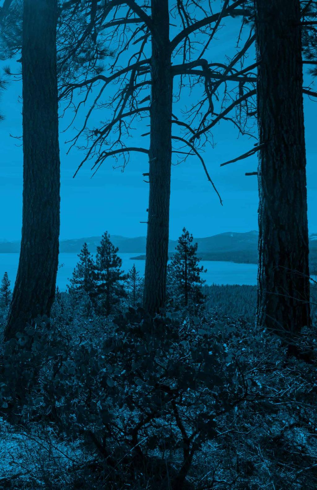
2 OVERVIEW Lake Tahoe is an iconic destination for mountain biking. With crystal blue waters surrounded by mountain peaks on all sides, the area is one of the most scenic places you ll ever ride. Most of the trails in the area are managed for the US Forest Service - Lake Tahoe Basin Management Unit. With a wide range of motorized routes and trails, Lake Tahoe is a great place to ride emtbs. SEASON Spring to Fall PLEASE FOLLOW THESE GENERAL GUIDELINES FOR RESPONSIBLE EMTB RIDING: On federal, state, county and local trails, emtb access varies significantly. General speaking, any natural surface trail designated for both motorized and non-motorized use is open to emtbs. emtbs may not be allowed on trails managed for non-motorized activities. Do not ride your emtbs in areas where the local rules are unclear. When in doubt, ask your local land manager about access, since local land rules change frequently. PeopleForBikes and the Bicycle Product Suppliers Association are working to promote sensible access to emtbs. It is critical that emtb riders ride legally and only on authorized trails to show that all mountain bikers are responsible users.

3 Class 1 Electric Mountain Bikes Only Class 2 and Class 3 Prohibited 2 1 BARKER PASS LOOP 8.9 MILES» 1,417 elevation gain» Mix of steep 4x4 doubletrack road and paved road 3 KINGS BEACH LOOPS 4.6/10.3 MILES 1 SHORT LOOP» 775 elevation gain» Mix of double-track/singletrack with sections of roots/rocks LONG LOOP» 1,774 elevation gain» Mix of doubletrack/singletrack with sections of roots/rocks 3 KINGSBURY-STINGER TRAIL 5.3 MILES» 1,482 elevation loss» Singletrack» Point-to-point 3 4 CORRAL TRAIL LOOP 9.2 MILES» 1,397 elevation loss» Mix of road and singletrack (with bike-optimized features) BEYOND THIS POINT 4

4 1BARKER PASS LOOP 8.9 MILES.59 TH BACKGROUND» 8.9 miles» 1,417 elevation gain» Mix of steep 4x4 doubletrack road and paved road» Loop» Big open pine forest, and open to motorized vehicles» N Barker Pass Road DESCRIPTION From the campground parking area, head west on the doubletrack, #15N38. The route is easy-going at first as it passes through meadows and past big trees. The grade gets steeper gradually and then is a steady uphill grind all the way to Barker Pass Road. Descend the paved road or retrace your steps and enjoy the dirt downhill ride on #15N38. ACCESS From the USFS office (35 College Dr., South Lake Tahoe), drive north on Al Tahoe Blvd for 0.4 miles. Turn left on Lake Tahoe Blvd and drive 2 miles to take a right on Emerald Bay Rd (CA-89N). Drive 23 miles to Barker Pass Rd. Turn left and drive 2.25 miles to a parking area on the right.

5 2KINGS BEACH LOOPS MILES BACKGROUND SHORT LOOP» 4.6 miles» 775 elevation gain» Mix of double-track/singletrack with sections of roots/rocks» Loop» Big pine forest LONG LOOP» 10.3 miles» 1,774 elevation gain» Mix of doubletrack/singletrack with sections of roots/rocks» Loop» Big pine forest DESCRIPTION SHORT LOOP Start at the small trailhead and kiosk and ride up the road to.40 OHV Route #18E18F. This is a rocky singletrack track that climbs steadily.52 with some very steep sections. At the intersection with 16N52, continue straight onto doubletrack. Turn left #18E18, singletrack with lots of fun and flow. At the bottom of the route, look for a left turn on #18E18B and then left again #16N87. This will take you back to the beginning of the ride LONG LOOP 1.90 LONG LOOP Start at the small trailhead and kiosk and ride up the road to OHV Route #18E18F. This is a rocky singletrack track that climbs steadily with some very steep sections. At the intersection with #16N52, continue straight onto doubletrack. Follow this past an intersection with #18E18 all the way to #16N66. Stay right here and then hang a left at 16N55. Pedal doubletrack to #18E04. Turn left here and enjoy fun singletrack to 16N52. Stay left and follow the road to the intersection with #18E18. Turn right here and ride singletrack downhill with lots of fun and flow. At the bottom of the route, look for a left turn on #18E18B and then left again #16N87. This will take you back to the beginning of the ride. ACCESS From the Coon St roundabout in Kings Beach, drive east 0.4 miles to Beaver St. Turn left and drive 1.1 miles to a small parking area with a kiosk (GPS location: , ) KINGS BEACH SHORT LOOP 0.49 TH

6 3KINGSBURY-STINGER TRAIL 5.3 MILES 5.32 Andria Drive 0.43 TH BACKGROUND» 5.3 miles» 1,482 elevation loss» Singletrack» Point-to-point» Big pine forest with occasional views of Lake Tahoe» DESCRIPTION This is a flowy trail with some moderately challenging sections, that travels through big pine forests at the top. The forest is both open and narrow with some tight corners through giant granite boulders. In the lower section of the trail, you can catch glimpses of Lake Tahoe. ACCESS From the USFS office (35 College Dr., South Lake Tahoe), drive 1 mile north on Johnson Blvd. to Lake Tahoe Blvd. Turn right and drive 2.3 miles to Kingsbury Grade Rd. Turn right again and drive 2.8 miles to N Benjamin Rd. Continue onto Andria Dr. and drive 0.8 miles to the Tahoe Rim Trail trailhead (GPS location: , ).
» Loop» Open forest with big pines» https://www.mtbproject.")
7 4SIDEWINDER-CORRAL TRAIL LOOP 9.2 MILES Railroad Grade Trail #18E15 FSR #12N BACKGROUND» 9.2 miles» 1,397 elevation loss» Mix of road and singletrack (with bike-optimized features)» Loop» Open forest with big pines» DESCRIPTION The Corral Trail Loop is another dose of good singletrack riding with bikeoptimized features. For the ride, use USFS Road 1201 to access Corral Trail (#18E14) and Sidewinder Trail (#18E14A). Start on Sidewinder, a mix of tech and flow in thick forest. Hop on the Corral Trail at a three way intersection. The forest opens here, and the trail has an endless stream of bike-optimized features like rollers and berms. At the bottom, turn left onto Powerline (#12N08) and again on Saxon Tie Rd (#12N17) to ride back to the beginning of the route. ACCESS From the USFS office (35 College Dr., South Lake Tahoe), drive south for 1.1 miles to Pioneer Trail. Turn right and drive 4.6 miles to Oneidas St. Go another 0.5 miles and turn left on Fountain Place Rd. Drive 0.4 miles to the parking area. TH
8
9 peopleforbikes.org/e-bikes
Explore the outdoors in Shelby County
 Explore the outdoors in Shelby County Oak Mountain Trail GPS: 33.283831-86.865238 Trail Location: Address: Oak Mountain State Park Trail 200 Terrace Drive Pelham, AL 35124 Type of Trail: Walking, Mountain
Calaveras Big Trees State Park--South Grove Loop
 Copyright 1999 by Jeff Robinson. You are free to use and reproduce this description for personal, not-for-profit, and not-forbusiness use. Any reproduction other than for personal use, including businesses,
HURL ELKHORN 50K RUN AID STATIONS COURSE MARKINGS
 HURL ELKHORN 50K RUN AID STATIONS The race starts and finishes at Crystal Creek Campground, where primitive camping is available. The race starts at 7:00 am. The finish cut off time is 9:00 pm. No drop
Gravel Bike Guide Haywood County
 Gravel Bike Guide Haywood County Haywood County is an ideal place for bicycling on gravel roads, because 37% or 129,994 acres of Haywood County is federal property, including portions of the Pisgah National
Pah Rah Mountain Range
 Pah Rah Mountain Range The Pah Rah Mountain Range is located east of the city of Sparks, and parallels Vista Boulevard. The mountain range originates at Interstate 80, and terminates at Pyramid Lake. Most
Biking Trails near Invermere, BC. Lillean Lake Along the Johnson Bike Trails. Spirit Trail Columbia Lake
 Biking Trails near Invermere, BC Lillean Lake Along the Johnson Bike Trails - To get there: From Invermere, take the Panorama Road Mount Swansea Biking and Hiking Trails Spirit Trail Columbia Lake IMBA
Douglas A. Ormseth Shortgrass Web Development
 Douglas A. Ormseth Shortgrass Web Development doug@shortgrass.com 406-261-1115 (Note: others have proposed some of these ideas already in the Black Eagle Community Visioning document and on the Rivers
Fish Lake Team Relay Course Information 2016
 Fish Lake Team Relay Course Information 2016 Fish Lake Team Relay Course Information 2016 The Fish Lake Team Relay begins at Fish Lake Lodge on the shores of beautiful Fish Lake located in Sevier County,
Trail Notes Local Mountain Bike Areas
 Trail Notes Local Mountain Bike Areas Campus Recreation 875 Perimeter Drive MS 1230 Moscow. Idaho 83844-1230 Ph: 208.885.6810 Rentals: 208.885.6170 Fax: 208.885.6879 uidaho.edu/outdoorprogram 1 Table of
Fish Lake Team Relay Course Information
 Fish Lake Team Relay Course Information Fish Lake Team Relay Course Information The Fish Lake Team Relay begins at Fish Lake Lodge on the shores of beautiful Fish Lake located in Sevier County, Utah. The
Heathcote to Engadine via Audley
 Heathcote to Engadine via Audley 6 hrs 3 mins 5 km One way Hard track 4 635m Covering a large section of central Royal National Park, this walk goes through the heath and scrub along a well managed and
LOCATION Machico, Madeira Island, Portugal REGISTRATION CATEGORIES PROTECTION RULES. Document created by MADproductions
 LOCATION Machico, Madeira Island, Portugal REGISTRATION CATEGORIES PROTECTION RULES COURSE DESCRIPTION By António Abreu, MADproductions LINK 1 (4,96km - 208hmm uphill - 11hm downhill) Start the race at
9. APPENDICES Disciplines of Mountain Biking
 9. APPENDICES 9.1. Disciplines of Mountain Biking Cross-country Cross-country mountain biking is the oldest discipline within the sport and is analogous to cross-country running or skiing. It involves
Caerlee: Average Age = 6 (June 2017)
") Caerlee: Average Age = 6 (June 2017) Safety Able to follow M Check Take part in 10 minute blocks of cycling or coaching. Equity/ Social Able to interact and share with peers. Plays by the rules. Confident
Caerlee: Average Age = 6 (June 2017) Safety Able to follow M Check Take part in 10 minute blocks of cycling or coaching. Equity/ Social Able to interact and share with peers. Plays by the rules. Confident
Echo Point to Leura Forest via Three Sisters and Giant Stairs loop
 Echo Point to Leura Forest via Three Sisters and Giant Stairs loop 3 hrs 3.8 km Circuit Hard track 512m This walk starts from the popular Echo Point, in Katoomba, and winds down to the base of the Three
USA Cycling Mountain Bike Cross-country Marathon National Championships
 USA Cycling Mountain Bike Cross-country Marathon National Championships Tech Guide Columbia County, Georgia June 4, Held in conjunction with the Wildwood Games Rev. 6/2/16 Welcome to the USA Cycling Mountain
To Benefit the Wachusett Mountain Race Team!
 To Benefit the Wachusett Mountain Race Team! Handbook Outline: Race Overview & Events Schedule....3 Leg 1: 5-mile Run... 4 Leg 2: Scenic Bike Race.....5 Leg 3: Summit Climb......6 Leg 4: Ski Run...7 Application.....8
Ride Center Evaluation Criteria
 Ride Center Evaluation Criteria Singletrack Trail Mileage Minimum Qualifications Quality Trail Experience Objective Scoring Total Minimum Total Qualification Score Miles Kilometers Score Score Level Score
Mountain Biking LA GRANDE OREGON. By Brian Sather & Mark Larson
 Mountain Biking LA GRANDE OREGON By Brian Sather & Mark Larson 2006 by Recreation Publishing. Summerville, Oregon. All rights reserved. No part of this book may be reproduced for sale. Only limited material
Trail Proposal #1; May 14, 2005
 Trail Proposal #1; May 14, 2005 Dennis Kaltenbruner Bow Cycle Dean Cockshutt Mountain Toys Dave Sheridan GPS map Coord. Plus many others! Rocky Mountain Dirt Riders Association (RMDRA), on behalf of all
PARTICIPANT GUIDE 2018 TO THE 25 th ANNUAL EVENT!
 PARTICIPANT GUIDE 2018 TO THE 25 th ANNUAL EVENT! GETTING HERE Find US-41 and head north. Yup, just head north. US-41 ends/begins in Copper Harbor. The main trailhead is right in the middle of town next
Maintenance. Maintenance. Design. Construction. Planning. Bike-Friendly Techniques. PNW Techniques. Tools, Special Considerations
 Maintenance Planning Design Construction Maintenance Objectives: Style, Audience, Skill Level, Connections Bike-Specific vs. Bike- Friendly Multi-Use Resources, Funding, Volunteers Permission, Permitting,
Welcome to the 3 day Leadville Stage Race!
 Welcome to the 3 day Leadville Stage Race! This Year marks the 23rd anniversary of the first Leadville Trail 100 mountain bike race. We are excited to have you join us for the second year of this challenge.
Event History: Kevin Tilton Steve Peterson Paul Young
 Event History: Northfield enters its fifth year as part of the Western Mass. Athletic Club (WMAC) snowshoe series. Northfield has served as a regional qualifier for the USSSA national championship and
UNH CYCLING Presents: ECCC Conference Championships at Highland Mountain Bike Park October 7 & 8, 2017
 UNH CYCLING Presents: ECCC Conference Championships at Highland Mountain Bike Park October 7 & 8, 2017 Promoter: Nate LaTourette ndl1002@wildcats.unh.edu Co-Promoter: Tim Putnam tjp1001@wildcats.unh.edu
Bureau of Land Management National Mountain Bike Action Plan
 Bureau of Land Management National Mountain Bike Action Plan IMBA World Summit, 2016 BLM National Mountain Bike Strategy (1992) National Mountain Bicycling Strategic Action Plan (2002) National Mountain
UNH CYCLING Presents: ECCC Conference Championships at Highland Mountain Bike Park October 6 & 7, 2018
 UNH CYCLING Presents: ECCC Conference Championships at Highland Mountain Bike Park October 6 & 7, 2018 Promoter: Nate LaTourette ndl1002@wildcats.unh.edu Co-Promoter: Tim Putnam tjp1001@wildcats.unh.edu
Ft. Tuthill Bike Park. design proposal
 Ft. Tuthill Bike Park design proposal What is this? A bicycle skills park is specially designed to provide riders a place to practice skills, learn to jump, have fun on mountain bikes, and watch and encourage
Engineering Report: Apache-Sitgreaves National Forests. Black Mesa Ranger District. Analysis of. National Forest System Roads (NFSRs) #s 504 & 169
 #s 504 & 169") Engineering Report: Apache-Sitgreaves National Forests Black Mesa Ranger District Analysis of National Forest System Roads (NFSRs) #s 504 & 169 for Motorized Mixed Use Designation Forest: Apache-Sitgreaves
Engineering Report: Apache-Sitgreaves National Forests Black Mesa Ranger District Analysis of National Forest System Roads (NFSRs) #s 504 & 169 for Motorized Mixed Use Designation Forest: Apache-Sitgreaves
Carrington Park to Leura Forest and pass loop
 Carrington Park to Leura Forest and pass loop 3 hrs Hard track 4.8 km Circuit 4 674m This walk is a fantastic way to see Leura Forest. The walk descends from Carrington Park, visiting Leura Forest and
RACE BOOK. Revised 05/12/18. Round California Enduro Series Snow Summit Mountain Resort Enduro Big Bear Lake, CA July 28 th July 29 th, 2018
 RACE BOOK Revised 05/12/18 Round 5 2018 California Enduro Series Snow Summit Mountain Resort Enduro Big Bear Lake, CA July 28 th July 29 th, 2018 Crafts and Cranks Crafts and Crank is a bike race and beer
Trail and Driving Directions
 Trail and Driving Directions GETTING TO THE START: FROM CADILLAC: Follow M-55 west from US131 for 20.9 miles to the corner of M-37 and M-55 FROM THE INTERSECTION OF M-55 AND M-37: Head west on M-55 2.7
2018 Greenway Challenge. Up River Course Maps and Cue Sheets
 2018 Greenway Challenge Up River Course Maps and Cue Sheets Segment 1 2 laps with in- water mass start for 2.7 mile Open Water Paddle (2x 1.35 mile loop) on Olney Pond at Lincoln Woods State Park, Lincoln,
Androscoggin River Trail Access Sites. Mahoosucs. 168 miles from its source at Lake Umbagog to Merrymeeting Bay
 Androscoggin River Trail Access Sites Mahoosucs 168 miles from its source at Lake Umbagog to Merrymeeting Bay Trail Under Construction More than 40 Public Access Sites Available Androscoggin River Watershed
Leveraging Active Transportation & Recreation for Economic Development in Rural VT Vermont Bike Walk Summit
 Leveraging Active Transportation & Recreation for Economic Development in Rural VT 2018 Vermont Bike Walk Summit 5.4.18 MRV Moves Active Transportation Plan Scope & Purpose Watershed-wide long-range
APRIL LAGUNA SECA RECREATION AREA, MONTEREY, CALIFORNIA 2019 BICYCLE DEMO MANUAL
 APRIL 11-14 2019 LAGUNA SECA RECREATION AREA, MONTEREY, CALIFORNIA 2019 BICYCLE DEMO MANUAL BICYCLE DEMO MANUAL 2 Please review and share this information with the individual(s) responsible for managing
Darrington Rock Climbing Sampler. Page 1. a mini-guide to some routes in Clear and Copper Creeks
 a mini-guide to some routes in Clear and Copper Creeks Joe near the top of Exfoliation Dome. Near Darrington, Washington, there are several granite domes in scenic mountain valleys. This is not sport climbing:
Parks, Open Space, Trails and Recreation Master Plan
 5.3 DEFINITIONS AND VOCABULARY In order to fully understand the range of trails that have been developed, and should be developed, throughout the community, a vocabulary needs to be established for the
Operational Policy. Queensland Parks and Wildlife Service. Mountain biking in QPWS managed areas. Visitor Management. 1 Purpose
 Queensland Parks and Wildlife Service Operational Policy Visitor Management Mountain biking in QPWS managed areas Operational policies provide a policy direction or set operational standards for day-to-day
Williams Lake WestSyde Trail Network
 Williams Lake WestSyde Trail Network This is an intermediate to advanced network with many beginner options. The Westside network has 40 trails with over 97Km of singletrack, including the legendary Box
PARADISE VALLEY TRAIL GUIDE
 PARADISE VALLEY TRAIL GUIDE 4949 East Lincoln Drive Paradise Valley, AZ 85253 (480) 627-3200 omnihotels.com/montelucia omnihotels.com/montelucia HIKE, RUN & RIDE IN PARADISE VALLEY The beautiful weather
USA Cycling Mountain Bike Cross-country Marathon National Championships
 USA Cycling Mountain Bike Cross-country Marathon National Championships Tech Guide Columbia County, Georgia May 2, Held in conjunction with the Wildwood Games Welcome to the USA Cycling Mountain Bike Marathon
WILD AND SCENID ELIGIBILITY ANALYSIS FOR RECREATION San Juan Forest and BLM
 WILD AND SCENID ELIGIBILITY ANALYSIS FOR RECREATION San Juan Forest and BLM Draft 5/3/06 I. Region of comparison: The interdisciplinary team must identify the area of consideration that will serve as the
Canoe Route. Dogtooth Lake-Highwind Lake-Dryberry Lake- Lake of the Woods-Blindfold Lake
 1 Canoe Route Dogtooth Lake-Highwind Lake-Dryberry Lake- Lake of the Woods-Blindfold Lake This is an interesting and challenging route starting and ending at Rushing River Provincial Park. It passes over
RACE BOOK 2018 California Enduro Series Mammoth Bar Enduro Auburn, CA June 16, 2018
 RACE BOOK 2018 California Enduro Series Mammoth Bar Enduro Auburn, CA June 16, 2018 Location Registration Categories Mammoth Bar OHV, Auburn SRA, Auburn, CA Old Foresthill Road - Auburn, CA 95603 Registration/Packet
Scenic World to Echo Point
 Scenic World to Echo Point 1 hr 15 mins 2.1 km One way Moderate track 192m This is one of the most popular tourist walks in the Katoomba area. The walk follows the cliffs along a well maintained and signposted
Thrash and Bash at Attitash
 Thrash and Bash at Attitash September 7 & 8 Peter McNulty 508-404-4820 pmcnulty92@gmail.com USAC Permit: 2013-3156 I. Schedule Saturday, September 7th 7:30 AM Registration Opens at Adventure Center Lodge
BSA Cycling Merit Badge. Created: April 2017 Updated: May 2017
 BSA Cycling Merit Badge Created: April 2017 Updated: May 2017 MB Counselor Cycling Merit Badge Dan Marsalek 7247 Tottenham Rd. Toledo, Ohio 43617 Cell: 419-279-0217 E-Mail: DMarsalek@hotmail.com Schedule
Uphill Flow. The new emtb mode for the Performance Line CX. RETROFIT NOW at your specialist dealer. Bosch ebike Systems 2018 EN
 Uphill Flow The new emtb mode for the Performance Line CX RETROFIT NOW at your specialist dealer Bosch ebike Systems 2018 EN The new emtb mode for the Performance Line CX in detail Optimised Direct Flow
Uphill Flow. The new emtb mode for the Performance Line CX. RETROFIT NOW at your specialist dealer. Bosch ebike Systems 2018 EN
 Uphill Flow The new emtb mode for the Performance Line CX RETROFIT NOW at your specialist dealer Bosch ebike Systems 2018 EN Performance Line CX The highlights Uphill Flow Experience the fascination of
I-5 Colonnade Mountain Bike Skills Park. Phase 2. High Level Design & Trail Standards
 I-5 Colonnade Mountain Bike Skills Park Phase 2 High Level Design & Trail Standards Table of Contents OVERVIEW... 3 INTRODUCTION...3 ACKNOWLEDGEMENTS... 3 PURPOSE AND SCOPE... 4 DESIGN FLEXIBILITY... 4
COMPETITOR INFO PACK. Page 1
 2016 COMPETITOR INFO PACK Page 1 3 Page 2 75k 50k 25k Race start time 75km Competitors & Teams Race Start: 8am Briefing: 7:45am 50km Competitors Race Start: 9am Briefing: 8:45am 25km Competitors Race Start:
La Madre Wilderness Area
 La Madre Wilderness Area Rock Climbing Inventory Statistics: Area: Walls La Madre North 3 24 136 22 Kraft Mt./Gateway Canyon White Rock Springs Willow Springs East The Promised Land 18 4 3 3 12 23 11 24
Androscoggin River Trail Access Sites. Mahoosucs. 168 miles from its source at Lake Umbagog to Merrymeeting Bay
 Androscoggin River Trail Access Sites Mahoosucs 168 miles from its source at Lake Umbagog to Merrymeeting Bay Trail Under Construction More than 40 Public Access Sites Available Androscoggin River Watershed
Bikeability Checklist
 Bikeability Checklist How bikeable is your community? Riding a bike is fun! Bicycling is a great way to get around and to get your daily dose of physical activity. It's good for the environment, and it
Incredible Electromotive Systems. A kit that converts mountain bikes to electric mountain bikes.
 Incredible Electromotive Systems. A kit that converts mountain bikes to electric mountain bikes. Hermes by Paradox Kinetics. Precision and perfection, down to the last detail. Paradox Kinetics is a company
2016 North Country Trail Relay Updated Event Instructions Jan 2016
 Welcome to the 2016 North Country Trail Relay (NCTR). organized by Bev Chesebro and Doug Bostian The race is run on the North Country National Scenic Trail, which is a footpath that one day will stretch
THE FIRST MOUNTAIN BIKE TRAIL CENTRE IN THE GCC & MIDDLE EAST
 THE FIRST MOUNTAIN BIKE TRAIL CENTRE IN THE GCC & MIDDLE EAST INTRODUCTION WELCOME TO HATTA TRAIL CENTRE WEBSITE Hatta Trail Centre is a first MTB Centre in the Middle East, and is a home to multiple cross
2 MISSION HYBRID RIDE HARDER 3
 HYBRID TWO THOUS AND 18 2 MISSION HYBRID RIDE HARDER 3 DT Swiss is on a mission, a mission to bring emtb riders the components they need. The people behind this mission are people who know, understand
Eligibility: You must have completed at least one 100 Mile TRAIL RUN or a qualifying 50 Miler (see website for 50 mile qualifying events).
.") Cruel Jewel 100 Mile Course Description The Cruel Jewel 100 is a 108 mile foot race deep with in the beautiful Chattahoochee National Forest of the North Georgia Mountains. It consists of 95 miles of trails,
Cruel Jewel 100 Mile Course Description The Cruel Jewel 100 is a 108 mile foot race deep with in the beautiful Chattahoochee National Forest of the North Georgia Mountains. It consists of 95 miles of trails,
RACE BOOK. Round California Enduro Series Battle Born Enduro Reno, NV May 14, 2016
 RACE BOOK Round 2 2016 California Enduro Series Battle Born Enduro Reno, NV May 14, 2016 Location Rancho San Rafael Regional Park 1595 N. Sierra Street Reno, NV 89503 Address does not always work in mapping
Tour de Wyoming 2015 Route Overview:
 Tour de Wyoming 2015 Route Overview: Route Overview: Gather in Sundance on July 11 Day 1 (July 12): Sundance to Newcastle via Upton Day 2 (July 13): Newcastle to Custer via Wind Cave NP Day 3 (July 14):
2018 Athlete Guide. September 8, Coconino/Kaibab National Forests Flagstaff, AZ
 2018 Athlete Guide September 8, 2018 Coconino/Kaibab National Forests Flagstaff, AZ Welcome, Athletes! BlueWolf Events proudly presents the 2018 CenturyLink Barn Burner MTB Race. Not only will you love
General Design Factors
 Chapter 3: 3-1.0 Introduction General Design Factors Mn/DOT s goals include encouraging and accommodating safe bicycling. From a design perspective, these goals are achieved by first having an understanding
Trail Objec ves. Eleva on Profile. Trail Alignment. Warburton Mountain Bike Trails Design & Masterplan. Trail ID Status Length Difficulty Style
 13A Proposed 2.95 km Advanced Cross country 400m 246m Connec vity Exercise Hey Hey My My is 3,000m of old-school technical Cross-Country/ All Mountain trail. Built by hand on the western slopes of Minesha
Queen Creek Canyon. Guidebooks The Rock Jocks Guide to Queens Creek Canyon by Marty Karabin Jr.
 is one of Arizona s best winter climbing destination. The area is about 1 1/2 hours east of hoenix and elevation is around 4000 feet. The rock is a thick formation of ash that was deposited between 15
BIKE ON ROAD NETWORKS: URBAN & RURAL. Non-motorized Transportation Networks. Madison County Council of Governments
 ON ROAD NETWORKS: URBAN & RURAL Non-motorized Transportation Networks Madison County Council of Governments 16 E. 9 th Street Anderson, IN 46016 99 th ANNUAL PURDUE ROAD SCHOOL MARCH 5-7, 2013 PRESENTATION
Dirt Mountain Bike Magazine # 118 December 2011
 Dirt Mountain Bike Magazine # 118 December 2011 Mountain Bike Philippines - Home - MOUNTAIN BIKE PHILIPPINES VOL.3 See you all this weekend at the Nuvali Dirt Weekend Now officially available at your favorite
Commitment like this is hard to find. Thank you for riding with us in Leadville!
 Welcome to the 3 day Leadville Stage Race! This Year marks the 23rd anniversary of the first Leadville Trail 100 mountain bike race. We are excited to have you join us for the second year of this challenge.
Gerald Desmond Bridge Replacement: The Severance of a Major Bicycling and Ped Route
 GDB Bike Ped Access R3.0 Slide # 1 Gerald Desmond Bridge Replacement: The Severance of a Major Bicycling and Ped Route Dan Gutierrez CABO D7 Director GDB Bike Ped Access R3.0 Slide # 2 Overview Literally!
TR0WBRIDGE FOREST RECREATION TRAIL MASTER PLAN MOUNTAIN BIKING MULTI USE NORDIC
 TR0WBRIDGE FOREST RECREATION TRAIL MASTER PLAN MOUNTAIN BIKING MULTI USE NORDIC City of Thunder Bay / April 2017 Executive Summary The Trowbridge Forest trail system which includes Centennial Park, Shuniah
Summary of Research RESULTS SAFETY TRAINING. Selected Results From a 2006 Survey of Registered Off-Highway Vehicle (OHV) Owners in Montana YES 44%
 Owners in Montana YES 44%") Summary of Research Selected Results From a 2006 Survey of Registered Off-Highway Vehicle (OHV) Owners in Montana RMU Research Summary No. 21 Michael S. Lewis and Ray Paige July 2006 In the last decade,
Summary of Research Selected Results From a 2006 Survey of Registered Off-Highway Vehicle (OHV) Owners in Montana RMU Research Summary No. 21 Michael S. Lewis and Ray Paige July 2006 In the last decade,
2017 Racer Manual Desert RATS mtb Classic
 2017 Racer Manual Desert RATS mtb Classic May 13, 2017 Fruita, CO Hello Racers and Crews! We can t wait to see all of you this May - hopefully with fresh legs and a powerful spirit, ready to start the
OTSO VOYTEK. Otso Cycles is a new bicycle company from the engineers. Designed to excel in any condition BIKE TEST / OTSO VOYTEK
 BIKE TEST / Designed to excel in any condition Otso Cycles is a new bicycle company from the engineers at Wolf Tooth Components. One might ask where they got this unique name, and the founders are happy
Building a mountain bike trail system through partnerships to boost economic development, youth opportunities, and build community
 One Wheel at a Time Building a mountain bike trail system through partnerships to boost economic development, youth opportunities, and build community Briget Eastep, Southern Utah University, Director
Timing: 2 days Grade: AD- / Moderate snow slopes some steep climbing - Beginner suitable
 PERUVIAN ANDES ADVENTURES CLIMB VALLUNARAJU 5686m (18655 ft) Timing: 2 days Grade: AD- / Moderate snow slopes some steep climbing - Beginner suitable Eli & Rolando Morales & the Peruvian Andes Dog (Cholo)
NORISMAN TRIATHLON 2017
 NORISMAN TRIATHLON 2017 We are excited to announce our epic Triathlon Event hosted by Fil-Am Tri club and Optimum Care Therapy and Optimum Multisport. This is a Swim-Bike-Run Triathlon from Long Beach
Sharrows and Elephants and Bike Boxes!, s, Oh My!
 Sharrows and Elephants and Bike Boxes!, s, Oh My! New Traffic Control Devices on Vancouver s Bike Routes David Rawsthorne, P.Eng. City of Vancouver Engineering g Services CITE Quad Conference, May 2009
Mountain Biking At Mammoth Mountain. Trek Media Event June 27, 2018
 Mountain Biking At Mammoth Mountain Trek Media Event June 27, 2018 Mammoth Mountain Some History Mammoth Mountain Some History Dave McCoy began skiing Mammoth Mountain in the 1930 s and opened the first
SOUTH MOUNTAIN TRAILS - THE DEFINITIVE GUIDE Lehigh University, Bethlehem PA. By Daniel McCauley
 SOUTH MOUNTAIN TRAILS - THE DEFINITIVE GUIDE Lehigh University, Bethlehem PA By Daniel McCauley DESCRIPTION: The South Mountain Trail Network is an extensive network of intermediate jeep roads to extreme
REGIONAL MUNICIPALITY OF WOOD BUFFALO BIKE PARK OPEN HOUSE. RMWB BIKE PARK IBI Group NOVEMBER 7, 2013
 REGIONAL MUNICIPALITY OF WOOD BUFFALO BIKE PARK OPEN HOUSE SITE CONTEXT SITE 1 NORTH PARSONS CREEK LANDS SITE 2 SILIN FOREST ROAD SITE 3 LOWER WOLVERINE SITE 4 REAL MARTIN DRIVE PARSONS CREEK TIMBERLEA
Federal Pass Walking Track
 Federal Pass Walking Track 5 hrs Hard track 8 km One way 4 989m This classic trail follows along the base of the cliffs from Leura to the Golden Stairs, passing many of the more popular sights of the Katoomba
2016 Brown County Epic Mountain Bike Festival General Information
 2016 Brown County Epic Mountain Bike Festival General Information Brown County Epic Registration Information *2016 Epic Rides will take place on Saturday again this year. Event camping offered Thursday
The 2012 AASHTO Bike Guide: An Overview
 The 2012 AASHTO Bike Guide: An Overview Presentation by: Jennifer Toole, AICP, ASLA Peter Lagerwey August 10, 2012 {Enter Module Name on Master Slide} WEBINAR #1: OVERVIEW OF 2012 AASHTO BIKE GUIDE Today
distance Easy/Moderate
 Experience Rating Easy/Moderate distance 40km (25m) Cycling route: 40km (25 miles) Cycling in: The Great Waterway, Prince Edward County Number of days cycling: 1 Recommended number of nights stay: 2 Experience
2015 Brown County Epic Mountain Bike Festival General Information
 2015 Brown County Epic Mountain Bike Festival General Information Brown County Epic Registration Information * Changes in 2015 Epic Rides will take place on Saturday! Demos on Saturday and Sunday Registration
CITY OF ELKO BICYCLE AND PATHWAY PLAN
 CITY OF ELKO BICYCLE AND PATHWAY PLAN INTRODUCTION: The City of Elko is intended to provide the basic framework for the development of a functional bicycle and pathway system for the community with connections
HUNTSMAN WORLD SENIORGAMES MOUNTAIN BIKING OCTOBER15-16,2018 H U N T S M A N W O R L D S E N IO R G A M E S. #worldseniorgames
 MOUNTAIN BIKINGBIBLE OCTOBER 15-16,2018 - ST.GEORGE,UTAH - USA H U N T S M A N W O R L D S E N IO R G A M E S CHALLENGE YOURSELF.CHALLENGE THE WORLD HUNTSMAN WORLD SENIORGAMES MOUNTAIN BIKING OCTOBER15-16,2018
Trails that Transform: The Economic Impact of Bicycle Tourism
 Trails that Transform: The Economic Impact of Bicycle Tourism September 2016 Economic Growth Summit Alta Planning + Design Nation s leading team of bicycle, pedestrian, greenways, and trails planning and
Leg #1 (GUNLOCK AND LOADED) Miles
 Miles") Leg #1 (GUNLOCK AND LOADED)- 6.07 Miles Difficulty: Easy to Moderate This is a nice leg for those who like running downhill. It s a beautiful run down the Santa Clara River canyon to the point where the
Leg #1 (GUNLOCK AND LOADED)- 6.07 Miles Difficulty: Easy to Moderate This is a nice leg for those who like running downhill. It s a beautiful run down the Santa Clara River canyon to the point where the
USA CYCLING PERMIT A Three-Day USA Cycling Sanctioned Stage Race. March 18, 19, 20, 2016
 USA CYCLING PERMIT 2016-411 A Three-Day USA Cycling Sanctioned Stage Race March 18, 19, 20, 2016 Revised 9 March 2016 Welcome to the 30 th Annual Tucson Bicycle Classic; Southern Arizona s premier three-day
Coyote Buttes/The Waves
 Coyote Buttes/The Waves Ron Ross December 22, 2007 Coyote Buttes is located in the Paria Canyon-Vermilion Cliffs Wilderness just south of US 89 about halfway between Kanab, Utah and Page, Arizona. The
State Route 28 Shared Use Path & Safety/Stormwater Enhancements Public Information Meeting
 State Route 28 Shared Use Path & Safety/Stormwater Enhancements Public Information Meeting Thursday, March 30, 2017 4-7 p.m. Presentation at 5:30 p.m. The Chateau at Incline Village 955 Fairway Blvd. Incline
Pima County Mountain Biking Program
 Pima County Mountain Biking Program Published by the Pima County Bicycle and Pedestrian Program Introduction The Pima County Mountain Biking Program has been developed to further educate riders of the
Hunters Hill to Epping Road
 Hunters Hill to Epping Road 2 hrs 30 mins 5.5 km One way Moderate track 154m An enjoyable walk through lower sections of the Lane Cove National Park, this walk features plenty of mangroves next to the
MOUNTAINTOWN CREEK TRAIL ASSESSMENT Prepared for Georgia ForestWatch by David Govus and Joseph Govus May 2012
 MOUNTAINTOWN CREEK TRAIL ASSESSMENT Prepared for Georgia ForestWatch by David Govus and Joseph Govus May 2012 This assessment was performed by Georgia ForestWatch ( ForestWatch ) with input from Ralph
Broaddus Loop. Lufkin & Angelina County Bicycle Route. Total Miles:
 Lufkin & Angelina County Bicycle Route Total Miles: 72.6 www.visitlufkin.com Route Directions: Segment Distance Direction of Total Distance Road Traveled (miles) Turn (miles) Start Lufkin High School
By: Enduro Mountain Bike Magazine Published: August 3, 2015
 First Ride: Cannondale Habit Trailbike By: Enduro Mountain Bike Magazine Published: August 3, 2015 It has been a long wait but worth every second; last week the crew from Cannondale presented the Habit,
City of Charlottesville Bicycle and Pedestrian Master Plan Update
 City of Charlottesville Bicycle and Pedestrian Master Plan Update September 17, 2014 I. Welcome and meeting overview II. Project status update III. Network overview IV. Break-out groups Pedestrian Network
Hillside STA Extension
 Hillside STA 2017 Extension History of STA Hillside Singletrack Advocates formed in 2004 to represent mountain bikers amongst the various user groups First STA project completed in 2005 Brown Bear trail