Leads you on 28 adventures into the beautiful scenery and wild swimming paradise of Dartmoor and South Devon. Discover wooded river pools and
|
|
|
- Amanda Harmon
- 5 years ago
- Views:
Transcription
1

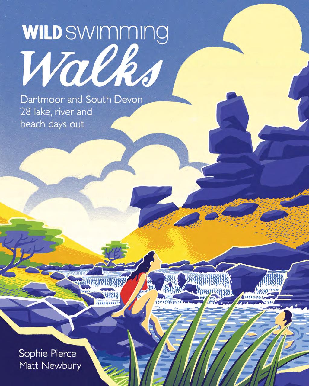
2 wild swimming walks Leads you on 28 adventures into the beautiful scenery and wild swimming paradise of Dartmoor and South Devon. Discover wooded river pools and tumbling waterfalls, secret coves and amazing sea caves, safe in the company of Devon s two most intrepid and fun-loving explorers. All the walking routes include places to swim and ideas for pubs and refreshments along the route.


3 Sophie Pierce lives on the edge of Dartmoor and started the South Devon Wild Swimming Club after getting caught in a rip-current during a New Year s Day dip. She has worked as a reporter for the BBC for 20 years. Matt Newbury is a writer and marketing specialist born and raised in Devon. He has completed many swimming challenges including escaping from Alcatraz and swimming to the Isle of Wight. Sophie and Matt are authors of Beyond the Beach: the secret wild swims of Torbay. If you like Wild Swimming Walks you might also like these other titles from WildThingsPublishing.com

4 WILD SWIMMING SAFETY Great Mattiscombe Sand P lan your walk, taking necessary supplies and protection; don t forget water, a map, compass and waterproofs, especially on the moor. Remember that cold water can limit your swimming endurance. If it is your first outdoor swim of the season, be careful to enter the water slowly and acclimatise. Stay close to the shore until you are comfortable. Wear a wetsuit for added warmth and buoyancy. Do not overestimate your ability. Remember that the cold water quickly creates hypothermia shivering is the first stage. Don t enter water without first establishing an exit point, especially in fast-flowing water. Never jump or dive into water without first checking the depth and whether there are any obstructions. Even if you have jumped/dived there before, always check every time. Large obstructions like tree branches and rocks move about underwater and an area that was previously clear may well be blocked. Swim in a group wherever possible or, if swimming alone, let people know your movements and take extra special care. Take extra care following heavy rainfall, when rivers might be in spate and flowing much faster than normal. Watch out in high surf - rip-currents can form which take you out to sea, to behind the breaking waves. Swim perpendicularly from them to escape, then body-surf back in. Beware of tidal currents, especially near estuary mouths and around headlands, especially at mid-tide, and on fortnightly spring tides, when flows are strongest. If you are concerned about water quality, cover cuts and open wounds with plasters and do not swim front crawl. TIDES AND WEATHER CONDiTIONS FOR SOUTH DEVON When planning a swim on the South Devon coast, it s very useful to look at the wind forecast as well as the tides. If you want calm water, you need to know which way the wind is coming from. The prevailing winds in Devon are south westerly, and if this is the case, then choose a swim spot that faces east. Conversely, if the winds are easterly, then it s a good idea to pick a west or south west facing beach. The principle here is that you don t want the wind blowing from the sea onto the land, as the sea is more likely to be rough. Tides are of course very important. Before you go, find out what the tide is doing; it is important to know whether it s going out or coming in. The interesting thing to note about tides in South Devon is that on spring tides (the biggest tides, occurring at the time of the full and new moons), high water will always be at about 6pm, while low water will always be at about noon. 20
5
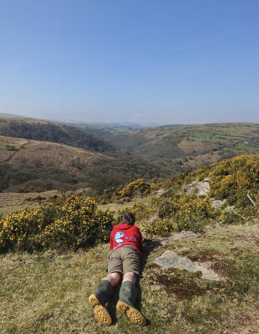
6 Walk 11 Sharrah Pool Circular Experience the raw purity of the River Dart rushing through a wooded gorge, a steep ascent to a remarkable tor, and a picturesque Dartmoor village. You start in ancient woodland, walking past a whole series of cascades, chutes and pools, many of which are suitable for swimming in. This is one of the most beautiful stretches of the River Dart. The water is invariably clear, passing as it does over pure granite. You can normally see trout, as well as minnows and bullheads in the shallows. The woods are gorgeous at all times of the year, whether in the starkness of winter, in the acid green growth of spring, or in the autumn, when fungi, including penny buns, chanterelles and hedgehog mushrooms can be found. After about a quarter of an hour s walk you climb a steep hill to the top of Holne Cliff, from where you can see down to a big pool below. This is known locally as Betsy s Pool, and is off Wellsfoot Island, which has a sandy beach. There are also amazing views up the Dart Gorge from the top of Holne Cliff. You go down the other side of the hill and keep walking until you reach a spectacular waterfall 3, which you need to cross. You are now walking high above the river, and down below are various islands. Eventually you reach a stile, and a few minutes further on you reach Sharrah Pool 4. It is unmistakeable, because it s absolutely huge. It has a most magical waterfall at the top, with enormous rocks, one of which has been christened Elephant Rock by outdoor swimmers. The thing to do is the Sharrah Chute, which involves climbing onto Elephant Rock, and then jumping out into the current and getting swept down like a cork popping out of a champagne bottle. Just down from the cascade, you zoom through a rectangular channel, with walls of granite, before the pool opens out into a vast oval. Once floating in the pool, if you look upstream and then up, you will see the rocky buttress of Bench Tor, overlook- INFORMATION Distance: 5 miles Time: 3 hours Map: OS Explorer Dartmoor OL28 Start Point: Newbridge (SX , TQ13 7NT). Park in the small car park by the road on the Ashburton side of the bridge End Point: Newbridge Public transport: Buses: the X38 from Exeter and Plymouth, and the 88 from Newton Abbot and Totnes. Then you ll need to taxi to the start point Swimming: Sharrah Pool (SX ) on the River Dart, plus numerous smaller pools Places of interest: Sharrah Pool, Bench Tor, Holne Parish Church (which is notable for its rare medieval painted roodscreen) Refreshments: The Holne Tea Rooms, a wonderful village enterprise, with excellent food and friendly villagers serving it ( , TQ13 7SL). The Church House Inn at Holne, a traditional country pub ( , TQ13 7SJ) 89

7 Walk x xxxxxxxxxxxxx 90

8 Walk x xxxxxxxxxxxxx 91


9 Walk 11 Sharrah Pool Circular ing the pool like a castle standing sentinel. It s not known how the pool got its name. Some think it may be a corruption of Sarah s Pool, but as to who Sarah was, nobody knows. Once you ve enjoyed a swim, the walk then takes you on a virtually vertical climb, about five hundred feet up to Bench Tor. You ll get so hot climbing up through the woods you ll probably want another swim, which is possible towards the end of the walk. Once you get to Bench Tor 7 the views down over the Dart Gorge are absolutely magnificent. You can hear the rush of the river, as well as see it, and you can even make out Sharrah Pool down below. Eric Hemery, in High Dartmoor, says the Tor was described as Benjay Tor in the first edition of the OS one inch map in 1809, and he calls it Benjy Tor. However, Bench Tor would seem a suitable name, as unlike most Dartmoor tors it is much wider than it is high. It spreads in groups of rock along a promontory, and according to Hemery, one of the outcrops was once known as Eagle Rock, probably because of the habitat s wild, isolated suitability for the bird, before it disappeared and fled to Scotland. Once you ve explored all around the tor, and taken in its tremendous views, you then walk south and pick up the road to Holne 8. This is a beautiful Dartmoor village, with a particularly good tea shop, run by volunteers. They certainly don t stint on the cream in their cream teas! Or if that doesn t take your fancy you can have a refreshing pint in the pub. After a pit stop, it s pretty much downhill all the way back. You head along the footpath down through a couple of fields and then pick up the path by the river, just near where you started. There are several pools along here if you fancy another dip before going home. 92

10 Directions 1 Walk along the eastern/ southern bank of the Dart, keeping the river on your right. 0.1 miles 2 After about five minutes you will reach a fork with a signpost to Holne pointing to the left hand fork. Ignore this and stay on the path going alongside the river. 0.3 miles 3 After about 35 minutes walk in which you ascend a big hill and go down again - you cross a waterfall. 1 mile D a r t 4 After another minutes walk you will reach a stile. Head over and down the path where you will see Sharrah Pool up ahead on the right. 0.5 miles 5 After a swim, come back to the stile and turn immediately right and follow the fence right up through the woods - a very steep climb. Follow the path until it comes out of the woods, and along to a field gate. 0.3 miles Bench Tor R i v e r D a r t Aish Tor Leigh Tor At the gate turn right and follow the field boundary on your left, and then bear right to Bench Tor which you will see up ahead. 0.3 miles 7 Once you ve explored Bench Tor, turn back and follow the stone wall on your left. It will take you to the road, where you turn left and walk down into the village of Holne. 2 miles 8 Once you ve explored Holne, re-join the road where you will find a fingerpost sign to a path which leads you down through fields and back to the river. 0.3 miles D G C 8 Holne 9 The path links up with the very first section of path; follow it back up to your car. 0.4 miles 93
Leads you on 28 adventures into the beautiful scenery and wild swimming paradise of Dartmoor and South Devon. Discover wooded river pools and
 wild swimming walks Leads you on 28 adventures into the beautiful scenery and wild swimming paradise of Dartmoor and South Devon. Discover wooded river pools and tumbling waterfalls, secret coves and amazing
Rhossili - Tears Point - Mewslade Bay - Talgarth's Well - Rhossili - ID: 148. Walk description:
 Walk description: A glorious walk combining thrilling cliffs with beautiful wild beaches and a bird's-eye view of the Gower peninsula from Rhossili Down. The adventurous can walk out to the Worm's Head
Bakewell Club Site - Robin Hood's Stride
 Bakewell Club Site - Robin Hood's Stride Camping and Caravanning Route Summary A circular walk with fabulous views winding it's way through the beautiful White Peak scenery. Points of interest include
ST. AGNES. you cannot put a time limit on beauty.
 ST. AGNES CIRCULAR WALKS AROUND There are many enjoyable and picturesque walks around St. Agnes most are signposted and are featured on the St. Agnes Mini-guide map. Because most of our footpaths are in
This walk description is from happyhiker.co.uk
 This walk description is from happyhiker.co.uk Pendle Hill Walk From Barley Starting point and OS Grid reference Ordnance Survey map Distance Traffic light rating Barley village honesty box car park OS
8 Miles Circular 4 hours
 VISIT RYEDALE HELMSLEY AND RICCAL DALE 8 Miles Circular 4 hours 090616 Challenging Terrain An 8 mile (13km) circular walk from the market town of Helmsley in Ryedale. The route heads out across sheep pastures
THE WELLDIGGERS ARMS, HESWORTH AND FITTLEWORTH TRAIL
 THE WELLDIGGERS ARMS, HESWORTH AND FITTLEWORTH TRAIL 5.5 miles Circular 3 hours 041017 Challenging Terrain A 300-year-old pub turned country-inn on the edge of the South Downs National Park, The Welldiggers
The Mendip Way. Route Directions and Maps Wells to Frome
 The Mendip Way Route Directions and Maps Wells to Frome Website: www.mendiphillsaonb.org.uk Email: mendip@mendiphillsaonb.org.uk Facebook & Twitter: @MendipHillsAONB Phone: 01761462338 1 Wells to Shepton
Approximate distance: 10 miles For this walk we ve included OS grid references should you wish to use them. Start. End
 Approximate distance: 10 miles For this walk we ve included OS grid references should you wish to use them. 2 3 Start End 1 N W E S Reproduced by permission of Ordnance Survey on behalf of HMSO. Crown
BALCOMBE AND ARDINGLY RESERVOIR, WEST SUSSEX
 BALCOMBE AND ARDINGLY RESERVOIR, WEST SUSSEX 7 miles Circular 4 hours 080816 Challenging Terrain Hi, I'm Luke and this is my West Sussex Weekends walk It's a 7 mile loop from Balcombe rail station, taking
Maps The maps provided are a guide and are not to scale. Please use OS Explorer Map 120 (Chichester).
.") A Walker s Guide - Chichester Harbour Useful Information Directions All the walks were tested in 2013. Please note, however, that some footpaths may be diverted and buildings such as pubs may have changed
A Walker s Guide - Chichester Harbour Useful Information Directions All the walks were tested in 2013. Please note, however, that some footpaths may be diverted and buildings such as pubs may have changed
Beautiful Walks from the Blue Ball Inn
 Walk No. 7 COAST AND VALLEY WALK Countisbury, Glenthorne, County Gate, Brendon, Rockford and Wilsham 10 MILES APPROX. Walking time 5 hours approx. (not including breaks)> OS Sheet 64/74 Lynton and Lynmouth.
THE DOG AND DUCK HAREWOODS ESTATE TRAIL. 6 Miles Circular 3 hours. Getting there. Walk Sections
 THE DOG AND DUCK HAREWOODS ESTATE TRAIL Moderate Terrain A 6 mile circular pub walk from the Dog and Duck in Outwood, Surrey. The Dog and Duck is a delightful pub where everyone is made welcome. From walkers
Walk NOC 03 Location: Llyn y Fan (the lake) and Fan Brycheinog (the mountain) off Trecastle Road
 and Fan Brycheinog (the mountain) off Trecastle Road") 8 Walk NOC 03 Location: Llyn y Fan (the lake) and Fan Brycheinog (the mountain) off Trecastle Road Directions: Distance (miles): Time (hours): Length of Walk: Turn right out of the castle, take first left
8 Walk NOC 03 Location: Llyn y Fan (the lake) and Fan Brycheinog (the mountain) off Trecastle Road Directions: Distance (miles): Time (hours): Length of Walk: Turn right out of the castle, take first left
10 Miles Circular 5 hours
 VISIT RYEDALE PICKERING AND CAWTHORN CAMPS 10 Miles Circular 5 hours Moderate Terrain 120616 A 10 mile (16km) there and back walk from the market town of Pickering in Ryedale. The route heads north through
Approximate distance: 5.5 miles For this walk we ve included OS grid references should you wish to use them. Start. End
 Approximate distance: 5.5 miles For this walk we ve included OS grid references should you wish to use them. End 4 1 Start 3 2 N W E S Reproduced by permission of Ordnance Survey on behalf of HMSO. Crown
Christchurch to Hengistbury Head
 Last checked 6 June 2018 Document last updated: 13 July 2018 This document and information herein are copyrighted to Saturday Walkers Club. If you are interested in printing or displaying any of this material,
Cilgerran Wildlife Park Circular Walk
 Walking embrokeshire Cilgerran Wildlife ark Circular Walk It s good to walk, so why not step out and sample some of the walks your neighbourhood has to offer. This pleasant and interesting walk which starts
9.5 km Circular 3 hours
 MEDIEVAL WAVERLEY Challenging Terrain A 6 mile (9.5km) undulating circular walk from Tilford village passing close to The Sands village and the historic ruins of Waverley Abbey. From the top of Crooksbury
Thank you for signing up to the 30 Bays in 30 Days Challenge!
 Introduction Thank you for signing up to the 30 Bays in 30 Days Challenge! The challenge takes place in July when everyone is invited to swim in 30 bays throughout the month. It s a fantastic way to explore
9.5 km Circular 3 hours
 RANMORE CIRCULAR A 6 mile (9.5km) circular walk from Boxhill and Westhumble Station in the village of Westhumble, passing through part of the Polesden Lacey Estate, Ranmore Common and Denbies Vineyard.
HARDMOORS 26.2 WHITE HORSE HALF ROUTE DESCRIPTION - 018
 HARDMOORS 26.2 WHITE HORSE HALF ROUTE DESCRIPTION - 018 Follow Cleveland Way, keeping to the left hand path (right path is a bike trail) Ignoring any turnings to the left or right At path junction (after
Maps The maps provided are a guide and are not to scale. Please use OS Explorer Map 120 (Chichester).
.") A Walker s Guide - Chichester Harbour Useful Information Directions All the walks were tested in 2013. Please note, however, that some footpaths may be diverted and buildings such as pubs may have changed
A Walker s Guide - Chichester Harbour Useful Information Directions All the walks were tested in 2013. Please note, however, that some footpaths may be diverted and buildings such as pubs may have changed
Walk 2: doniford to east quantoxhead
 Walk 2: doniford to east quantoxhead Length: 9 ¼ miles / 15km Good For: Difficulty: Moderate Theme: Nature Notes: This walk is tidal - please check tide times before setting off. Dogs are welcome but need
Island Hopping. Must try when in Boracay. Explore different islands and beaches, enjoy snorkeling and cliff jumping. Duration: 3-8 hours
 Paradise English offers not only the best English courses in the Philippines, but many interesting and educational activities. Explore Boracay Island and surrounding islands with fun activities. A great
Nearest Town: Teignmouth Start: From Teignmouth Beach with Car Parking Public car. Finish: Newton Abbot Town Quay Postcode TQ12 4AD - SX
 Teign Estuary Teignmouth Devon Challenging Trail: Please be aware that the grading of this trail was set according to normal water levels and conditions. Weather and water level/conditions can change the
Walk 7: Watchet to washford
 Walk 7: Watchet to washford Length: Moderate - 7.5 miles / 12 km Good For: Theme: History Duration: 2-3 hours depending on speed of walking Notes: This is a moderate to difficult walk in places, with steps,
READING AND LISTENING. A beach. By John Russell
 READING AND LISTENING http://learnenglish.britishcouncil.org/en/magazine/beach A beach By John Russell life jacket water-sport cliff capsize (v.) paradise float (v.) sanctuary refuge anchor (v.) rock pool
Danbury Words and pictures by Laurie Page of the Public Rights of Way team at Essex County Council.
 Danbury Words and pictures by Laurie Page of the Public Rights of Way team at Essex County Council. An undulating walk from Danbury village to the bluebells at the National Trust property of Blakes Wood.
For more information and to buy this book click here ISBN: CICERONE. Guides for walkers, trekkers, mountaineers, climbers and cyclists
 For more information and to buy this book click here ISBN: 9781852845377 CICERONE Guides for walkers, trekkers, mountaineers, climbers and cyclists www.cicerone.co.uk WALK 5 Ouston and Urpeth Distance
General Water Safety Tips
 General Wherever there is water these rules apply. Know the Aquacode Go Together, Stay Afloat and Wave, Reach to Rescue. Always swim with a friend or adult. To reach and rescue, lie down and stretch out.
9.5 km Circular 3 hours
 SILENT POOL AND ST MARTHA S HILL Challenging Terrain A 9.5km (6 mile) circular walk in the Surrey Hills, visiting a number of popular attractions including Silent Pool, a stretch of the North Downs Way,
Specialising in Adventure Trips with a. Personal touch.
 Specialising in Adventure Trips with a Personal touch. 2016 At X Adventure Activities we specialise in offering outdoor experiences throughout the UK with a Personal touch. At X Adventure Activities we
Summer Outdoor Activities - Falkirk Community Trust Outdoor. Youth Adventure Programme
 Summer Outdoor Activities - Falkirk Community Trust 2017 Outdoor Activities Youth Adventure Programme Summer 2017 The Adventure starts here! The Outdoor Activities team have been running our Youth Adventure
Chichester Harbour. A Walker s Guide
 A Walker s Guide - Chichester Harbour Chichester Harbour A Walker s Guide Chichester Harbour is an Area of Outstanding Natural Beauty on the south coast of Britain. Virtually flat with far reaching sea
Although the majority of these walks are around country lanes you should still follow the Country Code:-
 With the update of the Parish Plan was a request for details of any Walks around Pillaton The following pages give several walks that I and my wife have done for many years. Please be aware that NONE OF
Canoe Route. Dogtooth Lake-Highwind Lake-Dryberry Lake- Lake of the Woods-Blindfold Lake
 1 Canoe Route Dogtooth Lake-Highwind Lake-Dryberry Lake- Lake of the Woods-Blindfold Lake This is an interesting and challenging route starting and ending at Rushing River Provincial Park. It passes over
Spit Bridge to Middle Head Forts
 Spit Bridge to Middle Head Forts 2 hrs 30 mins 6.3 km One way Hard track 4 181m This scenic walk takes you from the Spit Bridge, along the coast to explore the Middle Head Forts. There are a few alternate
Manuel Antonio Surf School Prices and Tour Description 2017
 Manuel Antonio Surf School Prices and Tour Description 2017 Manuel Antonio Beach Lessons (Surf and SUP) Regular Surf Lesson: Maximum of 3 students/ instructor. Semi-Private Surf Lesson: Maximum of 2 students/
Maps The maps provided are a guide and are not to scale. Please use OS Explorer Map 120 (Chichester).
.") A Walker s Guide - Chichester Harbour Useful Information Directions All the walks were tested in 201. Please note, however, that some footpaths may be diverted and buildings such as pubs may have changed
A Walker s Guide - Chichester Harbour Useful Information Directions All the walks were tested in 201. Please note, however, that some footpaths may be diverted and buildings such as pubs may have changed
Wild Coast Adventure Trail, South Africa
 Wild Coast Adventure Trail, South Africa Itinerary Discover the rugged and unspoilt natural beauty of the Wild Coast. Explore rocky headlands, rolling hills and vast tracks of superb golden beaches. This
Hammer Vale and Linchmere Common
 point your feet on a new path Hammer Vale and Linchmere Common Distance: 9 km=5½ miles or 6 km=3¾ miles easy walking with one steep section Region: Hampshire, West Sussex Author: Botafuego Refreshments:
Thank you for signing up to the 30 Bays in 30 Days Challenge!
 Introduction Thank you for signing up to the 30 Bays in 30 Days Challenge! The challenge takes place in July when everyone is invited to swim in 30 bays throughout the month. It s a fantastic way to explore
O U T D O O R E D U C A T I O N :
 O U T D O O R E D U C A T I O N : Jonginenge offers safe, exciting and educational experiences for schools. Learners work in small groups and participate in practical tasks, environmental education and
Cleeve Common Self-Guided Walk 1 Family Circular
 Cleeve Common Self-Guided Walk 1 Family Circular Start point: Quarry Car Park Nearest postcode: GL52 3PW please note this is for the golf club. To find the quarry car park drive past the golf club car
Saltash, Cornwall - Railways, Rivers & Castles
 Saltash, Cornwall - Railways, Rivers & Castles Starts at St Stephen's Church, Saltash, Cornwall 2 hours 45 minutes 5.5miles 8.9km Easy ID: 0.2532 Developed by: Peter Clements Checked by: Kevin Connor www.ramblersroutes.org
Husthwaite to Byland Abbey
 Husthwaite to Byland Abbey This walk begins with a loop round the village of Husthwaite and continues towards Coxwold along a disused railway line, which is now a right of way. It passes through Coxwold
Wallarah Coastal Walk
 Wallarah Coastal Walk 3 hrs 8.3 km Return Hard track 247m This walk starts at Caves Beach and travels south along the coastline, until reaching the Pinney s Headland Lookout. There are many opportunities
10 km Circular 3 hours
 FRIMLEY AND FRIMLEY GREEN 10 km Circular 3 hours Easy Terrain 250716 A 10km (6 mile) circular walk exploring the canal towpath, riverside path, woodland, heath and small settlements around Frimley in Surrey.
T H E S A I N T S W A Y ST. AUSTELL RUNNING CLUB THE SAINTS WAY RELAY SUNDAY 27 TH MAY 2018
 The annual Saints Way relay will take place on Sunday 27 th of May. For those who haven t done this before, it is something different from normal training or racing. It gives a chance to run socially and
Wattamolla to Big Marley Beach
 Wattamolla to Big Marley Beach 4 hrs 10.4 km Circuit Moderate track 4m This walk is an excellent loop which takes in both the coast and the heathy inland of Royal National Park. Nearly the whole walk has
AZURA QUILALEA PRIVATE ISLAND CHILDREN AND TEEN ACTIVITIES
 AZURA QUILALEA PRIVATE ISLAND CHILDREN AND TEEN ACTIVITIES Children and teens at Azura will be spoilt for choice when it comes to spending time here with us. Whilst we don t have the traditional kids activity
Waterhead Pier to Orrest Head, Windermere and Bowness
 Waterhead Pier to Orrest Head, Windermere and Bowness A 4 1 2 hour walk through Woodlands and the Troutbeck Valley with spectacular Lake and Mountain views and a lakeshore path. Walk 10 Walk 11 Walk 12
Walking Pembrokeshire.
 Walking Pembrokeshire Canaston Woods Walk It s good to walk, so why not step out and sample some of the walks your neighbourhood has to offer. This pleasant and interesting walk which starts and finishes
Eardley Canyon, Straight Wash San Rafael Swell, Central Swell
 Eardley Canyon, Straight Wash San Rafael Swell, Central Swell Rating: Best Season: Time: Access: Permit: Equipment: Map: Cold Protection: Drinking Water: Flash Flood Risk: Skills Required: Technical Note:
Cymyran Strait and Rhoscolyn
 Borthwen and Rhoscolyn Beacon - Photo: www.pixaerial.com 7 No. 7 Grade B 18km OS Sheet 114 Tidal Port Liverpool Start Four Mile Bridge (280783) Finish Porth Dafarch (233800) HW/LW are around 1 hour 30
Dyrham and Hinton Parish Walks
 Dyrham and Hinton Parish Walks A series of five walks in the parish, exploring most of the public footpaths. By John Miller Each walk is described in detail, with a complete map, to provide a handy guide
Other useful information Nearest Refreshments: In the Victoria Inn or the Lugger Inn, in Chickerell OS Explorer Map: OL15 (Purbeck and South Dorset)
") they find the diamond, and then to Holland, where they try to sell it, finding themselves in worse trouble than ever as a result. It is ten years before John returns to Moonfleet, fortuitously being shipwrecked
they find the diamond, and then to Holland, where they try to sell it, finding themselves in worse trouble than ever as a result. It is ten years before John returns to Moonfleet, fortuitously being shipwrecked
Oceans in Motion: Waves and Tides
 Oceans in Motion: Waves and Tides Waves Waves are among the most familiar features in the ocean. All waves work similarly, so although we are talking about ocean waves here, the same information would
Balmoral Beach to The Spit
 Balmoral Beach to The Spit 2 hrs 30 mins.3 km One way Hard track 85m This walks follows the coast from Balmoral to the Spit and across Spit Bridge. There are some alternate tracks to consider at high-tides,
/50. Physical Geology Shorelines
 Physical Geology Shorelines Multiple Guess: (You know the drill 2 points each) 1. The path of movement of a water particle in a wave at sea is 1. circular 2. horizontal 3. vertical 4. elliptical 5. none
Lincolnshire Walks. Ancaster. Three cir cular walks of2 3/4,4or 6km (11/3, 21/2 or 33/4 miles)
") Lincolnshire Walks Ancaster Three cir cular walks of2 3/4,4or 6km (11/3, 21/2 or 33/4 miles) Introduction These walks are set in the attractive countryside around the historic town of Ancaster. The town
Lincolnshire Walks Ancaster Three cir cular walks of2 3/4,4or 6km (11/3, 21/2 or 33/4 miles) Introduction These walks are set in the attractive countryside around the historic town of Ancaster. The town
Masson Hill. Walk. Approximately 4 km. Moderate Walk Begins from Matlock Railway Station
 Masson Hill Walk Approximately 4 km Moderate Walk Begins from Matlock Railway Station TOWN WALKS Masson Hill walk is approx. 4 km. It can be walked in a couple of hours or so. Enjoy your walk and the beautiful
GUIDED IMAGERY. Young children imagine the life of a salmon in the wild. LEARNING OBJECTIVES WHAT TO DO
 GUIDED IMAGERY Young children imagine the life of a salmon in the wild. LEARNING OBJECTIVES Develop listening skills. Understand a life process and that it is a cycle. Begin to understand how pollution
Tideswell to Castleton
 Tideswell to Castleton 1 Walk summary Length: 14 km, 8.5 miles Maps: OS Explorer OL1 The Peak District - Dark Peak Area, OS Explorer OL24 The Peak District - White Peak Area, OS Landranger 110 Sheffield
Welsh Newton and Woodland
 Welsh Newton and Woodland This is a 8.2km miles (approx) walk which will take about 2.5 hours at a relaxed and leisurely pace. There are a few hills but no steep inclines. Start at Llangrove bus stop and
Outwood: oaks, buttercups and windmill
 point your feet on a new path Outwood: oaks, buttercups and windmill Distance: 9 km=5½ miles Region: Surrey Author: Schwebefuss Refreshments: Outwood easy walking Date written: 23-may-2014 Last update:
Southern Croatia (Dubrovnik)
") Southern Croatia (Dubrovnik) Yacht Charter in Dubrovnik The Republic of Croatia is overlooking the spectacular Adriatic Sea - east of Italy. Slovenia and Hungary lies to the north and Serbia to the northeast,
Southern Croatia (Dubrovnik) Yacht Charter in Dubrovnik The Republic of Croatia is overlooking the spectacular Adriatic Sea - east of Italy. Slovenia and Hungary lies to the north and Serbia to the northeast,
Bagshot Heath and Swinley Forest
 point your feet on a new path Bagshot Heath and Swinley Forest Distance: 13 km=8 miles Region: Berkshire, Surrey Author: Botafuego Refreshments: Forest Look Out, Bagshot easy walking Date written: 17-feb-2013
EAST GRINSTEAD AND THE HIGH WEALD, WEST SUSSEX
 EAST GRINSTEAD AND THE HIGH WEALD, WEST SUSSEX 7 miles Circular 3.5 hours 301015 Challenging Terrain Hi, I'm Tom and this is my West Sussex Weekends walk. I live and work in London but often head out of
Distance: 14 km=8½ miles or 7 km=4½ miles easy-to-moderate walking
 point your feet on a new path Normandy Distance: 14 km=8½ miles or 7 km=4½ miles easy-to-moderate walking Region: Surrey Author: Botafuego Refreshments: Pirbright, Ash date written: 20-feb-2012 date revised:
For information on the beaches in the area please look at our beaches page.
 Photographic Holiday St Merryn The parish and village of St Merryn, of 3,798 acres, includes more than 5 1/2 miles of coastline, with some of the most dramatic cliffs and beautiful beaches in Cornwall.
Directed Reading. Section: Ocean Currents. a(n). FACTORS THAT AFFECT SURFACE CURRENTS
. FACTORS THAT AFFECT SURFACE CURRENTS") Skills Worksheet Directed Reading Section: Ocean Currents 1. A horizontal movement of water in a well-defined pattern is called a(n). 2. What are two ways that oceanographers identify ocean currents? 3.
Skills Worksheet Directed Reading Section: Ocean Currents 1. A horizontal movement of water in a well-defined pattern is called a(n). 2. What are two ways that oceanographers identify ocean currents? 3.
Weatherman Walking. Approximate distance: 5.5 miles For this walk we ve included OS grid references should you wish to use them. Start.
 Approximate distance: 5.5 miles For this walk we ve included OS grid references should you wish to use them. 4 1 Start End 3 2 N W E S Reproduced by permission of Ordnance Survey on behalf of HMSO. Crown
Loch Ness Shores Club Site
 Loch Ness Shores Club Site Camping and Caravanning Falls of Foyers Route Summary A strenuous walk from Loch Ness Shores Club Site. The route climbs through forest to The Upper Foyers Waterfall and then
Tinneyhall Wood, Cornwall - About 9 ½ acres, 59,000
 Tinneyhall Wood, Cornwall - About 9 ½ acres, 59,000 Tinney Hall is a hamlet close by the small hilltop village of Lewannick, which is centred around a crossroads. This is unusual for Cornwall, where the
Popes Glen, Pulpit Rock, Govetts Leap and Braeside Walk
 Popes Glen, Pulpit Rock, Govetts Leap and Braeside Walk 8 hrs Hard track 13.6 km Circuit 4 1068m This large circuit walk, from Popes Glen to Pulpit Rock, Govetts leap and along the Braeside Track, passes
Chapter 22, Section 1 - Ocean Currents. Section Objectives
 Chapter 22, Section 1 - Ocean Currents Section Objectives Intro Surface Currents Factors Affecting Ocean Currents Global Wind Belts (you should draw and label a diagram of the global wind belts) The Coriolis
RAJA LAUT. Private Charter: Andaman
 RAJA LAUT Private Charter: Andaman The Andaman Islands, part of the union territories of India, is made up of over 550 islands, islets and rocks, situated in the southeastern part of the Bay of Bengal,
ISLANDS. Movement leads to discovery, discovery leads to knowledge 7 DAY ITINERARY
 ISLANDS Movement leads to discovery, discovery leads to knowledge 7 DAY ITINERARY THE OPEN ARMS WELCOME OF Located in the heart of the South Pacific, Fiji is blessed with 333 tropical islands that are
F R E E R E s E R v o i R WA L K s REsERvoiR WALKs To BLoW AWAY THE CoBWEBs BRougHT To You BY
 F R E E r e s e r v o i r WALKS reservoir WALKS TO BLOW AWAY THE COBWEBS Brought to you by Only available in Yorkshire. We look after 72,000 acres of land in Yorkshire, spanning the North York Moors, the
THE BECK STONE Backstone Beck on Ilkley Moor
 THE BECK STONE Backstone Beck on Ilkley Moor 1 Three different routes which take in the best of the lower slopes of Ilkley Moor, with bracken, heather, a tarn (a small mountain lake) and rushing streams.
KYLE OF SUTHERLAND ANGLING ASSOCIATION.
 KYLE OF SUTHERLAND ANGLING ASSOCIATION. VIRTUAL GHILLIE SALMON The Kyle of Sutherland offers some of the finest Salmon estuary fishing in the country. when the weather is dry, and the rivers are low, salmon
RILLINGTON TO MALTON by Tania Dickinson
 RILLINGTON TO MALTON by Tania Dickinson This walk takes you from the Vale of Pickering up on to the Wold scarp, before dropping down again through the pretty village of Settrington and joining the Centenary
Things to do for all the family.
 Things to do for all the family. Walks Being on the SW coast path and in one of the UK s most celebrated areas of outstanding natural beauty (AONB) we really do have a selection of walks to accommodate
coastal Safety challenge Leaders notes
 coastal Safety challenge Leaders notes Leaders notes COASTAL SAFETY CHALLENGE INTRODUCTION The Scout Association is pleased to be working with The Maritime and Coastguard Agency (MCA) to bring you the
Risk Assessment. Compiled by: Lawrence Smith Date Compiled: 1 February 2009
 Risk Assessment Compiled by: Lawrence Smith Date Compiled: 1 February 2009 Location: Gwithian Date of Activity: Ongoing Activity: Kitesurfing on the sea and launching and landing of LEI kites on land.
LDWA SOUTH DOWNS MARATHON
 AHD ahead SDW South Downs Way BL/BR bear left/bear right TL/TR turn left/turn right SP signpost/fingerpost X cross LEG 1 - EAST DEAN to WP1 NORTON GR 470019. Open 1030 to 1300. 9.6 miles. 1.1 From village
Wentworth Falls Conservation Hut Loop
 Wentworth Falls Conservation Hut Loop 3 hrs Hard track 6.7 km Circuit 4 341m This scenic walk from Wentworth Falls Station, winds along the Nature Trail to Conservation Hut, then drops into the magnificent
NORTH BOVEY, DARTMOOR WALKS FROM RING OF BELLS NORTH BOVEY. By Debbie Jenkin
 NORTH BOVEY, DARTMOOR WALKS FROM RING OF BELLS NORTH BOVEY By Debbie Jenkin CONTENTS Page Introduction Walk 1 Ring of Bells - 3/4 of a mile 3 & 4 Walk 2 Ring of Bells - 3.5 miles 5 & 6 Walk 3 Ring of Bells
Thornton le Dale Walks
 Thornton le Dale Walks A collection of circular walks in, and around, the village www.visitthorntonledale.co.uk Thornton-le-Dale Traders Forum and Thornton le Dale Parish Council 1 Thornton le Dale Circular
11 Miles Linear 5 to 6 hours
 11 Miles Linear 5 to 6 hours Sussex Hospices Trail Part 21: BALCOMBE TO HORSHAM Moderate Terrain 030918 An 11 mile linear walk from Balcombe rail station to Horsham rail station in West Sussex, forming
Walk Description. Directions
 Title: Saffron Trail: Battlesbridge to Chelmsford Distance: 14¾ miles Time taken: 6 hours Start Point: Outside the Barge Inn, Battlesbridge OS Explorer Map: 175 & 183 Grid Ref.: TQ 780 947 Transport: Rail:-
Luxury Solomon Diving
 Our Home Luxury Solomon Diving (Photos Courtesy of Solomon Islands Dive Expeditions) The vertical chasm at Leru Cut is a unique dive site. By Ken Hoppen A new dive vessel to Solomon Island waters is now
holly tree Wellhill Farm Woodyard Bramham House red kites Round House ha-ha
 This 6.4 mile walk around the magnificent Bramham Park Estate has been made possible with the active support of the owner of the Estate, Nick Lane Fox, with funding from Natural England, as part of Defra
General Information on Drowning
 General Information on Drowning Drowning is the third leading cause of accidental death in the United States and the second leading cause of accidental death for persons aged 5 to 44. For children in the
There are toilets at Manningtree Station, Flatford (close to the hump back bridge) and in Dedham.
 and in Dedham.") Arriving by Train Main Features of the Walk Outline Route Employs particularly attractive paths, many of which offer impressive views across Dedham Vale. Includes a section along the tidal section of the
Arriving by Train Main Features of the Walk Outline Route Employs particularly attractive paths, many of which offer impressive views across Dedham Vale. Includes a section along the tidal section of the
Walk: NOC 08 Location: Cym Glyn near Brecon
 33 Walk: NOC 08 Location: Cym Glyn near Brecon Directions: Not easy to find at all. Go to Libanus, then head towards Brecon on the A470. Take minor C road single track lane first right as you come out
LDWA SOUTH DOWNS MARATHON 13 th MAY 2018
 AHD ahead SDW South Downs Way BL/BR bear left/bear right TL/TR turn left/turn right X cross LEG 1 - EAST DEAN to WP1 NORTON GR 470019. Open 1030 to 1300. 9.7 miles. 1.1 From village hall TL and walk to