MIDDLETOWN WALKABLE COMMUNITY WORKSHOP
|
|
|
- Maude Davis
- 5 years ago
- Views:
Transcription


1 MIDDLETOWN WALKABLE COMMUNITY WORKSHOP September 10, 2014 Hosted by Middletown Main Street & WILMAPCO Walkable Community Workshops are interactive events that bring together the community and transportation professionals to focus attention on making it safer and easier to walk. Workshop participants identified real-world problems and hands-on solutions for the community.
2
3 CONTENTS INTRODUCTION... 1 Who Is WILMAPCO?...1 Why are walkable communities important?...1 WHAT IS A WALKABLE COMMUNITY WORKSHOP?... 3 MIDDLETOWN BACKGROUND AND RECOMMENDATIONS... 4 Area Background...4 SUMMARY OF RECOMMENDATIONS... 6 Getting along the street...6 Sidewalks...6 Getting across the street Crosswalks Corners Signals Transit Aesthetics and beyond FUNDING AND IMPLEMENTATION RESOURCES Funding Programs and Contacts Other Useful Links Learn more about the Walkable Community Workshop Program at The preparation of this document was financed in part with funds provided by the Federal Government, including the Federal Transit Administration and the Federal Highway Administration of the United States Department of Transportation.
4
5 Middletown Walkable Community Workshop INTRODUCTION WILMAPCO was selected for the 2005 Walkable Community Workshops (WCW) program part of the National Center for Bicycling & Walking effort to work directly with communities. WCWs are interactive events that bring together residents, elected officials, advocates, public agency staff, health practitioners, educators, planners and engineers to make our communities safer and easier to walk in. Since 2005, workshops have been held throughout the WILMAPCO region, providing information on how we can turn our communities into the kind of pedestrianfriendly places we all like to experience. WHO IS WILMAPCO? The Wilmington Area Planning Council (WILMAPCO) is the bi-state Metropolitan Planning Organization (MPO) serving New Castle County, DE and Cecil County, MD. Our policy-making body, the WILMAPCO Council, consists of state, county and municipal representatives. We have the important role of educating and involving the public and local agencies in the transportation decision-making and funding process. Our Regional Transportation Plan calls for improving our quality of life by protecting public health and supporting our communities, transporting people by providing transportation choices including facilities for bicycling and walking, and supporting economic activity and growth by making our region an attractive place to live and work. Making our communities more walkable achieves all these goals, and more. WHY ARE WALKABLE COMMUNITIES IMPORTANT? We are all pedestrians. Whether we think of ourselves as one or not, we are pedestrians. We may walk to work, walk for exercise, walk to do errands or simply walk from where we park the car to the neighborhood store; we all need safe facilities for walking. Walking is crucial to give those who don t drive a travel choice. Many in our region are too young to drive, have a permanent or temporary disability which prevents their driving, have no access to a car, or choose not to drive. In Middletown, Delaware, 23% of the population is under 18, 13% are 65 or older (this number is expected to grow rapidly in the years to come), 5% of the population has a disability, and 3% of households have no available vehicle. Many people in these population groups need to walk in order to lead active and independent lives. Walkable communities are healthier communities. Americans waistlines are getting wider, triggering a rise in related illnesses including heart disease and diabetes. The Centers for Disease Control estimates that in Delaware 27% of adults are obese, only 46% of adults engage in the recommended amount of physical activity, and 22% of adults engage in no leisure time physical activity at all. Additionally, only 24% of adolescents get the recommended amount of physical activity. Yet we know that pedestrian-friendly communities Page 1
6 Middletown Walkable Community Workshop make it easier for people to integrate physical activity into their daily lives. Indeed, those who report having access to sidewalks are 27% more likely to be physically active. Everyone benefits from walkable communities. Even if you don t personally enjoy walking, you still benefit from living in a walkable community. Approximately 40% of all trips are less than two miles an easy walk or bike ride in an area with safe pedestrian and bicycling facilities. More people walking and bicycling can help reduce overall levels of congestion, benefiting drivers too. Less driving can also help reduce air pollution caused by motor vehicles. There are economic benefits as well, with higher property values and greater sales in commercial areas. Page 2


7 Middletown Walkable Community Workshop WHAT IS A WALKABLE COMMUNITY WORKSHOP? A WCW is typically a four hour session that includes an educational presentation on what makes a community walkable, a walking audit of a specific area, and a mapping session, where participants engage in brainstorming solutions. Focusing on a particular area s walkability, participants study sidewalks, pathways, inviting streetscape, crosswalks, destinations, etc. The process gives everyone the tools for making a community walkable and provides realistic next steps that can be used to achieve their ideas. There are three main parts of a workshop: Part 1: Presentation The presentation talks about sidewalk design, crosswalks, traffic calming, community design and other tools communities need to create walkable communities. Part 2: Walking Audit The walking audit gives participants a chance to walk through the area, identifying issues and thinking about applying what they have learned from the presentation. Getting out and walking is key to illustrating the challenges that people face when pedestrian facilities are not available. Part 3: Mapping During the mapping exercise people put down on paper their vision and realistic actions for improving the study area. Participants ended the session by committing to specific next steps to continue the process started at the workshop. Page 3
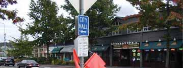
8 Middletown Walkable Community Workshop MIDDLETOWN BACKGROUND AND RECOMMENDATIONS AREA BACKGROUND The Middletown is an historic community that is home to more than 19,000 residents. At the heart of Middletown is its Main Street, a designated Main Street by the Delaware Economic Development Office (DEDO). Businesses, restaurants, cultural attractions, and public gathering places line Main Street. Approximately 30 residents, business representatives, community organizations and transportation professionals attended the Middletown WCW held on September 10, 2014 in the historic downtown of the Middletown at the Town Hall. The walking audit route (Map 1) began at the Town Hall and then traveled on Green Street to Broad Street, Broad Street between Green Street and Main Street, Main Street between Broad Street and the Norfolk Southern Railroad, before returning along Main Street to the Town Hall. The Middletown WCW builds upon past planning in the community. In 1997, WILMAPCO partnered with the Town of Middletown to develop Mobility Friendly Design Standards. The design standards provided a guide to ensure that walking and bicycling were are considered and implemented in the built environment where appropriate. They recommended specific text and design criteria amendments to remove existing impediments to mobility friendly design, and were subsequently adopted into the Town s zoning code. More recently, Middletown has worked with DelDOT to complete downtown streetscaping projects that included sidewalks, street trees, pedestrian scale lighting, ADA crosswalks and other feature to support a vibrant, walkable downtown. Four miles of walking and bicycling trails have been built throughout the Town to connect housing, parks, schools and shopping area, and the Town works closely with developers to ensure that new growth is interconnected with the community. These efforts culminated with Middletown being awarded the first Gold Level Delaware Healthy Community by Governor Jack Markell's Council on Health Promotion and Disease Prevention. Middletown requested WILMAPCO s assistance in holding a WCW to get confirmation that it is a walkable town, and identify next steps to improve even more. In particular, needs identified prior to the workshop included downtown safety, drawing more foot traffic to support businesses, and a pedestrian crossing in front of our Historic Everett Theatre. Page 4
9 Middletown Walkable Community Workshop Map 1 Study Area Page 5


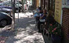
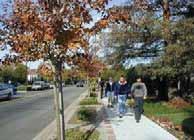
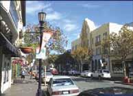
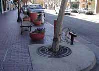
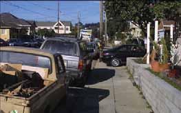
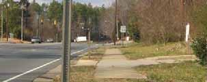
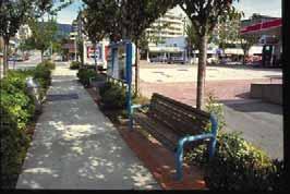
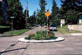
10 Middletown Walkable Community Workshop SUMMARY OF RECOMMENDATIONS Workshop attendees completed a walking audit along the route shown in Map 1. Following the walking audit, participants divided into two groups to brainstorm and map their recommendations. Map 2 (recommendations along the walk route) and Map 3 (broader area recommendations) summarize the discussion by the two groups. Highlights of the discussion along the walk and during the mapping include: GETTING ALONG THE STREET Sidewalks Sidewalks in the area studied vary in width and character. Along Main Street between Wood Street and Broad Street, the brick sidewalks are wide and even with decorative streetlights, trees and ample places to sit. Downtown, Main Street sidewalks are well maintained, and have decorative streetscaping elements and landscaping that help give character to the neighborhood. Green Street sidewalks are also well maintained brick sidewalks with a grass buffer between the walkway and road. Sidewalks should be at least 5 feet wide in residential areas, but in commercial areas 8 feet or wider is preferred. Wider sidewalks provide space for outdoor dining, benches, bicycle racks, sandwich boards and trash cans separate from where people are walking. Page 6


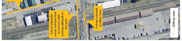
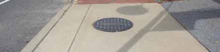
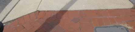
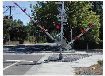
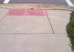
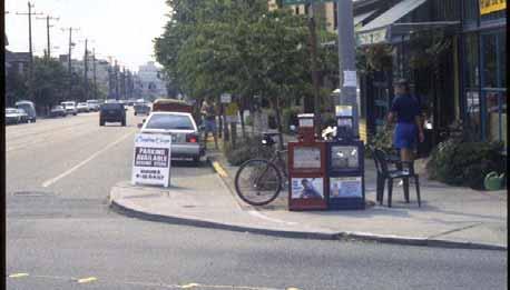
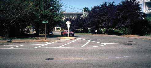
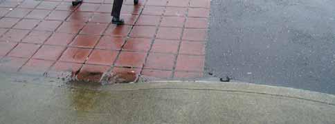
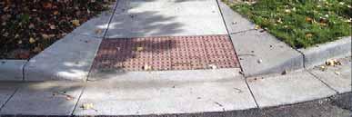
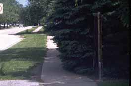
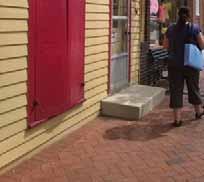
11 Middletown Walkable Community Workshop Utility vaults along Main Street may be are slippery, particularly when wet, and should be relocated if possible or replaced with slipresistant materials. Some side streets are either missing sidewalks or have poorly maintained sidewalks. Sidewalks end briefly at the Norfolk Southern railroad crossing. A better option is to extend the sidewalks through the rail crossing, such as this example. This crossing also features an escape route to allow pedestrians caught within the gates to get out. Photo: Page 7

12 Middletown Walkable Community Workshop Map 2 Recommendations Page 8
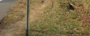
13 Middletown Walkable Community Workshop Map 3 Missing sidewalk and existing conditions Page 9


14 Middletown Walkable Community Workshop Bicycle Routes Main and Broad Streets are part of Bike Route 1, and 180 mile regional bike route that extends from Newark to Dewey Beach. Route lacks accompanying pavement markings and has inconsistent signage. Bicycle facility pavement markings should be added to Broad and Main Streets. Without marked on-road facilities, bicyclists were seen riding on the sidewalk. Delaware Bike Route 1 travels through Middletown with directional signs but without bicycle facilities. Bicycle lanes should be 4-6 feet wide. If there is more space, a painted buffer might also be added as shown to the left. Bicycle lanes can be added to Broad Street by widening the shoulder where space exists and adding bicycle lane markings. Page 10


15 Middletown Walkable Community Workshop Sharrows, or Shared Lane Markings, accommodate bicyclists on lower volume, lower speed streets without sufficient width for bicycle lanes. Sharrows also assist bicyclists with proper lane positioning relative to the curb and on-street parking. Sharrows might be appropriate for Main Street if there is not sufficient width for bicycle lanes. Local streets can be designed as Bicycle Boulevards, particularly where they fill a gap between off-road pathways and key destinations including parks, schools, and commercial areas. Bicycle Boulevards use a mix of signs, pavement markings, and traffic calming measures to discourage through trips by motor vehicles, create safe, convenient bicycle crossings of arterial streets, and give bicycles travel priority. Photo: Page 11


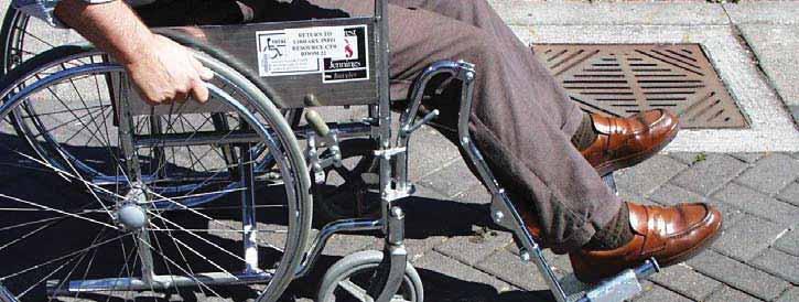
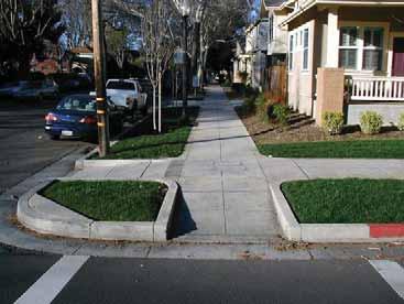
16 Middletown Walkable Community Workshop Driveway improvements Driveways present another challenge for walking. Sidewalks that remain level are preferred to sidewalks that dip down at each driveway. Some sidewalks slope at driveways and do not meet ADA guidelines if the grade of the slope is more than 2%. The sidewalk can wrap around the driveway ramp if needed to remain level, however this presents a challenge for those who have visual impairments. Most driveways observed meet ADA guidelines, but some should be improved. Example of level sidewalk with driveway apron using sloped edge only. Most driveways on Main Street stand out to drivers and pedestrians through the use contrasting concrete pavement. Former fire station driveway is sloped, making it uncomfortable to walk on and not ADA compliant. Page 12


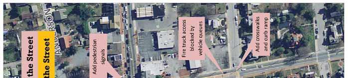
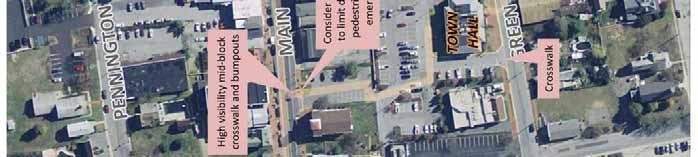
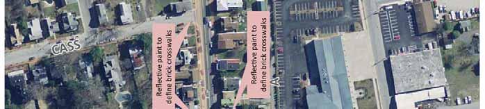
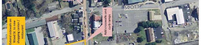
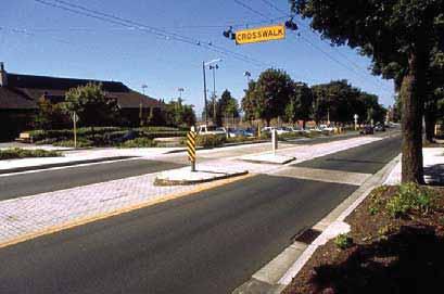
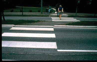
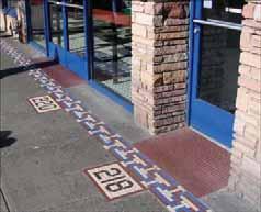
17 Middletown Walkable Community Workshop GETTING ACROSS THE STREET Crossing Main Street currently presents a challenge to the pedestrian friendliness of the area. At Main Street and Broad Street, lack of pedestrian signals combined with turning vehicles makes it confusing for drivers and pedestrians as to when people are expected to cross. Between Broad Street and Industrial Road, 0.3 miles, there are no crosswalks. Lack of crosswalks along this commercial streets leads to frequent jaywalking. In some locations, the curbs have been extended with bump outs to reduce this distance, make crossing pedestrians more visible to drivers, and protecting parked cars. Crosswalks At minimum, crosswalks should be striped as wide as or wider than the sidewalk it connects to and use high-visibility markings that contrast with the pavement and are reflective at night. Crosswalks along the route walked on Main Street are only marked at Broad Street, and these lack countdown pedestrian signals. As a result, participants noticed people crossing at unmarked locations. Crosswalks should be added by DelDOT across Main Street at the Everett Theatre and Wood Street, and across Broad Street at Green Street. Middletown should also add crosswalks on Scott Street across A Street, and across town hall driveways on Green Street. Crosswalks can also be installed using materials to add color and texture helping to give unique character to the neighborhood. This can be done using textured and/or colored concrete or high friction surface epoxy. Some examples are below. Page 13

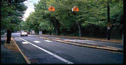
18 Middletown Walkable Community Workshop Corners The design of the corner should provide access for all pedestrians including persons with disabilities, make drivers and those waiting to cross visible to one another, deduce the distance needed to cross and reduce excessive turning speeds by drivers. Most locations lacked curb ramps that meet ADA standards. Curb ramps are important, not only for those persons with disabilities, but for others who may be pushing strollers, or rolling shopping carts, luggage, etc. Working with DelDOT and Middletown Department of Public Works, ADA curb ramps installed should be installed at all intersections. When possible, ramps should be installed for each crosswalk direction, rather than a single ramp per corner. Bump-outs serve several important roles; with bump-outs drivers and pedestrians can clearly see one another, the distance to cross is significantly reduced and parking is protected. Larger bump-outs provide space for benches, planters, trash cans and other needs. Signals Existing and potential signals should be review with DelDOT Traffic to identify ways they can improve the walkability of the community. Improvements to consider at existing signals include: Shorten signal lengths if feasible, to reduce the wait time for pedestrians. Coordinate signal timing to give green wave for drivers traveling at the speed limit. Leading Pedestrian Interval gives pedestrians a 3 7 second head start when entering an intersection with a corresponding green signal in the same direction of travel. Consider pedestrian signals at unsignalized intersections. This might include a traditional pedestrian signal that stops traffic or newer types a HAWK or Rectangular Flashing Beacon. Page 14


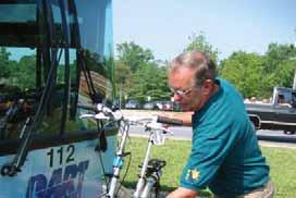
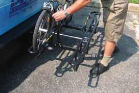
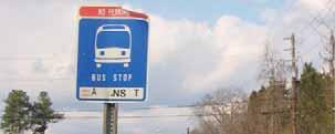
19 Middletown Walkable Community Workshop A HAWK or High-Intensity Activated crosswalk beacon (left) or Rectangular Flashing Beacon (right) is used to stop traffic only as needed. The signal remains unlit when not in use. TRANSIT Transit riders are pedestrians and must walk to reach bus stops and cross the street to reach destinations. DART Route 43 travels along Main Street between Middletown and Odessa but has no stops along the section visited during the Walkable Community Workshop. The nearest bus stops are at the Middletown Commons Shopping Center to the west and at the Bethesda United Methodist Church to the east, more than ½ mile apart. A desirable walking distance to promote transit use is with ¼ mile, or a five minute walk, for a local service route bus stops, with approximately four bus stops recommended in a one-mile corridor. Middletown should work with DART First State to install add least one additional bus stop on each side of the street in the corridor. Bus stops should be located near crosswalk locations. Benches, shelters and trash cans make waiting for the bus more comfortable. Location of bus stops should be reviewed to make sure they are located close to safe places to cross. Benches and trash cans make waiting for the bus more comfortable. Locating bus stops at bump-outs help bus drivers spot waiting riders. Being well-lit at night is also important to ensure the visibility of waiting riders. Busy stops benefit from shelters or locations adjacent to building awnings to keep people covered by they wait. Page 15


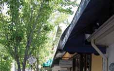
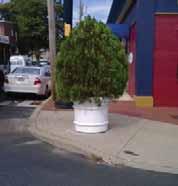
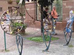
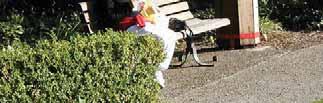
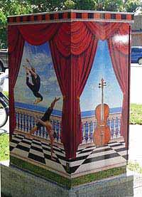
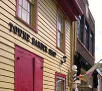
20 Middletown Walkable Community Workshop AESTHETICS AND BEYOND Places to sit, street lighting, public art, trash cans, and wayfinding information can elevate the character of a safe pedestrian environment into a more distinctive place and more vital, cohesive community. Shown below, many place-defining elements already enhance the community, including public art, banners, places to sit, and landscaping. Participants noted that while Middletown has many placemaking elements, other opportunities exist. Page 16


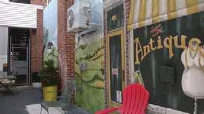
21 Middletown Walkable Community Workshop Landscaping can also serve duel function as a buffered bump out around on street parking. Photo: Carl Sundstrom Photo: Dan Burden Parking lots can be screened using planters, trees or other decorations. Photo: Dan Burden Blank surfaces such as walls and traffic signal boxes, that might otherwise attract graffiti, can become canvases for local artists or even display art from student art classes. Photo: Page 17


.")
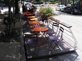
22 Middletown Walkable Community Workshop Outdoor dining was also identified as something that can be expanded. Parklets can transform off-street parking spaces into temporary outdoor seating. Parklets combine modular decking with railings, planters, and seating to create seasonal cafes. Narrow café seating located close to buildings may be another option. Photo: universitycity.org/parklets Middletown s extensive trail system is an asset that can be strengthened with wayfinding signs. Wayfinding Signs: Sources Healthy Duluth Area Coalition, City of Boston, St. Andrews School FUNDING AND IMPLEMENTATION RESOURCES FUNDING PROGRAMS AND CONTACTS Town of Middletown Town of Middletown is a good starting point for most recommendations from the Walkable Community Workshop. The Middletown Town Planner can be contacted at and the Middletown Main Street Program can be contacted at DelDOT DelDOT administers the Transportation Alternatives Program (TAP). TAP offer funding opportunities to help expand transportation choices and enhance the transportation experience, formerly known as the Transportation Enhancements (TE) Program. TAP Activities Page 18
23 Middletown Walkable Community Workshop must relate to surface transportation. Eligible projects most related to the Walkable Communities include: Construction, planning, and design of on-road and off-road trail facilities for pedestrians, bicyclists, and other nonmotorized forms of transportation Construction, planning, and design of infrastructure-related projects and systems that will provide safe routes for non-drivers, including children, older adults, and individuals with disabilities to access daily needs Safe routes to school program In Delaware, projects require a twenty percent funding match. Delaware Transportation Alternatives Program Coordinator Jeff Niezgoda Delaware Department of Transportation, PO Box 778, Dover, DE Tel: Fax: Jeff.Niezgoda@state.de.us State Elected Officials Community Transportation Fund (CTF) funding provides a fixed amount of funds annually to each State Senator and House Representative to be used as they and their constituents believe is best for transportation improvements within their district. Legislators may also fund their own project ideas and they have the option of banking a portion of their yearly CTF budget for up to three years in order to fund a larger transportation improvement. OTHER USEFUL LINKS Pedestrian and Bicycle Information Center - League of American Bicyclists - National Center for Bicycling and Walking - Federal Highway Administration - Manual on Uniform Traffic Control Devices (MUTCD) - mutcd.fhwa.dot.gov NACTO Urban Street Design Guide - nacto.org/usdg WILMAPCO - Page 19
24 Middletown Walkable Community Workshop APPENDICES: BEYOND THE WALKABLE COMMUNITY WORKSHOP WORKSHOP POWERPOINT Page 20

25 B EYOND THE WALKABLE COMMUNITY WORKSHOP: N EXT STEPS TO MAKE IT COUNT A WILMAPCO Walkable Community Workshop is an important step in recognizing the need for walkability in your neighborhood. Yet, a workshop alone will not be enough to transform your community into a pedestrianfriendly environment overnight. To spur action, the next step involves creating a greater level of public awareness that increased walkability improves non-motorized safety, physical fitness, social interaction, and overall quality of life. The majority of action required is at the local level. Getting the results your community wants will take time, but is well worth the effort. Be Active Share the report and brief neighbors, community leaders, and other stakeholders who could not attend the walkable workshop. Identify community and individual actions that can help move your community in the right direction towards implementation. Use your community s report as a resource. It includes contact information for agencies and individuals who can help. Get Involved Here s what you can do after your community s walkable workshop to build interest, momentum and get desirable results: Take small steps towards accommodating safe walking and biking, such as promoting safe crossing and cycling practices. Partner with local pedestrian and bicycle groups on events that promote safety and accessibility for non-motorized transportation. Advocate for necessary policy changes that support safe and walkable communities. Seek out ways to support changes in the way your community is planned and designed to ensure barriers to walkability are removed and new ones are not created. Work with your municipality to include provisions for non-motorized facilities in the transportation element of the Comprehensive Plan. Find Support Contact WILMAPCO staff for further technical assistance and support. Attend government meetings to express interest in having more pedestrian and bicycle facilities and improvements to existing facilities. Contact your Legislators to address specific non-motorized concerns in your area. Develop support at your neighborhood level with groups such as civic associations and PTA s to assist in advocacy activities and implementation. Get the media involved in bringing awareness to the problems and highlighting solutions. Be specific about the issues and use a variety of communication strategies.

26 B EYOND THE WALKABLE COMMUNITY WORKSHOP: I MPLEMENTATION STRAGEGIES Together community members and partner agencies can take part in necessary activities to improve the pedestrian and bicycle environment. Strategic actions, both large and small, will help your community evolve over time to become more walkable and livable. And the more comprehensive the approach, the more likely your community will achieve long-term success. Strategies and Solutions Plans and Policies Develop a plan that conveys the vision for your community and include prioritized short- and long-term goals based on greatest need and most benefits. For example, your community can create a Pedestrian Safety Plan which includes specific measures that reduce risks for pedestrians. Evaluate policies that support walkability. New policies or changes to existing policies may be necessary before implementation can begin. Design and Engineering Explore various designs that accommodate safe multimodal facilities. Consider appropriate designs that will control vehicle speeds where necessary, such as traffic calming techniques. Other measures may include reducing roadway width, incorporating raised medians, sidewalks, curb ramps, and other pedestrian-centered facilities. Better design practices encourage walking and bicycling. Educate Drivers and Pedestrians Education and awareness are tools that reshape the travel behavior of pedestrians, bicyclists, and motorists. Create education and outreach materials to raise awareness and encourage proper use of roadway and non-motorized facilities. Educational programs can be tailored to various age groups. Information should be disseminated in many forms such as flyers, non-motorized facility maps, public meetings, and forums. Improve Access to Transit Since transit users are pedestrians, walkability should include access to key destinations and to transit facilities. It is important that transit stops and their surrounding areas be safe and accessible for transit users. This will protect transit riders as well as providing support for and encouraging transit use. Promote Physical Activity Studies show that physical activity is increased with more walkable places. A walkable place gives people choices to walk along sidewalks in good condition and greenways, or bicycle along safe bike routes. Walking and biking can be promoted through plans and policies, community events, and school programs. Seek Funding and Build Support Finding funding to support and sustain necessary transportation improvements is often challenging. Moreover, financial constraints make project prioritization a key step. To help narrow down priorities, projects with an identified local and/or private funding match should take the lead in the development process. And for a greater advantage in implementation, consider tying non-motorized improvements into roadway projects that are already planned.

27 B EYOND THE WALKABLE COMMUNITY WORKSHOP: F UNDING RESOURCES Pursuing necessary funding for project implementation is perhaps the most important step to make your community vision materialize. Since funding mechanisms to implement projects can vary try, not to limit your potential projects to federal and state resources. In addition to traditional funding streams, seek out grants, private sponsorships, and think of creative funding alternatives. Funding Resources for Implementation Safe Routes to School The SRTS Program provides funding for a wide variety of programs and projects, such as creating safer street crossings and establishing programs that encourage children and their parents to walk and bicycle to school safely. This program requires local community support. Transportation Enhancements The TE Program provides funding opportunities to help expand transportation choices through activities related to surface transportation. Eligible projects include pedestrian and bicycle infrastructure, safety programs, scenic and historic highway programs, landscaping and scenic beautification, historic preservation, and environmental mitigation. A local match is required. Community Transportation Fund This fund is designated by individual legislators for specific transportation related projects. This fund allows individual legislators to address small transportation projects that may not meet department priorities. Commonly funded projects through this grant allocation are new sidewalks and repairs, curb-cuts, repaving, and drainage repairs. Congestion Mitigation and Air Quality The CMAQ Program funds projects that improve air quality and reduce congestion. Eligible bicycle and pedestrian projects include paths, bike racks, support and other facilities that reduce vehicle trips. Municipal Funding Municipalities often set aside funding for small nonmotorized projects such as sidewalk and curb repairs, bicycle lanes striping, or pedestrian signals. For instance, Wilmington has set aside some funding for sidewalk repairs throughout the city. Private Funding Private sector funding sources can include local non-profit organizations, foundations that provide community grants, land trusts that have set aside funding for land to purchase trails, and large corporations and businesses. In addition, a public-private partnership can be established to leverage limited public funding. Community Fundraising Another approach is to find creative ways to break a large project into small pieces that can be "purchased" by the public through community fundraising. For instance, a fundraiser can be held to raise cash donations to match Transportation Enhancements funds. Creative Funding Examples Portland, OR Community members sold bricks from historic areas to fund local sidewalk projects. The fundraiser had a great publicity and community support. Donor names were engraved in each brick and proceeds purchased basic sidewalk construction materials. Ashtabula, OH The local trail organization raised onethird of the funding needed to buy the land for a trail by forming a "300 Club." Three hundred acres were needed for the trail and they set a goal of finding 300 residents who would finance one acre each. The land price was $400 an acre, and they found just over 100 people to buy an honorary acre, raising over $40,000. Colorado Springs, CO The Rock Island Rail-Trail is being partly funded by the Rustic Hills Improvement Association comprised of a group of local homeowners living adjacent to the trail. Ten miles of the trail was cleared of railroad ties by a local boy scout troop.


28 B EYOND THE WALKABLE COMMUNITY WORKSHOP: P OST-WORKSHOP EFFORTS The WILMAPCO Region Edgemoor Gardens, DE Following the workshop, residents used their walkable workshop report to evaluate the best means for implementation. Together, residents teamed up to find alternative resources to fund needed improvements. The community applied for and received a private grant that provided funding for small scale pedestrian improvements at several key locations. Southbridge, DE After reviewing their report, residents requested that WILMAPCO develop a neighborhood level prioritization process to rank the proposed improvements. Gathering community feedback on the technical scoring led to local support to begin implementation. Many of the recommendations are being addressed through the Safe Routes to School and a Transportation Enhancements Program. The program provided $125,000 in funding to repair pedestrian facilities near the community s elementary school. A $1.2 million Transportation Enhancements project was also initiated to address the neighborhood s more pressing traffic-calming and streetscape issues. Northeast, MD During the walking audit, workshop participants generated a list of potential solutions to address a narrow bridge overpass that makes travel for pedestrians and bicyclists unsafe. Those solutions were presented before the Town Council, planners, and developers, who decided on one of the alternatives suggested. Perryville, MD During the workshop, the Town of Perryville requested WILMAPCO s assistance in creating a greenway plan. WILMAPCO is currently working with the Town to create the Perryville Master Trail Plan which will connect the local library, school, and senior center. Other Regions Dayton, OH After taking inventory of barriers to non-motorized travel, residents formed a Walk! Downtown Committee that meets monthly to discuss activities to encourage residents to live, work, and play downtown. The group also focuses on painting crosswalks at intersections, adding public art on the sidewalks, and adding artistic displays to vacant storefronts. Glen Cove, NY The Mayor of Glen Cove, who attended the workshop, decided the City should take a proactive approach towards traffic safety and non-motorized issues. Along a major street known for speeding vehicles, the City has planned to install traffic restrictors (humps) made of recycled tire pavers to give the appearance of a raised crosswalk. They have also re-striped crosswalks area-wide, improved pedestrian-scale lighting, and applied for two grants to fund a roundabout in the central business district and traffic calming in a neighborhood that is slighted by extreme cut-through traffic. For more information, go to:


29 Walkable Communities Workshop Middletown Progress Mobility Friendly Design Standards 1997 Downtown streetscaping projects Walking/bicycling trails 1 st Gold Level Delaware Healthy Community / Dan Burden Creating Livable Places that Work I. Presentation II. Walkabout


30 Elements of Livability III. Plan of Action Benefits of Walkable Communities Relationships are Everything Less traffic, pollution & noise Less crime Eyes on the street Better sense of community Economic benefits Travel choices for kids, seniors, people with disabilities, people w/out cars Healthy communities


31 Focus on low cost, easy to implement solutions Signs Paint Ramps Obesity Trends* Among U.S. Adults 1990 No Data <10% 10% 14% (*BMI 30, or ~ 30 lbs. overweight for 5 4 person)

 Source: Delawareonline.")
32 Obesity Trends* Among U.S. Adults 2010 The cost of obesity in Delaware is estimated to be $722 million a year in direct costs of health care and indirect costs including lost productivity No Data <10% 10% 14% 15% 19% 20% 24% 25% 29% 30% (*BMI 30, or ~ 30 lbs. overweight for 5 4 person) Source: Delawareonline.com If you re inactive, you have a much higher risk of getting: Heart Disease and High Blood Pressure Colon Cancer Diabetes Osteoporosis/hip fractures Depression and anxiety Others asthma, arthritis, back pain, alzheimers, stroke, premature mortality
")


33 Health Benefits of Walking: Travel choices 3 hrs/wk of brisk walking (3mph) reduced heart disease risk in women by 35 40% Older adults who walked at least 4 hrs/week were 31% less likely to be hospitalized for heart disease or stroke. Women who walked at least 1 hr/wk reduced risk of heart disease by 50% (amount more important than pace). 30% or more of residents in your community do not have direct access to an automobile I. Getting Along the Streets Sidewalks People want a safe place to live


34 Buffer Zone Walk/Talk Zone Shy Zone Which community is a better place to raise children? What s wrong with this picture? What s wrong with this picture?


35 What s wrong with this picture? Not Walkable High Car Dependency Serious Congestion Walkable Low Car Dependency Moderate Congestion Sidewalk Buffers


36 ADA Universal Design Wheelchair Accessible? It s About All of Us Apron Goes Through Sidewalk Pavers and bricks are hard on wheelchair users Good Engineering Invites Right Use


37 Obstacle Course Railroad crossings should accommodate walking and bicycling Lowest Cost Sidewalks Widen Sidewalks


38 Bicycle facilities Pathways Sidewalk/bicycle route issues 2. Getting Across the Street Intersections & Crosswalks Missing / damaged sidewalk or bike route Uneven / sloping walkway Sidewalk blocked Driveways No bike lane or too narrow / wide Network of paths for off road trips


39 What s wrong with this picture? What s wrong with this picture? Where would you rather cross? Which crosswalk will get the driver s attention?


40 What the Community Provided What the Customer Wanted High Visibility Crosswalk Rectangular Rapid Flashing Beacon High Visibility Crosswalk Pedestrian signs: new color increases visibility In street yield signs

41 They drive fast Curb Extensions Shorter crossing distance Slower turning vehicles More visible pedestrians


42


43 Truncated Domes Truncated domes provide tactile clues


44 Crossing Issues Broken or missing pedestrian ramps Construct/restore ADA accessible ramps Faded or hard to see markings Remark crosswalks / stopbars Turning vehicles failing to yield Improve signs and pavement markings Shorten crossing distance Poor draining or ponding in crosswalks Drainage improvements


45 What s wrong with this picture?


46 Rider needs Weather Protection Places to Sit Lighting Public Art Trash Receptacles Newspaper Boxes Schedule Information Place to cross the street What s wrong with this street? Creature comforts Bathrooms Places to sit Lighting Public art Trash cans Newspaper boxes Maps/directions


47


48


49 Safe routes to school 30% Middletown residents younger than age 16 Narrow lanes reduce speeds


50 Portable speed limit signs Raised Crosswalk


51 Test ideas Steps to a walkable community Build ways to get along the street Create ways to get across the street Have comfortable and accessible transit facilities Plan nice design and places to walk or bike Slow speeding traffic Develop safe routes to schools (and shops, jobs, parks, libraries, churches, )
52 Thank you! Heather Dunigan 302/ ext. 118
FOURTH STREET WILMINGTON WALKABLE COMMUNITY WORKSHOP
 FOURTH STREET WILMINGTON WALKABLE COMMUNITY WORKSHOP June 24, 2015 Hosted by Cornerstone West & WILMAPCO Walkable Community Workshops are interactive events that bring together the community and transportation
Introduction. Who is WILMAPCO. Why are walkable communities important
 Walkable Community Workshops Round 1 April 2005 SPONSORED BY WILMAPCO AND CCOBH CITY OF NEW CASTLE EDGEMOOR GARDENS CIVIC ASSOCIATION WITH FUNDING BY DELAWARE DEPARTMENT OF TRANSPORTATION AND THE DELAWARE
WEST SIDE WILMINGTON WALKABLE COMMUNITY WORKSHOP
 WEST SIDE WILMINGTON WALKABLE COMMUNITY WORKSHOP October 29 2013 Hosted by Cornerstone West &WILMAPCO Walkable Community Workshops are interactive events that bring together the community and transportation
Perryville TOD and Greenway Plan
 Perryville TOD and Greenway Plan Greenway Glossary Pathway: A bicycle and pedestrian path separated from motorized vehicular traffic by an open space, barrier or curb. Multi-use paths may be within the
Agenda. Overview PRINCE GEORGE S PLAZA METRO AREA PEDESTRIAN PLAN
 PRINCE GEORGE S PLAZA METRO AREA PEDESTRIAN PLAN May 28, 2008 Agenda Welcome and introductions Project overview and issue identification Planning context and strengths Design challenges and initial recommendations
Living Streets Policy
 Living Streets Policy Introduction Living streets balance the needs of motorists, bicyclists, pedestrians and transit riders in ways that promote safety and convenience, enhance community identity, create
NJDOT Complete Streets Checklist
 Background The New Jersey Department of Transportation s Complete Streets Policy promotes a comprehensive, integrated, connected multi-modal network by providing connections to bicycling and walking trip
APPENDIX A: Complete Streets Checklist DRAFT NOVEMBER 2016
 APPENDIX A: Complete Streets Checklist DRAFT NOVEMBER 2016 Complete Streets Checklist MetroPlan Orlando s Complete Streets Checklist is an internal planning tool for staff to further implementation of
City of Novi Non-Motorized Master Plan 2011 Executive Summary
 City of Novi Non-Motorized Master Plan 2011 Executive Summary Prepared by: February 28, 2011 Why Plan? Encouraging healthy, active lifestyles through pathway and sidewalk connectivity has been a focus
PEDESTRIAN ACTION PLAN
 ATTACHMENT 2 CITY OF SANTA MONICA PEDESTRIAN ACTION PLAN CITY OF SANTA MONICA PEDESTRIAN ACTION PLAN This page intentionally left blank EXECUTIVE SUMMARY CHAPTER 1 EXECUTIVE SUMMARY Setting the Stage
Omaha s Complete Streets Policy
 Omaha s Complete Streets Policy (Adopted August 2015) VISION To create great places and enhance our quality of life, the City of Omaha will provide safe, accessible streets for all users. Complete Streets
CHAPTER 3: Vision Statement and Goals
 Davidson Walks & Rolls: Active Transportation Master Plan CHAPTER 3 Contents: Overview Vision Statement Measurable Goals Public Outreach CHAPTER 3: Vision Statement and Goals Overview The vision statement
CONNECTIVITY PLAN. Adopted December 5, 2017 City of Virginia Beach
 CONNECTIVITY PLAN Adopted December 5, 2017 City of Virginia Beach CONTENTS 1.0 Background & Purpose... 2 2.0 Existing Inventory & Analysis... 3 ViBe District Existing Walking Conditions... 4 3.0 ViBe District
5. Pedestrian System. Accomplishments Over the Past Five Years
 5. Pedestrian System Accomplishments Over the Past Five Years The Alamo Area Metropolitan Planning Organization (MPO) and its partner agencies recognize the importance of improving pedestrian mobility.
Proposed. City of Grand Junction Complete Streets Policy. Exhibit 10
 Proposed City of Grand Junction Complete Streets Policy Exhibit 10 1 City of Grand Junction Complete Streets Policy Vision: The Complete Streets Vision is to develop a safe, efficient, and reliable travel
CITY OF COCOA BEACH 2025 COMPREHENSIVE PLAN. Section VIII Mobility Element Goals, Objectives, and Policies
 CITY OF COCOA BEACH 2025 COMPREHENSIVE PLAN Section VIII Mobility Element Goals, Objectives, and Policies Adopted August 6, 2015 by Ordinance No. 1591 VIII MOBILITY ELEMENT Table of Contents Page Number
PRINCE GEORGE S PLAZA METRO AREA PEDESTRIAN PLAN
 PRINCE GEORGE S PLAZA METRO AREA PEDESTRIAN PLAN May 28, 2008 Agenda Welcome and introductions Project overview and issue identification Planning context and strengths Design challenges and initial recommendations
RESOLUTION NO ?? A RESOLUTION OF THE CITY OF NEPTUNE BEACH ADOPTING A COMPLETE STREETS POLICY
 RESOLUTION NO. 2018-?? A RESOLUTION OF THE CITY OF NEPTUNE BEACH ADOPTING A COMPLETE STREETS POLICY WHEREAS, safe, convenient, and accessible transportation for all users is a priority of the City of Neptune
Executive Summary Route 30 Corridor Master Plan
 Route Corridor Master Plan Project Overview The Route Corridor Master Plan is a coordinated multimodal transportation and land use plan for the entire stretch of Route through East Whiteland Township,
CITY OF BLOOMINGTON COMPLETE STREETS POLICY
 CITY OF BLOOMINGTON COMPLETE STREETS POLICY POLICY OBJECTIVE: The City of Bloomington will enhance safety, mobility, accessibility and convenience for transportation network users of all ages and abilities,
Active Transportation Facility Glossary
 Active Transportation Facility Glossary This document defines different active transportation facilities and suggests appropriate corridor types. Click on a facility type to jump to its definition. Bike
REGIONAL BICYCLE AND PEDESTRIAN DESIGN GUIDELINES
 REGIONAL BICYCLE AND PEDESTRIAN DESIGN GUIDELINES November 16, 2011 Deb Humphreys North Central Texas Council of Governments Bicycle and Pedestrian Advisory Committee Snapshot of the Guide 1. Introduction
CONNECTING PEOPLE TO PLACES
 CONNECTING PEOPLE TO PLACES 82 EAST BENCH MASTER PLAN 07 Introduction The East Bench transportation system is a collection of slow moving, treelined residential streets and major arteries that are the
WELCOME. Purpose of the Open House. Update you on the project. Present a draft recommended plan. Receive your input
 WELCOME Purpose of the Open House The Town of Smiths Falls has initiated the Beckwith Street Redevelopment Plan that includes the preparation of a streetscape functional design for the renewal of Beckwith
Watertown Complete Streets Prioritization Plan. Public Meeting #1 December 14, 2017
 Watertown Complete Streets Prioritization Plan Public Meeting #1 December 14, 2017 Goals for Public Meeting Overview of MassDOT Complete Streets Funding Program Educate the community on Complete Streets
City of Birmingham Draft Multi-modal Transportation Plan
 City of Birmingham Draft Multi-modal Transportation Plan City Commission Public Hearing Monday, November 25, 2013 7:30 pm Norman Cox, PLA, ASLA The Greenway Collaborative, Inc. Ann Arbor, Michigan The
NM-POLICY 1: Improve service levels, participation, and options for non-motorized transportation modes throughout the County.
 Transportation PRINCE WILLIAM COUNTY 2008 COMPREHENSIVE PLAN NON-MOTORIZED PLAN CONTENTS Goals, Policies, and Action Strategies Table 4 (Bike Facility Classifications and Descriptions) Table 5 (Bike Facility
9/21/2016 VIA . RE: The Knot (DR16-270)
") 9/21/2016 VIA EMAIL Garrett Norman, Assistant Planner City of Sacramento Community Development Department 300 Richards Boulevard, 3 rd Floor Sacramento, CA 95811 RE: The Knot (DR16-270) Dear Mr. Norman:
9/21/2016 VIA EMAIL Garrett Norman, Assistant Planner City of Sacramento Community Development Department 300 Richards Boulevard, 3 rd Floor Sacramento, CA 95811 RE: The Knot (DR16-270) Dear Mr. Norman:
Solana Beach Comprehensive Active Transportation Strategy (CATS)
") Solana Beach Comprehensive Active Transportation Strategy (CATS) 3.0 Goals & Policies The Solana Beach CATS goals and objectives outlined below were largely drawn from the Solana Beach Circulation Element
Solana Beach Comprehensive Active Transportation Strategy (CATS) 3.0 Goals & Policies The Solana Beach CATS goals and objectives outlined below were largely drawn from the Solana Beach Circulation Element
Broad Street Bicycle Boulevard Design Guidelines
 Broad Street Bicycle Boulevard Design Guidelines Building from the strategies introduced in the 2013 Bicycle Transportation Plan and community input received thus far, City Transportation Staff have identified
1.0 EXECUTIVE SUMMARY
 1.0 EXECUTIVE SUMMARY The Active Transportation Plan is a guide to accomplish the Town s vision for developing a network of sidewalks, on-road bicycle facilities, and trails that allow for safe and convenient
City of Albert Lea Policy and Procedure Manual 4.10 ALBERT LEA CROSSWALK POLICY
 4.10 ALBERT LEA CROSSWALK POLICY PURPOSE: Pedestrian crosswalks are an integral part of our transportation infrastructure. To be effective and promote safety, marked crosswalks must be installed after
Bikeway action plan. Bicycle Friendly Community Workshop March 5, 2007 Rochester, MN
 Bikeway action plan Summary The was held on March 5, 2007 at the Rochester Mayo Civic Center. The workshop was hosted by Rochester-Olmsted County Planning Department in collaboration with the League of
COMPLETE STREETS PLANNER S PORTFOLIO
 COMPLETE STREETS PLANNER S PORTFOLIO ISSUE 3 APRIL 2016 PLANNER S PORTFOLIO COMPLETE STREETS 1 2 6 10 14 OVERVIEW MATURE NEIGHBORHOODS GROWING SUBURBS CENTRAL PLACES ACTIVITY CORRIDORS Planner s Portfolio
Item to be Addressed Checklist Consideration YES NO N/A Required Description Complete Streets Guidelines
 Passaic County Complete Streets Checklist - Concept Development Project Name Item to be Addressed Checklist Consideration YES NO N/A Required Description Complete Streets Guidelines Existing Plans Have
Corpus Christi Metropolitan Transportation Plan Fiscal Year Introduction:
 Introduction: The Safe, Accountable, Flexible, Efficient Transportation Equity Act: A Legacy for Users (SAFETEA-LU) has continued the efforts started through the Intermodal Surface Transportation Efficiency
INDOT Complete Streets Guideline & Policy
 INDOT Complete Streets Guideline & Policy INTRODUCTION The Complete Streets guidelines build upon multiple efforts and promote a multimodal transportation system that is integrated and sustains land use
Streets. Safe for Pedestrians 20% 2nd 5,000. Are We People-Friendly?
 Streets Safe for Pedestrians 20% Pedestrian deaths account for more than of all traffic-related fatalities in California each year. 600 More than people are killed and another 13,000 are injured every
TOWN OF PORTLAND, CONNECTICUT COMPLETE STREETS POLICY
 TOWN OF PORTLAND, CONNECTICUT COMPLETE STREETS POLICY I. VISION, GOALS & PRINCIPLES VISION To improve the streets of Portland making them safer and more accessible for all users including pedestrians,
12/4/2016 VIA . RE: Grocery Outlet Del Paso (DR16-328)
") 12/4/2016 VIA EMAIL Ethan Meltzer, Assistant Planner City of Sacramento Community Development Department 300 Richards Blvd, 3 rd Floor Sacramento, CA 95811 RE: Grocery Outlet Del Paso (DR16-328) Dear Mr.
12/4/2016 VIA EMAIL Ethan Meltzer, Assistant Planner City of Sacramento Community Development Department 300 Richards Blvd, 3 rd Floor Sacramento, CA 95811 RE: Grocery Outlet Del Paso (DR16-328) Dear Mr.
Complete Streets. Designing Streets for Everyone. Sarnia
 Complete Streets Designing Streets for Everyone Sarnia Complete Streets ~ Sarnia ~ 2018 Introduction Our City is made up of a network of streets that we use to go for a walk, cycle to work, drive to the
7 Complete Streets & Roadway Aesthetics
 7 Complete Streets & Roadway Aesthetics 7.1 OVERVIEW Our streets lay the foundation for how we interface with travel needs, physical exercise, social exchanges and access to goods and services. They are
8/31/2016 VIA . RE: Freeport Arco Fuel Station (P16-039)
") 8/31/2016 VIA EMAIL Garrett Norman, Assistant Planner City of Sacramento Community Development Department 300 Richards Boulevard, 3 rd Floor Sacramento, CA 95811 RE: Freeport Arco Fuel Station (P16-039)
8/31/2016 VIA EMAIL Garrett Norman, Assistant Planner City of Sacramento Community Development Department 300 Richards Boulevard, 3 rd Floor Sacramento, CA 95811 RE: Freeport Arco Fuel Station (P16-039)
A CHANGING CITY. of Edmonton, it is essential that it reflects the long-term vision of the City.
 A CHANGING CITY By the year 2040, Edmonton will be home to more than 1 million people. To accommodate growth and support a healthy and compact city, we need a new approach to development/redevelopment
6/14/2013 VIA . Evan Compton, Associate Planner Community Development Department City of Sacramento 300 Richards Blvd Sacramento, CA 95814
 6/14/2013 VIA EMAIL Evan Compton, Associate Planner Community Development Department City of Sacramento 300 Richards Blvd RE: Sacramento Natural Foods Co-Op (P13-025) Dear Mr. Compton: WALKSacramento appreciates
G AT E WAY PLAN. Community BRIEFING KIT GATEWAY BIKE
 G AT E WAY PLAN GATEWAY BIKE Community BRIEFING KIT PLAN August 2016 TABLE OF CONTENTS INTRODUCTION... 1 THE BENEFITS OF A BIKEABLE COMMUNITY... 2 ECONOMY...2 SAFETY...3 HEALTH...3 HOUSEHOLD SPENDING...3
Bicycle Master Plan Goals, Strategies, and Policies
 Bicycle Master Plan Goals, Strategies, and Policies Mobilizing 5 This chapter outlines the overarching goals, action statements, and action items Long Beach will take in order to achieve its vision of
Chapter 5. Complete Streets and Walkable Communities.
 Chapter 5. Complete Streets and Walkable Communities. 5.1 Description of Complete Streets. Cities throughout the world, and specifically the United States, are coming to embrace a new transportation and
UPTOWN REGIONAL BIKE CORRIDORS PROJECT SAN DIEGO ASSOCIATION OF GOVERNMENTS
 UPTOWN REGIONAL BIKE CORRIDORS PROJECT SAN DIEGO ASSOCIATION OF GOVERNMENTS SUMMARY REPORT: COMMUNITY UPDATE MEETING February 6, 2014 6 8:30 p.m. Roosevelt Middle School Library 3366 Park Blvd, San Diego
ACTIVE TRANSPORTATION
 ACTIVE TRANSPORTATION Mobility 2040 Supported Goals Improve the availability of transportation options for people and goods. Support travel efficiency measures and system enhancements targeted at congestion
Non-Motorized Transportation 7-1
 Non-Motorized Transportation 7-1 Transportation facilities no longer mean just accommodating a vehicle powered by a combustion engine. Pedestrian and non-motorized facilities are important modes of travel
Tonight is for you. Learn everything you can. Share all your ideas.
 Strathcona Neighbourhood Renewal Draft Concept Design Tonight is for you. Learn everything you can. Share all your ideas. What is Neighbourhood Renewal? Creating a design with you for your neighbourhood.
EXECUTIVE SUMMARY. Vision
 Vision Walking and bicycling in Salt Lake City will be safe, convenient, comfortable, and viable transportation options that connect people to places, foster recreational and economic development opportunities,
Appendix 3 Roadway and Bike/Ped Design Standards
 Appendix 3 Roadway and Bike/Ped Design Standards OTO Transportation Plan 2040 4/20/2017 Page A3-1 Adopted Standards The adopted OTO Design Standards and Major Thoroughfare Plan are contained herein.
10/30/2012 VIA
 10/30/2012 VIA EMAIL David Hung, Associate Planner Community Development Department, Current Planning Division City of Sacramento 300 Richards Blvd., 3 rd Floor Sacramento, CA 95811 RE: The Cannery On-Site
Chapter 2. Bellingham Bicycle Master Plan Chapter 2: Policies and Actions
 Chapter 2 Bellingham Bicycle Master Plan Chapter 2: Policies and Actions Chapter 2: Policies and Actions The Bicycle Master Plan provides a road map for making bicycling in Bellingham a viable transportation
Section 8. Partnerships and Funding
 This section discusses the potential partnership and funding options that the Town should consider in order to assist with the implementation of the recommendations provided in the Plan. Section 8. Partnerships
FOCUS AREA 1 - Alberta Avenue Pocket Park 3 (121 Ave and 92 St)
") FOCUS AREA 1 - Alberta Avenue Pocket Park 3 (121 Ave and 92 St) New benches Plant evergreen trees Widen existing sidewalk from 1.5m to 1.8m Marked crosswalk 1.8m wide sidewalk Add pedestrian oriented lights
FOCUS AREA 1 - Alberta Avenue Pocket Park 3 (121 Ave and 92 St) New benches Plant evergreen trees Widen existing sidewalk from 1.5m to 1.8m Marked crosswalk 1.8m wide sidewalk Add pedestrian oriented lights
Lee s Summit Road Improvement Study Public Open House June 7, 2007 Summary of Comment Card Responses
 Lee s Summit Road Improvement Study Public Open House June 7, 2007 Summary of Comment Card Responses Introduction At the Lee s Summit Road Improvement Study Public Open House held Thursday, June 7, 2007
9/22/2014 VIA . RE: Butano Apartments Pre App (PAMP )
") 9/22/2014 VIA EMAIL Surinder Singh, Senior Planner Planning and Environmental Review Division Sacramento County 827 7th Street, Second Floor RE: Butano Apartments Pre App (PAMP2014-00012) Dear Mr. Singh:
9/22/2014 VIA EMAIL Surinder Singh, Senior Planner Planning and Environmental Review Division Sacramento County 827 7th Street, Second Floor RE: Butano Apartments Pre App (PAMP2014-00012) Dear Mr. Singh:
Use this guide to learn more about walkability and how you can make your community safer to walk
 Walkability Guide Do You Enjoy Walking In Your Community? Use this guide to learn more about walkability and how you can make your community safer to walk 2 About This Guide Circulate San Diego believes
Chapter 2: Standards for Access, Non-Motorized, and Transit
 Standards for Access, Non-Motorized, and Transit Chapter 2: Standards for Access, Non-Motorized, and Transit The Washtenaw County Access Management Plan was developed based on the analysis of existing
o n - m o t o r i z e d transportation is an overlooked element that can greatly enhance the overall quality of life for the community s residents.
 N o n - m o t o r i z e d transportation is an overlooked element that can greatly enhance the overall quality of life for the community s residents. 84 Transportation CHAPTER 11 INTRODUCTION Transportation
5/7/2013 VIA . RE: University Village Safeway Expansion (P13-019)
") 5/7/2013 VIA EMAIL David Hung, Associate Planner Community Development Department, Current Planning Division City of Sacramento 300 Richards Boulevard, 3 rd Floor Sacramento, CA 95811 RE: University Village
5/7/2013 VIA EMAIL David Hung, Associate Planner Community Development Department, Current Planning Division City of Sacramento 300 Richards Boulevard, 3 rd Floor Sacramento, CA 95811 RE: University Village
Chapter VISION, MISSION, AND GOALS AND OBJECTIVES. Vision. Mission. Goals and Objectives CONNECTING COMMUNITIES ACROSS THE ST.
 VISION, MISSION, AND GOALS AND OBJECTIVES Chapter 3 The Plan s vision, mission, and goals and objectives were developed through a series of interactive exercises with the Citizens Advisory Committee (CAC)
3/10/2016 VIA th Street, Suite 203 Sacramento, CA
 3/10/2016 VIA EMAIL Arwen Wacht, Associate Planner City of Sacramento Community Development Department 300 Richards Boulevard, 3 rd Floor Sacramento, CA 95811 RE: Natomas Fountains (P16-012) Dear Ms. Wacht:
A. Pedestrian Facility Design
 A. Pedestrian Facility Design Photo by Dan Burden Photo by Cara Seiderman Walkways are the portion of the public right-of-way that provide a separated area for people traveling on foot.walkways that are
BIKE PLAN CONTENTS GATEWAY
 CONTENTS Acknowledgments...vii Great Rivers Greenway District Board of Directors... vii Great Rivers Greenway District Staff... vii Project Consultants... vii Committees... viii Citizens Advisory Committee
Creating walkable, bikeable and transit-supportive communities in Halton
 Creating walkable, bikeable and transit-supportive communities in Halton By presenting current research and best practices, the information in this paper is meant to support and broaden discussion on how
Morristown, NJ Complete Streets Policy
 Morristown, NJ Complete Streets Policy Introduction A Complete Street is defined as a means to provide safe access for all users by designing and operating a comprehensive, integrated, connected multi-modal
Safe Routes to School: Munroe Elementary Walk Audit Report. Image: Drexel, Barrell & Co.
 Safe Routes to School: Munroe Elementary Walk Audit Report Image: Drexel, Barrell & Co. April 12, 2016 OVERVIEW As part of the 2014/2015 Denver Safe Routes to School (SRTS) Program, WalkDenver coordinated
Clarkson Walkability Audit: Results and Recommendations Summary
 Clarkson Walkability Audit: Results and Recommendations Summary The following document was prepared by the Region of Peel and includes a summary of comments made by participants during our breakout discussion
City of Wilsonville 5 th Street to Kinsman Road Extension Project
 City of Wilsonville 5 th Street to Kinsman Road Walking Tour & Neighborhood Workshop Summary Report Public Outreach Overview On July 18 th, 2017, the City of Wilsonville hosted a neighborhood walking tour
Cross Street Corridor Non-Motorized Enhancement Project Project Description
 Cross Street Corridor Non-Motorized Enhancement Project Project Description A cooperative study of the Cross Street neighborhood was completed in May 2002 by the City of Ypsilanti, the Depot Town Downtown
7/23/2017 VIA . Michael Hanebutt City of Sacramento Community Development Department 300 Richards Boulevard, 3 rd Floor Sacramento, CA 95811
 7/23/2017 VIA EMAIL Michael Hanebutt City of Sacramento Community Development Department 300 Richards Boulevard, 3 rd Floor Sacramento, CA 95811 RE: 65 th Street Apartments (DR17-220) Dear Mr. Hanebutt:
AMATS Complete Streets Policy
 AMATS Complete Streets Policy Table of Contents: Section 1. Definition of Complete Streets Section 2. Principles of Complete Streets Section 3. Complete Streets Policy Section 4. Consistency Section 5.
Bridgewater Complete Streets Prioritization Plan and Pedestrian Safety Assessment
 Bridgewater Complete Streets Prioritization Plan and Pedestrian Safety Assessment Presented by Luciano Rabito Manager of Complete Streets Presented to Bridgewater, MA Wednesday, April 26, 2017 6:30 P.M.
Bicycle and Pedestrian Advisory Committee (BPAC) November 21, 2013
 November 21, 2013") Bicycle and Pedestrian Advisory Committee (BPAC) November 21, 2013 OVERALL LAND USE CONCEPT Overall Broadway Valdez District: 95.5 acres (35.1 acres right-of ways + 60.4 acres developable land) Plan Subareas:
Bicycle and Pedestrian Advisory Committee (BPAC) November 21, 2013 OVERALL LAND USE CONCEPT Overall Broadway Valdez District: 95.5 acres (35.1 acres right-of ways + 60.4 acres developable land) Plan Subareas:
New Castle County Bicycle Plan. Heather Dunigan ext
 New Castle County Bicycle Plan Heather Dunigan hdunigan@wilmapco.org 302-737-6205 ext 118 www.wilmapco.org/bikencc www.facebook.com/bikencc April 2018 Statewide Bicycle Policy Plan Purpose Build upon past
Complete Streets Workshop Follow-up. April 27, 2011 Rockledge City Hall
 Complete Streets Workshop Follow-up April 27, 2011 Rockledge City Hall Agenda Complete Streets draft briefing presentation and sample policy language Share your Complete Streets projects and post workshop
6/22/2018 VIA . Darcy Goulart, Planning Manager City of Rancho Cordova Planning Department 2729 Prospect Park Drive Rancho Cordova, CA 95670
 6/22/2018 VIA EMAIL Darcy Goulart, Planning Manager City of Rancho Cordova Planning Department 2729 Prospect Park Drive Rancho Cordova, CA 95670 RE: Quick Quack Car Wash (DD9801) Dear Ms. Goulart: WALKSacramento
Health and the Built Environment
 Health and the Built Environment Today s children may be the first generation to have a shorter life expectancy than their parents have. Obesity is the tip of the iceberg; other chronic conditions are
Improvements Infrastructure Gap Assessment and Improvements Street Striping
 Infrastructure Project Proposal The federal-aid Safe Routes to School program funds infrastructure/engineering projects that fall into two categories: Design (available only to School Development Authority
PEDALING FORWARD. A Glance at the SFMTA s Bike Program for SFMTA.COM
 PEDALING FORWARD A Glance at the SFMTA s Bike Program for 2017-2021 SFMTA.COM INTRODUCTION About This Booklet More people from all walks of life see their bicycle as a more convenient way to get where
11/28/2016 VIA
 11/28/2016 VIA EMAIL Ethan Meltzer, Assistant Planner City of Sacramento Community Development Department 300 Richards Blvd., 3 rd Floor Sacramento, Ca 95811 RE: Natomas Corporate Center Commercial Building
Hennepin County Pedestrian Plan Public Comment Report
 Hennepin County Pedestrian Plan Public Comment Report On May 31, 2013, the draft Hennepin County Pedestrian Plan was released for a 45-day public comment period ending July 15, 2013. The county received
July 5, Arthur R. Ware, Jr. Elementary School 2017 Safe Routes to School Walkabout Report
 July 5, 2017 Arthur R. Ware, Jr. Elementary School 2017 Safe Routes to School Walkabout Report 1 Walkabout Report Introduction On April 28, 2017, City, School, and SAWMPO staff met to conduct a Safe Routes
TRAFFIC CALMING TOOLBOX. For the residents of the City of Decatur, Georgia
 TRAFFIC CALMING TOOLBOX For the residents of the City of Decatur, Georgia 2 City of Decatur Traffic Calming Toolbox Public Works Department 2635 Talley Street Decatur, GA 30030 404.377.5571 3 Welcome to
TRAFFIC CALMING GUIDE FOR TORONTO CITY OF TORONTO TRANSPORTATION SERVICES DIVISION
 TRAFFIC CALMING GUIDE FOR TORONTO CITY OF TORONTO TRANSPORTATION SERVICES DIVISION CITY OF TORONTO TRANSPORTATION SERVICES DIVISION 2016 TRAFFIC CALMING GUIDE FOR TORONTO TABLE OF CONTENTS Introduction
Oakland Pedestrian Master Plan Oakland Pedestrian Plan Draft Recommendations Chapter Outline
 EISEN LETUNIC T R A N S P O R T A T I O N, ENVIRO N M E N TA L A N D URBAN PLANNIN G MEMORANDUM To Oakland Pedestrian Plan Technical Advisory Committee & Pedestrian Advisory Group From Victoria Eisen Date
Middle School Walk Audit Booklet
 Safe Routes to School GEORGIA Georgia Department of Transportation Middle School Walk Audit Booklet This Walk Audit Guide was prepared by the Georgia Safe Routes to School Resource Center, funded by the
GRAHAM PEDESTRIAN TRANSPORTATION PLAN
 GRAHAM PEDESTRIAN TRANSPORTATION PLAN Chapter 1 I 1.1 Scope and Purpose n March of 2005, the City of Graham contracted with Greenways Incorporated (GWI) to create a Pedestrian Transportation Plan. The
Introduction. North 12 th Complete Street Project Overview
 Introduction On Wednesday, March 1, 2017, the City of Sacramento, in partnership with Sacramento Regional Transit District and the Sacramento Housing and Redevelopment Agency, hosted a community outreach
Ballston Station Multimodal Study WMATA and Arlington County. Meeting Minutes
 Date of Meeting: June 10, 2010 Location: Ballston Metrorail Station and NRECA Building 4301 Wilson Blvd, Arlington, VA Subject: Ballston Station Multimodal Study Stakeholder Meeting #1 Summary: This first
Off-road Trails. Guidance
 Off-road Trails Off-road trails are shared use paths located on an independent alignment that provide two-way travel for people walking, bicycling, and other non-motorized users. Trails specifically along
5/31/2016 VIA . Arwen Wacht City of Sacramento Community Development Department 300 Richards Blvd., 3 rd Floor Sacramento, CA 95811
 5/31/2016 VIA EMAIL Arwen Wacht City of Sacramento Community Development Department 300 Richards Blvd., 3 rd Floor Sacramento, CA 95811 RE: El Pollo Loco (P16-028) Dear Ms. Wacht: WALKSacramento has reviewed
AGENDA ITEM NO. 5b HCAOG TAC meeting of May 8, 2014
 Humboldt County Association of Governments Eureka, CA, 95501 AGENDA ITEM NO. 5b HCAOG TAC meeting of May 8, 2014 DATE: May 1, 2014 TO: HCAOG Technical Advisory Committee (TAC) FROM:, SUBJECT: Letters of
Safe Routes to School: Valverde Elementary Walk Audit Report. Image: CPLIVE, SkyscraperPage.com
 Safe Routes to School: Valverde Elementary Walk Audit Report Image: CPLIVE, SkyscraperPage.com April 28, 2016 1 OVERVIEW As part of the 2014/2015 Denver Safe Routes to School (SRTS) Program, WalkDenver
City of Charlottesville Bicycle and Pedestrian Master Plan Update
 City of Charlottesville Bicycle and Pedestrian Master Plan Update September 17, 2014 I. Welcome and meeting overview II. Project status update III. Network overview IV. Break-out groups Pedestrian Network
Exhibit 1 PLANNING COMMISSION AGENDA ITEM
 Exhibit 1 PLANNING COMMISSION AGENDA ITEM Project Name: Grand Junction Circulation Plan Grand Junction Complete Streets Policy Applicant: City of Grand Junction Representative: David Thornton Address: