Loughs Agency Water Framework Directive Fish in Rivers Classification Report 2014 Water Framework Directive Fish Population Assessment
|
|
|
- Clifton Nelson
- 5 years ago
- Views:
Transcription


1 LOUGHS AGENCY OF THE FOYLE CARLINGFORD AND IRISH LIGHTS COMMISSION Loughs Agency Water Framework Directive Fish in Rivers Classification Report 214 Water Framework Directive Fish Population Assessment Loughs Agency of the Foyle Carlingford and Irish Lights Commission Art Niven, Mark McCauley & Rachel Scott, April 215 This report outlines results and classifications from Water Framework Directive fish surveillance and routine monitoring programmes within rivers of the Foyle and Carlingford areas during 214
2 Headquarters 22, Victoria Road Derry ~ Londonderry BT47 2AB Northern Ireland Tel: +44() Fax: +44() g e n e r a l o u g h s - a g e n c y. o r g w w w. l o u g h s - a g e n c y. o r g Regional Office Dundalk Street Carlingford Co Louth Republic of Ireland Tel+353() Fax+353() c a r l i n g f o r l o u g h s - a g e n c y. o r g w w w. l o u g h s - a g e n c y. o r g Report Reference LA/WFDFIR/14 CITATION: Niven, A.J, McCauley, M. & Scott, R. (215) Loughs Agency Water Framework Directive Fish in Rivers Classification Report 214. Loughs Agency, 22, Victoria Road, Derry~Londonderry Page 2 of 72
3 DOCUMENT CONTROL Name of Document Loughs Agency Water Framework Directive Fish in Rivers Classification Report 214 Author (s): Art Niven, Mark McCauley & Rachel Scott Authorised Officer: Art Niven Description of Content: WFD Fish Classification Report Approved by: John McCartney Date of Approval: May 215 Assigned review period: Annual Date of next review: May 216 Document Code This documents comprises LA/WFDFIR/14 TOC Text List of tables Table of Figures X X X X Version Control Table No. Appendices Version No. Status Author (s) Reviewed by Approved by Date of issue Version 1 Revision 2 Final copy Art Niven, Mark McCauley & Rachel Scott John McCartney John Pollock 31/5/215 Page 3 of 72


4 ACKNOWLEDGEMENTS The Loughs Agency sponsoring departments, board and staff are gratefully acknowledged for the funding, support and assistance provided to conduct Water Framework Directive fish monitoring in the Foyle and Carlingford areas. Land owners and angling associations are also gratefully acknowledged for their co-operation. PROJECT STAFF 214 Fisheries Biologist/Project Manager GIS Manager Assistant Scientific Officer Assistant Scientific Officer Assistant Scientific Officer Assistant Scientific Officer Fisheries Intern Art Niven Rachel Scott Mark McCauley Antoin Lawlor David Tully Suzanne McBride Aisling Doogan For further information Loughs Agency TV LOUGHS AGENCY OF THE FOYLE CARLINGFORD AND IRISH LIGHTS COMMISSION 215 Page 4 of 72
5 TABLE OF CONTENTS 1. INTRODUCTION BASIS FOR WATER FRAMEWORK DIRECTIVE FISH CLASSIFICATION Table 1. Habitat classification based on Department of Agriculture for Northern Ireland (Fisheries Division) advisory leaflet on the evaluation of habitat for salmon and trout Figure 1. WFD Fish surveillance river sites within the Foyle area, Northern Ireland and Ireland Fig 2. WFD fish surveillance river sites within the Carlingford area, Northern Ireland. There are no sites within Ireland in the Carlingford area CLASSIFICATIONS F11335 Camowen River at Donnellys Bridge GBNI1NW11233 Camowen WFD Fish Classification Table 2. Multi method sampling results Fig 3. Site F Fig 5. Density/1m² Fig 6. Length weight relationship of salmon Fig 7. Length weight relationship of all trout caught Fig 8. Length frequency distribution for juvenile salmon caught Fig 9. Length frequency distribution for trout F145 Derg River at Crew Bridge GBNI1NW11295 Derg WFD Fish Classification Table 3. Removal sampling results Fig 1. Site F Fig 11. Total catch Fig 12. Density/1m Fig 13. Length weight relationship of of salmon caught Fig 14. Length weight relationship of of trout caught Page 5 of 72
6 Fig. 15. Length frequency distribution for salmon caught Fig. 16. Length frequency distribution for trout caught F1128 Drumragh River U/S of Campsie Br GBNI1NW1126 Drumragh WFD Fish Classification Table 4. Sampling results... 3 Fig 17. Site F Fig 18. Total catch Fig 19. Density estimate in 1m² Fig 2. Length weight relationship of salmon Fig 21. Length weight relationship of trout Fig 22. Length frequency distribution for salmon Fig 23. Length frequency distribution for trout F111 Fairywater River GBNI1NW11241 Fairywater WFD Fish Classification Table 5. Removal sampling results Fig 24. Site F Fig 25. Total catch Fig 26. Density/1m² Fig 27. Length weight relationship of salmon caught Fig 28. Length weight relationship of salmon caught Fig 29. Length frequency distribution for salmon caught Fig 3. Length frequency distribution for trout caught F1148 Faughan River at Mobuoy Bridge GBNI1NW22431 Faughan WFD Fish Classification Table 6. Removal sampling results Fig 31. Site F Fig 32. Total catch Fig 33. Density/1m² Fig 34. Length weight relationship of all salmon caught Page 6 of 72
7 Fig 35. Length weight relationship of all trout caught Fig 36. Length frequency distribution for all salmon caught Fig 37. Length frequency distribution for all trout caught F172 Owenkillew River, Killymore Br GBNI1NW11228 Owenkillew WFD Fish Classification Table 7. Removal sampling results... 5 Fig 38. Site F Fig 39. Total catch Fig 4. Density estimate/1m Fig 41. Length weight relationship of salmon caught Fig 42. Length weight relationship of salmon caught Fig 43. Length weight frequency distribution of salmon caught Fig 44. Length frequency distribution of trout caught F1171 River Roe at Limavady GBNI1NW22218 Roe WFD Fish Classification Table 8. Removal sampling results Fig 45. Site F Fig 46. Total catch Fig 47. Density estimate/1m Fig 48. Length weight relationship of all salmon caught Fig 49. Length weight relationship of all trout caught Fig 5. Length frequency distribution for all salmon caught... 6 Fig 51. Length frequency distribution for all trout caught OVERVIEW OF WFD FISH SURVEILLANCE RESULTS Table 9. WFD fish surveillance stations surveyed by the Loughs Agency Fig 52. Loughs Agency WFD fish surveillance water body classifications 214 Foyle area SEMI QUANTITATIVE/SALMON MANAGEMENT PLAN CLASSIFICATIONS 68 Page 7 of 72
8 Table method comparisons Fig 53. Foyle area Semi quantitative/salmon management plan derived indicative water body classifications Fig 54. Carlingford area Semi quantitative/salmon management plan derived indicative water body classifications CONCLUSION Page 8 of 72
9 EXECUTIVE SUMMARY Seven Water Framework Directive fish surveillance monitoring stations were surveyed within the Loughs Agency jurisdiction in 214. All seven were within Northern Ireland. 43% of sites surveyed were classified as high status, 29% as good status, 14% as moderate status and 14% as poor status. % of sites were classified as bad status. 14% 14% 43% High Good Moderate Poor 29% Bad Classification in 214 was completed using the WFD compliant classification tool, Fish Classification Scheme 2 Ireland (FCS2 Ireland) with the option of a professional judgement over ride. No results were over ridden using professional judgement in 214. An overview of the classification system is provided and a synopsis of the survey data presented. Additional data and information has been presented in a series of excel spreadsheets and ESRI Arc GIS shape files. All data reported is stored within the Loughs Agency Geographical Information System (GIS) and is available upon request. Photographs of each site have been included and outline recommendations made for consideration as part of any programme of measures. Additional indicative classifications have been derived for water bodies within the Foyle and Carlingford areas where certain criteria have been applied to semi quantitative Salmon Management Plan electrofishing data. These criteria have Page 9 of 72
10 been developed by the Northern Ireland Water Framework Directive Fish Group and are outlined within this report. A number of recommendations are made to ensure the continued success of Water Framework Directive river fish monitoring. Page 1 of 72
11 1. INTRODUCTION This report has been prepared to disseminate results for Water Framework Directive fish monitoring within the Foyle and Carlingford areas as managed by the Loughs Agency. The Loughs Agency reports this information to the Northern Ireland Environment Agency. The report provides classifications for water bodies with surveillance monitoring stations, waterbodies where additional data of a suitable standard for deriving WFD fish classifications is available and for water bodies covered by routine semi quantitative Salmon Management Plan monitoring within the Loughs Agency jurisdictions of the Foyle and Carlingford areas for 214. Additional information has been provided in electronic format. WFD compliant fish surveys at surveillance stations are required under national and European law. Annex V of the WFD outlines that rivers are included within monitoring programmes and that the composition abundance and age structure of fish fauna are examined (Council of the European Communities, 2). A synopsis of targeted Water Framework Directive river fish sampling within the Foyle and Carlingford areas has been provided below for fieldwork conducted in 214. Other sites outside the Foyle and Carlingford areas have been monitored by the Agri Food and Biosciences Institute (AFBI) under contract to NIEA. Loughs Agency and AFBI have previously collaborated on a number of surveys to ensure continuity of sampling methods, no collaborative surveys were conducted in BASIS FOR WATER FRAMEWORK DIRECTIVE FISH CLASSIFICATION The Fish Classification Scheme 2 tool for Ireland (FCS2 Ireland) has been developed to classify fish fauna from high status to bad status to comply with Water Framework Directive requirements. FCS2 Ireland is a statistical model based on the Environment Agency (England) Fisheries Classification Scheme 2 (FCS2). FCS2 Ireland compares the observed abundance of fish of each species with a site specific prediction of the expected fish community under near undisturbed reference conditions. The predicted reference conditions are Page 11 of 72
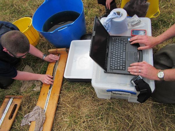
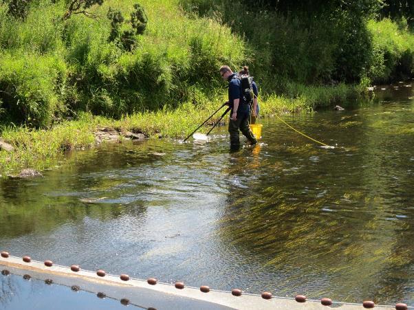
12 estimated using models created for each part of the UK and Ireland (UKTAG, 213). FCS2 Ireland was used for the first time within the Loughs Agency jurisdiction in 212 to classify fish in rivers. This methodology is WFD compliant and has replaced professional opinion as the main method of classification. A professional opinion over ride can still be employed if deemed appropriate. Fish classifications will be incorporated into final surface water classifications. Data collection was conducted in the field during July and August 214 and involved the use of a quantitative electrofishing methodology and a multi method survey technique. Electrofishing is the preferred method for WFD surveillance monitoring of fish in rivers to obtain a representative sample of fish from each monitoring station. This method is compliant with the European Committee for Standardisation (CEN) standards for assessing fish stocks in wadeable rivers (CEN, 23). Quantitative electrofishing requires the netting off of a section of river using stop nets. Removal sampling is then conducted utilising electrofishing equipment with the numbers, age class and species of each fish being recorded for each pass. After an appropriate depletion has been achieved, which facilitates a density estimation to be made, all fish were returned alive to the river. At a number of larger river sites where quantitative electrofishing was not possible due to width and or depth a multi method sampling approach was adopted which included single pass electrofishing, the deployment of 1m D ring fyke nets overnight and seine netting. Additional habitat variables were recorded and the exact sampling locations were recorded using a Trimble Juno hand held GPS unit. Professional judgement over ride can be utilised where classifications are deemed to be inaccurate due to the presence of barriers to migration downstream of the sampling stations. Consideration of this issue has not been incorporated into the FCS2 (Ireland) model at this time. Other scenarios for professional judgement over ride include significant deviation from expected classification and high water levels during survey. Page 12 of 72
13 NURSERY AREA Grade 1 5-8mm water depth.5 8% gradient Stable cobble/boulder substrate > or = 7% bed cover Providing adequate cover Grade 2 Marginally outside grade 1 on one count only Grade 3 Well outside grade 1 on one or more counts Grade 4 Absent, deep, channelized, silty etc. SPAWNING AREA Grade 1 Flow 3 6mm/sec Water depth 15 7mm 7% substrate 3-8mm diameter Gravel depth: Trout = 5-15mm Salmon = 2-5mm Grades 2-4 Failing as for nursery habitat above HOLDING AREA Grade 1 Depth minimum m ideally > or = 2m Suitable cover Bankside/substrate stability Grades 2-4 Failing as for nursery habitat above Table 1. Habitat classification based on Department of Agriculture for Northern Ireland (Fisheries Division) advisory leaflet on the evaluation of habitat for salmon and trout Page 13 of 72
14 Figure 1. WFD Fish surveillance river sites within the Foyle area, Northern Ireland and Ireland Page 14 of 72
15 Fig 2. WFD fish surveillance river sites within the Carlingford area, Northern Ireland. There are no sites within Ireland in the Carlingford area. Page 15 of 72

16 3. CLASSIFICATIONS 3.1 F11335 Camowen River at Donnellys Bridge GBNI1NW11233 Camowen WFD Fish Classification 214 GOOD METHOD Sal + Sal 1+ Tro + Tro 1+ Eel Minnow Stone Loach Total Electrofishing Single Pass Seine Netting Fyke Net Fyke Net TOTAL Table 2. Multi method sampling results Fig 3. Site F11335 Page 16 of 72
17 Due to the width and depth of the Camowen River at site F11335 it was surveyed using a multi method approach which incorporated a single pass electrofishing method, seine netting and fyke netting. Only the single pass electrofishing data has been used for final classification purposes. The combined multi method catch data was also entered into the model as single pass catch data from which a high classification was derived. It was decided to apply the precautionary approach and base the final fish classification on the lowest classification resulting in a classification for this site of good. Minimum density estimates have been calculated for all species present based on the single pass electrofishing data. 6 5 Number of Fish Salmon + Salmon 1+ Trout + Trout 1+ Eel Species Lamprey Stickleback Minnow Stone Loach Flounder Fig 4. Total catch Salmon + Salmon1+ Trout + Trout 1+ Tot Sal Tot Tro No. of Fish/1m² Tot Salmonids Eels Lamprey Stickleback Minnow Stoneloach Fish Species Fig 5. Density/1m² Page 17 of 72
18 3 25 y = 1E-5x 3.49 R² = Weight (g) Length (mm) Fig 6. Length weight relationship of salmon n = y = 2E-5x R² = Weight (g) Length (mm) Fig 7. Length weight relationship of all trout caught n = 47 Page 18 of 72
19 [-9] [1-19] [2-29] [3-39] [4-49] [5-59] [6-69] [7-79] [8-89] [9-99] [1-19] Frequency [11-119] [12-129] [13-139] [14-149] Length (mm) Fig 8. Length frequency distribution for juvenile salmon caught (this can be used to assess the presence of different age classes/cohorts). 211 n= 71, 214 n = 65. Frequency [-9] [1-19] [2-29] [3-39] [4-49] [5-59] [6-69] [7-79] [8-89] [9-99] [1-19] [11-119] [12-129] [13-139] [14-149] [15-159] [16-169] [17-179] [18-189] [19-199] [2-29] [21-219] [22-229] [23-239] [24-249] [25-259] [26-269] [27-279] [28-289] [29-299] Length (mm) Fig 9. Length frequency distribution for trout. 211 n = 36, 214 n = 47. Page 19 of 72


20 This site electrofished is composed predominantly of grade 1 spawning habitat (5%) with grade 2 nursery habitat (5%) and no holding habitat. Additional biological information is available in the spreadsheets provided. Stretches within this water body show evidence of being heavily drained with flood banks constructed beside the river. Significant bank erosion is occurring in places with Japanese knotweed and Himalayan balsam present along the bank. A number of weirs are located within this water body which impact upon fish migration. Potential programmes of measures could include removal and treatment of invasive species and introduction of large woody debris. Reconnection of the river to the flood plain would also be beneficial from a hydro geomorphological perspective. The removal of weirs should also be given careful consideration. Page 2 of 72

21 Page 21 of 72
22 Page 22 of 72

23 3.2 F145 Derg River at Crew Bridge GBNI1NW11295 Derg WFD Fish Classification 214 HIGH Method Sal + Sal 1+ Tro + Tro 1+ Eel Lam Min SB Gud Roa SL Total Electrofishing Seine Fyke Fyke TOTAL Table 3. Removal sampling results *Note Sal + = salmon +, Sal 1+ = salmon1+, Tro + = Trout +, Tro 1+ = Trout 1+, Lam = Lamprey, Min = Minnow, SB = 3 Spined Stickleback, Gud = Gudgeon, Roa = Roach and SL = Stone Loach Fig 1. Site F145 Page 23 of 72
24 Site F145 was surveyed using a multi method approach which incorporated a single pass quantitative electrofishing method, seine netting and fyke netting. Only the single pass electrofishing data has been used for final classification purposes. The combined multi method catch data was also entered into the model as single pass catch data from which a high classification was derived. Both data sets resulted in an agreed classification of high status. Minimum density estimates have been calculated for all species present based on the single pass electrofishing data Number of Fish Salmon + Fig 11. Total catch Salmon 1+ Trout + Trout 1+ Eel Lamprey Species Minnow Stickleback Stone Loach Roach Gudgeon No. of Fish/1m² Salmon + Salmon1+ Trout + Trout 1+ Tot Sal Tot Tro Tot Salmonids Eels Lamprey Minnow Stoneloach Flounder Roach Gudgeon Fish Species Fig 12. Density/1m 2 Page 24 of 72
25 y = 1E-5x R² = Weight (g) Length (mm) Fig 13. Length weight relationship of of salmon caught n = y = 1E-5x 3.18 R² = Weight (g) Length (mm) Fig 14. Length weight relationship of of trout caught n = 9. Page 25 of 72
26 Frequency [-9] [1-19] [2-29] [3-39] [4-49] [5-59] [6-69] [7-79] [8-89] [9-99] [1-19] [11-119] [12-129] [13-139] [14-149] Length (mm) Fig. 15. Length frequency distribution for salmon caught. 211 n = 9, 214 n = Frequency [-9] [1-19] [2-29] [3-39] [4-49] [5-59] [6-69] [7-79] [8-89] [9-99] [1-19] [11-119] [12-129] [13-139] [14-149] [15-159] [16-169] [17-179] [18-189] [19-199] [2-29] [21-219] [22-229] [23-239] [24-249] [25-259] [26-269] [27-279] [28-289] [29-299] Length (mm) Fig. 16. Length frequency distribution for trout caught. 211 n = 4, 214 n = 1. Page 26 of 72


27 This site is composed predominantly of grade 2 spawning habitat (5%) with grade 2 nursery habitat (4%) and grade 3 holding habitat (1%). This site demonstrated natural channel structure with good in channel habitat diversity including the presence of Ranunculus sp. Himalayan balsam was present on both banks of the river and Japanese knotweed was present on the left hand bank downstream of the bridge. Giant hogweed was present upstream of the bridge. Some bank erosion was evident upstream of Crew Bridge on the right hand bank. Potential programmes of measures could include removal and treatment of invasive species and introduction of large woody debris. Reconnection of the river to the flood plain would also be beneficial from a hydro geomorphological perspective. The bank erosion could be halted through riparian fencing incorporating a gate to facilitate limited access grazing and a pasture pump. Additional biological information is available in the spreadsheets provided. Page 27 of 72

28 Page 28 of 72
29 Page 29 of 72

30 3.3 F1128 Drumragh River U/S of Campsie Br GBNI1NW1126 Drumragh WFD Fish Classification 214 HIGH FISHING Salmon + Salmon 1+ Trout + Trout 1+ Eel La Mi SB SL Roach Total 1st Pass TOTAL Table 4. Sampling results *Note La = Lamprey, Mi = Minnow, SB = 3 Spined Stickleback and SL = Stone loach Fig 17. Site F1128 Site F1128 has been classified as a large river site where quantitative electrofishing is not possible except in the lowest of water conditions. A single pass electrofishing survey without stop nets was conducted as the river lacked suitable depths to safely deploy seine and fyke netting methods. From this data minimum density estimates have been calculated for all species present. Page 3 of 72
31 6 5 Number of Fish Salmon + Salmon 1+ Trout + Trout 1+ Eel Species Lamprey Minnow Stickleback Stone Loach Roach Fig 18. Total catch Salmon + Salmon1+ Trout + Trout 1+ No. of Fish/1m² Tot Sal Tot Tro Tot Salmonids Eels Lamprey Stickleback Roach Minnow Stone Loach Fish Species Fig 19. Density estimate in 1m² Page 31 of 72
32 y = 1E-5x R² = Weight (g) Length (mm) Fig 2. Length weight relationship of salmon n = y = 8E-6x 3.79 R² = Weight (g) Length (mm) Fig 21. Length weight relationship of trout n = 6 Page 32 of 72
33 Frequency [-9] [1-19] [2-29] [3-39] [4-49] [5-59] [6-69] [7-79] [8-89] [9-99] [1-19] [11-119] [12-129] [13-139] [14-149] Length (mm) Fig 22. Length frequency distribution for salmon. 211 n = 64, 214 n = Frequency [-9] [1-19] [2-29] [3-39] [4-49] [5-59] [6-69] [7-79] [8-89] [9-99] [1-19] [11-119] [12-129] [13-139] [14-149] [15-159] [16-169] [17-179] [18-189] [19-199] [2-29] [21-219] [22-229] [23-239] [24-249] [25-259] [26-269] [27-279] [28-289] [29-299] Length (mm) Fig 23. Length frequency distribution for trout. 211 n = 26, 214 n = 6. Page 33 of 72
 with grade 3 spawning habitat (25%) and")


34 This site is composed predominantly of grade 2 nursery habitat (65%) with grade 3 spawning habitat (25%) and grade 3 holding habitat (1%). This waterbody is impacted by large scale flood defences. Himalayan balsam is present on both banks. Additional biological information is available in the spreadsheets provided. Page 34 of 72
35 Page 35 of 72

36 3.4 F111 Fairywater River GBNI1NW11241 Fairywater WFD Fish Classification 214 MODERATE FISHING Salmon Salmon Trout Trout Eel *La *Mi *SL *SB Total st TOTAL Table 5. Removal sampling results*note La = Lamprey, Mi = Minnow, SL = Stone Loach & SB = Stickleback Fig 24. Site F111 Site F111 was surveyed using a single pass quantitative electrofishing method due to the very low numbers of fish caught. This involved stop netting the river at both upstream and downstream limits of the selected site. From this data minimum density estimates have been calculated for all species present. Page 36 of 72
37 12 1 Number of Fish Salmon + Salmon 1+ Trout + Trout 1+ Eel Species Lamprey Minnow Stickleback Stone Loach Fig 25. Total catch Salmon + Salmon1+ Trout + Trout 1+ No. of Fish/1m² Tot Sal Tot Tro Tot Salmonids Eels Lamprey Stickleback Minnow Stone Loach Flounder Fish Species Fig 26. Density/1m² Page 37 of 72
38 y = 1E-5x 3.18 R² = Weight (g) Length (mm) Fig 27. Length weight relationship of salmon caught n = y =.3x R² = 1 15 Weight (g) Length (mm) Fig 28. Length weight relationship of trout caught n = 2 Page 38 of 72
39 [-9] [1-19] [2-29] [3-39] [4-49] [5-59] [6-69] [7-79] [8-89] [9-99] [1-19] [11-119] [12-129] [13-139] Frequency [14-149] Length (mm) Fig 29. Length frequency distribution for salmon caught. 211 n = 4, 214 n = Frequency [-9] [1-19] [2-29] [3-39] [4-49] [5-59] [6-69] [7-79] [8-89] [9-99] [1-19] [11-119] [12-129] [13-139] [14-149] [15-159] [16-169] [17-179] [18-189] [19-199] [2-29] [21-219] [22-229] [23-239] [24-249] Length (mm) Fig 3. Length frequency distribution for trout caught. 211 n = 13, 214 n = 3. Page 39 of 72

40 This site is composed predominantly of grade 3 nursery habitat (8%) with grade 3 holding habitat (15%) and grade 4 spawning habitat (5%). There was heavy filamentous green algae growth possibly Cladophera spp at this site. This watercourse is slow flowing in nature which may be as a result of former drainage programmes which have over widened and deepened the river channel. The riparian area is heavily trampled by cattle on the right hand bank which is introducing fine sediment into the watercourse. Potential programmes of measures could include reinstatement of a diverse inchannel habitat including the creation of low level deflectors, and the introduction of spawning gravel and nursery stone to create repeated units of spawning holding and nursery habitat. The introduction of large woody debris could also be beneficial throughout this waterbody. Riparian fencing incorporating gates to facilitate limited access for grazing and pasture pumps are also recommended. Page 4 of 72

41 Page 41 of 72
42 Page 42 of 72

43 3.5 F1148 Faughan River at Mobuoy Bridge GBNI1NW22431 Faughan WFD Fish Classification 214 POOR METHOD Sal + Sal 1+ Tro + Tro 1+ Eel Lam Min SB SL Total Seine Seine Fyke Fyke Electrofishing TOTAL Table 6. Removal sampling results Fig 31. Site F1148 Page 43 of 72
44 Site F1148 has been classified as a large river site where quantitative electrofishing is not possible. This site was surveyed using a multi method approach. The multi method approach is conducted across a range of habitats and combines electrofishing at a suitable riffle habitat, seine netting and fyke netting. Only the single pass electrofishing data has been used for final classification purposes. The combined multi method catch data was also entered into the model as single pass catch data from which a poor classification was derived. Both data sets resulted in an agreed classification of poor status. Minimum density estimates have been calculated for all species present based on the single pass electrofishing data. Number of Fish Salmon + Salmon 1+ Trout + Trout 1+ Eel Species Lamprey Minnow Stickleback Stone Loach Fig 32. Total catch No. of Fish/1m² Salmon + Salmon1+ Trout + Trout 1+ Tot Sal Tot Tro Fish Species Tot Salmonids Eels Lamprey Stickleback Minnow Stone Loach Flounder Fig 33. Density/1m² Page 44 of 72
45 25 2 y = 3E-5x R² =.9771 Weight (g) Length (mm) Fig 34. Length weight relationship of all salmon caught n = y = 1E-6x R² = Weight (g) Length (mm) Fig 35. Length weight relationship of all trout caught n = 7 Page 45 of 72
46 Frequency [-9] [1-19] [2-29] [3-39] [4-49] [5-59] [6-69] [7-79] [8-89] [9-99] [1-19] [11-119] [12-129] [13-139] [14-149] Length (mm) Fig 36. Length frequency distribution for all salmon caught. 211 n = 89, 214 n = Frequency [-9] [1-19] [2-29] [3-39] [4-49] [5-59] [6-69] [7-79] [8-89] [9-99] [1-19] [11-119] [12-129] [13-139] [14-149] [15-159] [16-169] [17-179] [18-189] [19-199] [2-29] [21-219] Length (mm) Fig 37. Length frequency distribution for all trout caught. 211 n = 16, 214 n = 7. Page 46 of 72


47 This site is composed predominantly of grade 3 spawning habitat (55%) with grade 3 nursery habitat (25%) and grade 3 holding habitat (2%). This site lies within a heavily modified waterbody with the channel constrained by large flood embankments. The riparian area has been colonised by Himalayan balsam and Japanese knotweed. Potential programmes of measures could include removal and treatment of invasive species, introduction of large woody debris and low level deflector construction. Reconnection of the river to the flood plain would also be beneficial from a hydro geomorphological perspective. Fish passage issues downstream may be having an impact on upstream fish migration particularly for European eel, Sea lamprey and River lamprey migration. Additional biological information is available in the spreadsheets provided. Page 47 of 72

48 Page 48 of 72
49 Page 49 of 72

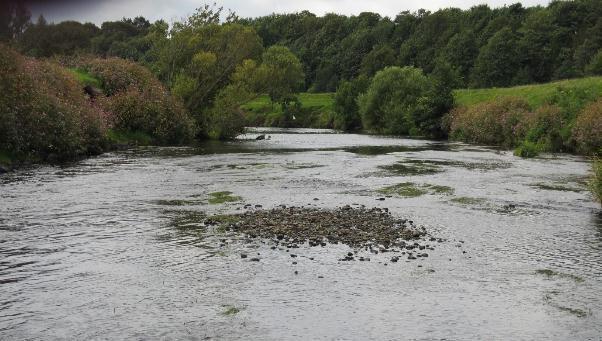
50 3.6 F172 Owenkillew River, Killymore Br GBNI1NW11228 Owenkillew WFD Fish Classification 214 HIGH METHOD Sal + Sal 1+ Sea Trout Tro + Tro 1+ Eel Lam SB SL Total Seine Fyke Fyke Electrofishing TOTAL Table 7. Removal sampling results Fig 38. Site F172 Site F172 has been classified as a large river site where quantitative electrofishing is not possible. This site was surveyed using a multi method approach. The multi method approach is conducted across a range of habitats Page 5 of 72
51 and combines electrofishing at a suitable riffle habitat, seine netting and fyke netting. Only the single pass electrofishing data has been used for final classification purposes. The combined multi method catch data was also entered into the model as single pass catch data from which a good classification was derived. The two data sets resulted in different classifications. The single pass electrofishing resulted in a high classification and the combined multi method data resulted in a good classification. It was decided using professional judgement that the high classification derived from single pass electrofishing was justified. Minimum density estimates have been calculated for all species present based on the single pass electrofishing data. Number of Fish Fig 39. Total catch No. of Fish/1m² Salmon + Salmon 1+ Sea Trout Trout + Trout 1+ Eel Species Lamprey Minnow Stickleba ck Stone Loach Salmon + Salmon1+ Trout + Trout 1+ Tot Sal Tot Tro Fish Species Tot Salmonids Eels Lamprey Stickleback Stone Loach Fig 4. Density estimate/1m 2 Page 51 of 72
52 25 2 y = 1E-5x 3.5 R² =.9923 Weight (g) Length (mm) Fig 41. Length weight relationship of salmon caught y = 5E-5x 2.74 R² = Weight (g) Length (mm) Fig 42. Length weight relationship of salmon caught. Page 52 of 72
53 Frequency Length (mm) Fig 43. Length weight frequency distribution of salmon caught in 211 n = 96 and 214 n = Frequency Length (mm) Fig 44. Length frequency distribution of trout caught in 211 n = 91 and 214 n = 69. Page 53 of 72

.")
54 This site is composed of grade 2 nursery habitat (8%) and grade 3 spawning habitat (2%). Page 54 of 72


55 The site has unrestricted access to the watercourse by cattle in places. Himalayan balsam is also present within the site. Both banks show evidence of arterial drainage with a large flood bank and reinforced bank toe evident. This site demonstrates features associated with a high energy gravel river with large mobile cobble banks and bars formed in places. Potential programmes of measures could include stock proof fencing, treatment of invasive species and consideration of flood management measures. This site was used for demonstration purposes with a video available at Page 55 of 72
56 Page 56 of 72

57 3.7 F1171 River Roe at Limavady GBNI1NW22218 Roe WFD Fish Classification 214 GOOD METHOD Sal + Sal 1+ Tro + Tro 1+ Eel Lam Min SB Fl Total Electrofishing Single Pass TOTAL Table 8. Removal sampling results Fig 45. Site F1171 Site F1171 has been classified as a large river site where quantitative electrofishing is not possible. A single pass electrofishing survey was conducted within a defined area. From this data minimum density estimates have been calculated for all species present. Page 57 of 72
58 Salmon + Salmon 1+ Trout + Trout 1+ Eel Lamprey Minnow Stickleback Number of Fish Flounder Species Fig 46. Total catch No. of Fish/1m² Salmon + Salmon1+ Trout + Trout 1+ Tot Sal Tot Tro Tot Salmonids Eels Lamprey Stickleback Minnow Flounder Fish Species Fig 47. Density estimate/1m 2 Page 58 of 72
59 35 3 y = 1E-5x R² = Weight (g) Length (mm) Fig 48. Length weight relationship of all salmon caught n = y = 2E-5x R² = Weight (g) Length (mm) Fig 49. Length weight relationship of all trout caught n = 3 Page 59 of 72
60 Frequency 1 5 [-9] [1-19] [2-29] [3-39] [4-49] [5-59] [6-69] [7-79] [8-89] [9-99] [1-19] [11-119] [12-129] [13-139] Length (mm) Fig 5. Length frequency distribution for all salmon caught 211 n = 32 & 214 n = 51 [14-149] Frequency [-9] [1-19] [2-29] [3-39] [4-49] [5-59] [6-69] [7-79] [8-89] [9-99] [1-19] [11-119] [12-129] [13-139] [14-149] [15-159] [16-169] [17-179] Length (mm) Fig 51. Length frequency distribution for all trout caught 211 n = 5 & 214 n = 3 Page 6 of 72


61 This site is composed of grade 3 spawning habitat (5%), grade 3 nursery habitat (3%) and grade 3 holding habitat (2%). This site is within a designated watercourse and is classified as a major maintained channel with extensive earthen flood embankments on both sides of the river. The river flows through a deeply incised channel which has been heavily drained. Both banks are heavily colonised by Himalayan balsam with the left hand bank also heavily colonised by Japanese knotweed. Both banks demonstrate active erosion in places possibly as an impact of the invasive species. This site is also impacted upon by a high litter/rubbish burden. Potential programmes of measures should include the sensitive removal and treatment of non-native invasive species, ensuring recolinisation by native species, reconnection of the river to the floodplain, introduction of large woody debris and a litter pick to remove waste from the watercourse and riparian area. Page 61 of 72

62 Page 62 of 72
63 Page 63 of 72


64 4. OVERVIEW OF WFD FISH SURVEILLANCE RESULTS The results for WFD river fish monitoring within the Loughs Agency areas from are outlined in the table below. In 214 a total of seven WFD river fish surveillance monitoring stations were monitored. All seven were in Northern Ireland. Classifications are outlined in the figure below. FCS2 (Ireland) was the primary classification tool from 212, prior to this classifications were based on professional opinion. No additional waterbodies were classified using FCS2 in 214. Page 64 of 72
65 Site Code Year of 1 st Survey Catchment Classification F Strule Good Good F Strule Mod Good F Owenkillew Good Mod F12 29 Burndennet Good High F Glenmornan Mod Good F Newry Mod Good F Killbroney Mod Poor F Owenkillew Good Good F Skeoge Poor Poor F Burndennet Good Mod F Derg Good Good F Glenelly Good Mod F Camowen Good Good F Roe Good F Mourne Poor Page 65 of 72
66 Site Code Year of 1 st Survey Catchment Classification B24 21 Bredagh N/A Mod 1M11 21 Derg N/A Poor 1S22 21 Finn N/A Mod F Camowen Good Good F Derg Good High F Drumragh Good High F Fairywater Good Mod F Faughan Good Poor F Owenkillew Good High F Roe Good Good F Finn Mod F Newry Mod Table 9. WFD fish surveillance stations surveyed by the Loughs Agency Page 66 of 72
67 Fig 52. Loughs Agency WFD fish surveillance water body classifications 214 Foyle area Page 67 of 72
68 5. SEMI QUANTITATIVE/SALMON MANAGEMENT PLAN CLASSIFICATIONS For classification in 214 the NI WFD Fish Group continued to adopt the set of rules for deriving indicative fish classifications for waterbodies in which annual semi quantitative/salmon management plan electrofishing surveys are conducted. Within the Foyle and Carlingford areas approximately 5 sites are semi quantitatively surveyed annually. The ability to derive indicative classifications greatly facilitates the ability to highlight pressures within specific waterbodies and can assist with the development of programmes of measures. The refined rules as of January 213 are listed below. 1. Only use if there are a minimum of three sites per water body - suggest a minimum of the three largest rivers for which data is available important to record the stations used. 2. Classify according to the dominant salmonid species within the water body where adequate historical data is available. 3. Classify if 66% of sites agree 4. Classify as Good or better, moderate or Poor or worse 5. Use the most recent years data Site In Agreement SMP Class WFD Class Roe Yes Good Good Faughan No Good Poor Derg No Good High Owenkillew No Good High Fairywater No Unclassified Moderate Drumragh No Moderate High Camowen No Unclassified Good Table method comparisons The maps below provide an overview of results for the application of this method within the Foyle and Carlingford areas in 214. GIS shape files containing the raw data behind these maps including site id s has been provided to NIEA. Page 68 of 72

69 Fig 53. Foyle area Semi quantitative/salmon management plan derived indicative water body classifications 214 Page 69 of 72

70 Fig 54. Carlingford area Semi quantitative/salmon management plan derived indicative water body classifications 214 Page 7 of 72
71 6. CONCLUSION From 212 classification has been predominantly based on the FCS2 (Ireland) model. This has replaced the professional opinion classification method as the dominant classification method. A professional opinion over ride exists to correct classifications based on a paucity of information including the presence of barriers downstream to a monitored site. The professional opinion override was not utilised in marked the last year in the first full monitoring period/cycle of the Water Framework Directive. In 214 a number of large river sites were monitored using the multi method approach. The key recommendation coming from this report for future monitoring is that the sampling of large river sites using the multi method approach should be curtailed in favour of single pass electrofishing at suitable wadeable sites. Electrofishing only is the recommended survey method. It is also recommended that when it is not possible to install stop nets due to excessive flow that a single pass survey within a defined area is conducted The FCS2 (Ireland) tool has passed the intercalibration process and has now been fully adopted for use across the island of Ireland. Further refinements may be made to the model in the future to incorporate issues such as full consideration of barriers downstream and acceptance of different types of survey data. Adoption of the FCS2 (Ireland) model and completion of the first cycle of Water Framework Directive fish surveillance monitoring marks an end to a very positive beginning for WFD compliant fish monitoring in the rivers of Northern Ireland. A degree of flexibility will need to be maintained in collecting and analysing fisheries data which can be utilised for WFD classification purposes and to ensure future development of the model. REFERENCES CEN (23) Water Quality Sampling of Fish with Electricity. European Standard. Ref. No. EN1411:2. Page 71 of 72
72 Council of the European Communities (2) Establishing a framework for community action in the field of water policy. Directive of the European Parliament and of the Council establishing a framework (2)/6/EC). Official Journal of the European Communities, 43, UK Technical Advisory Group on the Water Framework Directive (212) Proposed recommendations on biological standards, Consultation Page 72 of 72
Loughs Agency Water Framework Directive Fish in Rivers Classification Report 2012
 LOUGHS AGENCY OF THE FOYLE CARLINGFORD AND IRISH LIGHTS COMMISSION Loughs Agency Water Framework Directive Fish in Rivers Classification Report 212 Water Framework Directive Fish Population Assessment
Stillwater Status Report: Lough Muck, County Tyrone
 LOUGHS AGENCY OF THE FOYLE CARLINGFORD AND IRISH LIGHTS COMMISSION Stillwater Status Report: Lough Muck, County Tyrone Stillwater Fish Stock Survey Loughs Agency of the Foyle Carlingford and Irish Lights
Stillwater Status Report: Lough Muck, County Donegal
 LOUGHS AGENCY OF THE FOYLE CARLINGFORD AND IRISH LIGHTS COMMISSION Stillwater Status Report: Lough Muck, County Donegal Stillwater Fish Stock Survey Loughs Agency of the Foyle Carlingford and Irish Lights
Loughs Agency Freshwater Fisheries Monitoring Programme
 Loughs Agency Freshwater Fisheries Monitoring Programme Fisheries Coordination Centre/RAFTS Annual Biologists Meeting 29 th 30 th January 2014 Marine Scotland Freshwater Laboratory, Pitlochry Art Niven,
Stillwater Status Report: Lough Mourne, County Donegal
 LOUGHS AGENCY OF THE FOYLE CARLINGFORD AND IRISH LIGHTS COMMISSION Stillwater Status Report: Lough Mourne, County Donegal Stillwater Fish Stock Survey Loughs Agency of the Foyle Carlingford and Irish Lights
Foyle Area and Tributaries Catchment Status Report 2015 Conservation and assessment of fish populations and aquatic habitats
 LOUGHS AGENCY OF THE FOYLE CARLINGFORD AND IRISH LIGHTS COMMISSION Foyle Area and Tributaries Catchment Status Report 2015 Conservation and assessment of fish populations and aquatic habitats Art Niven,
Foyle Area and Tributaries Catchment Status Report 2014 Conservation and assessment of fish populations and aquatic habitats
 LOUGHS AGENCY OF THE FOYLE CARLINGFORD AND IRISH LIGHTS COMMISSION Foyle Area and Tributaries Catchment Status Report 2014 Conservation and assessment of fish populations and aquatic habitats Art Niven,
Stillwater Status Report: Enagh Lough East
 LOUGHS AGENCY OF THE FOYLE CARLINGFORD AND IRISH LIGHTS COMMISSION Stillwater Status Report: Enagh Lough East Stillwater Fish Stock Survey Loughs Agency of the Foyle Carlingford and Irish Lights Commission
Fairywater River and Tributaries Catchment Status Report 2011 Conservation, protection and assessment of fish populations and aquatic habitats
 This document and its contents are copyright of the Loughs Agency 212 LOUGHS AGENCY OF THE FOYLE CARLINGFORD AND IRISH LIGHTS COMMISSION Fairywater River and Tributaries Catchment Status Report 211 Conservation,
A review of Rotary Screw Trap operations on the River Faughan
 LOUGHS AGENCY OF THE FOYLE CARLINGFORD AND IRISH LIGHTS COMMISSION A review of Rotary Screw Trap operations on the River Faughan 2003-2016 Monitoring and Conservation Loughs Agency of the Foyle Carlingford
Foyle Area and Tributaries Catchment Status Report 2016 Conservation and assessment of fish populations and aquatic habitats
 LOUGHS AGENCY OF THE FOYLE CARLINGFORD AND IRISH LIGHTS COMMISSION Foyle Area and Tributaries Catchment Status Report 2016 Conservation and assessment of fish populations and aquatic habitats Art Niven
River Derg and Tributaries Catchment Status Report 2011 Conservation, protection and assessment of fish populations and aquatic habitats
 This document and its contents are copyright of the Loughs Agency 212 LOUGHS AGENCY OF THE FOYLE CARLINGFORD AND IRISH LIGHTS COMMISSION River Derg and Tributaries Catchment Status Report 211 Conservation,
COPYRIGHT 2012 LOUGHS AGENCY OF THE FOYLE CARLINGFORD AND IRISH LIGHTS COMMISSION LOUGHS AGENCY OF THE FOYLE CARLINGFORD AND IRISH LIGHTS COMMISSION
 LOUGHS AGENCY OF THE FOYLE CARLINGFORD AND IRISH LIGHTS COMMISSION Burndennet, Glenmornan River and Tributaries Catchment Status Report 2011 Conservation, protection and assessment of fish populations
Stillwater Status Report: Camlough, Co. Armagh
 LOUGHS AGENCY OF THE FOYLE CARLINGFORD AND IRISH LIGHTS COMMISSION Stillwater Status Report: Camlough, Co. Armagh Stillwater Fish Stock Survey Loughs Agency of the Foyle Carlingford and Irish Lights Commission
Glenelly River and Tributaries catchment Status Report 2011 Conservation, protection and assessment of fish populations and aquatic habitats
 This document and its contents are copyright of the Loughs Agency 2012 LOUGHS AGENCY OF THE FOYLE CARLINGFORD AND IRISH LIGHTS COMMISSION Glenelly River and Tributaries catchment Status Report 2011 Conservation,
Culdaff River, Inishowen and Tributaries Catchment Status Report 2011 Conservation, protection and assessment of fish populations and aquatic habitats
 This document and its contents are copyright of the Loughs Agency 2012 LOUGHS AGENCY OF THE FOYLE CARLINGFORD AND IRISH LIGHTS COMMISSION Culdaff River, Inishowen and Tributaries Catchment Status Report
River Finn and Tributaries Catchment Status Report 2011 Conservation, protection and assessment of fish populations and aquatic habitats
 This document and its contents are copyright of the Loughs Agency 2012 LOUGHS AGENCY OF THE FOYLE CARLINGFORD AND IRISH LIGHTS COMMISSION River Finn and Tributaries Catchment Status Report 2011 Conservation,
Carlingford Area and Tributaries Catchment Status Report 2014 Conservation and assessment of fish populations and aquatic habitats
 LOUGHS AGENCY OF THE FOYLE CARLINGFORD AND IRISH LIGHTS COMMISSION Carlingford Area and Tributaries Catchment Status Report 2014 Conservation and assessment of fish populations and aquatic habitats Art
[Type a quote from the document or the summary of an interesting point. You can
 [Type a quote from the document or the summary of an interesting point. You can position the text box anywhere in the document Use the Text Box Tools tabto LOUGHS AGENCY OF THE FOYLE CARLINGFORD AND IRISH
Fish population survey report
 Fish population survey report River Teme 2016 This report provides a summary of results from recent coarse fish population surveys on the River Teme between Tenbury Wells and Powick. The surveys were carried
Water Framework Directive Fish Stock Survey of Rivers in the South Western River Basin District, 2013
 Water Framework Directive Fish Stock Survey of Rivers in the South Western River Basin District, 213 Fiona L. Kelly, Ronan Matson, Lynda Connor, Rory Feeney, Emma Morrissey, John Coyne and Kieran Rocks
River Roe and Tributaries Catchment Status Report 2011 Conservation, protection and assessment of fish populations and aquatic habitats
 This document and its contents are copyright of the Loughs Agency 2012 LOUGHS AGENCY OF THE FOYLE CARLINGFORD AND IRISH LIGHTS COMMISSION River Roe and Tributaries Catchment Status Report 2011 Conservation,
European Smelt (Osmerus eperlanus L.) Baseline Surveys on the River Foyle, River Finn, River Deele & Burndennet River
 Baseline Surveys on the River Foyle, River Finn, River Deele & Burndennet River") 2010 European Smelt (Osmerus eperlanus L.) Baseline Surveys on the River Foyle, River Finn, River Deele & Burndennet River Loughs Agency of the Foyle Carlingford and Irish Lights Commission Report Ref:
2010 European Smelt (Osmerus eperlanus L.) Baseline Surveys on the River Foyle, River Finn, River Deele & Burndennet River Loughs Agency of the Foyle Carlingford and Irish Lights Commission Report Ref:
Water Framework Directive Fish Stock Survey of Glencar Lough, August 2013
 1 Water Framework Directive Fish Stock Survey of Glencar Lough, August 2013 Fiona L. Kelly, Lynda Connor, Emma Morrissey, John Coyne, Ronan Matson, Rory Feeney and Kieran Rocks Inland Fisheries Ireland,
Loughs Agency Gníomhaireacht na Lochanna Factrie fur Loughs
 CONSULTATION DOCUMENT PROPOSED AMENDMENTS OF THE FOYLE AREA (CONTROL OF FISHING) REGULATIONS 1999 Foyle Area (Control of Fishing) (Amendment) Regulations 2008 INTRODUCTION This Consultation Document sets
Fish population survey report
 Fish population survey report River Lugg This report provides a summary of results from recent fish population surveys on the River Lugg between Leominster and Hereford. The surveys were carried out to
Sea trout (Salmo trutta L.) Status Report: Foyle & Carlingford Areas
 Status Report: Foyle & Carlingford Areas") LOUGHS AGENCY OF THE FOYLE CARLINGFORD AND IRISH LIGHTS COMMISSION Sea trout (Salmo trutta L.) Status Report: Foyle & Carlingford Areas Monitoring, Conservation & Protection Loughs Agency of the Foyle
LOUGHS AGENCY OF THE FOYLE CARLINGFORD AND IRISH LIGHTS COMMISSION Sea trout (Salmo trutta L.) Status Report: Foyle & Carlingford Areas Monitoring, Conservation & Protection Loughs Agency of the Foyle
Know Your River Conwy Salmon & Sea Trout Catchment Summary
 Know Your River Conwy Salmon & Sea Trout Catchment Summary Introduction This report describes the status of the salmon and sea trout populations in the Conwy catchment. Bringing together data from rod
Fish population survey report
 Fish population survey report Upper River Avon Catchment This report provides a summary of results from recent fish population surveys on the Tetbury Avon, Sherston Avon and River Marden The surveys were
Water Framework Directive Fish Stock Survey of Lickeen Lough, September 2013
 1 Water Framework Directive Fish Stock Survey of Lickeen Lough, September 2013 Fiona L. Kelly, Lynda Connor, Emma Morrissey, John Coyne, Ronan Matson, Rory Feeney and Kieran Rocks Inland Fisheries Ireland,
ELECTRO-FISHING REPORT 2016 UPPER TWEED
 ELECTRO-FISHING REPORT 2016 UPPER TWEED The electro-fishing programme carried out each summer by The Tweed Foundation is part of our management plan, which details the information that is required to manage
Water Framework Directive Fish Stock Survey of Lough Meelagh, August 2014
 1 Water Framework Directive Fish Stock Survey of Lough Meelagh, August 2014 Fiona L. Kelly, Lynda Connor, Emma Morrissey, John Coyne, Rory Feeney, Ronan Matson and Kieran Rocks Inland Fisheries Ireland,
Water Framework Directive Fish Stock Survey of Transitional Waters in the South Western River Basin District Lough Gill
 Water Framework Directive Fish Stock Survey of Transitional Waters in the South Western River Basin District Lough Gill Fiona L. Kelly, Ronan Matson, John Coyne, Rory Feeney, Emma Morrissey, and Kieran
We would also like to thank Dr. Martin O Grady (CFB) and No. 3 Operational Wing, Irish Air Corps (Aer Chór na héireann) for the aerial photographs.
 and No. 3 Operational Wing, Irish Air Corps (Aer Chór na héireann) for the aerial photographs.") ACKNOWLEDGEMENTS The authors wish to gratefully acknowledge the help and co-operation of the acting CEO Dr. Milton Matthews and staff of the Northern Regional Fisheries Board. The authors would also like
ACKNOWLEDGEMENTS The authors wish to gratefully acknowledge the help and co-operation of the acting CEO Dr. Milton Matthews and staff of the Northern Regional Fisheries Board. The authors would also like
Water Framework Directive Fish Stock Survey of Lough Rea, July 2013
 1 Water Framework Directive Fish Stock Survey of Lough Rea, July 2013 Fiona L. Kelly, Lynda Connor, Emma Morrissey, John Coyne, Ronan Matson, Rory Feeney and Kieran Rocks Inland Fisheries Ireland, 3044
Know Your River Conwy Salmon & Sea Trout Catchment Summary
 Know Your River Conwy Salmon & Sea Trout Catchment Summary Introduction This report describes the status of the salmon and sea trout populations in the Conwy catchment. Bringing together data from rod
Big Spring Creek Habitat Enhancement and Fishery Management Plans
 Big Spring Creek Habitat Enhancement and Fishery Management Plans November 5, 2012 Big Spring Events and Activities Center Newville, PA Charlie McGarrell Regional Habitat Biologist Pennsylvania Fish and
Water Framework Directive Fish Stock Survey of Maumwee Lough, August 2013
 1 Water Framework Directive Fish Stock Survey of Maumwee Lough, August 2013 Fiona L. Kelly, Lynda Connor, Emma Morrissey, John Coyne, Ronan Matson, Rory Feeney and Kieran Rocks Inland Fisheries Ireland,
Water Framework Directive Fish Stock Survey of Upper Lake, Killarney, September 2014
 1 Water Framework Directive Fish Stock Survey of Upper Lake, Killarney, September 2014 Fiona L. Kelly, Lynda Connor, Emma Morrissey, John Coyne, Rory Feeney, Ronan Matson and Kieran Rocks Inland Fisheries
Know Your River River Afan Salmon and Sea Trout Catchment Summary
 Know Your River River Afan Salmon and Sea Trout Catchment Summary Introduction This report describes the status of the salmon and sea trout populations in the Afan catchments. Bringing together data from
Water Framework Directive Fish Stock Survey of Upper Lake, September 2011
 1 Water Framework Directive Fish Stock Survey of Upper Lake, September 2011 Fiona L. Kelly, Lynda Connor, Emma Morrissey, Ciara Wogerbauer, Ronan Matson, Rory Feeney and Kieran Rocks Inland Fisheries Ireland,
Know Your River - River Ogmore Salmon and Sea Trout Catchment Summary
 Know Your River - River Ogmore Salmon and Sea Trout Catchment Summary Introduction This report describes the status of the salmon and sea trout populations in the Ogmore catchments. Bringing together data
Data Report : Russian River Basin Steelhead and Coho Salmon Monitoring Program Pilot Study
 Data Report 1999-1: Russian River Basin Steelhead and Coho Salmon Monitoring Program Pilot Study Sonoma County Water Agency 215 West College Avenue Santa Rosa, California 951 Prepared by David Cook Senior
Water Framework Directive Fish Stock Survey of Glenbeg Lough, September 2014
 1 Water Framework Directive Fish Stock Survey of Glenbeg Lough, September 2014 Fiona L. Kelly, Lynda Connor, Emma Morrissey, John Coyne, Rory Feeney, Ronan Matson and Kieran Rocks Inland Fisheries Ireland,
Water Framework Directive Fish Stock Survey of Doo Lough, October 2012
 1 Water Framework Directive Fish Stock Survey of Doo Lough, October 2012 Fiona L. Kelly, Lynda Connor, Emma Morrissey, Ciara Wogerbauer, Ronan Matson, Rory Feeney and Kieran Rocks Inland Fisheries Ireland,
Know Your River - Clwyd Salmon & Sea Trout Catchment Summary
 Know Your River - Clwyd Salmon & Sea Trout Catchment Summary Introduction This report describes the status of the salmon and sea trout populations in the Clwyd catchment. Bringing together data from rod
Abundance of Steelhead and Coho Salmon in the Lagunitas Creek Drainage, Marin County, California
 scanned for KRIS Abundance of Steelhead and Coho Salmon in the Lagunitas Creek Drainage, Marin County, California Prepared for: Marin Municipal Water District 220 Nellen Drive Corte Madera, California
We would like to thank the landowners and angling clubs that granted us access to their land and respective fisheries.
 The Central and Regional Fisheries Boards ACKNOWLEDGEMENTS The authors wish to gratefully acknowledge the help and co-operation of the CEO, Mr. Pat Doherty, Assistant CEO, Mr. William Walsh and the staff
Catchment Characterisation Survey
 Survey Electrofishing Report, Project Report No. Revision No. Date of Issue Catchment Characterisation 002 001 April 2017 Author: Rosie Law Project Officer Rosie Law Reviewed by: David Calvert Chairman
Loughs Agency. Foyle, Carlingford and Irish Lights Commission. Pre-Fishery Stock Assessment Lough Foyle Native Oyster Fishery.
 Loughs Agency Foyle, Carlingford and Irish Lights Commission Pre-Fishery Stock Assessment Lough Foyle Native Oyster Fishery Summary Report Autumn 216 1 Aquaculture & Shellfisheries Report Reference LA/Y/216
We would also like to thank Dr. Martin O Grady (CFB) and No. 3 Operational Wing, Irish Air Corps (Aer Chór na héireann) for the aerial photographs.
 and No. 3 Operational Wing, Irish Air Corps (Aer Chór na héireann) for the aerial photographs.") ACKNOWLEDGEMENTS The authors wish to gratefully acknowledge the help and co-operation of the CEO Mr. Vincent Roche, the assistant CEO Dr. John Conneely and the staff of the North Western Regional Fisheries
ACKNOWLEDGEMENTS The authors wish to gratefully acknowledge the help and co-operation of the CEO Mr. Vincent Roche, the assistant CEO Dr. John Conneely and the staff of the North Western Regional Fisheries
Council CNL(16)37. Annual Progress Report on Actions Taken Under the Implementation Plan for the Calendar Year EU - UK (Northern Ireland)
37. Annual Progress Report on Actions Taken Under the Implementation Plan for the Calendar Year EU - UK (Northern Ireland)") Agenda item 6.1 For information Council CNL(16)37 Annual Progress Report on Actions Taken Under the Implementation Plan for the Calendar Year 2015 EU - UK (Northern Ireland) CNL(16)37 Annual Progress
Agenda item 6.1 For information Council CNL(16)37 Annual Progress Report on Actions Taken Under the Implementation Plan for the Calendar Year 2015 EU - UK (Northern Ireland) CNL(16)37 Annual Progress
Guidance Note. Hydropower Guidance Note: HGN 8 Fish Passage. When do you need to install a fish pass?
 Guidance Note Hydropower Guidance Note: This guidance note is not intended as a statement of law. It should be read in combination with, and in the context of, the relevant enactments and EU obligations.
We would also like to thank Dr. Martin O Grady (CFB) and No. 3 Operational Wing, Irish Air Corps (Aer Chór na héireann) for the aerial photographs.
 and No. 3 Operational Wing, Irish Air Corps (Aer Chór na héireann) for the aerial photographs.") ACKNOWLEDGEMENTS The authors wish to gratefully acknowledge the help and co-operation of the CEO Mr. Aidan Barry, the assistant CEO Dr. Patrick Buck and the staff of the Southern Regional Fisheries Board.
ACKNOWLEDGEMENTS The authors wish to gratefully acknowledge the help and co-operation of the CEO Mr. Aidan Barry, the assistant CEO Dr. Patrick Buck and the staff of the Southern Regional Fisheries Board.
Minutes of Meeting of the Salmon, Inland Fisheries and Environmental Focus Group. Wednesday 26 th March Silverbirch Hotel, Omagh
 Minutes of Meeting of the Salmon, Inland Fisheries and Environmental Focus Group Wednesday 26 th March 2014 Silverbirch Hotel, Omagh Present Forum Members Jim Haughey Tony French Eamon Mullan Michael Stinson
Know Your River River Neath Salmon and Sea Trout Catchment Summary
 Know Your River River Neath Salmon and Sea Trout Catchment Summary Introduction This report describes the status of the salmon and sea trout populations in the Neath catchments. Bringing together data
An Roinn Turasoireachta, lascaigh. agus Foraoiseachta THE IMPACT OF EEL FYKE NETTING ON OTHER FISHERIES
 " An Roinn Turasoireachta, lascaigh agus Foraoiseachta THE IMPACT OF EEL FYKE NETTING ON OTHER FISHERIES Christopher Moriarty 1'1, I " I,' i l,i,! ill I!'I: " I III "!'I :,11 'I, I li,'1 li'[11 ill ':Ii
Rampart Stream Fish Stock Survey - Monitoring Report
 Rampart Stream Fish Stock Survey - Monitoring Report Action E3 LIFE09 NAT/IE/000220 BLACKWATER SAMOK 2015 The IRD Duhallow LIFE Project is supported through the LIFE financial instrument of the European
The Spey Catchment Initiative
 The Spey Catchment Initiative Introducing the Spey Catchment Initiative The Spey Catchment Initiative is a new project which aims to help deliver the objectives of the River Spey Catchment Management Plan
Water Framework Directive Fish Stock Survey of Kylemore Lough, August 2013
 1 Water Framework Directive Fish Stock Survey of Kylemore Lough, August 2013 Fiona L. Kelly, Lynda Connor, Emma Morrissey, John Coyne, Ronan Matson, Rory Feeney and Kieran Rocks Inland Fisheries Ireland,
Know Your River River Loughor Salmon and Sea Trout Catchment Summary
 Know Your River River Loughor Salmon and Sea Trout Catchment Summary Introduction This report describes the status of the salmon and sea trout populations in the Loughor catchments. Bringing together data
Salmon Five Point Approach restoring salmon in England
 Salmon Five Point Approach restoring salmon in England Our Mission To restore the abundance, diversity and resilience of salmon stocks throughout England We will do this by:- a) Maximising the production
Cornwell brook Cornwell Manor
 Cornwell brook Cornwell Manor An Advisory Visit by the Wild Trout Trust February 2014 1 1. Introduction This report is the output of a Wild Trout Trust visit to a tributary of the Cornwell Brook at Cornwell
The Central and Regional Fisheries Boards
 1 ACKNOWLEDGEMENTS The authors wish to gratefully acknowledge the help and co-operation of the Acting CEO Dr. Milton Matthews and the staff of the Northern Regional Fisheries Board. The authors would also
Know Your River Dee Salmon & Sea Trout Catchment Summary
 Know Your River Dee Salmon & Sea Trout Catchment Summary Introduction This report describes the status of the salmon and sea trout populations in the Dee catchment. Bringing together data from rod catches,
Yours Aye Eddie. Chairman of the LLFT
 Welcome to the Loch Lomond Fisheries Trust (LLFT) second Annual Newsletter. Most of you will know the role of the Trust: we are an environmental charity which exists to champion the conservation of Loch
Know Your River - Ogwen Salmon & Sea Trout Catchment Summary
 Know Your River - Ogwen Salmon & Sea Trout Catchment Summary Introduction This report describes the status of the salmon and sea trout populations in the Ogwen catchment. Bringing together data from rod
Inland Fisheries Ireland. National Research Survey Programme. Fish Stock Survey of Lough Nasnahida, July 2015
 1 Inland Fisheries Ireland National Research Survey Programme Fish Stock Survey of Lough Nasnahida, July 2015 Fiona L. Kelly, Lynda Connor, Karen Delanty, John Coyne, Emma Morrissey, William Corcoran,
Know Your River - Clwyd Salmon & Sea Trout Catchment Summary
 Know Your River - Clwyd Salmon & Sea Trout Catchment Summary Introduction This report describes the status of the salmon and sea trout populations in the Clwyd catchment. Bringing together data from rod
The Central and Regional Fisheries Boards
 1 ACKNOWLEDGEMENTS The authors wish to gratefully acknowledge the help and co-operation of the CEO Mr. Vincent Roche, Assistant CEO Dr. John Conneely and their staff from the North Western Regional Fisheries
Habitat Advisory visit to the River Fergus system Co.Clare, Eire. Undertaken on behalf of Ennis and District Anglers Association, by Vaughan Lewis,
 Habitat Advisory visit to the River Fergus system Co.Clare, Eire. Undertaken on behalf of Ennis and District Anglers Association, by Vaughan Lewis, Windrush AEC Ltd April 2006 1.0 Introduction This report
NASCO Guidelines for the Protection, Restoration and Enhancement of Atlantic Salmon Habitat
 NASCO Guidelines for the Protection, Restoration and Enhancement of Atlantic Salmon Habitat 1 NASCO Guidelines for the Protection, Restoration and Enhancement of Atlantic Salmon Habitat Additional copies
We would like to thank the landowners and angling clubs that granted us access to their land and respective fisheries.
 ACKNOWLEDGEMENTS The authors wish to gratefully acknowledge the help and co-operation of the regional director Mr. William Walsh and staff from IFI Blackrock as well as various other offices throughout
Marine Tourism and Angling Development Facilities
 Marine Tourism and Angling Development Facilities Contents Introduction... 2 List of Partners... 2 Gribben Quay... 3 Backwater... 4 Mellon Beat... 5 Malin Head... 6 Benone Beach Activity Centre... 7 Greencastle
FISHERY MANAGEMENT ISSUES - LUNAN WATER
 ERFT Putting the fish in efficiency FISHERY MANAGEMENT ISSUES - LUNAN WATER A DESIGNATED SALMON RIVER UNDER NASCO OBJECTIVES OF THE TRUST: To advance environmental protection and improvement by conserving
COLUMBIA LAKE DAM REMOVAL PROJECT
 COLUMBIA LAKE DAM REMOVAL PROJECT Major Goals of the Columbia Lake Dam Removal: Reconnect 10 miles of the Paulins Kill River to the Delaware River, restoring natural flow regime and sediment transport.
Columbia Lake Dam Removal Project
 Columbia Lake Dam Removal Project The Columbia Lake dam located 1/4 mile upstream of the Paulins Kill River's confluence with the Delaware River in Knowlton Township, Warren County has been proposed for
NEVADA DEPARTMENT OF WILDLIFE STATEWIDE FISHERIES MANAGEMENT
 NEVADA DEPARTMENT OF WILDLIFE STATEWIDE FISHERIES MANAGEMENT FEDERAL AID JOB PROGRESS REPORTS F-20-52 2016 REDBAND TROUT EASTERN REGION NEVADA DEPARTMENT OF WILDLIFE, FISHERIES DIVISION ANNUAL JOB PROGRESS
We would also like to thank Dr. Martin O Grady (CFB) and No. 3 Operational Wing, Irish Air Corps (Aer Chór na héireann) for the aerial photographs.
 and No. 3 Operational Wing, Irish Air Corps (Aer Chór na héireann) for the aerial photographs.") ACKNOWLEDGEMENTS The authors wish to gratefully acknowledge the help and co-operation of the CEO Dr. Greg Forde, the assistant CEO Ms. Amanda Mooney and the staff of the Western Regional Fisheries Board.
ACKNOWLEDGEMENTS The authors wish to gratefully acknowledge the help and co-operation of the CEO Dr. Greg Forde, the assistant CEO Ms. Amanda Mooney and the staff of the Western Regional Fisheries Board.
Lamprey populations in the UK & the development of a new sampling tool for deep water habitats. Nicola Teague
 Lamprey populations in the UK & the development of a new sampling tool for deep water habitats Nicola Teague Lamprey in the UK Lamprey among the most ancient & curious aquatic vertebrates Along with hagfish
STREAM SURVEY File form No..
 scanned for KRIS THE RESOURCES AGENCY OF CALIFORNIA California Department of Fish and Game STREAM SURVEY File form No.. Date: September 4, 1969. NAME: North Fork Schooner Gulch Creek COUNTY: Mendocino.
OKANAGAN RIVER RESTORATION INITIATIVE - FAQ
 OKANAGAN RIVER RESTORATION INITIATIVE - FAQ Initiative background: The health of the q awsitk w (Okanagan River) has been severely impacted by the channelization works that occurred in the mid-1950 s.
Water Framework Directive Fish Stock Survey of Transitional Waters in the South Western River Basin District Barrow, Nore, Suir Estuary 2013
 Water Framework Directive Fish Stock Survey of Transitional Waters in the South Western River Basin District Barrow, Nore, Suir Estuary 2013 Fiona L. Kelly, Ronan Matson, John Coyne, Rory Feeney, Emma
Minnesota Department of Natural Resources Division of Fish and Wildlife Section of Fisheries. Stream Survey Report. Luxemburg Creek.
 Minnesota F-29-R(P)-24 Area 315 Study 3 March 2016 Minnesota Department of Natural Resources Division of Fish and Wildlife Section of Fisheries Stream Survey Report Luxemburg Creek 2015 Mark Pelham Sauk
STEELHEAD SURVEYS IN OMAK CREEK
 STEELHEAD SURVEYS IN OMAK CREEK 2002 Annual Report Prepared by Chris Fisher John Arterburn Colville Confederated Tribes Fish and Wildlife Department P.O. Box 150 Nespelem, WA 99155 Prepared for Project
Study Update Tailrace Slough Use by Anadromous Salmonids
 Study Update Tailrace Slough Use by Anadromous Salmonids Goals and Objectives Identify what anadromous salmonids use the tailrace slough by: Life Stage (Juvenile, migrating and spawning adults) Timing
Columbia Lake Dam Removal Project
 Columbia Lake Dam Removal Project Major Goals of the Columbia Lake Dam Removal: Reconnect 10 miles of the Paulins Kill River to the Delaware River, restoring natural flow regime and sediment transport.
Trout Unlimited Comments on the Scope of Environmental Impact Statement for the Constitution Pipeline Project, Docket No. PF12-9
 October 9, 2012 Kimberly D. Bose, Secretary Federal Energy Regulatory Commission 888 First Street, NE, Room 1A Washington, DC 20426 RE: Trout Unlimited Comments on the Scope of Environmental Impact Statement
Escaped Rainbow Trout (Onchorhyncus mykiss) Management 2018 Operational Plan
 Management 2018 Operational Plan") Escaped Rainbow Trout (Onchorhyncus mykiss) Management 2018 Operational Plan Internal Document Last updated 9 th May 2018 INTRODUCTION Following the escape of a significant number of rainbow trout (Onchorhyncus
Escaped Rainbow Trout (Onchorhyncus mykiss) Management 2018 Operational Plan Internal Document Last updated 9 th May 2018 INTRODUCTION Following the escape of a significant number of rainbow trout (Onchorhyncus
The Central and Regional Fisheries Boards
 1 ACKNOWLEDGEMENTS The authors wish to gratefully acknowledge the help and co-operation of the CEO Mr. Pat Doherty, Assistant CEO Mr. William Walsh and their staff from the Eastern Regional Fisheries Board.
Goldfish control in the Vasse River: summary of the 2008 programme
 Goldfish control in the Vasse River: summary of the 8 programme Prepared by Freshwater and Threatened Fish Research Facility Prepared for February 9 1 Goldfish control in the Vasse River: summary of the
Current Status and Management Recommendations for the Fishery in the Cloverleaf Chain of Lakes
 Current Status and Management Recommendations for the Fishery in the Cloverleaf Chain of Lakes Jason Breeggemann Senior Fisheries Biologist Wisconsin Department of Natural Resources Outline DNR fisheries
Fish Survey Report and Stocking Advice for Loch Milton. (Loch a Mhuilinn), May 2011
, May 2011") Fish Survey Report and Stocking Advice for Loch Milton (Loch a Mhuilinn), May 2011 Jonah Tosney Freshwater Fisheries Biologist Wester Ross Fisheries Trust 1 Loch Milton (Loch a Mhuilinn) Fish Survey Report
Fish Survey Report and Stocking Advice for Loch Milton (Loch a Mhuilinn), May 2011 Jonah Tosney Freshwater Fisheries Biologist Wester Ross Fisheries Trust 1 Loch Milton (Loch a Mhuilinn) Fish Survey Report
Council CNL(11)35. Annual Report on Actions Taken Under Implementation Plans. EU - France
35. Annual Report on Actions Taken Under Implementation Plans. EU - France") Agenda Item 6.1 For Information Council CNL(11)35 Annual Report on Actions Taken Under Implementation Plans EU - France Annual Report on actions taken under Implementation Plans for the Calendar Year
Agenda Item 6.1 For Information Council CNL(11)35 Annual Report on Actions Taken Under Implementation Plans EU - France Annual Report on actions taken under Implementation Plans for the Calendar Year
Don Pedro Project Relicensing
 Don Pedro Project Relicensing M ODESTO I RRIGATION D ISTRICT TURLOCK I RRIGATION D ISTRICT FERC PROJECT N O. 2299 Resident Fish in Don Pedro Reservoir Don Pedro Reservoir Fish Stocking (1971-Present) CDFG
We would also like to thank Dr. Martin O Grady (CFB) and No. 3 Operational Wing, Irish Air Corps (Aer Chór na héireann) for the aerial photographs.
 and No. 3 Operational Wing, Irish Air Corps (Aer Chór na héireann) for the aerial photographs.") ACKNOWLEDGEMENTS The authors wish to gratefully acknowledge the help and co-operation of the CEO Mr. Aidan Barry, the assistant CEO Dr. Patrick Buck and the staff of the Southern Regional Fisheries Board.
ACKNOWLEDGEMENTS The authors wish to gratefully acknowledge the help and co-operation of the CEO Mr. Aidan Barry, the assistant CEO Dr. Patrick Buck and the staff of the Southern Regional Fisheries Board.
REPORT OF PHASE 1 OF AN EASTERN TAY DISTRICT RIPARIAN SURVEY. David Summers and Robert Mitchell Tay Foundation May 2010
 REPORT OF PHASE 1 OF AN EASTERN TAY DISTRICT RIPARIAN SURVEY 1. INTRODUCTON David Summers and Robert Mitchell Tay Foundation May 2010 The eastern half of the Tay district mainly consists of arable farmland
FISH PASSAGE IMPROVEMENT in California s Watersheds. Assessments & Recommendations by the Fish Passage Forum
 FISH PASSAGE IMPROVEMENT in California s Watersheds Assessments & Recommendations by the Fish Passage Forum FISH PASSAGE IMPROVEMENT in California s Watersheds The mission of the Fish Passage Forum is
Hydraulic Modeling of Stream Enhancement Methods
 Hydraulic Modeling of Stream Enhancement Methods Matthew J. Curry John J. Levitsky Abstract Development within watersheds increases the amounts of runoff causing stream erosion and degradation of stream
FINAL REPORT. Yonkers Creek Migration Barrier Removal Project Wonderstump Road Del Norte County. Submitted By:
 FINAL REPORT Yonkers Creek Migration Barrier Removal Project Wonderstump Road Del Norte County Submitted By: Del Norte County Community Development Department Yonkers Creek Migration Barrier Removal Project