Water Framework Directive Fish Stock Survey of Rivers in the South Western River Basin District, 2013
|
|
|
- Andrew Austin
- 5 years ago
- Views:
Transcription
1
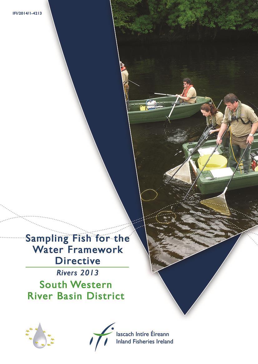
2 Water Framework Directive Fish Stock Survey of Rivers in the South Western River Basin District, 213 Fiona L. Kelly, Ronan Matson, Lynda Connor, Rory Feeney, Emma Morrissey, John Coyne and Kieran Rocks Inland Fisheries Ireland, 344 Lake Drive, Citywest Business Campus, Dublin 24 CITATION: Kelly, F.L., Matson, R., Connor, L., Feeney, R., Morrissey, E., Coyne, J. and Rocks, K. (214) Water Framework Directive Fish Stock Survey of Rivers in the South Western River Basin District. Inland Fisheries Ireland, 344 Lake Drive, Citywest Business Campus, Dublin 24, Ireland. Cover photo: WFD team electric-fishing Inland Fisheries Ireland Inland Fisheries Ireland 214 2
3 ACKNOWLEDGEMENTS The authors wish to gratefully acknowledge the help and co-operation of the regional director Dr. Pat Buck and staff from IFI Macroom as well as various other offices throughout the region. The authors also gratefully acknowledge the help and cooperation of colleagues in IFI Swords. We would like to thank the landowners and angling clubs that granted us access to their land and respective fisheries. Furthermore, the authors would like to acknowledge the funding provided for the project from the Department of Communications, Energy and Natural Resources for 213. PROJECT STAFF Project Director/Senior Research Officer: Dr. Fiona Kelly Project Manager: Ms. Lynda Connor Research Officer: Dr. Ronan Matson Technician Mr. Rory Feeney Technician: Ms. Emma Morrissey Technician: Mr. John Coyne GIS Officer: Mr. Kieran Rocks Fisheries Assistant: Mr. Johannes Bulfin (Jul 213 Dec 213) Fisheries Assistant: Mr. John Finn (Jul 213 Dec 213) Fisheries Assistant: Ms. Karen Kelly (Jul 213 Dec 213) Fisheries Assistant: Ms. Roisín O Callaghan (Jul 213 Dec 213) Fisheries Assistant: Ms. Laura Walsh (Jul 213 Dec 213) The report includes Ordnance Survey Ireland data reproduced under OSi Copyright Permit No. MP 758. Unauthorised reproduction infringes Ordnance Survey Ireland and Government of Ireland copyright. Ordnance Survey Ireland,
4 TABLE OF CONTENTS 1. INTRODUCTION STUDY AREA METHODS RESULTS River surveys The Adrigole River The Araglin River The River Blackwater The Cummeragh River The Dalua River The River Funshion The River Lee The Licky River The Owvane (Cork) River Community Structure Age and growth Ecological status DISCUSSION REFERENCES APPENDIX APPENDIX APPENDIX APPENDIX APPENDIX
5 1. INTRODUCTION Fish stock surveys were undertaken in 75 river sites (56 waterbodies) throughout Ireland during the summer of 213 as part of the programme of sampling fish for the Water Framework Directive (WFD). These surveys are required by both national and European law, with Annex V of the WFD stipulating that rivers are included within the monitoring programme and that the composition, abundance and age structure of fish fauna are examined (Council of the European Communities, 2). Twelve of these surveys were carried out at river sites in the South Western River Basin District (SWRBD) from July to September 213 by staff from Inland Fisheries Ireland (Table 2.1, 2.2 and Fig. 2.1). Although fish survey work has been carried out in Ireland in the past, no project to date has been as extensive as the current on-going monitoring programme in providing data appropriate for WFD compliance. Continued surveying of these and additional river sites will provide a useful baseline and time-series dataset for future monitoring of water quality. This in turn will provide information for River Basin District (RBD) managers to compile and implement programmes of measures to improve degraded water bodies. As 213 is the sixth year of the rivers sampling programme, many of the sites surveyed this year are repeat surveys of those carried out in previous years. As a result, surveys this year can be compared with those from before, to determine whether the ecological status of fish in our rivers is improving or deteriorating. This report summarises the results of the 213 fish stock survey carried out on each site in the SWRBD, as part of the Water Framework Directive surveillance monitoring programme. 5
6 2. STUDY AREA Twelve river sites were surveyed in five river catchments within the SWRBD during 213: the Adrigole, Blackwater, Cummeragh, Lee and Owvane catchments (Table 2.1). The sites ranged in surface area from 255m 2 at the Cummeragh River to 26,566m 2 at the River Lee (Lee Fields). The sites were divided into two categories for reporting purposes: wadeable sites, which were surveyed with bank-based electric fishing units, and non-wadeable sites, which were surveyed with boat-based electric fishing units. Summary details of each site s location and physical characteristics are given in Tables 2.1 and 2.2, and the distribution of sites throughout the SWRBD is shown in Figure 2.1. Table 2.1. Location and codes of river sites surveyed for WFD surveillance monitoring, SWRBD 213 River Site name Catchment Site Code Waterbody code SWRBD Wadeable sites Adrigole River Glashduff confl._a Adrigole 21A115A SW_21_852 Araglin River Elizabeth's Br._A Blackwater 18A32A SW_18_1131 Cummeragh River Owengarriff confl._a Cummeragh 21C44A SW_21_6162 Dalua River Liscongill_A Blackwater 18D12A SW_18_394 Licky River Glenlicky_A Blackwater 18L11A SW_18_2819 Owvane River (Cork) Pierson s Br._A Owvane 21O74A SW_21_848 SWRBD Non-Wadeable sites Blackwater (Munster), River Killavullen Br._A Blackwater 18B219A SW_18_2292_5 Blackwater (Munster), River Lismore Br._A Blackwater 18B226A SW_18_2755 Blackwater (Munster), River Nohaval Br._A Blackwater 18B22A SW_18_45 Funshion, River Blackwater confl._a Blackwater 18F511A SW_18_1836 Lee (Cork), River Inchinossig Br._A Lee 19L31A SW_19_928 Lee (Cork), River Lee Fields_A Lee 19L38A SW_19_1663 6
7 Table 2.2. Details of river sites surveyed for WFD surveillance monitoring, SWRBD 213 Site name Upstream catchment (km 2 ) Wetted width (m) Surface area (m 2 ) Mean depth (m) Max depth (m) SWRBD Wadeable sites Adrigole (Glashduff confl._a) Araglin (Elizabeth's Br._A) Cummeragh (Owengarriff confl._a) Dalua (Liscongill_A) Licky (Glenlicky_A) Owvane (Pierson s Br._A) SWRBD Non-Wadeable sites Blackwater (Munster), (Killavullen Br._A) Blackwater (Munster), (Lismore Br._A) Blackwater (Munster), (Nohaval Br._A) Funshion, (Blackwater confl._a) Lee (Cork), (Inchinossig Br._A) Lee (Cork), (Lee Fields_A)

8 8 Fig Location map of river sites surveyed throughout the SWRBD for WFD fish surveillance monitoring 213
9 3. METHODS Electric-fishing is the method of choice for the surveillance monitoring of fish in rivers and to obtain a representative sample of the fish assemblage for each survey site. This technique complies with European Committee for Standardisation (CEN) guidelines for fish stock assessment in wadeable rivers (CEN, 23). At each site, the sample stretch was isolated where possible using stop nets, with one to three fishings carried out using bank-based or boat-based electric fishing units. Each site ideally contained all habitat types, including riffle, glide and pool. A suite of physical and chemical parameters were also recorded. Fish from each pass were sorted and processed separately. During processing, the species of each fish was identified, with its length and weight measured. Sub-samples were sometimes taken when large numbers of fish were present. For the purpose of species identification, juvenile river lamprey (Lampetra fluviatilis), brook lamprey (Lampetra planeri) and sea lamprey (Petromyzon marinus) were recorded as Lamprey sp.. Sea trout and brown trout were listed separately. For ageing analyses, scales were taken from fish greater than 8.cm for salmonids and most non-native fish species. After processing, fish were held in large bins of oxygenated water until they were fully recovered, before returning them to the water. For various reasons, including river width and flow rate, stop nets could not be deployed at every site, thus making three fishing passes impractical. Therefore, in order to draw comparisons between sites, fish densities were calculated using data from the first fishing pass only. The number captured in the first pass was divided by the total area surveyed to give a density for each species. A subsample of the dominant fish species was aged (five fish from each 1cm size class). Fish scales were aged using a microfiche reader. Growth was determined by back-calculating lengths at the end of each winter (e.g. L1 is the mean length at the end of the first winter and L2 is the mean length at the end of the second winter, etc.). 9
.")
10 4. RESULTS 4.1 River surveys The Adrigole River One site was electric fished on the Adrigole River as part of the WFD surveillance monitoring programme in rivers 213. The survey site was located approximately 2km north of Adrigole, Co. Cork (Fig. 4.1; Plate 4.1). Three electric-fishing passes were conducted using three bank-based electric fishing units on the 24 th of September 213, along a 4m length of channel. The habitat at this site was an even mix of riffle, glide and pool, while the substrate consisted mainly of boulder and cobble. The vegetation at this site was dominated by bryophytes, with a diverse number of aquatic and semi-aquatic mosses and liverworts present, on the numerous boulders along the stretch. Fig Location of the Adrigole River (Glashduff confl.) surveillance monitoring site 1
, Adrigole River (Glashduff confl.")
11 Plate 4.1. The Adrigole River (Glashduff confl.), Adrigole, Co. Cork Three fish species were recorded in the Adrigole River during the 213 survey (Table 4.1). Salmon was the most abundant species, followed by brown trout and European eel. Table 4.1. Density of fish (no./m 2 ), Adrigole River (Glashduff confl.) (fish density has been calculated as minimum estimates based on one fishing) Total minimum density Total minimum density Species Salmon Salmon Salmon..77 Brown trout Brown trout Brown trout.4.5 European eel All Fish Brown trout captured during the 213 survey ranged in length from 6.2cm to 19.6cm (mean = 11.8cm) (Fig. 4.2). Four age classes (+, 1+, 2+ and 3+) were present, accounting for approximately 27%, 6%, 1% and 2% of the total brown trout catch respectively. Brown trout captured during the 212 survey ranged in length from 5.9cm to 18.cm (mean = 11.9cm). Three age classes were present 11
12 Number of fish Number of fish (+, 1+ and 2+), accounting for approximately 36%, 45% and 18% of the brown trout catch respectively Length (cm) Fig Length frequency distribution of brown trout in the Adrigole River (Glashduff confl.) September 212 (n = 44) and September 213 (n = 48) Salmon captured during the 213 survey ranged in length from 5.5cm to 13.cm (mean = 9.2cm) (Fig. 4.3). Two age classes (+ and 1+) were present, accounting for approximately 41% and 59% of the total salmon catch respectively. Salmon captured during the 212 survey ranged in length from 5.4cm to 9.6cm (mean = 7.5cm). Only salmon aged + were present Length (cm) Fig Length frequency distribution of salmon in the Adrigole River (Glashduff confl.), September 212 (n = 93) and September 213 (n = 8) 12
13 Number of fish Eels captured during the 213 survey ranged in length from 14.cm to 5.5cm (mean = 26.6cm) (Fig. 4.4). Eels captured during the 212 survey ranged in length from 12.cm to 3.8cm (mean = 23.cm) Length (cm) Fig Length frequency distribution of European eel in the Adrigole River (Glashduff confl.), September 212 (n = 18) and September 213 (n = 27) 13
.")
14 4.1.2 The Araglin River One site was electric fished on the Araglin River as part of the WFD surveillance monitoring programme in rivers 213. The survey site was located upstream of Elizabeth s Br. approximately 8km northeast of Fermoy, Co. Cork (Fig. 4.5; Plate 4.2). Three electric-fishing passes were conducted using three bank-based electric fishing units on the 25 th of July 213, along a 4m length of channel. Glide dominated the habitat, while the substrate consisted largely of cobble and boulder. The vegetation at this site was diverse, with a large number of moss and liverwort species present. Fig Location of the Araglin River (Elizabeths Br.) surveillance monitoring sites 14
, Araglin River (Elizabeths Br.")
15 Plate 4.2. The Araglin River at Elizabeth s Br., Co. Cork Four fish species were recorded in the Araglin River during the 213 survey (Table 4.2). Salmon was the most abundant species, followed by brown trout, European eel and Lamprey sp. Table 4.2. Density of fish (no./m 2 ), Araglin River (Elizabeths Br.) site (fish density has been calculated as minimum estimates based on one fishing) Total minimum density Species 213 Salmon.17 + Salmon Salmon.95 Brown trout.36 + Brown trout Brown trout.23 European eel.16 Lamprey sp..2 All Fish
16 Number of fish Number of fish Brown trout captured during the 213 survey ranged in length from 5.6cm to 21.8cm (mean = 11.5cm) (Fig. 4.6). Three age classes (+, 1+ and 2+) were present, accounting for 27%, 43% and 3% of the total brown trout catch respectively Length (cm) Fig Length frequency distribution brown trout in the Araglin River (Elizabeths Br.), July 213 (n = 37) Salmon captured during the 213 survey ranged in length from 4.9cm to 14.cm (mean = 9.8cm) (Fig. 4.7). Three age classes (+, 1+ and 2+) were present, accounting for approximately 9%, 71% and 2% of the total salmon catch respectively Length (cm) Fig Length frequency distribution salmon in the Araglin River (Elizabeths Br.), July 213 (n = 114) 16
17 Number of fish Eels captured during the 213 survey ranged in length from 12.1cm to 33.5cm (mean = 23.5cm) (Fig. 4.8) Length (cm) Fig Length frequency distribution of European eel in the Araglin River (Elizabeths Br.), July 213 (n = 2) 17
18 4.1.3 The River Blackwater Three sites were electric fished on the Munster Blackwater River as part of the WFD surveillance monitoring programme in rivers 213; the River Blackwater, Killavullen Br., the River Blackwater Lismore and the River Blackwater, Nohaval Br. The Killavullen survey site was located approximately 5m upstream of Killavullen Br., 9km east of Mallow, Co. Cork (Fig. 4.9; Plate 4.3). One electric-fishing pass was conducted using four boatbased electric fishing units on the 21 st of August 213, along a 446m length of channel. Glide dominated the habitat, while the substrate consisted largely of cobble. Vegetation at this site consisted of various groups including floating, submergent and emergent species. The Lismore survey site was located just upstream of Lismore Br., in Lismore, Co. Waterford (Fig. 4.1; Plate 4.4). One electric-fishing pass was conducted using four boat-based electric fishing units on the 22 nd of August 213, along a 363m length of channel. Glide dominated the habitat, while the substrate consisted largely of cobble. Vegetation at this deep site consisted mainly of emergent and riparian bank-side species. The Nohaval Br. survey site was located approximately 25m upstream of Nohaval Br. approximately 14km northwest of Millstreet, Co. Cork (Fig. 4.11; Plate 4.5). Three electric-fishing passes were conducted using two boat-based electric fishing units on the 2 nd of August 213, along a 194m length of channel. Glide dominated the habitat, while the substrate consisted largely of gravel and cobble. The vegetation at this site was diverse, with a number of bryophytes, floating and riparian species present. 18

 surveillance monitoring site Plate 4.")
19 Fig Location of the River Blackwater (Killavullen Br.) surveillance monitoring site Plate 4.3. The River Blackwater at Killavullen Br., Co. Cork 19

 surveillance monitoring site Plate")
20 Fig Location of the River Blackwater (Lismore Br.) surveillance monitoring site Plate 4.4. The River Blackwater at Lismore Br., Co. Waterford 2

 surveillance monitoring site Plate")
21 Fig Location of the River Blackwater (Nohaval Br.) surveillance monitoring site Plate 4.5. The River Blackwater at Nohaval Br., Co. Cork 21
22 River Blackwater (Killavullen Br.) Nine fish species were recorded in the River Blackwater, Killavullen Br. site during the 213 survey (Table 4.3). Brown trout was the most abundant species, followed by dace, European eel, gudgeon, Lamprey sp., minnow, salmon, stone loach and three-spined stickleback. Table 4.3. Density of fish (no./m 2 ), River Blackwater (Killavullen Br.) (fish density has been calculated as minimum estimates based on one fishing) Total minimum density Total minimum density Species Brown trout Brown trout Brown trout.2.3 Dace.3.6 European eel.5.1 Gudgeon.4.1 Lamprey sp. -. Minnow.2.1 Salmon Salmon Salmon.2.6 Stone loach.1.1 Three-spined stickleback -.1 Roach.1 - All Fish.8.25 Brown trout captured during the 213 survey ranged in length from 6.cm to 32.5cm (mean = 2.4cm) (Fig. 4.12). Five age classes (+, 1+, 2+, 3+ and 4+) were present, accounting for 5%, 3%, 42%, 2% and 3% of the total brown trout catch respectively. Brown trout captured during the 29 survey ranged in length from 13.2cm to 38.1cm (mean = 21.1cm). Four age classes (1+, 2+, 3+ and 6+) were present, accounting for approximately 16%, 53%, 29% and 3% of the brown trout catch respectively. 22
23 Number of fish Number of fish Length (cm) Fig Length frequency distribution of brown trout in the River Blackwater (Killavullen Br.), July 21 (n = 38) and August 213 (n = 6) Salmon captured during the 213 survey ranged in length from 5.5cm to 15.6cm (mean = 9.8cm) (Fig. 4.13). Two age classes (+ and 1+) were present, accounting for approximately 37% and 63% of the total salmon catch respectively. Salmon captured during the 29 survey ranged in length from 5.cm to 17.6cm (mean = 1.8cm). Two age classes (+ and 1+) were present, accounting for approximately 14% and 86% of the salmon catch respectively Length (cm) Fig Length frequency distribution of salmon in the River Blackwater (Killavullen Br.), July 21 (n = 5) and August 213 (n = 155) Dace captured during the 213 survey ranged in length from 4.1cm to 24.1cm (mean = 15.cm) (Fig. 4.14). Six age classes (+, 2+, 3+, 4+, 5+ and 6+) were present, accounting for approximately 31%, 5%, 25%, 3%, 14% and 22% of the total dace catch respectively. Dace captured during the 29 survey ranged in length from 9.cm to 25.cm (mean = 17.2cm). Six age classes (2+, 3+, 4+,5+, 7+ and 8+) were present, accounting for approximately 7%, 64%, 11%, 13%, 3% and 2% of the dace catch respectively. 23
24 Number of fish Number of fish Length (cm) Fig Length frequency distribution of dace in the River Blackwater (Killavullen Br.), July 21 (n = 61) and August 213 (n = 96) Eels captured during the 213 survey ranged in length from 12.9cm to 35.5cm (mean = 26.5cm) (Fig. 4.15). Only one eel was caught in 29, measuring 24.5cm in length Length (cm) Fig Length frequency distribution of European eel in the River Blackwater (Killavullen Br.), July 21 (n = 1) and August 213 (n = 17) 24
25 River Blackwater (Lismore Br.) Nine fish species were recorded in the River Blackwater, Lismore Br. site during the 213 survey (Table 4.4). Salmon was the most abundant species, followed by flounder, dace, European eel, brown trout, minnow, roach, gudgeon and stone loach. Table 4.4. Density of fish (no./m 2 ), River Blackwater (Lismore Br.) (fish density has been calculated as minimum estimates based on one fishing) Total minimum density Total minimum density Species Salmon Salmon Salmon.5.6 Flounder.3.4 Dace.1.2 European eel.1.1 Brown trout Brown trout Brown trout -.1 Minnow.5.1 Roach.1.2 Gudgeon.3.2 Stone loach.1.1 Three-spined stickleback.1 - Lamprey sp..1 - All Fish Brown trout numbers were low in the 213 survey and ranged in length from 8.6cm to 26.6cm (mean = 18.cm). Four age classes (+, 1+, 2+ and 3+) were present, accounting for approximately 11%, 33%, 33% and 22% of the total brown trout catch respectively. No brown trout were caught during the previous survey in 21. Salmon captured during the 213 survey ranged in length from 5.7cm to 14.8cm (mean = 1.8cm) (Fig. 4.16). Two age classes (+ and 1+) were present, accounting for approximately 11% and 89% of the total salmon catch respectively. Salmon captured during the 21 survey ranged in length from 4.5cm to 12.3cm (mean = 1.cm). Four age classes (+, 1+, 3+ and 4+) were present, accounting for approximately 2%, 95%, 1% and 1% of the salmon catch respectively. Adult salmon (3+ and older) were avoided during the 213 survey. 25
26 Number of fish Number of fish Length (cm) Fig Length frequency distribution of salmon in the River Blackwater (Lismore Br.), June 21 (sub-sample, n = 81) and August 213 (sub-sample, n = 91) Dace captured during the 213 survey ranged in length from 5.cm to 22.8cm (mean = 8.1cm) (Fig. 4.17). Four age classes (+, 2+, 3+ and 4+) were present, accounting for approximately 8%, 3%, 13% and3% of the total dace catch respectively. Dace captured during the 21 survey ranged in length from 9.5cm to 25.3cm (mean = 14.2cm). Four age classes (1+, 2+, 3+ and 5+) were present, accounting for approximately 14%, 57%, 21% and 7% of the dace catch respectively Length (cm) Fig Length frequency distribution of dace in the River Blackwater (Lismore Br.), June 21 (n = 14) and August 213 (n = 3) Flounder captured during the 213 survey ranged in length from 4.4cm to 19.5cm (mean = 11.2cm) (Fig. 4.18). Flounder captured during the 21 survey ranged in length from 6.9cm to 13.cm (mean = 9.9cm). 26
27 Number of fish Number of fish Length (cm) Fig Length frequency distribution of flounder in the River Blackwater (Lismore Br.), June 21 (n = 45) and August 213 (n = 56) Eels captured during the 213 survey ranged in length from 7.4cm to 38.cm (mean = 22.2cm) (Fig. 4.19). Eels captured during the 21 survey ranged in length from 12.8cm to 57.cm (mean = 27.cm) Length (cm) Fig Length frequency distribution of European eel in the River Blackwater (Lismore Br.), June 21 (n = 23) and August 213 (n = 14) 27
28 River Blackwater (Nohaval Br.) Seven fish species were recorded in the River Blackwater Nohaval site during the 213 survey (Table 4.5). Salmon was the most abundant species, followed by brown trout, minnow, lamprey sp., stone loach, three-spined stickleback and gudgeon. Table 4.5. Density of fish (no./m 2 ), River Blackwater (Nohaval Br.) (fish density has been calculated as minimum estimates based on one fishing) Total minimum density Species Salmon Salmon Salmon Brown trout Brown trout Brown trout Minnow Lamprey sp Stone loach Three-spined stickleback Gudgeon European eel All Fish Brown trout captured during the 213 survey ranged in length from 6.cm to 29.6cm (mean = 14.8cm) (Fig. 4.2). Five age classes (+, 1+, 2+, 3+ and 4+) were present, accounting for approximately 19%, 43%, 27%, 9% and 1% of the total brown trout catch respectively. Brown trout captured during the 21 survey ranged in length from 4.2cm to 27.5.cm (mean = 16.4cm). Four age classes (+, 1+, 2+ and 3+) were present, accounting for approximately 3%, 67%, 28% and 2% of the brown trout catch respectively. Brown trout captured during the 29 survey ranged in length from 12.3cm to 26.4cm (mean = 18.cm). Four age classes (1+, 2+, 3+ and 4+) were present, accounting for approximately 42%, 42%, 14% and 2% of the brown trout catch respectively. 28
29 Number of fish Number of fish Length (cm) Fig Length frequency distribution of brown trout in the River Blackwater (Nohaval Br.), July 29 (n = 5), August 21 (n=173) and August 213 (sub-sample, n = 145) Salmon captured during the 213 survey ranged in length from5.3cm to 14.1cm (mean = 9.2cm) (Fig. 4.21). Two age classes (+ and 1+) were present, accounting for approximately 54% and 46% of the total salmon catch respectively. Salmon captured during the 21 survey ranged in length from 5.1cm to 16.7cm (mean = 9.6cm). Three age classes (+, 1+ and 2+) were present, accounting for approximately 37%, 61% and 2% of the brown trout catch respectively. Salmon captured during the 29 survey ranged in length from 5.4cm to 11.9cm (mean = 9.9cm). Two age classes (+ and 1+) were present, accounting for approximately 14% and 86% of the salmon catch respectively Length (cm) Fig Length frequency distribution of salmon in the River Blackwater (Nohaval Br.), July 29 (n = 14), August 21 (n=182) and August 213 (sub-sample, n = 179) Lamprey captured during the 213 survey ranged in length from 5.1cm to 11.7cm (mean = 9.cm) (Fig. 4.22). Lamprey captured during the 21 survey ranged in length from 1.cm to 14.1cm (mean = 12.2cm). No lamprey were recorded during the 29 survey. 29
30 Number of fish Length (cm) Fig Length frequency distribution of lamprey in the River Blackwater (Nohaval Br.), July 29 (n = ), August 21 (n = 16) and August 213 (n = 25) 3
.")
31 4.1.4 The Cummeragh River One site was electric fished on the Cummeragh River as part of the WFD surveillance monitoring programme in rivers 213. The survey site was located in a valley near Derrineden, between Cahersavane Br. and Cummeragh Br., approximately 9km northeast of Waterville, Co. Kerry (Fig. 4.23; Plate 4.6). Three electric-fishing passes were conducted using two bank-based electric fishing units on the 23 rd of September 213, along a 4m length of channel. Glide dominated the habitat, while the substrate consisted mainly of cobble. The vegetation at this site was diverse, with a number of liverworts present as well as some emergent bank-side and floating species. Fig Location of the Cummeragh River (Owengarriff confl.) surveillance monitoring site 31
 were recorded in the Cummeragh River site during the 213 survey (Table 4.6).")
32 Plate 4.6. The Cummeragh River (Owengarrif confl.), Co. Kerry Four fish species (sea trout are counted as a separate variety of brown trout) were recorded in the Cummeragh River site during the 213 survey (Table 4.6). Salmon was the most common species recorded, followed by three-spined stickleback, brown trout and European eel. Table 4.6. Density of fish (no./m 2 ), Cummeragh River (Owengarrif confl.) site (fish density has been calculated as minimum estimates based on one fishing) Total minimum density Total minimum density Species Salmon Salmon Salmon Three-spined stickleback Brown trout Brown trout Brown trout European eel.4.4 Sea trout.7 - All Fish
33 Number of fish Number of fish Brown trout captured during the 213 survey ranged in length from 4.6cm to 17.7cm (mean = 11.6cm) (Fig. 4.24). Two age classes (+, and 1+) were present, accounting for 89% and 11% of the total brown trout catch respectively. Brown trout captured during the 21 survey ranged in length from 3.5cm to 13.9cm (mean = 6.cm). Two age classes were present (+ and 1+) accounting for approximately 89% and 11% of the brown trout catch respectively Length (cm) Fig Length frequency distribution of brown trout in the Cummeragh River (Owengarrif confl.) site, August 21 (n = 91) and September 213 (sub-sample, n = 15) Salmon captured during the 213 survey ranged in length from 3.9cm to 12.5cm (mean = 9.cm) (Fig. 4.25). Three age classes (+, 1+ and 2+) were present, accounting for approximately 77%, 22% and 1% of the total salmon catch respectively. Salmon captured during the 21 survey ranged in length from 2.4cm to 11.8cm (mean = 5.2cm). Two age classes (+ and 1+) were present, accounting for approximately 85% and 15% of the salmon catch respectively Length (cm) Fig Length frequency distribution of salmon in the Cummeragh River (Owengarrif confl.) site, August 21 (n = 323) and September 213 (sub-sample, n = 59) 33
.")
34 4.1.5 The Dalua River One site was electric fished on the Dalua River as part of the WFD surveillance monitoring programme in rivers 213. The survey site was located at an old disused ford near Liscongill, approximately 3km south of Newmarket, Co. Cork (Fig. 4.26; Plate 4.7). Three electric-fishing passes were conducted using three bank-based electric fishing units on the 19 th of August 213, along a 41m length of channel. Glide dominated the habitat, while the substrate was dominated by cobble. The vegetation at this site was dominated by bryophytes, with a diverse number of aquatic and semiaquatic mosses and liverworts present. Fig Location of the Dalua River (Liscongill) surveillance monitoring sites 34

35 Plate 4.7. The Dalua River at Liscongill, Co. Cork Five fish species were recorded in the Dalua River during the 213 survey (Table 4.7). Salmon was the most common species recorded, followed by brown trout, European eel, Lamprey sp. and stone loach. Table 4.7. Density of fish (no./m 2 ), Dalua River (Liscongill) site (fish density has been calculated as minimum estimates based on one fishing) Total minimum density Total minimum density Species Salmon Salmon Salmon Brown trout Brown trout Brown trout.35.4 European eel.8.7 Lamprey sp..4.2 Stone loach -.2 Minnow.14 - All Fish
36 Number of fish Number of fish Brown trout captured during the 213 survey ranged in length from 5.2cm to 13.5cm (mean = 7.8cm) (Fig. 4.27). Two age classes (+ and 1+) were present, accounting for 77% and 23% of the total brown trout catch respectively. Brown trout captured during the 21 survey ranged in length from 9.7cm to 22.5cm (mean = 14.1cm). Three age classes (1+, 2+ and 3+) were present, accounting for approximately 7%, 26% and 4% of the salmon catch respectively Length (cm) Fig Length frequency distribution of brown trout in the Dalua River (Liscongill), July 21 (n = 23) and August 213 (n = 13) Salmon captured during the 213 survey ranged in length from 4.1cm to 13.6cm (mean = 7.1cm) (Fig. 4.28). Three age classes (+, 1+ and 2+) were present, accounting for approximately 61%, 34% and 5% of the total salmon catch respectively. Salmon captured during the 21 survey ranged in length from 2.4cm to 16.9cm (mean = 6.3cm). Three age classes were present (+, 1+ and 2+) accounting for approximately 71%, 27% and 2% of the brown trout catch respectively Length (cm) Fig Length frequency distribution of salmon in the Dalua River (Liscongill), July 21 (n = 614) and August 213 (n = 359) 36
 confluence and only 4km northeast of Fermoy, Co. Cork (Fig. 4.29; Plate 4.8).")
37 4.1.6 The River Funshion One site was electric fished on the River Funshion as part of the WFD surveillance monitoring programme in rivers 213. The survey site was located upstream of Ballyfean Br., approximately 1km upstream of the River Blackwater (Munster) confluence and only 4km northeast of Fermoy, Co. Cork (Fig. 4.29; Plate 4.8). One electric-fishing pass was conducted using two boat-based electric fishing units on the 22 nd of August 213, along a 177m length of channel. Glide and pool dominated the habitat, while the substrate was mixed, consisting mainly of cobble. The vegetation at this relatively deep site consisted of emergent, floating and submerged species. Fig Location of the River Funshion (Blackwater confl.) surveillance monitoring site 37

38 Plate 4.8. The River Funshion at (Blackwater confl.), Co. Cork Eight fish species were recorded in the River Funshion during the 213 survey (Table 4.8). Salmon was the most common species recorded, followed by brown trout, three-spined stickleback, European eel, minnow, stone loach, dace and Lamprey sp. Table 4.8. Density of fish (no./m 2 ), River Funshion (Blackwater confl.) (fish density has been calculated as minimum estimates based on one fishing) Total minimum density Total minimum density Species Salmon Salmon Salmon.28.1 Brown trout Brown trout Brown trout.1.8 Three-spined stickleback.4.7 European eel.3.4 Minnow.1.4 Stone loach.5.4 Dace.1.2 Lamprey sp..1.4 All Fish
39 Number of fish Number of fish Brown trout captured during the 213 survey ranged in length from 14.6cm to 28.4cm (mean = 21.9cm) (Fig. 4.3). Two age classes (2+ and 3+) were present, accounting for 65% and 35% of the total brown trout catch respectively. Brown trout captured during the 21 survey ranged in length from 14.1cm to 3.6cm (mean = 2.4cm). Three age classes were present (1+, 2+ and 3+), accounting for approximately 3%, 39% and 3% of the brown trout catch respectively Length (cm) Fig Length frequency distribution of brown trout in the Funshion River (Blackwater confl.), August 21 (n = 33) and August 213 (n = 2) Salmon captured during the 213 survey ranged in length from 5.6cm to 13.2cm (mean = 1.7cm) (Fig. 4.31). Two age classes (+ and 1+) were present, accounting for approximately 14% and 86% of the total salmon catch respectively. Salmon captured during the 21 survey ranged in length from 5.6cm to 14.6cm (mean = 11.cm). Two age classes (+ and 1+) were present, accounting for approximately 1% and 9% of the salmon catch respectively Length (cm) Fig Length frequency distribution of salmon in the Funshion River (Blackwater confl.), July 21 (n = 99) and August 213 (n = 29) 39
40 Number of fish Eels captured during the 213 survey ranged in length from 17.9cm to 49.8cm (mean = 29.7cm) (Fig. 4.32). Eels captured during the 21 survey ranged in length from 9.1cm to 36.1cm (mean = 28.5cm) Length (cm) Fig Length frequency distribution of European eel in the Funshion River (Blackwater confl.), August 21 (n = 11) and August 213 (n = 9) 4
41 4.1.7 The River Lee Two sites were electric fished on the River Lee as part of the WFD surveillance monitoring programme in rivers 213; the River Lee, Inchinossig Br. and the River Lee, Lee Fields. The Inchinossig Br. survey site was located upstream of Inchinossig Br., just outside Ballingeary, Co. Cork (Fig. 4.33; Plate 4.9). Three electric-fishing passes were conducted using threebank-based electric fishing units on the 3 th of July 213, along a 45m length of channel. Glide dominated the habitat, with a mixt substrate of mostly cobble. The vegetation at this site was diverse, consisting of a number of bryophytes, submergent and emergent species. The Lee Fields survey site was located along the Carrigohane Straight, approximately 3km west of Cork City Centre (Fig. 4.34; Plate 4.1). One electric-fishing pass was conducted using four boatbased electric fishing units on the 2 th of August 213, along a 444m length of channel. Glide dominated the habitat, while the substrate was a mix of cobble, gravel, sand, mud and silt. The vegetation at this site consisted mainly of various emergent bank-side and submergent species. 41

 surveillance monitoring site")
42 Fig Location of the River Lee (Inchinossig Br.) surveillance monitoring site Plate 4.9. The River Lee at Inchinossig Br., Co. Cork 42


43 Fig Location of the River Lee (Lee Fields) surveillance monitoring site Plate 4.1. The River Lee at Lee Fields, Co. Cork 43
44 Number of fish River Lee (Inchinossig Br.) Five fish species were recorded in the River Lee at Inchinossig Br. during the 213 survey (Table 4.9). Brown trout was the most common species recorded, followed by minnow, lamprey sp., roach and three-spined stickleback. Table 4.9. Density of fish (no./m 2 ), River Lee (Inchinossig Br.) (fish density has been calculated as minimum estimates based on one fishing) Total minimum density Species Brown trout Brown trout Brown trout.7.19 Minnow Lamprey sp Roach.2.7 Three-spined stickleback.44.2 European eel.2 - Stone loach.2 - Pike.2 - Gudgeon.2 - All Fish Brown trout captured during the 213 survey ranged in length from 4.5cm to 24.8cm (mean = 8.2cm) (Fig. 4.35). Five age classes (+, 1+, 2+, 3+ and 4+) were present, accounting for 75%, 1%, 13%, 2% and 2% of the total brown trout catch respectively. Brown trout captured during the 21 survey ranged in length from 4.8cm to 25.7cm (mean = 7.9cm). Four age classes were present (+, 1+, 2+ and 3+), accounting for approximately 78%, 16%, 5% and 1% of the brown trout catch respectively Length (cm) Fig Length frequency distribution of brown trout in the River Lee (Inchinossig Br.) site, July 21 (n = 85) and July 213 (n = 63) 44
45 River Lee (Lee Fields) Twelve fish species were recorded in the River Lee at the Lee Fields site during the 213 survey (Table 4.1). Minnow was the most common species recorded, followed by salmon, three-spined stickleback, European eel, gudgeon, stone loach, brown trout, perch, lamprey sp., pike, bream and roach. Table 4.1. Density of fish (no./m 2 ), River Lee (Lee Fields) (fish density has been calculated as minimum estimates based on one fishing) Total minimum density Total minimum density Species Minnow.4.5 Salmon Salmon Salmon.. Three-spined stickleback.1.2 European eel.2.2 Gudgeon.3.2 Stone loach.4.1 Brown trout Brown trout Brown trout..3 Perch -.2 Lamprey sp..4.2 Pike -.1 Bream -.4 Roach -.4 All Fish.9.14 Brown trout captured during the 213 survey ranged in length from 16.7cm to 26.4cm (mean = 19.7cm) (Fig. 4.36). Three age classes (1+, 2+ and 3+) were present, accounting for 75%, 13% and 13% of the total brown trout catch respectively. Brown trout captured during the 21 survey ranged in length from 1.5cm to 25.4cm (mean = 16.7cm). Three age classes were present (1+, 2+ and 3+), accounting for approximately 67%, 17% and 17% of the brown trout catch respectively. 45
46 Number of fish Number of fish Length (cm) Fig Length frequency distribution of brown trout in the River Lee (Lee Fields) site, June 21 (n = 6) and August 213 (n = 8) Salmon captured during the 213 survey ranged in length from 5.5cm to 13.9cm (mean = 8.cm) (Fig. 4.37). Two age classes (+ and 1+) were present, accounting for 9% and 1% of the total salmon catch respectively. Salmon captured during the 21 survey ranged in length from 3.4cm to 9.8cm (mean = 5.9cm). Two age classes were present (+ and 1+), accounting for approximately 57% and 43% of the salmon catch respectively Length (cm) Fig Length frequency distribution of salmon in the River Lee (Lee Fields) site, June 21 (n = 14) and August 213 (n = 51) Eels captured during the 213 survey ranged in length from 7.4cm to 6.6cm (mean = 3.3cm) (Fig. 4.38). European eel captured during the 21 survey ranged in length from 9.1cm to 56.8cm (mean = 25.9cm). 46
47 Number of fish Length (cm) Fig Length frequency distribution of European eel in the River Lee (Lee Fields) site, June 21 (n = 59) and August 213 (n = 48) 47
.")
48 4.1.8 The Licky River One site was electric fished on the Licky River as part of the WFD surveillance monitoring programme in rivers 213. The survey site was located upstream of an abandoned bridge near Glenlicky, approximately 12km southwest of Dungarvan, Co. Waterford (Fig. 4.39; Plate 4.11). Three electric-fishing passes were conducted using two bank-based electric fishing units on the 23 rd of July 213, along a 45m length of channel. Glide dominated the habitat, with a substrate mostly composed of cobble. The vegetation at this site was dominated by bryophytes, with a diverse number of aquatic and semi-aquatic liverworts present. Fig Location of the Licky River (Glenlicky) surveillance monitoring site 48

49 Plate The Licky River at Glenlicky, Co. Waterford Three fish species were recorded in the Licky River during the 213 survey (Table 4.11). Salmon was the most common species recorded, followed by brown trout and European eel. Table Density of fish (no./m 2 ), Licky River (Glenlicky) (fish density has been calculated as minimum estimates based on one fishing) Total minimum density Total minimum density Species Salmon Salmon Salmon Brown trout Brown trout Brown trout European eel All Fish
50 Number of fish Number of fish Brown trout captured during the 213 survey ranged in length from 5.4cm to 16.8cm (mean = 11.6cm) (Fig. 4.4). Four age classes (+, 1+, 2+ and 3+) were present, accounting for 21%, 59%, 18% and 3% of the total brown trout catch respectively. Brown trout captured during the 21 survey ranged in length from 5.5cm to 18.8cm (mean = 12.3cm). Three age classes were present (+, 1+ and 2+), accounting for approximately 14%, 67% and 19% of the brown trout catch respectively Length (cm) Fig Length frequency distribution of brown trout in the Licky River (Glenlicky), July 21 (n = 42) and July 213 (n = 39) Salmon captured during the 213 survey ranged in length from 5.9cm to 13.1cm (mean = 1.5cm) (Fig. 4.41). Three age classes (+, 1+ and 2+) were present, accounting for 3%, 9% and 7% of the total salmon catch respectively. Salmon captured during the 21 survey ranged in length from 4.6cm to 11.9cm (mean = 8.5cm). Two age classes were present (+ and 1+) accounting for approximately 32% and 68% of the salmon catch respectively Length (cm) Fig Length frequency distribution of salmon in the Licky River (Glenlicky), July 21 (n = 19) and July 213 (n = 3) 5
51 Number of fish Eels captured during the 213 survey ranged in length from 9.7cm to 32.7cm (mean = 18.cm) (Fig. 4.42). Eels captured during the 21 survey ranged in length from 9.2cm to 32.5cm (mean = 21.2cm) Length (cm) Fig Length frequency distribution of eels in the Licky River (Glenlicky), July 21 (n = 17) and July 213 (n = 1) 51
.")
52 4.1.9 The Owvane (Cork) River One site was electric fished on the Owvane River (Cork) as part of the WFD surveillance monitoring programme in rivers 213. The survey site was located behind St Colum s GAA Club, halfway between Ballylicky and Kealkill, Co. Cork (Fig. 4.43; Plate 4.12). Three electric-fishing passes were conducted using three bank-based electric fishing units on the 25 th of September 213, along a 4m length of channel. Glide dominated the habitat, with a substrate of mainly gravel and cobble. Despite the paucity of vegetation at this site, most of the major groups were represented, including bryophytes, submergent, floating and emergent species. Himalayan balsam was also present along the banks. Fig Location of the Owvane River (Pierson s Br.) surveillance monitoring site 52
. Minnow was the most common species recorded, followed by salmon, brown trout and European eel. Table 4.12. Density of fish (no./m 2 ), Owvane River (Pierson s Br.")
53 Plate The Owvane River (Pierson s Br.), Co. Cork Four fish species (sea trout are included as a separate variety of brown trout) were recorded in the Owvane River during the 213 survey (Table 4.12). Minnow was the most common species recorded, followed by salmon, brown trout and European eel. Table Density of fish (no./m 2 ), Owvane River (Pierson s Br.) (fish density has been calculated as minimum estimates based on one fishing) Total minimum density Species 213 Minnow 1.6 Salmon.98 + Salmon Salmon.16 Brown trout.47 + Brown trout Brown trout.18 European eel.42 Sea trout - All Fish
54 Number of fish Number of fish Brown trout captured during the 213 survey ranged in length from 5.4cm to 2.cm (mean = 8.4cm) (Fig. 4.44). Three age classes (+, 1+ and 2+) were present, accounting for 69%, 26% and 6% of the total brown trout catch respectively Length (cm) Fig Length frequency distribution of brown trout in the Owvane River (Pierson s Br.), September 21 (n = 4) and August 213 (n = 54) Salmon captured during the 213 survey ranged in length from 5.2cm to 13.6cm (mean = 12.2cm) (Fig. 4.45). Three age classes (+, 1+ and 2+) were present, accounting for 86% and 14% of the total brown trout catch respectively Length (cm) Fig Length frequency distribution of salmon in the Owvane River (Pierson s Br.), September 21 (n = 21) and August 213 (n = 111) 54
55 Number of fish Eels captured during the 213 survey ranged in length from 7.4cm to 32.6cm (mean = 12.2cm) (Fig. 4.46) Length (cm) Fig Length frequency distribution of eels in the Owvane River (Pierson s Br.), September 21 (n = 4) and August 213 (n = 47) 55
56 Brown trout Salmon European eel Minnow Lamprey 3-Spined stickleback Stone loach Gudgeon Roach Dace Flounder Perch Pike Bream % of river sites 4.2 Community Structure A total of 14 fish species were recorded within the 12 SWRBD sites surveyed during 213 (Fig. 4.47). Brown trout was the most common fish species recorded, occurring in all 12 sites, followed by salmon, European eel, minnow, lamprey sp., three-spined stickleback, stone loach, gudgeon, roach, and dace. Flounder, perch, pike and bream were only recorded in one site each Fig Percentage of sites where each fish species was recorded in the SWRBD for WFD SM monitoring
57 Length (cm) 4.3 Age and growth Growth rates based on back-calculated length-at-age data were analysed for selected species in each river site surveyed in the SWRBD during 213. The mean back-calculated length-at-age data for brown trout in the SWRBD are shown in Figure 4.48 and Appendix 1. Brown trout were recorded at all 12 sites, with each containing brown trout aged 1+ or older. Ages ranged from + to 4+, with fish aged + and 1+ comprising the most abundant age classes within the region. The largest brown trout recorded in the SWRBD in 213 was caught in the River Blackwater at Killavullen Br., which measured 32.5cm in length and was aged 4+. The brown trout at each river site were assigned growth categories described by Kennedy and Fitzmaurice (1971), who examined the relationship between alkalinity and growth of brown trout in Irish streams and rivers. Using this method, the growth rate can only be reliably estimated from fish at sites where individual fish are 2+ or older, and where sufficient numbers are caught. Growth was considered very slow at the Araglin, Blackwater (Nohaval Br.), Lee (Inchinossig Br.), Licky and Owvane Rivers, slow at Blackwater (Killavullen Br. and Lismore Br.) and Funshion Rivers and fast at the River Lee (Lee Fields) (Appendix 1) Adrigole (Glashduff confl.) Araglin (Elizabeth's Br.) Blackwater (Killavullen Br.) Blackwater (Lismore Br.) Blackwater (Nohaval Br.) Cummeragh (Owengarriff confl.) Dalua (Liscongill) Funshion (Blackwater confl.) Lee (Inchinossig Br.) Lee (Lee Fields) Licky (Glenlicky) Owvane (Lisheen) L1 L2 L3 L4 Fig Back calculated lengths for brown trout in each river, WFD surveillance monitoring
58 Length (cm) The mean back-calculated length-at-age data for salmon in the SWRBD are shown in Figure 4.49 and Appendix 2. Salmon were recorded in eleven river sites and ranged in age from + to 2+. The most abundant age class was +. The largest juvenile salmon recorded in the SWRBD during 213 was caught in the River Blackwater (Killavullen Br.), measured 15.6cm and was aged Adrigole (Glashduff) Araglin (Elizabeth's Br.) Blackwater (Killavullen Br.) Blackwater (Lismore Br.) Blackwater (Nohaval Br.) Cummeragh (Owengarriff confl.) Dalua (Liscongill) Funshion (Blackwater confl.) Lee (Lee Fields) Licky (Glenlicky) Owvane (Lisheen) L1 L2 Fig Back calculated lengths for salmon in each river, WFD surveillance monitoring
59 Length (cm) The mean back-calculated length-at-age data for roach in the SWRBD are shown in Figure 4.5 and Appendix 3. Roach were recorded in three river sites and ranged in age from 1+ to 3+. The most abundant age class was 2+. The largest roach recorded in the SWRBD during 213 was caught in the River Lee (Inchinossig Br.), measured 12.5cm, weighed 26g and was aged Blackwater, River (Lismore Br.) Lee, River (Inchinossig Br.) 4 2 L1 L2 L3 Fig Back calculated lengths for roach in each river, WFD surveillance monitoring
60 Length (cm) The mean back-calculated length-at-age data for dace in the SWRBD are shown in Figure 4.51 and Appendix 4. Dace were recorded in three river sites and ranged in age from + to 6+. The most abundant age class was +. The largest dace recorded in the SWRBD during 213 was caught in the River Blackwater (Killavullen Br.), measured 24.1cm and was aged Blackwater (Killavullen Br.) Blackwater (Lismore Br.) Funshion (Blackwater confl.) 5 L1 L2 L3 L4 L5 L6 Fig Back calculated lengths for dace in each river, WFD surveillance monitoring 213 Pike were only recorded in one SWRBD site, the River Lee (Lee Fields). Only two individuals were caught, the largest of which measured 64.6cm and was aged 3+. Length at age data for pike is shown in Appendix 5. 6
61 4.4 Ecological status An essential step in the WFD process is the classification of the ecological status of lakes, rivers and transitional waters, which in turn will assist in identifying objectives that must be set in the individual River Basin District Management Plans. Following an approach similar to that developed by the Environment Agency in England and Wales, the Fisheries Classification Scheme 2 (FCS2) has been developed for the Republic of Ireland and Northern Ireland, along with a separate version for Scotland, to comply with the requirements of the WFD. Agencies throughout each of the three regions contributed data to be used in the model, which was developed under the management of the Scotland & Northern Ireland Forum for Environmental Research (SNIFFER). This method is a geostatistical model based on Bayesian probabilities, that makes probabilistic comparisons of observed fish counts with expected (predicted) fish counts under reference (un-impacted conditions). This classification system (SNIFFER, 211) generates Ecological Quality Ratings (EQRs) between 1 and for each site, corresponding to the five different ecological status classes of High, Good, Moderate, Poor and Bad. Confidence levels are then assigned to each class and represented as probabilities. The confidence level for a site is expressed as the probability of that site being assigned to each different status class, with the highest class probability being the overall classification. Using this tool and expert opinion, each site surveyed in 213 was assigned a draft fish classification status (Table 4.13). One site was classed as High, six as Good and five as Moderate. When comparing the status this year with that from previous years, there was a deterioration in status on the River Lee at Inchinossig Br., while all other sites remained the same. 61
62 Table Ecological status of sites surveyed in the SWRBD for surveillance monitoring 213 (figures in brackets indicate confidence of site status being correct) River Site name Site Code Previous ecological status Ecological status 213 SWRBD Wadeable sites Adrigole Glashduff confl._a 21A115A Good (73%)(212) Good (97%) Araglin Elizabeth's Br._A 18A32A Good (1%) Cummeragh Owengarriff confl_a 21C44A High (1%)(21) High (1%) Dalua Liscongill_A 18D12A Good (1%)(21) Good (97%) Lee (Cork) Inchinossig Br._A 19L31A Good (28) Moderate Licky Glenlicky_A 18L11A Moderate (88%)(21) Moderate (1%) Owvane (Cork) Pierson s Br._A 21O74A Good (72%) SWRBD Non-Wadeable sites Blackwater Killavullen Br._A 18B219A Moderate (92%)(29) Moderate Blackwater Lismore Br._A 18B226A Moderate (94%)(21) Moderate (57%) Blackwater Nohaval Br._A 18B22A Good (29), Good (21) Good Funshion Blackwater confl_a 18F511A Good (21) Good (98%) Lee (Cork) Lee Fields_A 19L38A Moderate (73%)(21) Moderate 62
63 5. DISCUSSION A total of 14 fish species were recorded during the 213 WFD rivers surveillance monitoring programme for fish in rivers within the SWRBD. Brown trout was the most common fish species encountered in the SWRBD, recorded in all 12 sites, followed by salmon and European eel. The River Lee (Lee Fields) was the most diverse site surveyed within the SWRBD for the Water Framework Directive in 213 with a total of 12 species present. The sites that recorded the lowest diversity in this region were the Adrigole River and Licky River, both with only three species present, brown trout, European eel and salmon. The greatest abundances of brown trout and salmon were both recorded in the Cummeragh River. Following the methods of Kennedy and Fitzmaurice (1971), growth could be estimated at some sites. Growth was considered very slow at the Araglin, Blackwater (Nohaval Br.), Lee (Inchinossig Br.), Licky and Owvane Rivers, slow at the Blackwater (Killavullen Br.), Blackwater (Lismore Br.) and Funshion Rivers and fast at the River Lee (Lee Fields) (Appendix 1). The Fish Classification Scheme 2 (FCS2) tool for assessing the ecological status of rivers has been recently developed for the Republic of Ireland which is compliant with the requirements of the WFD. Using this tool and expert opinion, each site surveyed in 213 was assigned a draft fish classification status. One site was classed as High, six as Good and five as Moderate. 63
64 6. REFERENCES CEN (23) Water Quality Sampling of Fish with Electricity. European Standard. Ref. No. EN 1411:2. Council of the European Communities (2) Establishing a framework for Community action in the field of water policy. Directive of the European Parliament and of the Council establishing a framework for community action in the field of water policy (2/6/EC). Official Journal of the European Communities, 43, Kennedy, M. and Fitzmaurice, P. (1971) Growth and food of brown trout Salmo Trutta (L.) in Irish waters. Proceedings of the Royal Irish Academy, 71 (B) (18), SNIFFER (211) River Fish Classification Tool: Science Work. WFD68c, Phase 3, Final Report. Scotland and Northern Ireland Forum for Environmental Research. 64
65 APPENDIX 1 Summary of the growth of brown trout in rivers (L1=back calculated length at the end of the first winter etc.) River L1 L2 L3 L4 Growth category Adrigole (Glashduff confl.) Mean n/a S.D n/a S.E n/a n Min Max Araglin (Elizabeth s Br.) Mean Very Slow S.D S.E n 23 7 Min Max Blackwater (Killavullen Br.) Mean Slow S.D S.E n Min Max Blackwater (Lismore Br.) Mean Slow S.D n/a S.E n/a n Min Max Blackwater (Nohaval Br.) Mean Very Slow S.D S.E n Min Max Cummeragh (Owengarrif confl.) Mean 7.75 n/a S.D S.E..85 n 9 Min 4.38 Max
66 APPENDIX 1 continued Summary of the growth of brown trout in rivers (L1=back calculated length at the end of the first winter etc.) River L1 L2 L3 L4 Growth category Dalua (Liscongill) Mean 8.3 n/a S.D..98 S.E..56 n 3 Min 6.92 Max 8.78 Funshion Mean Slow (Blackwater confl.) S.D S.E n Min Max Lee (Inchinossig Br.) Mean Very Slow S.D n/a S.E n/a n Min Max Lee (Lee Fields) Mean Fast S.D n/a S.E n/a n Min Max Licky (Glenlicky) Mean Very Slow S.D n/a S.E n/a n Min Max Owvane (Pierson s Br.) Mean Very Slow S.D S.E n 1 3 Min Max
67 APPENDIX 2 Summary of the growth of salmon in rivers (L1=back calculated length at the end of the first River L1 L2 Adrigole (Glashduff confl.) Mean 5.67 S.D. 1.1 S.E..24 n 21 Min 3.93 Max 7.8 Araglin (Elizabeth s Br.) Mean S.D S.E n Min Max Blackwater (Killavullen Br.) Mean 5.46 S.D..71 S.E..41 n 3 Min 4.64 Max 5.9 Blackwater (Lismore Br.) Mean 5.78 S.D..96 S.E..19 n 27 Min 4.32 Max 7.89 Blackwater (Nohaval Br.) Mean 5.7 S.D. 1.5 S.E..24 n 19 Min 3.64 Max 7.4 Cummeragh Mean (Owengarrif confl.) S.D S.E n 19 3 Min Max
68 APPENDIX 2 continued Summary of the growth of salmon in rivers (L1=back calculated length at the end of the first winter etc.) River L1 L2 Dalua (Liscongill) Mean S.D S.E n 27 9 Min Max Funshion Mean 5.8 (Blackwater confl.) S.D. 1.5 S.E..23 n 21 Min 3.3 Max 7.2 Lee (Lee Fields) Mean 6.34 S.D S.E..69 n 5 Min 4.76 Max 8.94 Licky (Glenlicky) Mean S.D S.E n 19 2 Min Max Owvane (Pierson s Br.) Mean 5.36 S.D..74 S.E..22 n 11 Min 4.33 Max
69 APPENDIX 3 Summary of the growth of roach in rivers (L1=back calculated length at the end of the first winter etc.) River L1 L2 L3 Blackwater (Lismore Br.) Mean S.D S.E n 3 3 Min Max Lee (Inchinossig Br.) Mean S.D n/a S.E n/a n Min Max APPENDIX 4 Summary of the growth of dace in rivers (L1=back calculated length at the end of the first winter etc.) River L1 L2 L3 L4 L5 L6 Blackwater (Killavullen Br.) Mean S.D S.E n Min Max Blackwater (Lismore Br.) Mean S.D n/a S.E n/a n Min Max Funshion Mean (Blackwater confl.) S.D S.E n 4 2 Min Max
70 APPENDIX 5 Summary of the growth of pike in rivers (L1=back calculated length at the end of the first winter etc.) River L1 L2 L3 Lee (Lee Fields) Mean S.D n/a n/a S.E..82 n/a n/a n Min Max

71 71
Water Framework Directive Fish Stock Survey of Glencar Lough, August 2013
 1 Water Framework Directive Fish Stock Survey of Glencar Lough, August 2013 Fiona L. Kelly, Lynda Connor, Emma Morrissey, John Coyne, Ronan Matson, Rory Feeney and Kieran Rocks Inland Fisheries Ireland,
Water Framework Directive Fish Stock Survey of Transitional Waters in the South Western River Basin District Lough Gill
 Water Framework Directive Fish Stock Survey of Transitional Waters in the South Western River Basin District Lough Gill Fiona L. Kelly, Ronan Matson, John Coyne, Rory Feeney, Emma Morrissey, and Kieran
Water Framework Directive Fish Stock Survey of Lough Meelagh, August 2014
 1 Water Framework Directive Fish Stock Survey of Lough Meelagh, August 2014 Fiona L. Kelly, Lynda Connor, Emma Morrissey, John Coyne, Rory Feeney, Ronan Matson and Kieran Rocks Inland Fisheries Ireland,
Water Framework Directive Fish Stock Survey of Upper Lake, Killarney, September 2014
 1 Water Framework Directive Fish Stock Survey of Upper Lake, Killarney, September 2014 Fiona L. Kelly, Lynda Connor, Emma Morrissey, John Coyne, Rory Feeney, Ronan Matson and Kieran Rocks Inland Fisheries
Water Framework Directive Fish Stock Survey of Lickeen Lough, September 2013
 1 Water Framework Directive Fish Stock Survey of Lickeen Lough, September 2013 Fiona L. Kelly, Lynda Connor, Emma Morrissey, John Coyne, Ronan Matson, Rory Feeney and Kieran Rocks Inland Fisheries Ireland,
Water Framework Directive Fish Stock Survey of Upper Lake, September 2011
 1 Water Framework Directive Fish Stock Survey of Upper Lake, September 2011 Fiona L. Kelly, Lynda Connor, Emma Morrissey, Ciara Wogerbauer, Ronan Matson, Rory Feeney and Kieran Rocks Inland Fisheries Ireland,
Water Framework Directive Fish Stock Survey of Glenbeg Lough, September 2014
 1 Water Framework Directive Fish Stock Survey of Glenbeg Lough, September 2014 Fiona L. Kelly, Lynda Connor, Emma Morrissey, John Coyne, Rory Feeney, Ronan Matson and Kieran Rocks Inland Fisheries Ireland,
Sampling Fish for the Water Framework Directive, Rivers 2014
 Sampling Fish for the Water Framework Directive, Rivers 1 Fiona L. Kelly, Lynda Connor, Ronan Matson, Rory Feeney, Emma Morrissey, John Coyne and Kieran Rocks Inland Fisheries Ireland, 3 Lake Drive, Citywest
Water Framework Directive Fish Stock Survey of Lough Rea, July 2013
 1 Water Framework Directive Fish Stock Survey of Lough Rea, July 2013 Fiona L. Kelly, Lynda Connor, Emma Morrissey, John Coyne, Ronan Matson, Rory Feeney and Kieran Rocks Inland Fisheries Ireland, 3044
Inland Fisheries Ireland. National Research Survey Programme. Fish Stock Survey of Lough Nasnahida, July 2015
 1 Inland Fisheries Ireland National Research Survey Programme Fish Stock Survey of Lough Nasnahida, July 2015 Fiona L. Kelly, Lynda Connor, Karen Delanty, John Coyne, Emma Morrissey, William Corcoran,
We would like to thank the landowners and angling clubs that granted us access to their land and respective fisheries.
 The Central and Regional Fisheries Boards ACKNOWLEDGEMENTS The authors wish to gratefully acknowledge the help and co-operation of the CEO, Mr. Pat Doherty, Assistant CEO, Mr. William Walsh and the staff
We would like to thank the landowners and angling clubs that granted us access to their land and respective fisheries.
 ACKNOWLEDGEMENTS The authors wish to gratefully acknowledge the help and co-operation of the regional director Mr. William Walsh and staff from IFI Blackrock as well as various other offices throughout
Water Framework Directive Fish Stock Survey of Doo Lough, October 2012
 1 Water Framework Directive Fish Stock Survey of Doo Lough, October 2012 Fiona L. Kelly, Lynda Connor, Emma Morrissey, Ciara Wogerbauer, Ronan Matson, Rory Feeney and Kieran Rocks Inland Fisheries Ireland,
Water Framework Directive Fish Stock Survey of Kylemore Lough, August 2013
 1 Water Framework Directive Fish Stock Survey of Kylemore Lough, August 2013 Fiona L. Kelly, Lynda Connor, Emma Morrissey, John Coyne, Ronan Matson, Rory Feeney and Kieran Rocks Inland Fisheries Ireland,
Water Framework Directive Fish Stock Survey of Maumwee Lough, August 2013
 1 Water Framework Directive Fish Stock Survey of Maumwee Lough, August 2013 Fiona L. Kelly, Lynda Connor, Emma Morrissey, John Coyne, Ronan Matson, Rory Feeney and Kieran Rocks Inland Fisheries Ireland,
Sampling Fish for the Water Framework Directive, Rivers 2015
 Sampling Fish for the Water Framework Directive, Rivers 15 Fiona L. Kelly, Ronan Matson, Karen Delanty, Lynda Connor, Rossa O Briain, Paul Gordon, Rory Feeney, Will Corcoran, John Coyne, Emma Morrissey,
The authors wish to gratefully acknowledge the help and co-operation of the regional director Mr. David McInerney and staff from
 ACKNOWLEDGEMENTS The authors wish to gratefully acknowledge the help and co-operation of the regional director Mr. David McInerney and staff from IFI Clonmel as well as various other offices throughout
The Central and Regional Fisheries Boards
 1 ACKNOWLEDGEMENTS The authors wish to gratefully acknowledge the help and co-operation of the Acting CEO Dr. Milton Matthews and the staff of the Northern Regional Fisheries Board. The authors would also
Inland Fisheries Ireland. National Research Survey Programme. Fish Stock Survey of Dunglow Lough, July 2015
 1 Inland Fisheries Ireland National Research Survey Programme Fish Stock Survey of Dunglow Lough, July 2015 Fiona L. Kelly, Lynda Connor, Karen Delanty, John Coyne, Emma Morrissey, William Corcoran, Daniel
Stillwater Status Report: Lough Muck, County Tyrone
 LOUGHS AGENCY OF THE FOYLE CARLINGFORD AND IRISH LIGHTS COMMISSION Stillwater Status Report: Lough Muck, County Tyrone Stillwater Fish Stock Survey Loughs Agency of the Foyle Carlingford and Irish Lights
We would also like to thank Dr. Martin O Grady (CFB) and No. 3 Operational Wing, Irish Air Corps (Aer Chór na héireann) for the aerial photographs.
 and No. 3 Operational Wing, Irish Air Corps (Aer Chór na héireann) for the aerial photographs.") ACKNOWLEDGEMENTS The authors wish to gratefully acknowledge the help and co-operation of the acting CEO Dr. Milton Matthews and staff of the Northern Regional Fisheries Board. The authors would also like
ACKNOWLEDGEMENTS The authors wish to gratefully acknowledge the help and co-operation of the acting CEO Dr. Milton Matthews and staff of the Northern Regional Fisheries Board. The authors would also like
Water Framework Directive Fish Stock Survey of Transitional Waters in the South Western River Basin District Barrow, Nore, Suir Estuary 2013
 Water Framework Directive Fish Stock Survey of Transitional Waters in the South Western River Basin District Barrow, Nore, Suir Estuary 2013 Fiona L. Kelly, Ronan Matson, John Coyne, Rory Feeney, Emma
Stillwater Status Report: Lough Muck, County Donegal
 LOUGHS AGENCY OF THE FOYLE CARLINGFORD AND IRISH LIGHTS COMMISSION Stillwater Status Report: Lough Muck, County Donegal Stillwater Fish Stock Survey Loughs Agency of the Foyle Carlingford and Irish Lights
The Central and Regional Fisheries Boards
 1 ACKNOWLEDGEMENTS The authors wish to gratefully acknowledge the help and co-operation of the CEO Mr. Vincent Roche, Assistant CEO Dr. John Conneely and their staff from the North Western Regional Fisheries
Water Framework Directive Fish Stock Survey of Lough Leane, September 2014
 1 Water Framework Directive Fish Stock Survey of Lough Leane, September 2014 Fiona L. Kelly, Lynda Connor, Emma Morrissey, John Coyne, Rory Feeney, Ronan Matson and Kieran Rocks Inland Fisheries Ireland,
Water Framework Directive Fish Stock Survey of Lough Sheelin, June 2011
 1 Water Framework Directive Fish Stock Survey of Lough Sheelin, June 2011 Fiona L. Kelly, Lynda Connor, Emma Morrissey, Ciara Wogerbauer, Ronan Matson, Rory Feeney and Kieran Rocks Inland Fisheries Ireland,
Fish Stock Survey - Monitoring Report. Action E3
 Fish Stock Survey - Monitoring Report Action E3 LIFE09 NAT/IE/000220 BLACKWATER SAMOK 2014 The IRD Duhallow LIFE Project is supported through the LIFE financial instrument of the European Community. Contents
We would also like to thank the landowners and angling clubs that granted us access to their land and respective fisheries.
 PROJECT PERSONNEL This report was written and researched by Dr. Fiona Kelly, Dr. Ronan Matson, Mr. Glen Wightman, Ms. Lynda Connor, Mr. Rory Feeney, Ms. Emma Morrissey, Ms. Róisín O Callaghan, Ms. Gráinne
The landowners and angling clubs that granted access to their land and respective fisheries are also gratefully acknowledged.
 ACKNOWLEDGEMENTS The authors wish to gratefully acknowledge the help and co-operation of the Director Mr. William Walsh and staff from IFI, Blackrock as well as other offices throughout the region. The
Water Framework Directive Fish Stock Survey of Lough Derg, June 2012
 1 Water Framework Directive Fish Stock Survey of Lough Derg, June 2012 Fiona L. Kelly, Lynda Connor, Emma Morrissey, Ciara Wogerbauer, Ronan Matson, Rory Feeney and Kieran Rocks Inland Fisheries Ireland,
Fish population survey report
 Fish population survey report Upper River Avon Catchment This report provides a summary of results from recent fish population surveys on the Tetbury Avon, Sherston Avon and River Marden The surveys were
We would also like to thank Dr. Martin O Grady (CFB) and No. 3 Operational Wing, Irish Air Corps (Aer Chór na héireann) for the aerial photographs.
 and No. 3 Operational Wing, Irish Air Corps (Aer Chór na héireann) for the aerial photographs.") ACKNOWLEDGEMENTS The authors wish to gratefully acknowledge the help and co-operation of the CEO Mr. Aidan Barry, the assistant CEO Dr. Patrick Buck and the staff of the Southern Regional Fisheries Board.
ACKNOWLEDGEMENTS The authors wish to gratefully acknowledge the help and co-operation of the CEO Mr. Aidan Barry, the assistant CEO Dr. Patrick Buck and the staff of the Southern Regional Fisheries Board.
We would also like to thank Dr. Martin O Grady (CFB) and No. 3 Operational Wing, Irish Air Corps (Aer Chór na héireann) for the aerial photographs.
 and No. 3 Operational Wing, Irish Air Corps (Aer Chór na héireann) for the aerial photographs.") ACKNOWLEDGEMENTS The authors wish to gratefully acknowledge the help and co-operation of the CEO Dr. Greg Forde, the assistant CEO Ms. Amanda Mooney and the staff of the Western Regional Fisheries Board.
ACKNOWLEDGEMENTS The authors wish to gratefully acknowledge the help and co-operation of the CEO Dr. Greg Forde, the assistant CEO Ms. Amanda Mooney and the staff of the Western Regional Fisheries Board.
Water Framework Directive Fish Stock Survey of Lough Ree, June 2013
 1 Water Framework Directive Fish Stock Survey of Lough Ree, June 2013 Fiona L. Kelly, Lynda Connor, Emma Morrissey, John Coyne, Ronan Matson, Rory Feeney and Kieran Rocks Inland Fisheries Ireland, 3044
We would also like to thank Dr. Martin O Grady (CFB) and No. 3 Operational Wing, Irish Air Corps (Aer Chór na héireann) for the aerial photographs.
 and No. 3 Operational Wing, Irish Air Corps (Aer Chór na héireann) for the aerial photographs.") ACKNOWLEDGEMENTS The authors wish to gratefully acknowledge the help and co-operation of the CEO Mr. Vincent Roche, the assistant CEO Dr. John Conneely and the staff of the North Western Regional Fisheries
ACKNOWLEDGEMENTS The authors wish to gratefully acknowledge the help and co-operation of the CEO Mr. Vincent Roche, the assistant CEO Dr. John Conneely and the staff of the North Western Regional Fisheries
Stillwater Status Report: Lough Mourne, County Donegal
 LOUGHS AGENCY OF THE FOYLE CARLINGFORD AND IRISH LIGHTS COMMISSION Stillwater Status Report: Lough Mourne, County Donegal Stillwater Fish Stock Survey Loughs Agency of the Foyle Carlingford and Irish Lights
The Central and Regional Fisheries Boards
 1 ACKNOWLEDGEMENTS The authors wish to gratefully acknowledge the help and co-operation of the CEO Mr. Pat Doherty, Assistant CEO Mr. William Walsh and their staff from the Eastern Regional Fisheries Board.
Loughs Agency Water Framework Directive Fish in Rivers Classification Report 2012
 LOUGHS AGENCY OF THE FOYLE CARLINGFORD AND IRISH LIGHTS COMMISSION Loughs Agency Water Framework Directive Fish in Rivers Classification Report 212 Water Framework Directive Fish Population Assessment
Inland Fisheries Ireland. National Research Survey Programme. Fish Stock Survey of Lough Owel, July 2015
 1 Inland Fisheries Ireland National Research Survey Programme Fish Stock Survey of Lough Owel, July 2015 Fiona L. Kelly, Lynda Connor, Karen Delanty, Paul McLoone, John Coyne, Emma Morrissey, William Corcoran,
We would also like to thank Dr. Martin O Grady (CFB) and No. 3 Operational Wing, Irish Air Corps (Aer Chór na héireann) for the aerial photographs.
 and No. 3 Operational Wing, Irish Air Corps (Aer Chór na héireann) for the aerial photographs.") ACKNOWLEDGEMENTS The authors wish to gratefully acknowledge the help and co-operation of the CEO Mr. Aidan Barry, the assistant CEO Dr. Patrick Buck and the staff of the Southern Regional Fisheries Board.
ACKNOWLEDGEMENTS The authors wish to gratefully acknowledge the help and co-operation of the CEO Mr. Aidan Barry, the assistant CEO Dr. Patrick Buck and the staff of the Southern Regional Fisheries Board.
Loughs Agency Water Framework Directive Fish in Rivers Classification Report 2014 Water Framework Directive Fish Population Assessment
 LOUGHS AGENCY OF THE FOYLE CARLINGFORD AND IRISH LIGHTS COMMISSION Loughs Agency Water Framework Directive Fish in Rivers Classification Report 214 Water Framework Directive Fish Population Assessment
We would like to thank the landowners and angling clubs that granted us access to their land and respective fisheries.
 ACKNOWLEDGEMENTS The authors wish to gratefully acknowledge the help and co-operation of the Director Mr. William Walsh and staff from IFI, Blackrock as well as various other offices throughout the region.
Fish population survey report
 Fish population survey report River Lugg This report provides a summary of results from recent fish population surveys on the River Lugg between Leominster and Hereford. The surveys were carried out to
ELECTRO-FISHING REPORT 2016 UPPER TWEED
 ELECTRO-FISHING REPORT 2016 UPPER TWEED The electro-fishing programme carried out each summer by The Tweed Foundation is part of our management plan, which details the information that is required to manage
We would also like to thank Dr. Martin O Grady (CFB) and No. 3 Operational Wing, Irish Air Corps (Aer Chór na héireann) for the aerial photographs.
 and No. 3 Operational Wing, Irish Air Corps (Aer Chór na héireann) for the aerial photographs.") 1 ACKNOWLEDGEMENTS The authors wish to gratefully acknowledge the help and co-operation of the CEO Mr. Eamon Cusack, ACEO Mr. Sean Ryan and the staff of the Shannon Regional Fisheries Board. The authors
1 ACKNOWLEDGEMENTS The authors wish to gratefully acknowledge the help and co-operation of the CEO Mr. Eamon Cusack, ACEO Mr. Sean Ryan and the staff of the Shannon Regional Fisheries Board. The authors
The Central and Regional Fisheries Boards
 1 ACKNOWLEDGEMENTS The authors wish to gratefully acknowledge the help and co-operation of the CEO Mr. Aidan Barry, the Assistant CEO Dr. Patrick Buck and the staff of the South Western Regional Fisheries
Inland Fisheries Ireland. National Research Survey Programme. Fish Stock Survey of Lough Conn, August 2016
 1 Inland Fisheries Ireland National Research Survey Programme Fish Stock Survey of Lough Conn, August 2016 Inland Fisheries Ireland, 3044 Lake Drive, Citywest Business Campus, Dublin 24. CITATION: Kelly,
The Central and Regional Fisheries Boards
 1 ACKNOWLEDGEMENTS The authors wish to gratefully acknowledge the help and co-operation of the CEO Mr. Eamon Cusack, Assistant CEO Mr. Sean Ryan and their staff from the Shannon Regional Fisheries Board.
Fish population survey report
 Fish population survey report River Teme 2016 This report provides a summary of results from recent coarse fish population surveys on the River Teme between Tenbury Wells and Powick. The surveys were carried
Stillwater Status Report: Enagh Lough East
 LOUGHS AGENCY OF THE FOYLE CARLINGFORD AND IRISH LIGHTS COMMISSION Stillwater Status Report: Enagh Lough East Stillwater Fish Stock Survey Loughs Agency of the Foyle Carlingford and Irish Lights Commission
Big Spring Creek Habitat Enhancement and Fishery Management Plans
 Big Spring Creek Habitat Enhancement and Fishery Management Plans November 5, 2012 Big Spring Events and Activities Center Newville, PA Charlie McGarrell Regional Habitat Biologist Pennsylvania Fish and
Stillwater Status Report: Camlough, Co. Armagh
 LOUGHS AGENCY OF THE FOYLE CARLINGFORD AND IRISH LIGHTS COMMISSION Stillwater Status Report: Camlough, Co. Armagh Stillwater Fish Stock Survey Loughs Agency of the Foyle Carlingford and Irish Lights Commission
Study Update Tailrace Slough Use by Anadromous Salmonids
 Study Update Tailrace Slough Use by Anadromous Salmonids Goals and Objectives Identify what anadromous salmonids use the tailrace slough by: Life Stage (Juvenile, migrating and spawning adults) Timing
A review of Rotary Screw Trap operations on the River Faughan
 LOUGHS AGENCY OF THE FOYLE CARLINGFORD AND IRISH LIGHTS COMMISSION A review of Rotary Screw Trap operations on the River Faughan 2003-2016 Monitoring and Conservation Loughs Agency of the Foyle Carlingford
Rampart Stream Fish Stock Survey - Monitoring Report
 Rampart Stream Fish Stock Survey - Monitoring Report Action E3 LIFE09 NAT/IE/000220 BLACKWATER SAMOK 2015 The IRD Duhallow LIFE Project is supported through the LIFE financial instrument of the European
We would also like to thank Dr. Martin O Grady (CFB) and No. 3 Operational Wing, Irish Air Corps (Aer Chór na héireann) for the aerial photographs.
 and No. 3 Operational Wing, Irish Air Corps (Aer Chór na héireann) for the aerial photographs.") ACKNOWLEDGEMENTS The authors wish to gratefully acknowledge the help and co-operation of the CEO Mr. Vincent Roche, the assistant CEO Dr. John Conneely and the staff of the North Western Regional Fisheries
ACKNOWLEDGEMENTS The authors wish to gratefully acknowledge the help and co-operation of the CEO Mr. Vincent Roche, the assistant CEO Dr. John Conneely and the staff of the North Western Regional Fisheries
Field survey of the fish populations of the lower Ngaruroro River
 Field survey of the fish populations of the lower Ngaruroro River Glenn Maclean March 2014 HBRC Publication No. 4873 Report No. RM16-54 CMB 93, RD 2, Owhango 3990 E glenn@technicallytrout.co.nz W www.technicallytrout.co.nz
Report on a Salmon Survey in the Waterford Estuary in 2010
 Report on a Salmon Survey in the Waterford Estuary in 2010 Dr. P. Gargan Inland Fisheries Ireland June 2011 1 Contents 1. Introduction 3 2. Proposal for a Survey in Waterford estuary in 2010 3 3. Survey
Data Report : Russian River Basin Steelhead and Coho Salmon Monitoring Program Pilot Study
 Data Report 1999-1: Russian River Basin Steelhead and Coho Salmon Monitoring Program Pilot Study Sonoma County Water Agency 215 West College Avenue Santa Rosa, California 951 Prepared by David Cook Senior
An Roinn Turasoireachta, lascaigh. agus Foraoiseachta THE IMPACT OF EEL FYKE NETTING ON OTHER FISHERIES
 " An Roinn Turasoireachta, lascaigh agus Foraoiseachta THE IMPACT OF EEL FYKE NETTING ON OTHER FISHERIES Christopher Moriarty 1'1, I " I,' i l,i,! ill I!'I: " I III "!'I :,11 'I, I li,'1 li'[11 ill ':Ii
RIVER CONONISH INVERTEBRATE SURVEY Dr Kjersti Birkeland
 RIVER CONONISH INVERTEBRATE SURVEY 26 Dr Kjersti Birkeland Background The Cononish, the upper reaches of the River Dochart, should be very important for spring salmon but surveys by the Tay District Salmon
Water Framework Directive Fish Stock Survey of Transitional Waters in the South Western River Basin District
 Water Framework Directive Fish Stock Survey of Transitional Waters in the South Western River Basin District Fiona L. Kelly, Lynda Connor, Ronan Matson, Emma Morrissey, Ciara Wogerbauer, Rory Feeney, and
Jason Blackburn, Paul Hvenegaard, Dave Jackson, Tyler Johns, Chad Judd, Scott Seward and Juanna Thompson
 Alberta Conservation Association (ACA) Date: 2014-2015 Project Name: Owl River Walleye and Aquatic Habitat Assessment Fisheries Program Manager: Peter Aku Project Leader: Tyler Johns Primary ACA staff
Final Bull Trout Genetics Monitoring Plan for the Wallowa Falls Hydroelectric Project. (FERC No. P-308) June 2017
 June 2017") Final for the Wallowa Falls Hydroelectric Project (FERC No. P-308) June 2017 Prepared by: Jeremiah Doyle PacifiCorp 825 NE Multnomah Street Portland, OR 97232 June, 2017 Page 1 of 8 Table of Contents 1.0
Final for the Wallowa Falls Hydroelectric Project (FERC No. P-308) June 2017 Prepared by: Jeremiah Doyle PacifiCorp 825 NE Multnomah Street Portland, OR 97232 June, 2017 Page 1 of 8 Table of Contents 1.0
We would also like to thank Dr. Martin O Grady (CFB) and No. 3 Operational Wing, Irish Air Corps (Aer Chór na héireann) for the aerial photographs.
 and No. 3 Operational Wing, Irish Air Corps (Aer Chór na héireann) for the aerial photographs.") ACKNOWLEDGEMENTS The authors wish to gratefully acknowledge the help and co-operation of the CEO Dr. Greg Forde, the assistant CEO Ms. Amanda Mooney and the staff of the Western Regional Fisheries Board.
ACKNOWLEDGEMENTS The authors wish to gratefully acknowledge the help and co-operation of the CEO Dr. Greg Forde, the assistant CEO Ms. Amanda Mooney and the staff of the Western Regional Fisheries Board.
Know Your River - River Ogmore Salmon and Sea Trout Catchment Summary
 Know Your River - River Ogmore Salmon and Sea Trout Catchment Summary Introduction This report describes the status of the salmon and sea trout populations in the Ogmore catchments. Bringing together data
We would also like to thank Dr. Martin O Grady (CFB) and No. 3 Operational Wing, Irish Air Corps (Aer Chór na héireann) for the aerial photographs.
 and No. 3 Operational Wing, Irish Air Corps (Aer Chór na héireann) for the aerial photographs.") ACKNOWLEDGEMENTS The authors wish to gratefully acknowledge the help and co-operation of the acting CEO Dr. Milton Matthews and the staff of the Northern Regional Fisheries Board. The authors would also
ACKNOWLEDGEMENTS The authors wish to gratefully acknowledge the help and co-operation of the acting CEO Dr. Milton Matthews and the staff of the Northern Regional Fisheries Board. The authors would also
Fish Stock Assessment of the River Barrow Catchment 2015
 1 Fish Stock Assessment of the River Barrow Catchment 2015 Karen Delanty, Fiona L. Kelly, Paul McLoone, Ronan Matson, Rossa O Briain, Paul Gordon, Lynda Connor, Will Corcoran, John Coyne, Rory Feeney,
We would also like to thank Dr. Martin O Grady (CFB) and No. 3 Operational Wing, Irish Air Corps (Aer Chór na héireann) for the aerial photographs.
 and No. 3 Operational Wing, Irish Air Corps (Aer Chór na héireann) for the aerial photographs.") ACKNOWLEDGEMENTS The authors wish to gratefully acknowledge the help and co-operation of the CEO Mr. Pat Doherty, the assistant CEO Mr. William Walsh and the staff of the Eastern Regional Fisheries Board.
ACKNOWLEDGEMENTS The authors wish to gratefully acknowledge the help and co-operation of the CEO Mr. Pat Doherty, the assistant CEO Mr. William Walsh and the staff of the Eastern Regional Fisheries Board.
European Smelt (Osmerus eperlanus L.) Baseline Surveys on the River Foyle, River Finn, River Deele & Burndennet River
 Baseline Surveys on the River Foyle, River Finn, River Deele & Burndennet River") 2010 European Smelt (Osmerus eperlanus L.) Baseline Surveys on the River Foyle, River Finn, River Deele & Burndennet River Loughs Agency of the Foyle Carlingford and Irish Lights Commission Report Ref:
2010 European Smelt (Osmerus eperlanus L.) Baseline Surveys on the River Foyle, River Finn, River Deele & Burndennet River Loughs Agency of the Foyle Carlingford and Irish Lights Commission Report Ref:
Beach seining using a 30m fine-mesh net to capture fish in littoral areas
 Preliminary Synopsis of the WFD Surveillance Monitoring Fish Stock Surveys at selected Transitional Water Bodies in the Eastern River Basin District, October 2010 1.1 Introduction Fish stock surveys were
SUMMARY REPORT FOR LAKE ST. MALO FISHERIES ASSESSMENT. Prepared for the St. Malo and District Wildlife Association
 SUMMARY REPORT FOR LAKE ST. MALO FISHERIES ASSESSMENT Prepared for the St. Malo and District Wildlife Association Presented by August 25, 2014 Study dates thus far: Date Tasks February 16 Fishing derby;
Loughs Agency Freshwater Fisheries Monitoring Programme
 Loughs Agency Freshwater Fisheries Monitoring Programme Fisheries Coordination Centre/RAFTS Annual Biologists Meeting 29 th 30 th January 2014 Marine Scotland Freshwater Laboratory, Pitlochry Art Niven,
Rehabilitation of Grimes Creek, a Stream Impacted in the Past by Bucket-lined Dredge Gold Mining, Boise River Drainage, July 2008 to August 2011.
 Rehabilitation of Grimes Creek, a Stream Impacted in the Past by Bucket-lined Dredge Gold Mining, Boise River Drainage, July 2008 to August 2011. Pam Harrington TU,1020 W. Main Street Suite 440, Boise,
Michigan Dept. of Natural Resources Status of the Fishery Resource Report Page 1. Weber Lake Cheboygan County, T34N, R3W, Sec.
 Michigan Dept. of Natural Resources 2012-143 Status of the Fishery Resource Report Page 1 Weber Lake Cheboygan County, T34N, R3W, Sec. 31 Neal Godby, Fisheries Biologist Environment Weber Lake is a 28.5-acre
Freshwater Fish Assessment
 Alaska Department of Transportation & Public Facilities Seward Highway MP 7-9 6-7 Freshwater Fish Assessment March 14, 8 Prepared by HDR Alaska C Street, Suite 3 Anchorage, Alaska 993 Project Number: BR-BH-NH-OA3
Minnesota Department of Natural Resources Division of Fish and Wildlife Section of Fisheries. Stream Survey Report. Three Mile Creek 2011
 Minnesota Department of Natural Resources Division of Fish and Wildlife Section of Fisheries Stream Survey Report Three Mile Creek 2011 By Joseph D. Stewig Montrose Area Fisheries Office TABLE OF CONTENTS
APPENDIX 3. Distribution Maps of Fish Species
 APPENDIX 3 Distribution Maps of Fish Species This appendix contains maps of known past and present fish distributions within the Manistique River watershed. The distributions of fish species were compiled
TABLE 1. Riverscape surveys completed in the upper Chehalis River, Newaukum, and Satsop rivers.
 RIVERSCAPE SURVEYS OF IN-STREAM FISH ASSEMBLAGES AND HABITAT IN THE CHEHALIS RIVER Mara Zimmerman and John Winkowski Washington Department of Fish and Wildlife, Fish Program EXECUTIVE SUMMARY Introduction
Assessment of Elizabeth Lake as a Potential Candidate for Stocking
 Assessment of Elizabeth Lake as a Potential Candidate for Stocking Region 1, Nanaimo West Coast Planning Unit Ministry of Water, Land and Air Protection Prepared by: Laura Cassin Scott Silvestri 2002 1.0
STUDY PERFORMANCE REPORT
 STUDY PERFORMANCE REPORT State: Michigan Project No.: F-80-R-4 Study No.: 702 Title: Effects of sediment traps on Michigan river channels Period Covered: October 1, 2002 to September 30, 2003 Study Objectives:
Fisheries Survey of White Rapids Flowage, Marinette County Wisconsin during Waterbody Identification Code
 Fisheries Survey of White Rapids Flowage, Marinette County Wisconsin during 25 Waterbody Identification Code 6343 Michael Donofrio Fisheries Supervisor Wisconsin Department of Natural Resources Peshtigo,
REC 6 FISHERIES HABITAT EVALUATION
 REC 6 FISHERIES HABITAT EVALUATION 1.0 EXECUTIVE SUMMARY Analysis of fisheries habitat for recreational angling opportunities was completed by reviewing the results of the CAWG 1, Characterize Stream and
Know Your River River Afan Salmon and Sea Trout Catchment Summary
 Know Your River River Afan Salmon and Sea Trout Catchment Summary Introduction This report describes the status of the salmon and sea trout populations in the Afan catchments. Bringing together data from
Amendment to a Biological Assessment/Evaluation completed for the Coon Creek Land Disposal completed December Grand Valley Ranger District
 Amendment to a Biological Assessment/Evaluation completed for the Coon Creek Land Disposal completed December 2007 Grand Valley Ranger District Grand Mesa, Uncompahgre, Gunnison National Forests Prepared
Know Your River River Loughor Salmon and Sea Trout Catchment Summary
 Know Your River River Loughor Salmon and Sea Trout Catchment Summary Introduction This report describes the status of the salmon and sea trout populations in the Loughor catchments. Bringing together data
Floating Pennywort Project. River Medway and River Cray locations
 Floating Pennywort Project River Medway and River Cray locations 2011 Andrea Griffiths (BSc) Partnership Officer Medway Valley Countryside Partnership MVCP Floating Pennywort Report 2011 Andrea Griffiths
NORTH WEST WATER AUTHORITY RIVERS DIVISION SCIENTISTS DEPARTMENT TECHNICAL SUPPORT GROUP
 NORTH WEST WATER AUTHORITY RIVERS DIVISION SCIENTISTS DEPARTMENT TECHNICAL SUPPORT GROUP ELECTROFISHING SURVEY OF THE RIVER AND ITS TRIBUTARIES APRIL 1978 CALDER B. Williams N.W.W.A. RIVERS DIVISION SCIENTISTS
Alberta Conservation Association 2017/18 Project Summary Report
 Alberta Conservation Association 2017/18 Project Summary Report Project Name: Abundance, Distribution, Spawning, and Thermal Habitat of Westslope Cutthroat Trout and Bull Trout in the Stimson Creek Watershed
STREAM SURVEY File form No..
 scanned for KRIS THE RESOURCES AGENCY OF CALIFORNIA California Department of Fish and Game STREAM SURVEY File form No.. Date: September 4, 1969. NAME: North Fork Schooner Gulch Creek COUNTY: Mendocino.
Restoration of rivers in Poland. Examples, possible obstacles
 Restoration of rivers in Poland Examples, possible obstacles Main purposes for river restoration projects To be in compliance with Water Framework Directive Good Environmental Status and Floods Directive;
Fish Survey Report and Stocking Advice for Loch Milton. (Loch a Mhuilinn), May 2011
, May 2011") Fish Survey Report and Stocking Advice for Loch Milton (Loch a Mhuilinn), May 2011 Jonah Tosney Freshwater Fisheries Biologist Wester Ross Fisheries Trust 1 Loch Milton (Loch a Mhuilinn) Fish Survey Report
Fish Survey Report and Stocking Advice for Loch Milton (Loch a Mhuilinn), May 2011 Jonah Tosney Freshwater Fisheries Biologist Wester Ross Fisheries Trust 1 Loch Milton (Loch a Mhuilinn) Fish Survey Report
Know Your River Conwy Salmon & Sea Trout Catchment Summary
 Know Your River Conwy Salmon & Sea Trout Catchment Summary Introduction This report describes the status of the salmon and sea trout populations in the Conwy catchment. Bringing together data from rod
Figure 1. Structure of Estonian commercial fishing and fish farming in 2011 (% of the total volume)
") Estonia FISHERIES Estonia is a sea and coastal country on the Eastern shore of the Baltic Sea. The territory of Estonia is small 45 227 km 2 ; the length of our coastline, however, is 3794 km. Good location
Estonia FISHERIES Estonia is a sea and coastal country on the Eastern shore of the Baltic Sea. The territory of Estonia is small 45 227 km 2 ; the length of our coastline, however, is 3794 km. Good location
Michigan Department of Natural Resources Status of the Fishery Resource Report Page 1
 Michigan Department of Natural Resources 2008-59 Status of the Fishery Resource Report Page 1 Bowens Manistee County, (T24N R16W Sec. 11, 12, 13, 14, 15, 24, and 30). Last surveyed 2008 Mark A. Tonello
Lamprey populations in the UK & the development of a new sampling tool for deep water habitats. Nicola Teague
 Lamprey populations in the UK & the development of a new sampling tool for deep water habitats Nicola Teague Lamprey in the UK Lamprey among the most ancient & curious aquatic vertebrates Along with hagfish
LAKE DIANE Hillsdale County (T8-9S, R3W, Sections 34, 3, 4) Surveyed May Jeffrey J. Braunscheidel
 Surveyed May Jeffrey J. Braunscheidel") Michigan Department of Natural Resources Status of the Fishery Resource Report No. 2003-4, 2003 LAKE DIANE Hillsdale County (T8-9S, R3W, Sections 34, 3, 4) Surveyed May 2001 Jeffrey J. Braunscheidel Environment
Michigan Department of Natural Resources Status of the Fishery Resource Report No. 2003-4, 2003 LAKE DIANE Hillsdale County (T8-9S, R3W, Sections 34, 3, 4) Surveyed May 2001 Jeffrey J. Braunscheidel Environment
S U R V E Y R E P O R T
 S U R V E Y R E P O R T Isle of Mull Rivers Project: Summary of 2010 Fish Populations, Habitat Surveys and Potential Habitat Management Initiatives This report should be quoted as: Argyll Fisheries Trust
BIG TWIN LAKE Kalkaska County (T28N, R05W, Section 18, and T28N, R06W, Section 13) Surveyed May 1999
 Surveyed May 1999") Michigan Department of Natural Resources Status of the Fishery Resource Report No. 2001-1, Year 2001 BIG TWIN LAKE Kalkaska County (T28N, R05W, Section 18, and T28N, R06W, Section 13) Surveyed May 1999
Michigan Department of Natural Resources Status of the Fishery Resource Report No. 2001-1, Year 2001 BIG TWIN LAKE Kalkaska County (T28N, R05W, Section 18, and T28N, R06W, Section 13) Surveyed May 1999
Figure 1. Structure of Estonian commercial fishing and fish farming in 2010 (% of the total volume)
") Estonia FISHERIES Estonia is a sea and coastal country on the Eastern shore of the Baltic Sea. The territory of Estonia is small 45 227 km 2 the length of our coastline, however, is 3794 km. Good location
Estonia FISHERIES Estonia is a sea and coastal country on the Eastern shore of the Baltic Sea. The territory of Estonia is small 45 227 km 2 the length of our coastline, however, is 3794 km. Good location