Sampling Fish for the Water Framework Directive, Rivers 2014
|
|
|
- Juniper Moore
- 5 years ago
- Views:
Transcription
1
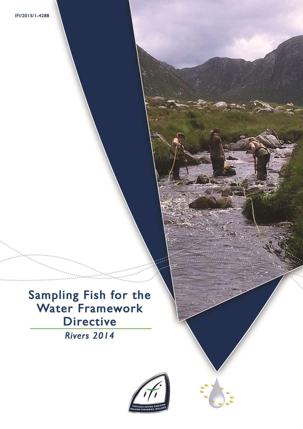
2 Sampling Fish for the Water Framework Directive, Rivers 1 Fiona L. Kelly, Lynda Connor, Ronan Matson, Rory Feeney, Emma Morrissey, John Coyne and Kieran Rocks Inland Fisheries Ireland, 3 Lake Drive, Citywest Business Campus, Dublin CITATION: Kelly, F.L., Connor, L., Matson, R., Feeney, R., Morrissey, E., Coyne, J. and Rocks, K. (1aa) Sampling Fish for the Water Framework Directive, Rivers 1. Inland Fisheries Ireland, 3 Lake Drive, Citywest Business Campus, Dublin, Ireland. Cover photo: WFD team electric-fishing Inland Fisheries Ireland Inland Fisheries Ireland 1
3 EXECUTIVE SUMMARY The Water Framework Directive (WFD) (/6/EC) came into force in and was subsequently transposed into Irish law in 3 (S.I. No. 7 of 3), with the principal aim of preserving those water bodies where the ecological status is currently High or Good, and restoring those water bodies that are currently impaired, to achieve at least Good ecological status in all water bodies by 1 or by designated extended deadlines. A key step in this process is that each Member State must assess the current ecological status of surface water bodies (rivers, lakes and transitional waters) by monitoring a range of physical, chemical and biological quality elements including phytoplankton, macrophytes, phytobenthos, benthic invertebrates and fish. Inland Fisheries Ireland has been assigned the responsibility by the EPA of delivering the fish monitoring requirements of the WFD in Ireland. Over 3 water bodies, encompassing rivers, lakes and transitional waters are required to be surveyed in a three year rolling programme. IFI have been undertaking fish stock surveys in rivers for the WFD since 8. All river surveys are conducted using electric-fishing. This report summarises the main findings of the 1 surveillance monitoring programme for rivers and highlights the current status of each water body in accordance with the fish populations present. A total of 7 river sites were surveyed during 1 using boat-based electric-fishing gear for the nonwadeable sites and bank based (hand-set) electric-fishing gear for the wadeable sites. A total of 1 fish species (sea trout are included as a separate variety of trout) and one type of hybrid (roach x bream) were recorded. Brown trout was the most common fish species recorded, being present in 9.7% of sites surveyed, followed by salmon (77.1%), European eel (.7%), stone loach (.%), minnow, and three-spined stickleback (38.6%), lamprey sp. (3.3%), roach (.9%), perch (18.6%), pike (1.3%), gudgeon (1.9%), sea trout (11.3%), flounder (1.%), dace (.7%) and roach x bream hybrids (1.%). Brown trout and salmon population densities were greater in wadeable streams, sampled using bank-based electric-fishing gear, when compared to the deeper rivers surveyed using boat-based gear. This is mainly due to the preference for large numbers of juvenile salmonids to inhabit shallow riffle areas. The ecological status classification tool for fish in Irish rivers FSC Ireland (SNIFFER, 11) along with expert opinion, was used to classify all river sites surveyed during 1; three sites were classed as High, 38 as Good, as Moderate and two as Poor. Two sites were not classified. 1
4
5 ACKNOWLEDGEMENTS The authors wish to gratefully acknowledge the help and co-operation of the regional directors, Mr. Brian Beckett and staff from IFI Dublin, Ms. Amanda Mooney and staff from IFI Limerick, Dr. Milton Matthews and staff from IFI Ballyshannon, Dr. Patrick Buck and staff from IFI Macroom, Mr. David McInerney and staff from IFI Clonmel and Dr. J.J. Connelly and staff from IFI Galway and Ballina. The authors also gratefully acknowledge the help and cooperation of colleagues in IFI Citywest. We would like to thank the landowners and angling clubs that granted us access to their land and respective fisheries. Furthermore, the authors would like to acknowledge the funding provided for the project from the Department of Communications, Energy and Natural Resources for 1. PROJECT STAFF Project Director/Senior Research Officer: Dr. Fiona Kelly Project Manager: Ms. Lynda Connor Research Officer: Dr. Ronan Matson Technician Mr. Rory Feeney Technician: Ms. Emma Morrissey Technician: Mr. John Coyne GIS Officer: Mr. Kieran Rocks Fisheries Assistant: Ms. Roisín O Callaghan (Apr 1 Dec 1) Fisheries Assistant: Ms. Ruth Hanniffy (Jul 1 Dec 1) Fisheries Assistant: Ms. Sinead O Reilly (Jul 1 Dec 1) Fisheries Assistant: Ms. Laura Walsh (Jul 1 Dec 1) The report includes Ordnance Survey Ireland data reproduced under OSi Copyright Permit No. MP 78. Unauthorised reproduction infringes Ordnance Survey Ireland and Government of Ireland copyright. Ordnance Survey Ireland, 1. 3
6 TABLE OF CONTENTS EXECUTIVE SUMMARY... 1 ACKNOWLEDGEMENTS... 3 PROJECT STAFF INTRODUCTION.... STUDY AREA METHODS RESULTS....1 River surveys Eastern River Basin District - wadeable sites Eastern River Basin District - non-wadeable sites Neagh-Bann International River Basin District - wadeable sites North Western River Basin District - wadeable sites South Eastern River Basin District - wadeable sites South Eastern River Basin District - non-wadeable sites Shannon International River Basin District - wadeable sites Shannon International River Basin District - non-wadeable sites South Western River Basin District - wadeable sites Western River Basin District - wadeable sites Western River Basin District - non-wadeable sites Community Structure Age and growth Ecological status DISCUSSION REFERENCES APPENDIX APPENDIX APPENDIX APPENDIX... 9 APPENDIX APPENDIX APPENDIX APPENDIX APPENDIX
7 1. INTRODUCTION Fish stock surveys were undertaken at 7 river sites in 9 catchments throughout Ireland during the summer of 1 as part of the programme of sampling fish for the Water Framework Directive (WFD). These surveys are required by both national and European law, with Annex V of the WFD stipulating that rivers are included within the monitoring programme and that the composition, abundance and age structure of fish fauna are examined (Council of the European Communities, ). Although fish stock surveys have been carried out in Ireland in the past, no project to date has been as extensive as the current on-going monitoring programme. Continued surveying of these and additional river sites will provide a useful baseline and time-series dataset for WFD and fisheries management purposes. This in turn will provide information for River Basin District (RBD) managers to compile and implement programmes of measures to improve degraded water bodies. 1 is the seventh year of the fish in river sampling programme, with many of the sites surveyed this year being repeat surveys of those carried out in other years. As a result, much of the data from 1 can be compared with that from at least one previous sampling occasion, to determine whether the status of our rivers is improving or deteriorating. This report summarises the results of the 1 fish stock surveys carried out within each River Basin District (RBD), as part of the Water Framework Directive surveillance monitoring programme.. STUDY AREA Thirty-six sites were wadeable and surveyed using bank-based electric fishing equipment; the remaining 3 non-wadeable sites were surveyed using boat based equipment. Sites ranged in surface area from 11m at the Tubbercurry River site just upstream of the River Moy confluence to 19,m for the River Nore at Brownsbarn. Summary details for each site s location and physical characteristics are given in Tables.1 and., and the distribution map of sites throughout Ireland is shown in Figure.1.
8 Fig..1. Location map of river sites surveyed throughout the country for WFD fish surveillance monitoring, 1
 guidelines for fish stock assessment in wadeable rivers (CEN, 3).")


9 3. METHODS Electric-fishing is the method of choice for the surveillance monitoring of fish in rivers and to obtain a representative sample of the fish assemblage for each survey site. This technique complies with European Committee for Standardisation (CEN) guidelines for fish stock assessment in wadeable rivers (CEN, 3). At each site, the sample stretch was isolated where possible using stop nets, with one to three fishings carried out using bank-based or boat-based electric fishing units. Each site ideally contained all habitat types, including riffle, glide and pool. A suite of physical and chemical parameters were also recorded. Fish from each pass were sorted and processed separately. During processing, the species of each fish was identified, with its length and weight measured. Sub-samples were sometimes taken when large numbers of fish were present. For the purpose of species identification, juvenile river lamprey (Lampetra fluviatilis), brook lamprey (Lampetra planeri) and sea lamprey (Petromyzon marinus) were recorded as Lamprey sp.. Sea trout and brown trout were listed separately. For ageing analyses, scales were taken from fish greater than 8.cm for salmonids and most nonnative fish species. After processing, fish were held in large bins of oxygenated water until they were fully recovered, before returning them to the water. For various reasons, including river width and flow rate, stop nets could not be deployed at every site, thus making three fishing passes impractical. Therefore, in order to draw comparisons between sites, fish densities were calculated using data from the first fishing pass only. The number captured in the first pass was divided by the total area surveyed to give a minimum density for each species. A subsample of the dominant fish species was aged (five fish from each 1cm size class). Fish scales were aged using a microfiche reader. Growth was determined by back-calculating lengths at the end of each winter (e.g. L1 is the mean length at the end of the first winter and L is the mean length at the end of the second winter, etc.). Plate.1. Electric-fishing using bank-based equipment on the the River Duag at Ballyporeen Plate.1. Electric-fishing using boat-based equipment on the the Aherlow River at Old Cappa Br. Plate.3. Processing samples on the River Suir at Kilsheelan Br. 3

10 . RESULTS.1 River surveys.1.1 Eastern River Basin District - wadeable sites Six river sites were surveyed in four river catchments within the Eastern River Basin District (ERBD). The ERBD covers a land area of around 6,3km and sea area of approximately 3km. It is situated mainly over the north-eastern part of Leinster, with a coastline of about 13km, stretching from south Co. Cavan in the north to Co. Wexford in the south. Catchments with sites surveyed on them included the Boyne, Dargle, Liffey and Vartry. Four sites were wadeable and two were non-wadeable (Fig..1). Fig..1. Map of the ERBD showing all sites surveyed in 1

, August 1 (n=89) and July 1 (n=6) River Dodder Two sites were electric fished on the River Dodder, one at Mount Carmel")
11 Dargle River (Bahana_A) This site was located on the upstream side of a bridge, approximately 1.km below Powerscourt Waterfall, near Enniskerry Co. Wicklow (Plate.1). One electric-fishing pass was conducted using two bank-based electric fishing units on the 7 th of July 1, along a 37m length of channel. Glide dominated the habitat, over a substrate of mainly cobble Fig... Length frequency distribution of brown trout in the Dargle River (Bahana_A), August 1 (n=89) and July 1 (n=6) River Dodder Two sites were electric fished on the River Dodder, one at Mount Carmel Hospital and another at Bohernabreena. Plate.1. The Dargle River at Bahana Br., Co. Wicklow Dodder, River (d/s Piperstown Stream, Bohernabreena_A) Brown trout was the only species recorded (Table.1 and Fig..), although salmon were previously recorded during the 1 survey. A change in age structure of brown trout was observed at the site between the two survey occasions (Table.1 and Fig..). Table.1. Density of fish (no./m ), Dargle River (Bahana_A) (fish density has been calculated as minimum estimates based on one fishing) Species 1 1 Brown trout brown trout & older brown trout.3.19 Salmon salmon & older salmon.3 - All Fish.1.1 Plate.. The River Dodder at Bohernabreena, South Co. Dublin The Bohernabreena survey site was located along the Dublin Mountains Way, approximately.km south of Oldbawn, Co. Dublin (Plate.). Three electric-fishing passes were conducted using one three bank-based electric fishing units on the 16 th of July 1, along a 3m length of channel. Riffle dominated the habitat, over a substrate of cobble and boulder. Brown trout was the most common species encountered in 1 (Table. and Fig..3). Fry (+) were present again in 1 after an absence

12 in 13 but were still much fewer than in the first survey in 11. Table.. Density of fish (no./m ), River Dodder (d/s Piperstown Stream, Bohernabreena_A) Species Brown trout brown trout & older brown trout European eel. -.3 Stone loach..3.3 All Fish Fig..3. Length frequency distribution of brown trout in the River Dodder (d/s Piperstown stream, Bohernabreena_A), July 11 (n=9), July 13 (n=) and July 1 (n=3). Plate.3. The River Dodder at Mount Carmel, South Co. Dublin Brown trout was the most commonly encountered species in 1 (Table.3 and Fig..), followed closely by minnow. Three-spined stickleback, stone loach and minnow were all recorded again in 1 after an absence in 13. Table.3. Density of fish (no./m ), River Dodder (Mount Carmel Hospital_A) Species Brown trout brown trout & older brown trout European eel..9.3 Minnow. -.1 Stone loach.3 -. Three-spined stickleback All Fish Dodder, River (Mount Carmel Hospital_A) The Mount Carmel survey site was located just downstream of a foot bridge on the river near Mount Carmel Hospital in Rathfarnham (Plate.3). Three electric-fishing passes were conducted using three bank-based electric-fishing units on the 16 th of July 1, along a 37m length of channel. Glide dominated the habitat, over a substrate of mainly cobble Fig... Length frequency distribution of brown trout in the River Dodder (Mount Carmel Hospital_A), September 11 (n=93), July 13 (n=1) and July 1 (n=73) 6

13 Vartry River (Newrath Br._A) This survey site was located downstream of Newrath Br., halfway between Ashford and Rathnew, Co. Wicklow (Plate.). Three electricfishing passes were conducted using three bankbased electric fishing units on the 1 th of August 1, along a m length of channel. Riffle and pool dominated the habitat, over a substrate of cobble and gravel Fig... Length frequency distribution of salmon in the Vartry River (Newrath Br._A), September 13 (n=3) and August 1 (n=81) Plate.. The Vartry River at Newrath Br., Co. Wicklow Salmon was the most commonly encountered species in 1, followed by brown trout and European eel (Table.1 and Figs.. and.6). All species present in 13 were recorded again in 1, except for three-spined stickleback. Table.. Density of fish (no./m ), Vartry River (Newrath Br._A) Species 13 1 Brown trout brown trout & older brown trout.6.31 European eel.1.3 Flounder.9.3 Lamprey sp..3.1 Minnow.1.9 Salmon salmon & older salmon.6.1 Sea trout spined stickleback.6 - All Fish Fig..6. Length frequency distribution of brown trout in the Vartry River (Newrath Br._A), September 13 (n=6) and August 1 (n=7) 7
.")

14 .1. Eastern River Basin District - non-wadeable sites Boyne, River (Boyne Br._A) This survey site was located close to the river s source, approximately 1.km north of Edenderry (Plate.). Three electric-fishing passes were conducted using one boat-based electric fishing unit on the 8 th of July 1, along a 13m length of channel. Glide dominated the habitat, over a substrate of mud and silt Fig..7. Length frequency distribution of brown trout in the River Boyne (Boyne Br._A), August 9 (n=3), July 1 (n=61) and July 1 (n=7) Plate.. The River Boyne at Boyne Br., on the Kildare/Offaly border River Liffey (Lucan Br._A) This survey site was located downstream of the bridge in Lucan (Plate.6). One electric-fishing pass was conducted using four boat-based electric fishing units (two boats fishing parallel to each bank separately) on the 11 th of July 1, along a 9m length of channel. Glide dominated the habitat, over a substrate of mainly cobble. Brown trout was the most commonly encountered species (Table. and Fig..7). Only three fish species were recorded during the 1 and 1 survey, down from a total of six in 9. Table.. Density of fish (no./m ), River Boyne (Boyne Br._A) Species Brown trout brown trout & older brown trout European eel. - - Lamprey sp Minnow.. - Stone loach spined stickleback... All Fish Plate.6. The River Liffey at Lucan, South Co. Dublin Salmon was the most commonly encountered species and showed a similar age structure between the two surveys (Table.6 and Fig..8). Brown trout were recorded across a wide range of sizes, while gudgeon, absent in 9, were recorded in 1 (Fig..9 and Table.6). 8
15 Table.6. Density of fish (no./m ), River Liffey (Lucan Br._A) Species 9 1 Brown trout brown trout & older brown trout.7.3 European eel.. Gudgeon -. Lamprey sp... Minnow.1.19 Roach.. Salmon salmon & older salmon.1. Stone loach.1.1 All Fish Fig..8. Length frequency distribution of salmon in the River liffey (Lucan_A), August 9 (n=19) and July 1 (n=1) Fig..9. Length frequency distribution of brown trout in the River liffey (Lucan_A), August 9 (n=) and July 1 (n=1) 9

16 .1.3 Neagh-Bann International River Basin District - wadeable sites Three river sites were surveyed within two river catchments within the Neagh-Bann International River Basin District (NBIRBD). The NBIRBD is one of three international river basin districts on the island of Ireland. Most of its area, some 6,km, is situated within Northern Ireland while the remainder (,km ) is situated within the Republic of Ireland. The NBIRBD has the smallest stretch of coastline among all eight RBDs throughout Ireland (north and south). Catchments with surveys on them included, the Monaghan Blackwater and Dee. Two of these sites were wadeable and one was non-wadeable (Fig..1). Fig..1. Map of the NBIRBD showing all sites surveyed in 1 1

, July 1 (n=3) Plate.7. The River Blackwater at Corvally, Co.")
17 River Blackwater (Monaghan)(Corvally_A) This survey site was located at Corvally, approximately 3km northeast of Monaghan Town (Plate.7). Three electric-fishing passes were conducted using two bank-based electric fishing units on the 9 th of July 1, along a m length of channel. Glide and pool dominated the habitat, over a substrate of cobble, bedrock and gravel Fig..11. Length frequency distribution of brown trout in the River Blackwater (Monaghan), July 1 (n=3) Plate.7. The River Blackwater at Corvally, Co. Monaghan Brown trout was the most commonly encountered species (Table.7 and Fig..11), followed by salmon. White River (Louth) (Coneyburrow Br._B) This survey site was located upstream of Coneyburrow Br., 1km north of Dunleer, Co. Louth (Plate.8). Three electric-fishing passes were conducted using three bank-based electric fishing units on the th of August 1, along a m length of channel. Glide dominated the habitat, over a mixed substrate of gravel, cobble and sand. Table.7. Density of fish (no./m ), River Blackwater (Monaghan)(Corvally_A) Species 1 Brown trout.61 + brown trout. 1+ & older brown trout.39 Gudgeon. Salmon.7 + salmon. 1+ & older salmon. Stone loach. 3-spined stickleback. All Fish.8 Plate.8. The White River at Coneyburrow Br., Co. Louth Minnow was the most commonly encountered species (Table.8), followed by three-spined stickleback. Brown trout and salmon were present in relatively low densities (Table.8; Figs..1 and.13). 11
18 Table.8. Density of fish (no./m ), White River (Louth) (Coneyburrow Br._B) Species Brown trout bown trout & older brown trout European eel Lamprey sp Minnow Salmon salmon & older salmon Stone loach spined stickleback All Fish Fig..1. Length frequency distribution of brown trout in the White River (Coneyburrow Br._B), July 1 (n=6), August 13 (n=) and August 1 (n=8) Fig..13. Length frequency distribution of salmon in the White River (Coneyburrow Br._B), July 1 (n=7), August 13 (n=) and August 1 (n=7) 1
. Three electric-fishing passes were conducted using one boat-based electric fishing unit on the 1 th of July 1, along a 1m length of channel.")
19 .1. Neagh-Bann International River Basin District - non-wadeable Sites Dee, River (Burley Br._A) This survey site was located downstream of Burley Bridge between Mandistown and Ballygowan, Co. Meath (Plate.9). Three electric-fishing passes were conducted using one boat-based electric fishing unit on the 1 th of July 1, along a 1m length of channel. The habitat was made up of glide, over a substrate of mostly cobble Fig..1. Length frequency distribution of brown troutin the River Dee (Burley Br._A), August 9 (n=) and July 1 (n=3) Plate.9. The River Dee at Burley Br., Louth/Meath Border Minnow was the most abundant species captured in 1, followed by brown trout and roach (Table.9). Four fish species recorded in 9 were absent from the 1 survey, including threespined stickleback, stone loach, gudgeon and European eel. Furthermore, only one salmon fry was captured in Fig..1. Length frequency distribution of roach in the River Dee (Burley Br._A), August 9 (n=9) and July 1 (n=17) Table.9. Density of fish (no./m ), River Dee (Burley Br._A) Species 9 1 Brown trout brown trout & older brown trout.11.1 European eel.1 - Gudgeon. - Minnow..18 Roach.1.9 Salmon..1 + salmon & older salmon.3 - Stone loach.3-3-spined stickleback.16 - All Fish..3 13

20 .1.. North Western River Basin District - wadeable sites Five river sites were surveyed in three river catchments within the North Western International River Basin District (NWIRBD). The NWIRBD is another cross-border RBD, shared with Northern Ireland. It encompasses all of Co. Donegal and parts of many other counties along the border. It has a land surface area of approximately 1,3km and a marine area (most of which belongs to Co. Donegal) of approximately,km. Catchments where surveys were undertaken included the Clady, Erne and Swilly. All of these sites were wadeable (Fig..16). Fig..16. Map of the NWIRBD showing all sites surveyed in 1 1
 The Dunlewy Lough survey site was located just upstream of the confluence with a sister stream, approximately.km upstream of Dunlewy Lough (Plate.1).")
21 Cronaniv Burn Two sites were electric fished on the Cronaniv Burn, both upstream of Dunlewy Lough Cronaniv Burn (Br. u/s Dunlewy Lough_A) The Dunlewy Lough survey site was located just upstream of the confluence with a sister stream, approximately.km upstream of Dunlewy Lough (Plate.1). Three electric-fishing passes were conducted using two bank-based electric fishing units on the 1 th of July 1, along a m length of channel. Riffle dominated the habitat, over a substrate of cobble, boulder and gravel Fig..17. Length frequency distribution of salmon in the Cronaniv Burn (Br. u/s Dunlewy Lough_A), September 9 (n=69), August 11 (n=7) and July 1 (n=) Plate.1. The Cronaniv Burn upstream of Dunlewy Lough, Co. Donegal Salmon and brown trout were the only two species encountered on all three survey occasions, with salmon consistently being the most abundant species recorded (Table.1). Table.1. Density of fish (no./m ), Cronaniv Burn (Br. u/s Dunlewy Lough_A) Species Brown trout brown trout & older brown trout.11.. Salmon salmon & older salmon All Fish Fig..18. Length frequency distribution of brown trout in the Cronaniv Burn (Br. u/s Dunlewy Lough_A), September 9 (n=9), August 11 (n=1) and July 1 (n=17) Cronaniv Burn (.km u/s Dunlewy Lough_A) The survey site was located approximately 3m downstream of the first site, just upstream of a bridge near Dunlewy Lough (Plate.11). Three electric-fishing passes were conducted using three bank-based electric fishing units on the 1 th of July 1, along a m length of channel. Riffle dominated the habitat, over a substrate of mainly cobble and boulder. 1
, Cronaniv Burn (.km u/s dunlewy Lough_A) Species 1 Brown trout. + brown trout.17 1+ & older brown trout.6 Salmon.168 + salmon.1 1+ & older salmon. All Fish.191 8 7 6 3 1 6 8 1 1 1 16 18 Fig.")
_A) This survey site was located downstream of the N87 bridge on the Drumcona side of Swanlinbar town, just upstream of the River Blackwater confluence (Plate.1).")
22 Plate.11. The Cronaniv Burn at Dunlewy, Co. Donegal Salmon and brown trout were the only two species encountered at this site, with salmon the more abundant of the two species (Table.11). Table.11. Density of fish (no./m ), Cronaniv Burn (.km u/s dunlewy Lough_A) Species 1 Brown trout. + brown trout & older brown trout.6 Salmon salmon.1 1+ & older salmon. All Fish Fig... Length frequency distribution of brown trout in the Cronaniv Burn (Dunlewy_A), July 1 (n=19) Swanlinbar River (Swanlinbar Br. (Carpark)_A) This survey site was located downstream of the N87 bridge on the Drumcona side of Swanlinbar town, just upstream of the River Blackwater confluence (Plate.1). Three electric-fishing passes were conducted using three bank-based electric fishing units on the 1 th of July 1, along a 6m length of channel. There was a good mix of habitat, composed of glide, pool and riffle, over a substrate of mainly cobble Plate.1. The Swanlinbar River at Swanlinbar, Co. Cavan Fig..19. Length frequency distribution of salmon in the Cronaniv Burn (Dunlewy_A), July 1 (n=19) Brown trout was the most common species encountered at this site on both occasions (Table.1). A greater spread of brown trout sizes were recorded in 1 (Fig..1), while there was a shift from in salmon age class dominance between years; fry were dominant in 11 while only parr were captured in 1 (Fig..). 16

23 Table.1. Density of fish (no./m ), Swanlinbar River (Swanlinbar Br. (Carpark)_A) Species 11 1 Brown trout brown trout & older brown trout.1.9 European eel..1 Gudgeon.3 - Lamprey sp. -.3 Salmon salmon.1-1+ & older salmon.3. All Fish River Swilly Two sites were electric fished on the River Swilly, one at Altadush and another at Swilly Br. River Swilly (Altadush_A) The Altadush site was located near Altadush close to the river s source, approximately 1km west of Letterkenny, Co. Donegal (Plate.13). Three electric-fishing passes were conducted using two bank-based electric fishing units on the 16 th of July 1, along a 6m length of channel. Riffle dominated the habitat, over a mixed substrate of cobble, boulder and gravel Fig..1. Length frequency distribution of brown trout in the Swanlinbar River (Carpark_A), August 11 (n=78) and July 1 (n=9) Plate.13. The River Swilly at altadush, Co. Donegal Brown trout was the only species caught at this site (Table.13), with 1+ & older abundance far outnumbering fry (+) (Fig..3). Table.13. Density of fish (no./m ), River Swilly (Altadush_A) Species 1 Brown trout.89 + brown trout.9 1+ & older brown trout.8 All Fish.89 Fig... Length frequency distribution of salmon in the Swanlinbar River (Carpark_A), August 11 (n=1) and July 1 (n=8) 17
.")
24 Fig..3. Length frequency distribution of brown trout in the River Swilly (Altadush_A), July 1 (n=) River Swilly (Swilly Br. (near Breenagh)_A) The Swilly Br. site was located approximately 1.km further downstream of the Altadush site near Breenagh (Plate.1). Three electric-fishing passes were conducted using two bank-based electric fishing units on the 16 th of July 1, along a m length of channel. Glide dominated the habitat, over a substrate dominated by cobble. Table.1. Density of fish (no./m ), River Swilly (Swilly Br. (near Breenagh)_A) Species Brown trout brown trout & older brown trout European eel.6.6. Lamprey sp Salmon salmon & older salmon All Fish Fig... Length frequency distribution of brown trout in the River Swilly (Swilly Br. (near Breenagh_A), September 8 (n=38), August 11 (n=) and July 1 (n=1) Plate.1. The River Swilly near Breenagh, Co. Donegal Brown trout was the most common species recorded, followed by salmon (Table.1). Brown trout fry numbers were relatively high in 1 compared to previous survey occasions (Fig..), while the salmon density and size range were more comparable with those recorded in 8 (Fig..) Fig... Length frequency distribution of salmon in the River Swilly (Swilly Br. (near Breenagh)_A), September 8 (n=), August 11 (n=3) and July 1 (n=9) 18

25 .1.6. South Eastern River Basin District - wadeable sites Twenty-five river sites were surveyed in seven river catchments within the South Eastern River Basin District (SERBD). The SERBD is the second largest RBD in Ireland, covering a land area of approximately 13,km. It also encompasses a further 1,km of marine waters off the coast of Counties Wexford and Waterford. Catchments where surveys were undertaken included, the Barrow, Duncormick, Mahon, Nore, Owenduff, Slaney and Suir. Nine of these sites were wadeable and 19 were non-wadeable (Fig..6). Fig..6. Map of the SERBD showing all sites surveyed in 1 19
 The Balisland Bridge site was located downstream of Balisland Br., 3km south of Shillelagh, Co. Wicklow (Plate.1).")
26 Derry River Two sites were electric fished on the Derry River one at Balisland Bridge and another at Ballyknocker. Derry River (Balisland Br._A) The Balisland Bridge site was located downstream of Balisland Br., 3km south of Shillelagh, Co. Wicklow (Plate.1). Three electric-fishing passes were conducted using three bank-based electric fishing units on the th of August 1, along a 3m length of channel. Glide dominated the habitat, over a substrate of mainly cobble and gravel Fig..7. Length frequency distribution of salmon in the Derry River (Balisland Br._A), August 1 (n=6) Plate.1. The Derry River at Balisland Br., Co. Wicklow Minnow was the most common species, followed by salmon and brown trout (Table.1). The number of salmon fry (+) was far greater than 1+ & older cohorts (Fig..8), with an opposite trend apparent for brown trout (Fig..7). Table.1. Density of fish (no./m ), Derry River (Balisland Br._A) Species 1 Brown trout.8 + brown trout.6 1+ & older brown trout.1 Lamprey sp..11 Minnow. Salmon.83 + salmon & older salmon. Stone loach.9 3-spined stickleback.13 All Fish.366 Fig..8. Length frequency distribution of brown trout in the Derry River (Balisland Br._A), August 1 (n=) Derry River (Ballyknocker_A) The Ballyknocker site was located downstream of a bridge on a private road, approximately 3km upstream of the Balisland Br. site (Plate.1). Three electric-fishing passes were conducted using two bank-based electric fishing units on the th of August 1, along a m length of channel. Glide and riffle dominated the habitat, over a mixed substrate of cobble, gravel and sand.
 outnumbered the amount of 1+ & older cohorts for both salmon (Fig..9) and brown trout (Fig..3). Table.16. Density of fish (no.")
27 Plate.1. The Derry River at Ballyknocker, Co. Wicklow Salmon was the most abundant species, followed by brown trout (Table.1). The number of fry (+) outnumbered the amount of 1+ & older cohorts for both salmon (Fig..9) and brown trout (Fig..3). Table.16. Density of fish (no./m ), Derry River (Ballyknocker_A) Species 1 Brown trout.9 + brown trout.6 1+ & older brown trout.3 European eel. Lamprey sp.. Minnow.1 Salmon.39 + salmon & older salmon.8 Sea trout. Stone loach. 3-spined stickleback. All Fish.369 Fig..9. Length frequency distribution of salmon in the Derry River (Ballyknocker_A), August 1 (n=3) Fig..3. Length frequency distribution of brown trout in the Derry River (Ballyknocker_A), August 1 (n=7) River Duag Two sites were electric fished on the Duag River, one at Ballyporeen and another at Kilnamona. River Duag (Br. u/s Ballyporeen_B) The Ballyporeen survey site was located downstream of a bridge located approximately 1. km west of Ballyporeen in Co. Tipperary (Plate.17). Three electric-fishing passes were conducted using one bank-based electric fishing unit on the 3 rd of September 1, along a m length of channel. Glide dominated the habitat, over a substrate of mainly gravel and cobble. 1
.")
28 Plate.17. The River Duag at Ballyporeen, Tipperary Brown trout was the most commonly encountered species at this site (Table.17). Brown trout and salmon fry densities were more comparable between 8 and 1, than with 11, where their abundance was much greater (Table.17; Figs..31 and 3.3). Juvenile lamprey abundance was low in 1 when compared with the two previous surveys (Table.17 and Fig..33). Table.17. Density of fish (no./m ), River Duag, (Br. u/s Ballyporeen_B) Species Brown trout brown trout & older bown trout European eel Lamprey sp Salmon salmon & older salmon Stone loach spined stickleback.6..7 All Fish Fig..31. Length frequency distribution of brown trout in the Duag River (Br. u/s Ballyporeen_B), July 8 (n=7), July 11 (n=166) and September 1 (n=3) Fig..3. Length frequency distribution of salmon in the Duag River (Br. u/s Ballyporeen_B), July 8 (n=16), July 11 (n=18) and September 1 (n=) Fig..33. Length frequency distribution of Lamprey sp. in the Duag River (Br. u/s Ballyporeen_B), July 8 (n=), July 11 (n=1) and September 1 (n=)

29 Duag, River (Kilnamona_A) The Kilnamona survey site was located downstream of a bridge, 7m upstream from the Ballyporeen site (Plate.18). Three electric-fishing passes were conducted using two bank-based electric fishing units on the 3 rd of September 1, along a m length of channel. Riffle dominated a mixed habitat, with an assorted substrate of cobble, gravel, sand and boulder Fig..3. Length frequency distribution of brown trout in the Duag River (Kilnamona_A), September 1 (n=1) 3 Plate.18. The River Duag at Kilnamona, Co. Tipperary Brown trout was the most abundant species encountered at this site (Table.18), while fry (+) dominated the catch (Fig..3) Table.18. Duag, River (Kilnamona_A) Species 1 Brown trout.13 + brown trout & older brown trout.1 Lamprey sp..1 Salmon. + salmon. 1+ & older salmon - Stone loach. 3-spined stickleback.9 All Fish.191 Fig..3. Length frequency distribution of lamprey sp. in the Duag River (Kilnamona_A), September 1 (n=1) Duncormick River (W) Br. nr Duncormick Rly St_B) This survey site was located just downstream of a railway bridge near Duncormick village (Plate.19). Three electric-fishing passes were conducted using two bank-based electric fishing units on the 18 th of August 1, along a m length of channel. Glide and pool dominated the habitat, over a mixed substrate of sand, gravel, cobble, mud and silt. 3
.")
30 Plate.19. The Duncormick River near Duncormick, Co. Cork Brown trout was by far the most abundant species recorded, with European eel also present in relatively good numbers (Table.19). Brown trout abundance increased from 8 to 1 and this can mainly be attributed to an increase in 1+ & older fish (Fig..36). In contrast, European eel density decreased each year, with the abundance of smaller individuals much lower in 1 and 11, than that recorded in 8 (Fig..37). Table.19. Density of fish (no./m ), Duncormick River ((W) Br. nr Duncormick Rly St_B) Species Brown trout brown trout & older brown trout European eel Flounder. - - Salmon salmon & older salmon Sea trout -. Stone loach spined stickleback All Fish Fig..36. Length frequency distribution of brown trout in the Duncormick River ((W) Br. nr Duncormick Rly St_B), July 8 (n=97), July 11 (n=9) and August 1 (n=99) 3 1 Fig..37. Length frequency distribution of European eel in the Duncormick River ((W) Br. nr Duncormick Rly St_B), July 8 (n=8), July 11 (n=13) and August 1 (n=7) Mahon, River Two sites were electric fished on the River Mahon, one near Seafield House and another at the Bunmahon Pumphouse Weir. Mahon, River (Pumphouse Weir_A) The Pumphouse Weir survey site was located downstream of the weir at the waterworks, approximately three kilometres north-east of Bunmahon (Plate.). Three electric-fishing passes were conducted using two bank-based electric fishing units on the nd of September 1, along a 36m length of channel. Glide and pool
.")
31 dominated the habitat, over a substrate dominated by cobble and gravel Fig..38. Length frequency distribution of salmon in the Mahon River (Pumphouse Weir_A), September 1 (n=) Plate.. The Mahon River at the pumphouse weir, Bunmahon, Co. Cork Flounder was the most abundant species captured at this site, a species often encountered in streams close to the sea (Table..). Salmon fry (+) were much more abundant than parr (1+ & older) (Fig..38), while the brown trout numbers were more evenly mixed between both + and 1+ & older (Fig..). The eel population was mixed across size classes, and juveniles up to 1cm in length made up the majority of those recorded (Fig..39) Table.. Density of fish (no./m ), Mahon, River (Pumphouse Weir_A) Fig..39. Length frequency distribution of European eel in the Mahon River (Pumphouse Weir_A), September 1 (n=7) Species 1 Brown trout. + Brown trout Brown trout.1 European eel.3 Flounder.163 Lamprey sp..1 Salmon.68 + Salmon Salmon.9 3-spined stickleback.77 All Fish Fig... Length frequency distribution of brown trout in the Mahon River (Pumphouse Weir_A), September 1 (n=18)

32 Mahon, River (ENE of Seafield House_A) The Seafield House survey site was located further downstream of the Pumphouse Weir site (Plate.1). Three electric-fishing passes were conducted using two bank-based electric fishing units on the nd of September 1, along a m length of channel. Glide dominated a mixed habitat, with a substrate composed of mainly cobble and gravel Fig..1. Length frequency distribution of salmon in the Mahon River (ENE of Seafield House_A), September 1 (n=3) Plate.1. The Mahon River near Seafield House, Bunmahon, Co. Cork Flounder was by far the most abundant species caught, followed closely by three-spined stickleback (Table.1). Salmon parr (1+ & older) were captured in low numbers when compared to fry (+) at this site (Fig..1). European eel were also present in good numbers, with the majority of those recorded measuring 1cm or less (Fig..) Fig... Length frequency distribution of European eel in the Mahon River (ENE of Seafield House_A), September 1 (n=6) Table.1. Density of fish (no./m ), River Mahon, (ENE of Seafield House_A) Species 1 Brown trout. + brown trout.3 1+ & older brown trout. European eel. Flounder.66 Lamprey sp..1 Salmon.1 + salmon.1 1+ & older salmon. Sea trout - 3-spined stickleback.63 All Fish.13 6

33 Owenduff River (Rathnageeragh_A) This survey site was located downstream of Rathnageragh bridge, approximately 1km northwest of Wellingtonbridge, Co. Wexford (Plate.). Three electric-fishing passes were conducted using two bank-based electric fishing units on the 1 st of September 1, along a m length of channel. The habitat was evenly spread out between riffle, glide and pool, over a substrate dominated by cobble Fig..3. Length frequency distribution of brown trout in the Owenduff River (Rathnageeragh_A), September 1 (n=8) Plate.. The Owenduff River at Rathnageeragh, Co. Wexford Brown trout and salmon were the two most abundant species encountered (Table.). Both species had a range of sizes recorded, with fry (+) and 1+ & older present (Figs..3 and.). European eel was also recorded up to over cm in length (Fig..) Fig... Length frequency distribution of salmon in the Owenduff River (Rathnageeragh_A, September 1 (n=37) Table.. Density of fish (no./m ), Owenduff River (Rathnageeragh_A) Species 1 Brown trout.1 + brown trout.6 1+ & older brown trout.99 European eel.6 Lamprey sp.. Salmon.9 + salmon & older salmon.6 Stone loach.6 3-spined stickleback. All Fish Fig... Length frequency distribution of European eel in the Owenduff River (Rathnageeragh_A), September 1 (n=1) 7

34 Urrin River This survey site was located downstream of Bucks Bridge, approximately 3km southeast of Kiltealy, Co. Wexford (Plate.3). Three electric-fishing passes were conducted using two bank-based electric fishing units on the 1 st of August 1, along a m length of channel. The habitat was mixed, with glide the most abundant type, over a substrate of mainly cobble and gravel Fig..6. Length frequency distribution of brown trout in the Urrin River (Buck's Br._B), August 1 (n=6) and October 8 (n=87) Plate.3. The Urrin River at Buck s Br., Co. Wexford Only native fish species were recorded at this site during both surveys (Table.3). Brown trout 1+ and older density was higher in 8, with + density greater in 1 (Fig..6). Salmon fry (+) abundance was markedly higher in 1 than 8 (Fig..7) Fig..7. Length frequency distribution of salmon in the Urrin River (Buck s Br._B), August 1 (n=16) and October 8 (n=9) Table.3. Density of fish (no./m ), Urrin River (Buck's Br._B) Species 8 1 Brown trout brown trout & older brown trout.1.8 European eel..9 Salmon salmon & older salmon.1.37 All Fish
 The Killardry Bridge survey site was located upstream of Killardry Bridge, approximately 1.km downstream of the river s confluence with the River Ara (Plate.). Table.. Density of fish (no.")
35 .1.7. South Eastern River Basin District - nonwadeable sites Aherlow River Two sites were electric fished on the Aherlow, one at Killardry Br. and another at Old Cappa Br. Aherlow River (Killardy Br._A) The Killardry Bridge survey site was located upstream of Killardry Bridge, approximately 1.km downstream of the river s confluence with the River Ara (Plate.). Table.. Density of fish (no./m ), Aherlow River (Killardy Br._A) Species 1 1 Brown trout..6 + brown trout & older brown trout..6 Perch -.1 Roach.1.3 Salmon.. + salmon & older salmon.17. Stone loach spined stickleback.3 - All Fish..16 Plate.. The Aherlow River at Killardry Br., Co. Tipperary One electric-fishing pass was conducted using two boat-based electric fishing units on the 1 sh of July 1, along a m length of channel. Glide dominated the habitat, over a mixed substrate of cobble, gravel and sand. Brown trout and salmon were the most abundant species encountered (Table.). The abundance of brown trout was much lower than in the previous survey in 1 (Fig..8). A similar trend was observed for salmon, with densities much lower for 1 (Fig..9) Fig..8. Length frequency distribution of brown trout in the Aherlow River (Killardry Br._A), July 1 (n=81) and July 1 (n=) Fig..9. Length frequency distribution of salmon in the Aherlow River (Killardry Br._A), July 1 (n=8) and July 1 (n=18) 9

36 Aherlow River (Old Cappa Br._A) The Old Cappa Bridge survey site was located upstream of the Old Cappa Bridge, approximately 1km upstream of the river s confluence with the River Ara (Plate.). Three electric-fishing passes were conducted using one boat-based electric fishing unit on the 1 st of July 1, along a 168m length of channel. Glide dominated the habitat, over a substrate of mainly cobble and gravel Fig... Length frequency distribution of brown trout in the Aherlow River (Old Cappa Br._A), July 1 (n=) Plate.. The Aherlow River at Old Cappa Br., Co. Tipperary Only brown trout and salmon were recorded at this site (Table.). No brown trout fry (+) were recorded at this site (Fig..), while in the case of salmon, the majority or those recorded were parr (1+ & older) (Fig..1) Fig..1. Length frequency distribution of salmon in the Aherlow River (Old Cappa Br._A), July 1 (n=6) Table.. Density of fish (no./m ), Aherlow River (Old Cappa Br._A) Species 1 Brown trout. + brown trout - 1+ & older brown trout. Salmon. + salmon. 1+ & older salmon.3 All Fish.8 Anner River Two sites were electric fished on the Anner River, one at Drummon Br. and another at Killusty. Anner River (Drummon Br._A) The Drummon Bridge site was located downstream of Drummon Bridge, about 11km east of Fethard, Co. Tipperary (Plate.6). Three electric-fishing passes were conducted using two boat-based electric fishing units on the 3 rd of July 1, along a 197m length of channel. Glide dominated the habitat, over a substrate of mainly cobble and gravel. 3
, while salmon fry abundance was also lower in 1 (Fig..3).")
37 Plate.6. The Anner River at Drummon Br., Tipperary Brown trout and salmon were the two most dominant species recorded at this site (Table.6). Brown trout abundance was lower across all size classes in 1 than 8 (Table. and Fig..), while salmon fry abundance was also lower in 1 (Fig..3). Three-spined stickleback were also present in 1, but not recorded in 8. Table.6. Density of fish (no./m ), Anner River (Drummon Br._A) Species 8 1 Brown trout brown trout & older brown trout..3 European eel.1. Lamprey sp..1.1 Salmon salmon & older salmon.1. Stone loach.. 3-spined stickleback -.1 All Fish Fig... Length frequency distribution of brown trout in the Anner River (Drummon Br._A), September 8 (n=3) and July 1 (n=83) Fig..3. Length frequency distribution of salmon in the Anner River (Drummon Br._A), September 8 (n=13) and July 1 (n=83) Anner River (Killusty_A) 8 1 The Killusty Br. site was located at a ford on the western side of Slievenamon, about km southeast of Fethard, Co. Tipperary. Three electric-fishing passes were conducted using one boat-based electric fishing unit on the 3 rd of July 1, along a 1m length of channel. Glide dominated the habitat, over a mixed substrate of cobble, gravel and sand. Brown trout and salmon were the most commonly encountered species (Table.6). A relatively wide range of brown trout lengths were recorded (Fig..) but only a single individual fry (+) was recorded. Both salmon fry (+) and parr (1+ & older) were present (Table.7 and Figs. and.). 31
 The Bansha site was located downstream of the bridge in Bansha, approximately 6km southeast of Tipperary Town (Plate.7).")
38 Table.7. Density of fish (no./m ), Anner River (Killusty_A) Species 1 Brown trout.38 + brown trout.1 1+ & older brown trout.37 European eel.1 Salmon. + salmon.1 1+ & older salmon. Stone loach. All Fish.7 Ara River (Bansha_A) The Bansha site was located downstream of the bridge in Bansha, approximately 6km southeast of Tipperary Town (Plate.7). Three electric-fishing passes were conducted using one boat-based electric fishing unit on the nd of July 1, along a 1m length of channel. Glide and pool dominated the habitat, over a substrate of mainly cobble and gravel Fig... Length frequency distribution of brown trout in the Anner River (Killusty_A), July 1 (n=63) Plate.7. The Ara River at Bansha, Co. Tipperary Brown trout was the most abundant fish species recorded, with + and 1+ & older present (Table.8 and Fig..6). Salmon were only present in low numbers and all of those recorded were parr (Table.8) Fig... Length frequency distribution of salmon in the Anner River (Killusty_A), July 1 (n=) Table.8. Density of fish (no./m ), Ara River (Bansha_A) Species 1 Brown trout. + brown trout.1 1+ & older brown trout. European eel.1 Salmon.1 + salmon - 1+ & older salmon.1 Stone loach.1 All Fish.7 Ara River Two sites were electric fished on the Ara River, one at Bansha and another at Lisheen. 3
.")
39 Fig..6. Length frequency distribution of brown trout in the Ara River (Bansha_A), July 1 (n=39) Ara River (Lisheen_A) The Lisheen site was located at approximately 1km upstream of the confluence with the Aherlow River, approximately 8km northwest of Caher, Co. Tipperary (Plate.8). Three electric-fishing passes were conducted using one boat-based electric fishing unit on the nd of July 1, along a 16m length of channel. Glide dominated the habitat, over a substrate of mainly gravel and cobble. Table.9. Density of fish (no./m ), Ara River (Lisheen_A) Species 1 Brown trout.3 + brown trout - 1+ & older brown trout.3 European eel. Perch. Salmon.3 + salmon. 1+ & older salmon.3 Stone loach. All Fish Fig..7. Length frequency distribution of brown trout in the Ara River (Lisheen_A), July 1 (n=3) Plate.8. The Ara River at Lisheen, Co. Tipperary Brown trout was the most abuntant species at this site (Table.9). No brown trout fry (+) were recorded (Fig..7). Both salmon fry (+) and parr (1+ & older) were encountered but fry were present in low numbers (Table.9 and Figs..7 and.8). Fig..8. Length frequency distribution of salmon in the Ara River (Lisheen_A), July 1 (n=7) 33
 on the 3 th of June 1, along a 363m length of channel.")
40 Barrow, River (Pass Br._B) This survey site was located between Pass Bridge and the Grand Canal Bridge, just outside Monasterevin, Co. Kildare (Plate.9). One electric-fishing pass was conducted using four boat-based electric fishing units (two boats electric fished parallel to each bank separately) on the 3 th of June 1, along a 363m length of channel. Glide dominated the habitat, over a mixed substrate of gravel, cobble and sand. Table.3. Density of fish (no./m ), Barrow, River (Pass Br._B) Species 1 1 Brown trout.. + brown trout & older brown trout.. Dace.1.1 European eel.1.3 Gudgeon.13. Lamprey sp..3 - Minnow.37.7 Perch.3. Pike.. Roach.16.9 Roach x bream hybrid.3.1 Salmon.3. + salmon & older salmon.3. Stone loach spined stickleback. - All Fish.88.6 Plate.9. The River Barrow at Pass Br., Co. Kildare This was a species rich site, with dace the most frequently encountered species (Table.3 and Fig..9). Roach density was lower in 1 than 1, with a marked decrease in fry (Table.3). Brown trout and salmon showed similar trends, with + dominating in 1 and 1+ & older dominating in 1 (Figs..6 to.63) Fig..9. Length frequency distribution of dace in the River Barrow (Pass Br._B), May 1 (n=8) and June 1 (n=118) 3
, May 1 (n=3) and June 1 (n=31) 9 8 7 6 3 1 1 1 3 6 9 1 1 18 1 7 Multeen River (Ballygriffin Br.")
41 Fig..6. Length frequency distribution of roach in the River Barrow (Pass Br._B), May 1 (n=136) and June 1 (n=7) Fig..63. Length frequency distribution of salmon in the River Barrow (Pass Br._B), May 1 (n=3) and June 1 (n=31) Multeen River (Ballygriffin Br._A) This survey site was located downstream of Ballygriffin Bridge, approximately km north of Golden, Co. Tipperary (Plate.3). Three electricfishing passes were conducted using two boatbased electric fishing units on the th of September 1, along a 173m length of channel. Glide dominated the habitat, over a mixed substrate of gravel, cobble and sand. Fig..61. Length frequency distribution of perch in the River Barrow (Pass Br._B), May 1 (n=3) and June 1 (n=3) Fig..6. Length frequency distribution of brown trout in the River Barrow (Pass Br._B), May 1 (n=19) and June 1 (n=16) Plate.3. The Multeen River at Ballygriffin Br., Co. Tipperary Brown trout and salmon were the most abundant species recorded at this site (Table.31). Brown trout density was higher in 1, with far greater densities of 1+ & older fish caught (Fig..6). Salmon abundance also increased in 1, with fry (+) abundance increasing from that recorded in 8 (Fig..6). 3

42 Table.31. Density of fish (no./m ), Multeen River (Ballygriffin Br._A) Species 8 1 Brown trout brown trout.. 1+ & older brown trout.1.9 European eel -. Lamprey sp... Salmon salmon & older salmon.16.1 Stone loach.. All Fish.37.6 River Nore Three sites were electric fished on the River Nore: Brownsbarn, Kilmacshane and Quakers Br. Nore, River (Brownsbarn Br._A) Brownsbarn Bridge is located upstream of Brownsbarn Br., north-west of Inistioge in Co. Kilkenny (Plate.31). One electric-fishing pass was conducted using four boat-based electric fishing units, with two boats fishing parallel to each bank separately, on the 8 th of August 1, along a 6m length of channel. Glide and pool dominated the habitat, over a substrate of mainly cobble Fig..6. Length frequency distribution of brown trout in the Multeen River (Ballygriffin Br._B), September 8 (n=77) and September 1 (n=168) Plate.31. The River Nore at Brownsbarn Br., Co. Kilkenny Dace was the most abundant fish species, with an increase in density recorded in 1 (Table.3 and Fig..66). No brown trout fry (+) were caught either year, but brown trout (1+ & older) distribution was quite similar despite a small increase in 1 (Fig..67). Salmon density was lower in 1 than 1, with parr (1& & older) replacing fry (+) as the dominant cohort (Table.3 and Fig..68). Fig..6. Length frequency distribution of salmon in the Multeen River (Ballygriffin Br._B), September 8 (n=113) and September 1 (n=166) 36

43 Table.3. Density of fish (no./m ), River Nore, (Brownsbarn Br._A) Species 1 1 Brown trout brown trout & older brown trout.1.3 Dace.1.6 European eel.. Flounder.. Lamprey sp. -.1 Minnow..1 Salmon.. + salmon & older salmon.. Sea trout -.1 Stone loach..1 All Fish Fig..67. Length frequency distribution of brown trout in the River Nore (Brownsbarn Br._A), June 1 (n=3) and August 1 (n=) Fig..68. Length frequency distribution of salmon in the River Nore (Brownsbarn Br._A), June 1 (n=) and August 1 (n=3) Nore, River (Kilmacshane_A) 1 1 The Kilmacshane site was located approximately 3m downstream of the Brownsbarn Bridge site (Plate.3). One electric-fishing pass was conducted using four boat-based electric fishing units (two boats electric fished each bank separately) on the 8 th of August 1, along a 38m length of channel. Glide and pool dominated the habitat, with the substrate composed mainly of cobble and gravel. Fig..66. Length frequency distribution of dace in the River Nore (Brownsbarn Br._A), June 1 (n=1) and August 1 (n=81) Plate.3. The River Nore at Kilmacshane, Co. Kilkenny Dace was also the most abundant species recorded at this site (Table.33). Brown trout and salmon (Fig..71) were also recorded but fry (+) were 37

44 absent for both species (Table.33 and Figs..7 and.71). trout in the River Nore (Kilmacshane_A), August 1 (n=3) Table.33. Density of fish (no./m ), River Nore, (Kilmacshane_A) Species 1 Brown trout.3 + brown trout - 1+ & older brown trout.3 Dace.6 European eel.1 Flounder.1 Minnow.1 Roach.1 Salmon.1 + salmon - 1+ & older salmon.1 Sea trout. All Fish Fig..71. Length frequency distribution of salmon in the River Nore (Kilmacshane_A), August 1 (n=9) Nore, River (Quakers Br._A) The Quakers Bridge site was located just downstream of Quakers Br., on the border between Counties Tipperary and Laois, approximately 8km south-east of Roscrea (Plate.33). Three electric-fishing passes were conducted using one boat-based electric fishing unit on the 7 th of August 1, along a 3m length of channel. Glide dominated the habitat, over a substrate comprised mostly of mud and silt. Fig..69. Length frequency distribution of dace in the River Nore (Kilmacshane_A), August 1 (n=9) Fig..7. Length frequency distribution of brown Plate.33. The River Nore at Quakers Br., Laois/Tipperary border Brown trout was the most abundant species recorded at this site (Table.3), and showed a marked increase in density since the previous two surveys. A range of age classes were caught, but no fry (+) (Fig..7). Despite the good brown trout numbers, European eel, salmon and a 38

45 number of other species, previously recorded, were not captured during the survey. Table.3. Density of fish (no./m ), River Nore, (Quakers Br._A) Species Brown trout brown trout & older brown trout European eel.1. - Gudgeon.1. - Lamprey sp Minnow Perch Pike.6..1 Salmon salmon & older salmon Stone loach spined stickleback... All Fish Fig..7. Length frequency distribution of brown trout in the River Nore (Quakers Br._A), August 8 (n=1), July 1 (n=18) and August 1 (n=66) River Slaney Two sites were electric fished on the River Slaney, one at Bunclody and another at Carhill. Slaney, River (Bunclody_A) The Bunclody site was located just upstream of Slaney Br. in Bunclody, on the Carlow/Wexford border (Plate.3). Plate.3. The River Slaney at Bunclody, Carlow/Wexford border One electric-fishing pass was conducted using four boat-based electric fishing units (two boats electric fished parallel to each bank separately) on the 19 th of August 1, along a 3m length of channel. Glide dominated the habitat, over a mixed substrate of cobble, gravel, sand and boulder. This was a species rich site, with salmon the most abundant species recorded (Table.3). The majority of these were parr (1+ & older) (Fig..73). Similarly, the brown community was also composed entirely of 1+ & older (Fig..7). A number of other species were also recorded, including roach and sea trout. Table.3. Density of fish (no./m ), River Slaney, (Bunclody_A) Species 1 Brown trout. + brown trout - 1+ & older brown trout. European eel.1 Gudgeon. Minnow.1 Roach. Salmon.9 + salmon. 1+ & older salmon.8 Sea trout. Stone loach. 3-spined stickleback. All Fish.1 39
. Overall species densities were relatively low. Sea trout were also recorded at this site. 1 6 8 1 1 1 16 18 Fig..7.")
46 Fig..73. Length frequency distribution of salmon in the River Slaney (Bunclody_A), August 1 (n=8) Plate.3. The River Slaney at Carhill, Carlow/Wexford border 3 Minnow was the most abundant fish species recorded at this site (Table.36). Overall species densities were relatively low. Sea trout were also recorded at this site Fig..7. Length frequency distribution of brown trout in the River Slaney (Bunclody_A), August 1 (n=1) Slaney, River (Carhill_A) The Carhill site was located approximately m upstream of the Bunclody site (Plate.3). One electric-fishing pass was conducted using four boat-based electric fishing units (two boats electric fished parallel to each bank separately) on the 19 th of August 1, along a 3m length of channel. Glide and pool dominated the habitat, over a mixed substrate of cobble, boulder, gravel and sand. Table.36. Density of fish (no./m ), River Slaney, (Carhill_A) Species 1 Brown trout.1 + brown trout.1 1+ & older brown trout.1 Gudgeon. Minnow. Salmon.1 + salmon.3 1+ & older salmon.1 Sea trout.3 Stone loach.3 All Fish.1 River Suir Three sites were electric fished on the River Suir main channel, Kilsheelan Br., Knocknageragh Br. and Poulakerry. Suir, River (Kilsheelan Br._A) The Kilsheelan Br. survey site was located upstream of Kilsheelan Br., approximately.km east of Clonmel on the Tipperary, Waterford border (Plate.36). One electric-fishing pass was conducted using four boat-based electric fishing units (two boats electric fished parallel to each bank separately) on the 6 th of August 1, along a 33m length of channel. Glide dominated the
, June 1 (n=87) and August 1 (n=11) Plate.36.")
47 habitat, over a substrate mainly composed of cobble Fig..7. Length frequency distribution of salmon in the River Suir (Kilsheelin Br._A), June 1 (n=87) and August 1 (n=11) Plate.36. The River Suir at Kilsheelan, Tipperary/Waterford border Salmon was the most abundant species recorded at this site, with both fry and parr recorded (Table.37). An increase in parr was observed in 1 when compared with the previous survey of 1 (Fig..7). Brown trout abundance was also higher in 1 with a wide range of size classes recorded (Table.37 and Fig..76). Table.37. Density of fish (no./m ), River Suir, (Kilsheelan Br._A) Species 1 1 Brown trout brown trout.. 1+ & older brown trout.1.7 Dace.3 - European eel.3. Flounder..1 Lamprey sp..1.3 Minnow.3. Salmon salmon & older salmon.3.6 Stone loach.1. 3-spined stickleback.3 - All Fish Fig..76. Length frequency distribution of brown trout in the River Suir (Kilsheelin Br._A), June 1 (n=18) and August 1 (n=73) Suir, River (Knocknageragh Br._A) 1 1 The Knocknageragh Br. survey site was located approximately 1km from the source of the River Suir, downstream of Knocknageragh Br., just outside Templemore (Plate.37). Three electricfishing passes were conducted using one boatbased electric fishing unit on the th of August 1, along a 1m length of channel. Glide dominated the habitat, over a substrate of cobble, sand, mud and silt. 1
.")
48 Plate.37. The River Suir at Knocknageragh, Co. Tipperary Brown trout was the most abundant fish species recorded at this site; however, their density was lower in 1 when compared with the previous surveys (Table.38). Only 1+ and older specimens were recorded. Salmon were absent from this site during 1, having been recorded on two previous occasions. Table.38. Density of fish (no./m ), River Suir, (Knocknageragh Br._A) Species Brown trout brown trout & older brown trout European eel -. - Gudgeon. - - Lamprey sp. -.. Pike -. - Roach. - - Salmon salmon & older salmon..3 - Stone loach spined stickleback -. - All Fish Fig..77. Length frequency distribution of brown trout in the River Suir (Knocknageragh Br._A), August 8 (n=17), August 1 (n=1) and August 1 (n=1) Suir, River (Poulakerry_A) The Poulakerry survey site was located approximately m downstream from the Kilsheelan Bridge site. One electric-fishing pass was conducted using four boat-based electric fishing units (two boats electric fished parallel to each bank separately) on the 6 th of August 1, along a 1m length of channel. Glide dominated the habitat, over a substrate of cobble and gravel. Stoneloach and three-spined stickleback were the two most commonly encountered species at this site (Table.39). Brown trout and salmon fry and parr were recorded. Dace were also recorded (Fig..8). Table.39. Density of fish (no./m ), River Suir, (Poulakerry_A) Species 1 Brown trout.3 + brown trout.1 1+ & older brown trout.1 Dace. European eel. Flounder.1 Lamprey sp.. Minnow.11 Salmon. + salmon.1 1+ & older salmon.1 Stone loach.7 3-spined stickleback.7 All Fish.7
49 Fig..78. Length frequency distribution of brown trout in the River Suir (Poulakerry_A), August 1 (n=13) Fig..79. Length frequency distribution of salmon in the River Suir (Poulakerry_A), August 1 (n=1) Fig..8. Length frequency distribution of dace in the River Suir (Poulakerry_A), August 1 (n=1) 3

50 .1.8. Shannon International River Basin District - wadeable sites Nine river sites were surveyed in four river catchments within the Shannon International River Basin District (ShIRBD) during 1. The ShIRBD is home to Ireland s longest river and is Ireland s largest RBD, covering an area of approximately 18, km stretching over a distance from Co. Fermanagh in Northern Ireland, as far south as the Dingle peninsula in County Kerry. Catchments with surveys on them included, the Feale, Inny, Deel and Brosna. Five of these sites were wadeable and four were non-wadeable (Fig..81). Fig..81. Map of the ShIRBD showing all sites surveyed in 1
 The Balliniska survey site was located downstream of Bunoke Br. near Ballinska, approximately 6.km southeast of Newcastlewest, Co. Limerick (Plate.3).")

51 The River Deel (Newcastlewest) Two sites were electric fished on the River Deel (Newcastlewest), one at Balliniska and another at Ballygulleen River Deel (Br. near Balliniska_A) The Balliniska survey site was located downstream of Bunoke Br. near Ballinska, approximately 6.km southeast of Newcastlewest, Co. Limerick (Plate.3). Three electric-fishing passes were conducted using three bank-based electric fishing units on the th of July 1, along a m length of channel. Glide dominated the habitat, over a substrate of mostly cobble and gravel Fig..8. Length frequency distribution of brown trout in the Deel River (Balliniska_A), July 8 (n=6), August 11 (n=1) and July 1 (n=11) River Deel (Ballygulleen_A) The Ballygulleen survey site was located a further.km upstream from the Balliniska site (Plate.38). Three electric-fishing passes were conducted using two bank-based electric fishing units on the th of September 1, along a m length of channel. Glide and riffle dominated the habitat, over a substrate of cobble and gravel. Plate.38. The River Deel at Balliniska, Co. Limerick Minnow was the most abundant species recorded at this site (Table.). Brown trout fry were not recorded, while salmon fry (+) were present (Table. and Figs..8 and.83). Table.. Density of fish (no./m ), River Deel (Br. near Balliniska_A) Species 11 1 Brown trout.6. + brown trout & older brown trout.6. Minnow Salmon..8 + salmon & older salmon - - Stone loach.6.61 Three-spined stickleback.1.8 All Fish Plate.39. The River Deel at Ballyguleen, Cork/Limerick border Minnow was the most abundant fish species recorded at this site. Salmon fry (+) were also recorded but the density was relatively low (Table.1).

52 Table.1. Density of fish (no./m ), River Deel (Ballygulleen_A) Species 1 Minnow.877 Salmon.8 + salmon.8 1+ & older salmon - Stone loach.66 3-spined stickleback.8 All Fish 1.1 The River Inny Two wadeable sites were electric fished on the River Inny, one at Oldcastle and another at Shrule Br. River Inny (Br. 1 km S of Oldcastle_A) The Oldcastle survey site was located close to its source, on the downstream side of Tubride Bridge, just south of Oldcastle, Co. Meath (Plate.). Three electric-fishing passes were conducted using one bank-based electric fishing unit on the 9 th of September 1, along a m length of channel. Glide and riffle dominated the habitat, over a mixed substrate largely composed of cobble, gravel and boulder. Table.. Density of fish (no./m ), River Inny (Br. 1 km S of Oldcastle_A) Species Brown trout brown trout & older brown trout Lamprey sp spined stickleback All Fish Fig..83. Length frequency distribution of brown trout in the Inny River (Br. 1km S of Oldcastle_A), September 8 (n=116), August 11 (n=7) and September 1 (n=87) The Smearlagh River Two sites were electric fished on the Smearlagh, one at a Ford upstream of the Feale River confluence and another at Rathea. Plate.. The Inny River at Oldcastle, Co. Meath Brown trout density fluctuated over the three sampling occasions; the + age class was dominant in 8 and 11, while 1+ & older fish dominated in 1 (Table.83 and Fig..83). Juvenile lamprey and three-spined stickleback were also present at the site (Table.83). Smearlagh River (Ford u/s Feale R confl (LHS)_A) The Ford survey site was located within 3m of the River Feale confluence, less than 3km southeast of Listowel, Co. Kerry (Plate.1). Three electric-fishing passes were conducted using three bank-based electric fishing units on the 3 rd of September 1, along a m length of channel. Riffle was the most abundant habitat type at this mixed site, over a substrate largely composed of cobble and boulder. 6
. Salmon abundance was higher in 1 than in 8.")
53 Plate.1. The Smearlagh River upstream of the River Feale Confluence, Co. Kerry Salmon was the most abundant fish species recorded at this site, followed closely by minnow (Table.3). Salmon abundance was higher in 1 than in 8. Brown trout fry (+), previously absent in 8, were recorded in 1, while the length of brown trout was generally smaller than that recorded in 8 (Fig..8). Table.3. Density of fish (no./m ), Smearlagh River (Ford u/s Feale R confl (LHS)_A) Species 8 1 Brown trout brown trout & older brown trout.11.1 European eel.1. Lamprey sp..3. Minnow.3.3 Salmon salmon & older salmon.1.1 Sea trout.3. 3-spined stickleback -.9 All Fish.9. Fig..8. Length frequency distribution of salmon in the Smearlagh River (Feale Confl._A), July 8 (n=1) and September 1 (n=16) Fig..8. Length frequency distribution of brown trout in the Smearlagh River (Feale Confl._A), July 8 (n=1) and September 1 (n=16) Smearlagh River (Rathea_A) 8 1 The Rathea survey site was located downstream of a bridge near Rathea, approximately 1km upstream of the Ford survey site (Plate.). Three electric-fishing passes were conducted using three bank-based electric fishing units on the 3 rd of September 1, along a m length of channel. Riffle dominated the habitat, over a substrate of mainly cobble and boulder. 7

54 Plate.. The Smearlagh at Rathea, Co. Kerry Salmon was the most abundant fish species recorded at this site, with good densities of both fry and parr recorded (Table.). + salmon was the dominant age class for that species while in contrast brown trout parr were more abundant. Fig..87. Length frequency distribution of brown trout in the Smearlagh River (Rathea_A), September 1 (n=19) Table.. Density of fish (no./m ), Smearlagh River (Rathea_A) Species 1 Brown trout.9 + brown trout. 1+ & older brown trout. European eel.1 Salmon.9 + salmon.3 1+ & older salmon.16 All Fish Fig..86. Length frequency distribution of salmon in the Smearlagh River (Rathea_A), September 1 (sub-sample, n=33) 8
. One electric-fishing pass was conducted using four boat-based electric fishing units on the nd of September 1, along a 6m length of channel.")
, July 8 (n=88) and September 1 (sub-sample, n=1) The River Feale Two sites were electric fished on the River Feale, one at Duagh")
55 .1.9. Shannon International River Basin District - non-wadeable sites The River Brosna This survey site was located immediately upstream of a road bridge, approximately m northwest of Pollagh village, Co. Offaly (Plate.3). One electric-fishing pass was conducted using four boat-based electric fishing units on the nd of September 1, along a 6m length of channel. Glide dominated the habitat, over a substrate of sand, mud and silt Fig..88. Length frequency distribution of roach in the Brosna River (Pollagh_A), July 8 (n=88) and September 1 (sub-sample, n=1) The River Feale Two sites were electric fished on the River Feale, one at Duagh House and another at Sluicequarter. Plate.3. The River Brosna at Pollagh, Co. Offaly Roach was the most abundant fish species recorded at this site in 1 and showed a marked increase from the density recorded in 8 (Table.). This increase was due to an increase in fry (+) density (Fig..88). Feale, River (Br. ENE of Duagh Ho_A) The Duagh House survey site was located downstream of Duagh Br., just west of the Village of Duagh, near Listowel, Co. Kerry (Plate.). One electric-fishing pass was conducted using four boat-based electric fishing units (two boats electric fished parallel to each bank separately) on the th of September 1, along a 6m length of channel. Glide dominated the habitat, over a substrate of mainly cobble. Table.. Density of fish (no./m ), River Brosna (.km NW of Pollagh_A) Species 8 1 Brown trout brown trout & older brown trout -.1 European eel.1 - Gudgeon.1.1 Lamprey sp. -. Minnow.. Perch.. Pike..1 Roach.7.8 Stone loach -. 3-spined stickleback -. All Fish.1.33 Plate.. The River Feale near Duagh House, Co. Kerry Salmon was the most abundant species recorded at this site, with relatively good densities of both fry and parr; both were higher than densities recorded in 8 (Table.6 and Fig..89). Brown 9
 Species 8 1 Brown trout.1.3 + brown trout - - 1+ & older brown trout.1.3 European eel.1.1 Lamprey sp... Minnow..1 Salmon.9.3 + salmon.1.18 1+ & older salmon.8. Sea trout.")
56 trout abundance was also higher in 1, with again, only parr present (Fig..9). Sea trout were absent on this occasion. Table.6. Density of fish (no./m ), River Feale River (Br. ENE of Duagh Ho_A) Species 8 1 Brown trout brown trout & older brown trout.1.3 European eel.1.1 Lamprey sp... Minnow..1 Salmon salmon & older salmon.8. Sea trout.1 - All Fish.13.9 Feale, River (Sluicequarter_A) The Sluicequarter survey site was located approximately km further upstream of the Duagh House site (Plate.). One electric-fishing pass was conducted using two boat-based electric fishing units on the th of September 1, along a 16m length of channel. Glide dominated the habitat, over a substrate of cobble and boulder Plate.. The River Feale at Sluicequarter, Co. Kerry Salmon was the most abundant fish species recorded at this site and the vast majority of these were parr (Table.7 and Fig..91). This was a relatively good site for European eel, with a wide range of sizes captured (Fig..9). Fig..89. Length frequency distribution of salmon in the Feale River (Br. ENE of Duagh Ho._A), July 8 (n=1) and September 1 (n=1) Table.7. Density of fish (no./m ), River Feale, (Sluicequarter_A) Species 1 Brown trout. + brown trout - 1+ & older brown trout. European eel.11 Minnow. Salmon.8 + salmon. 1+ & older salmon. All Fish.8 Fig..9. Length frequency distribution of brown trout in the Feale River (Br. ENE of Duagh Ho._A), July 8 (n=91) and September 1 (n=6)
 on the 8 th of September 1, along a 38m length of")
57 River Inny (Shrule Br._A) The Shrule Bridge survey site was located downstream of Shrule Br., about 3km upstream of Ballymahon, Co. Longford (Plate.6). One electric-fishing pass was conducted using four boat-based electric fishing units (two boats electric fishied parallel to each bank separately) on the 8 th of September 1, along a 38m length of channel. Glide dominated the habitat, over a mixed substrate of sand, cobble and gravel. Fig..91. Length frequency distribution of salmon in the Feale River (Br. ENE of Sluicequarter_A), September 1 (n=17) 3 1 Fig..9. Length frequency distribution of European eel in the Feale River (Br. ENE of Sluicequarter_A), September 1 (n=) Fig..93. Length frequency distribution of brown trout in the Feale River (Br. ENE of Sluicequarter_A), September 1 (n=9) Plate.6. The Inny River at Shrule Br., Co. Longford Minnow and perch were the two most abundant species encountered (Table.8). Perch density was higher in 1 than in 8, with a wide range of length classes present (Fig..9). Brown trout were also recorded across a wide range of length classes but their density was lower in 1 (Fig..9). Roach x bream hybrids and chub were absent from the latest survey. Table.8. Density of fish (no./m ), River Inny (Shrule Br._A) Species 8 1 Brown trout brown trout & older brown trout.6. Chub.1 - European eel.1 - Gudgeon.7.3 Minnow.11.7 Perch..7 Pike.1.1 Roach.. Roach x bream hybrid.1 - Salmon salmon & older salmon -.1 Stone loach.1. All Fish.1.9 1
58 Fig..9. Length frequency distribution of perch in the Inny River (Shrule Br._A), July (8) (n=1) and September 1 (n=7) Fig..9. Length frequency distribution of brown trout in the Inny River (Shrule Br._A), July (8) (n=1) and September 1 (n=) Fig..96. Length frequency distribution of roach in the Inny River (Shrule Br._A), July (8) (n=31) and September 1 (n=9)

59 .1.1. South Western River Basin District - wadeable sites Six river sites were surveyed in three river catchments within the South Western River Basin District (SWRBD) during 1. The SERBD is the second largest RBD in Ireland, covering a land area of approximately 13,km. It also encompasses a further 1,km of marine waters off the coast of Counties Wexford and Waterford. Catchments with surveys on them included, the Glashaboy, Lee and Munster Blackwater. All of these sites were wadeable. Fig..97. Map of the SWRBD showing all sites surveyed in 1 3

60 Finisk River (Modelligo Br._A) This survey site was located downstream of Modelligo Bridge, approximately 6km east of Cappoquin, Co. Waterford (Plate.7). Three electric-fishing passes were conducted using three bank-based electric fishing units on the 1 th of September 1, along a m length of channel. Riffle and glide dominated the habitat, over a substrate of mainly cobble and gravel Fig..98. Length frequency distribution of salmon in the Finisk River (Modelligo Br._A), July (1) (n=73) and September 1 (n=1) Plate.7. The Finisk River at Modelligo Br., Co. Waterford Salmon was the most abundant fish species recorded at this site, although their density was lower than 1 (Table.9 and Fig..98). Brown trout abundance was relatively low, with a comparable spread of size classes between both years (Fig..99). Stone loach and three-spined stickleback were recorded in 1, having been absent from the 1 survey. Table.9. Density of fish (no./m ), Finisk River (Modelligo Br._A) Species 1 1 Brown trout brown trout.. 1+ & older brown trout.9.9 European eel..11 Lamprey sp.. - Salmon salmon & older salmon.18.7 Stone loach -.11 Three-spined stickleback -. All Fish Fig..99. Length frequency distribution of brown trout in the Finisk River (Modelligo Br._A), July (1) (n=11) and September 1 (n=8) The River Funshion Two sites were electric fished on the River Funshion, one at Brackbaun Br. and another River Funshion at Kilbeheny Br. River Funshion (Brackbaun Br._A) The Brackbaun Bridge survey site was located just upstream of Brackbaun Bridge, approximately 1km northeast of Mitchelstown, Co. Cork (Plate.8). Three electric-fishing passes were conducted using three bank-based electric fishing units on the 16 th of September 1, along a m length of channel. Riffle dominated the habitat, over a substrate of mainly gravel.
.")
61 Plate.8. The River Funshion at Brackbaun Br., Limerick/Tipperary border Brown trout was the most abundant fish species recorded at this site, while salmon were also relatively abundant (Table.). Brown trout fry (+) density was noticeably higher in 1 than in 9 (Fig..1). The observed increase in salmon density between both years was due to a higher parr (1+ & older) density (Table. and Fig..11). Table.. Density of fish (no./m ), River Funshion, (Brackbaun Br._A) Species 9 1 Brown trout brown trout & older brown trout..8 European eel -.3 Salmon salmon & older salmon.9.81 All Fish.19.3 Fig..1. Length frequency distribution of brown trout in the River Funshion (Brackbaun Br._A), July (9) (n=7) and September 1 (n=19) Fig..11. Length frequency distribution of salmon in the River Funshion (Brackbaun Br._A), July (9) (n=63) and September 1 (n=7) River Funshion (Kilbeheny_A) 9 1 The Kilbeheny survey site was located just downstream of the confluence with the Behanagh River, approximately km downstream of the Brackbaun Br. site (Plate.9). Three electricfishing passes were conducted using two bankbased electric fishing units on the 16 th of September 1, along a m length of channel. Riffle dominated the habitat, over a substrate of mainly gravel.
.")
, River Funshion, (Kilbeheny_A) Species 1 Brown trout.18 + brown trout. 1+ & older brown trout.66 European eel.3 Salmon.36 + salmon.167 1+ & older salmon.69 All Fish.37 Fig..13.")
62 salmon in the River Funshion (Kilbeheny_A), September 1 (n=18) Plate.9. The River Funshion at Kilbeheny, Cork/Limerick border Salmon and brown trout were both abundant at this site (Table.1). The majority of salmon recorded were fry (+) (Fig..1). A wide range of brown trout length classes were recorded, with fry (+) making up the most abundant age cohort (Fig..13). Table.1. Density of fish (no./m ), River Funshion, (Kilbeheny_A) Species 1 Brown trout.18 + brown trout. 1+ & older brown trout.66 European eel.3 Salmon.36 + salmon & older salmon.69 All Fish.37 Fig..13. Length frequency distribution of brown trout in the River Funshion (Kilbeheny_A), September 1 (n=7) The Glashaboy River Two sites were electric fished on the Glashaboy River, one at Ballyvorisheen Br. and another at Ardnabricka. Glashaboy River (Ardnabricka_A) The Ardnabricka survey site was located just east of Carrignavar village at Ardnabricka Br., approximately 3km south of the Ballyvorisheen site (Plate.). Three electric-fishing passes were conducted using two bank-based electric fishing units on the 17 th of September 1, along a m length of channel. Riffle and glide dominated the habitat, over a substrate of cobble, gravel, mud and silt Fig..1. Length frequency distribution of Plate.. The Glashaboy River at Ardnabricka, Co. Cork 6
, Glashaboy River (Ardnabricka_A) Species 1 Brown trout.38 + Brown trout.116 1++ Brown trout.69 European eel.19 Lamprey sp..6 Salmon.3 + Salmon - 1++ Salmon.3 Stone loach.")
63 Brown trout was the most abundant fish species recorded, with relatively good densities of both + and 1+ & older present (Table. and Fig..1). Lamprey was also abundant at this site (Fig..1). Table.. Density of fish (no./m ), Glashaboy River (Ardnabricka_A) Species 1 Brown trout.38 + Brown trout Brown trout.69 European eel.19 Lamprey sp..6 Salmon.3 + Salmon Salmon.3 Stone loach.9 All Fish.77 Glashaboy River (Ballyvorisheen Br._B) The Ballyvorisheen Bridge survey site was located just downstream of Ballyvorisheen Bridge, km north of Carrignavar village (Plate.1). Three electric-fishing passes were conducted using two bank-based electric fishing units on the 17 th of September 1, along a m length of channel. Riffle and glide dominated the habitat, over a substrate of gravel, sand and cobble Plate.1. The Glashaboy River at Ballyvorisheen Br., Co. Cork Brown trout was the most abundant fish species recorded at this site (Table.3 and Fig..16). Although their density was higher than 11, it was still lower than that originally recorded in 8 (Table.3). Fig..1. Length frequency distribution of brown trout in the Glashaboy River (Ardnabricka_A), September 1 (n=183) Table.3. Density of fish (no./m ), Glashaboy River (Ballyvorisheen Br._B) Species Brown trout brown trout & older brown trout European eel Salmon salmon & older salmon..6 - Stone loach All Fish Fig..1. Length frequency distribution of lamprey in the Glashaboy River (Ardnabricka_A), September 1 (n=8) 7
, July 8 (n=33), July 11 (n=9) and September 1 (n=7) Sullane River (Sullane Br._A) 8 11 1 This survey site was located upstream of Sullane Br., approximately 1km west of Macroom, Co. Cork (Plate.). Three electric-fishing passes were conducted using three bank-based electric fishing units on the 18 th of September 1, along a m length of channel.")
64 Fig..16. Length frequency distribution of brown trout in the Glashaboy River (Ballyvorisheen Br._B), July 8 (n=33), July 11 (n=9) and September 1 (n=7) Sullane River (Sullane Br._A) This survey site was located upstream of Sullane Br., approximately 1km west of Macroom, Co. Cork (Plate.). Three electric-fishing passes were conducted using three bank-based electric fishing units on the 18 th of September 1, along a m length of channel. Riffle and glide dominated the habitat, over a substrate of cobble and gravel. Table.. Density of fish (no./m ), Sullane River (Sullane Br._A) Species 1 Brown trout.3 + brown trout & older brown trout.96 Minnow.7 Salmon.39 + salmon.3 1+ & older salmon. Stone loach. 3-spined stickleback. All Fish Fig..17. Length frequency distribution of brown trout in the Sullane River (Sullane Br._A), September 1 (n=18) Plate.. The Sullane River at Sullane Br., Co. Cork Brown trout was the most abundant species recorded at this site with salmon the second most frequently encountered (Table.). A wide range of length classes were recorded for brown trout, which included both + and 1+ & older (Fig..17). Fry and parr were also recorded for salmon, although fry were dominant (Table. and Fig..18) Fig..18. Length frequency distribution of salmon in the Sullane River (Sullane Br._A), September 1 (n=6) 8

65 Western River Basin District - wadeable sites Sixteen river sites were surveyed in six river catchments within the Western River Basin District (WRBD) during 1. The WRBD stretches along,7km of coastline from County Sligo in the north to Co. Clare in the south. Although it shares borders with two international river basin districts (NWIRBD and SHIRBD), the WRBD is situated entirely within the Republic of Ireland. Catchments with sites surveyed included, the Ballysadare, Bundorragha, Corrib, Garvogue, Moy and Nanny. Five of these sites were wadeable and 11 were non-wadeable. Fig..19. Map of the WRBD showing all sites surveyed in 1 9

66 Bundorragha River (Rock Pool_A) This survey site was located at the rock pool, less than 1km south of Fin Lough, near the Delphi Fishery, Co. Mayo (Plate.3). Three electricfishing passes were conducted using two bankbased electric fishing units on the 31 st of July 1, along a 38m length of channel. Glide dominated the habitat, over a substrate of cobble and boulder Fig..11. Length frequency distribution of salmon in the Bundorragha River (Rockpool_A), July 1 (n=8) 3 Plate.3. The Bundorragha River at the Rock Pool, near Delphi, Co. Mayo Salmon was the most abundant fish species recorded at this site, with the majority of these fry (Table. and Fig..11). Brown trout were also present, both + and 1+ & older (Table. and Fig..111). Table.. Density of fish (no./m ), Bundorragha River (Rock Pool_A) Species 1 Brown trout.17 + brown trout.6 1+ & older brown trout.11 European eel.11 Salmon.88 + salmon & older salmon.19 All Fish Fig Length frequency distribution of brown trout in the Bundorragha River (Rockpool_A), July 1 (n=17) Owennaglogh River (Tawnynoran_A) This survey site was located upstream of the confluence with the Bundorragha River near the Delphi Fishery, Co. Mayo (Plate.). Three electric-fishing passes were conducted using two bank-based electric fishing units on the 31 st of July 1, along a m length of channel. Glide was the most abundant habitat, over a substrate dominated by cobble. 6
. Brown trout were evenly spread across a wide range of size classes, representing both fry and parr (Table.6 and Fig..113). Table.6. Density of fish (no.")
, July 1 (n=38) Nanny River Two sites were surveyed in the Nanny River catchment, one was wadeable (Demesne")
67 Plate.. The Owenaglogh River, upstream of the Bundorragha confluence, Co. Mayo Salmon was the most abundant species recorded at this site, with fry making up the majority of those caught (Table.6 and Fig..11). Brown trout were evenly spread across a wide range of size classes, representing both fry and parr (Table.6 and Fig..113). Table.6. Density of fish (no./m ), Owennaglogh River (Tawnynoran_A) Species 1 Brown trout. + brown trout & older brown trout.1 European eel.3 Salmon.6 + salmon & older salmon.6 All Fish Fig Length frequency distribution of brown trout in the Owenaglogh River (Tanynoran_A), July 1 (n=38) Nanny River Two sites were surveyed in the Nanny River catchment, one was wadeable (Demesne River) and is described below and the second was unwadeable and is described later in the section. Demesne River (Curraghcreen_A) The Demesne River survey site was located along a quiet track in Curraghcreen, on the western side of Tuam (Plate.). Three electric-fishing passes were conducted using one bank-based electric fishing unit on the 8 th of July 1, along a m length of channel. Glide was the most abundant habitat, over a substrate of mainly gravel and cobble Plate.. The Demesne River at Curraghcreen, Tuam, Co. Galway Fig..11. Length frequency distribution of salmon in the Owenaglogh River (Tanynoran_A), July 1 (n=16) Brown trout, three-spined stickleback and lamprey were the only species recorded at this site and were all captured in comparable, but low densities 61

68 (Table.6). Both brown trout + and 1+ & older were present (Fig..11). Table.7. Density of fish (no./m ), Demesne River, (Curraghcreen_A) Species 1 Brown trout.38 + brown trout.9 1+ & older brown trout.8 Lamprey sp spined stickleback.38 All Fish.19 The Tobercurry River Two sites were electric fished on the Tobercurry River, one just upstream of the River Moy confluence and another further upstream at Tullinaglug. Tobercurry River (Br. just u/s Moy River_C) The site was located upstream of a small bridge, approximately 1m from the River Moy confluence (Plate.6). Three electric-fishing passes were conducted using one bank-based electric fishing unit on the nd of July 1, along a m length of channel. Glide dominated the habitat, over a substrate mainly composed of cobble Fig..11. Length frequency distribution of brown trout in the Demesne River (Curraghcreen_A), July 1 (n=1) Fig..11. Length frequency distribution of lamprey in the Demesne River (Curraghcreen_A), July 1 (n=1) Plate.6. The Tobercurry River, just upstream of the River Moy confluence, Co. Sligo Salmon was the most abundant fish species recorded at this site with both fry and parr well represented (Table.8 and Fig..116). Brown trout, minnow, stoneloach and three-spined stickleback were also recorded at the site (Table.8). Table.8. Density of fish (no./m ), Tobercurry River (Br. just u/s Moy River_C) Species 11 1 Brown trout brown trout.8-1+ & older brown trout -.18 Minnow.99.1 Salmon salmon & older salmon..37 Stone loach.16-3-spined stickleback.16.9 All Fish

69 Table.9. Density of fish (no./m ), Tobercurry River (Tullanaglug_A) Species 1 Brown trout.7 + brown trout - 1+ & older brown trout.7 Salmon salmon & older salmon.6 3-spined stickleback.3 All Fish.1 Fig Length frequency distribution of salmon in the Tobercurry River (Moy Confl._C), August 11 (n=16) and July 1 (n=81) Tobercurry River (Tullanaglug_A) The Tullanaglug survey site was located 1. km upstream from the other River Moy confluence site (Plate.7). Three electric-fishing passes were conducted using one bank-based electric fishing unit on the nd of July 1, along a m length of channel. The habitat was well mixed, with glide the most abundant type, over a substrate of mainly cobble and gravel Fig Length frequency distribution of salmon in the Tobercurry River (Tullanaglug_A), July 1 (n=37) Plate.7. The Tobercurry River at Tullanaglug, Co. Sligo Salmon, brown trout and three-spined stickleback were the only fish species recorded at this site although salmon made up the vast majority of the catch (Table.9). Most of the salmon caught were fry (+) (Fig..117). 63
 The Ballysadare survey site was located just upstream of the main bridge in Ballysadare (Plate.8).")

70 .1.1. Western River Basin District - nonwadeable sites The Ballysadare River Two sites were electric fished on the Ballysadare River one at Ballysadare Br. and another at Oakwood. Ballysadare River (Ballysadare Br._A) The Ballysadare survey site was located just upstream of the main bridge in Ballysadare (Plate.8). One electric-fishing pass was conducted using three boat-based electric fishing units on the 3 rd of July 1, along a 3m length of channel. Glide and pool dominated the habitat, over a substrate of cobble, gravel, mud and silt Fig Length frequency distribution of roach in the Ballysadare River (Ballysadare Br._A), June 1 (n=) and July 1 (n=) Ballysadare River (Oakwood_A) The Oakwood survey site was located upstream of the N bridge on the eastern side of Ballysadare, approximately m upstream of the Ballysadare site (Plate.9). One electric-fishing pass was conducted using three boat-based electric fishing units on the 3 rd of July 1, along a 8m length of channel. Glide and pool dominated the habitat, over a substrate of cobble, gravel, mud and silt. Plate.8. The Ballysadare River at Ballysadare Br., Co. Sligo The density of fish captured at this site was relatively low, with roach the most frequently encountered species (Table.6 and Fig..118). Table.6. Density of fish (no./m ), Ballysadare River (Ballysadare Br._A) Species 1 1 Brown trout..3 + brown trout & older brown trout..3 European eel.3.1 Lamprey sp..1 - Minnow.1 - Perch.9.3 Pike.. Roach.1.3 Salmon salmon.1-1+ & older salmon spined stickleback. - All Fish.3.6 Plate.9. The Ballysadare River at Oakwood,Ballysadare, Co. Sligo No fish were recorded during this survey, however adult salmon were observed. This was a relatively deep site with steep muddy banks, providing poor habitat for juvenile fish. 6
 The Dromahaire survey site was located downstream of a bridge on the southern side of Dromahaire, Co. Leitrim (Plate.6).")
71 Bonet River Two sites were electric fished on the Bonet River, one at Dromahaire Br. and another near Dromahaire Castle. Bonet River (1.8 km d/s Dromahaire Br._A) The Dromahaire survey site was located downstream of a bridge on the southern side of Dromahaire, Co. Leitrim (Plate.6). One electricfishing pass was conducted using three boat-based electric fishing units on the 1 st of July 1, along a 3m length of channel. Glide and pool dominated the habitat, over a substrate of sand, mud and silt. Bonet River (Castle_A) The Castle site was located at the bridge in Dromahaire, approximately 1m downstream of the Dromahaire survey site. One electric-fishing pass was conducted using three boat-based electric fishing units on the 1 st of July 1, along a 13m length of channel. Glide and pool dominated the habitat, over a substrate of sand, mud, silt and bedrock. Only three fish species were recorded at this site. Brown trout was the most abundant, followed by salmon and gudgeon (Table.6). Table.6. Density of fish (no./m ), Bonet River (Castle_A) Species 1 Brown trout.9 + brown trout - 1+ & older brown trout.9 Gudgeon.3 Salmon.3 + salmon - 1+ & older salmon.3 All Fish.13 Plate.6. The Bonet River near Dromahaire, Co. Leitrim The density of fish recorded at this site was also relatively low (Table.61). Eel, gudgeon, lamprey, minnow and perch were recorded at the site (Table.61). Despite being recorded in 1, no brown trout or salmon were caught during the 1 survey. Table.61. Density of fish (no./m ), Bonet River (1.8 km d/s Dromahaire Br._A) Species 1 1 Brown trout. - + brown trout & older brown trout. - European eel..3 Gudgeon.1. Lamprey sp..8. Minnow.113. Perch.1.6 Salmon. - + salmon & older salmon. - Stone loach.1-3-spined stickleback. - All Fish Fig Length frequency distribution of brown trout in the Bonet River (Castle_A), July 1 (n=8) 6

72 6 3 1 Fig..1. Length frequency distribution of salmon in the Bonet River (Castle_A), July 1 (n=1) The River Clare Two sites were electric fished on the Clare River, one at Corrofin and another at Kiltroge Castle Br. River Clare (Corrofin Br._A) The Corrofin site was located just over 1km north of Corrofin, Co. Galway (Plate.61). One electricfishing pass was conducted using three boat-based electric fishing units on the 9 th of July 1, along a 3m length of channel. Glide dominated the habitat, over a substrate mainly composed of sand. Table.63. Density of fish (no./m ), River Clare, (Corrofin Br._A) Species 1 1 Brown trout brown trout.3-1+ & older brown trout spined stickleback.3 - Perch..1 Pike.3.1 Roach.6. Salmon salmon.1-1+ & older salmon.6.3 Stone loach.. 3-spined stickleback.6 - All Fish Fig..11. Length frequency distribution of roach in the River Clare (Corrofin Br._A), August 1 (n=36) and July 1 (n=31) Plate.61. The River Clare near Corrofin, Co. Galway Roach was the most abundant fish species recorded at the site (Table.63). The length frequency distribution showed a shift in length class between both years, from mainly smaller sizes in 1 to larger sizes in 1 (Fig..11). Perch were also captured at this site, with a wide range of sizes recorded (Fig..1) Fig..1. Length frequency distribution of perch in the River Clare (Corrofin Br._A), August 1 (n=1) and July 1 (n=7) 66

73 River Clare (Kiltroge Castle Br._A) The Kiltroge Castle Bridge site was located downstream of the bridge beside the castle ruins, km east of Claregalway (Plate.6). One electricfishing pass was conducted using two boat-based electric fishing units on the 9 th of July 1, along a 1m length of channel. Glide dominated the habitat, over a substrate of gravel, cobble and sand Fig..13. Length frequency distribution of roach in the River Clare (Kiltroge Castle Br._A), August 1 (n=) and July 1 (n=9) 1 1 Plate.6. The River Clare at Kiltroge Castle, Co. Galway Roach was the most abundant fish species caught at this site in 1 (Table.6). The density of roach was also higher in 1 than 1 with slightly older cohorts responsible for the increase (Fig..13). Salmon fry (+) and parr (1+ & older) abundance was lower in 1 than 1 (Fig..1). Brown trout density was also lower in 1, although the spread of sizes remained somewhat similar to the previous survey (Fig..1). Table.6. Density of fish (no./m ), River Clare, (Kiltroge Castle Br._A) Species 1 1 Brown trout brown trout & older brown trout..3 European eel.3.3 Lamprey sp..3 - Perch.1.1 Pike.1.3 Roach Salmon.3. + salmon.1-1+ & older salmon spined stickleback.7 - All Fish Fig..1. Length frequency distribution of salmon in the River Clare (Kiltroge Castle Br._A), August 1 (n=13) and July 1 (n=1) Fig..1. Length frequency distribution of brown trout in the River Clare (Kiltroge Castle Br._A), August 1 (n=) and July 1 (n=1) 67

 (3 m u/s Unshin River confl_a) The Owenmore, Unshin River Confluence survey site was located approximately.")
74 River Nanny (u/s Weir Br._A) This site was located upstream of Weir Bridge, just upstream from the River Clare confluence (Plate.63). One electric-fishing pass was conducted using one boat-based electric fishing unit on the 8 th of July 1, along a 11m length of channel. Glide dominated the habitat, over a substrate of mud and silt. Owenmore River Two sites were electric fished on the Owenmore River, one near the Unshin River Confluence and another at the waterfall in Collooney. Owenmore River (Sligo) (3 m u/s Unshin River confl_a) The Owenmore, Unshin River Confluence survey site was located approximately.km upstream of the confluence with the Unshin River, just outside Collooney (Plate.6). One electric-fishing pass was conducted using three boat-based electric fishing units on the th of July 1, along a 1m length of channel. Glide was the most abundant habitat, over a substrate mixed between cobble, boulder and gravel. Plate.63. The River Nanny just upstream of the River Clare confluence, Co. Galway The density of fish was low at this site (Table.6). Table.6. Density of fish (no./m ), Nanny (Tuam), River (u/s Weir Br._A) Species 9 1 Brown trout brown trout.1-1+ & older brown trout.6.3 Perch. - Pike.3 - Roach -.1 Salmon salmon & older salmon.1 - Stone loach.1 - All Fish.76. Plate.6. The Owenmore River just downstream of the Unshin River Confluence, Co. Sligo Salmon was the most abundant fish species recorded at this site (Table.66 and Fig..16). Roach were not captured in 1 but were recorded in abundance in 1, across a range of sizes (Fig..17). Table.66. Density of fish (no./m ), Owenmore River (Sligo) (3 m u/s Unshin River confl_a) Species 1 1 Brown trout.7. + brown trout & older brown trout.7. European eel. - Lamprey sp..1 - Minnow.3.3 Perch.1.3 Pike -.3 Roach -. Salmon salmon & older salmon.8.16 All Fish
. One electricfishing pass were conducted using three boatbased electric fishing units on the th of July 1, along a 179m length of channel.")
75 Owenmore River (Sligo) (Waterfall_A) The Owenmore (Waterfall) survey site was located approximately m further upstream from the Unshin River Confluence site, just below the waterfall in Collooney (Plate.6). One electricfishing pass were conducted using three boatbased electric fishing units on the th of July 1, along a 179m length of channel. Riffle and glide dominated the habitat, over a substrate of mostly boulder and cobble. Fig..16. Length frequency distribution of salmon in the Owenmore River (3 m u/s Unshin River confl_a), June 1 (n=33) and July 1 (n=11) Fig..17. Length frequency distribution of roach in the Owenmore River (3 m u/s Unshin River confl_a), June 1 (no roach) and July 1 (n=18) Plate.6. The Owenmore River just downstream of the waterfall in Collooney, Co. Sligo Salmon was the most abundant fish species recorded at this site, with the majority of these, parr (1+ & older) (Table.67 and Fig..18). A range of brown trout sizes were also recorded (Fig..19). Table.67. Density of fish (no./m ), Owenmore River (Sligo) (Waterfall_A) Species 1 Brown trout. + brown trout - 1+ & older brown trout. European eel. Perch.1 Pike. Roach. Salmon. + salmon.1 1+ & older salmon.1 All Fish.8 69
, July 1 (n=19) Plate.66. The Robe River at Akit Br., Co.")
76 Fig..18. Length frequency distribution of salmon in the Owenmore River (Waterfall_A), July 1 (n=91) Fig..19. Length frequency distribution of brown trout in the Owenmore River (Waterfall_A), July 1 (n=19) Plate.66. The Robe River at Akit Br., Co. Mayo Minnow was the most abundant species recorded at this site (Table.68). Brown trout were caught in low numbers, and both + and 1+ & older were represented (Fig..13). Table.68. Density of fish (no./m ), Robe River (Akit Br._A) Species 1 1 Brown trout brown trout & older brown trout.1.1 European eel.1.1 Minnow.8.17 Perch.3.1 Pike -. Roach -.3 Stone loach spined stickleback -.1 All Fish.9. The Robe River Two sites were electric fished on the Robe River, one at Akit Br. and another at Friarsquarter. Robe River (Akit Br._A) The Akit Bridge survey site was located upstream of Akit Bridge, on the north end of Ballinrobe (Plate.66). One electric-fishing pass was conducted using two boat-based electric fishing units on the 3 th of July 1, along a 7m length of channel. Glide dominated the habitat, over a substrate of mainly mud and silt Fig..13. Length frequency distribution of brown trout in the Robe River (Akit Br._A), July 1 (n=) and July 1 (n=1) 7

77 Robe River (Friarsquarter_A) This site was located a little further upstream from the Akit Bridge site (Plate.67). One electricfishing pass was conducted using two boat-based electric fishing units on the 3 th of July 1, along a 1m length of channel. Glide dominated the habitat, over a substrate of gravel, sand, mud and silt. Plate.67. The Robe River at Friarsquarter, Co. Mayo Only three fish species were recorded at this site, with minnow the most abundant (Fig..69). No brown trout fry (+) were encountered. Table.69. Density of fish (no./m ), Robe River (Friarsquarter_A) Species 1 Brown trout.3 + brown trout - 1+ & older brown trout.3 Minnow.11 Roach. All Fish.1 71
78 Brown trout Salmon European eel Stone loach Minnow Three-spined stickleback Lamprey sp. Roach Perch Pike Gudgeon Sea trout Flounder Dace Roach x bream hybrid % of river sites. Community Structure A total of 1 fish species (sea trout are included as a separate variety of brown trout) and one hybrid were recorded within the 7 sites surveyed during 1 (Fig..131). Brown trout was the most common fish species recorded, occurring in 67 sites, followed by salmon (), European eel (39), stone loach (3), minnow (7), three-spined stickleback (7), lamprey (), roach (16), perch (13), pike (1), gudgeon (9), sea trout (8), flounder (7) and dace (). Roach x bream hybrids were only recorded at one site Fig Percentage of sites where each fish species was recorded across Ireland for WFD SM monitoring 1 7
79 .3 Age and growth Brown trout were recorded at 67 sites. 1+ and older brown trout were present at all these sites, but + (fry) were only present at sites. Ages ranged from + to +, with fish aged + and 1+ comprising the most abundant age classes. Older brown trout cohorts were encountered much less frequently, with + and + individuals recorded in only fourteen and two sites respectively. The largest brown trout recorded in 1 was caught in the Inny River at Shrule Br., which measured 8.cm in length, weighed 1.3kg and was +. The mean back-calculated length-at-age data for brown trout, where individuals aged 1+ and older were recorded are shown in Appendix and Fig.13. Slower growth was observed in some of the more upland and acidic sites, such as the Cronaniv Burn, Bundorragha and Dargle Rivers (Fig..13). The fastest growth rate at L1 was observed on the Mahon River (Pumphouse Weir_A) at L was on the the Deel River (Br. near Balliniska_A), at L3 was on the River Clare (Kiltroge Castle Br._A) and L was on the River Inny at Shrule Br._A). There were insufficient L brown trout captured to compare them reliably. Salmon were recorded in sites and 8 of these had parr (1+ & older) present. Salmon ages ranged from + to 3+, with those within the + and 1+ the most common age classes present. Eleven sites recorded salmon aged +, while 3+ were only present at one site. Adult salmon were intentionally avoided during these surveys to avoid damaging them, but were observed at a number of sites. The mean back-calculated length-at-age data for salmon, where individuals aged 1+ and older were recorded are shown in Figure.133 and Appendix. Length at age data is not shown for the Owenmore River (3 m u/s Unshin confl_a) as no salmon scales were collected. The fastest growth rate at L1 was observed on the River Clare (Corrofin Br._A) and L was on the Finisk River (Modelligo Br._A). Eight age classes were recorded for dace (+ to 7+). The 1+ cohort was the most abundant age class present, followed by +. The mean backcalculated length-at-age data for dace, where individuals aged 1+ and older were recorded are shown in Figure.13 and Appendix 6. The River Barrow (Pass Br._B) had the highest length at age mean values, indicating a faster growth rate than any of the other sites where dace were caught. Six age classes of pike were recorded (+ to +). The River Barrow recorded the widest range of age classes, with a total of five present and was the only site where individuals aged + were encountered. The mean back-calculated length-atage data for pike, where individuals aged 1+ and older were recorded are shown in Figure.13 and Appendix 7. Length at age data for the River Barrow also indicates faster growth rates for pike than at any of the other sites where they were recorded. Eleven age classes were recorded for roach (+ to 11+). The River Barrow (Pass Br._B) recorded the widest range of age classes for any site during 1. The mean back-calculated length-at-age data for roach, where individuals aged 1+ and older were recorded, are shown in Figure.136 and Appendix 8. The River Barrow displayed a relatively fast rate of growth. The Robe River (Friarsquarter_A), however, had the fastest rate of growth rate, indicated by greater length-at-age data. The Aherlow River (Killardry Br._A) contained the oldest individuals that were recorded (1+). Four age classes were recorded for sea trout (1.+,.+,.1+ and.1.1+). Sea trout were recorded in relatively low numbers in four age categories 1.+ (two sea winter maiden with one previous year in freshwater),.+ (finnock),.1+ (two sea winter maiden with previous years in freshwater) and.1.1+ ( year old smolt). The mean backcalculated length-at-age data for sea trout are shown in Appendix 9. The River Slaney (Carhill_A) and River Nore (Brownsbarn Br._A) both showed relatively fast rates of growth. 73
80 WRBD SWRBD ShIRBD SERBD NWIRBD NBIRBD ERBD Vartry (Newrath Br._A) Liffey (Lucan Br._A) Dodder (Mount Carmel Hospital_A) Dodder (Bohernabreena_A) Dargle (Bahana_A) Boyne (Boyne Br._A) White (Louth) (Coneyburrow Br._B) Dee (Louth) (Burley Br._A) Blackwater (Monaghan) (Corbally_A) Swilly (Swilly Br. (near Breenagh)_A) Swilly (Altadush_A) Swanlinbar (Swanlinbar Br. (Carpark)_A) Cronaniv Burn (Guinness Estate_A) Cronaniv Burn (Br. u/s Dunlewy Lough_A) Urrin (Buck's Br._A) Suir (Poulakerry_A) Suir (Knocknageragh Br._A) Suir (Kilsheelan Br._A) Slaney (Carhill_A) Slaney (Bunclody_A) Owenduff (Rathnageeragh_A) Nore (Quaker's Br._A) Nore (Kilmacshane_A) Nore (Brownsbarn Br._A) Multeen (Ballygriffin Br._A) Mahon (Pumphouse Weir_A) Mahon (ENE of Seafield House_A) Duncormick (Duncormick Rly_B) Duag (Kilnamona_A) Duag (Br. u/s Ballyporeen_B) Derry (Ballyknocker_A) Derry (Balisland_A) Barrow (Pass Br._B) Ara (Lisheen_A) Ara (Bansha_A) Anner (Killusty_A) Anner (Drummon Br._A) Aherlow (Old Cappa Br._A) Aherlow (Killardy Br._A) Smearlagh (Rathea_A) Smearlagh (Ford u/s Feale confl_a) Inny (Shrule Br._A) Inny (Br. 1 km S of Oldcastle_A) Feale (Sluicequarter_A) Feale (Br. ENE of Duagh Ho_A) Deel (Br. near Balliniska_A) Brosna (.km NW of Pollagh_A) Sullane (Sullane Br._A) Glashaboy (Ballyvorisheen Br._B) Glashaboy (Ardnabruka_A) Funshion (Kilbeheny_A) Funshion (Brackbaun Br._A) Finisk (Modelligo Br._A) Tobercurry (Tullanaglug_A) Tobercurry (Br. just u/s Moy _C) Robe (Friarsquarter_A) Robe (Akit Br._A) Owennaglogh (Tawnynoran_A) Owenmore (Waterfall_A) Owenmore (u/s Unshin confl_a) Nanny (Tuam) (u/s Weir Br._A) Demesne (Curraghcreen_A) Clare (Kiltroge Castle Br._A) Clare (Corrofin Br._A) Bundorragha (Rock Pool_A) Bonet (Castle_A) Ballysadare (Ballysadare Br._A) L1 L L3 L L Fig..13. Mean length at age values (L1, L, L3 etc.) for brown trout across all sites surveyed in 1 7
81 WRBD SWRBD SHIRBD SERBD NWIRBD NBIRBD ERBD Vartry (Newrath Br._A) Liffey (Lucan Br._A) L1 L L3 Blackwater (Monaghan) (Corbally_A) Swilly (Swilly Br. (near Breenagh)_A) Swanlinbar (Swanlinbar Br. (Carpark)_A) Cronaniv Burn (Guinness Estate_A) Cronaniv Burn (Br. u/s Dunlewy Lough_A) Urrin (Buck's Br._A) Suir (Poulakerry_A) Suir (Kilsheelan Br._A) Slaney(Carhill_A) Slaney (Bunclody_A) Owenduff (Rathnageeragh_A) Nore (Kilmacshane_A) Nore (Brownsbarn Br._A) Multeen (Ballygriffin Br._A) Mahon (Pumphouse Weir_A) Mahon(ENE of Seafield House_A) Duag (Br. u/s Ballyporeen_B) Derry (Ballyknocker_A) Derry (Balisland Br._A) Barrow(Pass Br._B) Ara (Lisheen_A) Ara (Bansha_A) Anner (Kilusty_A) Anner (Drummon Br._A) Aherlow (Old Cappa Br._A) Aherlow (Killardy Br._A) Smearlagh (Rathea_A) Smearlagh (Ford u/s Feale R confl (LHS)_A) Inny (Shrule Br._A) Feale (Sluicequarter_A) Feale (Br. ENE of Duagh Ho_A) Sullane(Sullane Br._A) Glashaboy (Ardnabruka_A) Funshion (Kilbeheny_A) Funshion (Brackbaun Br._A) Finisk (Modelligo Br._A) Tobercurry (Tullanaglug_A) Tobercurry (Br. just u/s Moy River_C) Owennaglogh (Tawnynoran_A) Owenmore (Sligo)(Waterfall_A) Clare (Kiltroge Castle Br._A) Clare (Corrofin Br._A) Bundorragha (Rock Pool_A) Bonet River (Castle_A) Ballysadare (Ballysadare Br._A) Fig Mean length at age values (L1, L, L3 etc.) for salmon across all sites surveyed in 1 7
82 WRBD ShIRBD SERBD ERBD WRBD ShIRBD SERBD SERBD Suir (Poulakerry_A) L1 L L3 L L L6 L7 Nore (Kilmacshane_A) Nore (Brownsbarn Br._A) Barrow (Pass Br._B) Fig..13. Mean length at age values (L1, L, L3 etc.) for dace across all sites surveyed in 1 Nore (Quaker's Br._A) Barrow (Pass Br._B) L1 L L3 L L Inny (Shrule Br._A) Brosna (.km NW of Pollagh_A) Robe (Akit Br._A) Owenmore (Sligo) (Waterfall_A) Owenmore (Sligo)(3 m u/s Unshin confl_a) Clare (Kiltroge Castle Br._A) Clare (Corrofin Br._A) Ballysadare (Ballysadare Br._A) Fig..13. Mean length at age values (L1, L, L3 etc.) for pike across all sites surveyed in 1 Dee (Burley Br._A) Liffey (Lucan Br._A) Slaney (Bunclody_A) Nore (Kilmacshane_A) Barrow (Pass Br._B) Aherlow (Killardy Br._A) Inny (Shrule Br._A) Brosna (.km NW of Pollagh_A) Robe (Friarsquarter_A) Robe (Akit Br._A) Owenmore (Sligo) (Waterfall_A) Owenmore (Sligo)(3 m u/s Unshin confl_a) Nanny (Tuam) (u/s Weir Br._A) Clare (Kiltroge Castle Br._A) Clare (Corrofin Br._A) Ballysadare (Ballysadare Br._A) L1 L L3 L L L6 L7 L8 L9 L Fig Mean length at age values (L1, L, L3 etc.) for roach across all sites surveyed in 1 76
83 Mean length (cm) River sites where 1+ and older brown trout were present were divided into three categories based on their alkalinity; these were low = <3 mgcaco 3 l -1, moderate = 3-1 mgcaco 3 l -1, and high > 1 mgcaco 3 l -1. The mean back-calculated lengths for each alkalinity type are shown in Figure.138. Eighteen river sites were characterised as low alkalinity, 1 as moderate alkalinity and 37 as high alkalinity. The mean length at age data for each alkalinity category is shown in Fig Statistical analysis revealed that there was a significant difference across alkalinity groups for L1 (Kruskal-Wallis, H=9.168, df=, p<.), with a significant difference between the Low and High categories (Mann-Whitney Pairwise, P<.1). For L, there was also a difference across the alkalinity groups (ANOVA, F=87., df=, p<.1, with a significant difference between the Low and High categories (Tukey s Pairwise, p<.1). For L3 there was also a difference across the alkalinity groups (Kruskal-Wallis, H=., p<.1). Mann- Whitney Pairwise tests revealed the differences to be between the Low and High (p<.1) and Moderate and High groups (p<.1). For L, there was no significant difference found across the three alkalinity groups. 3 3 Low alkalinity (17 Rivers) Moderate (11 Rivers) High (36 Rivers) 1 1 L1 L L3 L L Age Fig Mean (±S.D.) back calculated lengths at age for brown trout in rivers within each alkalinity class The brown trout at each river site were assigned growth categories based on a new classification scheme developed using length at age data (L1, L, L3 and L) (Matson and Kelly, in prep). Length at age data for each site was compared with Table.7 below to acertain which growth category it fit into most appropriately. Some sites couldn t be determined due to insufficient data. Where there was overlap between two categories, a mixed category was used (Table.71). Four sites were categorised as very slow, two sites as very slow/slow, one site as slow, two sites as slow/moderate, 9 sites as moderate and four sites as moderate/fast. Four sites had insufficient data to determine a growth category reliably. Table.7. Length at age limits for each growth (Matson and Kelly, in prep) Growth Category L1 L L3 L Very Slow < <1 <1. < Slow to. 1 to 1 1. to 18 to Moderate. to 9 1 to to. to 3 Fast 9 to to 1.. to 9. 3 to 36. Very Fast >1 >1. >9. >36. Table.71. Categories of brown trout growth in the WFD river sites surveyed in 1 77
84 River Growth category River Growth category Ballysadare (Ballysadare Br._A) N/A Duncormick ((W) Br. nr Duncormick Rly St_B) Moderate Clare (Corrofin Br._A) N/A Feale (Br. ENE of Duagh Ho_A) Moderate Robe (Friarsquarter_A) N/A Feale (Sluicequarter_A) Moderate Tobercurry (Br. just u/s Moy _C) N/A Finisk (Modelligo Br._A) Moderate Tobercurry (Tullanaglug_A) N/A Funshion (Kilbeheny_A) Moderate Cronaniv Burn (Br. u/s Dunlewy Lough_A) Very Slow Glashaboy (Ardnabricka_A) Moderate Cronaniv Burn (Dunlewy_A) Very Slow Glashaboy (Ballyvorisheen Br._B) Moderate Funshion (Brackbaun Br._A) Very Slow Mahon (ENE of Seafield House_A) Moderate Inny (Br. 1 km S of Oldcastle_A) Very Slow Mahon (Pumphouse Weir_A) Moderate Dargle (Bahana_A) Very Slow/Slow Multeen (Ballygriffin Br._A) Moderate Owennaglogh (Tawnynoran_A) Very Slow/Slow Nanny (Tuam) (u/s Weir Br._A) Moderate Bundorragha (Rock Pool_A) Slow Nore (Brownsbarn Br._A) Moderate Swanlinbar (Swanlinbar Br. (Carpark)_A) Slow/Moderate Nore (Kilmacshane_A) Moderate Swilly (Swilly Br. (near Breenagh)_A) Slow/Moderate Nore (Quakers Br._A) Moderate Aherlow (Killardy Br._A) Moderate Owenduff (Rathnageeragh_A) Moderate Aherlow (Old Cappa Br._A) Moderate Owenmore (Sligo) (Waterfall_A) Moderate Anner (Drummon Br._A) Moderate Robe (Akit Br._A) Moderate Anner (Killusty_A) Moderate Slaney (Bunclody_A) Moderate Ara (Bansha_A) Moderate Slaney (Carhill_A) Moderate Ara (Lisheen_A) Moderate Smearlagh (Ford u/s Feale R confl (LHS)_A) Moderate Barrow (Pass Br._B) Moderate Smearlagh (Rathea_A) Moderate Blackwater (Monaghan)(Corvally_A) Moderate Suir (Kilsheelan Br._A) Moderate Bonet (Castle_A) Moderate Suir (Knocknageragh Br._A) Moderate Boyne (Boyne Br._A) Moderate Suir (Poulakerry_A) Moderate Brosna (.km NW of Pollagh_A) Moderate Sullane (Sullane Br._A) Moderate Dee (Louth)(Burley Br._A) Moderate Swilly (Altadush_A) Moderate Deel (Newcastlewest)(Br. near Balliniska_A) Moderate Urrin (Buck s Br._B) Moderate Demesne (Curraghcreen_A) Moderate Vartry (Newrath Br._A) Moderate Derry (Balisland_A) Moderate White (Louth) (Coneyburrow Br._B) Moderate Derry (Ballyknocker_A) Moderate Clare (Kiltroge Castle Br._A) Moderate/Fast Dodder (Bohernabreena_A) Moderate Inny (Shrule Br._A) Moderate/Fast Dodder (Mount Carmel Hospital_A) Moderate Liffey (Lucan Br._A) Moderate/Fast Duag (Br. u/s Ballyporeen_B) Moderate Owenmore (Sligo)( Unshin confl_a) Moderate/Fast Duag (Kilnamona_A) Moderate. Ecological status An essential step in the WFD process is the classification of the ecological status of lakes, rivers and transitional waters, which in turn will assist in identifying objectives that must be set in the individual River Basin District Management Plans. Following an approach similar to that developed by the Environment Agency in England and Wales, the Fisheries Classification Scheme (FCS-Ireland) has been developed for the Republic of Ireland and Northern Ireland, along with a separate version for Scotland, to comply with the requirements of the WFD. Agencies throughout each of the three regions contributed data to be used in the model, which was developed under the management of the Scotland & Northern Ireland Forum for Environmental Research (SNIFFER). This method is a geostatistical model based on Bayesian probabilities, that makes probabilistic comparisons of observed fish counts with expected (predicted) fish counts under reference (un-impacted) conditions. This classification system (SNIFFER, 11) generates Ecological Quality Ratings (EQRs) between 1 and for each site, corresponding to the five different ecological status classes of High, Good, Moderate, Poor and Bad. Confidence levels are then assigned to each class and represented as probabilities. The confidence level for a site is expressed as the probability of that site being assigned to each different status class, with the highest class probability being the overall classification. The tool has been intercalibrated in a cross-europe exercise (EC, 13). Using this tool and expert opinion, each site surveyed in 1 was assigned a draft fish classification status (Table.7. & Fig..138). Where applicable, the status is also given for previous surveys. 78
85 The ecological status of three sites were classed as High, 38 as Good, as Moderate and two as Poor. Two sites were not classified. When comparing the status this year with that from previous years, there was an improvement in ecological status at the River Nore (Quakers Br._A) and the River Vartry (Newrath Br._A); however, there was a deterioration in ecological status at four sites: the Aherlow River (Killardy Br._A), the River Feale (Br. ENE of Duagh Ho_A, the Owenmore River (3 m u/s Unshin River confl_a) and the River Suir (Knocknageragh Br._A). All other sites that were previously surveyed remained unchanged. 79
86 SERBD NWIRBD NBIRBD ERBD RBD Table.7. Ecological status for 1 WFD surveillance monitoring sites, including previous status where applicable River (Site) Boyne (Boyne Br._A) G M M Dargle (Bahana_A) G G Dodder (Bohernabreena_A) G M M Dodder (Mount Carmel Hospital_A) M M M Liffey (Lucan Br._A) G G Vartry (Newrath Br._A) G G H Blackwater (Monaghan)(Corvally_A) M Dee (Burley Br._A) M M White (Coneyburrow Br._B) M P P Cronaniv Burn (Br. u/s Dunlewy Lough_A) H H H Cronaniv Burn (Dunlewy_A) G Swanlinbar (Swanlinbar Br. (Carpark)_A) G G Swilly (Altadush_A) G Swilly (Swilly Br. (near Breenagh)_A) G G G Aherlow (Killardy Br._A) G M Aherlow (Old Cappa Br._A) M Anner (Drummon Br._A) G G Anner (Killusty_A) G Ara (Bansha_A) G Ara (Lisheen_A) G Barrow (Pass Br._B) G G Derry (Balisland Br._A) M Derry (Ballyknocker_A) H Duag (Br. u/s Ballyporeen_B) G M M Duag (Kilnamona_A) M Duncormick (Duncormick Rly St_B) M M M Mahon (ENE of Seafield House_A) G G Mahon (Pumphouse Weir_A) G Multeen (Ballygriffin Br._A) G G Nore (Brownsbarn Br._A) G G Nore (Kilmacshane_A) G Nore (Quakers Br._A) M M G Owenduff (Rathnageeragh_A) G Slaney (Bunclody_A) M Slaney (Carhill_A) M 8
87 WRBD SWRBD ShIRBD SERBD RBD Table.7 continued. Ecological status for 1 WFD surveillance monitoring sites, including previous status where applicable River (Site) Suir (Kilsheelan Br._A) G G Suir (Knocknageragh Br._A) M G M Suir (Poulakerry_A) G Urrin (Buck's Br._A) G G Brosna (.km NW of Pollagh_A) M M Deel (Ballygulleen_A) P Deel (Br. near Balliniska_A) M M M Feale (Br. ENE of Duagh Ho_A) H G Feale (Sluicequarter_A) G Inny (Br. 1 km S of Oldcastle_A) G G G Inny (Shrule Br._A) M M Smearlagh (Ford u/s Feale R confl (LHS)_A) G G Smearlagh (Rathea_A) G Finisk (Modelligo Br._A) G G Funshion (Brackbaun Br._A) G G Funshion (Kilbeheny_A) G Glashaboy (Ardnabricka_A) G Glashaboy (Ballyvorisheen Br._B) G G G Sullane (Sullane Br._A) G Ballysadare (Ballysadare Br._A) G N/A Ballysadare (Oakwood_A) N/A Bonet (1.8 km d/s Dromahaire Br._A) M M Bonet (Castle_A) M Bundorragha (Rock Pool_A) G Clare (Corrofin Br._A) M M Clare (Kiltroge Castle Br._A) M M Demesne (Curraghcreen_A) M Nanny (u/s Weir Br._A) M M Owenmore (Sligo) (Unshin River confl_a) H G Owenmore (Sligo)(Waterfall_A) G Owennaglogh (Tawnynoran_A) G Robe (Akit Br._A) M M Robe (Friarsquarter_A) M Tobercurry (Br. just u/s Moy River_C) G G Tobercurry (Tullanaglug_A) G 81

88 Fig Map of ecological status for 1 WFD surveillance monitoring sites, with indication of changes in status where applicable. 8
89 . DISCUSSION A total of 1 fish species (including sea trout) and one hybrid were recorded during the 1 WFD surveillance monitoring programme across Ireland. Brown trout was the most commonly encountered species, recorded in all but three sites. The River Barrow (Pass Br._B) was the most diverse site surveyed, recording a total of 1 species (sea trout are included as a separate variety of trout) and one hybrid. The lowest diversity (only a single species) was recorded in two sites, the Dargle River (Bahana_A) and Swilly River (Altadush_A). The greatest abundances of brown trout and salmon were recorded in the Inny River (Br. 1km S of Oldcastle_A)) and Smearlagh River (Rathea_A) sites respectively. The growth of brown trout was done by ranking sites according to length at age data for each length class (L1, L, L3 etc.). Sites were then split into growth categories. Only sites with sufficient fish caught could be assigned a growth rate category (Matson and Kelly, In Prep). The majority of sites were class as having moderate growth. Among those with the slowest rates of growth included streams in upland areas such as the sites on the Cronaniv Burn. The Fish Classification Scheme (FCS) tool for assessing the ecological status of rivers has been recently developed for the Republic of Ireland which is compliant with the requirements of the WFD. Using this tool and expert opinion, each site surveyed in 1 was assigned a draft fish classification status. Three sites were classed as High, 38 as Good and as Moderate and two as Poor. 6. REFERENCES CEN (3) Water Quality Sampling of Fish with Electricity. European Standard. Ref. No. EN 111:. Council of the European Communities () Establishing a framework for Community action in the field of water policy. Directive of the European Parliament and of the Council establishing a framework for community action in the field of water policy (/6/EC). Official Journal of the European Communities, 3, EC (13) Commission Decision of September 13 establishing, pursuant to Directive /6/EC of the European Parliament and of the Council the values of the Member State monitoring system classisifations as a result of the intercalibration exercise and repealing Decision 8/91/EC. Official Journal of the European Union L66/1 Kennedy, M. and Fitzmaurice, P. (1971) Growth and food of Brown Trout Salmo Trutta (L.) in Irish Waters. Proceedings of the Royal Irish Academy, 71 (B) (18), Matson R. P. and Kelly, F.L. (in prep) Brown trout growth in rivers of varying alkalinity. SNIFFER (11) River Fish Classification Tool: Science Work. WFD68c, Phase 3, Final Report. Scotland and Northern Ireland Forum for Environmental Research. 83
90 APPENDIX 1 Site location information for WFD surveillance monitoring, 1 River name Site name Easting Northing ERBD (Wadeable sites) Dargle River Bahana_A Dodder, River D/s Piperstown Stream, Bohernabreena_A Dodder, River Mount Carmel Hospital_A Vartry River Newrath Br._A ERBD (Non-wadeable sites) Boyne, River Boyne Br._A Liffey, River Lucan Br._A NBIRBD (Wadeable sites) Blackwater (Monaghan), River Corvally_A White River (Louth) Coneyburrow Br._B NBIRBD (Non-wadeable sites) Dee, River Burley Br._A NWIRBD (Wadeable sites) Cronaniv Burn Br. u/s Dunlewy Lough_A Cronaniv Burn Dunlewy_A Swanlinbar River Swanlinbar Br. (Carpark)_A Swilly, River Altadush_A 8 93 Swilly, River Swilly Br. (near Breenagh)_A 63 9 SERBD (Wadeable sites) Derry River Balisland Br._A Derry River Ballyknocker_A Duag, River Br. u/s Ballyporeen_B Duag, River Kilnamona_A Duncormick River (W) Br. nr Duncormick Rly St_B Mahon, River ENE of Seafield House_A Mahon, River Pumphouse Weir_A Owenduff River Rathnageeragh_A Urrin River Buck s Br._B SERBD (Non-wadeable sites) Aherlow River Killardy Br._A Aherlow River Old Cappa Br._A Anner River Drummon Br._A Anner River Killusty_A Ara River Bansha_A Ara River Lisheen_A Barrow, River Pass Br._B Multeen River Ballygriffin Br._A Nore, River Brownsbarn Br._A Nore, River Kilmacshane_A Nore, River Quakers Br._A
91 APPENDIX 1 continued Site location information for WFD surveillance monitoring, 1 River name Site name Easting Northing Slaney, River Bunclody_A Slaney, River Carhill_A Suir, River Kilsheelan Br._A Suir, River Knocknageragh Br._A Suir, River Poulakerry_A SHIRBD (Wadeable sites) Deel (Newcastlewest), River Ballygulleen_A Deel (Newcastlewest), River Br. near Balliniska_A Inny River Br. 1 km S of Oldcastle_A Smearlagh River Ford u/s Feale R confl (LHS)_A Smearlagh River Rathea_A SHIRBD (Non-wadeable sites) Brosna, River.km NW of Pollagh_A Feale, River Br. ENE of Duagh Ho_A Feale, River Sluicequarter_A Inny River Shrule Br._A SWRBD (Wadeable sites) Finisk River Modelligo Br._A Funshion, River Brackbaun Br._A Funshion, River Kilbeheny_A Glashaboy River Ardnabricka_A Glashaboy River Ballyvorisheen Br._B Sullane River Sullane Br._A WRBD (Wadeable sites) Bundorragha River Rock Pool_A Demesne River Curraghcreen_A Owennaglogh Tawnynoran_A 8 6 Tobercurry River Br. just u/s Moy River_C Tobercurry River Tullanaglug_A WRBD (Non-wadeable sites) Ballysadare River Ballysadare Br._A Ballysadare River Oakwood_A Bonet River 1.8 km d/s Dromahaire Br._A Bonet River Castle_A Clare, River Corrofin Br._A 19 Clare, River Kiltroge Castle Br._A Nanny (Tuam), River u/s Weir Br._A Owenmore River (Sligo) 3 m u/s Unshin River confl_a Owenmore River (Sligo) Waterfall_A Robe River Akit Br._A Robe River Friarsquarter_A
92 APPENDIX Site coding information for WFD surveillance monitoring, 1 River Site name Catchment Site code Waterbody code ERBD (Wadeable sites) Dargle River Bahana_A Dargle 1D1A EA_1_118 Dodder, River Bohernabreena_A Liffey 9D11A EA_9_166 Dodder, River Mount Carmel_A Liffey 9D168A EA_9_87 Vartry River Newrath Br._A Vartry 1V13A EA_1_161 ERBD (Non-wadeable sites) Boyne, River Boyne Br._A Boyne 7BA EA_7_99 Liffey, River Lucan Br._A Liffey 9L11A EA_9_187_ NBIRBD (Wadeable sites) Blackwater (Monaghan), River Corvally_A Blackwater 3B168A GBNI1NB33799 White River (Louth) Coneyburrow Br._B Dee 6W1B NB_6_ NBIRBD (Non-wadeable sites) Dee, River Burley Br._A Dee 6D16A NB_6_ NWIRBD (Wadeable sites) Cronaniv Burn Dunlewy Lough_A Clady 38C61A NW_38_8 Cronaniv Burn Dunlewy_A Clady 38C61A NW_38_8 Swanlinbar River Carpark_A Erne 36S19A NW_36_18 Swilly, River Altadush_A Swilly 39S3A NW_39_8 Swilly, River Swilly Br._A Swilly 39SA NW_39_18 SERBD (Wadeable sites) Derry River Balisland Br._A Slaney 1D71A SE_1_9 Derry River Ballyknocker_A Slaney 1D7A SE_1_9 Duag, River Br. u/s Ballyporeen_B Suir 16D31B SE_16_639 Duag, River Kilnamona_A Suir 16D38A SE_16_639 Duncormick River Railway_B Duncormick 13D13B SE_13_7 Mahon, River Seafield House_A Mahon 17M13A SE_17_8 Mahon, River Pumphouse Weir_A Mahon 17M13A SE_17_8 Owenduff River Rathnageeragh_A Owenduff 13O16A SE_13_7 Urrin River Buck s Br._B Slaney 1U1B SE_1_6 SERBD (Non-wadeable sites) Aherlow River Killardy Br._A Suir 16A19A SE_16_ Aherlow River Old Cappa Br._A Suir 16A18A SE_16_ Anner River Drummon Br._A Suir 16A6A SE_16_3 Anner River Killusty_A Suir 16A77A SE_16_3 Ara River Bansha_A Suir 16A3A SE_16_33 Ara River Lisheen_A Suir 16A37A SE_16_33 Barrow, River Pass Br._B Barrow 1B11B SE_1_196_1 Multeen River Ballygriffin Br._A Suir 16M11A SE_16_38 Nore, River Brownsbarn Br._A Nore 1N1A SE_1_199_7 Nore, River Kilmacshane_A Nore 1N11A SE_1_199_7 Nore, River Quakers Br._A Nore 1N13A SE_1_118 86
93 APPENDIX continued Site coding information for WFD surveillance monitoring, 1 River Site name Catchment Site code Waterbody code Slaney, River Bunclody_A Slaney 1S18A SE_1_9_ Slaney, River Carhill_A Slaney 1S17A SE_1_9_ Suir, River Kilsheelan Br._A Suir 16S7A SE_16_181_ Suir, River Knocknageragh Br._A Suir 16SA SE_16_3997 Suir, River Poulakerry_A Suir 16S71A SE_16_181_ SHIRBD (Wadeable sites) Deel (Newcastlewest), River Ballygulleen_A Shannon Est Sth D3A SH 863 Deel (Newcastlewest), River Balliniska_A Shannon Est Sth DA SH 863 Inny River Oldcastle_A Inny 6I11A SH_6_6 Smearlagh River Feale R. confl_a Feale 3S7A SH_3_373 Smearlagh River Rathea_A Feale 3SA SH_3_373 SHIRBD (Non-wadeable sites) Brosna, River Pollagh_A Shannon Lwr B976A SH 681 Feale, River Duagh Ho_A Feale 3F1A SH_3_91 Feale, River Sluicequarter_A Feale 3F1A SH_3_91 Inny River Shrule Br._A Inny 6I113A SH_6_883 SWRBD (Wadeable sites) Finisk River Modelligo Br._A Blackwater 18F3A SW_18_77 Funshion, River Brackbaun Br._A Blackwater 18F3A SW_18_11 Funshion, River Kilbeheny_A Blackwater 18F6A SW_18_11 Glashaboy River Ardnabricka_A Glashaboy 19G17A SW_19_7 Glashaboy River Ballyvorisheen Br._B Glashaboy 19G1B SW_19_7 Sullane River Sullane Br._A Lee 19S3A SW_19_91 WRBD (Wadeable sites) Bundorragha River Rock Pool_A Bundorragha 3B116A WE_3_1767 Demesne River Curraghcreen_A Nanny 3N18A WE_3_118 Owennaglogh Tawnynoran_A Bundorragha 3B113A WE_3_378 Tobercurry River Moy River_C Moy 3TC WE_3_633 Tobercurry River Tullanaglug_A Moy 3T1A WE_3_633 WRBD (Non-wadeable sites) Ballysadare River Ballysadare Br._A Ballysadare 3B1A WE_3_17 Ballysadare River Oakwood_A Ballysadare 3B7A WE_3_17 Bonet River Dromahaire Br._A Garvogue 3B66A WE_3_38 Bonet River Castle_A Garvogue 3B66B WE_3_38 Clare, River Corrofin Br._A Corrib 3C18A WE_3_8_3 Clare, River Kiltroge Castle Br._A Corrib 3C111A WE_3_8_ Nanny (Tuam), River Weir Br._A Corrib 3N13A WE_3_118 Owenmore River (Sligo) Unshin R. confl_a Ballysadare 3O69A WE_3_17 Owenmore River (Sligo) Waterfall_A Ballysadare 3O683A WE_3_17 Robe River Akit Br._A Corrib 3R16A WE_3_337_3 Robe River Friarsquarter_A Corrib 3R19A WE_3_337_3 87
94 River ERBD (Wadeable sites) APPENDIX 3 Details of river sites surveyed for WFD surveillance monitoring, 1 Site name Catchment area (km ) Width (m) Surface area (m ) Mean depth (m) Max depth (m) Dargle River Bahana_A Dodder, River Bohernabreena_A Dodder, River Mount Carmel_A Vartry River Newrath Br._A ERBD (Non-wadeable sites) Boyne, River Boyne Br._A Liffey, River Lucan Br._A NBIRBD (Wadeable sites) Blackwater (Monaghan), River Corvally_A White River (Louth) Coneyburrow Br._B NBIRBD (Non-wadeable sites) Dee, River Burley Br._A NWIRBD (Wadeable sites) Cronaniv Burn Dunlewy Lough_A Cronaniv Burn Dunlewy_A Swanlinbar River Carpark_A Swilly, River Altadush_A Swilly, River Swilly Br._A SERBD (Wadeable sites) Derry River Balisland Br._A Derry River Ballyknocker_A Duag, River Br. u/s Ballyporeen_B Duag, River Kilnamona_A Duncormick River Railway_B Mahon, River Seafield House_A Mahon, River Pumphouse Weir_A Owenduff River Rathnageeragh_A Urrin River Buck s Br._B SERBD (Non-wadeable sites) Aherlow River Killardy Br._A Aherlow River Old Cappa Br._A Anner River Drummon Br._A Anner River Killusty_A Ara River Bansha_A Ara River Lisheen_A Barrow, River Pass Br._B Multeen River Ballygriffin Br._A Nore, River Brownsbarn Br._A Nore, River Kilmacshane_A Nore, River Quakers Br._A
95 River APPENDIX 3 continued Details of river sites surveyed for WFD surveillance monitoring, 1 Site name Catchment area (km ) Width (m) Surface area (m ) Mean depth (m) Max depth (m) Slaney, River Bunclody_A Slaney, River Carhill_A Suir, River Kilsheelan Br._A Suir, River Knocknageragh Br._A Suir, River Poulakerry_A SHIRBD (Wadeable sites) Deel (Newcastlewest), River Ballygulleen_A Deel (Newcastlewest), River Balliniska_A Inny River Oldcastle_A Smearlagh River Feale R. confl_a Smearlagh River Rathea_A SHIRBD (Non-wadeable sites) Brosna, River Pollagh_A Feale, River Duagh Ho_A Feale, River Sluicequarter_A Inny River Shrule Br._A SWRBD (Wadeable sites) Finisk River Modelligo Br._A Funshion, River Brackbaun Br._A Funshion, River Kilbeheny_A Glashaboy River Ardnabricka_A Glashaboy River Ballyvorisheen Br._B Sullane River Sullane Br._A WRBD (Wadeable sites) Bundorragha River Rock Pool_A Demesne River Curraghcreen_A Owennaglogh Tawnynoran_A Tobercurry River Moy River_C Tobercurry River Tullanaglug_A WRBD (Non-wadeable sites) Ballysadare River Ballysadare Br._A Ballysadare River Oakwood_A Bonet River Dromahaire Br._A Bonet River Castle_A Clare, River Corrofin Br._A Clare, River Kiltroge Castle Br._A Nanny (Tuam), River Weir Br._A Owenmore River (Sligo) Unshin R. confl_a Owenmore River (Sligo) Waterfall_A Robe River Akit Br._A Robe River Friarsquarter_A
96 APPENDIX Summary brown trout growth in rivers (L1=back calculated length at the end of the first winter etc.) River L1 L L3 L L Growth category Aherlow Mean Moderate (Killardy Br._A) S.D N/A N/A n Min Max Aherlow Mean Moderate (Old Cappa Br._A) S.D n Min Max Anner Mean Moderate (Drummon Br._A) S.D n Min Max Anner Mean Moderate (Killusty_A) S.D n 3 17 Min Max Ara Mean Moderate (Bansha_A) S.D N/A n 8 1 Min Max Ara Mean Moderate (Lisheen_A) S.D N/A n Min Max Ballysadare Mean N/A (Ballysadare Br._A) S.D N/A n 1 Min Max Barrow Mean Moderate (Pass Br._B) S.D....1 n 1 9 Min Max Blackwater (Monaghan) Mean Moderate (Corvally_A) S.D n 1 6 Min Max
97 APPENDIX continued Summary brown trout growth in rivers (L1=back calculated length at the end of the first winter etc.) River L1 L L3 L L Growth category Bonet Mean Moderate (Castle_A) S.D n 8 13 Min Max Boyne Mean Moderate (Boyne Br._A) S.D n Min Max Brosna Mean 6.6 Moderate (.km NW of Pollagh_A) S.D. n 1 Min 6.6 Max 6.6 Bundorragha Mean Slow (Rock Pool_A) S.D n 9 Min Max Clare Mean N/A (Corrofin Br._A) S.D. N/A N/A n 1 1 Min Max Clare Mean Moderate/Fast (Kiltroge Castle Br._A) S.D N/A n Min Max Cronaniv Burn Mean.7 1. Very Slow (Br. u/s Dunlewy Lough_A) S.D n 6 Min Max Cronaniv Burn Mean Very Slow (Dunlewy_A) S.D N/A N/A n Min Max Dargle Mean Very Slow/Slow (Bahana_A) S.D n Min Max
98 APPENDIX continued Summary of brown trout growth in rivers (L1=back calculated length at the end of the first winter etc.) River L1 L L3 L L Growth category Dee (Louth) Mean Moderate (Burley Br._A) S.D N/A N/A n Min Max Deel (Newcastlewest) Mean Moderate (Br. near Balliniska_A) S.D. 1.6 N/A n 11 1 Min Max 1..7 Demesne Mean 7.1 Moderate (Curraghcreen_A) S.D.. n 3 Min.76 Max 9. Derry Mean Moderate (Balisland_A) S.D n 1 Min.7 1. Max Derry Mean Moderate (Ballyknocker_A) S.D n 16 Min Max Dodder Mean Moderate (D/s Piperstown Stream, S.D N/A Bohernabreena_A) n Min Max Dodder Mean Moderate (Mount Carmel Hospital_A) S.D n 1 Min Max Duag Mean 6.9 Moderate (Br. u/s Ballyporeen_B) S.D..31 n 7 Min 3.6 Max 9.33 Duag Mean 7.3 Moderate (Kilnamona_A) S.D.. n Min 6.7 Max 7.3 9
99 APPENDIX continued Summary of brown trout growth in rivers (L1=back calculated length at the end of the first winter etc.) River L1 L L3 L L Growth category Duncormick Mean Moderate ((W) Br. nr Duncormick Rly St_B) S.D n 8 8 Min Max Feale Mean Moderate (Br. ENE of Duagh Ho_A) S.D n 16 Min Max Feale Mean Moderate (Sluicequarter_A) S.D N/A n 9 1 Min Max Finisk Mean 6.7 Moderate (Modelligo Br._A) S.D. 1. n Min.3 Max 7.67 Funshion Mean.9 Very Slow (Brackbaun Br._A) S.D..9 n 7 Min 3.1 Max 6.8 Funshion Mean Moderate (Kilbeheny_A) S.D n Min Max Glashaboy Mean Moderate (Ardnabricka_A) S.D n Min Max Glashaboy Mean Moderate (Ballyvorisheen Br._B) S.D N/A n 1 Min Max Inny Mean Very Slow (Br. 1 km S of Oldcastle_A) S.D n 9 6 Min Max
100 APPENDIX continued Summary of brown trout growth in rivers (L1=back calculated length at the end of the first winter etc.) River L1 L L3 L L Growth category Inny Mean Moderate/Fast (Shrule Br._A) S.D n Min Max Liffey Mean Moderate/Fast (Lucan Br._A) S.D n 13 8 Min Max Mahon Mean 8.8 Moderate (ENE of Seafield House_A) S.D. N/A n 1 Min 8.8 Max 8.8 Mahon Mean 8.99 Moderate (Pumphouse Weir_A) S.D..7 n 6 Min 6.96 Max 1.1 Multeen Mean Moderate (Ballygriffin Br._A) S.D n Min Max Nanny (Tuam) Mean Moderate (u/s Weir Br._A) S.D N/A n 1 Min Max Nore Mean Moderate (Brownsbarn Br._A) S.D n 31 9 Min Max Nore Mean Moderate (Kilmacshane_A) S.D n 19 Min Max Nore Mean Moderate (Quakers Br._A) S.D N/A n 16 1 Min Max
101 APPENDIX continued Summary of brown trout growth in rivers (L1=back calculated length at the end of the first winter etc.) River L1 L L3 L L Growth category Owenduff Mean Moderate (Rathnageeragh_A) S.D n 18 Min Max Owenmore (Sligo) Mean Moderate/Fast (3 m u/s Unshin confl_a) S.D N/A n Min Max Owenmore (Sligo) Mean Moderate (Waterfall_A) S.D n 1 7 Min Max Owennaglogh Mean. 9.8 Very Slow/Slow (Tawnynoran_A) S.D n 1 11 Min Max Robe Mean Moderate (Akit Br._A) S.D n 6 Min Max Robe Mean N/A (Friarsquarter_A) S.D n 3 Min Max Slaney Mean Moderate (Bunclody_A) S.D N/A n 1 1 Min Max Slaney Mean Moderate (Carhill_A) S.D. 1.6 n 1 Min Max Smearlagh Mean Moderate (Ford u/s Feale R confl (LHS)_A) S.D n 1 Min Max
102 APPENDIX continued Summary of brown trout growth in rivers (L1=back calculated length at the end of the first winter etc.) River L1 L L3 L L Growth category Smearlagh Mean Moderate (Rathea_A) S.D..89 N/A n 13 1 Min Max Suir Mean Moderate (Kilsheelan Br._A) S.D n 39 Min Max Suir Mean Moderate (Knocknageragh Br._A) S.D N/A n Min Max Suir Mean Moderate (Poulakerry_A) S.D...39 n Min Max Sullane Mean Moderate (Sullane Br._A) S.D n 3 8 Min Max Swanlinbar Mean Slow/Moderate (Swanlinbar Br. (Carpark)_A) S.D N/A n Min Max Swilly Mean Moderate (Altadush_A) S.D n 16 3 Min. 9. Max Swilly Mean Slow/Moderate (Swilly Br. (near Breenagh)_A) S.D n 11 Min Max Tobercurry Mean N/A (Br. just u/s Moy _C) S.D..76 N/A n 1 Min Max
103 APPENDIX continued Summary of brown trout growth in rivers (L1=back calculated length at the end of the first winter etc.) River L1 L L3 L L Growth category Tobercurry Mean.6 N/A (Tullanaglug_A) S.D. N/A n 1 Min.6 Max.6 Vartry Mean 6.7 Moderate (Newrath Br._A) S.D. 1.1 n 18 Min 3.7 Max 8.6 White (Louth) Mean Moderate (Coneyburrow Br._B) S.D. 1. N/A n 1 Min Max Urrin Mean Moderate (Buck s Br._B) S.D n 8 Min Max
104 APPENDIX Summary of salmon growth in rivers (L1=back calculated length at the end of the first winter etc.) River L1 L L3 Aherlow Mean.6 (Killardy Br._A) S.D. 1.7 n 1 Min.16 Max 8.91 Aherlow Mean.96 (Old Cappa Br._A) S.D..91 n 13 Min.87 Max 7.8 Anner Mean.8 (Drummon Br._A) S.D..6 n 11 Min.9 Max 6.6 Anner Mean 6. (Kilusty_A) S.D. 1.1 n 1 Min.96 Max 8.8 Ara Mean 6.6 (Bansha_A) S.D..63 n 3 Min 6.18 Max 7.9 Ara Mean 6.1 (Lisheen_A) S.D..8 n 11 Min.7 Max 8.19 Ballysadare Mean.61 (Ballysadare Br._A) S.D. 1.9 n 7 Min.6 Max 6.36 Barrow Mean. (Pass Br._B) S.D..97 n 8 Min 3.6 Max 6. Blackwater Mean 6.9 (Monaghan) (Corvally_A) S.D..63 n Min 6. Max
105 APPENDIX continued Summary of salmon growth in rivers (L1=back calculated length at the end of the first winter etc.) River L1 L L3 Bonet River Mean.79 (Castle_A) S.D. 1.1 n 1 Min 3.1 Max 6.6 Bundorragha Mean (Rock Pool_A) S.D n 17 Min Max Clare Mean 6.66 (Corrofin Br._A) S.D. 1.9 n Min.7 Max 7.7 Clare Mean.9 (Kiltroge Castle Br._A) S.D.. n 9 Min.8 Max 6.19 Cronaniv Burn Mean. (Br. u/s Dunlewy Lough_A) S.D..83 n 8 Min 3. Max.93 Cronaniv Burn Mean (Dunlewy_A) S.D..63. n 1 6 Min..81 Max Derry Mean.87 (Balisland Br._A) S.D. N/A n 1 Min.87 Max.87 Derry Mean 6. (Ballyknocker_A) S.D..81 n 8 Min.16 Max 7. Duag Mean. (Br. u/s Ballyporeen_B) S.D..71 n 3 Min.7 Max.96 99
106 APPENDIX continued Summary of salmon growth in rivers (L1=back calculated length at the end of the first winter etc.) River L1 L L3 Feale Mean.7 8. (Br. ENE of Duagh Ho_A) S.D n Min Max Feale Mean (Sluicequarter_A) S.D n 3 Min Max Finisk Mean (Modelligo Br._A) S.D. 1.3 N/A n 1 1 Min Max Funshion Mean (Brackbaun Br._A) S.D N/A n Min Max Funshion Mean.81 (Kilbeheny_A) S.D. 1. n 17 Min 3. Max 6.9 Glashaboy Mean 6.17 (Ardnabricka_A) S.D. 1.9 n 9 Min. Max 9.13 Inny Mean.91 (Shrule Br._A) S.D. 1.6 n Min.7 Max 6.93 Liffey Mean. (Lucan Br._A) S.D. 1.1 n Min 3.7 Max 8.8 Mahon Mean 6.6 (ENE of Seafield House_A) S.D. N/A n 1 Min 6.6 Max 6.6 1
107 APPENDIX continued Summary of salmon growth in rivers (L1=back calculated length at the end of the first winter etc.) River L1 L L3 Mahon Mean 6. (Pumphouse Weir_A) S.D..61 n 3 Min.7 Max 6.91 Multeen Mean.37 (Ballygriffin Br._A) S.D. 1.6 n 1 Min 3.1 Max 9.3 Nore Mean.3 (Brownsbarn Br._A) S.D. 1.1 n 13 Min 3.3 Max 8.73 Nore Mean.1 (Kilmacshane_A) S.D. 1. n 9 Min.9 Max.8 Owenduff Mean.66 (Rathnageeragh_A) S.D n 13 Min.9 Max 7.3 Owenmore (Sligo) Mean.88 (Waterfall_A) S.D. 1.8 n 17 Min 3. Max 6.69 Owennaglogh Mean (Tawnynoran_A) S.D n 1 6 Min Max Slaney Mean 6.8 (Bunclody_A) S.D..8 n 8 Min.37 Max 7. Slaney Mean.77 (Carhill_A) S.D..6 n 3 Min. Max
108 APPENDIX continued Summary of salmon growth in rivers (L1=back calculated length at the end of the first winter etc.) River L1 L L3 Smearlagh Mean.1 (Ford u/s Feale R confl (LHS)_A) S.D..87 n 1 Min 3.61 Max 6. Smearlagh Mean (Rathea_A) S.D..7.8 n 1 Min.7 7. Max Suir Mean.78 (Kilsheelan Br._A) S.D. 1.6 n 1 Min 3.89 Max 9.16 Suir Mean.7 (Poulakerry_A) S.D..6 n Min 3.6 Max.6 Urrin Mean.6 (Buck's Br._A) S.D. 1. n 1 Min.19 Max 7.9 Sullane Mean. (Sullane Br._A) S.D.. n Min.1 Max.7 Swanlinbar Mean (Swanlinbar Br. (Carpark)_A) S.D n 8 7 Min Max Swilly Mean (Swilly Br. (near Breenagh)_A) S.D..98 N/A n 9 1 Min Max Tobercurry Mean (Br. just u/s Moy River_C) S.D n 17 Min..8 Max
109 APPENDIX continued Summary of salmon growth in rivers (L1=back calculated length at the end of the first winter etc.) River L1 L L3 Tobercurry Mean.8 (Tullanaglug_A) S.D..77 n 11 Min 3.68 Max 6.33 Vartry Mean 6. (Newrath Br._A) S.D. 1. n 6 Min. Max 6.86 APPENDIX 6 Summary of dace growth in rivers (L1=back calculated length at the end of the first winter etc.) River L1 L L3 L L L6 L7 Barrow Mean (Pass Br._B) S.D N/A n 17 1 Min Max Nore Mean (Brownsbarn Br._A) S.D n Min Max Nore Mean (Kilmacshane_A) S.D n Min Max Suir Mean. (Poulakerry_A) S.D..77 n 11 Min.8 Max.37 13
110 APPENDIX 7 Summary of pike growth in rivers (L1=back calculated length at the end of the first winter etc.) River L1 L L3 L L Ballysadare Mean (Ballysadare Br._A) S.D N/A n 3 1 Min Max Barrow Mean (Pass Br._B) S.D N/A n Min Max Brosna Mean (.km NW of Pollagh_A) S.D. N/A N/A n 1 1 Min Max Clare Mean (Corrofin Br._A) S.D n 3 Min Max Clare Mean (Kiltroge Castle Br._A) S.D. N/A n 1 Min Max Inny Mean (Shrule Br._A) S.D N/A n Min Max Nore Mean 9.76 (Quakers Br._A) S.D. N/A n 1 Min 9.76 Max 9.76 Owenmore (Sligo) Mean (3 m u/s Unshin confl_a) S.D. N/A N/A n 1 1 Min Max Owenmore (Sligo) Mean 1.93 (Waterfall_A) S.D. N/A n 1 Min 1.93 Max
111 APPENDIX 7 continued Summary of pike growth in rivers (L1=back calculated length at the end of the first winter etc.) River L1 L L3 L L Robe Mean (Akit Br._A) S.D. N/A N/A n 1 1 Min Max
112 APPENDIX 8 Summary of roach growth in rivers (L1=back calculated length at the end of the first winter etc.) River L1 L L3 L L L6 L7 L8 L9 L1 Aherlow Mean (Killardy Br._A) S.D n Min Max Ballysadare Mean (Ballysadare Br._A) S.D N/A n Min Max Barrow Mean (Pass Br._B) S.D N/A n Min Max Brosna Mean (.km NW of S.D N/A N/A n Min Max Clare Mean (Corrofin Br._A) S.D n Min Max Clare Mean (Kiltroge Castle Br._A) S.D n Min Max Dee Mean (Burley Br._A) S.D N/A n Min Max Inny Mean (Shrule Br._A) S.D n 6 1 Min Max Liffey Mean (Lucan Br._A) S.D n Min Max
113 APPENDIX 8 continued Summary of roach growth in rivers (L1=back calculated length at the end of the first winter etc.) River L1 L L3 L L L6 L7 L8 L9 L1 Nanny (Tuam) Mean (u/s Weir Br._A) S.D. N/A N/A n 1 1 Min Max Nore Mean.3 (Kilmacshane_A) S.D. N/A n 1 Min.3 Max.3 Owenmore (Sligo) Mean (3 m u/s S.D n Min Max Owenmore (Sligo) Mean (Waterfall_A) S.D. 1.1 N/A n 1 Min Max Robe Mean (Akit Br._A) S.D. 1.9 N/A N/A N/A N/A n Min Max Robe Mean (Friarsquarter_A) S.D N/A N/A N/A n Min Max Slaney Mean.86 (Bunclody_A) S.D..18 n Min.73 Max.99 17
114 APPENDIX 9 Summary sea trout growth in rivers (L1=back calculated length at the end of the first winter etc.) River L1 L L3 L Duncormick Mean ((W) Br. nr Duncormick Rly St_B) S.D. N/A N/A n 1 1 Min Max Nore Mean (Brownsbarn Br._A) S.D. N/A N/A N/A n Min Max Nore Mean (Kilmacshane_A) S.D..1.8 n 3 3 Min.8.38 Max Slaney Mean (Carhill_A) S.D. N/A N/A n 1 1 Min Max Smearlagh Mean (Ford u/s Feale R confl (LHS)_A) S.D N/A n 1 Min Max Vartry Mean (Ashford Br._A) S.D n 1 1 Min Max Vartry Mean (Newrath Br._A) S.D n 6 6 Min Max Vartry Mean (Nun's Cross Br._A) S.D n Min Max
115 19

116 11
Water Framework Directive Fish Stock Survey of Rivers in the South Western River Basin District, 2013
 Water Framework Directive Fish Stock Survey of Rivers in the South Western River Basin District, 213 Fiona L. Kelly, Ronan Matson, Lynda Connor, Rory Feeney, Emma Morrissey, John Coyne and Kieran Rocks
Sampling Fish for the Water Framework Directive, Rivers 2015
 Sampling Fish for the Water Framework Directive, Rivers 15 Fiona L. Kelly, Ronan Matson, Karen Delanty, Lynda Connor, Rossa O Briain, Paul Gordon, Rory Feeney, Will Corcoran, John Coyne, Emma Morrissey,
Water Framework Directive Fish Stock Survey of Lough Meelagh, August 2014
 1 Water Framework Directive Fish Stock Survey of Lough Meelagh, August 2014 Fiona L. Kelly, Lynda Connor, Emma Morrissey, John Coyne, Rory Feeney, Ronan Matson and Kieran Rocks Inland Fisheries Ireland,
Water Framework Directive Fish Stock Survey of Glencar Lough, August 2013
 1 Water Framework Directive Fish Stock Survey of Glencar Lough, August 2013 Fiona L. Kelly, Lynda Connor, Emma Morrissey, John Coyne, Ronan Matson, Rory Feeney and Kieran Rocks Inland Fisheries Ireland,
We would like to thank the landowners and angling clubs that granted us access to their land and respective fisheries.
 The Central and Regional Fisheries Boards ACKNOWLEDGEMENTS The authors wish to gratefully acknowledge the help and co-operation of the CEO, Mr. Pat Doherty, Assistant CEO, Mr. William Walsh and the staff
Water Framework Directive Fish Stock Survey of Lickeen Lough, September 2013
 1 Water Framework Directive Fish Stock Survey of Lickeen Lough, September 2013 Fiona L. Kelly, Lynda Connor, Emma Morrissey, John Coyne, Ronan Matson, Rory Feeney and Kieran Rocks Inland Fisheries Ireland,
Water Framework Directive Fish Stock Survey of Transitional Waters in the South Western River Basin District Lough Gill
 Water Framework Directive Fish Stock Survey of Transitional Waters in the South Western River Basin District Lough Gill Fiona L. Kelly, Ronan Matson, John Coyne, Rory Feeney, Emma Morrissey, and Kieran
The authors wish to gratefully acknowledge the help and co-operation of the regional director Mr. David McInerney and staff from
 ACKNOWLEDGEMENTS The authors wish to gratefully acknowledge the help and co-operation of the regional director Mr. David McInerney and staff from IFI Clonmel as well as various other offices throughout
We would like to thank the landowners and angling clubs that granted us access to their land and respective fisheries.
 ACKNOWLEDGEMENTS The authors wish to gratefully acknowledge the help and co-operation of the regional director Mr. William Walsh and staff from IFI Blackrock as well as various other offices throughout
Water Framework Directive Fish Stock Survey of Glenbeg Lough, September 2014
 1 Water Framework Directive Fish Stock Survey of Glenbeg Lough, September 2014 Fiona L. Kelly, Lynda Connor, Emma Morrissey, John Coyne, Rory Feeney, Ronan Matson and Kieran Rocks Inland Fisheries Ireland,
Water Framework Directive Fish Stock Survey of Upper Lake, Killarney, September 2014
 1 Water Framework Directive Fish Stock Survey of Upper Lake, Killarney, September 2014 Fiona L. Kelly, Lynda Connor, Emma Morrissey, John Coyne, Rory Feeney, Ronan Matson and Kieran Rocks Inland Fisheries
Water Framework Directive Fish Stock Survey of Lough Rea, July 2013
 1 Water Framework Directive Fish Stock Survey of Lough Rea, July 2013 Fiona L. Kelly, Lynda Connor, Emma Morrissey, John Coyne, Ronan Matson, Rory Feeney and Kieran Rocks Inland Fisheries Ireland, 3044
Inland Fisheries Ireland. National Research Survey Programme. Fish Stock Survey of Lough Nasnahida, July 2015
 1 Inland Fisheries Ireland National Research Survey Programme Fish Stock Survey of Lough Nasnahida, July 2015 Fiona L. Kelly, Lynda Connor, Karen Delanty, John Coyne, Emma Morrissey, William Corcoran,
Water Framework Directive Fish Stock Survey of Upper Lake, September 2011
 1 Water Framework Directive Fish Stock Survey of Upper Lake, September 2011 Fiona L. Kelly, Lynda Connor, Emma Morrissey, Ciara Wogerbauer, Ronan Matson, Rory Feeney and Kieran Rocks Inland Fisheries Ireland,
We would also like to thank Dr. Martin O Grady (CFB) and No. 3 Operational Wing, Irish Air Corps (Aer Chór na héireann) for the aerial photographs.
 and No. 3 Operational Wing, Irish Air Corps (Aer Chór na héireann) for the aerial photographs.") ACKNOWLEDGEMENTS The authors wish to gratefully acknowledge the help and co-operation of the acting CEO Dr. Milton Matthews and staff of the Northern Regional Fisheries Board. The authors would also like
ACKNOWLEDGEMENTS The authors wish to gratefully acknowledge the help and co-operation of the acting CEO Dr. Milton Matthews and staff of the Northern Regional Fisheries Board. The authors would also like
The Central and Regional Fisheries Boards
 1 ACKNOWLEDGEMENTS The authors wish to gratefully acknowledge the help and co-operation of the Acting CEO Dr. Milton Matthews and the staff of the Northern Regional Fisheries Board. The authors would also
Water Framework Directive Fish Stock Survey of Kylemore Lough, August 2013
 1 Water Framework Directive Fish Stock Survey of Kylemore Lough, August 2013 Fiona L. Kelly, Lynda Connor, Emma Morrissey, John Coyne, Ronan Matson, Rory Feeney and Kieran Rocks Inland Fisheries Ireland,
Sampling Fish for the Water Framework Directive - Summary Report 2014
 Sampling Fish for the Water Framework Directive - Summary Report 2014 Fiona L. Kelly, Lynda Connor, Ronan Matson, Rory Feeney, Emma Morrissey, John Coyne and Kieran Rocks Inland Fisheries Ireland, 3044
Inland Fisheries Ireland. National Research Survey Programme. Fish Stock Survey of Dunglow Lough, July 2015
 1 Inland Fisheries Ireland National Research Survey Programme Fish Stock Survey of Dunglow Lough, July 2015 Fiona L. Kelly, Lynda Connor, Karen Delanty, John Coyne, Emma Morrissey, William Corcoran, Daniel
Stillwater Status Report: Lough Muck, County Tyrone
 LOUGHS AGENCY OF THE FOYLE CARLINGFORD AND IRISH LIGHTS COMMISSION Stillwater Status Report: Lough Muck, County Tyrone Stillwater Fish Stock Survey Loughs Agency of the Foyle Carlingford and Irish Lights
Water Framework Directive Fish Stock Survey of Transitional Waters in the South Western River Basin District Barrow, Nore, Suir Estuary 2013
 Water Framework Directive Fish Stock Survey of Transitional Waters in the South Western River Basin District Barrow, Nore, Suir Estuary 2013 Fiona L. Kelly, Ronan Matson, John Coyne, Rory Feeney, Emma
We would also like to thank the landowners and angling clubs that granted us access to their land and respective fisheries.
 PROJECT PERSONNEL This report was written and researched by Dr. Fiona Kelly, Dr. Ronan Matson, Mr. Glen Wightman, Ms. Lynda Connor, Mr. Rory Feeney, Ms. Emma Morrissey, Ms. Róisín O Callaghan, Ms. Gráinne
Water Framework Directive Fish Stock Survey of Doo Lough, October 2012
 1 Water Framework Directive Fish Stock Survey of Doo Lough, October 2012 Fiona L. Kelly, Lynda Connor, Emma Morrissey, Ciara Wogerbauer, Ronan Matson, Rory Feeney and Kieran Rocks Inland Fisheries Ireland,
Water Framework Directive Fish Stock Survey of Maumwee Lough, August 2013
 1 Water Framework Directive Fish Stock Survey of Maumwee Lough, August 2013 Fiona L. Kelly, Lynda Connor, Emma Morrissey, John Coyne, Ronan Matson, Rory Feeney and Kieran Rocks Inland Fisheries Ireland,
Stillwater Status Report: Lough Muck, County Donegal
 LOUGHS AGENCY OF THE FOYLE CARLINGFORD AND IRISH LIGHTS COMMISSION Stillwater Status Report: Lough Muck, County Donegal Stillwater Fish Stock Survey Loughs Agency of the Foyle Carlingford and Irish Lights
ELECTRO-FISHING REPORT 2016 UPPER TWEED
 ELECTRO-FISHING REPORT 2016 UPPER TWEED The electro-fishing programme carried out each summer by The Tweed Foundation is part of our management plan, which details the information that is required to manage
Water Framework Directive Fish Stock Survey of Lough Sheelin, June 2011
 1 Water Framework Directive Fish Stock Survey of Lough Sheelin, June 2011 Fiona L. Kelly, Lynda Connor, Emma Morrissey, Ciara Wogerbauer, Ronan Matson, Rory Feeney and Kieran Rocks Inland Fisheries Ireland,
Fish population survey report
 Fish population survey report Upper River Avon Catchment This report provides a summary of results from recent fish population surveys on the Tetbury Avon, Sherston Avon and River Marden The surveys were
Water Framework Directive Fish Stock Survey of Lough Derg, June 2012
 1 Water Framework Directive Fish Stock Survey of Lough Derg, June 2012 Fiona L. Kelly, Lynda Connor, Emma Morrissey, Ciara Wogerbauer, Ronan Matson, Rory Feeney and Kieran Rocks Inland Fisheries Ireland,
The landowners and angling clubs that granted access to their land and respective fisheries are also gratefully acknowledged.
 ACKNOWLEDGEMENTS The authors wish to gratefully acknowledge the help and co-operation of the Director Mr. William Walsh and staff from IFI, Blackrock as well as other offices throughout the region. The
Stillwater Status Report: Lough Mourne, County Donegal
 LOUGHS AGENCY OF THE FOYLE CARLINGFORD AND IRISH LIGHTS COMMISSION Stillwater Status Report: Lough Mourne, County Donegal Stillwater Fish Stock Survey Loughs Agency of the Foyle Carlingford and Irish Lights
We would also like to thank Dr. Martin O Grady (CFB) and No. 3 Operational Wing, Irish Air Corps (Aer Chór na héireann) for the aerial photographs.
 and No. 3 Operational Wing, Irish Air Corps (Aer Chór na héireann) for the aerial photographs.") ACKNOWLEDGEMENTS The authors wish to gratefully acknowledge the help and co-operation of the CEO Mr. Vincent Roche, the assistant CEO Dr. John Conneely and the staff of the North Western Regional Fisheries
ACKNOWLEDGEMENTS The authors wish to gratefully acknowledge the help and co-operation of the CEO Mr. Vincent Roche, the assistant CEO Dr. John Conneely and the staff of the North Western Regional Fisheries
We would also like to thank Dr. Martin O Grady (CFB) and No. 3 Operational Wing, Irish Air Corps (Aer Chór na héireann) for the aerial photographs.
 and No. 3 Operational Wing, Irish Air Corps (Aer Chór na héireann) for the aerial photographs.") 1 ACKNOWLEDGEMENTS The authors wish to gratefully acknowledge the help and co-operation of the CEO Mr. Eamon Cusack, ACEO Mr. Sean Ryan and the staff of the Shannon Regional Fisheries Board. The authors
1 ACKNOWLEDGEMENTS The authors wish to gratefully acknowledge the help and co-operation of the CEO Mr. Eamon Cusack, ACEO Mr. Sean Ryan and the staff of the Shannon Regional Fisheries Board. The authors
An Roinn Turasoireachta, lascaigh. agus Foraoiseachta THE IMPACT OF EEL FYKE NETTING ON OTHER FISHERIES
 " An Roinn Turasoireachta, lascaigh agus Foraoiseachta THE IMPACT OF EEL FYKE NETTING ON OTHER FISHERIES Christopher Moriarty 1'1, I " I,' i l,i,! ill I!'I: " I III "!'I :,11 'I, I li,'1 li'[11 ill ':Ii
Water Framework Directive Fish Stock Survey of Lough Ree, June 2013
 1 Water Framework Directive Fish Stock Survey of Lough Ree, June 2013 Fiona L. Kelly, Lynda Connor, Emma Morrissey, John Coyne, Ronan Matson, Rory Feeney and Kieran Rocks Inland Fisheries Ireland, 3044
The Central and Regional Fisheries Boards
 1 ACKNOWLEDGEMENTS The authors wish to gratefully acknowledge the help and co-operation of the CEO Mr. Vincent Roche, Assistant CEO Dr. John Conneely and their staff from the North Western Regional Fisheries
We would also like to thank Dr. Martin O Grady (CFB) and No. 3 Operational Wing, Irish Air Corps (Aer Chór na héireann) for the aerial photographs.
 and No. 3 Operational Wing, Irish Air Corps (Aer Chór na héireann) for the aerial photographs.") ACKNOWLEDGEMENTS The authors wish to gratefully acknowledge the help and co-operation of the CEO Dr. Greg Forde, the assistant CEO Ms. Amanda Mooney and the staff of the Western Regional Fisheries Board.
ACKNOWLEDGEMENTS The authors wish to gratefully acknowledge the help and co-operation of the CEO Dr. Greg Forde, the assistant CEO Ms. Amanda Mooney and the staff of the Western Regional Fisheries Board.
Fish population survey report
 Fish population survey report River Lugg This report provides a summary of results from recent fish population surveys on the River Lugg between Leominster and Hereford. The surveys were carried out to
The Central and Regional Fisheries Boards
 1 ACKNOWLEDGEMENTS The authors wish to gratefully acknowledge the help and co-operation of the CEO Mr. Pat Doherty, Assistant CEO Mr. William Walsh and their staff from the Eastern Regional Fisheries Board.
The Central and Regional Fisheries Boards
 1 ACKNOWLEDGEMENTS The authors wish to gratefully acknowledge the help and co-operation of the CEO Mr. Eamon Cusack, Assistant CEO Mr. Sean Ryan and their staff from the Shannon Regional Fisheries Board.
Water Framework Directive Fish Stock Survey of Lough Leane, September 2014
 1 Water Framework Directive Fish Stock Survey of Lough Leane, September 2014 Fiona L. Kelly, Lynda Connor, Emma Morrissey, John Coyne, Rory Feeney, Ronan Matson and Kieran Rocks Inland Fisheries Ireland,
We would also like to thank Dr. Martin O Grady (CFB) and No. 3 Operational Wing, Irish Air Corps (Aer Chór na héireann) for the aerial photographs.
 and No. 3 Operational Wing, Irish Air Corps (Aer Chór na héireann) for the aerial photographs.") ACKNOWLEDGEMENTS The authors wish to gratefully acknowledge the help and co-operation of the CEO Mr. Aidan Barry, the assistant CEO Dr. Patrick Buck and the staff of the Southern Regional Fisheries Board.
ACKNOWLEDGEMENTS The authors wish to gratefully acknowledge the help and co-operation of the CEO Mr. Aidan Barry, the assistant CEO Dr. Patrick Buck and the staff of the Southern Regional Fisheries Board.
Fish population survey report
 Fish population survey report River Teme 2016 This report provides a summary of results from recent coarse fish population surveys on the River Teme between Tenbury Wells and Powick. The surveys were carried
Loughs Agency Water Framework Directive Fish in Rivers Classification Report 2012
 LOUGHS AGENCY OF THE FOYLE CARLINGFORD AND IRISH LIGHTS COMMISSION Loughs Agency Water Framework Directive Fish in Rivers Classification Report 212 Water Framework Directive Fish Population Assessment
We would like to thank the landowners and angling clubs that granted us access to their land and respective fisheries.
 ACKNOWLEDGEMENTS The authors wish to gratefully acknowledge the help and co-operation of the Director Mr. William Walsh and staff from IFI, Blackrock as well as various other offices throughout the region.
Inland Fisheries Ireland. National Research Survey Programme. Fish Stock Survey of Lough Owel, July 2015
 1 Inland Fisheries Ireland National Research Survey Programme Fish Stock Survey of Lough Owel, July 2015 Fiona L. Kelly, Lynda Connor, Karen Delanty, Paul McLoone, John Coyne, Emma Morrissey, William Corcoran,
We would also like to thank Dr. Martin O Grady (CFB) and No. 3 Operational Wing, Irish Air Corps (Aer Chór na héireann) for the aerial photographs.
 and No. 3 Operational Wing, Irish Air Corps (Aer Chór na héireann) for the aerial photographs.") ACKNOWLEDGEMENTS The authors wish to gratefully acknowledge the help and co-operation of the CEO Mr. Aidan Barry, the assistant CEO Dr. Patrick Buck and the staff of the Southern Regional Fisheries Board.
ACKNOWLEDGEMENTS The authors wish to gratefully acknowledge the help and co-operation of the CEO Mr. Aidan Barry, the assistant CEO Dr. Patrick Buck and the staff of the Southern Regional Fisheries Board.
Report on a Salmon Survey in the Waterford Estuary in 2010
 Report on a Salmon Survey in the Waterford Estuary in 2010 Dr. P. Gargan Inland Fisheries Ireland June 2011 1 Contents 1. Introduction 3 2. Proposal for a Survey in Waterford estuary in 2010 3 3. Survey
Fish Stock Survey - Monitoring Report. Action E3
 Fish Stock Survey - Monitoring Report Action E3 LIFE09 NAT/IE/000220 BLACKWATER SAMOK 2014 The IRD Duhallow LIFE Project is supported through the LIFE financial instrument of the European Community. Contents
Loughs Agency Water Framework Directive Fish in Rivers Classification Report 2014 Water Framework Directive Fish Population Assessment
 LOUGHS AGENCY OF THE FOYLE CARLINGFORD AND IRISH LIGHTS COMMISSION Loughs Agency Water Framework Directive Fish in Rivers Classification Report 214 Water Framework Directive Fish Population Assessment
The Central and Regional Fisheries Boards
 1 ACKNOWLEDGEMENTS The authors wish to gratefully acknowledge the help and co-operation of the CEO Mr. Aidan Barry, the Assistant CEO Dr. Patrick Buck and the staff of the South Western Regional Fisheries
RIVER CONONISH INVERTEBRATE SURVEY Dr Kjersti Birkeland
 RIVER CONONISH INVERTEBRATE SURVEY 26 Dr Kjersti Birkeland Background The Cononish, the upper reaches of the River Dochart, should be very important for spring salmon but surveys by the Tay District Salmon
Inland Fisheries Ireland. National Research Survey Programme. Fish Stock Survey of Lough Conn, August 2016
 1 Inland Fisheries Ireland National Research Survey Programme Fish Stock Survey of Lough Conn, August 2016 Inland Fisheries Ireland, 3044 Lake Drive, Citywest Business Campus, Dublin 24. CITATION: Kelly,
Rampart Stream Fish Stock Survey - Monitoring Report
 Rampart Stream Fish Stock Survey - Monitoring Report Action E3 LIFE09 NAT/IE/000220 BLACKWATER SAMOK 2015 The IRD Duhallow LIFE Project is supported through the LIFE financial instrument of the European
Know Your River Conwy Salmon & Sea Trout Catchment Summary
 Know Your River Conwy Salmon & Sea Trout Catchment Summary Introduction This report describes the status of the salmon and sea trout populations in the Conwy catchment. Bringing together data from rod
Final Bull Trout Genetics Monitoring Plan for the Wallowa Falls Hydroelectric Project. (FERC No. P-308) June 2017
 June 2017") Final for the Wallowa Falls Hydroelectric Project (FERC No. P-308) June 2017 Prepared by: Jeremiah Doyle PacifiCorp 825 NE Multnomah Street Portland, OR 97232 June, 2017 Page 1 of 8 Table of Contents 1.0
Final for the Wallowa Falls Hydroelectric Project (FERC No. P-308) June 2017 Prepared by: Jeremiah Doyle PacifiCorp 825 NE Multnomah Street Portland, OR 97232 June, 2017 Page 1 of 8 Table of Contents 1.0
Data Report : Russian River Basin Steelhead and Coho Salmon Monitoring Program Pilot Study
 Data Report 1999-1: Russian River Basin Steelhead and Coho Salmon Monitoring Program Pilot Study Sonoma County Water Agency 215 West College Avenue Santa Rosa, California 951 Prepared by David Cook Senior
We would also like to thank Dr. Martin O Grady (CFB) and No. 3 Operational Wing, Irish Air Corps (Aer Chór na héireann) for the aerial photographs.
 and No. 3 Operational Wing, Irish Air Corps (Aer Chór na héireann) for the aerial photographs.") ACKNOWLEDGEMENTS The authors wish to gratefully acknowledge the help and co-operation of the CEO Mr. Pat Doherty, the assistant CEO Mr. William Walsh and the staff of the Eastern Regional Fisheries Board.
ACKNOWLEDGEMENTS The authors wish to gratefully acknowledge the help and co-operation of the CEO Mr. Pat Doherty, the assistant CEO Mr. William Walsh and the staff of the Eastern Regional Fisheries Board.
A review of Rotary Screw Trap operations on the River Faughan
 LOUGHS AGENCY OF THE FOYLE CARLINGFORD AND IRISH LIGHTS COMMISSION A review of Rotary Screw Trap operations on the River Faughan 2003-2016 Monitoring and Conservation Loughs Agency of the Foyle Carlingford
We would also like to thank Dr. Martin O Grady (CFB) and No. 3 Operational Wing, Irish Air Corps (Aer Chór na héireann) for the aerial photographs.
 and No. 3 Operational Wing, Irish Air Corps (Aer Chór na héireann) for the aerial photographs.") ACKNOWLEDGEMENTS The authors wish to gratefully acknowledge the help and co-operation of the CEO Mr. Vincent Roche, the assistant CEO Dr. John Conneely and the staff of the North Western Regional Fisheries
ACKNOWLEDGEMENTS The authors wish to gratefully acknowledge the help and co-operation of the CEO Mr. Vincent Roche, the assistant CEO Dr. John Conneely and the staff of the North Western Regional Fisheries
We would also like to thank Dr. Martin O Grady (CFB) and No. 3 Operational Wing, Irish Air Corps (Aer Chór na héireann) for the aerial photographs.
 and No. 3 Operational Wing, Irish Air Corps (Aer Chór na héireann) for the aerial photographs.") ACKNOWLEDGEMENTS The authors wish to gratefully acknowledge the help and co-operation of the acting CEO Dr. Milton Matthews and the staff of the Northern Regional Fisheries Board. The authors would also
ACKNOWLEDGEMENTS The authors wish to gratefully acknowledge the help and co-operation of the acting CEO Dr. Milton Matthews and the staff of the Northern Regional Fisheries Board. The authors would also
Fish Stock Assessment of the River Barrow Catchment 2015
 1 Fish Stock Assessment of the River Barrow Catchment 2015 Karen Delanty, Fiona L. Kelly, Paul McLoone, Ronan Matson, Rossa O Briain, Paul Gordon, Lynda Connor, Will Corcoran, John Coyne, Rory Feeney,
Stillwater Status Report: Enagh Lough East
 LOUGHS AGENCY OF THE FOYLE CARLINGFORD AND IRISH LIGHTS COMMISSION Stillwater Status Report: Enagh Lough East Stillwater Fish Stock Survey Loughs Agency of the Foyle Carlingford and Irish Lights Commission
Field survey of the fish populations of the lower Ngaruroro River
 Field survey of the fish populations of the lower Ngaruroro River Glenn Maclean March 2014 HBRC Publication No. 4873 Report No. RM16-54 CMB 93, RD 2, Owhango 3990 E glenn@technicallytrout.co.nz W www.technicallytrout.co.nz
Know Your River Conwy Salmon & Sea Trout Catchment Summary
 Know Your River Conwy Salmon & Sea Trout Catchment Summary Introduction This report describes the status of the salmon and sea trout populations in the Conwy catchment. Bringing together data from rod
Stillwater Status Report: Camlough, Co. Armagh
 LOUGHS AGENCY OF THE FOYLE CARLINGFORD AND IRISH LIGHTS COMMISSION Stillwater Status Report: Camlough, Co. Armagh Stillwater Fish Stock Survey Loughs Agency of the Foyle Carlingford and Irish Lights Commission
Fish Survey Report and Stocking Advice for Loch Milton. (Loch a Mhuilinn), May 2011
, May 2011") Fish Survey Report and Stocking Advice for Loch Milton (Loch a Mhuilinn), May 2011 Jonah Tosney Freshwater Fisheries Biologist Wester Ross Fisheries Trust 1 Loch Milton (Loch a Mhuilinn) Fish Survey Report
Fish Survey Report and Stocking Advice for Loch Milton (Loch a Mhuilinn), May 2011 Jonah Tosney Freshwater Fisheries Biologist Wester Ross Fisheries Trust 1 Loch Milton (Loch a Mhuilinn) Fish Survey Report
NORTH WEST WATER AUTHORITY RIVERS DIVISION SCIENTISTS DEPARTMENT TECHNICAL SUPPORT GROUP
 NORTH WEST WATER AUTHORITY RIVERS DIVISION SCIENTISTS DEPARTMENT TECHNICAL SUPPORT GROUP ELECTROFISHING SURVEY OF THE RIVER AND ITS TRIBUTARIES APRIL 1978 CALDER B. Williams N.W.W.A. RIVERS DIVISION SCIENTISTS
We would also like to thank Dr. Martin O Grady (CFB) and No. 3 Operational Wing, Irish Air Corps (Aer Chór na héireann) for the aerial photographs.
 and No. 3 Operational Wing, Irish Air Corps (Aer Chór na héireann) for the aerial photographs.") ACKNOWLEDGEMENTS The authors wish to gratefully acknowledge the help and co-operation of the CEO Dr. Greg Forde, the assistant CEO Ms. Amanda Mooney and the staff of the Western Regional Fisheries Board.
ACKNOWLEDGEMENTS The authors wish to gratefully acknowledge the help and co-operation of the CEO Dr. Greg Forde, the assistant CEO Ms. Amanda Mooney and the staff of the Western Regional Fisheries Board.
Know Your River - Ogwen Salmon & Sea Trout Catchment Summary
 Know Your River - Ogwen Salmon & Sea Trout Catchment Summary Introduction This report describes the status of the salmon and sea trout populations in the Ogwen catchment. Bringing together data from rod
Big Spring Creek Habitat Enhancement and Fishery Management Plans
 Big Spring Creek Habitat Enhancement and Fishery Management Plans November 5, 2012 Big Spring Events and Activities Center Newville, PA Charlie McGarrell Regional Habitat Biologist Pennsylvania Fish and
Know Your River Dee Salmon & Sea Trout Catchment Summary
 Know Your River Dee Salmon & Sea Trout Catchment Summary Introduction This report describes the status of the salmon and sea trout populations in the Dee catchment. Bringing together data from rod catches,
Cedar Lake Comprehensive Survey Report Steve Hogler and Steve Surendonk WDNR-Mishicot
 Cedar Lake- 2006 Comprehensive Survey Report Steve Hogler and Steve Surendonk WDNR-Mishicot ABSTRACT Cedar Lake is a 142 acre lake located in the southwest corner of Manitowoc County. It is a seepage lake
Loughs Agency Freshwater Fisheries Monitoring Programme
 Loughs Agency Freshwater Fisheries Monitoring Programme Fisheries Coordination Centre/RAFTS Annual Biologists Meeting 29 th 30 th January 2014 Marine Scotland Freshwater Laboratory, Pitlochry Art Niven,
Abundance of Steelhead and Coho Salmon in the Lagunitas Creek Drainage, Marin County, California
 scanned for KRIS Abundance of Steelhead and Coho Salmon in the Lagunitas Creek Drainage, Marin County, California Prepared for: Marin Municipal Water District 220 Nellen Drive Corte Madera, California
Beach seining using a 30m fine-mesh net to capture fish in littoral areas
 Preliminary Synopsis of the WFD Surveillance Monitoring Fish Stock Surveys at selected Transitional Water Bodies in the Eastern River Basin District, October 2010 1.1 Introduction Fish stock surveys were
TABLE 1. Riverscape surveys completed in the upper Chehalis River, Newaukum, and Satsop rivers.
 RIVERSCAPE SURVEYS OF IN-STREAM FISH ASSEMBLAGES AND HABITAT IN THE CHEHALIS RIVER Mara Zimmerman and John Winkowski Washington Department of Fish and Wildlife, Fish Program EXECUTIVE SUMMARY Introduction
European Smelt (Osmerus eperlanus L.) Baseline Surveys on the River Foyle, River Finn, River Deele & Burndennet River
 Baseline Surveys on the River Foyle, River Finn, River Deele & Burndennet River") 2010 European Smelt (Osmerus eperlanus L.) Baseline Surveys on the River Foyle, River Finn, River Deele & Burndennet River Loughs Agency of the Foyle Carlingford and Irish Lights Commission Report Ref:
2010 European Smelt (Osmerus eperlanus L.) Baseline Surveys on the River Foyle, River Finn, River Deele & Burndennet River Loughs Agency of the Foyle Carlingford and Irish Lights Commission Report Ref:
6TH PELLETIER BROOK LAKE T15 R9, Aroostook Co. U.S.G.S. Gardner Pond, Maine (7 1/2 )
") 6TH PELLETIER BROOK LAKE T15 R9, Aroostook Co. U.S.G.S. Gardner Pond, Maine (7 1/2 ) Fishes Brook trout Minnows Blacknose dace Pearl dace Physical Characteristics Area - 27 acres Average depth - 2 feet
6TH PELLETIER BROOK LAKE T15 R9, Aroostook Co. U.S.G.S. Gardner Pond, Maine (7 1/2 ) Fishes Brook trout Minnows Blacknose dace Pearl dace Physical Characteristics Area - 27 acres Average depth - 2 feet
Know Your River - River Ogmore Salmon and Sea Trout Catchment Summary
 Know Your River - River Ogmore Salmon and Sea Trout Catchment Summary Introduction This report describes the status of the salmon and sea trout populations in the Ogmore catchments. Bringing together data
Know Your River River Afan Salmon and Sea Trout Catchment Summary
 Know Your River River Afan Salmon and Sea Trout Catchment Summary Introduction This report describes the status of the salmon and sea trout populations in the Afan catchments. Bringing together data from
Job 1. Title: Estimate abundance of juvenile trout and salmon.
 STUDY PERFORMANCE REPORT State: Michigan Project No.: F-53-R-13 Study No.: 461 Title: Population dynamics of juvenile rainbow trout and coho salmon in Lake Superior tributaries Period Covered: April 1,
Study Update Tailrace Slough Use by Anadromous Salmonids
 Study Update Tailrace Slough Use by Anadromous Salmonids Goals and Objectives Identify what anadromous salmonids use the tailrace slough by: Life Stage (Juvenile, migrating and spawning adults) Timing
Fraser River. FISH SURVEY AND MANAGEMENT INFORMATION Jon Ewert - Aquatic Biologist (Hot Sulphur Springs)
") Fraser River FISH SURVEY AND MANAGEMENT INFORMATION Jon Ewert - Aquatic Biologist (Hot Sulphur Springs) General Information: The Fraser River is a highly diverse river offering many transitions in habitat
Fraser River FISH SURVEY AND MANAGEMENT INFORMATION Jon Ewert - Aquatic Biologist (Hot Sulphur Springs) General Information: The Fraser River is a highly diverse river offering many transitions in habitat
Alberta Conservation Association 2017/18 Project Summary Report
 Alberta Conservation Association 2017/18 Project Summary Report Project Name: Abundance, Distribution, Spawning, and Thermal Habitat of Westslope Cutthroat Trout and Bull Trout in the Stimson Creek Watershed
NEVADA DEPARTMENT OF WILDLIFE STATEWIDE FISHERIES MANAGEMENT
 NEVADA DEPARTMENT OF WILDLIFE STATEWIDE FISHERIES MANAGEMENT FEDERAL AID JOB PROGRESS REPORTS F-20-52 2016 REDBAND TROUT EASTERN REGION NEVADA DEPARTMENT OF WILDLIFE, FISHERIES DIVISION ANNUAL JOB PROGRESS
Know Your River - Clwyd Salmon & Sea Trout Catchment Summary
 Know Your River - Clwyd Salmon & Sea Trout Catchment Summary Introduction This report describes the status of the salmon and sea trout populations in the Clwyd catchment. Bringing together data from rod
Know Your River River Neath Salmon and Sea Trout Catchment Summary
 Know Your River River Neath Salmon and Sea Trout Catchment Summary Introduction This report describes the status of the salmon and sea trout populations in the Neath catchments. Bringing together data
Jason Blackburn, Paul Hvenegaard, Dave Jackson, Tyler Johns, Chad Judd, Scott Seward and Juanna Thompson
 Alberta Conservation Association (ACA) Date: 2014-2015 Project Name: Owl River Walleye and Aquatic Habitat Assessment Fisheries Program Manager: Peter Aku Project Leader: Tyler Johns Primary ACA staff
2007 LOWER TUOLUMNE RIVER ANNUAL REPORT
 UNITED STATES OF AMERICA BEFORE THE FEDERAL ENERGY REGULATORY COMMISSION Turlock Irrigation District ) ) and ) Project No. 2299 ) Modesto Irrigation District ) LOWER TUOLUMNE RIVER ANNUAL REPORT Report
Results of a survey of the freshwater salmonid habitat. of sub-reaches within the Owenmore River System
 Results of a survey of the freshwater salmonid habitat of sub-reaches within the Owenmore River System 2007 By Elvira de Eyto, Russell Poole, Joseph Cooney, Davy Sweeney and Michael Hughes A report prepared
S U R V E Y R E P O R T
 S U R V E Y R E P O R T Isle of Mull Rivers Project: Summary of 2010 Fish Populations, Habitat Surveys and Potential Habitat Management Initiatives This report should be quoted as: Argyll Fisheries Trust
Know Your River River Loughor Salmon and Sea Trout Catchment Summary
 Know Your River River Loughor Salmon and Sea Trout Catchment Summary Introduction This report describes the status of the salmon and sea trout populations in the Loughor catchments. Bringing together data
Eastern Regional Fisheries Board Bord Iascaigh Réigiúnach an Oirthir
 Eastern Regional Fisheries Board Bord Iascaigh Réigiúnach an Oirthir FISHERIES Requirements for the Protection of Fisheries Habitat during Construction and Development Works at River Sites EASTERN REGIONAL
MONITORING PROGRAMME OF WHITE-CLAWED CRAYFISH IN IRISH LAKES - NPWS Training Talk. Dr. William O Connor
 MONITORING PROGRAMME OF WHITE-CLAWED CRAYFISH IN IRISH LAKES - NPWS Training Talk Dr. William O Connor Lifecycle, ecology and distribution of crayfish in Ireland Crayfish are large, mobile freshwater invertebrates
Salmon Five Point Approach restoring salmon in England
 Salmon Five Point Approach restoring salmon in England Our Mission To restore the abundance, diversity and resilience of salmon stocks throughout England We will do this by:- a) Maximising the production
During the mid-to-late 1980s
 The 2001 Yellow Perch Report by Rick Kubb During the mid-to-late 1980s the yellow perch popula tions in Lake Erie were among the highest on record. Limit catches by fishermen were extremely common during
Don Pedro Project Relicensing
 Don Pedro Project Relicensing M ODESTO I RRIGATION D ISTRICT TURLOCK I RRIGATION D ISTRICT FERC PROJECT N O. 2299 Resident Fish in Don Pedro Reservoir Don Pedro Reservoir Fish Stocking (1971-Present) CDFG
MINNESOTA DEPARTMENT OF NATURAL RESOURCES DIVISION OF FISHERIES AND WILDLIFE. Gamefish Assessment Report
 Minnesota DNR F-29-R(P) Area F312 February 1, 2013 MINNESOTA DEPARTMENT OF NATURAL RESOURCES DIVISION OF FISHERIES AND WILDLIFE Gamefish Assessment Report Spring Gamefish Assessment on the Mississippi
Restoration of rivers in Poland. Examples, possible obstacles
 Restoration of rivers in Poland Examples, possible obstacles Main purposes for river restoration projects To be in compliance with Water Framework Directive Good Environmental Status and Floods Directive;